| PalestineRemembered | About Us | Oral History | العربية | |
| Pictures | Zionist FAQs | Haavara | Maps | |
| Search |
| Camps |
| Districts |
| Acre |
| Baysan |
| Beersheba |
| Bethlehem |
| Gaza |
| Haifa |
| Hebron |
| Jaffa |
| Jericho |
| Jerusalem |
| Jinin |
| Nablus |
| Nazareth |
| Ramallah |
| al-Ramla |
| Safad |
| Tiberias |
| Tulkarm |
| Donate |
| Contact |
| Profile |
| Videos |
Welcome To al-Burj - البرج (אל-בורג')
|
District of al-Ramla
Ethnically cleansed days ago |
العربية Google Earth |
 |
Gallery (54) |
- Statistics & Facts
-
Before & After

- Satellite View
- Articles 1
- Pictures 54
- Oral History 1
- Members 13
- All That Remains
- Wikipedia
- Videos 1
- Guest Book 7
- Links 1
| Statistic & Fact | Value | ||||||||||||||
| Occupation Date | July 15, 1948 | ||||||||||||||
| Distance From District | 14 (km) East of al-Ramla | ||||||||||||||
| Elevation | 275 (meters) | ||||||||||||||
| Before & After Nakba, Click Map For Details |
|||||||||||||||
|
|||||||||||||||
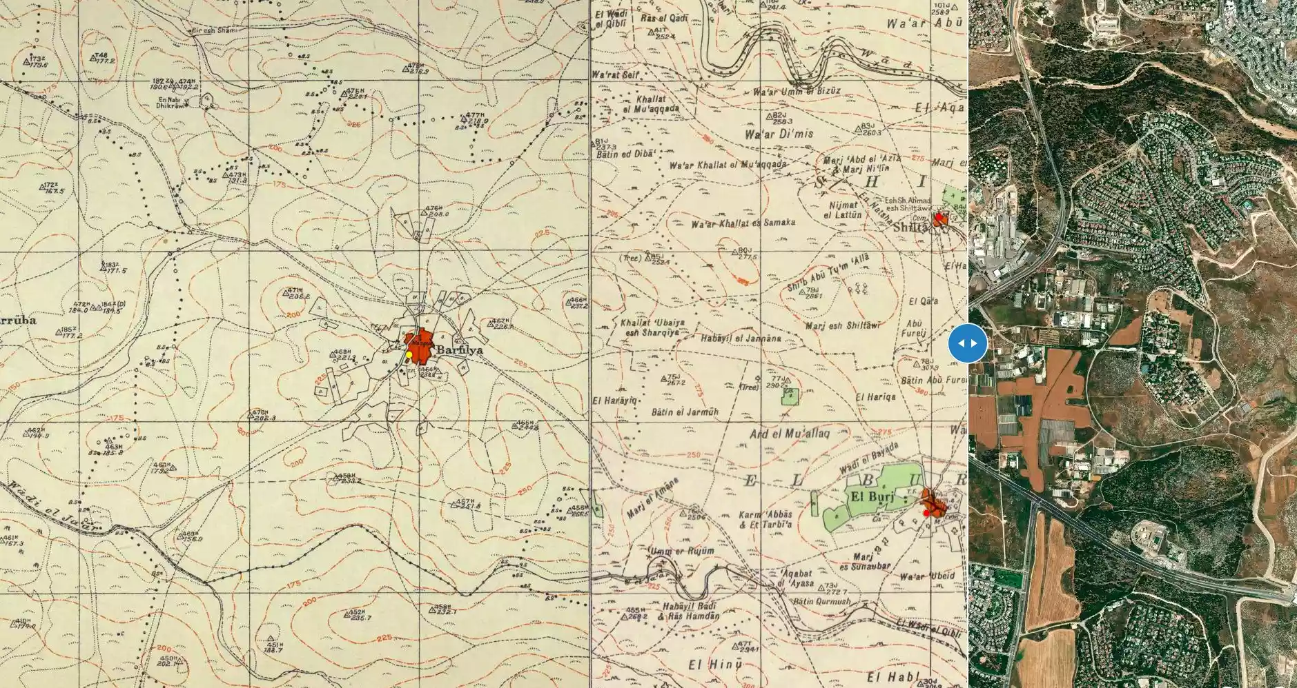
| Map Location | See location #22 on the map View from satellite |
||||||||||||||
| Military Operation | Second phase of Operation Dani. | ||||||||||||||
| Defenders | Jordanian Army | ||||||||||||||
| Exodus Cause | Military assault by Zionist troops | ||||||||||||||
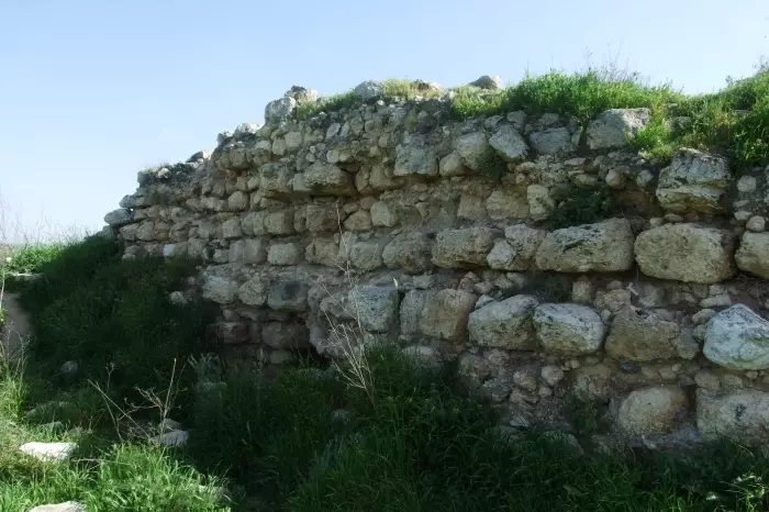
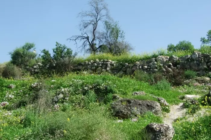
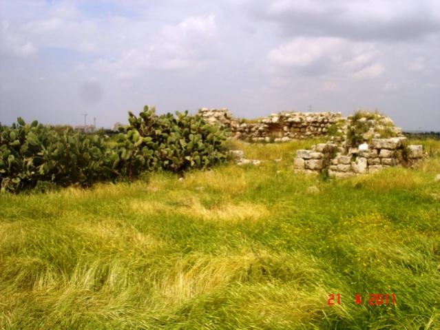
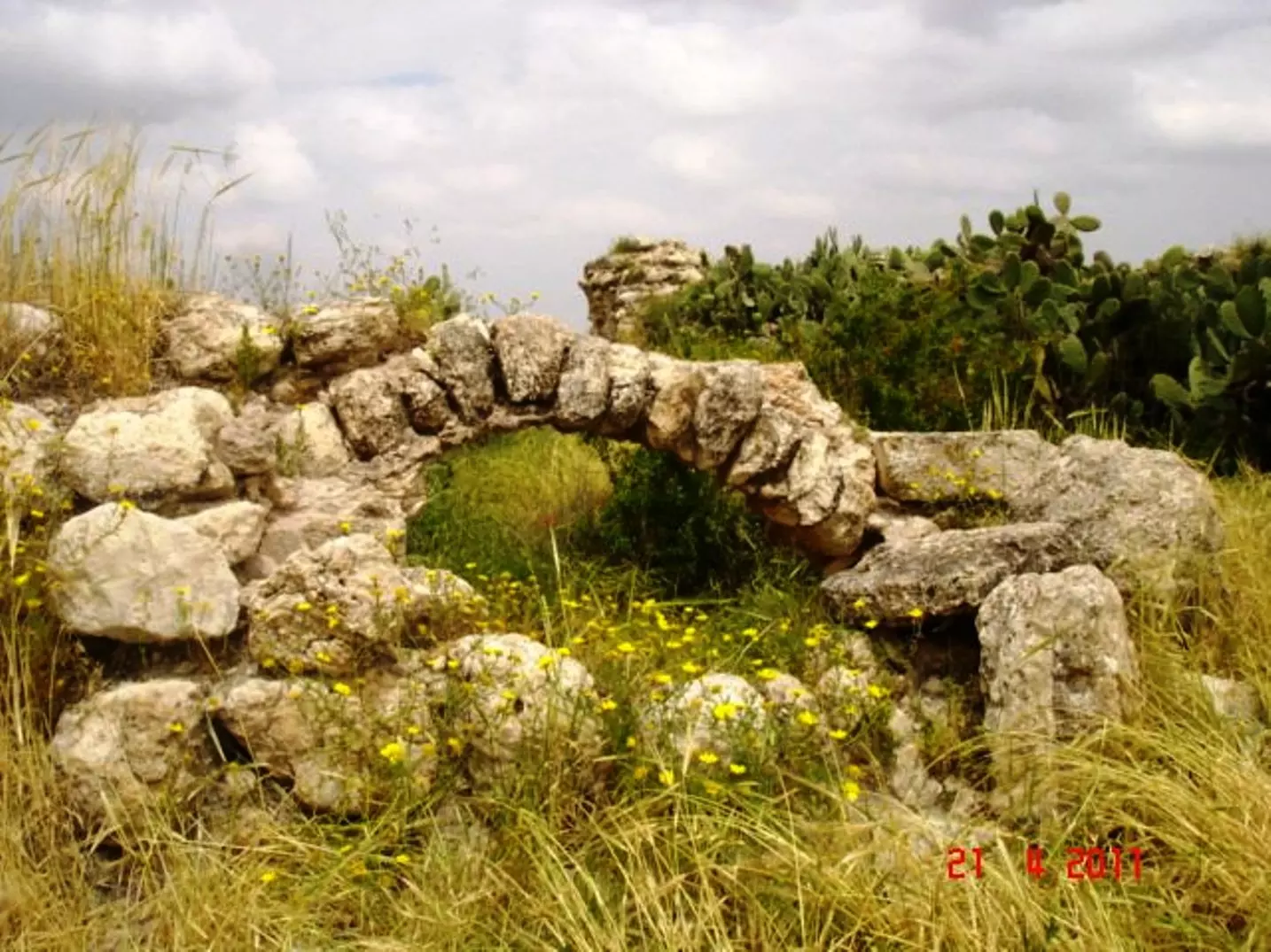
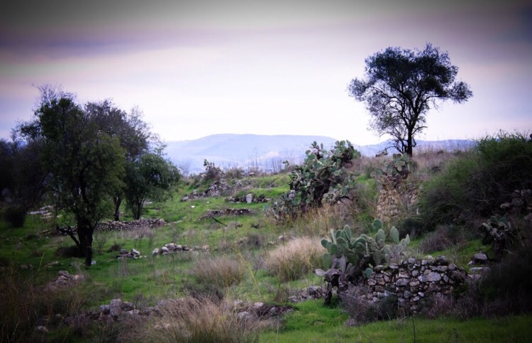
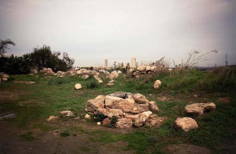
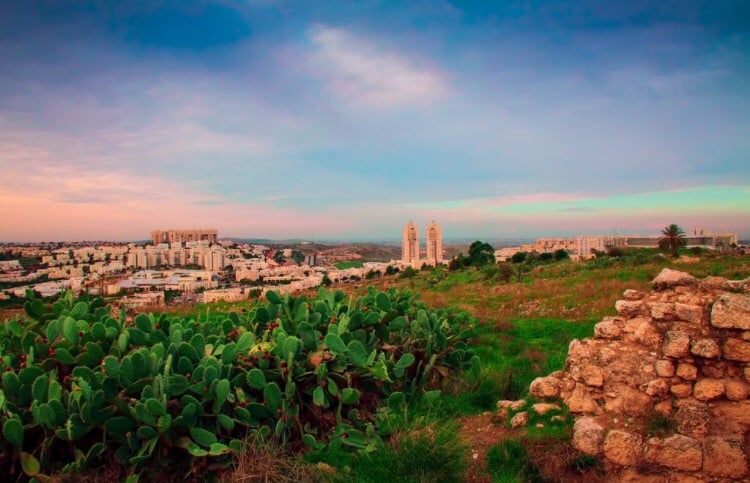
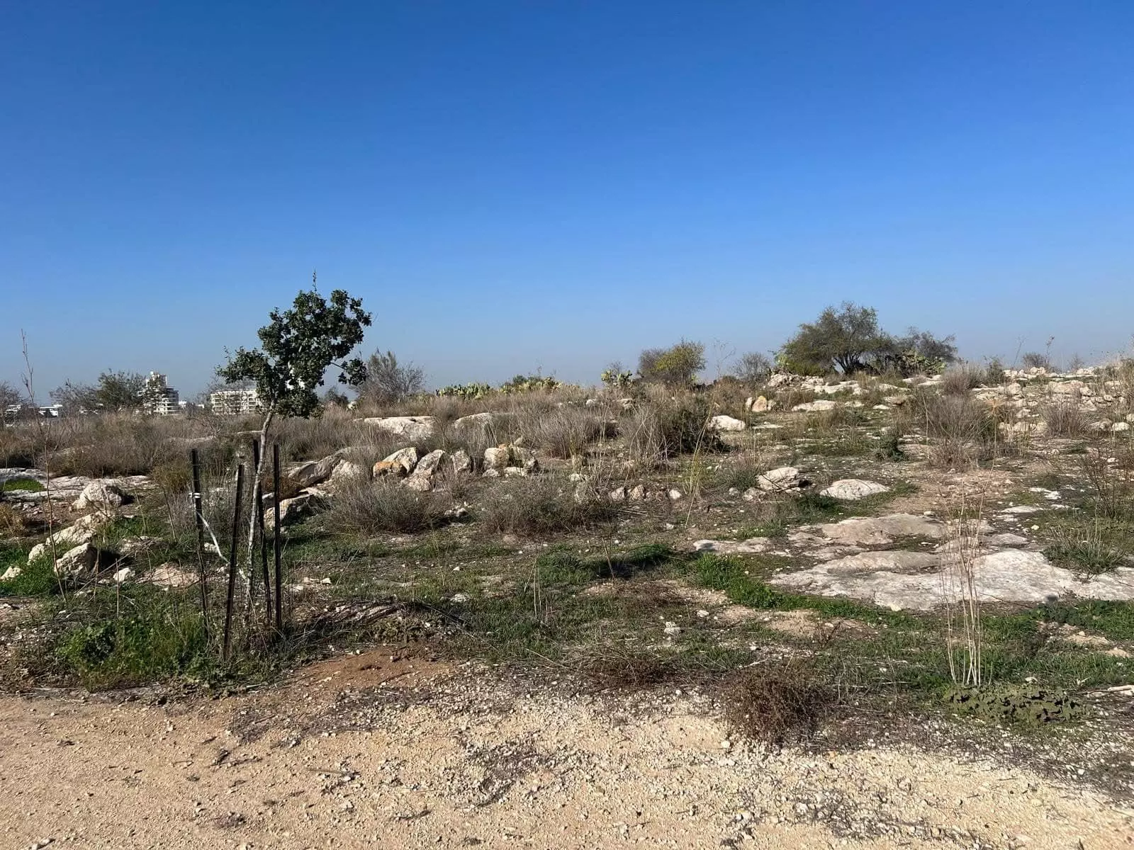
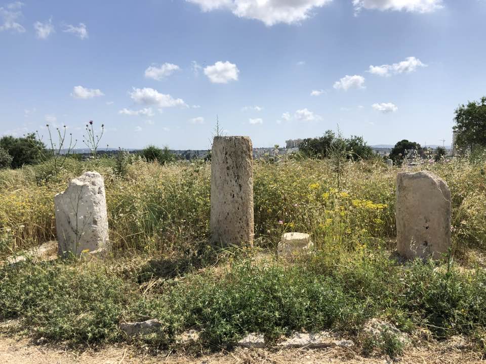
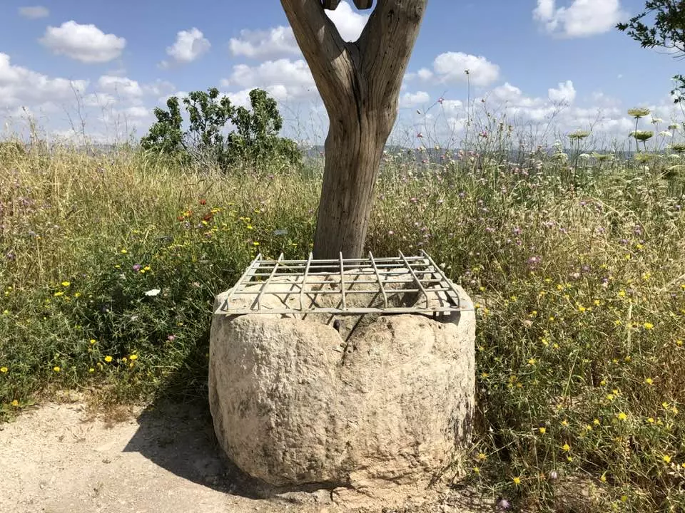
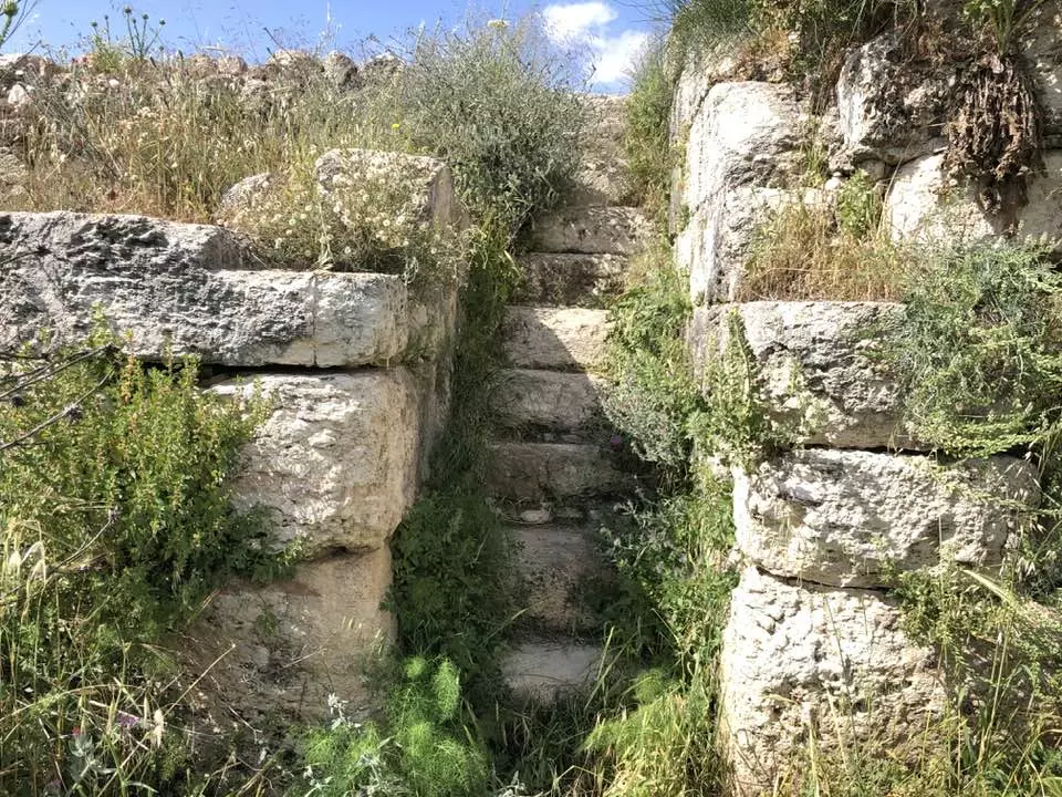
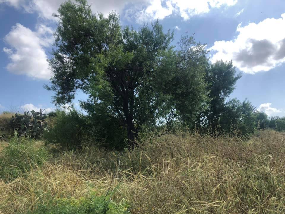
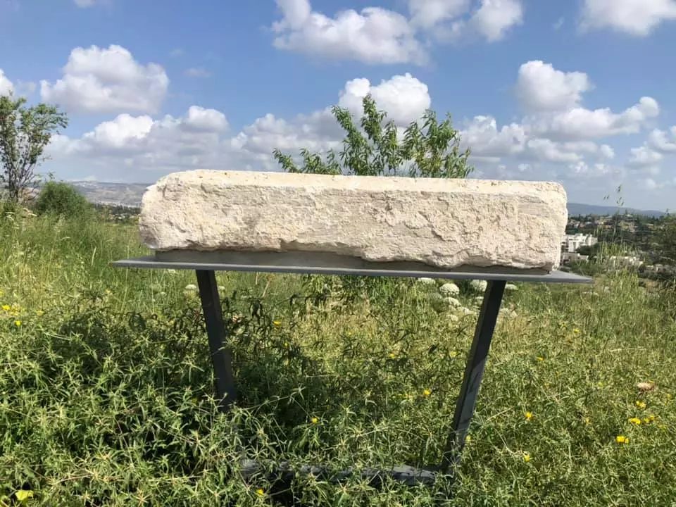
| Village Temains | al-Burj was mostly destroyed with the exception of one crumbling house remain standing. | ||||||||||||||
| Ethnically Cleansing | al-Burj inhabitants were completely ethnically cleansed. | ||||||||||||||
| Pre-Nakba Land Ownership |
**Town Lands' Demarcation Maps |
||||||||||||||
| Land Usage As of 1945 |
|
||||||||||||||
| Population |
|
||||||||||||||
| Number of Houses |
|
||||||||||||||
| Near By Towns |
|||||||||||||||
|
|
|||||||||||||||
| Town's Name Through History | al-Burj may have been named in reference to the nearby Crusades castle, Castle Arnold. | ||||||||||||||
| Schools | An elementary school for boys which was founded in 1947, and it had an initial enrollment of 35 boys. | ||||||||||||||
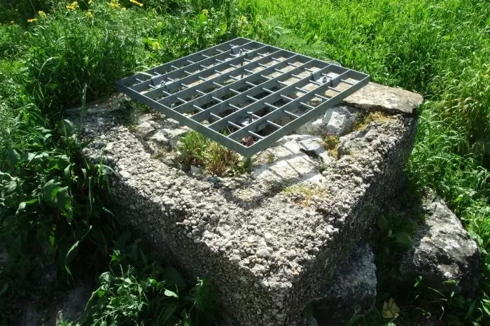
| Water Supply | A water tank located on the East side which provided the village with its water supplies. | ||||||||||||||
| Exculsive Jewish Colonies Who Usurped Village Lands |
Kefar Rut | ||||||||||||||
| Featured Video | |||||||||||||||
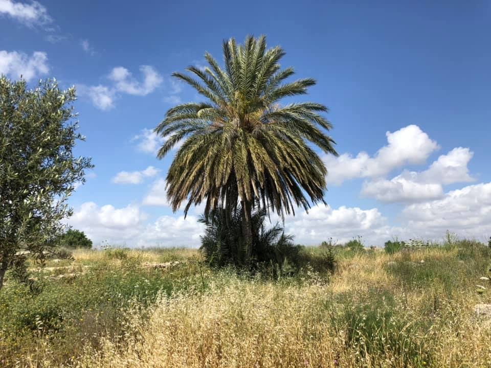
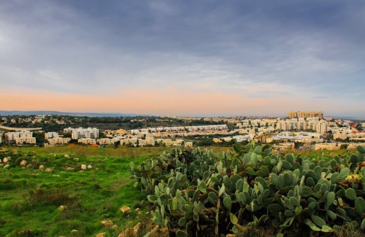
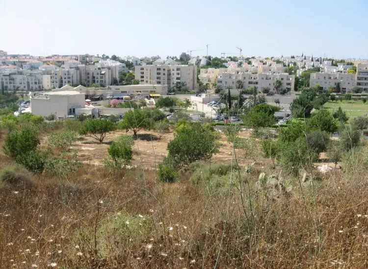
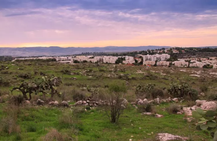
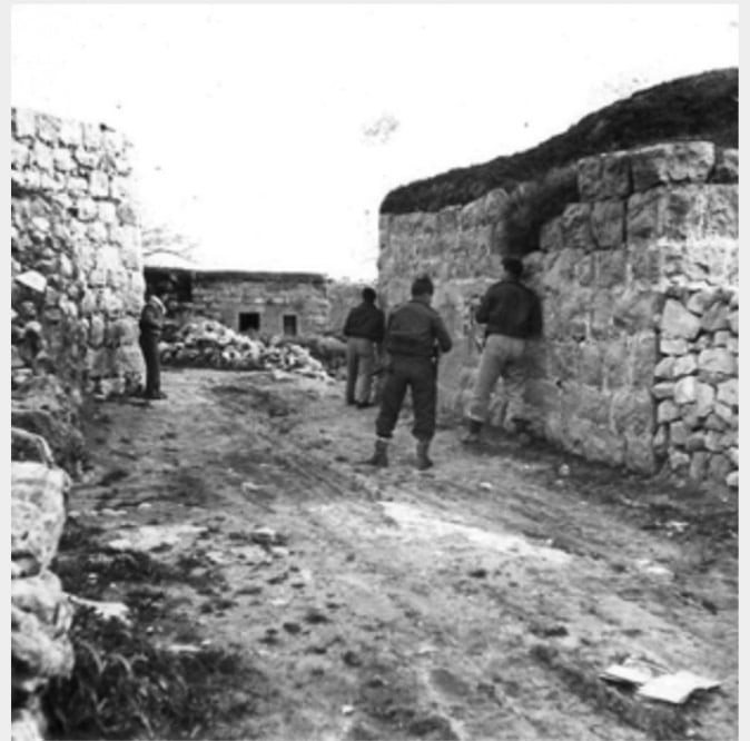
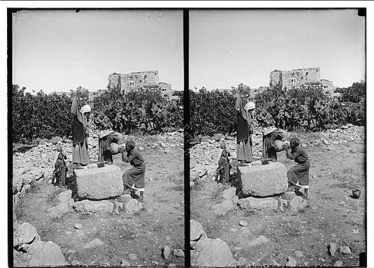
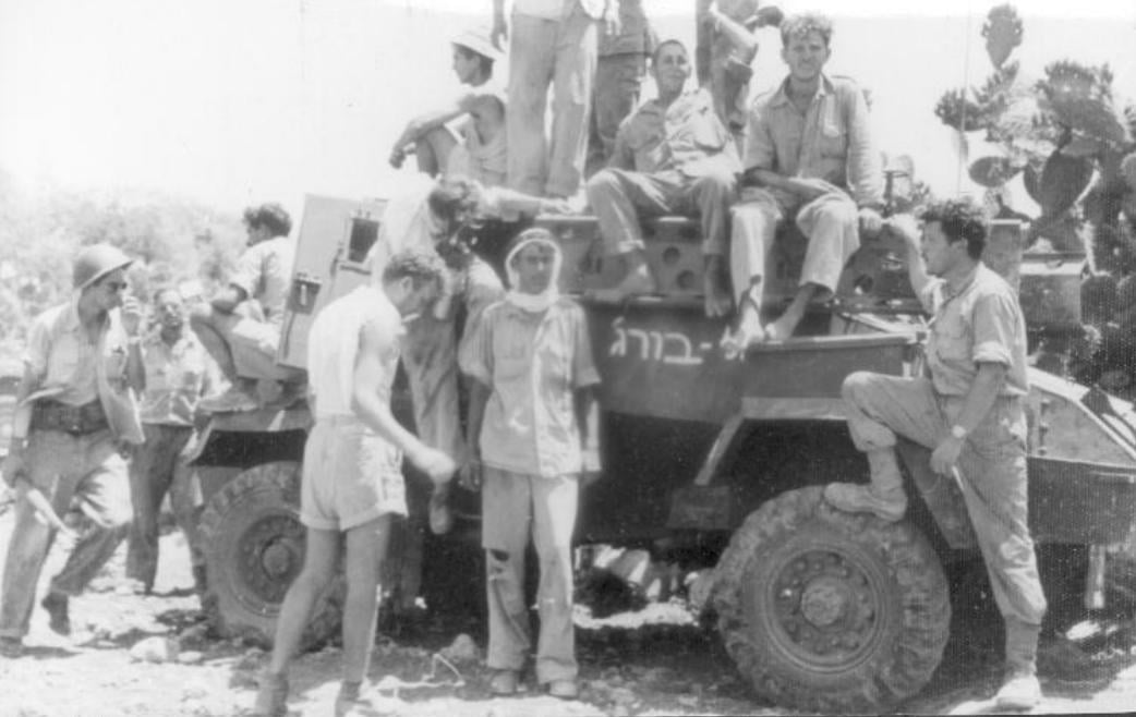
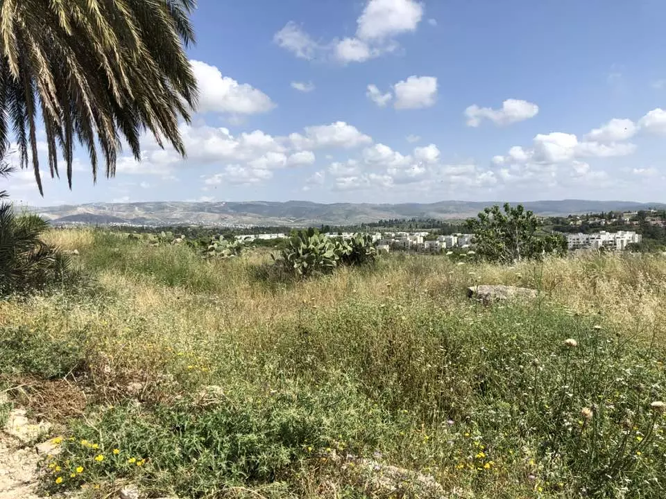
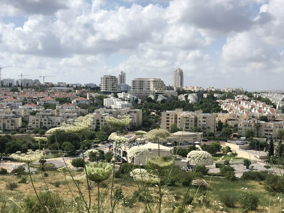
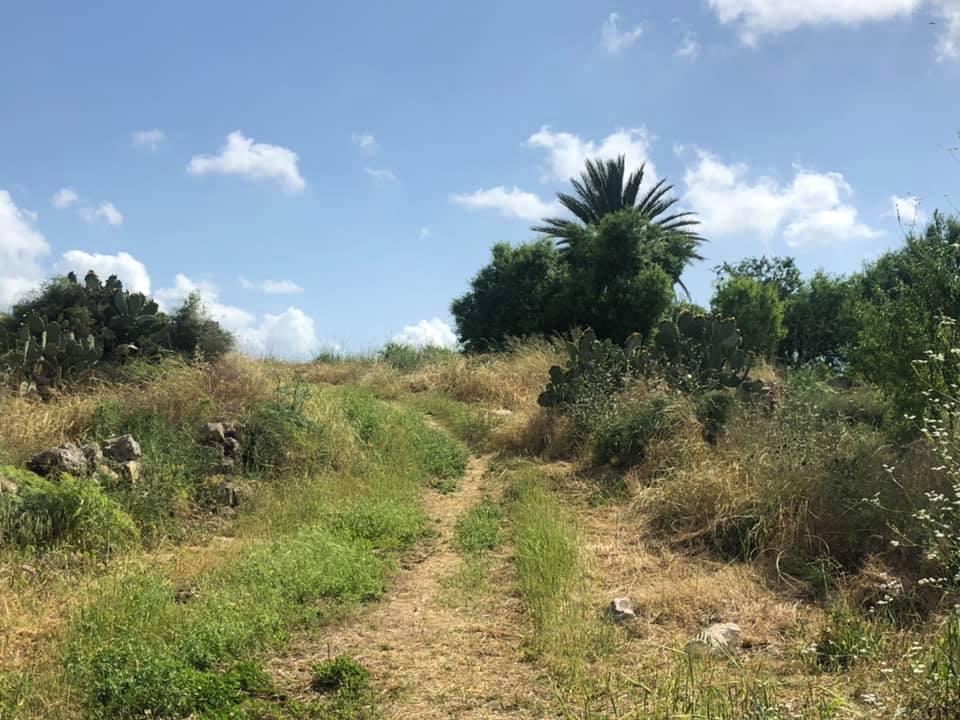
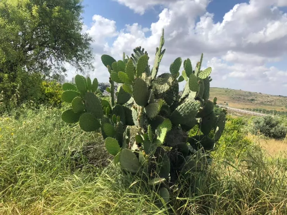
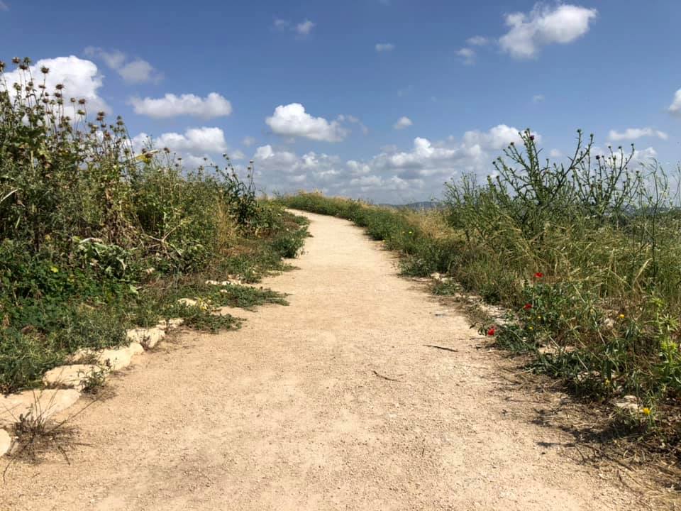
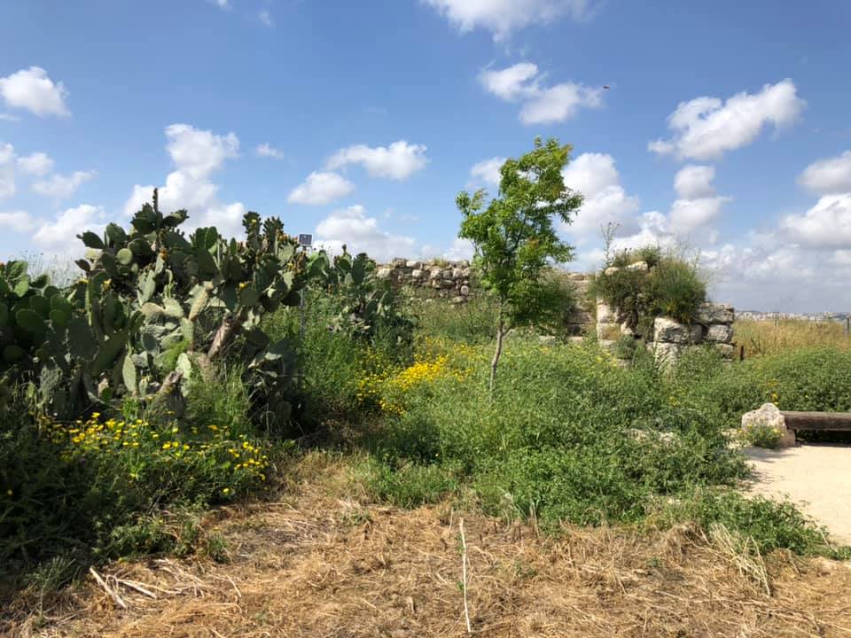
Village Before NakbaThe village was situated on a rocky spot in the western foothills of the Ramallah Mountains, overlooking the central coastal plain. It was linked by a network of narrow roads to the Ramla-Ramallah highway, which ran a relatively short distance to the southeast, and to the neighboring villages of Bayt Sira, Safa, and Barfiliya. The village may have been named al-Burj (an Arabization of the Greek pyrgos, 'tower') in reference to the Crusader castle, Castle Arnold, that had been built on the site in earlier times. The village was visited by Edward Robinson in 1838 , and when the authors of the Survey of Western Palestine saw it, later in the nineteenth century, al-Burj was a village situated on a hilltop that was surrounded on all sides by open fields. They also saw the remains of the Crusader fortress nearby.Originally, al-Burj had a semi-circular layout, but it expanded southward during the Mandate. Some of its houses were built of adobe brick, while others were of stone. Its population was predominantly Muslim. The villagers underwrote the construction of an elementary school that was completed in 1947, and that had an initial enrollment of about thirty-five students. A water tank on the east side provided the village with drinking water. Animal husbandry and agriculture were the main occupations of the residents. They cultivated grain, fruit, vegetables, and olives. In 1944/45 a total of 2,631 dunums was allotted to cereals; 6 dunums were irrigated or used for orchards. Village Occupation and Ethnic CleaningAl-Burj village was the scene of a battle between Israeli forces and the Transjordanian Arab Legion during the Ten Days between the two truces of the war. The Israeli army occupied the village on 15 July 1948, during the second phase of Operation Dani (see Abu al-Fadl, Ramla sub-disctrict). It occupied Barfiliya, Salbit, and Bir Ma'in at the same time, according to a Reuters dispatch in the New York Times. The following day, the Arab Legion tried to regain control of the village with two infantry platoons and a column of ten armored cars, as related by the History of the War of Independence. That account reads:The armored cars approached el Burj and our men let them advance towards the village's houses and then opened fire with anti-tank weapons. After a four-hour long battle, the enemy withdrew, taking some killed and wounded and leaving on the battlefield 4 armoured vehicles and a number of their dead. Meanwhile, our mortars and heavy machine-guns opened fire on the enemy infantry, but they withdrew before we could complete their encirclement. Palestinian historian 'Arif al-'Arif states that the attempt to recapture al-Burj managed to block the advance of Israeli forces along this axis. Estimates of the number of casualties in the battle vary considerably. According to the Haganah, 30 Arabs were killed and 50 wounded, with 3 Jews killed and another 7 wounded. But al-'Arif states that 7 Arabs were killed and 6 were missing and presumed dead, while 3 were wounded. Zionists Colonies on Village LandsThe agricultural settlement of Kefar Rut (153146) is northeast of the site on village lands.Village TodayOnly one crumbled house remains on the hilltop. Cactuses and wild plants grow on the site. The nearby settlement uses the village land for hothouse agriculture.SourceDr. Walid al-Khalidi, 1992: All That Remains. |
|||||||||||||||
| Related Maps | Town Lands' Demarcation Maps خرائط للقضاء توضح حدود القرى والاودية Town's map on MapQuest View from satellite Help us map this town at WikiMapia |
||||||||||||||
| Related Links | Wikipedia's Page Google Search Google For Images Google For Videos |
||||||||||||||
| More Information | في كتاب كي لا ننسى في كتاب بلادنا فلسطين المزيد من موقع هوية |
||||||||||||||
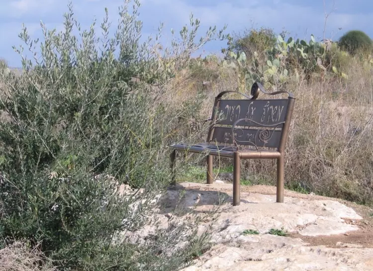
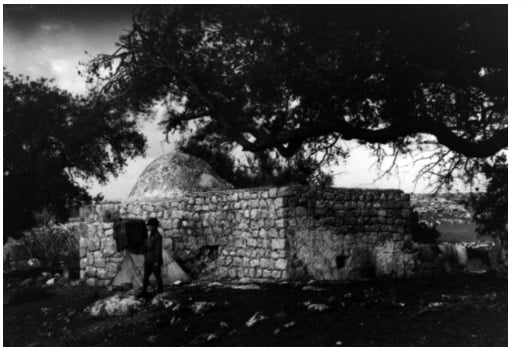
- General View Of al-Burg Site, MAY 2001
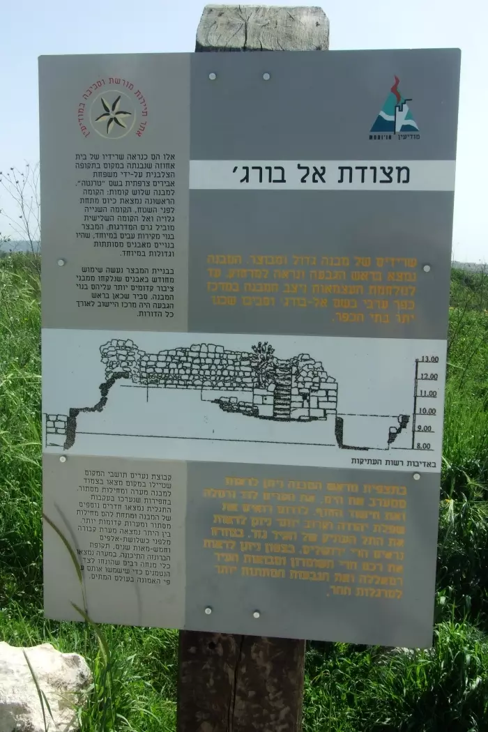
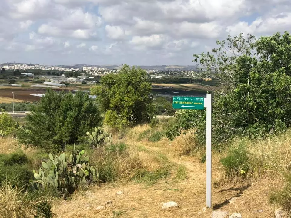
Posted by omar mansour 8 - A sign near the only remaining building mentions the fortress (burj) and the Palestinian village that existed here until 1948.
Posted by Uri Zackhem - The fortress.
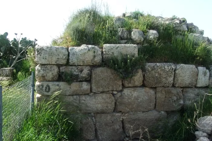
Posted by Uri Zackhem 1 - The fortress.
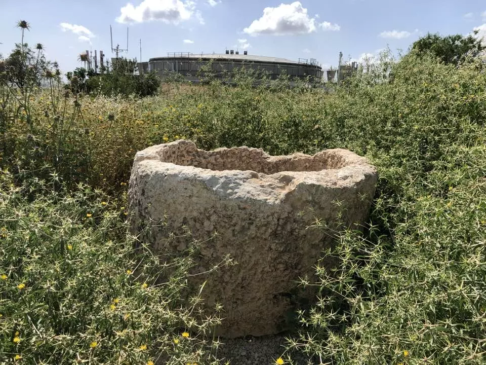
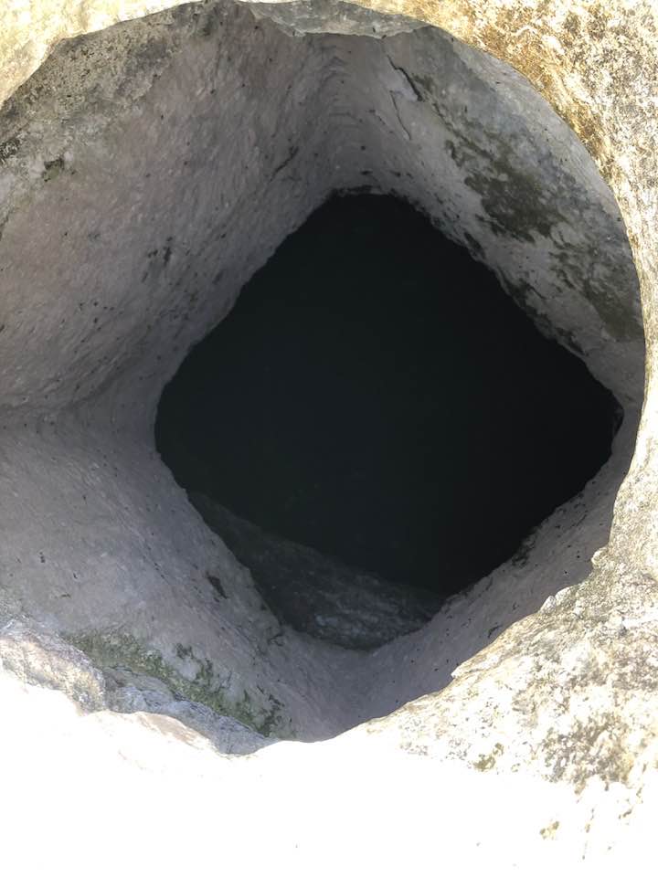
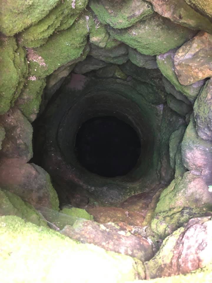
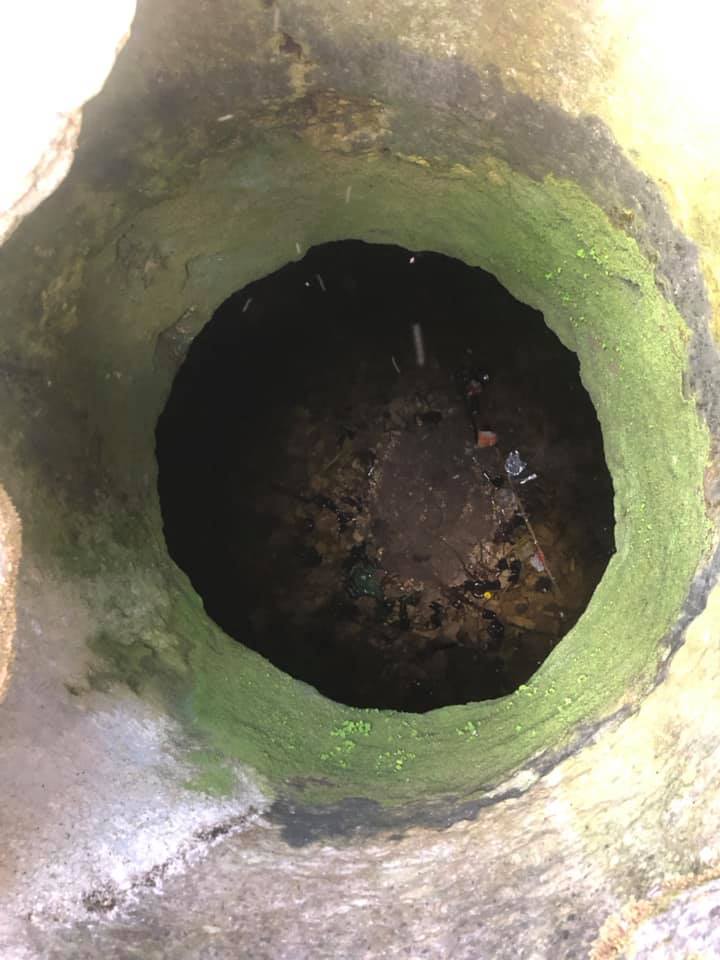
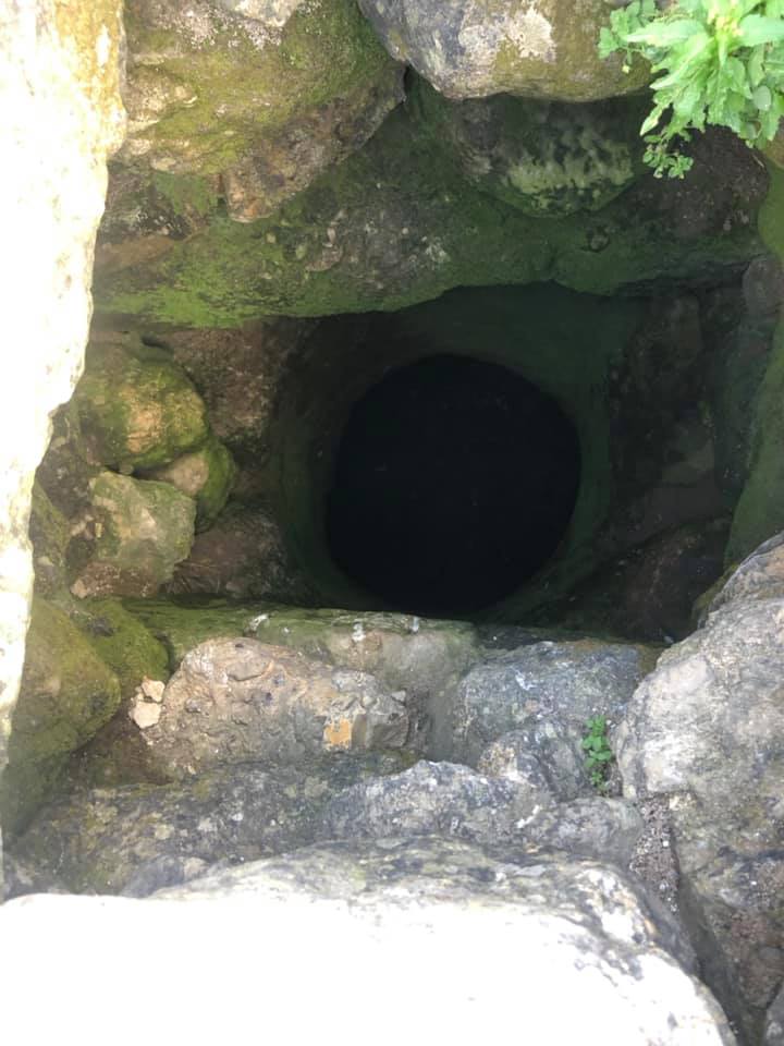
Posted by Uri Zackhem 1 - A well or a cistern.
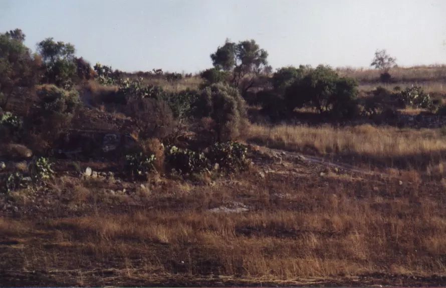
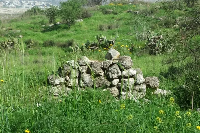
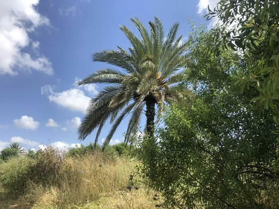
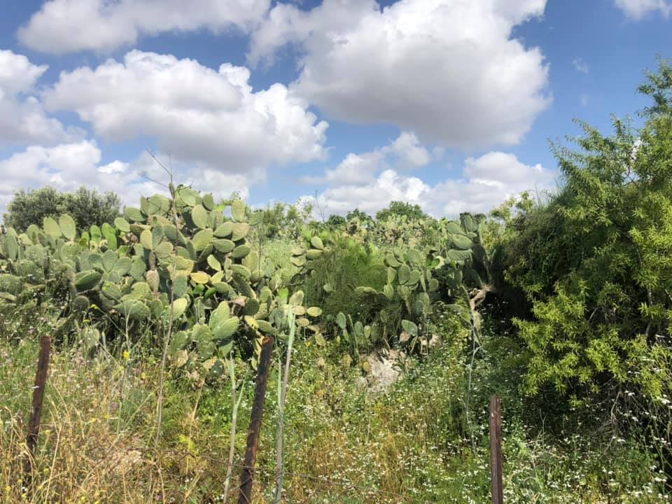
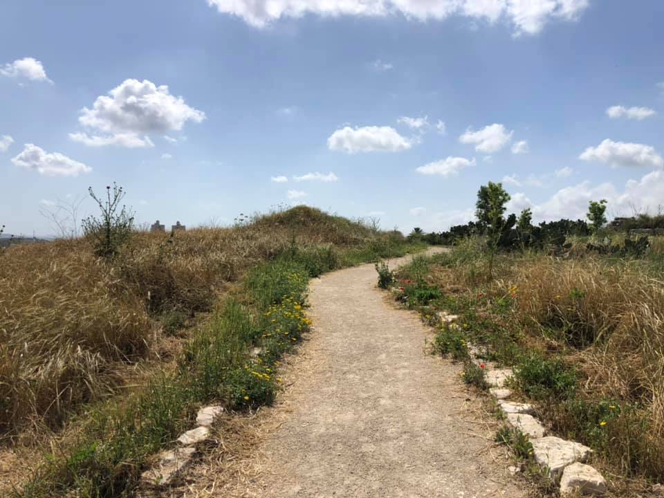
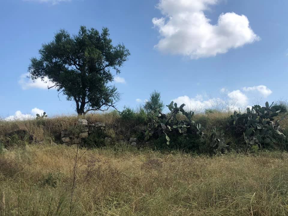
Posted by Uri Zackhem 3 - Remains, cacti, and a Palestinian village (probably Beit Sira) far away.
Posted by Uri Zackhem 4 - Cultivation plots
Posted by Uri Zackhem - وسط القرية
Posted by خالد دويات 1 - قوس احد البيوت صامد
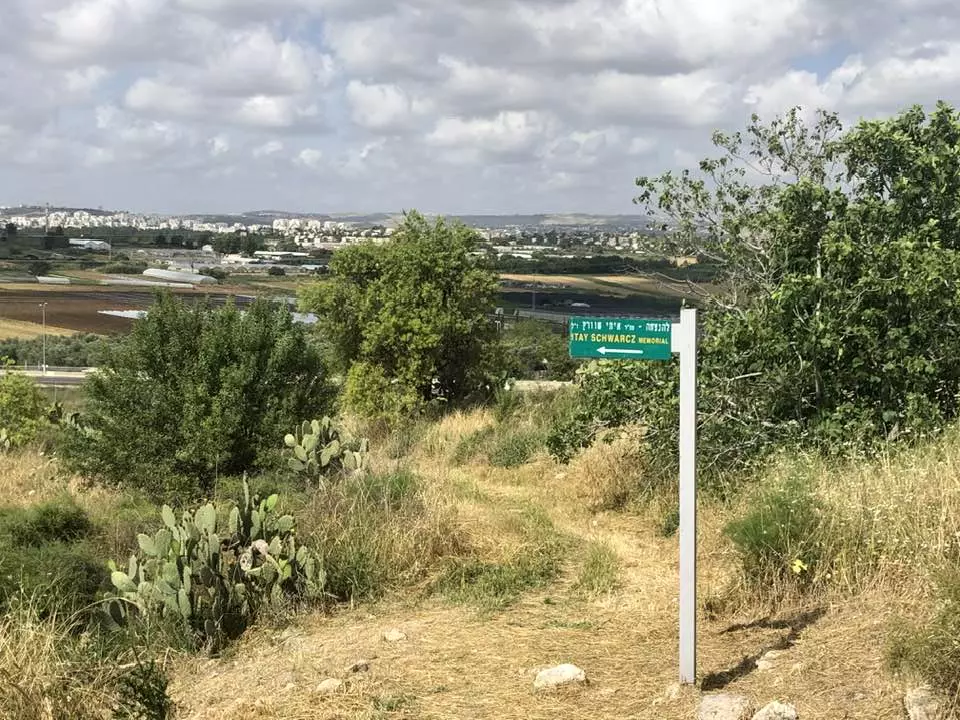
Posted by خالد دويات - موقع القريه
Posted by abu raya - من غرب موقع القريه والمستعمره المقامه على اراضيها
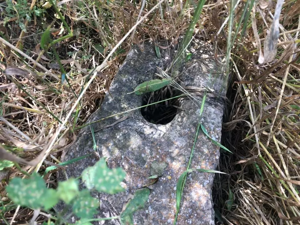
Posted by abu raya - ابار القريه
Posted by abu raya - موقع القريه من الغرب
Posted by abu raya - اطلال القريه
Posted by abu raya - موقع القريه
Posted by abu raya - منظر عام من موقع القريه
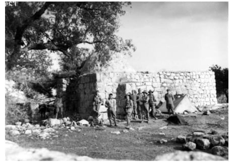
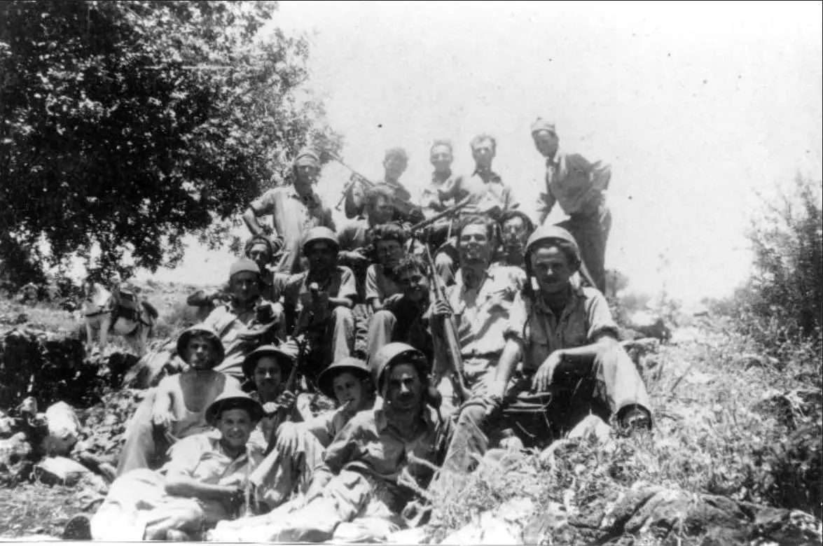
Posted by abu raya - العصابات الصهيونيه في قريه البرج سنه 1948
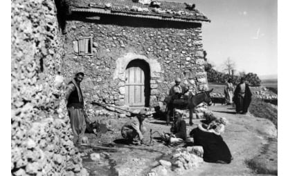
Posted by abu raya - قريه البرج قبل النكبه
Posted by abu raya - صوره قديمه لمسجد قريه البرج سنه 1918
Posted by abu raya - مسجد قريه البرج سنه 1918
Posted by abu raya - صوره قديمه من قريه البرج سنه 1918
Posted by abu raya - The most so-called "civilized" in al-Burj soon after replacing the indigenous people. You would think such Zionists fought the Nazis! On the contrary, they avoided fighting Hitler to the bitter end. They saw little action at war's end. Think about it: how else will the Jews be "great" again?
- The most so-called "civilized" in al-Burj soon after replacing the indigenous people. You would think such Zionists fought the Nazis! On the contrary, they avoided fighting Hitler to the bitter end. They saw little action at war's end. Think about it: how else will the Jews be "great" again? #2
- More house rubble; courtesy of the "most civilized"
- That is how the "civilized" erased and replaced us: al-Burj was completely obliterated, as you see -- البرج باتت أثر بعد عين. من هنا مر الهمجّ
- That is how the "civilized" erased and replaced us: al-Burj was completely obliterated, as you see -- البرج باتت أثر بعد عين. من هنا مر الهمجّ #2
- That is how the "civilized" erased and replaced us: al-Burj was completely obliterated, as you see -- البرج باتت أثر بعد عين. من هنا مر الهمجّ #3
- That is how the "civilized" erased and replaced us: al-Burj was completely obliterated, as you see -- البرج باتت أثر بعد عين. من هنا مر الهمجّ #4
- That is how the "civilized" erased and replaced us: al-Burj was completely obliterated, as you see -- البرج باتت أثر بعد عين. من هنا مر الهمجّ #5
- That is how the "civilized" erased and replaced us: al-Burj was completely obliterated, as you see -- البرج باتت أثر بعد عين. من هنا مر الهمجّ #6
- That is how the "civilized" erased and replaced us: al-Burj was completely obliterated, as you see -- البرج باتت أثر بعد عين. من هنا مر الهمجّ #7
- That is how the "civilized" erased and replaced us: al-Burj was completely obliterated, as you see -- البرج باتت أثر بعد عين. من هنا مر الهمجّ #8
- That is how the "civilized" erased and replaced us: al-Burj was completely obliterated, as you see -- البرج باتت أثر بعد عين. من هنا مر الهمجّ #9
- That is how the "civilized" erased and replaced us: al-Burj was completely obliterated, as you see -- البرج باتت أثر بعد عين. من هنا مر الهمجّ #10
- That is how the "civilized" erased and replaced us: al-Burj was completely obliterated, as you see -- البرج باتت أثر بعد عين. من هنا مر الهمجّ #11
- That is how the "civilized" erased and replaced us: al-Burj was completely obliterated, as you see -- البرج باتت أثر بعد عين. من هنا مر الهمجّ #12
- That is how the "civilized" erased and replaced us: al-Burj was completely obliterated, as you see -- البرج باتت أثر بعد عين. من هنا مر الهمجّ #13
- That is how the "civilized" erased and replaced us: al-Burj was completely obliterated, as you see -- البرج باتت أثر بعد عين. من هنا مر الهمجّ #14
- Let us see how the most "liberal and civilized" of world Jewry has obliterated our village. How else will the Jews be great and safe again? -- القرية دمرت بالكامل.. من هنا مر الهمج
- Let us see how the most "liberal and civilized" of world Jewry has obliterated our village. How else will the Jews be great and safe again? -- القرية دمرت بالكامل.. من هنا مر الهمج #2
- Let us see how the most "liberal and civilized" of world Jewry has obliterated our village. How else will the Jews be great and safe again? -- القرية دمرت بالكامل.. من هنا مر الهمج #3
- Let us see how the most "liberal and civilized" of world Jewry has obliterated our village. How else will the Jews be great and safe again? -- القرية دمرت بالكامل.. من هنا مر الهمج #4
- Let us see how the most "liberal and civilized" of world Jewry has obliterated our village. How else will the Jews be great and safe again? -- القرية دمرت بالكامل.. من هنا مر الهمج #5
- Let us see how the most "liberal and civilized" of world Jewry has obliterated our village. How else will the Jews be great and safe again? -- القرية دمرت بالكامل.. من هنا مر الهمج #6
- Let us see how the most "liberal and civilized" of world Jewry has obliterated our village. How else will the Jews be great and safe again? -- القرية دمرت بالكامل.. من هنا مر الهمج #7
- Let us see how the most "liberal and civilized" of world Jewry has obliterated our village. How else will the Jews be great and safe again? -- القرية دمرت بالكامل.. من هنا مر الهمج #8
- Let us see how the most "liberal and civilized" of world Jewry has obliterated our village. How else will the Jews be great and safe again? -- القرية دمرت بالكامل.. من هنا مر الهمج #9
- Let us see how the most "liberal and civilized" of world Jewry has obliterated our village. How else will the Jews be great and safe again? -- القرية دمرت بالكامل.. من هنا مر الهمج #10
- Let us see how the most "liberal and civilized" of world Jewry has obliterated our village. How else will the Jews be great and safe again? -- القرية دمرت بالكامل.. من هنا مر الهمج #11
- Let us see how the most "liberal and civilized" of world Jewry has obliterated our village. How else will the Jews be great and safe again? -- القرية دمرت بالكامل.. من هنا مر الهمج #12
- Let us see how the most "liberal and civilized" of world Jewry has obliterated our village. How else will the Jews be great and safe again? -- القرية دمرت بالكامل.. من هنا مر الهمج #13
- Let us see how the most "liberal and civilized" of world Jewry has obliterated our village. How else will the Jews be great and safe again? -- القرية دمرت بالكامل.. من هنا مر الهمج #14
- Let us see how the most "liberal and civilized" of world Jewry has obliterated our village. How else will the Jews be great and safe again? -- القرية دمرت بالكامل.. من هنا مر الهمج #15
- Let us see how the most "liberal and civilized" of world Jewry has obliterated our village. How else will the Jews be great and safe again? -- القرية دمرت بالكامل.. من هنا مر الهمج #16
Want to browse more? 80,000 pictures were grouped in these gallaries:
| Display Name | Clan/Hamolah | Country of Residence |
| H?m??deh ???meer | - | Palestine |
| حسن معالي | - | Palestine |
| omar noffal | - | Canada |
| عمر الامير | الامير | - |
| حمزة عليان | عليان | - |
| اسماعيل | عدوان | - |
| ابن البرج | الخطيب | - |
| nabilo2003 | Odwan | Amman, Jordan |
| ابو جمال | - | - |
| ابراهيم معالي | maali | - |
| Jignesh | - | Gujarat, India |
| Ayman | - | Amman, Jordan |
| jameel | - | jordan, jordan |
- Tracing All that remains of al-Burg Duration: 7 min 30 sec
 Fake Valor: Why Did Zionist Jews Hoist Nazis Flag on Their Ships in the 1930s?
What is new?
-
Facts About Oct. 7th Gaza Raid
-
Remined Us Please:: Who Did Rape Who? Palestinians Raped Israelis? Or, was the other way around?
-
When Prof. Edward Said was invited to debate Bibi Netanyahu in the 1980s, watch what happened!
-
Ezra Klein of the NY Times on the "Jewish Race".
-
Abusing Blood Libel!
-
Did Israeli Soldiers Activate The Hanniba Direective On Oct. 7th? You Be The Judge
-
Zionist FAQ: Isn't it true that Palestinians don't want peace? Palestinians never accepted the two-state solution
- Facts about Haavara (Transfer) Agreement between Ben-Gurion & Hitler
-
Haavara FAQs: Why Did Zionist Jews Hoist Nazis' Flags on Their Ships in the 1930s?
- Haavara FAQs: When Chaim Weizmann met FDR in mid-1943, why was he silent about rescuing European Jewry?
-
Dear ChatGPT: How did Palestinians resist Napoleon's invasion of their country in 1799?
-
Dear ChatGPT: Gaza had a vibrant Jewish community in the mid-17th century. What happened to them?
-
Dear ChatGPT: Why did the Jewish Agency suppress news of the Holocaust during WWII?
-
Video Playlist: Jews share their DNA tests to end the conflict for good.
-
A Tale of Two Conflicts: Examining the Definition of Genocide
-
Prof. Abraham Polak And The Suppressed History of the Khazars and European Jewry
-
How Ronald Reagan would have framed the genocide in Gaza if he were still alive?
-
Haavara FAQs: Let us do the math: how many German Jews did The Haavara Agreement save?
-
Zionist FAQs: The Hebron Massacre of 1929, "clearly proves" that Palestinians are antisemitic, how could you deny it?
-
Zionist FAQs: Why Anti-Zionist Is Not Antisemitism?
-
Zionist FAQs: Isn't it true that the KGB created Palestinian Nationalism in the early 1960s?
- Zionist FAQs: Muslims are killing Muslims all the time; why are Israeli Jews being singled out in the media?
- Zionist FAQs: How is Israel an apartheid state when 20% of its citizens are Arabs who enjoy full rights?
-
Haavara FAQs: Why Did Dorothy Thompson Flip From A Zionist Advocate to A Silenced Dissenter?
-
Haavara FAQs: Analysis of Herzl's Uganda Scheme and how it could have saved millions of Jews.
-
Haavara FAQs: Why did Hayim Greenberg describe American Jewry as "morally bankrupt" in early 1943?
-
Haavara FAQs: What if the Evian Conference was a resounding success? What would have been the impact of saving European Jewry on Zionism?
- Haavara FAQs: What if the six million were saved, how that would have impacted the Zionist project?
-
Haavara FAQs: How did Zionist leaders react when Europe's Jews lingered in the DP camps after WWII ended?
-
Why does the American Jewish community repeat lies that David Ben-Gurion had debunked before he died?
-
Who has the power to rename the Tatar/Khazar Gene Marker to Jewish IV?
-
Zionist FAQs: Why won't Egypt, Syria, and Jordan take their people back? Jews are indigenous to Palestine, and Arabs immigrated after Jews developed the country. Arabs should leave.
-
Haavara FAQs: Did Hitler and the Nazis conflate between Judaism and Zionist? If that wasn't case, then why?
-
Haavara FAQs: Winston Churchill and antisemitism, a collection of articles written Churchill.
-
Haavara FAQs: Broken by country, how many Jews survived vs. killed during the Holocaust?
-
Haavara FAQs: Why did European Jews vote with their feet and to immigrated to the Americas, not Palestine, after WWII?
-
Watch this American Jewish Girl describing Israeli Jews' cognitive dissonance like no other in under two minutes
-
Haavara FAQs: When the Nazis went out of their way to hide the Holocaust, Israeli Jews did the exact opposite by broadcasting their genocide of Gazans. But why?
-
Haavara FAQs: How Zionist Jews went out of their to show their appreciation to Nazism and Fascism?
- Haavara FAQs: Why Zionist leaders were against bombing the death camps & the Railroads leading to them?
-
Haavara FAQs: Hitler's message to the British and American people: If Jews are such noble citizens and you care about them, how come you're not letting them in? I will gladly ship them to you at my expense, even on luxury liners!
-
A shortlist of Zionist and Israeli false flag operations in the name Jews.
-
The Most Moral Army
- The Land of Kapos (Israel): Where the brave are boycotted and Kapos walk free.
- Why did early Zionists often named their communal enterprises "colonial"?
- Zionist Relations with Nazi Germany by Faris Glubb
-
Two NY Times advertisements by Zionists in the early 1943 that exposes Zionists' treason at the height of the calamity
- Facts Not Lies about the Palestinian-Israeli Conflict.
- Site's pictures have been categorized
- Campgain Against Lice
- A Survey of Palestine, the official source about Palestine before Nakba produced by the British Mandate; over 1200 pages.
- Satellite View & Google Earth: Over 6,000 placemarks identifying all destroyed towns, W. Bank & Gaza Strip Towns, & refugee camps.
- PalestineRemembered.com and its Nakba Oral History Project were featured on al-Jazeera Satellite TV.
- Nakba Oral History Video Podcast:
 Over 700 Oral History interviews (including 3,500+ hours of recording) can be viewed online.
 - Palestine Village Statistics Project
- Gaza Jail Break
- النسخة العربية للموقع الان متوفرة
- Videos: Documenting the destroyed villages in video: Tracing all that remains since Nakba.
- Videos: Responding to Zionist Propaganda
- Interview: The ethnic cleansing of Palestine: George Galloway interviews Israeli Historian Ilan Pappe.
- For Palestinians, memory matters. It provides a blueprint for their future By George Bisharat.
- Zionist FAQ now available in Hebrew שאלות שציונים שואלים, עכשיו בעברית
- Video: The Stephen Walt and John Mearsheimer report on the influence of the Israel Lobby on U.S. Foreign Policy
- The Palestinian-Israeli conflict for beginners
