| PalestineRemembered | About Us | Oral History | العربية | |
| Pictures | Zionist FAQs | Haavara | Maps | |
| Search |
| Camps |
| Districts |
| Acre |
| Baysan |
| Beersheba |
| Bethlehem |
| Gaza |
| Haifa |
| Hebron |
| Jaffa |
| Jericho |
| Jerusalem |
| Jinin |
| Nablus |
| Nazareth |
| Ramallah |
| al-Ramla |
| Safad |
| Tiberias |
| Tulkarm |
| Donate |
| Contact |
| Profile |
| Videos |
Welcome To al-Tira - طيرة دندن (א-טירה)
|
District of al-Ramla
Ethnically cleansed days ago |
العربية Google Earth |
 |
Gallery (52) |
- Statistics & Facts
-
Before & After

- Satellite View
- Articles 5
- Pictures 52
- Aerial Views 1
- Land Deeds 3
- Oral History 2
- Members 68
- All That Remains
- Wikipedia
- Videos 6
- Guest Book 49
- Links
| Statistic & Fact | Value | ||||||||||||||
| Occupation Date | July 10, 1948 | ||||||||||||||
| Distance From District | 12 (km) Northeast of al-Ramla | ||||||||||||||
| Elevation | 75 (meters) | ||||||||||||||
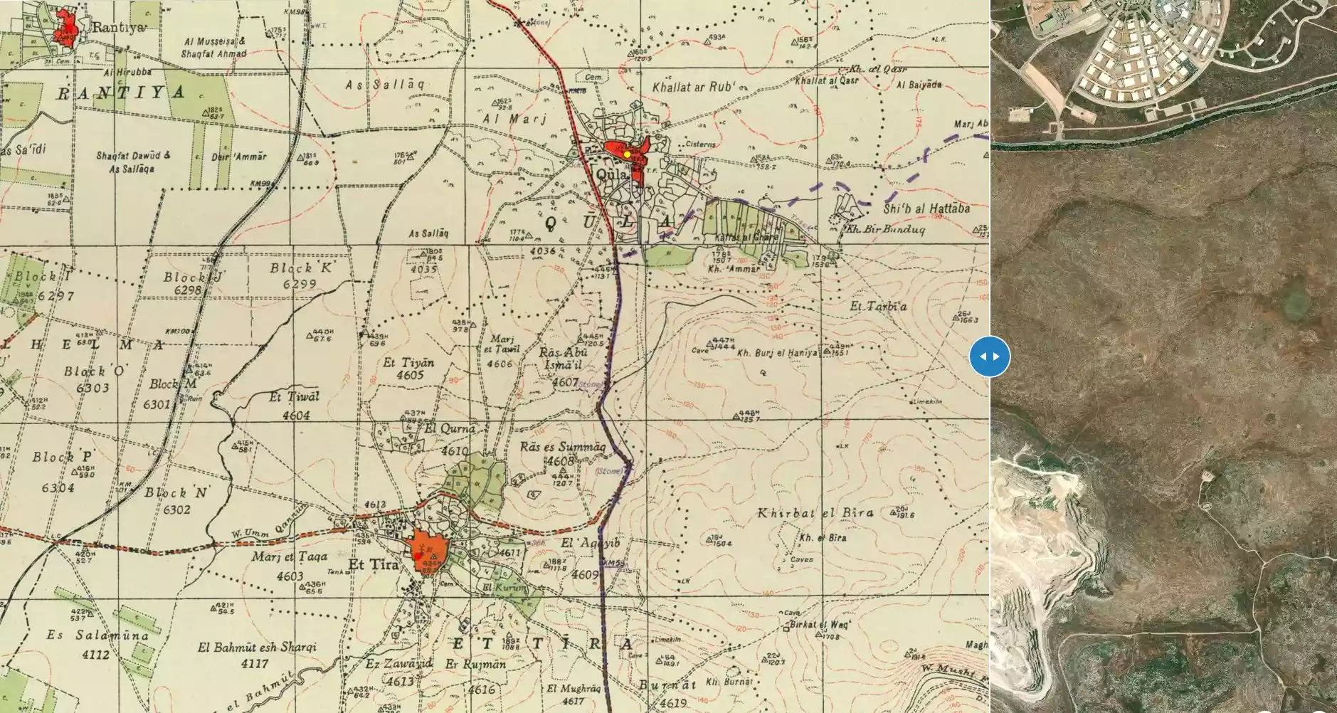
| Before & After Nakba, Click Map For Details |
|||||||||||||||
|
|||||||||||||||
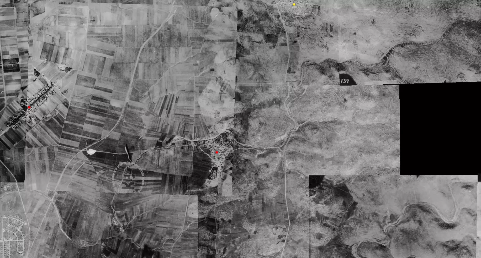
| Pre-Nakba Aerial View |
|||||||||||||||
|
|||||||||||||||
| Map Location | See location #4 on the map View from satellite |
||||||||||||||
| Military Operation | Operation Dani | ||||||||||||||
| Attacking Units | Alexandroni and Armored (Eighth) brigades | ||||||||||||||
| Defenders | Local militia & Arab Liberation Army | ||||||||||||||
| Exodus Cause | Military assault by Zionist troops | ||||||||||||||
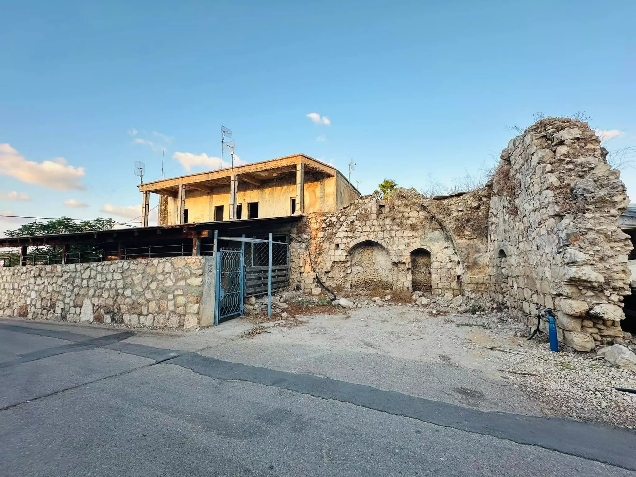
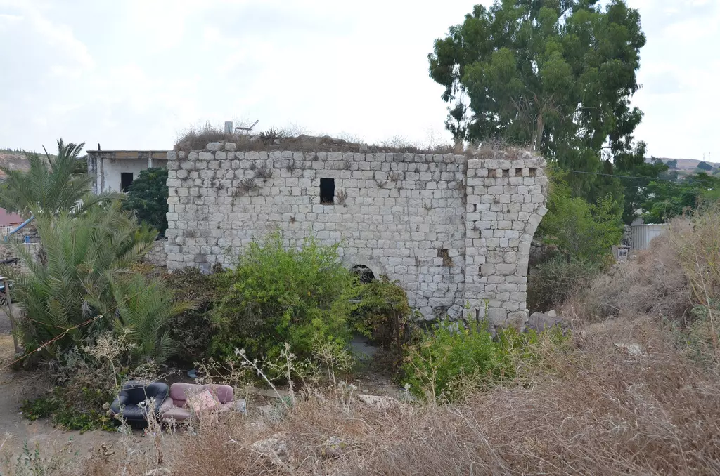
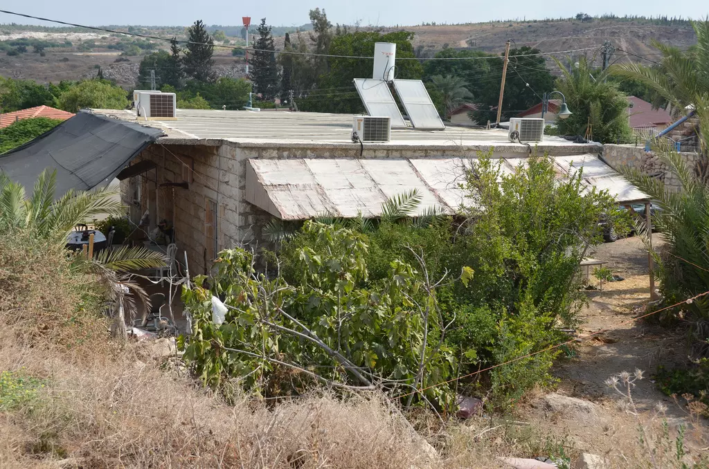
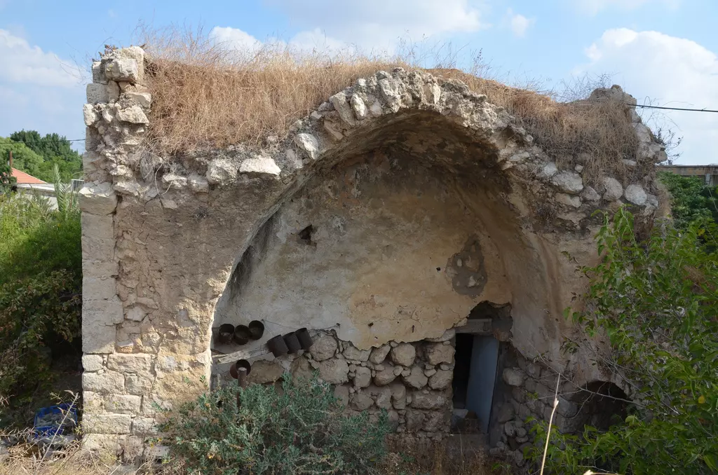
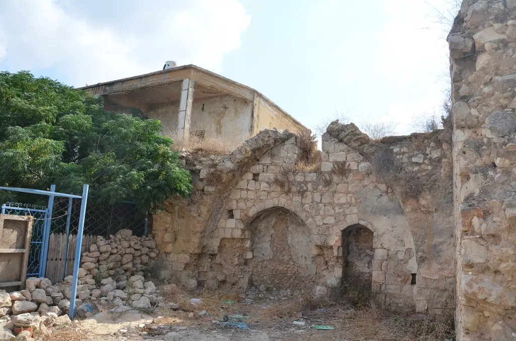
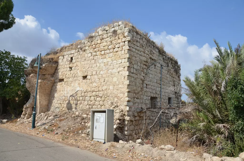
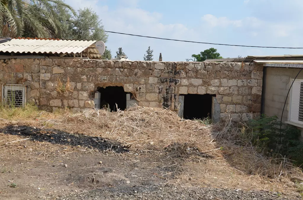
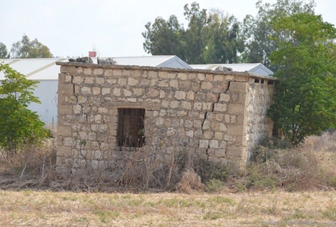
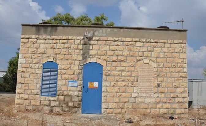
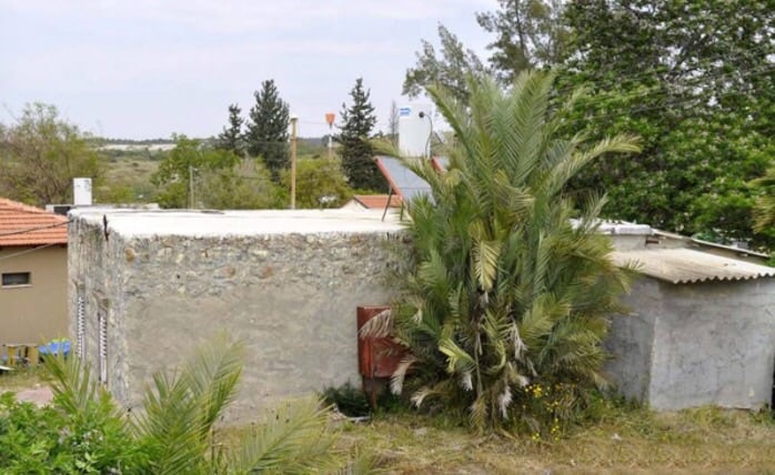
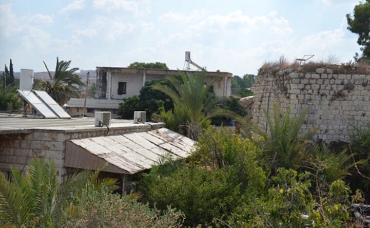
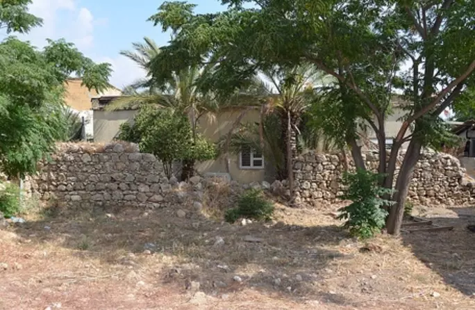
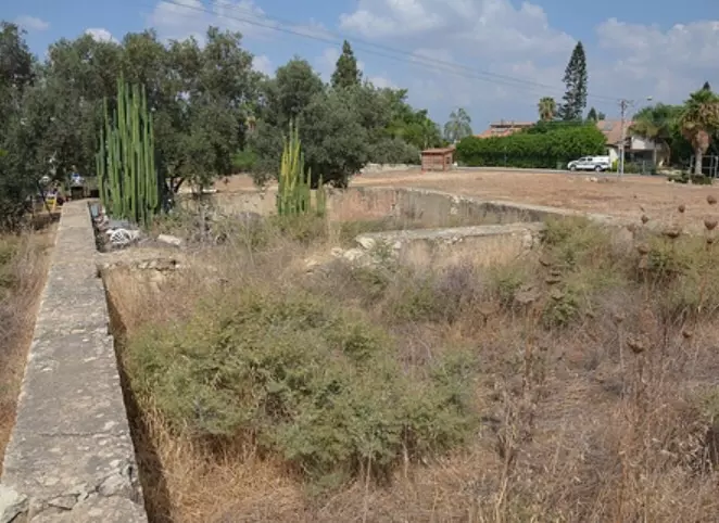
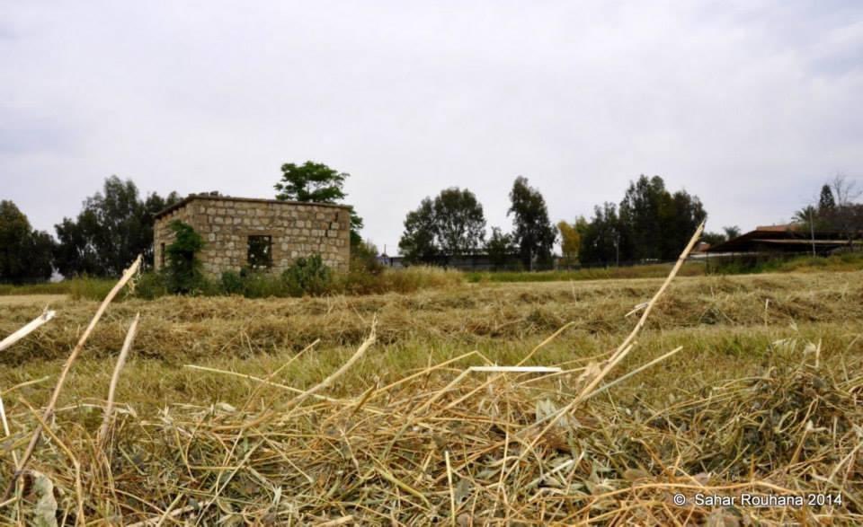
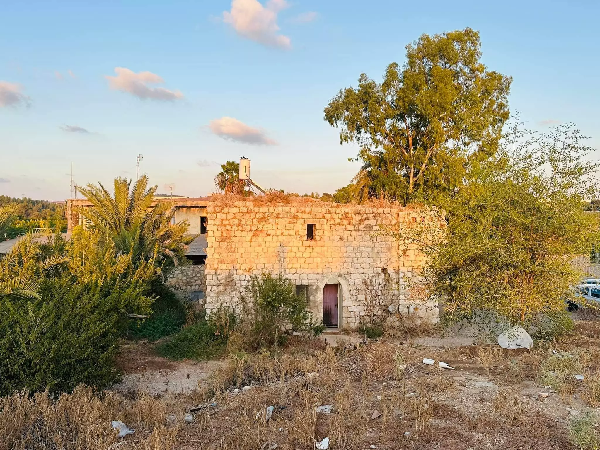
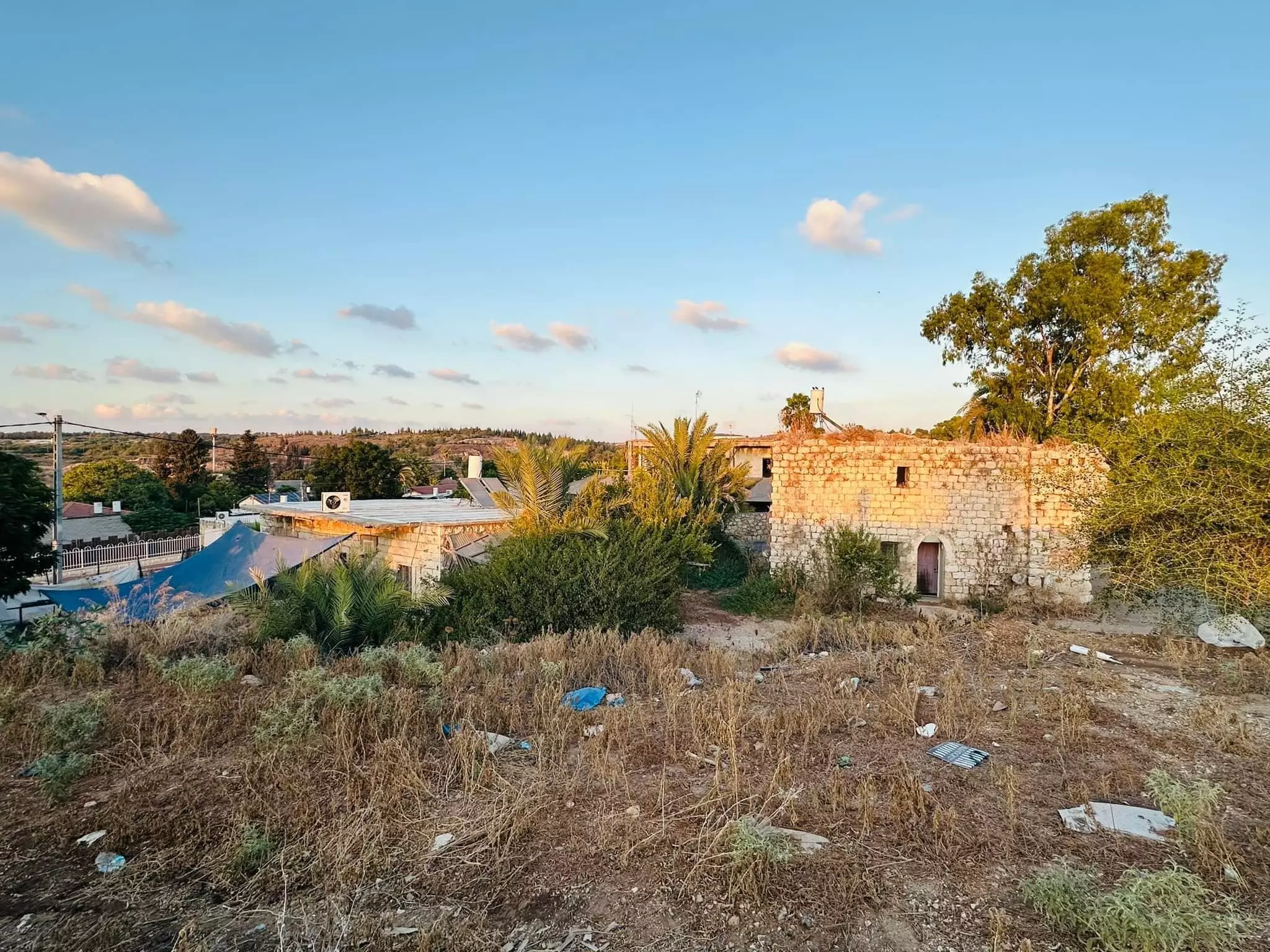
| Village Temains | al-Tira was mostly destroyed with the exception of few houses survived destruction. Some of those houses are deserted and some are being used by Israeli Jewish settlers. | ||||||||||||||
| Ethnically Cleansing | al-Tira inhabitants were completely ethnically cleansed. | ||||||||||||||
| Pre-Nakba Land Ownership |
**Town Lands' Demarcation Maps |
||||||||||||||
| Land Usage As of 1945 |
|
||||||||||||||
| Population |
|
||||||||||||||
| Number of Houses |
|
||||||||||||||
| Near By Towns |
|||||||||||||||
|
|||||||||||||||
| Town's Name Through History | al-Tira was known to the Crusades by Thaeria. | ||||||||||||||
| Schools | An elementary school which was founded in 1922, and in 1947-48 school year it had an enrollment of 110 boys and 22 girls students. | ||||||||||||||
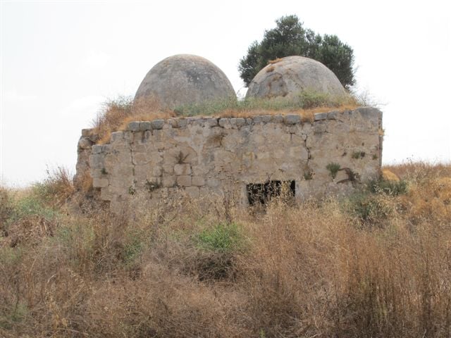
| Places of Warship | The village has an old mosque call al-'Umari mosque, and another newer mosque. | ||||||||||||||
| Water Supply | Drinking water was provided by a well on the West Side and from smaller private wells. Also water was collected in al-Waq' pool, which was used for irrigation. | ||||||||||||||
| Exculsive Jewish Colonies Who Usurped Village Lands |
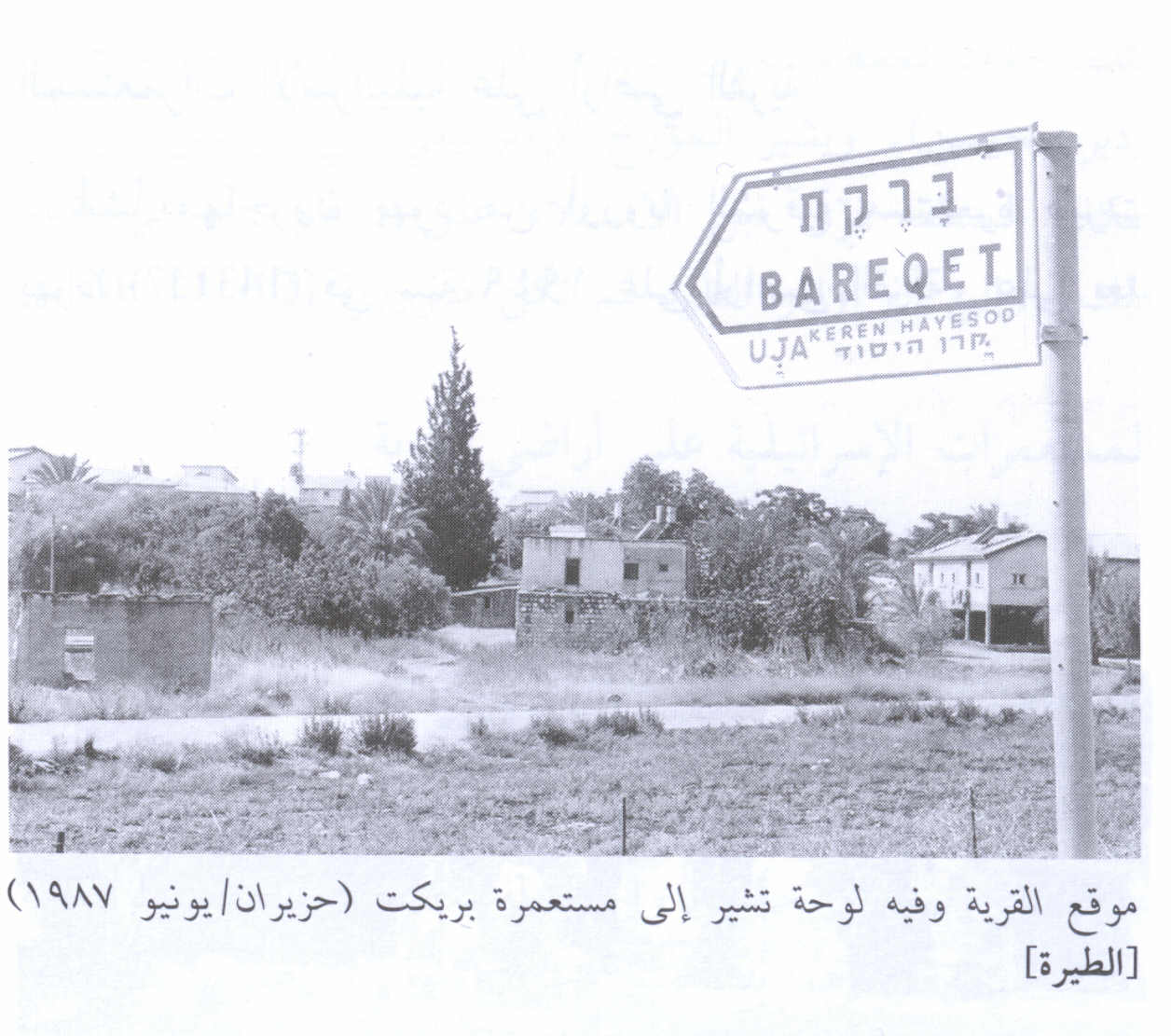
Tirat Yehuda, Giv'at Koach, and Bareqet. | ||||||||||||||
| Featured Video | |||||||||||||||
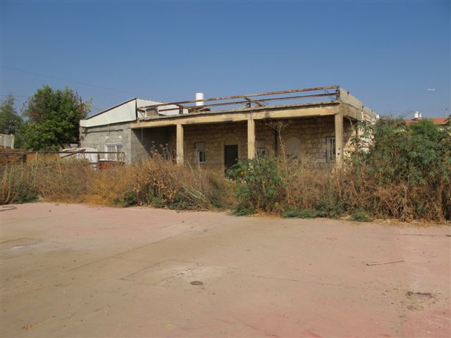
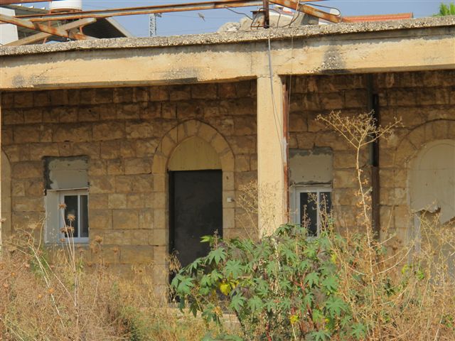
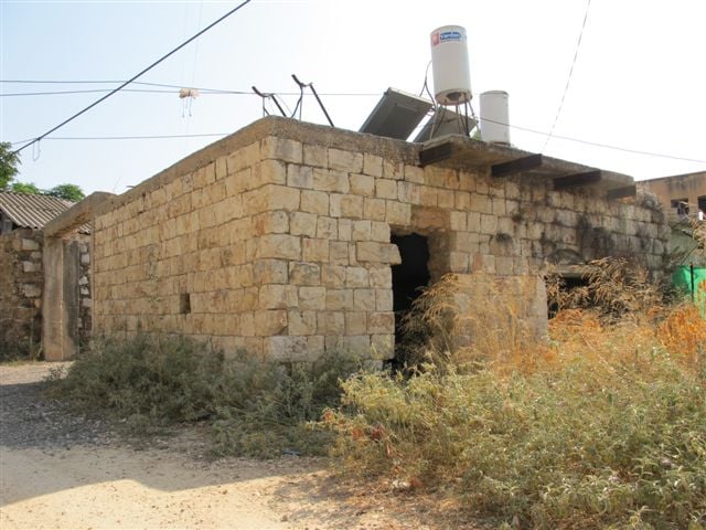
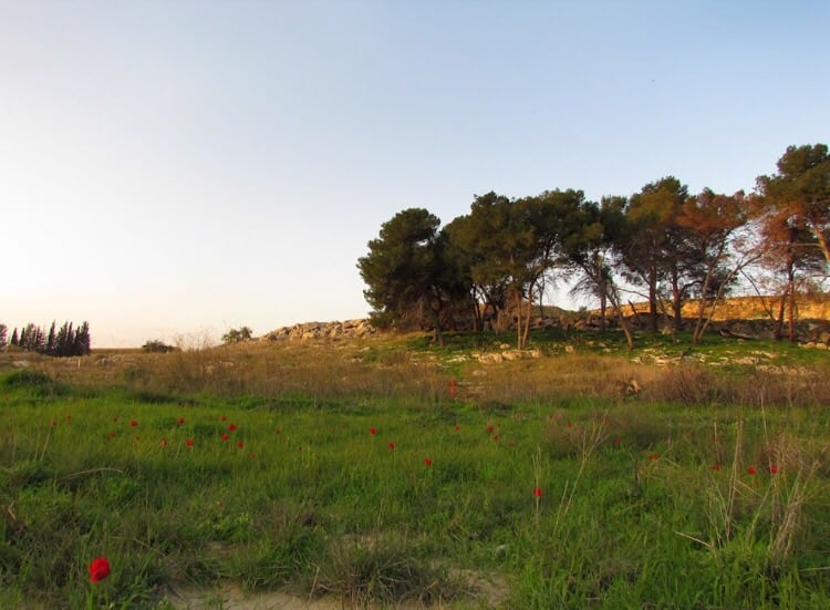
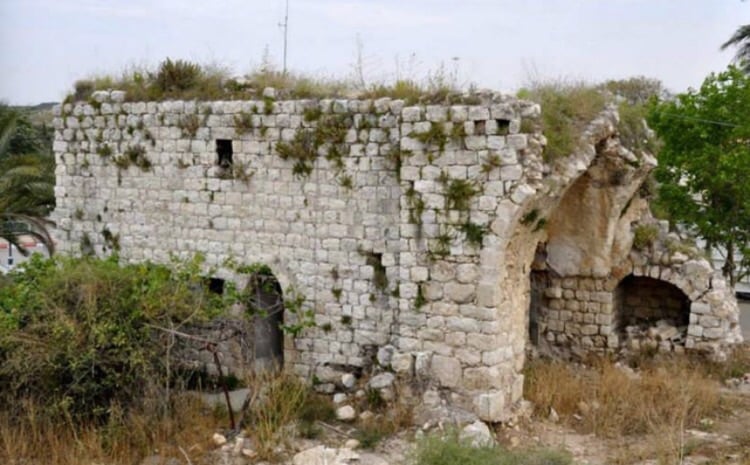
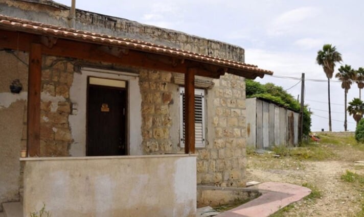
Village Before NakbaThe village was situated on limestone hills that were slightly higher than the surrounding area. Secondary roads connected it with two highways leading to Ramla, Jaffa, and other urban centers. AI-Tira was identified with the Crusader locality of Thaeria. In 1596, al-Tira was a village in the nahiya of Ramla (liwa' of Gaza) with a population of 160. It paid taxes on a number of crops, including wheat, barley, and fruits, as well as on other types of produce and property, such as goats, beehives, and vineyards. In the late nineteenth century, al-Tira was described as a village of moderate size built of adobe bricks and situated at the end of a plain. Its houses were made of bricks, stone and cement, and cement bricks. There were two mosques where the villagers, all of whom were Muslim, worshipped. The older mosque was called the al-'Umari mosque, perhaps after 'Umar ibn al-Khattab, the second Muslim caliph. The newer mosque was larger than the older mosque. The village elementary school was founded in 1922 and had an enrollment of 110 male and 22 female students in the 1947-48 school year.Drinking water was provided by a well on the west side of the village, smaller private wells, and by the al-Waq' pool. This pool, which lay 2 km east of the village, was lined with stones and provided water for livestock as well as for human needs. The village economy was based on rainfed agriculture and animal husbandry. In 1944/45 a total of 5,551 dunums was allocated to cereals; 78 dunums were irrigated or used for orchards. A daily livestock market was held in al-Tira with the participation of neighboring villages. The abundant archeological evidence of earlier habitation of the site included building foundations, rock-cut tombs, and fallen columns within the village. Village Occupation and Ethnic CleaningThe village was first targeted at an early stage in the war; Arab Liberation Army (ALA) commander Fawzi al-Qawuqji reported a 'heavy' attack on the village on 10 May, two months before its occupation. In a cable to the ALA command, he indicated that the attack began after reconnaissance probes the previous day, and that there was a simultaneous Haganah attack on Qalqilya (which was not occupied until June 1967). He informed the command that his units' ammunition was insufficient to wage battle. He gives no further information, however, about the results of the fighting.AI-Tira was occupied on the morning of 10 July 1948, in order to cut Lydda off from the north so that it could be attacked and occupied. The History of the War of Independence, which outlines this plan, adds that the occupation was accomplished by a force drawn from the Alexandroni and Armored (Eighth) brigades, as part of Operation Dani (see Abu al-Fadl, Ramla sub-disctrict). On the same day that the village was occupied, operational headquarters ordered the Yiftach and Eighth brigades to blow up most of the houses of al-Tira, leaving a few houses intact to accommodate a small garrison. Neighboring 'Innaba received the same treatment. There is no indication of the fate of the villagers; presumably, they either fled under attack or were expelled upon the entry of the troops. Zionists Colonies on Village LandsImmigrants from Eastern Europe established the settlement of Tirat Yehuda (143157) in 1949 on village land, 1.5 km southeast of the site. Giv'at Koach (144159), built in 1950, and the agricultural settlement of Bareqet (144158), built in 1952, are also on village lands.Village TodayThe site, situated next to a paved road, is partly deserted and overgrown with a variety of trees, such as olive, date-palm, fig, and gum trees. The rubble of some of the destroyed houses is visible. A number of stone houses survive, however; some are deserted, others are occupied by Israelis, and still others are used as stables for livestock. A deserted house, fenced in with barbed wire, has high, round-arched windows and a flat roof; the yard is overgrown with untended grass. One of the occupied houses is quite modest. It has a rectangular door and window and a flat roof; date-palm and other trees grow on two sides. A second, larger, occupied house has two storeys and a wide porch, and is also surrounded by trees. A third is also quite large and has two storeys; a side stairway leads to a second-floor porch and there is a large, round arched entrance on the first floor (see photos). There are some destroyed houses inside the settlement of Bareqet. Some of the surrounding land is planted in grapes and kiwi fruit.SourceDr. Walid al-Khalidi, 1992: All That Remains. |
|||||||||||||||
| Related Maps | Town Lands' Demarcation Maps خرائط للقضاء توضح حدود القرى والاودية Town's map on MapQuest View from satellite Help us map this town at WikiMapia |
||||||||||||||
| Related Links | Wikipedia's Page Facebook Page Google Search Google For Images Google For Videos |
||||||||||||||
| More Information | في كتاب كي لا ننسى في كتاب بلادنا فلسطين المزيد من موقع هوية |
||||||||||||||
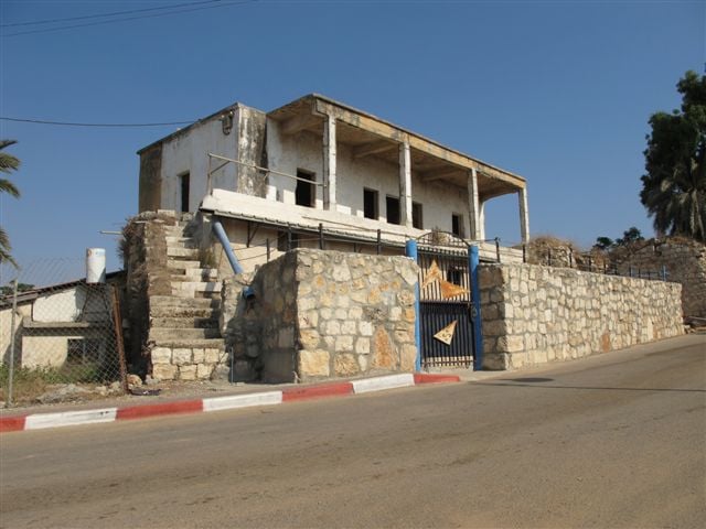
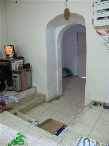
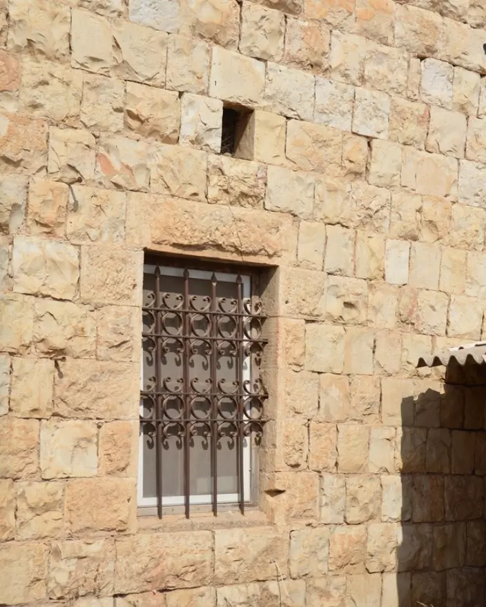
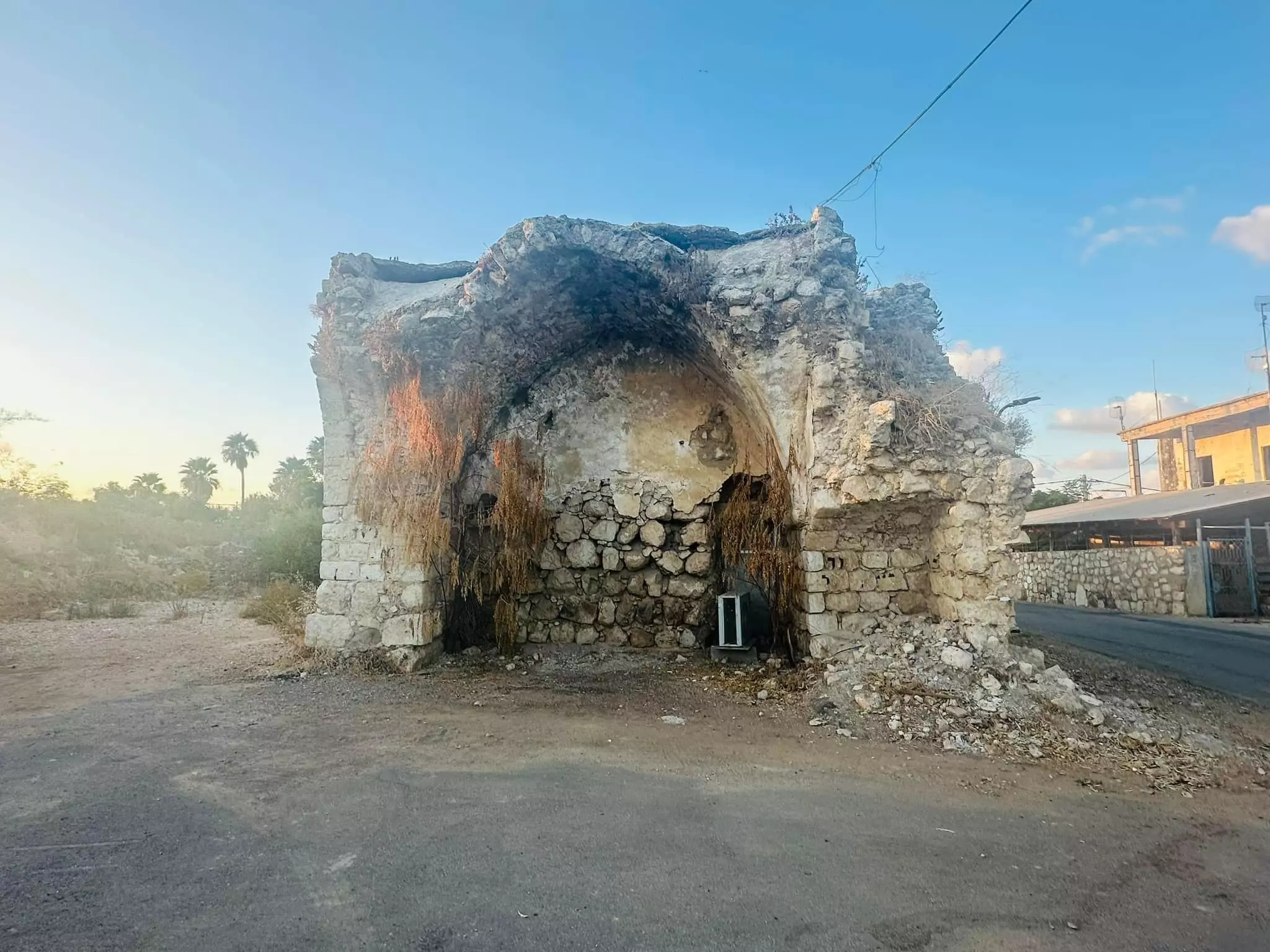
- A Deserted Two Story Village House Still Standing In 1987
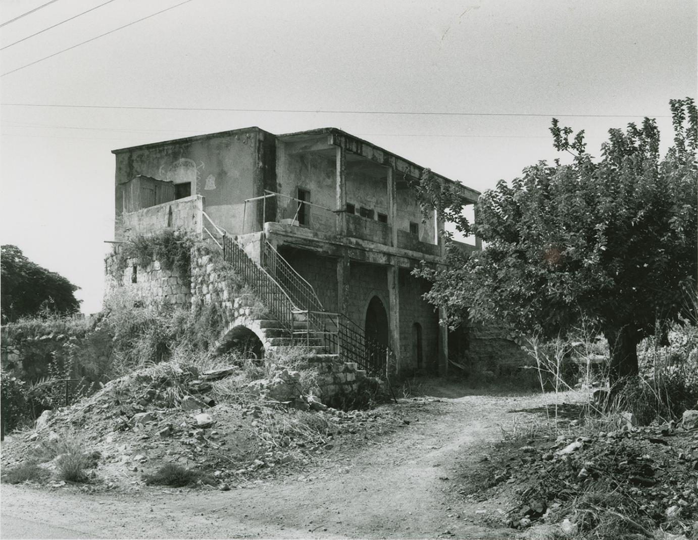
Scanned from "All That Remains" by Dr. Walid Khalidi 22 - al-Tira 2012
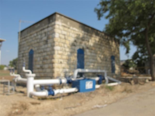
Posted by said 2 - Village House Used By A Jewish Family In 1987
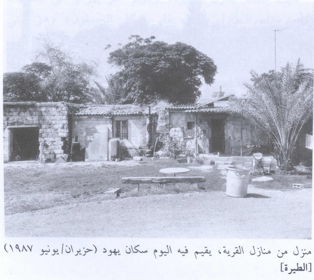
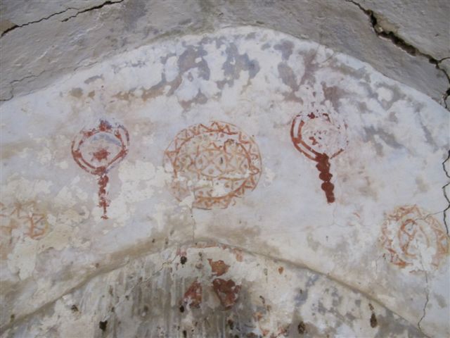
Scanned from "All That Remains" by Dr. Walid Khalidi 4 - Village Site In 1987
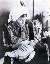
Scanned from "All That Remains" by Dr. Walid Khalidi 6 - صورة لأم محمد من طيرة دندن
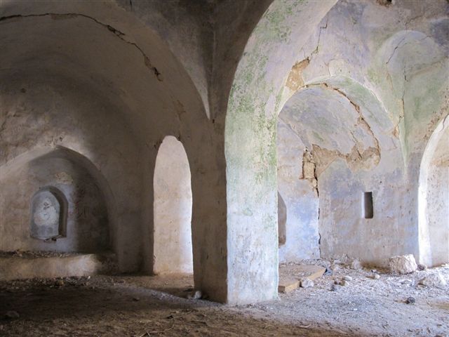
Posted by محمد الواوي 2 - The mosque(?)
Posted by Uri Zackhem - Near the mosque(?) used by a Jewish family
Posted by Uri Zackhem - Another side of the mosque
Posted by Uri Zackhem - More to the east. I think that the building (mosque) was broken to make way for the street.
Posted by Uri Zackhem - Other side of the possible mosque
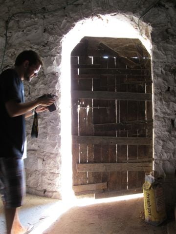
Posted by Uri Zackhem - A door in a complex west to the mosque.
Posted by Uri Zackhem - More houses, some inhabited
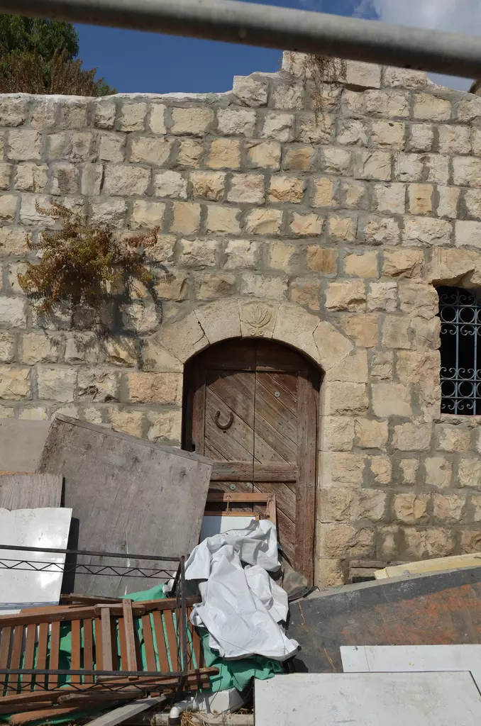
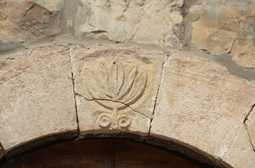
Posted by Uri Zackhem - A door with inscription above.
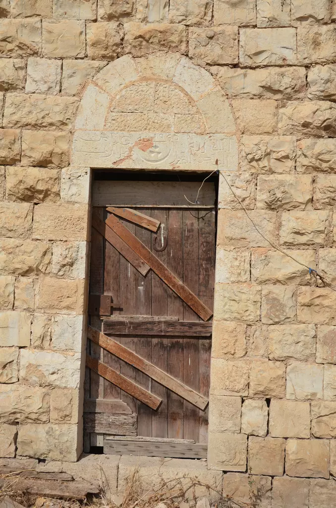
Posted by Uri Zackhem - Detail above a door.
Posted by Uri Zackhem - al-Tira 2012
Posted by said 1 - al-Tira 2012
Posted by said - al-Tira 2012
Posted by said - al-Tira 2012
Posted by said - al-Tira 2012
Posted by said 1 - al-Tira 2012
Posted by said - al-Tira 2012
Posted by said - al-Tira 2012
Posted by said - al-Tira 2012
Posted by said - من موقع القريه
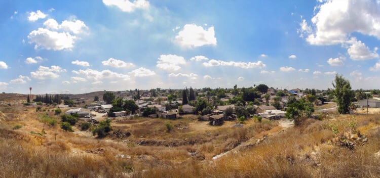
Posted by abu raya - طيره دندن
Posted by abu raya - طيره دندن
Posted by abu raya - بيوت طيره دندن
Posted by abu raya - بيوت طيره دندن يسكنها المستعمرون
Posted by abu raya - بيت باقي في طيره دندن
Posted by abu raya - بيوت طيره دندن
Posted by abu raya - طيره دندن
Posted by abu raya - طيره دندن
Posted by abu raya - طيره دندن
Posted by abu raya - طيره دندن
Posted by abu raya - طيره دندن
Posted by abu raya - صوره قديمه لقريه طيره دندن بعد احتلالها
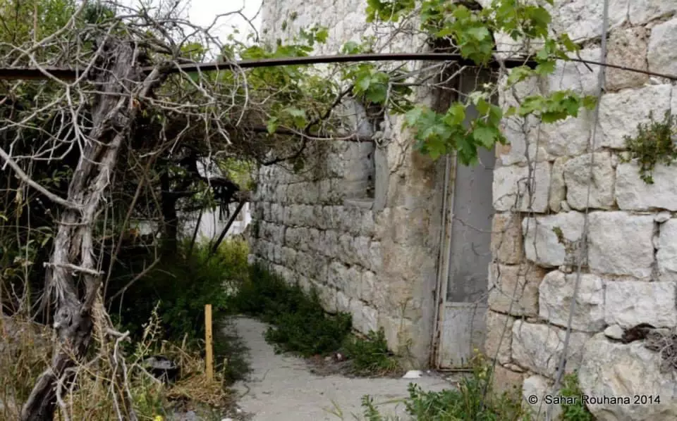
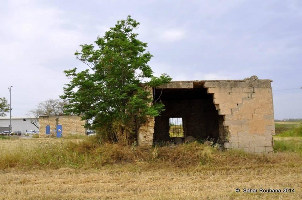
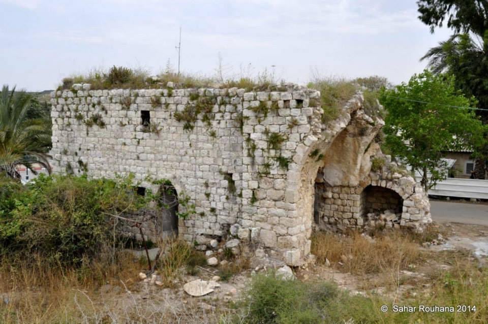
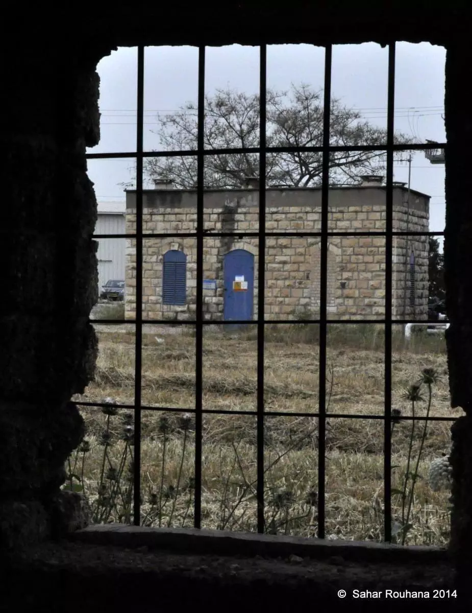
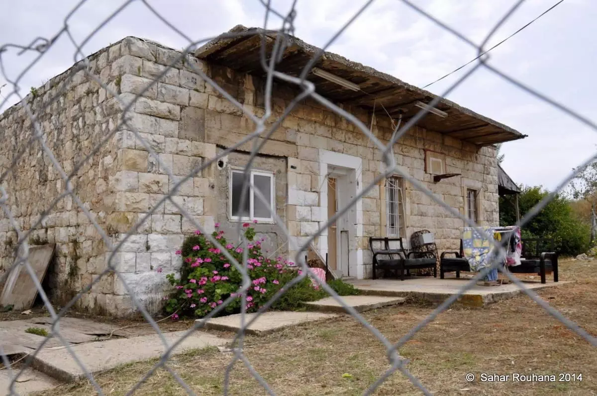
Posted by abu raya - بيوت طيرة دندن المنهوبة - تصوير Sahar Rouhana
- بيوت طيرة دندن المنهوبة - تصوير Sahar Rouhana #2
- بيوت طيرة دندن المنهوبة - تصوير Sahar Rouhana #3
- بيوت طيرة دندن المنهوبة - تصوير Sahar Rouhana #4
- بيوت طيرة دندن المنهوبة - تصوير Sahar Rouhana #5

- بيوت طيرة دندن المنهوبة - تصوير Sahar Rouhana #6
- بيوت طيرة دندن المنهوبة - تصوير Sahar Rouhana #7
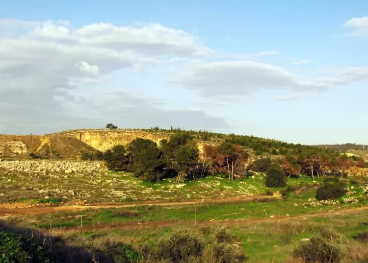
- Pre-Nakba Aerial view of the village / صورة من الجو للقرية اخذت قبل النكبة
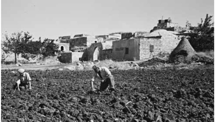
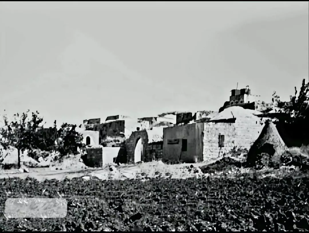
- صورة نادرة وساحرة لقرية طيرة دندن قضاء الرملة أربعينيات القرن العشرين..
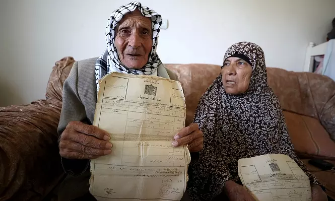
- محمد مسعود الطيراوي وزوجته غالية ....يشهران كواشين ملكيتهم لاارض التي هجرو منها... . ويتمسكان بحق بالعودة إلى بلدتهما الطيرة، التي هُجرا منها لدى احتلالها من قبل العصابات الصهيونية عام 1948، رغم تجاوزهما سن الثمانين.... لهما فديو ومقال في صفحة قريتهم الطيرة
- محمد مسعود الطيراوي وزوجته غالية ....يشهران كواشين ملكيتهم لاارض التي هجرو منها... . ويتمسكان بحق بالعودة إلى بلدتهما الطيرة، التي هُجرا منها لدى احتلالها من قبل العصابات الصهيونية عام 1948، رغم تجاوزهما سن الثمانين.... لهما فديو ومقال في صفحة قريتهم الطيرة #2
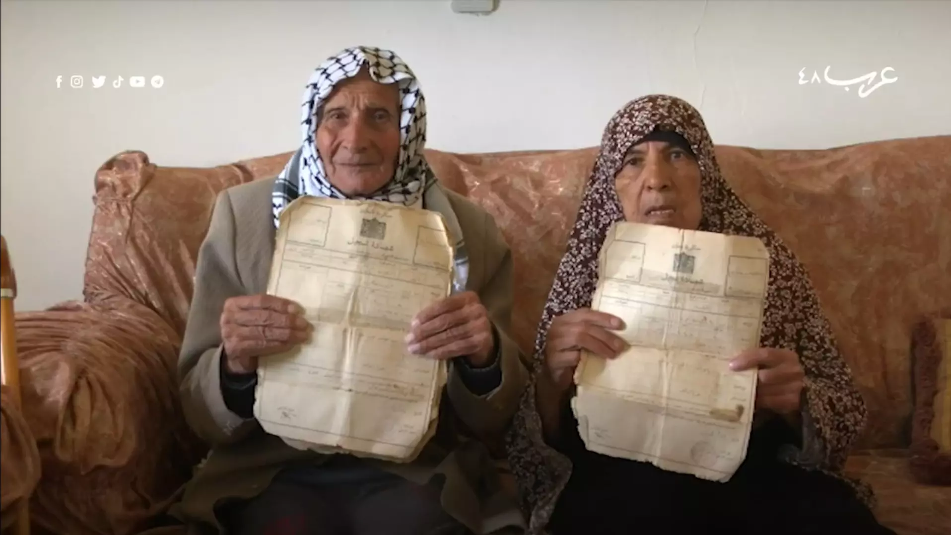
- محمد مسعود الطيراوي وزوجته غالية ....يشهران كواشين ملكيتهم لاارض التي هجرو منها... . ويتمسكان بحق بالعودة إلى بلدتهما الطيرة، التي هُجرا منها لدى احتلالها من قبل العصابات الصهيونية عام 1948، رغم تجاوزهما سن الثمانين.... لهما فديو ومقال في صفحة قريتهم الطيرة #3
- A tour of Palestinian homes that were looted by the "most civilized". How else will the Jews be great again? Mazletov
- A tour of Palestinian homes that were looted by the "most civilized". How else will the Jews be great again? Mazletov #2
- A tour of Palestinian homes that were looted by the "most civilized". How else will the Jews be great again? Mazletov #3
- A tour of Palestinian homes that were looted by the "most civilized". How else will the Jews be great again? Mazletov #4
Want to browse more? 80,000 pictures were grouped in these gallaries:
- محمد مسعود الطيراوي وزوجته غالية ....يشهران كواشين ملكيتهم لاارض التي هجرو منها... . ويتمسكان بحق بالعودة إلى بلدتهما الطيرة، التي هُجرا منها لدى احتلالها من قبل العصابات الصهيونية عام 1948، رغم تجاوزهما سن الثمانين.... لهما فديو ومقال في صفحة قريتهم الطيرة
- محمد مسعود الطيراوي وزوجته غالية ....يشهران كواشين ملكيتهم لاارض التي هجرو منها... . ويتمسكان بحق بالعودة إلى بلدتهما الطيرة، التي هُجرا منها لدى احتلالها من قبل العصابات الصهيونية عام 1948، رغم تجاوزهما سن الثمانين.... لهما فديو ومقال في صفحة قريتهم الطيرة #2
- محمد مسعود الطيراوي وزوجته غالية ....يشهران كواشين ملكيتهم لاارض التي هجرو منها... . ويتمسكان بحق بالعودة إلى بلدتهما الطيرة، التي هُجرا منها لدى احتلالها من قبل العصابات الصهيونية عام 1948، رغم تجاوزهما سن الثمانين.... لهما فديو ومقال في صفحة قريتهم الطيرة #3
| Display Name | Clan/Hamolah | Country of Residence |
| nour srour | المصاروة | - |
| محمدصادق عابد الطيراوي | - | العقبة, العقبة |
| Bajes Khalil | Issa | Poland |
| حسام | يوسف خليل | Riyadh, K.S.A |
| مراد زكي شاكر الواوي | الواوي | عمان - الاردن |
| ال سلامه | ال سلامه | عمان |
| naim suleiman | - | florida, florida |
| ابو خالد | - | الاردن, طيرة دندن |
| ربيع عدوان | عدوان | الاردن |
| علي سلامة | سلامة | رام الله, فلسطين |
| Teerawi | Issa | Doha - Qatar |
| الطيراوي | - | الاردن, الاردن |
| نعمه محمد خليل الطيراوي | - | - |
| omar khyam | - | amman_jbal alnaser, jordan |
| ام احمد | الحاج | عمان, الاردن |
| morad zaki | ghabain | zarka, jordan |
| Awadh | Al Omari | Jeddah, KSA |
| ناصر إباهيم ناصر | حمدان | عمان, الاردن |
| Adel Al-Shayeb | HAMDAN | U.S.A. , Qatar |
| رامي | عدوان | دبي, الامارات |
| عبدالكريم احمد حسين مصطفى عبدالرحمن سرور | المصاروه | - |
| خولة فوزي محمد سليمان غباين | غباين | رام الله , فلسطين |
| لطفي محمد لطفي ياسين خليل | يوسف خليل | RAMALLAH, Palestaine |
| ala | issa | BC, Canada |
| ENG.HAKAM | SALAMEH | ABUDHABI, UAE |
| هديل | عطية | zarka |
| دندن | - | الزرقاء, الاردن |
| suad alwawy | - | dubai |
| khalid thib | thib | amman |
| ابراهيم محمد ياسين الحاج | الحاج | dubai, uae |
| ثائر | عطية | - |
| باسم عدوان | عدوان | الكويت, الكويت |
| هديل عطية | حمدان | الزرقاء |
| waleed yassin | - | - |
| عدي الحاوي | الحاوي | الزرقاء, الأردن |
| mahmoud alhawi | الحاوي | الزرقاء, الاردن |
| ابوخضر | عيسى | نابلس, فلسطين |
| AMJAD NASER | - | KUWAIT |
| اسماعيل | عبد القادر | عدن, عدن |
| ابو اسماعيل | عبد القادر | اليمن, اليمن |
| ندي عبد القادر | abd alkader | - |
| Musa'b Muhammed Salameh | Salameh | dubai, UAE |
| Abeer Abdel-Qader | Abdel Qader | jordan |
| sa'adat ghabayen | ghabayen | dubai, UAE |
| Issa Alterawe | - | Abu Dhabi, UAE |
| احمد حسن | ناصر | الكويت |
| alteerawy | - | amman, jordan |
| ahmed issa | - | Alberta, Canada |
| Abdel Wahed | Abdel Qader | amman, jordan |
| aluns | issa | uae, uae |
| Yasser_Yasin | Ibrahem - Yasin | Rousaifa, Jordan |
| Haneen Khalil | abd al qader | Ramallah, Paletine |
| gassan terawy | alwawy | jenin, palstine |
| waleed mohd abdelkader | abdel qader | - |
| terawi | abdel qader | U>A>E, u.a.e |
| Reem Essam Abdulqader | Abdulqader | Doha, Qatar |
| said salameh | salameh | west bank, palestine |
| HASAN | SALAMEH | amman, jordan |
| Ghada Terawi | - | Palestine, Palestine |
| salameh | salameh | uae |
| yasser SALAM | Issa | Abu Dhabi, u.a.e. |
| *Teraweyyeh_Gurl* | - | Canada |
| Teerawi | Issa | Dubai, UAE |
| Abo Omar | Issa | Sydney, Australia |
| Zakaria Issa | - | - |
| Hani Abdul-Qader | Abdul-Qader | Amman, Jordan |
| Luai Abdul-Qader | Abdul-Qader | Abu Dhabi, UAE |
| Yaser Abdul Qader | Abdul qader | - |
- جولة ميدانية في طيرة دندن المهجرة (قضاء الرملة) : كل ما تبقى من البيوت والعلالي والزقاق ...الحارة القليلية ... تاريخ منقوش بالحجر يأبي النسيان . Duration: 2 min 6 sec
- طيرة دَندَن أو طيرة الرّملة أو طيرة الحجر. من كبرياء قرى قضاء الرّملة المهجّرة عام 1948. عشية النكبة سكن فيها حوالي 1500 نسمة الذين كانوا يرتزقون في اغلبهم من الزراعة والشعل في مناسب مختلفة في قطار فلسطين والمعسكرات الانكليزية والمحاجر المحلية. بعد تهجيرها أقيمت مستوطنة (طيرة يهوذا) على أنقاذها Duration: min 39 sec
- طيرة دندن بين الطمس والتهويد :حكاية قصور وعلالي شامخة تنتظر عودة أبنائها. من عائلاتها أحمد، جودة، الحاج، حلفش، حمدان، الخطيب، دندن، سلامة، سليم، عابد، عبد الفتاح، عبد القادر، عدوان، عيسى، غبائن، صوفان، مطير، الواوي، ياسين Duration: 9 min 23 sec
- سلسلة حكاية قرية من فلسطين| قرية طيرة دندن (14) موسوعة القرى الفلسطينية Duration: 4 min 50 sec
- في قرية طيرة دندن المهجرة (قضاء الرملة ) Duration: min 22 sec
- بعد تجاوزهما سن الثمانين: محمد وغالية الطيرواي يتمسكان بحق العودة Duration: 2 min 19 sec
No links have been shared yet, be free to the first to share the first link.
 Fake Valor: Why Did Zionist Jews Hoist Nazis Flag on Their Ships in the 1930s?
What is new?
-
Facts About Oct. 7th Gaza Raid
-
Remined Us Please:: Who Did Rape Who? Palestinians Raped Israelis? Or, was the other way around?
-
When Prof. Edward Said was invited to debate Bibi Netanyahu in the 1980s, watch what happened!
-
Ezra Klein of the NY Times on the "Jewish Race".
-
Abusing Blood Libel!
-
Did Israeli Soldiers Activate The Hanniba Direective On Oct. 7th? You Be The Judge
-
Zionist FAQ: Isn't it true that Palestinians don't want peace? Palestinians never accepted the two-state solution
- Facts about Haavara (Transfer) Agreement between Ben-Gurion & Hitler
-
Haavara FAQs: Why Did Zionist Jews Hoist Nazis' Flags on Their Ships in the 1930s?
- Haavara FAQs: When Chaim Weizmann met FDR in mid-1943, why was he silent about rescuing European Jewry?
-
Dear ChatGPT: How did Palestinians resist Napoleon's invasion of their country in 1799?
-
Dear ChatGPT: Gaza had a vibrant Jewish community in the mid-17th century. What happened to them?
-
Dear ChatGPT: Why did the Jewish Agency suppress news of the Holocaust during WWII?
-
Video Playlist: Jews share their DNA tests to end the conflict for good.
-
A Tale of Two Conflicts: Examining the Definition of Genocide
-
Prof. Abraham Polak And The Suppressed History of the Khazars and European Jewry
-
How Ronald Reagan would have framed the genocide in Gaza if he were still alive?
-
Haavara FAQs: Let us do the math: how many German Jews did The Haavara Agreement save?
-
Zionist FAQs: The Hebron Massacre of 1929, "clearly proves" that Palestinians are antisemitic, how could you deny it?
-
Zionist FAQs: Why Anti-Zionist Is Not Antisemitism?
-
Zionist FAQs: Isn't it true that the KGB created Palestinian Nationalism in the early 1960s?
- Zionist FAQs: Muslims are killing Muslims all the time; why are Israeli Jews being singled out in the media?
- Zionist FAQs: How is Israel an apartheid state when 20% of its citizens are Arabs who enjoy full rights?
-
Haavara FAQs: Why Did Dorothy Thompson Flip From A Zionist Advocate to A Silenced Dissenter?
-
Haavara FAQs: Analysis of Herzl's Uganda Scheme and how it could have saved millions of Jews.
-
Haavara FAQs: Why did Hayim Greenberg describe American Jewry as "morally bankrupt" in early 1943?
-
Haavara FAQs: What if the Evian Conference was a resounding success? What would have been the impact of saving European Jewry on Zionism?
- Haavara FAQs: What if the six million were saved, how that would have impacted the Zionist project?
-
Haavara FAQs: How did Zionist leaders react when Europe's Jews lingered in the DP camps after WWII ended?
-
Why does the American Jewish community repeat lies that David Ben-Gurion had debunked before he died?
-
Who has the power to rename the Tatar/Khazar Gene Marker to Jewish IV?
-
Zionist FAQs: Why won't Egypt, Syria, and Jordan take their people back? Jews are indigenous to Palestine, and Arabs immigrated after Jews developed the country. Arabs should leave.
-
Haavara FAQs: Did Hitler and the Nazis conflate between Judaism and Zionist? If that wasn't case, then why?
-
Haavara FAQs: Winston Churchill and antisemitism, a collection of articles written Churchill.
-
Haavara FAQs: Broken by country, how many Jews survived vs. killed during the Holocaust?
-
Haavara FAQs: Why did European Jews vote with their feet and to immigrated to the Americas, not Palestine, after WWII?
-
Watch this American Jewish Girl describing Israeli Jews' cognitive dissonance like no other in under two minutes
-
Haavara FAQs: When the Nazis went out of their way to hide the Holocaust, Israeli Jews did the exact opposite by broadcasting their genocide of Gazans. But why?
-
Haavara FAQs: How Zionist Jews went out of their to show their appreciation to Nazism and Fascism?
- Haavara FAQs: Why Zionist leaders were against bombing the death camps & the Railroads leading to them?
-
Haavara FAQs: Hitler's message to the British and American people: If Jews are such noble citizens and you care about them, how come you're not letting them in? I will gladly ship them to you at my expense, even on luxury liners!
-
A shortlist of Zionist and Israeli false flag operations in the name Jews.
-
The Most Moral Army
- The Land of Kapos (Israel): Where the brave are boycotted and Kapos walk free.
- Why did early Zionists often named their communal enterprises "colonial"?
- Zionist Relations with Nazi Germany by Faris Glubb
-
Two NY Times advertisements by Zionists in the early 1943 that exposes Zionists' treason at the height of the calamity
- Facts Not Lies about the Palestinian-Israeli Conflict.
- Site's pictures have been categorized
- Campgain Against Lice
- A Survey of Palestine, the official source about Palestine before Nakba produced by the British Mandate; over 1200 pages.
- Satellite View & Google Earth: Over 6,000 placemarks identifying all destroyed towns, W. Bank & Gaza Strip Towns, & refugee camps.
- PalestineRemembered.com and its Nakba Oral History Project were featured on al-Jazeera Satellite TV.
- Nakba Oral History Video Podcast:
 Over 700 Oral History interviews (including 3,500+ hours of recording) can be viewed online.
 - Palestine Village Statistics Project
- Gaza Jail Break
- النسخة العربية للموقع الان متوفرة
- Videos: Documenting the destroyed villages in video: Tracing all that remains since Nakba.
- Videos: Responding to Zionist Propaganda
- Interview: The ethnic cleansing of Palestine: George Galloway interviews Israeli Historian Ilan Pappe.
- For Palestinians, memory matters. It provides a blueprint for their future By George Bisharat.
- Zionist FAQ now available in Hebrew שאלות שציונים שואלים, עכשיו בעברית
- Video: The Stephen Walt and John Mearsheimer report on the influence of the Israel Lobby on U.S. Foreign Policy
- The Palestinian-Israeli conflict for beginners
