| PalestineRemembered | About Us | Oral History | العربية | |
| Pictures | Zionist FAQs | Haavara | Maps | |
| Search |
| Camps |
| Districts |
| Acre |
| Baysan |
| Beersheba |
| Bethlehem |
| Gaza |
| Haifa |
| Hebron |
| Jaffa |
| Jericho |
| Jerusalem |
| Jinin |
| Nablus |
| Nazareth |
| Ramallah |
| al-Ramla |
| Safad |
| Tiberias |
| Tulkarm |
| Donate |
| Contact |
| Profile |
| Videos |
Welcome To Kafr 'Inan - كفر عنان (כפר ענאן)
|
District of Acre
Ethnically cleansed days ago |
العربية Google Earth |
 |
Gallery (115) |
- Statistics & Facts
-
Before & After

- Satellite View
- Articles 9
- Pictures 115
- Land Deeds 1
- Oral History 6
- Members 2
- All That Remains
- Wikipedia
- Videos 1
- Guest Book 3
- Links 1
| Statistic & Fact | Value | ||||||||||||||||
| Occupation Date | February 1, 1949 | ||||||||||||||||
| Distance From District | 33 (km) East of Acre | ||||||||||||||||
| Elevation | 325 (meters) | ||||||||||||||||
| Before & After Nakba, Click Map For Details |
|||||||||||||||||
|
|||||||||||||||||
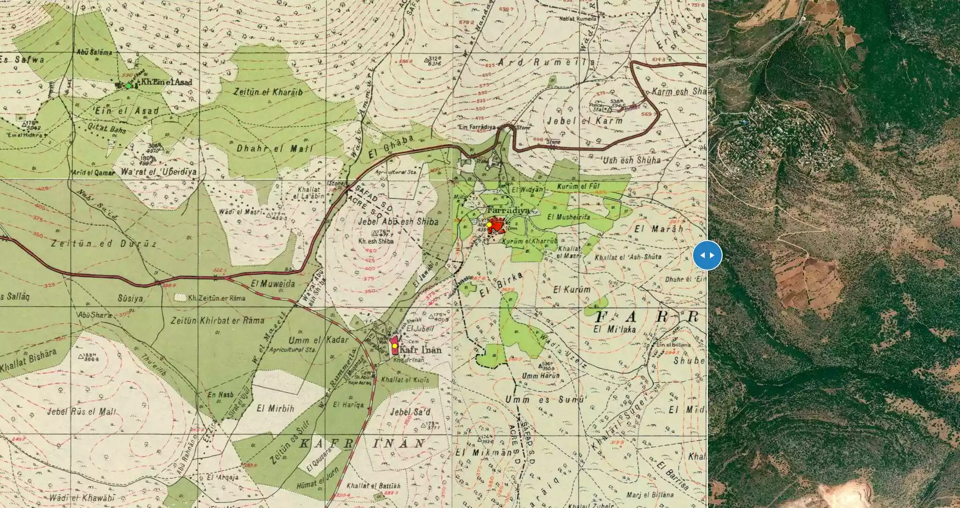
| Map Location | See location #22 on the map View from satellite |
||||||||||||||||
| Military Operation | Operation Hiram | ||||||||||||||||
| Attacking Units | Golani Brigade | ||||||||||||||||
| Exodus Cause | Expulsion by Zionist troops | ||||||||||||||||
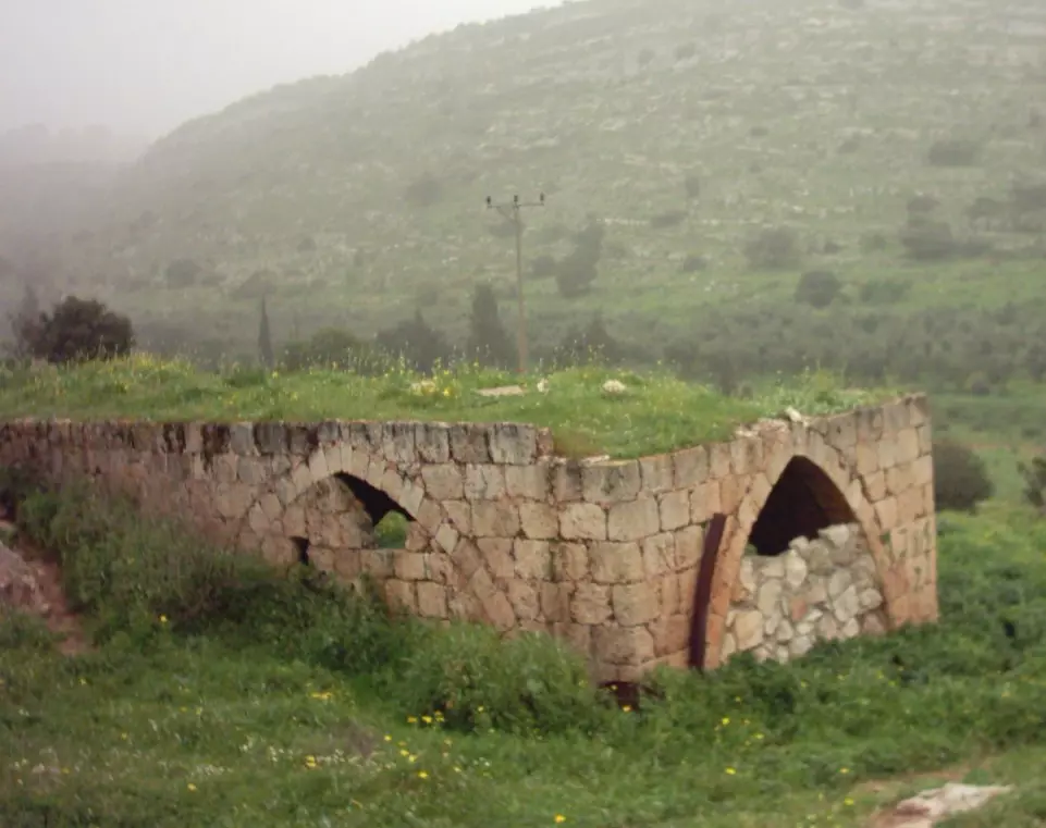
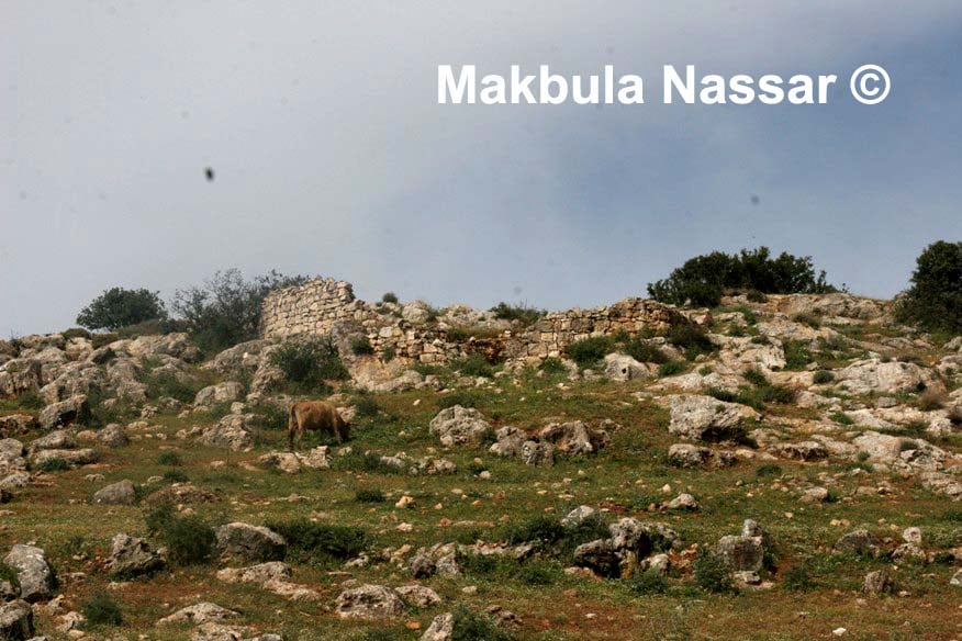
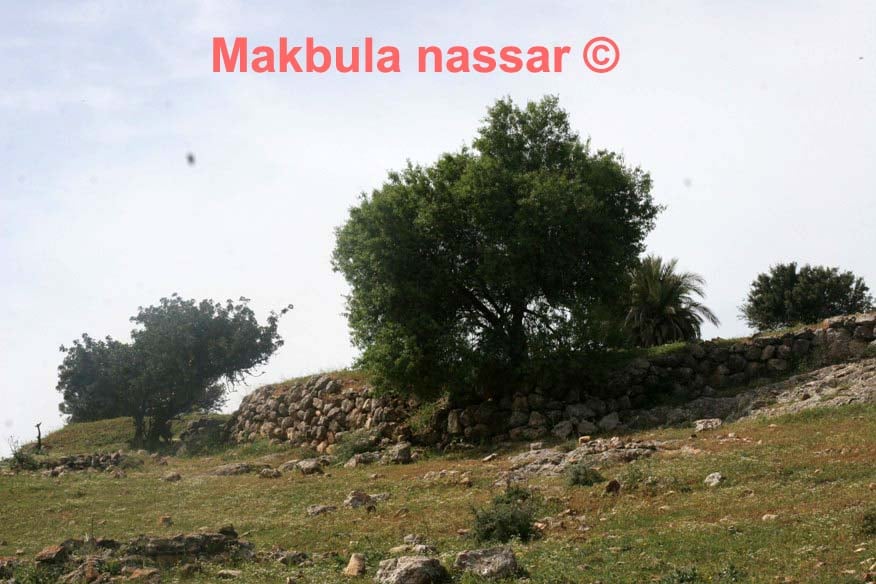
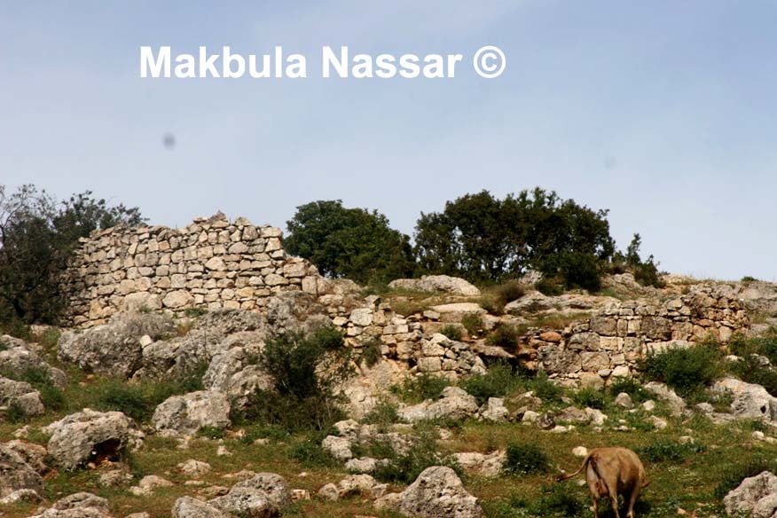
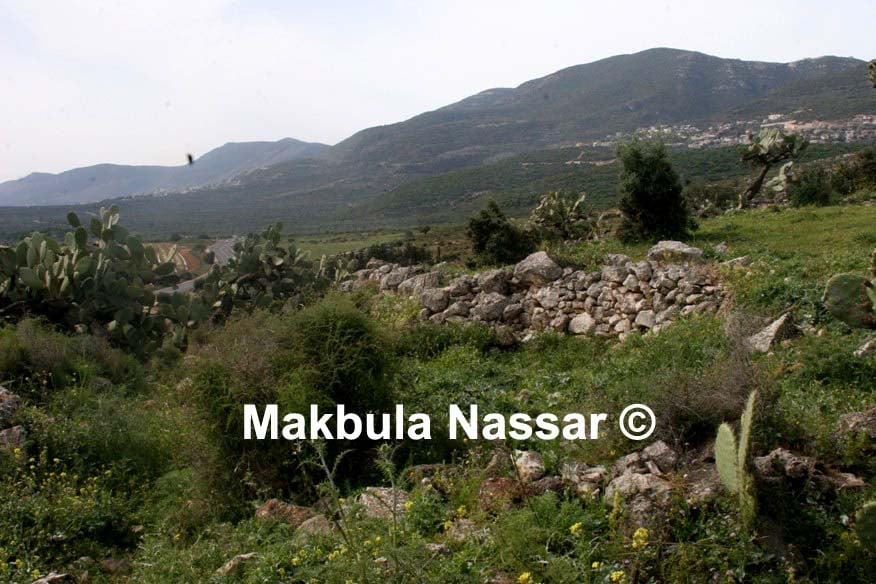
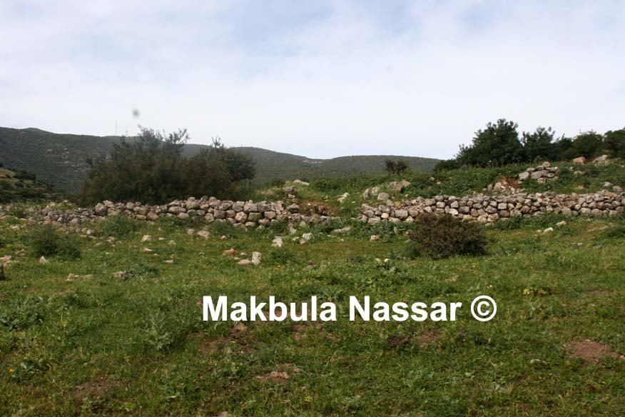
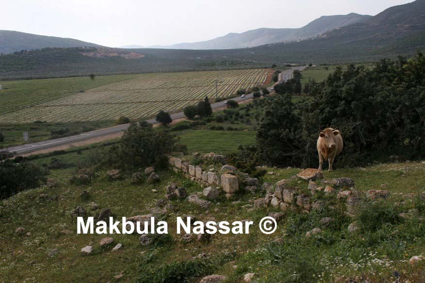
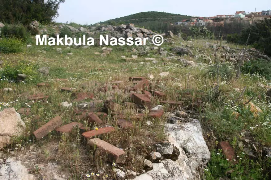
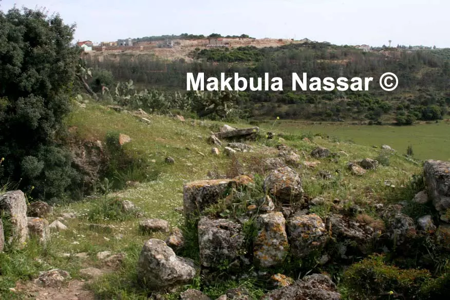
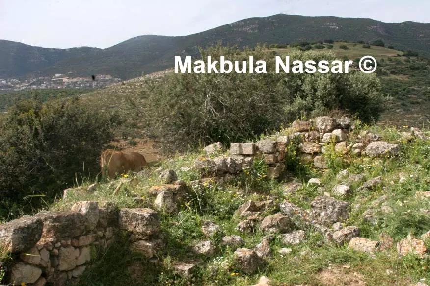
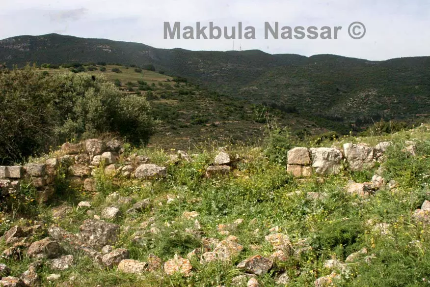
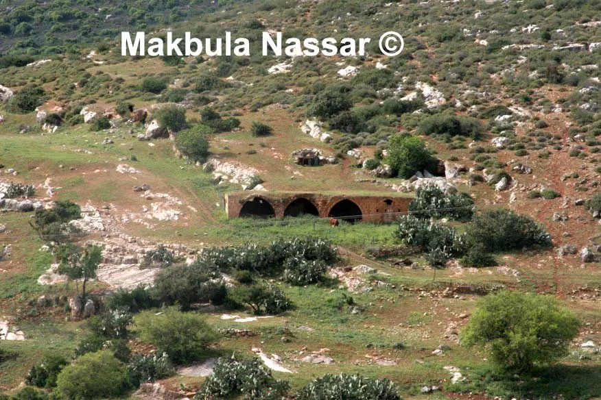
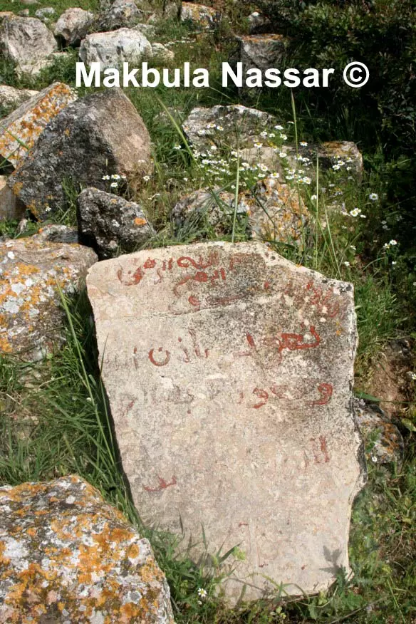
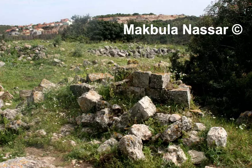
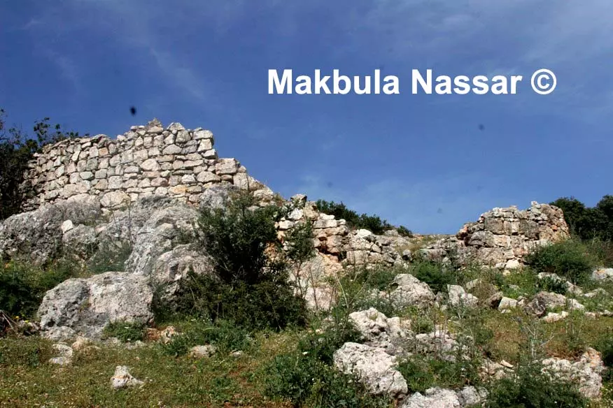
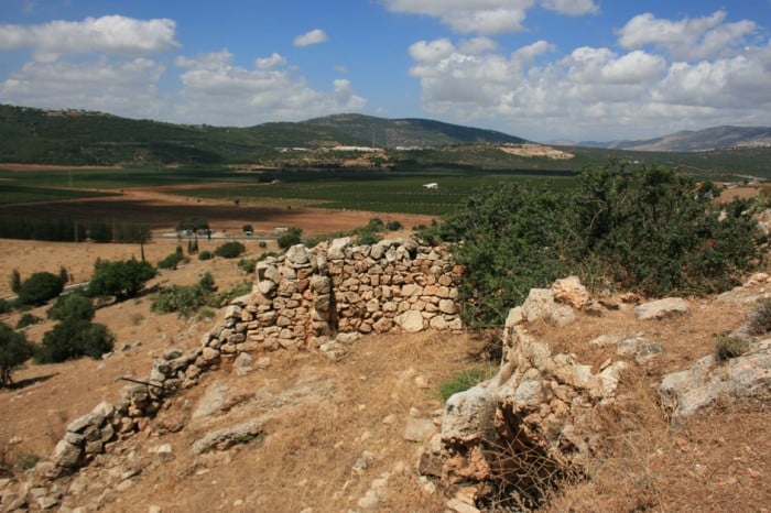
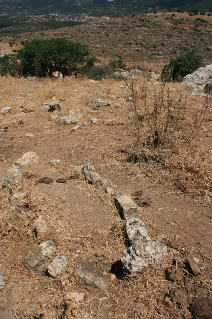
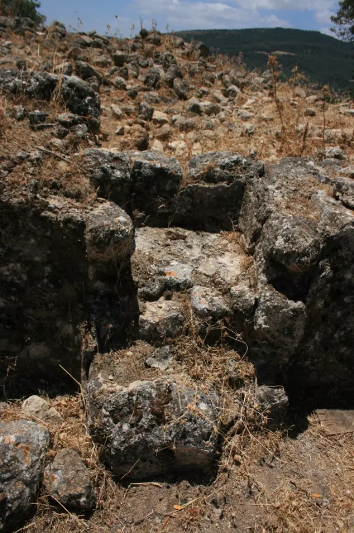
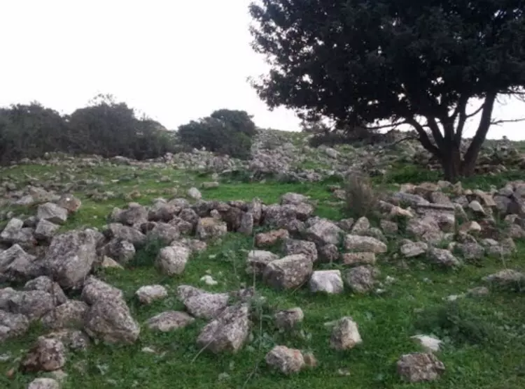
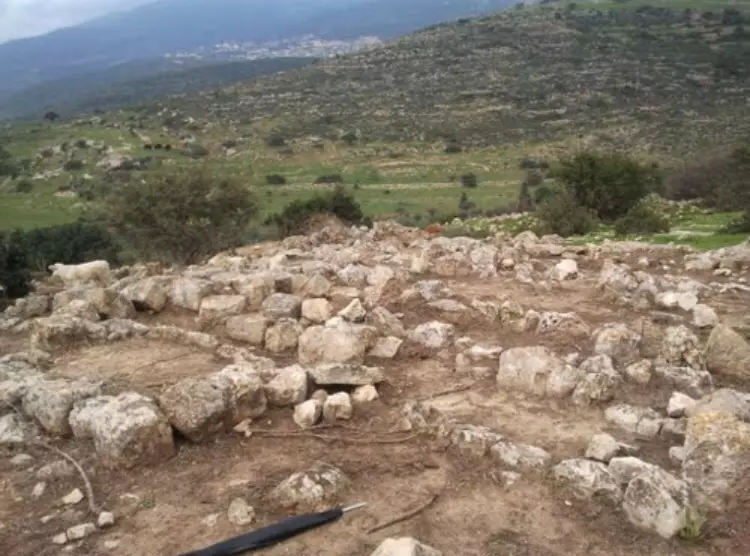
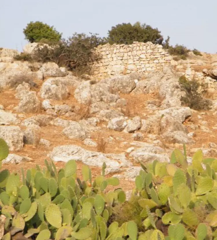
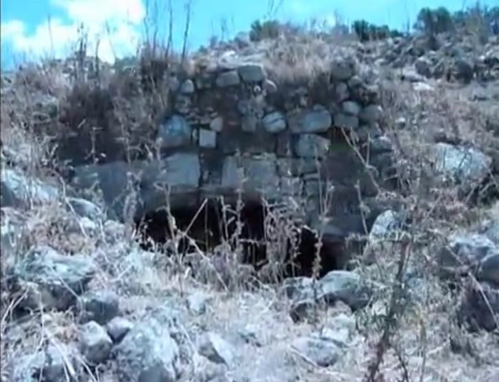
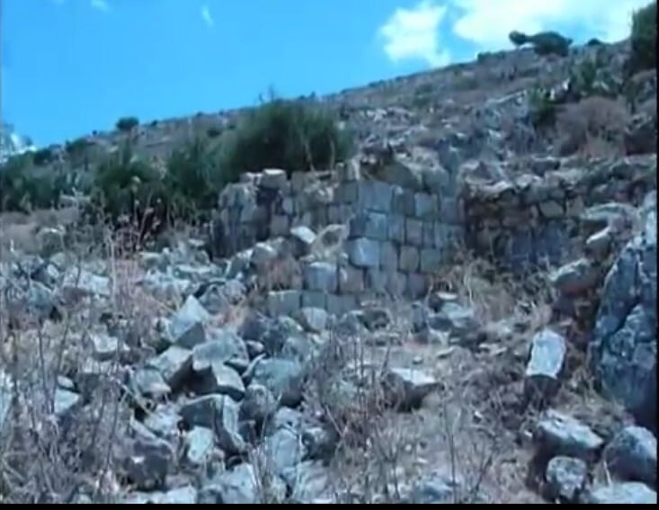
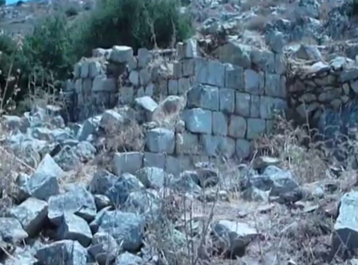
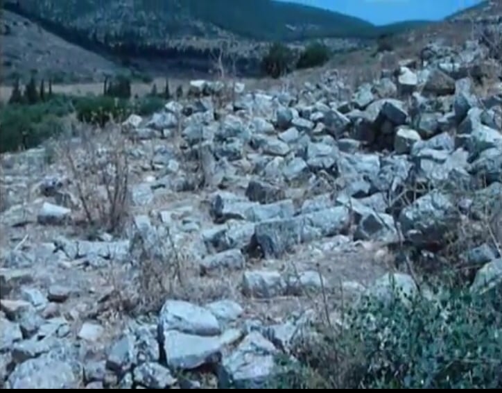
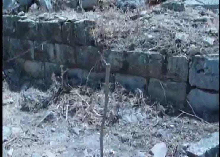
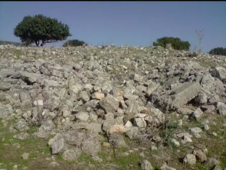
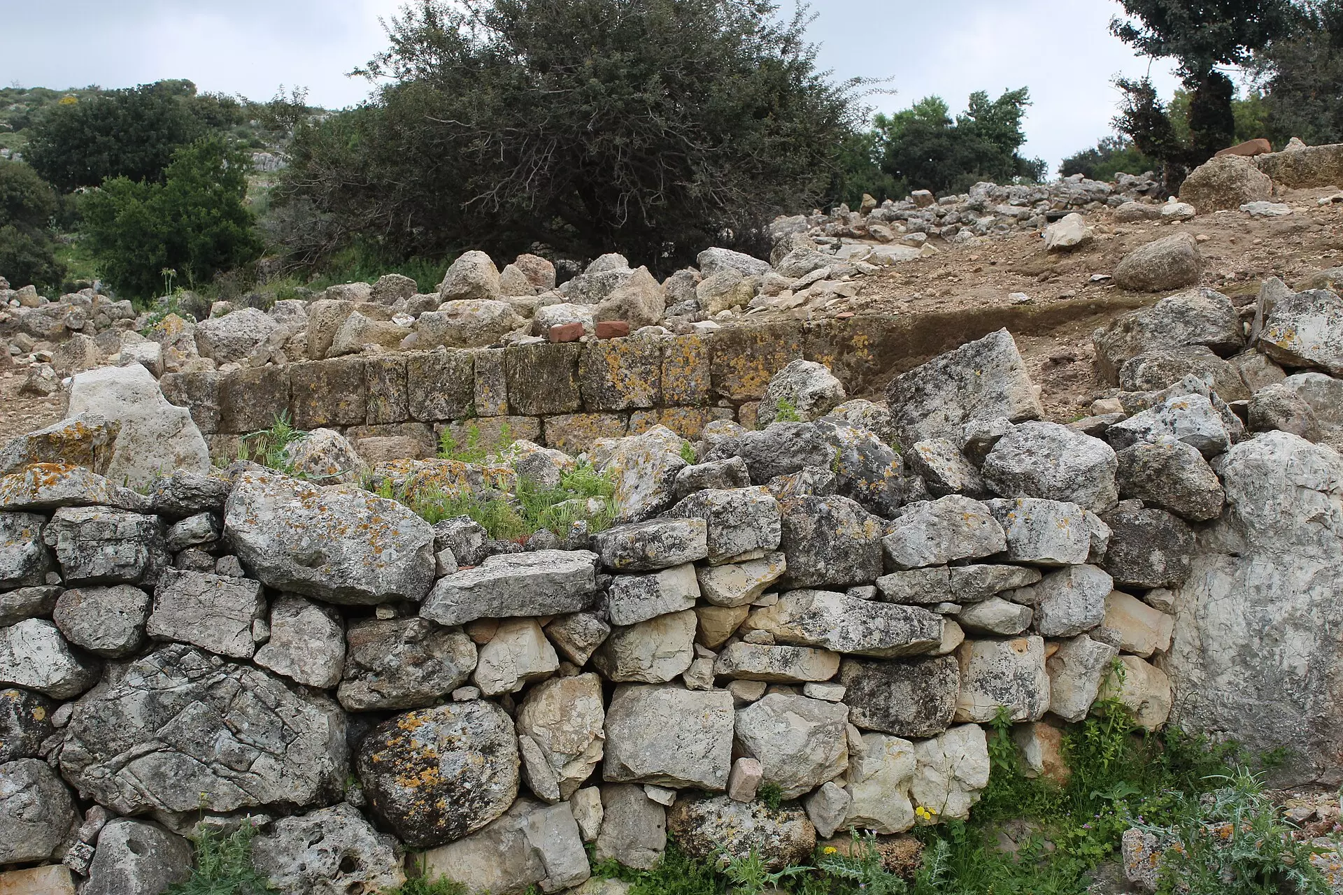
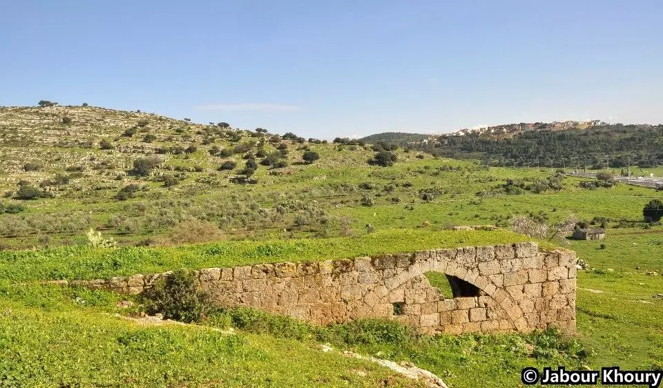
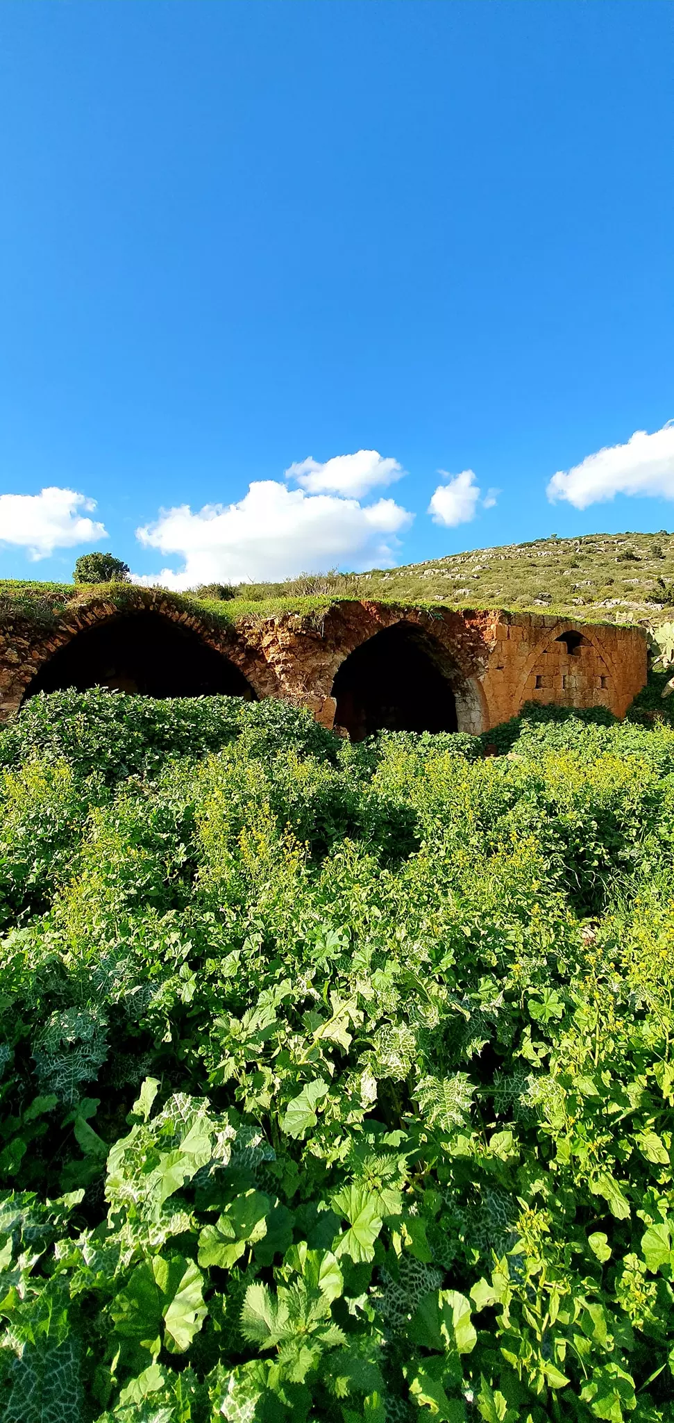
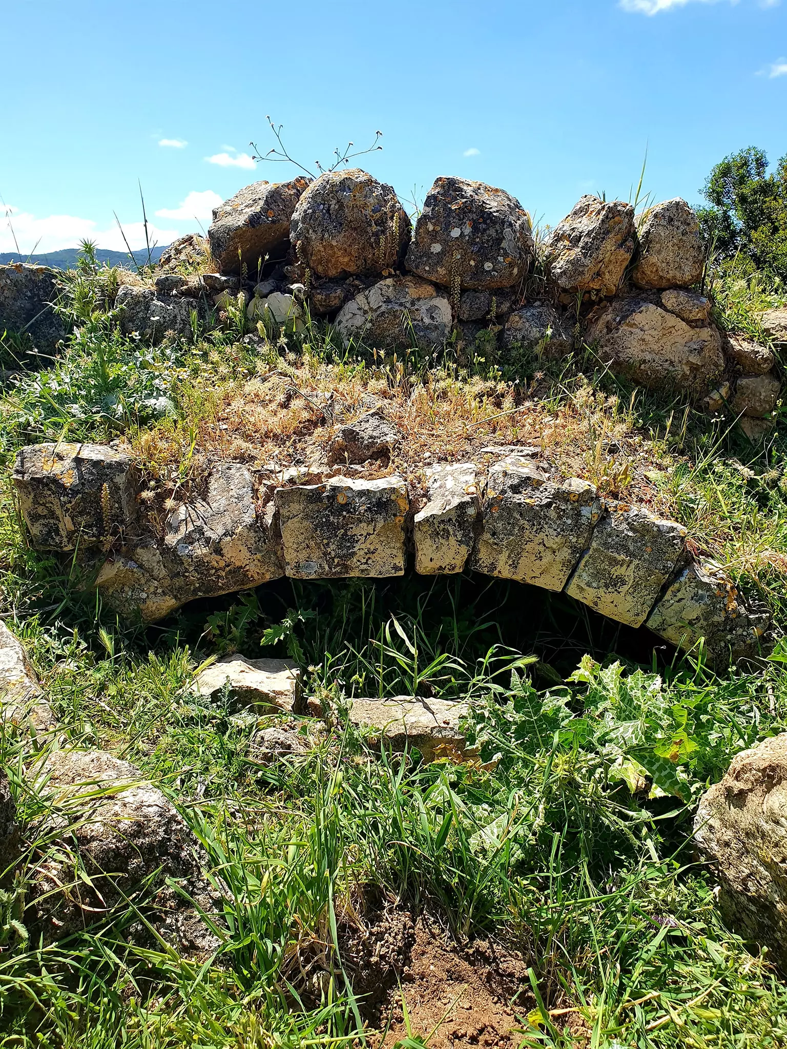
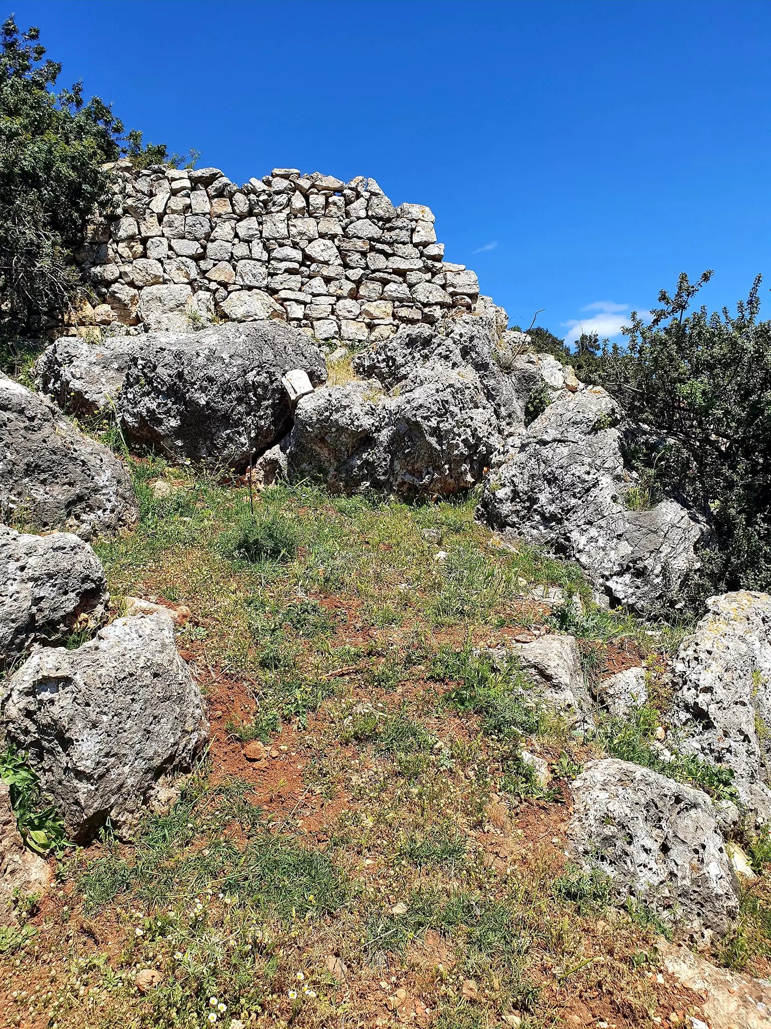
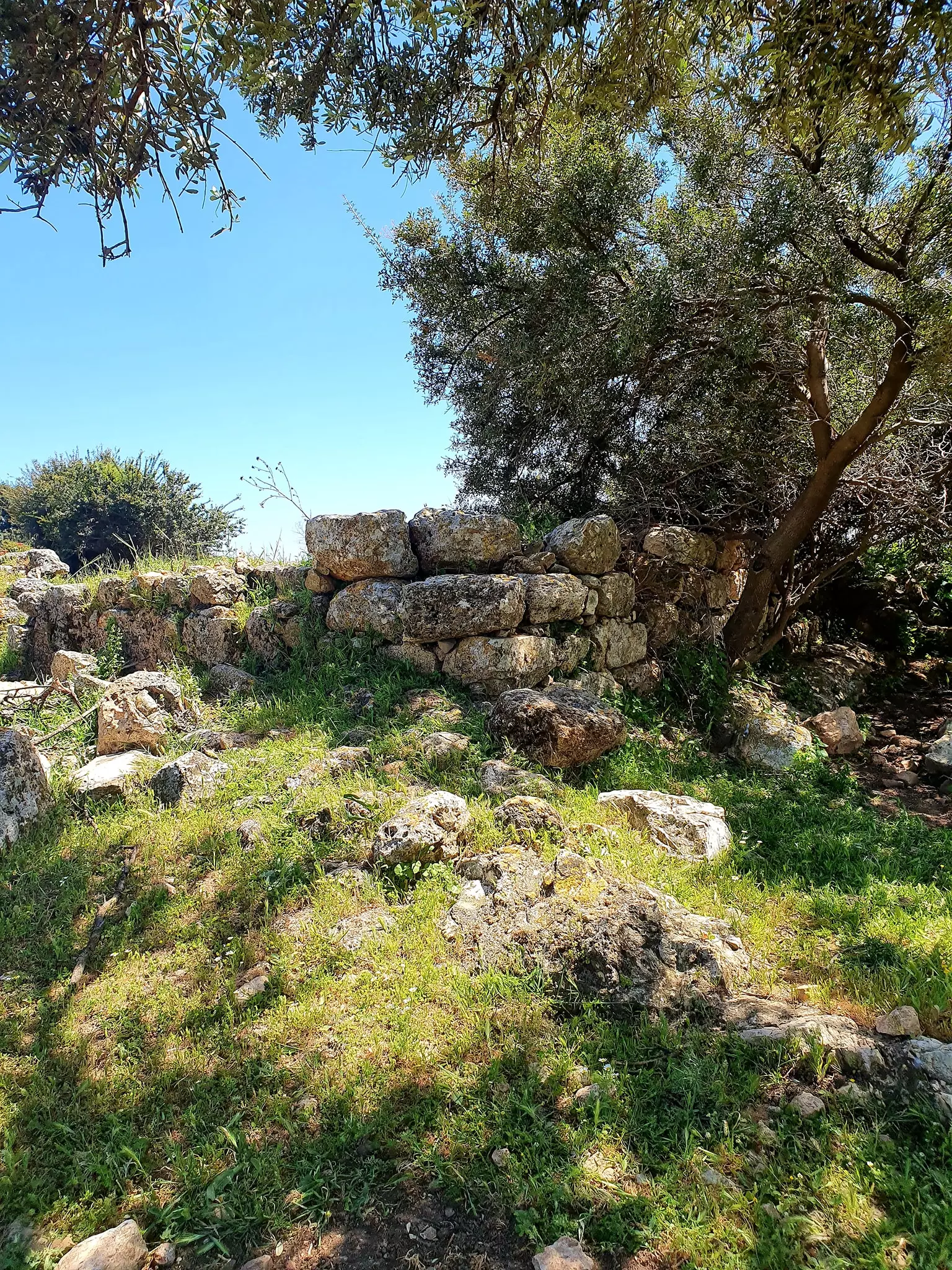
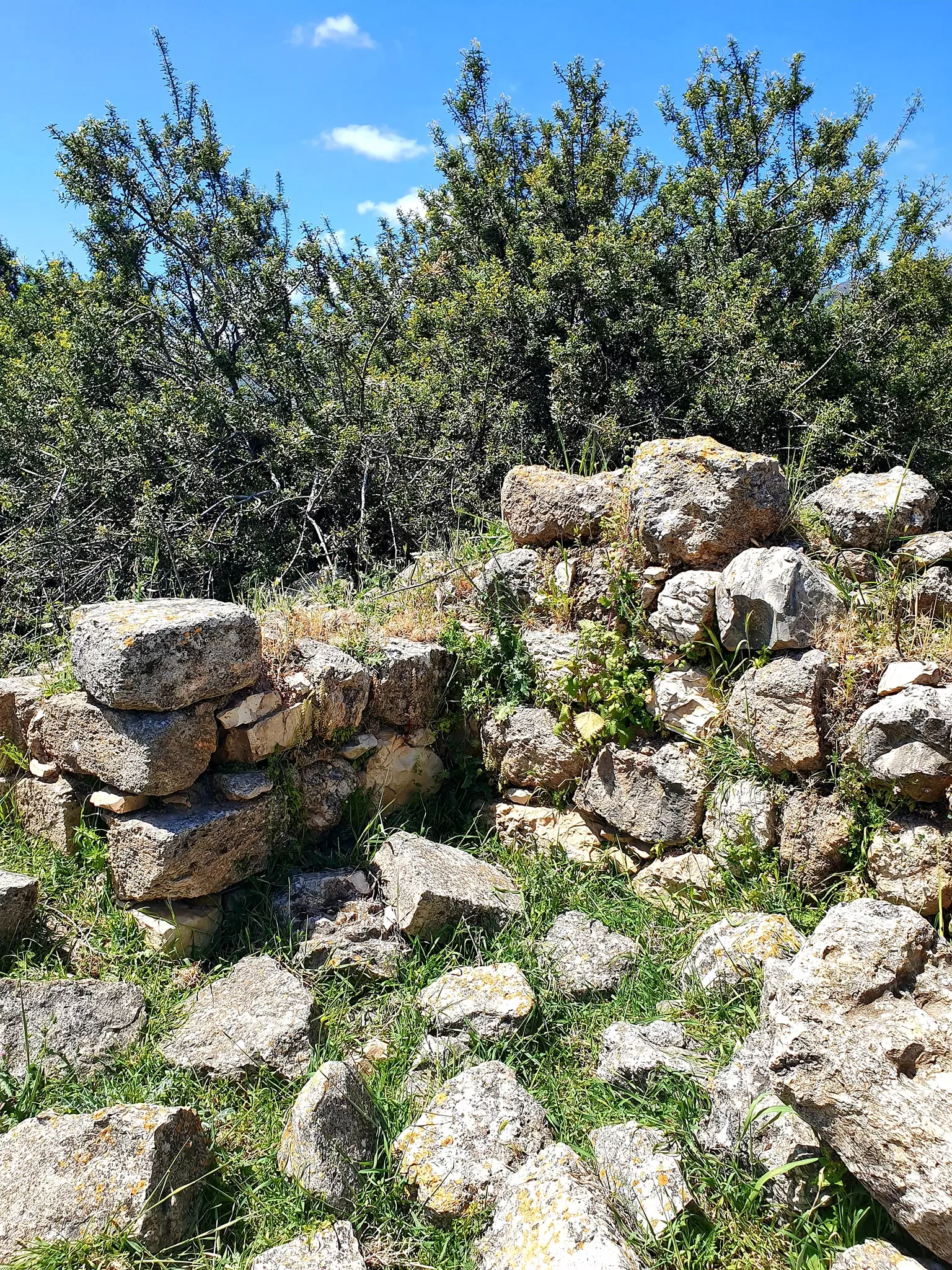
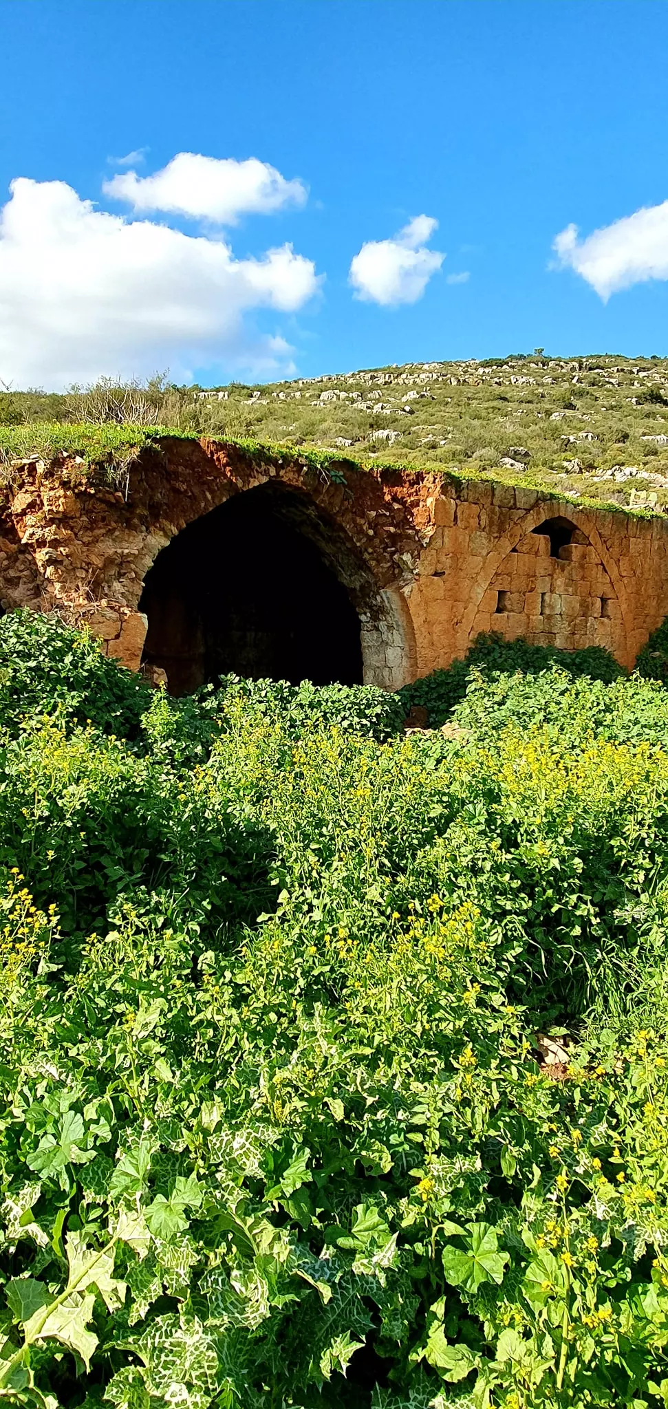
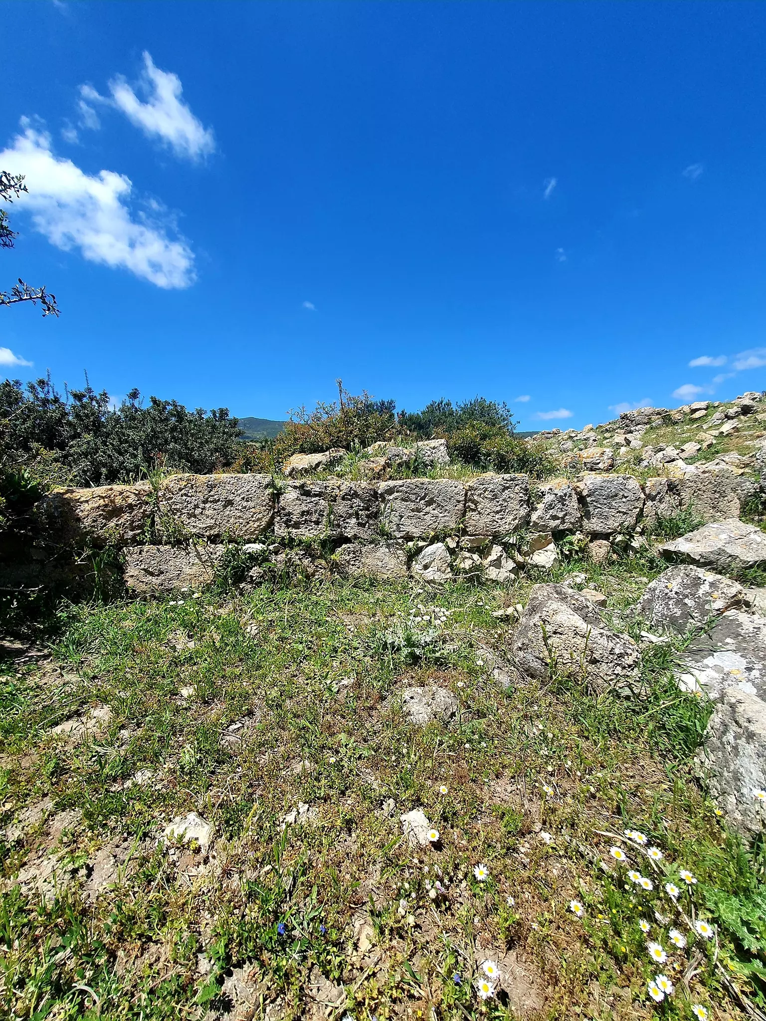
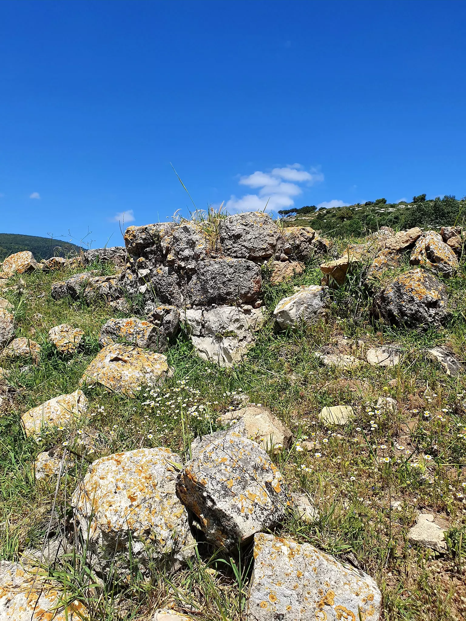
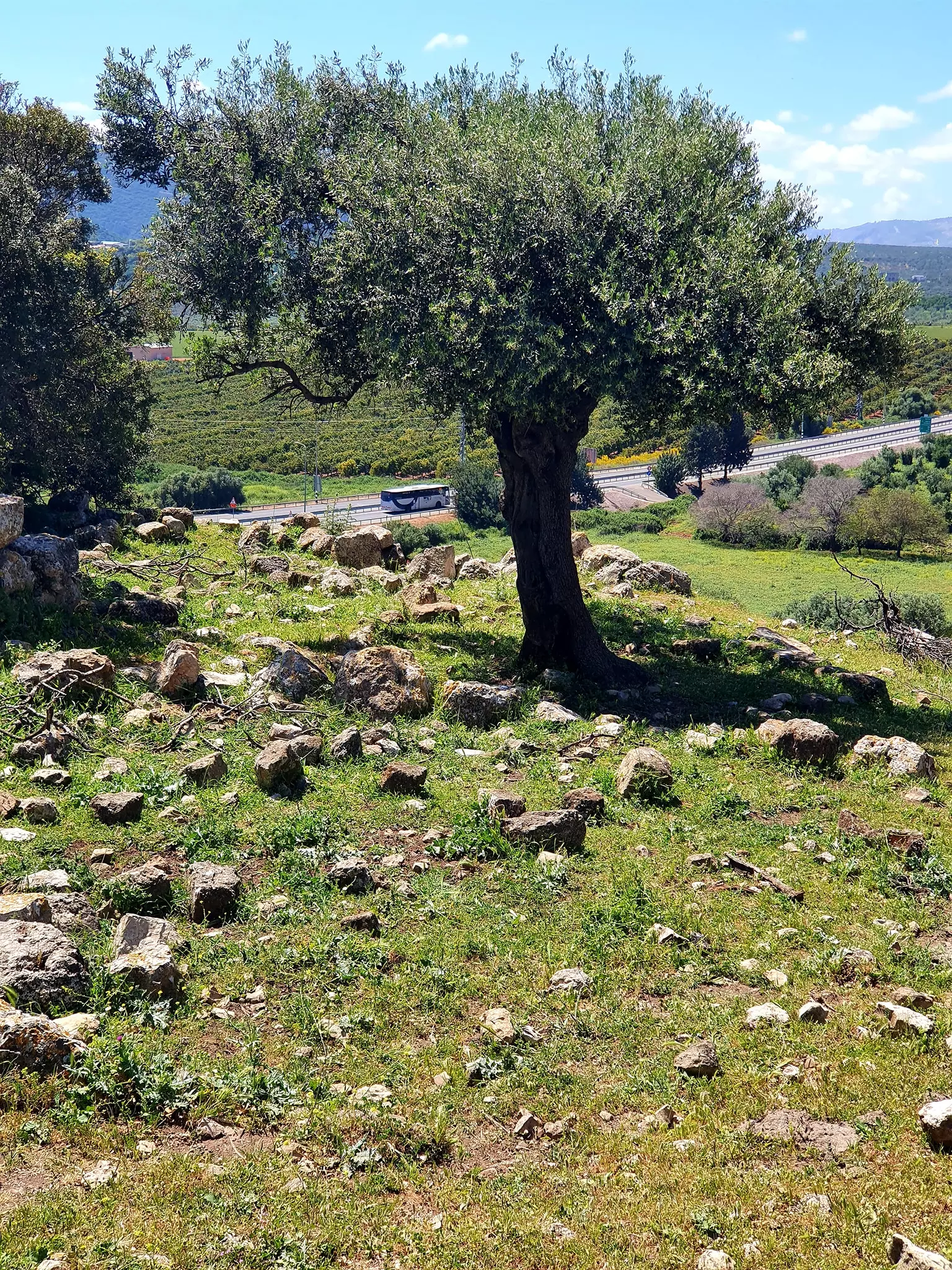
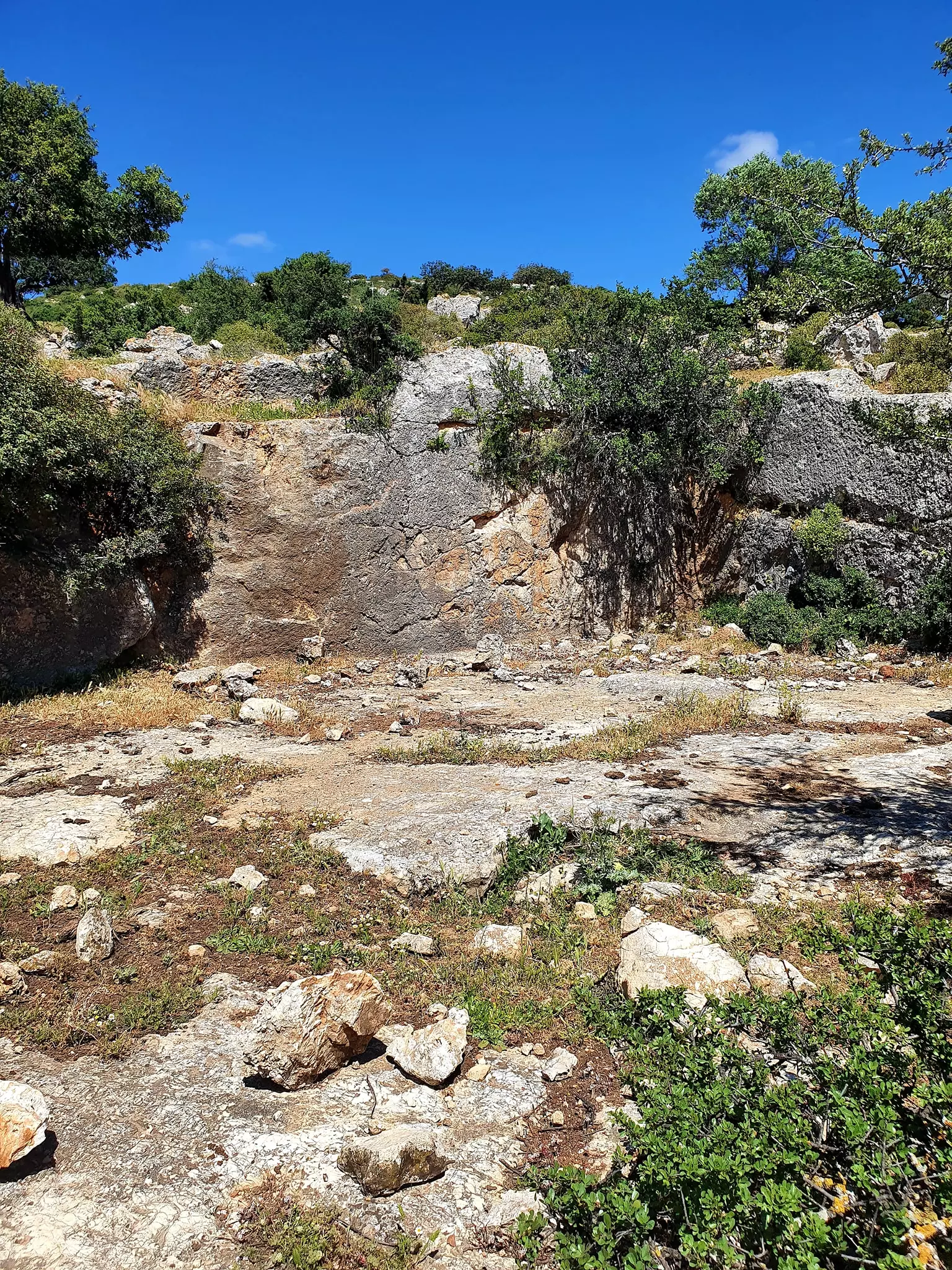
| Village Temains | Kafr 'Inan was mostly destroyed with the exception of the village mosque and its shrine. | ||||||||||||||||
| Ethnically Cleansing | Kafr 'Inan inhabitants were completely ethnically cleansed. | ||||||||||||||||
| Pre-Nakba Land Ownership |
**Town Lands' Demarcation Maps |
||||||||||||||||
| Land Usage As of 1945 |
|
||||||||||||||||
| Population |
|
||||||||||||||||
| Number of Houses |
|
||||||||||||||||
| Near By Towns |
|||||||||||||||||
|
|||||||||||||||||
| Town's Name Through History | Kafr 'Inan was built over the Hebrew (and later Roman) village of Kefar Chananya; the word 'Inan might have been a corruption of Chananya. | ||||||||||||||||
| Places of Warship | One mosque which remains standing to this date, but it needs renovations guys? | ||||||||||||||||
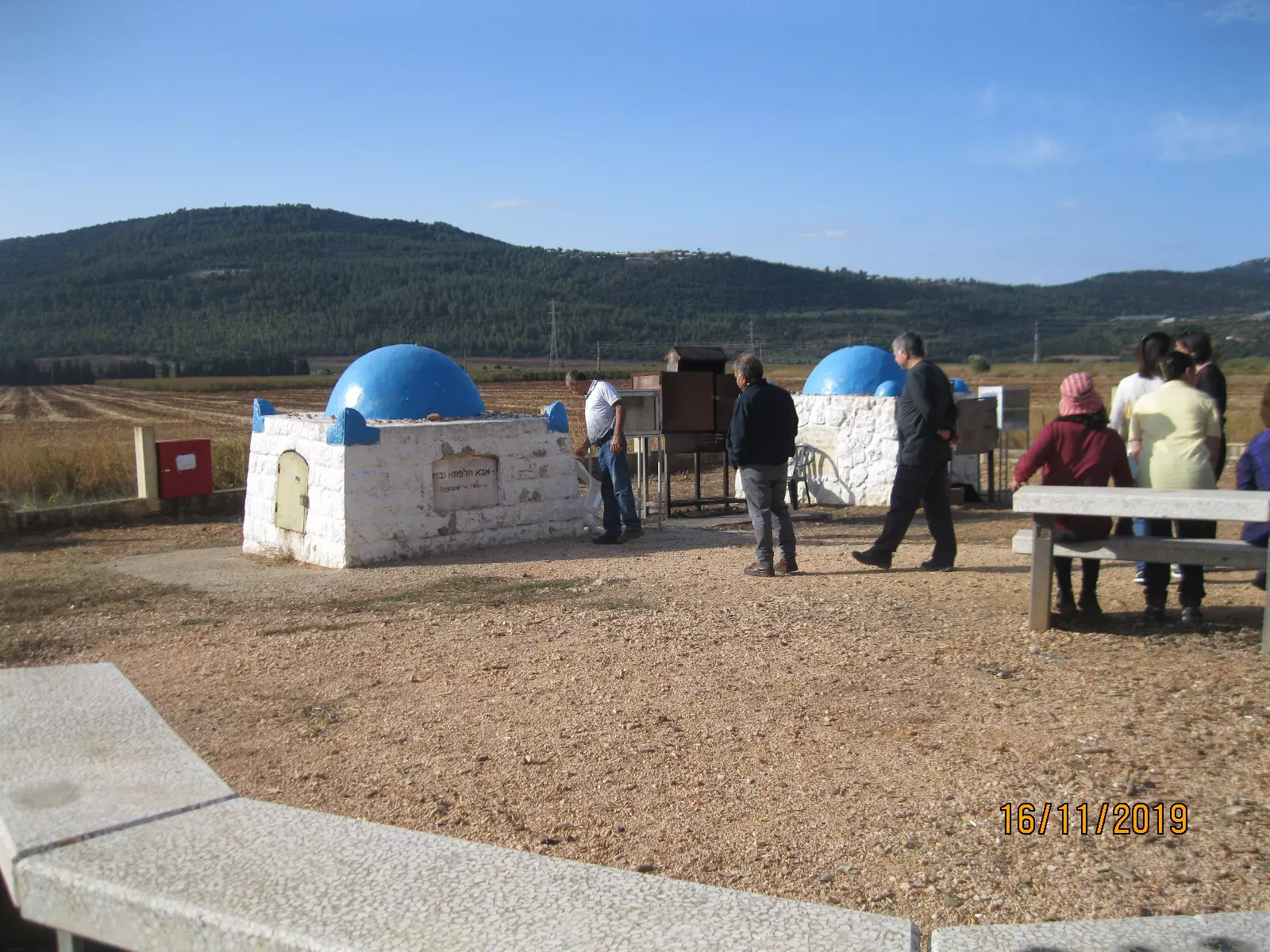
| Shrines / Maqams | A shrine of al-Shaykh Abu Hajar Azraq (remain standing) | ||||||||||||||||
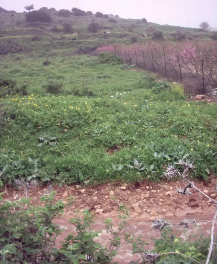
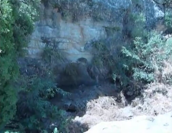
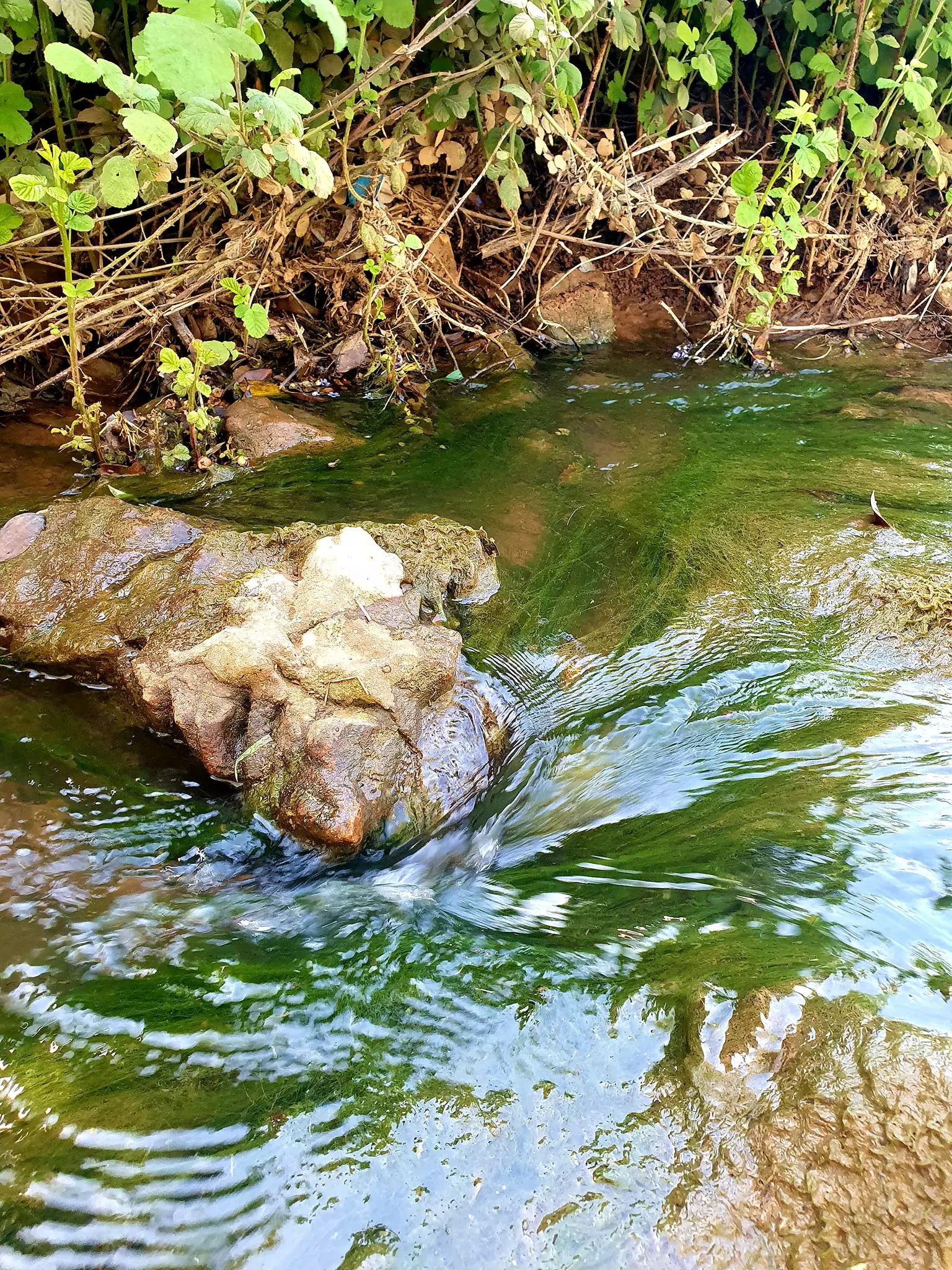
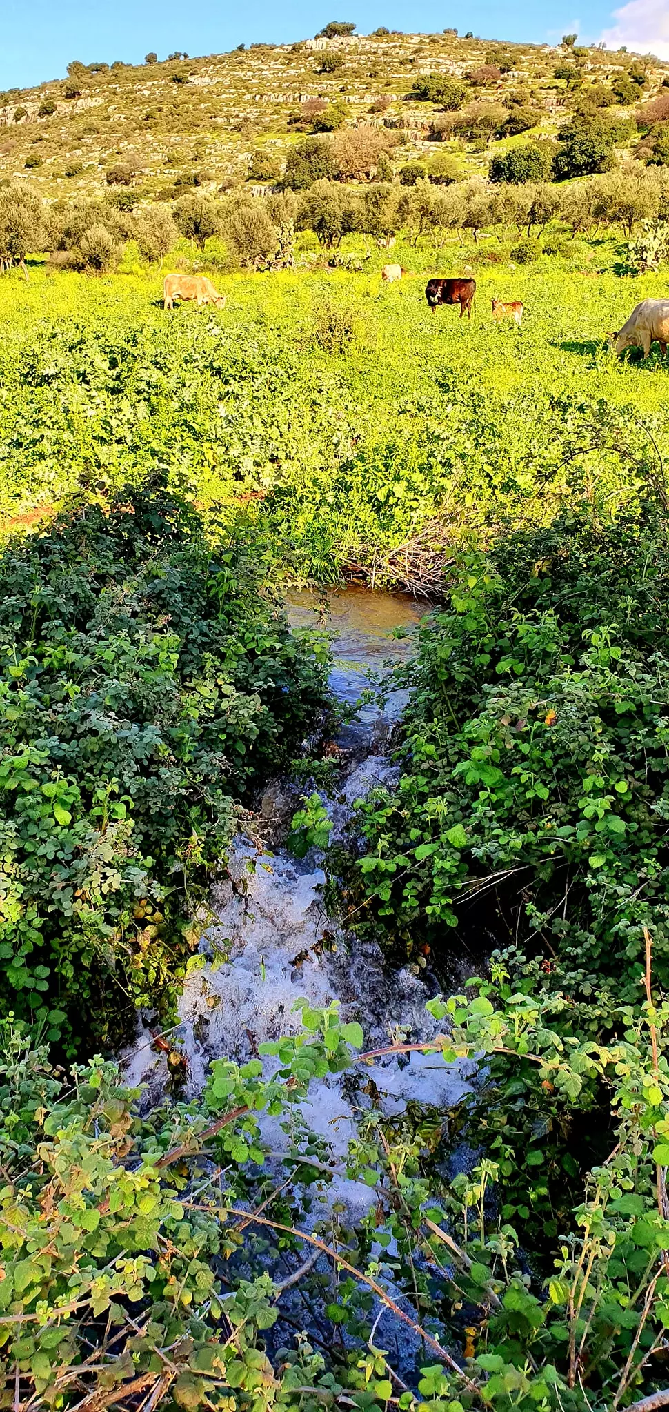
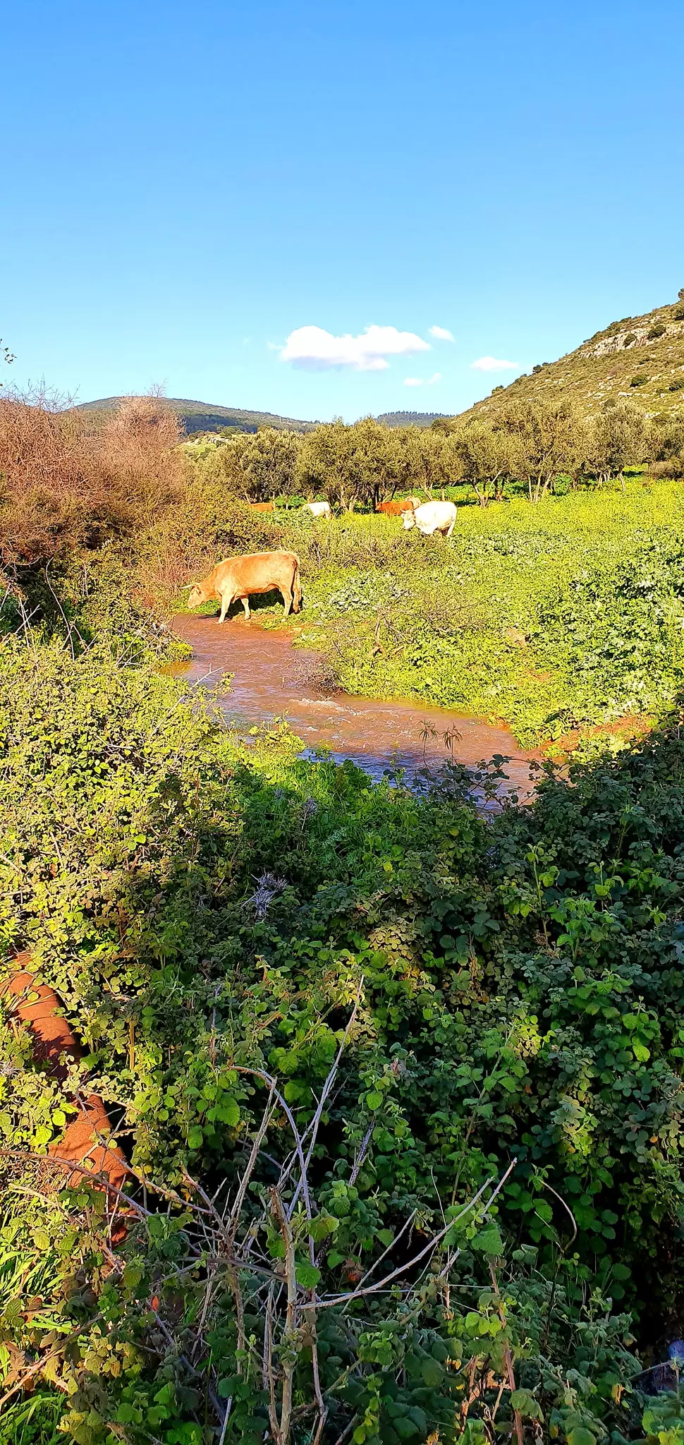
| Water Supply | Many springs and domestic wells which usded to supply it with fresh drinking water. | ||||||||||||||||
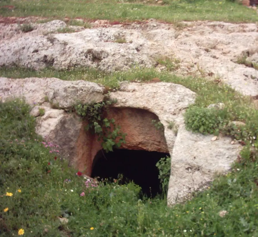
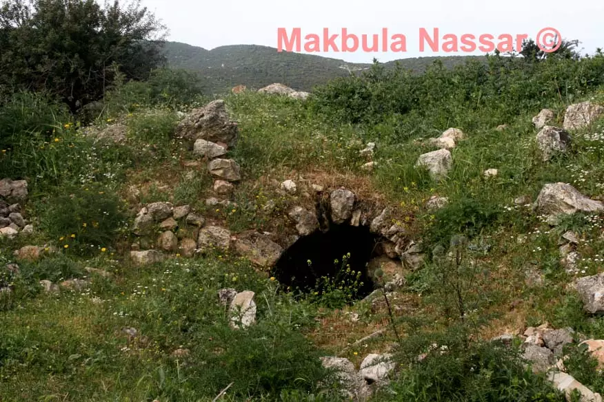
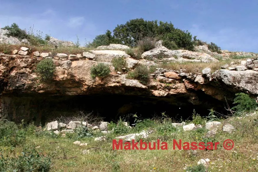
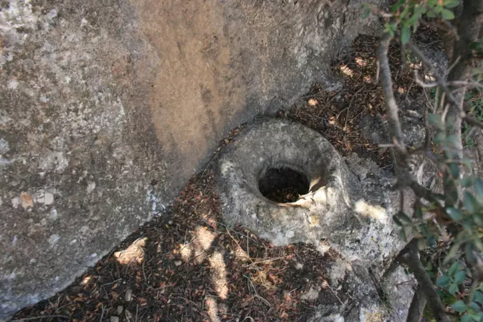
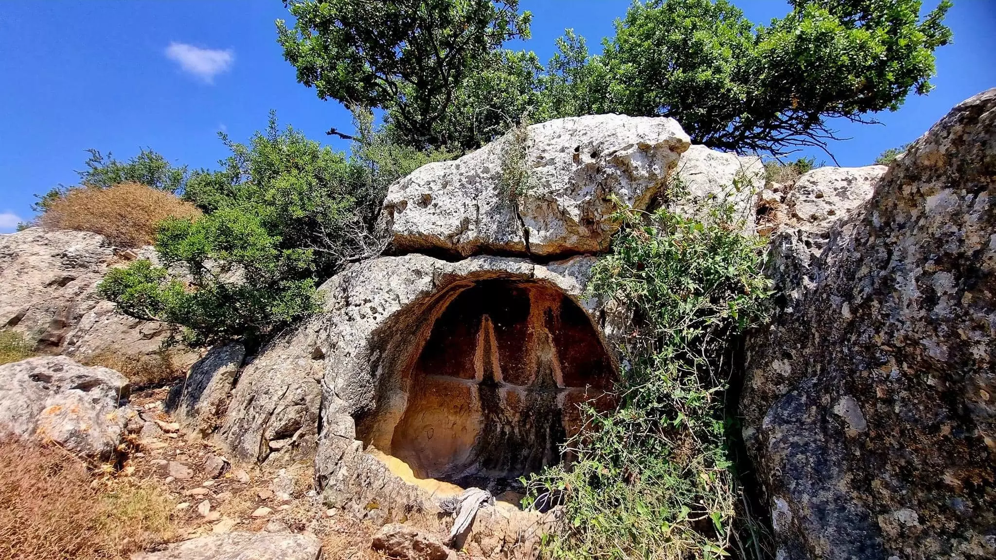
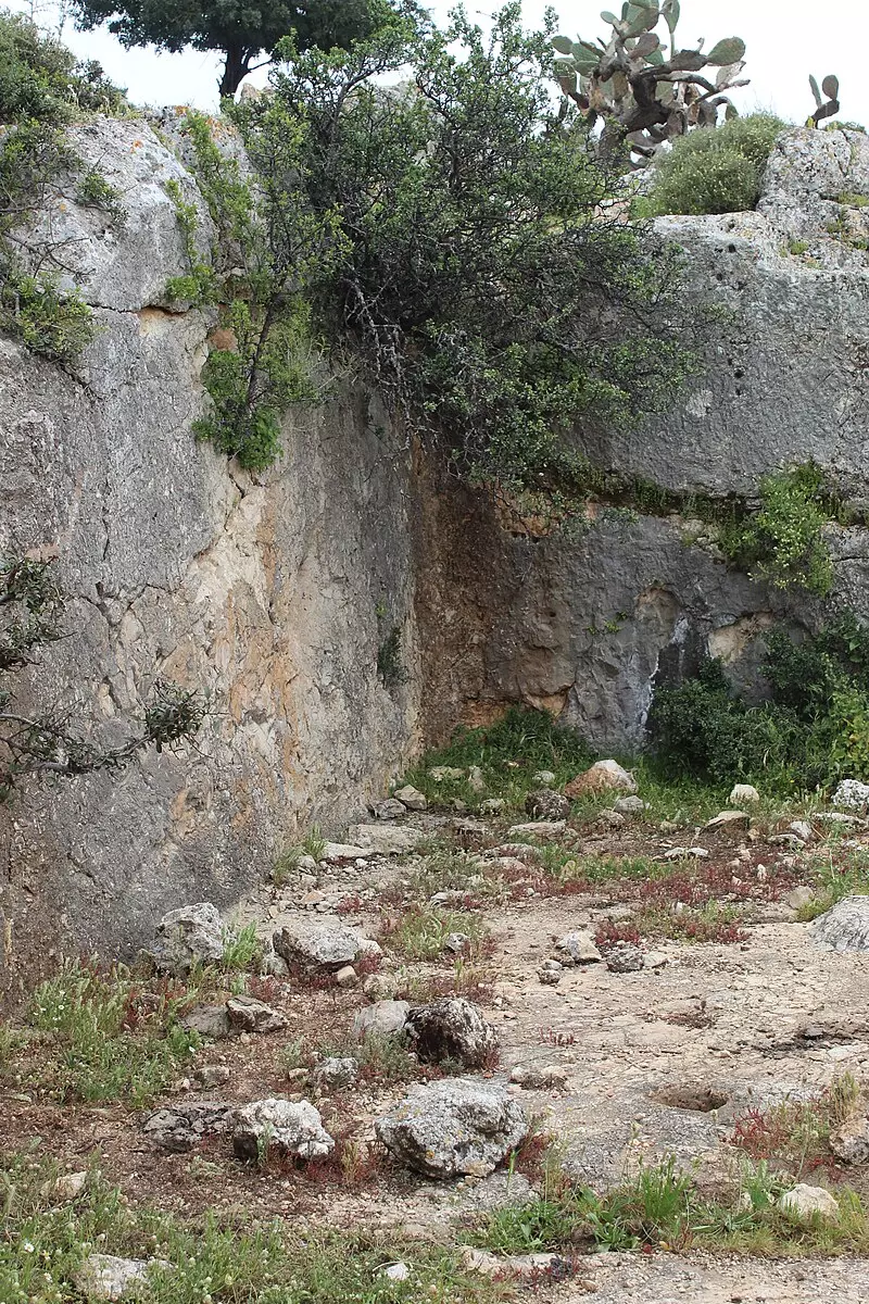
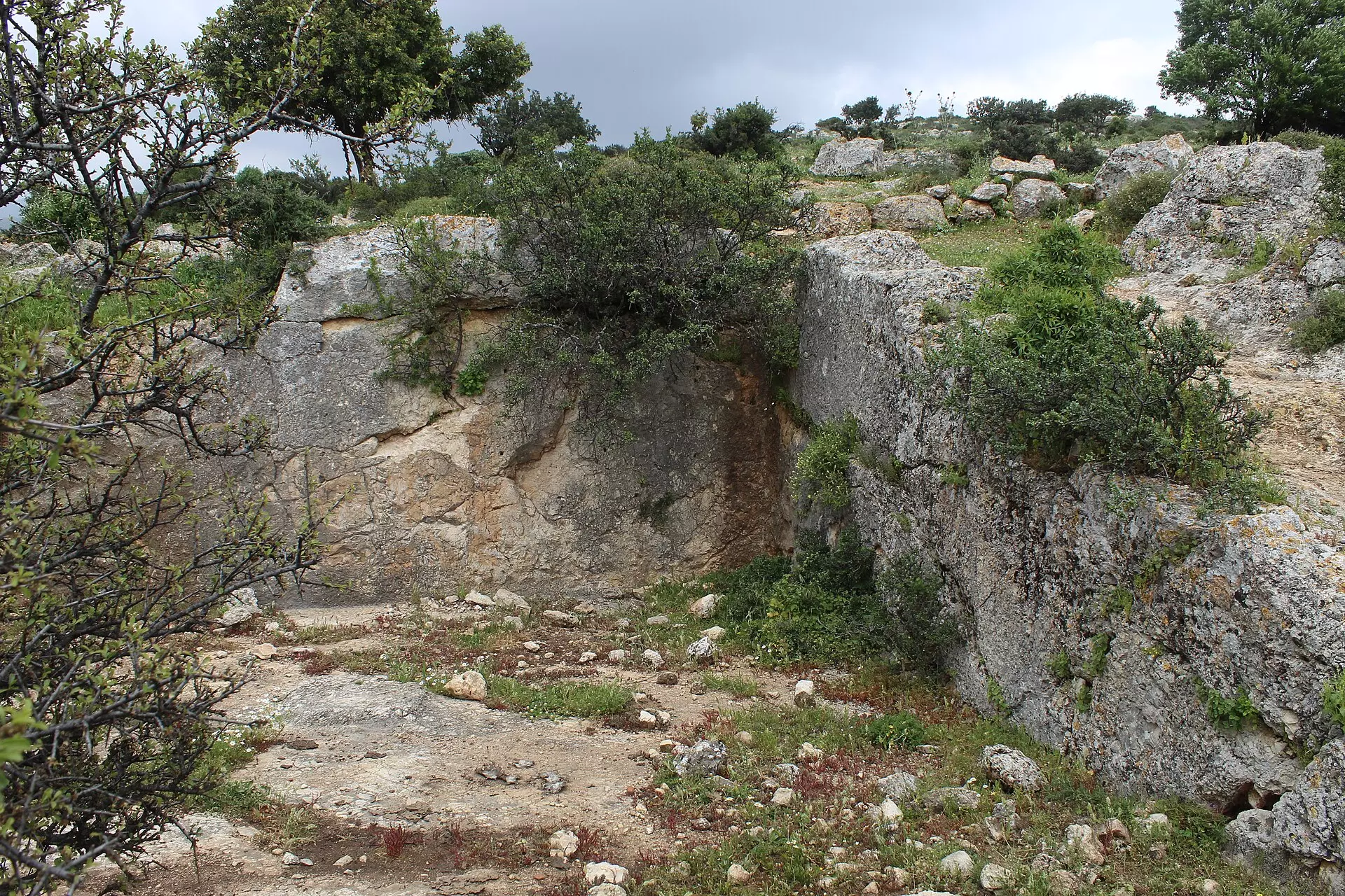
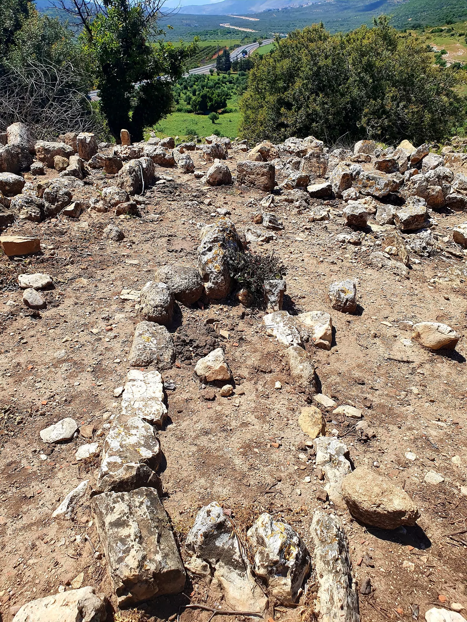
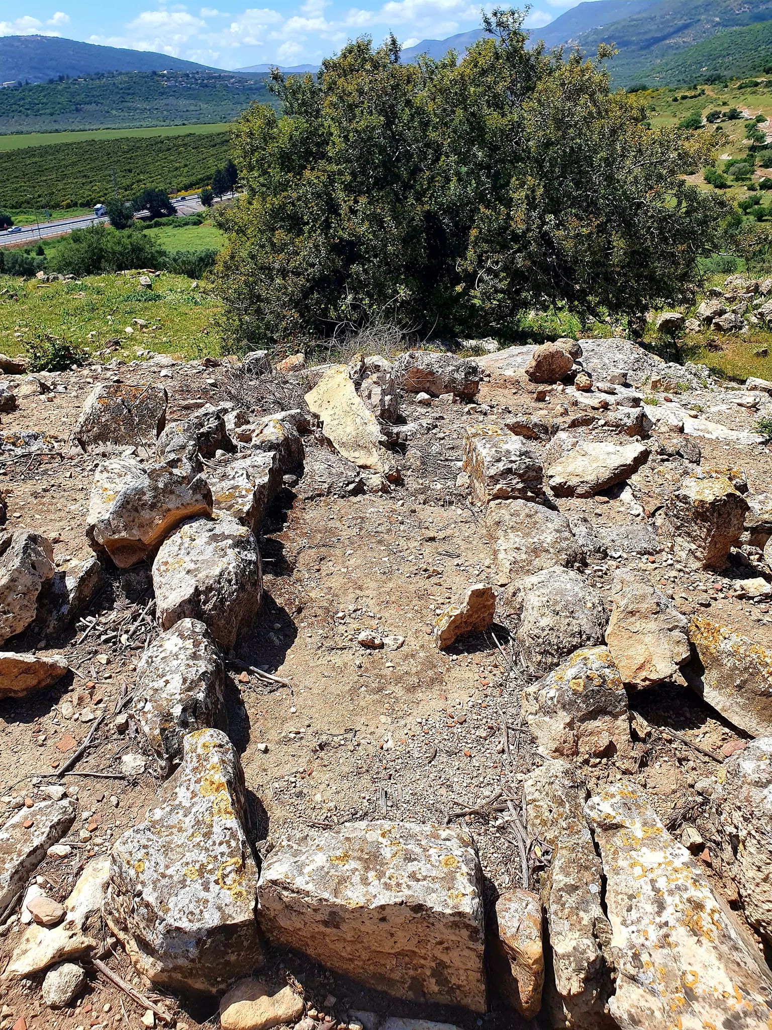
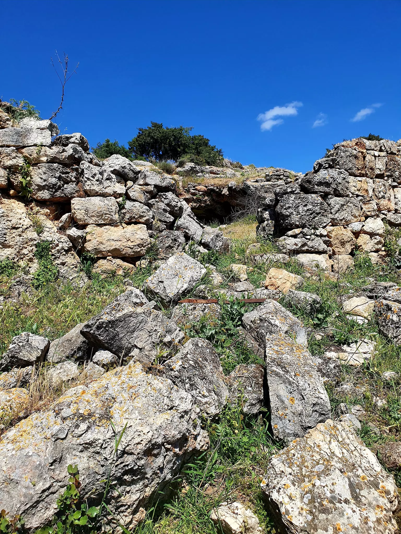
| Archeological Sites | Kafr 'Inan contains the shafts and bases of columns, caves, a pool, and burial grounds. | ||||||||||||||||
| Exculsive Jewish Colonies Who Usurped Village Lands |
Kefar Chananya | ||||||||||||||||
| Featured Video | |||||||||||||||||
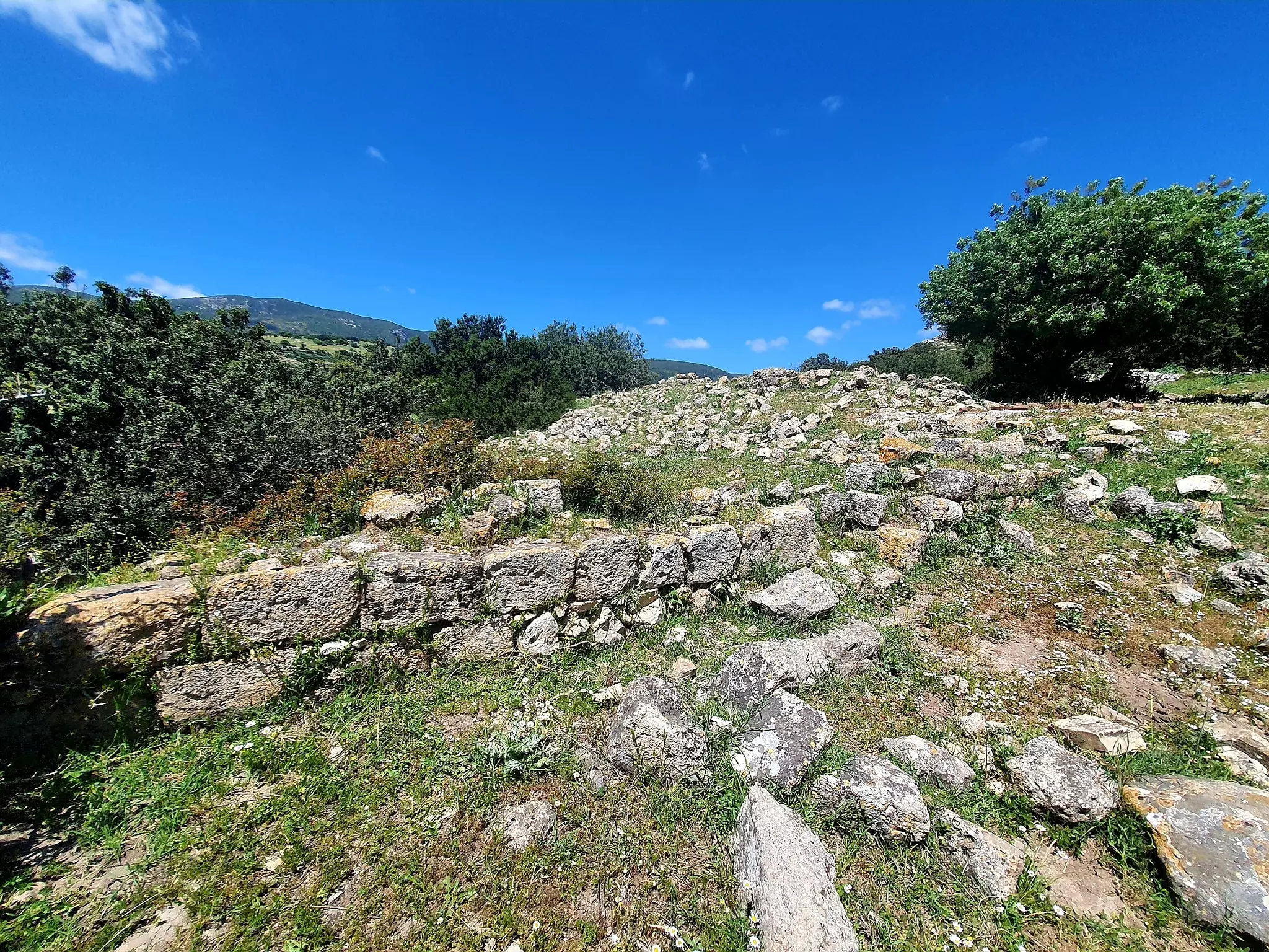
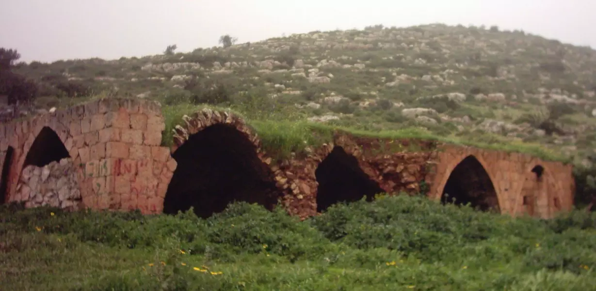
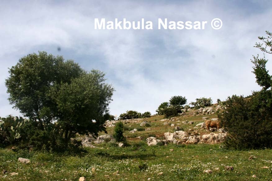
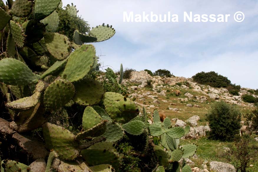
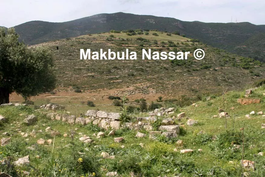
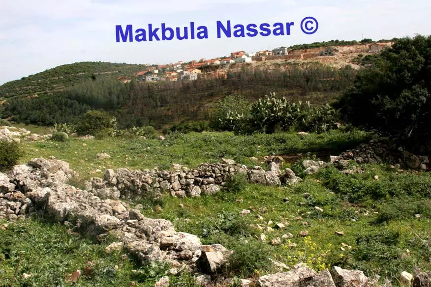
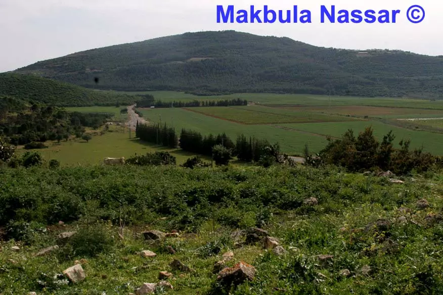
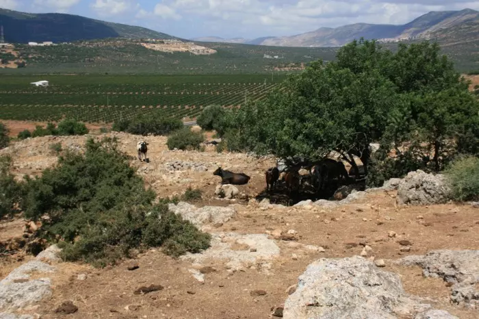
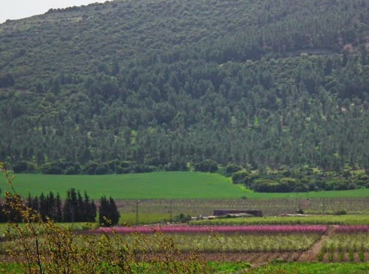
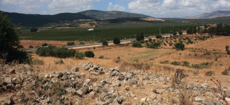
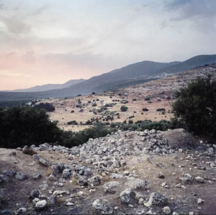
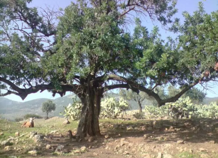
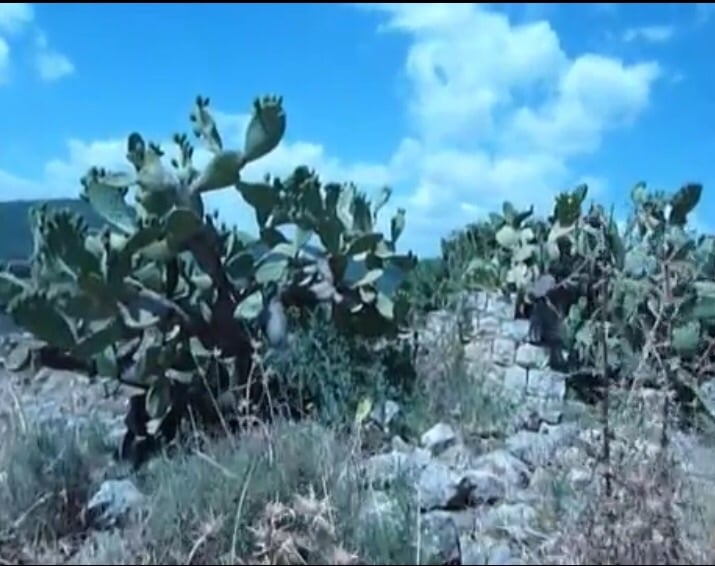
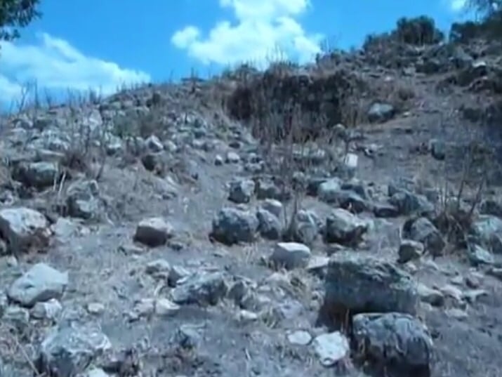
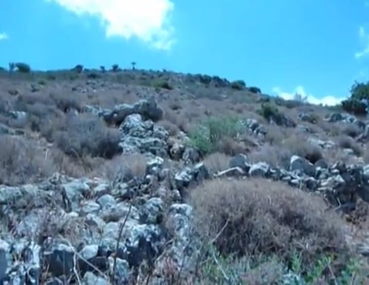
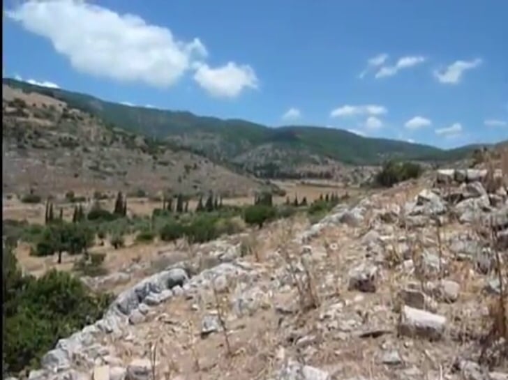
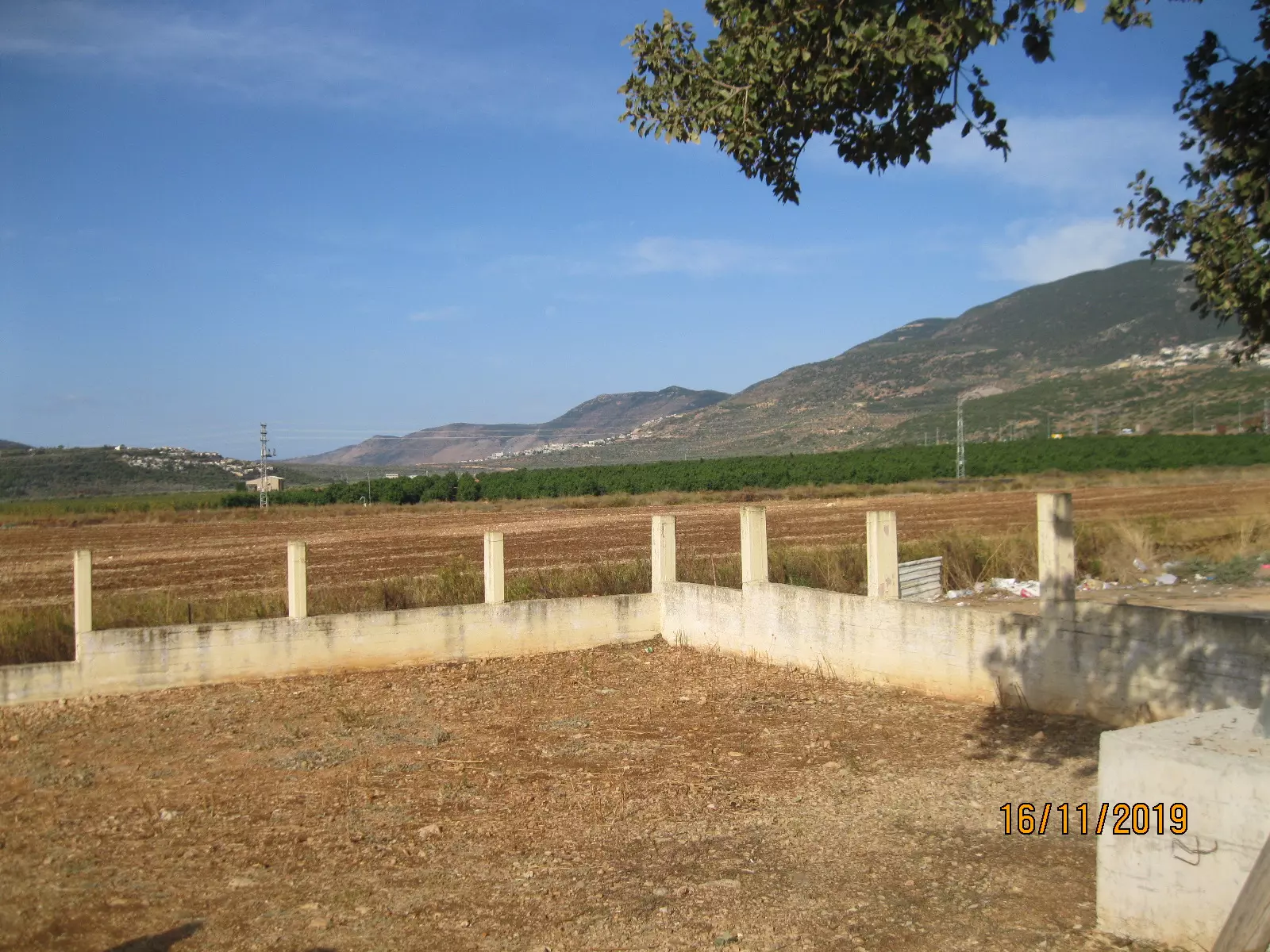
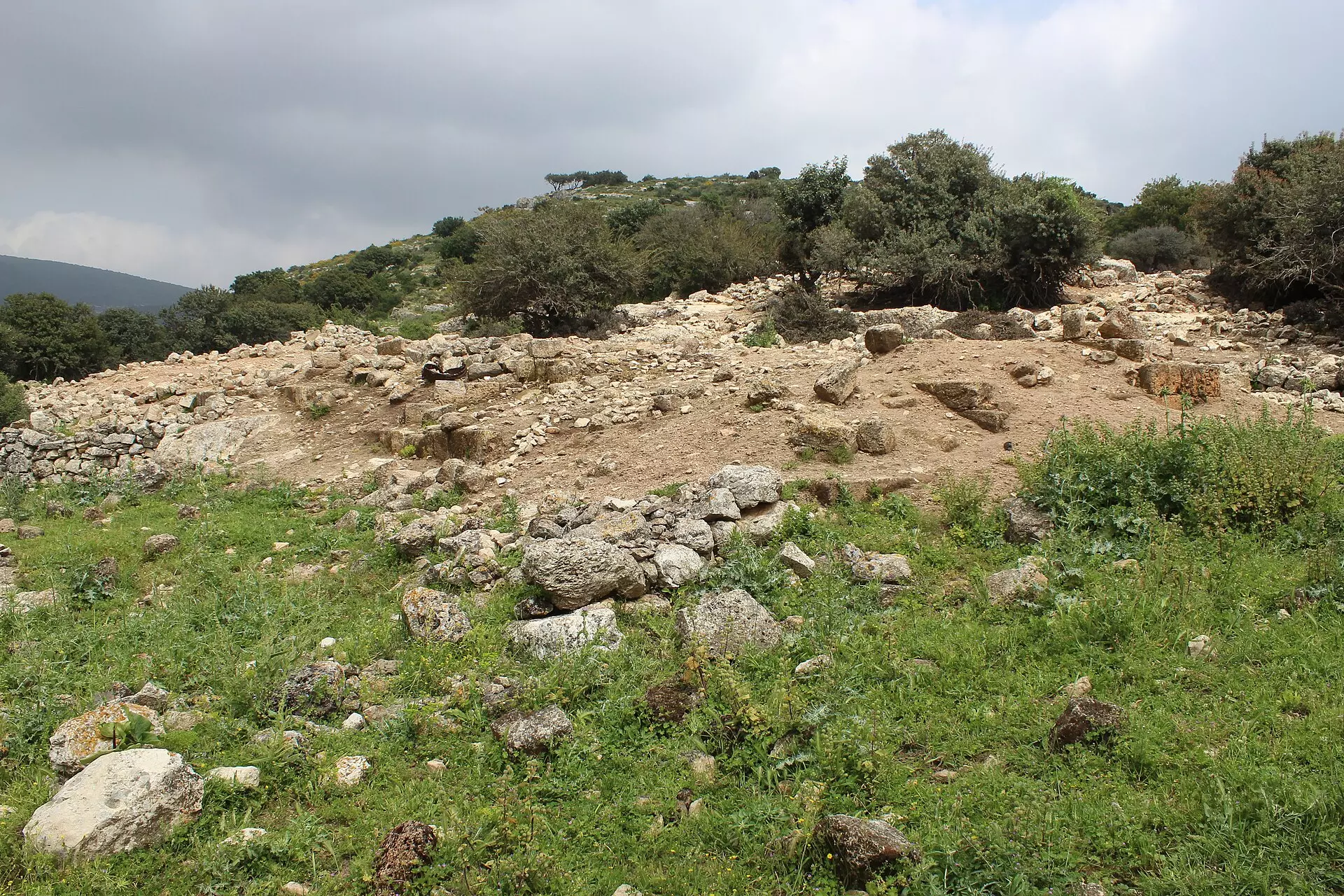
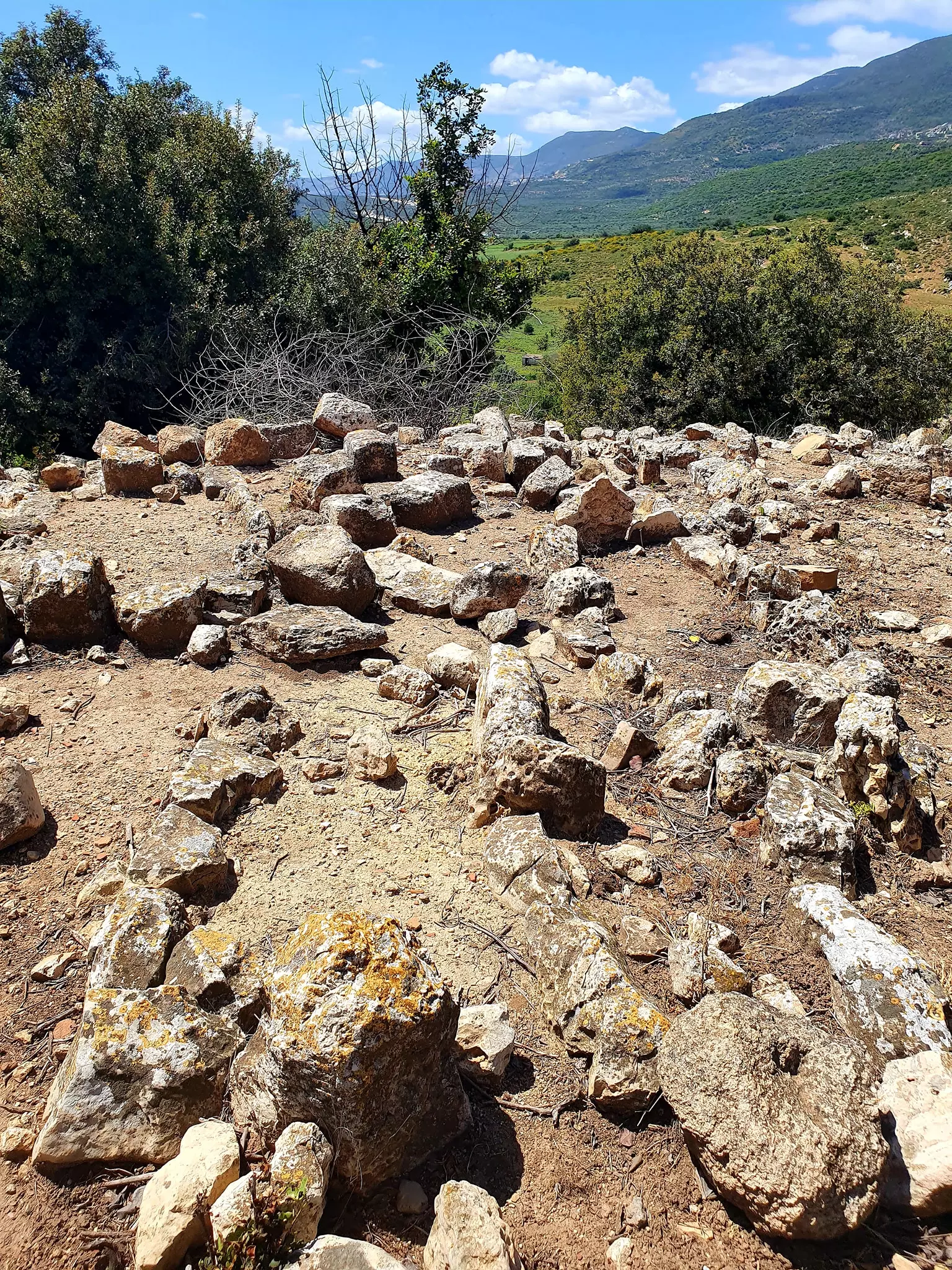
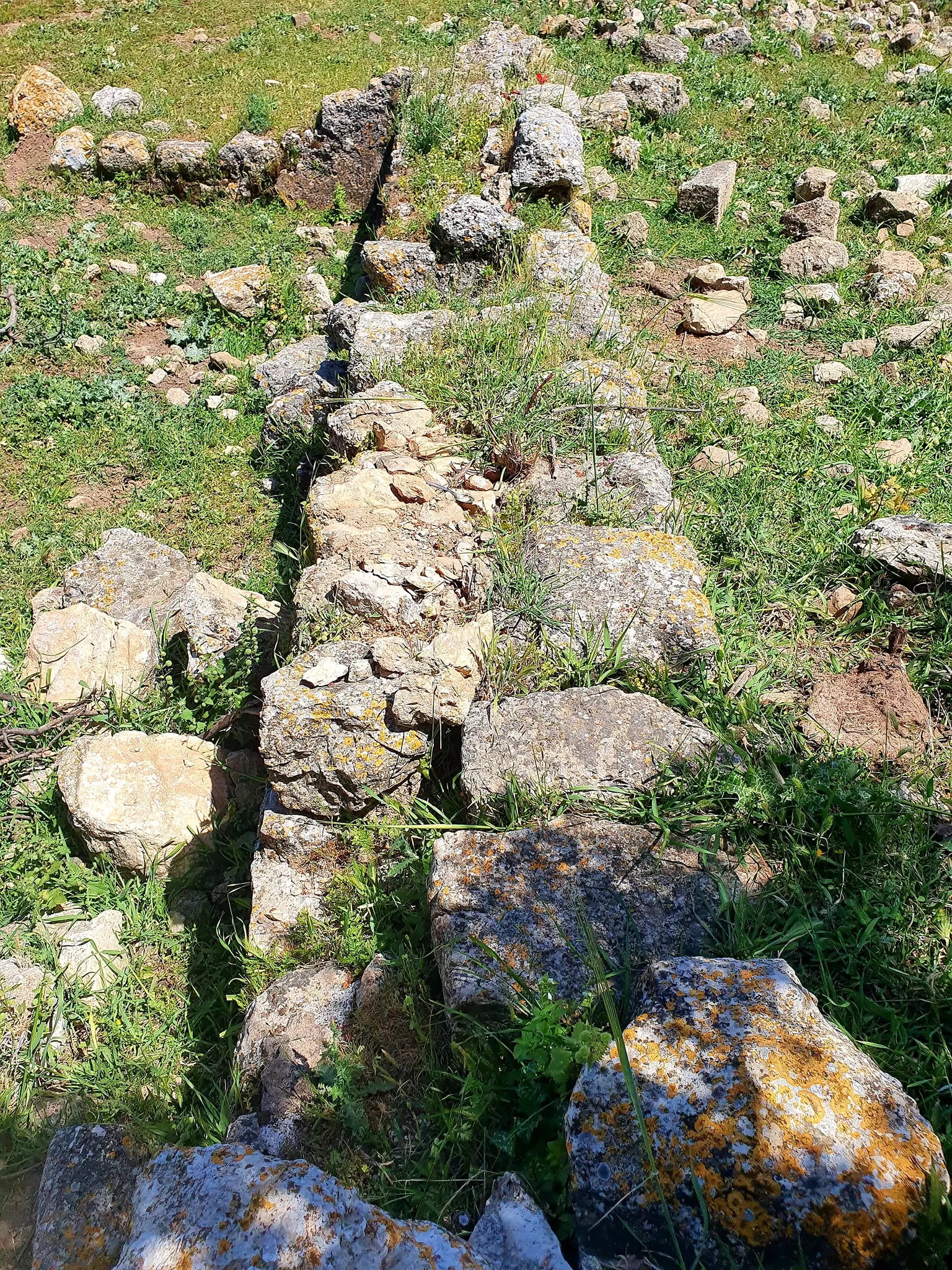
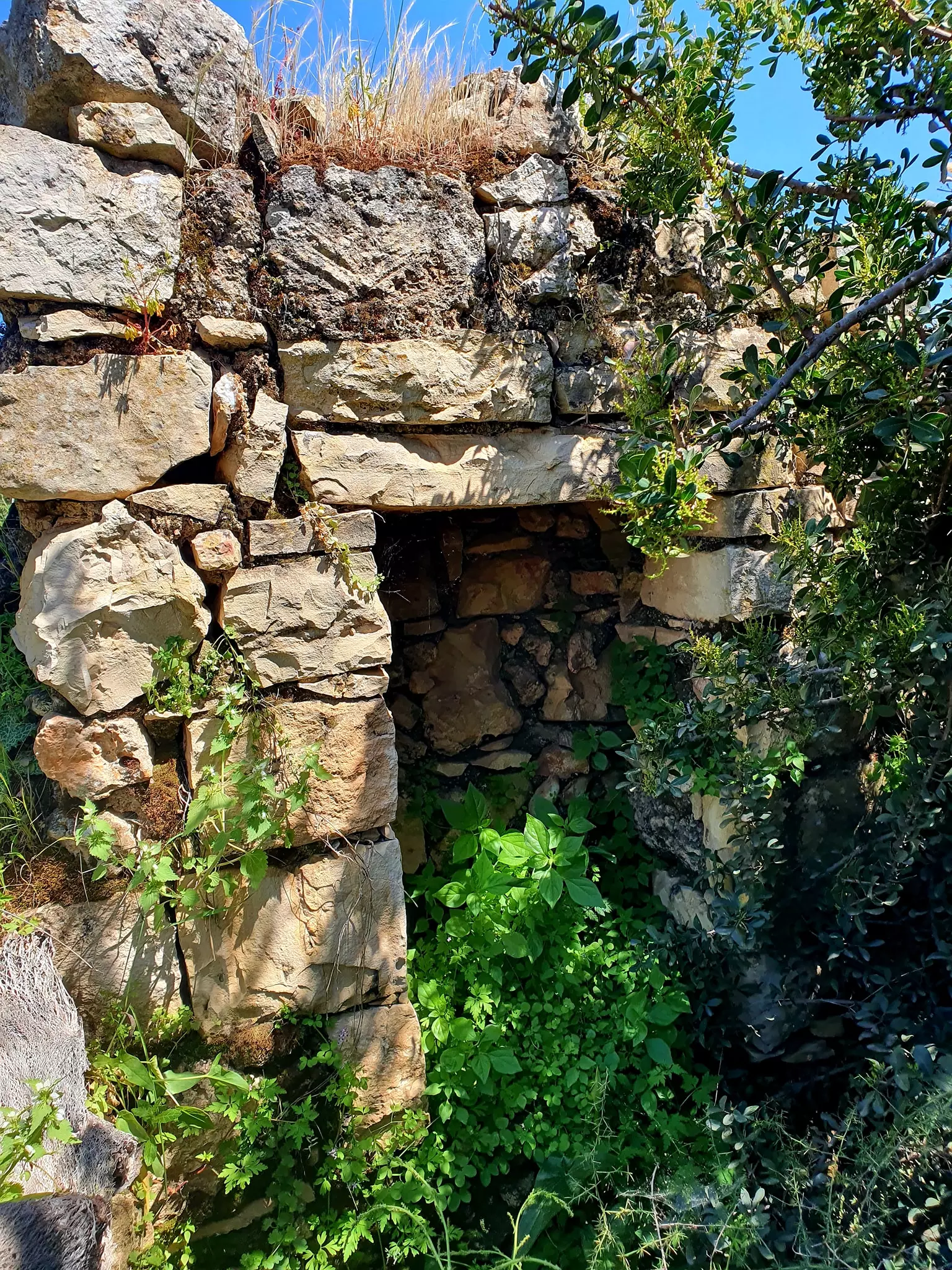
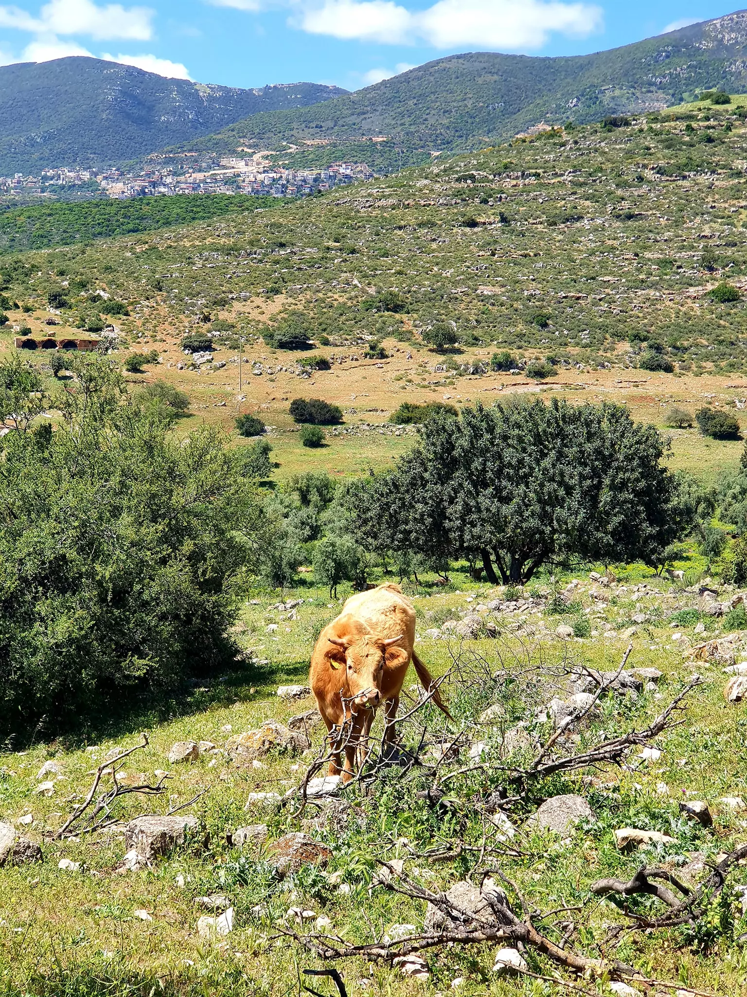
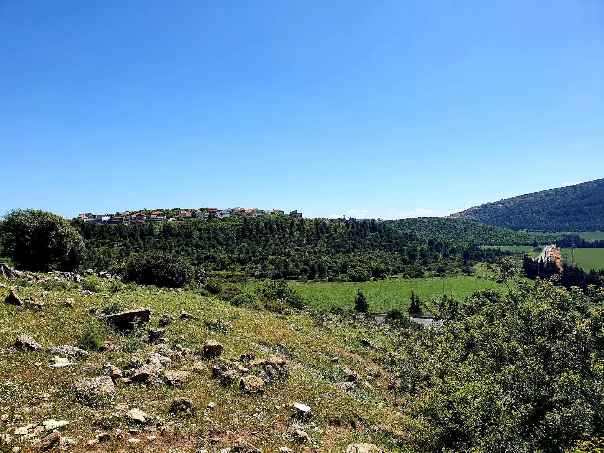
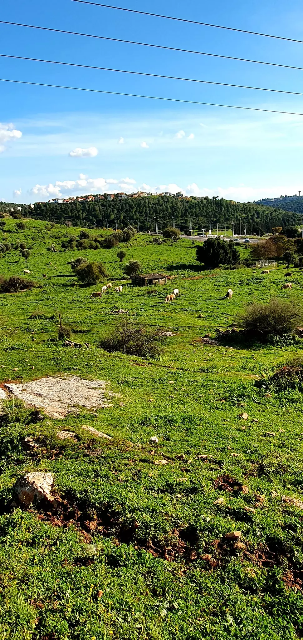
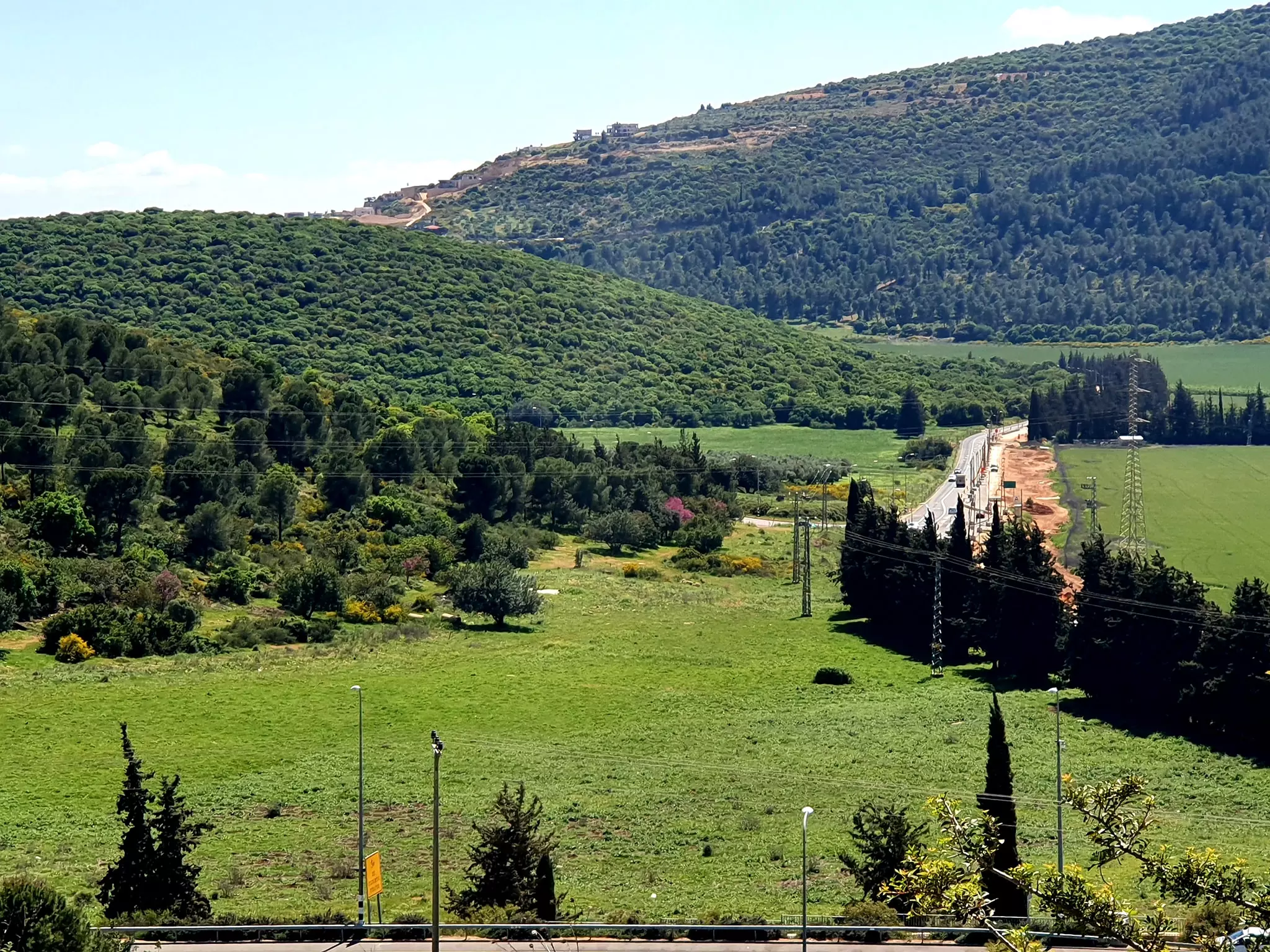
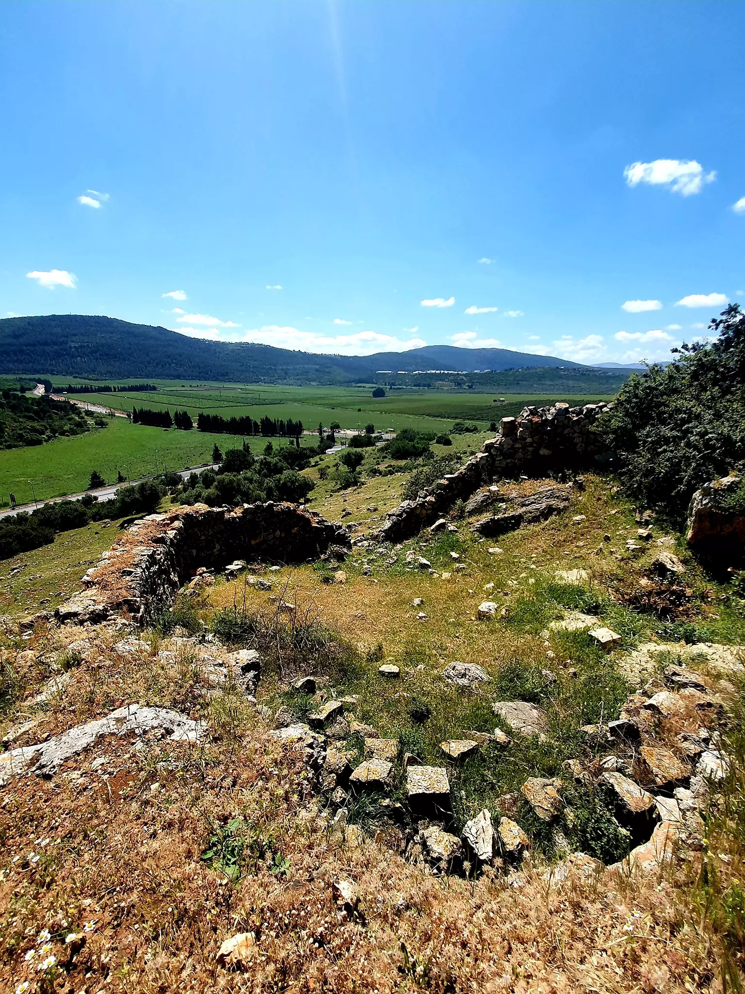
Village Before NakbaThe village was situated on the lower slopes of the al-Zabul Mountains, at the place where they tapered off toward the south and became the al-Rama Plain. A secondary road linked it to a nearby highway that went from Acre to Safad. Kafr Inan was built over the Hebrew (and later Roman) village of Kefar Chananya; the word Inan might have been a corruption of Chananya. In 1596, Kafr Inan was a village in the nahiya of Jira (liwa' of Safad), with a population of 259. It paid taxes on goats and beehives and on its press, which was used to process either olives or grapes.In the late nineteenth century, the village of Kafr Inan was built of stone and had 150–200 residents. The village's arable land contained gardens and olive trees. The entire population was Muslim. Their houses, made of stone with mud mortar, were bunched close together and were separated by semi–circular, narrow alleys. Many new houses were constructed during the final years of the Mandate. Springs and domestic wells supplied the villagers' drinking water, and rainfall was the source of irrigation water. Olives and grain were the chief crops. Grain was grown in the nearby flat zones and valleys. In 1944/45 a total of 1,740 dunums was allotted to cereals; 1,195 dunums were irrigated or used for orchards, of which 1,145 were planted with olive trees. The village had an archaeological site that contained, among other things, the shafts and bases of columns, caves, a pool, and burial grounds. Village Occupation and Ethnic CleaningAlthough Kafr Inan was probably overrun in Operation Hiram at the end of October 1948, the villagers stayed put, refusing to be pushed out like most of the population of the area. Units of the Golani Brigade probably forced their way into the village on 30 October, moving northwards in pursuit of retreating forces from the Arab Liberation Army. But Israeli historian Benny Morris finds that they were not expelled and that many remained in their homes for the next few weeks. He also reports, however, that during December 1948 and January 1949, 'pressure built up to evict [them],' along with the population of nearby al-Farradiyya and that of Saffuriyya, further south, near Nazareth. The excuse given by Israeli minority affairs minister Bechor Shitrit was that increasing numbers of exiled villagers were 'infiltrating' and that if this phenomenon were not halted, Israel would have to 'conquer the Galilee anew.' But the people of Kafr Inan and al-Farradiyya (across the sub-district border, in Safad sub-district) were not evicted until February 1949; half were transferred to villages inside Israeli–controlled territory, and the other half were sent to the Triangle area, which was under Jordanian control. The Military Government said the evictions were necessary to assure 'security, law and order.' The Israeli policy in Galilee was to expel entire villages whenever possible; when this was impractical, the villages were filled up with people from other communities, so that villagers who had been displaced could not return.Zionists Colonies on Village LandsPlans were made by the Jewish Agency to set up the settlement of Kefar Chananya to the south of the site in 1982 [Map of Settlement in Eretz Israel July, 1982], but it was established in 1989 on village land. Chazon, built in 1969 on the lands of al-Mansura in Tiberias sub-district, and Parod, built in 1949 on the lands of al-Farradiyya in Safad sub-district, are close to the site but are not on village land.Village TodayThe Village TodayThe site is covered with piles of stones that lie scattered around clumps of cactuses and fig trees. There are remains of a domed building on a slope facing the village and the small shrine of Shaykh Abu Hajar Azraq on the plain south-west of the village. The land around the site is forested and planted with fruit trees by the settlement of Parod. SourceDr. Walid al-Khalidi, 1992: All That Remains. |
|||||||||||||||||
| Related Maps | Town Lands' Demarcation Maps خرائط للقضاء توضح حدود القرى والاودية Town's map on MapQuest View from satellite Help us map this town at WikiMapia |
||||||||||||||||
| Related Links | Wikipedia's Page Google Search Google For Images Google For Videos |
||||||||||||||||
| More Information | في كتاب كي لا ننسى في كتاب بلادنا فلسطين المزيد من موقع هوية |
||||||||||||||||
- قصة: حسن الممروش لم تناول عشاءه ذلك المساء - القسم الاول
- حسن الممروش لم يتناول عشاءه ذلك المساء - القسم الثاني
- حسن الممروش لما يتناول عشاءه ذلك المساء - القسم الثالث
- حسن الممروش لم يتناول عشاءه ذلك المساء - القسم الرابع
- حسن الممروش لم يتناول عشاءه ذلك المساء - القسم الخامس
- شهادة فاطمة عوض حسن منصور - مواليد 1936
- شهادة حسن احمد مصطفى احمد منصور
- نبذة تاريخية عن قرية كفر عنان (قضاء عكا) من كتاب (كي لا ننسى)
- 25 ورقة كواشين: نعم لنا أرض في فلسطين الحاج محمود إسماعيل (89 عامًا) مخيم شاتيلا
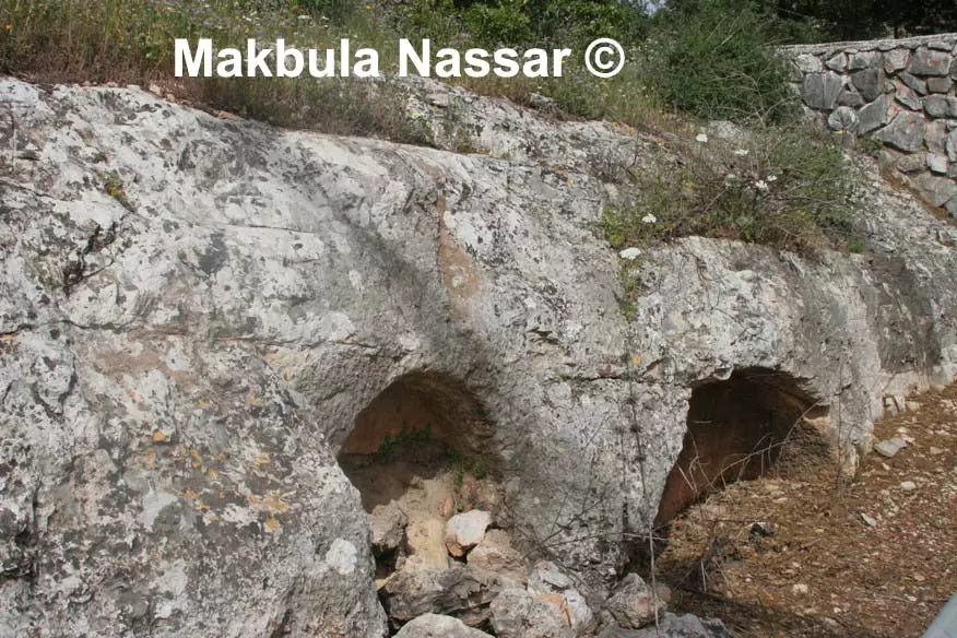
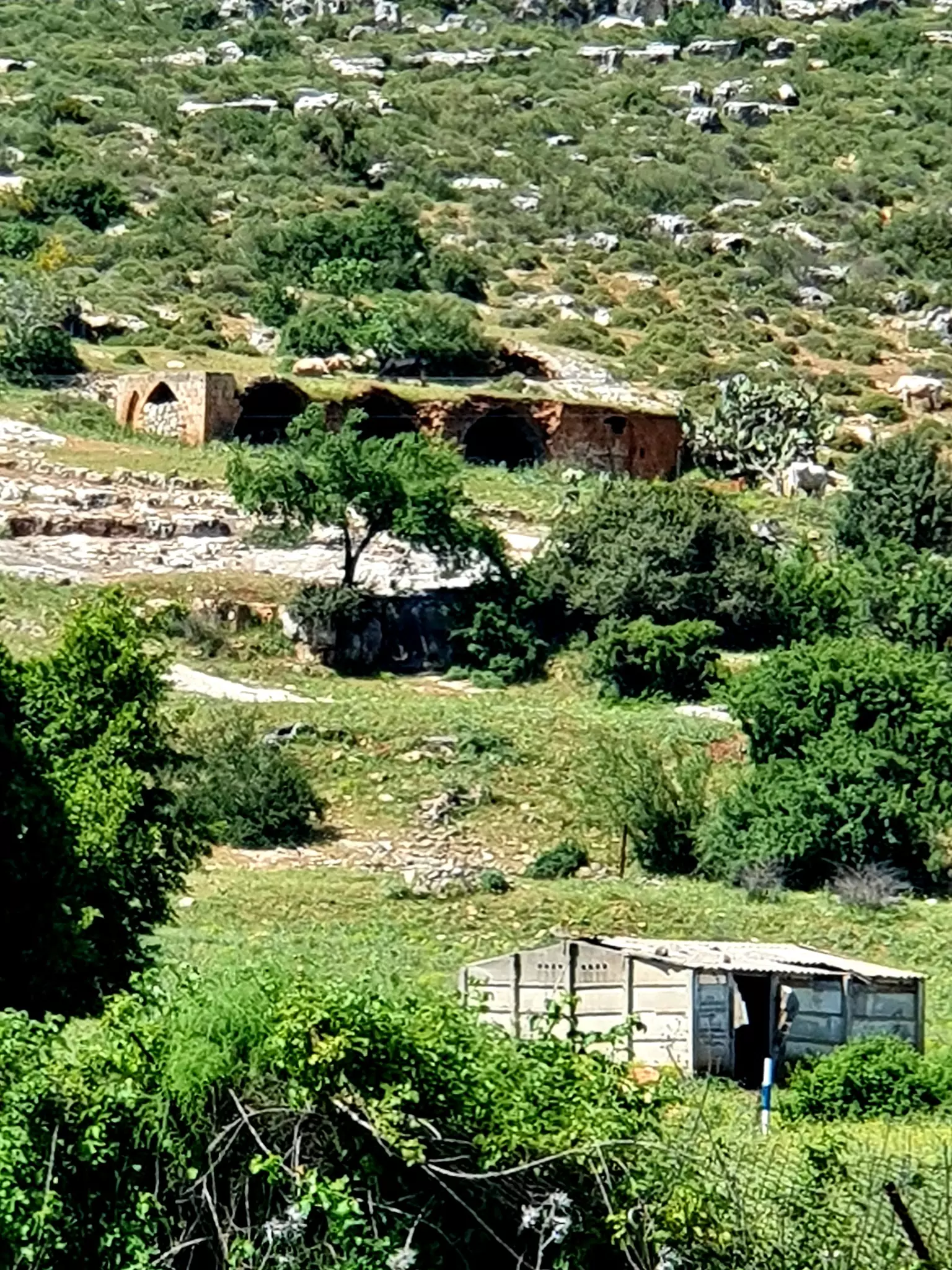
- مبنى من بيوت كفر عنان, يقع على التلة المقابلة لموقع القرية الاصلي , يستعمل حالياً كزريبة للابقار وتقع خلفه مباشرة مجموعة من المغر .2003
Posted by Makbula Nassar 3 - احد المغر ( ذات عدة مداخل لكنها متصلة من الداخل )تقع خلف المبنى في الصورة السابقة 2003
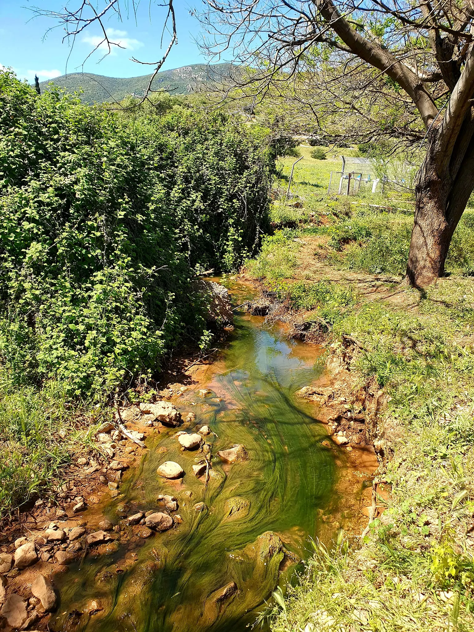
Posted by Makbula Nassar - مياه الرميلة التي تصل كفر عنان من وادي فراضية 2003
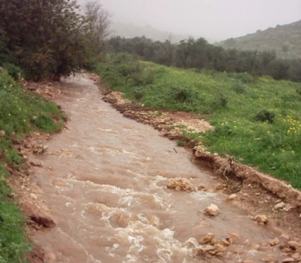
Posted by Makbula Nassar - التلة التي تقع عليها القرية و اسفل الصورة تظهر المياه الجارية للرميلة من الجهة الغربية 2003
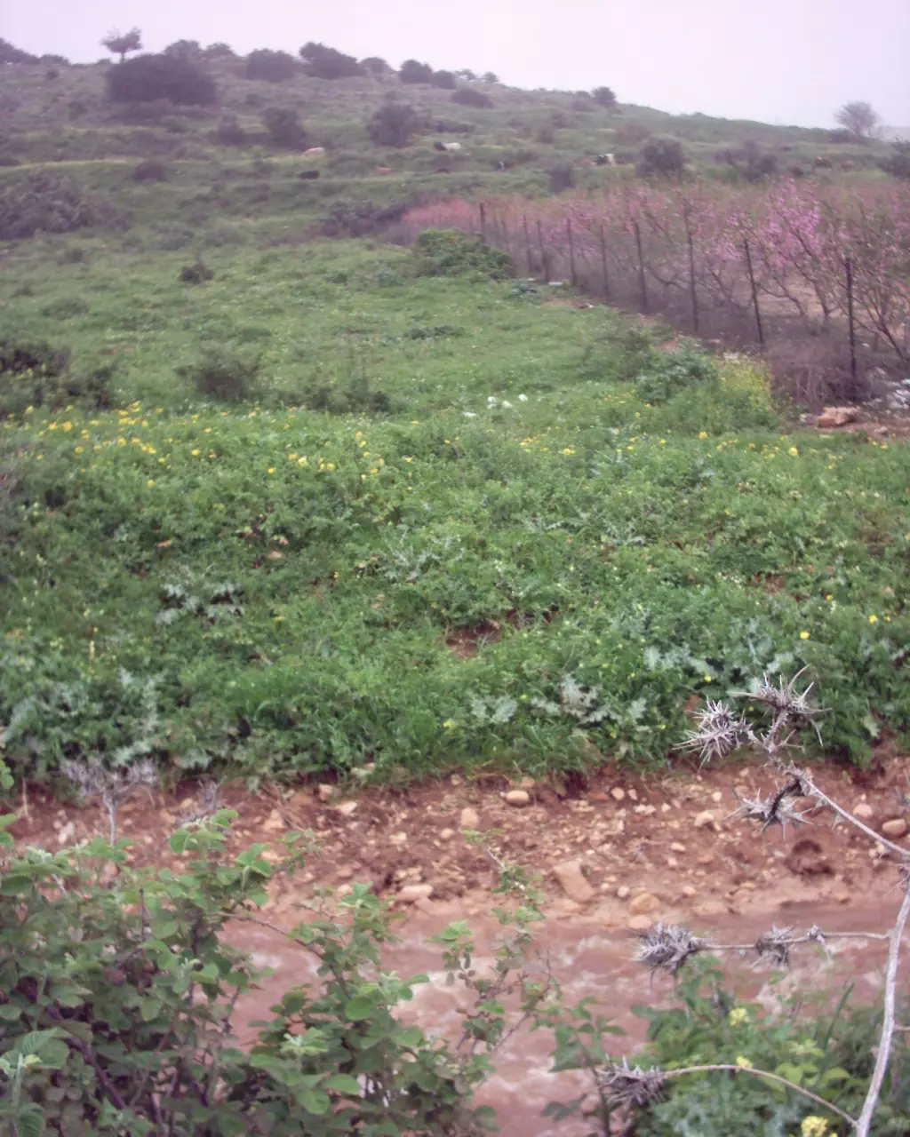
Posted by Makbula Nassar - التلة التي تقع عليها القرية من الجهة الثانية و تظهر خلفية المبنى المتبقى من بيوت القرية والمبين في الصورة السابقة - الصورة من الجهة الغربية 2003
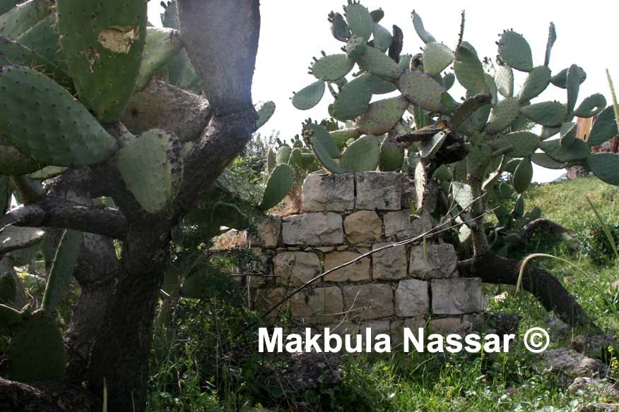
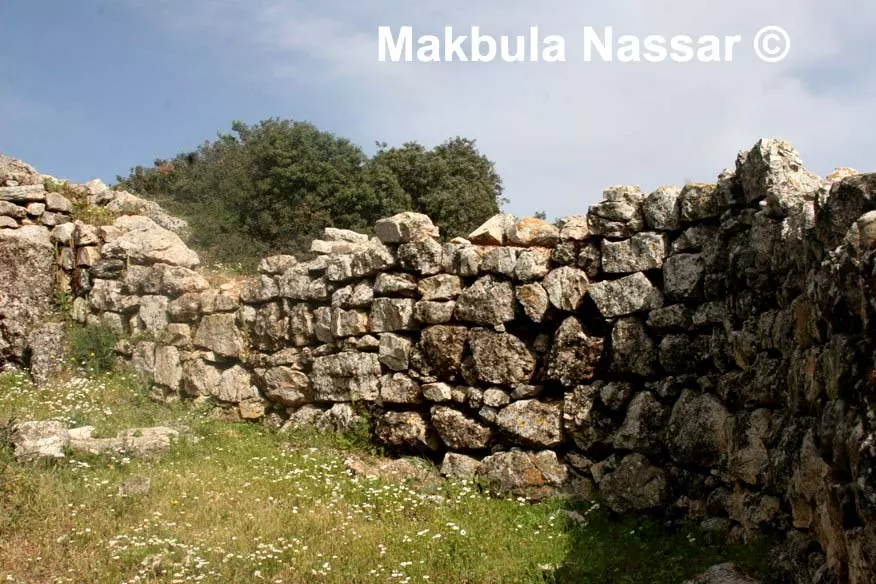
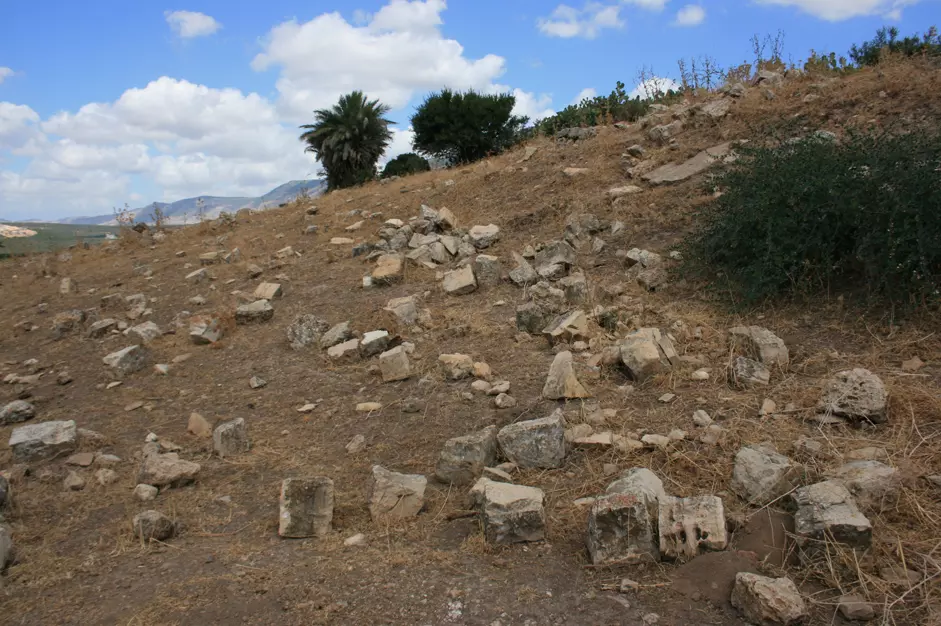
Posted by Makbula Nassar - اثار القرية الباقية- تصوير مقبولة نصار - 5.4.08
Posted by Makbula Nassar - اثار القرية الباقية- تصوير مقبولة نصار - 5.4.08
Posted by Makbula Nassar - اثار القرية الباقية- تصوير مقبولة نصار - 5.4.08
Posted by Makbula Nassar - اثار القرية الباقية- تصوير مقبولة نصار - 5.4.08
Posted by Makbula Nassar - اثار القرية الباقية- تصوير مقبولة نصار - 5.4.08
Posted by Makbula Nassar - اثار القرية الباقية- تصوير مقبولة نصار - 5.4.08
Posted by Makbula Nassar - اثار القرية الباقية- تصوير مقبولة نصار - 5.4.08
Posted by Makbula Nassar - اثار القرية الباقية- تصوير مقبولة نصار - 5.4.08
Posted by Makbula Nassar - اثار القرية الباقية- تصوير مقبولة نصار - 5.4.08
Posted by Makbula Nassar - اثار القرية الباقية- تصوير مقبولة نصار - 5.4.08
Posted by Makbula Nassar - اثار القرية الباقية- تصوير مقبولة نصار - 5.4.08
Posted by Makbula Nassar - اثار القرية الباقية- تصوير مقبولة نصار - 5.4.08
Posted by Makbula Nassar - اثار القرية الباقية الناحية الغربية للتلة- تصوير مقبولة نصار - 5.4.08
Posted by Makbula Nassar - اثار القرية الباقية - تصوير مقبولة نصار - 5.4.08
Posted by Makbula Nassar - اثار القرية الباقية - تصوير مقبولة نصار - 5.4.08
Posted by Makbula Nassar - اثار القرية الباقية - تصوير مقبولة نصار - 5.4.08
Posted by Makbula Nassar - اثار القرية الباقية - تصوير مقبولة نصار - 5.4.08
Posted by Makbula Nassar - اثار القرية الباقية - تصوير مقبولة نصار - 5.4.08
Posted by Makbula Nassar - بيت عائلة سعد - تصوير مقبولة نصار - 5.4.08
Posted by Makbula Nassar - حجر بين انقاض القرية كتب عليه ، من بين الكلمات سنعود - تصوير مقبولة نصار - 5.4.08
Posted by Makbula Nassar - حجر بين انقاض القرية كتب عليه ، من بين الكلمات سنعود - تصوير مقبولة نصار - 5.4.08
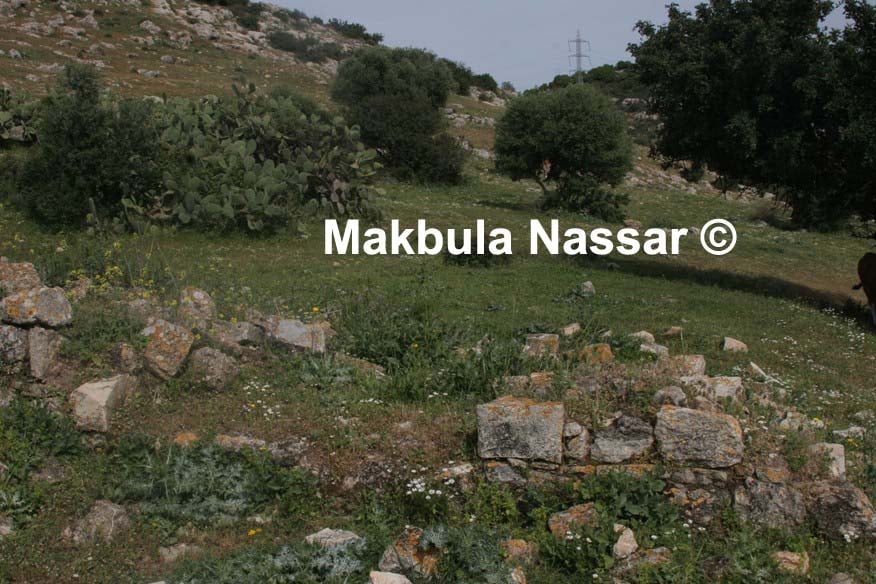
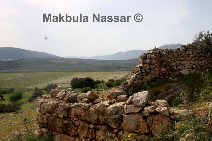
Posted by Makbula Nassar - اثار باقية في القرية - تصوير مقبولة نصار - 5.4.08
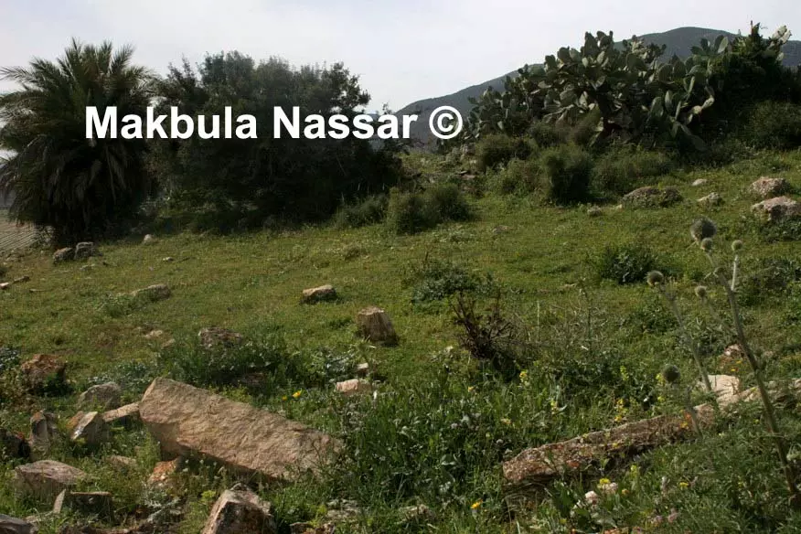
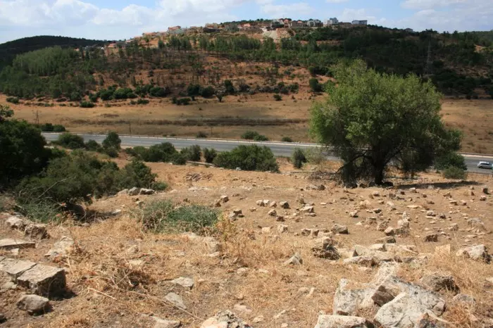
Posted by Makbula Nassar - اراضي القرية من ناحية قرية المغار - تصوير مقبولة نصار - 5.4.08
Posted by Makbula Nassar - اراضي القرية من ناحية قرية المغار - تصوير مقبولة نصار - 5.4.08
Posted by Makbula Nassar - اثار باقية في الناحية العلوية للقرية - تصوير مقبولة نصار - 5.4.08
Posted by Makbula Nassar - اثار باقية في الناحية العلوية للقرية - تصوير مقبولة نصار - 5.4.08
Posted by Makbula Nassar - اثار باقية في الناحية العلوية للقرية - تصوير مقبولة نصار - 5.4.08
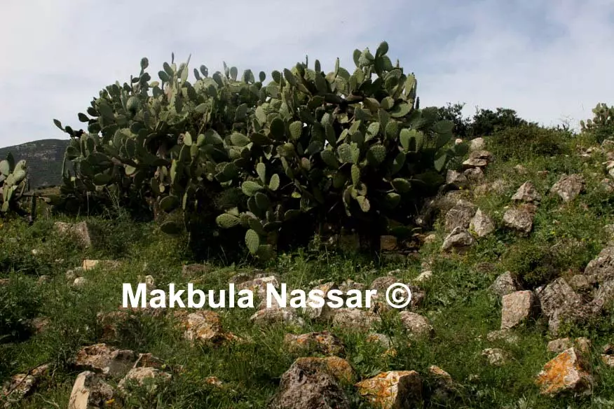
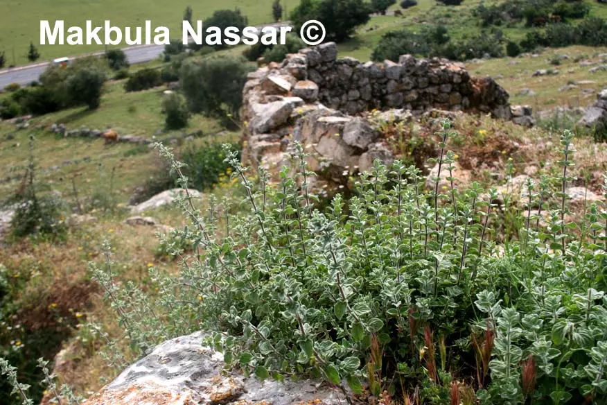
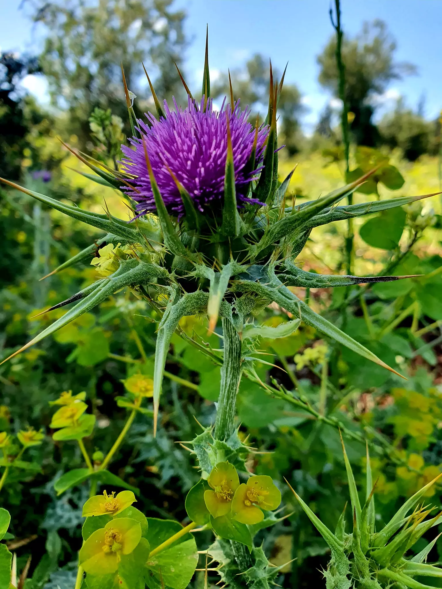
Posted by Makbula Nassar - الزعتر في كفر عنان - تصوير مقبولة نصار - 5.4.08
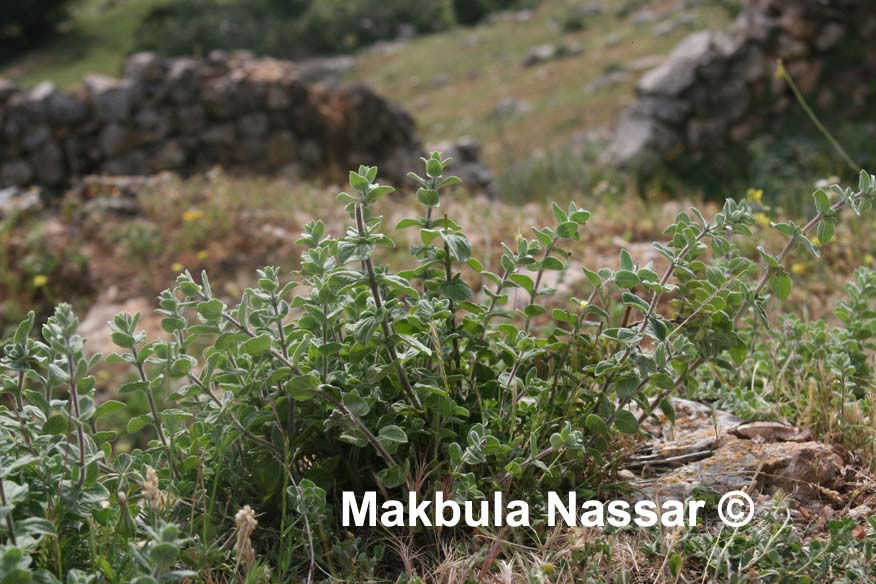
Posted by Makbula Nassar - الزعتر في كفر عنان - تصوير مقبولة نصار - 5.4.08
Posted by Makbula Nassar - مزار مقدس لليهود عند مدخل القرية - تصوير مقبولة نصار - 5.4.08
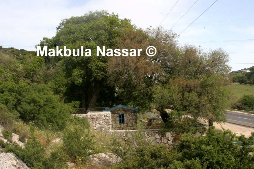
Posted by Makbula Nassar 1 - مزار مقدس لليهود عند مدخل القرية - تصوير مقبولة نصار - 5.4.08
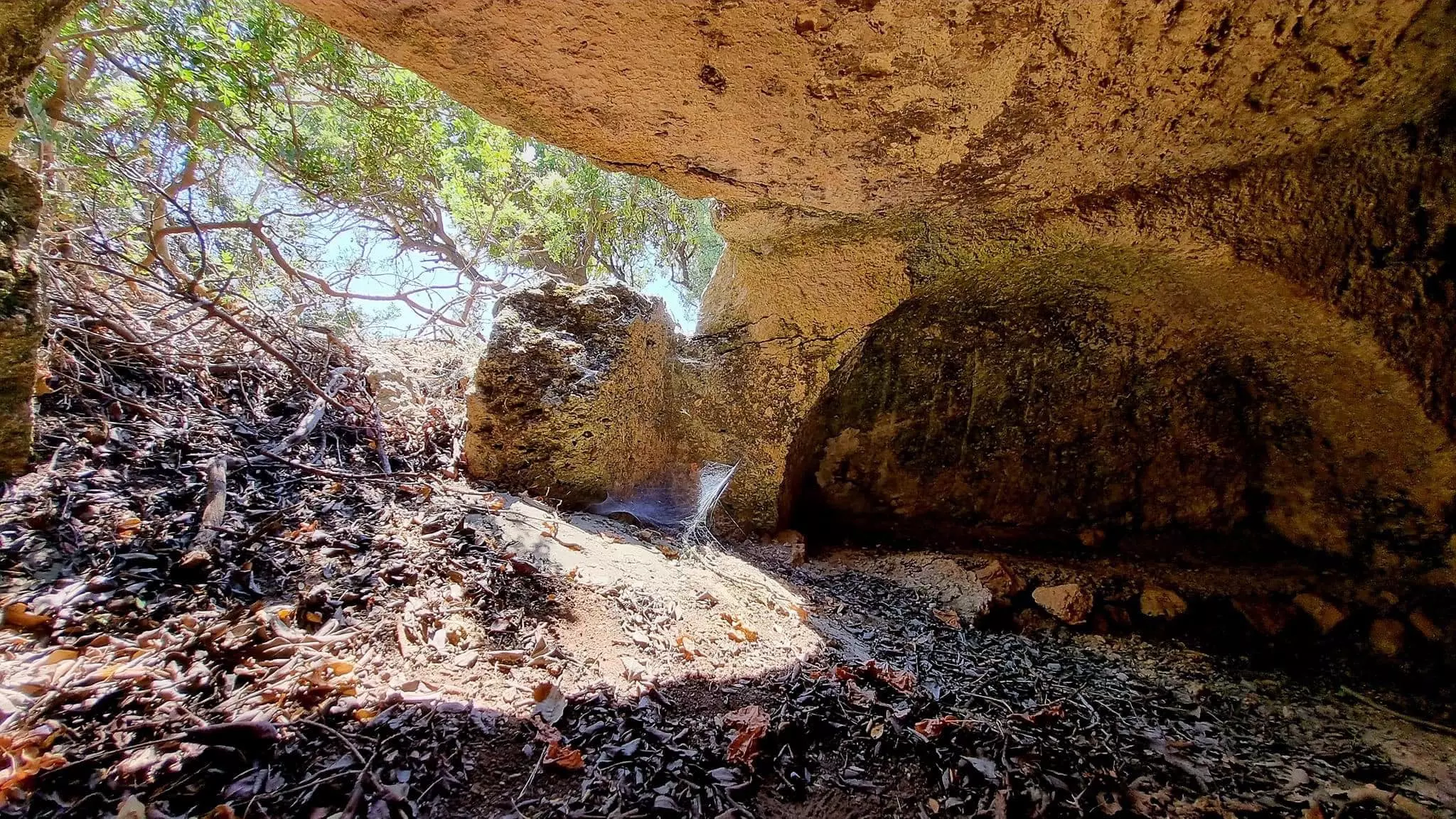
Posted by Makbula Nassar 1 - مغر تشكل مزار ومقدسة عند اليهود - تصوير مقبولة نصار - 5.4.08
Posted by Makbula Nassar - مغر تشكل مزار ومقدسة عند اليهود - تصوير مقبولة نصار - 5.4.08
Posted by Makbula Nassar - اشكال صخرية عند مدخل القرية- تصوير مقبولة نصار - 5.4.08
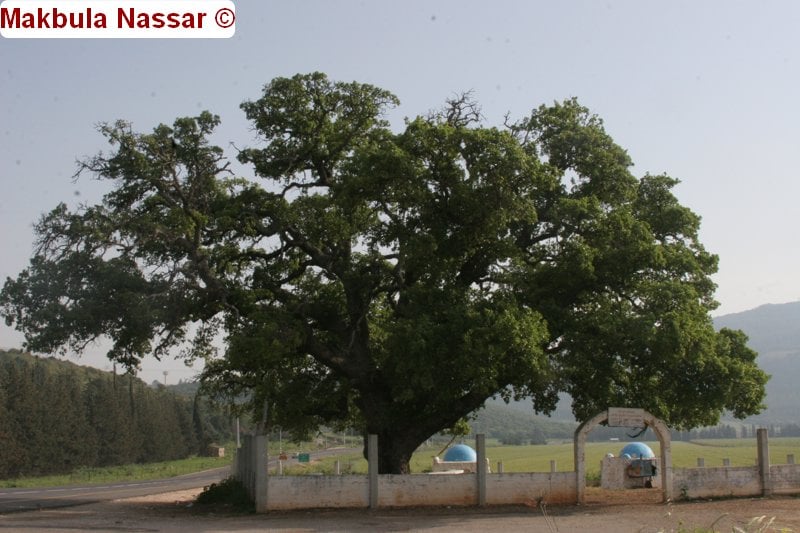
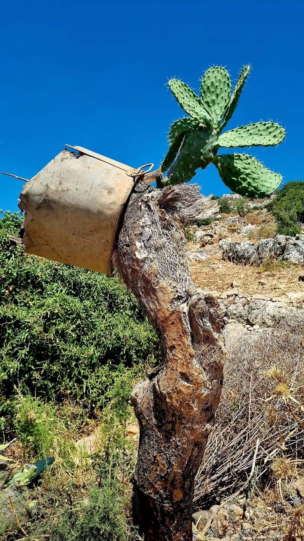
Posted by Makbula Nassar - قرية كفر عنان المهجرة - بطمة كفر عنان لا تزال شاهقة بجوار احد المقامات المقدسة لدى اليهود، 3.4.09 © تصوير مقبولة نصار
Posted by Makbula Nassar 1 - ما تبقى من بيوت القريى 8 2009
Posted by Raneen G. - ما تبقى من بيوت القرية 8 2009
Posted by Raneen G. - حظيرة بقر 8 2009
Posted by Raneen G. - ما تبقى من القرية- تستعمل اراضي القرية اليوم لتريبة الابقار والمواشي 2 2009
Posted by Raneen G. - مقبرة القرية 8 2009
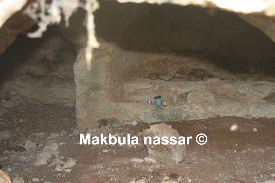
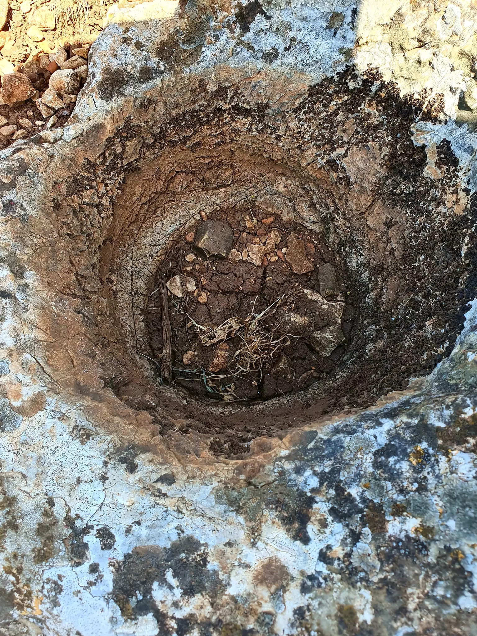
Posted by Raneen G. - جرن قديم جدا استعمله اهل القرية لتخزين الطعام او دقه 8 2009
Posted by Raneen G. - ما تبقى من القرية- يقال انه فرن قديم
Posted by Raneen G. - منظر لبقايا المباني في القريه
Posted by abu raya - اثار البيوت المهدومه في القريه
Posted by abu raya - مقبره كفرعنان
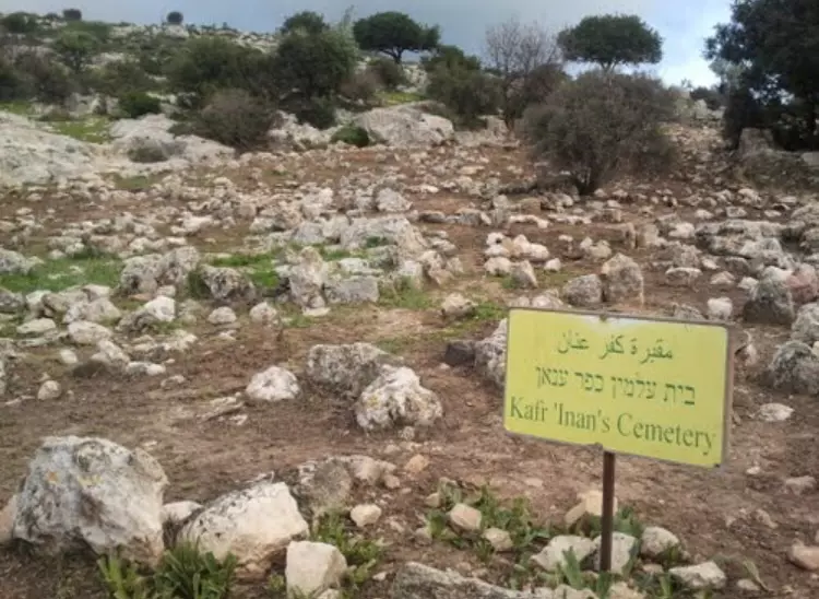
Posted by abu raya - مقبره القريه
Posted by abu raya - اراضي قريه كفرعنان
Posted by abu raya - الطبيعه في كفر عنان
Posted by abu raya - منظر لبيوت القريه
Posted by abu raya - منظر من القريه باتجاه الجنوب
Posted by abu raya - اثار بيوت القريه
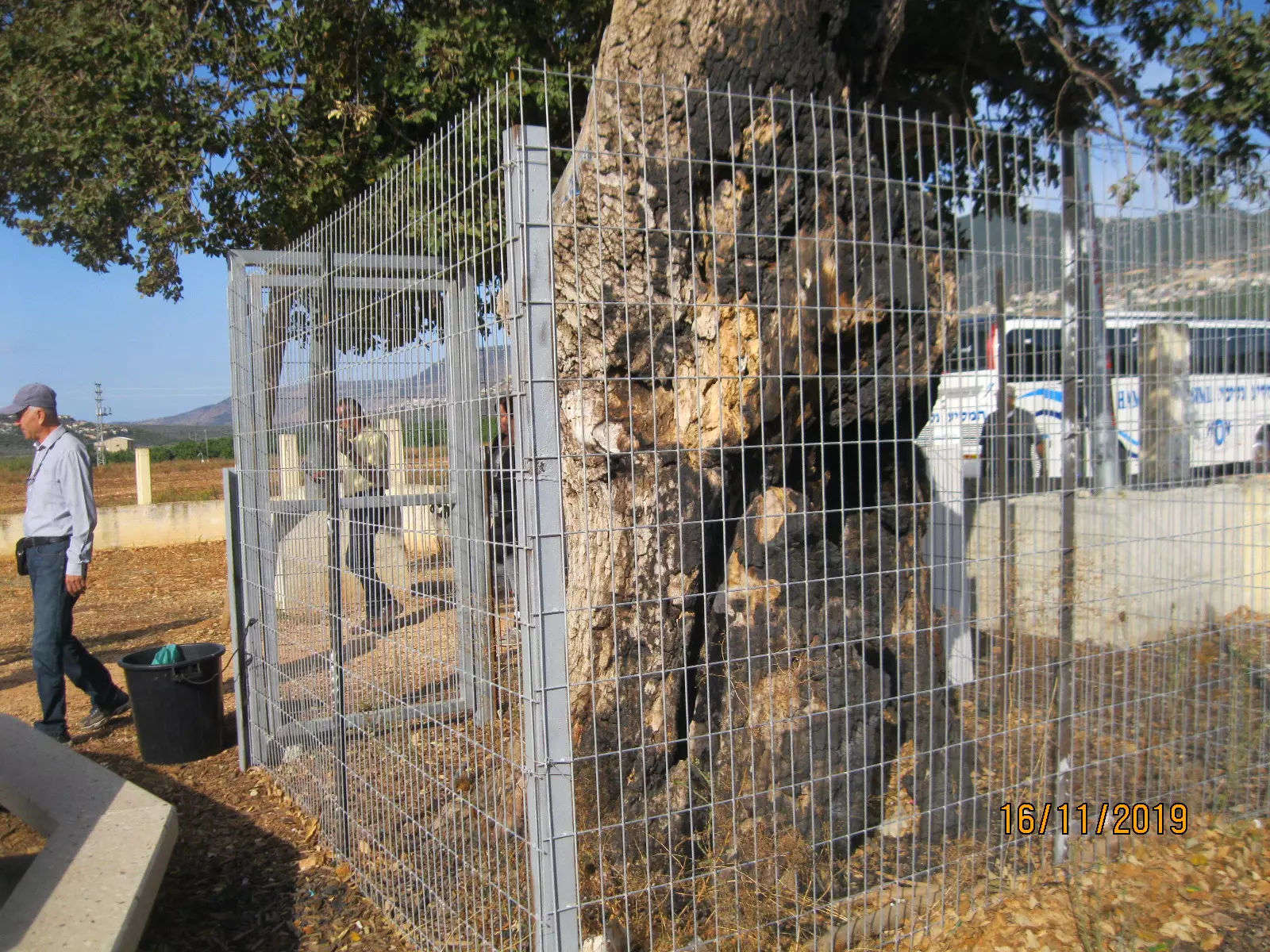
Posted by abu raya - من الاشجار المعمره في القريه
Posted by abu raya - اثار بيوت القريه
Posted by abu raya - من بقايا بيوت القريه
Posted by abu raya - بقايا لاحدى مخازن القريه
Posted by abu raya - صوره لبركه القريه وكانت تستعمل كمجمع للمياه
Posted by abu raya - بقايا بيوت كفرعنان
Posted by abu raya - بيوت كفرعنان
Posted by abu raya - بقايا البيوت المهدومه في القريه
Posted by abu raya - بقايا حيطان بيت في كفرعنان
Posted by abu raya - من اطراف القريه
Posted by abu raya - القريه من الناحيه الغربيه
Posted by abu raya - ردم بيوت القريه
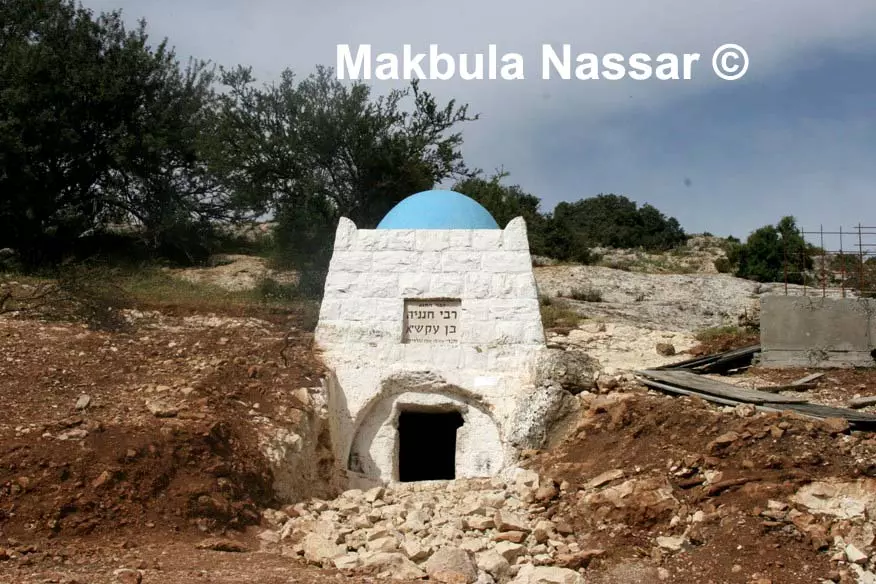
Posted by abu raya - هنا كانت مقبرة للأولياء الصالحين حولوها الى قبور يهودية
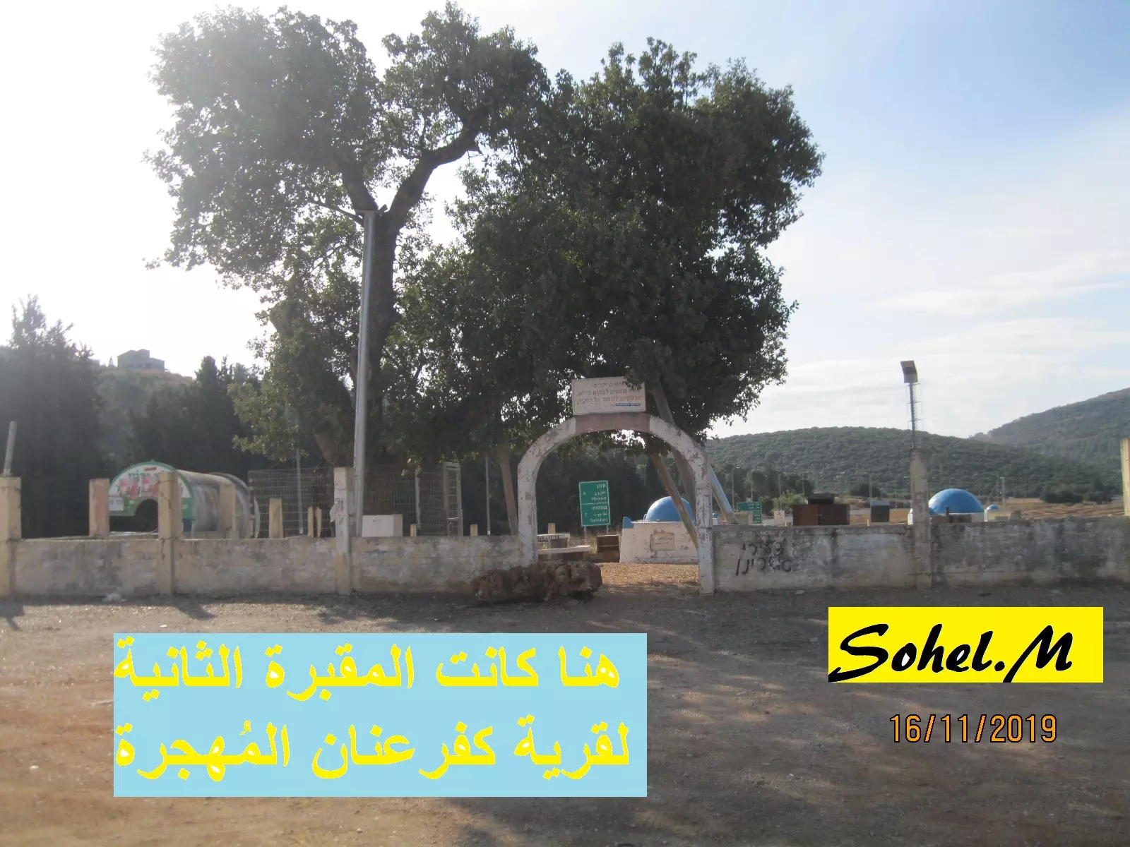
Posted by سهيل مخول - هنا كانت مقبرة للأولياء الصالحين حولوها الى قبور يهودية
Posted by سهيل مخول - هنا كانت مقبرة للأولياء الصالحين حولوها الى قبور يهودية
Posted by سهيل مخول - هنا كانت مقبرة للأولياء الصالحين حولوها الى قبور يهودية
Posted by سهيل مخول - 25 ورقة كواشين: نعم لنا أرض في فلسطين
الحاج محمود إسماعيل (89 عامًا) مخيم شاتيلا...مقال الحاج في قسم المقالات
- جولة في احد الخرب المحيطة
- جولة في احد الخرب المحيطة #2
- جولة في احد الخرب المحيطة #3
- جولة في احد الخرب المحيطة #4
- That is how the "civilized" erased and replaced us: Kafr 'Inan was completely obliterated, as you see -- كفر عنان باتت أثر بعد عين. من هنا مر الهمجّ
-
That is how the "civilized" erased and replaced us: Kafr 'Inan was completely obliterated, as you see -- كفر عنان باتت أثر بعد عين. من هنا مر الهمجّ #2
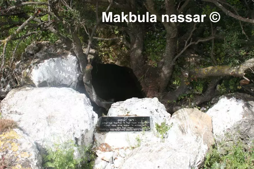
- خربة تعود لكنيس منحوت في الصخر
- خربة تعود لكنيس منحوت في الصخر #2
- Only a few structures remained. The "civilized" obliterate the whole village
- Let us see how the most "liberal and civilized" of world Jewry has obliterated our village; even the cemetery didn't escape their savagery.. How else will the Jews be great and safe again? -- القرية دمرت بالكامل.. من هنا مر الهمج
- Let us see how the most "liberal and civilized" of world Jewry has obliterated our village; even the cemetery didn't escape their savagery.. How else will the Jews be great and safe again? -- القرية دمرت بالكامل.. من هنا مر الهمج #2
- Let us see how the most "liberal and civilized" of world Jewry has obliterated our village; even the cemetery didn't escape their savagery.. How else will the Jews be great and safe again? -- القرية دمرت بالكامل.. من هنا مر الهمج #3
- Let us see how the most "liberal and civilized" of world Jewry has obliterated our village; even the cemetery didn't escape their savagery.. How else will the Jews be great and safe again? -- القرية دمرت بالكامل.. من هنا مر الهمج #4
- Let us see how the most "liberal and civilized" of world Jewry has obliterated our village; even the cemetery didn't escape their savagery.. How else will the Jews be great and safe again? -- القرية دمرت بالكامل.. من هنا مر الهمج #5
- Let us see how the most "liberal and civilized" of world Jewry has obliterated our village; even the cemetery didn't escape their savagery.. How else will the Jews be great and safe again? -- القرية دمرت بالكامل.. من هنا مر الهمج #6
- Let us see how the most "liberal and civilized" of world Jewry has obliterated our village; even the cemetery didn't escape their savagery.. How else will the Jews be great and safe again? -- القرية دمرت بالكامل.. من هنا مر الهمج #7
- Let us see how the most "liberal and civilized" of world Jewry has obliterated our village; even the cemetery didn't escape their savagery.. How else will the Jews be great and safe again? -- القرية دمرت بالكامل.. من هنا مر الهمج #8
- Let us see how the most "liberal and civilized" of world Jewry has obliterated our village; even the cemetery didn't escape their savagery.. How else will the Jews be great and safe again? -- القرية دمرت بالكامل.. من هنا مر الهمج #9

- Let us see how the most "liberal and civilized" of world Jewry has obliterated our village; even the cemetery didn't escape their savagery.. How else will the Jews be great and safe again? -- القرية دمرت بالكامل.. من هنا مر الهمج #10
- Let us see how the most "liberal and civilized" of world Jewry has obliterated our village; even the cemetery didn't escape their savagery.. How else will the Jews be great and safe again? -- القرية دمرت بالكامل.. من هنا مر الهمج #11
- Let us see how the most "liberal and civilized" of world Jewry has obliterated our village; even the cemetery didn't escape their savagery.. How else will the Jews be great and safe again? -- القرية دمرت بالكامل.. من هنا مر الهمج #12
- Let us see how the most "liberal and civilized" of world Jewry has obliterated our village; even the cemetery didn't escape their savagery.. How else will the Jews be great and safe again? -- القرية دمرت بالكامل.. من هنا مر الهمج #13
- Let us see how the most "liberal and civilized" of world Jewry has obliterated our village; even the cemetery didn't escape their savagery.. How else will the Jews be great and safe again? -- القرية دمرت بالكامل.. من هنا مر الهمج #14
- Let us see how the most "liberal and civilized" of world Jewry has obliterated our village; even the cemetery didn't escape their savagery.. How else will the Jews be great and safe again? -- القرية دمرت بالكامل.. من هنا مر الهمج #15
- Let us see how the most "liberal and civilized" of world Jewry has obliterated our village; even the cemetery didn't escape their savagery.. How else will the Jews be great and safe again? -- القرية دمرت بالكامل.. من هنا مر الهمج #16
- Let us see how the most "liberal and civilized" of world Jewry has obliterated our village; even the cemetery didn't escape their savagery.. How else will the Jews be great and safe again? -- القرية دمرت بالكامل.. من هنا مر الهمج #17
- Let us see how the most "liberal and civilized" of world Jewry has obliterated our village; even the cemetery didn't escape their savagery.. How else will the Jews be great and safe again? -- القرية دمرت بالكامل.. من هنا مر الهمج #18
- Let us see how the most "liberal and civilized" of world Jewry has obliterated our village; even the cemetery didn't escape their savagery.. How else will the Jews be great and safe again? -- القرية دمرت بالكامل.. من هنا مر الهمج #19
- Let us see how the most "liberal and civilized" of world Jewry has obliterated our village; even the cemetery didn't escape their savagery.. How else will the Jews be great and safe again? -- القرية دمرت بالكامل.. من هنا مر الهمج #20
- Let us see how the most "liberal and civilized" of world Jewry has obliterated our village; even the cemetery didn't escape their savagery.. How else will the Jews be great and safe again? -- القرية دمرت بالكامل.. من هنا مر الهمج #21
- Let us see how the most "liberal and civilized" of world Jewry has obliterated our village; even the cemetery didn't escape their savagery.. How else will the Jews be great and safe again? -- القرية دمرت بالكامل.. من هنا مر الهمج #22
- Let us see how the most "liberal and civilized" of world Jewry has obliterated our village; even the cemetery didn't escape their savagery.. How else will the Jews be great and safe again? -- القرية دمرت بالكامل.. من هنا مر الهمج #23

- Let us see how the most "liberal and civilized" of world Jewry has obliterated our village; even the cemetery didn't escape their savagery.. How else will the Jews be great and safe again? -- القرية دمرت بالكامل.. من هنا مر الهمج #24
- Let us see how the most "liberal and civilized" of world Jewry has obliterated our village; even the cemetery didn't escape their savagery.. How else will the Jews be great and safe again? -- القرية دمرت بالكامل.. من هنا مر الهمج #25
- Let us see how the most "liberal and civilized" of world Jewry has obliterated our village; even the cemetery didn't escape their savagery.. How else will the Jews be great and safe again? -- القرية دمرت بالكامل.. من هنا مر الهمج #26
- Let us see how the most "liberal and civilized" of world Jewry has obliterated our village; even the cemetery didn't escape their savagery.. How else will the Jews be great and safe again? -- القرية دمرت بالكامل.. من هنا مر الهمج #27
- Let us see how the most "liberal and civilized" of world Jewry has obliterated our village; even the cemetery didn't escape their savagery.. How else will the Jews be great and safe again? -- القرية دمرت بالكامل.. من هنا مر الهمج #28
- Let us see how the most "liberal and civilized" of world Jewry has obliterated our village; even the cemetery didn't escape their savagery.. How else will the Jews be great and safe again? -- القرية دمرت بالكامل.. من هنا مر الهمج #29
- Let us see how the most "liberal and civilized" of world Jewry has obliterated our village; even the cemetery didn't escape their savagery.. How else will the Jews be great and safe again? -- القرية دمرت بالكامل.. من هنا مر الهمج #30
- Let us see how the most "liberal and civilized" of world Jewry has obliterated our village; even the cemetery didn't escape their savagery.. How else will the Jews be great and safe again? -- القرية دمرت بالكامل.. من هنا مر الهمج #31
- Let us see how the most "liberal and civilized" of world Jewry has obliterated our village; even the cemetery didn't escape their savagery.. How else will the Jews be great and safe again? -- القرية دمرت بالكامل.. من هنا مر الهمج #32
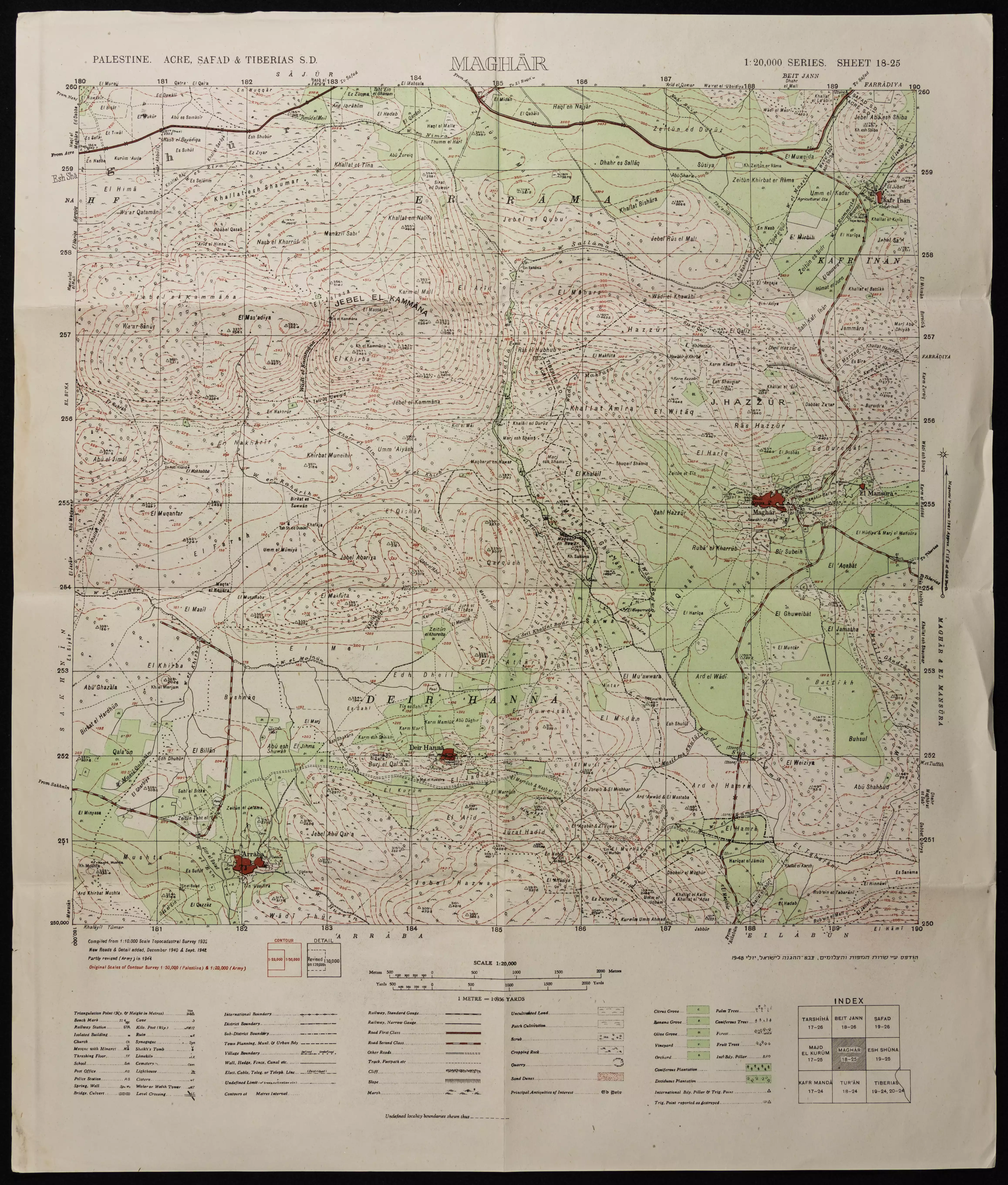
- خارطة تُظهِر الحدود والطرق بأنواعها والأماكن المقدسة والطبيعة الطوبغرافية من تلال وسهول ومنحدرات والتشكيلة الطبيعية للأرض وأنواع المزروعات. نُشرت الخريطة فترة الانتداب البريطاني، تم إضافة تعديلات عليها من قِبَل خدمة الخرائط والصور التابعة للقوات العسكرية الاسرائيلية فترة الأربعينيات.
Want to browse more? 80,000 pictures were grouped in these gallaries:
| Display Name | Clan/Hamolah | Country of Residence |
| احمد منصور | المنصور | الامارات ام القيوين, الامارات |
| Basim Daas | - | - |
 Fake Valor: Why Did Zionist Jews Hoist Nazis Flag on Their Ships in the 1930s?
What is new?
-
Facts About Oct. 7th Gaza Raid
-
Remined Us Please:: Who Did Rape Who? Palestinians Raped Israelis? Or, was the other way around?
-
When Prof. Edward Said was invited to debate Bibi Netanyahu in the 1980s, watch what happened!
-
Ezra Klein of the NY Times on the "Jewish Race".
-
Abusing Blood Libel!
-
Did Israeli Soldiers Activate The Hanniba Direective On Oct. 7th? You Be The Judge
-
Zionist FAQ: Isn't it true that Palestinians don't want peace? Palestinians never accepted the two-state solution
- Facts about Haavara (Transfer) Agreement between Ben-Gurion & Hitler
-
Haavara FAQs: Why Did Zionist Jews Hoist Nazis' Flags on Their Ships in the 1930s?
- Haavara FAQs: When Chaim Weizmann met FDR in mid-1943, why was he silent about rescuing European Jewry?
-
Dear ChatGPT: How did Palestinians resist Napoleon's invasion of their country in 1799?
-
Dear ChatGPT: Gaza had a vibrant Jewish community in the mid-17th century. What happened to them?
-
Dear ChatGPT: Why did the Jewish Agency suppress news of the Holocaust during WWII?
-
Video Playlist: Jews share their DNA tests to end the conflict for good.
-
A Tale of Two Conflicts: Examining the Definition of Genocide
-
Prof. Abraham Polak And The Suppressed History of the Khazars and European Jewry
-
How Ronald Reagan would have framed the genocide in Gaza if he were still alive?
-
Haavara FAQs: Let us do the math: how many German Jews did The Haavara Agreement save?
-
Zionist FAQs: The Hebron Massacre of 1929, "clearly proves" that Palestinians are antisemitic, how could you deny it?
-
Zionist FAQs: Why Anti-Zionist Is Not Antisemitism?
-
Zionist FAQs: Isn't it true that the KGB created Palestinian Nationalism in the early 1960s?
- Zionist FAQs: Muslims are killing Muslims all the time; why are Israeli Jews being singled out in the media?
- Zionist FAQs: How is Israel an apartheid state when 20% of its citizens are Arabs who enjoy full rights?
-
Haavara FAQs: Why Did Dorothy Thompson Flip From A Zionist Advocate to A Silenced Dissenter?
-
Haavara FAQs: Analysis of Herzl's Uganda Scheme and how it could have saved millions of Jews.
-
Haavara FAQs: Why did Hayim Greenberg describe American Jewry as "morally bankrupt" in early 1943?
-
Haavara FAQs: What if the Evian Conference was a resounding success? What would have been the impact of saving European Jewry on Zionism?
- Haavara FAQs: What if the six million were saved, how that would have impacted the Zionist project?
-
Haavara FAQs: How did Zionist leaders react when Europe's Jews lingered in the DP camps after WWII ended?
-
Why does the American Jewish community repeat lies that David Ben-Gurion had debunked before he died?
-
Who has the power to rename the Tatar/Khazar Gene Marker to Jewish IV?
-
Zionist FAQs: Why won't Egypt, Syria, and Jordan take their people back? Jews are indigenous to Palestine, and Arabs immigrated after Jews developed the country. Arabs should leave.
-
Haavara FAQs: Did Hitler and the Nazis conflate between Judaism and Zionist? If that wasn't case, then why?
-
Haavara FAQs: Winston Churchill and antisemitism, a collection of articles written Churchill.
-
Haavara FAQs: Broken by country, how many Jews survived vs. killed during the Holocaust?
-
Haavara FAQs: Why did European Jews vote with their feet and to immigrated to the Americas, not Palestine, after WWII?
-
Watch this American Jewish Girl describing Israeli Jews' cognitive dissonance like no other in under two minutes
-
Haavara FAQs: When the Nazis went out of their way to hide the Holocaust, Israeli Jews did the exact opposite by broadcasting their genocide of Gazans. But why?
-
Haavara FAQs: How Zionist Jews went out of their to show their appreciation to Nazism and Fascism?
- Haavara FAQs: Why Zionist leaders were against bombing the death camps & the Railroads leading to them?
-
Haavara FAQs: Hitler's message to the British and American people: If Jews are such noble citizens and you care about them, how come you're not letting them in? I will gladly ship them to you at my expense, even on luxury liners!
-
A shortlist of Zionist and Israeli false flag operations in the name Jews.
-
The Most Moral Army
- The Land of Kapos (Israel): Where the brave are boycotted and Kapos walk free.
- Why did early Zionists often named their communal enterprises "colonial"?
- Zionist Relations with Nazi Germany by Faris Glubb
-
Two NY Times advertisements by Zionists in the early 1943 that exposes Zionists' treason at the height of the calamity
- Facts Not Lies about the Palestinian-Israeli Conflict.
- Site's pictures have been categorized
- Campgain Against Lice
- A Survey of Palestine, the official source about Palestine before Nakba produced by the British Mandate; over 1200 pages.
- Satellite View & Google Earth: Over 6,000 placemarks identifying all destroyed towns, W. Bank & Gaza Strip Towns, & refugee camps.
- PalestineRemembered.com and its Nakba Oral History Project were featured on al-Jazeera Satellite TV.
- Nakba Oral History Video Podcast:
 Over 700 Oral History interviews (including 3,500+ hours of recording) can be viewed online.
 - Palestine Village Statistics Project
- Gaza Jail Break
- النسخة العربية للموقع الان متوفرة
- Videos: Documenting the destroyed villages in video: Tracing all that remains since Nakba.
- Videos: Responding to Zionist Propaganda
- Interview: The ethnic cleansing of Palestine: George Galloway interviews Israeli Historian Ilan Pappe.
- For Palestinians, memory matters. It provides a blueprint for their future By George Bisharat.
- Zionist FAQ now available in Hebrew שאלות שציונים שואלים, עכשיו בעברית
- Video: The Stephen Walt and John Mearsheimer report on the influence of the Israel Lobby on U.S. Foreign Policy
- The Palestinian-Israeli conflict for beginners
