| PalestineRemembered | About Us | Oral History | العربية | |
| Pictures | Zionist FAQs | Haavara | Maps | |
| Search |
| Camps |
| Districts |
| Acre |
| Baysan |
| Beersheba |
| Bethlehem |
| Gaza |
| Haifa |
| Hebron |
| Jaffa |
| Jericho |
| Jerusalem |
| Jinin |
| Nablus |
| Nazareth |
| Ramallah |
| al-Ramla |
| Safad |
| Tiberias |
| Tulkarm |
| Donate |
| Contact |
| Profile |
| Videos |
Welcome To al-Farradiyya - الفراضية (אל-פראדיה)
|
District of Safad
Ethnically cleansed days ago |
العربية Google Earth |
 |
Gallery (169) |
- Statistics & Facts
-
Before & After

- Satellite View
- Articles 3
- Pictures 169
- Oral History 8
- Members 59
- All That Remains
- Wikipedia
- Videos 1
- Guest Book 24
- Links
| Statistic & Fact | Value | ||||||||||||||||
| Occupation Date | February 1, 1949 | ||||||||||||||||
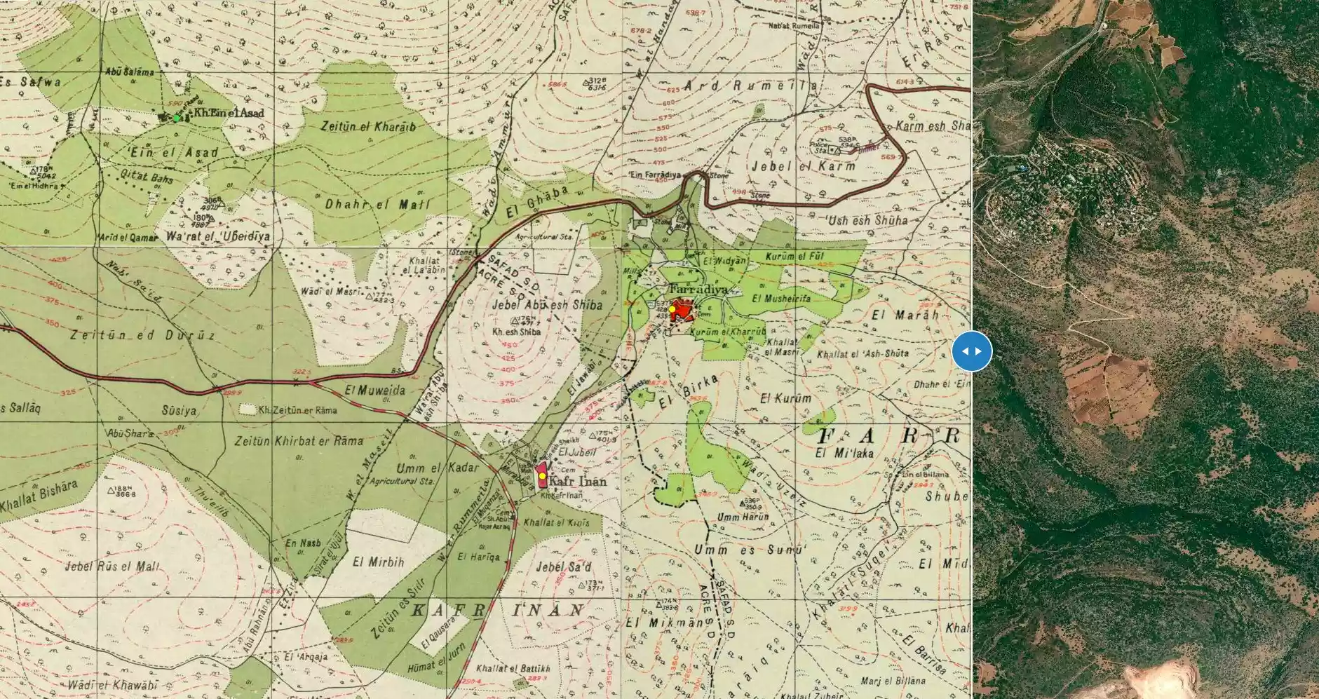
| Distance From District | 8 (km) South West of Safad | ||||||||||||||||
| Elevation | 375 (meters) | ||||||||||||||||
| Before & After Nakba, Click Map For Details |
|||||||||||||||||
|
|||||||||||||||||
| Map Location | See location #71 on the map View from satellite |
||||||||||||||||
| Military Operation | Operation Hiram | ||||||||||||||||
| Attacking Units | Golani Brigade | ||||||||||||||||
| Exodus Cause | Expulsion by Zionist troops | ||||||||||||||||
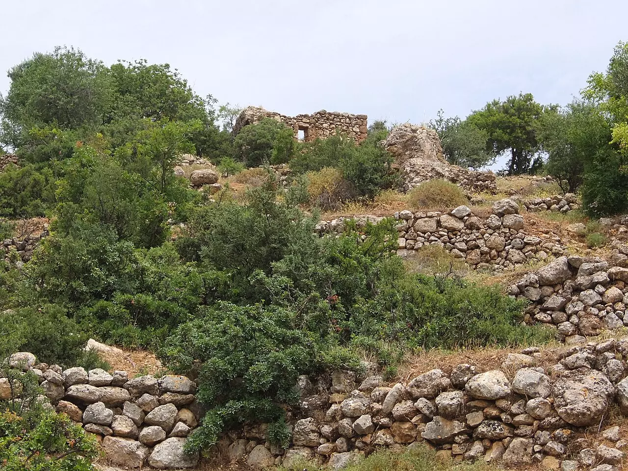
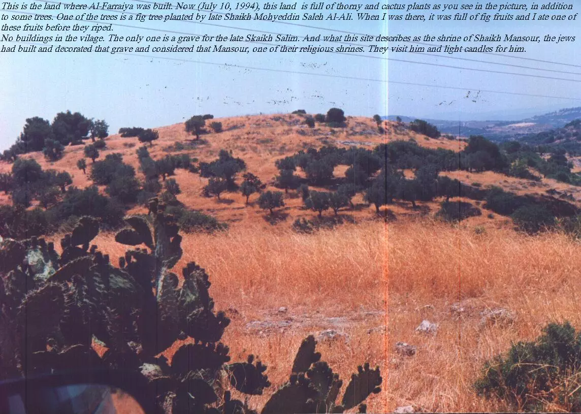
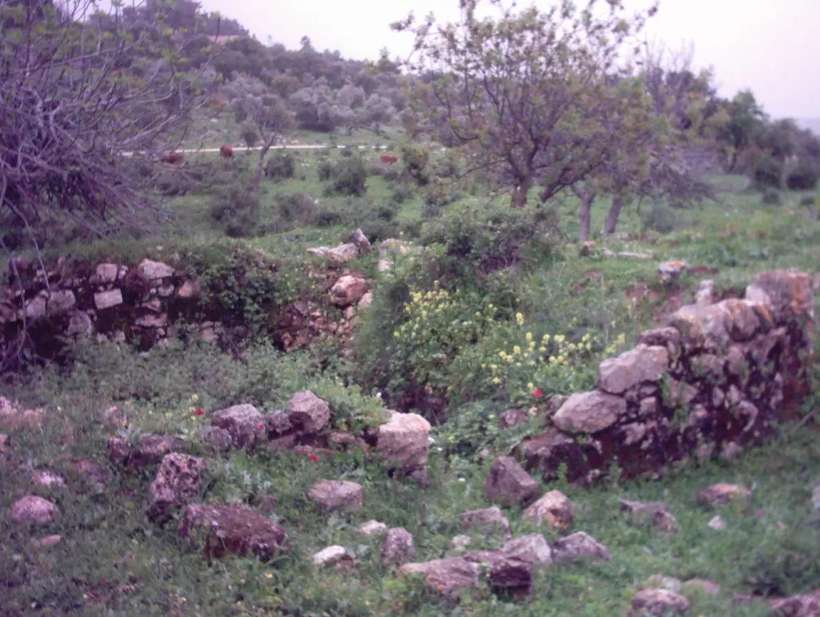
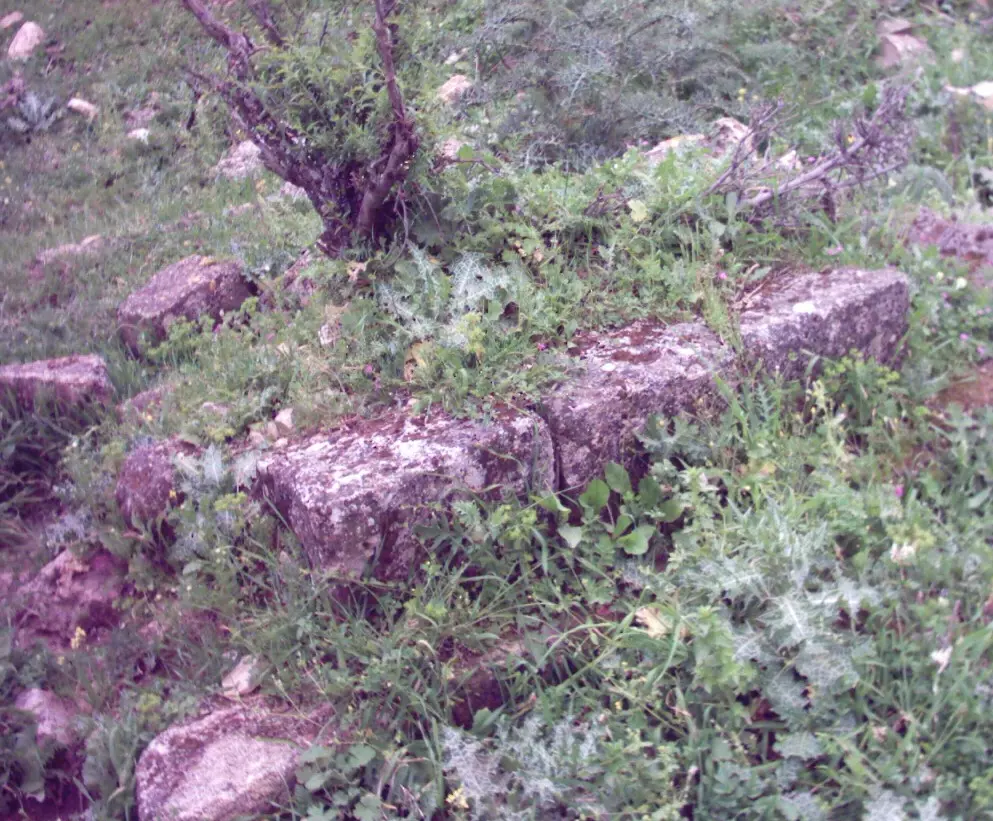
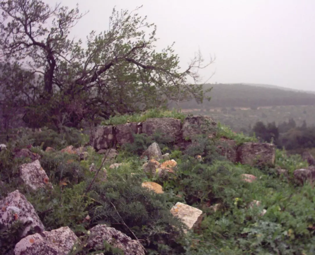
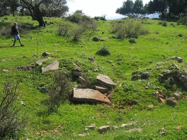
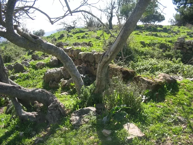
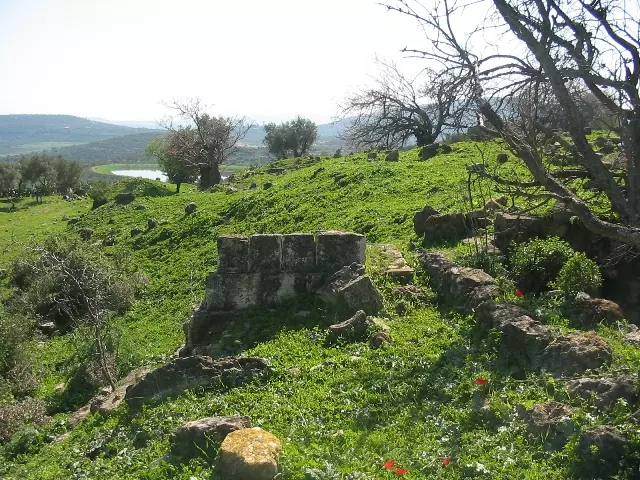
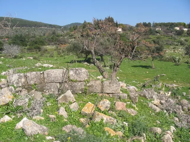
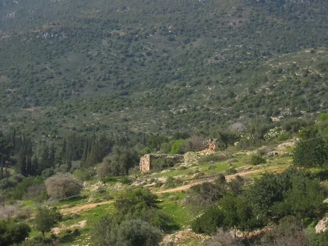
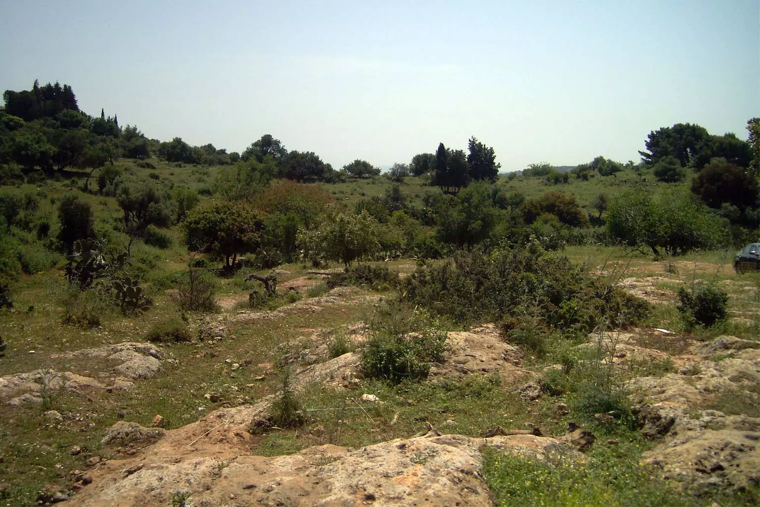
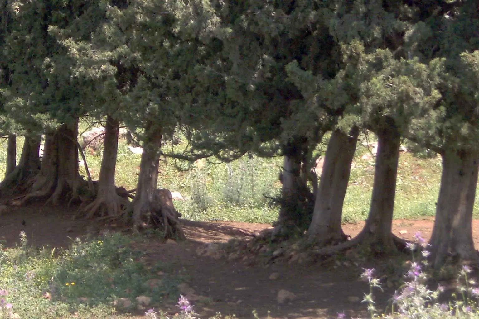
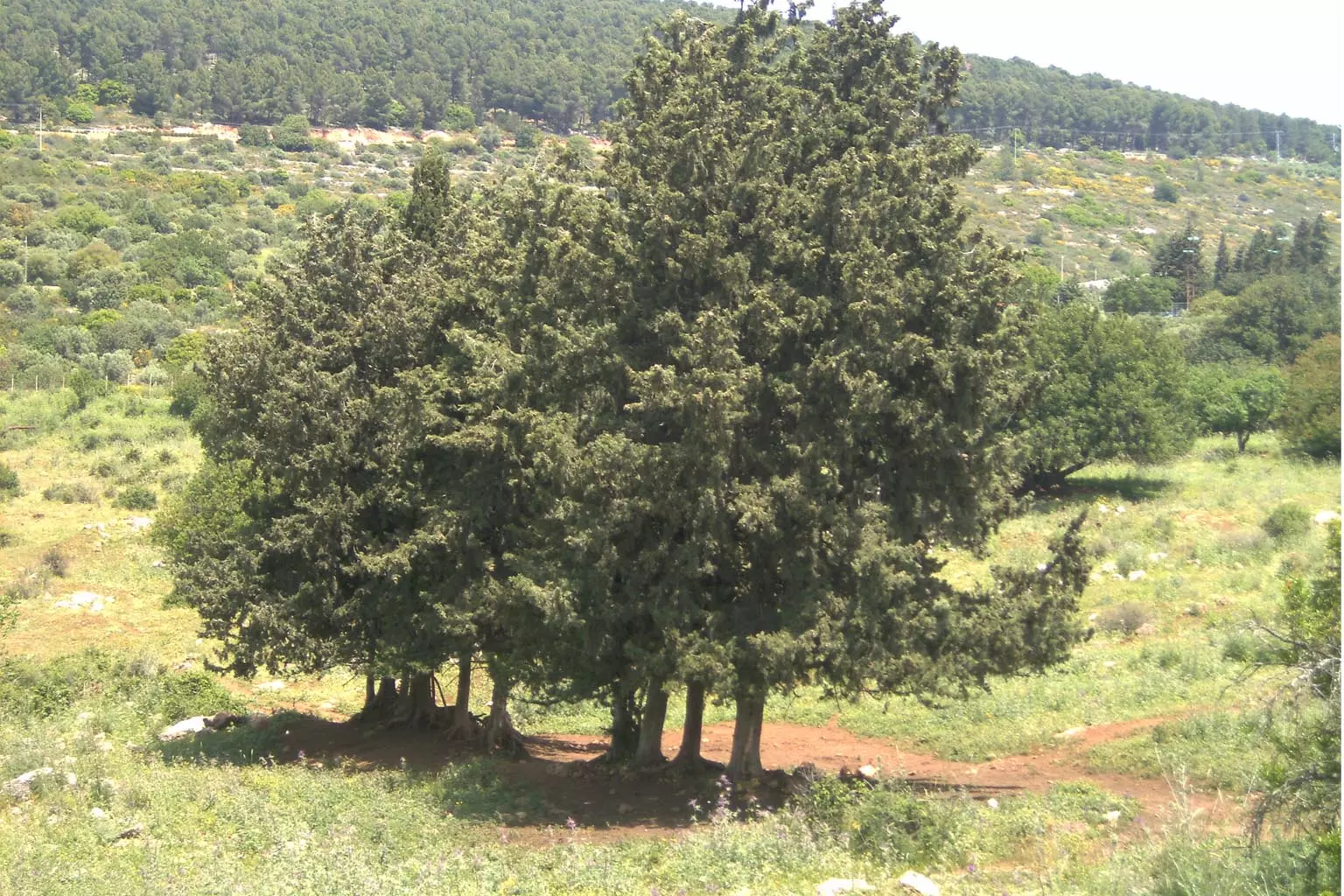
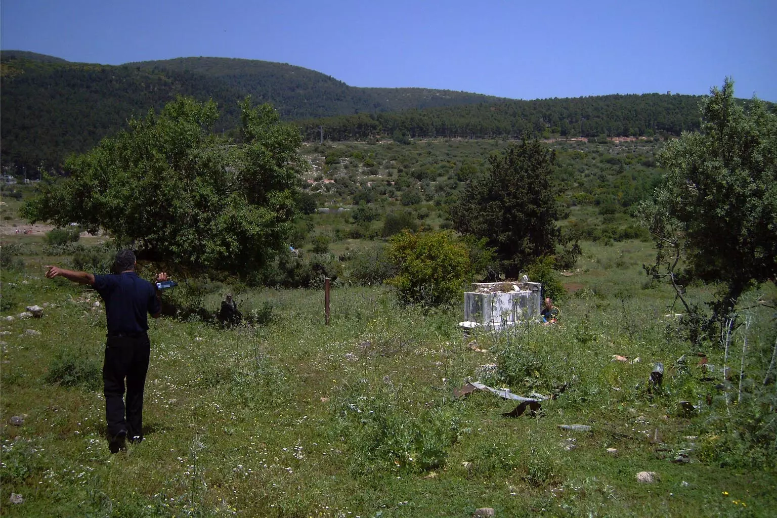
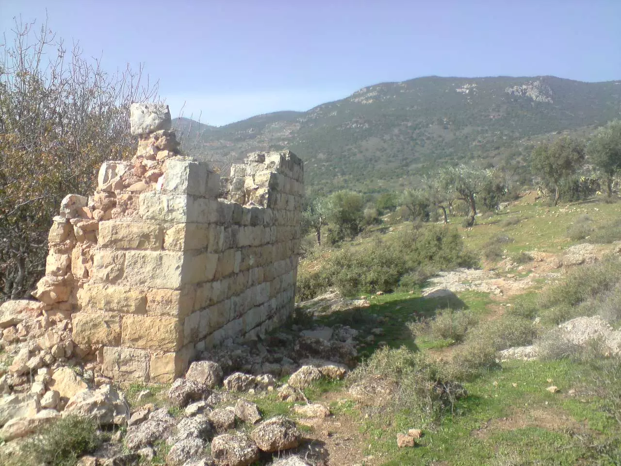
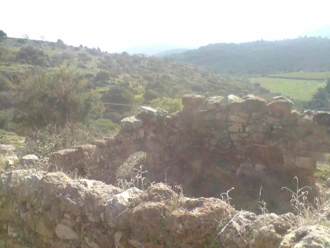
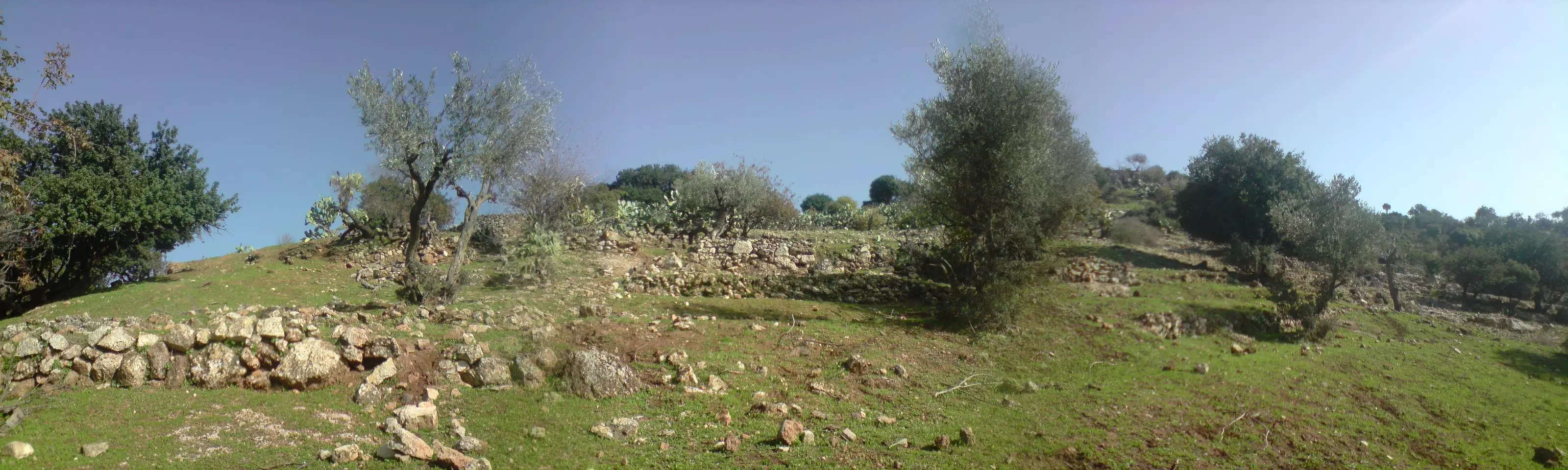
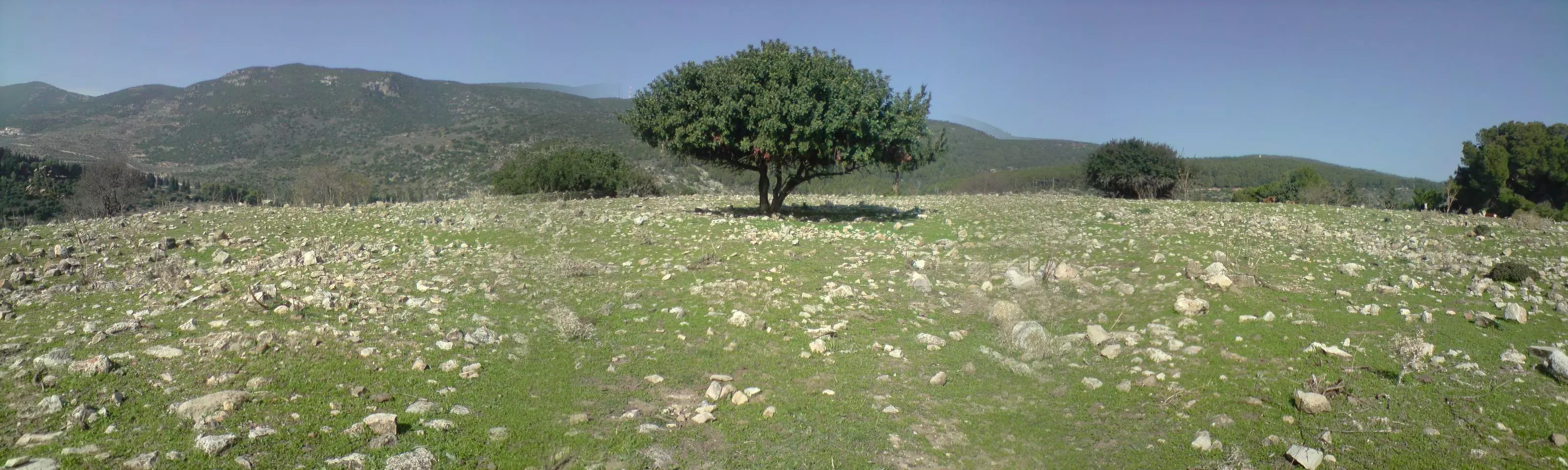
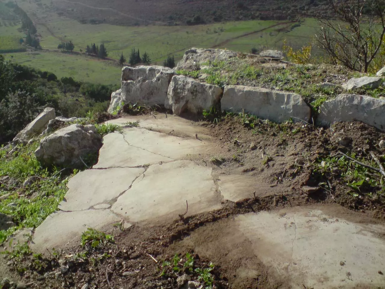
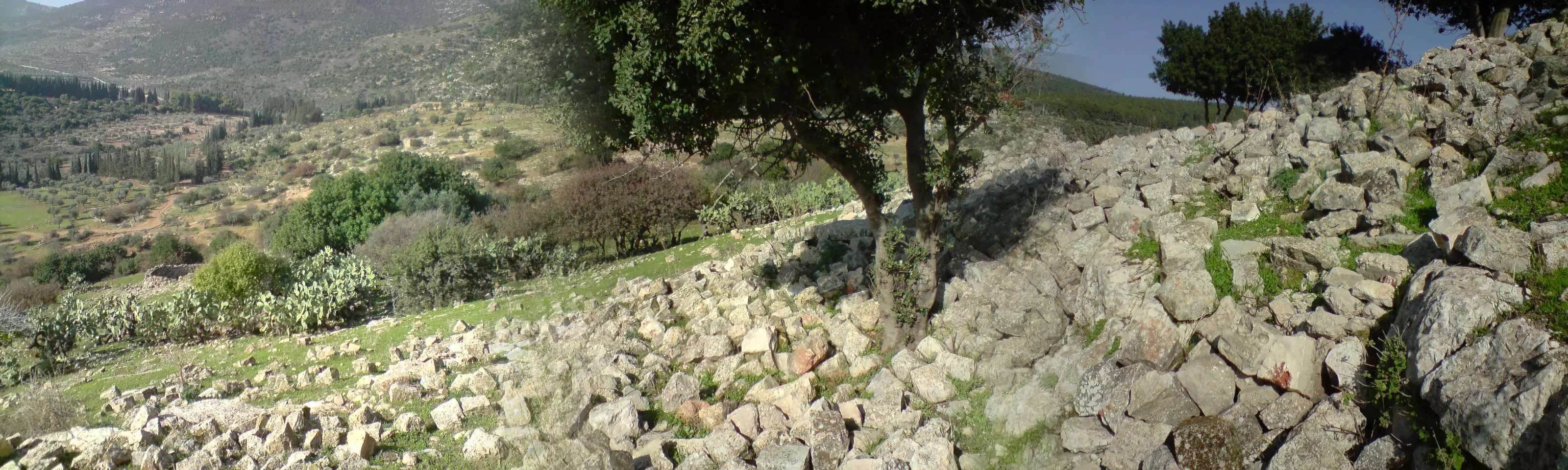
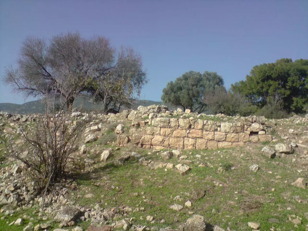
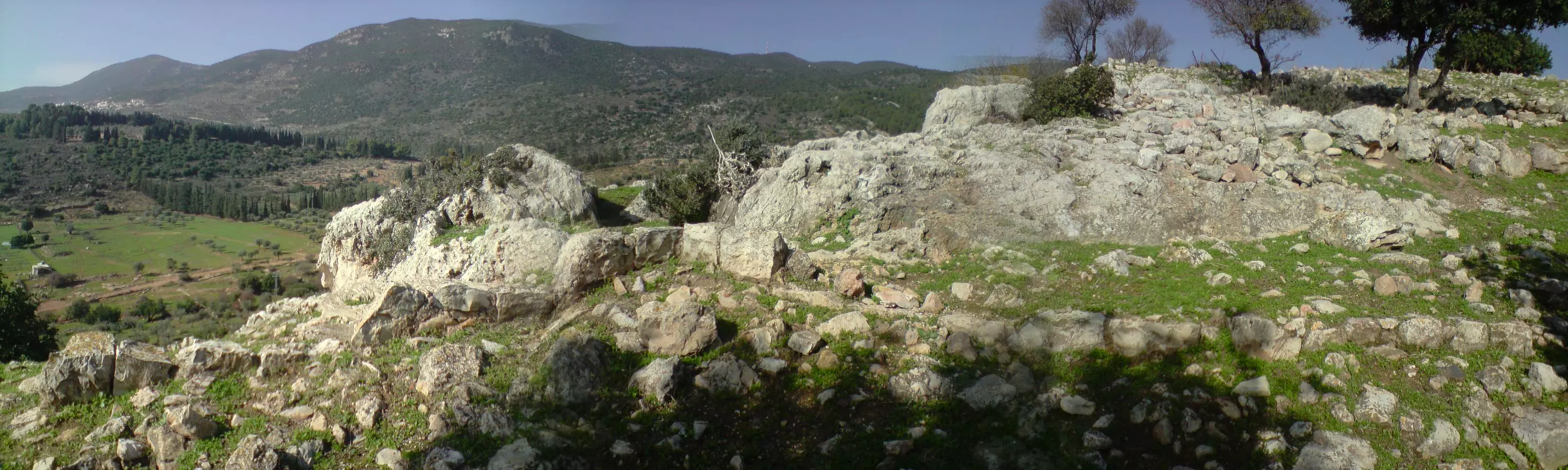
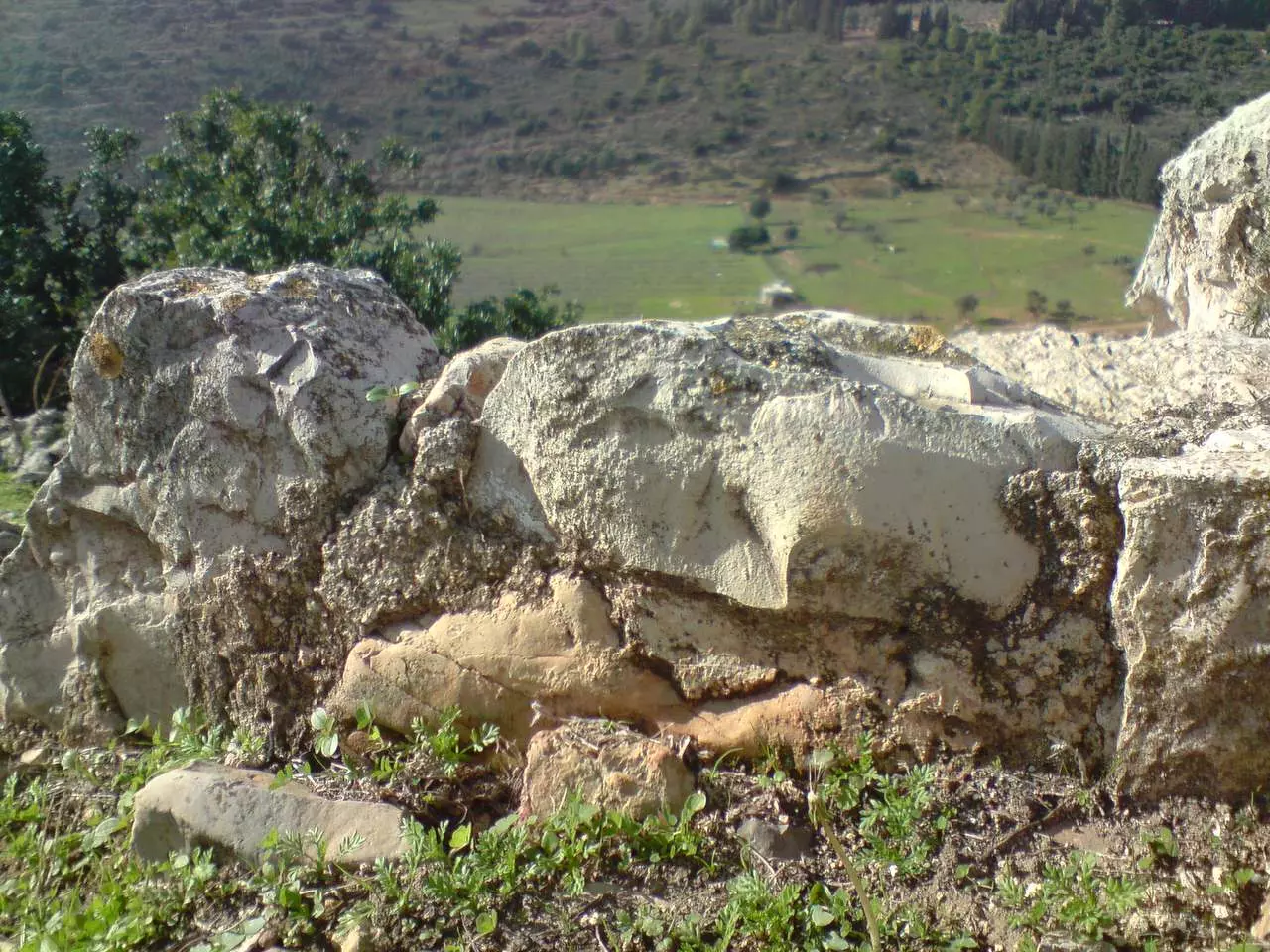
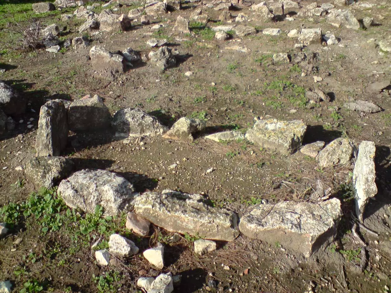
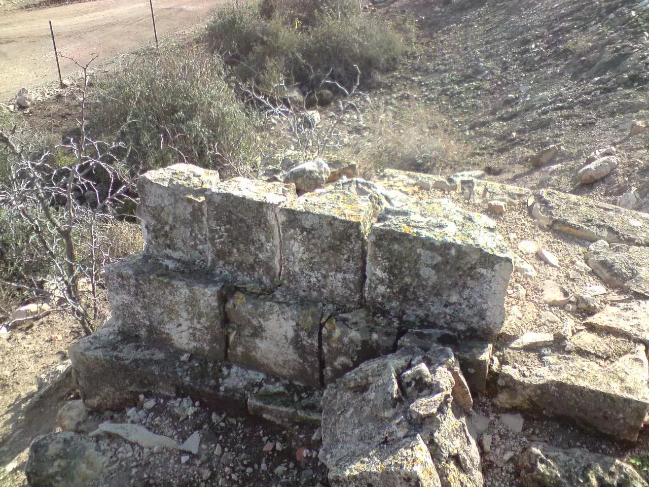
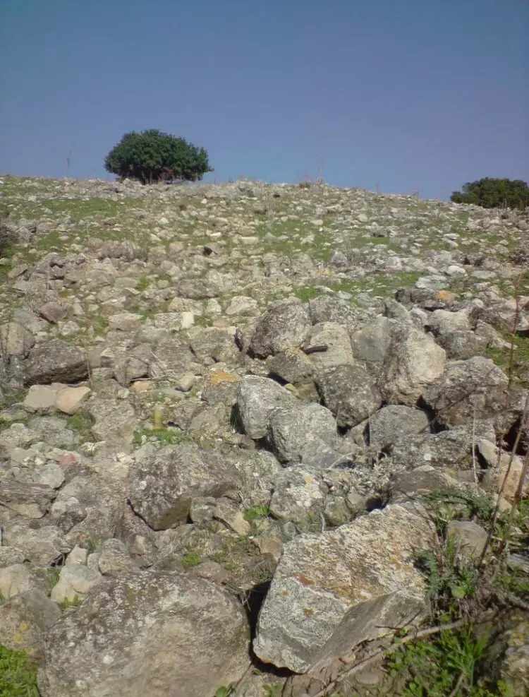
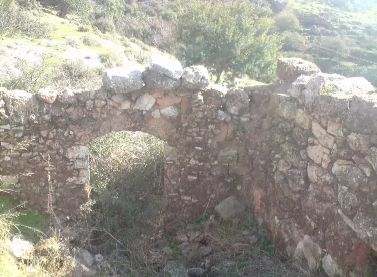
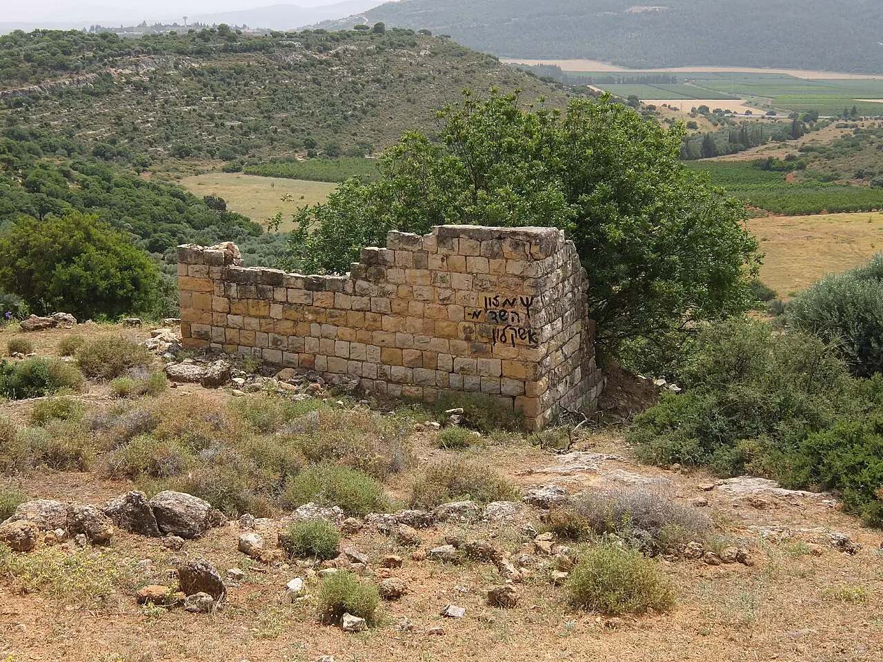
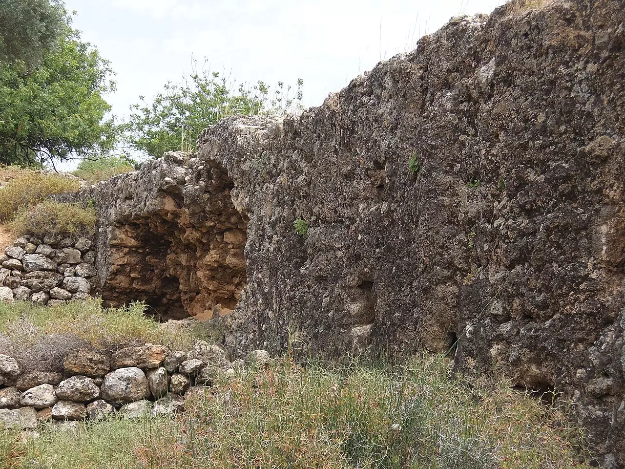
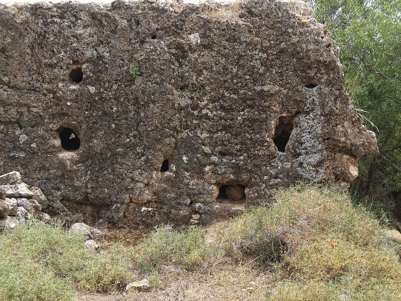
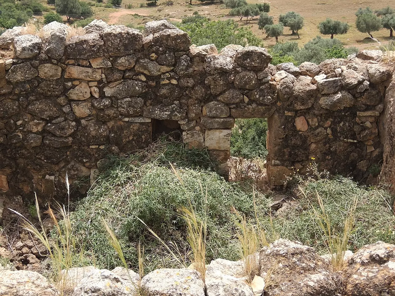
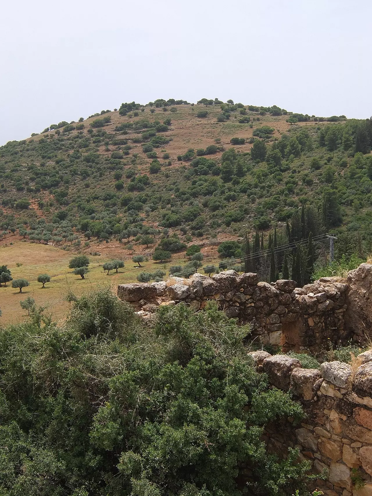
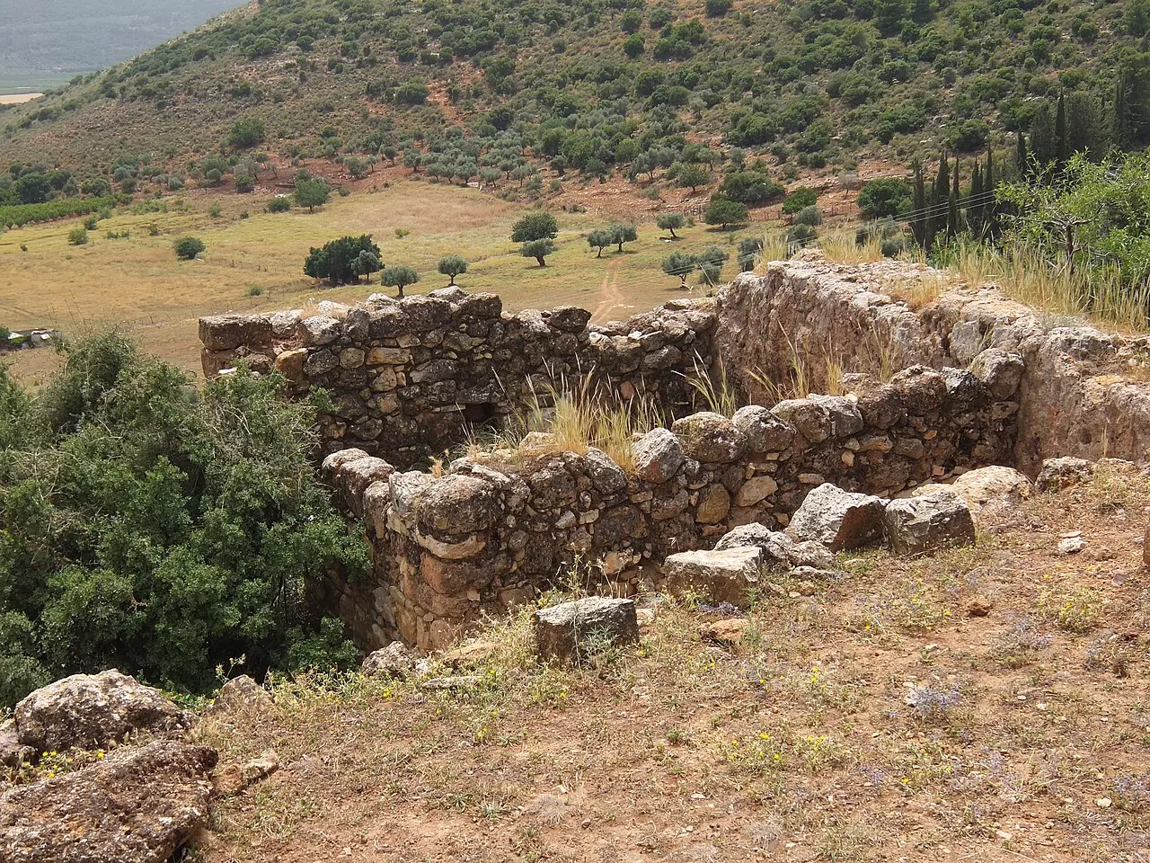
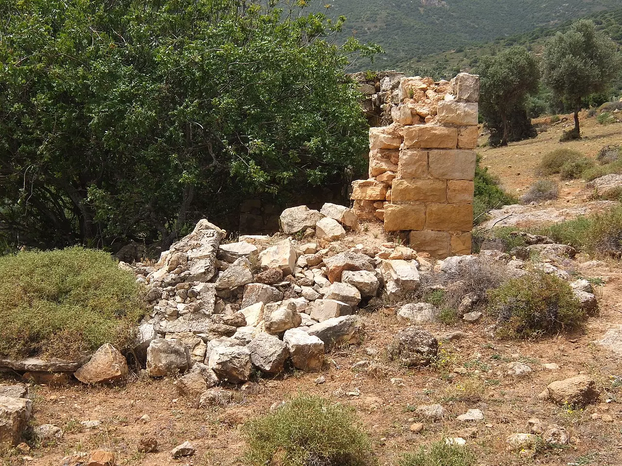
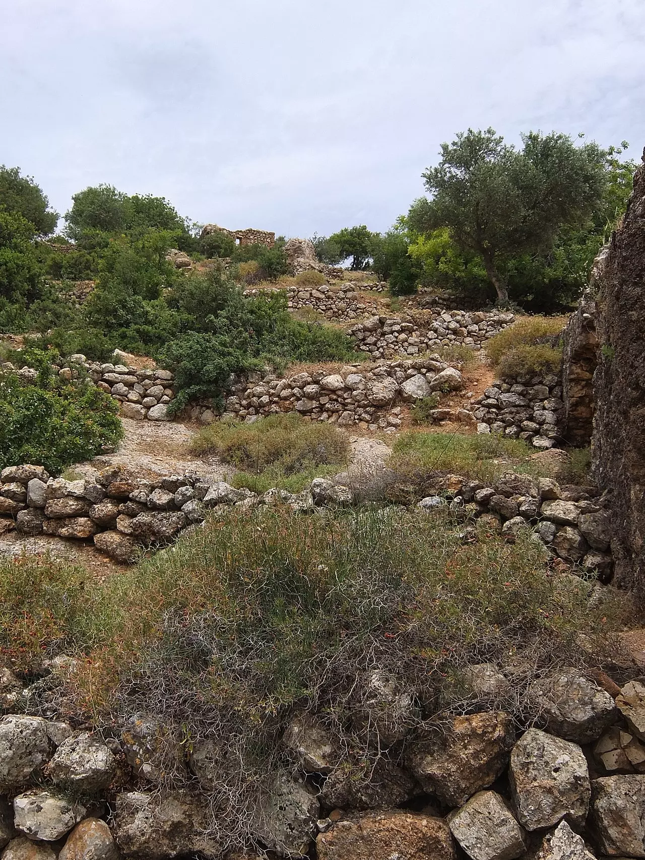
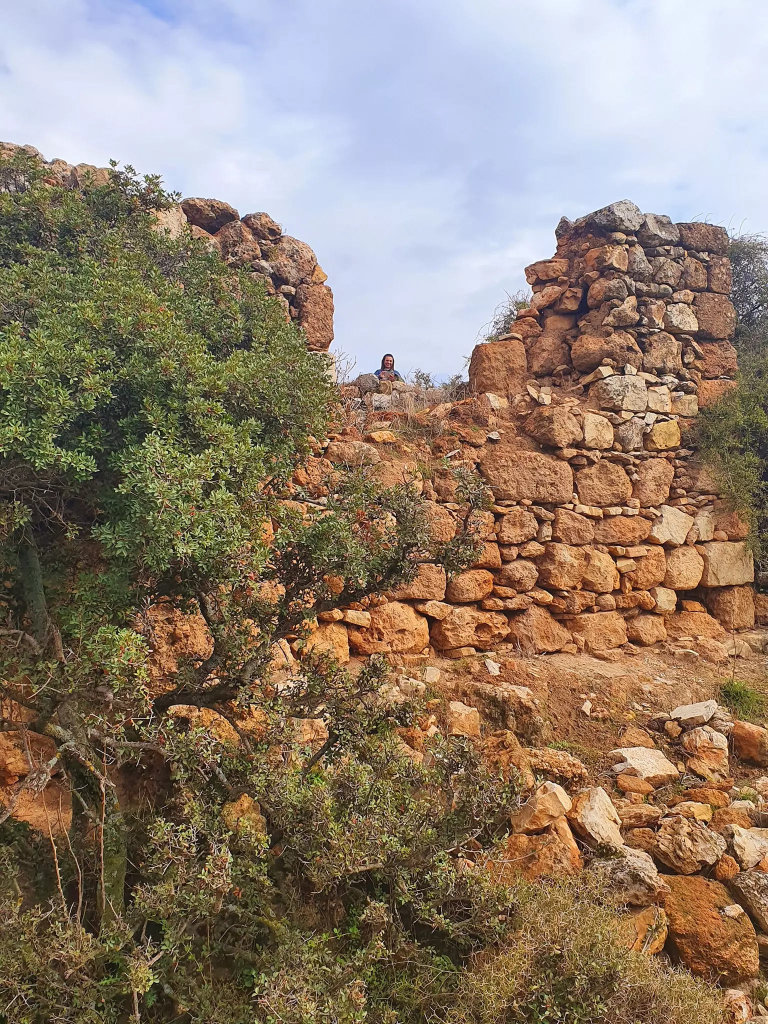
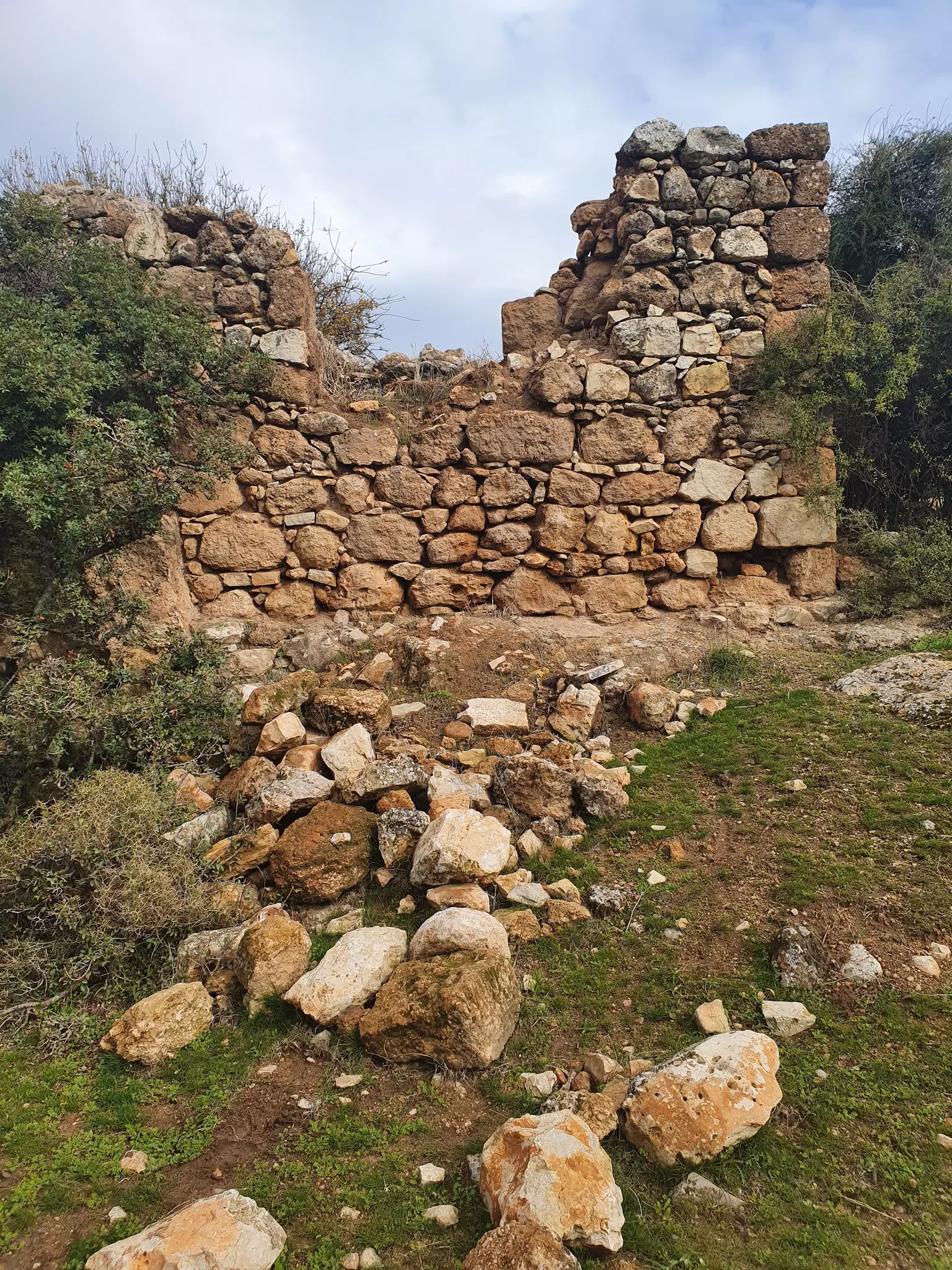
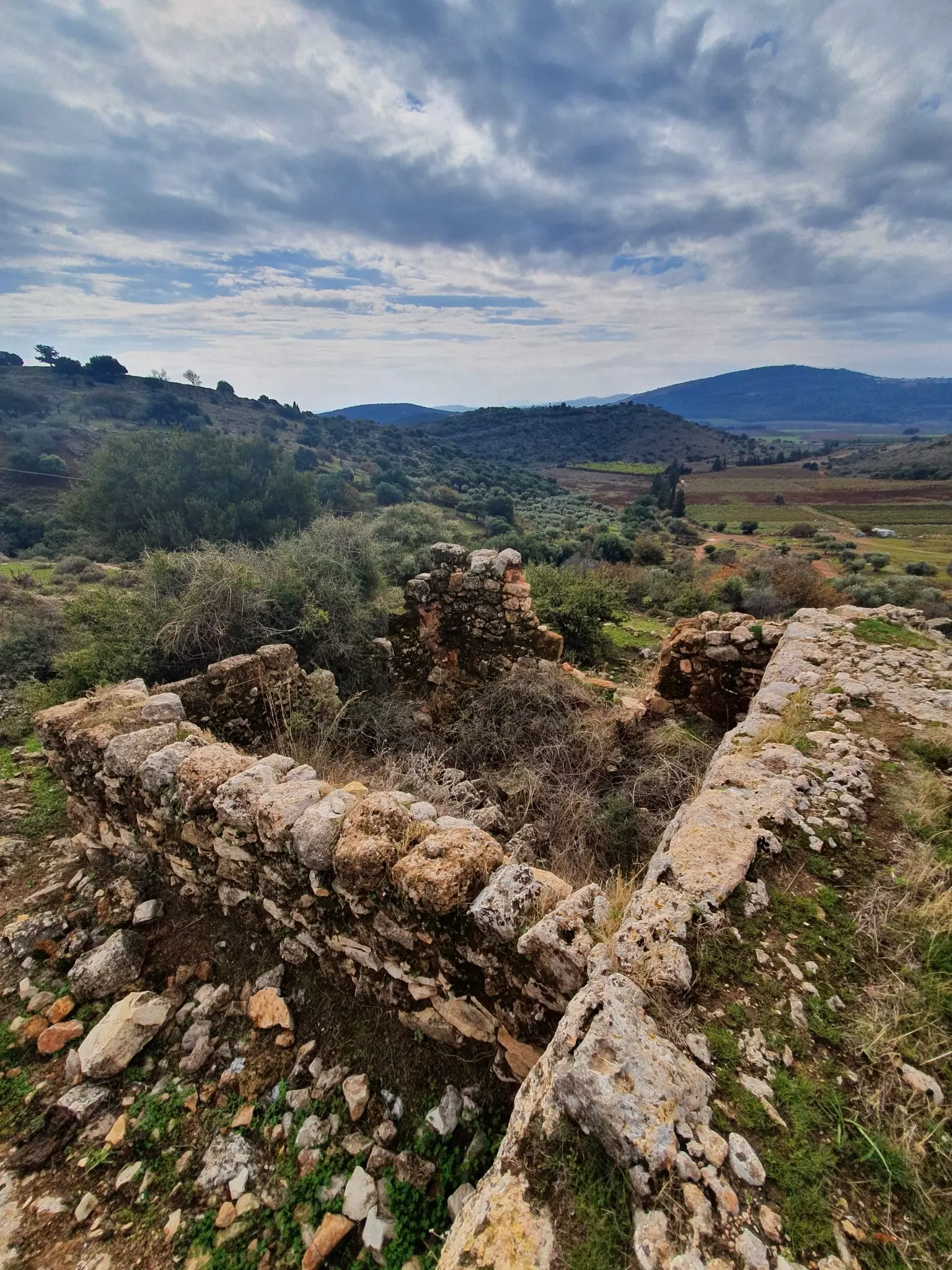
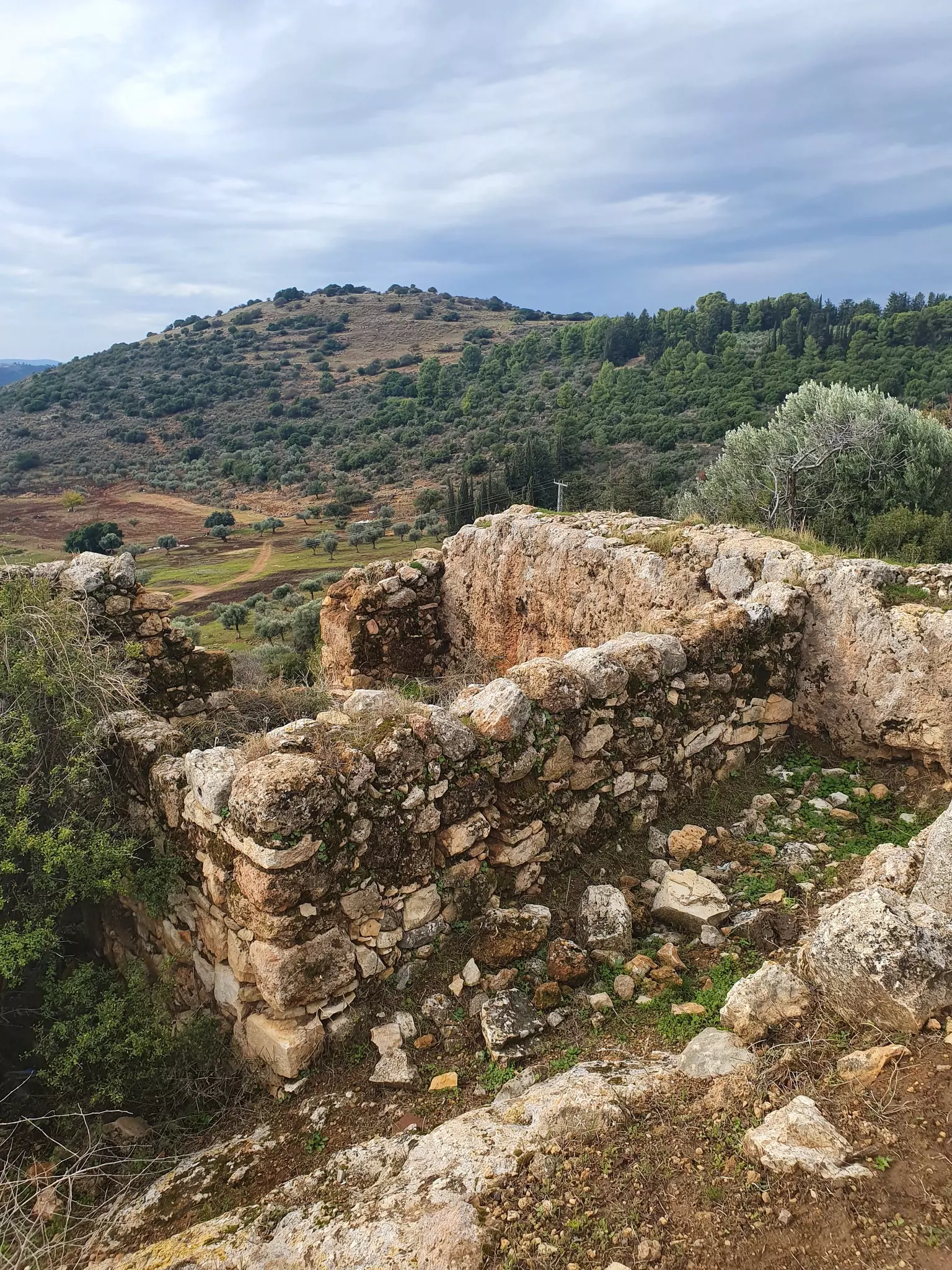
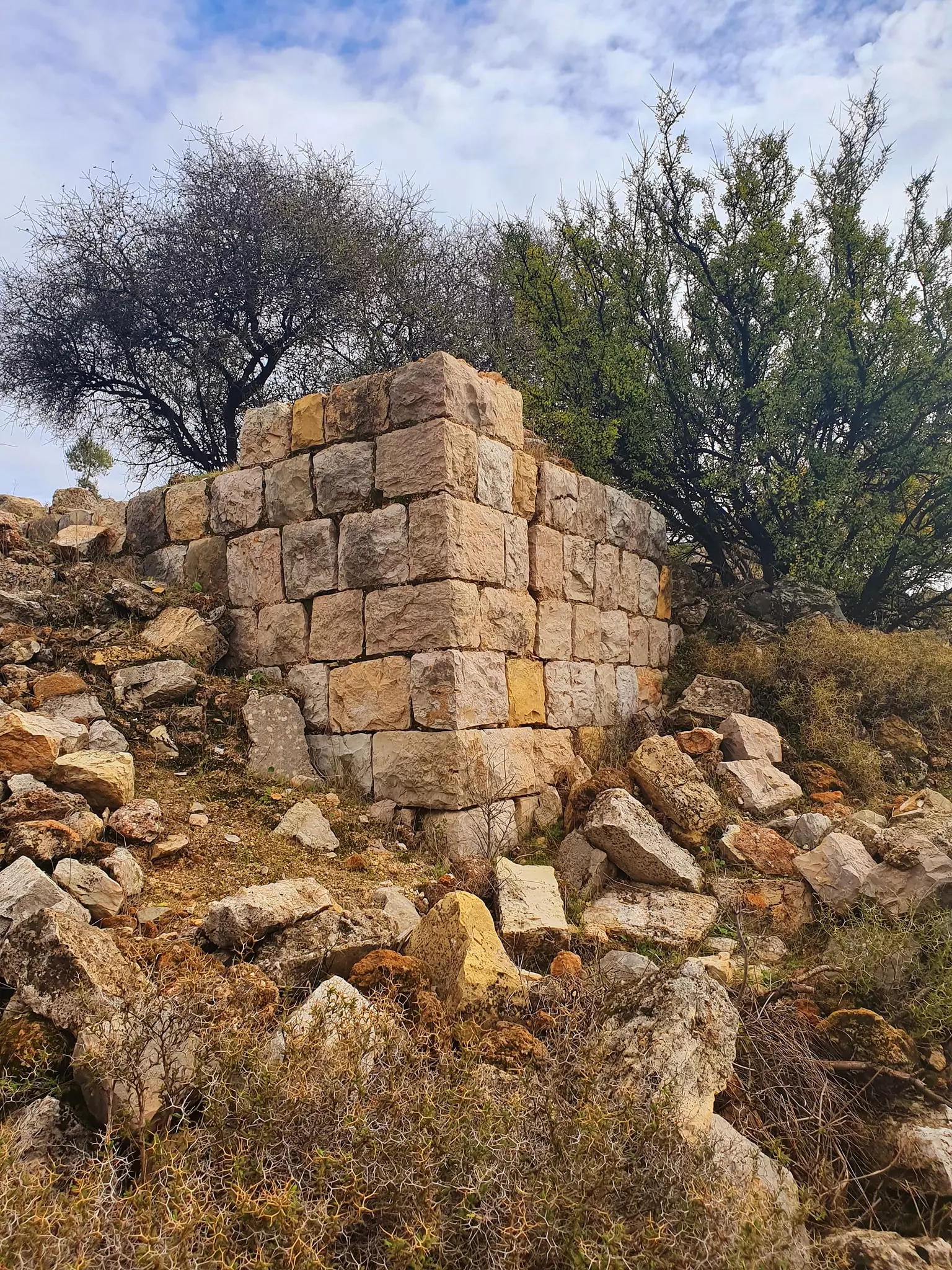
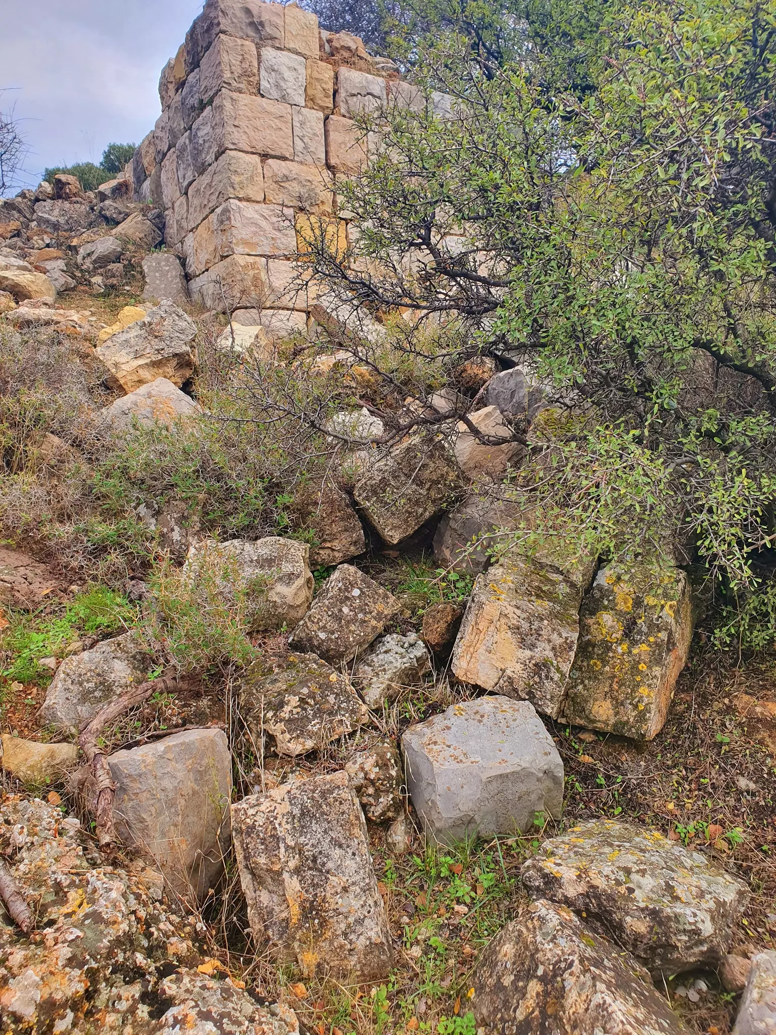
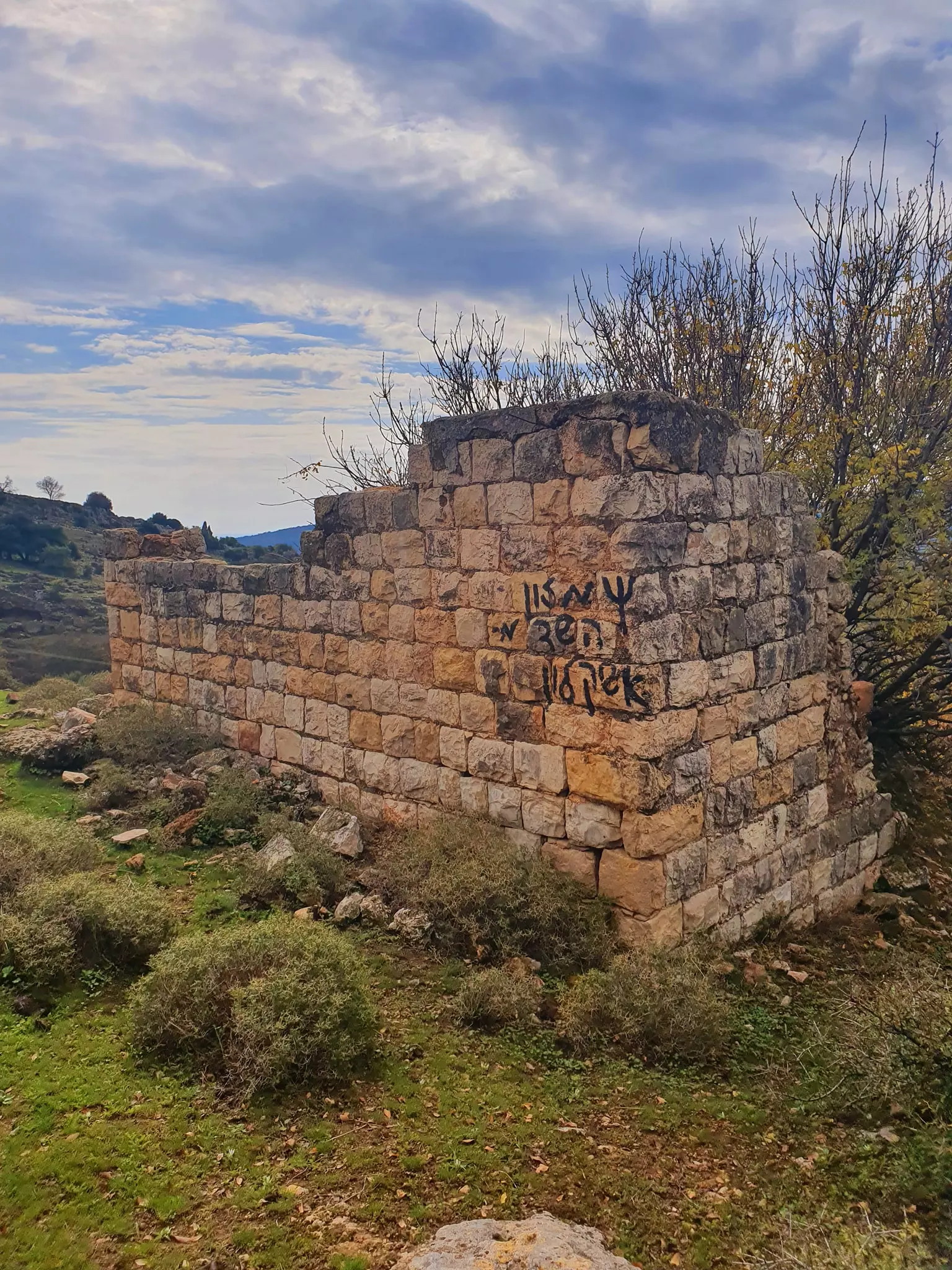
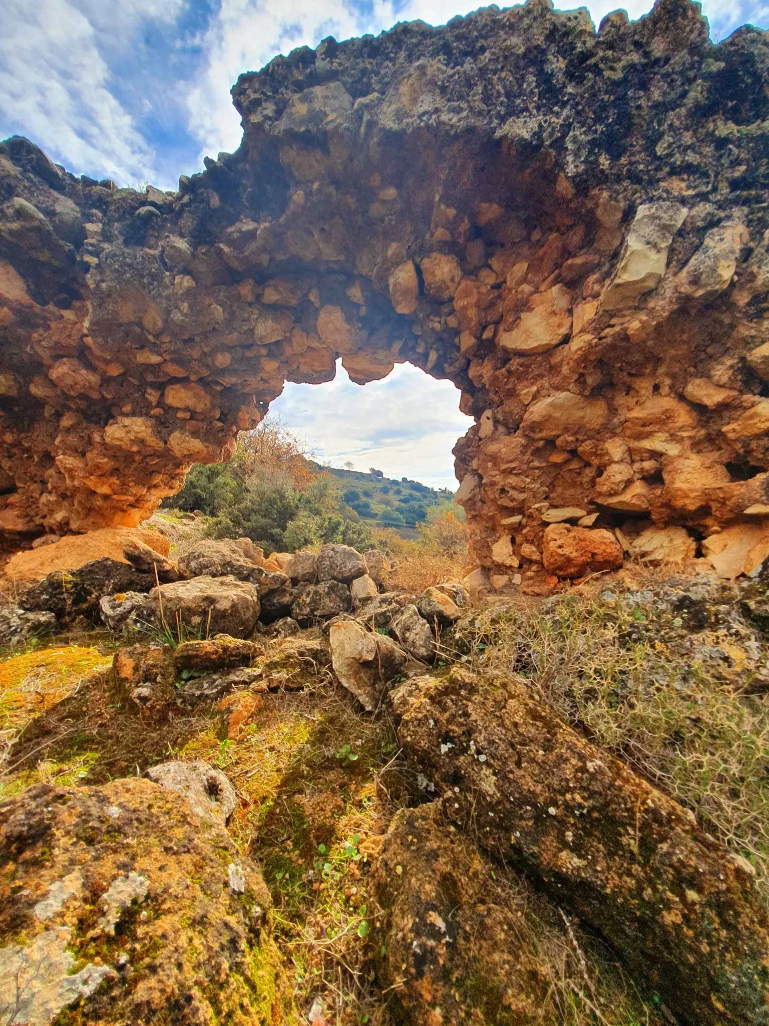
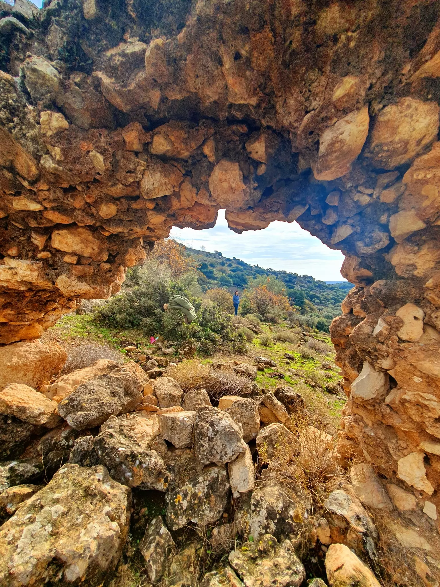
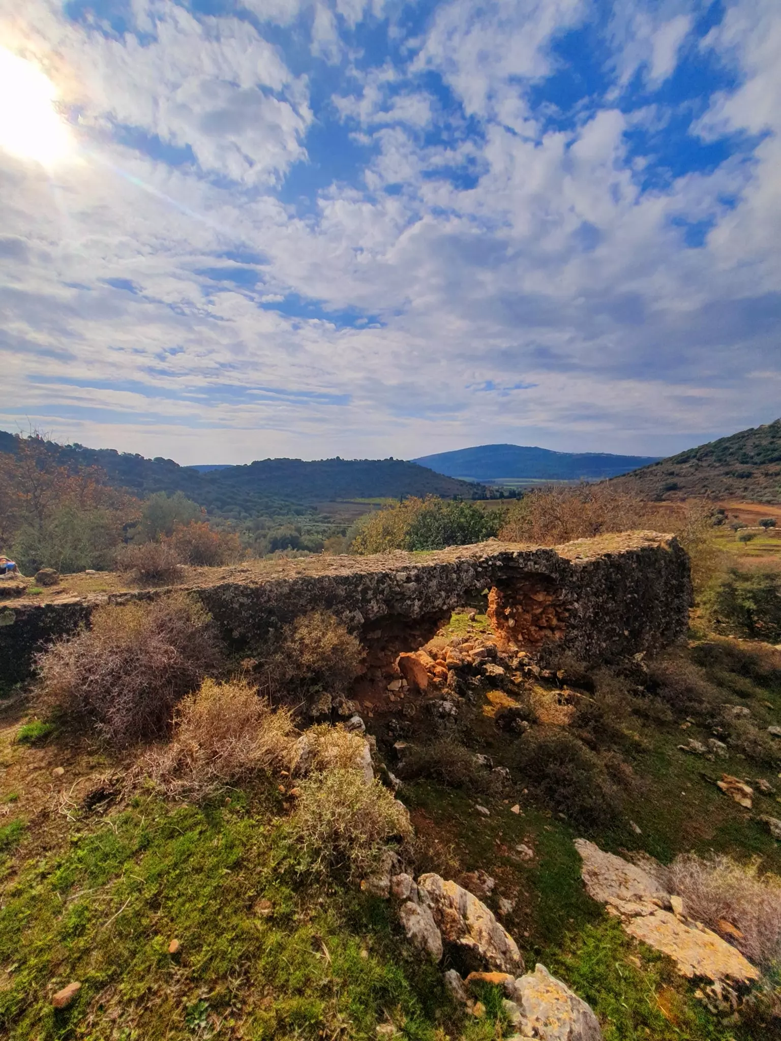
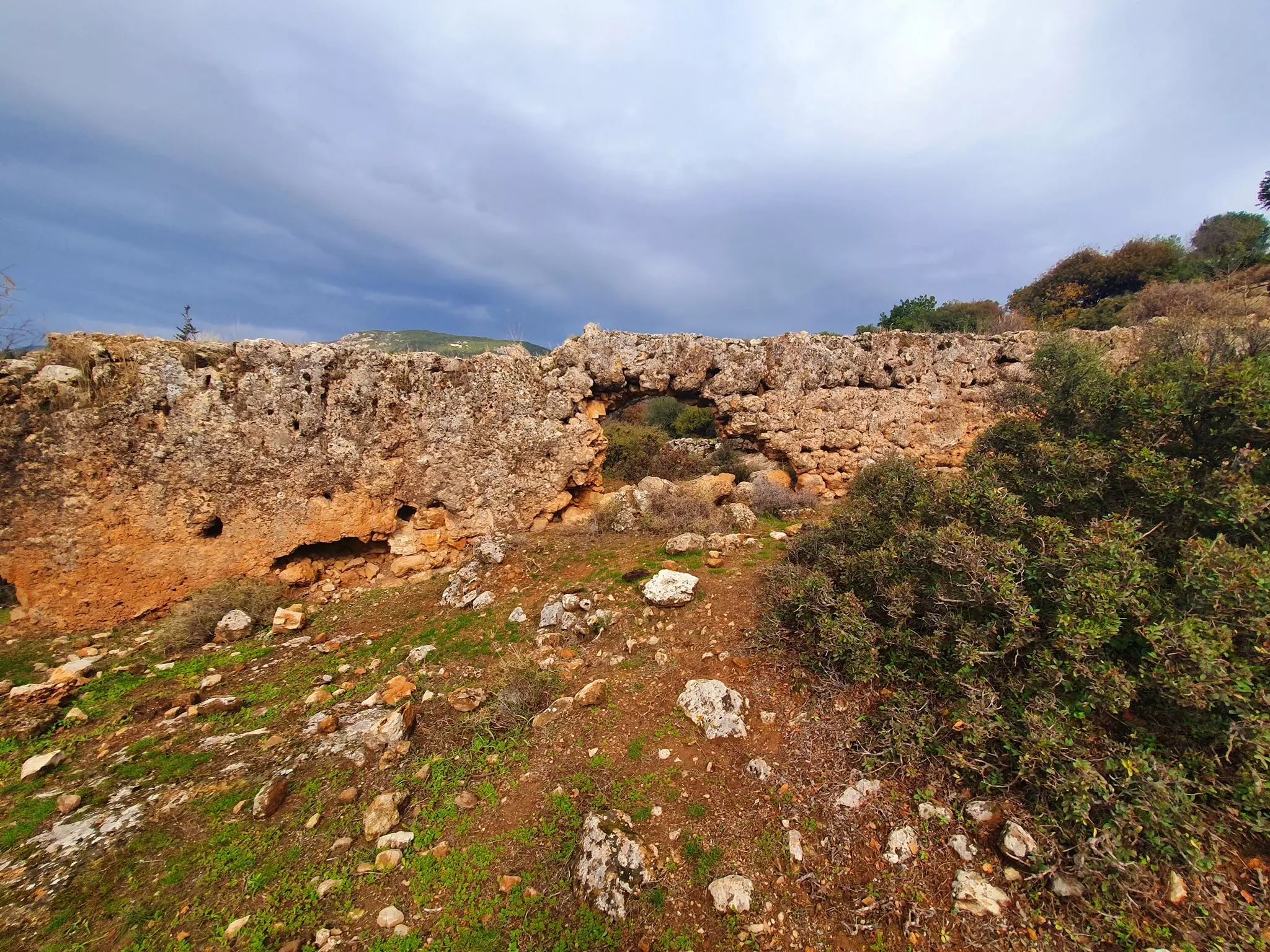
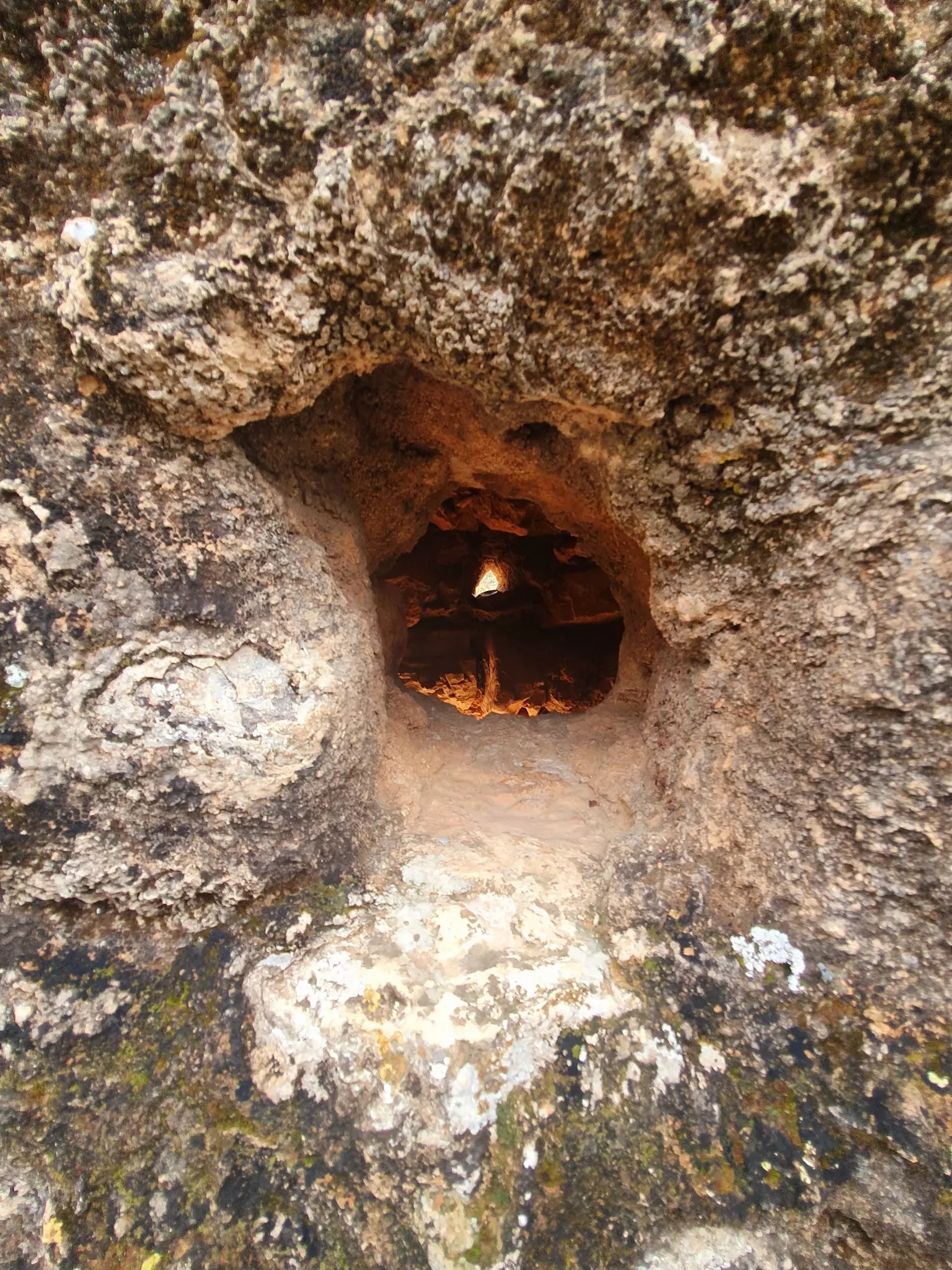
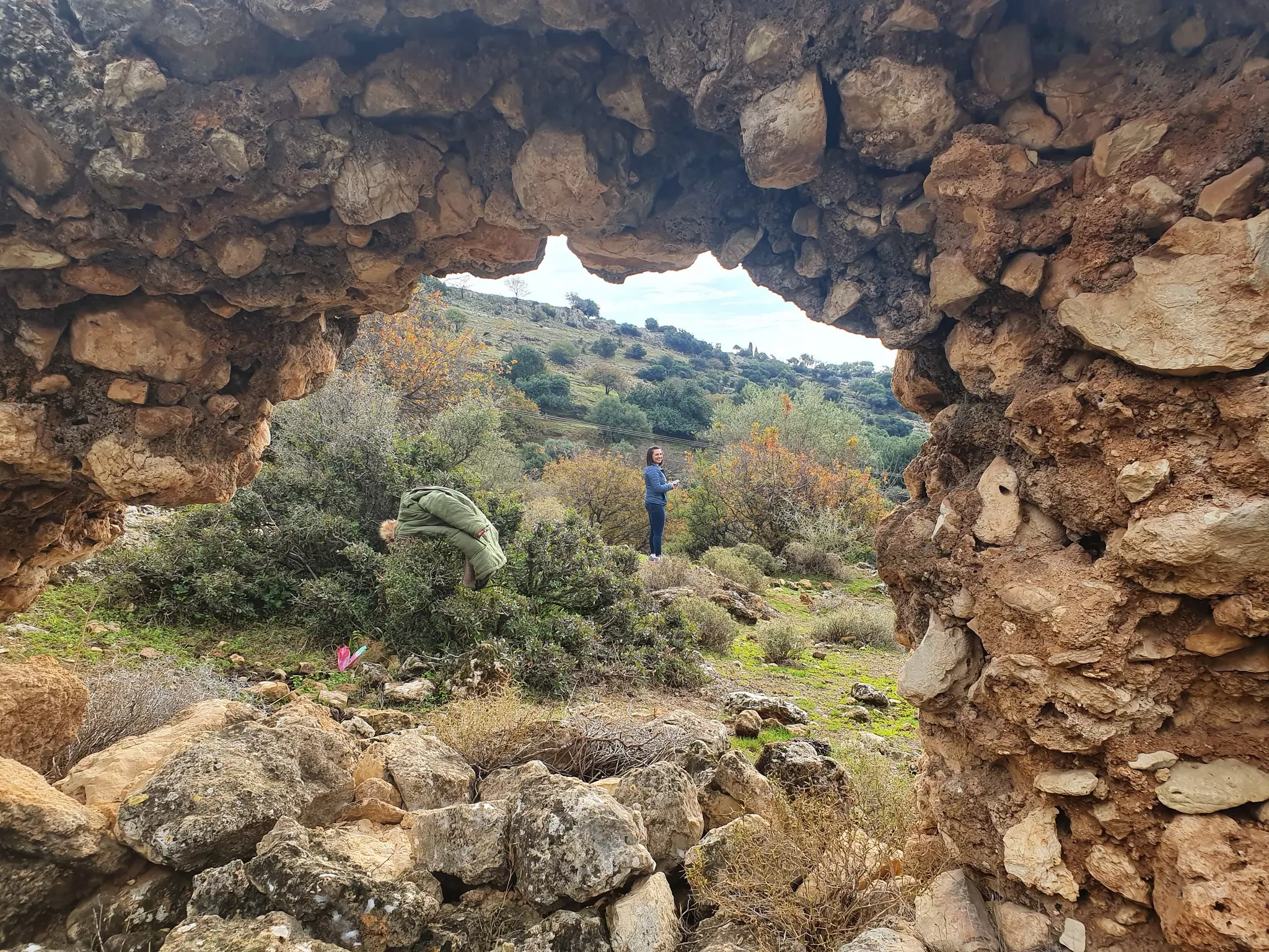
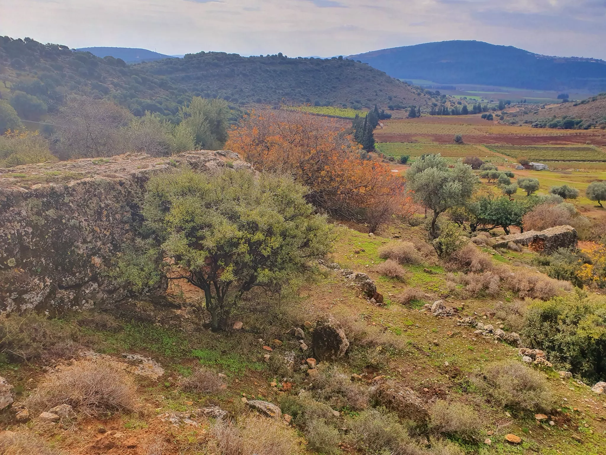
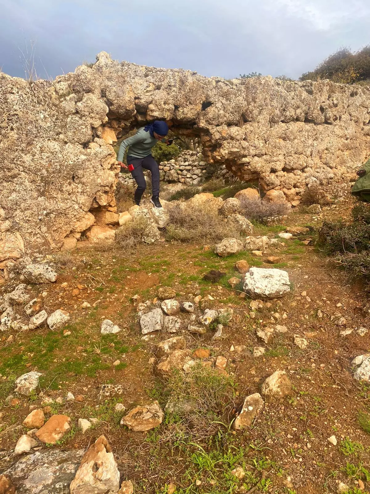
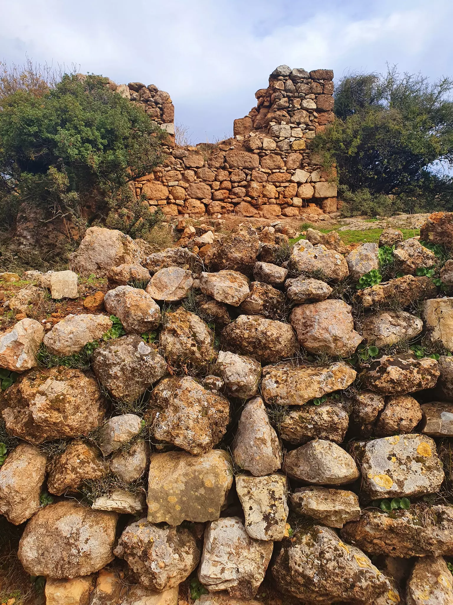
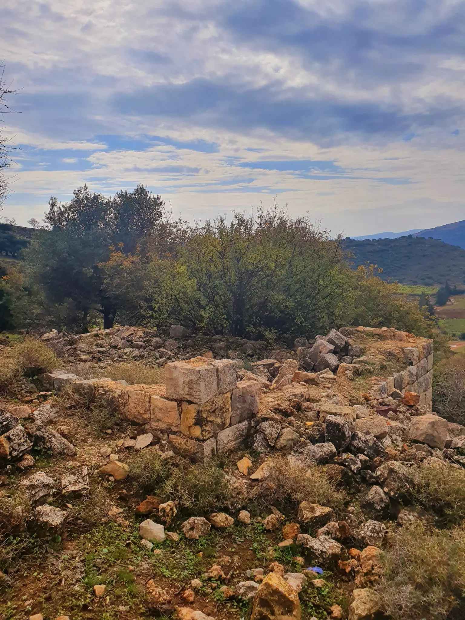
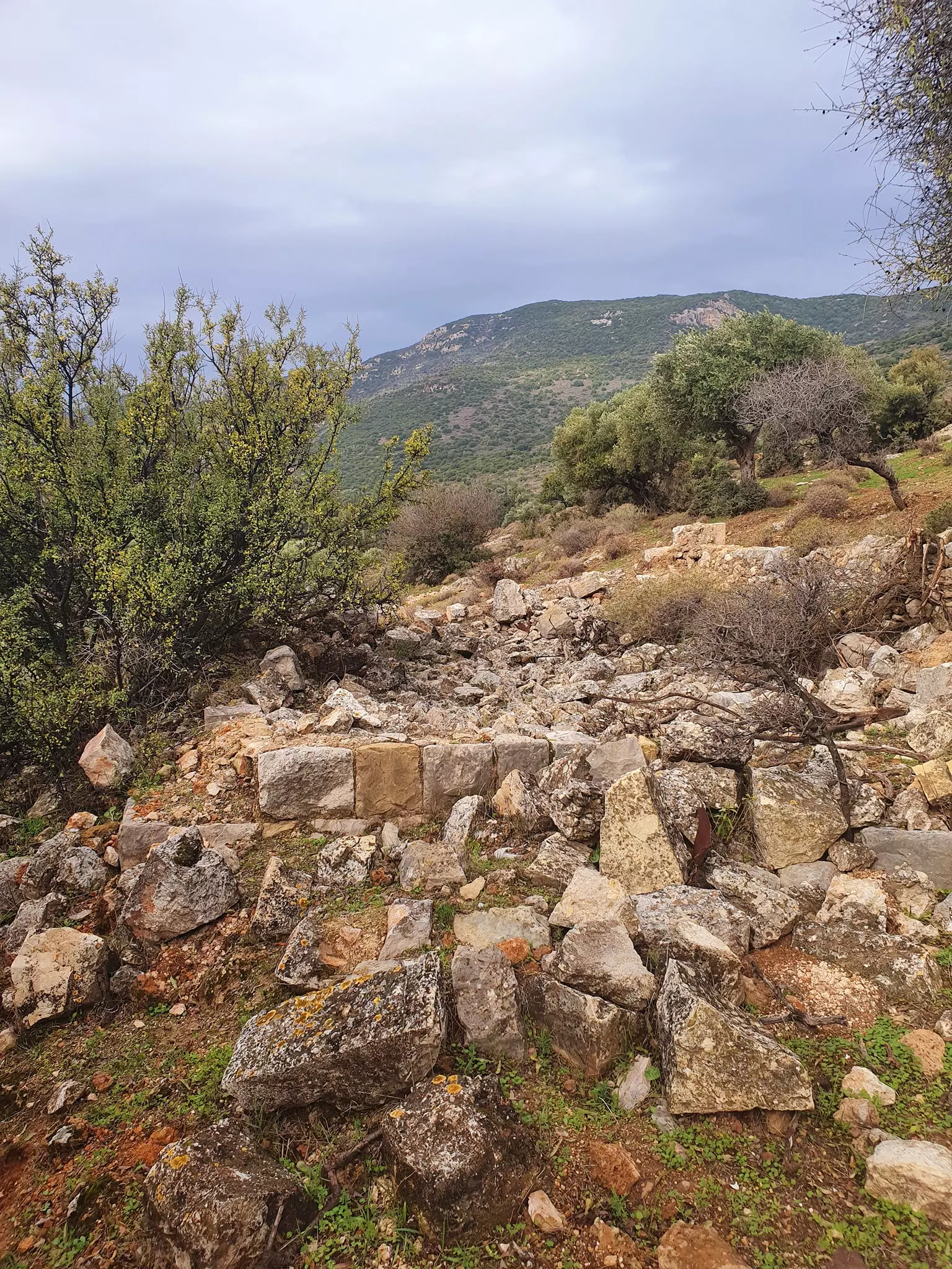
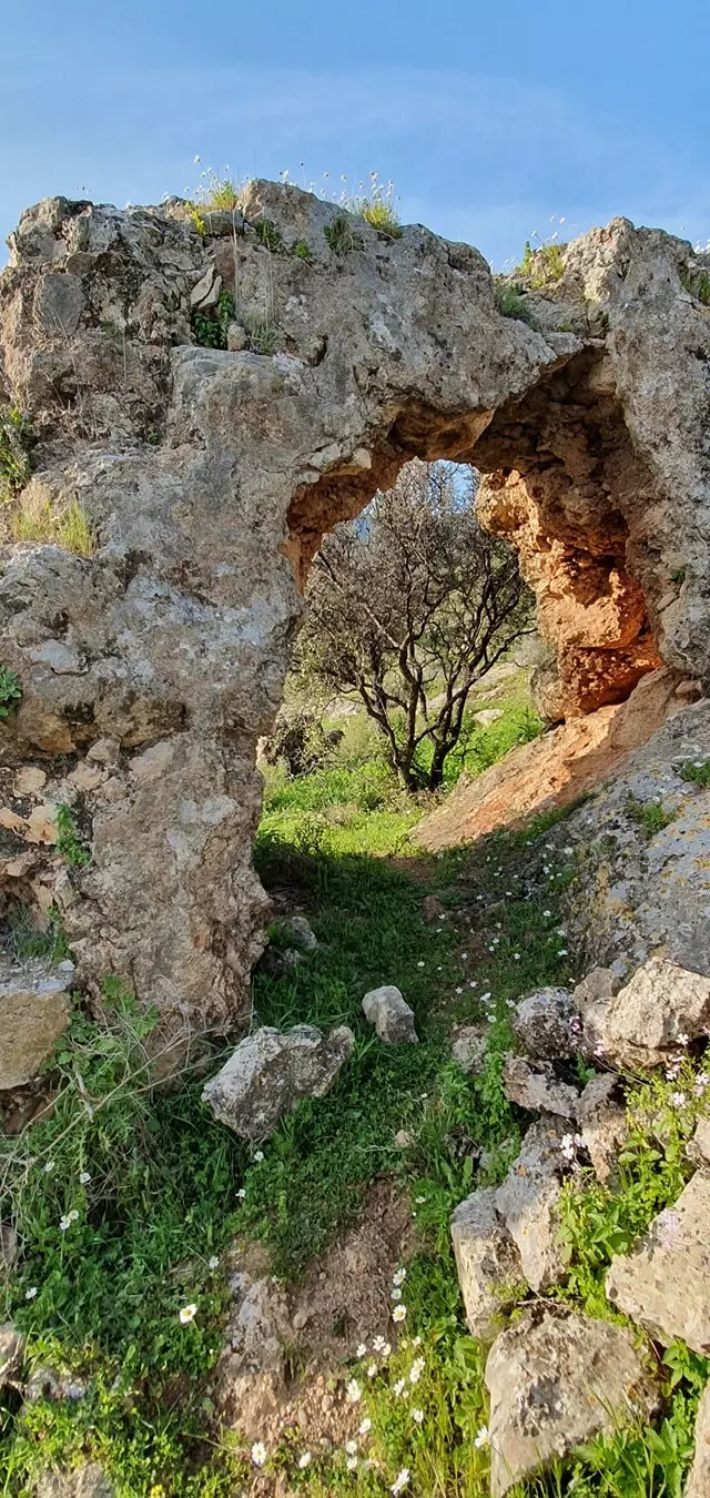
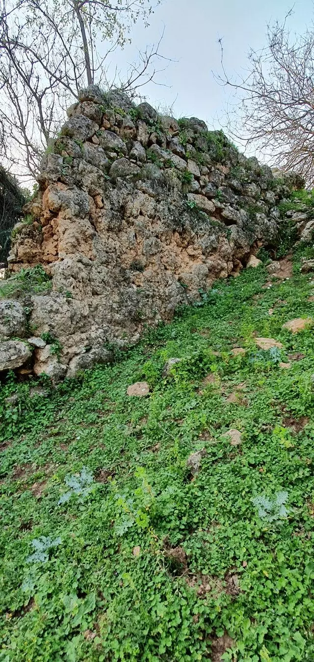
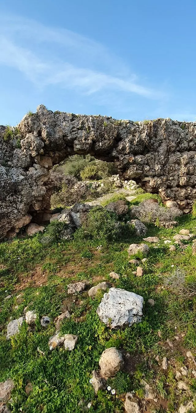
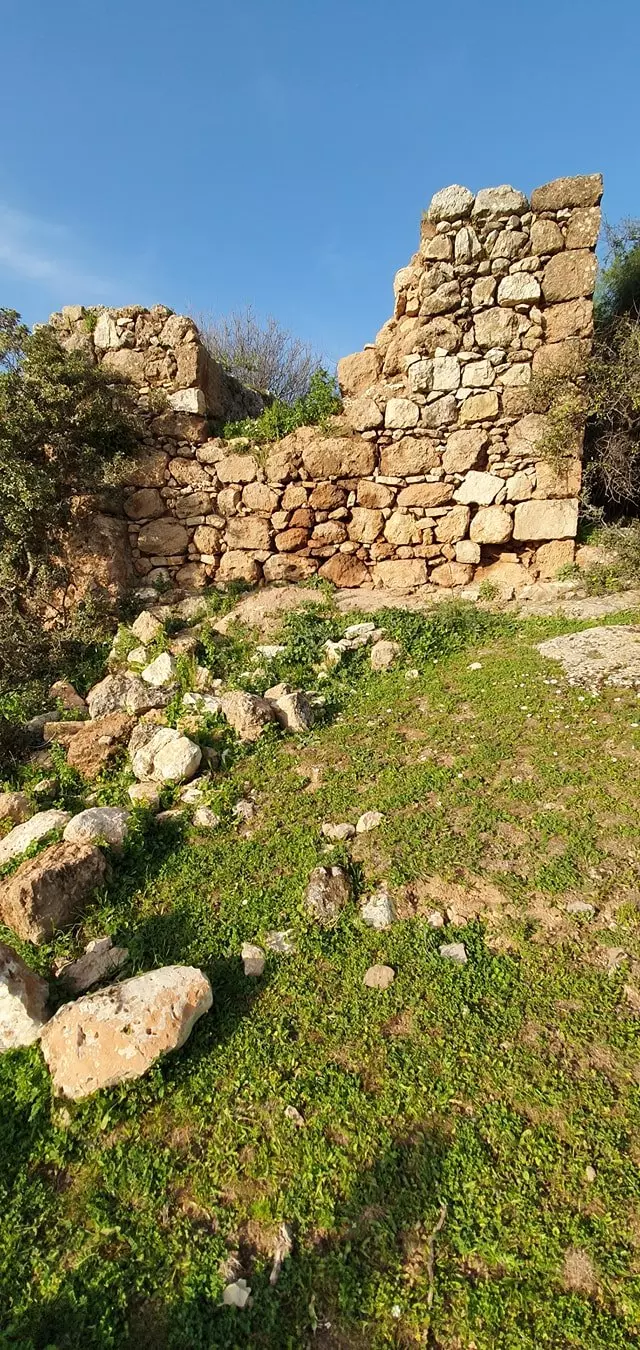
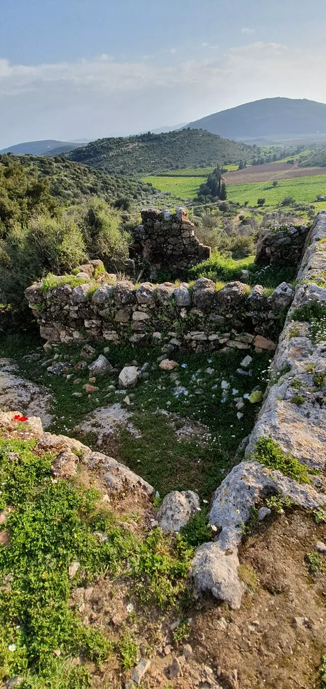
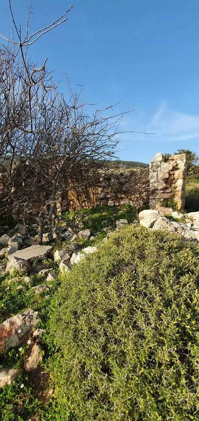
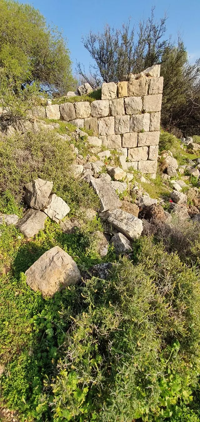
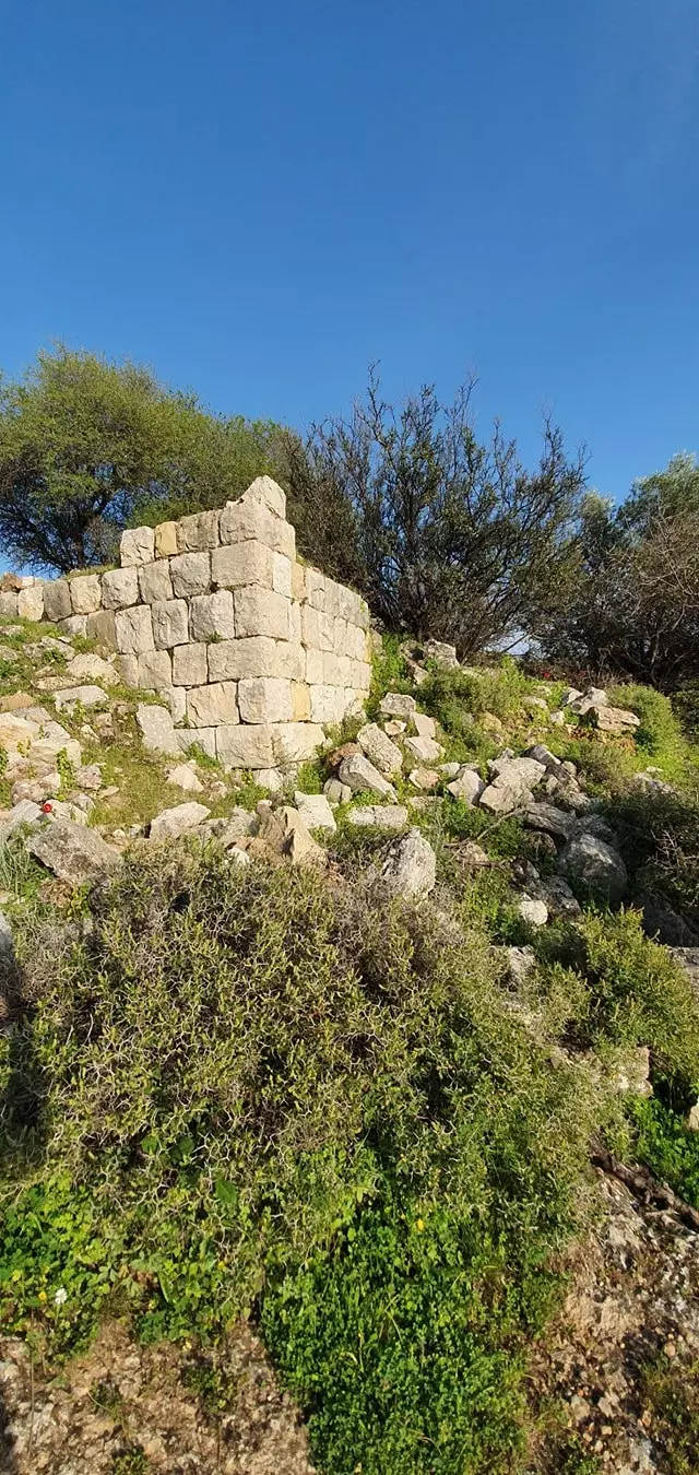
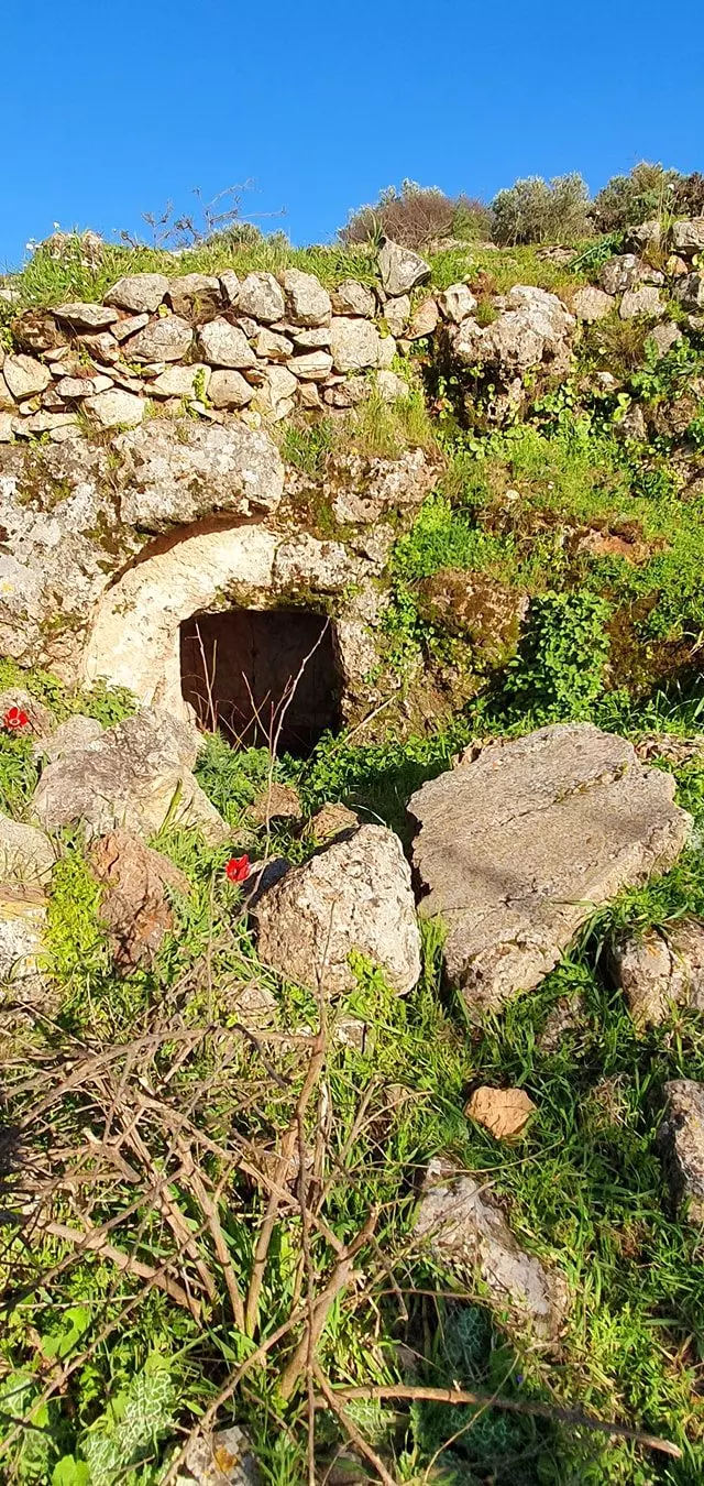
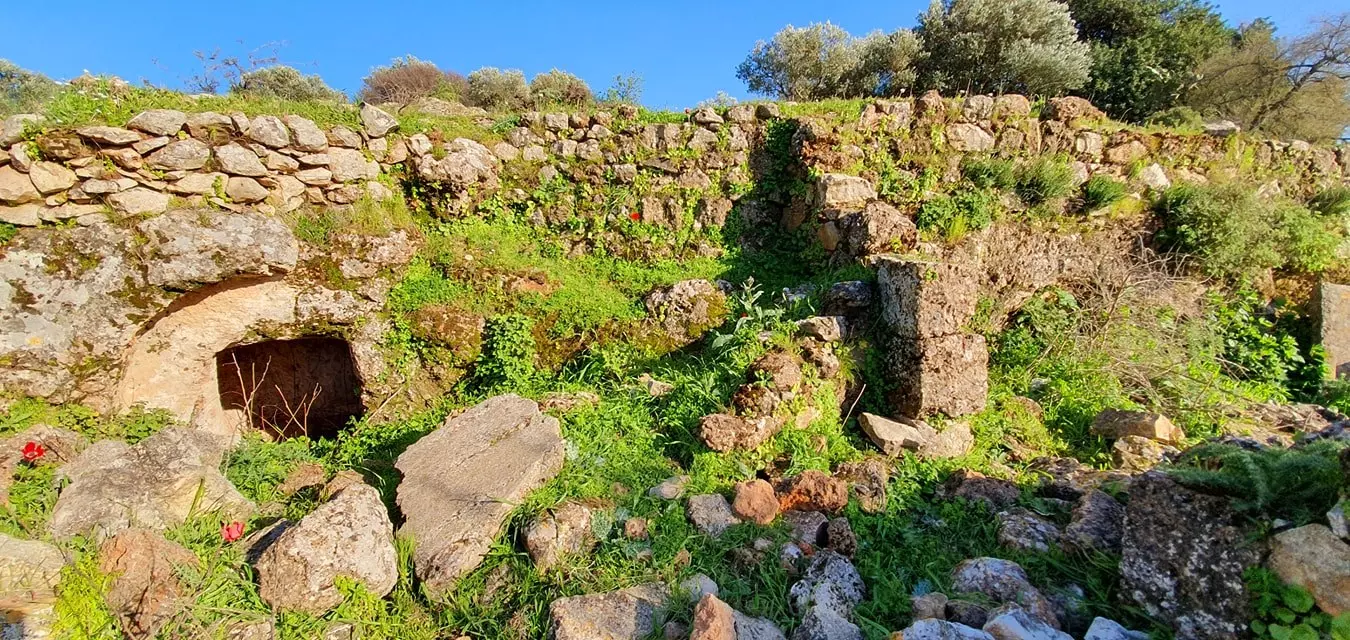
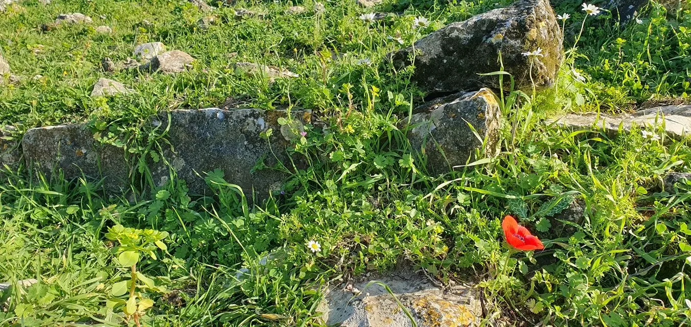
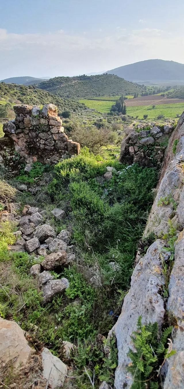
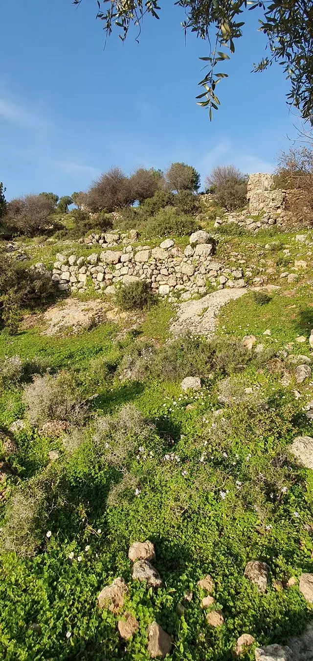
| Village Temains | The village has been completely destroyed, and only house walls and rubble left behind. | ||||||||||||||||
| Ethnically Cleansing | al-Farradiyya inhabitants were completely ethnically cleansed. | ||||||||||||||||
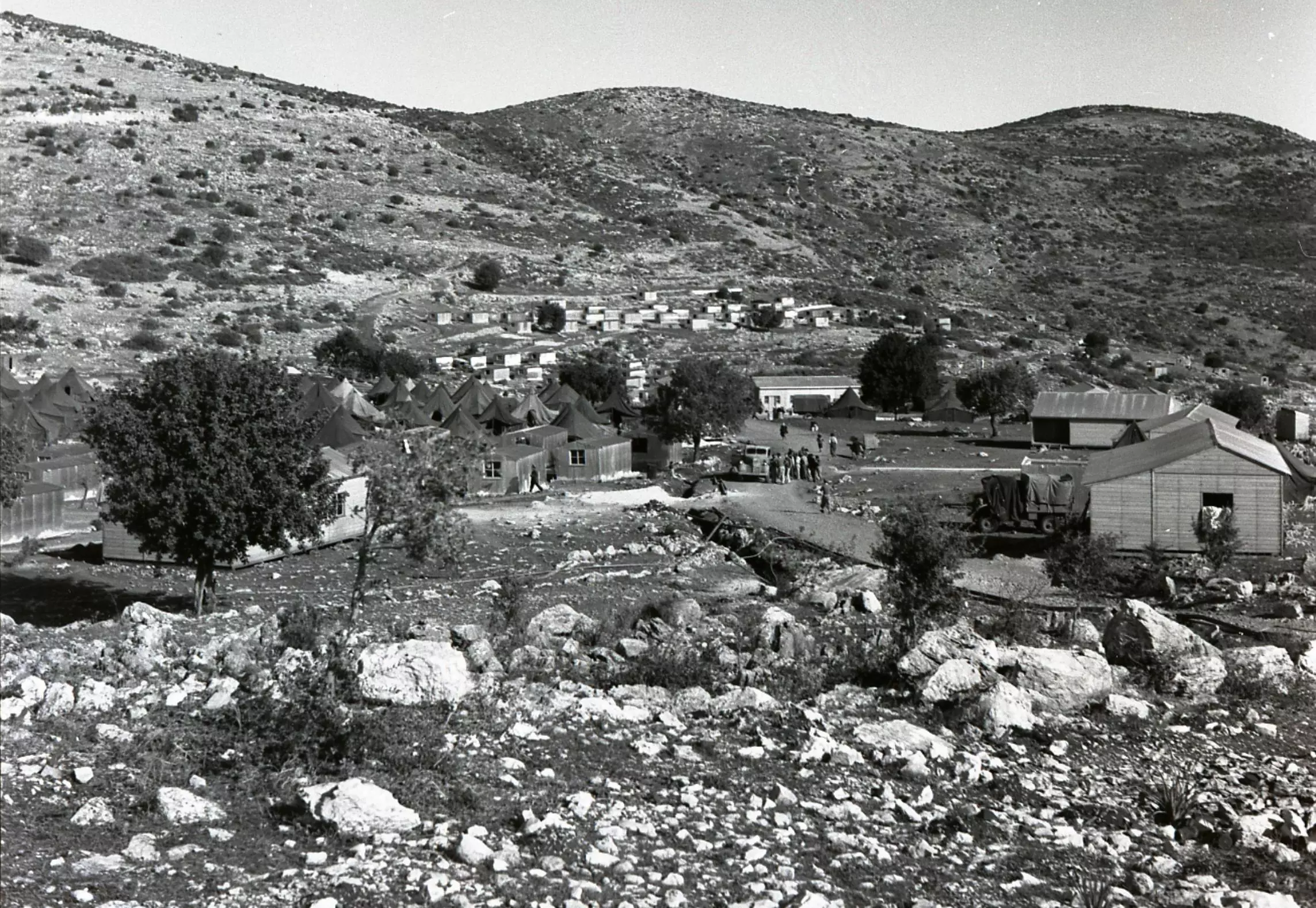
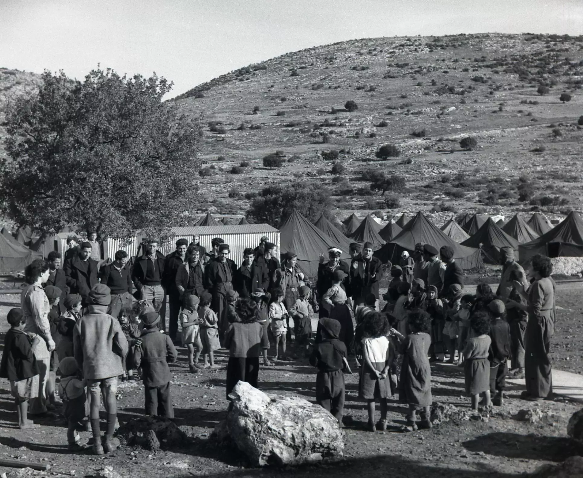
| Terminating Refugee Camps | Many of the refugees were scattered in Tel al-Za'tar, Shatila, Sabra, Ayn al-Hilwah, and Meiyah Ew-Meiyah refugee camps in Lebanon, and few became internal refugees in the upper Galilee, occupied Palestine. | ||||||||||||||||
| Pre-Nakba Land Ownership |
**Town Lands' Demarcation Maps |
||||||||||||||||
| Land Usage As of 1945 |
|
||||||||||||||||
| Population |
|
||||||||||||||||
| Number of Houses |
|
||||||||||||||||
| Near By Towns |
|||||||||||||||||
|
|||||||||||||||||
| Town's Name Through History | The Romans referred to the village by Parod | ||||||||||||||||
| Schools | The village had an elementary school for boys. | ||||||||||||||||
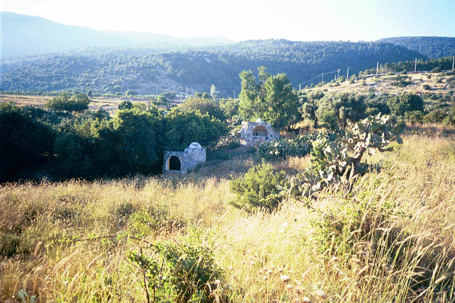
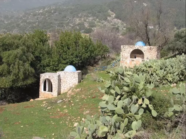
| Shrines / Maqams | A shrine for a local religious teacher known by al-Shaykh Mansour | ||||||||||||||||
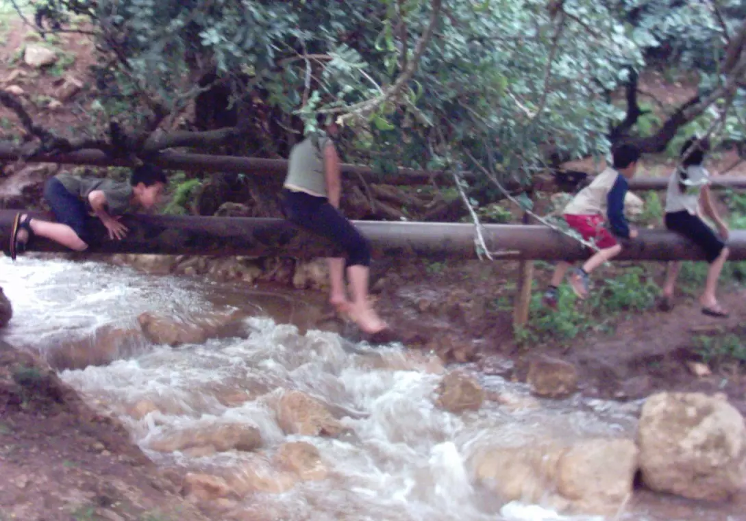
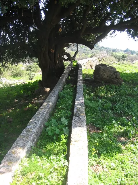
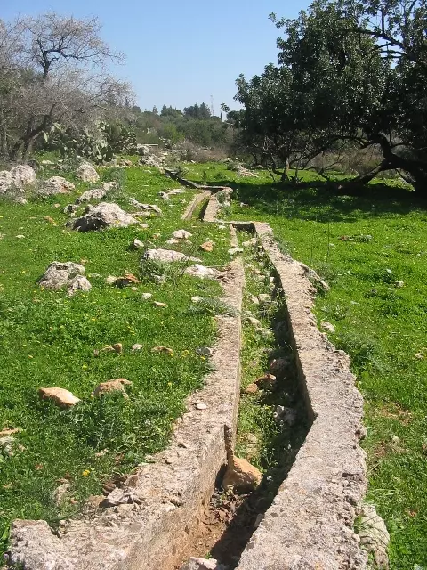
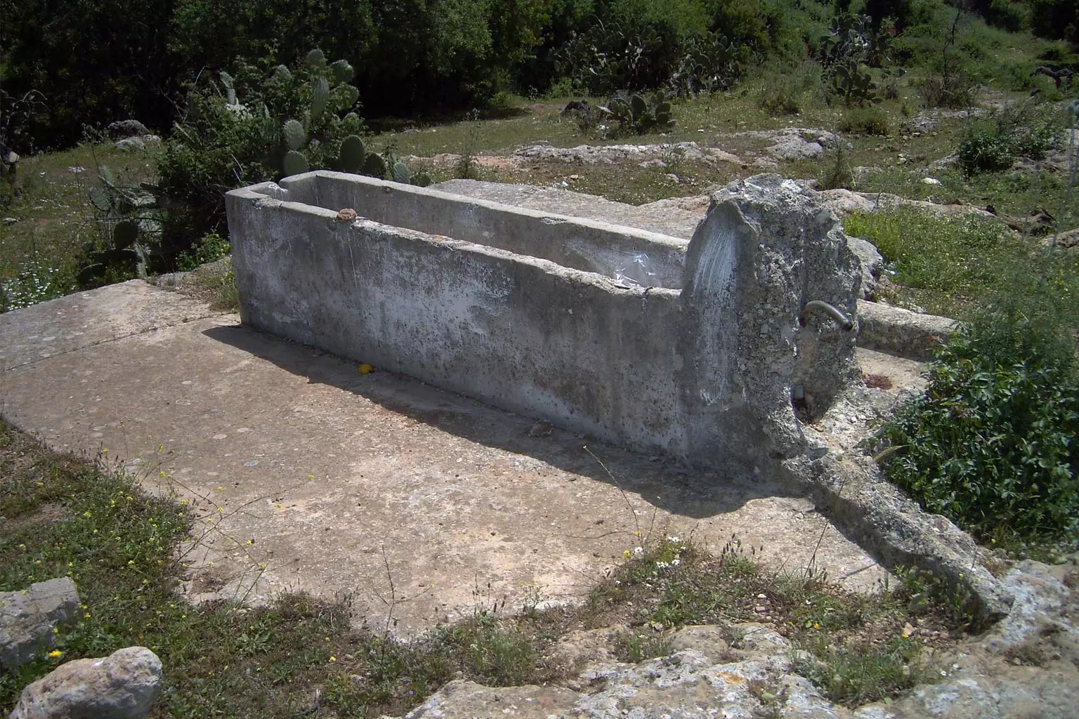
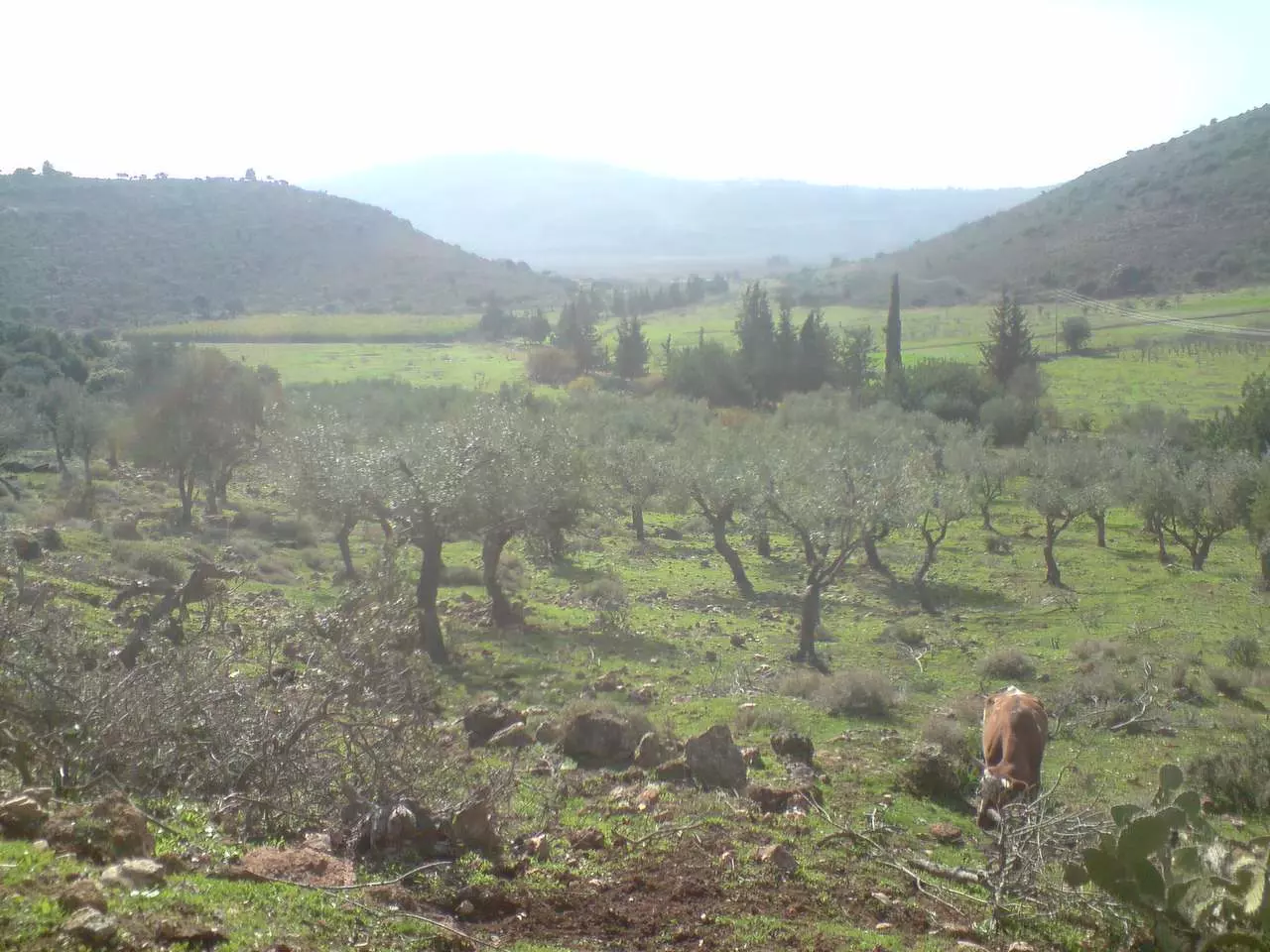
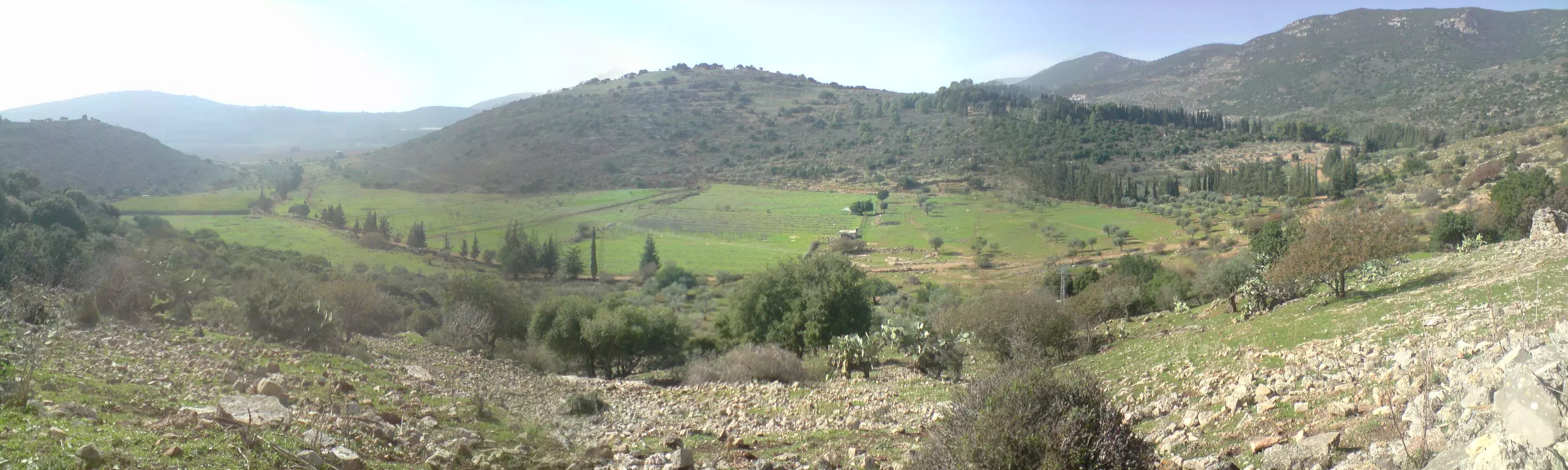
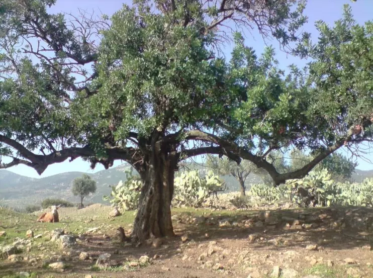
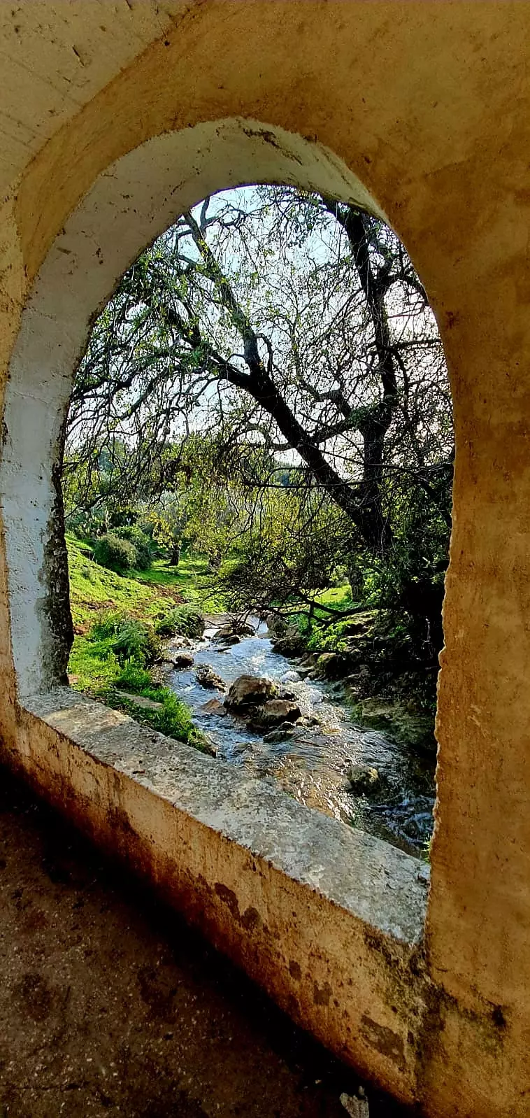
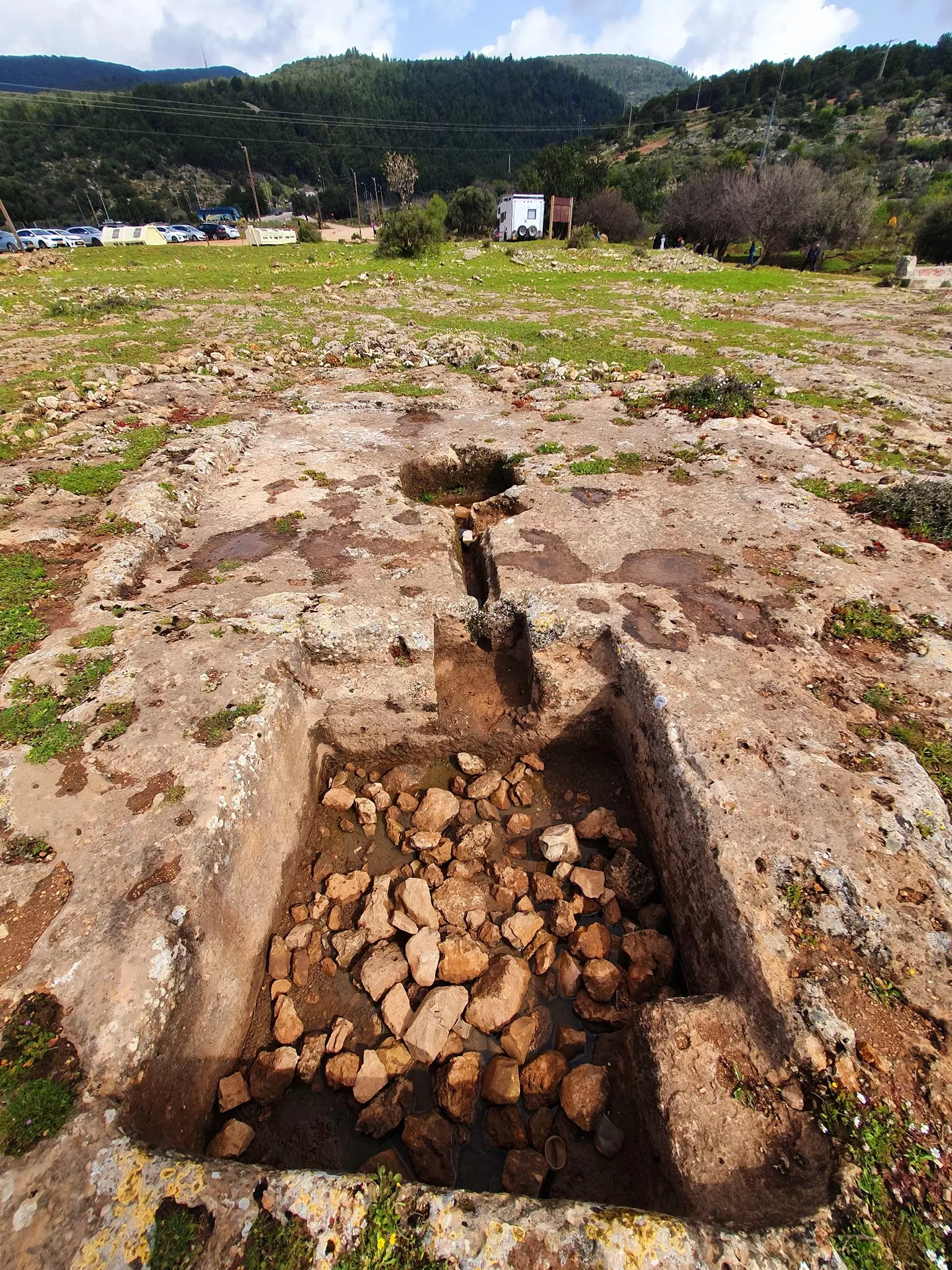
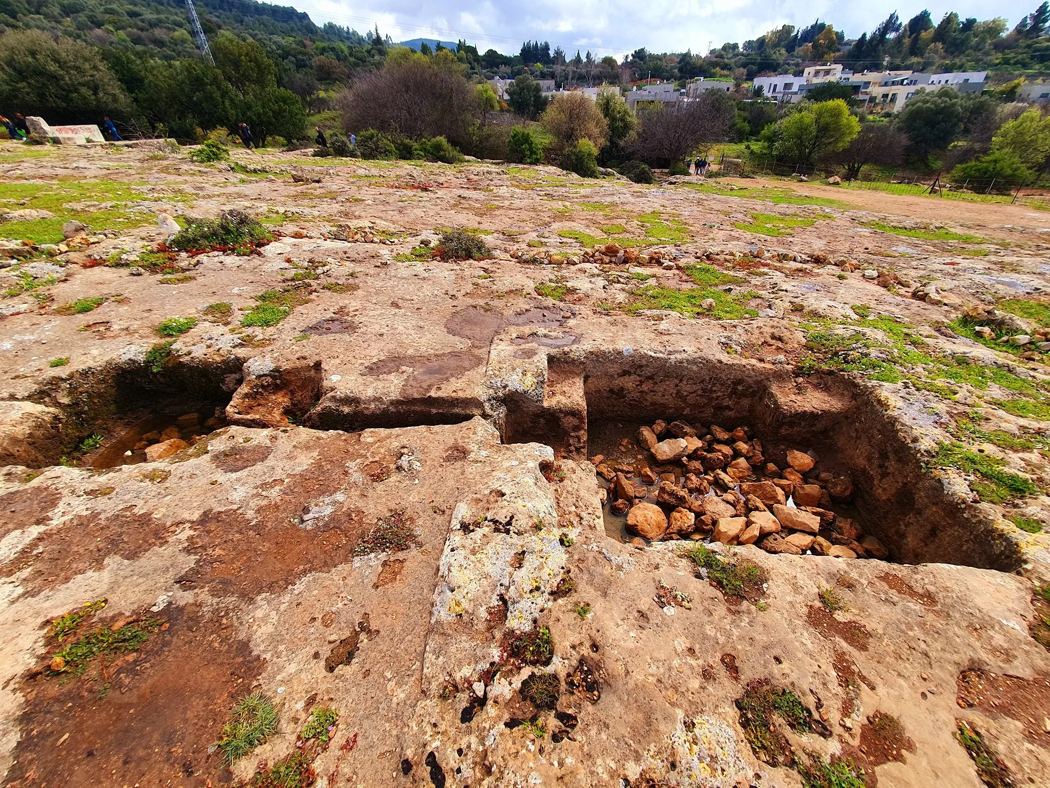
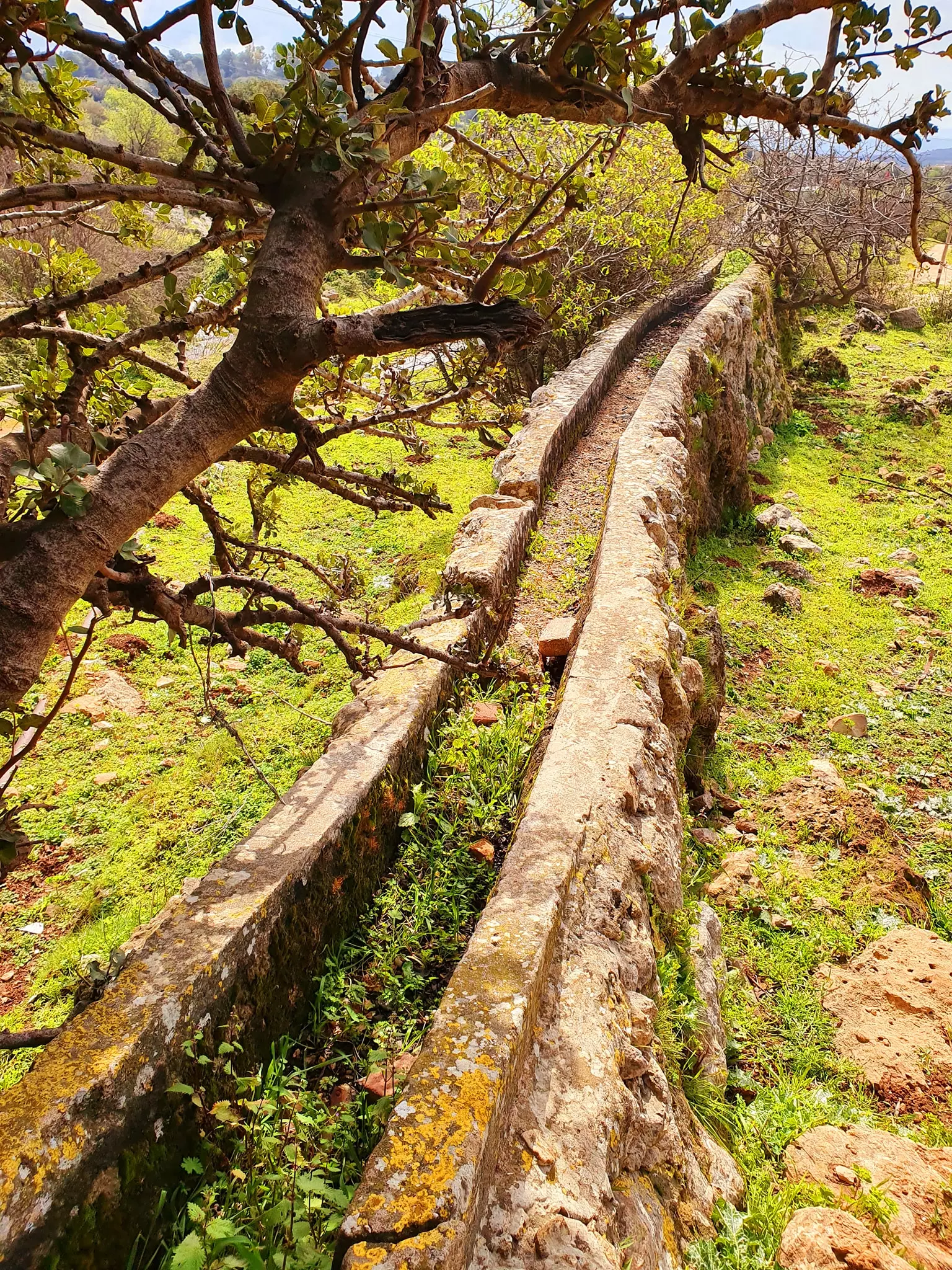
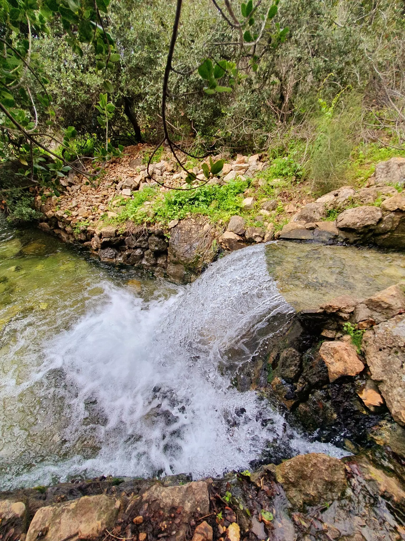
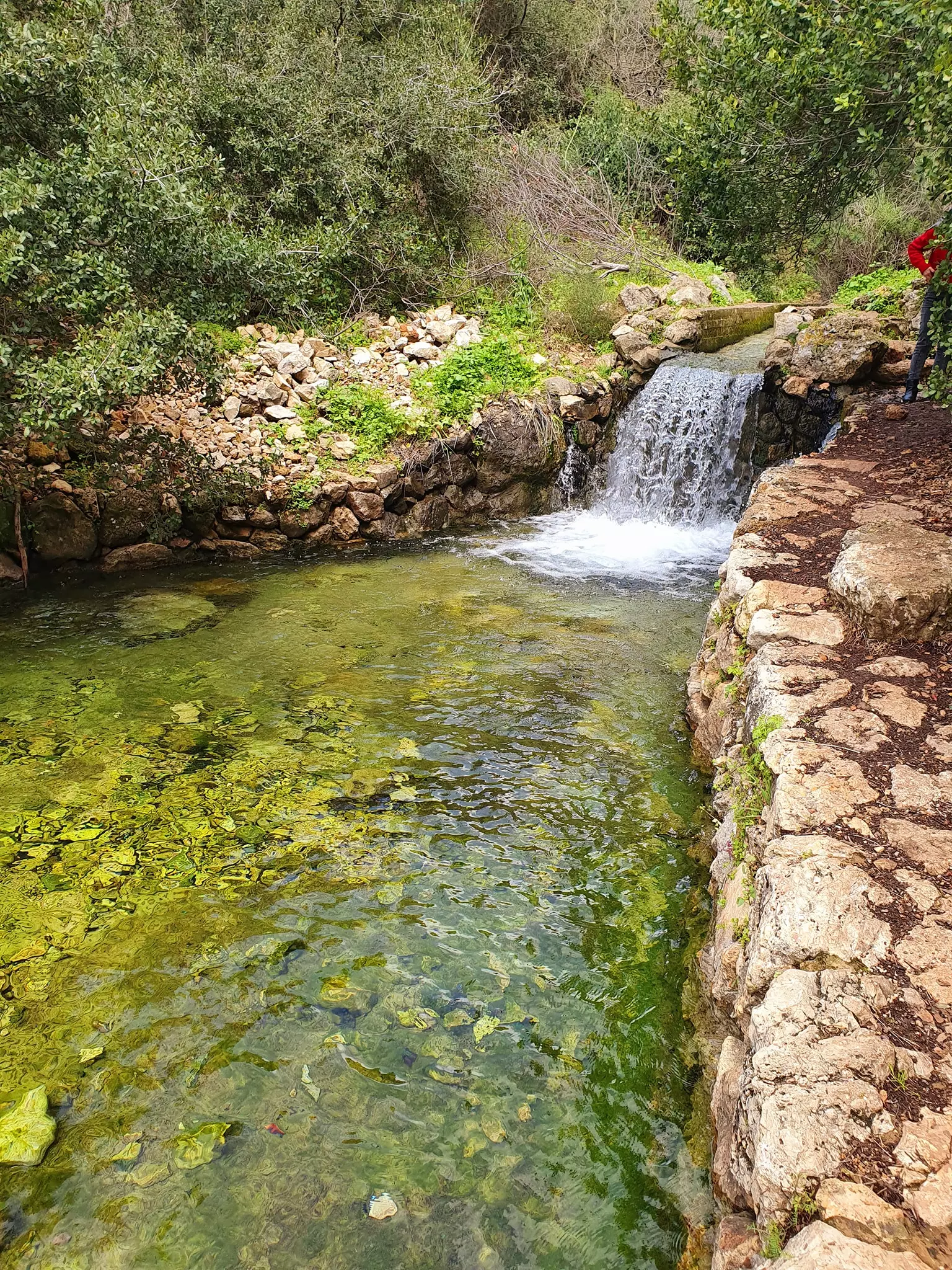
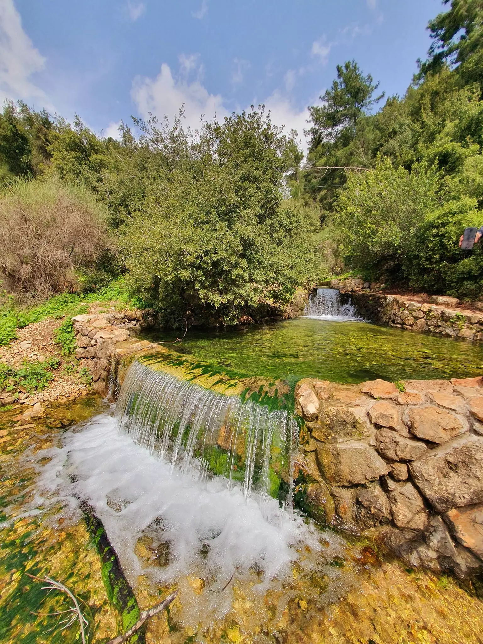
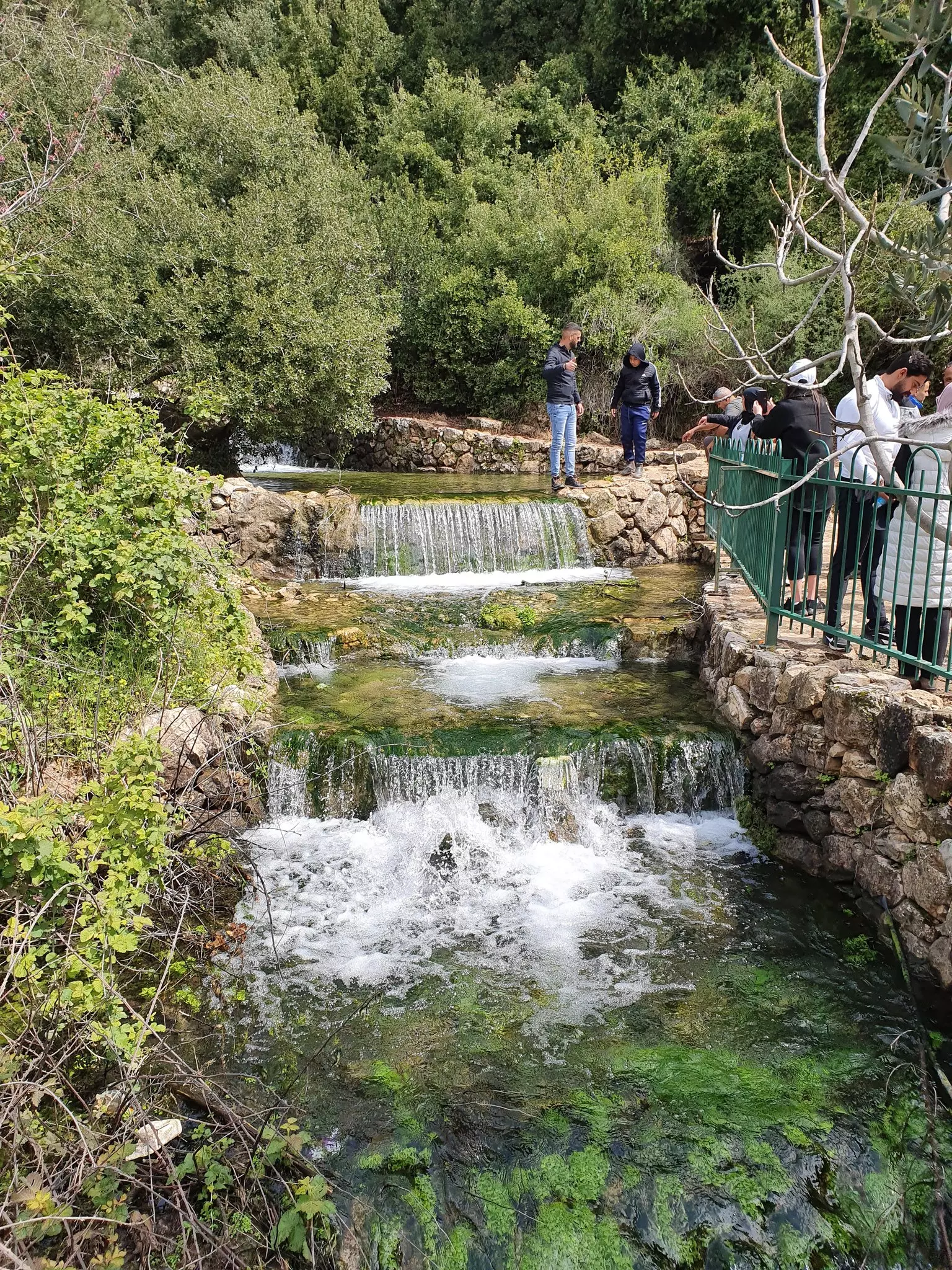
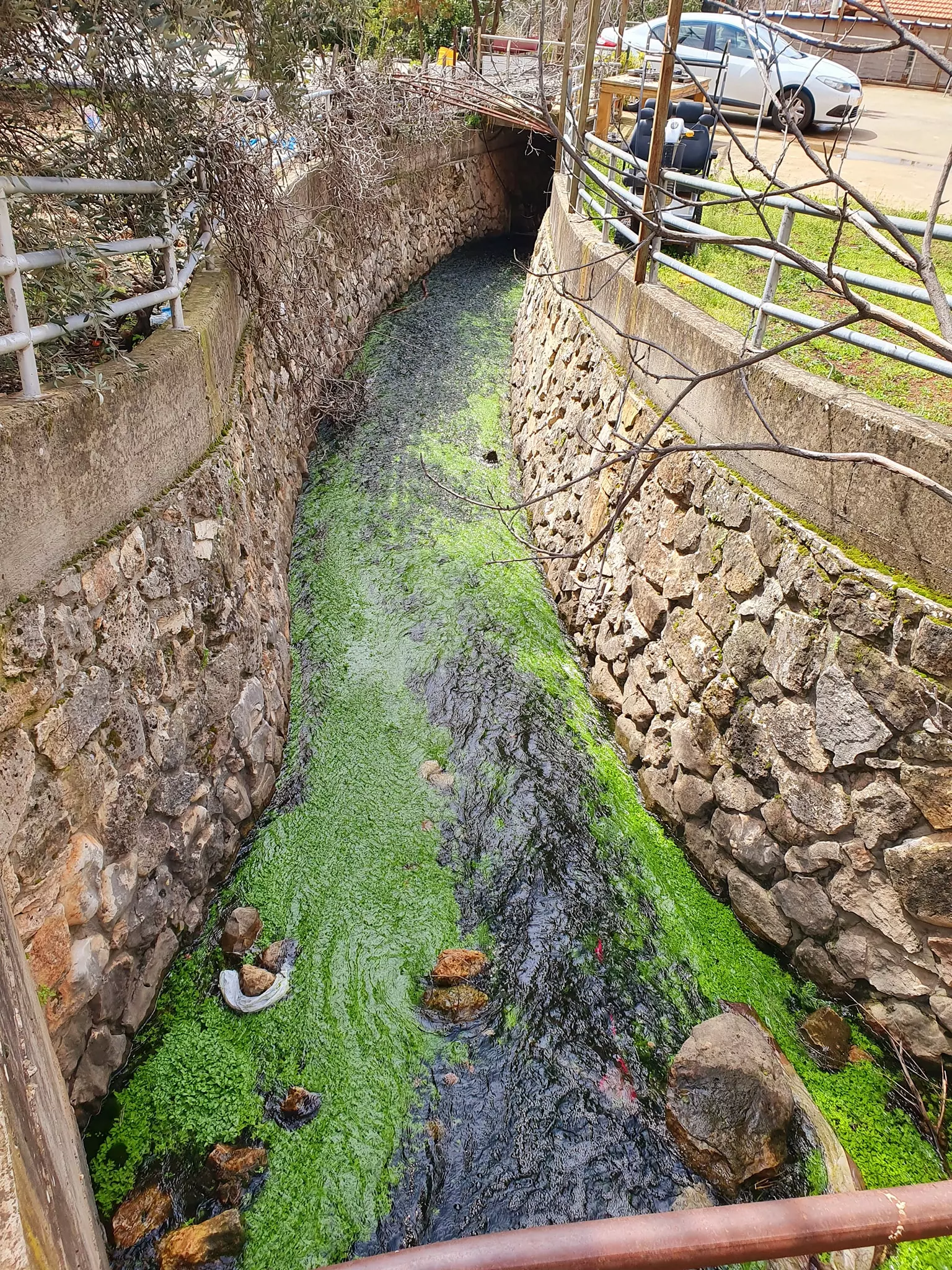
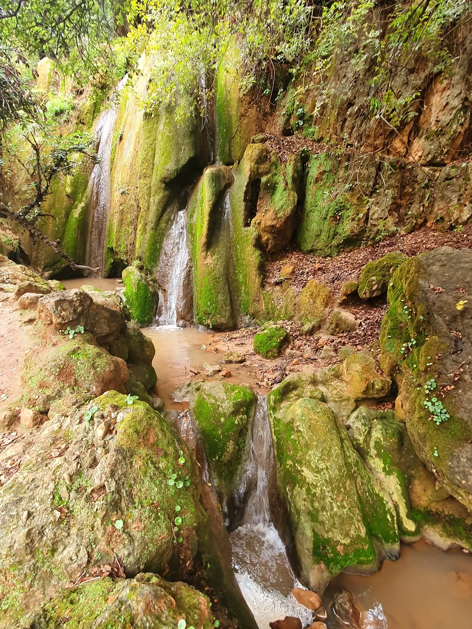
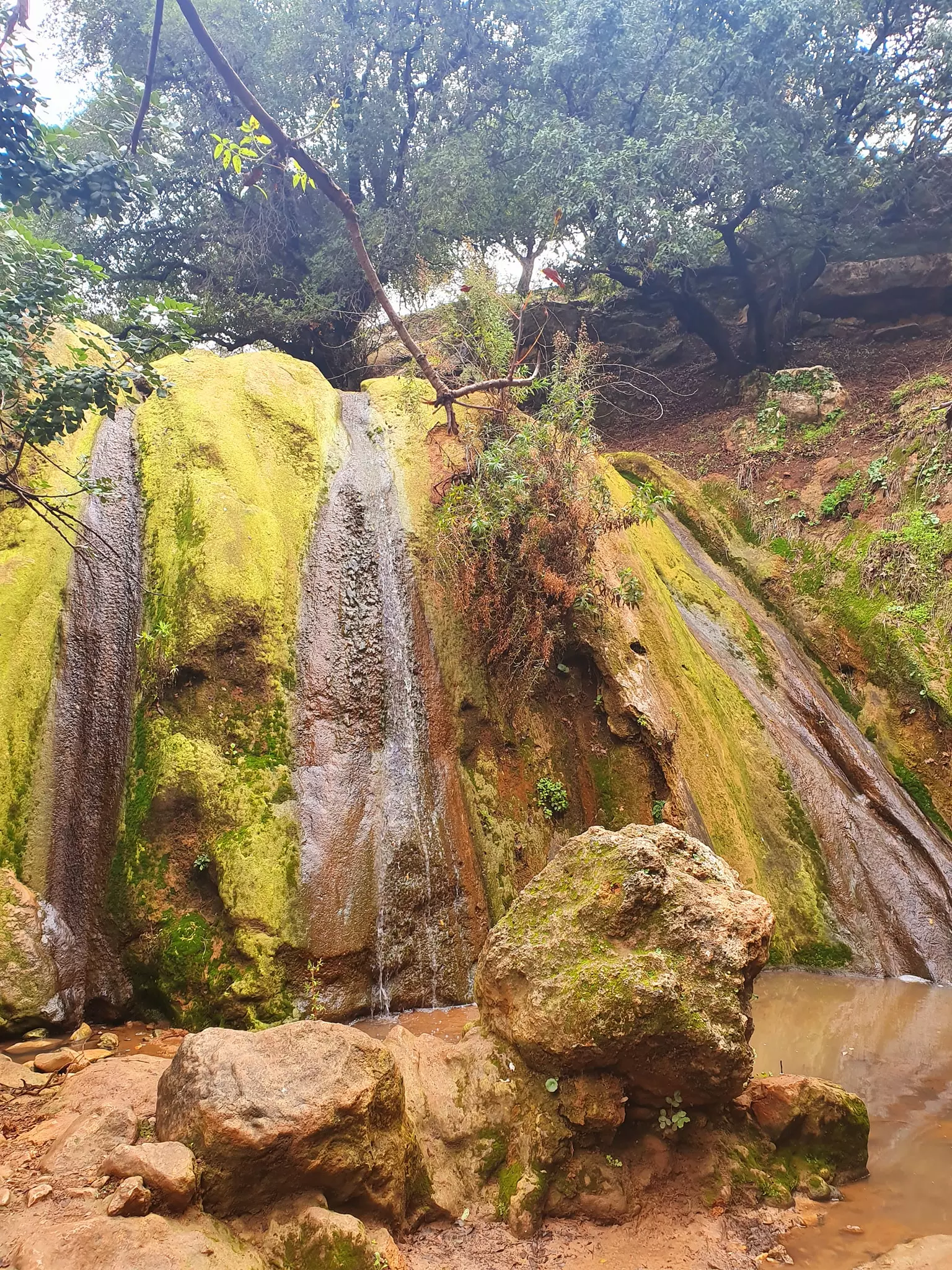
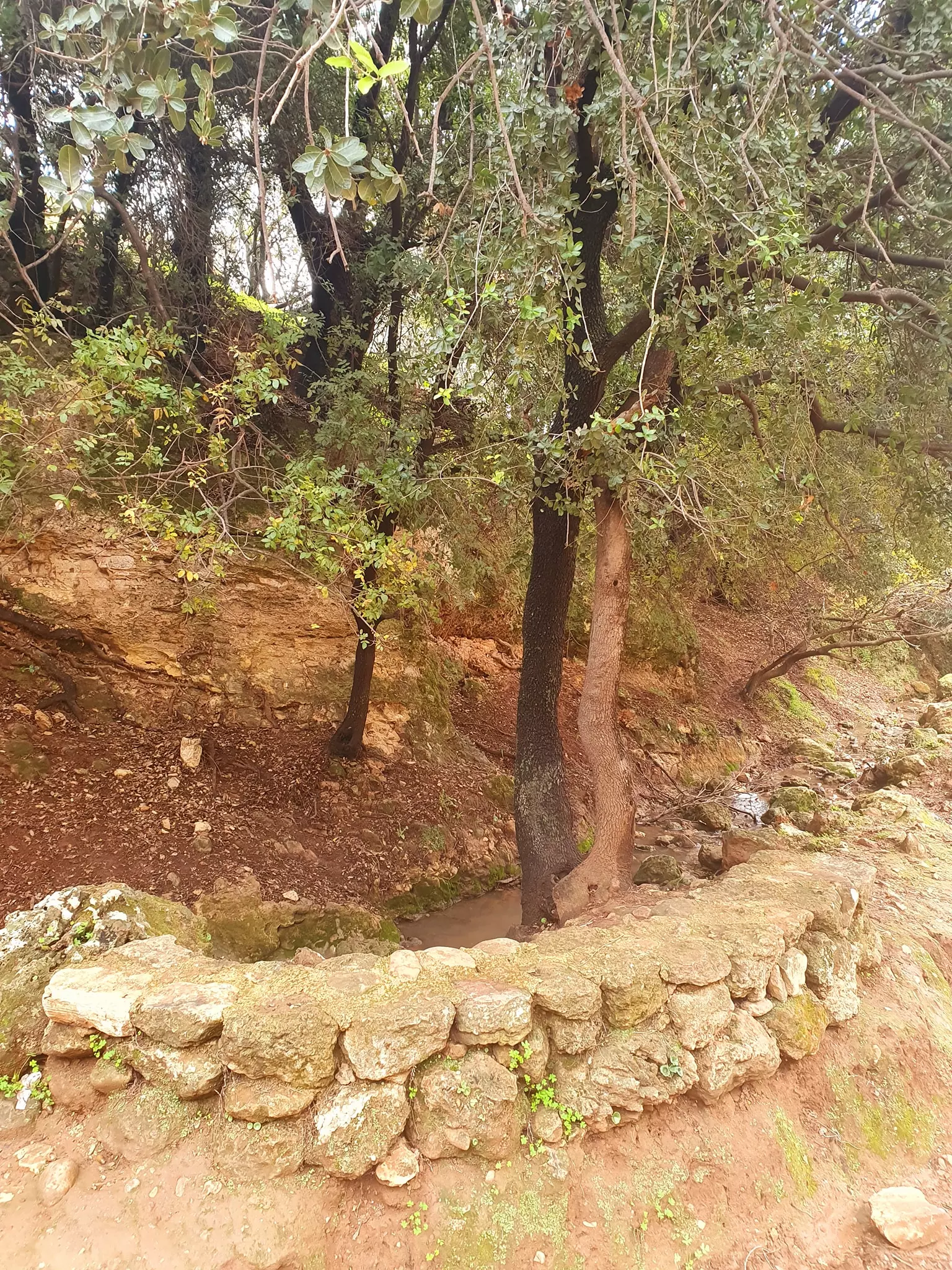
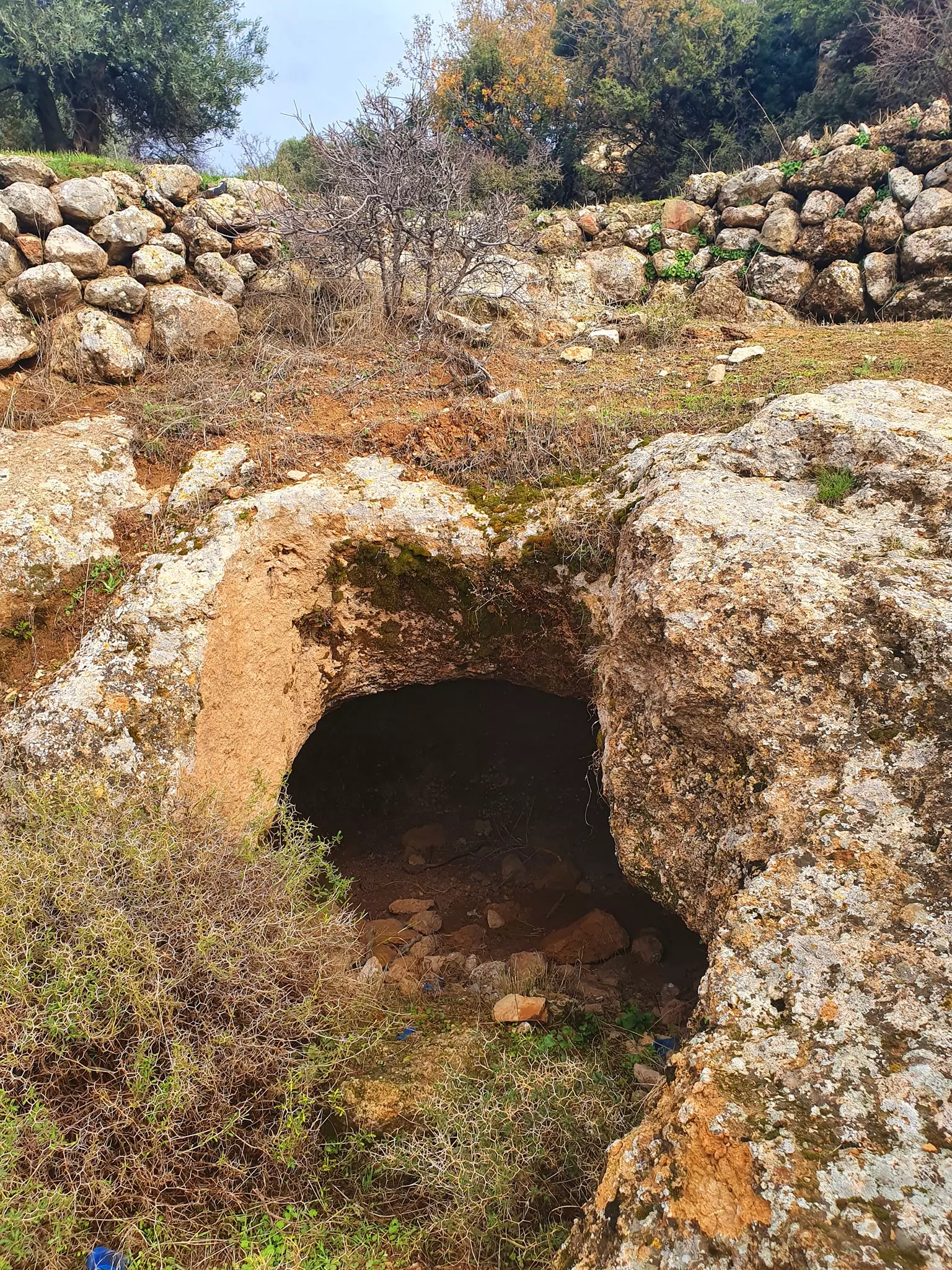
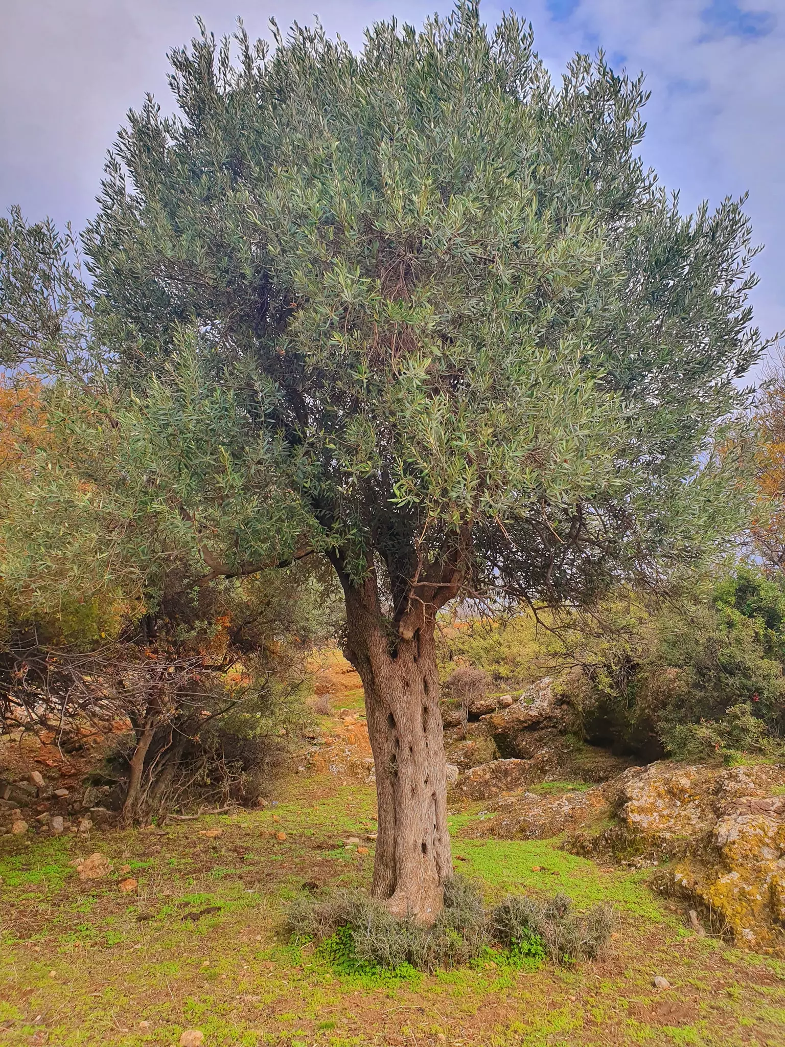
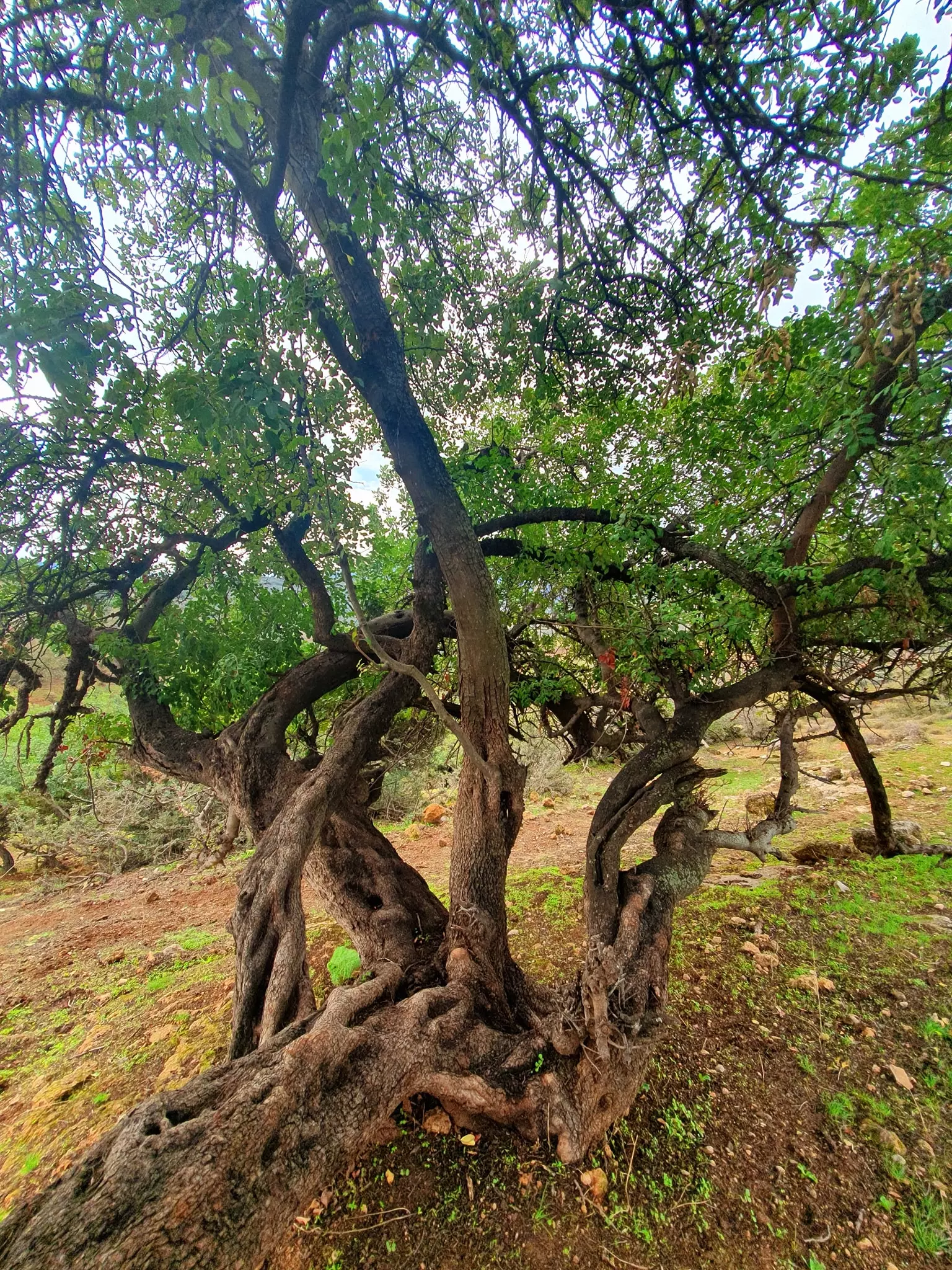
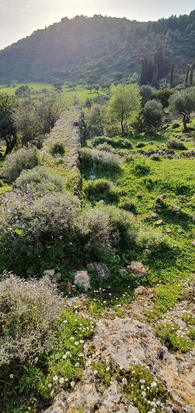
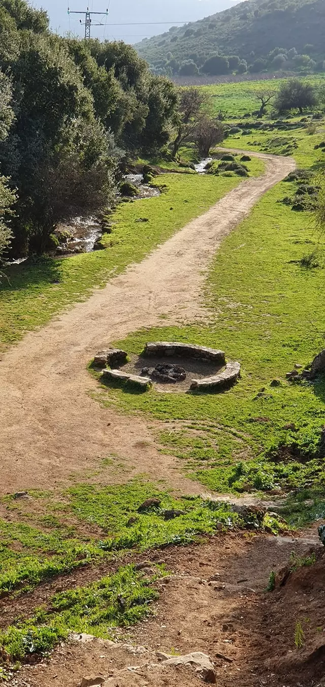
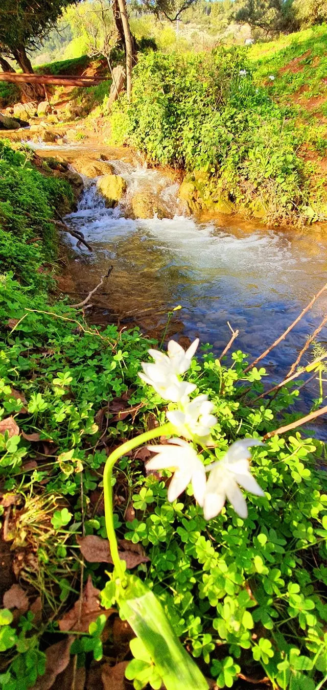
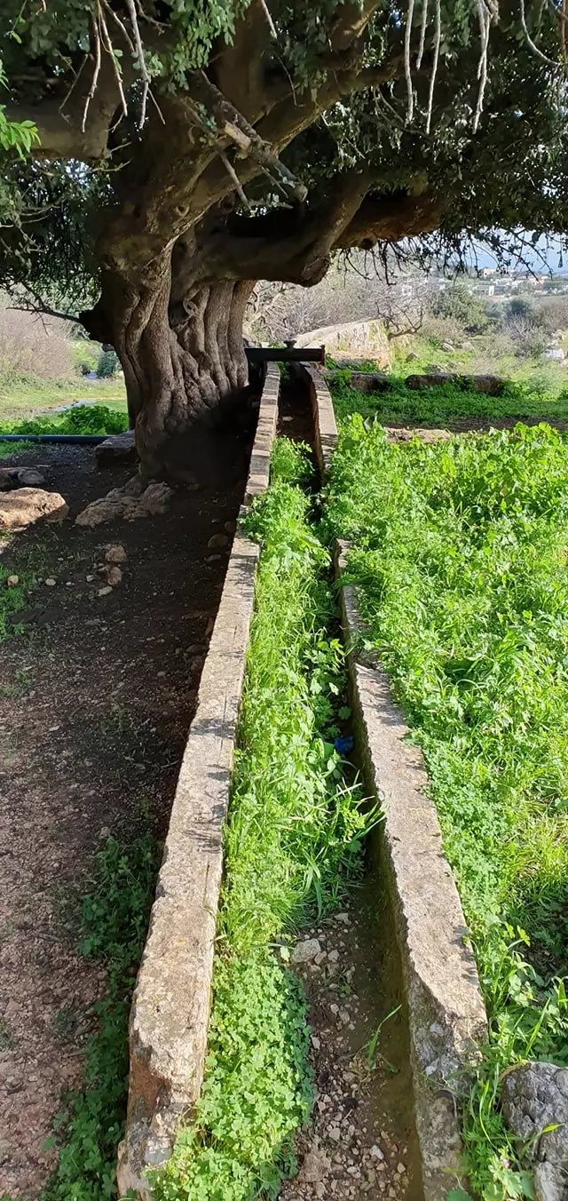
| Water Supply | Springs that originated from Mount al-Jarmaq (al-Shaykh) provided al-Farradiyya with plenty of fresh water supplies, and enough running water to power several water mills. | ||||||||||||||||
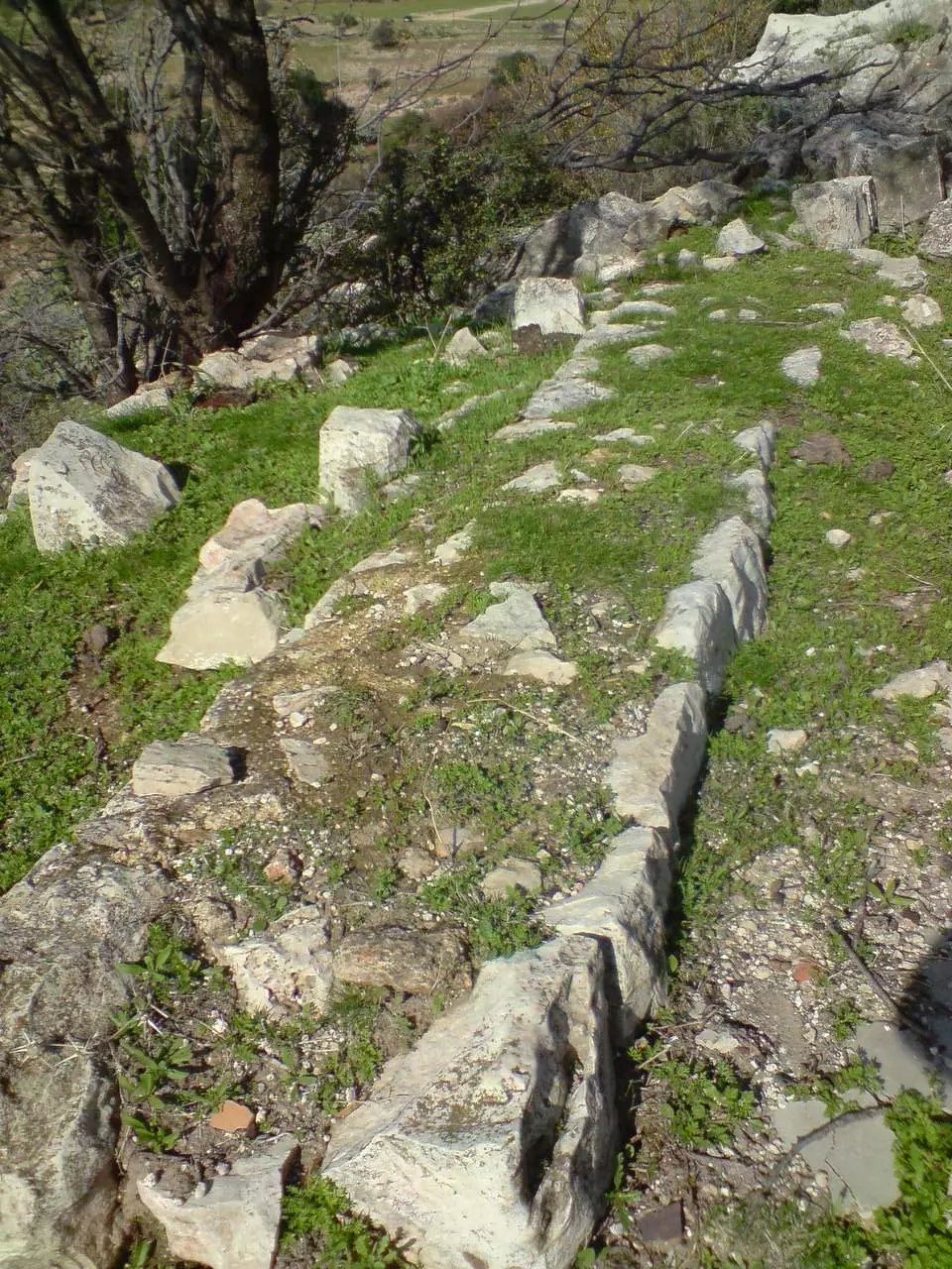
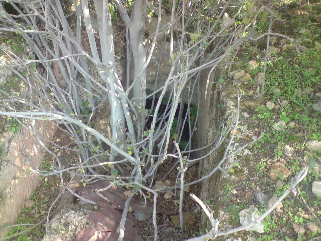
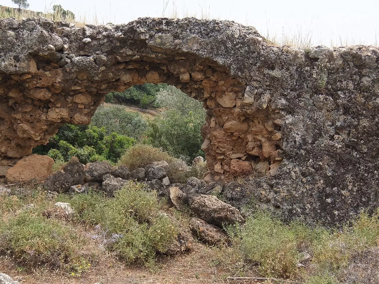
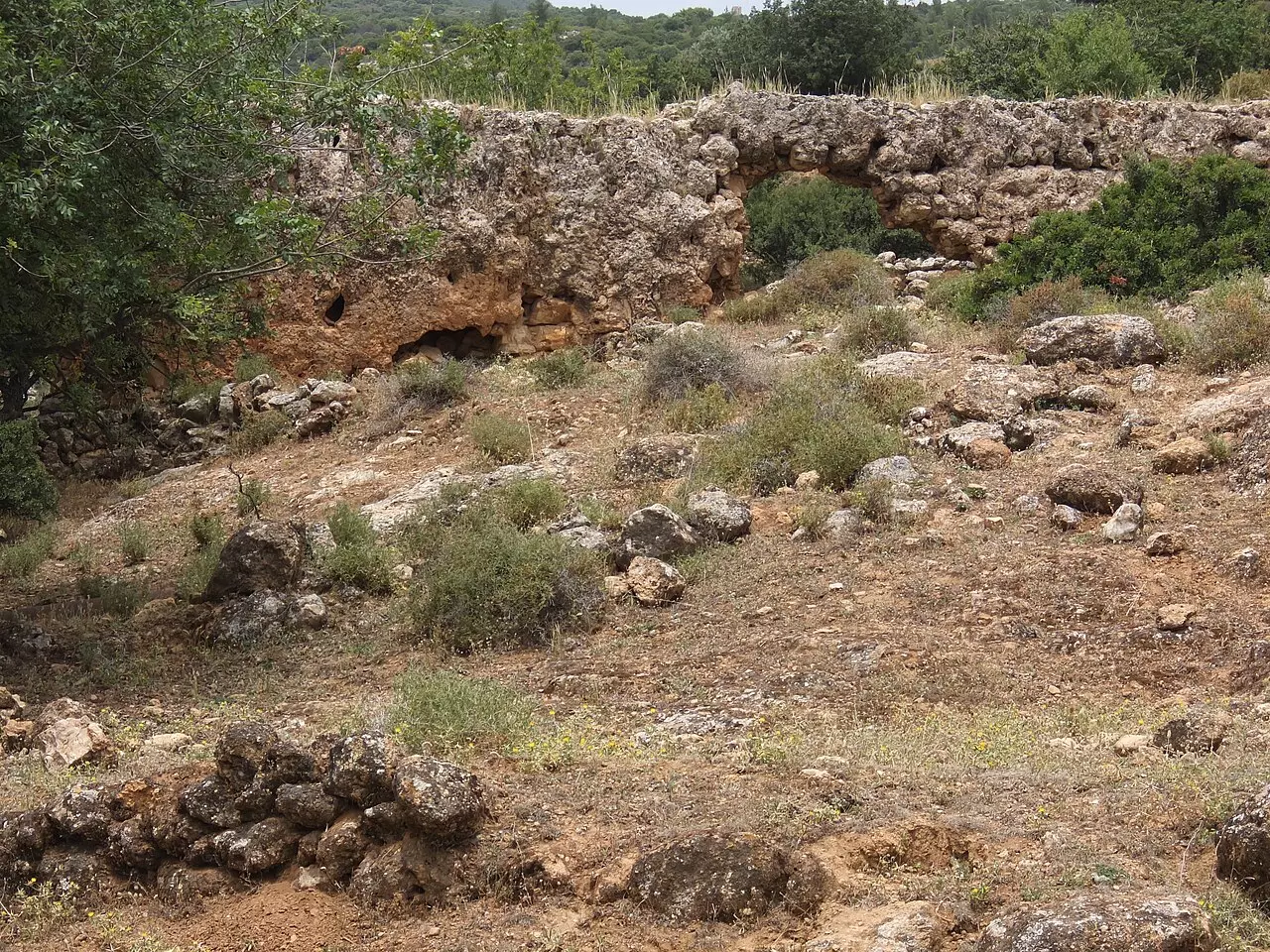
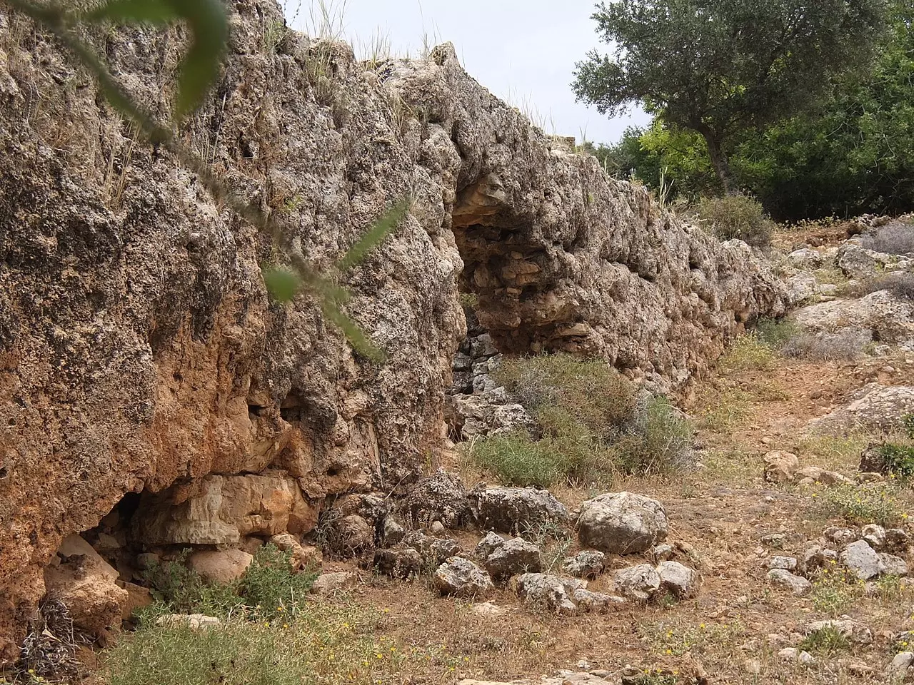
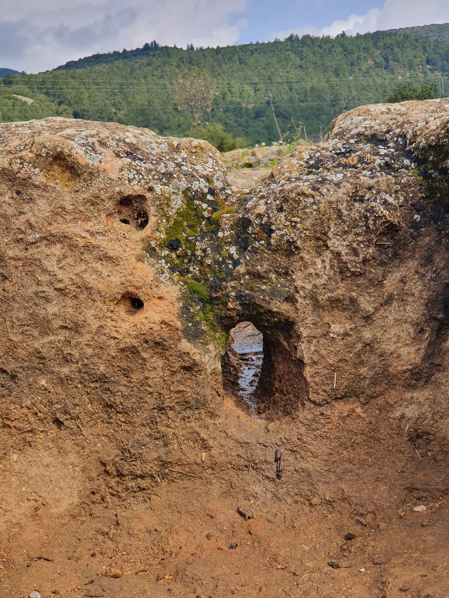
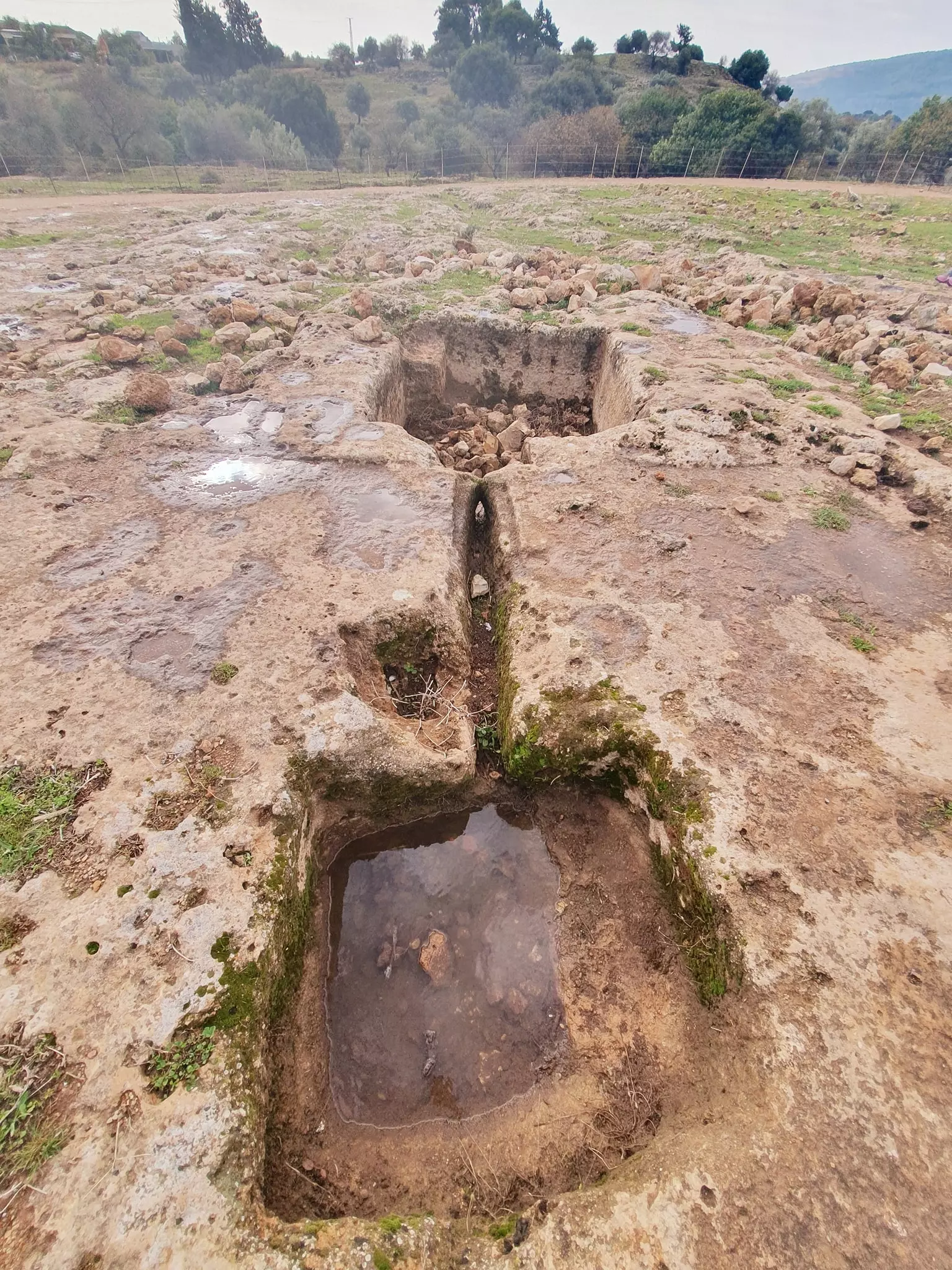
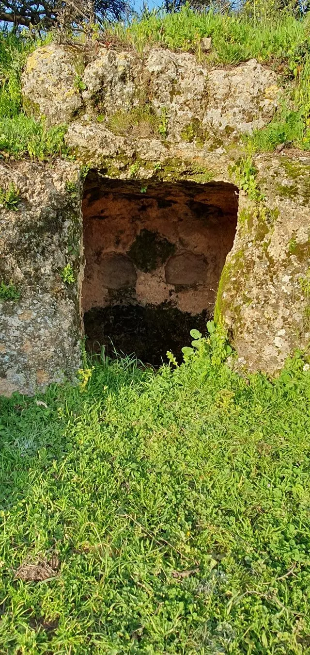
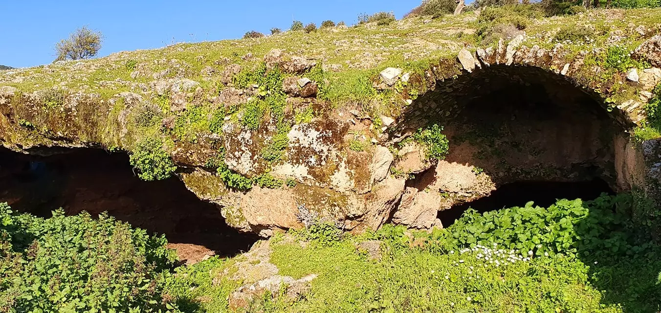
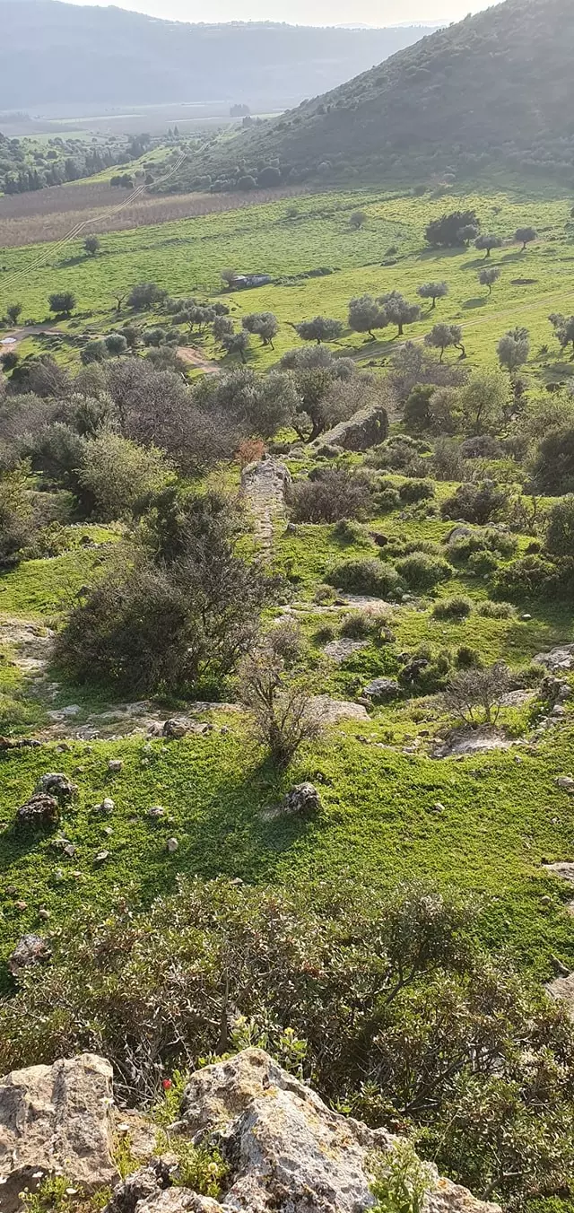
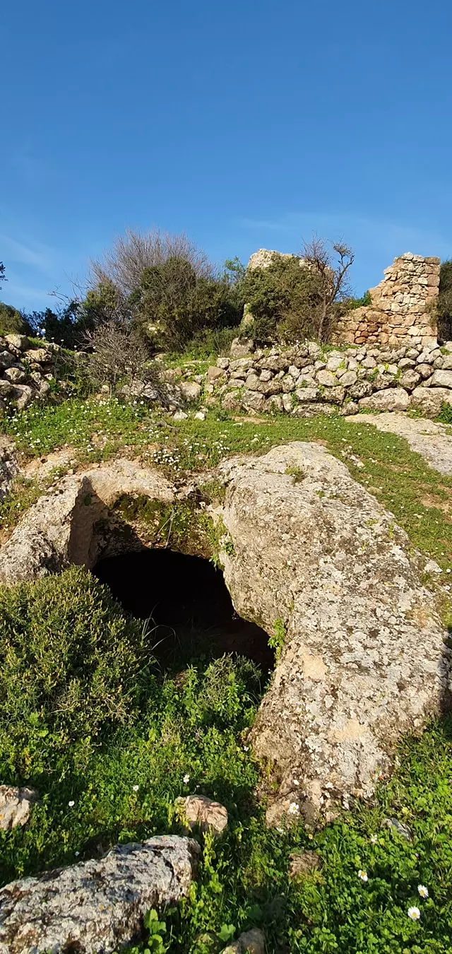
| Archeological Sites | The village contained the ruins of water mills and an aqueduct | ||||||||||||||||
| Exculsive Jewish Colonies Who Usurped Village Lands |
Qaddarim, Shefer, and Parod | ||||||||||||||||
| Featured Video | |||||||||||||||||
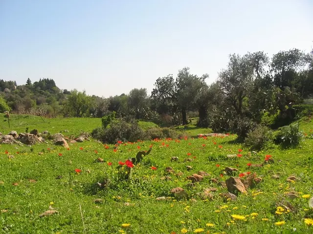
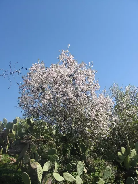
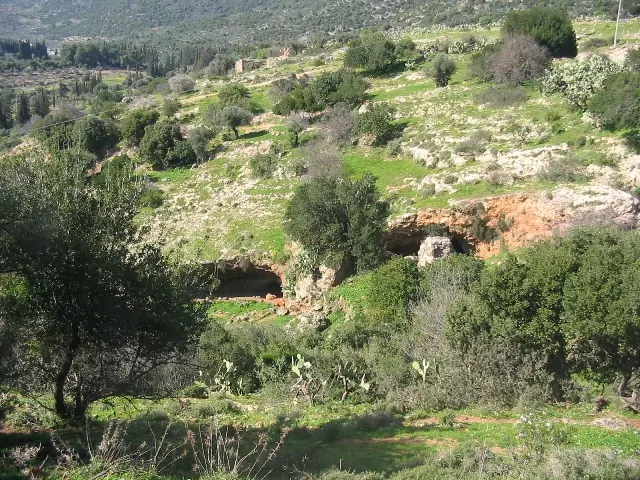
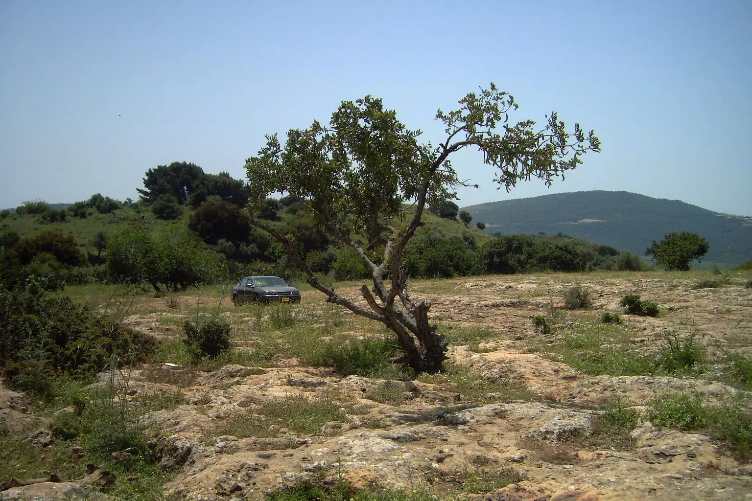
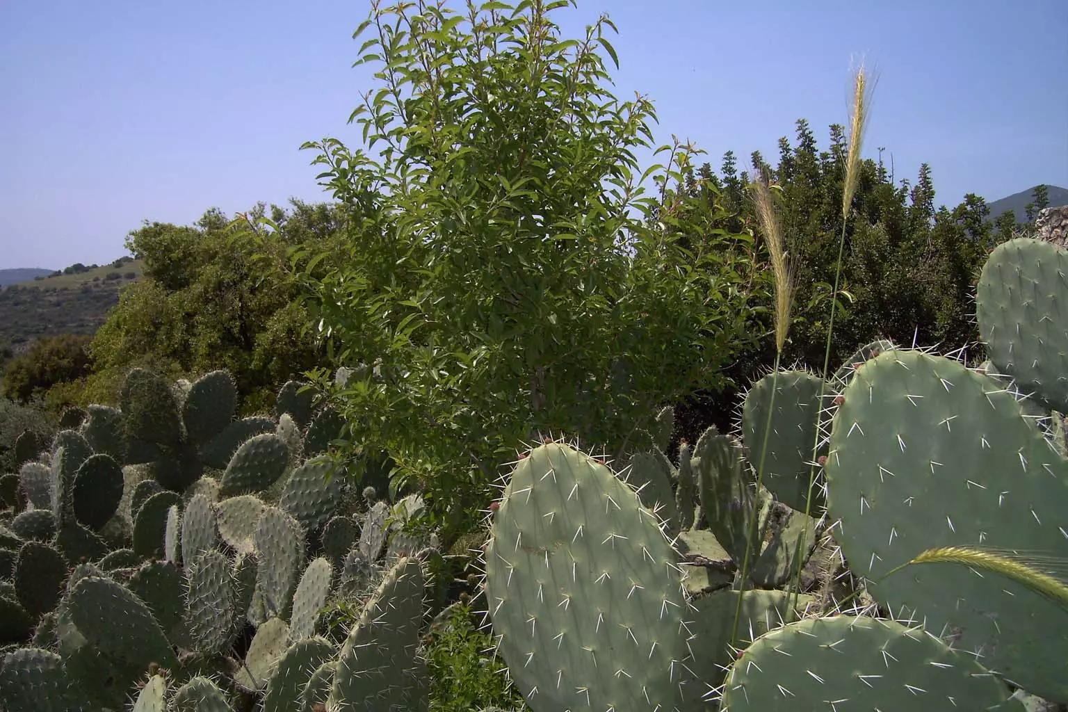
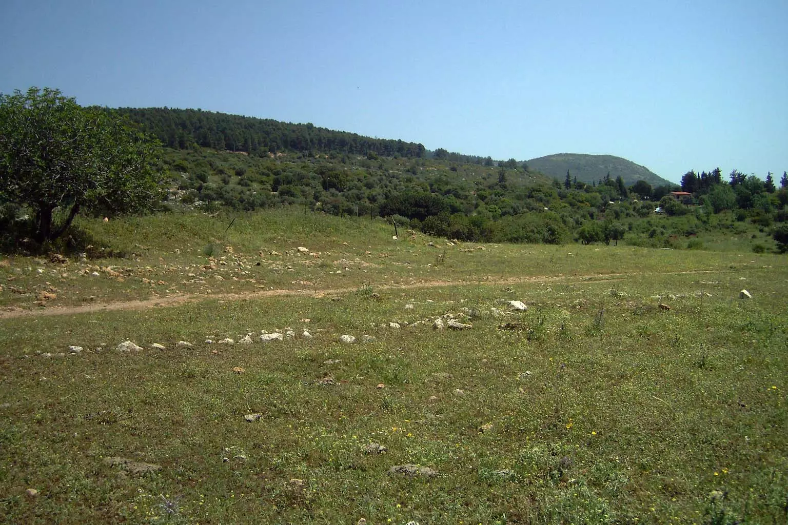
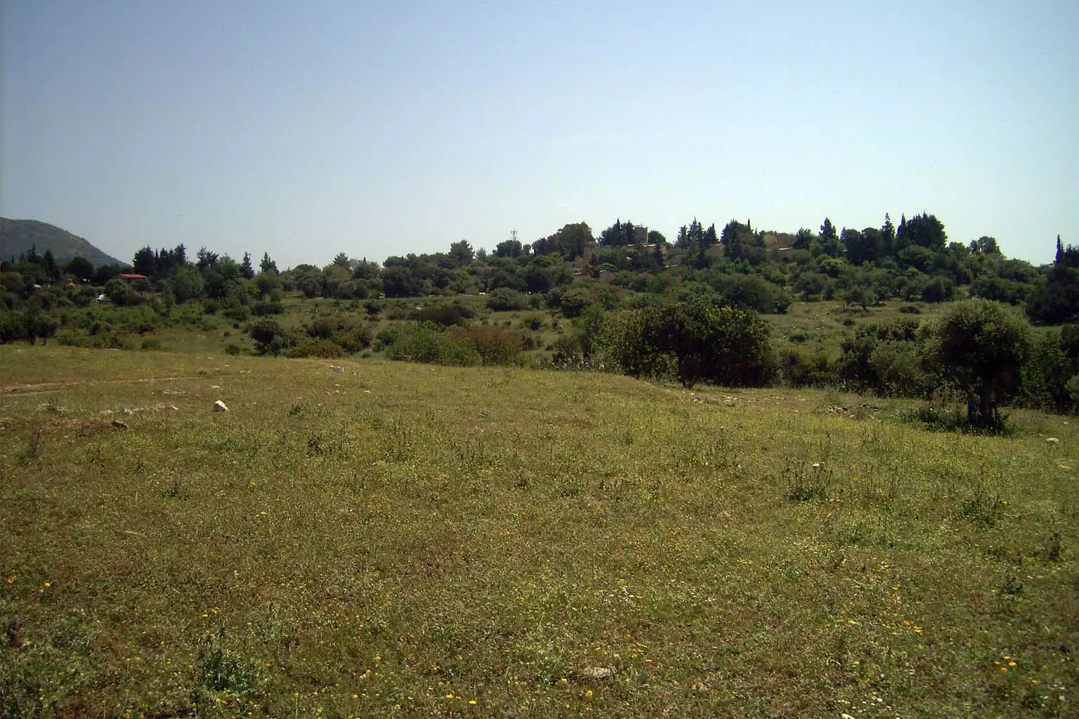
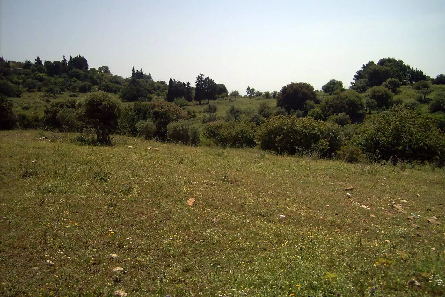
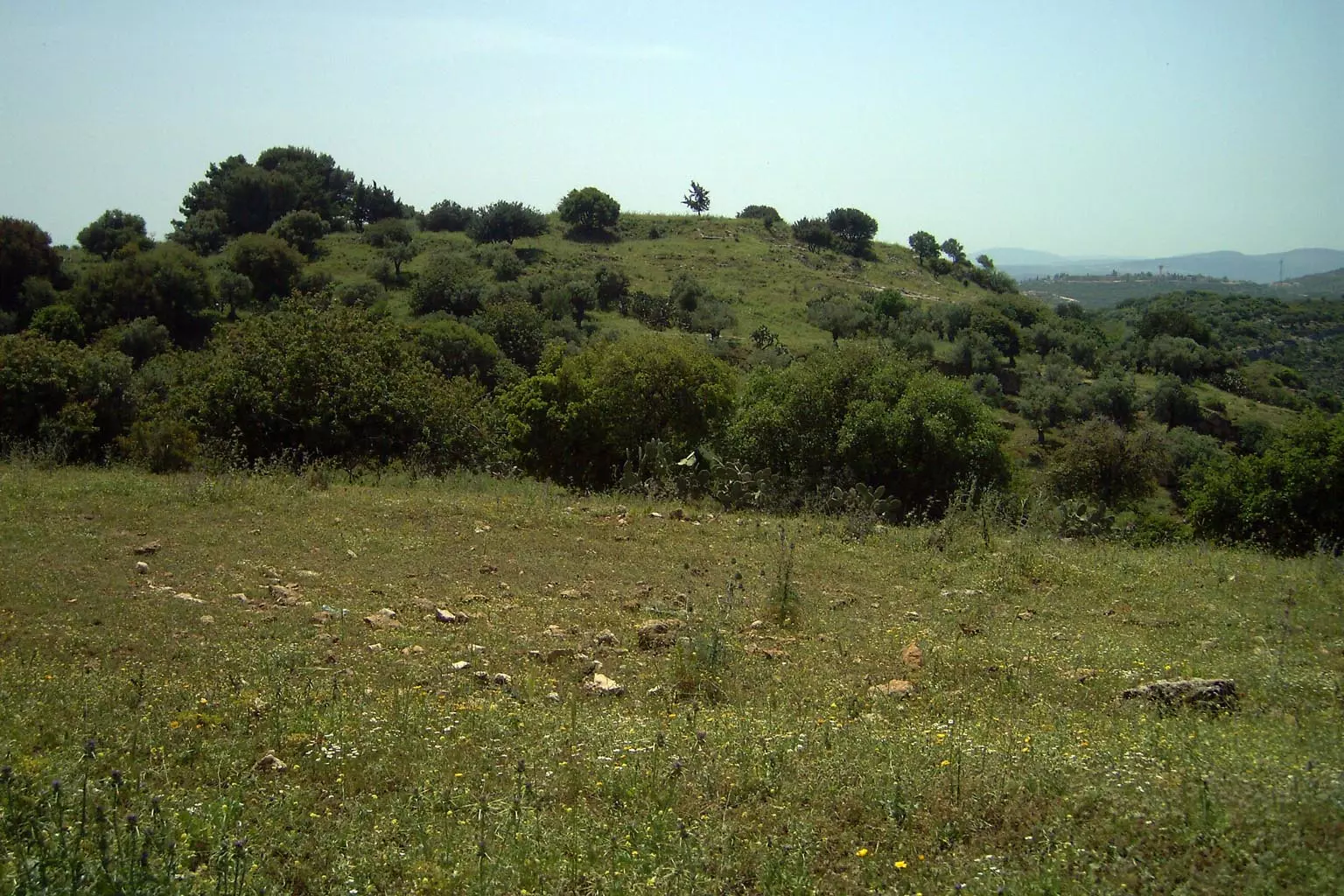
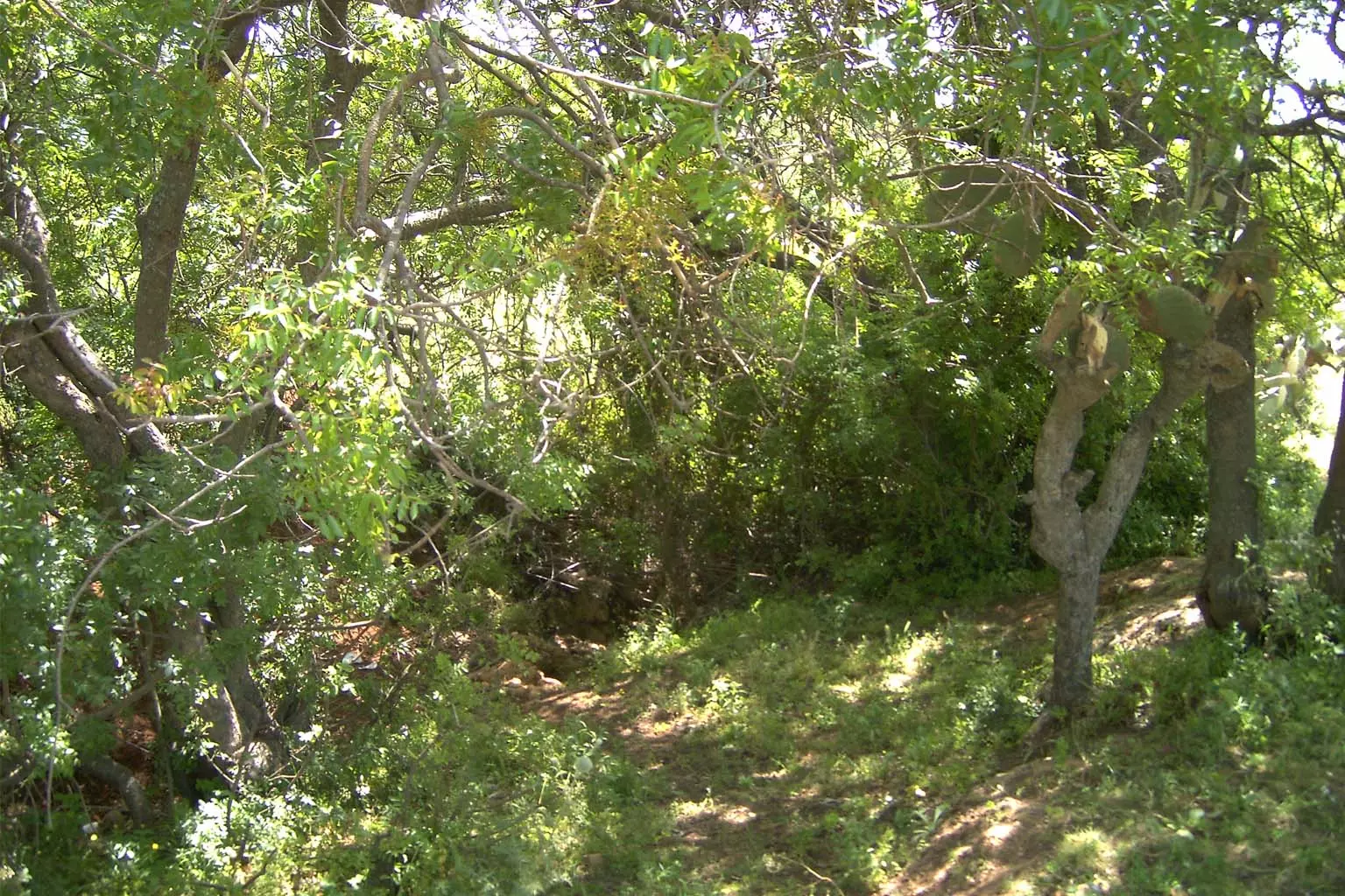
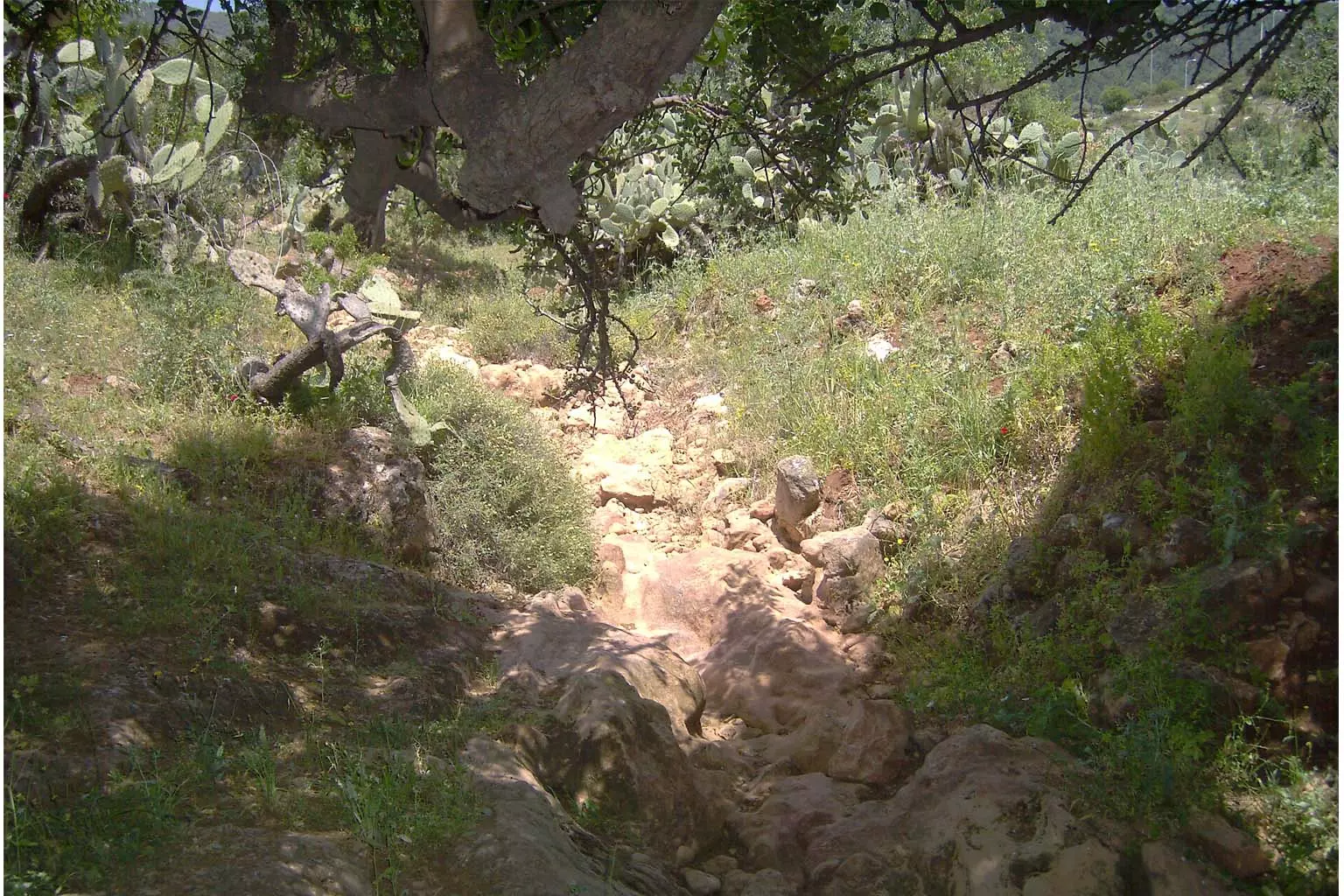
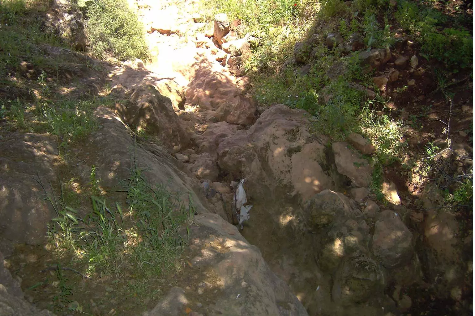
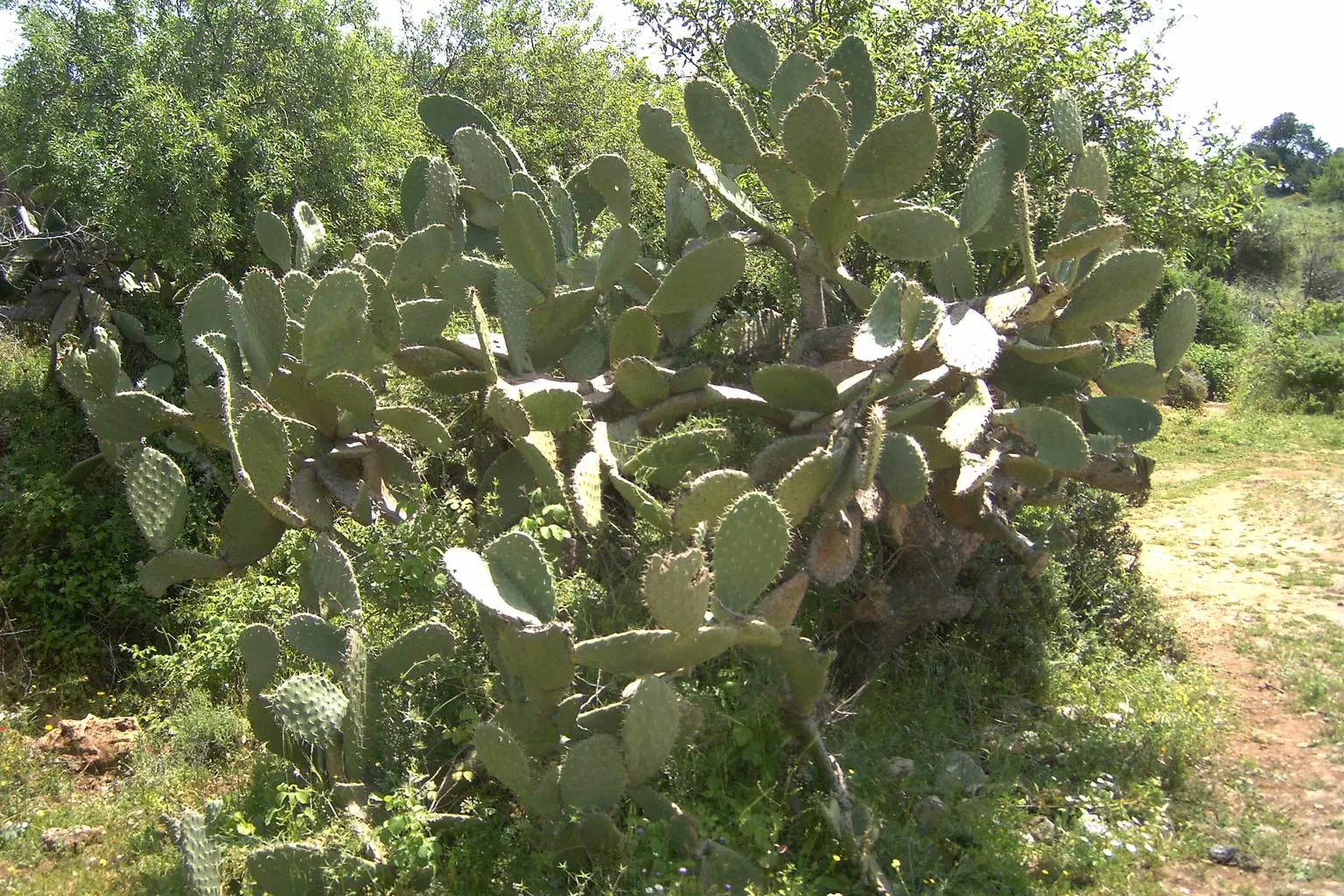
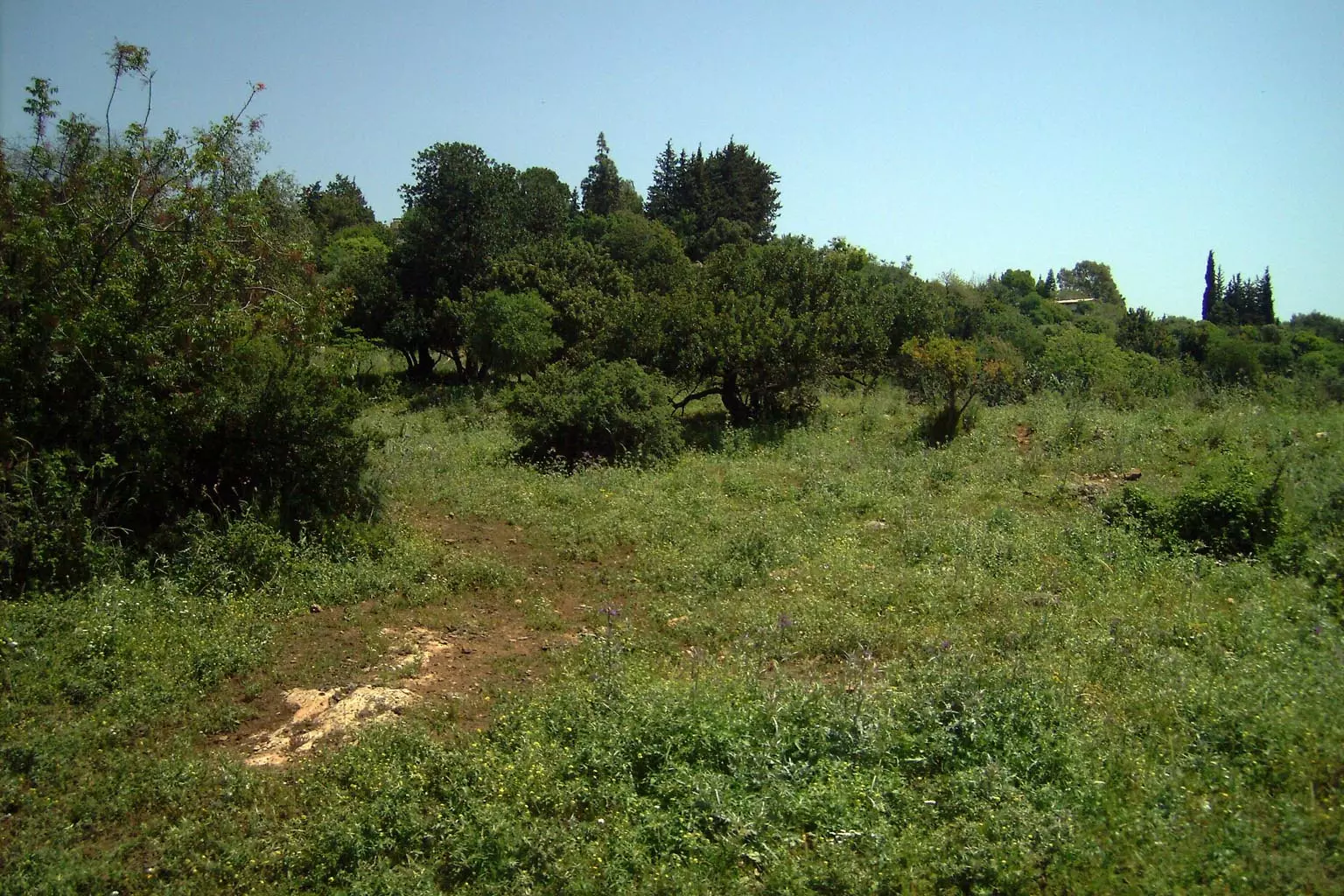
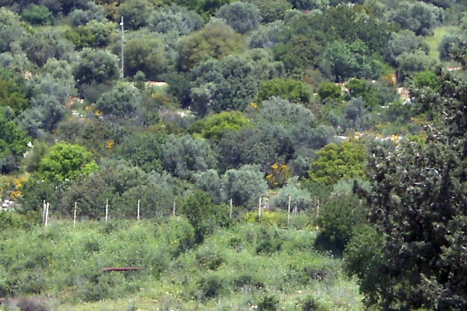
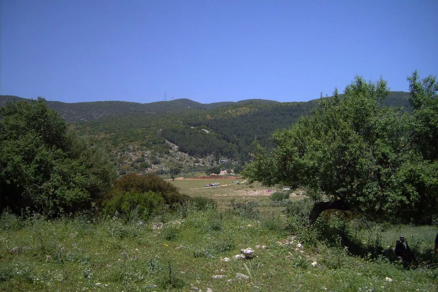
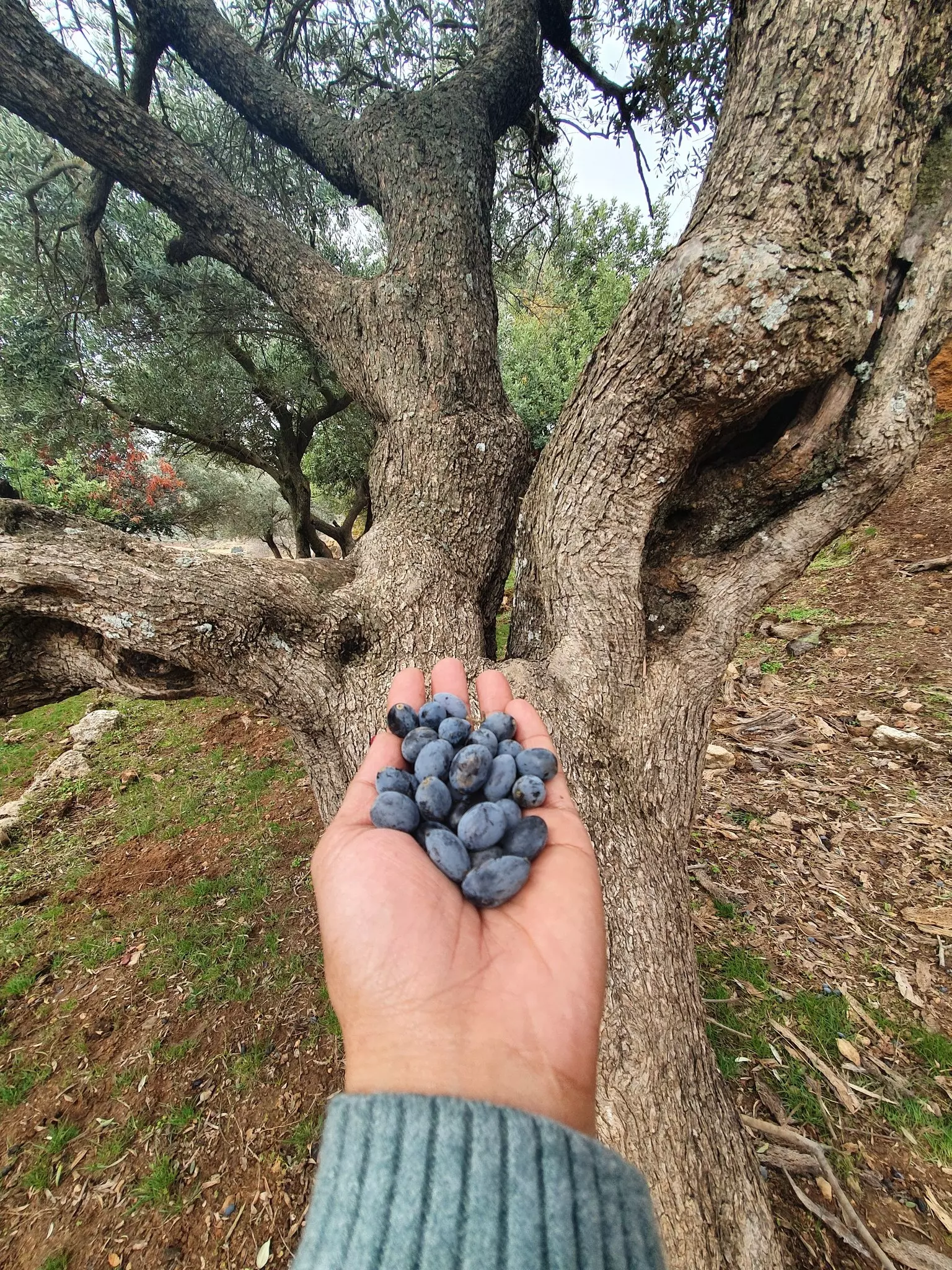
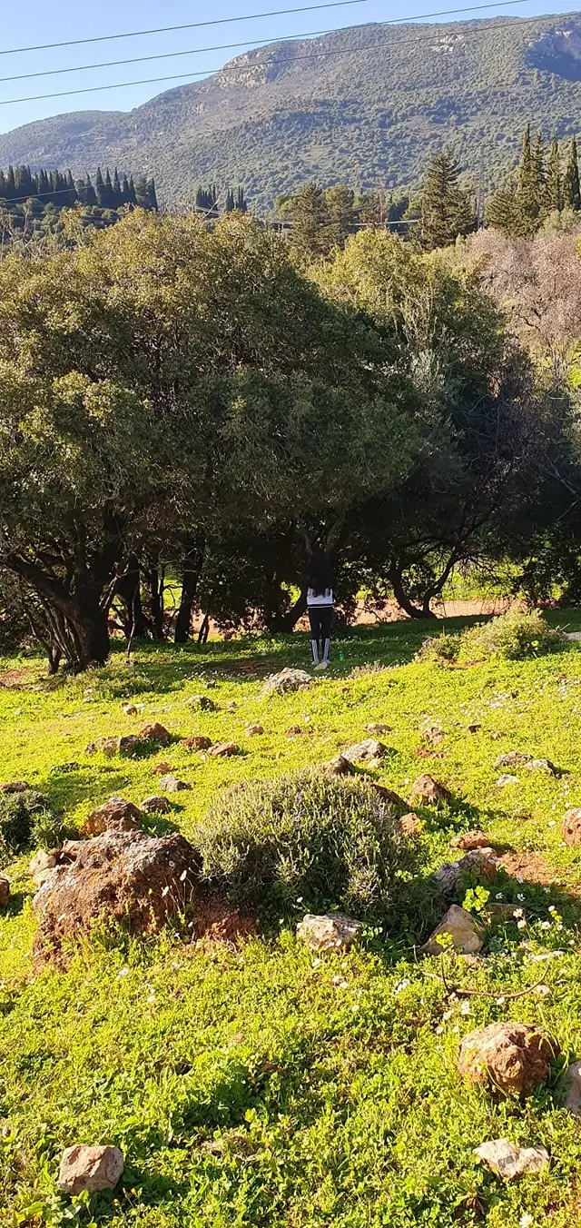
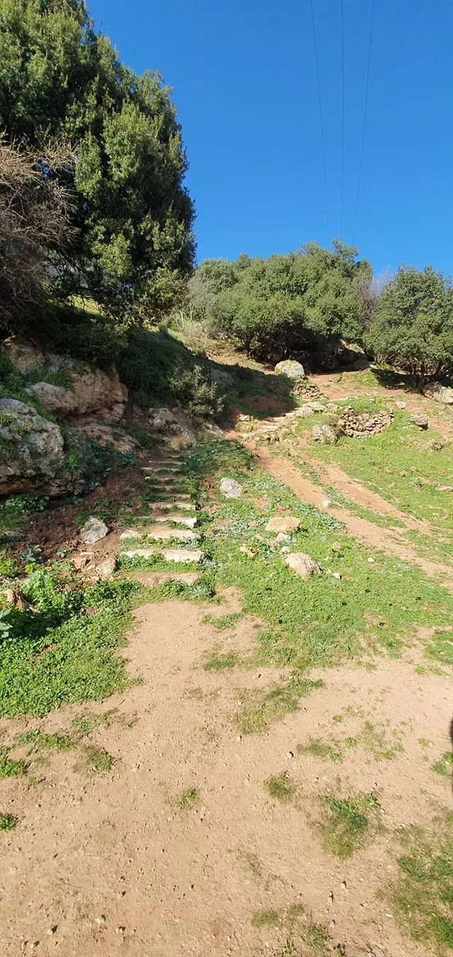
Village Before NakbaThe village stood on the southern slope of Mount Zabud. The Nazareth-Safad highway passed just to the north of it. Al-Farradiyya may have been built on the site of a village known during the Roman period as Parod, The Arab geographer al-Maqdisi (d. 985), referred to it as al-Farradhiyya and described it as a large village, renowned for its groves of fruit trees and grapes, located in a pleasant area with plentiful water. [[Cited in D 6/2:181; al-Khalidi 1968:174]] In 1596, al-Farradiyya was a village in the nahiya of Jira (liwa' of Safad) with a population of 237. It paid taxes on a number of crops, including wheat, barley, olives, and fruits, as well as on other types of produce and property, such as goats, beehives and pasturelands. [[Hut. and Abd.:177]] In the late nineteenth century, al-Farradiyya was a village built of stone and situated on a plain. The village residents, who numbered about 150, tilled small gardens and grew figs and olives. [[SWP (1881) 1:203]] Al-Farradiyya's population was predominantly Muslim. The village had a boys' elementary school. Springs that issued from Mount al.Jarmaq, to the north, provided an ample water supply.AI-Farradiyya had a thriving agricultural sector. It was known for its model, experimental farm, which covered 300 dunums of land. The farm was founded to improve the varieties of apples, figs, grapes, apricots, pears, and almonds, and to develop new seed varieties. It had an arboretum where 2,000 plants were grown and distributed to peasants. It also provided extension services for the farmers from both the Acre and Safad sub-districts and gave them advice on poultry production methods and beekeeping. The station was supervised by a Palestinian agronomist who had done his graduate studies at Montpelier University in France, and had begun to work at the station in 1932. Apart from the station, a number of water-powered mills were to be found in the village vicinity. In 1944/45 a total of 4,147 dunums was allocated to cereals and 1,182 dunums were irrigated or used for orchards. AI-Farradiyya was the site of a shrine (maqam) for a local religious teacher, al-Shaykh Mansur, and there are ruins of mills and an aqueduct. Village Occupation and Ethnic CleaningPeople from neighboring villages (mainly 'Akbara and al-Zahiriyya al-Tahta) took refuge in al-Farradiyya in early May, as they fled out of the path of Operation yiftach (see Abil al-Qamh, Safad sub-disctrict), according to testimony by the villagers of 'Akbara. The History of the War of Independence implies that the village did not come under Israeli control until 30 October 1948, during Operation Hiram (see 'Arab al-Samniyya, Acre sub-disctrict). It was probably one of several villages occupied when various forces executed a pincer maneuver to occupy a pocket in central Galilee, west of Safad. It apparently was not attacked directly. However, as units of the Golani Brigade advanced northwards from 'Aylabun (some 10 km to the south of al-Farradiyya) towards Sa'sa' (about 10 km to the north), the village was surrounded by Israeli forces on all sides. Since it did not suffer a direct assault, many of its residents seem to have remained in their homes until February 1949, when the final assault on the village began. [[N:43–45; see T:324–25]]In December 1948 and January 1949, top Israeli officials increasingly supported a plan to expel the villagers. Minority Affairs Minister Bechor Shitrit argued for expulsion on the pretext of preventing 'infiltration' of refugees back to the village. Israeli historian Benny Morris quotes, him as saying that if the infiltrations were not halted, Israel would have to 'conquer the Galilee anew.' Morris adds that the Committee for Transferring Arabs from Place to Place endorsed a proposal on 15 December to expel the 261 remaining inhabitants of al-Farradiyya and Kafr 'Inan (Acre sub-district). This plan was not executed until February. Some villagers were evicted to other villages under Israeli control and others expelled to the Triangle area (Nablus-Tulkarm-Jenin) on the West Bank. [[M:241]] Zionists Colonies on Village LandsIn 1949 Israel founded the settlement of Parod (190257) on village land, about 300 m east of the site of the destroyed village. The settlement of Shefer (191260), established in 1950 on village lands, is north of the village site. In 1980 the settlement of Qaddarim (193257) was established to the east of the site, but it was moved to the south-east in 1987.Village TodayThe site is deserted and covered with wild thorns, trees, and piles of stones from the destroyed homes. Cactuses grow on the land around the site, which is mostly utilized for grazing animals. Some segments of it, however, are wooded and serve as Israeli recreation grounds.SourceDr. Walid al-Khalidi, 1992: All That Remains. |
|||||||||||||||||
| Related Maps | Town Lands' Demarcation Maps خرائط للقضاء توضح حدود القرى والاودية Town's map on MapQuest View from satellite Help us map this town at WikiMapia |
||||||||||||||||
| Related Links | Wikipedia's Page Google Search Google For Images Google For Videos |
||||||||||||||||
| More Information | في كتاب كي لا ننسى في كتاب بلادنا فلسطين المزيد من موقع هوية |
||||||||||||||||
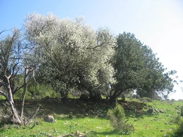
- General view of al-Farradiyya village site, 1994
Posted by Zed Alison 1 - A grave yard located in Wadi Salame, May 2002

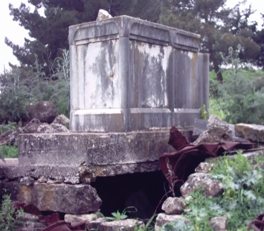
Posted by Uri Zackhem 1 - A shrine or maqam to an onl old Hebrew sage dating to the Roman period, May 2002
Posted by Uri Zackhem 2 - مقبرة القرية , احد القبور الواضحة (خشخاشة) 2003
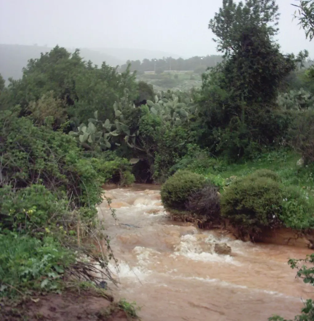
Posted by Makbula Nassar 3 - نهر موسمي يسمى الرميلة ينبع من جبل الجرمق , ثم الى السموعية والى وادي فراضية ثم الى كفر عنان 2003
Posted by Makbula Nassar 4 - اثار احد بيوت القرية 2003
Posted by Makbula Nassar 1 - منظر عام للقرية من الجهة الشرقية 2003

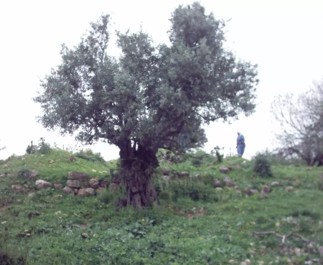
Posted by Makbula Nassar 3 - اثار احد بيوت القرية الى جانبه شجرة زيتون وسط موقع القرية قرب المقبرة 2003
Posted by Makbula Nassar 1 - احد القبور , مقبرة القرية 2003
Posted by Makbula Nassar - مياه الرميلة في وادي فراضية تشكل موقع للسياحة خاصة للفلسطينين في الداخل, في الصورة اطفال حضروا مع اهلهم للعب هناك 2003
Posted by Makbula Nassar 2 - اثار لاحد بيوت القرية 2003
Posted by Makbula Nassar - منظرعام للقرية - وقوفاً شمالي القرية عند الصعود الى منطقة جبل الجرمق - ربيع 2003

Posted by Makbula Nassar 1 - منظرعام للقرية - وقوفاً شمالي القرية عند الصعود الى منطقة جبل الجرمق - ربيع 2003

Posted by Makbula Nassar 1 - قناة المياه من مياه فراضية والتي نصل الى القرية - 28/2/2005 تصوير : مقبولة نصار
Posted by Makbula Nassar - قناة المياه من مياه فراضية والتي نصل الى القرية - 28/2/2005 تصوير : مقبولة نصار
Posted by Makbula Nassar - اراضي محيطة بمجرى ماء فراضية - 28/2/2005 تصوير : مقبولة نصار
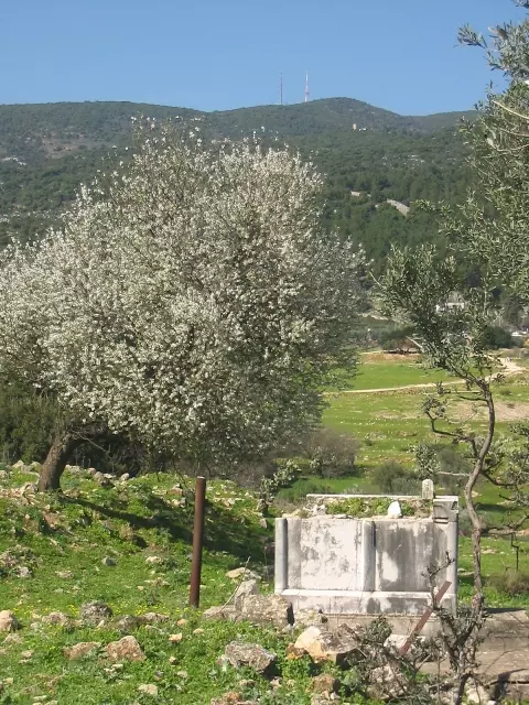
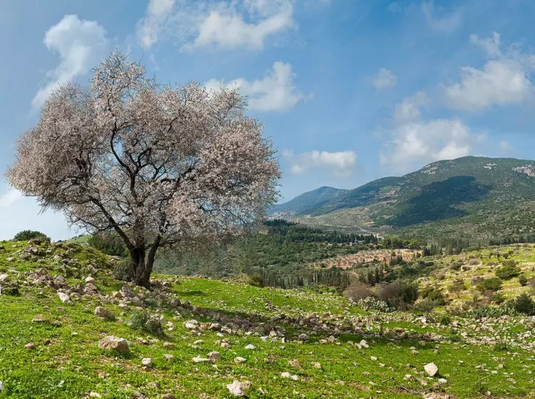
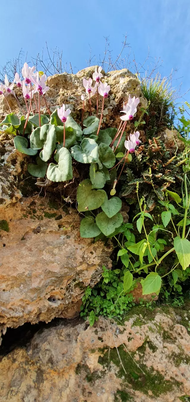
Posted by Makbula Nassar 1 - ازهار اللوز - 28/2/2005 تصوير : مقبولة نصار
Posted by Makbula Nassar 3 - بعض اثار البيوت الباقية - 28/2/2005 تصوير : مقبولة نصار
Posted by Makbula Nassar - اللوز والخروب في فراضية - 28/2/2005 تصوير : مقبولة نصار
Posted by Makbula Nassar - بعض اثار البيوت الباقية - 28/2/2005 تصوير : مقبولة نصار
Posted by Makbula Nassar 1 - ضريح متبقي في القرية - 28/2/2005 تصوير : مقبولة نصار
Posted by Makbula Nassar 2 - تجمعات لمياه المطر في اطراف القرية - 28/2/2005 تصوير : مقبولة نصار
Posted by Makbula Nassar - بعض الاثار الباقية في القرية - 28/2/2005 تصوير : مقبولة نصار
Posted by Makbula Nassar 1 - بعض الاثار الباقية في القرية - 28/2/2005 تصوير : مقبولة نصار
Posted by Makbula Nassar - نباتات من القرية - 28/2/2005 تصوير : مقبولة نصار
Posted by Makbula Nassar 1 - بعض الاثار الباقية في القرية من الناحية الغربية - 28/2/2005 تصوير : مقبولة نصار
Posted by Makbula Nassar - منحدر المياه في الطريق الى كفر عنان يمر بجانب مجموعة من المغر في الناحية الغربية - 28/2/2005 تصوير : مقبولة نصار
Posted by Makbula Nassar 3 - فراضية اجمل من الجمال نفسة تصوير فؤاد كروم
Posted by KARRUM 3 - هذا مقام الشيخ منصور اما الان اصبح مزار للصهاينة بمعنى اخر ( خليل بعد التعديل ) تصوير فؤاد كروم
Posted by KARRUM - هذا مقام الشيخ منصور تصوير فؤاد كروم
Posted by KARRUM 1 - لا تعليق لا تعليق الصورة بتتكلم فراضية تصوير فؤاد كروم
Posted by KARRUM - هذه الصورة مدخل البلدة فراضية تصوير فؤاد كروم
Posted by KARRUM 1 - هذه صورة البيادر القمح فراضية تصوير فؤاد كروم
Posted by KARRUM - هذه صورة لبيادر القمح فراضية تصوير فؤاد كروم
Posted by KARRUM - هذه صورة لبيادر القمح فراضية تصوير فؤاد كروم
Posted by KARRUM - بساتين فراضية تصوير فؤاد كروم
Posted by KARRUM 1 - مجرا نبع فراضية وكان يصب في بحيرة طبريا تصوير فؤاد كروم
Posted by KARRUM - مجرا نبع فراضية اثر بعد عين تصوير فؤاد كروم
Posted by KARRUM - اثار موقع المدرسة في فراضية اثر بعد عين تصوير فؤاد كروم
Posted by KARRUM - كانت تسمى العين في فراضية اثر بعد عين تصوير فؤاد كروم
Posted by KARRUM - ويبقى الوز و الصبر شامخ في فراضية تصوير فؤاد كروم
Posted by KARRUM - هنا كانت ماء الجبل تتجمع و تسمى رئس العين تصوير فؤاد كروم

Posted by KARRUM - هذة هية فراضية تصوير فؤاد كروم
Posted by KARRUM - اشجار الصنوبر شاهدة على العصر فراضية تصوير فؤاد كروم
Posted by KARRUM 1 - اشجار الصنوبر شاهدة على العصر فراضية تصوير فؤاد كروم
Posted by KARRUM - احراش فراضية تصوير فؤاد كروم
Posted by KARRUM - من روائع قرية فراضية تصوير فؤاد كروم
Posted by KARRUM 4 - مقبرة فراضية تصوير فؤاد كروم
Posted by KARRUM 2 - Farradiyya - remains of old house or 'Mantara' near the village
Posted by Ramez - Mantara near the northern side of the village - منطرة قرب القرية - تصوير رامز عيد
Posted by Ramez - Olive trees of the village كرم زيتون في الجهة الشمالية-غربية - تصوير رامز عيد
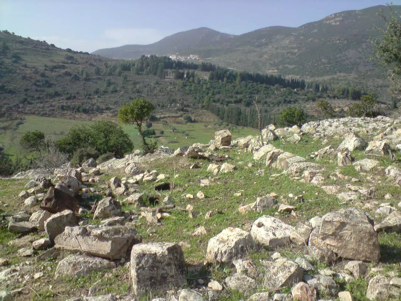
Posted by Ramez - View from the valley going up to the village منظر من السهل باتجاه تلة القرية - تصوير رامز عيد
Posted by Ramez - View from the village to the western valley - منظر من القرية الى الغرب - تصوير رامز عيد
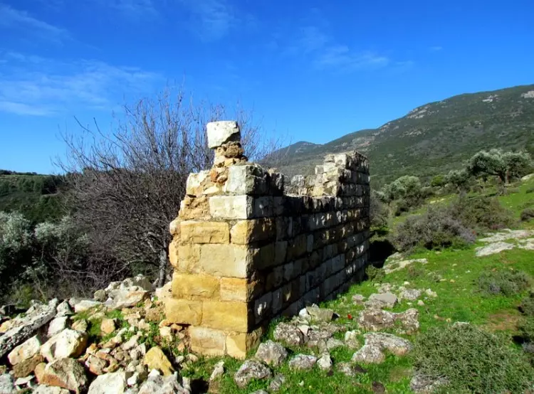
Posted by Ramez - Farradiyya - This is what remains today of the village center. ما تبقى من مركز القرية اليوم - تصوير رامز عيد
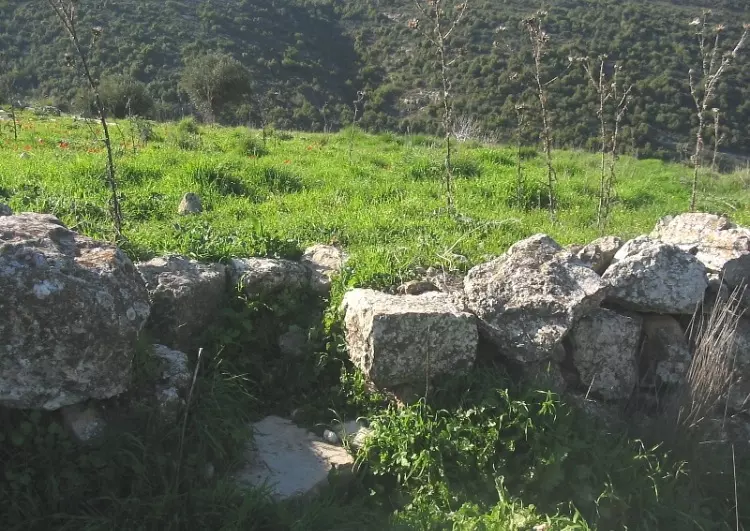
Posted by Ramez - What remains of a wall ما تبقى من حائط لأحدى البيوت - تصوير رامز عيد
Posted by Ramez - The floor of one of the houses مصطبة داخلية لأحدى البيوت - تصوير رامز عيد
Posted by Ramez - A view from the village to the north منظر من القرية الى الشمال - تصوير رامز عيد
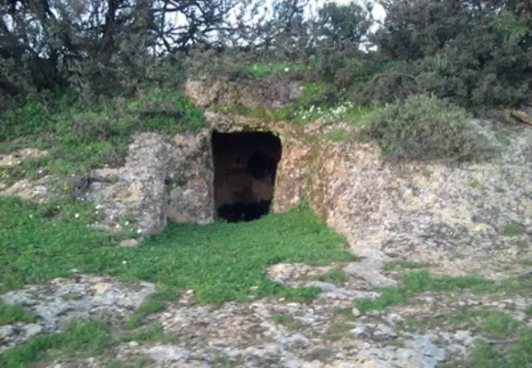
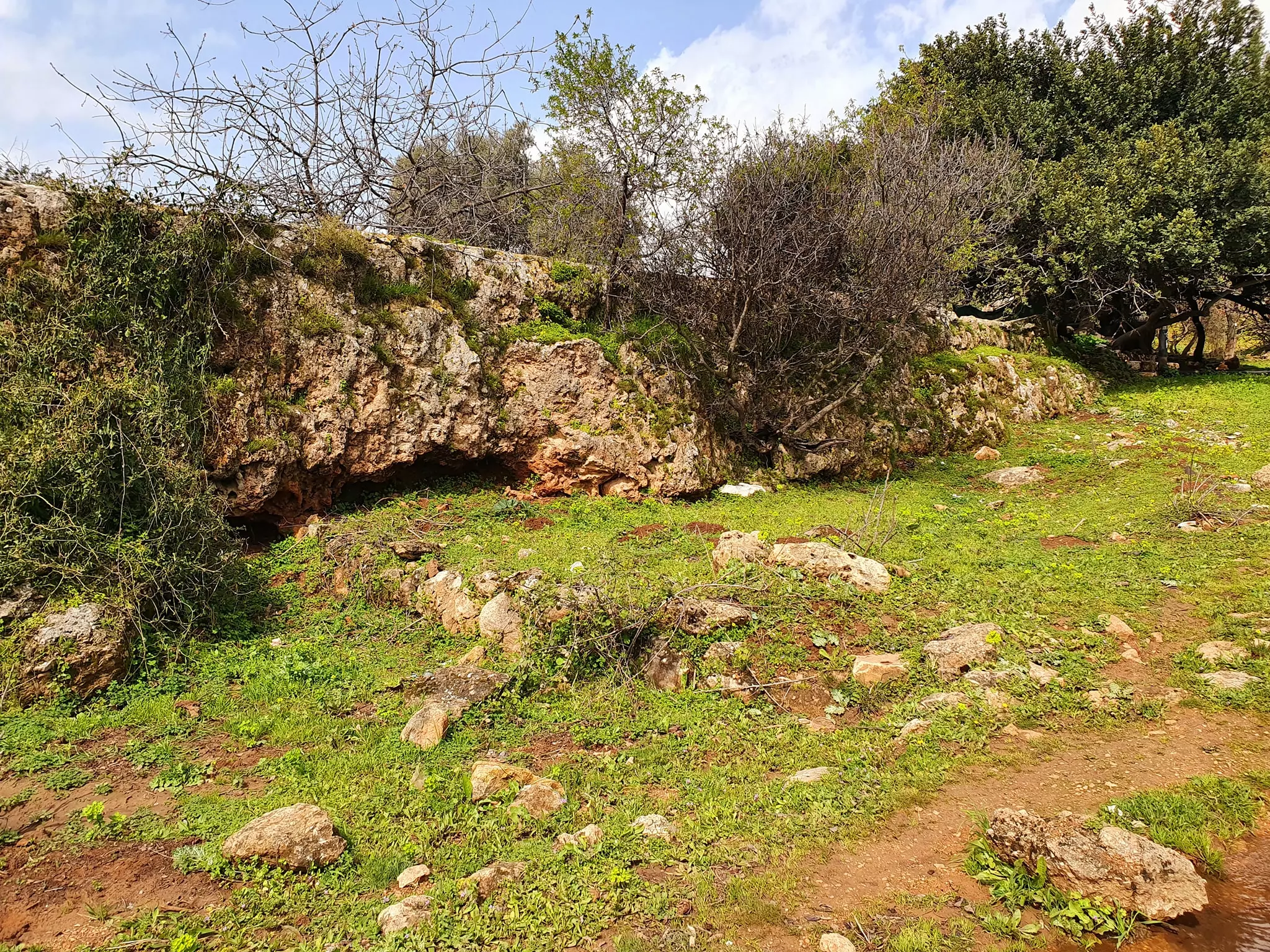
Posted by Ramez - A Cave - مغارة في سفح التلة الغربي
Posted by Ramez - Some Mulberry and Almond trees شجر التوت واللوز قرب مركز القرية
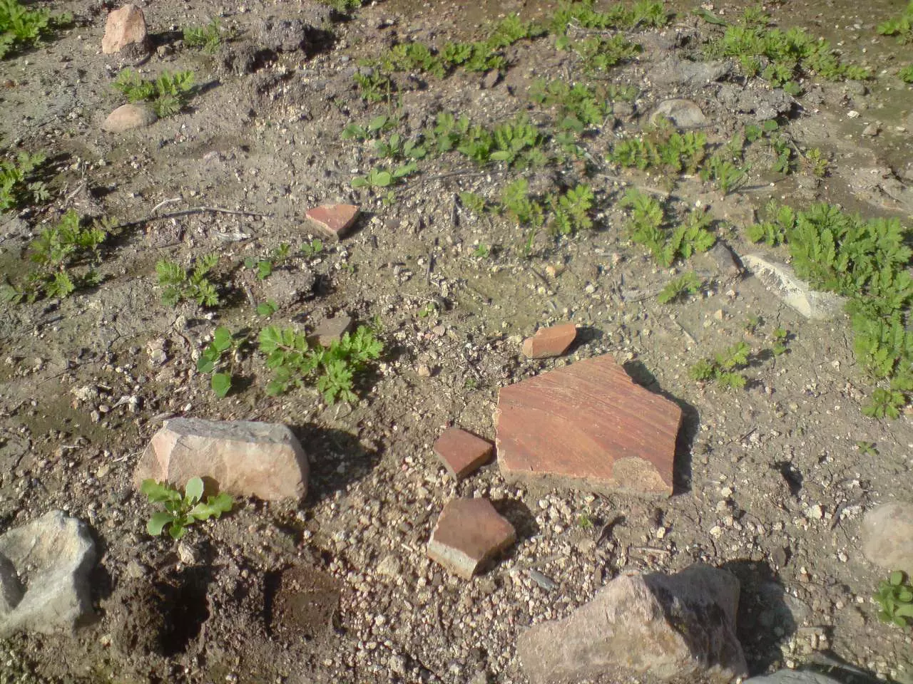
Posted by Ramez - Some Palestinian pottery بعض الفخار الفلسطيني المكسور في مركز القرية
Posted by Ramez - One of the few remaining walls in the village بقايا نادرة لأحد البيوت في مركز القرية
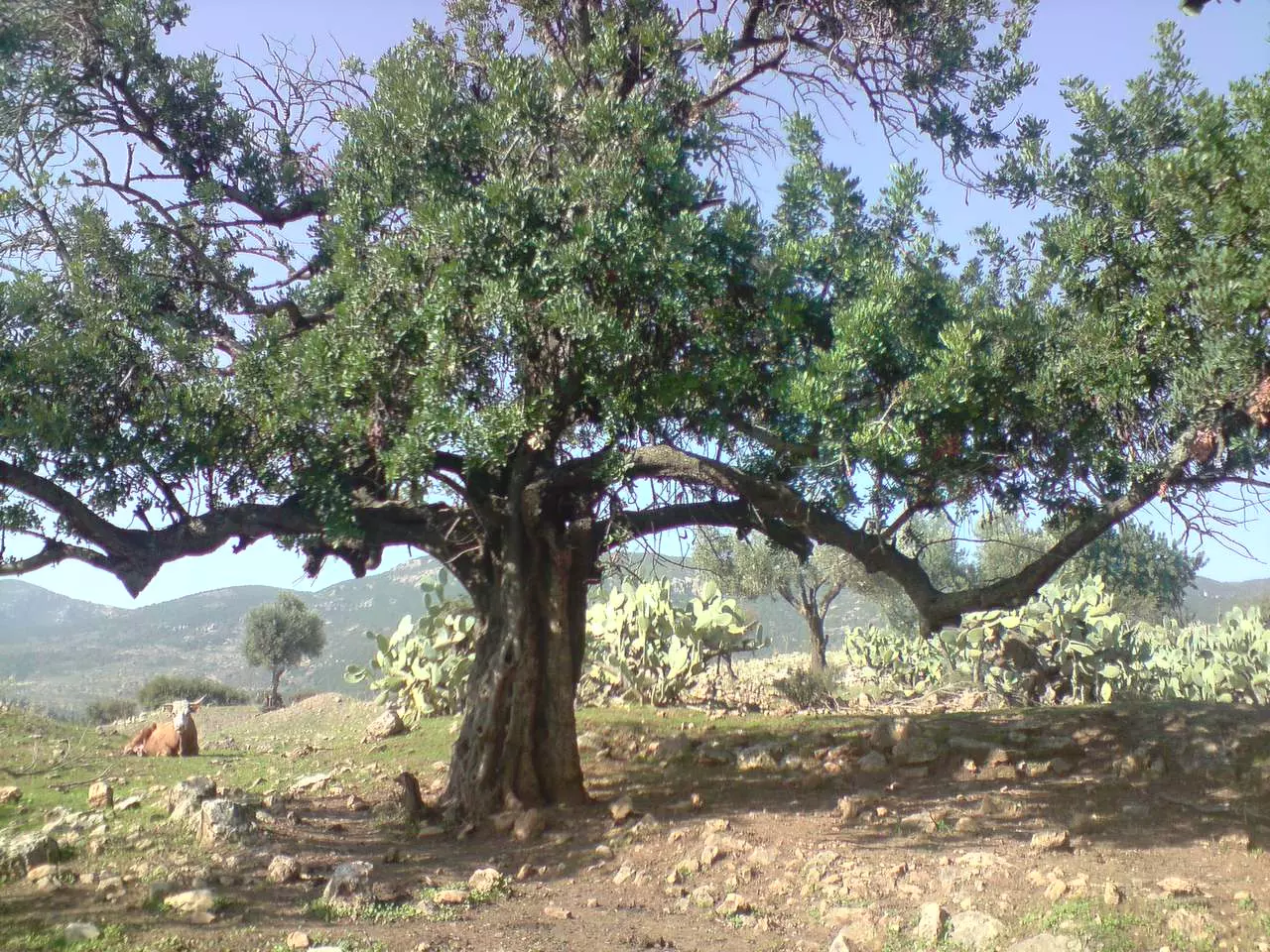
Posted by Ramez - Carob tree on the southern side of the village شجرة خروب شامخة في الناحية الجنوبية للقرية - تصوير رامز عيد
Posted by Ramez - The remains of one of the houses on the western edge of the village بقايا احدى البيوت المطلة على السهل في الجهة الغربية - تصوير رامز عيد
Posted by Ramez - The remians of one of the houses on the western edge بقايا بيت اخر في الجهة الغربية للقرية - تصوير رامز عيد
Posted by Ramez - The remains of a plastered wall بقايا الطين القديم (القصارة) على حائط في الجهة الغربية - تصوير رامز عيد
Posted by Ramez - A tomb in the cemetery بقايا قبر في المقبرة في الجهة الشرقية للقرية - تصوير رامز عيد
Posted by Ramez - A tomb in the cemetery بقايا قبر في المقبرة في الجهة الشرقية للقرية - تصوير رامز عيد
Posted by Ramez - مجرى عين فراضيه

Posted by abu raya - احدى الماقامات في فراضيه
Posted by abu raya - الخروب والصبار في فراضيه
Posted by abu raya - موقع القريه واثار ردم البيوت

Posted by abu raya - اثار ردم بيوت القريه
Posted by abu raya - بقايا احد بيوت القريه
Posted by abu raya - اثار القريه

Posted by abu raya - الربيع في فراضيه
Posted by abu raya - بيوت فراضيه
Posted by abu raya - فراضيه

Posted by abu raya - مقبره فراضيه

Posted by abu raya - فراضيه
Posted by abu raya - زيتون فراضيه

Posted by abu raya - فراضيه
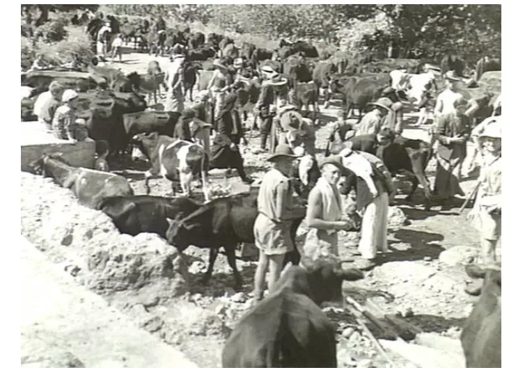
Posted by abu raya - جنود بريطانيين يستحمون في عين فراضيه سنه 1941

Posted by abu raya - جنود بريطانيين في الفراضيه قبل النكبه

Posted by abu raya - جنود بريطانيين في الفراضيه قبل النكبه
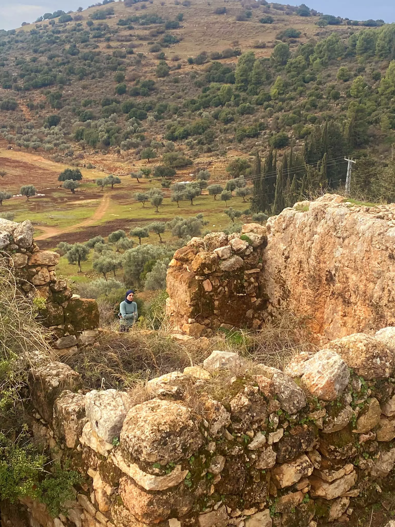
Posted by abu raya - قرية فراضية بأيام ألشتوية -- Nov. 2023 -- Nabela Salem
- Let us see how the most "liberal and civilized" of world Jewry has obliterated our village. How else will the Jews be great and safe again? -- القرية دمرت بالكامل.. من هنا مر الهمج
- Let us see how the most "liberal and civilized" of world Jewry has obliterated our village. How else will the Jews be great and safe again? -- القرية دمرت بالكامل.. من هنا مر الهمج
#2
- Let us see how the most "liberal and civilized" of world Jewry has obliterated our village. How else will the Jews be great and safe again? -- القرية دمرت بالكامل.. من هنا مر الهمج
#3
- Let us see how the most "liberal and civilized" of world Jewry has obliterated our village. How else will the Jews be great and safe again? -- القرية دمرت بالكامل.. من هنا مر الهمج
#4
- Let us see how the most "liberal and civilized" of world Jewry has obliterated our village. How else will the Jews be great and safe again? -- القرية دمرت بالكامل.. من هنا مر الهمج
#5
- Let us see how the most "liberal and civilized" of world Jewry has obliterated our village. How else will the Jews be great and safe again? -- القرية دمرت بالكامل.. من هنا مر الهمج
#6
- Let us see how the most "liberal and civilized" of world Jewry has obliterated our village. How else will the Jews be great and safe again? -- القرية دمرت بالكامل.. من هنا مر الهمج
#7
- Let us see how the most "liberal and civilized" of world Jewry has obliterated our village. How else will the Jews be great and safe again? -- القرية دمرت بالكامل.. من هنا مر الهمج
#8
- Let us see how the most "liberal and civilized" of world Jewry has obliterated our village. How else will the Jews be great and safe again? -- القرية دمرت بالكامل.. من هنا مر الهمج
#9
- Let us see how the most "liberal and civilized" of world Jewry has obliterated our village. How else will the Jews be great and safe again? -- القرية دمرت بالكامل.. من هنا مر الهمج
#10
- Let us see how the most "liberal and civilized" of world Jewry has obliterated our village. How else will the Jews be great and safe again? -- القرية دمرت بالكامل.. من هنا مر الهمج
#11
- Let us see how the most "liberal and civilized" of world Jewry has obliterated our village. How else will the Jews be great and safe again? -- القرية دمرت بالكامل.. من هنا مر الهمج
#12
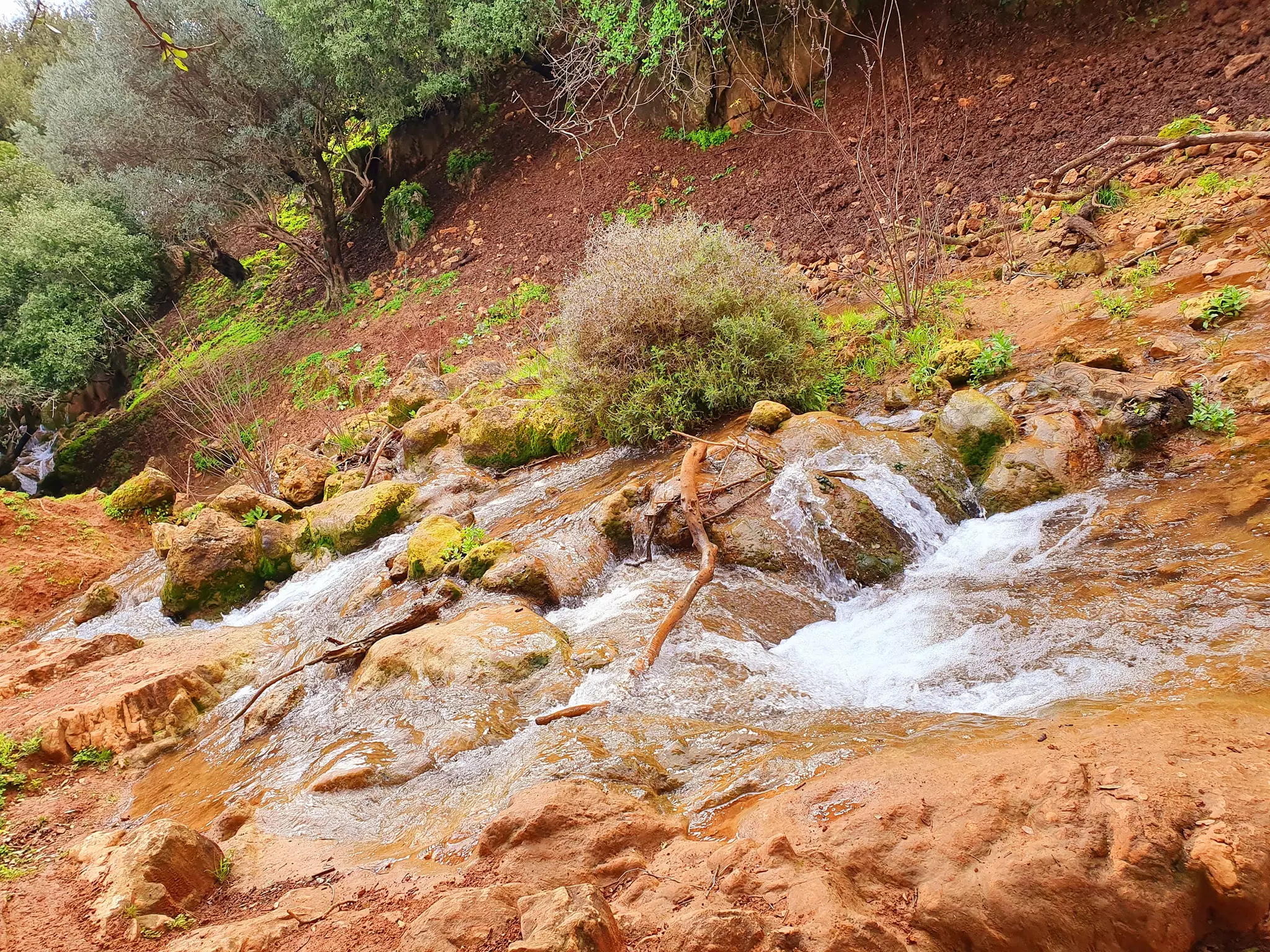
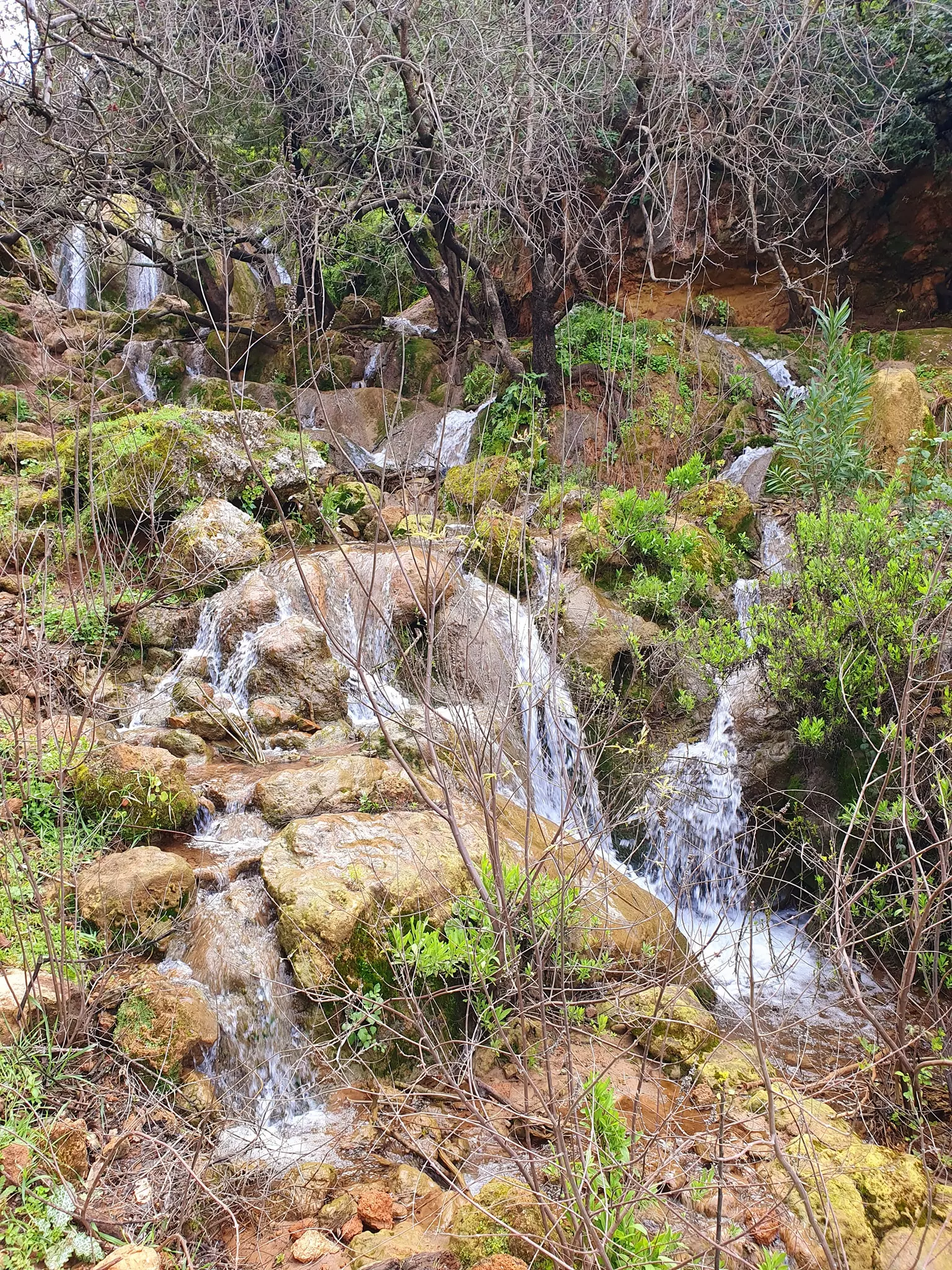
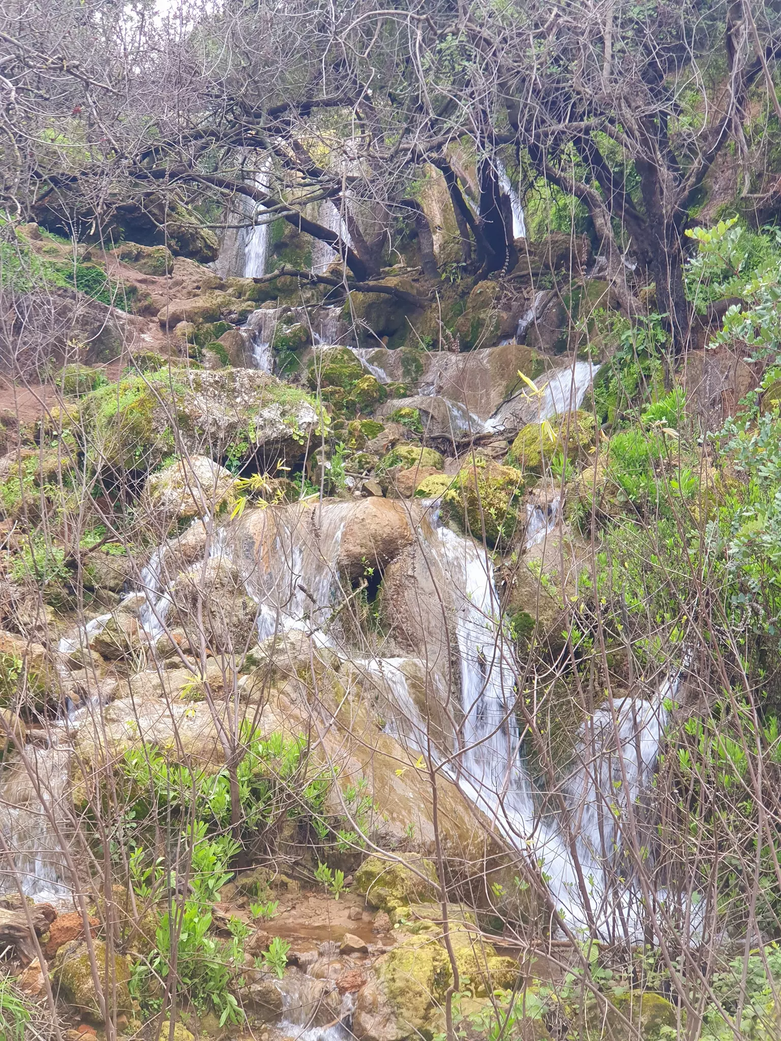
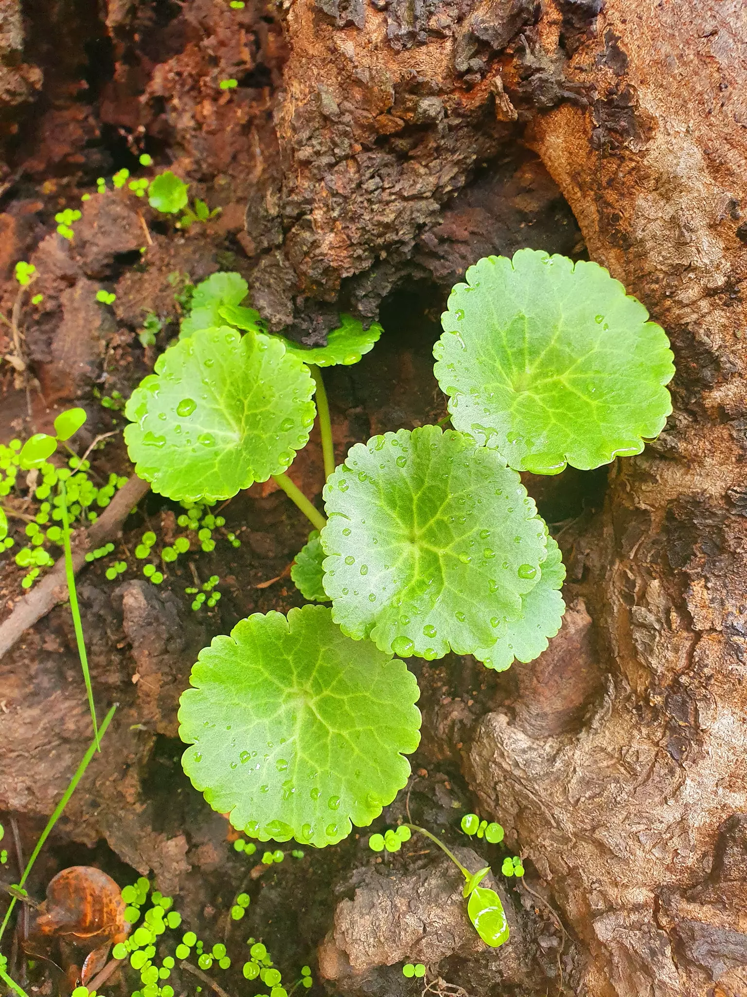
- جولة في شلالات فراضية وعين ألرميلة -- March 2022 - Nabela Salem
- جولة في شلالات فراضية وعين ألرميلة -- March 2022 - Nabela Salem #2
- جولة في شلالات فراضية وعين ألرميلة -- March 2022 - Nabela Salem #3
- جولة في شلالات فراضية وعين ألرميلة -- March 2022 - Nabela Salem #4
- جولة في شلالات فراضية وعين ألرميلة -- March 2022 - Nabela Salem #5
- جولة في شلالات فراضية وعين ألرميلة -- March 2022 - Nabela Salem #6
- جولة في شلالات فراضية وعين ألرميلة -- March 2022 - Nabela Salem #7
- جولة في شلالات فراضية وعين ألرميلة -- March 2022 - Nabela Salem #8
- جولة في شلالات فراضية وعين ألرميلة -- March 2022 - Nabela Salem #9
- جولة في شلالات فراضية وعين ألرميلة -- March 2022 - Nabela Salem #10
- جولة في شلالات فراضية وعين ألرميلة -- March 2022 - Nabela Salem #11
- جولة في شلالات فراضية وعين ألرميلة -- March 2022 - Nabela Salem #12
- جولة في شلالات فراضية وعين ألرميلة -- March 2022 - Nabela Salem #13
- جولة في شلالات فراضية وعين ألرميلة -- March 2022 - Nabela Salem #14
- Let us see how the most "liberal and civilized" of world Jewry has obliterated our village. How else will the Jews be great and safe again?-- Jan. 2022
- Let us see how the most "liberal and civilized" of world Jewry has obliterated our village. How else will the Jews be great and safe again?-- Jan. 2022 #2
- Let us see how the most "liberal and civilized" of world Jewry has obliterated our village. How else will the Jews be great and safe again?-- Jan. 2022 #3
- Let us see how the most "liberal and civilized" of world Jewry has obliterated our village. How else will the Jews be great and safe again?-- Jan. 2022 #4
- Let us see how the most "liberal and civilized" of world Jewry has obliterated our village. How else will the Jews be great and safe again?-- Jan. 2022 #5
- Let us see how the most "liberal and civilized" of world Jewry has obliterated our village. How else will the Jews be great and safe again?-- Jan. 2022 #6
- Let us see how the most "liberal and civilized" of world Jewry has obliterated our village. How else will the Jews be great and safe again?-- Jan. 2022 #7
- Let us see how the most "liberal and civilized" of world Jewry has obliterated our village. How else will the Jews be great and safe again?-- Jan. 2022 #8
- Let us see how the most "liberal and civilized" of world Jewry has obliterated our village. How else will the Jews be great and safe again?-- Jan. 2022 #9
- Let us see how the most "liberal and civilized" of world Jewry has obliterated our village. How else will the Jews be great and safe again?-- Jan. 2022 #10
- Let us see how the most "liberal and civilized" of world Jewry has obliterated our village. How else will the Jews be great and safe again?-- Jan. 2022 #11
- Let us see how the most "liberal and civilized" of world Jewry has obliterated our village. How else will the Jews be great and safe again?-- Jan. 2022 #12
- Let us see how the most "liberal and civilized" of world Jewry has obliterated our village. How else will the Jews be great and safe again?-- Jan. 2022 #13
- Let us see how the most "liberal and civilized" of world Jewry has obliterated our village. How else will the Jews be great and safe again?-- Jan. 2022 #14
- Let us see how the most "liberal and civilized" of world Jewry has obliterated our village. How else will the Jews be great and safe again?-- Jan. 2022 #15
- Let us see how the most "liberal and civilized" of world Jewry has obliterated our village. How else will the Jews be great and safe again?-- Jan. 2022 #16
- Let us see how the most "liberal and civilized" of world Jewry has obliterated our village. How else will the Jews be great and safe again?-- Jan. 2022 #17
- Let us see how the most "liberal and civilized" of world Jewry has obliterated our village. How else will the Jews be great and safe again?-- Jan. 2022 #18
- Let us see how the most "liberal and civilized" of world Jewry has obliterated our village. How else will the Jews be great and safe again?-- Jan. 2022 #19
- Let us see how the most "liberal and civilized" of world Jewry has obliterated our village. How else will the Jews be great and safe again?-- Jan. 2022 #20
- Let us see how the most "liberal and civilized" of world Jewry has obliterated our village. How else will the Jews be great and safe again?-- Jan. 2022 #21
- Let us see how the most "liberal and civilized" of world Jewry has obliterated our village. How else will the Jews be great and safe again?-- Jan. 2022 #22
- Let us see how the most "liberal and civilized" of world Jewry has obliterated our village. How else will the Jews be great and safe again?-- Jan. 2022 #23
- Let us see how the most "liberal and civilized" of world Jewry has obliterated our village. How else will the Jews be great and safe again?-- Jan. 2022 #24
- Let us see how the most "liberal and civilized" of world Jewry has obliterated our village. How else will the Jews be great and safe again?-- Jan. 2022 #25
- Let us see how the most "liberal and civilized" of world Jewry has obliterated our village. How else will the Jews be great and safe again?-- Jan. 2022 #26
- Let us see how the most "liberal and civilized" of world Jewry has obliterated our village. How else will the Jews be great and safe again?-- Jan. 2022 #27
- Let us see how the most "liberal and civilized" of world Jewry has obliterated our village. How else will the Jews be great and safe again?-- Jan. 2022 #28
- Let us see how the most "liberal and civilized" of world Jewry has obliterated our village. How else will the Jews be great and safe again?-- Jan. 2022 #29
- Let us see how the most "liberal and civilized" of world Jewry has obliterated our village. How else will the Jews be great and safe again?-- Jan. 2022 #30
- Let us see how the most "liberal and civilized" of world Jewry has obliterated our village. How else will the Jews be great and safe again?-- March. 2021
- Let us see how the most "liberal and civilized" of world Jewry has obliterated our village. How else will the Jews be great and safe again?-- March. 2021 #2
- Let us see how the most "liberal and civilized" of world Jewry has obliterated our village. How else will the Jews be great and safe again?-- March. 2021 #3
- Let us see how the most "liberal and civilized" of world Jewry has obliterated our village. How else will the Jews be great and safe again?-- March. 2021 #4
- Let us see how the most "liberal and civilized" of world Jewry has obliterated our village. How else will the Jews be great and safe again?-- March. 2021 #5
- Let us see how the most "liberal and civilized" of world Jewry has obliterated our village. How else will the Jews be great and safe again?-- March. 2021 #6
- Let us see how the most "liberal and civilized" of world Jewry has obliterated our village. How else will the Jews be great and safe again?-- March. 2021 #7
- Let us see how the most "liberal and civilized" of world Jewry has obliterated our village. How else will the Jews be great and safe again?-- March. 2021 #8
- Let us see how the most "liberal and civilized" of world Jewry has obliterated our village. How else will the Jews be great and safe again?-- March. 2021 #9
- Let us see how the most "liberal and civilized" of world Jewry has obliterated our village. How else will the Jews be great and safe again?-- March. 2021 #10
- Let us see how the most "liberal and civilized" of world Jewry has obliterated our village. How else will the Jews be great and safe again?-- March. 2021 #11
- Let us see how the most "liberal and civilized" of world Jewry has obliterated our village. How else will the Jews be great and safe again?-- March. 2021 #12
- Let us see how the most "liberal and civilized" of world Jewry has obliterated our village. How else will the Jews be great and safe again?-- March. 2021 #13
- Let us see how the most "liberal and civilized" of world Jewry has obliterated our village. How else will the Jews be great and safe again?-- March. 2021 #14
- Let us see how the most "liberal and civilized" of world Jewry has obliterated our village. How else will the Jews be great and safe again?-- March. 2021 #15
- Let us see how the most "liberal and civilized" of world Jewry has obliterated our village. How else will the Jews be great and safe again?-- March. 2021 #16
- Let us see how the most "liberal and civilized" of world Jewry has obliterated our village. How else will the Jews be great and safe again?-- March. 2021 #17
- Let us see how the most "liberal and civilized" of world Jewry has obliterated our village. How else will the Jews be great and safe again?-- March. 2021 #18
- Let us see how the most "liberal and civilized" of world Jewry has obliterated our village. How else will the Jews be great and safe again?-- March. 2021 #19
- Let us see how the most "liberal and civilized" of world Jewry has obliterated our village. How else will the Jews be great and safe again?-- March. 2021 #20
- Let us see how the most "liberal and civilized" of world Jewry has obliterated our village. How else will the Jews be great and safe again?-- March. 2021 #21
- Let us see how the most "liberal and civilized" of world Jewry has obliterated our village. How else will the Jews be great and safe again?-- March. 2021 #22
- Let us see how the most "liberal and civilized" of world Jewry has obliterated our village. How else will the Jews be great and safe again?-- March. 2021 #23
- Let us see how the most "liberal and civilized" of world Jewry has obliterated our village. How else will the Jews be great and safe again?-- March. 2021 #24
- Let us see how the most "liberal and civilized" of world Jewry has obliterated our village. How else will the Jews be great and safe again?-- March. 2021 #25
- A rare picture of the nearby Kibbutz taken 2 years after the "civilized" replaced us. In the background, it seems our village wasn't destroyed yet
- A rare picture of the nearby Kibbutz taken 2 years after the "civilized" replaced us. In the background, it seems our village wasn't destroyed yet #2
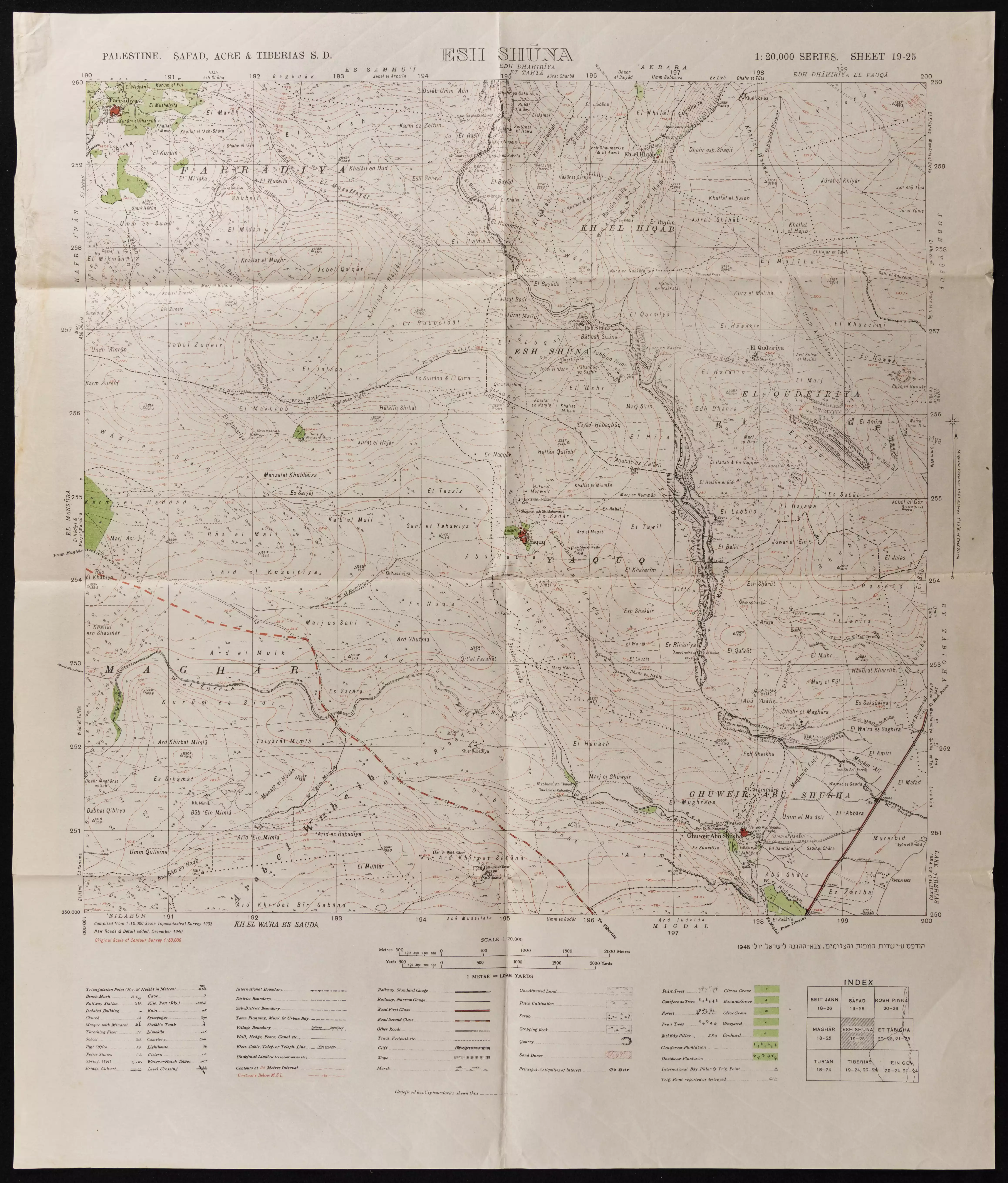
- خارطة تُظهِر الحدود والطرق بأنواعها والأماكن المقدسة والطبيعة الطوبغرافية من تلال وسهول ومنحدرات والتشكيلة الطبيعية للأرض وأنواع المزروعات. نُشرت الخريطة فترة الانتداب البريطاني، تم إضافة تعديلات عليها من قِبَل خدمة الخرائط والصور التابعة للقوات العسكرية الاسرائيلية فترة الأربعينيات.
Want to browse more? 80,000 pictures were grouped in these gallaries:
| Display Name | Clan/Hamolah | Country of Residence |
| Jenna | Al-Hussein | Los Angeles, United States |
| Nermeen Ali | - | København, Danmark |
| Samir Badran | - | Sønderborg, Denmark |
| Dina Karroum | - | Abu Dhabi, UAE |
| Saied Ahmad Hassan Badran | Ismail Badran | Sønderjylland, Danmark |
| Said Alahmad | Dar Hussain | West Midlands, United Kingdom |
| ghassan mahmoud | Barghouty | - |
| Ghassan Mahmoud | - | - |
| Abo Adam | - | Ringsted, Denmark |
| نعيم احمد حسن | - | oppland, oppland |
| chadia mahmoud | - | limoges, france |
| kamal karroum | 7afid saleh elhaj karroum | malmö-sweden - currently, lebanon - saida |
| Mahmoud Awad | - | germany, germany |
| Mohammed Assi | Assi | Sweden, skåne |
| يوسف صالح أحمد | مشايخ ال حسين البرغوثي | مالمو, السويد |
| za3bol | - | - |
| Dr.Hicham Awad | AWAD | Berlin, Germany |
| KARRUM | KARRUM | AARHUS, DENEMARK |
| KARRUM | KARRUM | ARHUS |
| naser | - | ukraine, ukraine |
| wisam karroum | - | uae, lebanon |
| karroum | karroum | هrhus, denmark |
| jabbar | badran | skane, sweden |
| Shams | - | Beqaa, Lebanon |
| Nayef El Ali | - | Sharjah, United Arab Emirates |
| Lama Barghouty | Barghouty | - |
| Amal Badran | - | Sharjah, United Arab Emirates |
| Chadi Mahmoud | Barghouty | - |
| Hanna Al Ahmad | Badarne | Saida, Lebanon |
| Khaled Badran | Badran | Saida, Lebanon |
| Samer Badran | Badarne | Lebanon |
| Shadi Badran | Badran | - |
| Samar Badran | Badran | Malmo, Sweden |
| MOHAMAD BADRAN | - | SWEDEN, SWEDEN |
| Zeina Badran | - | Abudhabi, United Arab Emirates |
| RAAD KARROUM | KARROUM | MALMض, SWEDEN |
| jihad Badran | - | - |
| Salem | Al-Hussain | Alberta, Canada |
| Mohammad Assi | Assi | Skهne, Sweden |
| Fadi Assi | - | - |
| ziad | husaen | KBH, denmark |
| Dina Mahmoud | Barghouty | - |
| fouad saiid Abdel-halim | Badarni | Denmark, KBH |
| Issam b | - | - |
| san | san | togo, togo |
| kefah otuor | otuor | lebanon, lebanon |
| alasmar | sarah | tripoli/lebanon |
| KARRUM | chrome | DENEMARK, FARADI |
| Mohamed Gheneim | Gheneim | Australia |
| wissam awad | - | saida, lebanon |
| ABDALLA GHONEIM | GHONEIM | MALMO, SWEDEN |
| MAHA KARROUM | KARROUM | MALMO, SWEDEN |
| khoder karroum | karroum | ekleem al kharoob, lebanon |
| muhammad abd el rasaq | Shams | berlin, germany |
| Khaled Assi | Assi | Sweden-Malmo |
| Amer | Ali | MALMض, Sweden |
| Khalil Assi | Assi | Malmo, Sweden |
| Ahmed AbuShaker | AbuShaker | Canada |
| Tel al-Aza'tar | Karroum | Canada |
- زيارة رائة من الجوي لفراضية Duration: 7 min 28 sec
No links have been shared yet, be free to the first to share the first link.
 Fake Valor: Why Did Zionist Jews Hoist Nazis Flag on Their Ships in the 1930s?
What is new?
-
Facts About Oct. 7th Gaza Raid
-
Remined Us Please:: Who Did Rape Who? Palestinians Raped Israelis? Or, was the other way around?
-
When Prof. Edward Said was invited to debate Bibi Netanyahu in the 1980s, watch what happened!
-
Ezra Klein of the NY Times on the "Jewish Race".
-
Abusing Blood Libel!
-
Did Israeli Soldiers Activate The Hanniba Direective On Oct. 7th? You Be The Judge
-
Zionist FAQ: Isn't it true that Palestinians don't want peace? Palestinians never accepted the two-state solution
- Facts about Haavara (Transfer) Agreement between Ben-Gurion & Hitler
-
Haavara FAQs: Why Did Zionist Jews Hoist Nazis' Flags on Their Ships in the 1930s?
- Haavara FAQs: When Chaim Weizmann met FDR in mid-1943, why was he silent about rescuing European Jewry?
-
Dear ChatGPT: How did Palestinians resist Napoleon's invasion of their country in 1799?
-
Dear ChatGPT: Gaza had a vibrant Jewish community in the mid-17th century. What happened to them?
-
Dear ChatGPT: Why did the Jewish Agency suppress news of the Holocaust during WWII?
-
Video Playlist: Jews share their DNA tests to end the conflict for good.
-
A Tale of Two Conflicts: Examining the Definition of Genocide
-
Prof. Abraham Polak And The Suppressed History of the Khazars and European Jewry
-
How Ronald Reagan would have framed the genocide in Gaza if he were still alive?
-
Haavara FAQs: Let us do the math: how many German Jews did The Haavara Agreement save?
-
Zionist FAQs: The Hebron Massacre of 1929, "clearly proves" that Palestinians are antisemitic, how could you deny it?
-
Zionist FAQs: Why Anti-Zionist Is Not Antisemitism?
-
Zionist FAQs: Isn't it true that the KGB created Palestinian Nationalism in the early 1960s?
- Zionist FAQs: Muslims are killing Muslims all the time; why are Israeli Jews being singled out in the media?
- Zionist FAQs: How is Israel an apartheid state when 20% of its citizens are Arabs who enjoy full rights?
-
Haavara FAQs: Why Did Dorothy Thompson Flip From A Zionist Advocate to A Silenced Dissenter?
-
Haavara FAQs: Analysis of Herzl's Uganda Scheme and how it could have saved millions of Jews.
-
Haavara FAQs: Why did Hayim Greenberg describe American Jewry as "morally bankrupt" in early 1943?
-
Haavara FAQs: What if the Evian Conference was a resounding success? What would have been the impact of saving European Jewry on Zionism?
- Haavara FAQs: What if the six million were saved, how that would have impacted the Zionist project?
-
Haavara FAQs: How did Zionist leaders react when Europe's Jews lingered in the DP camps after WWII ended?
-
Why does the American Jewish community repeat lies that David Ben-Gurion had debunked before he died?
-
Who has the power to rename the Tatar/Khazar Gene Marker to Jewish IV?
-
Zionist FAQs: Why won't Egypt, Syria, and Jordan take their people back? Jews are indigenous to Palestine, and Arabs immigrated after Jews developed the country. Arabs should leave.
-
Haavara FAQs: Did Hitler and the Nazis conflate between Judaism and Zionist? If that wasn't case, then why?
-
Haavara FAQs: Winston Churchill and antisemitism, a collection of articles written Churchill.
-
Haavara FAQs: Broken by country, how many Jews survived vs. killed during the Holocaust?
-
Haavara FAQs: Why did European Jews vote with their feet and to immigrated to the Americas, not Palestine, after WWII?
-
Watch this American Jewish Girl describing Israeli Jews' cognitive dissonance like no other in under two minutes
-
Haavara FAQs: When the Nazis went out of their way to hide the Holocaust, Israeli Jews did the exact opposite by broadcasting their genocide of Gazans. But why?
-
Haavara FAQs: How Zionist Jews went out of their to show their appreciation to Nazism and Fascism?
- Haavara FAQs: Why Zionist leaders were against bombing the death camps & the Railroads leading to them?
-
Haavara FAQs: Hitler's message to the British and American people: If Jews are such noble citizens and you care about them, how come you're not letting them in? I will gladly ship them to you at my expense, even on luxury liners!
-
A shortlist of Zionist and Israeli false flag operations in the name Jews.
-
The Most Moral Army
- The Land of Kapos (Israel): Where the brave are boycotted and Kapos walk free.
- Why did early Zionists often named their communal enterprises "colonial"?
- Zionist Relations with Nazi Germany by Faris Glubb
-
Two NY Times advertisements by Zionists in the early 1943 that exposes Zionists' treason at the height of the calamity
- Facts Not Lies about the Palestinian-Israeli Conflict.
- Site's pictures have been categorized
- Campgain Against Lice
- A Survey of Palestine, the official source about Palestine before Nakba produced by the British Mandate; over 1200 pages.
- Satellite View & Google Earth: Over 6,000 placemarks identifying all destroyed towns, W. Bank & Gaza Strip Towns, & refugee camps.
- PalestineRemembered.com and its Nakba Oral History Project were featured on al-Jazeera Satellite TV.
- Nakba Oral History Video Podcast:
 Over 700 Oral History interviews (including 3,500+ hours of recording) can be viewed online.
 - Palestine Village Statistics Project
- Gaza Jail Break
- النسخة العربية للموقع الان متوفرة
- Videos: Documenting the destroyed villages in video: Tracing all that remains since Nakba.
- Videos: Responding to Zionist Propaganda
- Interview: The ethnic cleansing of Palestine: George Galloway interviews Israeli Historian Ilan Pappe.
- For Palestinians, memory matters. It provides a blueprint for their future By George Bisharat.
- Zionist FAQ now available in Hebrew שאלות שציונים שואלים, עכשיו בעברית
- Video: The Stephen Walt and John Mearsheimer report on the influence of the Israel Lobby on U.S. Foreign Policy
- The Palestinian-Israeli conflict for beginners
