| PalestineRemembered | About Us | Oral History | العربية | |
| Pictures | Zionist FAQs | Haavara | Maps | |
| Search |
| Camps |
| Districts |
| Acre |
| Baysan |
| Beersheba |
| Bethlehem |
| Gaza |
| Haifa |
| Hebron |
| Jaffa |
| Jericho |
| Jerusalem |
| Jinin |
| Nablus |
| Nazareth |
| Ramallah |
| al-Ramla |
| Safad |
| Tiberias |
| Tulkarm |
| Donate |
| Contact |
| Profile |
| Videos |
Welcome To Tarbikha - تربيخا (תרביח'א)
|
District of Acre
Ethnically cleansed days ago |
العربية Google Earth |
 |
Gallery (26) |
- Statistics & Facts
-
Before & After

- Satellite View
- Articles 2
- Pictures 26
- Oral History 2
- Members 12
- Families
- All That Remains
- Wikipedia
- Videos
- Guest Book 14
- Links 1
| Statistic & Fact | Value | ||||||||||||||
| Occupation Date | November 1, 1948 | ||||||||||||||
| Distance From District | 27 (km) Northeast of Acre | ||||||||||||||
| Elevation | 550 (meters) | ||||||||||||||
| Before & After Nakba, Click Map For Details |
|||||||||||||||
|
|||||||||||||||
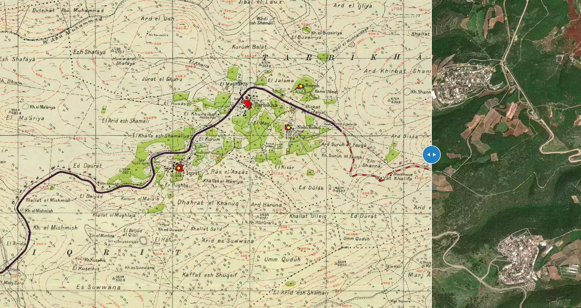
| Map Location | See location #4 on the map View from satellite |
||||||||||||||
| Military Operation | Last stage Operation Hiram | ||||||||||||||
| Attacking Units | 'Oded Brigade | ||||||||||||||
| Exodus Cause | Expulsion by Zionist troops | ||||||||||||||
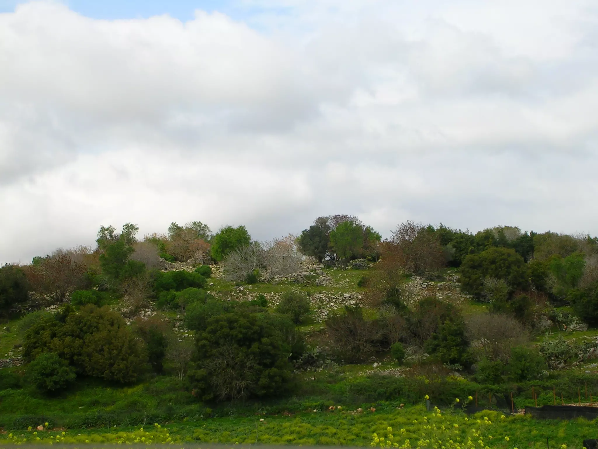
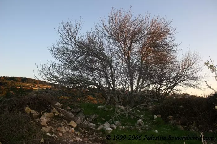
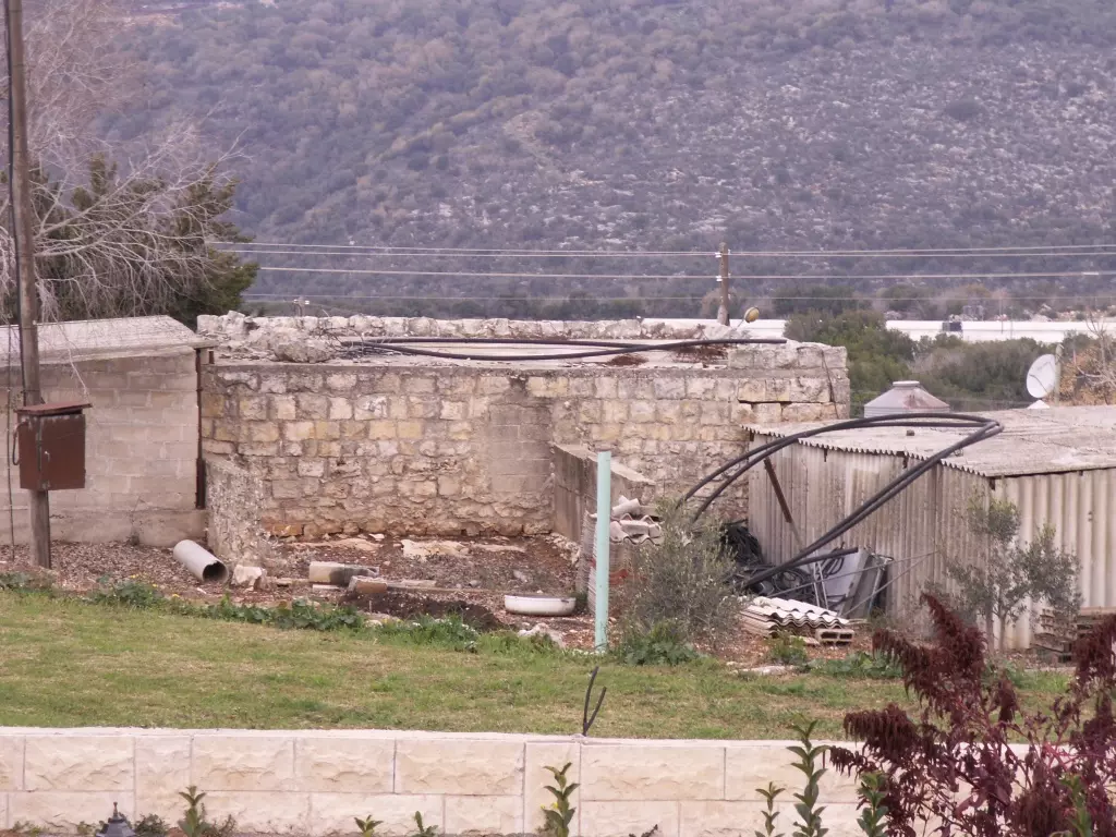
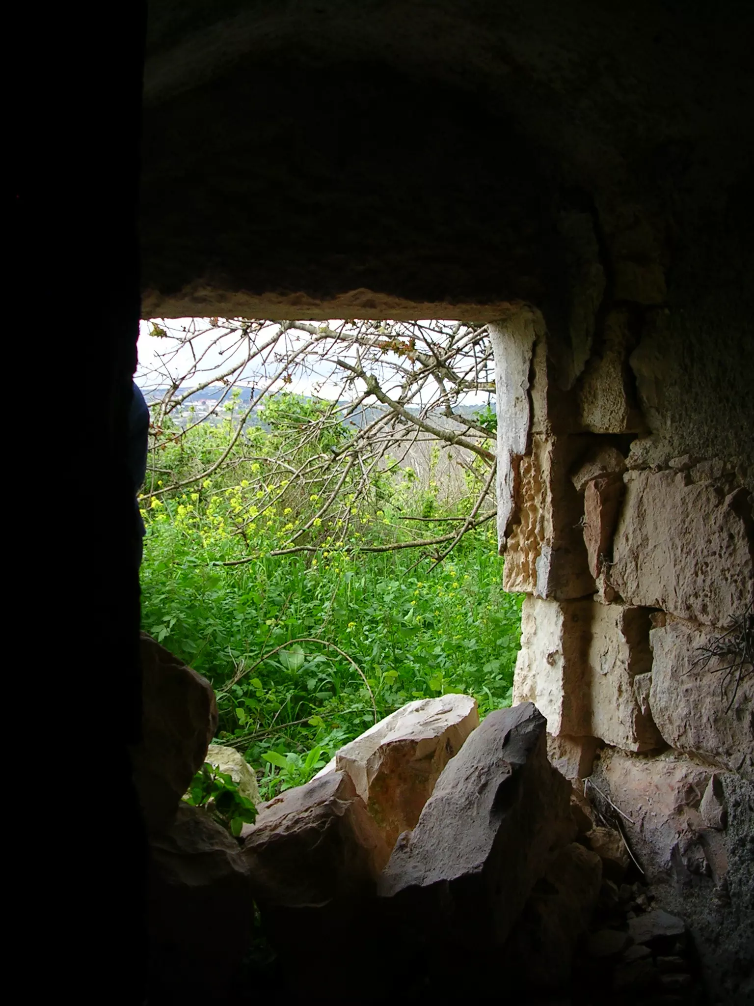
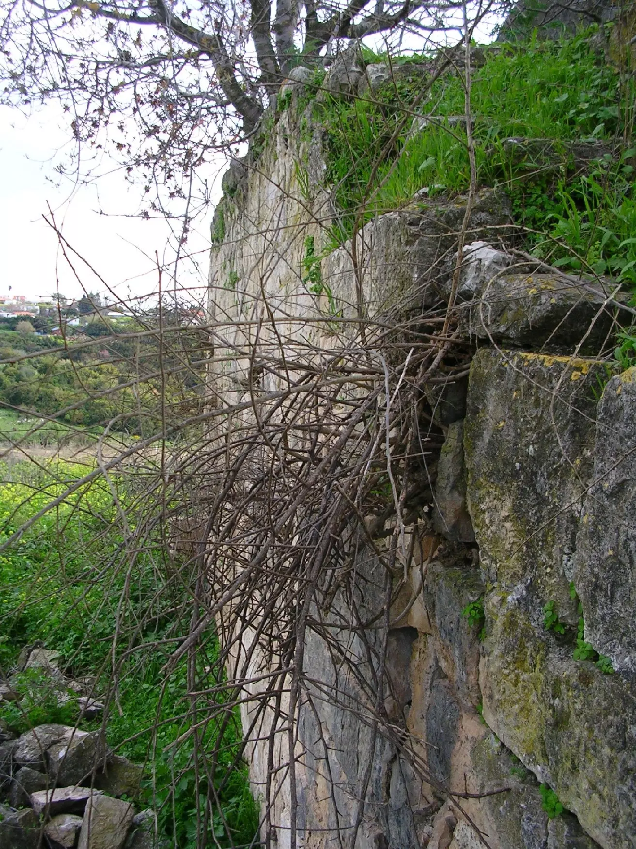
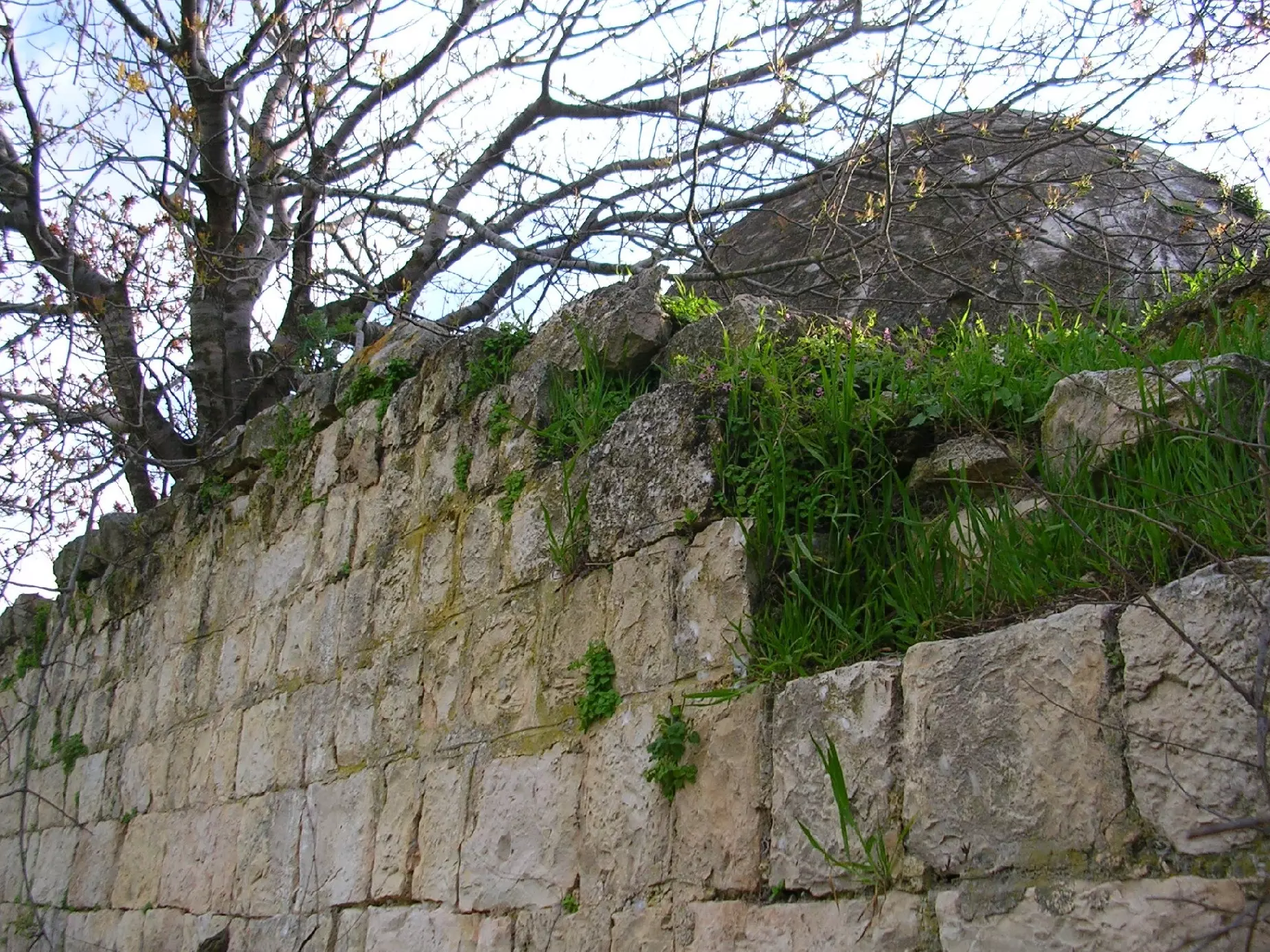
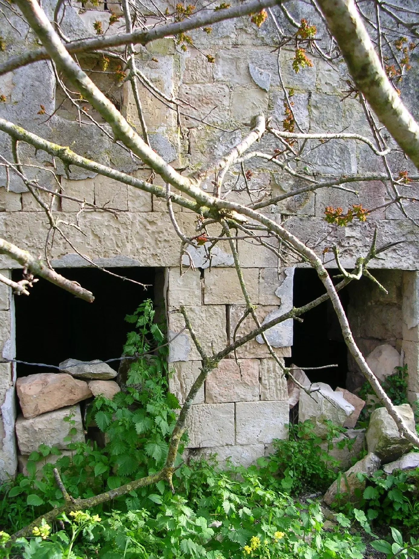
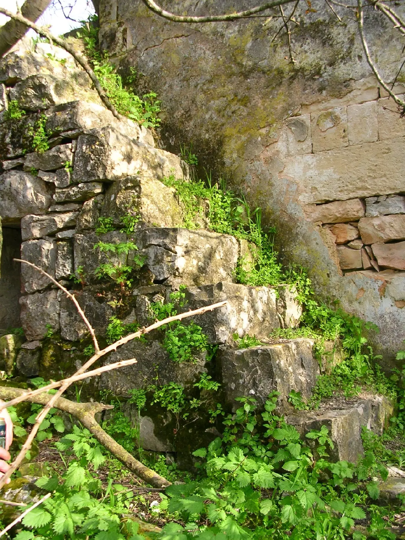
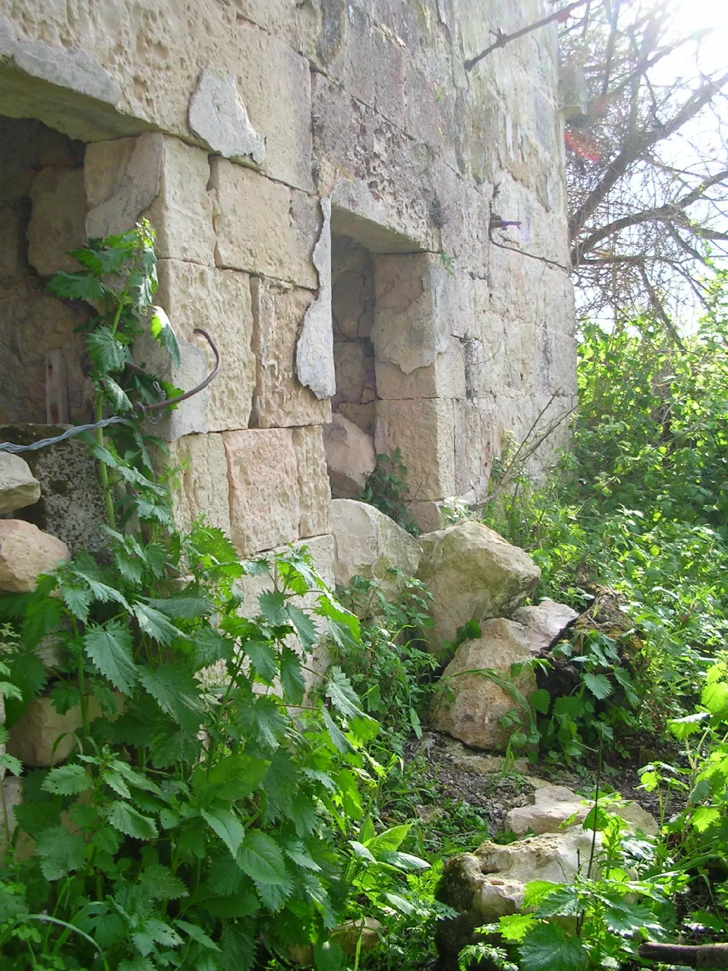
| Village Temains | The village was mostly destroyed with the exception of the 21 stone houses which are being used by Israeli Jewish settlers. | ||||||||||||||
| Ethnically Cleansing | Tarbikha inhabitants were completely ethnically cleansed. | ||||||||||||||
| Pre-Nakba Land Ownership |
**Town Lands' Demarcation Maps |
||||||||||||||
| Land Usage As of 1945 |
|
||||||||||||||
| Population |
|
||||||||||||||
| Number of Houses |
|
||||||||||||||
| Near By Towns |
|||||||||||||||
|
|||||||||||||||
| Town's Name Through History | The Crusader referred to Tarbikha by Tayerebika. | ||||||||||||||
| Schools | Tarbikha had an elementary school for boys which was founded in 1938, and in 1945 it had an enrollment of 120 boys. Students from the nearby villages of al-Nabi Rubin and Surah used to attend the same school. | ||||||||||||||
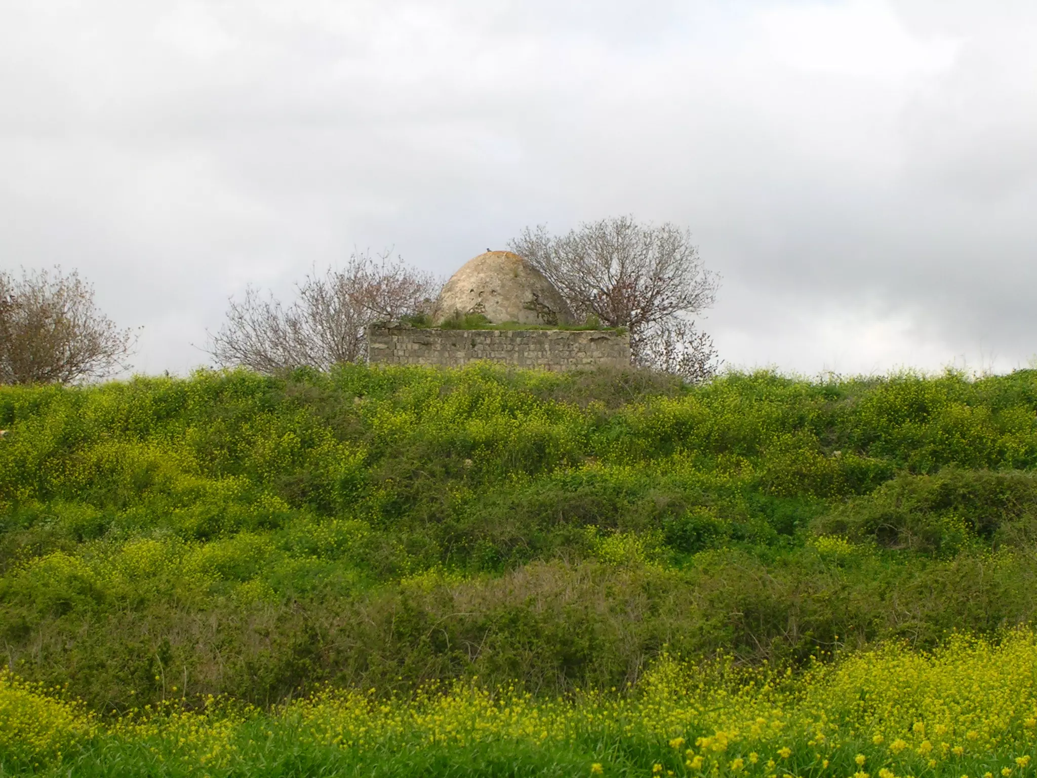
| Places of Warship | Two mosques | ||||||||||||||
| Water Supply | Several springs, reservoirs, and wells which provided Tabrikha's inhabitants with water for domestic use. | ||||||||||||||
| Archeological Sites | Numerous khirbas on the village lands, some khirbas have ancient Olive presses and rock-hewn tombs. | ||||||||||||||
| Exculsive Jewish Colonies Who Usurped Village Lands |
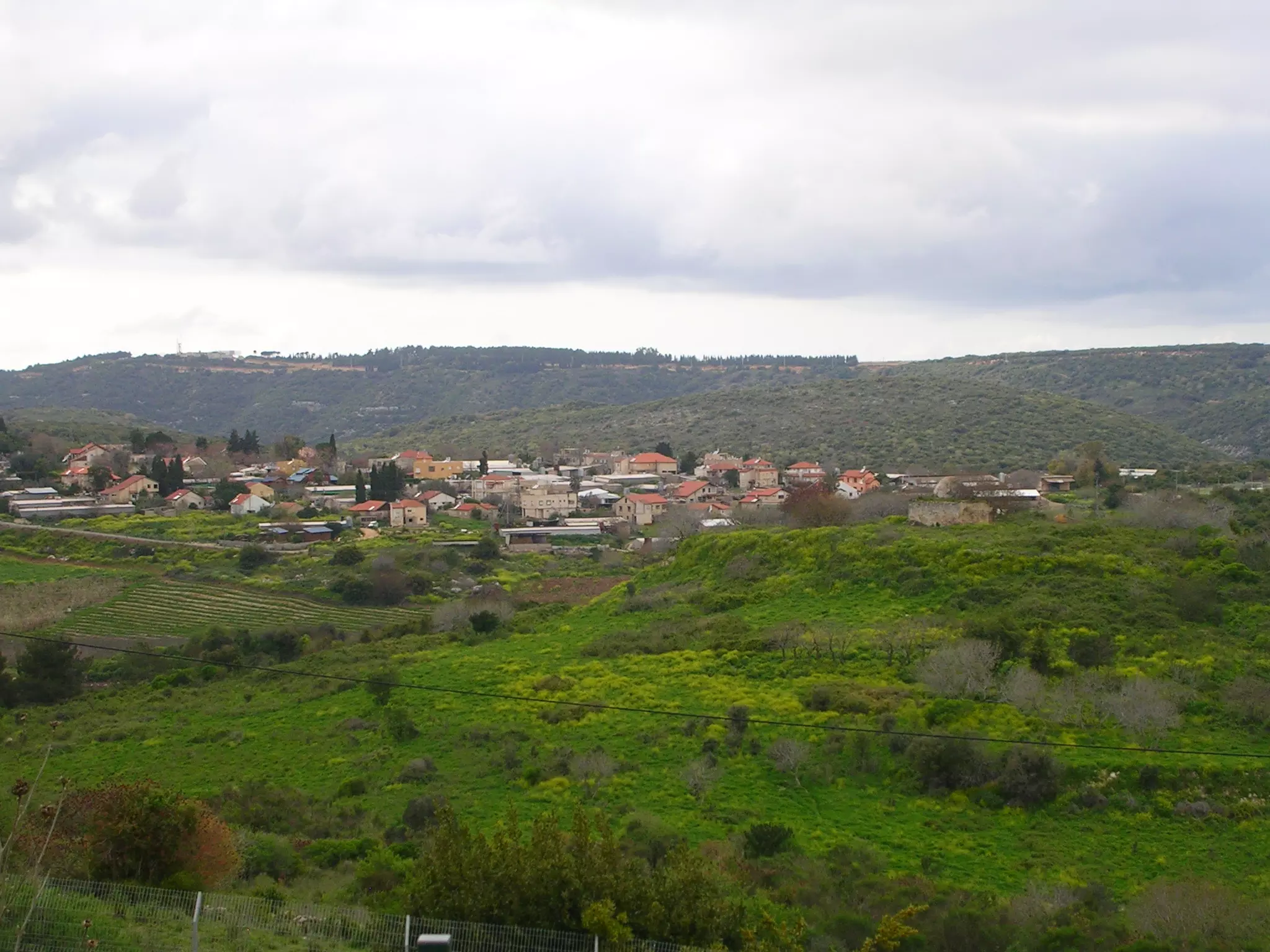
Shomera, Even Menachem, Shetula, and Kefar Rosenwald. | ||||||||||||||
| Featured Video | |||||||||||||||
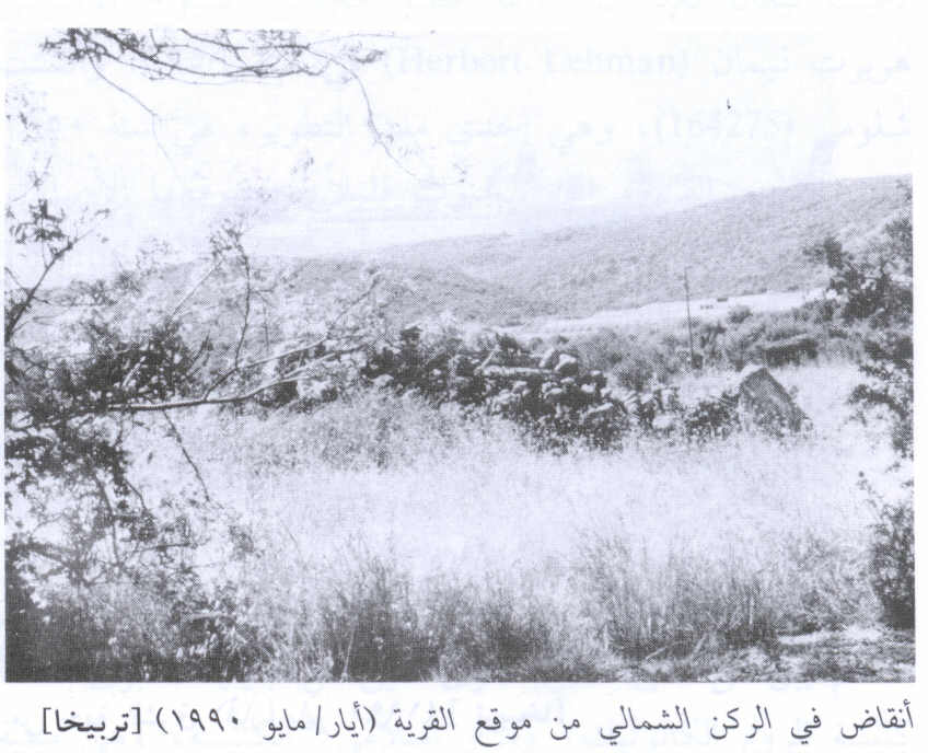
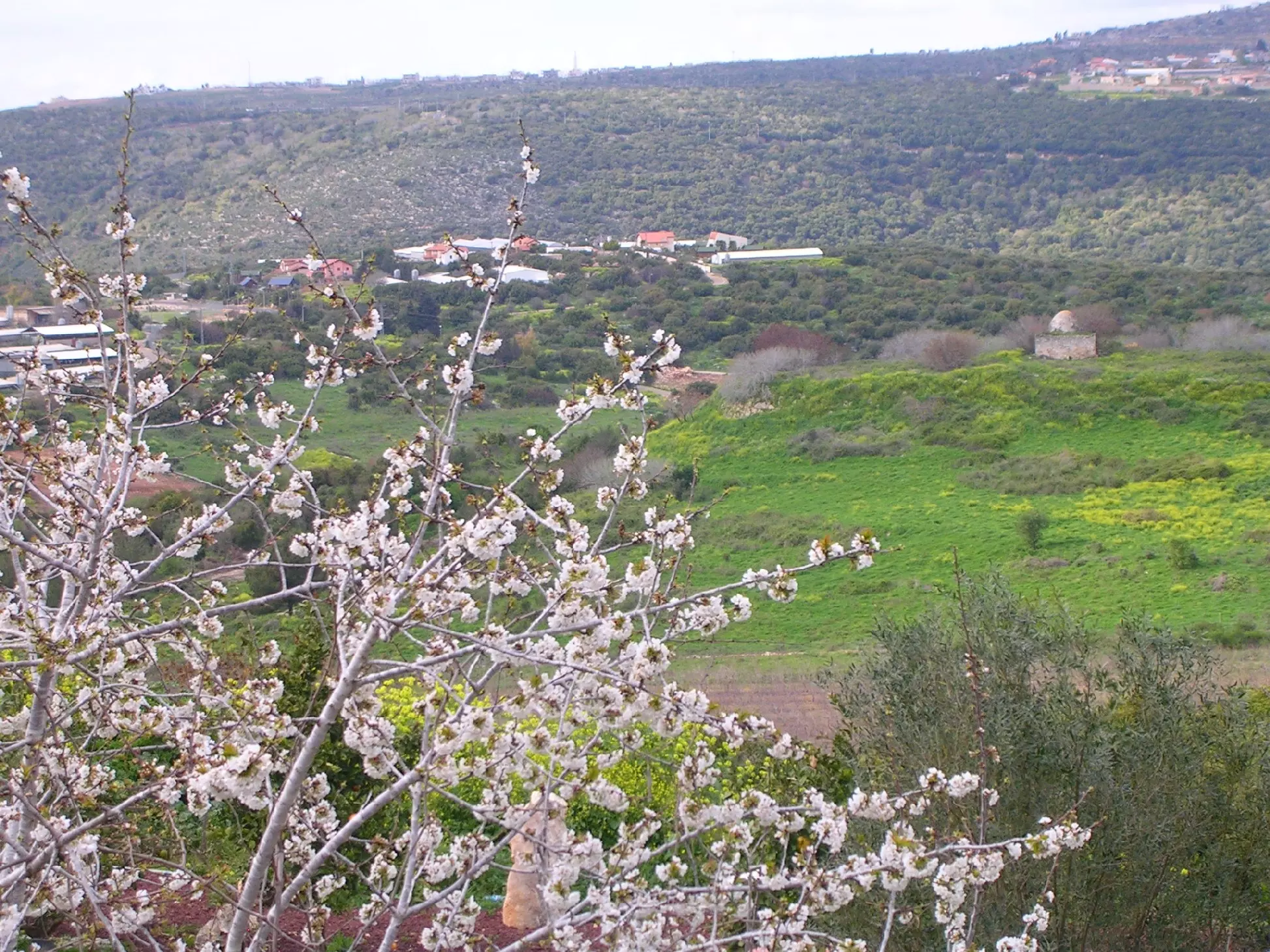
Village Before NakbaThe village was situated on the flat part of a plateau that rose gradually toward the west, bordered by a wide wadi. It overlooked its two satellite villages to the east: Suruh and al-Nabi Rubin. A network of secondary roads linked it to Ra's al-Naqura and some neighboring villages along the Lebanese border. Tarbikha was located on the site of the Crusader 'Tayerebika,' from which it derived its name. In 1596, Tarbikha was a village in the nahiya of Tibnin (liwa' of Safad), with a population of 88. It paid taxes on a number of crops, including wheat, barley, and olives, as well as on other types of produce and property, such as goats and beehives and a press that was used for processing either olives or grapes.In the late nineteenth century, the village of Tarbikha was built of stone and was situated on a ridge. The village's 100 residents cultivated olives. Tarbikha was part of Beirut province in the late Ottoman period. It was not until after World War I, when the borders between Lebanon and Palestine were delineated by the British and French, that Tarbikha came under Palestinian administration. The population consisted entirely of Muslims. The houses of Tarbikha were made of stone, with wood–and–mud ceilings, and clustered initially around a watering pool. Some two–storey houses, built of reinforced concrete, appeared in the village toward the end of the Mandate, and new construction stretched along the Ra's al-Naqura–Banat Ya'qub road. The village had two mosques and an elementary school, founded after 1938, that had an enrollment of 120 students in the mid–1940s. It also had a customs office and a police station for monitoring the Lebanese border. A Cultural Reform Association (jam'iyyat al-islah al-thaqafiyya) was founded in Tarbikha in 1945 to improve social, educational, and medical conditions. The village land was mountainous and cut by several wadis, but it also had several flat areas. Springs, reservoirs, and wells provided the inhabitants with water for domestic use. The bulk of the land area was used as pasture, but the villagers also grew grain, olives, and other crops. Tobacco production increased toward the end of the Mandate and its quality began to match that grown in Turkey. In 1944/45 a total of 3,200 dunums was allotted to cereals; 619 dunums were irrigated or used for orchards. Numerous khirbas on the village lands have been identified which provide evidence for a rich and long history of habitation in the immediate area. Some khirbas contained ancient olive presses and rock–hewn tombs. Village Occupation and Ethnic CleaningAfter the completion of the Israeli army's Operation Hiram, at the end of October 1948, Israeli units swept into a number of villages near the border with Lebanon and expelled their inhabitants. Tarbikha was one of the first to be captured. Some time during the second week of November, the Oded Brigade entered the village and ordered its people to cross the border into Lebanon. The Israeli forces met with no resistance in the village, according to the account of the occupation in the History of the War of Independence. Nevertheless, Israeli historian Benny Morris quotes the Israeli commanding officer of the Northern Front as saying that his forces 'had been forced for military reasons' to expel the villagers of Tarbikha, among others.Zionists Colonies on Village LandsMorris states that by 27 May 1949, Jewish immigrants had been settled in the village, which was renamed Shomera. Even Menachem, established in 1960, is located very close to the village site. Netu'a, founded in 1966, Kefar Rosenwald, established in 1967, and Shetula, founded in 1969, are also on village lands.Village TodayAbout twenty houses from the village are now occupied by the residents of Moshav Shomera. Some of the roofs have been remodeled and given a gabled form. Stones from the original houses embellish the roof of the central shelter of the moshav.SourceDr. Walid al-Khalidi, 1992: All That Remains. |
|||||||||||||||
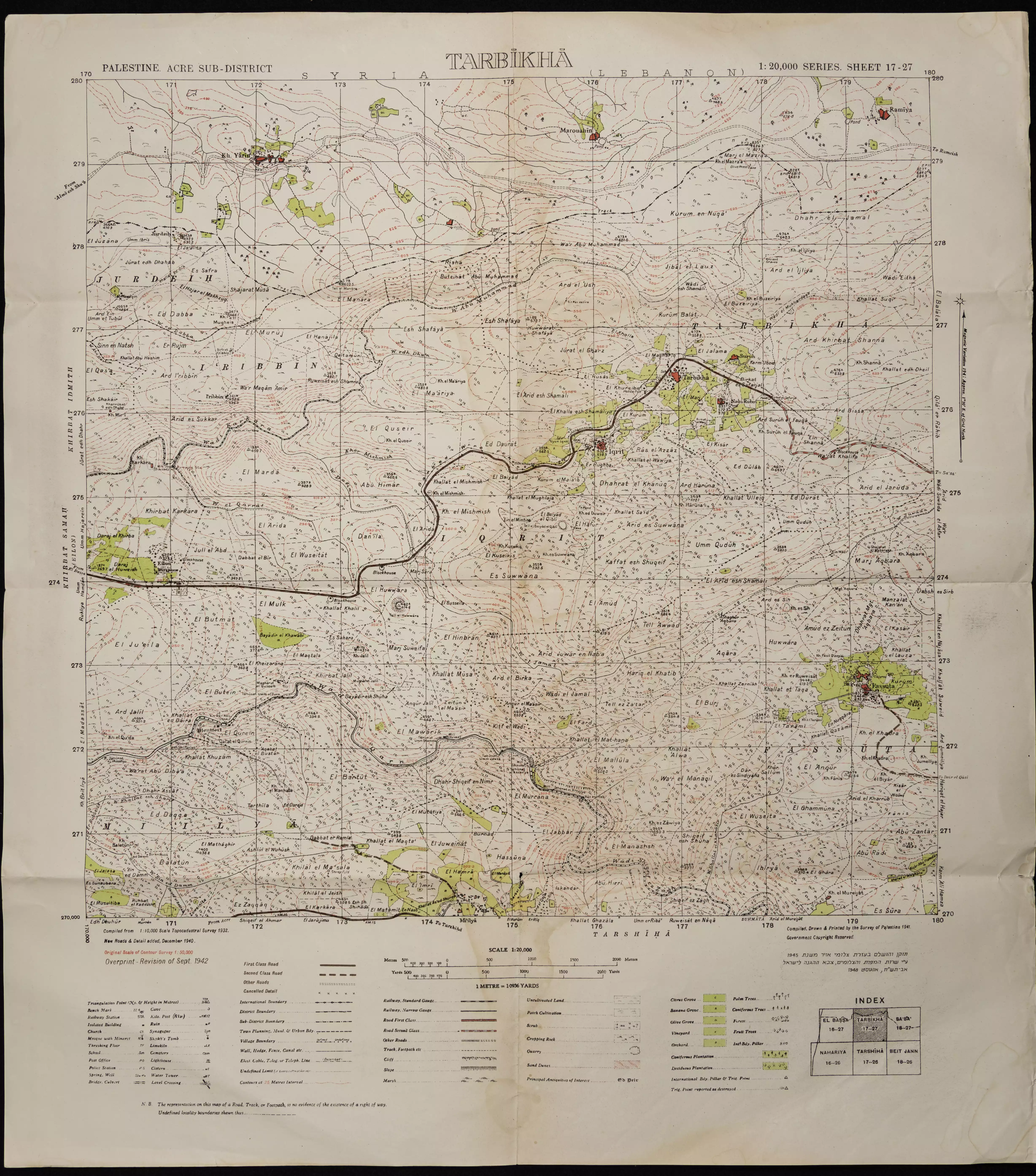
| Related Maps | Town Lands' Demarcation Maps خرائط للقضاء توضح حدود القرى والاودية Town's map on MapQuest View from satellite Help us map this town at WikiMapia |
||||||||||||||
| Related Links | Wikipedia's Page Facebook Page Google Search Google For Images Google For Videos |
||||||||||||||
| More Information | في كتاب كي لا ننسى في كتاب بلادنا فلسطين المزيد من موقع هوية |
||||||||||||||
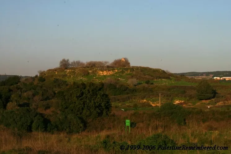
- Village Site In 1990
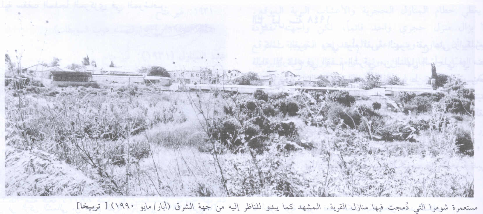
Scanned from "All That Remains" by Dr. Walid Khalidi 1 - Village Rubble In 1990
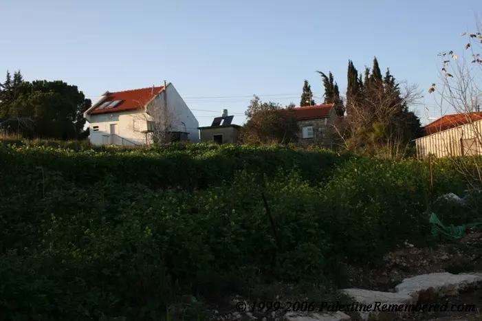
Scanned from "All That Remains" by Dr. Walid Khalidi - مستوطنة شوميرا18.6.06 تصوير مقبولة نصار
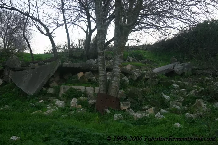
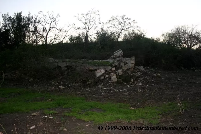
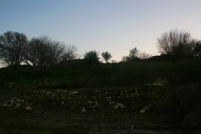
Posted by Makbula Nassar - بقايا البيوت- 18.6.06 تصوير مقبولة نصار
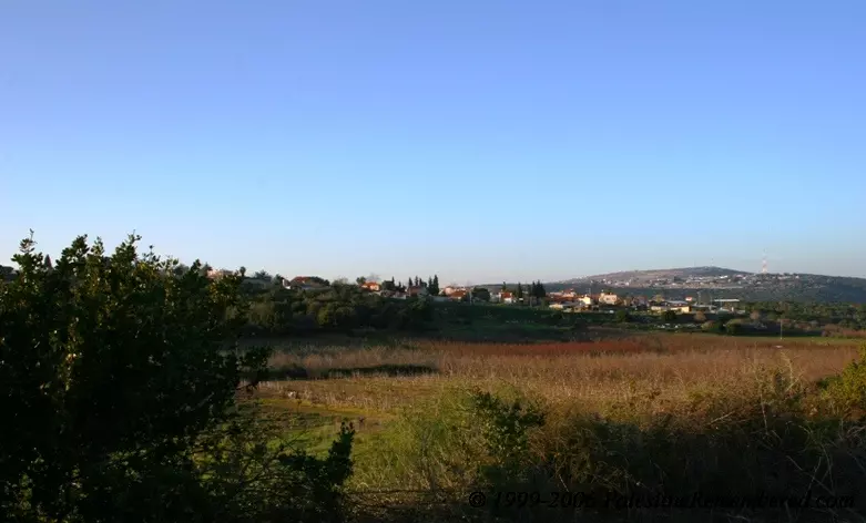
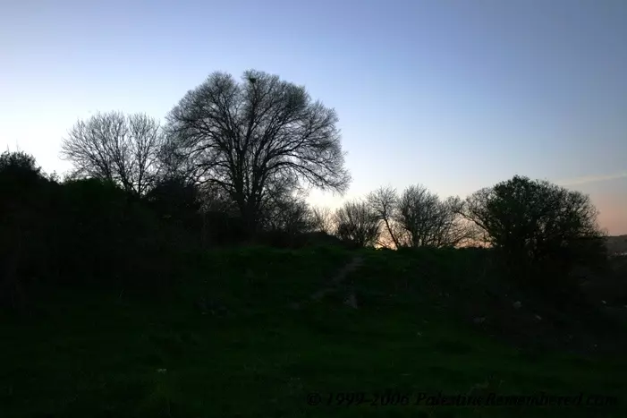
Posted by Makbula Nassar - موقع القرية- 18.6.06 تصوير مقبولة نصار
Posted by Makbula Nassar - بقايا البيوت- 18.6.06 تصوير مقبولة نصار
Posted by Makbula Nassar - موقع القرية- 18.6.06 تصوير مقبولة نصار
Posted by Makbula Nassar - مستوطنة شوميرا 18.6.06 تصوير مقبولة نصار
Posted by Makbula Nassar - بقايا البيوت- 18.6.06 تصوير مقبولة نصار

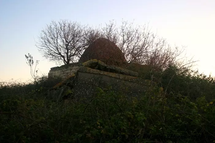
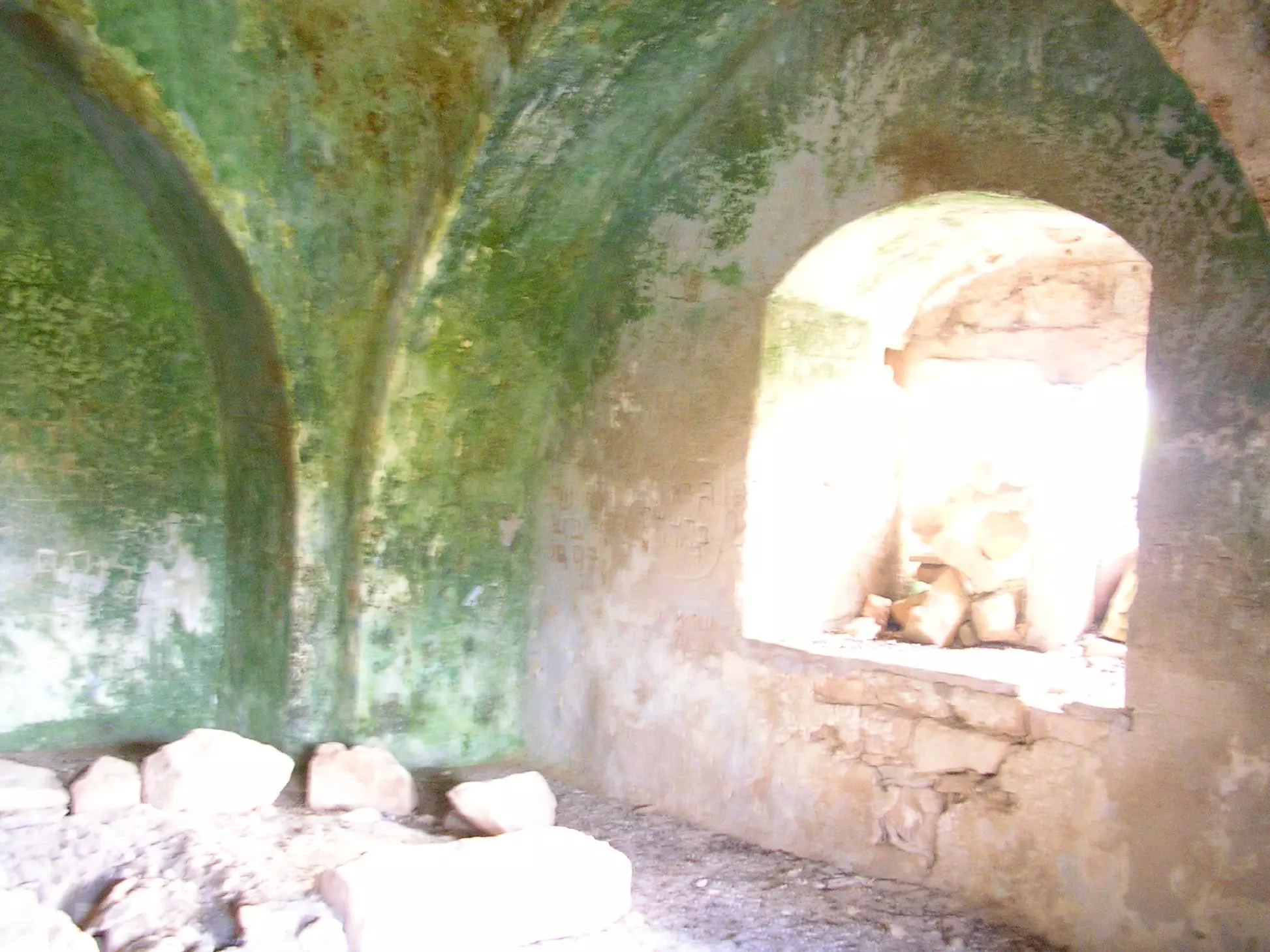
Posted by Makbula Nassar - جامع تربيخا 18.6.06 تصوير مقبولة نصار
Posted by Makbula Nassar 1 - موقع القرية 18.6.06 تصوير مقبولة نصار
Posted by Makbula Nassar - بقايا البيوت 18.6.06 تصوير مقبولة نصار
Posted by Makbula Nassar - A house still used (Moshav Shomera)
Posted by Uri Zackhem 1 - The remaining stones from Tarbikha
Posted by Dr. Mariam El-Hadi 2 - The mosque from Tarbikha
Posted by Dr. Mariam El-Hadi - The mosque from Tarbikha
Posted by Dr. Mariam El-Hadi 1 - Inside the mosque from Tarbikha
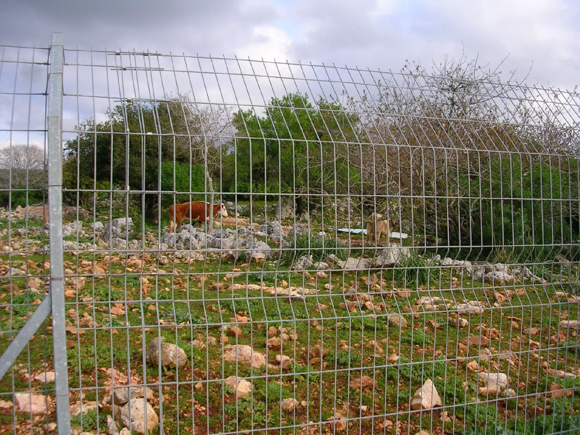
Posted by Dr. Mariam El-Hadi - Cows were kept now on the ground of Tarbikha
Posted by Dr. Mariam El-Hadi - The mosque of Tarbikha #1
Posted by Dr. Mariam El-Hadi - The mosque of Tarbikha #2
Posted by Dr. Mariam El-Hadi - Inside Tarbikha's mosque
Posted by Dr. Mariam El-Hadi 1 - The mosque of Tarbikha #3
Posted by Dr. Mariam El-Hadi - The mosque of Tarbikha #4
Posted by Dr. Mariam El-Hadi - The mosque of Tarbikha #5
Posted by Dr. Mariam El-Hadi - The mosque of Tarbikha #6
Posted by Dr. Mariam El-Hadi 2 - خارطة تُظهِر الحدود والطرق بأنواعها والأماكن المقدسة والطبيعة الطوبغرافية من تلال وسهول ومنحدرات والتشكيلة الطبيعية للأرض وأنواع المزروعات. نُشرت الخريطة فترة الانتداب البريطاني، تم إضافة تعديلات عليها من قِبَل خدمة الخرائط والصور التابعة للقوات العسكرية الاسرائيلية فترة الأربعينيات.
Want to browse more? 80,000 pictures were grouped in these gallaries:
| Display Name | Clan/Hamolah | Country of Residence |
| mtiba | Tiba | Dearborn, USA |
| abo ali ahmad kassem | - | BERLIN, GERMANY |
| refaat ruhayel | tarbekha | dubai |
| BASSEL MUSALLAM | - | - |
| Nehmi youssef | AL MAWASI | TYR, LEBANON |
| HASSAN | - | conakry |
| Dr. Mariam El-Hadi | El-Hadi | Germany |
| diban kassem | - | tn, usa |
| Rami Ruhayel | Ruhayel | W.A., Australia |
| Amin Youssef | Al Mawasi | Australia |
| Fakih | - | - |
| Al Mahroom | El jishi | Dubai, UAE |
 Fake Valor: Why Did Zionist Jews Hoist Nazis Flag on Their Ships in the 1930s?
What is new?
-
Facts About Oct. 7th Gaza Raid
-
Remined Us Please:: Who Did Rape Who? Palestinians Raped Israelis? Or, was the other way around?
-
When Prof. Edward Said was invited to debate Bibi Netanyahu in the 1980s, watch what happened!
-
Ezra Klein of the NY Times on the "Jewish Race".
-
Abusing Blood Libel!
-
Did Israeli Soldiers Activate The Hanniba Direective On Oct. 7th? You Be The Judge
-
Zionist FAQ: Isn't it true that Palestinians don't want peace? Palestinians never accepted the two-state solution
- Facts about Haavara (Transfer) Agreement between Ben-Gurion & Hitler
-
Haavara FAQs: Why Did Zionist Jews Hoist Nazis' Flags on Their Ships in the 1930s?
- Haavara FAQs: When Chaim Weizmann met FDR in mid-1943, why was he silent about rescuing European Jewry?
-
Dear ChatGPT: How did Palestinians resist Napoleon's invasion of their country in 1799?
-
Dear ChatGPT: Gaza had a vibrant Jewish community in the mid-17th century. What happened to them?
-
Dear ChatGPT: Why did the Jewish Agency suppress news of the Holocaust during WWII?
-
Video Playlist: Jews share their DNA tests to end the conflict for good.
-
A Tale of Two Conflicts: Examining the Definition of Genocide
-
Prof. Abraham Polak And The Suppressed History of the Khazars and European Jewry
-
How Ronald Reagan would have framed the genocide in Gaza if he were still alive?
-
Haavara FAQs: Let us do the math: how many German Jews did The Haavara Agreement save?
-
Zionist FAQs: The Hebron Massacre of 1929, "clearly proves" that Palestinians are antisemitic, how could you deny it?
-
Zionist FAQs: Why Anti-Zionist Is Not Antisemitism?
-
Zionist FAQs: Isn't it true that the KGB created Palestinian Nationalism in the early 1960s?
- Zionist FAQs: Muslims are killing Muslims all the time; why are Israeli Jews being singled out in the media?
- Zionist FAQs: How is Israel an apartheid state when 20% of its citizens are Arabs who enjoy full rights?
-
Haavara FAQs: Why Did Dorothy Thompson Flip From A Zionist Advocate to A Silenced Dissenter?
-
Haavara FAQs: Analysis of Herzl's Uganda Scheme and how it could have saved millions of Jews.
-
Haavara FAQs: Why did Hayim Greenberg describe American Jewry as "morally bankrupt" in early 1943?
-
Haavara FAQs: What if the Evian Conference was a resounding success? What would have been the impact of saving European Jewry on Zionism?
- Haavara FAQs: What if the six million were saved, how that would have impacted the Zionist project?
-
Haavara FAQs: How did Zionist leaders react when Europe's Jews lingered in the DP camps after WWII ended?
-
Why does the American Jewish community repeat lies that David Ben-Gurion had debunked before he died?
-
Who has the power to rename the Tatar/Khazar Gene Marker to Jewish IV?
-
Zionist FAQs: Why won't Egypt, Syria, and Jordan take their people back? Jews are indigenous to Palestine, and Arabs immigrated after Jews developed the country. Arabs should leave.
-
Haavara FAQs: Did Hitler and the Nazis conflate between Judaism and Zionist? If that wasn't case, then why?
-
Haavara FAQs: Winston Churchill and antisemitism, a collection of articles written Churchill.
-
Haavara FAQs: Broken by country, how many Jews survived vs. killed during the Holocaust?
-
Haavara FAQs: Why did European Jews vote with their feet and to immigrated to the Americas, not Palestine, after WWII?
-
Watch this American Jewish Girl describing Israeli Jews' cognitive dissonance like no other in under two minutes
-
Haavara FAQs: When the Nazis went out of their way to hide the Holocaust, Israeli Jews did the exact opposite by broadcasting their genocide of Gazans. But why?
-
Haavara FAQs: How Zionist Jews went out of their to show their appreciation to Nazism and Fascism?
- Haavara FAQs: Why Zionist leaders were against bombing the death camps & the Railroads leading to them?
-
Haavara FAQs: Hitler's message to the British and American people: If Jews are such noble citizens and you care about them, how come you're not letting them in? I will gladly ship them to you at my expense, even on luxury liners!
-
A shortlist of Zionist and Israeli false flag operations in the name Jews.
-
The Most Moral Army
- The Land of Kapos (Israel): Where the brave are boycotted and Kapos walk free.
- Why did early Zionists often named their communal enterprises "colonial"?
- Zionist Relations with Nazi Germany by Faris Glubb
-
Two NY Times advertisements by Zionists in the early 1943 that exposes Zionists' treason at the height of the calamity
- Facts Not Lies about the Palestinian-Israeli Conflict.
- Site's pictures have been categorized
- Campgain Against Lice
- A Survey of Palestine, the official source about Palestine before Nakba produced by the British Mandate; over 1200 pages.
- Satellite View & Google Earth: Over 6,000 placemarks identifying all destroyed towns, W. Bank & Gaza Strip Towns, & refugee camps.
- PalestineRemembered.com and its Nakba Oral History Project were featured on al-Jazeera Satellite TV.
- Nakba Oral History Video Podcast:
 Over 700 Oral History interviews (including 3,500+ hours of recording) can be viewed online.
 - Palestine Village Statistics Project
- Gaza Jail Break
- النسخة العربية للموقع الان متوفرة
- Videos: Documenting the destroyed villages in video: Tracing all that remains since Nakba.
- Videos: Responding to Zionist Propaganda
- Interview: The ethnic cleansing of Palestine: George Galloway interviews Israeli Historian Ilan Pappe.
- For Palestinians, memory matters. It provides a blueprint for their future By George Bisharat.
- Zionist FAQ now available in Hebrew שאלות שציונים שואלים, עכשיו בעברית
- Video: The Stephen Walt and John Mearsheimer report on the influence of the Israel Lobby on U.S. Foreign Policy
- The Palestinian-Israeli conflict for beginners
