| PalestineRemembered | About Us | Oral History | العربية | |
| Pictures | Zionist FAQs | Haavara | Maps | |
| Search |
| Camps |
| Districts |
| Acre |
| Baysan |
| Beersheba |
| Bethlehem |
| Gaza |
| Haifa |
| Hebron |
| Jaffa |
| Jericho |
| Jerusalem |
| Jinin |
| Nablus |
| Nazareth |
| Ramallah |
| al-Ramla |
| Safad |
| Tiberias |
| Tulkarm |
| Donate |
| Contact |
| Profile |
| Videos |
Welcome To al-Sumayriyya - السميريه (א-סומיריה)
|
District of Acre
Ethnically cleansed days ago |
العربية Google Earth |
 |
Gallery (64) |
- Statistics & Facts
-
Before & After

- Satellite View
- Articles 4
- Pictures 64
- Aerial Views 1
- Land Deeds 7
- Oral History 17
- Members 41
- Families
- All That Remains
- Wikipedia
- Videos 2
- Guest Book 8
- Links
| Statistic & Fact | Value | ||||||||||||||||
| Occupation Date | May 14, 1948 | ||||||||||||||||
| Distance From District | 6 (km) North of Acre | ||||||||||||||||
| Elevation | 25 (meters) | ||||||||||||||||
| Before & After Nakba, Click Map For Details |
|||||||||||||||||
|
|||||||||||||||||
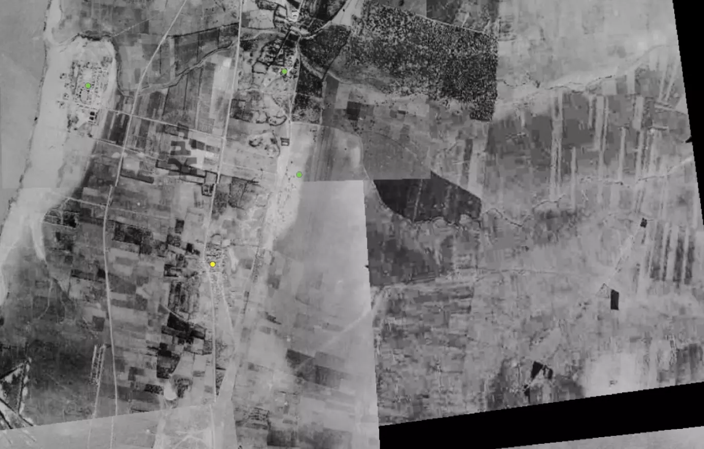
| Pre-Nakba Aerial View |
|||||||||||||||||
|
|||||||||||||||||
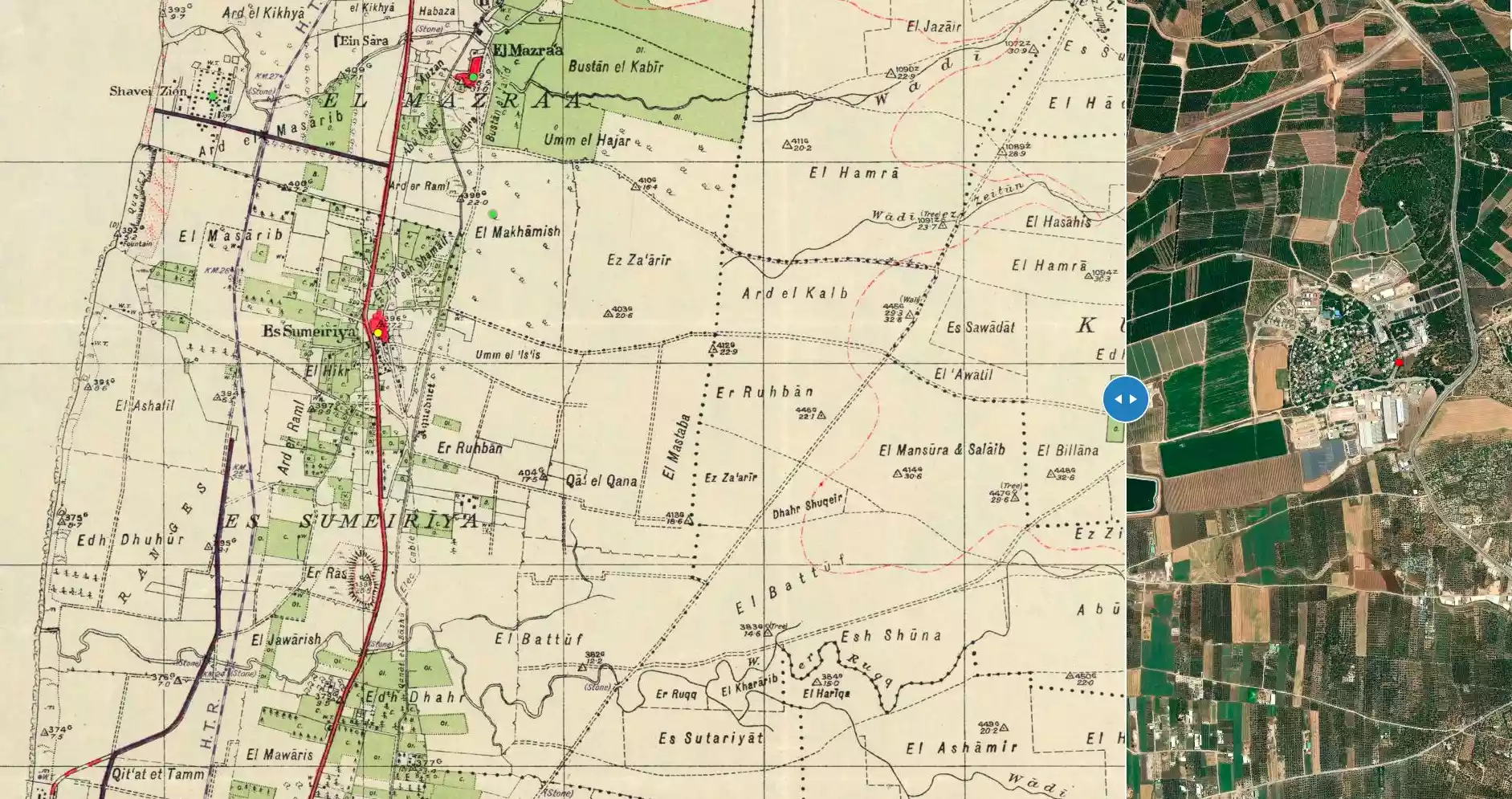
| Map Location | See location #20 on the map View from satellite |
||||||||||||||||
| Military Operation | Operation Ben-Ami | ||||||||||||||||
| Attacking Units | Carmeli Brigade | ||||||||||||||||
| Exodus Cause | Military assault by Zionist troops | ||||||||||||||||
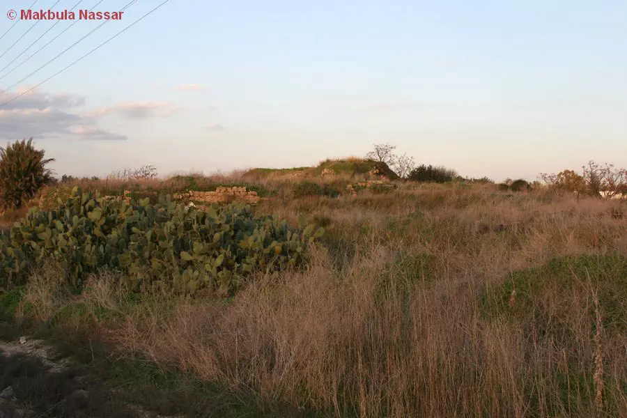
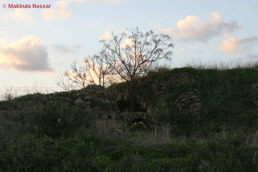
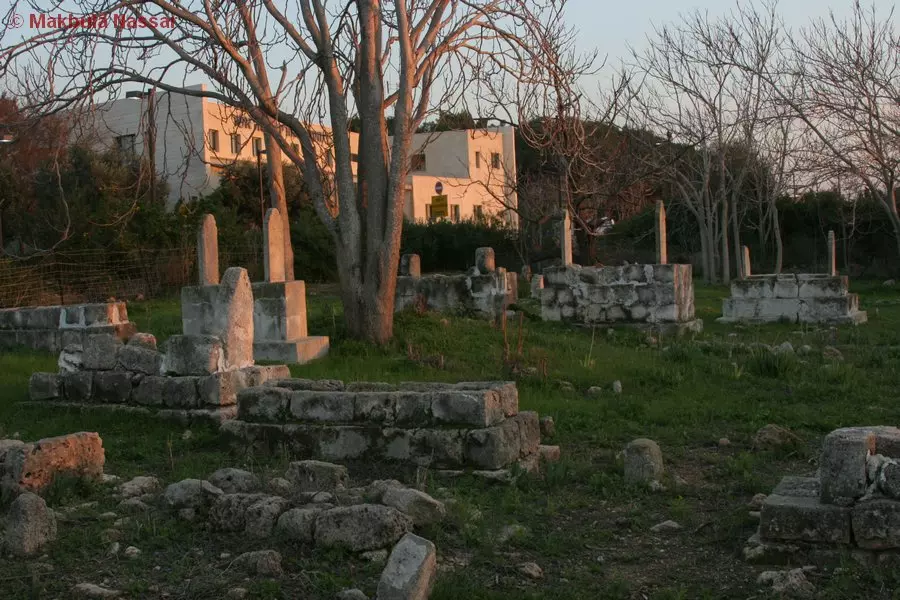
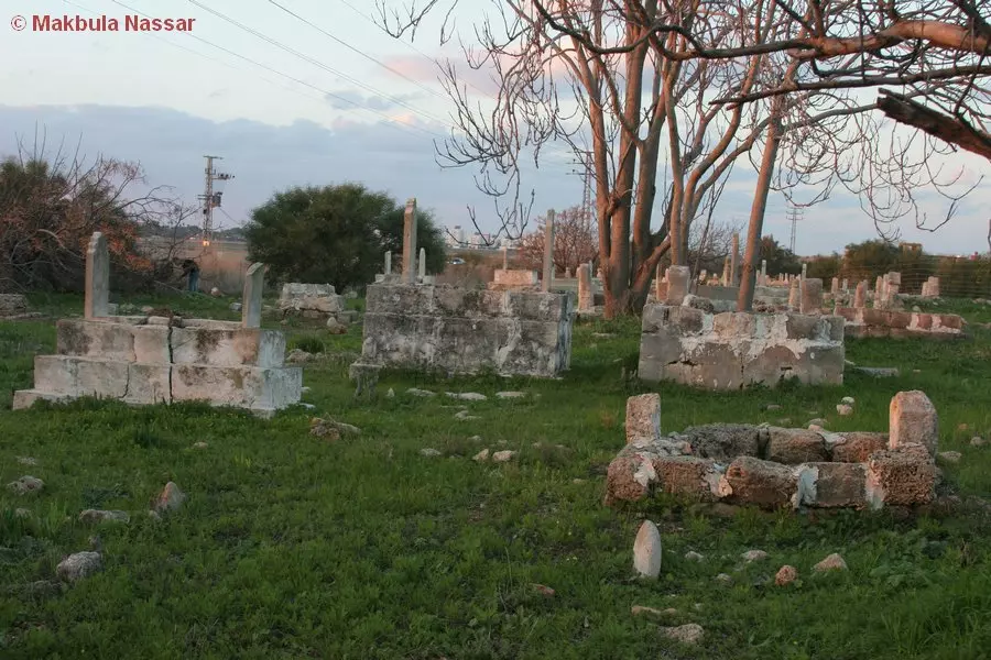
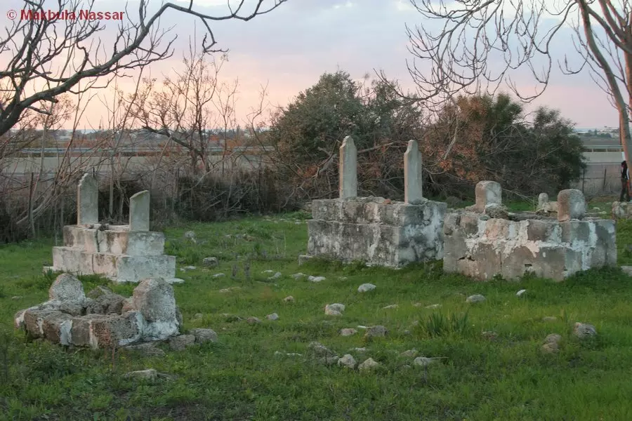
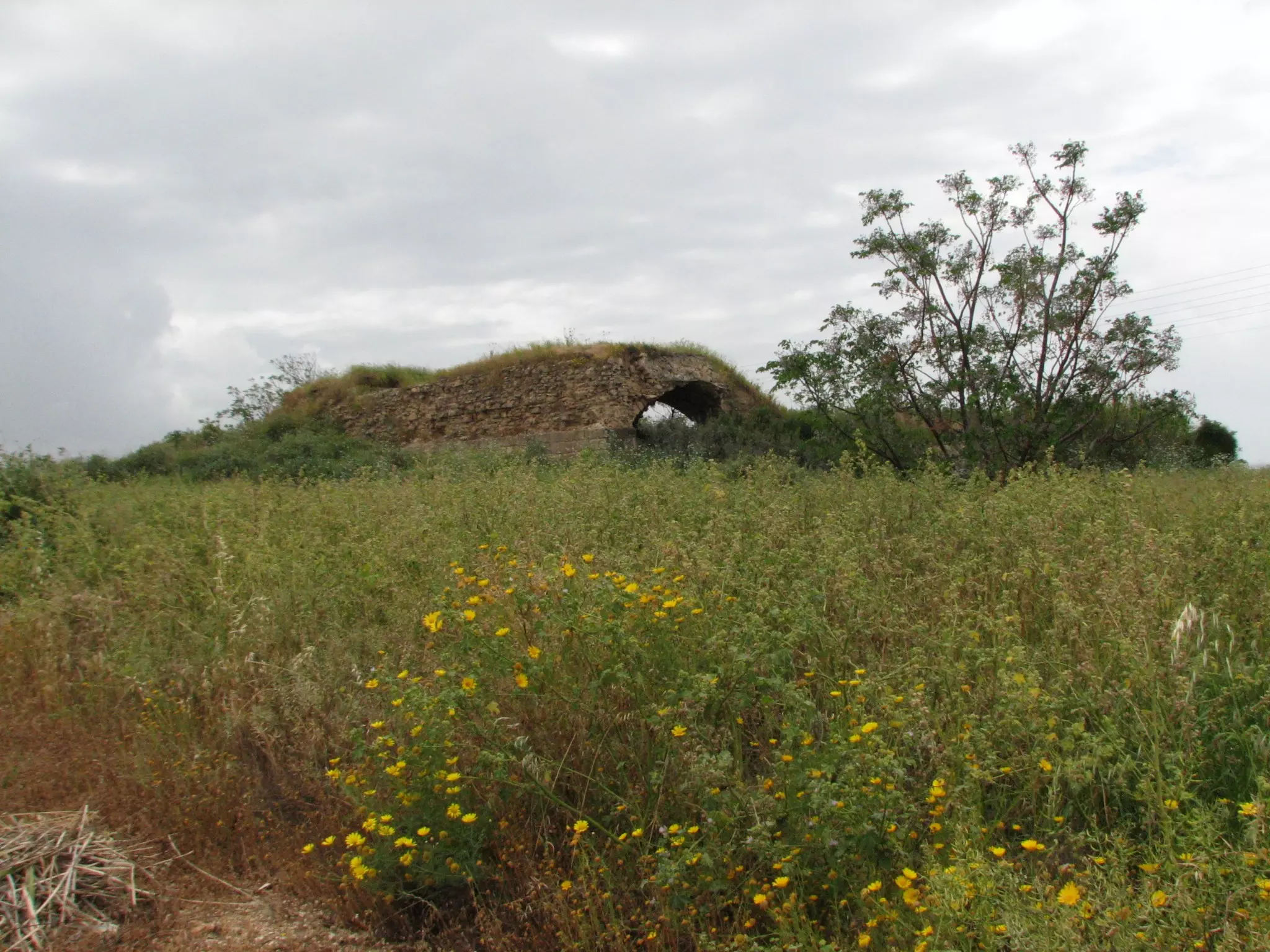
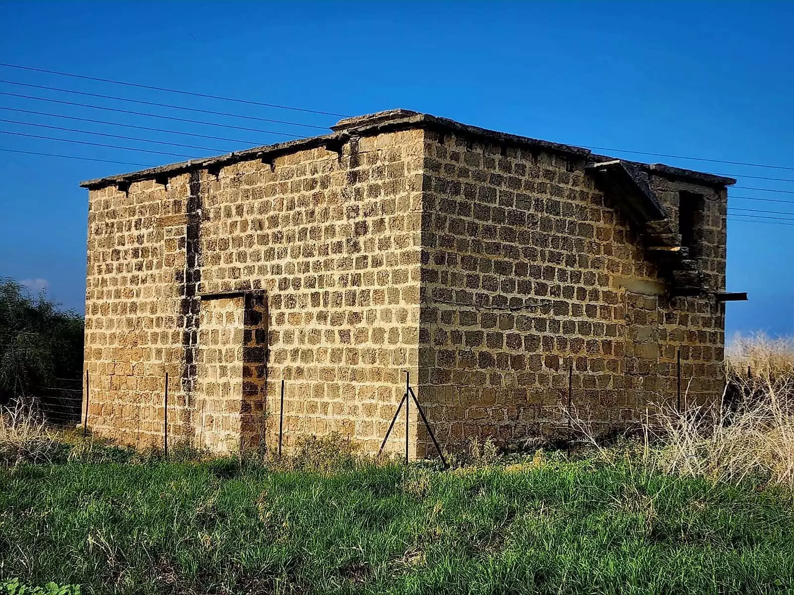
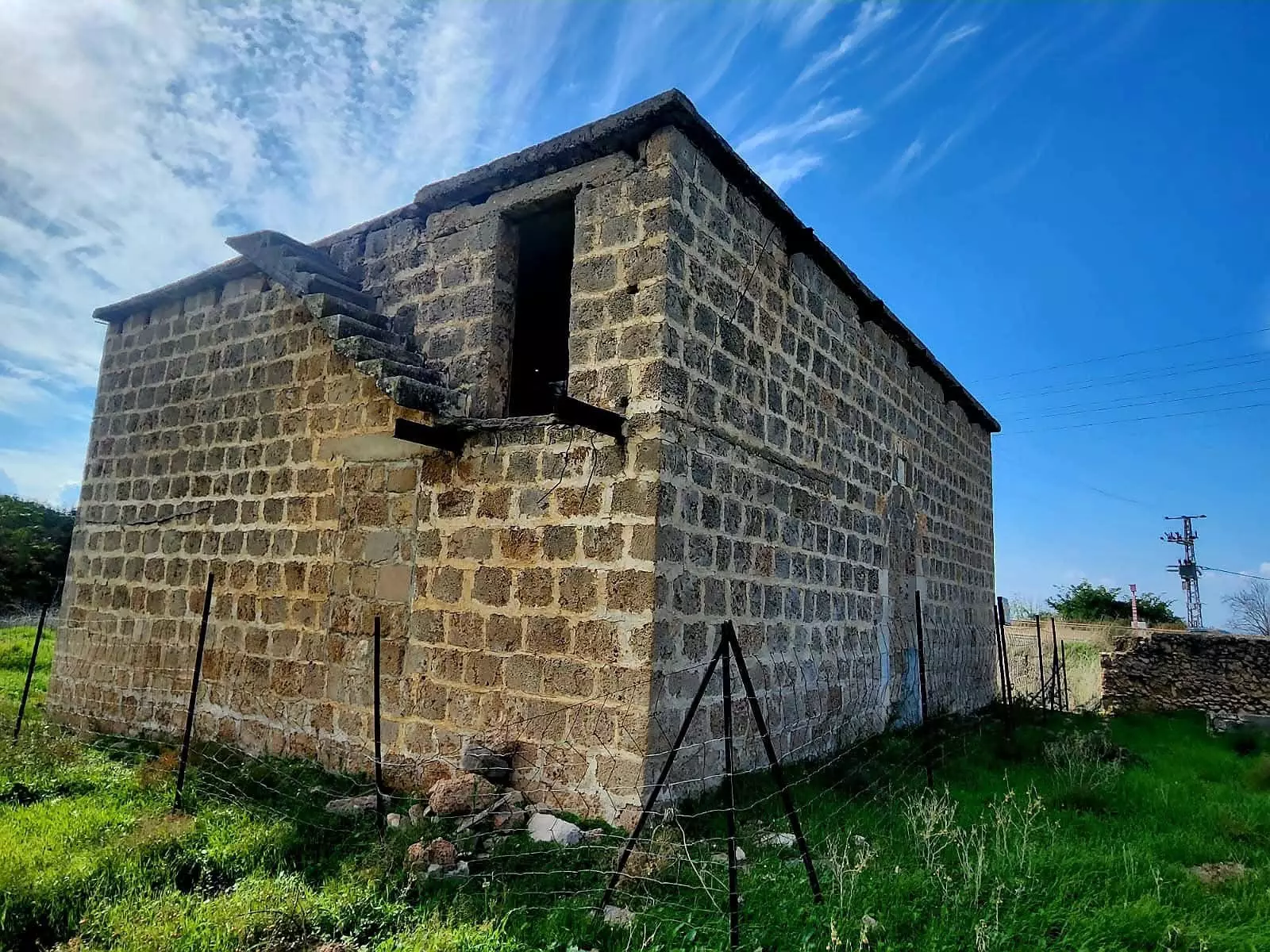
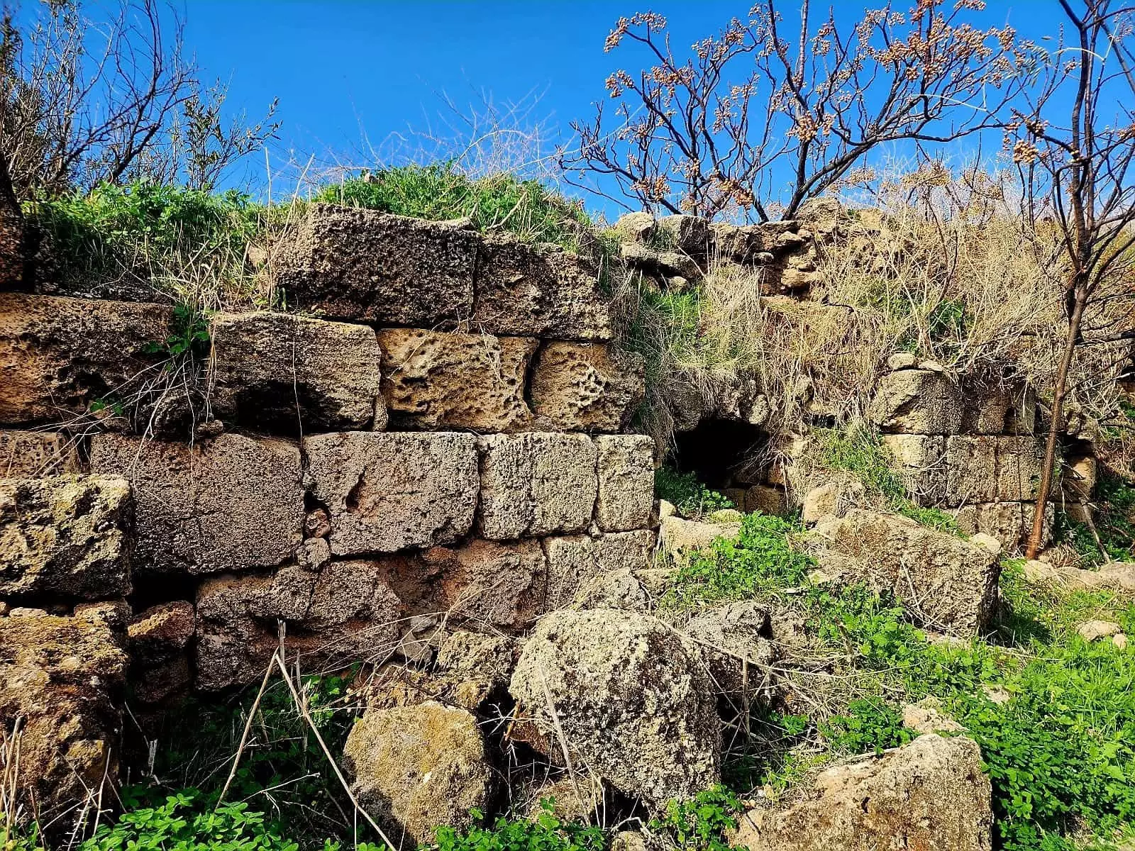
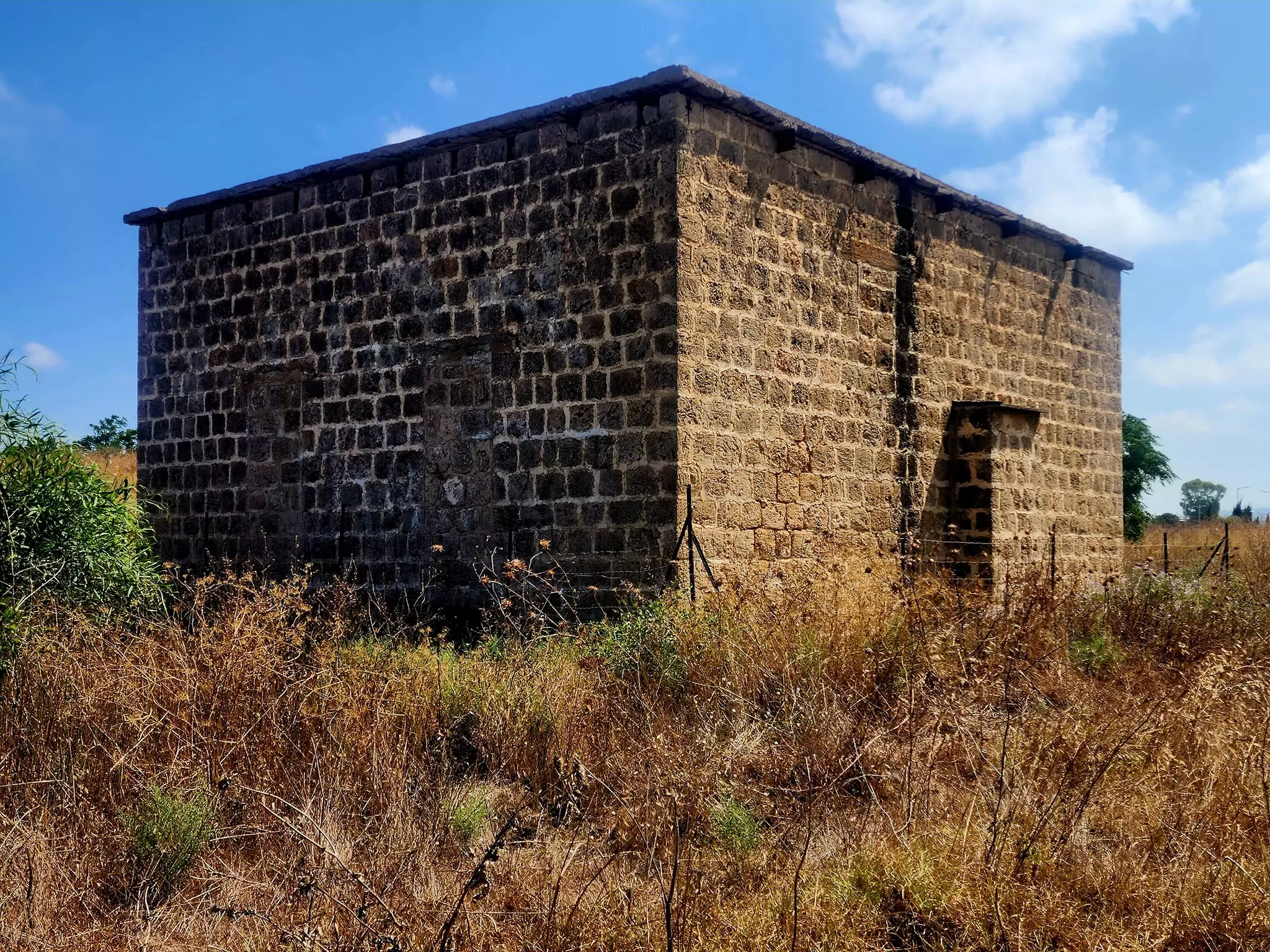
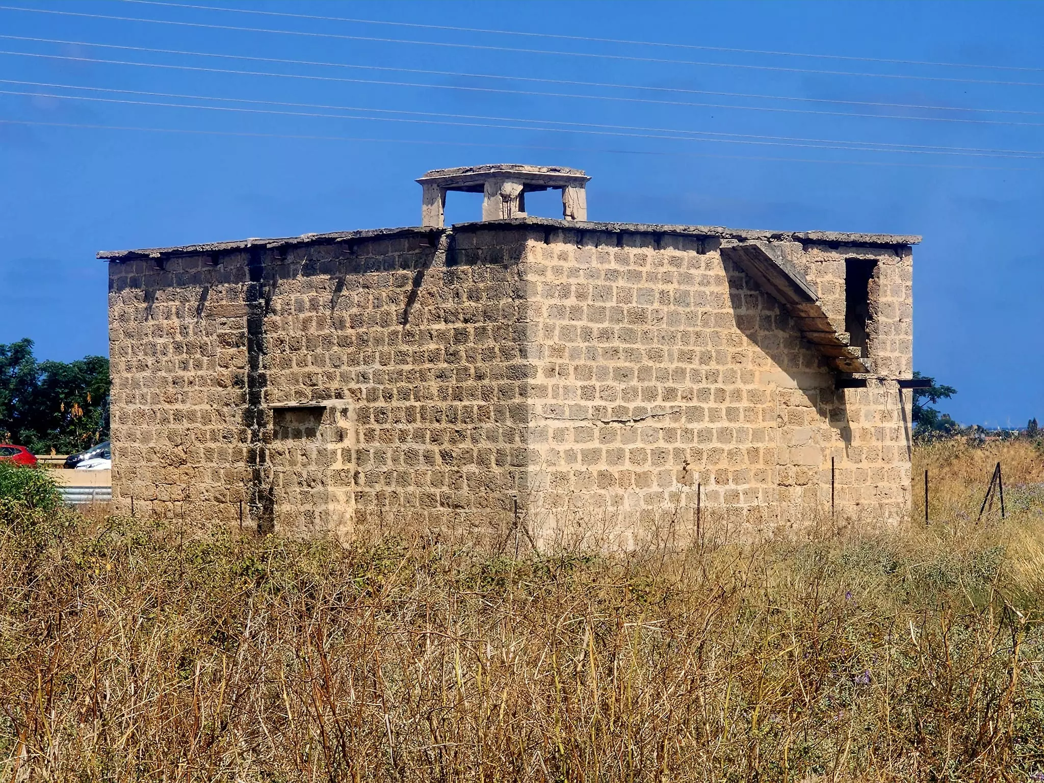
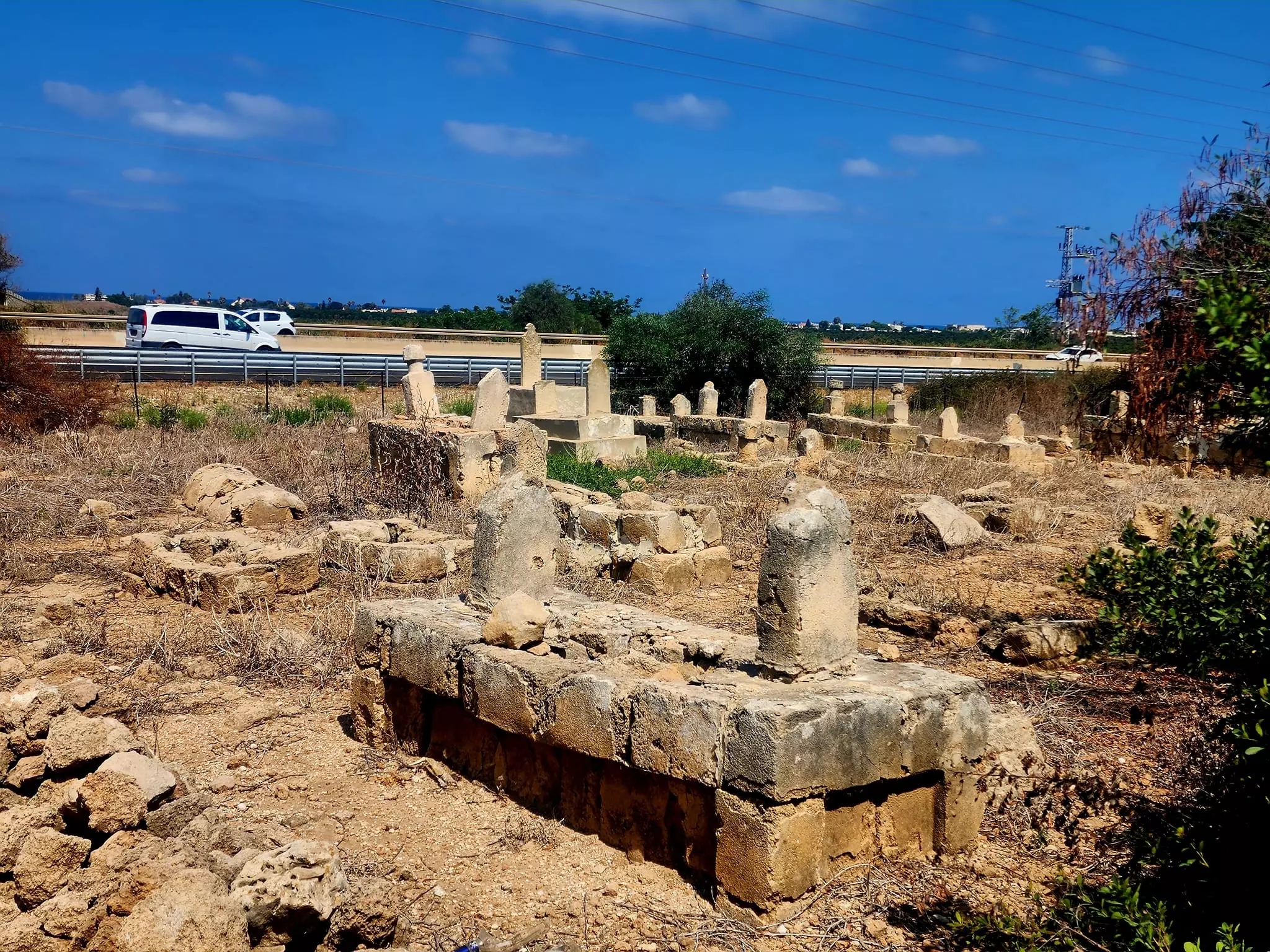
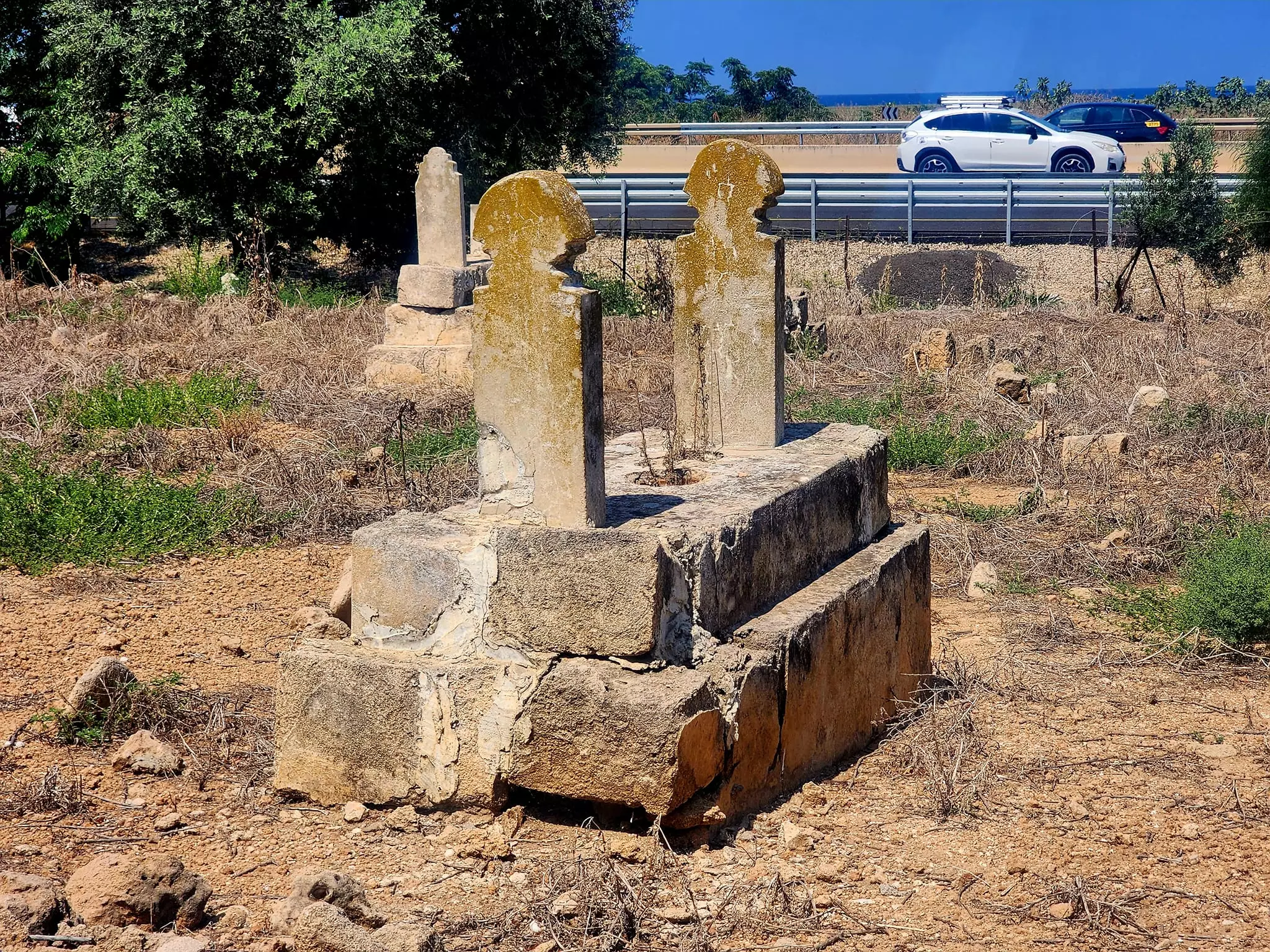
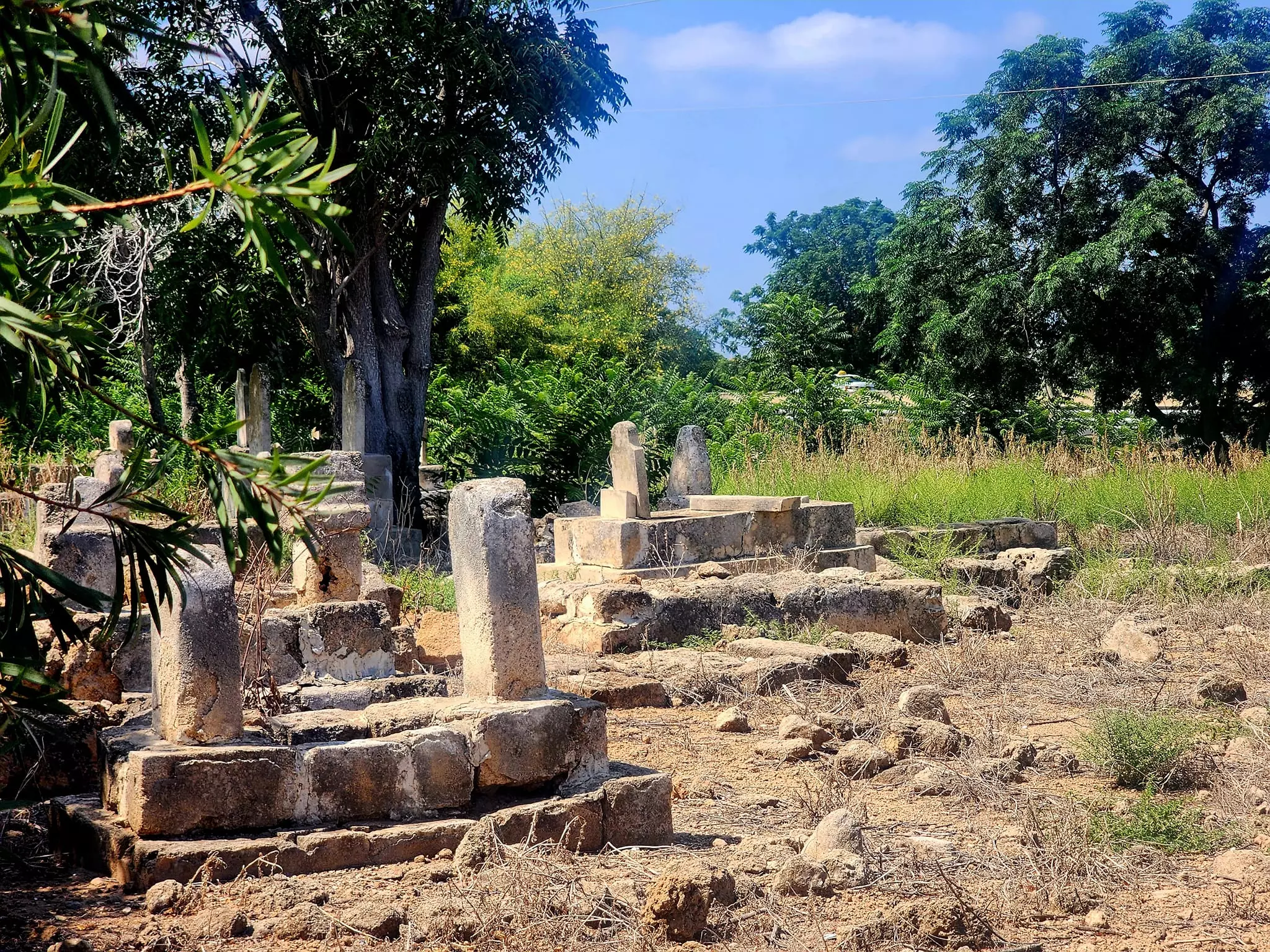
| Village Temains | al-Sumayriyya was mostly destroyed with the exception of its mosque. | ||||||||||||||||
| Ethnically Cleansing | al-Sumayriyya inhabitants were completely ethnically cleansed. | ||||||||||||||||
| Pre-Nakba Land Ownership |
**Town Lands' Demarcation Maps |
||||||||||||||||
| Land Usage As of 1945 |
|
||||||||||||||||
| Population |
|
||||||||||||||||
| Number of Houses |
|
||||||||||||||||
| Near By Towns |
|||||||||||||||||
|
|||||||||||||||||
| Town's Name Through History | al-Sumayriyya may have been called Katasir during the Canaanite period. It's subsequent name was possibly derived from the one of the jewish sect of the Samartians, who were ethnically cleansed out of the Acre area by Ahmad Basha al-Jazzar in the late 18th Century. They moved to the Nablus district, now in the occupied West Bank, where they still live as Palestinian citizens with full rights. By the Crusaders, the village was called Someleria. | ||||||||||||||||
| Schools | al-Sumayriyya had an elementary school for boys, which was founded in 1943. In 1945, it had an enrollment of 60 students! | ||||||||||||||||
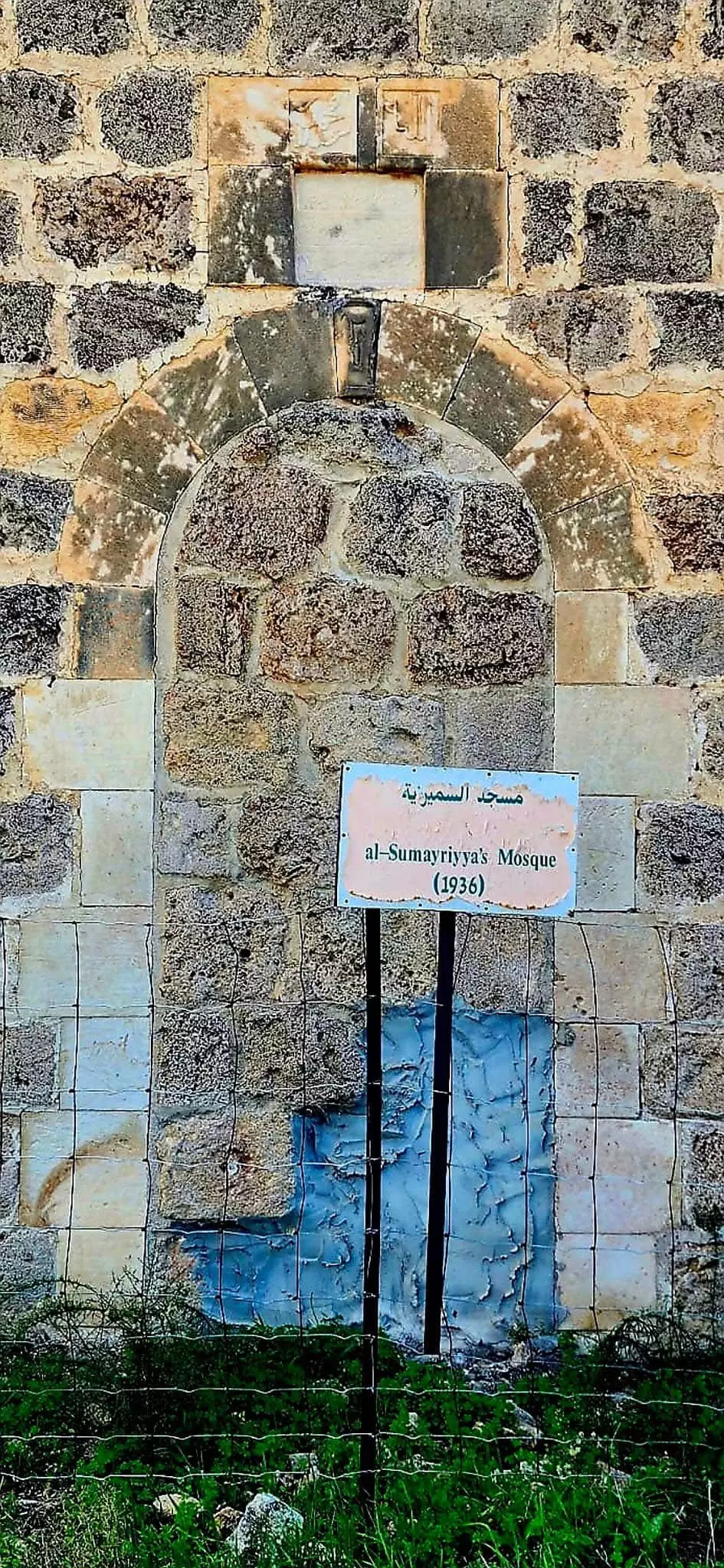
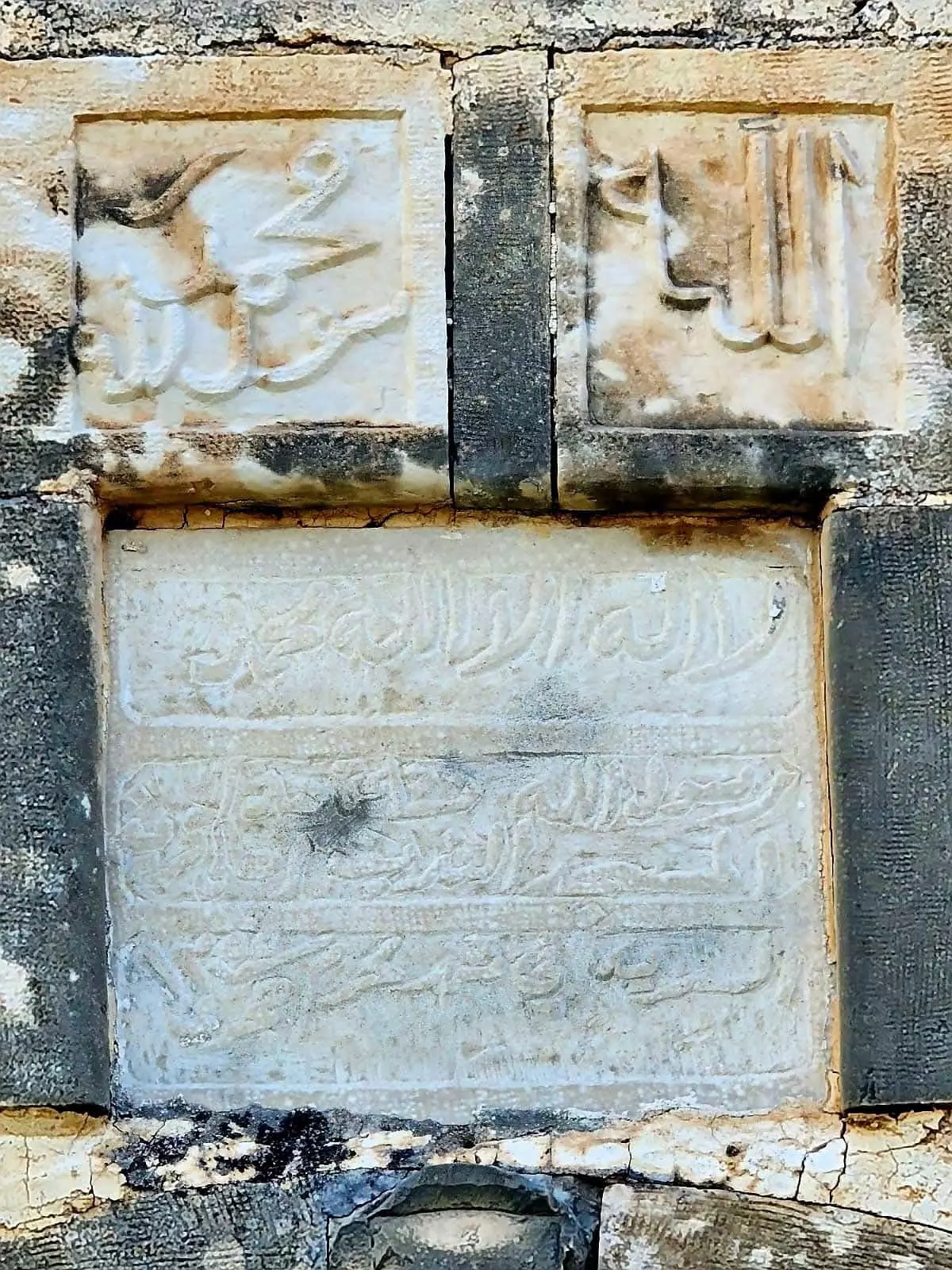
| Places of Warship | One mosque which remains to this date, however, it needs serious renovations guys! | ||||||||||||||||
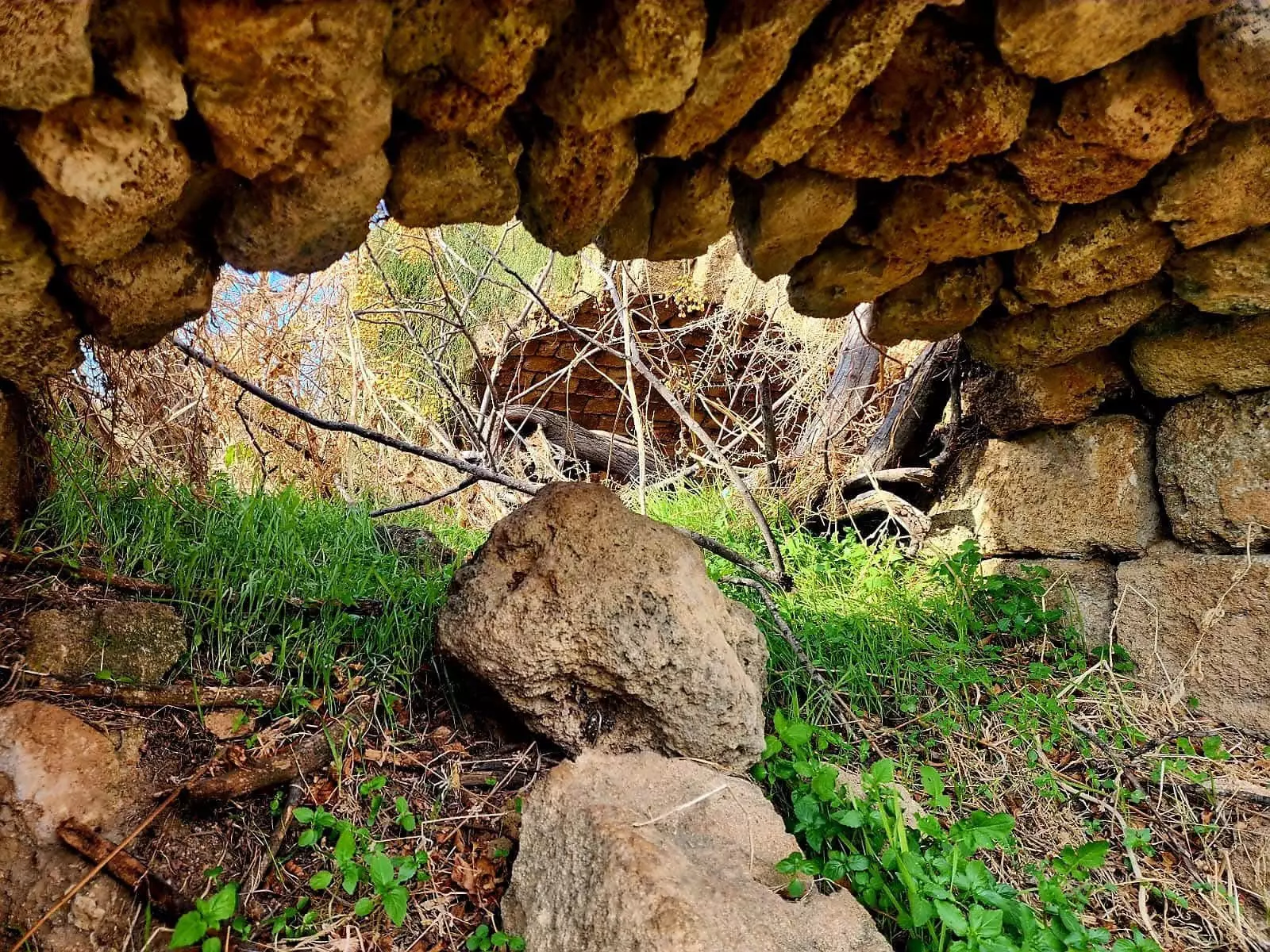
| Archeological Sites | Tall al-Sumayriyya contains carved stones, a mosaic floor, tombs, columns, and stone capitals. Khirbat Abu 'Ataba has an Islamic shrine and ceramic fragments. | ||||||||||||||||
| Exculsive Jewish Colonies That Usurped Village Lands |
ha-Geta'ot and Shamrat | ||||||||||||||||
| Featured Video | |||||||||||||||||
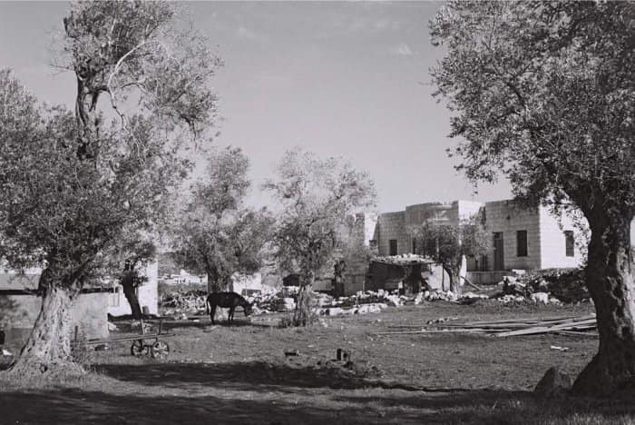
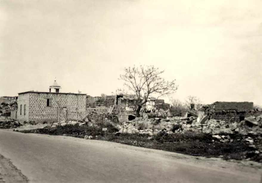
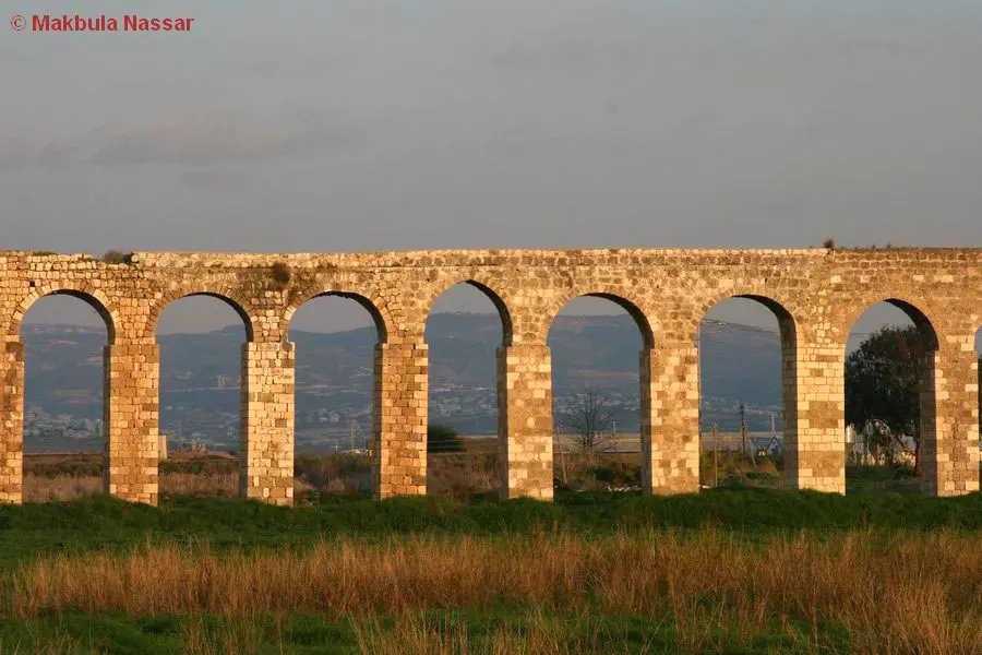
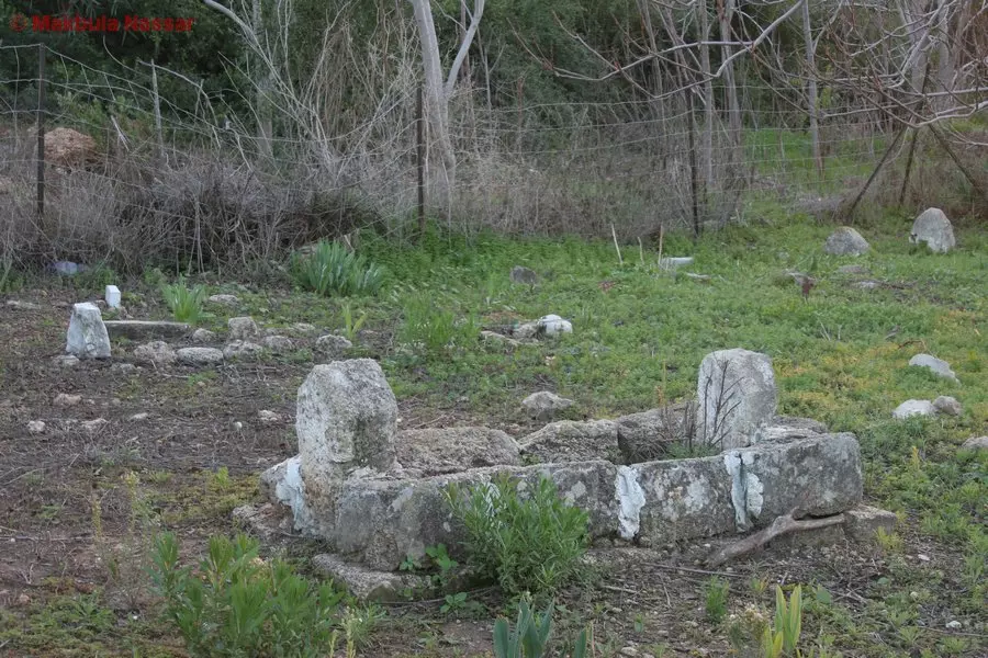
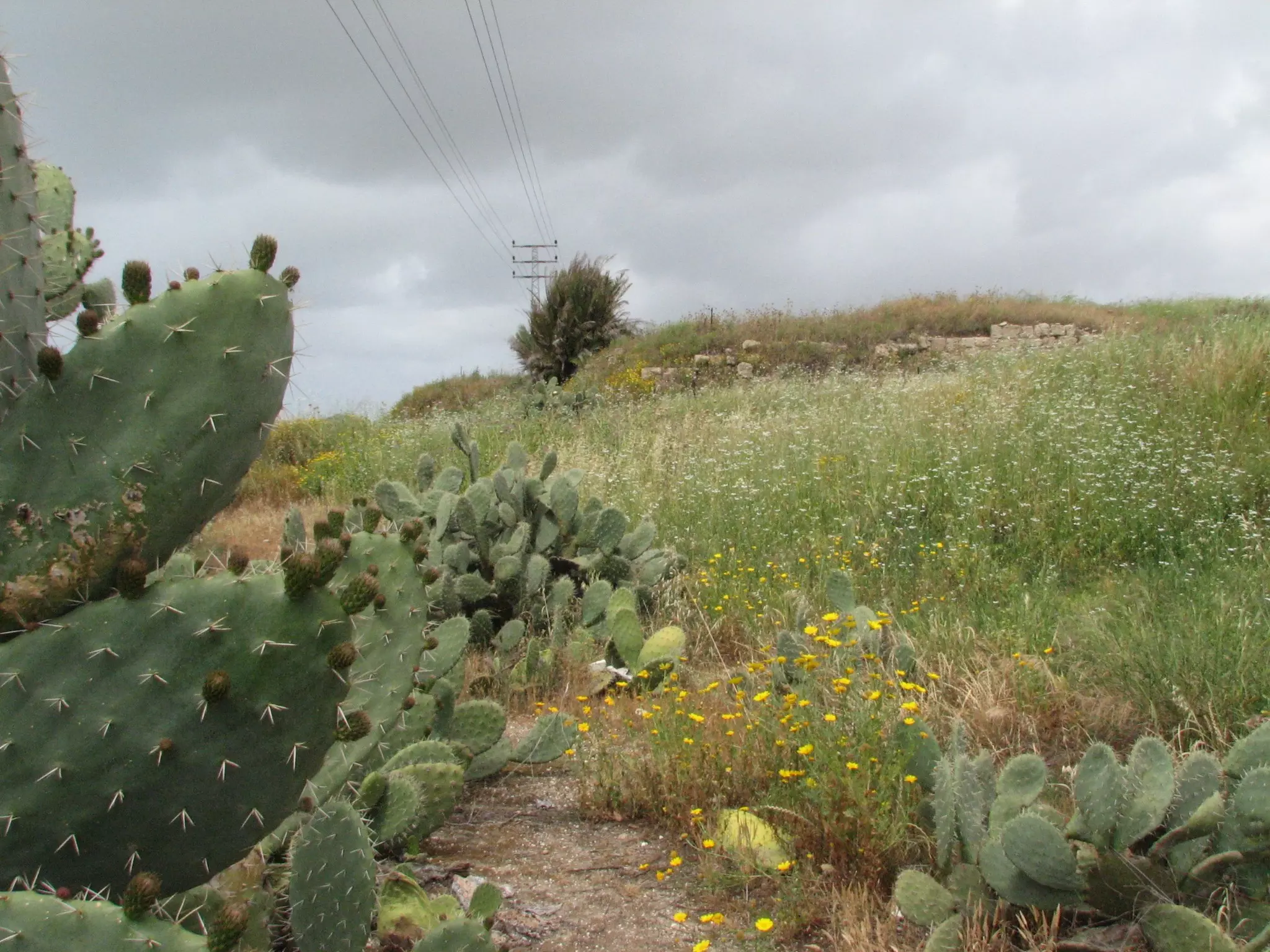
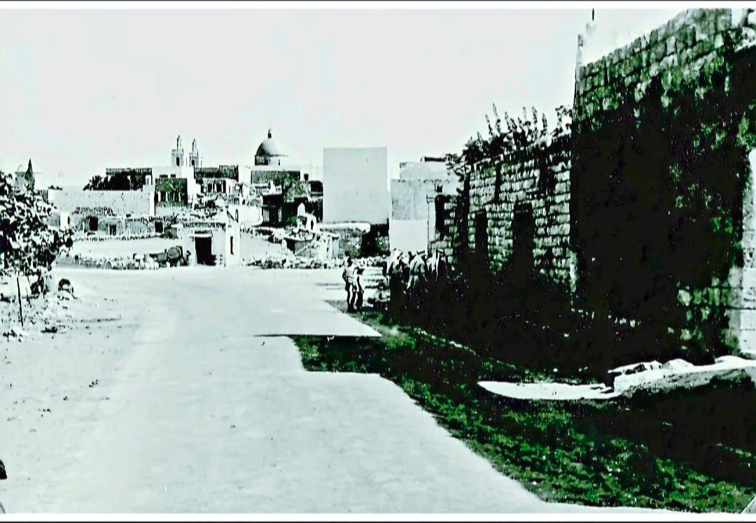
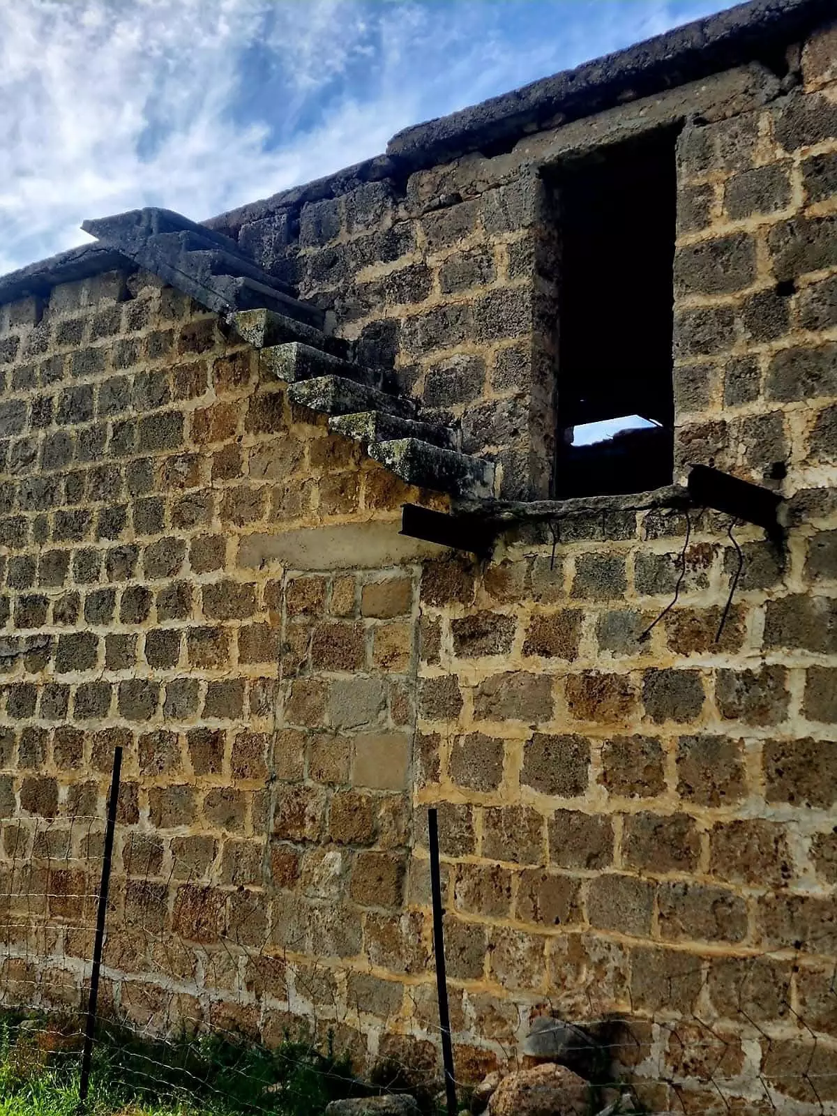
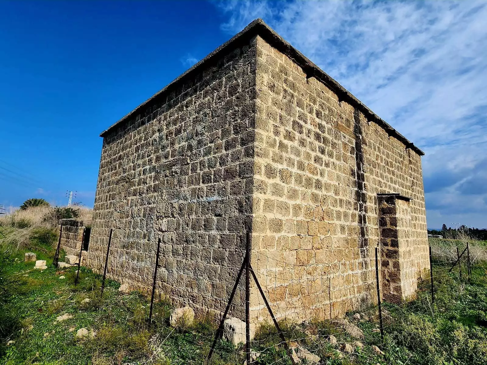
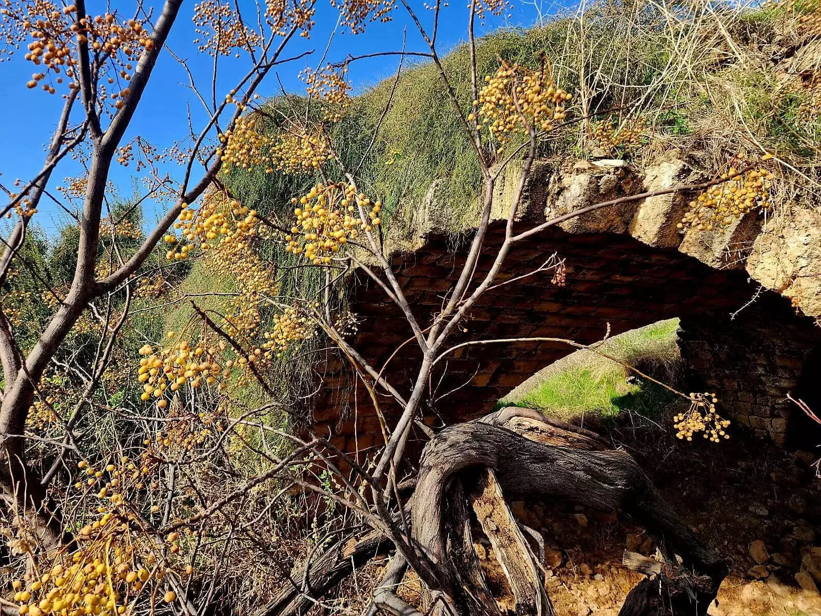
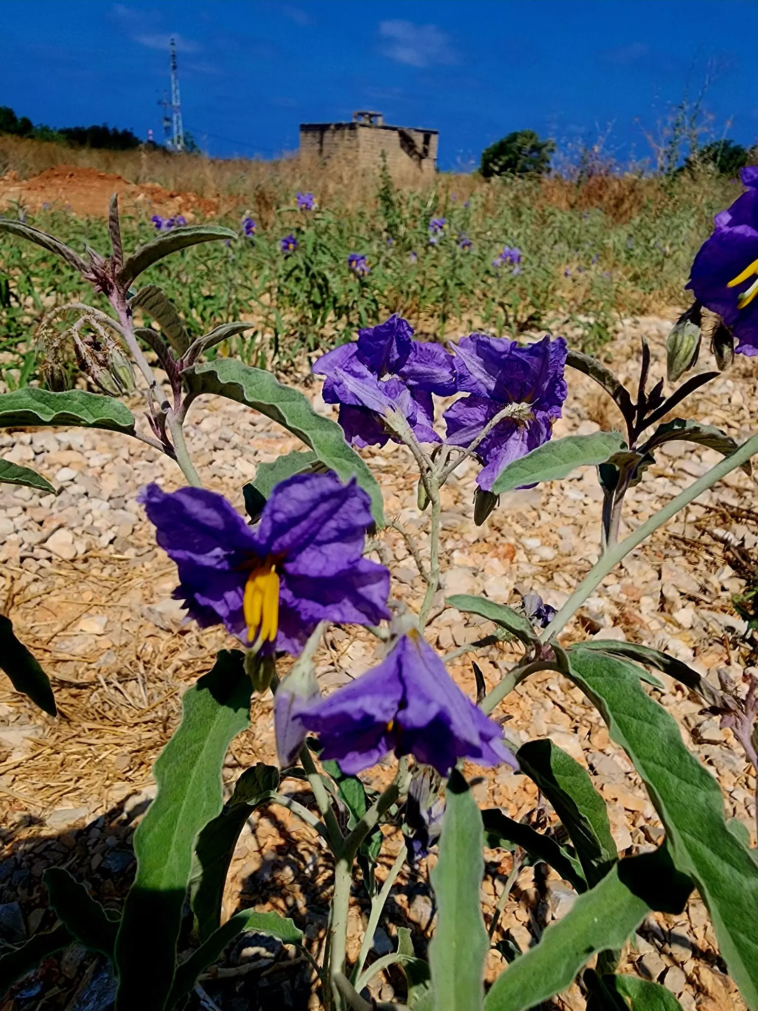
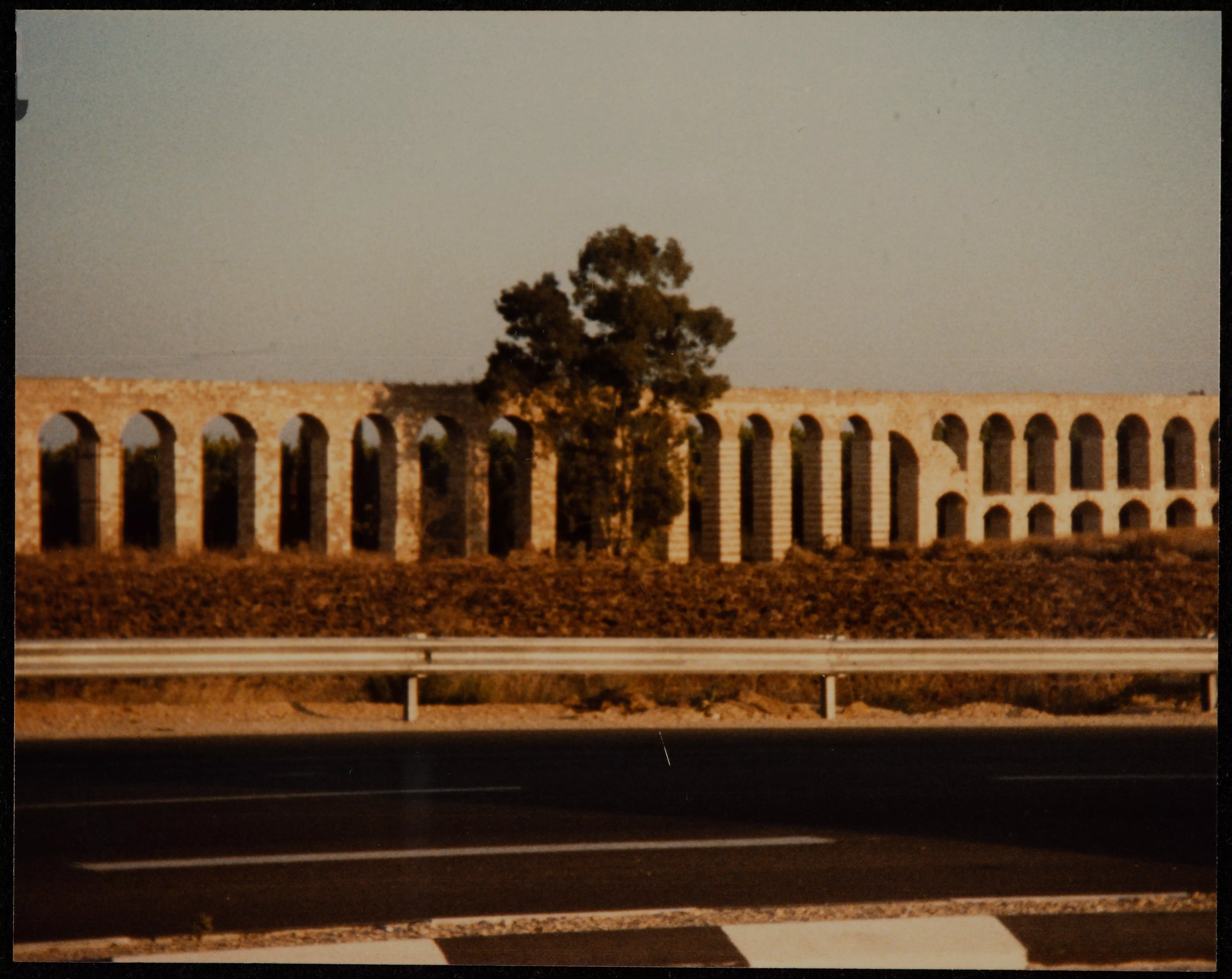
Village Before NakbaThe village stood on a sandstone hill near the Mediterranean coast. South of it were the historic aqueducts of al-Kabri, on the wadis of al-Majnuna ('the mad woman') and Tall al-Zuhur ('the mound of flowers'), so named because of its masses of wild flowers. The tell served as a recreation area for Acre and the adjacent villages. The al-Kabri canal ran west of the village down to Acre. The village was linked to Acre and Ra's al-Naqura (and ultimately to Beirut) by the coastal highway. Al-Sumayriyya may have been called Katasir in Canaanite times; its subsequent name may have been derived from that of the Jewish sect, the Samaritans, who were ordered out of the Acre area in the eighteenth century and who moved to Nablus, where they still live. The Crusaders referred to it as Someleria.In the late nineteenth century al-Sumayriyya was situated on a plain and surrounded by clumps of olive and fig trees. Its population was estimated at 200–400. Many of its houses were built of sandstone but a few were of adobe. All of the village residents were Muslim, and they maintained a village mosque. The village also had a school, founded in 1943, in which approximately sixty students were enrolled. Some inhabitants worked in the village's stone quarries, but most engaged in agriculture, growing citrus, cucumbers, melons, wheat, sesame, and other crops. In 1944/45 a total of 632 dunums was devoted to citrus and bananas and 6,854 dunums were allotted to cereals; 354 dunums were irrigated or used for orchards. The village had two archaeological sites. One of them (Tall al-Sumayriyya) contained carved stones, a mosaic floor, tombs, columns, and stone capitals, and the second (Abu Ataba) contained an Islamic shrine and ceramic fragments. Village Occupation and Ethnic CleaningThe village was occupied on the morning of 14 May 1948, when it was attacked by the Carmeli Brigade from the northwest and south. This occurred during Operation Ben-Ami. Israeli historian Benny Morris writes that this left 'the village's eastern side wide open to allow the Arabs to escape―which the villagers did as the units mortared the site and closed in.' But Palestinian historian Arif al-Arif states that the village was captured after heavy fighting during which all the young defenders of the village perished when their ammunition ran out. The History of the Haganah relates merely that forces landed by sea at a point nearby and proceeded to take al-Sumayriyya.Eyewitnesses provided more details which differ somewhat from the versions cited above. The village militia of about thirty–five men was defending the village and was taken by surprise by an armored unit approaching from the south. A villager recalled that one of the men began to fire in the air to welcome what he thought was a unit of the Arab Liberation Army. But he was fired upon and killed instantly. Most of the women and children had been evacuated to Acre and neighboring villages, but the men attempted to repel the attack from the northwest before withdrawing, 'leaving behind many killed and injured.' Later, some returned to bury their dead, but could only recover one body in the southernmost part of the village. One of those who returned for a short time reported that 'most of the village was destroyed.' That testimony receives corroboration from a photograph published in the New York Times less than two weeks after its occupation, showing extensive wreckage in the village caused by 'Jewish demolition squads.' The photograph was taken by the Associated Press; according to its caption, the village 'was used by Arabs as a sniping point on the north–south highway.' Zionists Colonies on Village LandsBy June 1948, the Jewish National Fund had initiated the levelling of al-Sumayriyya, with authorization from Israel's prime minister David Ben-Gurion. And some seven months later, on 27 January 1949, a kibbutz (Lochamey ha-Geta'ot, named after the 'Fighters of the Ghettoes') was established on its ruins. Lochamey ha-Geta'ot and Shamrat, founded in 1948, are both on village lands.Shavey Tziyon and Regba are both close to the northern boundaries of al-Sumayriyya's lands; they were established on land that belonged to the Arab village of al-Mazra'a, which still exists. Shavey Tziyon was founded in 1936 as an armed fortification with a watchtower. A residential quarter called Shekhunat Chof was built nearby and was merged with Shavey Tziyon in 1949. Regba, established in 1946, is close to the village site. Village TodayOne room from the mosque, portions of a building, segments of walls and arches from fallen houses, and graves are all that remain of al-Sumayriyya. The remaining part of the mosque is a square stone building with a flat roof that is supported on girders and crossbeams. It has a round–arched doorway that is presently closed. Most of the site is covered by a forest of eucalyptus trees interspersed with bushes and wild grass. There is a cowshed on the site's northern section. The lands in the vicinity are cultivated by the settlement of Regba.SourceDr. Walid al-Khalidi, 1992: All That Remains. |
|||||||||||||||||
| Related Maps | Town Lands' Demarcation Maps خرائط للقضاء توضح حدود القرى والاودية Town's map on MapQuest View from satellite Help us map this town at WikiMapia |
||||||||||||||||
| Related Links | Wikipedia's Page Facebook Page Google Search Google For Images Google For Videos |
||||||||||||||||
| More Information | في كتاب كي لا ننسى في كتاب بلادنا فلسطين المزيد من موقع هوية |
||||||||||||||||
- Village Building Remains In 1987
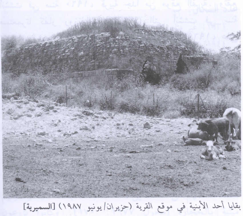
Scanned from "All That Remains" by Dr. Walid Khalidi 2 - al-Sumayriyya Destruction In 1948
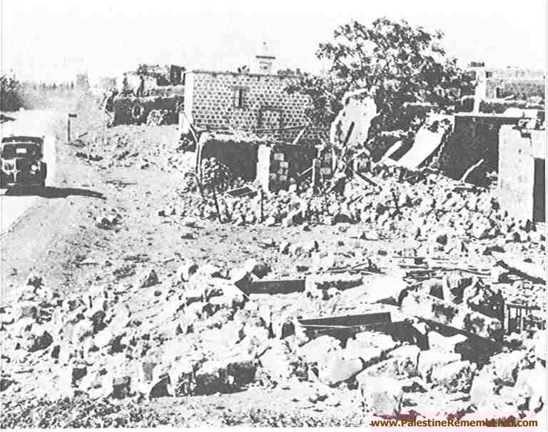
1 - al-Sumayriyya Destruction In 1948
1 - قناطر الكابري بجانب قرية السميرية - 12.1.2008 - تصوير : مقبولة نصار
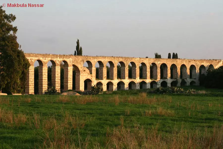
Posted by Makbula Nassar 2 - قناطر الكابري بجانب قرية السميرية - 12.1.2008 - تصوير ك مقبولة نصار
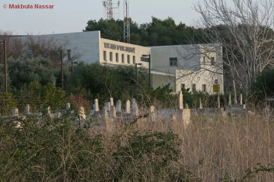
Posted by Makbula Nassar - مسجد السميرية من الواجهة الخلفية - 12.1.2008 - تصوير : مقبولة نصار
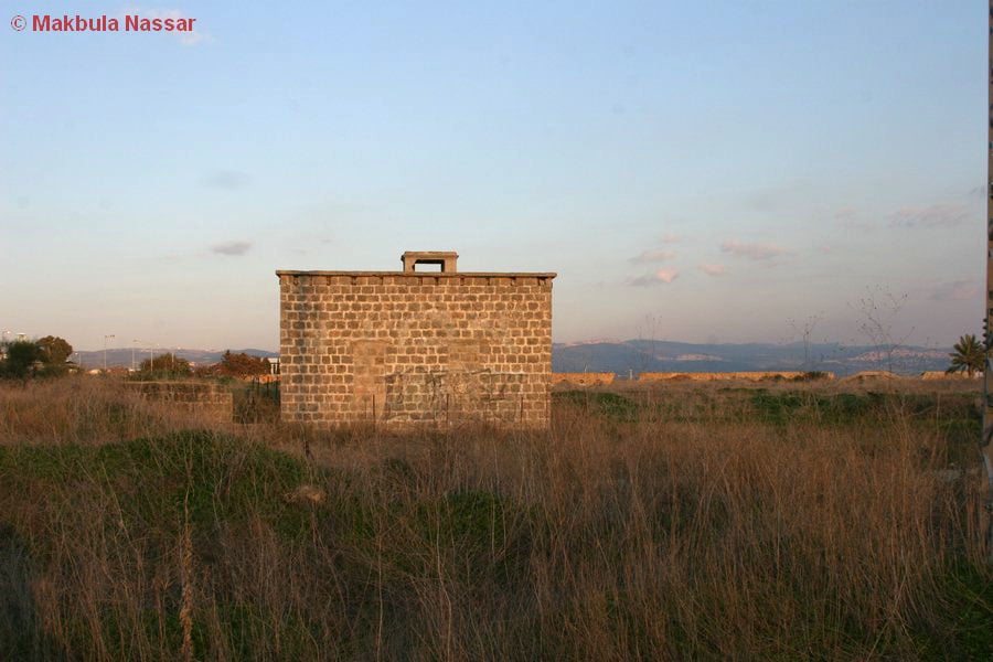
Posted by Makbula Nassar 2 - مبنى لا يزال قائم في قرية السميرية - 12.1.2008 - تصوير: مقبولة نصار
Posted by Makbula Nassar - مبنى لا يزال قائم في قرية السميرية - 12.1.2008 - تصوير : مقبولة نصار
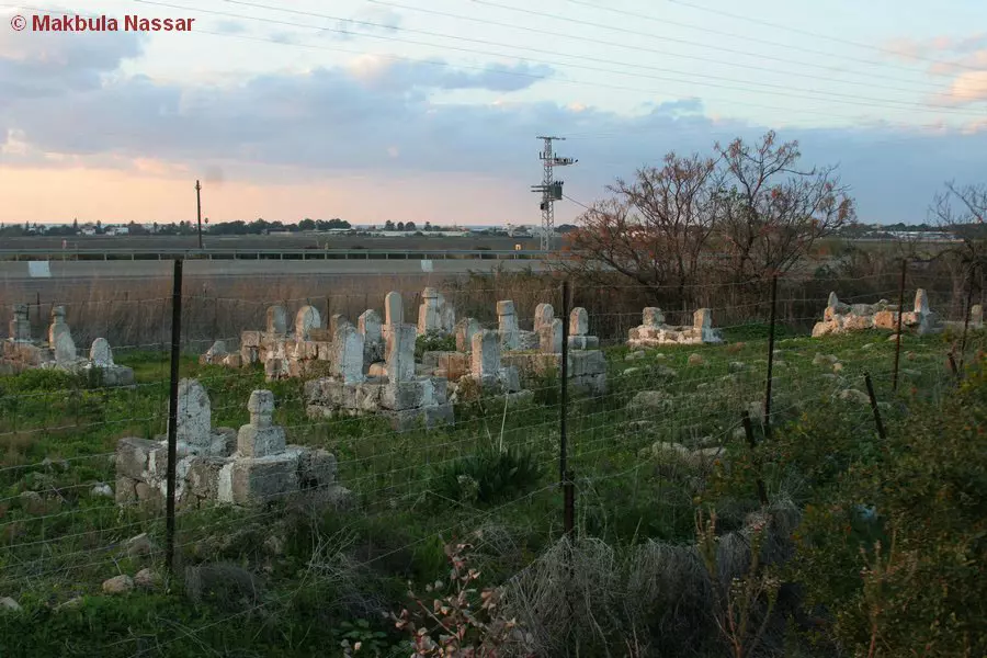
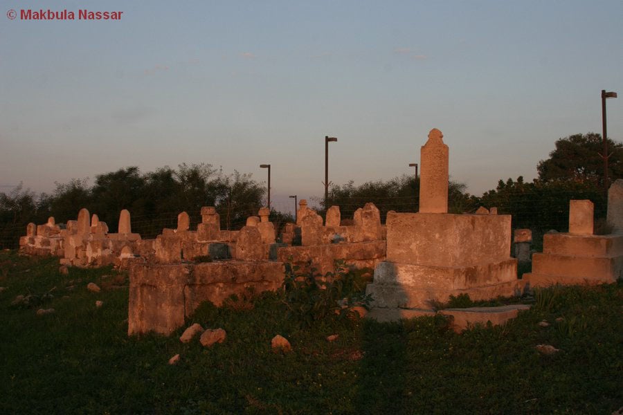
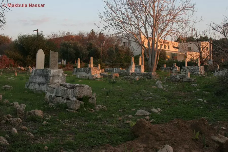
Posted by Makbula Nassar - مقبرة القرية من الجهة الغربية - 12.1.2008 - تصوير: مقبولة نصار
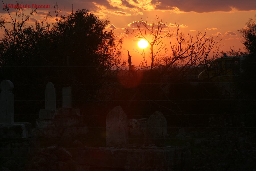
Posted by Makbula Nassar - مقبرة القرية- 12.1.2008 - تصوير : مقبولة نصار
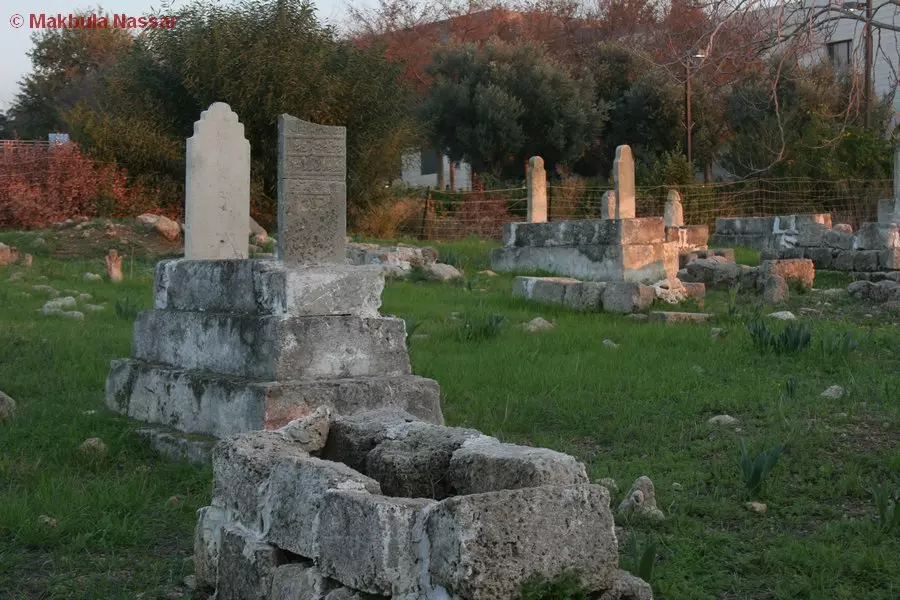
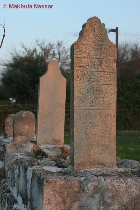
Posted by Makbula Nassar 1 - مقبرة القرية - 12.1.2008 - تصوير: مقبولة نصار
Posted by Makbula Nassar - مقبرة القرية- 12.1.2008 - تصوير : مقبولة نصار
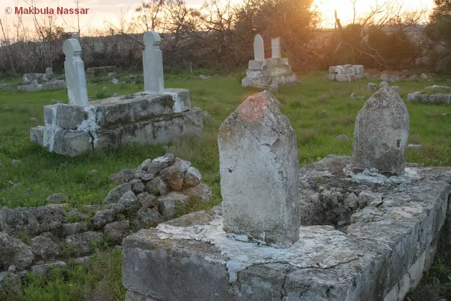
Posted by Makbula Nassar - مقبرة القرية - 12.1.2008 - تصوير: مقبولة نصار
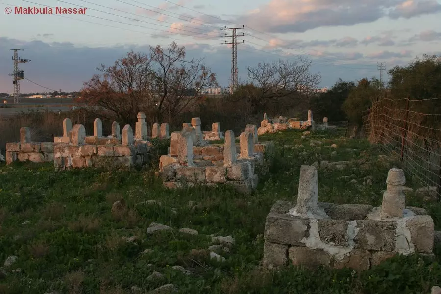
Posted by Makbula Nassar - مقبرة القرية- 12.1.2008 - تصوير : مقبولة نصار
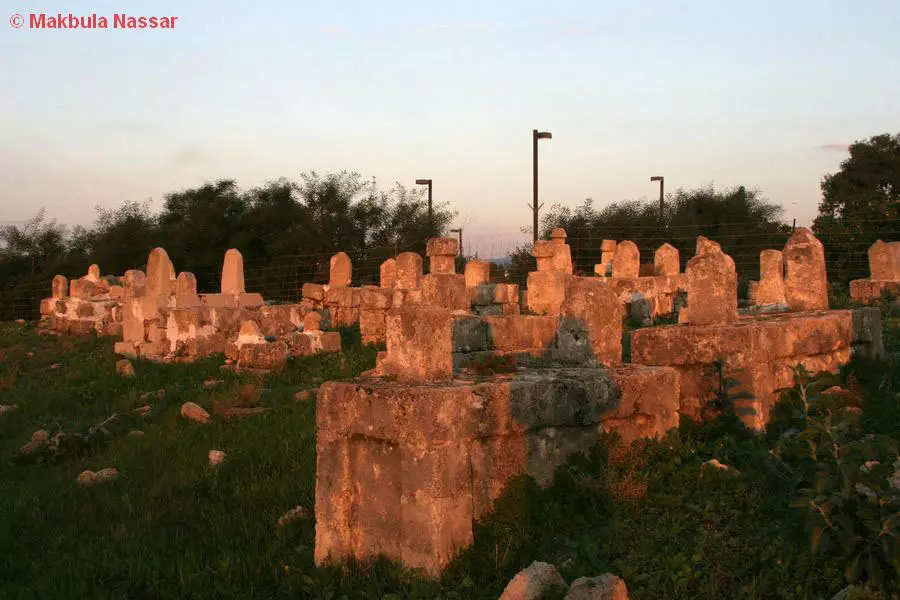
Posted by Makbula Nassar - مقبرة القرية - 12.1.2008 - تصوير: مقبولة نصار
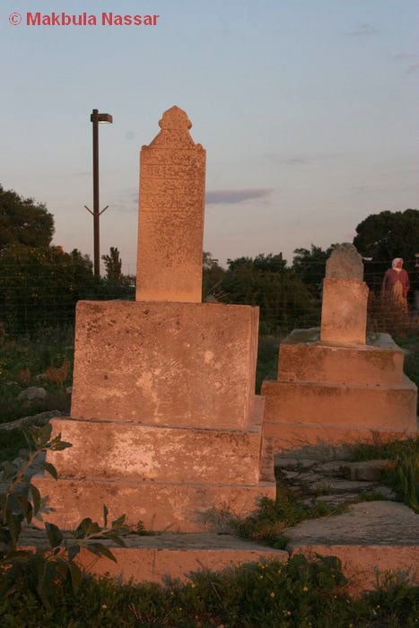
Posted by Makbula Nassar - مقبرة القرية- 12.1.2008 - تصوير : مقبولة نصار
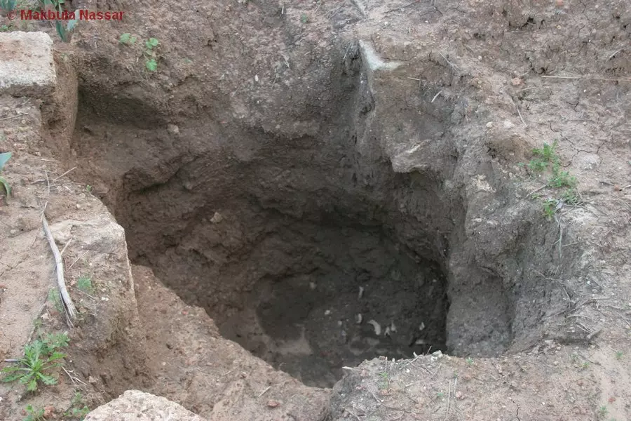
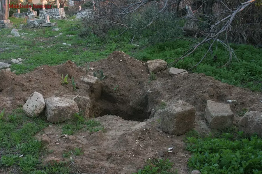
Posted by Makbula Nassar - احد القبور الذي تم نبشة مؤخراً !!- 12.1.2008 - تصوير: مقبولة نصار
Posted by Makbula Nassar - مقبرة القرية- 12.1.2008 - تصوير : مقبولة نصار
Posted by Makbula Nassar - احد القبور الذي تم نبشة مؤخراً !!- 12.1.2008 - تصوير: مقبولة نصار
Posted by Makbula Nassar - مقبرة القرية- 12.1.2008 - تصوير : مقبولة نصار
Posted by Makbula Nassar - مقبرة القرية!- 12.1.2008 - تصوير: مقبولة نصار
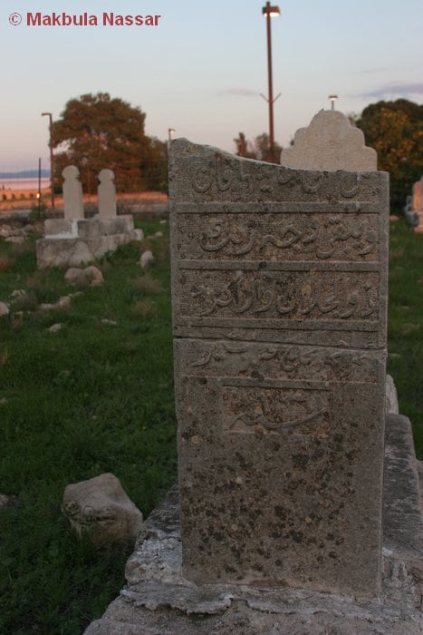
Posted by Makbula Nassar - مقبرة القرية- 12.1.2008 - تصوير : مقبولة نصار
Posted by Makbula Nassar - مقبرة القرية- 12.1.2008 - تصوير: مقبولة نصار
Posted by Makbula Nassar 1 - مقبرة القرية- 12.1.2008 - تصوير : مقبولة نصار
Posted by Makbula Nassar - مقبرة القرية- 12.1.2008 - تصوير: مقبولة نصار
Posted by Makbula Nassar - مقبرة القرية- 12.1.2008 - تصوير : مقبولة نصار
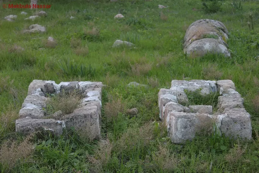
Posted by Makbula Nassar - مقبرة القرية- 12.1.2008 - تصوير: مقبولة نصار

Posted by Makbula Nassar - مقبرة القرية- 12.1.2008 - تصوير: مقبولة نصار
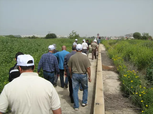
Posted by Makbula Nassar - مسيرة العودة الى السميرية السبت 29/3/2008
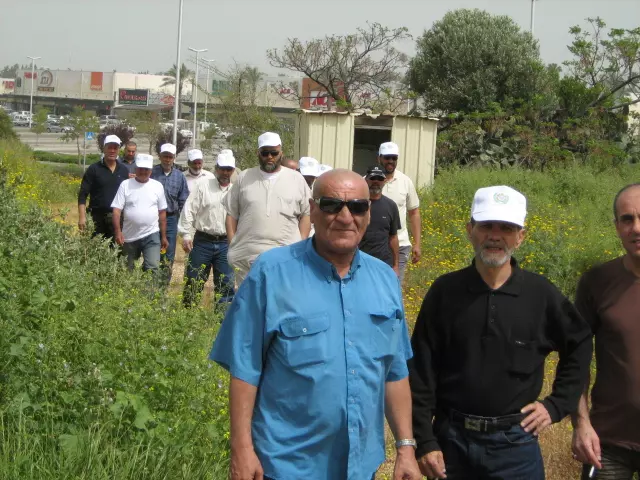
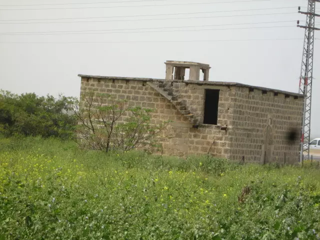
Posted by farid haj yahya - مسجد السميرية مسيرة العودة الى السميرية السبت 29/3/2008
Posted by farid haj yahya 1 - مسيرة العودة الى قرية السميرية 29/3/2008
Posted by farid haj yahya - القلعة الصليبية 15\4\2009
Posted by Raneen G. - ساحة المراح في القرية 15\4\2009
Posted by Raneen G. - السيد وفيق حمادي عبد الغني
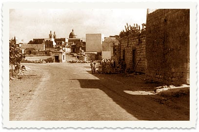
Posted by MOHAMAD NABIL EL BENI - منظر عام للقرية عام 1930
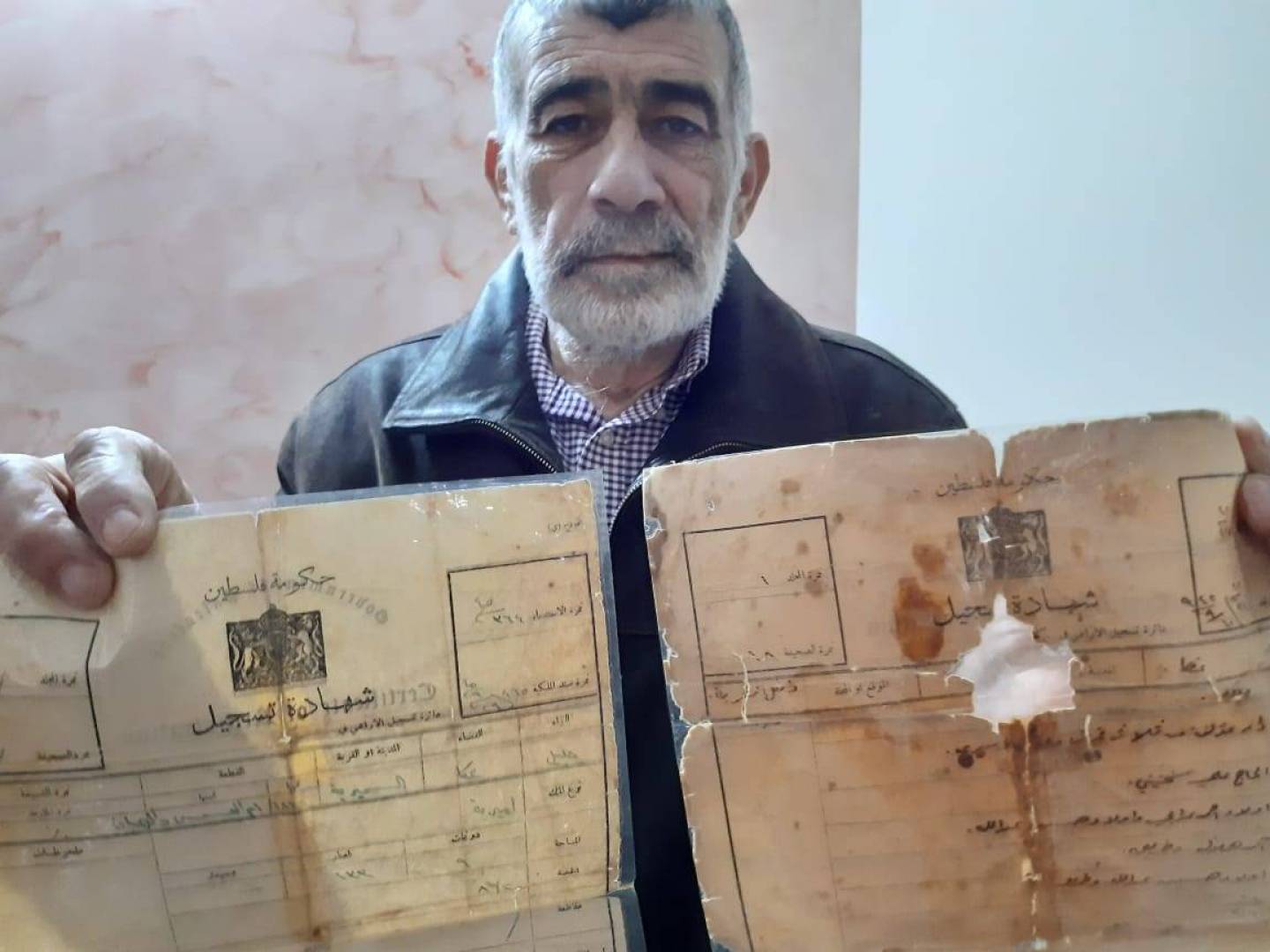
Posted by فتحي ابو رضا \ العايدي - كواشين الارض الطابو في قرية السمرية التي تعود ملكيتها ل شاكر ياسين (مواليد السمرية 1945) القاطن في مخيم عين الحلوة
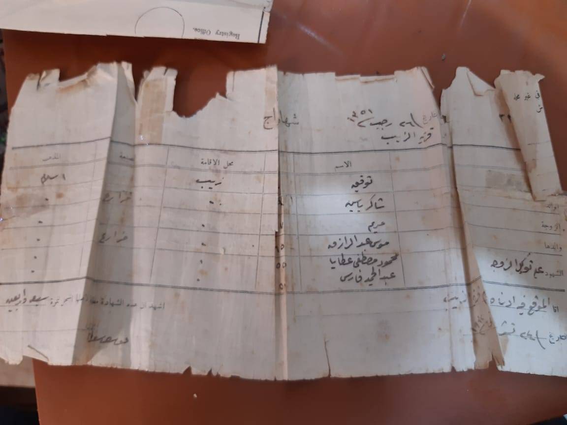
- كواشين الارض الطابو في قرية السمرية التي تعود ملكيتها ل شاكر ياسين (مواليد السمرية 1945) القاطن في مخيم عين الحلوة #2
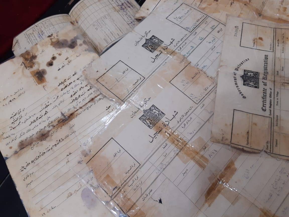
- كواشين الارض الطابو في قرية السمرية التي تعود ملكيتها ل شاكر ياسين (مواليد السمرية 1945) القاطن في مخيم عين الحلوة #3
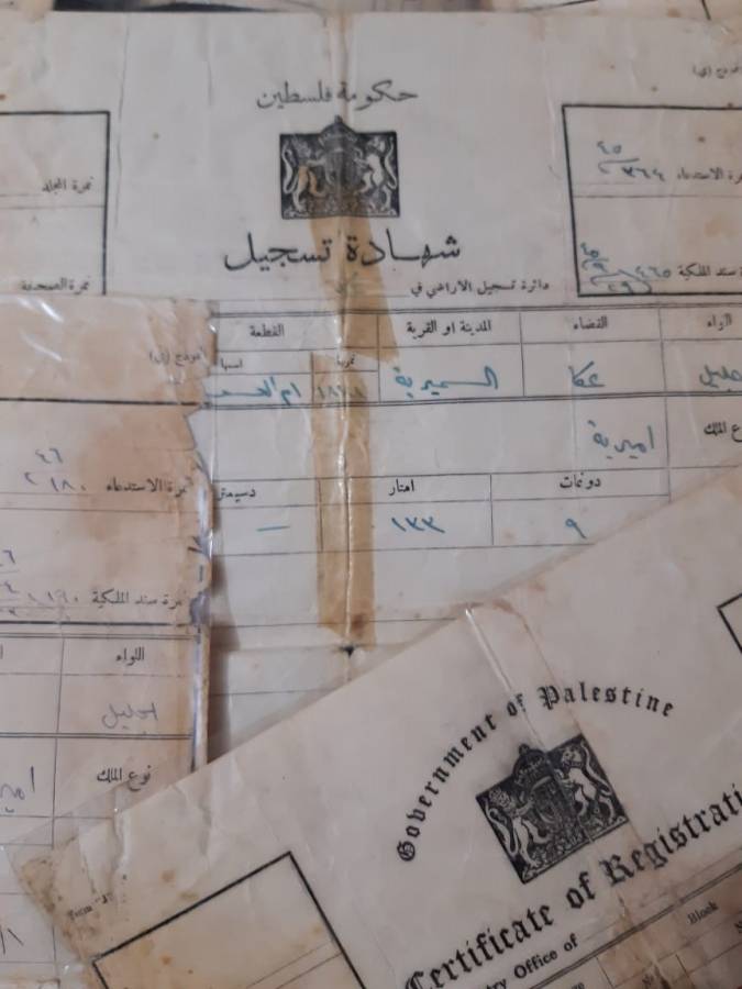
- كواشين الارض الطابو في قرية السمرية التي تعود ملكيتها ل شاكر ياسين (مواليد السمرية 1945) القاطن في مخيم عين الحلوة #4
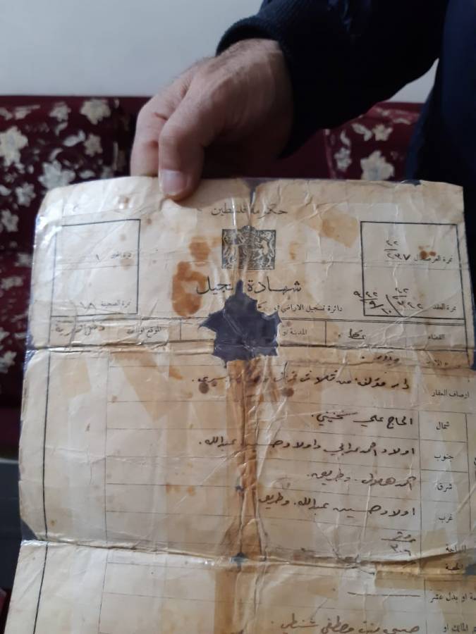
- كواشين الارض الطابو في قرية السمرية التي تعود ملكيتها ل شاكر ياسين (مواليد السمرية 1945) القاطن في مخيم عين الحلوة #5 (المزيد في قسم التعليقات)
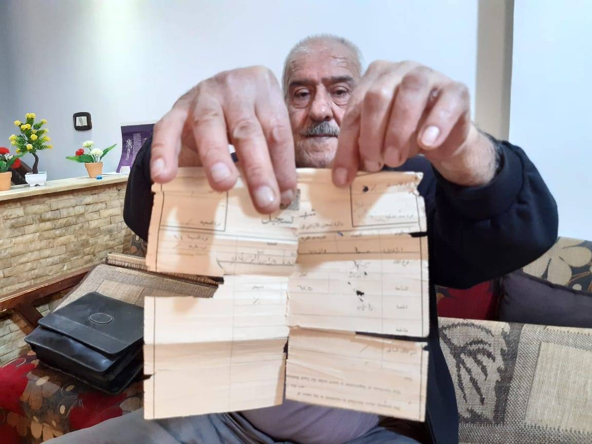
1 - كواشين الارض الطابو في قرية السمرية التي تعود ملكيتها ل شاكر ياسين (مواليد السمرية 1945) القاطن في مخيم عين الحلوة #6
- كواشين الارض الطابو في قرية السمرية التي تعود ملكيتها ل شاكر ياسين (مواليد السمرية 1945) القاطن في مخيم عين الحلوة #7
- Pre-Nakba Aerial view of the village / صورة من الجو للقرية اخذت قبل النكبة
- صورة نادرة لقرية السميرية قضاء عكا بين عام 1938-1940..
- جولة بين انقاض بيوت القرية ومسجدها -- نبيلة سالم
- جولة بين انقاض بيوت القرية ومسجدها -- نبيلة سالم #2
- جولة بين انقاض بيوت القرية ومسجدها -- نبيلة سالم #3
- جولة بين انقاض بيوت القرية ومسجدها -- نبيلة سالم #4
- جولة بين انقاض بيوت القرية ومسجدها -- نبيلة سالم #5
- جولة بين انقاض بيوت القرية ومسجدها -- نبيلة سالم #6
- جولة بين انقاض بيوت القرية ومسجدها -- نبيلة سالم #7
- جولة بين انقاض بيوت القرية ومسجدها -- نبيلة سالم #8
- جولة بين انقاض بيوت القرية ومسجدها -- نبيلة سالم #9
- جولة بين انقاض بيوت القرية ومسجدها -- نبيلة سالم #10
- A village scene during the pre-Nakba period -- مشهد في القرية يعود لقبل النكبة
- Let us see how the most "liberal and civilized" of world Jewry has obliterated our village except for a mosque and a few graves. How else will the Jews be great and safe again? -- القرية دمرت بالكامل بإستثناء بضعة -- July, 2023 مبناني.. من هنا مر الهمج
- Let us see how the most "liberal and civilized" of world Jewry has obliterated our village except for a mosque and a few graves. How else will the Jews be great and safe again? -- القرية دمرت بالكامل بإستثناء بضعة -- July, 2023 مبناني.. من هنا مر الهمج #2
- Let us see how the most "liberal and civilized" of world Jewry has obliterated our village except for a mosque and a few graves. How else will the Jews be great and safe again? -- القرية دمرت بالكامل بإستثناء بضعة -- July, 2023 مبناني.. من هنا مر الهمج #3
- Let us see how the most "liberal and civilized" of world Jewry has obliterated our village except for a mosque and a few graves. How else will the Jews be great and safe again? -- القرية دمرت بالكامل بإستثناء بضعة -- July, 2023 مبناني.. من هنا مر الهمج #4
- Let us see how the most "liberal and civilized" of world Jewry has obliterated our village except for a mosque and a few graves. How else will the Jews be great and safe again? -- القرية دمرت بالكامل بإستثناء بضعة -- July, 2023 مبناني.. من هنا مر الهمج #5
- Let us see how the most "liberal and civilized" of world Jewry has obliterated our village except for a mosque and a few graves. How else will the Jews be great and safe again? -- القرية دمرت بالكامل بإستثناء بضعة -- July, 2023 مبناني.. من هنا مر الهمج #6
- Let us see how the most "liberal and civilized" of world Jewry has obliterated our village except for a mosque and a few graves. How else will the Jews be great and safe again? -- القرية دمرت بالكامل بإستثناء بضعة -- July, 2023 مبناني.. من هنا مر الهمج #7
- Let us see how the most "liberal and civilized" of world Jewry has obliterated our village except for a mosque and a few graves. How else will the Jews be great and safe again? -- القرية دمرت بالكامل بإستثناء بضعة -- July, 2023 مبناني.. من هنا مر الهمج #8
- Al-Kabri Bridges, aa-Sumayriyya, 1980-1989
Want to browse more? 80,000 pictures were grouped in these gallaries:
- كواشين الارض الطابو في قرية السمرية التي تعود ملكيتها ل شاكر ياسين (مواليد السمرية 1945) القاطن في مخيم عين الحلوة
- كواشين الارض الطابو في قرية السمرية التي تعود ملكيتها ل شاكر ياسين (مواليد السمرية 1945) القاطن في مخيم عين الحلوة #2
- كواشين الارض الطابو في قرية السمرية التي تعود ملكيتها ل شاكر ياسين (مواليد السمرية 1945) القاطن في مخيم عين الحلوة #3
- كواشين الارض الطابو في قرية السمرية التي تعود ملكيتها ل شاكر ياسين (مواليد السمرية 1945) القاطن في مخيم عين الحلوة #4
- كواشين الارض الطابو في قرية السمرية التي تعود ملكيتها ل شاكر ياسين (مواليد السمرية 1945) القاطن في مخيم عين الحلوة #5 (المزيد في قسم التعليقات)
1 - كواشين الارض الطابو في قرية السمرية التي تعود ملكيتها ل شاكر ياسين (مواليد السمرية 1945) القاطن في مخيم عين الحلوة #6
- كواشين الارض الطابو في قرية السمرية التي تعود ملكيتها ل شاكر ياسين (مواليد السمرية 1945) القاطن في مخيم عين الحلوة #7
| Display Name | Clan/Hamolah | Country of Residence |
| wael mansour | منصور | ابو ظبي, الامارات |
| Dina Hamadi | Hamadi | - |
| عاصم | سوالمه | Jeddah |
| Mohammad Awad | - | UAE, UAE |
| رائد عوض | عوض | الرياض, السعودية |
| Imad | - | Abu-Dhabi, UAE |
| حسين مناع | مناع | Liban, Liban |
| wassim awad | AWAD | UAE - AL SHARJAH |
| santos | - | sweden, sweden |
| Rida Bachir | - | UAE, Palestine |
| Ayman Hamade | Hamade | - |
| Ahmed Ghassan Ziab | ziab | Doha, Qatar |
| MOHAMAD NABIL EL BENI | - | SAIDA |
| Wafika | - | saida, lebanon |
| Adam El-Yousseph | El-Youssef | OHIO, USA, USA |
| Bilal El-Yousseph | El-Youssef | - |
| Hilal El-Yousseph | El-Youssef | Ohio, USA |
| Abdul Hamadi | Hamadi | - |
| Mansour | - | Boston, Boston |
| Hicham Ismail Abdul Ghani | ABDUL GHANI | 00971505618696, UAE |
| Moustafa Rafic Hamadi | Hamadi | Doha, Qatar |
| Lobna hamadi | Hamadi | Doha, Qatar |
| asim sawalmeh | Sawalmeh | saudi arabia, saudi arabia |
| W.SAYYAH | - | RIYADH, 0504136581 |
| AHMAD BACHIR | - | QUBEC, CANADA |
| Ahmad Merhi Abdulghani | abdulghani | malmo, sweden |
| Zakaria Elnatour | Elnatour | Wisconsin, USA |
| AHMED BACHIR | - | Sweden |
| ahmad al_khatib | al_khateb | lebanon, lebanon |
| Farah Asaad Abed Alghani | - | - |
| abu saleh | - | saida, lebanon |
| Ahmad Alyousseph | Alyousseph | lebanon, saida |
| Rabie Ahmad Asaad Hamadeh Abdul Ghani | al-Jalil | Saida, Lebanon |
| Asaad Rabie Abdul Ghani | - | Saida, Lebanon |
| Mahmoud El-Yousseph | El-Youssef | Ohio, USA |
| Mahmoud Manna | - | - |
| asaad abdulghani | - | lebanon |
| Ali Elyoussef | - | Lebanon, Lebanon |
| FAYE3 | - | - |
| Maarouf Sayyah | Sayyah | UAE |
| Mohammad Sirriyeh | Sirriyeh | Jordan, Jordan |
No links have been shared yet, be free to the first to share the first link.
 Fake Valor: Why Did Zionist Jews Hoist Nazis Flag on Their Ships in the 1930s?
What is new?
-
Facts About Oct. 7th Gaza Raid
-
Remined Us Please:: Who Did Rape Who? Palestinians Raped Israelis? Or, was the other way around?
-
When Prof. Edward Said was invited to debate Bibi Netanyahu in the 1980s, watch what happened!
-
Ezra Klein of the NY Times on the "Jewish Race".
-
Abusing Blood Libel!
-
Did Israeli Soldiers Activate The Hanniba Direective On Oct. 7th? You Be The Judge
-
Zionist FAQ: Isn't it true that Palestinians don't want peace? Palestinians never accepted the two-state solution
- Facts about Haavara (Transfer) Agreement between Ben-Gurion & Hitler
-
Haavara FAQs: Why Did Zionist Jews Hoist Nazis' Flags on Their Ships in the 1930s?
- Haavara FAQs: When Chaim Weizmann met FDR in mid-1943, why was he silent about rescuing European Jewry?
-
Dear ChatGPT: How did Palestinians resist Napoleon's invasion of their country in 1799?
-
Dear ChatGPT: Gaza had a vibrant Jewish community in the mid-17th century. What happened to them?
-
Dear ChatGPT: Why did the Jewish Agency suppress news of the Holocaust during WWII?
-
Video Playlist: Jews share their DNA tests to end the conflict for good.
-
A Tale of Two Conflicts: Examining the Definition of Genocide
-
Prof. Abraham Polak And The Suppressed History of the Khazars and European Jewry
-
How Ronald Reagan would have framed the genocide in Gaza if he were still alive?
-
Haavara FAQs: Let us do the math: how many German Jews did The Haavara Agreement save?
-
Zionist FAQs: The Hebron Massacre of 1929, "clearly proves" that Palestinians are antisemitic, how could you deny it?
-
Zionist FAQs: Why Anti-Zionist Is Not Antisemitism?
-
Zionist FAQs: Isn't it true that the KGB created Palestinian Nationalism in the early 1960s?
- Zionist FAQs: Muslims are killing Muslims all the time; why are Israeli Jews being singled out in the media?
- Zionist FAQs: How is Israel an apartheid state when 20% of its citizens are Arabs who enjoy full rights?
-
Haavara FAQs: Why Did Dorothy Thompson Flip From A Zionist Advocate to A Silenced Dissenter?
-
Haavara FAQs: Analysis of Herzl's Uganda Scheme and how it could have saved millions of Jews.
-
Haavara FAQs: Why did Hayim Greenberg describe American Jewry as "morally bankrupt" in early 1943?
-
Haavara FAQs: What if the Evian Conference was a resounding success? What would have been the impact of saving European Jewry on Zionism?
- Haavara FAQs: What if the six million were saved, how that would have impacted the Zionist project?
-
Haavara FAQs: How did Zionist leaders react when Europe's Jews lingered in the DP camps after WWII ended?
-
Why does the American Jewish community repeat lies that David Ben-Gurion had debunked before he died?
-
Who has the power to rename the Tatar/Khazar Gene Marker to Jewish IV?
-
Zionist FAQs: Why won't Egypt, Syria, and Jordan take their people back? Jews are indigenous to Palestine, and Arabs immigrated after Jews developed the country. Arabs should leave.
-
Haavara FAQs: Did Hitler and the Nazis conflate between Judaism and Zionist? If that wasn't case, then why?
-
Haavara FAQs: Winston Churchill and antisemitism, a collection of articles written Churchill.
-
Haavara FAQs: Broken by country, how many Jews survived vs. killed during the Holocaust?
-
Haavara FAQs: Why did European Jews vote with their feet and to immigrated to the Americas, not Palestine, after WWII?
-
Watch this American Jewish Girl describing Israeli Jews' cognitive dissonance like no other in under two minutes
-
Haavara FAQs: When the Nazis went out of their way to hide the Holocaust, Israeli Jews did the exact opposite by broadcasting their genocide of Gazans. But why?
-
Haavara FAQs: How Zionist Jews went out of their to show their appreciation to Nazism and Fascism?
- Haavara FAQs: Why Zionist leaders were against bombing the death camps & the Railroads leading to them?
-
Haavara FAQs: Hitler's message to the British and American people: If Jews are such noble citizens and you care about them, how come you're not letting them in? I will gladly ship them to you at my expense, even on luxury liners!
-
A shortlist of Zionist and Israeli false flag operations in the name Jews.
-
The Most Moral Army
- The Land of Kapos (Israel): Where the brave are boycotted and Kapos walk free.
- Why did early Zionists often named their communal enterprises "colonial"?
- Zionist Relations with Nazi Germany by Faris Glubb
-
Two NY Times advertisements by Zionists in the early 1943 that exposes Zionists' treason at the height of the calamity
- Facts Not Lies about the Palestinian-Israeli Conflict.
- Site's pictures have been categorized
- Campgain Against Lice
- A Survey of Palestine, the official source about Palestine before Nakba produced by the British Mandate; over 1200 pages.
- Satellite View & Google Earth: Over 6,000 placemarks identifying all destroyed towns, W. Bank & Gaza Strip Towns, & refugee camps.
- PalestineRemembered.com and its Nakba Oral History Project were featured on al-Jazeera Satellite TV.
- Nakba Oral History Video Podcast:
 Over 700 Oral History interviews (including 3,500+ hours of recording) can be viewed online.
 - Palestine Village Statistics Project
- Gaza Jail Break
- النسخة العربية للموقع الان متوفرة
- Videos: Documenting the destroyed villages in video: Tracing all that remains since Nakba.
- Videos: Responding to Zionist Propaganda
- Interview: The ethnic cleansing of Palestine: George Galloway interviews Israeli Historian Ilan Pappe.
- For Palestinians, memory matters. It provides a blueprint for their future By George Bisharat.
- Zionist FAQ now available in Hebrew שאלות שציונים שואלים, עכשיו בעברית
- Video: The Stephen Walt and John Mearsheimer report on the influence of the Israel Lobby on U.S. Foreign Policy
- The Palestinian-Israeli conflict for beginners
