| PalestineRemembered | About Us | Oral History | العربية | |
| Pictures | Zionist FAQs | Haavara | Maps | |
| Search |
| Camps |
| Districts |
| Acre |
| Baysan |
| Beersheba |
| Bethlehem |
| Gaza |
| Haifa |
| Hebron |
| Jaffa |
| Jericho |
| Jerusalem |
| Jinin |
| Nablus |
| Nazareth |
| Ramallah |
| al-Ramla |
| Safad |
| Tiberias |
| Tulkarm |
| Donate |
| Contact |
| Profile |
| Videos |
Welcome To Bi'lin - بعلين (ביעלין)
|
District of Gaza
Ethnically cleansed days ago |
العربية Google Earth |
| Gallery (11) |
- Statistics & Facts
-
Before & After

- Satellite View
- Articles 1
- Pictures 11
- Aerial Views 1
- Oral History 2
- Members 2
- All That Remains
- Wikipedia
- Videos 1
- Guest Book 4
- Links 1
| Statistic & Fact | Value | ||||||||||||||||||
| Occupation Date | July 8, 1948 | ||||||||||||||||||
| Distance From District | 39 (km) North East of Gaza | ||||||||||||||||||
| Elevation | 150 (meters) | ||||||||||||||||||
| Before & After Nakba, Click Map For Details |
|||||||||||||||||||

|
|||||||||||||||||||
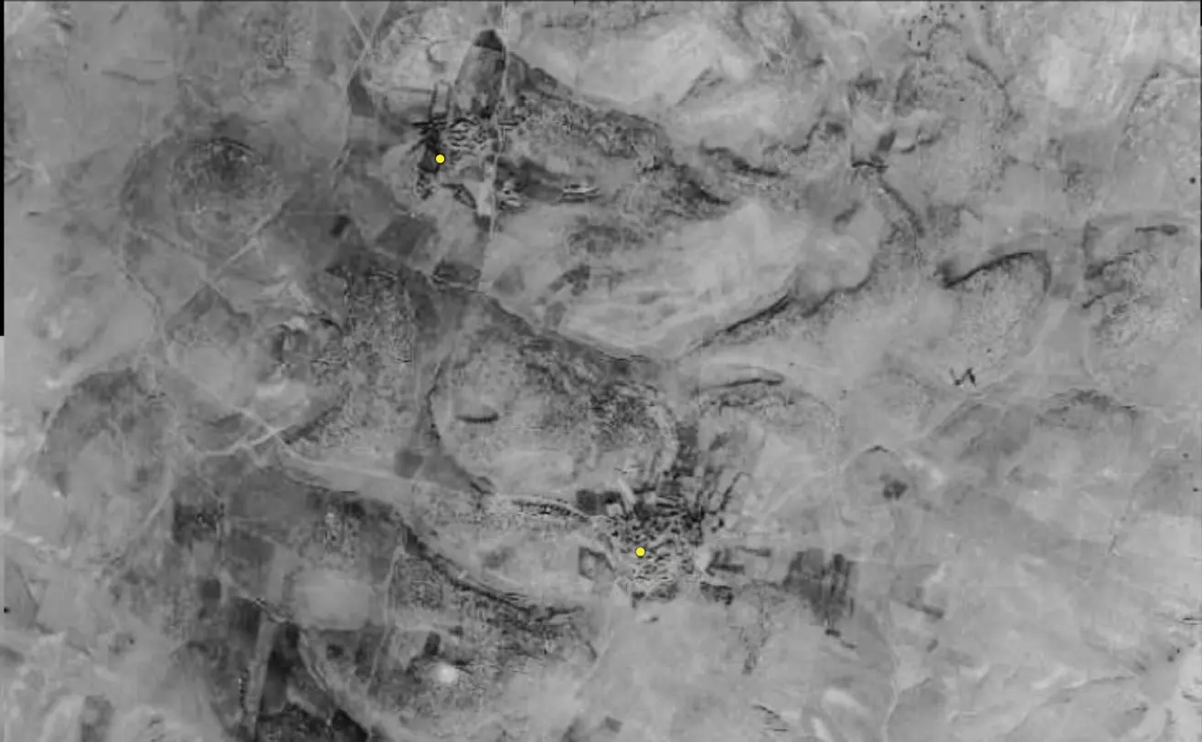
| Pre-Nakba Aerial View |
|||||||||||||||||||

|
|||||||||||||||||||
| Map Location | See location #17 on the map View from satellite |
||||||||||||||||||
| Military Operation | Operation An-Far | ||||||||||||||||||
| Attacking Units | First Battalion of Giv'ati Brigade | ||||||||||||||||||
| Acts of Terror | Massacre occured by Zionist troops against the town's inhabitants. | ||||||||||||||||||
| Exodus Cause | Military assault by Zionist troops | ||||||||||||||||||
| Village Temains | The village was mostly destroyed with the exception of few houses remain standing. | ||||||||||||||||||
| Ethnically Cleansing | Bi'lin inhabitants were completely ethnically cleansed. | ||||||||||||||||||
| Pre-Nakba Land Ownership |
**Town Lands' Demarcation Maps |
||||||||||||||||||
| Land Usage As of 1945 |
|
||||||||||||||||||
| Population |
|
||||||||||||||||||
| Number of Houses |
|
||||||||||||||||||
| Near By Towns |
|||||||||||||||||||
|
|
|||||||||||||||||||
| Schools | Bi'lin had an elementary school which was founded in 1937. | ||||||||||||||||||
| Shrines / Maqams | A shrine for al-Shaykh Ya'qub. | ||||||||||||||||||
| Water Supply | Bi'lin contained two wells which supplied it with its drinking water needs. | ||||||||||||||||||
| Exculsive Jewish Colonies Who Usurped Village Lands |
Qedma | ||||||||||||||||||
| Featured Video | |||||||||||||||||||
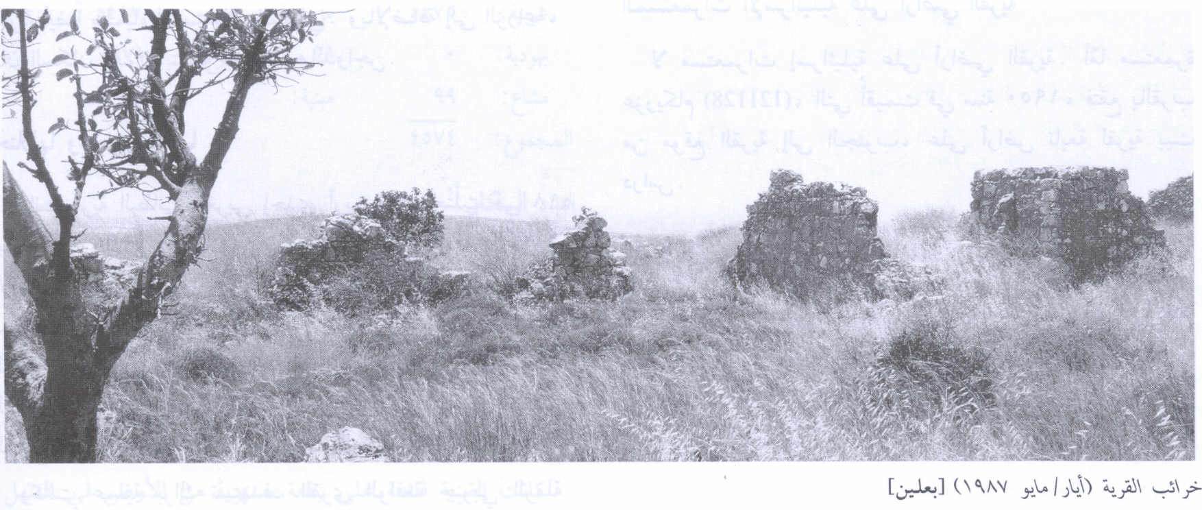
Village Before NakbaThe village stood on a limestone hill on generally hilly terrain. It was somewhat isolated due to the terrain and the absence of roads other than dirt paths. In the late nineteenth century, Bi'lin was a small village built of adobe bricks and stone, with mud used for mortar. The village had two wells, a school (founded in 1937), and some shops. The shrine of Shaykh Ya'qub was east of the village. Some village land was used for grazing goats and sheep, but most was used for rainfed agriculture; the villagers grew grain and fruit, including grapes, figs, and almonds. In 1944/45 a total of 6,972 dunums was allotted to cereals; 143 dunums were irrigated or used for orchards. The villagers also produced milk products and wool.Village Occupation and Ethnic CleaningBi'lin was one of more than sixteen villages occupied during Operation An-Far. The village probably fell in the first stage of the offensive, on 9–10 July 1948, to the First Battalion of the Giv'ati Brigade.Zionists Colonies on Village LandsNo settlement was established on village land, but the inhabitants of Qedma, established northwest of the village in 1946, now use some of the village lands.Village TodayAll that remains is the rubble of a few houses, with wild herbs and thorns growing on the site, along with some trees and cactus plants. The site is surrounded by barbed wire. Parts of the surrounding land are planted with mango trees and grapes, while other parts serve as pastures.SourceDr. Walid al-Khalidi, 1992: All That Remains. |
|||||||||||||||||||
| Related Maps | Town Lands' Demarcation Maps خرائط للقضاء توضح حدود القرى والاودية Town's map on MapQuest View from satellite Help us map this town at WikiMapia |
||||||||||||||||||
| Related Links | Wikipedia's Page Google Search Google For Images Google For Videos |
||||||||||||||||||
| More Information | في كتاب كي لا ننسى في كتاب بلادنا فلسطين المزيد من موقع هوية |
||||||||||||||||||
- Village Site In 1987
Scanned from "All That Remains" by Dr. Walid Khalidi 5 - Village Rubble In 1987
Scanned from "All That Remains" by Dr. Walid Khalidi 6 - موقع القريه واثار بيوت بعلين
Posted by abu raya - موقع القريه
Posted by abu raya - موقع القريه واراضيها
Posted by abu raya - بعلين
Posted by abu raya - بعلين
Posted by abu raya - اثار ردم بيوت القريه
Posted by abu raya - بعلين
Posted by abu raya - Pre-Nakba Aerial view of the village / صورة من الجو للقرية اخذت قبل النكبة
- خارطة تُظهِر الحدود والطرق بأنواعها والأماكن المقدسة والطبيعة الطوبغرافية من تلال وسهول ومنحدرات والتشكيلة الطبيعية للأرض وأنواع المزروعات. نُشرت الخريطة فترة الانتداب البريطاني، تم إضافة تعديلات عليها من قِبَل خدمة الخرائط والصور التابعة للقوات العسكرية الاسرائيلية فترة الأربعينيات.
Want to browse more? 80,000 pictures were grouped in these gallaries:
| Display Name | Clan/Hamolah | Country of Residence |
| محمد صلاح | - | الزرقاء / مخيم حطين |
| عزام عزام | الجابري | - |


