| PalestineRemembered | About Us | Oral History | العربية | |
| Pictures | Zionist FAQs | Haavara | Maps | |
| Search |
| Camps |
| Districts |
| Acre |
| Baysan |
| Beersheba |
| Bethlehem |
| Gaza |
| Haifa |
| Hebron |
| Jaffa |
| Jericho |
| Jerusalem |
| Jinin |
| Nablus |
| Nazareth |
| Ramallah |
| al-Ramla |
| Safad |
| Tiberias |
| Tulkarm |
| Donate |
| Contact |
| Profile |
| Videos |
Welcome To Thikrin - ذكرين (زِكرِين) (זיכרין)
|
District of Hebron
Ethnically cleansed days ago |
العربية Google Earth |
 |
Gallery (69) |
- Statistics & Facts
-
Before & After

- Satellite View
- Articles 7
- Pictures 69
- Aerial Views 1
- Land Deeds 4
- Oral History 3
- Members 53
- Families
- All That Remains
- Wikipedia
- Videos 1
- Guest Book 29
- Links 1
| Statistic & Fact | Value | ||||||||||||||
| Occupation Date | October 22, 1948 | ||||||||||||||
| Distance From District | 27 (km) Northwest of Hebron | ||||||||||||||
| Elevation | 200 (meters) | ||||||||||||||
| Before & After Nakba, Click Map For Details |
|||||||||||||||
|
|||||||||||||||
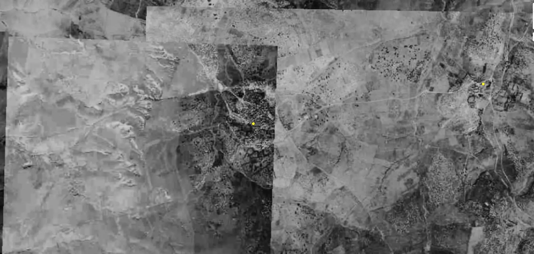
| Pre-Nakba Aerial View |
|||||||||||||||
|
|||||||||||||||
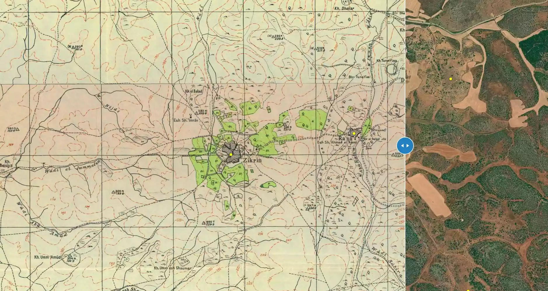
| Map Location | See location #9 on the map View from satellite |
||||||||||||||
| Military Operation | Operation Yo'av | ||||||||||||||
| Exodus Cause | Expulsion by Zionist troops | ||||||||||||||
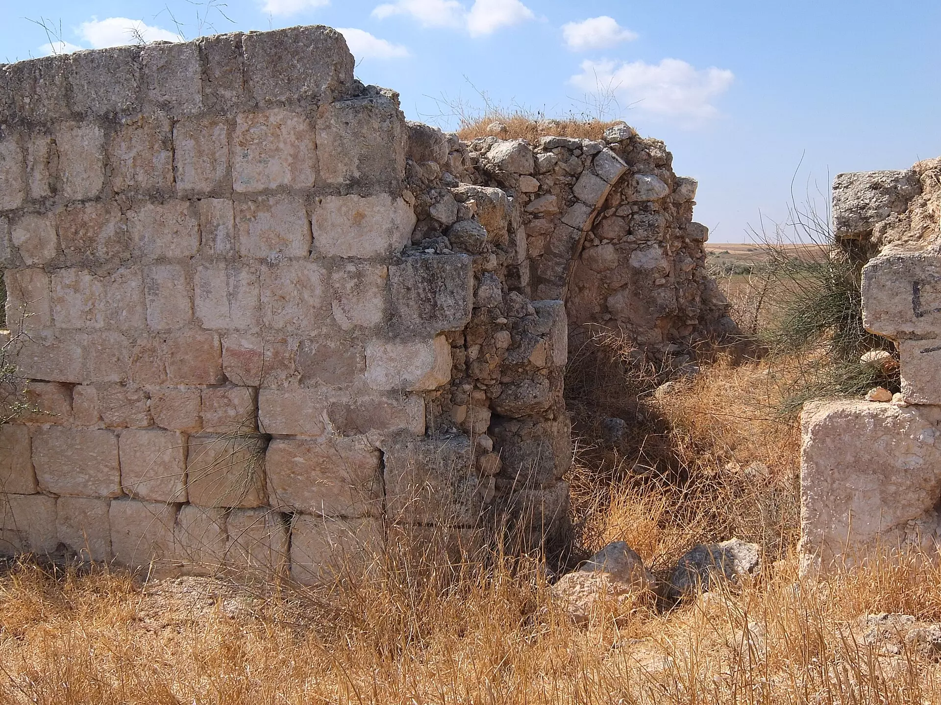
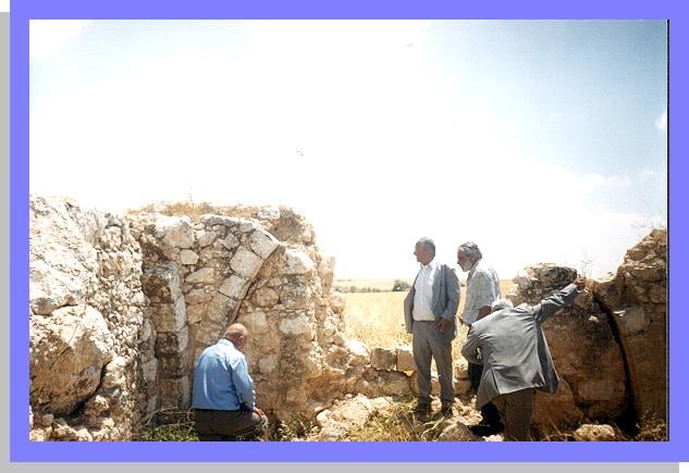
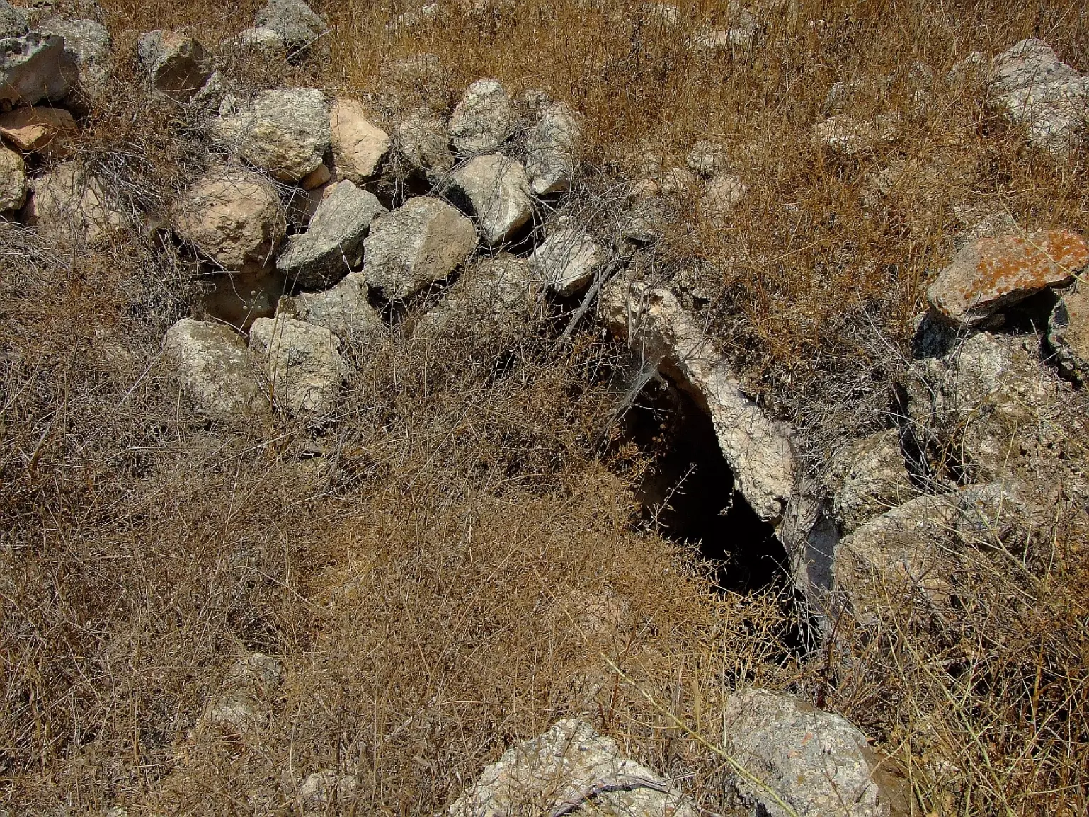
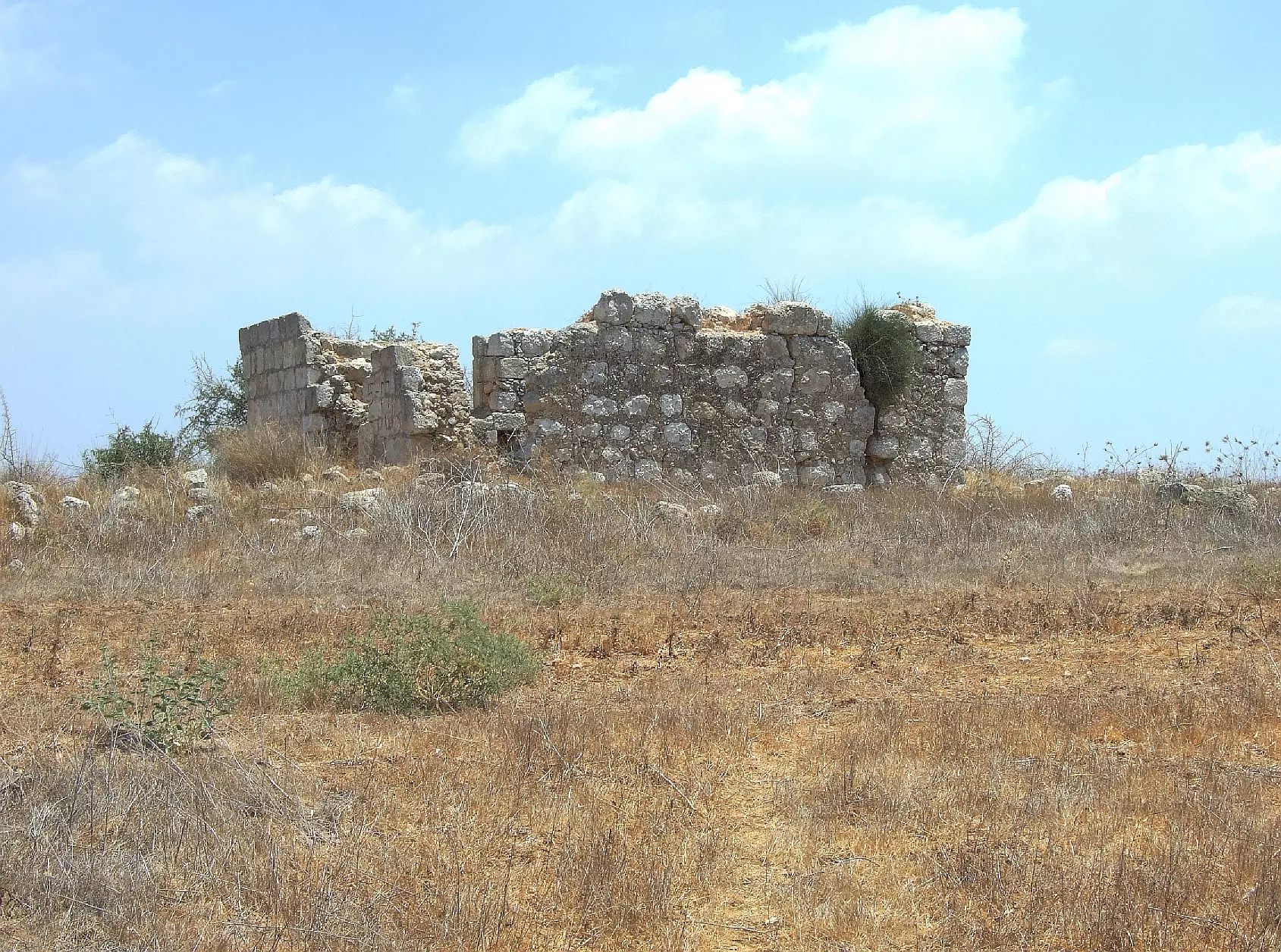
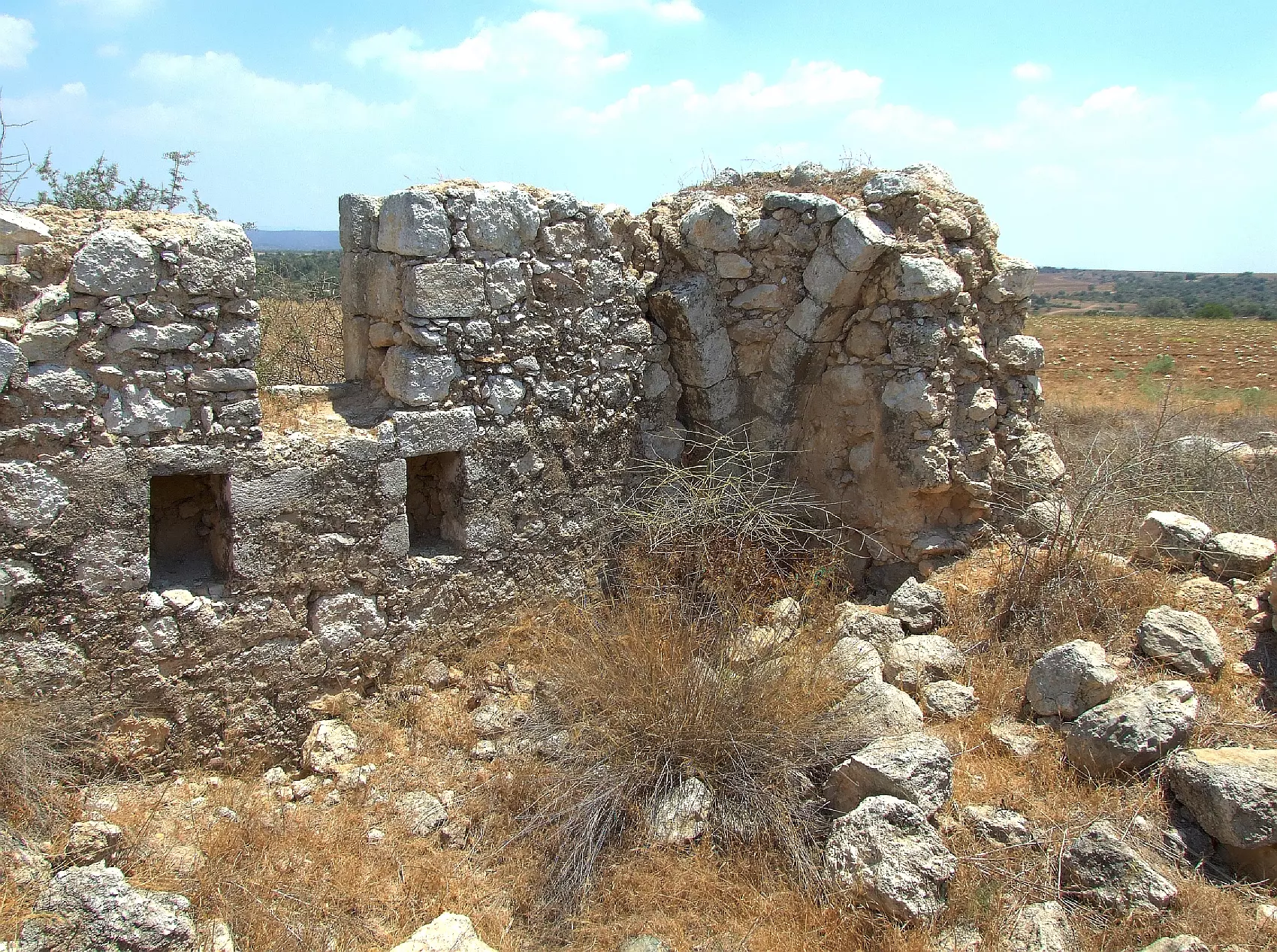
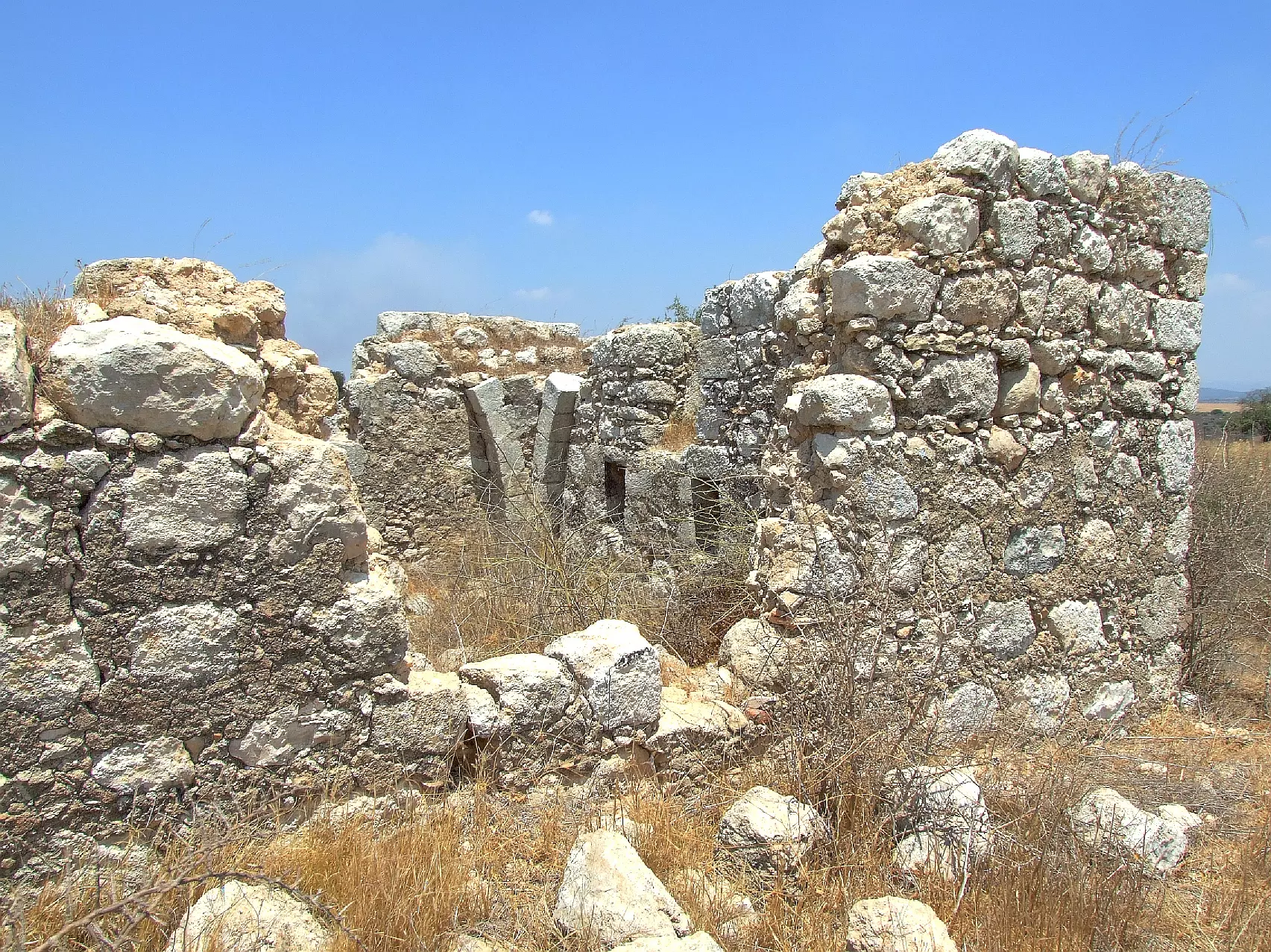
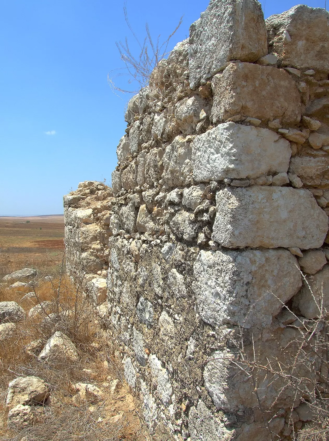
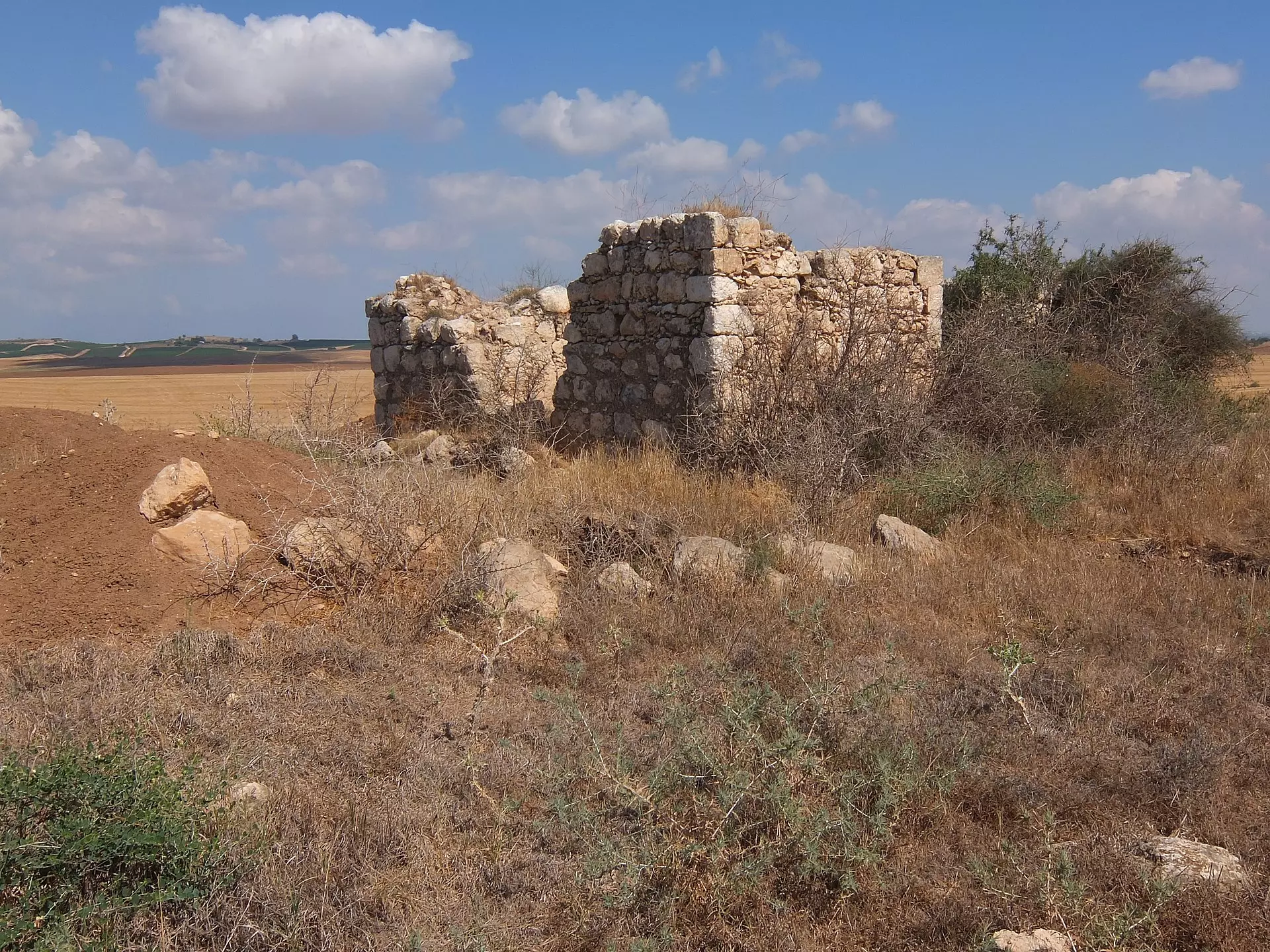
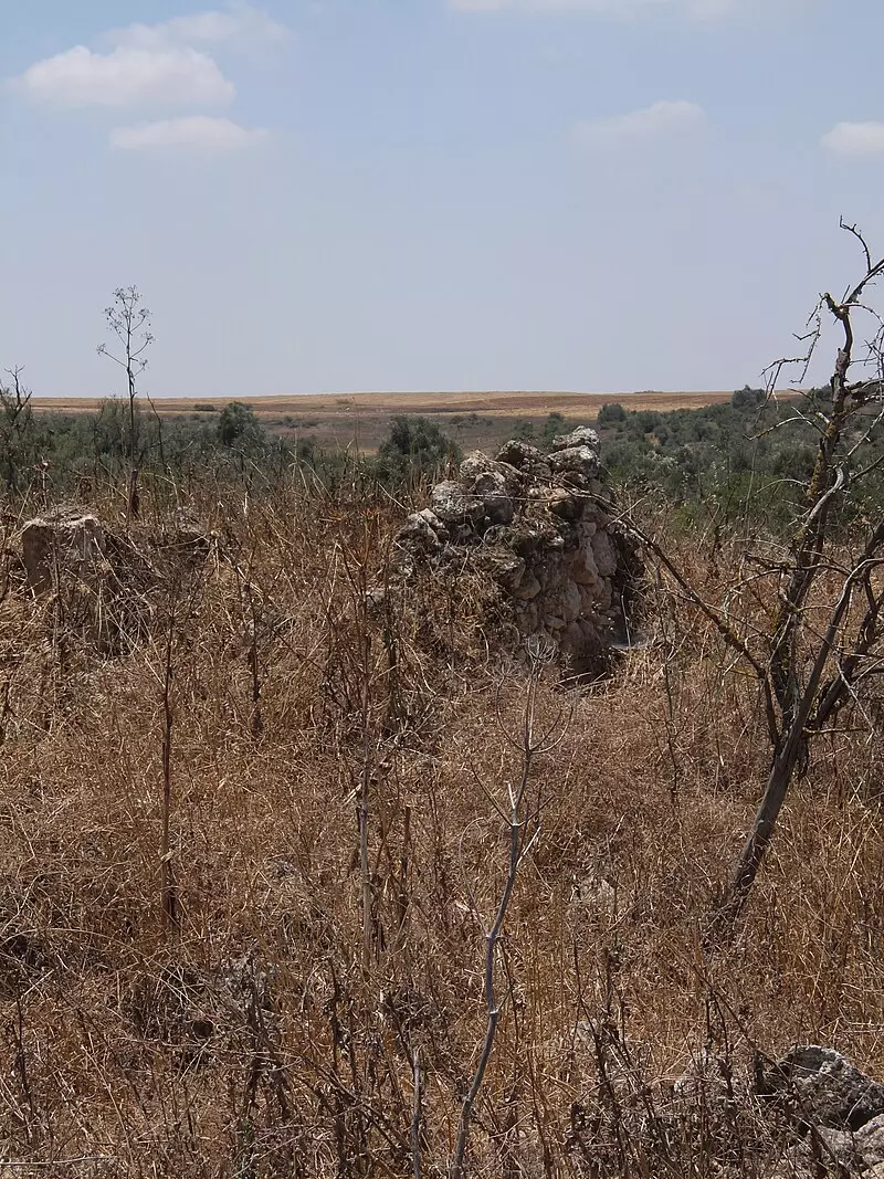
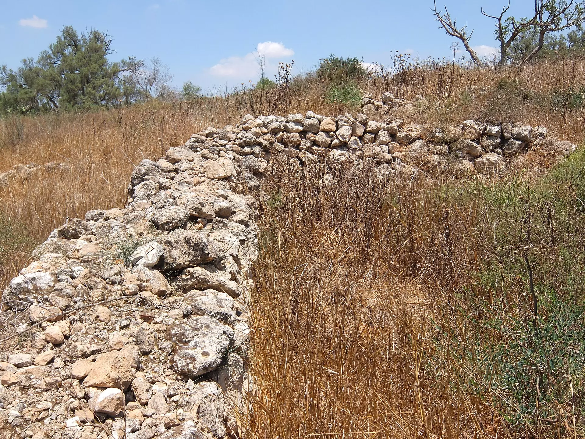
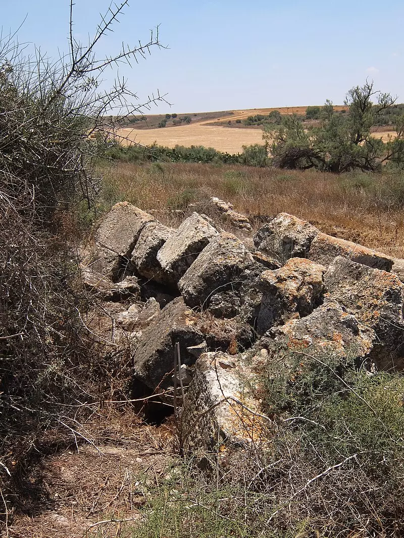
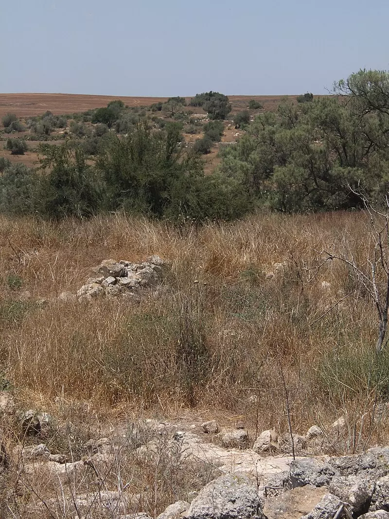
| Village Temains | Thikrin was completely destroyed, and only house walls and rubble left behind. | ||||||||||||||
| Ethnically Cleansing | Thikrin inhabitants were completely ethnically cleansed. | ||||||||||||||
| Pre-Nakba Land Ownership |
**Town Lands' Demarcation Maps |
||||||||||||||
| Land Usage As of 1945 |
|
||||||||||||||
| Population |
|
||||||||||||||
| Number of Houses |
|
||||||||||||||
| Near By Towns |
|||||||||||||||
|
|||||||||||||||
| Town's Name Through History | During the Roman period, Thikrin was known by Kefar Dikrina. | ||||||||||||||
| Schools | Thikrin had an elementary school for boys. | ||||||||||||||
| Nearby Wadies & Rivers | Wadi Bisiyya was nearby village lands | ||||||||||||||
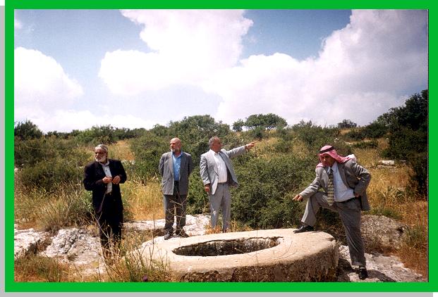
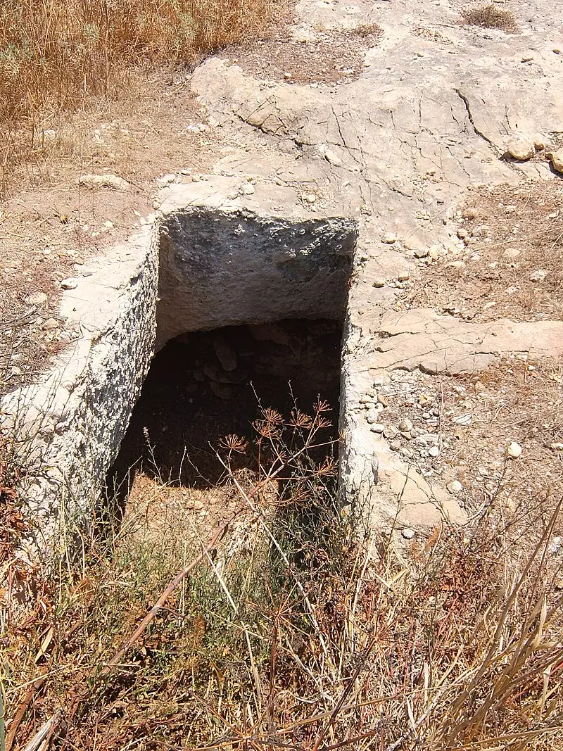
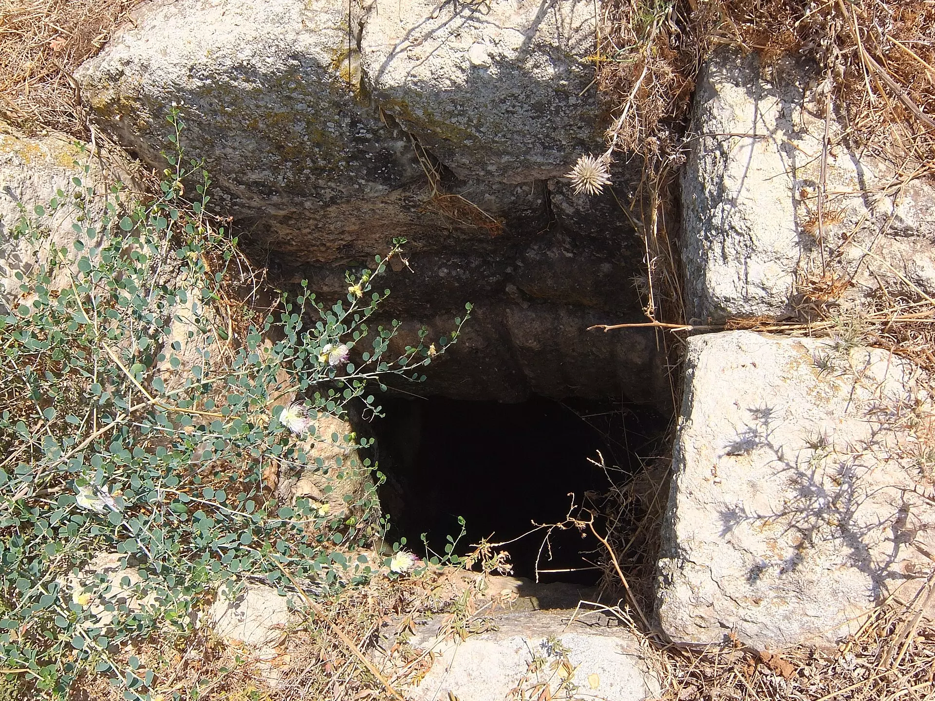
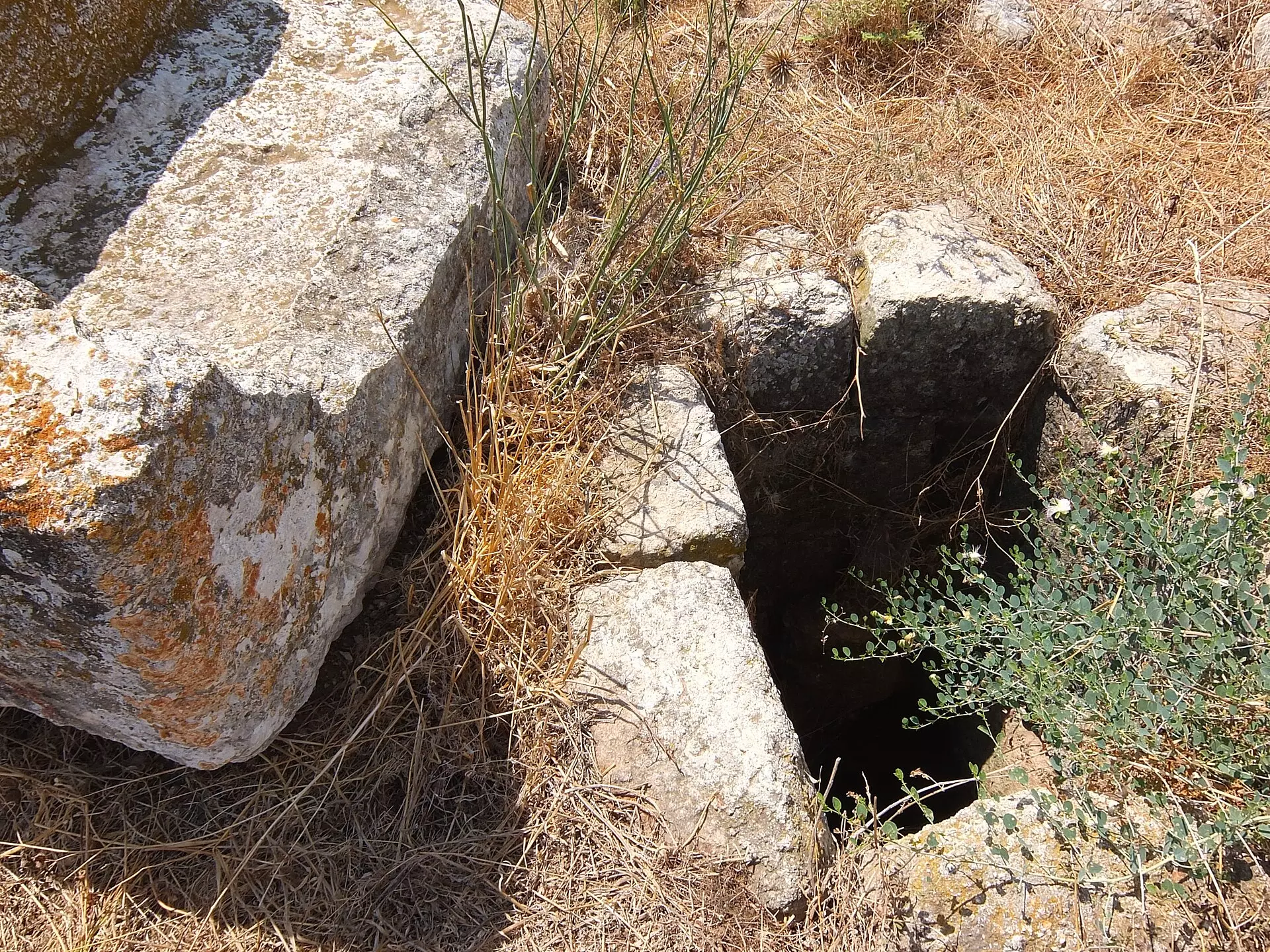
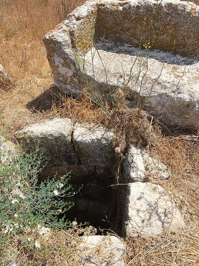
| Water Supply | A well located nearby Wadi Bisiyya used to be the main source of drinking water to the inhabitants of Thikrin. | ||||||||||||||
| Exculsive Jewish Colonies Who Usurped Village Lands |
No Israeli settlements on village lands | ||||||||||||||
| Featured Video | |||||||||||||||
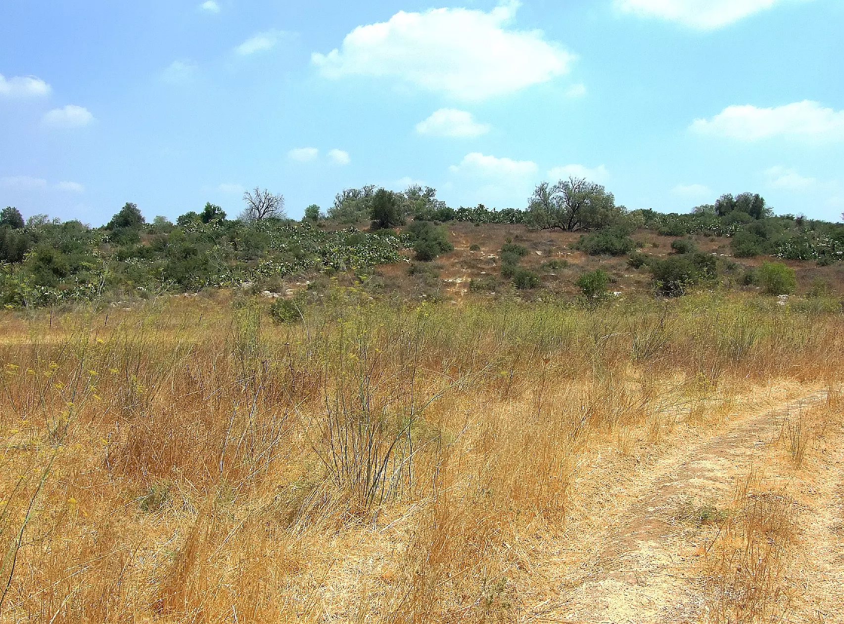
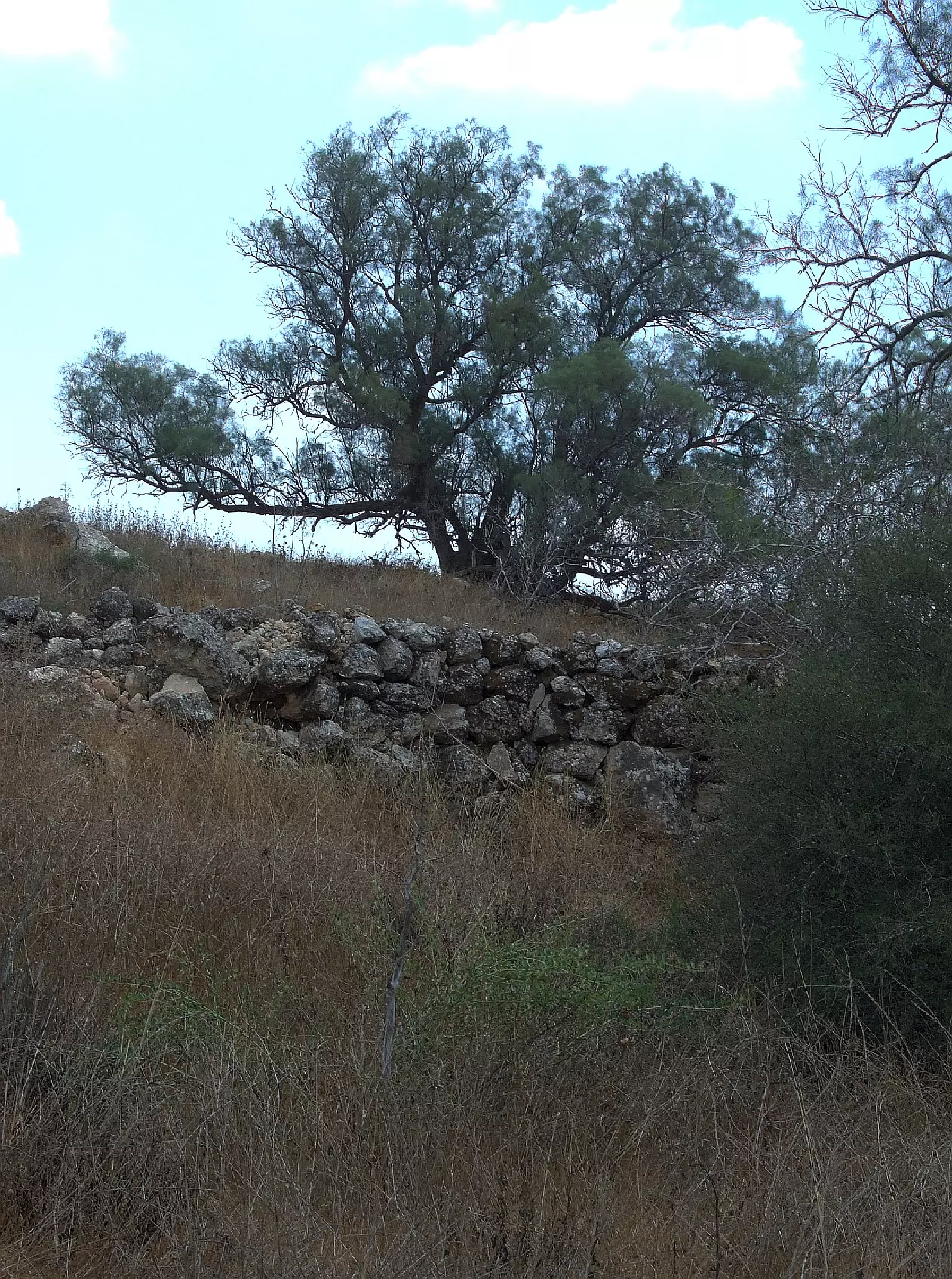
Village Before NakbaThe village was situated in the easternmost extension of the southern coastal plain, near the western foothills of the Hebron Mountains. It was linked to Bayt Jibrin, to the southeast, by a secondary road that passed through Kudna. Another secondary road ran from Zikrin through the village of Ajjur to a highway that ran northeast from Bayt Jibrin and intersected the Jerusalem-Jaffa highway. Zikrin was called Kefar Dikrina during the Roman period. In 1596, Zikrin was a village in the nahiya of Gaza (liwa' of Gaza), with a population of 220. It paid taxes on a number of crops, including wheat, barley, sesame, and fruits, as well as on vineyards. In the late nineteenth century, Zikrin was a village built of stone and surrounded by gardens. Its water supply came from 'numerous' wells in the valley to the north.The residents of the modem village were Muslims. Their houses were built of stone, mud, and wood and were distributed along two roads, one leading to Bayt Jibrin and another to Dayr al-Dubban. The village had an elementary school and a number of small shops. Shallow wells (3 to 15 m deep) collected rain water and runoff from the wadis, which the villagers utilized for drinking, irrigation, and construction. A well located on Wadi Bisiyya was the main source of drinking water. The villagers engaged in agriculture and animal husbandry. They grew grain, vegetables, and olives. In 1944/45 they allocated a total of 15,058 dunums of their land to cereals. Trees, shrubs, and wild grass grew on the south and southeast sides and served as pastures. Village Occupation and Ethnic CleaningThe Israeli army's Giv'ati Brigade occupied Zikrin on 22-23 October 1948, along with a few other villages in the Hebron area. The push towards Hebron was coordinated with Operation Yoav. Israeli historian Benny Morris states that most of the population of the Hebron area villages had left previously and the rest were expelled. In the last week of October, the acting United Nations mediator, Dr. Ralph Bunche, charged that Israeli forces on the southern front were operating with a 'prearranged plan' to permanently occupy the territory they moved into. But Israeli chief of operations Col. Yigal Yadin denied the charge on 27 October. He told the New York Times that every general staff has a plan for any eventuality, adding: 'And if he [Dr. Bunche] looked into American war plans he probably would discover a plan to capture Monaco.'Zionists Colonies on Village LandsThere are no settlements on village lands; Beyt Nir, established in 1955 on the lands of Kudna, is some 3 km south of the village site.Village TodayThe site, overgrown with tall weeds, scrub, and other wild vegetation, contains a number of olive and carob trees. Truncated stone terraces, partially overgrown with cactuses, further mark the site. Some of the surrounding lands are planted by Israeli farmers in wheat and the rest is used as rangeland.SourceDr. Walid al-Khalidi, 1992: All That Remains. |
|||||||||||||||
| Related Maps | Town Lands' Demarcation Maps خرائط للقضاء توضح حدود القرى والاودية Town's map on MapQuest View from satellite Help us map this town at WikiMapia |
||||||||||||||
| Related Links | Wikipedia's Page Facebook Page Google Search Google For Images Google For Videos |
||||||||||||||
| More Information | في كتاب كي لا ننسى في كتاب بلادنا فلسطين المزيد من موقع هوية |
||||||||||||||
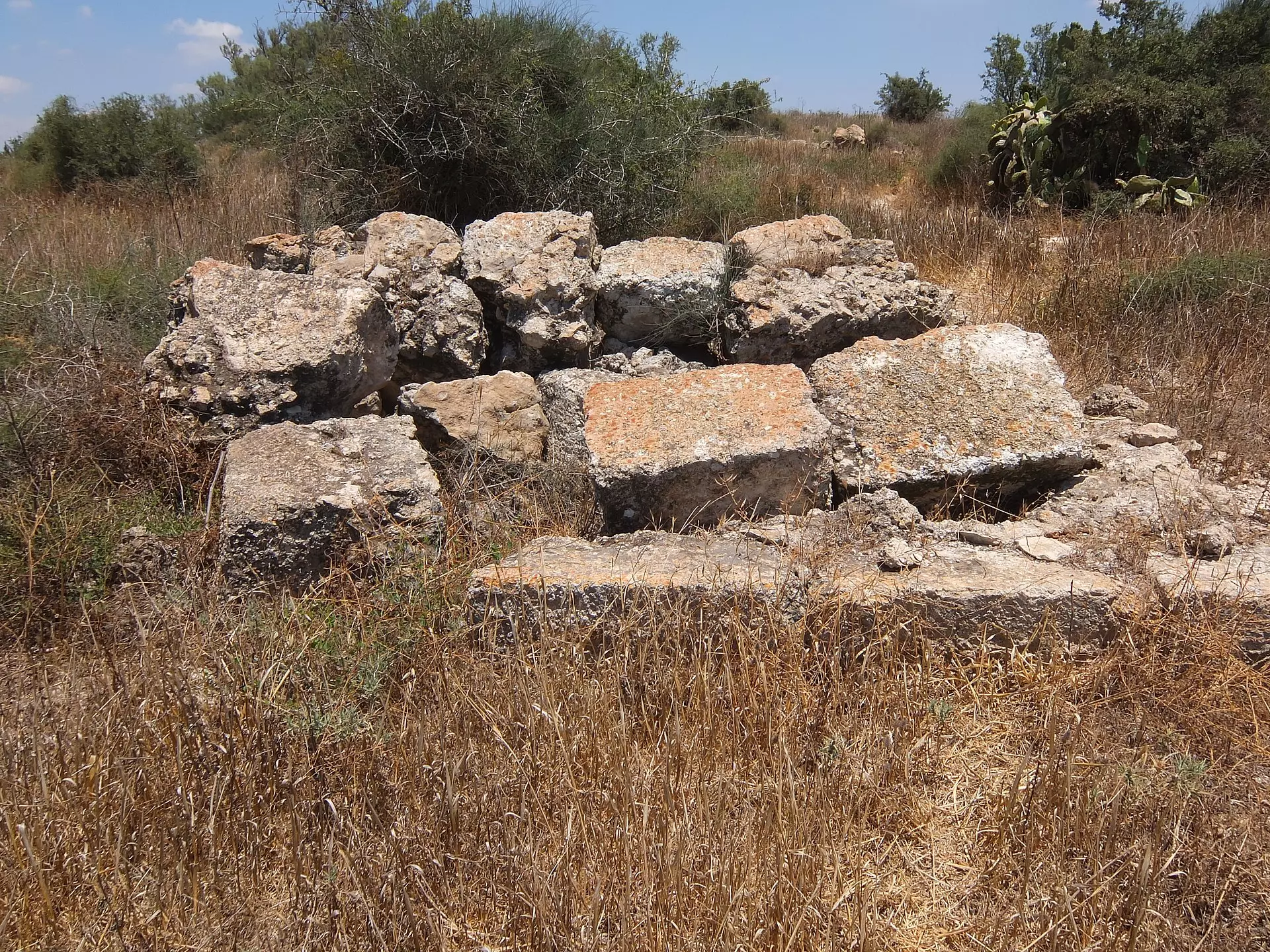
- Village house rubble, 1987
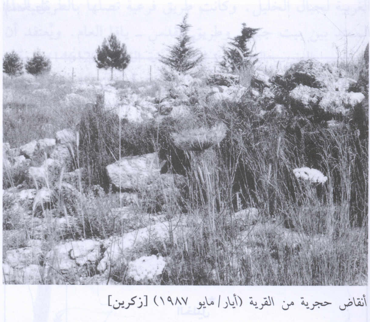
Scanned from "All That Remains" by Dr. Walid Khalidi 5 - Abu Shawar family member back visting Thikrin (May 2000)
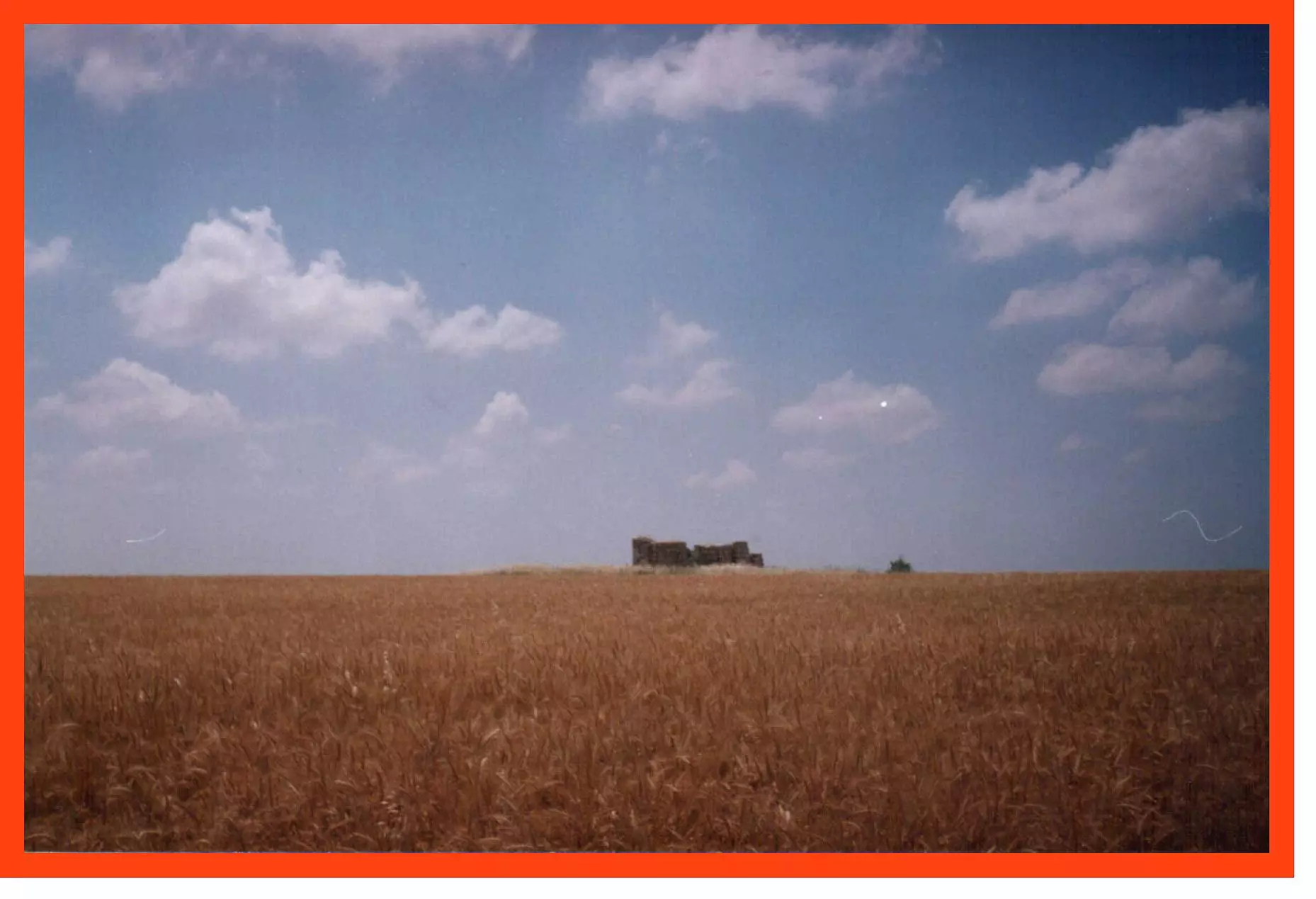
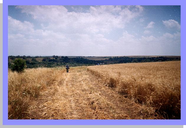
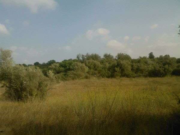
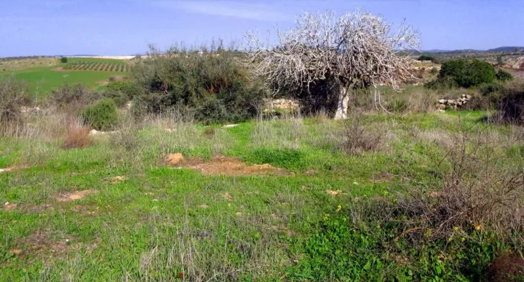
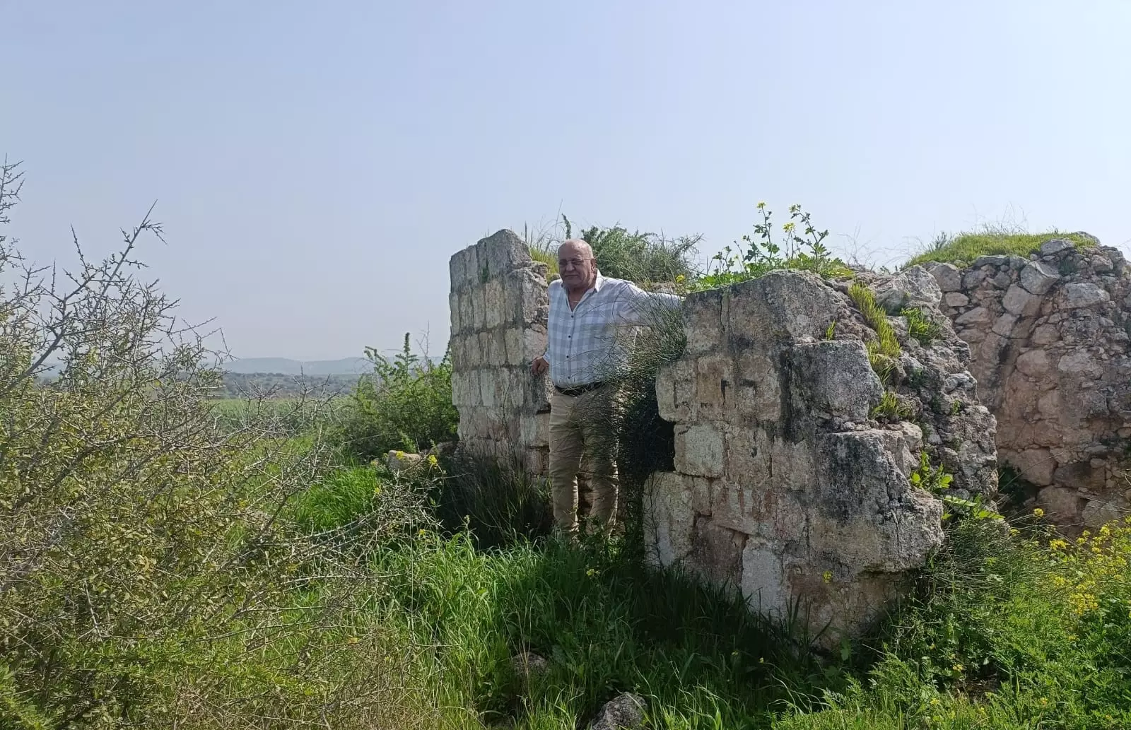
Posted by khaled Abushawar 2 - General view of village lands and one remaining structure (May 2000)
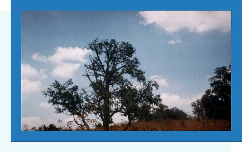
Posted by khaled Abushawar 3 - We planted this tree once a upon a time! (May 2000)
Posted by khaled Abushawar 3 - LOOK my friend, there! YES there!. Our house was there buddy, May 2000
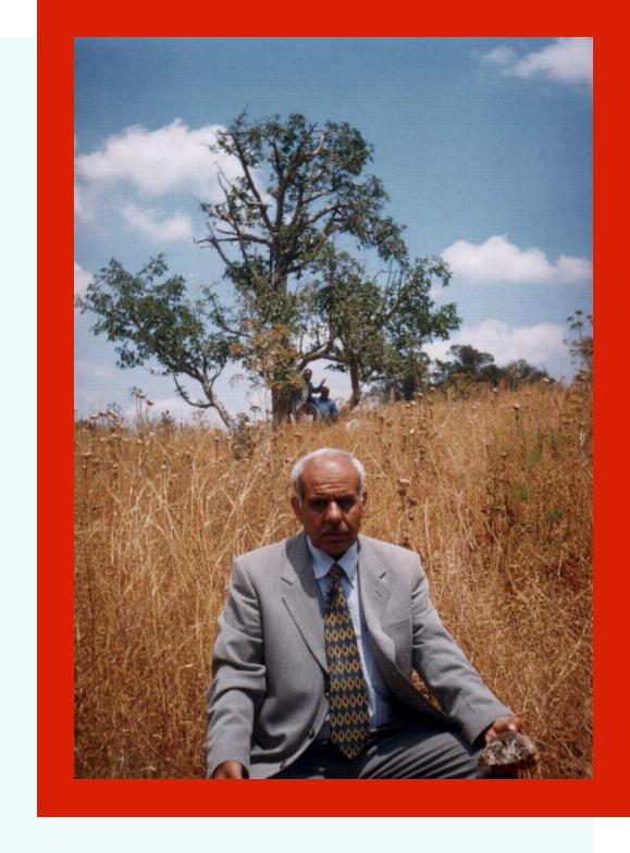
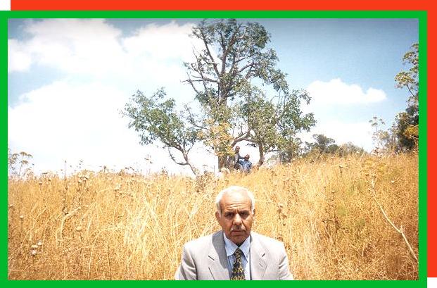
Posted by khaled Abushawar 2 - That was my home one day. We will & must come back one day, you can BANK on it.
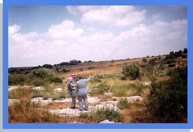
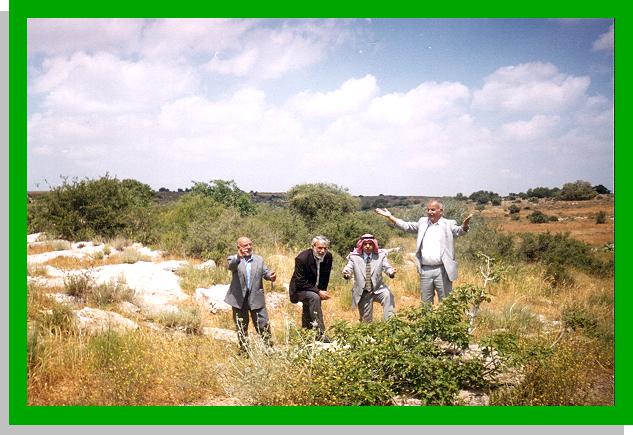
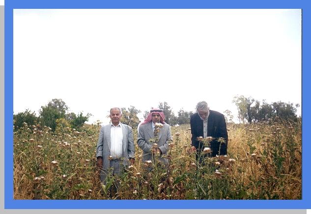
Posted by khaled Abushawar 2 - Another picture of village elders visiting the village again
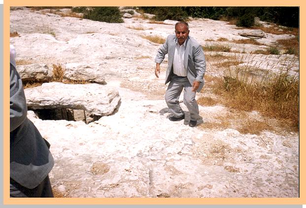
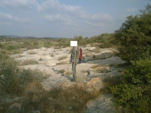
Posted by khaled Abushawar 2 - One time, some village houses used to be on that hill, May 2000
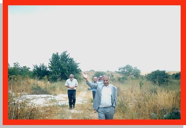
Posted by khaled Abushawar 3 - Thirken's elders visiting the village, May 2000
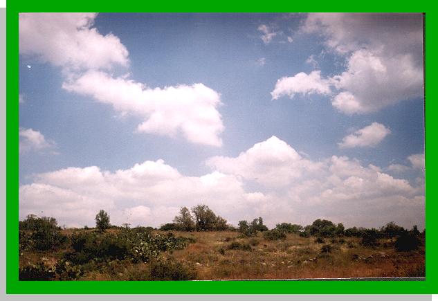
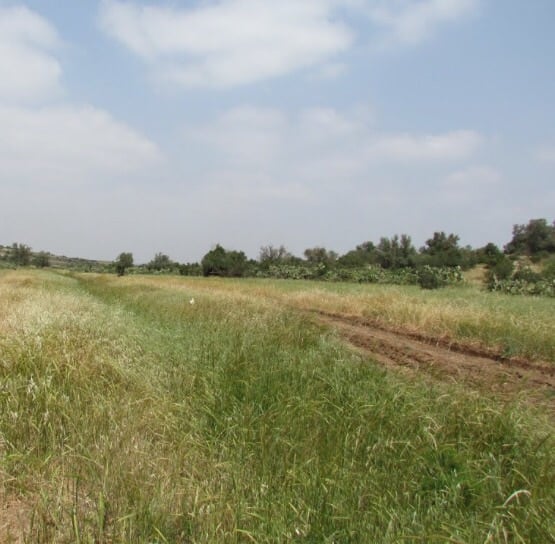
Posted by khaled Abushawar 1 - General picture of village lands, May 2000
Posted by khaled Abushawar 1 - They didn't destroy our houses only, they also destroyed our way of life, May 2000.
Posted by khaled Abushawar 2 - Before we were ethnically cleansed, the water was sweet from this well, May 2000
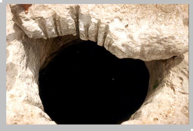
Posted by khaled Abushawar 4 - Village well again.
Posted by khaled Abushawar 3 - Another village well
Posted by khaled Abushawar 1 - Praying in our destroyed home, may God bless us all, May 2000
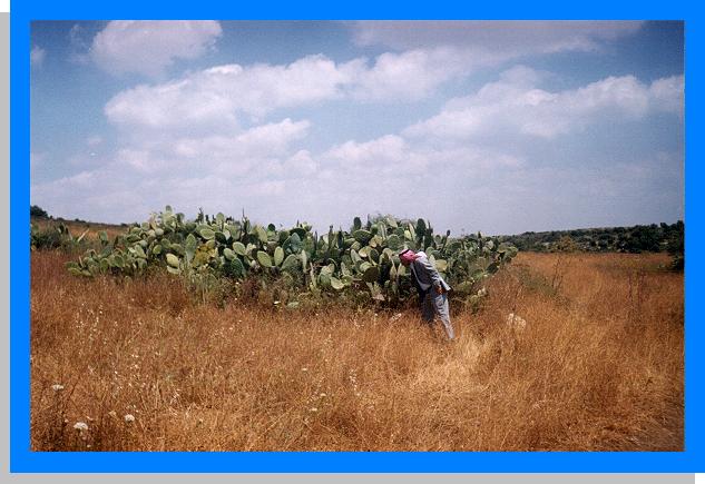
Posted by khaled Abushawar 13 - Cactus tree which we planted before we were ethnically cleansed, May 2000
Posted by khaled Abushawar - الحاج جميل المنشاوي
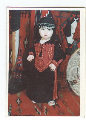
Posted by باسم 9 - براعم ذكرين 'زهرة البساتين'
Posted by qadoura2004 1 - Stone fence & trees
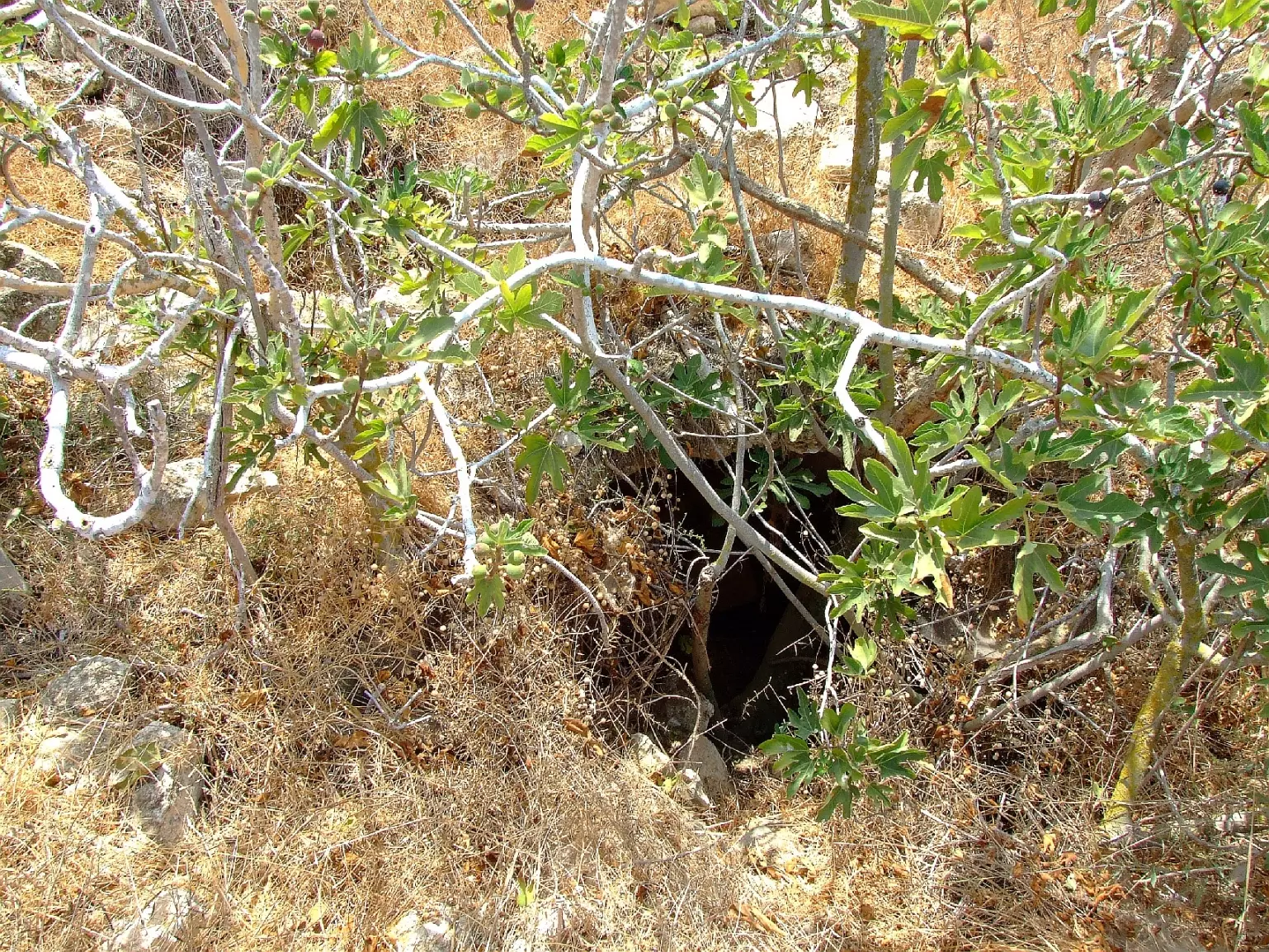
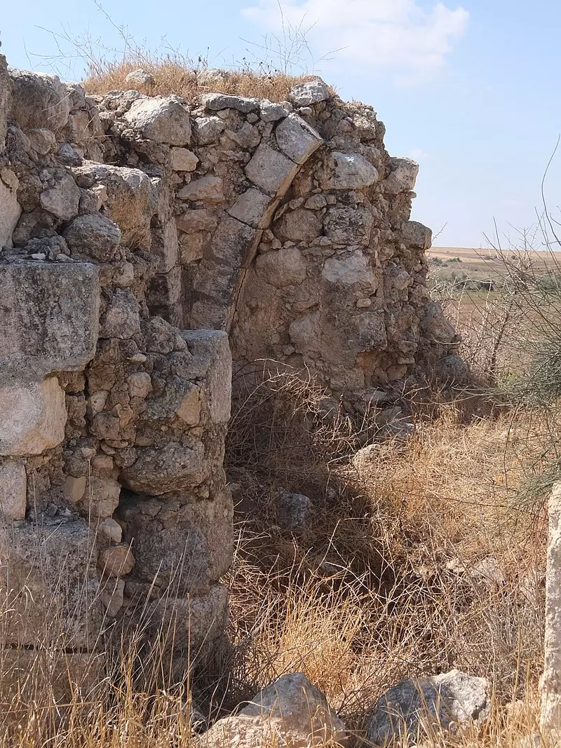
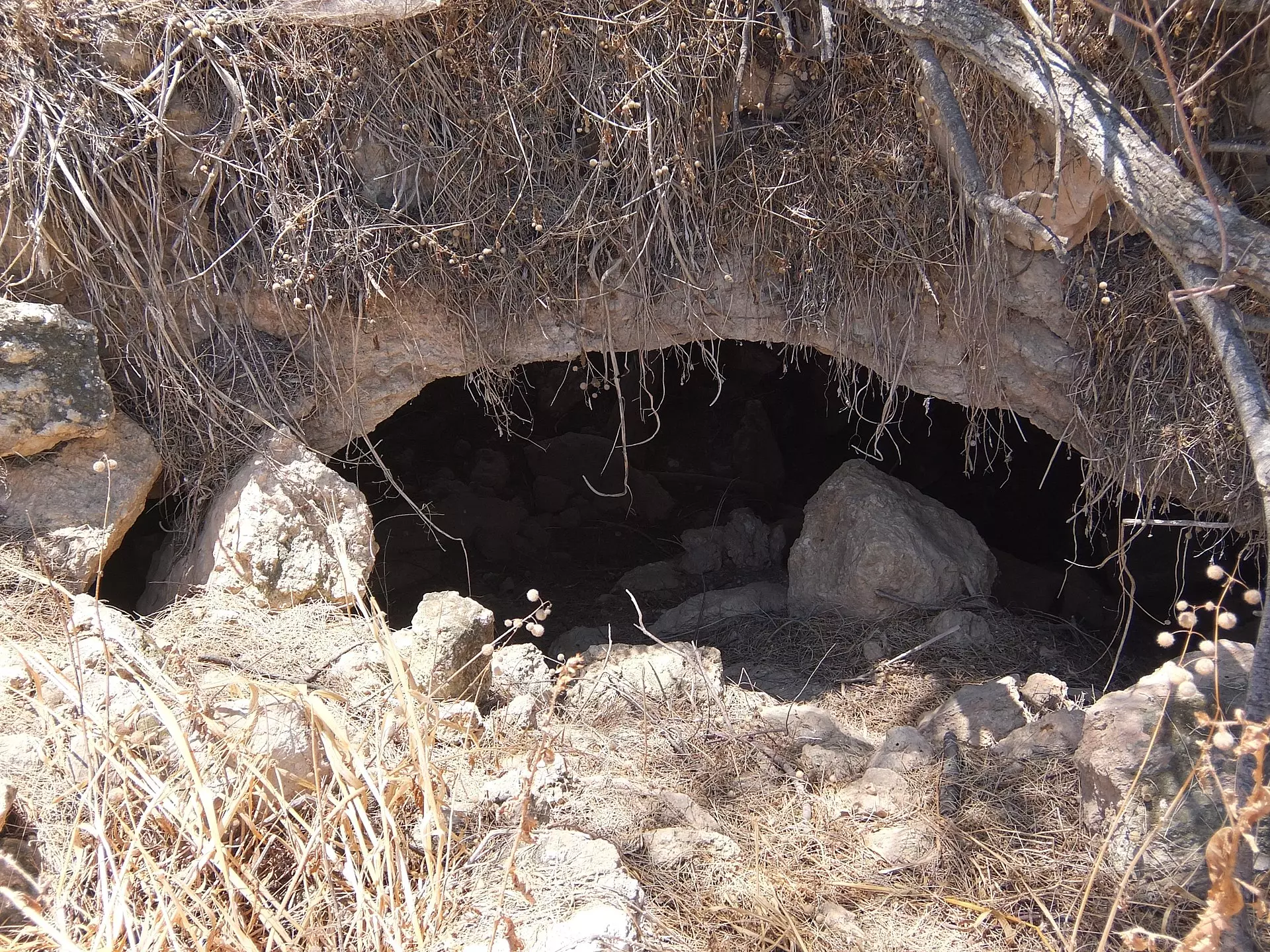
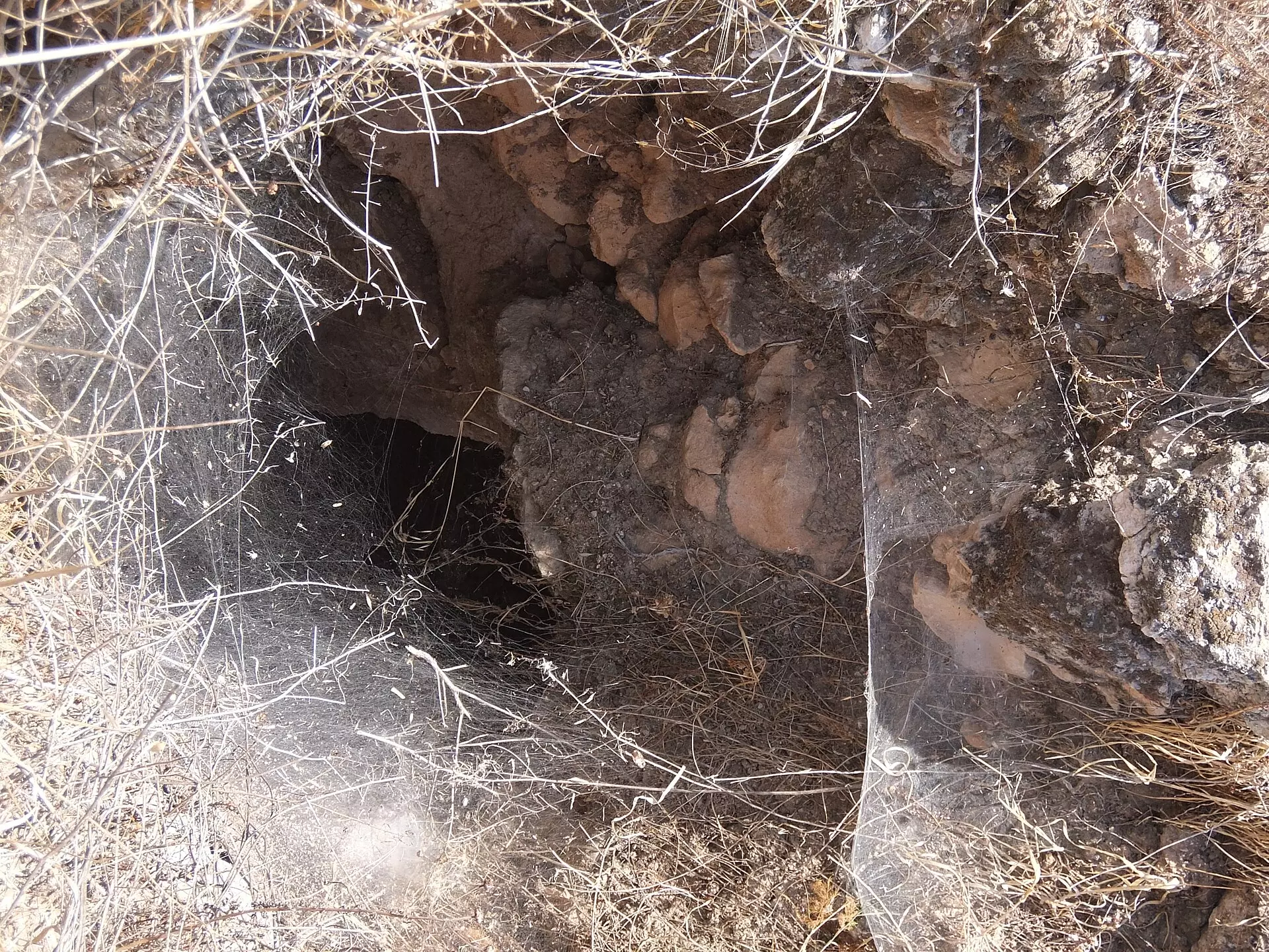
Posted by Uri Zackhem - Cistern / arch with fig tree growing out of it
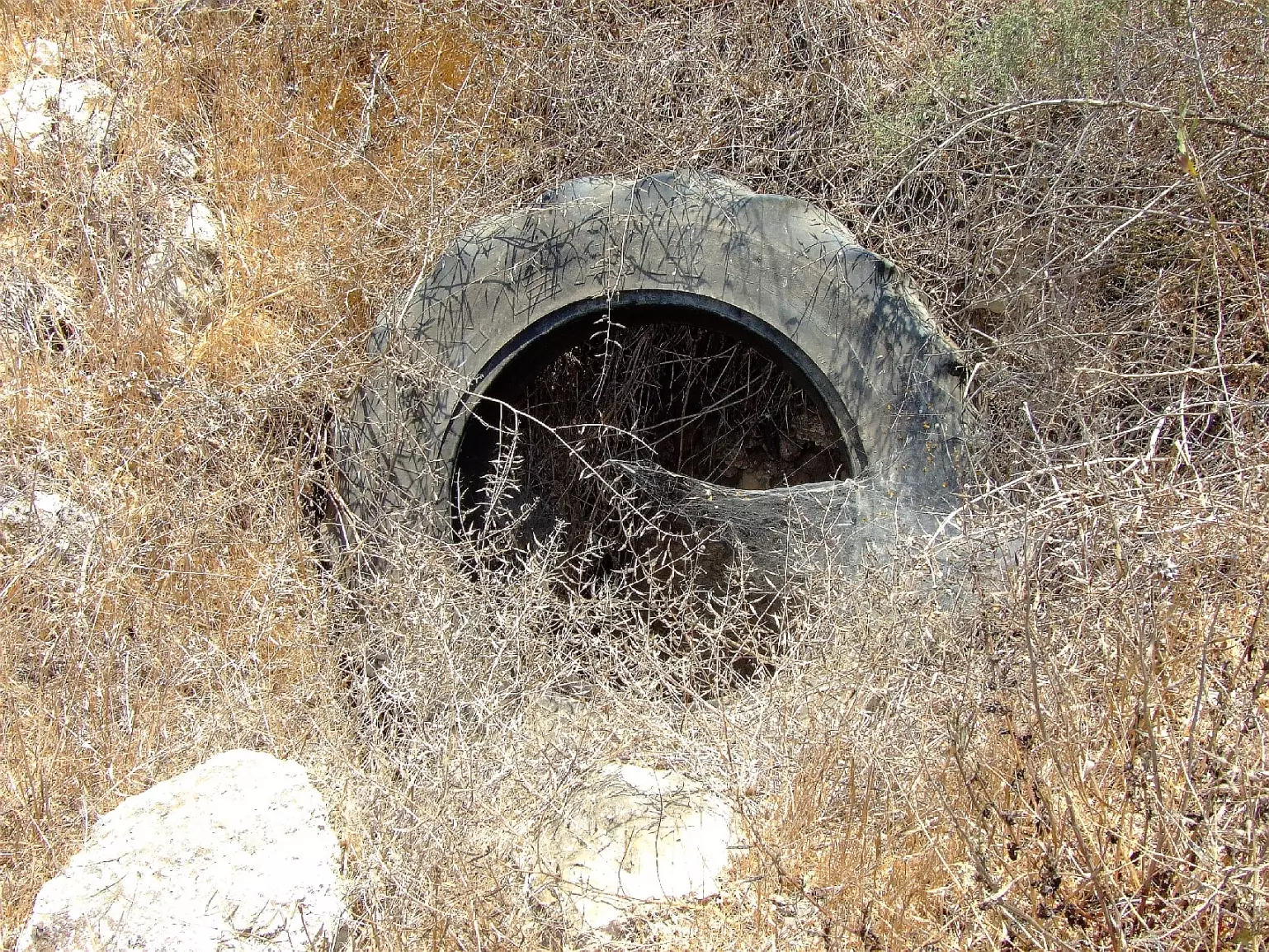
Posted by Uri Zackhem 1 - A cistern blocked with a tyre to prevent fall.
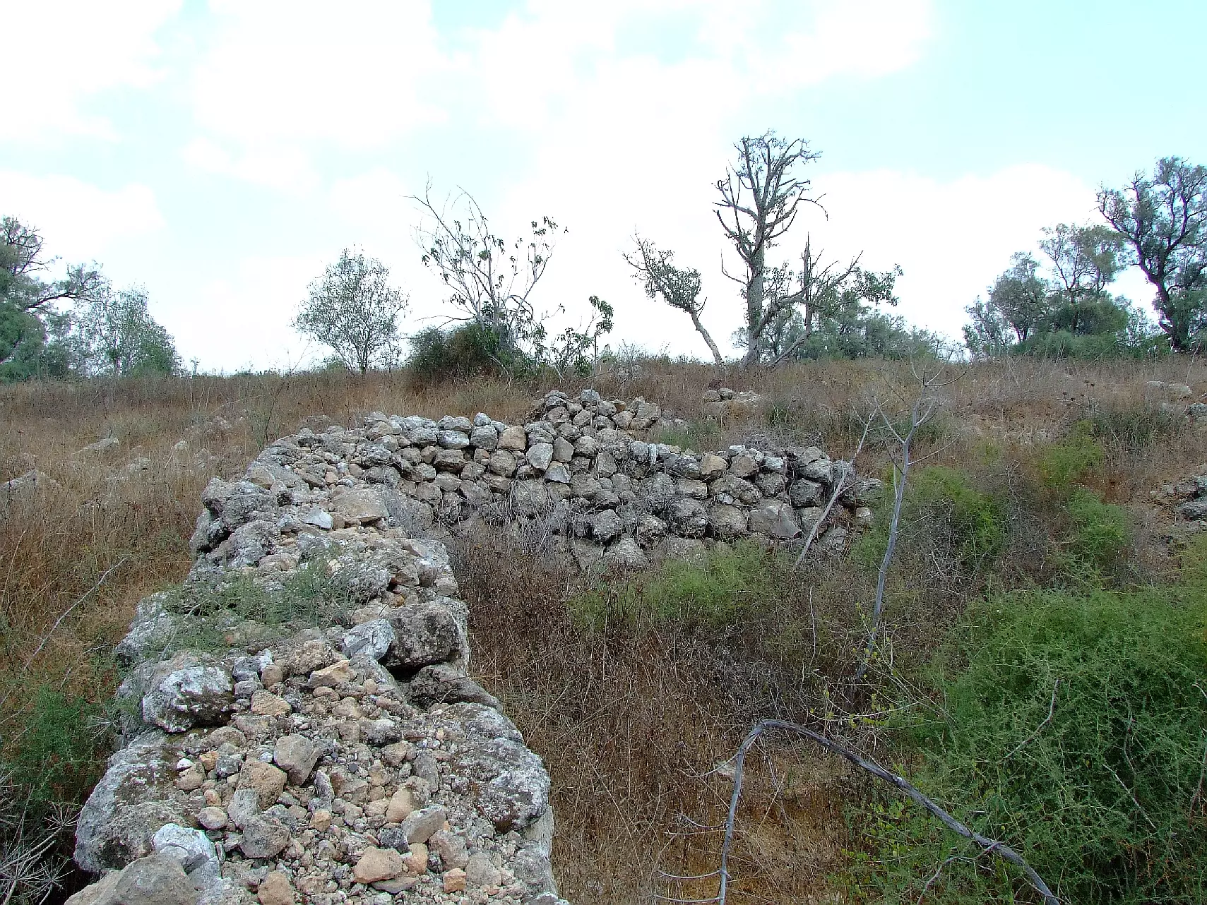
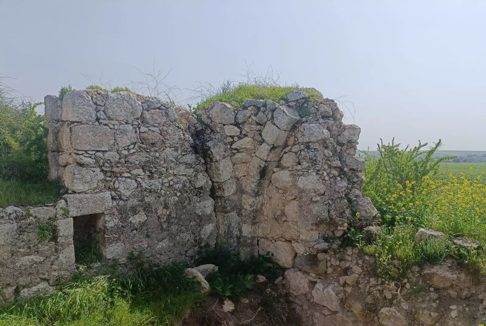
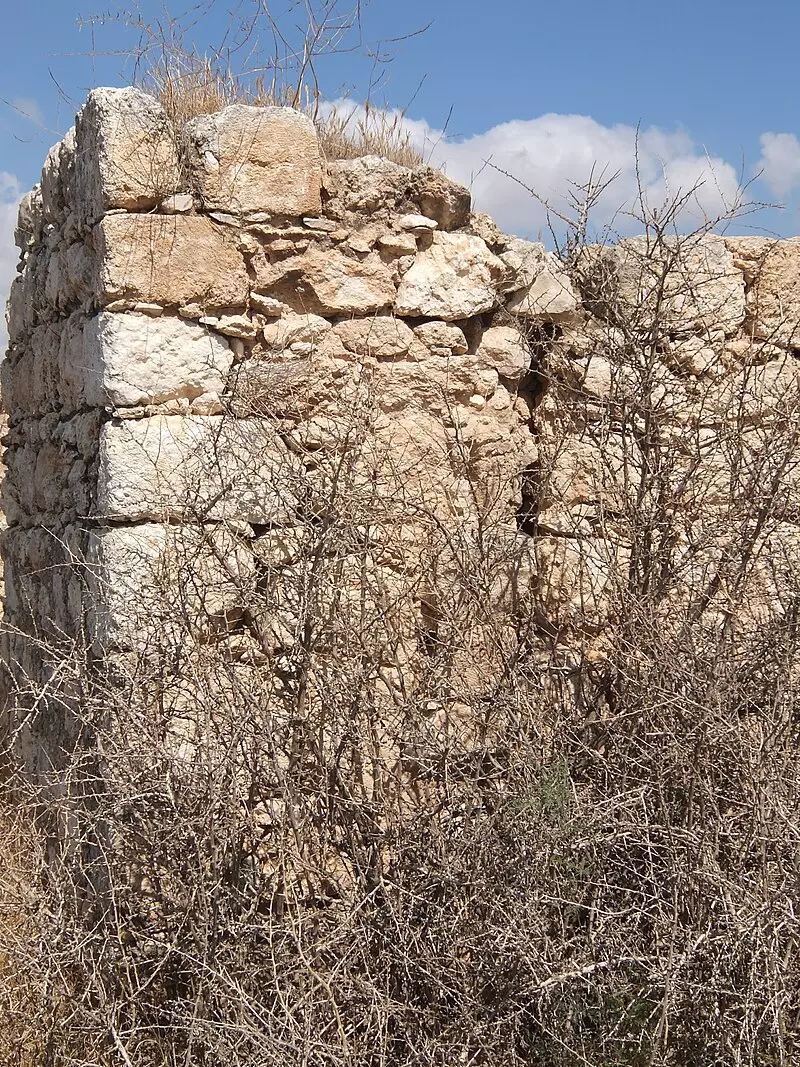
Posted by Uri Zackhem - Remains
Posted by Uri Zackhem - Looking eastward to Thikrin
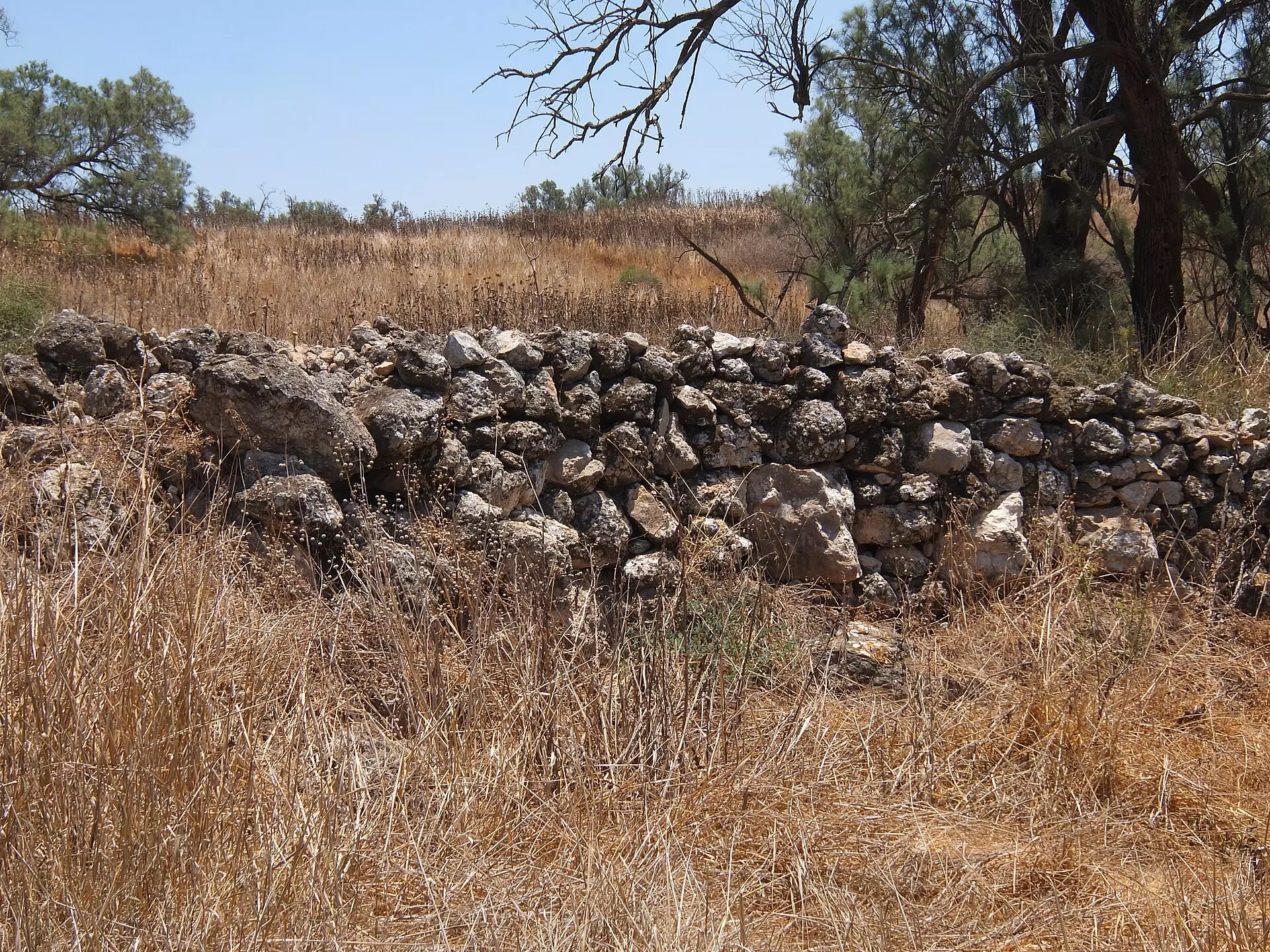
Posted by Uri Zackhem - Stone wall & tamarisk
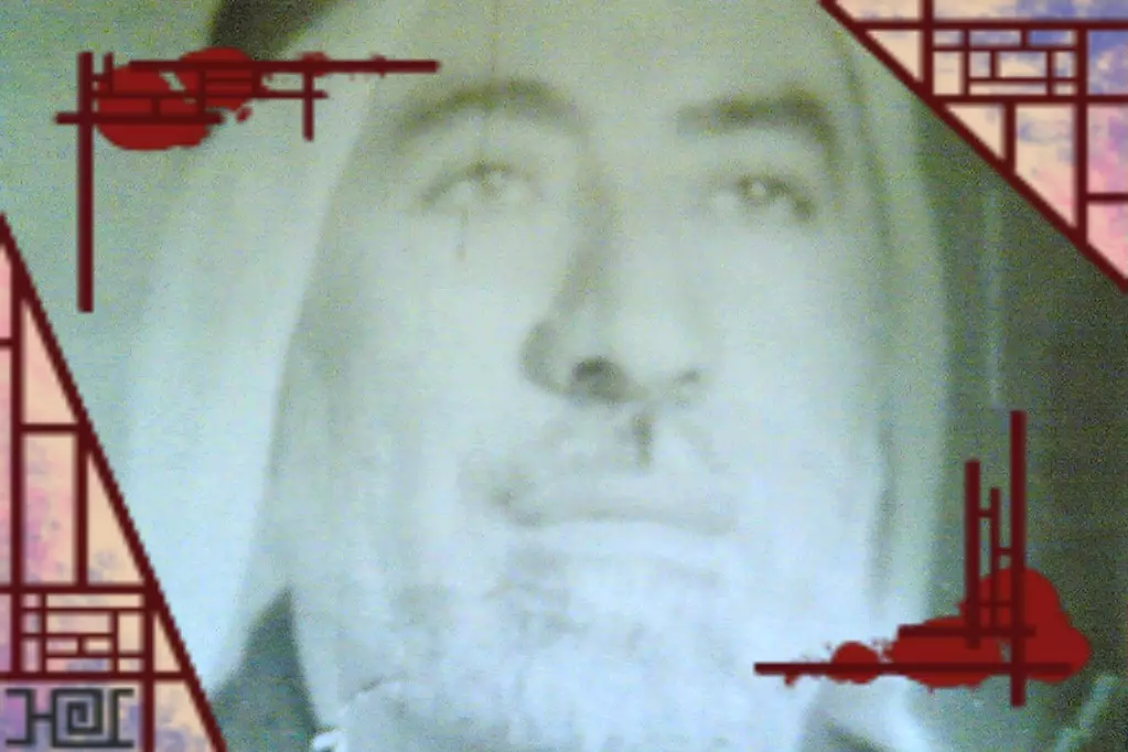
Posted by Uri Zackhem - Sheikh Abu Amran (?)
Posted by Uri Zackhem - Sheikh Abu Amran (?)
Posted by Uri Zackhem - Sheikh Abu Amran (?)
Posted by Uri Zackhem - Sheikh Abu Amran (?)
Posted by Uri Zackhem 1 - الشهيد عبد الرحمن أبو شاور أبو سلطان
Posted by أبو معين - احد بساتين بلدة ذكرين
Posted by خطاب - صورة ابار البردان وسط ذكرين
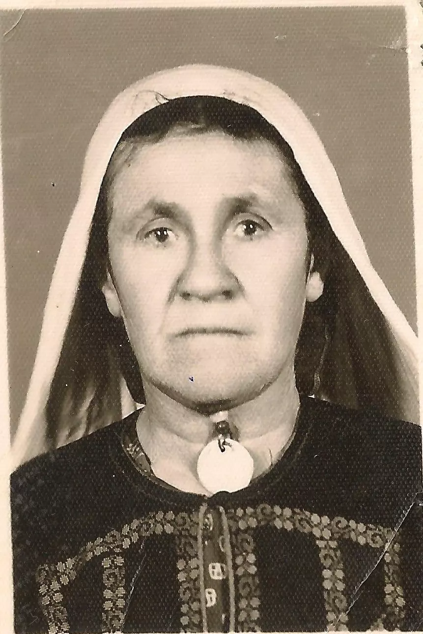
Posted by خطاب 1 - Mrs Aqel, wife of the late Mohammad Aqel
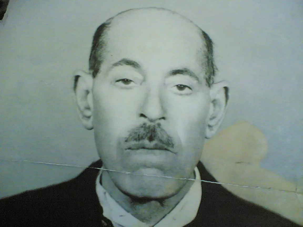
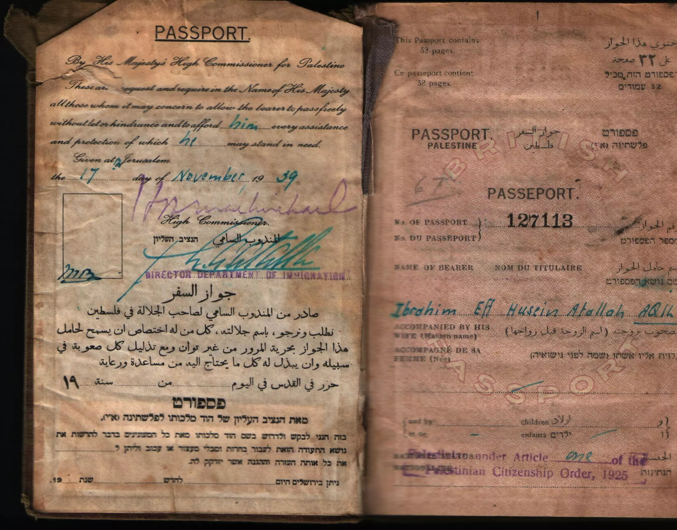
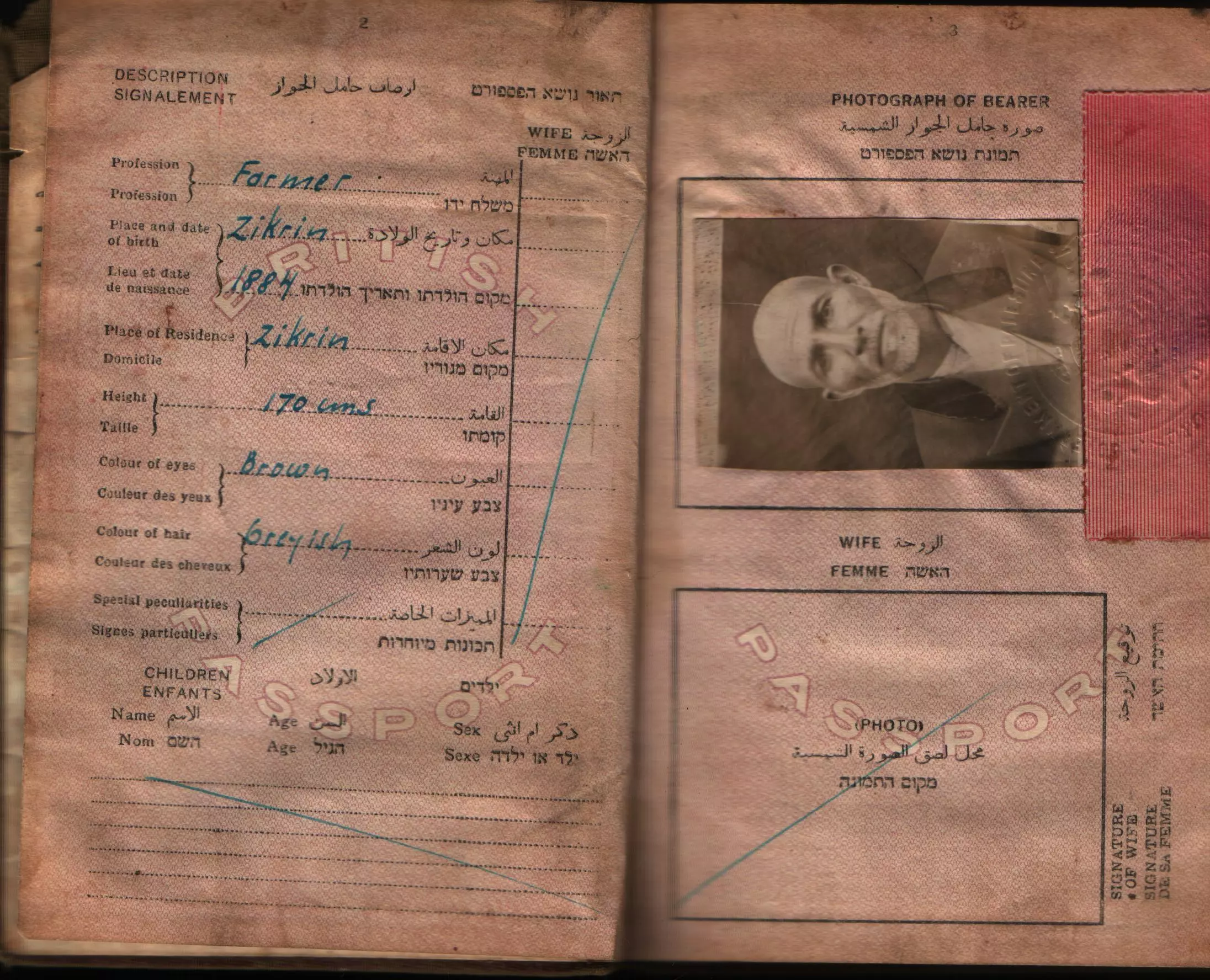
Posted by Dr Nayef M Aqel - The late Mohammad Abdel Rahman Aqel who was born in Thikrin circa 1900
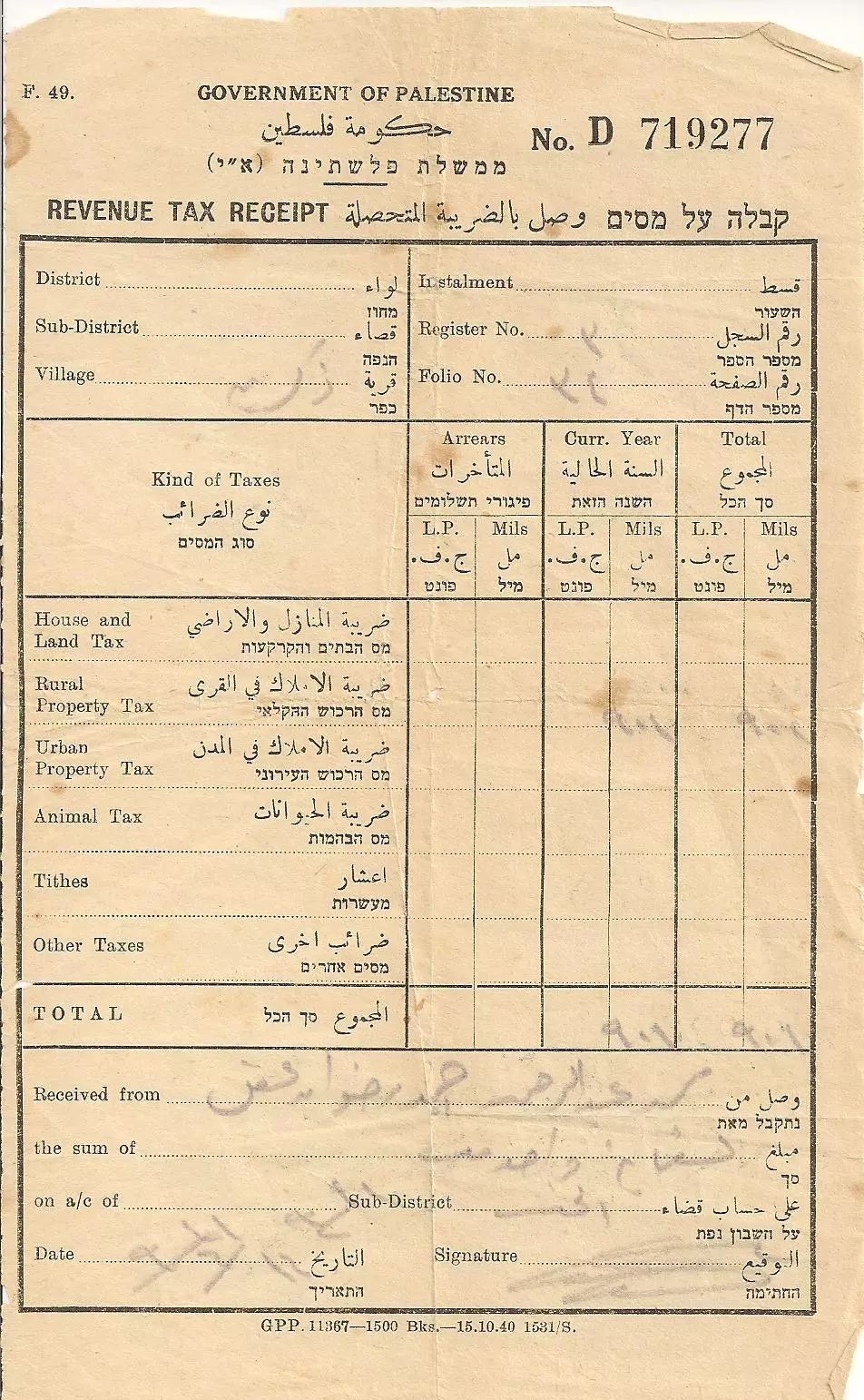
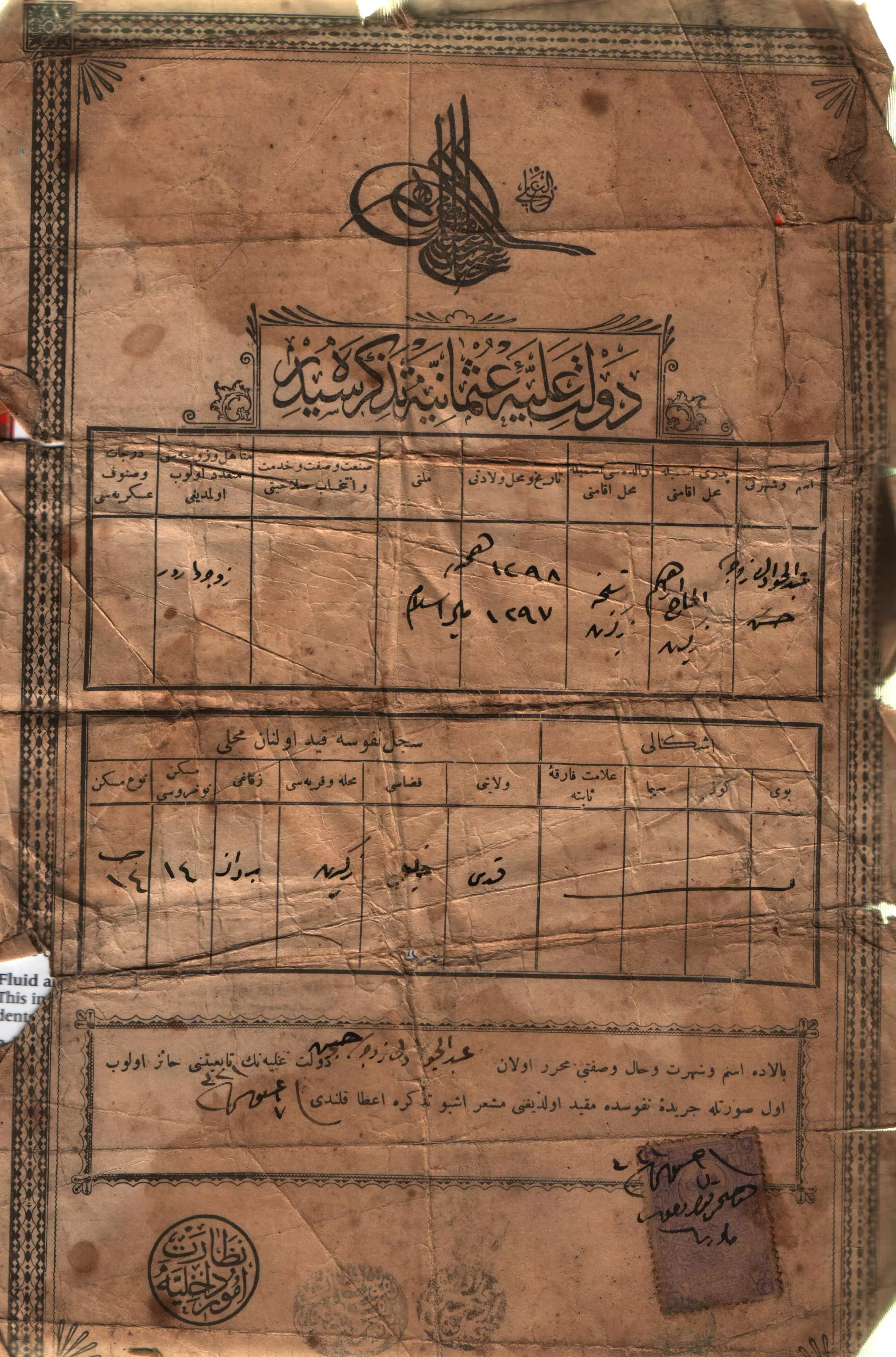
Posted by Dr Nayef M Aqel 1 - Old document belong to the late Mohammad Abdelrahman Aqel
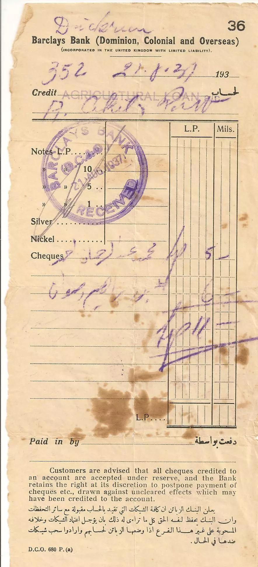
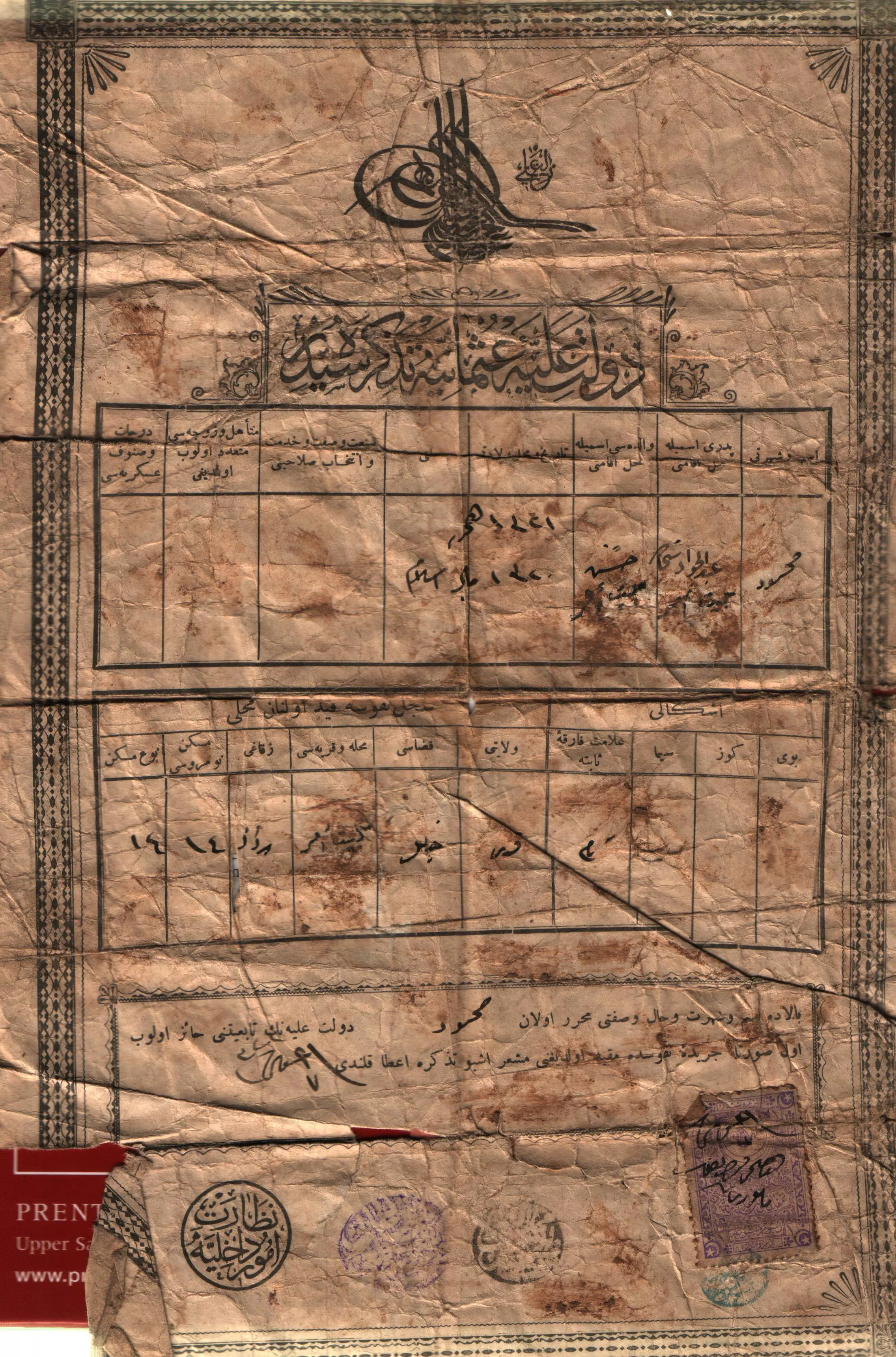
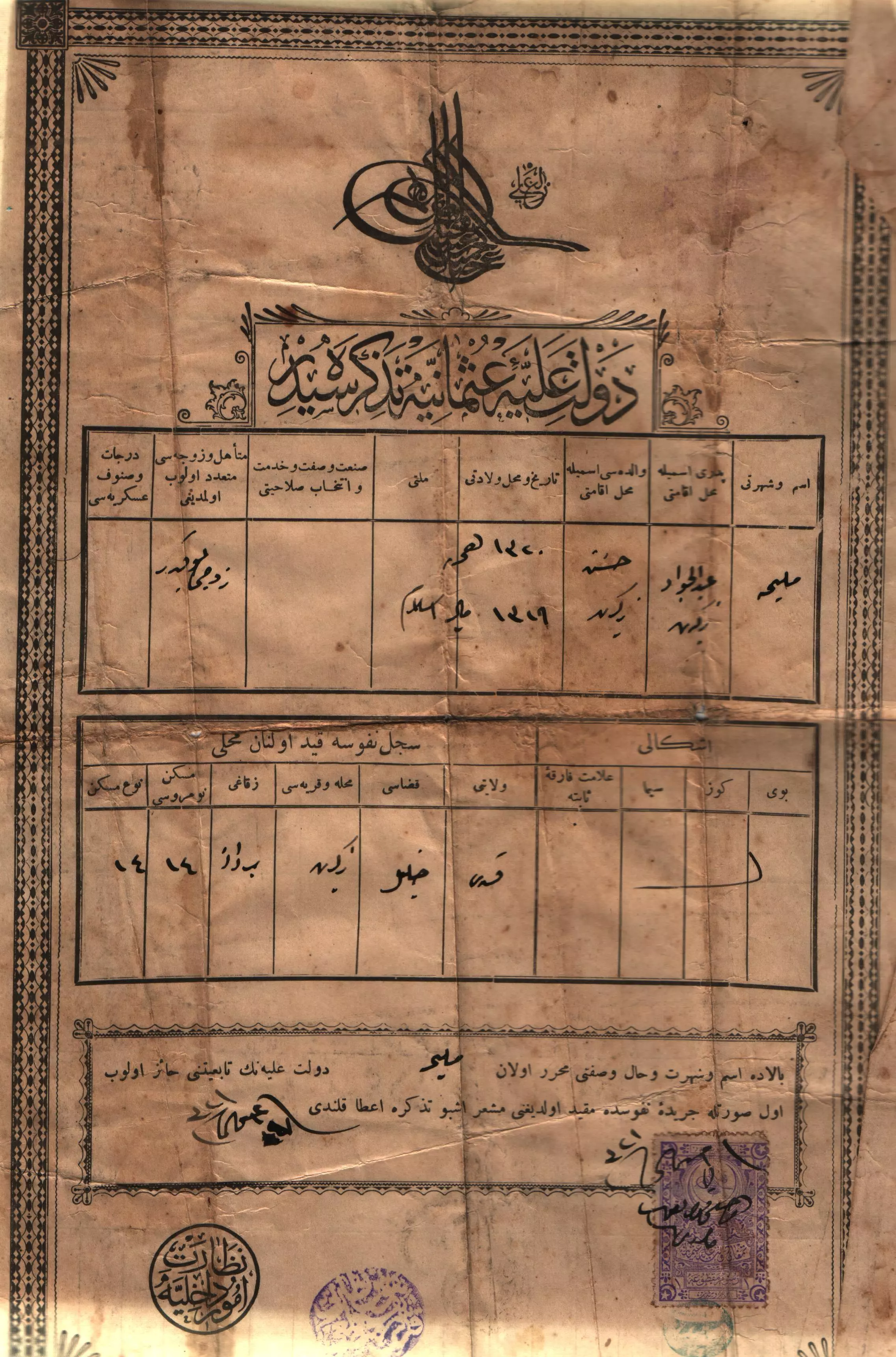
Posted by Dr Nayef M Aqel - A bank document from Thikrin, belong to the late Mohammad Abdel Rahman Aqel
Posted by Dr Nayef M Aqel - قريه ذكرين
Posted by abu raya - ذكرين
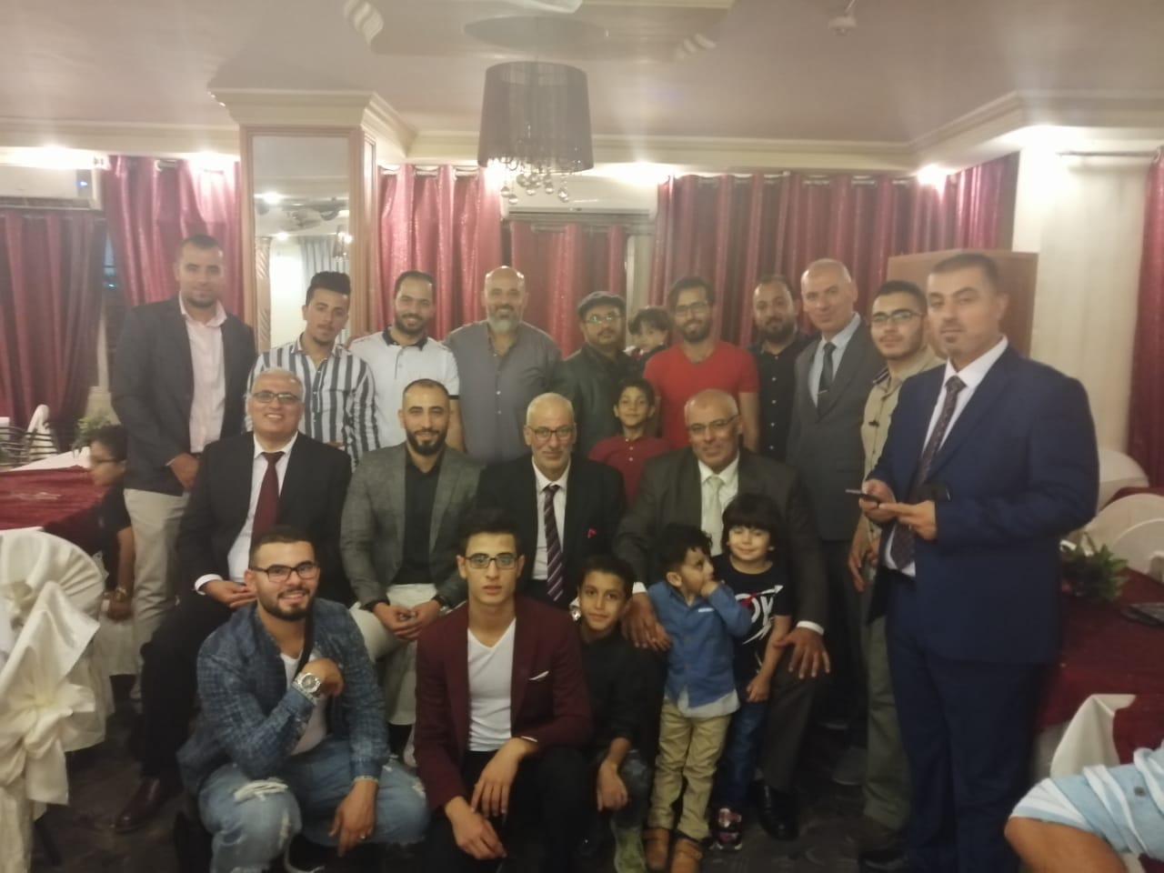
Posted by abu raya - أبناء الحاج جميل محمد المنشاوي
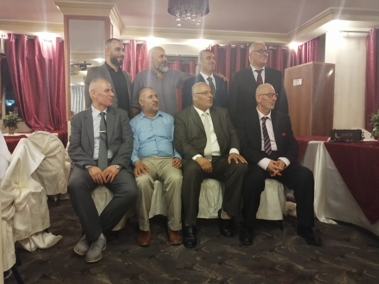
Posted by هشام جميل المنشاوي (ابو عمر) - شخصيات من عائلة المنشاوي بالاردن
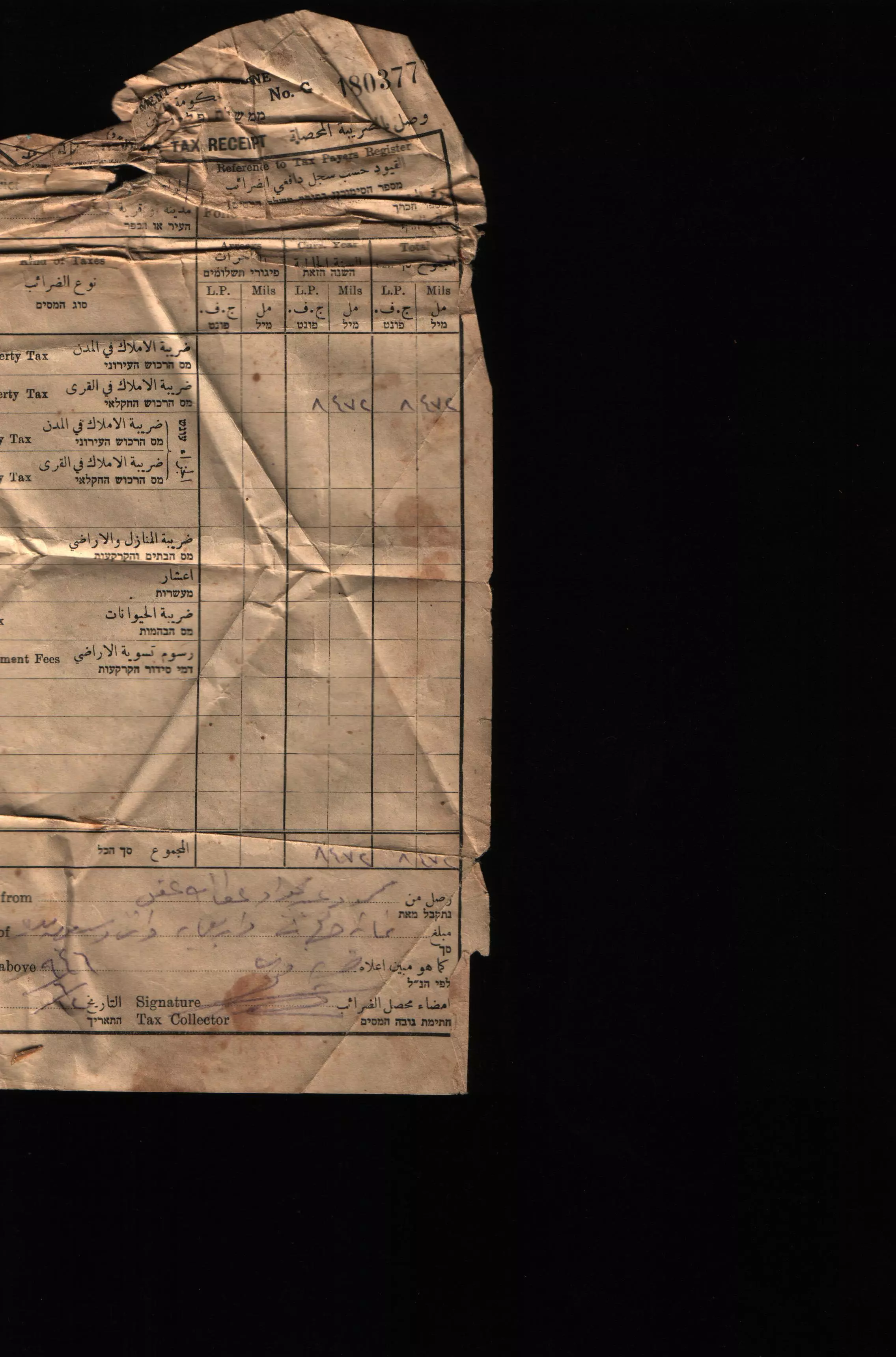
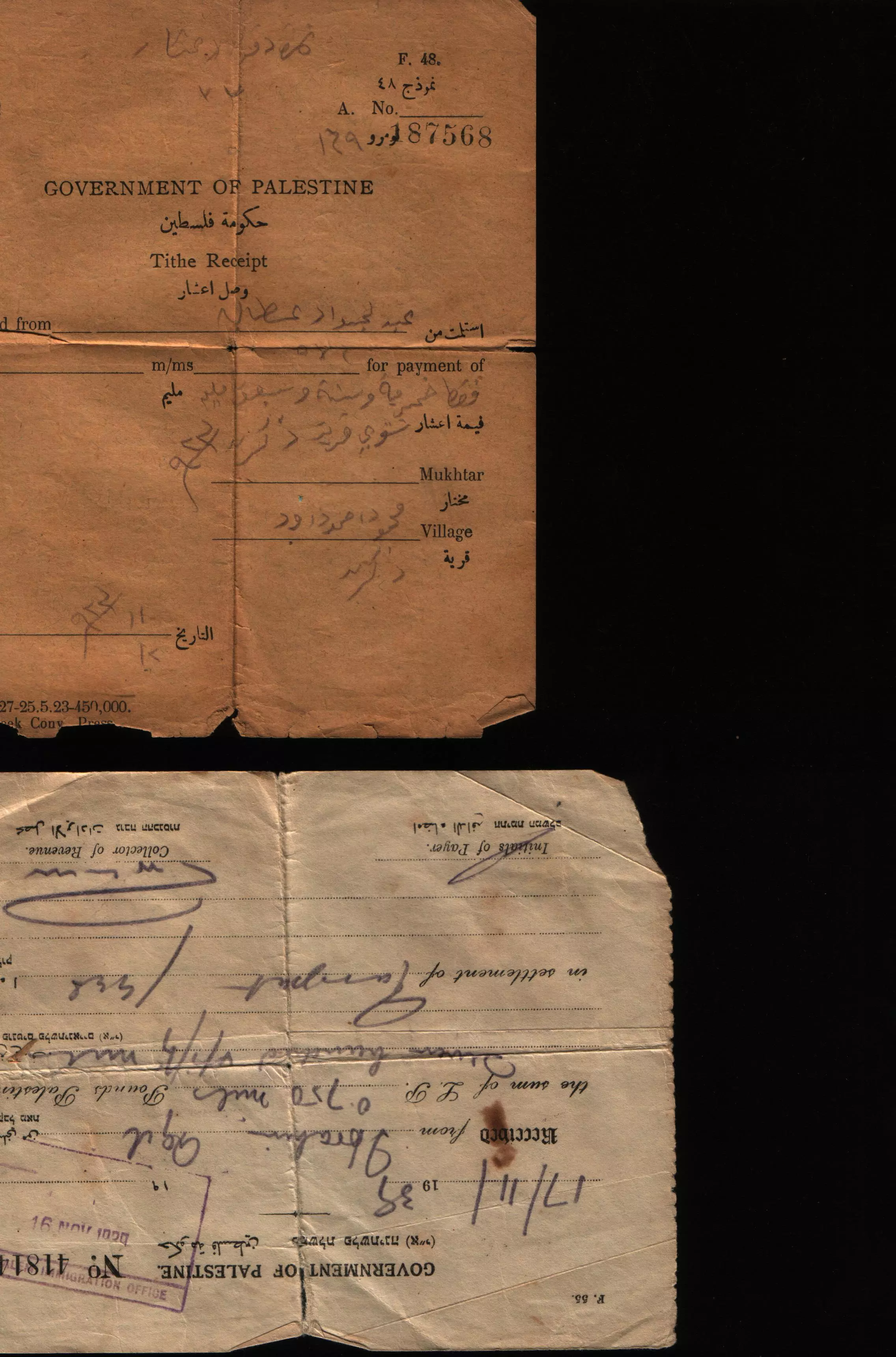
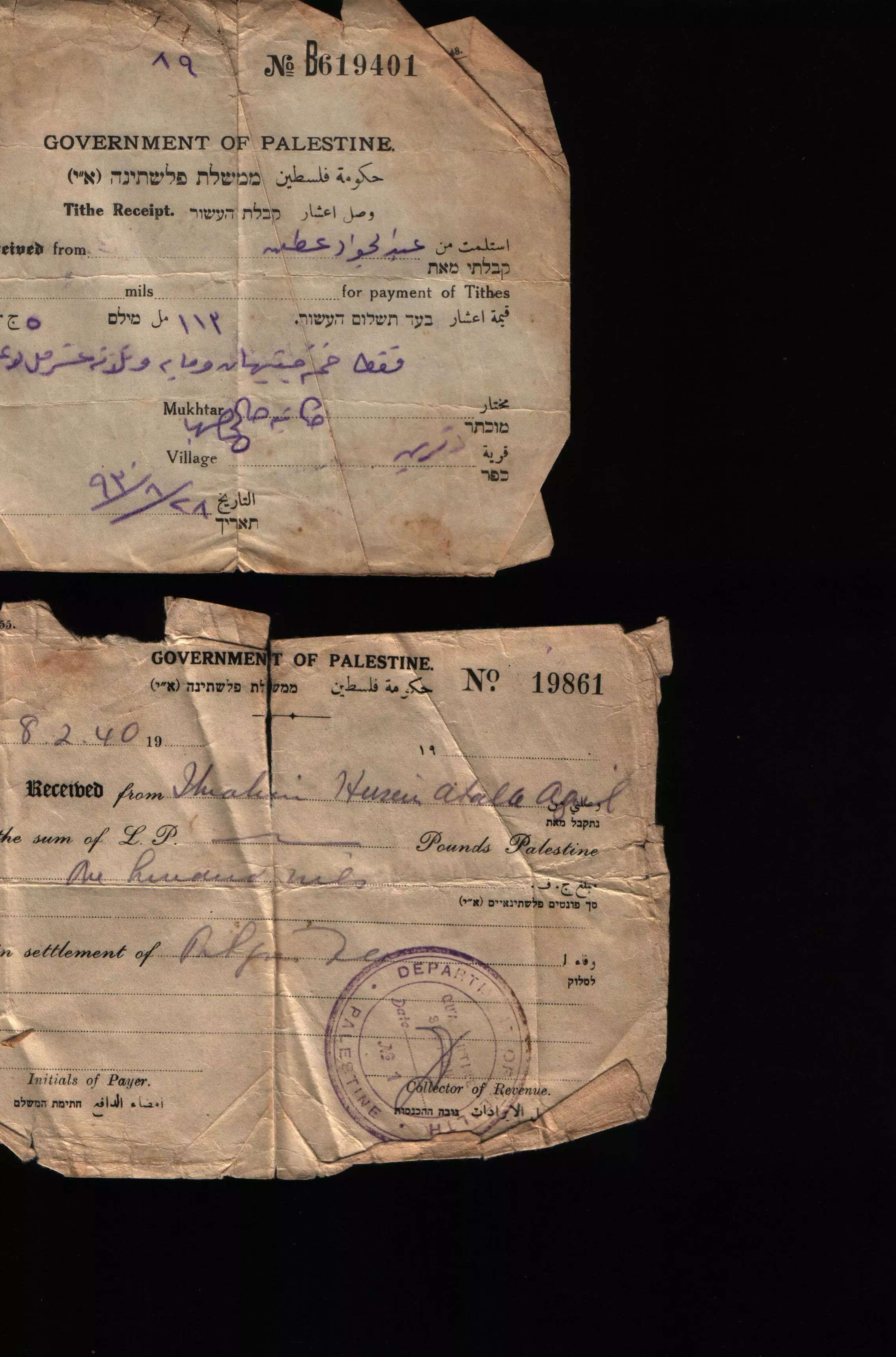
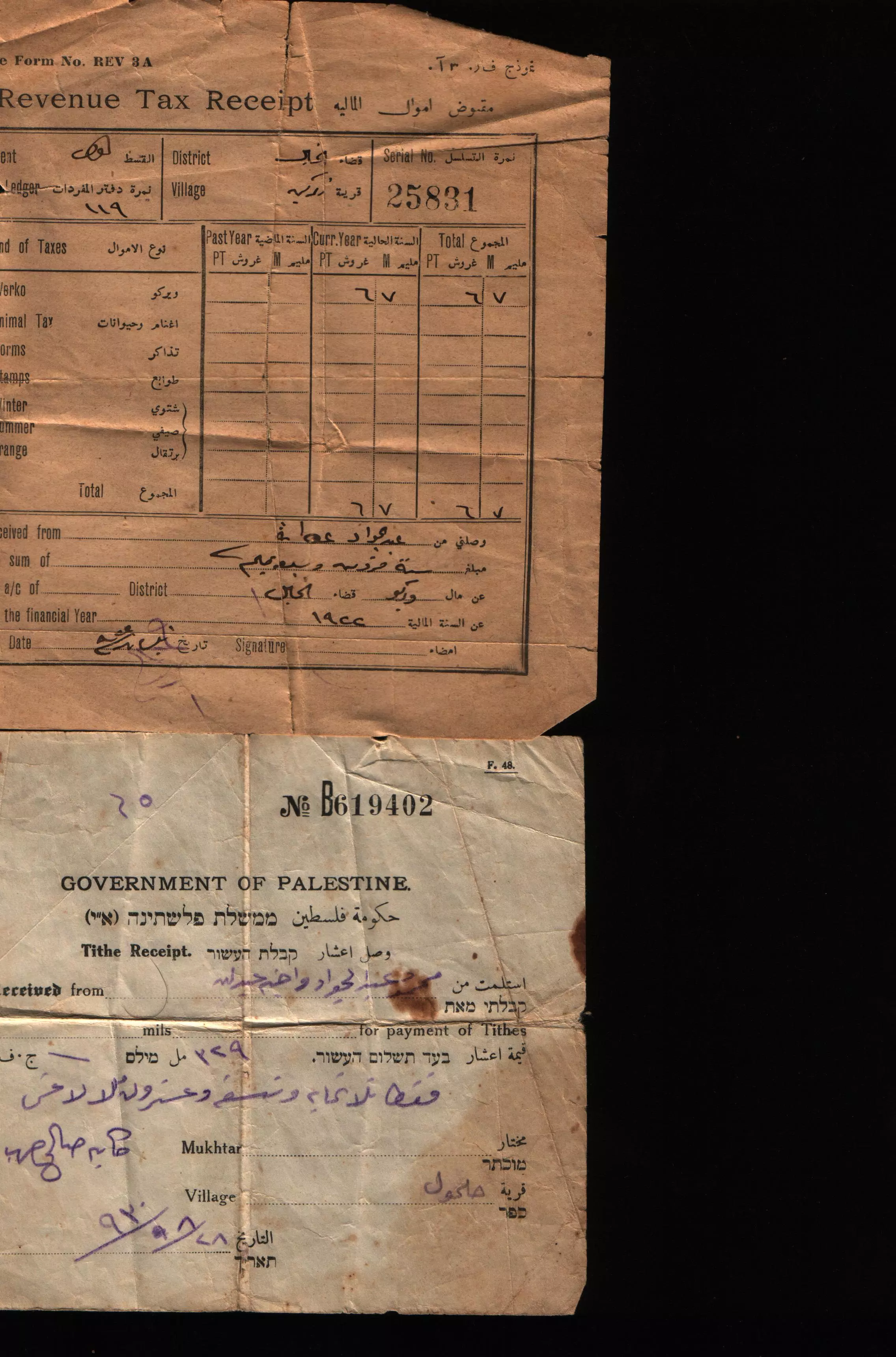
Posted by هشام جميل المنشاوي (ابو عمر) - مجموعة من الوثائق والكواشين وفرت لنا غضون مقابلة نعمان عقل لتدوين شهادته عن النكبة #6
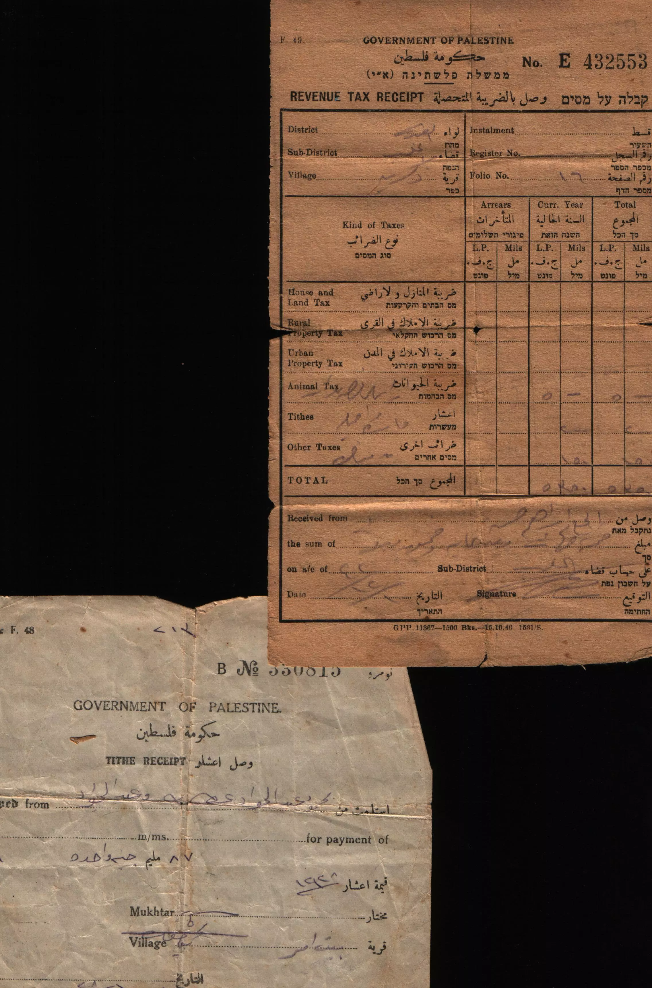
- مجموعة من الوثائق والكواشين وفرت لنا غضون مقابلة نعمان عقل لتدوين شهادته عن النكبة #7
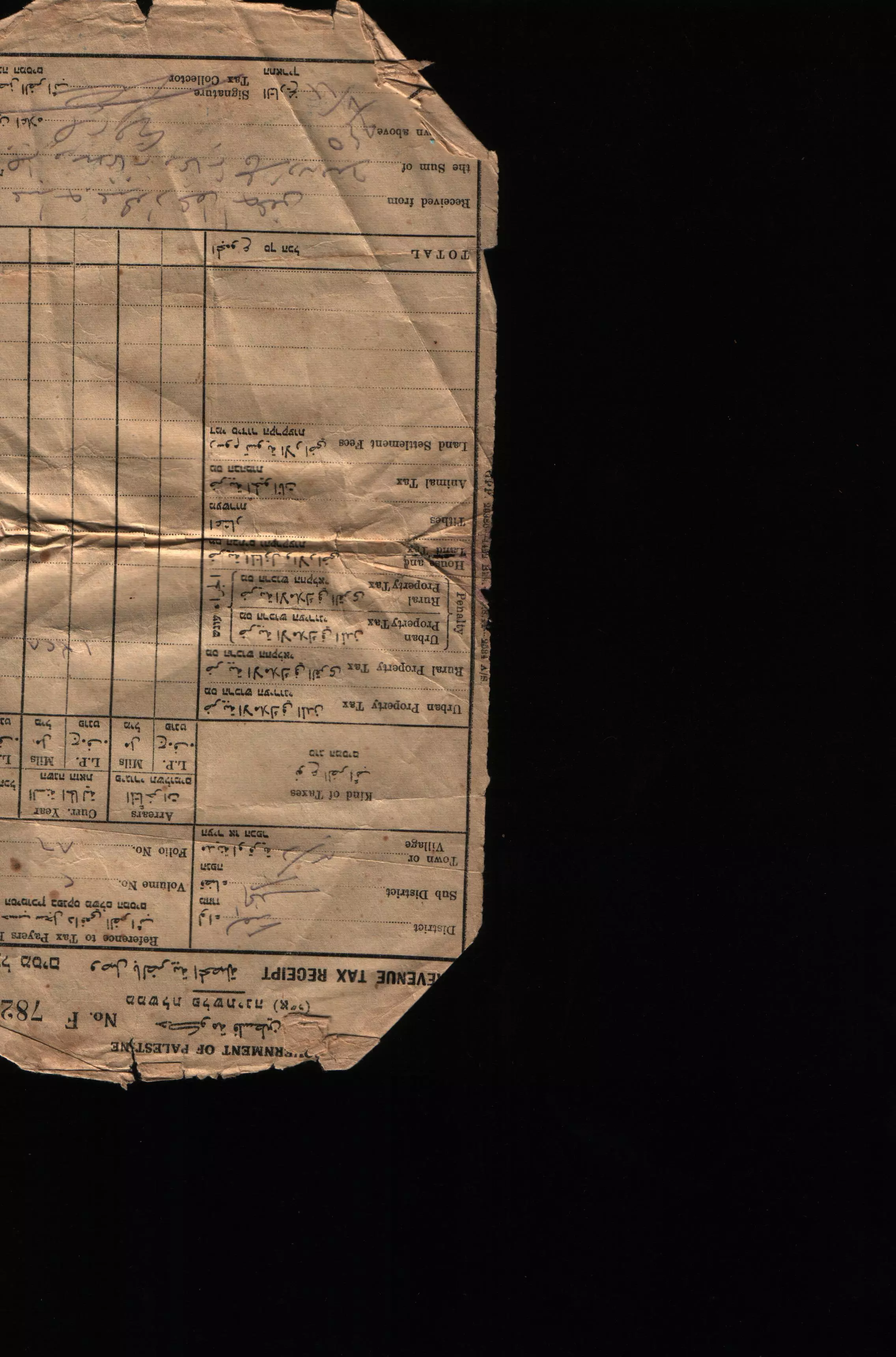
- مجموعة من الوثائق والكواشين وفرت لنا غضون مقابلة نعمان عقل لتدوين شهادته عن النكبة #8
- مجموعة من الوثائق والكواشين وفرت لنا غضون مقابلة نعمان عقل لتدوين شهادته عن النكبة #9
- مجموعة من الوثائق والكواشين وفرت لنا غضون مقابلة نعمان عقل لتدوين شهادته عن النكبة #10
- مجموعة من الوثائق والكواشين وفرت لنا غضون مقابلة نعمان عقل لتدوين شهادته عن النكبة #11
- مجموعة من الوثائق والكواشين وفرت لنا غضون مقابلة نعمان عقل لتدوين شهادته عن النكبة
- مجموعة من الوثائق والكواشين وفرت لنا غضون مقابلة نعمان عقل لتدوين شهادته عن النكبة #2
- مجموعة من الوثائق والكواشين وفرت لنا غضون مقابلة نعمان عقل لتدوين شهادته عن النكبة #3
- مجموعة من الوثائق والكواشين وفرت لنا غضون مقابلة نعمان عقل لتدوين شهادته عن النكبة #4
- مجموعة من الوثائق والكواشين وفرت لنا غضون مقابلة نعمان عقل لتدوين شهادته عن النكبة #5
- Pre-Nakba Aerial view of the village / صورة من الجو للقرية اخذت قبل النكبة
- مقام الشيخ عمران في ذكرين المهجرة (قضاء الخليل) --بروفيسور مصطفى كبها
- مقام الشيخ عمران في ذكرين المهجرة (قضاء الخليل) --بروفيسور مصطفى كبها #2
- Tomb of Sheikh Abu 'Imran, on a hill west of Thikrin
- Tomb of Sheikh Abu 'Imran, on a hill west of Thikrin #2
- Tomb of Sheikh Abu 'Imran, on a hill west of Thikrin #3
- That is how the "civilized" erased and replaced us: Thikrin was completely obliterated, as you see -- ذكرين باتت أثر بعد عين. من هنا مر الهمجّ
- That is how the "civilized" erased and replaced us: Thikrin was completely obliterated, as you see -- ذكرين باتت أثر بعد عين. من هنا مر الهمجّ
#2
- That is how the "civilized" erased and replaced us: Thikrin was completely obliterated, as you see -- ذكرين باتت أثر بعد عين. من هنا مر الهمجّ
#3
- That is how the "civilized" erased and replaced us: Thikrin was completely obliterated, as you see -- ذكرين باتت أثر بعد عين. من هنا مر الهمجّ
#4
- That is how the "civilized" erased and replaced us: Thikrin was completely obliterated, as you see -- ذكرين باتت أثر بعد عين. من هنا مر الهمجّ
#5
- That is how the "civilized" erased and replaced us: Thikrin was completely obliterated, as you see -- ذكرين باتت أثر بعد عين. من هنا مر الهمجّ
#6
- That is how the "civilized" erased and replaced us: Thikrin was completely obliterated, as you see -- ذكرين باتت أثر بعد عين. من هنا مر الهمجّ
#7
- That is how the "civilized" erased and replaced us: Thikrin was completely obliterated, as you see -- ذكرين باتت أثر بعد عين. من هنا مر الهمجّ
#8
- That is how the "civilized" erased and replaced us: Thikrin was completely obliterated, as you see -- ذكرين باتت أثر بعد عين. من هنا مر الهمجّ
#9
- That is how the "civilized" erased and replaced us: Thikrin was completely obliterated, as you see -- ذكرين باتت أثر بعد عين. من هنا مر الهمجّ
#10
- That is how the "civilized" erased and replaced us: Thikrin was completely obliterated, as you see -- ذكرين باتت أثر بعد عين. من هنا مر الهمجّ
#11
- That is how the "civilized" erased and replaced us: Thikrin was completely obliterated, as you see -- ذكرين باتت أثر بعد عين. من هنا مر الهمجّ
#12
- That is how the "civilized" erased and replaced us: Thikrin was completely obliterated, as you see -- ذكرين باتت أثر بعد عين. من هنا مر الهمجّ
#13
Want to browse more? 80,000 pictures were grouped in these gallaries:
- Old document belong to the late Mohammad Abdelrahman Aqel
Posted by Dr Nayef M Aqel - مجموعة من الوثائق والكواشين وفرت لنا غضون مقابلة نعمان عقل لتدوين شهادته عن النكبة #3
- مجموعة من الوثائق والكواشين وفرت لنا غضون مقابلة نعمان عقل لتدوين شهادته عن النكبة #4
- مجموعة من الوثائق والكواشين وفرت لنا غضون مقابلة نعمان عقل لتدوين شهادته عن النكبة #5
| Display Name | Clan/Hamolah | Country of Residence |
| عمر عبدالله أحمد المنشاوي | - | - |
| حازم جمال ابو جبة | - | الاردن, الاردن |
| khalil | abuthinin | Singapore, Singapore |
| ايمن سعد | - | ال ذكرين فلسطين, فلسطين |
| راني عبد العزيز ابوجبة | ابوجبة | عمان |
| اياد وصفي علي حرب | تيلخ | عمان, الاردن 0795571533 |
| احمد عبد السلام احمد قدوره | قدوره | ابو ظبي, الامارات |
| ولاء ابوجبه | ابوجبه | عمان , الأردن |
| منذر ابوشاور | ابوشاور | عمان, عمان |
| سامي عقل | عقل | أبو ظبي |
| mohammad.haif | حيف | amman, jordan |
| الخراز | الخراز / الدعاجنه | - |
| حسام الغربات | - | البقعه, الاردن |
| Mahmoud Ismail Heif | Heif | - |
| رامي ابوجبه | ابوجبه | الرياض, السعوديه |
| همــــام تيلــــخ | تيـــــــــــــلخ | الرياض, السعوديه |
| abu zakieh | - | amman, jordan |
| عمر سعد | سعد | فلسطين, فلسطين |
| شاهــــــــر زيــــــــــغان | - | Amman, Jordan |
| ابراهيم سعيد ابو جبة | ابو جبة | الرياض |
| أسامة أبوشاور | أبوشاور | عمان |
| ايادماجدالصوص | الصوص | عمان |
| أنس أبوجبة | أبو جبة | Amman, Jordan |
| احمد الذيبه | الذيبه | الامارات |
| حذيفة بني زيغان | - | البلقاء, البلقاء |
| loaiabushawar | ابوشاور | ontario, canada |
| sadam thaibeh | thaibeh | - |
| جمال ابوشاور | ابو شاور | عمان |
| mahmoud abushawar | ABUSHAWAR | on , canada |
| ابراهيم زيغان | زيغان | - |
| خلدون زيغان | زيغان | - |
| محمد حيف | حيف | عمان, الاردن |
| ابو اسماعيل | - | - |
| محمد سعد | سعد | فلسطين, فلسطين |
| اشرف حرب محمود الفضولي | الفضولي | العاصمه, الاردن |
| qadoura2004 | قدوره | عمان, الاردن |
| جمال الذيبه | الذيبه | - |
| علاء فيصل ابوحته | ابوحته | Amman, Jordan |
| سامي زيغان | زيغان | - |
| باسم | المنشاوي | البقعة |
| أبوشاور | abushawar | - |
| loay | tailakh | الخليل |
| Mohammad Tailakh | Tailakh | Aachen, Germany |
| Mohammd Hany Younes Tailakh | Thekreen | Nicosia, Cyprus |
| TAILAKH | HASSAN OTHMAN | SAUDIA ARABIA, SAUDIA ARABIA |
| Mohammad Wasfi Ali Saleh Harb | Tailakh | Jordan, Amman |
| Issa Tailakh | tailakh | jordan, jordan |
| wzighan | - | amman, jordan |
| MOHAMED thayabeh | - | montreal, canada |
| Younes Thibeh | Thibeh | Canada |
| Thaer Diabeh | Diabeh | - |
| fadi | - | n/a, n/a |
| khaled Abushawar | - | Toronto, Canada |
 Fake Valor: Why Did Zionist Jews Hoist Nazis Flag on Their Ships in the 1930s?
What is new?
-
Facts About Oct. 7th Gaza Raid
-
Remined Us Please:: Who Did Rape Who? Palestinians Raped Israelis? Or, was the other way around?
-
When Prof. Edward Said was invited to debate Bibi Netanyahu in the 1980s, watch what happened!
-
Ezra Klein of the NY Times on the "Jewish Race".
-
Abusing Blood Libel!
-
Did Israeli Soldiers Activate The Hanniba Direective On Oct. 7th? You Be The Judge
-
Zionist FAQ: Isn't it true that Palestinians don't want peace? Palestinians never accepted the two-state solution
- Facts about Haavara (Transfer) Agreement between Ben-Gurion & Hitler
-
Haavara FAQs: Why Did Zionist Jews Hoist Nazis' Flags on Their Ships in the 1930s?
- Haavara FAQs: When Chaim Weizmann met FDR in mid-1943, why was he silent about rescuing European Jewry?
-
Dear ChatGPT: How did Palestinians resist Napoleon's invasion of their country in 1799?
-
Dear ChatGPT: Gaza had a vibrant Jewish community in the mid-17th century. What happened to them?
-
Dear ChatGPT: Why did the Jewish Agency suppress news of the Holocaust during WWII?
-
Video Playlist: Jews share their DNA tests to end the conflict for good.
-
A Tale of Two Conflicts: Examining the Definition of Genocide
-
Prof. Abraham Polak And The Suppressed History of the Khazars and European Jewry
-
How Ronald Reagan would have framed the genocide in Gaza if he were still alive?
-
Haavara FAQs: Let us do the math: how many German Jews did The Haavara Agreement save?
-
Zionist FAQs: The Hebron Massacre of 1929, "clearly proves" that Palestinians are antisemitic, how could you deny it?
-
Zionist FAQs: Why Anti-Zionist Is Not Antisemitism?
-
Zionist FAQs: Isn't it true that the KGB created Palestinian Nationalism in the early 1960s?
- Zionist FAQs: Muslims are killing Muslims all the time; why are Israeli Jews being singled out in the media?
- Zionist FAQs: How is Israel an apartheid state when 20% of its citizens are Arabs who enjoy full rights?
-
Haavara FAQs: Why Did Dorothy Thompson Flip From A Zionist Advocate to A Silenced Dissenter?
-
Haavara FAQs: Analysis of Herzl's Uganda Scheme and how it could have saved millions of Jews.
-
Haavara FAQs: Why did Hayim Greenberg describe American Jewry as "morally bankrupt" in early 1943?
-
Haavara FAQs: What if the Evian Conference was a resounding success? What would have been the impact of saving European Jewry on Zionism?
- Haavara FAQs: What if the six million were saved, how that would have impacted the Zionist project?
-
Haavara FAQs: How did Zionist leaders react when Europe's Jews lingered in the DP camps after WWII ended?
-
Why does the American Jewish community repeat lies that David Ben-Gurion had debunked before he died?
-
Who has the power to rename the Tatar/Khazar Gene Marker to Jewish IV?
-
Zionist FAQs: Why won't Egypt, Syria, and Jordan take their people back? Jews are indigenous to Palestine, and Arabs immigrated after Jews developed the country. Arabs should leave.
-
Haavara FAQs: Did Hitler and the Nazis conflate between Judaism and Zionist? If that wasn't case, then why?
-
Haavara FAQs: Winston Churchill and antisemitism, a collection of articles written Churchill.
-
Haavara FAQs: Broken by country, how many Jews survived vs. killed during the Holocaust?
-
Haavara FAQs: Why did European Jews vote with their feet and to immigrated to the Americas, not Palestine, after WWII?
-
Watch this American Jewish Girl describing Israeli Jews' cognitive dissonance like no other in under two minutes
-
Haavara FAQs: When the Nazis went out of their way to hide the Holocaust, Israeli Jews did the exact opposite by broadcasting their genocide of Gazans. But why?
-
Haavara FAQs: How Zionist Jews went out of their to show their appreciation to Nazism and Fascism?
- Haavara FAQs: Why Zionist leaders were against bombing the death camps & the Railroads leading to them?
-
Haavara FAQs: Hitler's message to the British and American people: If Jews are such noble citizens and you care about them, how come you're not letting them in? I will gladly ship them to you at my expense, even on luxury liners!
-
A shortlist of Zionist and Israeli false flag operations in the name Jews.
-
The Most Moral Army
- The Land of Kapos (Israel): Where the brave are boycotted and Kapos walk free.
- Why did early Zionists often named their communal enterprises "colonial"?
- Zionist Relations with Nazi Germany by Faris Glubb
-
Two NY Times advertisements by Zionists in the early 1943 that exposes Zionists' treason at the height of the calamity
- Facts Not Lies about the Palestinian-Israeli Conflict.
- Site's pictures have been categorized
- Campgain Against Lice
- A Survey of Palestine, the official source about Palestine before Nakba produced by the British Mandate; over 1200 pages.
- Satellite View & Google Earth: Over 6,000 placemarks identifying all destroyed towns, W. Bank & Gaza Strip Towns, & refugee camps.
- PalestineRemembered.com and its Nakba Oral History Project were featured on al-Jazeera Satellite TV.
- Nakba Oral History Video Podcast:
 Over 700 Oral History interviews (including 3,500+ hours of recording) can be viewed online.
 - Palestine Village Statistics Project
- Gaza Jail Break
- النسخة العربية للموقع الان متوفرة
- Videos: Documenting the destroyed villages in video: Tracing all that remains since Nakba.
- Videos: Responding to Zionist Propaganda
- Interview: The ethnic cleansing of Palestine: George Galloway interviews Israeli Historian Ilan Pappe.
- For Palestinians, memory matters. It provides a blueprint for their future By George Bisharat.
- Zionist FAQ now available in Hebrew שאלות שציונים שואלים, עכשיו בעברית
- Video: The Stephen Walt and John Mearsheimer report on the influence of the Israel Lobby on U.S. Foreign Policy
- The Palestinian-Israeli conflict for beginners
