| PalestineRemembered | About Us | Oral History | العربية | |
| Pictures | Zionist FAQs | Haavara | Maps | |
| Search |
| Camps |
| Districts |
| Acre |
| Baysan |
| Beersheba |
| Bethlehem |
| Gaza |
| Haifa |
| Hebron |
| Jaffa |
| Jericho |
| Jerusalem |
| Jinin |
| Nablus |
| Nazareth |
| Ramallah |
| al-Ramla |
| Safad |
| Tiberias |
| Tulkarm |
| Donate |
| Contact |
| Profile |
| Videos |
Welcome To al-Muharraqa - المحرقة (אל-מוחרקה)
|
District of Gaza
Ethnically cleansed days ago |
العربية Google Earth |
 |
Gallery (22) |
- Statistics & Facts
-
Before & After

- Satellite View
- Articles 3
- Pictures 22
- Aerial Views 2
- Members 9
- All That Remains
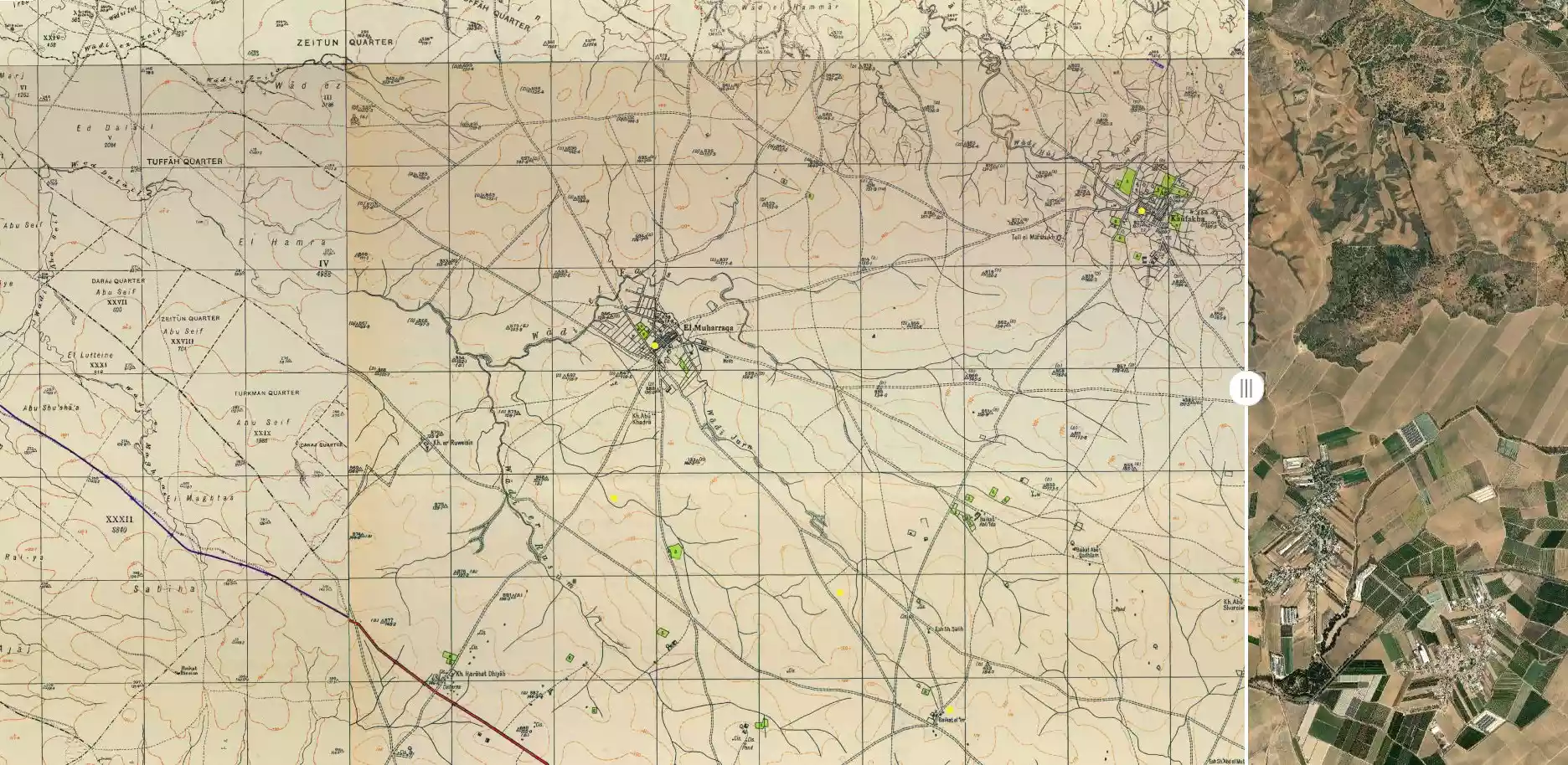
- Town's Map
- Wikipedia
- Videos 1
- Guest Book 4
- Links 1
| Statistic & Fact | Value | ||||||||||||||
| Occupation Date | May 27, 1948 | ||||||||||||||
| Distance From District | 14.5 (km) North East of Gaza | ||||||||||||||
| Elevation | 125 (meters) | ||||||||||||||
| Before & After Nakba, Click Map For Details |
|||||||||||||||
|
|||||||||||||||
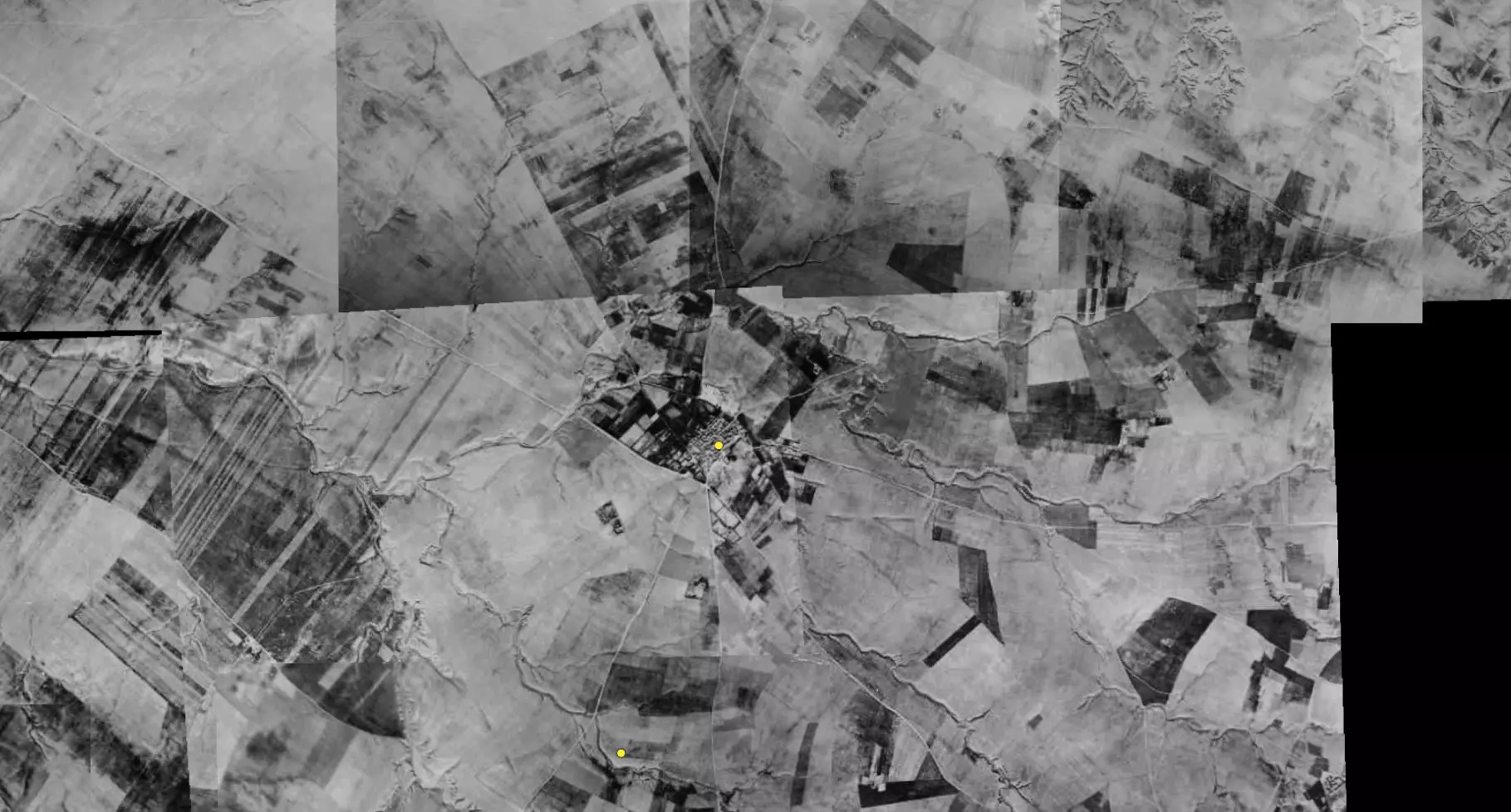
| Pre-Nakba Aerial View |
|||||||||||||||
|
|||||||||||||||
| Map Location | See location #45 on the map View from satellite |
||||||||||||||
| Military Operation | Operation Barak (lightening) | ||||||||||||||
| Attacking Units | Negev Brigade | ||||||||||||||
| Exodus Cause | Military assault by Zionist troops | ||||||||||||||
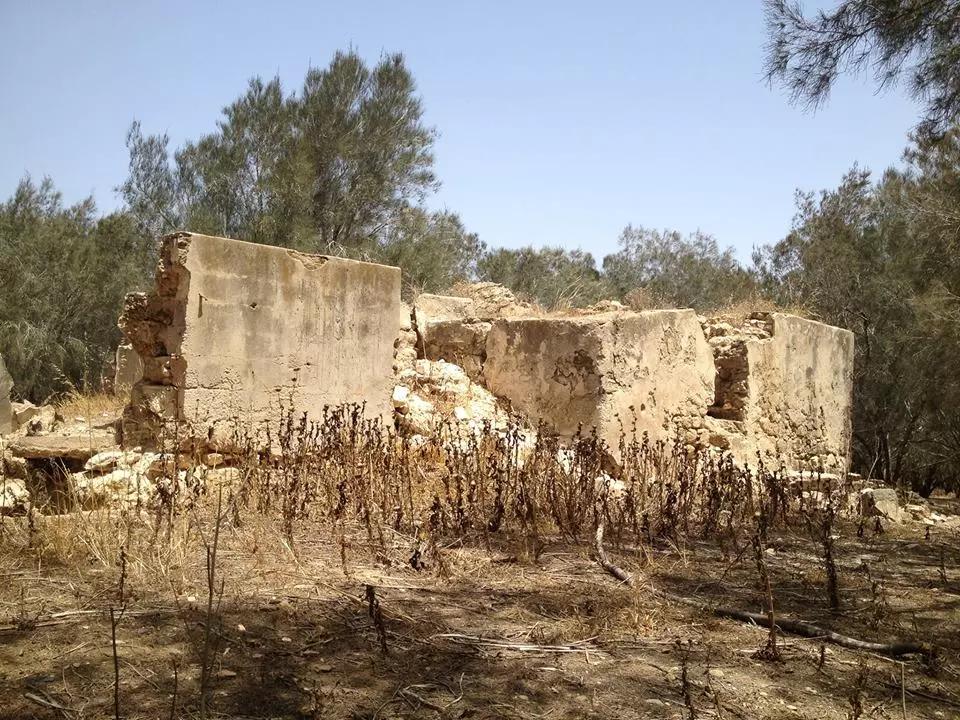
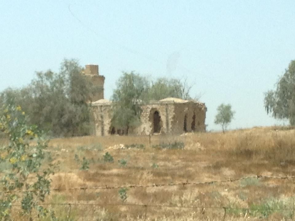
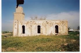
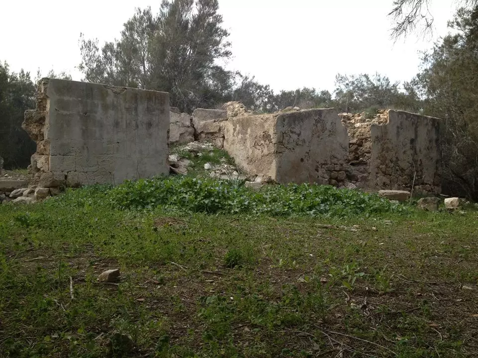
| Village Temains | The village has been mostly destroyed with the exception of its Diwan and its cemetery. | ||||||||||||||
| Ethnically Cleansing | al-Muharraqa inhabitants were completely ethnically cleansed. | ||||||||||||||
| Pre-Nakba Land Ownership |
**Town Lands' Demarcation Maps |
||||||||||||||
| Land Usage As of 1945 |
|
||||||||||||||
| Population |
|
||||||||||||||
| Number of Houses |
|
||||||||||||||
| Near By Towns |
|||||||||||||||
|
|||||||||||||||
| Schools | The val-Muharraqa had an elementary school for boys founded in 1945, and when it opened its doors it had an enrollment of 60 students. | ||||||||||||||
| Places of Warship | One mosque | ||||||||||||||
| Archeological Sites | The village contained mosaic floors, cisterns, and marble and pottery fragments. | ||||||||||||||
| Exculsive Jewish Colonies Who Usurped Village Lands |
Yakhini and Tequma | ||||||||||||||
| Featured Video | |||||||||||||||
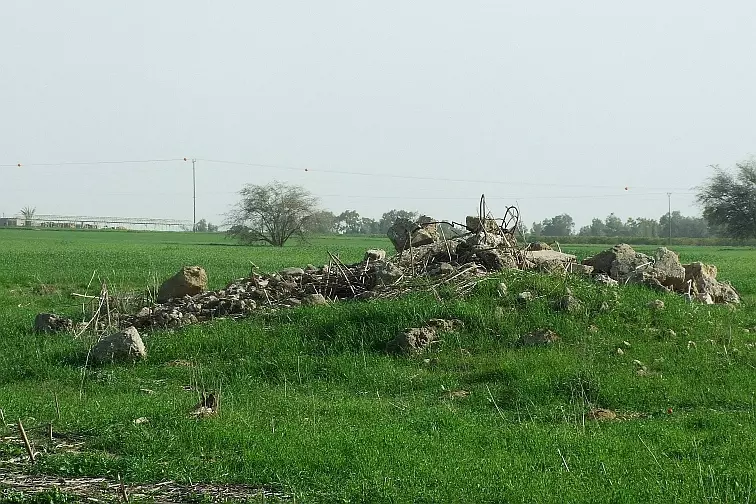
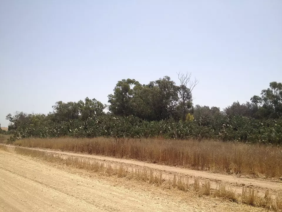
Village TodayAccording to the Palestinian historian Walid Khalidi, the village remaining structures on the village land are:"The site is marked by piles of rubble from buildings, including the village diwan (a meeting and guest house). There are also the remnants of a mill and a well. The cemetery, overgrown with wild vegetation, still exists" |
|||||||||||||||
| Related Maps | Town Lands' Demarcation Maps خرائط للقضاء توضح حدود القرى والاودية Town's map on MapQuest View from satellite Help us map this town at WikiMapia |
||||||||||||||
| Related Links | Wikipedia's Page Facebook Page Google Search Google For Images Google For Videos |
||||||||||||||
| More Information | مخطط البلد في كتاب كي لا ننسى في كتاب بلادنا فلسطين المزيد من موقع هوية |
||||||||||||||
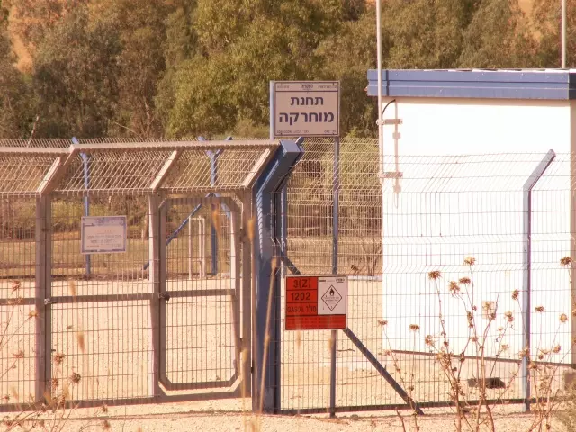
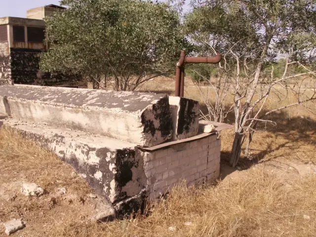
- A MEKOROT - the Israeli water company pumping station called MUHARRAQA
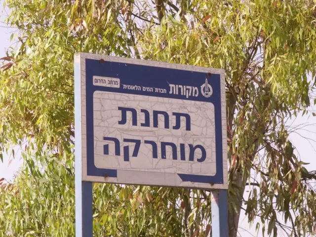
Posted by Uri Zackhem - صوره حديثه سنه 2013...لبئر ماء المحّرقه التى كانت تشرب منه القريه
Posted by محمد ابو عويلى 3 - The Muharraqa pumping station.
Posted by Uri Zackhem - Near the Muharraqa pumping station
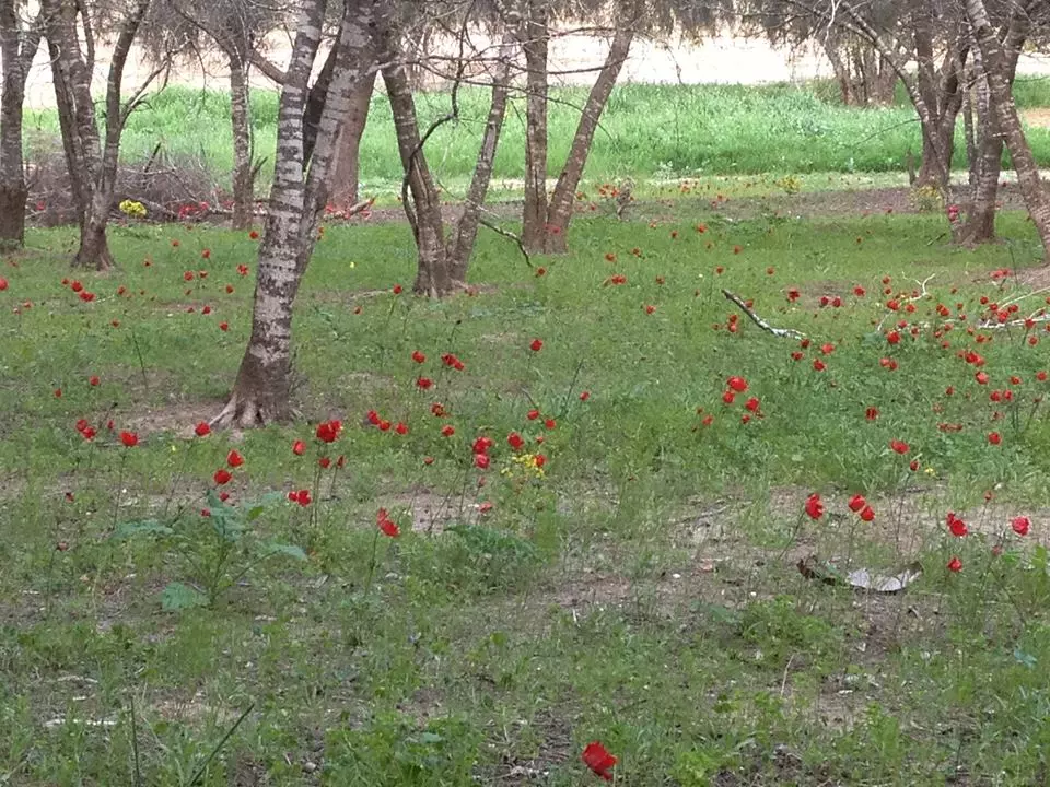
Posted by Uri Zackhem 3 - Rubble, north part of the village
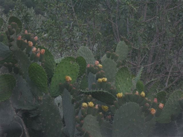
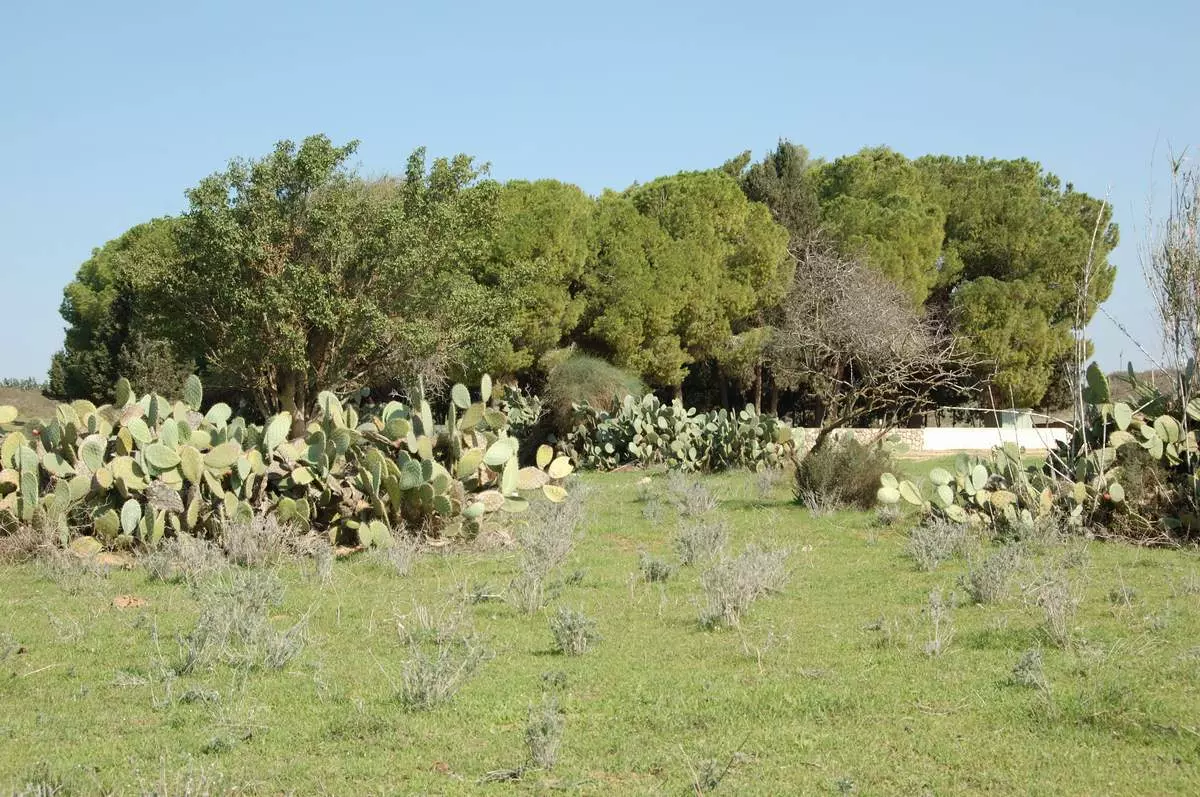
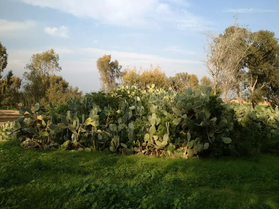
Posted by Uri Zackhem 7 - اشجار الصبر القديمه غرب القريه
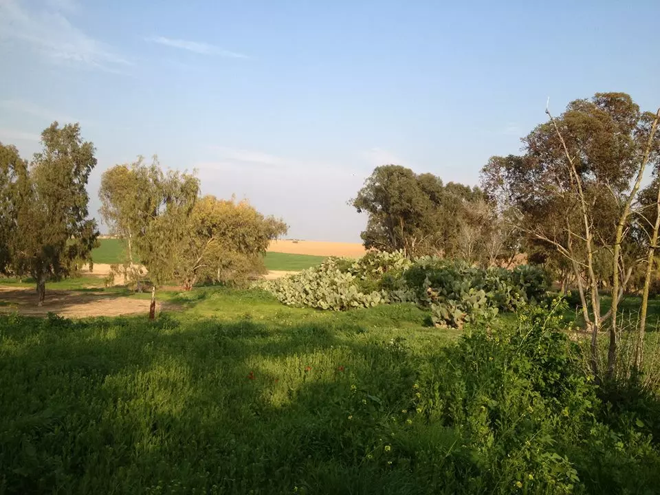
Posted by محمد ابو عويلى - بقايا من قريه المحرّقه...الجانب الجنوبى من القريه...
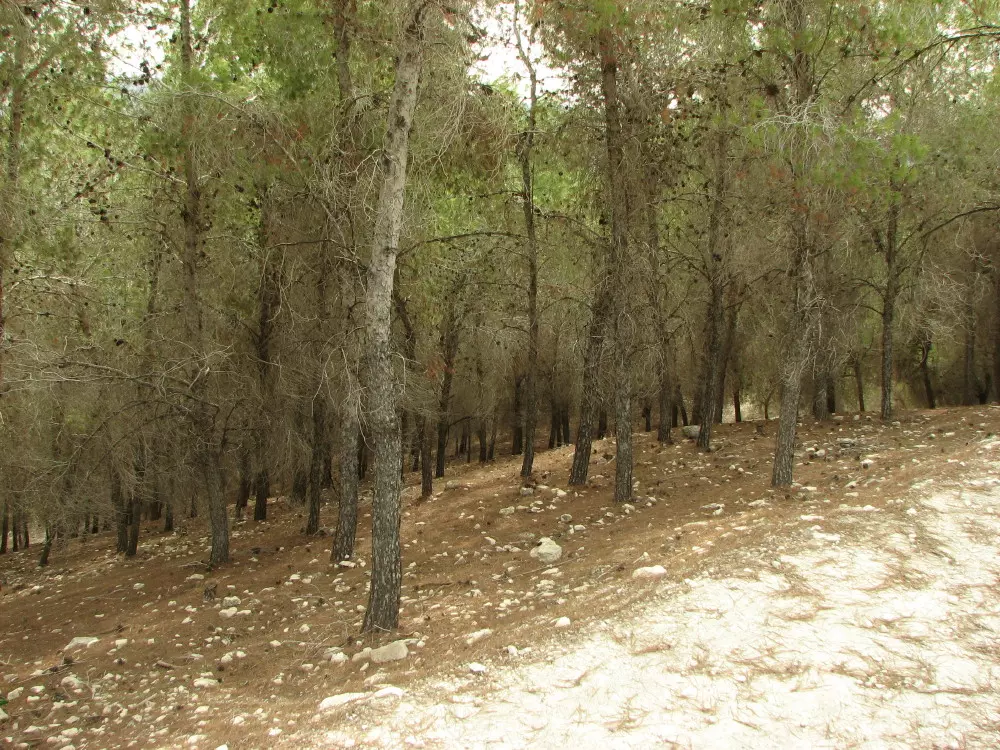
Posted by محمد ابو عويلى - من داخل قريه المحرّقه...قاموا بزراعه الاشجار لتغطيه معالم القريه....
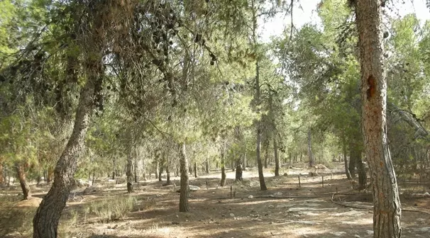
Posted by محمد ابو عويلى - من داخل قريه المحرّقه...قاموا بزراعه الاشجار لتغطيه معالم القريه....
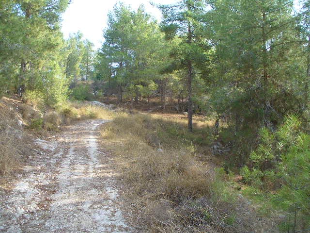
Posted by محمد ابو عويلى - من داخل قريه المحرّقه...قاموا بزراعه الاشجار لتغطيه معالم القريه....
Posted by محمد ابو عويلى - صوره حديثه سنه 2013...لمسجد الكوفخه الذى لا يزال صامد حتى الان...
Posted by محمد ابو عويلى 1 - المحرقه من جهه الغرب.....لاحظ ما تبقى من اشجار الصبارفى الصوره
Posted by محمد ابو عويلى 1 - مسجد القرية
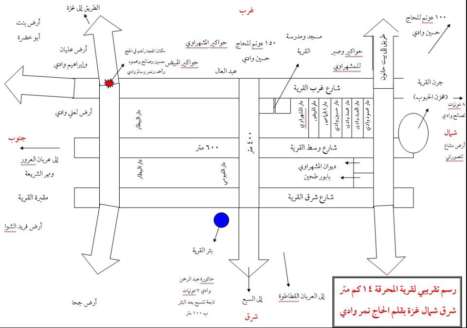
Posted by anwar wadi - صورة رسم تقريبي لقرية المحرقة
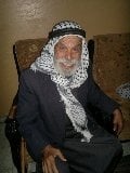
Posted by Saadi 1 - صور من اعيان قرية المحرقة الحاج عليان حسين وادي والحاج سعدي عليان حسين وادي

Posted by Saadi - صور من اعيان قرية المحرقة الحاج عليان حسين وادي والحاج سعدي عليان حسين وادي
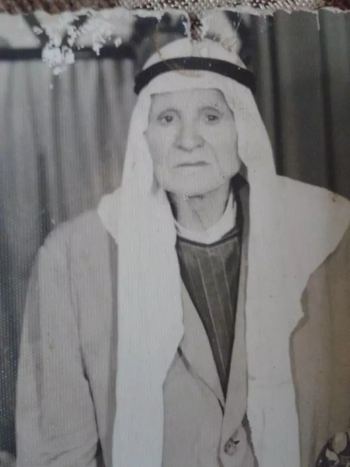
Posted by Saadi - صور من اعيان قرية المحرقة الحاج عليان حسين وادي والحاج سعدي عليان حسين وادي
Posted by Saadi - صور حديثه لقريه المحرّقه المهجره
Posted by محمد ابو عويلى - صور حديثه لقريه المحرّقه المهجره
Posted by محمد ابو عويلى - صور حديثه لقريه المحرّقه المهجره
Posted by محمد ابو عويلى - صور حديثه لقريه المحرّقه المهجره
Posted by محمد ابو عويلى - Pre-Nakba Aerial view of the village / صورة من الجو للقرية اخذت قبل النكبة

Want to browse more? 80,000 pictures were grouped in these gallaries:
| Display Name | Clan/Hamolah | Country of Residence |
| H.Joha | Joha | Bonn, Germany |
| عبدالحميد | الفيومي | - |
| yousef mash | المشهراوي | palestine , palestine |
| هاني منير سعدي المشهراوي | - | غـزة_المحرقـة |
| أحمد عبدالعال | عبدالعال | فلسطين |
| أحمد المشهراوي | - | - |
| سامح القطاع | - | gaza, palestine |
| محمد ابو عويلى | Al traben | Gaza city, Palestine |
| Hazem El-mashharawi | El-mashharawi | Gaza, Palestine |
- Tracing All That Remains of al-Muharraqa Since Nakba Duration: 2 min 44 sec
 Fake Valor: Why Did Zionist Jews Hoist Nazis Flag on Their Ships in the 1930s?
What is new?
-
Facts About Oct. 7th Gaza Raid
-
Remined Us Please:: Who Did Rape Who? Palestinians Raped Israelis? Or, was the other way around?
-
When Prof. Edward Said was invited to debate Bibi Netanyahu in the 1980s, watch what happened!
-
Ezra Klein of the NY Times on the "Jewish Race".
-
Abusing Blood Libel!
-
Did Israeli Soldiers Activate The Hanniba Direective On Oct. 7th? You Be The Judge
-
Zionist FAQ: Isn't it true that Palestinians don't want peace? Palestinians never accepted the two-state solution
- Facts about Haavara (Transfer) Agreement between Ben-Gurion & Hitler
-
Haavara FAQs: Why Did Zionist Jews Hoist Nazis' Flags on Their Ships in the 1930s?
- Haavara FAQs: When Chaim Weizmann met FDR in mid-1943, why was he silent about rescuing European Jewry?
-
Dear ChatGPT: How did Palestinians resist Napoleon's invasion of their country in 1799?
-
Dear ChatGPT: Gaza had a vibrant Jewish community in the mid-17th century. What happened to them?
-
Dear ChatGPT: Why did the Jewish Agency suppress news of the Holocaust during WWII?
-
Video Playlist: Jews share their DNA tests to end the conflict for good.
-
A Tale of Two Conflicts: Examining the Definition of Genocide
-
Prof. Abraham Polak And The Suppressed History of the Khazars and European Jewry
-
How Ronald Reagan would have framed the genocide in Gaza if he were still alive?
-
Haavara FAQs: Let us do the math: how many German Jews did The Haavara Agreement save?
-
Zionist FAQs: The Hebron Massacre of 1929, "clearly proves" that Palestinians are antisemitic, how could you deny it?
-
Zionist FAQs: Why Anti-Zionist Is Not Antisemitism?
-
Zionist FAQs: Isn't it true that the KGB created Palestinian Nationalism in the early 1960s?
- Zionist FAQs: Muslims are killing Muslims all the time; why are Israeli Jews being singled out in the media?
- Zionist FAQs: How is Israel an apartheid state when 20% of its citizens are Arabs who enjoy full rights?
-
Haavara FAQs: Why Did Dorothy Thompson Flip From A Zionist Advocate to A Silenced Dissenter?
-
Haavara FAQs: Analysis of Herzl's Uganda Scheme and how it could have saved millions of Jews.
-
Haavara FAQs: Why did Hayim Greenberg describe American Jewry as "morally bankrupt" in early 1943?
-
Haavara FAQs: What if the Evian Conference was a resounding success? What would have been the impact of saving European Jewry on Zionism?
- Haavara FAQs: What if the six million were saved, how that would have impacted the Zionist project?
-
Haavara FAQs: How did Zionist leaders react when Europe's Jews lingered in the DP camps after WWII ended?
-
Why does the American Jewish community repeat lies that David Ben-Gurion had debunked before he died?
-
Who has the power to rename the Tatar/Khazar Gene Marker to Jewish IV?
-
Zionist FAQs: Why won't Egypt, Syria, and Jordan take their people back? Jews are indigenous to Palestine, and Arabs immigrated after Jews developed the country. Arabs should leave.
-
Haavara FAQs: Did Hitler and the Nazis conflate between Judaism and Zionist? If that wasn't case, then why?
-
Haavara FAQs: Winston Churchill and antisemitism, a collection of articles written Churchill.
-
Haavara FAQs: Broken by country, how many Jews survived vs. killed during the Holocaust?
-
Haavara FAQs: Why did European Jews vote with their feet and to immigrated to the Americas, not Palestine, after WWII?
-
Watch this American Jewish Girl describing Israeli Jews' cognitive dissonance like no other in under two minutes
-
Haavara FAQs: When the Nazis went out of their way to hide the Holocaust, Israeli Jews did the exact opposite by broadcasting their genocide of Gazans. But why?
-
Haavara FAQs: How Zionist Jews went out of their to show their appreciation to Nazism and Fascism?
- Haavara FAQs: Why Zionist leaders were against bombing the death camps & the Railroads leading to them?
-
Haavara FAQs: Hitler's message to the British and American people: If Jews are such noble citizens and you care about them, how come you're not letting them in? I will gladly ship them to you at my expense, even on luxury liners!
-
A shortlist of Zionist and Israeli false flag operations in the name Jews.
-
The Most Moral Army
- The Land of Kapos (Israel): Where the brave are boycotted and Kapos walk free.
- Why did early Zionists often named their communal enterprises "colonial"?
- Zionist Relations with Nazi Germany by Faris Glubb
-
Two NY Times advertisements by Zionists in the early 1943 that exposes Zionists' treason at the height of the calamity
- Facts Not Lies about the Palestinian-Israeli Conflict.
- Site's pictures have been categorized
- Campgain Against Lice
- A Survey of Palestine, the official source about Palestine before Nakba produced by the British Mandate; over 1200 pages.
- Satellite View & Google Earth: Over 6,000 placemarks identifying all destroyed towns, W. Bank & Gaza Strip Towns, & refugee camps.
- PalestineRemembered.com and its Nakba Oral History Project were featured on al-Jazeera Satellite TV.
- Nakba Oral History Video Podcast:
 Over 700 Oral History interviews (including 3,500+ hours of recording) can be viewed online.
 - Palestine Village Statistics Project
- Gaza Jail Break
- النسخة العربية للموقع الان متوفرة
- Videos: Documenting the destroyed villages in video: Tracing all that remains since Nakba.
- Videos: Responding to Zionist Propaganda
- Interview: The ethnic cleansing of Palestine: George Galloway interviews Israeli Historian Ilan Pappe.
- For Palestinians, memory matters. It provides a blueprint for their future By George Bisharat.
- Zionist FAQ now available in Hebrew שאלות שציונים שואלים, עכשיו בעברית
- Video: The Stephen Walt and John Mearsheimer report on the influence of the Israel Lobby on U.S. Foreign Policy
- The Palestinian-Israeli conflict for beginners
