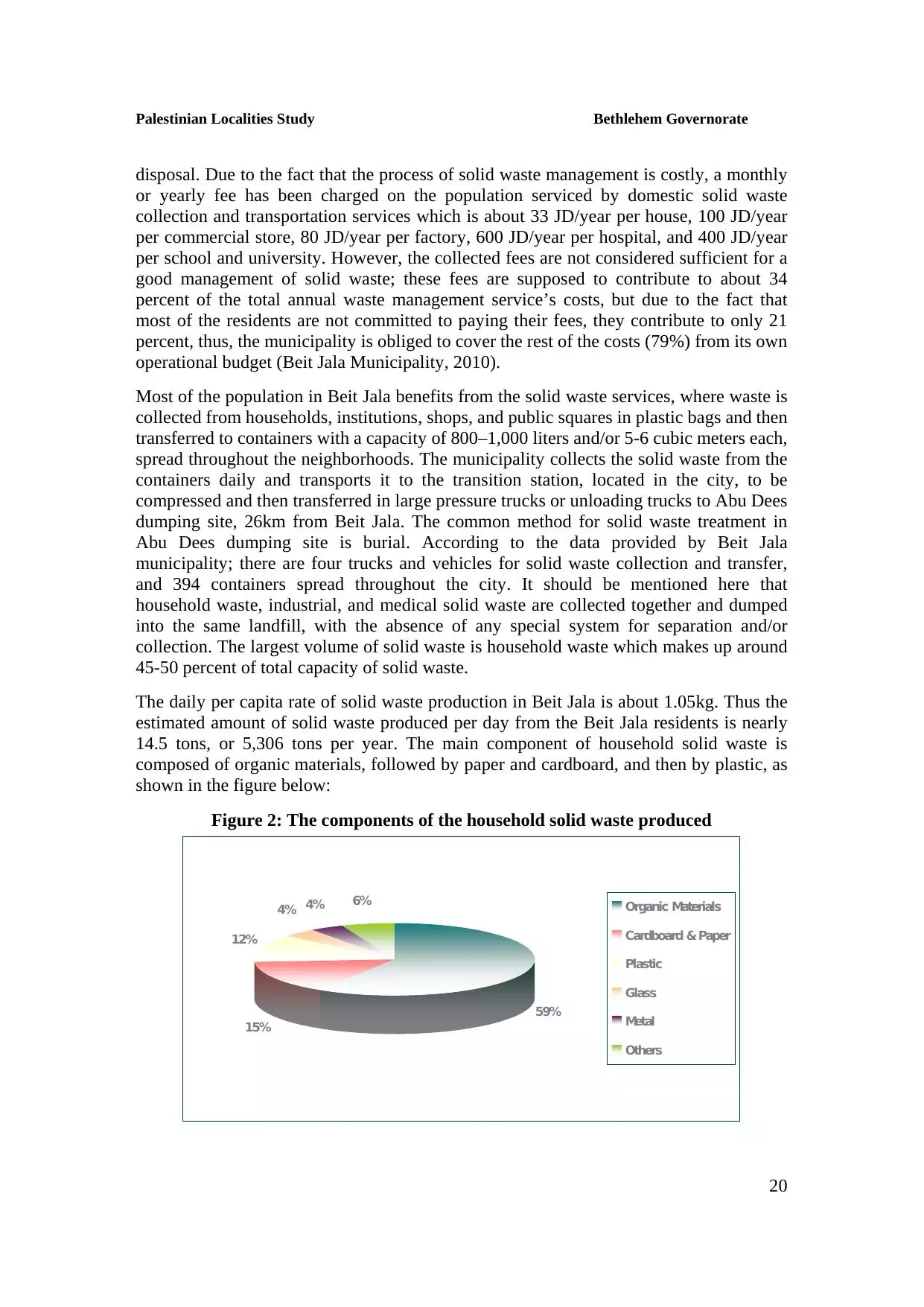
| PalestineRemembered | About Us | Oral History | العربية | |
| Pictures | Zionist FAQs | Haavara | Maps | |
| Search |
| Camps |
| Districts |
| Acre |
| Baysan |
| Beersheba |
| Bethlehem |
| Gaza |
| Haifa |
| Hebron |
| Jaffa |
| Jericho |
| Jerusalem |
| Jinin |
| Nablus |
| Nazareth |
| Ramallah |
| al-Ramla |
| Safad |
| Tiberias |
| Tulkarm |
| Donate |
| Contact |
| Profile |
| Videos |
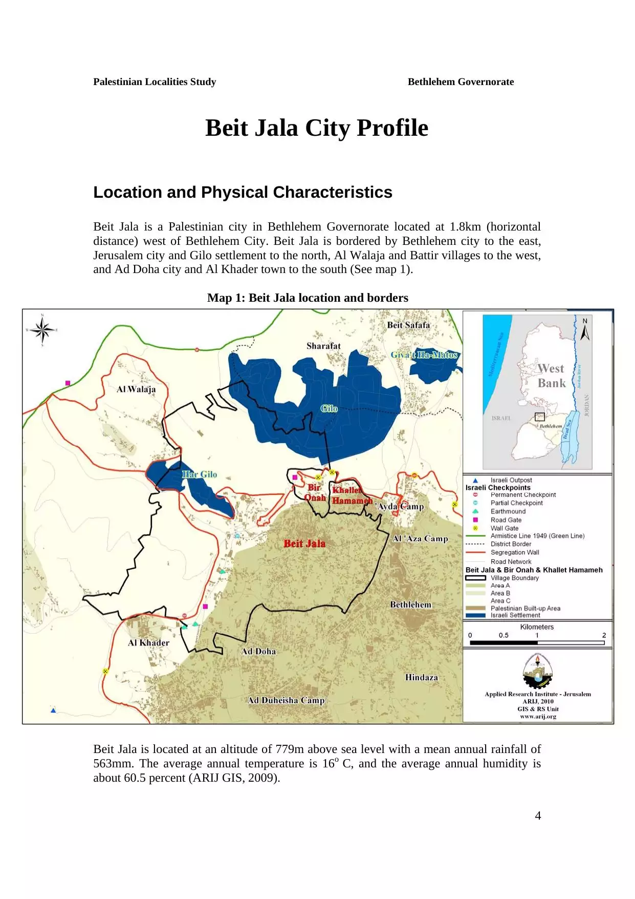
Welcome To Bayt Jala - بيت جالا (בית ג'אלא)
|
District of Bethlehem
Occupied days ago |
العربية Google Earth |
 |
Gallery (168) |
- Statistics & Facts
-
Before & After

- Satellite View
- Articles
- Pictures 168
- Aerial Views 5
- Land Deeds 9
- Members 3
- Families
- Wikipedia
- ARIJ Guide
- Videos 2
- Guest Book 6
- Links 2
| Statistic & Fact | Value | ||||||||||||||||||||||||||
| Distance From District | 2 km northwest of Bethlehem | ||||||||||||||||||||||||||
| Elevation | 825 meters | ||||||||||||||||||||||||||
| Before & After Nakba, Click Map For Details |
|||||||||||||||||||||||||||
|
|||||||||||||||||||||||||||
| Pre-Nakba Aerial View |
|||||||||||||||||||||||||||
|
|||||||||||||||||||||||||||
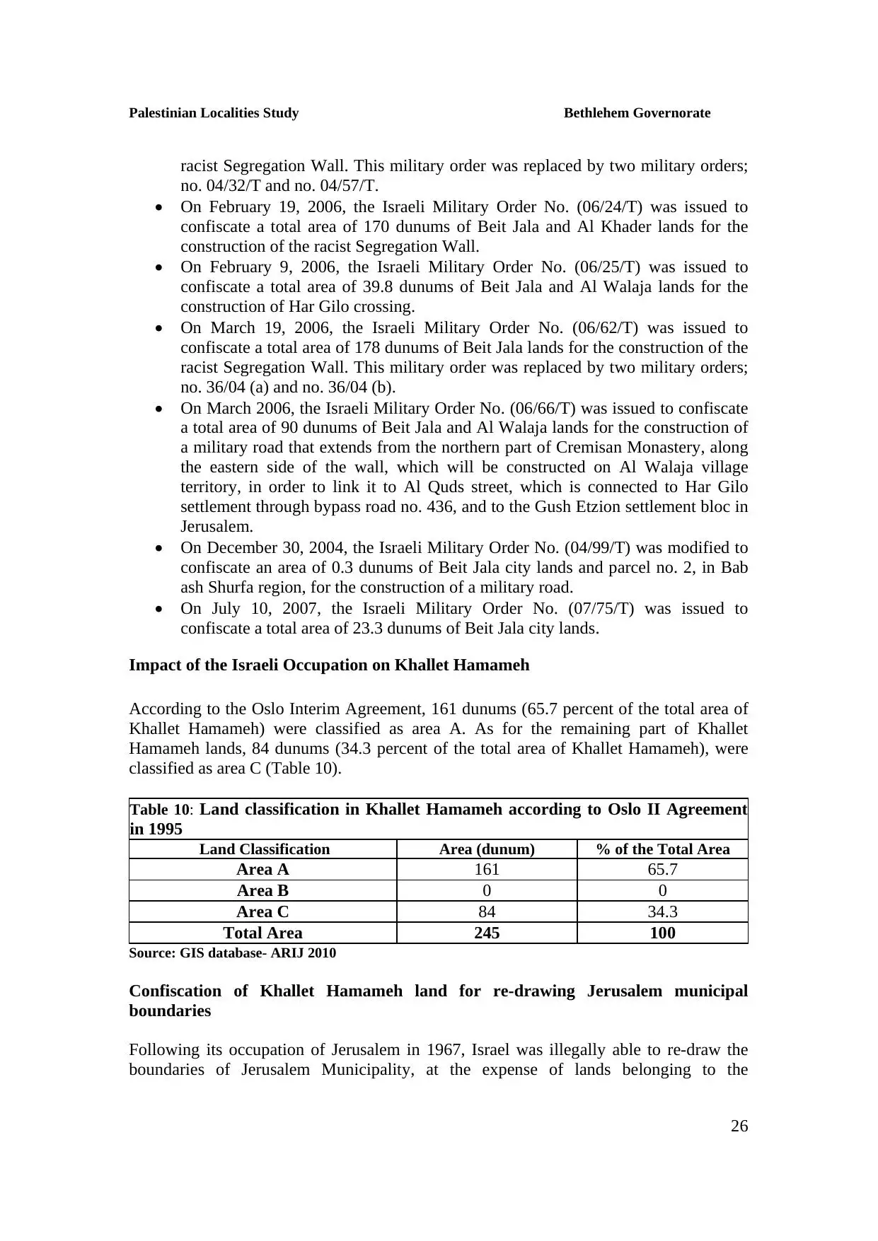
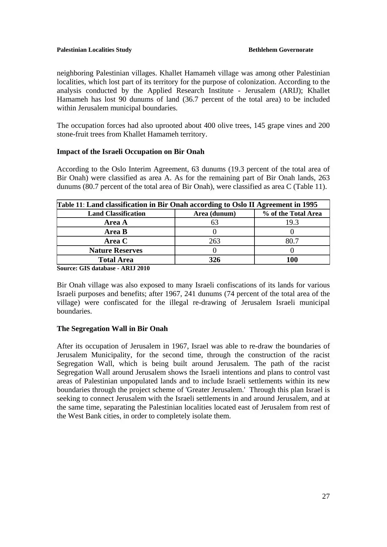
| Land Ownership |
**Town Lands' Demarcation Maps |
||||||||||||||||||||||||||
| Land Usage As of 1945 |
|
||||||||||||||||||||||||||
| Population |
|
||||||||||||||||||||||||||
| Near By Towns |
|||||||||||||||||||||||||||
|
|||||||||||||||||||||||||||
| Featured Video | |||||||||||||||||||||||||||
| ARIJ Guide | |||||||||||||||||||||||||||
3.
4. 
5. 
6. 
7. 
8. 
9. 
10. 
11. 
12. 
13. 
14. 
15. 
16. 
17. 
18. 
19. 
20. 
21. 
22. 
23. 
24. 
25. 
26. 
27. 
28. 
29. 
30. 
31. 
32. 
Click here to browse online. |
|||||||||||||||||||||||||||
| Related Maps | Town Lands' Demarcation Maps خرائط للقضاء توضح حدود القرى والاودية View from satellite Town's map on MapQuest Help us map this town at WikiMapia |
||||||||||||||||||||||||||
| Related Links | Wikipedia's Page Facebook Page ARIJ Guide Google Search Google For Images Google For Videos في كتاب بلادنا فلسطين دليل أريج المزيد من موقع هوية |
||||||||||||||||||||||||||
No articles have been added yet, please be free to be the first to add one.
- ستبقى شامخة
Posted by مهند قداره 1 - ستبقى شامخة
Posted by مهند قداره - ستبقى شامخة
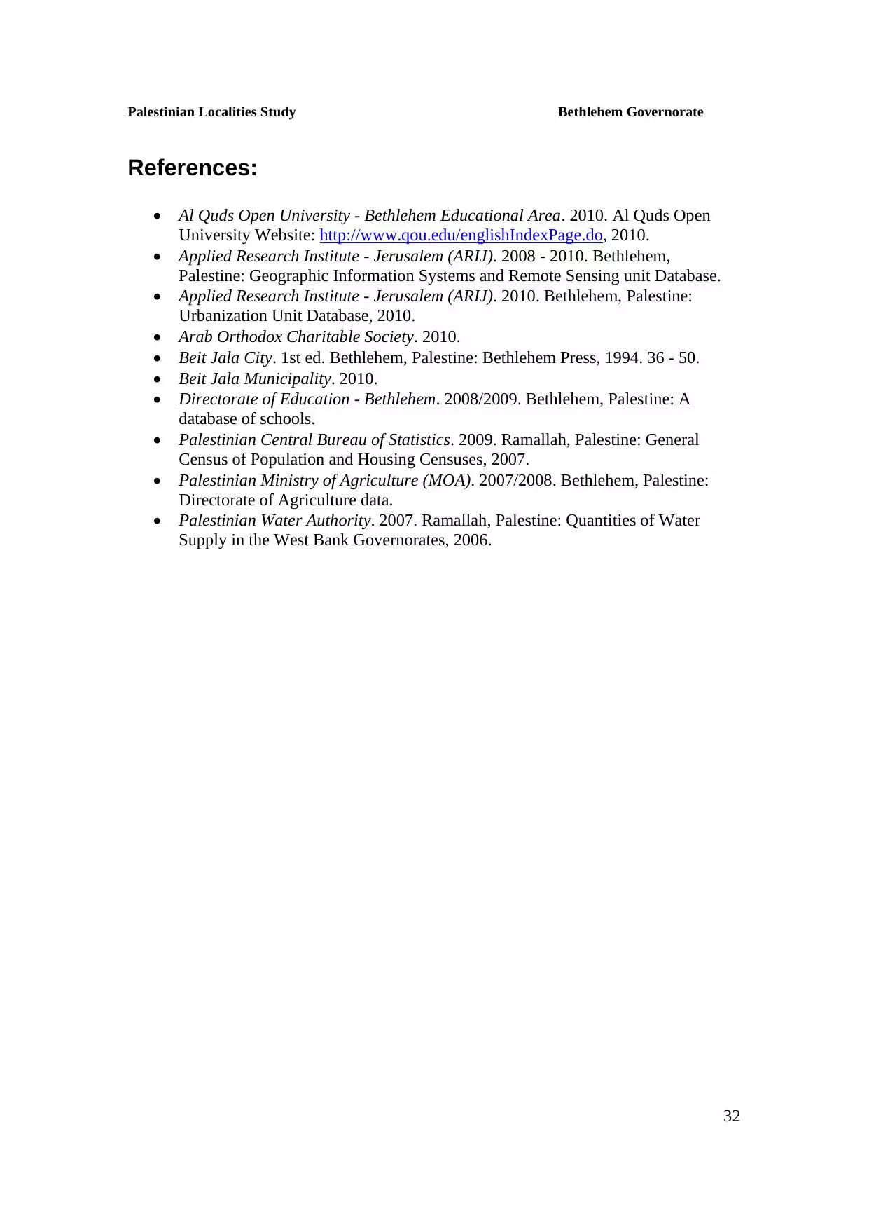
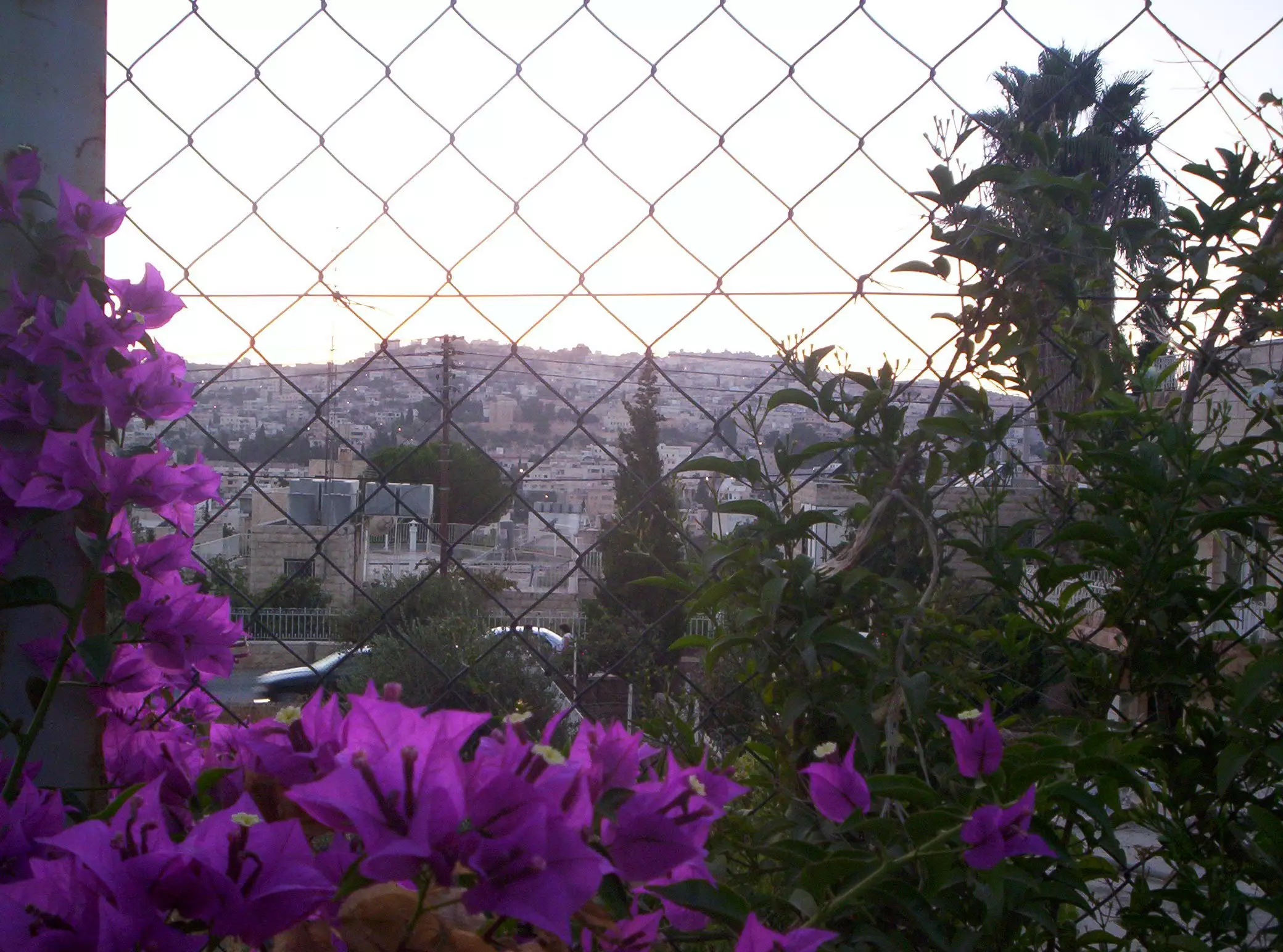
Posted by مهند قداره 1 - General view
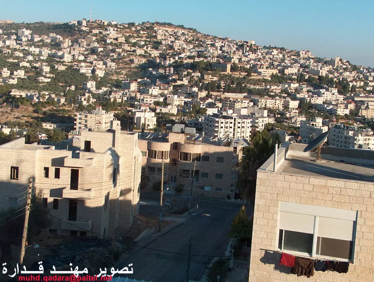
1 - Undate aerial view. Please provide direction in the below comments section
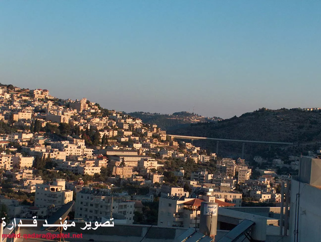
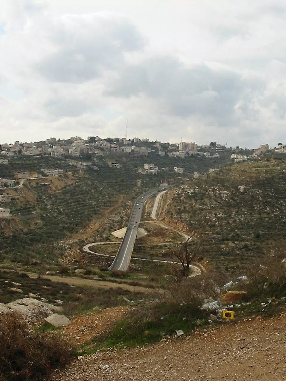
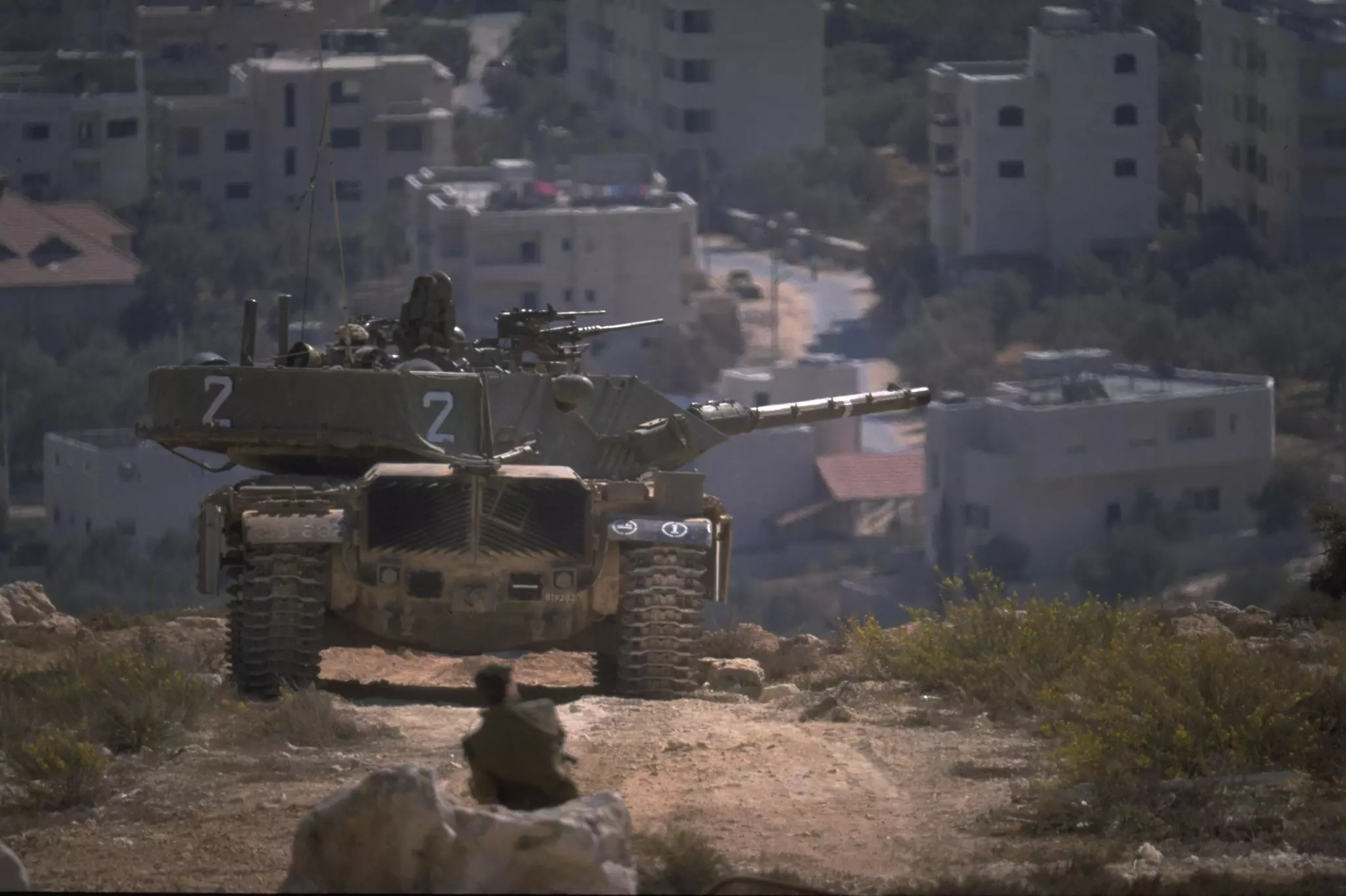
5 - Israelis with yellow plates can only drive on this road (in comparison to Palestinians who drive with white and blue plates). This road was built on Palestinian land in Beit Jala (Bayt Jala).
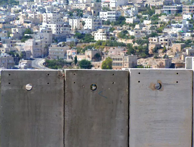
1 - Behind the Apartheid Wall
- قوافل مرت وبيت جالا شاخصة -هدية لأستاذي عيسى ابو غنام -صفافي
Posted by ابو عمر 1 - A View Of Wa'ad Ahmad.
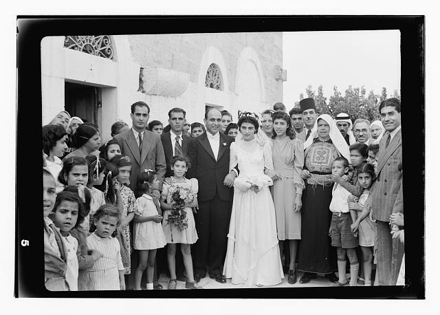
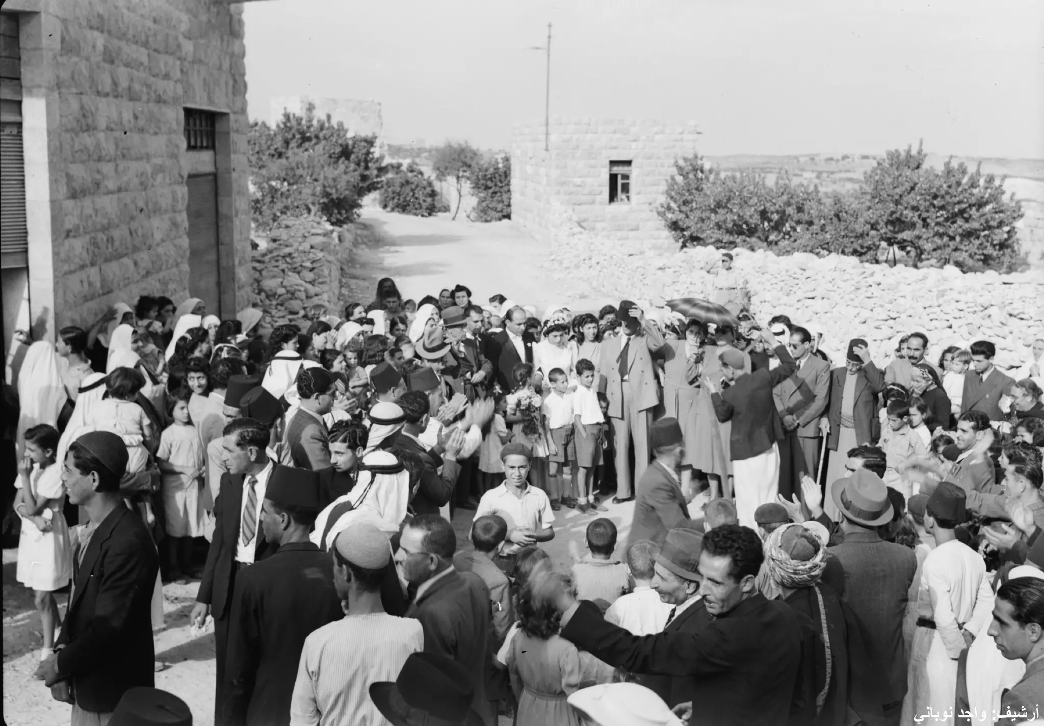
Posted by Umar Abu El-Bararri - زفاف للعريس- عطالله- اوائل الأربعينيات -هدية من صفافي-
Posted by ابو عمر 1 - منطقة شما ل الشرق -وتبدو دار جاسر ومسجد بلال بن رباح ومنطقة المدارس وخط الخليل القدس
Posted by ابو عمر - al quds open university betjala
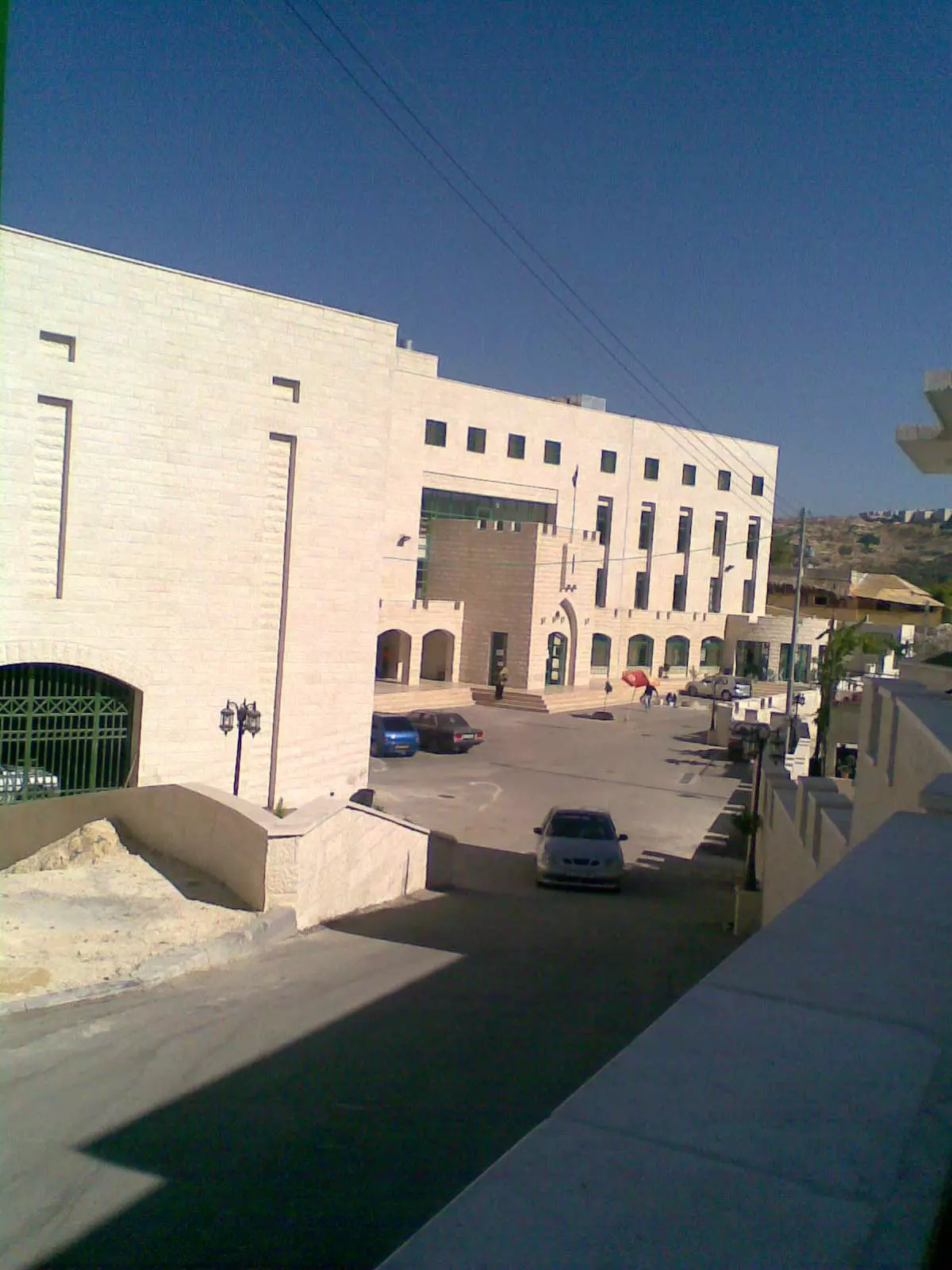
Posted by Joe Sanad - جامعة القدس المفتوحة منطقة بيت جالا
Posted by Joe Sanad - الكنيســــــــــة المعمدانيـــــــــــــة المحليــة

Posted by mazen labeeb - BEIT JALA 1
Posted by Rami Atwan - BEIT JALA 2
Posted by Rami Atwan - BEIT JALA 3 - 1926

Posted by Rami Atwan 1 - PALESTINE - Beit-Jala, early 1940s
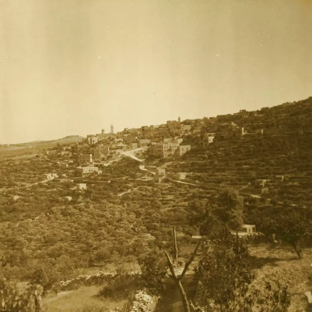
Posted by Rami Atwan 1 - BAYT JALA - Bayt Jalah from north, 1937
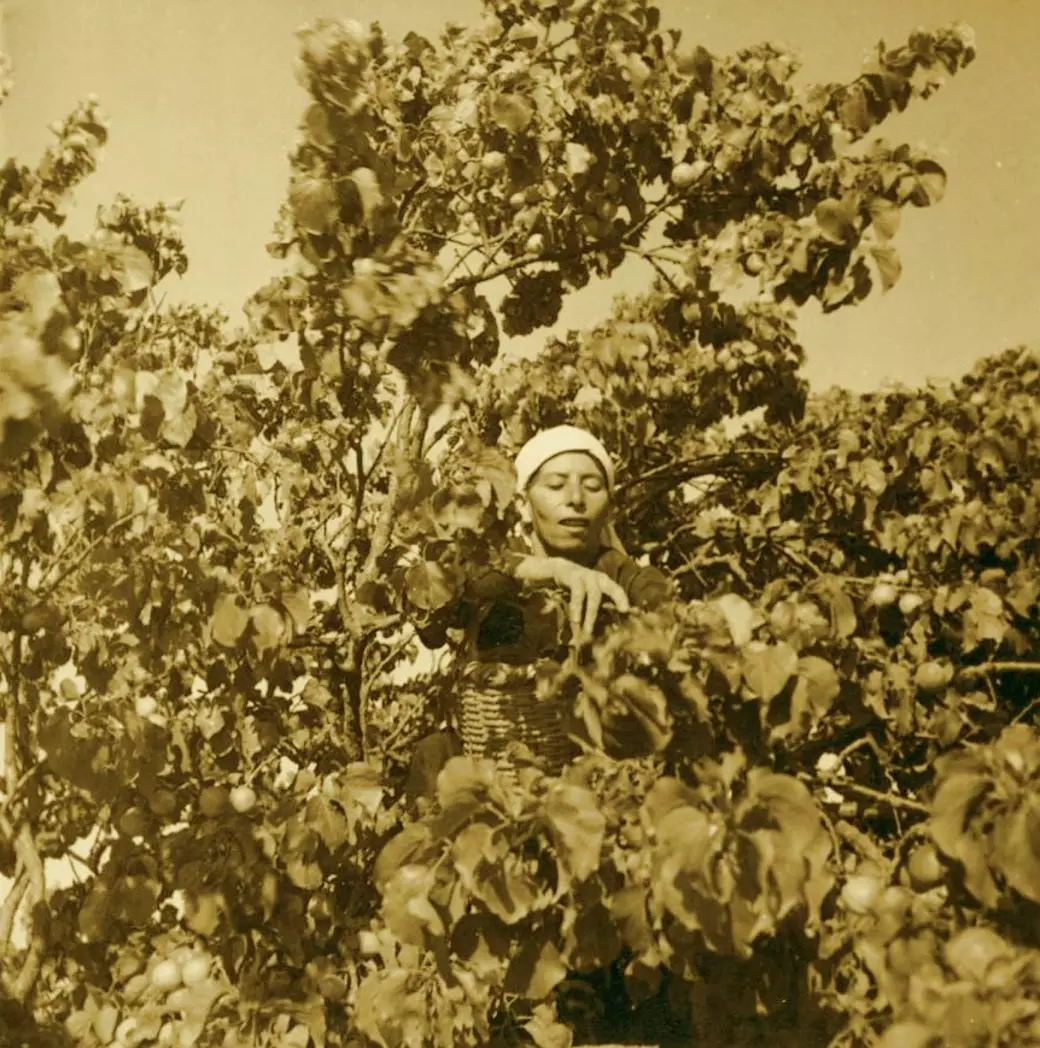
Posted by Rami Atwan - BAYT JALA - Picking apricots at Bayt Jalah, 1937
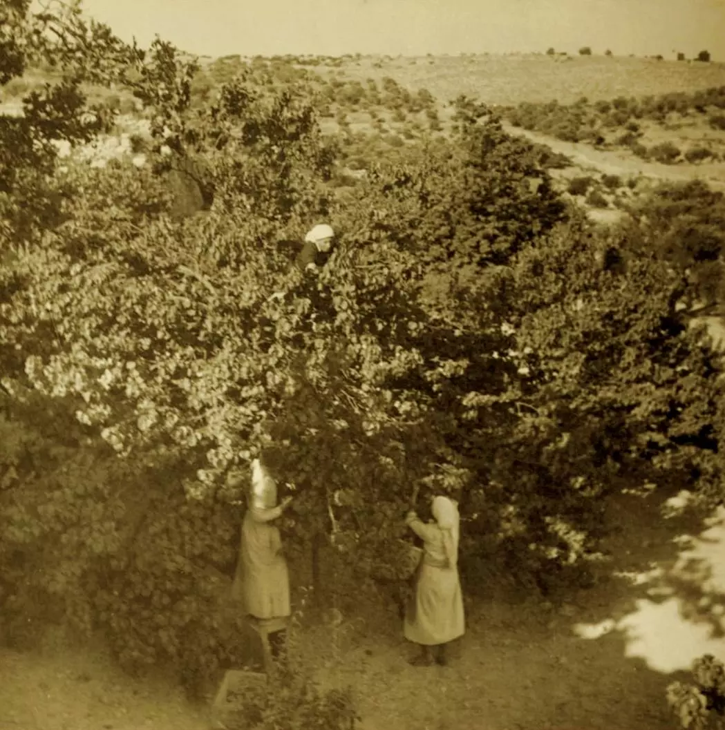
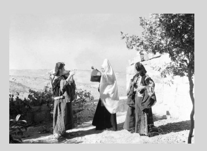
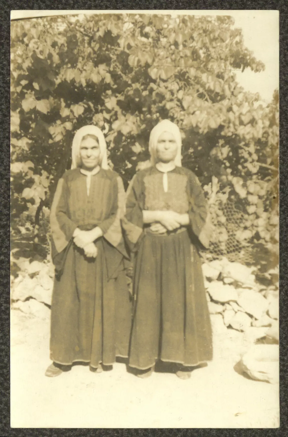
Posted by Rami Atwan - BAYT JALA - Women picking apricots at Bayt Jalah, 1937
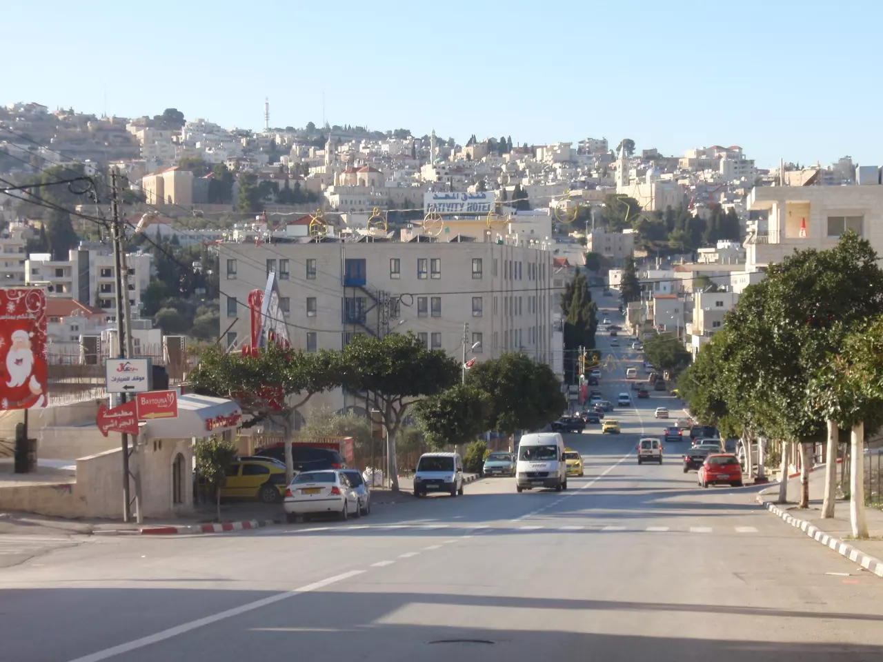
Posted by Rami Atwan - الشارع الرئيسي لبيت جالا - تصوير سهيل مخول يوم 29.12.2011
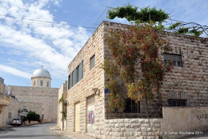
Posted by سهيل مخول - منظر عام -- عدسة سهر روحانا
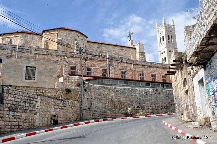
- منظر عام -- عدسة سهر روحانا
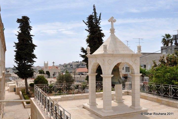
- منظر عام -- عدسة سهر روحانا
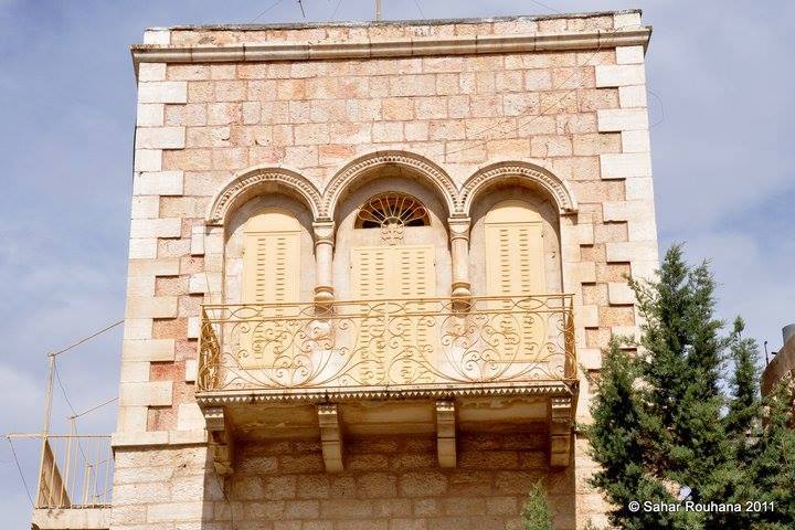
- منظر عام -- عدسة سهر روحانا
- بيت جالا سنه 1942
Posted by abu raya - صوره قديمه من الجو لبيت جالا
Posted by abu raya - صوره قديمه من بيت جالا
Posted by abu raya - عرس في بيت جالا من سنوات الاربعين
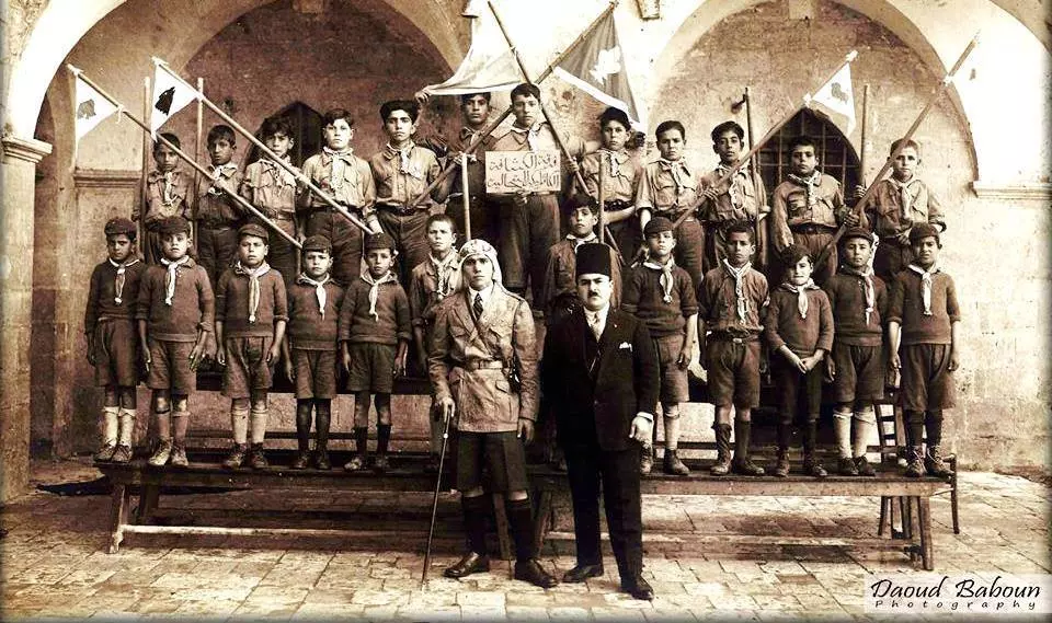
Posted by abu raya - Palestinian boy scouts in Beit Jala 1936
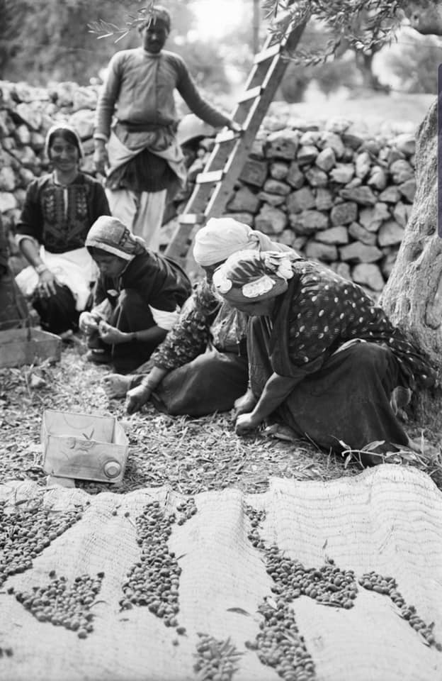
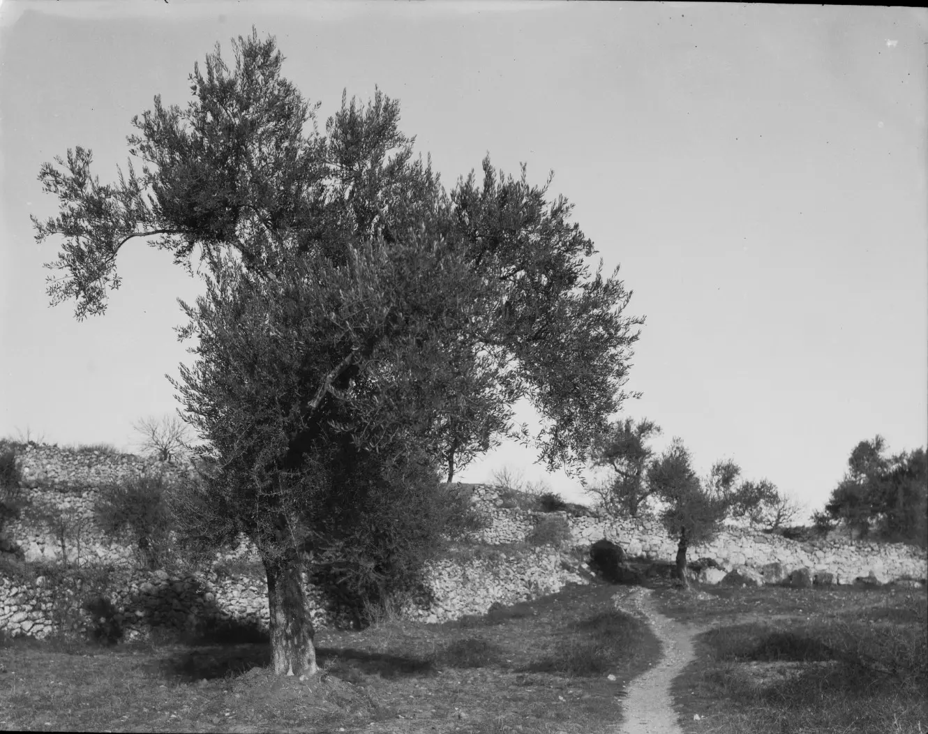
- موسم قطف الزيتون قبل النكبة
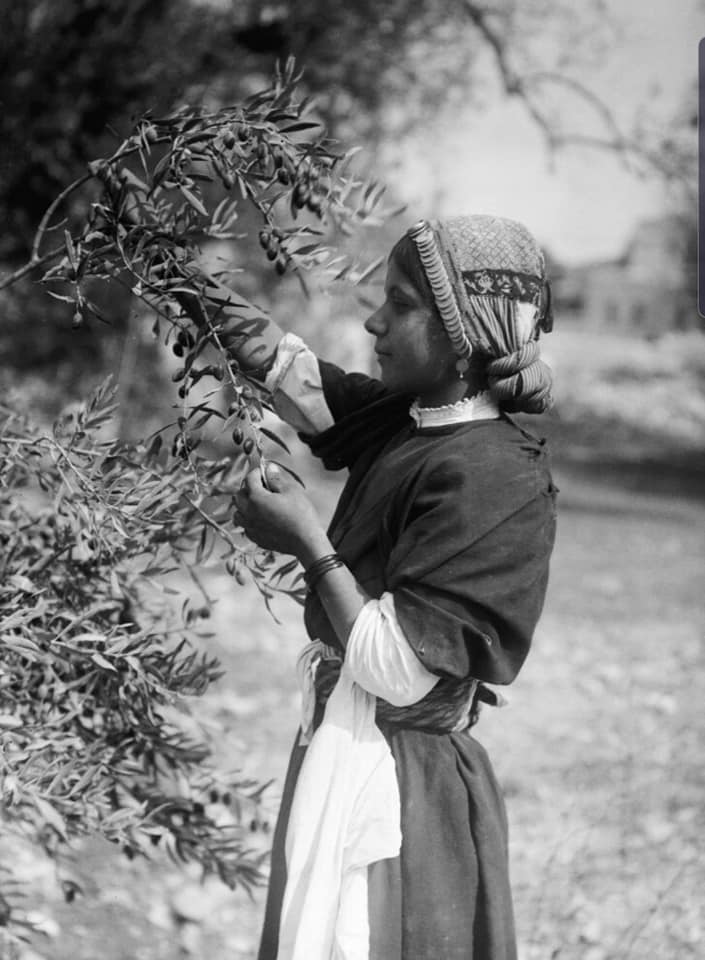
- موسم قطف الزيتون قبل النكبة #2
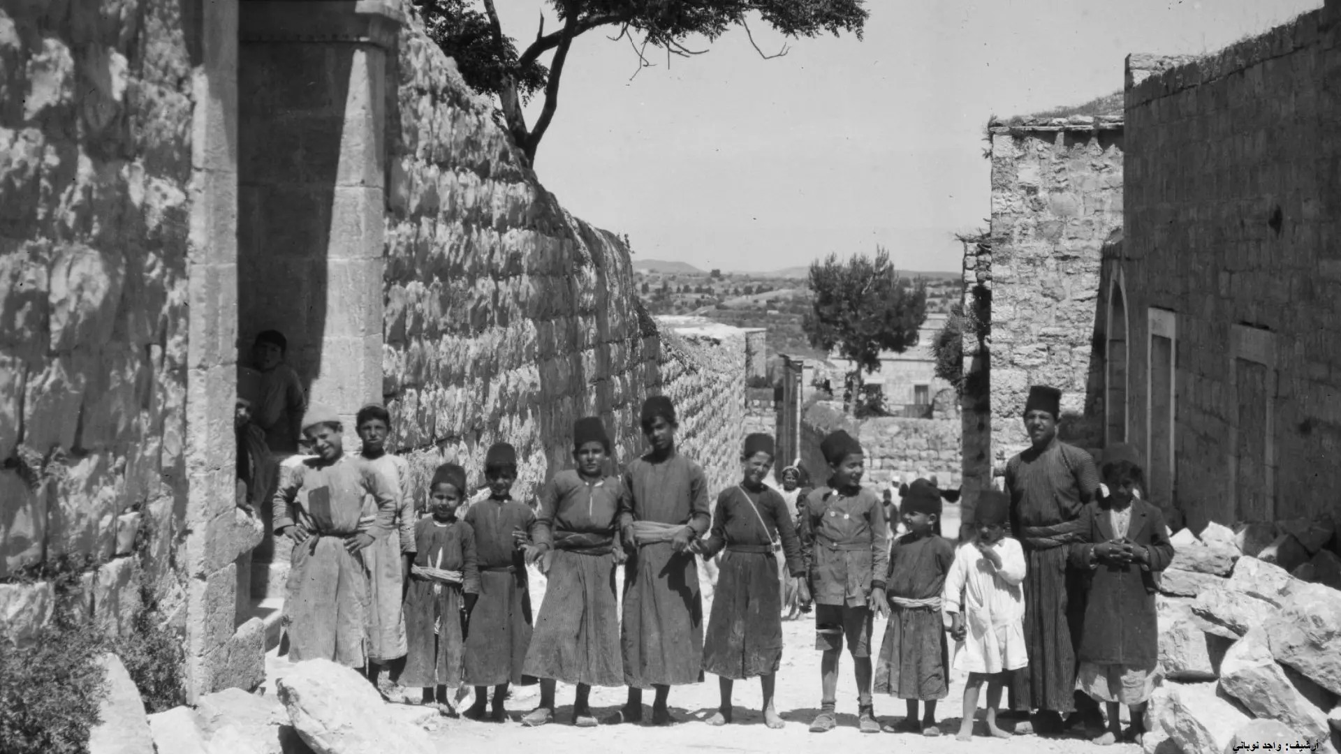
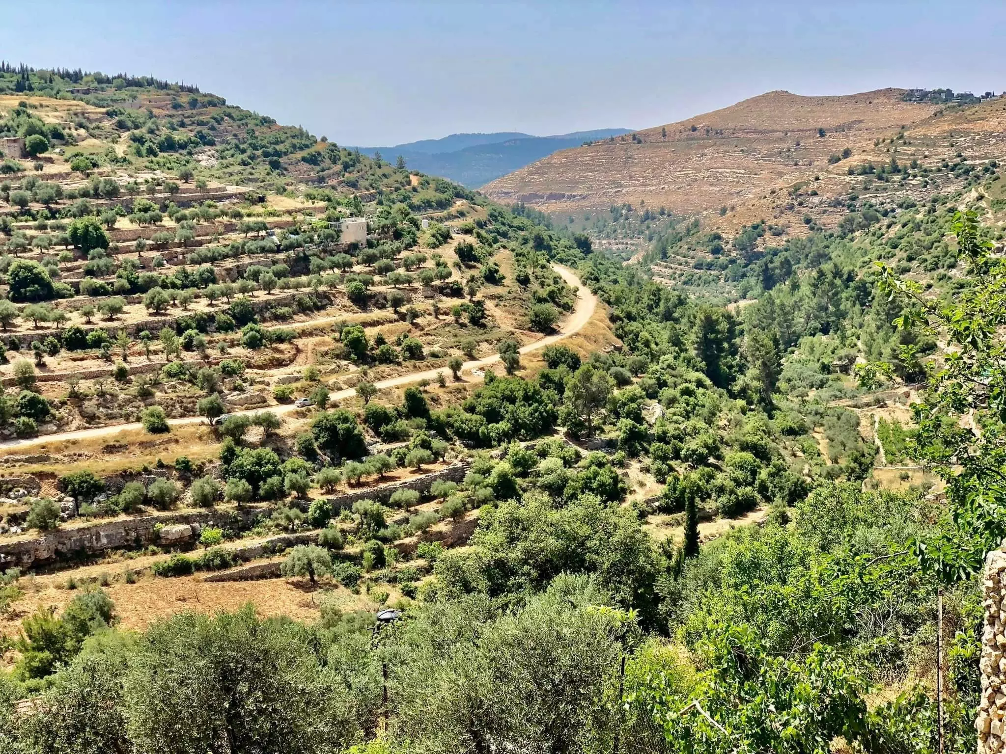
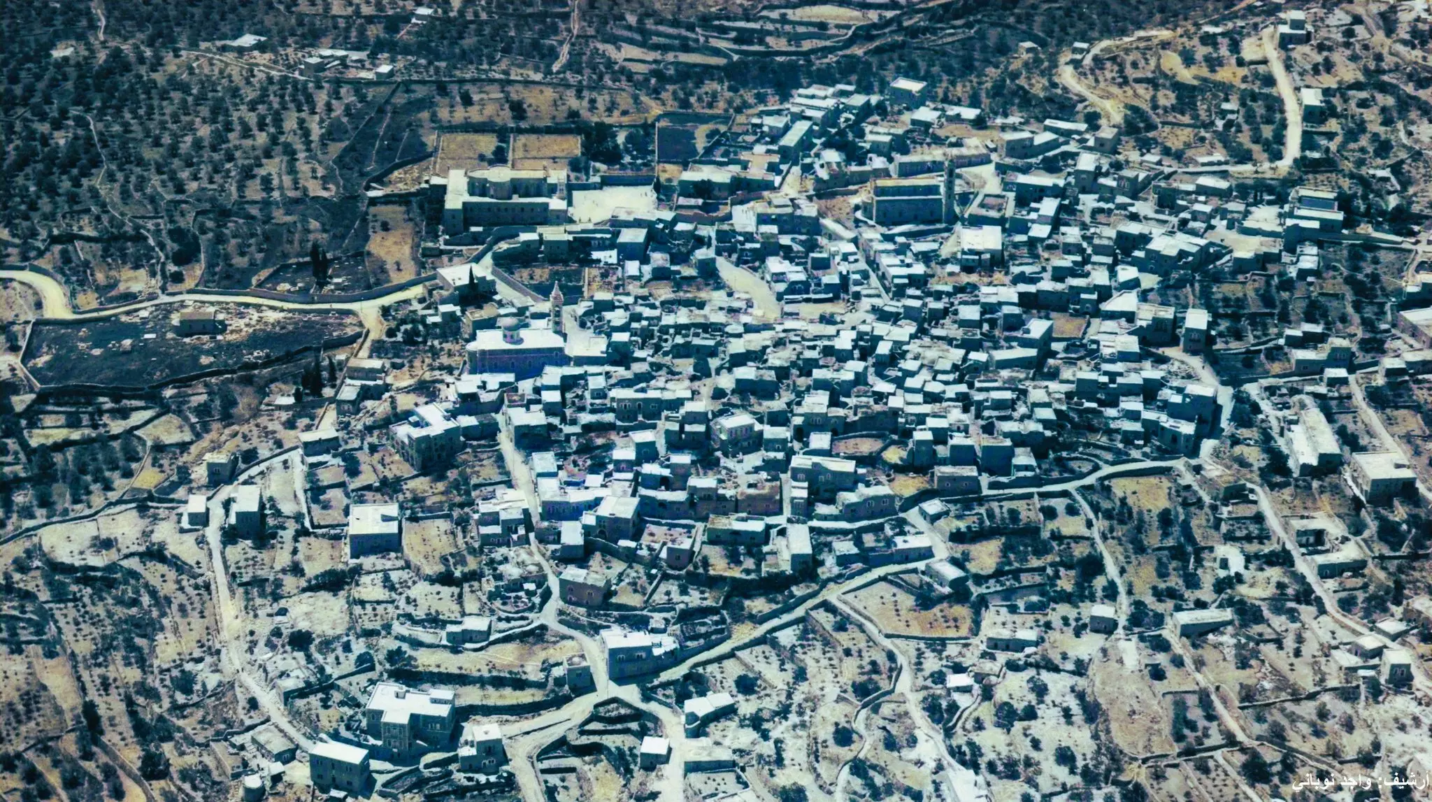
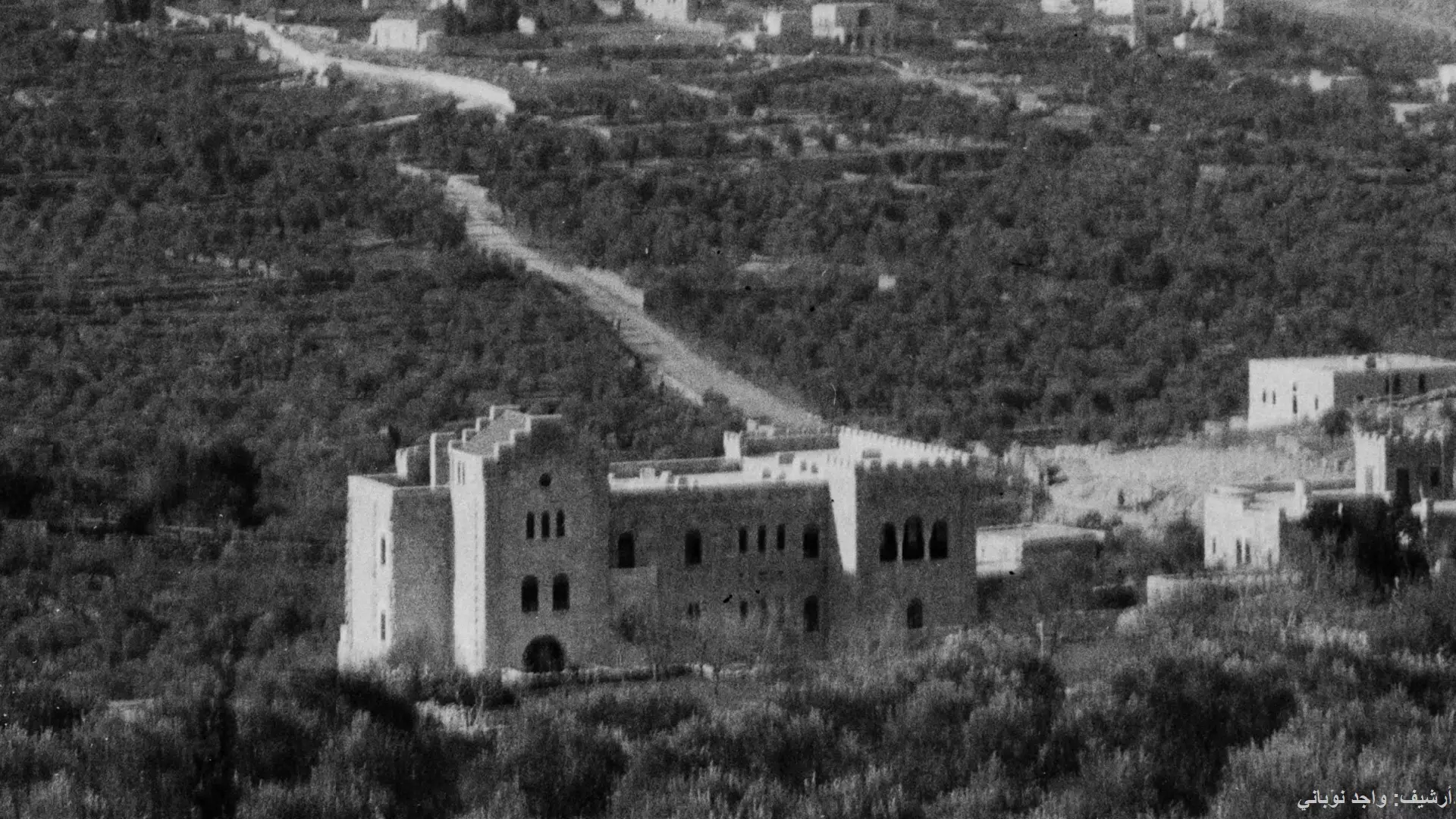
- براري بيت جالا ..تصوير : واجد النوباني .
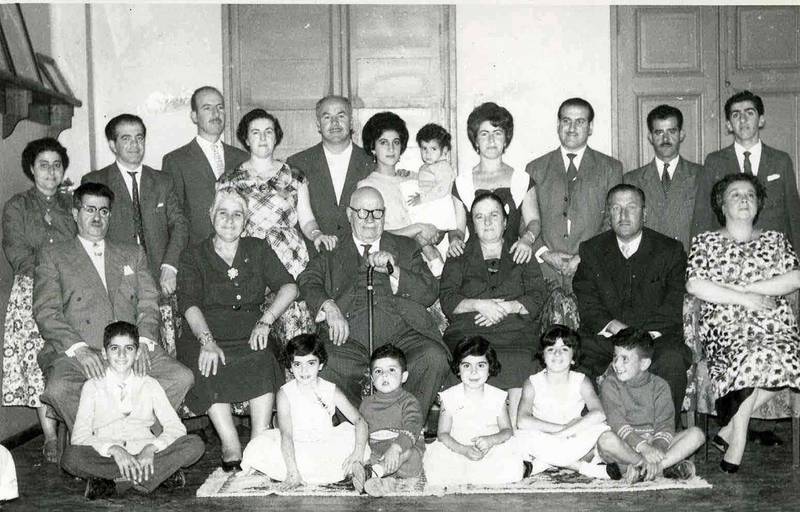
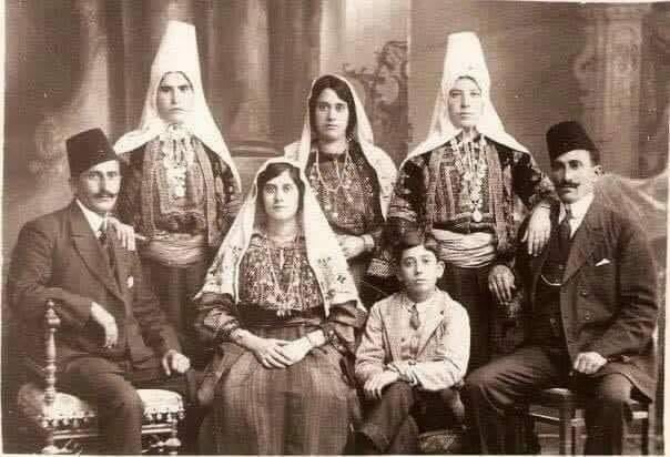
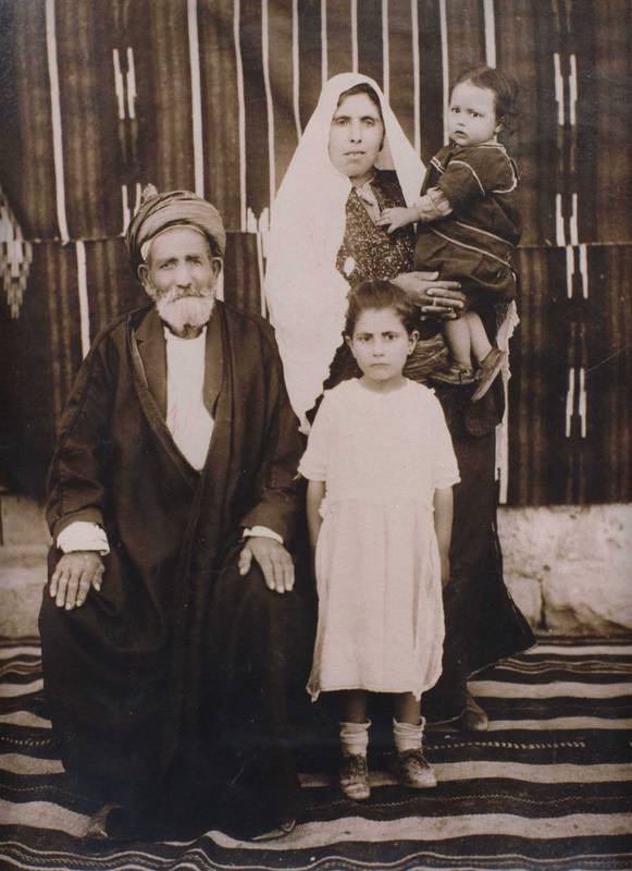
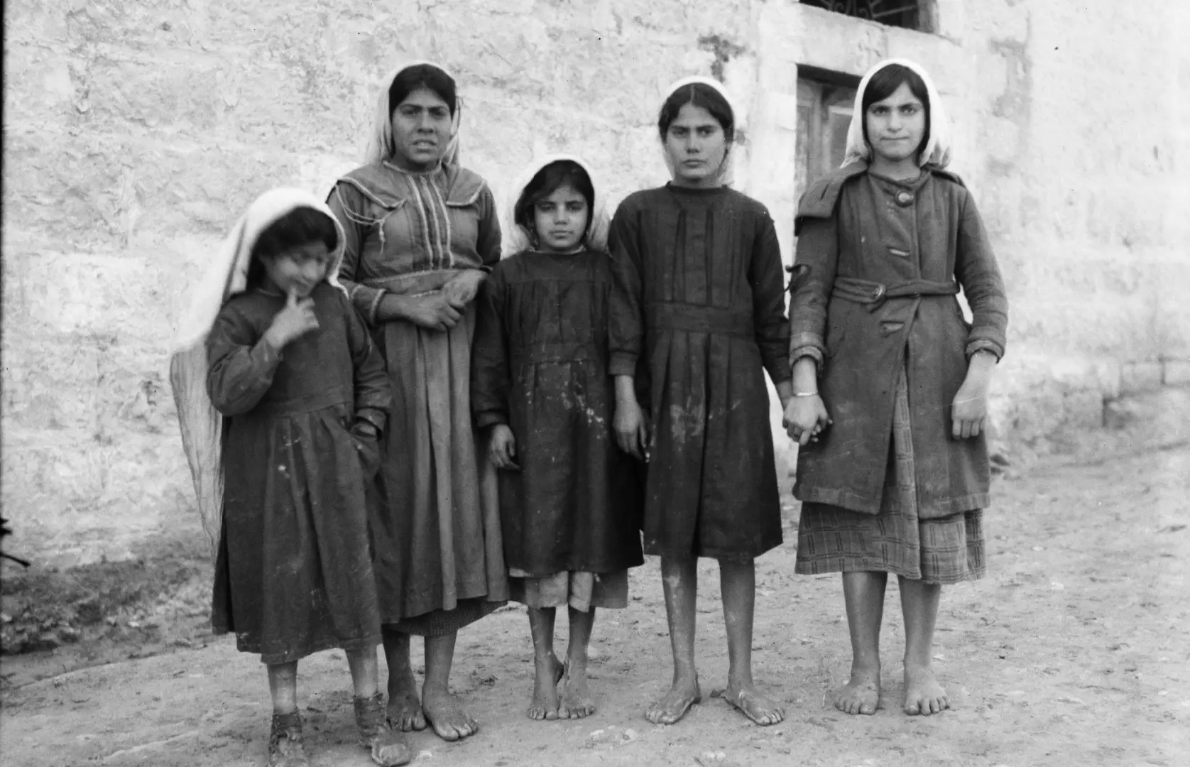
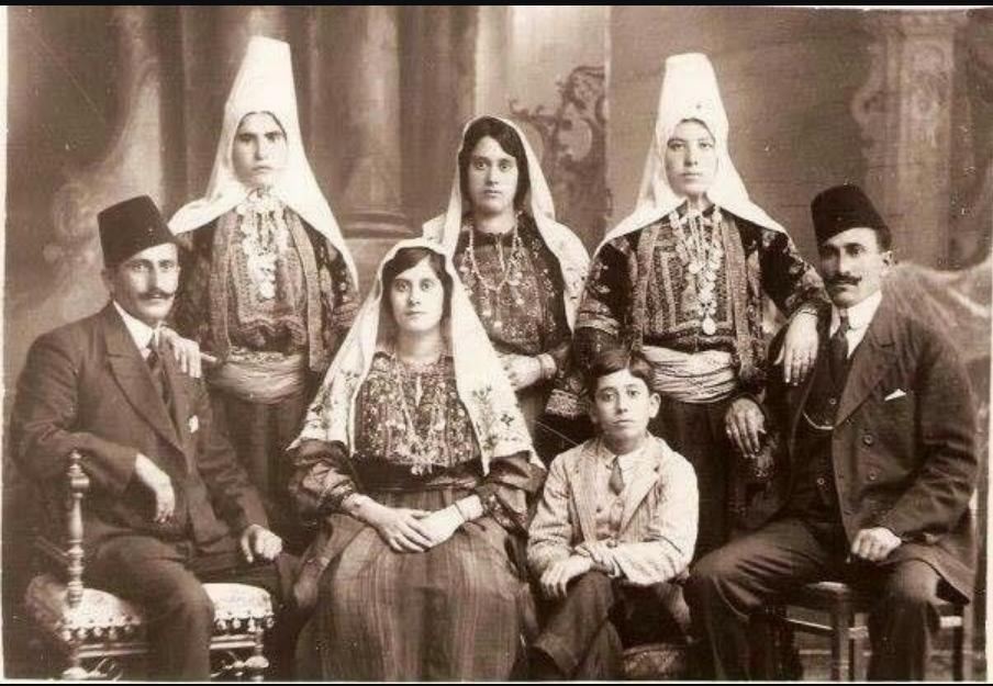
- عائلة نزال من بيت جالا قضاء بيت لحم، 1914.
Nazzal family from Beit Jala, Bethlehem District, 1914.
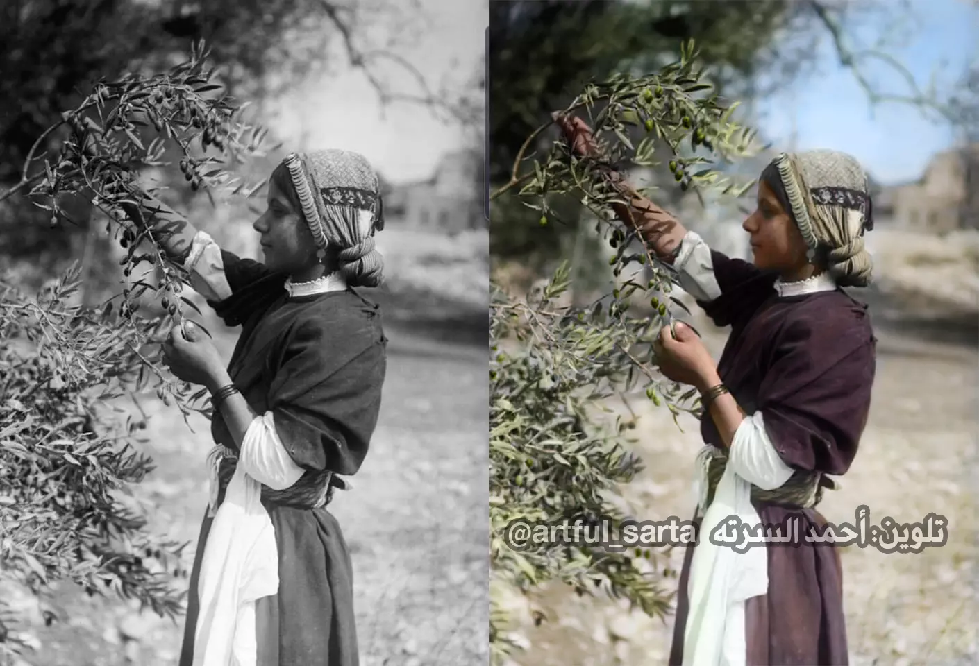
- (بالألوان) موسم قطف الزيتون قبل النكبة
(Colorized) Olive picking season before El-Nakba
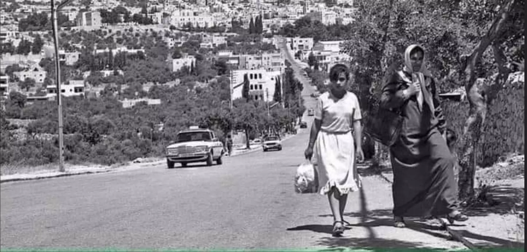
Posted by AhmedElsarta - صورة مميزة لمدينة بيت جالا عام 1970
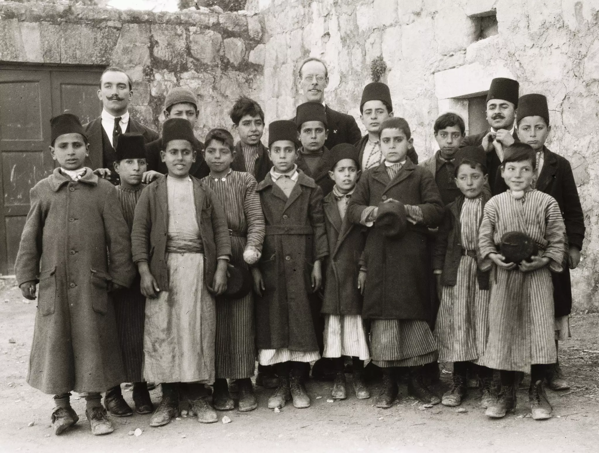
- Teachers and their students soon after WWI. It appears that Dr. Tawfiq Kana'an on the right
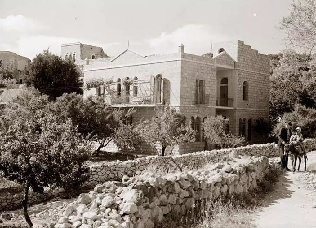
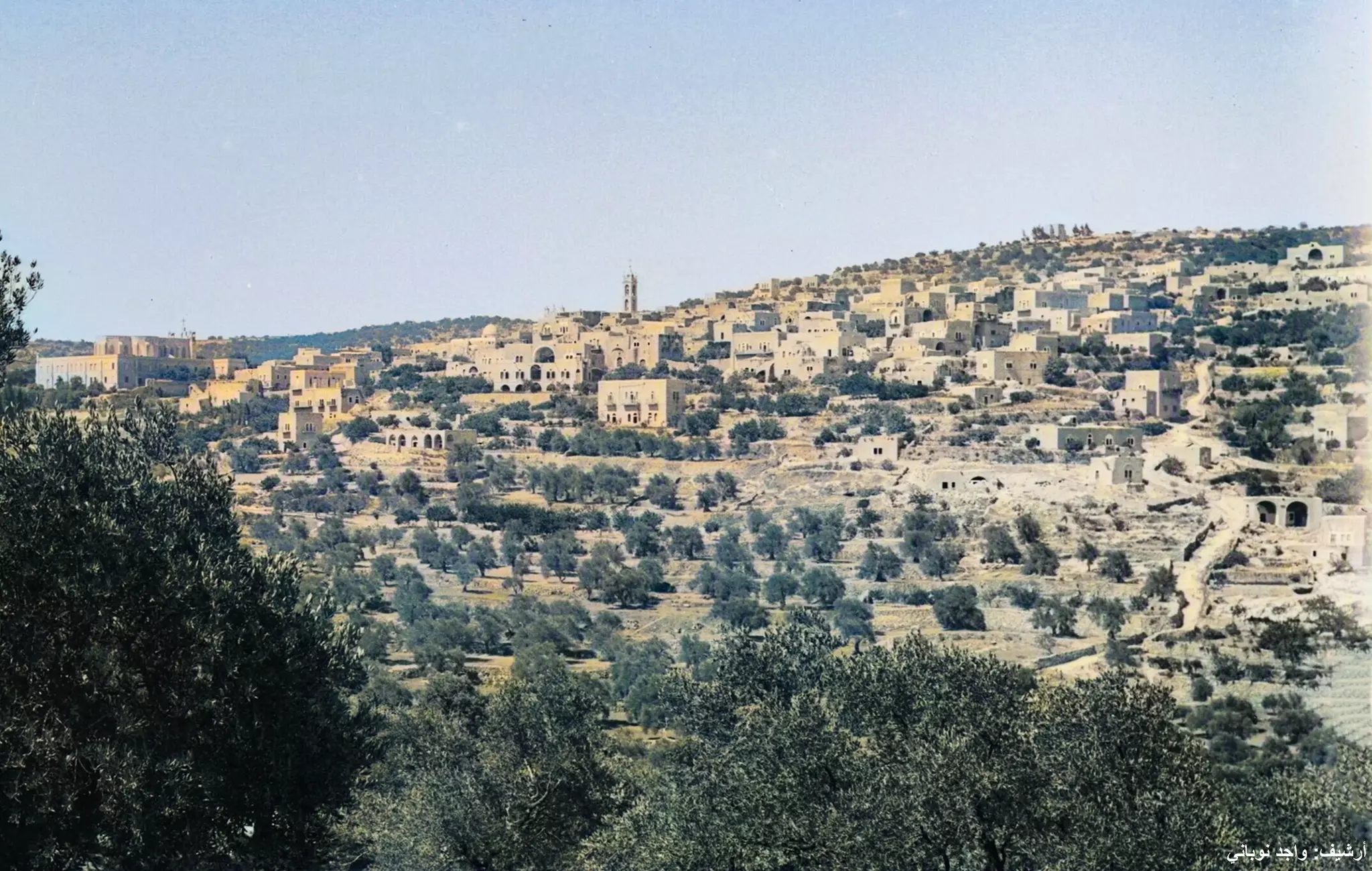
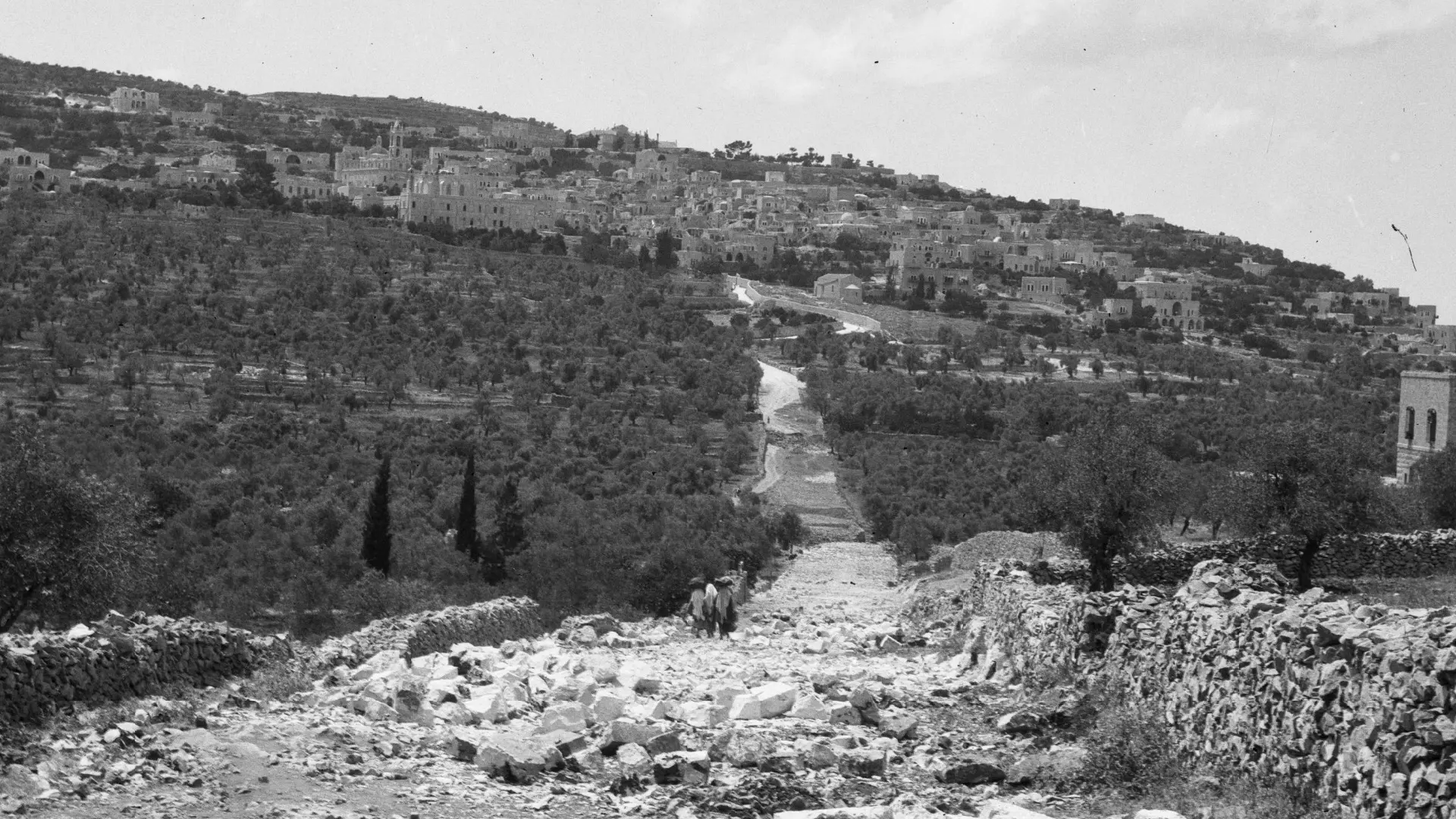
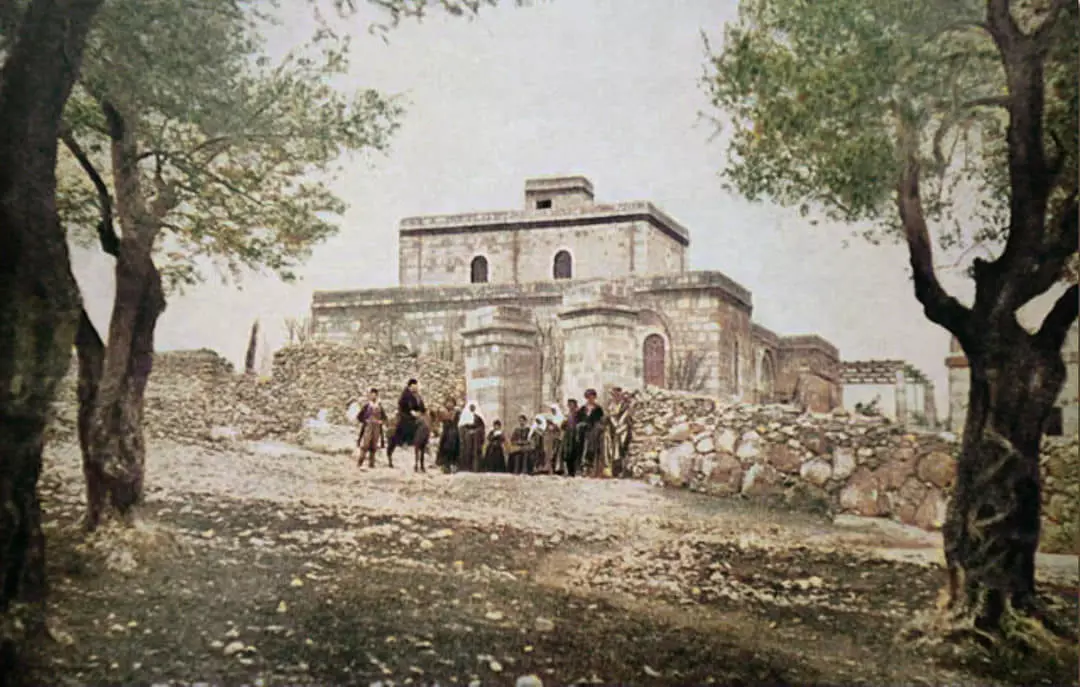
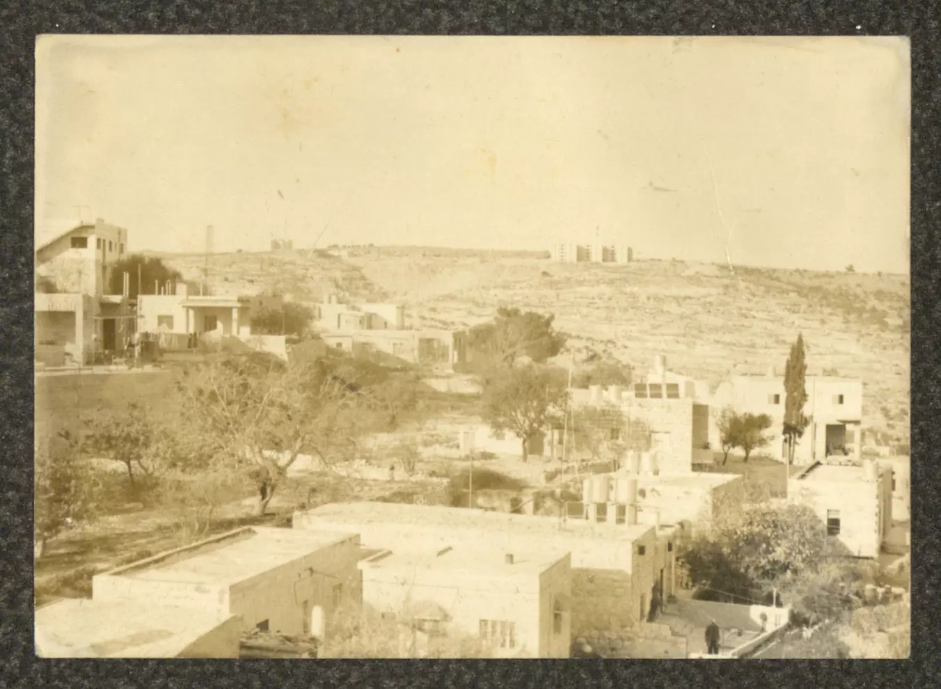
- A pre-Nakba view of the town
- A rare picture of students and their teacher, 1921
- قبل حوالي ١٣٠ سنة
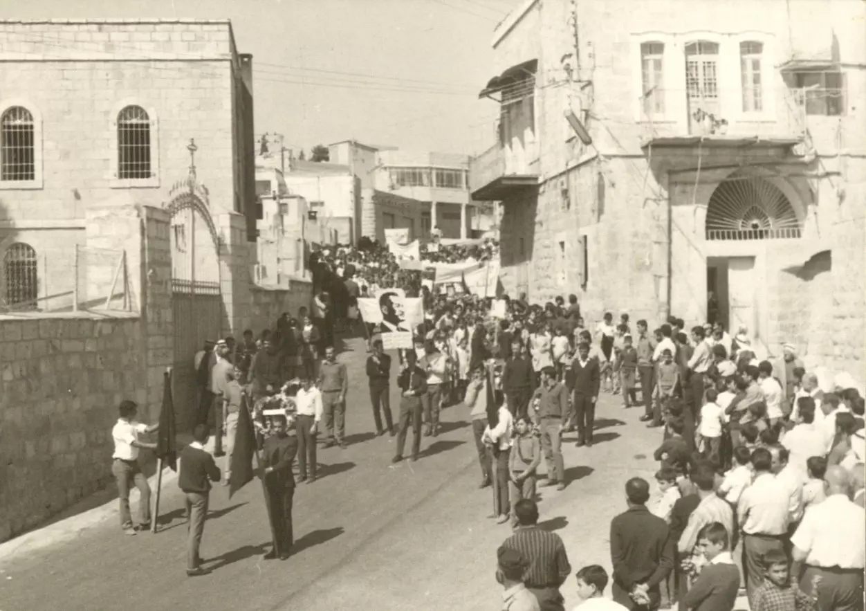
- أهالي بيت جالا "وهي بلدة فلسطينية مسيحية يغلب عليها الطابع الرومي الأرثوذكسي" يخرجون للمشاركة في جنازة رمزية لجمال عبد الناصر، في أواخر أيلول 1970م.
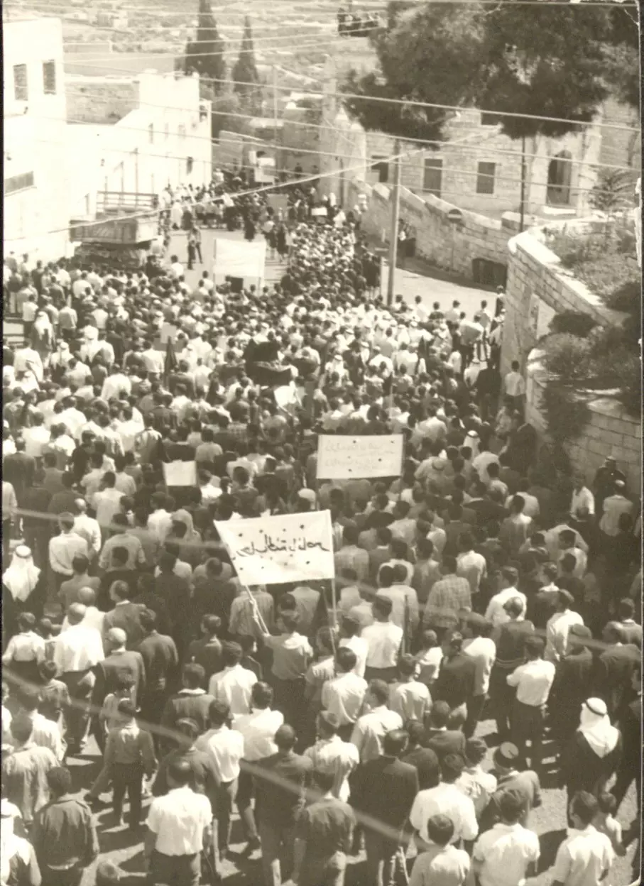
- أهالي بيت جالا "وهي بلدة فلسطينية مسيحية يغلب عليها الطابع الرومي الأرثوذكسي" يخرجون للمشاركة في جنازة رمزية لجمال عبد الناصر، في أواخر أيلول 1970م. #2
- أهالي بيت جالا "وهي بلدة فلسطينية مسيحية يغلب عليها الطابع الرومي الأرثوذكسي" يخرجون للمشاركة في جنازة رمزية لجمال عبد الناصر، في أواخر أيلول 1970م. #3
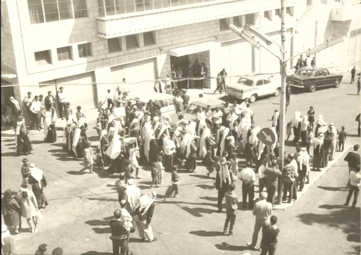
- أهالي بيت جالا "وهي بلدة فلسطينية مسيحية يغلب عليها الطابع الرومي الأرثوذكسي" يخرجون للمشاركة في جنازة رمزية لجمال عبد الناصر، في أواخر أيلول 1970م. #4
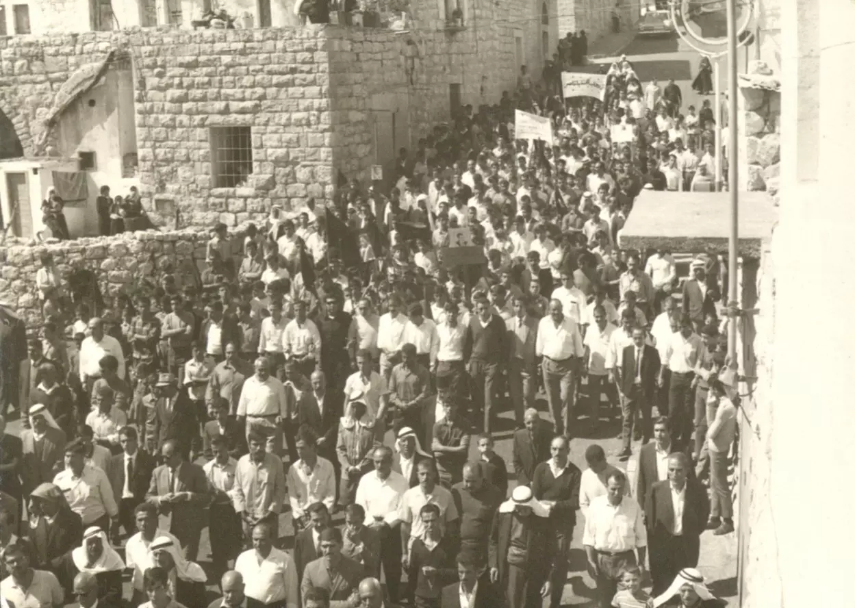
- أهالي بيت جالا "وهي بلدة فلسطينية مسيحية يغلب عليها الطابع الرومي الأرثوذكسي" يخرجون للمشاركة في جنازة رمزية لجمال عبد الناصر، في أواخر أيلول 1970م. #5
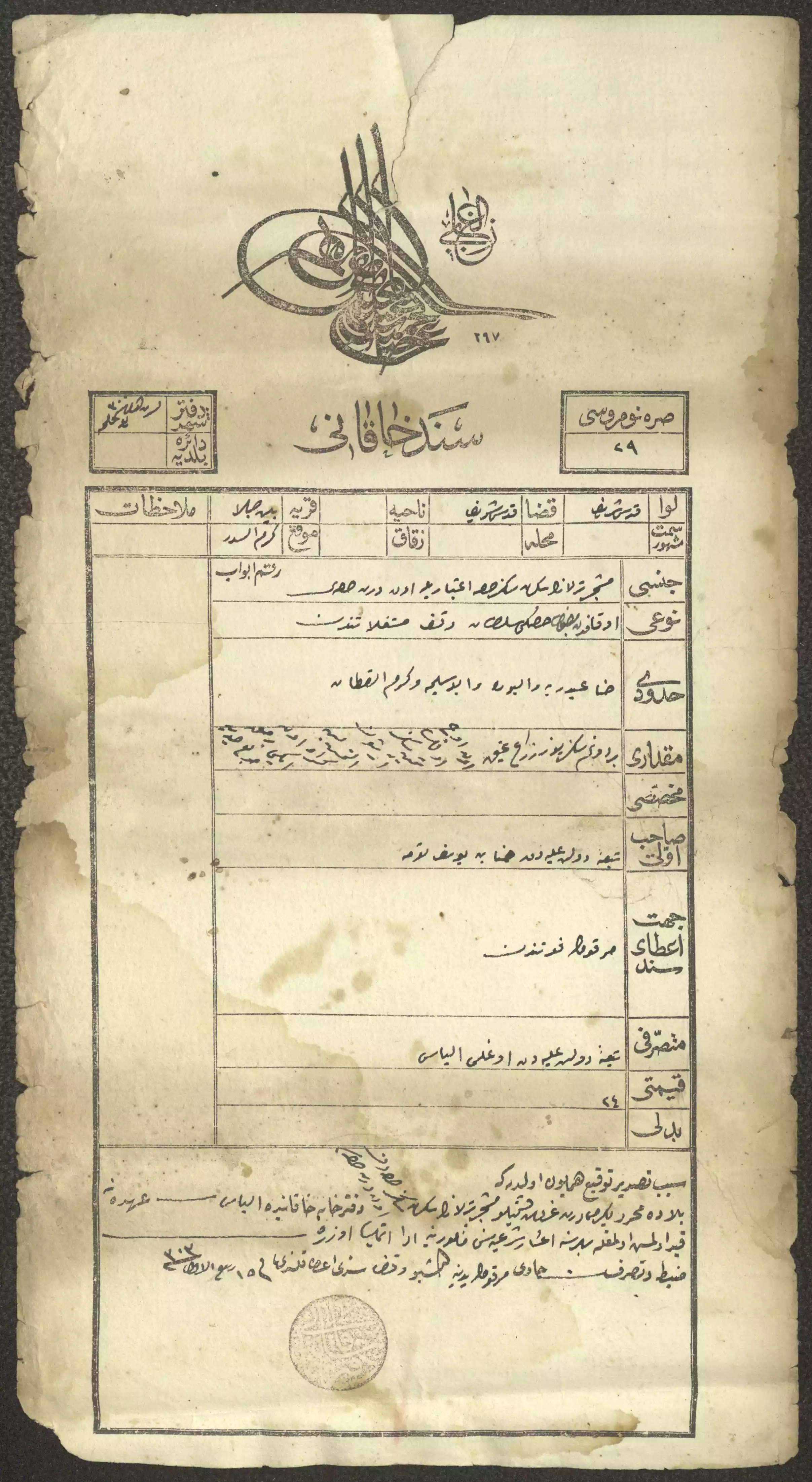
- "سند خاقاني" صادر عن دائرة تسجيل الأملاك لحنا توما، بيت جالا، 1885 -- المزيد عنه اسفل الصورة بقسم التعليقات
1 - "سند خاقاني" صادر عن دائرة تسجيل الأملاك، القدس، 1886
--لمزيد عنه اسفل الصورة بقسم التعليقات
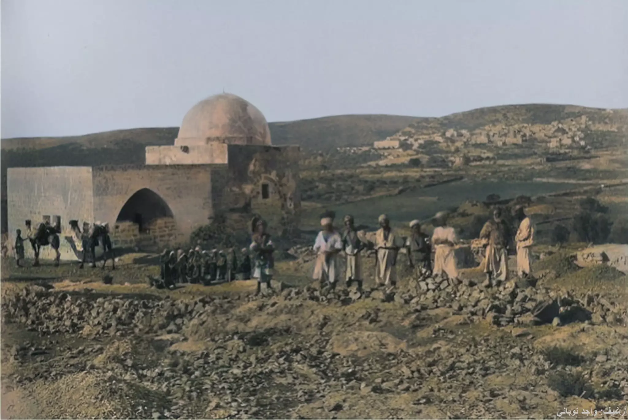
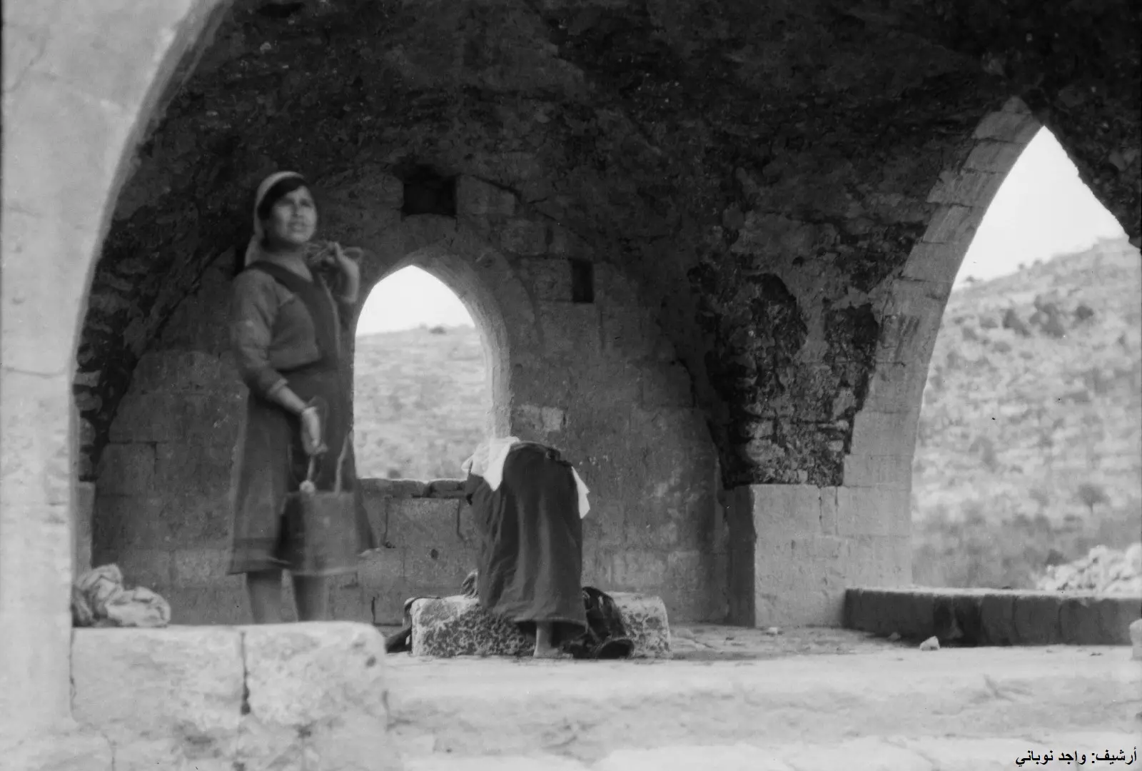
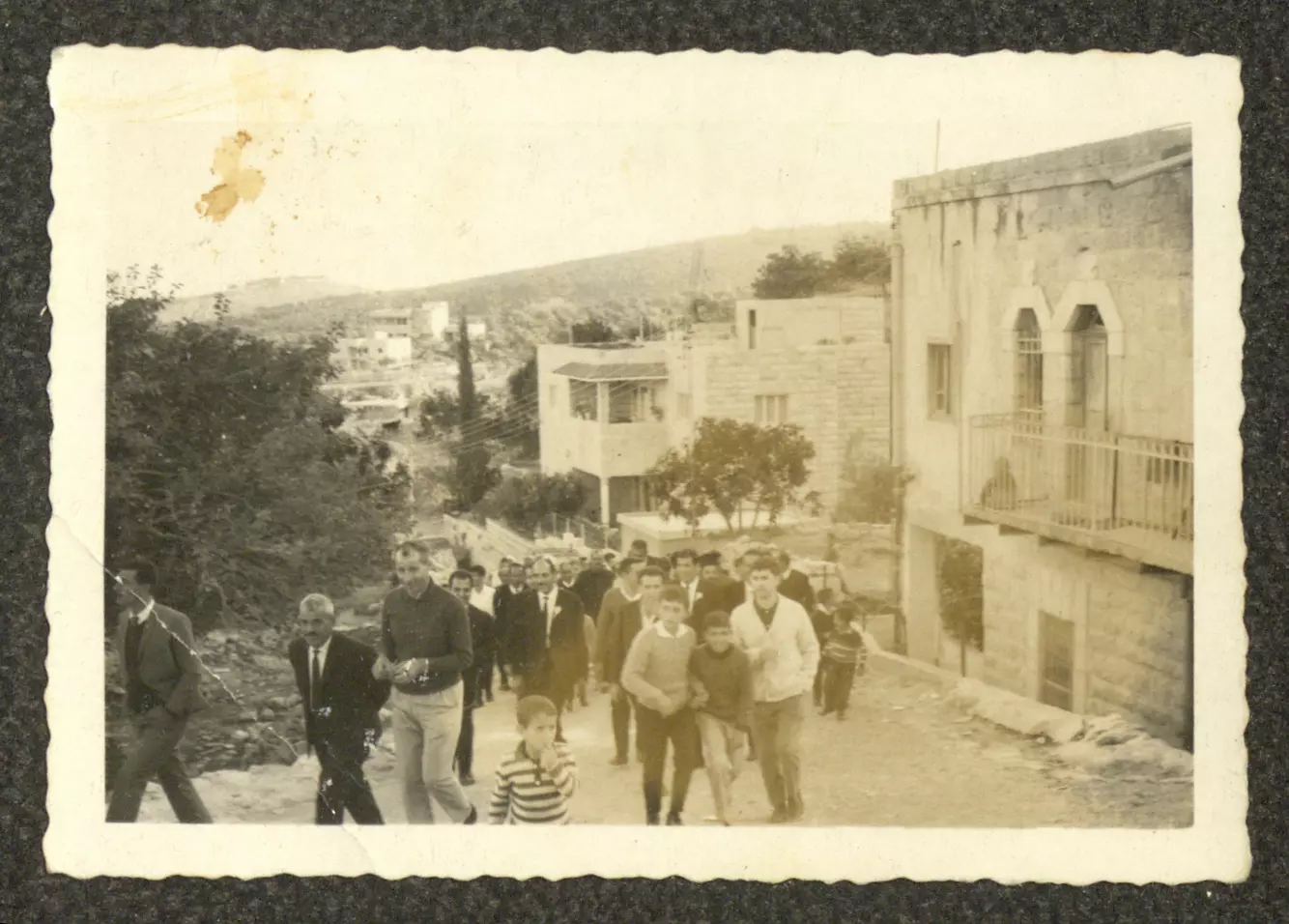
1 - إطلاله باتجاه بيت جالا، يظهر رجال ومن خلفهم نساء، هؤلاء يعملون بالأجرة في الطريق التي تصل بين بيت لحم والقدس. يمكن ملاحظة "القُفف" من حولهم، والتي يستعملونها في عملهم لنقل الحجارة
- جولة في بيت جالا -- 1921
- جولة في بيت جالا -- 1921 #2
- جولة في بيت جالا -- 1921 #3
- جولة في بيت جالا -- 1921 #4
- جولة في بيت جالا -- 1921 #5
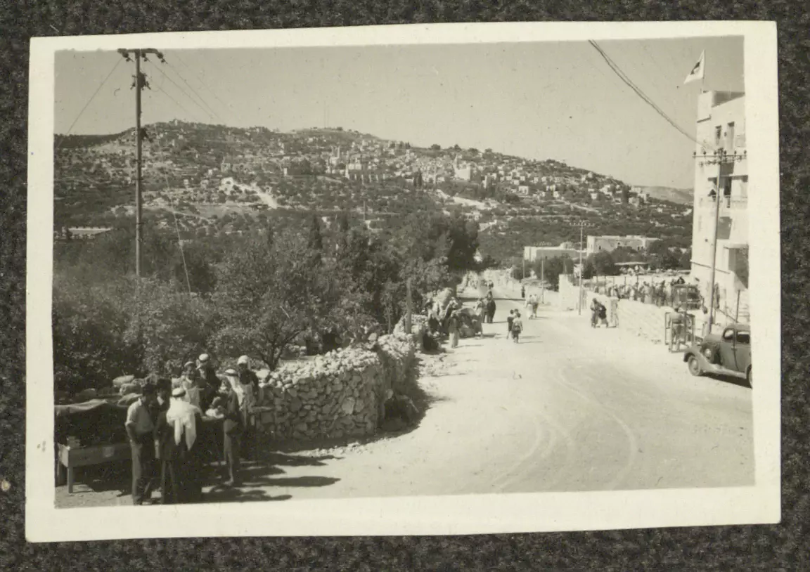
- بيت جالا في 1957
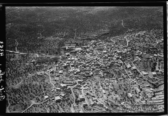
1 - صورة من الجو لبلدة بيت جالا في سنة 1931
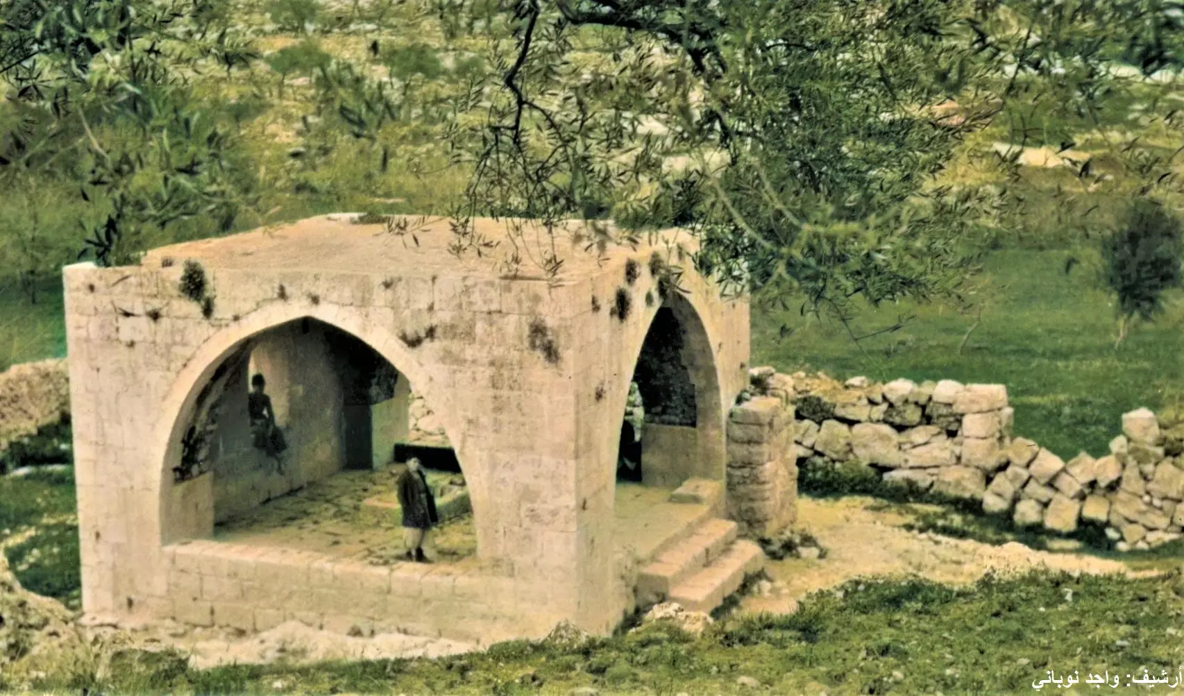
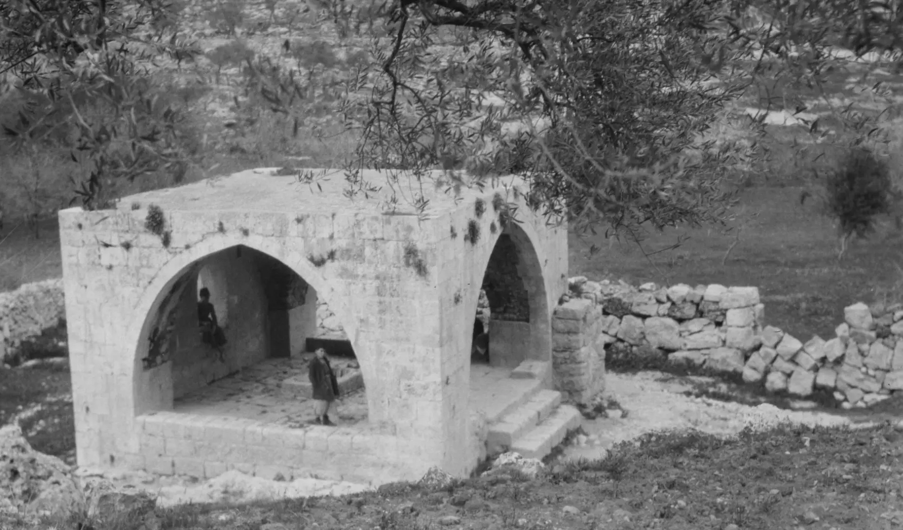
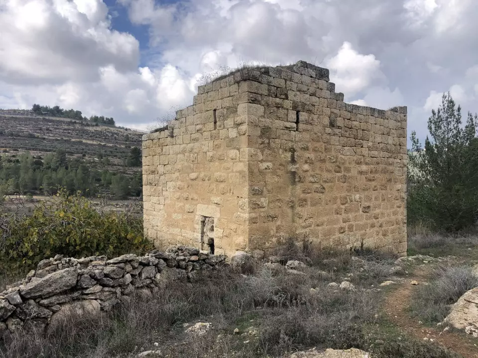
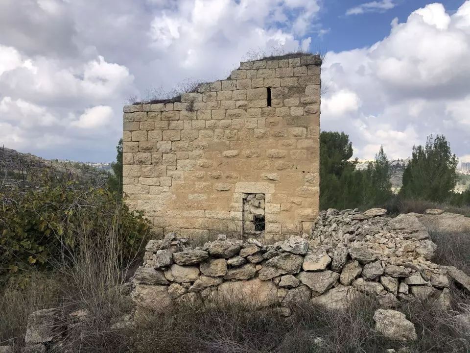
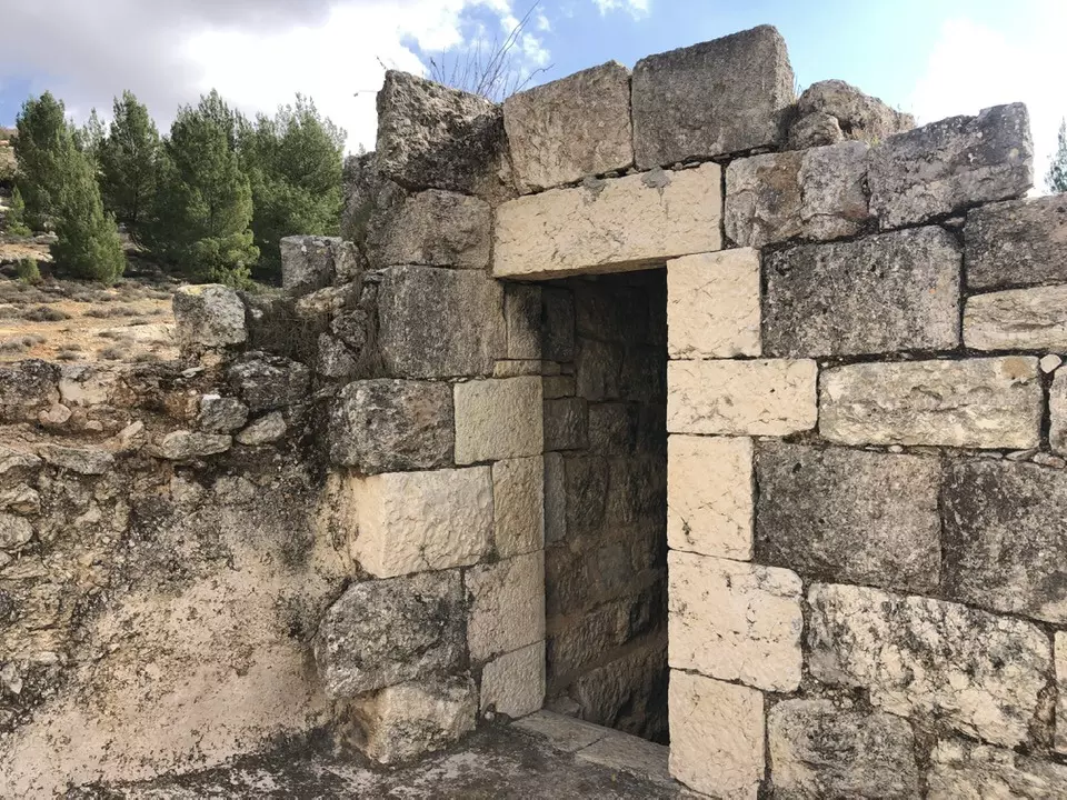
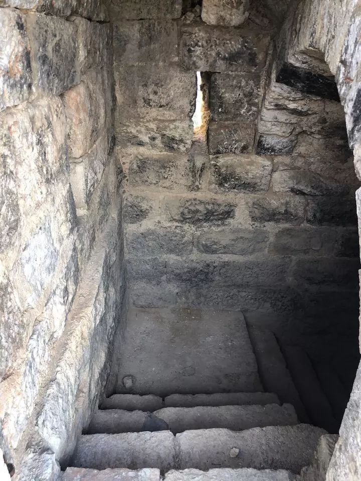
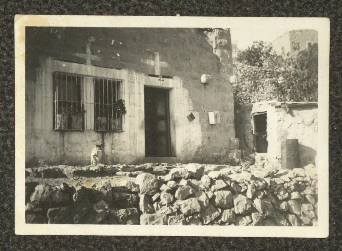
- بقاية خربة بيت إِرزة
- بقاية خربة بيت إِرزة #2
- بقاية خربة بيت إِرزة #3
- بقاية خربة بيت إِرزة #4
- بيت جالا قبل 100 عام
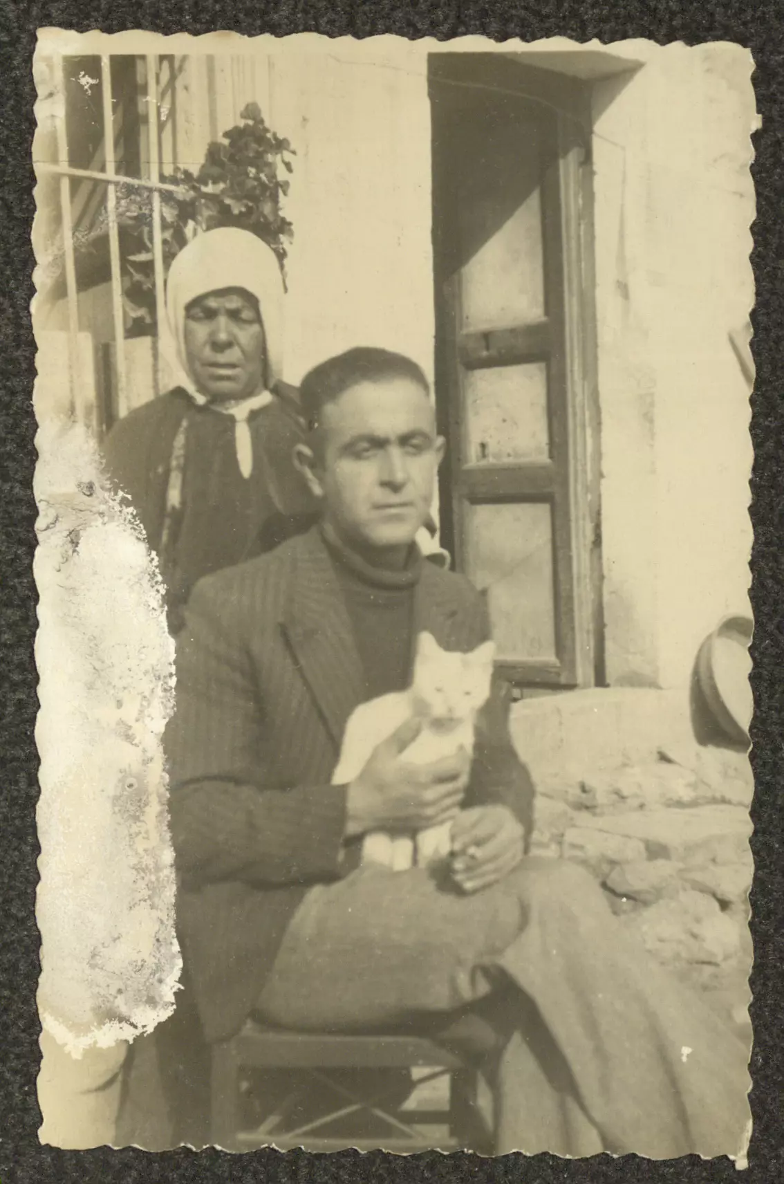
- سمعان الأعرج وزوجته عزيزة، والفتاة هيلانة والطفل مِتري الأعرج.
بيت جالا في 1926
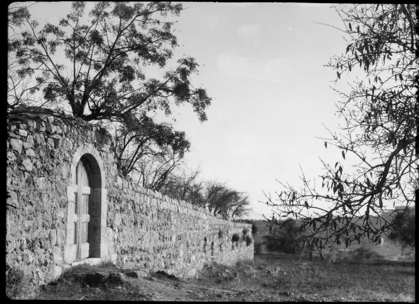
- بيت صغير بهالمدى .. ما بيعرف طريقه حدا
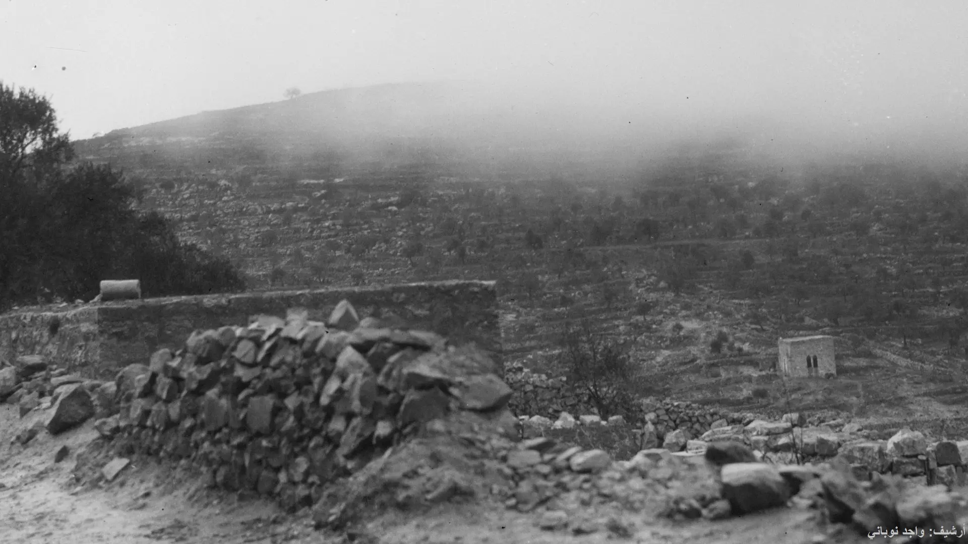
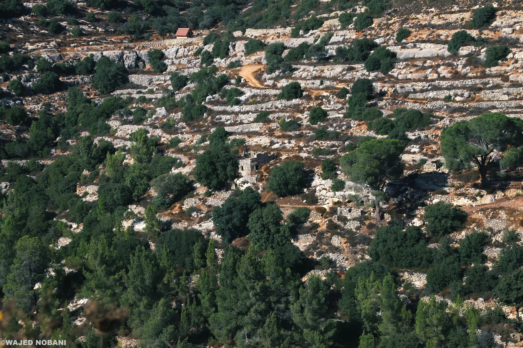
قرميده مغطى بالثلج .. وكل المرج شجر وعصافير كثير-- واجد النوباني
- بيت تاريخه ١٩١٤
- بيت تاريخه ١٩١٤ #2
- بيت تاريخه ١٩١٤ #3
- بيت تاريخه ١٩١٤ #4
- بيت جالا عام بعد عام 1900
- بيت جالا 23.10.2000
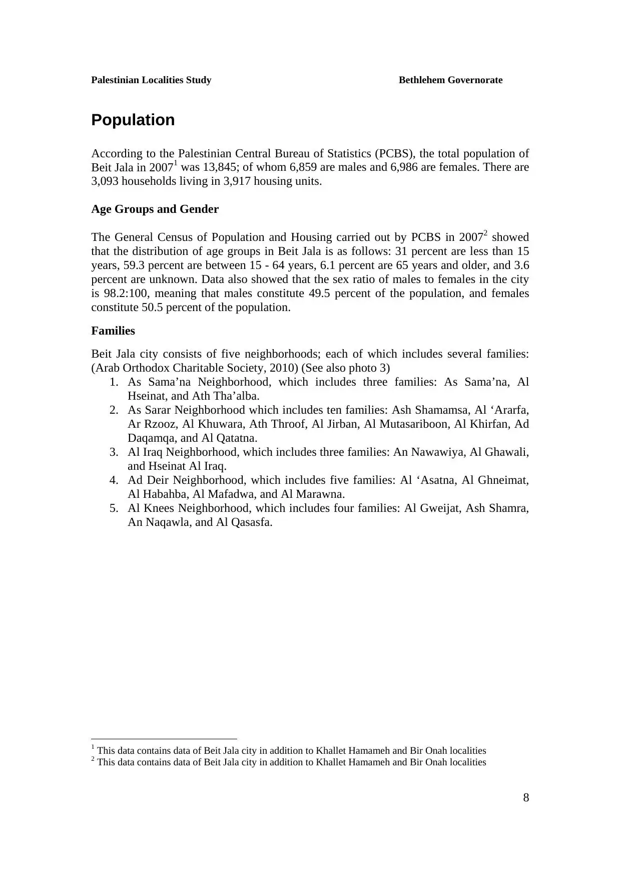
- قامت بيت جالا في 5 حارات: حارة الدير، حارة الكنيس، الصرار، السماعنة، العراق.
هذه صور التقطها فرانك شولتن قبل 100 عام
- قامت بيت جالا في 5 حارات: حارة الدير، حارة الكنيس، الصرار، السماعنة، العراق.
هذه صور التقطها فرانك شولتن قبل 100 عام #2
- قامت بيت جالا في 5 حارات: حارة الدير، حارة الكنيس، الصرار، السماعنة، العراق.
هذه صور التقطها فرانك شولتن قبل 100 عام #3
- قامت بيت جالا في 5 حارات: حارة الدير، حارة الكنيس، الصرار، السماعنة، العراق.
هذه صور التقطها فرانك شولتن قبل 100 عام #4
- قامت بيت جالا في 5 حارات: حارة الدير، حارة الكنيس، الصرار، السماعنة، العراق.
هذه صور التقطها فرانك شولتن قبل 100 عام #5
- صورة قديمة جدا لبلدة بيت جالا وهي بتاريخ 23.10.1896
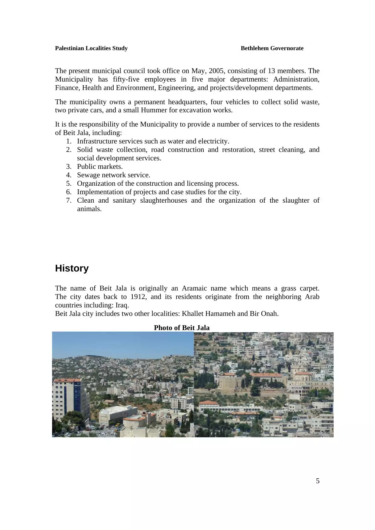
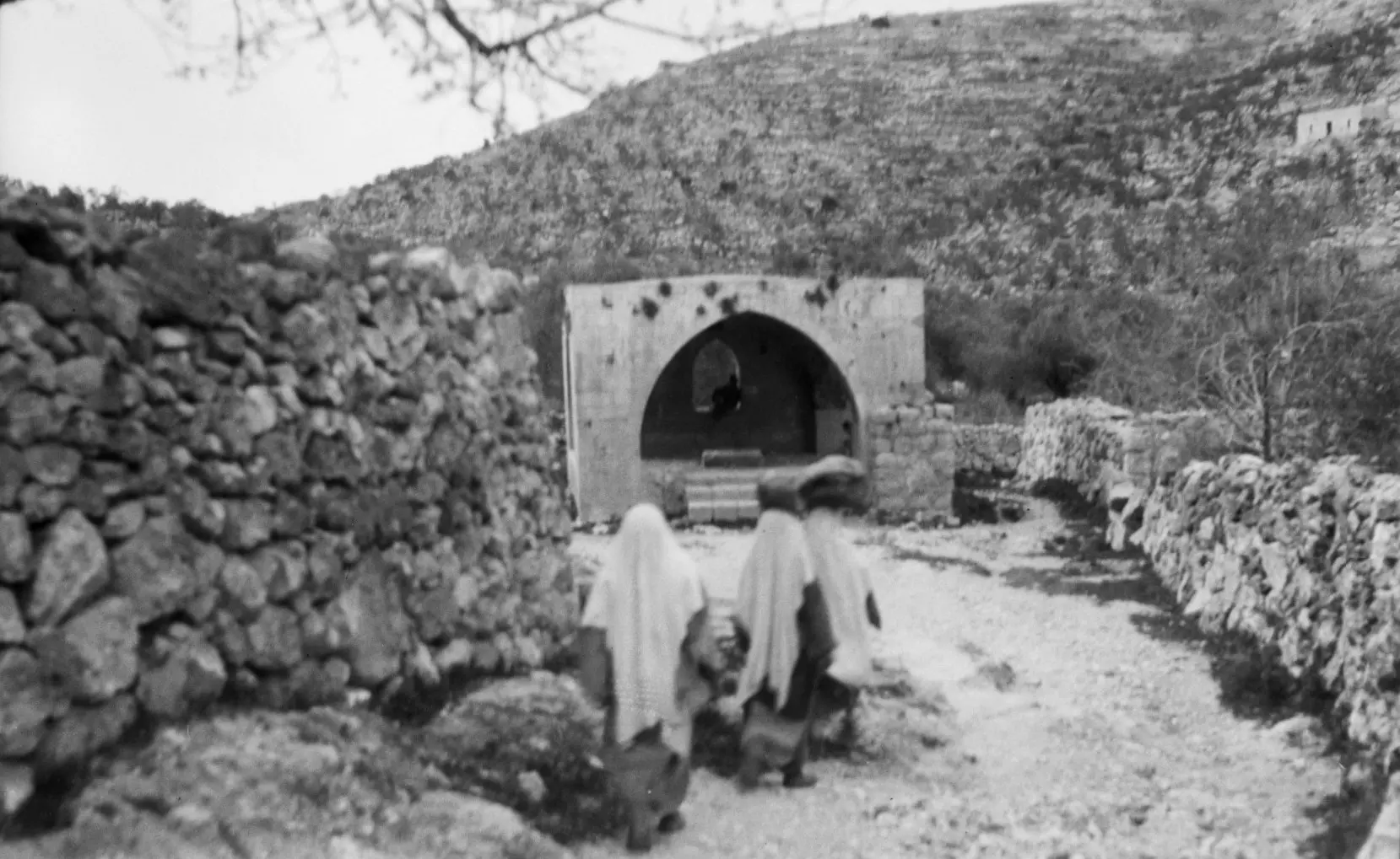
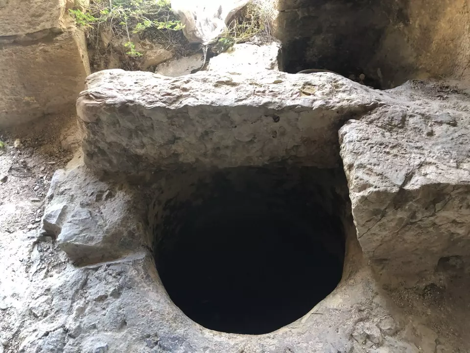
- بير عونة. قبل 100 عام
- بيت جالا قبل 95 سنة.
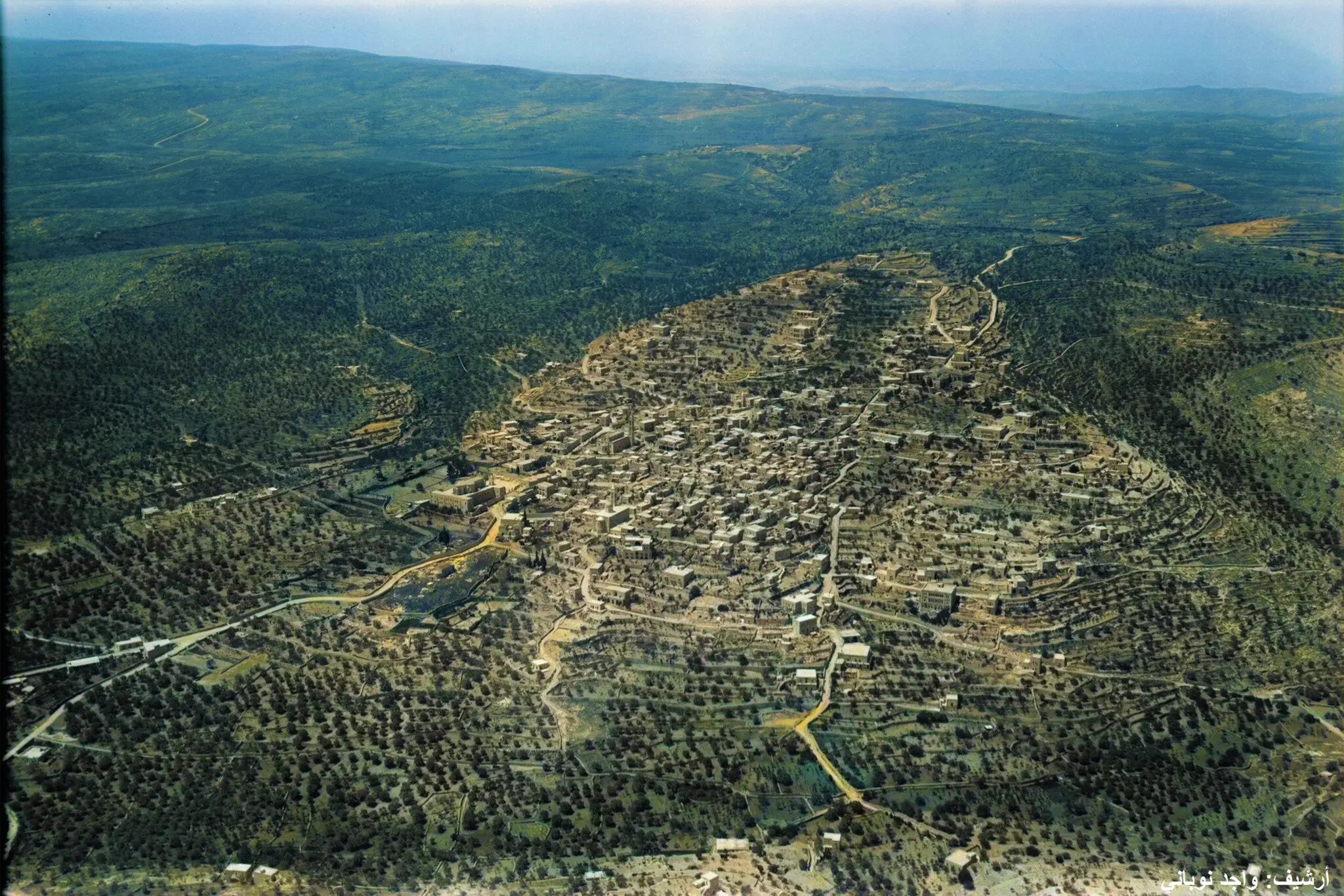
- صورة جوية لبلدة بيت جالا بتاريخ 1931
- بيت جالا في 1940م. السكان يزفون بفرح كبير عروسين في القرية.
- هذه بيت جالا قبل ما يزيد عن ال100 عام .. لاحظوا سُرجة الزيت الموضوعة لإضاءة الطريق
- بيت جالا 1962م
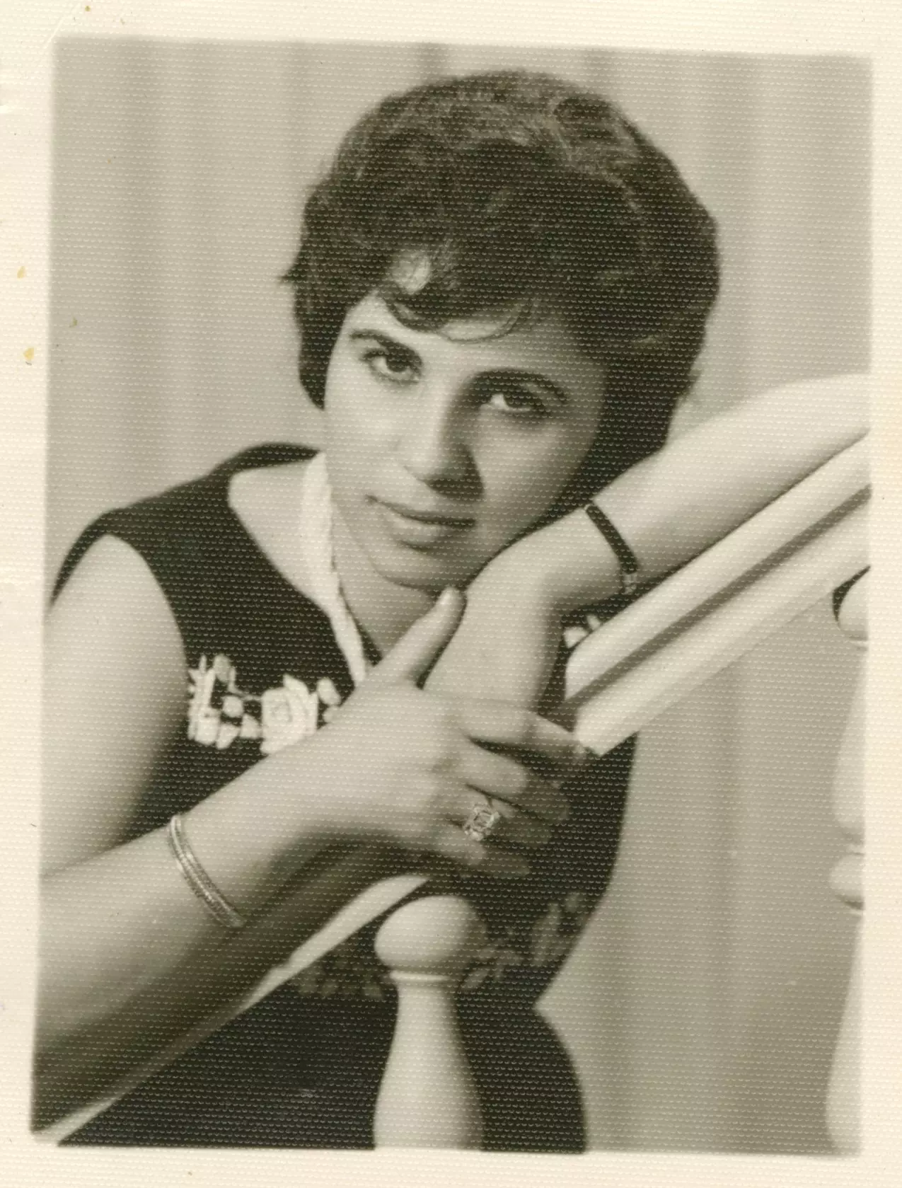
جوزفين قسيسة
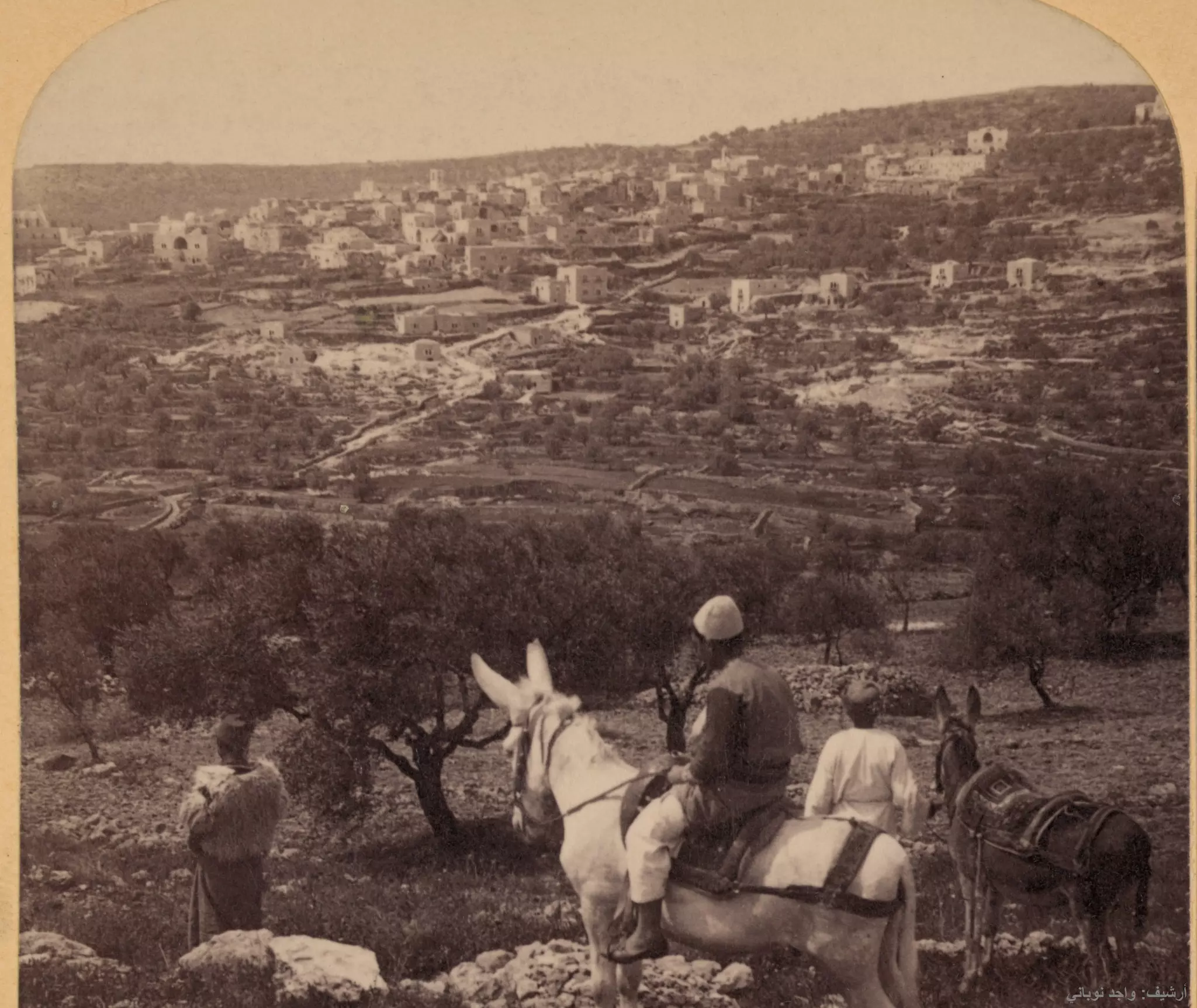
- طريق الصعود إلى بيت جالا للقادم من بيت لحم.. هذه الصورة قبل 100 عام
- الفرق بين الصورتين 100 سنة
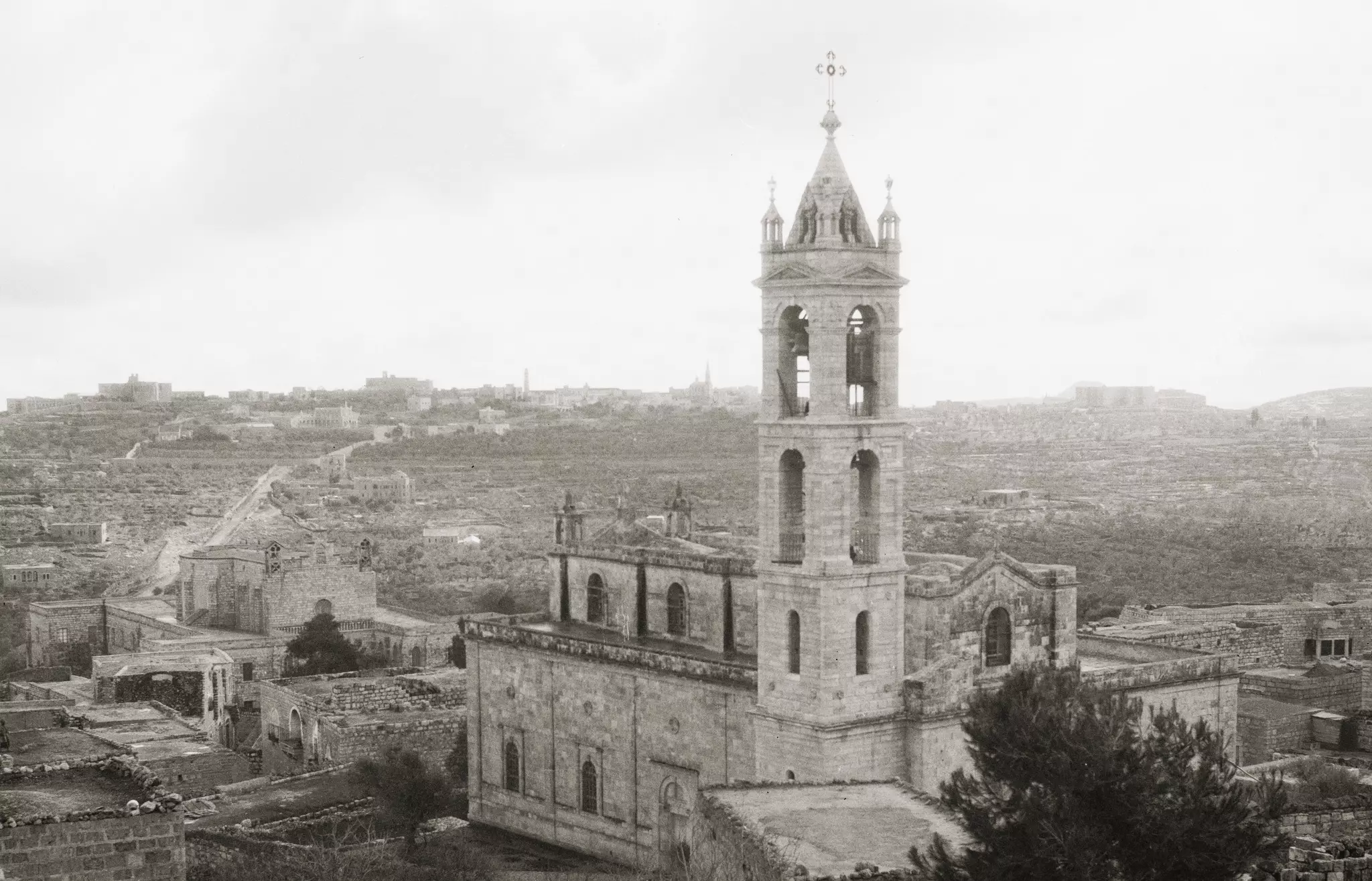
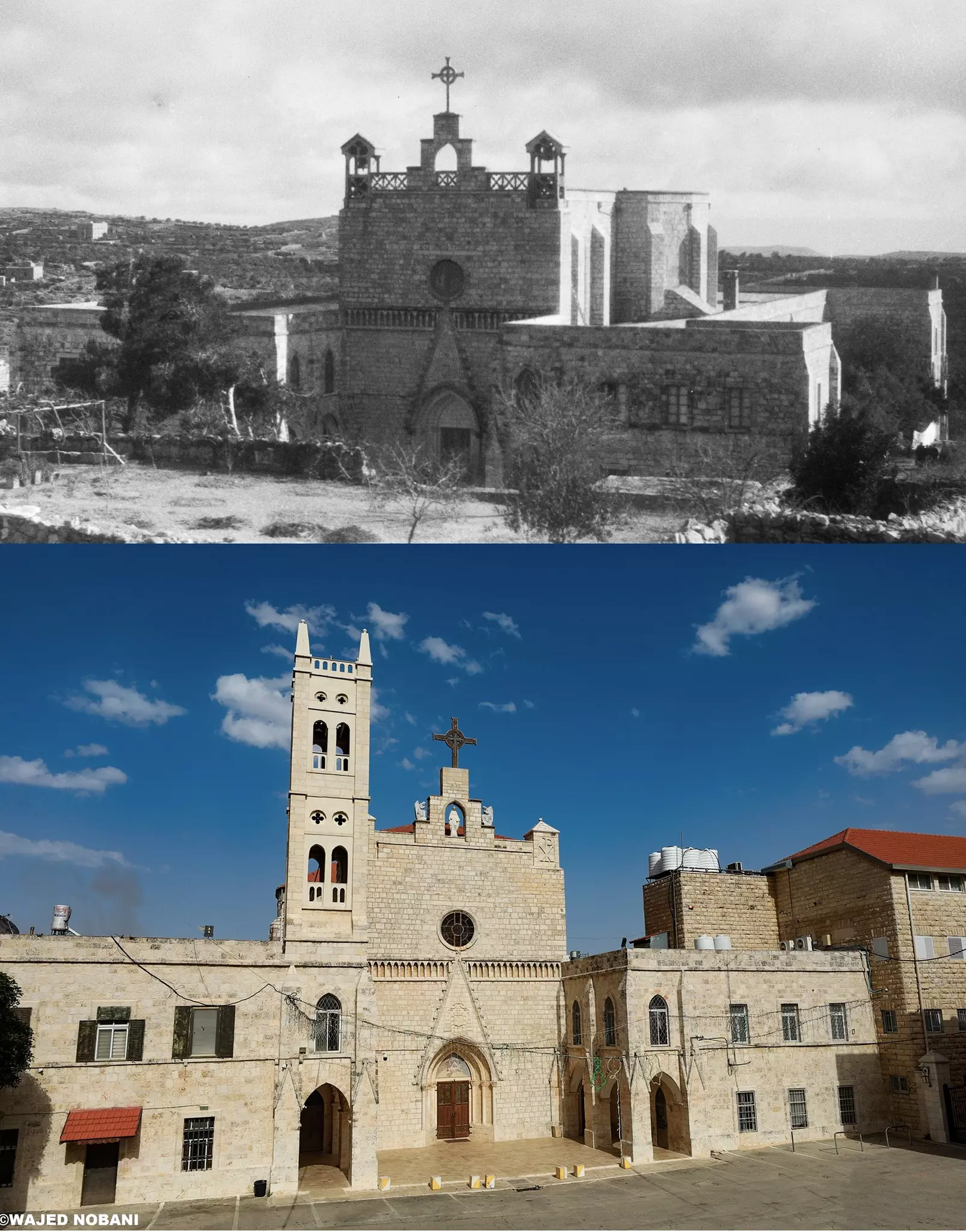
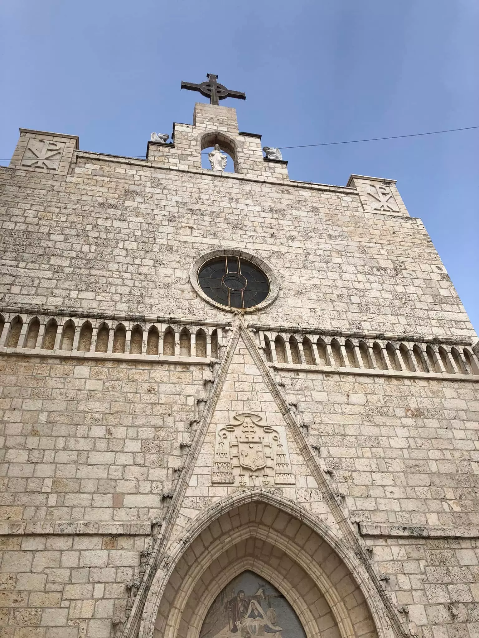
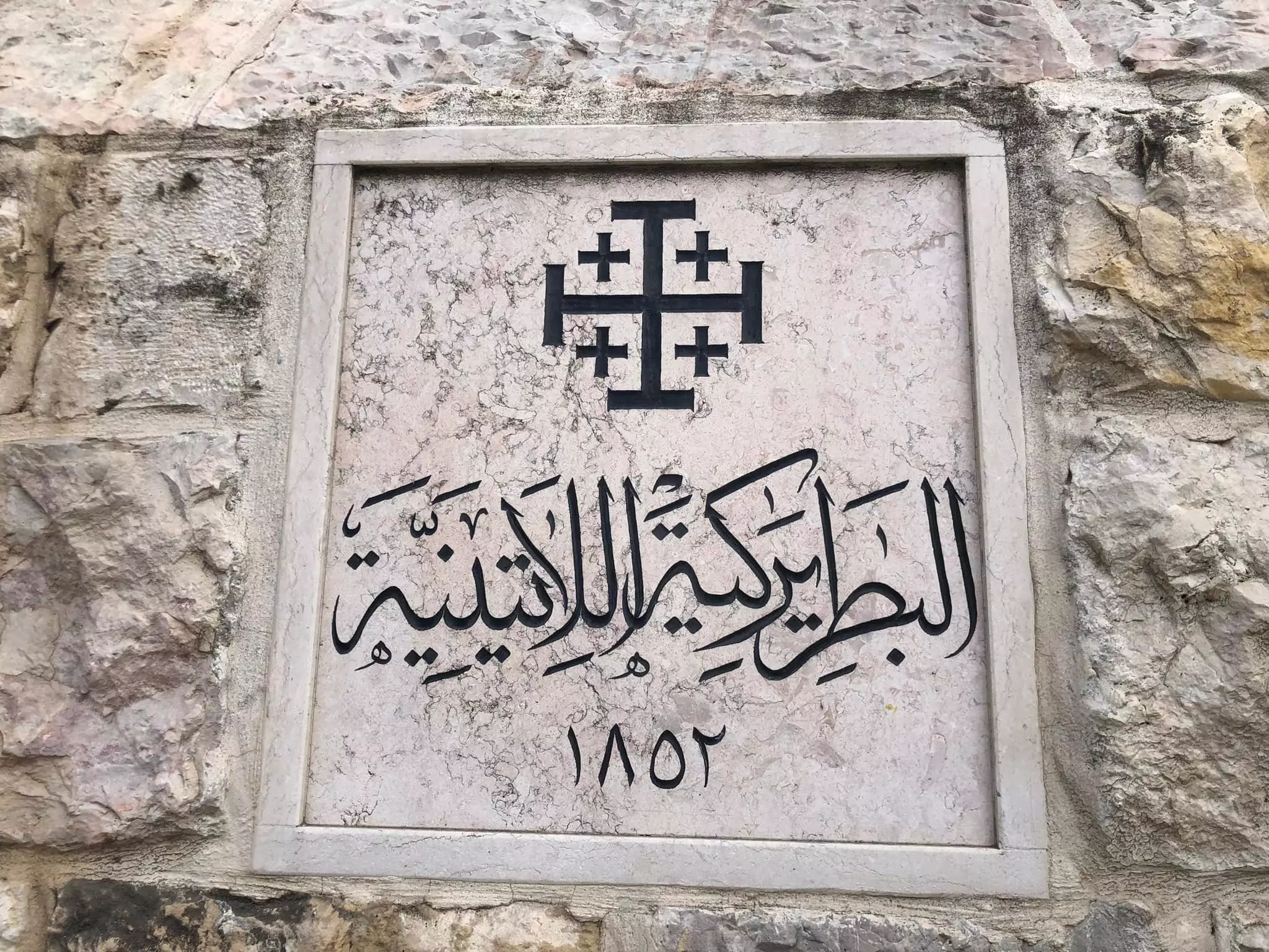
في الصورة البطريركية اللاتينية وقد قام البناء في 1852م
- بيت جالا قبل 100 سنة
- بيت جالا قبل 100 سنة #2
- بيت جالا قبل 100 سنة #3
- بيت جالا قبل 100 سنة #4
- بيت جالا قبل 100 سنة #5
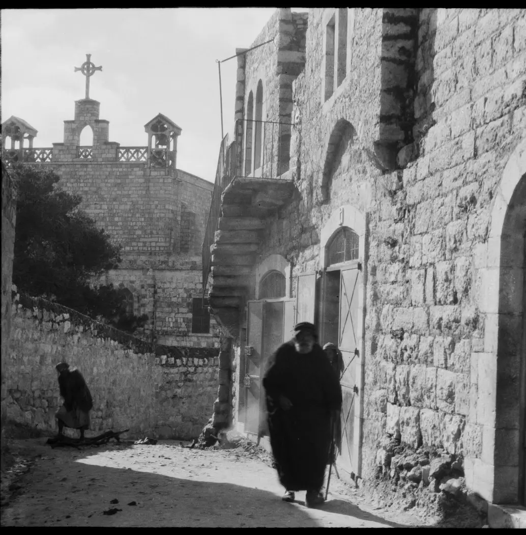
- بيت جالا قبل 100 سنة #6
- بيت جالا قبل 100 سنة #7
- بيت جالا قبل 100 سنة #8
- بيت جالا قبل 100 سنة #9
- بيت جالا قبل 100 سنة #10
- بيت جالا قبل 100 سنة #11
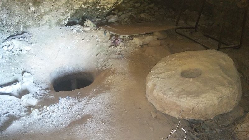
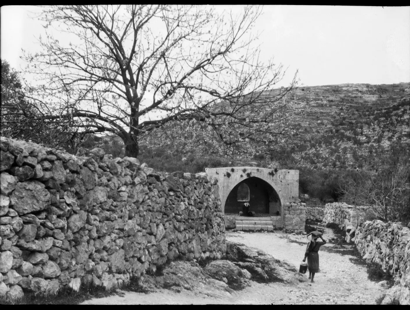
- من مطعم جالا جنغل ومغارة مار نقولا -- واجد النوباني
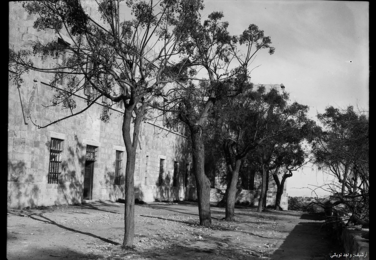
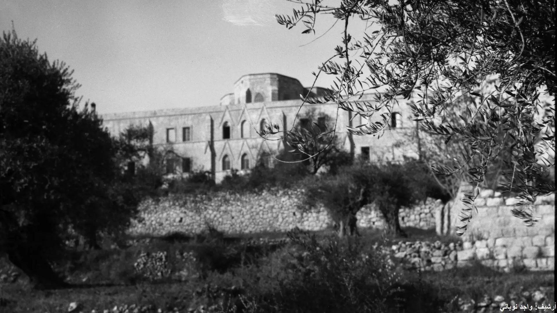
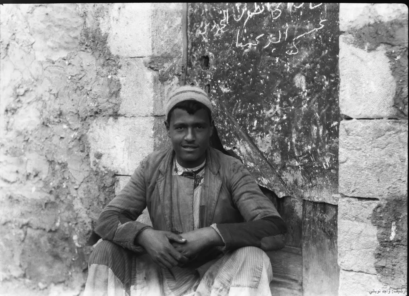
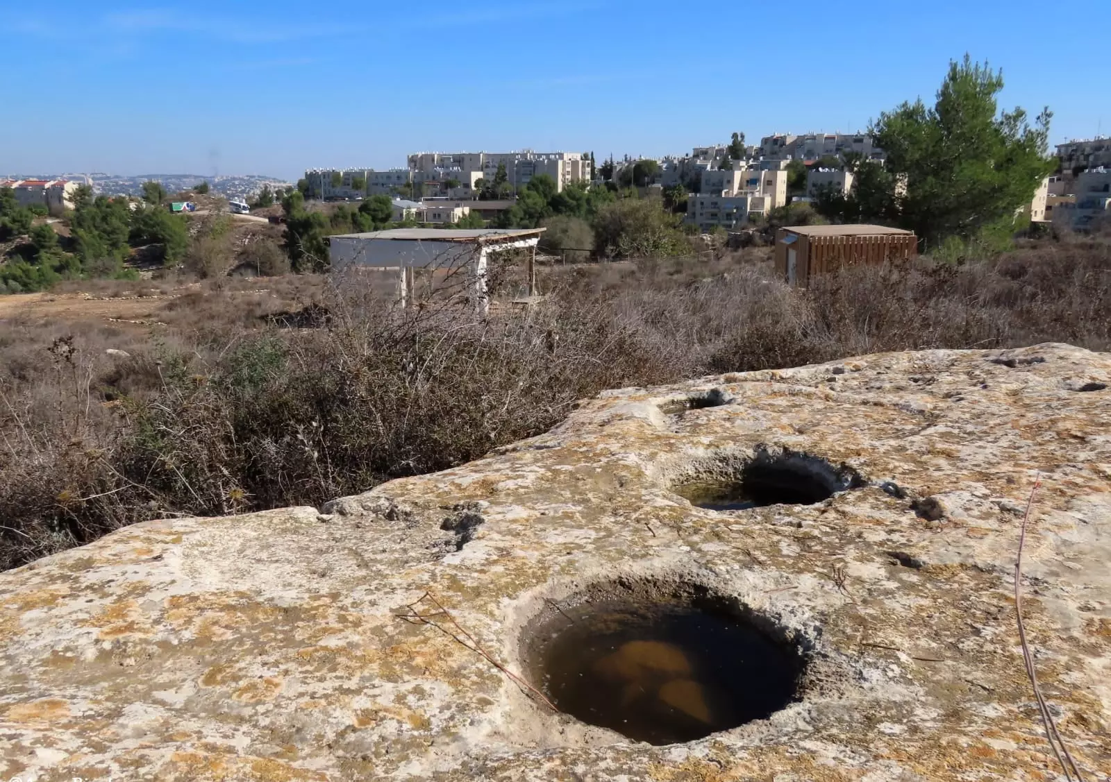
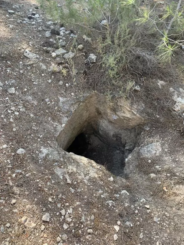
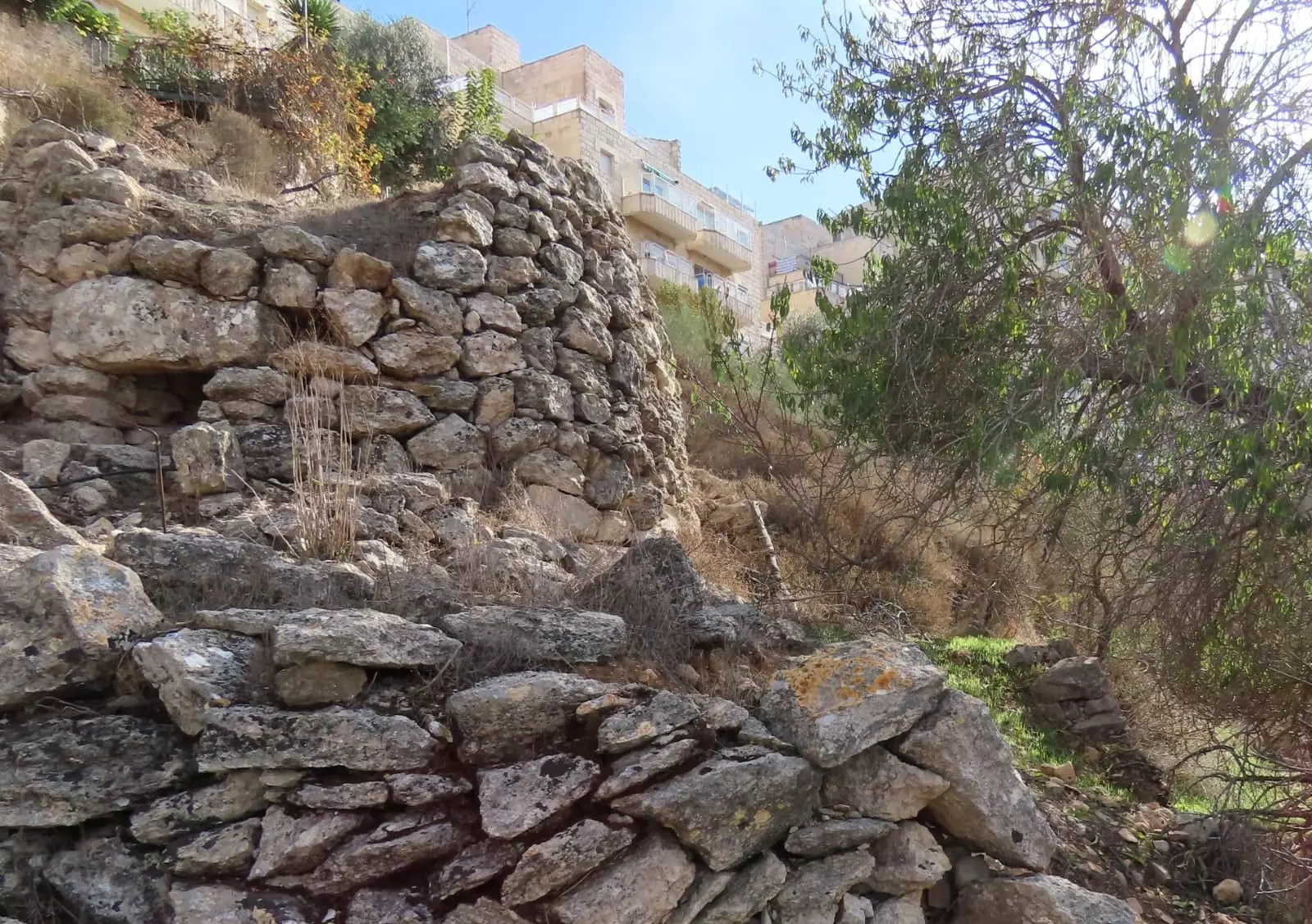
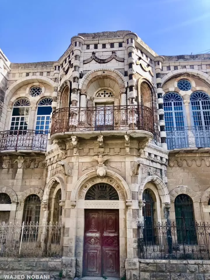
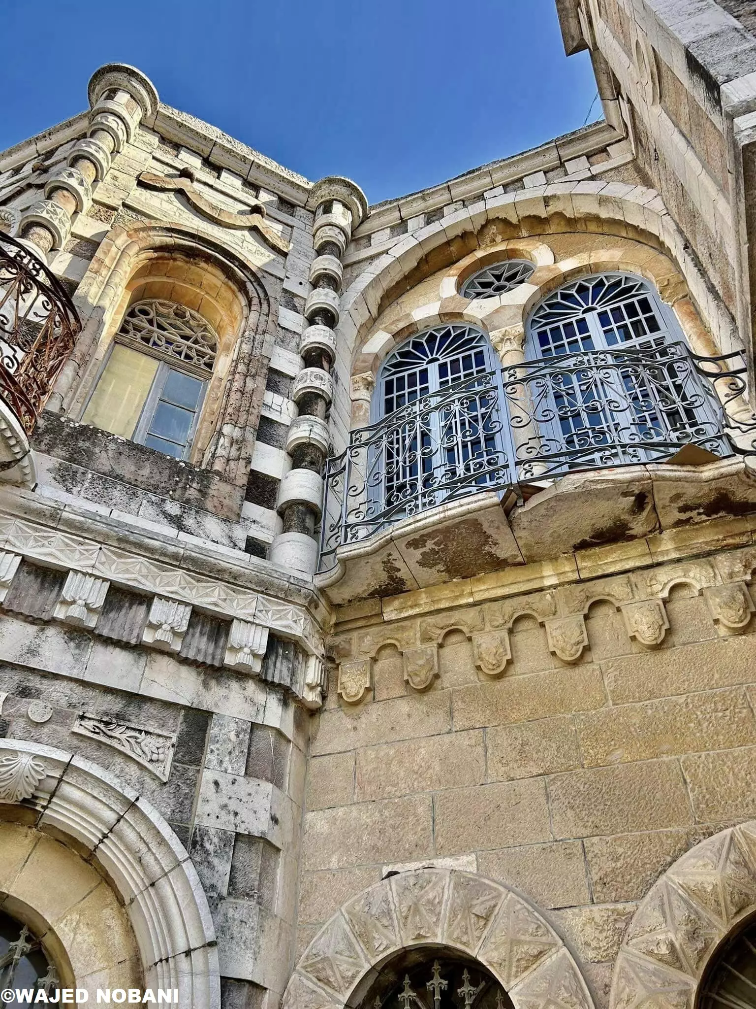
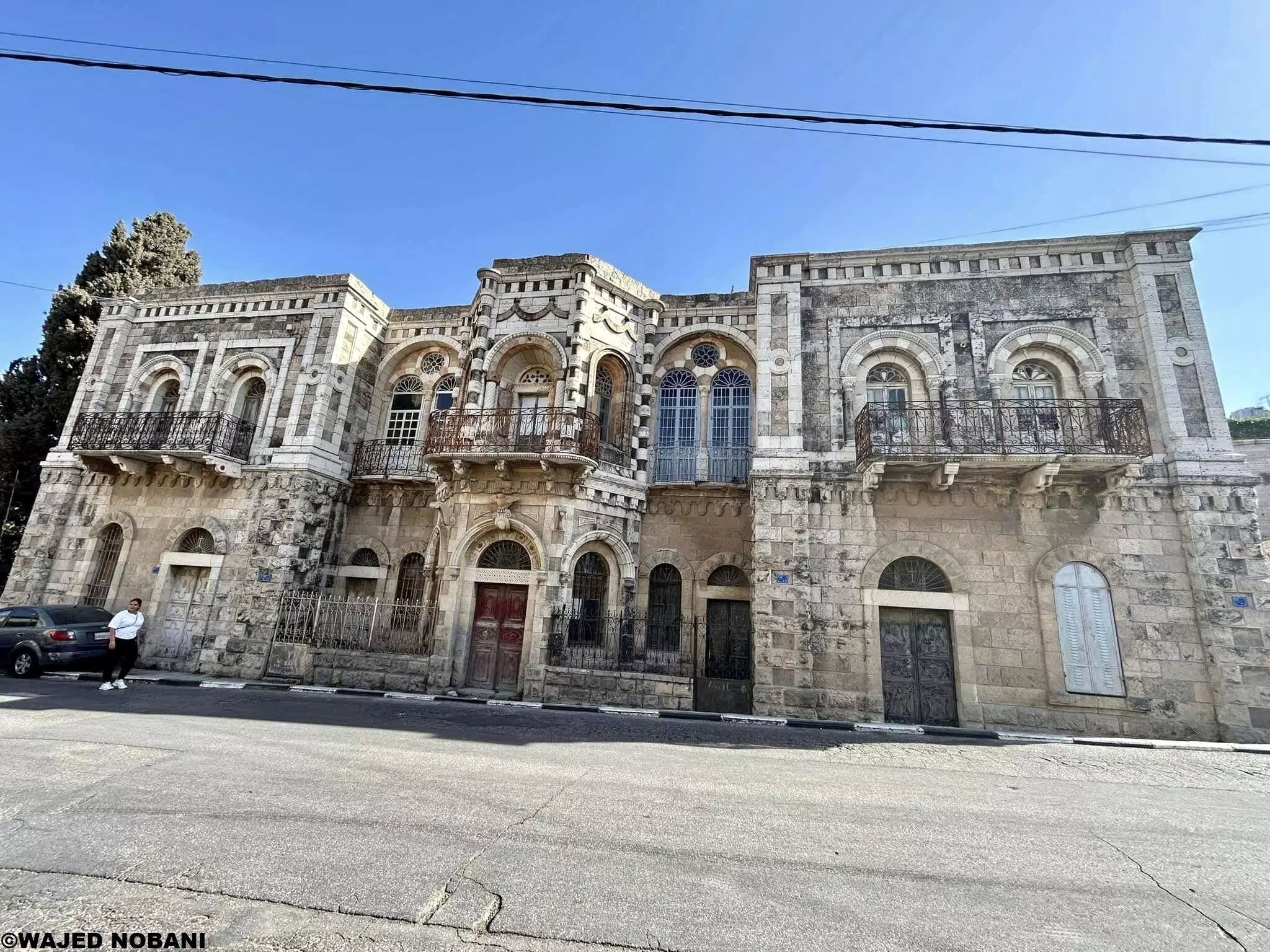
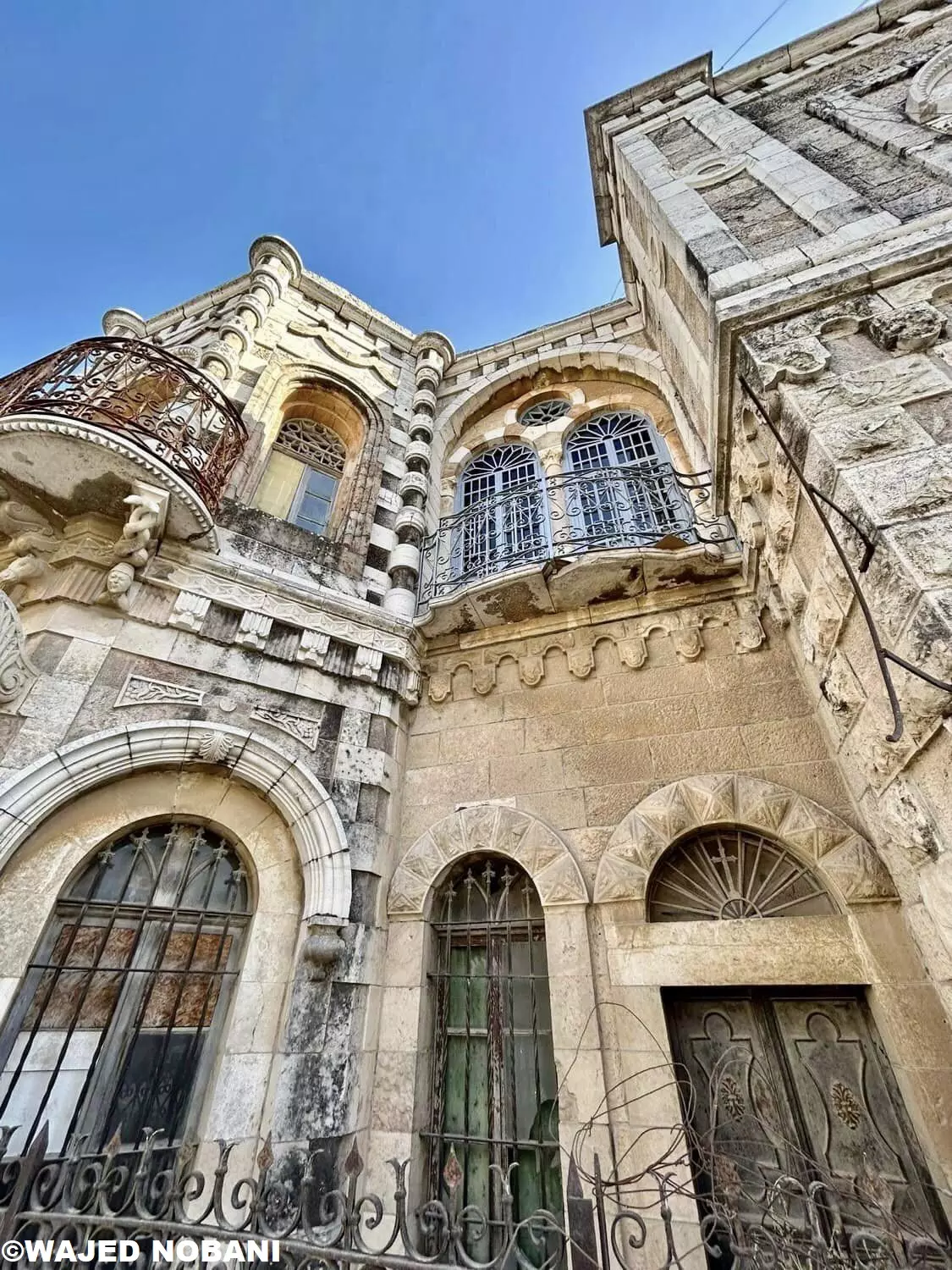
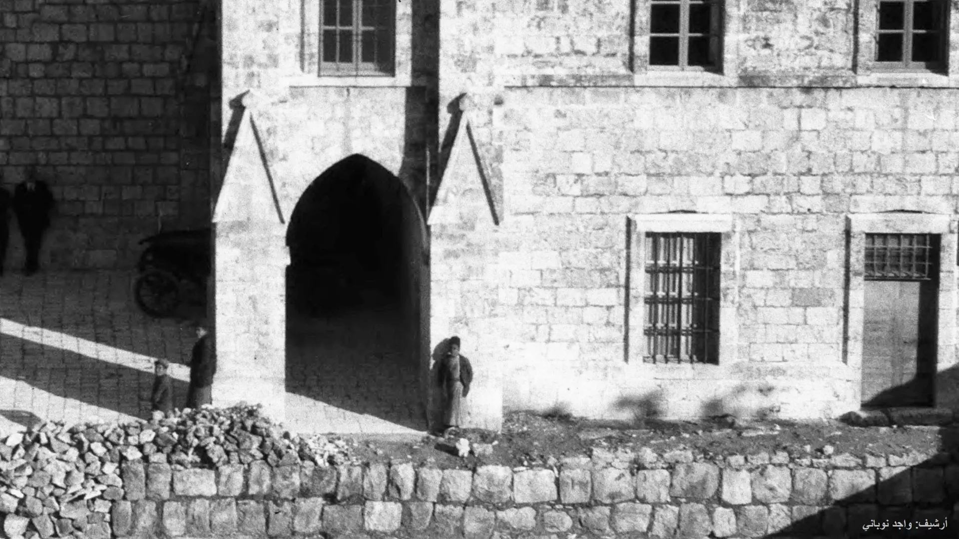
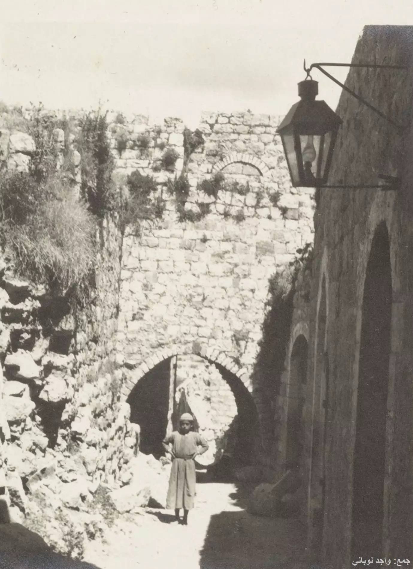
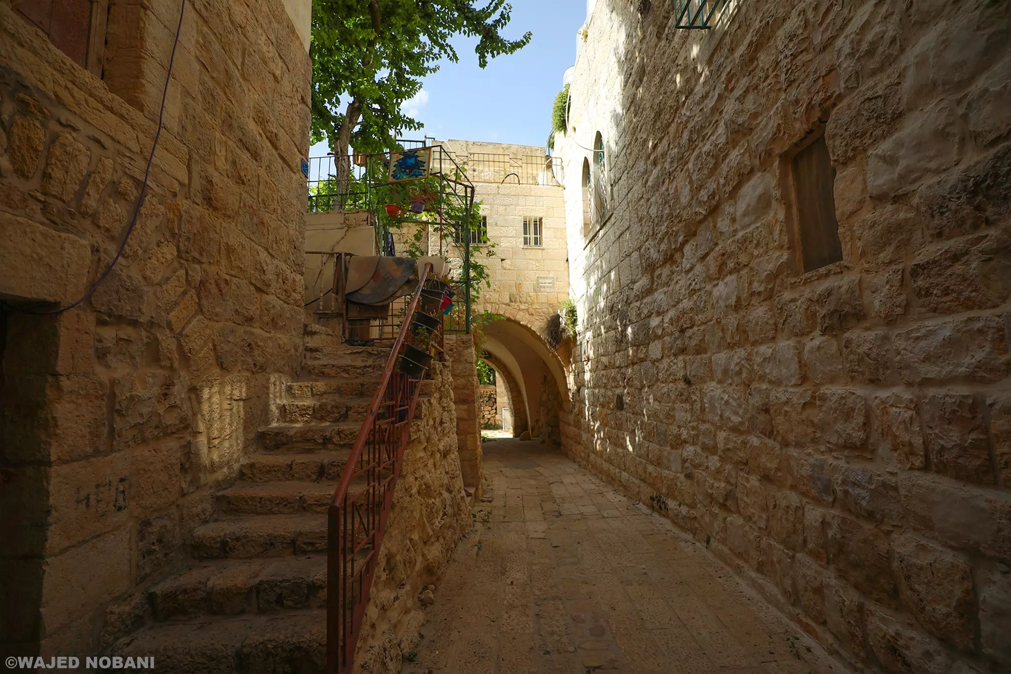
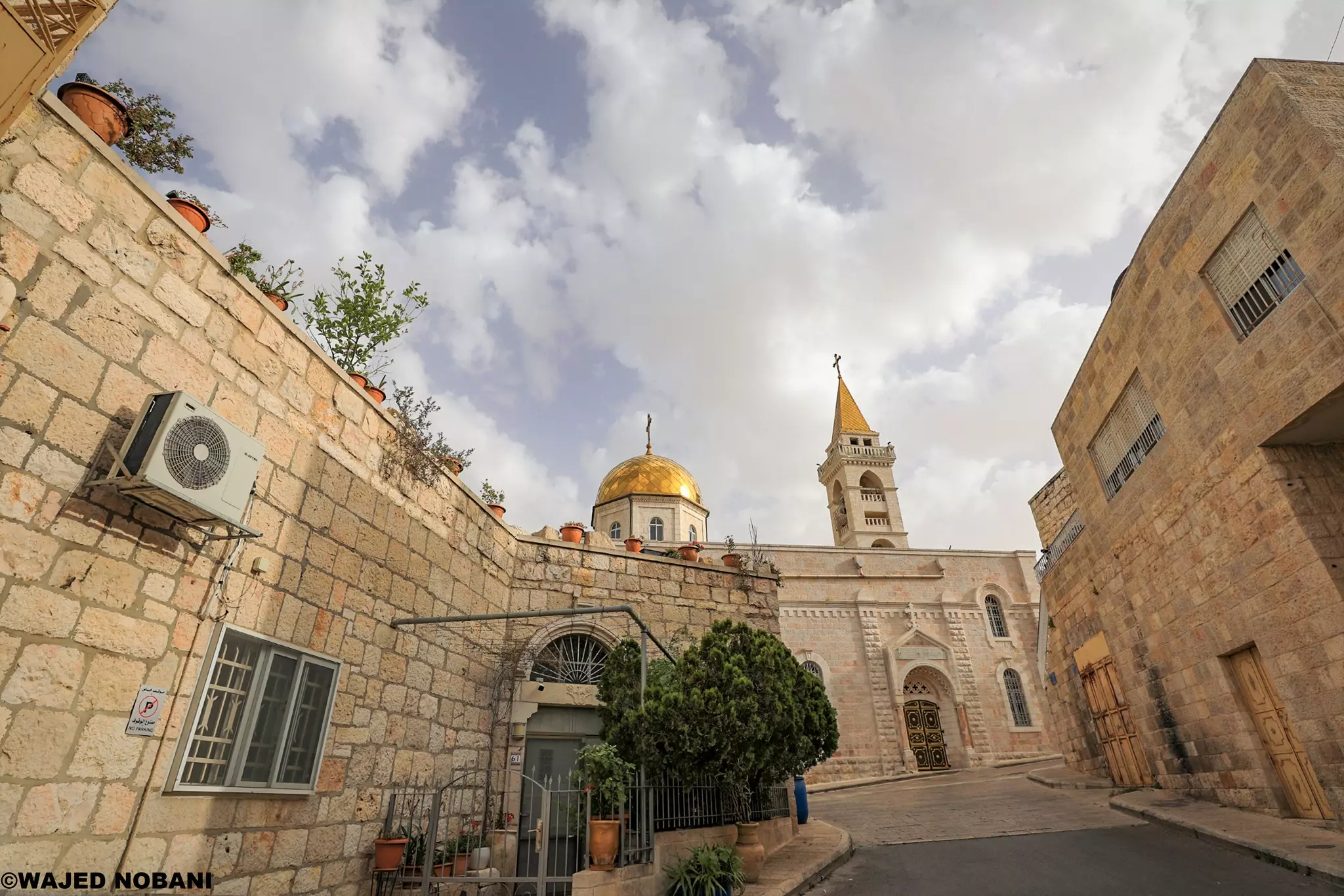
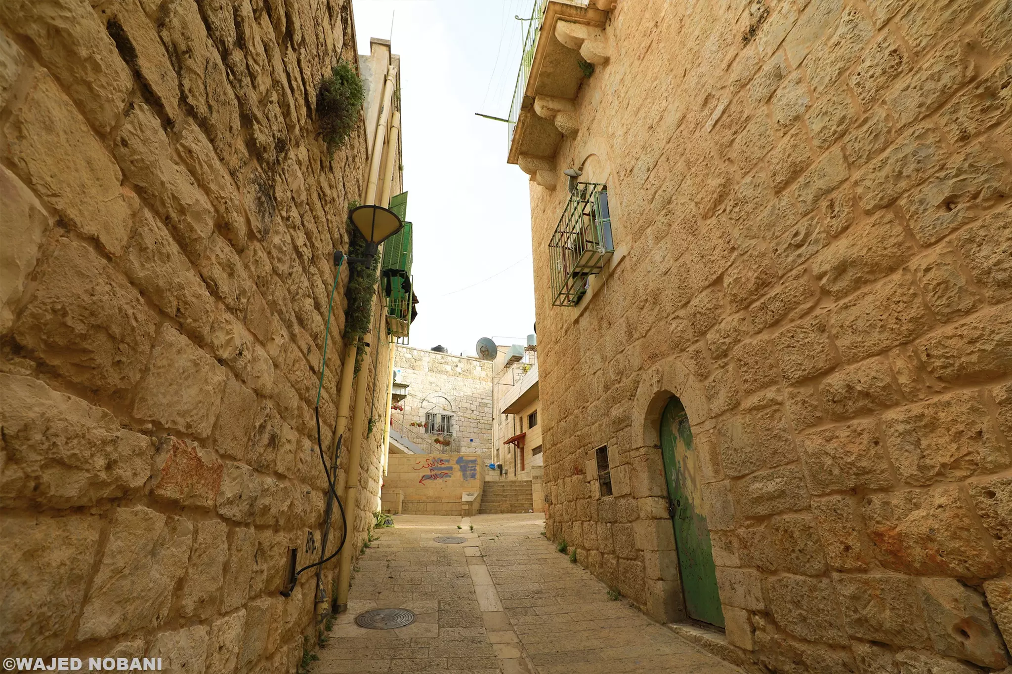
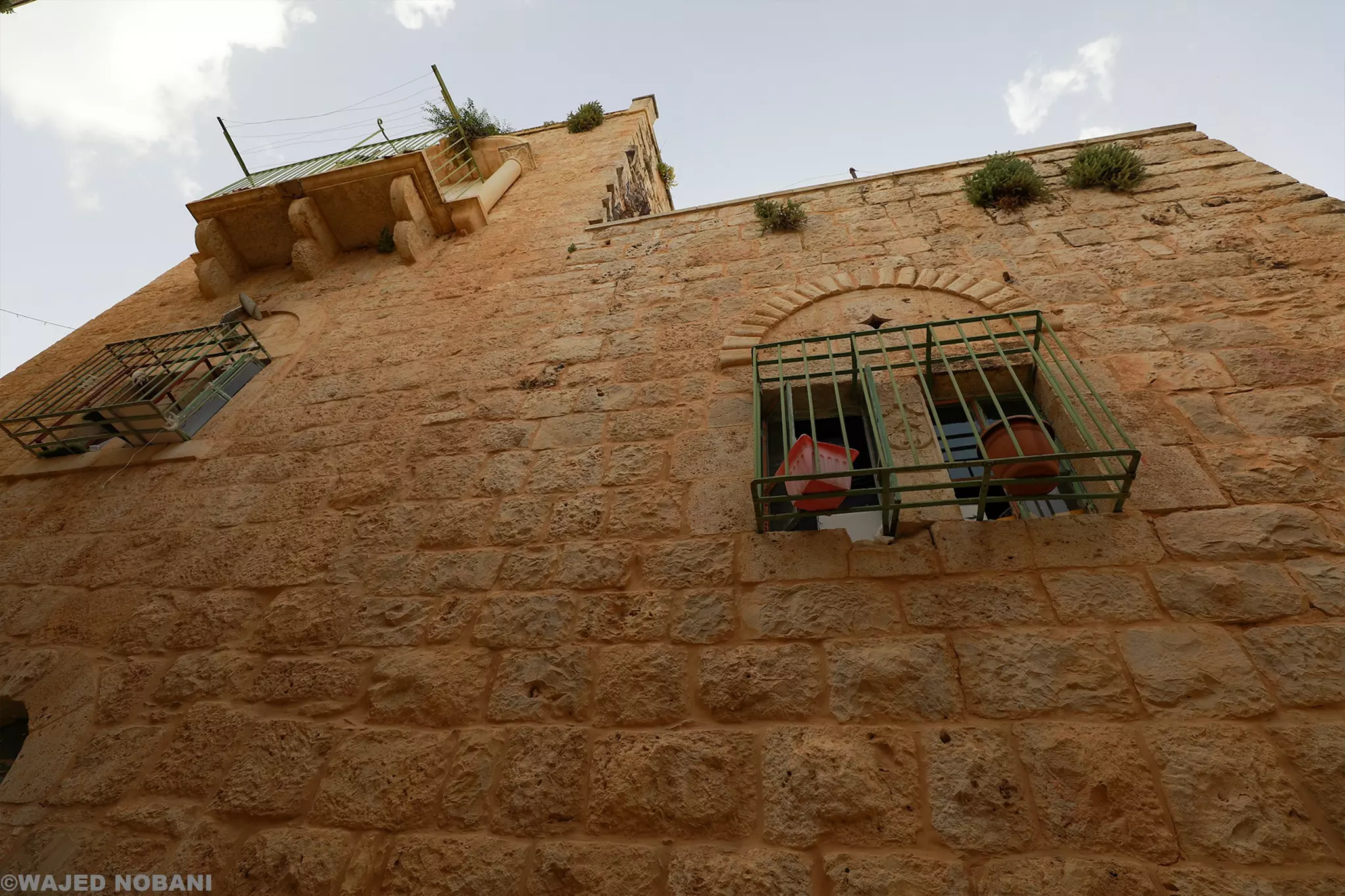
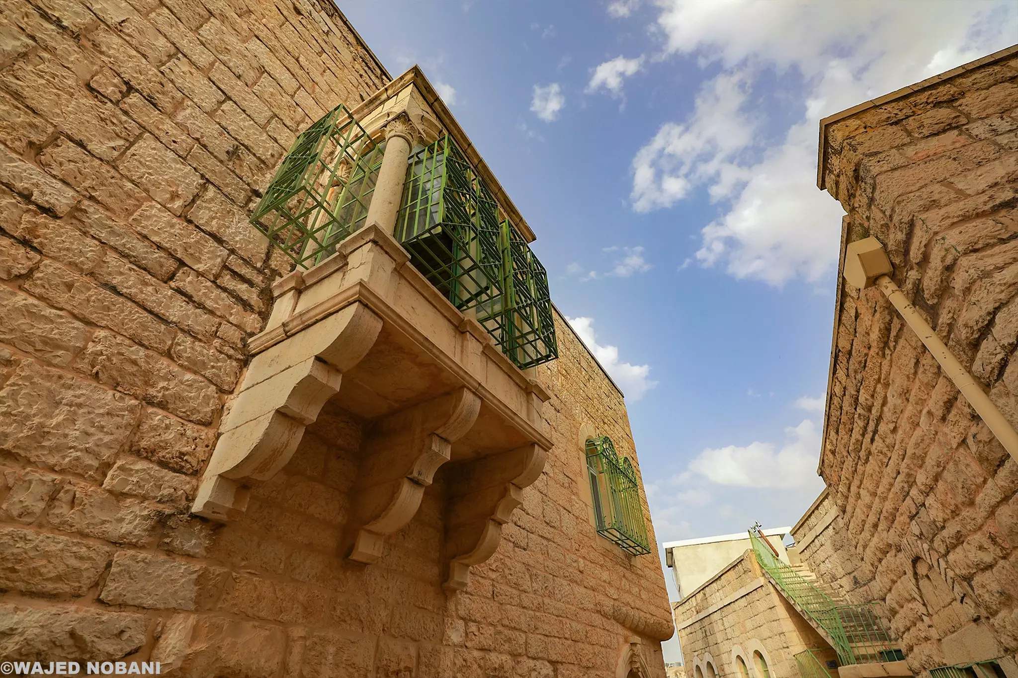
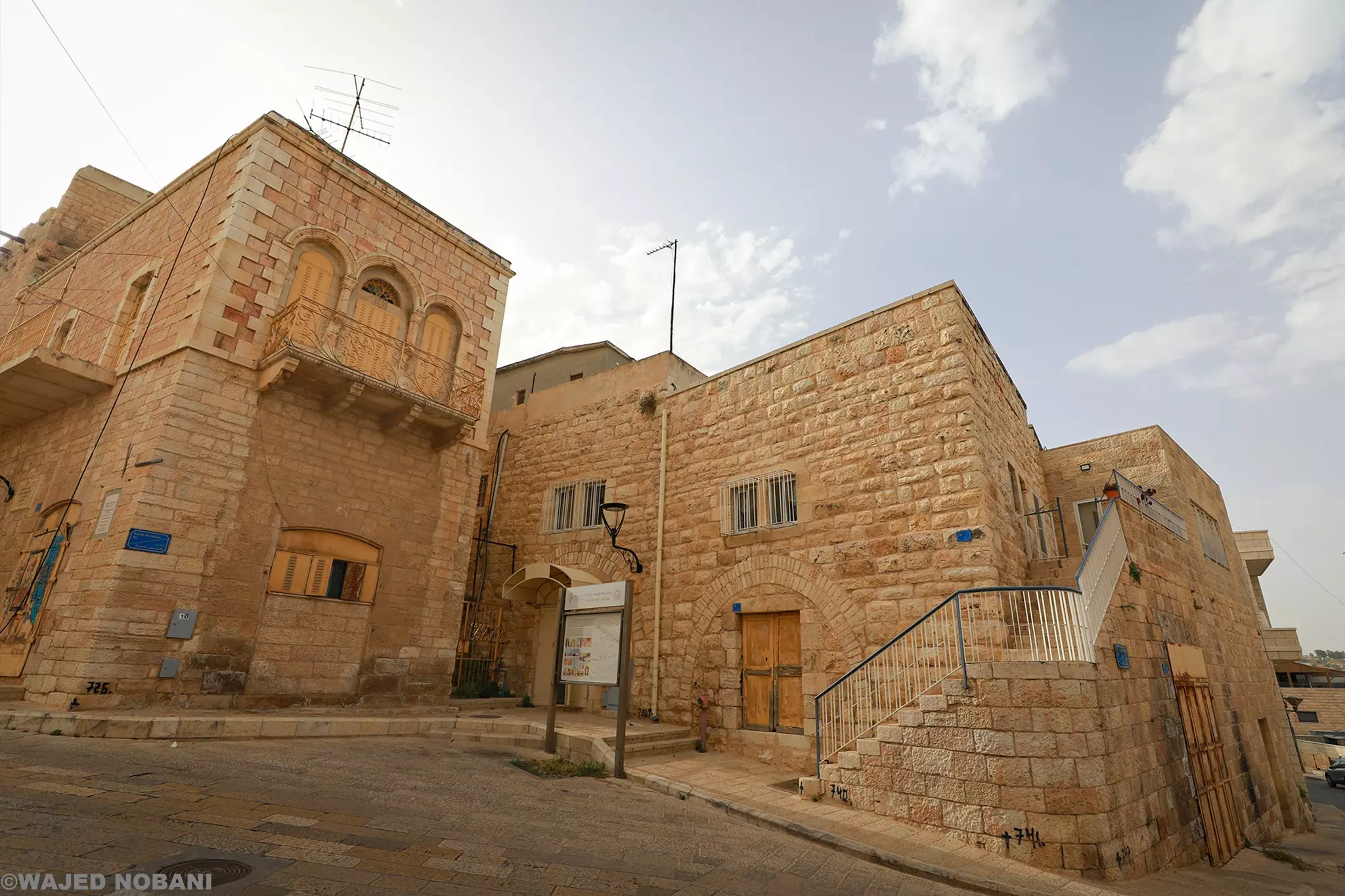
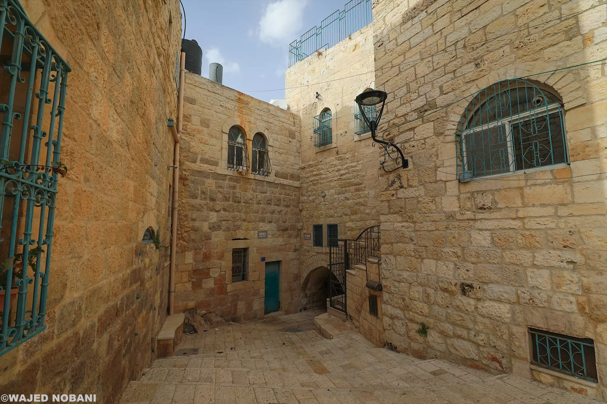
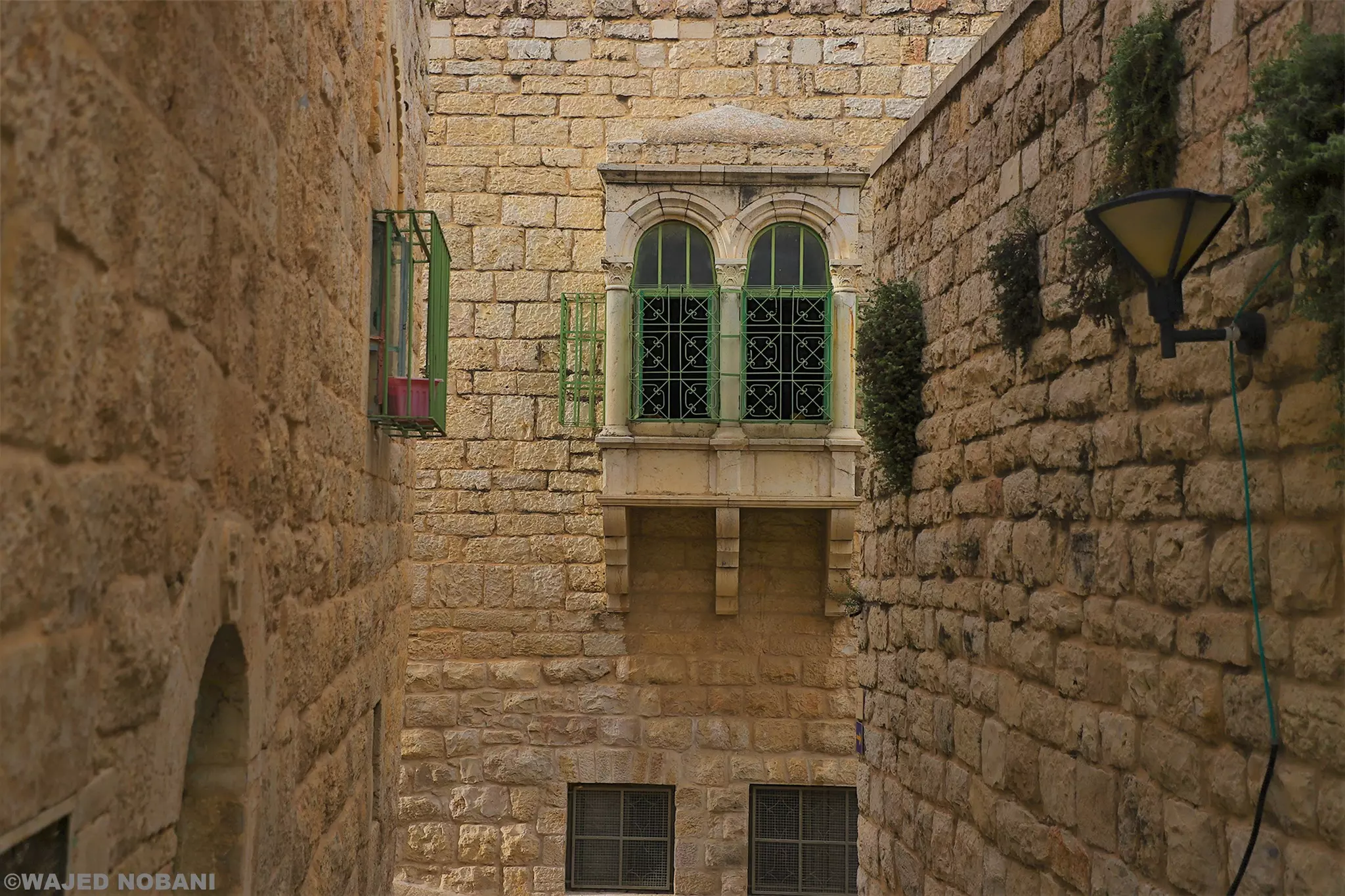
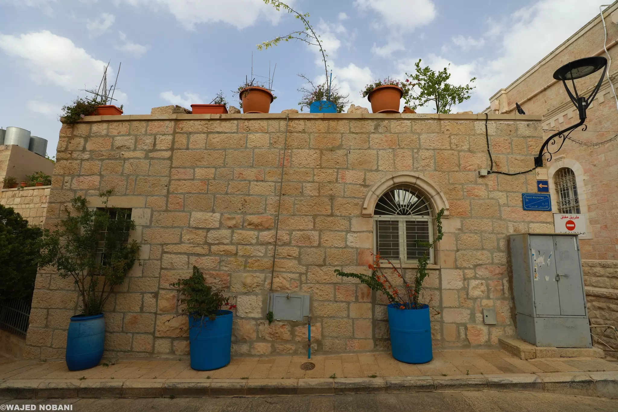
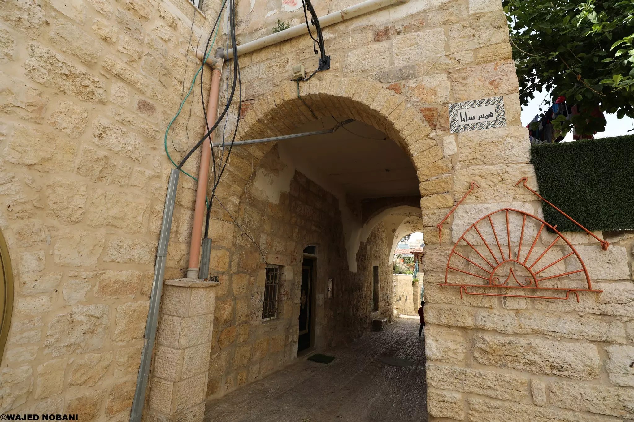
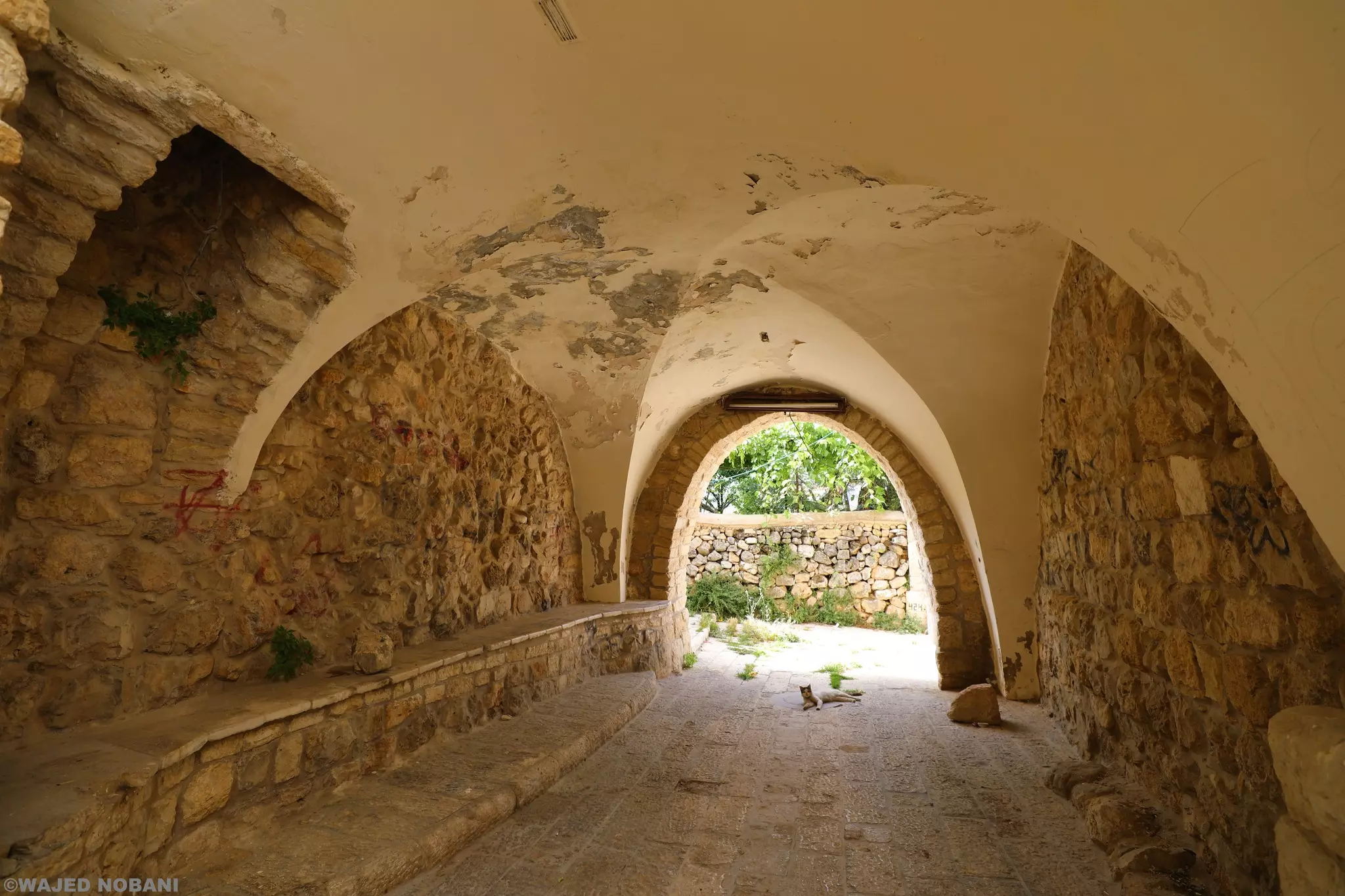
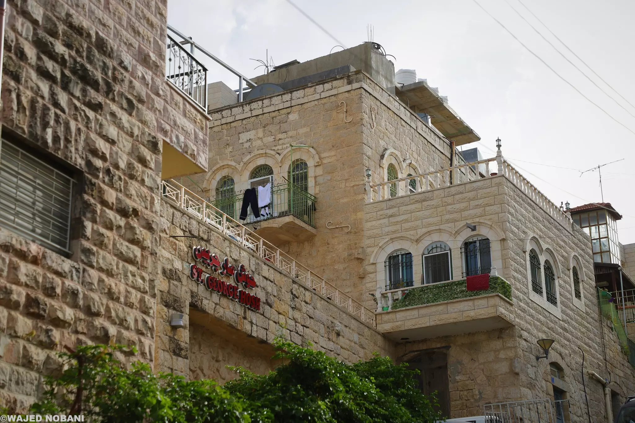
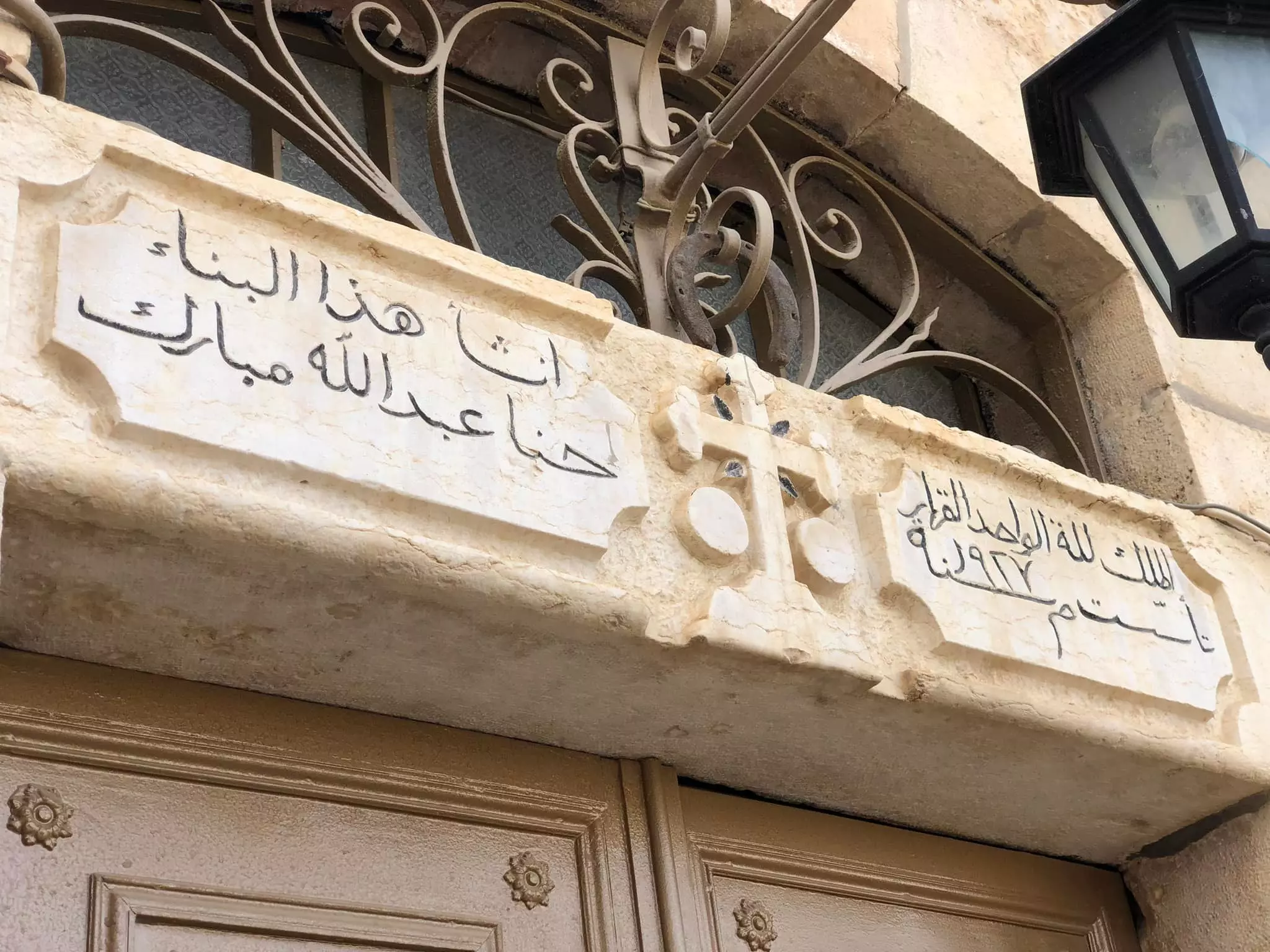
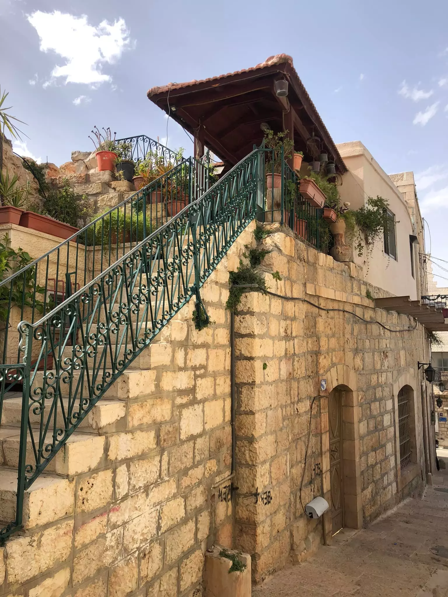
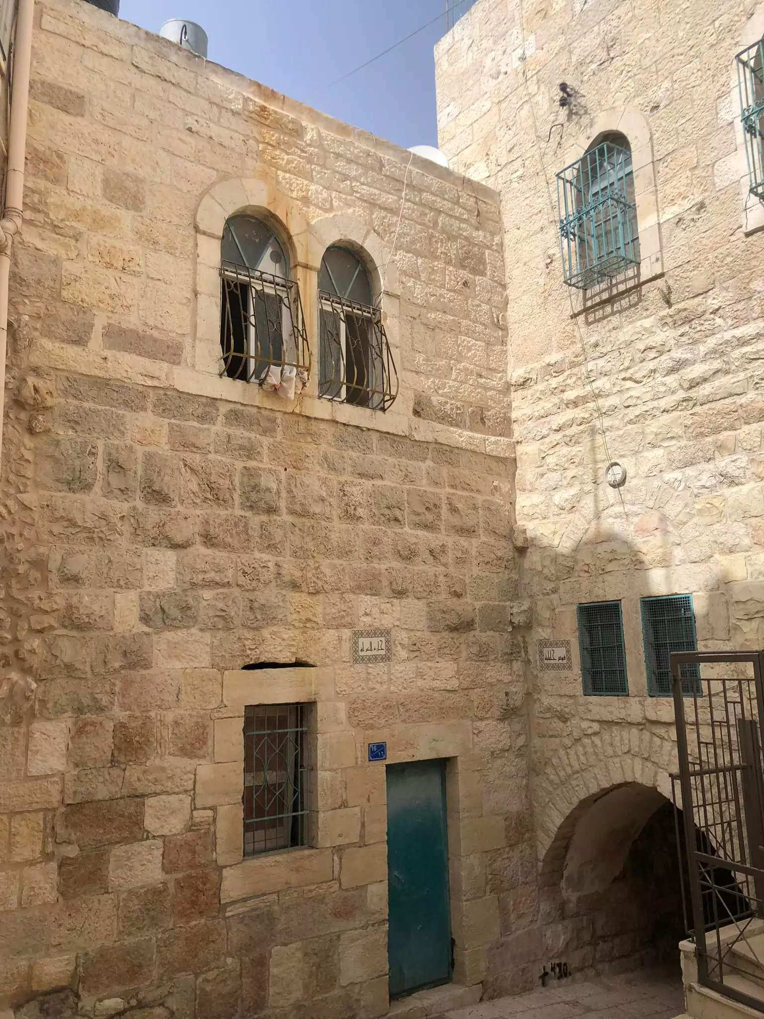
- جولة بين بيوت بيت جالا القديمة -- واجد النوباني
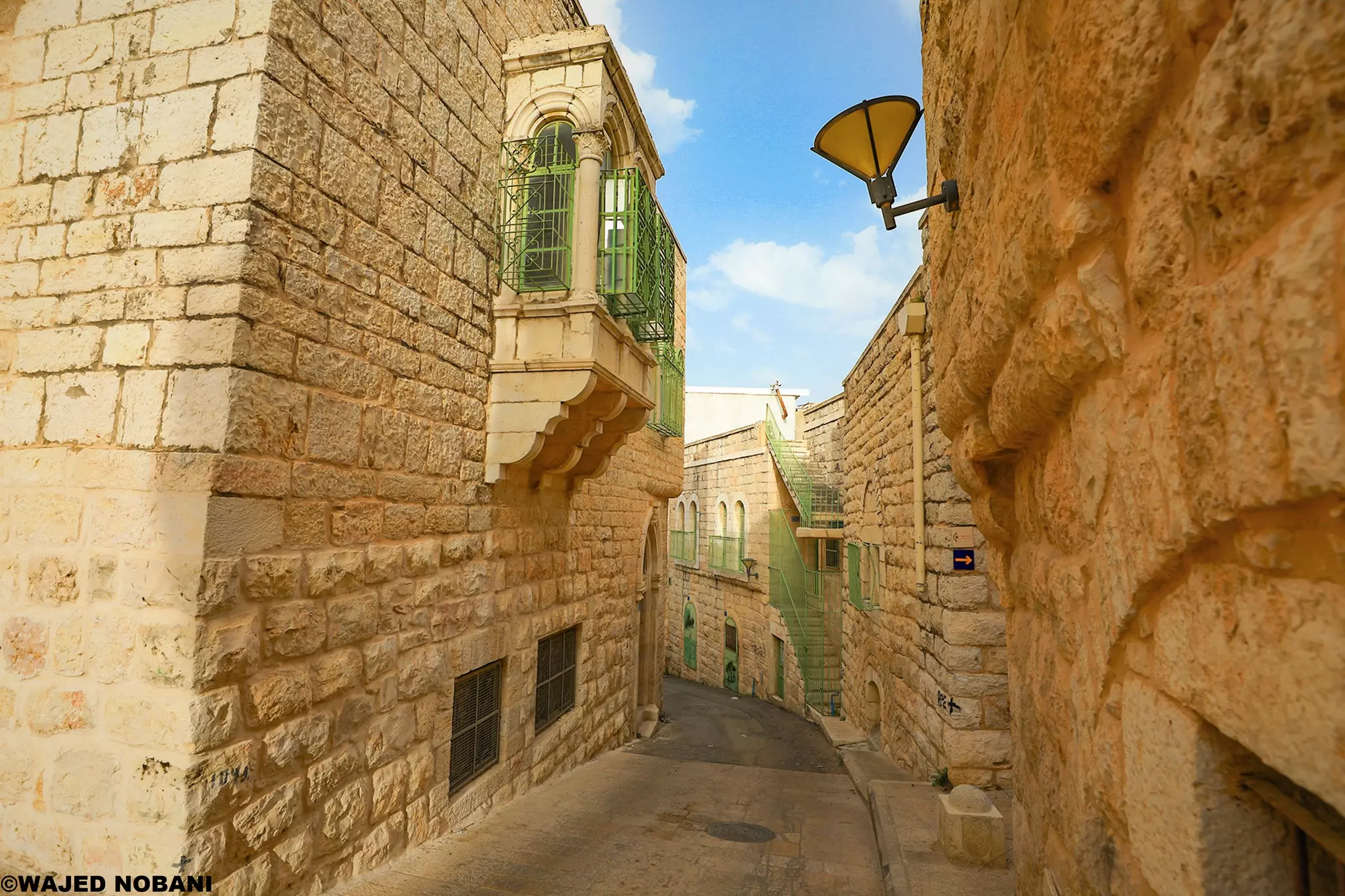
- جولة بين بيوت بيت جالا القديمة -- واجد النوباني #2
- جولة بين بيوت بيت جالا القديمة -- واجد النوباني #3
- جولة بين بيوت بيت جالا القديمة -- واجد النوباني #4
- جولة بين بيوت بيت جالا القديمة -- واجد النوباني #5
- جولة بين بيوت بيت جالا القديمة -- واجد النوباني #6
- جولة بين بيوت بيت جالا القديمة -- واجد النوباني #7
- جولة بين بيوت بيت جالا القديمة -- واجد النوباني #8
- جولة بين بيوت بيت جالا القديمة -- واجد النوباني #9
- جولة بين بيوت بيت جالا القديمة -- واجد النوباني #10
- جولة بين بيوت بيت جالا القديمة -- واجد النوباني #11
- جولة بين بيوت بيت جالا القديمة -- واجد النوباني #12
- جولة بين بيوت بيت جالا القديمة -- واجد النوباني #13
- جولة بين بيوت بيت جالا القديمة -- واجد النوباني #14
- جولة بين بيوت بيت جالا القديمة -- واجد النوباني #15
- جولة بين بيوت بيت جالا القديمة -- واجد النوباني #16
- جولة بين بيوت بيت جالا القديمة -- واجد النوباني #17
- جولة بين بيوت بيت جالا القديمة -- واجد النوباني
- جولة بين بيوت بيت جالا القديمة -- واجد النوباني
#2
- جولة بين بيوت بيت جالا القديمة -- واجد النوباني
#3
- جولة بين بيوت بيت جالا القديمة -- واجد النوباني
#4
- جولة بين بيوت بيت جالا القديمة -- واجد النوباني
#5
- جولة بين بيوت بيت جالا القديمة -- واجد النوباني
#6
- جولة بين بيوت بيت جالا القديمة -- واجد النوباني
#7
- جولة بين بيوت بيت جالا القديمة -- واجد النوباني
#8
- يت جالا. 1866م
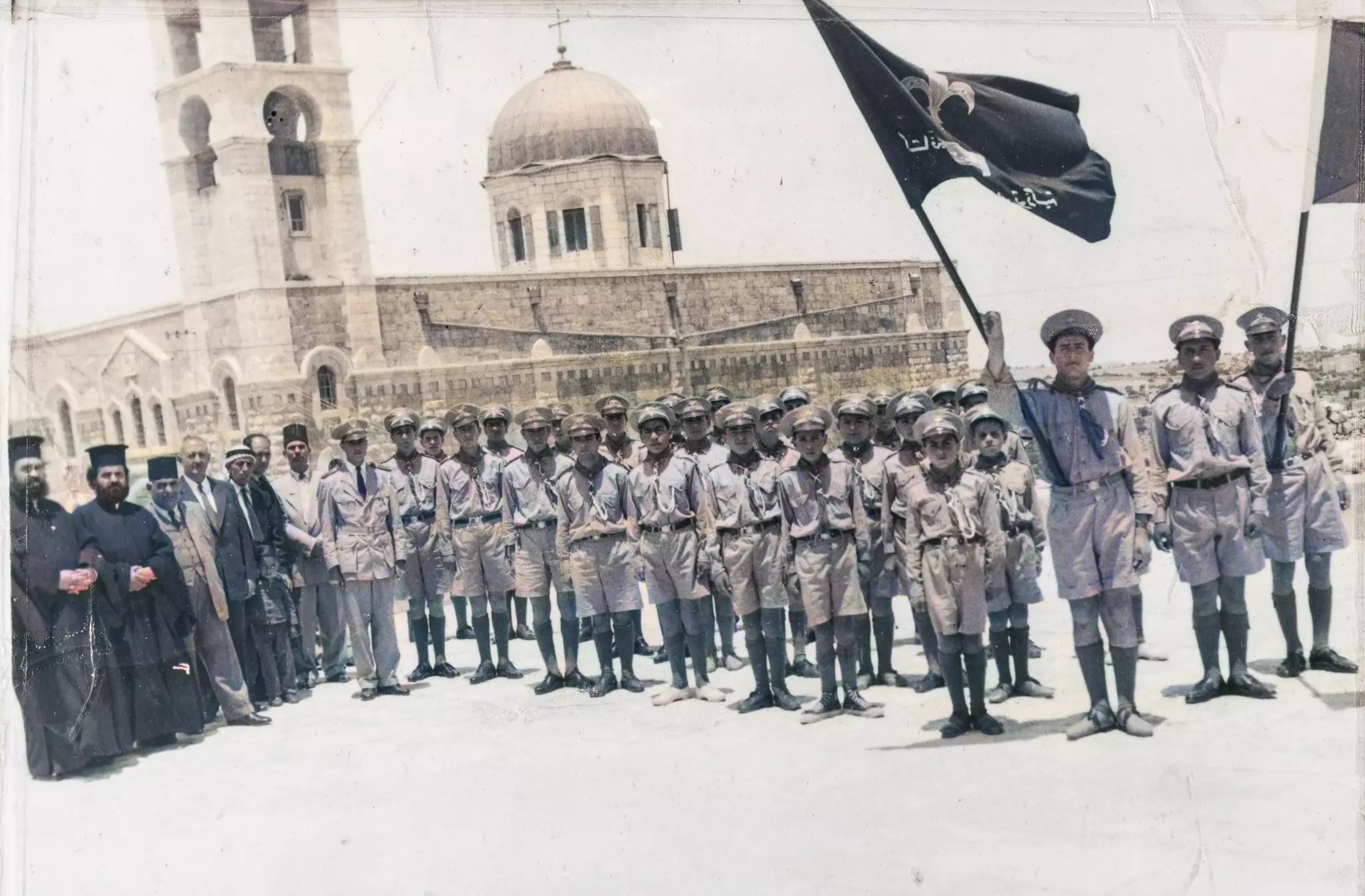
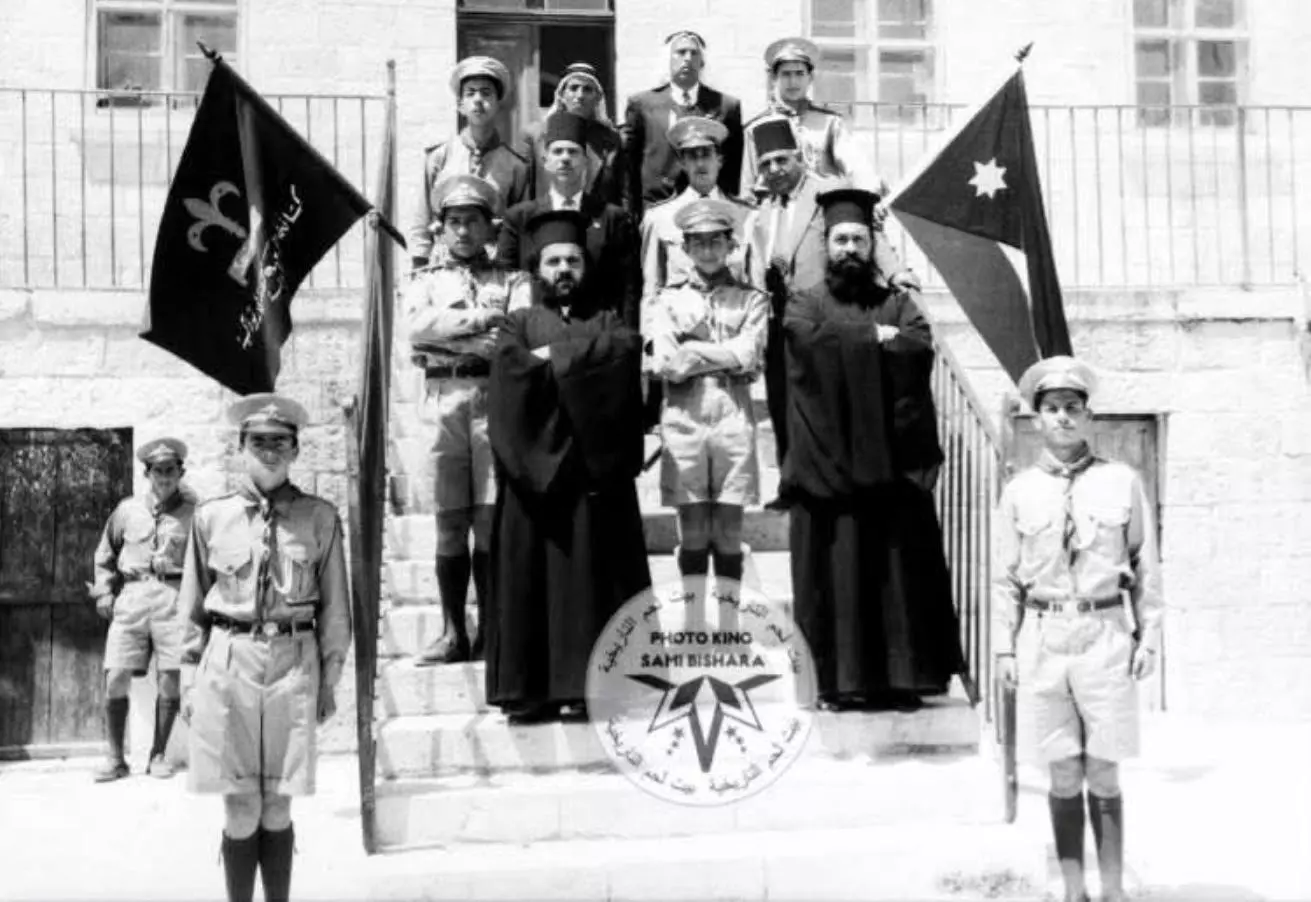
- صورة تعود لشهر تموز ١٩٦٣ وتمثل المجموعة الكشفية الأرثوذكسية العربية في بلدة بيت جالا التي تقع قرب مدينة بيت لحم الفلسطينية وذلك زمن وحدة الضفتين حيث يظهر العلم الأردني و علم مجموعة الكشافة الارثوذكسية .
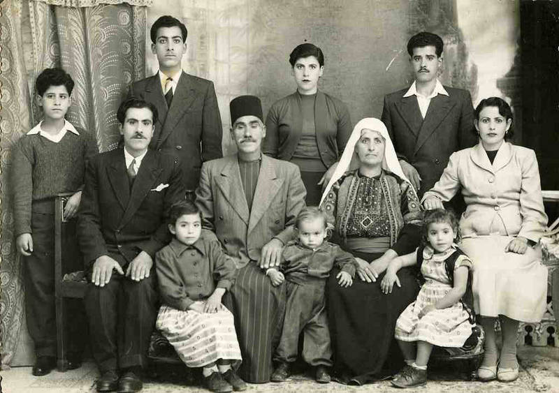
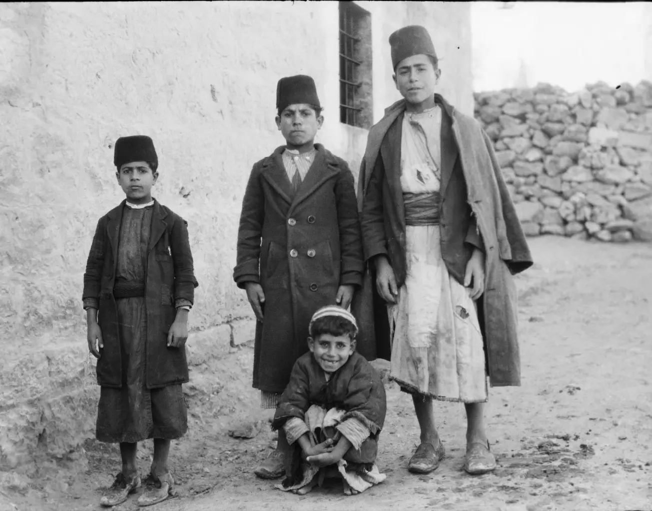
1 - A Palestinian family from bait Jala near Bethlehem way before the "civilized" landed on us, 1914
- مدرسة في بيت جالا 1969 - 1970
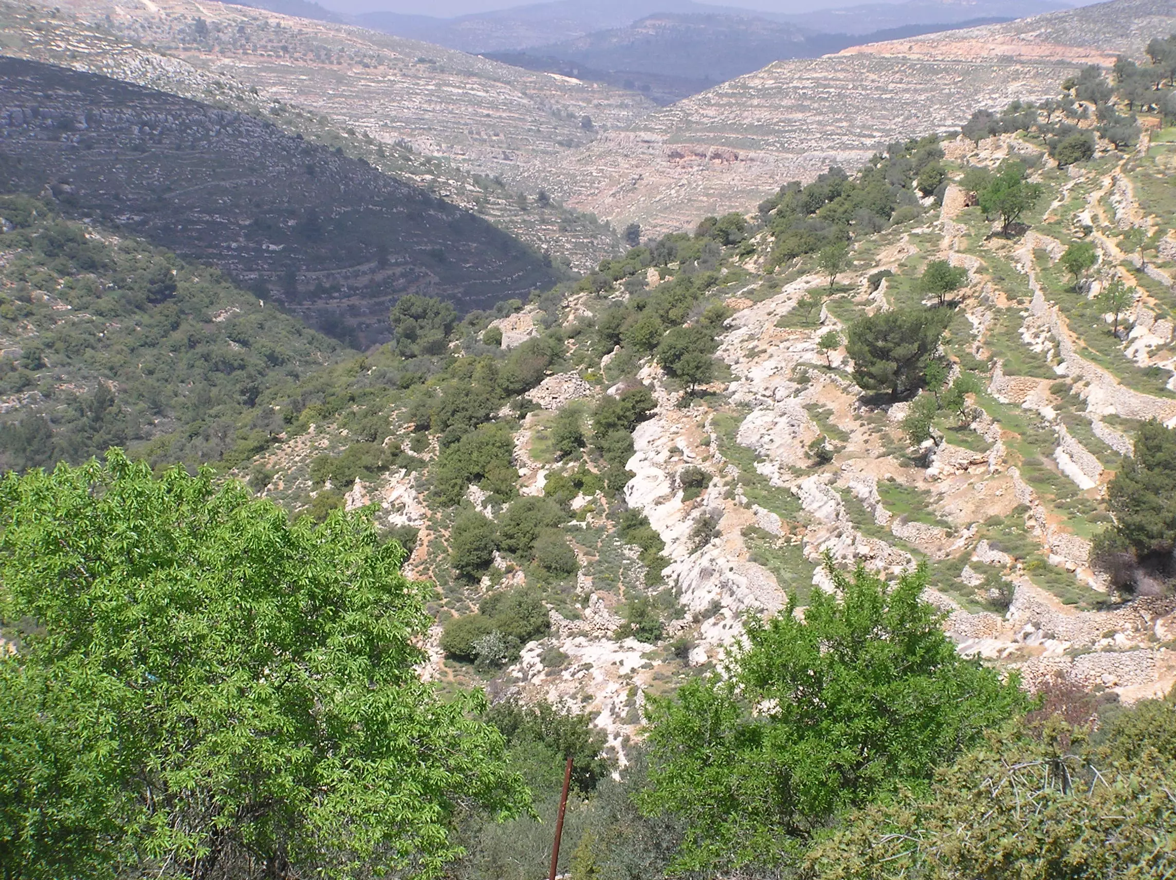
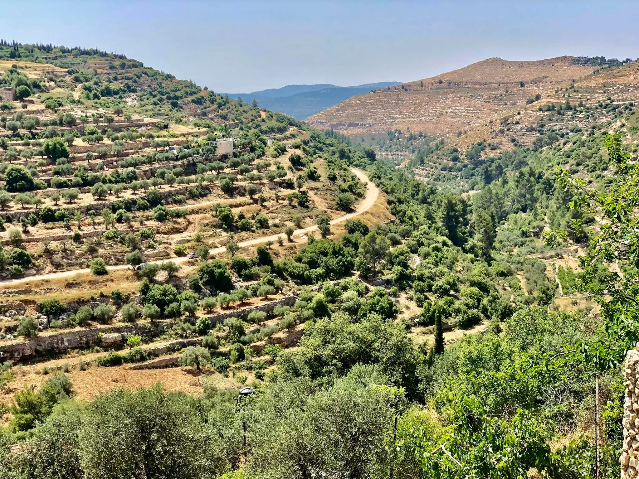
- بيت ابو عيد في وادي احمد في بلدة بيت جالا شمال غرب محافظة بيت لحم -- December, 2022 -- Iyad Jaber
- بيت ابو عيد في وادي احمد في بلدة بيت جالا شمال غرب محافظة بيت لحم -- December, 2022 -- Iyad Jaber #2
- بيت ابو عيد في وادي احمد في بلدة بيت جالا شمال غرب محافظة بيت لحم -- December, 2022 -- Iyad Jaber #3
- بيت ابو عيد في وادي احمد في بلدة بيت جالا شمال غرب محافظة بيت لحم -- December, 2022 -- Iyad Jaber #4
- بيت ابو عيد في وادي احمد في بلدة بيت جالا شمال غرب محافظة بيت لحم -- December, 2022 -- Iyad Jaber #5
- بيت ابو عيد في وادي احمد في بلدة بيت جالا شمال غرب محافظة بيت لحم -- December, 2022 -- Iyad Jaber #6

- بيت ابو عيد في وادي احمد في بلدة بيت جالا شمال غرب محافظة بيت لحم -- December, 2022 -- Iyad Jaber #7
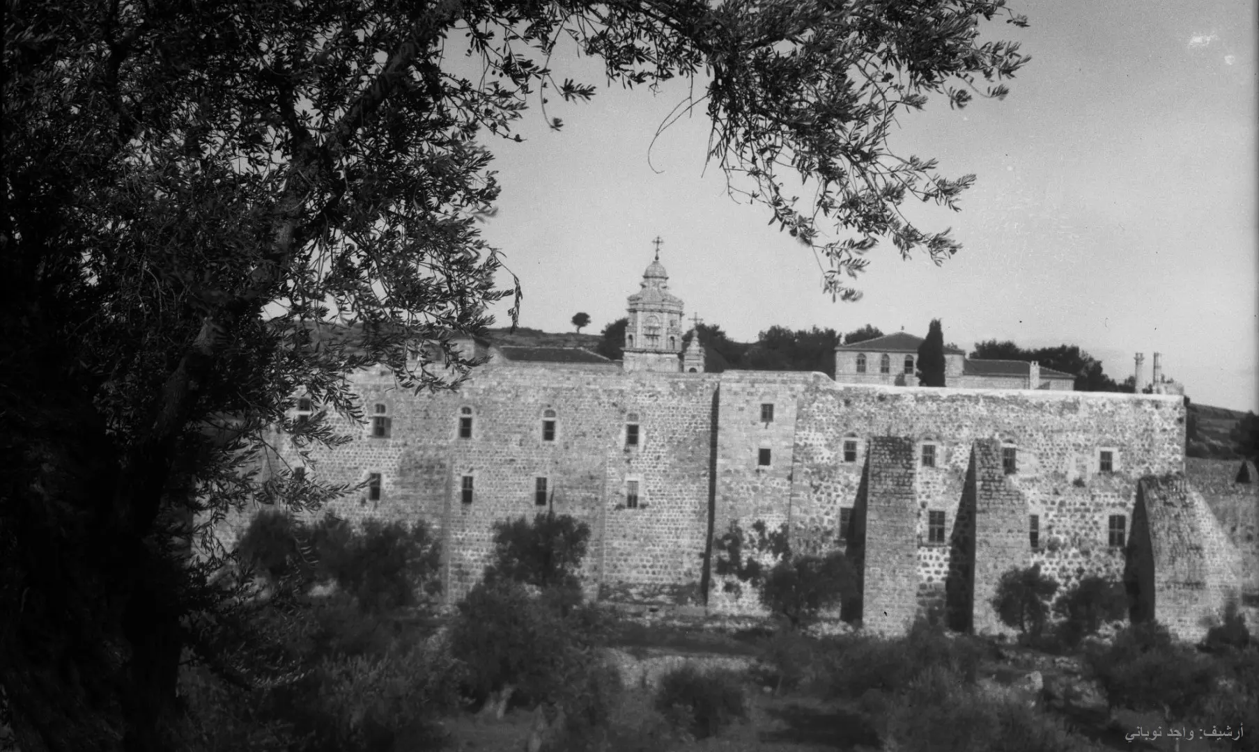
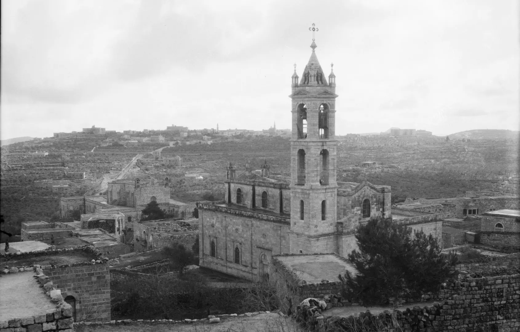
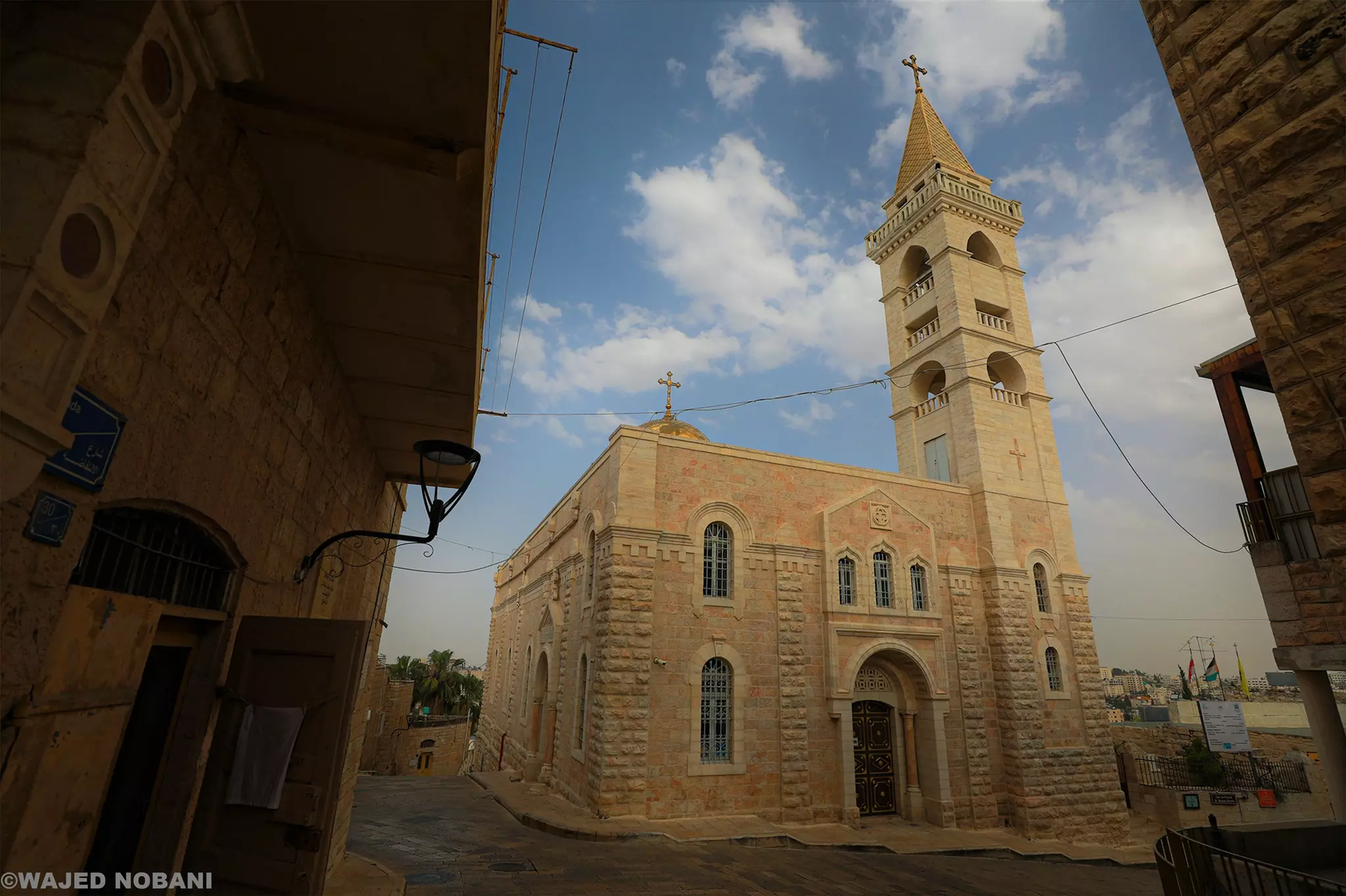
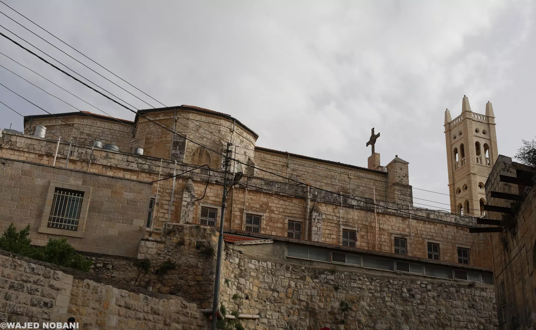
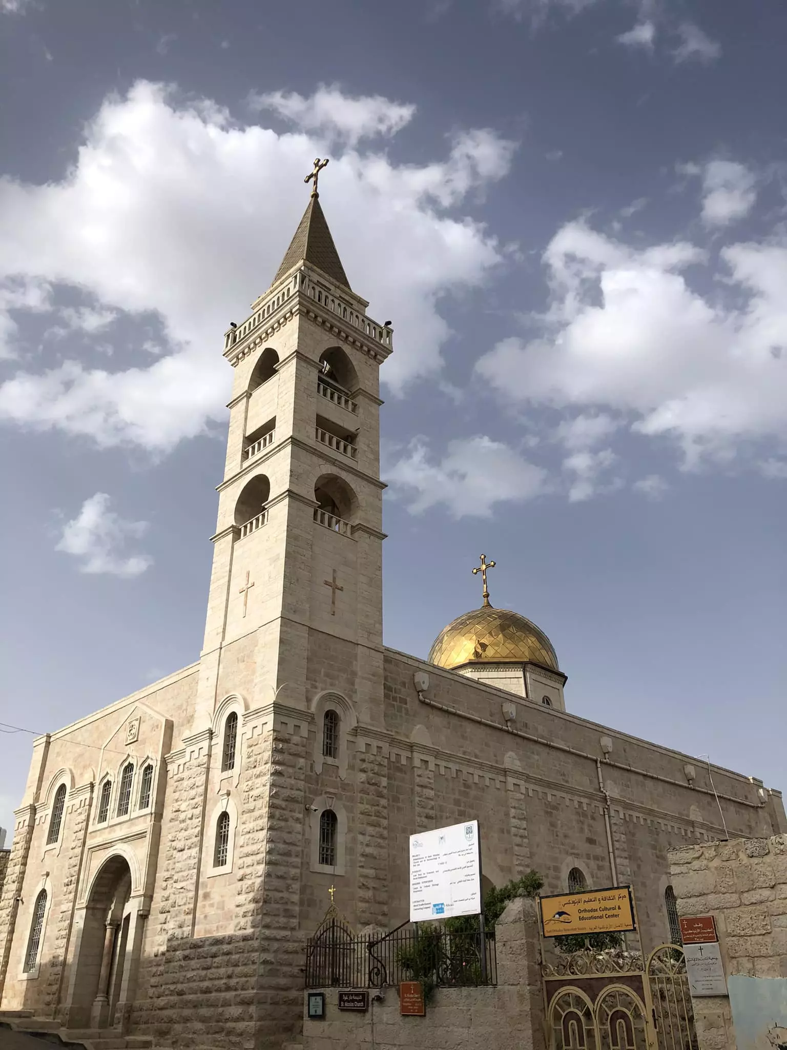
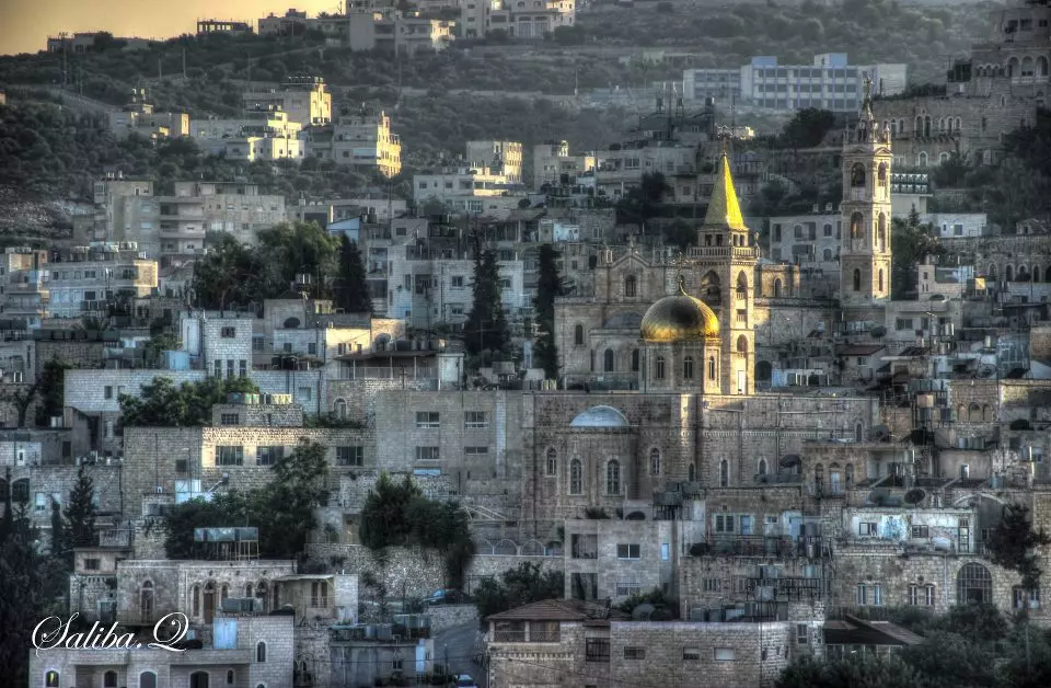
- Beit Jala, with Saint Nicholas Church.
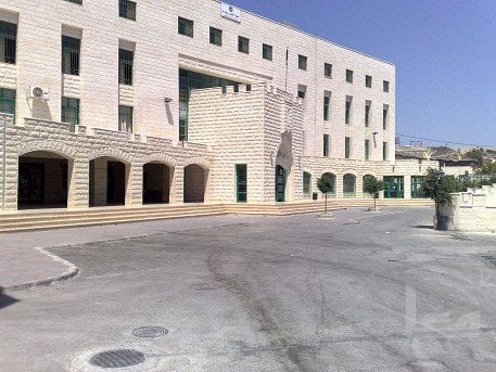
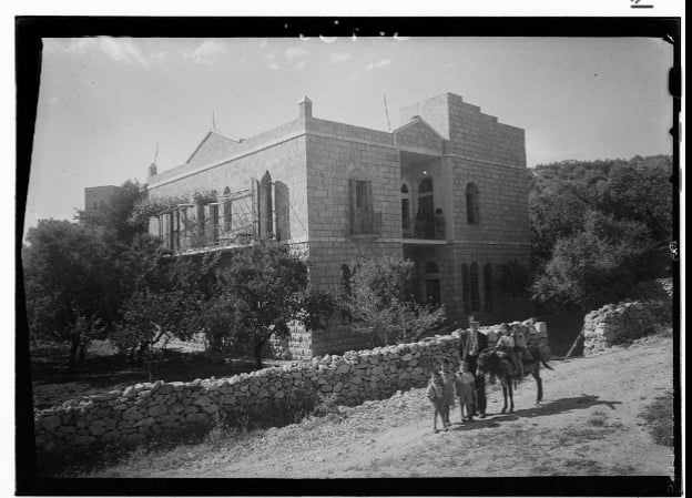
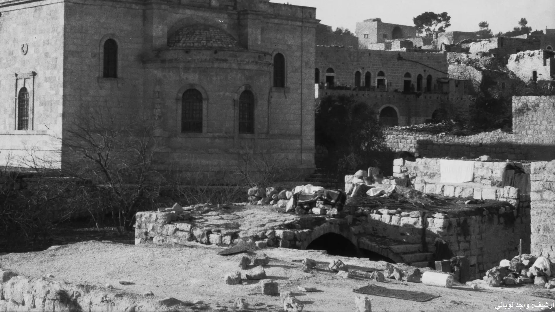
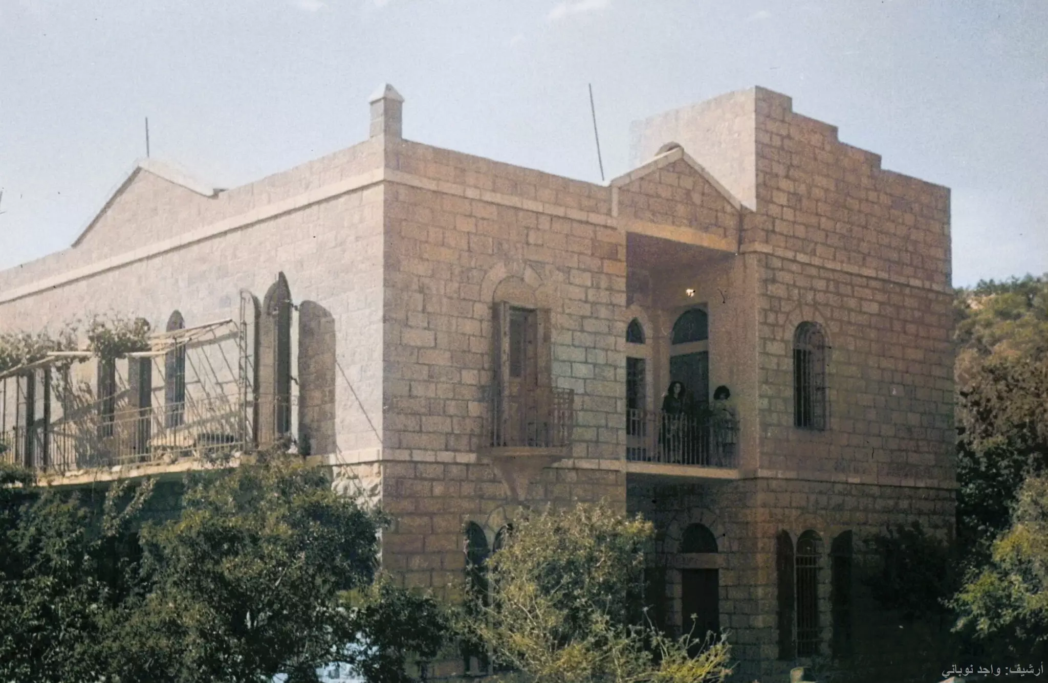
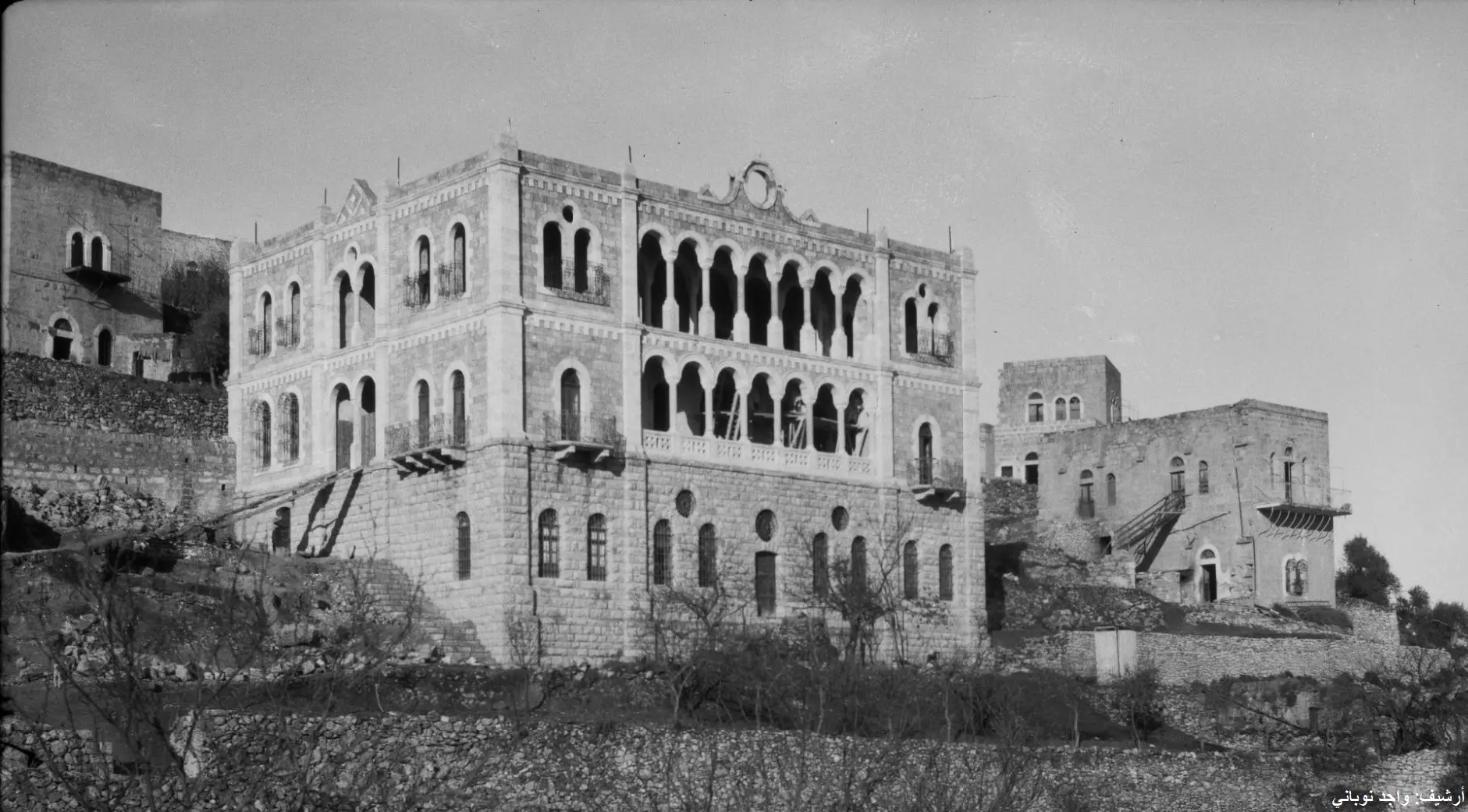
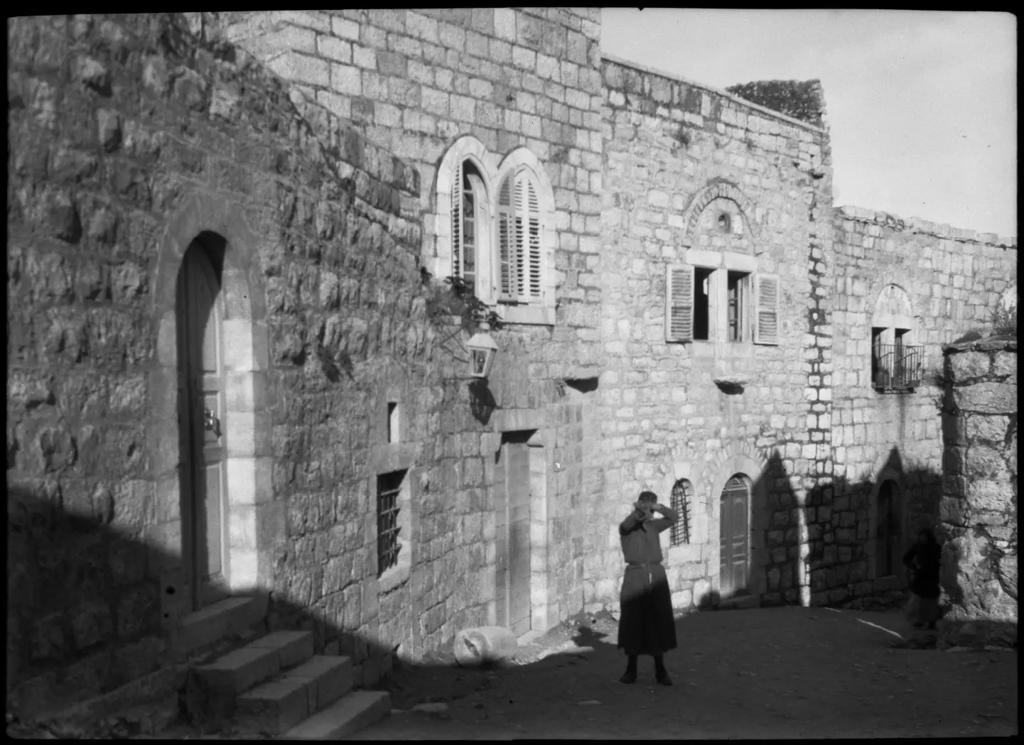
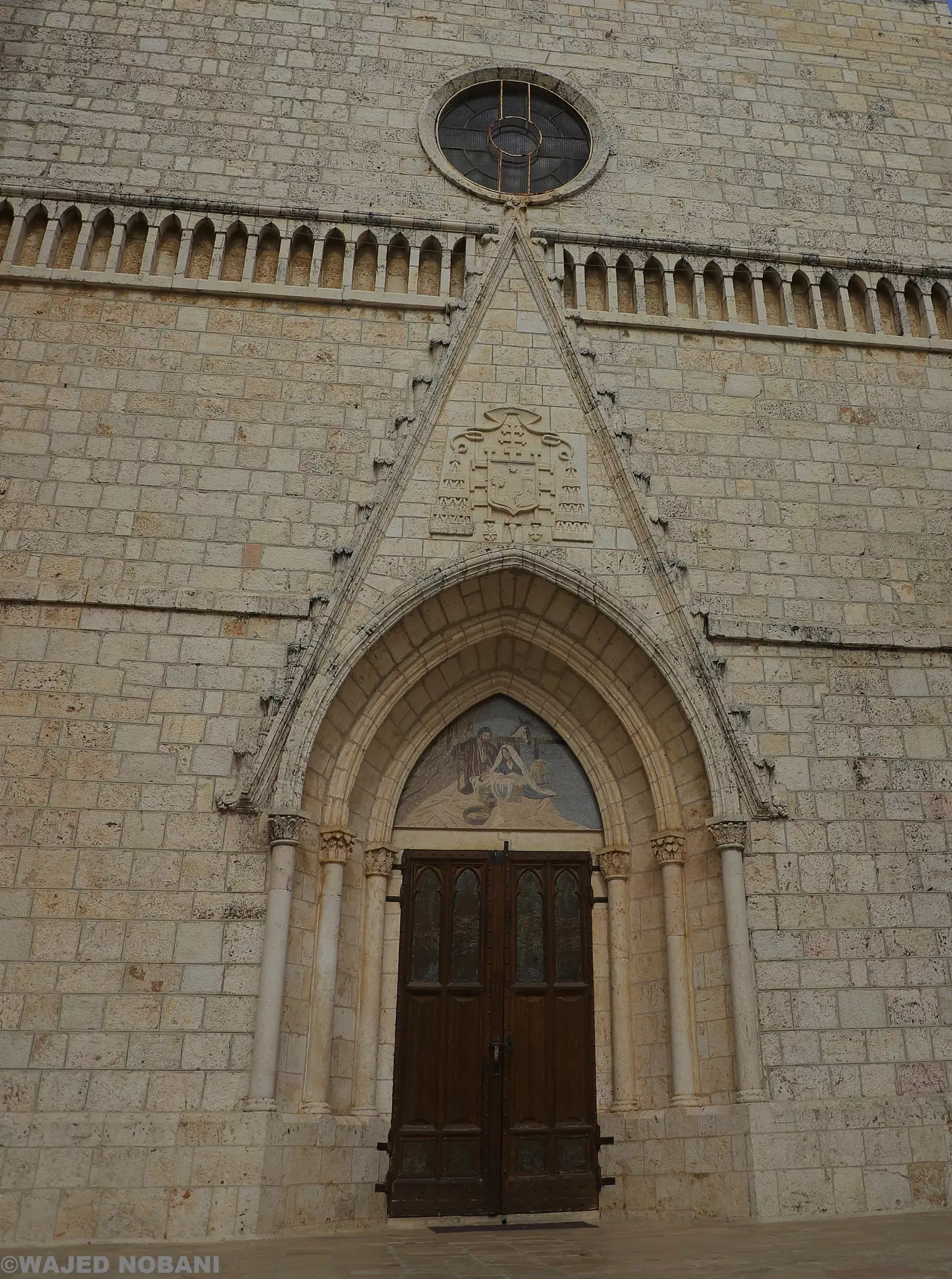
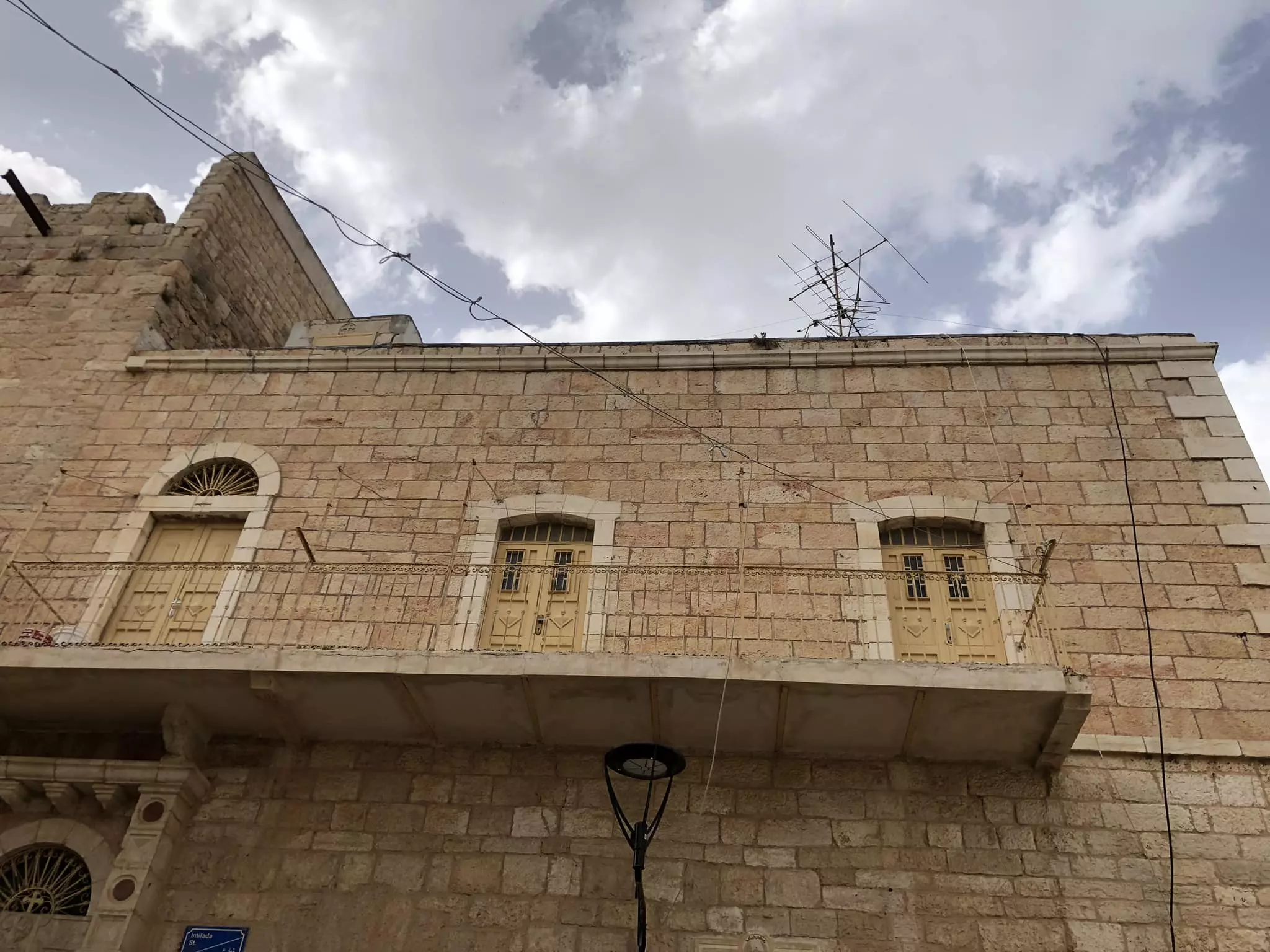
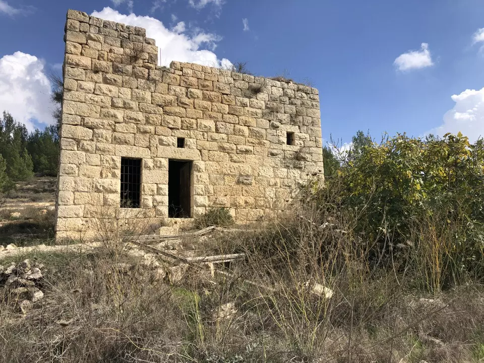
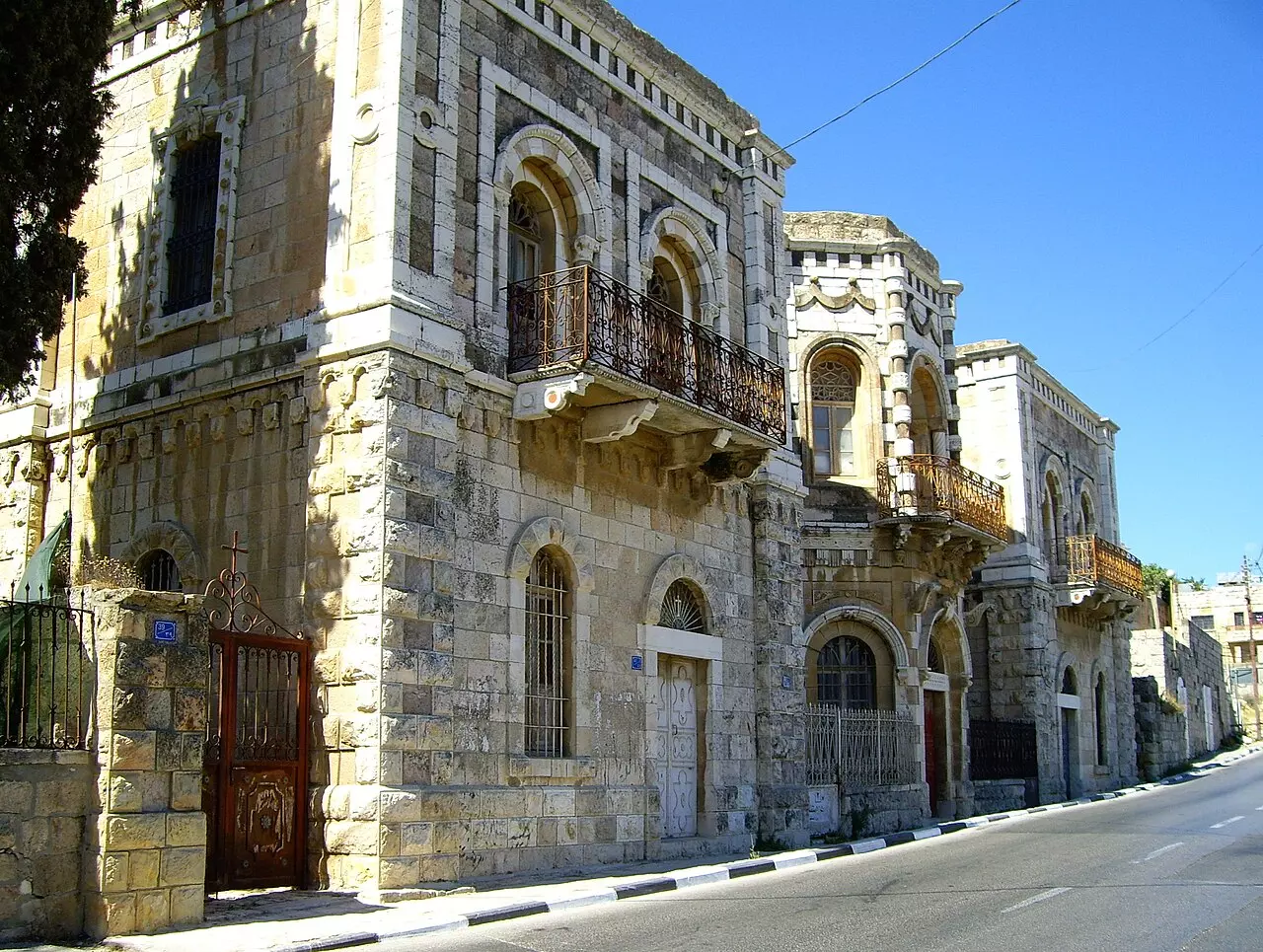
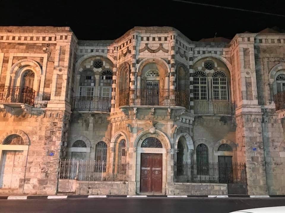
- Historical Building in Beit Jala
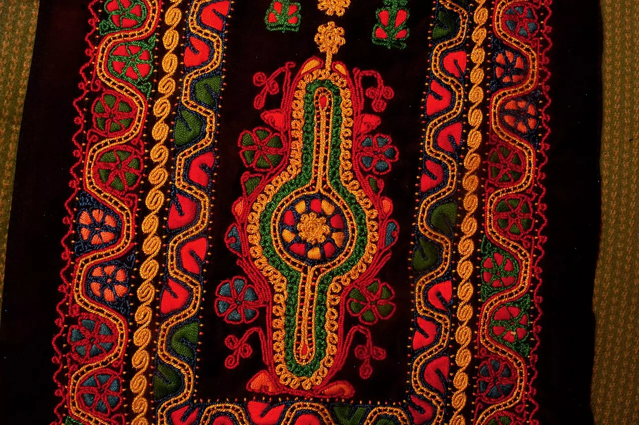
- Couching stitch from Beit Jala, 2006
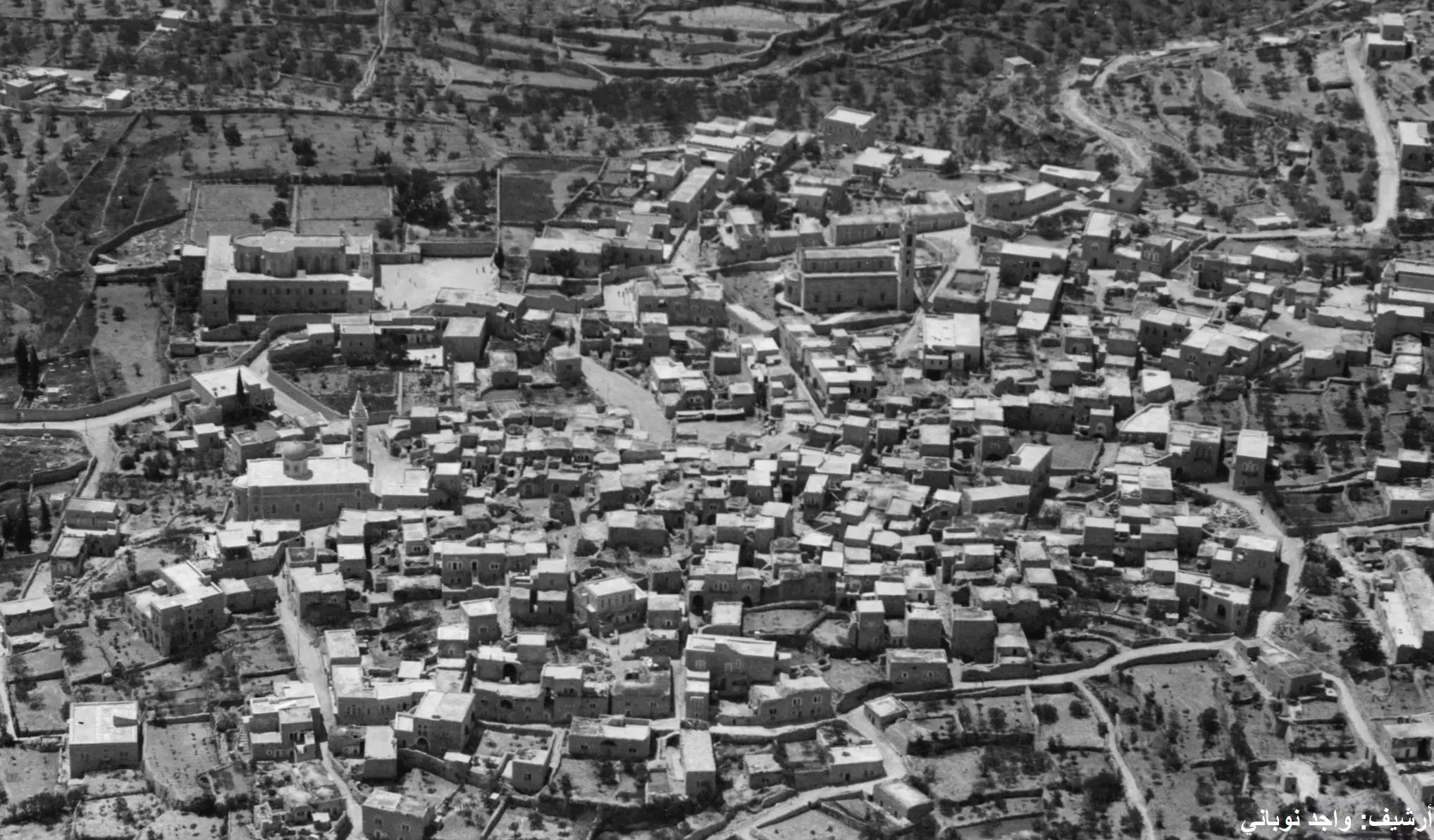
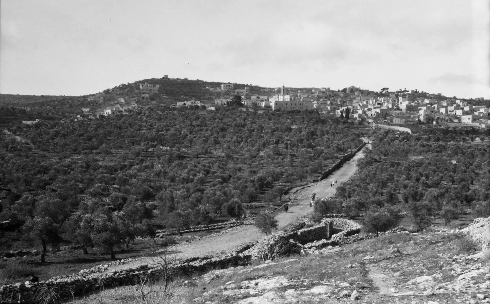
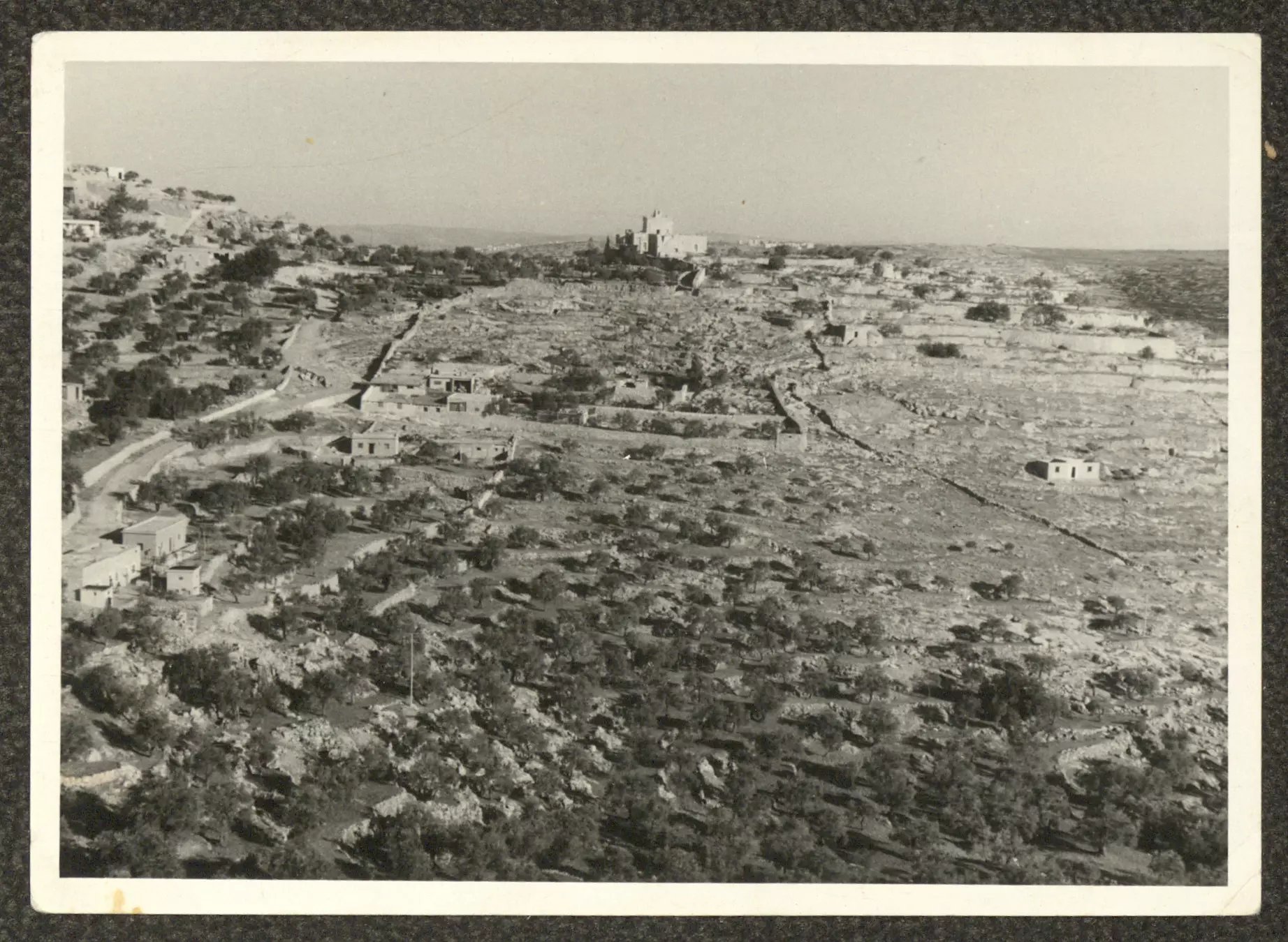
- صورة تظهر مساحات واسعة من اراضي بلدة بيت جالا، يظهر فيها عدد من بيوت القرية، التُقطت في خمسينيات القرن العشرين.

- منزل صلاح شهوان
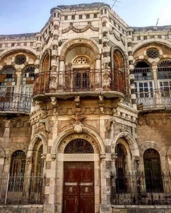
1 - قصر شهوان #2
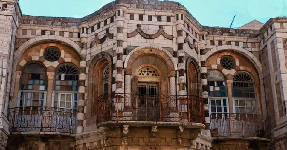
- قصر شهوان #3
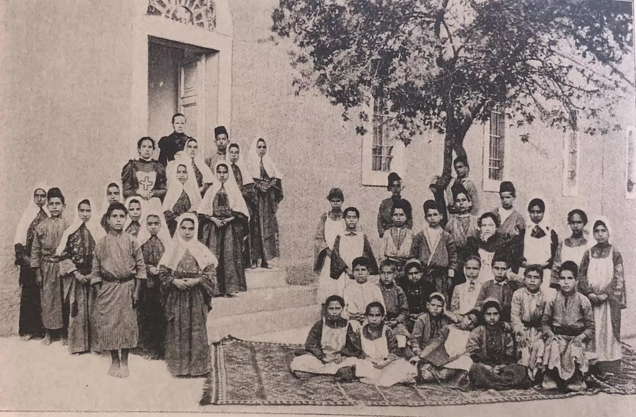
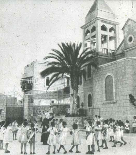
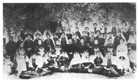
- Staff and students of the Christian Orthodox Girls' School in Beit Jala, Palestine in 1906. Note the traditional costumes. The school was founded in Jerusalem, Palestine in 1858 by a Russian benefactress and maintained at the expense of Czarina Marya Aleksandrovna
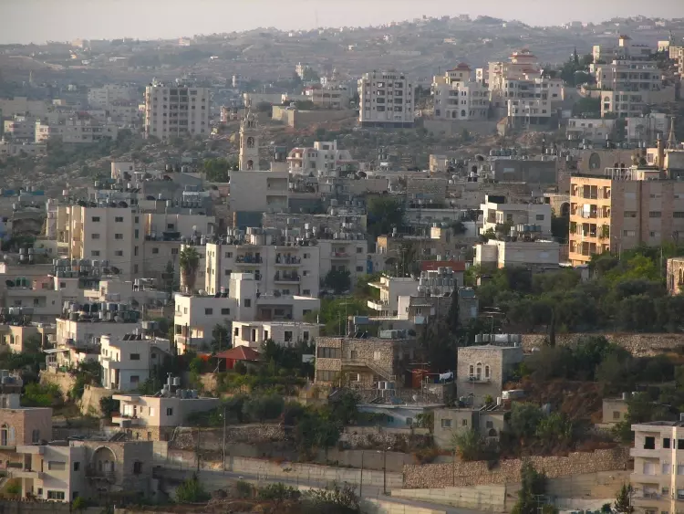
- Beit Jalla, viewed from the exclusively Jewish colony of Gilo
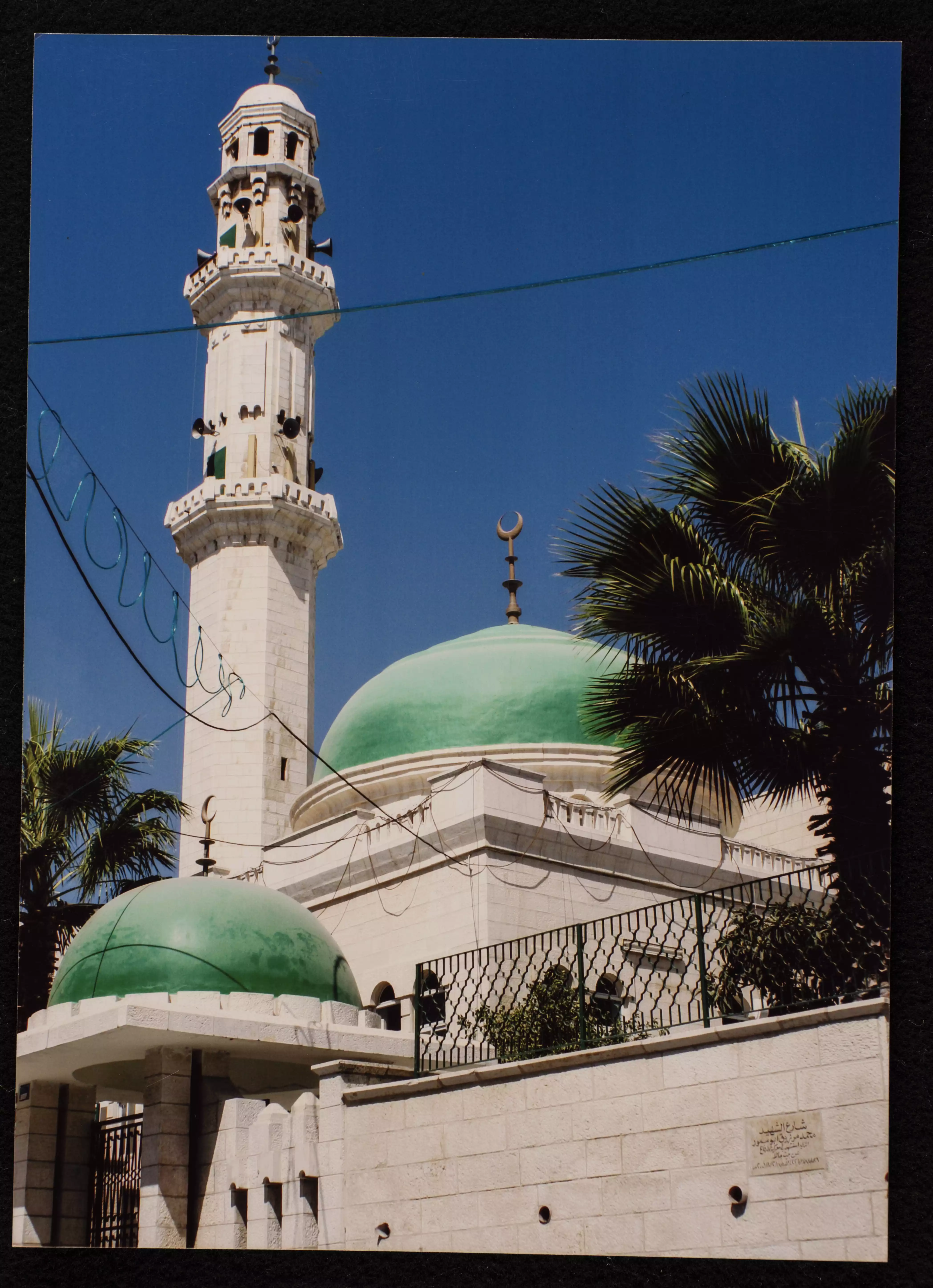
- مسجد بيت جالا الكبير -- 1990 - 1999
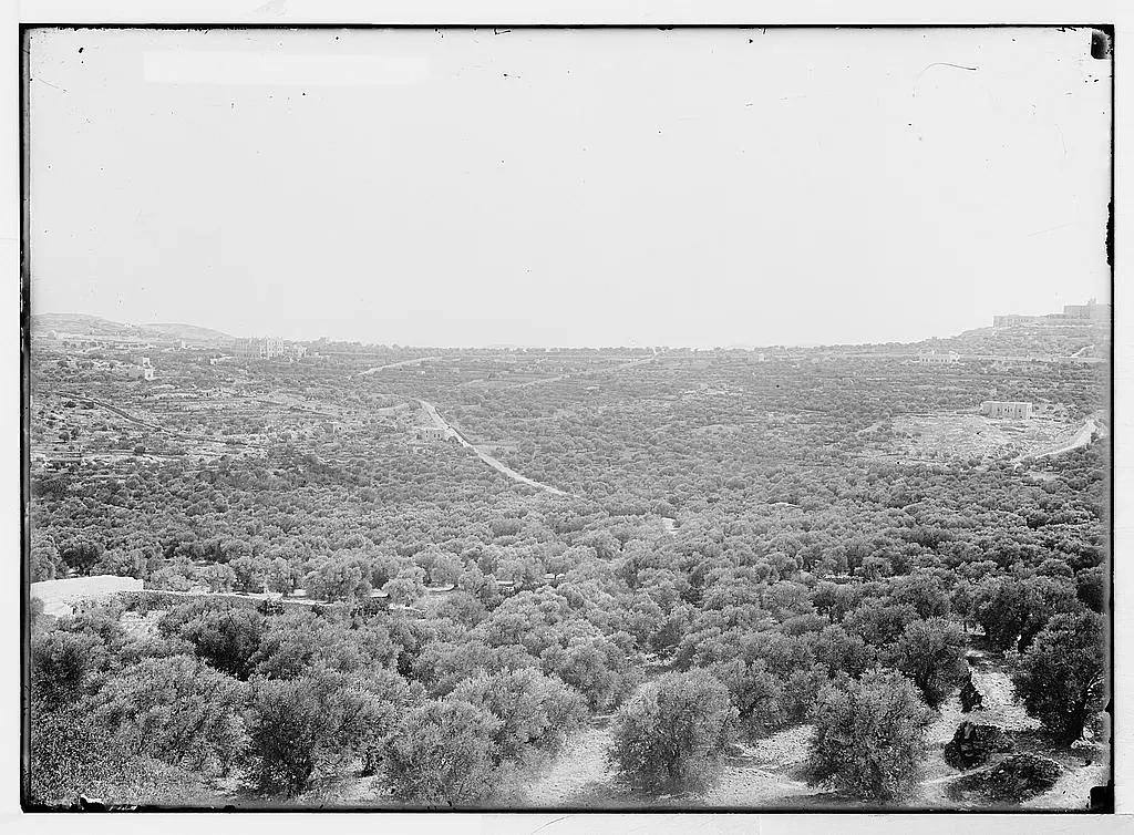
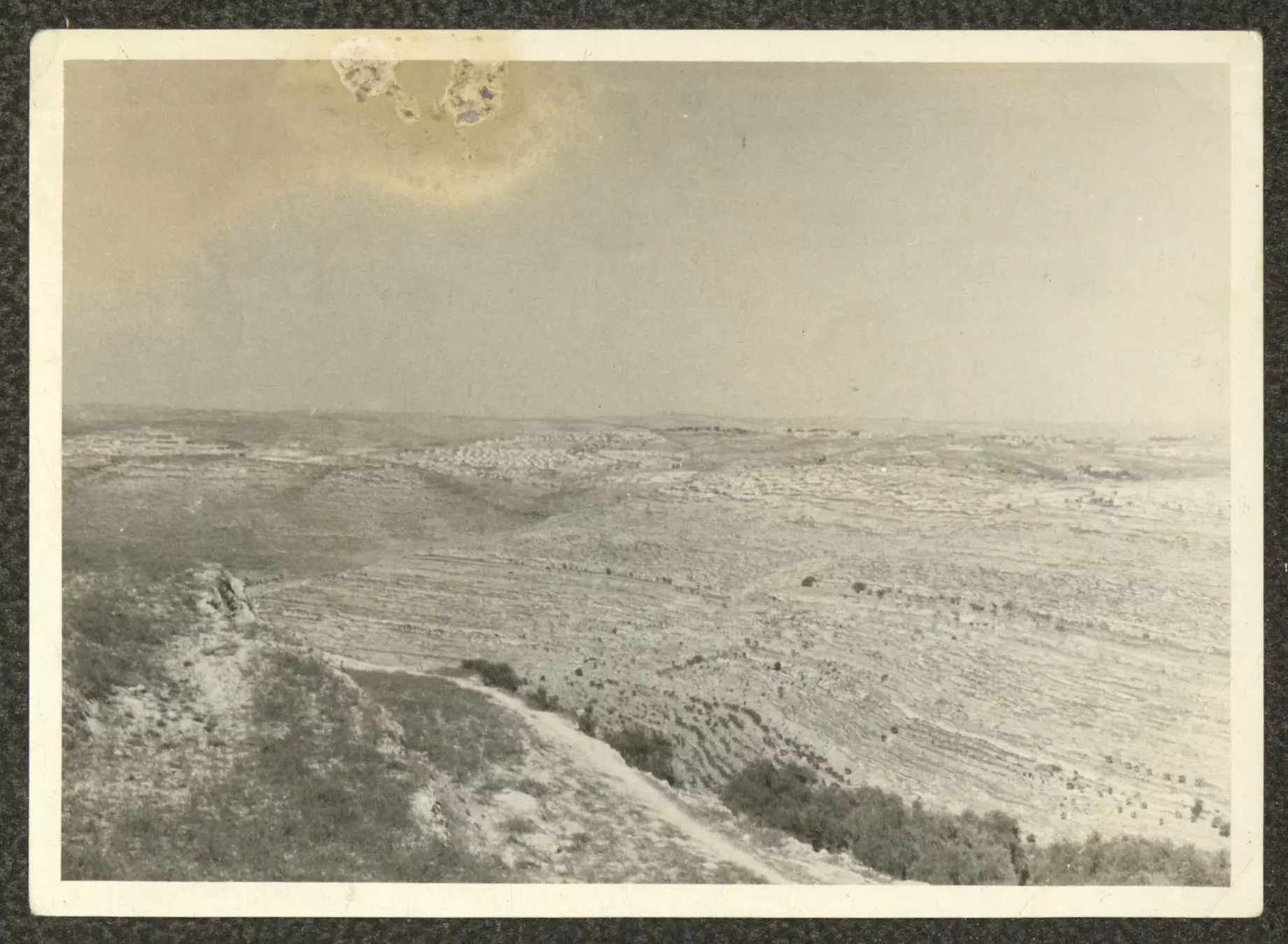
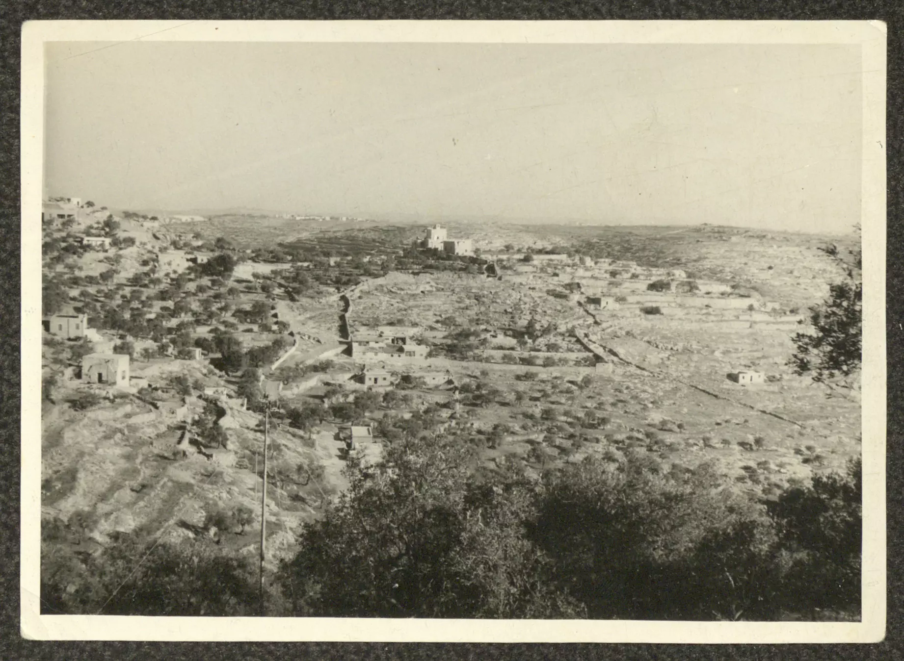
- صورة التُقطت في أربعينيات القرن العشرين يظهر فيها جزء من أراضي بلدة بيت جالا
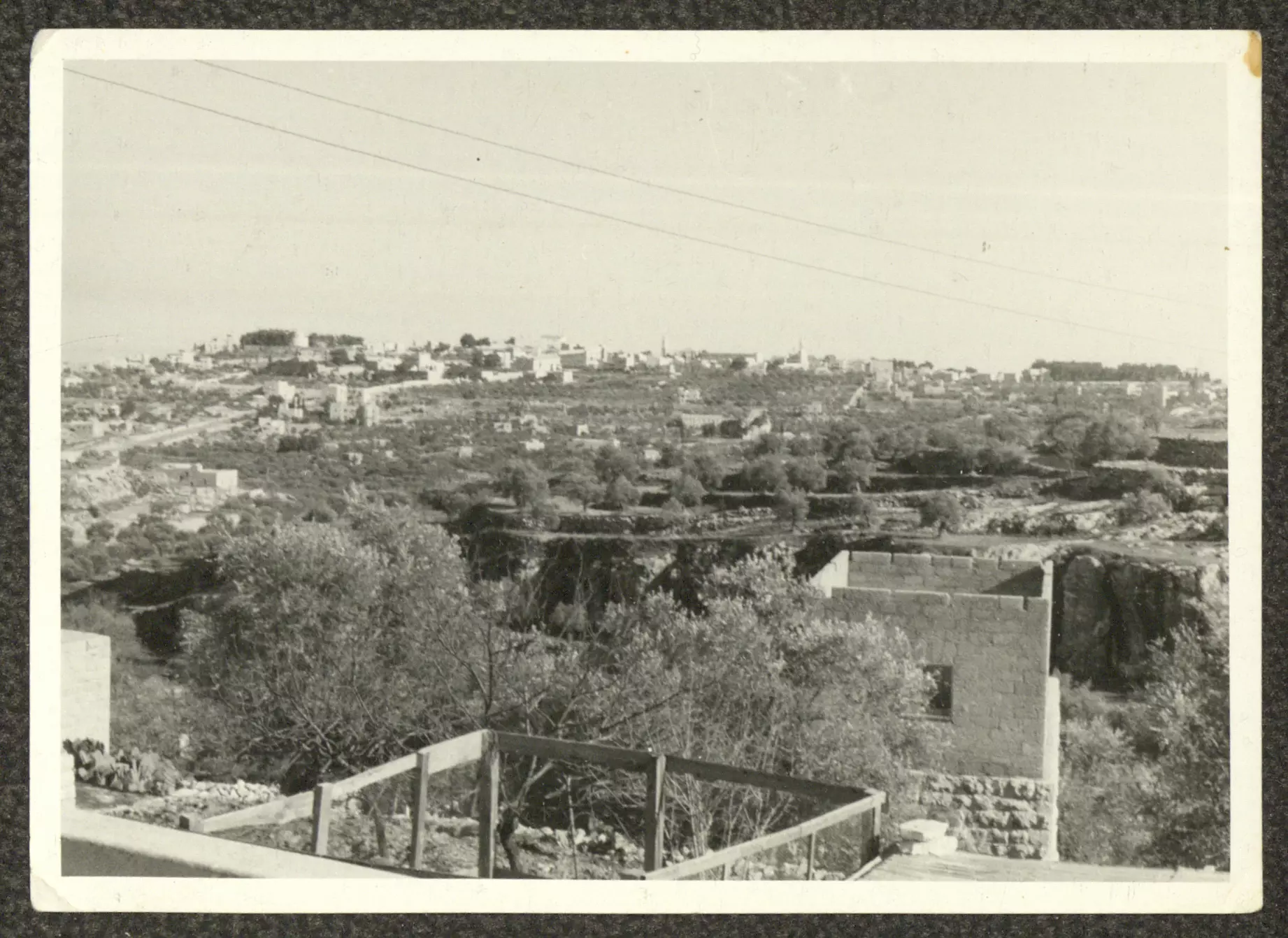
- صورة التُقطت في أربعينات القرن العشرين، تظهر فيها بلدة بيت جالا من ساحة منزل جريس خليل توما.
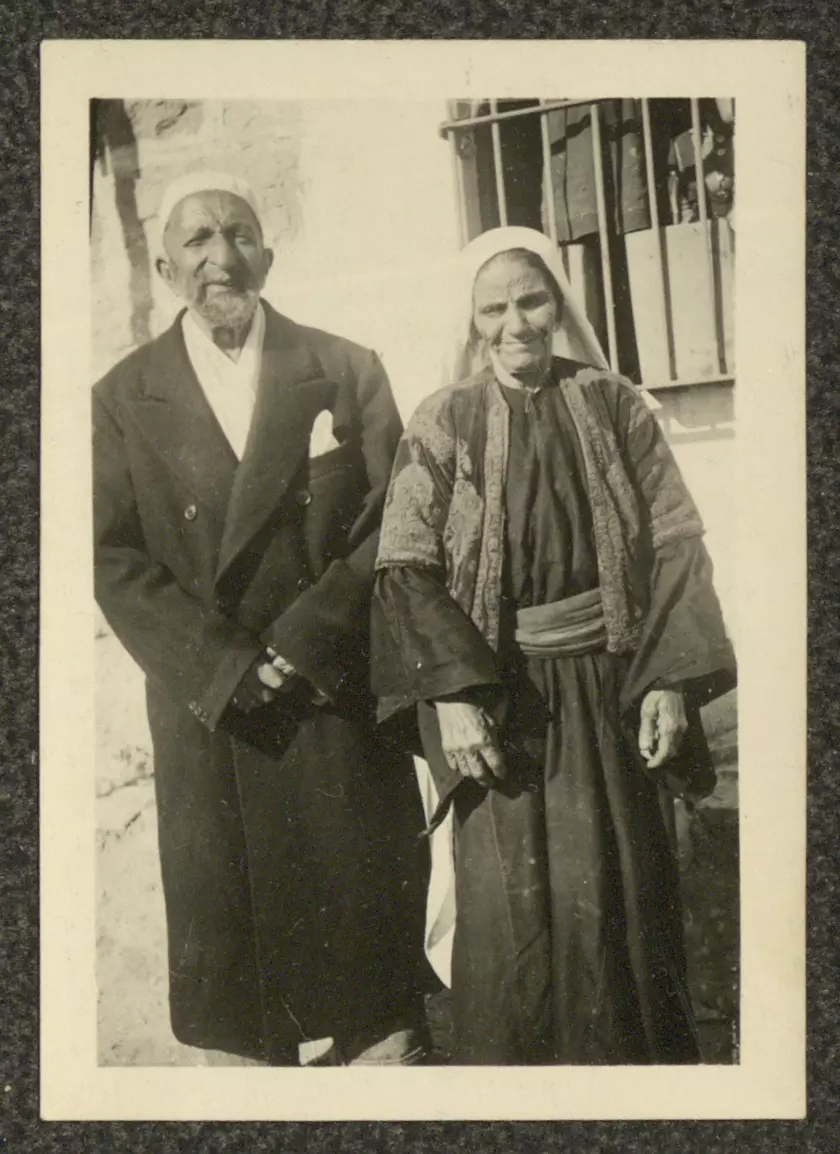
- صورة التُطقت بتاريخ 2 كانون الثاني 1947، لسيدة ورجل مسنان من عائلة توما في ساحة منزل جريس توما في بلدة بيت جالا.
- أحد شوارع بلدة بيت جالا، 5 أيلول 1949
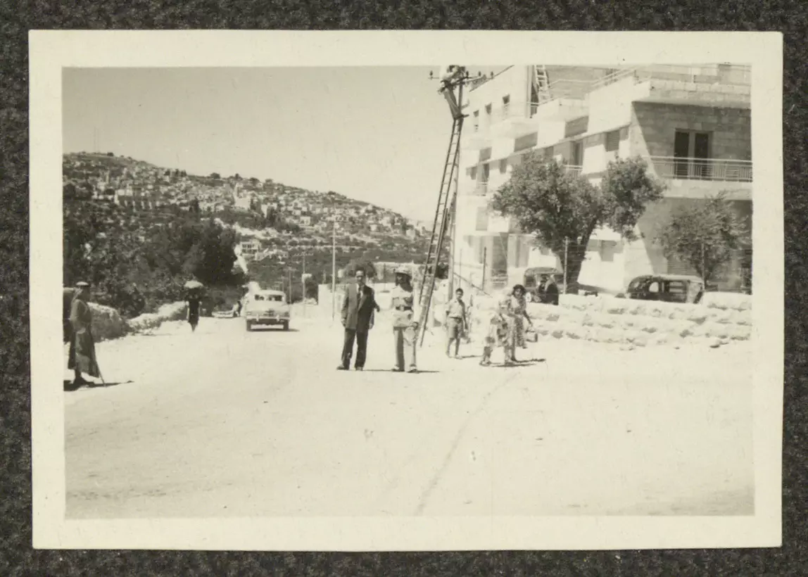
- صورة التقطها سمعان سحار لأحد شوارع بلدة بيت جالا بتاريخ 20 تشرين الأول 1949
- منزل جريس خليل توما، بيت جالا، أربعينيات القرن العشرين
- منزل جريس خليل توما، بيت جالا، أربعينيات القرن العشرين
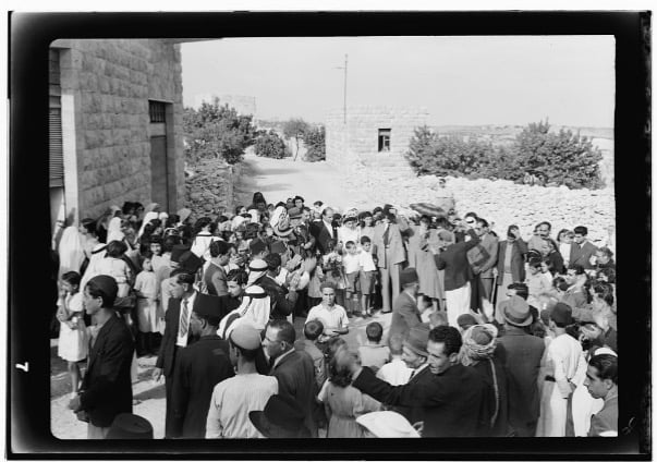
- تجمع من الرجال والأطفال في إحدى الساحات، بيت جالا، ستينيات القرن العشرين
- جريس توما ووالدته صوفيا أعميا في منزلهما في المخانق، بيت جالا، خمسينيات القرن العشرين
- عدد من منازل بلدة بيت جالا، ستينيات القرن العشرين
- مريم وأنطاسيا يعقوب توما، بيت جالا، ثلاثينيات القرن العشرين
- منطر عام -- بيت جالا، عشرينيات القرن العشرين
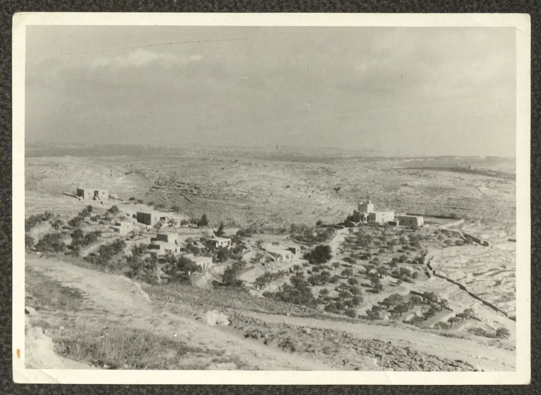
- أراضي بلدة بيت جالا، خمسينيات القرن العشرين
- جزء من أراضي بلدة بيت جالا، خمسينيات القرن العشرين
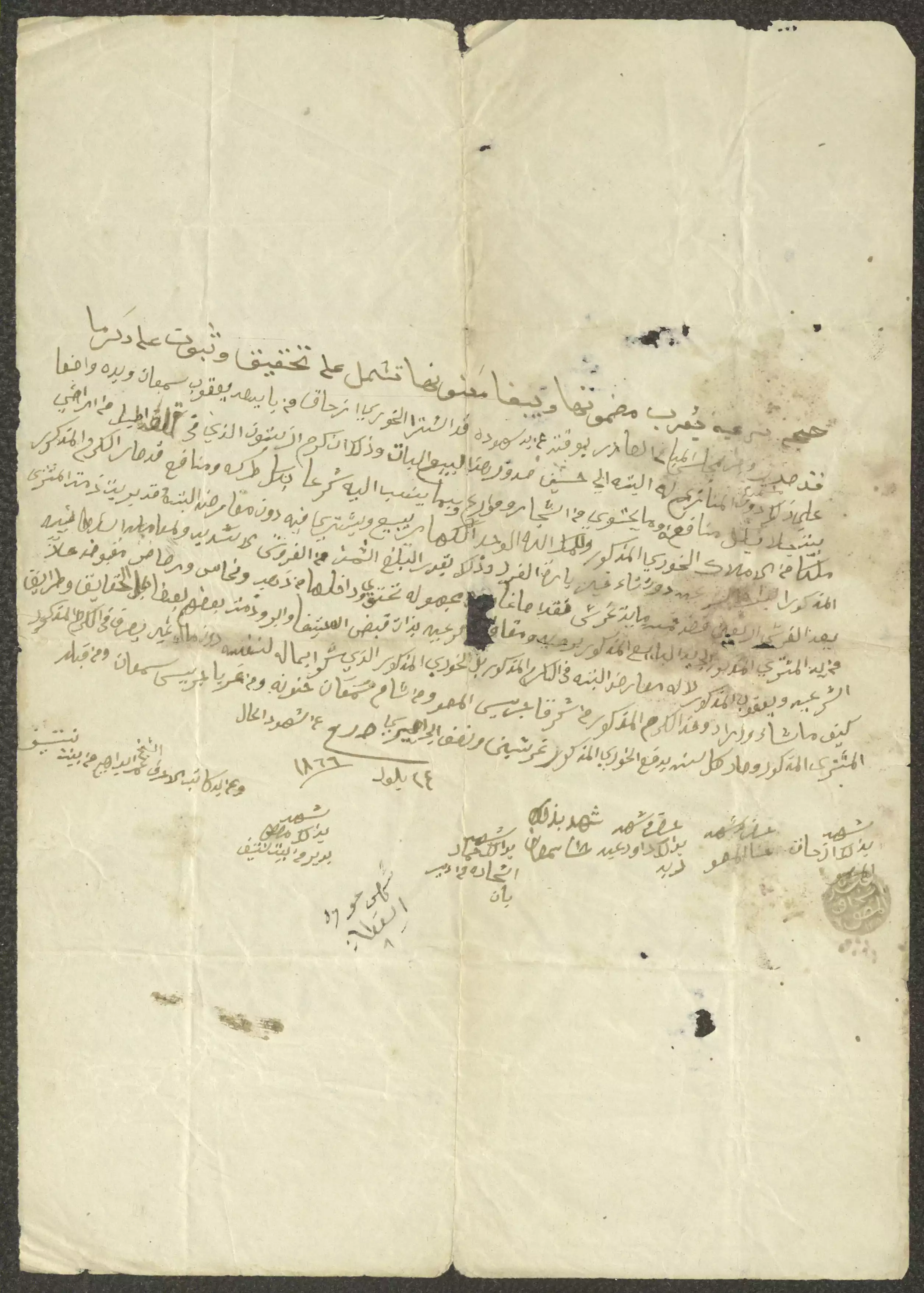
- حجة بيع قطعة أرض بين يعقوب سمعان واسحاق توما، 24 أيلول 1866
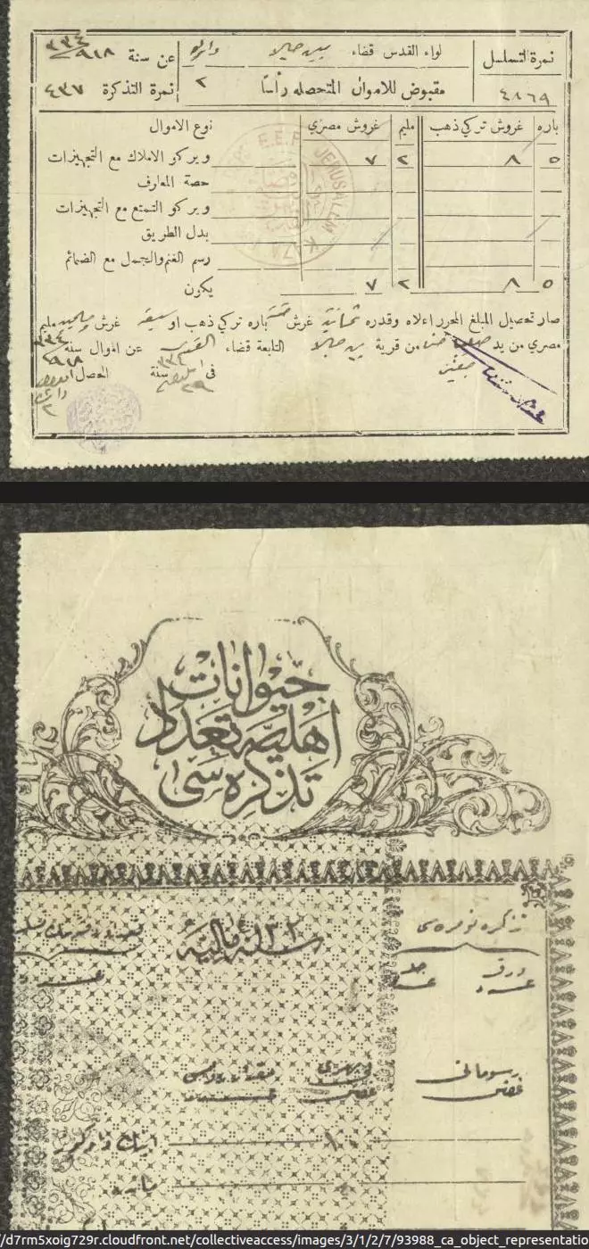
- وصل تحصيل ضريبة حيوانات إلى صليبا حنا صغير، 1916
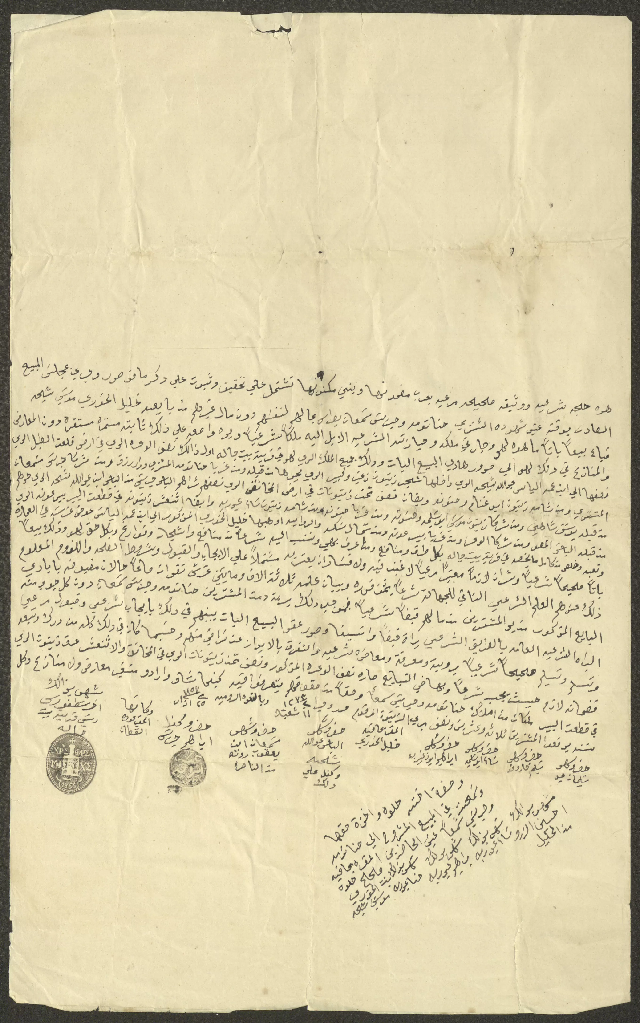
- حجة بيع كرم زيتون يحتوي على 11 شجرة زيتون في منطقة قلعة الطبل من أراضي بيت جالا بين البائع جريس سمعان بطرس والمشتري إسحاق توما، حيث اشترى توما كرم الزيتون من بطرس بمبلغ وقدره 550 قرش، ووقع على الحجة كل من البائع والمشتري وستة من الشهود من أهالي بلدة بيت جالا وكتب الحجة ميخائيل القسيس
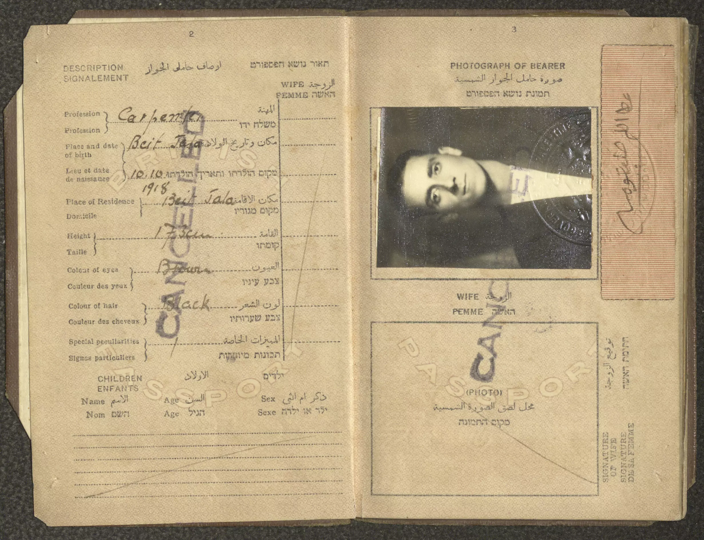
- جواز سفر عطا الله توما، صادر عن حكومة فلسطين، 23 آب 1937
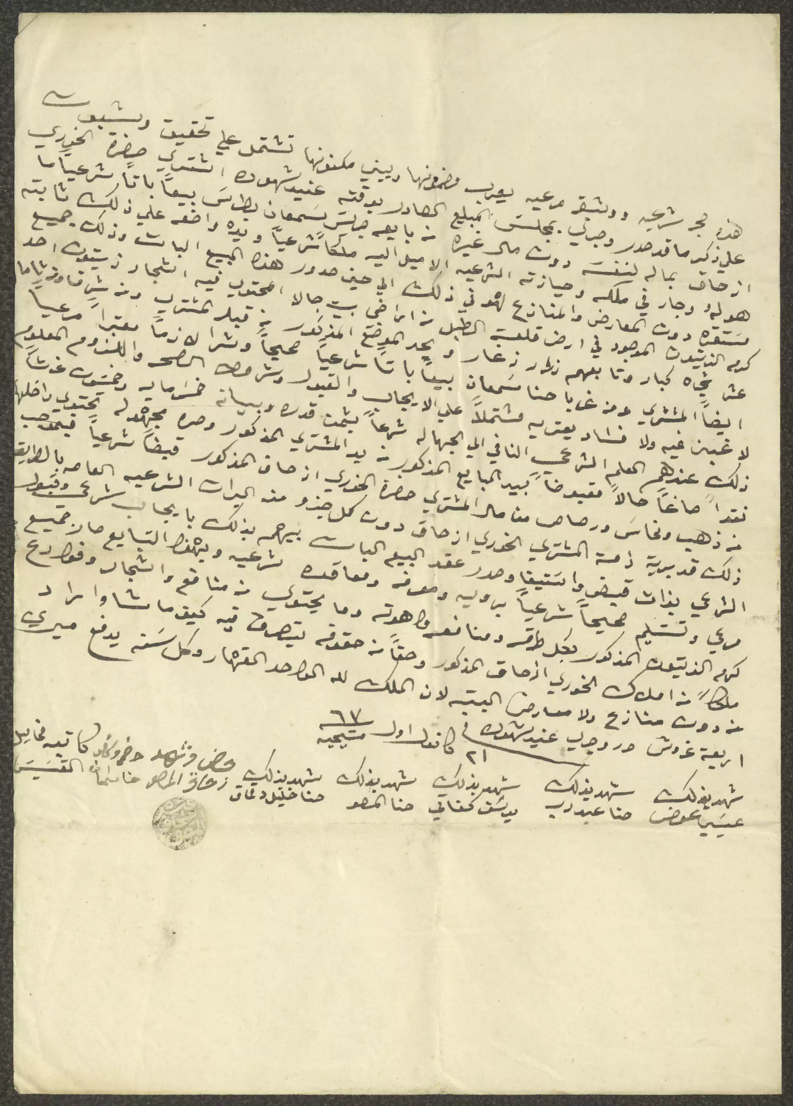
- حجة بيع خليل شيحة "قطعة أرض" لحنا توما وجريس بطرس، 6 نيسان 1857...المزيد في قسم التعليقات
1 - حجة بيع حنا شاهين "قطعة أرض" في بيت جالا لإسحاق توما، 1863...المزيد في قسم التعليقات
1 - حجة بيع أرض بين جريس بطرس وعطية عيد، 4 تشرين الثاني 1863..المزيد في قسم التعليقات

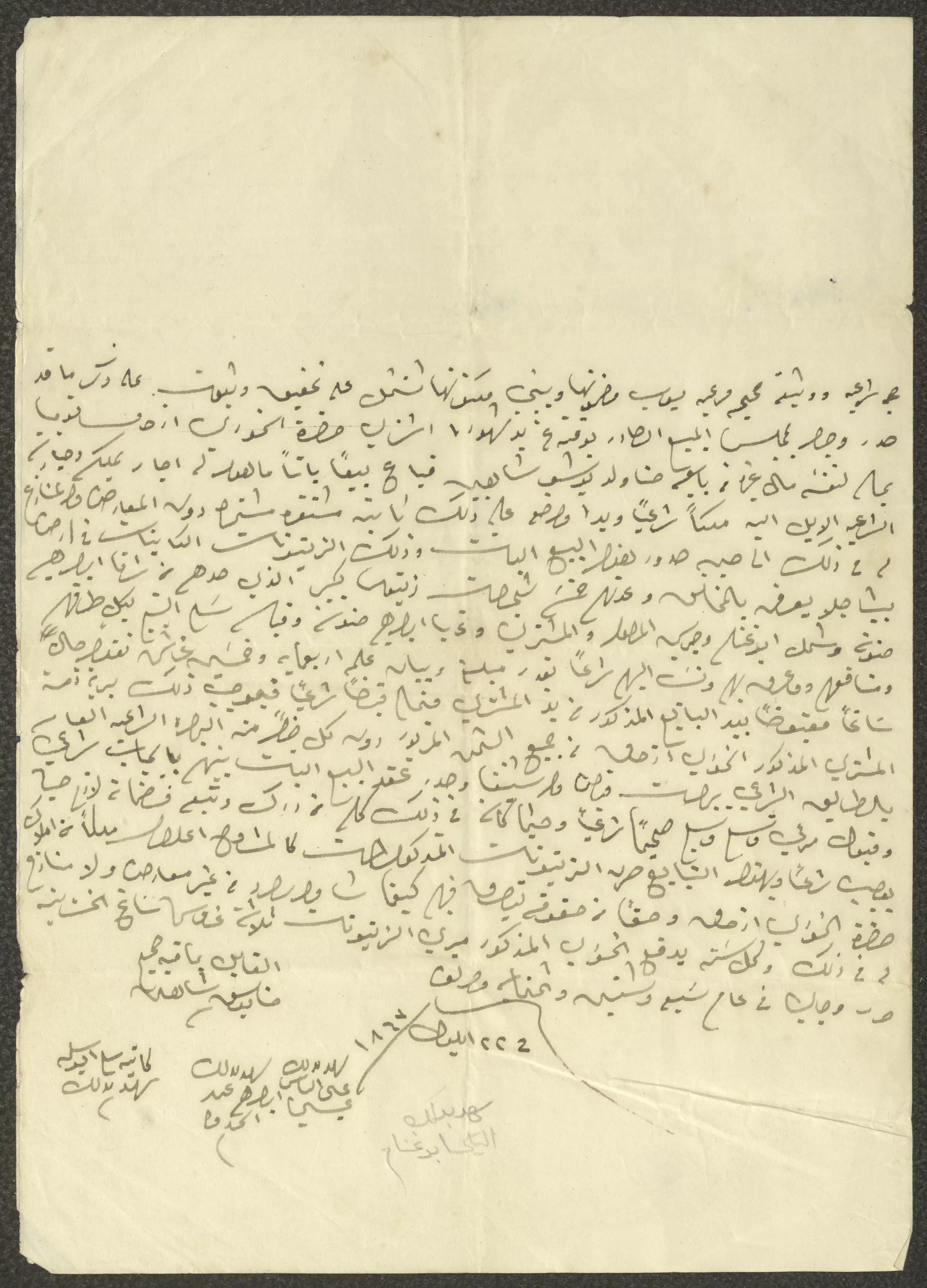
1 - حجة بيع وتبادل قطعة أرض بين اسحاق توما وجريس المصو، 26 نيسان 1869..المزيد في قسم التعليقات
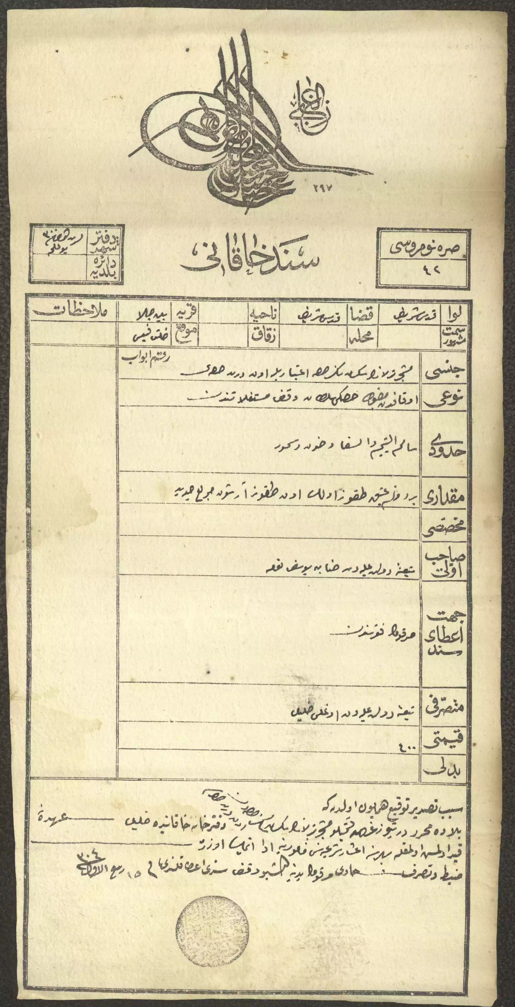
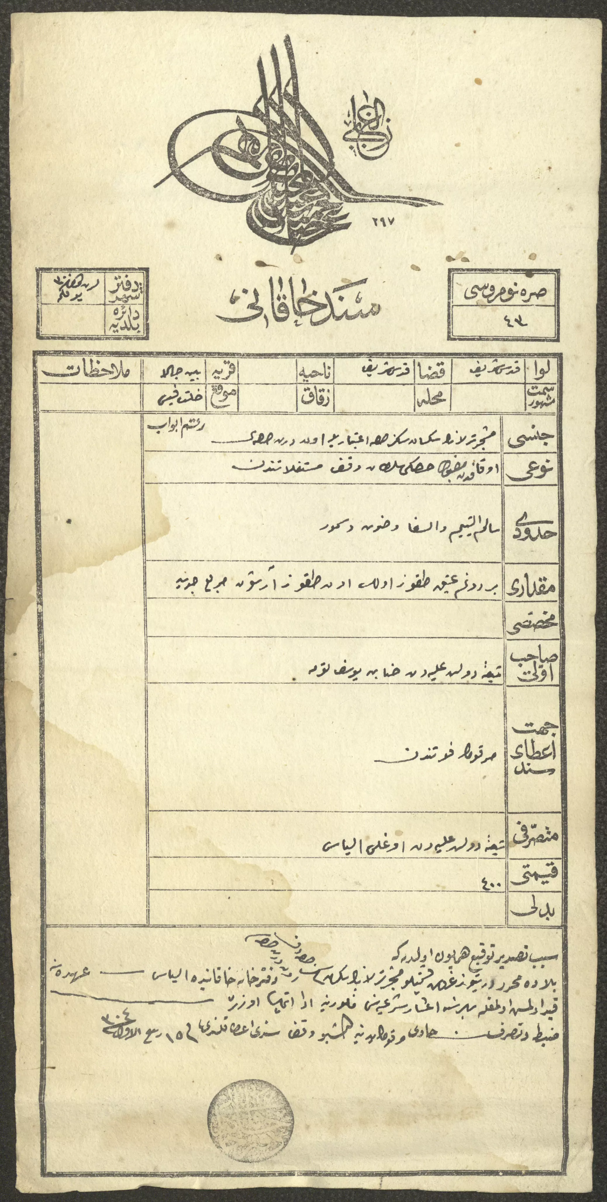
1 - "سند خاقاني" صادر عن دائرة تسجيل الأملاك، القدس، 1886..المزيد في قسم التعليقات
1 - إخطار عثماني بدفع ضريبة أملاك، بيت جالا، 1914...المزيد في قسم التعليقات
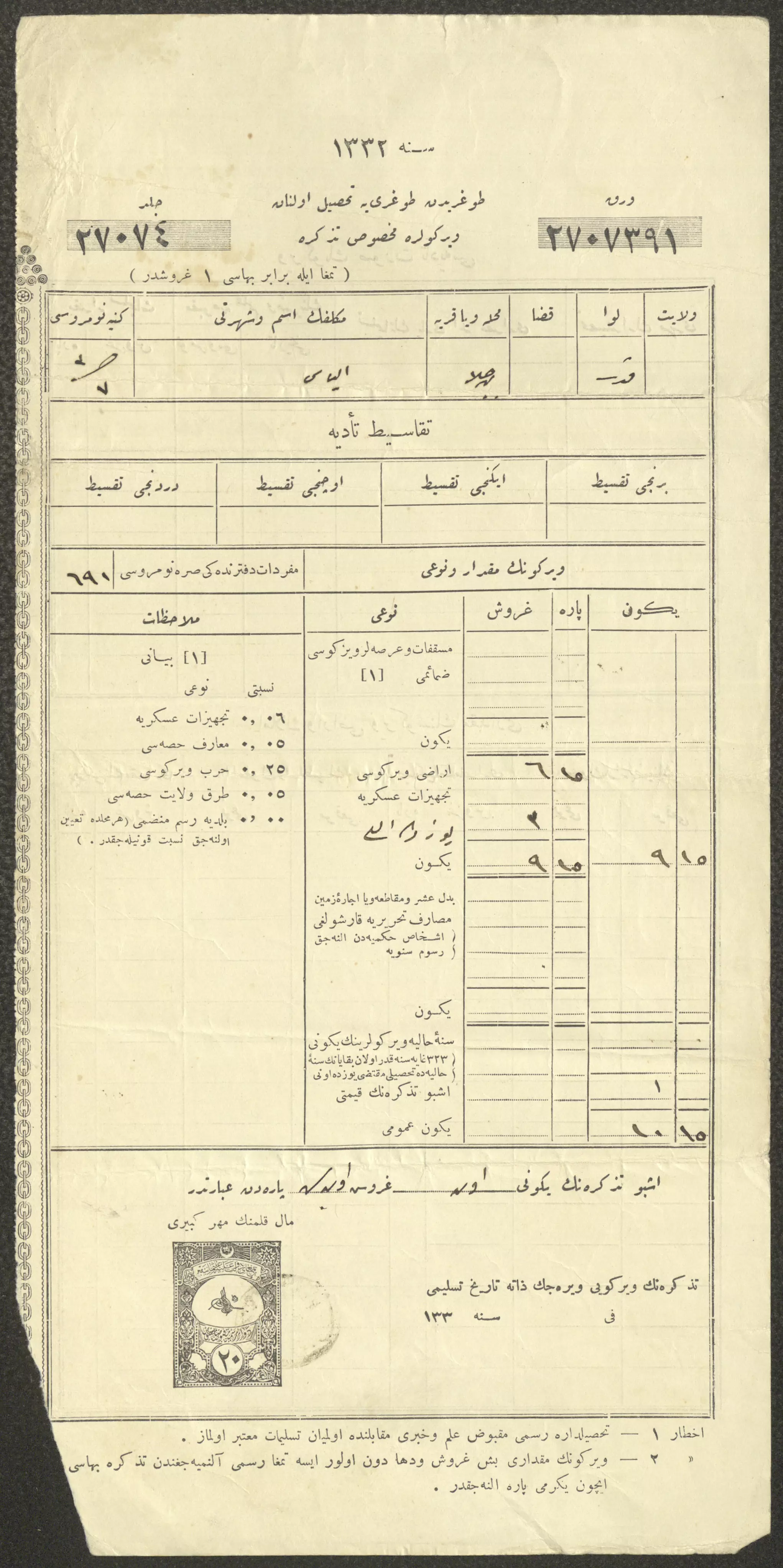
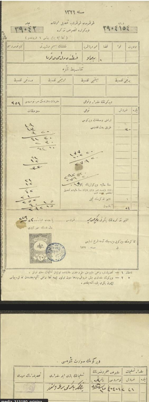
1 - إخطار عثماني بدفع ضريبة أملاك لقسطندي توما، بيت جالا، 1911...المزيد في قسم التعليقات
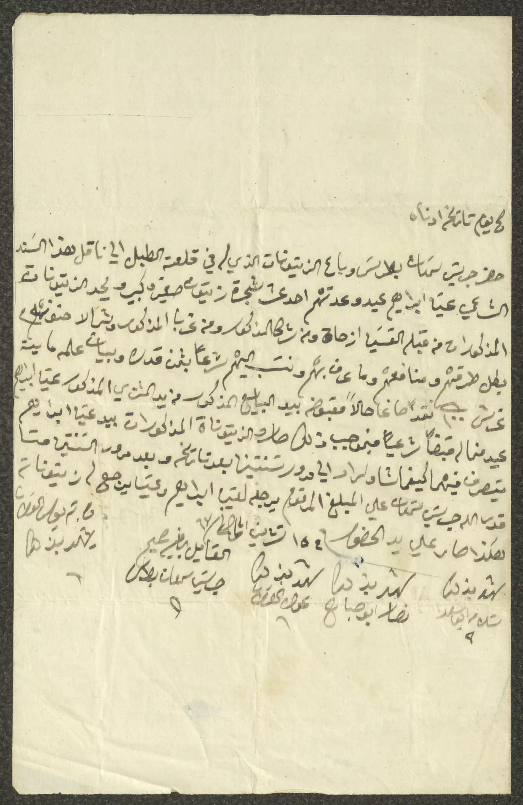
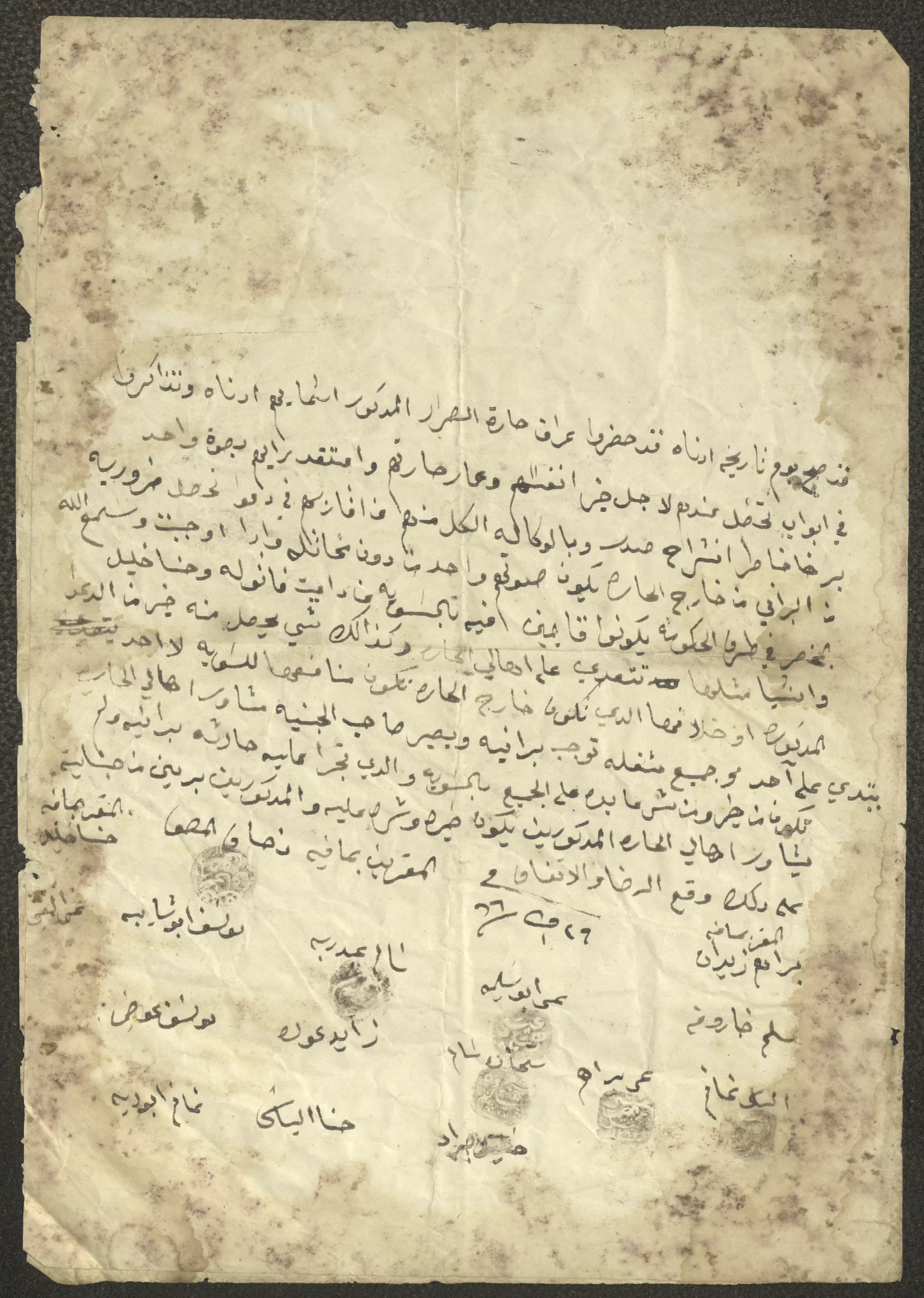
1 - اتفاقية بين أهالي بيت جالا لحفظ الأمن، 26 تشرين الأول 1866..المزيد في قسم التعليقات
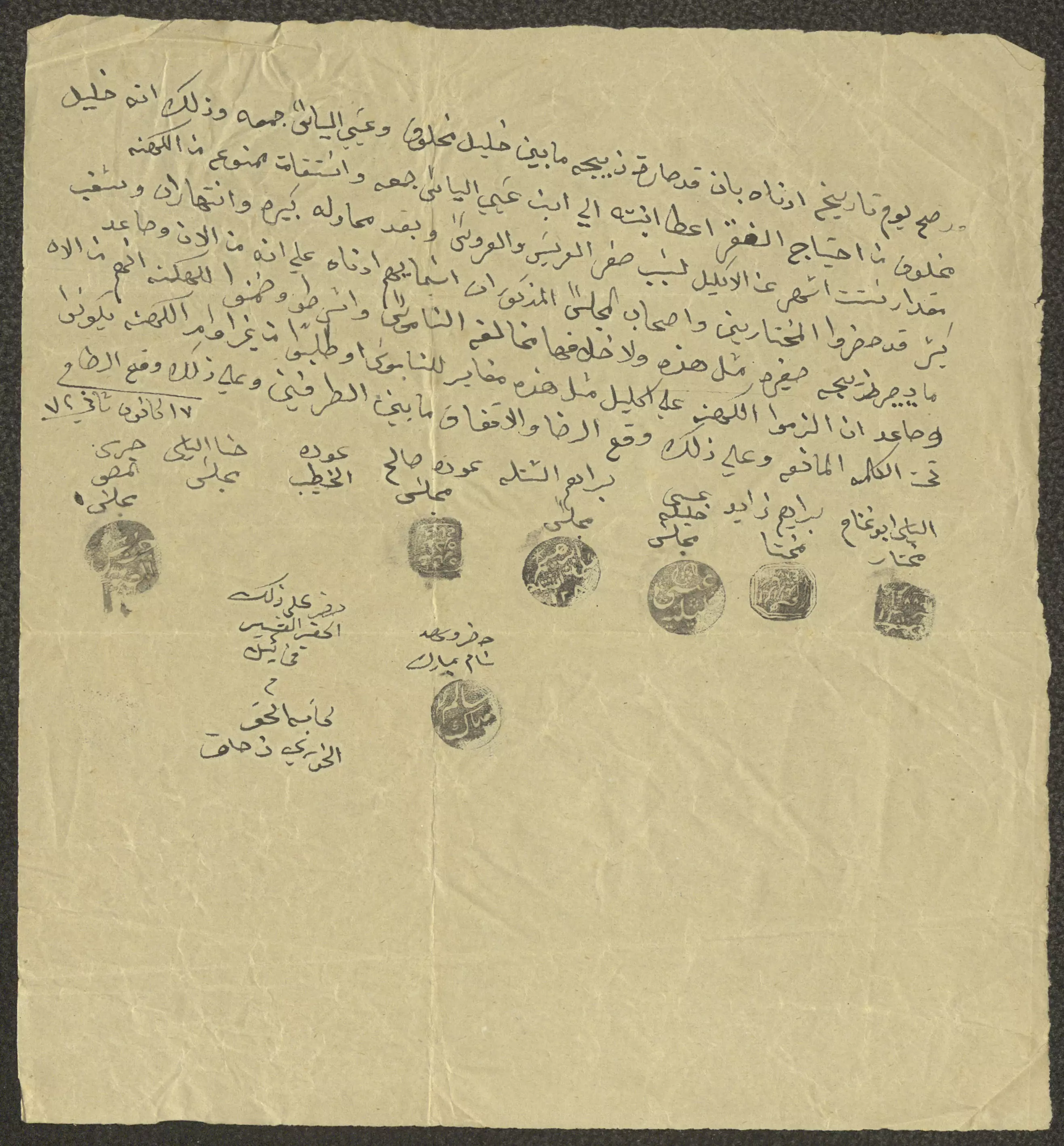
1 - اتفاق بين أهالي بيت جالا على منع الزواج المبكر، 7 كانون الثاني 1872..المزيد في قسم التعليقات
Want to browse more? 80,000 pictures were grouped in these gallaries:
- "سند خاقاني" صادر عن دائرة تسجيل الأملاك لحنا توما، بيت جالا، 1885 -- المزيد عنه اسفل الصورة بقسم التعليقات
1 - "سند خاقاني" صادر عن دائرة تسجيل الأملاك، القدس، 1886
--لمزيد عنه اسفل الصورة بقسم التعليقات
1 - حجة بيع قطعة أرض بين يعقوب سمعان واسحاق توما، 24 أيلول 1866
- حجة بيع كرم زيتون يحتوي على 11 شجرة زيتون في منطقة قلعة الطبل من أراضي بيت جالا بين البائع جريس سمعان بطرس والمشتري إسحاق توما، حيث اشترى توما كرم الزيتون من بطرس بمبلغ وقدره 550 قرش، ووقع على الحجة كل من البائع والمشتري وستة من الشهود من أهالي بلدة بيت جالا وكتب الحجة ميخائيل القسيس
- حجة بيع خليل شيحة "قطعة أرض" لحنا توما وجريس بطرس، 6 نيسان 1857...المزيد في قسم التعليقات
1 - حجة بيع حنا شاهين "قطعة أرض" في بيت جالا لإسحاق توما، 1863...المزيد في قسم التعليقات
1 - حجة بيع أرض بين جريس بطرس وعطية عيد، 4 تشرين الثاني 1863..المزيد في قسم التعليقات
1 - حجة بيع وتبادل قطعة أرض بين اسحاق توما وجريس المصو، 26 نيسان 1869..المزيد في قسم التعليقات
1 - "سند خاقاني" صادر عن دائرة تسجيل الأملاك، القدس، 1886..المزيد في قسم التعليقات
1
| Display Name | Clan/Hamolah | Country of Residence |
| Daniel El-Filistini | El-Filistini | Beit Jala, Palestine |
| Ghaleb Mitwasi | Mitwasi | Bet jala, Palestine (a7la balad) |
| Hadel | - | Madaba, Jordan |
- حلوة يا دنيا - تقرير عن مدينة بيت جالا - فلسطين Duration: 11 min 11 sec
- جولة في مدينة بيت جالا الفلسطينية Duration: 15 min 30 sec
 Fake Valor: Why Did Zionist Jews Hoist Nazis Flag on Their Ships in the 1930s?
What is new?
-
Facts About Oct. 7th Gaza Raid
-
Remined Us Please:: Who Did Rape Who? Palestinians Raped Israelis? Or, was the other way around?
-
When Prof. Edward Said was invited to debate Bibi Netanyahu in the 1980s, watch what happened!
-
Ezra Klein of the NY Times on the "Jewish Race".
-
Abusing Blood Libel!
-
Did Israeli Soldiers Activate The Hanniba Direective On Oct. 7th? You Be The Judge
-
Zionist FAQ: Isn't it true that Palestinians don't want peace? Palestinians never accepted the two-state solution
- Facts about Haavara (Transfer) Agreement between Ben-Gurion & Hitler
-
Haavara FAQs: Why Did Zionist Jews Hoist Nazis' Flags on Their Ships in the 1930s?
- Haavara FAQs: When Chaim Weizmann met FDR in mid-1943, why was he silent about rescuing European Jewry?
-
Dear ChatGPT: How did Palestinians resist Napoleon's invasion of their country in 1799?
-
Dear ChatGPT: Gaza had a vibrant Jewish community in the mid-17th century. What happened to them?
-
Dear ChatGPT: Why did the Jewish Agency suppress news of the Holocaust during WWII?
-
Video Playlist: Jews share their DNA tests to end the conflict for good.
-
A Tale of Two Conflicts: Examining the Definition of Genocide
-
Prof. Abraham Polak And The Suppressed History of the Khazars and European Jewry
-
How Ronald Reagan would have framed the genocide in Gaza if he were still alive?
-
Haavara FAQs: Let us do the math: how many German Jews did The Haavara Agreement save?
-
Zionist FAQs: The Hebron Massacre of 1929, "clearly proves" that Palestinians are antisemitic, how could you deny it?
-
Zionist FAQs: Why Anti-Zionist Is Not Antisemitism?
-
Zionist FAQs: Isn't it true that the KGB created Palestinian Nationalism in the early 1960s?
- Zionist FAQs: Muslims are killing Muslims all the time; why are Israeli Jews being singled out in the media?
- Zionist FAQs: How is Israel an apartheid state when 20% of its citizens are Arabs who enjoy full rights?
-
Haavara FAQs: Why Did Dorothy Thompson Flip From A Zionist Advocate to A Silenced Dissenter?
-
Haavara FAQs: Analysis of Herzl's Uganda Scheme and how it could have saved millions of Jews.
-
Haavara FAQs: Why did Hayim Greenberg describe American Jewry as "morally bankrupt" in early 1943?
-
Haavara FAQs: What if the Evian Conference was a resounding success? What would have been the impact of saving European Jewry on Zionism?
- Haavara FAQs: What if the six million were saved, how that would have impacted the Zionist project?
-
Haavara FAQs: How did Zionist leaders react when Europe's Jews lingered in the DP camps after WWII ended?
-
Why does the American Jewish community repeat lies that David Ben-Gurion had debunked before he died?
-
Who has the power to rename the Tatar/Khazar Gene Marker to Jewish IV?
-
Zionist FAQs: Why won't Egypt, Syria, and Jordan take their people back? Jews are indigenous to Palestine, and Arabs immigrated after Jews developed the country. Arabs should leave.
-
Haavara FAQs: Did Hitler and the Nazis conflate between Judaism and Zionist? If that wasn't case, then why?
-
Haavara FAQs: Winston Churchill and antisemitism, a collection of articles written Churchill.
-
Haavara FAQs: Broken by country, how many Jews survived vs. killed during the Holocaust?
-
Haavara FAQs: Why did European Jews vote with their feet and to immigrated to the Americas, not Palestine, after WWII?
-
Watch this American Jewish Girl describing Israeli Jews' cognitive dissonance like no other in under two minutes
-
Haavara FAQs: When the Nazis went out of their way to hide the Holocaust, Israeli Jews did the exact opposite by broadcasting their genocide of Gazans. But why?
-
Haavara FAQs: How Zionist Jews went out of their to show their appreciation to Nazism and Fascism?
- Haavara FAQs: Why Zionist leaders were against bombing the death camps & the Railroads leading to them?
-
Haavara FAQs: Hitler's message to the British and American people: If Jews are such noble citizens and you care about them, how come you're not letting them in? I will gladly ship them to you at my expense, even on luxury liners!
-
A shortlist of Zionist and Israeli false flag operations in the name Jews.
-
The Most Moral Army
- The Land of Kapos (Israel): Where the brave are boycotted and Kapos walk free.
- Why did early Zionists often named their communal enterprises "colonial"?
- Zionist Relations with Nazi Germany by Faris Glubb
-
Two NY Times advertisements by Zionists in the early 1943 that exposes Zionists' treason at the height of the calamity
- Facts Not Lies about the Palestinian-Israeli Conflict.
- Site's pictures have been categorized
- Campgain Against Lice
- A Survey of Palestine, the official source about Palestine before Nakba produced by the British Mandate; over 1200 pages.
- Satellite View & Google Earth: Over 6,000 placemarks identifying all destroyed towns, W. Bank & Gaza Strip Towns, & refugee camps.
- PalestineRemembered.com and its Nakba Oral History Project were featured on al-Jazeera Satellite TV.
- Nakba Oral History Video Podcast:
 Over 700 Oral History interviews (including 3,500+ hours of recording) can be viewed online.
 - Palestine Village Statistics Project
- Gaza Jail Break
- النسخة العربية للموقع الان متوفرة
- Videos: Documenting the destroyed villages in video: Tracing all that remains since Nakba.
- Videos: Responding to Zionist Propaganda
- Interview: The ethnic cleansing of Palestine: George Galloway interviews Israeli Historian Ilan Pappe.
- For Palestinians, memory matters. It provides a blueprint for their future By George Bisharat.
- Zionist FAQ now available in Hebrew שאלות שציונים שואלים, עכשיו בעברית
- Video: The Stephen Walt and John Mearsheimer report on the influence of the Israel Lobby on U.S. Foreign Policy
- The Palestinian-Israeli conflict for beginners
