| PalestineRemembered | About Us | Oral History | العربية | |
| Pictures | Zionist FAQs | Haavara | Maps | |
| Search |
| Camps |
| Districts |
| Acre |
| Baysan |
| Beersheba |
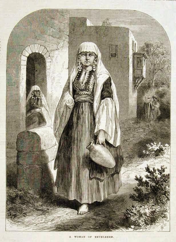
| Bethlehem |
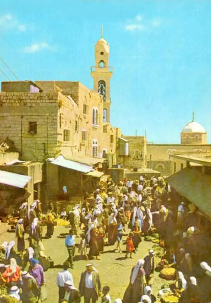
| Gaza |
| Haifa |
| Hebron |
| Jaffa |
| Jericho |
| Jerusalem |
| Jinin |
| Nablus |
| Nazareth |
| Ramallah |
| al-Ramla |
| Safad |
| Tiberias |
| Tulkarm |
| Donate |
| Contact |
| Profile |
| Videos |
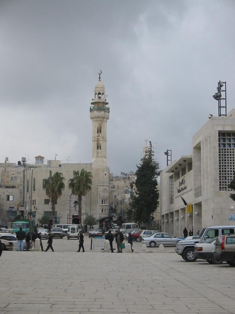
Welcome To Bethlehem - بيت لحم (בית לחם)
|
District of Bethlehem
Occupied days ago |
العربية Google Earth |
 |
Gallery (898) |
- Statistics & Facts
-
Before & After

- Satellite View
- Articles 5
- Pictures 898
- Aerial Views 6
- Land Deeds 1
- Oral History 1
- Members 34
- Families
- Wikipedia
- ARIJ Guide
- Videos 3
- Guest Book 20
- Links 2
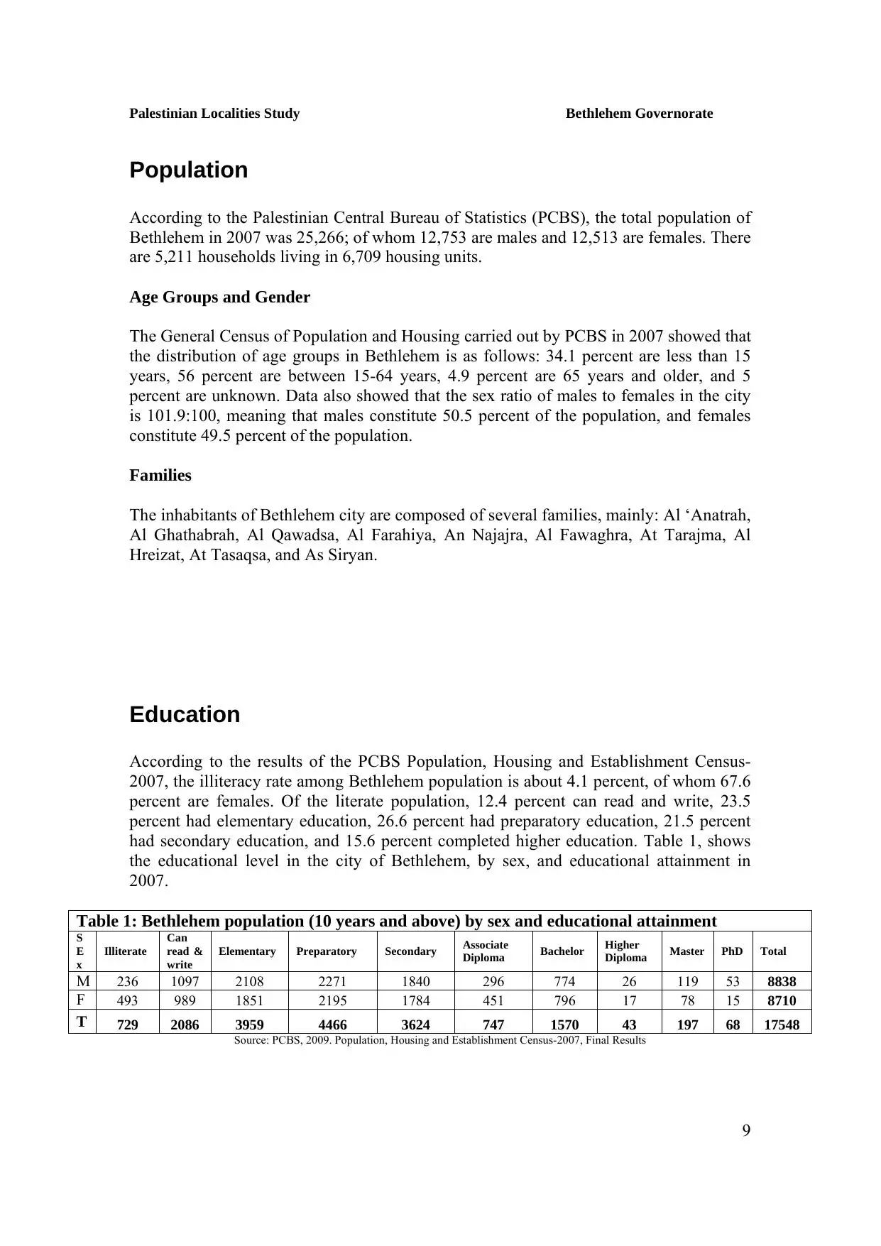
| Statistic & Fact | Value | |||||||||||||||||||||
| Elevation | 777 meters | |||||||||||||||||||||
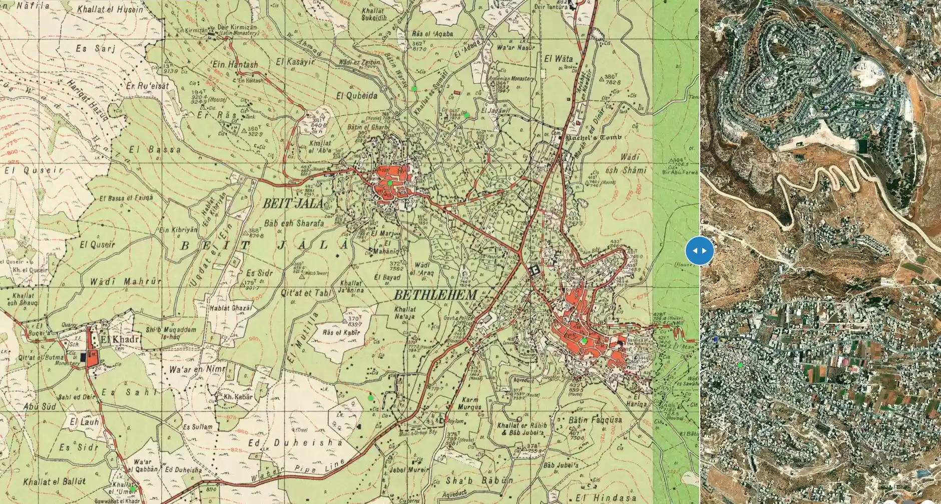
| Before & After Nakba, Click Map For Details |
||||||||||||||||||||||
|
||||||||||||||||||||||
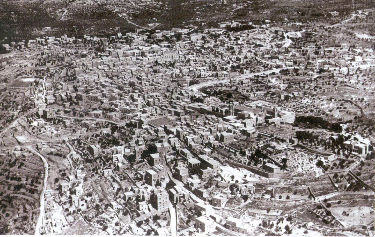
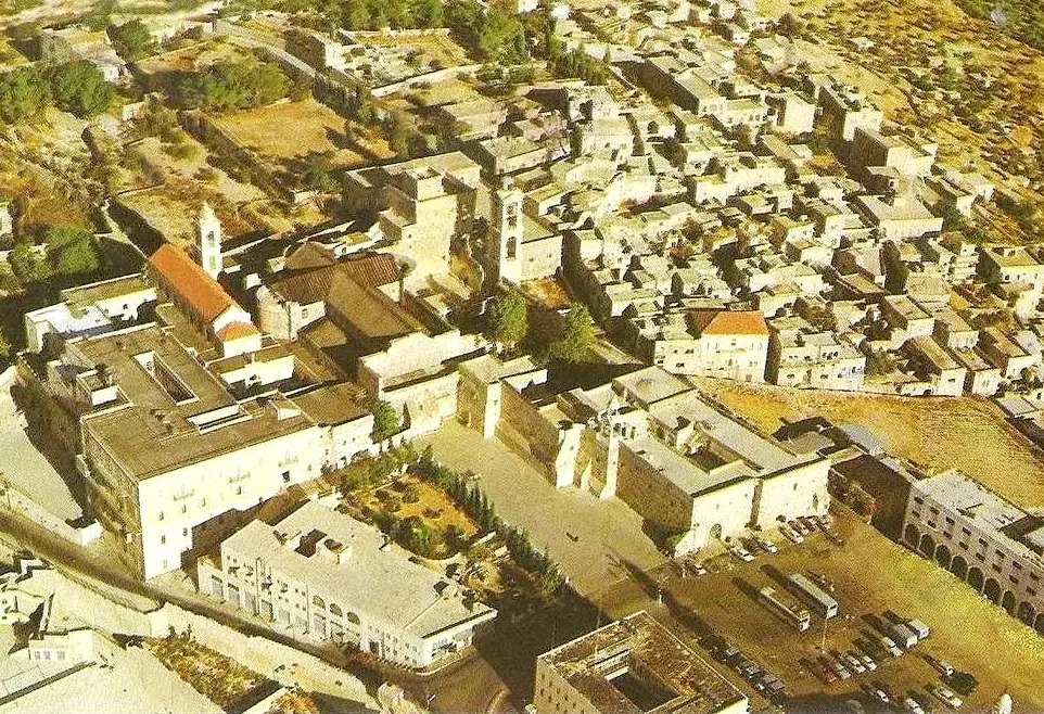
| Pre-Nakba Aerial View |
||||||||||||||||||||||
|
||||||||||||||||||||||
| Land Ownership |
**Town Lands' Demarcation Maps |
|||||||||||||||||||||
| Land Usage As of 1945 |
|
|||||||||||||||||||||
| Population |
|
|||||||||||||||||||||
| Near By Towns |
||||||||||||||||||||||
|
|
||||||||||||||||||||||
| Featured Video | ||||||||||||||||||||||
| ARIJ Guide | ||||||||||||||||||||||
3.

4. 
5. 
6. 
7. 
8. 
9. 
10. 
11. 
12. 
13. 
14. 
15. 
16. 
17. 
18. 
19. 
20. 
21. 
22. 
23. 
24. 
25. 
26. 
27. 
28. 
29. 
30. 
31. 
Click here to browse online. |
||||||||||||||||||||||
| Related Maps | Town Lands' Demarcation Maps خرائط للقضاء توضح حدود القرى والاودية View from satellite Town's map on MapQuest Help us map this town at WikiMapia |
|||||||||||||||||||||
| Related Links | Wikipedia's Page Facebook Page ARIJ Guide Google Search Google For Images Google For Videos في كتاب بلادنا فلسطين دليل أريج المزيد من موقع هوية |
|||||||||||||||||||||
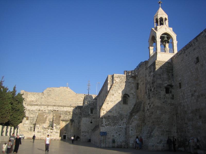
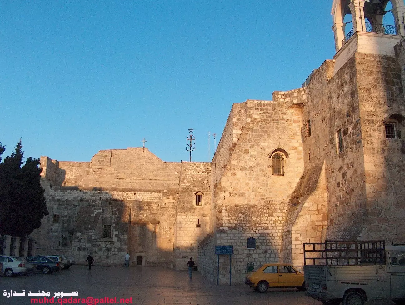
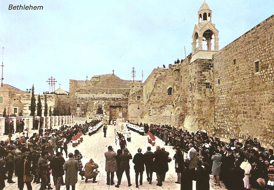
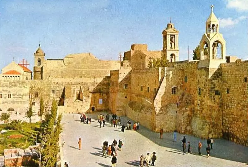
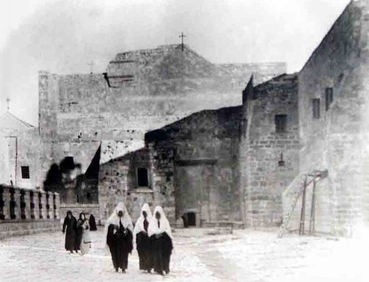
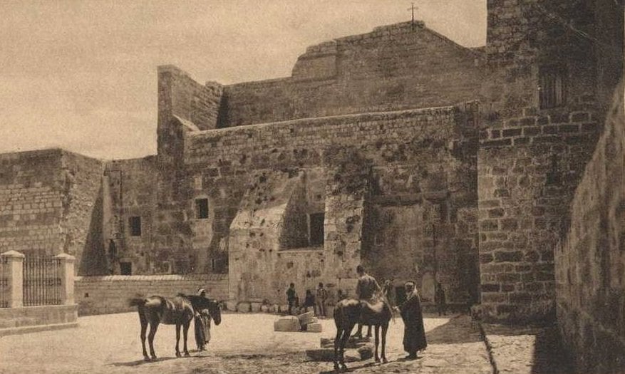
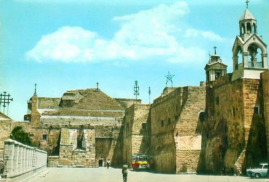
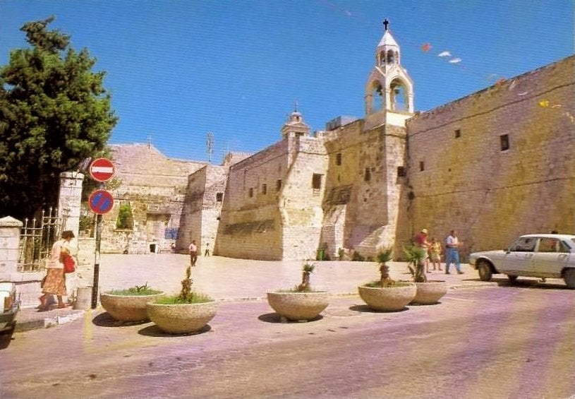
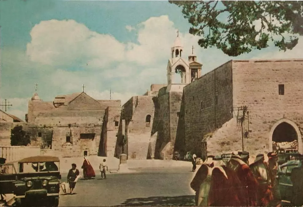
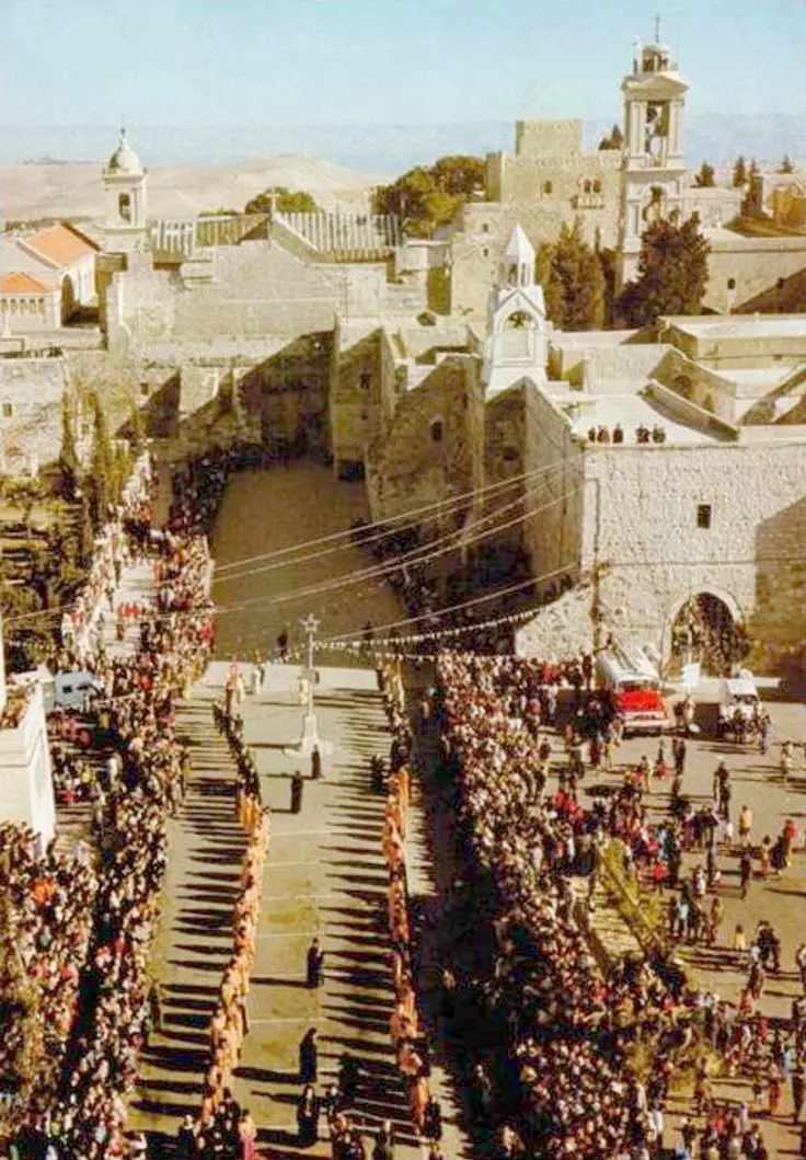
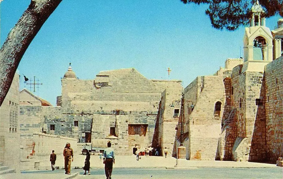
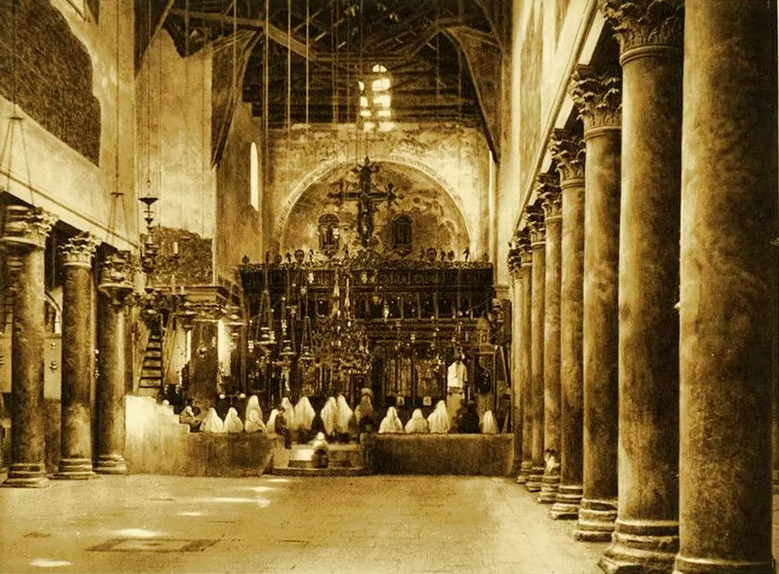
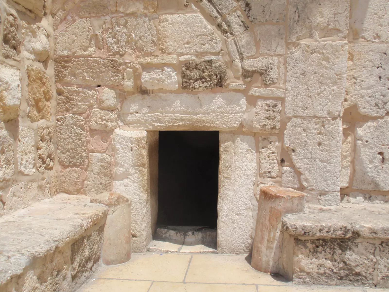
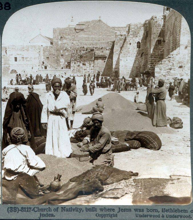
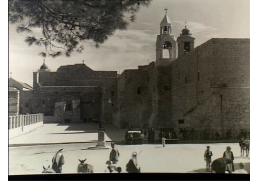
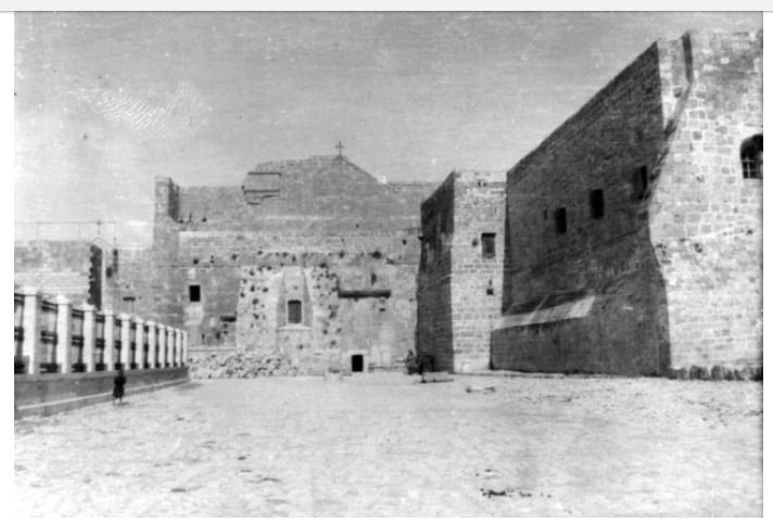
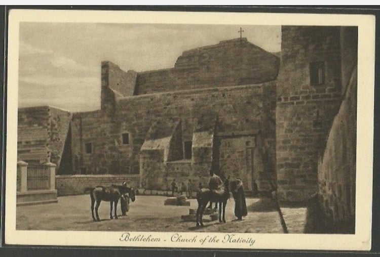
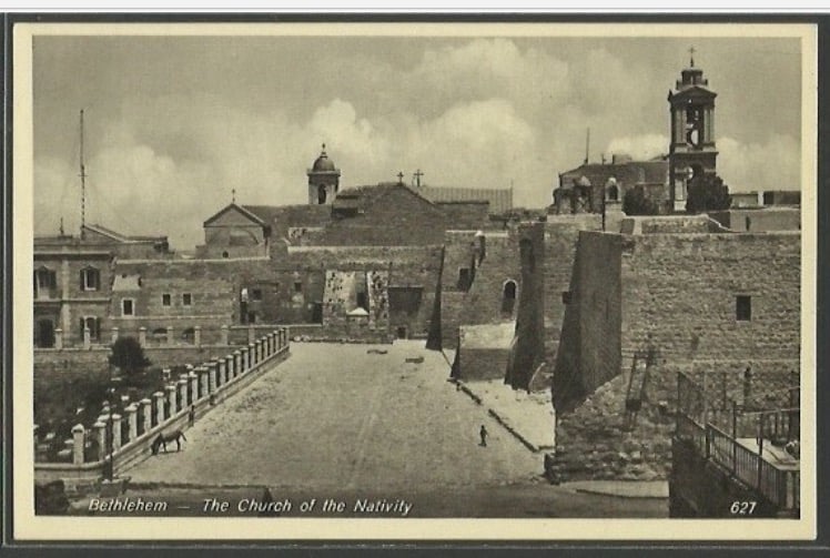
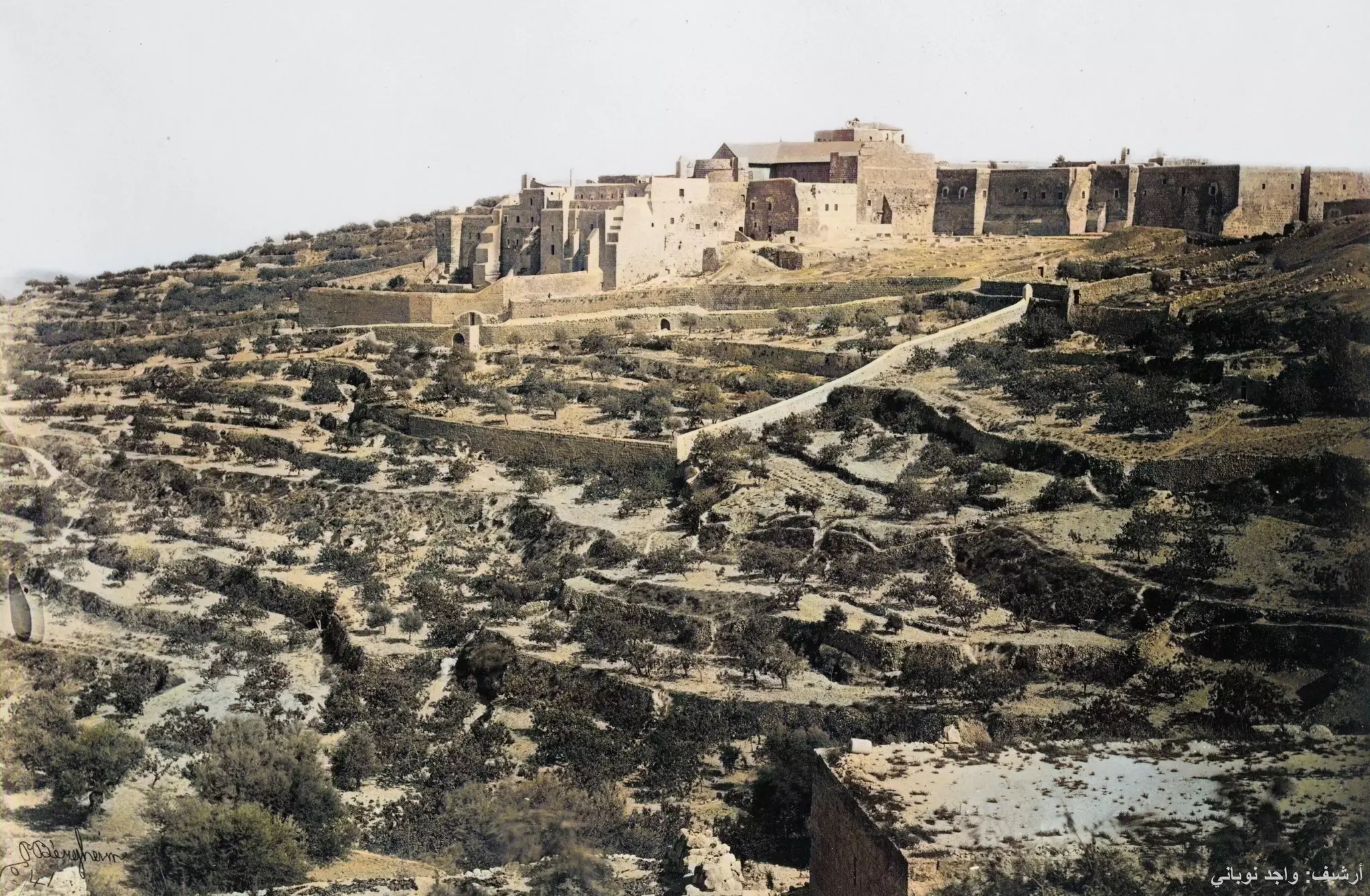
- The Church of Nativity

19 - The Church of Nativity #2
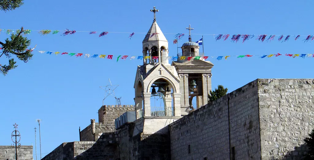
10 - The Church of Nativity #3

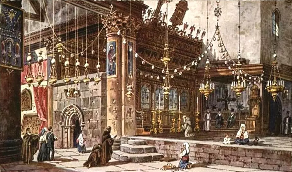
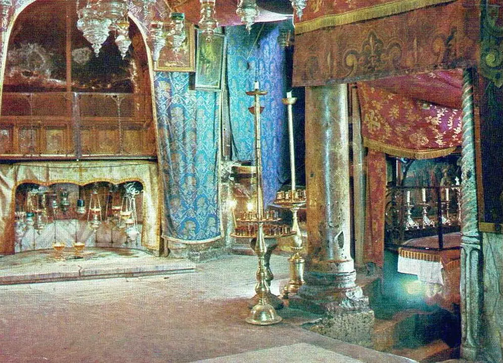
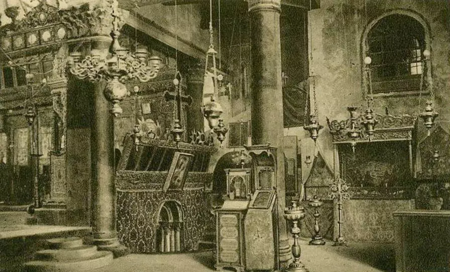
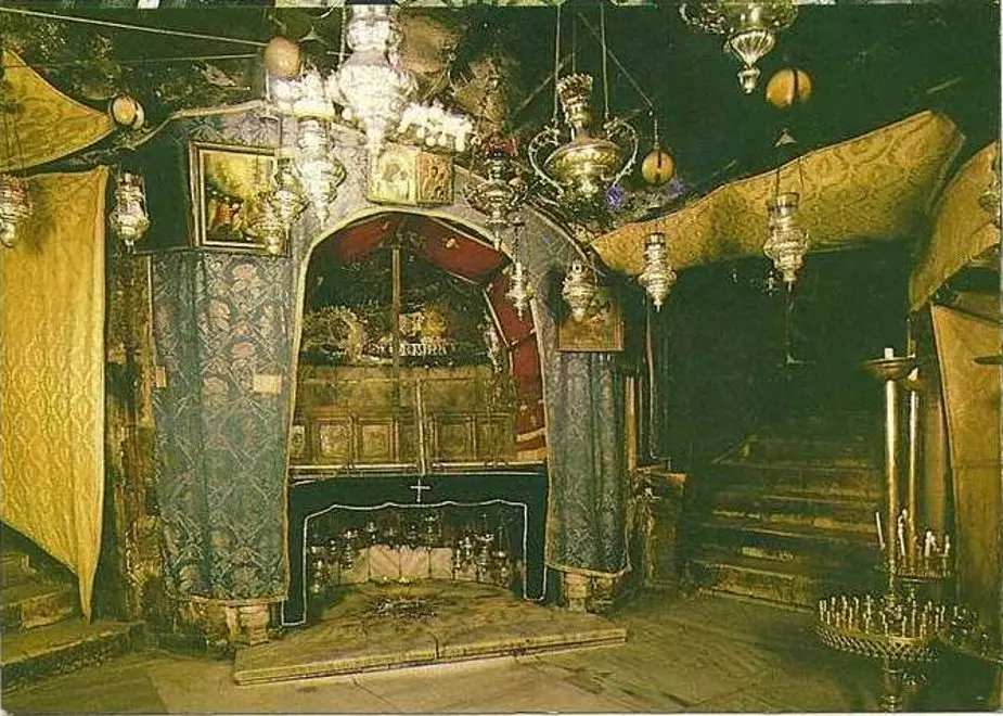
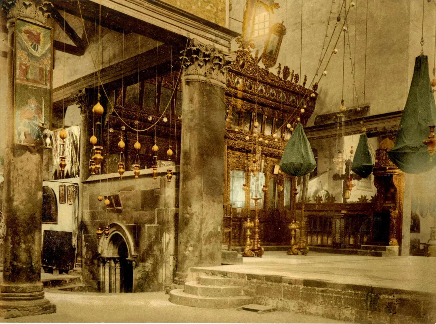
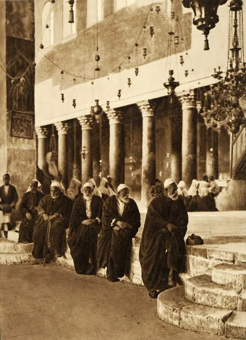
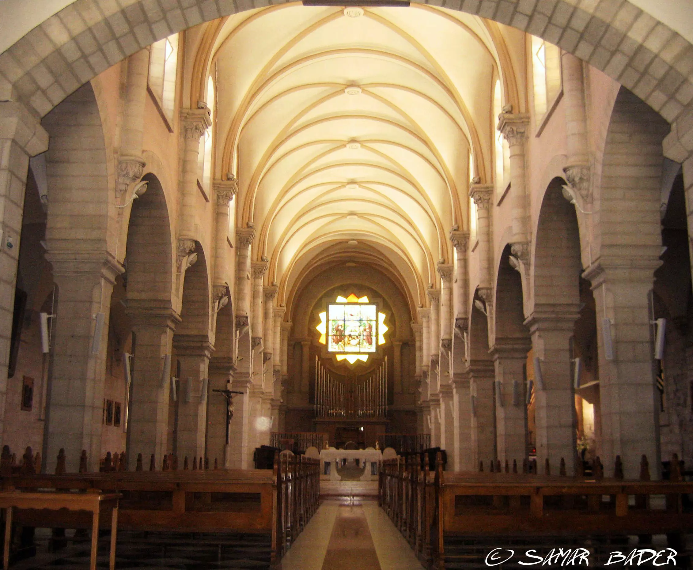
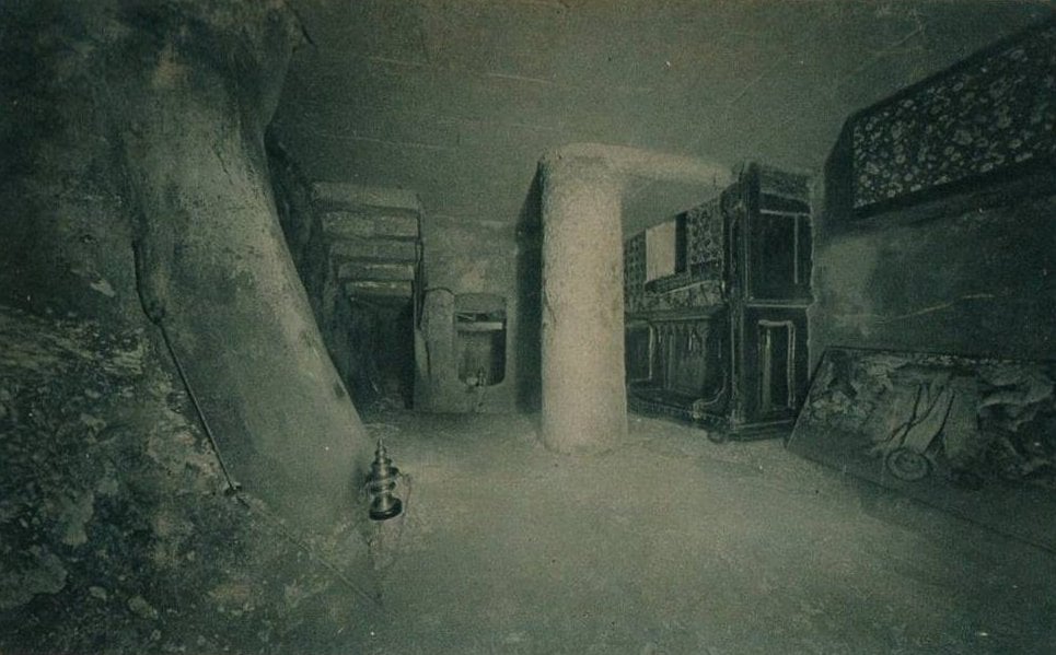
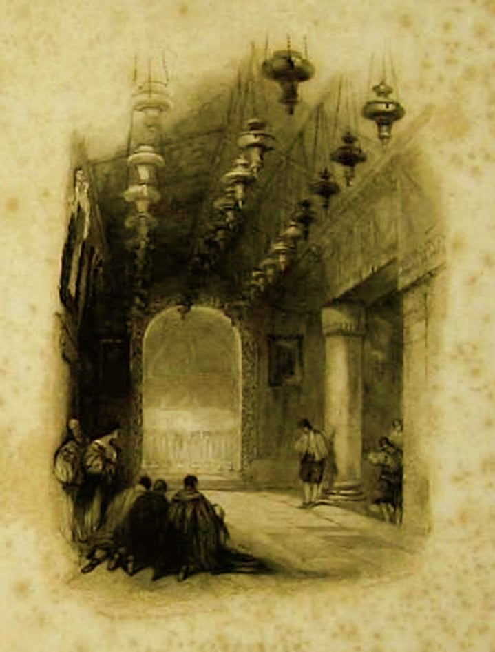
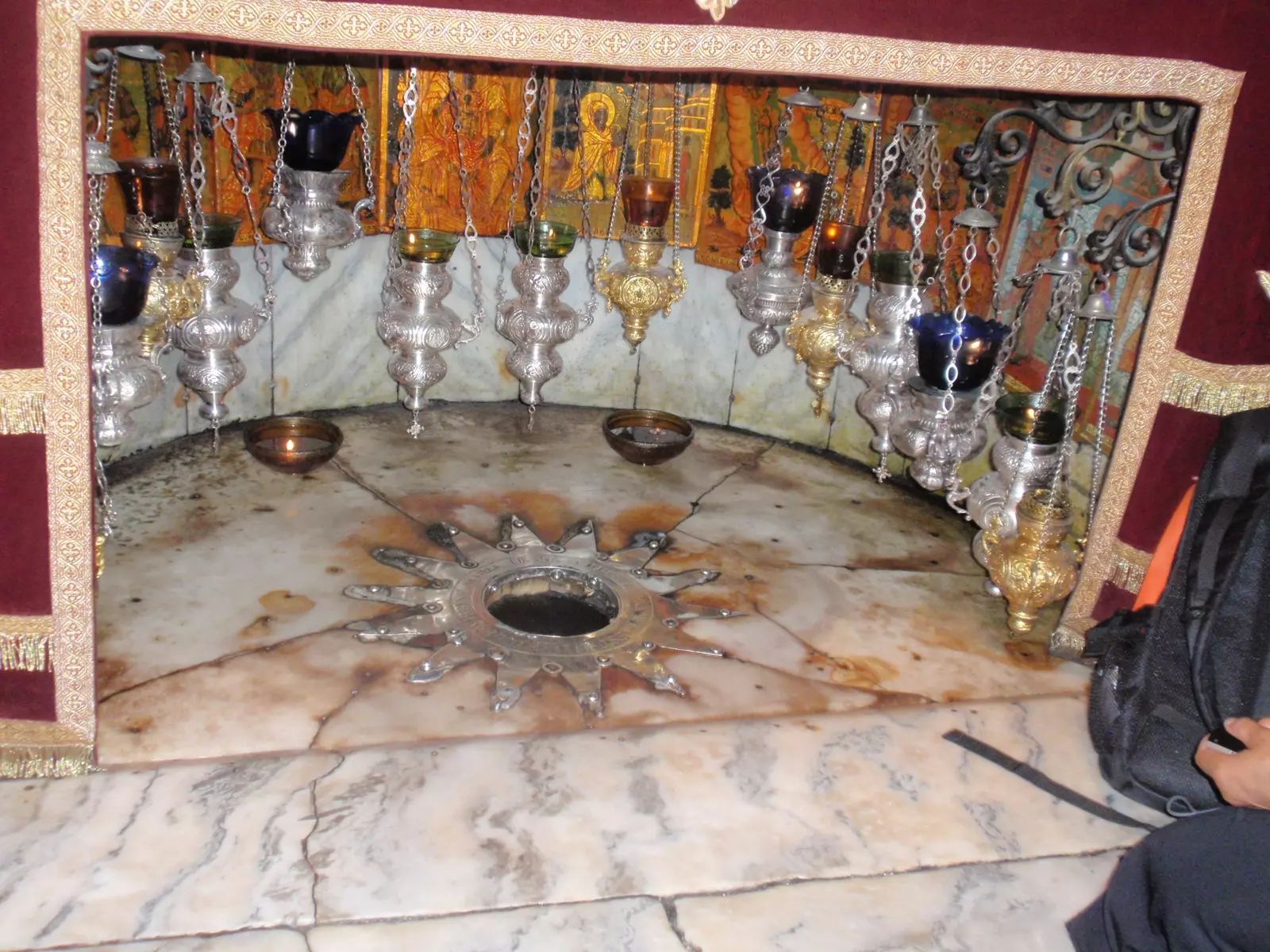
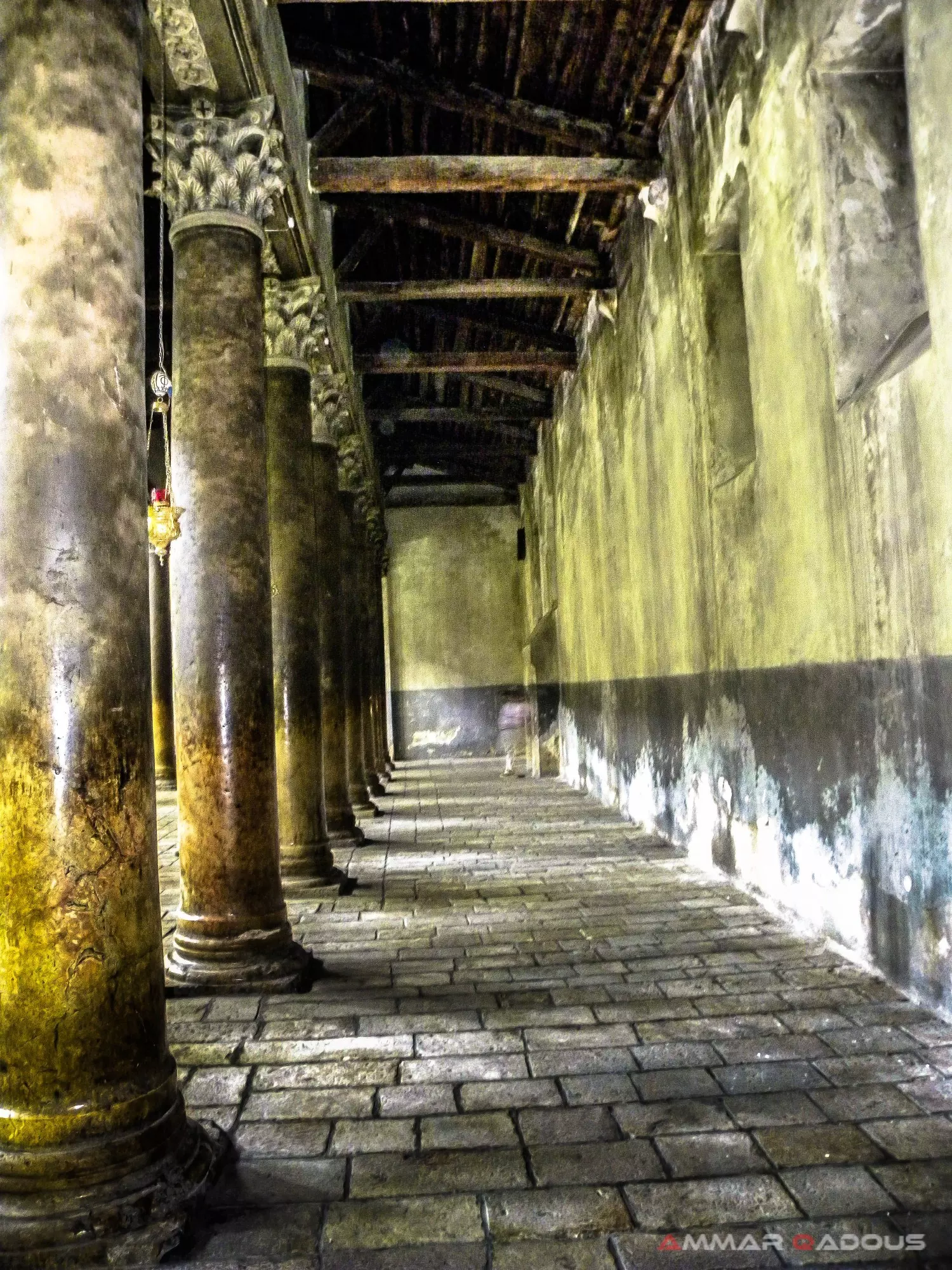
3 - Inside the Church of Nativity

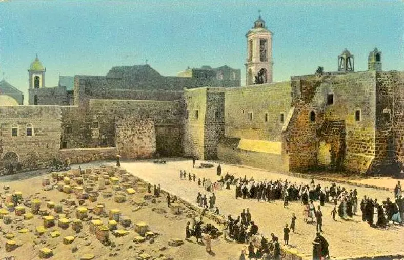
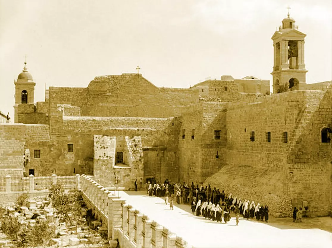
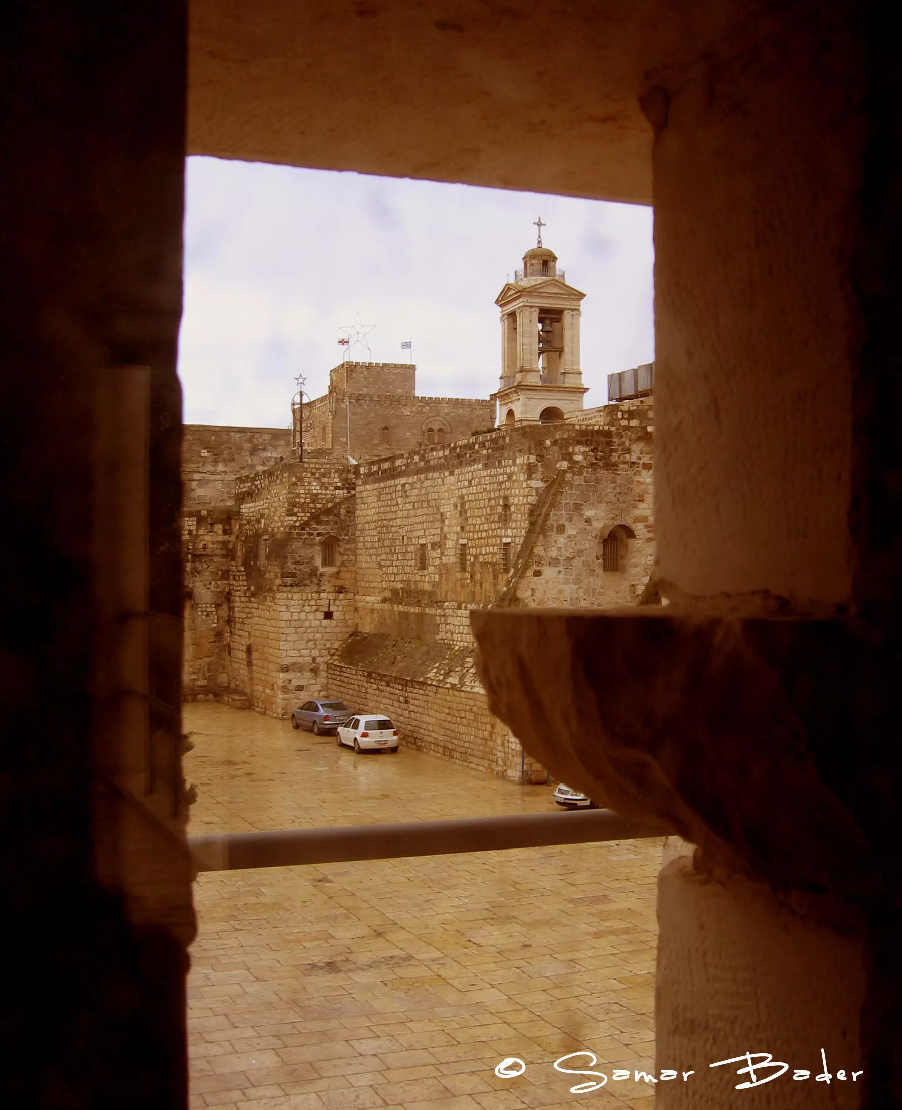
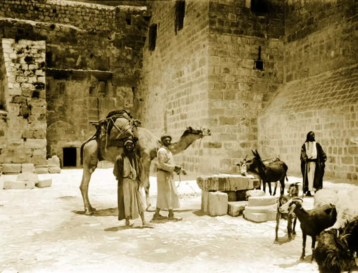
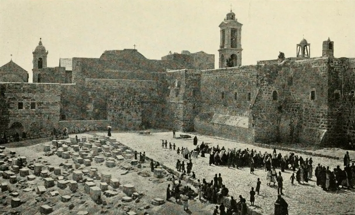
2 - The courtyard of the Church of Nativity
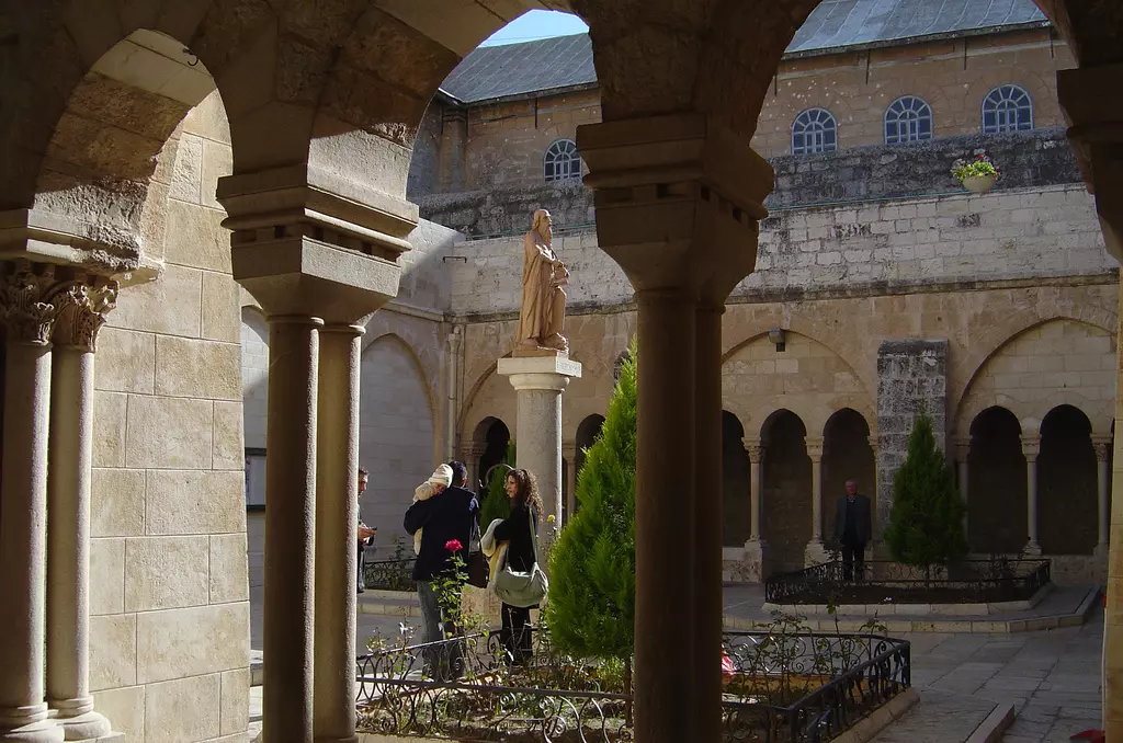
1 - In the courtyard of the Church of Nativity

5 - Inside the Church of Nativity #2

- Inside the Church of Nativity #3

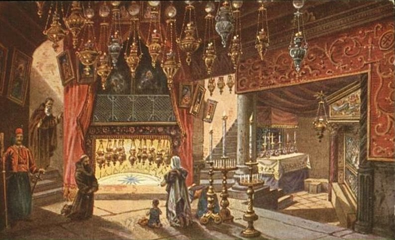
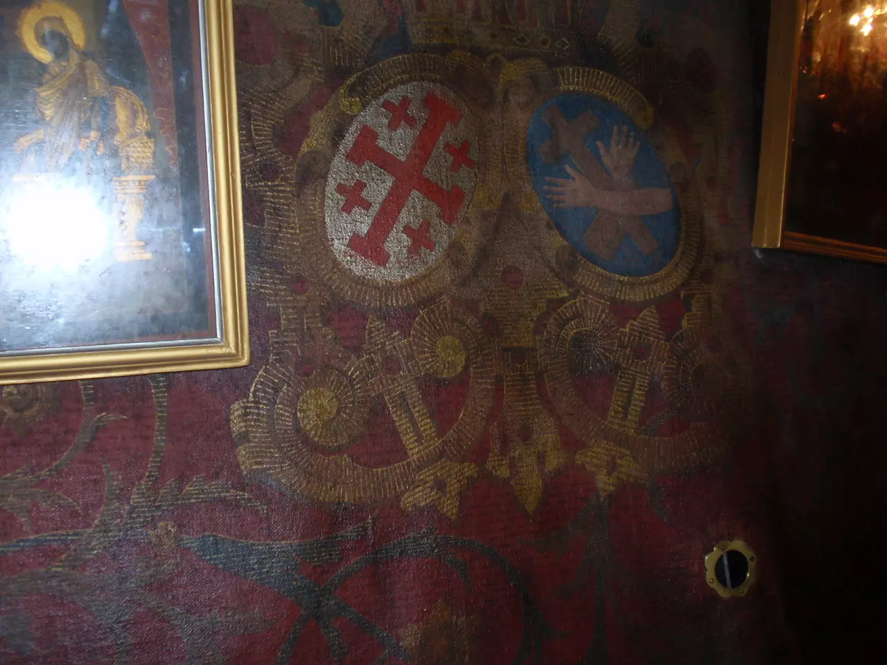
- Undate picture inside The Church of Nativity during the Ottoman period

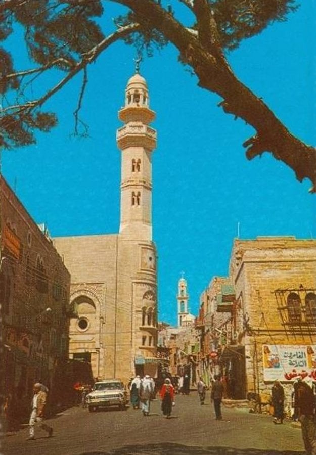
9 - Omar Ibn Al-Khattab Mosque at Manger Square

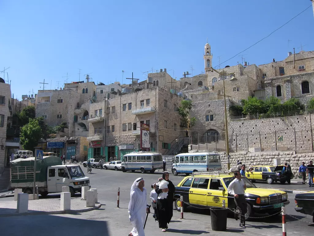
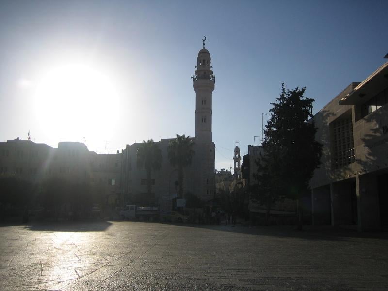
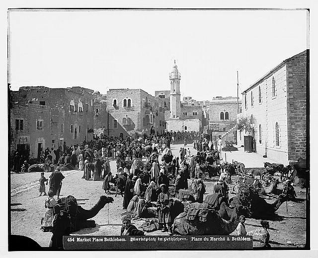
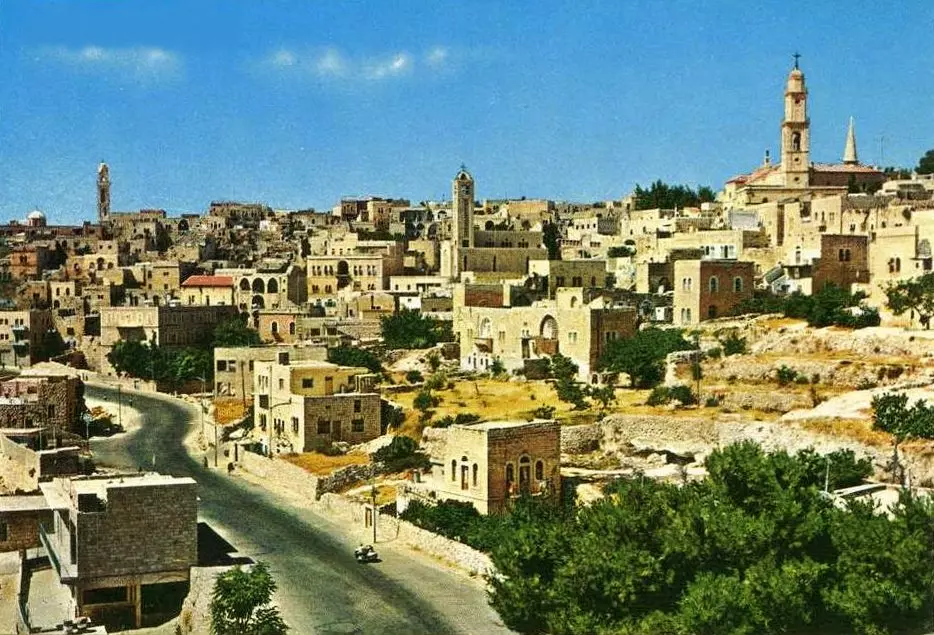
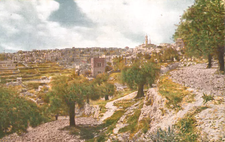
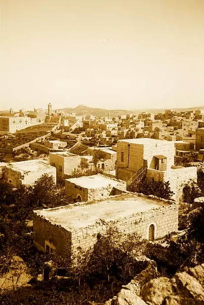
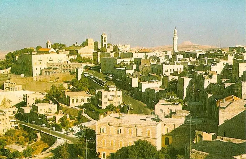
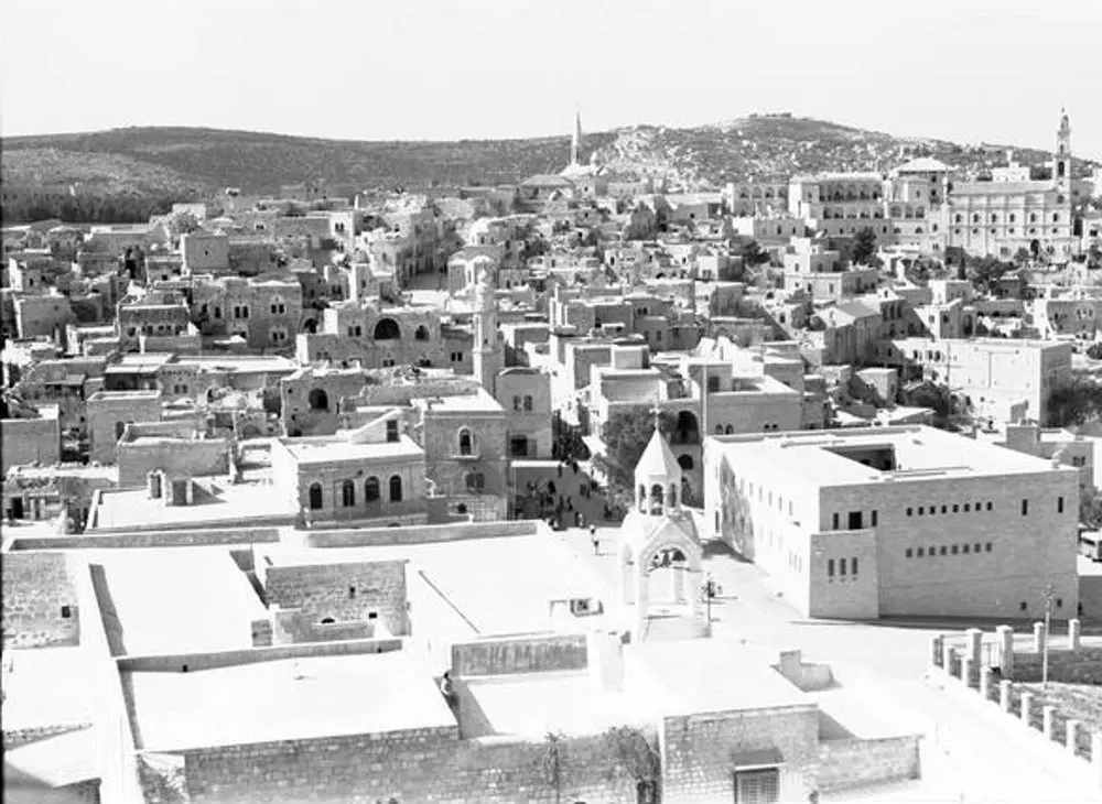
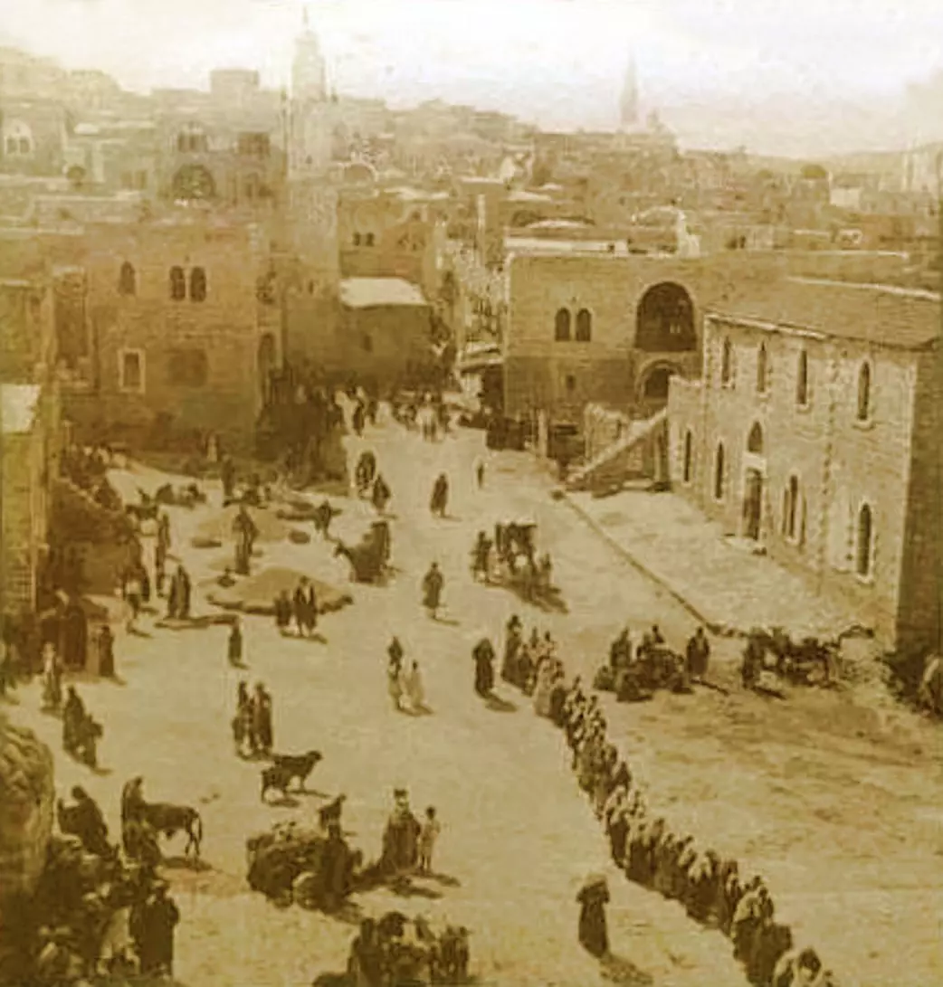
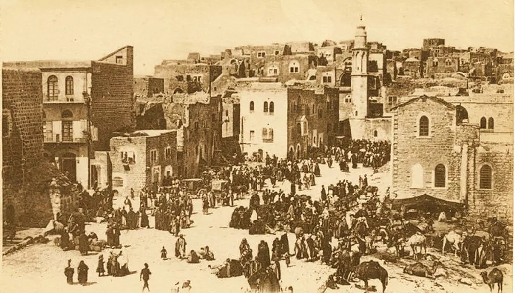
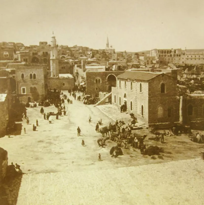
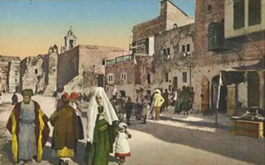
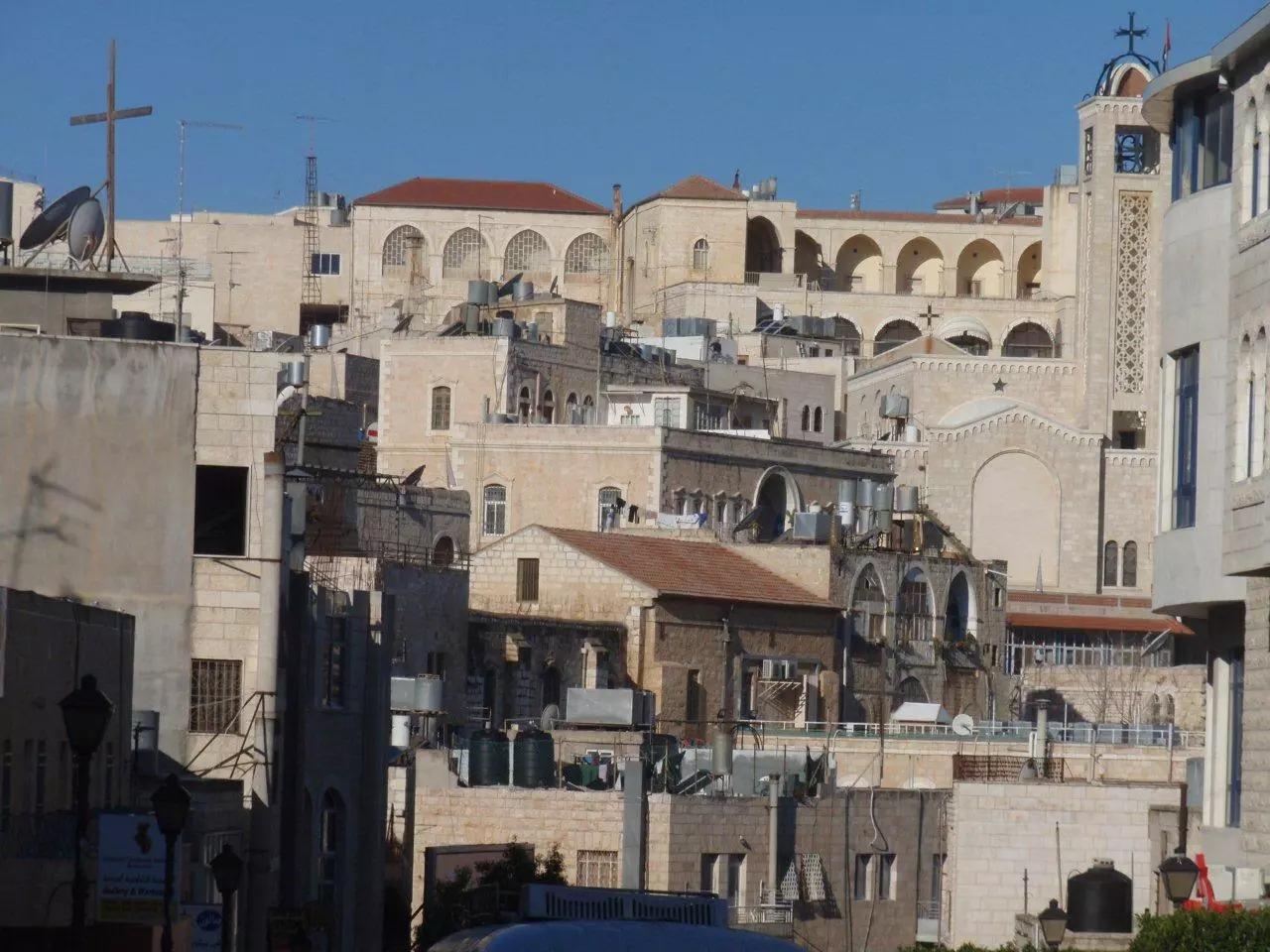
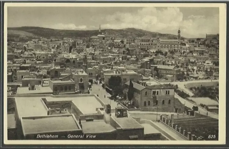
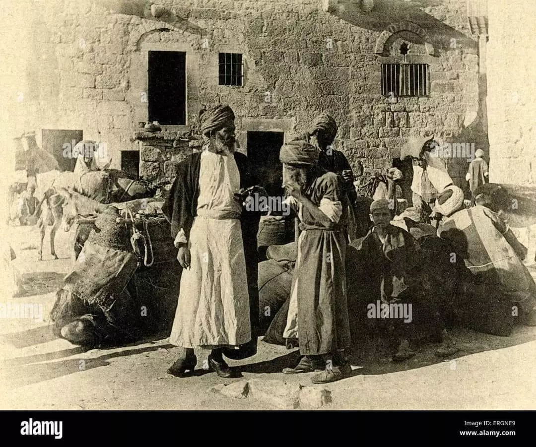
4 - General view
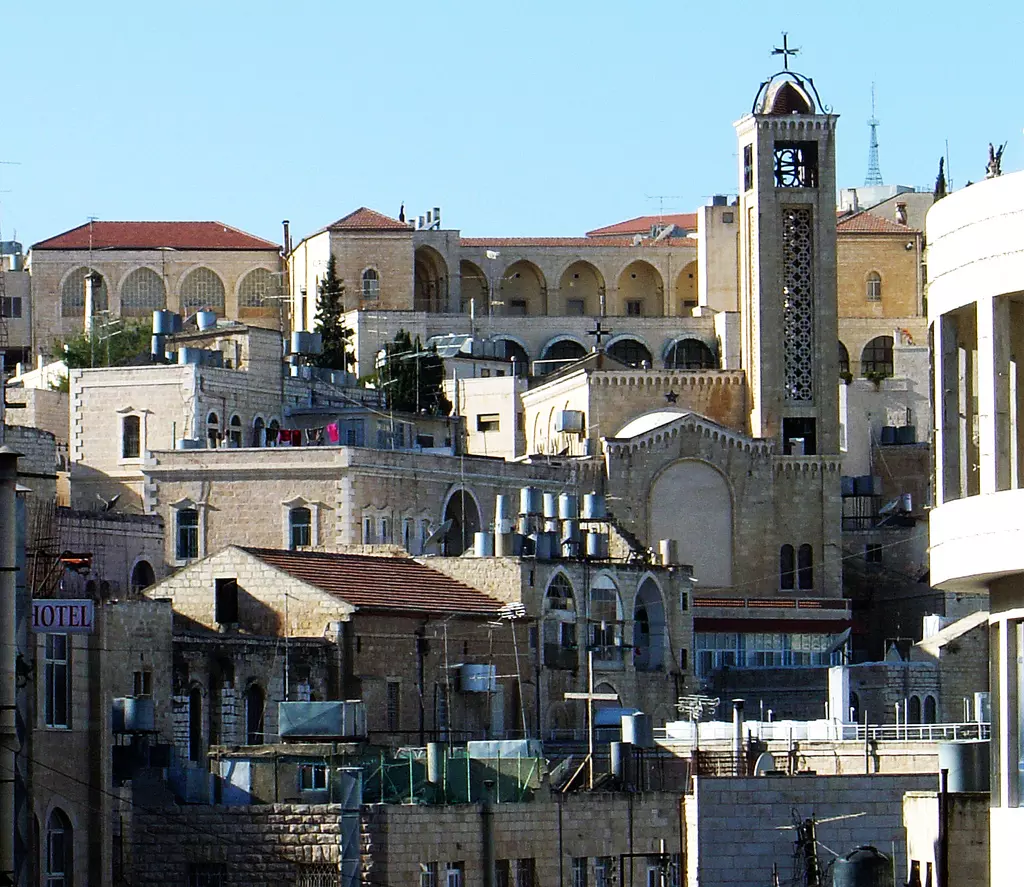
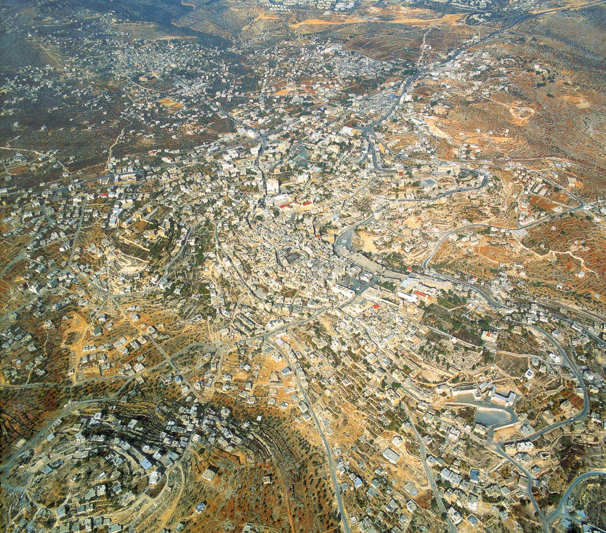
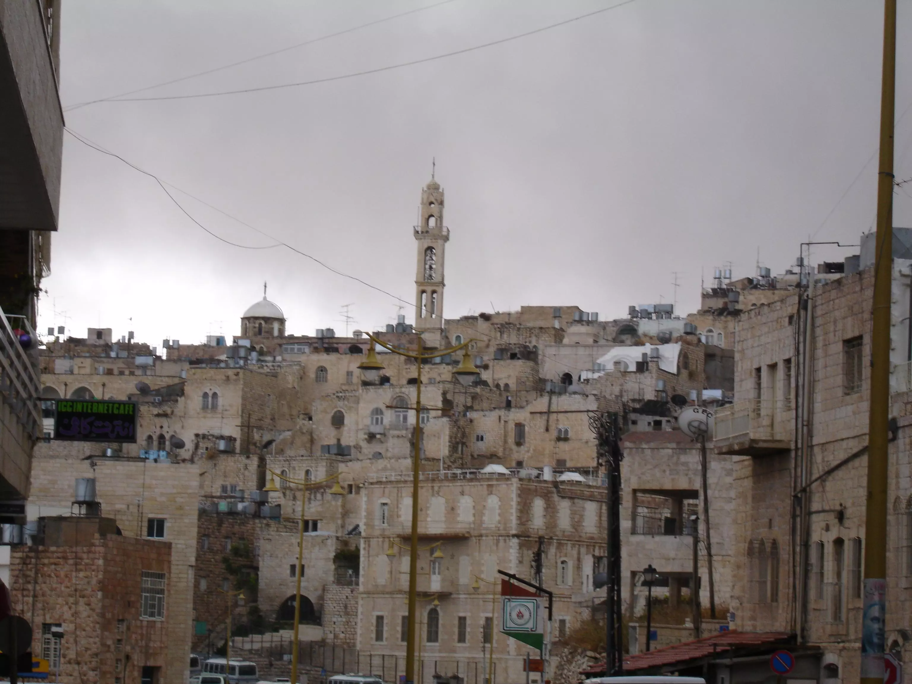
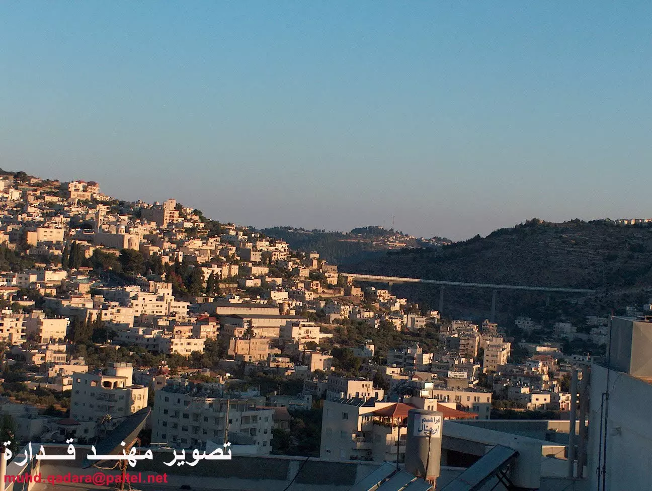
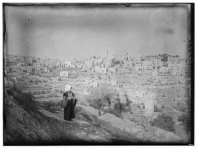
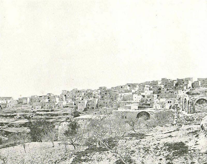
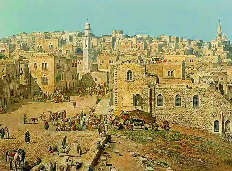
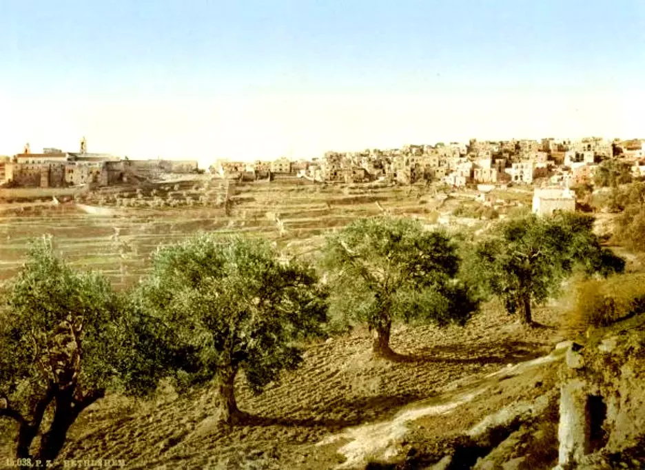
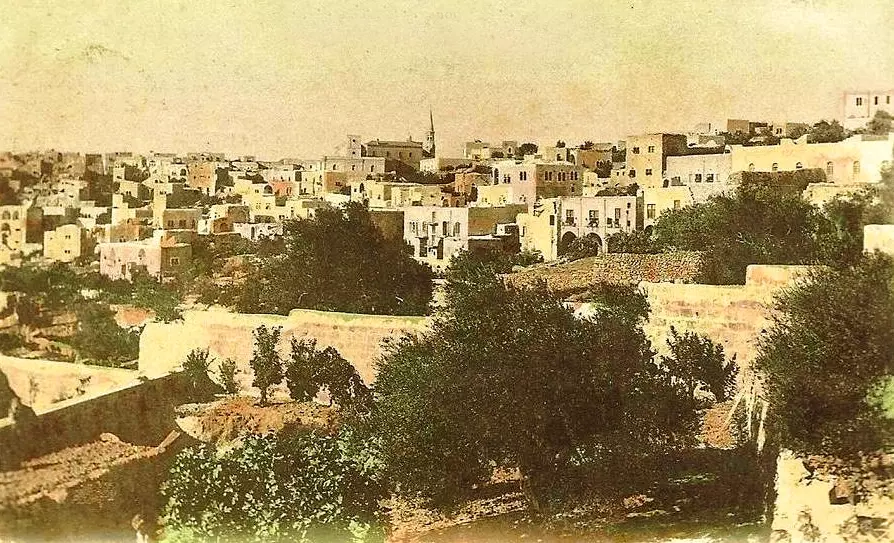
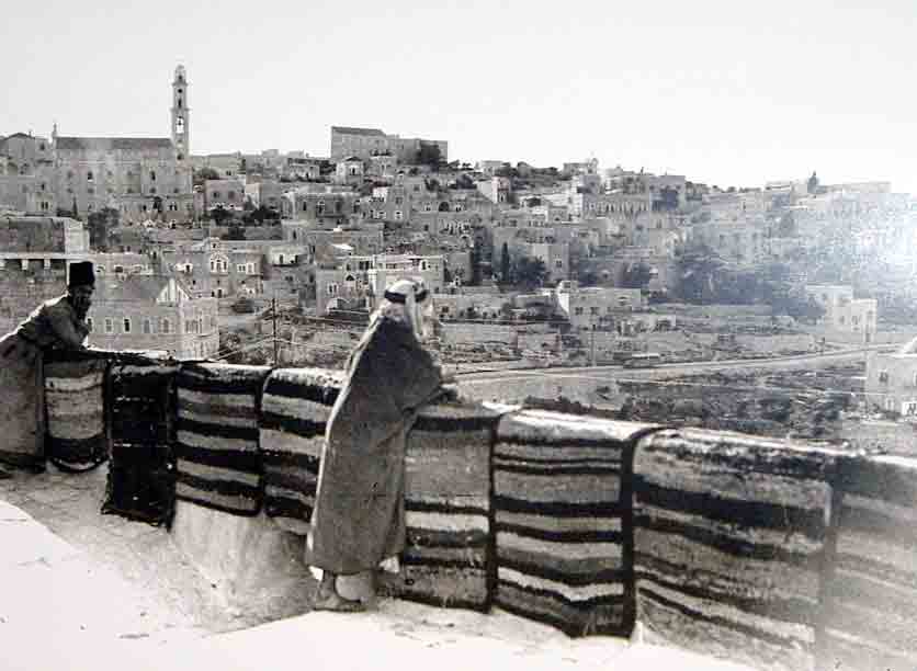
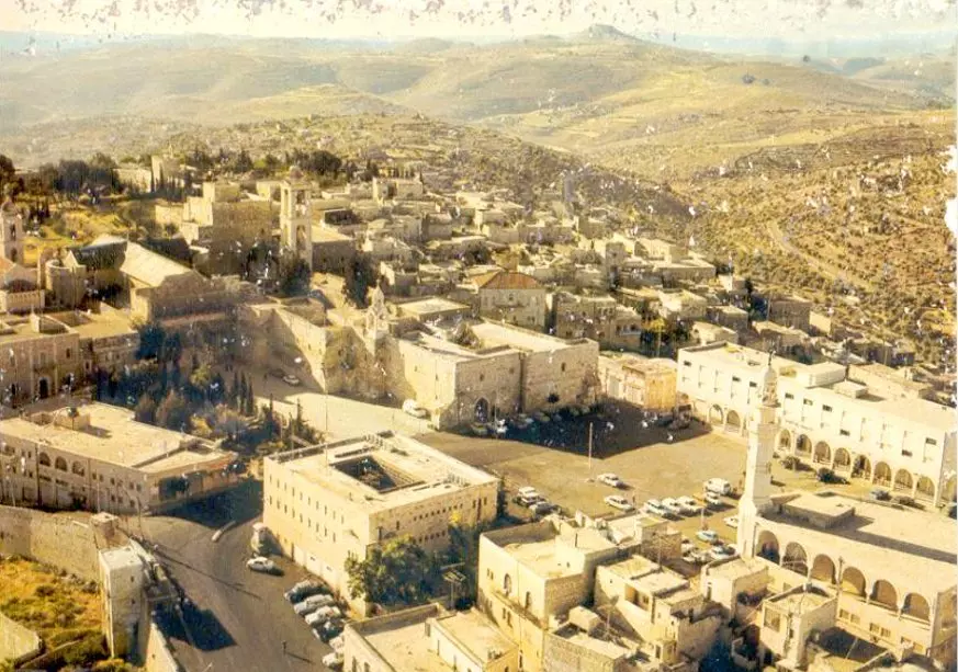
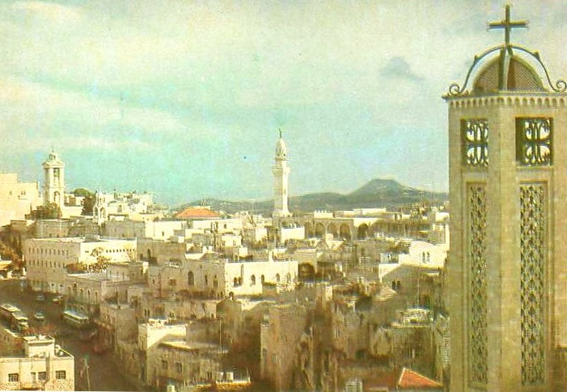
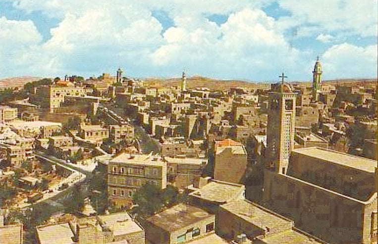
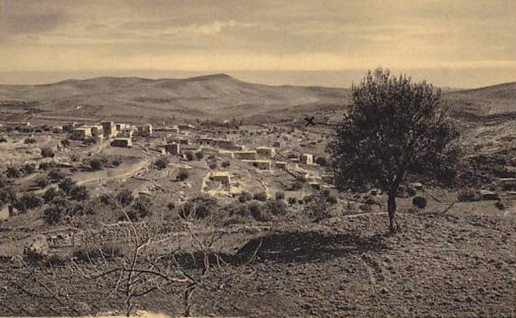
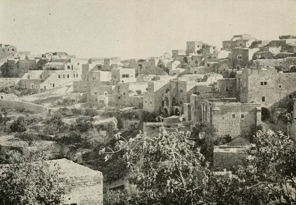
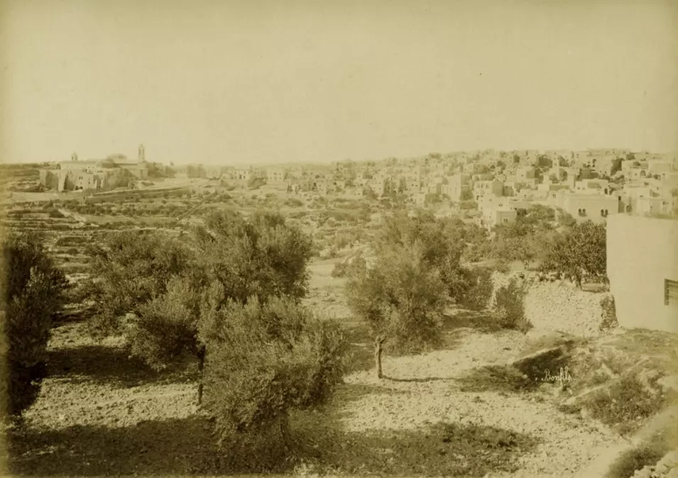
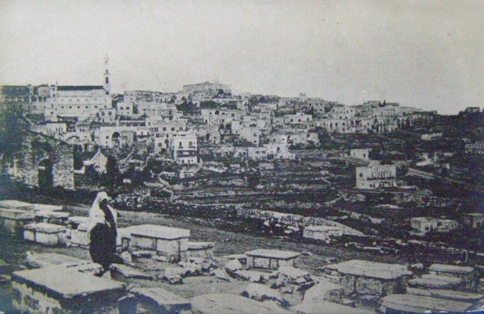
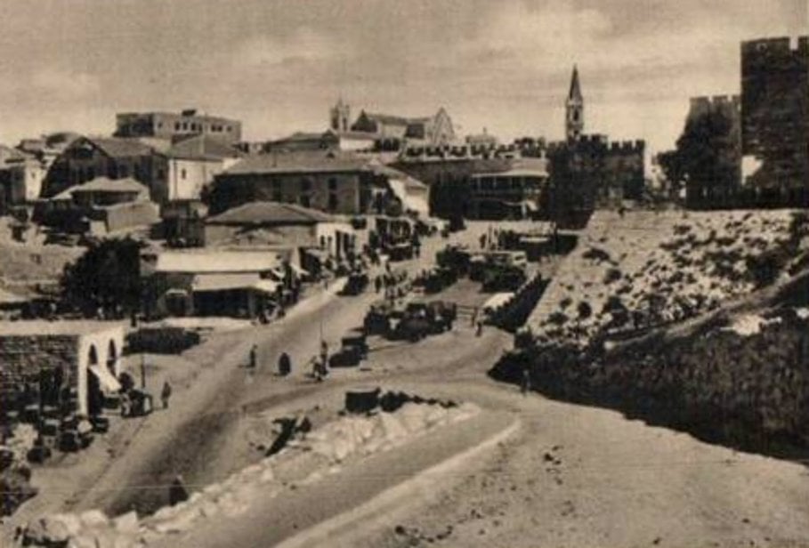
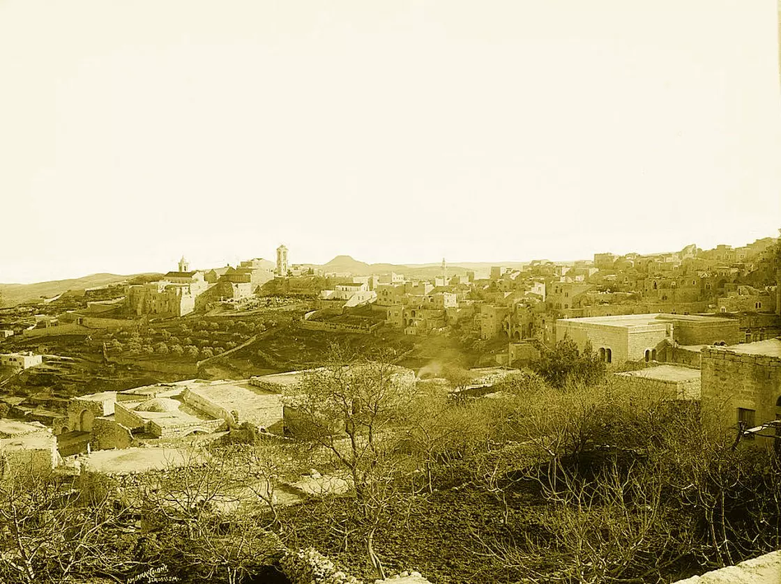
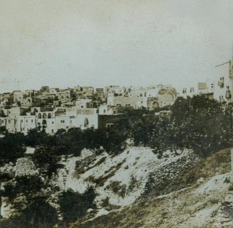
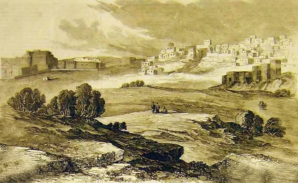
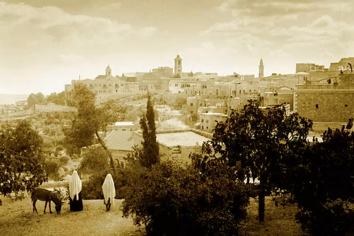
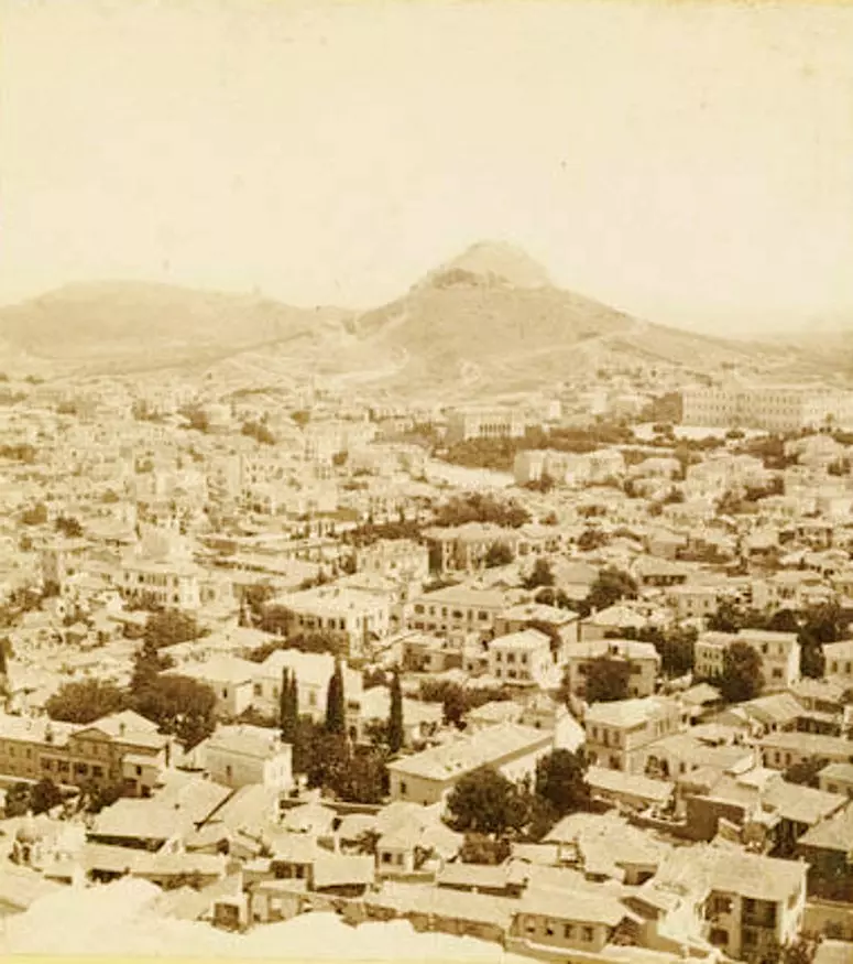
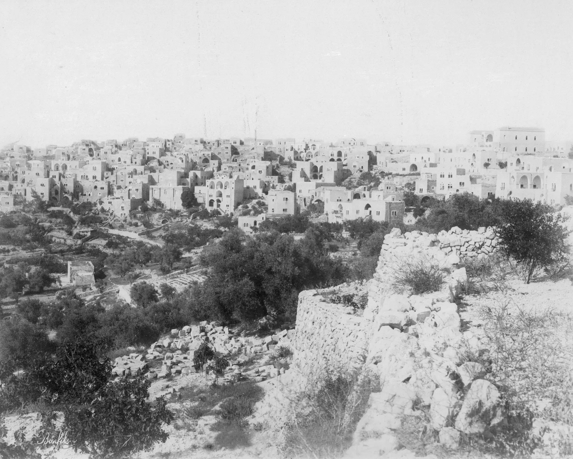
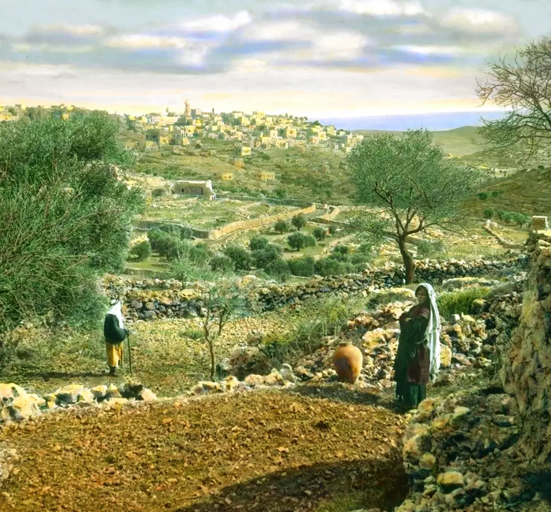
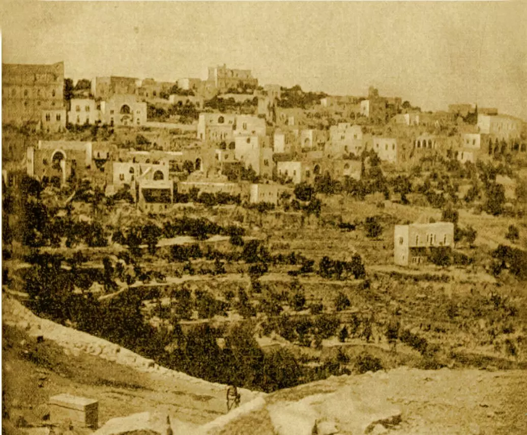
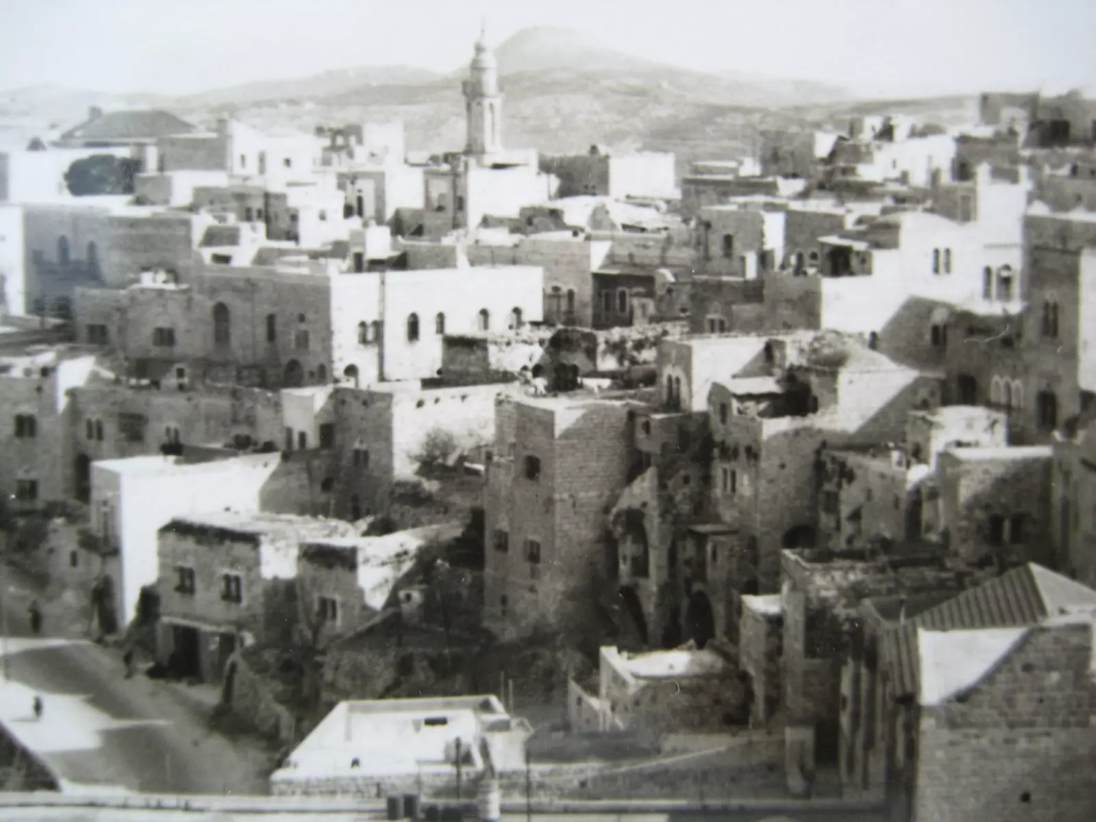
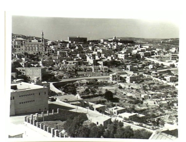
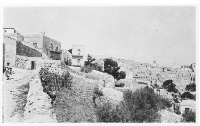
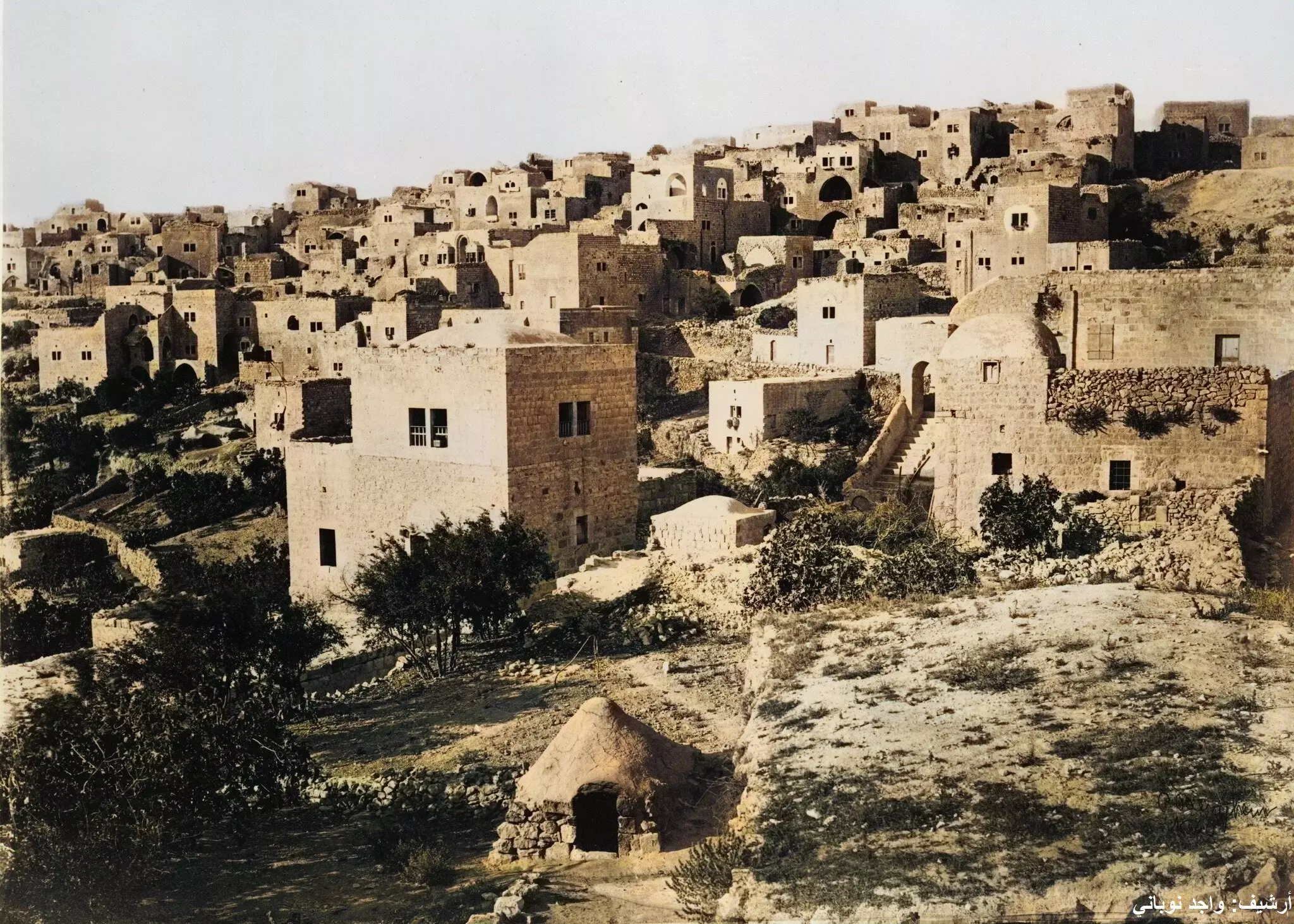
10 - A southwest view of Bethlehem

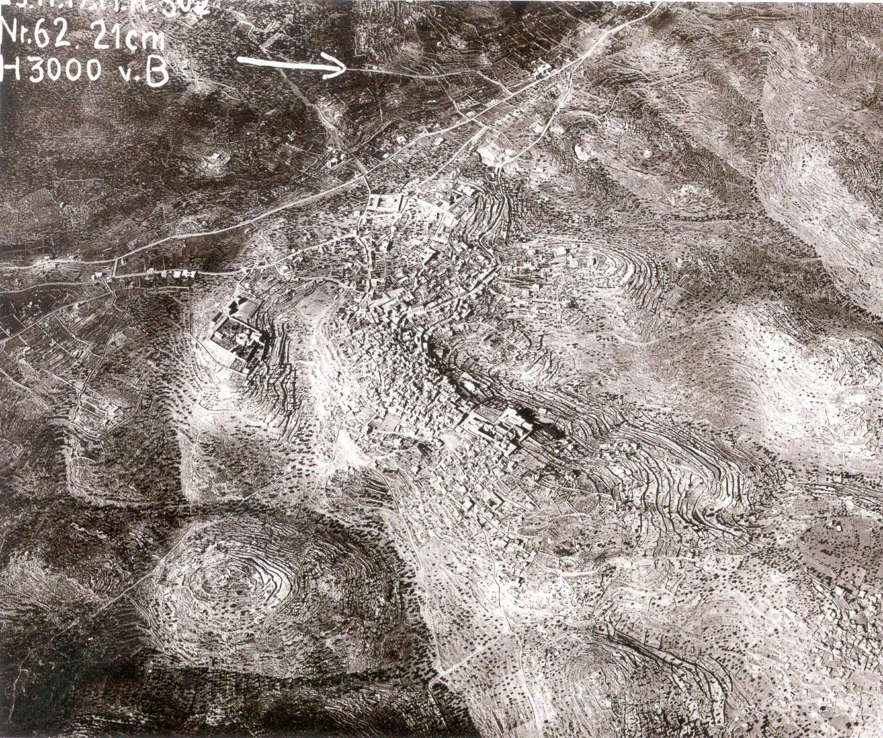
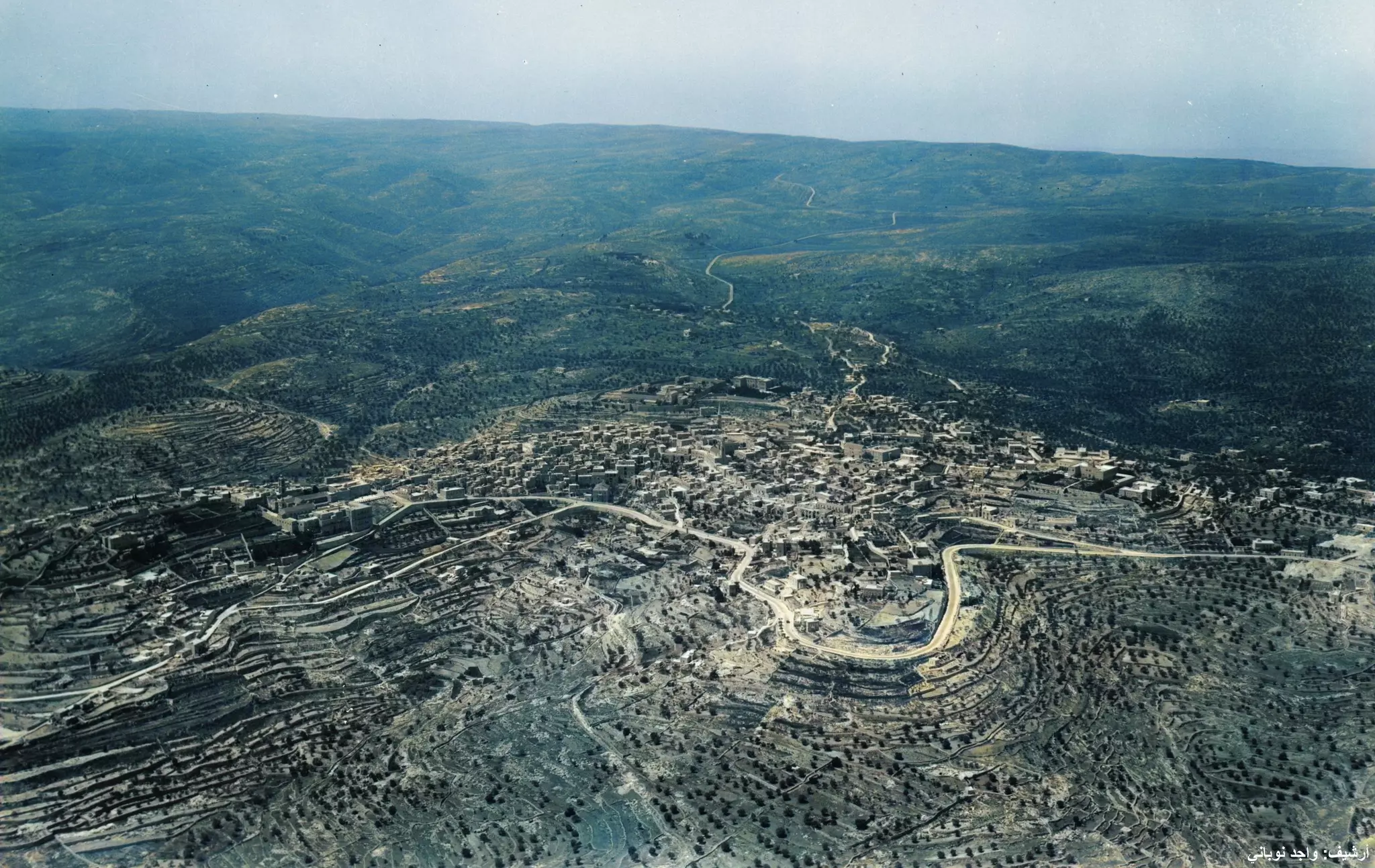
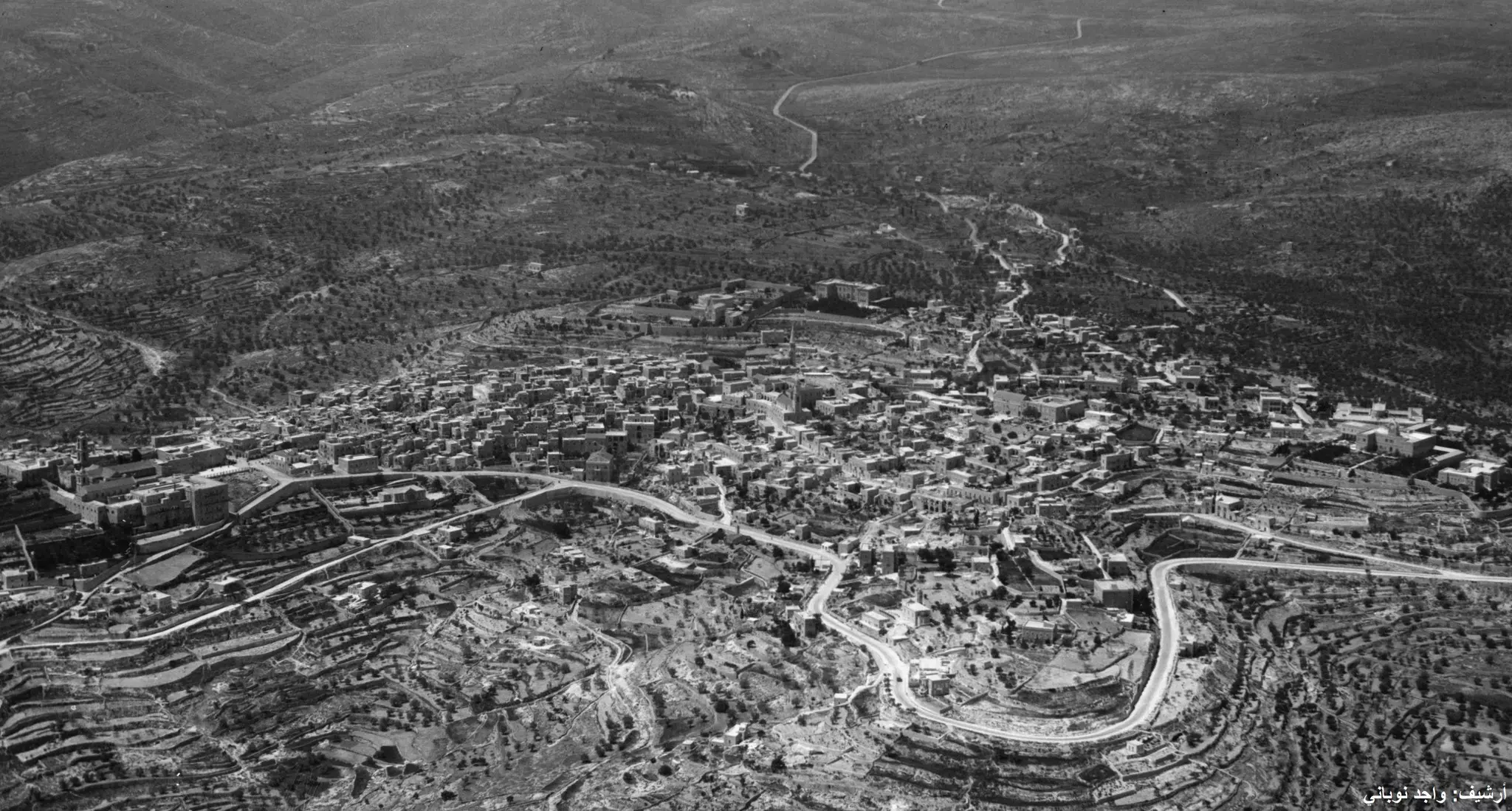
7 - (1917) An Aerial View, right hand side (note the arrow) points north
3 - 1937 Aerial View, right hand side points north
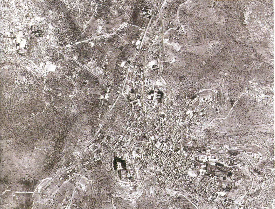
1 - 1967 Aerial view
- 1997 Aerial View
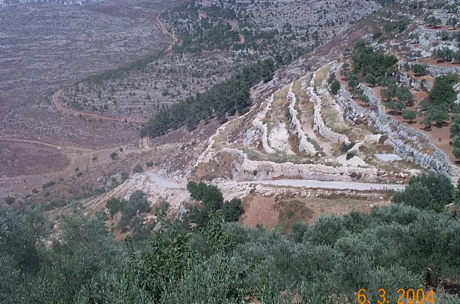
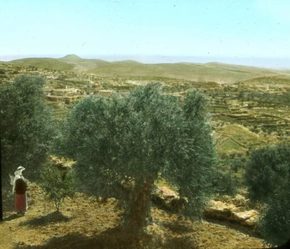
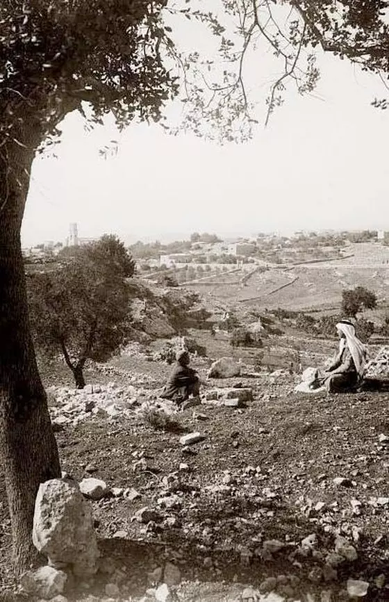
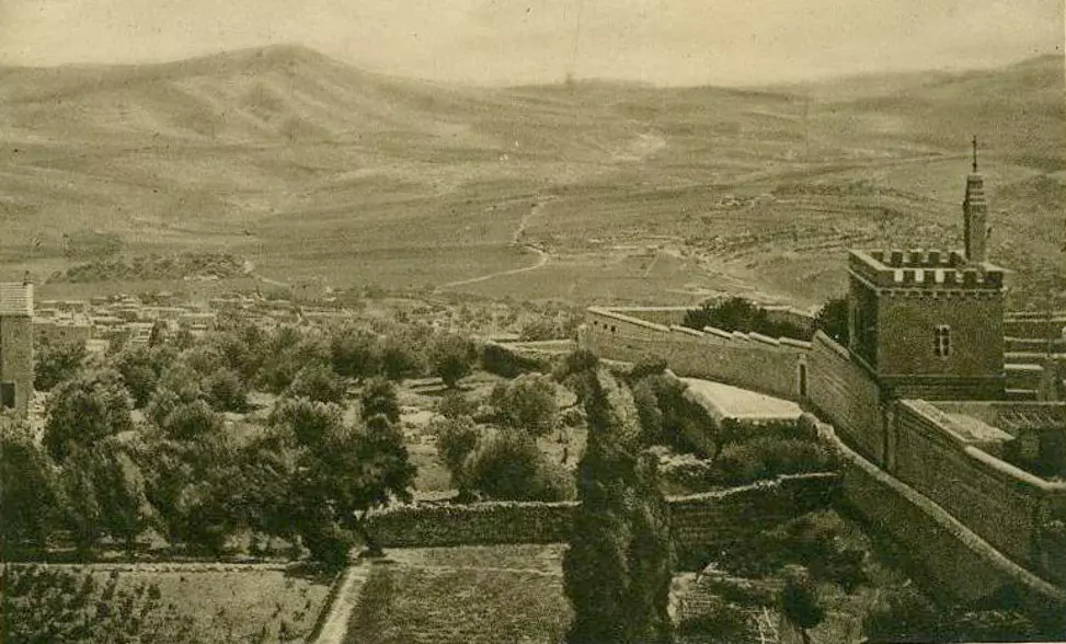
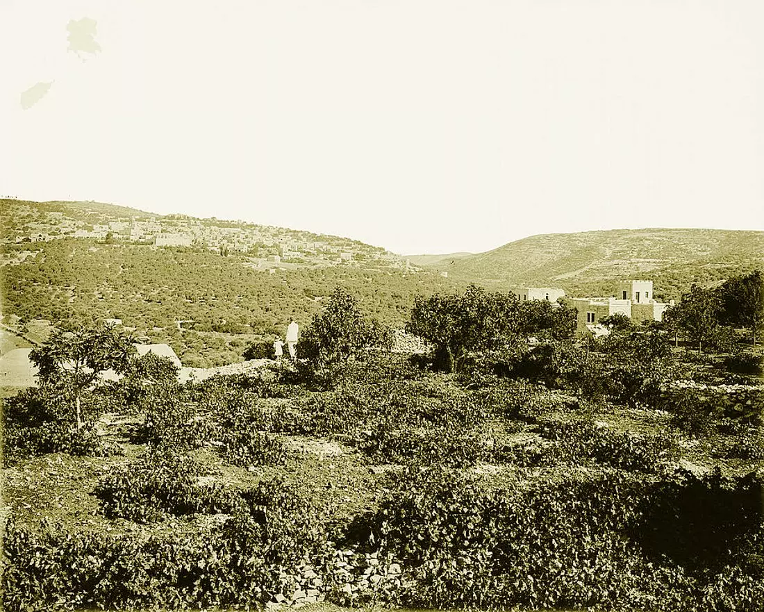
1 - Hills just to the north, Abu Ghneim can be seen on the top of the picture
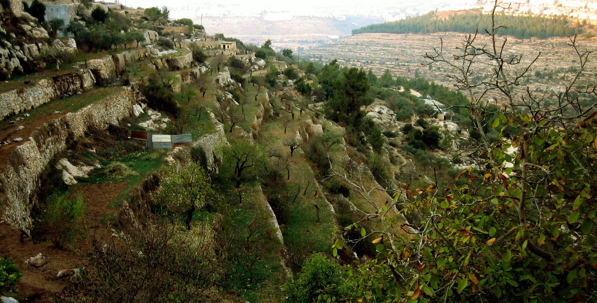
1 - Hills just to the north, Abu Ghneim can be seen on the top of the picture #2
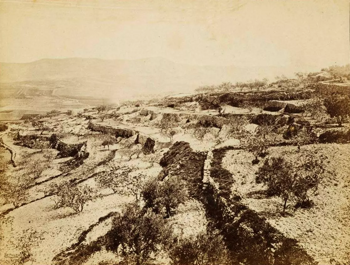
5 - Karakafeh area located between Bethlehem and Beit Sahour
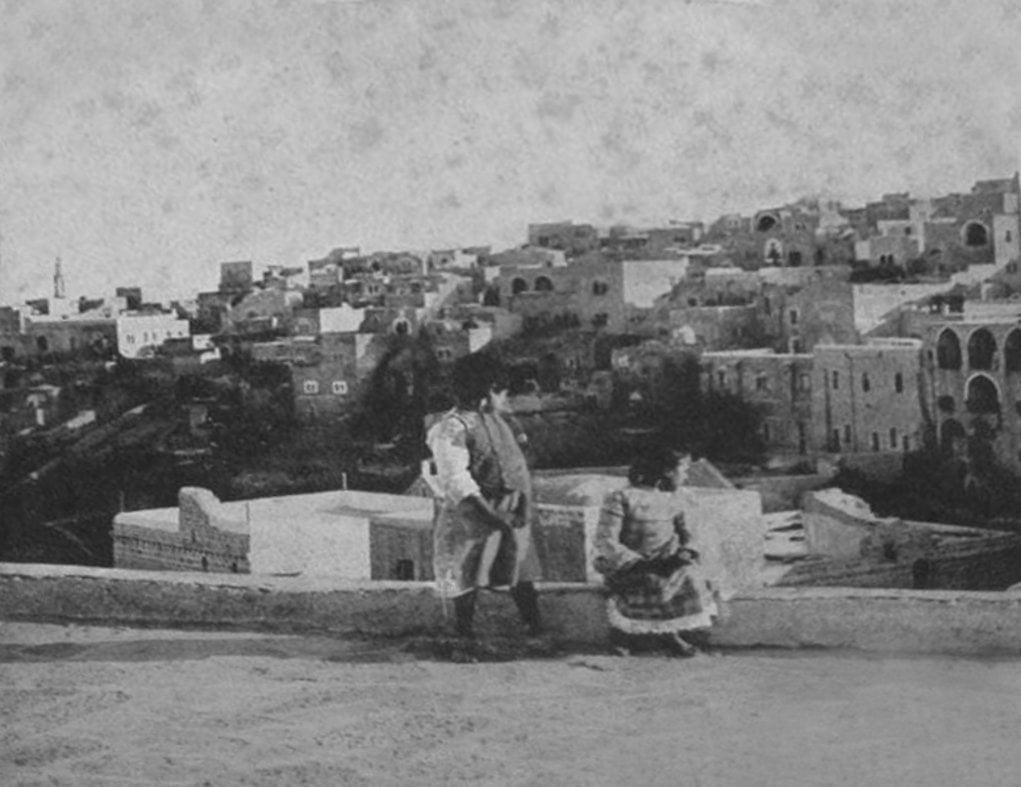
5 - Nearby the downtown area
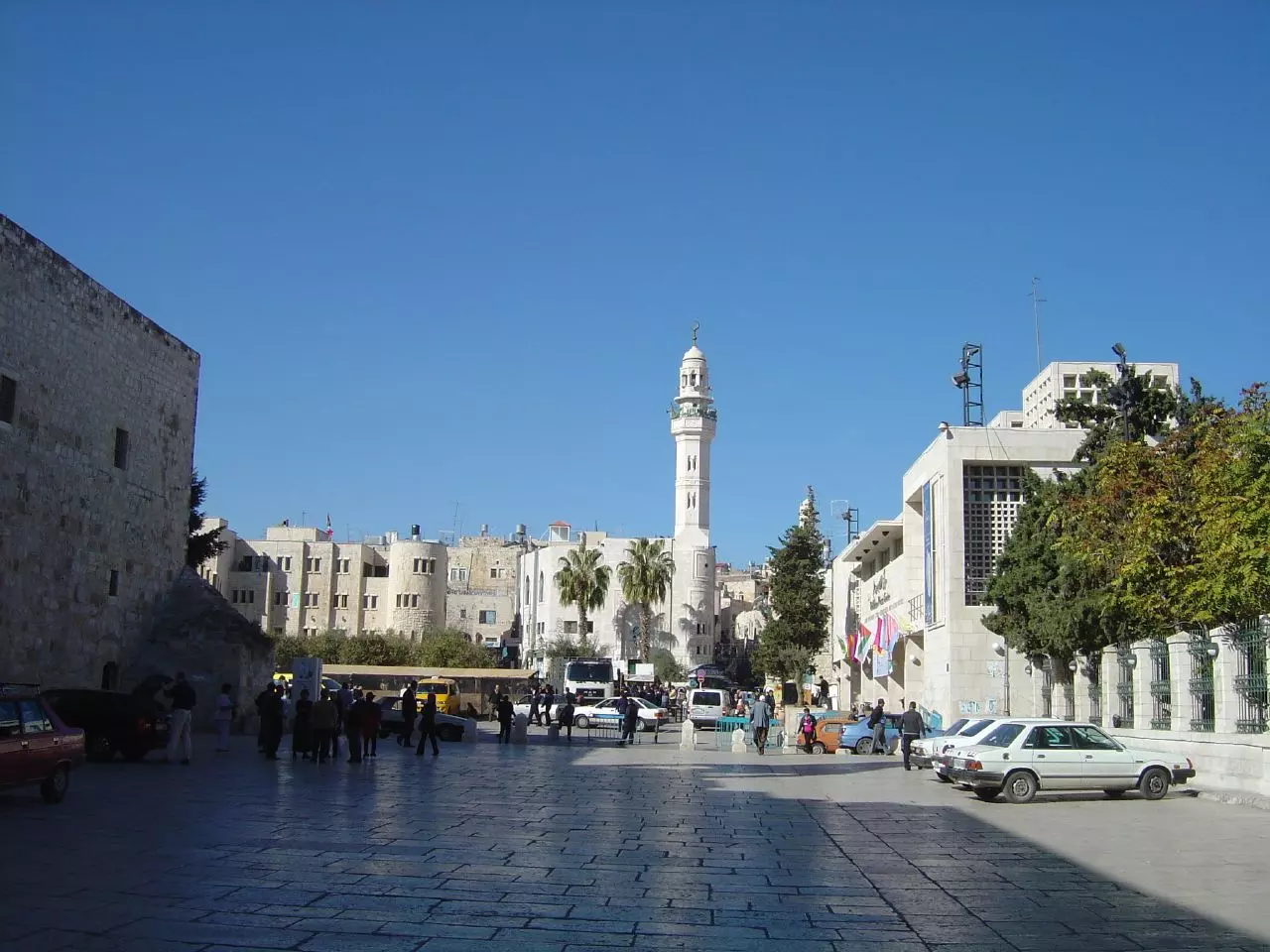
4 - Manarah Square
4 - Road to Jerusalem nearby Azza Camp
3 - Approaching Bab Izqaq traffic lights intersection. The road to Hebron
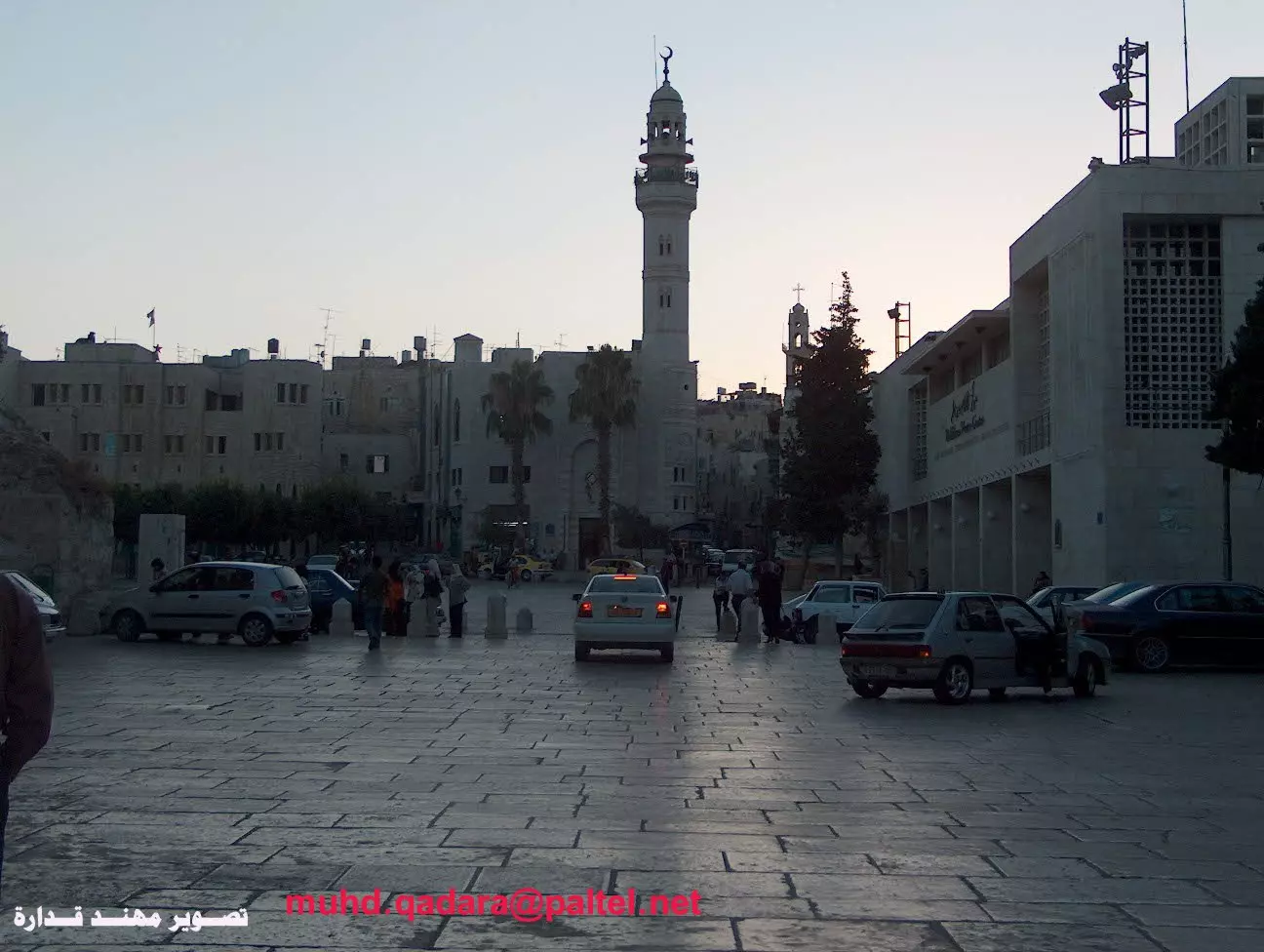
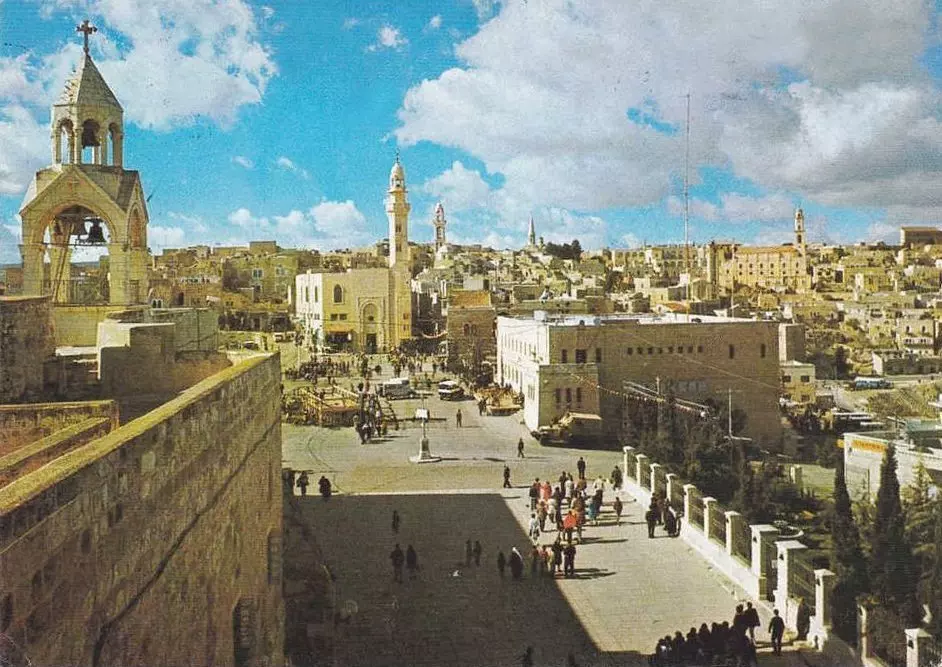
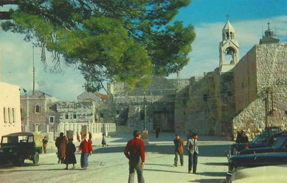
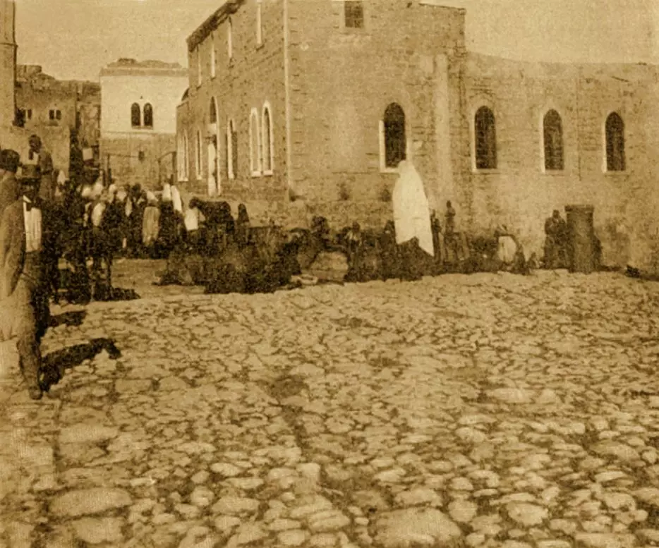
2 - Manger Square
1 - Manger Square (#2)
1 - Manger Square outside the Church of Nativity #3.
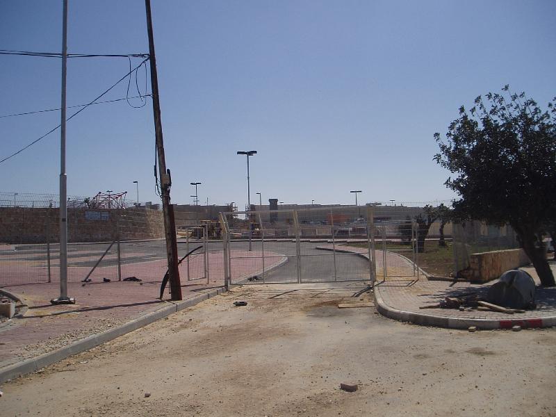
1 - Gilo's checkpoint, on the way to Jerusalem
- Gilo's checkpoint, on the way to Jerusalem #2
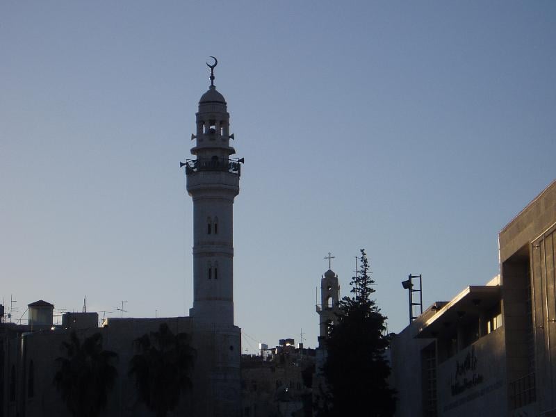
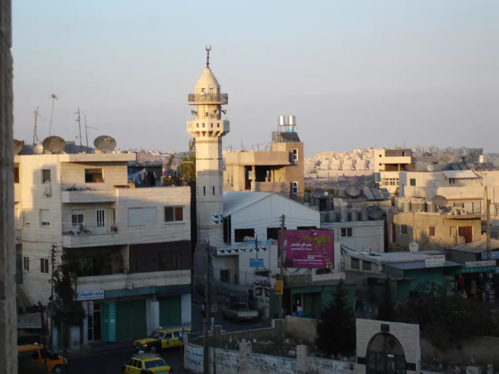
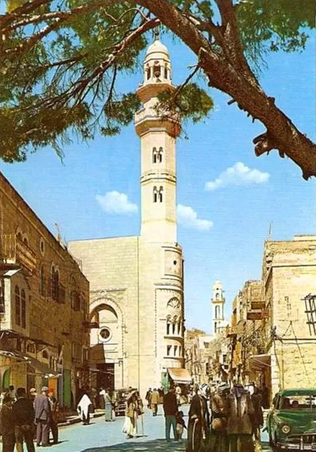
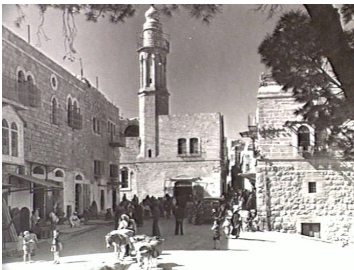
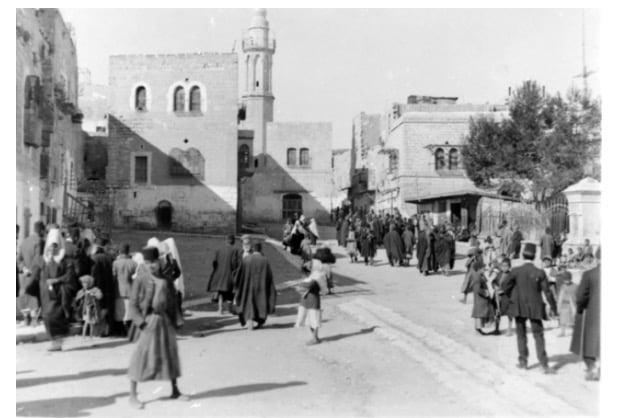
- The Minaret of Omar Ibn Al-Khattab Mosque at Manger's Square across from the Church of Nativity
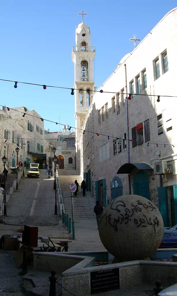
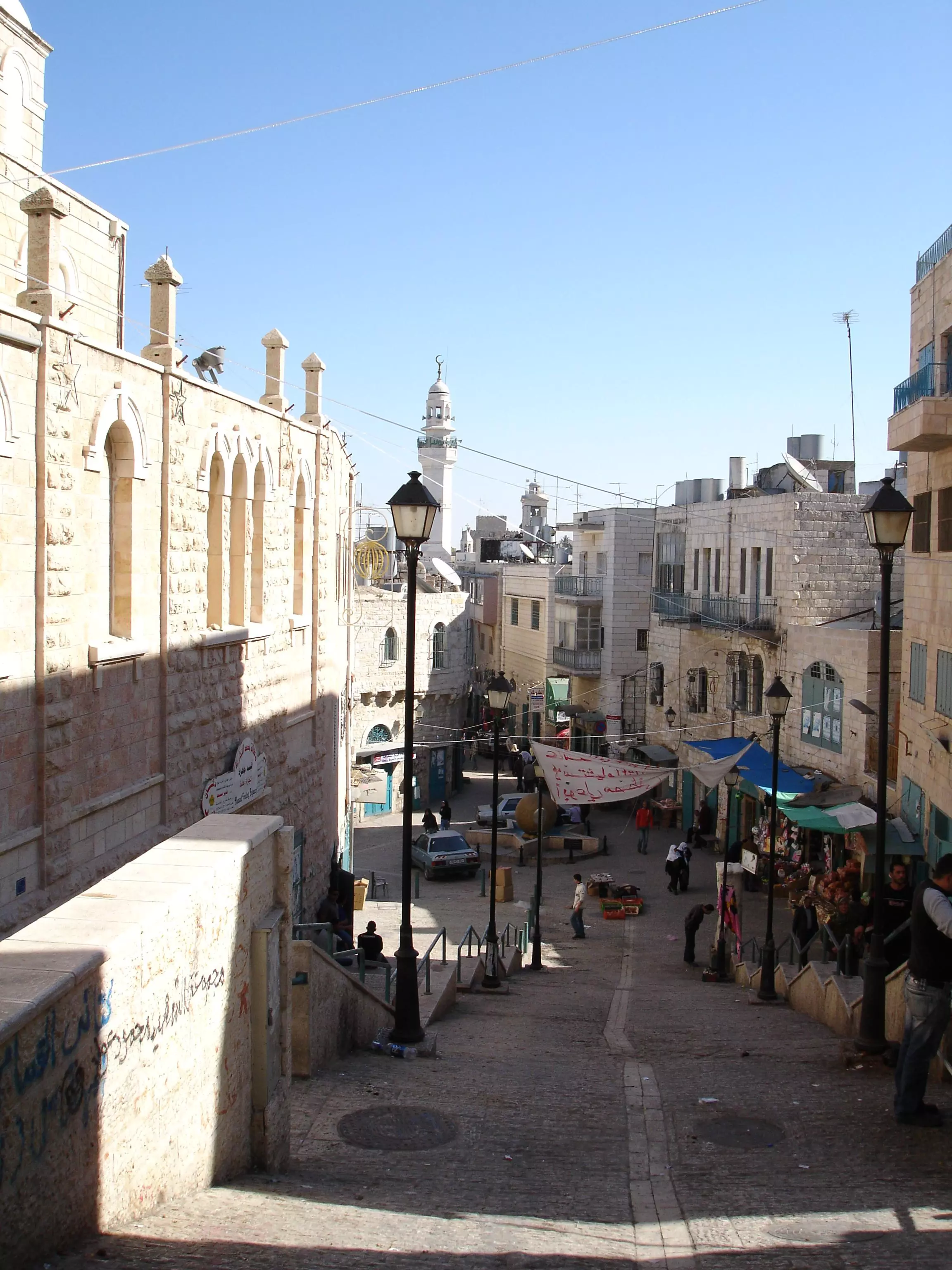
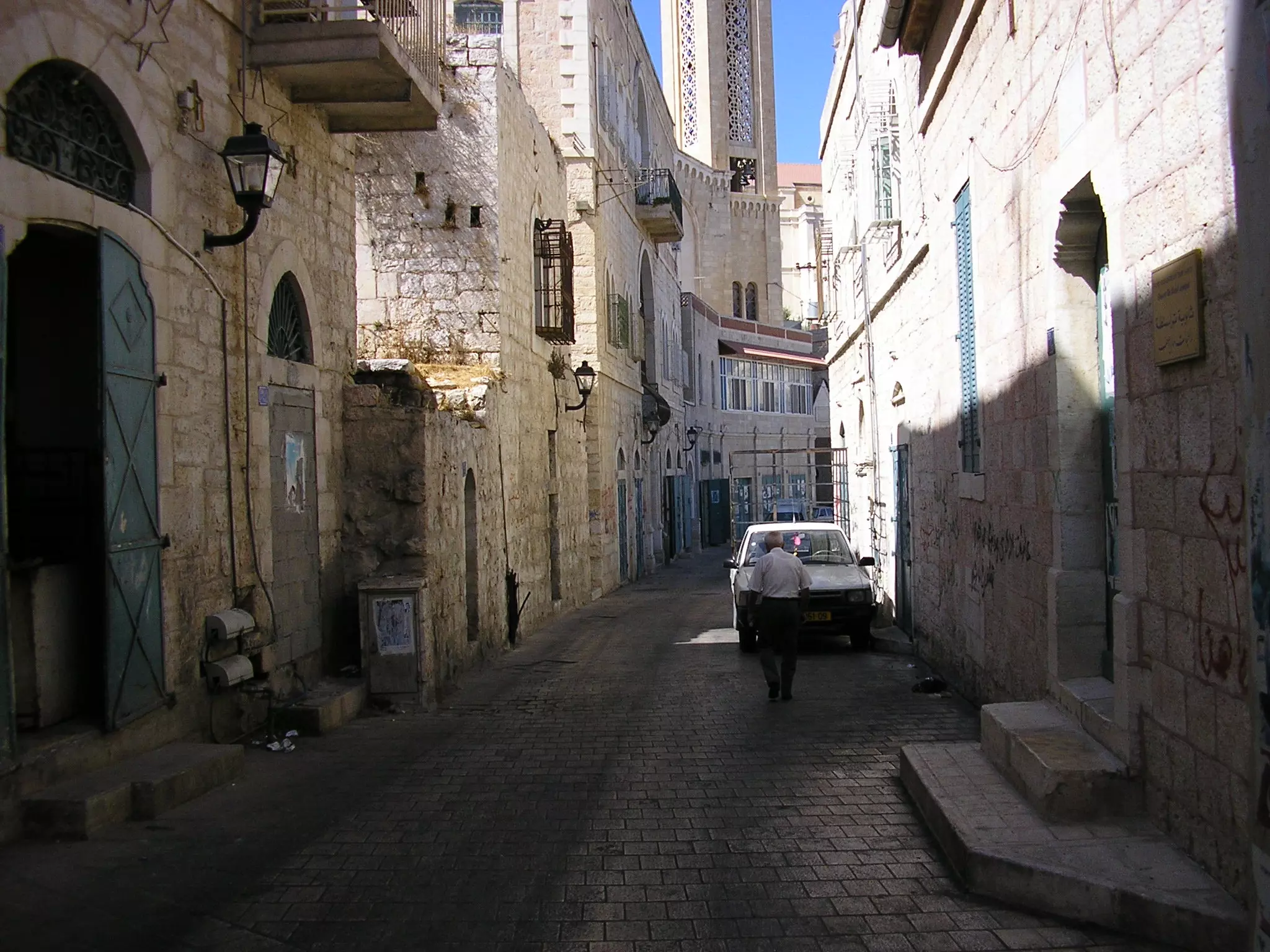
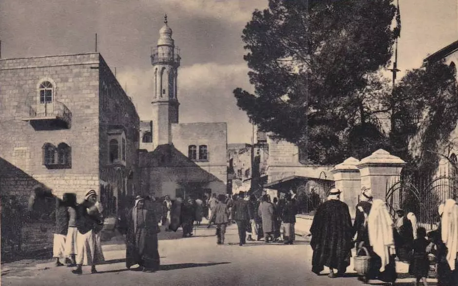
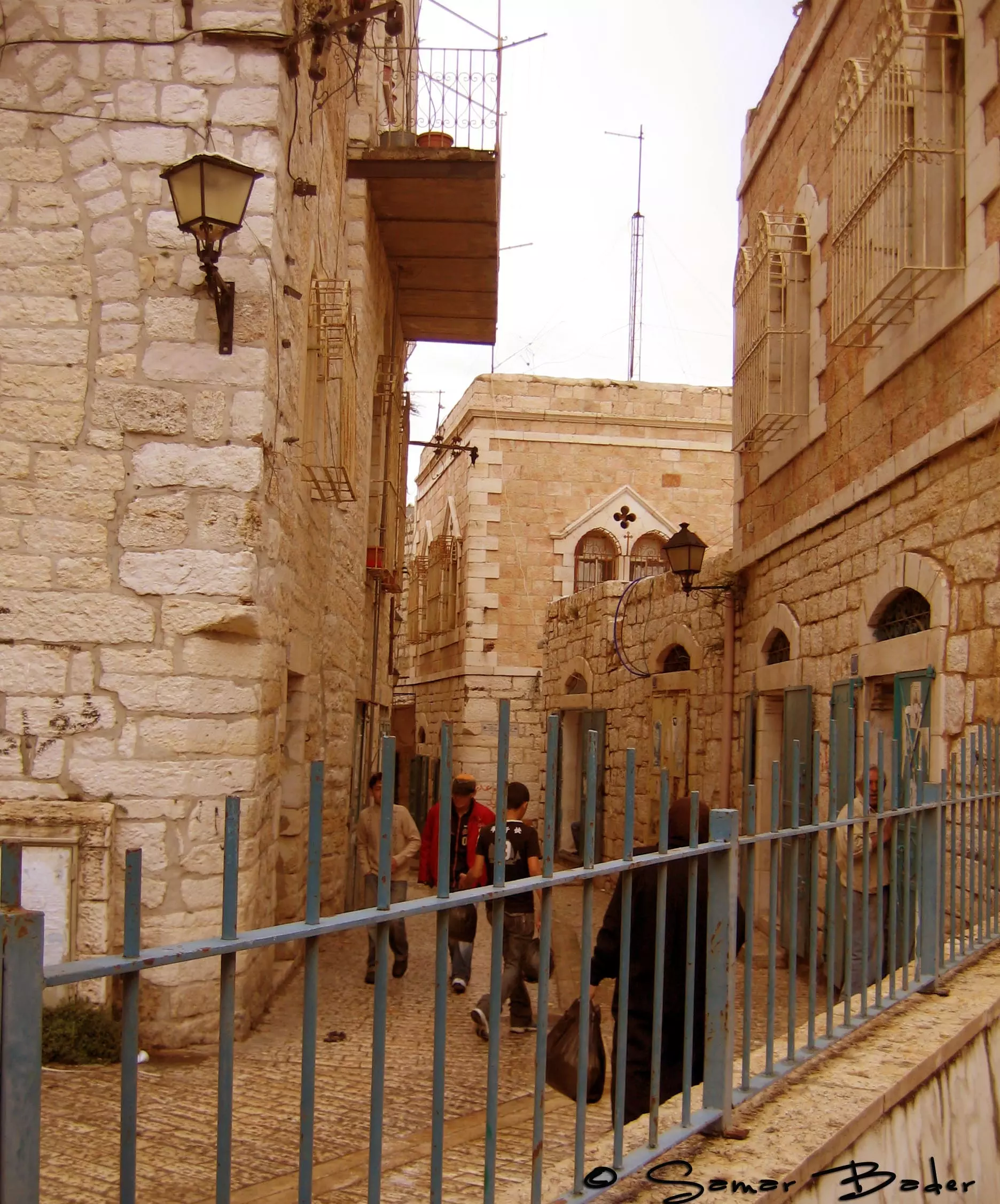
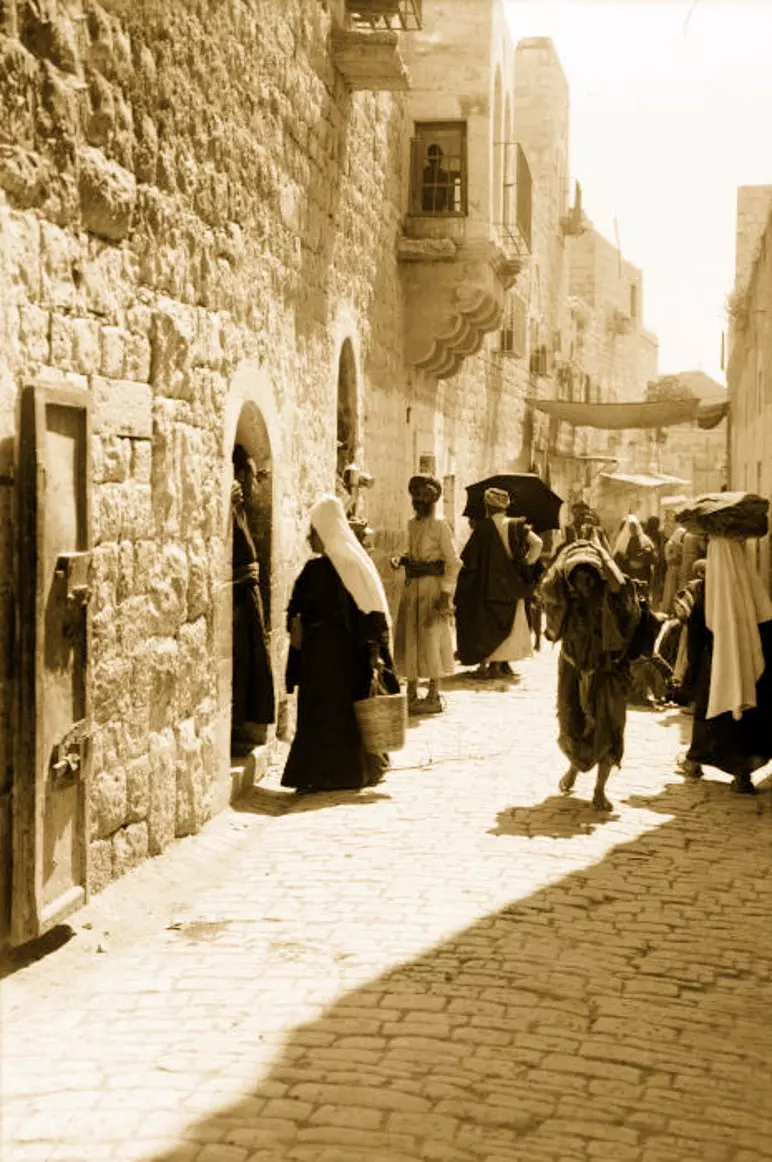
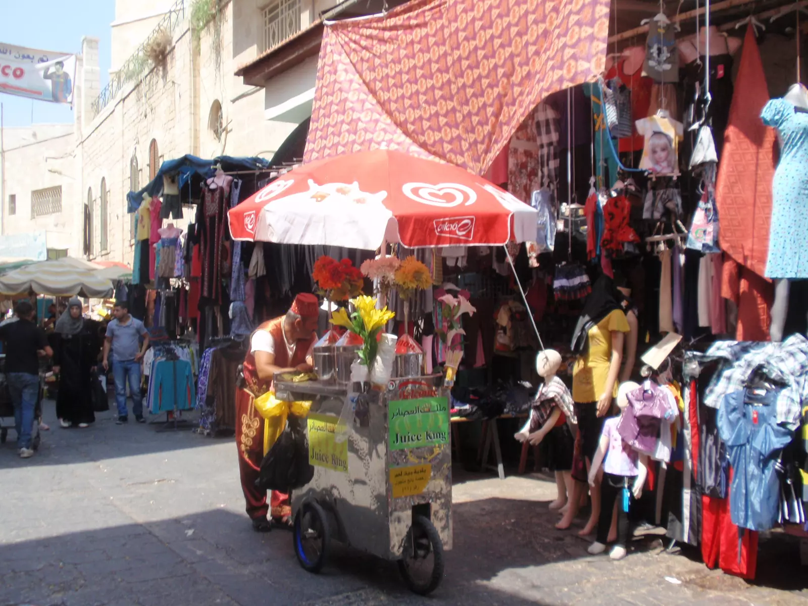
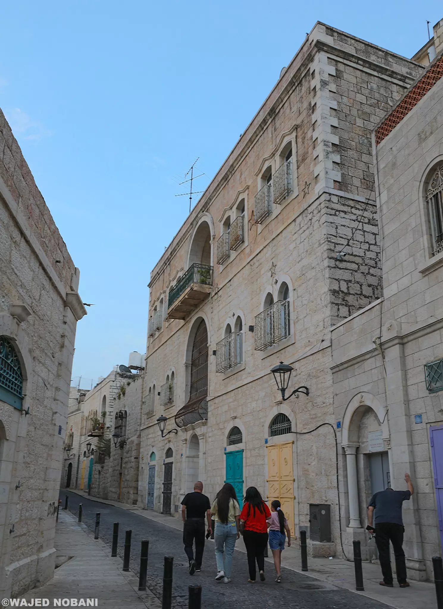
2 - A street in the downtown area

- Rooftop view, HarHoma can be seen on the top left hand side.

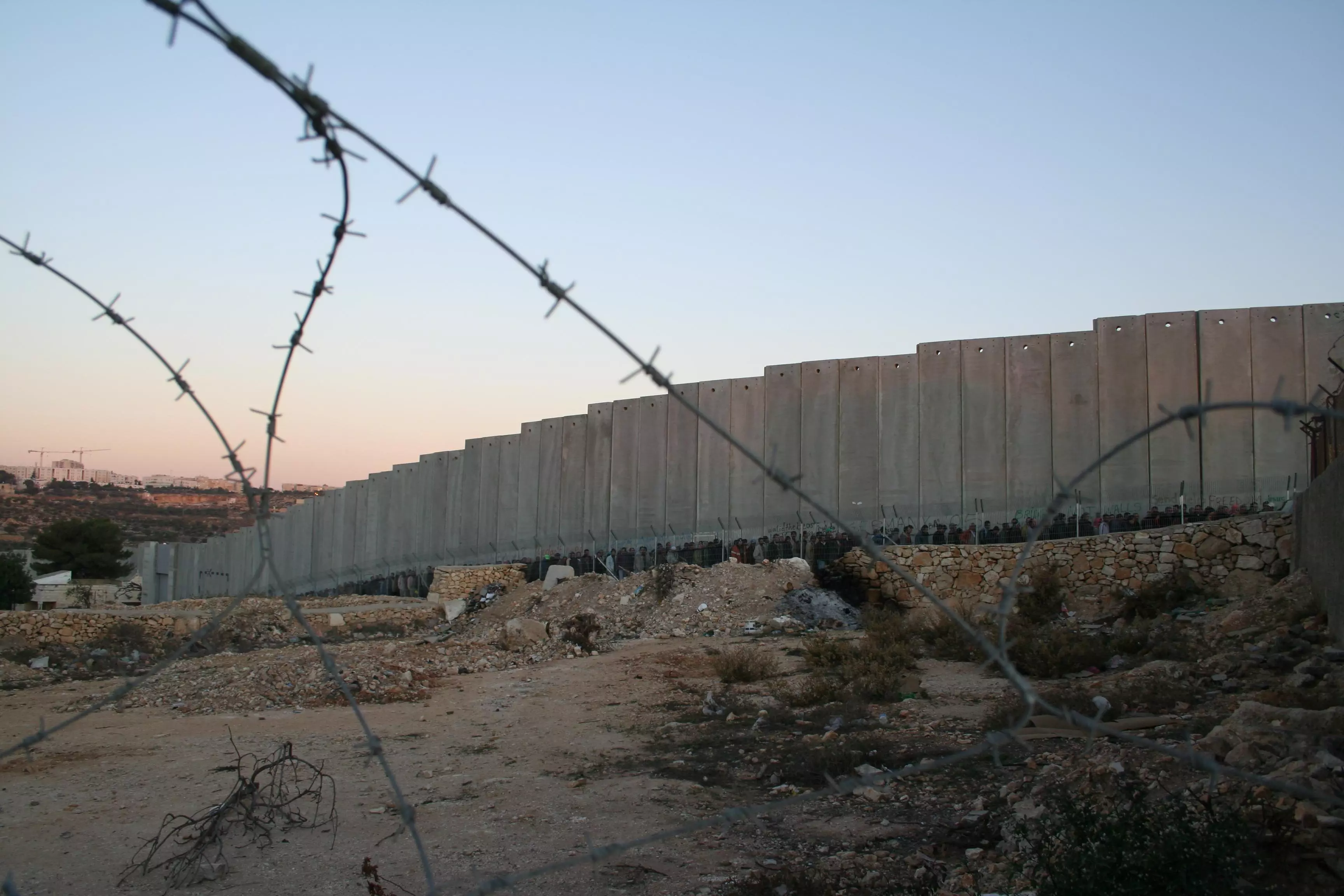
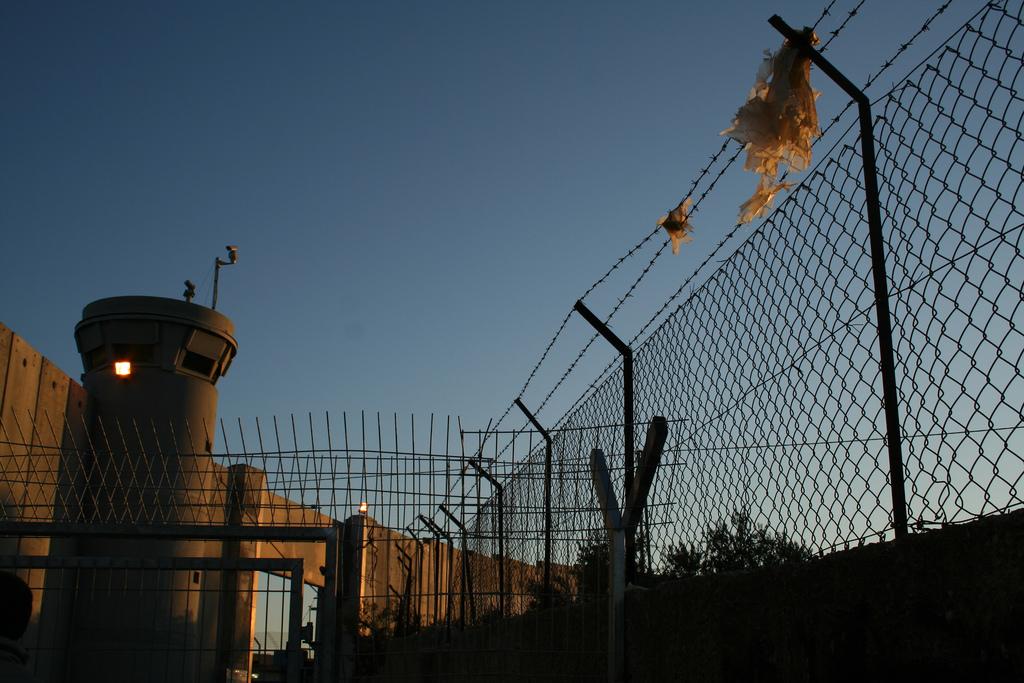
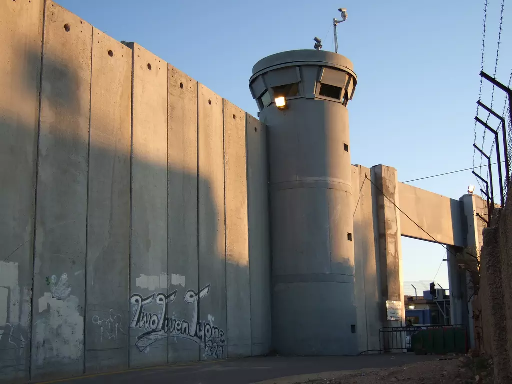
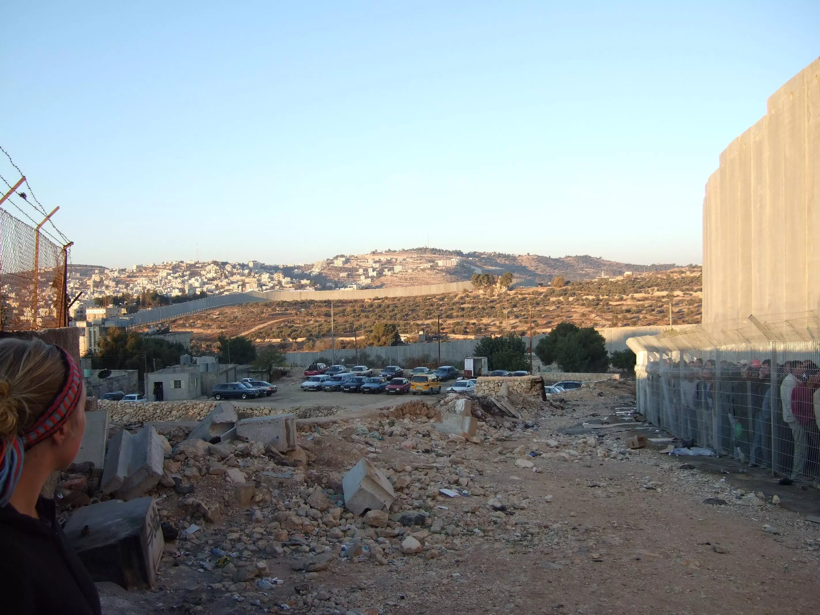
1 - The wall, imagine this from your balcony. President Bush put down this Apartheid Wall

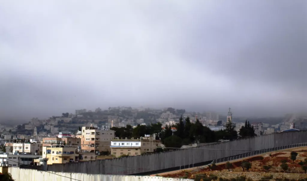
4 - The Apartheid Wall surrounding the city
1 - The Apartheid Wall is separating Palestinians from Palestinians. Built in the middle of what used to be a street. You can see scenes like this all over the regions the wall is built. Note the Israeli checkpoint on the right hand side

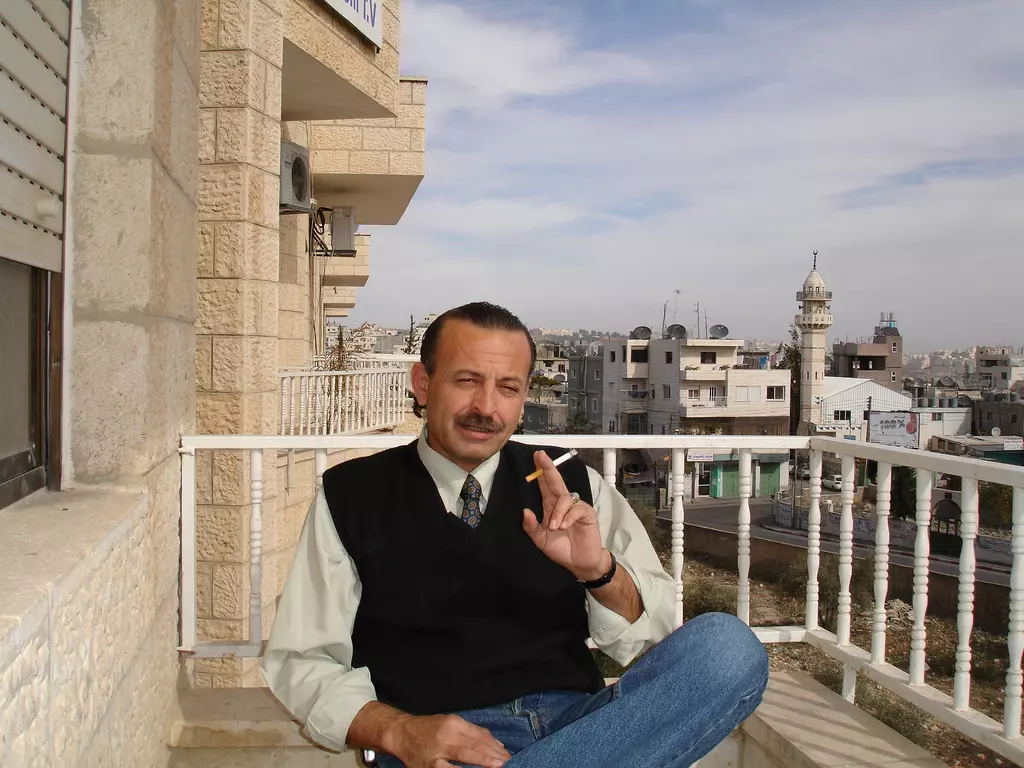
3 - Rooftop view, Rashed enjoying a cigarette on his balcony
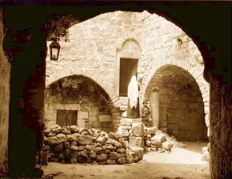
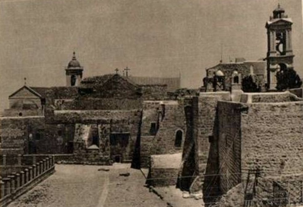
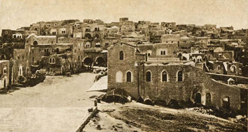
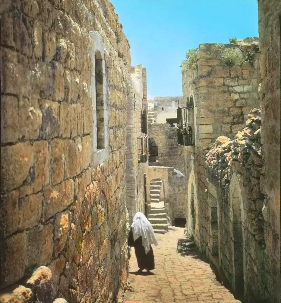
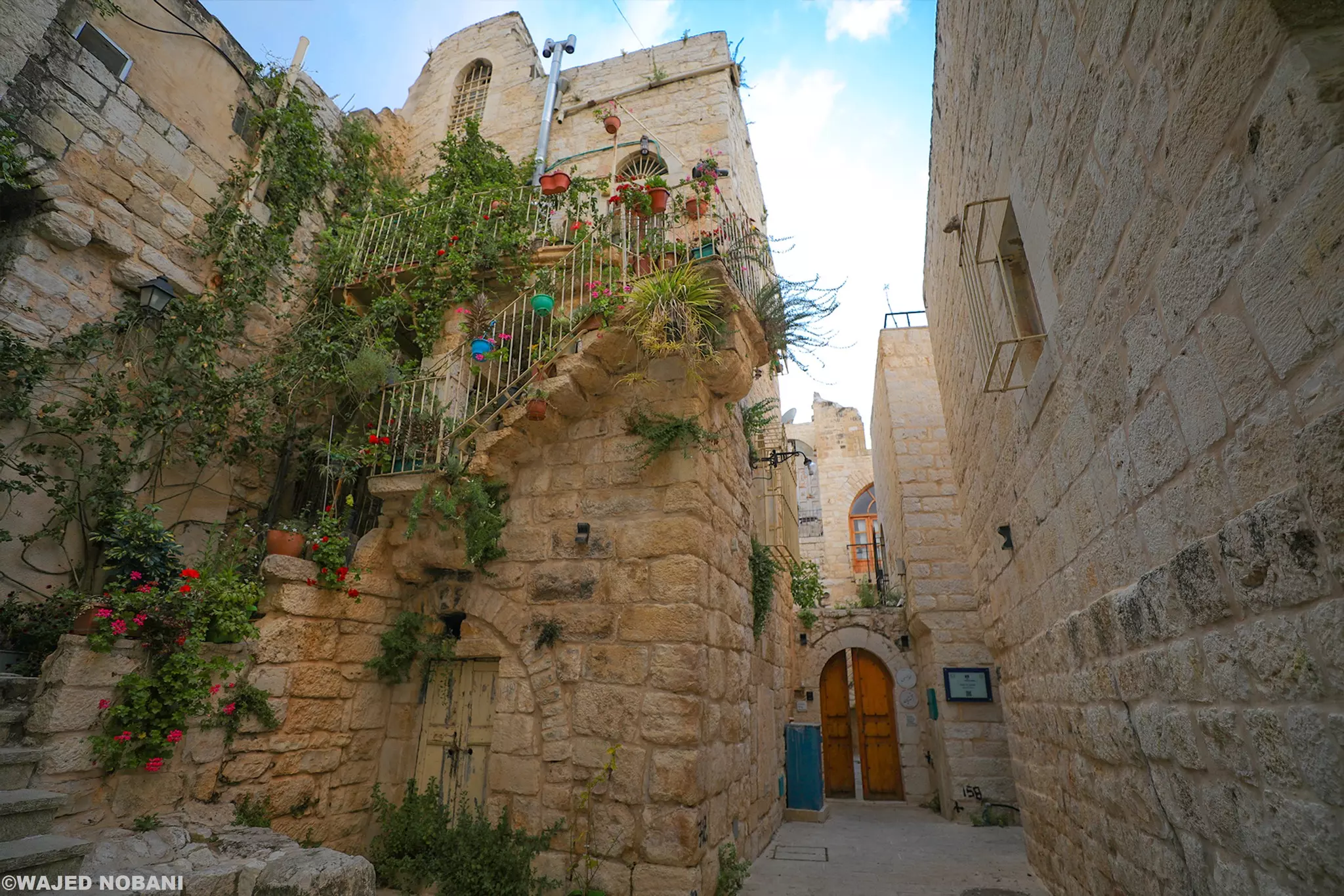
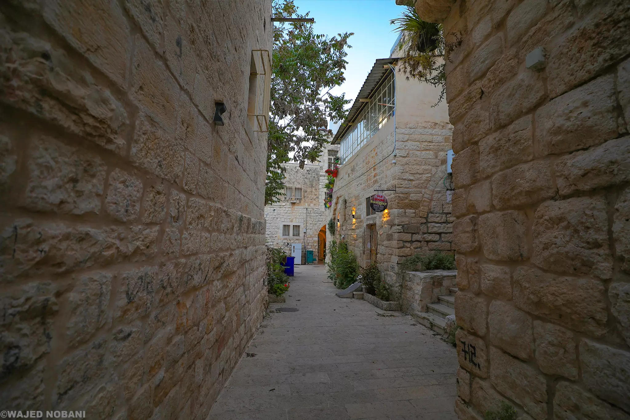
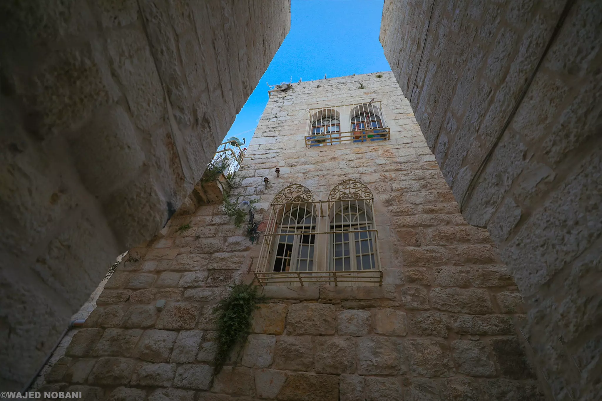
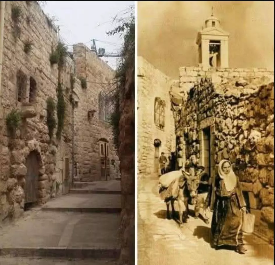
- The old city
2 - al-Deir Area and it is called Darajeh closed to the Nativity Church and Omar Mosque
8 - The old city #3

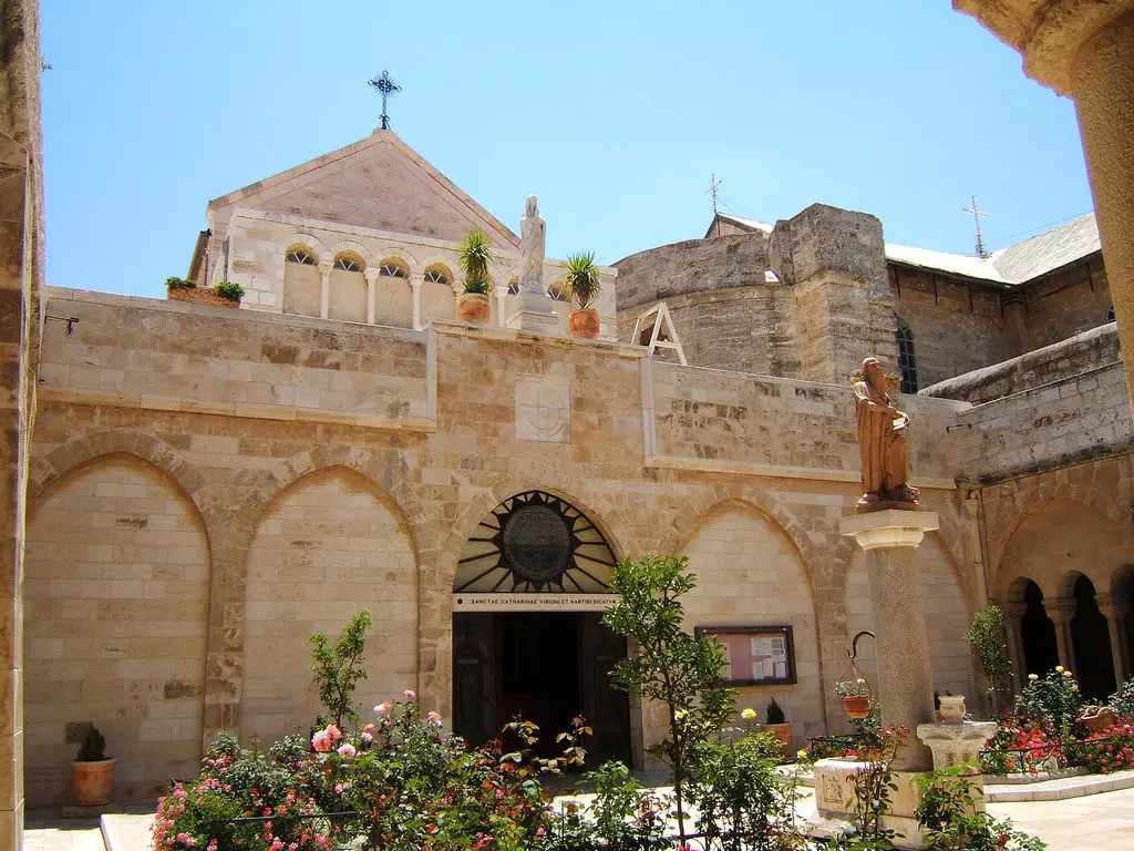
6 - St. Catherine's Church
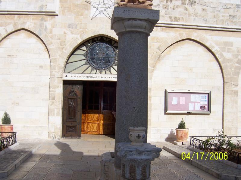
2 - The court yard of St. Catherine's Church
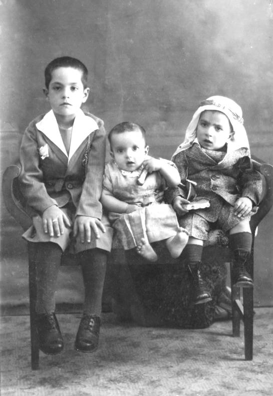
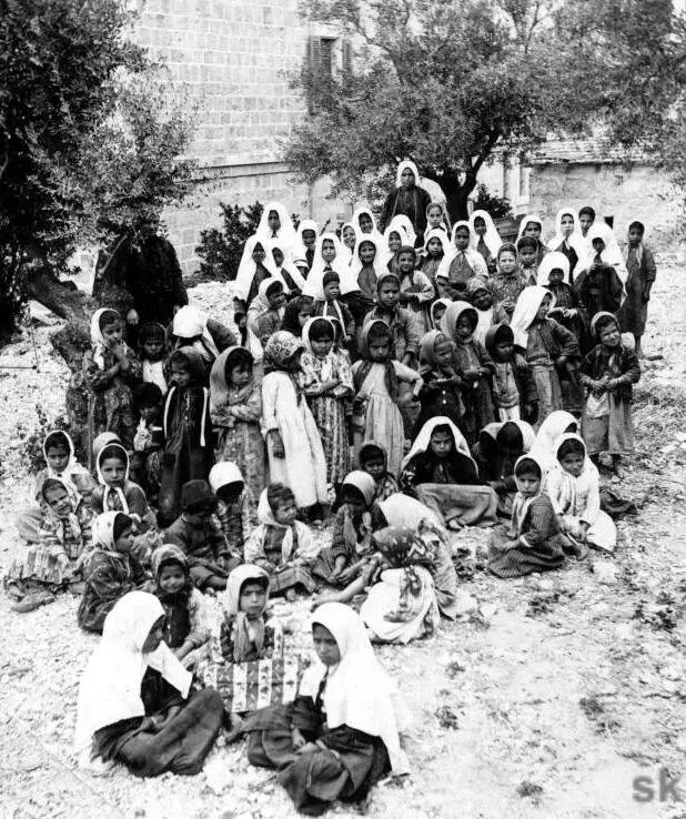
4 - The kids
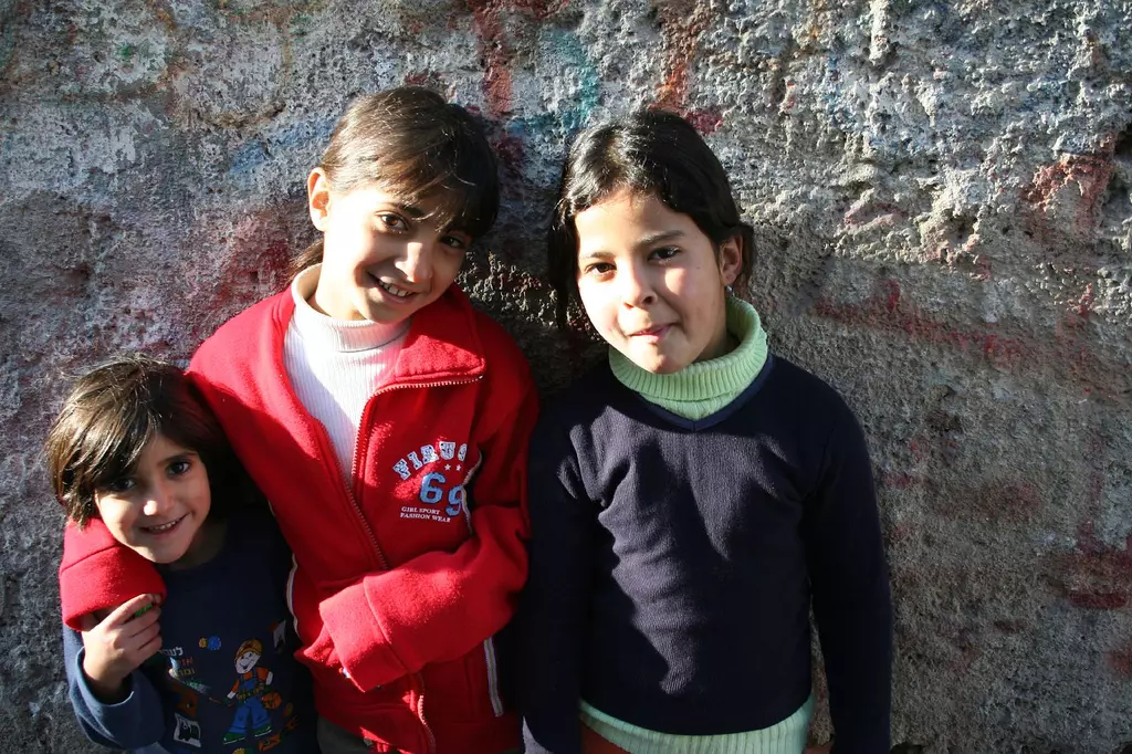
1 - The kids #2
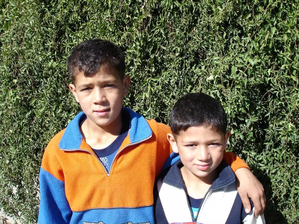
- The kids #3

2 - Falafel prepared at a local shop, Bethlehem style

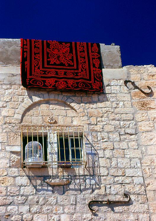
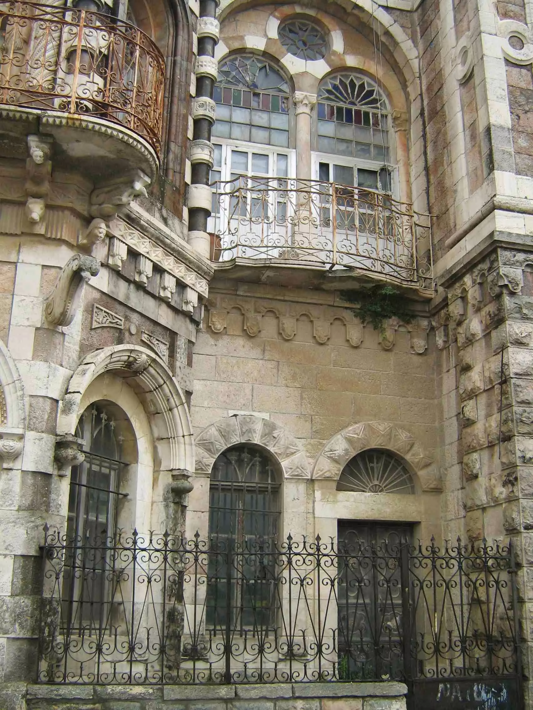
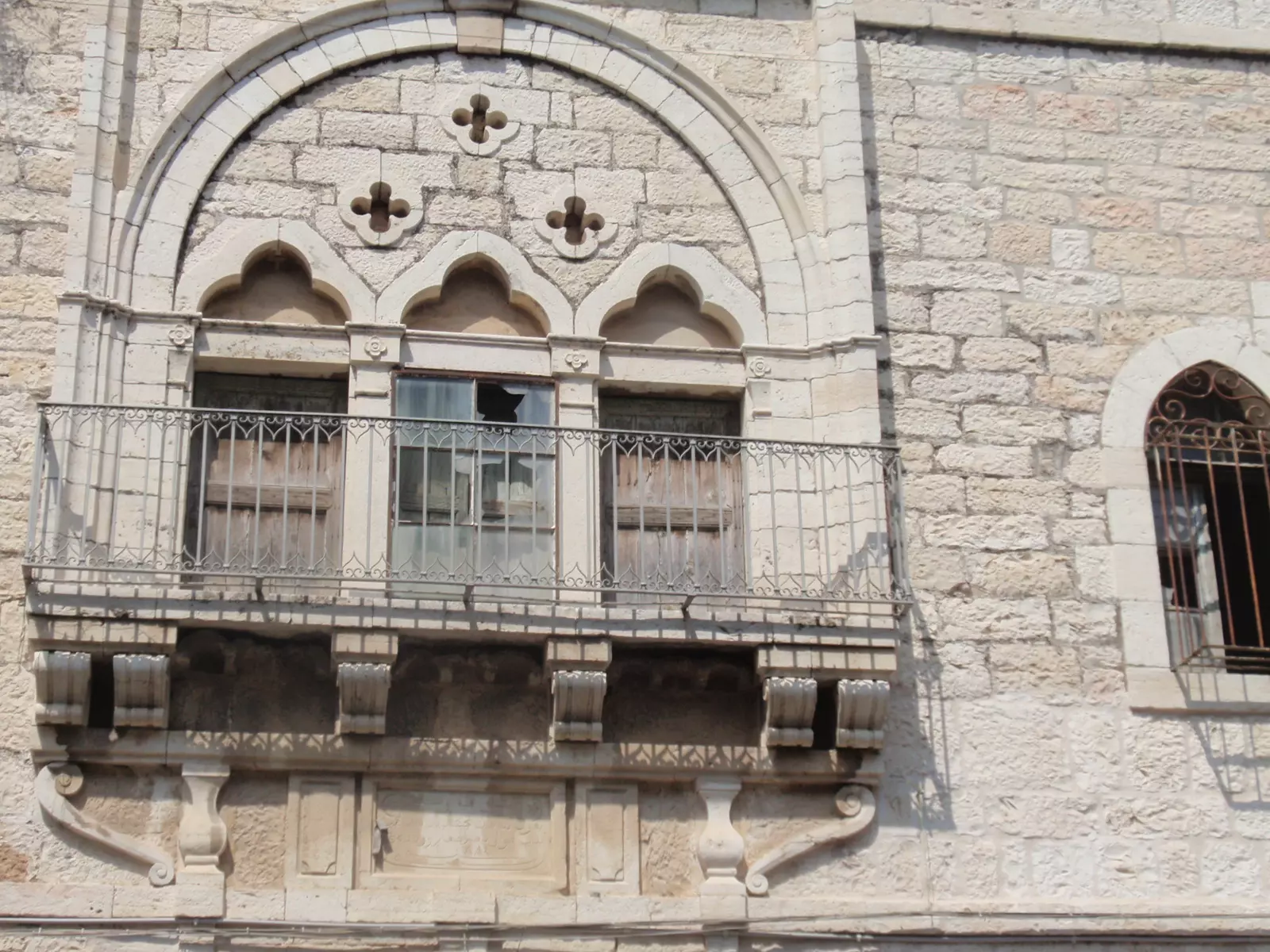
2 - An old house displaying traditional Palestinians architecture, note the windows and the iron work
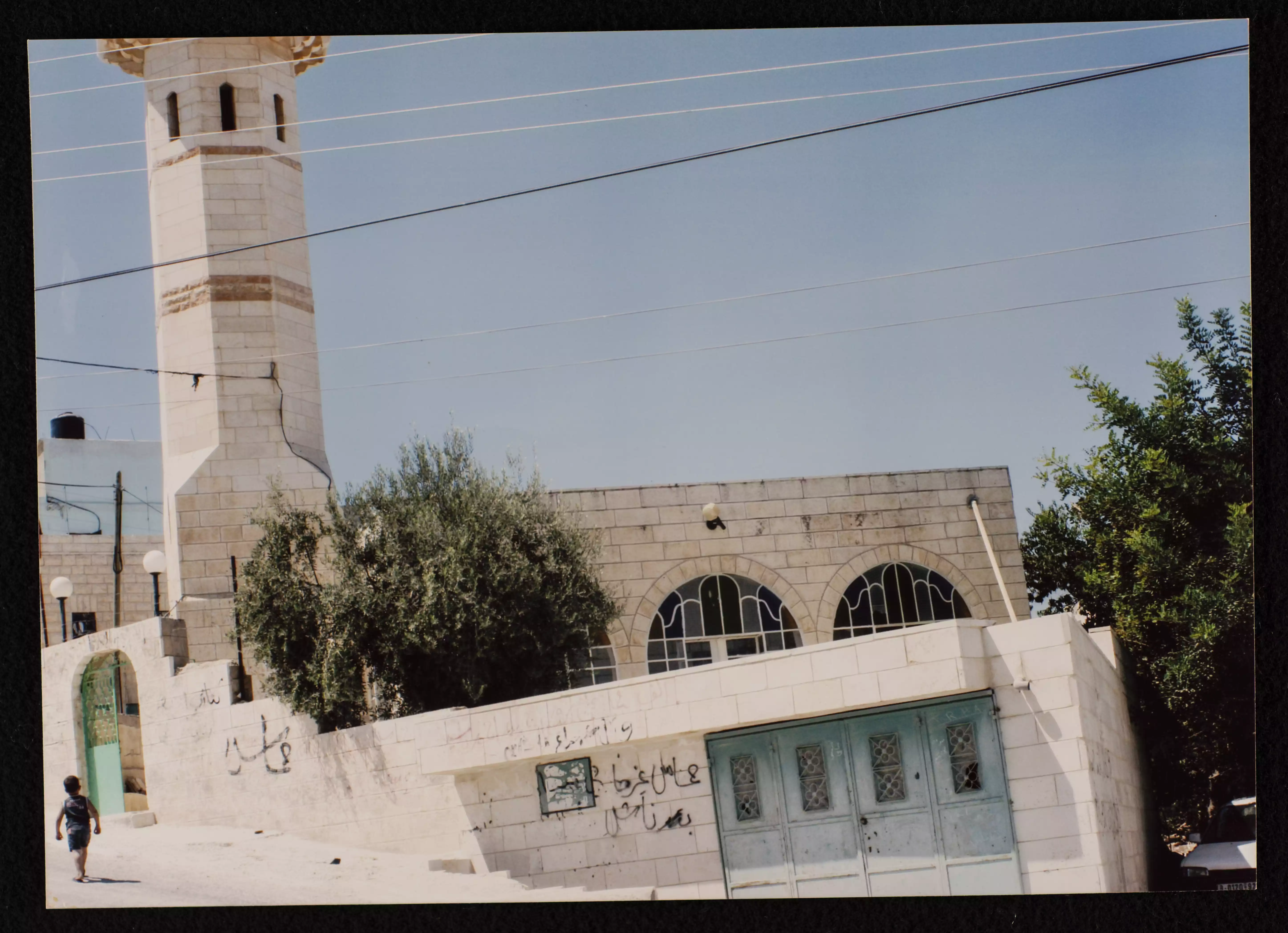
1 - A minaret of Azzeh mosque close to the refugee camp.
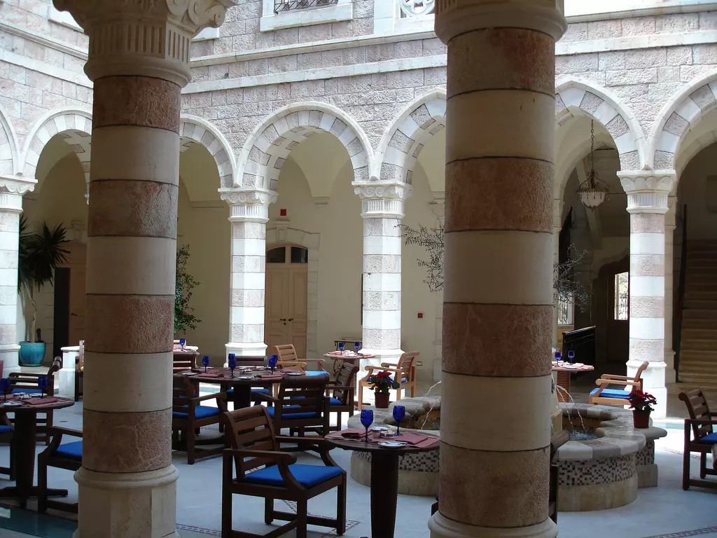
2 - The Intercontinental Hotel courtyard
6 - A painting depecting the simple Palestinian life Palestinians used to have before Nakba at the International Center

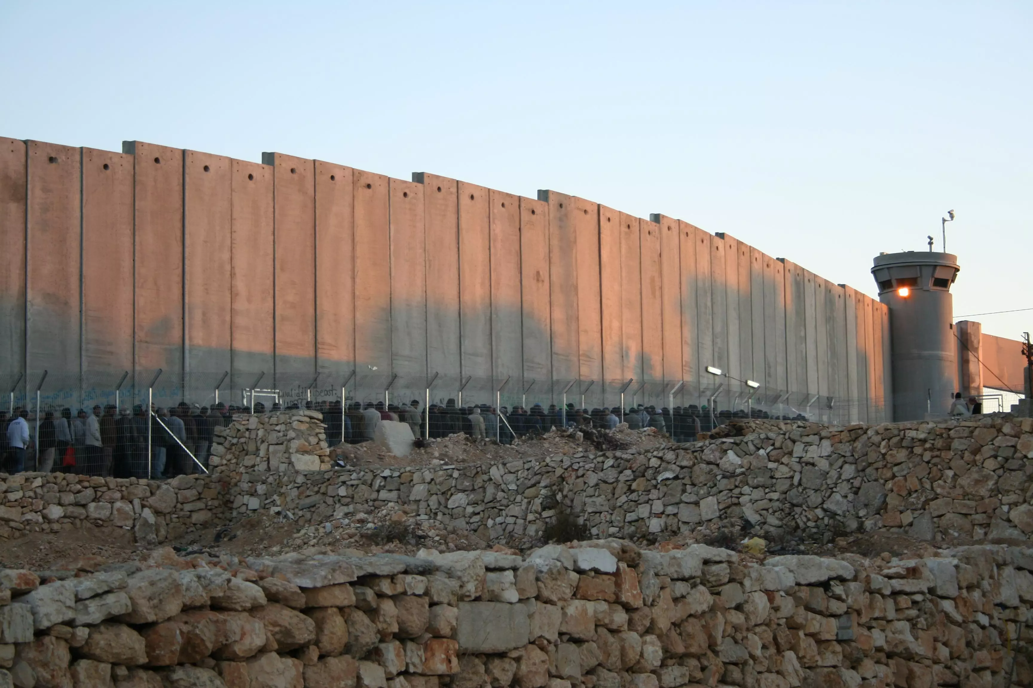
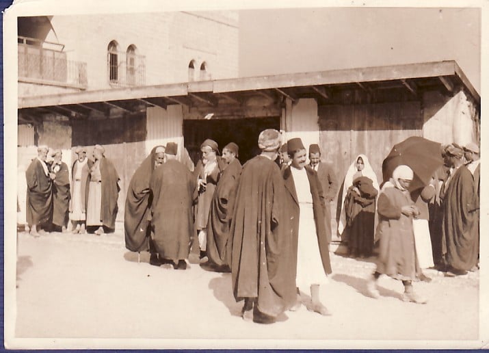
4 - A queue from hell, Bethelehem-Jerusalem checkpoint #1

6 - A queue from hell, Bethelehem-Jerusalem checkpoint #2
2 - A queue from hell, Bethlehem-Jerusalem checkpoint #3
2 - A queue from hell, Bethelehem-Jerusalem checkpoint #4
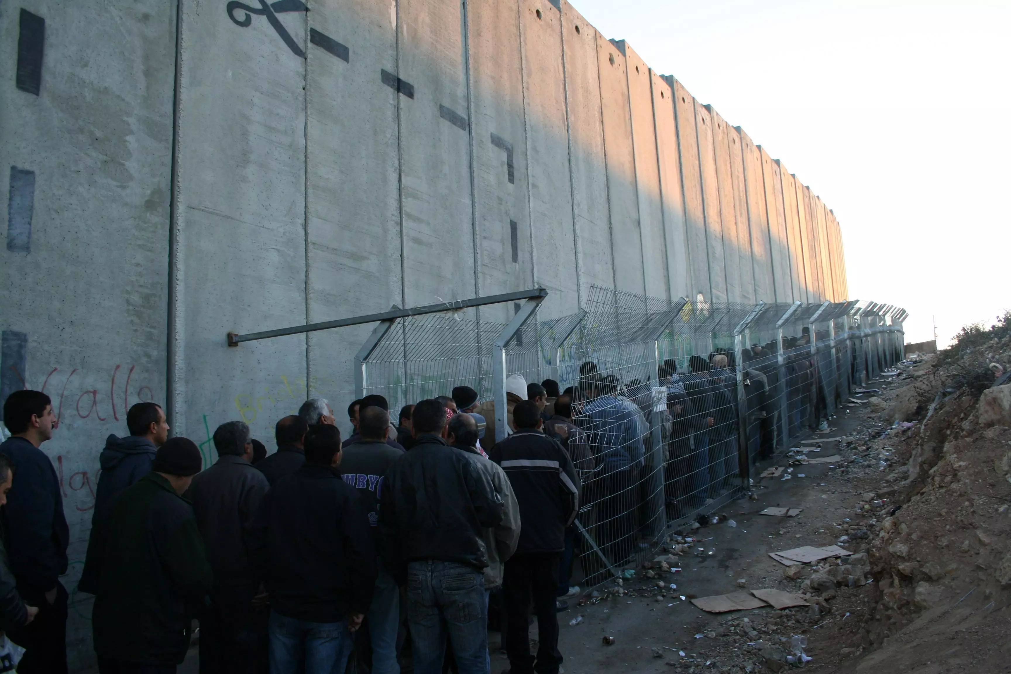
1 - The wall at Bethelehem-Jerusalem checkpoint #1
- The wall at Bethelehem-Jerusalem checkpoint #2
1 - The wall at Bethelehem-Jerusalem checkpoint #3
- This road and tunnel is under Beit Jala (a town west of Bethlehem). This road between Jerusalem and Hebron is exclusively used by Israelis. Palestinians are not allowed on these roads, although the road goes through their towns. Is this apartheid?

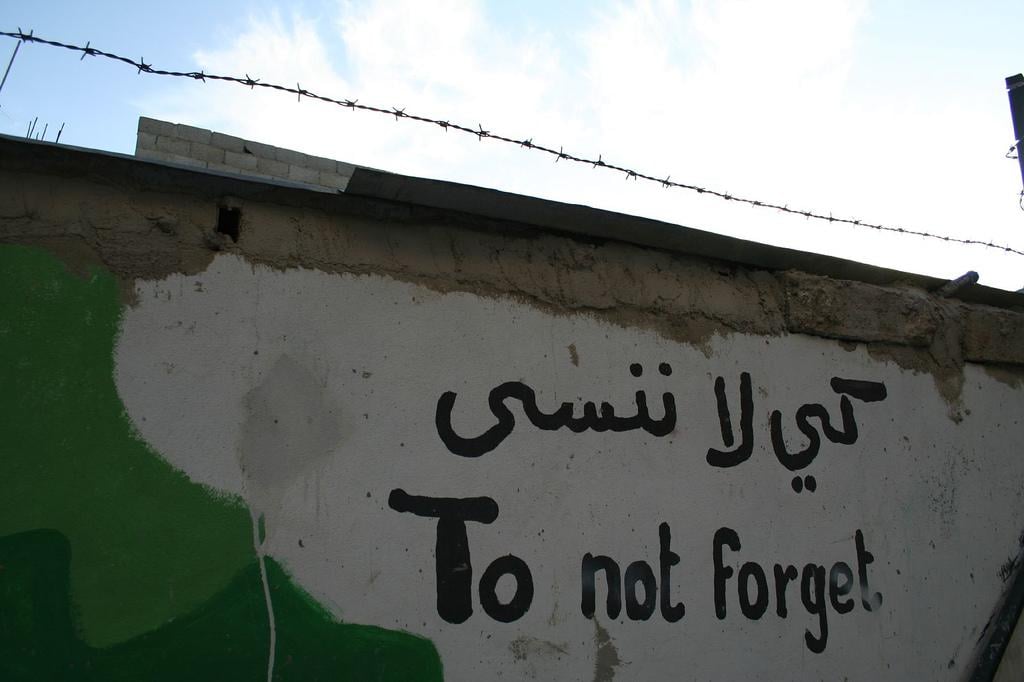
4 - Art work: Let us never forget
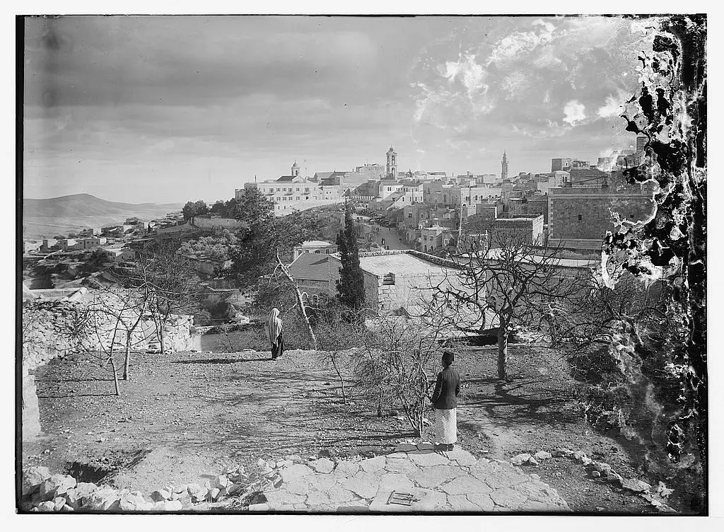
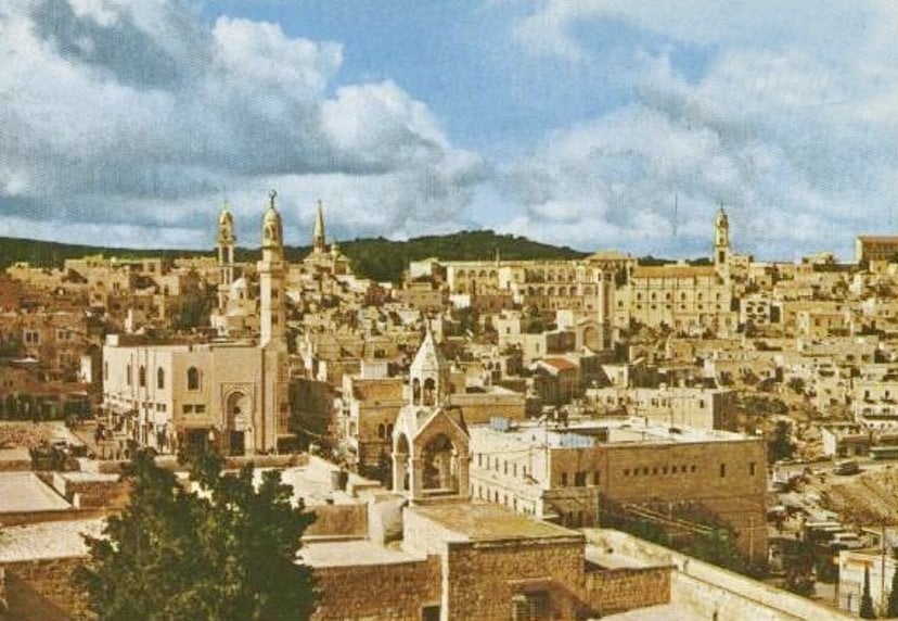
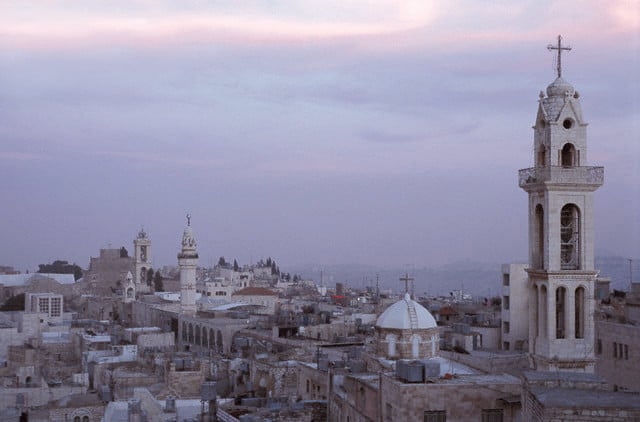
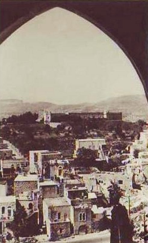
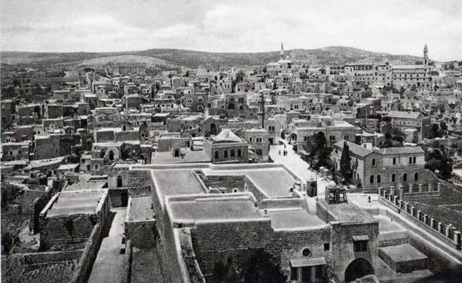
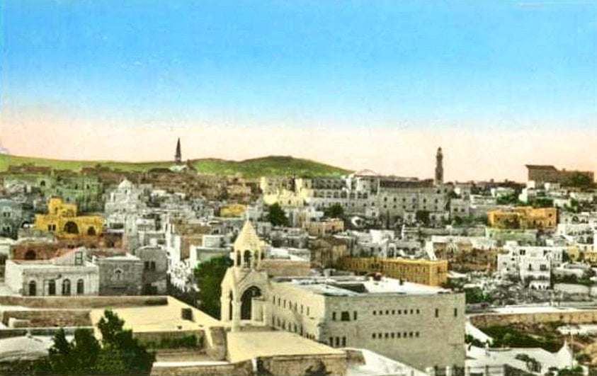
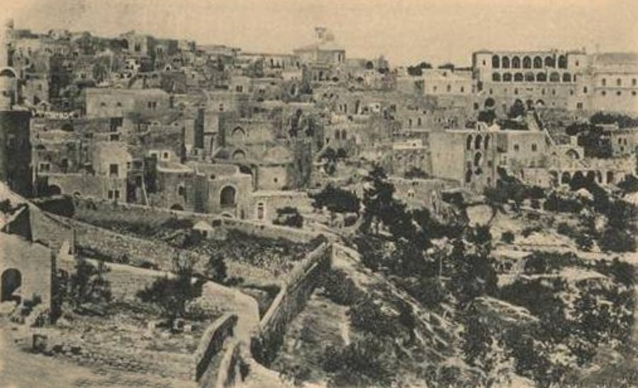
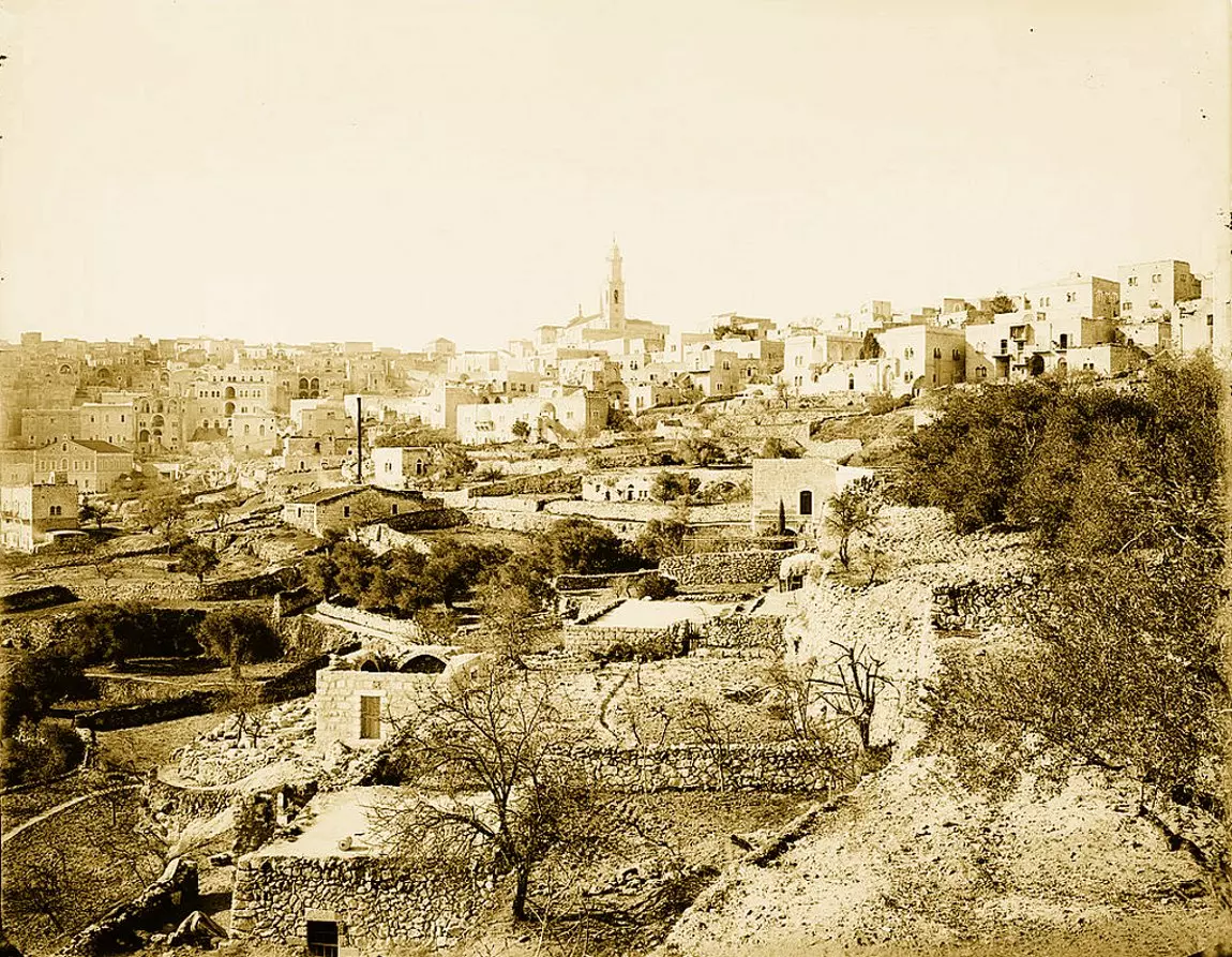
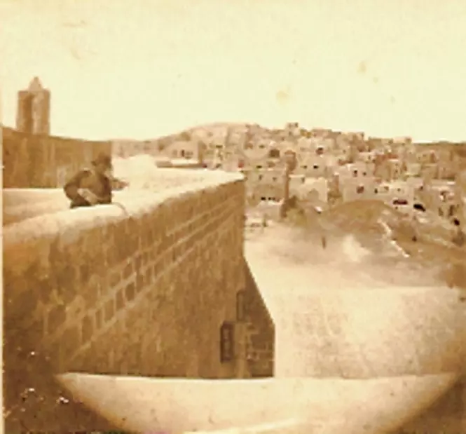
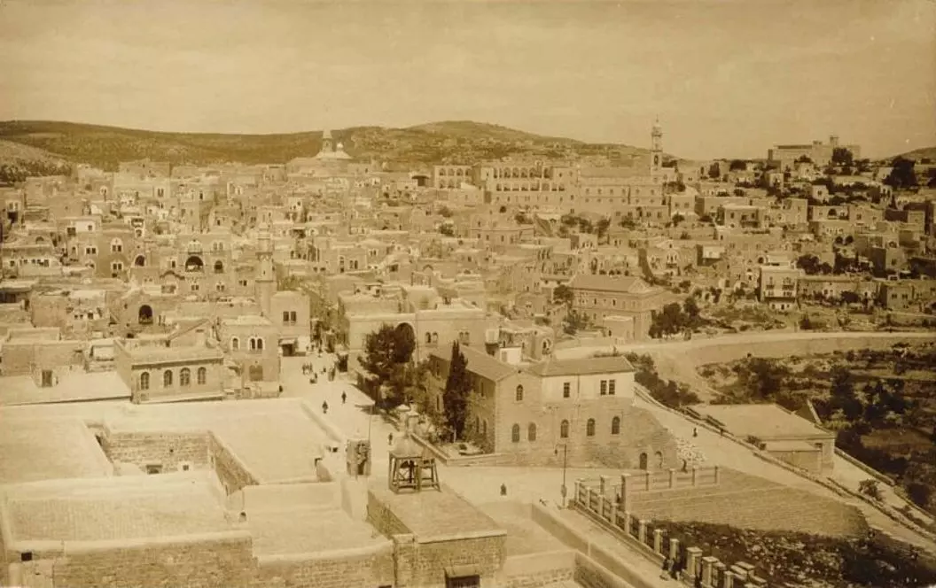
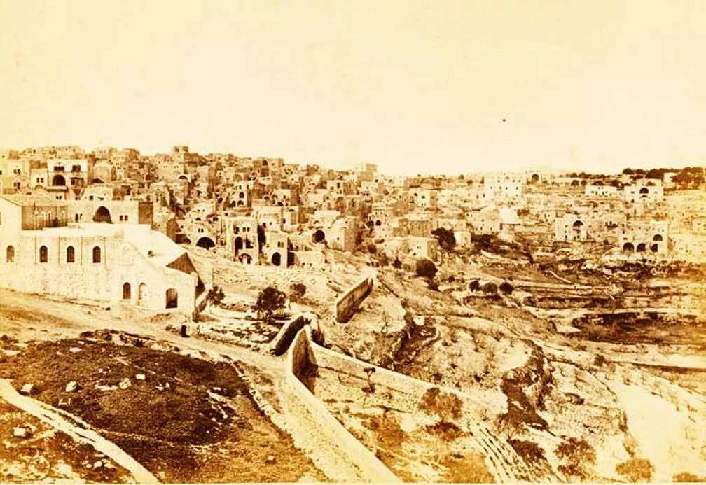
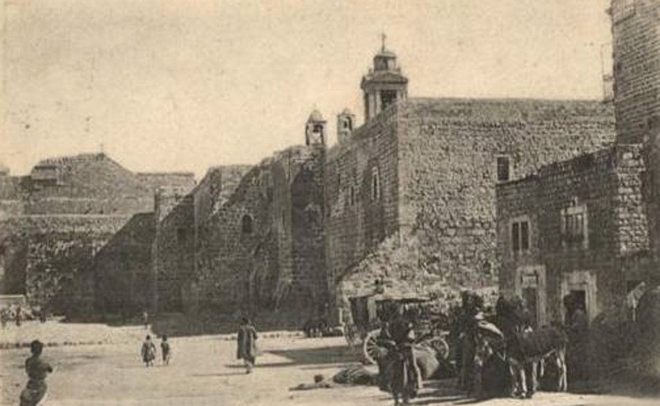
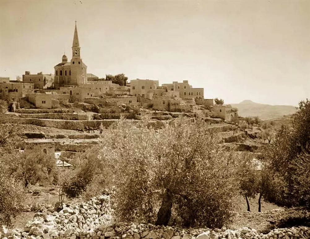
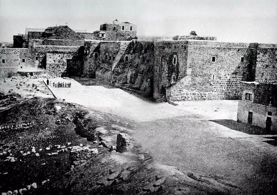
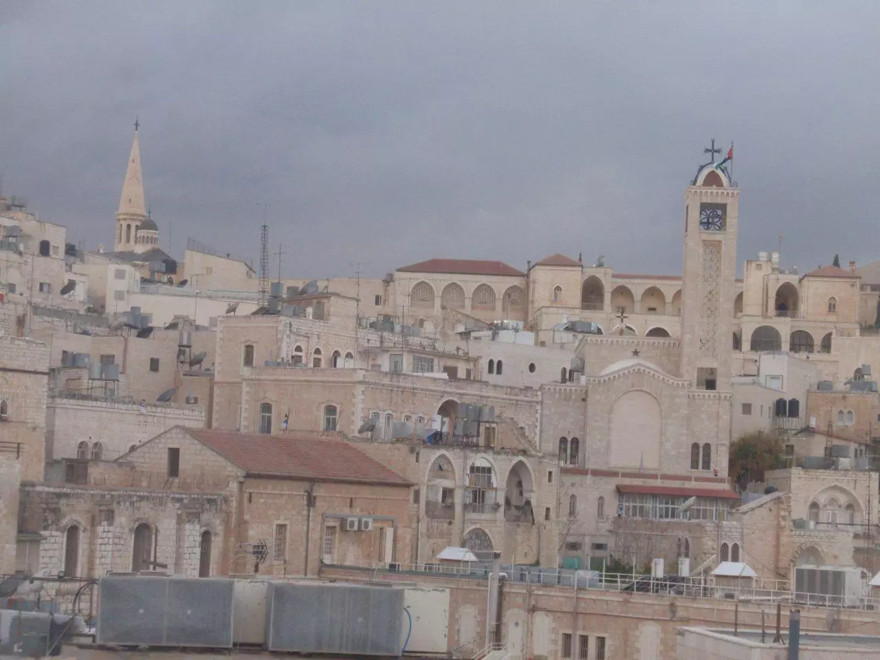
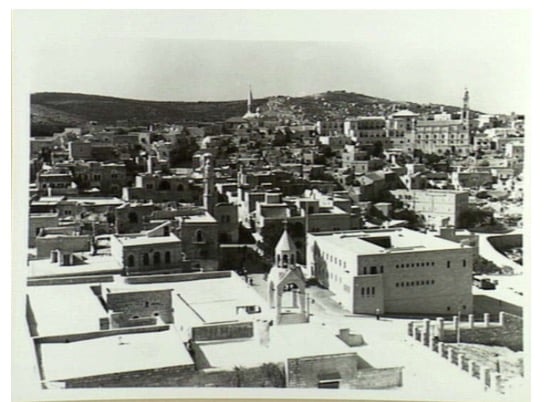
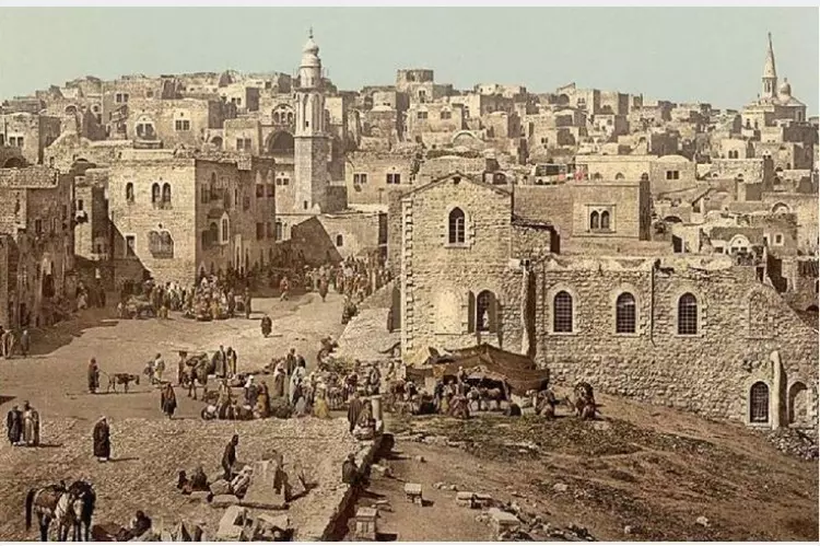
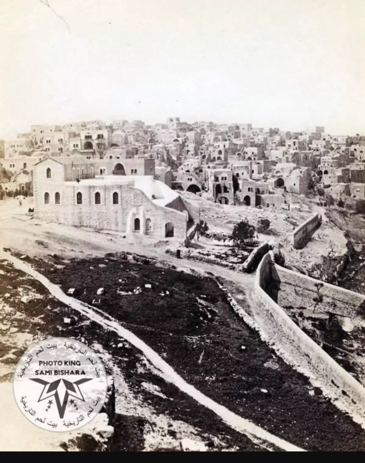
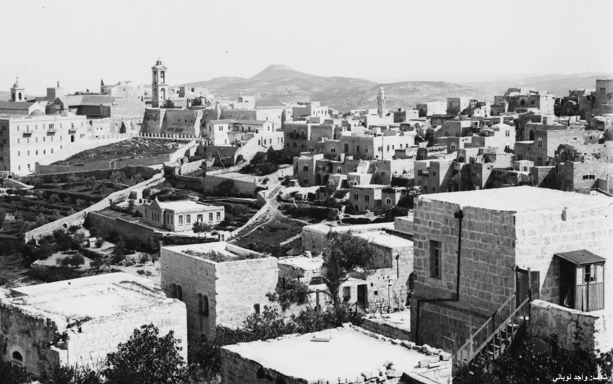
1 - Undated general view for the city. The large structure to the left is The Church of Nativity
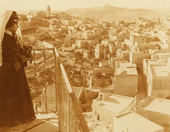
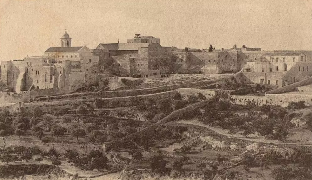
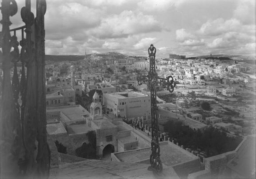
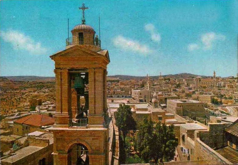
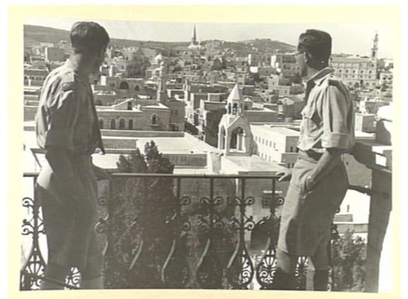
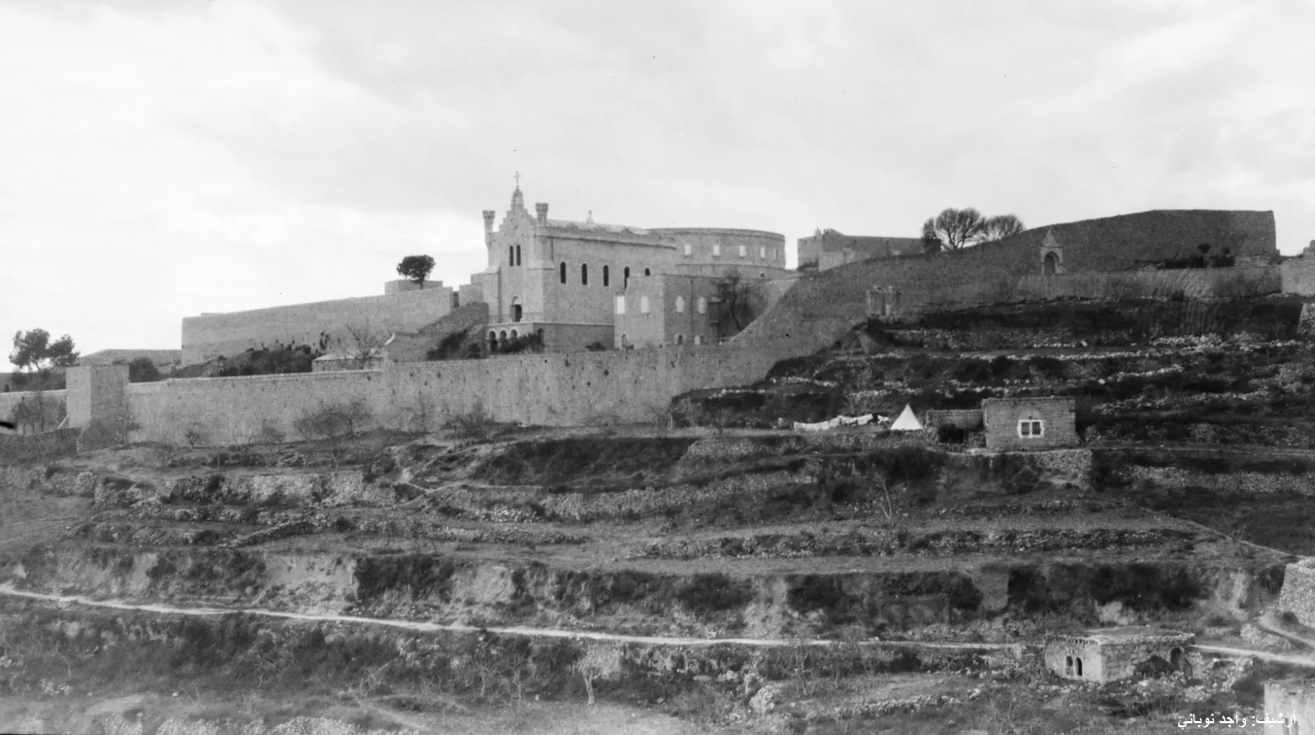
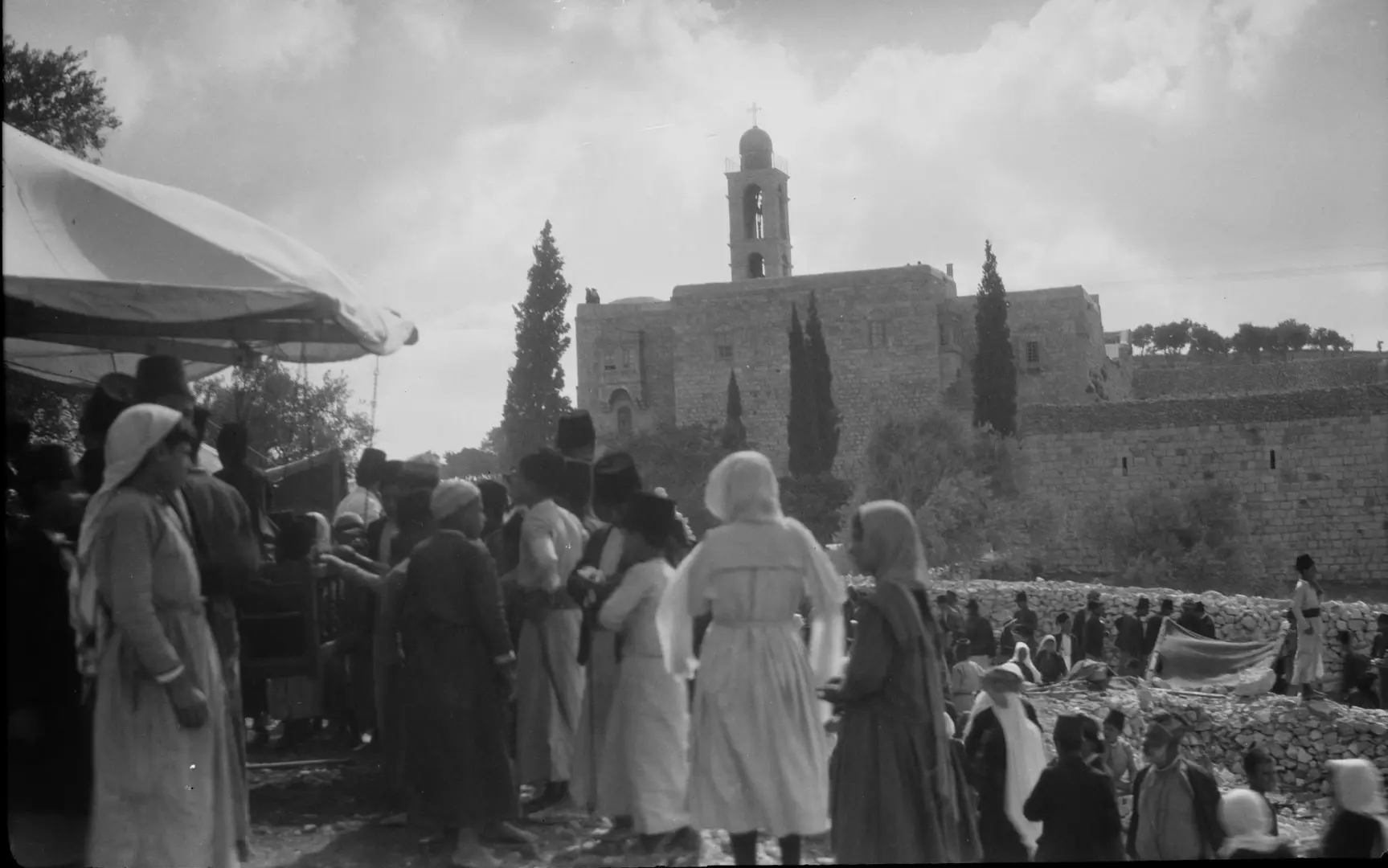
- General view of the city from The Church of Nativity's bell tower (1862)
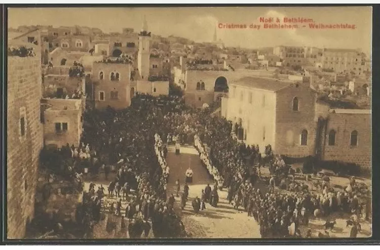
- General view of the city from The Church of Nativity's bell tower during Christmas day
1 - General view during Christmas (1900s)

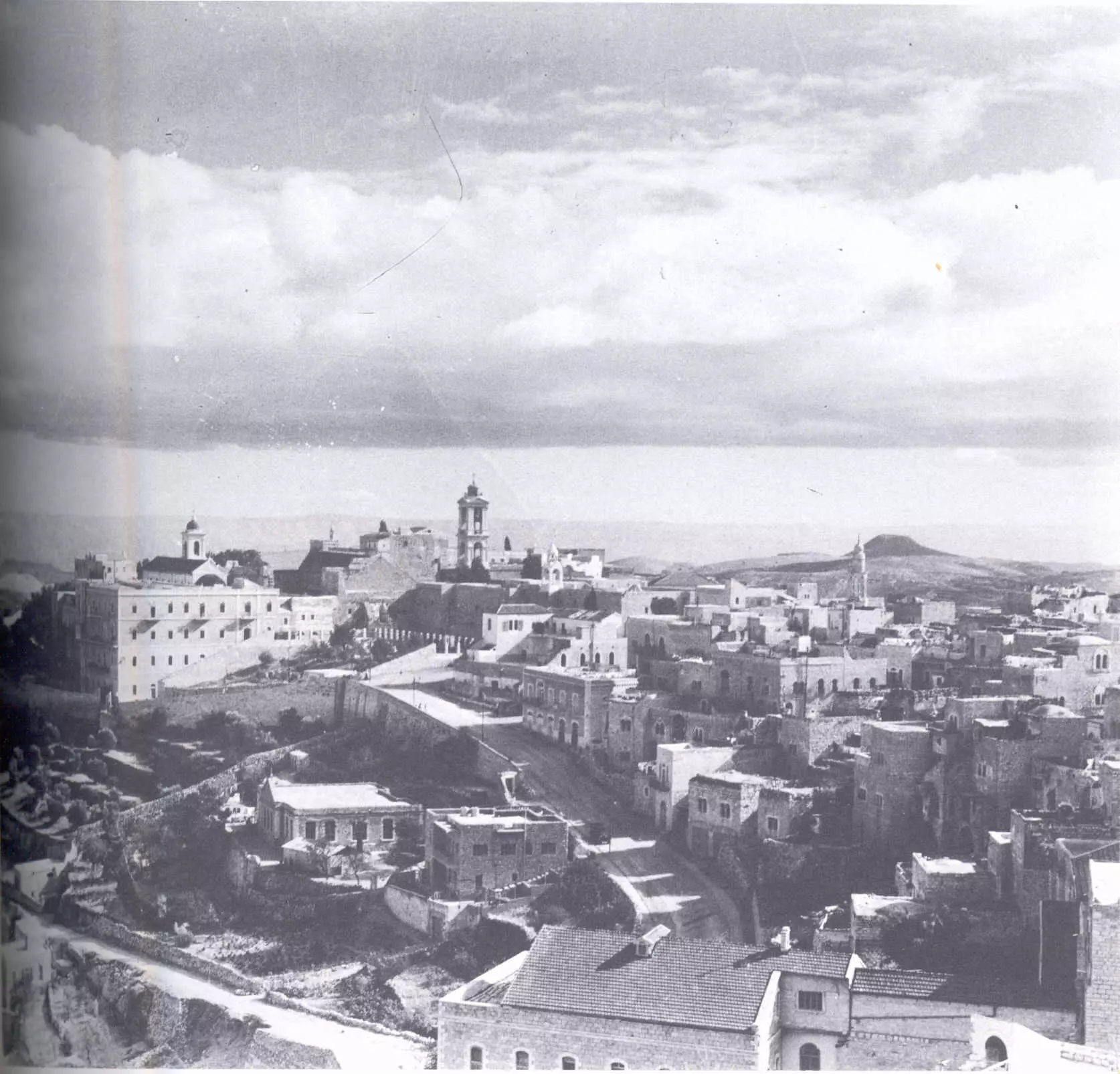
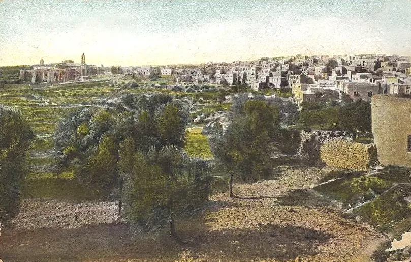
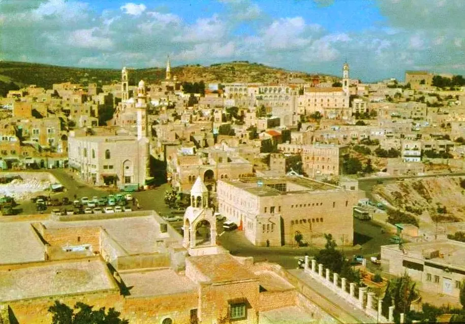
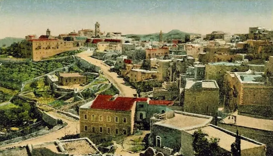
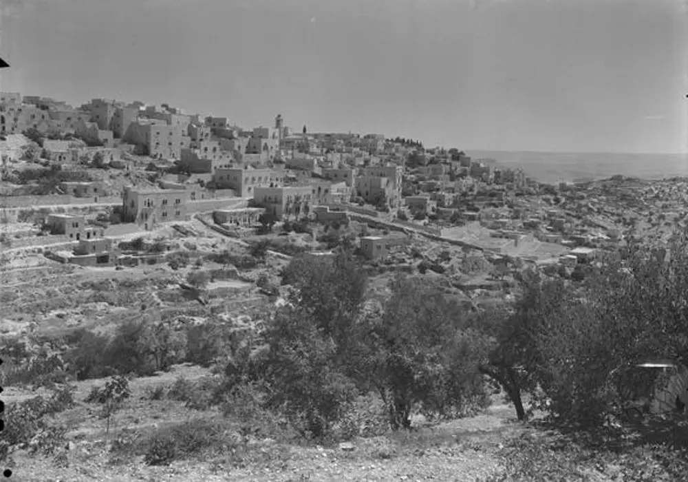
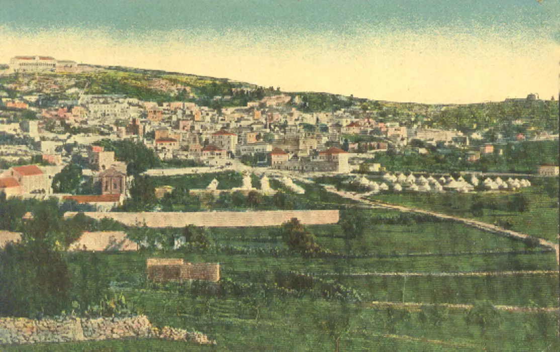
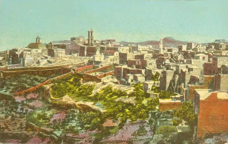
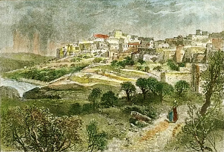
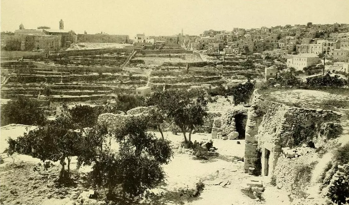
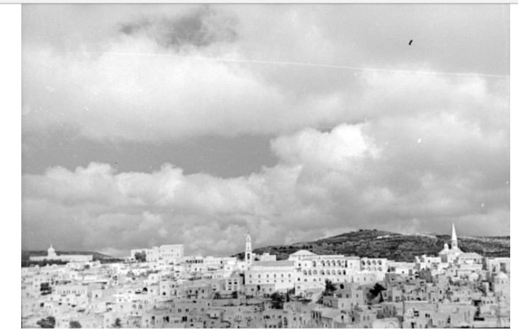
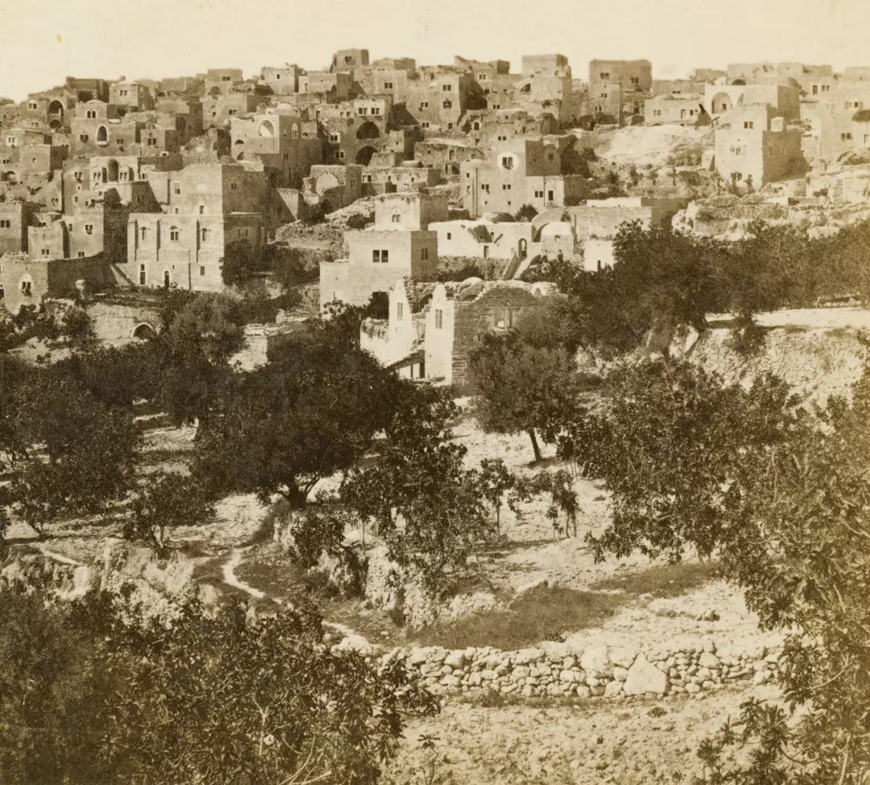
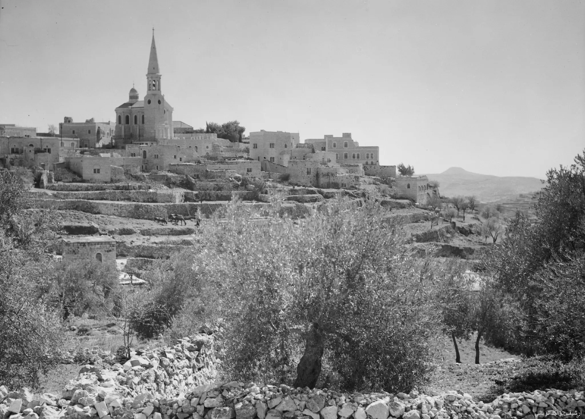
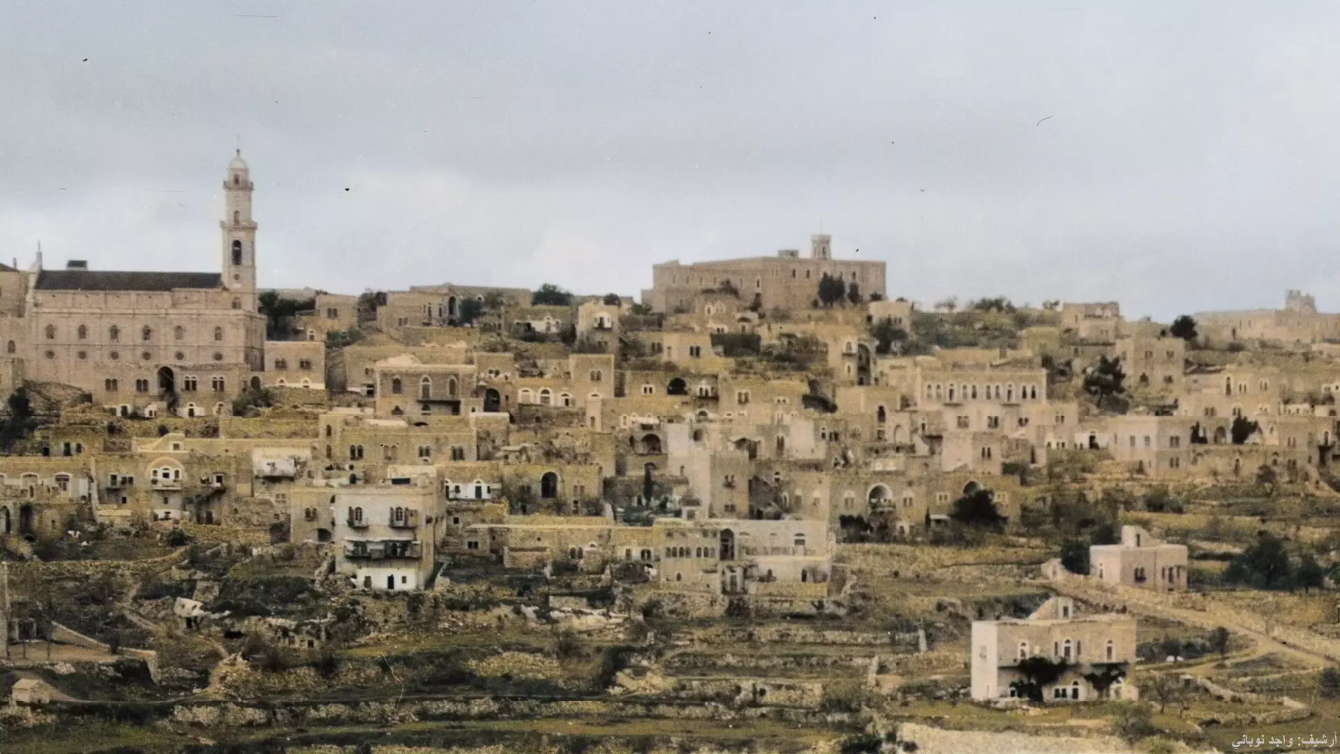
4 - General view from the southwest, Matson Collection. (1920-1933)
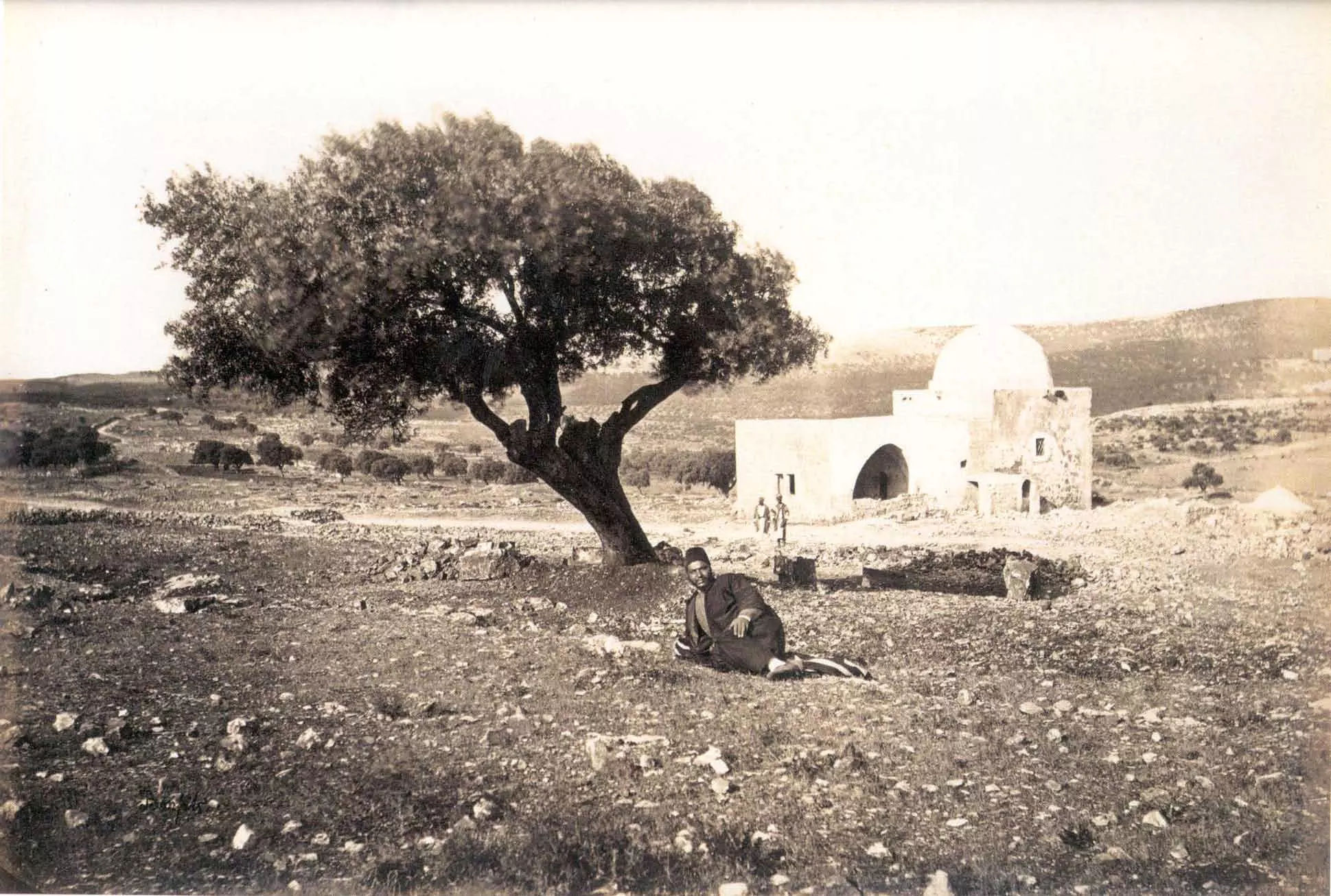
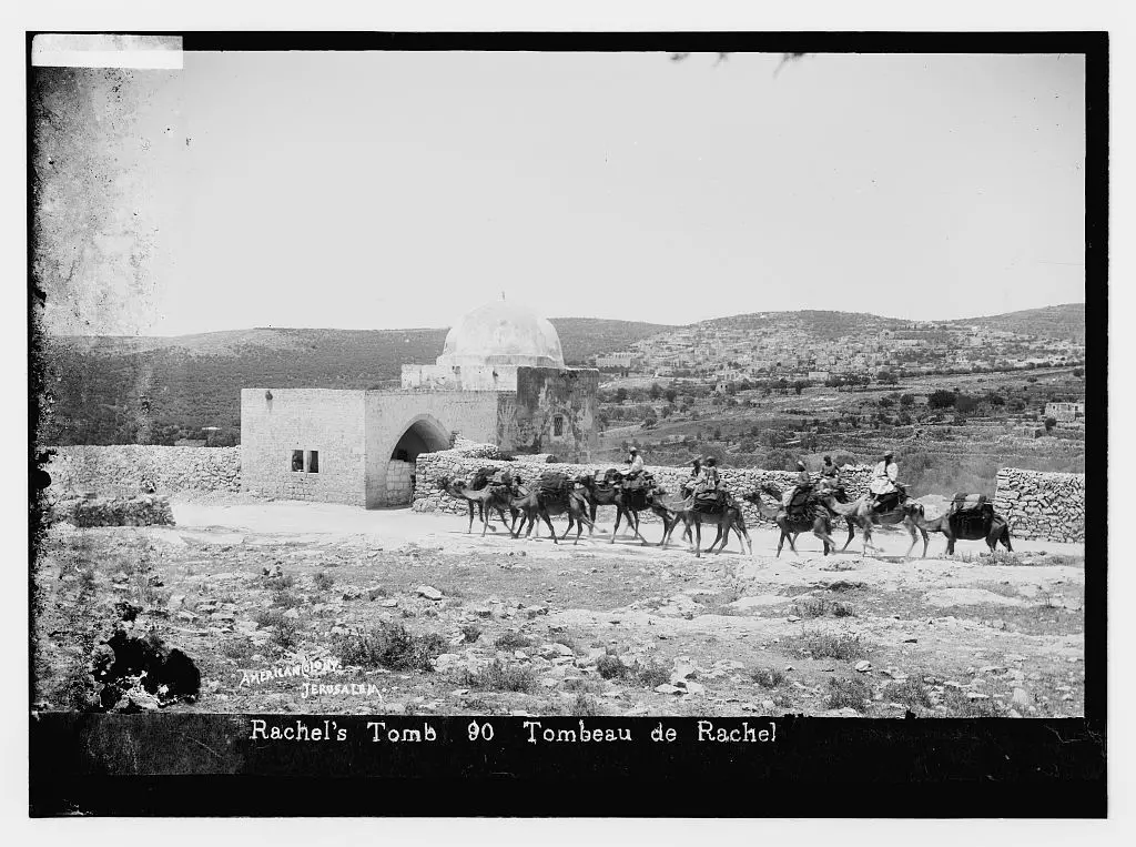
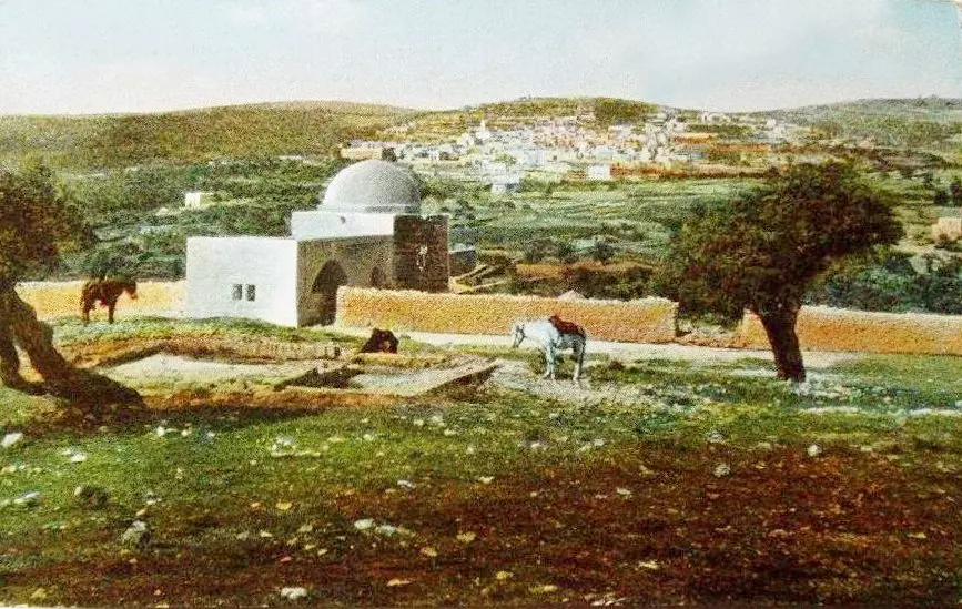
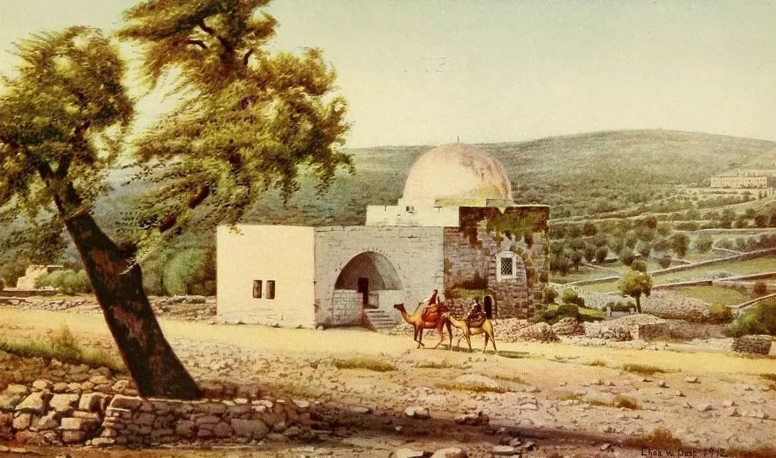
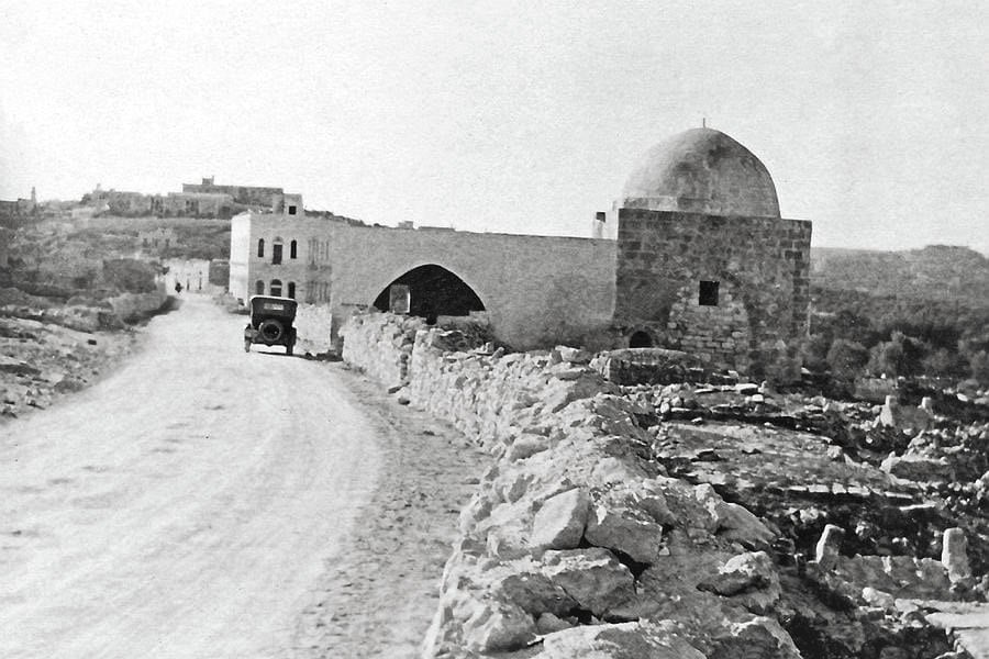
- Rachel tomb(1870)
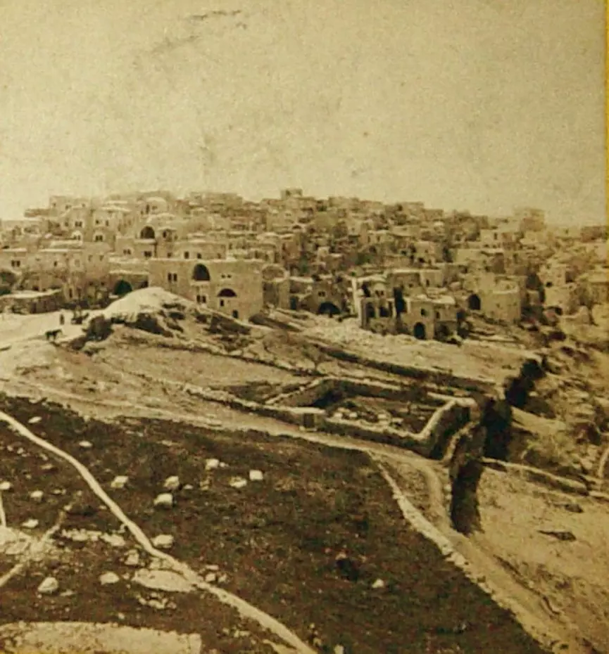
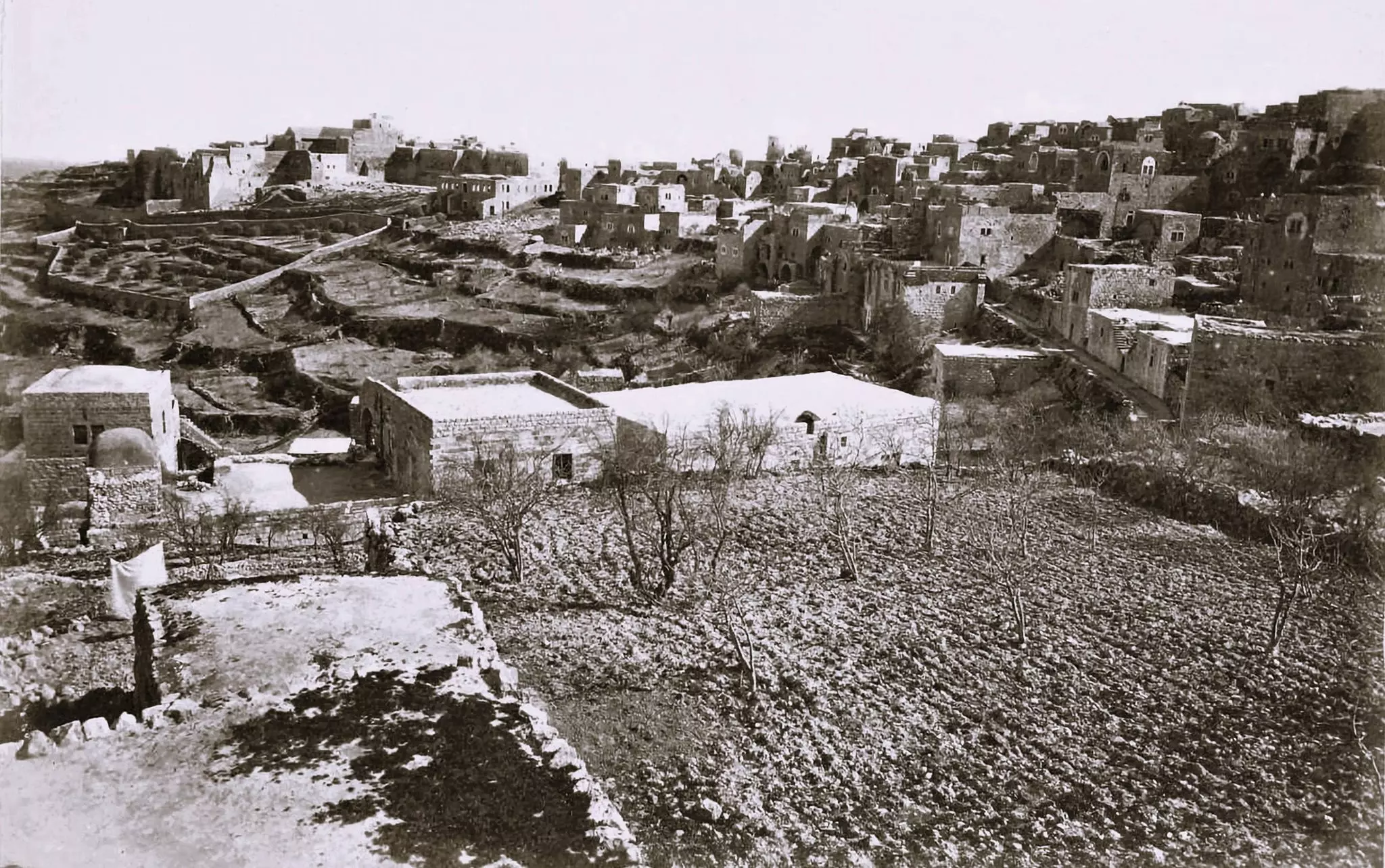
- A view for the city before 1920, Matson Collection.
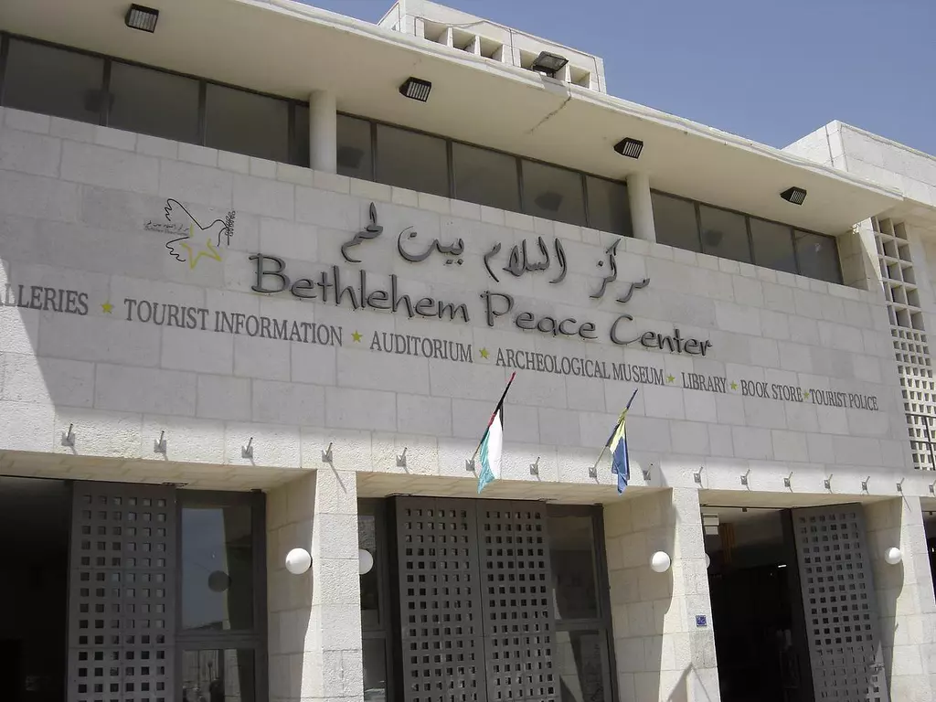
2 - The peace center in Manger square
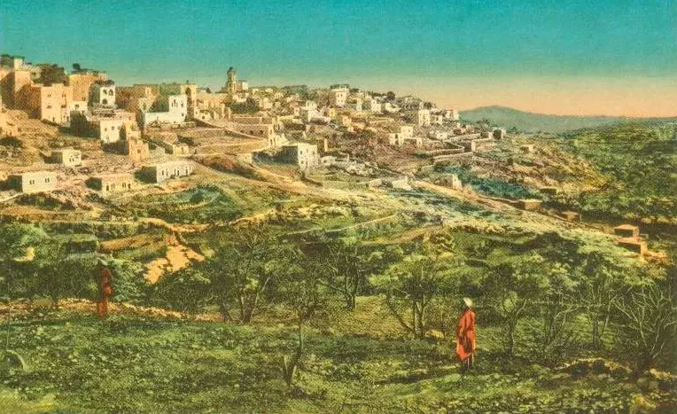
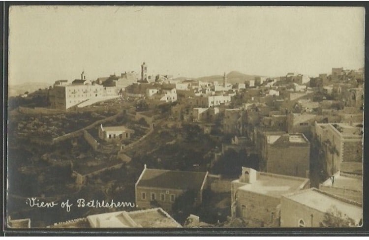
1 - General view
- Rachel's Tomb, Matson Collection.
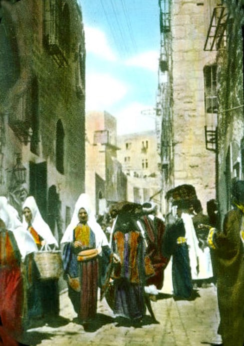
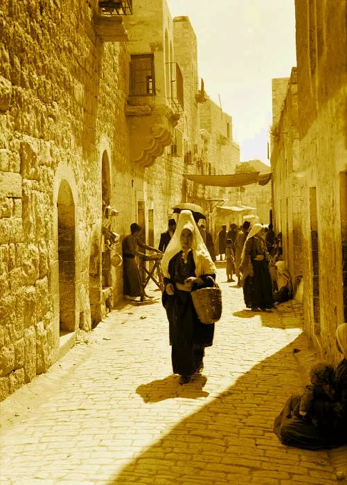
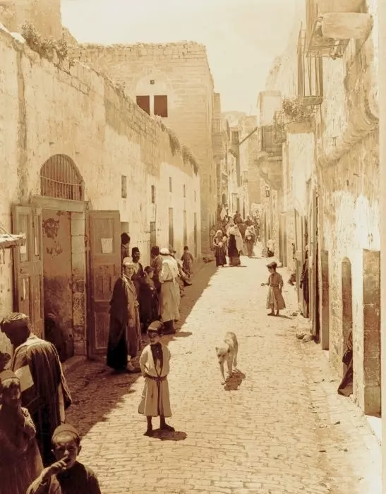
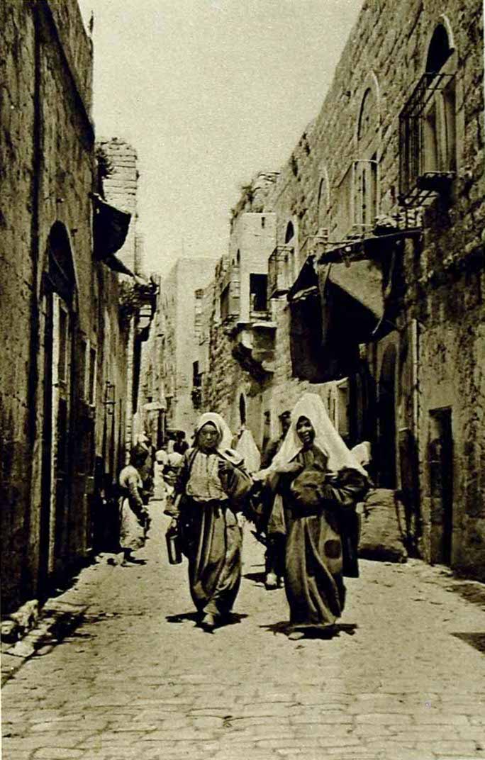
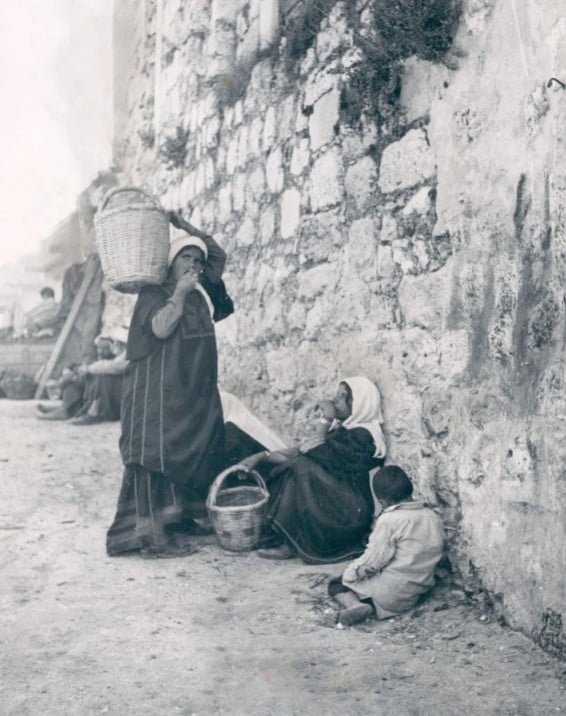
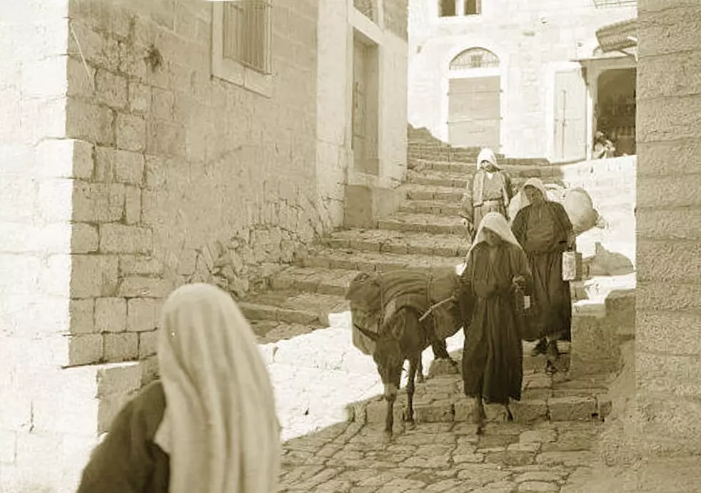
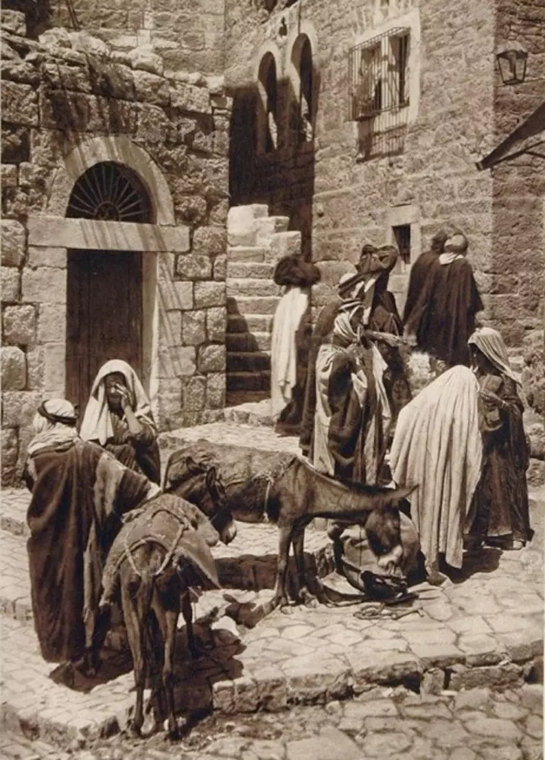
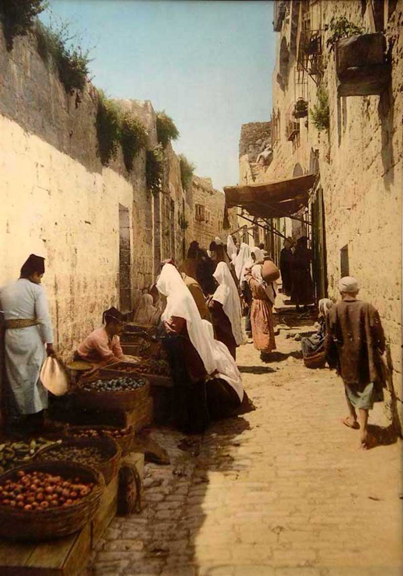
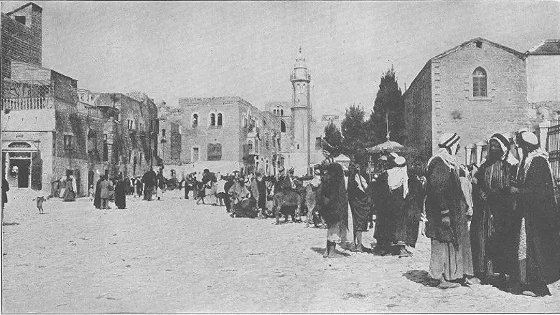
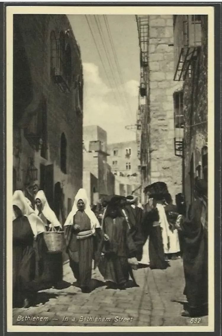
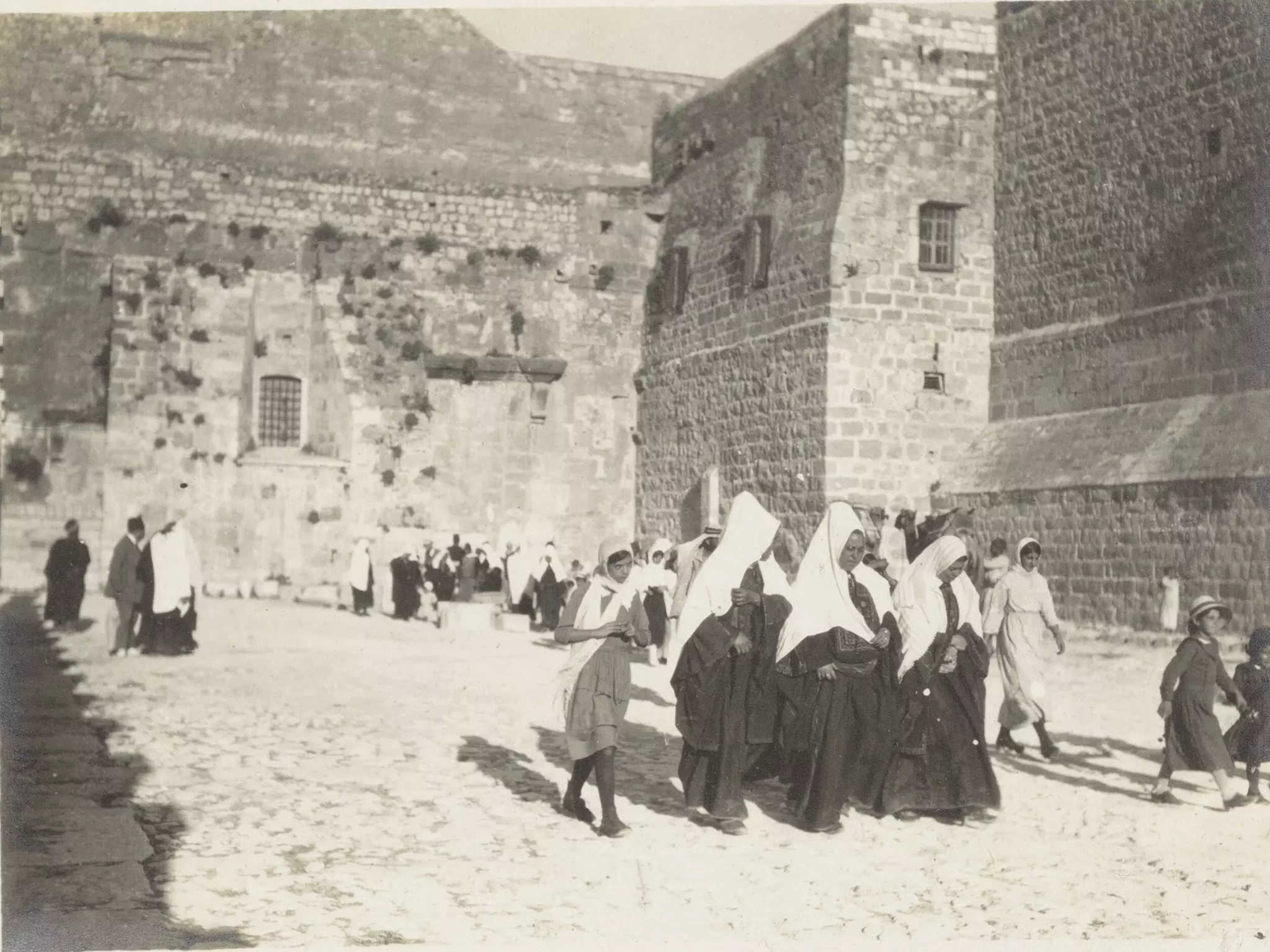
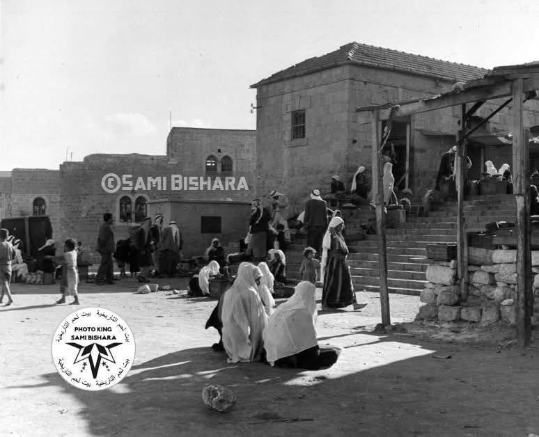
2 - Street Scene
2 - Street Scene
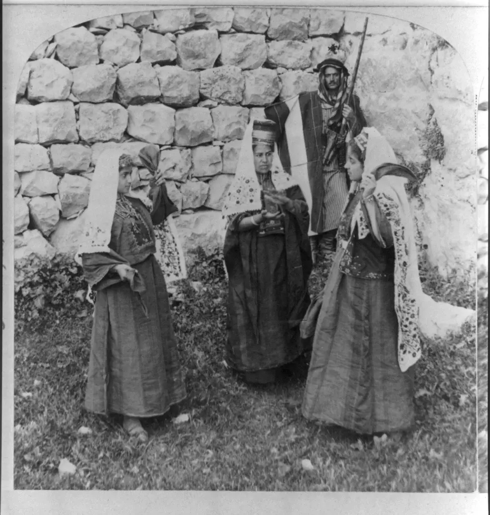
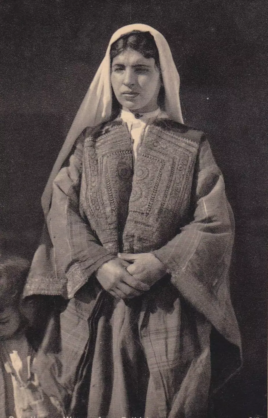
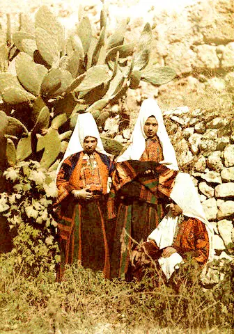
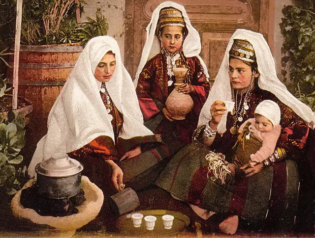
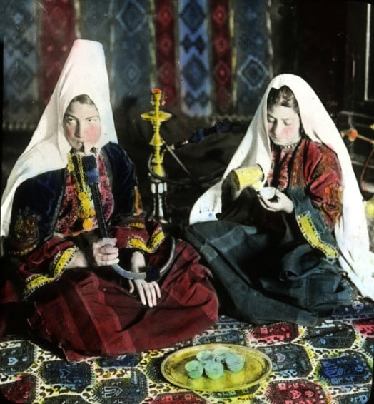
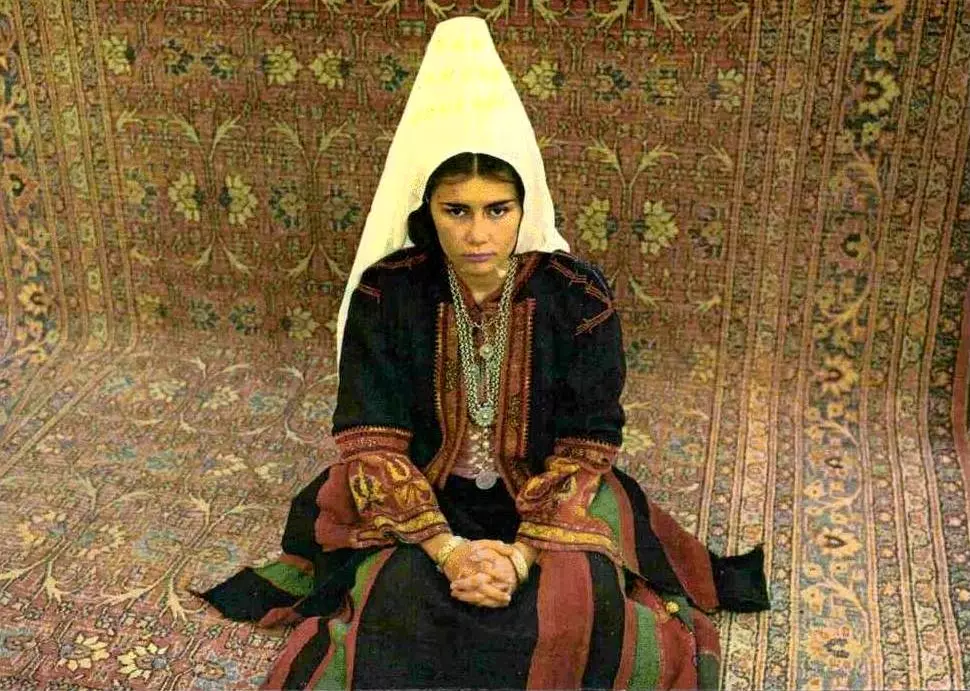
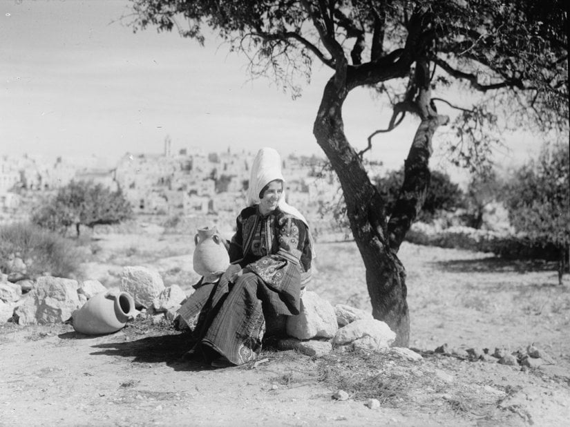
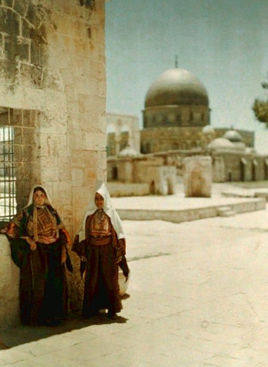
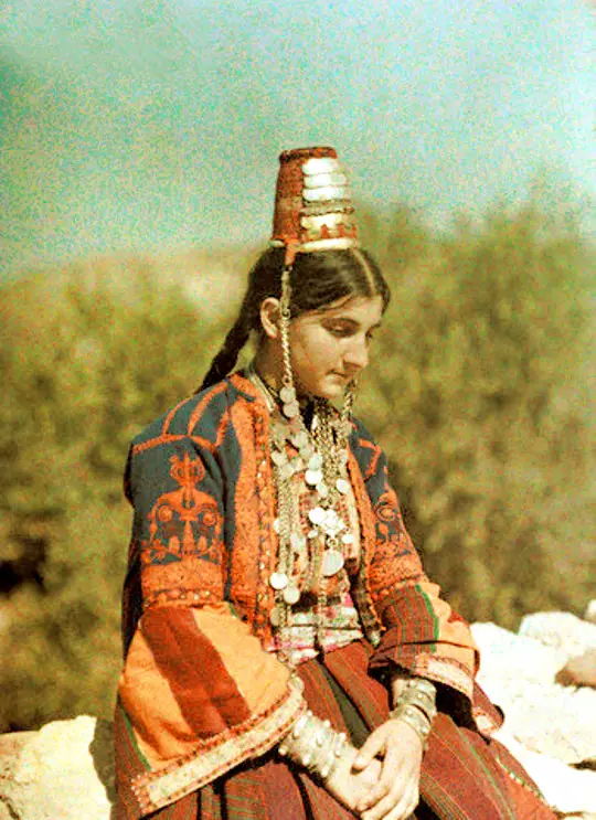
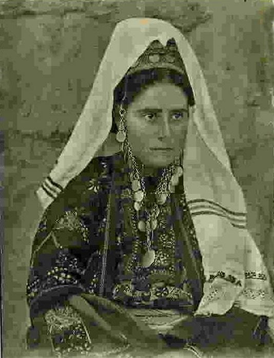
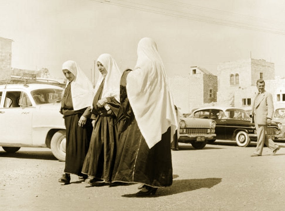
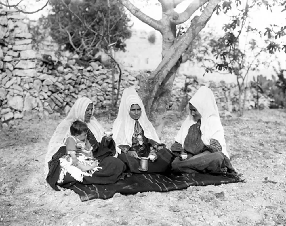
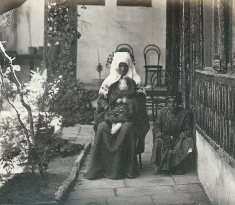
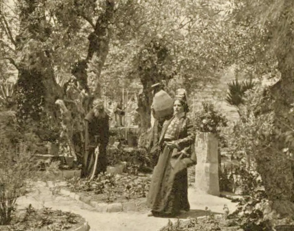
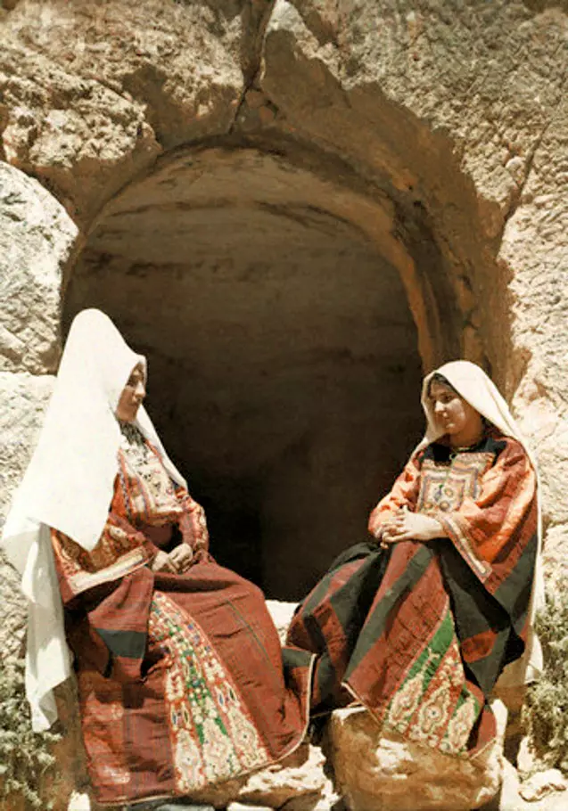
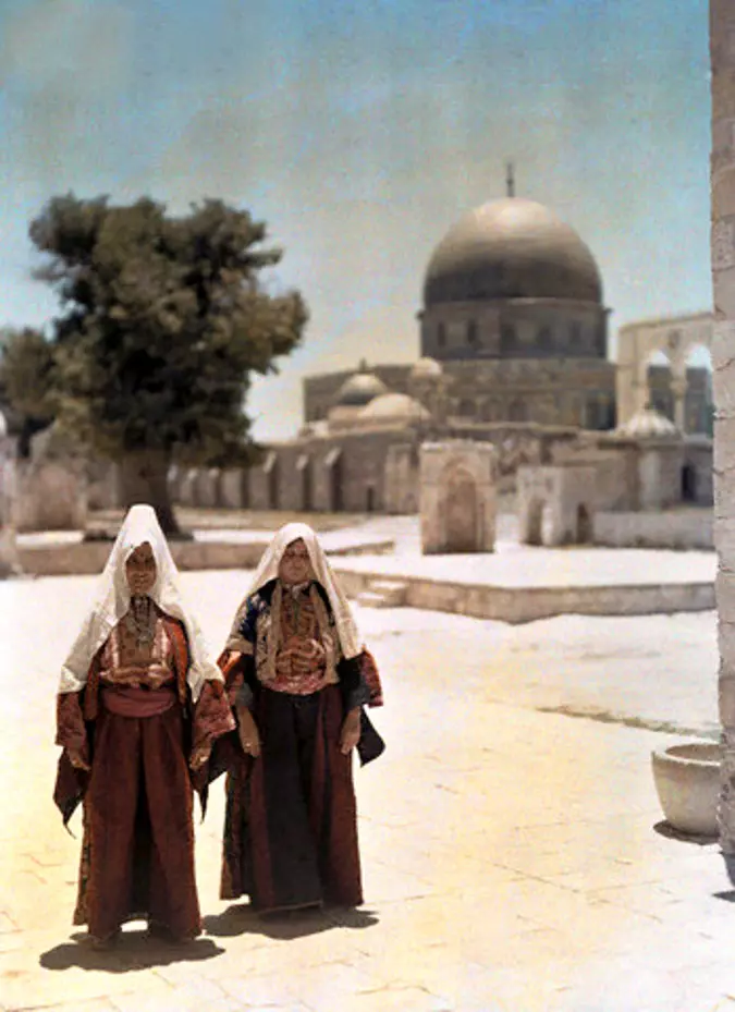
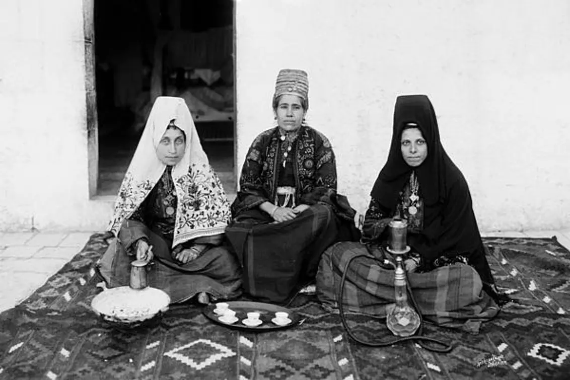
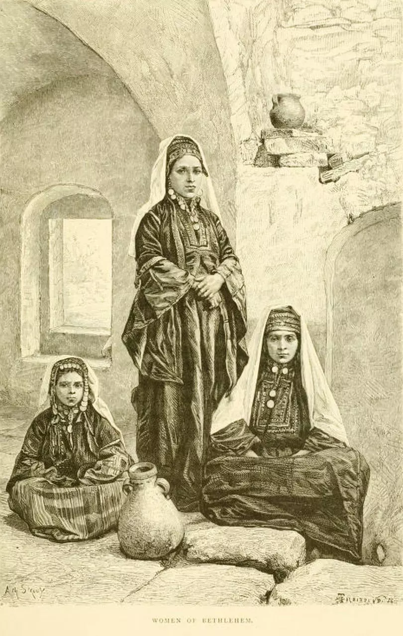
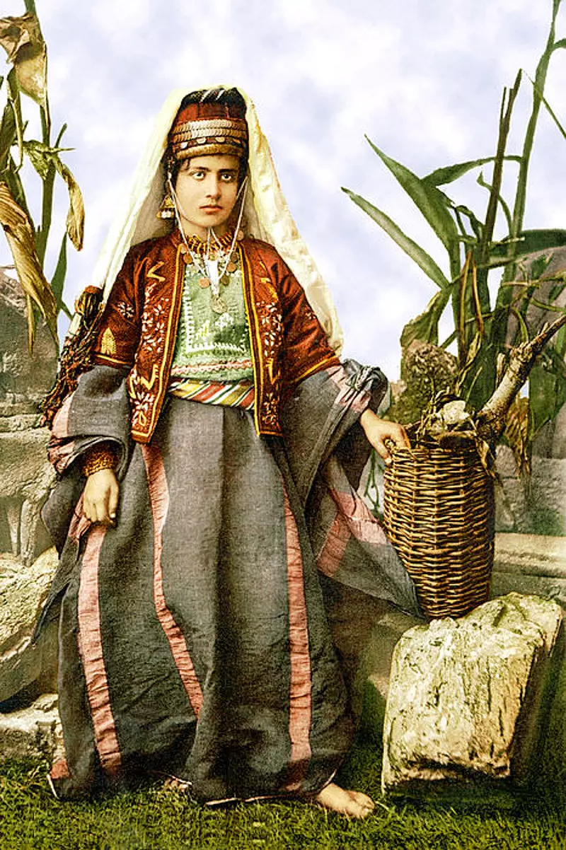
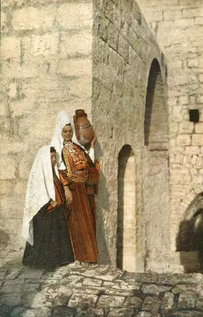
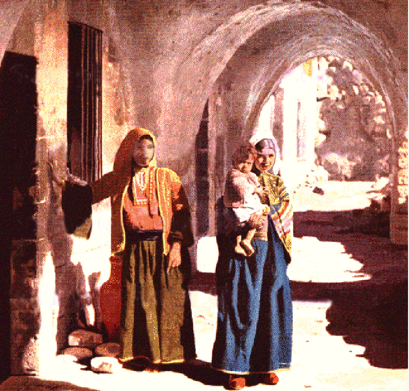
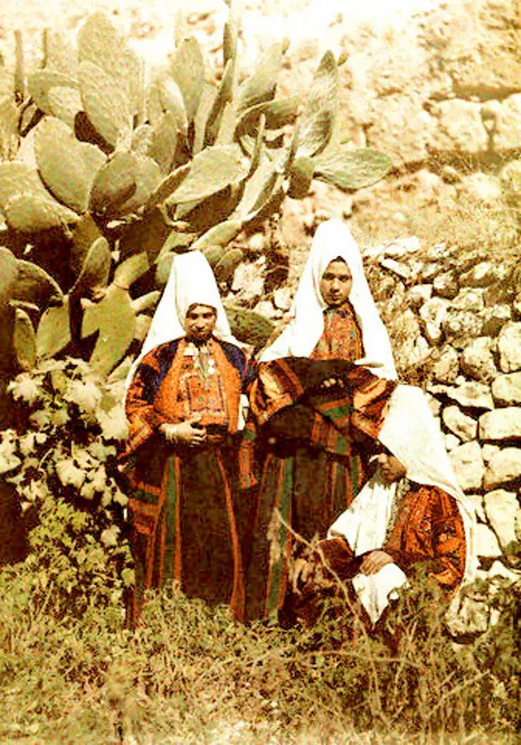
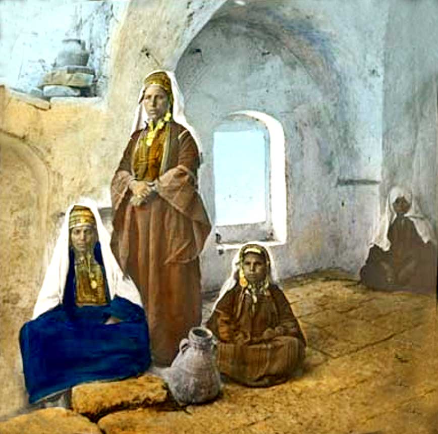
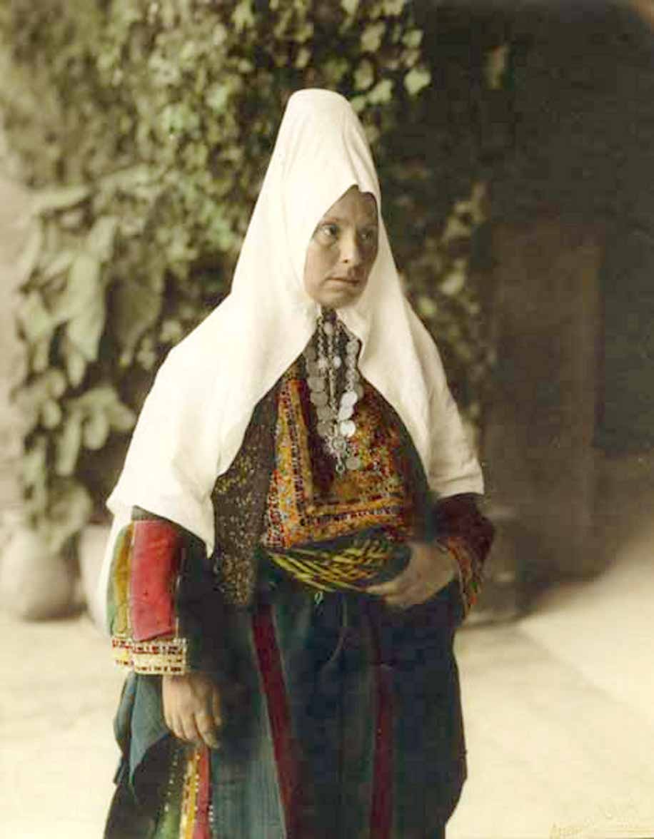
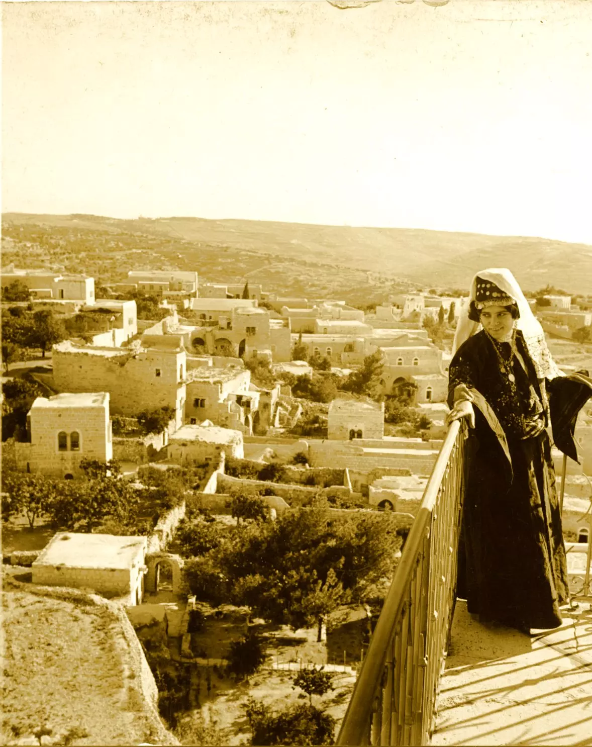
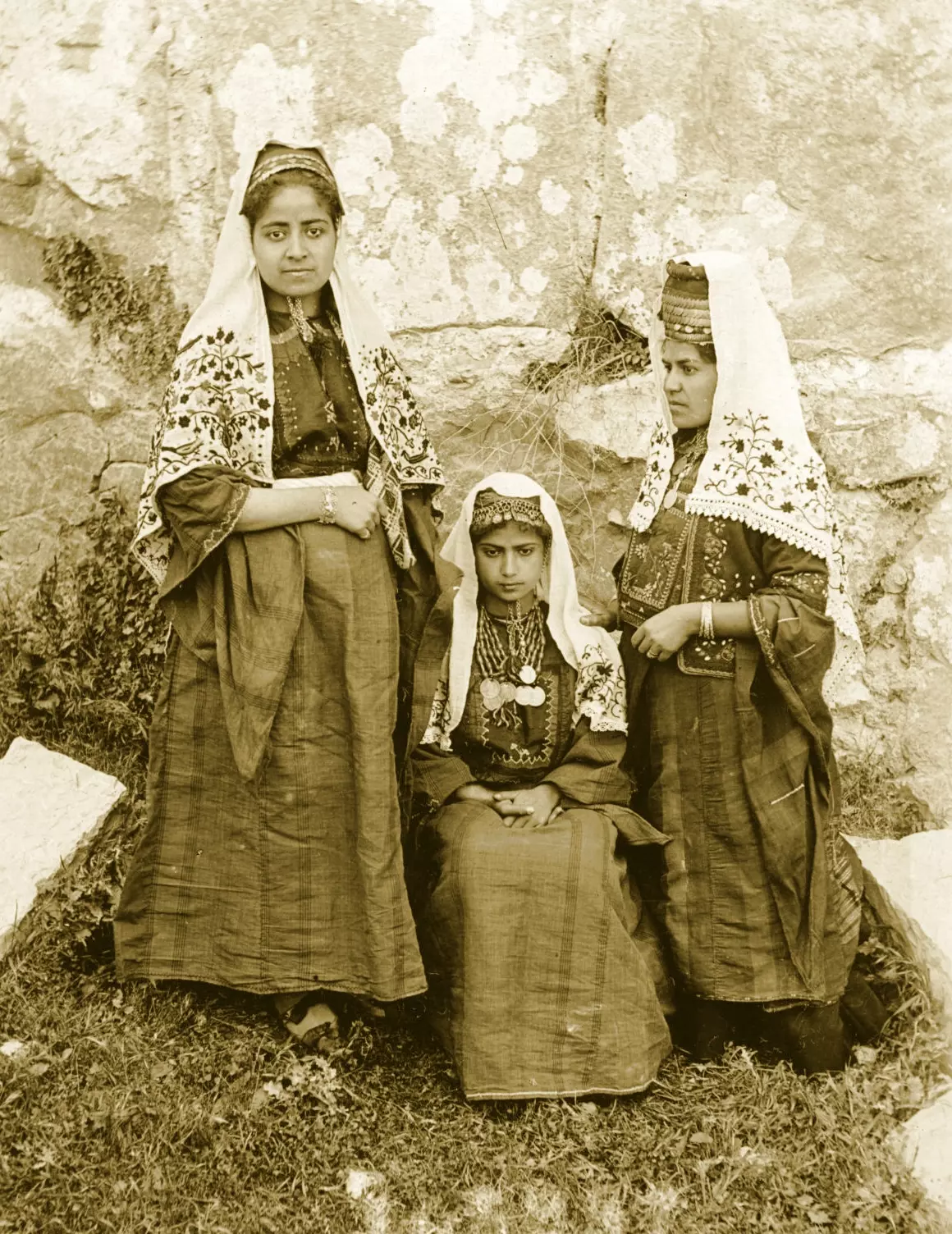
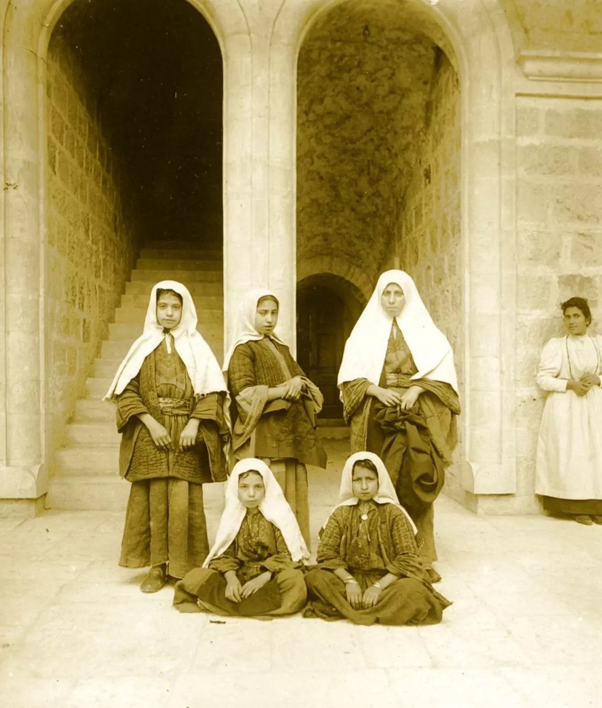
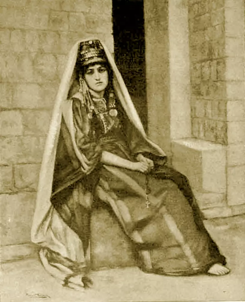
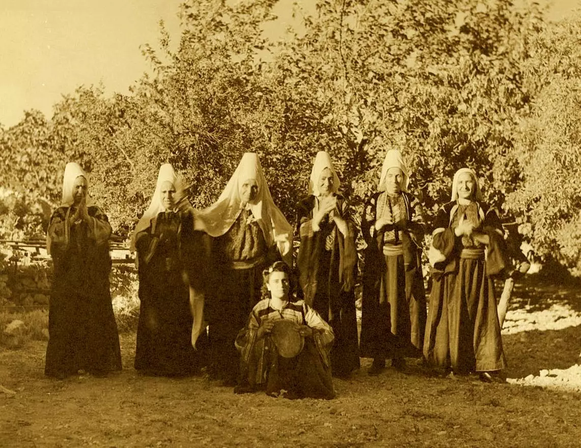
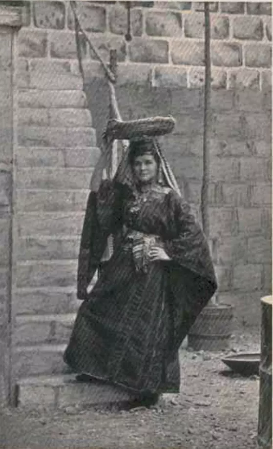
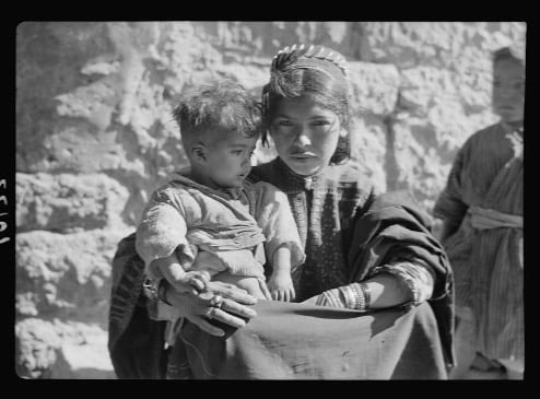
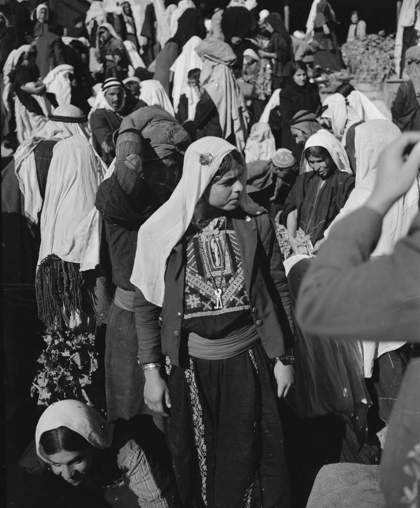
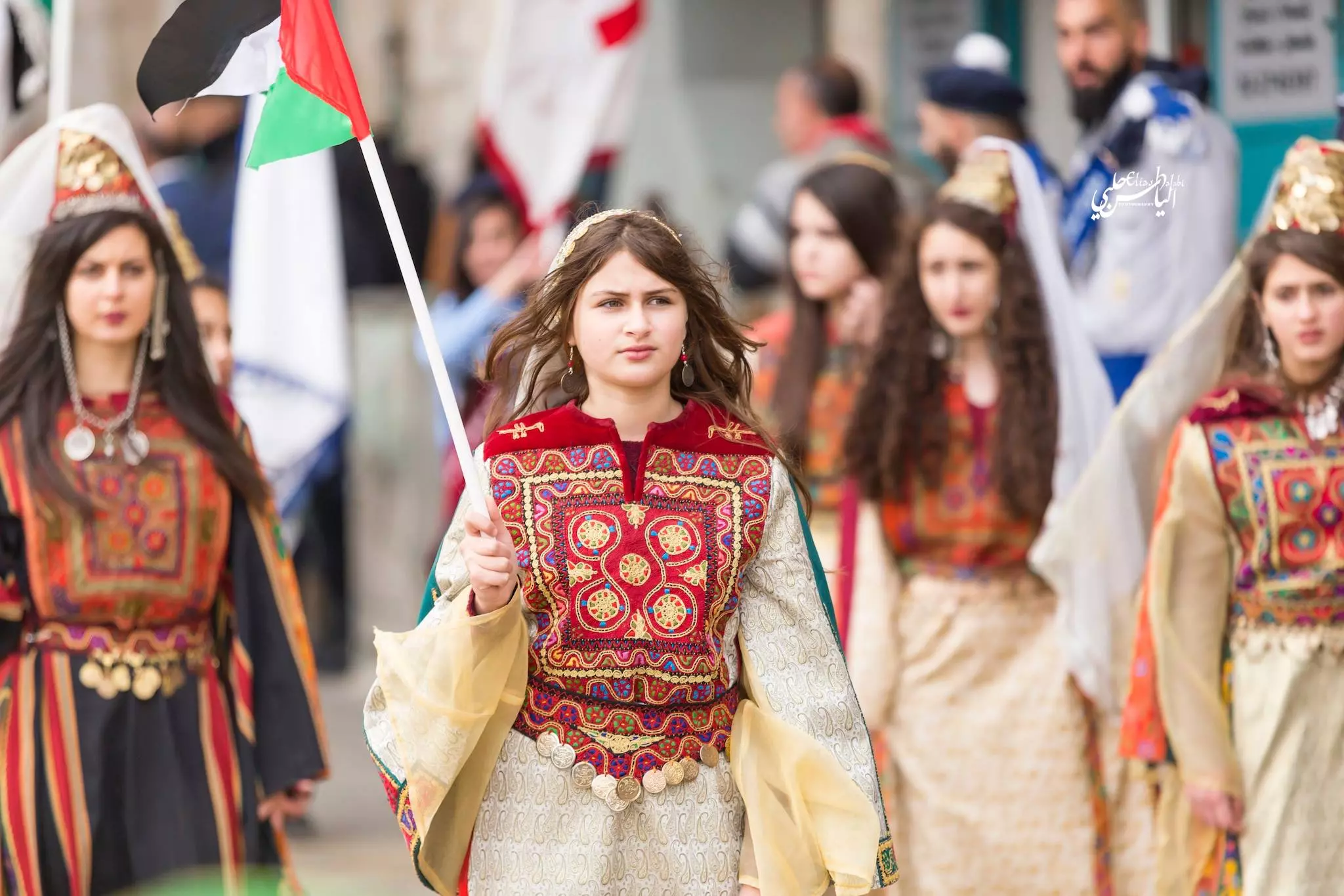
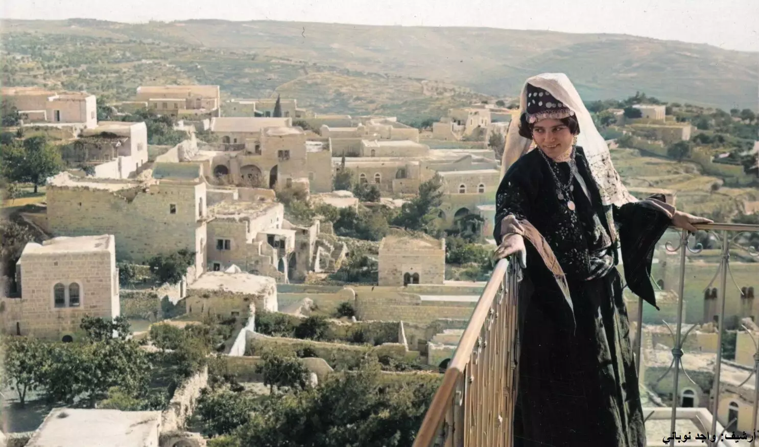
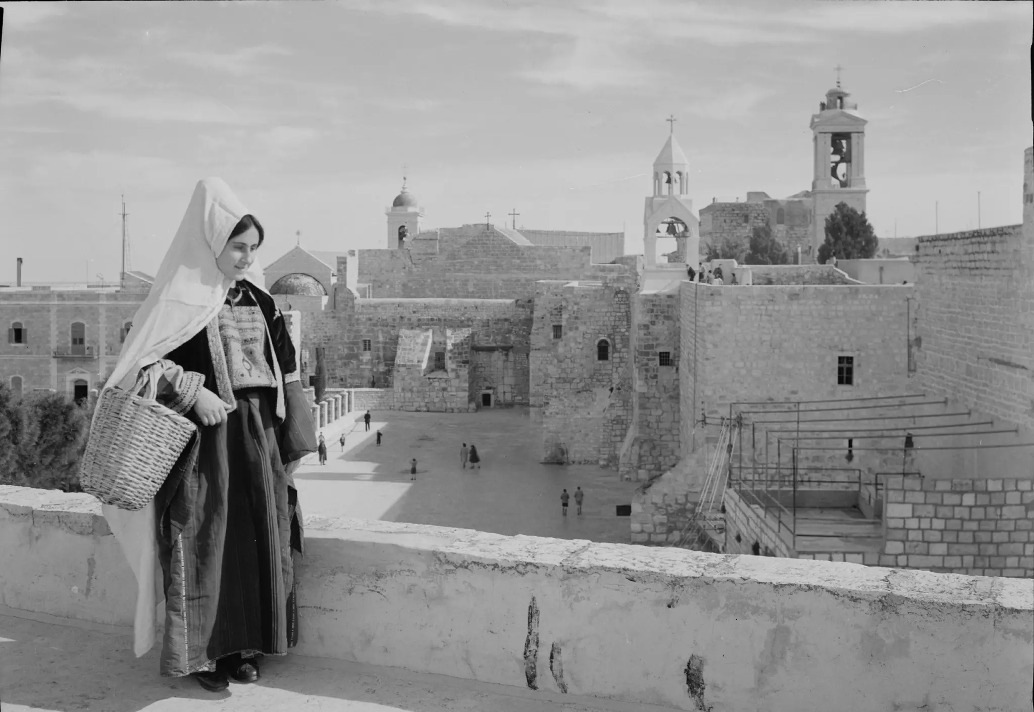
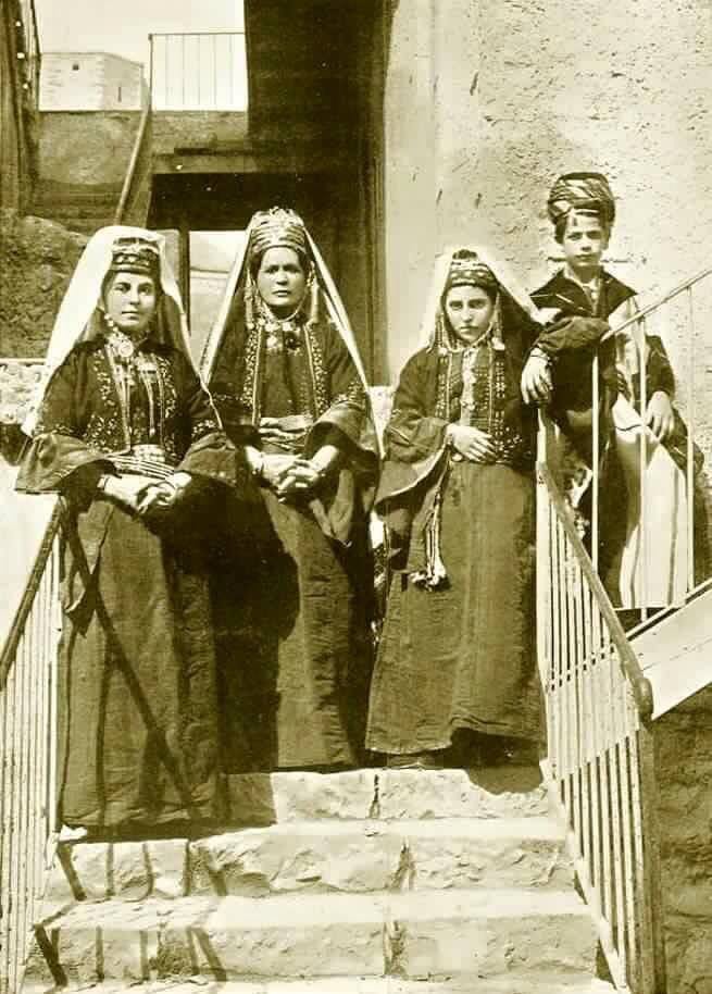
1 - Women from the city wearing their traditional Palestinian dresses, note that hats (Qulunsuwa), Matson Collection.
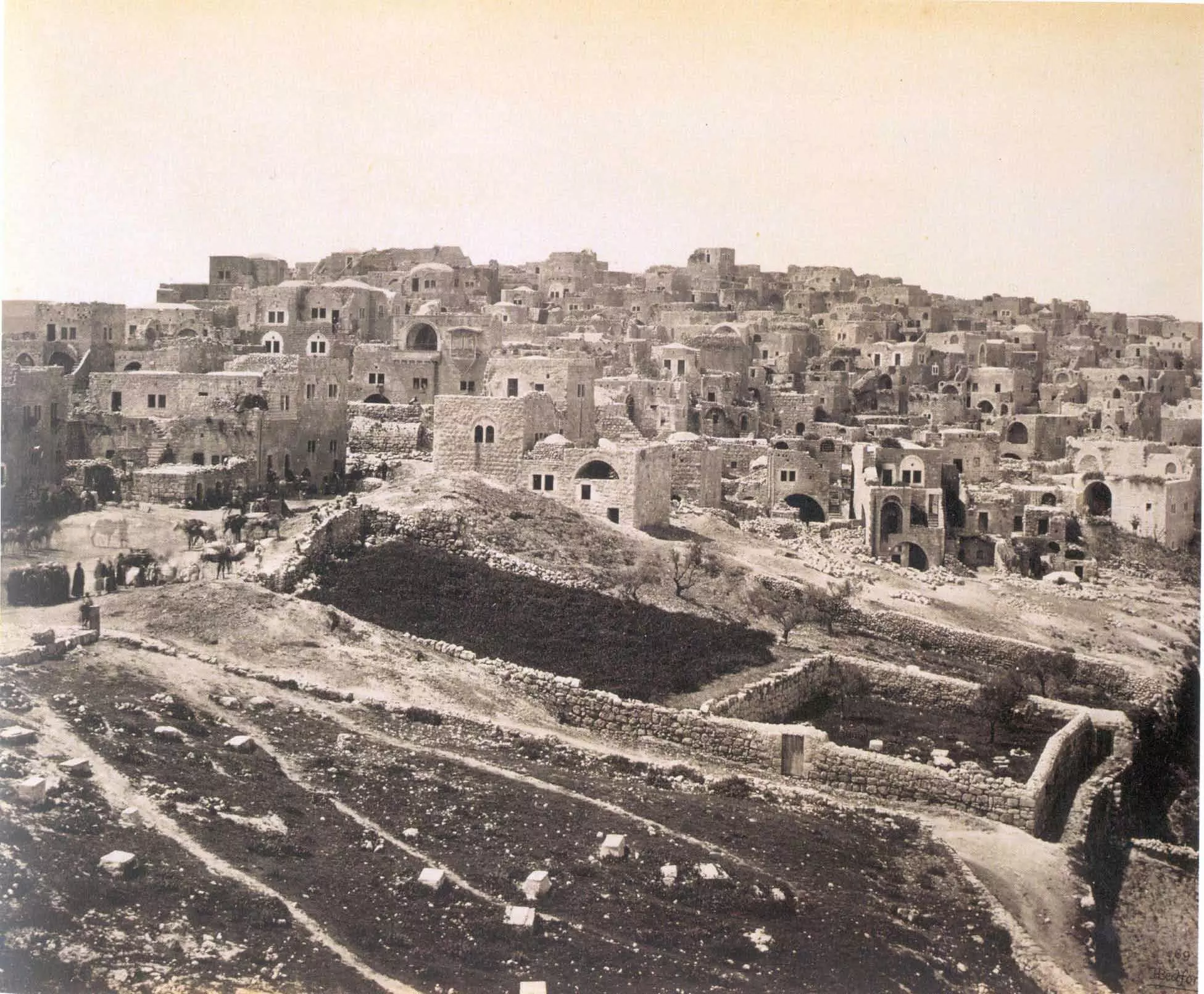
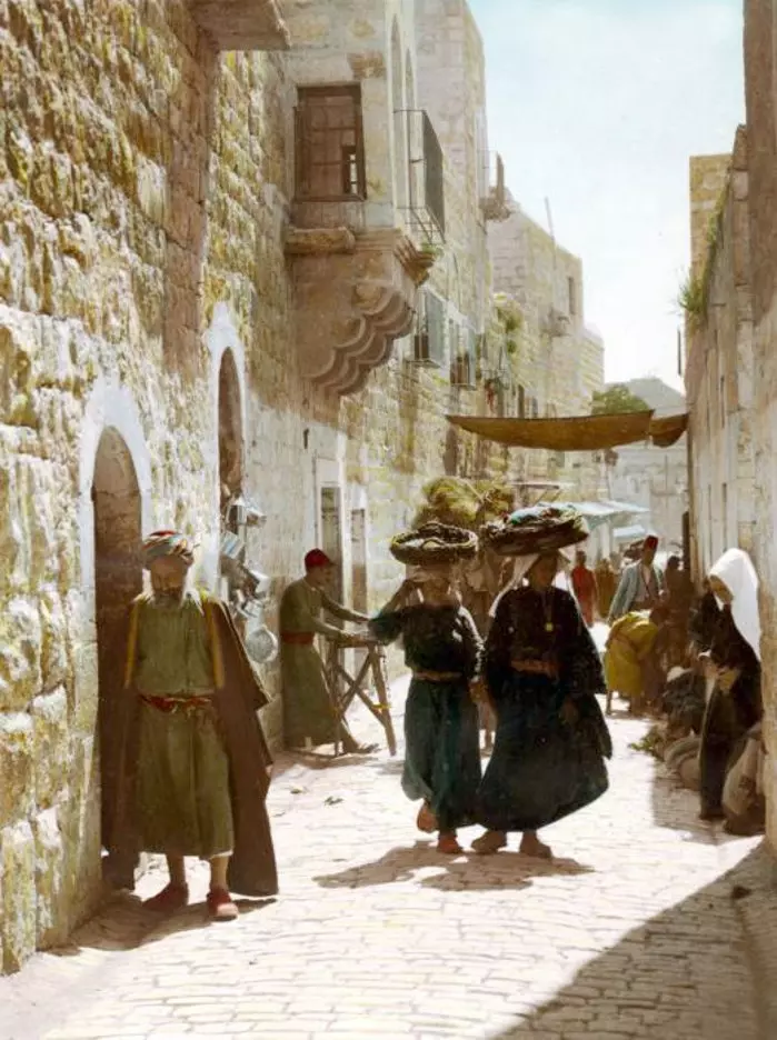
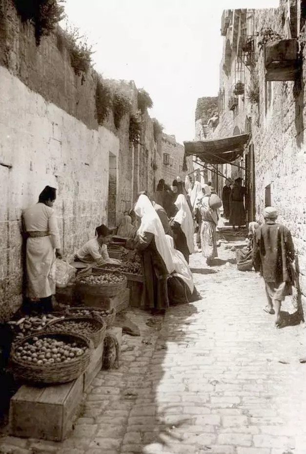
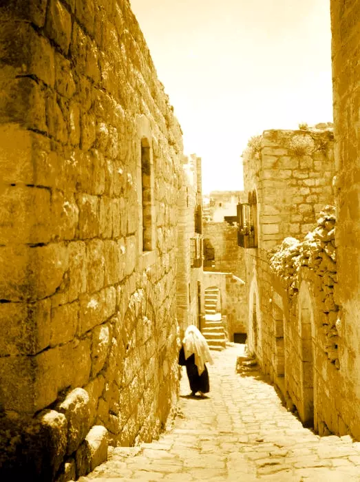
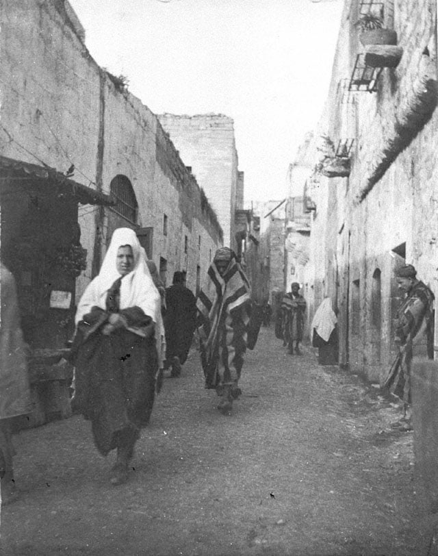
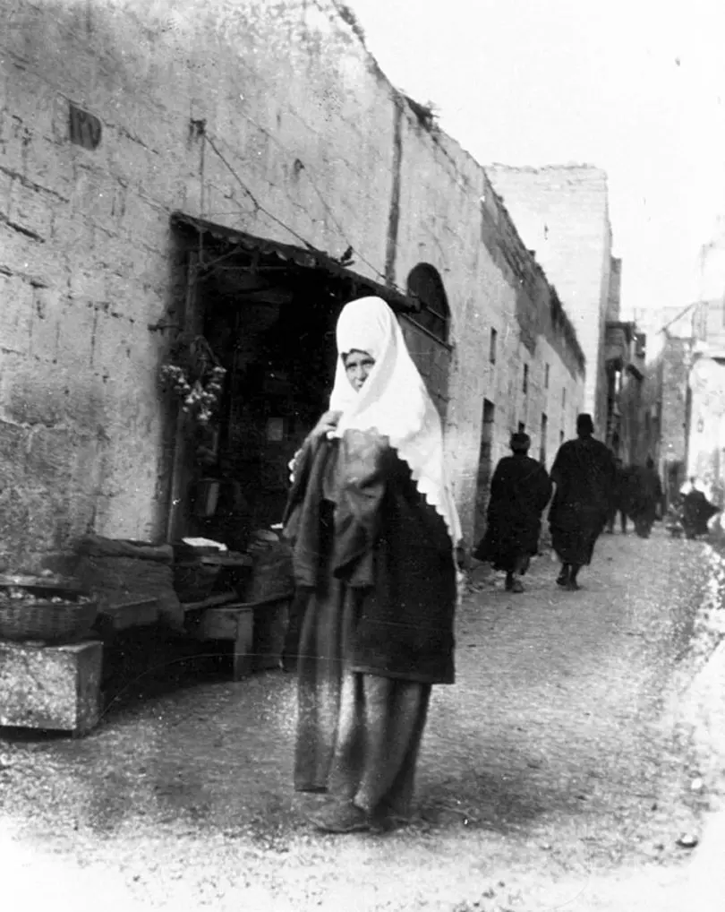
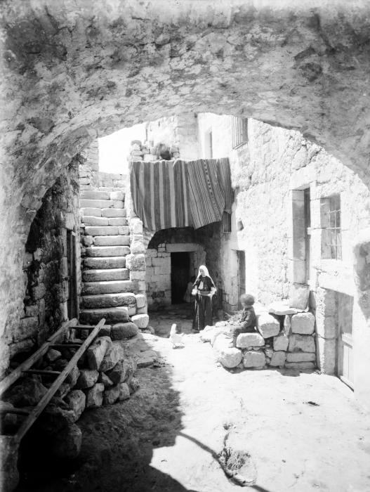
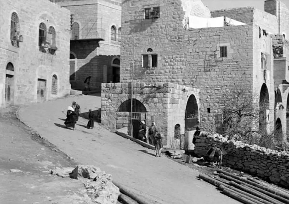
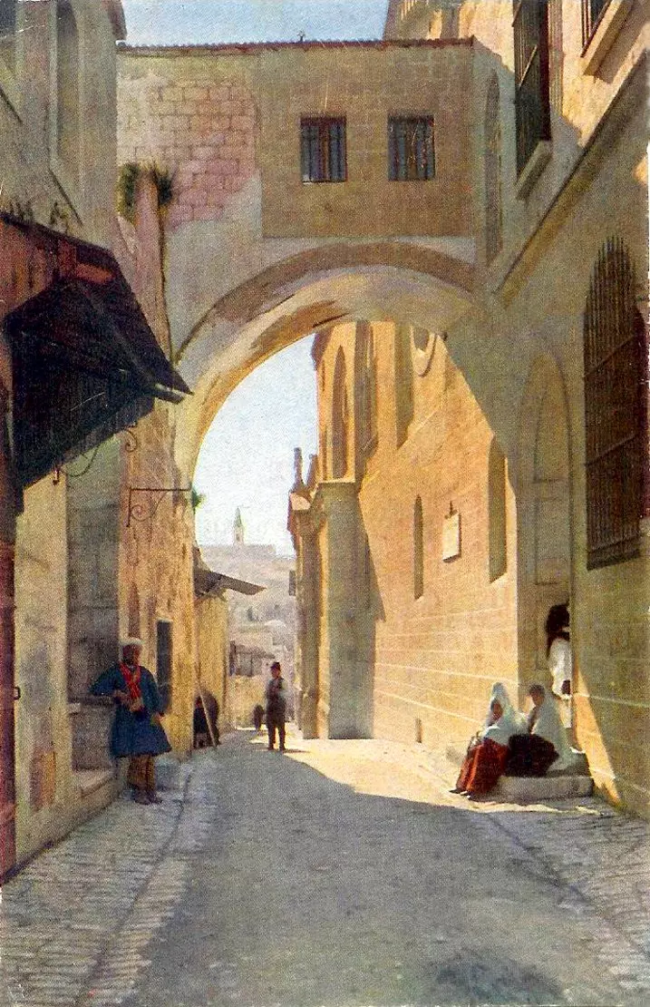
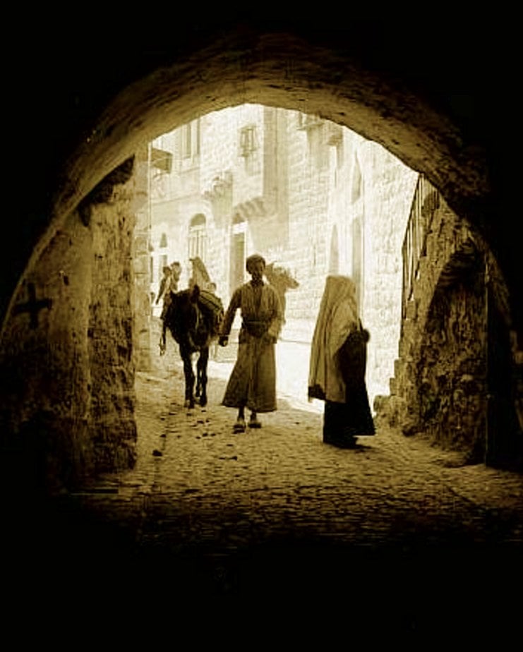
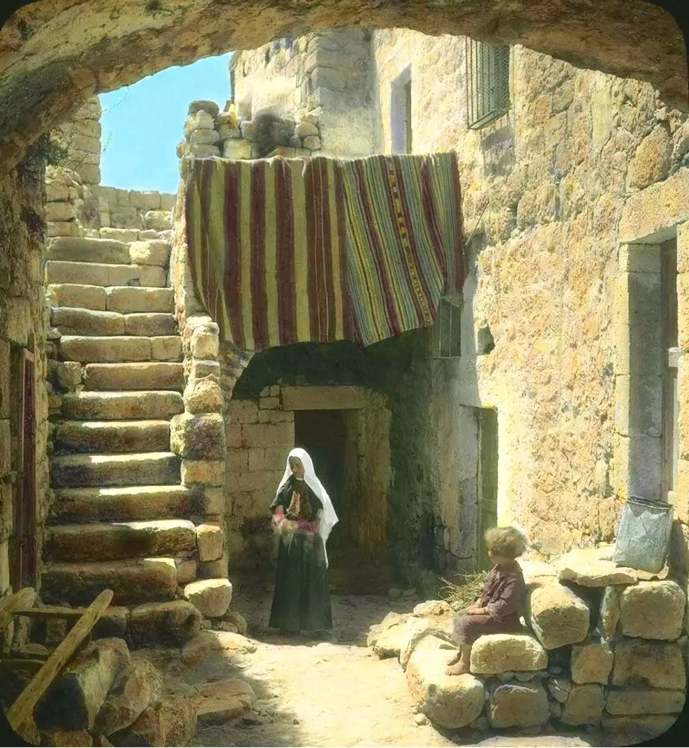
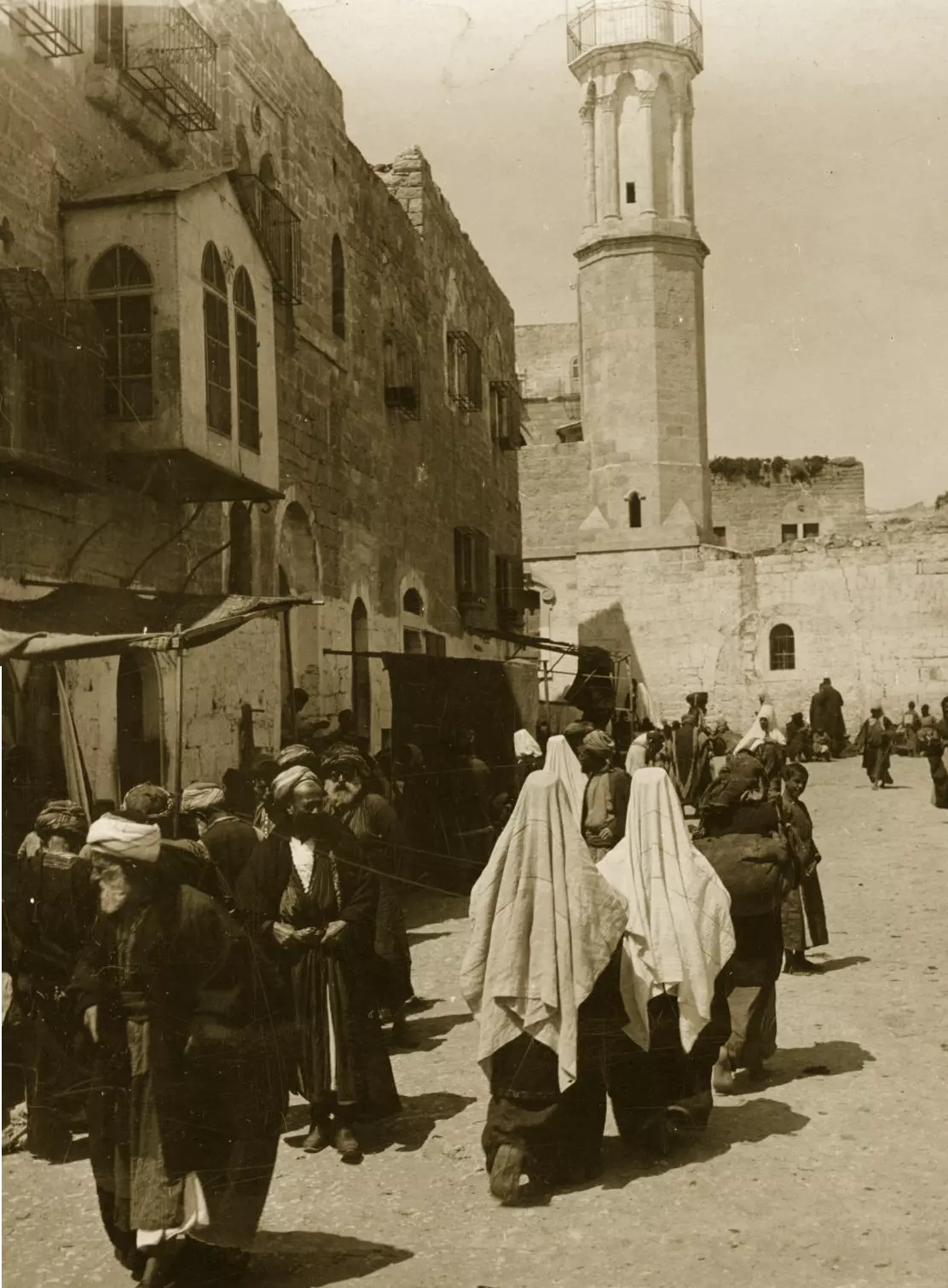
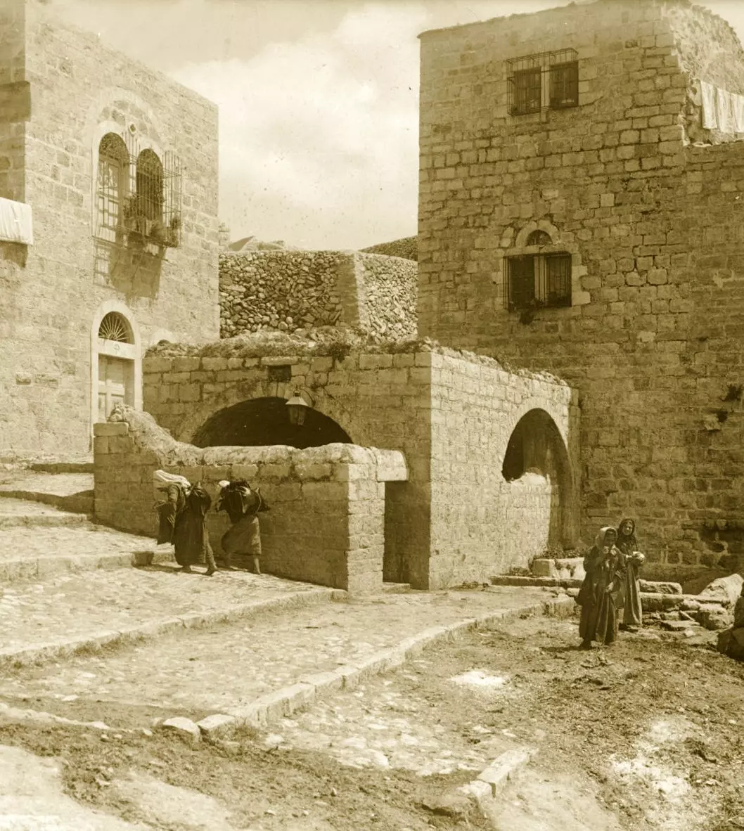
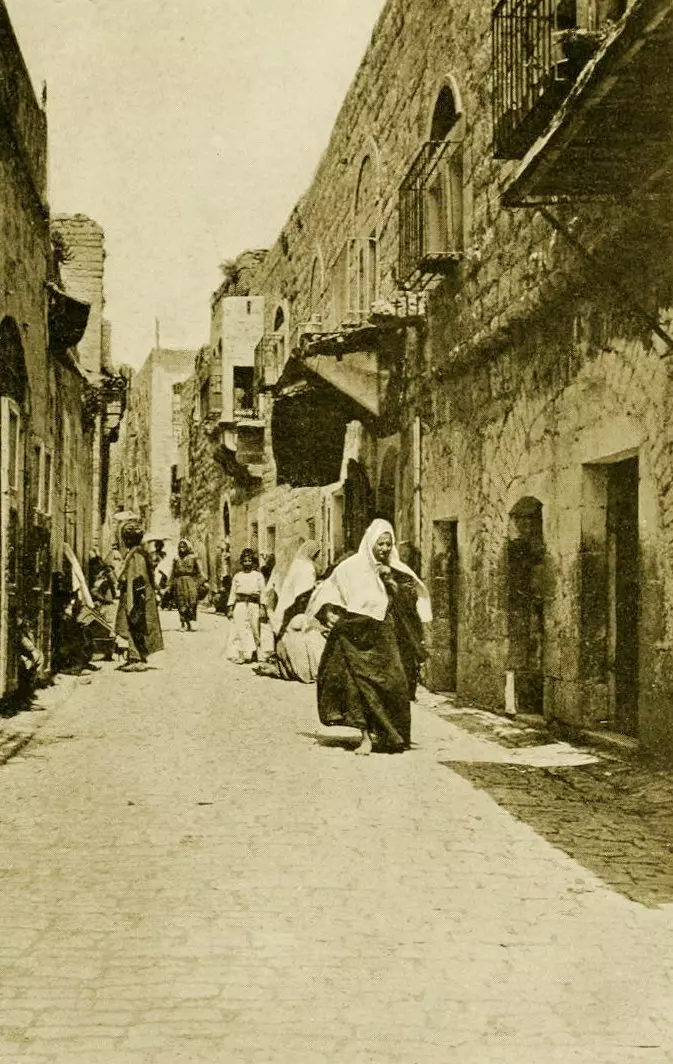
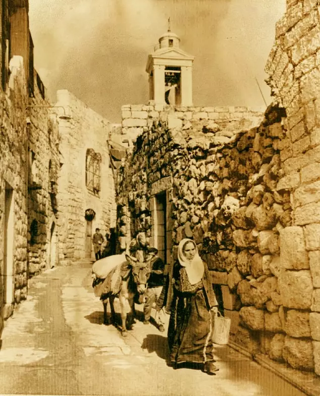
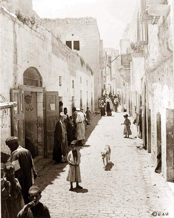
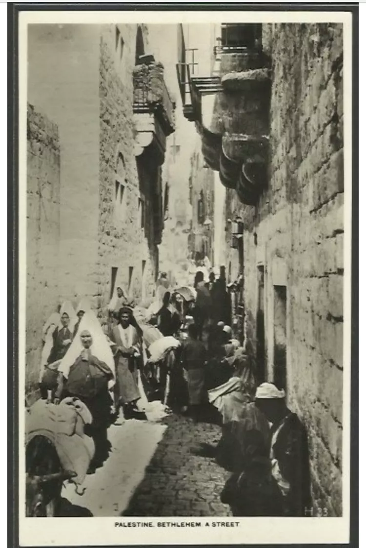
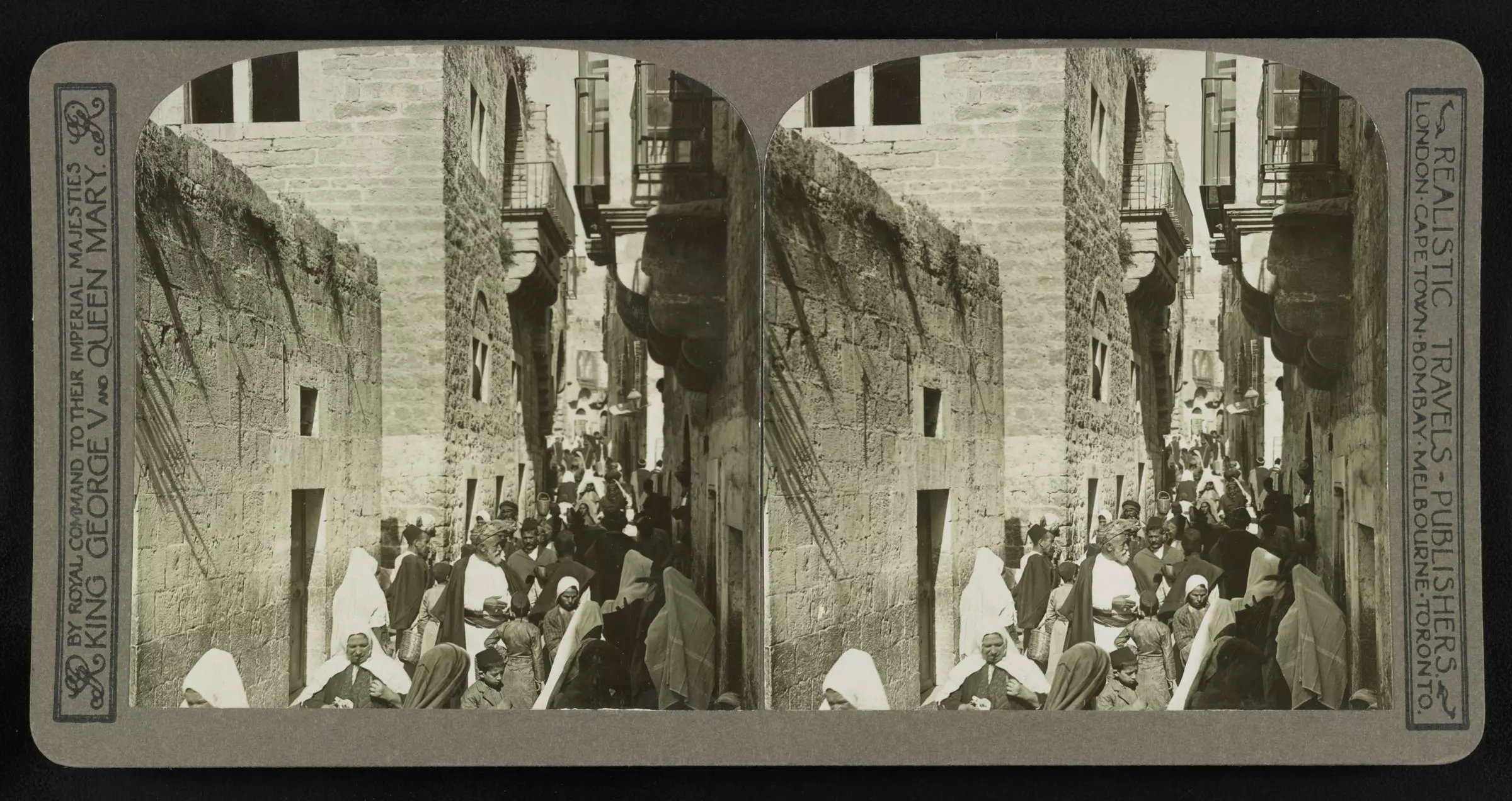
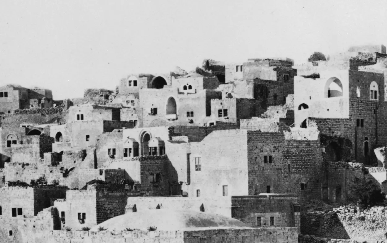
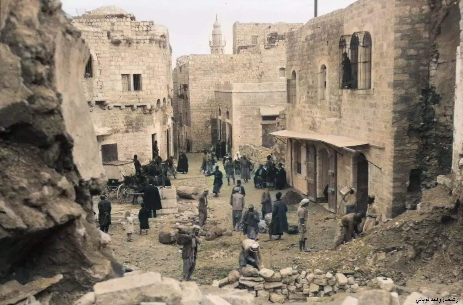
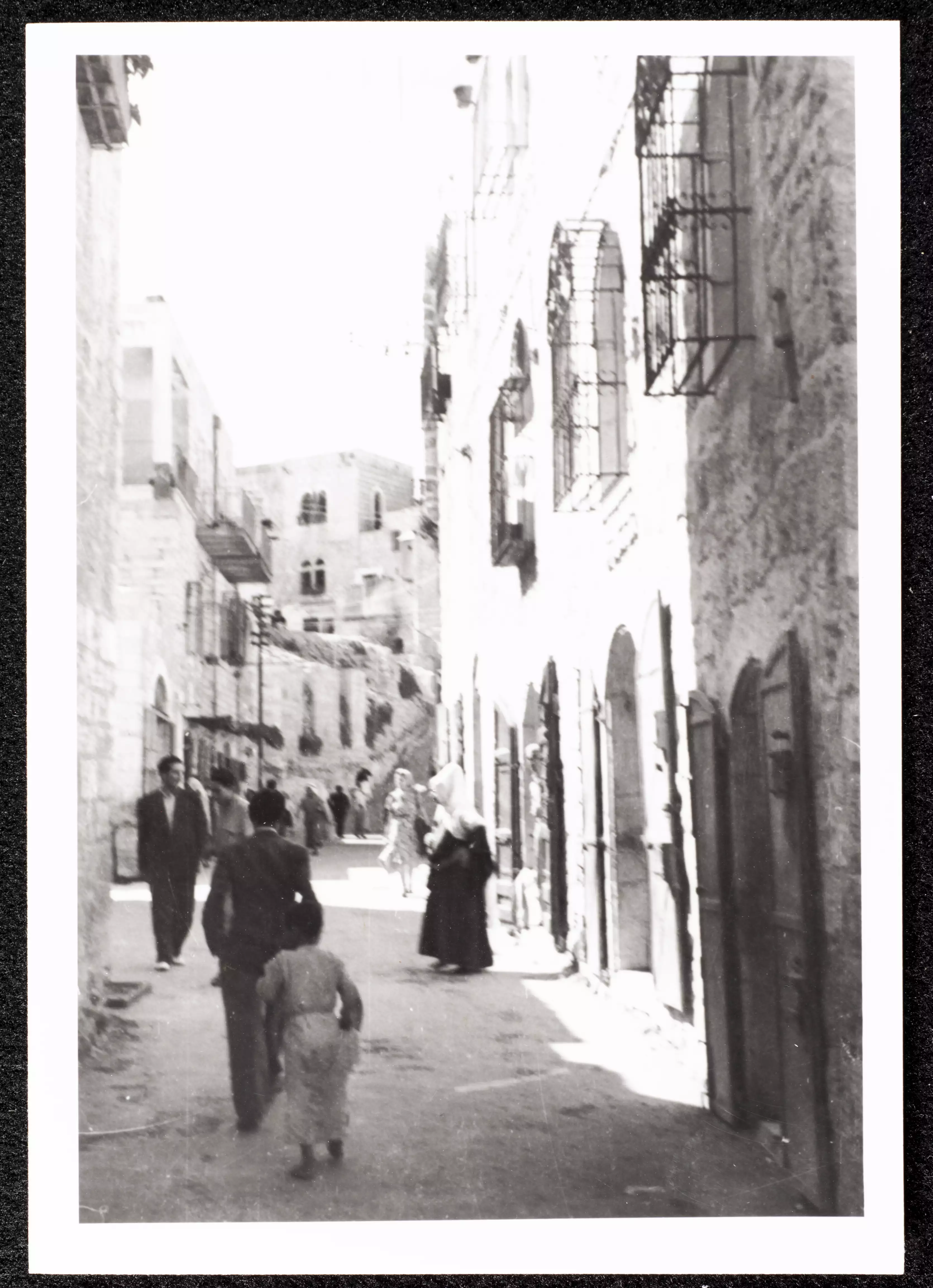
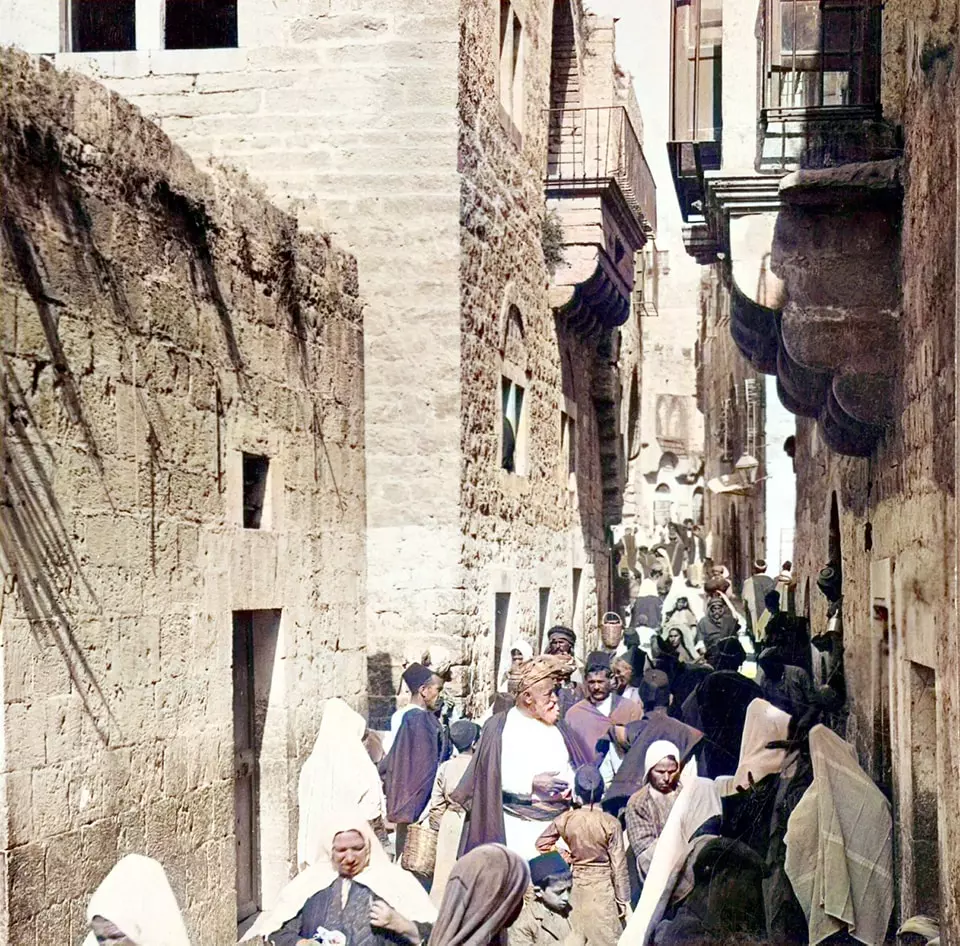
4 - A street scene in the old section
3 - الجبعة
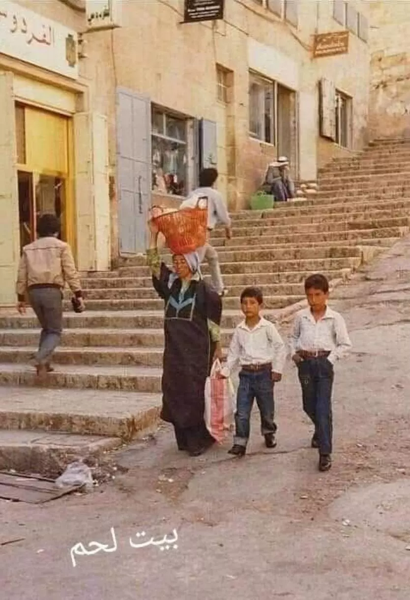
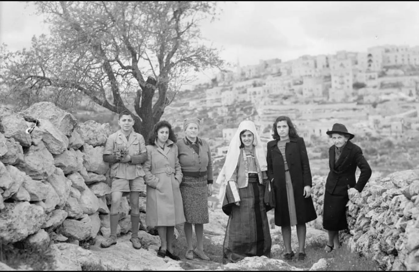
Posted by Bilal Abu Lateefa - Bethlehem 1942
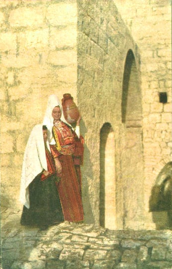
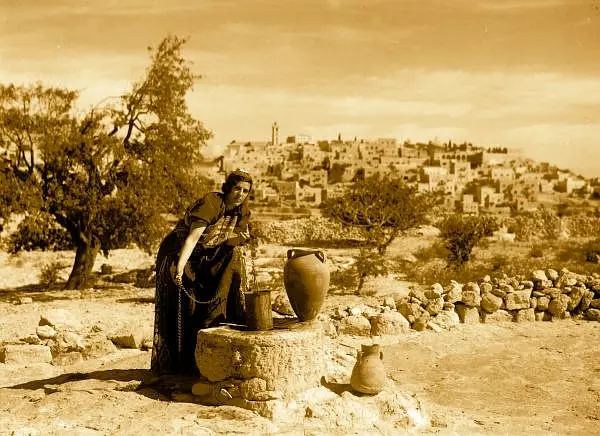
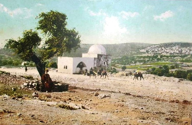
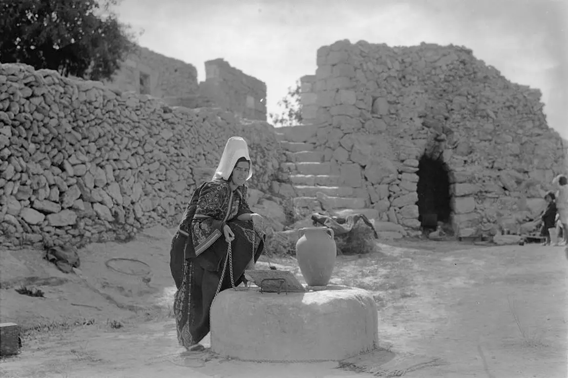
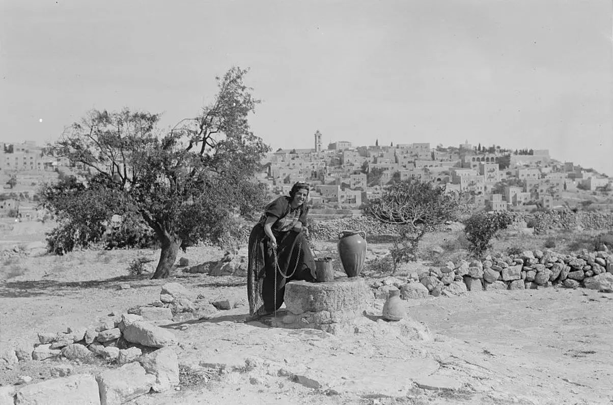
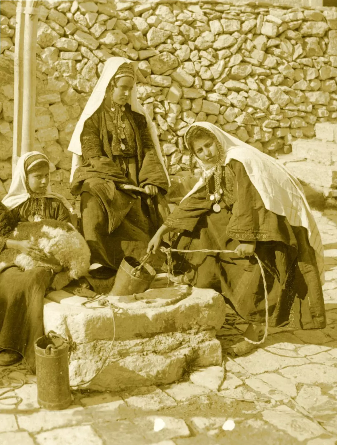
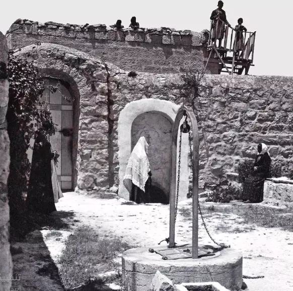
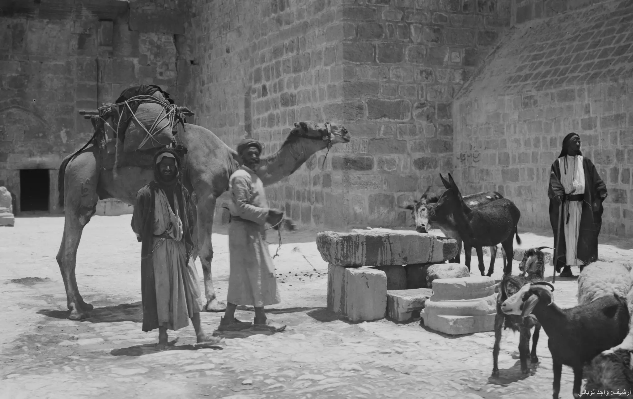
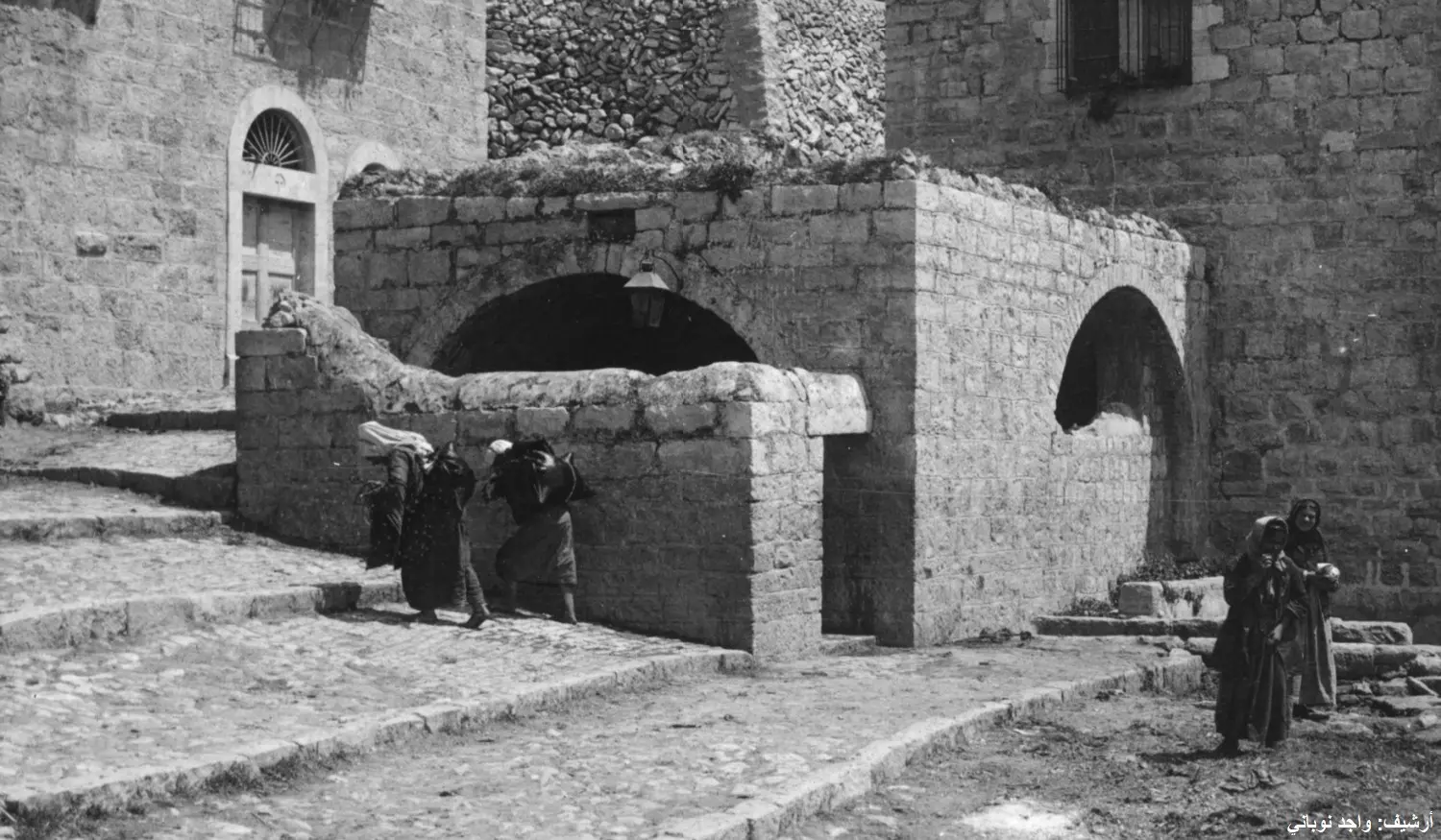
Posted by Umar Abu El-Bararri 1 - Watering Well At Bethlehem's Square from
Posted by Umar Abu El-Bararri - ستبقى شامخة
Posted by مهند قداره - Omari Mosque
Posted by مهند قداره - الساحة الرئسية
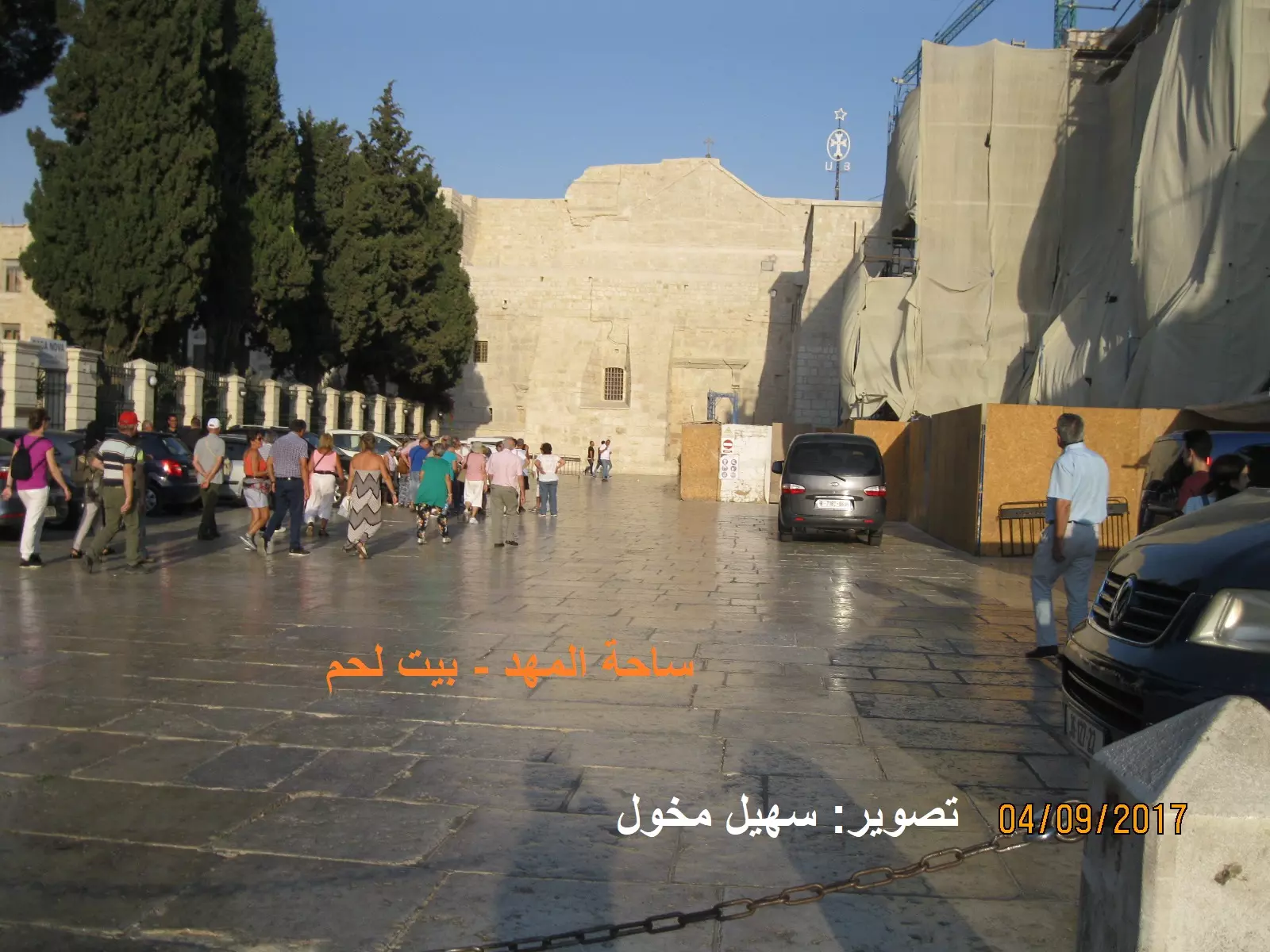
Posted by مهند قداره 1 - ساحة المهد ويبدو المسجد العمري بهيبته المتجذرة اواخر القرن التاسع عشر -هدية من صفافي

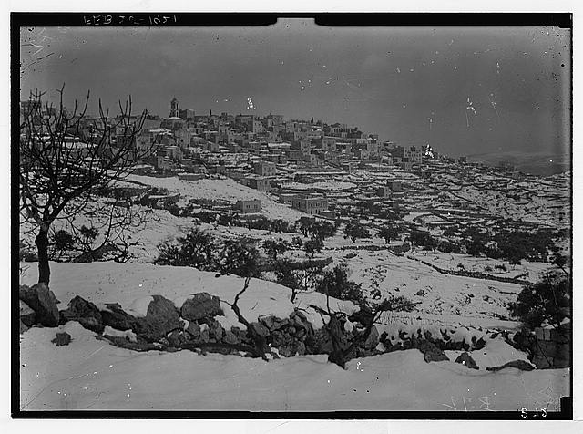
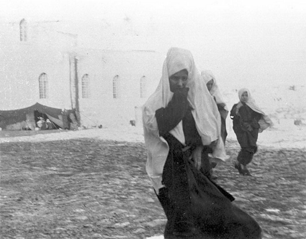
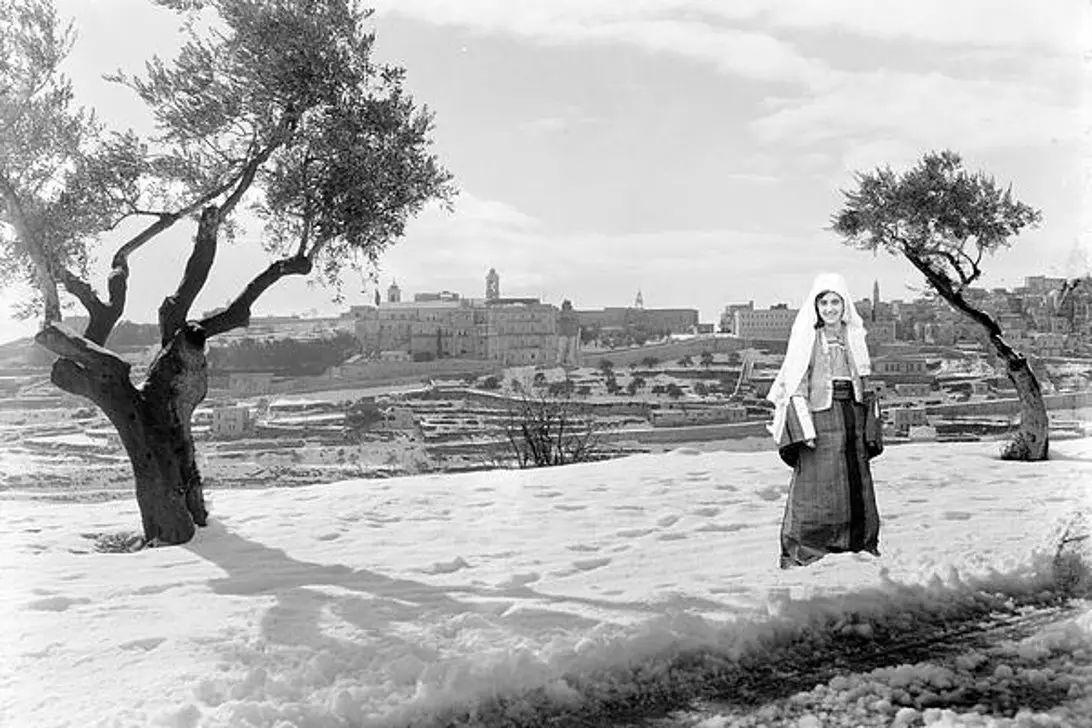
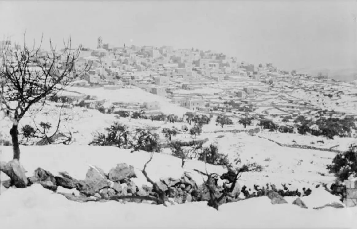
Posted by ابو عمر 1 - الثلج يكسو ربوة بيت لحم في 25شباط 1921-هدية من صفافي
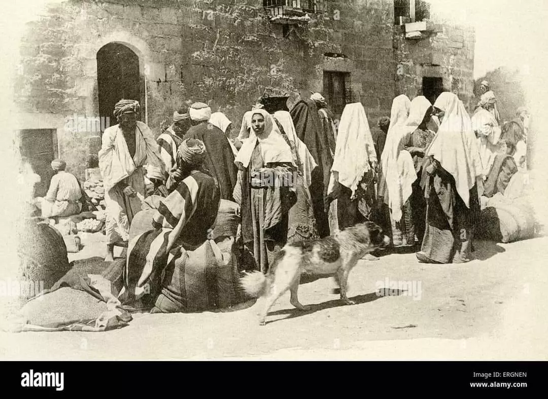
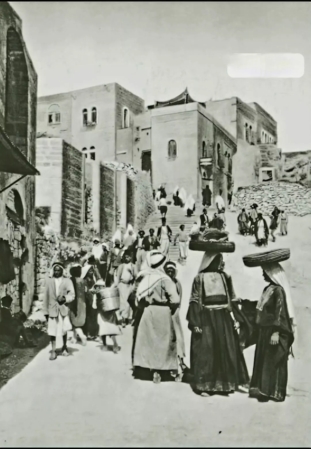
Posted by ابو عمر 1 - التسوق ايام تركيا انشط من ايامنا -هدية من صفافي
Posted by ابو عمر - نظرة من هندازه الى ربوة ذات قرار معين
Posted by ابو عمر - صورة جميلة جدا تصوير مهند قدارة
Posted by مهند قداره - ما احلى القدم تصوير مهند قدارة
Posted by مهند قداره - Bethlehem 1920-1930
Posted by Joehar Hamdan 1 - Bethlehem 1892
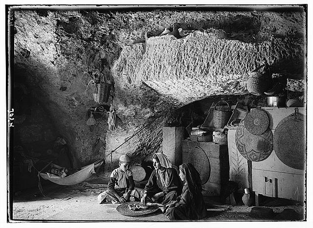
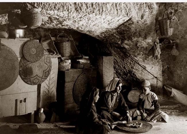
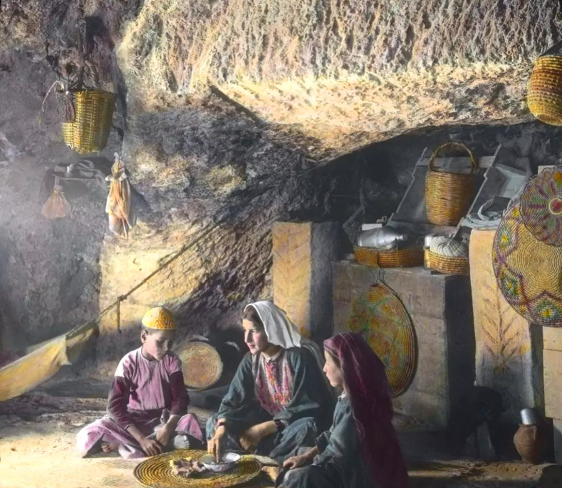
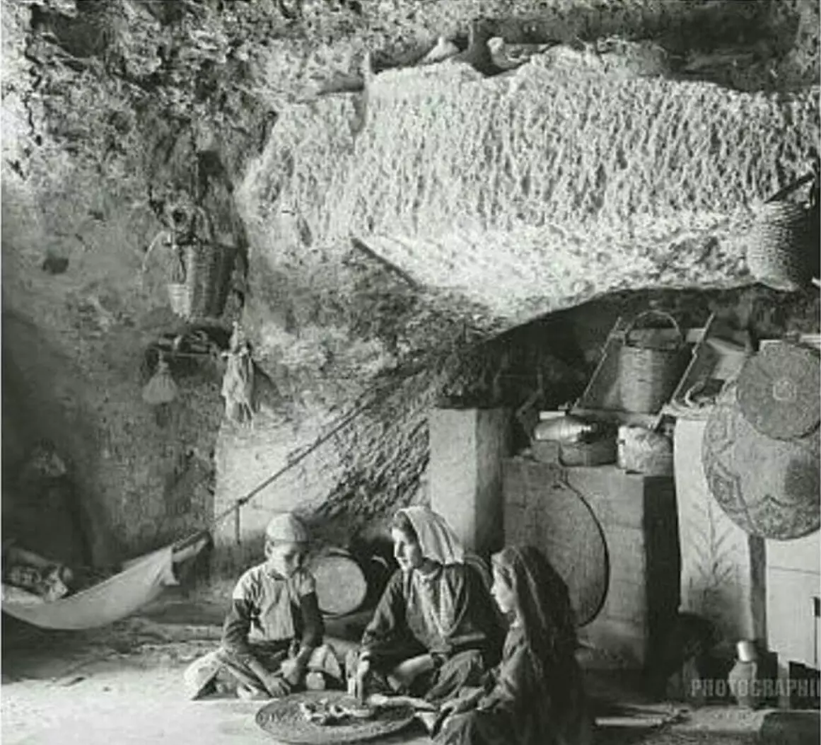
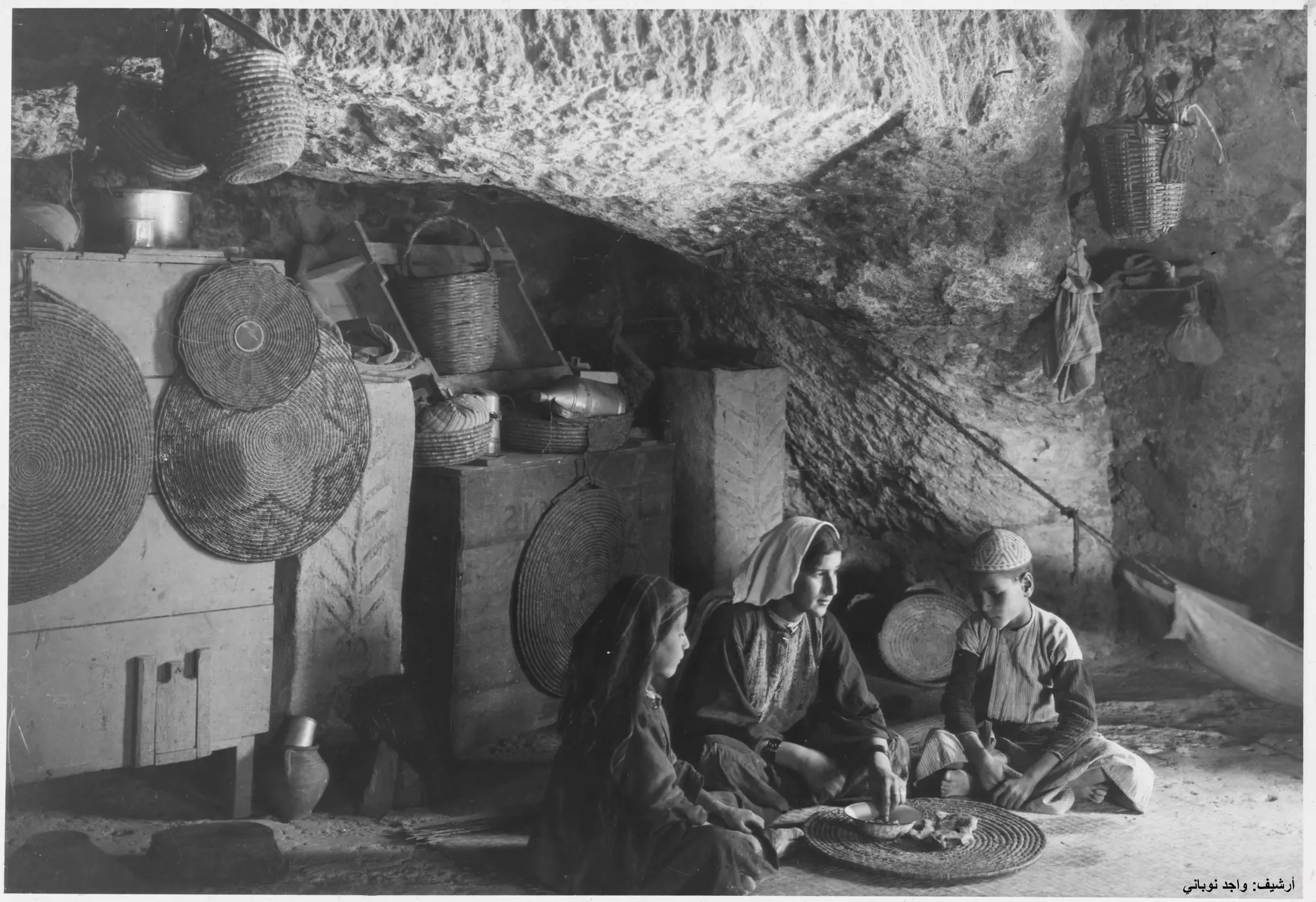
Posted by Joehar Hamdan - -1920- عائلة تلحمية تعيش في مغارة لاحظ الأدوات المنزلية اًنذاك-صفافي-
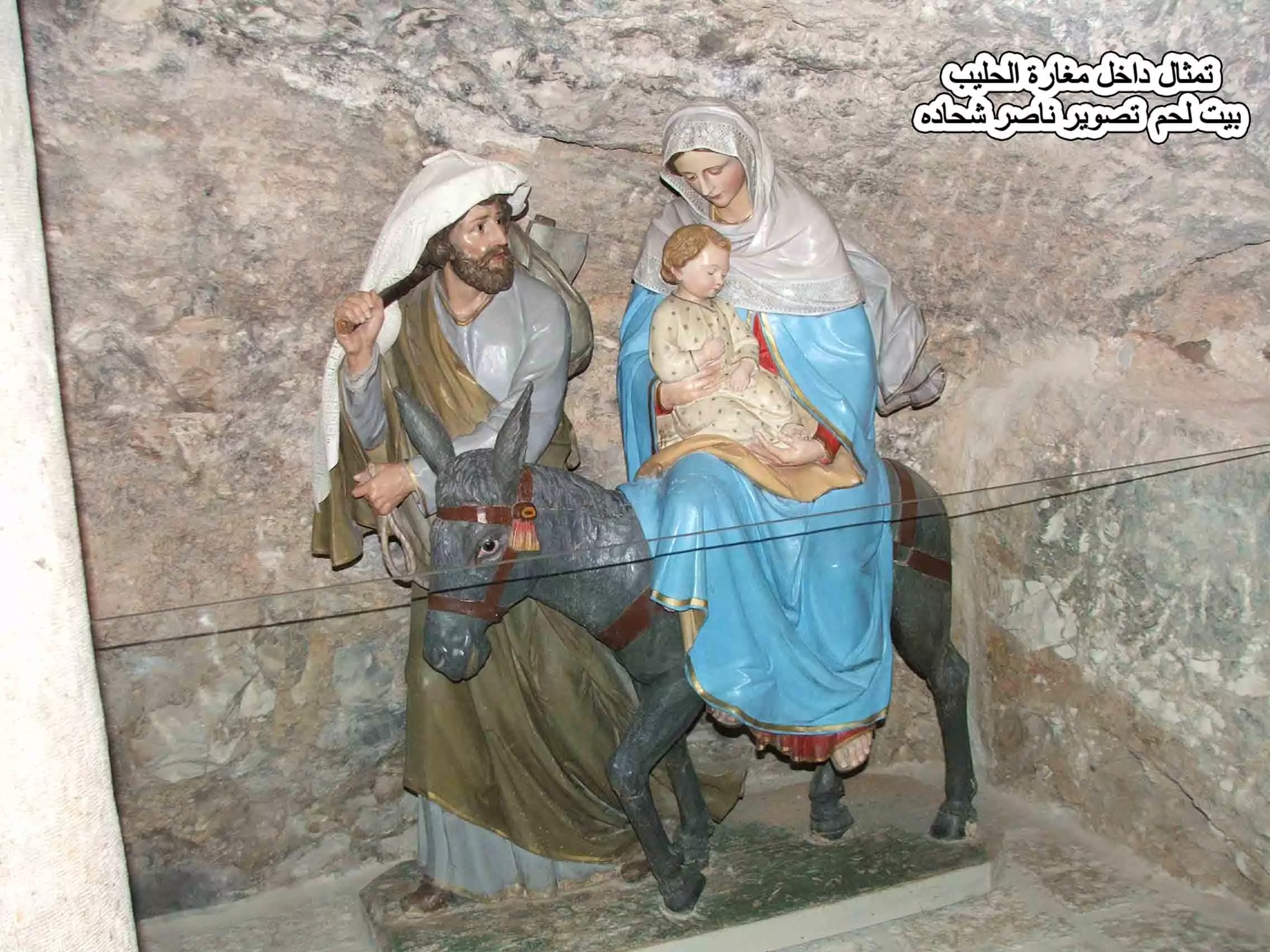
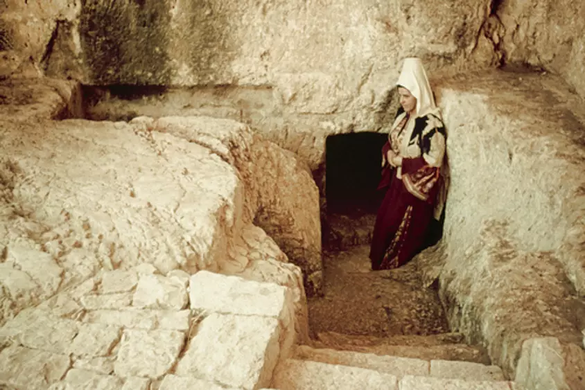
Posted by ابو عمر 1 - مغارة الحليب تمثال داخل المغارة تصوير ناصر شحاده
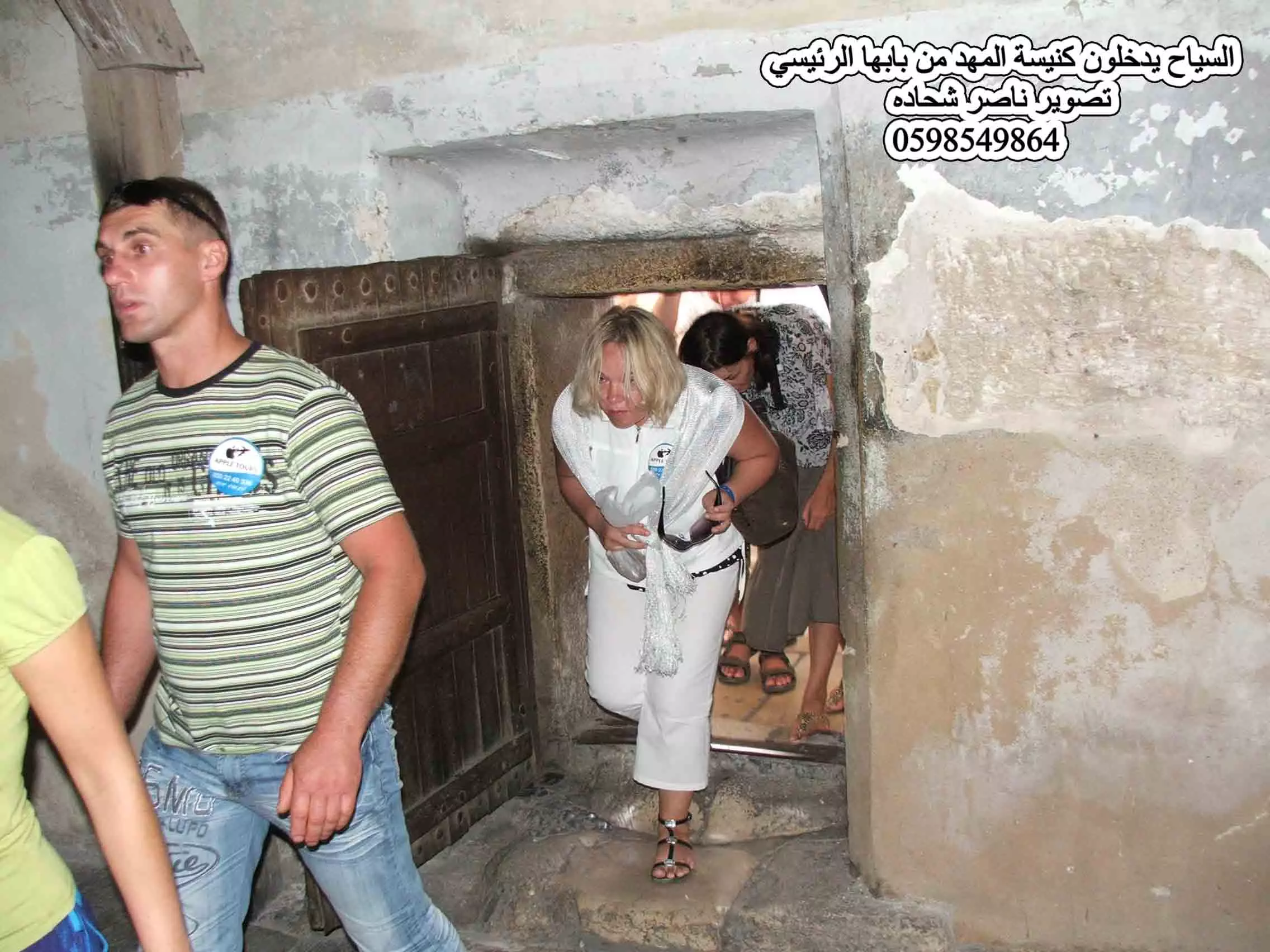
Posted by naser abed - السياح يدخلون كنيسة المهد من بابها الرئيسي بيت لحم تصوير ناصر شحاده
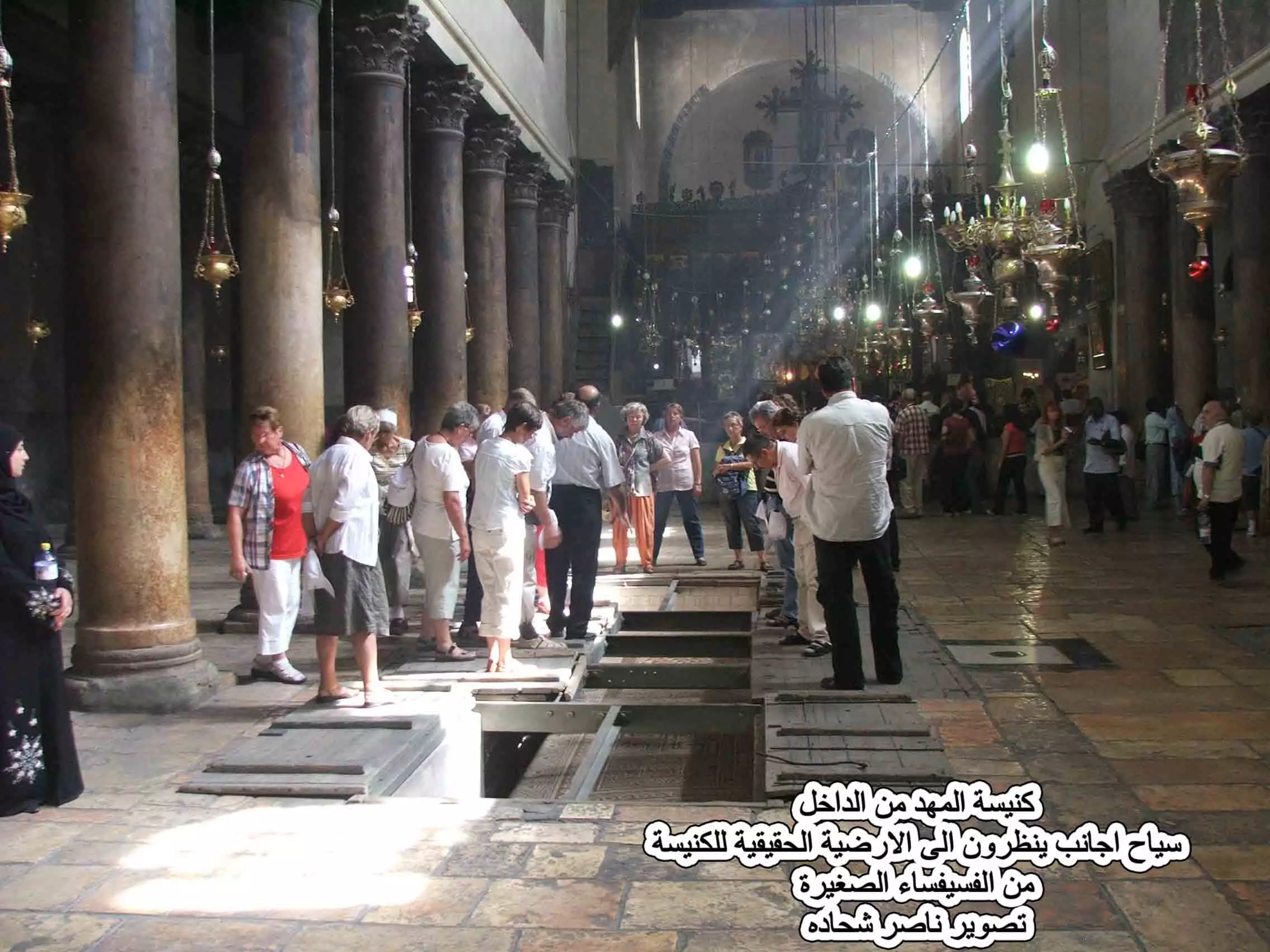
Posted by naser abed - السياح داخل كنيسة المهد بيت لحم تصوير ناصر شحاده
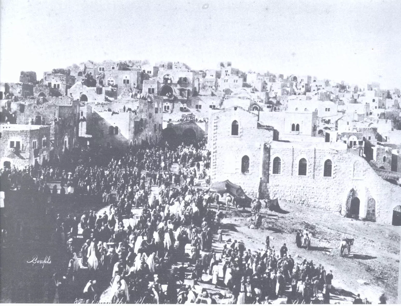
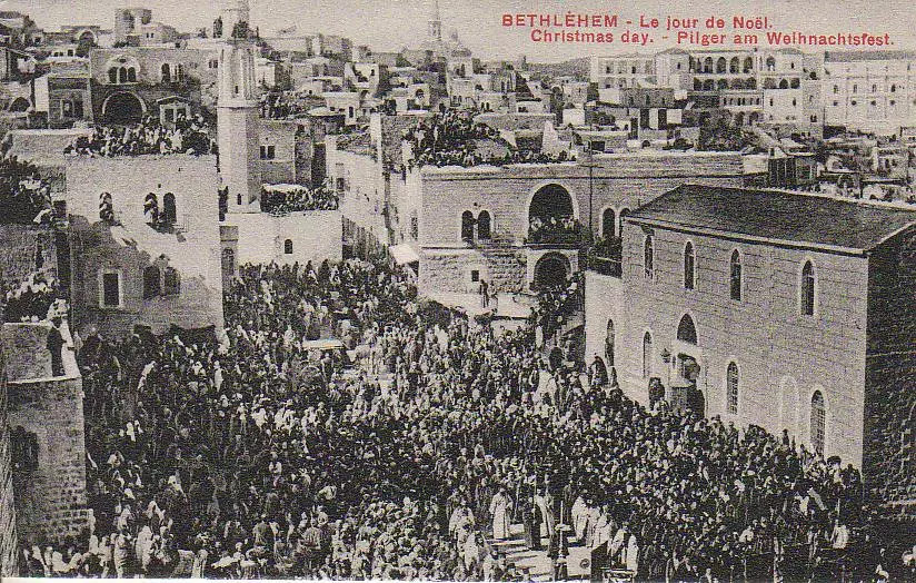
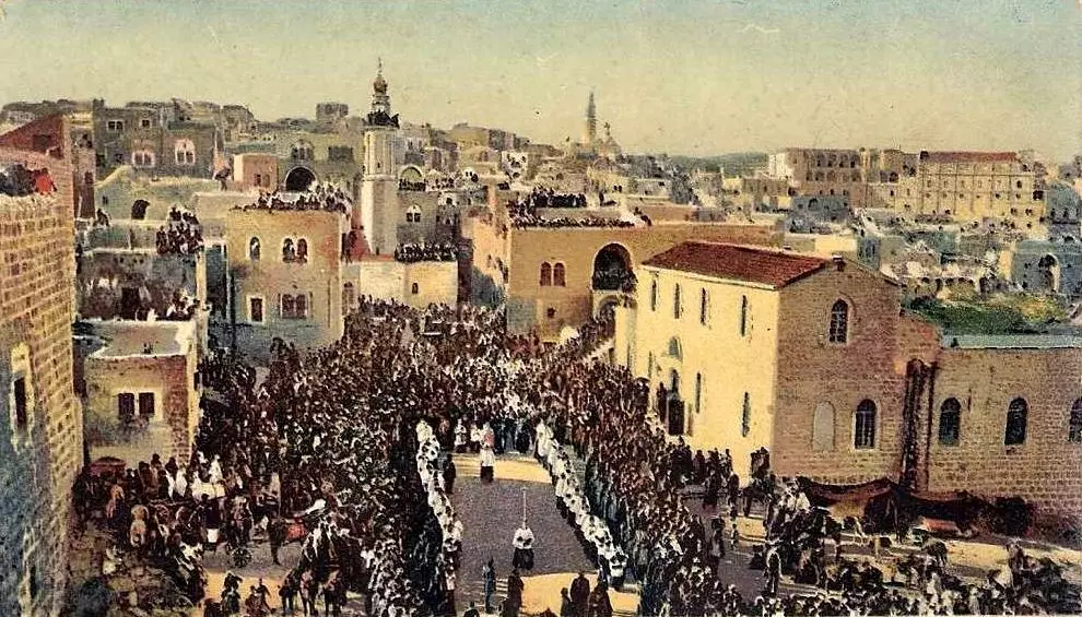
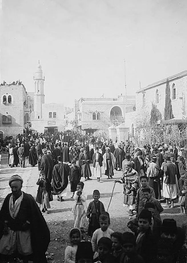
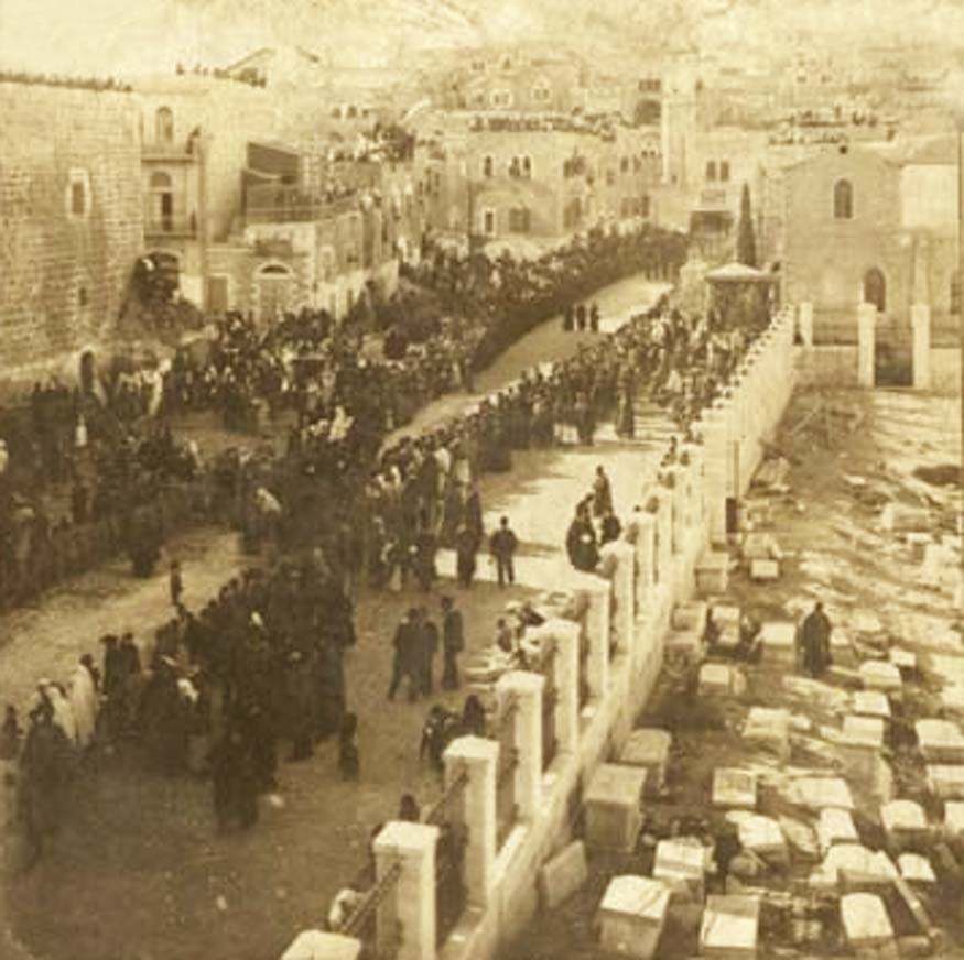
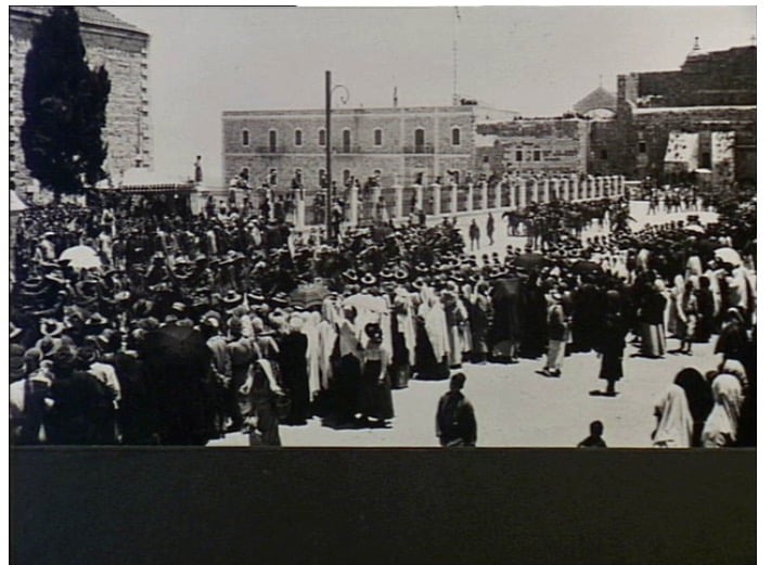
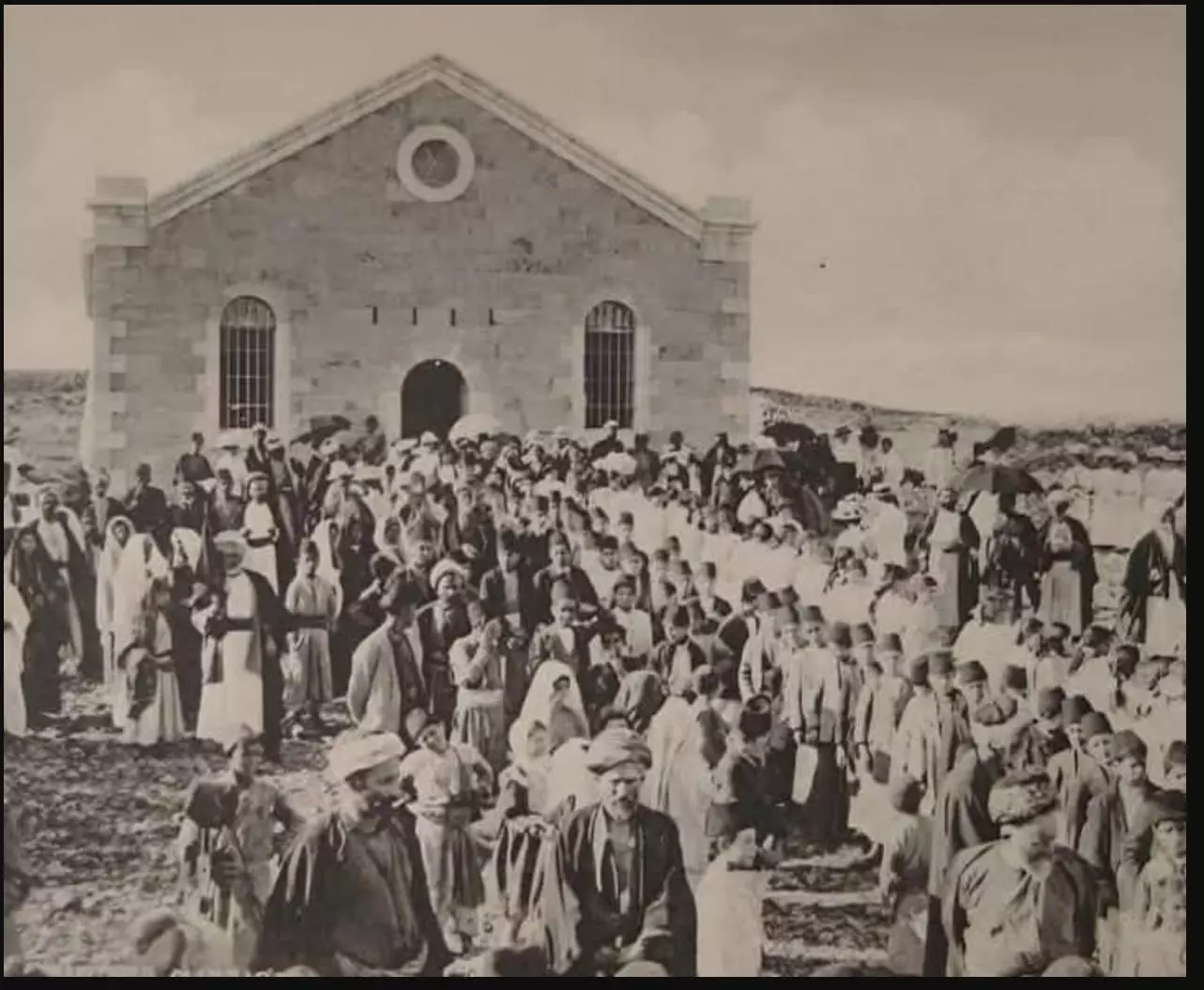
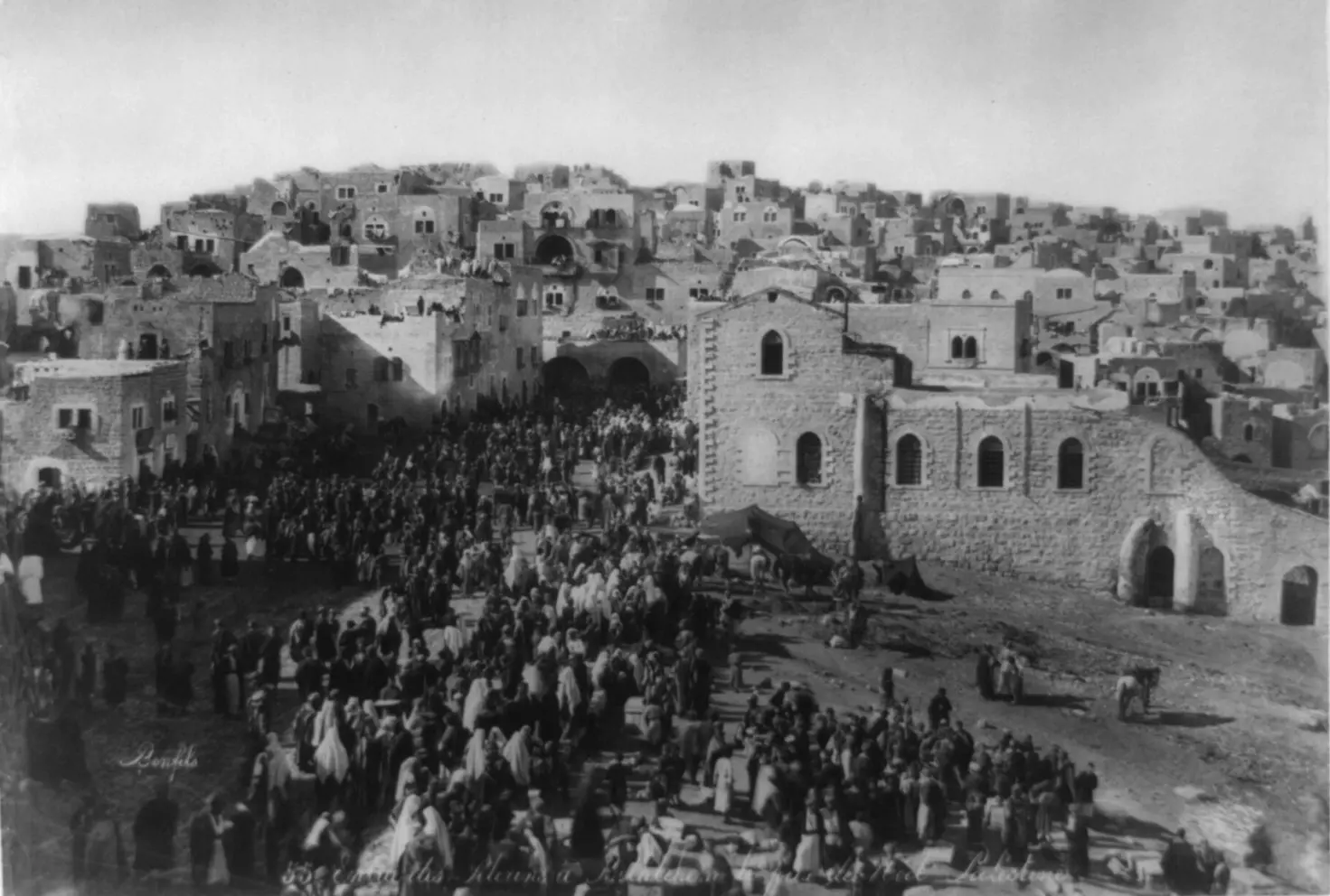
Posted by naser abed - منظر في عيد الميلاد لساحة المهد 1900
Posted by Wessam Hamdan - Bethlehem
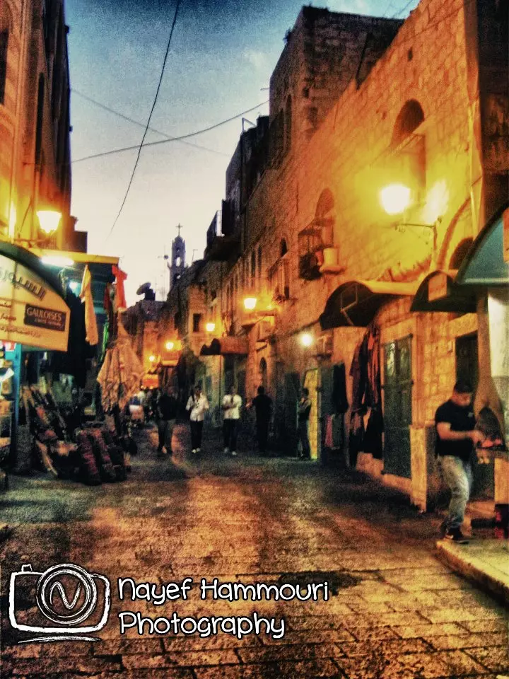
Posted by Mahmoud Saadi - مسجد عمر ليلا - تصوير عمار قادوس

Posted by Ammar Qadous - فندق الانتر كونتننتل ليلا - تصوير عمار قادوس

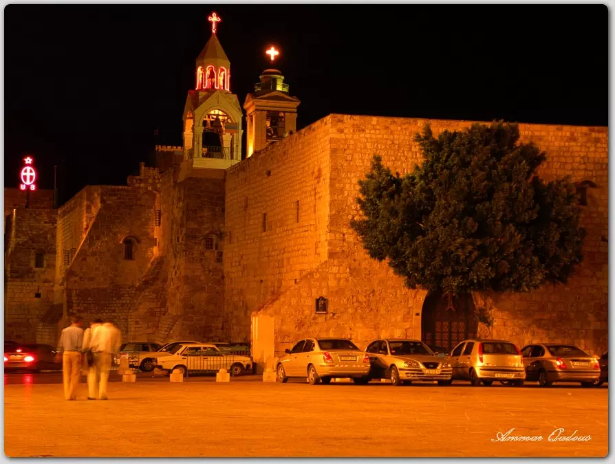
Posted by Ammar Qadous 1 - كنيسة المهد ليلا1 - تصوير عمار قادوس
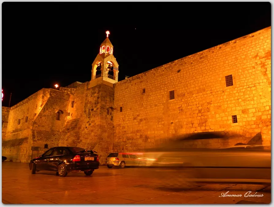
Posted by Ammar Qadous - كنيسة المهد ليلا2 - تصوير عمار قادوس
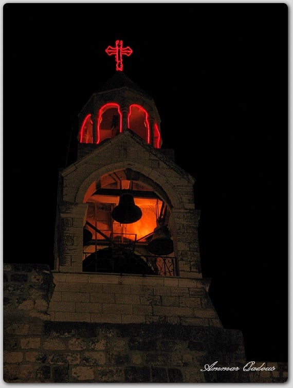
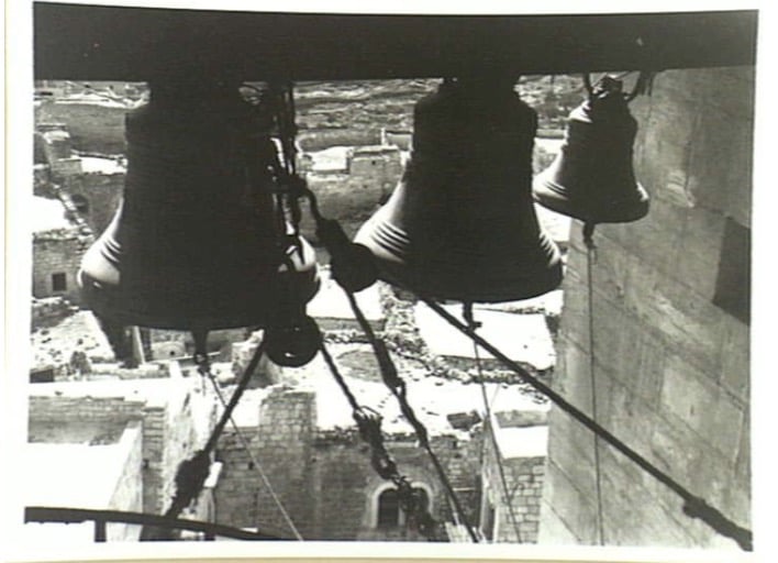
Posted by Ammar Qadous - اجراس كنيسة المهد ليلا - تصوير عمار قادوس
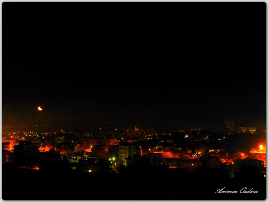
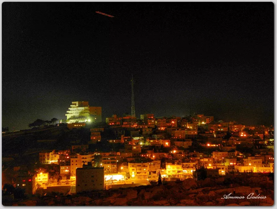
Posted by Ammar Qadous - منظر عام لبيت لحم ليلا - تصوير عمار قادوس
Posted by Ammar Qadous 1 - منظر عام لمدينة بيت لحم ليلا - تصوير عمار قادوس
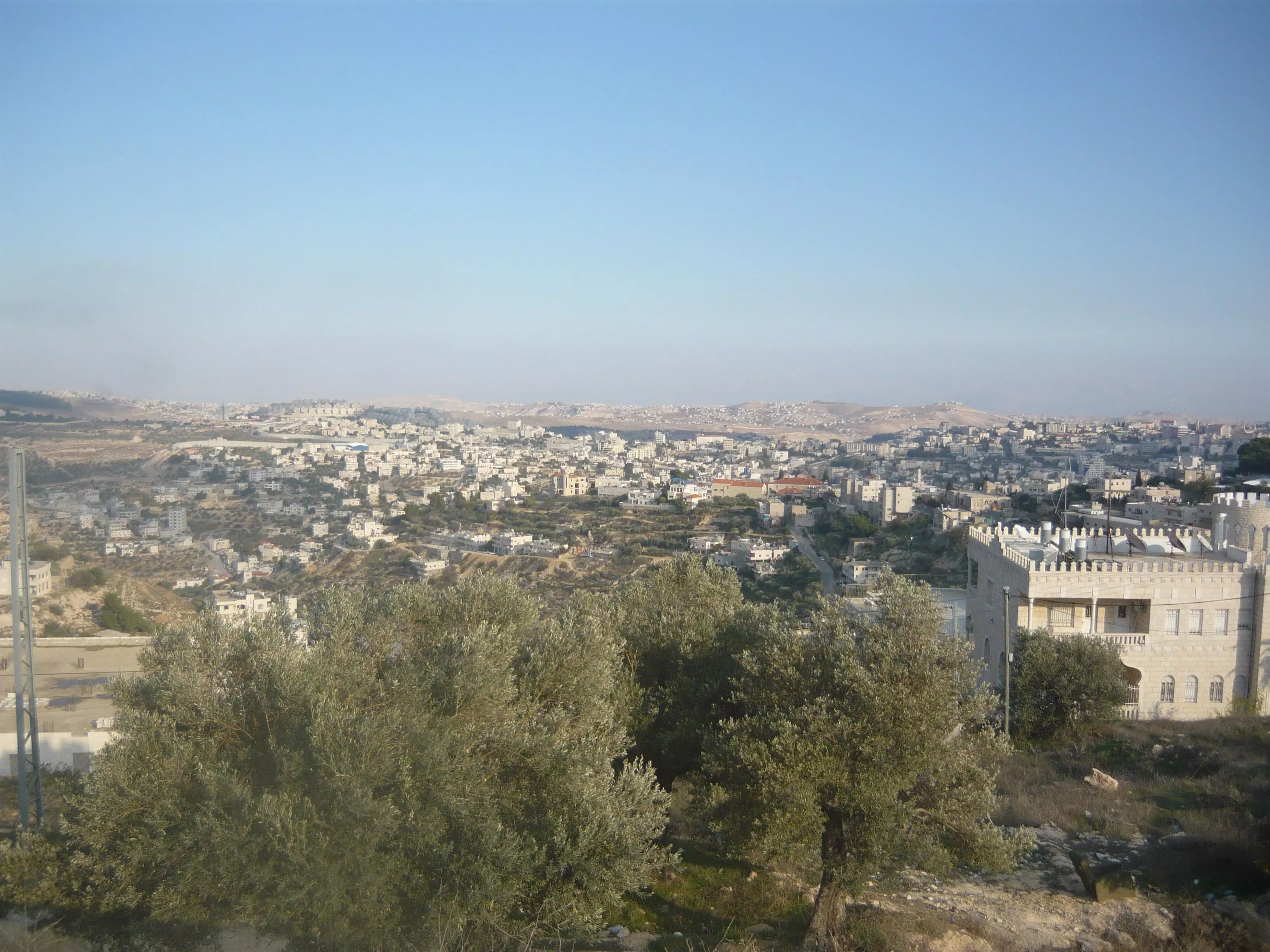
Posted by Ammar Qadous - صورة لمدينة بيت لحم ما خوذة من رأس بلدة بيت جالا 2009
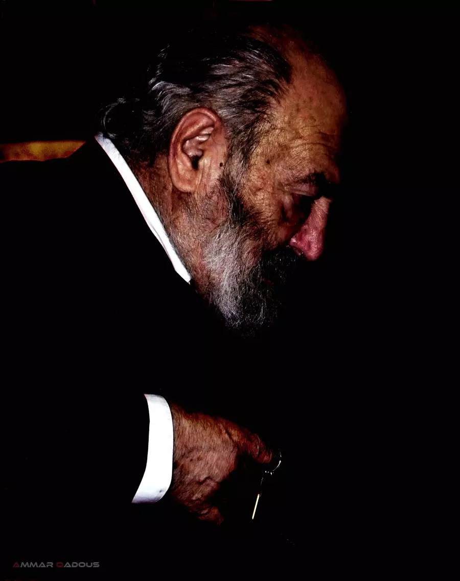
Posted by د.مهيب ( أبو مهند) ابولوحة - ابونا من داخل كنيسة المهد - عدسة عمار قادوس
Posted by Ammar Qadous - بيت لحم تزدهي بالوشاح الأبيض
Posted by Fadi Bader - صورة قديمة تعود إلى السبعينيات من القرن الماضي و أعياد الميلاد
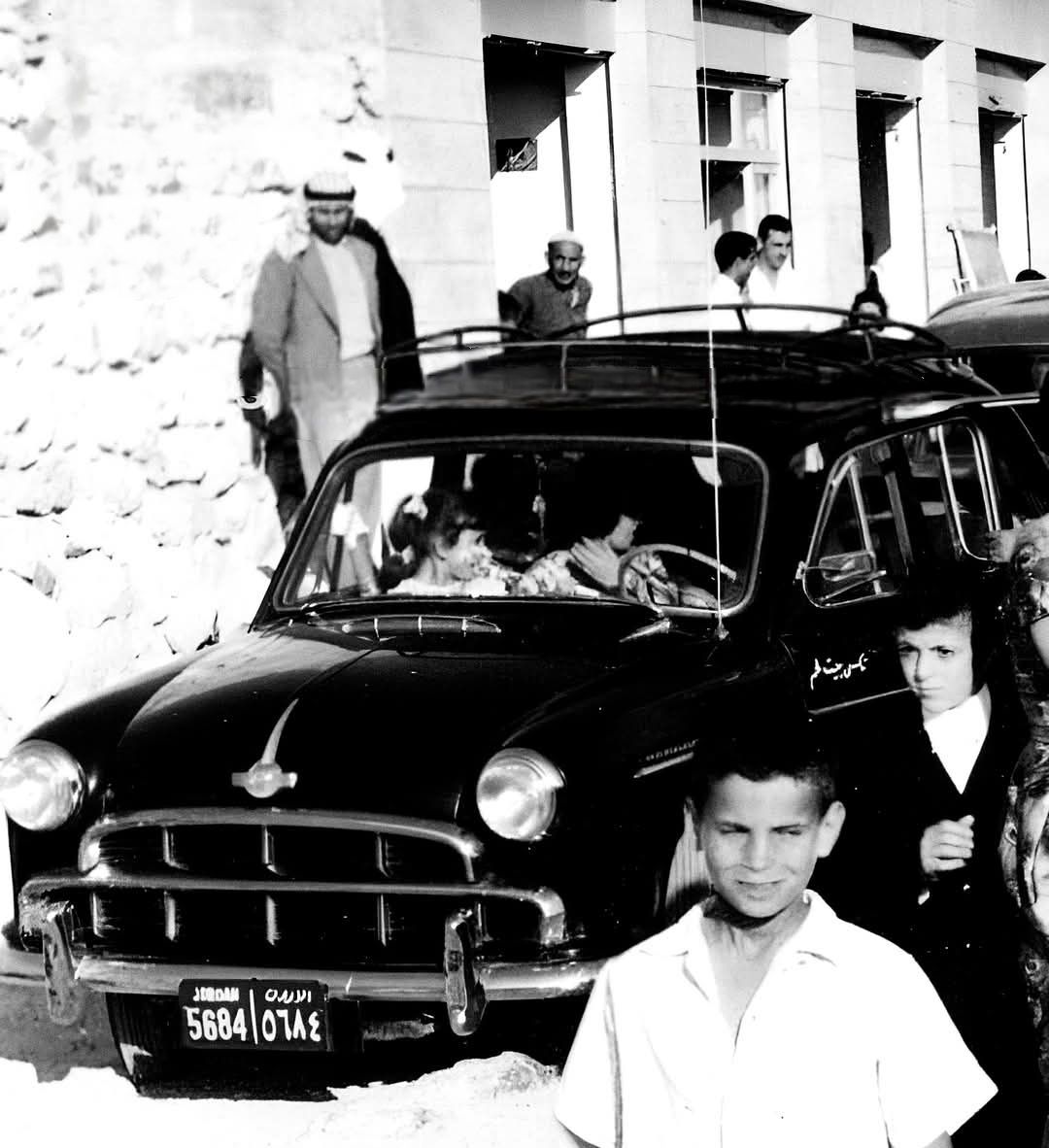
Posted by Fadi Bader - Bethlehem 1960s
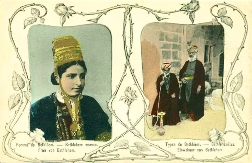
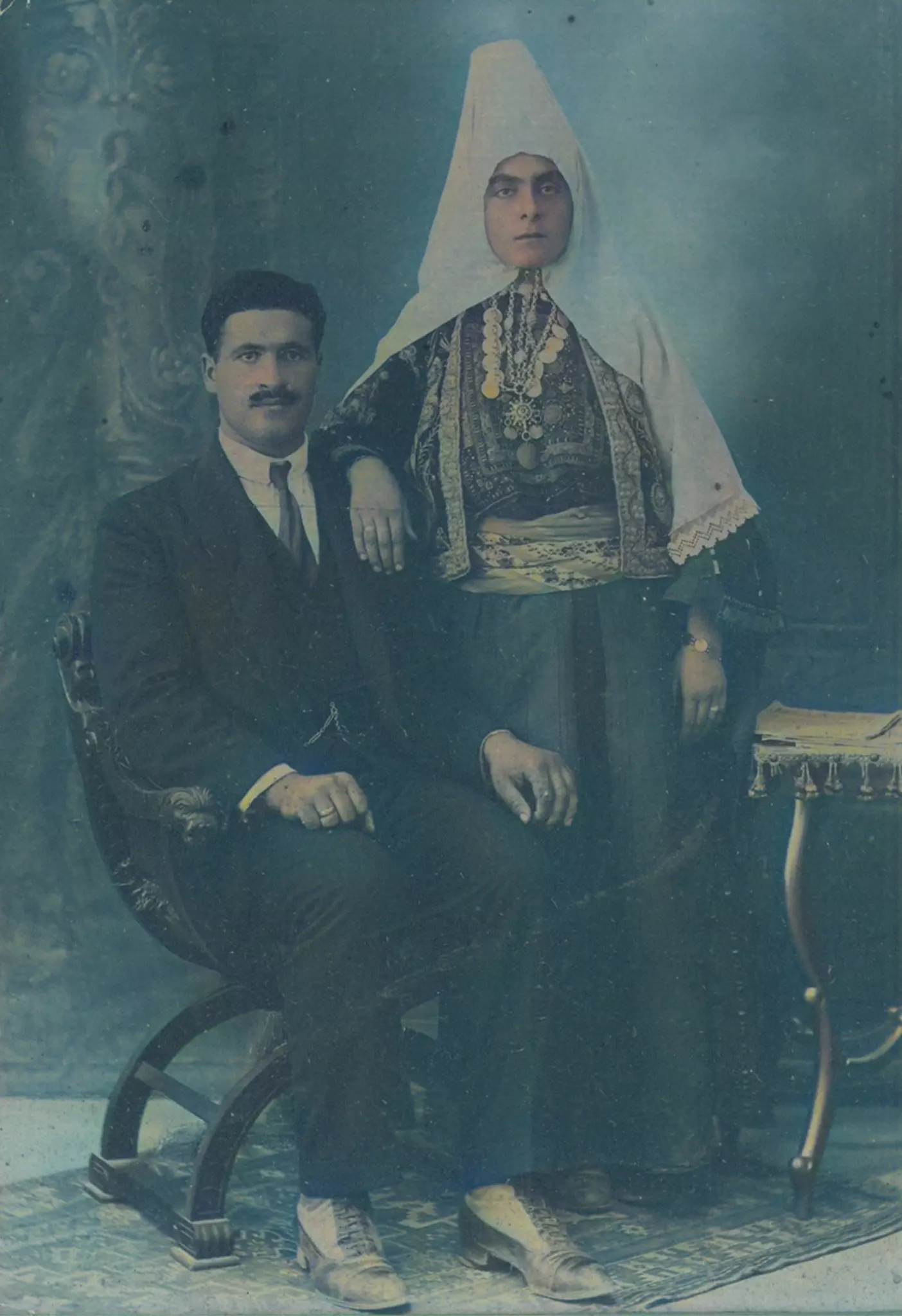
Posted by Rami Atwan 1 - Woman from Bethlehem, 00-10s
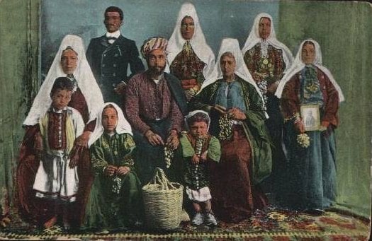
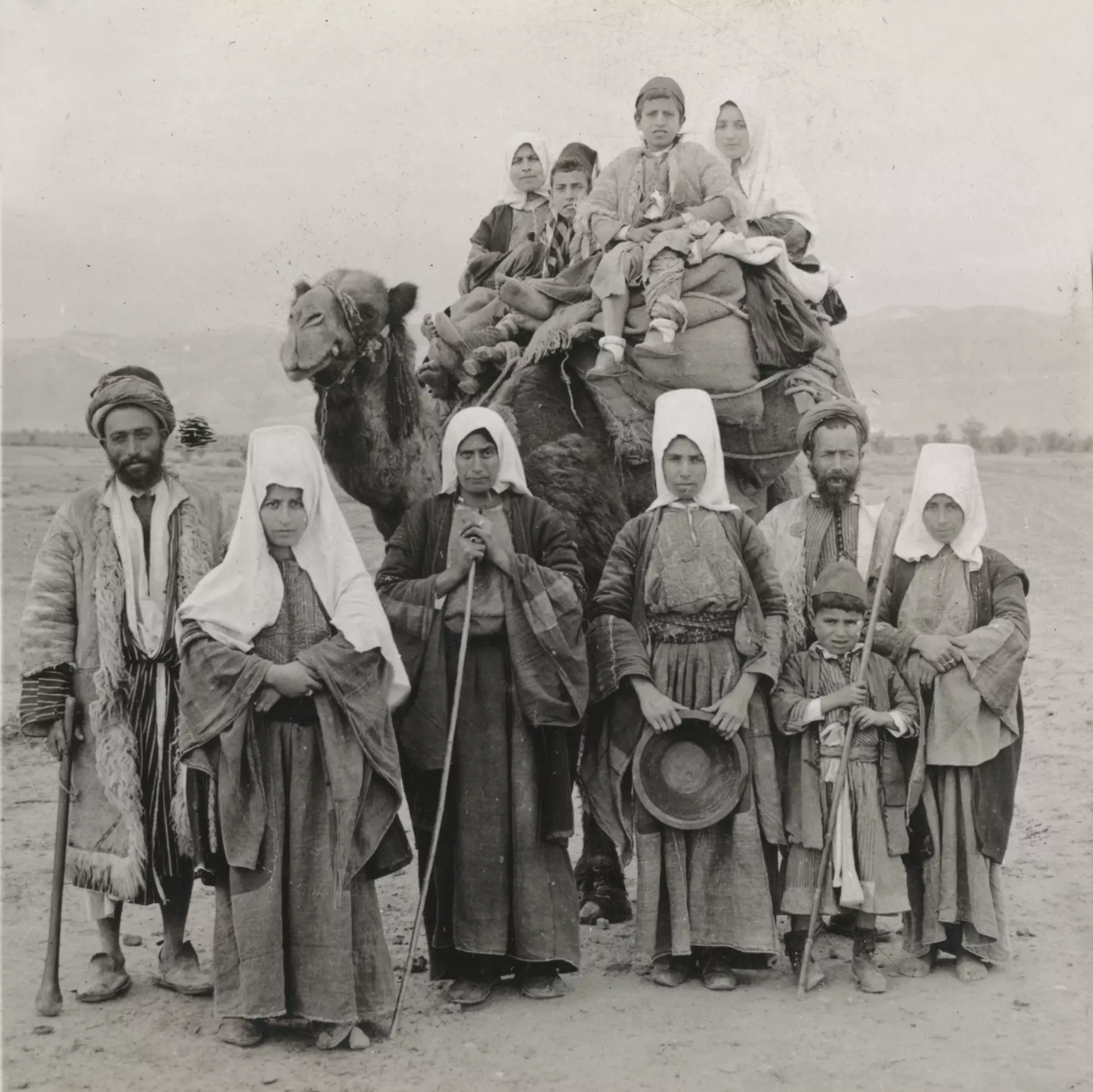
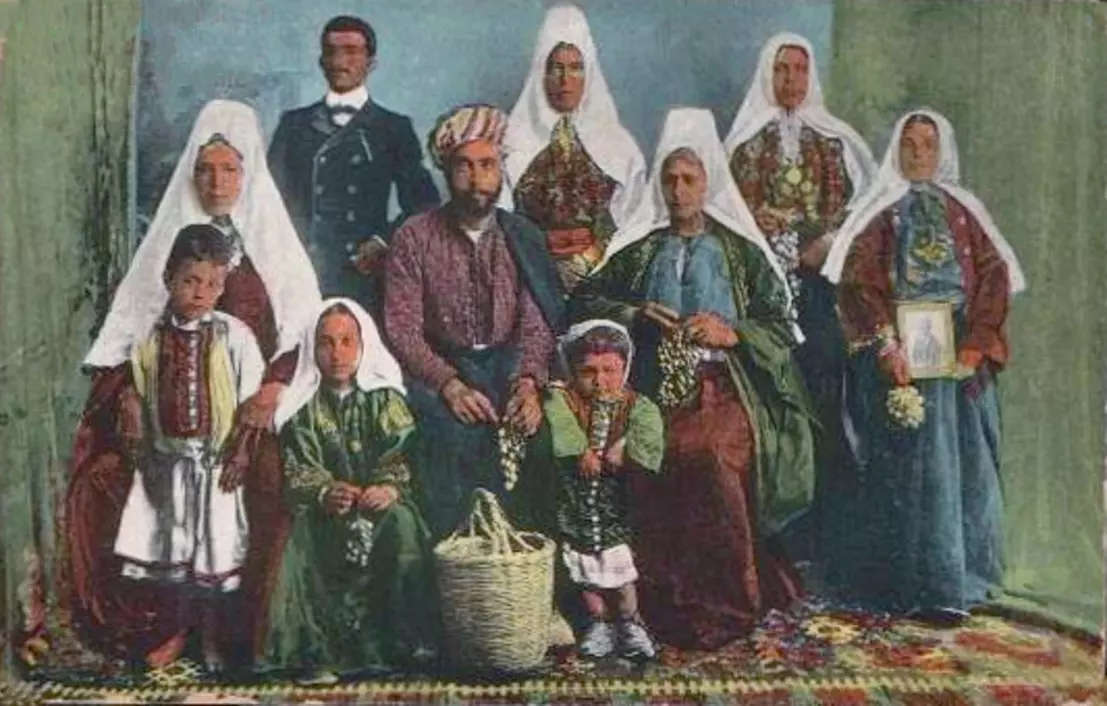
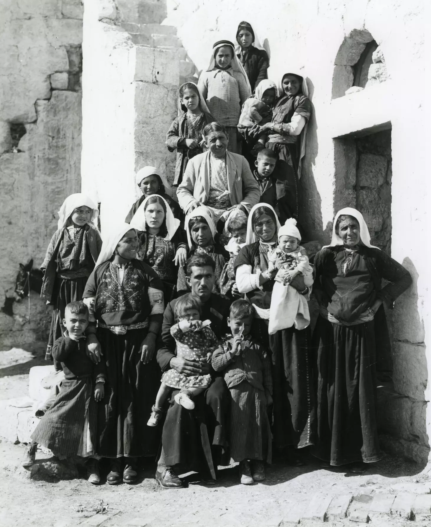
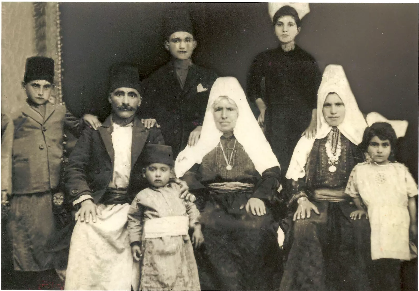
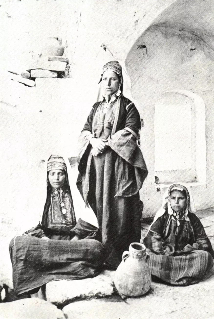
Posted by Rami Atwan - Bethlehem family, 1890s
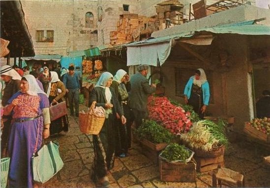
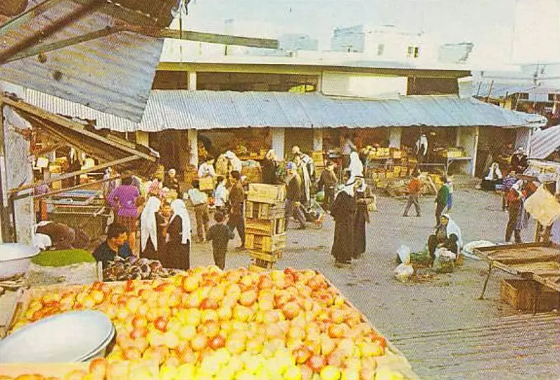
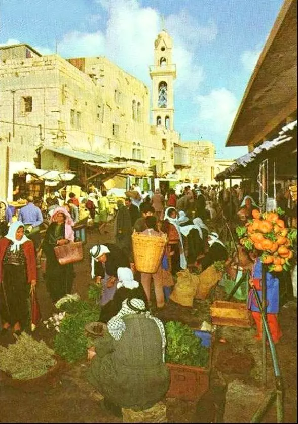
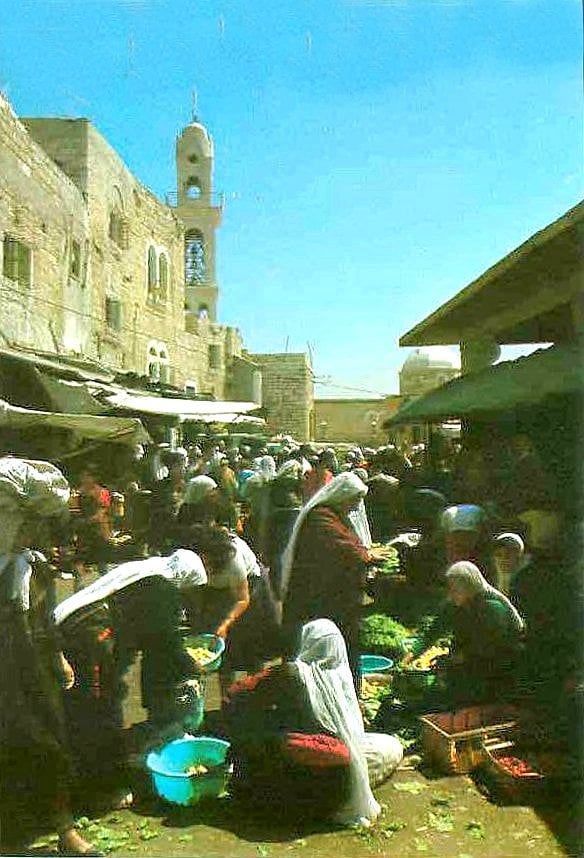
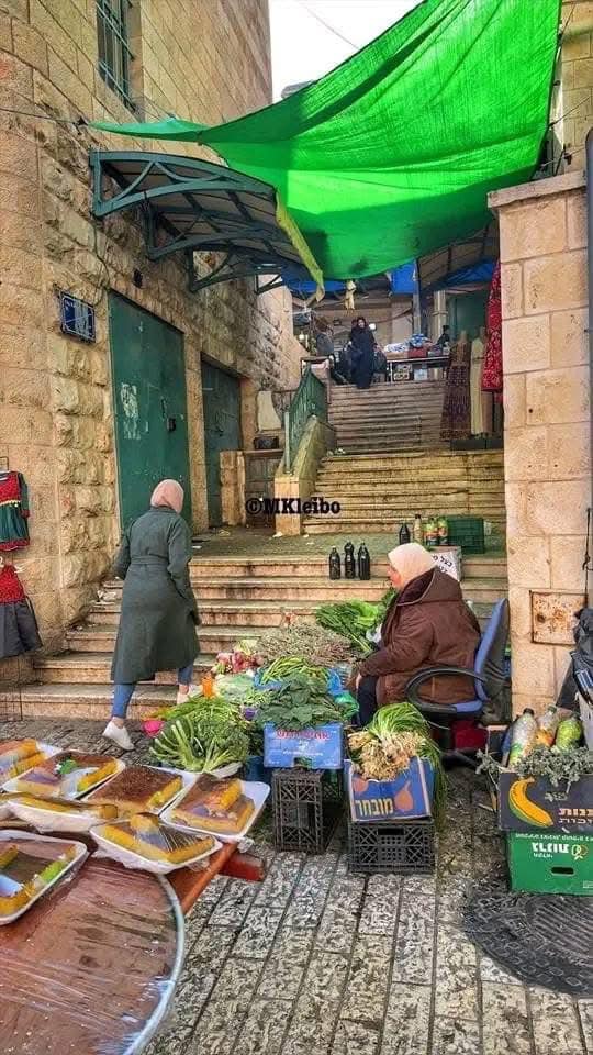
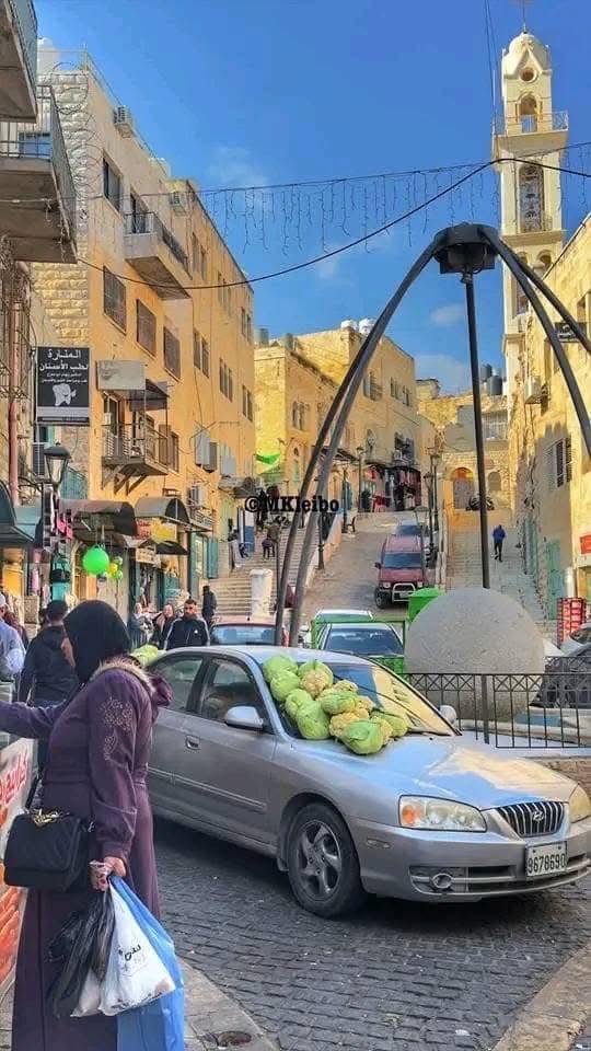
Posted by Rami Atwan - Vegetable market, 1960s
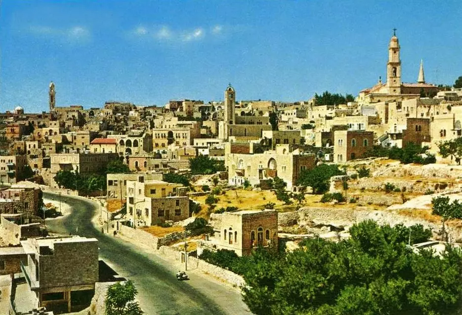
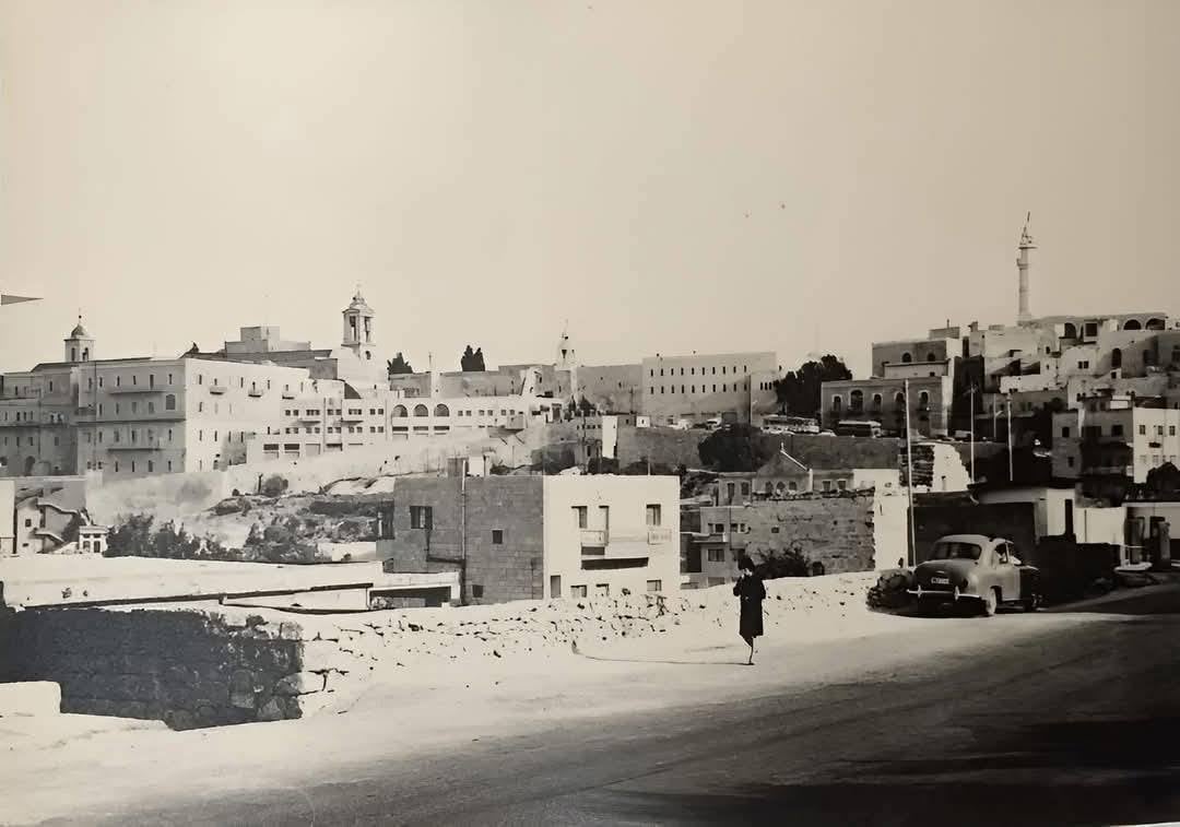
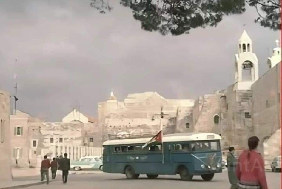
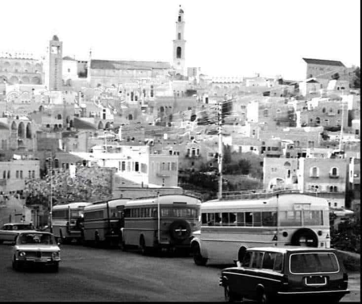
Posted by Rami Atwan 1 - Bethlehem, partial view, 1960s
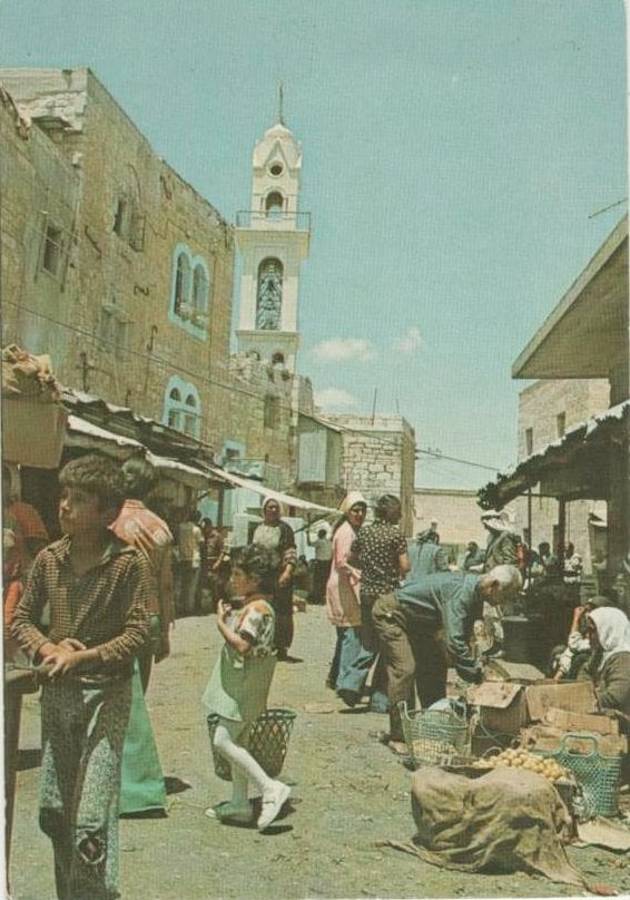
Posted by Rami Atwan - Street vendors, 1976
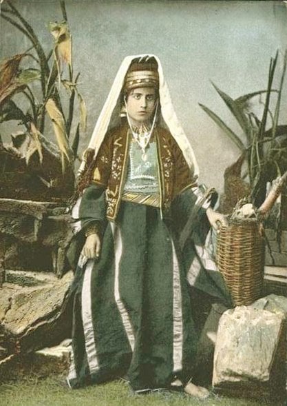
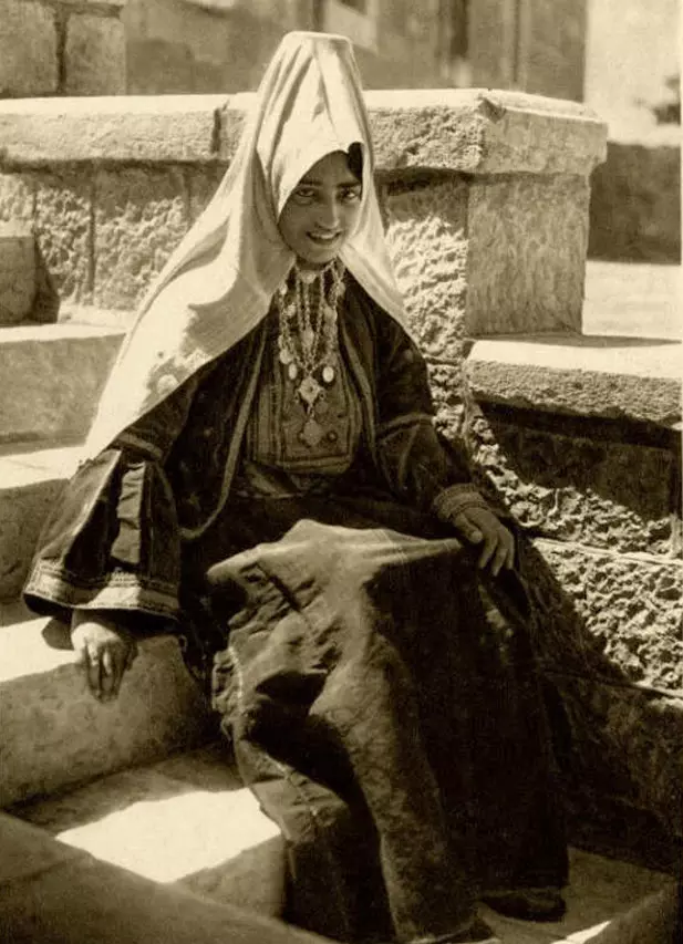
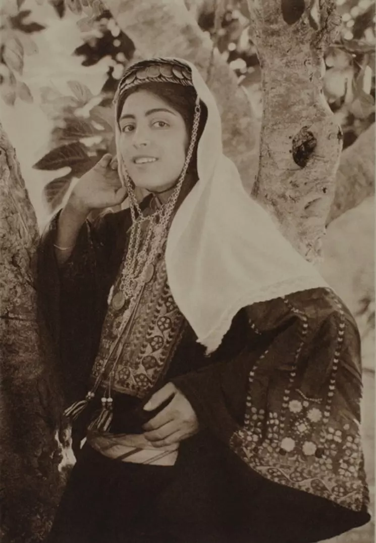
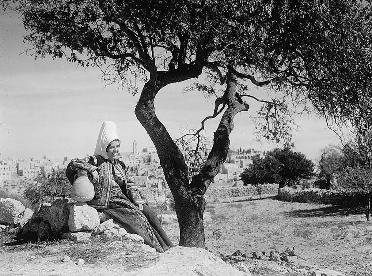
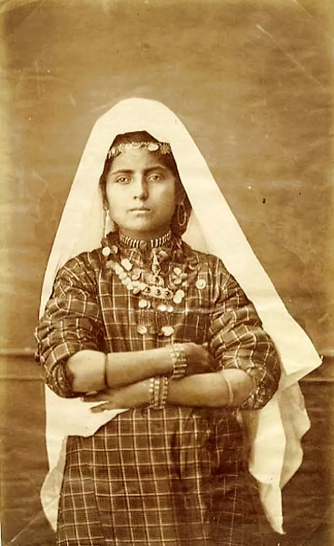
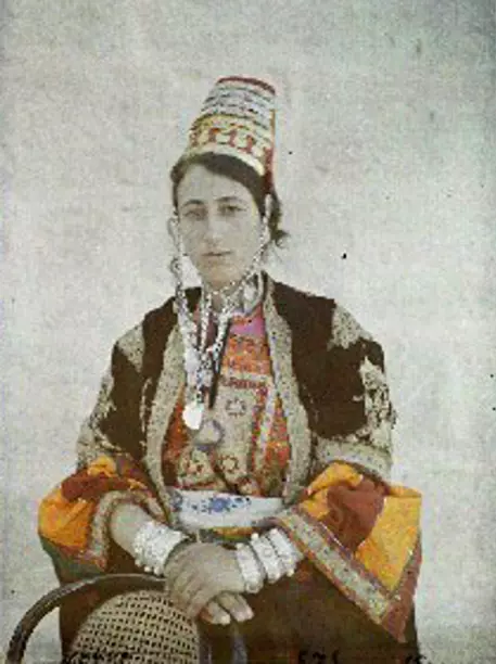
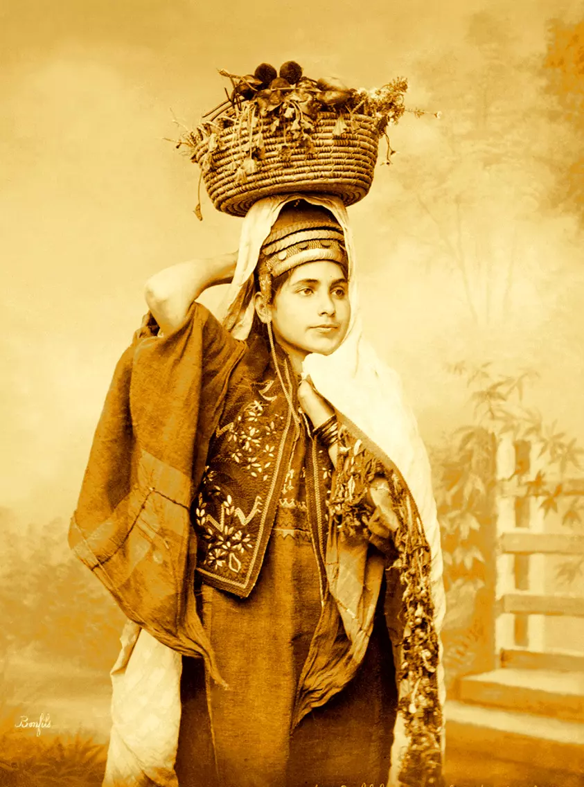
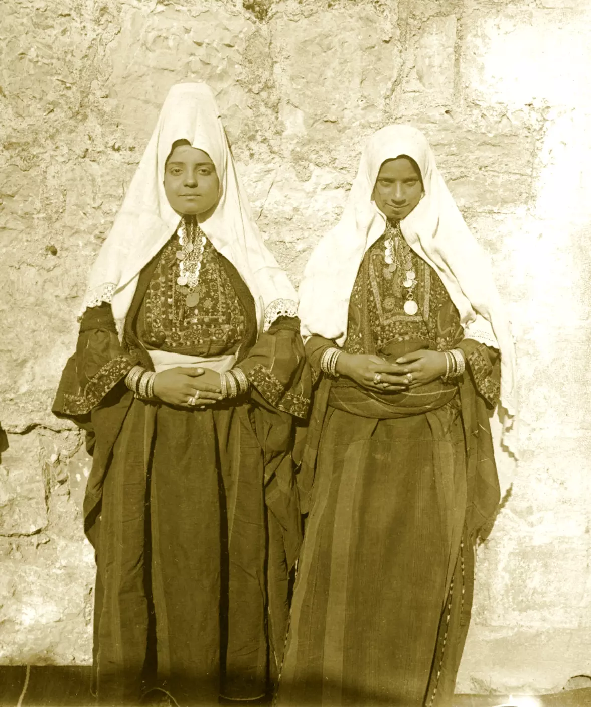
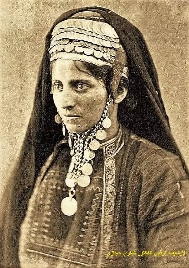
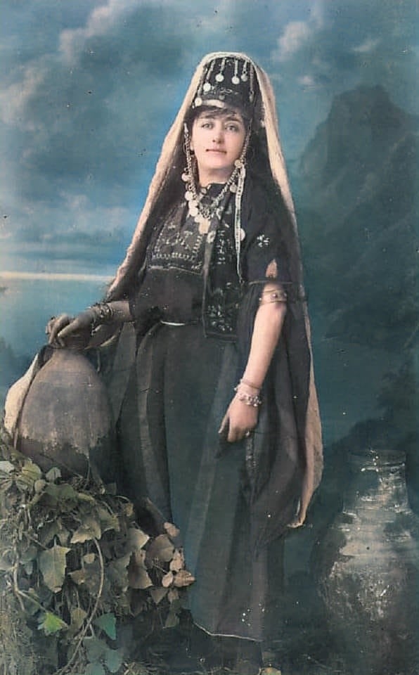
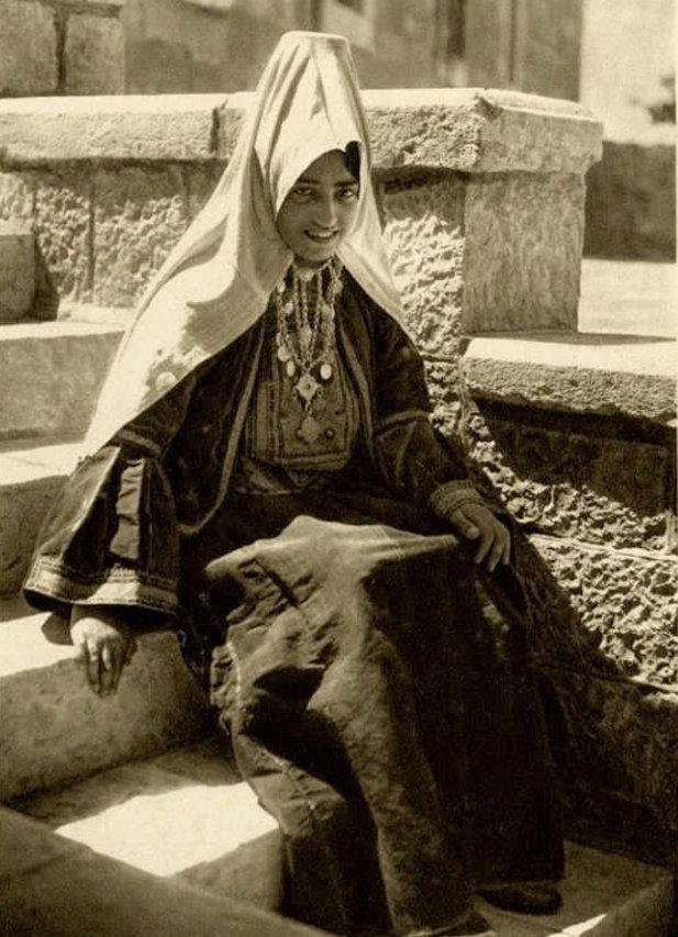
Posted by Rami Atwan - Woman of Bethlehem 1 (late 19th early 20th c.)
Posted by Rami Atwan - Woman of Bethlehem 2 (late 19th early 20th c.)
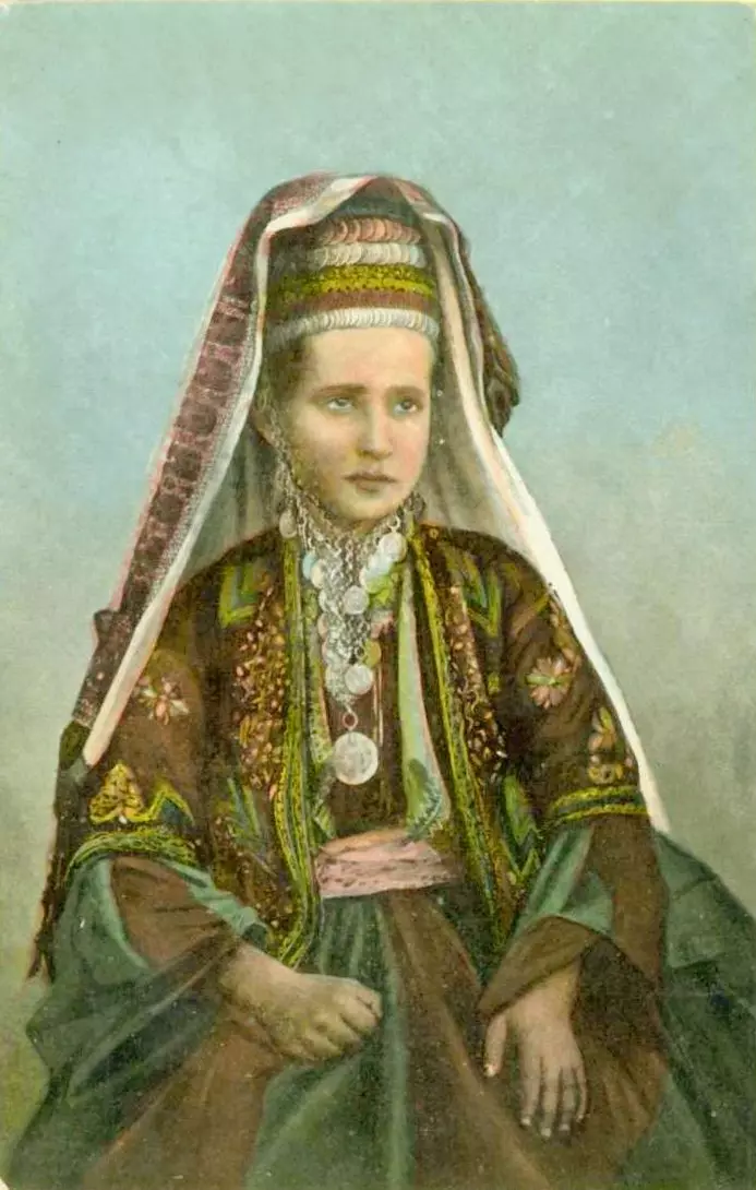
Posted by Rami Atwan - Woman of Bethlehem 3 (late 19th early 20th c.)

Posted by Rami Atwan - Woman of Bethlehem 4 (late 19th early 20th c.)
Posted by Rami Atwan - Woman of Bethlehem 5 (late 19th early 20th c.)

Posted by Rami Atwan - Woman of Bethlehem 6 (late 19th early 20th c.)
Posted by Rami Atwan 1 - Woman of Bethlehem 7 (late 19th early 20th c.)
Posted by Rami Atwan - Woman of Bethlehem 8 (late 19th early 20th c.)
Posted by Rami Atwan 1 - Woman of Bethlehem 9 (late 19th early 20th c.)
Posted by Rami Atwan - Woman of Bethlehem 10 (late 19th early 20th c.)
Posted by Rami Atwan - Woman of Bethlehem 11 (late 19th early 20th c.)
Posted by Rami Atwan - Woman of Bethlehem 12 (late 19th early 20th c.)
Posted by Rami Atwan - Woman of Bethlehem 13 (late 19th early 20th c.)

Posted by Rami Atwan - Woman of Bethlehem 14 (late 19th early 20th c.)
Posted by Rami Atwan - Woman of Bethlehem 15 (late 19th early 20th c.)
Posted by Rami Atwan - Woman of Bethlehem 16 (late 19th early 20th c.)
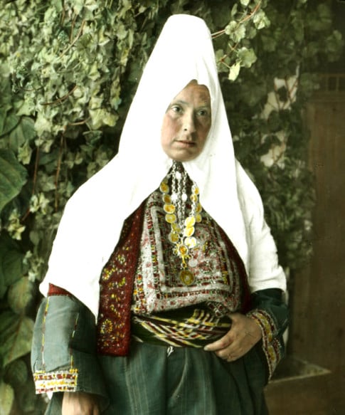
Posted by Rami Atwan - Bethlehem woman, 1960s
Posted by Rami Atwan - Bethlehem woman, 1940s
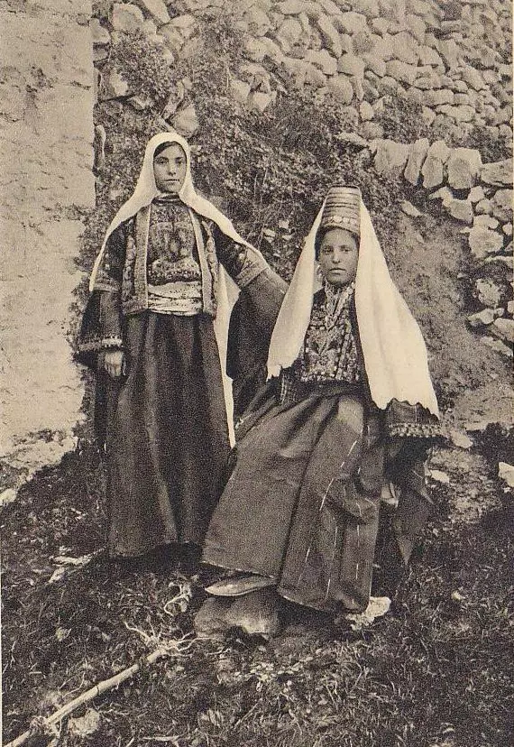
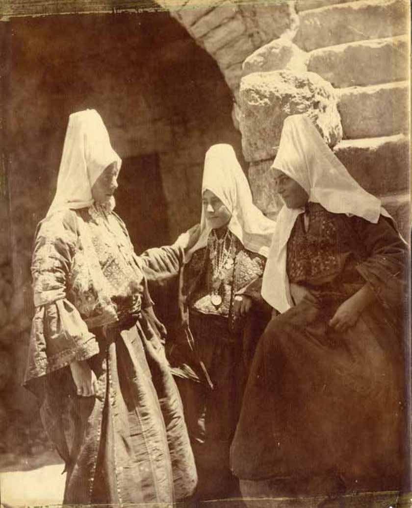
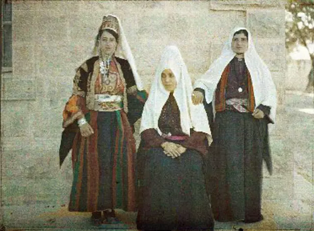
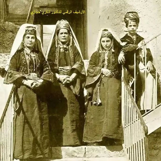
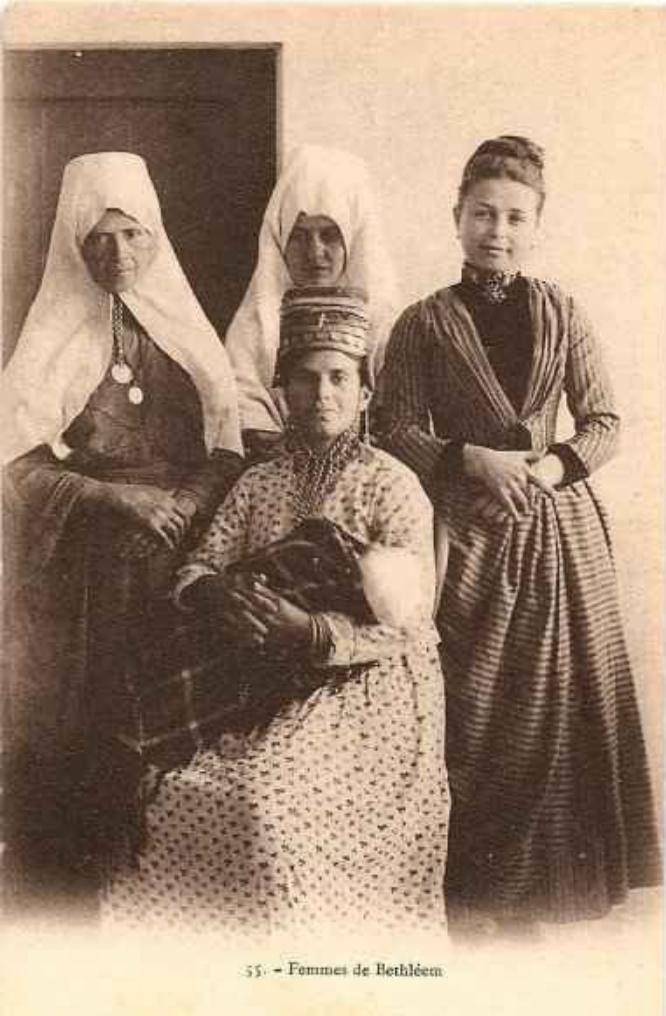
Posted by Rami Atwan - Group Of Women From Bethlehem, 1869

Posted by Rami Atwan - Bethlehem, 1960s 2
Posted by Rami Atwan - Bethlehem, 1960s 3
Posted by Rami Atwan - Bethlehem, 1960s 4
Posted by Rami Atwan - Bethlehem, 1890s 1
Posted by Rami Atwan - Bethlehem, 1890s 2
Posted by Rami Atwan - Bethlehem women 17 (Late 19th early 20th c.)

Posted by Rami Atwan - Bethlehem women 18 (Late 19th early 20th c.)

Posted by Rami Atwan - Bethlehem women 19 (Late 19th early 20th c
Posted by Rami Atwan - Bethlehem women 20 (Late 19th early 20th c
Posted by Rami Atwan - Bethlehem women 20 (Late 19th early 20th c1
Posted by Rami Atwan - Bethlehem women 22 (Late 19th early 20th c

Posted by Rami Atwan - Bethlehem, 1890s 3
Posted by Rami Atwan - Bethlehem, 1890s 4
Posted by Rami Atwan - Bethlehem, 1890s 5

Posted by Rami Atwan - Bethlehem, 1890s 6
Posted by Rami Atwan - Bethlehem, 1890s 7
Posted by Rami Atwan - Bethlehem, 1890s 8
Posted by Rami Atwan - Bethlehem, 1890s 9
Posted by Rami Atwan - Bethlehem, 1890s 10
Posted by Rami Atwan - Bethlehem, 1890s 11
Posted by Rami Atwan - Bethlehem, 1890s 12
Posted by Rami Atwan - PALESTINE _ Bethlehem 1930s
Posted by Rami Atwan - PALESTINE _ Bethlehem 1924
Posted by Rami Atwan - PALESTINE _ Bethlehem 1948
Posted by Rami Atwan 1 - PALESTINE _ Bethlehem 1951
Posted by Rami Atwan - PALESTINE _B ethlehem 1900s
Posted by Rami Atwan - PALESTINE _ Bethlehem 1931
Posted by Rami Atwan - PALESTINE _ Bethlehem mid 1940s
Posted by Rami Atwan - PALESTINE_Bethlehem 1930
Posted by Rami Atwan 1 - PALESTINE_Bethlehem 1890s

Posted by Rami Atwan - PALESTINE_Bethlehem 2005
Posted by Rami Atwan - PALESTINE_bethlehem 1929
Posted by Rami Atwan - Old Bethlehem mansion
Posted by Rami Atwan 1 - PALESTINE, Bethlehem 1890s
Posted by Rami Atwan - PALESTINE_Bethlehem, 1980s
Posted by Rami Atwan - PALESTINE_Bethlehem, early 20th c.
Posted by Rami Atwan - Women of Bethlehem 24 (late 19th early 20th c.)
Posted by Rami Atwan - Women of Bethlehem 23 (late 19th early 20th c.)
Posted by Rami Atwan - Women of Bethlehem 25 (late 19th early 20th c.)
Posted by Rami Atwan 1 - PALESTINE_Bethlehem, 1933.
Posted by Rami Atwan - PALESTINE_Bethlehem, late 19th c..
Posted by Rami Atwan - Women of Bethlehem 26 (late 19th early 20th c.)
Posted by Rami Atwan 1 - Women of Bethlehem 27
Posted by Rami Atwan - Woman of Bethlehem 28 (late 19th early 20th c.)

Posted by Rami Atwan - BETHLEHEM
Posted by Rami Atwan - BETHLEHEM 2
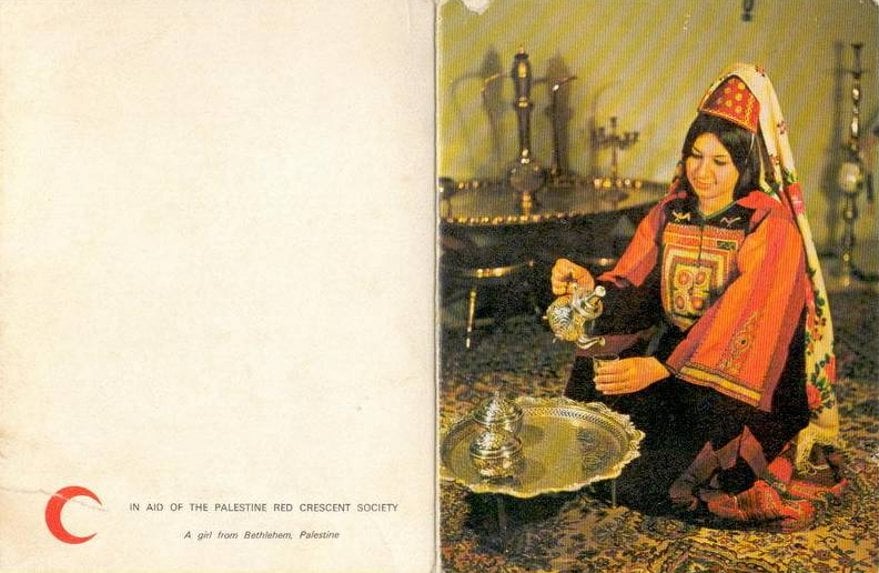
Posted by Rami Atwan 1 - Palestine Aid of the Red Crescent Society Beth Lehem Girl
Posted by Rami Atwan - Women of Bethlehem 29 (late 19th early 20th c.)
Posted by Rami Atwan - Church of the Nativity, Bethlehem, late 1930s
Posted by Rami Atwan - Bethlehem University
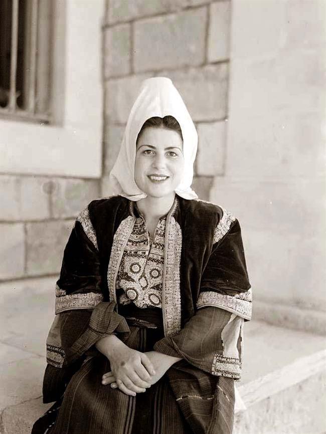
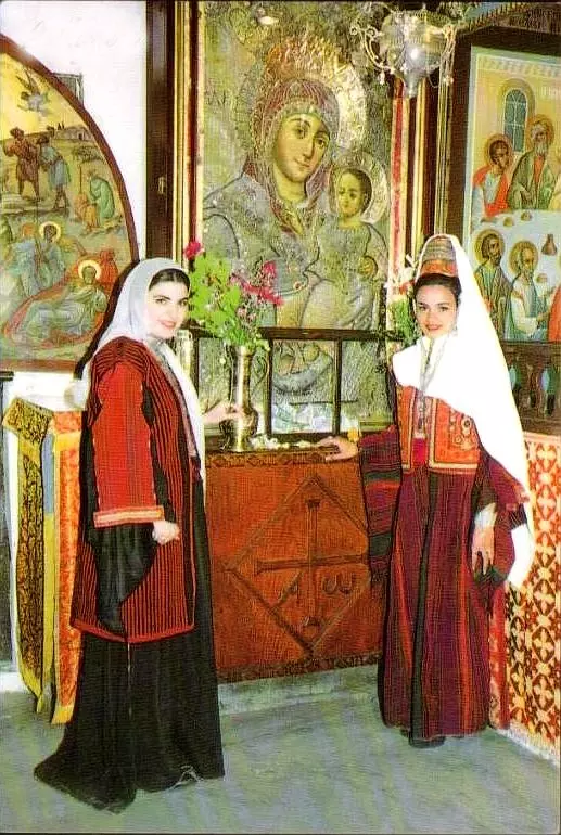
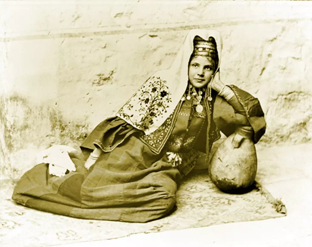
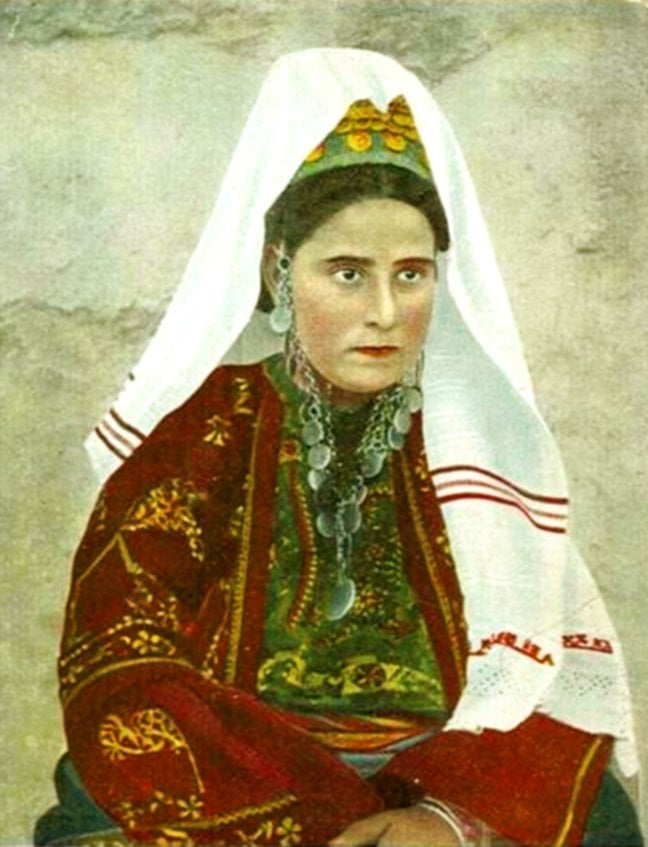
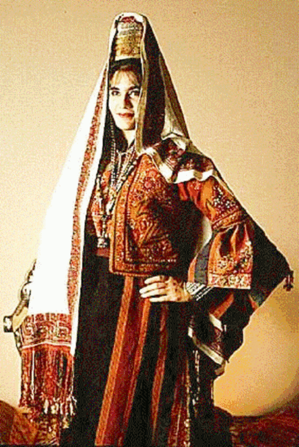
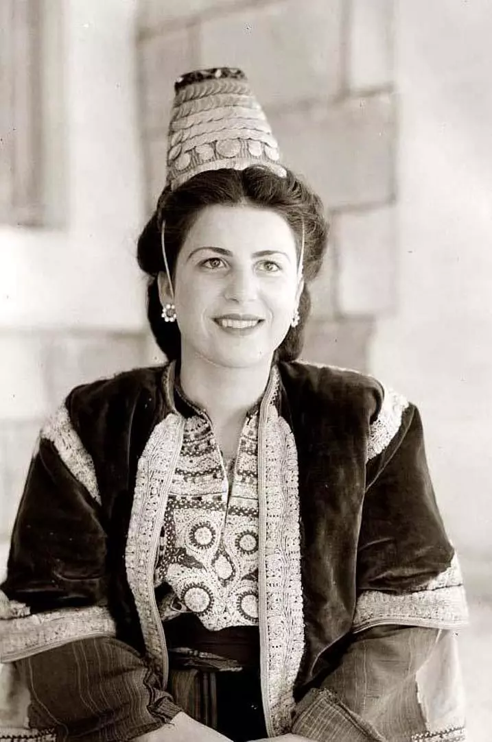
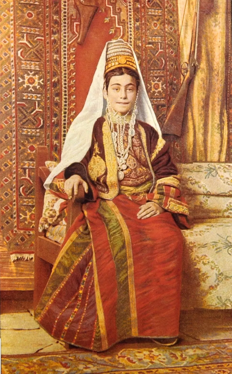
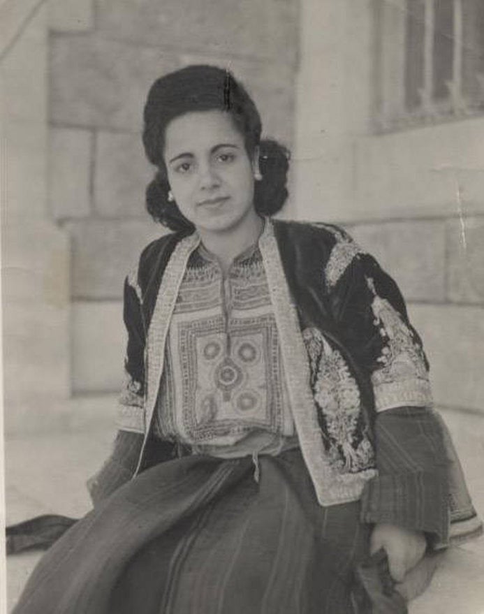
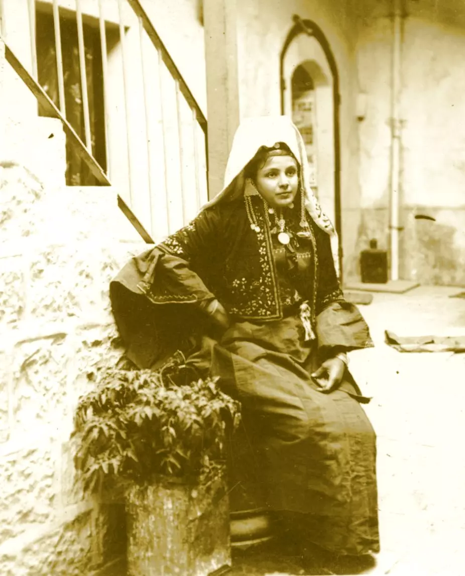
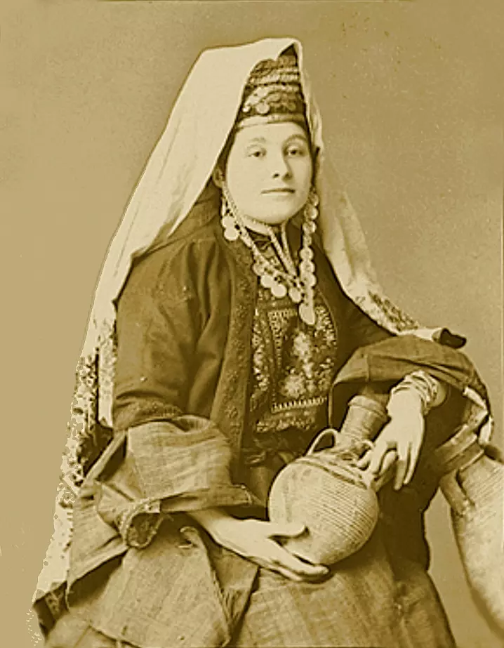
Posted by Rami Atwan - Bethlehem woman in traditional costume

Posted by Rami Atwan - Bethlehem, 1960s 5
Posted by Rami Atwan - Bethlehem men, between 1890s
Posted by Rami Atwan - Bethlehem, early 20th c.
Posted by Rami Atwan - Bethlehem street, early 20th c.
Posted by Rami Atwan 1 - Bethlehem, 1890s 14
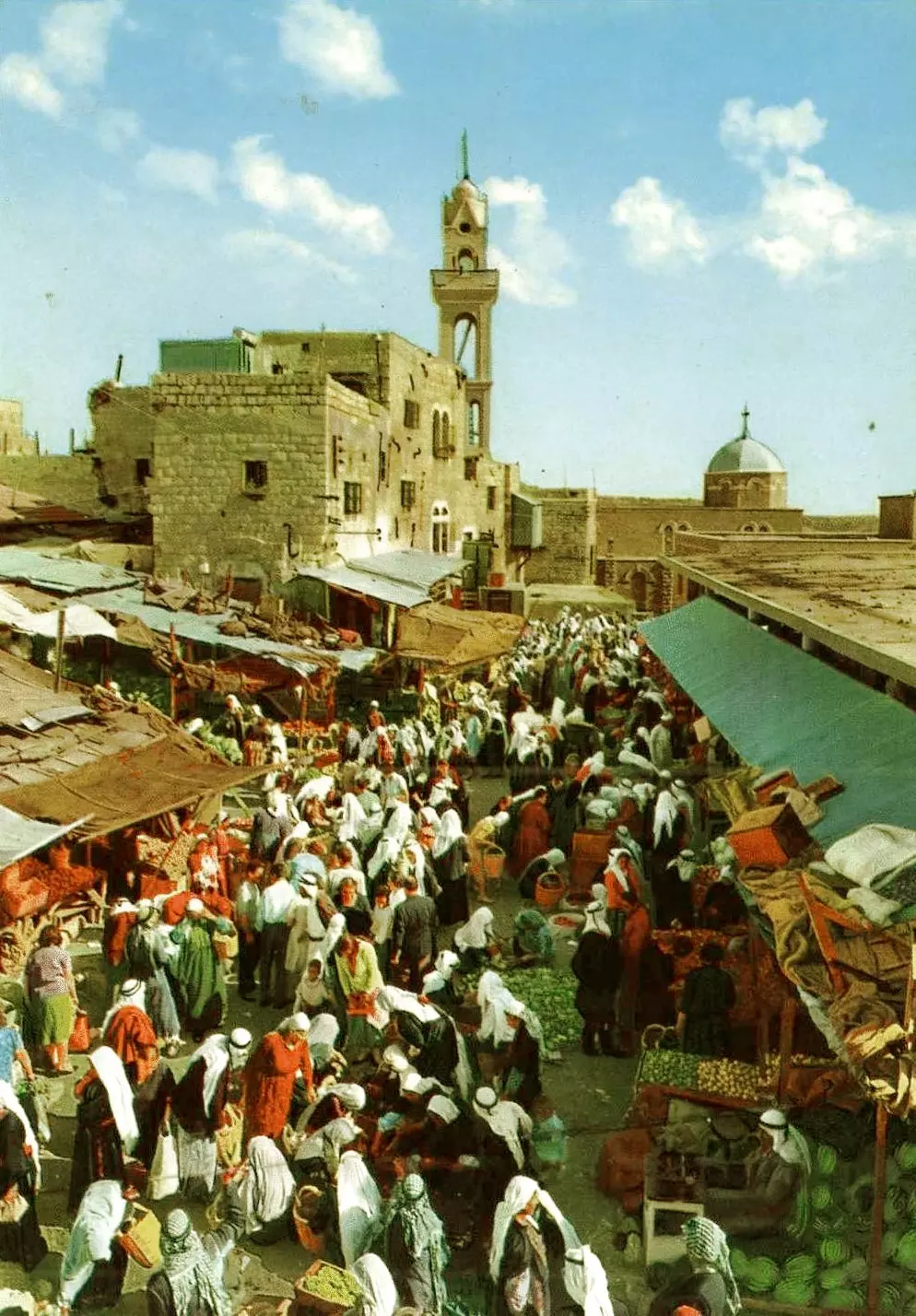
Posted by Rami Atwan - Bethlehem Market, 1925
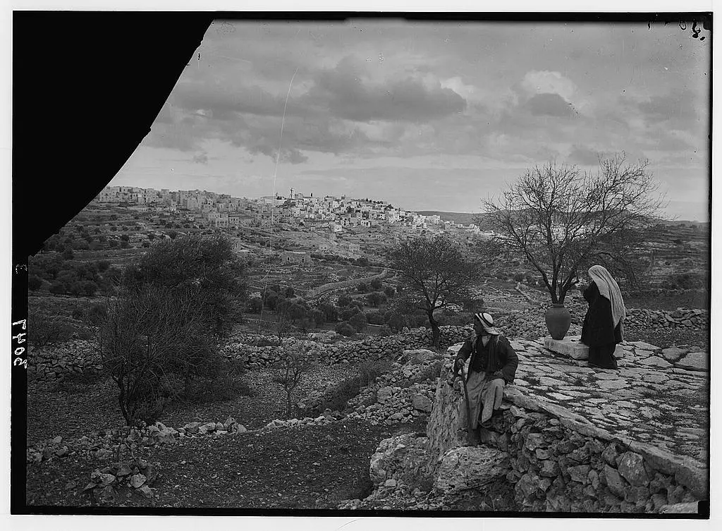
Posted by Rami Atwan - Hills of Bethlehem, 1936

Posted by Rami Atwan - Bethlehem Woman, early 40s
Posted by Rami Atwan - bethlehem women, 1925
Posted by Rami Atwan - Bethlehem-1945
Posted by Rami Atwan - Bethlehem, late 1930s
Posted by Rami Atwan - Bethlehem, early 20th c.
Posted by Rami Atwan - Bethlehem, early 20th c. 2
Posted by Rami Atwan - Bethlehem, early to mid 20th c.
Posted by Rami Atwan - Bethlehem and environs
Posted by Rami Atwan - Bethlehem, late 19th c., Rachel's Tomb (Colourised)
Posted by Rami Atwan - Bethlehem market, early 20th c.
Posted by Rami Atwan - Bethlehem, Christmas Day, early 20th c.
Posted by Rami Atwan - Mar Elias, north of Bethlehem, 1893.
Posted by Rami Atwan - BETHLEHEM, SHUBBAK
Posted by Rami Atwan - Bethlehem, 1890s 13
Posted by Rami Atwan - Bethlehem, 1890s 14
Posted by Rami Atwan - Bethlehem, 1890s 15
Posted by Rami Atwan 1 - Bethlehem, 1890s 16
Posted by Rami Atwan - Bethlehem, 1890s 17
Posted by Rami Atwan 1 - Bethlehem, 1890s 18
Posted by Rami Atwan 1 - Bethlehem, 1960s 6
Posted by Rami Atwan 1 - Bethlehem, 1960s 7
Posted by Rami Atwan - Bethlehem, 1960s 8

Posted by Rami Atwan - Bethlehem, 1960s 9

Posted by Rami Atwan - Bethlehem, 1960s 10

Posted by Rami Atwan 1 - Bethlehem, 1960s 11
Posted by Rami Atwan - BETHLEHEM, PALESTINE, 1860
Posted by Rami Atwan - CHURCH OF THE NATIVITY, BETHLEHEM, 1843 (E. Breton)
Posted by Rami Atwan - Women of Bethlehem 29 (late 19th early 20th c.)
Posted by Rami Atwan - Women of Bethlehem 30 (late 19th early 20th c.)
Posted by Rami Atwan - Women of Bethlehem 31 (late 19th early 20th c.)
Posted by Rami Atwan - Women of Bethlehem 32 (late 19th early 20th c.) - (Enhanced)
Posted by Rami Atwan - Church of the Nativity, late 19th c. 1
Posted by Rami Atwan - Church of the Nativity, late 19th c. 2
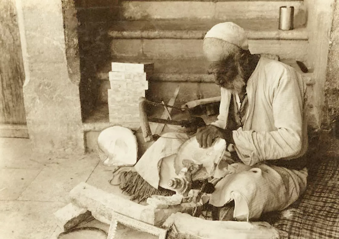
Posted by Rami Atwan - A Bethlehem weaver, early 20th c.
Posted by Rami Atwan - Women of Bethlehem 33 (late 19th early 20th c.)
Posted by Rami Atwan - Women of Bethlehem 34 (late 19th early 20th c.) (In Jerusalem)
Posted by Rami Atwan - Women of Bethlehem 35 (late 19th early 20th c.) (In Jerusalem)
Posted by Rami Atwan - Women of Bethlehem 36 (late 19th early 20th c.) (In Jerusalem)
Posted by Rami Atwan - Bethlehem, 1920
Posted by Rami Atwan - Women of Bethlehem 37
Posted by Rami Atwan - Women of Bethlehem 38 (1919)
Posted by Rami Atwan 1 - The road to Bethlehem, mid. 19th c.
Posted by Rami Atwan 1 - Woman of Bethlehem 39 (late 19th early 20th c.)
Posted by Rami Atwan - Bethlehem, 1960s 12
Posted by Rami Atwan - Bethlehem, 1960s 13

Posted by Rami Atwan - Bethlehem, 1960s 14
Posted by Rami Atwan - Bethlehem, 1960s 15
Posted by Rami Atwan - Bethlehem, 1960s 16
Posted by Rami Atwan - Bethlehem, 1960s (-70s) 17
Posted by Rami Atwan - Bethlehem, 1960s (-70s) 18
Posted by Rami Atwan - Bethlehem, 1960s (-70s) 19
Posted by Rami Atwan - PALESTINE - Bethlehem 1888, From the Church of the Nativity
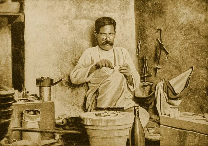
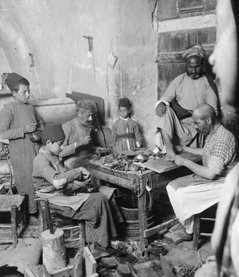
Posted by Rami Atwan 2 - PALESTINE - Bethlehem 1904 - A worker in mother of pearl, with wife and child

Posted by Rami Atwan - PALESTINE - Bethlehem, 1890s 19
Posted by Rami Atwan - PALESTINE - Bethlehem, 1890s 20
Posted by Rami Atwan - PALESTINE - Bethlehem, 1890s 21
Posted by Rami Atwan - PALESTINE - Bethlehem, 1890s 22
Posted by Rami Atwan - PALESTINE - Bethlehem, 1890s (early 20th c.) 23
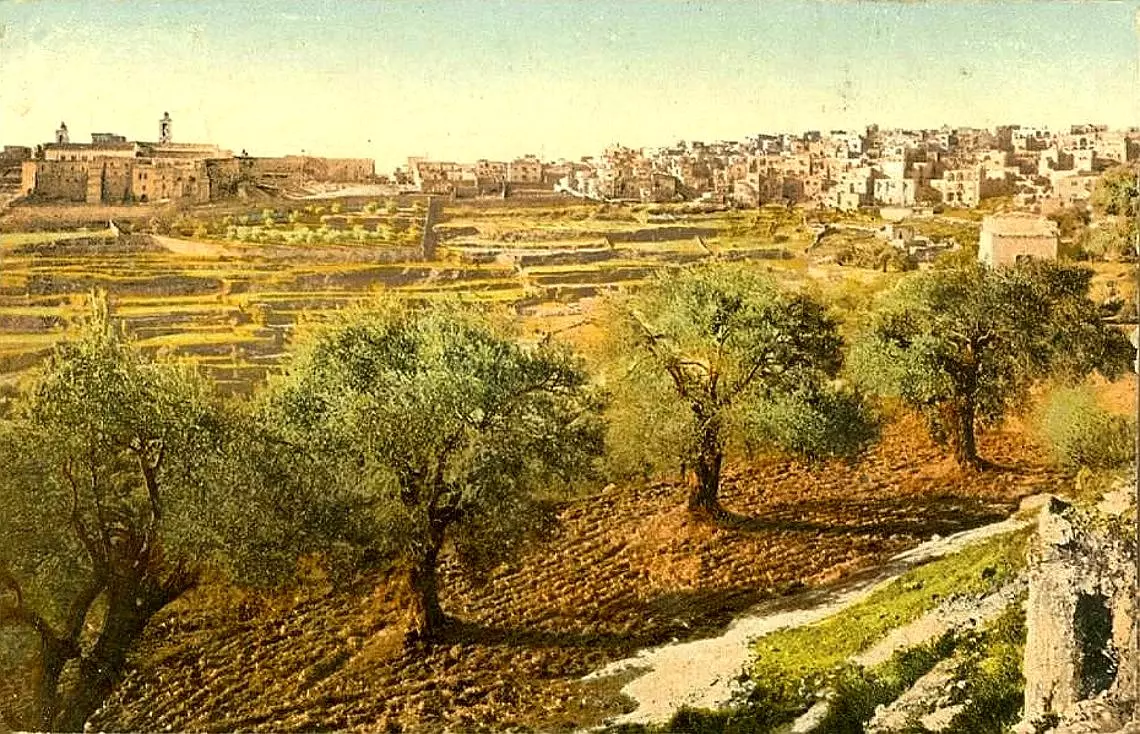
Posted by Rami Atwan - PALESTINE - Bethlehem and outlying fields
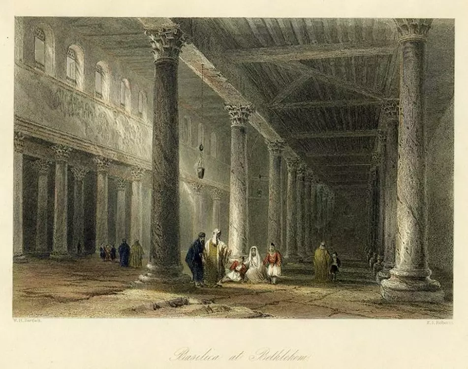
Posted by Rami Atwan - PALESTINE - Bethlehem - Basilica at Bethlehem (W.H.Bartlett, 1860)
Posted by Rami Atwan - PALESTINE - Bethlehem, early 20th c. 4
Posted by Rami Atwan - PALESTINE - Bethlehem, Early 20th c. 3
Posted by Rami Atwan - Women of Bethlehem 40 (late 19th early 20th c.)

Posted by Rami Atwan - Women of Bethlehem 42 (late 19th early 20th c.)
Posted by Rami Atwan - Women of Bethlehem 43 (late 19th early 20th c.)
Posted by Rami Atwan - Women of Bethlehem 41 (late 19th early 20th c.)
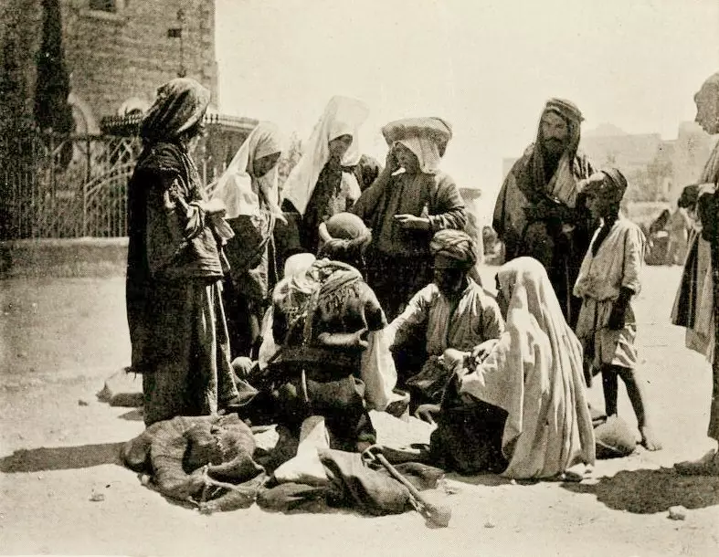
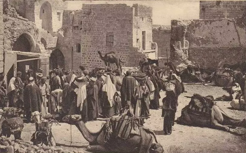
Posted by Rami Atwan - Bethlehem women buying corn from villagers, 1913ram321z
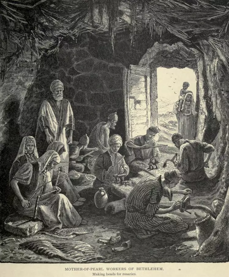
Posted by Rami Atwan 1 - Bethlehem - Mother-of-Pearl workers, 1878
Posted by Rami Atwan - Bethlehem, 1862
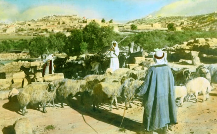
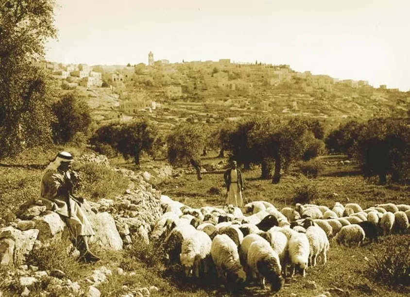
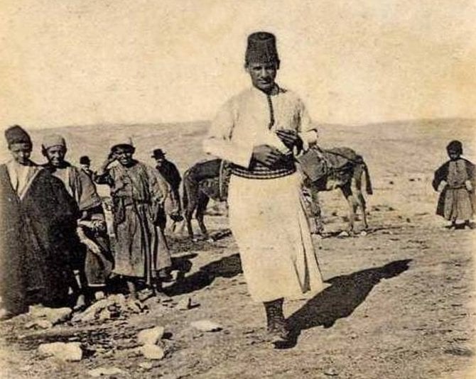
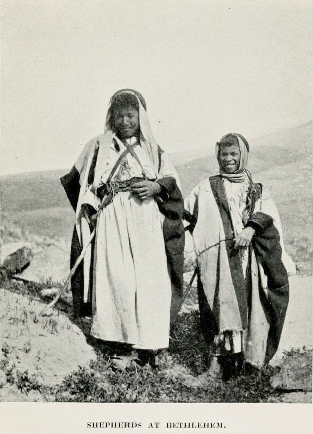
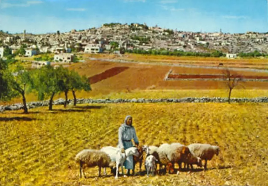
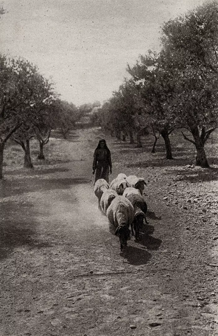
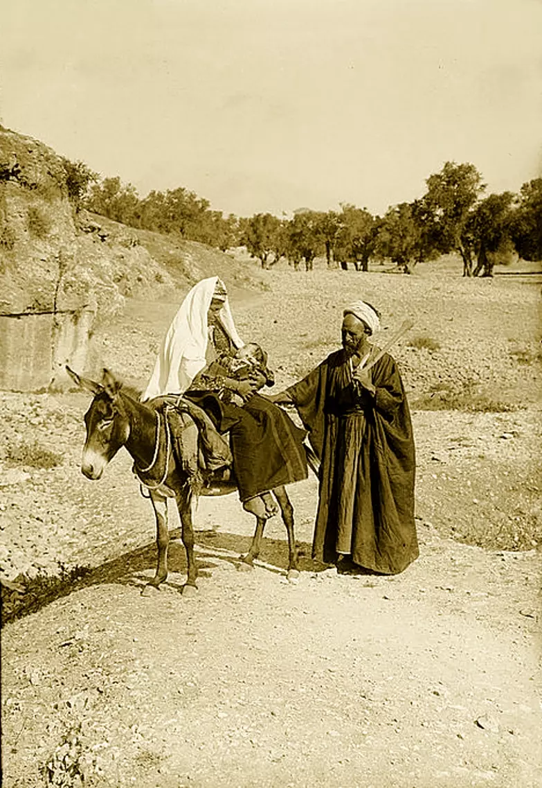
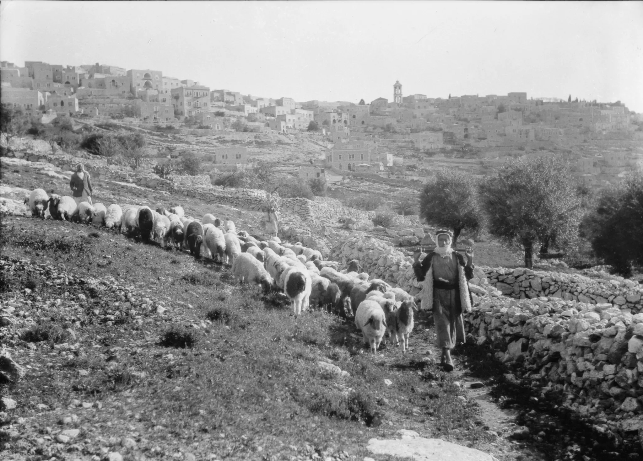
Posted by Rami Atwan - Shepherds at Bethlehem, 1913
Posted by Rami Atwan - Bethlehem, 1960s (-70s) 20
Posted by Rami Atwan - Bethlehem, 1960s (-70s) 21
Posted by Rami Atwan - Bethlehem, 1960s (-70s) 22
Posted by Rami Atwan - Bethlehem, 1960s (-70s) 23

Posted by Rami Atwan 1 - Bethlehem, 1960s (-70s) 24 Nativity Star & Crypt of Grotto
Posted by Rami Atwan - PALESTINE - Bethlehem, 1890s (early 20th c.) 24

Posted by Rami Atwan 1 - PALESTINE - Bethlehem, 1890s (early 20th c.) 25
Posted by Rami Atwan 1 - PALESTINE - Bethlehem, 1890s (early 20th c.) 26
Posted by Rami Atwan 1 - PALESTINE - Bethlehem, 1890s (early 20th c.) 27
Posted by Rami Atwan - PALESTINE - Bethlehem, 1890s (early 20th c.) 28 (1927)
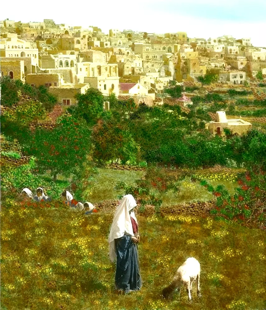
Posted by Rami Atwan 1 - PALESTINE - Bethlehem, 1890s (early 20th c.) 29 The Shepard's Field near Bethlehem
Posted by Rami Atwan - PALESTINE - Bethlehem, mid 20th c.
Posted by Rami Atwan - Women of Bethlehem 44 (1875)
Posted by Rami Atwan - Bethlehem. Shepherd's Fields, 1934
Posted by Rami Atwan 1 - Women of Bethlehem 45 - (1956)
Posted by Rami Atwan 1 - Women of Bethlehem 46 (late 19th early 20th c.) (In Jerusalem)
Posted by Rami Atwan - Women of Bethlehem 47 (1869)
Posted by Rami Atwan - PALESTINE - Bethlehem, 1890s (early 20th c.) 30

Posted by Rami Atwan - Women of Bethlehem 48 (1926)
Posted by Rami Atwan - Women of Bethlehem 49 (1954)
Posted by Rami Atwan - Women of Bethlehem 50 (1913)
Posted by Rami Atwan - Women of Bethlehem 51 (ca. 1899)
Posted by Rami Atwan - Women of Bethlehem 52 (1930s)

Posted by Rami Atwan - Women of Bethlehem 53 (1900) - Gertrude Bell Archive
Posted by Rami Atwan - Women of Bethlehem 54 (1900) - Gertrude Bell Archive
Posted by Rami Atwan - Women of Bethlehem 55 (1900) - Gertrude Bell Archive
Posted by Rami Atwan - Women of Bethlehem 56 (1934-39)
Posted by Rami Atwan 1 - Women of Bethlehem 57 (In a house in Jerusalem, late 19th, early 20th c. - PE Fund)..jpg
Posted by Rami Atwan - PALESTINE - Bethlehem, 1890s (early 20th c.) 30 1893
Posted by Rami Atwan 1 - Women of Bethlehem 58 (Bethlehem snow, 1930s - Munir Alawi)
Posted by Rami Atwan - Women of Bethlehem 59 (1930s)
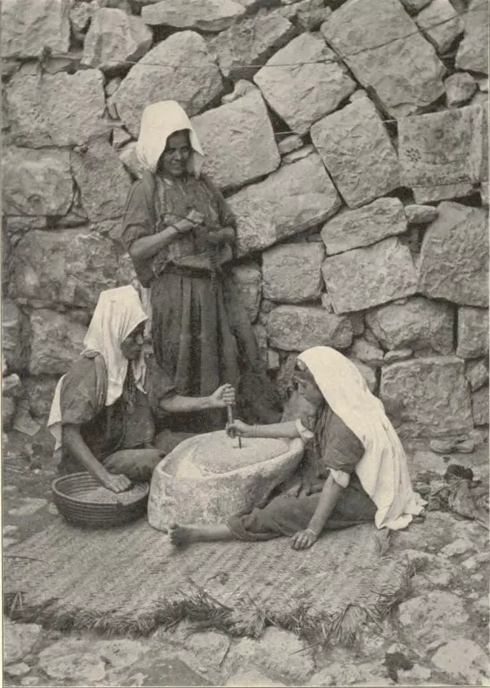
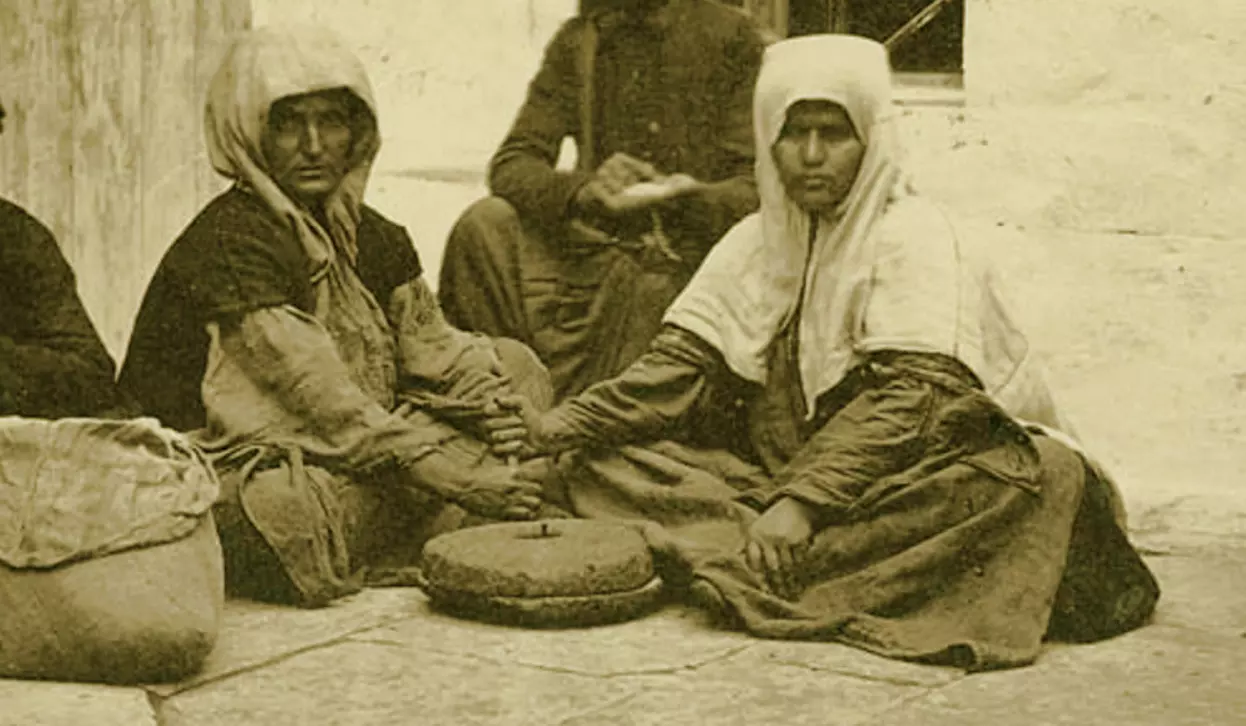
Posted by Rami Atwan - Women of Bethlehem 60 (Arab women grinding, 1912)
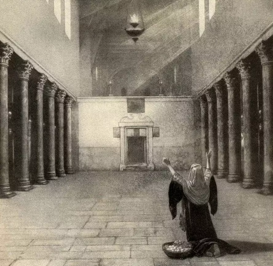
Posted by Rami Atwan - Women of Bethlehem 61 (Arab Woman praying in Nativity Church, early 20th c.)
Posted by Rami Atwan - Women of Bethlehem 62 (1930s)
Posted by Rami Atwan 2 - Women of Bethlehem 63 (1930s)
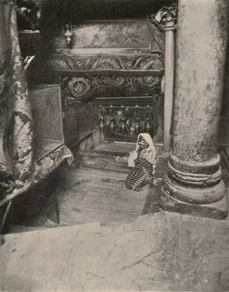
Posted by Rami Atwan - Women of Bethlehem 64 (1912, praying in the Church of the Nativity)
Posted by Rami Atwan - Women of Bethlehem 65 (1912, in Jerusalem, Garden of Gethsemane))
Posted by Rami Atwan - Women of Bethlehem 66 - 1927
Posted by Rami Atwan 1 - Bethlehem, 1960s (-70s) 25
Posted by Rami Atwan - Bethlehem, 1960s (-70s) 26
Posted by Rami Atwan 1 - PALESTINE - Bethlehem, 1890s (early 20th c.) 32 - Selling wheat and barley in Nativity Church precinct
Posted by Rami Atwan - Women of Bethlehem 67 - (late 19th early 20th c.)
Posted by Rami Atwan - PALESTINE - Bethlehem, 1890s (early 20th c.) 31 ~ Mission School
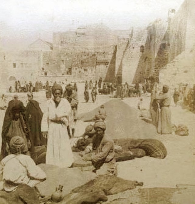
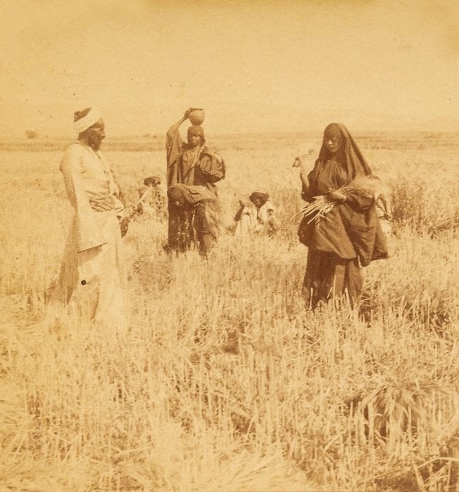
Posted by Rami Atwan - PALESTINE - Bethlehem, 1890s (early 20th c.) 32 (Barley harvest)
Posted by Rami Atwan - PALESTINE - Bethlehem, 1890s (early 20th c.) 33 (Idyllic domestic scene)
Posted by Rami Atwan 1 - Women of Bethlehem 68 - (late 19th early 20th c.) 1896
Posted by Rami Atwan - Women of Bethlehem 69 - (late 19th early 20th c.)
Posted by Rami Atwan - Women of Bethlehem 70 - (late 19th early 20th c.) 1930s
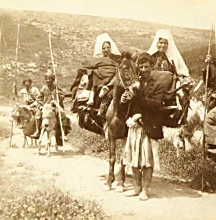
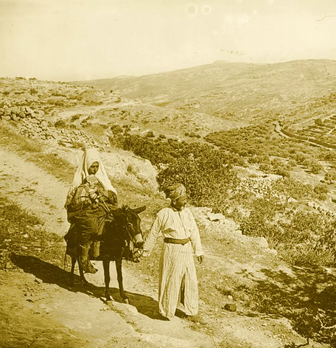
Posted by Rami Atwan 1 - Women of Bethlehem 71 - (late 19th early 20th c.) 1897, Road to Jericho on Mules
Posted by Rami Atwan 1 - Women of Bethlehem 72 - (late 19th early 20th c.)
Posted by Rami Atwan - Women of Bethlehem 73 - (late 19th early 20th c.)
Posted by Rami Atwan - Women of Bethlehem 74 - (late 19th early 20th c.)
Posted by Rami Atwan - Women of Bethlehem 75
Posted by Rami Atwan - BETHLEHEM - 1926, Itinerant traders
Posted by Rami Atwan - PALESTINE - Bethlehem, 1890s (early 20th c.) 34 (Mother of Pearl Worker)
Posted by Rami Atwan 1 - Women of Bethlehem 76 - Bethlehem and Ramallah women in Garden of Gethsemane (Jerusalem), 1890s
Posted by Rami Atwan - Women of Bethlehem 77 - Women from Bethlehem and Jerusalem on a pilgrimage to holy sites in Jerusalem, 1927
Posted by Rami Atwan - Women of Bethlehem 78 - Women from Bethlehem and Jerusalem on a pilgrimage to holy sites in Jerusalem, 1927
Posted by Rami Atwan - PALESTINE - Bethlehem, 2010 - 1
Posted by Rami Atwan - PALESTINE - Bethlehem, 2010 - Harmonious fusion of Palestinian-Arab-Islamic and Western styles of architecture
Posted by Rami Atwan 1 - PALESTINE - Bethlehem Family, late 19th, early 20th c.
Posted by Rami Atwan - PALESTINE - Bethlehem, 1890s (early 20th c.) 35
Posted by Rami Atwan - PALESTINE - Bethlehem, 1890s (early 20th c.) 36
Posted by Rami Atwan - PALESTINE - Bethlehem, 1890s (early 20th c.) 37
Posted by Rami Atwan - PALESTINE - Bethlehem, 1890s (early 20th c.) 38
Posted by Rami Atwan - PALESTINE - Bethlehem, 1890s (early 20th c.) 39

Posted by Rami Atwan 1 - PALESTINE - Bethlehem, 1890s (early 20th c.) 40 (Wheat and Barley harvest displayed in Nativity church-yard)
Posted by Rami Atwan - PALESTINE - Bethlehem, 1890s (early 20th c.) 41
Posted by Rami Atwan - PALESTINE - Bethlehem, 1890s (early 20th c.) 42
Posted by Rami Atwan - PALESTINE - Bethlehem, 1890s (early 20th c.) 43 (ca. 1883)
Posted by Rami Atwan - PALESTINE - Bethlehem, 1890s (early 20th c.) 44 (Rachels Tomb)
Posted by Rami Atwan - PALESTINE - Bethlehem, 1890s (early 20th c.) 45 (Church of the Nativity)
Posted by Rami Atwan - PALESTINE - Bethlehem, 1890s (early 20th c.) 46 (Shepherds Field and the Milk Grotto)
Posted by Rami Atwan - Bethlehem, 1960s (-70s) 27
Posted by Rami Atwan - Bethlehem, 1960s (-70s) 28
Posted by Rami Atwan - Women of Bethlehem 79 - (late 19th early 20th c.)
Posted by Rami Atwan - Women of Bethlehem 80 - (Late 19th, early 20th c.)
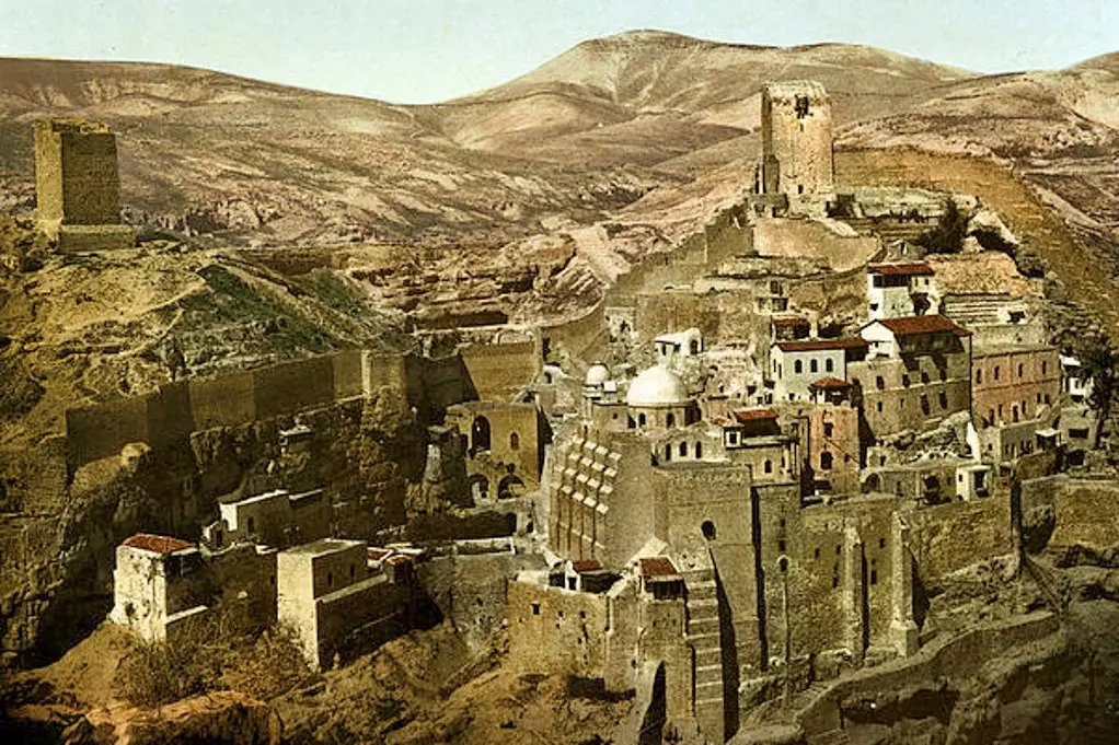
Posted by Rami Atwan 1 - PALESTINE - The monastery of Mar-Saba, east of Bethlehem
Posted by Rami Atwan - PALESTINE - Bethlehem, 1930s
Posted by Rami Atwan 2 - Women of Bethlehem 81 (Munir Alawi, Palestinian Artist and photographer)
Posted by Rami Atwan - Bethlehem, 1960s (-70s) 29 - Shepherds Field
Posted by Rami Atwan - Bethlehem, 1960s (-70s) 30
Posted by Rami Atwan - Bethlehem, 1960s (-70s) 31 - The Grotto of the Nativity
Posted by Rami Atwan - PALESTINE - Bethlehem, 1890s (early 20th c.) 47 (Rainy day in 1930s)
Posted by Rami Atwan - PALESTINE - Bethlehem, 1950s
Posted by Rami Atwan - Women of Bethlehem 81 - (Late 19th, early 20th c.) - Two Bethlehem women on a pilgrimage to Jerusalem (Arc of Ecce Homo)
Posted by Rami Atwan - Women of Bethlehem 82 - (Late 19th, early 20th c.) - (Engraving date 1897, based on photograph taken ca. 1869)
Posted by Rami Atwan - Women of Bethlehem 83 - (Late 19th, early 20th c.) - ca. 1920s - (Photo by Chalil Raad, Palestine's first Arab photographer, 1854-1957)
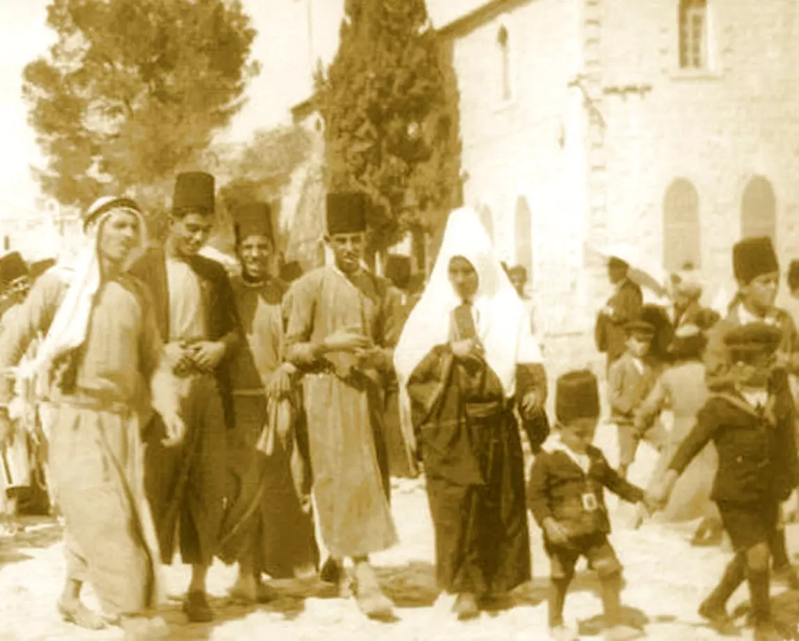
Posted by Rami Atwan - PALESTINE - Bethlehem, 1890s (early 20th c.) 48 circa 1925: A group of Palestinians talking outside their houses in Bethlehem. (Photo by Chalil Raad, Palestine's first Arab photographer, 1854-1957)
Posted by Rami Atwan 1 - Women of Bethlehem 84 - (Late 19th, early 20th c.)
Posted by Rami Atwan 1 - Women of Bethlehem 85 - A Palestinian woman from bethlehem and a Saudi woman, 1960s ?
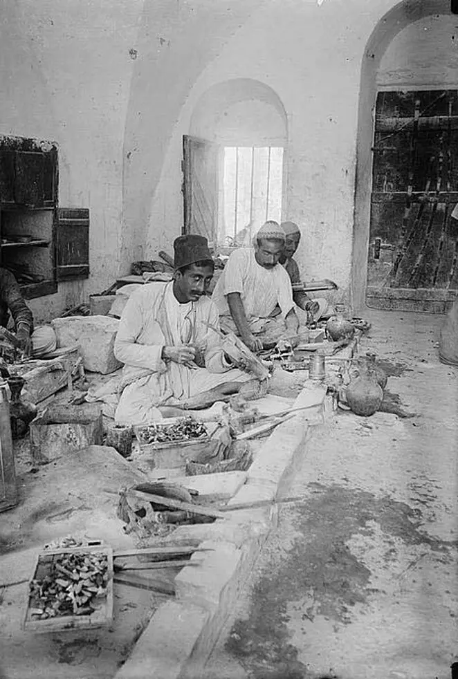
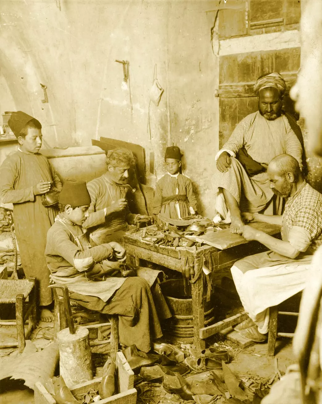
Posted by Rami Atwan - PALESTINE - Bethlehem, 1890s (early 20th c.) 49 circa 1925: A group of Palestinian craftsmen carving in ornaments mother-of-pearl. (Photo by Chalil Raad, Palestine's first Arab photographer, 1854-1957)
Posted by Rami Atwan 1 - Women of Bethlehem 86 - (late 19th, early 20th c.)
Posted by Rami Atwan - Women of Bethlehem 87 - (late 19th, early 20th c.) - 1930s
Posted by Rami Atwan 1 - Women of Bethlehem 88 - (late 19th, early 20th c.) - 1930s
Posted by Rami Atwan - Women of Bethlehem 89 - (late 19th, early 20th c.) - 1930s
Posted by Rami Atwan - Women of Bethlehem 90 - (late 19th, early 20th c.) - 1930s
Posted by Rami Atwan - Women of Bethlehem 91 - (late 19th, early 20th c.) - 1930s
Posted by Rami Atwan 1 - Women of Bethlehem 92 - (late 19th, early 20th c.) 1880s
Posted by Rami Atwan - Women of Bethlehem 93 - (late 19th, early 20th c.) 1934
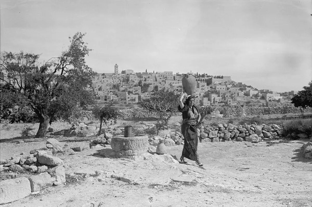
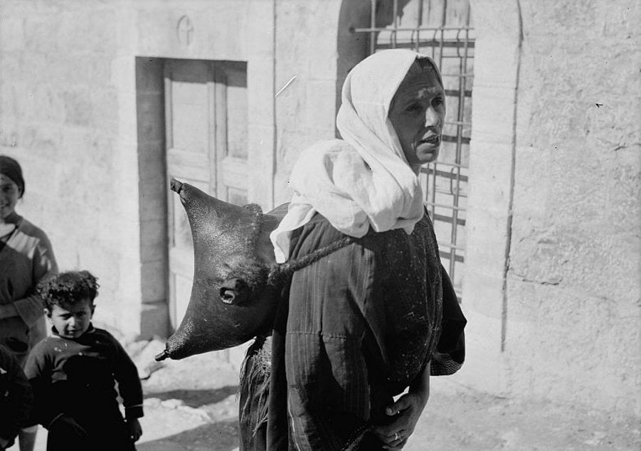
Posted by Rami Atwan - Women of Bethlehem 94 - (late 19th, early 20th c.) 1930s - Bethlehem woman carrying water in a goatskin
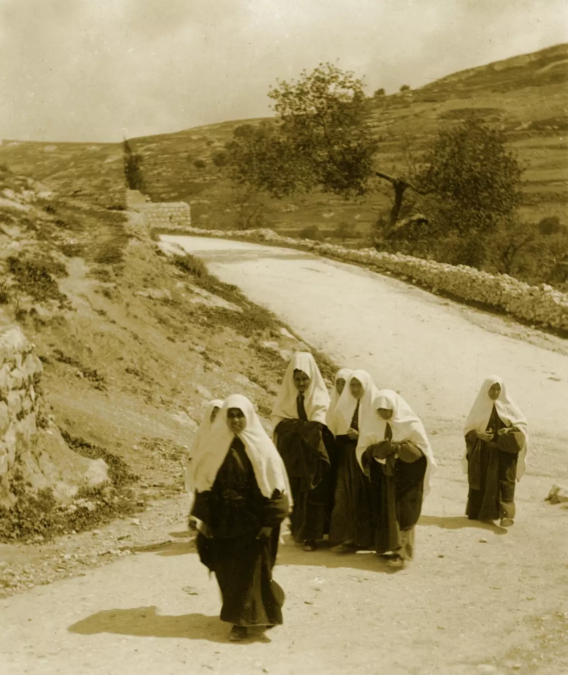
Posted by Rami Atwan - Women of Bethlehem 95 - (late 19th, early 20th c.) 1919 - Palestinians from Bethlehem on their way to Jerusalem
Posted by Rami Atwan 1 - Women of Bethlehem 96- (late 19th, early 20th c.) 1911 - Fountain at Silwan
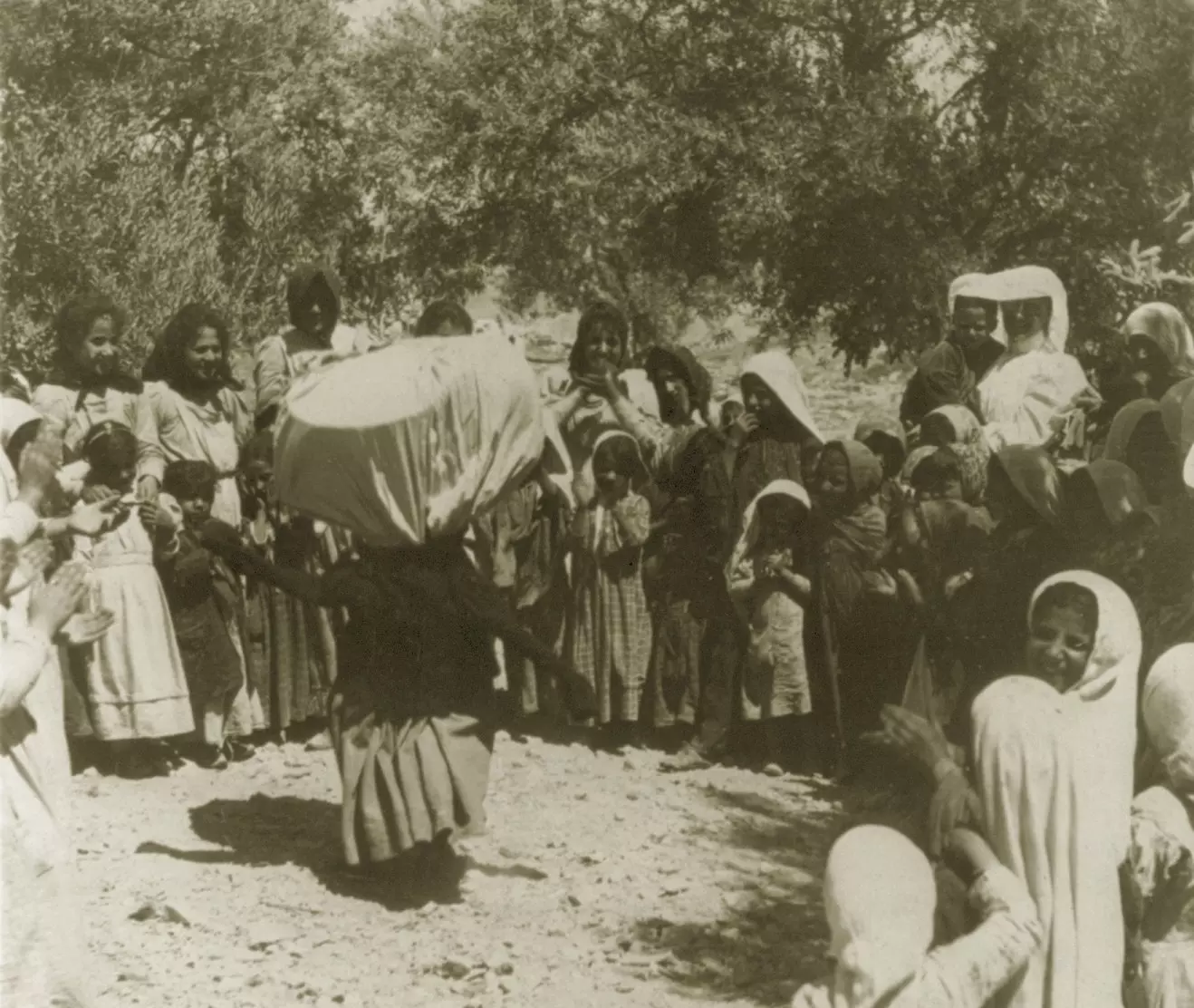
Posted by Rami Atwan - Women of Bethlehem 97- (late 19th, early 20th c.) 1900 - Old woman's dance to entertain children
Posted by Rami Atwan - Women of Bethlehem 98 - (late 19th, early 20th c.) 1880s
Posted by Rami Atwan - Women of Bethlehem 99 - (late 19th, early 20th c.) 1889

Posted by Rami Atwan - Women of Bethlehem 100 - (late 19th, early 20th c.) 1882

Posted by Rami Atwan - Women of Bethlehem 101 - (late 19th, early 20th c.)
Posted by Rami Atwan 1 - PALESTINE - Bethlehem, 1890s (early 20th c.) 50
Posted by Rami Atwan - PALESTINE - Bethlehem, 1890s (early 20th c.) 51 - 1889
Posted by Rami Atwan - PALESTINE - Bethlehem, 1890s (early 20th c.) 52 - Church of the nativity (interior)
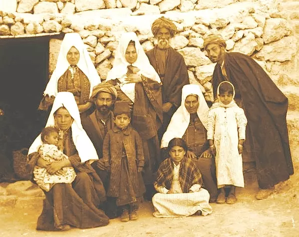
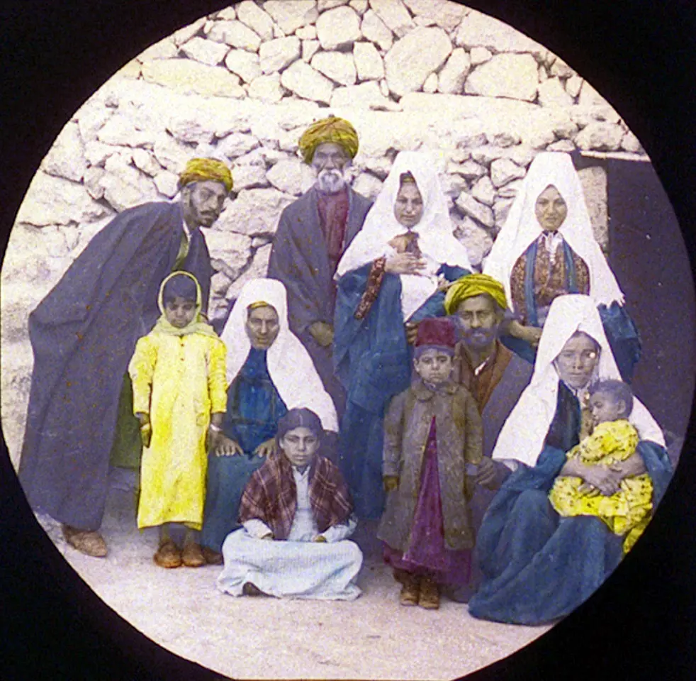
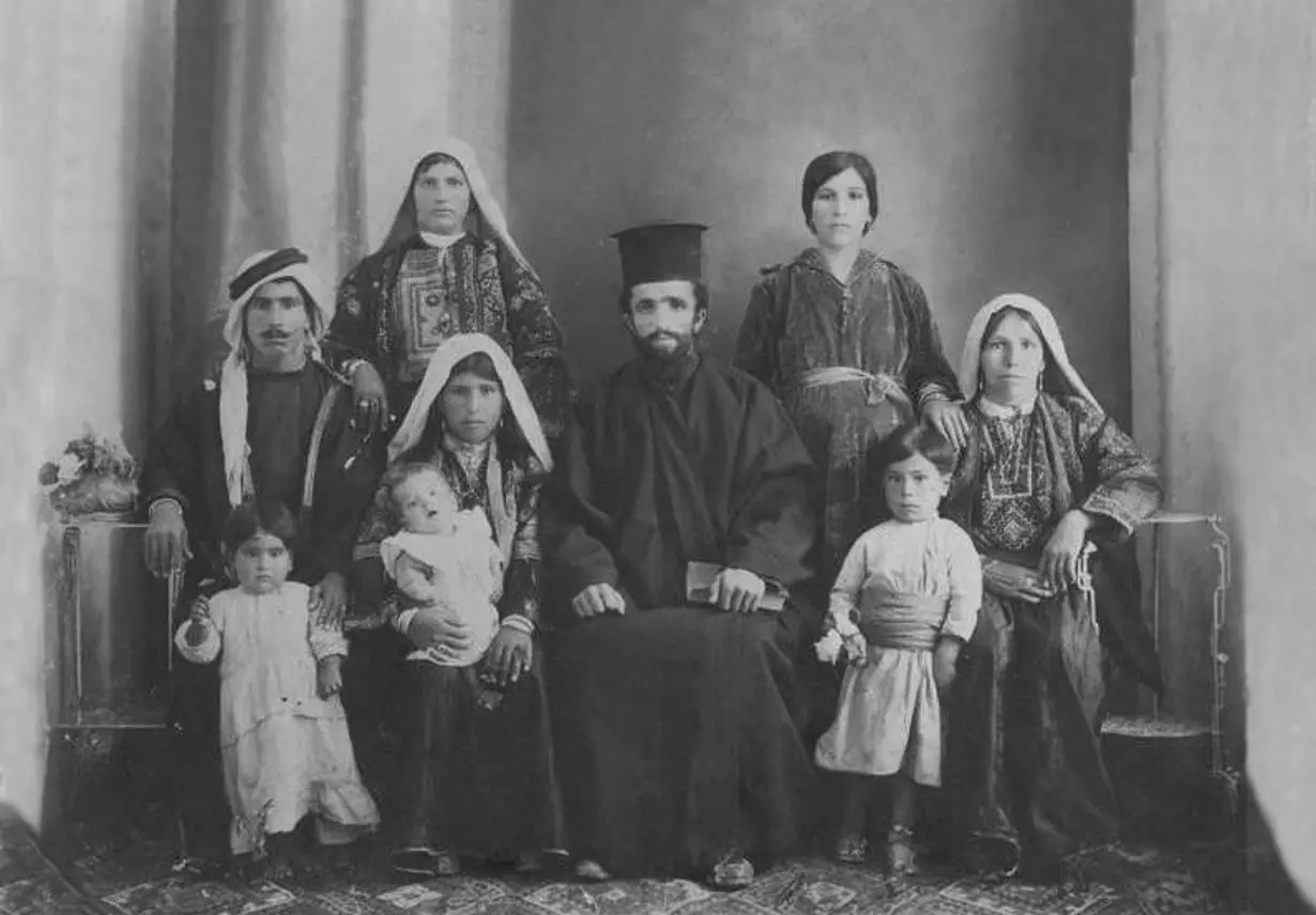
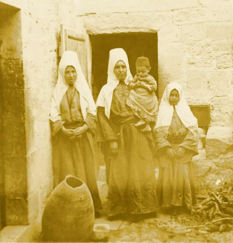
Posted by Rami Atwan - PALESTINE - Bethlehem, 1890s (early 20th c.) 53 - A Family of Bethlehem
Posted by Rami Atwan - BETHLEHEM - The old road to Bethlehem, 1937
Posted by Rami Atwan - Women of Bethlehem 102 - (1939-45)
Posted by Rami Atwan - Women of Bethlehem 103 - Drawing water from well, Beit Sahour (1939-45)
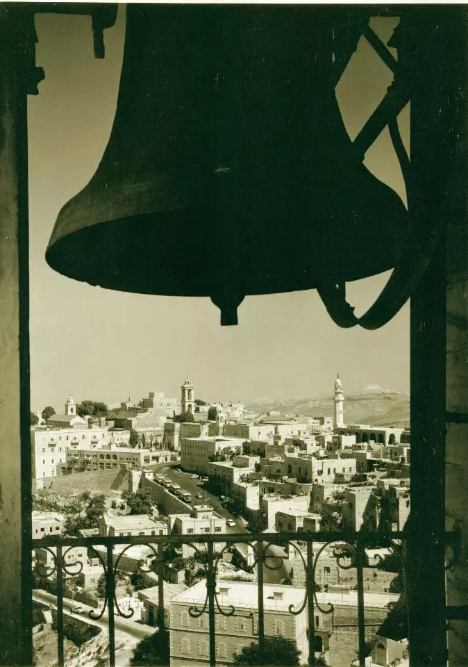
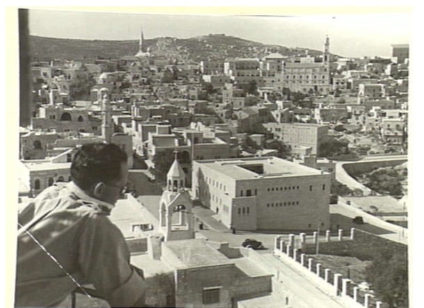
Posted by Rami Atwan - PALESTINE - Bethlehem, from the belfry of the Church of the Nativity, 24 December 1942
Posted by Rami Atwan - PALESTINE - Bethlehem, General view, ca. 1942
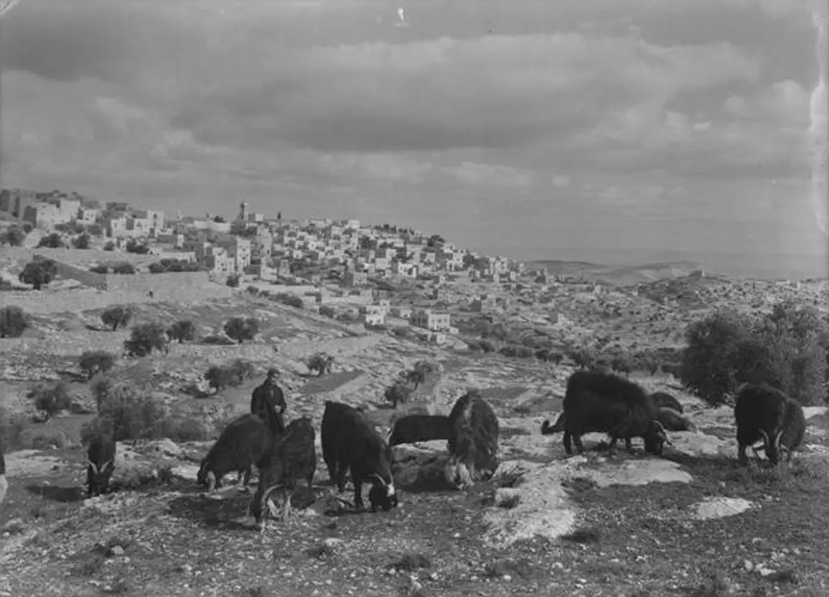
Posted by Rami Atwan 1 - PALESTINE - Bethlehem, palestinian shepherd outside Bethlehem, 1939-45
Posted by Rami Atwan - PALESTINE - Bethlehem, Panorama of Bethlehem as seen from the Spire of the Basilica of the Nativity, 1939-45
Posted by Rami Atwan - PALESTINE - Bethlehem, partial view as seen from the Spire of the Basilica of the Nativity, 1939- 45
Posted by Rami Atwan - PALESTINE - Bethlehem, 1890s (early 20th c.) 54
Posted by Rami Atwan - PALESTINE - Bethlehem, 1890s (early 20th c.) 55
Posted by Rami Atwan - BETHLEHEM - Church of the Nativity, ca. 1942 (National Library of Australia)

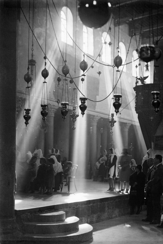
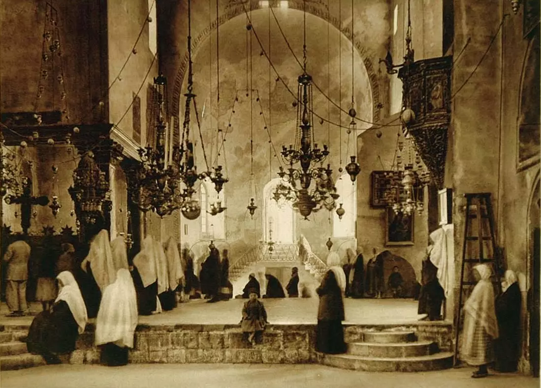
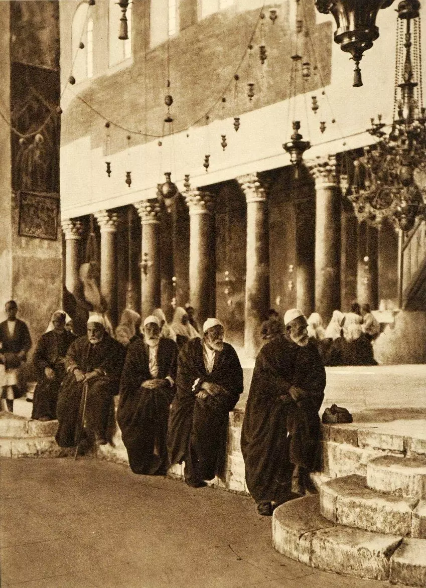
Posted by Rami Atwan - BETHLEHEM - Palestinian worshippers in Church of the Nativity, ca. early 1920s
Posted by Rami Atwan - BETHLEHEM - Palestinian worshippers in Church of the Nativity 2, ca. early 1920s
Posted by Rami Atwan - PALESTINE - Bethlehem, 1890s (early 20th c.) 56
Posted by Rami Atwan 1 - Bethlehem, 1960s (-70s) 32
Posted by Rami Atwan - Bethlehem, 1960s (-70s) 33

Posted by Rami Atwan - Women of Bethlehem 104 (late 19th, early 20th c.)
Posted by Rami Atwan - PALESTINE - Bethlehem, 1890s (early 20th c.) 57 - Wheat and barley harvest displayed in the centre of bethlehem
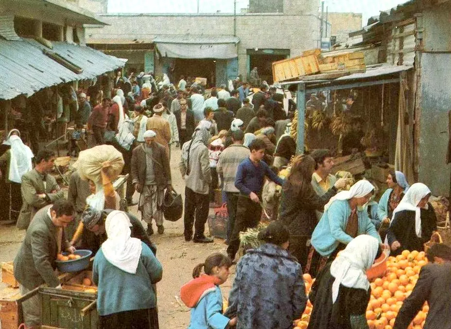
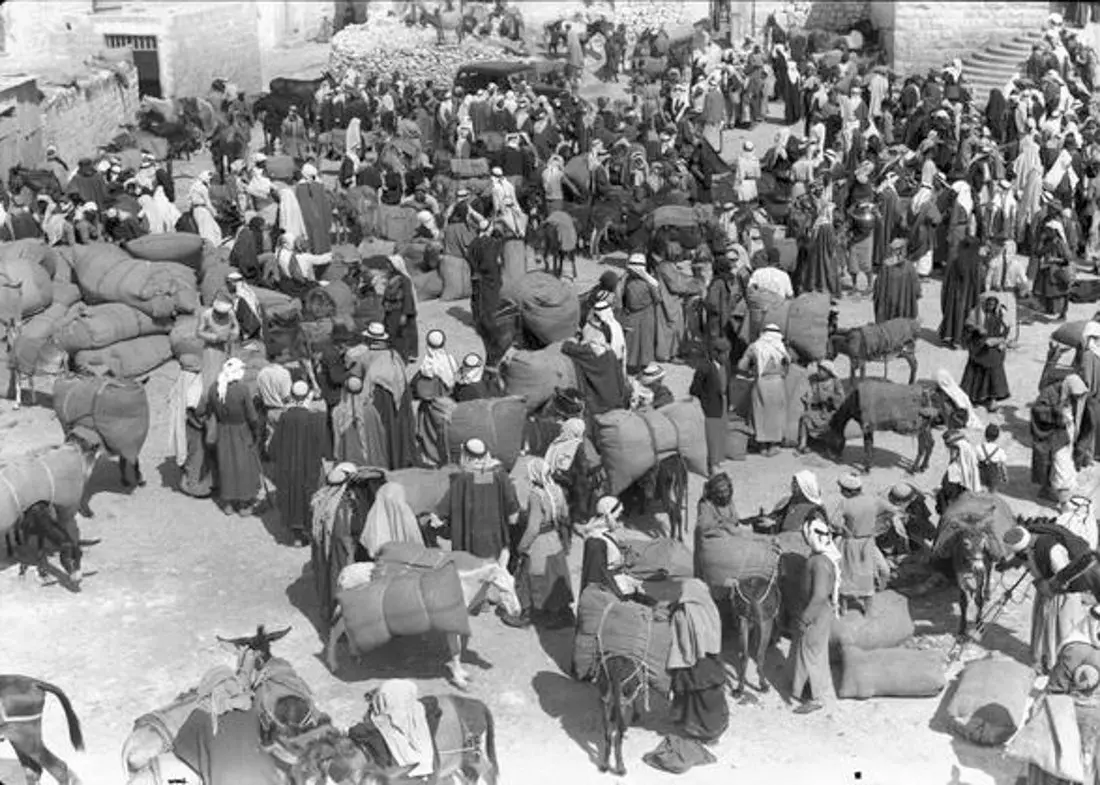
Posted by Rami Atwan - PALESTINE - Bethlehem - Market day, ca. 1941 - (National Library of Australia)
Posted by Rami Atwan - PALESTINE - Bethlehem, 1890s (early 20th c.) 58 - A funeral procession in Bethlehem, early 1930s
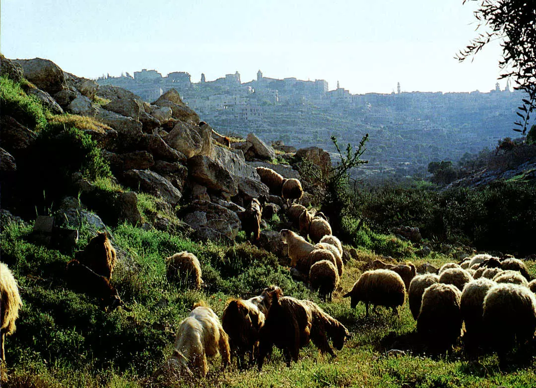
Posted by Rami Atwan - PALESTINE - The hills at the outskirts of Bethlehem
Posted by Rami Atwan - Women of Bethlehem 105 (Bethlehem area, possibly Beit Sahur or Beit Jala) - (late 19th, early 20th c.)
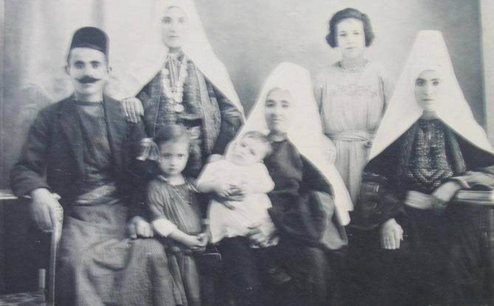
Posted by Rami Atwan - A Palestinian family of Bethlehem, 1890s (Note the woman holding framed picture and flowers)
Posted by Rami Atwan - Women of Bethlehem 106 (late 19th, early 20th c.)

Posted by Rami Atwan - Women of Bethlehem 107 (late 19th, early 20th c.)
Posted by Rami Atwan - Women of Bethlehem 108 (late 19th, early 20th c.) - 1892
Posted by Rami Atwan - Women of Bethlehem 109 - (Khalil Raad, ca. 1930 - Bethlehem area)

Posted by Rami Atwan - A Palestinian family group from the Bethlehem area, (Khalil Raad, ca. 1930)
Posted by Rami Atwan - Bethlehem, 1960s (-70s) 34
Posted by Rami Atwan - PALESTINE - Bethlehem, 1890s (early 20th c.) 59 Christmas procession of the Greek patriachs
Posted by Rami Atwan - PALESTINE - Bethlehem, 1890s (early 20th c.) 60
Posted by Rami Atwan - PALESTINE - Bethlehem, 1890s (early 20th c.) 61
Posted by Rami Atwan 1 - PALESTINE - Bethlehem, 1890s (early 20th c.) 62
Posted by Rami Atwan - PALESTINE - Bethlehem, 1890s (early 20th c.) 63
Posted by Rami Atwan - PALESTINE - Bethlehem, 1890s (early 20th c.) 64

Posted by Rami Atwan - PALESTINE - Bethlehem, 1890s (early 20th c.) 65
Posted by Rami Atwan - PALESTINE - Bethlehem, 1890s (early 20th c.) 66

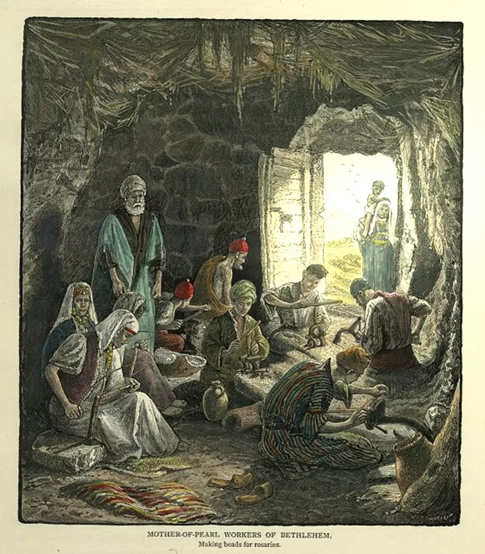
Posted by Rami Atwan - PALESTINE - Bethlehem, 1890s (early 20th c.) 67 - Mother-of-Pearl workers
Posted by Rami Atwan - PALESTINE - Bethlehem, 1890s (early 20th c.) 68 - Mother-of-Pearl workers

Posted by Rami Atwan - كنيسة المهد
Posted by samar bader - شوارع بيت لحم القديمه
Posted by samar bader 1 - ساحة المهد
Posted by samar bader - PALESTINE - Bethlehem, 1890s (early 20th c.) 69
Posted by Rami Atwan - PALESTINE - Bethlehem, 1890s (early 20th c.) 70
Posted by Rami Atwan - PALESTINE - Bethlehem, 1890s (early 20th c.) 71

Posted by Rami Atwan - PALESTINE - Bethlehem, 1890s (early 20th c.) 72
Posted by Rami Atwan - PALESTINE - Bethlehem, Mother-of-Pearl workers, 1934
Posted by Rami Atwan - PALESTINE - Bethlehem, 1890s (early 20th c.) 73

Posted by Rami Atwan - PALESTINE - Bethlehem, 1890s (early 20th c.) 74 - At the Church of the Nativity, c. 1920
Posted by Rami Atwan - Women of Bethlehem 110 (late 19th, early 20th c.)
Posted by Rami Atwan 2 - PALESTINE - Bethlehem, 1890s (early 20th c.) 75 - Barley Harvest, 1897
Posted by Rami Atwan 1 - PALESTINE - Bethlehem, 1890s (early 20th c.) 76 (Bonfils, 1882) - (Per Reem Ackall)
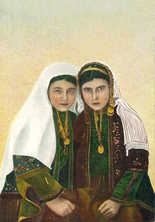
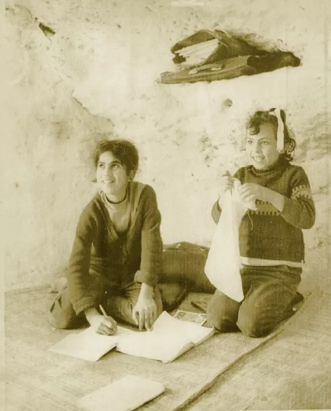
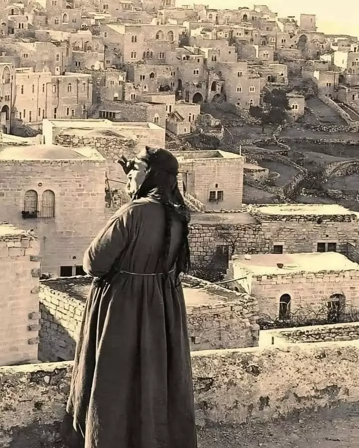
Posted by Rami Atwan - PALESTINE - Bethlehem, 1890s (early 20th c.) 77 - Two Palestinian girls gaze at their city (Per Reem Ackall)
Posted by Rami Atwan 1 - PALESTINE - Bethlehem, 1890s (early 20th c.) 78 (circa 1880s)
Posted by Rami Atwan 1 - PALESTINE - Bethlehem, 1890s (early 20th c.) 79 - Shepherds Grotto Near Bethlehem (Per Reem Ackall)
Posted by Rami Atwan - PALESTINE - Bethlehem, 1890s (early 20th c.) 80 - circa 1880s (Per Reem Ackall)
Posted by Rami Atwan 1 - PALESTINE - Bethlehem, 1890s (early 20th c.) 81 The barley harvest (Per Reem Ackall)
Posted by Rami Atwan - PALESTINE - Bethlehem, 1890s (early 20th c.) 82 Glorious Palestine (Per Reem Ackall)
Posted by Rami Atwan - PALESTINE - Bethlehem, 1890s (early 20th c.) 83 (Per Reem Ackall)

Posted by Rami Atwan - PALESTINE - Bethlehem, 1890s (early 20th c.) 84 - A general view from the South, circa 1870s (Per Reem Ackall)
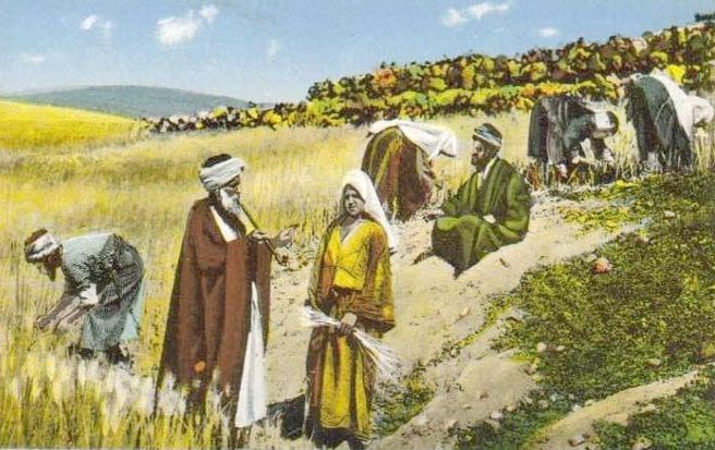
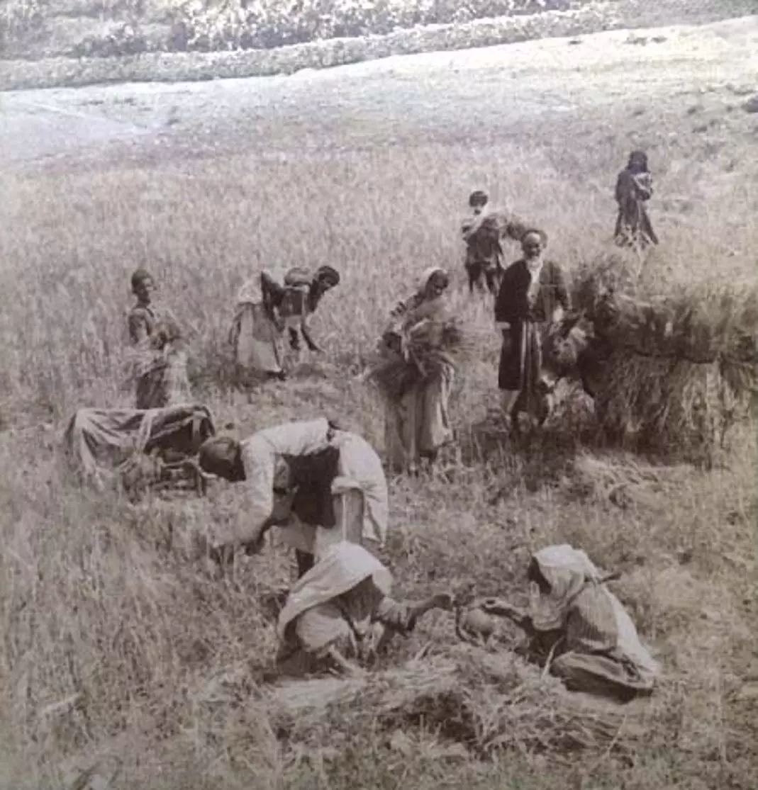
Posted by Rami Atwan - PALESTINE - Bethlehem, 1890s (early 20th c.) 85 - Barley Harvest near Bethlehem (Per Reem Ackall)
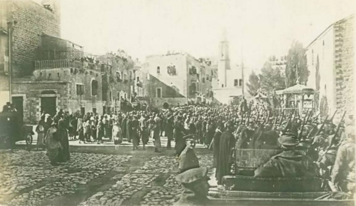
Posted by Rami Atwan - PALESTINE - Bethlehem, 1890s (early 20th c.) 86 - British Troops marching through Bethlehem, 1918 (Per Reem Ackall)
Posted by Rami Atwan 1 - PALESTINE - Bethlehem, 1890s (early 20th c.) 87 - A postcard (Per Reem Ackall)
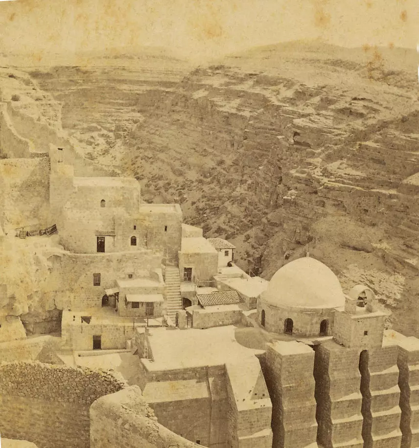
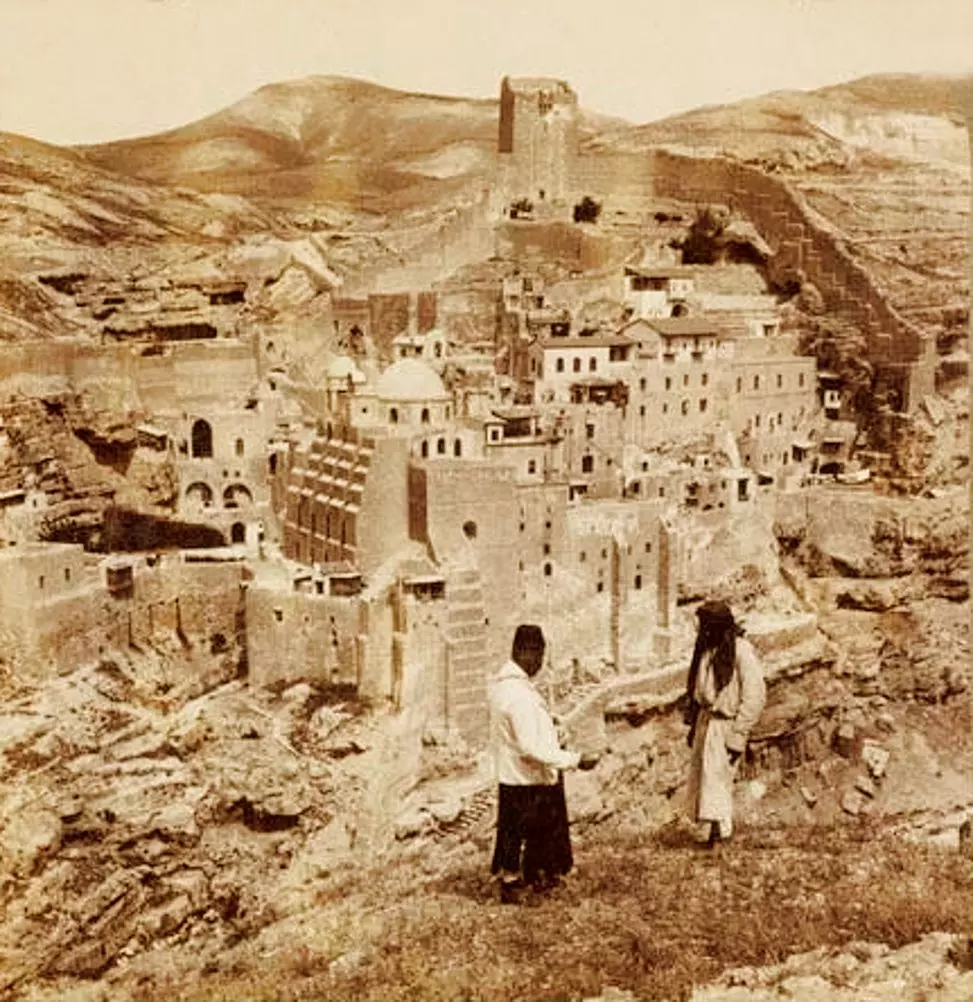
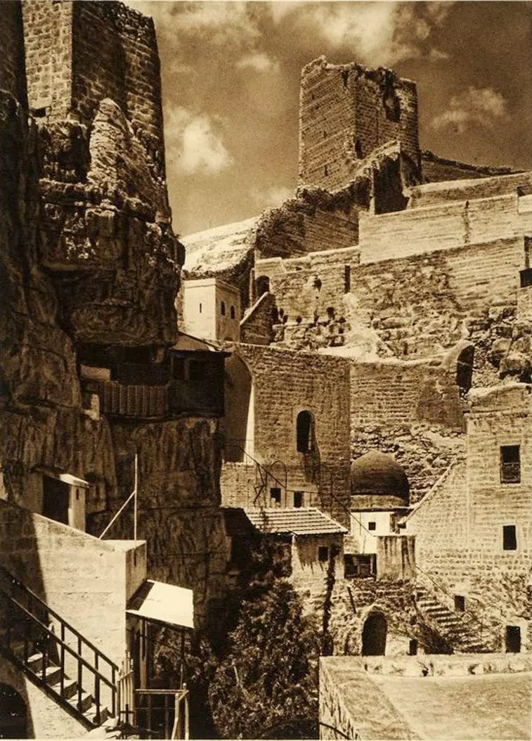
Posted by Rami Atwan - PALESTINE - Bethlehem, 1890s (early 20th c.) 88 - St. Saba Convent near Bethlehem, circa 1870s - (Per Reem Ackall)
Posted by Rami Atwan - Bethlehem, 1960s (-70s) 34 - Interiour of The Nativity Church
Posted by Rami Atwan - PALESTINE - Bethlehem, 1890s (early 20th c.) 89 - Market scene (Per Reem Ackall)
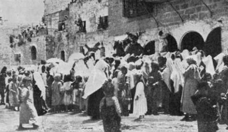
Posted by Rami Atwan - PALESTINE - Bethlehem, 1890s (early 20th c.) 90 - Christmas crowd at the Nativity (Per Reem Ackall)

Posted by Rami Atwan 1 - PALESTINE - Bethlehem, 1890s (early 20th c.) 91 - panoramic view, 1920s (Per Reem Ackall)
Posted by Rami Atwan - PALESTINE - Bethlehem, 1890s (early 20th c.) 92 - Front yard of the Nativity Church, circa 1880s (Per Reem Ackall)
Posted by Rami Atwan 1 - Bethlehem, 1960s (-70s) 35
Posted by Rami Atwan - Women of Bethlehem 111 (late 19th, early 20th c.)
Posted by Rami Atwan - PALESTINE - Bethlehem, 1890s (early 20th c.) 93 (Per Reem Ackall)
Posted by Rami Atwan - PALESTINE - Bethlehem, 1890s (early 20th c.) 94 - Church of the Nativity, circa 1870s (Per Reem Ackall)
Posted by Rami Atwan - PALESTINE - Bethlehem, 1890s (early 20th c.) 95 - Near Bethlehem, site of angel?s appearance to the shepherds (Per Reem Ackall)
Posted by Rami Atwan - PALESTINE - Bethlehem, 1890s (early 20th c.) 96 - the Shepherd?s Field, circa 1880s (Per Reem Ackall)
Posted by Rami Atwan - PALESTINE - Bethlehem, 1890s (early 20th c.) 97 - From the north-east, 1880s (Per Reem Ackall)
Posted by Rami Atwan - PALESTINE - Bethlehem, 1890s (early 20th c.) 98 - Bethlehem from the Latin Conventn, circa 1860s -70s (Per Reem Ackall)
Posted by Rami Atwan 1 - PALESTINE - Bethlehem, 1890s (early 20th c.) 99 - Bethlehem, from the Latin Convent 1860s-70s (Per Reem Ackall)
Posted by Rami Atwan - PALESTINE - Bethlehem, 1890s (early 20th c.) 100 (Per Reem Ackall)

Posted by Rami Atwan 1 - PALESTINE - Bethlehem, 1890s (early 20th c.) 101 - Market precinct, 1897 (Per Reem Ackall)
Posted by Rami Atwan - PALESTINE - Bethlehem, 1890s (early 20th c.) 102 (Per Reem Ackall)
Posted by Rami Atwan - PALESTINE - Bethlehem, 1890s (early 20th c.) 103 - Mar Saba monastery, 1896 (Per Reem Ackall)
Posted by Rami Atwan - PALESTINE - Bethlehem, 1890s (early 20th c.) 104 - The Greek Monastery of St. Elie (Per Reem Ackall)
Posted by Rami Atwan 1 - PALESTINE - Bethlehem, 1890s (early 20th c.) 105 - A bustling market day (Per Reem Ackall)
Posted by Rami Atwan 1 - Bethlehem, 1960s (-70s) 36 - On Christmas Day
Posted by Rami Atwan - Bethlehem, 1960s (-70s) 37 - The front yard of the Nativity Church (Manger Square)
Posted by Rami Atwan - Bethlehem, 1960s (-70s) 38 - The Mosque of Omar in Manger Square
Posted by Rami Atwan - PALESTINE - Bethlehem, 1890s (early 20th c.) 106 - In the courtyard of The Nativity Church, circa 1902 (Per Reem Ackall)
Posted by Rami Atwan - PALESTINE - Bethlehem, 1890s (early 20th c.) 107 - Panoramic view (Per Reem Ackall)

Posted by Rami Atwan - PALESTINE - Bethlehem, 1890s (early 20th c.) 108 - Grotto of the "Slaughter of the Innocents" (Per Reem Ackall)
Posted by Rami Atwan - PALESTINE - Bethlehem, 1890s (early 20th c.) 109 - Glorious Palestine (Per Reem Ackall)
Posted by Rami Atwan - PALESTINE - Bethlehem - British soldier fortifications in Manger Square, 1938 (Per Reem Ackall)
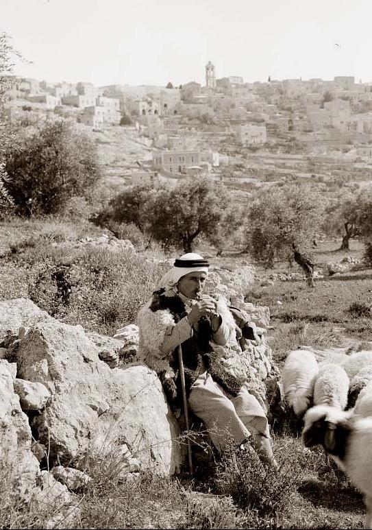
Posted by Rami Atwan - PALESTINE - Bethlehem, 1890s (early 20th c.) 110 - A shepherd in the outlying fields of Bethlehem, circa 1918 (Per Reem Ackall)
Posted by Rami Atwan - PALESTINE - Bethlehem, 1890s (early 20th c.) 111 - Christmas Day in Bethlehem, circa 1908
Posted by Rami Atwan - PALESTINE - Bethlehem, 1890s (early 20th c.) 112 - J. Harmsworth, circa 1885 (Per Reem Ackall
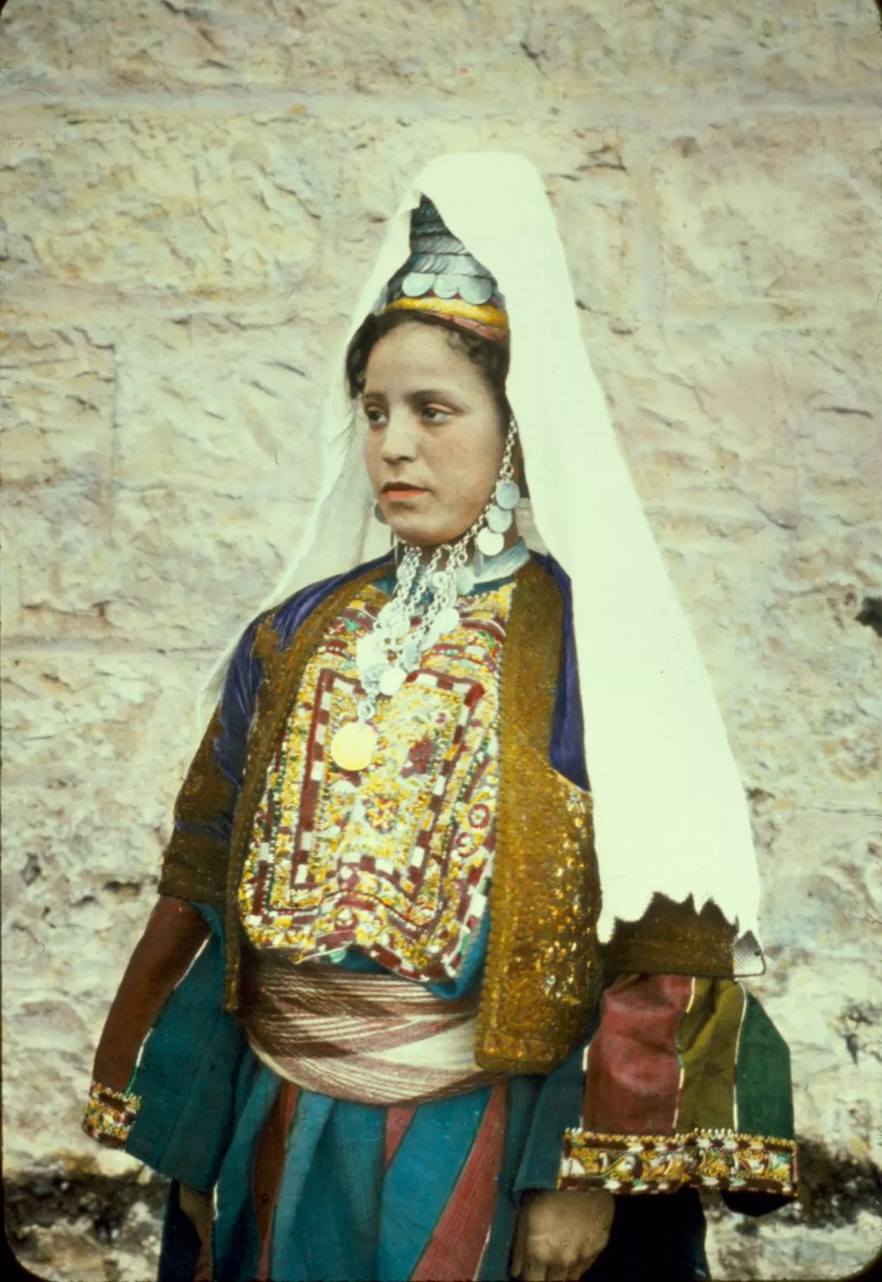
Posted by Rami Atwan - Women of Bethlehem 112 (late 19th, early 20th c.) A Palestinian woman of Bethlehem in her wedding dress, circa 1930s (Per Reem Ackall)
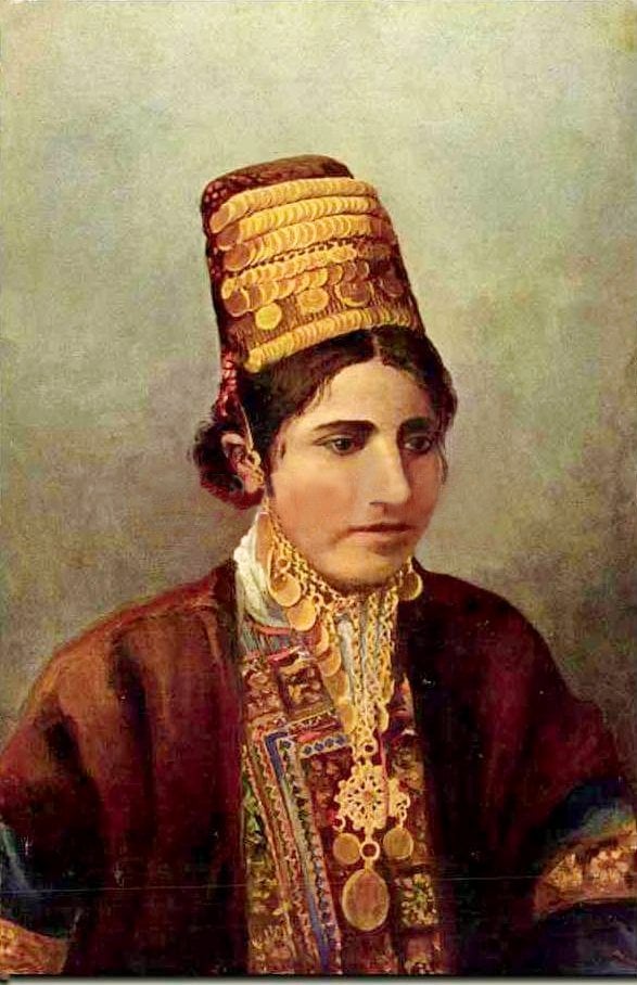
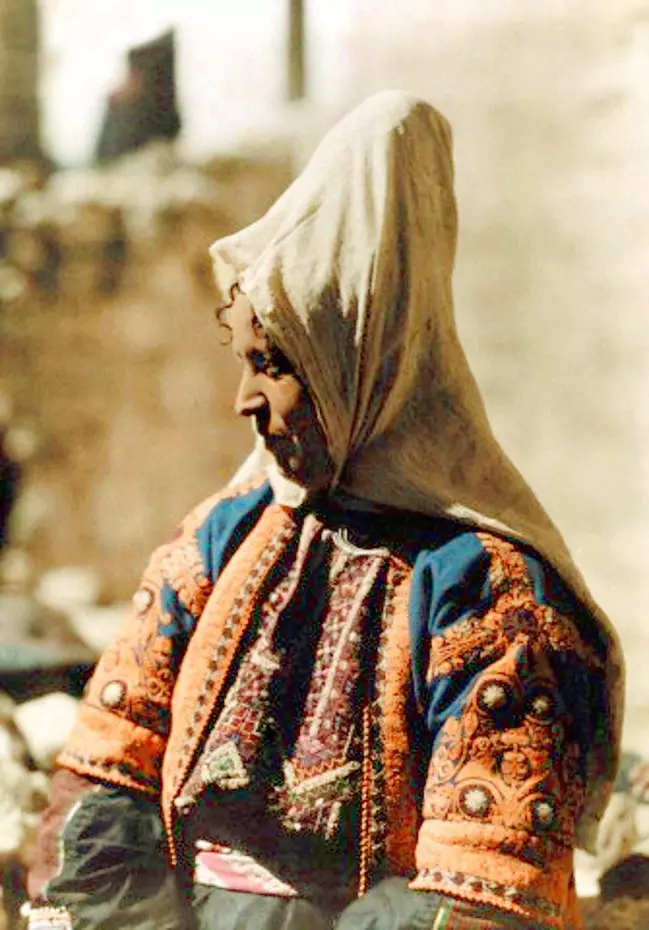
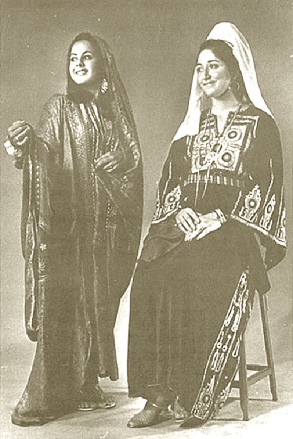
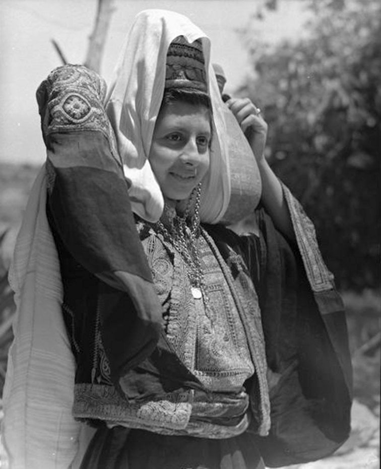
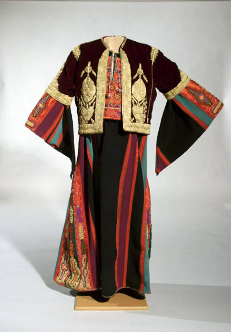
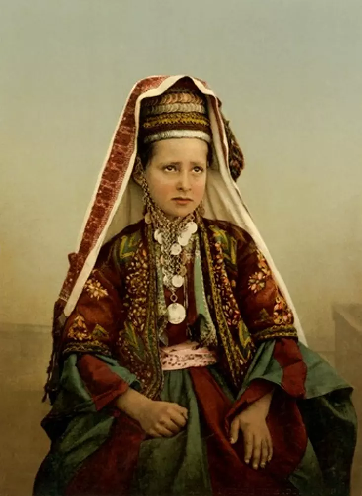
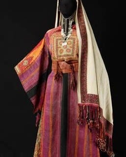
Posted by Rami Atwan - BETHLEHEM - Thob al malak (bridal gown) worn with a short velvet jacket (taksireh). Bethlehem, Palestine. Early 20th century (Oriental Institute of the University of Chicago)
Posted by Rami Atwan - PALESTINE - Bethlehem, 1890s (early 20th c.) 113 - A general view, circa 1909 (Per Reem Ackall)
Posted by Rami Atwan - PALESTINE - Bethlehem, 1890s (early 20th c.) 114 - A roof-top viewl , circa 1790-1850 (Per Reem Ackall)
Posted by Rami Atwan - PALESTINE - Bethlehem, 1890s (early 20th c.) 115 - Bird's-eye view, circa 1850 (Per Reem Ackall)
Posted by Rami Atwan - PALESTINE - Bethlehem, 1890s (early 20th c.) 116 - A partial view, circa 1858 (Per Reem Ackall)
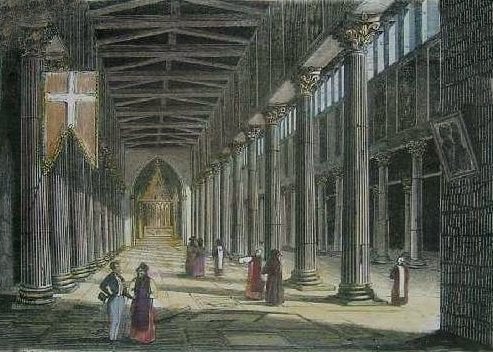
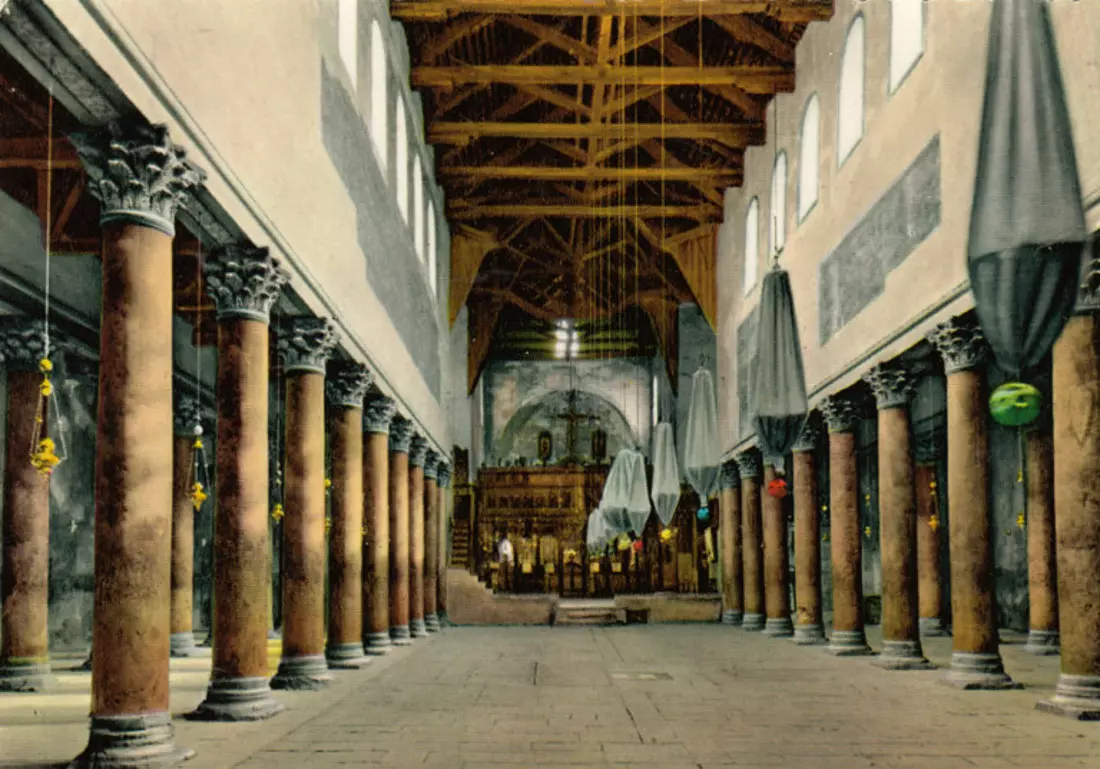
Posted by Rami Atwan - PALESTINE - Bethlehem, 1890s (early 20th c.) 117 - Interior of the Church of the Nativity, circa 1838
Posted by Rami Atwan - PALESTINE - Bethlehem, 1890s (early 20th c.) 118 - A Bethlehem man working (carving crosses, making rosaries, mother-of-pearl artifacts, etc.) with family basking in sunshine, circa 1870
Posted by Rami Atwan - PALESTINE - Bethlehem, 1890s (early 20th c.) 119 - A general view. (Per Reem Ackall)
Posted by Rami Atwan - PALESTINE - Bethlehem, 1890s (early 20th c.) 120 - Glorious Palestine, 1898 (Per Reem Ackall)
Posted by Rami Atwan - PALESTINE - Bethlehem, 1890s (early 20th c.) 121 - Glorious Palestine (Per Reem Ackall)
Posted by Rami Atwan - Women of Bethlehem 113 (late 19th, early 20th c.) - Palestinian women in the fields and vineyards surrounding Bethlehem - Colourised (Per Reem Ackall)
Posted by Rami Atwan - habib zuoghbi family

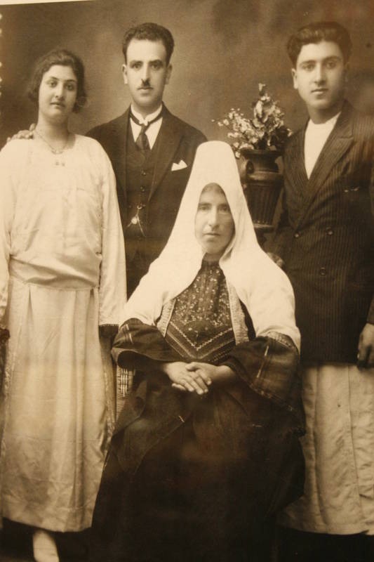
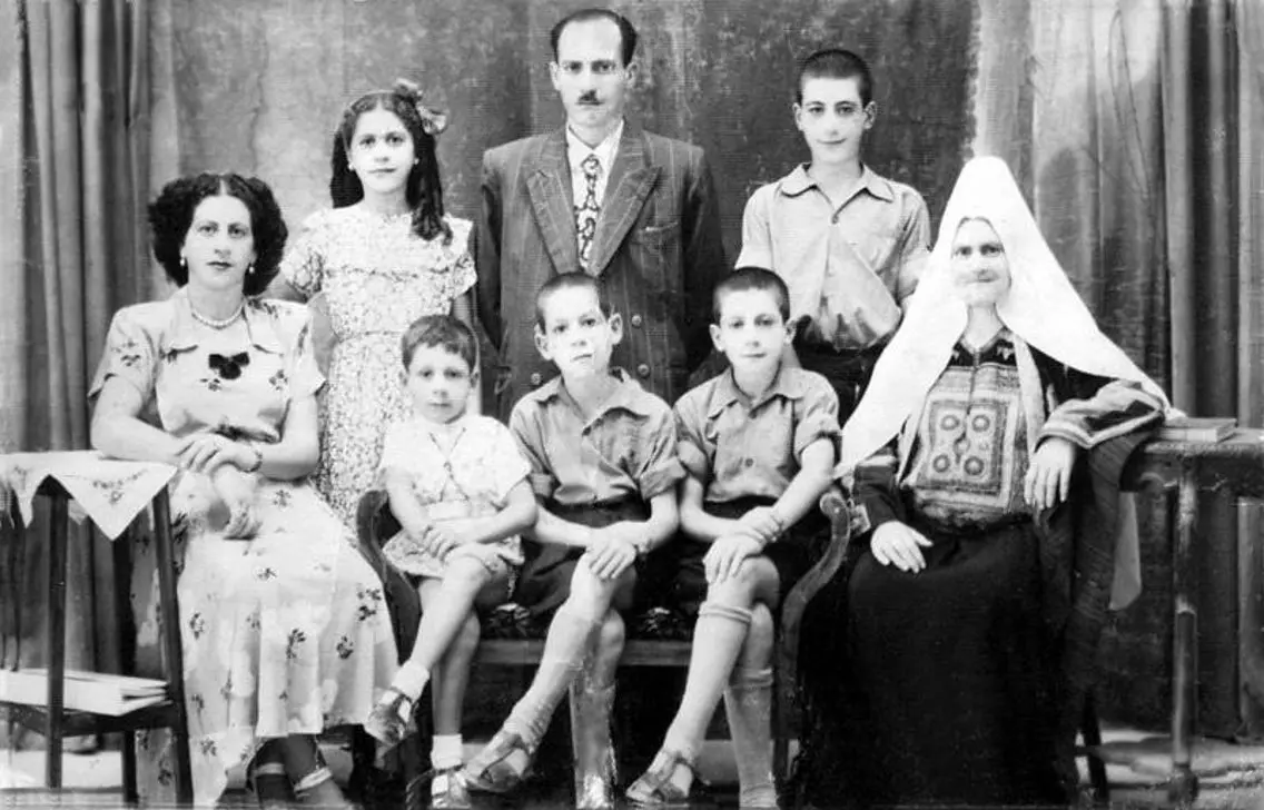
Posted by bibi 1 - BETHLEHEM FAMILY 1920
Posted by bibi - Women of Bethlehem 114 (late 19th, early 20th c.) - Image by Frank M. Good (colourised), circa 1868-9 (Per Reem Ackall)
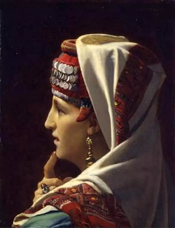
Posted by Rami Atwan - Women of Bethlehem 115 (late 19th, early 20th c.) - A married Arab woman of Bethlehem wearing Shatweh - Painting by Jean du Nou ?(Judith, 1875) (
Posted by Rami Atwan - Women of Bethlehem 116 (late 19th, early 20th c.) - Photo by Tancrède Dumas, 1880 (Per Reem Ackall)
Posted by Rami Atwan - Women of Bethlehem 117 (late 19th, early 20th c.) - Photo by Tancrède Dumas, 1889 (Per Reem Ackall)
Posted by Rami Atwan - Women of Bethlehem 118 (late 19th, early 20th c.) - Photo by Tancrède Dumas, 1880s (Per Reem Ackall)
Posted by Rami Atwan - Women of Bethlehem 119 (circa 1940s) (Per Reem Ackall)
Posted by Rami Atwan - Women of Bethlehem 120 (late 19th, early 20th c.) (Per Reem Ackall)
Posted by Rami Atwan - Women of Bethlehem 121 (late 19th, early 20th c.) - Photo by Emile Fréchon, c. 1920 (Per Reem Ackall)
Posted by Rami Atwan - Women of Bethlehem 122 (late 19th, early 20th c.) 1918 - (Per Reem Ackall)
Posted by Rami Atwan - Women of Bethlehem 123 (late 19th, early 20th c.) 1918 - (Per Reem Ackall)
Posted by Rami Atwan - Women of Bethlehem 124 (late 19th, early 20th c.) 1918 - (Per Reem Ackall)
Posted by Rami Atwan - Women of Bethlehem 125 (late 19th, early 20th c.) 1918 - (Per Reem Ackall)
Posted by Rami Atwan - Women of Bethlehem 126 (late 19th, early 20th c.) - (Per Reem Ackall)
Posted by Rami Atwan - Women of Bethlehem 127 (late 19th, early 20th c.) - A street scene (edited), 1930s
Posted by Rami Atwan 1 - Women of Bethlehem 128 (late 19th, early 20th c.) - A Palestinian womanof Bethlehem in her bridal gown (Thob Al Malak, head dress (Shatweh), short velvet jacket (Taksireh) - (Per Reem Ackall)
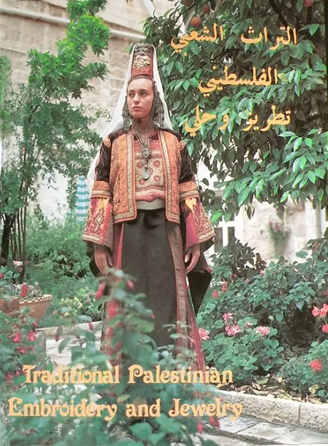
Posted by Rami Atwan - BETHLEHEM - Traditional Palestinian Embroidery and Jewelry (Author: Abed Al-Samih Abu Omar. Published in Jerusalem, 2005)
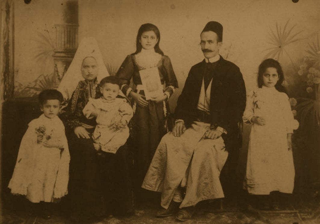
Posted by Rami Atwan - BETHLEHEM - A family of Bethlehem, circa 1900s
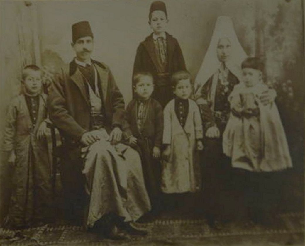
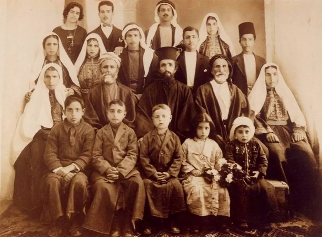
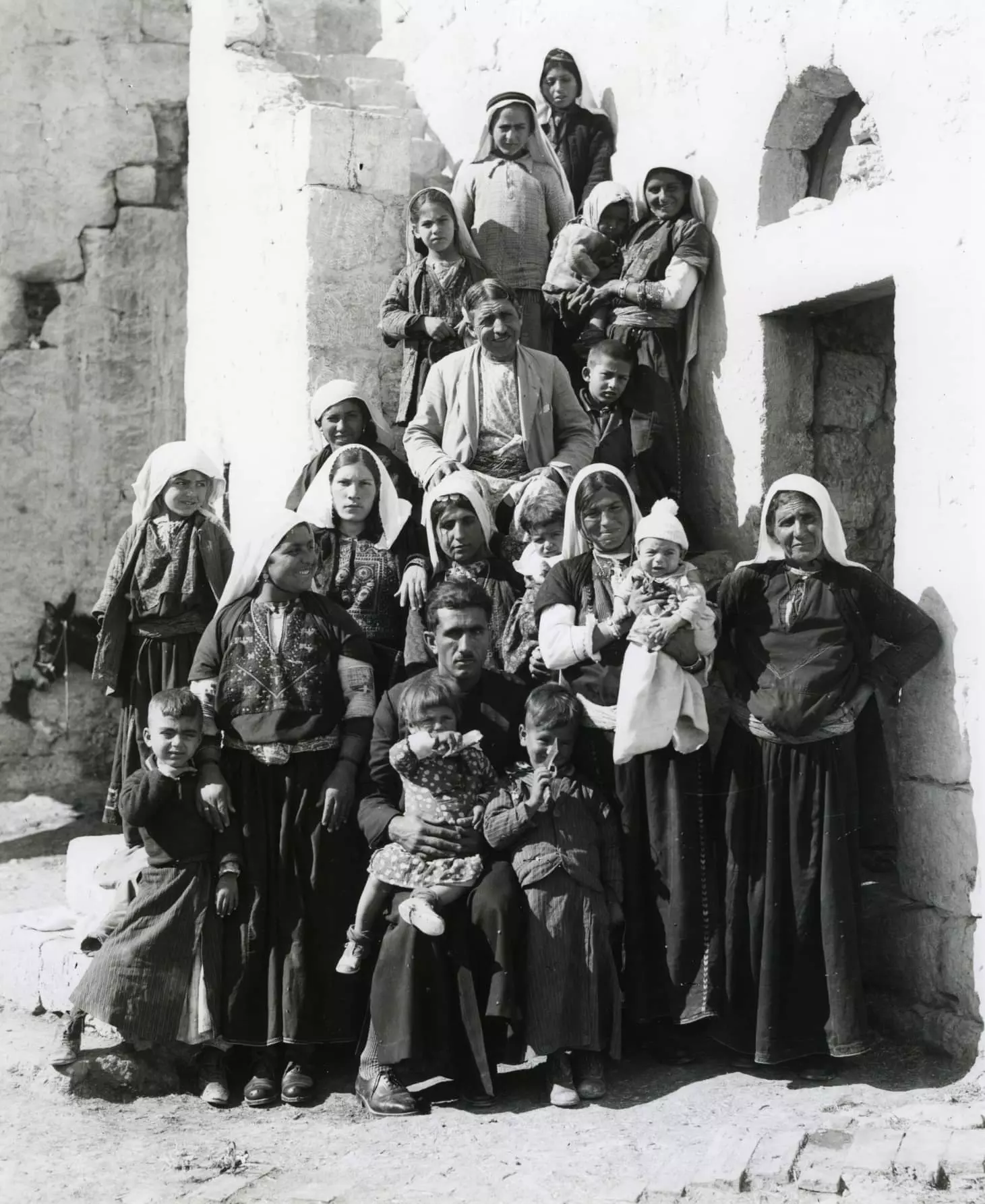
Posted by Rami Atwan 1 - BETHLEHEM - Four Generations of the Descendants of Khalil Atallah Jaar, 1925
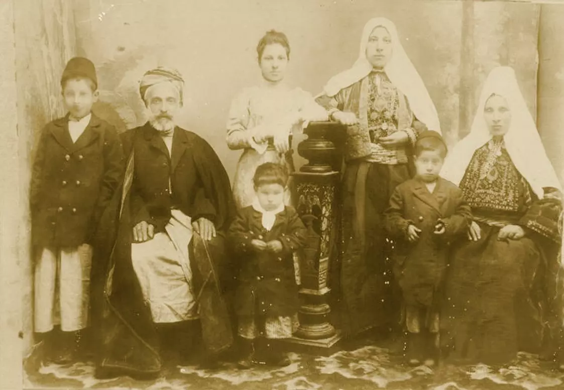
Posted by Rami Atwan - BETHLEHEM - Hanna Rock and his Family, 1912
Posted by Rami Atwan - BETHLEHEM - Iskandara Saloumeh Bandak with Issa Qahleesh and her only son Hanna, circa 1931
Posted by Rami Atwan - BETHLEHEM - Issa Qah'leesh (Bandak) and his family, 1945
Posted by Rami Atwan - BETHLEHEM - Judeh Morcos and his Family, 1922
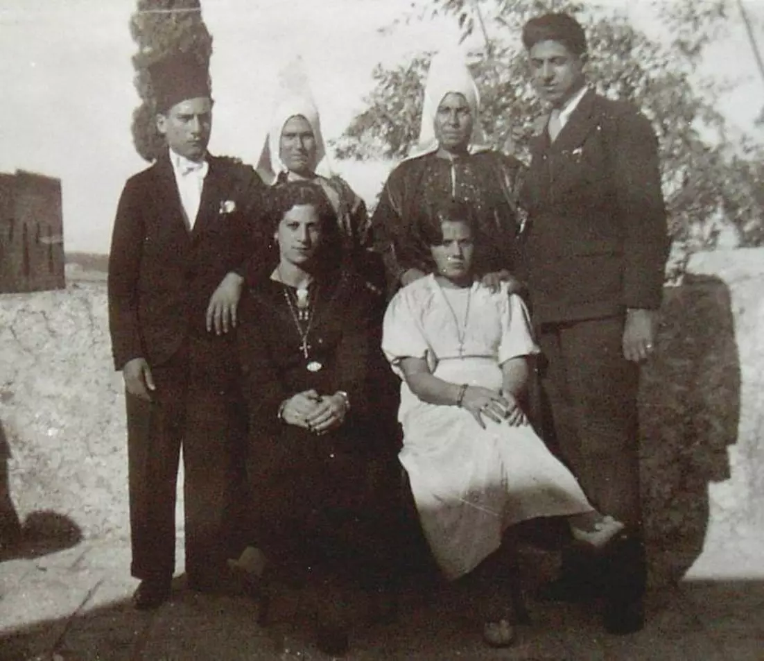
Posted by Rami Atwan 1 - BETHLEHEM - Qahleesh & Hazineh newly-weds, 1936
Posted by Rami Atwan - PALESTINE - Bethlehem, 1890s (early 20th c.) 122 - Market scene in Manger Square (Per Reem Ackall)
Posted by Rami Atwan - PALESTINE - Bethlehem, 1890s (early 20th c.) 123 - Olive-harvest in Bethlehem, circa 1890s (Per Reem Ackall)
Posted by Rami Atwan - PALESTINE - Bethlehem, 1890s (early 20th c.) 124 - Bethlehem hillside with German Lutheran church (Per Reem Ackall)
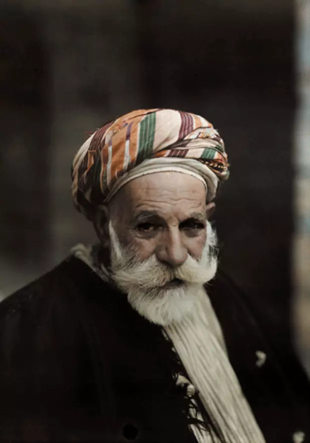
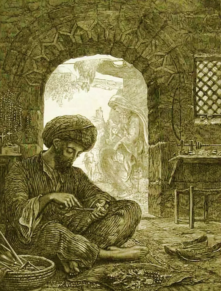
Posted by Rami Atwan - PALESTINE - Bethlehem, 1890s (early 20th c.) 125 - An Arab jeweller of Bethlehem, circa 1920s (Per Reem Ackall)
Posted by Rami Atwan - PALESTINE - Bethlehem, 1890s (early 20th c.) 126 - Farmers' Market in Manger Square (Per Reem Ackall)
Posted by Rami Atwan - PALESTINE - Bethlehem, 1890s (early 20th c.) 127 - Bethlehem from The Church of Nativity's bell tower (Per Reem Ackall)
Posted by Rami Atwan 1 - PALESTINE - Bethlehem, 1890s (early 20th c.) 128 - The Chrch of Nativity, circa 1906 (Per Reem Ackall)
Posted by Rami Atwan - PALESTINE - Bethlehem, 1890s (early 20th c.) 129 - Nativity Church and Manger Square, circa 1875 (Per Reem Ackall)
Posted by Rami Atwan - PALESTINE - Bethlehem, 1890s (early 20th c.) 130 - A general view (Bonfils, 1870s) (Per Reem Ackall)
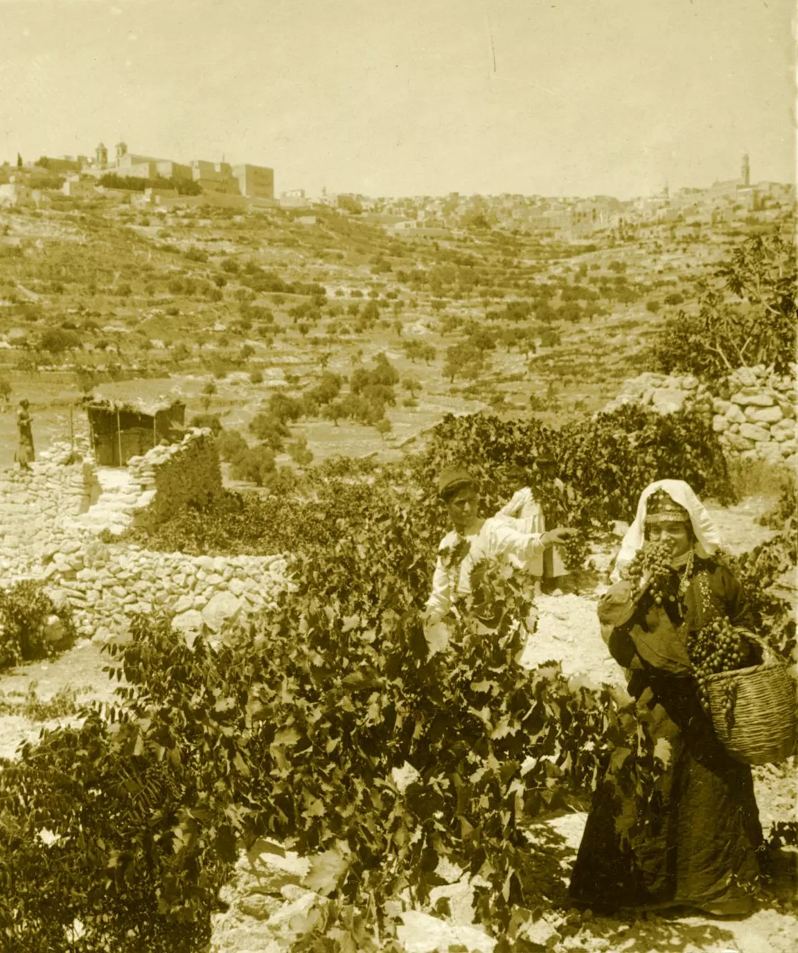
Posted by Rami Atwan - PALESTINE - Bethlehem, 1890s (early 20th c.) 131 - Palestinians of Bethlehem in their fields (Bonfils, 1875) (Per Reem Ackall)
Posted by Rami Atwan 1 - PALESTINE - Bethlehem, 1890s (early 20th c.) 132 - Masonry for renovation in Manger Square (Per Reem Ackall)
Posted by Rami Atwan - PALESTINE - Bethlehem, 1890s (early 20th c.) 133 - Manger Square as viewed from the Church of Nativity (Per Reem Ackall)
Posted by Rami Atwan - PALESTINE - Bethlehem, 1890s (early 20th c.) 134 - Rachel's Tomb and Bethlehem's countryside (Per Reem Ackall)
Posted by Rami Atwan - PALESTINE - Bethlehem, 1890s (early 20th c.) 135 - Rachel's Tomb, colourised in 1912 (Per Reem Ackall)
Posted by Rami Atwan - PALESTINE - Bethlehem, 1890s (early 20th c.) 136 - Panoramic view (Per Reem Ackall)
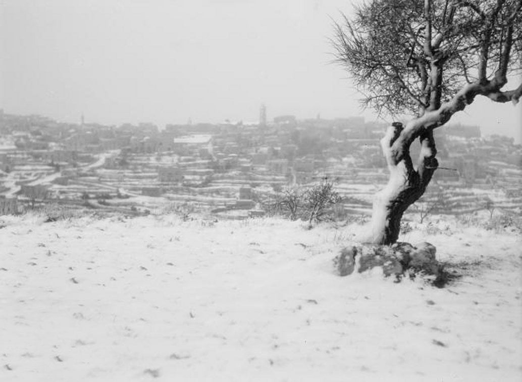
Posted by Rami Atwan - PALESTINE - Bethlehem, 1890s (early 20th c.) 137 - Bethlehen blanketed in snow, circa 1900-20 (Per Reem Ackall)
Posted by Rami Atwan - PALESTINE - Bethlehem, 1890s (early 20th c.) 138 - Snow and fog in bethlehem, 17-2 1946 (Per Reem Ackall)
Posted by Rami Atwan - Women of Bethlehem 129 (circa 1959) - A young girl of Bethlehem in traditional Thob and Shatweh (Per Reem Ackall)

Posted by Rami Atwan - Women of Bethlehem 130 (circa 1947) - Miranda Hirezi
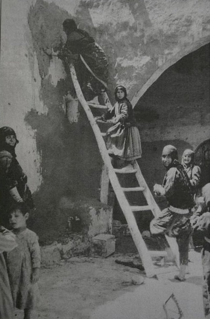
Posted by Rami Atwan - Women of Bethlehem 131 (circa 1927) - A group of palestinian villagers from the Bethlehem area white-washing interior of house (Bethlehem University archives)
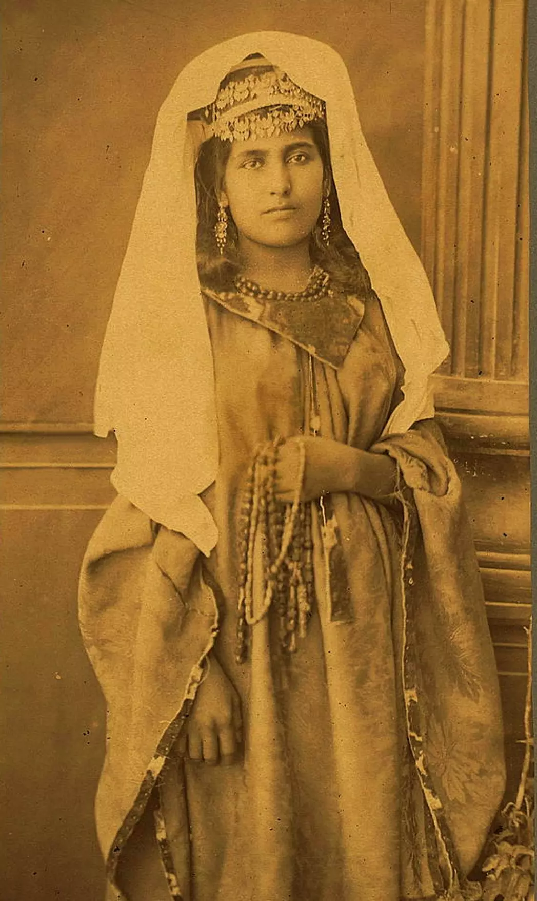
Posted by Rami Atwan - Women of Bethlehem 132 (circa 1880s) - A young woman in traditional Bethlehem costume
Posted by Rami Atwan - BETHLEHEM - Shepherds' Field, 1970s ??? (The Grotto) - (Per Reem Ackall)
Posted by Rami Atwan - Women of Bethlehem 133 (circa 1950s ???) - A Palestinian woman from Bethlehem at entrance of Queen Helena's tomb in Jerusalem (Per Reem Ackall)
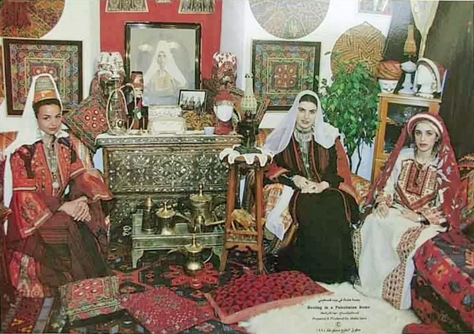
Posted by Rami Atwan - NATIONAL TREASURES - Palestinian Heritage Foundation (palestineheritage.org - Maha saca, 1994)
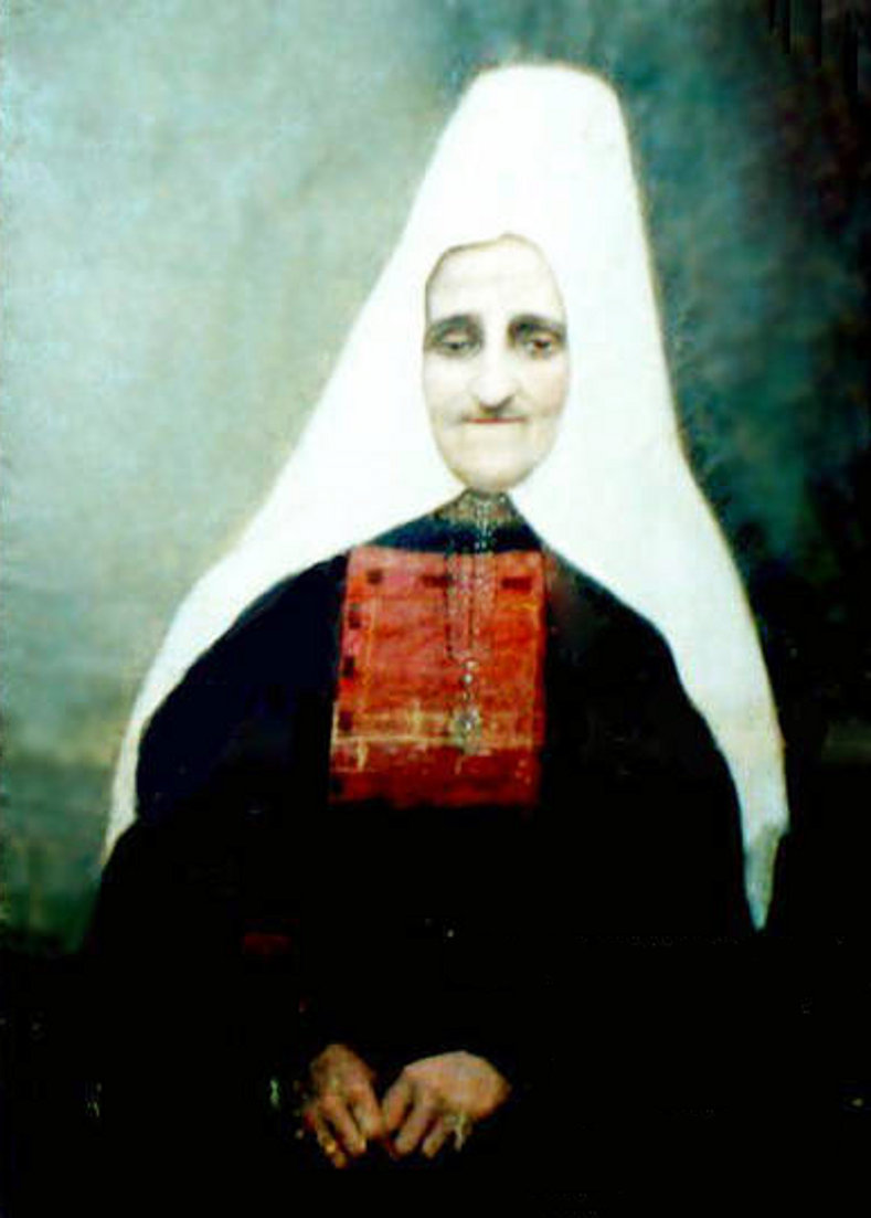
Posted by Rami Atwan - Women of Bethlehem 134 (circa 1922) - An elderly Palestinian woman of Bethlehem (Mariam (Nasser) Safieh)
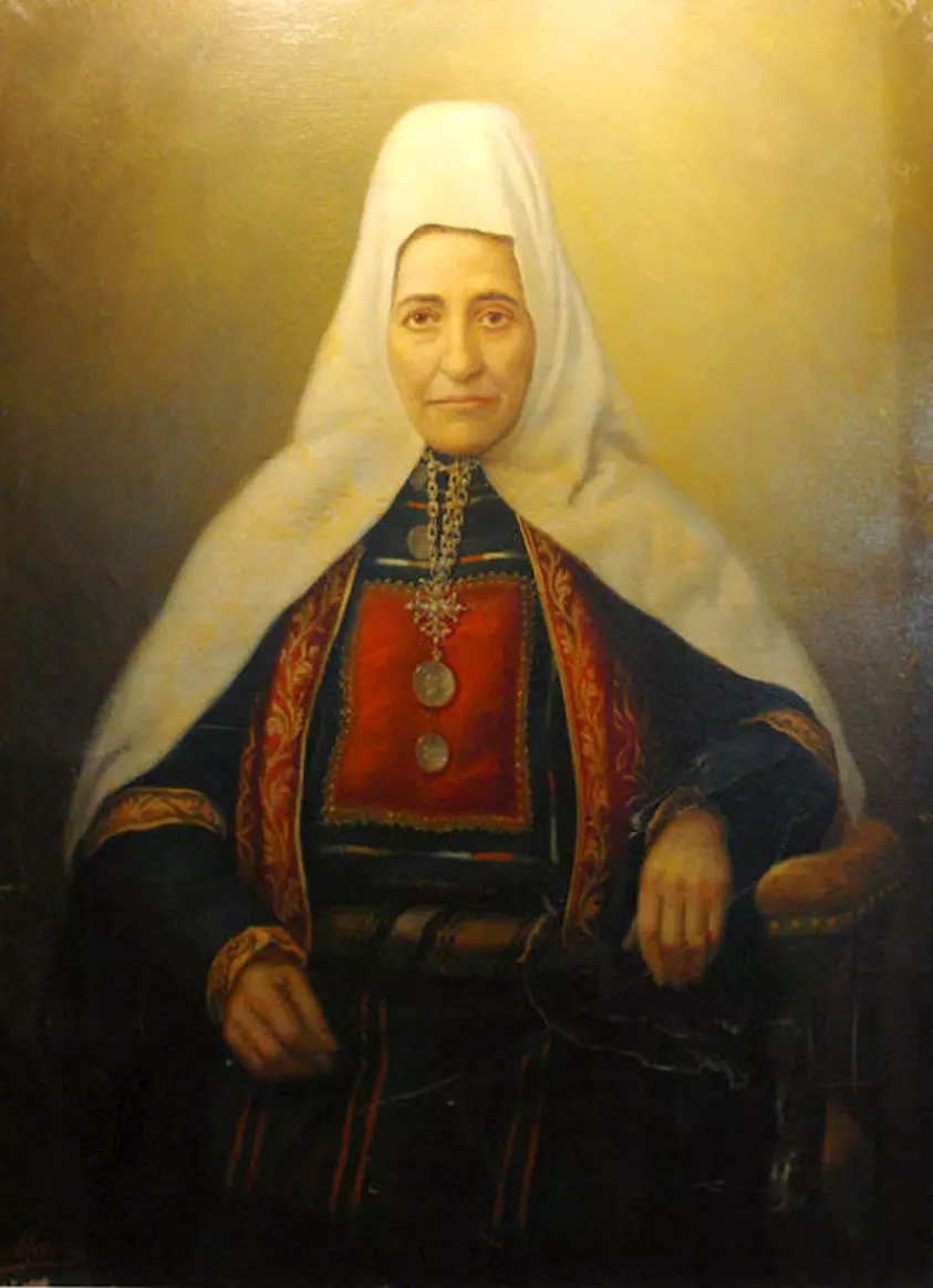
Posted by Rami Atwan - Women of Bethlehem 135 (circa 1900s-10s) - Mariam (Marcos) Nasser.
Posted by Rami Atwan - BETHLEHEM - Anton Khalil Salman and Family (Possibly 1930s)
Posted by Rami Atwan - BETHLEHEM - Francis Nasser, his wife Rahme and their children, circa 1900s-10s
Posted by Rami Atwan - BETHLEHEM - Hanna Mitri Canawati and his family, circa 1911
Posted by Rami Atwan - BETHLEHEM - Saleem Nasser, his wife Hanneh and their children, circa 1900s
Posted by Rami Atwan - BETHLEHEM - Saleem Nasser' s family, circa 1910s-20s
Posted by Rami Atwan - BETHLEHEM - Thabdoub family, circa 1921
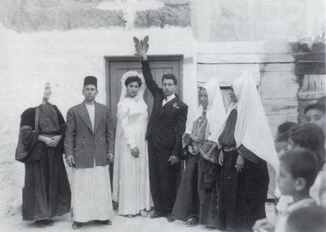
Posted by Rami Atwan - BETHLEHEM - Wedding in Bethlehem (of Roz Thabdoub and Elias Kraitem), circa 1937
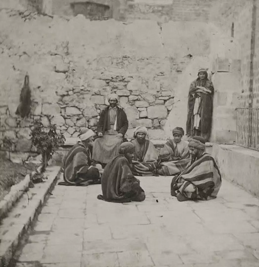
Posted by Rami Atwan - PALESTINE - Bethlehem, 1890s (early 20th c.) 139 - A group of Palestinian notables from Bethlehem
Posted by Rami Atwan - Women of Bethlehem 136 (circa 1870s-80s) - A woman with a basket of fruit on her head (Bonfils) (Per Reem Ackall)
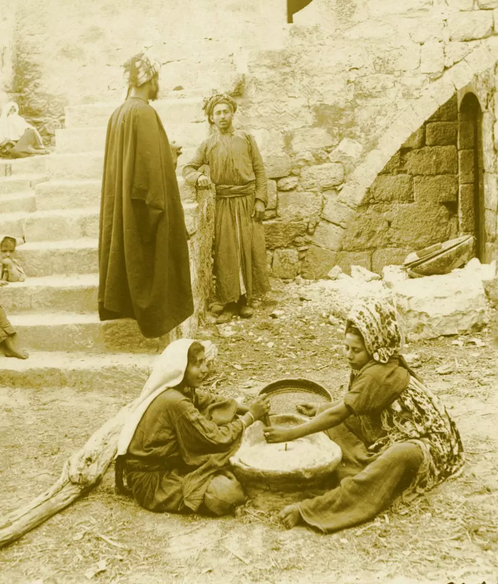
Posted by Rami Atwan - Women of Bethlehem 137 (Before 1918) - Two women of Bethlehem grinding flour with round millstones within a courtyard (Per Reem Ackall)
Posted by Rami Atwan - BETHLEHEM - George Ayoob and Hannah Dweri's Engagement photo, 1924
Posted by Rami Atwan - BETHLEHEM - The Bannourah Family (Beit Sahour), circa 1889
Posted by Rami Atwan - BETHLEHEM - The Banoura Family of Beit-Sahour in 1889 (Right to left: Farida, Saba, Aziza, Father Andrea, Hanna, Nima, Mitri, Hana & Milada (The Kids))
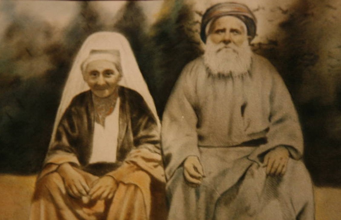
Posted by Rami Atwan - BETHLEHEM - The great grandparents of Maha Saca, Khalil Yacoub Ayob and his wife, 1900.
Posted by Rami Atwan - PALESTINE - Bethlehem, 1890s (early 20th c.) 140 - Market Day in Manger Square, 1913

Posted by Rami Atwan - bethlehem family 1928

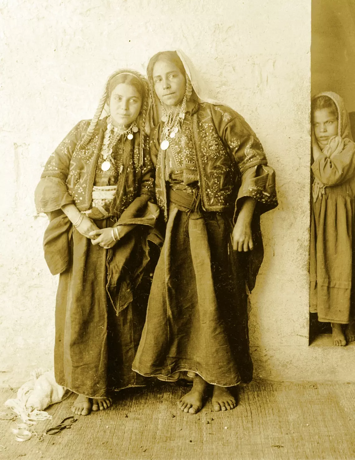
Posted by habibzuoghbi 1 - Women of Bethlehem 138 (late 19th, early 20th c.) - A Palestinian Arab woman of Bethlehem in traditional costume and ornaments (Berggren, G. 1892) (Per Reem Ackall)
Posted by Rami Atwan - Women of Bethlehem 139 (late 19th, early 20th c.) - A young couple from Bethlehem (Berggren, G. 1892) (Per Reem Ackall)

Posted by Rami Atwan - Women of Bethlehem 140 (late 19th, early 20th c.) - A woman from Bethlehem on a visit to Jerusalem, circa 1890 (Per Reem Ackall)
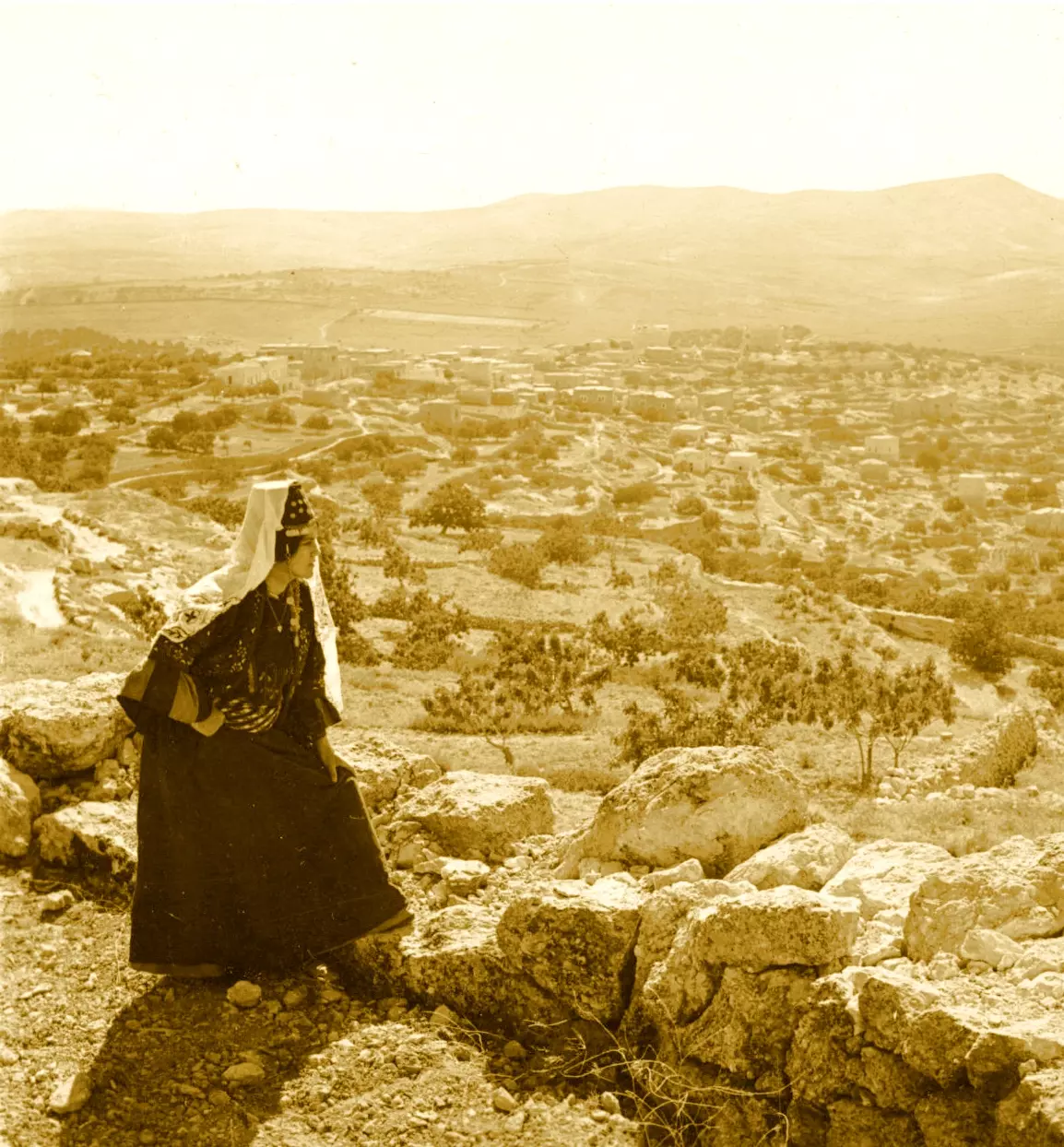
Posted by Rami Atwan - Women of Bethlehem 141 (late 19th, early 20th c.) - Gazing at her city (Per Reem Ackall)

Posted by Rami Atwan - PALESTINE - Bethlehem, 1890s (early 20th c.) 141 - GLORIOUS PALESTINE (Colourised) (Per Reem Ackall)
Posted by Rami Atwan - PALESTINE - Bethlehem, 1890s (early 20th c.) 143 - Woman and child in oldest Bethlehem (Colourised, Matson Collection)
Posted by Rami Atwan - PALESTINE - Bethlehem, 1890s (early 20th c.) 144 -Mother-of-Pearl Workers, 1875 (Per Reem Ackall)
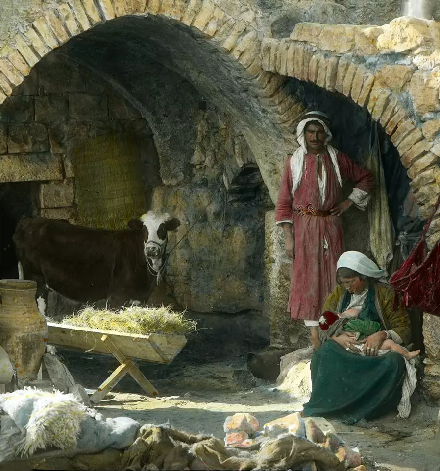
Posted by Rami Atwan - PALESTINE - Bethlehem, 1890s (early 20th c.) 145 - An Arab family posing for the Nativity scene, circa 1915 (Possibly in Beit Sahur) (Colourised)
Posted by Rami Atwan - Women of Bethlehem 142 (late 19th, early 20th c.) - Young woman sitting next to a staircase (Per Reem Ackall)
Posted by Rami Atwan - Women of Bethlehem 143 (late 19th, early 20th c.) - Amongst the vineyards (Per Reem Ackall)
Posted by Rami Atwan - Women of Bethlehem 144 (late 19th, early 20th c.) - On a country road (Per Reem Ackall)
Posted by Rami Atwan - Women of Bethlehem 145 (late 19th, early 20th c.) - In the Hhlls and fields North from Bethlehem, showing road to Jerusalem (Per Reem Ackall)
Posted by Rami Atwan - Women of Bethlehem 146 (late 19th, early 20th c.) (Per Reem Ackall)

Posted by Rami Atwan - Women of Bethlehem 147 (late 19th, early 20th c.) - Looking over Bethlehem (Per Reem Ackall)
Posted by Rami Atwan - Women of Bethlehem 148 (late 19th, early 20th c.) - In the Garden of Gethsemane (Per Reem Ackall)
Posted by Rami Atwan - Women of Bethlehem 149 (late 19th, early 20th c.) - In the Garden of Gethsemane (Per Reem Ackall)
Posted by Rami Atwan - Women of Bethlehem 150 (late 19th, early 20th c.) - In the streets of Arab Jerusalem (Per Reem Ackall)
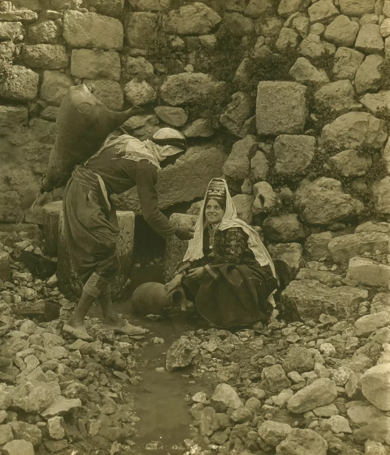
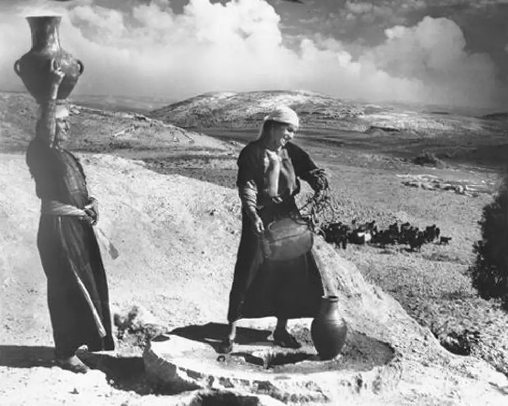
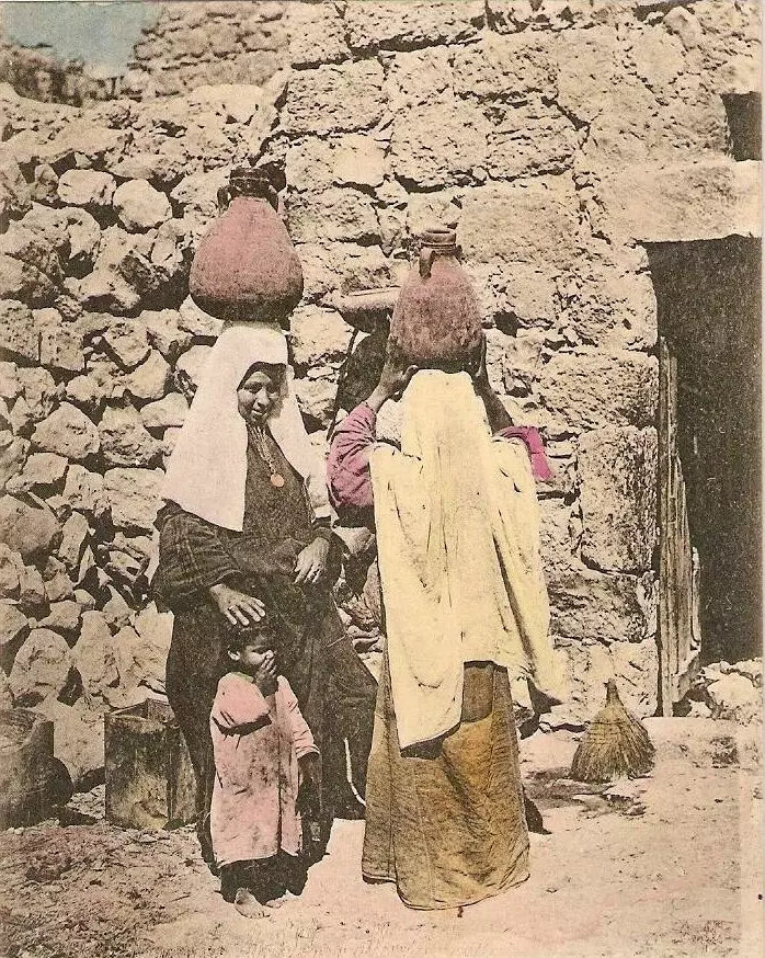
Posted by Rami Atwan - Women of Bethlehem 151 (late 19th, early 20th c.) - Drawing water from a local well (Per Reem Ackall)
Posted by Rami Atwan - Women of Bethlehem 152 (late 19th, early 20th c.) - On the road to Al-Eizariyeh (Bethany (Per Reem Ackall))
Posted by Rami Atwan - Women of Bethlehem 153 (late 19th, early 20th c.) - In Imwas (Per Reem Ackall)

Posted by Rami Atwan - Women of Bethlehem 154 (late 19th, early 20th c.) - Grinding, in Beit Sahur (Per Reem Ackall)
Posted by Rami Atwan - Women of Bethlehem 155 (late 19th, early 20th c.) (Per Reem Ackall)
Posted by Rami Atwan - Women of Bethlehem 156 (late 19th, early 20th c.) - Making a cave into a Home (Colourised)
Posted by Rami Atwan - Women of Bethlehem 157 - (late 19th, early 20th c.) - Three women in a field (Per Reem Ackall)
Posted by Rami Atwan - Women of Bethlehem 158 (late 19th, early 20th c.) - Married and single (Per Reem Ackall)
Posted by Rami Atwan - Women of Bethlehem 159 (late 19th, early 20th c.) - Going to the market (Per Reem Ackall)
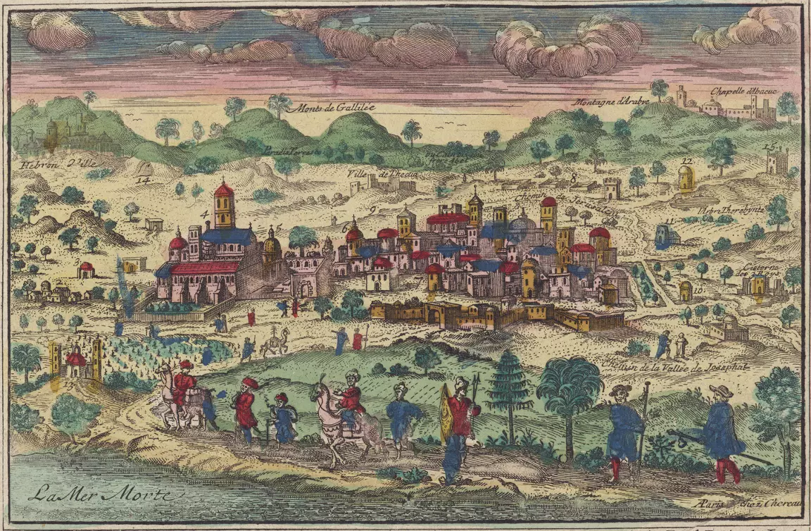
Posted by Rami Atwan - PALESTINE - Bethlehem - (Chéreau, Jacques le jeune, circa 1760s)
Posted by Rami Atwan - PALESTINE - Bethlehem - (Bruyn, Cornelis de, 1698)
Posted by Rami Atwan - Women of Bethlehem 160 (late 19th, early 20th c.) - A simple dance near a watch-tower (Per Reem Ackall)
Posted by Rami Atwan - Women of Bethlehem 161 (late 19th, early 20th c.) - At the local well (Per Reem Ackall)
Posted by Rami Atwan - Women of Bethlehem 162 (late 19th, early 20th c.) - Enacting "The Flight to Egypt" - Matson Collection (Per Reem Ackall)
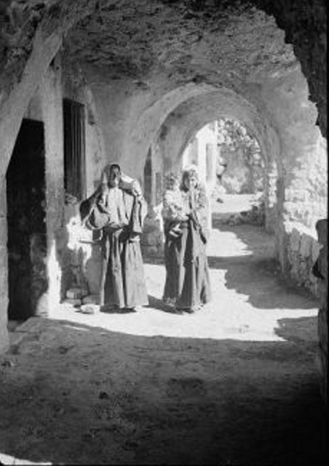
Posted by Rami Atwan - Women of Bethlehem 163 (late 19th, early 20th c.) - Under the archways, circa 1915 (Matson Collection, colourised)
Posted by Rami Atwan - Women of Bethlehem 164 (late 19th, early 20th c.) - Embroidering in the shade (Matson Collection, colourised)
Posted by Rami Atwan - Women of Bethlehem 165 (late 19th, early 20th c.) - (Per Reem Ackall)
Posted by Rami Atwan - Women of Bethlehem 166 (late 19th, early 20th c.) - (Per Reem Ackall)
Posted by Rami Atwan - Women of Bethlehem 167 (late 19th, early 20th c.) - An outing at the watch-tower (Per Reem Ackall)
Posted by Rami Atwan - Women of Bethlehem 168 (late 19th, early 20th c.) - An outing at the watch-tower 2 (Per Reem Ackall)
Posted by Rami Atwan - Women of Bethlehem 169 (late 19th, early 20th c.) - A family group (Per Reem Ackall)
Posted by Rami Atwan - Women of Bethlehem 170 (late 19th, early 20th c.) - circa 1880s (Per Reem Ackall)
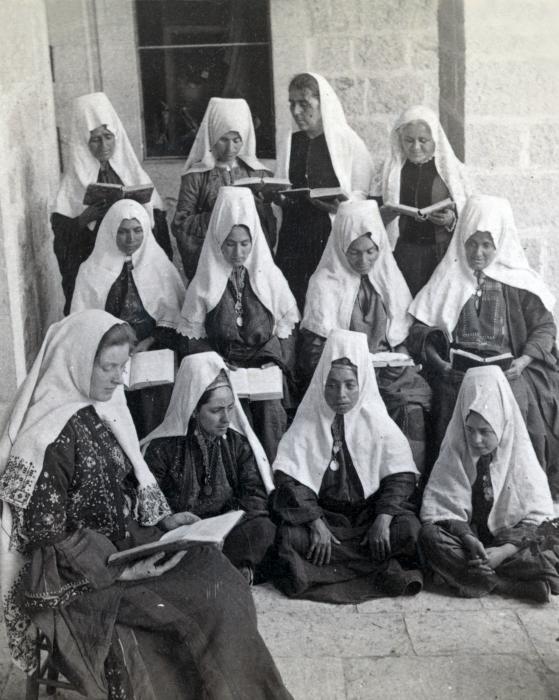
Posted by Rami Atwan - Women of Bethlehem 171 (late 19th, early 20th c.) - Palestinian women praying at the altar in The Church of Nativity, circa 1925 (Per Reem Ackall)
Posted by Rami Atwan - Women of Bethlehem 172 (late 19th, early 20th c.) - Visitors awaiting arrival of matron of the house (Per Reem Ackall)

Posted by Rami Atwan - Women of Bethlehem 173 (late 19th, early 20th c.) - Young mother and child, circa 1930s

Posted by Rami Atwan - Women of Bethlehem 174 (late 19th, early 20th c.) - Elderly woman walking the ancient cobbled streets of her childhood, circa 1915 (Per Reem Ackall)
Posted by Rami Atwan - Women of Bethlehem 175 (late 19th, early 20th c.) - Women celebrating in field, circa 1930s
Posted by Rami Atwan - Women of Bethlehem 176 (late 19th, early 20th c.) - In the market with the family, circa 1920s
Posted by Rami Atwan - PALESTINE - Bethlehem, 1890s (early 20th c.) 146 - A family workshop (UCR-California Museum of Photography) (Per Reem Ackall)
Posted by Rami Atwan - PALESTINE - Bethlehem, 1890s (early 20th c.) 147 - Mother-of-Pearl workers (UCR-California Museum of Photography) (Per Reem Ackall)
Posted by Rami Atwan - PALESTINE - Bethlehem, 1890s (early 20th c.) 148 - On a Market Day (UCR-California Museum of Photography) (Per Reem Ackall)
Posted by Rami Atwan - PALESTINE - Bethlehem, 1890s (early 20th c.) 149 - A partial view, circa 1890s (Per Reem Ackall)
Posted by Rami Atwan - PALESTINE - Bethlehem, 1890s (early 20th c.) 150 - Shoppers in manger square, circa 1890s
Posted by Rami Atwan - PALESTINE - Bethlehem, 1890s (early 20th c.) 151 - Courtyard of Mar Saba Monastery, circa 1925
Posted by Rami Atwan - PALESTINE - Bethlehem, 1890s (early 20th c.) 152 - Mar Saba Greek Orthodox Monastery Tower, circa 1925
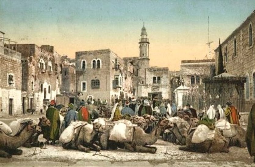
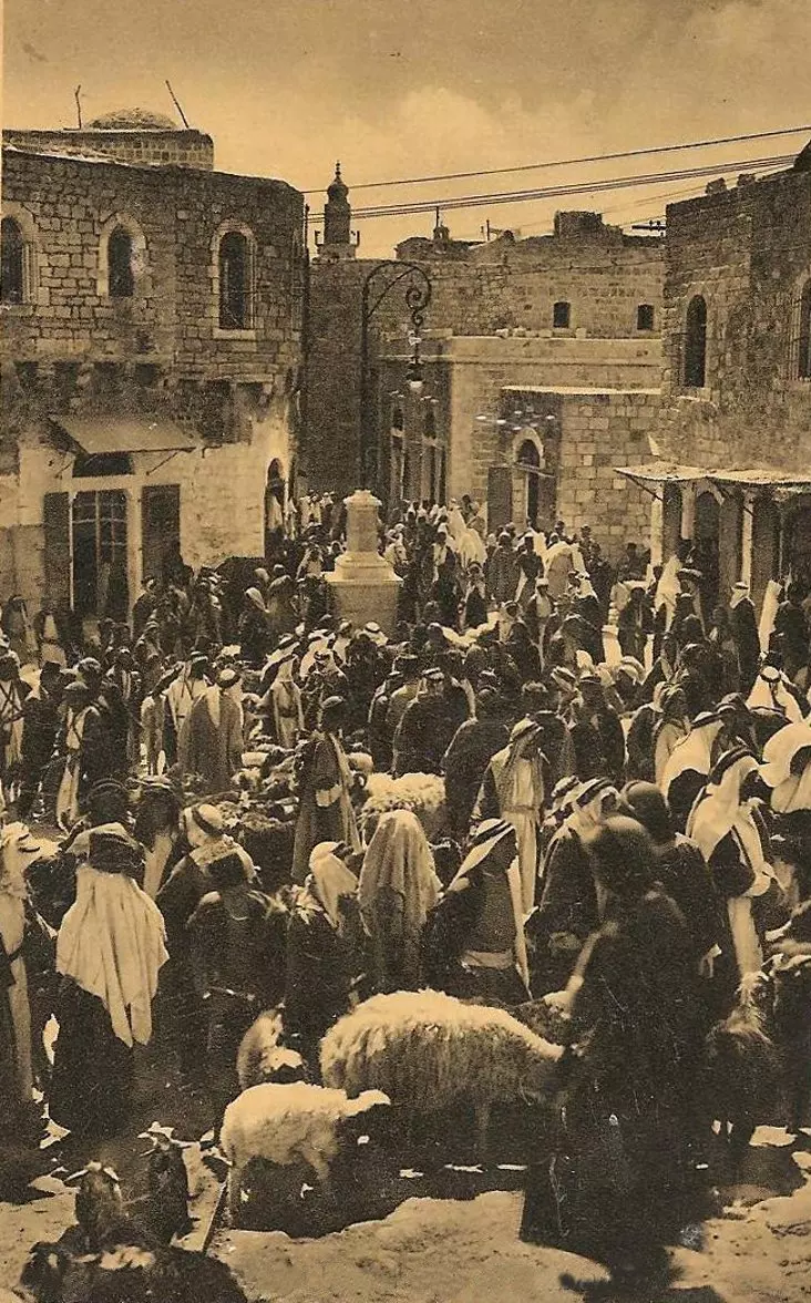
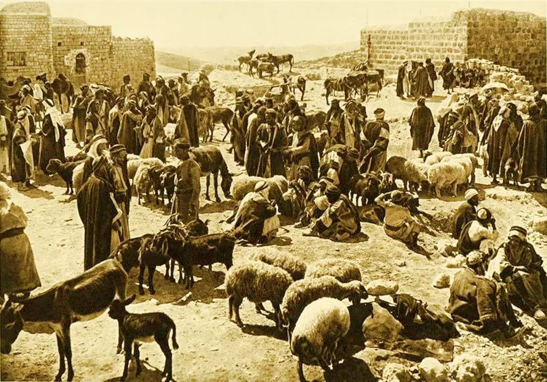
Posted by Rami Atwan - PALESTINE - Bethlehem, 1890s (early 20th c.) 153 - Sheep market, circa 1925
Posted by Rami Atwan - Women of Bethlehem 177 (late 19th, early 20th c.) - A family group at bab-el-dar (Matson Collection) (Per Reem Ackall)
Posted by Rami Atwan - PALESTINE - Bethlehem, 1890s (early 20th c.) 154 - A Palestinian family of Bethlehem, ca. 1900 (American Colony Photographers)
Posted by Rami Atwan - PALESTINE - Bethlehem, 1890s (early 20th c.) 155 - Some traditional Palestinian jewelry and headdresses (Bethlehem, Hebron, Jerusalem) - c. 1880s

Posted by Rami Atwan 1 - BETHLEHEM - Saade Family, circa 1910

Posted by Rami Atwan 1 - باب كنيسة المهد في بيت لجم يوم 29.12.2011 تصوير سهيل مخول
Posted by سهيل مخول - كساء مغارة الميلاد في كنيسة المهد تصوير سهيل مخول يوم 29.12.2011
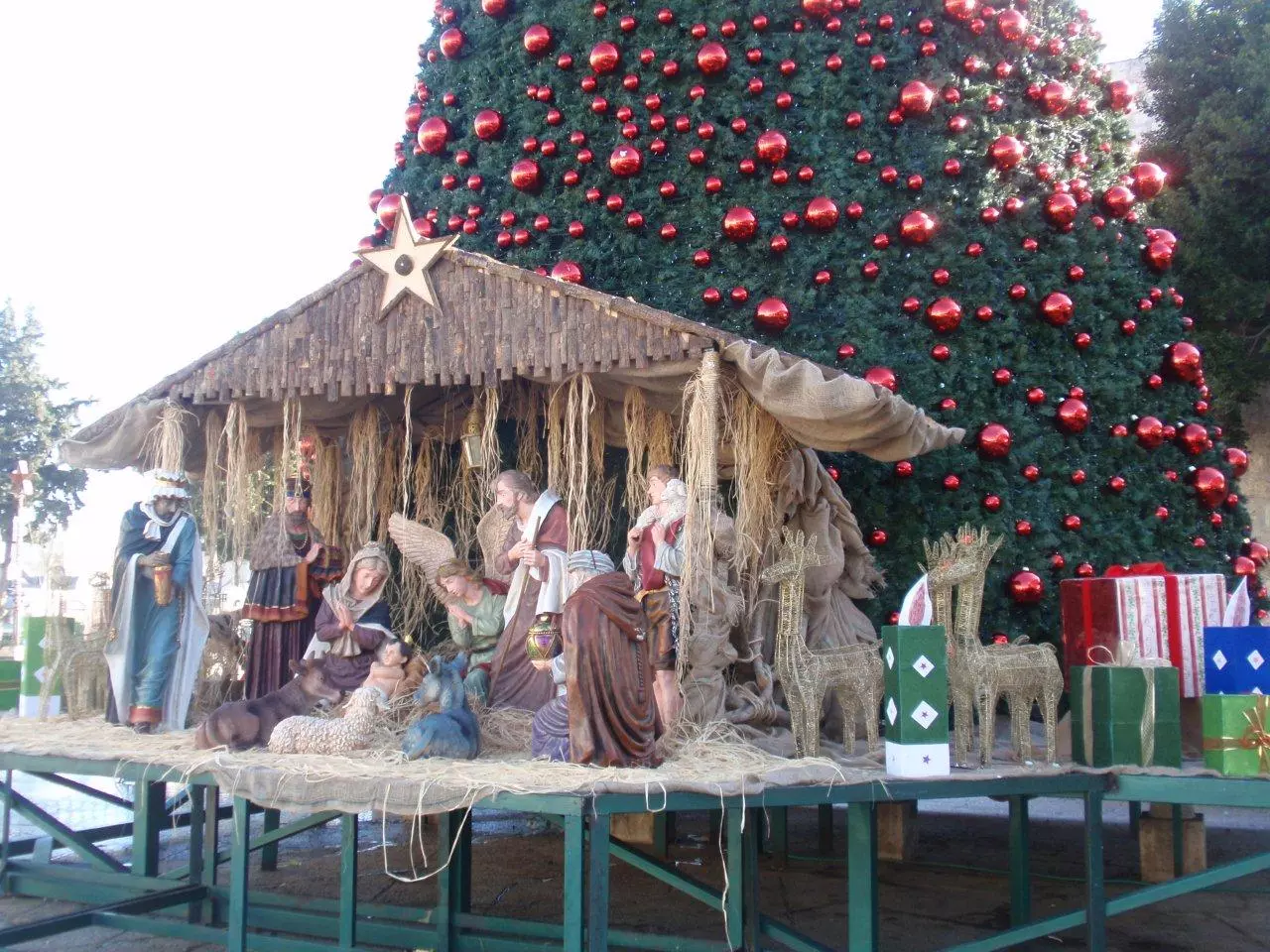
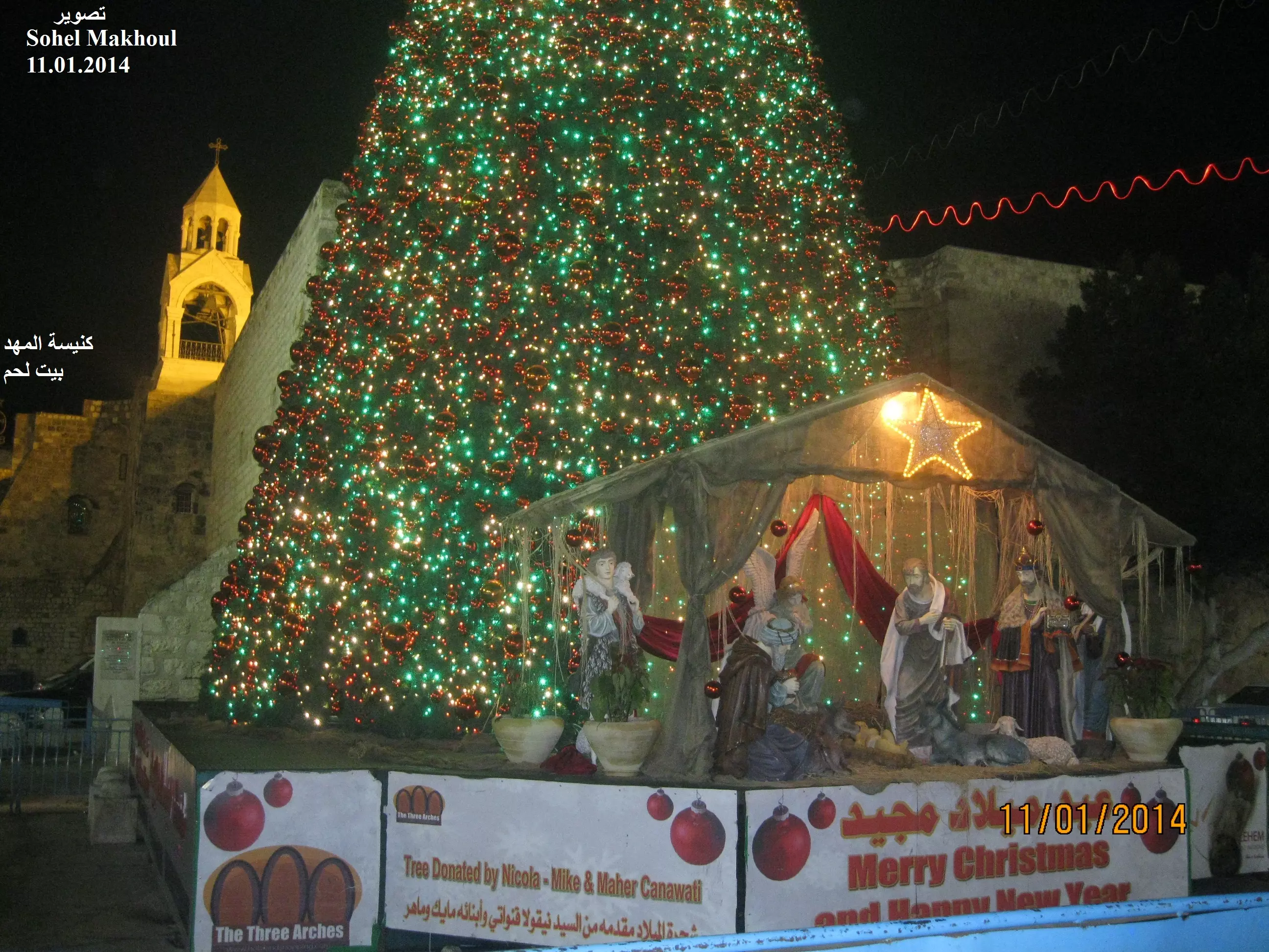
Posted by سهيل مخول - شجرة الميلاد مقابل كنيسة المهد يوم 29.12.2011 تصوير سهيل مخول
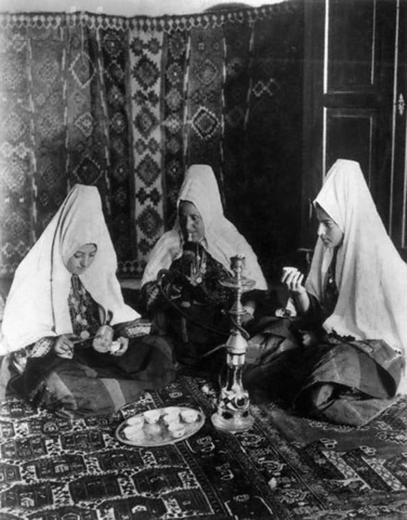
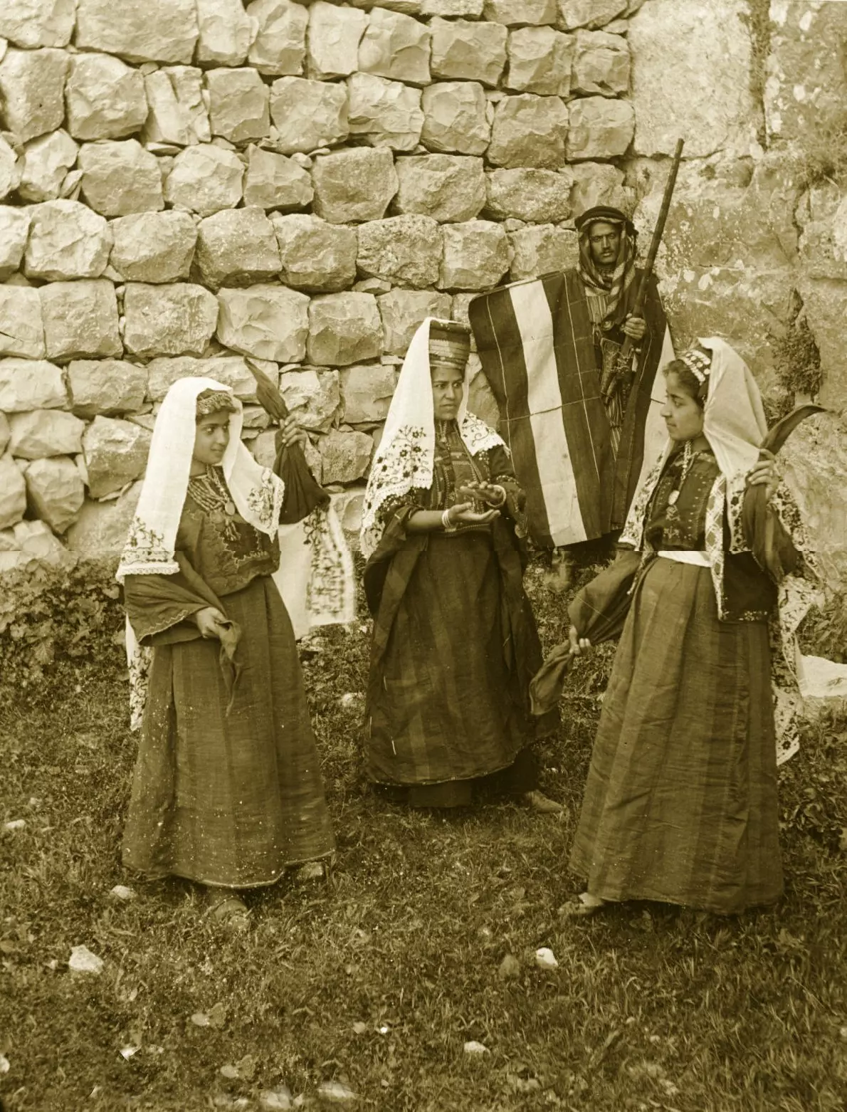
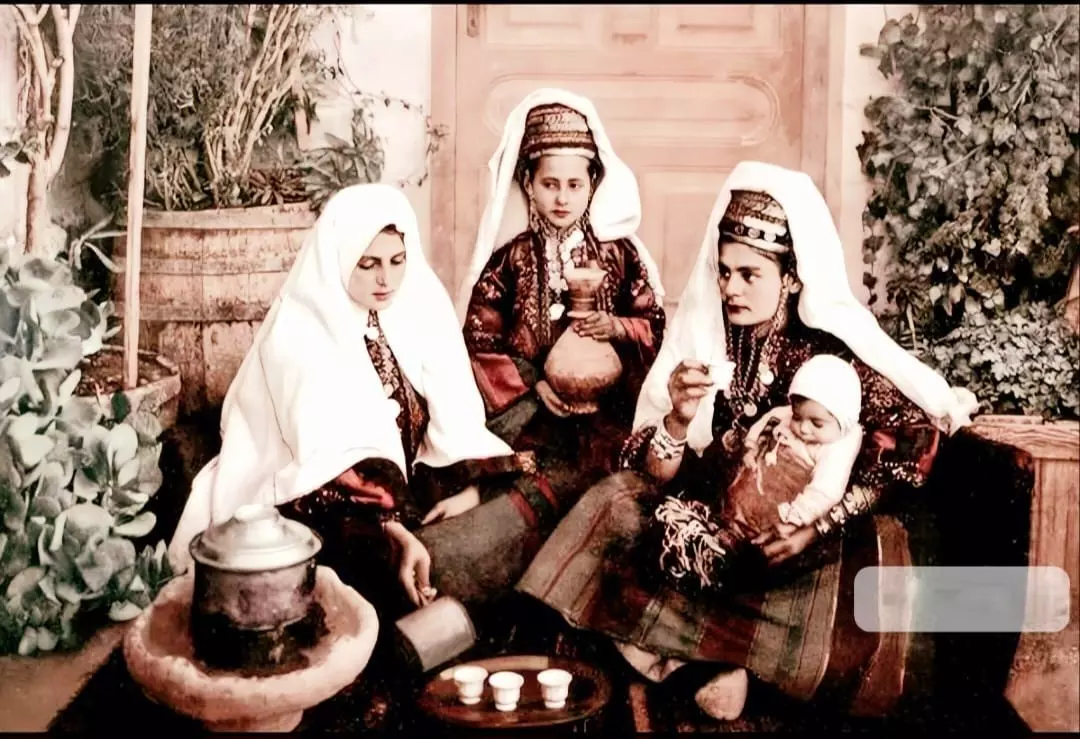
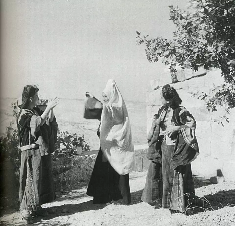
Posted by سهيل مخول - Women of Bethlehem 178 (late 19th, early 20th c.) - Two palestinian women in traditional Thobs with Jarrah and Kanoon
Posted by Rami Atwan - PALESTINE - Bethlehem, 1890s (early 20th c.) 156 - Market street in old Bethlehem
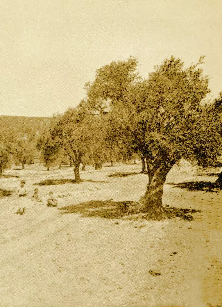
Posted by Rami Atwan - PALESTINE - Bethlehem, 1890s (early 20th c.) 157 - Olive grove at outskirts of Bethlehem (Per Reem Ackall)
Posted by Rami Atwan - PALESTINE - Bethlehem, 1890s (early 20th c.) 158 - Panoramic view (Per Reem Ackall)

Posted by Rami Atwan - Women of Bethlehem 179 (late 19th, early 20th c.) - At the doorstep of their home (Per Reem Ackall)
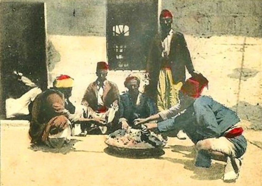
Posted by Rami Atwan - PALESTINE - Bethlehem, 1890s (early 20th c.) 159 - partaking of an Arabic meal of rice and lamb, circa 1900s (Per Reem Ackall)
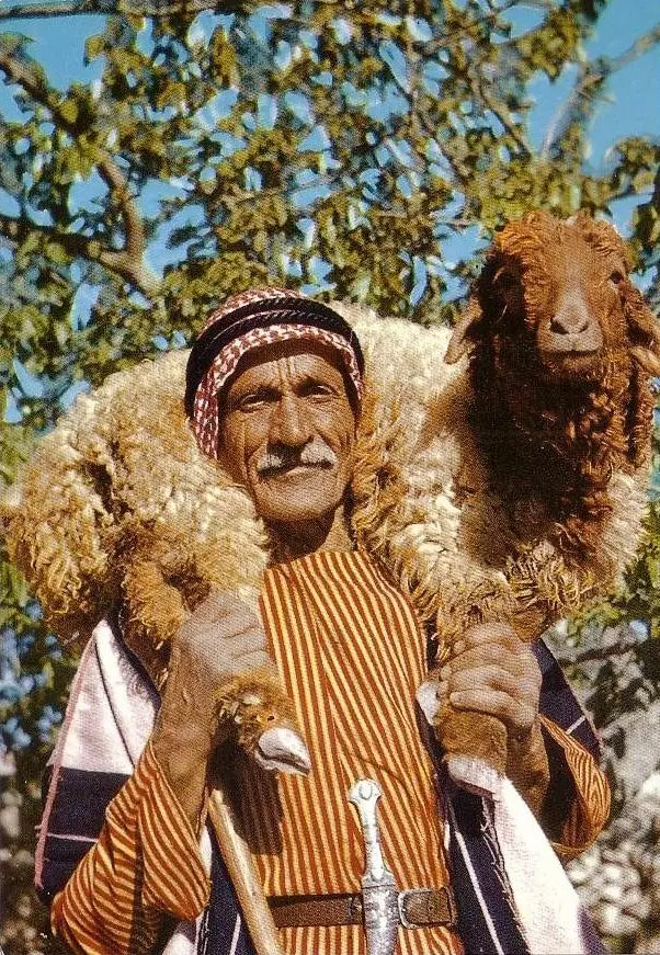
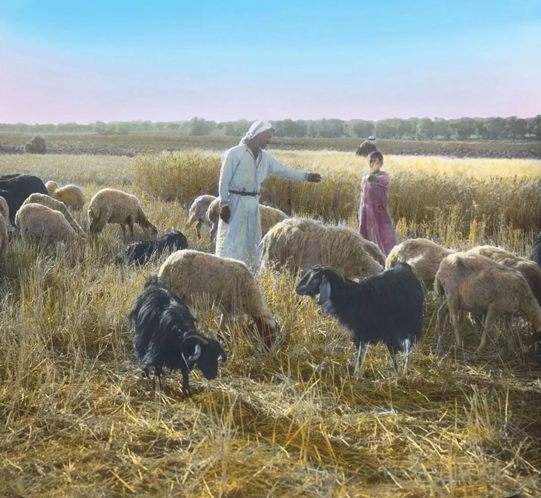
Posted by Rami Atwan - PALESTINE - Bethlehem, 1890s (early 20th c.) 160 - Palestinian shepherds and farmers at the outskirts of Bethlehem, circa 1920s
Posted by Rami Atwan - Women of Women of Bethlehem 180 - A group of Palstinians on the stairs of their home, c. 1910 (Per Reem Ackall)

Posted by Rami Atwan - Women of Bethlehem 181 - circa 1905 (Per Reem Ackall)
Posted by Rami Atwan - Bethlehem, 1960s (-70s) 34 (Per Reem Ackall)
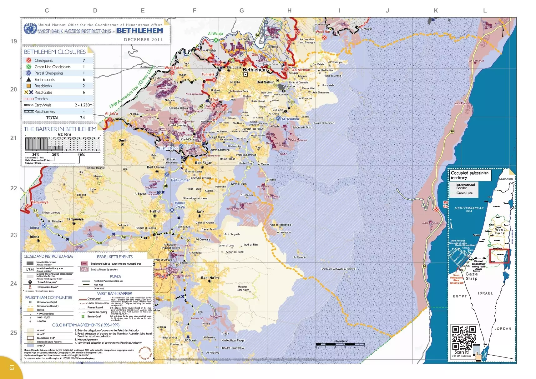
Posted by Rami Atwan - خارطة محافظة بيت لحم من OCHA
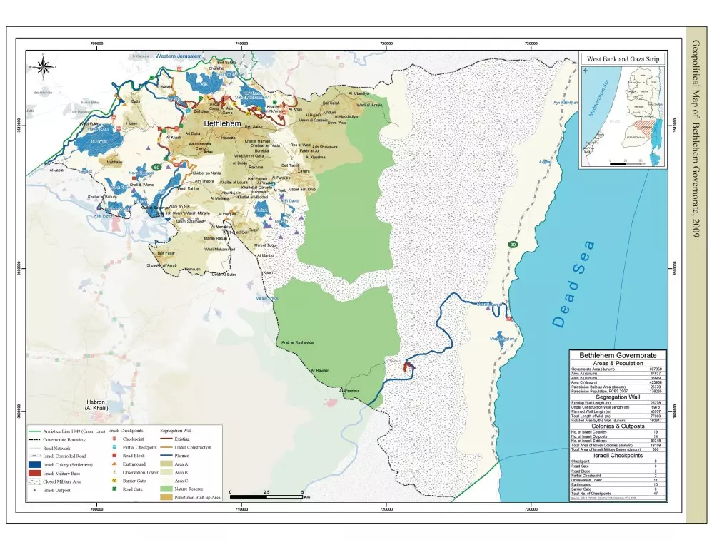
Posted by Rajae mahmoud - الخارطة الجيوسياسية لمحافظة بيت لحم 2009م
Posted by Rajae mahmoud - باب كنيسة المهد في بيت لجم يوم 19.6.2012 تصوير Sohel Makhoul
Posted by سهيل مخول - نجم الميلاد في كنيسة المهد - تصوير الأستاذ سهيل مخول يوم 19.6.2012
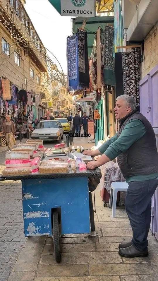
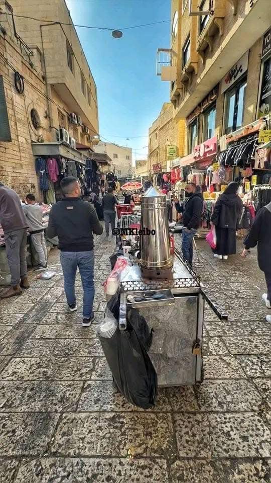
Posted by سهيل مخول - بيت لحم - السوق الشعبي تصوير الأستاذ سهيل مخول يوم 19.6.2012
Posted by سهيل مخول - بيت لحم - السوق الشعبي- بيت قديم - تصوير الأستاذ سهيل مخول يوم 19.6.2012
Posted by سهيل مخول - PALESTINE - Bethlehem, 1890s (early 20th c.) 161 - Palestinians in Manger Square (Per Reem Ackall)
Posted by Rami Atwan - BETHLEHEM - Westerners dressed in the Jerusalem-Bethlehem costumes, 1912 (Per Reem Ackall)

Posted by Rami Atwan - Bethlehem, 1960s (-70s) 35 (Per Reem Ackall)
Posted by Rami Atwan - View from bell-tower, 1977 (Per Reem Ackall)
Posted by Rami Atwan - Bethlehem, 1960s (-70s) 39 (Per Reem Ackall)

Posted by Rami Atwan - Palestinian refugees living in a Bethlehem cave in the aftermath of the 1967 war, 1973 (Per Reem Ackall)
Posted by Rami Atwan - PALESTINE - Bethlehem, 1890s (early 20th c.) 158 - Partial view (Per Reem Ackall)
Posted by Rami Atwan - Palestinian Arabs in vicinity of Nativity Church, circa 1930s (Per Reem Ackall)i
Posted by Rami Atwan - بيت لحم ساحات و شوارع كنيسة المهد
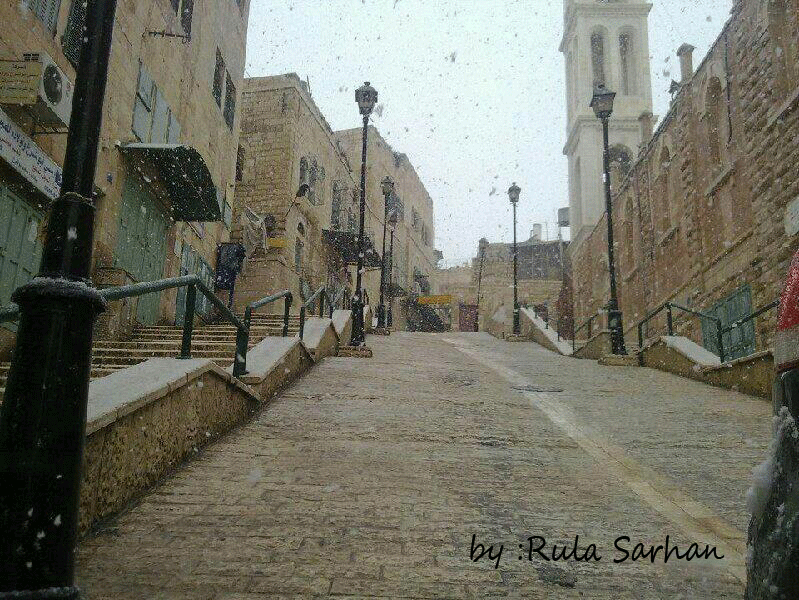
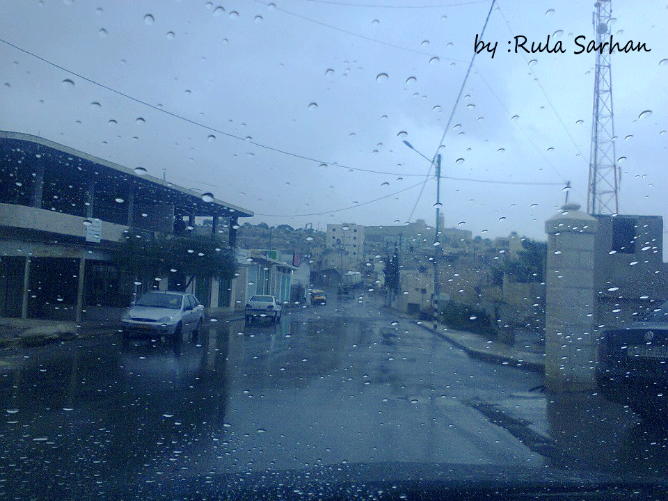
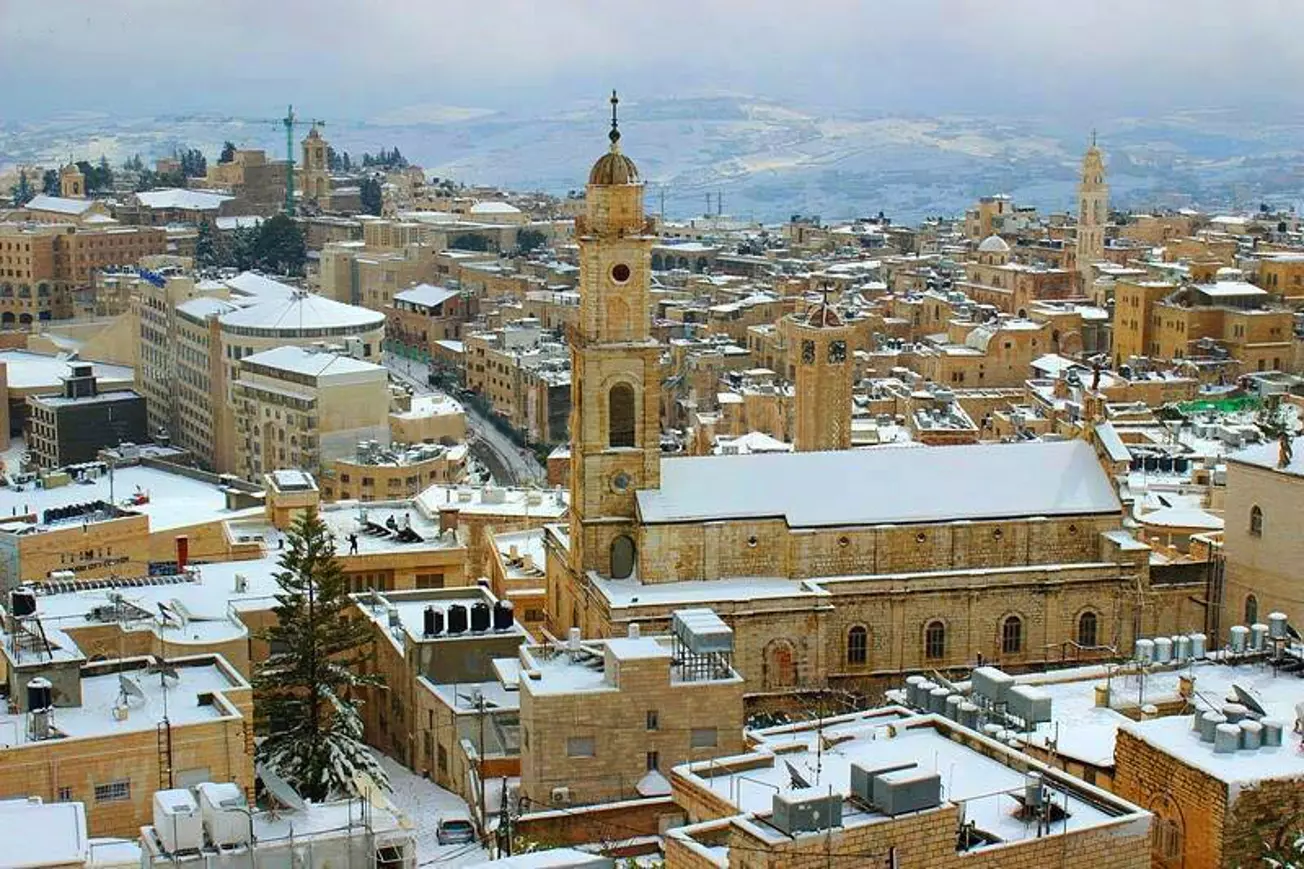
Posted by Nayef HaMmouri | نايف الحموري - بيت لحم في آخر منخفض قطبي ضرب البلاد في ال 2012 خلال التساقط الثلجي .. البلدة القديمة .. وسط البلد
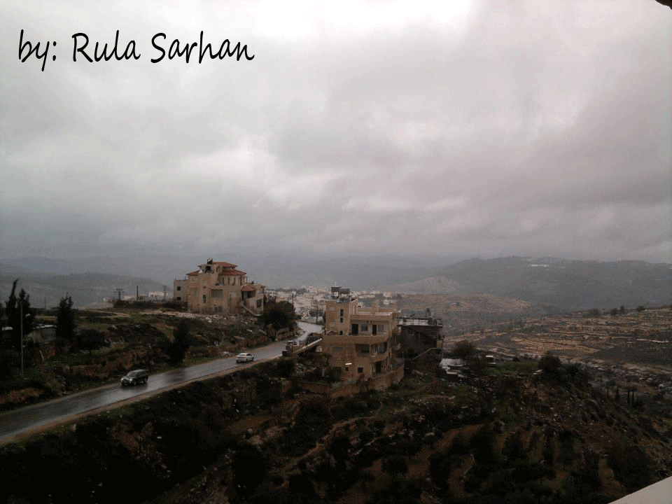
Posted by رولا سرحان - بيت لحم العبيدية
Posted by رولا سرحان - شجرة الميلاد يوم 15.12.2012 في ساحة المهد - تصوير سهيل مخول

Posted by سهيل مخول - شجرة الميلاد والمغارة يوم 16.12.2012 في ساحة المهد - تصوير سهيل مخول
Posted by سهيل مخول - منظر للشارع المؤدي لكنيسة المهد تصوير سهيل مخول يوم 16.12.12
Posted by سهيل مخول - منظر من بيت لحم باتجاه بيت ساحر - تصوير سهيل مخول يوم 16.12.12
Posted by سهيل مخول - بيت مهجور في ليت لحم ، يدل على العراقة والاصالة والحضارة الفلسطينية - تصوير سهيل مخول يوم 16.12.12

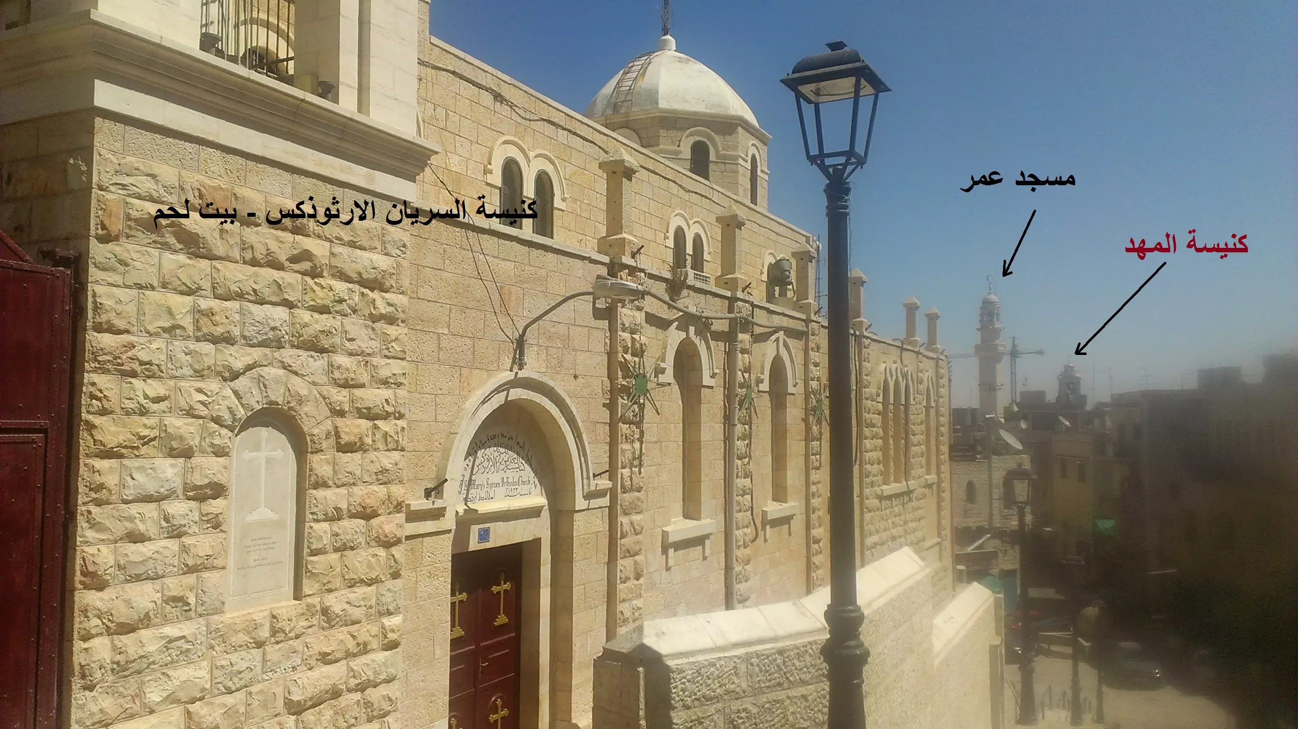
Posted by سهيل مخول 1 - منظر باتجاه كنيسة الروم الملكيين الكاثوليك في بيت لحم - تصوير سهيل مخول يوم 15.12.12
Posted by سهيل مخول - منظر باتجاه كنيسة الروم الملكيين الكاثوليك وكنيسة السريان والبيوت القديمة في مدينة بيت لحم - تصوير سهيل مخول يوم 15.12.12
Posted by سهيل مخول - امطار الخير تتساقط قبل قليل على قرية بتير غرب مديتة بيت لحم 21/12/2012م
Posted by رولا سرحان - من داخل كنيسة المهد - تصوير عمار قادوس
Posted by Ammar Qadous - Abu-Nasry alsaadi family bethlehem

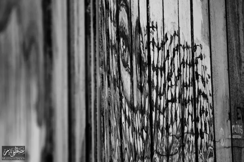
Posted by habibzuoghbi - رسومات على الجدار الفاصل شمال المدينة - عدسة: مصطفى بدر
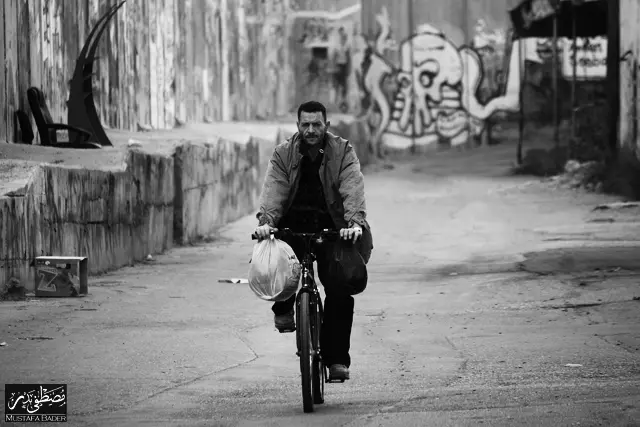
Posted by Mustafa Bader - شخص يركب دراجته الهوائية شمال المدينة قرب الجدار الفاصل حيث كان هذا الشارع عامراً بالحياة من وإلي القدس قبل أن يغلقه الجدار - عدسة: مصطفى بدر
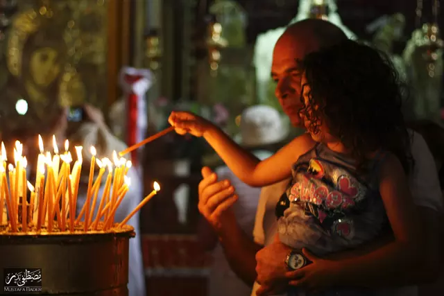
Posted by Mustafa Bader - حجاج مسيحيين يضيئون الشموع في كنيسة المهد - عدسة : مصطفى بدر
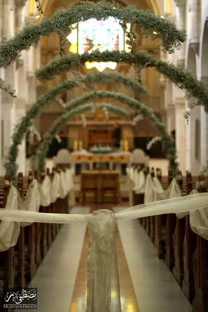
Posted by Mustafa Bader - زينة تجهيزاً لحفل زفاف في كنيسة المهد - عدسة: مصطفى بدر
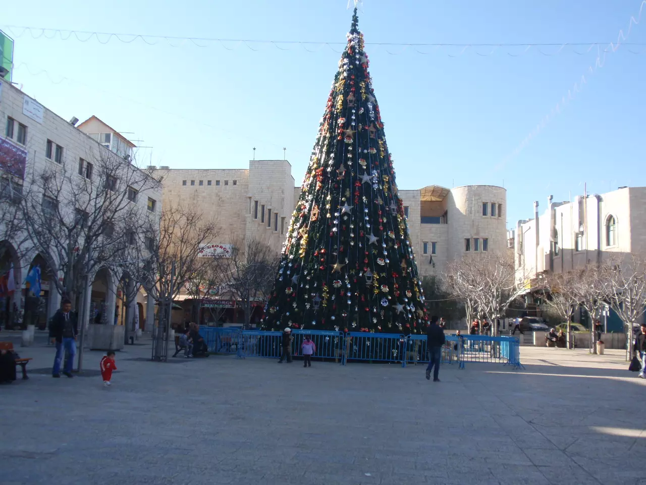
Posted by Mustafa Bader - كنيسة المهد وشجرة الميلاد في بيت لحم
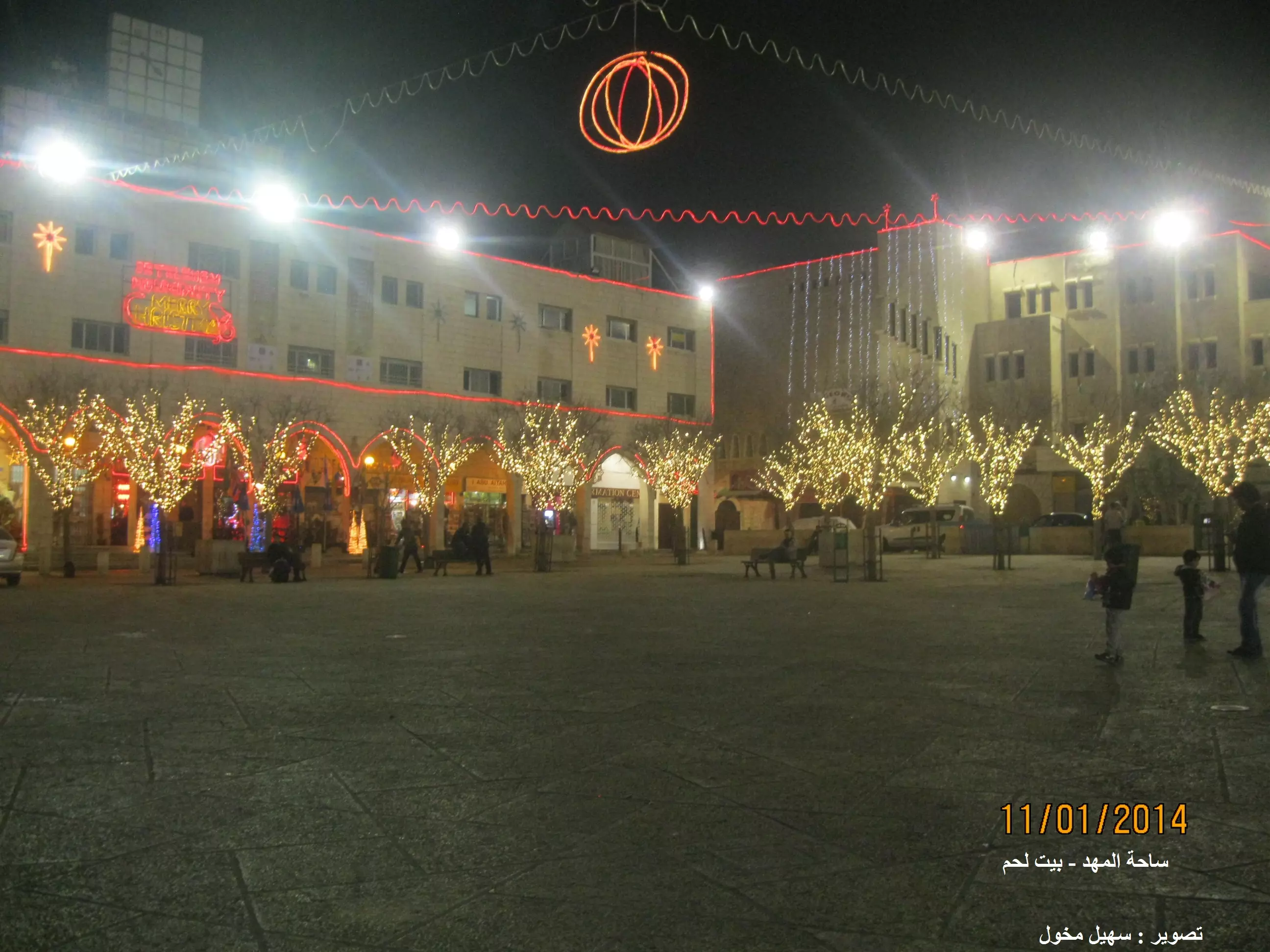
Posted by سهيل مخول - بيت لحم - ساحة المهد - تصوير Sohel Makhoul
Posted by سهيل مخول - زينة الميلاد في ساحة المهد - بيت لحم . تصوير سهيل مخول
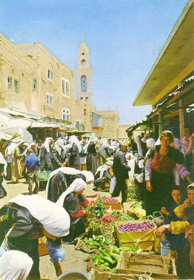
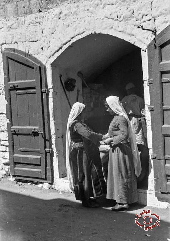
Posted by سهيل مخول - نساء في الطريق لسوق الخضروات لبيع السمن واللبن والخضروات في بيت لحم 1935
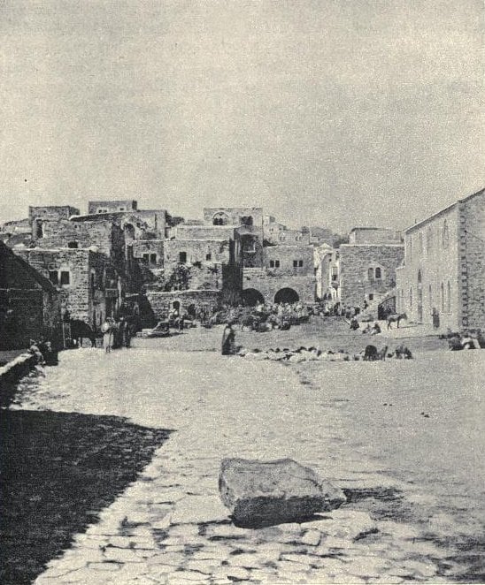
- من بيت لحم عام 1910
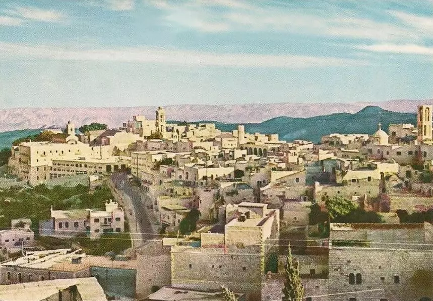
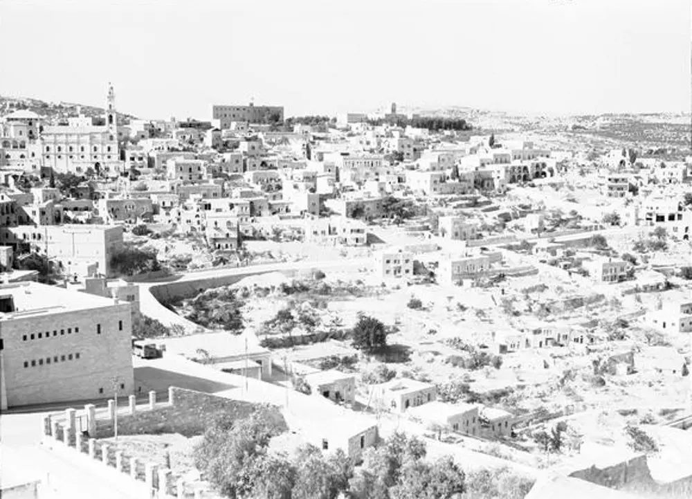
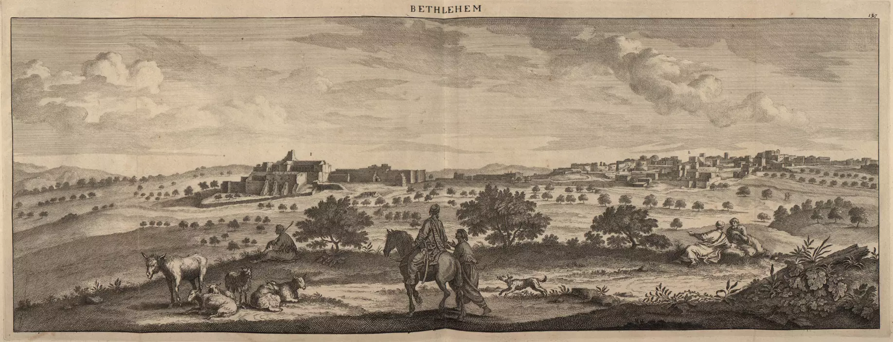
- BETHLEHEM - Partial view, c. 1930s.
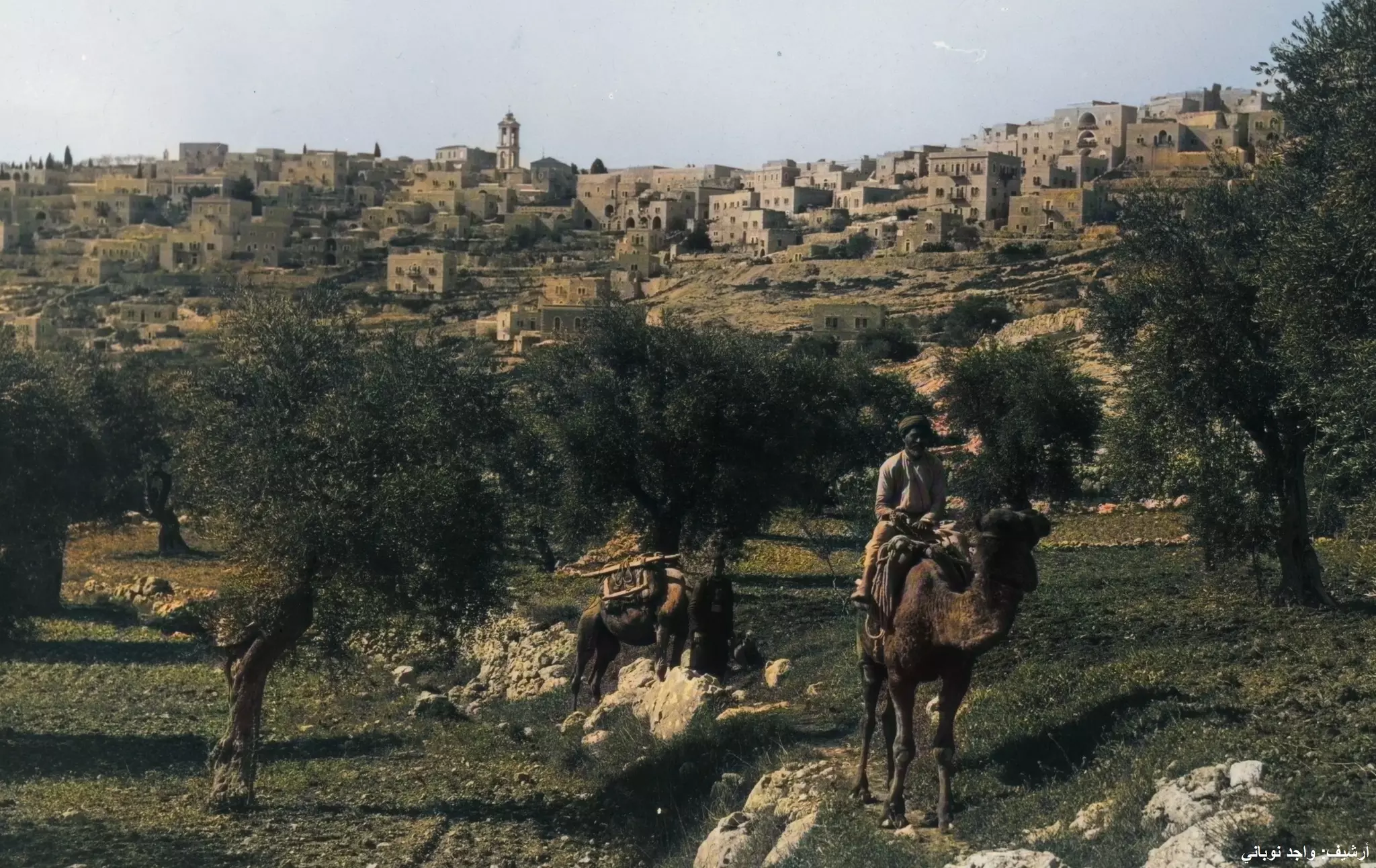
Posted by Rami Atwan - BETHLEHEM - Palestinian shepherds in the terraced olive groves outside the yown, circa 1930s.

Posted by Rami Atwan - BETHLEHEM - Engraving of a partial view, c. 1880s.
Posted by Rami Atwan - Bethlehem blanketed in snow, 2014.
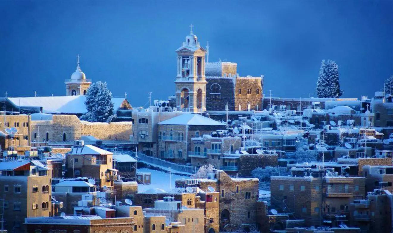
Posted by Rami Atwan - Bethlehem blenketed in snow, 2015. (Per Nicola H. Juha).
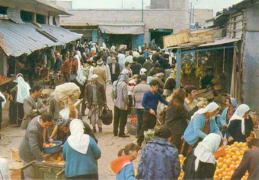
Posted by Rami Atwan - في سوق المدينة 1960
- في سوق المدينة 1920

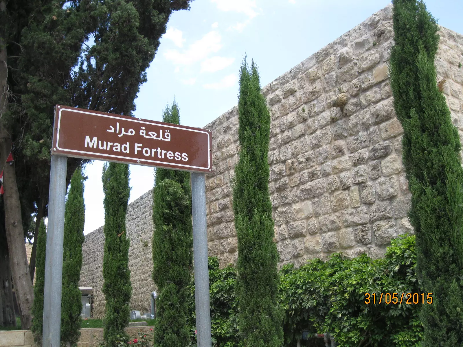
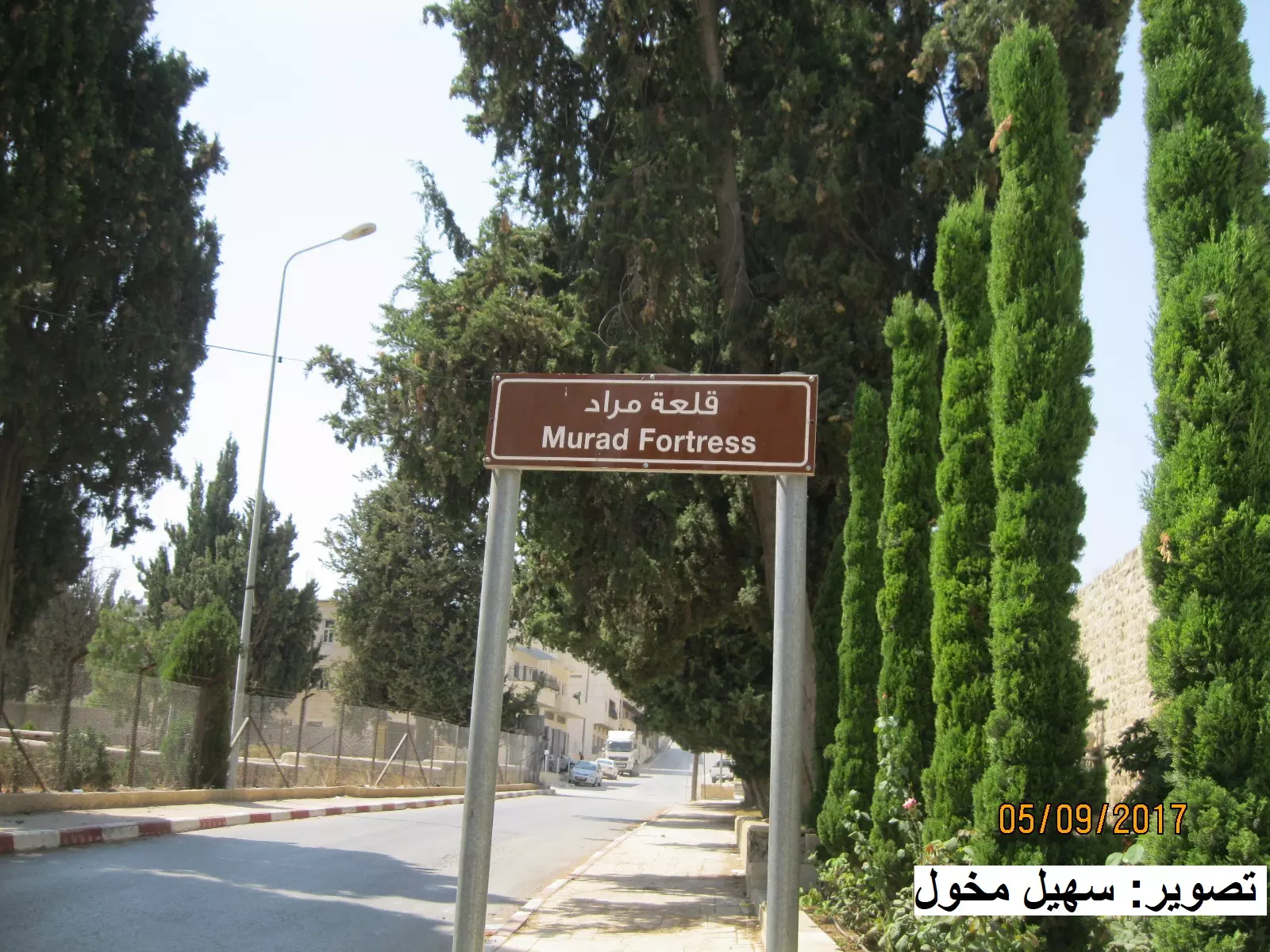
- قلعة مراد في بيت لحم - بعدسة سهيل مخول
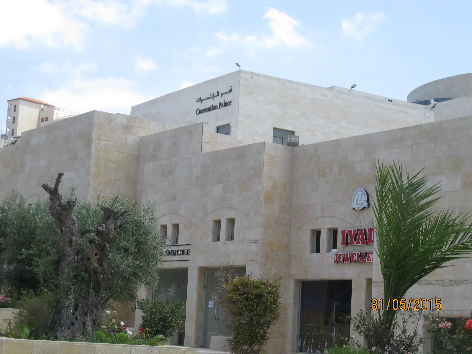
Posted by سهيل مخول - قصر المؤتمرات في بيت لحم - بعدسة سهيل مخول
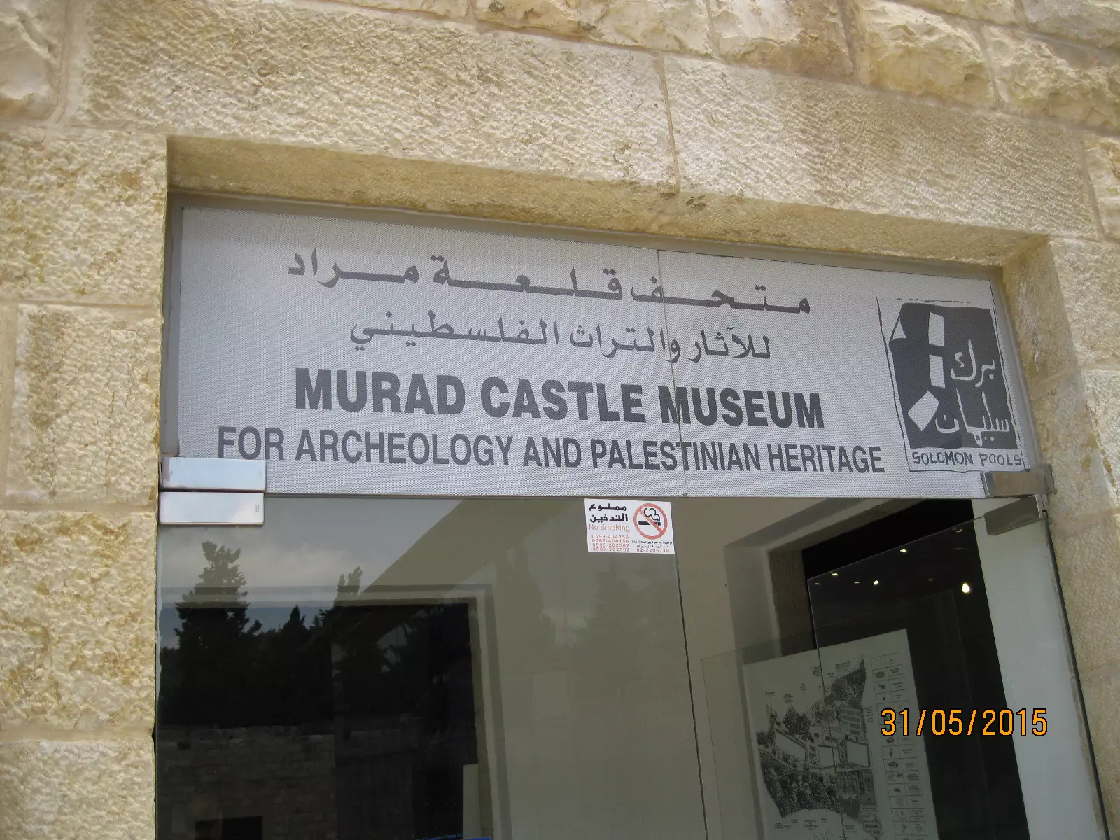
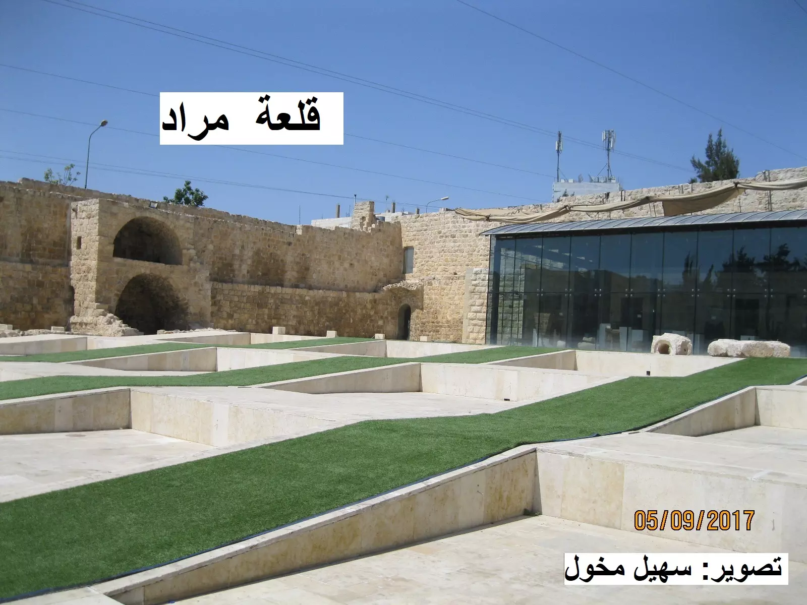
Posted by سهيل مخول - متحف قلعة مراد - بعدسة سهيل مخول 31.5.2015
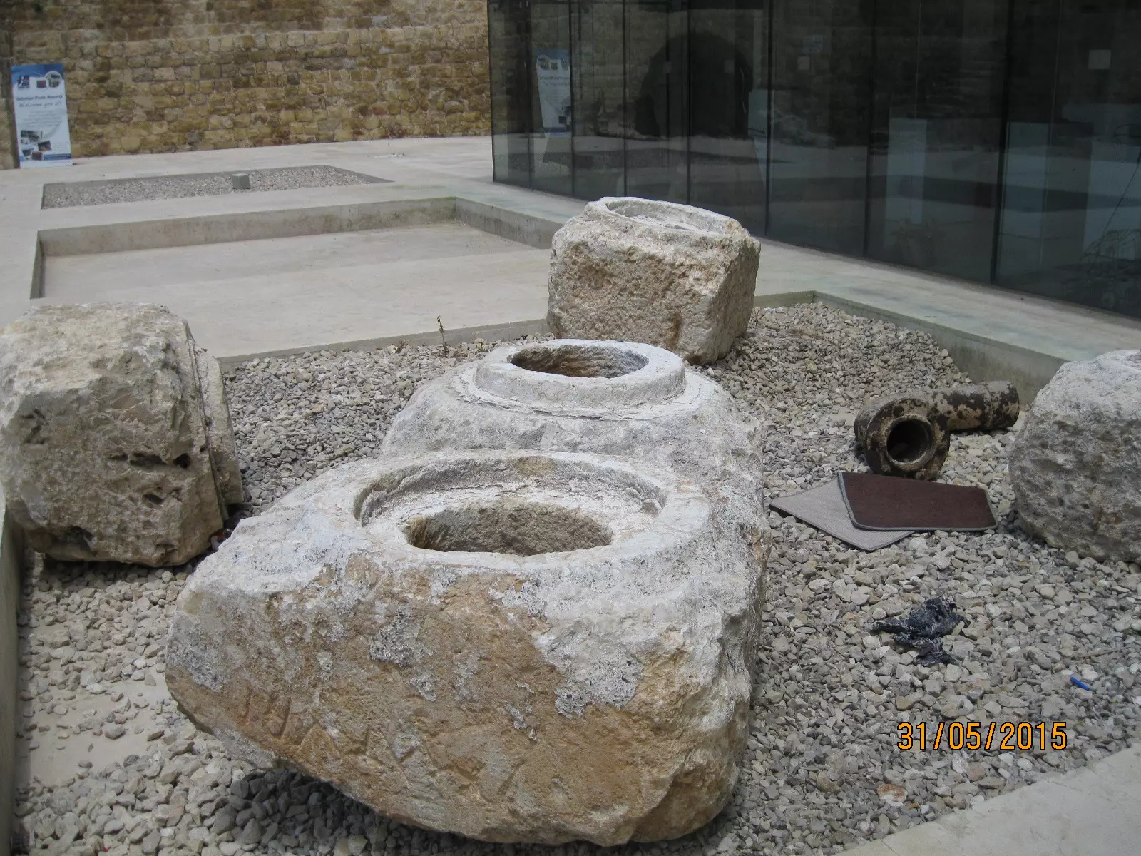
Posted by سهيل مخول - متحف قلعة مراد - بعدسة سهيل مخول 31.5.2015
Posted by سهيل مخول - منظر عام قديم في المدينة عام 1880
- كنيسة ومسجد في بيت لحم - بعدسة سهيل مخول
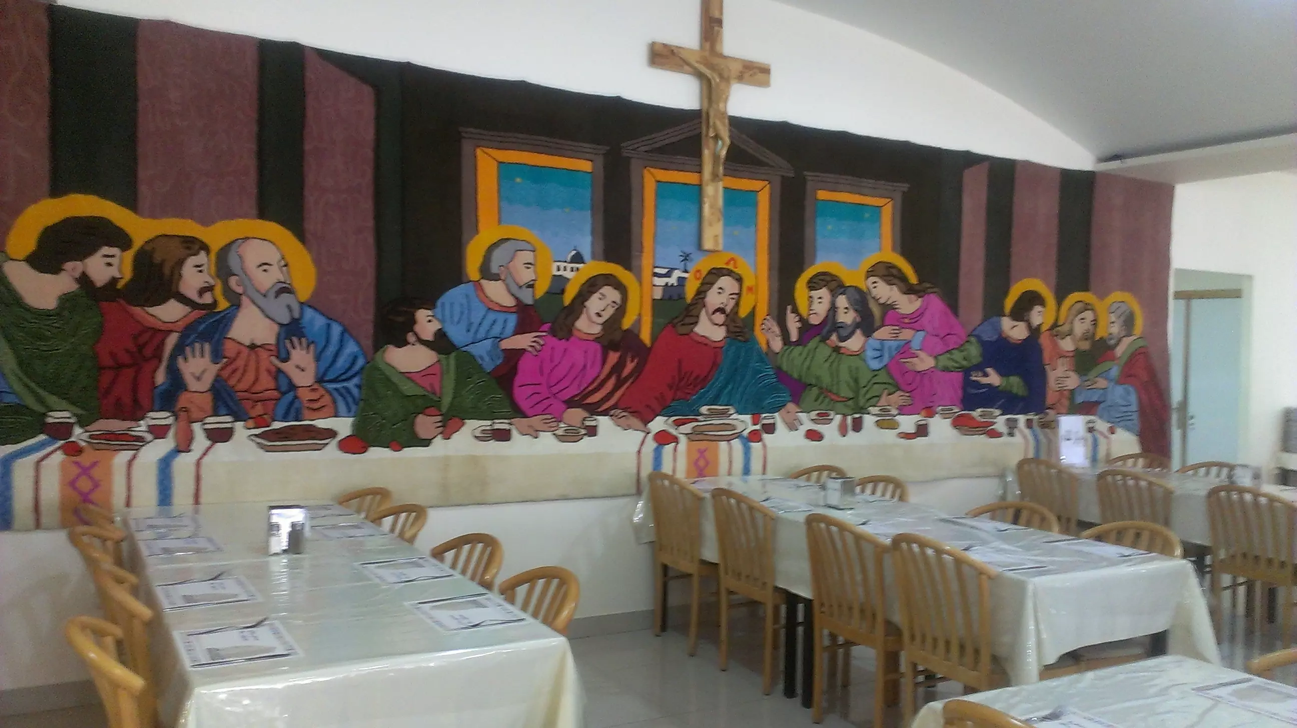
Posted by سهيل مخول - العشاء السري في قاعة الطعام في فندق بيت لخم
Posted by سهيل مخول - صوره قديمه لكنيسه المهد سنه 1941
Posted by abu raya - بيت لحم سنه 1940
Posted by abu raya - بيت لحم سنه 1940
Posted by abu raya - كنيسه المهد سنه 1941
Posted by abu raya - بيت لحم سنه 1941
Posted by abu raya - بيت لحم سنه 1941
Posted by abu raya - بيت لحم سنه 1941
Posted by abu raya - بيت لحم سنه 1941
Posted by abu raya - بيت لحم سنه 1941
Posted by abu raya - جيش الاستعمار البريطاني يدخل بيت لحم سنه 1918
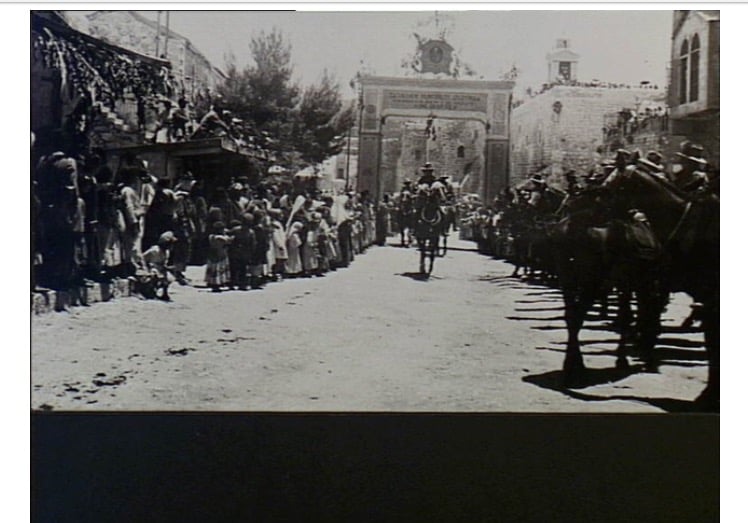
Posted by abu raya - عرض عسكري للجيش البريطاني في بيت لحم سنه 1918
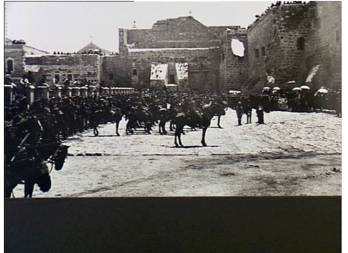
Posted by abu raya - عرض عسكري للجيش البريطاني في بيت لحم سنه 1918
Posted by abu raya - بيت لحم سنه 1918
Posted by abu raya - بيت لحم سنه 1918
Posted by abu raya - بيت لحم سنه 1918
Posted by abu raya - مدينه بيت لحم سنه 1941
Posted by abu raya - كنيسه المهد في بيت لحم سنه 1918
Posted by abu raya - بيت لحم سنه 1918
Posted by abu raya - سوق بيت لحم سنه 1918
Posted by abu raya - صوره قديمه لاطفال الكنيسه الكاثوليكيه في بيت لحم

Posted by abu raya - منظر عام لبيت لحم سنه 1910

Posted by abu raya - صوره قديمه من بيت لحم
Posted by abu raya - صوره قديمه من شوارع بيت لحم
Posted by abu raya - صوره قديمه من بيت لحم
Posted by abu raya - صوره قديمه من سوق بيت لحم
Posted by abu raya - صوره قديمه لكنيسه المهد
Posted by abu raya - صوره قديمه من شوارع بيت لحم
Posted by abu raya - صوره قديمه لكنيسه المهد
Posted by abu raya - منظر عام لمدينه بيت لحم ايام زمان
Posted by abu raya - صوره قديمه لمدينه بيت لحم
Posted by abu raya - صوره قديمه من بيت لحم
Posted by abu raya - مشروع ترميم كنيسة المهد في بيت لحم . تصوير سهيل مخول

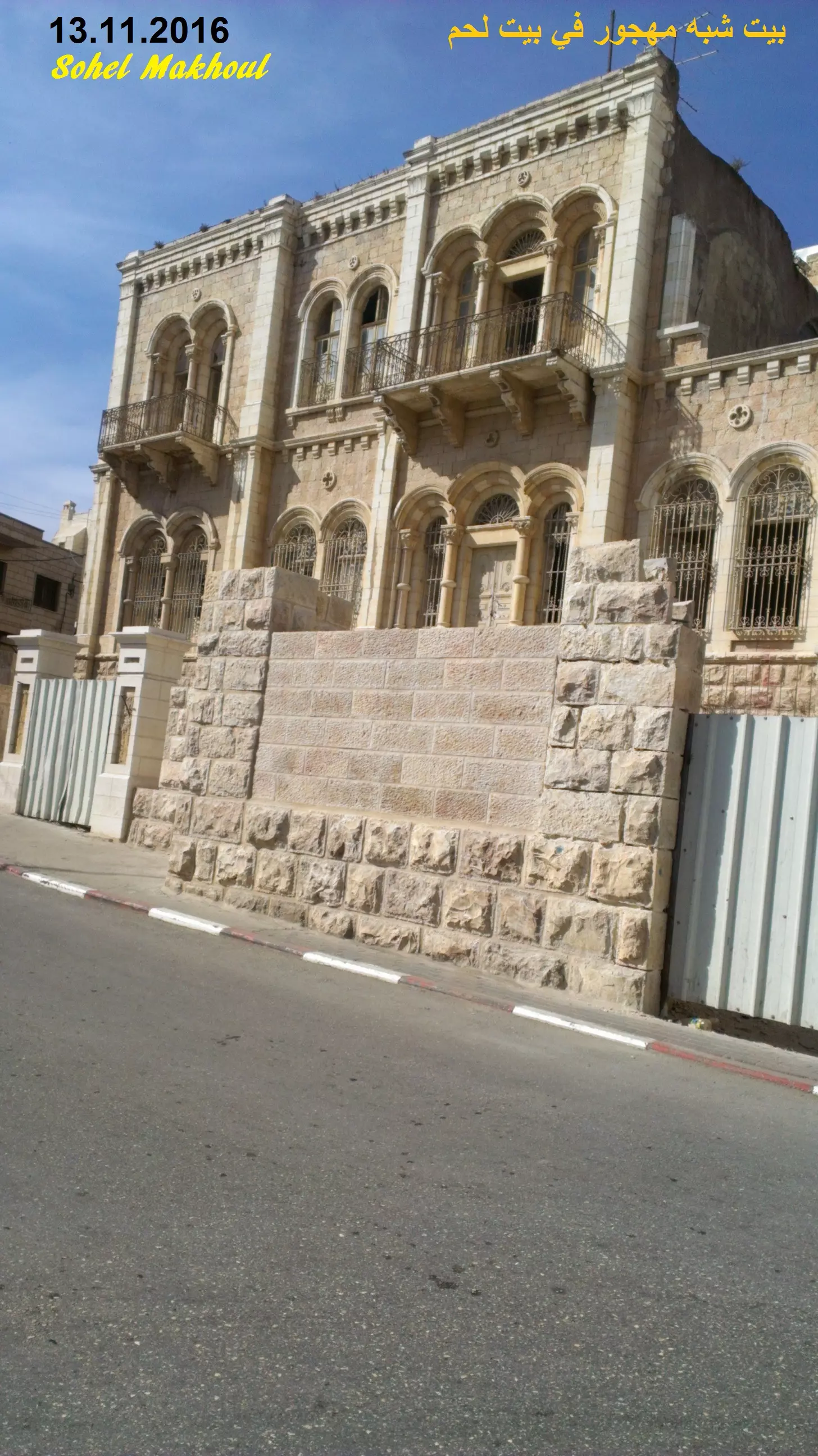
Posted by سهيل مخول - بيت شبه مهجور في مدينة بيت لحم. تصوير سهيل مخول يوم 13.11.206
Posted by سهيل مخول - ساحة المهد وكنيسة المهد في بيت لحم - تصوير : سهيل مخول

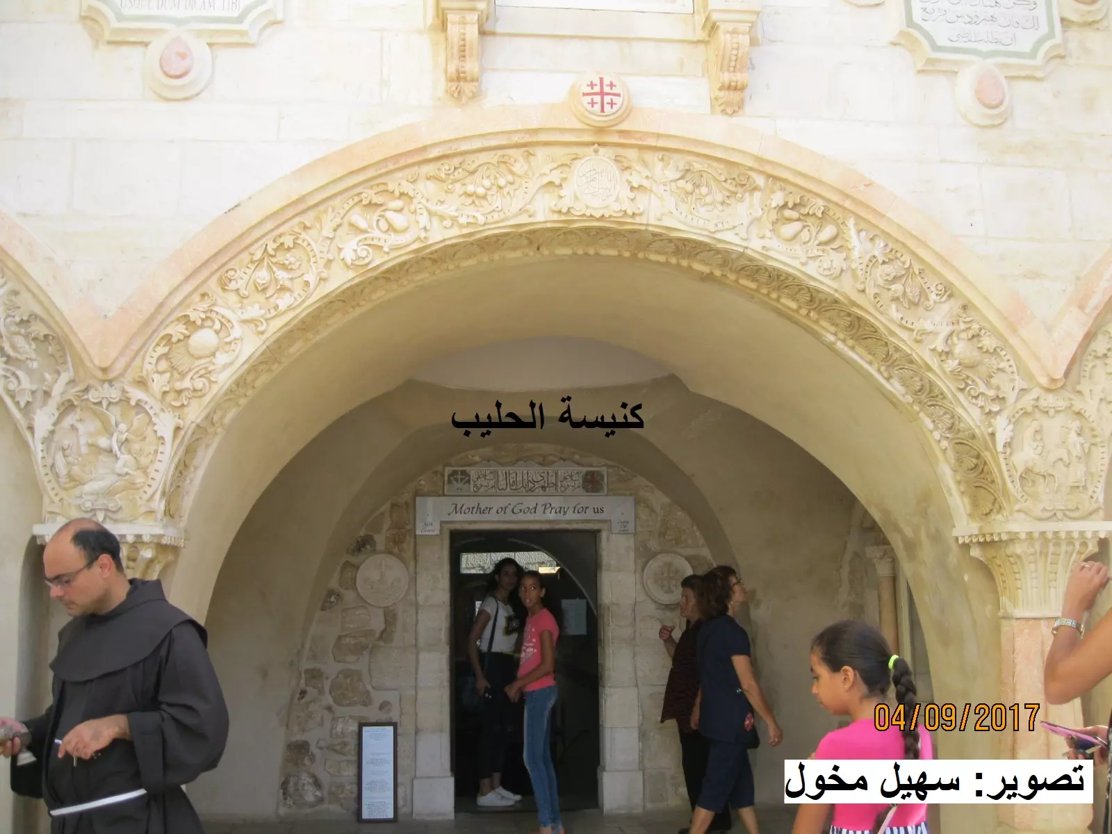
Posted by سهيل مخول - مغارة / كنيسة الحليب في بيت لحم بعدسة سهيل مخول
Posted by سهيل مخول - بيت لحم - كنيسة المهد ومسار الحجاج بعدسة سهيل مخول

Posted by سهيل مخول - ساحة المهد وكنيسة المهد في بيت لحم - تصوير : سهيل مخول
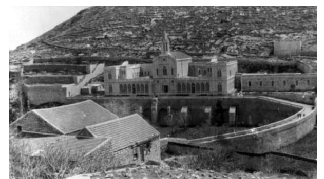
Posted by سهيل مخول - قلعة مراد بالقرب من برك سليمان
Posted by سهيل مخول - قلعة مراد بالقرب من برك سليمان
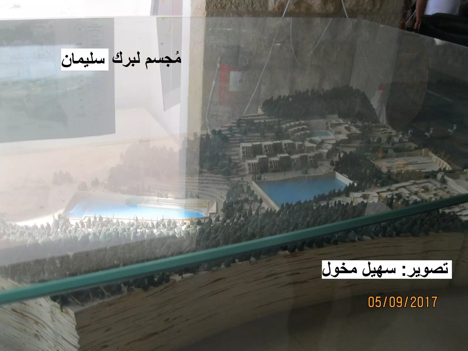
Posted by سهيل مخول - مجسم لبرك سليمان داخل المتحف التراث الفلسطيني في قلعة مراد
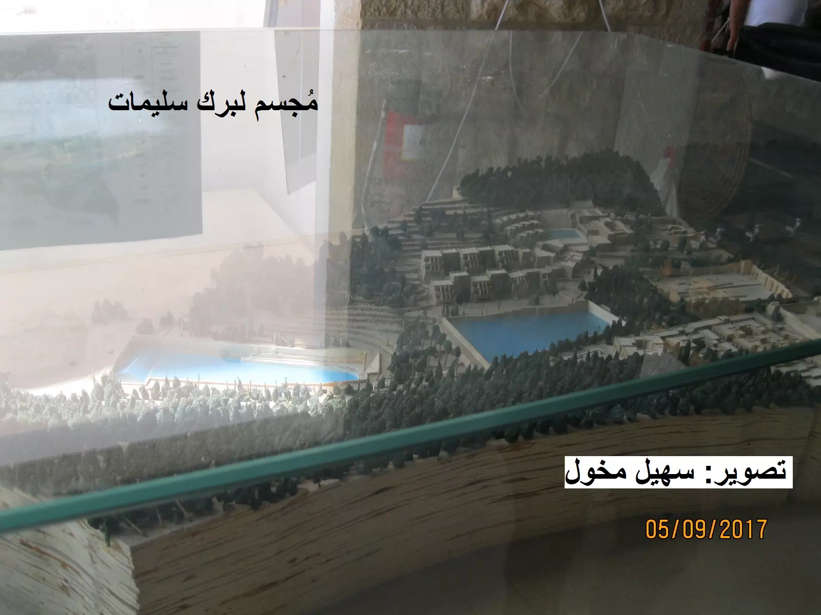
Posted by سهيل مخول - مجسم لبرك سليمان داخل المتحف التراث الفلسطيني في قلعة مراد
Posted by سهيل مخول - واحدة من برك سليمان بعدسة سهيل مخول

Posted by سهيل مخول - Bethlehem, late 1917 or early 1918
Posted by palestinehistory - صورة رائعة لاحد العائلات في مدينة بيت لحم 1930
- 1900 منظر لحرفين في بيت لحم يعود لقبل النكبة
- صناعة الاحذيةةفي بيت لحم 1900
- منظر لاحد البيوت القروية في منطقة بيت لحم 1910
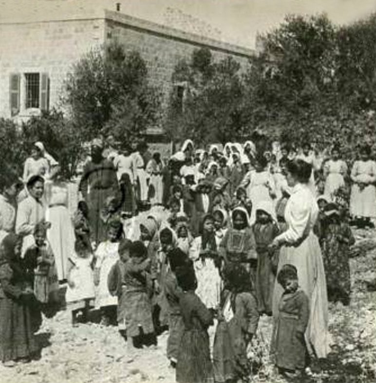
- صورة لمدرسة بنات في مدينة بيت لحم عام 1903 م
- The main entrance of the Church of Nativity
- A view of the church in 1945

- At Manger Square
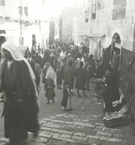
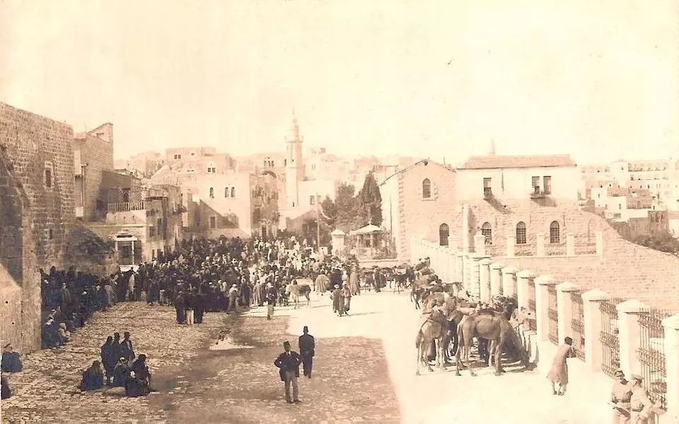
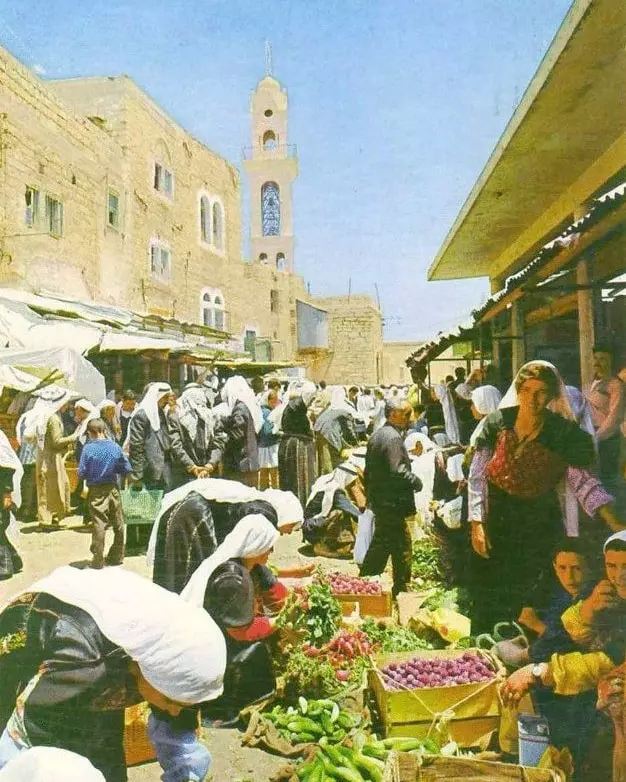
2 - Palestinian women shop in the market place near Manger Square in Bethlehem, Nov. 28, 1947 /فتيات فلسطينيات يتسوقن في السوق في القرب من ميدان المهد.- بيت لحم، 1947
- مدخل بيت لحم الشمالي 1930
- بيت لحم عام 1880

- بيت لحم عام 1880 #2
- بيت لحم عام 1880 #3
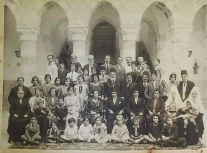
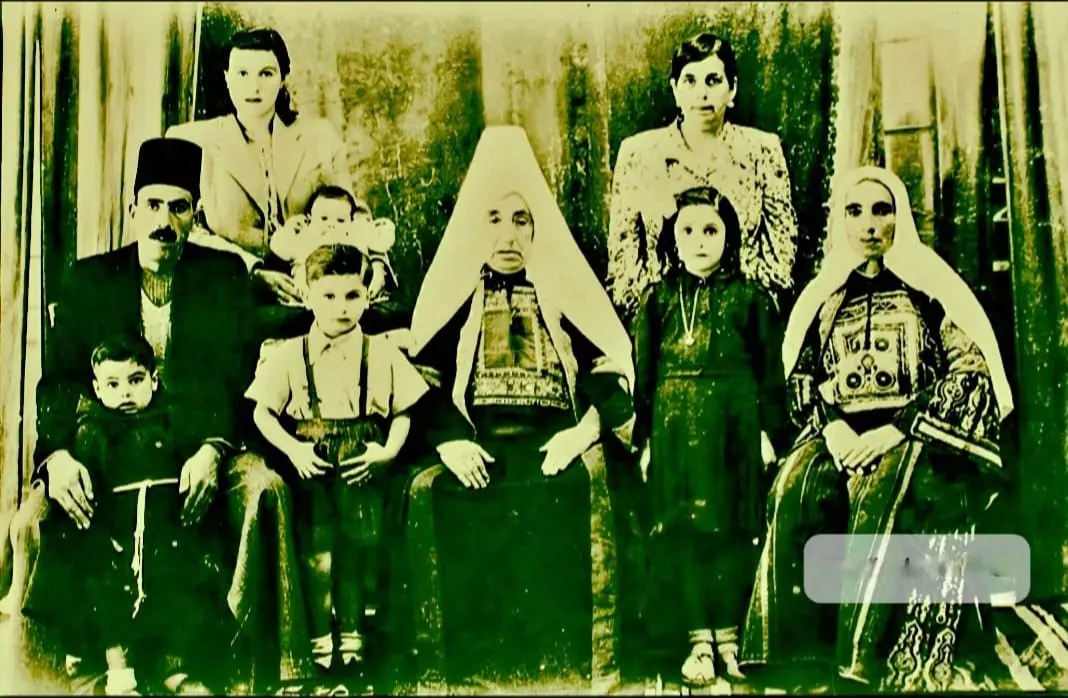
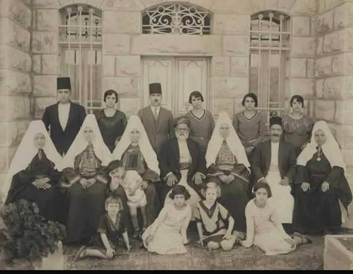
- صورة تاريخية نادرة لعائلة جاسر في باحة قصر جاسر التاريخي في بيت لحم عام 1925
- بيت لحم عام 1920م
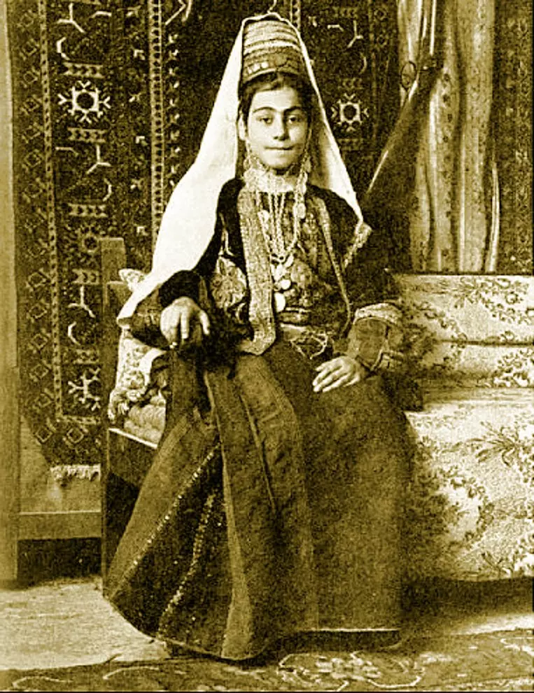
Posted by باحث تاريخي - امرأة من بيت لحم ترتدي الزي المحلي التراثي عام 1894م.

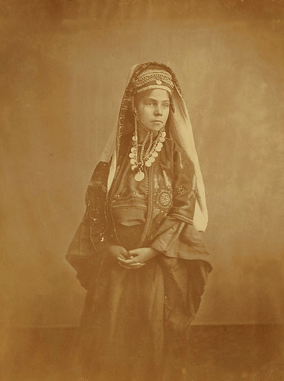
Posted by باحث تاريخي - فتاة من بيت لحم عام 1905م
Posted by باحث تاريخي - سيدة من بيت لحم عام 1870م
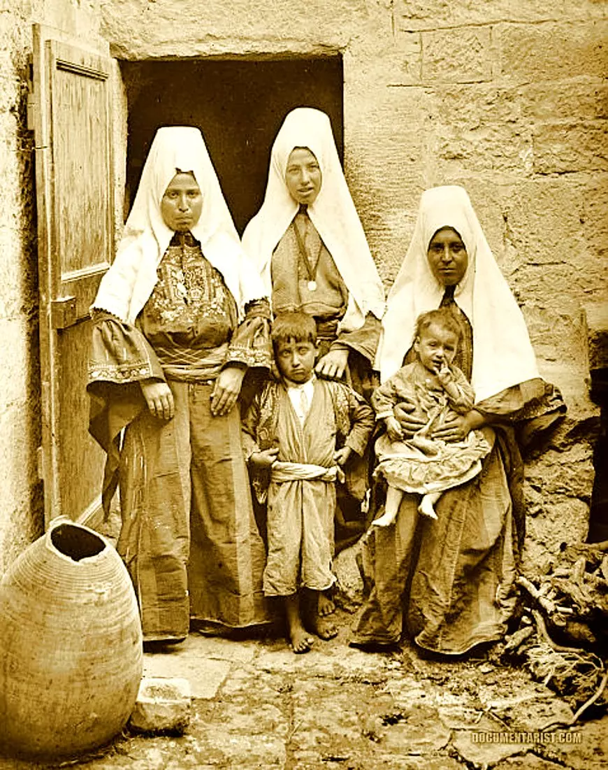
Posted by باحث تاريخي - أسرة من بيت لحم عام 1900م
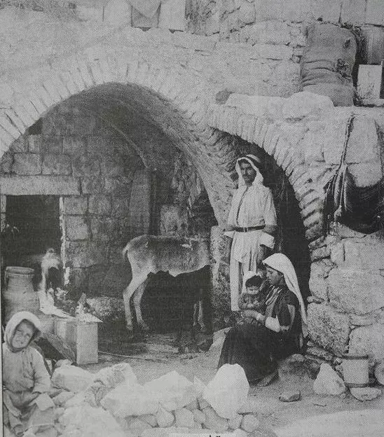
Posted by باحث تاريخي - بيت لحم 1900..بيت فلسطيني في مغارة ويظهر فيه مهد طفل وبرج حمام وأم فلسطينية مع أطفالها يتناولون وجبة طعام
- بيت لحم 1890 - عائلة فلسطينية مرتحلة من بيت لحم إلى القدس

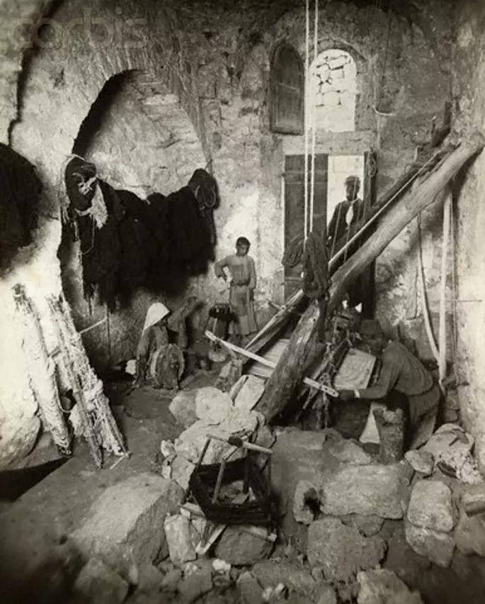
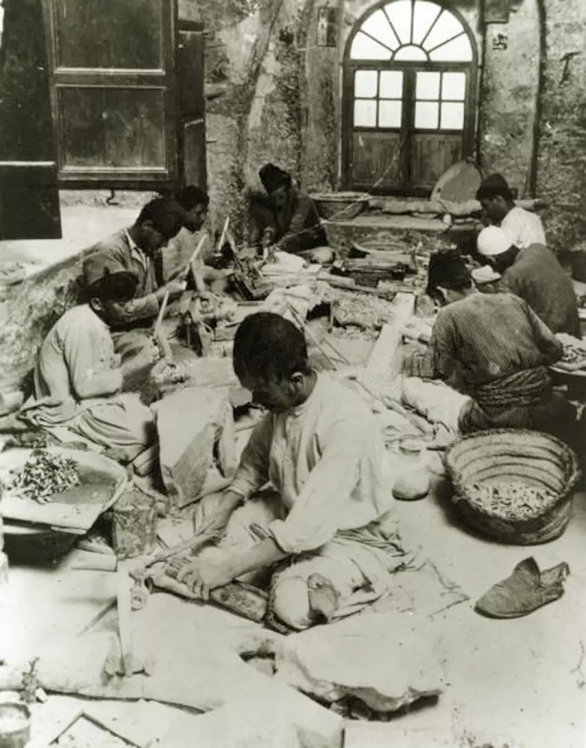
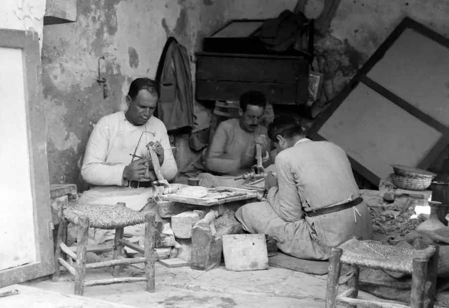
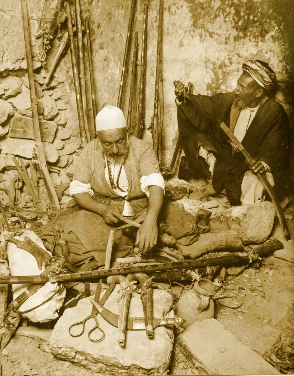
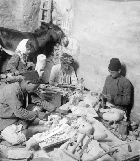
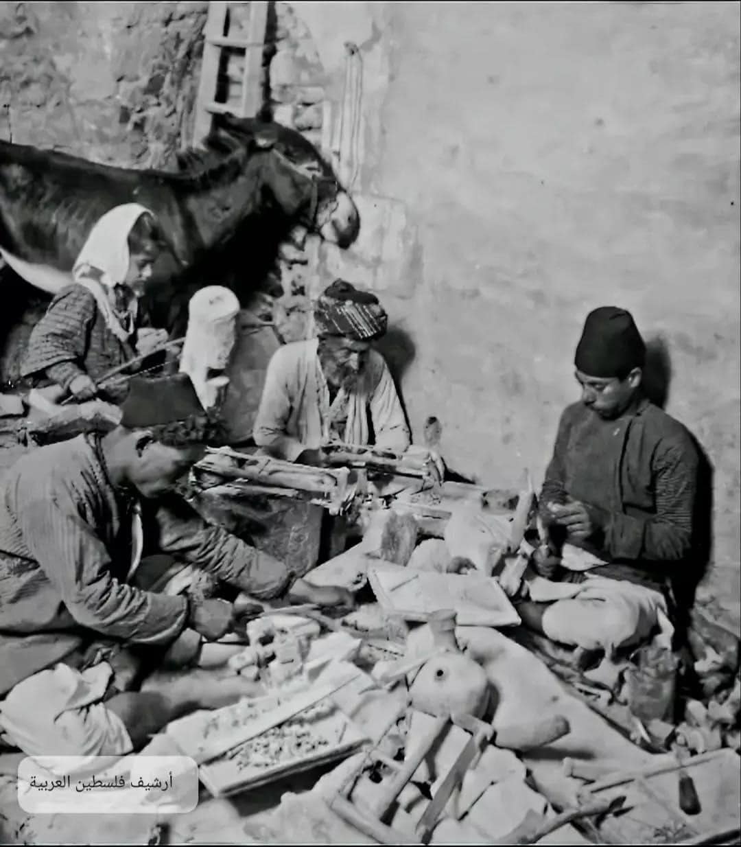
- ورشة حرفيي التصديف في بيت لحم مطلع القرن العشرين..
- قرب سوق الخضار في بيت لحم أربعينيات القرن العشرين..
- صورة تذكارية داخل أستوديو لعائلة مهيوب من بيت لحم عام 1920..
- صورة فوتوكروم داخل بيت في بيت لحم عام 1890..
- بيت لحم ١٨٩٠ وفِي خلفية الصورة جرسية المهد.
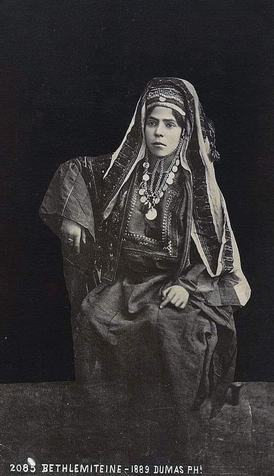
- امرأة فلسطينية باللباس التلحمي الكامل - بيت لحم ١٨٨٩
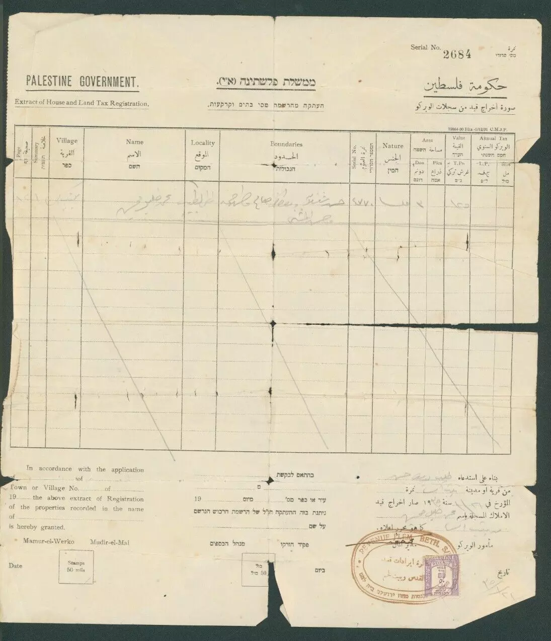
- A land deed from the Bethlehem area that predates the Nakba period
- عائلة فلسطينية من بيت لحم في أواخر القرن التاسع عشر
- سيدات من مدينة.. بيت لحم ... يصنعن الأواني الفخارية.عام 1923م
- صورة لعائلة فلسطينية من بيت لحم في أواخر عشرينيات القرن الماضي عائلة عيسى القنواتي (الكهل بالعمامة) أمام منزله الكائن على شارع القدس الخليل، والمبني في عشرينيات القرن العشرين. تظهر فيها أبنته ماريا (الى شماله) وإلى جانبها زوجها الياس حنا القنواتي.
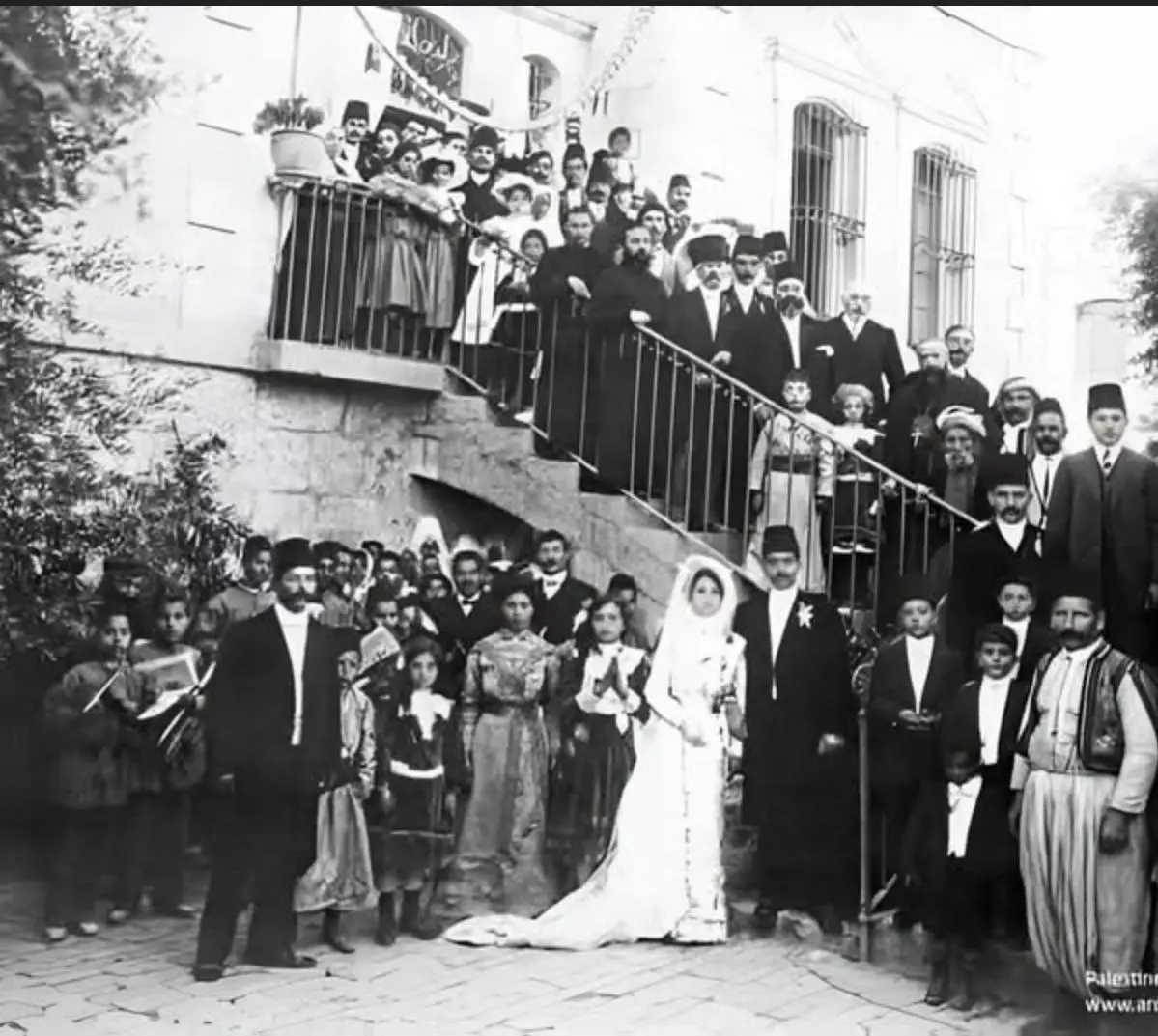
- A Palestinian wedding in Bethlehem City in 1900?
- pre-Nakba view; click the image to enlarge it
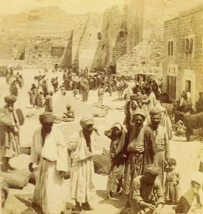
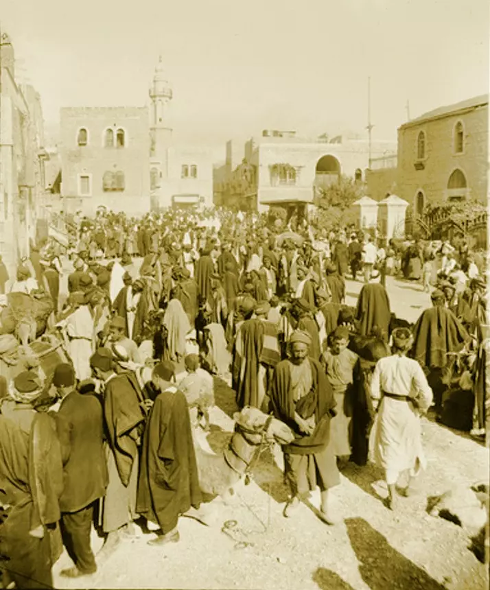
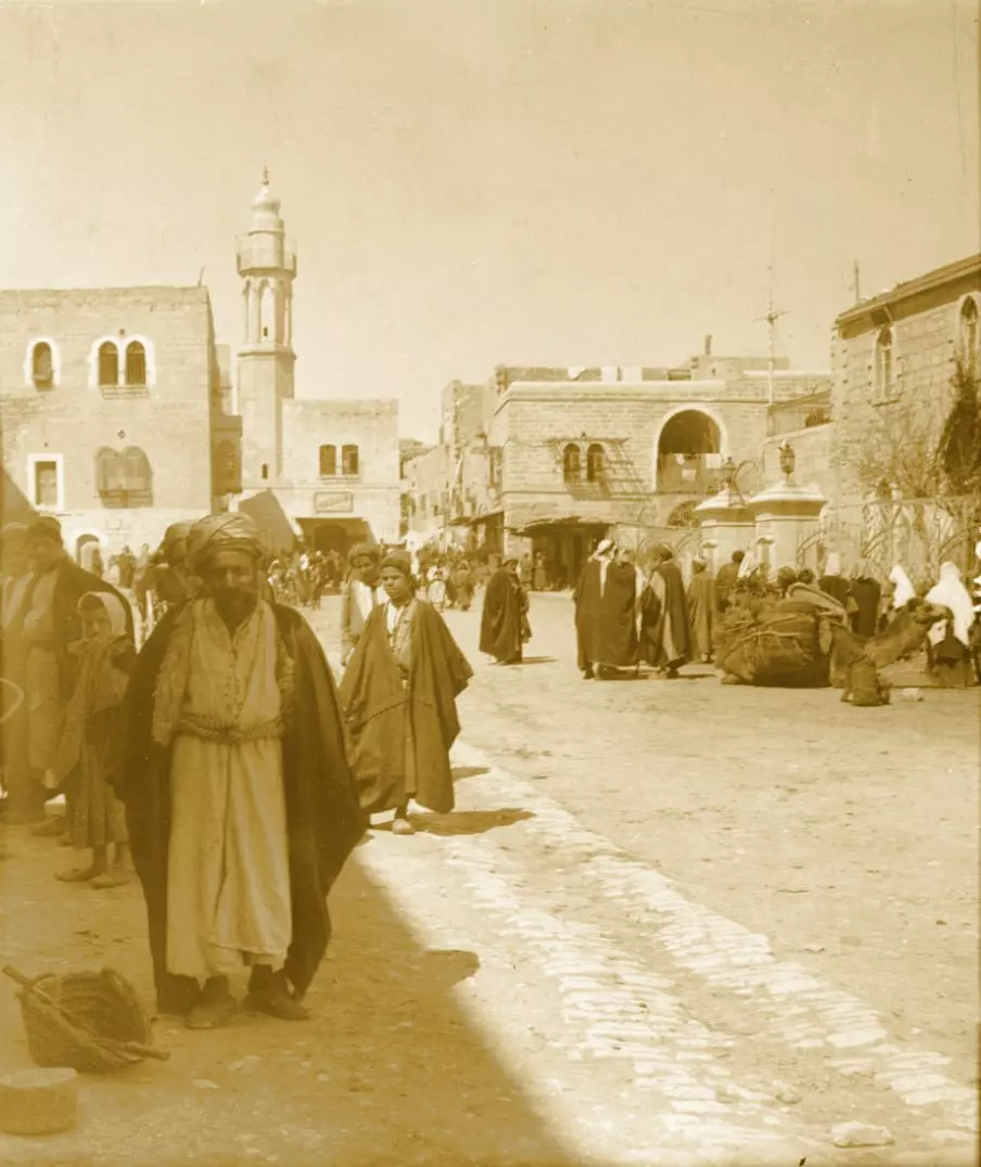
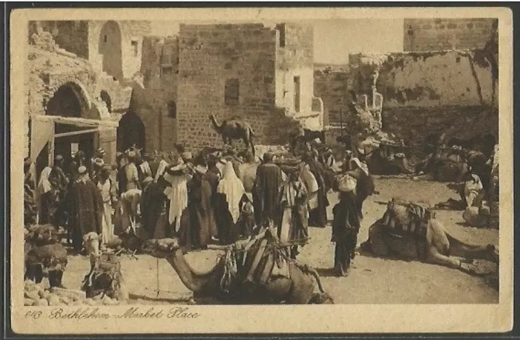
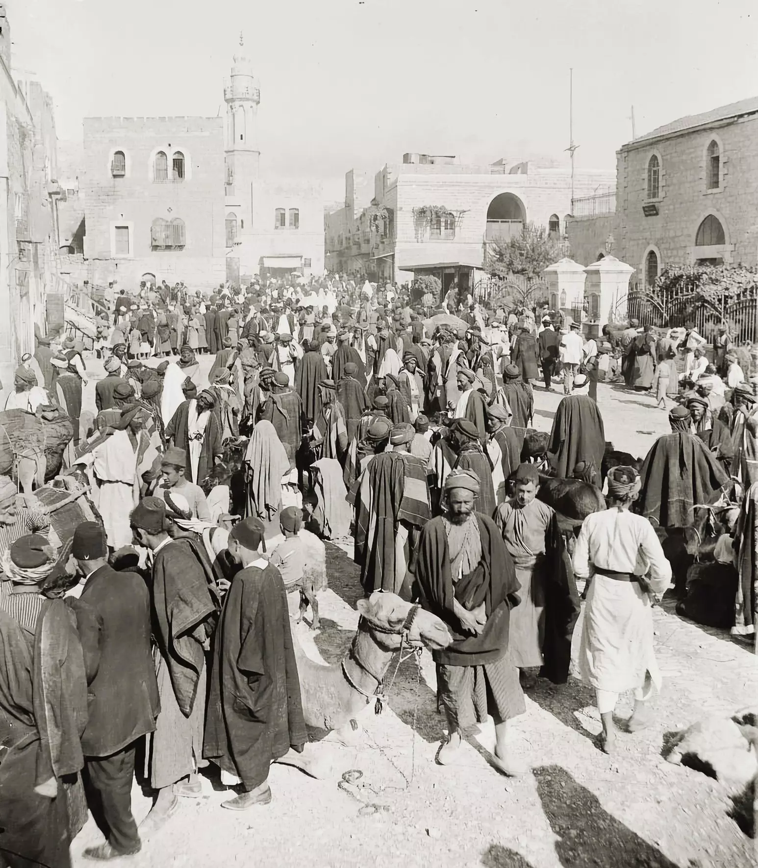
- Pre-wwi market view
- The city during the British occupation (pre-Nakba period_
- The city before Nakba
- One of the neighborhoods during the pre-Nakba era
- One of the city's neighborhoods during the pre-Nakba period
- General view of the city during the pre-WWI era
- يسعدهن التلحميات ...
- أشخاص وصور - أحفاد خليل عطا الله جعار في بيت لحم سنة 1925---People and Portraits - The Descendants of Khalil Atallah Jaar in Bethlehem in 1925.
- بيت لحم 1878 م
- هذه الصورة عند درج السوق القديم في بيت لحم.. منتصف السبعينات من القرن الماضي.. طبعا الصورة من السياح الأجانب...لانهم كانوا يزوروا السوق ويلتقطون صور عديدة...وقتها كان سلال البلاستيك جديده للناس.. بعد سلال القش...
- بيت لحم - فلسطين 1900 م
- بيت لحم - فلسطين ١٩٠٠ م
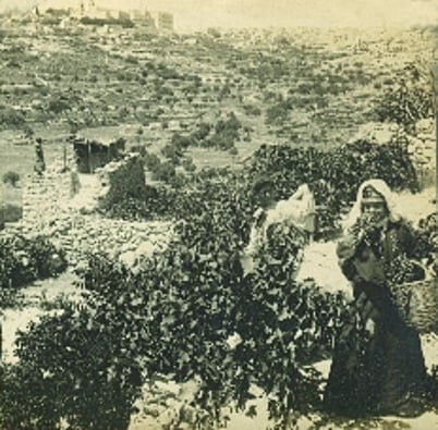
- حطب للبيع من قبل سيدات بيت لحم، حوالي عام 1900، فلسطين.
- حمامات السلطان سليمان ---جنوب بيت لحم فلسطين 1905
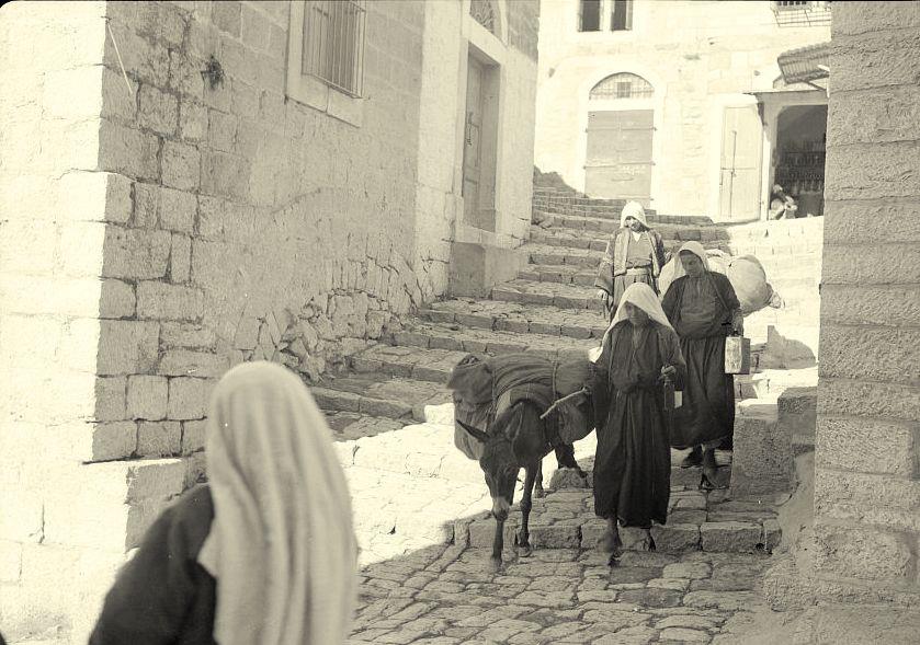
- Street in Bethlehem, ca. 1919
- بيت لحم عام 1967
- بيت لحم عام 1967 #2
- أشهر وأقدم صور لبيت لحم التاريخية
ساحة المهد للمصور فرانك ماسون عام ١٨٧٥
- نساء فلسطينيات يتجولن في سوق بيت لحم المركزي عام 1947
- A picture of a couple during the pre-Nakba era
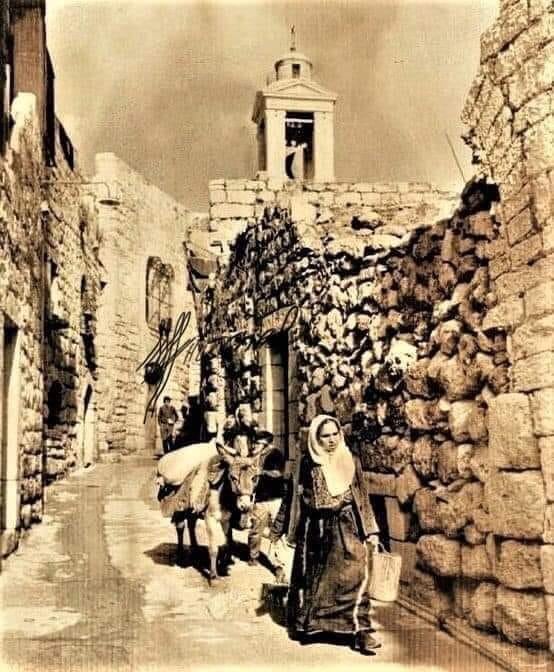
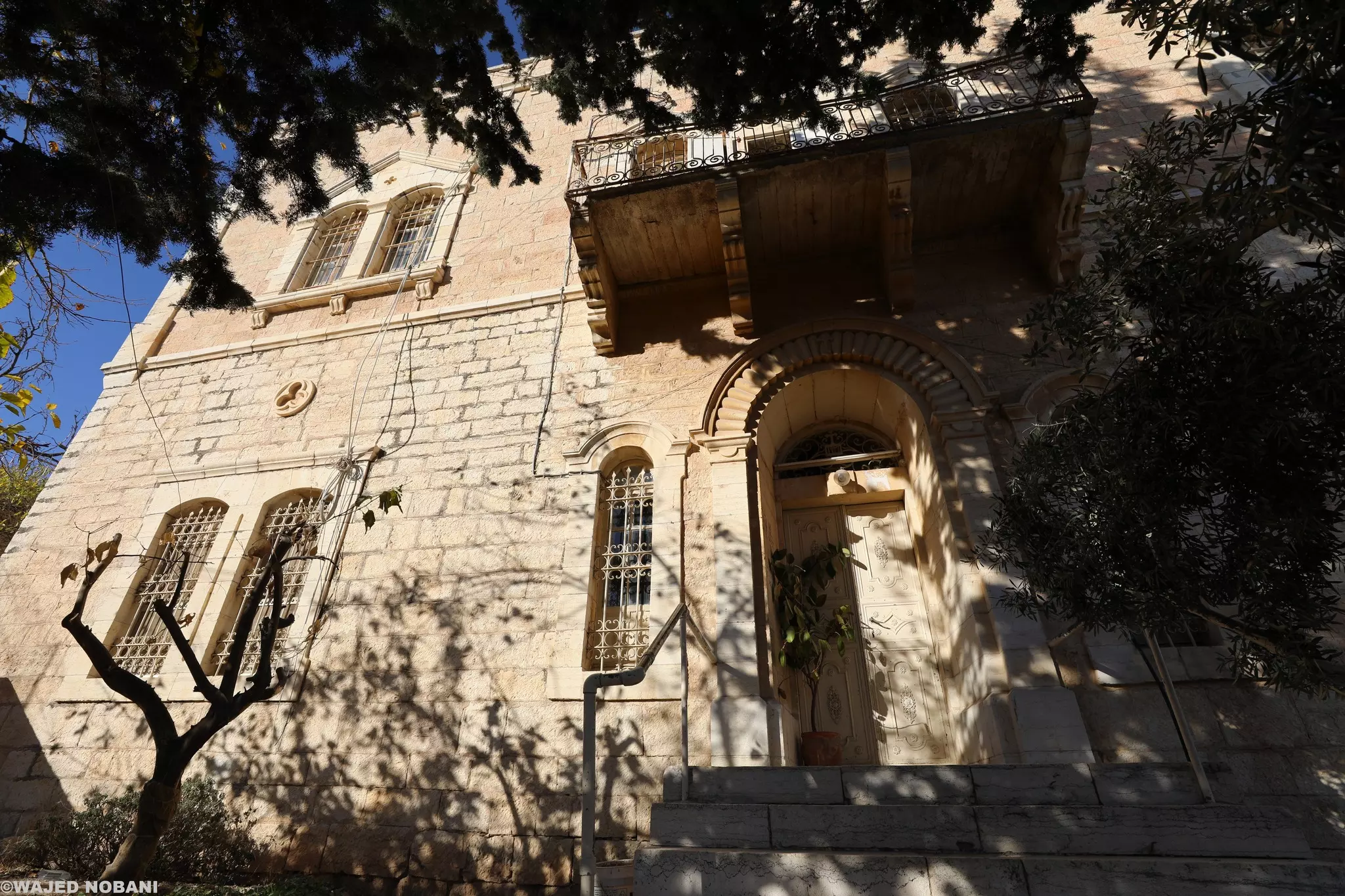
- بيت عتيق. بيت لحم -- واجد النوباني
- دير راهبات الكرمل في بيت لحم -- واجد النوباني
- بيت لحم بحدود عام 1867م تقريبا
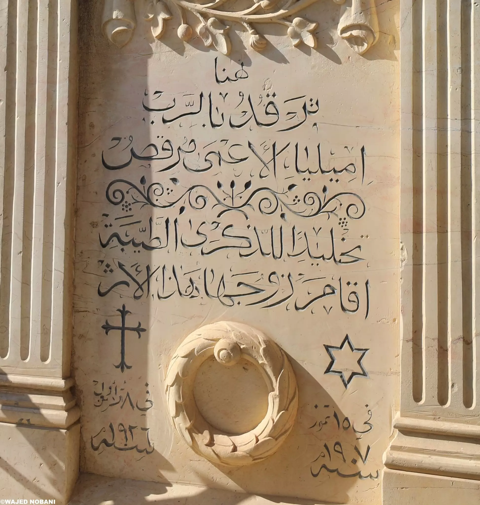
- مقبرة اللاتين القديمة في بيت لحم. إميليا المتوفية في 1907م ورحم الله زوجها الذي أقام لها الأثر في 1926م -- المزيد في قسم التعليقات
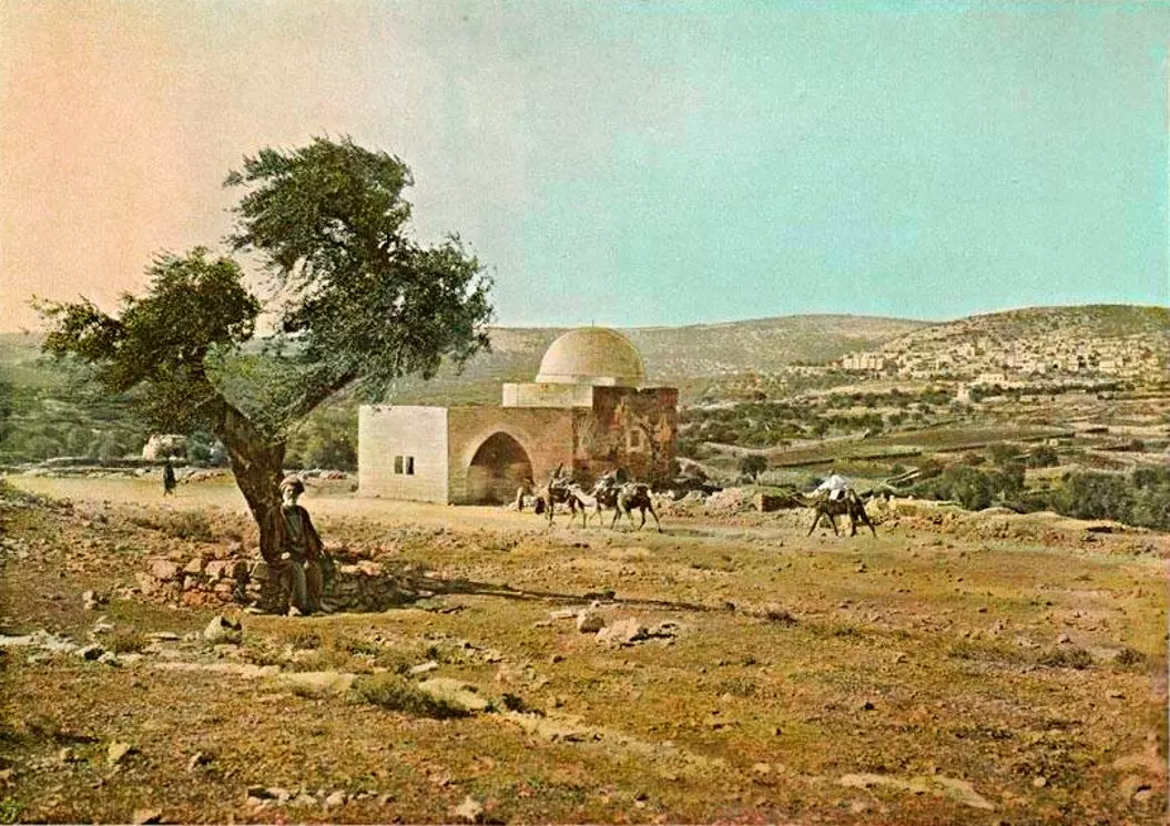
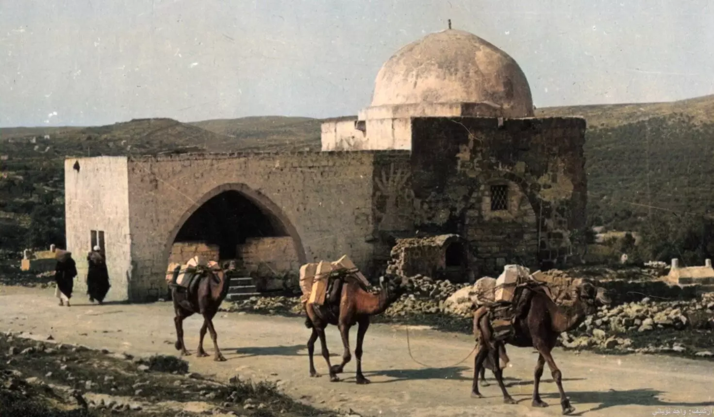
1 - قبر راحيل -- 1898
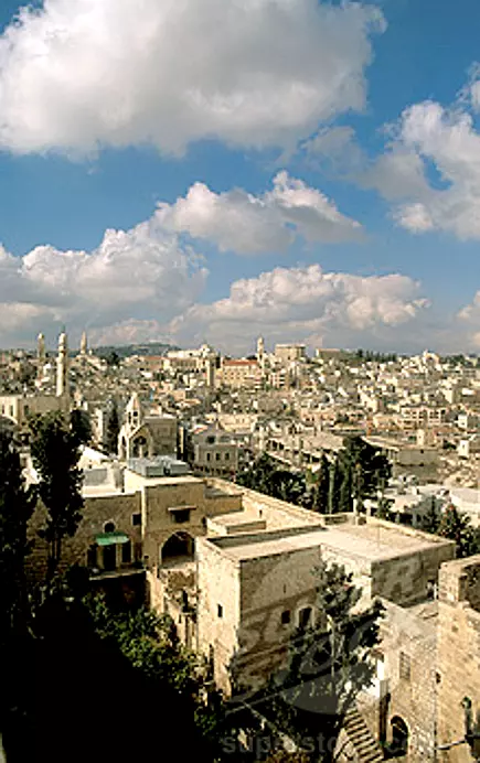
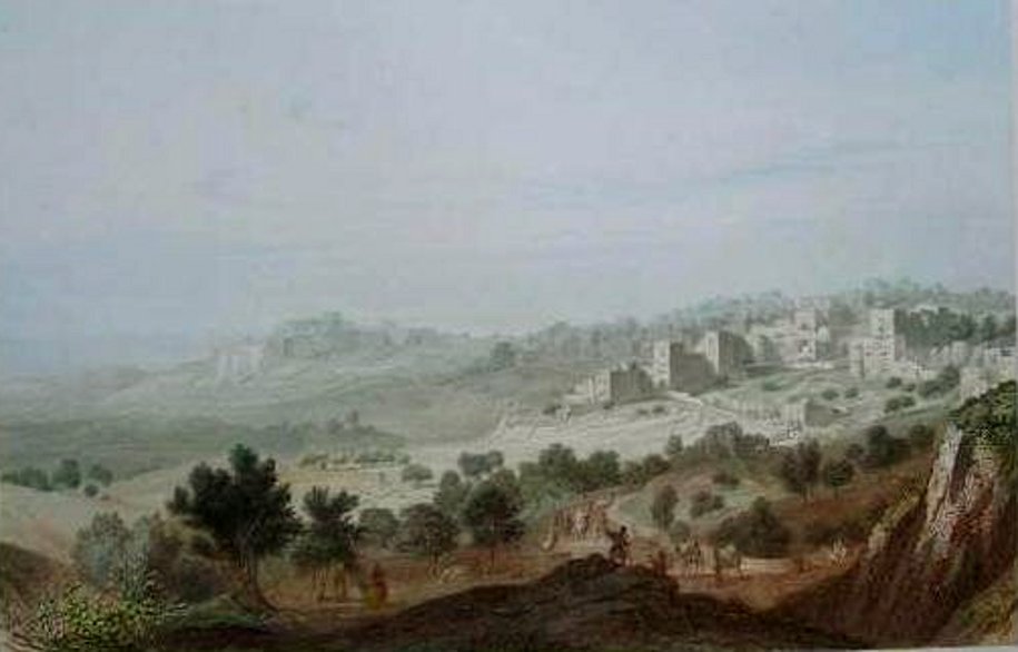
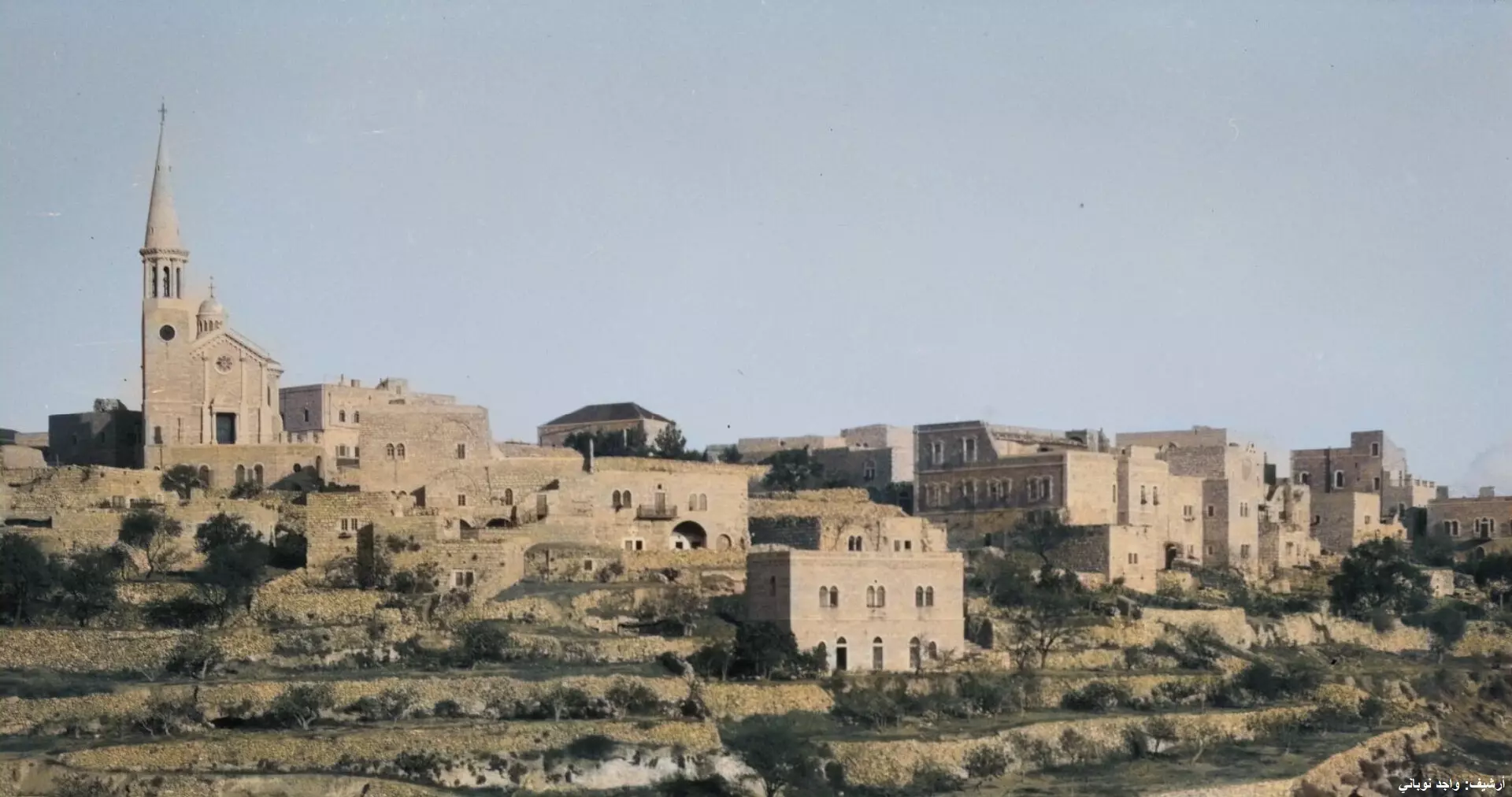
- General view of the city, early 20th century
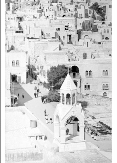
- ساحة كنيسة المهد 1932م.
- بيت لحم في عام 1860م
- بيت لحم في 1921م
- شابة من بيت لحم 1889م
- Late 19th century
- بيت لحم. عام 1860م

- Rare pictures of Bethlehem at the beginning of the 20th century
- Rare pictures of Bethlehem at the beginning of the 20th century #2
- Rare pictures of Bethlehem at the beginning of the 20th century #3
- Rare pictures of Bethlehem at the beginning of the 20th century #4
- Rare pictures of Bethlehem at the beginning of the 20th century #5
- بير المجوس - بيت لحم/ فلسطين. 1900م
- بيت لحم 1931م من السماء
- كنيسة المهد -- 1890
- We are born to be free. We resist with all we have got
- قبل أكثر من 100 عام
- عين ماء قريبة من ساحة المهد.
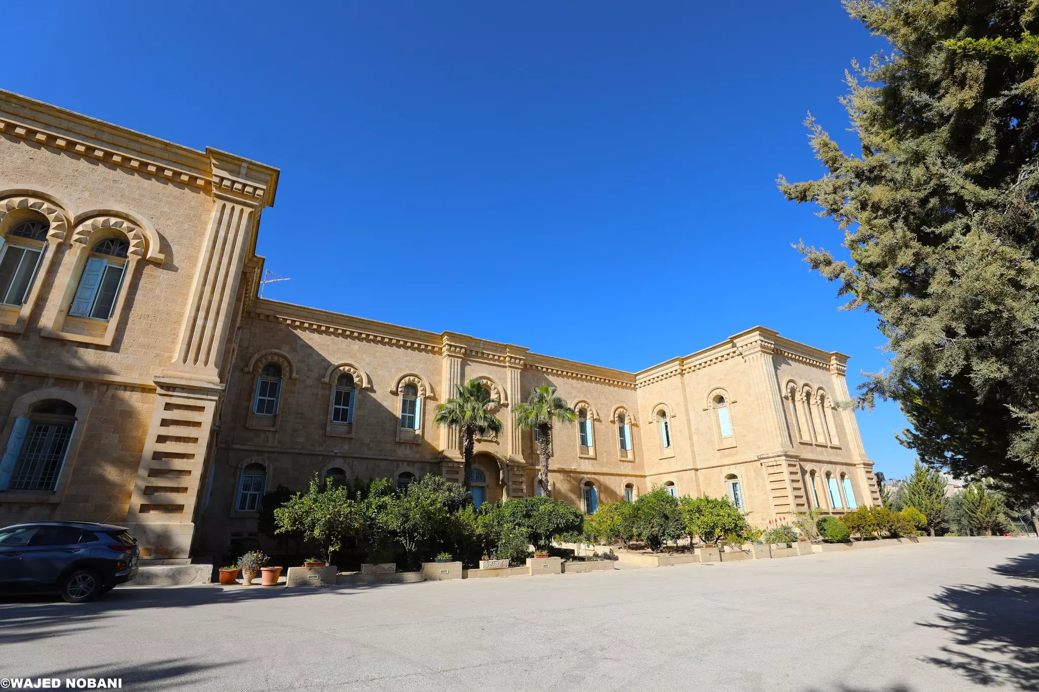
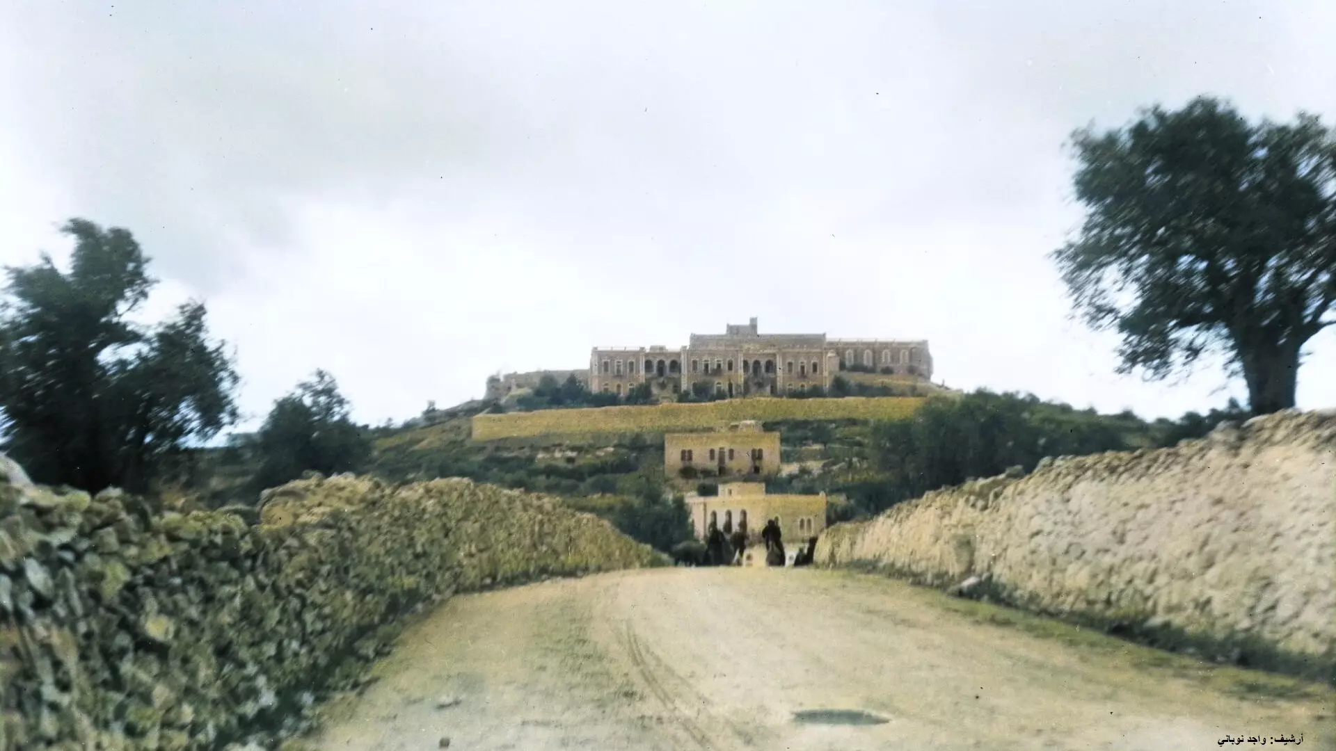
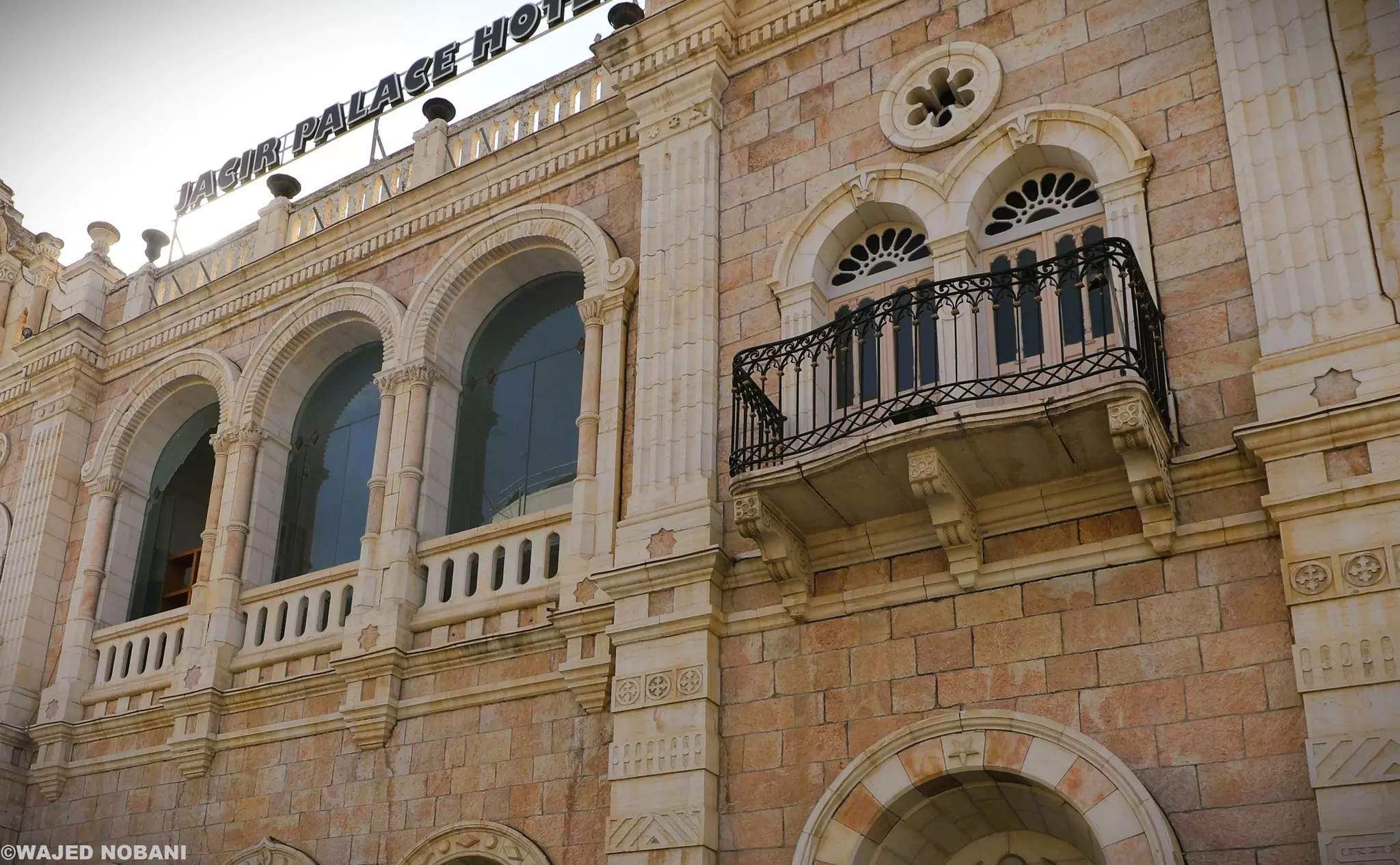
- قصر جاسر:أحد أجمل الأبنية في فلسطين. يرجع تاريخه لعام 1910-- واجد النوباني

- قصر جاسر:أحد أجمل الأبنية في فلسطين. يرجع تاريخه لعام 1910-- واجد النوباني #2
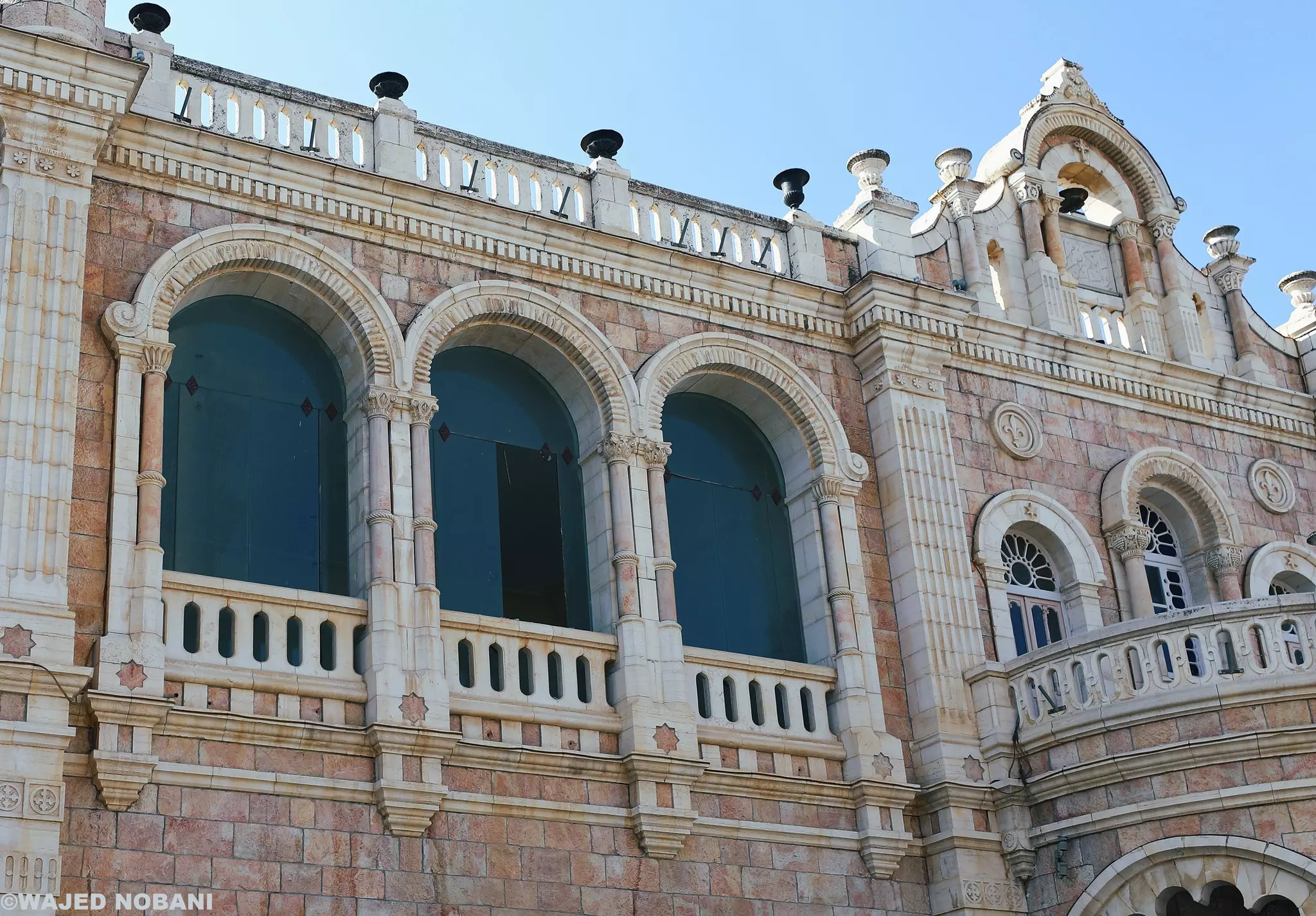
- قصر جاسر:أحد أجمل الأبنية في فلسطين. يرجع تاريخه لعام 1910-- واجد النوباني #3
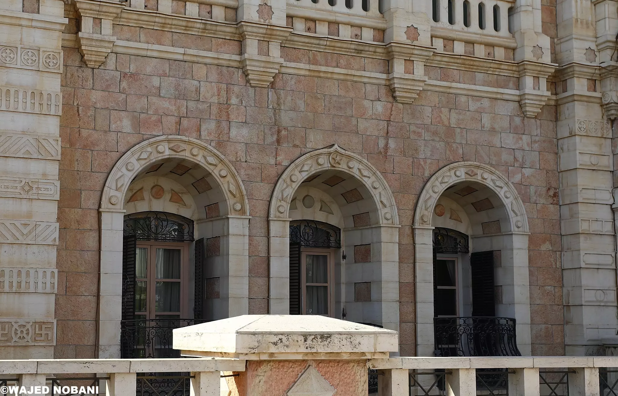
- قصر جاسر:أحد أجمل الأبنية في فلسطين. يرجع تاريخه لعام 1910-- واجد النوباني #4
- بيت لحم. بحدود عام 1860
- طفل من بيت لحم يستظل بقبر أمام كنيسة المهد. 1898م
- صورة رائعة تشمل بيت لحم من الجو وترجع للعام 1931م
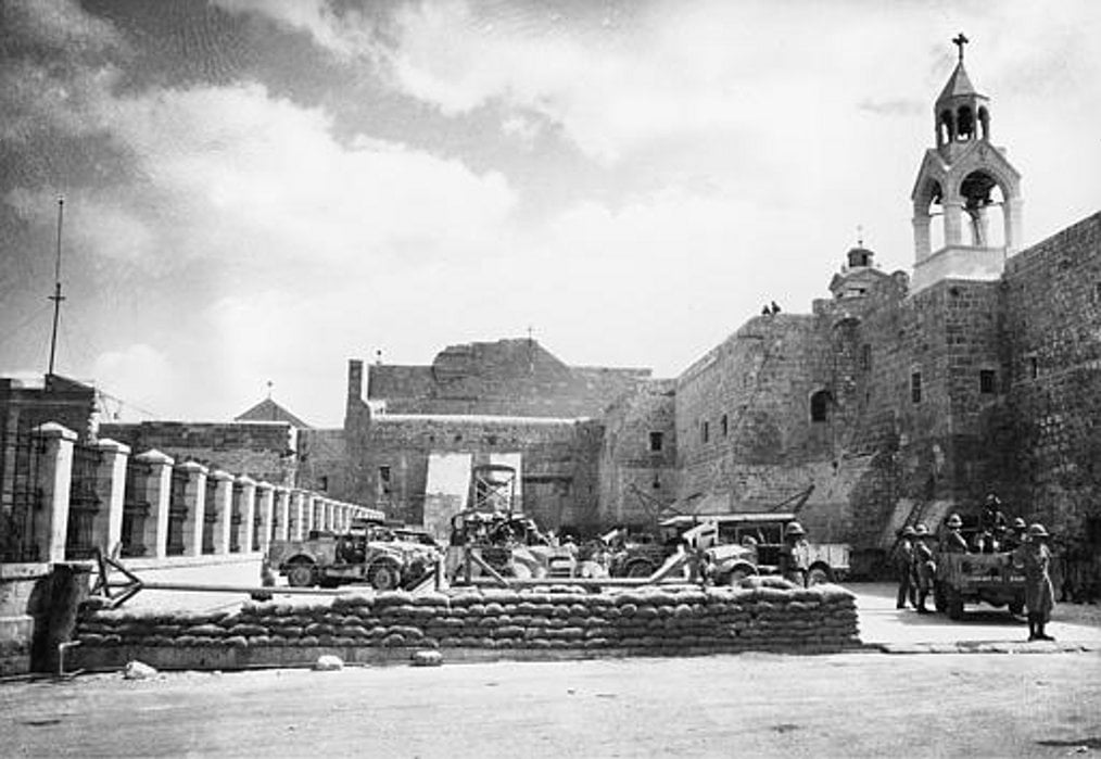
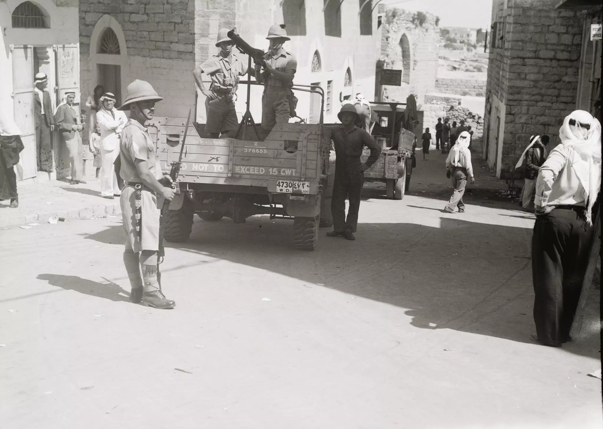
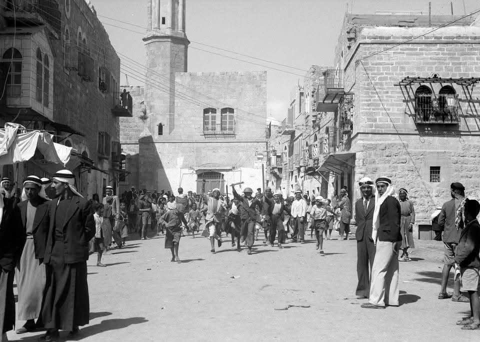
- جنود انجليز يقيمون حاجزاً للتفتيش مع اندلاع ثورة 1936
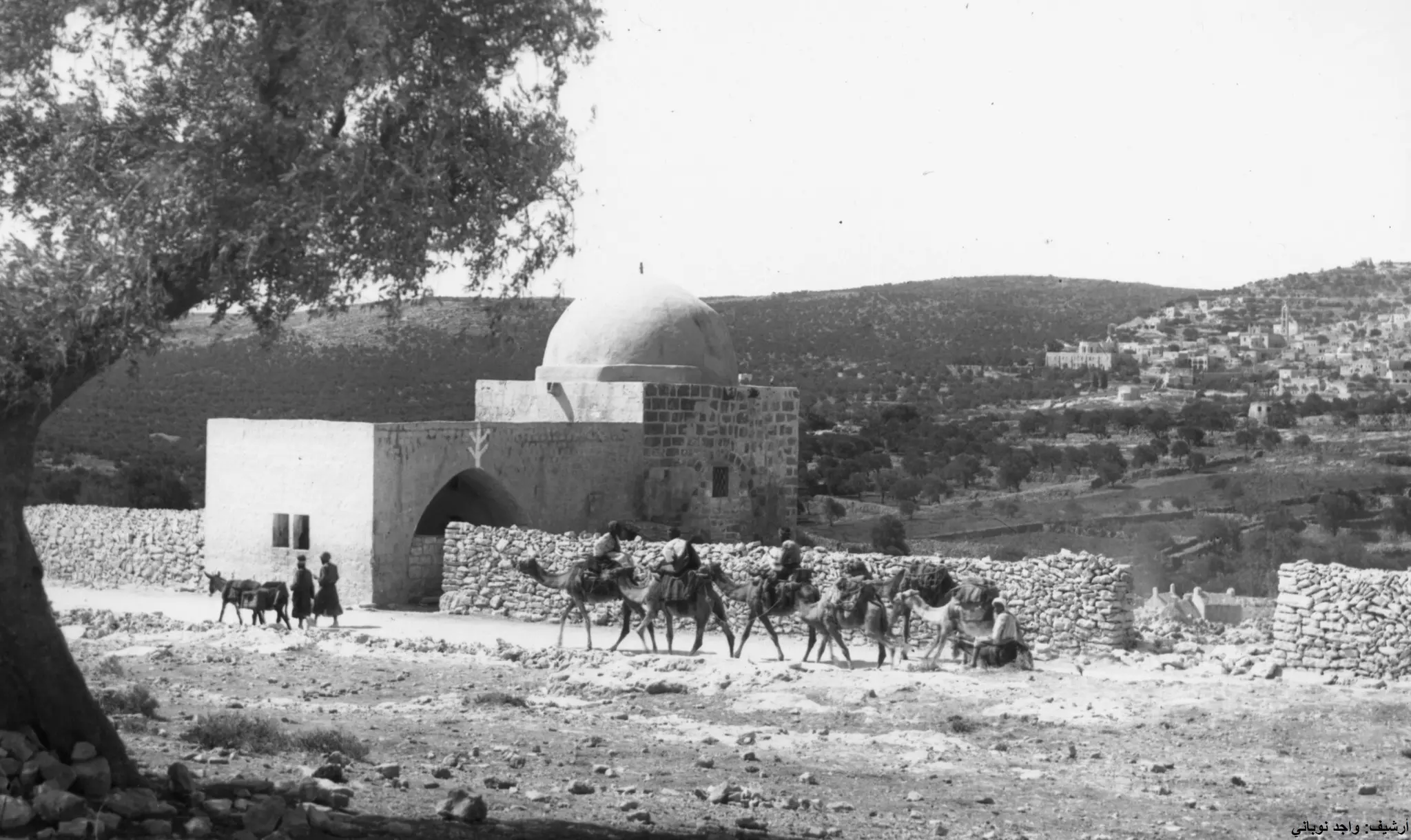
قبة راحيل/ مسجد بلال - مدخل بيت لحم الشمالي. على يمين الصورة الطريق نحو بيت جالا

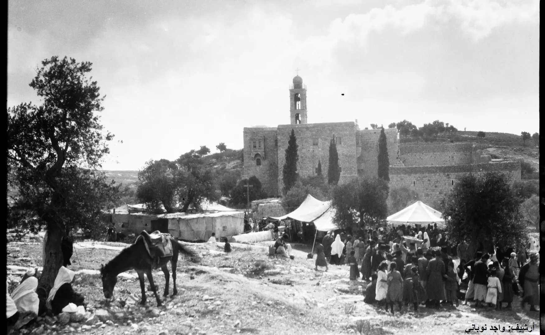
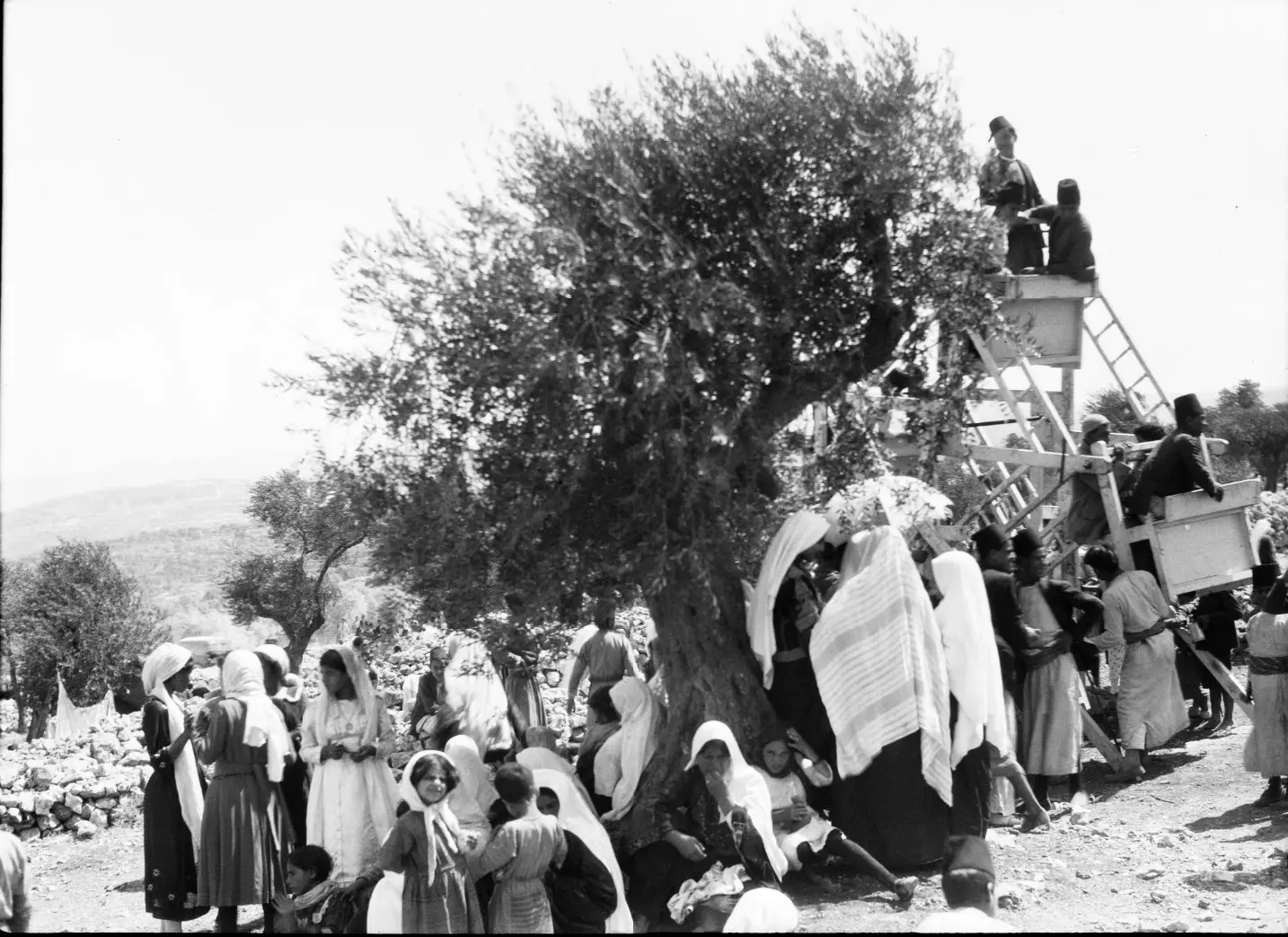
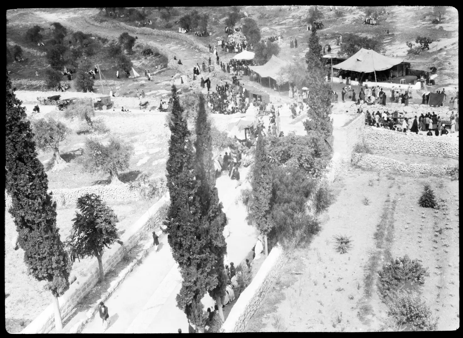
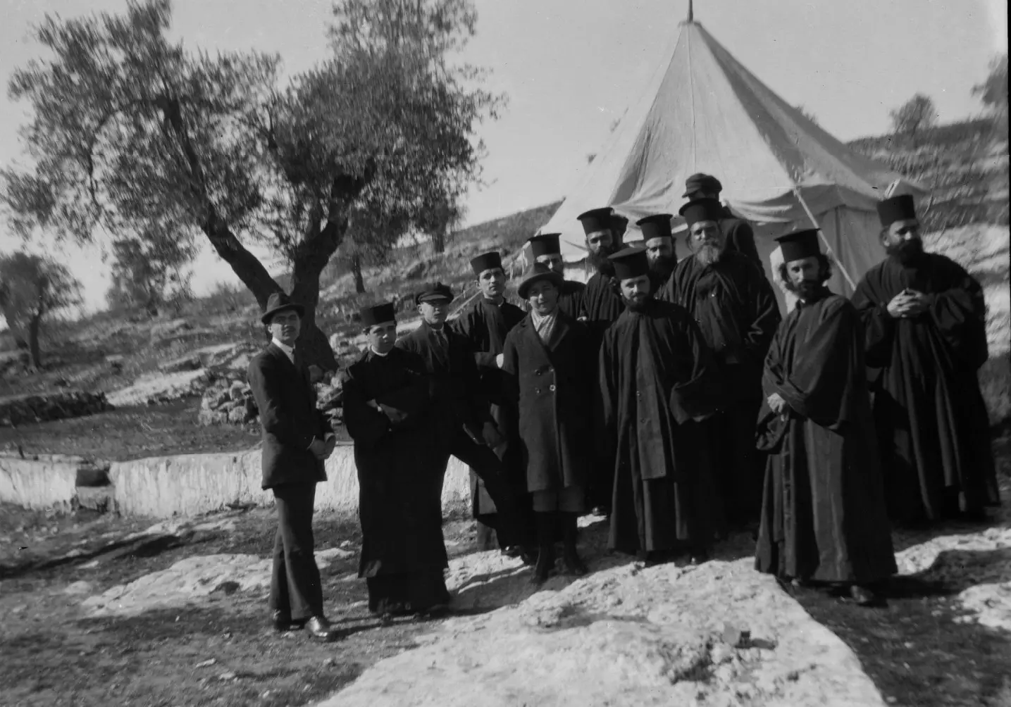
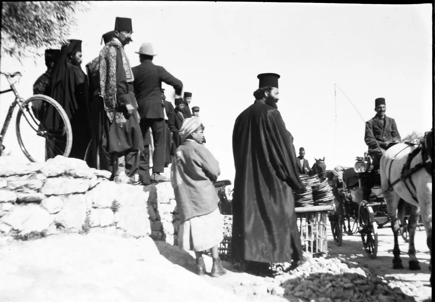
- في مثل هذه اللحظات كان الناس من مسيحيين ومسلمين يتوافدون عبر القرى والمدن نحو دير مار الياس شمالي بيت لحم ويقع على طريق بيت لحم والقدس، وذلك للاحتفال بعيد مار الياس عند الروم الأرثوذكس الذي يصادف اليوم الثاني من آب. لم يعد مسيحيو بيت لحم يستطيعون الوصول والاحتفال، لقد أغلق الاحتلال الطرق. كان الحجاج يأتون من كل مناطق فلسطين، ومن سوريا، ومن لبنان، ومن مصر، ومن اليونان وروسيا وجورجيا وأرمينيا وغيرها من البلدان.
- المدينة الجميلة بيت لحم
بين 1900 - 1920
- واحدة من أجمل الصور القديمة. عائلة من بيت لحم تعيش في كهف
- مواطنون يحتفلون بعيد مار الياس في شمال بيت لحم على الطريق الواصلة للقدس

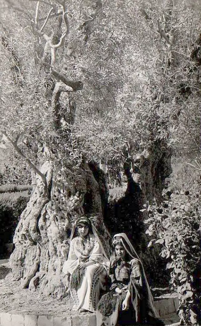
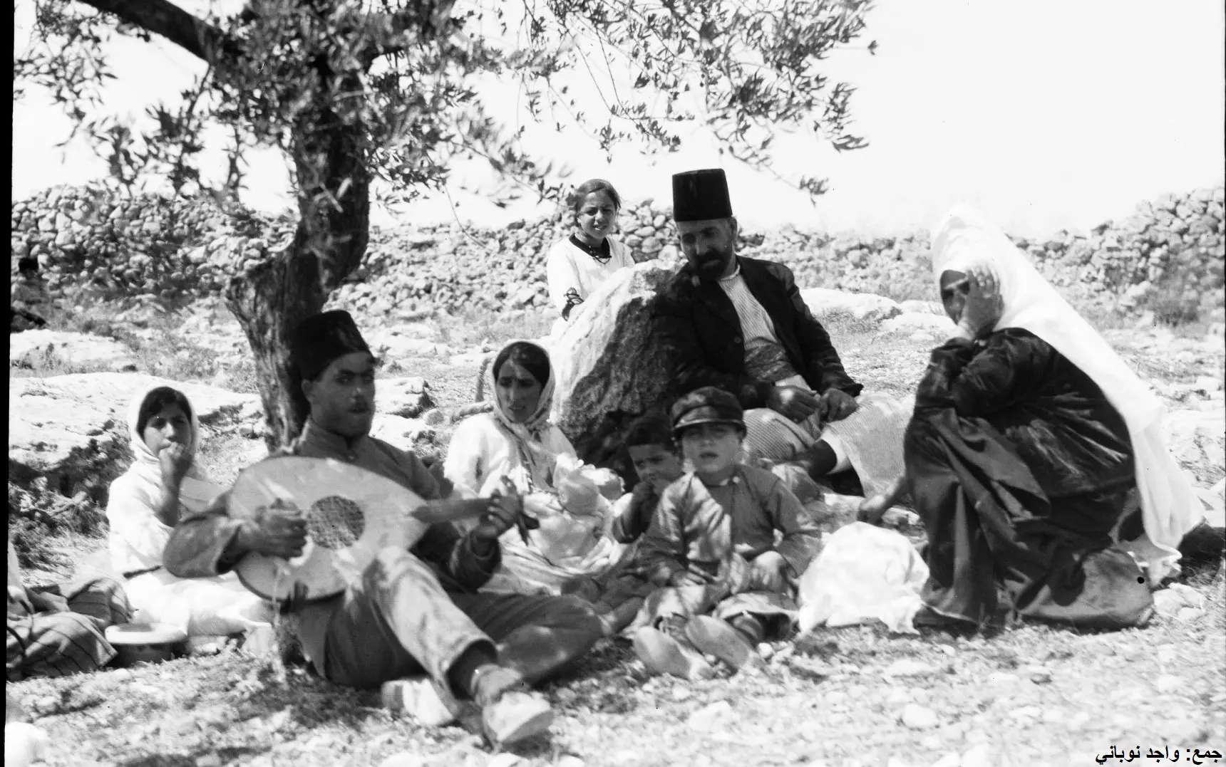
- عائلة تستظل قبل 100 عام بشجرة زيتون خلال الاحتفال بعيد مار الياس في دير مار الياس
1 - قبل 100 سنة
الاحتفال بعيد مار الياس والذي يأتي في شهر آب من كل سنة. يقع هذا الدير الضخم بين بيت لحم والقدس "أرض فلسطين" ويتبع للروم الأرثوذكس.

- قبل 100 سنة
الاحتفال بعيد مار الياس والذي يأتي في شهر آب من كل سنة. يقع هذا الدير الضخم بين بيت لحم والقدس "أرض فلسطين" ويتبع للروم الأرثوذكس.
#2
- قبل 100 سنة
الاحتفال بعيد مار الياس والذي يأتي في شهر آب من كل سنة. يقع هذا الدير الضخم بين بيت لحم والقدس "أرض فلسطين" ويتبع للروم الأرثوذكس.
#3
- قبل 100 سنة
الاحتفال بعيد مار الياس والذي يأتي في شهر آب من كل سنة. يقع هذا الدير الضخم بين بيت لحم والقدس "أرض فلسطين" ويتبع للروم الأرثوذكس.
#4
- قبل 100 سنة
الاحتفال بعيد مار الياس والذي يأتي في شهر آب من كل سنة. يقع هذا الدير الضخم بين بيت لحم والقدس "أرض فلسطين" ويتبع للروم الأرثوذكس.
#5
- قبل 100 سنة
الاحتفال بعيد مار الياس والذي يأتي في شهر آب من كل سنة. يقع هذا الدير الضخم بين بيت لحم والقدس "أرض فلسطين" ويتبع للروم الأرثوذكس.
#6
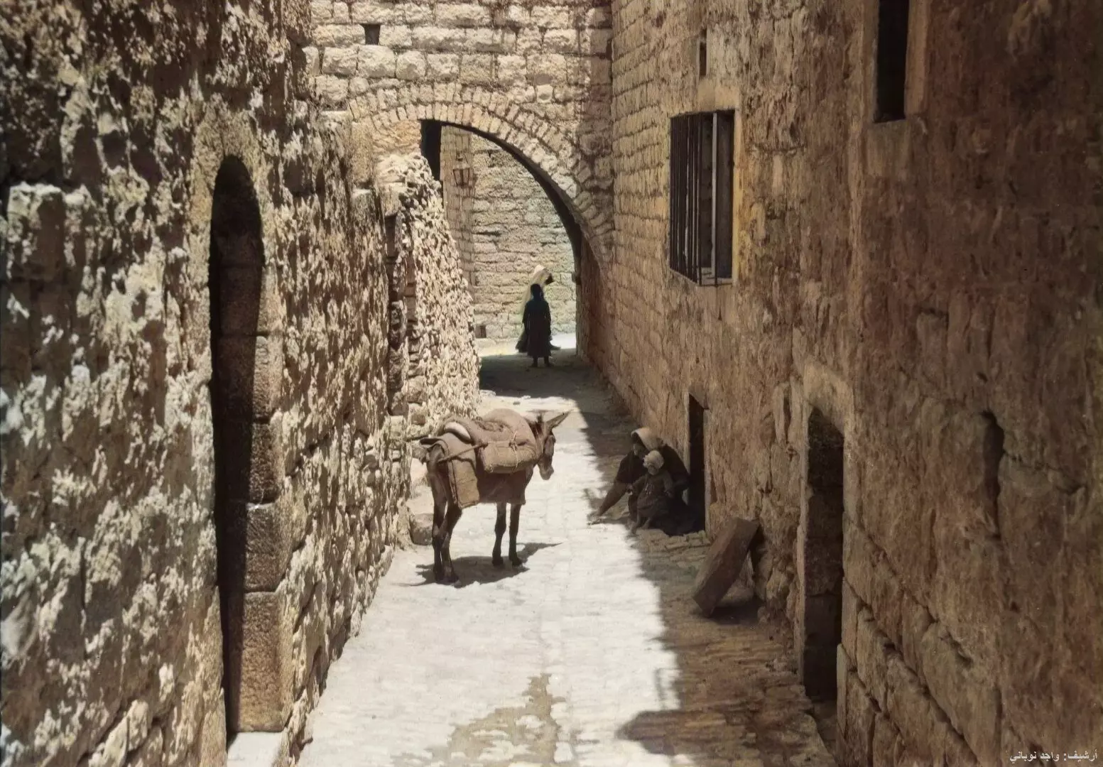
- البلدة القديمة -- واجد النوباني
- حوش السريان - بيت لحم العتيقة-- واجد النوباني
- حوش السريان - بيت لحم العتيقة-- واجد النوباني #2
- حوش السريان - بيت لحم العتيقة-- واجد النوباني #3
- حوش السريان - بيت لحم العتيقة-- واجد النوباني #4
- حوش السريان - بيت لحم العتيقة-- واجد النوباني #5
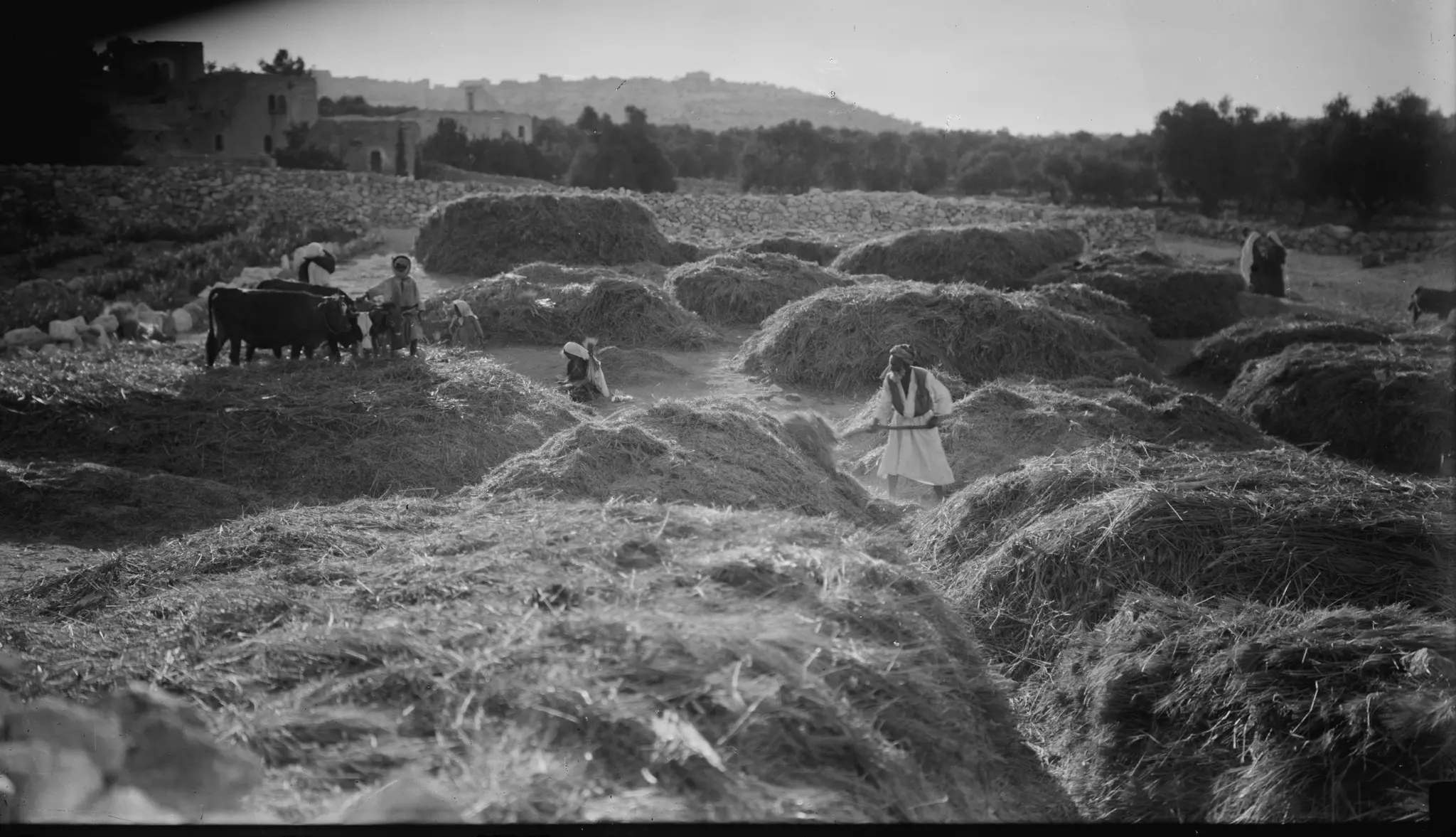
- هذه واحدة من الصور العظيمة. لا يمكنني ببساطة أن أصف شعوري أو أثر الصور القديمة علي، وخاصة الصور التي تظهر بعض تفاصيل الحياة في تلك الأيام.
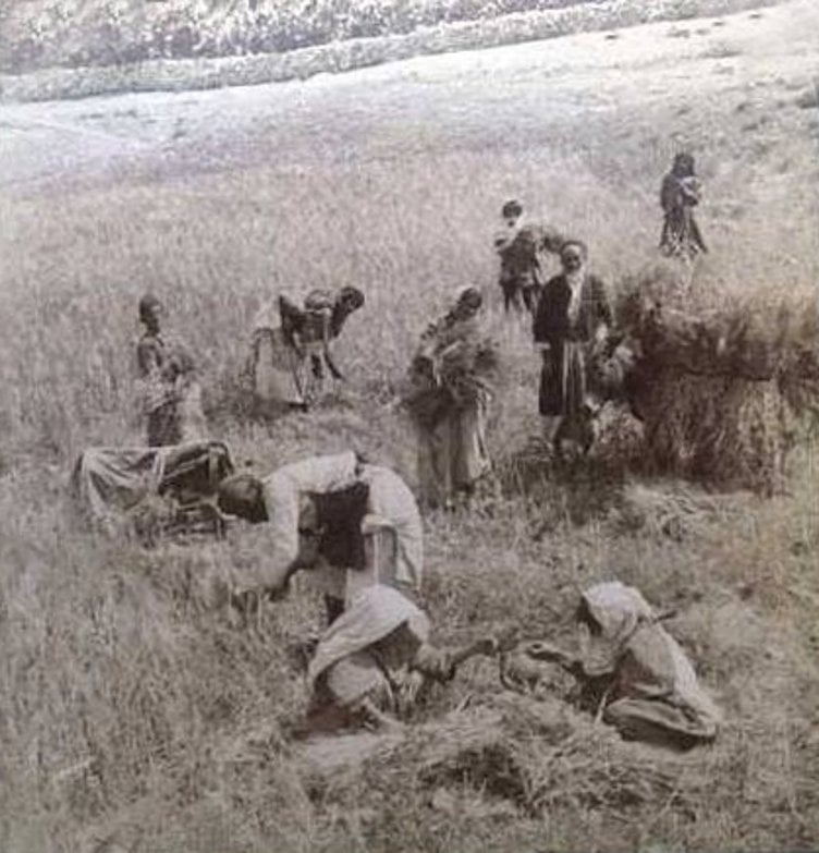
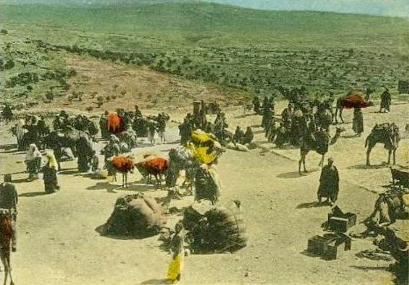
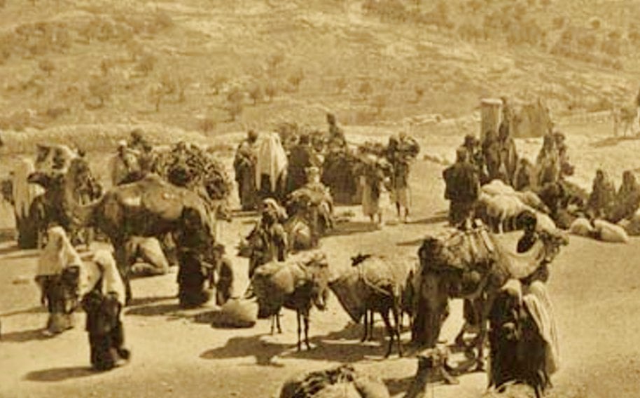
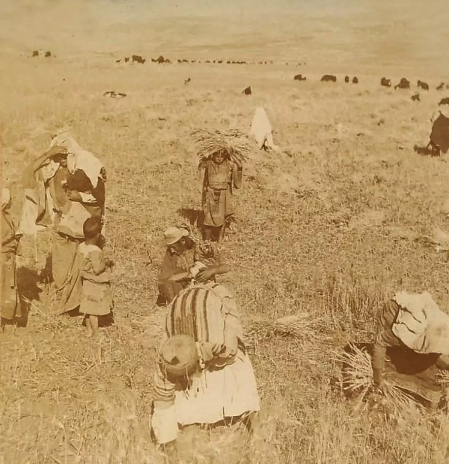
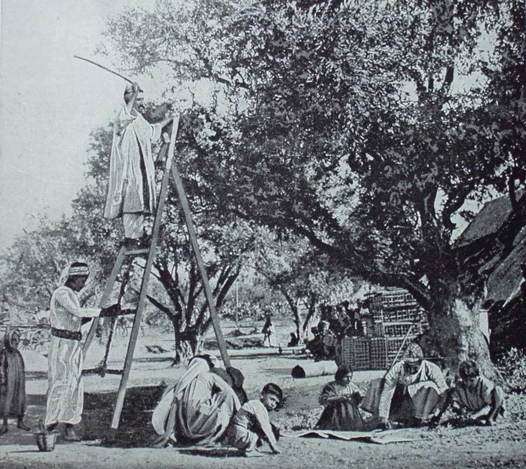
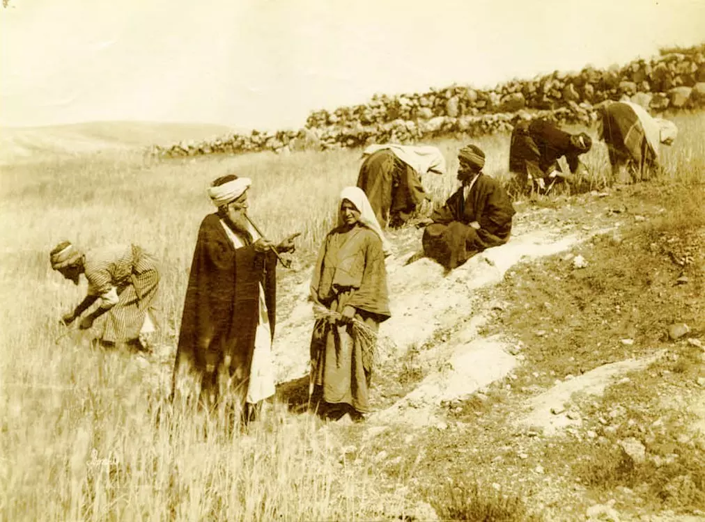
من منطقة بيت لحم في سنة 1920م. ربما الصورة في أراضي بيت ساحور التابعة لبيت لحم. موسم حصاد القمح ودرسه في حزيران.
- بيت لحم 1940م
- بيت لحم 1940م
#2
- بيت لحم 1940م
#3
- بيت لحم 1940م
#4
- بيت لحم 1940م
#5
- العين اسمها سلوة أو مريم العذراء -- 1911

- نقل حجارة البناء التي يتم قلعها في المقالع الصخرية على ظهور الجمال.. هذه هي بعض من تلك الأيام القديمة، الجمال تمر من ناحية بيت لحم عند قبة راحيل في الطريق المتجهة نحو القدس، والسفح الجبلي على يمين الصورة والذي تكسوه أشجار الزيتون هو جزء من بدايات أراضي بيت جالا التي عُرفت أيضا مثل بيت لحم بحرفييها والمختصين في الحجارة
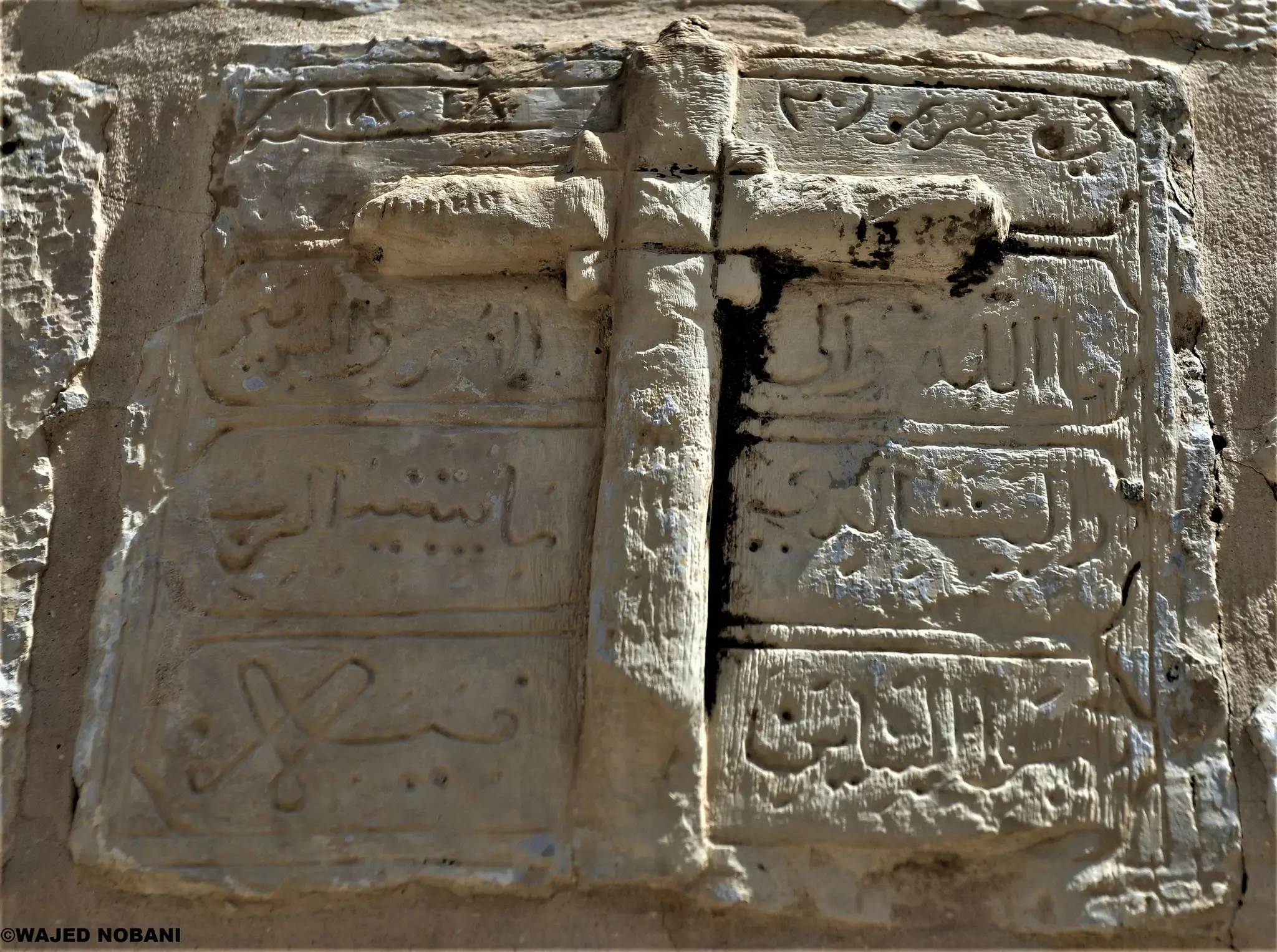
- نقش قديم.. حارة السريان - بيت لحم/ فلسطين
أعتقد أن المكتوب بالأعلى:
في شهر تموز 1818 -- واجد النوباني
- -شارع المهد بيت لحم في الستينات
- صورة تاريخية تظهر مشهدا من مدينة بيت لحم عام 1912، وتعكس ملامح الحياة اليومية في تلك الفترة.
الصورة التقطت في أحد الأسواق أو الأزقة التجارية
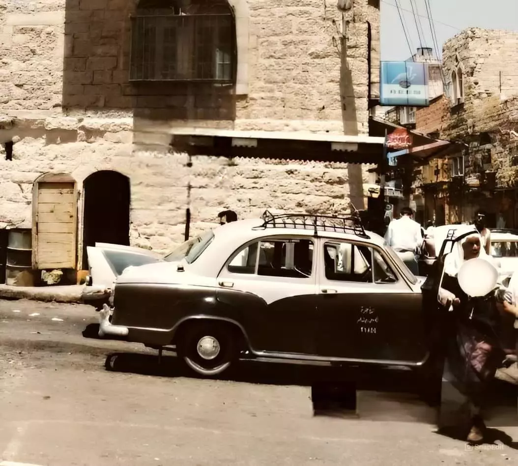
- سياره تكسي بيت لحم
- بيت لحم ساحة المهد عام ١٩٥٣
- بيت لحم في عام ١٩٦٨
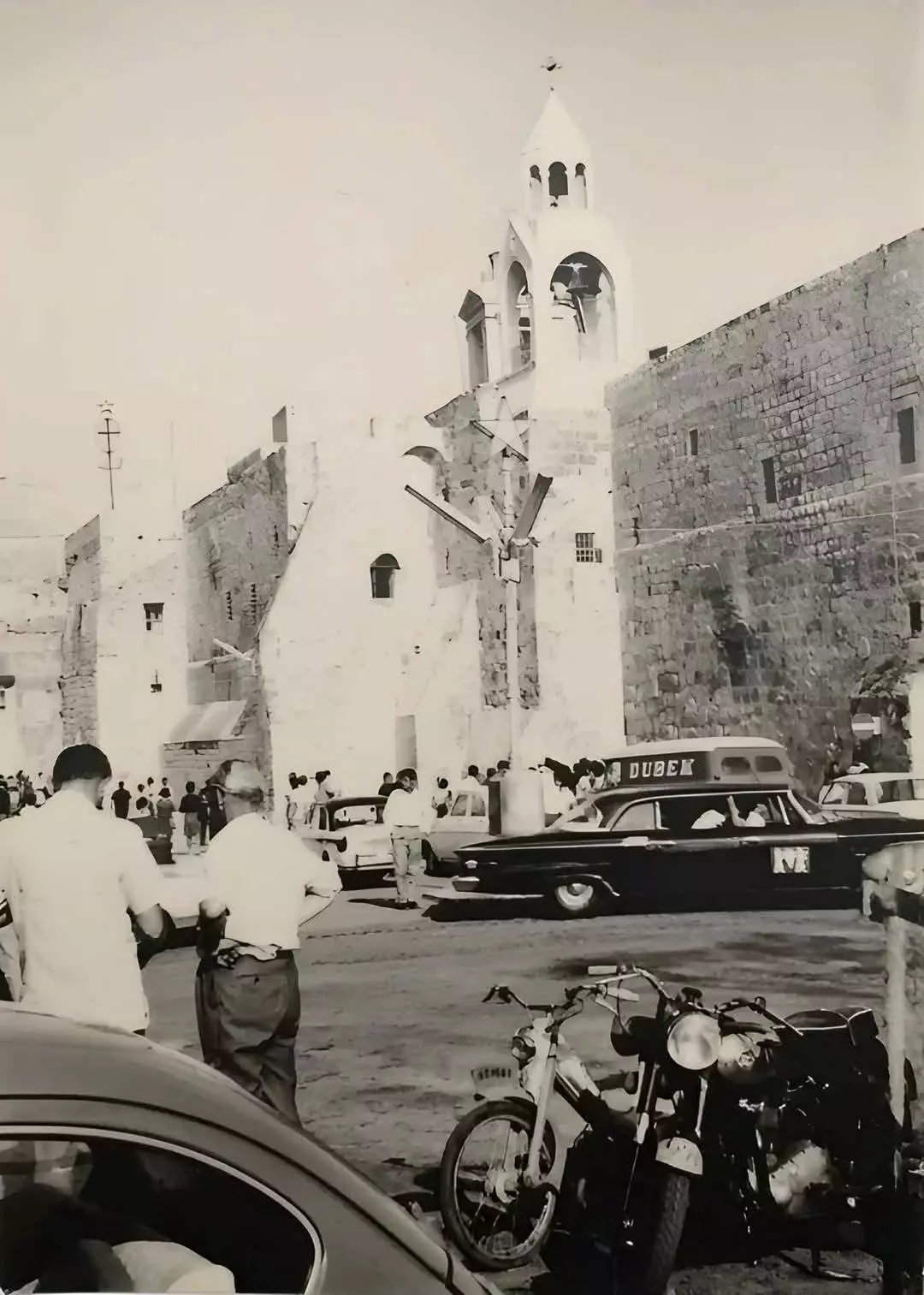
- مدينة بيت لحم طريق ساحة المهد في الستينات.
- -مكتب تكسي بيت لحم في الساحة عام ١٩٦٢ -- دعاية دخان كمال من صناعة الشركة الاردنية تظهر في بداية سوق المهد الصاعد غربا الى تلة الساليزيان !! البناية هذه بجانب التكسي هي بناية مسجد عمر القديم قبل هدمه وبناء المسجد الحالي الحديث
- صورة لمدينة بيت لحم منطقة شارع المهد يعتقد انها في الستينات.
- بيت لحم عام 1951
- بيت لحم عام 1951 #2
- صورة لمدينة بيت لحم موقف باصات القدس قرب ساحة المهد. في الستينات
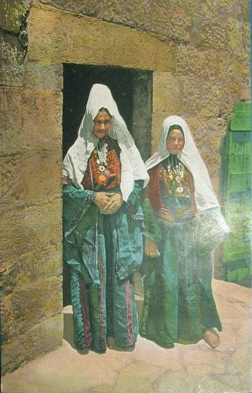
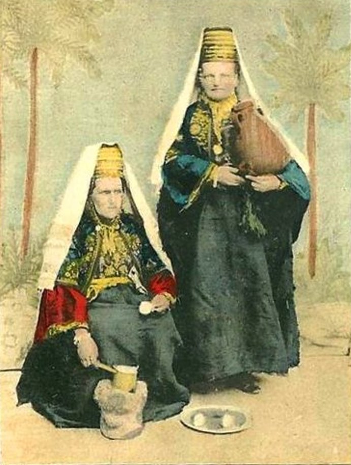
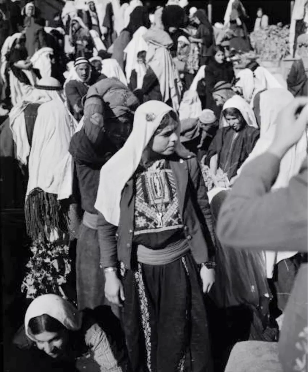
- نساء من مدينة بيت لحم فلسطين...
يلبسن الزي الشعبي الفلسطيني لمدينة بيت لحم
عام 1900
- Old photo of Palestinian women from Bethlehem in 1869
- An olld photo of a Palestinian woman from Bethlehem in 1898
- An old photo of a Palestinian family from Bethlehem in 1900

- A Palestinian woman wearing her traditional dress (thoub), 1920
- Palestinian worshippers in the Church of the Nativity, 1920s
- An old photo for a Palestinian family called Shahwan,1938
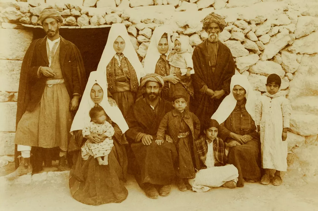
- An old photo of a Palestinian family from Bethlehem, 1915
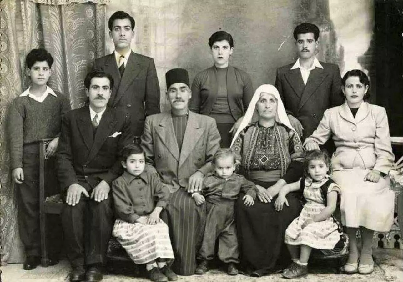
- A group picture in Bethlehem, 1945
- A wedding dance, 1936
- بيت لحم عام ١٩٦٧ --
الشارع من القبة باتجاه الشارع الجديد على اليمين مخيم العزة
- ريف بيت لحم الشرقي عام ١٩٦٩
- بيت لحم منطقة ساحة المهد في الثلاثينات
- يت لحم عام ١٩٦٧
- بيت لحم عام ١٩٥١
- بيت لحم عام ١٩٦٧
- صورة بين زمانين بفارق ١٠٠ عام لحارة العناترة اقدم حارات بيت لحم،،
- جولة في السوق القديم -- منير قليبو
- جولة في السوق القديم -- منير قليبو #2
- جولة في السوق القديم -- منير قليبو #3
- جولة في السوق القديم -- منير قليبو #4
- جولة في السوق القديم -- منير قليبو #5
- جولة في السوق القديم -- منير قليبو #6
- جولة في السوق القديم -- منير قليبو #7
- جولة في السوق القديم -- منير قليبو #8
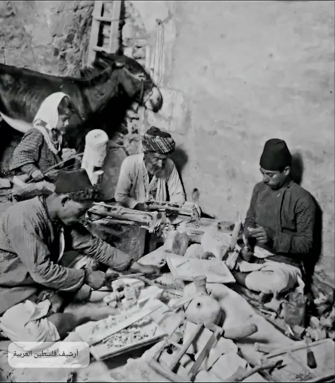
- ورشة حرفيي التصديف -- 1920
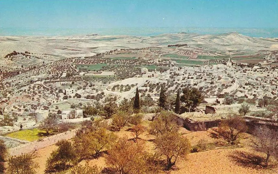
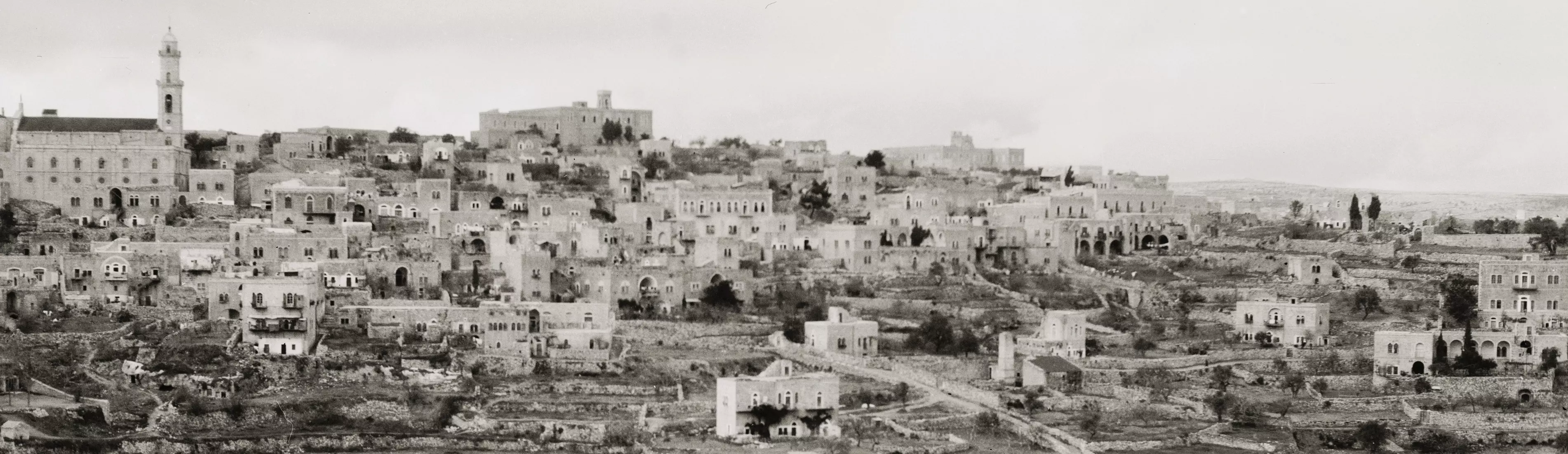
- General view of Bethlehem, 1900 - 1920. The Matson Collection
- البلدة القديمة -- يوسف عودة
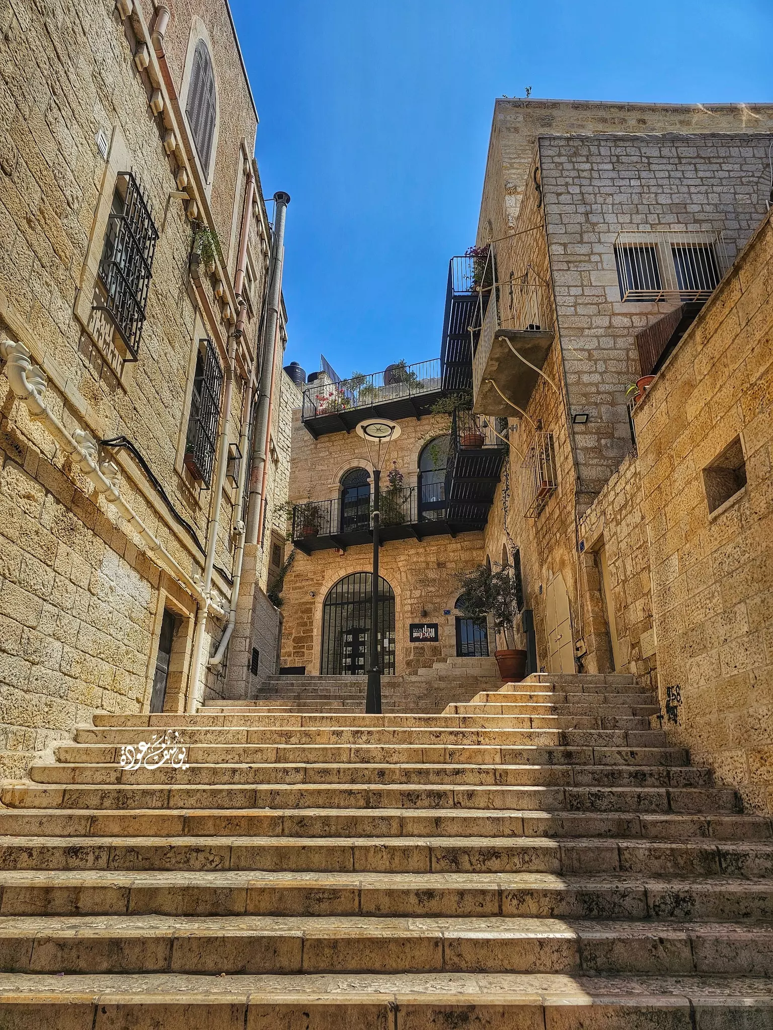
- البلدة القديمة -- يوسف عودة #2
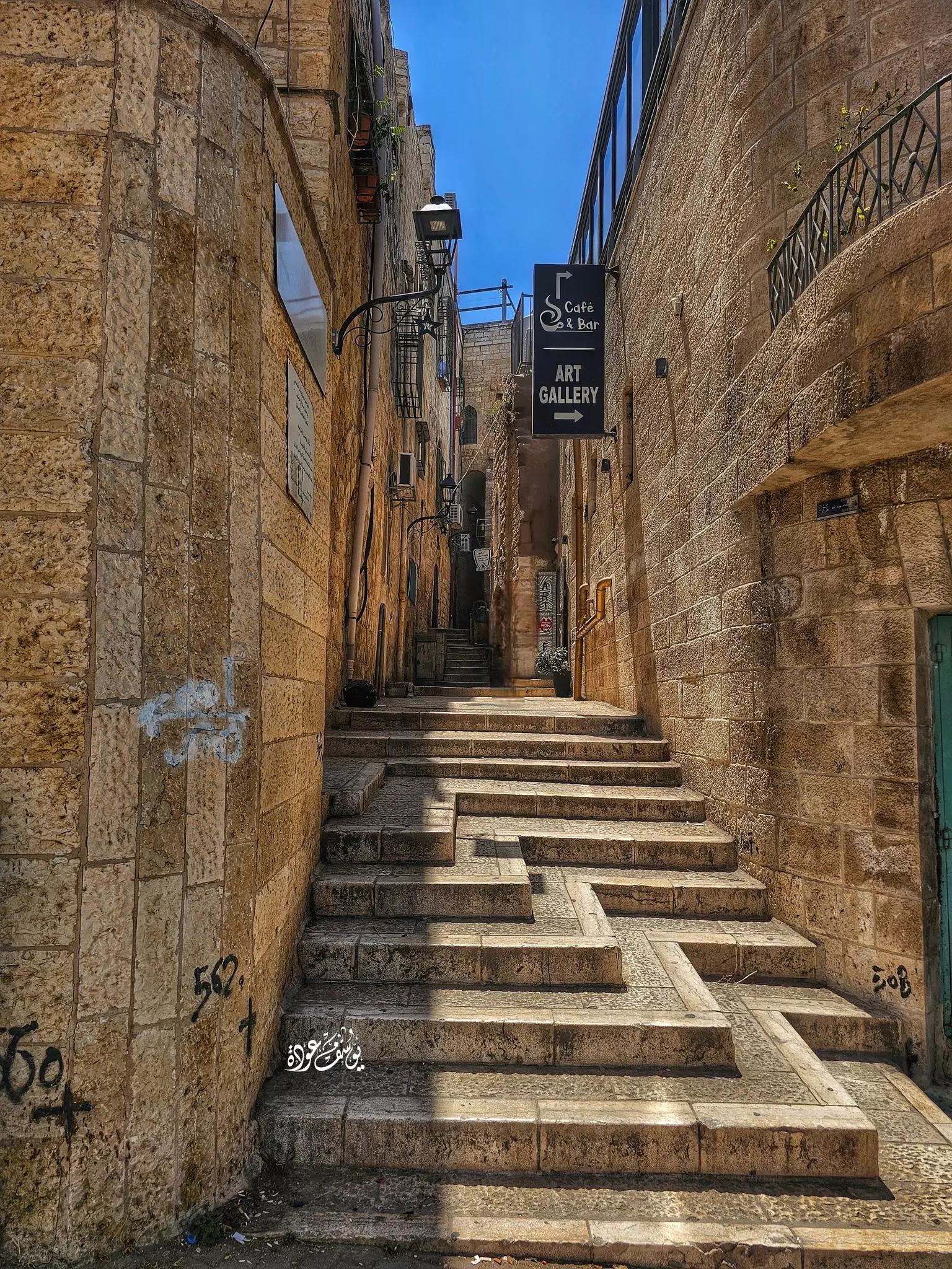
- البلدة القديمة -- يوسف عودة #3
- مسجد عمر بن الخطاب -- يوسف عودة

- بيت لحم عام ١٩٥١
- أثناء العمل على مسرحية مع المرضى النفسيين في مستشفى الأمراض النفسية -- 2004
- بيت لحم منتصف القرن الماضي
1 - اجمل صور سوق بيت لحم القديم
- صور في البلدة القديمة تعود لثمانينيات القرن الماضي -- مؤسسة رواق
- صور في البلدة القديمة تعود لثمانينيات القرن الماضي -- مؤسسة رواق #2

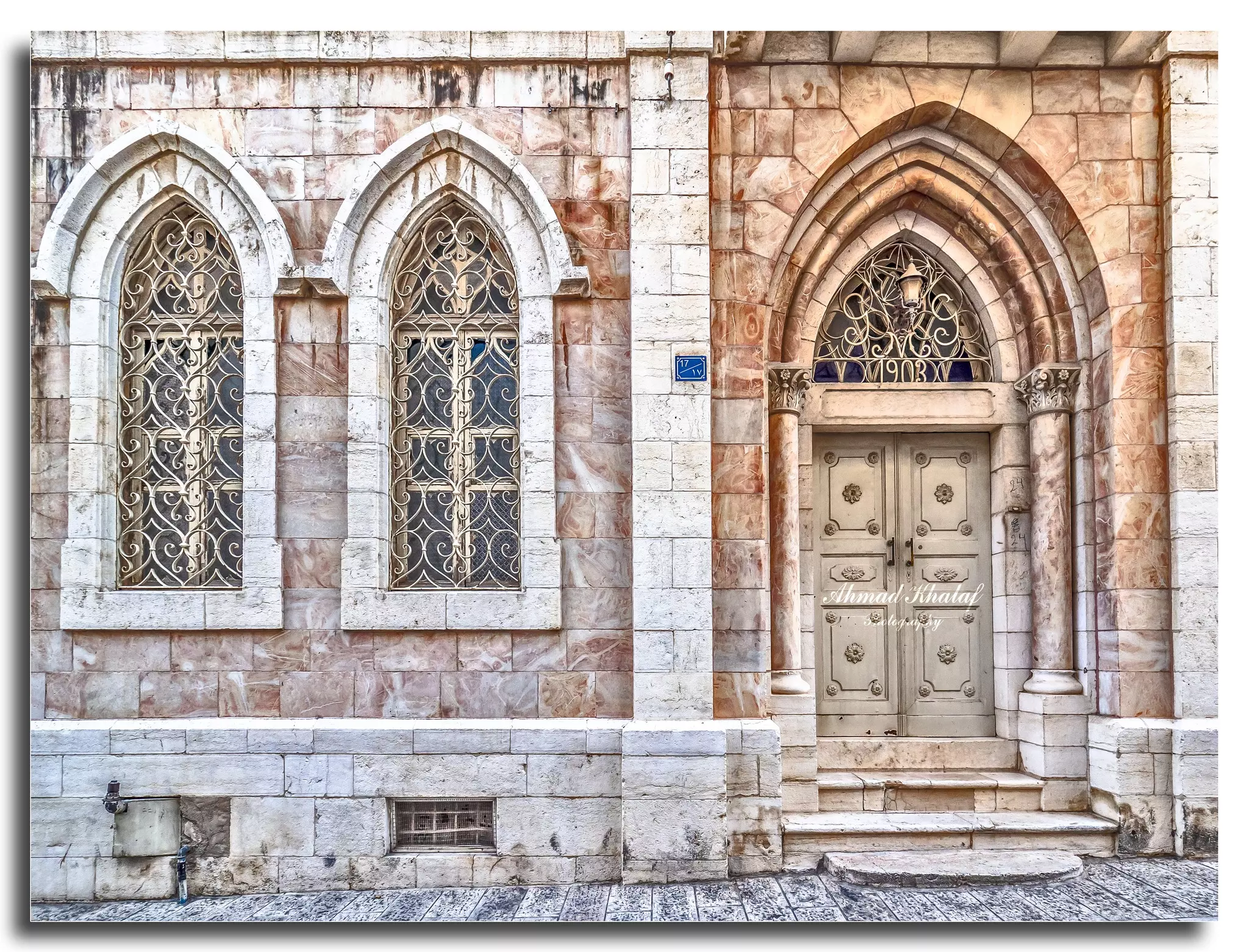
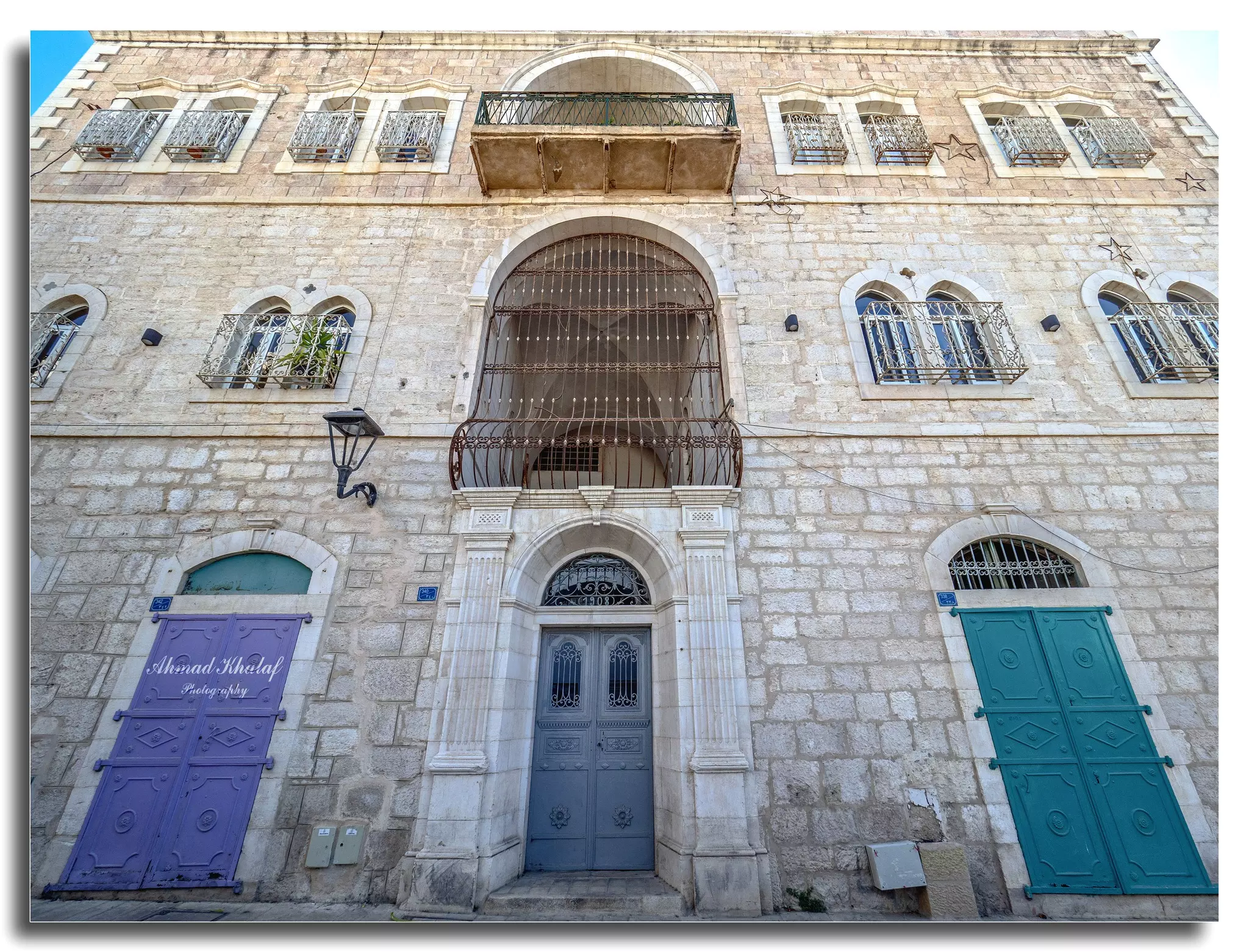
- جولة في حوش السريان -- Ahmad Khalaf
- جولة في حوش السريان -- Ahmad Khalaf #2
- جولة في حوش السريان -- Ahmad Khalaf #3
- من داخل احد منازل حوش قطان في مدينة بيت لحم العتيقه -- Ahmad Khalaf
- من داخل احد منازل حوش قطان في مدينة بيت لحم العتيقه -- Ahmad Khalaf #2
- من داخل احد منازل حوش قطان في مدينة بيت لحم العتيقه -- Ahmad Khalaf #3
- من داخل احد منازل حوش قطان في مدينة بيت لحم العتيقه -- Ahmad Khalaf #4

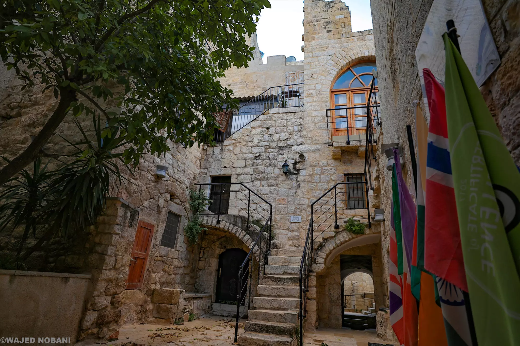
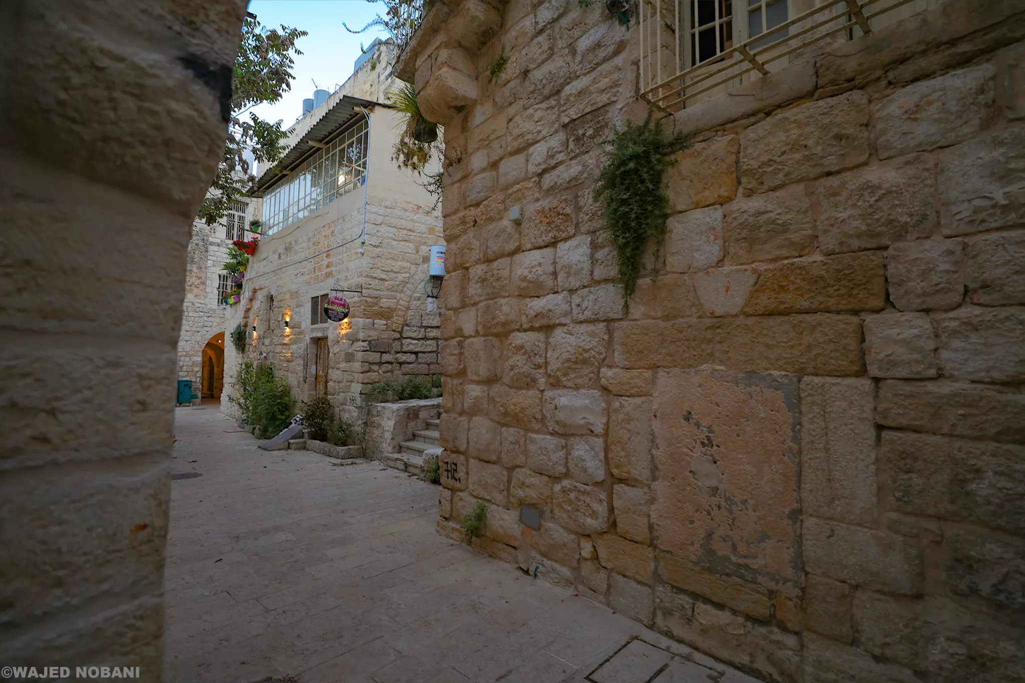
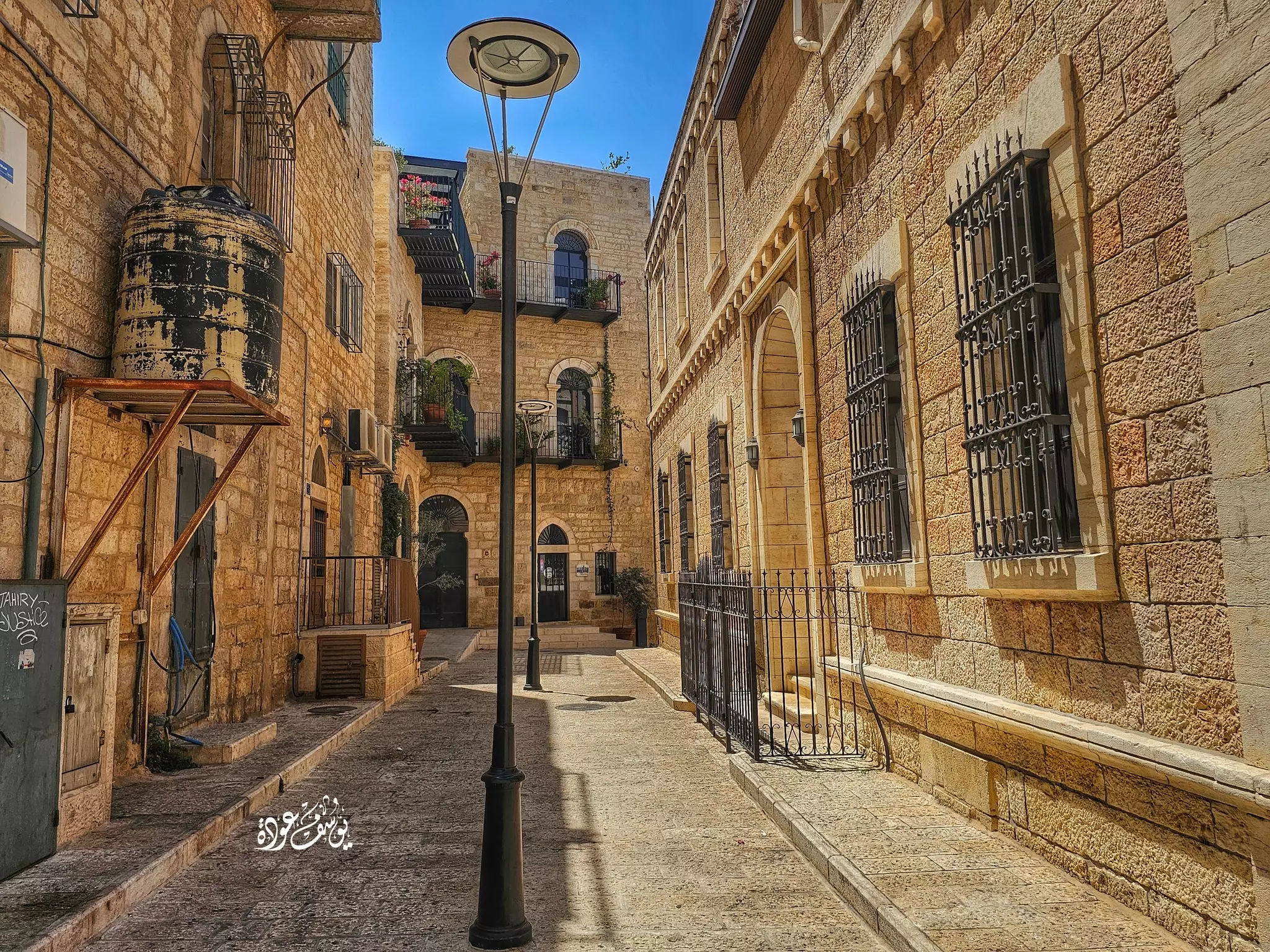
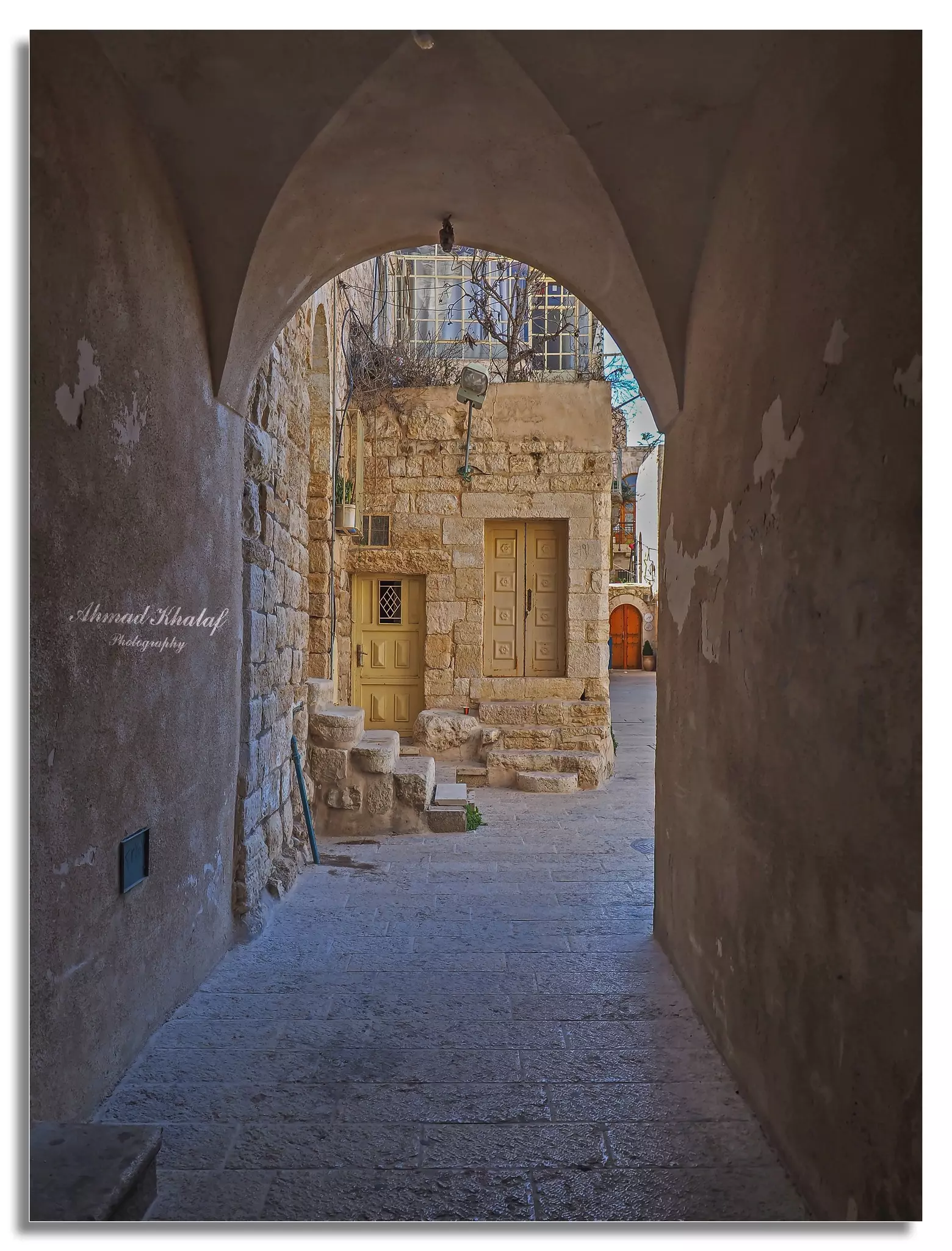
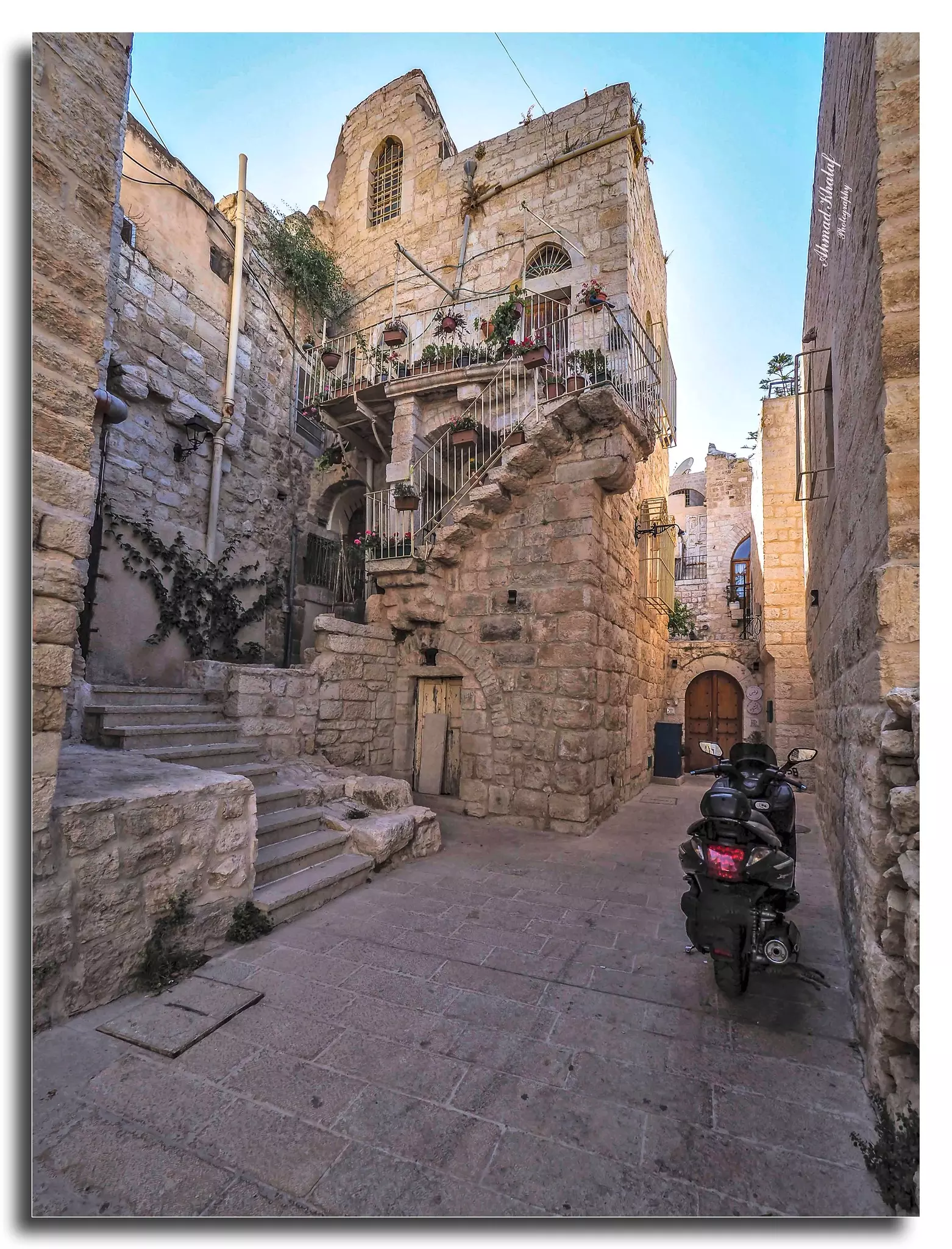
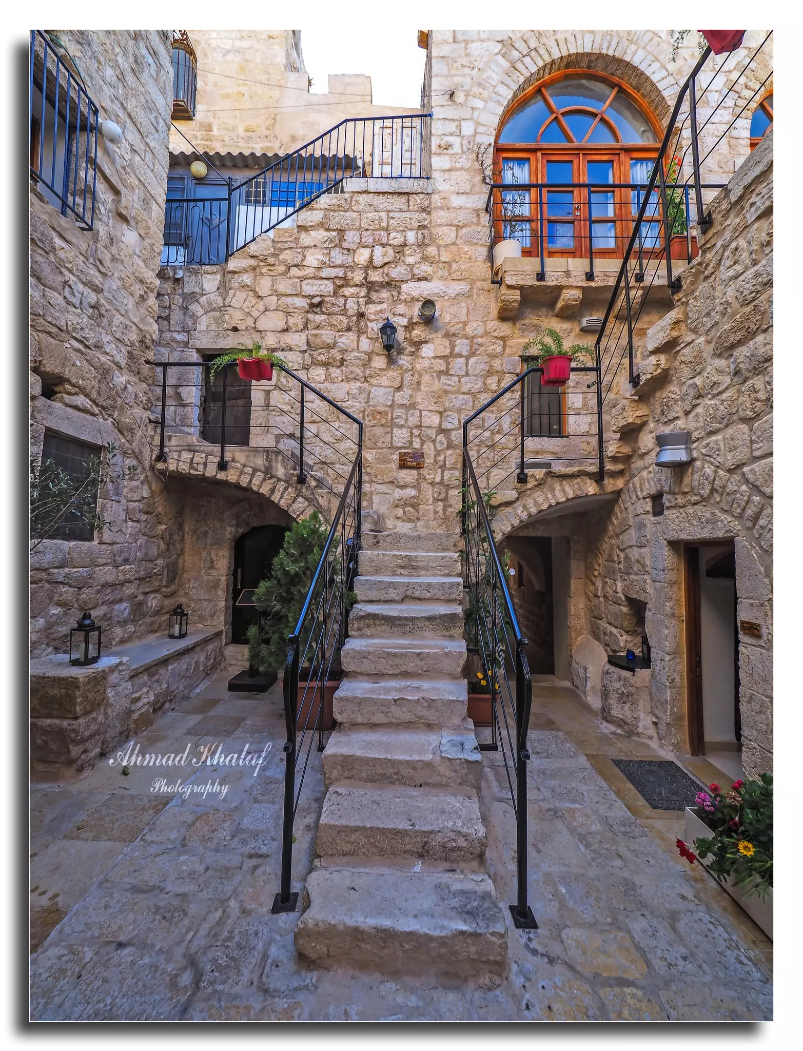
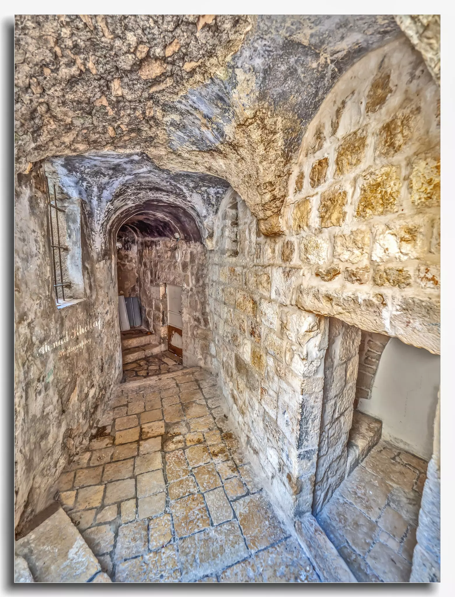
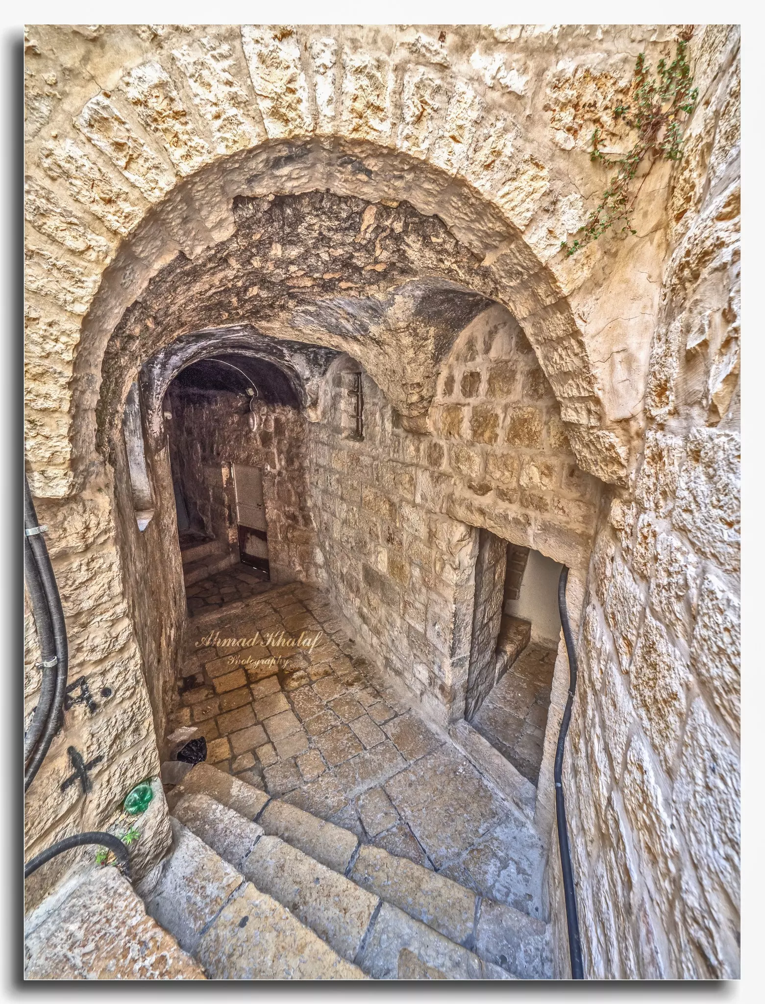
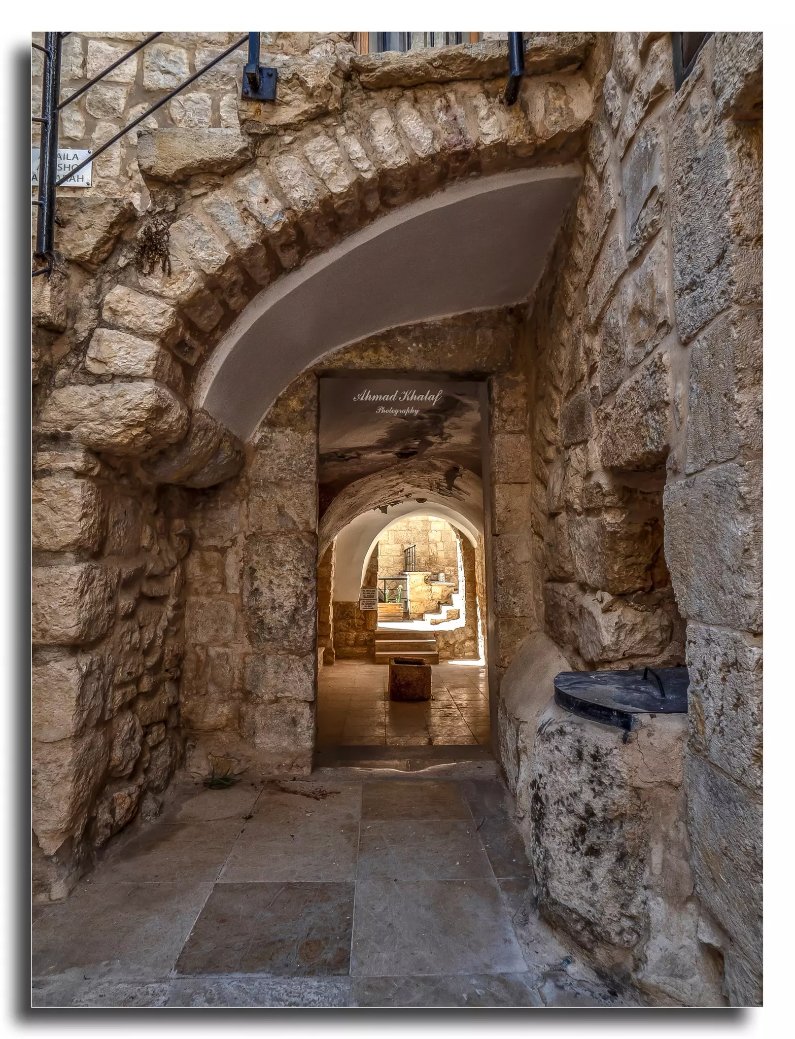
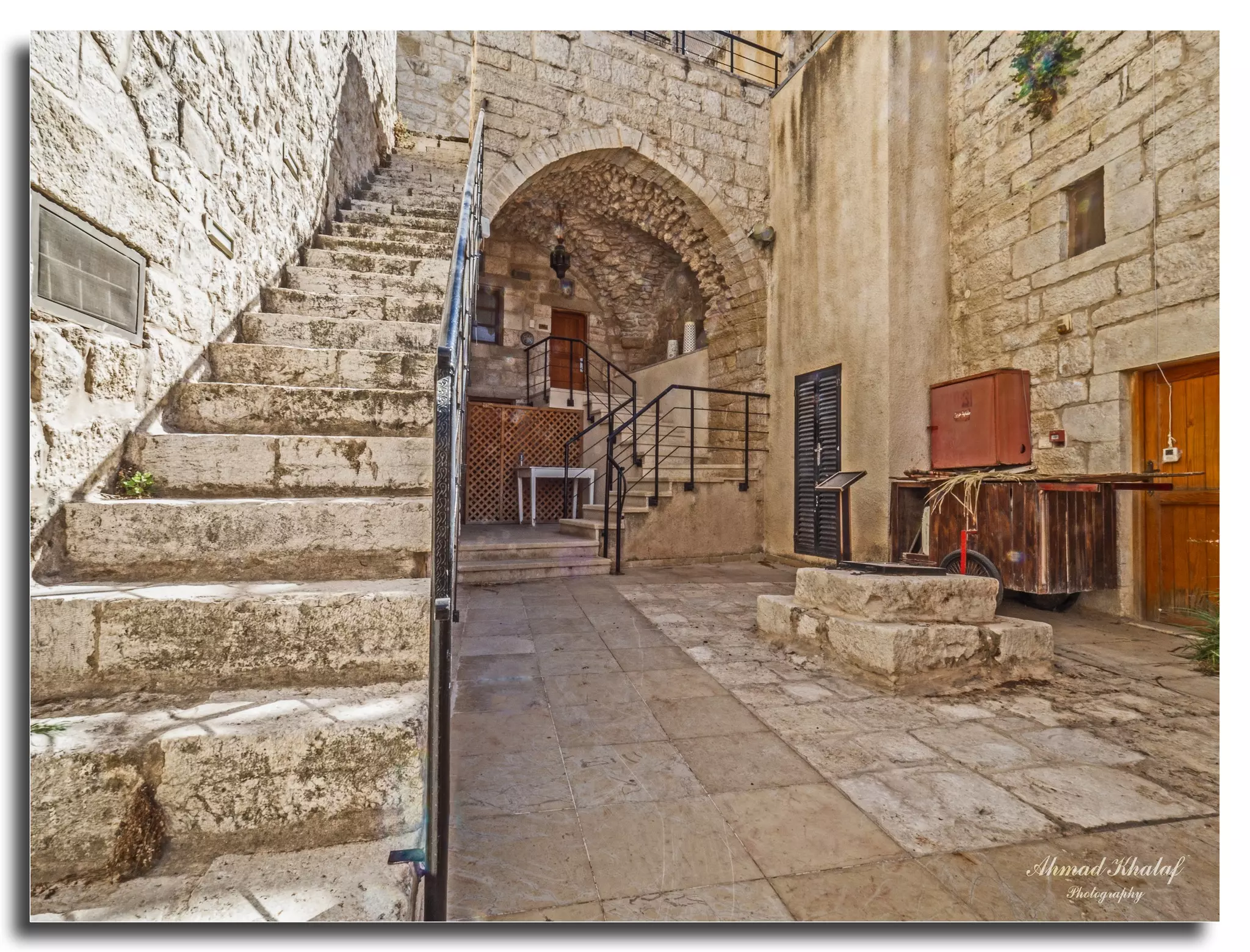
- جولة رائعة في أزقة مدينة بيت لحم العتيقه -- Ahmad Khalaf
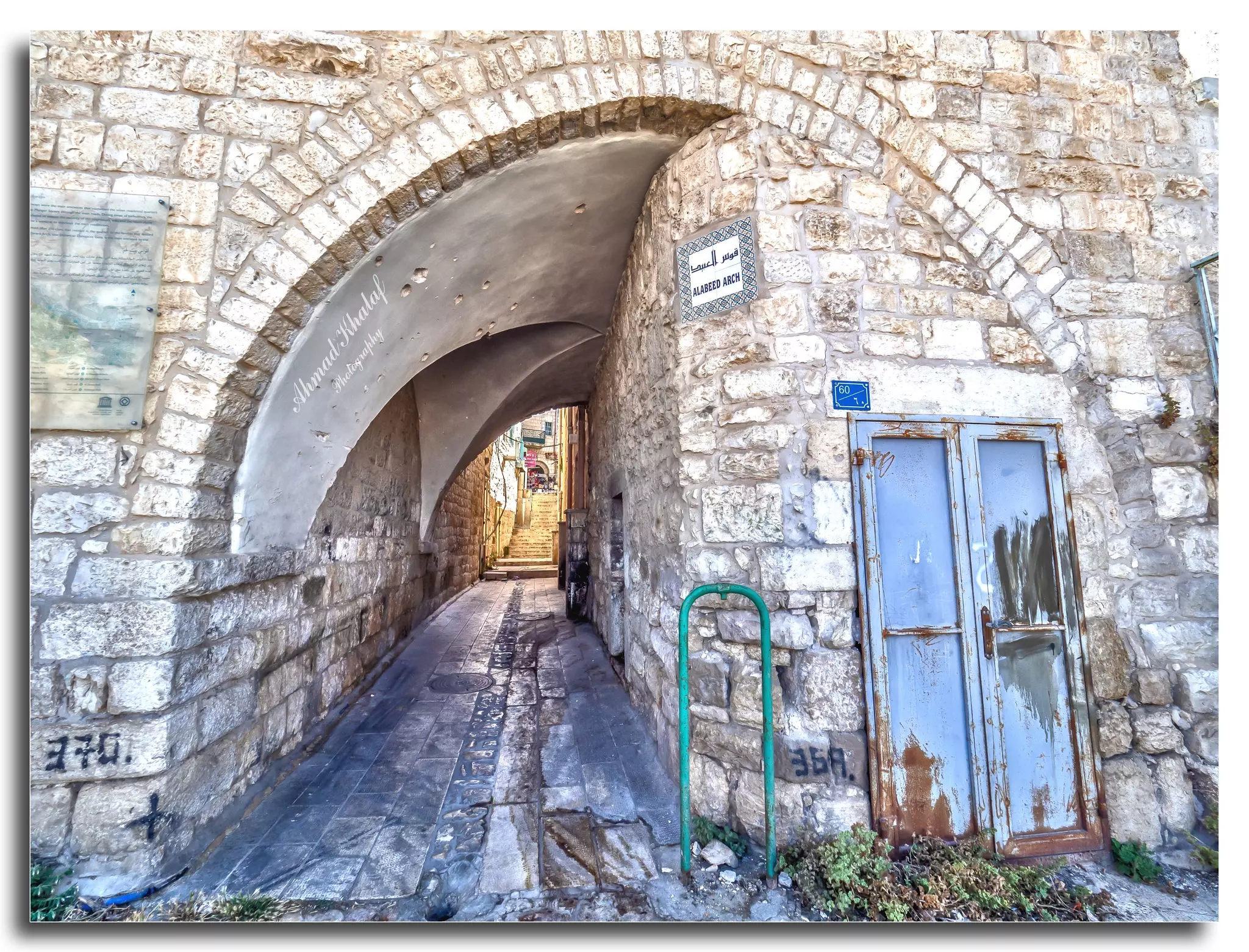
- جولة رائعة في أزقة مدينة بيت لحم العتيقه -- Ahmad Khalaf #2
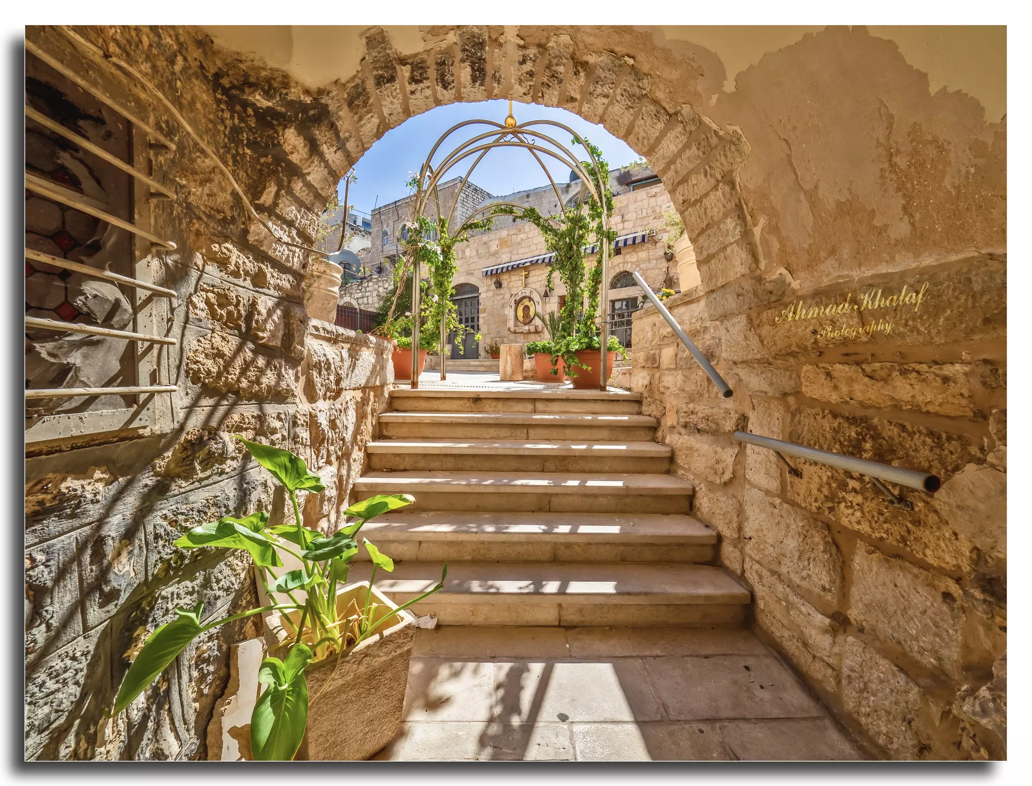
- جولة رائعة في أزقة مدينة بيت لحم العتيقه -- Ahmad Khalaf #3
- جولة رائعة في أزقة مدينة بيت لحم العتيقه -- Ahmad Khalaf #4
- جولة رائعة في أزقة مدينة بيت لحم العتيقه -- Ahmad Khalaf #5
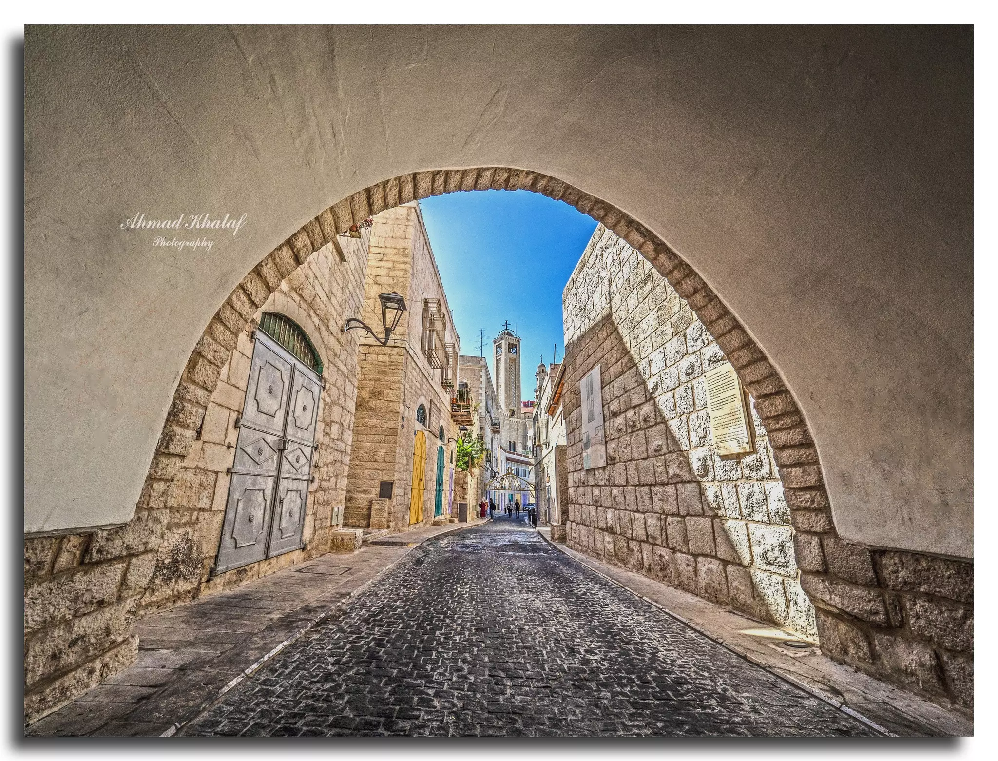
- جولة رائعة في أزقة مدينة بيت لحم العتيقه -- Ahmad Khalaf #6
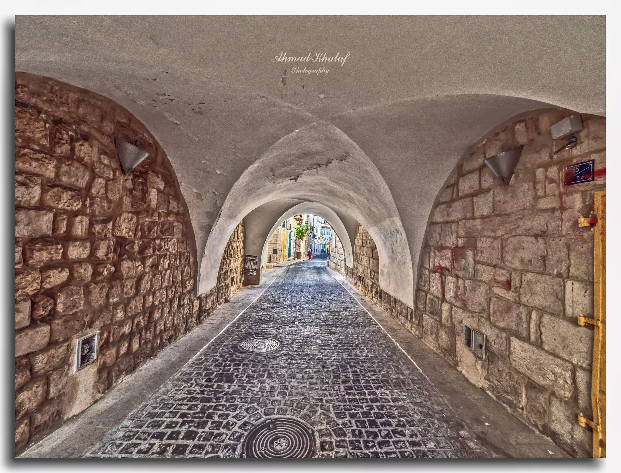
- جولة رائعة في أزقة مدينة بيت لحم العتيقه -- Ahmad Khalaf #7
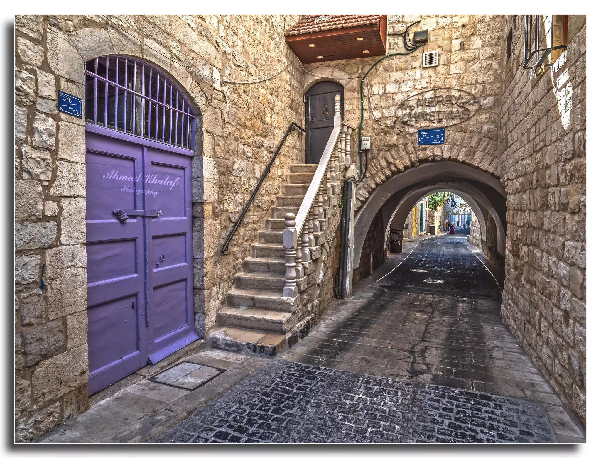
- جولة رائعة في أزقة مدينة بيت لحم العتيقه -- Ahmad Khalaf #8
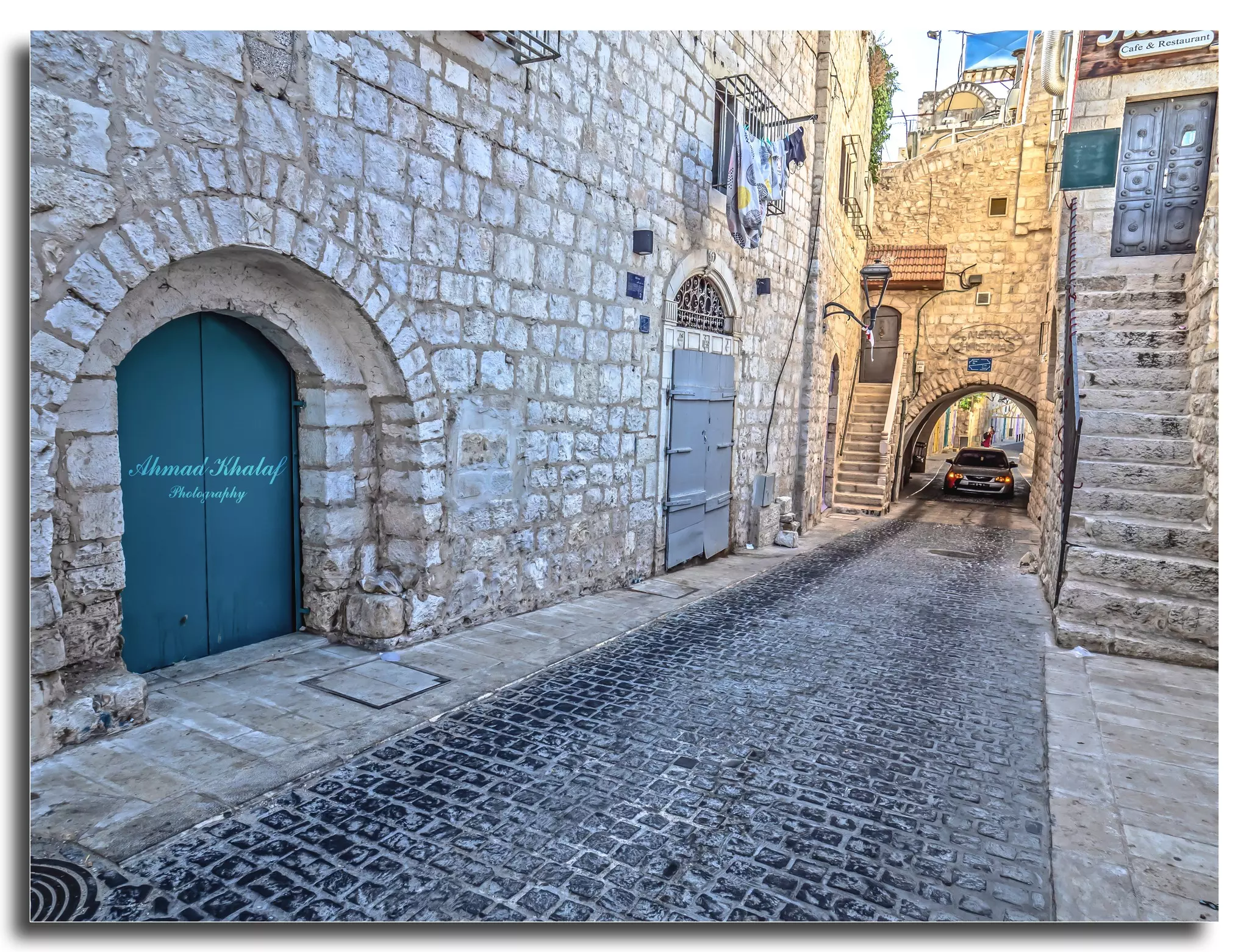
- جولة رائعة في أزقة مدينة بيت لحم العتيقه -- Ahmad Khalaf #9
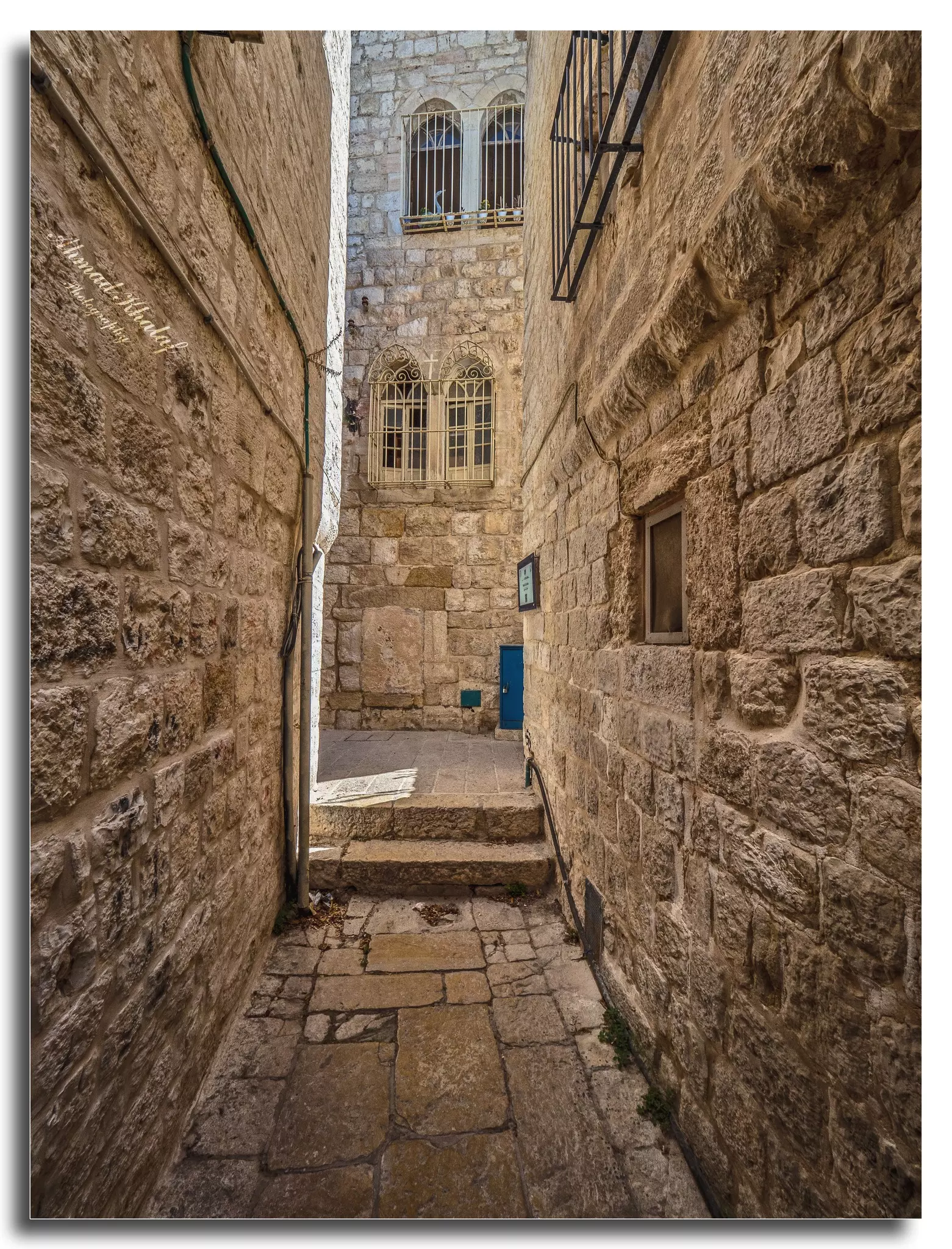
- جولة رائعة في أزقة مدينة بيت لحم العتيقه -- Ahmad Khalaf #10

- جولة رائعة في أزقة مدينة بيت لحم العتيقه -- Ahmad Khalaf #11
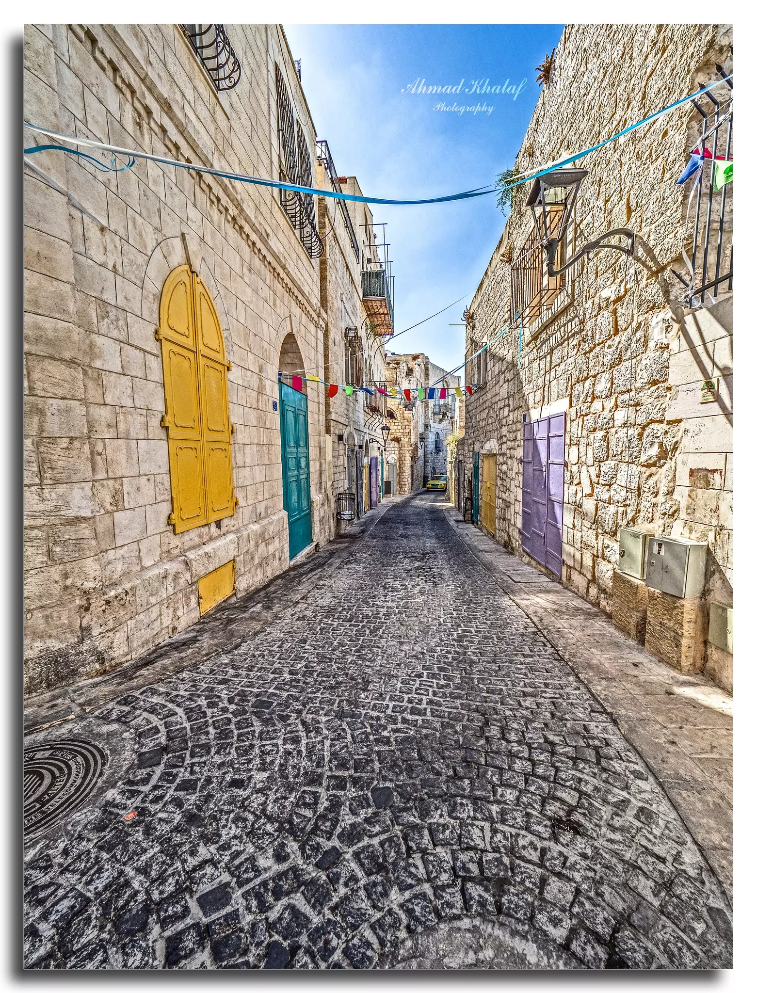
- جولة رائعة في أزقة مدينة بيت لحم العتيقه -- Ahmad Khalaf #12
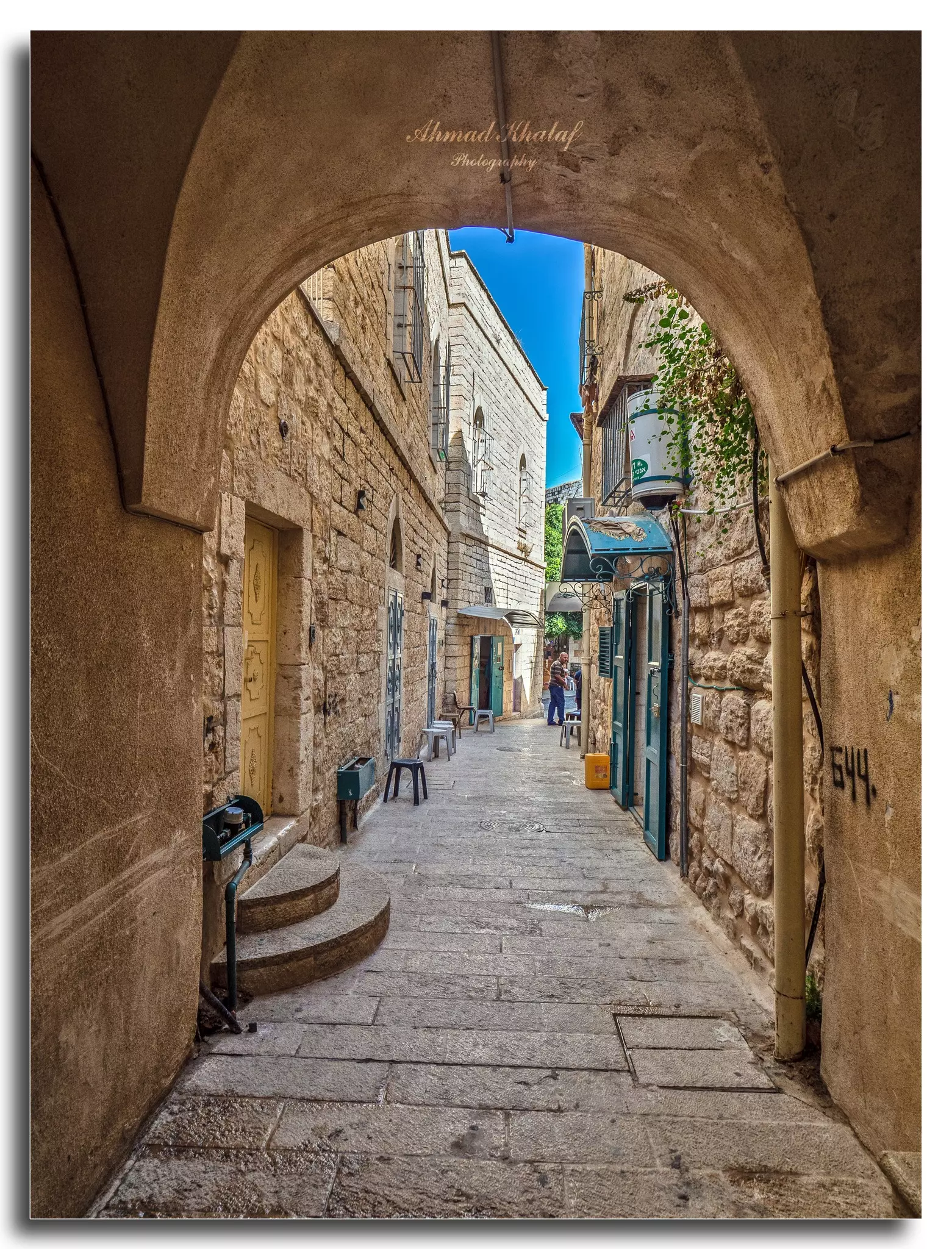
- جولة رائعة في أزقة مدينة بيت لحم العتيقه -- Ahmad Khalaf #13
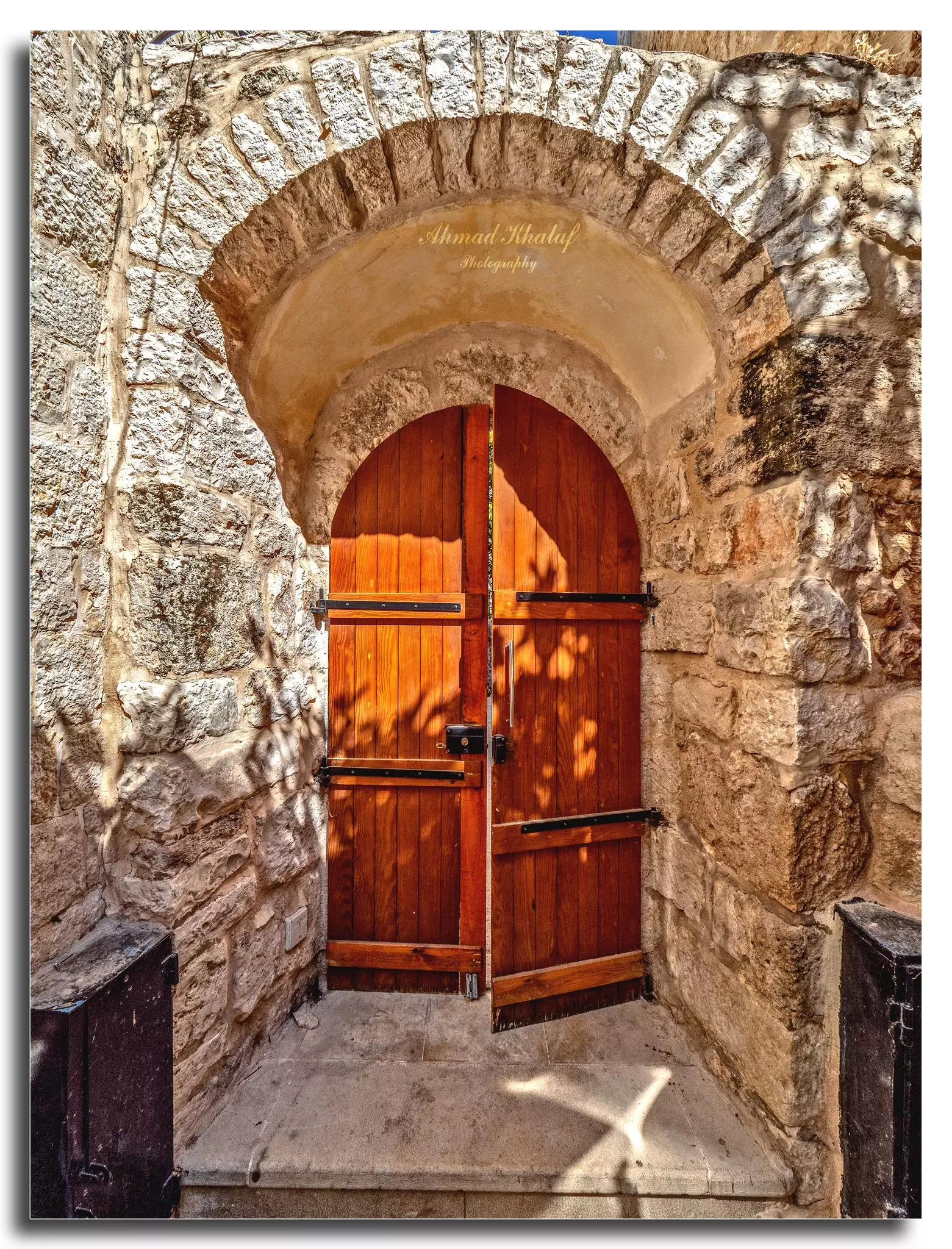
- جولة رائعة في أزقة مدينة بيت لحم العتيقه -- Ahmad Khalaf #14
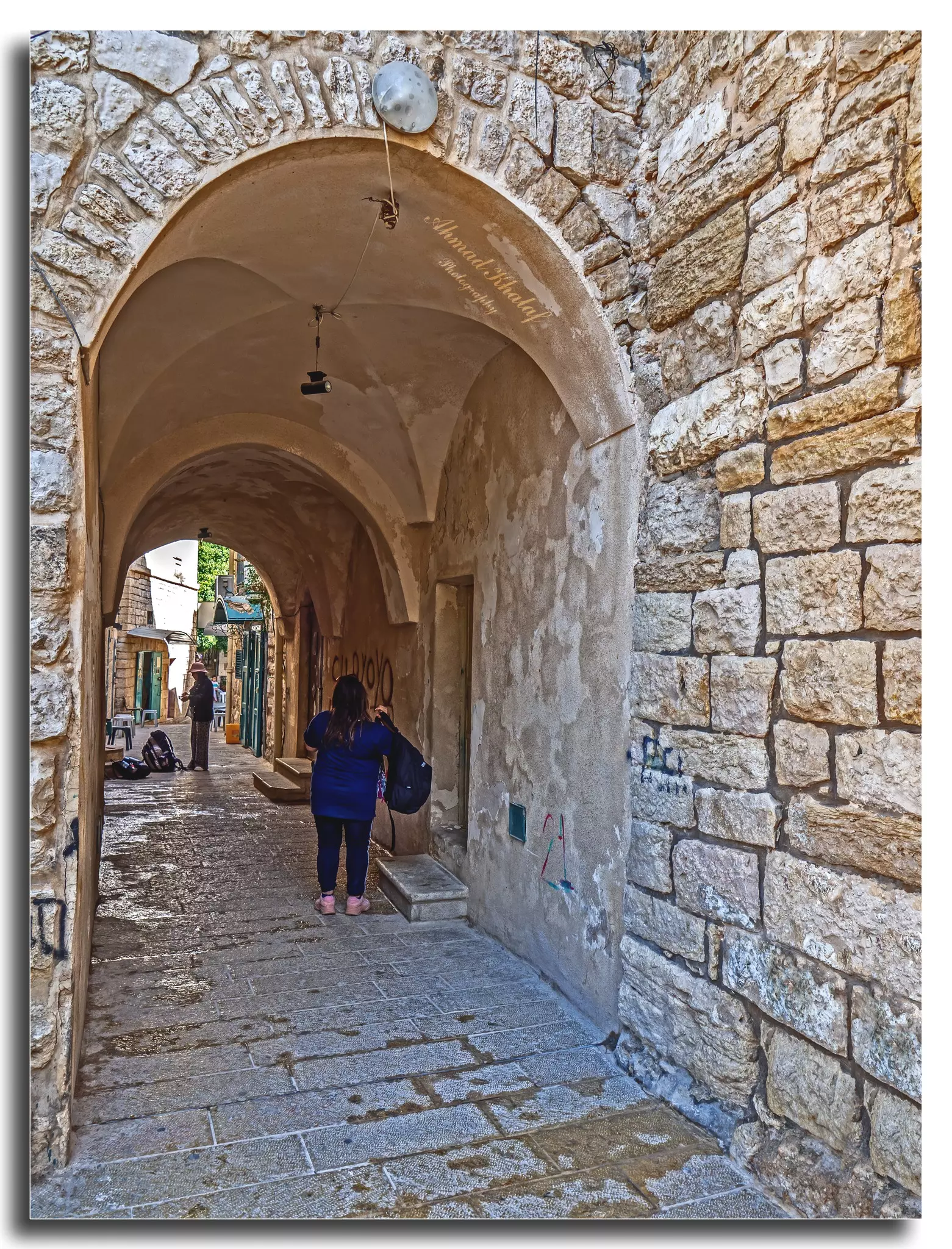
- جولة رائعة في أزقة مدينة بيت لحم العتيقه -- Ahmad Khalaf #15
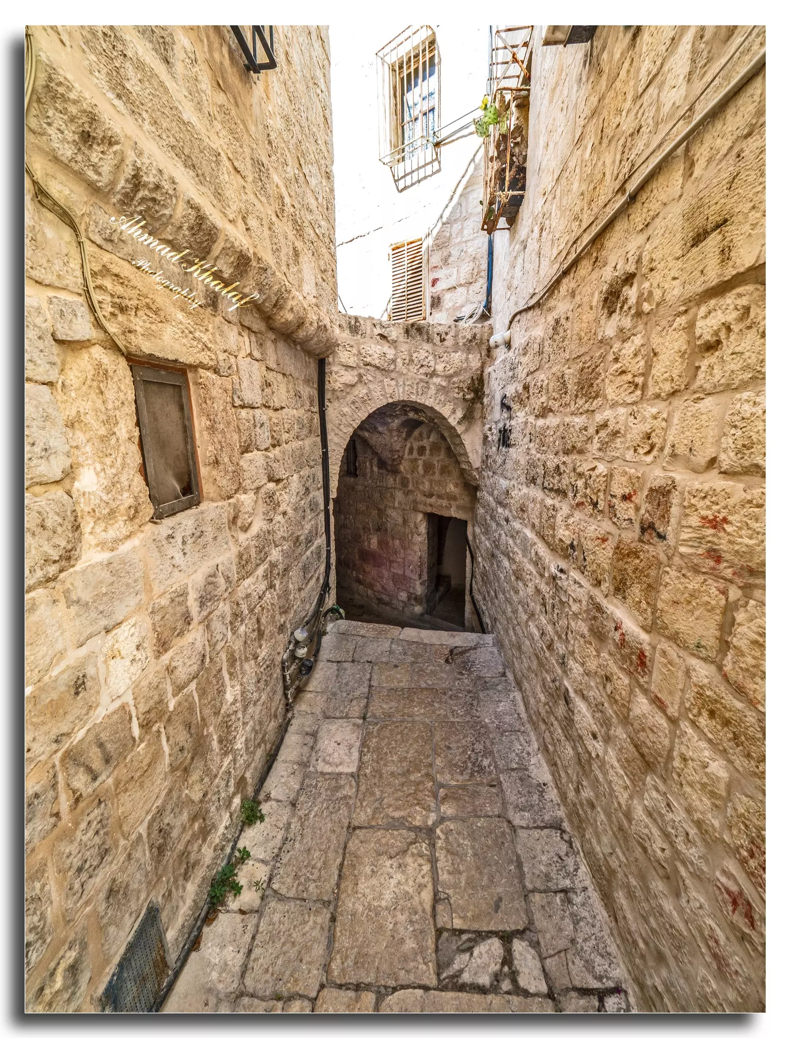
- جولة رائعة في أزقة مدينة بيت لحم العتيقه -- Ahmad Khalaf #16
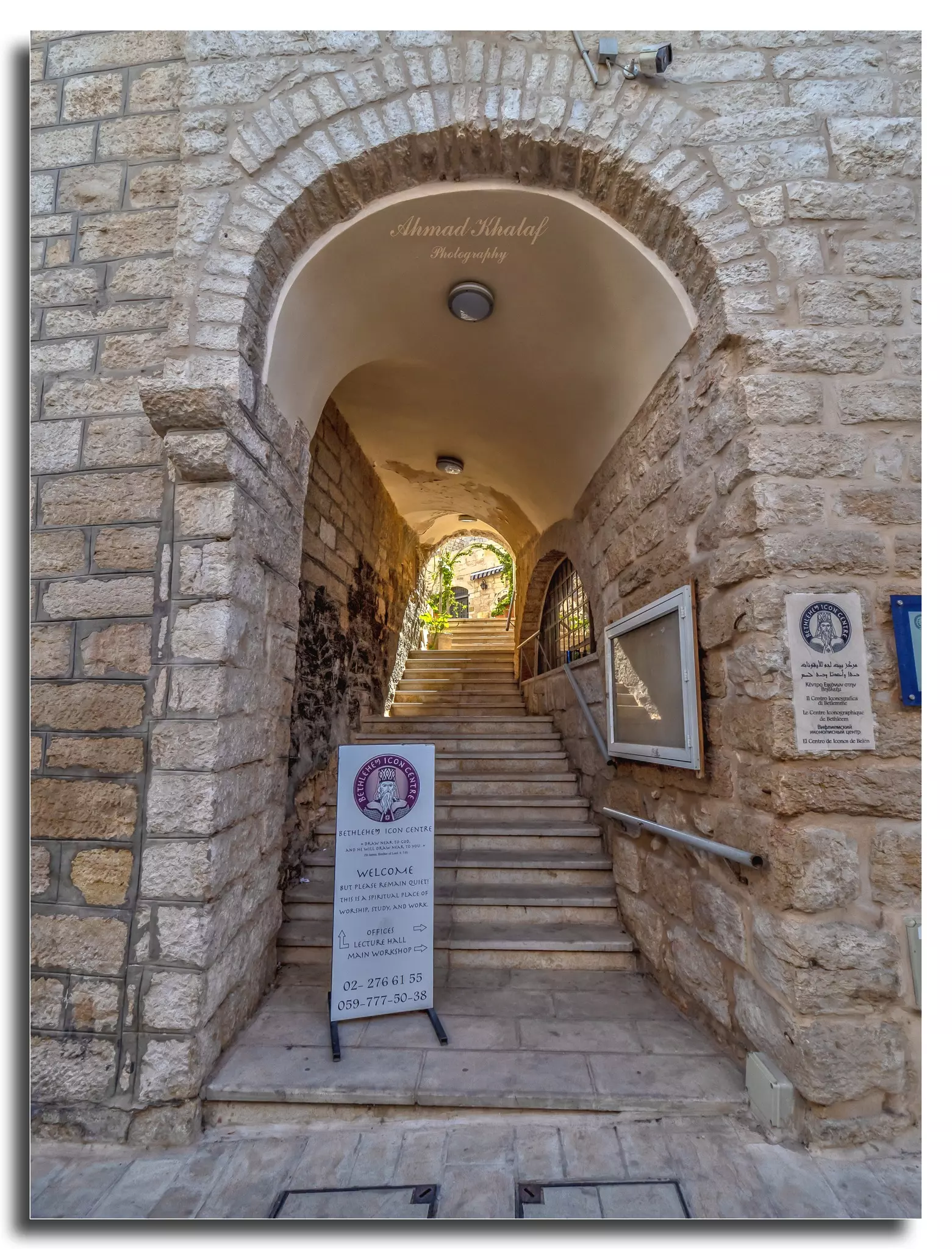
- جولة رائعة في أزقة مدينة بيت لحم العتيقه -- Ahmad Khalaf #17
- ترتدي ابنة الناصرة، الفنانة دلال أبوآمنة، ثوب بنت الجليل (جلاية الجليل).
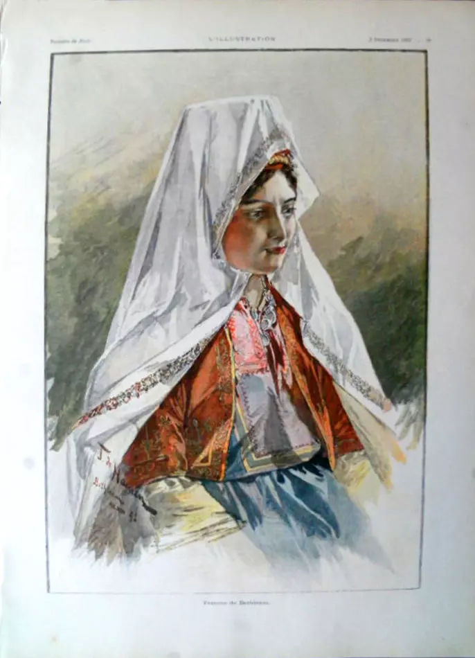
أما السيدة ماري قواس أنسطاس ، ابنة بيت لحم، ترتدي الثوب الأصيل…
- نبض الحياة في بيت لحم
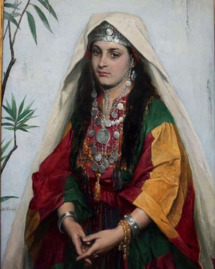
- عروس بيت لحم...لوحة عام 1880 للرسام البلجيكي Albrecht De Vriendt
- نبض الحياة في مدينة بيت لحم عام ١٩٠٠
- ثوب ملق (ملك) من منطقة بيت لحم
- أحد مساجد مدينة بيت لحم، وُجدت الصورة ضمن مجموعة مركز السنابل للدراسات والتراث الشعبي
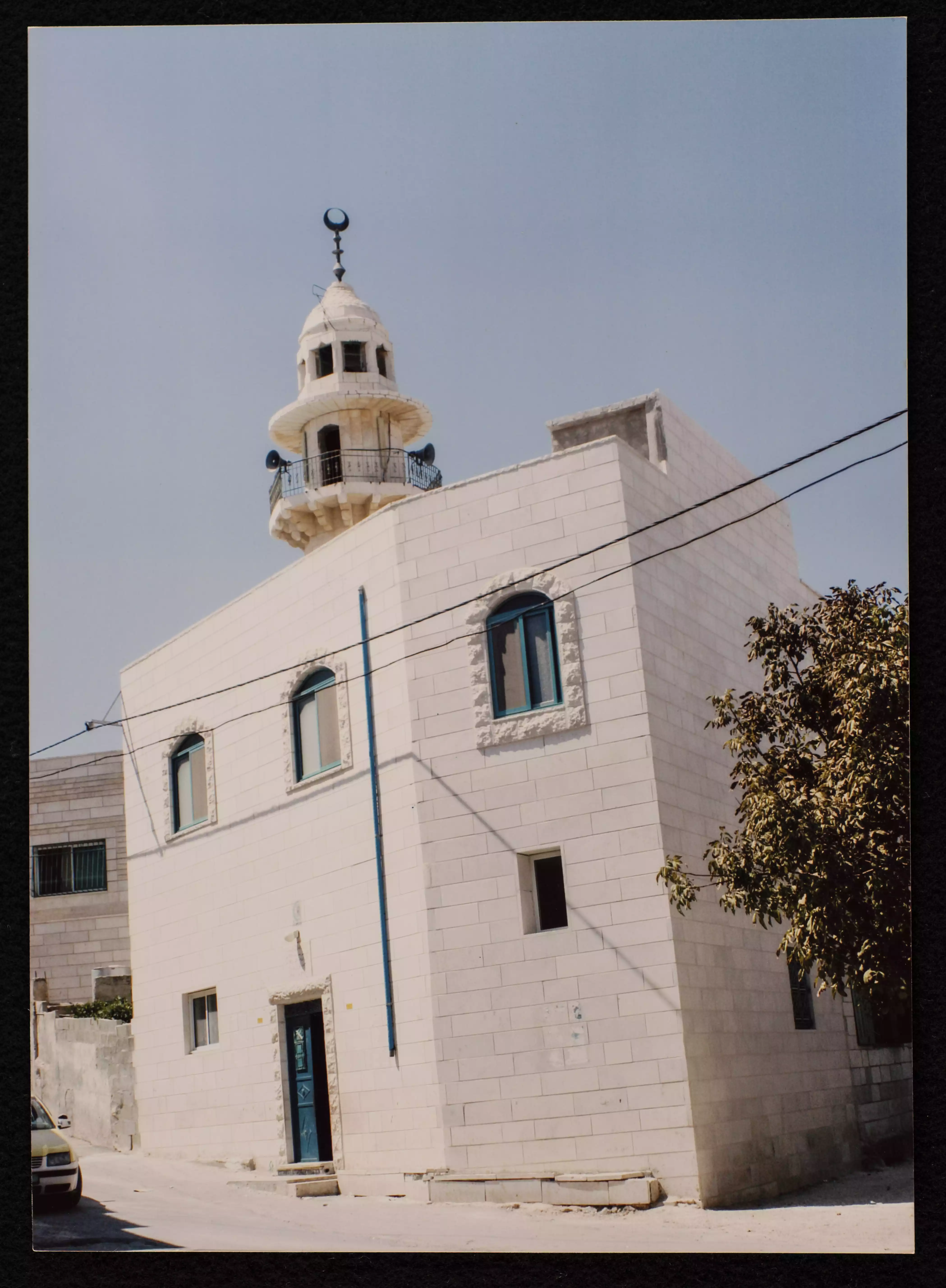
- مسجد الرحمن في مدينة بيت لحم، وُجدت الصورة ضمن مجموعة مركز السنابل للدراسات والتراث الشعبي.
- مسجد زيد بن ثابت
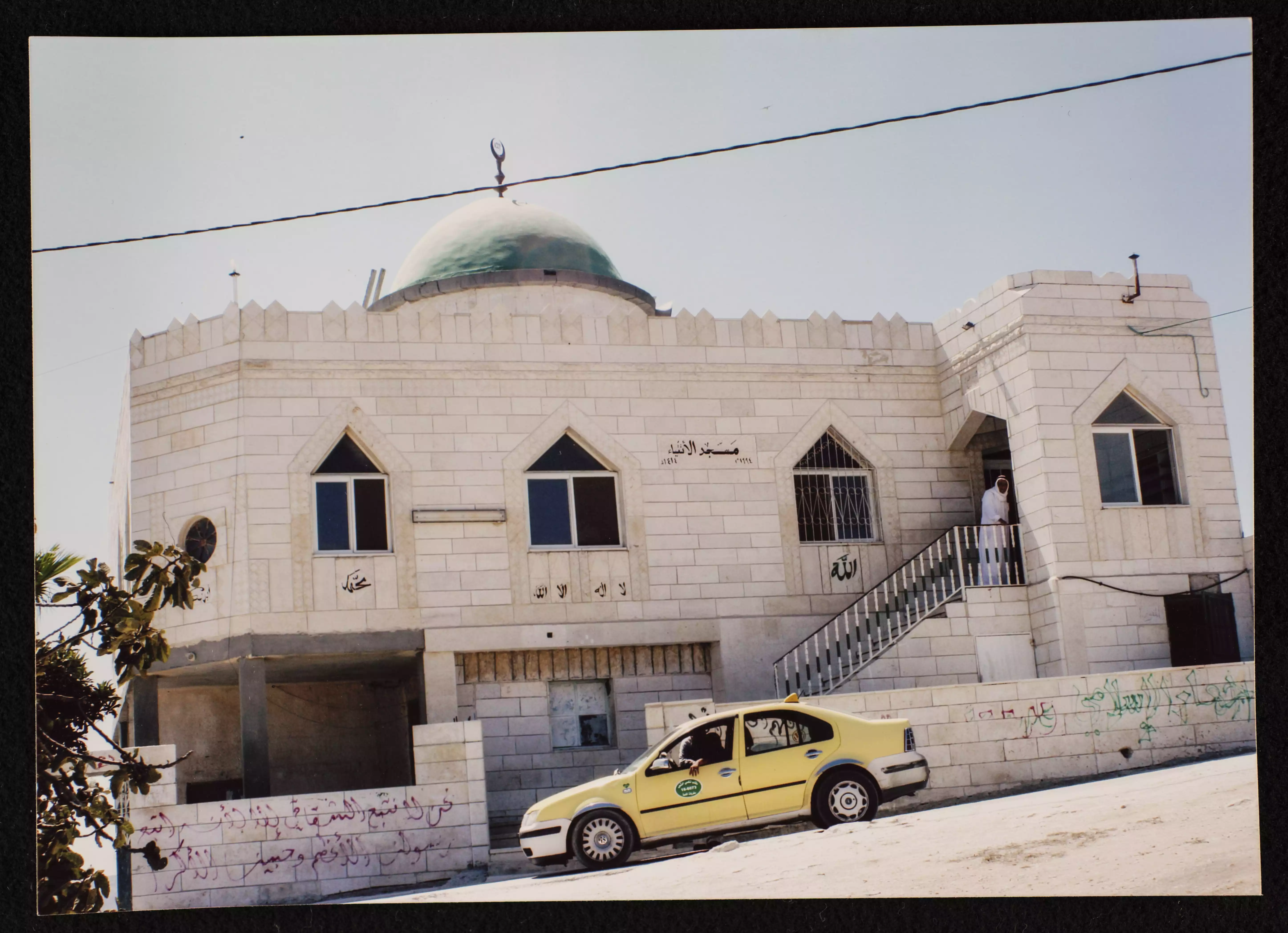
- مسجد الإيمان
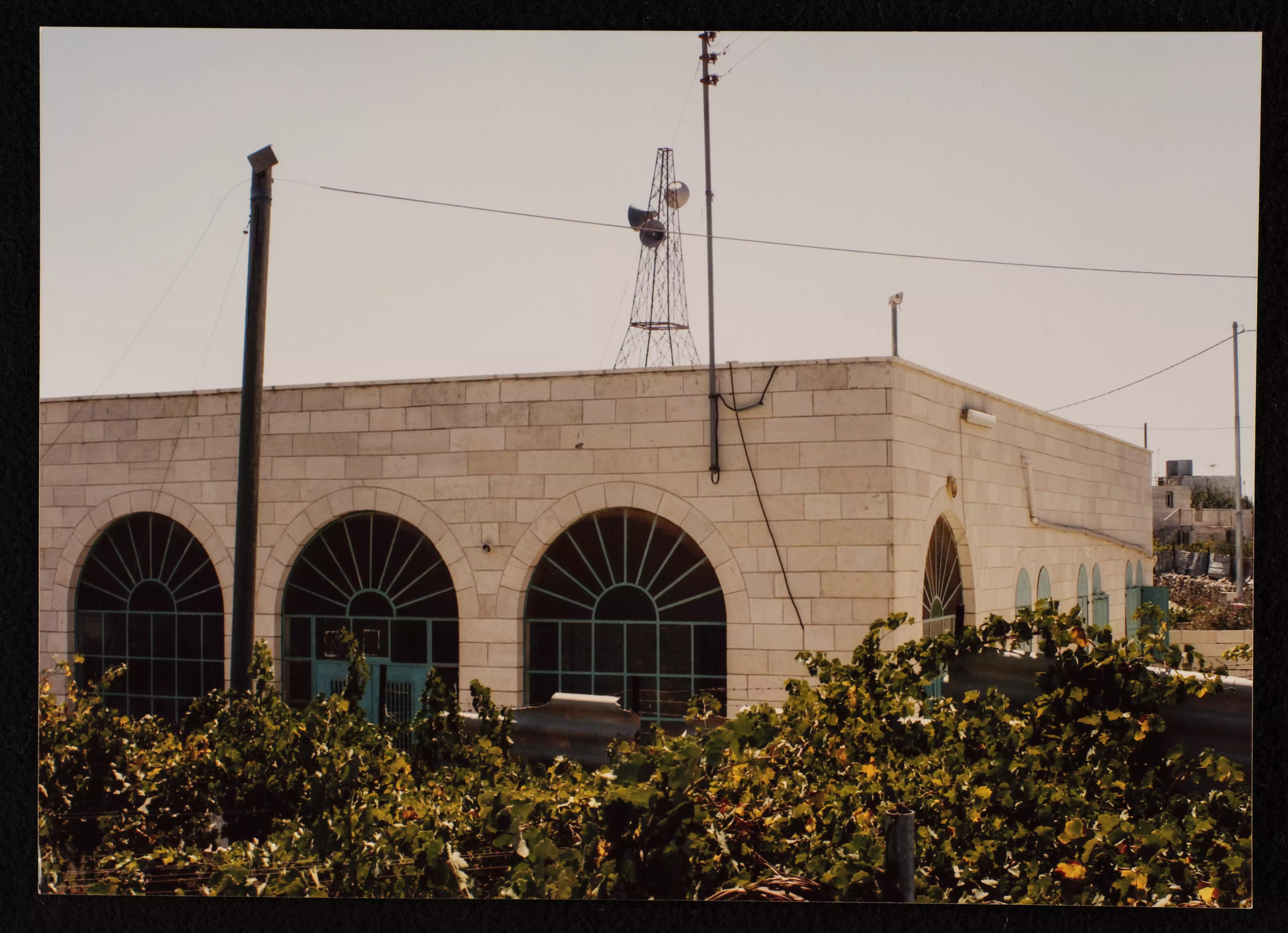
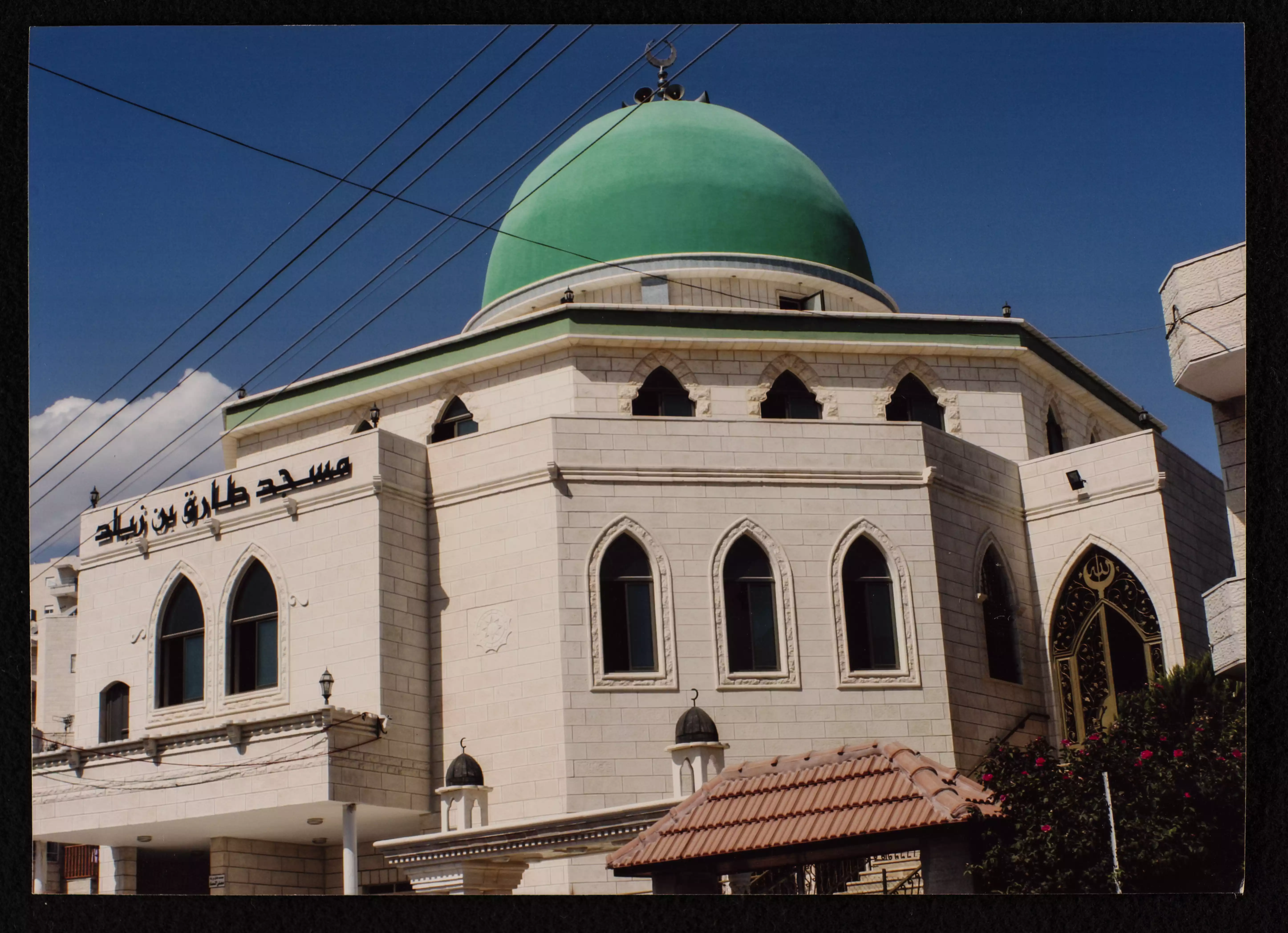
- مسجد طارق بن زياد
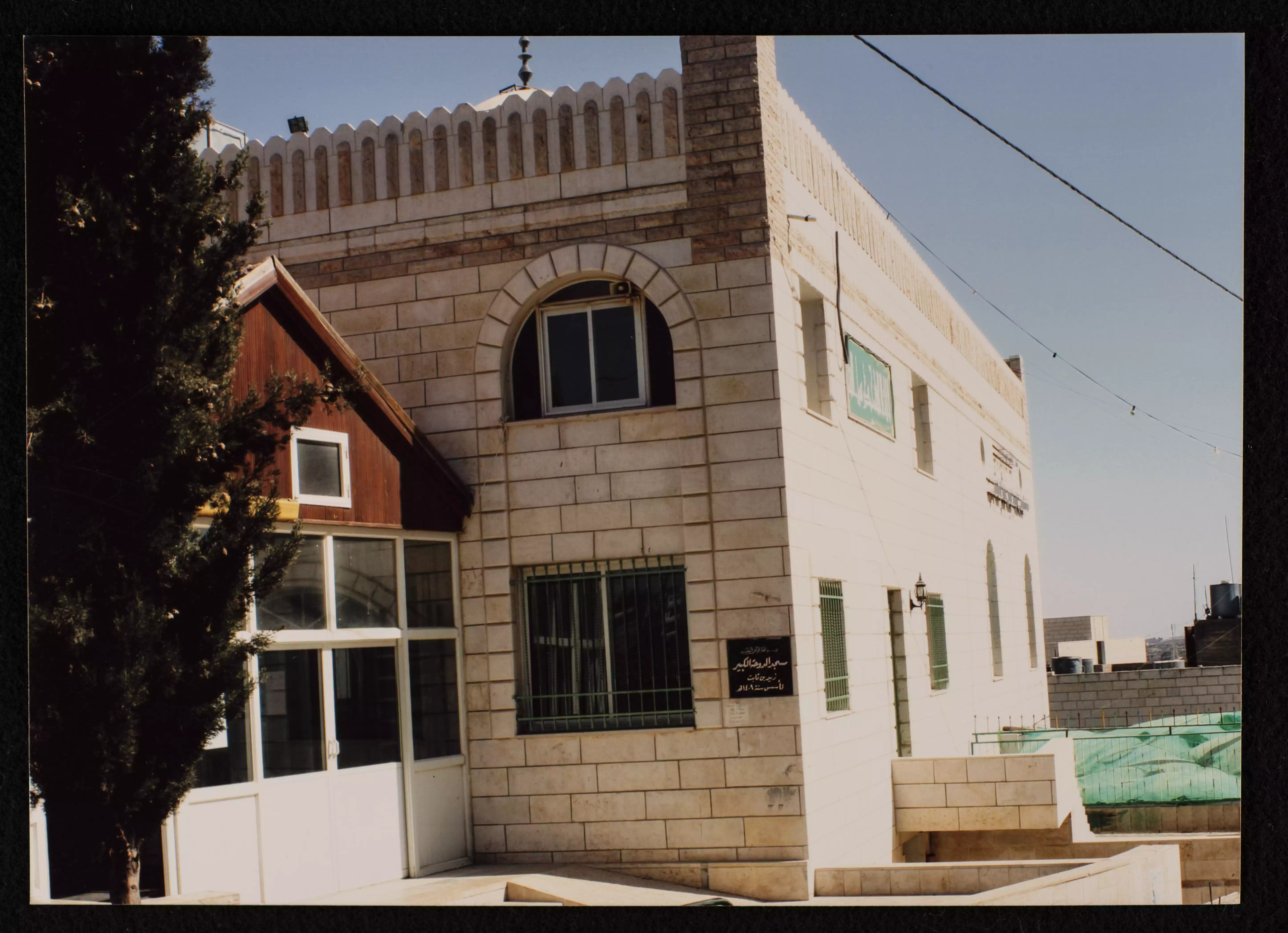
- مسجد الأتقياء في مدينة بيت لحم. بُني المسجد سنة 1994 وهو تابع لوزارة الأوقاف والشؤون الدينية. وُجدت الصورة ضمن مجموعة مركز السنابل للدراسات والتراث الشعبي.
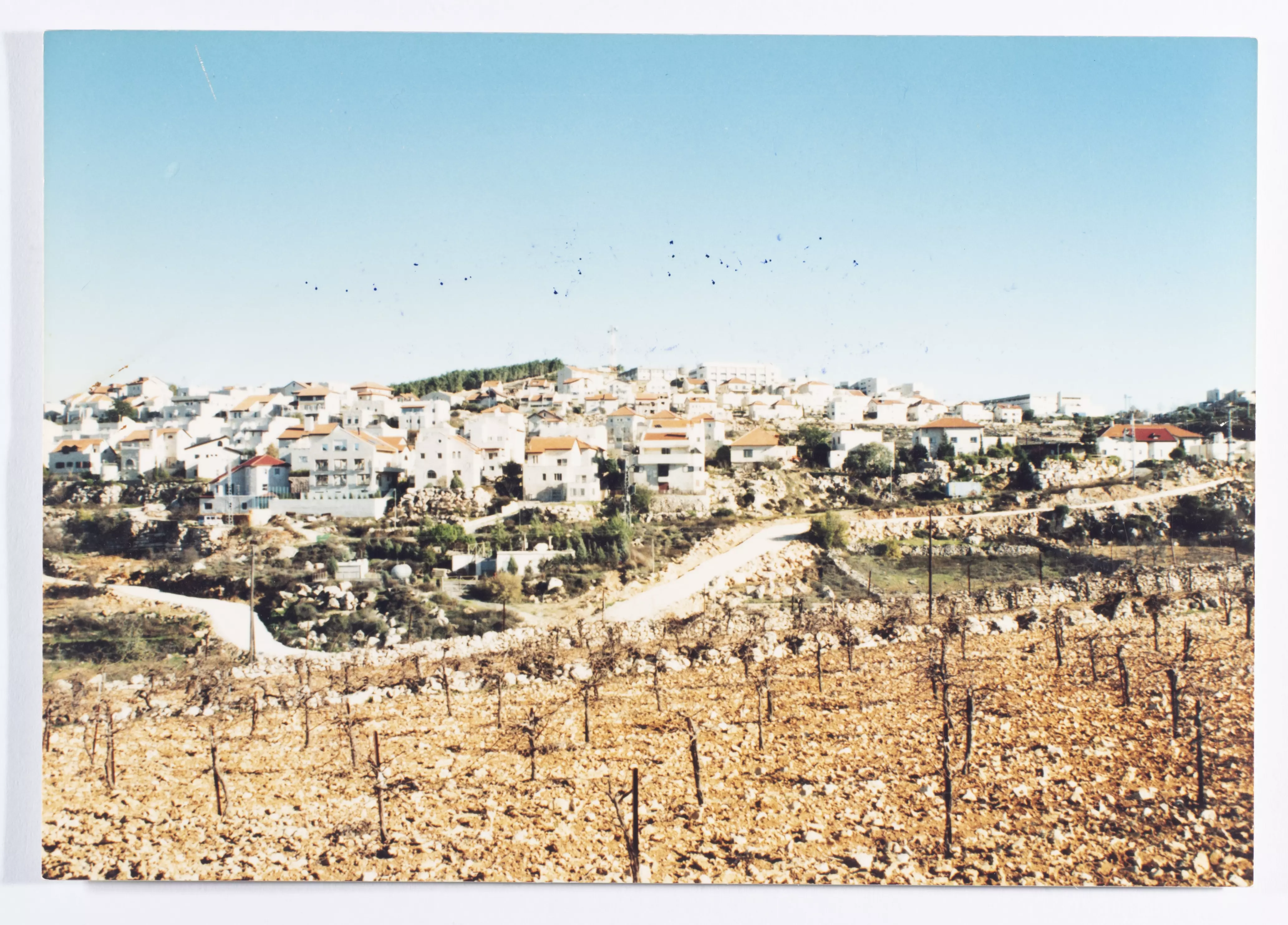
- صورة ملونة، تظهر فيها مستوطنة افرات جنوب بيت لحم، الصورة موجودة في أرشيف مصطفى أبو علي -- 1996
Want to browse more? 80,000 pictures were grouped in these gallaries:
| Display Name | Clan/Hamolah | Country of Residence |
| habib zuoghbi | zuoghbi | bahia, Brasil |
| Ruth Miriam | - | Palestine |
| رابيه قباجة | قباجة | بيت لحم, فلسطين |
| sema | - | بيت لحم |
| rosha | الشواورة | - |
| summer latif | al shami | ca, USA |
| الحلو | الحلو | بيت لحم, فلسطين |
| Mohammed Odeh | Taamreh | - |
| william huzaineh | huzaineh | ca, U S A |
| ANAN SWEITY | السويطي | الخليل, فلسطين |
| ابو لورنس | الشعلان | الاردن, الاردن |
| Ahed Hasayen | - | bethlehem |
| YOunES RAyyAN | عبيات | palestine, bethlehem |
| Abu Layth | Al Farahiya الفراحية | Palestine, Palestine |
| بن شاور | الشواورة | - |
| Joseph Dibsy | Dibsy/Karmy | ca, U S A |
| محمد القيسي | القيسي | جرش, الجبارات |
| Adam abeidallah | عبيدالله | - |
| نداء اللحام | اللحام | - |
| Jackie Faraj | - | Mississippi, usa |
| رائد الحروب | الحروب | عمان, الاردن |
| عادل ابو عفيفة | - | - |
| بنت بتير | البطحه | wis , usa |
| moon face | الثوابتة | بيت لحم, بيت فجار |
| عبد الرحيم | عطاونة | الخليل, بيت كاحل |
| قريه المالحه | - | - |
| المنتصر | المناصرة | سورية, سورية |
| ابو كارلوس | - | - |
| طارق احمد صبح | صبح | Steinkjer, Norway |
| ALHROUB | Al-Hroub | Jeddah, Saudi Arabia |
| Bilal Abu Lateefa | المشاعلة | بيت لحم, الجبعة - غرب بيت لحم |
| Yasser Husni | اللحام | Bethlehehm |
| Jalil Sahurie Saadi | al-farahiyeh | Santiago, Chile |
| Anan Hamad | Hamad | palestine, palestine |
- Bethlehem checkpoint Duration: 8 min 59 sec
- جولة في فلسطين - بيت لحم الجزء الاول
- جولة في فلسطين بيت لحم- الجزء الثاني
 Fake Valor: Why Did Zionist Jews Hoist Nazis Flag on Their Ships in the 1930s?
What is new?
-
Facts About Oct. 7th Gaza Raid
-
Remined Us Please:: Who Did Rape Who? Palestinians Raped Israelis? Or, was the other way around?
-
When Prof. Edward Said was invited to debate Bibi Netanyahu in the 1980s, watch what happened!
-
Ezra Klein of the NY Times on the "Jewish Race".
-
Abusing Blood Libel!
-
Did Israeli Soldiers Activate The Hanniba Direective On Oct. 7th? You Be The Judge
-
Zionist FAQ: Isn't it true that Palestinians don't want peace? Palestinians never accepted the two-state solution
- Facts about Haavara (Transfer) Agreement between Ben-Gurion & Hitler
-
Haavara FAQs: Why Did Zionist Jews Hoist Nazis' Flags on Their Ships in the 1930s?
- Haavara FAQs: When Chaim Weizmann met FDR in mid-1943, why was he silent about rescuing European Jewry?
-
Dear ChatGPT: How did Palestinians resist Napoleon's invasion of their country in 1799?
-
Dear ChatGPT: Gaza had a vibrant Jewish community in the mid-17th century. What happened to them?
-
Dear ChatGPT: Why did the Jewish Agency suppress news of the Holocaust during WWII?
-
Video Playlist: Jews share their DNA tests to end the conflict for good.
-
A Tale of Two Conflicts: Examining the Definition of Genocide
-
Prof. Abraham Polak And The Suppressed History of the Khazars and European Jewry
-
How Ronald Reagan would have framed the genocide in Gaza if he were still alive?
-
Haavara FAQs: Let us do the math: how many German Jews did The Haavara Agreement save?
-
Zionist FAQs: The Hebron Massacre of 1929, "clearly proves" that Palestinians are antisemitic, how could you deny it?
-
Zionist FAQs: Why Anti-Zionist Is Not Antisemitism?
-
Zionist FAQs: Isn't it true that the KGB created Palestinian Nationalism in the early 1960s?
- Zionist FAQs: Muslims are killing Muslims all the time; why are Israeli Jews being singled out in the media?
- Zionist FAQs: How is Israel an apartheid state when 20% of its citizens are Arabs who enjoy full rights?
-
Haavara FAQs: Why Did Dorothy Thompson Flip From A Zionist Advocate to A Silenced Dissenter?
-
Haavara FAQs: Analysis of Herzl's Uganda Scheme and how it could have saved millions of Jews.
-
Haavara FAQs: Why did Hayim Greenberg describe American Jewry as "morally bankrupt" in early 1943?
-
Haavara FAQs: What if the Evian Conference was a resounding success? What would have been the impact of saving European Jewry on Zionism?
- Haavara FAQs: What if the six million were saved, how that would have impacted the Zionist project?
-
Haavara FAQs: How did Zionist leaders react when Europe's Jews lingered in the DP camps after WWII ended?
-
Why does the American Jewish community repeat lies that David Ben-Gurion had debunked before he died?
-
Who has the power to rename the Tatar/Khazar Gene Marker to Jewish IV?
-
Zionist FAQs: Why won't Egypt, Syria, and Jordan take their people back? Jews are indigenous to Palestine, and Arabs immigrated after Jews developed the country. Arabs should leave.
-
Haavara FAQs: Did Hitler and the Nazis conflate between Judaism and Zionist? If that wasn't case, then why?
-
Haavara FAQs: Winston Churchill and antisemitism, a collection of articles written Churchill.
-
Haavara FAQs: Broken by country, how many Jews survived vs. killed during the Holocaust?
-
Haavara FAQs: Why did European Jews vote with their feet and to immigrated to the Americas, not Palestine, after WWII?
-
Watch this American Jewish Girl describing Israeli Jews' cognitive dissonance like no other in under two minutes
-
Haavara FAQs: When the Nazis went out of their way to hide the Holocaust, Israeli Jews did the exact opposite by broadcasting their genocide of Gazans. But why?
-
Haavara FAQs: How Zionist Jews went out of their to show their appreciation to Nazism and Fascism?
- Haavara FAQs: Why Zionist leaders were against bombing the death camps & the Railroads leading to them?
-
Haavara FAQs: Hitler's message to the British and American people: If Jews are such noble citizens and you care about them, how come you're not letting them in? I will gladly ship them to you at my expense, even on luxury liners!
-
A shortlist of Zionist and Israeli false flag operations in the name Jews.
-
The Most Moral Army
- The Land of Kapos (Israel): Where the brave are boycotted and Kapos walk free.
- Why did early Zionists often named their communal enterprises "colonial"?
- Zionist Relations with Nazi Germany by Faris Glubb
-
Two NY Times advertisements by Zionists in the early 1943 that exposes Zionists' treason at the height of the calamity
- Facts Not Lies about the Palestinian-Israeli Conflict.
- Site's pictures have been categorized
- Campgain Against Lice
- A Survey of Palestine, the official source about Palestine before Nakba produced by the British Mandate; over 1200 pages.
- Satellite View & Google Earth: Over 6,000 placemarks identifying all destroyed towns, W. Bank & Gaza Strip Towns, & refugee camps.
- PalestineRemembered.com and its Nakba Oral History Project were featured on al-Jazeera Satellite TV.
- Nakba Oral History Video Podcast:
 Over 700 Oral History interviews (including 3,500+ hours of recording) can be viewed online.
 - Palestine Village Statistics Project
- Gaza Jail Break
- النسخة العربية للموقع الان متوفرة
- Videos: Documenting the destroyed villages in video: Tracing all that remains since Nakba.
- Videos: Responding to Zionist Propaganda
- Interview: The ethnic cleansing of Palestine: George Galloway interviews Israeli Historian Ilan Pappe.
- For Palestinians, memory matters. It provides a blueprint for their future By George Bisharat.
- Zionist FAQ now available in Hebrew שאלות שציונים שואלים, עכשיו בעברית
- Video: The Stephen Walt and John Mearsheimer report on the influence of the Israel Lobby on U.S. Foreign Policy
- The Palestinian-Israeli conflict for beginners
