| PalestineRemembered | About Us | Oral History | العربية | |
| Pictures | Zionist FAQs | Haavara | Maps | |
| Search |
| Camps |
| Districts |
| Acre |
| Baysan |
| Beersheba |
| Bethlehem |
| Gaza |
| Haifa |
| Hebron |
| Jaffa |
| Jericho |
| Jerusalem |
| Jinin |
| Nablus |
| Nazareth |
| Ramallah |
| al-Ramla |
| Safad |
| Tiberias |
| Tulkarm |
| Donate |
| Contact |
| Profile |
| Videos |
Welcome To Ghor al-Fari'a & Umm Hureira - Ghor al-Fari'a & Umm Hureira
|
District of Nablus
Occupied days ago |
العربية Google Earth |
 |
Gallery (101) |
- Statistics & Facts
-
Before & After

- Satellite View
- Articles 7
- Pictures 101
- Mayrters & Prisoners 1
- Members
- Families
- ARIJ Guide
- Videos 3
- Guest Book 2
- Links
| Statistic & Fact | Value | ||||||||||
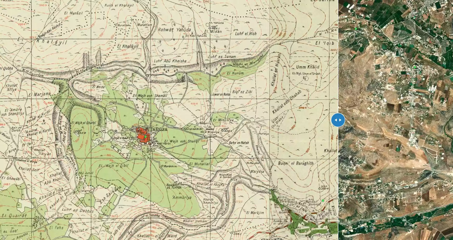
| Before & After Nakba, Click Map For Details |
|||||||||||
|
|||||||||||
| Land Ownership |
**Town Lands' Demarcation Maps |
||||||||||
| Land Usage As of 1945 |
|
||||||||||
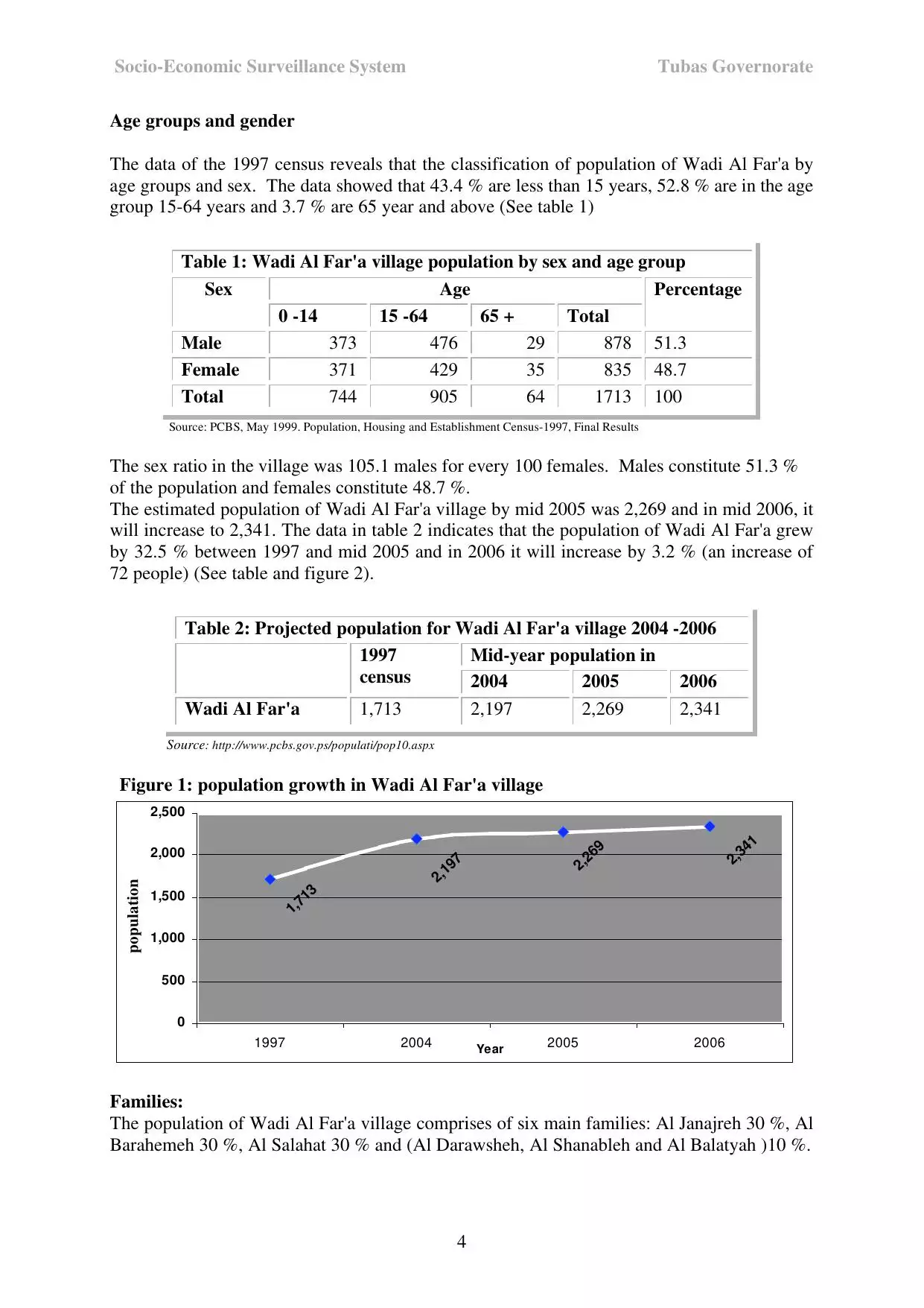
| Population |
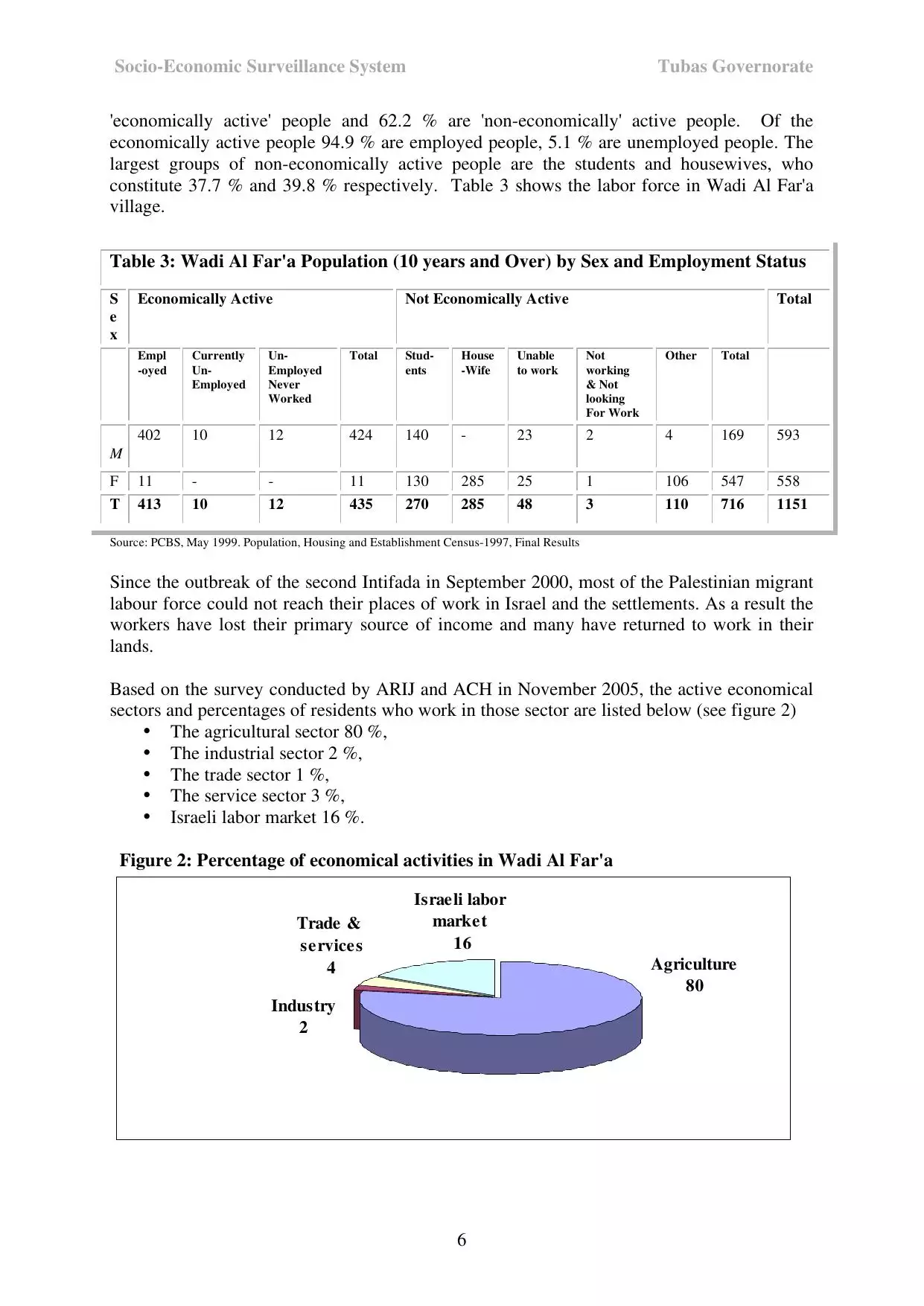
|
||||||||||
| Featured Video | |||||||||||
| ARIJ Guide | |||||||||||
3.

4. 
5. 
6. 
7. 
8. 
9. 
10. 
Click here to browse online. |
|||||||||||
| Related Maps | Town Lands' Demarcation Maps خرائط للقضاء توضح حدود القرى والاودية View from satellite Town's map on MapQuest Help us map this town at WikiMapia |
||||||||||
| Related Links | ARIJ Guide Google Search Google For Images Google For Videos المزيد من موقع هوية |
||||||||||
- الجفتلك - معسكر الجيش - بناء عثماني استخدمه الجيش البريطاني والاردني
Posted by Rajae mahmoud 1 - الجفتلك - معسكر الجيش - بناء عثماني استخدمه الجيش البريطاني والاردني 2

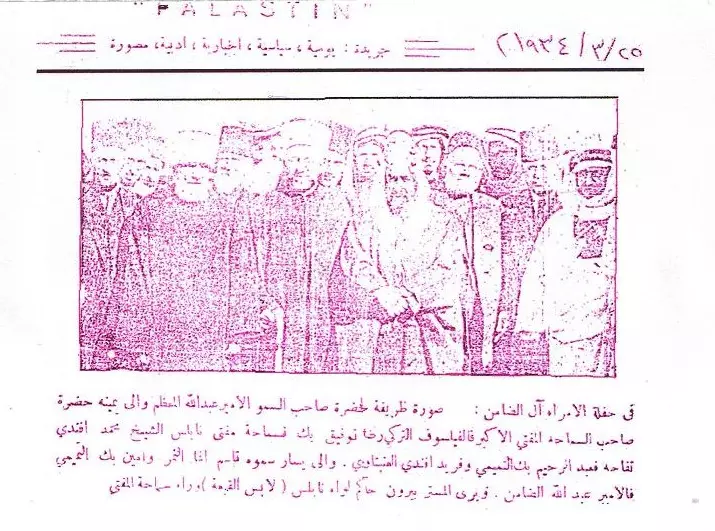
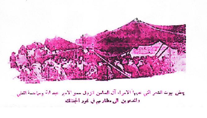
Posted by Rajae mahmoud - زيارة الامير عبد الله بن الحسين (في حينه) الى غور الفارعة-1934
Posted by Ghanem Mustafa - الجفتلك _ اشارة في معسكر الجيش _ الجفتلك اسم مستمد معناه من نوعية اراضي حسب قانون التمويل والاراضي العثماني
Posted by Rajae mahmoud - الجفتلك - معسكر الجيش منظر داخلي
Posted by Rajae mahmoud - الجفتلك - بوابة معسكر الجيش
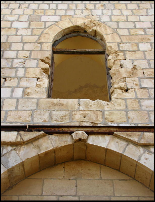
Posted by Rajae mahmoud - الجفتلك - نافذة في البناية العثمانية - معسكر الجيش
Posted by Rajae mahmoud - الجفتلك - اشارة تعلو احد بوابات البناء العثماني - معسكر الجيش

Posted by Rajae mahmoud - الجفتلك - مواقع داخل معسكر الجيش
Posted by Rajae mahmoud - الجفتلك - داخل معسكر الجيش وتظهر الجبال المحيطة بغور الجفتلك
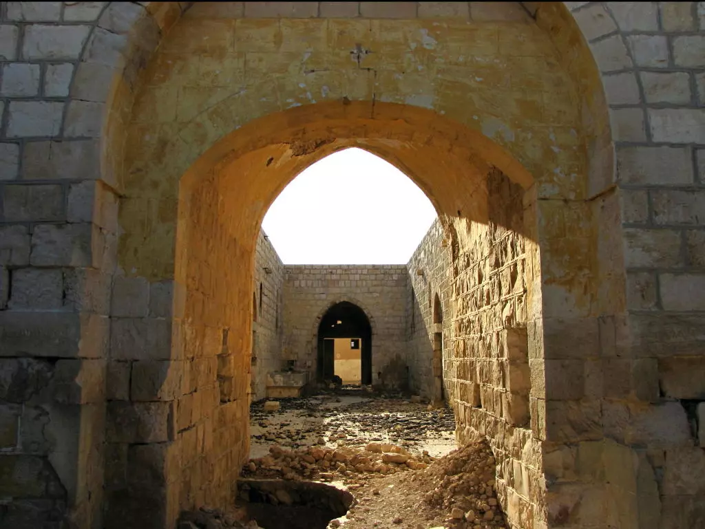
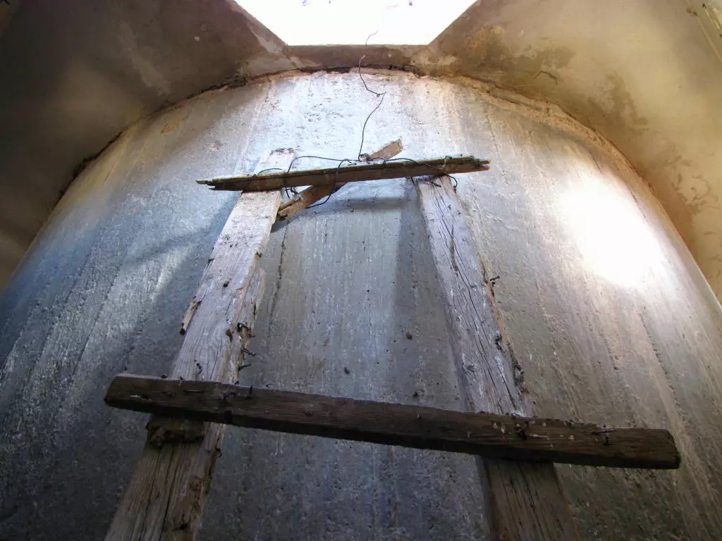
Posted by Rajae mahmoud - الجفتلك - من داخل المبنى العثماني - معسكر الجيش حسب ما يسميه الاهالي هناك 1
Posted by Rajae mahmoud - الجفتلك - من داخل المبنى العثماني - معسكر الجيش حسب ما يسميه الاهالي هناك 2

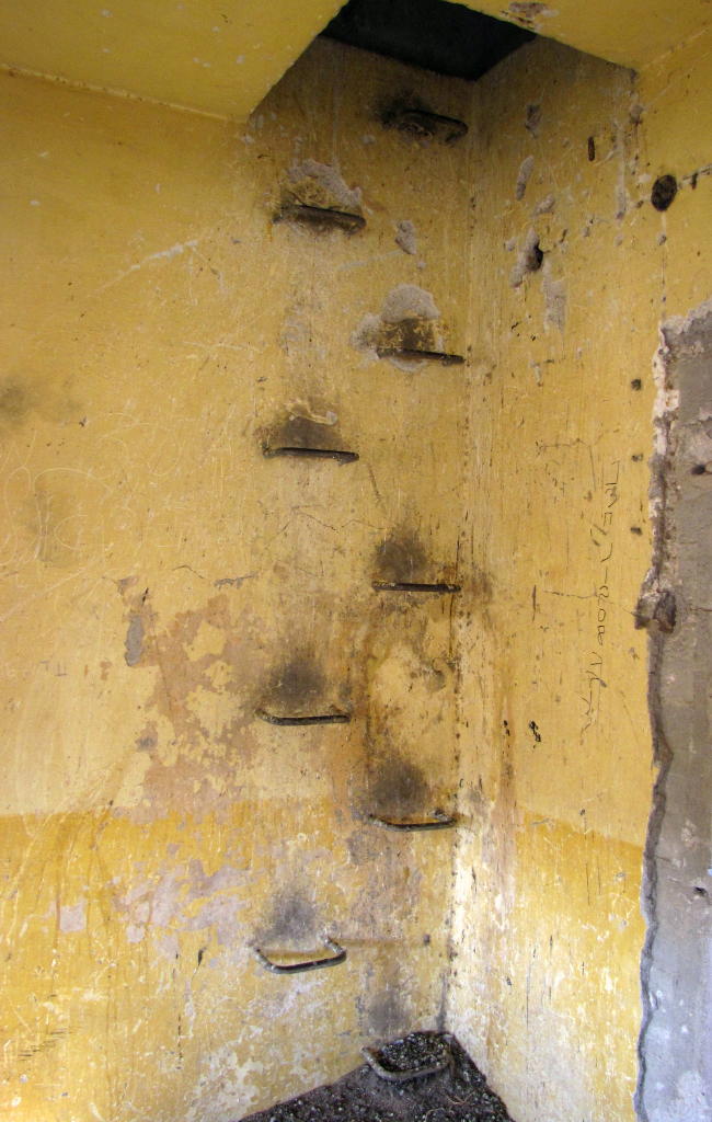
Posted by Rajae mahmoud - الجفتلك - سلالم داخل المبنى العثماني القديم - معسكر الجيش
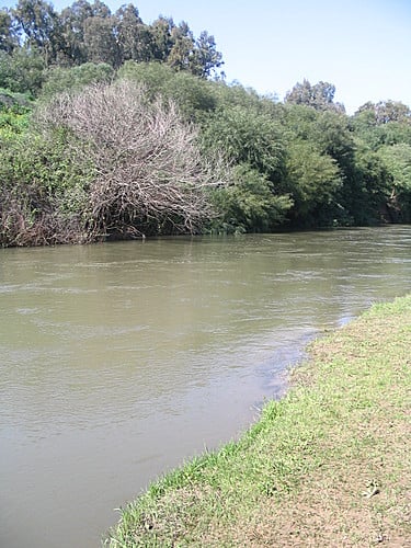
Posted by Rajae mahmoud - صورة ارشيفية لنهر الاردن شمالي غور الفارعة
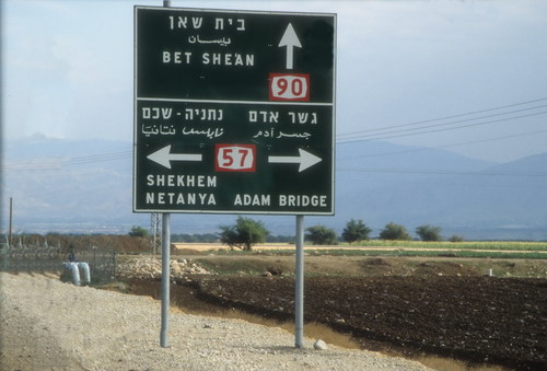
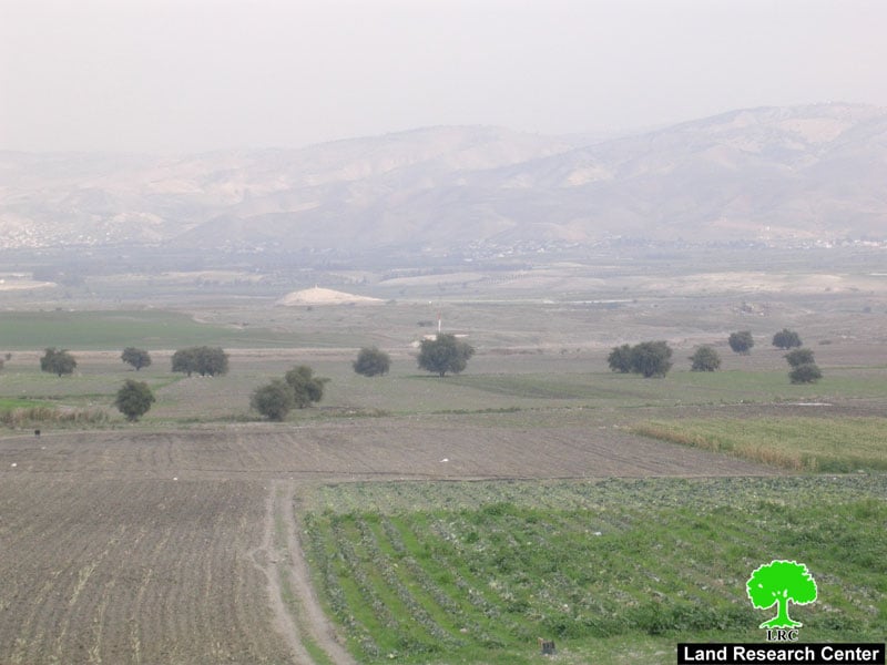
Posted by Ghanem Mustafa - سهل الفارعة على طريق اريحا بيسان عند تقاطع جسر دامية
Posted by Ghanem Mustafa 2 - زيارة الامير عبد الله بن الحسين (في حينه) الى غور الفارعة-1934
Posted by Ghanem Mustafa 2 - صورة ارشيفية لوادي الاردن شمالي غور الفارعة
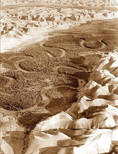
Posted by Ghanem Mustafa - تعرجات نهر الاردن شمالي غور الفارعة
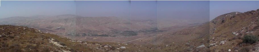
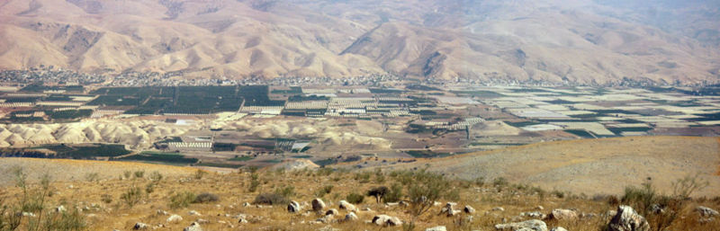
Posted by Ghanem Mustafa - بانوراما جبال البلقاء من غور الفارعة
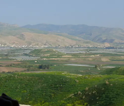
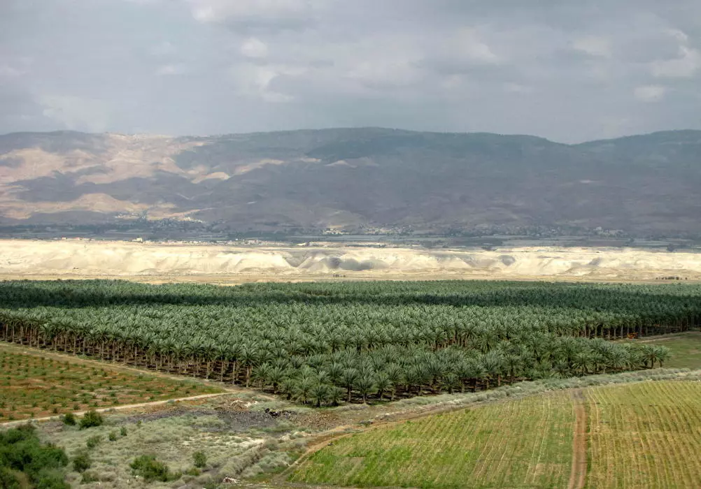
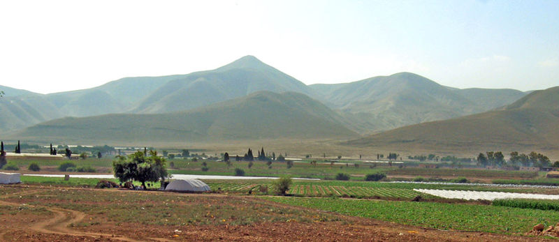
Posted by Ghanem Mustafa - وادي الاردن من غور الفارعة
Posted by Ghanem Mustafa - بداية وادي الفارعة عند البادان
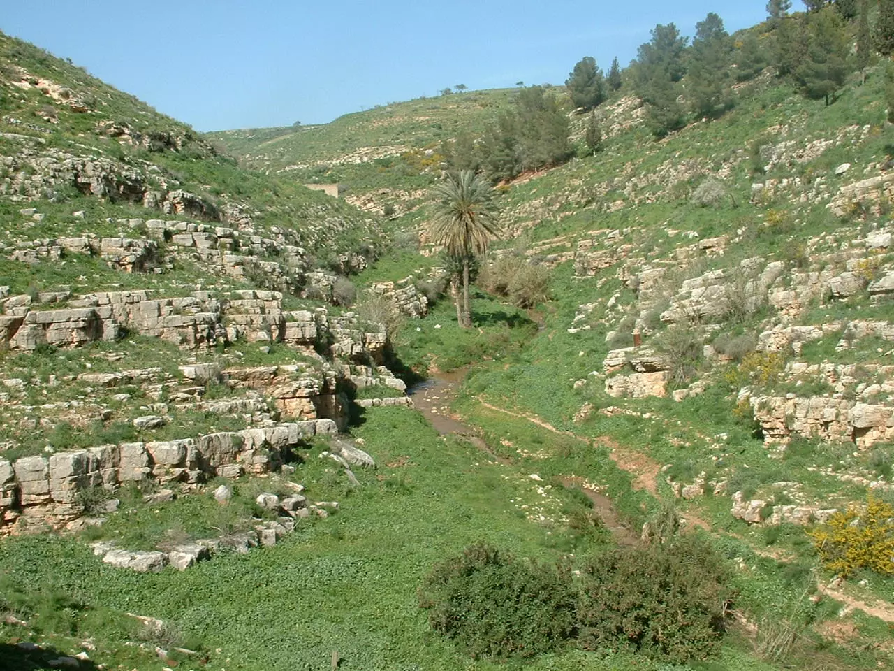
Posted by Ghanem Mustafa 2 - منظر ساحر لوادي الفارعة قرب البادان
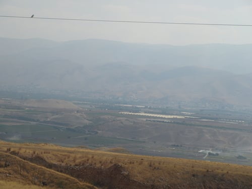
Posted by Ghanem Mustafa - اطلالة ساحرة على غور الاردن
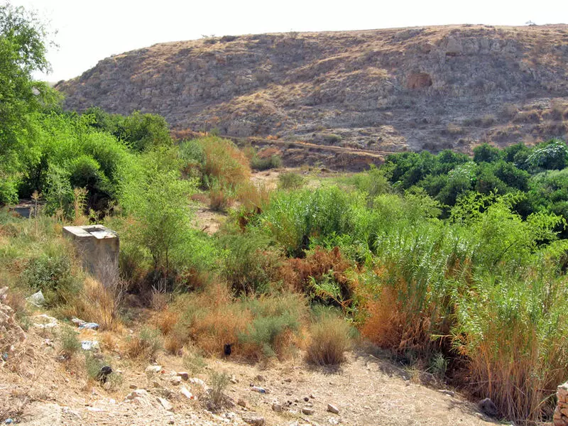
Posted by Ghanem Mustafa - وادي الاخمر - يطل على ام حريرة والغور

Posted by Ghanem Mustafa - مياه نبع العوجا في الجوار

Posted by Ghanem Mustafa - غور الفارعة قرب قرية النصارية
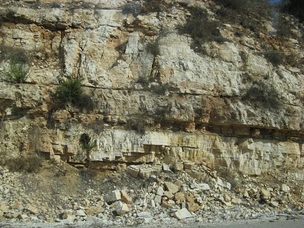
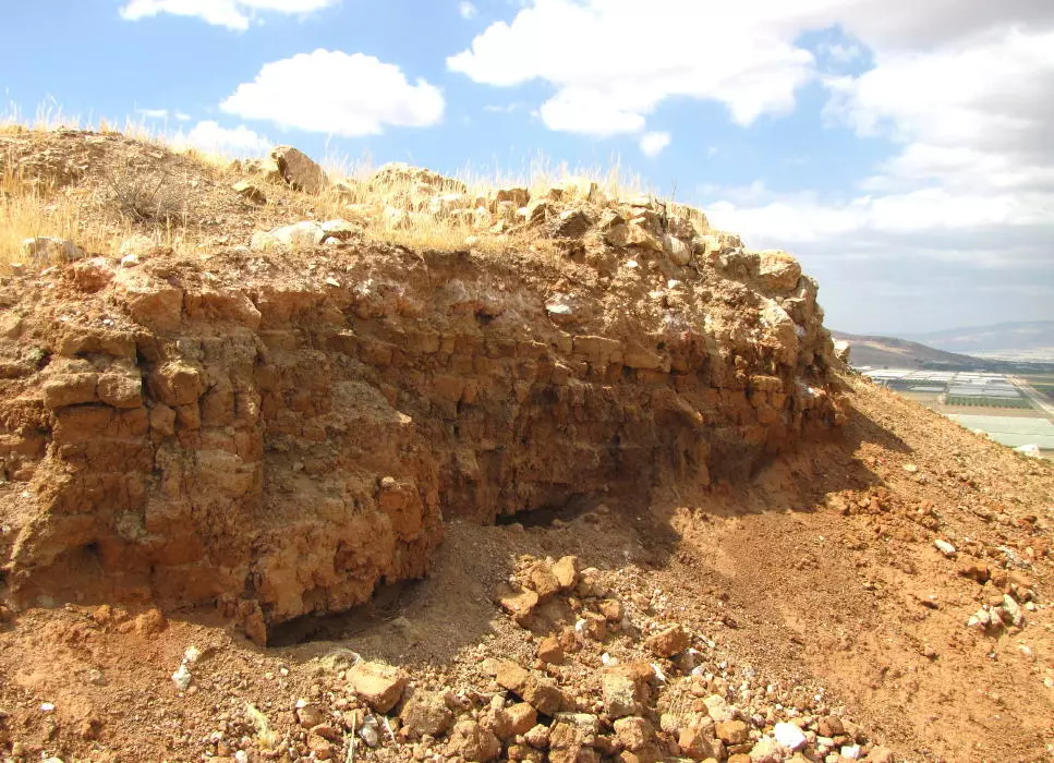
Posted by ابن عيبال [email protected] 1 - الجفتلك صخور و طبقات
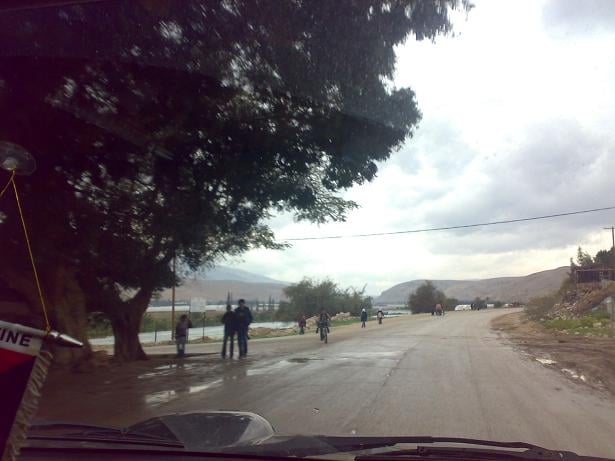
Posted by AboFalstin 1 - الجفتلك مفرق معسكر الجيش
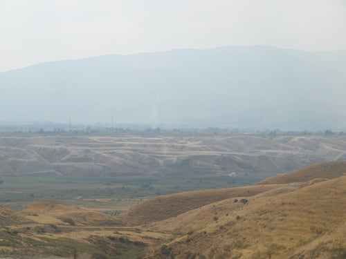
Posted by Abu Hsein - غور الجفتلك

Posted by Abu Hsein - الجفتلك - أشجار النخيل

Posted by Abu Hsein - الجفتلك - كازية الرطروط

Posted by Abu Hsein - غور الجفتلك
Posted by Abu Hsein - غور الجفتلك 2
Posted by Abu Hsein - الجفتلك بيوت عائلة علي السعد
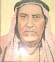
Posted by Abu Hsein - الامير فياض فاضل المسعودي
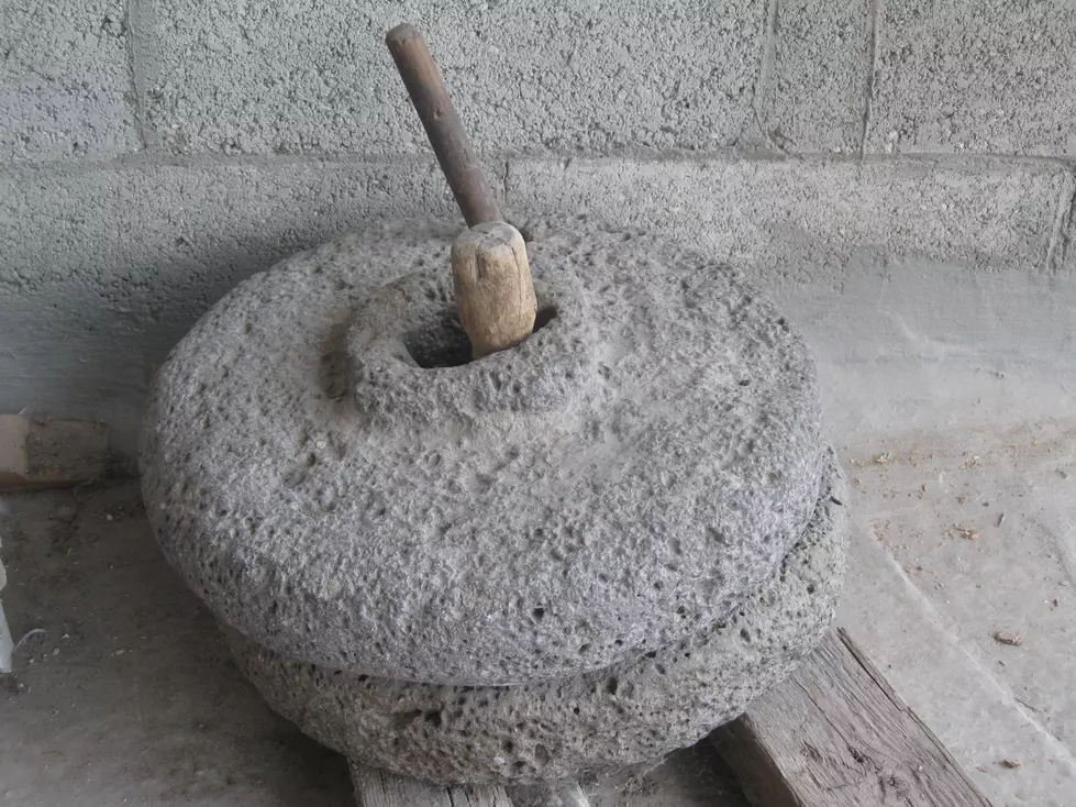
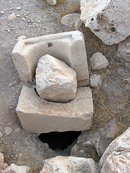
Posted by الامير المسعودي 2 - حجر الطاحون - من املاك ابوالعبد الشلبي اشتراها حين سكن غور الجفتلك سنوات 1949-1967م وهي اليوم في بيت ولده خالد شلبي في مخيم طولكرم
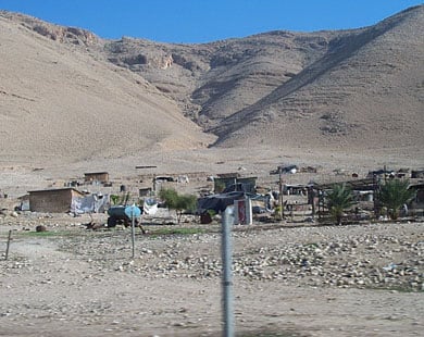
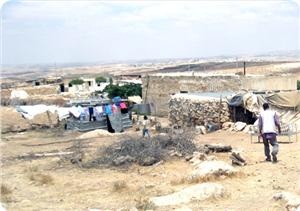
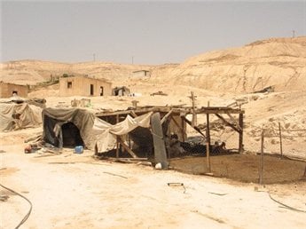
Posted by Abu Hsein - تجمع سكني بيوته من الصفيح في الجفتلك
Posted by Wadina - الجفتـلـك
Posted by Wadina - جنود إسرائيليون يحرسون جرافة تابعة للاحتلال الإسرائيلي تقوم بهدم منزل في قرية الجفتلك بالأغوار

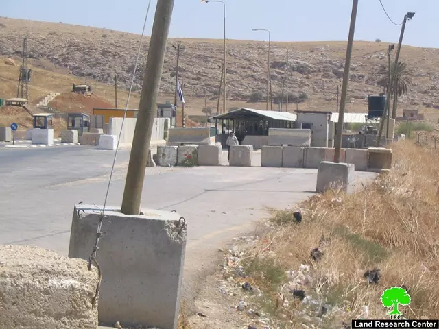
Posted by Wadina - حاجز الحمرا العسكري الفاصل بين الأغوار وأراضي الضفة
Posted by Wadina - السفوح الغربية لمنطقة الأغوار

Posted by Wadina - منطقة الجفتلك

Posted by Wadina 1 - معاناة اهل الجفتلك مع نقص المياه

Posted by Wadina - الشهيد مشهور طلب عوض صالح العاروري سقط يوم18/5/1976 على في عملية على ارض الجفتلك افرج عن جثته يوم 10/8/2010

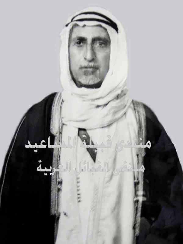
Posted by Wadina - الأمير علان الضامن المسعودي - أمير قبيلة المساعيد
Posted by GoUrFaR3Ah 3 - الجفتلك - صورة بانوراما
Posted by Rajae mahmoud - تشكل صخري قرب جسر آدم - تقاطع الطريق الى بيسان واريحا وفي الامام الجسر القديم

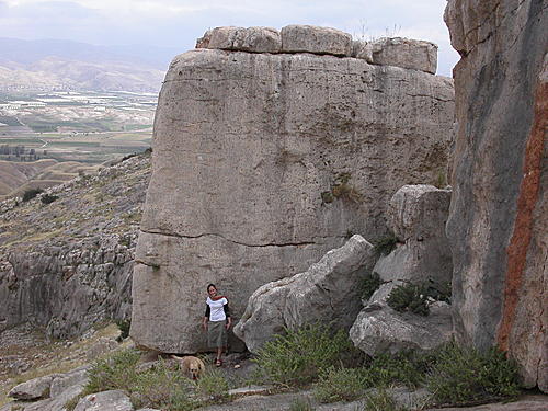
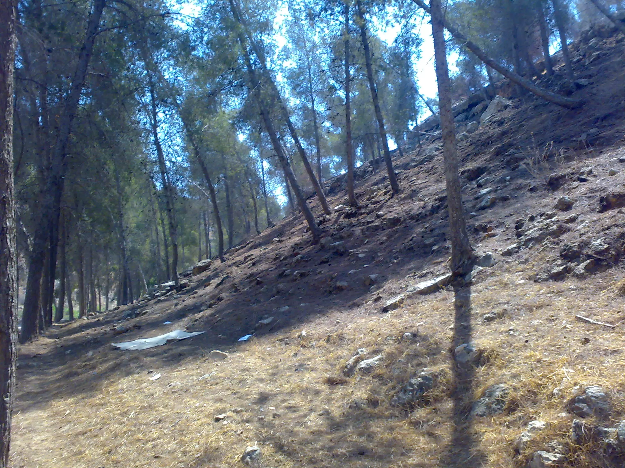
Posted by Rajae mahmoud 1 - جبال محيطة بغور الفارعة
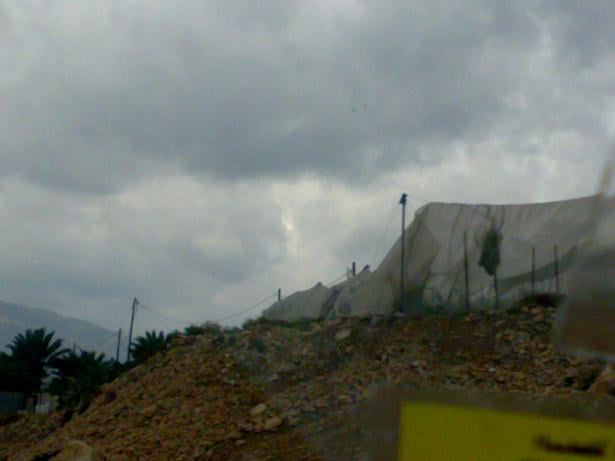
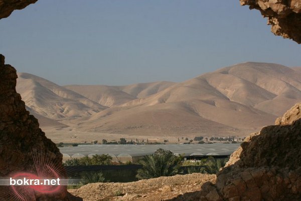
Posted by Rajae mahmoud - اراضي الغور مزروعة بأشجار النخيل - يمكن ان تكون لمزارعين فلسطينيين او لاحد المستوطنات المقامة على اراضي الغور ؟؟
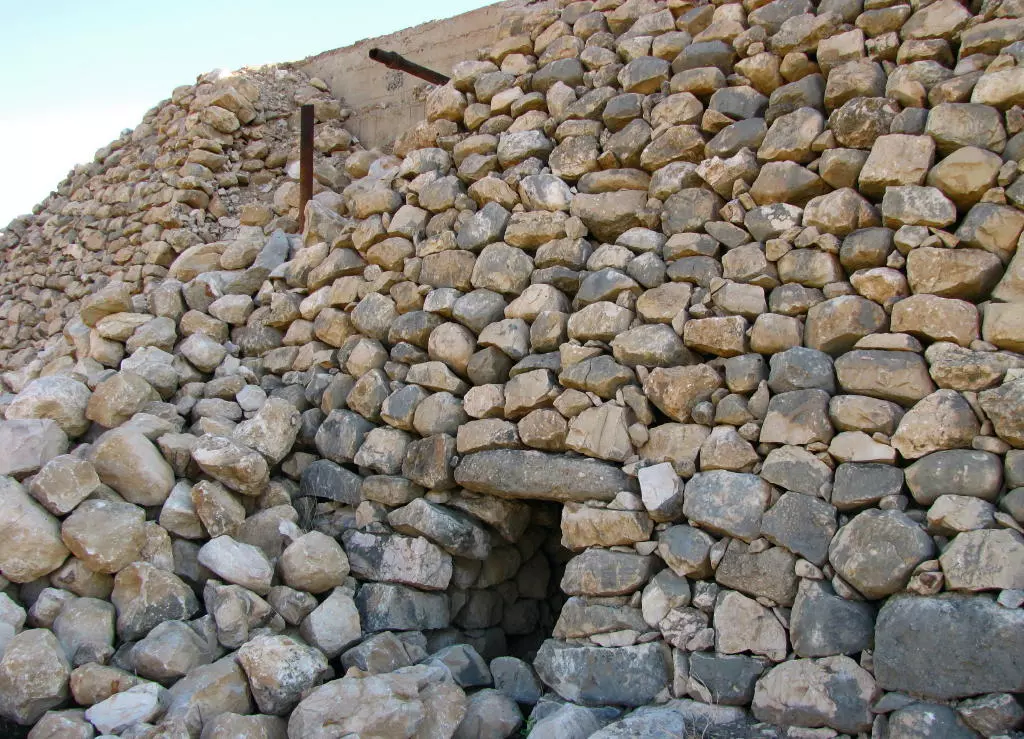
Posted by Rajae mahmoud 1 - الجفتلك - تحصينات منتشرة بكثرة في الجبال هناك
Posted by Rajae mahmoud - الجفتلك - موقع في الجبال المحيطة
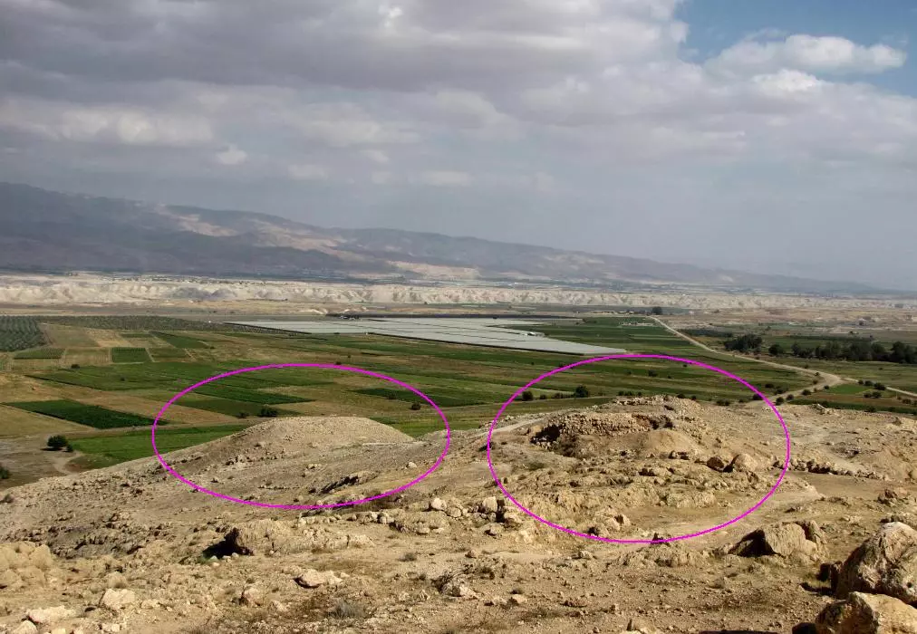
Posted by Rajae mahmoud - الجفتلك - تلة قريبة في منطقة الجفتلك
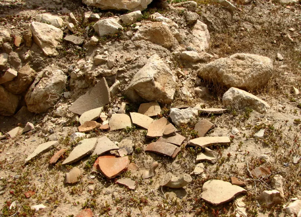
Posted by Rajae mahmoud - الجفتلك - فخاريات
Posted by Rajae mahmoud - الجفتلك - تحصينات تنتشر في الجبال
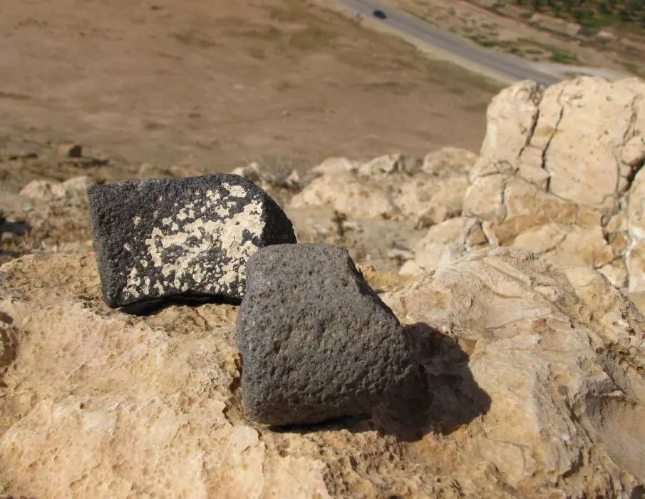
Posted by Rajae mahmoud - الجفتلك - نوع من الحجارة ينتشر في أراضيها
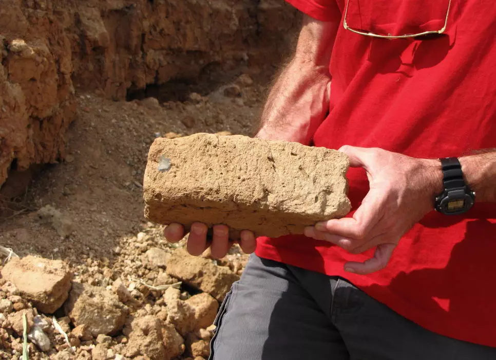
Posted by Rajae mahmoud - الجفتلك - طوب اللبن وهو مشكل من طين وقش يستخدم في البناء بسبب منع الاحتلال للاهالي من استخدام الاسمنت والطوب العادي
Posted by Rajae mahmoud - الجفتلك - تحصينات تنشر بكثرة هناك
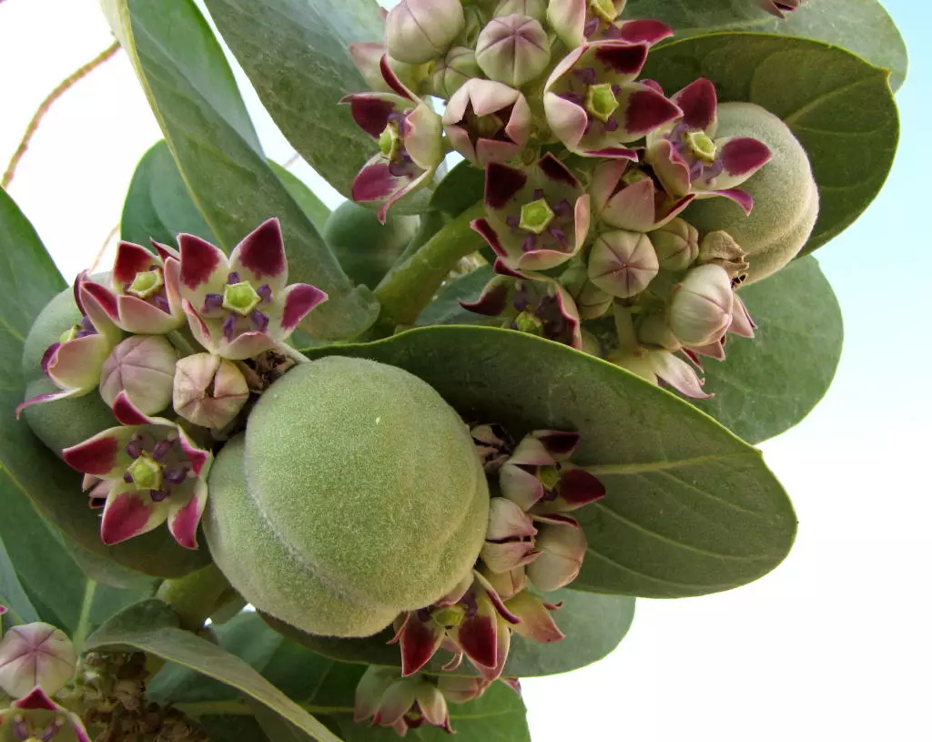
Posted by Rajae mahmoud - نبات العشار ( شجرة الجن ) المنتشرة في الأغوار
Posted by Rajae mahmoud - نباتات الغور البرية
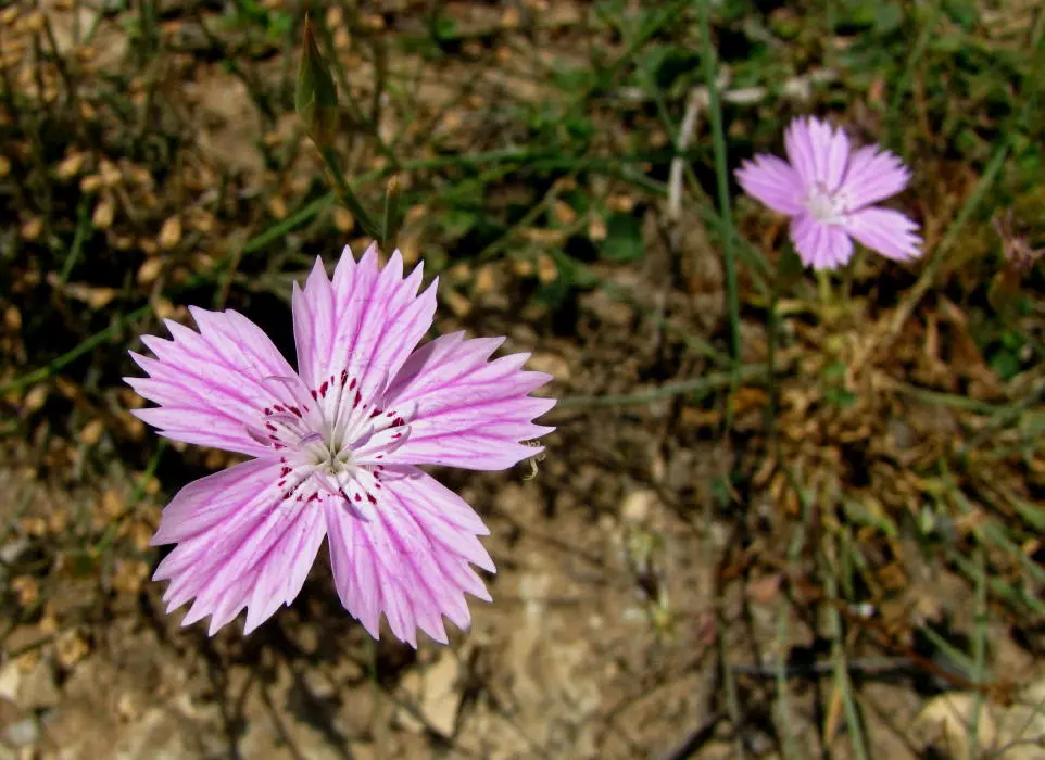
Posted by Rajae mahmoud - نباتات الغور البرية

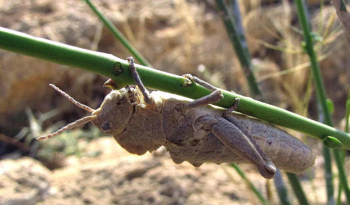
Posted by Rajae mahmoud - حياة الأغوار البرية
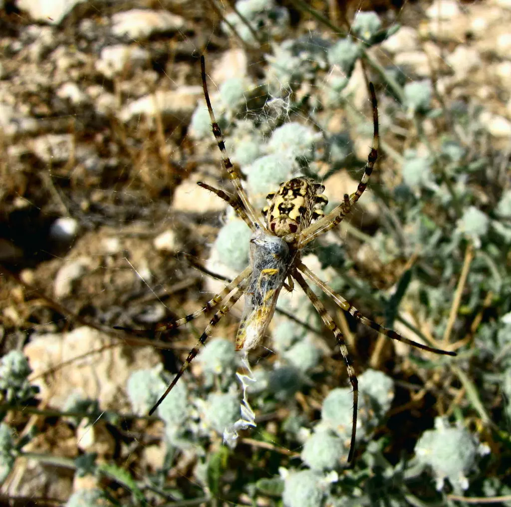
Posted by Rajae mahmoud - حياة الأغوار البرية
Posted by Rajae mahmoud - الجفتلك - منظر من علو والدخول للمنطقة اللي يطلق عليها الاهالي الخربة

Posted by Rajae mahmoud - الجفتلك - الطريق في شمال القرية
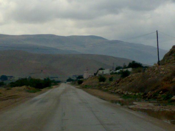
Posted by Rajae mahmoud - الجفتلك منظر عام
Posted by Rajae mahmoud - قمة جبل سرطبة من الغور
Posted by Rajae mahmoud - الصعود إلى جبل سرطبة

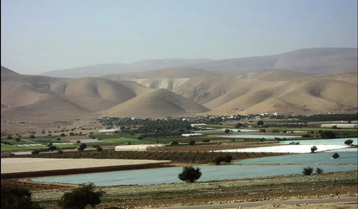
Posted by Rajae mahmoud - الغور بلون مزارعه وجباله
Posted by Rajae mahmoud - اثار جبل سرطبة
Posted by Rajae mahmoud - اثار سرطبة
Posted by Rajae mahmoud - بوابة بئر في جبل سرطبة
Posted by Rajae mahmoud - الجفتلك - منزل مهجور في القرية

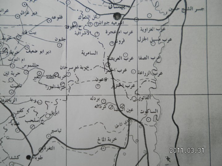
Posted by Rajae mahmoud - جزء من خارطة الأغوار قبل النكبة
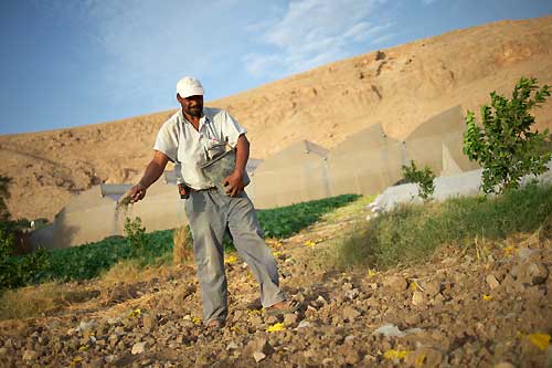
Posted by Rajae mahmoud 1 - عبد الحميد عبد الرازق مساعيد مزارع فلسطيني يعمل في قطعة أرضه في منطقة الجفتلك
Posted by Rajae mahmoud - البيت الكنعاني - ملتقى الأصدقاء الجفتلك - بيت طين ملتقى المتضامنين الأجانب

Posted by Rajae mahmoud - البيت الكنعاني - ملتقى الاصدقاء الجفتلك

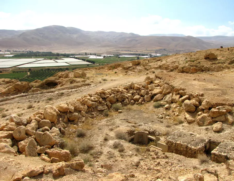
Posted by Rajae mahmoud - الجفتلك - مباني أثرية في المعسكر العثماني - قرب مدرسة الوكالة

Posted by Rajae mahmoud - قنوات مائية جافة في الجفتلك
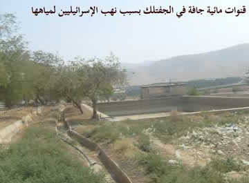
Posted by Rajae mahmoud - خزان مائي جفف بسبب النهب الإسرائيلي للمياه في الجفتلك

Posted by Rajae mahmoud - الجفتلك : غور الجفتلك 2012 تصوير المصورة م . البزرة

Posted by Rajae mahmoud - الجفتلك - بيوت طينية
Posted by Rajae mahmoud - الجفتلك - المثلث : صورة من منطقة المخروق جسر آدم
Posted by Rajae mahmoud 1 - الجفتلك : المبنى العثماني

Posted by Rajae mahmoud - الجفتلك : مبنى قديم مهدم قرب المبنى العثماني

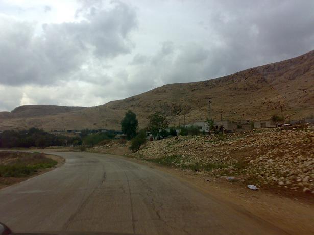
Posted by Rajae mahmoud 1 - الجفتلك : الطريق العام
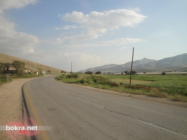
Posted by Rajae mahmoud - الجفتلك : الطريق العام 2

Posted by Rajae mahmoud - الجفتلك : على الطريق

Posted by Rajae mahmoud - الجفتلك : على الطريق 2

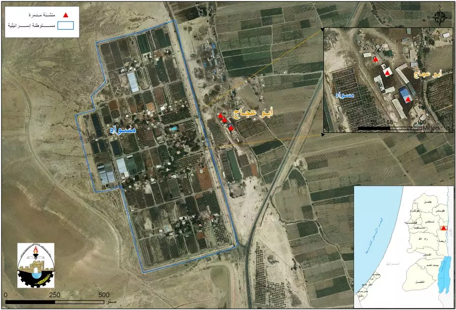
Posted by Rajae mahmoud - الجفتلك : خارطة لمنطقة ابو عجاج
Posted by Rajae mahmoud - الجفتلك : منظر عام من قرية الجفتلك
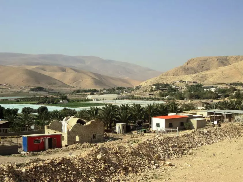
Posted by Rajae mahmoud - الجفتلك : منظر عام للجفتلك
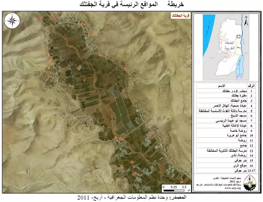
Posted by Rajae mahmoud - الجفتلك : خريطة المواقع الرئيسية الجفتلك
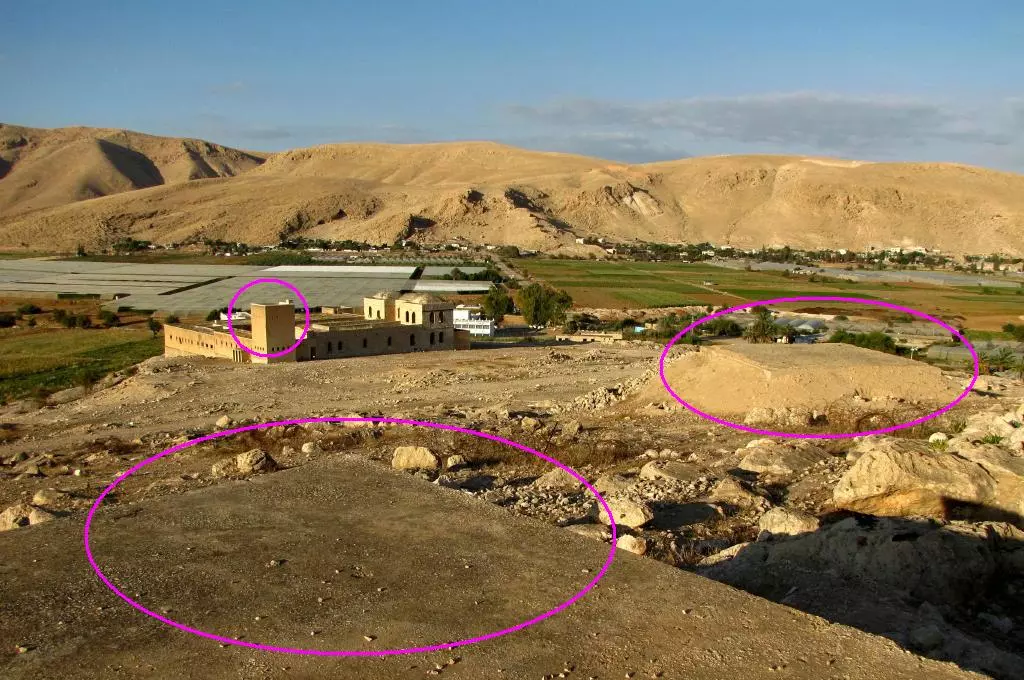
Posted by Rajae mahmoud - الجفتلك : صورة جوية

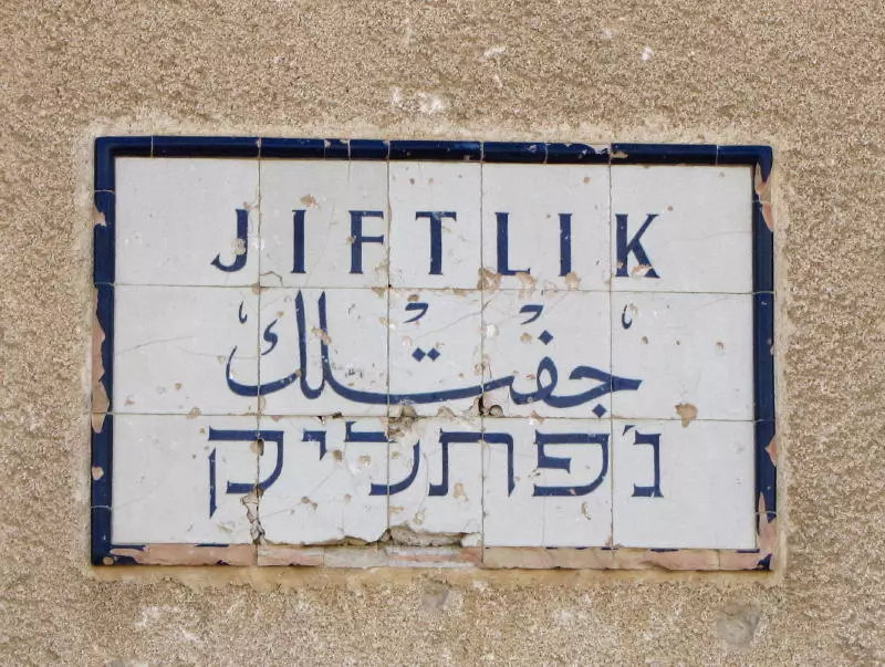
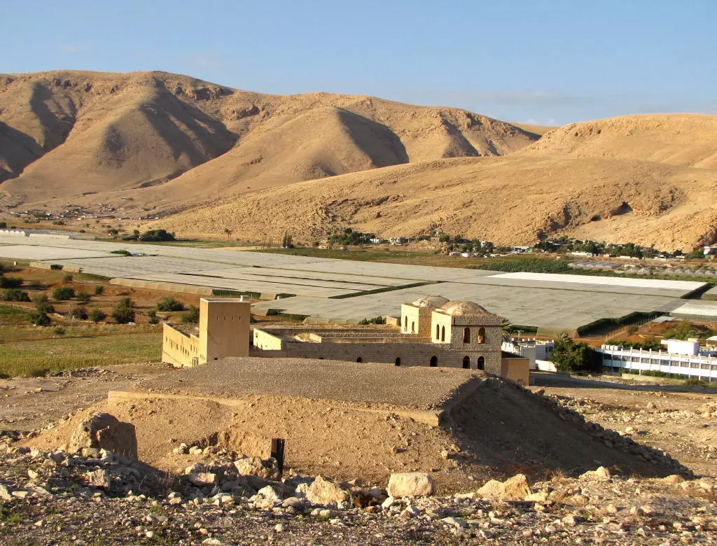
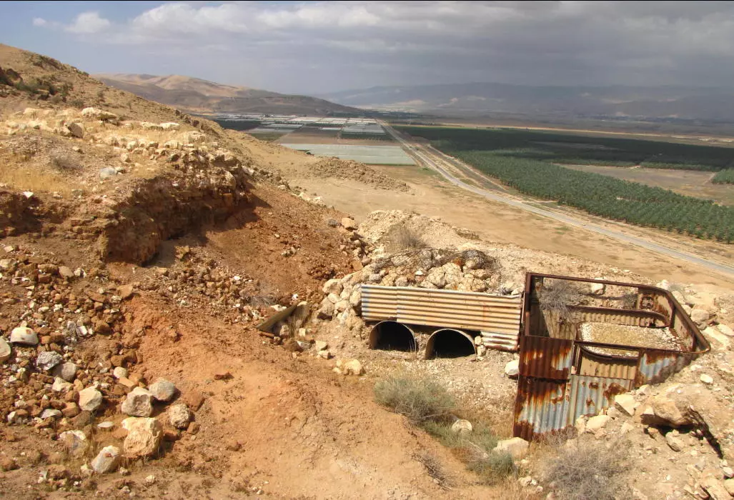
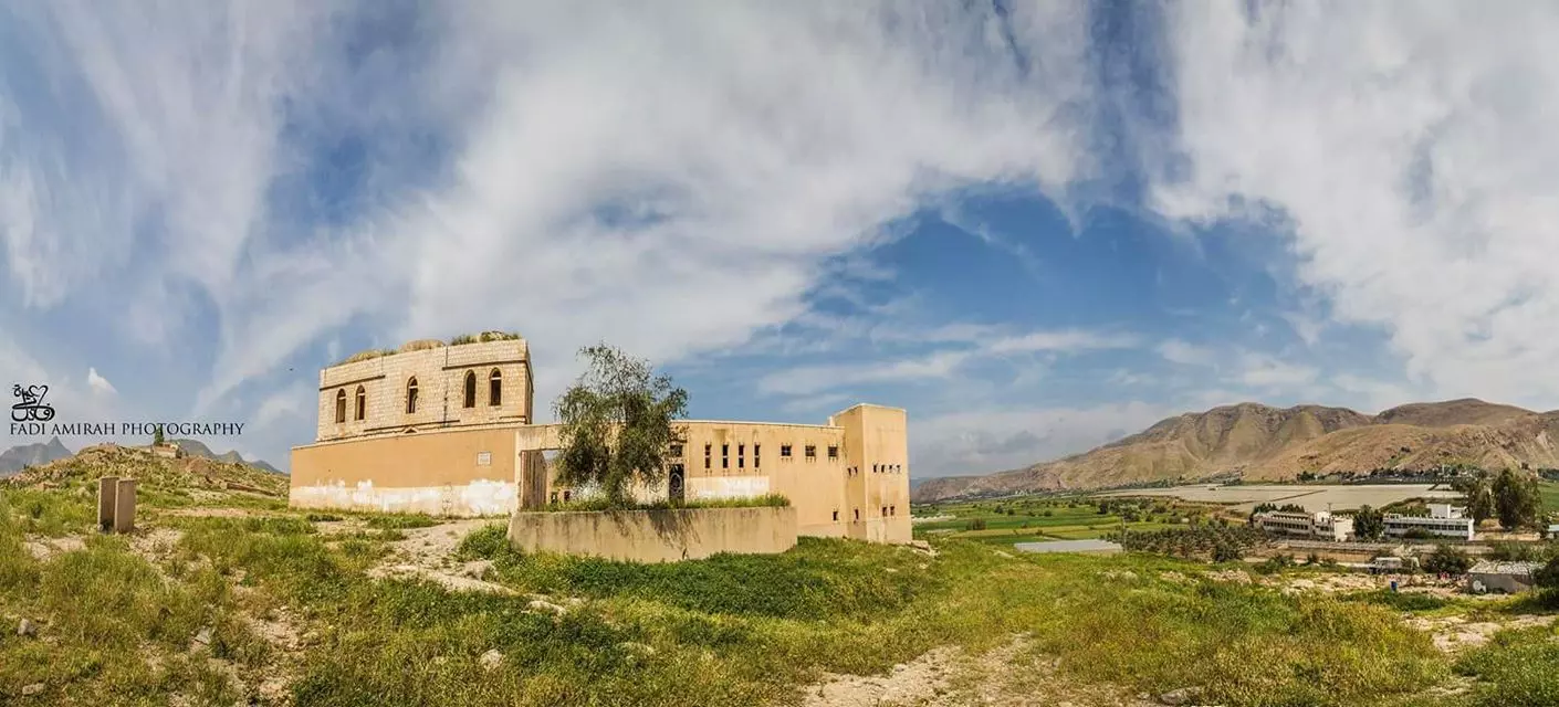
Posted by Rajae mahmoud - الجفتلك أسم تركي (بمعنى المزرعة) بدأ من هذا المبنى الذي شيده العثمانيون حتى يكون محكمة و استخدمه بعد ذلك الانجليز كسجن و الأردنيين كذلك و من بعدهم اسرائيل معسكر للجيش حتى هجر و لم يسمح بترميمه حتى يومنا هذا ،، تصوير فادي عميرة
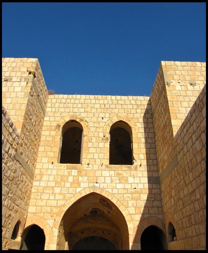
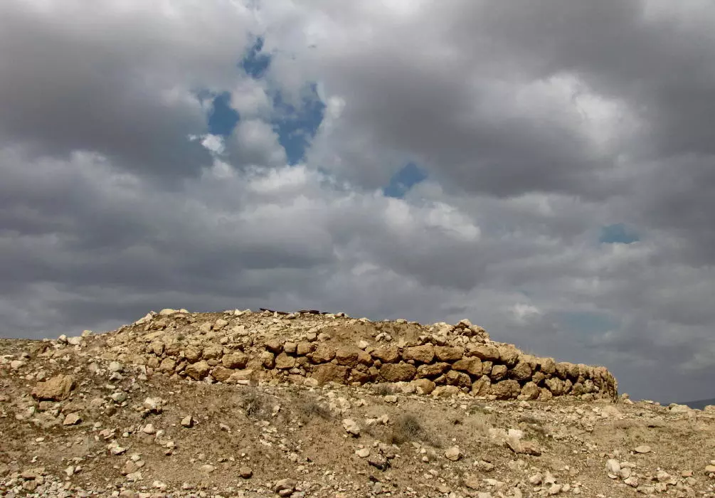
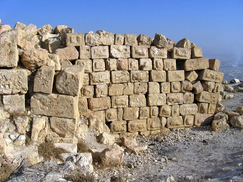
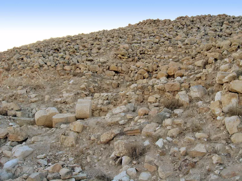
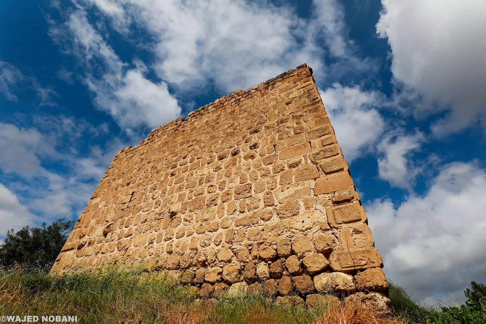
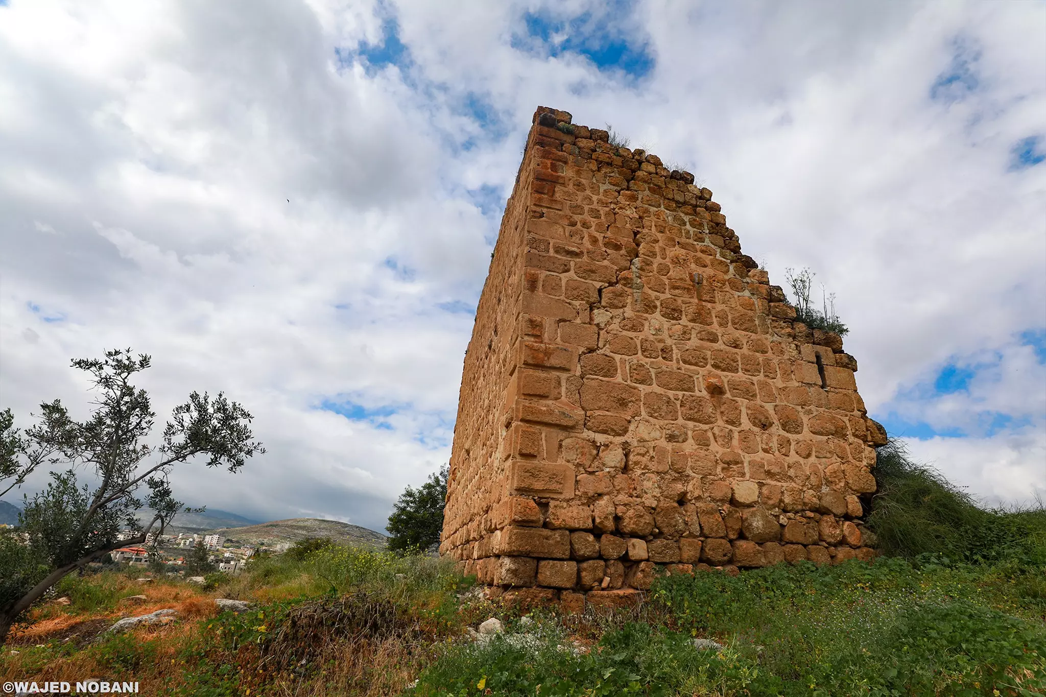
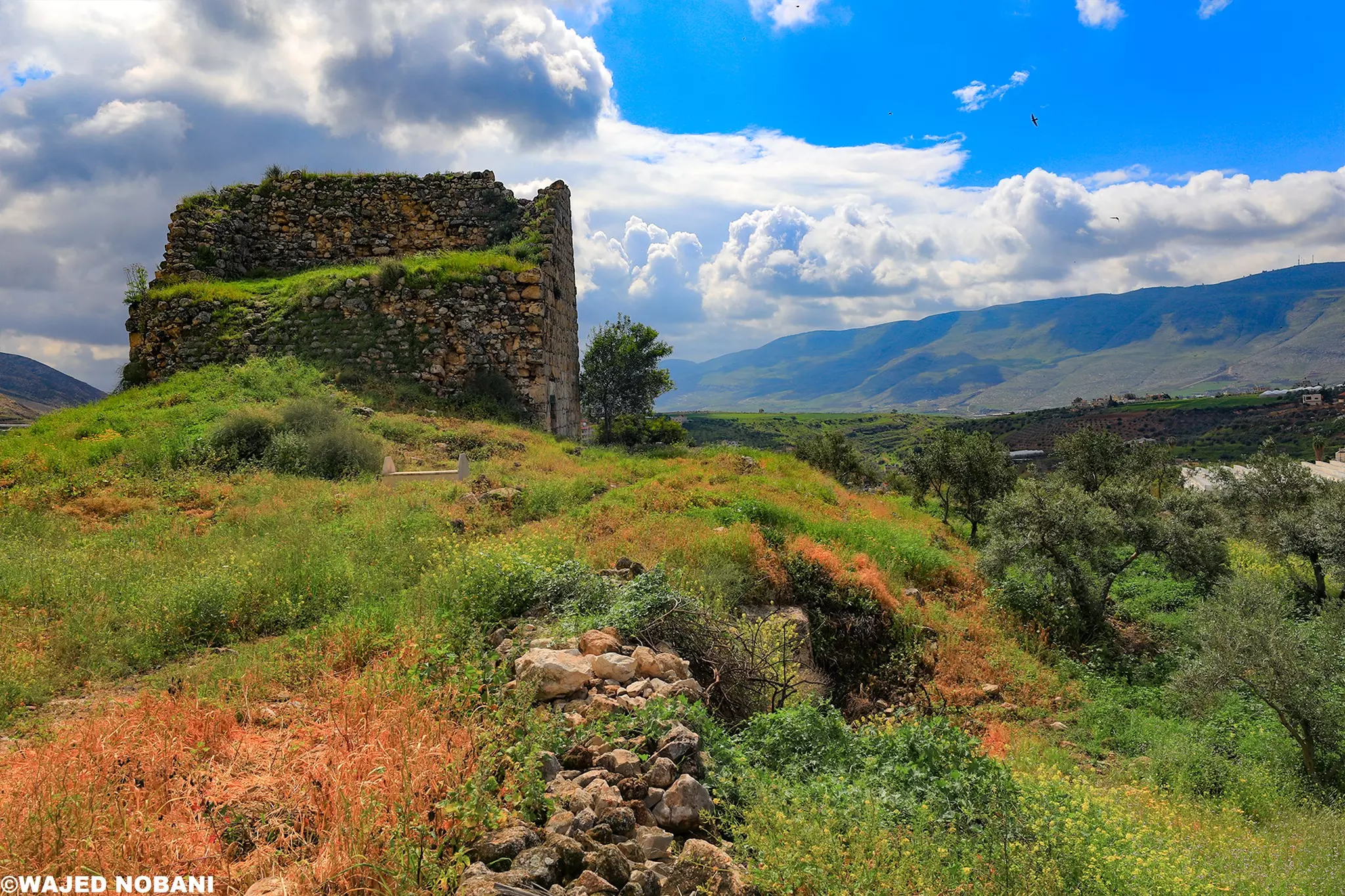
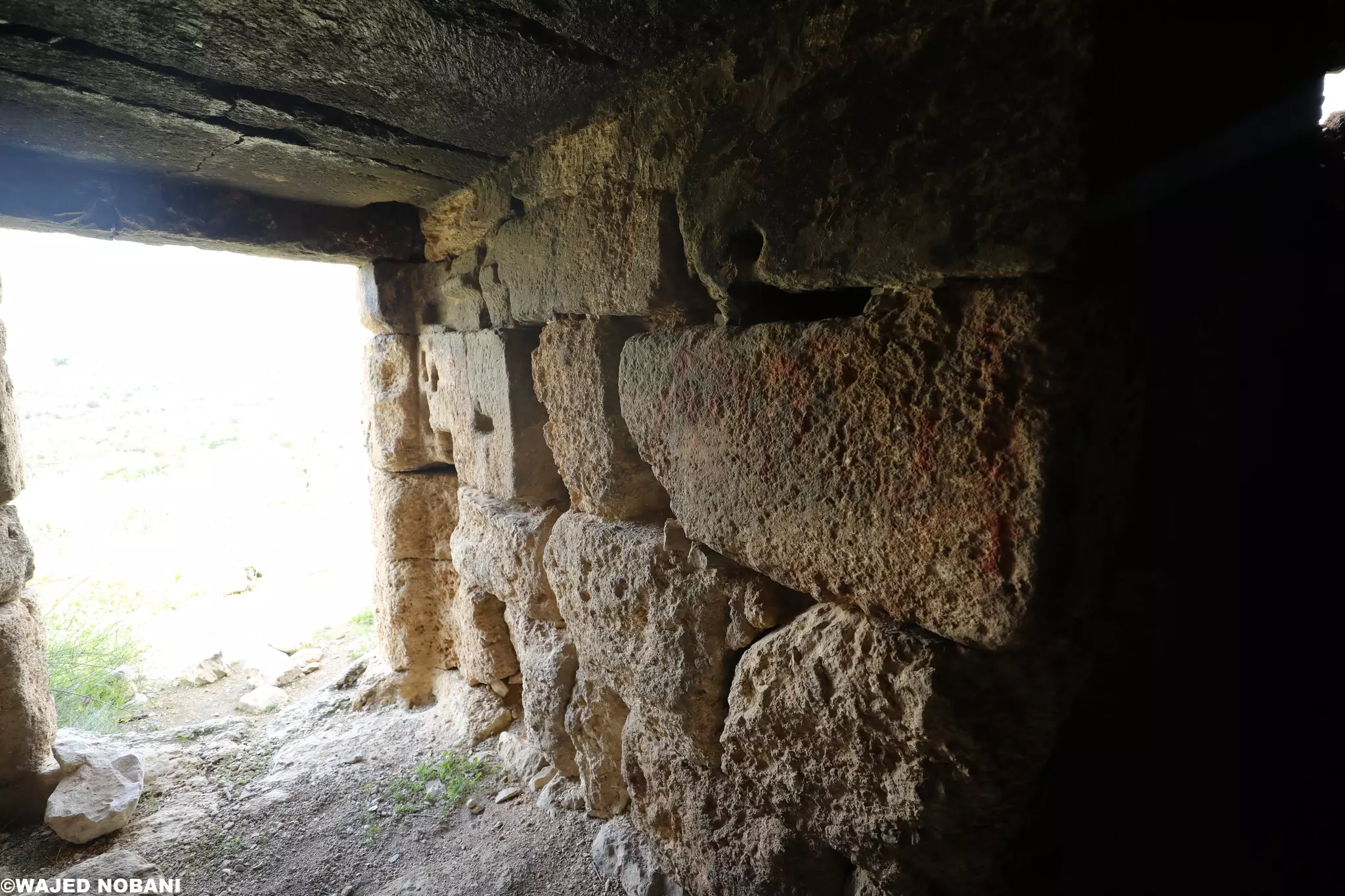
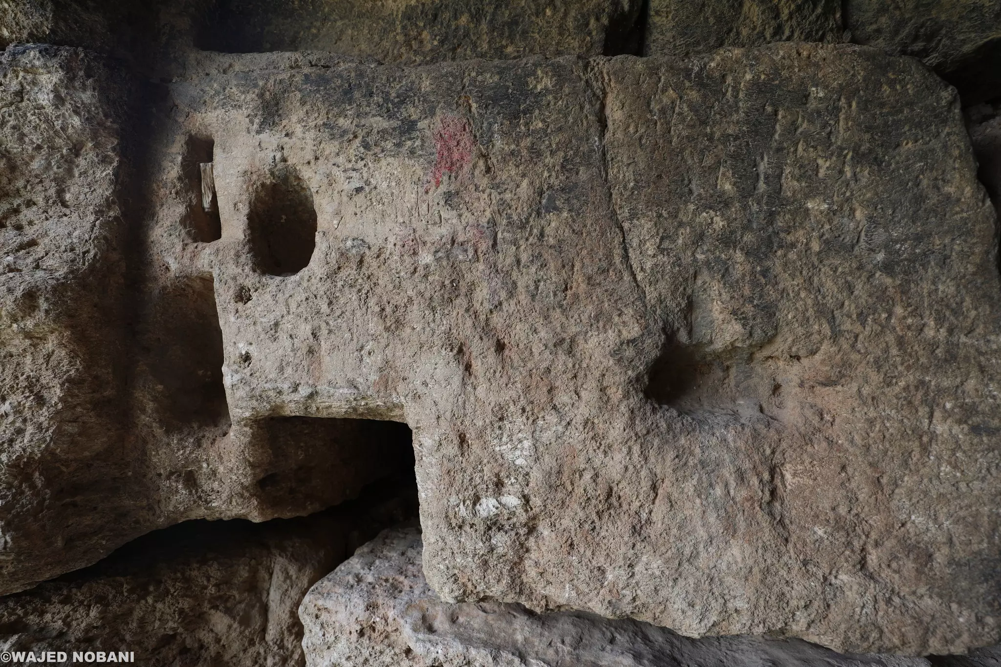
Posted by T-City - برج صليبي بحالة ممتازة، يقوم على تلة تحوي بقايا من الفترة البيزنطي -- واجد النوباني
- برج صليبي بحالة ممتازة، يقوم على تلة تحوي بقايا من الفترة البيزنطي -- واجد النوباني #2
- برج صليبي بحالة ممتازة، يقوم على تلة تحوي بقايا من الفترة البيزنطي -- واجد النوباني #3
- برج صليبي بحالة ممتازة، يقوم على تلة تحوي بقايا من الفترة البيزنطي -- واجد النوباني #4

- برج صليبي بحالة ممتازة، يقوم على تلة تحوي بقايا من الفترة البيزنطي -- واجد النوباني #5
- برج صليبي بحالة ممتازة، يقوم على تلة تحوي بقايا من الفترة البيزنطي -- واجد النوباني #6
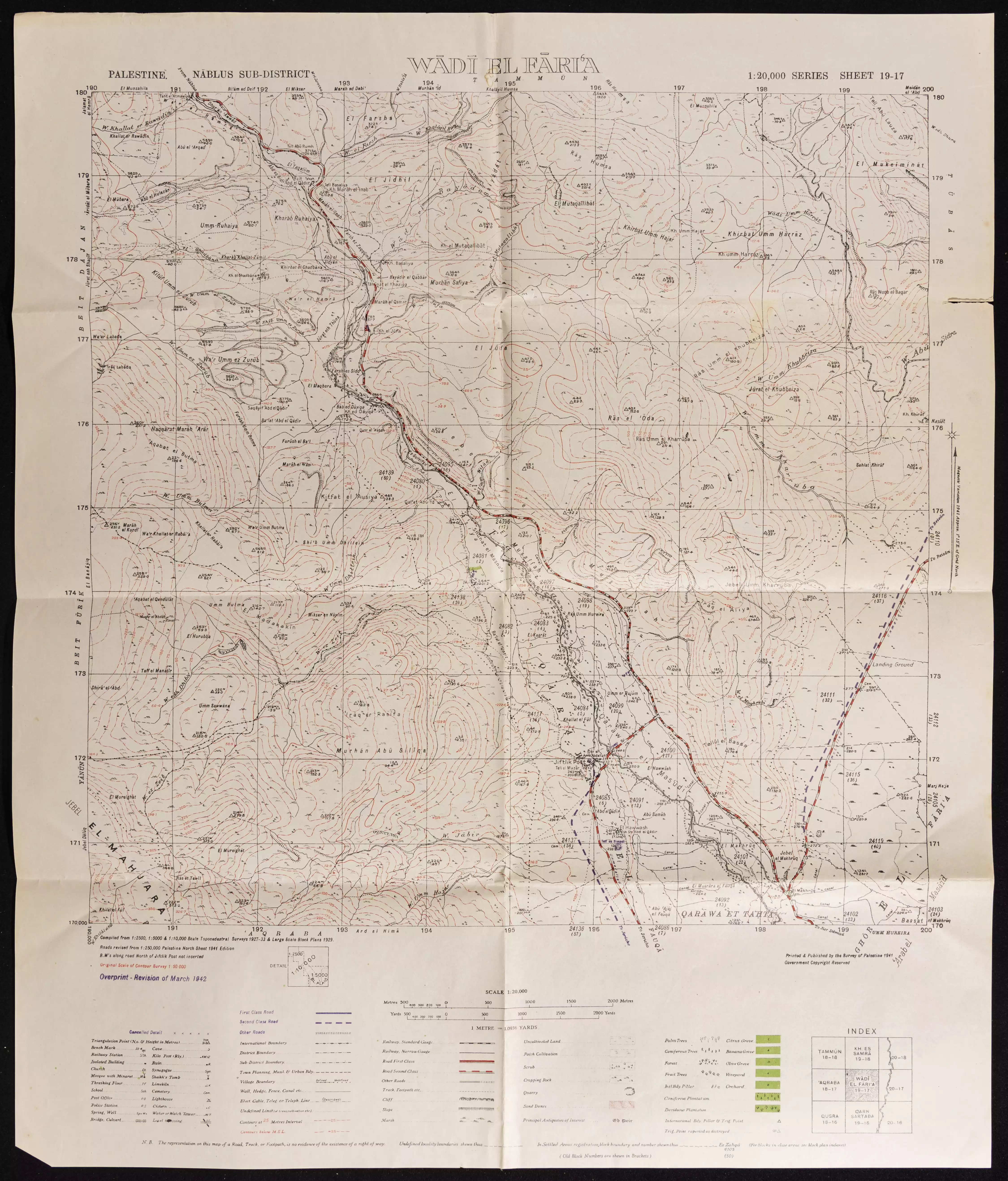
- خارطة تُظهِر الحدود والطرق بأنواعها والأماكن المقدسة والطبيعة الطوبغرافية من تلال وسهول ومنحدرات والتشكيلة الطبيعية للأرض وأنواع المزروعات. نُشرت الخريطة فترة الانتداب البريطاني، تم إضافة تعديلات عليها من قِبَل خدمة الخرائط والصور التابعة للقوات العسكرية الاسرائيلية فترة الأربعينيات.
Want to browse more? 80,000 pictures were grouped in these gallaries:
| Display Name | Clan/Hamolah | Country of Residence |
No links have been shared yet, be free to the first to share the first link.
 Fake Valor: Why Did Zionist Jews Hoist Nazis Flag on Their Ships in the 1930s?
What is new?
-
Facts About Oct. 7th Gaza Raid
-
Remined Us Please: Who Did Rape Whom? Was it Palestinians who raped Israelis? Or, was the other way around? You'll be the judge
-
When Prof. Edward Said was invited to debate Bibi Netanyahu in the 1980s, watch what happened!
-
Ezra Klein of the NY Times on the "Jewish Race".
-
Abusing Blood Libel!
-
How and why Israeli Jewry has become the most hated cult?
-
Did Israeli Soldiers Activate The Hannibal Direective On Oct. 7th? You Be The Judge
-
Zionist FAQ: Isn't it true that Palestinians don't want peace? Palestinians never accepted the two-state solution
- Facts about Haavara (Transfer) Agreement between Ben-Gurion & Hitler
-
Haavara FAQs: Why Did Zionist Jews Hoist Nazis' Flags on Their Ships in the 1930s?
- Haavara FAQs: When Chaim Weizmann met FDR in mid-1943, why was he silent about rescuing European Jewry?
-
Dear ChatGPT: How did Palestinians resist Napoleon's invasion of their country in 1799?
-
Dear ChatGPT: Gaza had a vibrant Jewish community in the mid-17th century. What happened to them?
-
Dear ChatGPT: Why did the Jewish Agency suppress news of the Holocaust during WWII?
-
Video Playlist: Jews share their DNA tests to end the conflict for good.
-
A Tale of Two Conflicts: Examining the Definition of Genocide
-
Prof. Abraham Polak And The Suppressed History of the Khazars and European Jewry
-
How Ronald Reagan would have framed the genocide in Gaza if he were still alive?
-
Haavara FAQs: Let us do the math: how many German Jews did The Haavara Agreement save?
-
Zionist FAQs: The Hebron Massacre of 1929, "clearly proves" that Palestinians are antisemitic, how could you deny it?
-
Zionist FAQs: Why Anti-Zionist Is Not Antisemitism?
-
Zionist FAQs: Isn't it true that the KGB created Palestinian Nationalism in the early 1960s?
- Zionist FAQs: Muslims are killing Muslims all the time; why are Israeli Jews being singled out in the media?
- Zionist FAQs: How is Israel an apartheid state when 20% of its citizens are Arabs who enjoy full rights?
-
Haavara FAQs: Why Did Dorothy Thompson Flip From A Zionist Advocate to A Silenced Dissenter?
-
Haavara FAQs: Analysis of Herzl's Uganda Scheme and how it could have saved millions of Jews.
-
Haavara FAQs: Why did Hayim Greenberg describe American Jewry as "morally bankrupt" in early 1943?
-
Haavara FAQs: What if the Evian Conference was a resounding success? What would have been the impact of saving European Jewry on Zionism?
- Haavara FAQs: What if the six million were saved, how that would have impacted the Zionist project?
-
Haavara FAQs: How did Zionist leaders react when Europe's Jews lingered in the DP camps after WWII ended?
-
Why does the American Jewish community repeat lies that David Ben-Gurion had debunked before he died?
-
Who has the power to rename the Tatar/Khazar Gene Marker to Jewish IV?
-
Zionist FAQs: Why won't Egypt, Syria, and Jordan take their people back? Jews are indigenous to Palestine, and Arabs immigrated after Jews developed the country. Arabs should leave.
-
Haavara FAQs: Did Hitler and the Nazis conflate between Judaism and Zionist? If that wasn't case, then why?
-
Haavara FAQs: Winston Churchill and antisemitism, a collection of articles written Churchill.
-
Haavara FAQs: Broken by country, how many Jews survived vs. killed during the Holocaust?
-
Haavara FAQs: Why did European Jews vote with their feet and to immigrated to the Americas, not Palestine, after WWII?
-
Watch this American Jewish Girl describing Israeli Jews' cognitive dissonance like no other in under two minutes
-
Haavara FAQs: When the Nazis went out of their way to hide the Holocaust, Israeli Jews did the exact opposite by broadcasting their genocide of Gazans. But why?
-
Haavara FAQs: How Zionist Jews went out of their to show their appreciation to Nazism and Fascism?
- Haavara FAQs: Why Zionist leaders were against bombing the death camps & the Railroads leading to them?
-
Haavara FAQs: Hitler's message to the British and American people: If Jews are such noble citizens and you care about them, how come you're not letting them in? I will gladly ship them to you at my expense, even on luxury liners!
-
A shortlist of Zionist and Israeli false flag operations in the name Jews.
-
The Most Moral Army
- The Land of Kapos (Israel): Where the brave are boycotted and Kapos walk free.
- Why did early Zionists often named their communal enterprises "colonial"?
- Zionist Relations with Nazi Germany by Faris Glubb
-
Two NY Times advertisements by Zionists in the early 1943 that exposes Zionists' treason at the height of the calamity
- Facts Not Lies about the Palestinian-Israeli Conflict.
- Site's pictures have been categorized
- Campgain Against Lice
- A Survey of Palestine, the official source about Palestine before Nakba produced by the British Mandate; over 1200 pages.
- Satellite View & Google Earth: Over 6,000 placemarks identifying all destroyed towns, W. Bank & Gaza Strip Towns, & refugee camps.
- PalestineRemembered.com and its Nakba Oral History Project were featured on al-Jazeera Satellite TV.
- Nakba Oral History Video Podcast:
 Over 700 Oral History interviews (including 3,500+ hours of recording) can be viewed online.
 - Palestine Village Statistics Project
- Gaza Jail Break
- النسخة العربية للموقع الان متوفرة
- Videos: Documenting the destroyed villages in video: Tracing all that remains since Nakba.
- Videos: Responding to Zionist Propaganda
- Interview: The ethnic cleansing of Palestine: George Galloway interviews Israeli Historian Ilan Pappe.
- For Palestinians, memory matters. It provides a blueprint for their future By George Bisharat.
- Zionist FAQ now available in Hebrew שאלות שציונים שואלים, עכשיו בעברית
- Video: The Stephen Walt and John Mearsheimer report on the influence of the Israel Lobby on U.S. Foreign Policy
- The Palestinian-Israeli conflict for beginners
