| PalestineRemembered | About Us | Oral History | العربية | |
| Pictures | Zionist FAQs | Haavara | Maps | |
| Search |
| Camps |
| Districts |
| Acre |
| Baysan |
| Beersheba |
| Bethlehem |
| Gaza |
| Haifa |
| Hebron |
| Jaffa |
| Jericho |
| Jerusalem |
| Jinin |
| Nablus |
| Nazareth |
| Ramallah |
| al-Ramla |
| Safad |
| Tiberias |
| Tulkarm |
| Donate |
| Contact |
| Profile |
| Videos |
Welcome To Yajur - ياجور (יאג'ור)
|
District of Haifa
Ethnically cleansed days ago |
العربية Google Earth |
 |
Gallery (31) |
- Statistics & Facts
-
Before & After

- Satellite View
- Articles 5
- Pictures 31
- Aerial Views 1
- Land Deeds 1
- Oral History 3
- Members 18
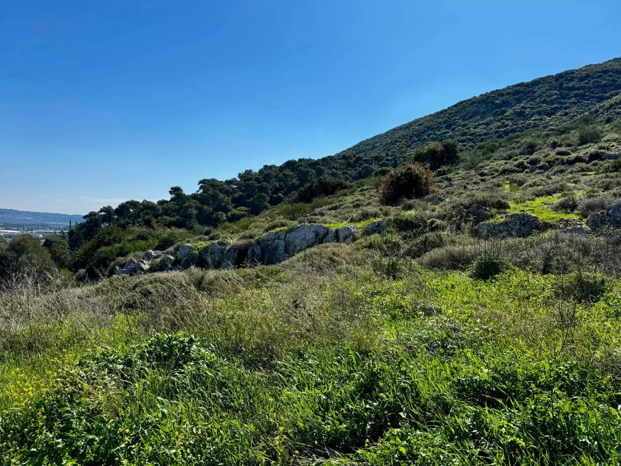
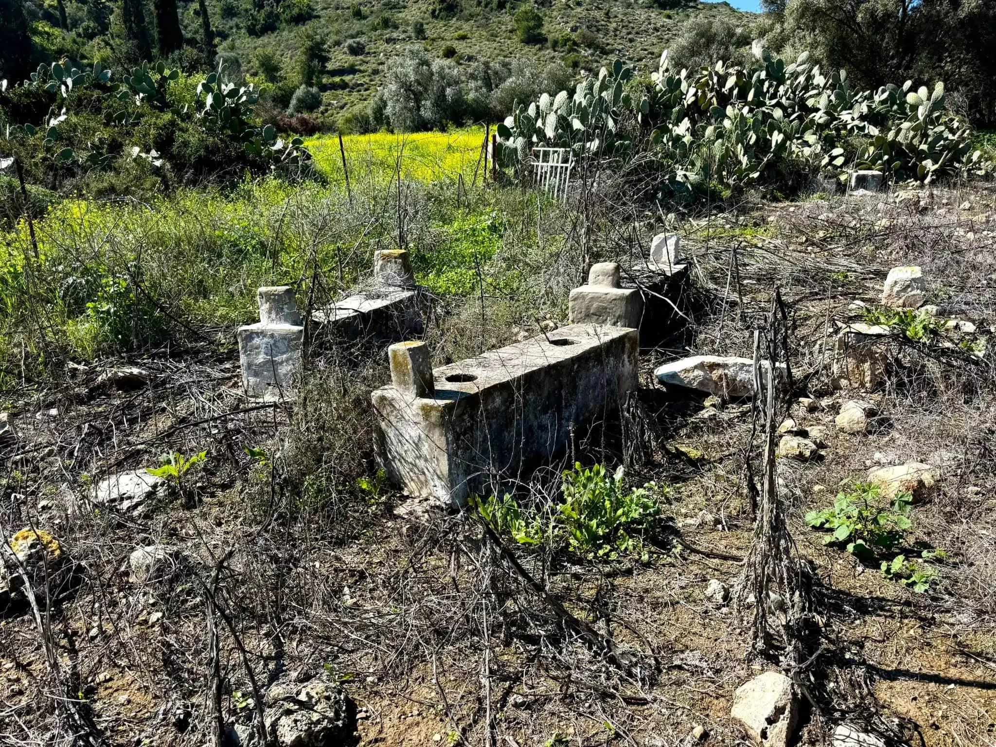
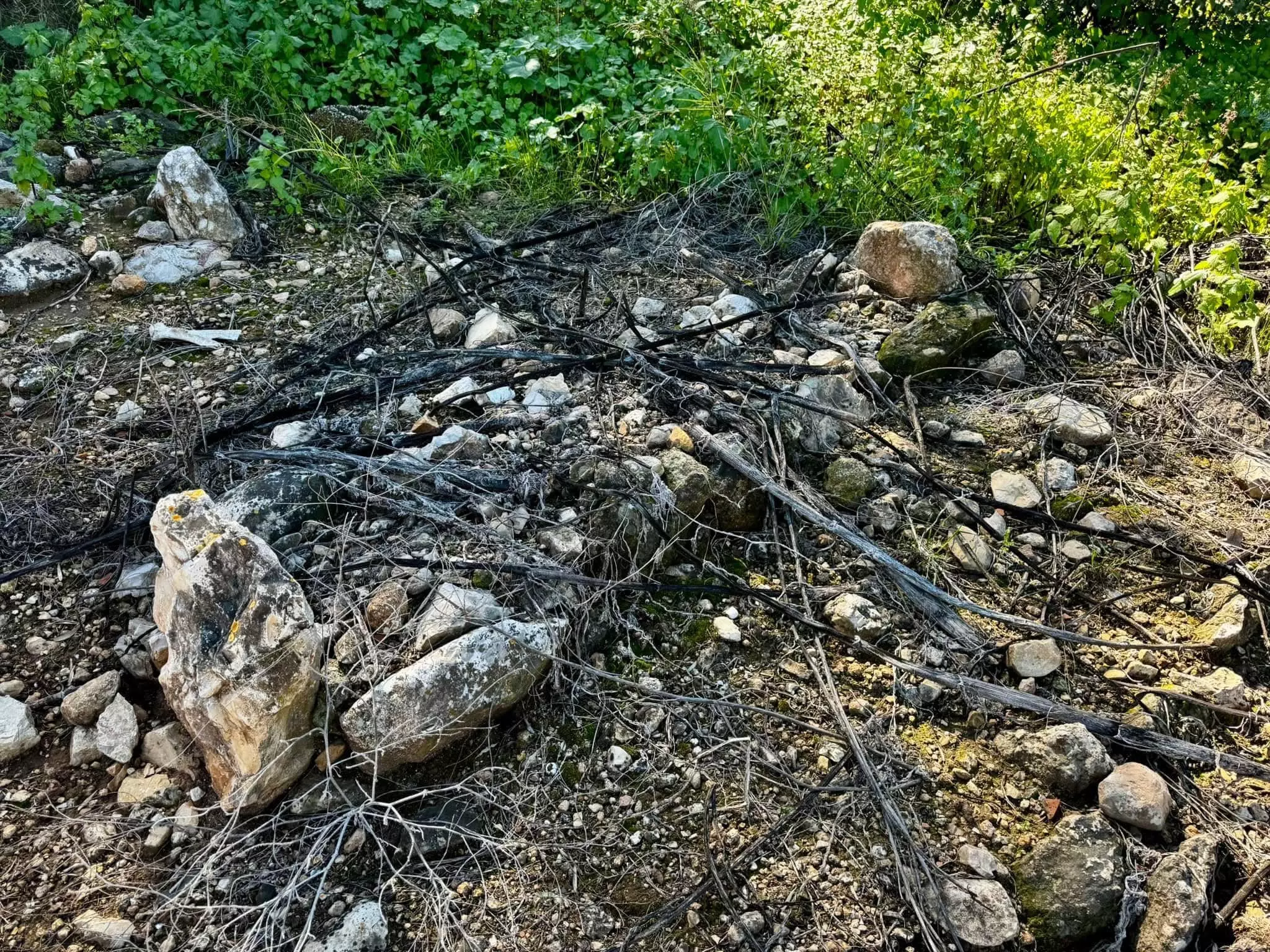
- All That Remains
- Wikipedia
- Videos 3
- Guest Book 12
- Links 1
| Statistic & Fact | Value | |||||||||||||||||||||
| Occupation Date | April 25, 1948 | |||||||||||||||||||||
| Distance From District | 9.5 (km) South East of Haifa | |||||||||||||||||||||
| Elevation | 25 (meters) | |||||||||||||||||||||
| Before & After Nakba, Click Map For Details |
||||||||||||||||||||||
|
||||||||||||||||||||||
| Pre-Nakba Aerial View |
||||||||||||||||||||||
|
||||||||||||||||||||||
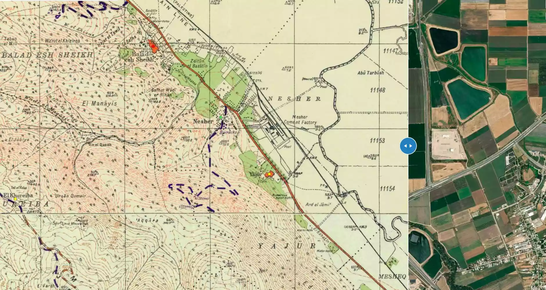
| Map Location | See location #7 on the map View from satellite |
|||||||||||||||||||||
| Military Operation | Possibly Operation Bi'ur Chametz | |||||||||||||||||||||
| Exodus Cause | Military assault by Zionist troops | |||||||||||||||||||||
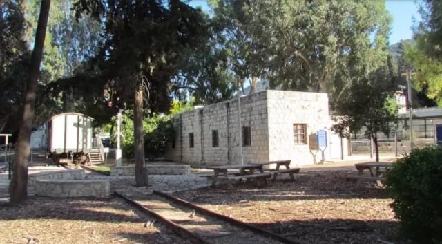
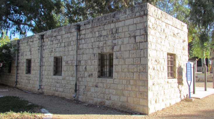
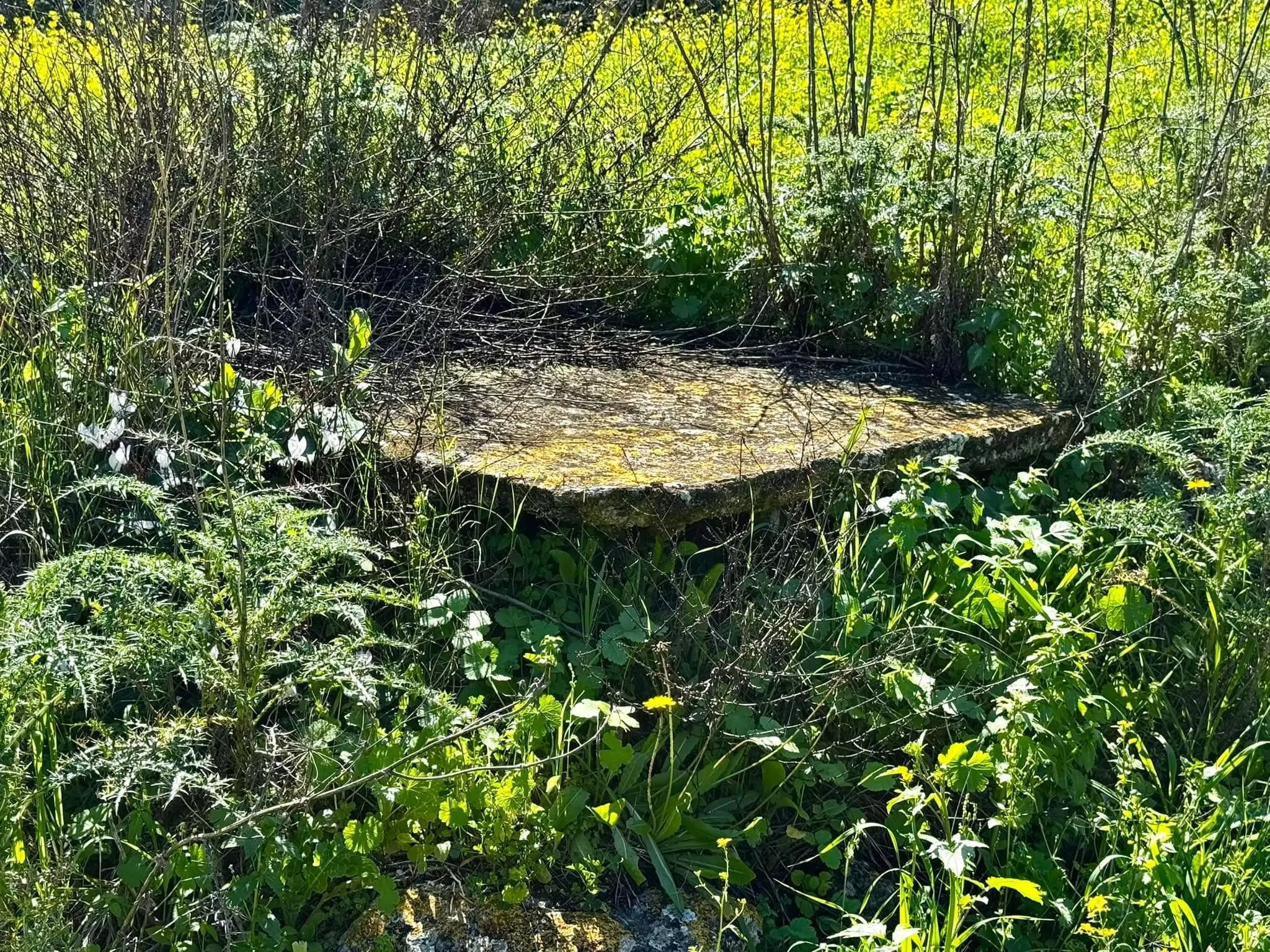
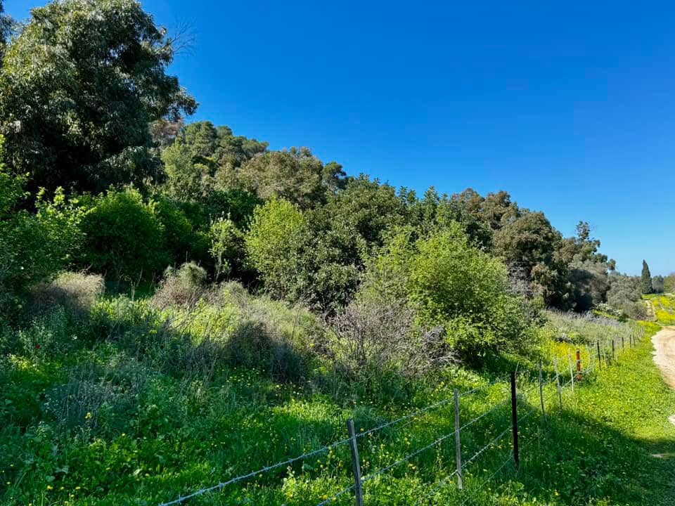
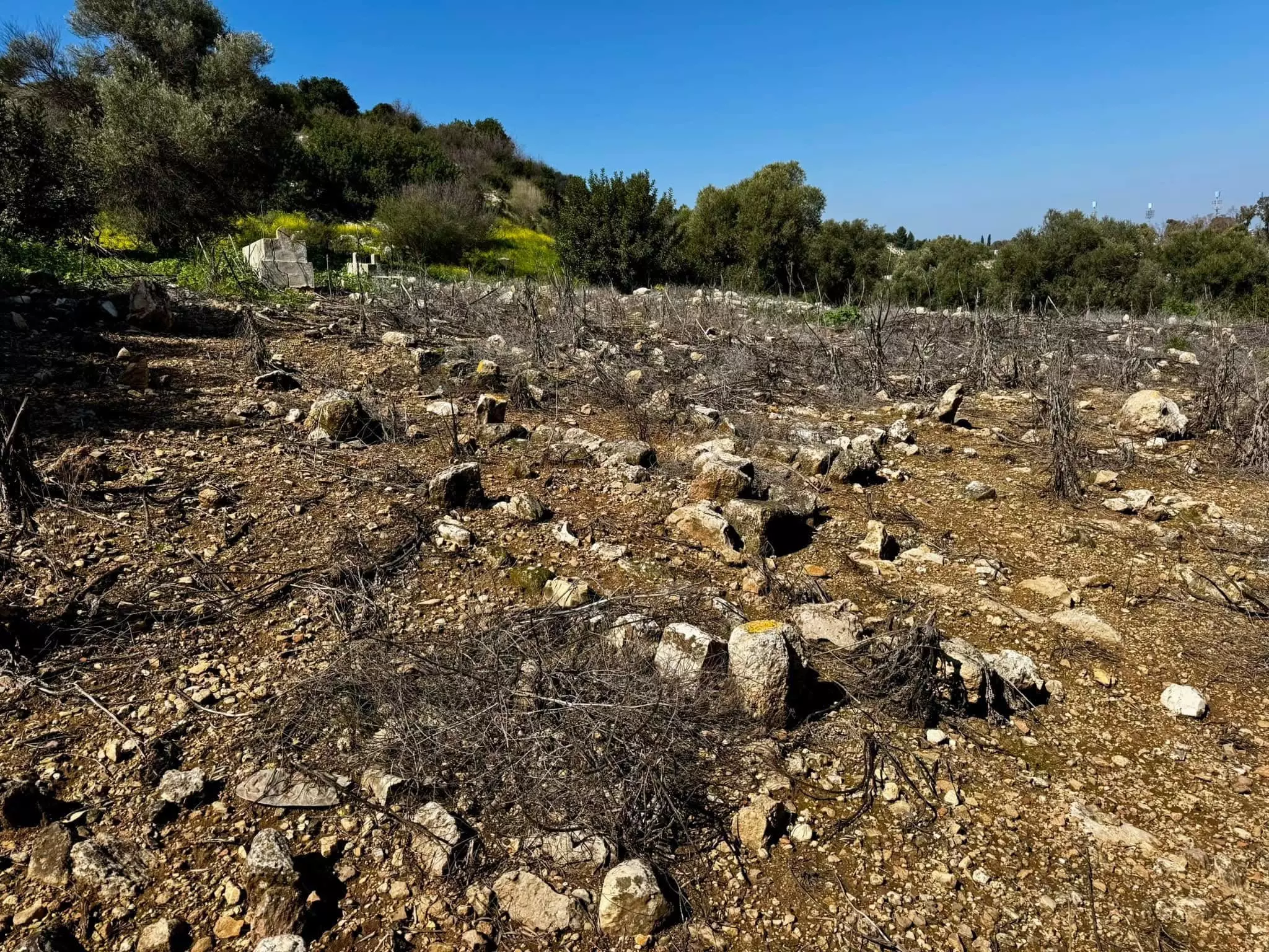
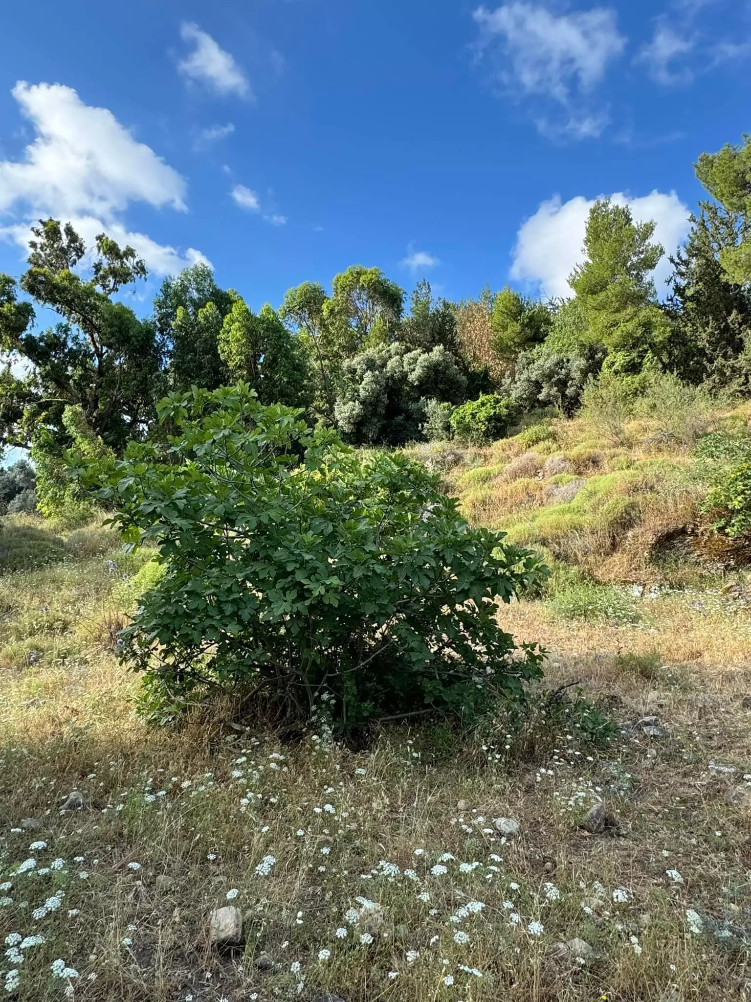
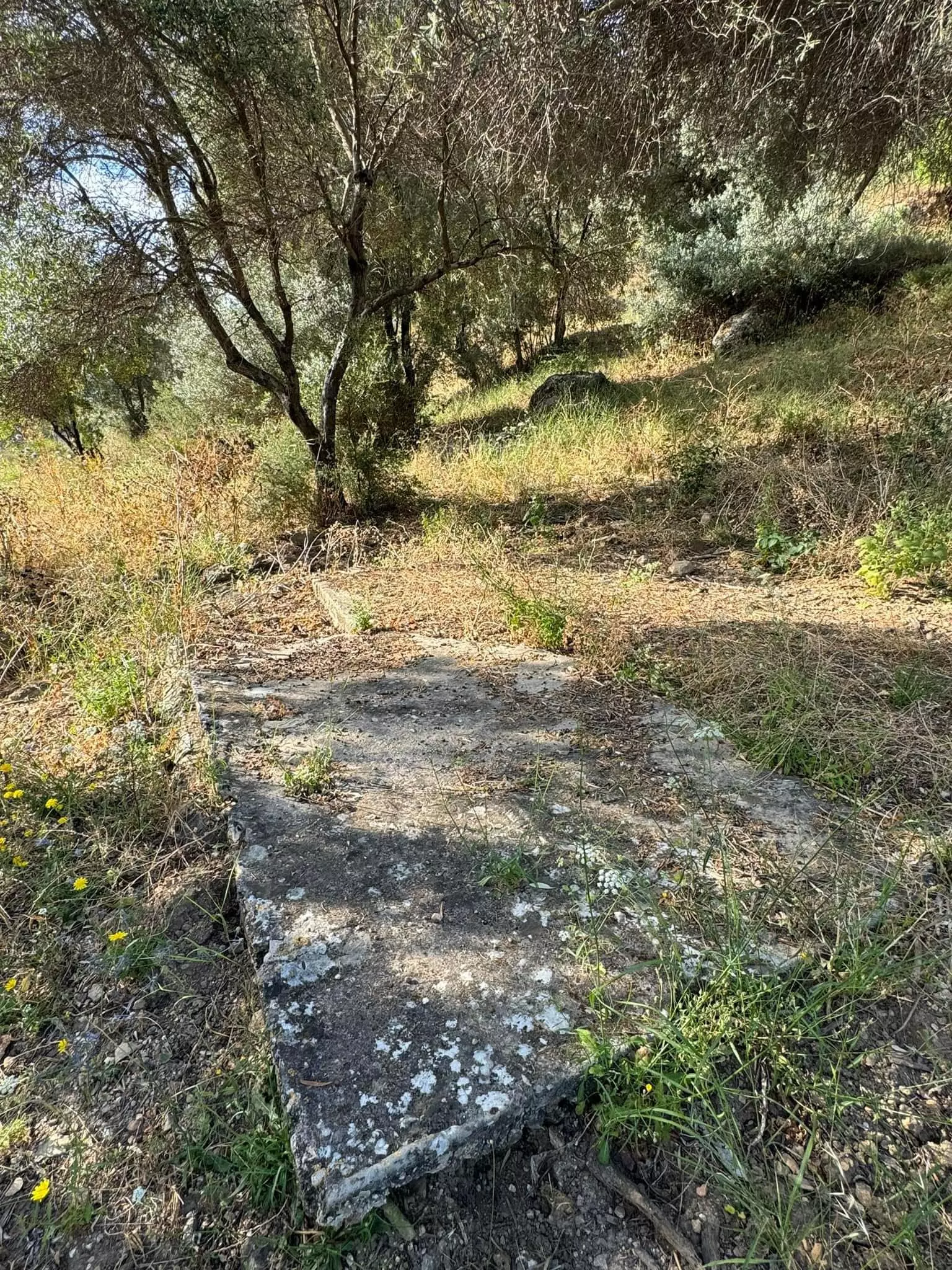
| Village Temains | The village has been completely obliterated | |||||||||||||||||||||
| Ethnically Cleansing | Yajur inhabitants were completely ethnically cleansed. | |||||||||||||||||||||
| Pre-Nakba Land Ownership |
**Town Lands' Demarcation Maps |
|||||||||||||||||||||
| Land Usage As of 1945 |
|
|||||||||||||||||||||
| Population |
|
|||||||||||||||||||||
| Number of Houses |
|
|||||||||||||||||||||
| Near By Towns |
||||||||||||||||||||||
|
||||||||||||||||||||||
| Archeological Sites | Yajur contained fragments of glass, building foundations, and tombs with sarcophagi. | |||||||||||||||||||||
| Exculsive Jewish Colonies Who Usurped Village Lands |
Yagur & Nesher | |||||||||||||||||||||
| Featured Video | ||||||||||||||||||||||
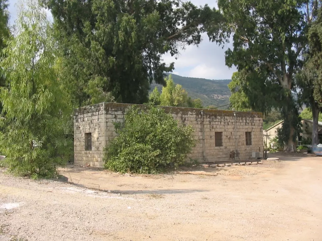
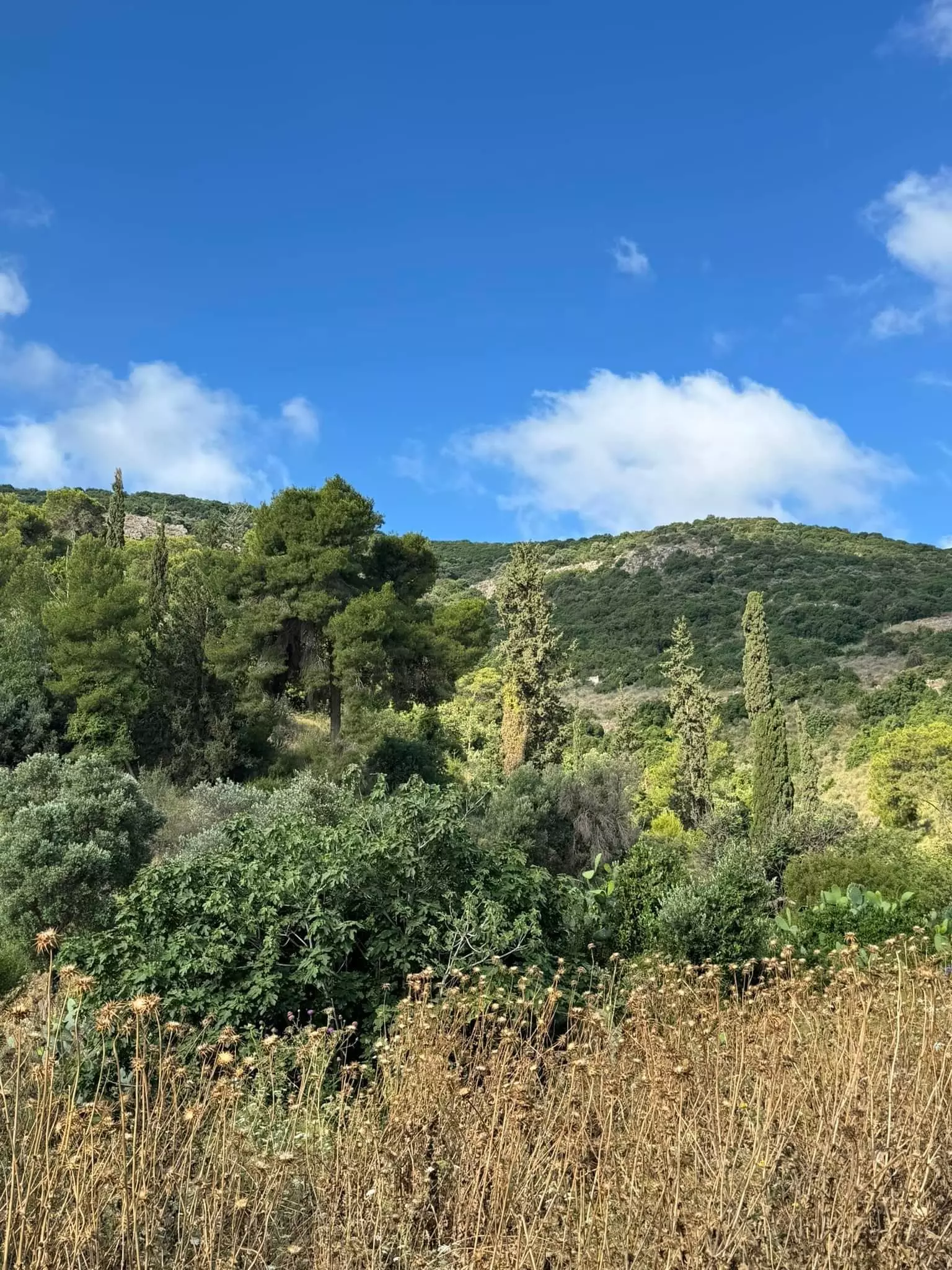
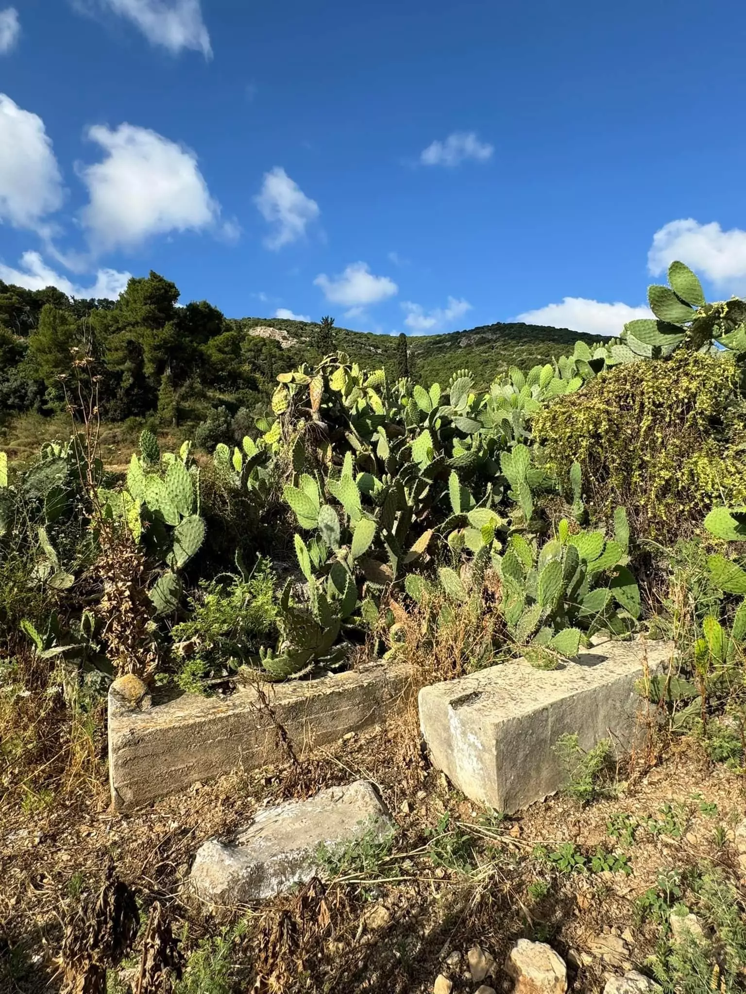
Village Before NakbaThe village stood on the lower slopes of Mount Carmel, facing northeast. The Haifa-Jenin highway passed northeast of it. Yajur was one of several villages whose lands were sold by the Ottoman government to two Lebanese merchants, Sursuq and Salim al-Khuri, in 1872. They in turn sold many of these lands to Zionists, who in 1922 established the settlement of Yagur on the land (see also Wadi al-Hawarith, Tulkarrn sub-disctrict). The Arab residents included 560 Muslims and 50 Christians in the mid-1940s; their houses were scattered across the mountain slopes. In 1944/45 a total of 261 dunums of their land was allotted to cereals 57 dunums were irrigated or used for orchards, of which 42 dunums were planted with olive trees. Although Yajur has not been identified with any ancient historical site, there is evidence of the village's antiquity, including fragments of glass, building foundations, and tombs with sarcophagi.Village Occupation and Ethnic CleaningYajur was one of the villages in the vicinity of Haifa that was captured immediately after the fall of the city. After the Haganah launched a major attack on Balad al-Shaykh, a large village just to the northeast of Yajur, the villagers decided not to wait for a similar assault. Israeli historian Benny Morris states that they evacuated on 24 or 25 April 1948, a couple of days after Haifa was captured. The New York Times reported a direct military strike against this village at the same time. The Times correspondent wrote that Yajur was one of three villages 'commanding' the eastern approaches to Haifa that was occupied on 24 April in order 'to create a protective zone and seal off Haifa from counter attacks.' After its occupation, the Haganah turned its attention further north, to Acre.Zionists Colonies on Village LandsZionists established the settlement of Yagur in 1922 on what were traditionally village lands. The settlement of Nesher , founded in 1925 on lands that formerly belonged to Balad al-Shaykh, is close by, to the north.Village TodayNo traces of the houses remain on the site, which is marked by numerous fig trees and a smaller number of olive trees. Cement factories occupy part of the surrounding lands. The Israeli settlement of Yagur occupies other parts of the land and uses them for agriculture.SourceDr. Walid al-Khalidi, 1992: All That Remains. |
||||||||||||||||||||||
| Related Maps | Town Lands' Demarcation Maps خرائط للقضاء توضح حدود القرى والاودية Town's map on MapQuest View from satellite Help us map this town at WikiMapia |
|||||||||||||||||||||
| Related Links | Wikipedia's Page Google Search Google For Images Google For Videos |
|||||||||||||||||||||
| More Information | في كتاب كي لا ننسى في كتاب بلادنا فلسطين المزيد من موقع هوية |
|||||||||||||||||||||
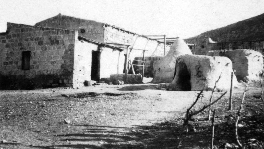
- General View Of Village Site In 1987
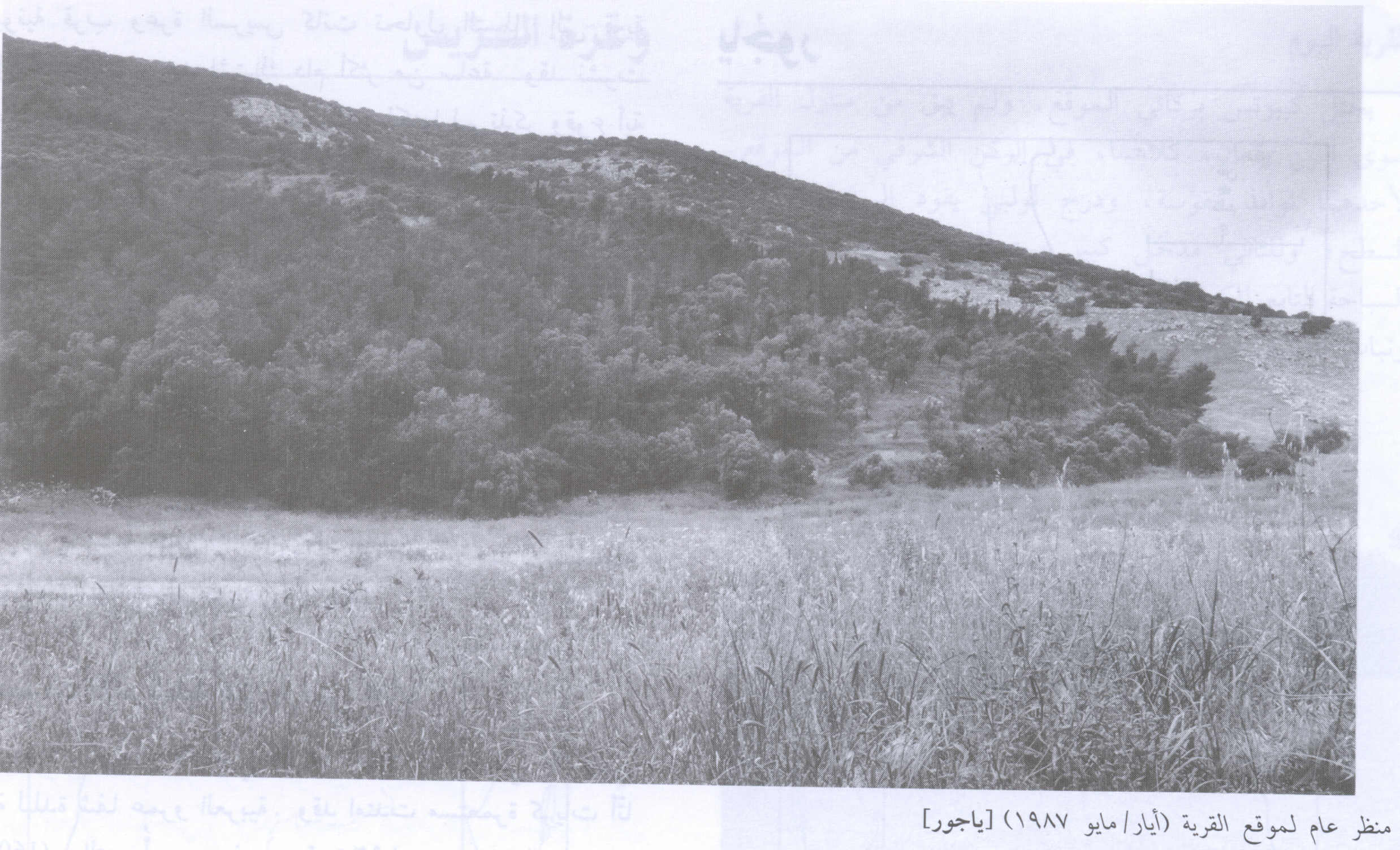
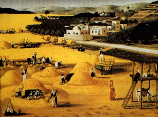
Scanned from "All That Remains" by Dr. Walid Khalidi - This is a Painting from my Onkel Ibrahim Kheite known as Ghannam
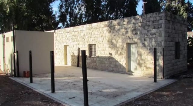
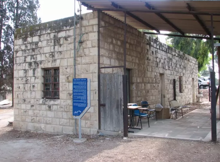
Posted by Hassan Kheite 3 - بيت متبقي في قرية الياجور والتي أقيم على أرضها اليوم كيبوتس ياغور 10/2004
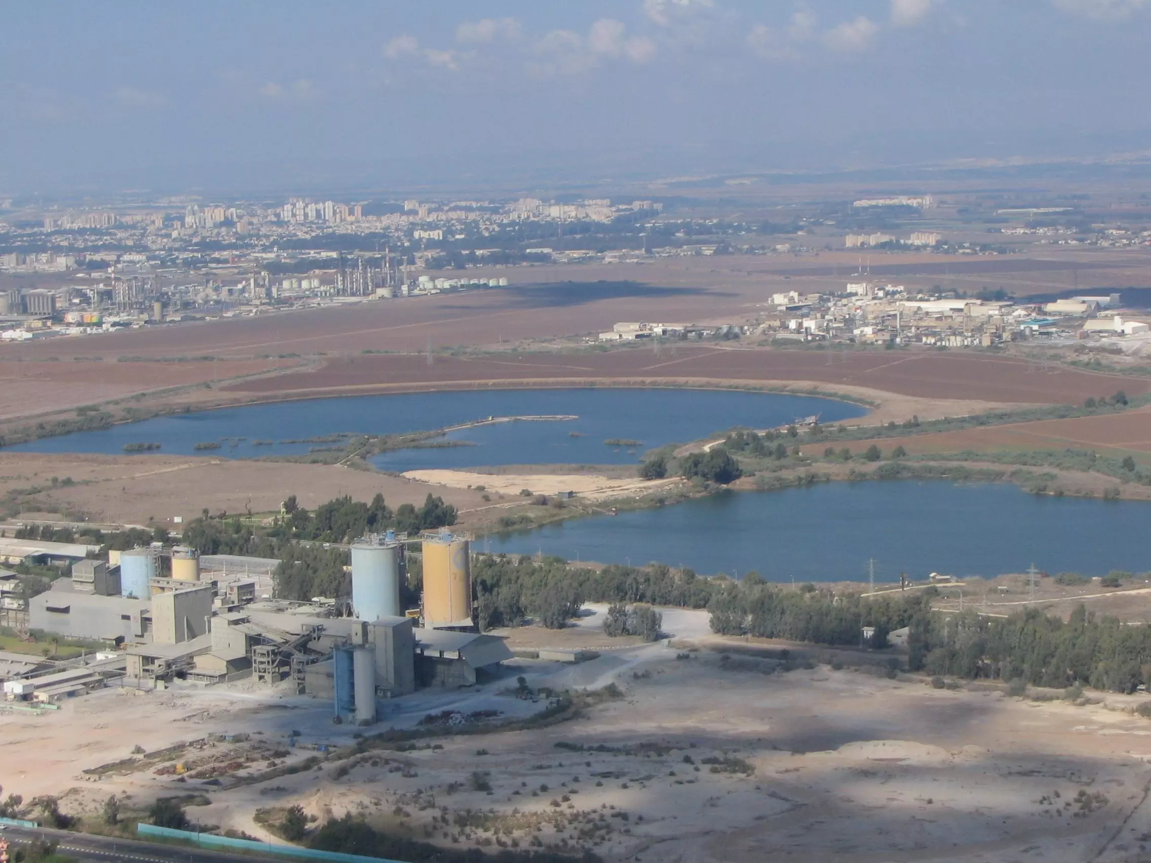
Posted by Makbula Nassar 3 - Nasher cement factory looking northwest from Yajur, note the refinary in the background
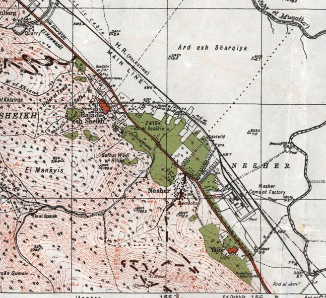
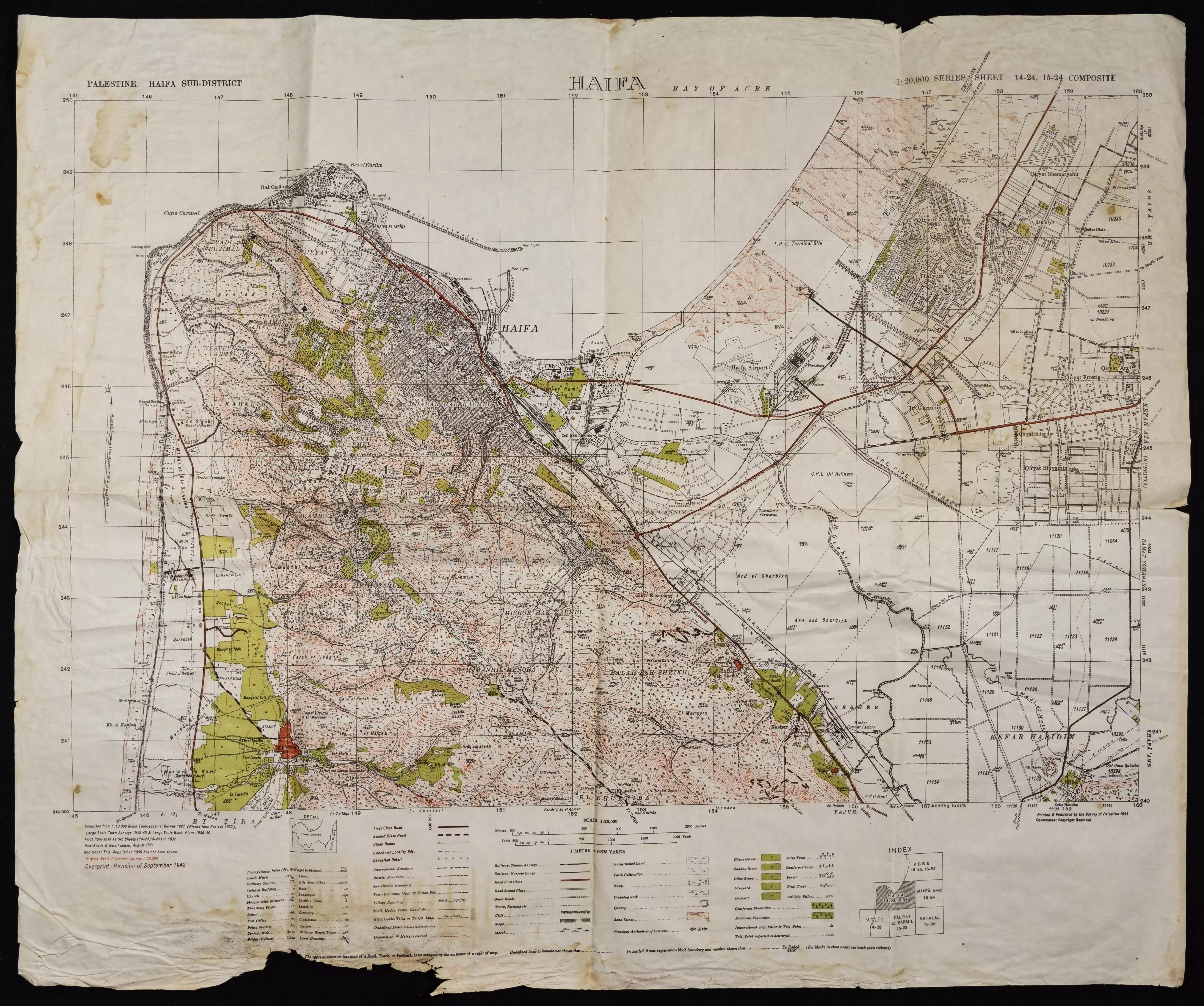
2 - British map 1946
Posted by said - ما تبقى من بيوت القريه
Posted by abu raya - من بيوت القريه
Posted by abu raya - صبار القريه
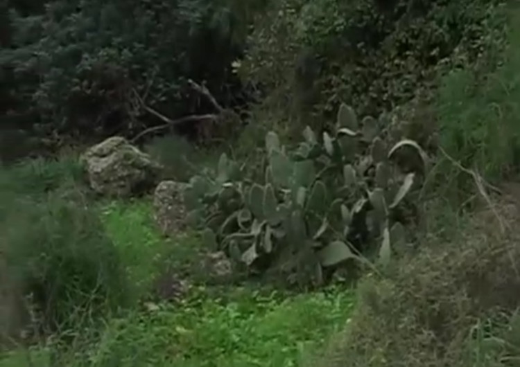
Posted by abu raya - زيتون القريه
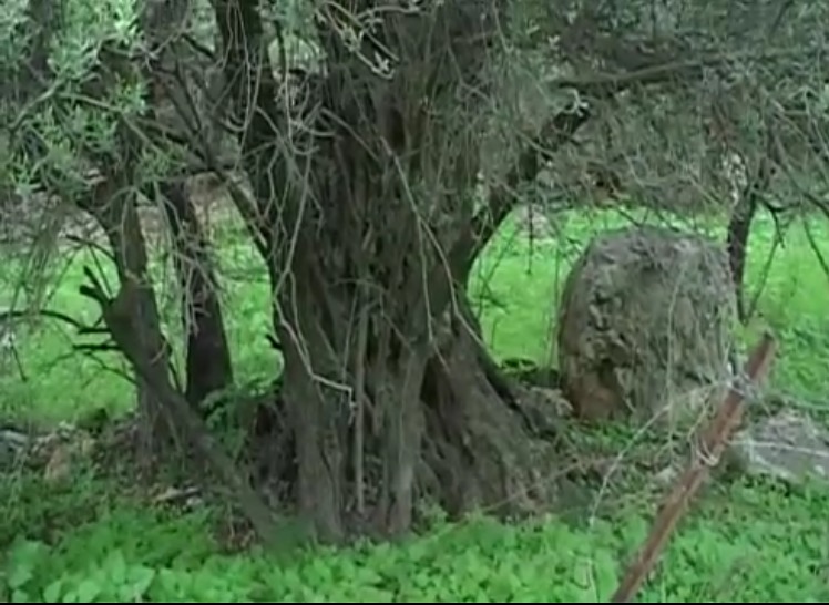
Posted by abu raya - ياجور
Posted by abu raya - ياجور
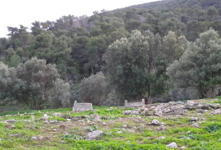
Posted by abu raya - مقبره القريه
Posted by abu raya - صورة نادرة من الياجور قضاء حيفا سنة 1936
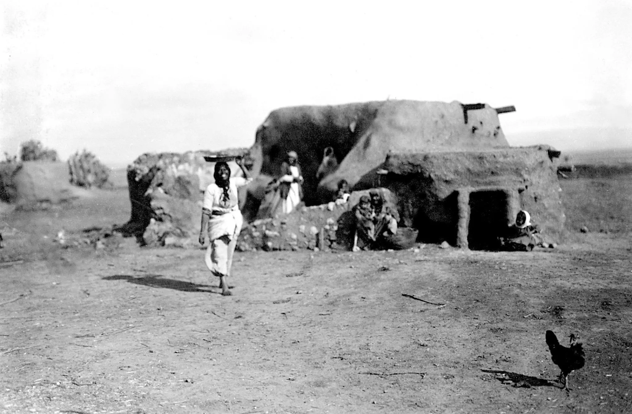
- قرية الياجور المدمرة قضاء حيفا(صورة نادرة)سنة 1940
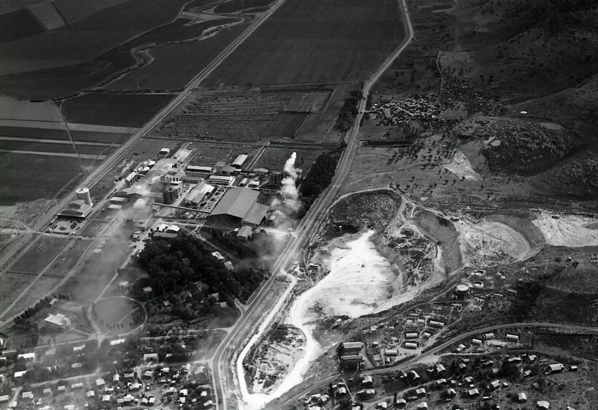
- Aerial View of Nesher plant showing Yajur at the top right hand corner (southwest),_1946
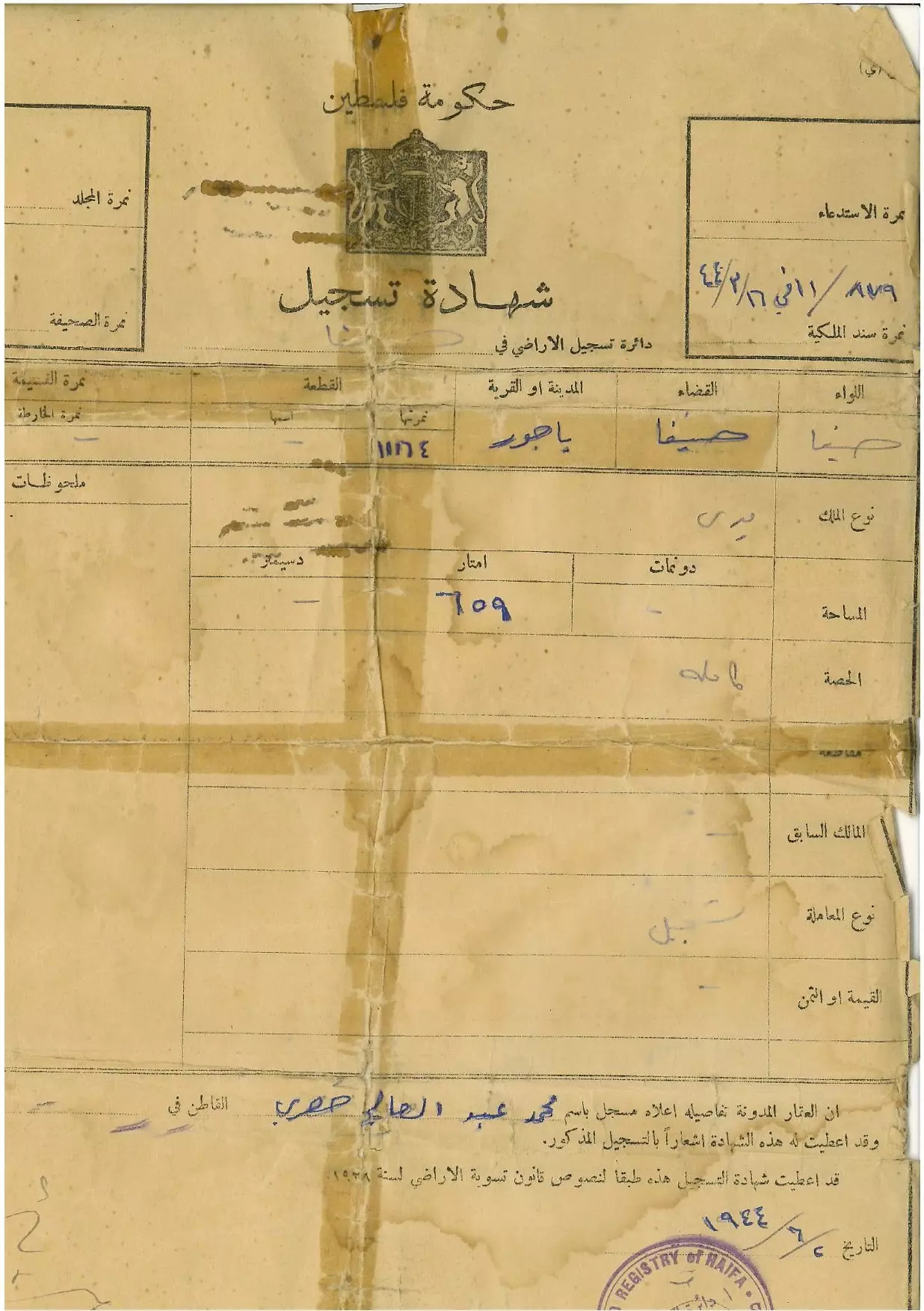
- كوشان ارض لمحمد حصري في قرية للياجور المهجرة
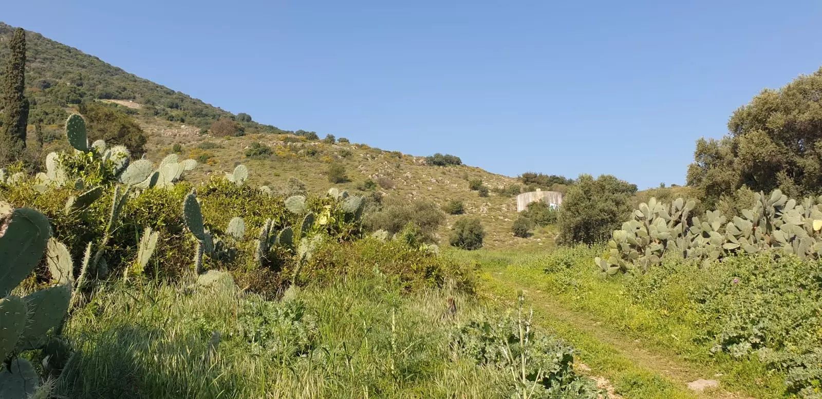
- في موقع قرية الياجور (قضاء حيفا ) ومقبرتها
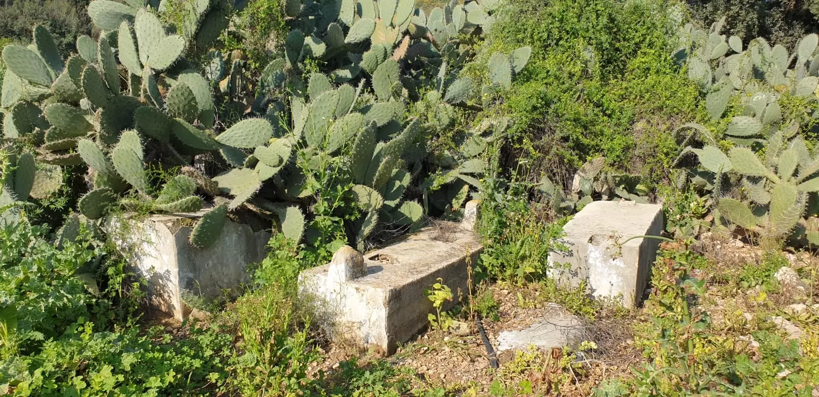
- في موقع قرية الياجور (قضاء حيفا ) ومقبرتها #2
- السجلات العثمانية _ سجل نفوس رب الاسرة من سجلات المخاتير العثمانية ياجور
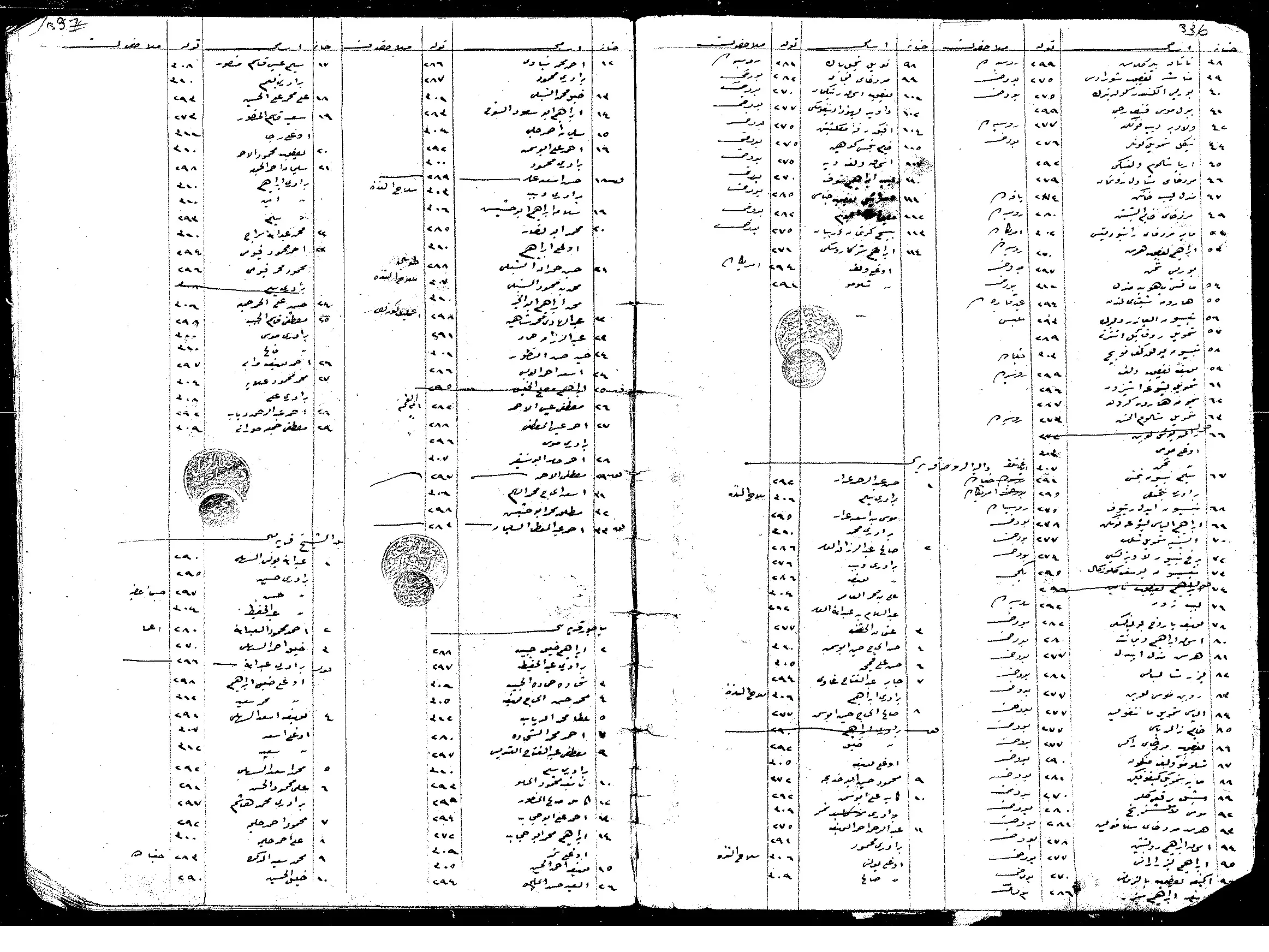
Posted by Wadi Alhawarith - السجلات العثمانية _ سجل نفوس رب الاسرة من سجلات المخاتير العثمانية ياجور

Posted by Wadi Alhawarith - جولة في المقبرة
- جولة في المقبرة #2
- جولة في المقبرة #3
- جولة في المقبرة #4
- جولة في المقبرة #5
- جولة في المقبرة #6
- That is how the "civilized" erased and replaced us: Yajur was completely obliterated, as you see -- ياجور باتت أثر بعد عين. من هنا مر الهمجّ
- That is how the "civilized" erased and replaced us: Yajur was completely obliterated, as you see -- ياجور باتت أثر بعد عين. من هنا مر الهمجّ
#2
- That is how the "civilized" erased and replaced us: Yajur was completely obliterated, as you see -- ياجور باتت أثر بعد عين. من هنا مر الهمجّ
#3
- That is how the "civilized" erased and replaced us: Yajur was completely obliterated, as you see -- ياجور باتت أثر بعد عين. من هنا مر الهمجّ
#4
- خارطة تُظهِر الحدود والطرق بأنواعها والأماكن المقدسة والطبيعة الطوبغرافية من تلال وسهول ومنحدرات والتشكيلة الطبيعية للأرض وأنواع المزروعات. نُشرت الخريطة فترة الانتداب البريطاني، تم إضافة تعديلات عليها من قِبَل خدمة الخرائط والصور التابعة للقوات العسكرية الاسرائيلية فترة الأربعينيات.
Want to browse more? 80,000 pictures were grouped in these gallaries:
| Display Name | Clan/Hamolah | Country of Residence |
| khodor | chehadi | - |
| abo rayan | - | baalbeck |
| Nahed Kheite | دار منصور | NRW, GERMANY |
| انس البعجاوي | البعجاوي | المنسي, المنسي |
| محمد ابو حشمه | ابو حشمه | - |
| FADI | fadi al audi | shouf, lebanon |
| ابوكرم | حجاب | jordan |
| ابوعدنان | حجاب | irbid, jordan |
| Yousef Khalil | - | Abudhabi, United Arab Emirates |
| Amani Khalil | - | Abudhabi, United Arab Emirates |
| Dana Khalil | - | Abudhabi, UAE |
| jomaa | - | sweden |
| Mustafa Chehade | - | - |
| mohammed abo shakra | - | DANMARK |
| Hossam | - | UK, UK |
| AOK | - | Kuala Lumpur, Malaysia |
| saleh | yaior | bekaa, lebanon |
| Hassan Kheite | - | NRW, Germany |
- Ibrahim Ghannam About Al-Yajour
- ياجور...وطني
- ياجور 2012 Duration: 12 min 38 sec
 Fake Valor: Why Did Zionist Jews Hoist Nazis Flag on Their Ships in the 1930s?
What is new?
-
Facts About Oct. 7th Gaza Raid
-
Remined Us Please:: Who Did Rape Who? Palestinians Raped Israelis? Or, was the other way around?
-
When Prof. Edward Said was invited to debate Bibi Netanyahu in the 1980s, watch what happened!
-
Ezra Klein of the NY Times on the "Jewish Race".
-
Abusing Blood Libel!
-
Did Israeli Soldiers Activate The Hanniba Direective On Oct. 7th? You Be The Judge
-
Zionist FAQ: Isn't it true that Palestinians don't want peace? Palestinians never accepted the two-state solution
- Facts about Haavara (Transfer) Agreement between Ben-Gurion & Hitler
-
Haavara FAQs: Why Did Zionist Jews Hoist Nazis' Flags on Their Ships in the 1930s?
- Haavara FAQs: When Chaim Weizmann met FDR in mid-1943, why was he silent about rescuing European Jewry?
-
Dear ChatGPT: How did Palestinians resist Napoleon's invasion of their country in 1799?
-
Dear ChatGPT: Gaza had a vibrant Jewish community in the mid-17th century. What happened to them?
-
Dear ChatGPT: Why did the Jewish Agency suppress news of the Holocaust during WWII?
-
Video Playlist: Jews share their DNA tests to end the conflict for good.
-
A Tale of Two Conflicts: Examining the Definition of Genocide
-
Prof. Abraham Polak And The Suppressed History of the Khazars and European Jewry
-
How Ronald Reagan would have framed the genocide in Gaza if he were still alive?
-
Haavara FAQs: Let us do the math: how many German Jews did The Haavara Agreement save?
-
Zionist FAQs: The Hebron Massacre of 1929, "clearly proves" that Palestinians are antisemitic, how could you deny it?
-
Zionist FAQs: Why Anti-Zionist Is Not Antisemitism?
-
Zionist FAQs: Isn't it true that the KGB created Palestinian Nationalism in the early 1960s?
- Zionist FAQs: Muslims are killing Muslims all the time; why are Israeli Jews being singled out in the media?
- Zionist FAQs: How is Israel an apartheid state when 20% of its citizens are Arabs who enjoy full rights?
-
Haavara FAQs: Why Did Dorothy Thompson Flip From A Zionist Advocate to A Silenced Dissenter?
-
Haavara FAQs: Analysis of Herzl's Uganda Scheme and how it could have saved millions of Jews.
-
Haavara FAQs: Why did Hayim Greenberg describe American Jewry as "morally bankrupt" in early 1943?
-
Haavara FAQs: What if the Evian Conference was a resounding success? What would have been the impact of saving European Jewry on Zionism?
- Haavara FAQs: What if the six million were saved, how that would have impacted the Zionist project?
-
Haavara FAQs: How did Zionist leaders react when Europe's Jews lingered in the DP camps after WWII ended?
-
Why does the American Jewish community repeat lies that David Ben-Gurion had debunked before he died?
-
Who has the power to rename the Tatar/Khazar Gene Marker to Jewish IV?
-
Zionist FAQs: Why won't Egypt, Syria, and Jordan take their people back? Jews are indigenous to Palestine, and Arabs immigrated after Jews developed the country. Arabs should leave.
-
Haavara FAQs: Did Hitler and the Nazis conflate between Judaism and Zionist? If that wasn't case, then why?
-
Haavara FAQs: Winston Churchill and antisemitism, a collection of articles written Churchill.
-
Haavara FAQs: Broken by country, how many Jews survived vs. killed during the Holocaust?
-
Haavara FAQs: Why did European Jews vote with their feet and to immigrated to the Americas, not Palestine, after WWII?
-
Watch this American Jewish Girl describing Israeli Jews' cognitive dissonance like no other in under two minutes
-
Haavara FAQs: When the Nazis went out of their way to hide the Holocaust, Israeli Jews did the exact opposite by broadcasting their genocide of Gazans. But why?
-
Haavara FAQs: How Zionist Jews went out of their to show their appreciation to Nazism and Fascism?
- Haavara FAQs: Why Zionist leaders were against bombing the death camps & the Railroads leading to them?
-
Haavara FAQs: Hitler's message to the British and American people: If Jews are such noble citizens and you care about them, how come you're not letting them in? I will gladly ship them to you at my expense, even on luxury liners!
-
A shortlist of Zionist and Israeli false flag operations in the name Jews.
-
The Most Moral Army
- The Land of Kapos (Israel): Where the brave are boycotted and Kapos walk free.
- Why did early Zionists often named their communal enterprises "colonial"?
- Zionist Relations with Nazi Germany by Faris Glubb
-
Two NY Times advertisements by Zionists in the early 1943 that exposes Zionists' treason at the height of the calamity
- Facts Not Lies about the Palestinian-Israeli Conflict.
- Site's pictures have been categorized
- Campgain Against Lice
- A Survey of Palestine, the official source about Palestine before Nakba produced by the British Mandate; over 1200 pages.
- Satellite View & Google Earth: Over 6,000 placemarks identifying all destroyed towns, W. Bank & Gaza Strip Towns, & refugee camps.
- PalestineRemembered.com and its Nakba Oral History Project were featured on al-Jazeera Satellite TV.
- Nakba Oral History Video Podcast:
 Over 700 Oral History interviews (including 3,500+ hours of recording) can be viewed online.
 - Palestine Village Statistics Project
- Gaza Jail Break
- النسخة العربية للموقع الان متوفرة
- Videos: Documenting the destroyed villages in video: Tracing all that remains since Nakba.
- Videos: Responding to Zionist Propaganda
- Interview: The ethnic cleansing of Palestine: George Galloway interviews Israeli Historian Ilan Pappe.
- For Palestinians, memory matters. It provides a blueprint for their future By George Bisharat.
- Zionist FAQ now available in Hebrew שאלות שציונים שואלים, עכשיו בעברית
- Video: The Stephen Walt and John Mearsheimer report on the influence of the Israel Lobby on U.S. Foreign Policy
- The Palestinian-Israeli conflict for beginners
