| PalestineRemembered | About Us | Oral History | العربية | |
| Pictures | Zionist FAQs | Haavara | Maps | |
| Search |
| Camps |
| Districts |
| Acre |
| Baysan |
| Beersheba |
| Bethlehem |
| Gaza |
| Haifa |
| Hebron |
| Jaffa |
| Jericho |
| Jerusalem |
| Jinin |
| Nablus |
| Nazareth |
| Ramallah |
| al-Ramla |
| Safad |
| Tiberias |
| Tulkarm |
| Donate |
| Contact |
| Profile |
| Videos |
Welcome To al-Sarafand - الصرفند (א-צרפנד)
|
District of Haifa
Ethnically cleansed days ago |
العربية Google Earth |
 |
Gallery (53) |
- Statistics & Facts
-
Before & After

- Satellite View
- Articles 2
- Pictures 53
- Aerial Views 1
- Oral History 1
- Members 3
- All That Remains
- Wikipedia
- Videos 4
- Guest Book 8
- Links
| Statistic & Fact | Value | ||||||||||||||||
| Occupation Date | July 16, 1948 | ||||||||||||||||
| Distance From District | 19 (km) South West of Haifa | ||||||||||||||||
| Elevation | 25 (meters) | ||||||||||||||||
| Before & After Nakba, Click Map For Details |
|||||||||||||||||

|
|||||||||||||||||
| Map Location | See location #15 on the map View from satellite |
||||||||||||||||
| Military Operation | Operation Shoter (Police) | ||||||||||||||||
| Attacking Units | A special force drawn from the Israeli Navy, Golani, Carmeli, and Alexandroni brigades | ||||||||||||||||
| Defenders | Local Palestinian militia, some Arab Liberation Army volunteers, and possibly some help from the Iraqi army in Tulkarm and Jinin | ||||||||||||||||
| Acts of Terror | In September 1948, UN investigators stated that 130 villagers were unaccounted for (see al-Tira & 'Ayn Ghazal for more details). | ||||||||||||||||
| Refugees' Migration Routes | The refugees were mostly expelled first eastward to al-Tira, and then they were expelled again to but this time to Jinin (West Bank) | ||||||||||||||||
| Exodus Cause | Military assault by Zionist troops | ||||||||||||||||
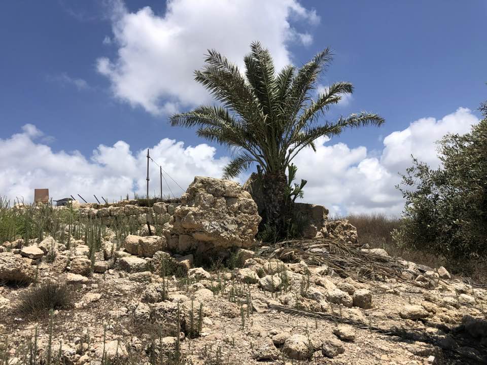
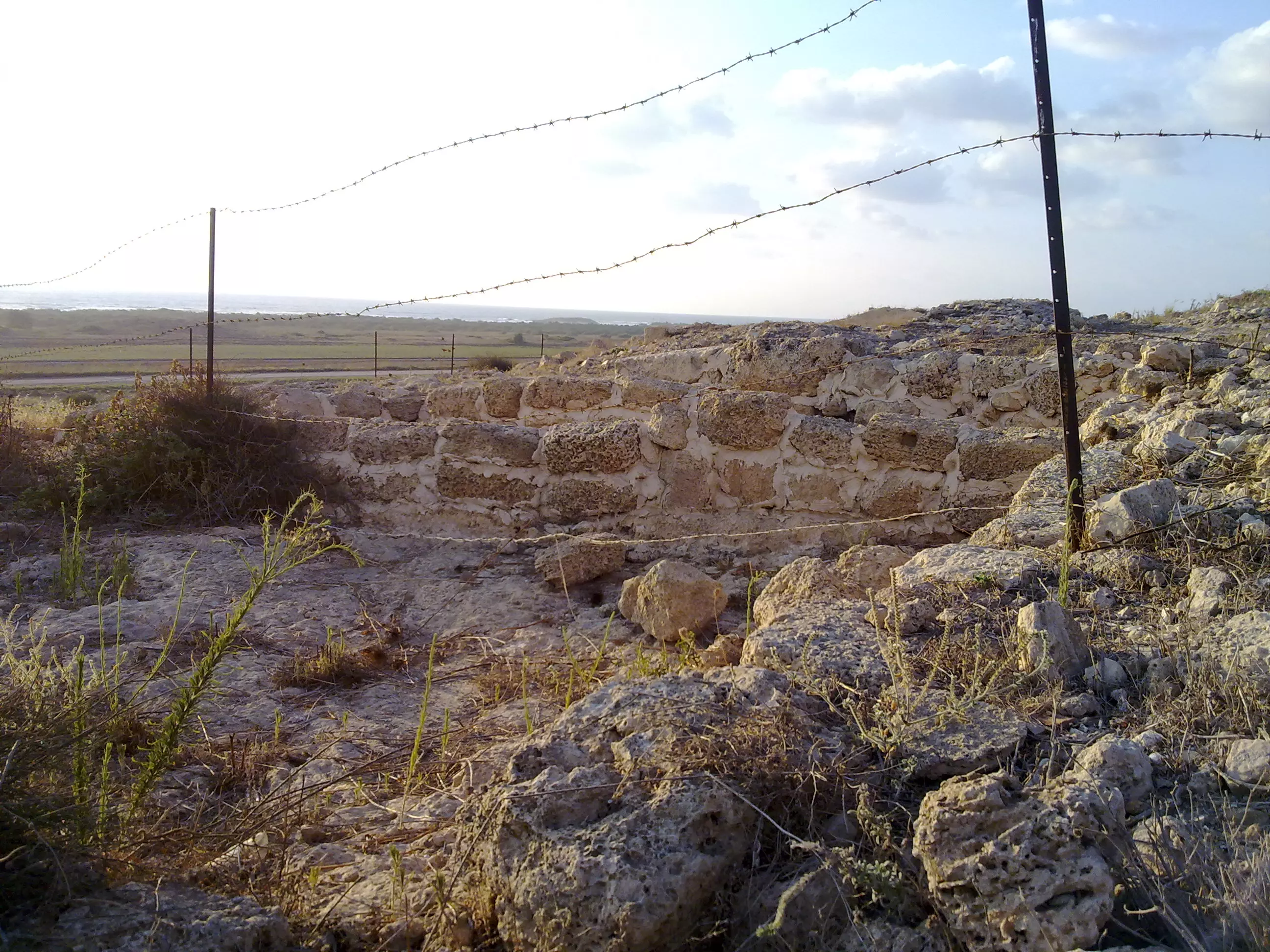
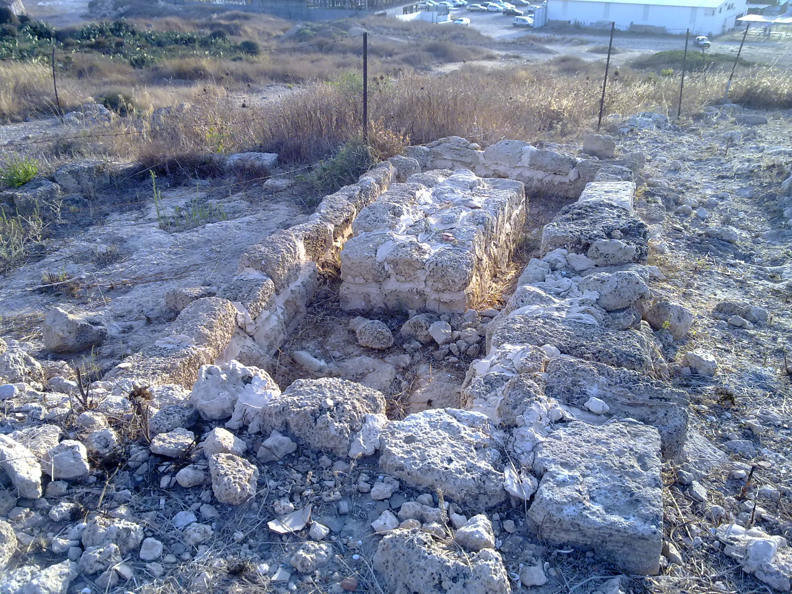
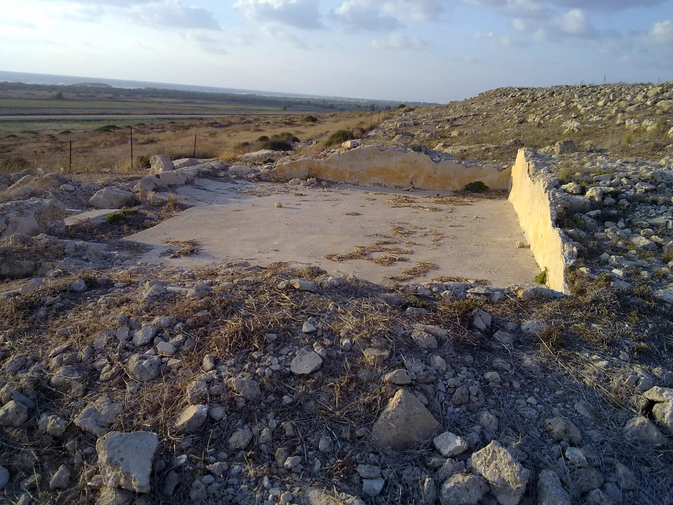
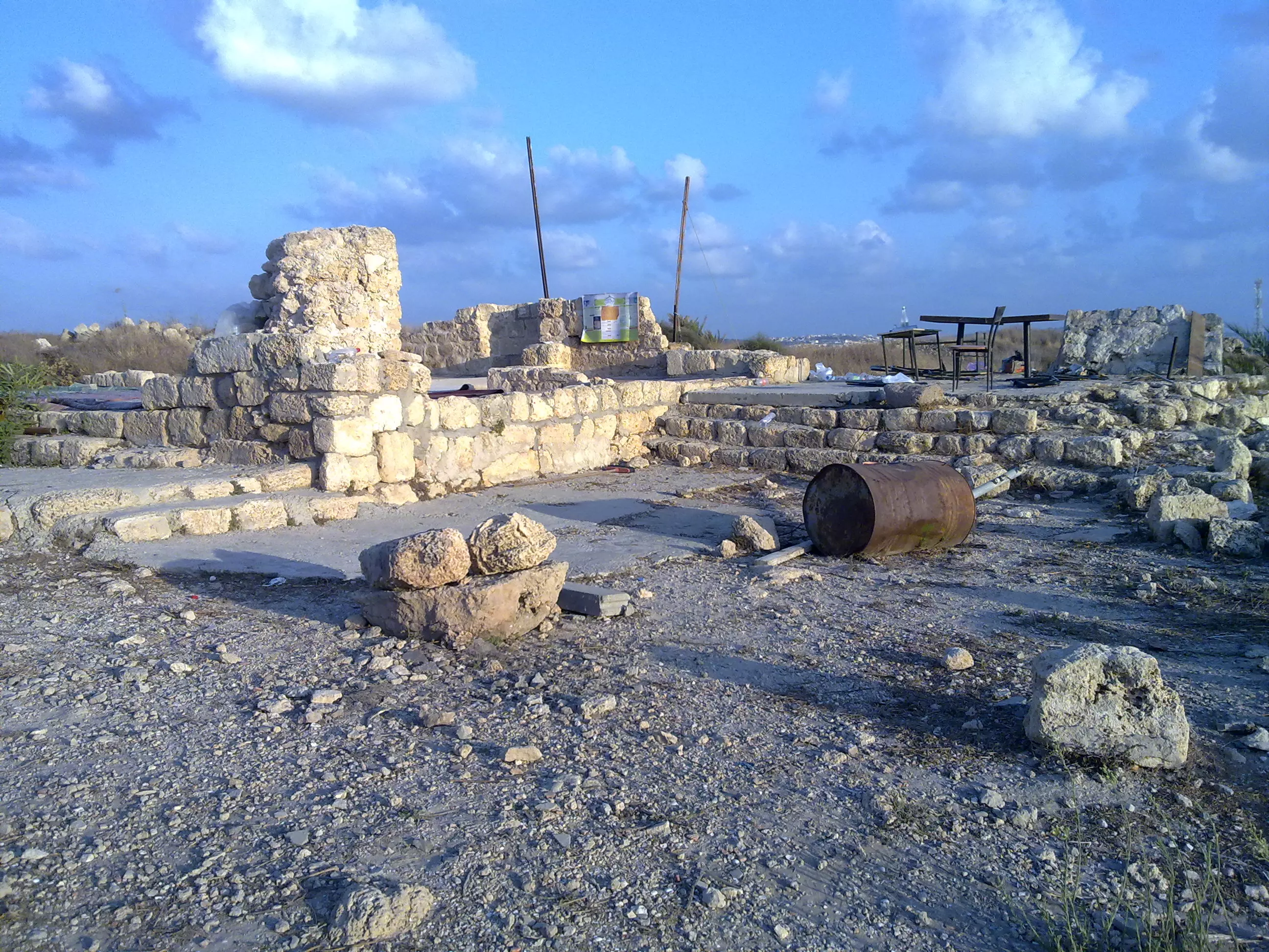
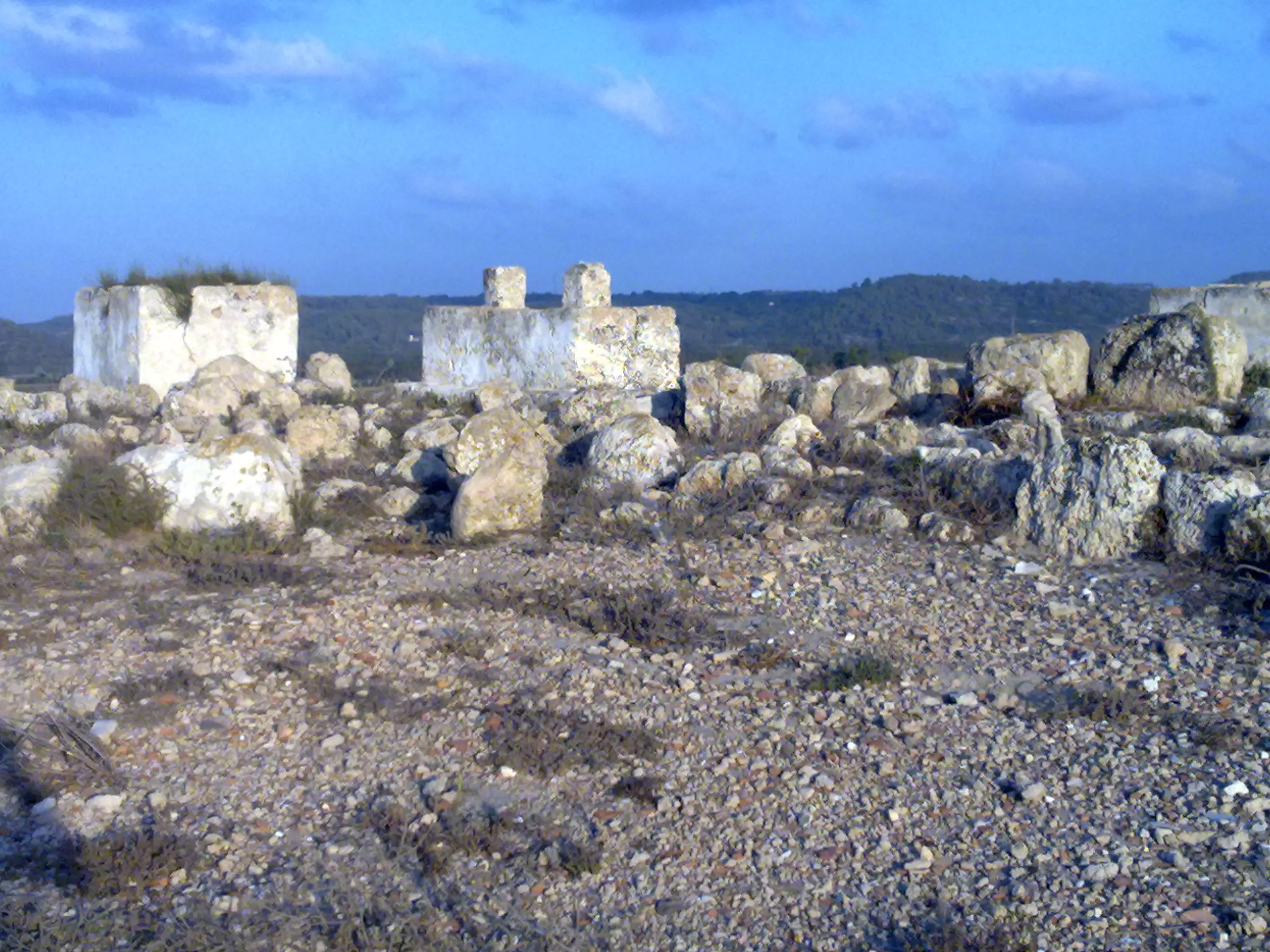
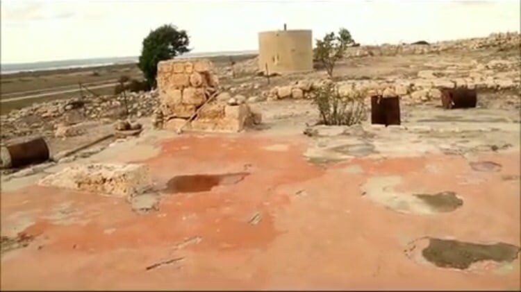
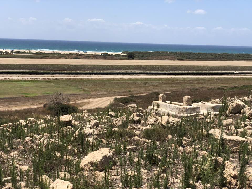
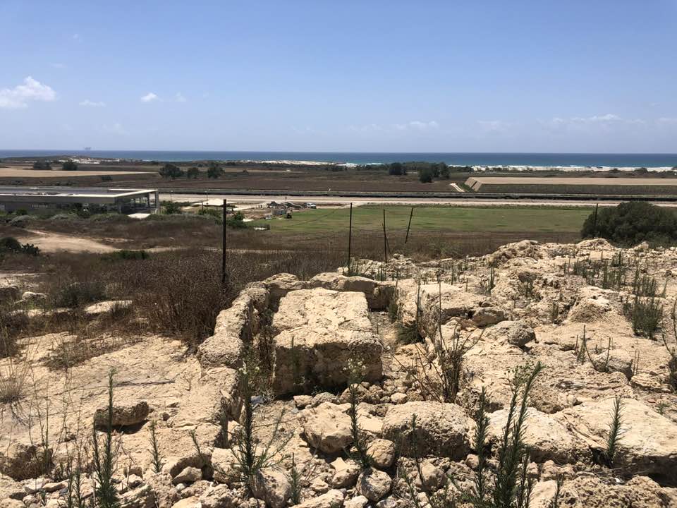
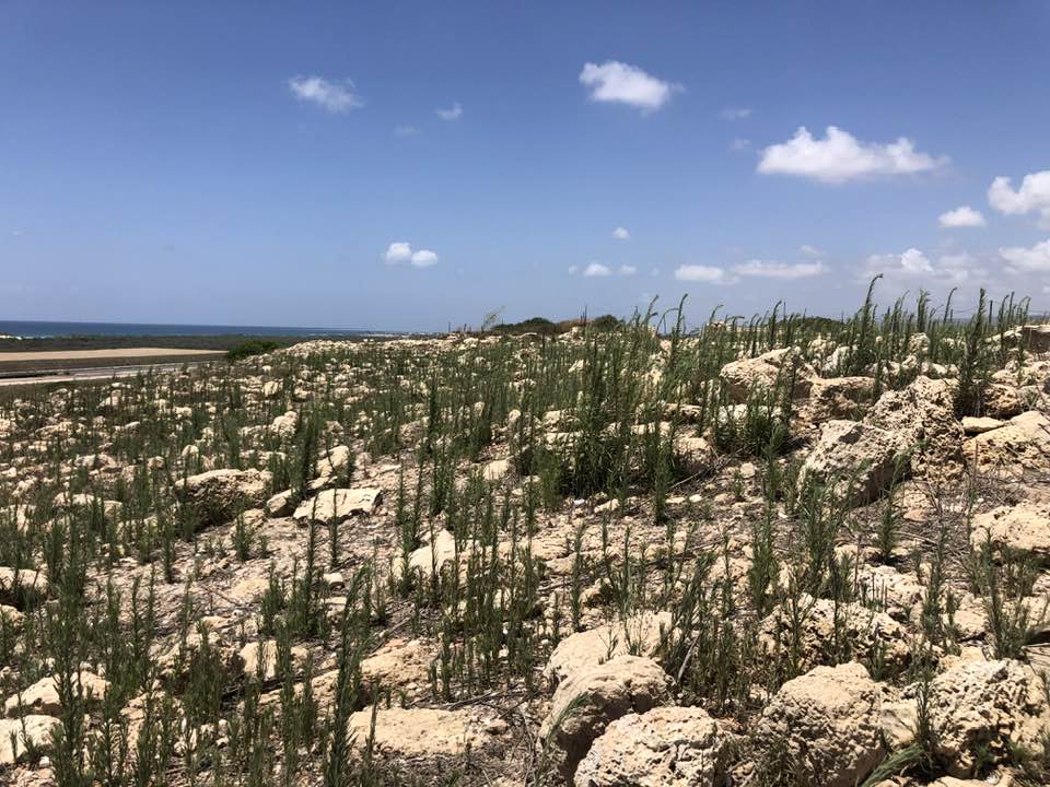
| Village Temains | The village has been mostly destroyed with the exception of a remaining house. | ||||||||||||||||
| Ethnically Cleansing | al-Sarafand inhabitants were completely ethnically cleansed. | ||||||||||||||||
| Pre-Nakba Land Ownership |
**Town Lands' Demarcation Maps |
||||||||||||||||
| Land Usage As of 1945 |
|
||||||||||||||||
| Population |
|
||||||||||||||||
| Number of Houses |
|
||||||||||||||||
| Near By Towns |
|||||||||||||||||
|
|||||||||||||||||
| Town's Name Through History | The Crusades referred to al-Sarafand by Sarepta Yudee | ||||||||||||||||
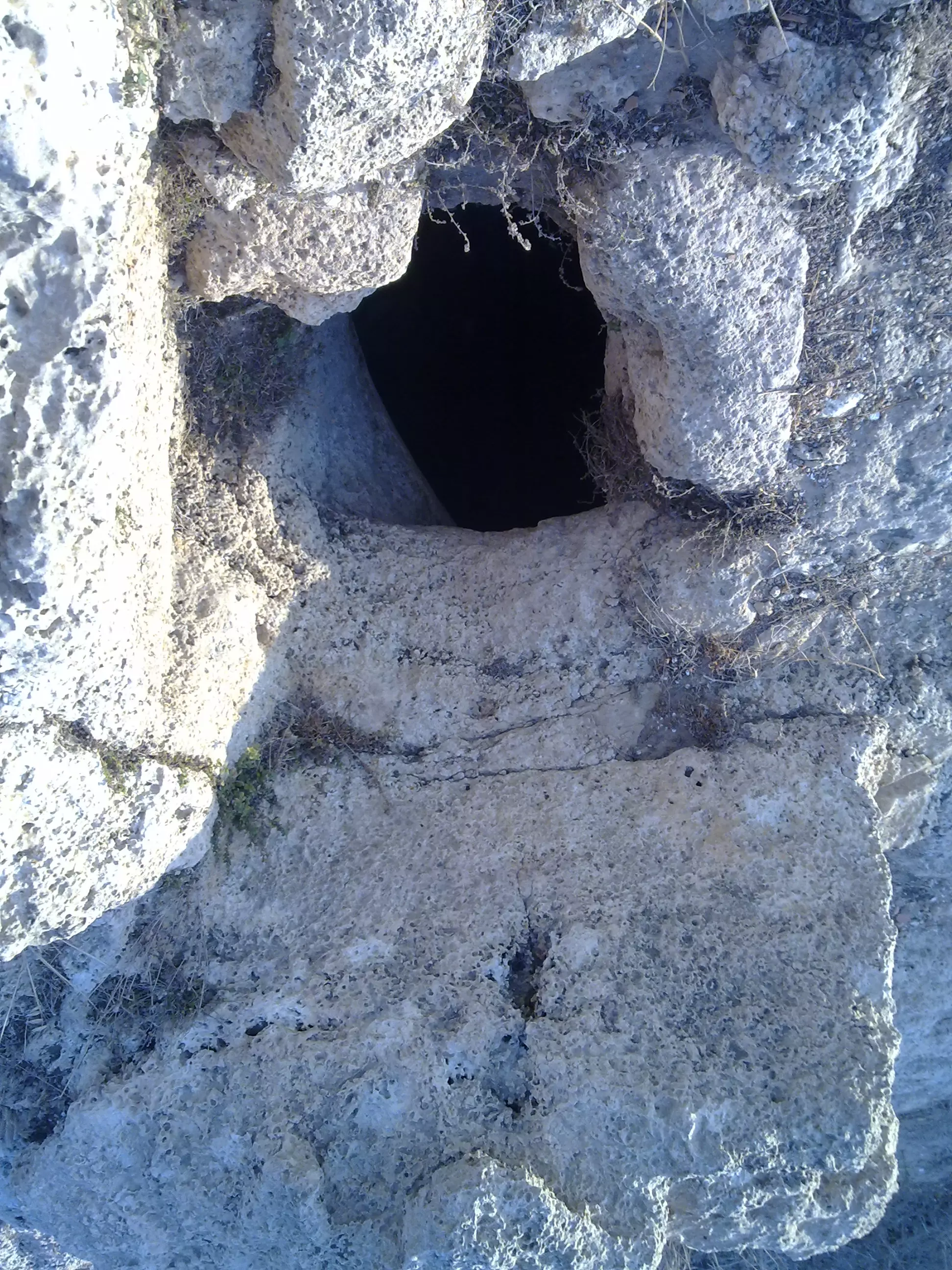
| Water Supply | The village contained more than ten wells | ||||||||||||||||
| Exculsive Jewish Colonies That Usurped Village Lands |
kibbutz Neve-Yam, Tzerufa, & Geva' Karmel | ||||||||||||||||
| Featured Video | |||||||||||||||||
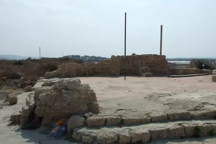
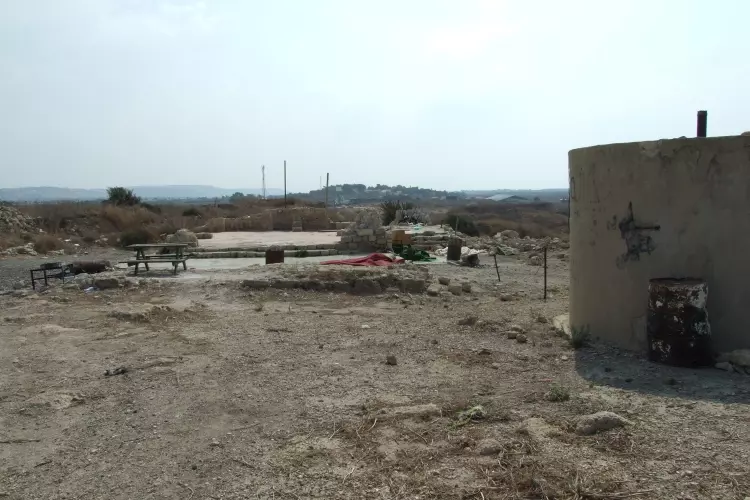
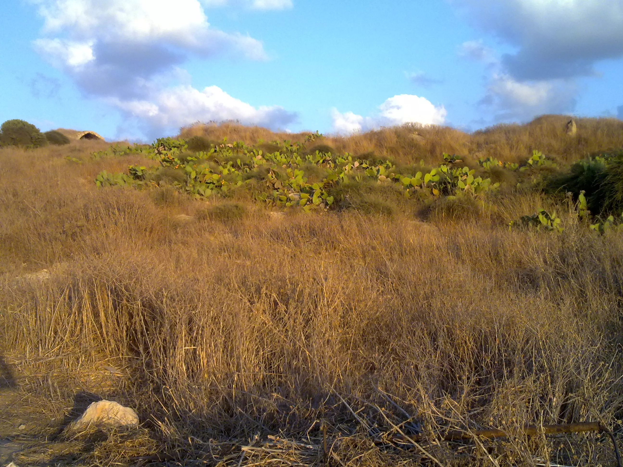
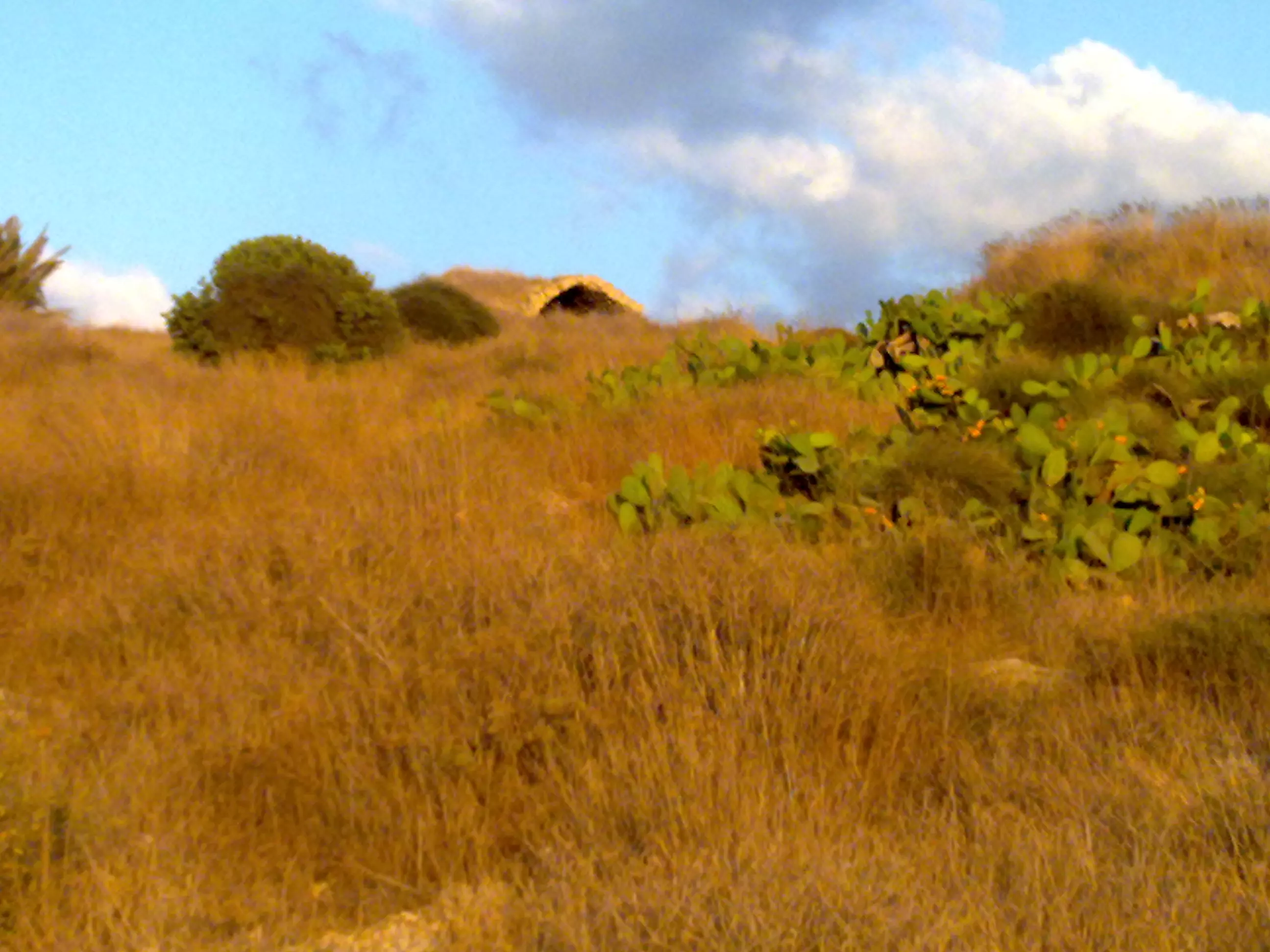
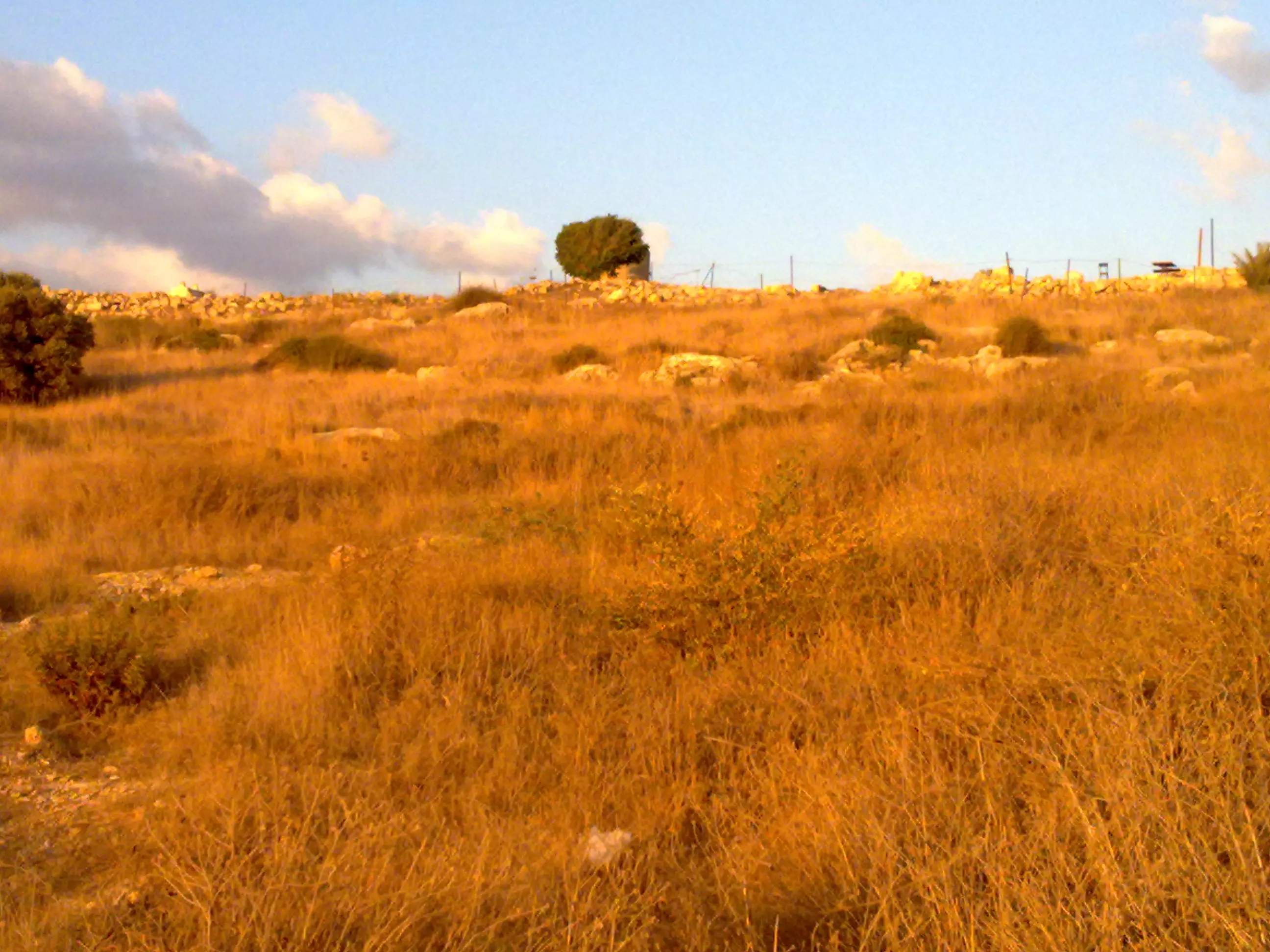
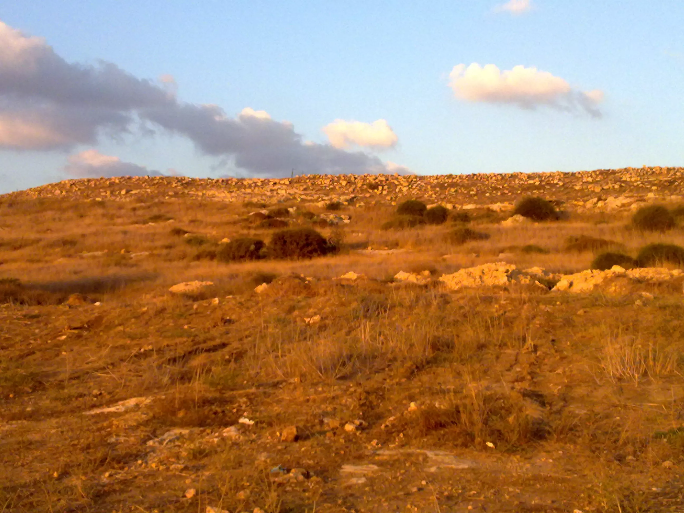
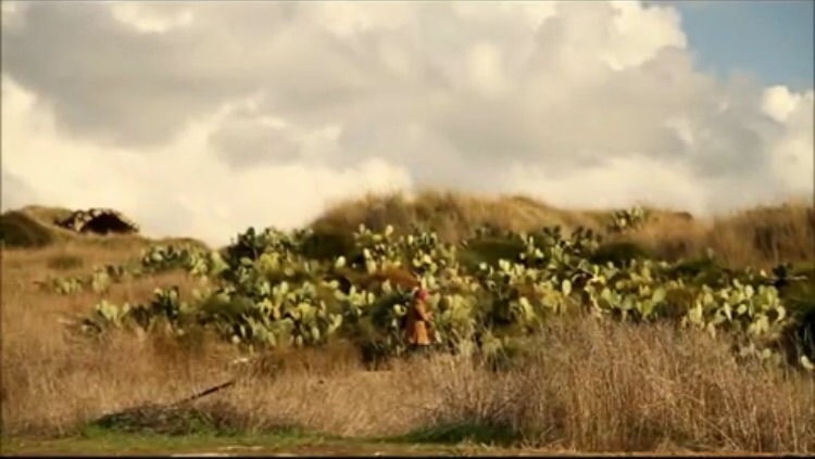
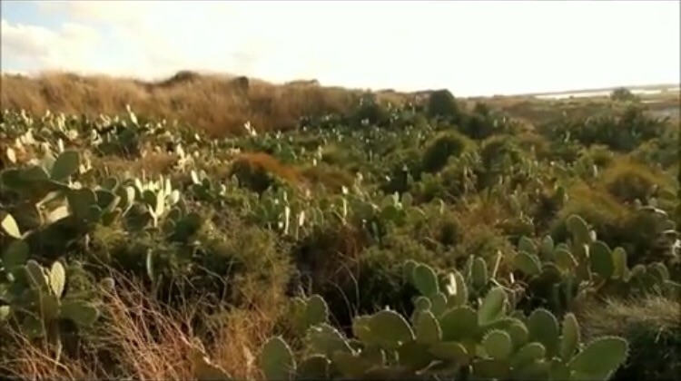
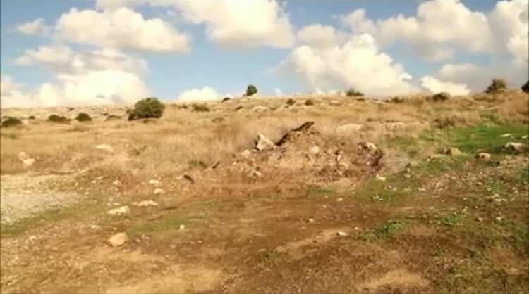
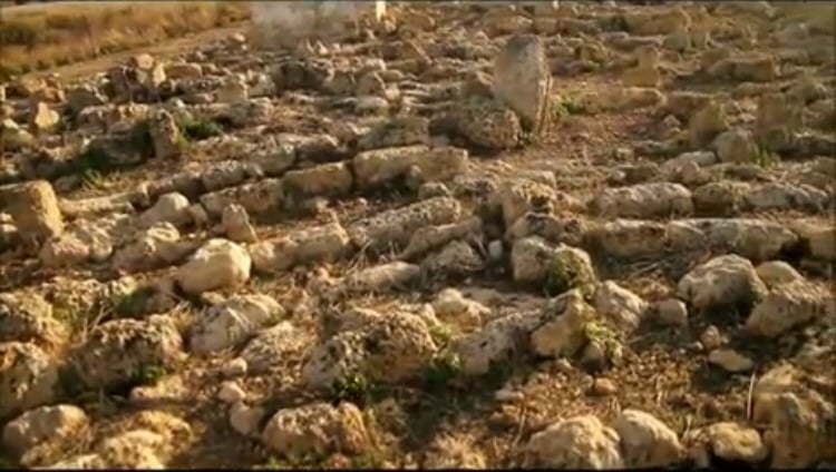
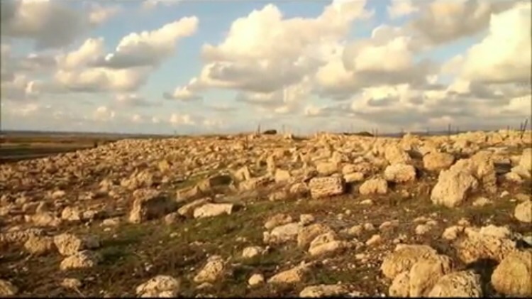
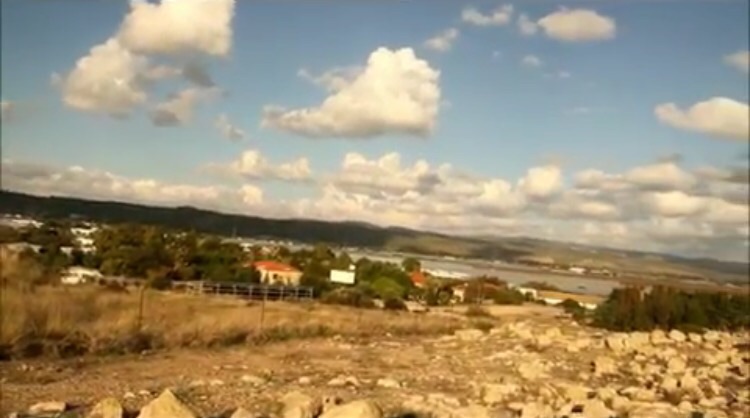
Village Before NakbaThe village stood on the narrow coastal plain south of Atlit, on a sandstone hill that was only slightly higher than the surrounding area. Secondary roads linked it to several nearby villages as well as to the coastal highway that ran 2 km to the east. The Crusaders referred to it as Sarepta Yudee. In 1596, al-Sarafand was a village in the nahiya of Shafa (liwa' of Lajjun), with a population of sixty-one. It paid taxes on a number of crops, including wheat and barley, as well as on goats and beehives.In the late nineteenth century, al-Sarafand was situated on a ridge between a plain and the beach. An estimated 150 people lived in it and cultivated 16 faddans (1 faddan =100-250 dunums). The village's general orientation was north-south, and its houses, made of stone and either mud or cement, were clustered together. Its population was Muslim. More than ten wells provided water for domestic use. The village economy depended on agriculture, animal husbandry, and salt making. The primary crops were various kinds of grain. Date palms were also planted in small patches on the western side of the village land. In 1944/45 a total of 3,244 dunums was allocated to cereals; 22 dunums were irrigated or used for orchards. Village Occupation and Ethnic CleaningOn 16 July 1948, two Haganah ships directed fire at the village of al-Sarafand to provide cover for the main attack by land. This was the first instance of cooperation between Israeli ground and naval forces in a military attack, according to the History of the War of Independence. The operation, one of the minor offensives launched during the ten-day period between the two truces of the war, resulted in the occupation of nearby Kafr Lam. Its residents may have been expelled following its occupation, as were those of neighboring al-Tira, which was occupied on the same day.Zionists Colonies on Village LandsOn 3 August 1948, the kibbutz of Neve-Yam wrote to the Israeli Agriculture Center asking to be handed over the lands of al-Sarafand. Israeli historian Benny Morris quotes the settlers as saying that the depopulation of the village had 'opened up the possibility of [a] radical solution which once and for all could give us sufficient land for the development of [our] settlement.'In 1949, Israel established the settlement of Tzerufa, 1 km northeast of the village site, on village land. The settlement of Geva' Karmel, also built in 1949 east of the site, was established on the lands of the neighboring village of Jaba'. Village TodayOnly one house, a large structure with two arches in front, has been spared. The Tel Aviv-Haifa highway crosses part of the site another part, fenced in with barbed wire, is overgrown with thorns and cactuses.SourceDr. Walid al-Khalidi, 1992: All That Remains. |
|||||||||||||||||
| Related Maps | Town Lands' Demarcation Maps خرائط للقضاء توضح حدود القرى والاودية Town's map on MapQuest View from satellite Help us map this town at WikiMapia |
||||||||||||||||
| Related Links | Wikipedia's Page Google Search Google For Images Google For Videos |
||||||||||||||||
| More Information | في كتاب كي لا ننسى في كتاب بلادنا فلسطين المزيد من موقع هوية |
||||||||||||||||
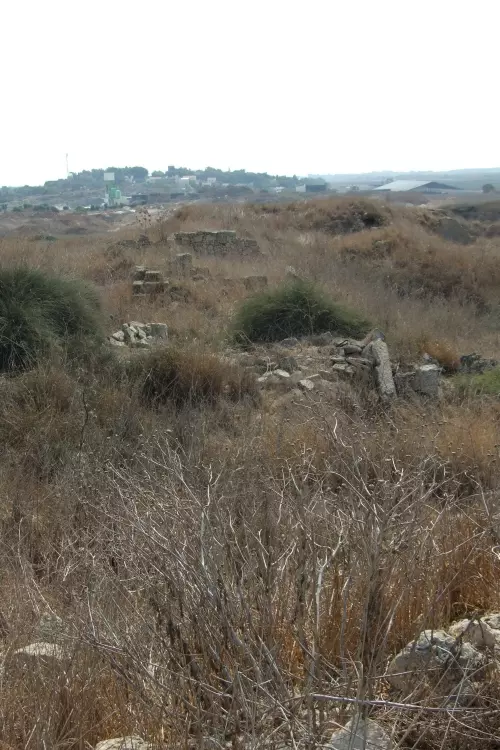
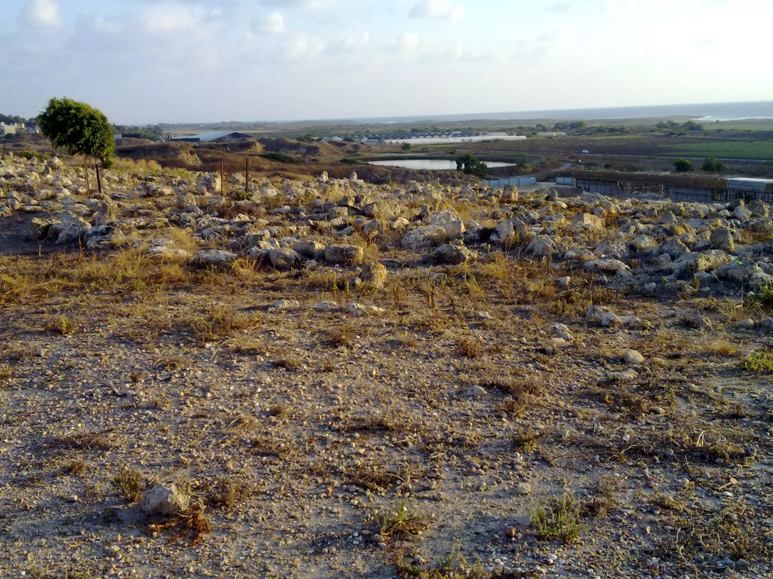
- General View Of Village Site In 1990
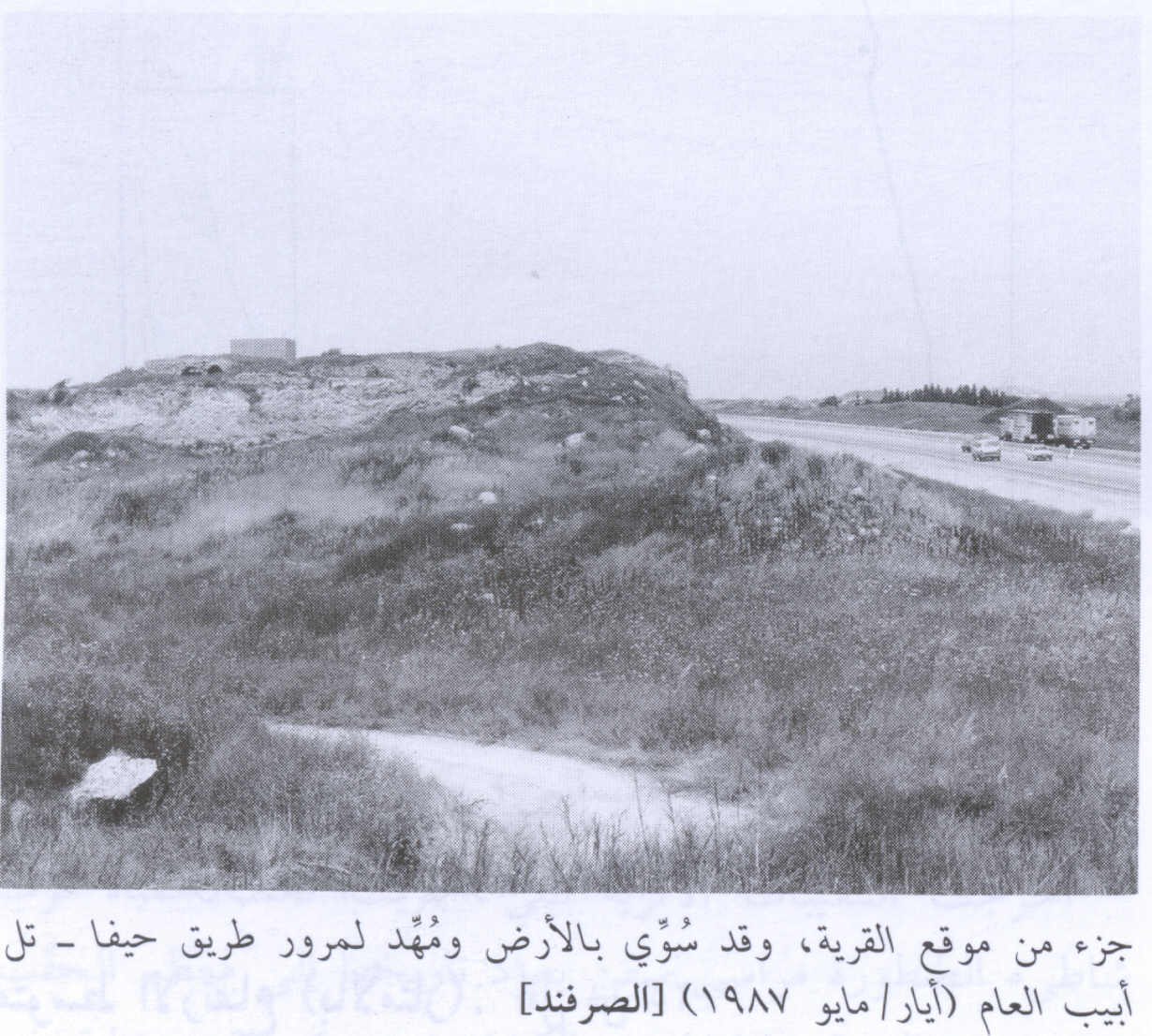
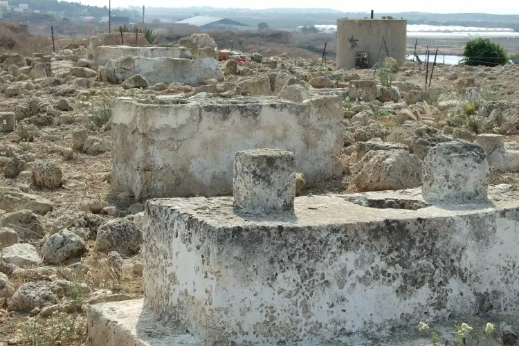
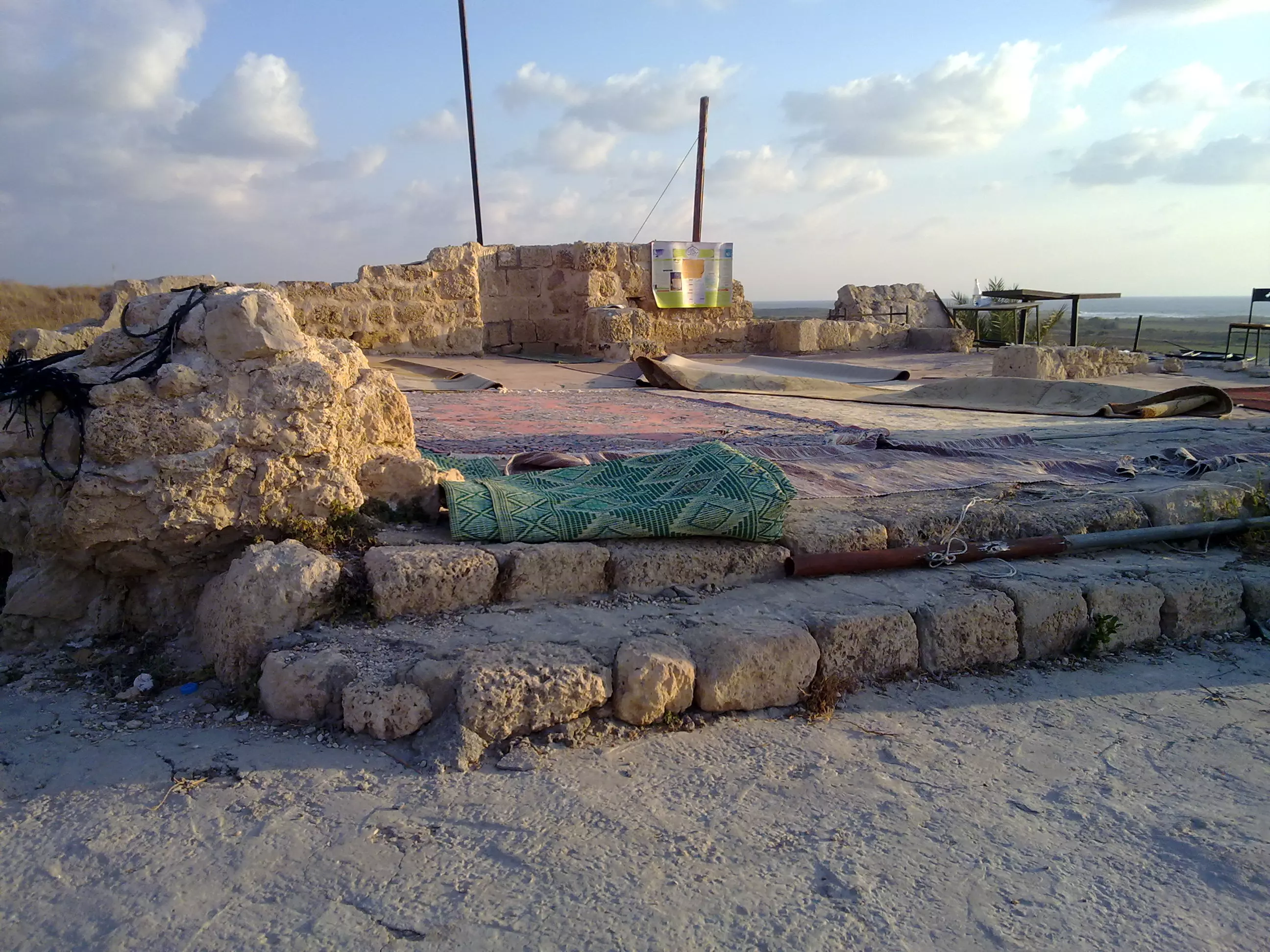
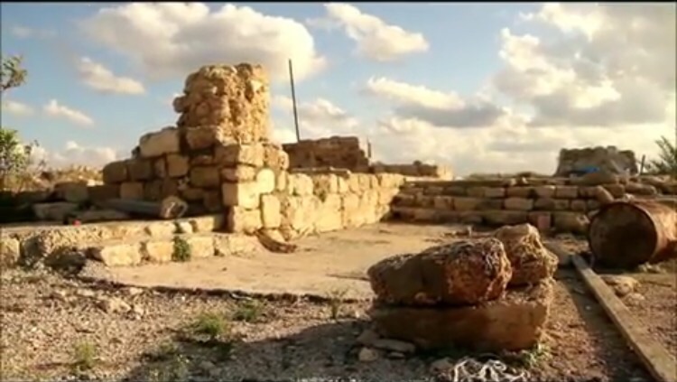
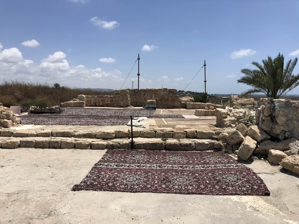
Scanned from "All That Remains" by Dr. Walid Khalidi - The destroyed and remains of Sarafand's Mosque-May-2002
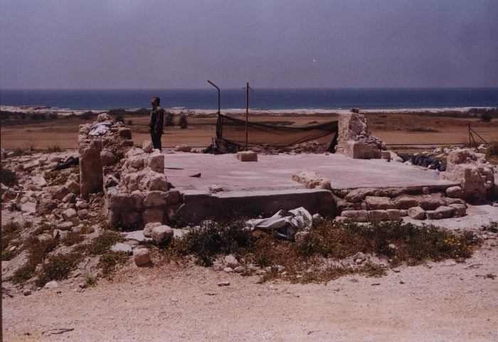
Posted by Aqsa Association-Palestine-1948 - The destroyed and remains of Sarafand's Mosque #2-May-2002
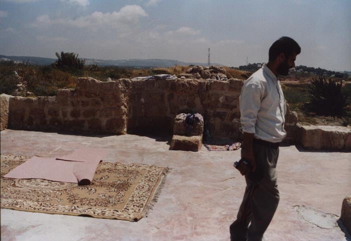
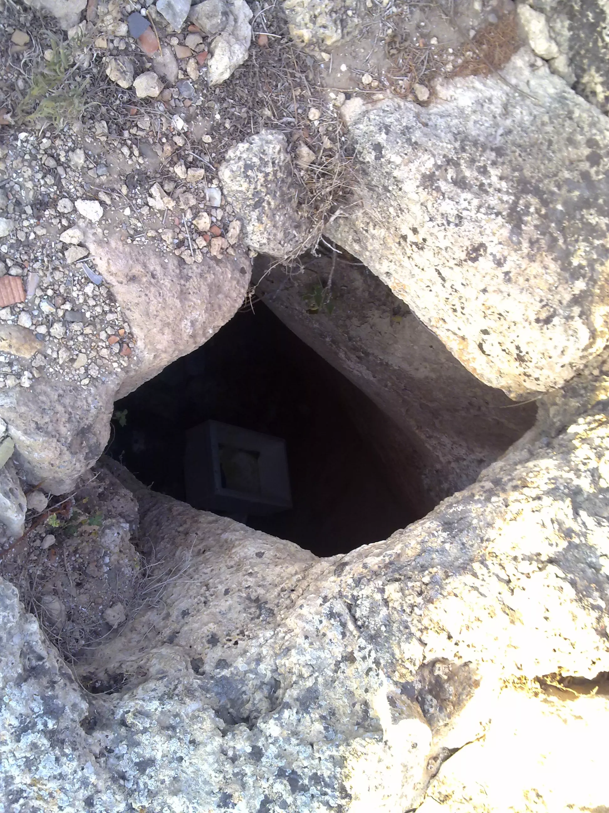
Posted by Aqsa Association-Palestine-1948 - The house remains of the Mosque's Mou'thin for Sarafand-Haifa-May-2002
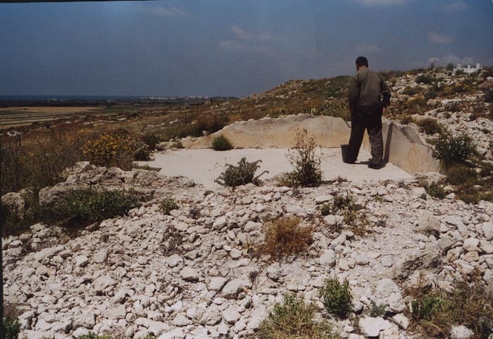
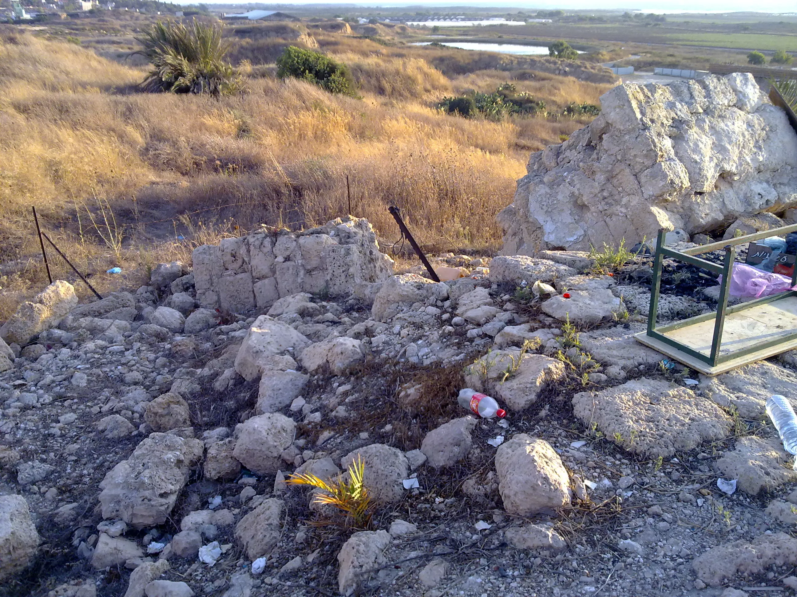
Posted by Aqsa Association-Palestine-1948 1 - House rubble in al-Sarafand
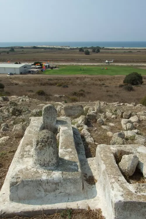
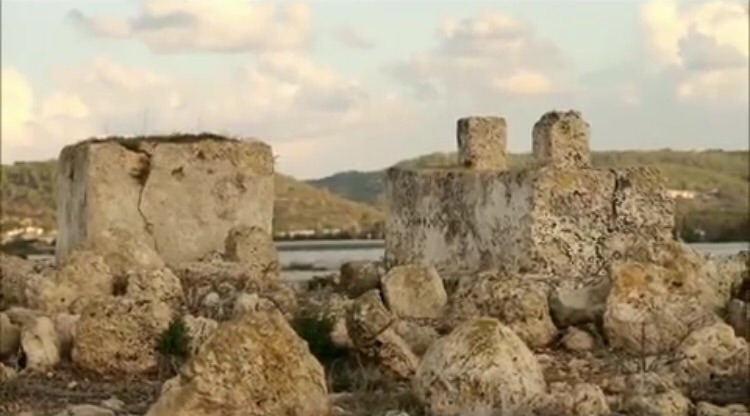
Posted by Abu Raya Muafaq - The cemetery and the skydiving airfield in the background.
Posted by Uri Zackhem - The cemetery
Posted by Uri Zackhem - The cemetery
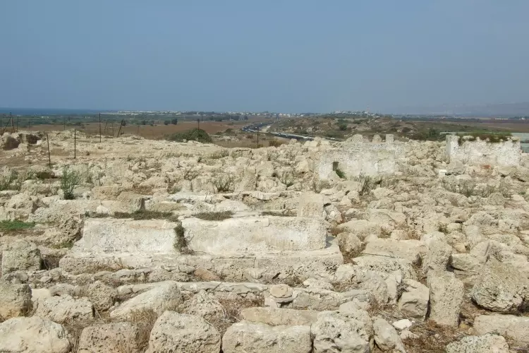
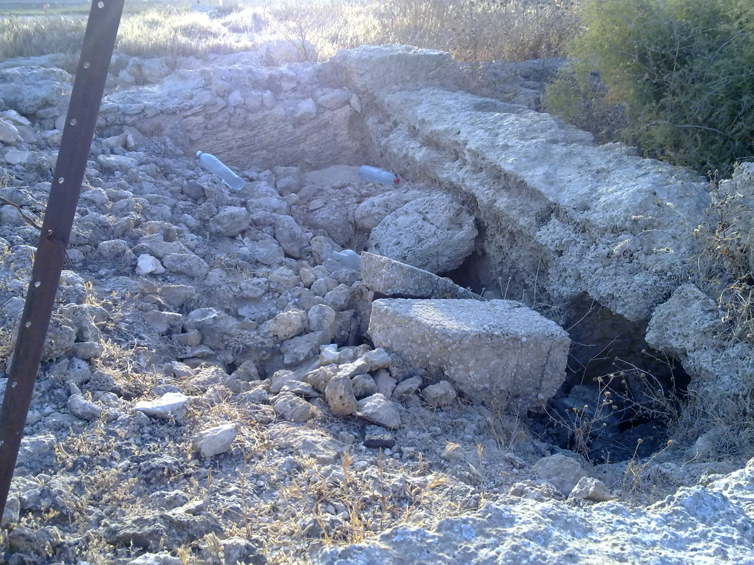
Posted by Uri Zackhem - Rubble at the south of the village.
Posted by Uri Zackhem - Remains of the mosque of Sarafand. It was demolished once the people wanted to rennovate it.
Posted by Uri Zackhem 1 - The water reservoir and the mosque.
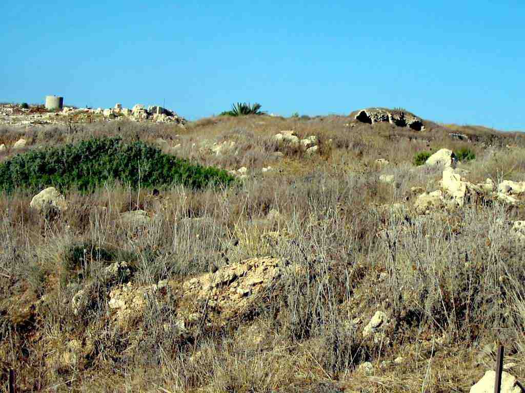
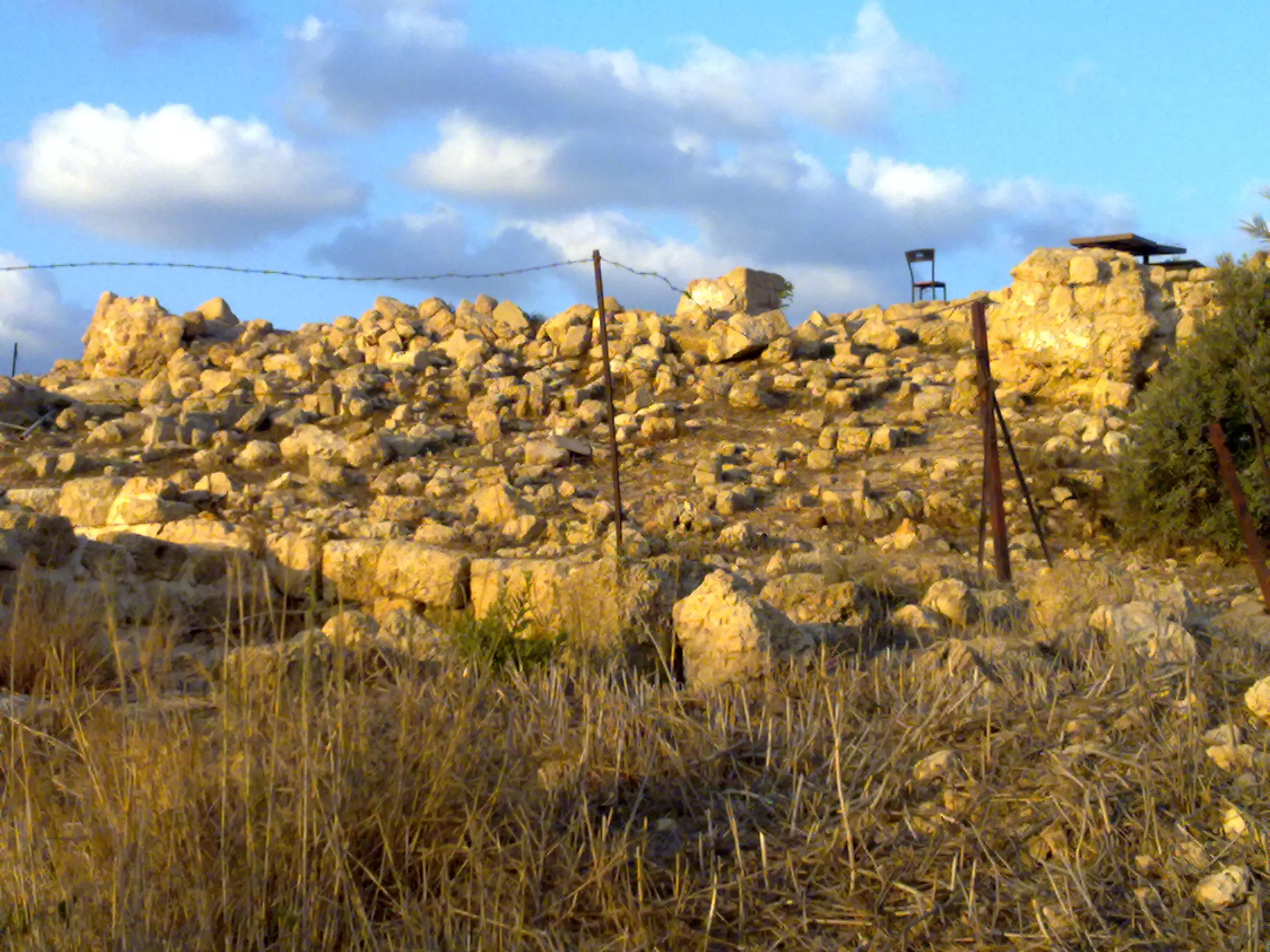
Posted by Uri Zackhem - General view - Rostom Shehadeh
Posted by rostom - General view - Rostom Shehadeh
Posted by rostom - General view - Rostom Shehadeh
Posted by rostom - General view - Rostom Shehadeh
Posted by rostom - General view - Rostom Shehadeh
Posted by rostom - General view - Rostom Shehadeh
Posted by rostom - Cemetery - Rostom Shehadeh
Posted by rostom - Rostom Shehadeh
Posted by rostom - Rostom Shehadeh
Posted by rostom - Rostom Shehadeh
Posted by rostom - Rostom Shehadeh
Posted by rostom - Rostom Shehadeh
Posted by rostom - General view - Rostom Shehadeh
Posted by rostom - Rostom Shehadeh
Posted by rostom - General view - Rostom Shehadeh
Posted by rostom - General view - Rostom Shehadeh
Posted by rostom - منظر من القريه
Posted by abu raya - موقع القريه
Posted by abu raya - هنا كانت القريه
Posted by abu raya - مقبره الصرفند
Posted by abu raya - بقايا الجامع
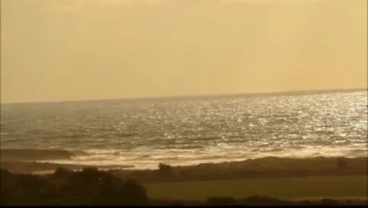
Posted by abu raya - منظر من الصرفند باتجاه البحر
Posted by abu raya - مقبره القريه
Posted by abu raya - مقبره الصرفند
Posted by abu raya - بقايا الجامع
Posted by abu raya - مستوطنه تسروفا المقامه على اراضي القريه وفي الافق جبال الكرمل
Posted by abu raya - منظر من القريه باتجاه جبل الكرمل
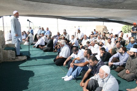
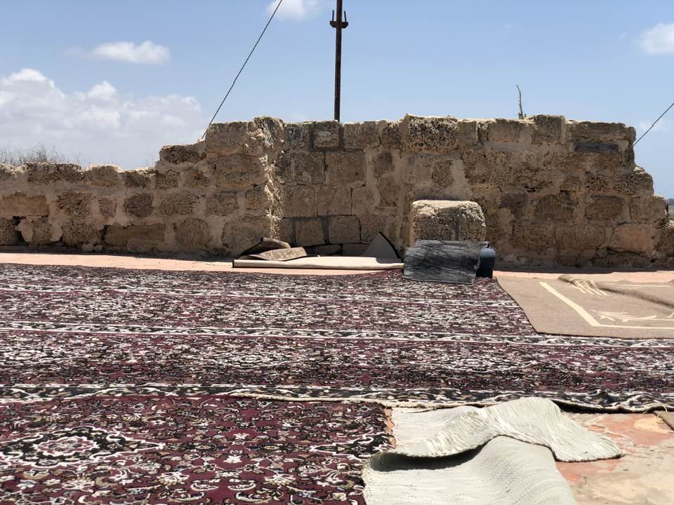
Posted by abu raya - صلاة جمعة بمسجد صرفند
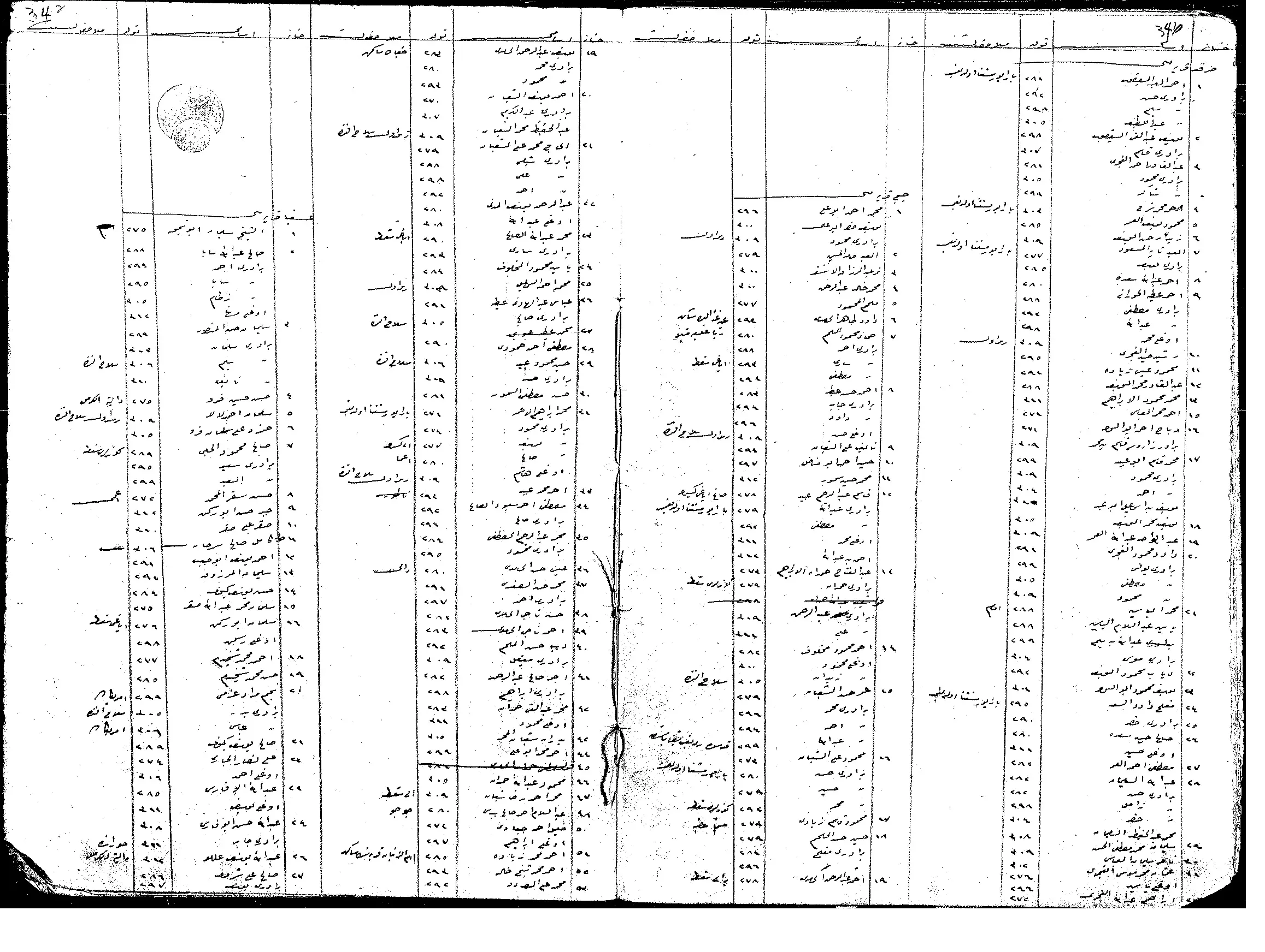
- السجلات العثمانية _ سجل نفوس رب الاسرة من سجلات المخاتير العثمانية الصرفند -- أنقر الصورة لتكبيرها
Posted by Wadi Alhawarith - That is how the "civilized" erased and replaced us: al-Sarfand was completely obliterated, as you see -- الصرفند باتت أثر بعد عين. من هنا مر الهمجّ
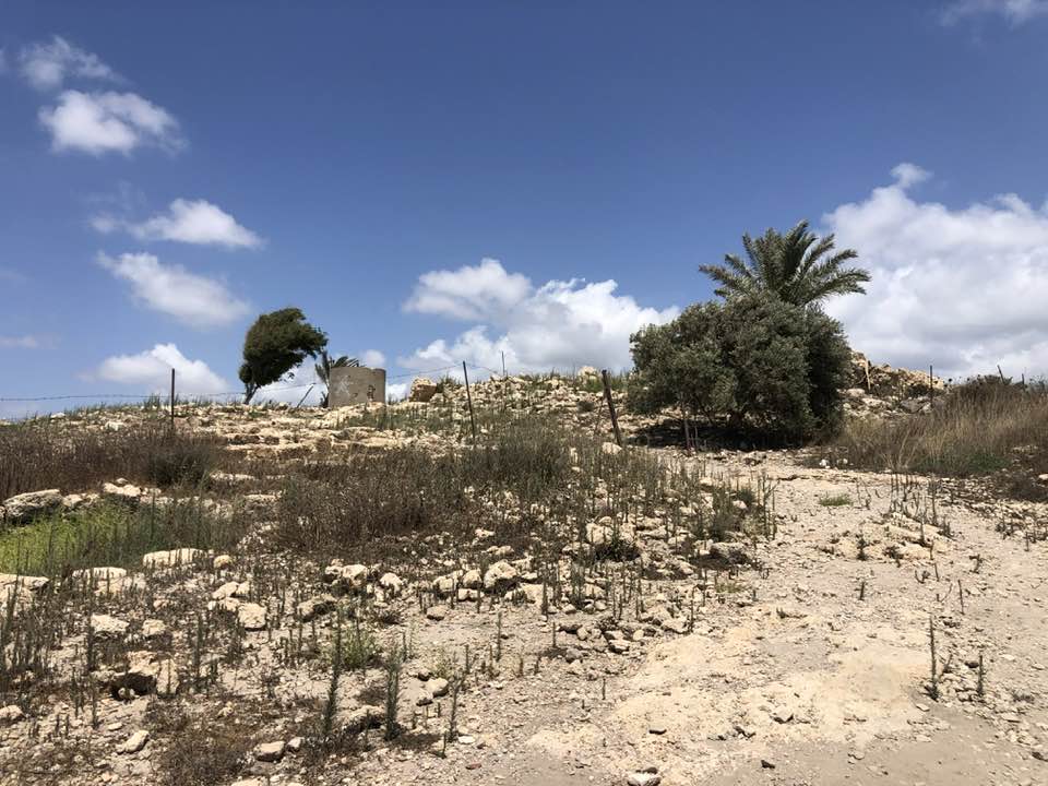
- That is how the "civilized" erased and replaced us: al-Sarfand was completely obliterated, as you see -- الصرفند باتت أثر بعد عين. من هنا مر الهمجّ
#2
- That is how the "civilized" erased and replaced us: al-Sarfand was completely obliterated, as you see -- الصرفند باتت أثر بعد عين. من هنا مر الهمجّ
#3
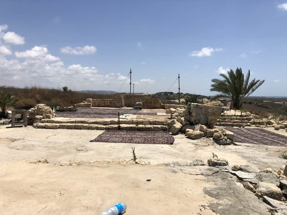
- That is how the "civilized" erased and replaced us: al-Sarfand was completely obliterated, as you see -- الصرفند باتت أثر بعد عين. من هنا مر الهمجّ
#4
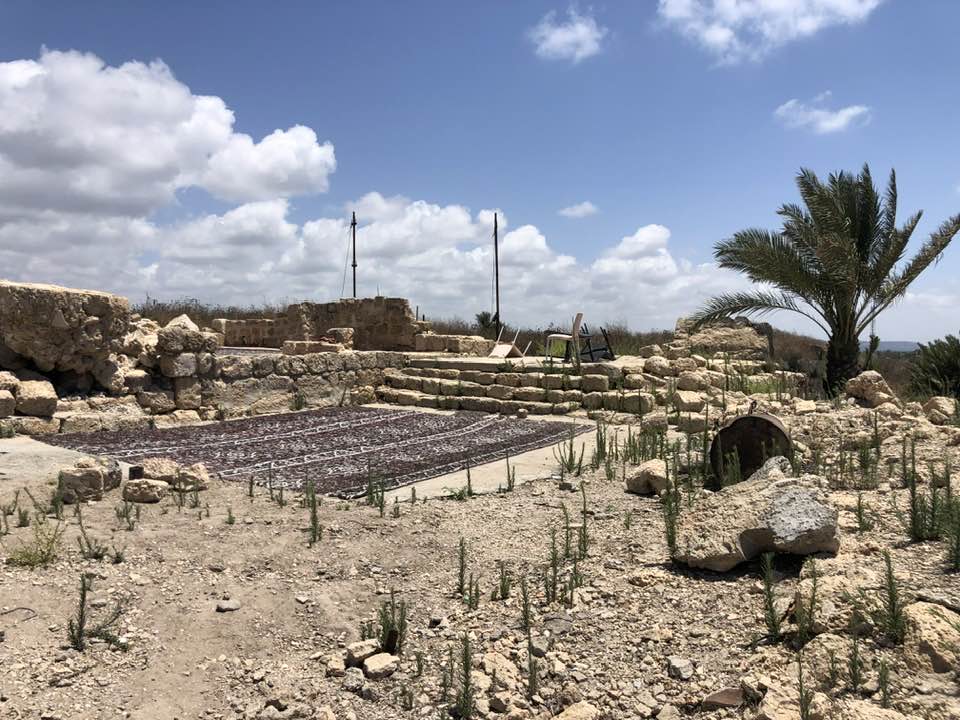
- That is how the "civilized" erased and replaced us: al-Sarfand was completely obliterated, as you see -- الصرفند باتت أثر بعد عين. من هنا مر الهمجّ
#5
- That is how the "civilized" erased and replaced us: al-Sarfand was completely obliterated, as you see -- الصرفند باتت أثر بعد عين. من هنا مر الهمجّ
#6
- That is how the "civilized" erased and replaced us: al-Sarfand was completely obliterated, as you see -- الصرفند باتت أثر بعد عين. من هنا مر الهمجّ
#7
- That is how the "civilized" erased and replaced us: al-Sarfand was completely obliterated, as you see -- الصرفند باتت أثر بعد عين. من هنا مر الهمجّ
#8
- That is how the "civilized" erased and replaced us: al-Sarfand was completely obliterated, as you see -- الصرفند باتت أثر بعد عين. من هنا مر الهمجّ
#9
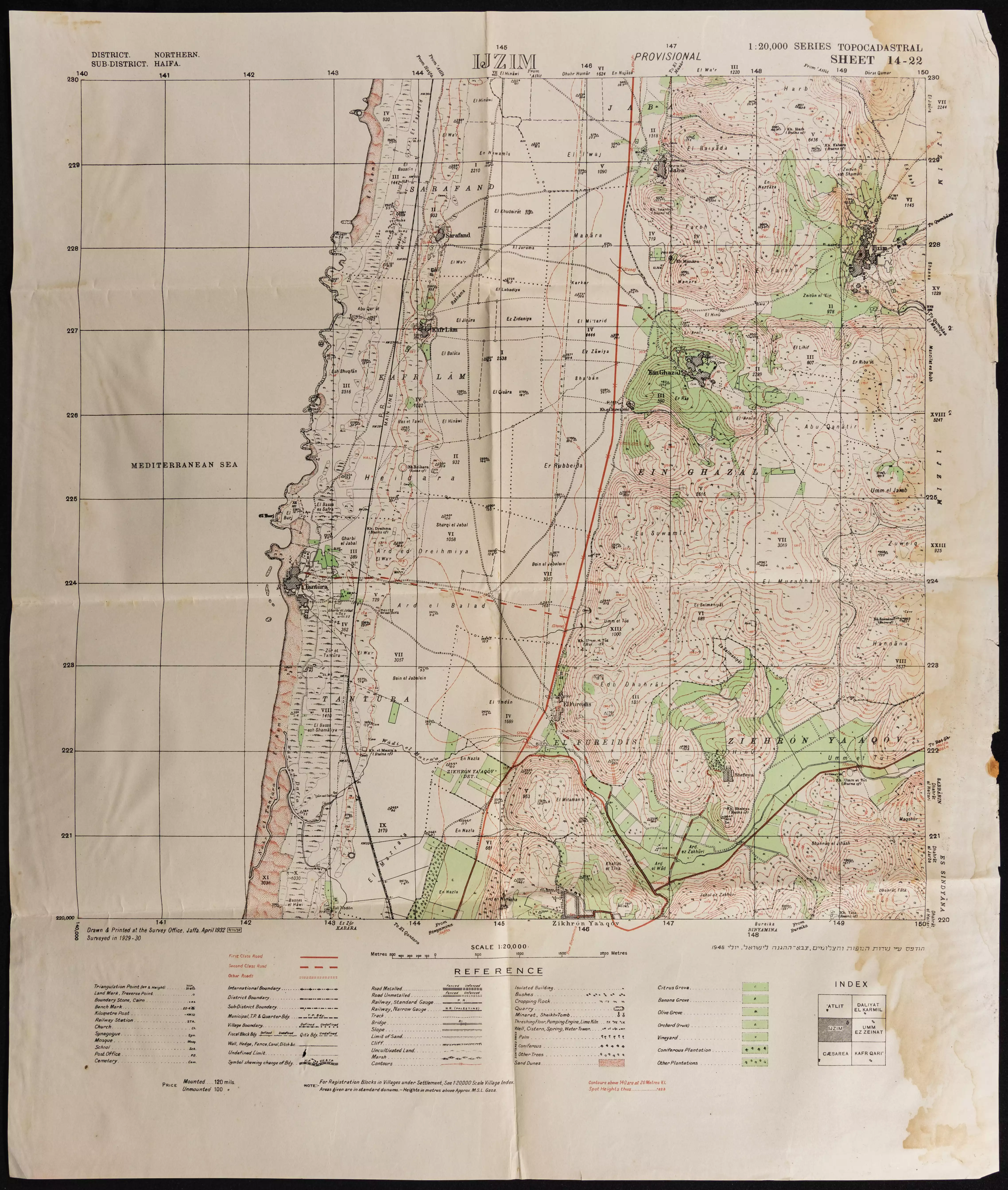
- خارطة تُظهِر الحدود والطرق بأنواعها والأماكن المقدسة والطبيعة الطوبغرافية من تلال وسهول ومنحدرات والتشكيلة الطبيعية للأرض وأنواع المزروعات. نُشرت الخريطة فترة الانتداب البريطاني، تم إضافة تعديلات عليها من قِبَل خدمة الخرائط والصور التابعة للقوات العسكرية الاسرائيلية فترة الأربعينيات.
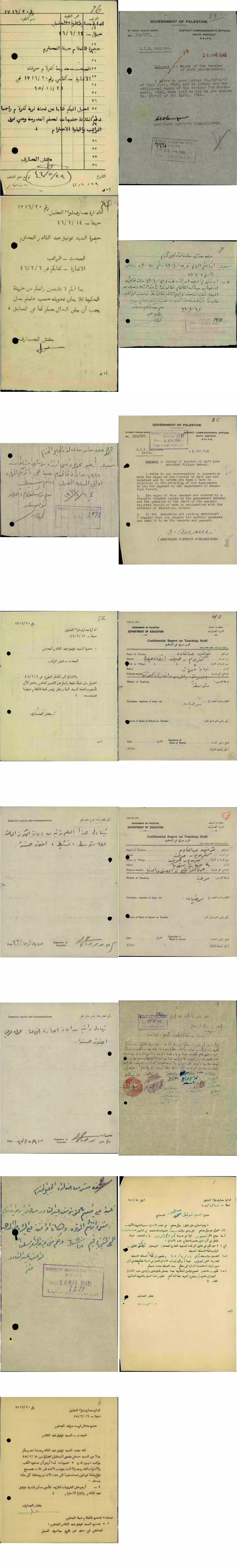
- مجموعة من الوثائق التي تخص تعين المعلم توفيق عبد القادر -- من قنير-- في مدرسة كفر لام والصرفند-- أنقر الصورة لتكبيرها - 1945 الى 1947
-
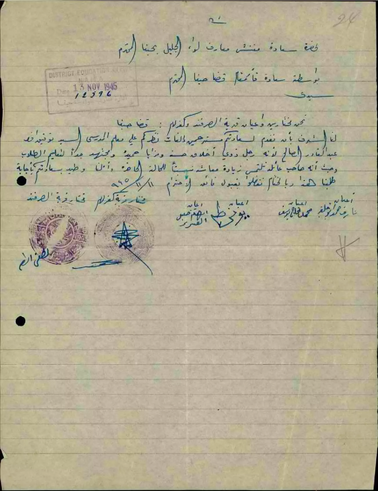
رسالة من مختارين وأعيان قرية الصرفند وكفر لام إلى مفتش المعارف يلفتون نظره على المعلم توفيق عبد القادر وحسن أخلاقه واجتهاده مطالبين زيادة معاشه -- 11-11-1945
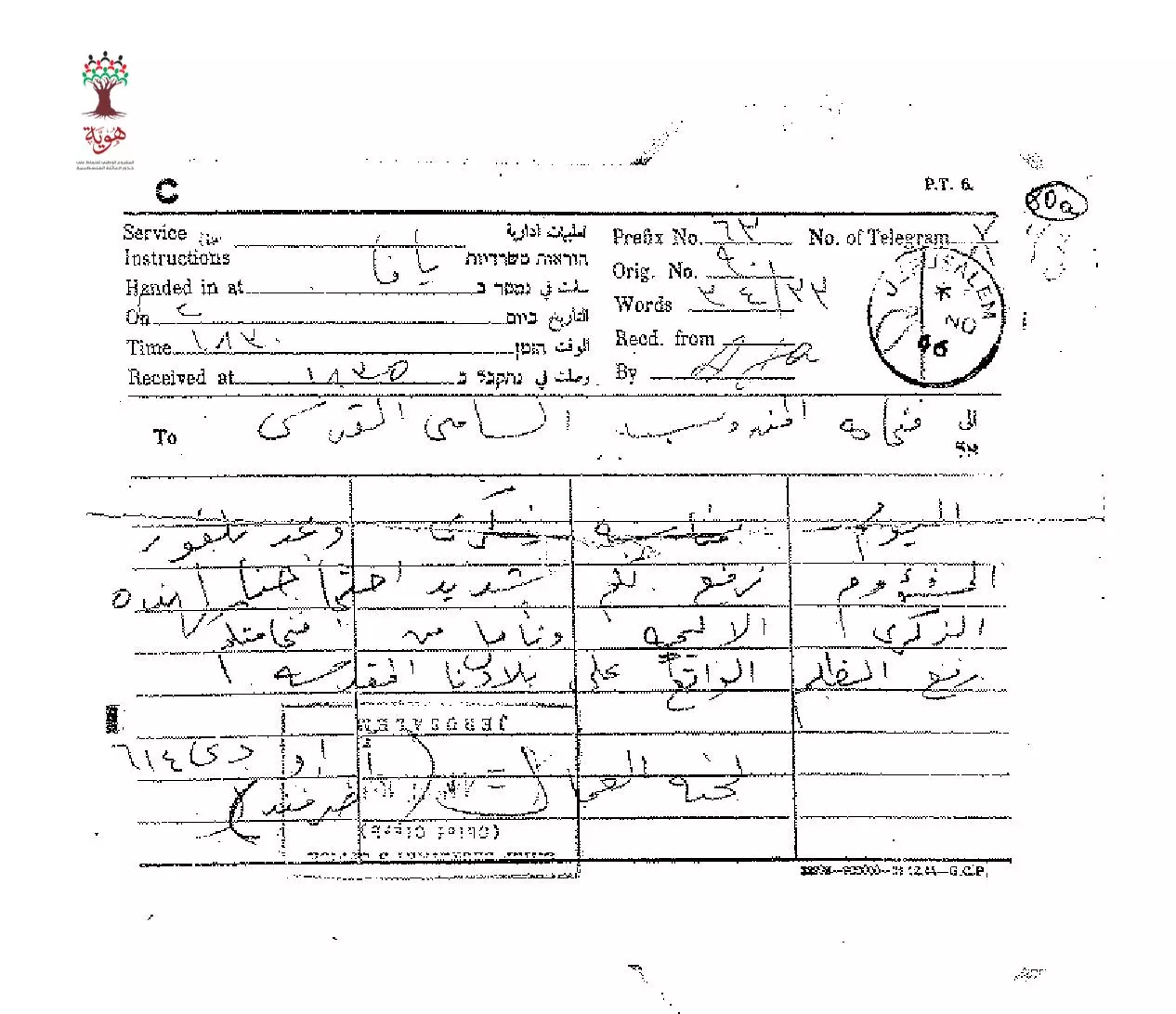
- تلغراف مرسل من لجنة العمال في الصرفند الى المندوب السامي احتجاجا على وعد بلفور --02-11-1946
Want to browse more? 80,000 pictures were grouped in these gallaries:
| Display Name | Clan/Hamolah | Country of Residence |
| mohammed omar amro | amro | mosul, Iraq |
| raed amru | - | - |
| ahmad amroo | amroo | syria, syria |
- كل ما تبقى من قرية الصرفند منذ النكبة Duration: 8 min 14 sec
- قرية وشاطئ الصرفند المهجرة قضاء حيفا Duration: 2 min 38 sec
- صرفند حيفا: قصة الجامع الكبير وصمود المصلين فيه Duration: 2 min 54 sec
- ما تبقى من مسجد قرية صرفند المهجرة قضاء حيفا . Duration: 16 sec
No links have been shared yet, be free to the first to share the first link.
 Fake Valor: Why Did Zionist Jews Hoist Nazis Flag on Their Ships in the 1930s?
What is new?
-
Facts About Oct. 7th Gaza Raid
-
Remined Us Please: Who Did Rape Whom? Was it Palestinians who raped Israelis? Or, was the other way around? You'll be the judge
-
When Prof. Edward Said was invited to debate Bibi Netanyahu in the 1980s, watch what happened!
-
Ezra Klein of the NY Times on the "Jewish Race".
-
Abusing Blood Libel!
-
How and why Israeli Jewry has become the most hated cult?
-
Did Israeli Soldiers Activate The Hannibal Direective On Oct. 7th? You Be The Judge
-
Zionist FAQ: Isn't it true that Palestinians don't want peace? Palestinians never accepted the two-state solution
- Facts about Haavara (Transfer) Agreement between Ben-Gurion & Hitler
-
Haavara FAQs: Why Did Zionist Jews Hoist Nazis' Flags on Their Ships in the 1930s?
- Haavara FAQs: When Chaim Weizmann met FDR in mid-1943, why was he silent about rescuing European Jewry?
-
Dear ChatGPT: How did Palestinians resist Napoleon's invasion of their country in 1799?
-
Dear ChatGPT: Gaza had a vibrant Jewish community in the mid-17th century. What happened to them?
-
Dear ChatGPT: Why did the Jewish Agency suppress news of the Holocaust during WWII?
-
Video Playlist: Jews share their DNA tests to end the conflict for good.
-
A Tale of Two Conflicts: Examining the Definition of Genocide
-
Prof. Abraham Polak And The Suppressed History of the Khazars and European Jewry
-
How Ronald Reagan would have framed the genocide in Gaza if he were still alive?
-
Haavara FAQs: Let us do the math: how many German Jews did The Haavara Agreement save?
-
Zionist FAQs: The Hebron Massacre of 1929, "clearly proves" that Palestinians are antisemitic, how could you deny it?
-
Zionist FAQs: Why Anti-Zionist Is Not Antisemitism?
-
Zionist FAQs: Isn't it true that the KGB created Palestinian Nationalism in the early 1960s?
- Zionist FAQs: Muslims are killing Muslims all the time; why are Israeli Jews being singled out in the media?
- Zionist FAQs: How is Israel an apartheid state when 20% of its citizens are Arabs who enjoy full rights?
-
Haavara FAQs: Why Did Dorothy Thompson Flip From A Zionist Advocate to A Silenced Dissenter?
-
Haavara FAQs: Analysis of Herzl's Uganda Scheme and how it could have saved millions of Jews.
-
Haavara FAQs: Why did Hayim Greenberg describe American Jewry as "morally bankrupt" in early 1943?
-
Haavara FAQs: What if the Evian Conference was a resounding success? What would have been the impact of saving European Jewry on Zionism?
- Haavara FAQs: What if the six million were saved, how that would have impacted the Zionist project?
-
Haavara FAQs: How did Zionist leaders react when Europe's Jews lingered in the DP camps after WWII ended?
-
Why does the American Jewish community repeat lies that David Ben-Gurion had debunked before he died?
-
Who has the power to rename the Tatar/Khazar Gene Marker to Jewish IV?
-
Zionist FAQs: Why won't Egypt, Syria, and Jordan take their people back? Jews are indigenous to Palestine, and Arabs immigrated after Jews developed the country. Arabs should leave.
-
Haavara FAQs: Did Hitler and the Nazis conflate between Judaism and Zionist? If that wasn't case, then why?
-
Haavara FAQs: Winston Churchill and antisemitism, a collection of articles written Churchill.
-
Haavara FAQs: Broken by country, how many Jews survived vs. killed during the Holocaust?
-
Haavara FAQs: Why did European Jews vote with their feet and to immigrated to the Americas, not Palestine, after WWII?
-
Watch this American Jewish Girl describing Israeli Jews' cognitive dissonance like no other in under two minutes
-
Haavara FAQs: When the Nazis went out of their way to hide the Holocaust, Israeli Jews did the exact opposite by broadcasting their genocide of Gazans. But why?
-
Haavara FAQs: How Zionist Jews went out of their to show their appreciation to Nazism and Fascism?
- Haavara FAQs: Why Zionist leaders were against bombing the death camps & the Railroads leading to them?
-
Haavara FAQs: Hitler's message to the British and American people: If Jews are such noble citizens and you care about them, how come you're not letting them in? I will gladly ship them to you at my expense, even on luxury liners!
-
A shortlist of Zionist and Israeli false flag operations in the name Jews.
-
The Most Moral Army
- The Land of Kapos (Israel): Where the brave are boycotted and Kapos walk free.
- Why did early Zionists often named their communal enterprises "colonial"?
- Zionist Relations with Nazi Germany by Faris Glubb
-
Two NY Times advertisements by Zionists in the early 1943 that exposes Zionists' treason at the height of the calamity
- Facts Not Lies about the Palestinian-Israeli Conflict.
- Site's pictures have been categorized
- Campgain Against Lice
- A Survey of Palestine, the official source about Palestine before Nakba produced by the British Mandate; over 1200 pages.
- Satellite View & Google Earth: Over 6,000 placemarks identifying all destroyed towns, W. Bank & Gaza Strip Towns, & refugee camps.
- PalestineRemembered.com and its Nakba Oral History Project were featured on al-Jazeera Satellite TV.
- Nakba Oral History Video Podcast:
 Over 700 Oral History interviews (including 3,500+ hours of recording) can be viewed online.
 - Palestine Village Statistics Project
- Gaza Jail Break
- النسخة العربية للموقع الان متوفرة
- Videos: Documenting the destroyed villages in video: Tracing all that remains since Nakba.
- Videos: Responding to Zionist Propaganda
- Interview: The ethnic cleansing of Palestine: George Galloway interviews Israeli Historian Ilan Pappe.
- For Palestinians, memory matters. It provides a blueprint for their future By George Bisharat.
- Zionist FAQ now available in Hebrew שאלות שציונים שואלים, עכשיו בעברית
- Video: The Stephen Walt and John Mearsheimer report on the influence of the Israel Lobby on U.S. Foreign Policy
- The Palestinian-Israeli conflict for beginners
