| PalestineRemembered | About Us | Oral History | العربية | |
| Pictures | Zionist FAQs | Haavara | Maps | |
| Search |
| Camps |
| Districts |
| Acre |
| Baysan |
| Beersheba |
| Bethlehem |
| Gaza |
| Haifa |
| Hebron |
| Jaffa |
| Jericho |
| Jerusalem |
| Jinin |
| Nablus |
| Nazareth |
| Ramallah |
| al-Ramla |
| Safad |
| Tiberias |
| Tulkarm |
| Donate |
| Contact |
| Profile |
| Videos |
Welcome To Zakariyya - زكريا (זכריא)
|
District of Hebron
Ethnically cleansed days ago |
العربية Google Earth |
 |
Gallery (79) |
- Statistics & Facts
-
Before & After

- Satellite View
- Articles 4
- Pictures 79
- Aerial Views 1
- Oral History 4
- Members 78
- Families
- All That Remains
- Wikipedia
- Videos 3
- Guest Book 30
- Links 2
| Statistic & Fact | Value | ||||||||||||||
| Occupation Date | October 23, 1948 | ||||||||||||||
| Distance From District | 25 (km) Northwest of Hebron | ||||||||||||||
| Elevation | 275 (meters) | ||||||||||||||
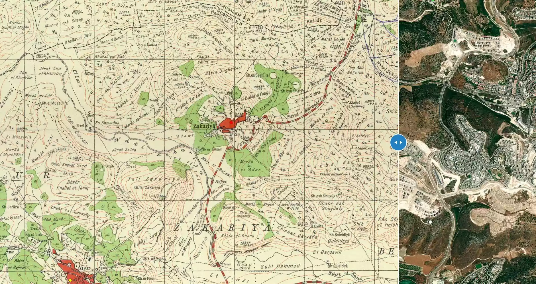
| Before & After Nakba, Click Map For Details |
|||||||||||||||
|
|||||||||||||||
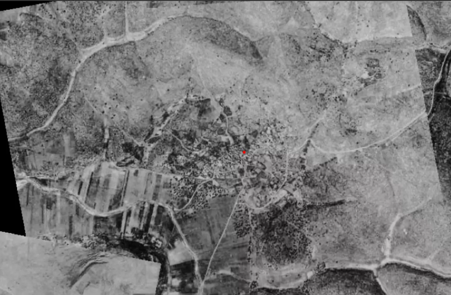
| Pre-Nakba Aerial View |
|||||||||||||||
|
|||||||||||||||
| Map Location | See location #2 on the map View from satellite |
||||||||||||||
| Military Operation | Either Operations ha-Har or Operation Ya'ov | ||||||||||||||
| Attacking Units | Possibly Giv'ati Brigade's Fourth Battalion | ||||||||||||||
| Defenders | Egyptian Muslim Brotherhoods, local Palestinian militias and some Arab Liberation Army volunteers | ||||||||||||||
| Exodus Cause | Military assault by Zionist troops | ||||||||||||||
| Village Temains | Zakariyya was partially destroyed, and the all remaining houses and its mosque became the property of the Jewish National Fund and Israeli government. Some Kurdish or Khazari Jews have taken residence in some of its houses. | ||||||||||||||
| Ethnically Cleansing | Zakariyya was completely ethnically cleansed on June 9th, 1950 based on the orders of Yosef Weitz, a Jewish National Fund (JNF) official. We hope that JNF will be taken to court for their terror acts one day, especially in US and Europe courts. This racist organization has been the engine behind confiscating and destroying many of the Palestinian properties to make sure Palestinians do not come back to their homes and farms. | ||||||||||||||
| Terminating Refugee Camps | Many of the villagers still live in the Dihaysha and al-'Aroub Refugee Camps in the Occupied Bethlehem and Hebron districts. Few of its orginial residents became internal refugees in Israel, and some were ethnically cleansed to al-Ramla. | ||||||||||||||
| Pre-Nakba Land Ownership |
**Town Lands' Demarcation Maps |
||||||||||||||
| Land Usage As of 1945 |
|
||||||||||||||
| Population |
|
||||||||||||||
| Number of Houses | In (1931): 189 | ||||||||||||||
| Near By Towns |
|||||||||||||||
|
|
|||||||||||||||
| Town's Name Through History | Zakariyya was known to the Romans by Caper Zacharia. | ||||||||||||||
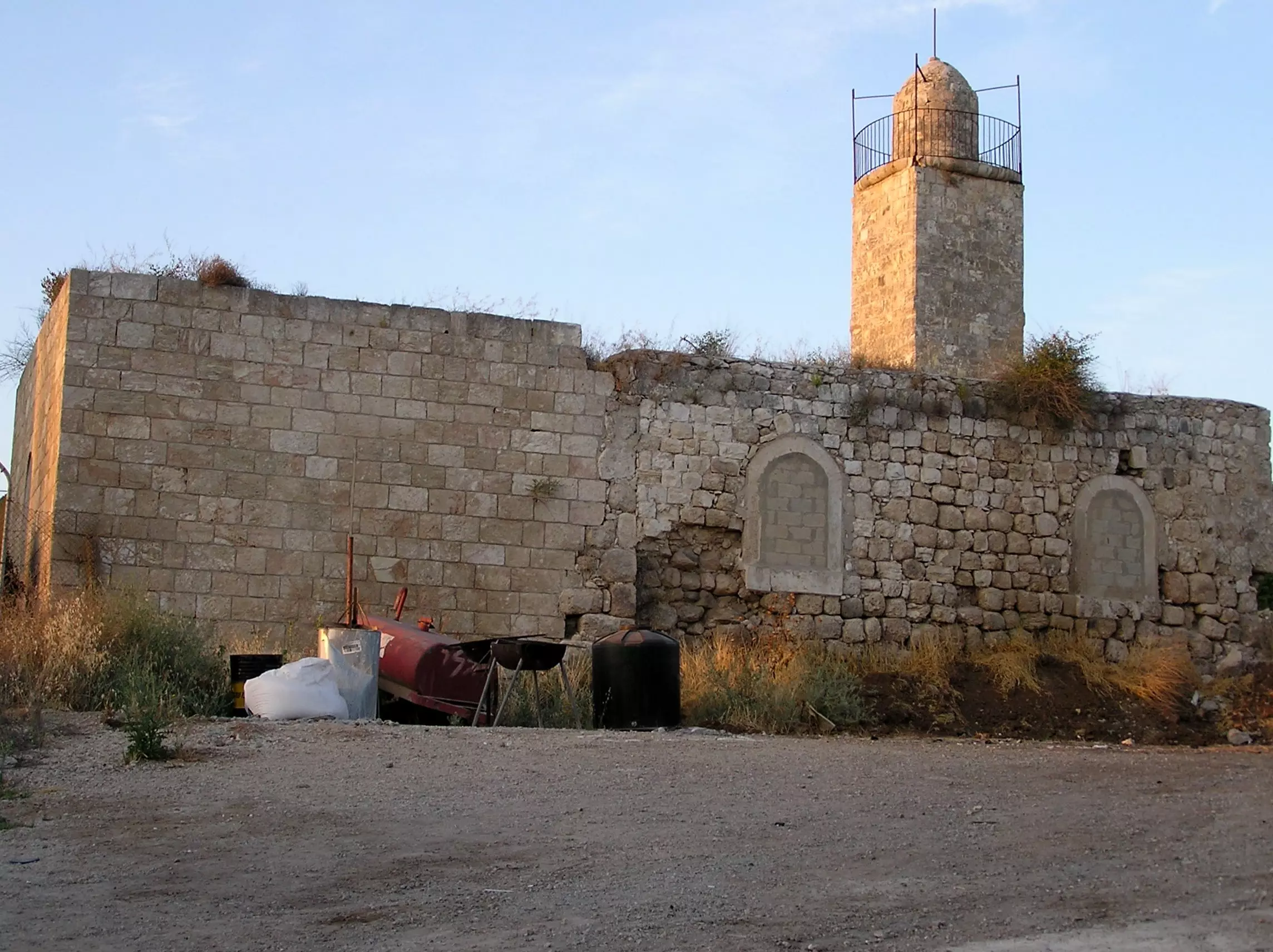
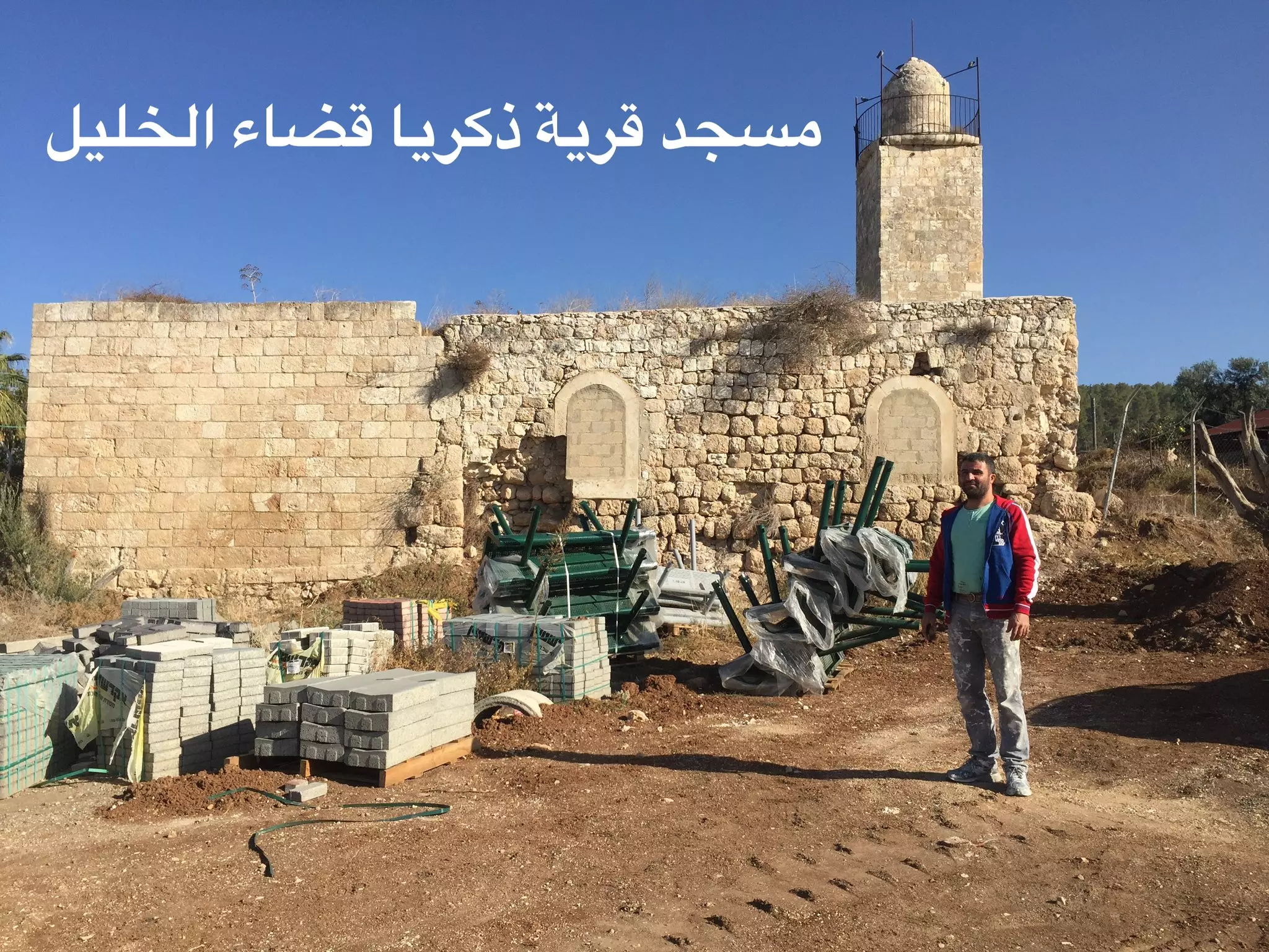
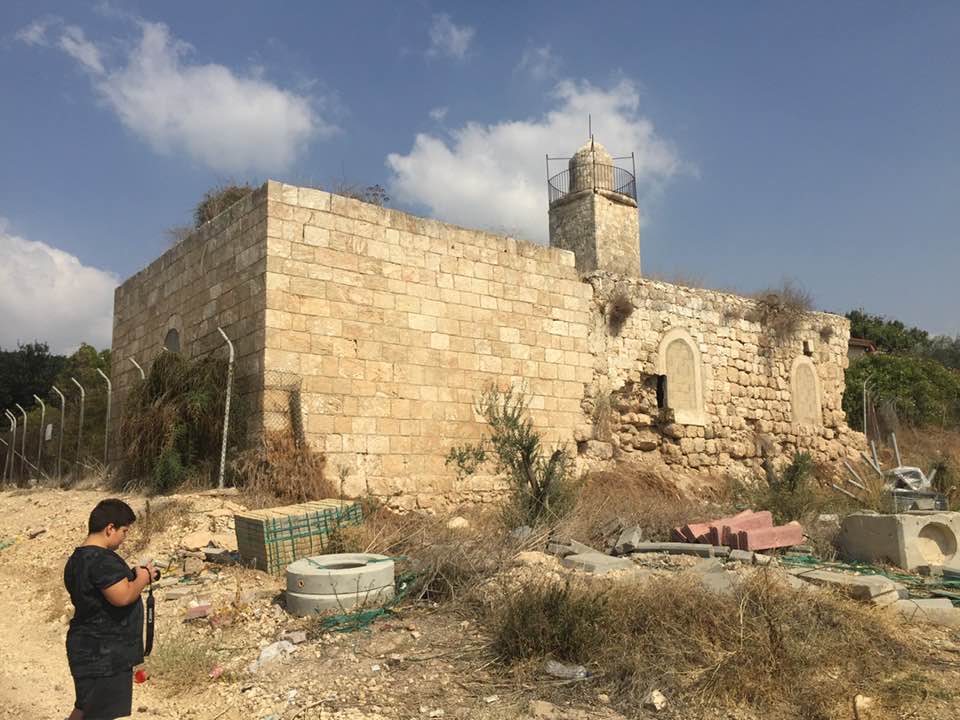
| Places of Warship | One Mosque (still standing) | ||||||||||||||
| Water Supply | The villagers obtained their drinking water from two communal wells:- al-Saflani well which was drilled next to Wadi 'Ajjur, and al-Sarara well located north of the village. | ||||||||||||||
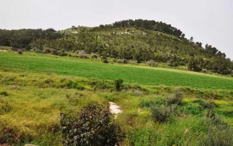
| Archeological Sites | According to the Bible David fought Goliath at Tall Zakariyya! | ||||||||||||||
| Exculsive Jewish Colonies Who Usurped Village Lands |
Zekharya and possibly Beit Shamesh too. | ||||||||||||||
| Featured Video | |||||||||||||||
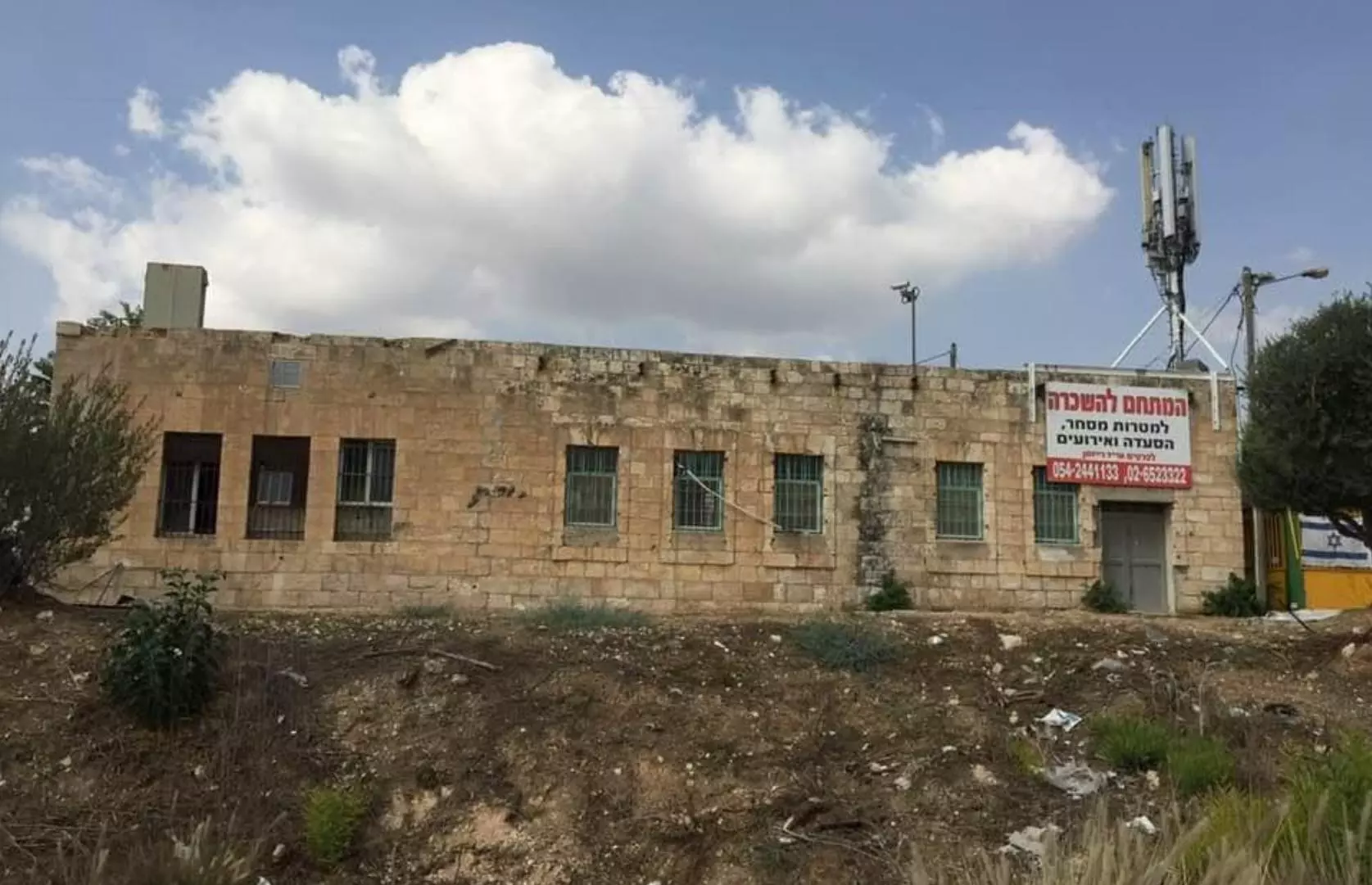
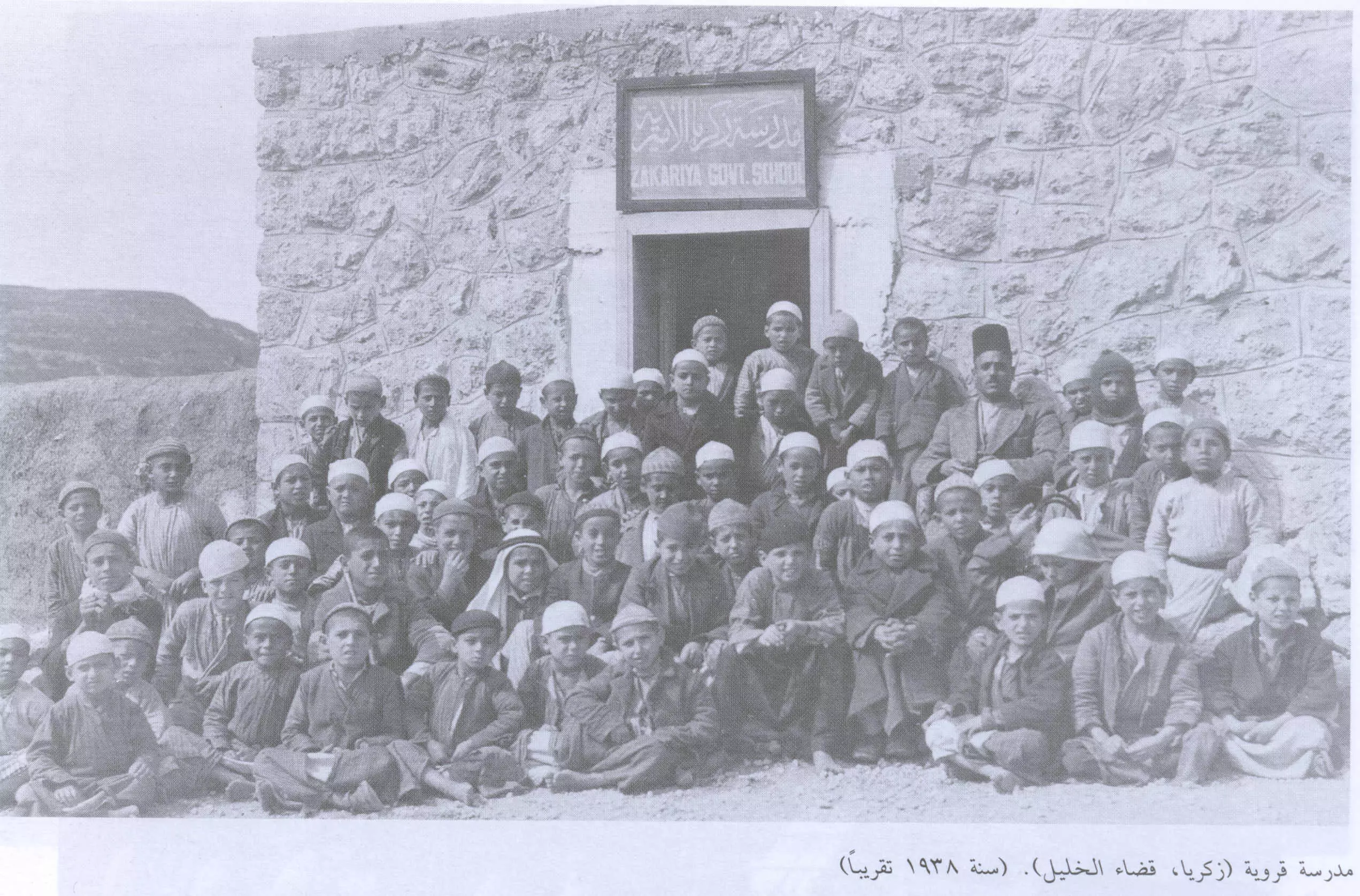
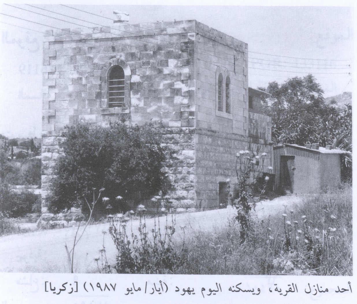
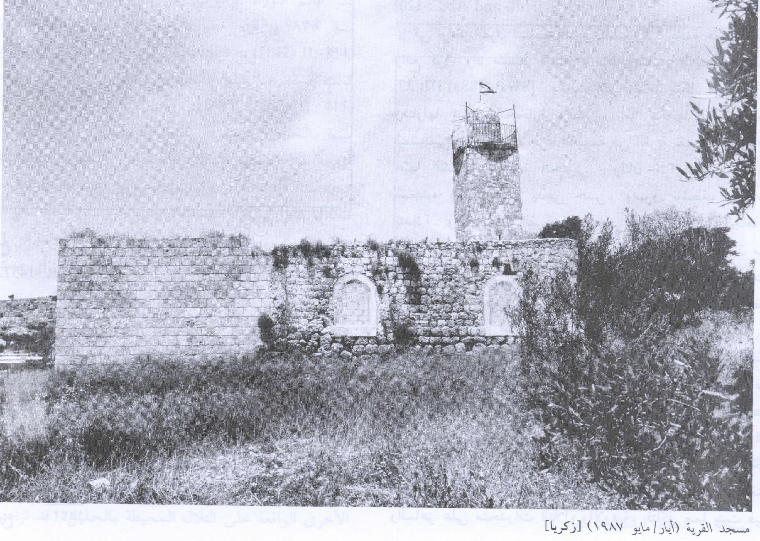
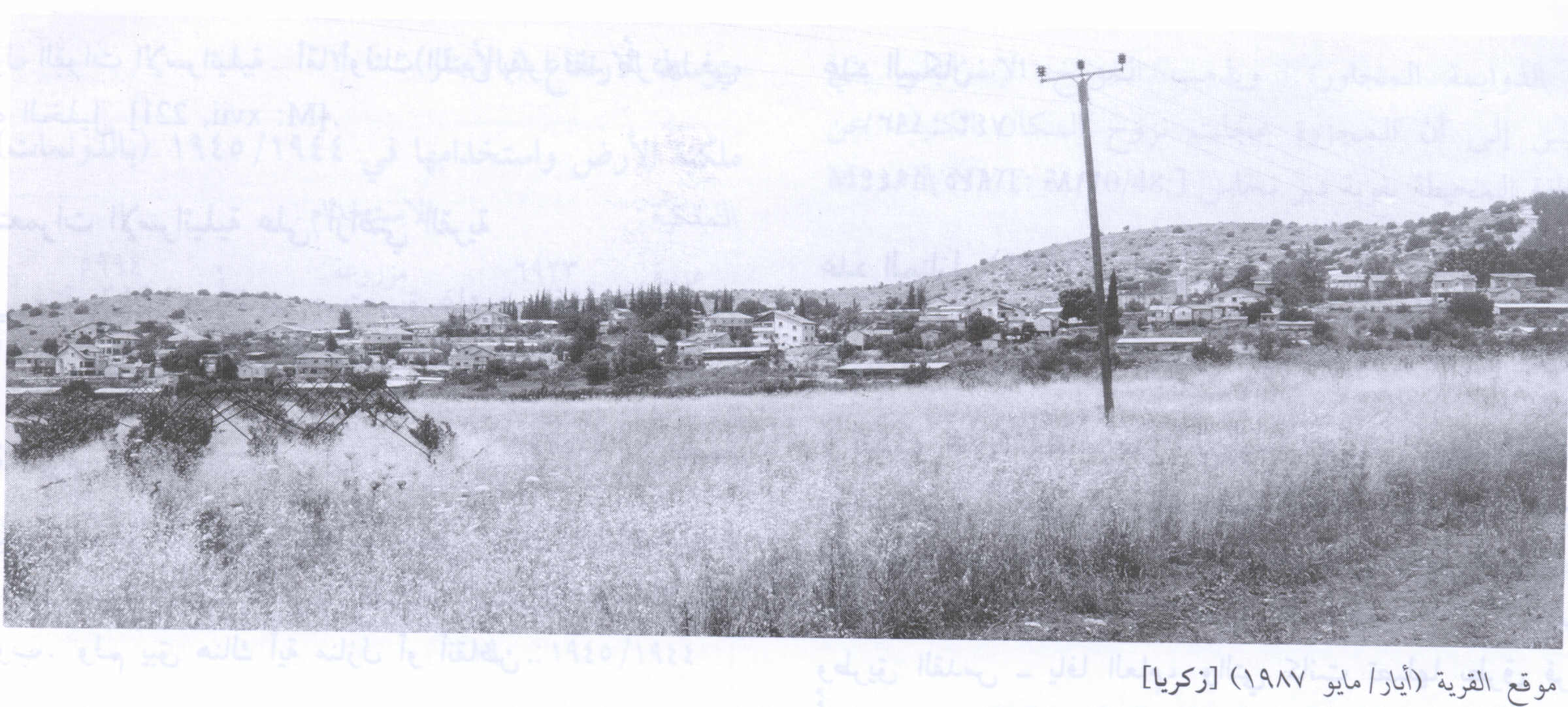
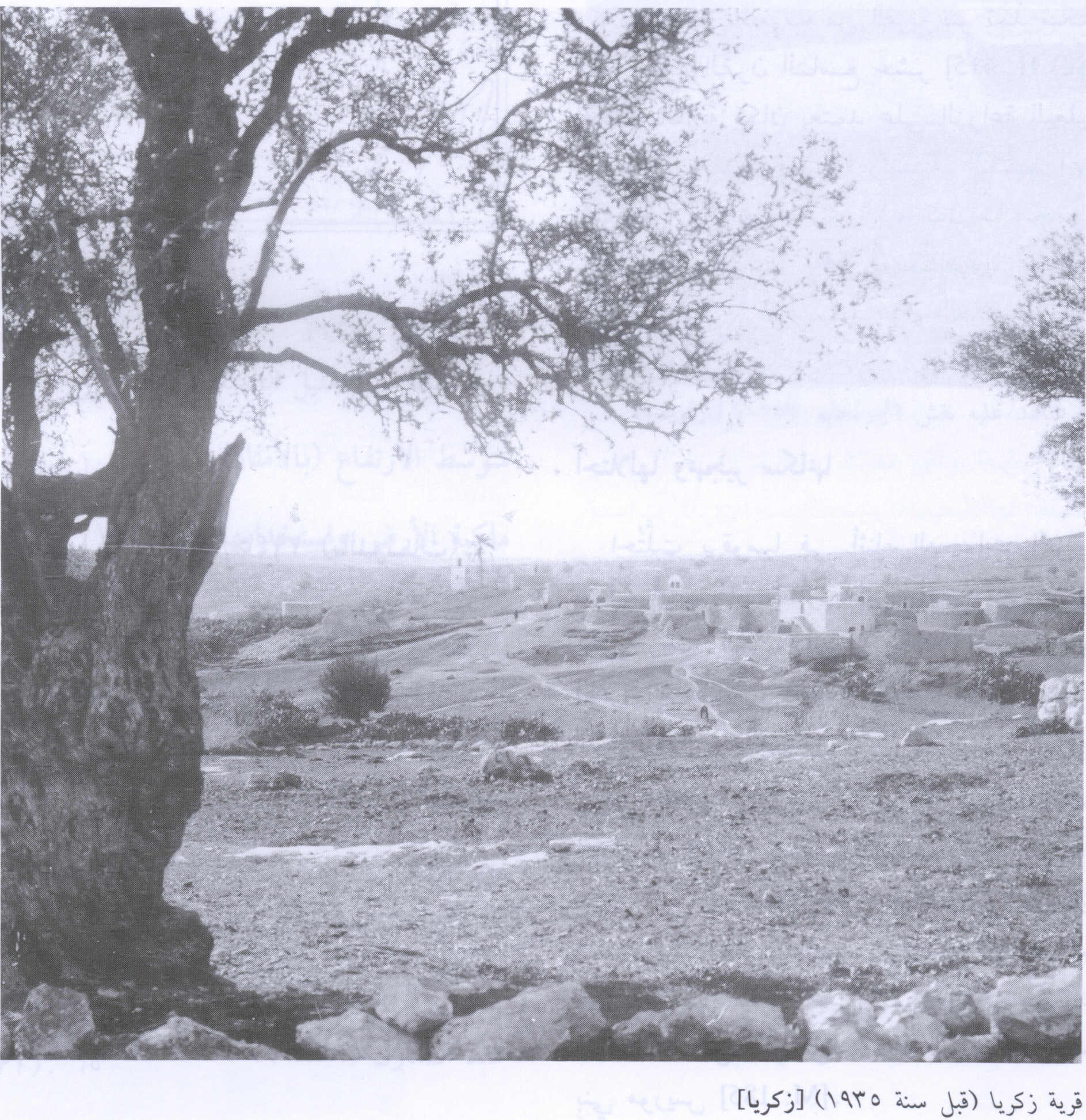
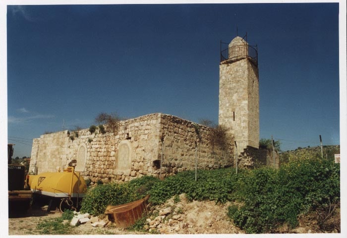
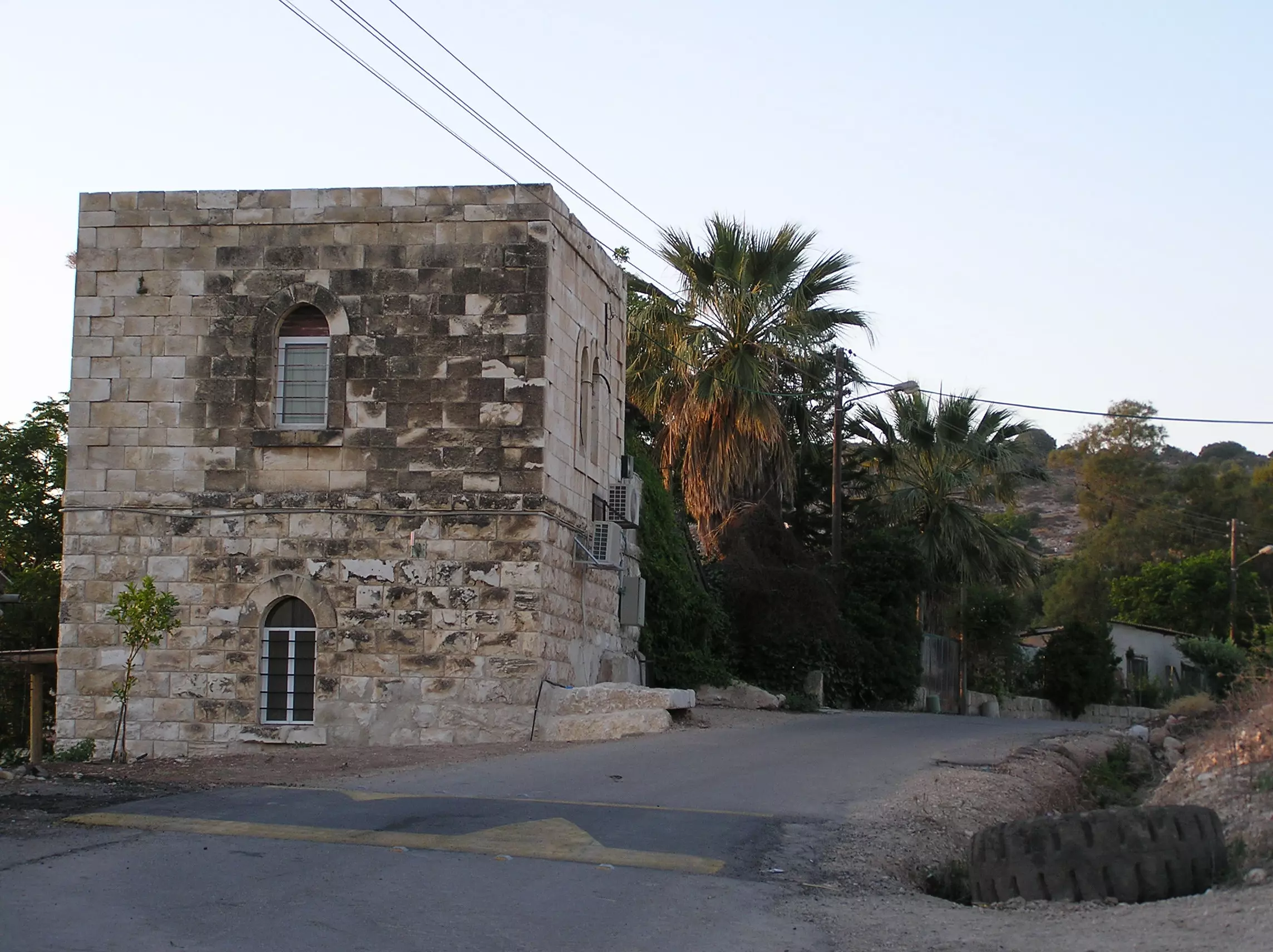
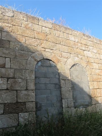
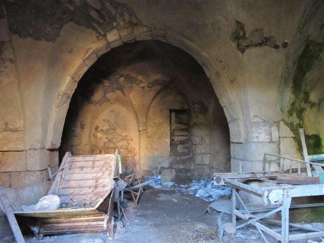
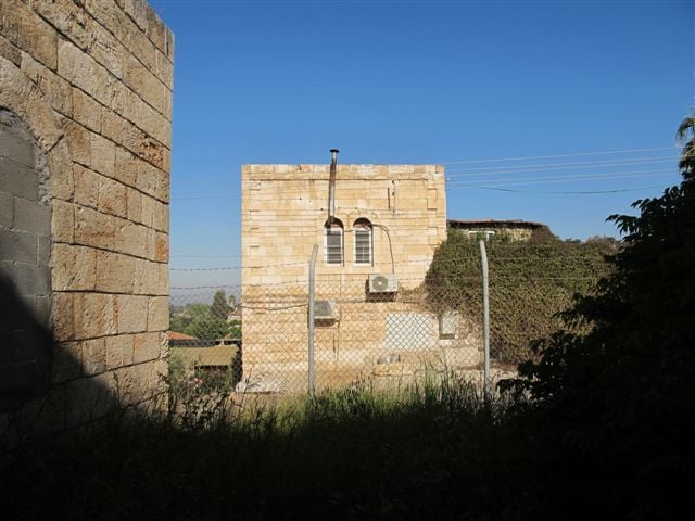
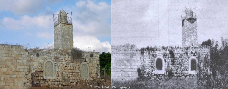
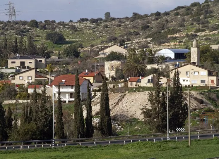
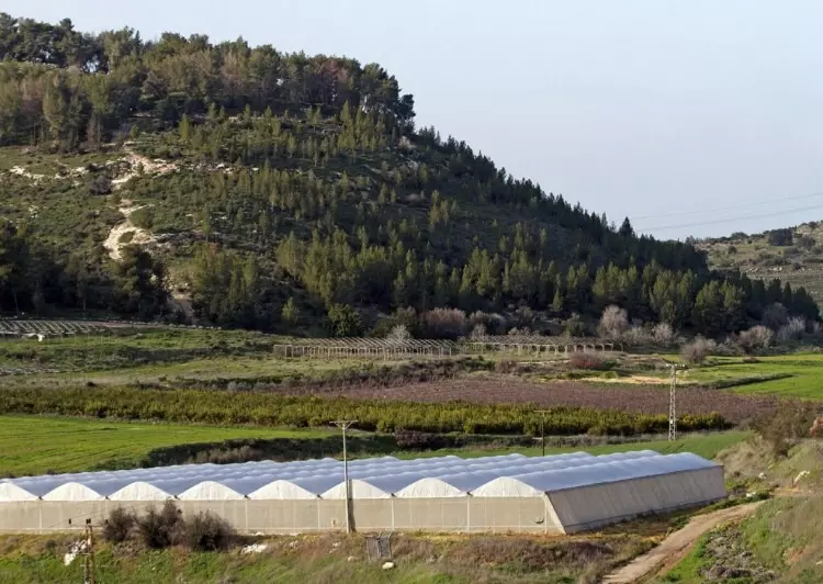
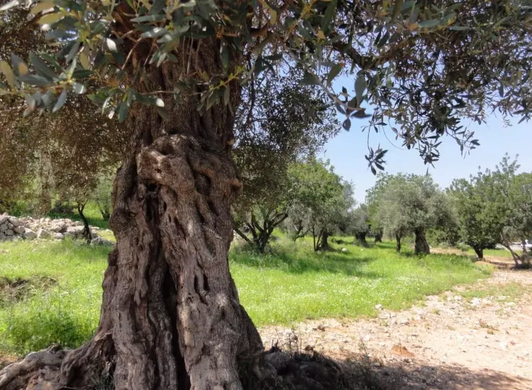
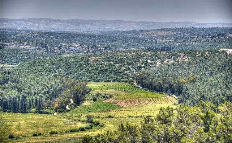
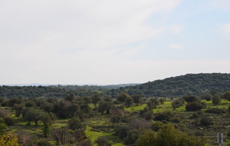
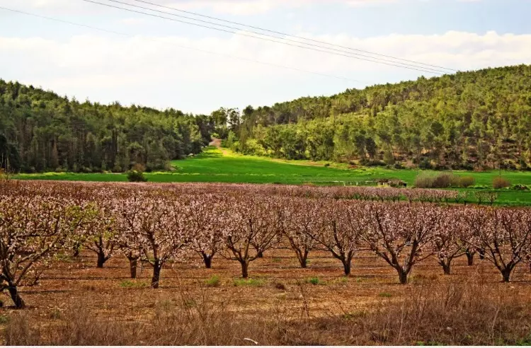
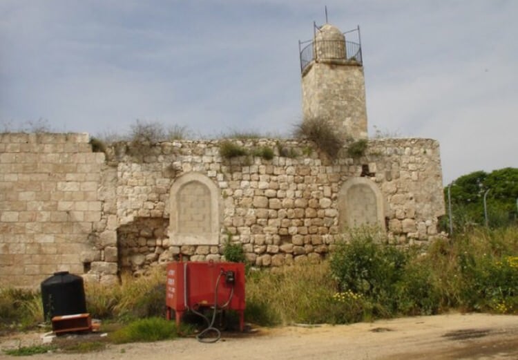
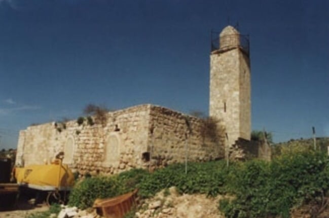
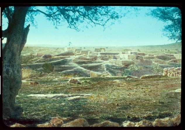
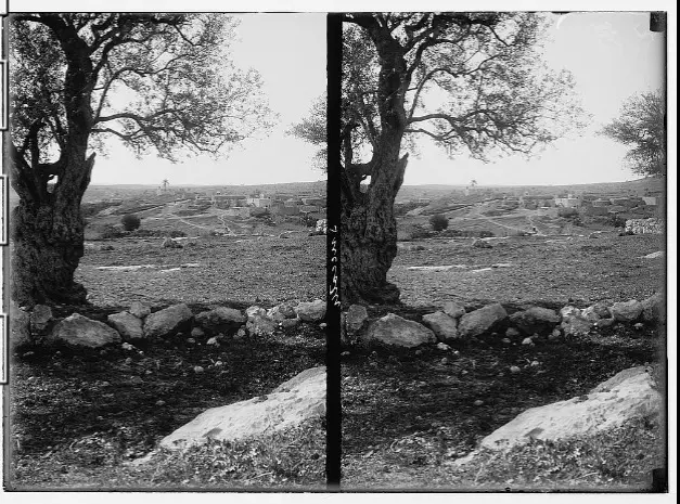
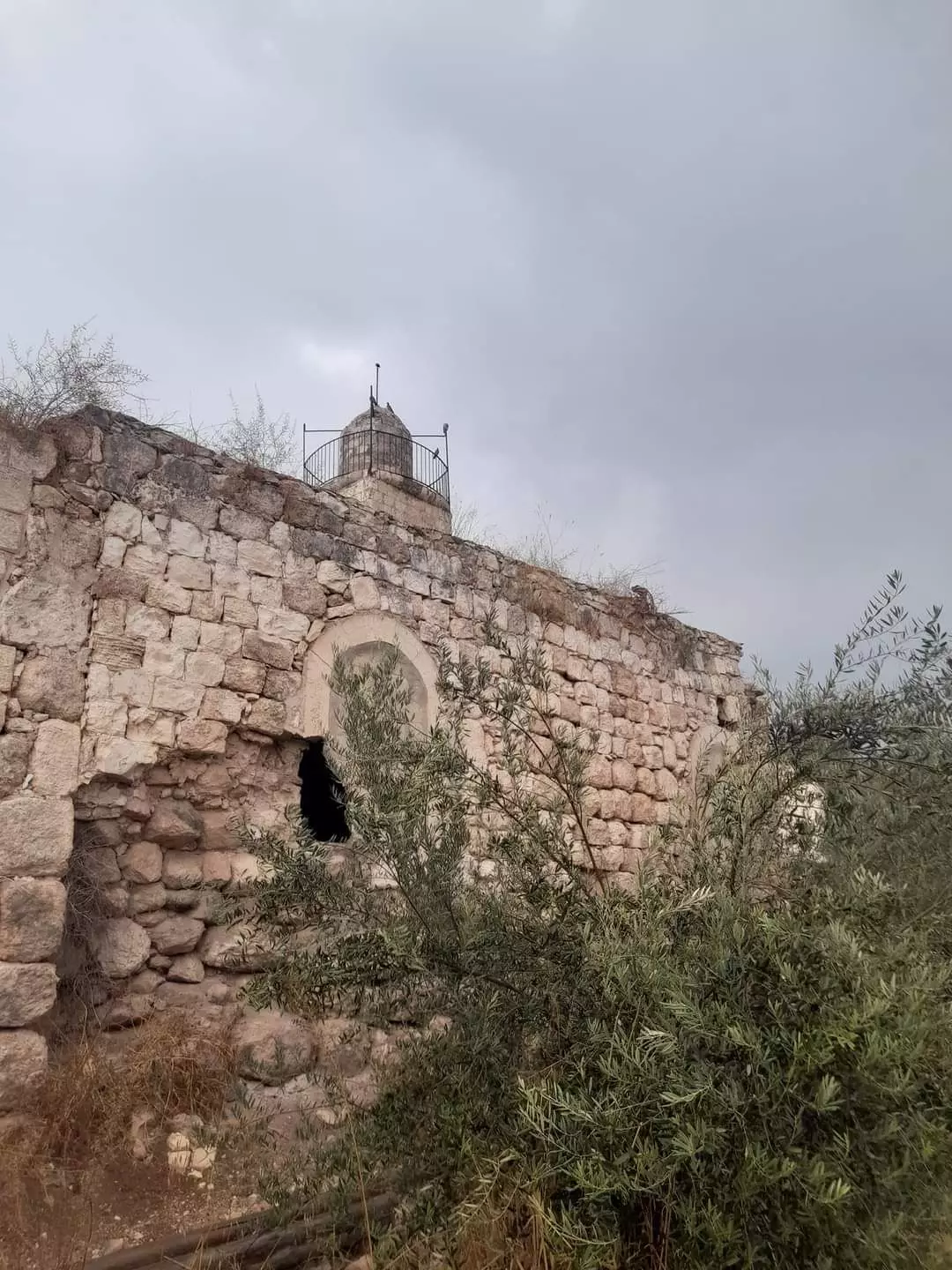
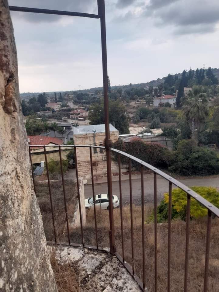
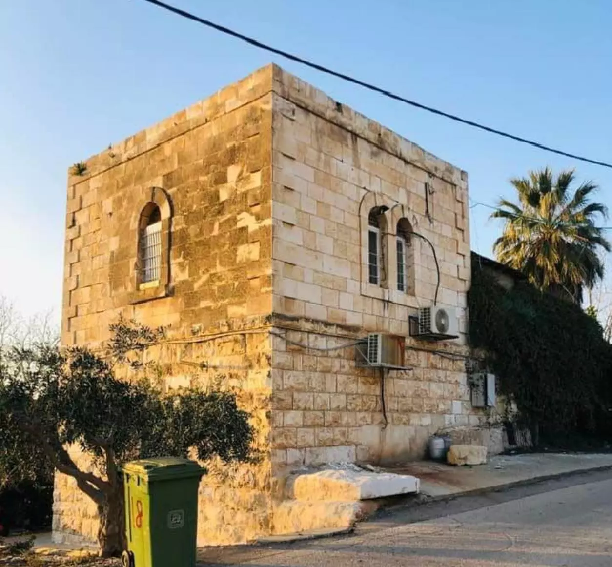
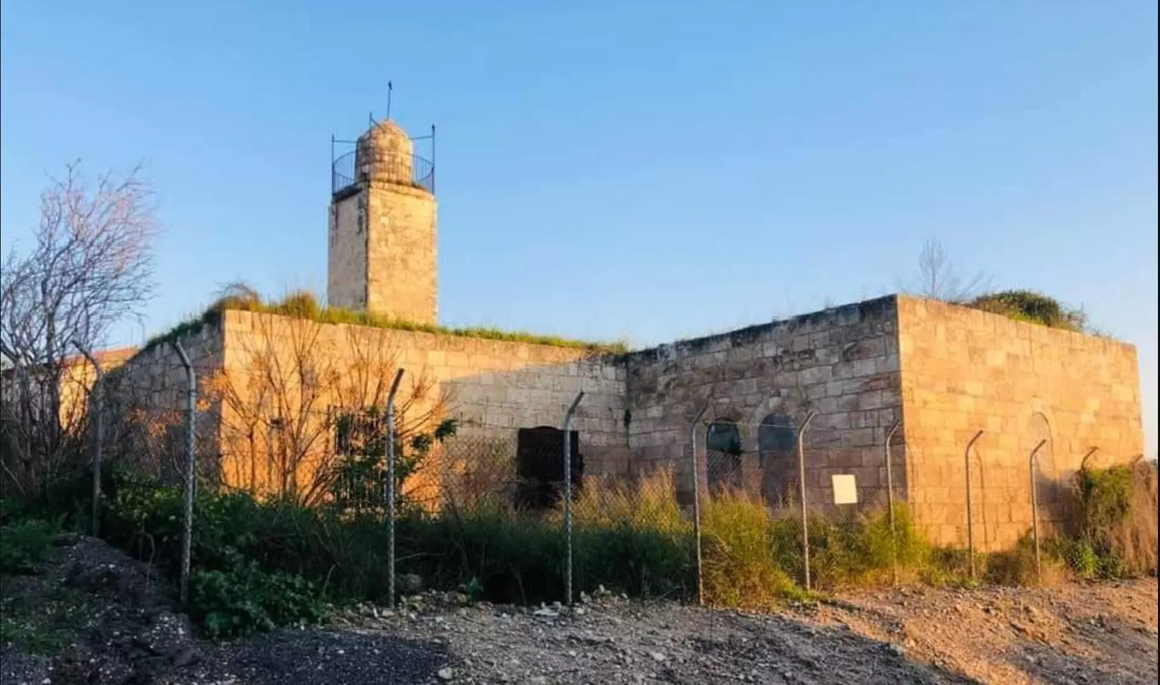
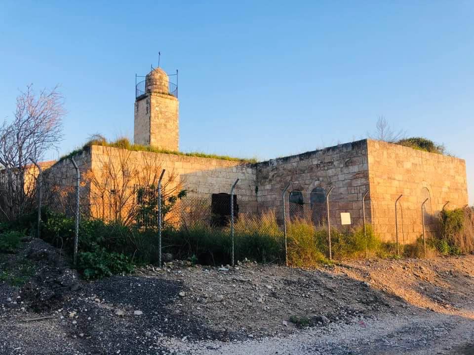
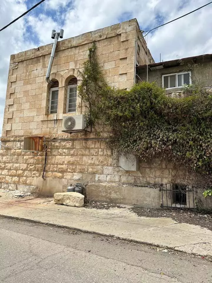
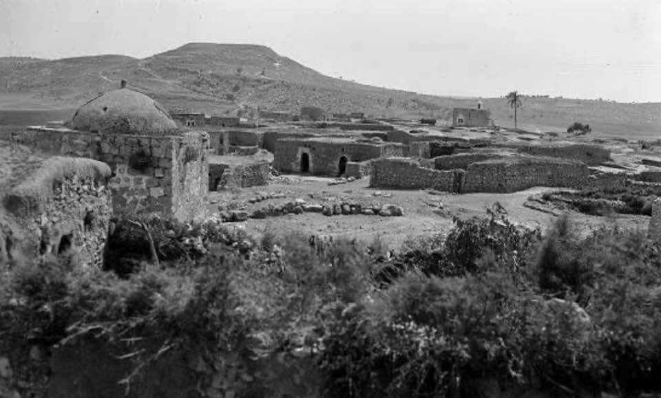
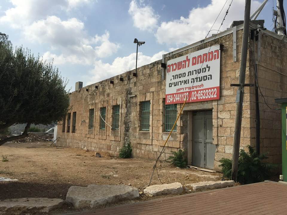
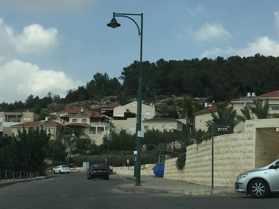
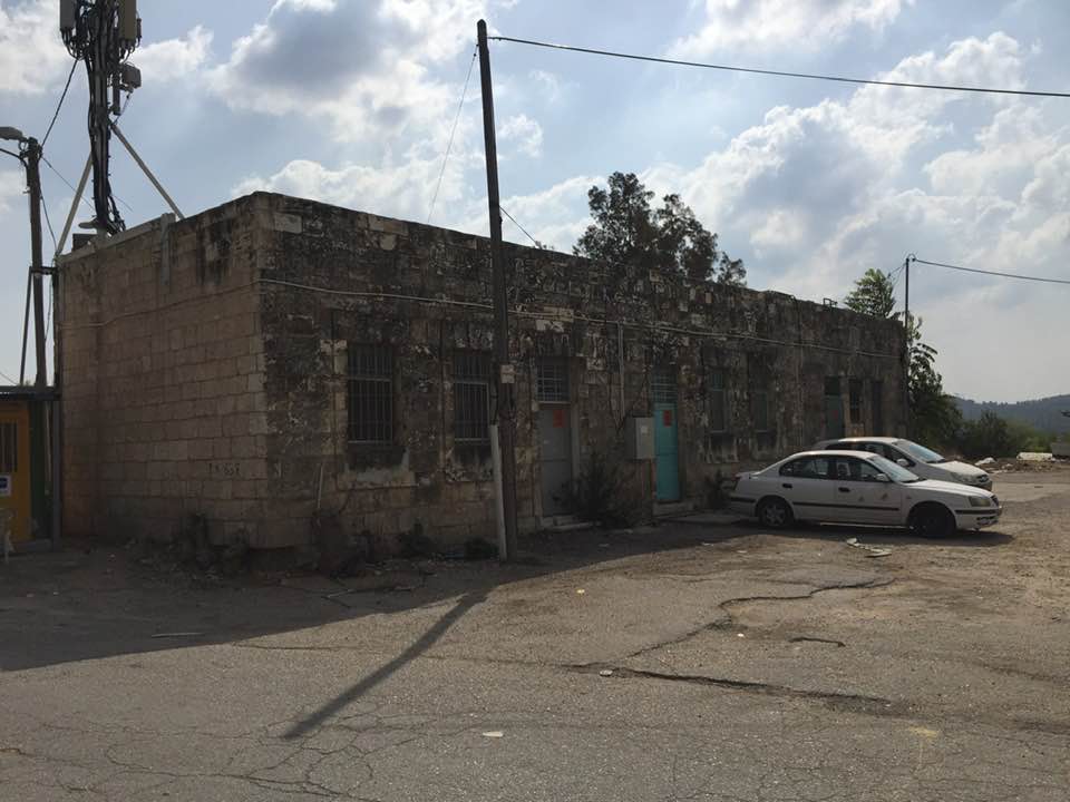
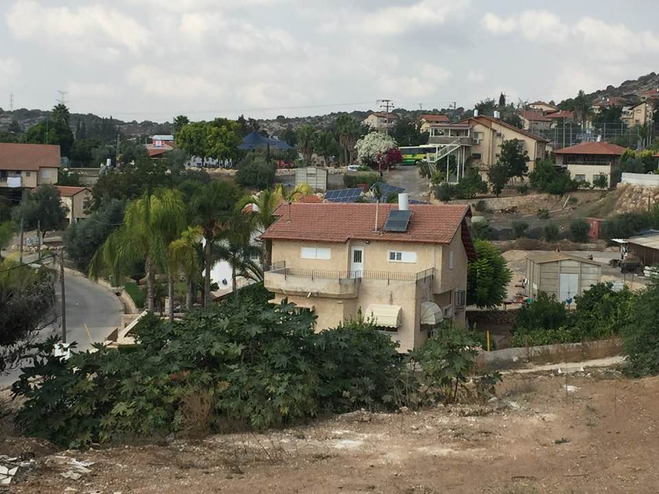
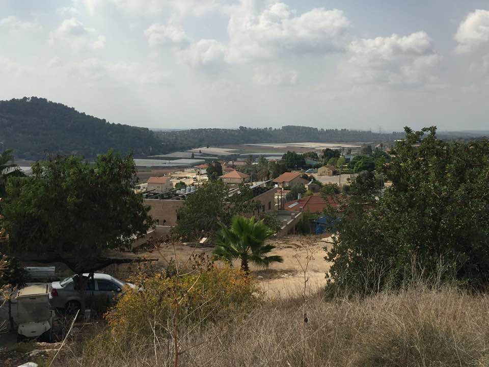
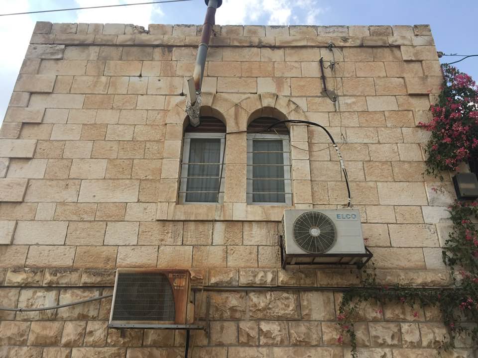
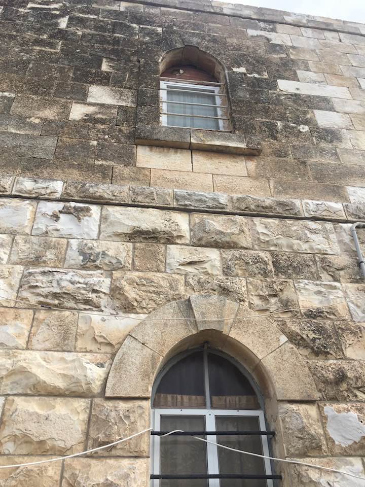
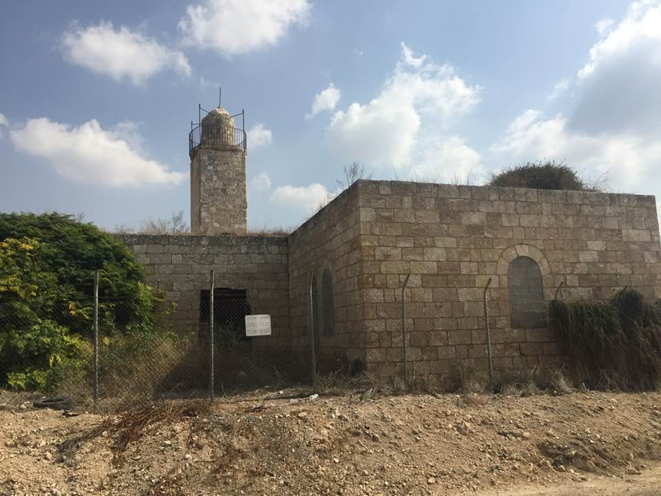
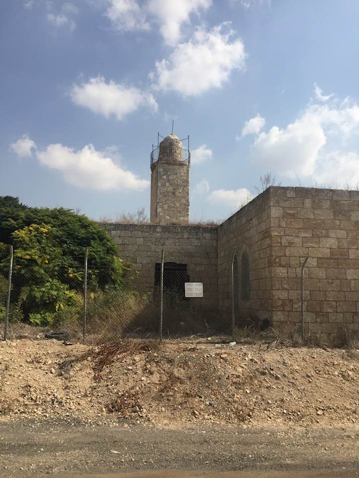
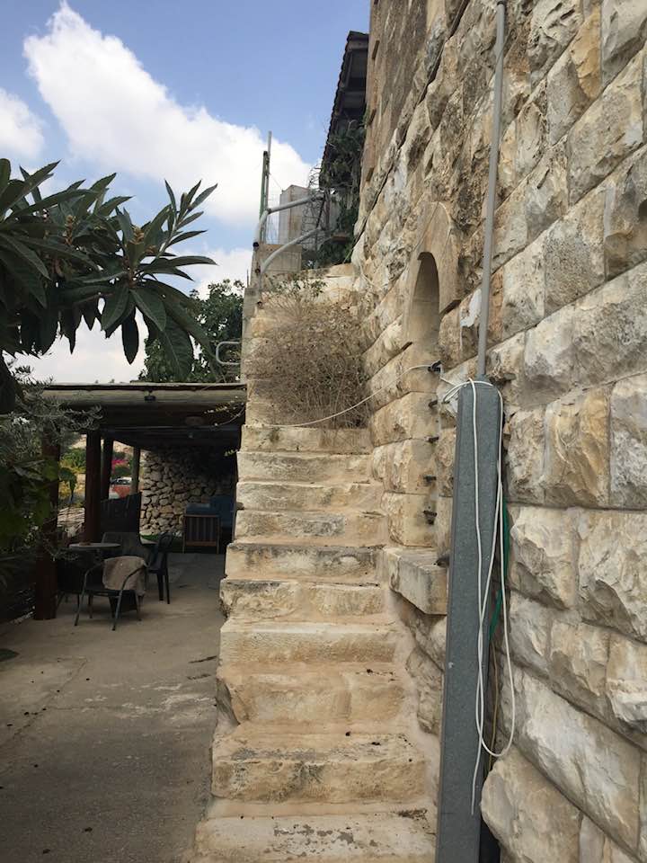
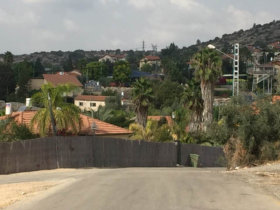
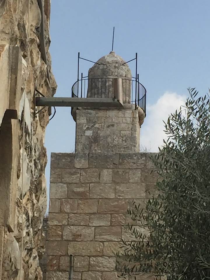
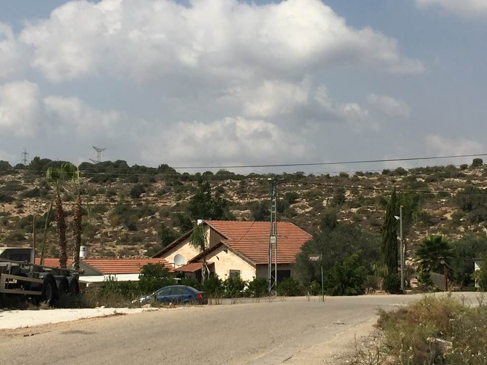
Village Before NakbaThe village stood on undulating ground that was underlain by soft white eocene limestone, in the western foothills of the Hebron Mountains. It was next to the road between Bayt Jibrin and the Jerusalem-Jaffa highway. This road linked it to other lateral roads and led to Bethlehem and a number of villages, among them 'Ajjur, Dayr al-Dubban, and Tall al-Safi. The village name reflected the cultural continuity of the area's population with the Roman and Byzantine periods; the site was called Caper Zacharia during those times and fell within the administrative jurisdiction of Bayt Jibrin. In 1596, Zakariyya was a village in the nahiya of Jerusalem (liwa' of Jerusalem), with a population of 259. It paid taxes on a number of crops, including wheat, barley, and olives, as well as on other types of produce, such as goats and beehives.In the late nineteenth century, Zakariyya stood on the slope above a broad, flat valley, surrounded by extensive olive groves. The village had a rectangular layout and the residents, who were Muslim, built their houses of stone and mud. The older parts of the village were located at its center and in its northern and southern quarters. The center consisted of a mosque, a shrine for a Shaykh Hasan, a busy marketplace, and an elementary school. The village expanded on all sides in modern times, especially to the north and south. The villagers obtained their drinking water from two communal wells -the al-Saflani well, drilled next to Wadi 'Ajjur, and the al-Sarara well, north of the village. Some water also came from domestic wells that gathered rainwater. Rainfed agriculture represented the backbone of the economy; the main crops included grain, beans, fruit, and olives. In 1944/45 a total of 6,523 dunums was allocated to cereals; 961 dunums were irrigated or used for orchards, of which 440 dunums were planted with olive trees. The second most important occupation for the villagers was animal husbandry. They grazed their goats and sheep on the wild shrubs and grasses that grew on the slopes of the hills and wadis. Near the site of the village were many ancient localities. About 1 km to the southwest was Tall Zakariyya, which rises 117 m above the plain. The plain to the east has been identified with the Valley of Elah where, according to the Bible (1 Samuel 17), David fought Goliath. Tall Zakariyya was excavated in 1898 and has been identified with Azekah, a town which may have been referred to in a text written on a broken shard that was found at Tall al-Duwayr. Azekah was said to be the place where Joshua triumphed over the Canaanites (Joshua 10:10). Village Occupation and Ethnic CleaningZakariyya first came under attack early in the war in the course of the battles around the Kfar Etziyon Bloc of Jewish settlements south of Bethlehem. Along with Dayr Aban and Bayt Nattif, it was besieged by a Haganah unit estimated at 100 men by 'Arab sources' quoted by the New York Times. The 'punitive expedition' against the villages, in retaliation for the ambush of a Palmach shock force nearby, persisted for about twenty-four hours. The Times also said that Israeli forces directed their fire at the villages on 17 and 18 January 1948, but the number of casualties among the villagers was not reported.Zakariyya was occupied over nine months later, towards the end of Operations Ha-Har and Yoav, when Israel's operational areas became contiguous in the last week of October 1948. Israeli units (probably the Giv'ati Brigade's Fourth Battalion) broke through to the village on 23 October 1948, linking the Israeli-held parts of the Hebron hills with the Jerusalem corridor. Unlike most of the inhabitants of villages conquered in these operations, the villagers were not displaced at the time of occupation. However, Israeli historian Benny Morris reports that over a year later, towards the end of 1949, the Israeli military drew up a plan to evict the people of Zakariyya, along with those of some seven other villages (mostly in northern Galilee). But Morris adds that 'political objections by the Foreign Ministry (and perhaps others) blocked implementation.' Efforts to expel the people of Zakariyya, as well as those of several communities in a similar position, persisted into the following year. Zakariyya was one of the longest-lasting of these communities, despite the 'appalling' health and food situation in the village, according to Morris. In March 1949, the Israeli Interior Ministry official in charge of the Jerusalem sub-disctrict noted that 'in the village there are many good houses, and it is possible to accommodate in them several hundred new immigrants.' In January 1950, Ben-Gurion met with his foreign minister, Moshe Sharett, and Jewish National Fund official Yosef Weitz and decided to evict the inhabitants of Zakariyya '[but]without coercion.' They were eventually evicted on 9 June 1950 -the means of expulsion are not mentioned- and most were transferred to Ramla, with some possibly going to Jordan Zionists Colonies on Village LandsThe settlement of Zekharya was established in 1950 on village land, close to the village site.Village TodayThe mosque and a number of houses, some occupied by Jewish residents and others deserted, remain on the site. Large sections of the site itself are covered with wild vegetation. The mosque is in a state of neglect segments of its walls and roof and the surrounding ground are overgrown with wild vegetation. An Israeli flag is planted on top of the minaret . One of the occupied houses is a two-storey stone structure with a flat roof. Its second storey windows have round arches and grillwork. Parts of the surrounding lands are cultivated by Israeli farmers.SourceDr. Walid al-Khalidi, 1992: All That Remains. |
|||||||||||||||
| Related Maps | Town Lands' Demarcation Maps خرائط للقضاء توضح حدود القرى والاودية Town's map on MapQuest View from satellite Help us map this town at WikiMapia |
||||||||||||||
| Related Links | Wikipedia's Page Facebook Page Google Search Google For Images Google For Videos |
||||||||||||||
| More Information | في كتاب كي لا ننسى في كتاب بلادنا فلسطين المزيد من موقع هوية |
||||||||||||||
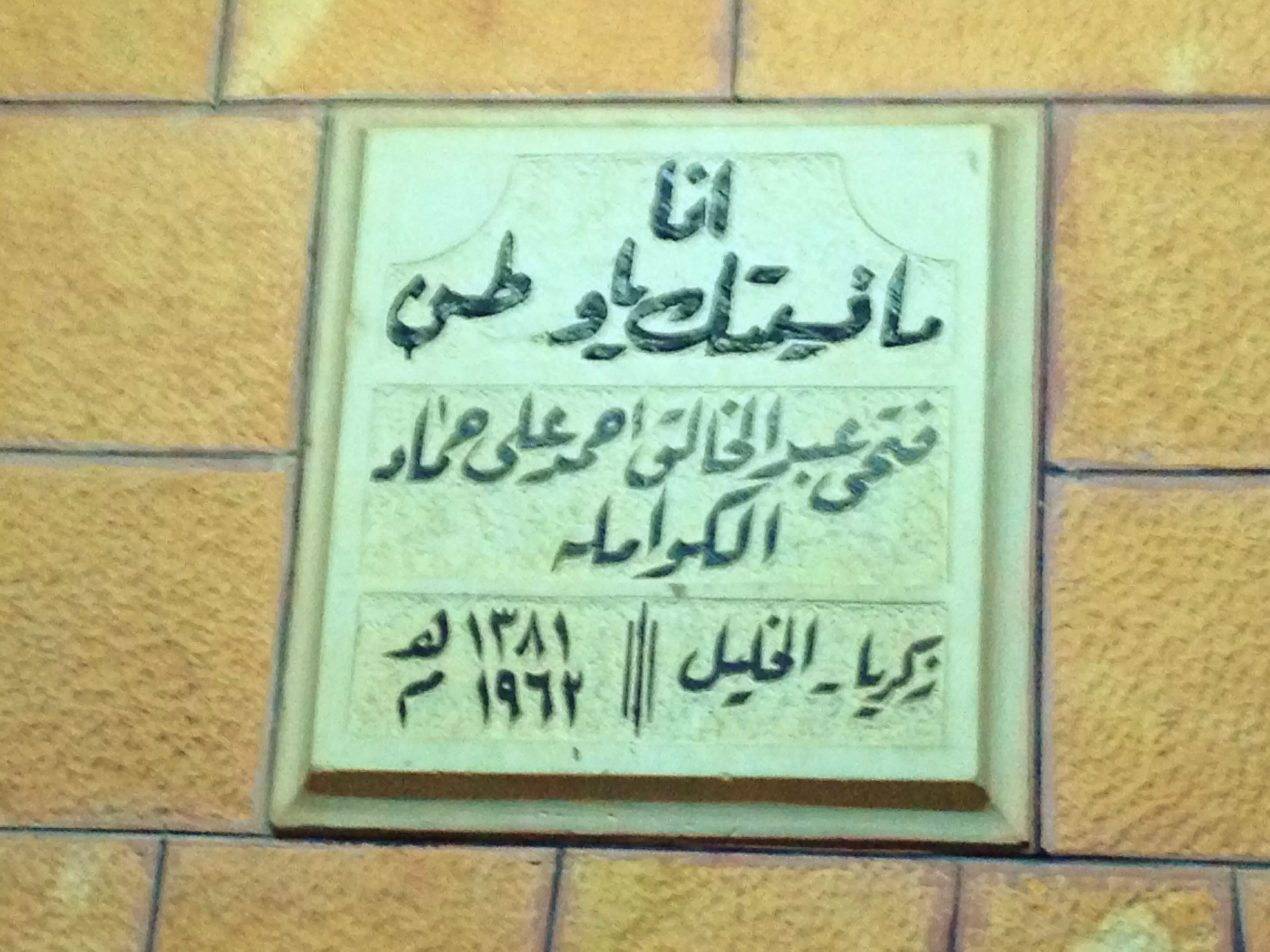
- مدرسة زكريا الأميرية، اُنقر الصورة لتكبيرها. 1938
Scanned from "All That Remains" by Dr. Walid Khalidi - Village house, now looted/stolen By a Jewish settler, 1987
Scanned from "All That Remains" by Dr. Walid Khalidi 2 - Village mosque remain standing, 1987
Scanned from "All That Remains" by Dr. Walid Khalidi 4 - Village Site In 1987
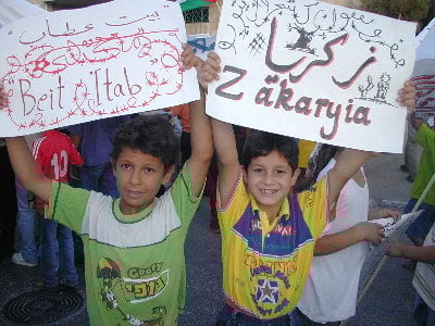
Scanned from "All That Remains" by Dr. Walid Khalidi - I will smile like this when I get the chance of going back to Zakariyya. Just give me my home back.
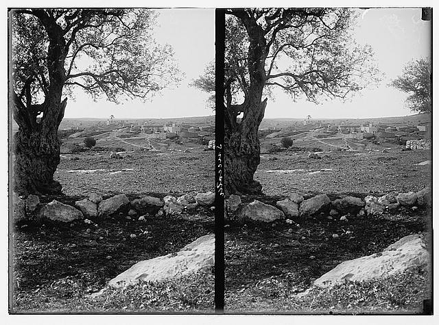
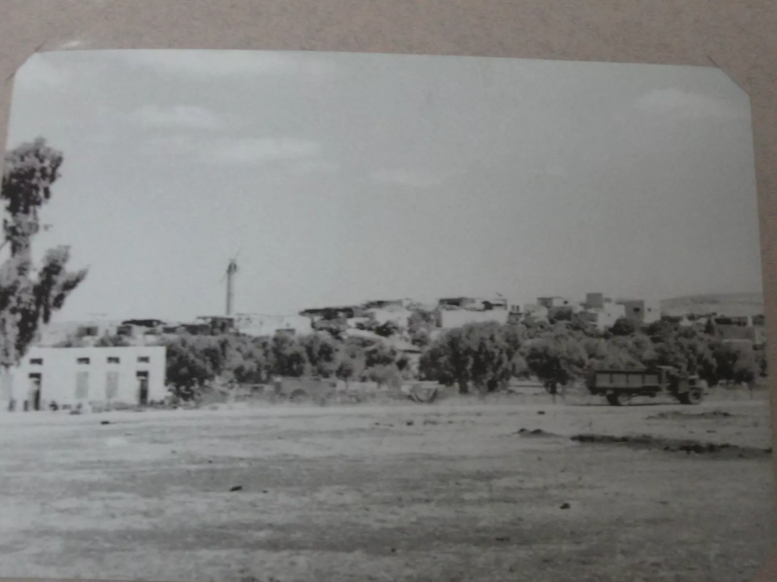
Posted by BADIL Organization 1 - General view Zakariyya before 1948
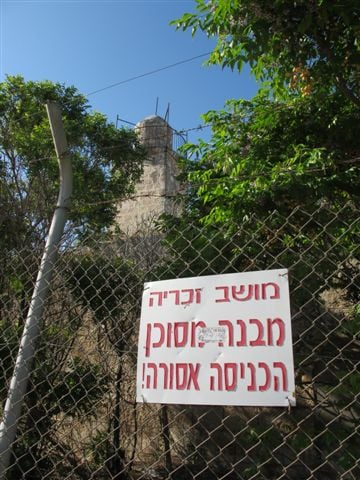
1 - Zakariyya's Mosque, Now Closed And Neglegted #1, May 2000
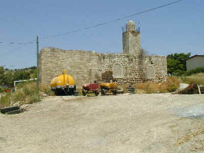
Posted by BADIL Organization - Zakariya's Mosque, Now Closed And Neglegted #2, May 2000
Posted by BADIL Organization - The closed and neglected Zakariyya's Mosque-May-2002
Posted by Aqsa Association-Palestine-1948 1 - Praying Inside Zakariya's Mosque, May 2000
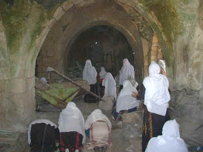
Posted by BADIL Organization - Praying Inside Zakariyya's The Mosque #2, May 2000
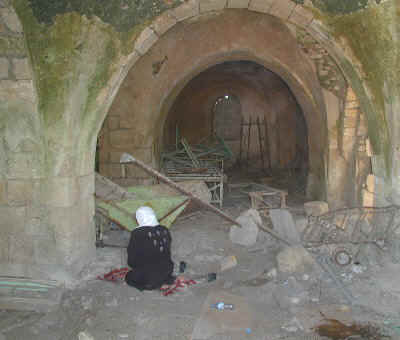
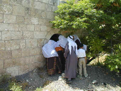
Posted by BADIL Organization - Trying To Look Inside Zakariyya's Mosque, May 2000
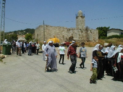
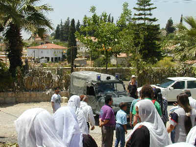
Posted by BADIL Organization - Refugees Are Being Ethnically Cleansed Again, May 2000
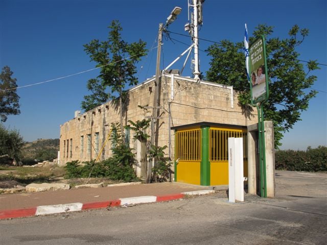
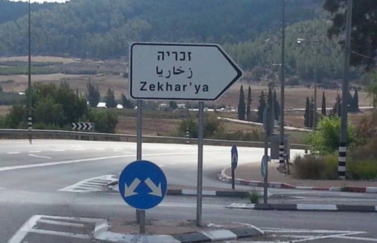
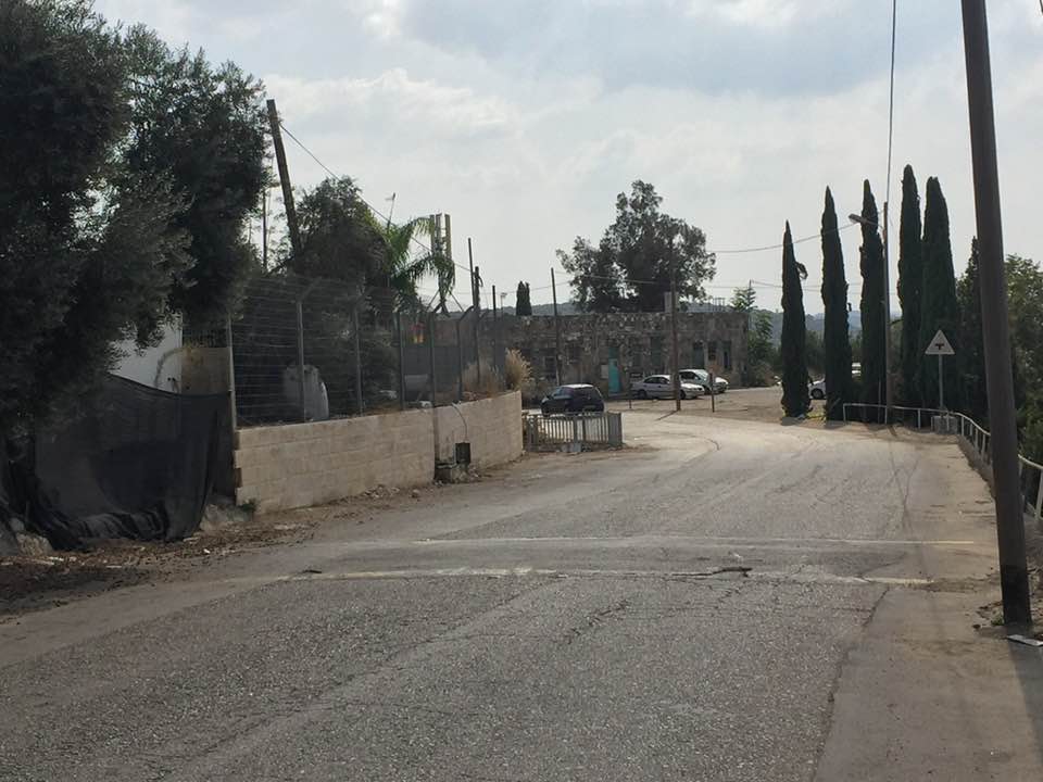
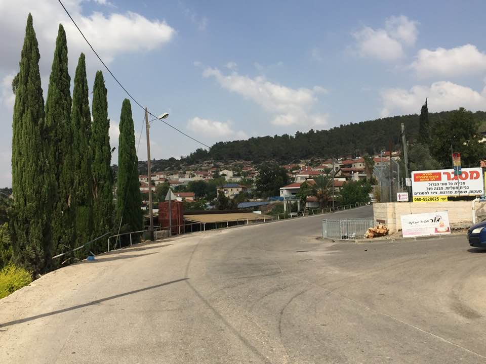
Posted by BADIL Organization - At the entrence to Zakariyya, the petrol station sign reads: Welcome to Zkharia
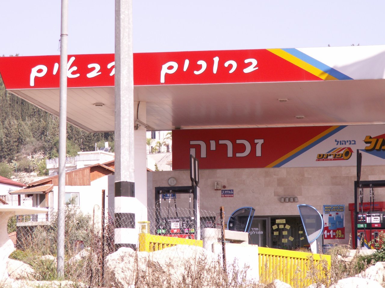
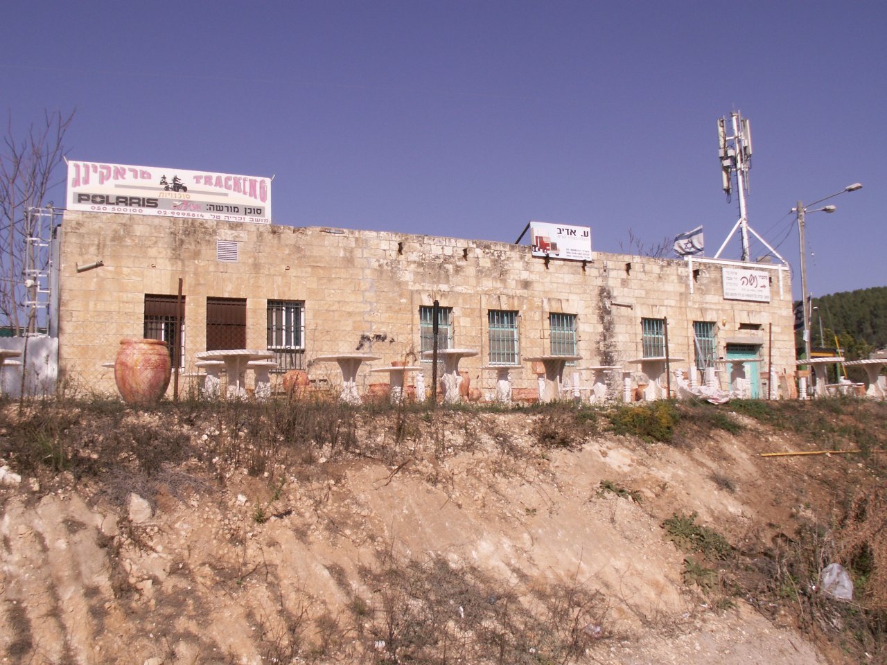
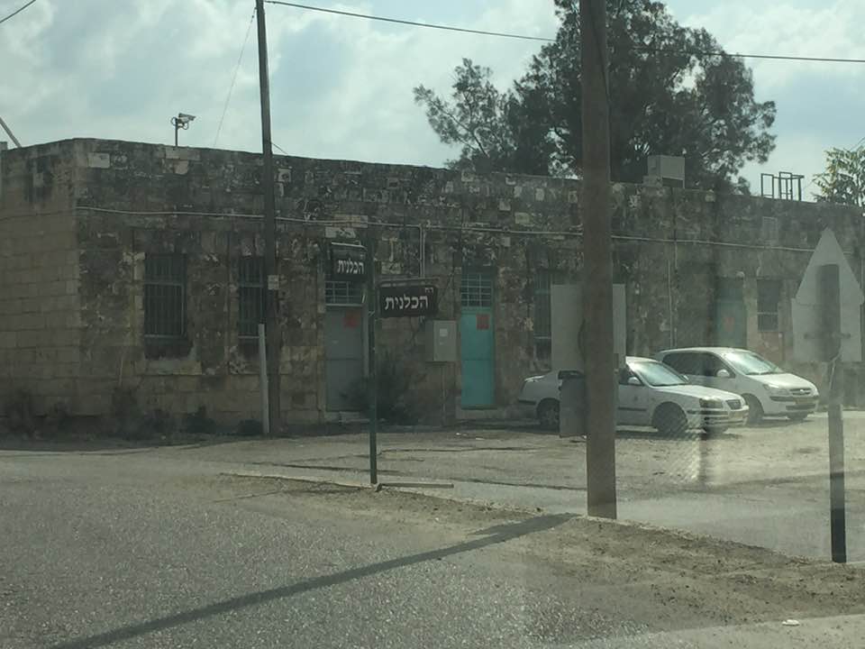
Posted by Uri Zackhem 1 - At the entrence to Zakariyya. The building is used for commerce.
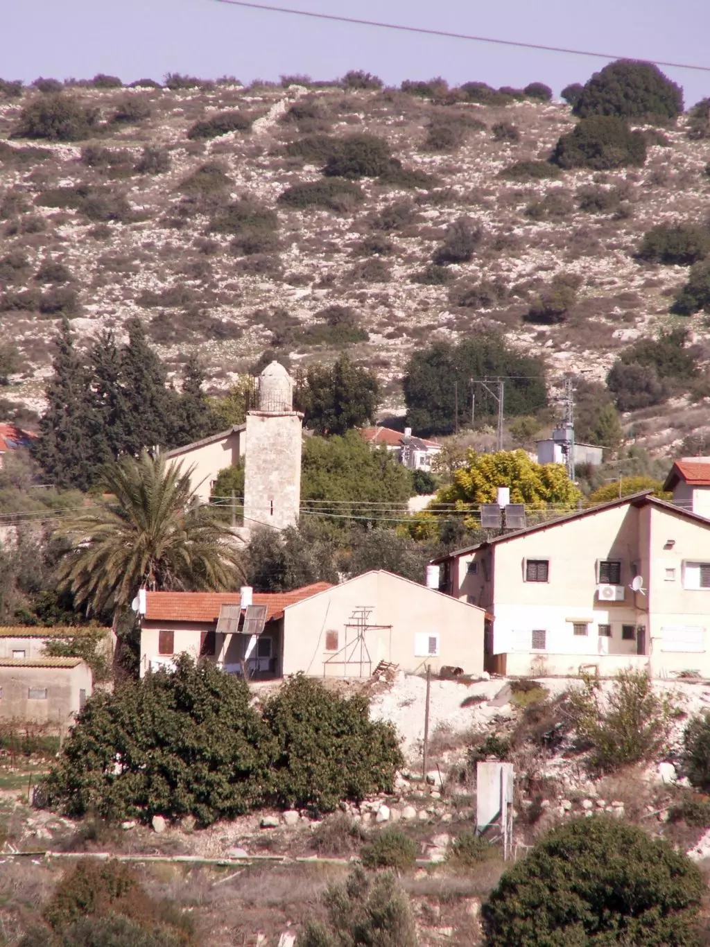
Posted by Uri Zackhem 1 - The mosque amidst the modern tile-roofed houses.
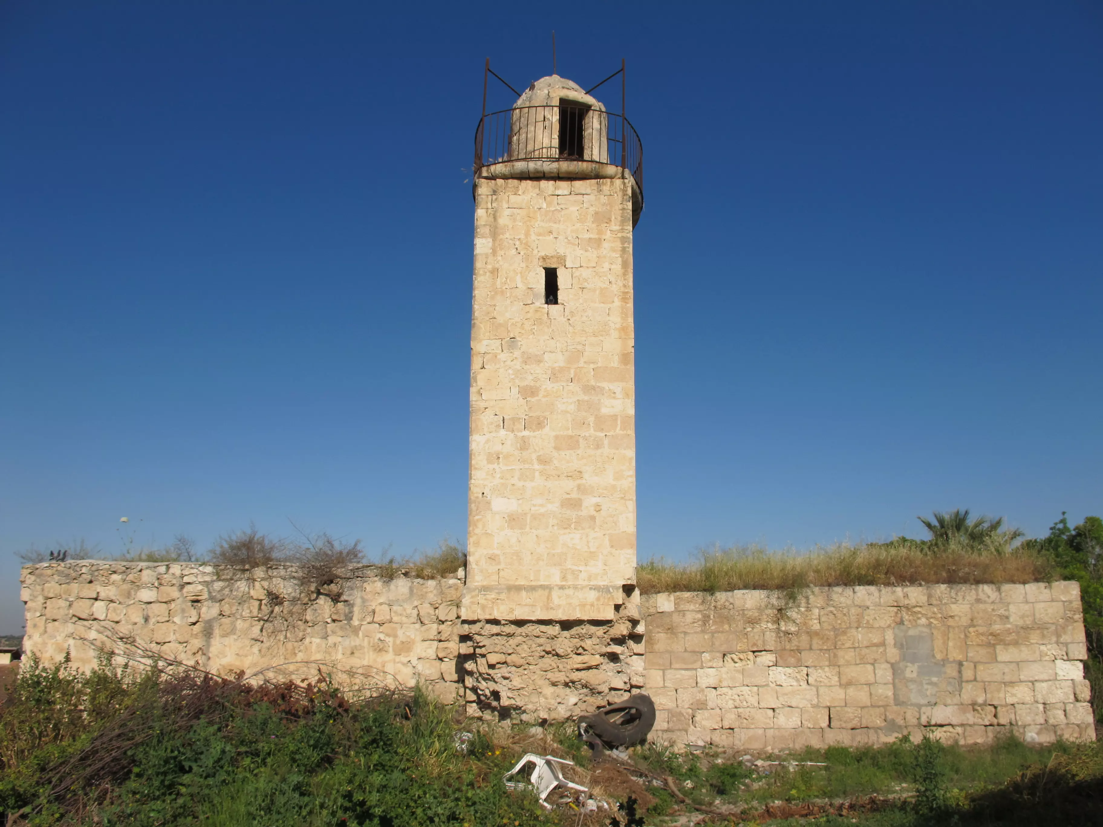
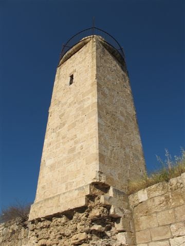
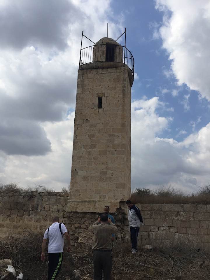
Posted by Uri Zackhem - Zakariyya's Mosque Minaret Still Standing Tall As A Witness To Its Past !
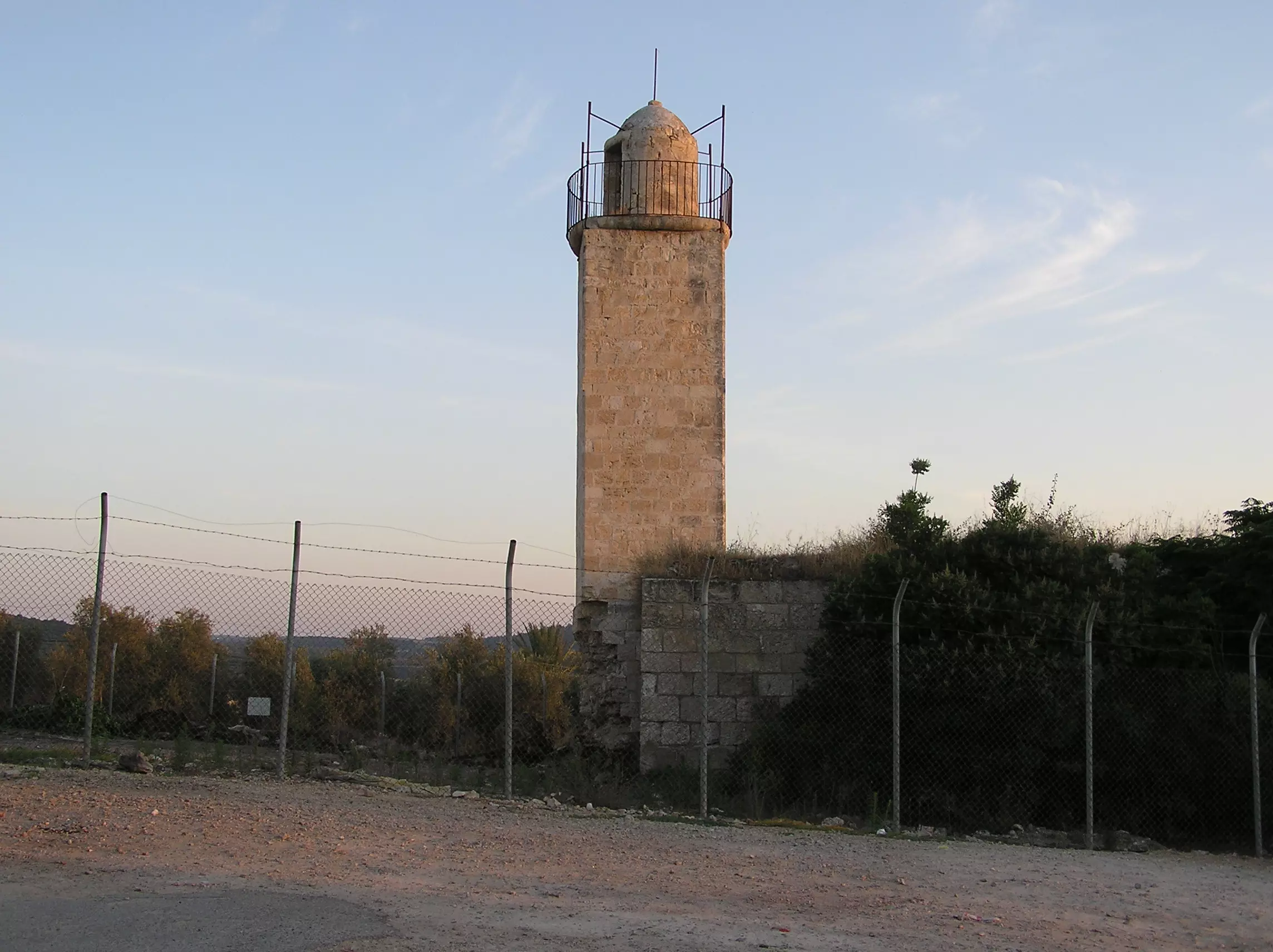
Posted by Umar Abu El-Bararri 3 - Zakariyya's Mosque Still Stands As A Witness To All The Prayer Days/Times Of Its Past !
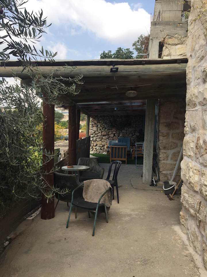
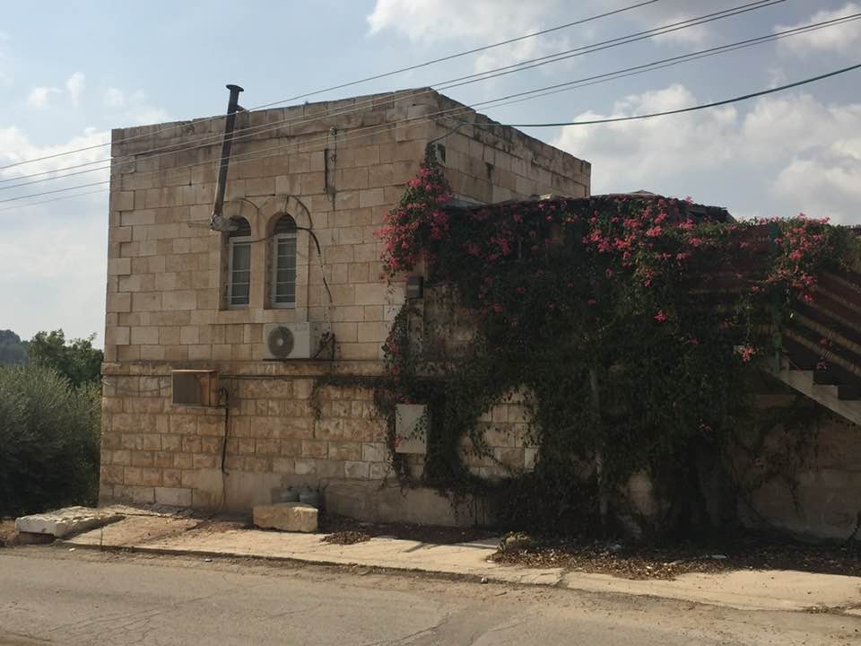
Posted by Umar Abu El-Bararri - One Of Zakariyya's House Still Stands With Its Beautiful Stones & Architecture. Guess Who Lives There?
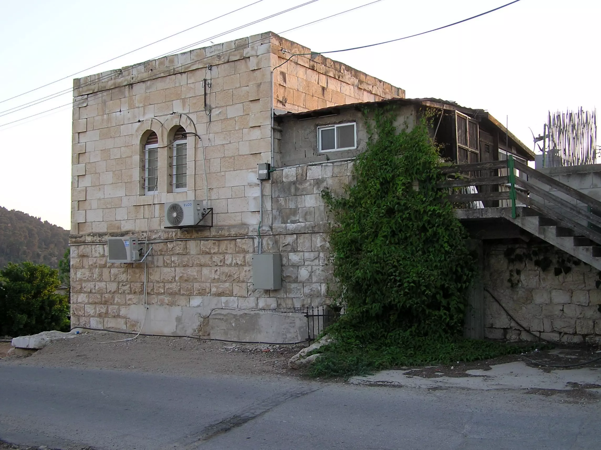
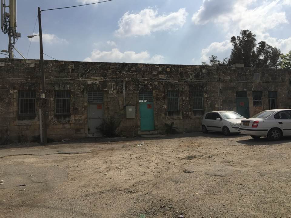
Posted by Umar Abu El-Bararri - A Back View Of Zakariyya's Homes Which Is Still Standing & Inhabited By Israelis.
Posted by Umar Abu El-Bararri 1 - زكريا الأصالة ايام تركيا-هدية من صفافي-
Posted by ابو عمر - قرية زكريا : صورة بعد احتلال القرية عام 1948 - مشاركة صفافي اصيل
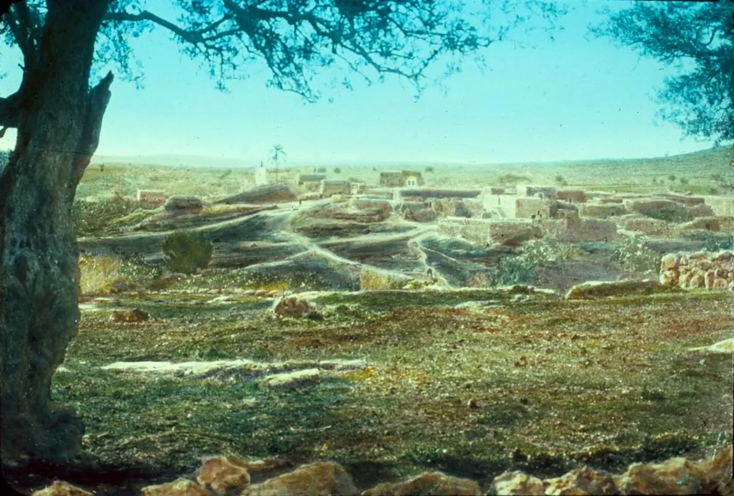
Posted by صفافي أصيل - The village of Zakariyya near Hebron, c. 1900s
Posted by Rami Atwan 1 - مإذنة جامع زكريا المغتصب، 2012
Posted by said 1 - مإذنة جامع زكريا المغتصب، 2012
Posted by said - مإذنة جامع زكريا المغتصب، 2012
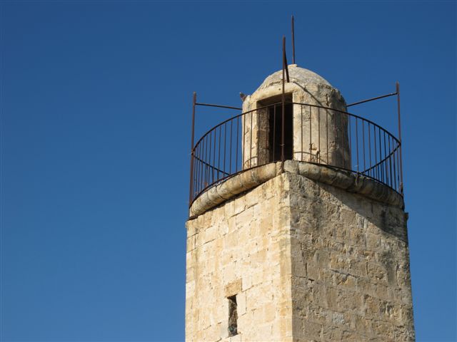
Posted by said - مإذنة جامع زكريا المغتصب، 2012
Posted by said - مسجد القرية المغتصب، 2012
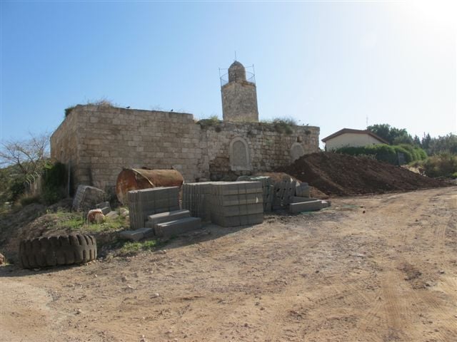
Posted by said - مسجد القرية المغتصب،، 2012
Posted by said - داخل مسجد القرية المغتصب، 2012
Posted by said - Zakariyya 2012
Posted by said - مبنى كبير وقد يكون مدرسة القرية المنهوبة، 2012
Posted by said - Zakariyya's mosque, before and after- Tariq Bakri
Posted by Tarek Bakri 1 - irbid, jordan
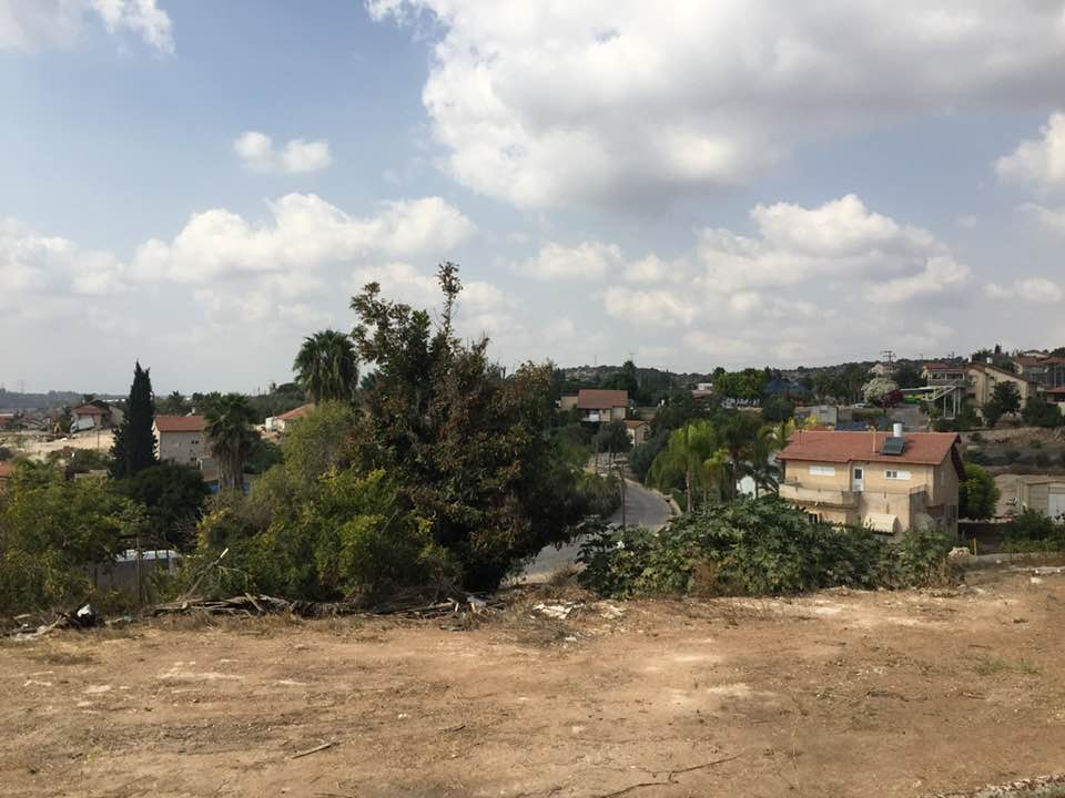
Posted by b an - منظر عام للقريه والمستعمره المقامه مكانها
Posted by abu raya - اراضي زكريه يستغلها المغتصبون
Posted by abu raya - زكريه
Posted by abu raya - زيتون القريه
Posted by abu raya - اراضي زكريه
Posted by abu raya - حقول زيتون زكريه
Posted by abu raya - اراضي زكريه
Posted by abu raya - زكريه
Posted by abu raya - مسجد القريه
Posted by abu raya - مسجد القريه
Posted by abu raya - قريه زكريه قبل النكبه
Posted by abu raya - قريه زكريه قبل النكبه
Posted by abu raya - Pre-Nakba Aerial view of the village / صورة من الجو للقرية اخذت قبل النكبة
- A view of the mosque; stay tuned. We are coming back
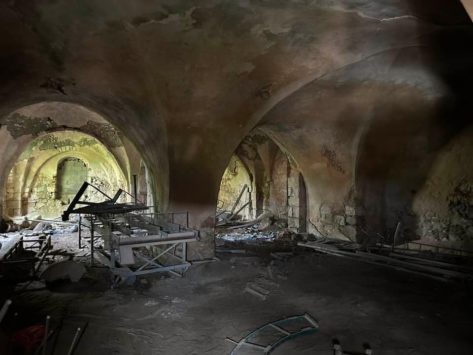
- A view from the mosque's minaret; stay tuned. We are coming back
- The Palestinian school, which was looted by the "most civilized". How else will the Jews be great again? Little looting, Jim Crow, and genocides won't hurt anyone. Mazletov
- A tour of Palestinian houses which were looted by the "most moral people" humanity has ever known. The rest was completely obliterated. How else will the Jews be great again? -- جولة بين البيوت الفلسطينية المنهوبة
- A tour of Palestinian houses which were looted by the "most moral people" humanity has ever known. The rest was completely obliterated. How else will the Jews be great again? -- جولة بين البيوت الفلسطينية المنهوبة #2
- A tour of Palestinian houses which were looted by the "most moral people" humanity has ever known. The rest was completely obliterated. How else will the Jews be great again? -- جولة بين البيوت الفلسطينية المنهوبة #3
- A tour of Palestinian houses which were looted by the "most moral people" humanity has ever known. The rest was completely obliterated. How else will the Jews be great again? -- جولة بين البيوت الفلسطينية المنهوبة #4
- A tour of Palestinian houses which were looted by the "most moral people" humanity has ever known. The rest was completely obliterated. How else will the Jews be great again? -- جولة بين البيوت الفلسطينية المنهوبة #5
- The village Mosque
- صورة نادرة لزكريا قبل النكبة
- the school
- That is how the "civilized" erased and replaced us: Zakariyya was completely obliterated except for the village mosque, the school, and a few remaining structures, as you see -- زكريا باتت أثر بعد عين بإستثناء بعض المباني. من هنا مر الهمجّ
- That is how the "civilized" erased and replaced us: Zakariyya was completely obliterated except for the village mosque, the school, and a few remaining structures, as you see -- زكريا باتت أثر بعد عين بإستثناء بعض المباني. من هنا مر الهمجّ
#2
- That is how the "civilized" erased and replaced us: Zakariyya was completely obliterated except for the village mosque, the school, and a few remaining structures, as you see -- زكريا باتت أثر بعد عين بإستثناء بعض المباني. من هنا مر الهمجّ
#3
- That is how the "civilized" erased and replaced us: Zakariyya was completely obliterated except for the village mosque, the school, and a few remaining structures, as you see -- زكريا باتت أثر بعد عين بإستثناء بعض المباني. من هنا مر الهمجّ
#4
- That is how the "civilized" erased and replaced us: Zakariyya was completely obliterated except for the village mosque, the school, and a few remaining structures, as you see -- زكريا باتت أثر بعد عين بإستثناء بعض المباني. من هنا مر الهمجّ
#5
- That is how the "civilized" erased and replaced us: Zakariyya was completely obliterated except for the village mosque, the school, and a few remaining structures, as you see -- زكريا باتت أثر بعد عين بإستثناء بعض المباني. من هنا مر الهمجّ
#6
- That is how the "civilized" erased and replaced us: Zakariyya was completely obliterated except for the village mosque, the school, and a few remaining structures, as you see -- زكريا باتت أثر بعد عين بإستثناء بعض المباني. من هنا مر الهمجّ
#7
- That is how the "civilized" erased and replaced us: Zakariyya was completely obliterated except for the village mosque, the school, and a few remaining structures, as you see -- زكريا باتت أثر بعد عين بإستثناء بعض المباني. من هنا مر الهمجّ
#8
- That is how the "civilized" erased and replaced us: Zakariyya was completely obliterated except for the village mosque, the school, and a few remaining structures, as you see -- زكريا باتت أثر بعد عين بإستثناء بعض المباني. من هنا مر الهمجّ
#9
- That is how the "civilized" erased and replaced us: Zakariyya was completely obliterated except for the village mosque, the school, and a few remaining structures, as you see -- زكريا باتت أثر بعد عين بإستثناء بعض المباني. من هنا مر الهمجّ
#10
- That is how the "civilized" erased and replaced us: Zakariyya was completely obliterated except for the village mosque, the school, and a few remaining structures, as you see -- زكريا باتت أثر بعد عين بإستثناء بعض المباني. من هنا مر الهمجّ
#11
- That is how the "civilized" erased and replaced us: Zakariyya was completely obliterated except for the village mosque, the school, and a few remaining structures, as you see -- زكريا باتت أثر بعد عين بإستثناء بعض المباني. من هنا مر الهمجّ
#12
- That is how the "civilized" erased and replaced us: Zakariyya was completely obliterated except for the village mosque, the school, and a few remaining structures, as you see -- زكريا باتت أثر بعد عين بإستثناء بعض المباني. من هنا مر الهمجّ
#13
- That is how the "civilized" erased and replaced us: Zakariyya was completely obliterated except for the village mosque, the school, and a few remaining structures, as you see -- زكريا باتت أثر بعد عين بإستثناء بعض المباني. من هنا مر الهمجّ
#14
- That is how the "civilized" erased and replaced us: Zakariyya was completely obliterated except for the village mosque, the school, and a few remaining structures, as you see -- زكريا باتت أثر بعد عين بإستثناء بعض المباني. من هنا مر الهمجّ
#15
- That is how the "civilized" erased and replaced us: Zakariyya was completely obliterated except for the village mosque, the school, and a few remaining structures, as you see -- زكريا باتت أثر بعد عين بإستثناء بعض المباني. من هنا مر الهمجّ
#16
- That is how the "civilized" erased and replaced us: Zakariyya was completely obliterated except for the village mosque, the school, and a few remaining structures, as you see -- زكريا باتت أثر بعد عين بإستثناء بعض المباني. من هنا مر الهمجّ
#17
- That is how the "civilized" erased and replaced us: Zakariyya was completely obliterated except for the village mosque, the school, and a few remaining structures, as you see -- زكريا باتت أثر بعد عين بإستثناء بعض المباني. من هنا مر الهمجّ
#18
- That is how the "civilized" erased and replaced us: Zakariyya was completely obliterated except for the village mosque, the school, and a few remaining structures, as you see -- زكريا باتت أثر بعد عين بإستثناء بعض المباني. من هنا مر الهمجّ
#19
- That is how the "civilized" erased and replaced us: Zakariyya was completely obliterated except for the village mosque, the school, and a few remaining structures, as you see -- زكريا باتت أثر بعد عين بإستثناء بعض المباني. من هنا مر الهمجّ
#20
- That is how the "civilized" erased and replaced us: Zakariyya was completely obliterated except for the village mosque, the school, and a few remaining structures, as you see -- زكريا باتت أثر بعد عين بإستثناء بعض المباني. من هنا مر الهمجّ
#21
Want to browse more? 80,000 pictures were grouped in these gallaries:
| Display Name | Clan/Hamolah | Country of Residence |
| Nur Alden Abu-Laben | Abu-Laben, Alhwamdi, Harb | Toronto, Canada |
| Eyad Hammad | الخمور | Amman, Jordan |
| سعاد عباد | عيسه | mafraq |
| احمد الفرارجة | الفرارجة | عين الباشا, الاردن |
| hmdd | عدوي | - |
| عبدالغفار الحاج | - | الزرقاء, زكريا |
| عبدالغفار الحاج | - | - |
| مالك | الفرارجة | الزرقاء, الرصيفة |
| نور الدين | الكواملة | ماليزيا & الأردن |
| ابو بشار | عدوي | الدمام, السعودية |
| Ehab Mohaisen | محيسن | Jordan, Jordan |
| الاء ابوجابر | الخمور | - |
| nabeel shaheen | shaheen | texas, usa |
| خالد فرارجة | - | الرياض , السعودية |
| Eihab | fararjeh | new jersey, usa |
| عاشق الجهاد | فرارجة | - |
| Jamal Obied | Obied | Texas, USA |
| Dr nabeel | fararjeh | zarqa |
| rama | صافي السلطان | amman, jordan |
| ابو صالح | زكارنة | جنين |
| haitham Fararjeh | Al Fararjeh | Amman, Jordan |
| omar shaheen | shaheen | - |
| م. مصطفى ابوحسن | العيسة | الخبر, السعودية |
| Al-Hayek Family | Al-Hayek | Central, Saudi Arabia |
| samar | عدوي | فلسطين , 45635696878678 |
| ABDELNASIR KHANNA | Khmour | - |
| Hammad Khanneh | Al Khmour | Amman |
| malik shahin | al shamarkha | - |
| Moath AL-Fararjeh | - | - |
| ابن العبد جبرين | الفرارجه | عمان, الاردن |
| حسام ابوزنيد ابوزنيد الشرحة | الشرحة | - |
| Ghaith | Al-Fararjeh | - |
| baker | Fararjeh | amman, jordan |
| moataz alfararjih | fararjih | amman, rosefah |
| tariq | زقطان | doha, QATAR |
| saleh khanna | alkhmour | Hebron,Palestine |
| samer zaqtan | ZAQTAN | TX, TX |
| nasr ayaseh | ayaseh | - |
| وسن عدوان | العيسة | العقبة , الأردن |
| عزالدين | - | عمان, الاردن |
| mohammed | fararjeh | saudi arabia, saudi arabia |
| الحلاق | - | - |
| gumaa | zakaryya | jordan, jordan |
| nedal mohammad fararjeh | fararjeh | new york, u.s.a |
| abdellatif | Shamarkha | MI, USA |
| Waddah Shamroukh | - | - |
| Usama Abujoda | alkhmour | Palestine, Palestine |
| Walid Abdu Al-fattah Frarjeh | Frarjeh | Riyadh- KSA |
| maudwan | Mohesen | JORDAN, AQABA |
| ziad alkhatib | ayaseh | awajan, awajan |
| Jawdat Manna' | farajeh | Palestine, Palestine |
| said manna | farajeh | amman, jordan |
| leo cheng | - | Guangdong, china |
| shadi | - | - |
| حسن ابو جوده | ابو جوده | , |
| imad fararjeh | fararjeh | oman |
| Said Abd AlHadi Abujudeh | Abujudeh | Muscat, Sultanate Of Oman |
| Majdi Said Abd Alhadi Abujudeh | Abujudeh | Muscat, Sultanate of Oman |
| Shadi Fararjeh | Fararjeh | Jeddah, Saudi Arabia |
| haitham ibrahim mashal | mashal | UAE, UAE |
| SUMRAIN | FARARJEH | SHARJAH, UAE |
| yaser alkhatib | ayaseh | zarqa, jordan |
| bassil adawi | adawi عدوي | palestine, palstine |
| Mustafa Osama Mustafa Adawi | Adawi | Bethlehem, Palestine |
| Fararjeh | - | awajan, Jordan |
| al-khmour | - | Riyadh |
| Mohamad Said Fararjeh | Fararjeh | CA, USA |
| Raed Mohammad | Abu-laban | Amman, Jordan |
| Bassam Badwan | Al'aiaseh | CA, USA |
| Mohamad Ismail Fararjeh | Fararjeh | Amman, Jordan |
| JIHAD fararjeh | FARARJEH | TURKEY, TURKEY |
| yousef fararjeh | fararjeh | awjan, jordan |
| Mahmoud Fararjeh | Fararjeh | Jordan, Jordan |
| Ra'ed Mohammad Al-fararjeh | Al-Fararjeh | JORDAN/AMMAN |
| Lo'ai Shamroukh | Shamroukh | Palestine, Palestine |
| Abed | Shamroukh | - |
| Wisam Shamroukh | Shamroukh | Hebron, Palestine |
| عيسى عدوي | adawi | riyadh, saudi arabia |
- زيارة لقرية زكريا المهجرة Duration: 3 min 57 sec
- قرية زكريا المهجرة, قضاء الخليل Duration: 3 min 44 sec
- جولة رائعة في القرية المهجرة -- 2025 Duration: 49 sec
 Fake Valor: Why Did Zionist Jews Hoist Nazis Flag on Their Ships in the 1930s?
What is new?
-
Facts About Oct. 7th Gaza Raid
-
Remined Us Please:: Who Did Rape Who? Palestinians Raped Israelis? Or, was the other way around?
-
When Prof. Edward Said was invited to debate Bibi Netanyahu in the 1980s, watch what happened!
-
Ezra Klein of the NY Times on the "Jewish Race".
-
Abusing Blood Libel!
-
Did Israeli Soldiers Activate The Hanniba Direective On Oct. 7th? You Be The Judge
-
Zionist FAQ: Isn't it true that Palestinians don't want peace? Palestinians never accepted the two-state solution
- Facts about Haavara (Transfer) Agreement between Ben-Gurion & Hitler
-
Haavara FAQs: Why Did Zionist Jews Hoist Nazis' Flags on Their Ships in the 1930s?
- Haavara FAQs: When Chaim Weizmann met FDR in mid-1943, why was he silent about rescuing European Jewry?
-
Dear ChatGPT: How did Palestinians resist Napoleon's invasion of their country in 1799?
-
Dear ChatGPT: Gaza had a vibrant Jewish community in the mid-17th century. What happened to them?
-
Dear ChatGPT: Why did the Jewish Agency suppress news of the Holocaust during WWII?
-
Video Playlist: Jews share their DNA tests to end the conflict for good.
-
A Tale of Two Conflicts: Examining the Definition of Genocide
-
Prof. Abraham Polak And The Suppressed History of the Khazars and European Jewry
-
How Ronald Reagan would have framed the genocide in Gaza if he were still alive?
-
Haavara FAQs: Let us do the math: how many German Jews did The Haavara Agreement save?
-
Zionist FAQs: The Hebron Massacre of 1929, "clearly proves" that Palestinians are antisemitic, how could you deny it?
-
Zionist FAQs: Why Anti-Zionist Is Not Antisemitism?
-
Zionist FAQs: Isn't it true that the KGB created Palestinian Nationalism in the early 1960s?
- Zionist FAQs: Muslims are killing Muslims all the time; why are Israeli Jews being singled out in the media?
- Zionist FAQs: How is Israel an apartheid state when 20% of its citizens are Arabs who enjoy full rights?
-
Haavara FAQs: Why Did Dorothy Thompson Flip From A Zionist Advocate to A Silenced Dissenter?
-
Haavara FAQs: Analysis of Herzl's Uganda Scheme and how it could have saved millions of Jews.
-
Haavara FAQs: Why did Hayim Greenberg describe American Jewry as "morally bankrupt" in early 1943?
-
Haavara FAQs: What if the Evian Conference was a resounding success? What would have been the impact of saving European Jewry on Zionism?
- Haavara FAQs: What if the six million were saved, how that would have impacted the Zionist project?
-
Haavara FAQs: How did Zionist leaders react when Europe's Jews lingered in the DP camps after WWII ended?
-
Why does the American Jewish community repeat lies that David Ben-Gurion had debunked before he died?
-
Who has the power to rename the Tatar/Khazar Gene Marker to Jewish IV?
-
Zionist FAQs: Why won't Egypt, Syria, and Jordan take their people back? Jews are indigenous to Palestine, and Arabs immigrated after Jews developed the country. Arabs should leave.
-
Haavara FAQs: Did Hitler and the Nazis conflate between Judaism and Zionist? If that wasn't case, then why?
-
Haavara FAQs: Winston Churchill and antisemitism, a collection of articles written Churchill.
-
Haavara FAQs: Broken by country, how many Jews survived vs. killed during the Holocaust?
-
Haavara FAQs: Why did European Jews vote with their feet and to immigrated to the Americas, not Palestine, after WWII?
-
Watch this American Jewish Girl describing Israeli Jews' cognitive dissonance like no other in under two minutes
-
Haavara FAQs: When the Nazis went out of their way to hide the Holocaust, Israeli Jews did the exact opposite by broadcasting their genocide of Gazans. But why?
-
Haavara FAQs: How Zionist Jews went out of their to show their appreciation to Nazism and Fascism?
- Haavara FAQs: Why Zionist leaders were against bombing the death camps & the Railroads leading to them?
-
Haavara FAQs: Hitler's message to the British and American people: If Jews are such noble citizens and you care about them, how come you're not letting them in? I will gladly ship them to you at my expense, even on luxury liners!
-
A shortlist of Zionist and Israeli false flag operations in the name Jews.
-
The Most Moral Army
- The Land of Kapos (Israel): Where the brave are boycotted and Kapos walk free.
- Why did early Zionists often named their communal enterprises "colonial"?
- Zionist Relations with Nazi Germany by Faris Glubb
-
Two NY Times advertisements by Zionists in the early 1943 that exposes Zionists' treason at the height of the calamity
- Facts Not Lies about the Palestinian-Israeli Conflict.
- Site's pictures have been categorized
- Campgain Against Lice
- A Survey of Palestine, the official source about Palestine before Nakba produced by the British Mandate; over 1200 pages.
- Satellite View & Google Earth: Over 6,000 placemarks identifying all destroyed towns, W. Bank & Gaza Strip Towns, & refugee camps.
- PalestineRemembered.com and its Nakba Oral History Project were featured on al-Jazeera Satellite TV.
- Nakba Oral History Video Podcast:
 Over 700 Oral History interviews (including 3,500+ hours of recording) can be viewed online.
 - Palestine Village Statistics Project
- Gaza Jail Break
- النسخة العربية للموقع الان متوفرة
- Videos: Documenting the destroyed villages in video: Tracing all that remains since Nakba.
- Videos: Responding to Zionist Propaganda
- Interview: The ethnic cleansing of Palestine: George Galloway interviews Israeli Historian Ilan Pappe.
- For Palestinians, memory matters. It provides a blueprint for their future By George Bisharat.
- Zionist FAQ now available in Hebrew שאלות שציונים שואלים, עכשיו בעברית
- Video: The Stephen Walt and John Mearsheimer report on the influence of the Israel Lobby on U.S. Foreign Policy
- The Palestinian-Israeli conflict for beginners
