| PalestineRemembered | About Us | Oral History | العربية | |
| Pictures | Zionist FAQs | Haavara | Maps | |
| Search |
| Camps |
| Districts |
| Acre |
| Baysan |
| Beersheba |
| Bethlehem |
| Gaza |
| Haifa |
| Hebron |
| Jaffa |
| Jericho |
| Jerusalem |
| Jinin |
| Nablus |
| Nazareth |
| Ramallah |
| al-Ramla |
| Safad |
| Tiberias |
| Tulkarm |
| Donate |
| Contact |
| Profile |
| Videos |
Welcome To al-Burayj - البريج (אל-בריג')
|
District of Jerusalem
Ethnically cleansed days ago |
العربية Google Earth |
 |
Gallery (12) |
- Statistics & Facts
-
Before & After

- Satellite View
- Articles 1
- Pictures 12
- Aerial Views 1
- Oral History 4
- Members 33
- All That Remains
- Wikipedia
- Videos
- Guest Book 10
- Links
| Statistic & Fact | Value | ||||||||||||||||
| Occupation Date | October 19, 1948 | ||||||||||||||||
| Distance From District | 28.5 (km) West of Jerusalem | ||||||||||||||||
| Elevation | 250 (meters) | ||||||||||||||||
| Before & After Nakba, Click Map For Details |
|||||||||||||||||
|
|||||||||||||||||
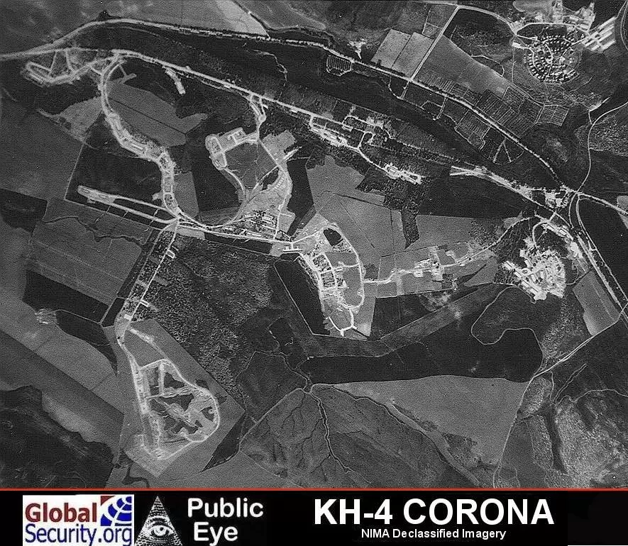
| Pre-Nakba Aerial View |
|||||||||||||||||
|
|||||||||||||||||
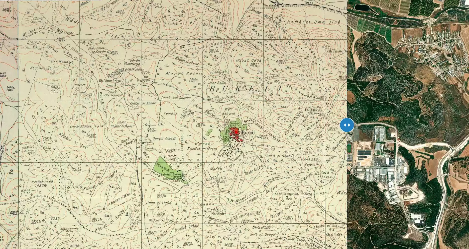
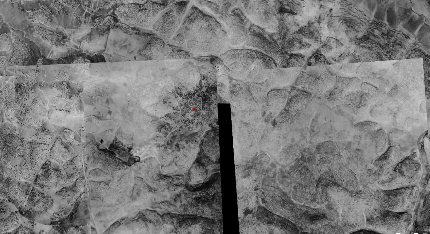
| Map Location | See location #32 on the map View from satellite |
||||||||||||||||
| Military Operation | First phase of Operation ha-Har | ||||||||||||||||
| Exodus Cause | Military assault by Zionist troops | ||||||||||||||||
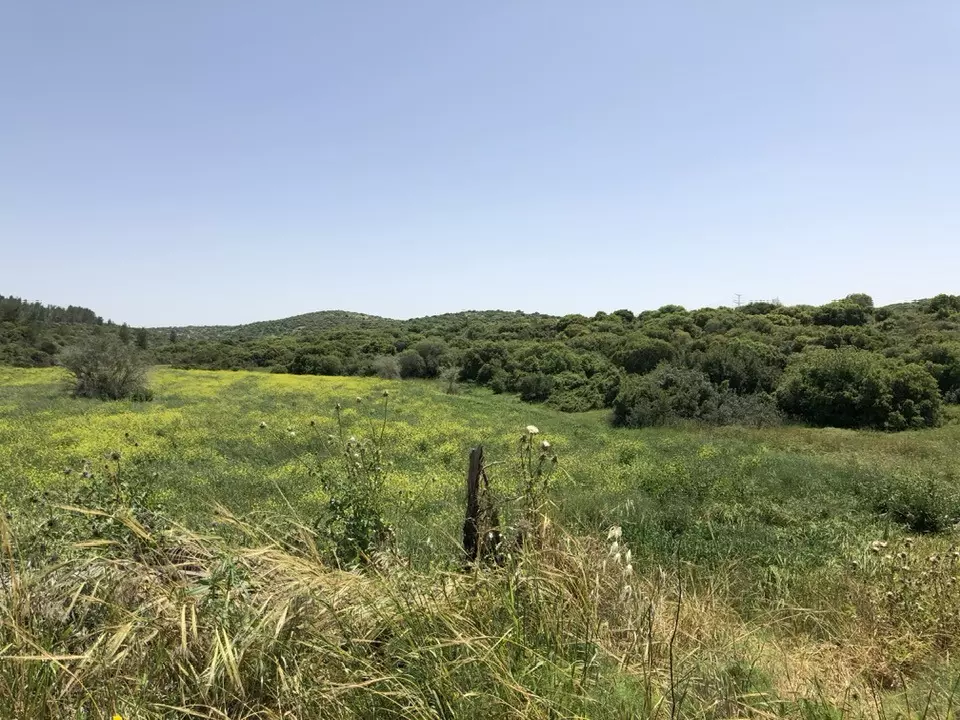
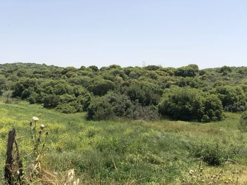
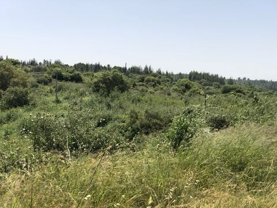
| Village Temains | al-Burayj was mostly destroyed and defaced. | ||||||||||||||||
| Ethnically Cleansing | al-Burayj inhabitants were completely ethnically cleansed. | ||||||||||||||||
| Pre-Nakba Land Ownership |
**Town Lands' Demarcation Maps |
||||||||||||||||
| Land Usage As of 1945 |
|
||||||||||||||||
| Population |
|
||||||||||||||||
| Number of Houses |
|
||||||||||||||||
| Near By Towns |
|||||||||||||||||
|
|
|||||||||||||||||
| Town's Name Through History | al-Burayj name was derived from the Greek purgos meaning a tower. | ||||||||||||||||
| Places of Warship | al-Burayj had a mosque called al-'Umari mosque and a Greek Orthodox Monastery to the west. | ||||||||||||||||
| Archeological Sites | The village has several khirbas around it which contained cisterns, rock-hewn wine presses, tombs, foundations, columns, mosaic floors, and caves. | ||||||||||||||||
| Exculsive Jewish Colonies Who Usurped Village Lands |
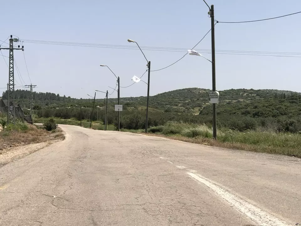
A large military base called Kanaf Staim occupies some of the village lands. | ||||||||||||||||
| Featured Video | |||||||||||||||||
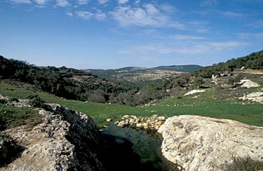
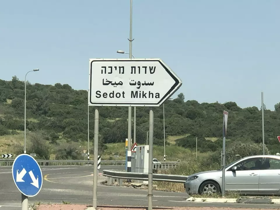
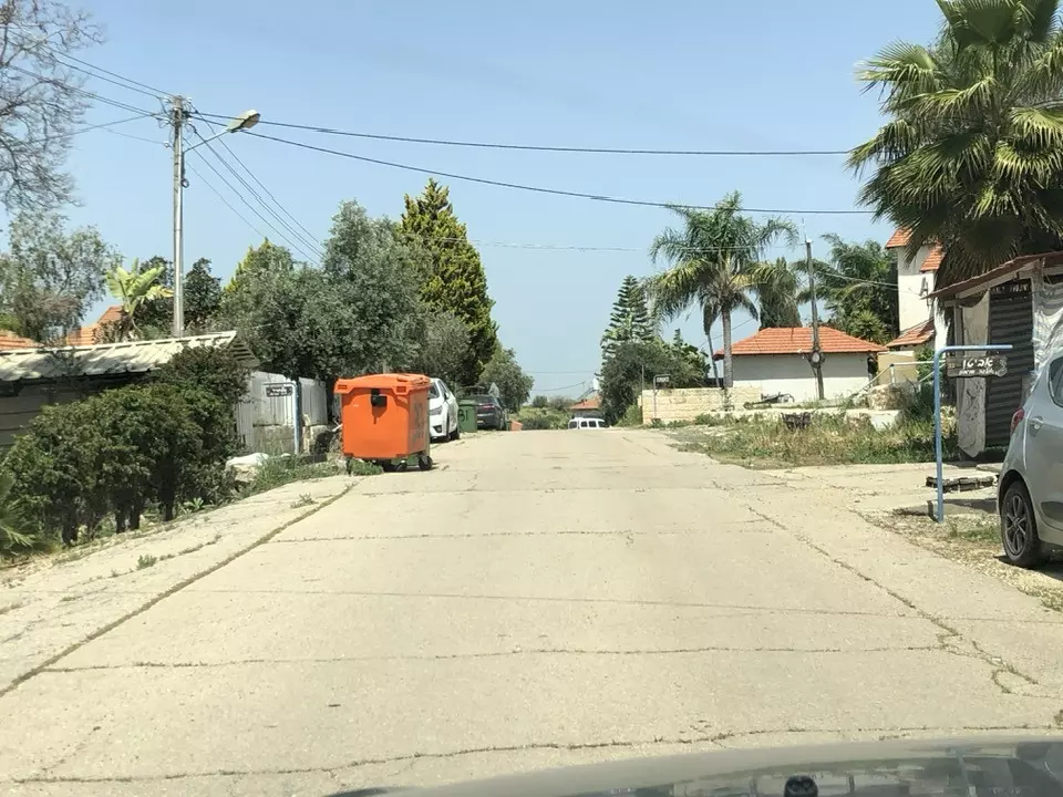
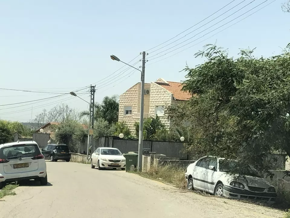
Village Before NakbaThe village stood on hilly terrain between two wadis in the north and south. To the west of al-Burayj was a secondary road that linked it to the highway between Bayt Jibrin (in the Hebron sub-disctrict) and the Jerusalem−Jaffa highway; dirt paths linked it to a group of nearby villages. The name al-Burayj, a diminutive of the Arabic word al-burj, is derived from the Greek purgos, which means tower. The village houses were originally scattered across the site in no particular configuration. New construction, however, took place along the roads that led to the village from many directions, so that the village plan began to take on a star-like shape. The houses were built of cement and stone. The village population was predominantly Muslim, with 10 Christians out of an estimated total of 720 in the mid-1940s. They maintained one mosque, called the al-'Umari mosque, perhaps as an allusion to the second Muslim caliph 'Umar ibn al-Khattab. There was also a Greek Orthodox monastery west of the village. Agriculture depended on rainfall and was based on grain, vegetables, and fruit trees, especially olive trees. Wild trees, grass, and herbs also grew on parts of the land. These parts were used as grazing areas, and the trees were a source of firewood. In 1944/45 a total of 31 dunums was devoted to citrus and bananas and 9,426 dunums were allocated to cereals; 77 dunums were irrigated or used for orchards. The village had several khirbas around it that contained cisterns, rock-hewn wine presses, tombs, foundations, columns, mosaic floors, and caves.Village Occupation and Ethnic CleaningAI-Burayj was probably captured during the first phase of Operation Ha-Har (see 'Allar, Jerusalem sub-district). The village fell sometime between 19 and 24 October 1948, as Israeli forces moved to occupy a number of villages in the southern half of the Jerusalem corridor.Zionists Colonies on Village LandsThe settlement of Sedot Mikha (142125), established in 1955, is south of the site, on village land.Village TodayThe site is now part of a large military base called Kanaf Staim (Wing Two). A large area is fenced in, and a watchtower has been built. The site is inaccessible to the public.SourceDr. Walid al-Khalidi, 1992: All That Remains. |
|||||||||||||||||
| Related Maps | Town Lands' Demarcation Maps خرائط للقضاء توضح حدود القرى والاودية Town's map on MapQuest View from satellite Help us map this town at WikiMapia |
||||||||||||||||
| Related Links | Wikipedia's Page Google Search Google For Images Google For Videos |
||||||||||||||||
| More Information | في كتاب كي لا ننسى في كتاب بلادنا فلسطين المزيد من موقع هوية |
||||||||||||||||
- صورة من خلال القمر الصناعي
Posted by محمد123 غطاس1984 8 - p8
Posted by محمد123 غطاس1984 2 - قال تعالى في الذين يخرجوا من ديارهم بغير حق

Posted by محمد123 غطاس1984 2 - P55
Posted by محمد123 غطاس1984 2 - Pre-Nakba Aerial view of the village / صورة من الجو للقرية اخذت قبل النكبة
- Let us see how the most "liberal and civilized" of world Jewry has obliterated our village. How else will the Jews be great and safe again? -- القرية دمرت بالكامل.. من هنا مر الهمج
- Let us see how the most "liberal and civilized" of world Jewry has obliterated our village. How else will the Jews be great and safe again? -- القرية دمرت بالكامل.. من هنا مر الهمج #2
- Let us see how the most "liberal and civilized" of world Jewry has obliterated our village. How else will the Jews be great and safe again? -- القرية دمرت بالكامل.. من هنا مر الهمج #3
- Let us see how the most "liberal and civilized" of world Jewry has obliterated our village. How else will the Jews be great and safe again? -- القرية دمرت بالكامل.. من هنا مر الهمج #4
- Let us see how the most "liberal and civilized" of world Jewry has obliterated our village. How else will the Jews be great and safe again? -- القرية دمرت بالكامل.. من هنا مر الهمج #5
- Let us see how the most "liberal and civilized" of world Jewry has obliterated our village. How else will the Jews be great and safe again? -- القرية دمرت بالكامل.. من هنا مر الهمج #6
- Let us see how the most "liberal and civilized" of world Jewry has obliterated our village. How else will the Jews be great and safe again? -- القرية دمرت بالكامل.. من هنا مر الهمج #7
Want to browse more? 80,000 pictures were grouped in these gallaries:
| Display Name | Clan/Hamolah | Country of Residence |
| عائشه ابراهيم الشلختي | شلختي | Irbid-Al-Husn, Jordan |
| فادي الحنيني | سكاكية | بيت لحم, فلسطين |
| Mohammad Nasrallah | - | - |
| hani abu khadija | - | - |
| nnasrallah | Nasrallah | - |
| عبدالرحمن الحنيني | الحنيني | الخبر , الخبر |
| مصطفى ابو خديجه | ابو خديجه | الرصيفه, البريج |
| أوس عيسى الحنيني - أبو قصي | سكاكي | - |
| hamadah | المساعفه | - |
| احمد حسن | سكاكي | عمان, الاردن |
| فادي يوسف أحمد عبدالرازق الخطيب | الخطيب | عمان, الأردن |
| احمد الشلختي | الشلختي | اربد |
| محمود الشلختي | الشلختي | اربد |
| ابوعلي | - | البريج |
| Ashraf Alhasan | Eskaki/ Hasan | - |
| محمد جمال | - | Jeddah, Saudi Arabia |
| Mustafa AbuSaab | AbuSaab | - |
| Mahmoud Abu-Saab | - | Jordan |
| البريجي | حسن | عمان |
| اشرف نصرالله | - | - |
| ابو محمد الشرش | الشرش | - |
| اشرف ابوخديجة | ابوخديجة | الرياض -, السعودية |
| مساعفه | - | - |
| ماجد عبد الهادي | - | قطر, قطر |
| Aktham Abu Khadijeh | - | - |
| محمد123 غطاس1984 | - | - |
| mohloay | نصرالله | - |
| البريجي | نصرالله | الاردن, البريج |
| عبدالله نصرالله | نصرالله | المنورة, السعودية |
| شباب المستقبل | - | القدس, حارس |
| saber | ESKAKI | - |
| Abdulqader Nasrallah | - | Dhahran, Khobar |
| NAEL HASAN | AL ESKAKI/ HASAN | AMMAN , JORDAN |
No links have been shared yet, be free to the first to share the first link.
 Fake Valor: Why Did Zionist Jews Hoist Nazis Flag on Their Ships in the 1930s?
What is new?
-
Facts About Oct. 7th Gaza Raid
-
Remined Us Please:: Who Did Rape Who? Palestinians Raped Israelis? Or, was the other way around?
-
When Prof. Edward Said was invited to debate Bibi Netanyahu in the 1980s, watch what happened!
-
Ezra Klein of the NY Times on the "Jewish Race".
-
Abusing Blood Libel!
-
Did Israeli Soldiers Activate The Hanniba Direective On Oct. 7th? You Be The Judge
-
Zionist FAQ: Isn't it true that Palestinians don't want peace? Palestinians never accepted the two-state solution
- Facts about Haavara (Transfer) Agreement between Ben-Gurion & Hitler
-
Haavara FAQs: Why Did Zionist Jews Hoist Nazis' Flags on Their Ships in the 1930s?
- Haavara FAQs: When Chaim Weizmann met FDR in mid-1943, why was he silent about rescuing European Jewry?
-
Dear ChatGPT: How did Palestinians resist Napoleon's invasion of their country in 1799?
-
Dear ChatGPT: Gaza had a vibrant Jewish community in the mid-17th century. What happened to them?
-
Dear ChatGPT: Why did the Jewish Agency suppress news of the Holocaust during WWII?
-
Video Playlist: Jews share their DNA tests to end the conflict for good.
-
A Tale of Two Conflicts: Examining the Definition of Genocide
-
Prof. Abraham Polak And The Suppressed History of the Khazars and European Jewry
-
How Ronald Reagan would have framed the genocide in Gaza if he were still alive?
-
Haavara FAQs: Let us do the math: how many German Jews did The Haavara Agreement save?
-
Zionist FAQs: The Hebron Massacre of 1929, "clearly proves" that Palestinians are antisemitic, how could you deny it?
-
Zionist FAQs: Why Anti-Zionist Is Not Antisemitism?
-
Zionist FAQs: Isn't it true that the KGB created Palestinian Nationalism in the early 1960s?
- Zionist FAQs: Muslims are killing Muslims all the time; why are Israeli Jews being singled out in the media?
- Zionist FAQs: How is Israel an apartheid state when 20% of its citizens are Arabs who enjoy full rights?
-
Haavara FAQs: Why Did Dorothy Thompson Flip From A Zionist Advocate to A Silenced Dissenter?
-
Haavara FAQs: Analysis of Herzl's Uganda Scheme and how it could have saved millions of Jews.
-
Haavara FAQs: Why did Hayim Greenberg describe American Jewry as "morally bankrupt" in early 1943?
-
Haavara FAQs: What if the Evian Conference was a resounding success? What would have been the impact of saving European Jewry on Zionism?
- Haavara FAQs: What if the six million were saved, how that would have impacted the Zionist project?
-
Haavara FAQs: How did Zionist leaders react when Europe's Jews lingered in the DP camps after WWII ended?
-
Why does the American Jewish community repeat lies that David Ben-Gurion had debunked before he died?
-
Who has the power to rename the Tatar/Khazar Gene Marker to Jewish IV?
-
Zionist FAQs: Why won't Egypt, Syria, and Jordan take their people back? Jews are indigenous to Palestine, and Arabs immigrated after Jews developed the country. Arabs should leave.
-
Haavara FAQs: Did Hitler and the Nazis conflate between Judaism and Zionist? If that wasn't case, then why?
-
Haavara FAQs: Winston Churchill and antisemitism, a collection of articles written Churchill.
-
Haavara FAQs: Broken by country, how many Jews survived vs. killed during the Holocaust?
-
Haavara FAQs: Why did European Jews vote with their feet and to immigrated to the Americas, not Palestine, after WWII?
-
Watch this American Jewish Girl describing Israeli Jews' cognitive dissonance like no other in under two minutes
-
Haavara FAQs: When the Nazis went out of their way to hide the Holocaust, Israeli Jews did the exact opposite by broadcasting their genocide of Gazans. But why?
-
Haavara FAQs: How Zionist Jews went out of their to show their appreciation to Nazism and Fascism?
- Haavara FAQs: Why Zionist leaders were against bombing the death camps & the Railroads leading to them?
-
Haavara FAQs: Hitler's message to the British and American people: If Jews are such noble citizens and you care about them, how come you're not letting them in? I will gladly ship them to you at my expense, even on luxury liners!
-
A shortlist of Zionist and Israeli false flag operations in the name Jews.
-
The Most Moral Army
- The Land of Kapos (Israel): Where the brave are boycotted and Kapos walk free.
- Why did early Zionists often named their communal enterprises "colonial"?
- Zionist Relations with Nazi Germany by Faris Glubb
-
Two NY Times advertisements by Zionists in the early 1943 that exposes Zionists' treason at the height of the calamity
- Facts Not Lies about the Palestinian-Israeli Conflict.
- Site's pictures have been categorized
- Campgain Against Lice
- A Survey of Palestine, the official source about Palestine before Nakba produced by the British Mandate; over 1200 pages.
- Satellite View & Google Earth: Over 6,000 placemarks identifying all destroyed towns, W. Bank & Gaza Strip Towns, & refugee camps.
- PalestineRemembered.com and its Nakba Oral History Project were featured on al-Jazeera Satellite TV.
- Nakba Oral History Video Podcast:
 Over 700 Oral History interviews (including 3,500+ hours of recording) can be viewed online.
 - Palestine Village Statistics Project
- Gaza Jail Break
- النسخة العربية للموقع الان متوفرة
- Videos: Documenting the destroyed villages in video: Tracing all that remains since Nakba.
- Videos: Responding to Zionist Propaganda
- Interview: The ethnic cleansing of Palestine: George Galloway interviews Israeli Historian Ilan Pappe.
- For Palestinians, memory matters. It provides a blueprint for their future By George Bisharat.
- Zionist FAQ now available in Hebrew שאלות שציונים שואלים, עכשיו בעברית
- Video: The Stephen Walt and John Mearsheimer report on the influence of the Israel Lobby on U.S. Foreign Policy
- The Palestinian-Israeli conflict for beginners
