| PalestineRemembered | About Us | Oral History | العربية | |
| Pictures | Zionist FAQs | Haavara | Maps | |
| Search |
| Camps |
| Districts |
| Acre |
| Baysan |
| Beersheba |
| Bethlehem |
| Gaza |
| Haifa |
| Hebron |
| Jaffa |
| Jericho |
| Jerusalem |
| Jinin |
| Nablus |
| Nazareth |
| Ramallah |
| al-Ramla |
| Safad |
| Tiberias |
| Tulkarm |
| Donate |
| Contact |
| Profile |
| Videos |
Welcome To Jarisha - جريشة (ג'רישה)
|
District of Jaffa
Ethnically cleansed days ago |
العربية Google Earth |
 |
Gallery (29) |
- Statistics & Facts
-
Before & After

- Satellite View
- Articles 1
- Pictures 29
- Aerial Views 1
- Members
- Wikipedia
- Videos
- Guest Book
- Links 1
| Statistic & Fact | Value | ||||||||||||||||||
| Occupation Date | May 1, 1948 | ||||||||||||||||||
| Distance From District | 7 (km) Northeast of Jaffa | ||||||||||||||||||
| Elevation | 25 (meters) | ||||||||||||||||||
| Before & After Nakba, Click Map For Details |
|||||||||||||||||||
|
|||||||||||||||||||
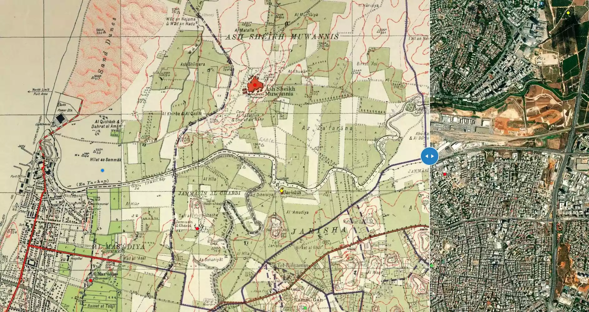
| Map Location | See location #11 on the map View from satellite |
||||||||||||||||||
| Acts of Terror | In March 1948, Irgun Zvai Leumi (IZL or ETZEL) kidnapped five of the village leaders despite of a truce between the villagers and the Haganah. | ||||||||||||||||||
| Exodus Cause | Expulsion by Zionist troops | ||||||||||||||||||
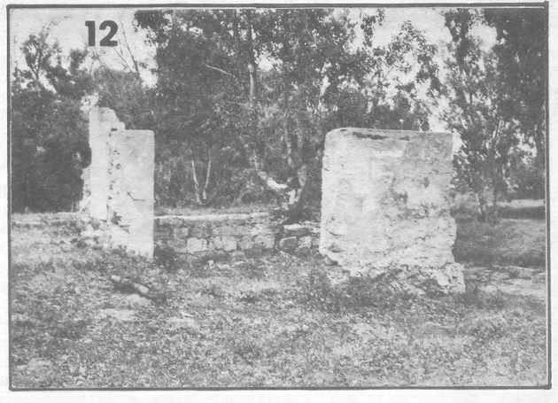
| Village Temains | Jarisha was completely obliterated. | ||||||||||||||||||
| Ethnically Cleansing | Jarisha inhabitants were completely ethnically cleansed. | ||||||||||||||||||
| Pre-Nakba Land Ownership |
**Town Lands' Demarcation Maps |
||||||||||||||||||
| Land Usage As of 1945 |
|
||||||||||||||||||
| Population |
|
||||||||||||||||||
| Number of Houses |
|
||||||||||||||||||
| Near By Towns |
|||||||||||||||||||
|
|||||||||||||||||||
| Town's Name Through History | Jarisha may have picked its name from the nearby a grain mill. | ||||||||||||||||||
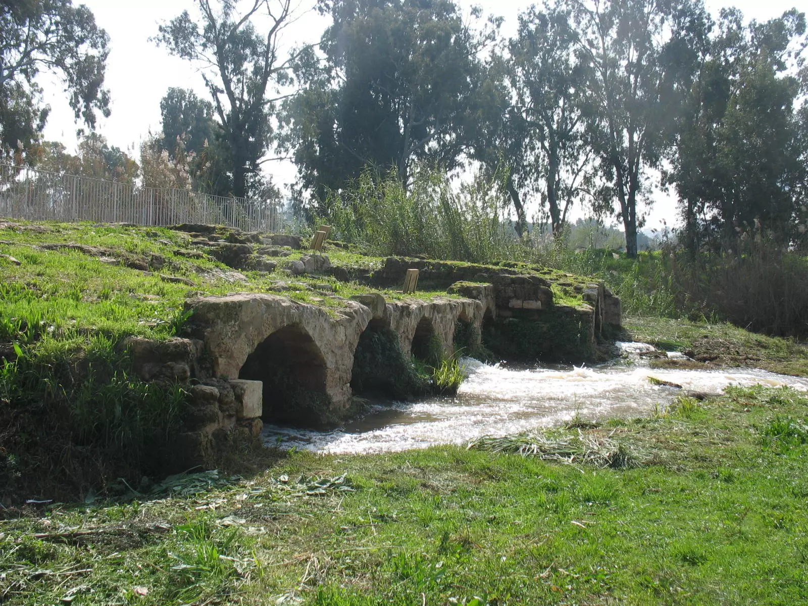
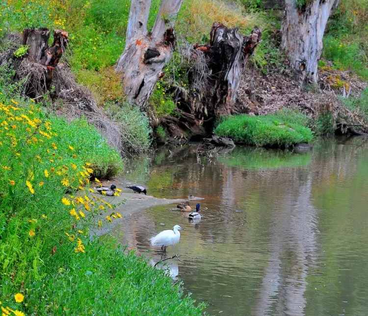
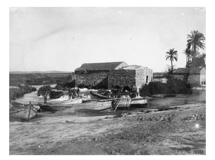
| Nearby Wadies & Rivers | Jarisha was situated on the south bank of the al-'Awja River. | ||||||||||||||||||
| Water Supply | Jarisha had its own well for drinking water and used the al-'Awja River water for irrigation. | ||||||||||||||||||
| Exculsive Jewish Colonies Who Usurped Village Lands |
The Israeli City of Ramat Gan has been encroaching on village lands. | ||||||||||||||||||
Village TodayAccording to the Palestinian historian Walid Khalidi, the village remaining structures on the village land are:"The site has been completely covered over by highways and suburban houses." |
|||||||||||||||||||
| Related Maps | Town Lands' Demarcation Maps خرائط للقضاء توضح حدود القرى والاودية Town's map on MapQuest View from satellite Help us map this town at WikiMapia |
||||||||||||||||||
| Related Links | Wikipedia's Page Facebook Page Google Search Google For Images Google For Videos |
||||||||||||||||||
| More Information | في كتاب كي لا ننسى في كتاب بلادنا فلسطين |
||||||||||||||||||
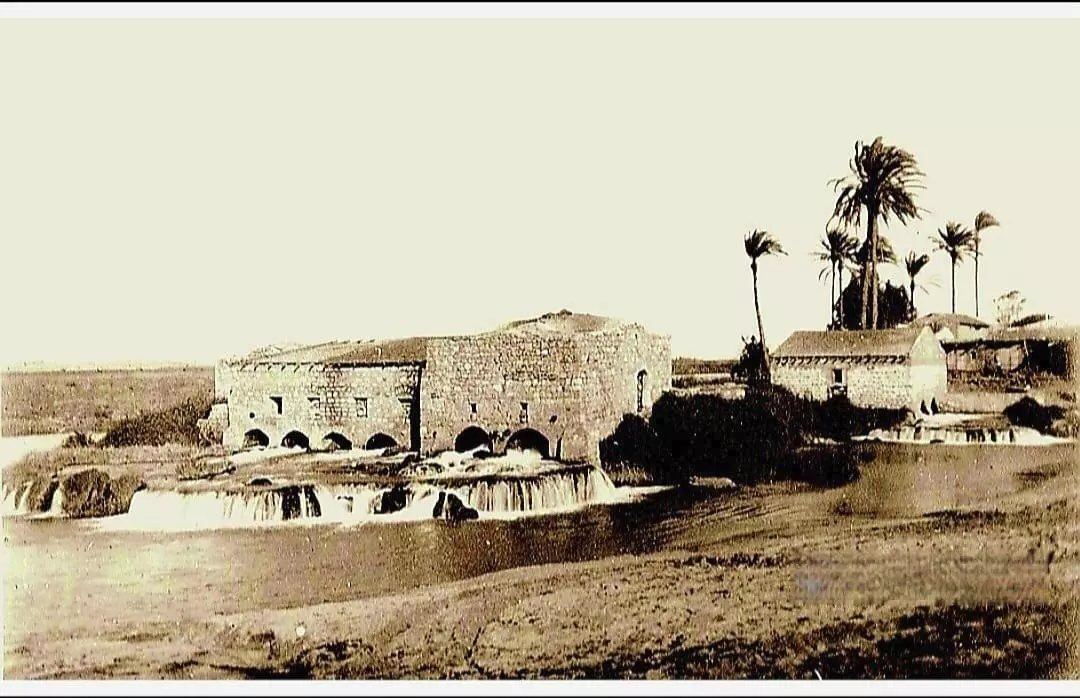
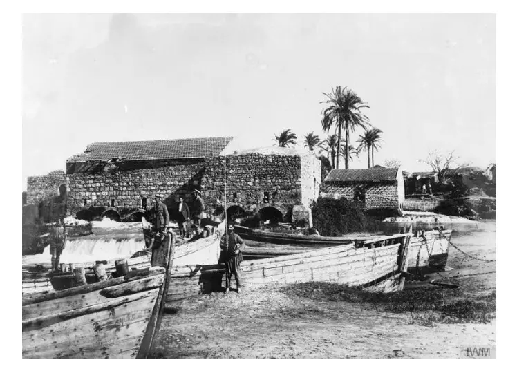
- Jarisha-Mill On The al-'Awja River In 1917

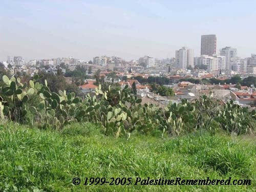
Scanned from "All That Remains" by Dr. Walid Khalidi - Jarisha's Cactus trees and Tel-Aviv in the background
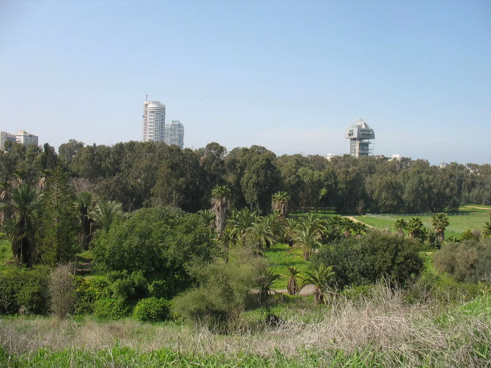
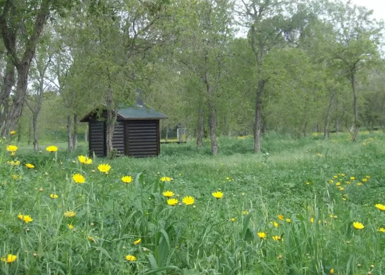
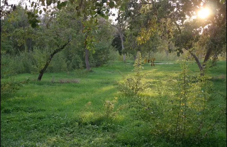
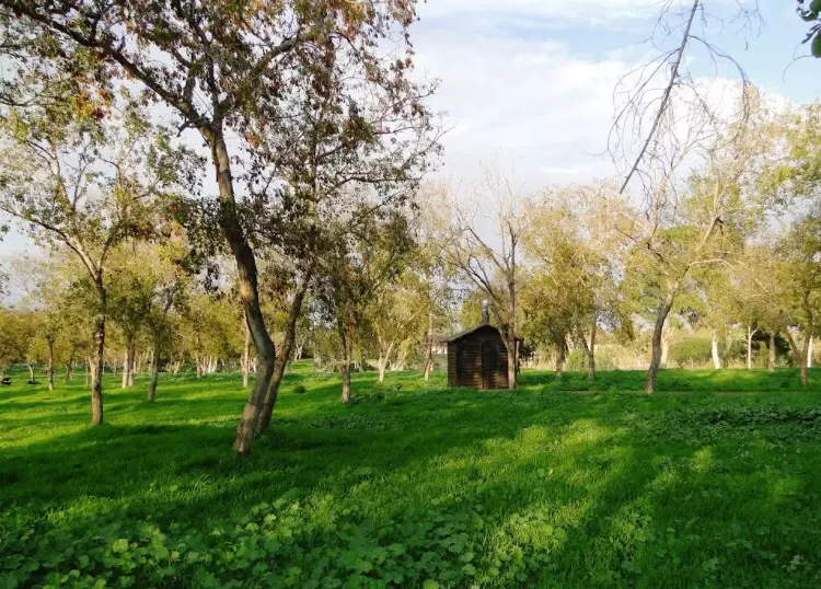
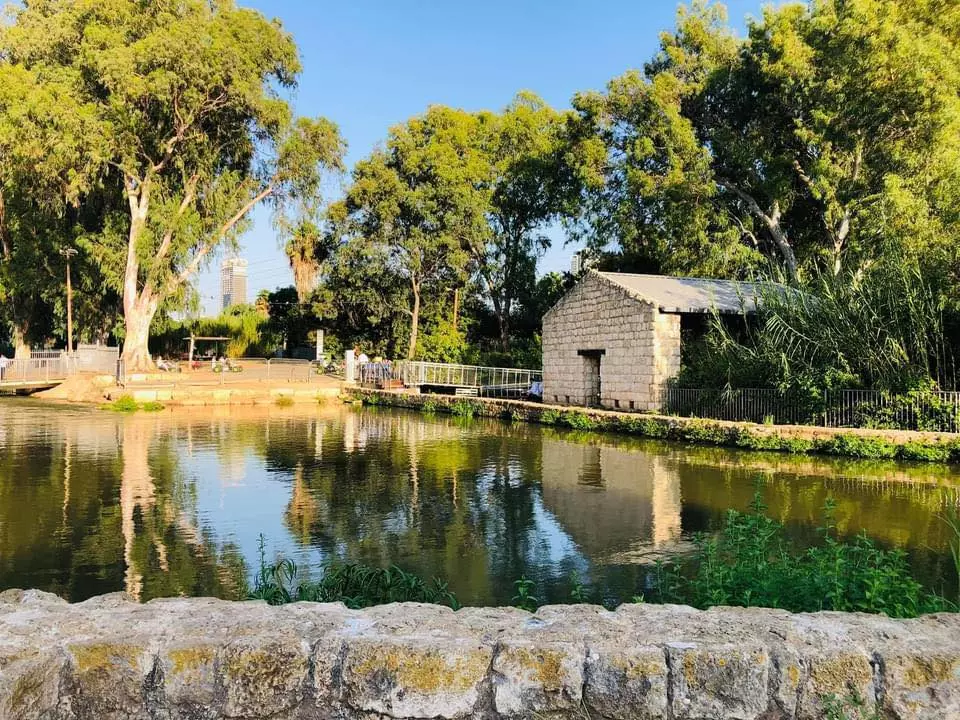
- General view for destroyed village's lands, now it serves the Israeli public (as usually done with most destroyed villages) as picnic park.
Posted by Noga Kadman - The famous mill (Tahouneh)
Posted by Noga Kadman - (منظر جوي بإتجاه الشرق ويهر نهر اليركون(العوجة

- قرية جريشة على نهر العوجا
Posted by فتحي ابو رضا \ العايدي - موقع القريه
Posted by abu raya - موقع القريه بين الاشجار
Posted by abu raya - موقع القريه
Posted by abu raya - القريه بالقرب من نهر العوجا
Posted by abu raya - القريه بالقرب من بنايات تل ابيب
Posted by abu raya - صوره قديمه لقريه الجريشه سنه 1918

Posted by abu raya - طواحين المياه في الجريشه سنه 1918
Posted by abu raya - صوره من القريه سنه 1918
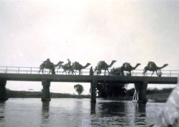
Posted by abu raya - قرية جريشة (الطواحين السبع )قضاء يافا سنة 1930- جسر على نهر العوجا

- جسر العوجا ..اليركون سنة 1946
- صورة ساحرة لجانب من قرية جريشة (السبع طواحين) على نهر العوجا قضاء يافا عام 1925..
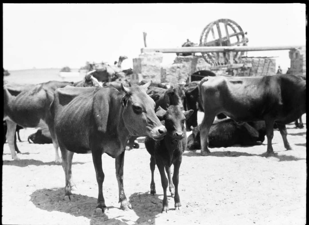
- Pictures taken in Jarisha during the pre-Nakba period
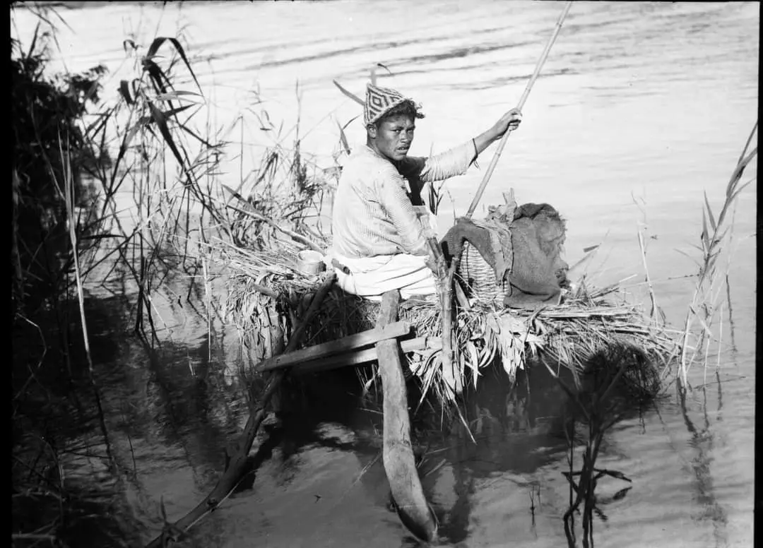
- Pictures taken in Jarisha during the pre-Nakba period #2
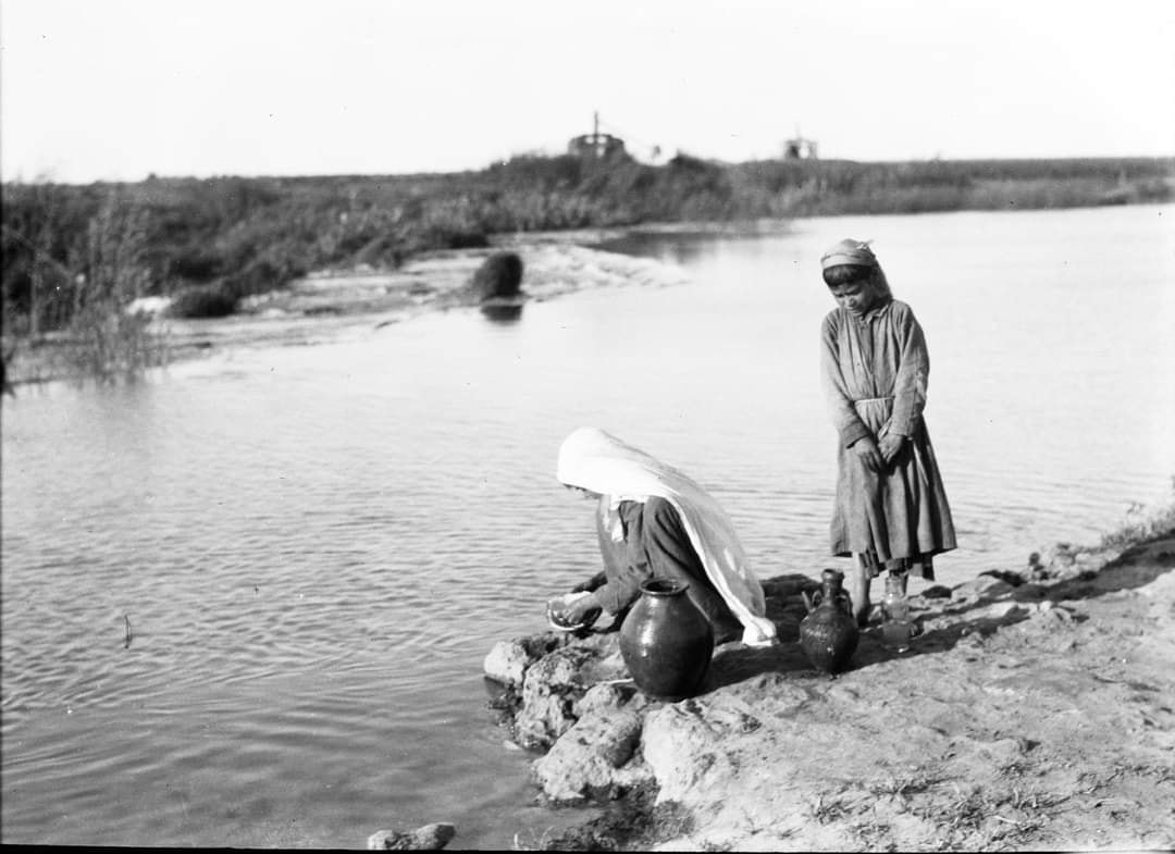
- Pictures taken in Jarisha during the pre-Nakba period #3
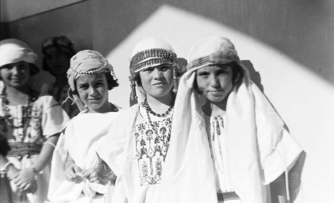
- Pictures taken in Jarisha during the pre-Nakba period #4
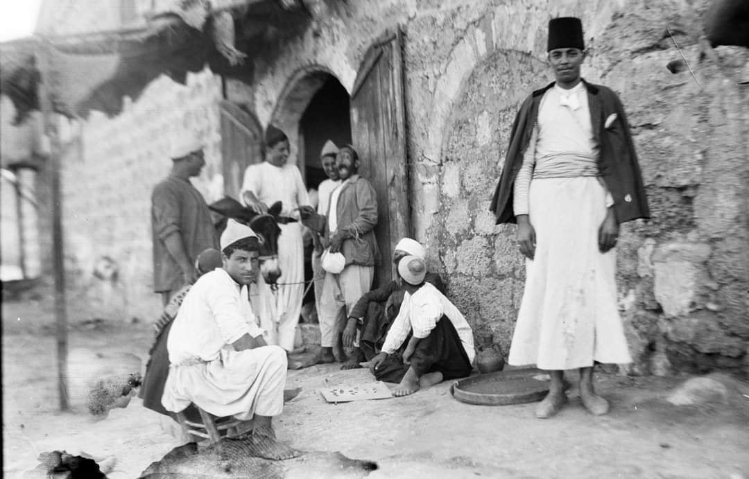
- Pictures taken in Jarisha during the pre-Nakba period #5
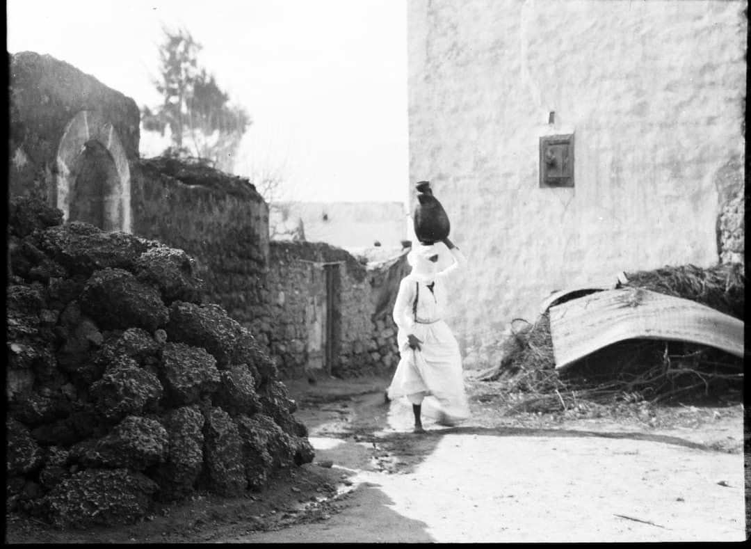
- Pictures taken in Jarisha during the pre-Nakba period #6
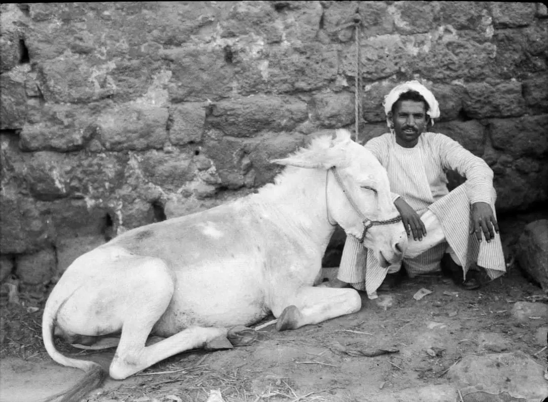
- Pictures taken in Jarisha during the pre-Nakba period #7
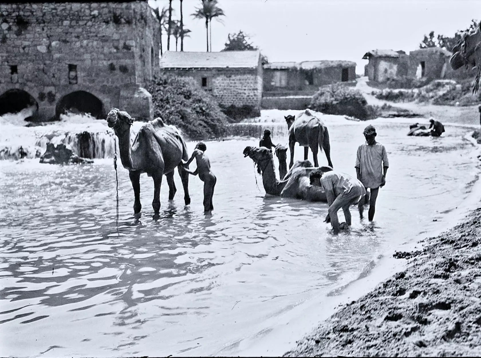
- شباب قرية اجريشة قضاء يافا يسبحون مع جمالهم على ضفاف نهر العوجا--1934
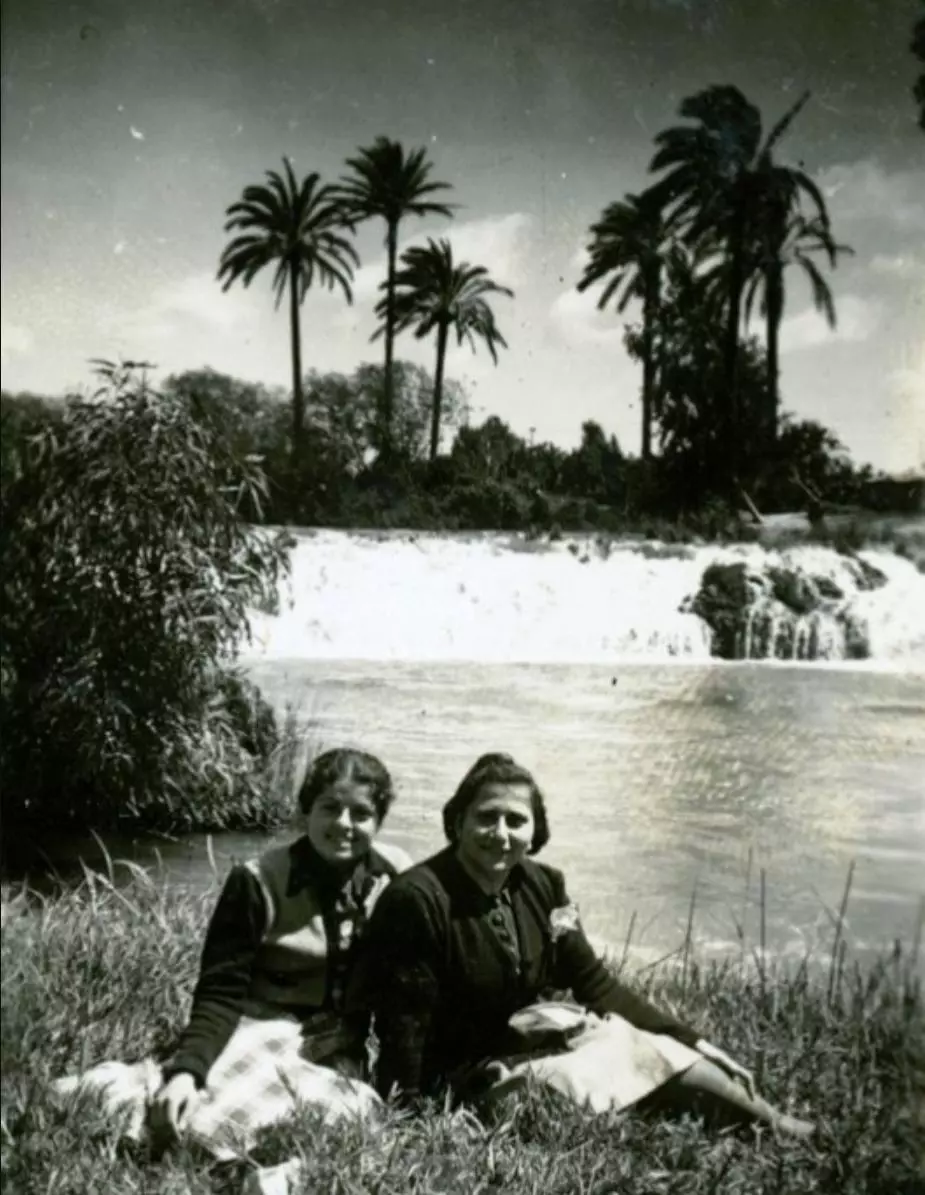
- معلمات المدرسة الارمنية من مدينة يافا يلتقطن صورة جميلة على ضفاف نهر العوجا قضاء يافا سنة 1940.
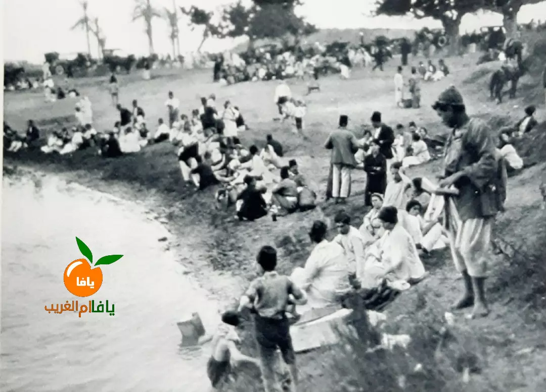
- صورة نادرة جدا لأهالي يافا يجتمعون في الأعياد في نهر العوجا -- جريشة
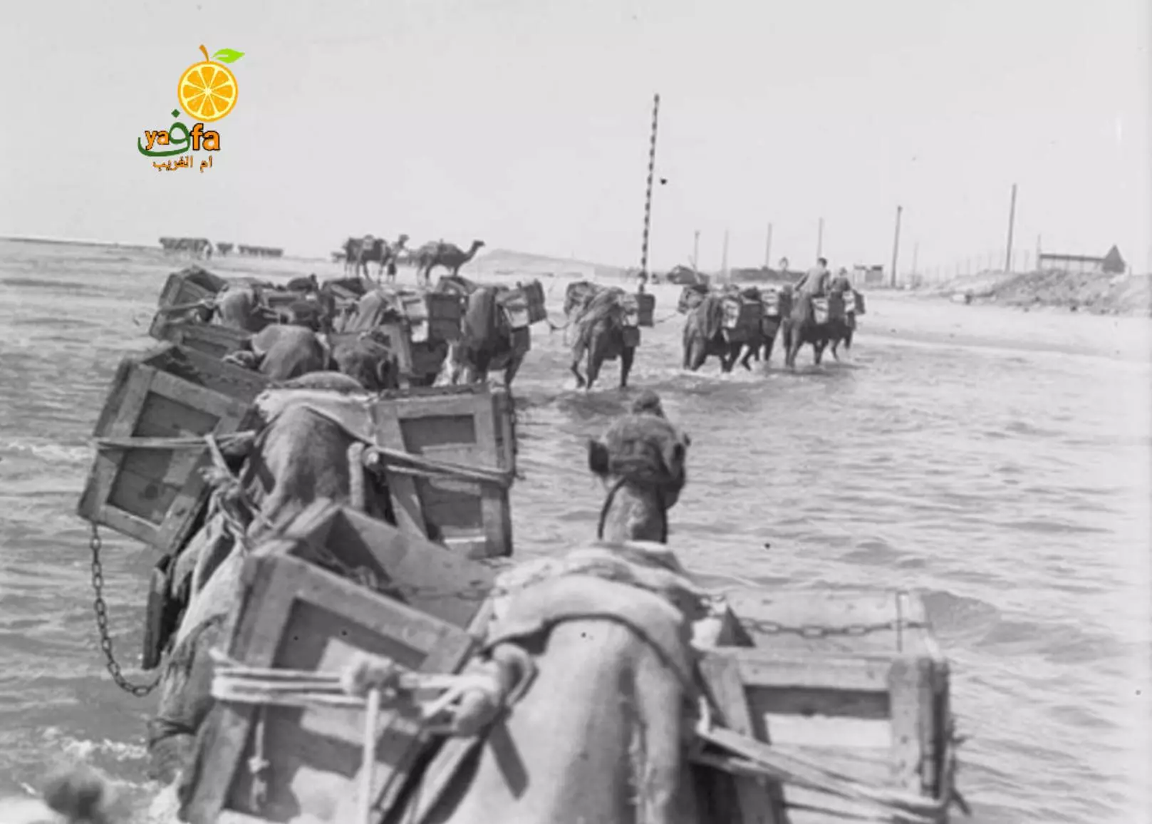
- قافلة جمال محملة بمواد بناء تقطع نهر العوجا قضاء يافا ..متجه نحو محطة الكهرباء المركزية التابعة ليافا -- 1937
- منظر عام رائع للقرية -- Iyad Jaber
Want to browse more? 80,000 pictures were grouped in these gallaries:
| Display Name | Clan/Hamolah | Country of Residence |
 Fake Valor: Why Did Zionist Jews Hoist Nazis Flag on Their Ships in the 1930s?
What is new?
-
Facts About Oct. 7th Gaza Raid
-
Remined Us Please:: Who Did Rape Who? Palestinians Raped Israelis? Or, was the other way around?
-
When Prof. Edward Said was invited to debate Bibi Netanyahu in the 1980s, watch what happened!
-
Ezra Klein of the NY Times on the "Jewish Race".
-
Abusing Blood Libel!
-
Zionist FAQ: Isn't it true that Palestinians don't want peace? Palestinians never accepted the two-state solution
- Facts about Haavara (Transfer) Agreement between Ben-Gurion & Hitler
-
Haavara FAQs: Why Did Zionist Jews Hoist Nazis' Flags on Their Ships in the 1930s?
-
Dear ChatGPT: Why did the Jewish Agency suppress news of the Holocaust during WWII?
-
Video Playlist: Jews share their DNA tests to end the conflict for good.
-
A Tale of Two Conflicts: Examining the Definition of Genocide
-
Prof. Abraham Polak And The Suppressed History of the Khazars and European Jewry
-
How Ronald Reagan would have framed the genocide in Gaza if he were still alive?
-
Haavara FAQs: Let us do the math: how many German Jews did The Haavara Agreement save?
-
Zionist FAQs: The Hebron Massacre of 1929, "clearly proves" that Palestinians are antisemitic, how could you deny it?
-
Zionist FAQs: Why Anti-Zionist Is Not Antisemitism?
-
Zionist FAQs: Isn't it true that the KGB create Palestinian Nationalism in the early 1960s?
- Zionist FAQs: Muslims are killing Muslims all the time; why are Israeli Jews being singled out in the media?
- Zionist FAQs: How is Israel an apartheid state when 20% of its citizens are Arabs who enjoy full rights?
-
Haavara FAQs: Analysis of Herzl's Uganda Scheme and how it could have saved millions of Jews.
-
Haavara FAQs: Why did Hayim Greenberg describe American Jewry as "morally bankrupt" in early 1943?
-
Haavara FAQs: What if the Evian Conference was a resounding success? What would have been the impact of saving European Jewry on Zionism?
- Haavara FAQs: What if the six million were saved, how that would have impacted the Zionist project?
-
Haavara FAQs: How did Zionist leaders react when Europe's Jews lingered in the DP camps after WWII ended?
-
Why does the American Jewish community repeat lies that David Ben-Gurion had debunked before he died?
-
Who has the power to rename the Tatar/Khazar Gene Marker to Jewish IV?
-
Zionist FAQs: Why won't Egypt, Syria, and Jordan take their people back? Jews are indigenous to Palestine, and Arabs immigrated after Jews developed the country. Arabs should leave.
-
Haavara FAQs: Did Hitler and the Nazis conflate between Judaism and Zionist? If that wasn't case, then why?
-
Haavara FAQs: Winston Churchill and antisemitism, a collection of articles written Churchill.
-
Haavara FAQs: Broken by country, how many Jews survived vs. killed during the Holocaust?
-
Haavara FAQs: Why did European Jews vote with their feet and to immigrated to the Americas, not Palestine, after WWII?
-
Watch this American Jewish Girl describing Israeli Jews' cognitive dissonance like no other in under two minutes
-
Haavara FAQs: When the Nazis went out of their way to hide the Holocaust, Israeli Jews did the exact opposite by broadcasting their genocide of Gazans. But why?
-
Haavara FAQs: How Zionist Jews went out of their to show their appreciation to Nazism and Fascism?
- Haavara FAQs: Why Zionist leaders were against bombing the death camps & the Railroads leading to them?
-
Haavara FAQs: Hitler's message to the British and American people: If Jews are such noble citizens and you care about them, how come you're not letting them in? I will gladly ship them to you at my expense, even on luxury liners!
-
A shortlist of Zionist and Israeli false flag operations in the name Jews.
-
The Most Moral Army
- The Land of Kapos (Israel): Where the brave are boycotted and Kapos walk free.
- Why did early Zionists often named their communal enterprises "colonial"?
- Zionist Relations with Nazi Germany by Faris Glubb
-
Two NY Times advertisements by Zionists in the early 1943 that exposes Zionists' treason at the height of the calamity
- Facts Not Lies about the Palestinian-Israeli Conflict.
- Site's pictures have been categorized
- Campgain Against Lice
- A Survey of Palestine, the official source about Palestine before Nakba produced by the British Mandate; over 1200 pages.
- Satellite View & Google Earth: Over 6,000 placemarks identifying all destroyed towns, W. Bank & Gaza Strip Towns, & refugee camps.
- PalestineRemembered.com and its Nakba Oral History Project were featured on al-Jazeera Satellite TV.
- Nakba Oral History Video Podcast:
 Over 700 Oral History interviews (including 3,500+ hours of recording) can be viewed online.
 - Palestine Village Statistics Project
- Gaza Jail Break
- النسخة العربية للموقع الان متوفرة
- Videos: Documenting the destroyed villages in video: Tracing all that remains since Nakba.
- Videos: Responding to Zionist Propaganda
- Interview: The ethnic cleansing of Palestine: George Galloway interviews Israeli Historian Ilan Pappe.
- For Palestinians, memory matters. It provides a blueprint for their future By George Bisharat.
- Zionist FAQ now available in Hebrew שאלות שציונים שואלים, עכשיו בעברית
- Video: The Stephen Walt and John Mearsheimer report on the influence of the Israel Lobby on U.S. Foreign Policy
- The Palestinian-Israeli conflict for beginners
