| PalestineRemembered | About Us | Oral History | العربية | |
| Pictures | Zionist FAQs | Haavara | Maps | |
| Search |
| Camps |
| Districts |
| Acre |
| Baysan |
| Beersheba |
| Bethlehem |
| Gaza |
| Haifa |
| Hebron |
| Jaffa |
| Jericho |
| Jerusalem |
| Jinin |
| Nablus |
| Nazareth |
| Ramallah |
| al-Ramla |
| Safad |
| Tiberias |
| Tulkarm |
| Donate |
| Contact |
| Profile |
| Videos |
Welcome To al-Mirr - المر (المحمودية) (אל-מיר)
|
District of Jaffa
Ethnically cleansed days ago |
العربية Google Earth |
 |
Gallery (40) |
- Statistics & Facts
-
Before & After

- Satellite View
- Articles 3
- Pictures 40
- Members
- All That Remains
- Wikipedia
- Videos 2
- Guest Book
- Links 1
| Statistic & Fact | Value | ||||||||||||
| Occupation Date | February 1, 1948 | ||||||||||||
| Distance From District | 16.5 (km) Northeast of Jaffa | ||||||||||||
| Elevation | 25 (meters) | ||||||||||||
| Before & After Nakba, Click Map For Details |
|||||||||||||
|
|||||||||||||
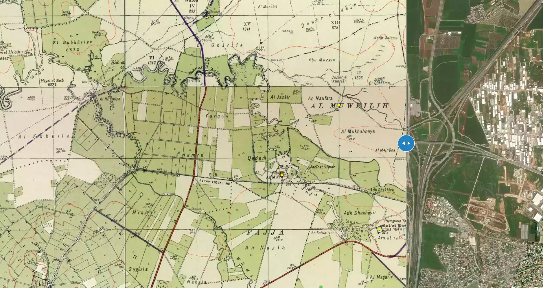
| Map Location | See location #8 on the map View from satellite |
||||||||||||
| Attacking Units | Irgun Zvai Leumi (IZL) | ||||||||||||
| Exodus Cause | Fear of Jewish attack, or of being caught in the fighting | ||||||||||||
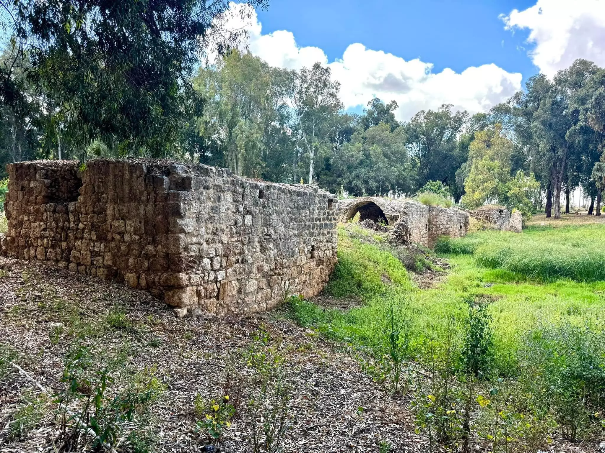
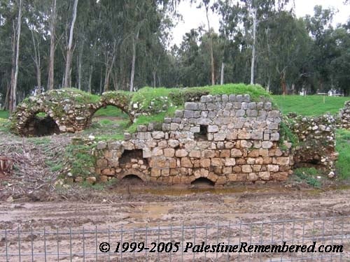
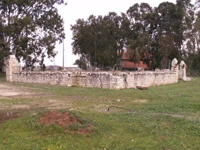
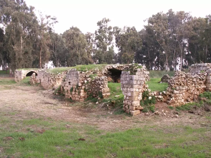
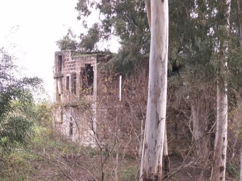
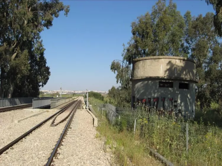
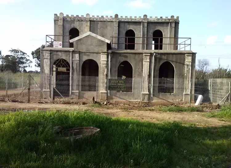
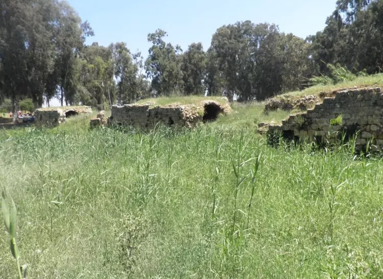
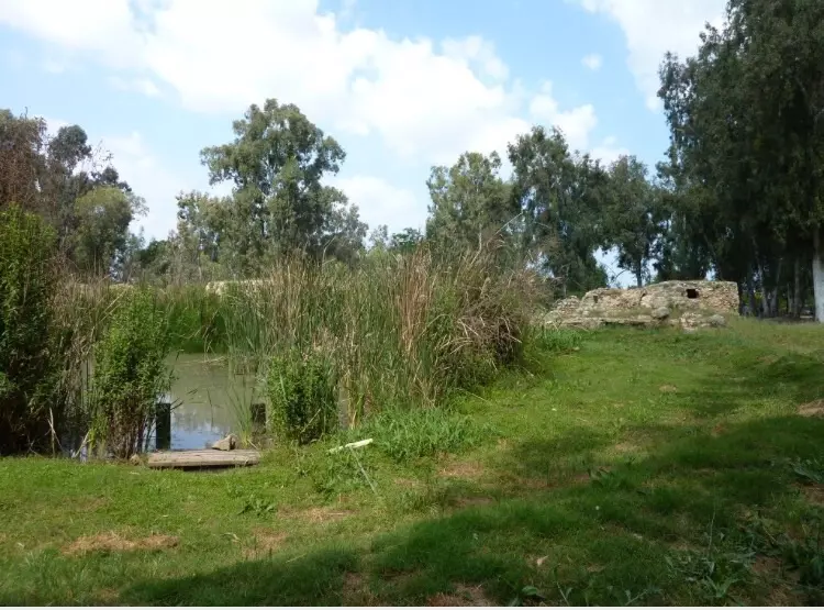
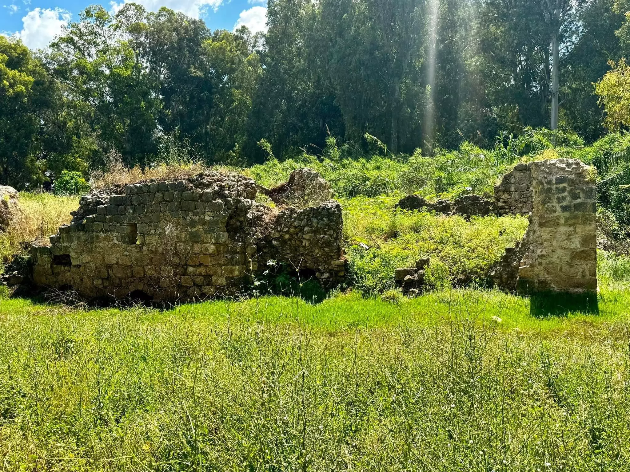
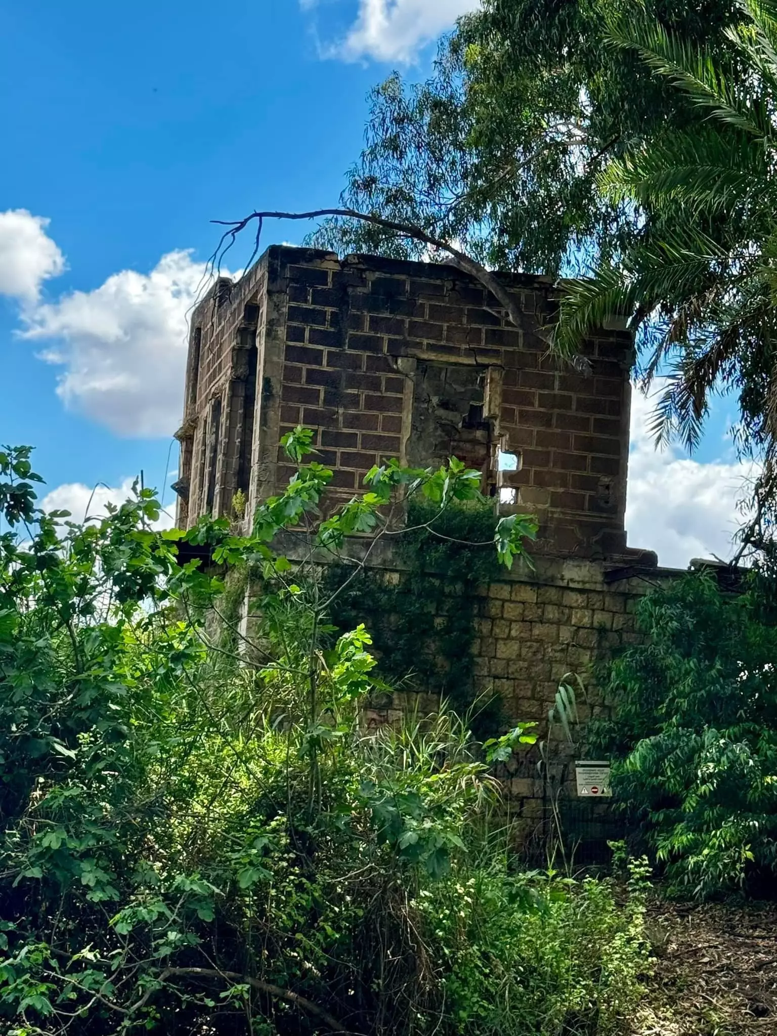
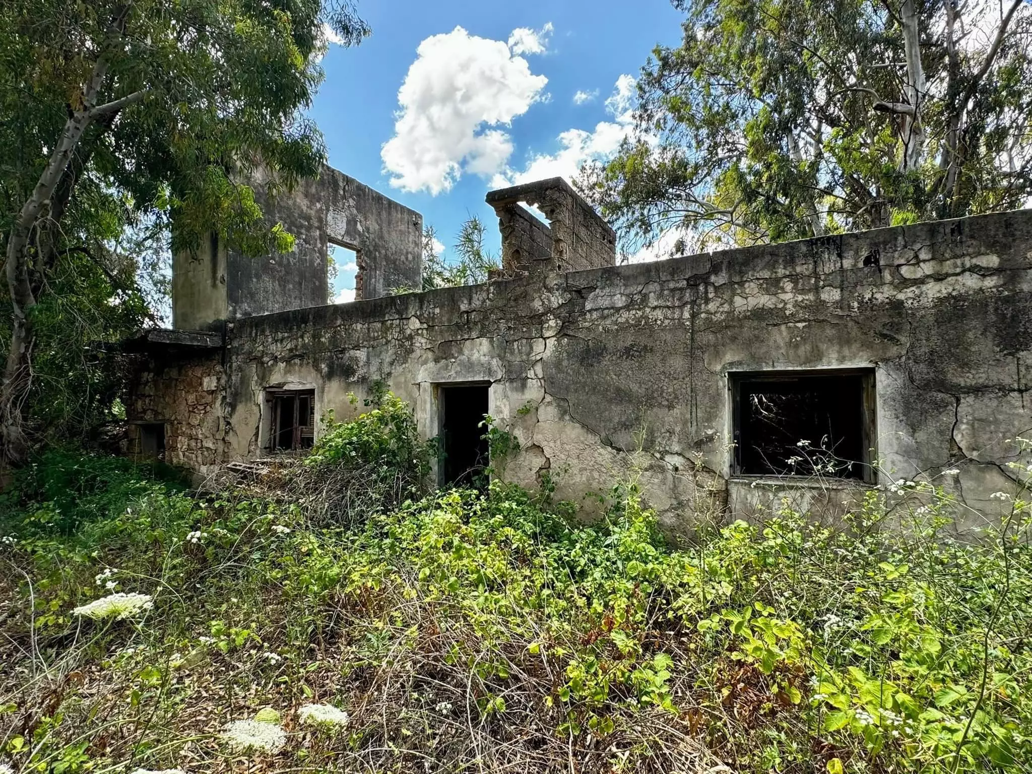
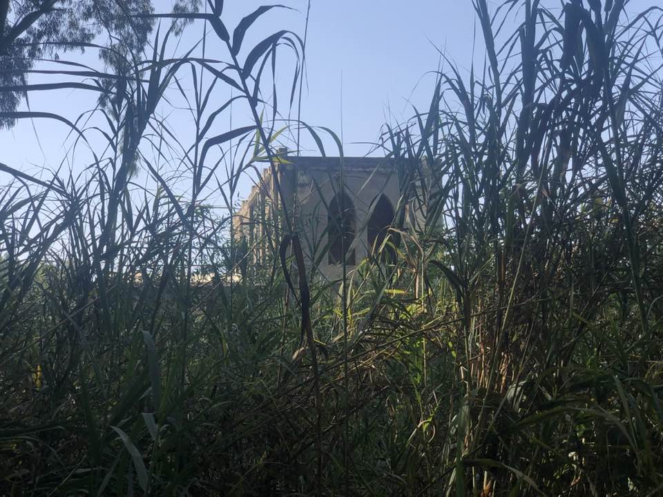
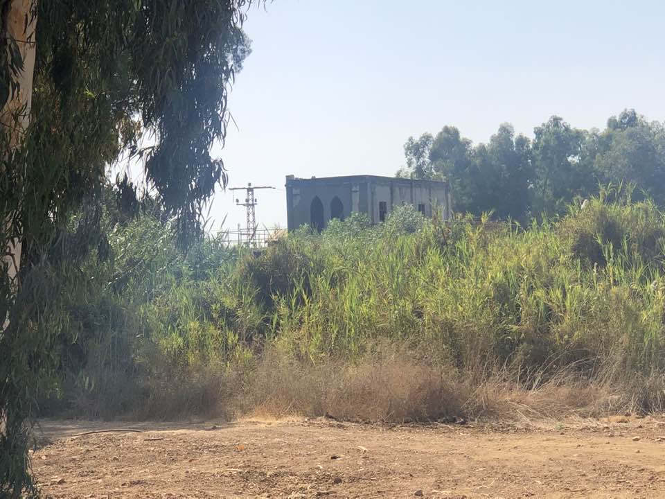
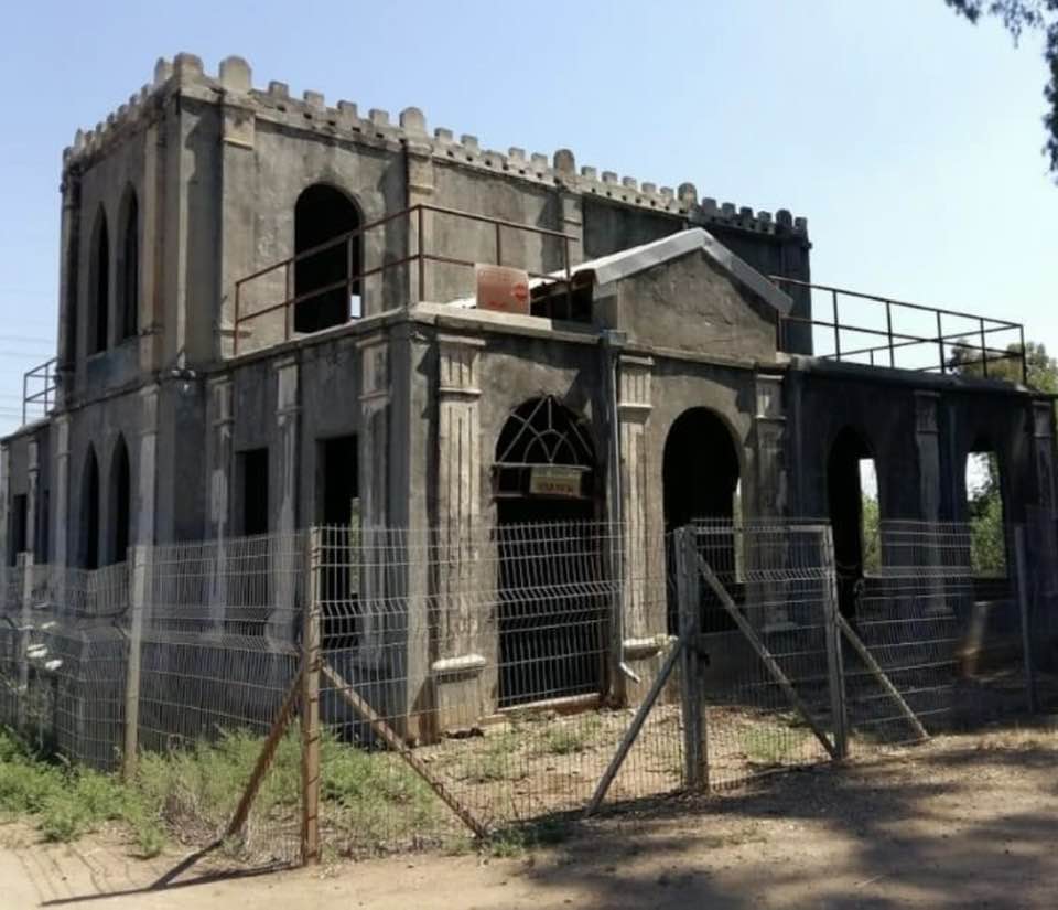
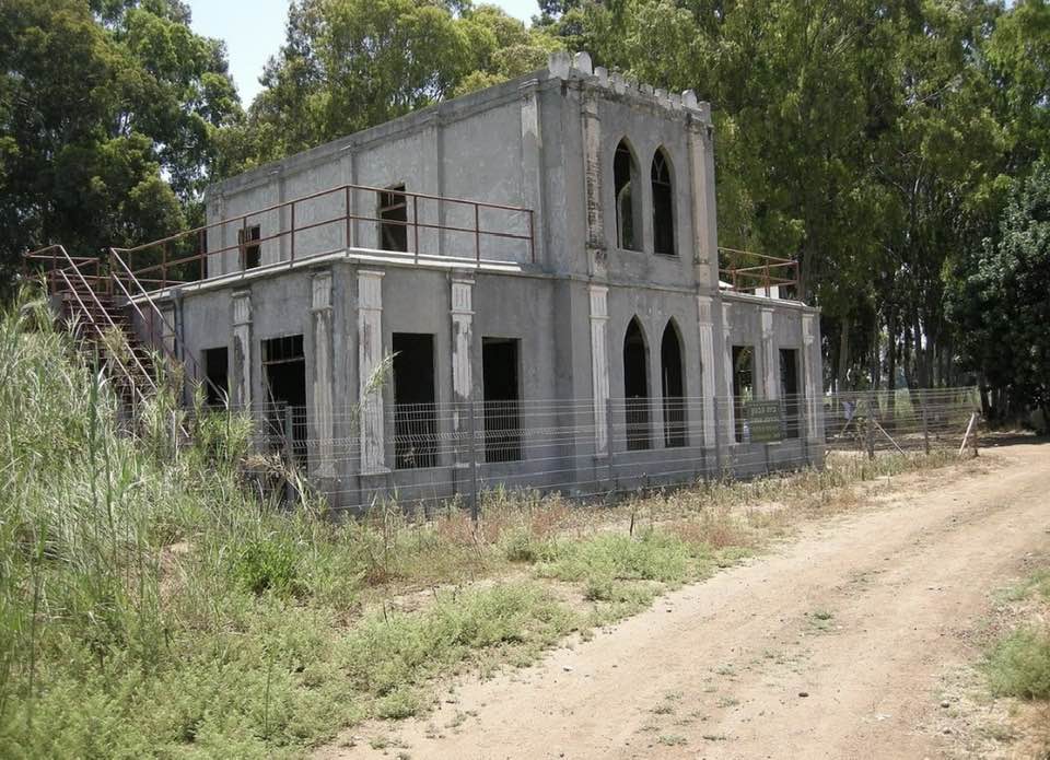
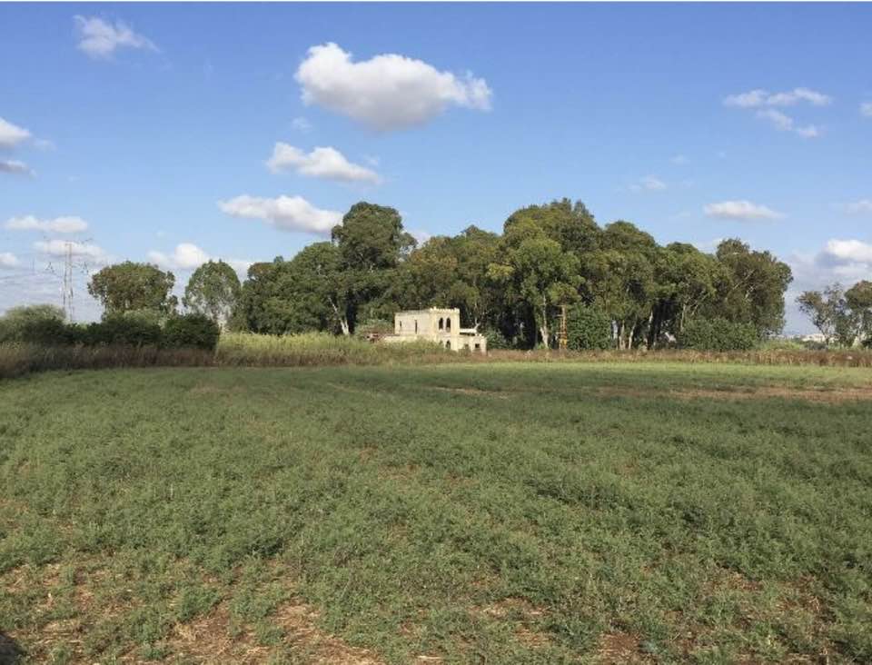
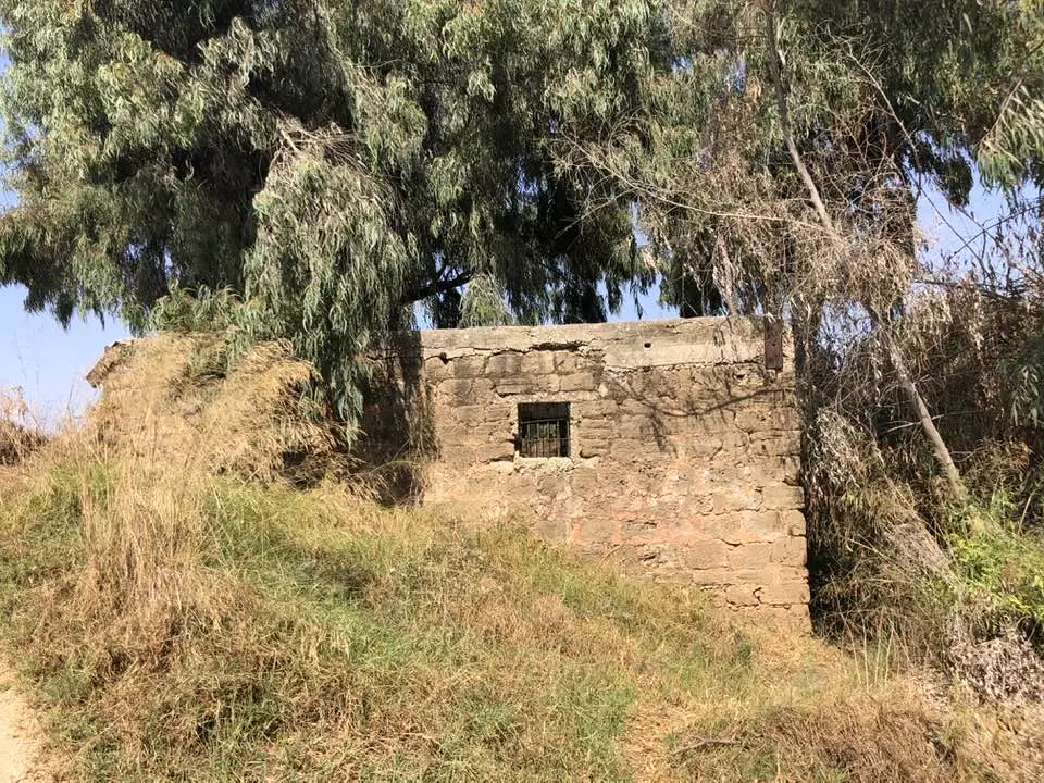
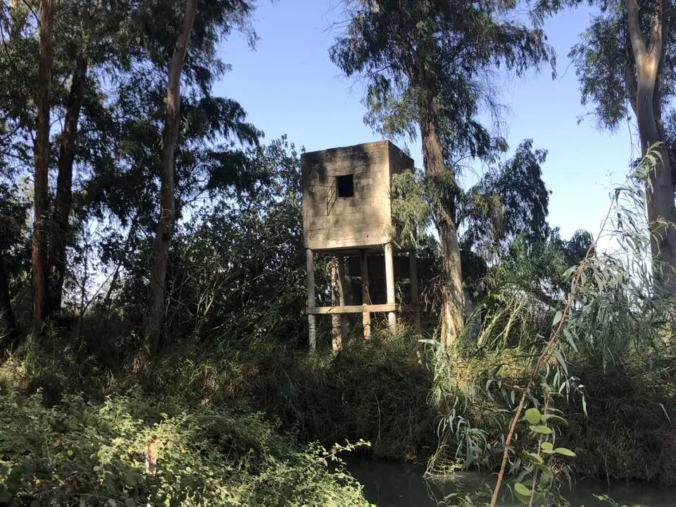
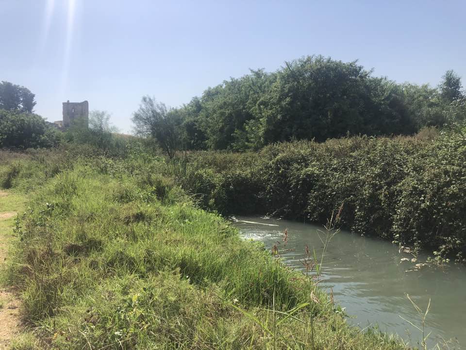
| Village Temains | The village has been mostly destroyed with the exception of few large deserted houses. | ||||||||||||
| Ethnically Cleansing | On the 3rd of February 1948, al-Mirr's inhabitants were terrorized in leaving the village by the terror gang of Irgun Zvai Leumi (IZL).. | ||||||||||||
| Pre-Nakba Land Ownership |
**Town Lands' Demarcation Maps |
||||||||||||
| Land Usage As of 1945 |
|
||||||||||||
| Population |
|
||||||||||||
| Number of Houses |
|
||||||||||||
| Near By Towns |
|||||||||||||
|
|||||||||||||
| Town's Name Through History | al-Mirr was founded during the reign of the Ottoman Sultan Mahmud II (1808-39), which it was known by his name for some time. | ||||||||||||
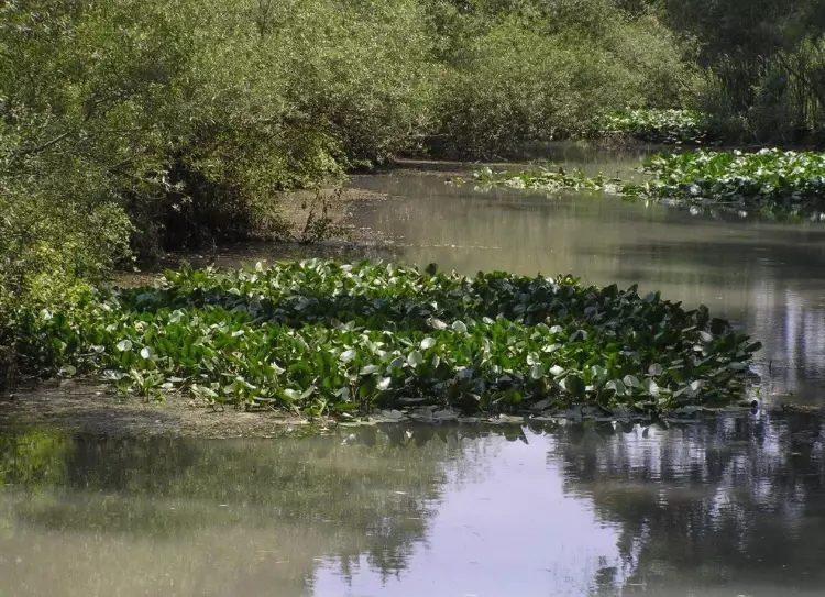
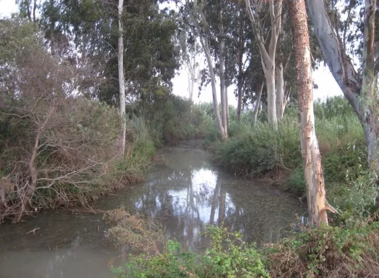
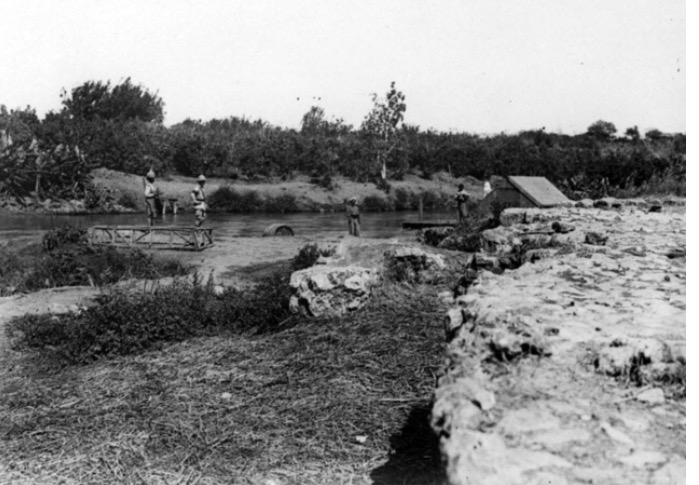
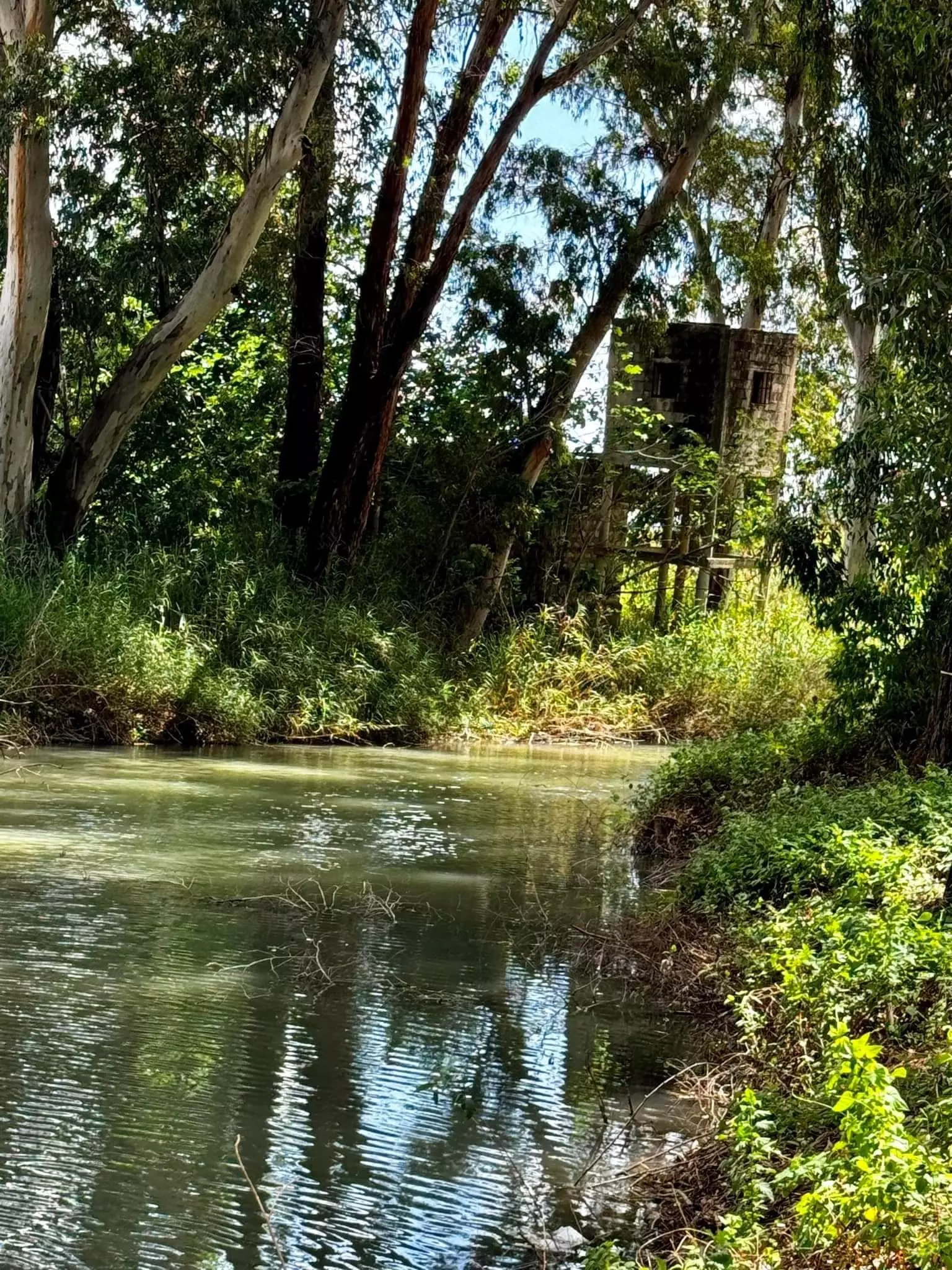
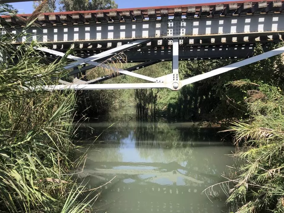
| Nearby Wadies & Rivers | al-Mirr is situated on the southern bank of the al-'Awja River. | ||||||||||||
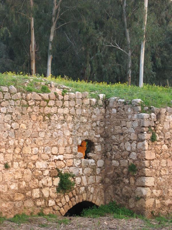
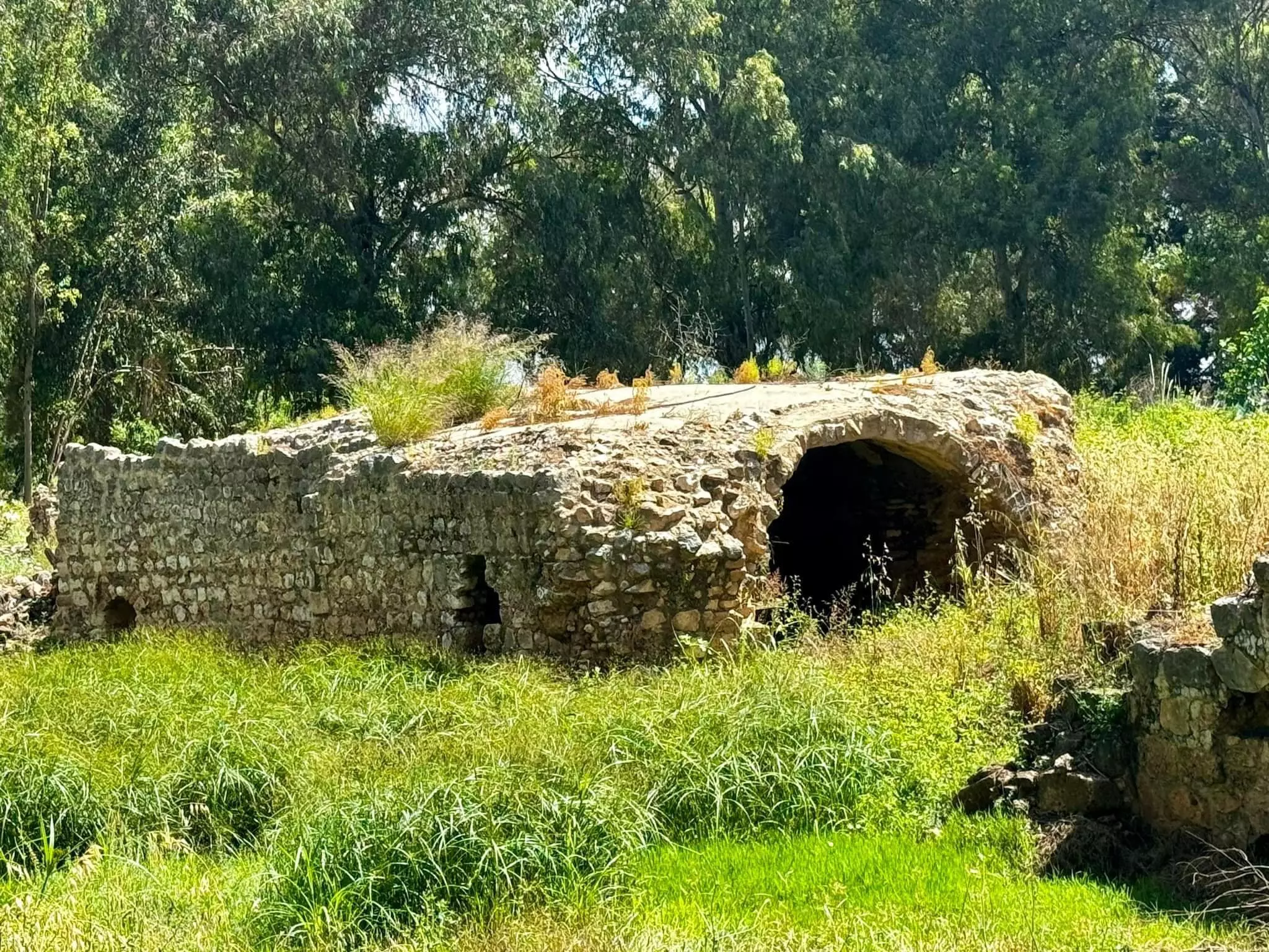
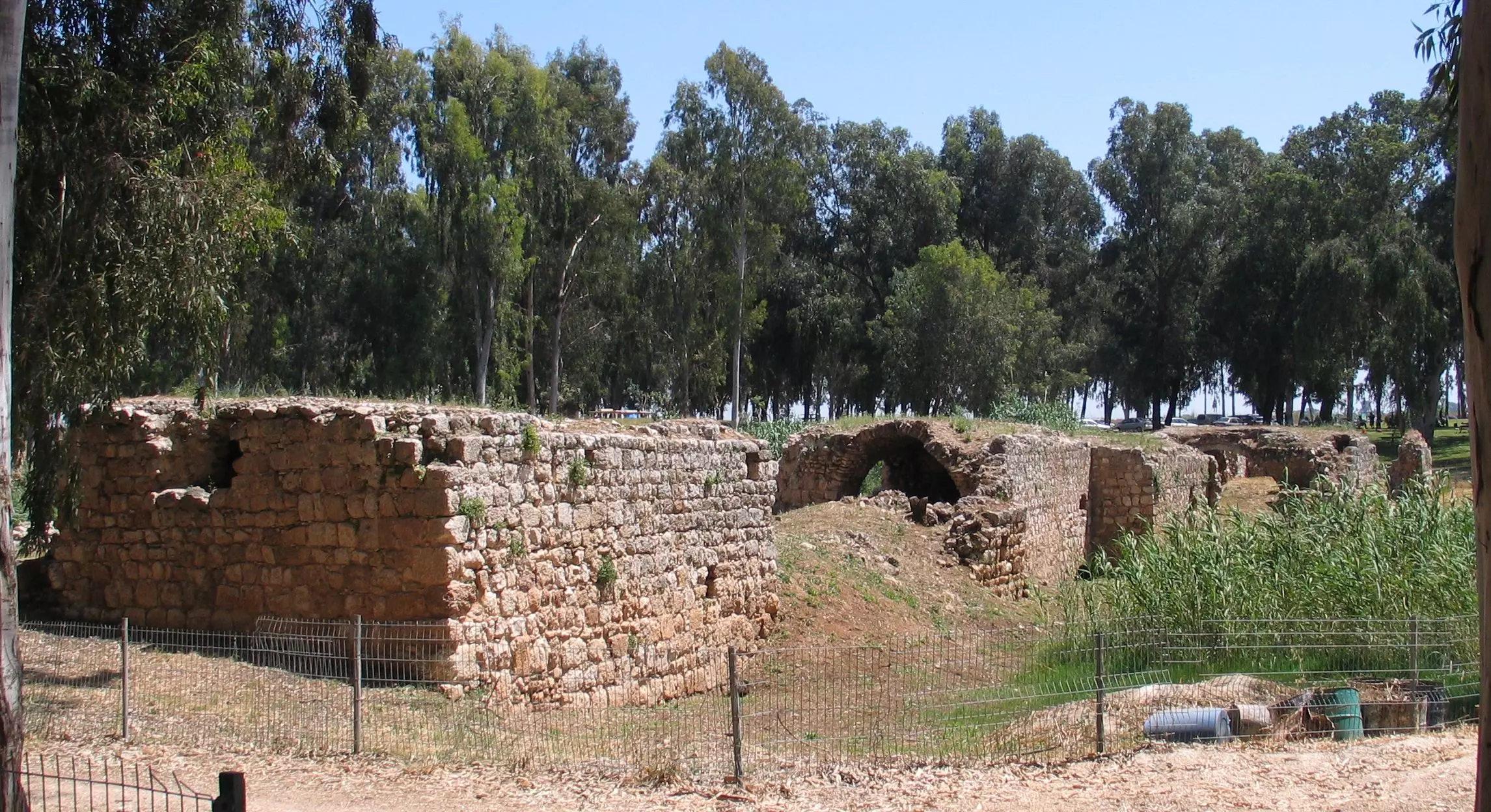
| Archeological Sites | al-Mirr contains the remains of a Turkish bridge which remains visible to this date. | ||||||||||||
| Exculsive Jewish Colonies Who Usurped Village Lands |
No Israeli settlements on village lands. | ||||||||||||
| Featured Video | |||||||||||||
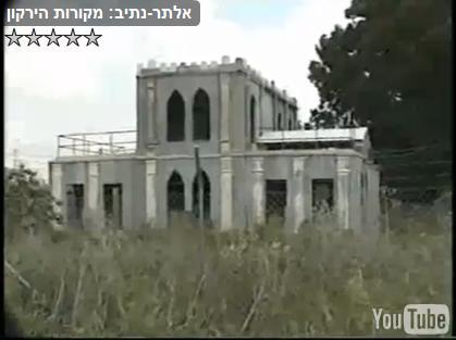
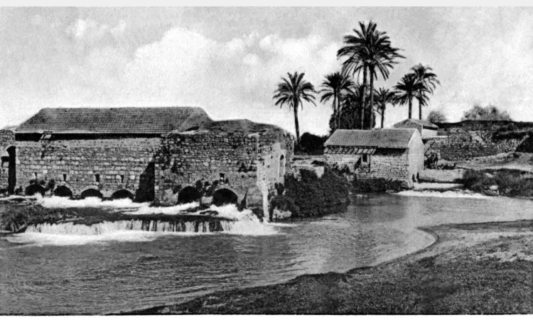
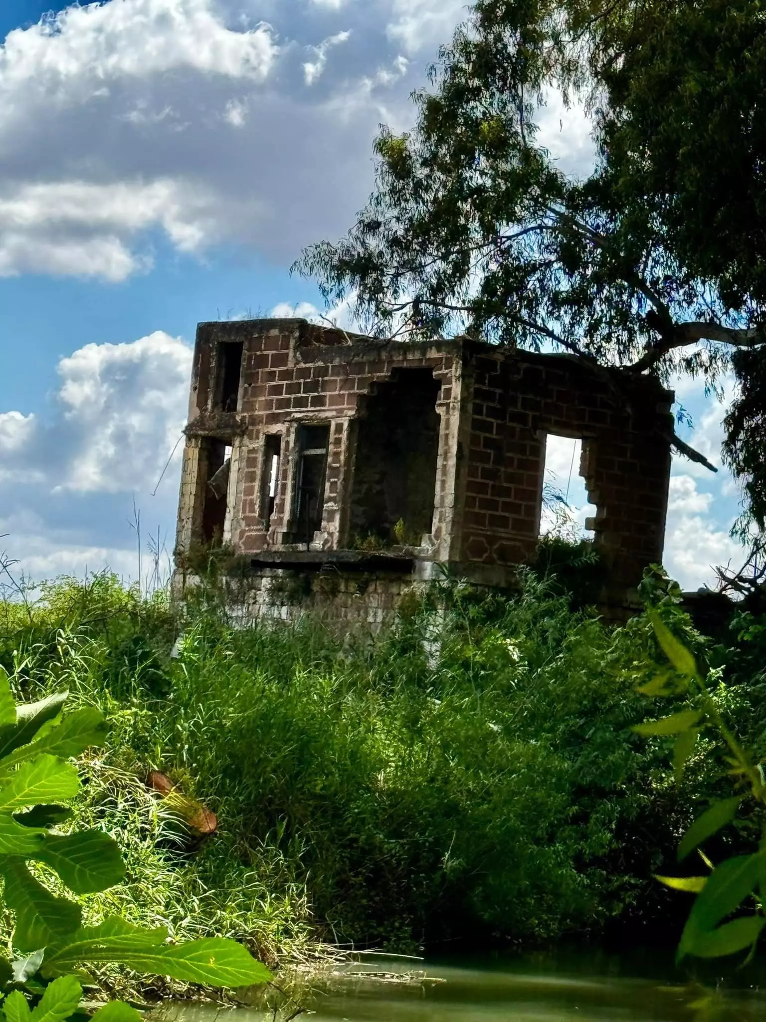
Village Before NakbaThe village was situated on flat terrain in the central coastal plain area, on the southern bank of the al-'Awja River. It was linked by a short, secondary railway track to the railway line that ran between Ra's al-'Ayn and the Jewish settlement of Petach Tiqwa (in the west). A number of secondary roads connected it to neighboring villages, such as Ra's al-'Ayn (the site of the town of Antipatris in Roman times). Al-Mirr was founded during the reign of the Ottoman sultan Mahmud II (1808–39) and so was also known as al-Mahmudiyya. In the late nineteenth century, al-Mirr was a village built of adobe bricks and featured a mill that stood next to the nearby river.The village was classified in the Mandate era as a hamlet by the Palestine Index Gazetteer. The entire population was Muslim. Most villagers worked in agriculture, although some earned their living in the transportation sector. They cultivated mainly citrus and olives on the village lands which lay west and east of the village proper. In 1944/45 a total of 2 dunums was devoted to citrus and bananas and 31 dunums were planted in cereals. The remains of a Turkish bridge are visible on the edge of the village site. Village Occupation and Ethnic CleaningIsraeli military intelligence reports stated that villagers left al-Mirr on 3 February 1948, out of 'general fear.' Located northeast of Petach Tiqwa and in the midst of a number of other Jewish settlements, the village was perceived as a likely target for attack early in the course of the war. In late 1947 and early 1948, Arab villages between Tel Aviv and Hadera were attacked by both the Haganah and Irgun Zvai Leumi (IZL). However, the New York Times quoted a British Army statement in mid-May that said that Jewish forces attacked al-Mirr (incorrectly referring to it by the name Antipatris) at that time. The 13 May attack would have occurred around the same time as a foray into the Triangle area by two IZL columns.Zionists Colonies on Village LandsThere are no settlements on village lands. The settlement of Newe Yaraq (143171), established in 1951, is about 2 km northeast of the village site, on land that belonged to the village of Jaljuliya (a Palestinian village that still exists).Village TodayAll that remains of the village are a few large, deserted houses, surrounded by tall, thorny plants and some unused village wells and roads. One of the houses is a two-storey concrete structure with a flat roof and rectangular windows and doors. Another house, also a two-storey, concrete building, is quite large and architecturally elaborate. Three round-arched doors define the front facade of the first floor, and the central door opens into a raised hallway that bisects the first storey and is surmounted, in the front, by a gable roof. The second storey, which is smaller than the first and is set back, away from the front of the house, has a facade containing three arched windows. The roof over the second storey is decorated with a serrated cornice. A dilapidated, stone-lined well, also remains, its ladder still inside. Railroad tracks run through the site and a number of palm trees are scattered across it. The land around the site is planted by Israeli farmers with fruit orchards.SourceDr. Walid al-Khalidi, 1992: All That Remains. |
|||||||||||||
| Related Maps | Town Lands' Demarcation Maps خرائط للقضاء توضح حدود القرى والاودية Town's map on MapQuest View from satellite Help us map this town at WikiMapia |
||||||||||||
| Related Links | Wikipedia's Page Google Search Google For Images Google For Videos |
||||||||||||
| More Information | في كتاب كي لا ننسى في كتاب بلادنا فلسطين المزيد من موقع هوية |
||||||||||||
- One of the remaining structure
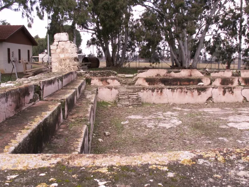
- Kassar farm, the irrigation pool.
Posted by Uri Zackhem - Kassar farm, the irrigation pool.
Posted by Uri Zackhem - Al-Mir flour mill, a sign in the park.
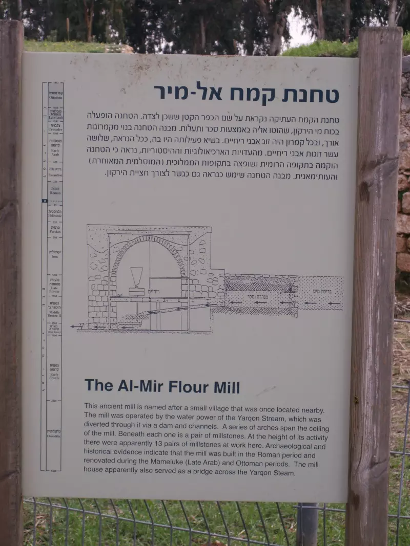
Posted by Uri Zackhem - Al-Mir flour mill.
Posted by Uri Zackhem - A farm house near the mill, north of the Awja.
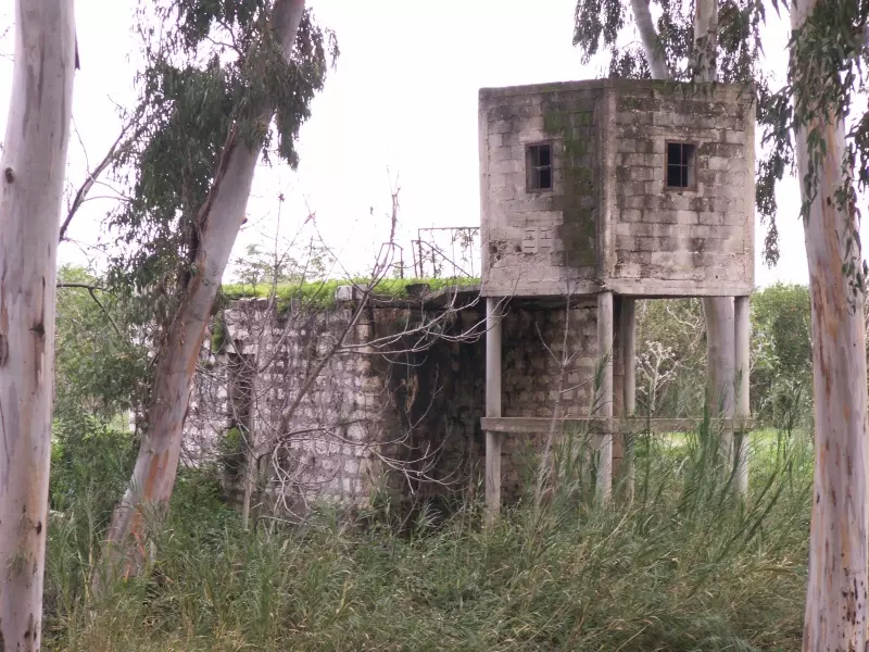
Posted by Uri Zackhem - A farm house near the mill, north of the Awja. #2
Posted by Uri Zackhem - The famous mill
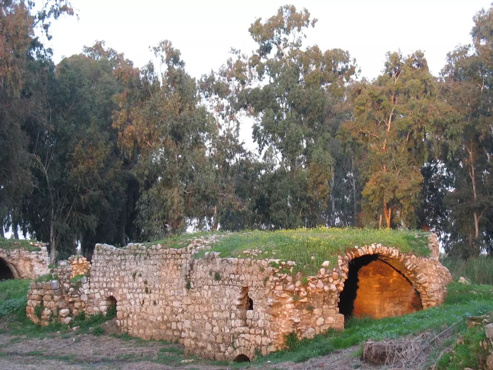
Posted by Noga Kadman - The famous mill
Posted by Noga Kadman - The first and only concrete house in Mir اول بيت باطون بكفر المر
Posted by Khaled El Sala - سكه الحديد القديمه في القريه
Posted by abu raya - نهر العوجا بالقرب من القريه
Posted by abu raya - بيت مبني من الاسمنت في القريه
Posted by abu raya - مياه القريه
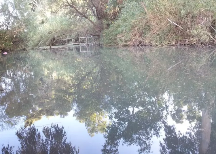
Posted by abu raya - نهر العوجا في القريه
Posted by abu raya - طواحين القريه
Posted by abu raya - نهر العوجا في القريه
Posted by abu raya - القريه اليوم
Posted by abu raya - نهر العوجا في قريه المر سنه 1918
Posted by abu raya - صوره قديمه من قريه المر سنه 1918
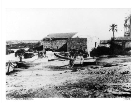
Posted by abu raya - طواحين القمح على نهر العوجا في القريه
Posted by abu raya - That is how the "civilized" erased and replaced us: al-Mirr was completely obliterated except the mill and a few Palestinian houses, as you see -- المحمودية باتت أثر بعد عين. من هنا مر الهمجّ
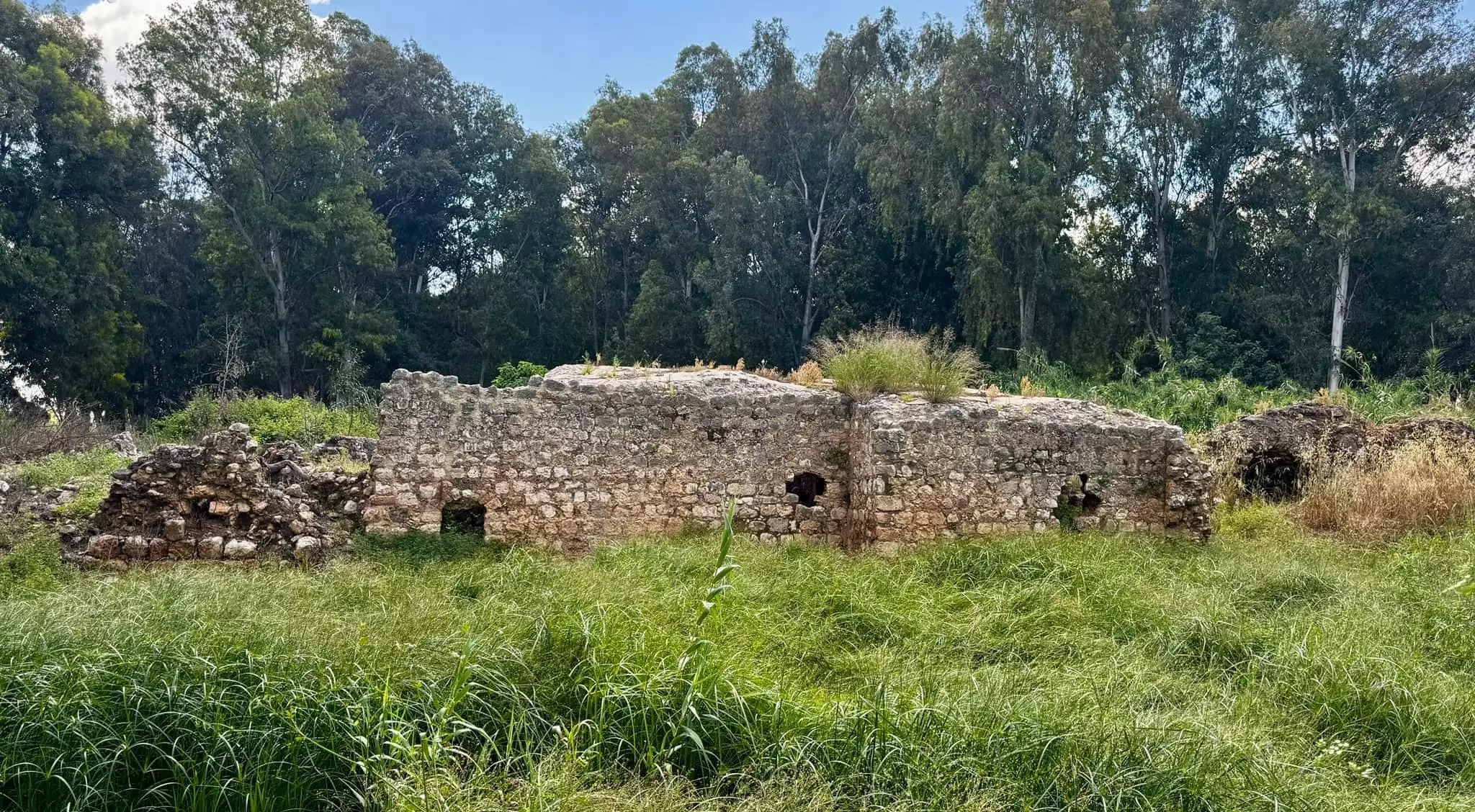
- That is how the "civilized" erased and replaced us: al-Mirr was completely obliterated except the mill and a few Palestinian houses, as you see -- المحمودية باتت أثر بعد عين. من هنا مر الهمجّ #2
- That is how the "civilized" erased and replaced us: al-Mirr was completely obliterated except the mill and a few Palestinian houses, as you see -- المحمودية باتت أثر بعد عين. من هنا مر الهمجّ #3
- That is how the "civilized" erased and replaced us: al-Mirr was completely obliterated except the mill and a few Palestinian houses, as you see -- المحمودية باتت أثر بعد عين. من هنا مر الهمجّ #4
- That is how the "civilized" erased and replaced us: al-Mirr was completely obliterated except the mill and a few Palestinian houses, as you see -- المحمودية باتت أثر بعد عين. من هنا مر الهمجّ #5
- That is how the "civilized" erased and replaced us: al-Mirr was completely obliterated except the mill and a few Palestinian houses, as you see -- المحمودية باتت أثر بعد عين. من هنا مر الهمجّ #6
- That is how the "civilized" erased and replaced us: al-Mirr was completely obliterated except the mill and a few Palestinian houses, as you see -- المحمودية باتت أثر بعد عين. من هنا مر الهمجّ #7
- That is how the "civilized" erased and replaced us: al-Mirr was completely obliterated except the mill and a few Palestinian houses, as you see -- المحمودية باتت أثر بعد عين. من هنا مر الهمجّ #8
- That is how the "civilized" erased and replaced us: al-Mirr was completely obliterated except the mill and a few Palestinian houses, as you see -- المحمودية باتت أثر بعد عين. من هنا مر الهمجّ #9

- That is how the "civilized" erased and replaced us: al-Mirr was completely obliterated except the mill and a few Palestinian houses, as you see -- المحمودية باتت أثر بعد عين. من هنا مر الهمجّ #10
- بيت الباطون waze בית הביטון
معالم صهيونية على أرض فلسطين
مبنى تم بناؤه عام ١٩١٢ من الكونكريت / الأسمنت على الأراضي القريبة من المجدل ورأس العين..(قرية المِرّ ، المحمودية) -- Oct. 23rd, 2022 -- Iyad Jaber
- بيت الباطون waze בית הביטון
معالم صهيونية على أرض فلسطين
مبنى تم بناؤه عام ١٩١٢ من الكونكريت / الأسمنت على الأراضي القريبة من المجدل ورأس العين..(قرية المِرّ ، المحمودية) -- Oct. 23rd, 2022 -- Iyad Jaber #2
- بيت الباطون waze בית הביטון
معالم صهيونية على أرض فلسطين
مبنى تم بناؤه عام ١٩١٢ من الكونكريت / الأسمنت على الأراضي القريبة من المجدل ورأس العين..(قرية المِرّ ، المحمودية) -- Oct. 23rd, 2022 -- Iyad Jaber #3
- بيت الباطون waze בית הביטון
معالم صهيونية على أرض فلسطين
مبنى تم بناؤه عام ١٩١٢ من الكونكريت / الأسمنت على الأراضي القريبة من المجدل ورأس العين..(قرية المِرّ ، المحمودية) -- Oct. 23rd, 2022 -- Iyad Jaber #4
- بيت الباطون waze בית הביטון
معالم صهيونية على أرض فلسطين
مبنى تم بناؤه عام ١٩١٢ من الكونكريت / الأسمنت على الأراضي القريبة من المجدل ورأس العين..(قرية المِرّ ، المحمودية) -- Oct. 23rd, 2022 -- Iyad Jaber #5
- That is how the "civilized" erased and replaced us: al-Mirr was completely obliterated except for a few remaining structures, as you see -- المر باتت أثر بعد عين. من هنا مر الهمجّ
- That is how the "civilized" erased and replaced us: al-Mirr was completely obliterated except for a few remaining structures, as you see -- المر باتت أثر بعد عين. من هنا مر الهمجّ #2
- That is how the "civilized" erased and replaced us: al-Mirr was completely obliterated except for a few remaining structures, as you see -- المر باتت أثر بعد عين. من هنا مر الهمجّ #3
- That is how the "civilized" erased and replaced us: al-Mirr was completely obliterated except for a few remaining structures, as you see -- المر باتت أثر بعد عين. من هنا مر الهمجّ #4
Want to browse more? 80,000 pictures were grouped in these gallaries:
| Display Name | Clan/Hamolah | Country of Residence |
- Tracing All That Remains of al-Mirr Since Nakba Duration: 5 min 35 sec
- الكامل في المِرّ عروس العوجا ...خلينا نمشي معًا لنتعرّف عن قرية الماء والطواحين: الجواريش والنهر والبيارات والمقبرة ومزرعة سليم قصّار. تصوير خاص مهدي لعائلاتها الكريمة: أبو ثابت، أبو رجب، ابو سليم، أبو عوّاد، أبو الضبعة، أبو كامل، الثور، الحافي ومسلَّم Duration: 21 min 34 sec
 Fake Valor: Why Did Zionist Jews Hoist Nazis Flag on Their Ships in the 1930s?
What is new?
-
Facts About Oct. 7th Gaza Raid
-
Remined Us Please:: Who Did Rape Who? Palestinians Raped Israelis? Or, was the other way around?
-
When Prof. Edward Said was invited to debate Bibi Netanyahu in the 1980s, watch what happened!
-
Ezra Klein of the NY Times on the "Jewish Race".
-
Abusing Blood Libel!
-
Zionist FAQ: Isn't it true that Palestinians don't want peace? Palestinians never accepted the two-state solution
- Facts about Haavara (Transfer) Agreement between Ben-Gurion & Hitler
-
Haavara FAQs: Why Did Zionist Jews Hoist Nazis' Flags on Their Ships in the 1930s?
-
Dear ChatGPT: Why did the Jewish Agency suppress news of the Holocaust during WWII?
-
Video Playlist: Jews share their DNA tests to end the conflict for good.
-
A Tale of Two Conflicts: Examining the Definition of Genocide
-
Prof. Abraham Polak And The Suppressed History of the Khazars and European Jewry
-
How Ronald Reagan would have framed the genocide in Gaza if he were still alive?
-
Haavara FAQs: Let us do the math: how many German Jews did The Haavara Agreement save?
-
Zionist FAQs: The Hebron Massacre of 1929, "clearly proves" that Palestinians are antisemitic, how could you deny it?
-
Zionist FAQs: Why Anti-Zionist Is Not Antisemitism?
-
Zionist FAQs: Isn't it true that the KGB create Palestinian Nationalism in the early 1960s?
- Zionist FAQs: Muslims are killing Muslims all the time; why are Israeli Jews being singled out in the media?
- Zionist FAQs: How is Israel an apartheid state when 20% of its citizens are Arabs who enjoy full rights?
-
Haavara FAQs: Analysis of Herzl's Uganda Scheme and how it could have saved millions of Jews.
-
Haavara FAQs: Why did Hayim Greenberg describe American Jewry as "morally bankrupt" in early 1943?
-
Haavara FAQs: What if the Evian Conference was a resounding success? What would have been the impact of saving European Jewry on Zionism?
- Haavara FAQs: What if the six million were saved, how that would have impacted the Zionist project?
-
Haavara FAQs: How did Zionist leaders react when Europe's Jews lingered in the DP camps after WWII ended?
-
Why does the American Jewish community repeat lies that David Ben-Gurion had debunked before he died?
-
Who has the power to rename the Tatar/Khazar Gene Marker to Jewish IV?
-
Zionist FAQs: Why won't Egypt, Syria, and Jordan take their people back? Jews are indigenous to Palestine, and Arabs immigrated after Jews developed the country. Arabs should leave.
-
Haavara FAQs: Did Hitler and the Nazis conflate between Judaism and Zionist? If that wasn't case, then why?
-
Haavara FAQs: Winston Churchill and antisemitism, a collection of articles written Churchill.
-
Haavara FAQs: Broken by country, how many Jews survived vs. killed during the Holocaust?
-
Haavara FAQs: Why did European Jews vote with their feet and to immigrated to the Americas, not Palestine, after WWII?
-
Watch this American Jewish Girl describing Israeli Jews' cognitive dissonance like no other in under two minutes
-
Haavara FAQs: When the Nazis went out of their way to hide the Holocaust, Israeli Jews did the exact opposite by broadcasting their genocide of Gazans. But why?
-
Haavara FAQs: How Zionist Jews went out of their to show their appreciation to Nazism and Fascism?
- Haavara FAQs: Why Zionist leaders were against bombing the death camps & the Railroads leading to them?
-
Haavara FAQs: Hitler's message to the British and American people: If Jews are such noble citizens and you care about them, how come you're not letting them in? I will gladly ship them to you at my expense, even on luxury liners!
-
A shortlist of Zionist and Israeli false flag operations in the name Jews.
-
The Most Moral Army
- The Land of Kapos (Israel): Where the brave are boycotted and Kapos walk free.
- Why did early Zionists often named their communal enterprises "colonial"?
- Zionist Relations with Nazi Germany by Faris Glubb
-
Two NY Times advertisements by Zionists in the early 1943 that exposes Zionists' treason at the height of the calamity
- Facts Not Lies about the Palestinian-Israeli Conflict.
- Site's pictures have been categorized
- Campgain Against Lice
- A Survey of Palestine, the official source about Palestine before Nakba produced by the British Mandate; over 1200 pages.
- Satellite View & Google Earth: Over 6,000 placemarks identifying all destroyed towns, W. Bank & Gaza Strip Towns, & refugee camps.
- PalestineRemembered.com and its Nakba Oral History Project were featured on al-Jazeera Satellite TV.
- Nakba Oral History Video Podcast:
 Over 700 Oral History interviews (including 3,500+ hours of recording) can be viewed online.
 - Palestine Village Statistics Project
- Gaza Jail Break
- النسخة العربية للموقع الان متوفرة
- Videos: Documenting the destroyed villages in video: Tracing all that remains since Nakba.
- Videos: Responding to Zionist Propaganda
- Interview: The ethnic cleansing of Palestine: George Galloway interviews Israeli Historian Ilan Pappe.
- For Palestinians, memory matters. It provides a blueprint for their future By George Bisharat.
- Zionist FAQ now available in Hebrew שאלות שציונים שואלים, עכשיו בעברית
- Video: The Stephen Walt and John Mearsheimer report on the influence of the Israel Lobby on U.S. Foreign Policy
- The Palestinian-Israeli conflict for beginners
