| PalestineRemembered | About Us | Oral History | العربية | |
| Pictures | Zionist FAQs | Haavara | Maps | |
| Search |
| Camps |
| Districts |
| Acre |
| Baysan |
| Beersheba |
| Bethlehem |
| Gaza |
| Haifa |
| Hebron |
| Jaffa |
| Jericho |
| Jerusalem |
| Jinin |
| Nablus |
| Nazareth |
| Ramallah |
| al-Ramla |
| Safad |
| Tiberias |
| Tulkarm |
| Donate |
| Contact |
| Profile |
| Videos |
Welcome To al-Muwaylih - المويلح (אל-מוילח)
|
District of Jaffa
Ethnically cleansed days ago |
العربية Google Earth |
| Gallery (11) |
- Statistics & Facts
-
Before & After

- Satellite View
- Articles 4
- Pictures 11
- Aerial Views 1
- Oral History 2
- Members 5
- Families

- All That Remains
- Wikipedia
- Videos 2
- Guest Book 6
- Links 1
| Statistic & Fact | Value | ||||||||||||||||||
| Occupation Date | December 31, 1947 | ||||||||||||||||||
| Distance From District | 16 (km) Northeast of Jaffa | ||||||||||||||||||
| Elevation | 25 (meters) | ||||||||||||||||||
| Before & After Nakba, Click Map For Details |
|||||||||||||||||||

|
|||||||||||||||||||
| Map Location | See location #7 on the map View from satellite |
||||||||||||||||||
| Exodus Cause | Military assault by Zionist troops | ||||||||||||||||||
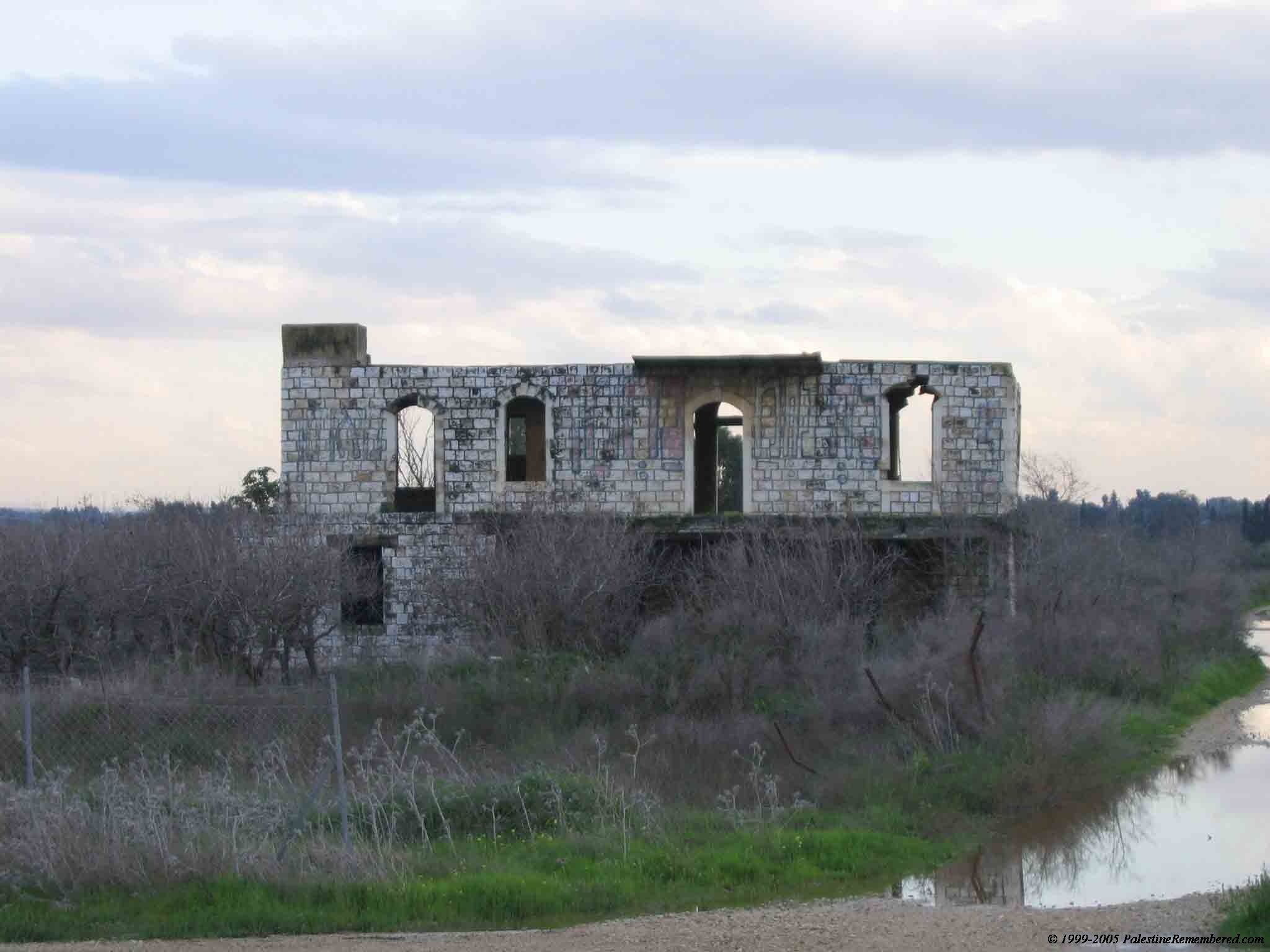
| Village Temains | Muwalih was mostly destroyed with the exception of few houses, one of which belongs to Halim al-Jayyusi. | ||||||||||||||||||
| Ethnically Cleansing | Late December 1947, Muwalih's inhabitants were terrorized into fleeing their homes. | ||||||||||||||||||
| Pre-Nakba Land Ownership |
**Town Lands' Demarcation Maps |
||||||||||||||||||
| Land Usage As of 1945 |
|
||||||||||||||||||
| Population |
|
||||||||||||||||||
| Inhabitants Place of Origin | al-Muwaylih was founded by nomads who traced their ancestry to the 'Arab al-Malaha Bedouin tribe. | ||||||||||||||||||
| Nearby Wadies & Rivers | al-Muwalih was situated 1.5 km north of the al-'Awja River | ||||||||||||||||||
| Water Supply | Muwalih had several wells located east of the village. | ||||||||||||||||||
| Exculsive Jewish Colonies Who Usurped Village Lands |
Newe Yaraq and the Palestinian Town of Jaljulya. | ||||||||||||||||||
| Featured Video | |||||||||||||||||||
Village Before NakbaThe village was situated on the central coastal plain, 1.5 km north of the al-'Awja River. It was about 1 km east of a highway leading to Tel Aviv, Jaffa, and neighboring villages. The village was founded by nomads who traced their ancestry to the 'Arab al-Malaha Bedouin; they settled in the area, initially building their houses around a spring, and later along the road to Ra's al-'Ayn (a nearby village that was deserted at the beginning of this century). The village houses were laid out in no particular pattern. The population was predominantly Muslim. During the Mandate, large landowners built villas amidst the outlying citrus and banana groves. In 1944/45 a total of 949 dunums was devoted to citrus and bananas and 1,796 dunums were allocated to cereals; 27 dunums were irrigated or used for orchards. Wells on its east side provided irrigation water.Village Occupation and Ethnic CleaningIt is difficult to determine when the villagers were displaced, but the village was probably occupied relatively early, in the first weeks of 1948. Located in an area of heavy Zionist settlement northeast of Tel Aviv, the village would have been within easy reach of a Haganah or Irgun strike. In the period between late December 1947 and late March 1948, a significant number of villages in this area were emptied, generally as a result of direct attacks.Zionists Colonies on Village LandsThe settlement of Newe Yaraq (143171) was established in 1951, partly on village lands and partly on the lands of Jaljulya (a Palestinian village that still exists).Village TodayThe site is very difficult to identify. Some of the villas still stand, deserted, amidst wild vegetation. One of them belonged to Hashim al-Jayyusi, who later became a Jordanian cabinet minister. It is a two-storey, concrete structure with rectangular doors and windows and a stairway in front that leads to the second storey. The other villas have been reduced to rubble. The land in the area is cultivated.SourceDr. Walid al-Khalidi, 1992: All That Remains. |
|||||||||||||||||||
| Related Maps | Town Lands' Demarcation Maps خرائط للقضاء توضح حدود القرى والاودية Town's map on MapQuest View from satellite Help us map this town at WikiMapia |
||||||||||||||||||
| Related Links | Wikipedia's Page Google Search Google For Images Google For Videos |
||||||||||||||||||
| More Information | في كتاب كي لا ننسى في كتاب بلادنا فلسطين المزيد من موقع هوية |
||||||||||||||||||
- Village House In 1987
Scanned from "All That Remains" by Dr. Walid Khalidi 2 - A Two story structure remains standing in al-Muwaylih
Posted by Uri Zackhem 4 - One of the remaining al Muwaylih houses
Posted by Uri Zackhem - صوره للمنطقه من على الطريق العام رقم 5
Posted by ابو الثائر - احد البيوت المتبقيه غربي اراضي القريه
Posted by ابو الثائر - اراضي تابعه للقريه من الجهه الغربيه
Posted by ابو الثائر - اراضي تابعه للقريه من الجهه الغربيه
Posted by ابو الثائر - al-Muwaylih (Map)
Posted by رحيلا مزراحي - أحد المنازل القائمة
1 - منظر عام للقريه
Posted by abu raya - المرحوم الحاج حسين الداقور - أبو إسماعيل
Posted by Ghanem Mustafa
Want to browse more? 80,000 pictures were grouped in these gallaries:
| Display Name | Clan/Hamolah | Country of Residence |
| ابو نضال | - | - |
| أبو عايش | أبو عايش | فلسطين, فلسطين |
| abu anas | aljaramneh | - |
| Hasan Alloush | Aljaramneh | - |
| جرامنه | ابووردة | - |
- Tracing all that remains of al-Muwaylih Duration: 56 sec
- الذاكرة مفتاح العودة-الحلقة 53- مويلح Duration: 23 min 22 sec


