| PalestineRemembered | About Us | Oral History | العربية | |
| Pictures | Zionist FAQs | Haavara | Maps | |
| Search |
| Camps |
| Districts |
| Acre |
| Baysan |
| Beersheba |
| Bethlehem |
| Gaza |
| Haifa |
| Hebron |
| Jaffa |
| Jericho |
| Jerusalem |
| Jinin |
| Nablus |
| Nazareth |
| Ramallah |
| al-Ramla |
| Safad |
| Tiberias |
| Tulkarm |
| Donate |
| Contact |
| Profile |
| Videos |
Welcome To al-Jawfa, Khirbat - خربة الجوْفة (ח'ירבת אל-ג'ופה)
|
District of Jinin
Ethnically cleansed days ago |
العربية Google Earth |
| Gallery (6) |
- Statistics & Facts
-
Before & After

- Satellite View
- Articles 2
- Pictures 6
- Members
- All That Remains
- Wikipedia
- Videos
- Guest Book
- Links
| Statistic & Fact | Value | |||||||||
| Occupation Date | May 12, 1948 | |||||||||
| Distance From District | 12 (km) Northeast of Jinin | |||||||||
| Elevation | -5 (meters) | |||||||||
| Before & After Nakba, Click Map For Details |
||||||||||

|
||||||||||
| Map Location | See location #6 on the map View from satellite |
|||||||||
| Military Operation | Operation Gideon | |||||||||
| Attacking Units | Golani Brigade | |||||||||
| Refugees' Migration Routes | After the fall of Baysan on the May 15th, 1948, al-Jawfa's remaining population mostly fled to the Jinin area. | |||||||||
| Exodus Cause | Influence of fall of, or exoduce from, neighboring town | |||||||||
| Village Temains | Khirbat al-Jawfa was completely obliterated, and only house rubble left behind. | |||||||||
| Ethnically Cleansing | al-Jawfa, Khirbat inhabitants were completely ethnically cleansed. | |||||||||
| Near By Towns |
||||||||||
|
||||||||||
| Exculsive Jewish Colonies Who Usurped Village Lands |
Village lands fell mostly on the armistice line between Israel and the occupied West Bank. On the Israeli side, the settlement of Ma'ale Gilbo'a was built in 1962. | |||||||||
Village TodayAccording to the Palestinian historian Walid Khalidi, the village remaining structures on the village land are:Although sections of some walls still stand, most of the former houses have been reduced to rubble. The entire area has been fenced in and is used as a grazing area for cows. A large water tank belonging to kibbutz Ma'ale Gilbo'a is on the site |
||||||||||
| Related Maps | Town Lands' Demarcation Maps خرائط للقضاء توضح حدود القرى والاودية Town's map on MapQuest View from satellite Help us map this town at WikiMapia |
|||||||||
| Related Links | Wikipedia's Page Google Search Google For Images Google For Videos |
|||||||||
| More Information | في كتاب كي لا ننسى المزيد من موقع هوية |
|||||||||
- The center of the village site center, 1990
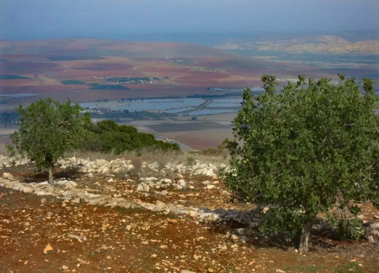
Scanned from "All That Remains" by Dr. Walid Khalidi - A view of the village land, 1990
Scanned from "All That Remains" by Dr. Walid Khalidi - Village lands now us as pasture by Jewish settlers, 1990
Scanned from "All That Remains" by Dr. Walid Khalidi - نظره من موقع القريه باتجاه سهول بيسان
Posted by abu raya - اراضي القريه
Posted by abu raya - اراضي القريه
Posted by abu raya
Want to browse more? 80,000 pictures were grouped in these gallaries:
| Display Name | Clan/Hamolah | Country of Residence |
No links have been shared yet, be free to the first to share the first link.


