| PalestineRemembered | About Us | Oral History | العربية | |
| Pictures | Zionist FAQs | Haavara | Maps | |
| Search |
| Camps |
| Districts |
| Acre |
| Baysan |
| Beersheba |
| Bethlehem |
| Gaza |
| Haifa |
| Hebron |
| Jaffa |
| Jericho |
| Jerusalem |
| Jinin |
| Nablus |
| Nazareth |
| Ramallah |
| al-Ramla |
| Safad |
| Tiberias |
| Tulkarm |
| Donate |
| Contact |
| Profile |
| Videos |
Welcome To al-Lajjun - اللجون (א-לג'ון)
|
District of Jinin
Ethnically cleansed days ago |
العربية Google Earth |
 |
Gallery (165) |
- Statistics & Facts
-
Before & After

- Satellite View
- Articles 7
- Pictures 165
- Aerial Views 4
- Mayrters & Prisoners 1
- Land Deeds 17
- Oral History 2
- Members 6
- Families
- All That Remains
- Town's Map
- Wikipedia
- Videos 9
- Guest Book 2
- Links 1
| Statistic & Fact | Value | ||||||||||||||
| Occupation Date | May 30, 1948 | ||||||||||||||
| Distance From District | 16 (km) Northwest of Jinin | ||||||||||||||
| Elevation | 150 (meters) | ||||||||||||||
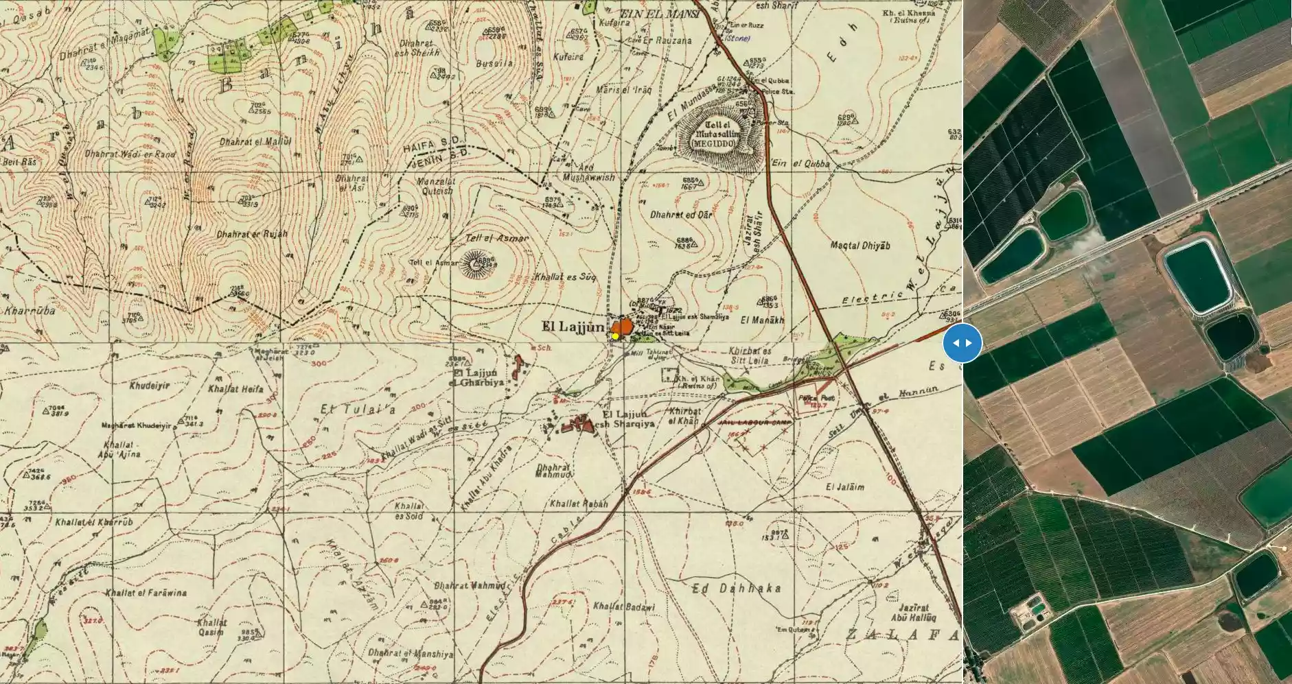
| Before & After Nakba, Click Map For Details |
|||||||||||||||
|
|||||||||||||||
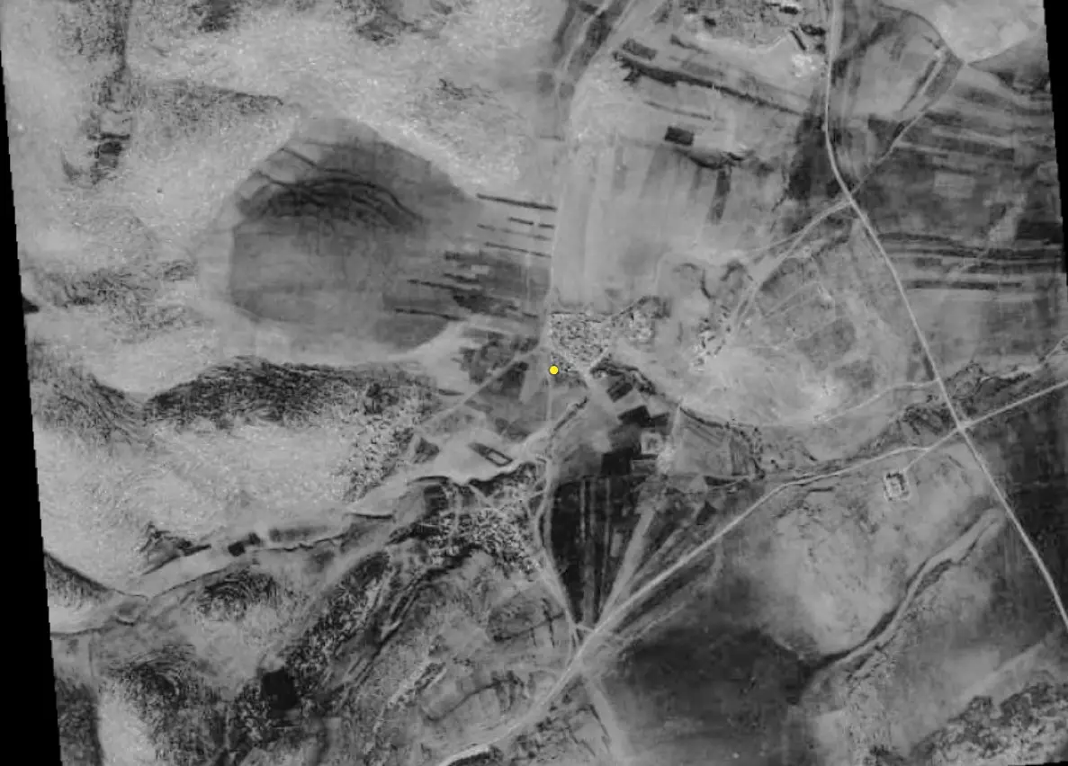
| Pre-Nakba Aerial View |
|||||||||||||||
|
|||||||||||||||
| Map Location | See location #2 on the map View from satellite |
||||||||||||||
| Military Operation | Operation Gideon | ||||||||||||||
| Attacking Units | Golani's Fourth Battalion | ||||||||||||||
| Defenders | Arab Liberation Army | ||||||||||||||
| Acts of Terror | Massacre occured by Zionist troops against the town's inhabitants. | ||||||||||||||
| Exodus Cause | Military assault by Zionist troops | ||||||||||||||
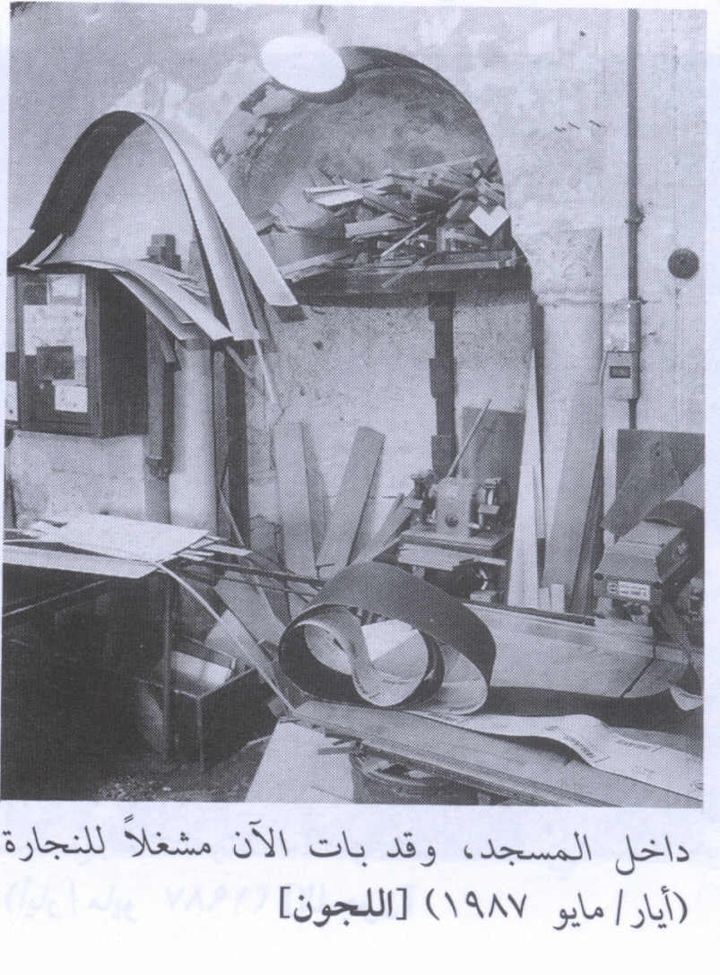
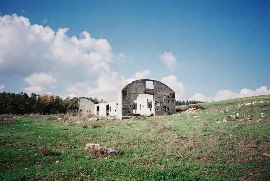
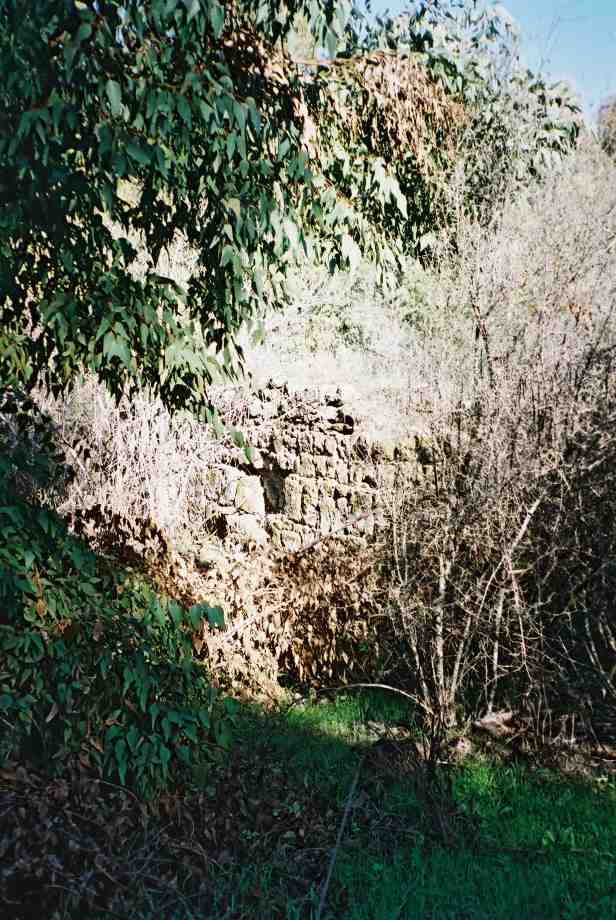
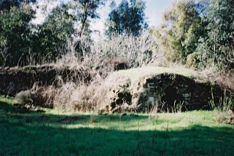
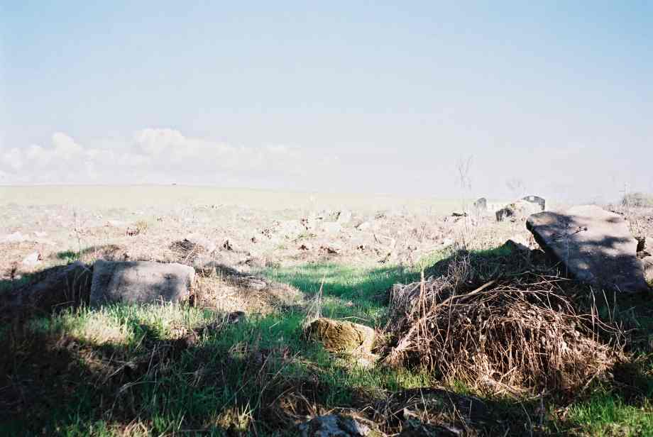
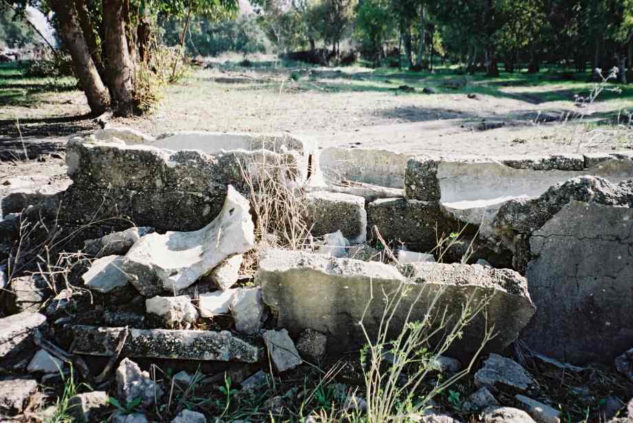
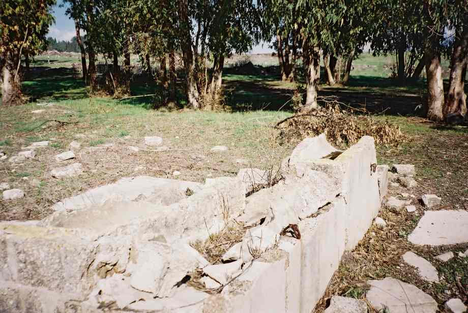
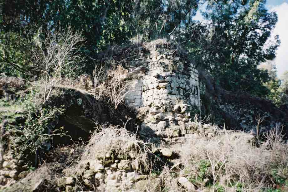
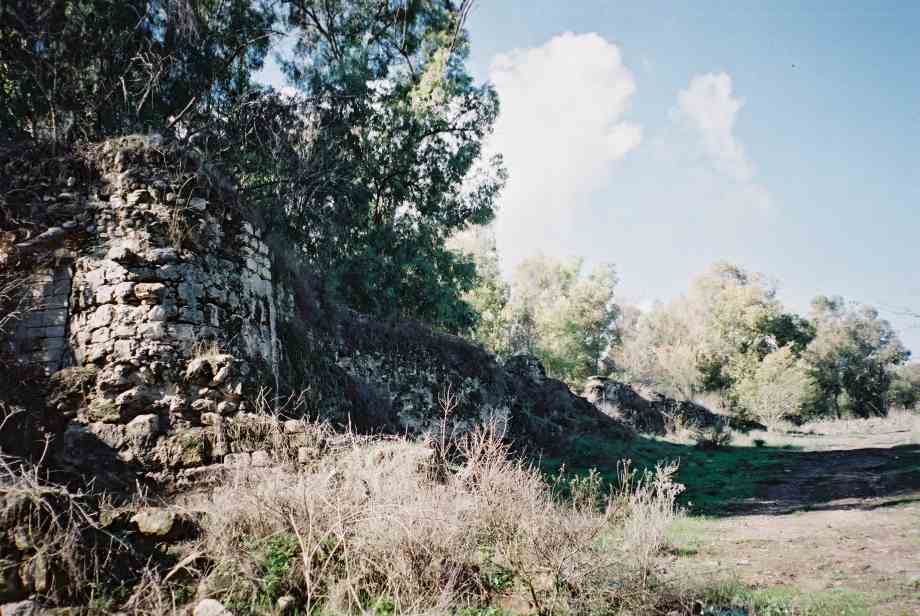
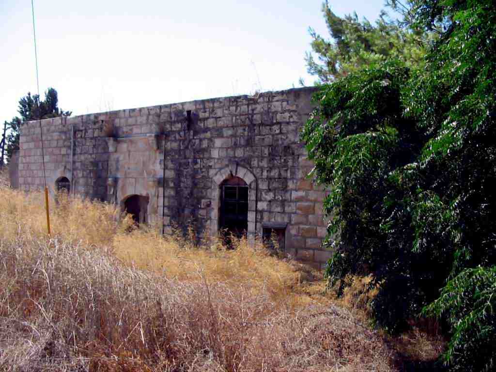
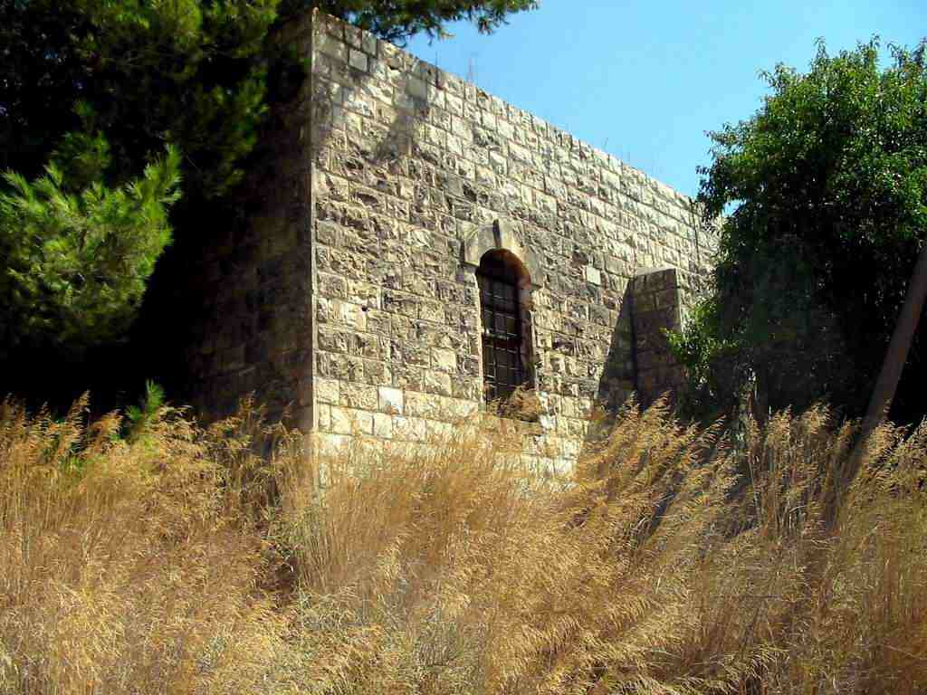
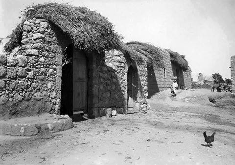
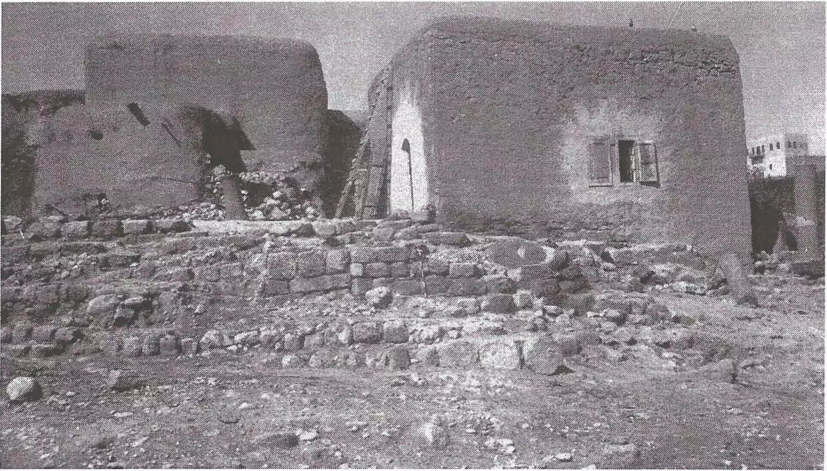
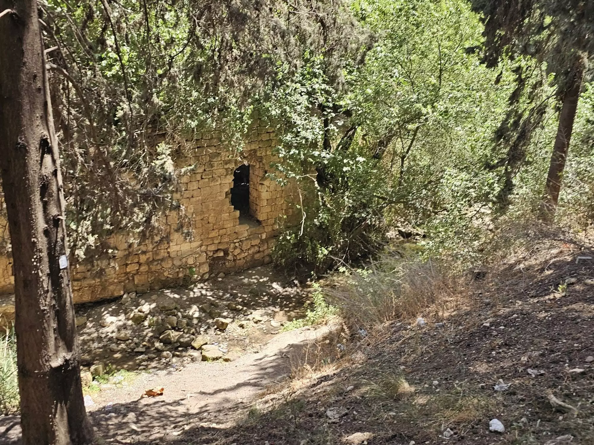
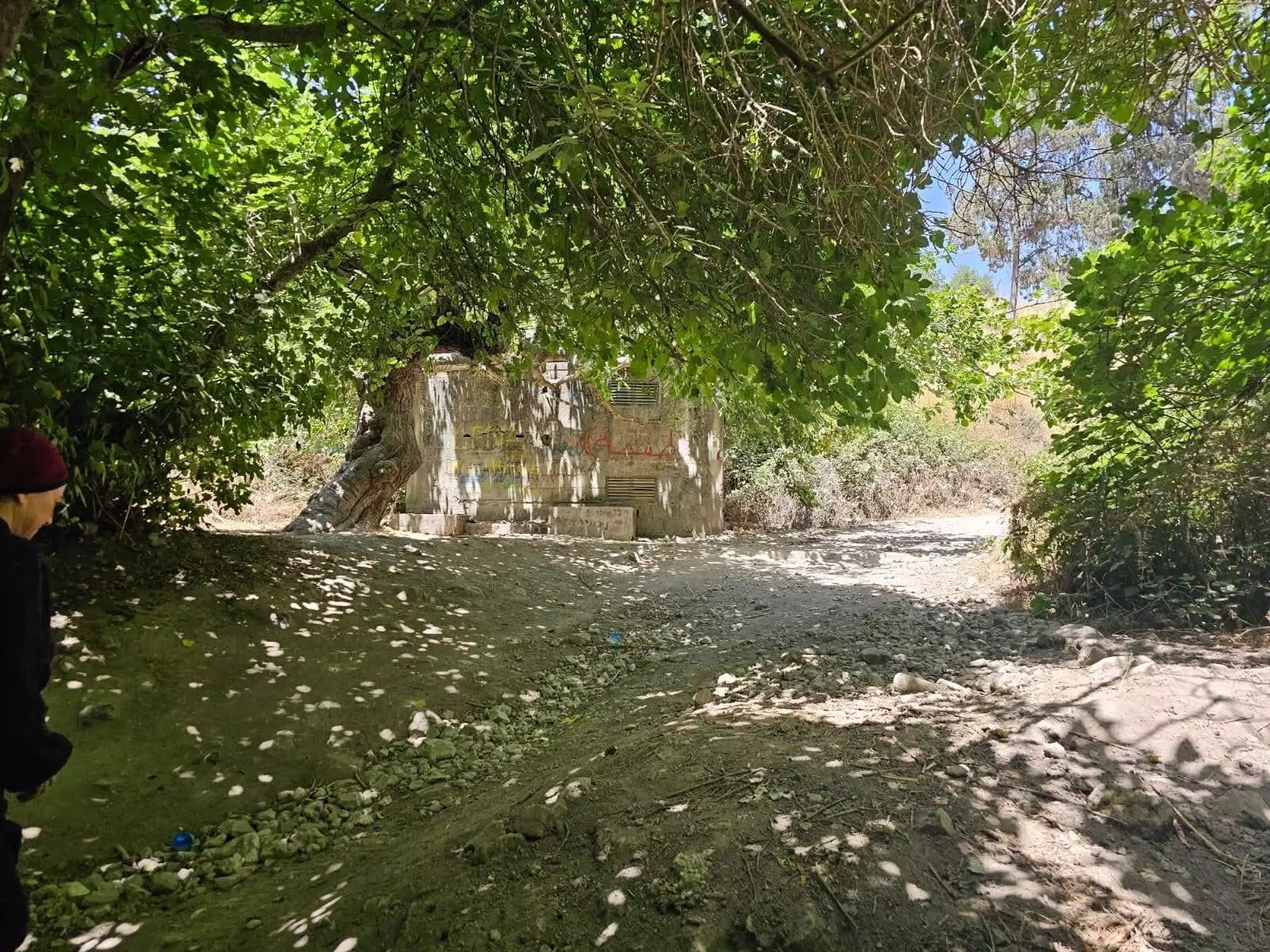
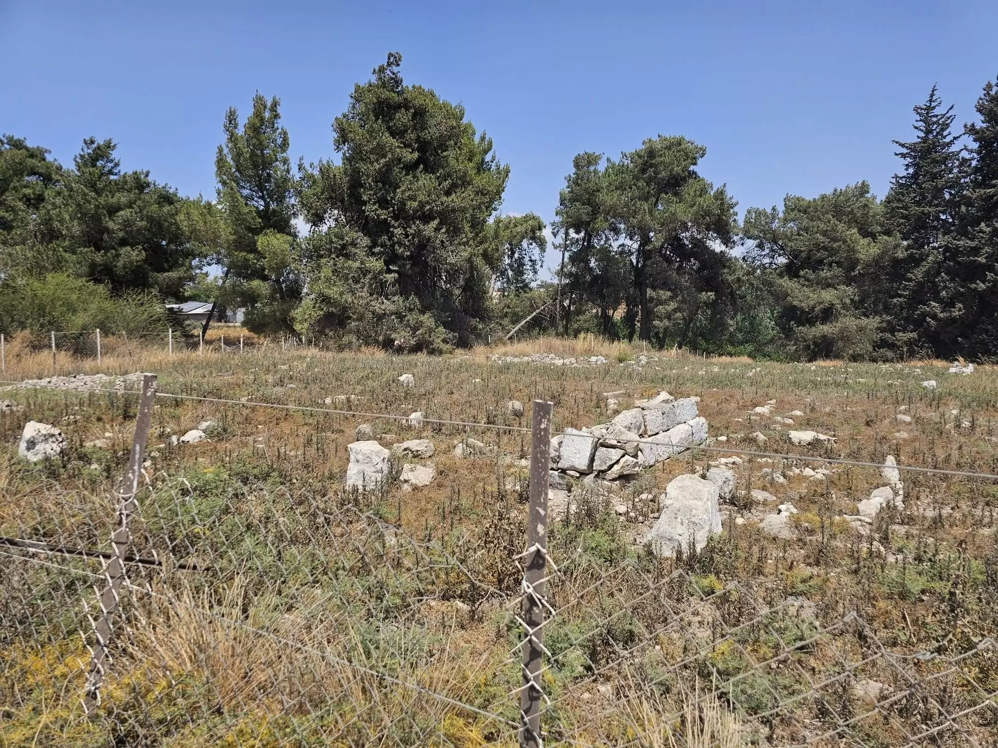
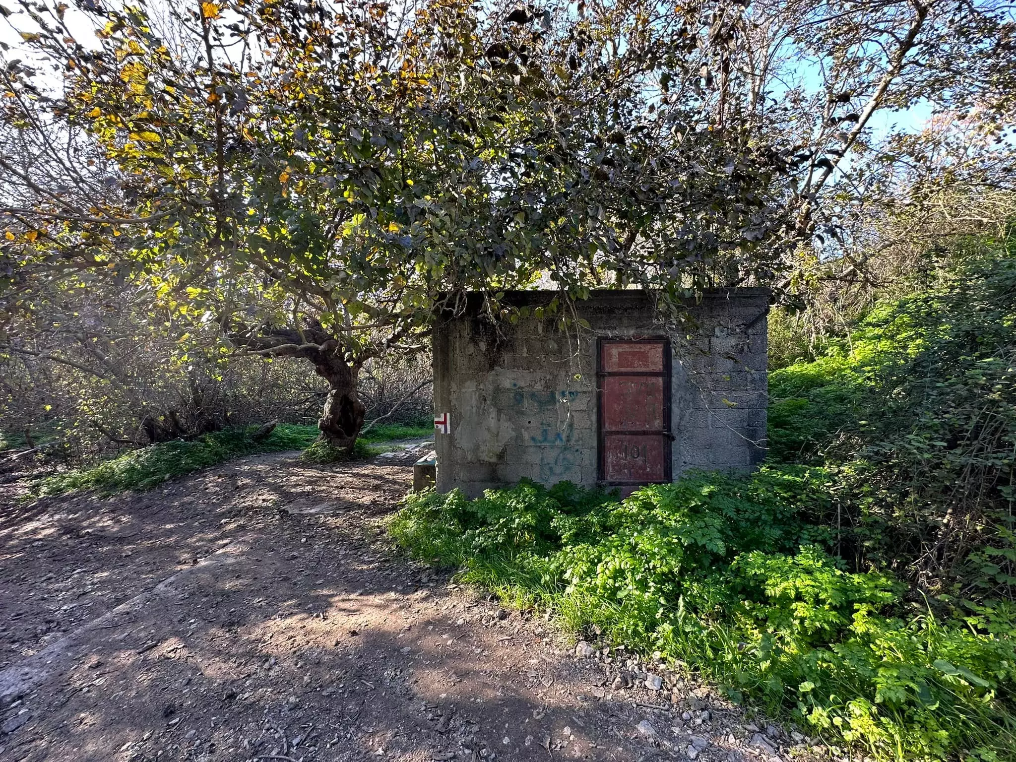
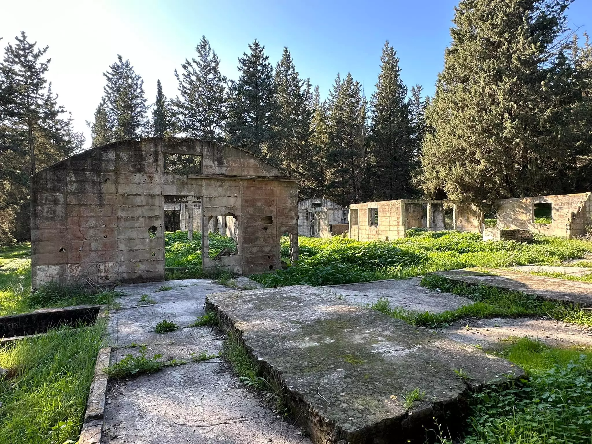
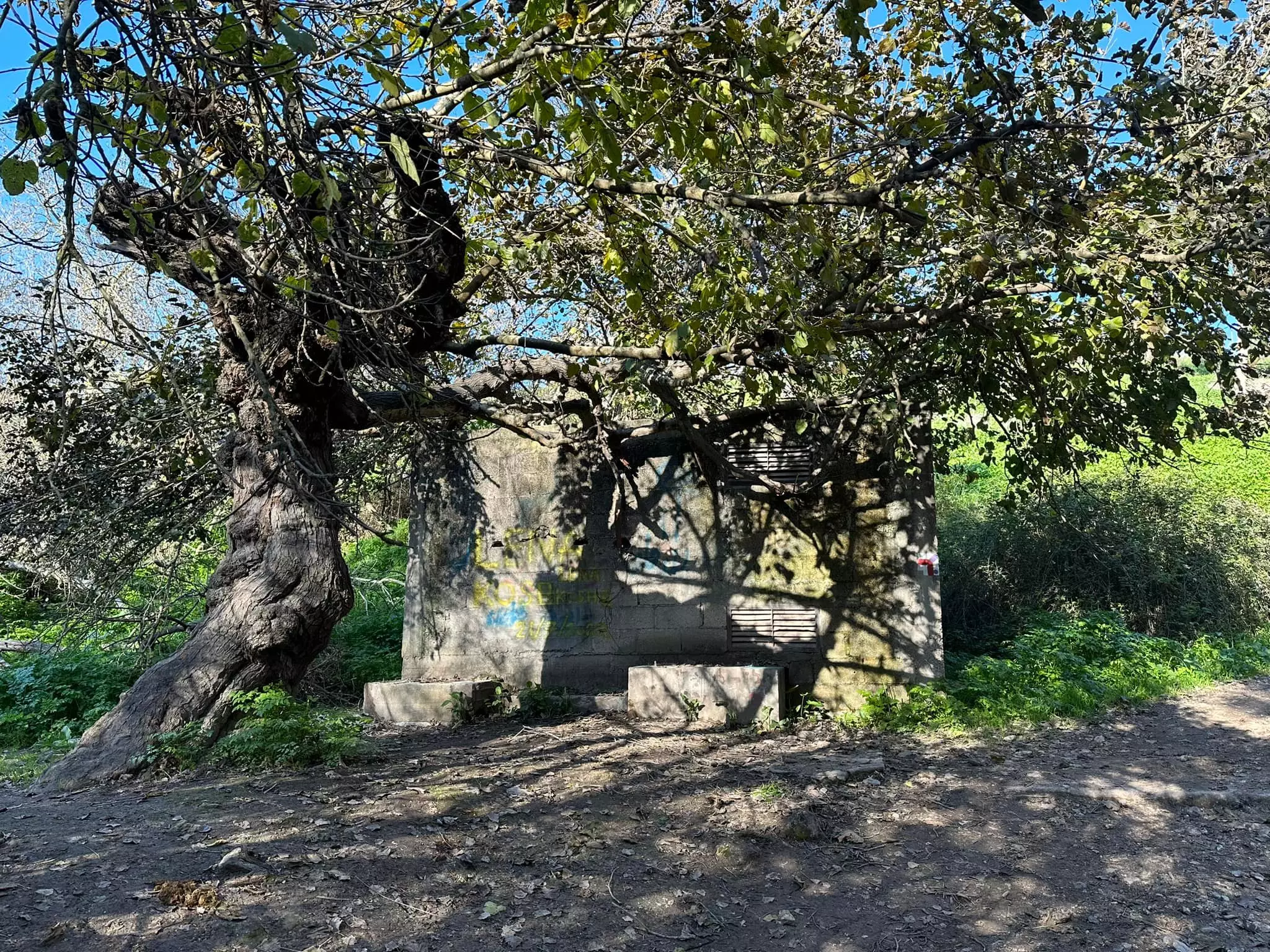
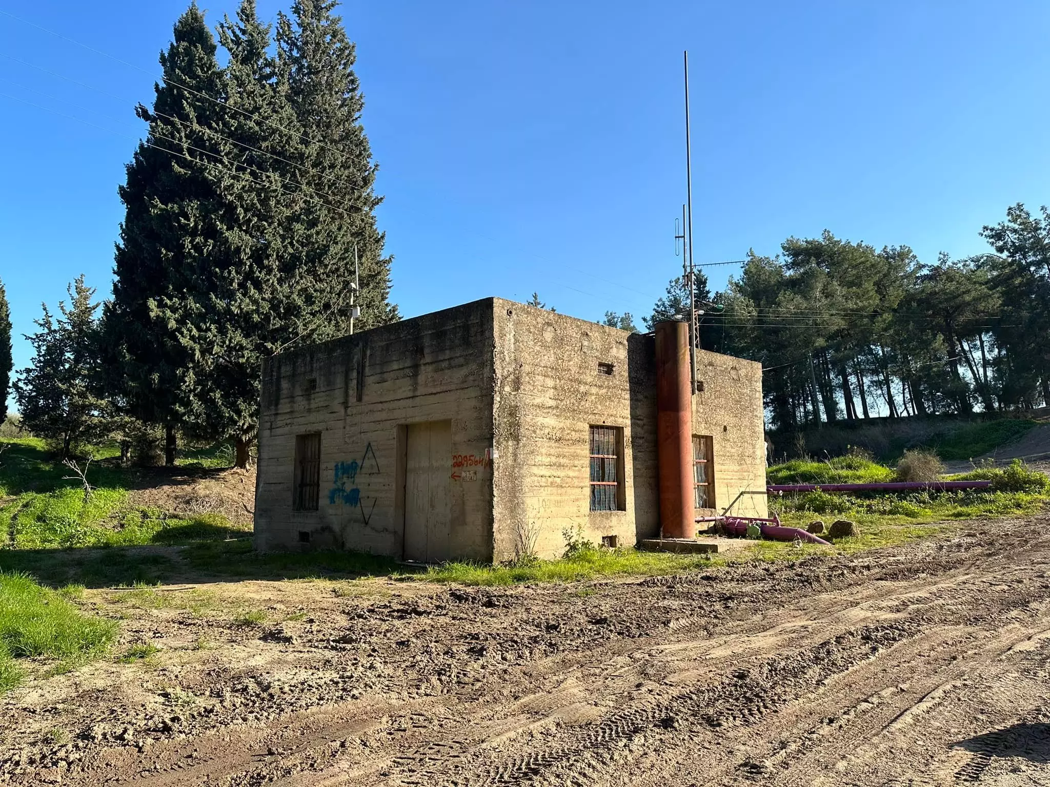
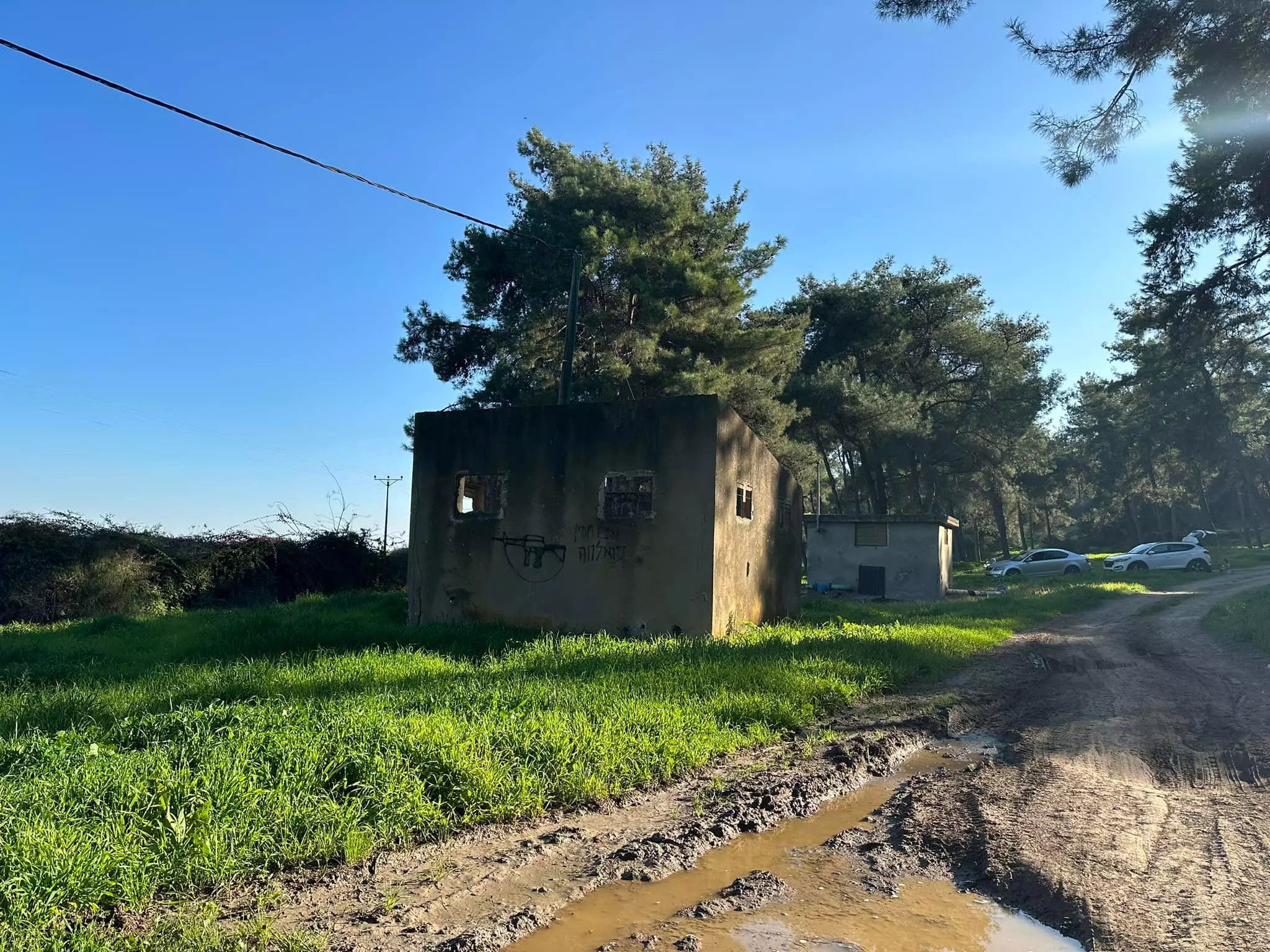
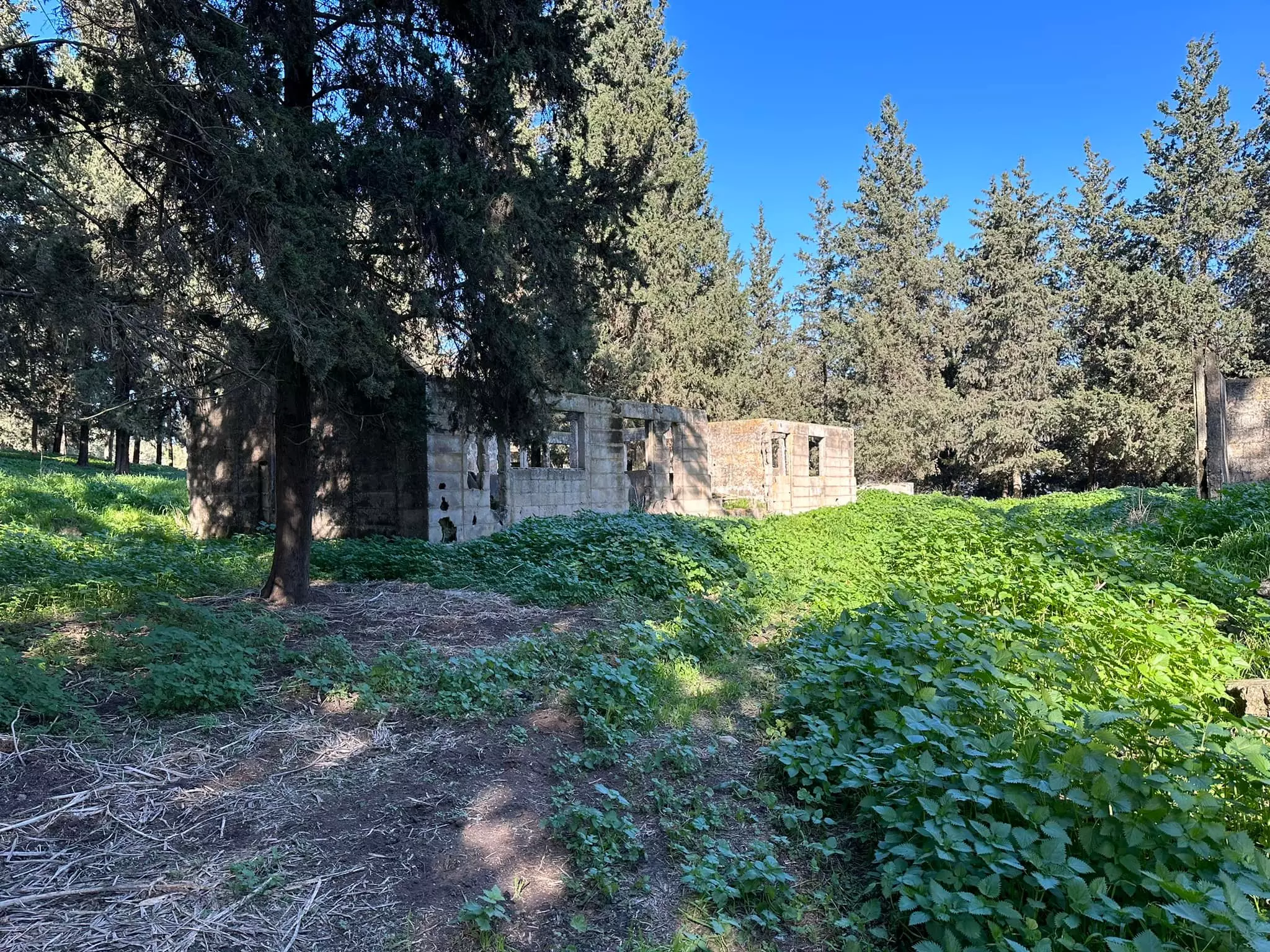
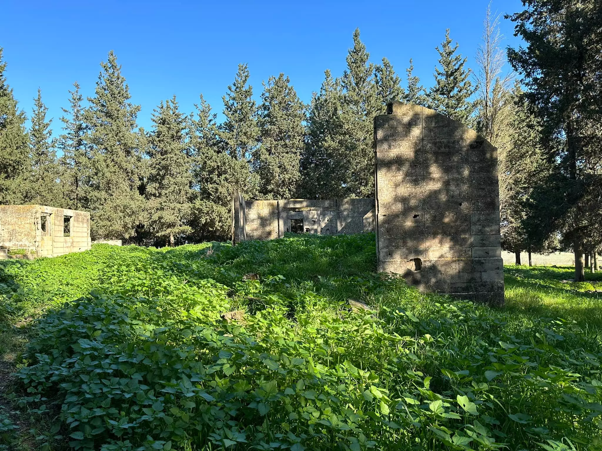
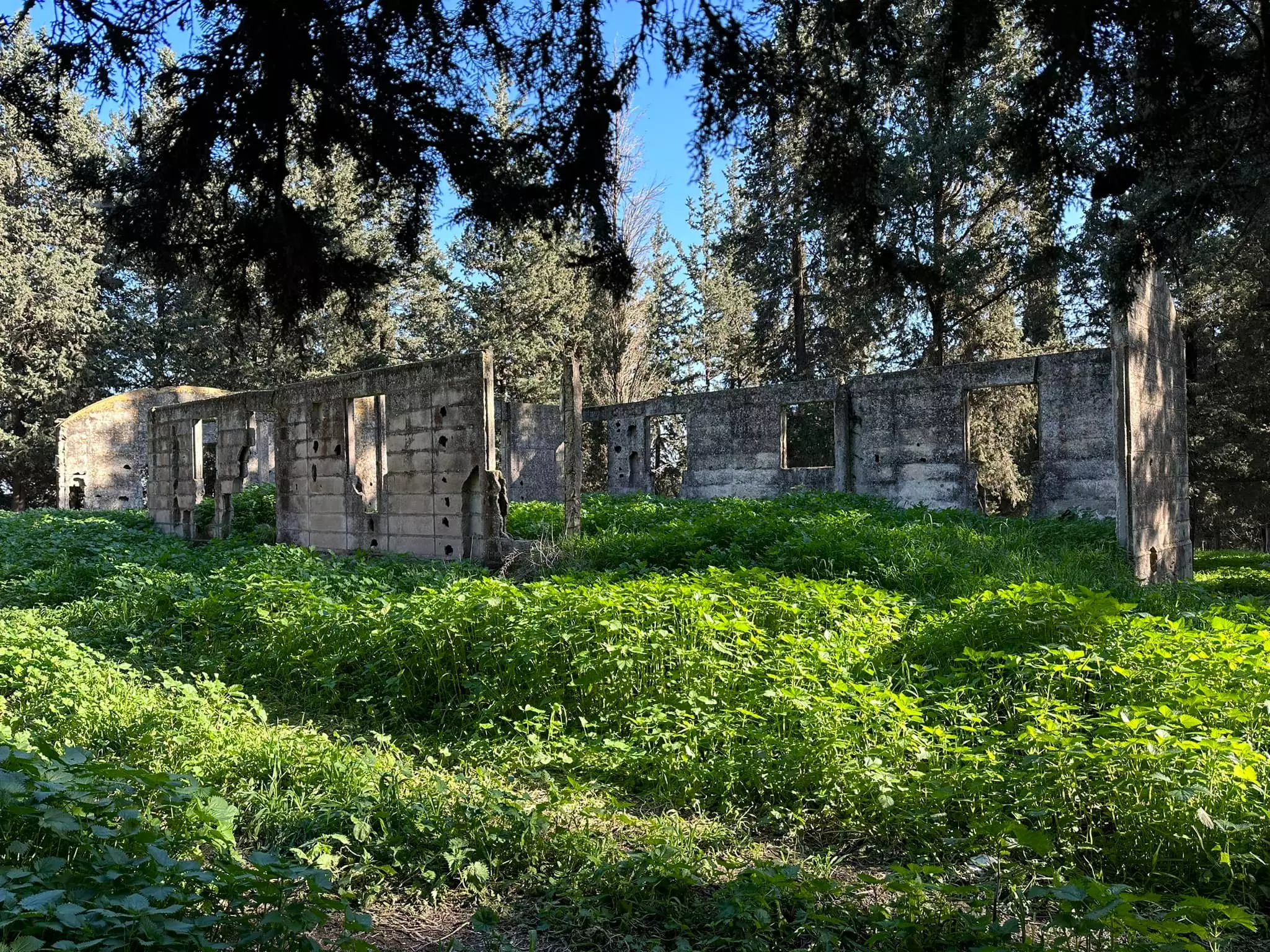
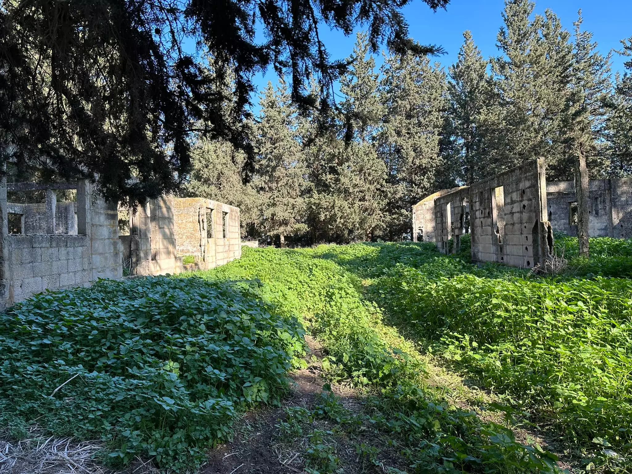
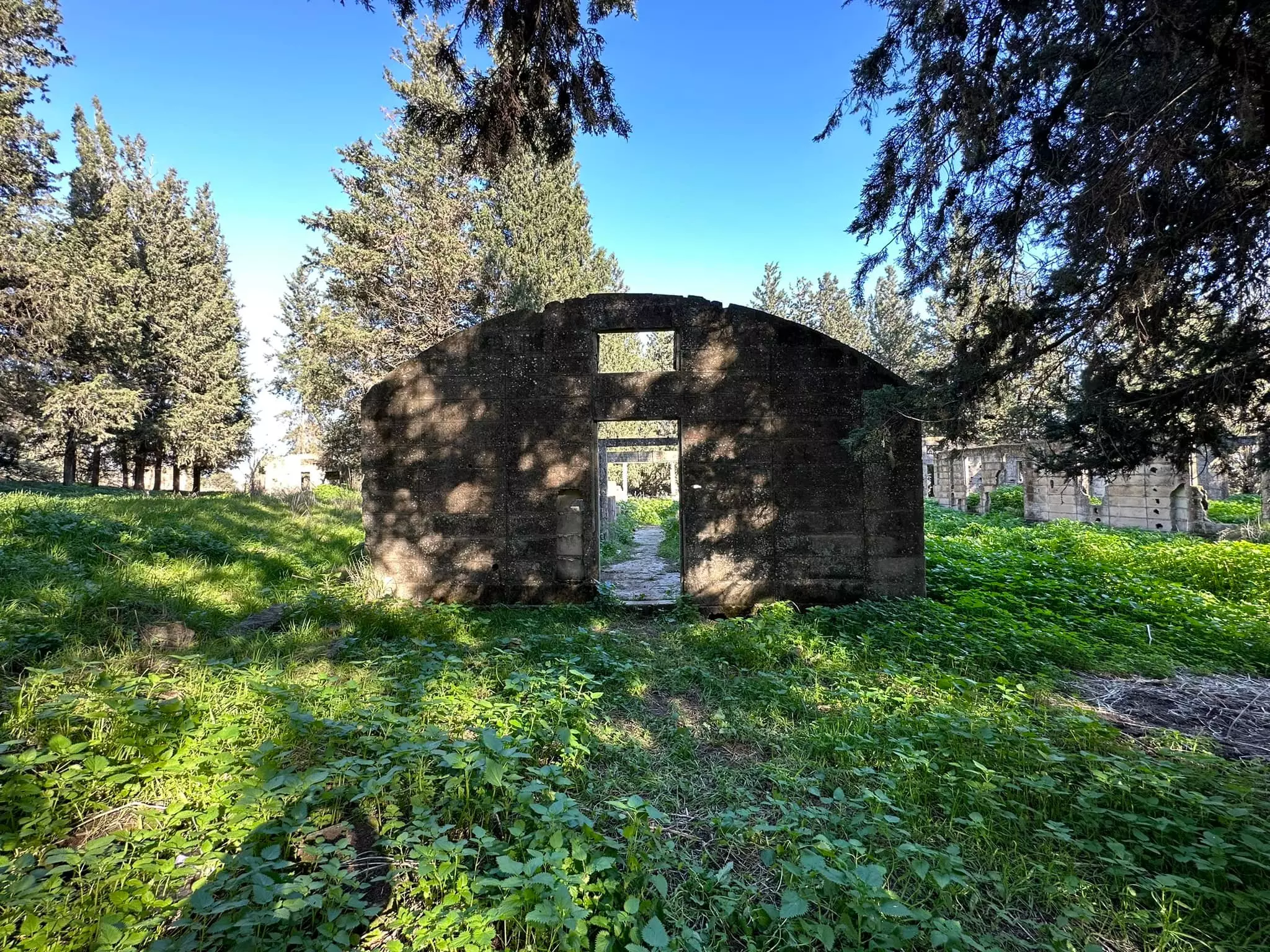
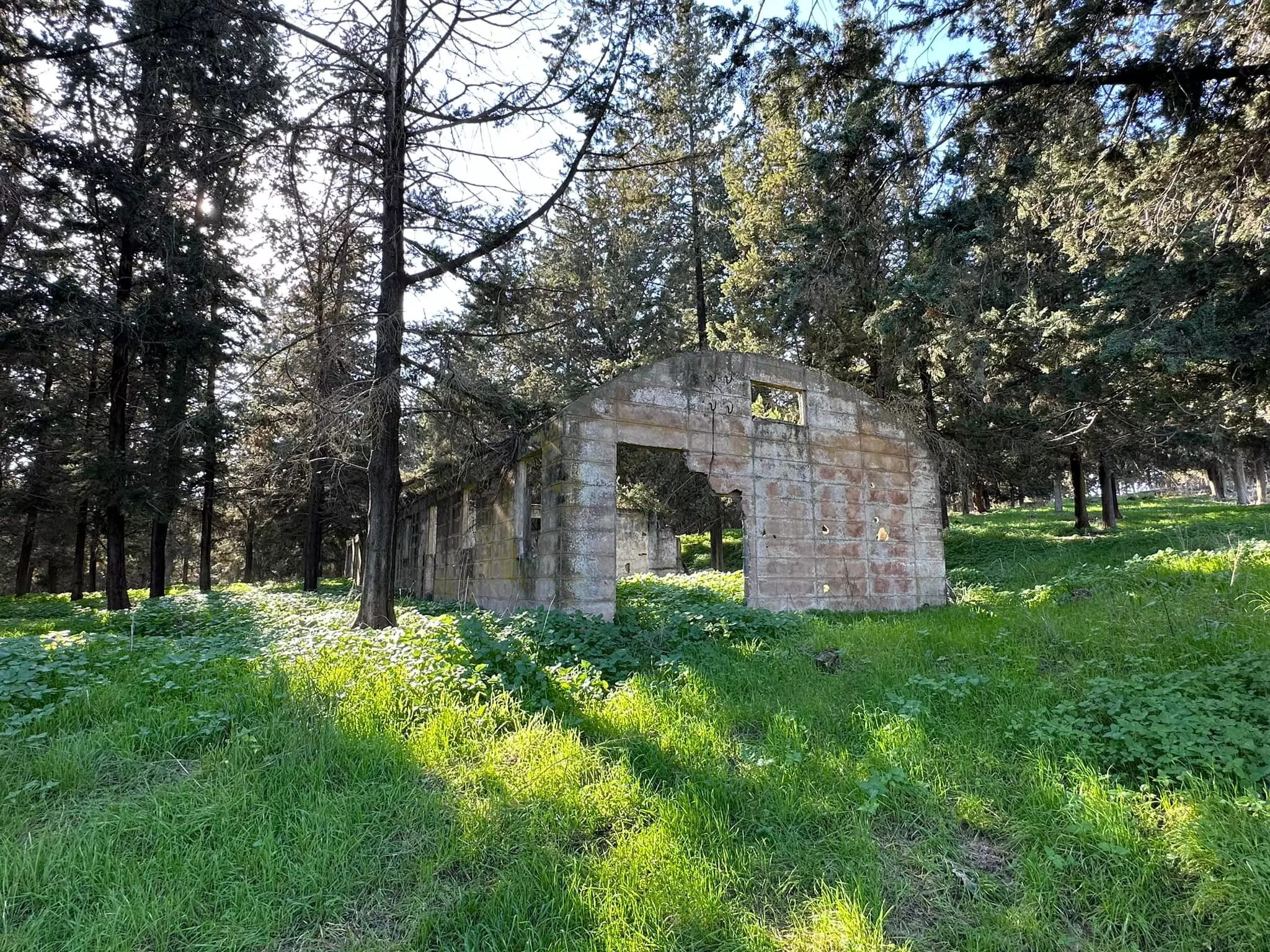
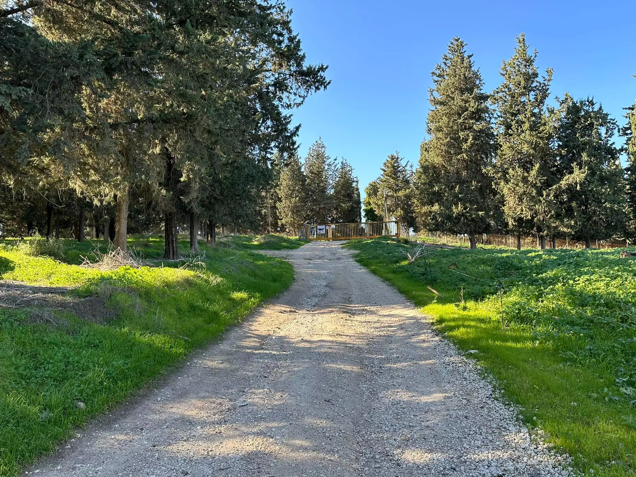
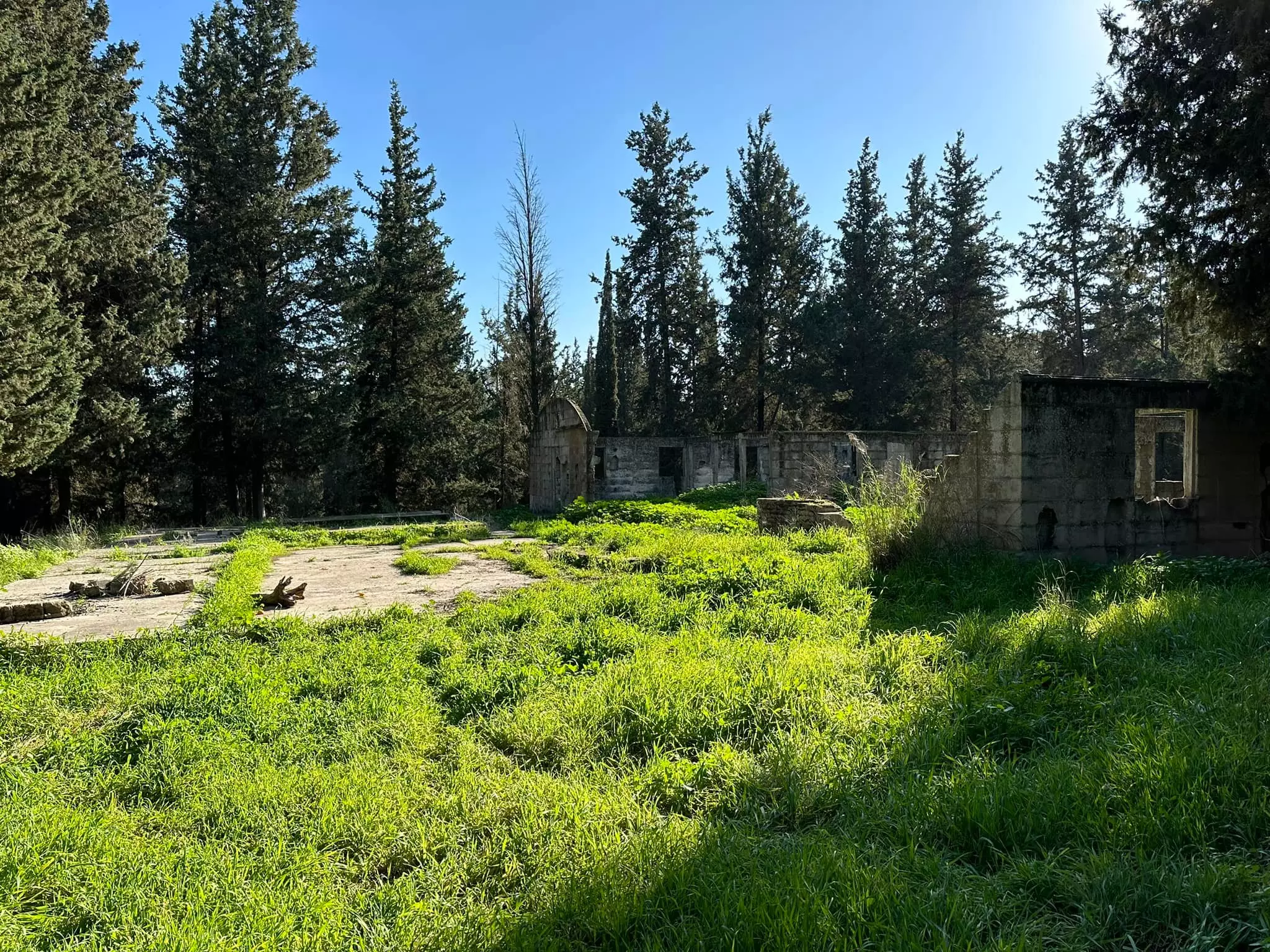
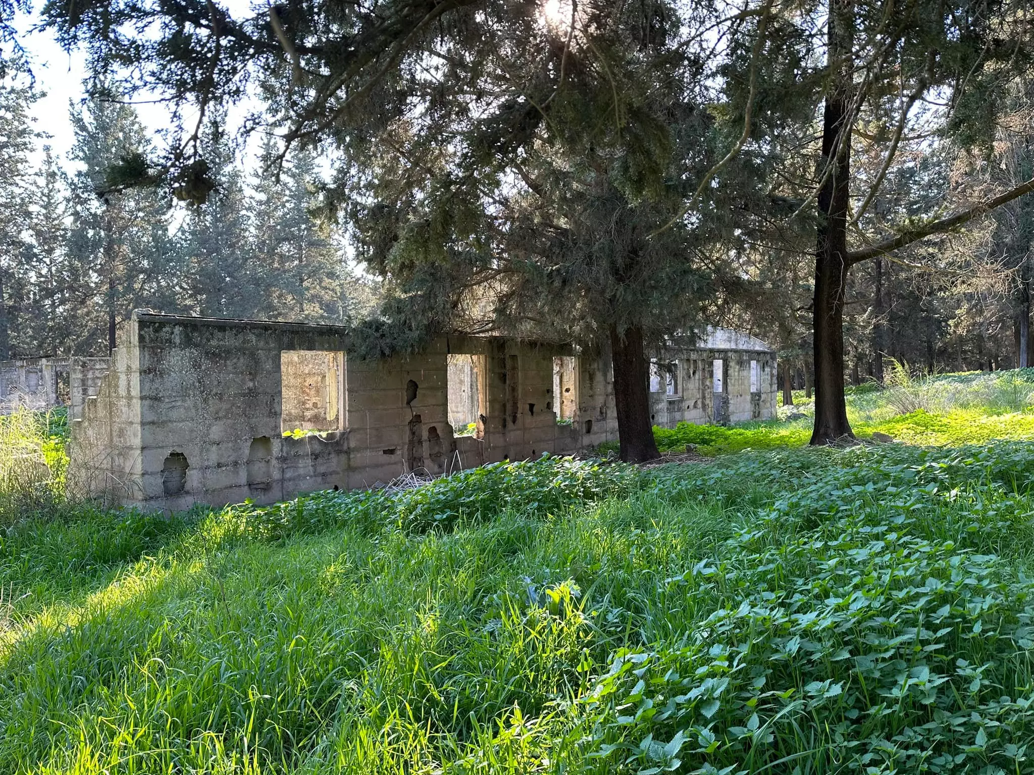
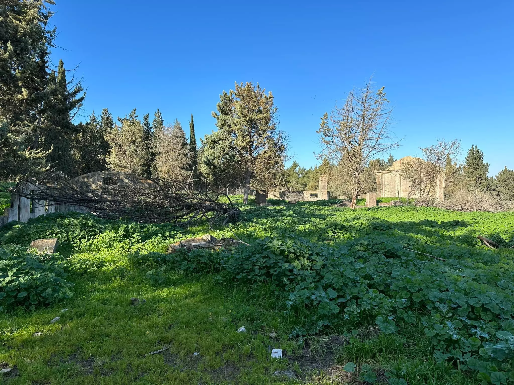
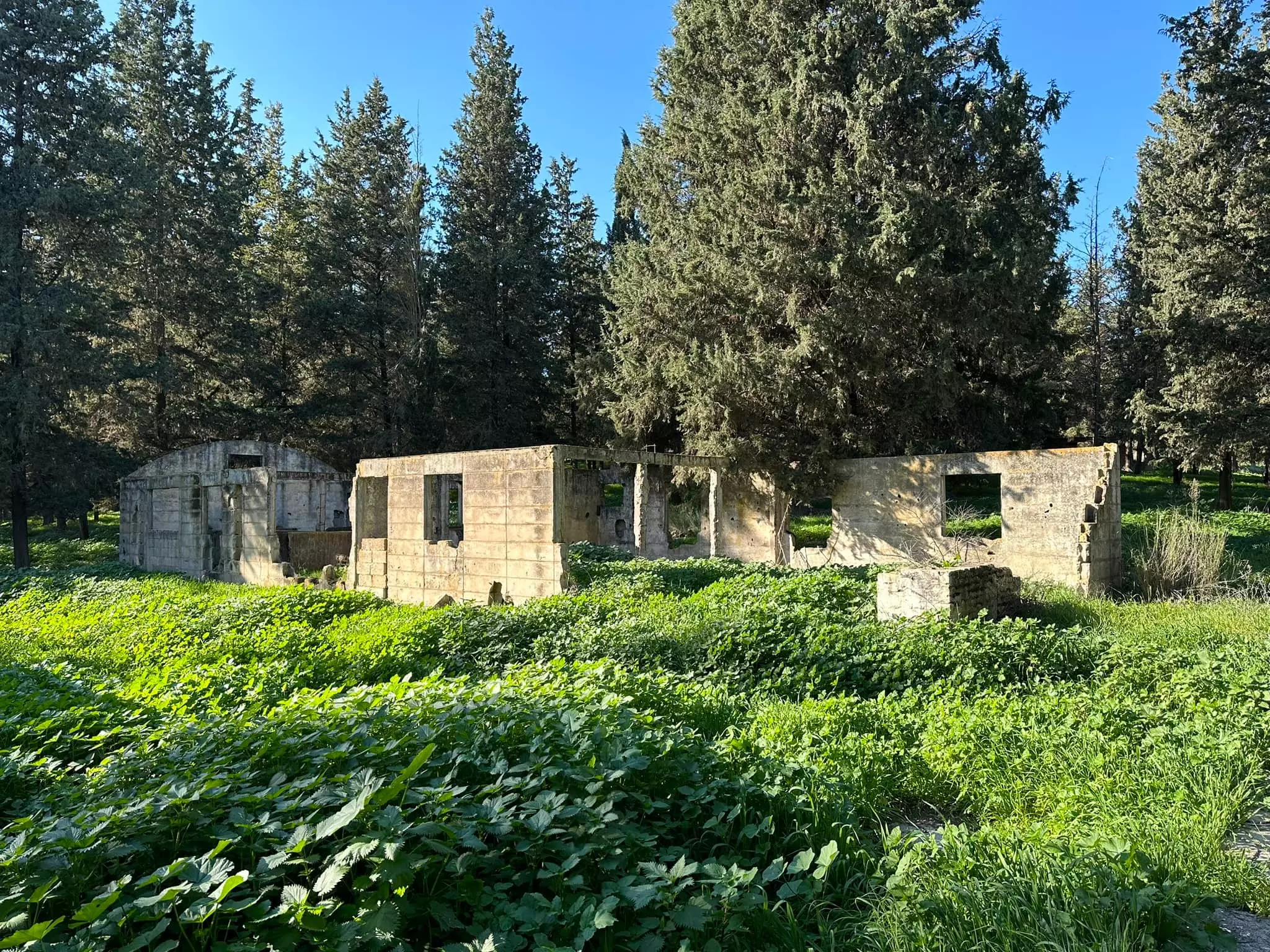
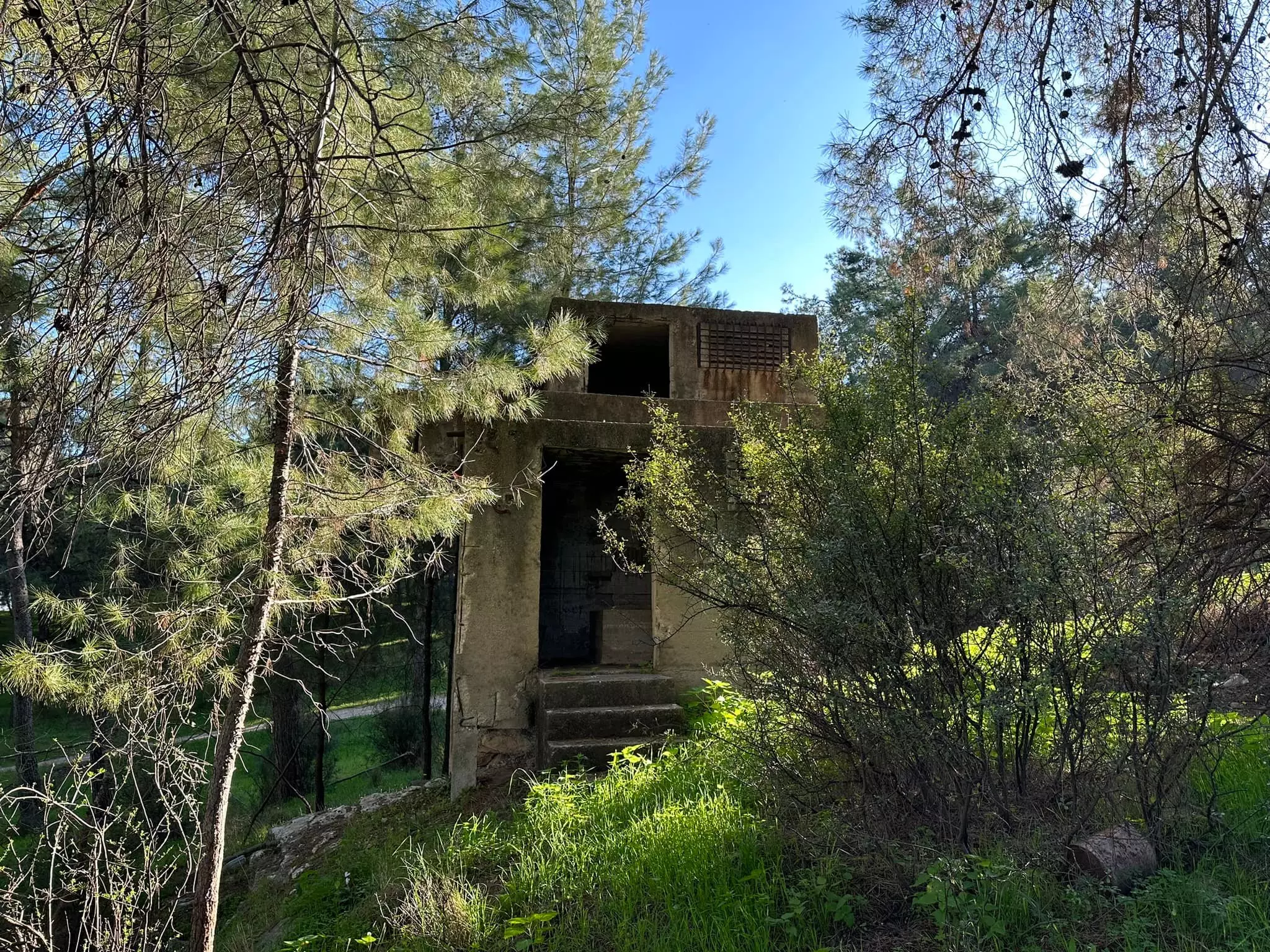
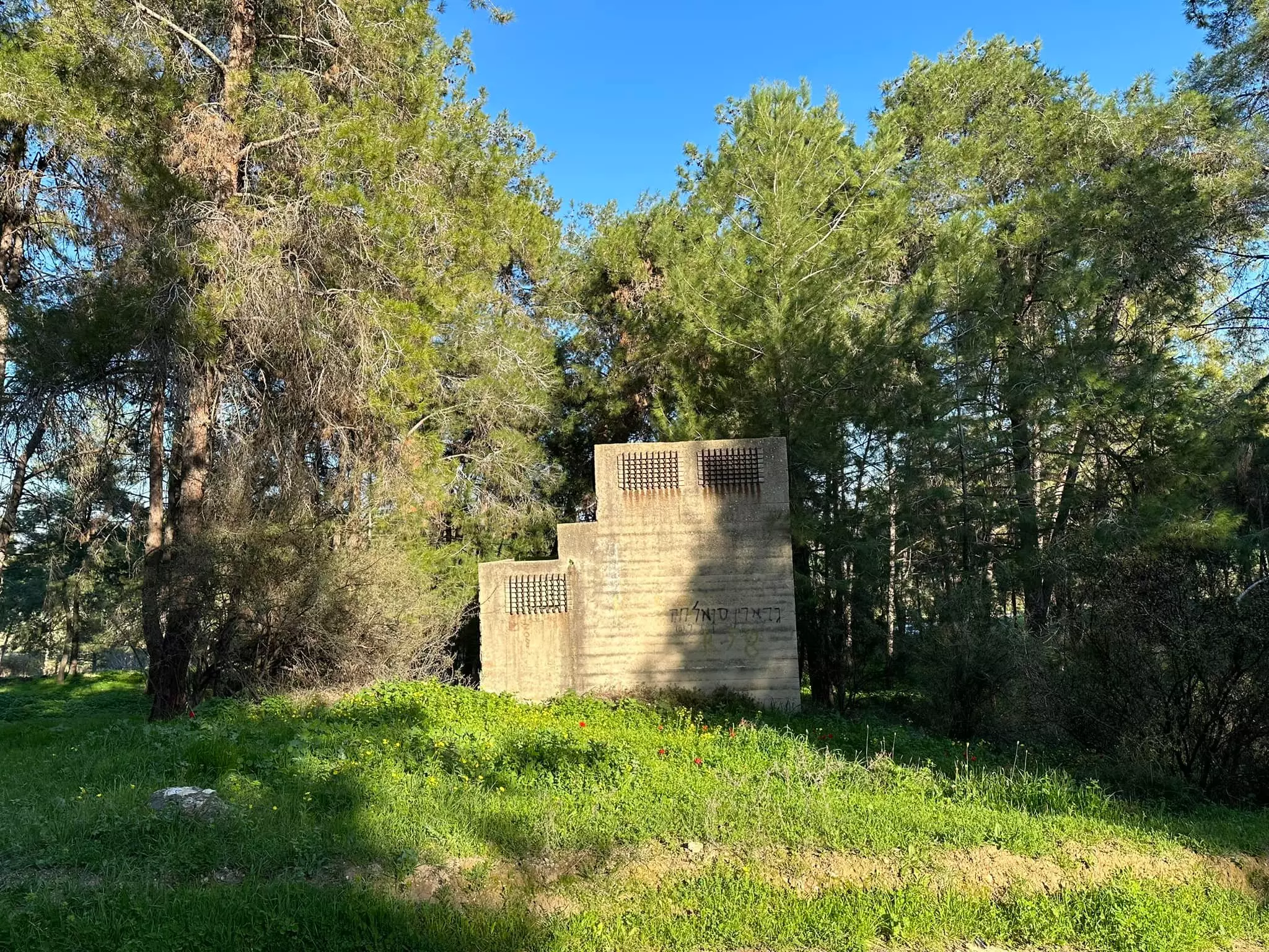
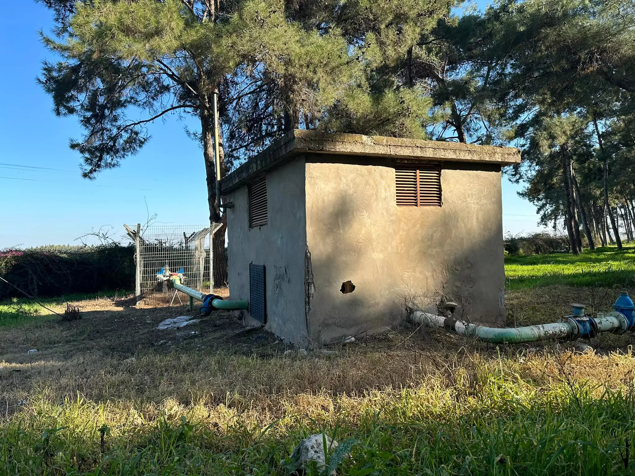
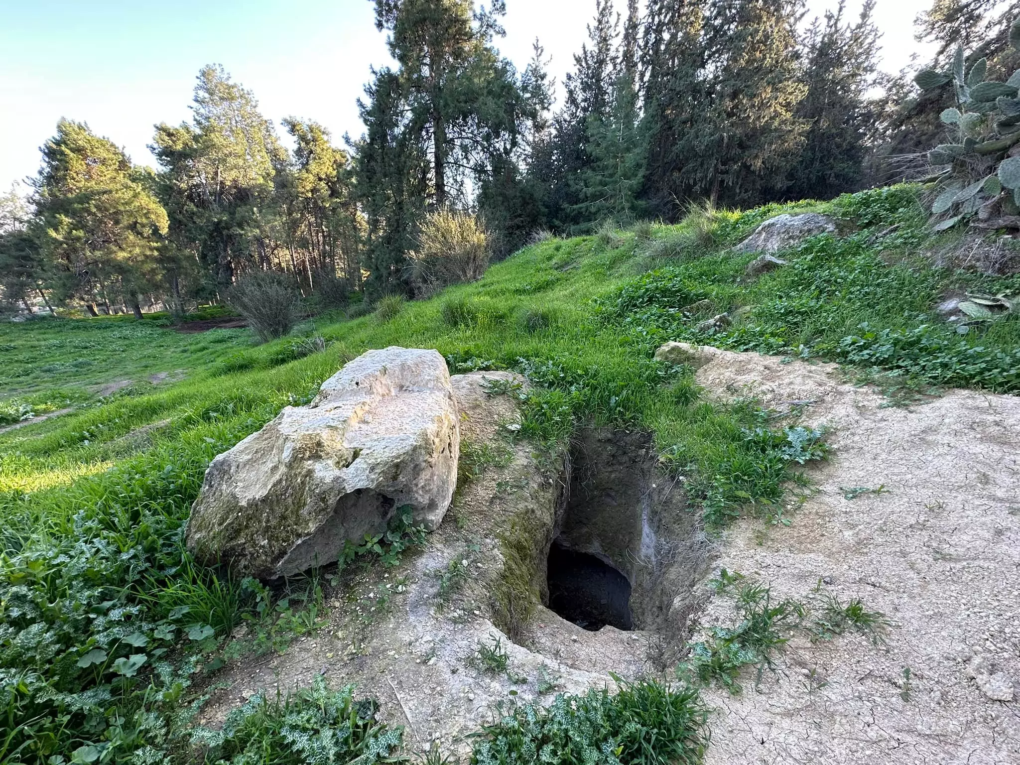
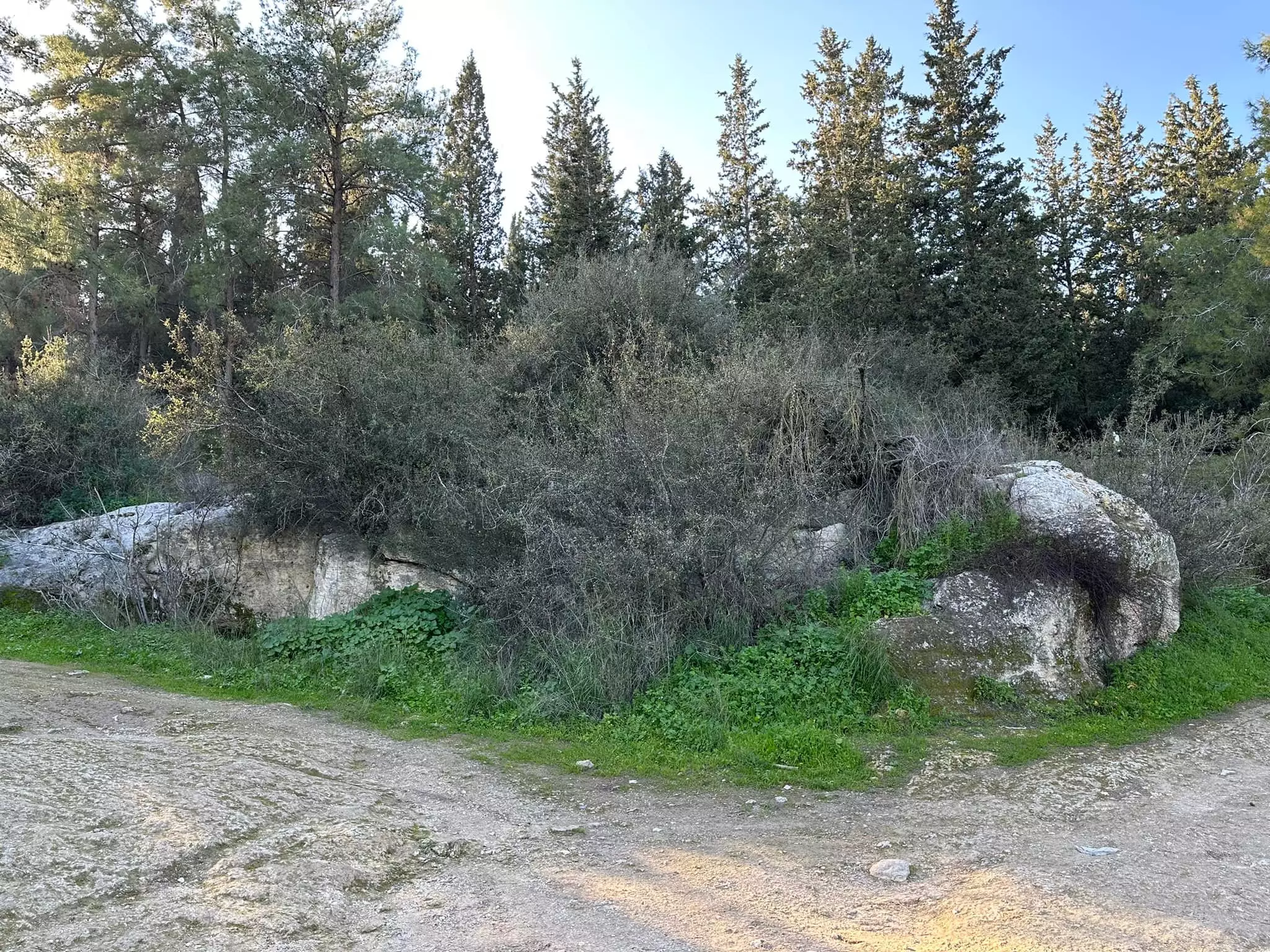
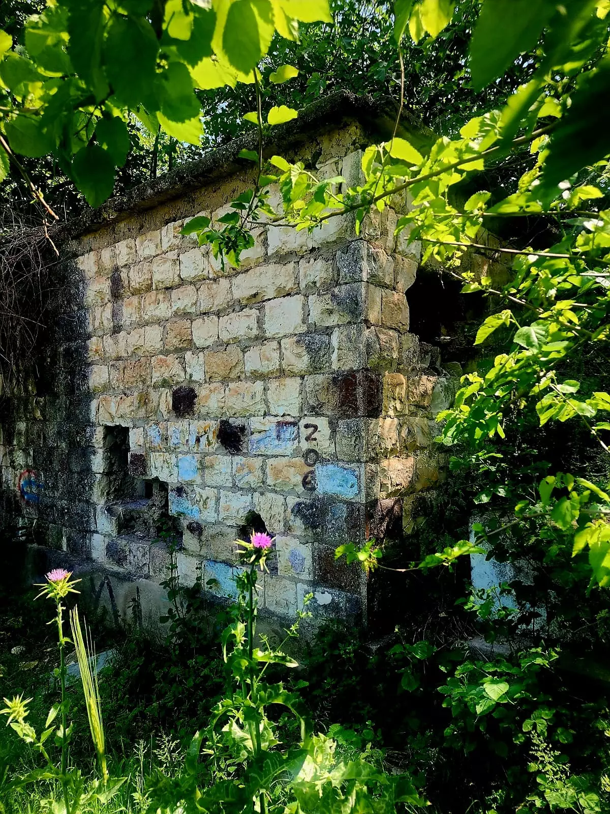
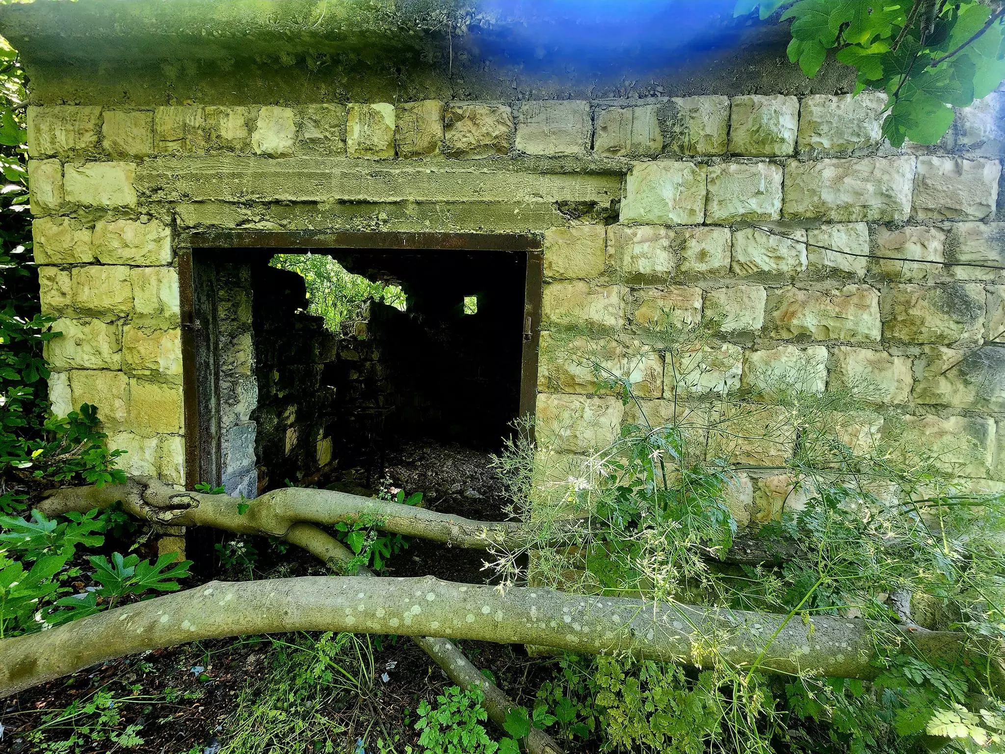
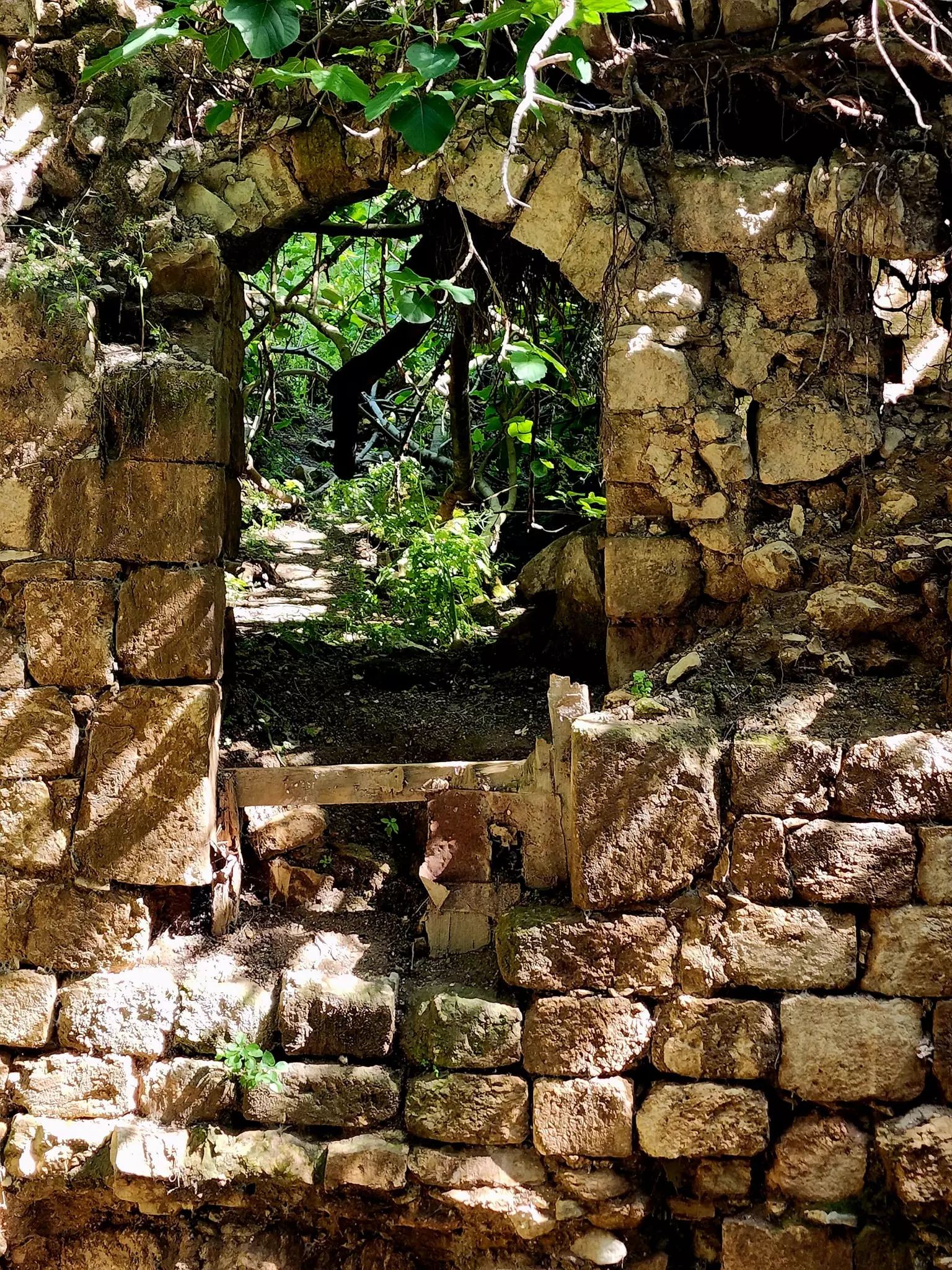
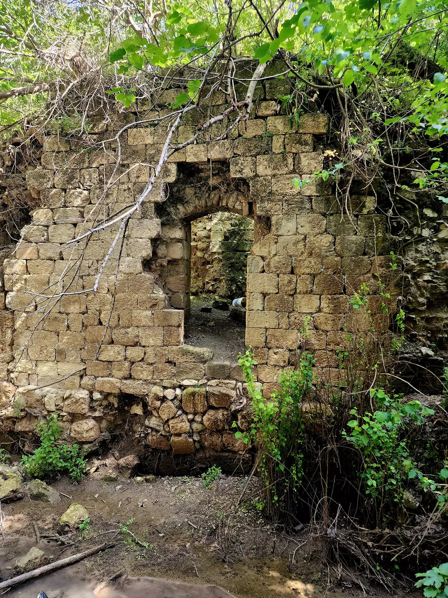
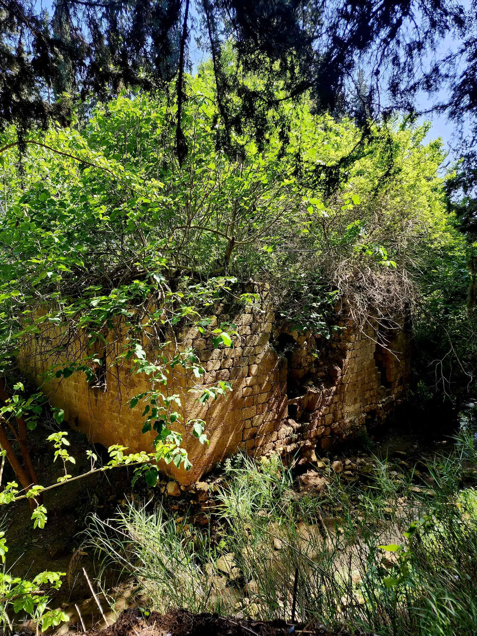
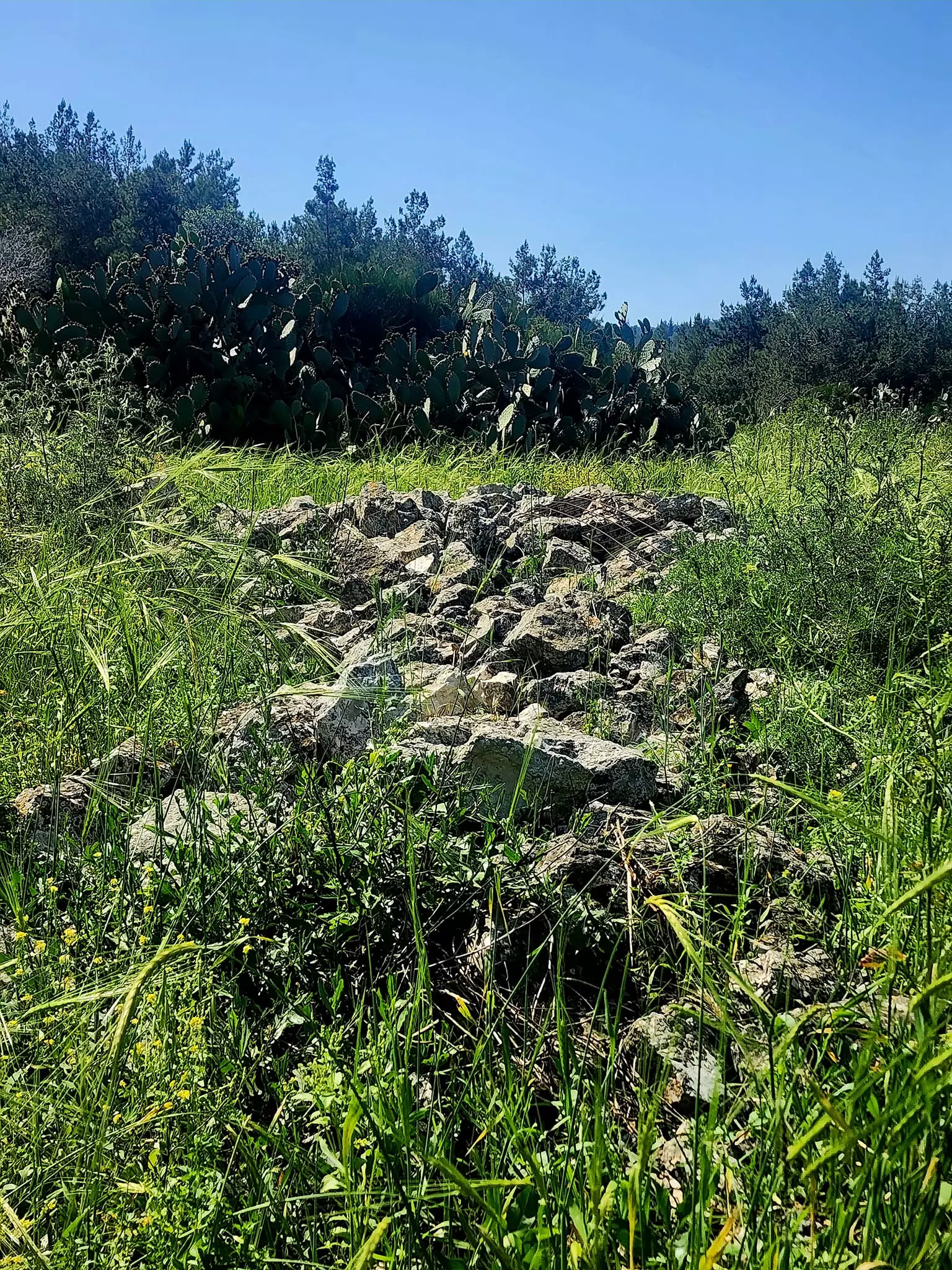
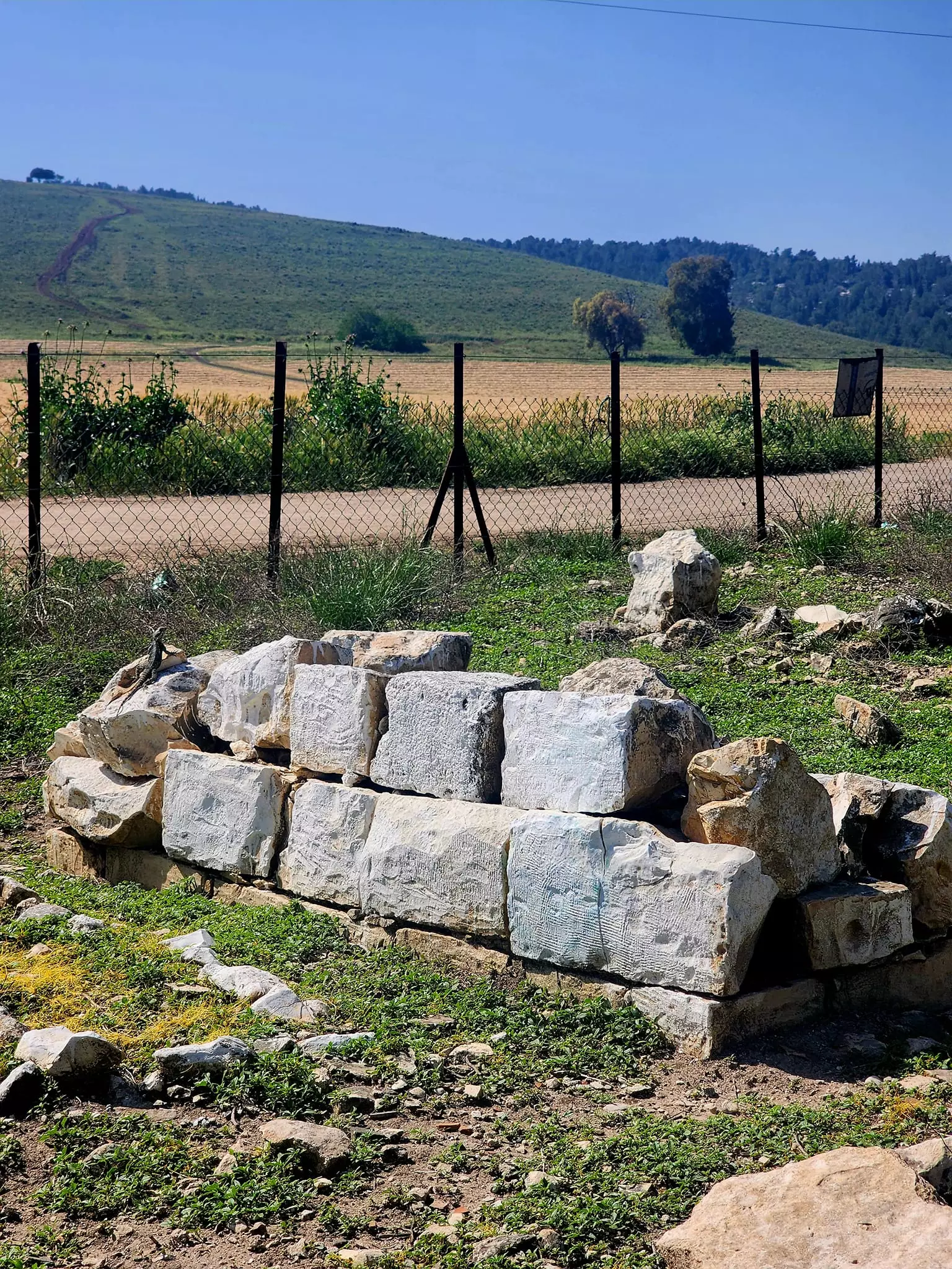
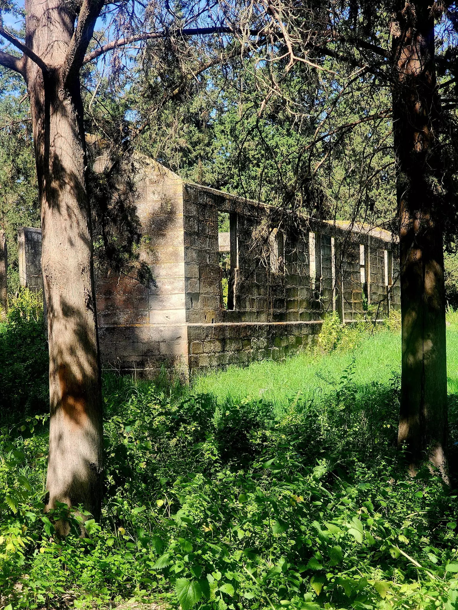
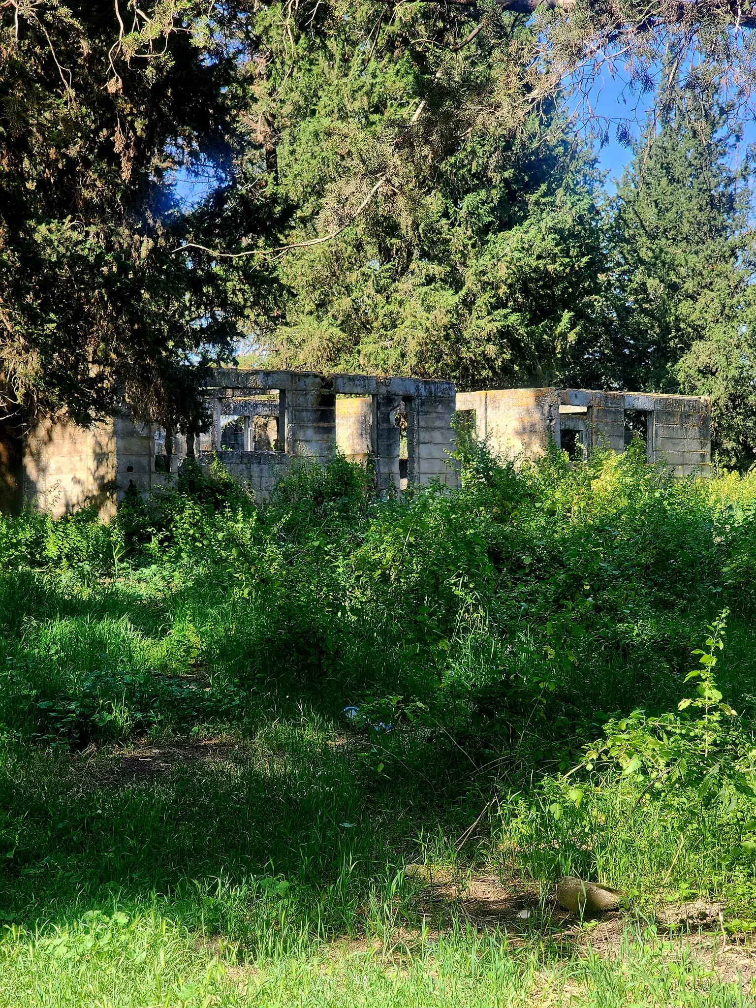
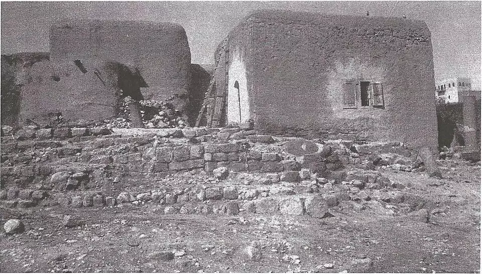
| Village Temains | al-Lajjun was mostly destroyed with the exception of the white stone mosque, one village mill, the village health center, and few partially destroyed houses still visible on the village site, ses Pictures section for details. | ||||||||||||||
| Ethnically Cleansing | al-Lajjun inhabitants were completely ethnically cleansed. | ||||||||||||||
| Clans | The village was made of several clans (hamayl) including:- al-Mahajina al-Tahta,al-Ghubariyya, al-Jabbarin, al-Mahamid, and al-Mahajina al-Fawqa clans | ||||||||||||||
| Pre-Nakba Land Ownership |
**Town Lands' Demarcation Maps |
||||||||||||||
| Population |
|
||||||||||||||
| Number of Houses |
|
||||||||||||||
| Near By Towns |
|||||||||||||||
|
|||||||||||||||
| Town's Name Through History | The Romans founded the village and called it Legio. | ||||||||||||||
| Schools | al-Lajjun had an elementary school for boys which was founded in 1937, and in 1945 it had an enrollment of 83 students. | ||||||||||||||
| Inhabitants Place of Origin | The most recent Palestinian population came from Umm al-Fahim escaping the British prosecution after the 1st intifadah in 1936. | ||||||||||||||
| Town's Notable People | Two famous Muslim scholars are from al-Lajjun: 'Ali al-Shafi'i (d. 1310) and 'Ali ibn al-Jalal. | ||||||||||||||
| Places of Warship | The village had two mosques, and currently the white mosque functions as carpentry workshop by Israeli Jewish settlers. | ||||||||||||||
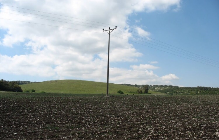
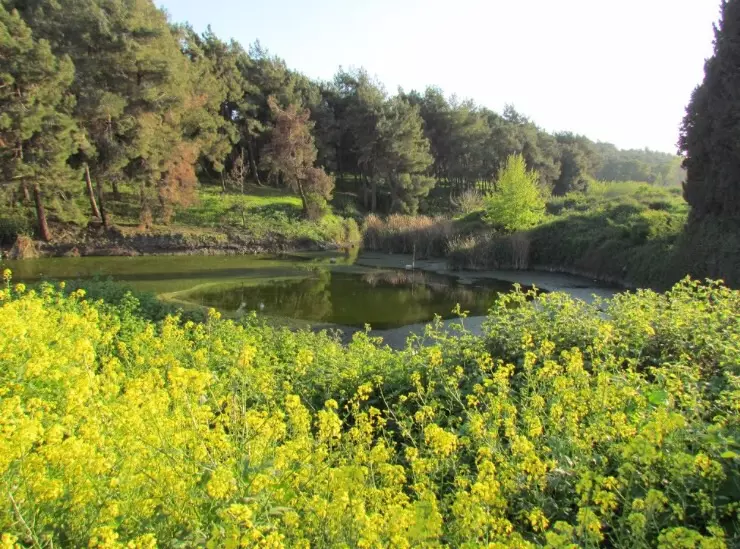
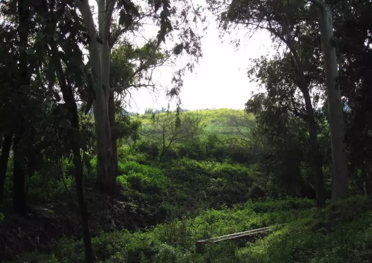
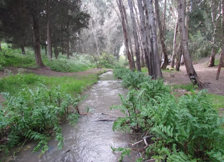
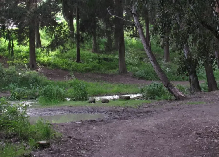
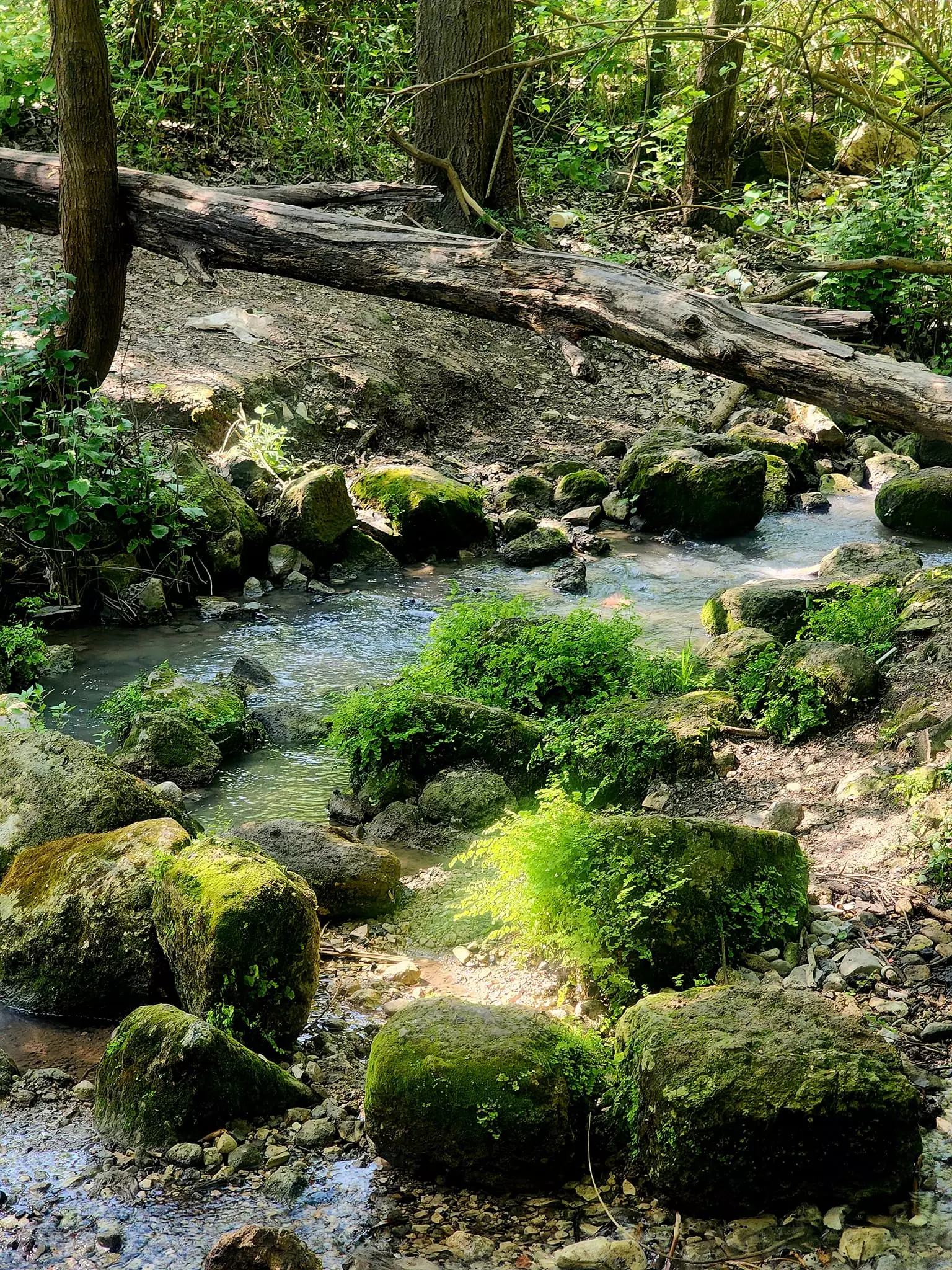
| Nearby Wadies & Rivers | al-Lajjun is situated on both banks of Wadi al-Lajjun. | ||||||||||||||
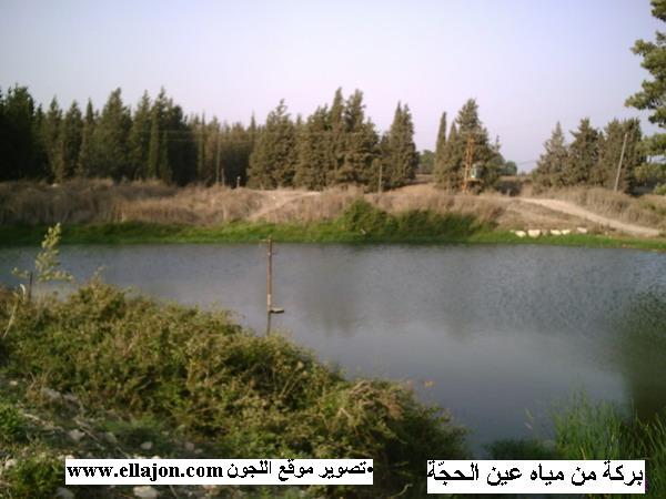
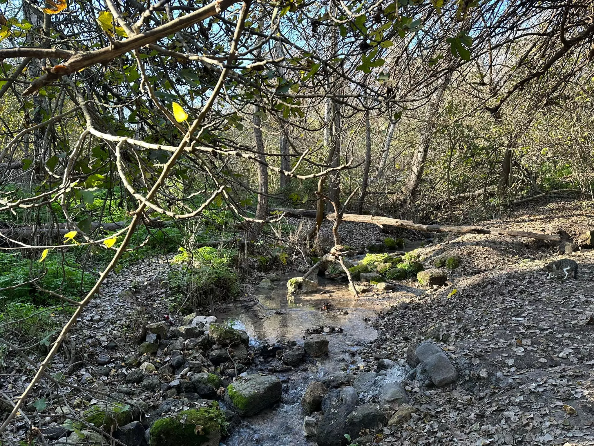
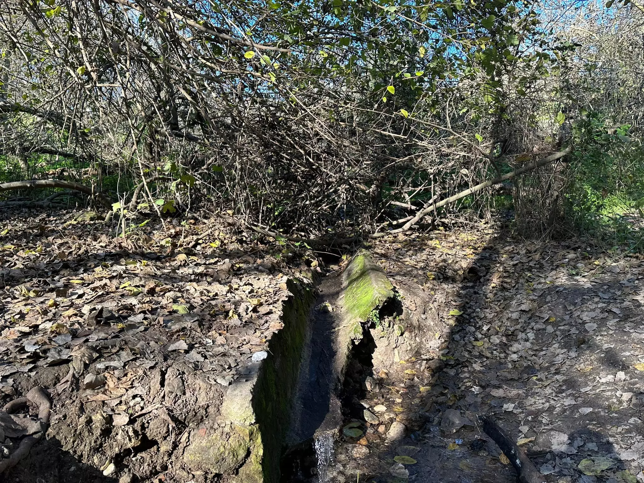
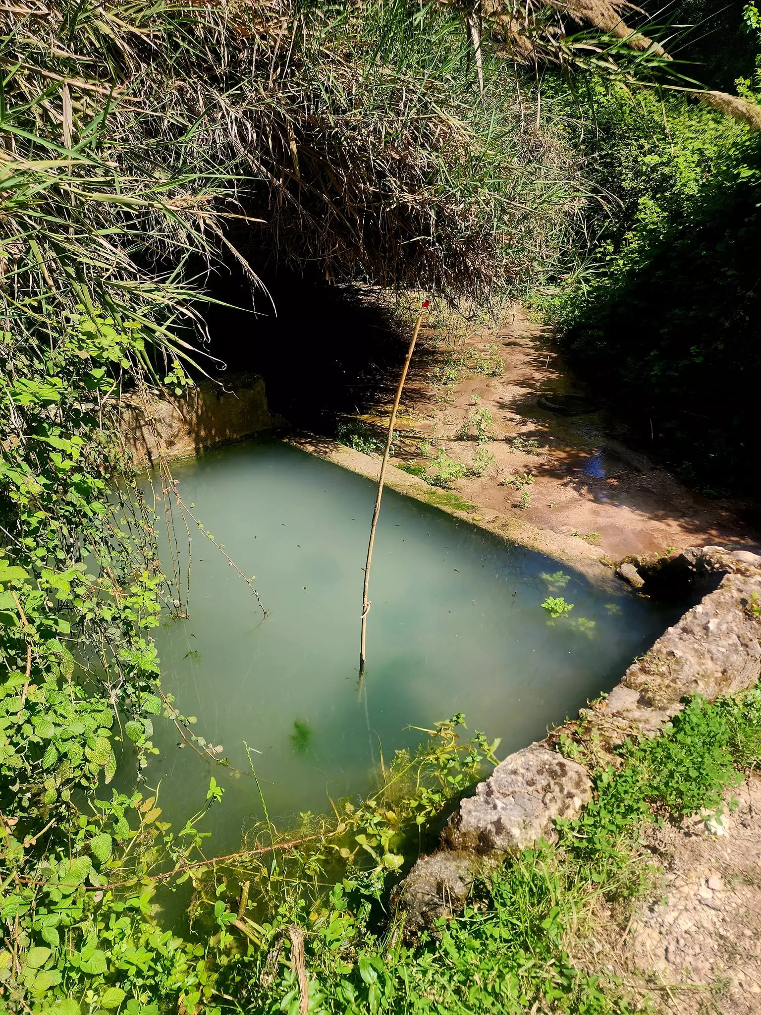
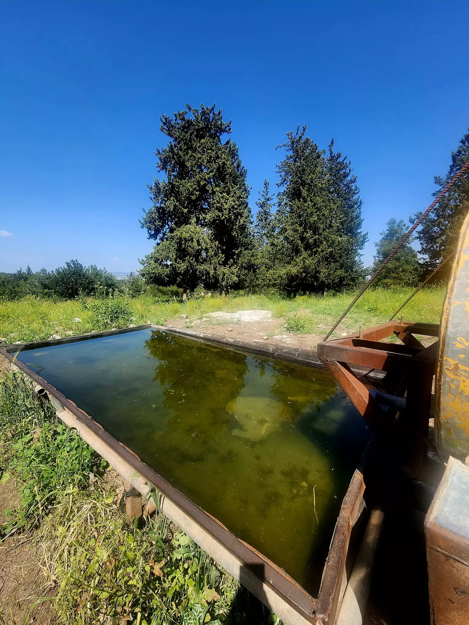
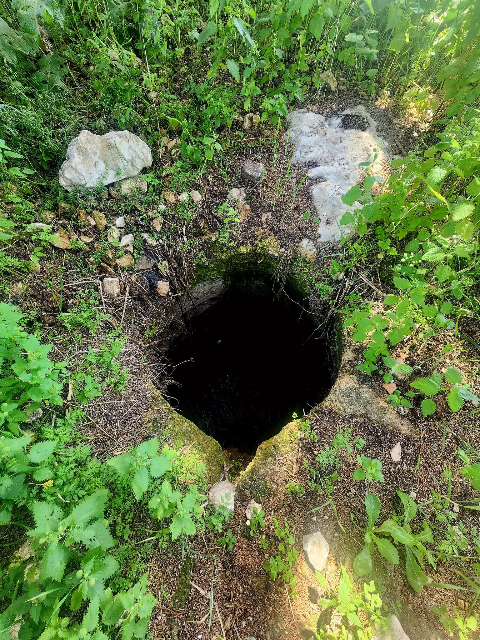
| Water Supply | al-Lajjun has several springs, including spring of 'Ayn al-Hajja used to provide the village with a fresh water source. | ||||||||||||||
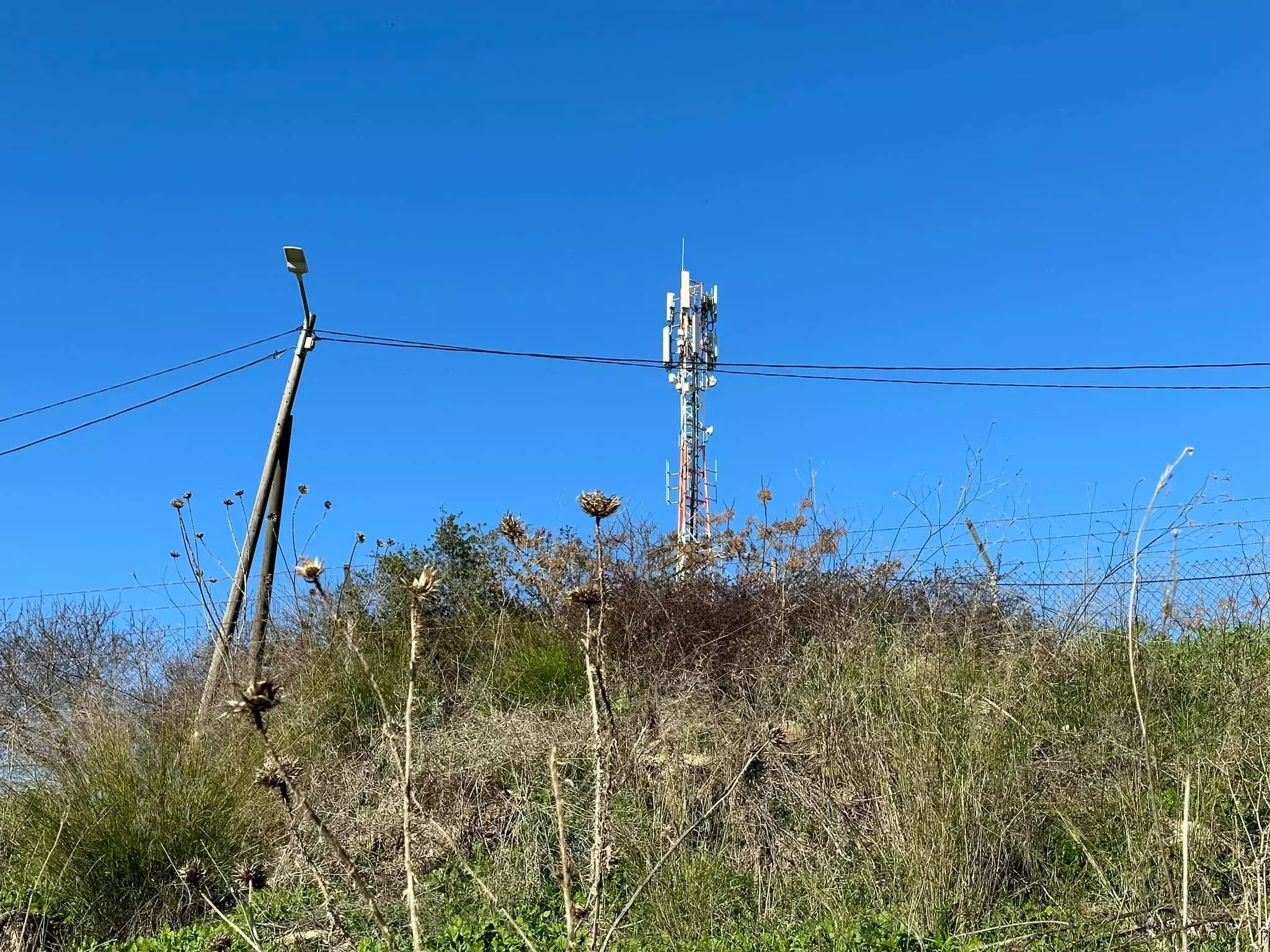
| Archeological Sites | The village contains Tall al-Mutasallim (ancient Megiddo) which was excavated by German archaeologists in 1903 | ||||||||||||||
| Exculsive Jewish Colonies That Usurped Village Lands |
Kibbutz Megiddo | ||||||||||||||
| Featured Video | |||||||||||||||
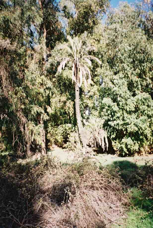
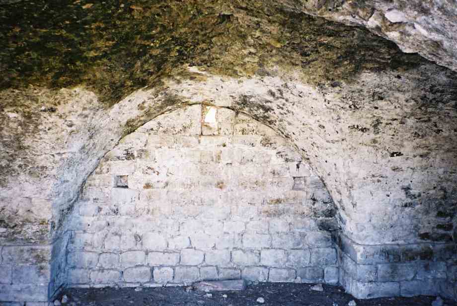
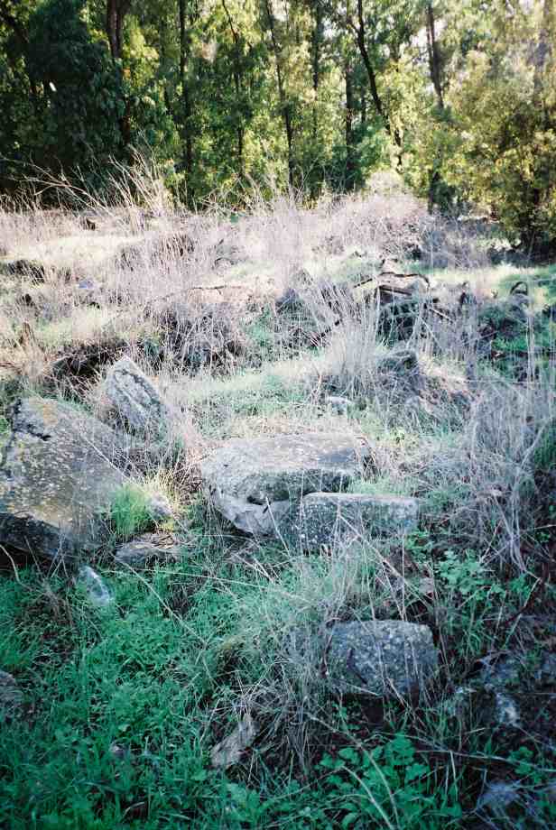
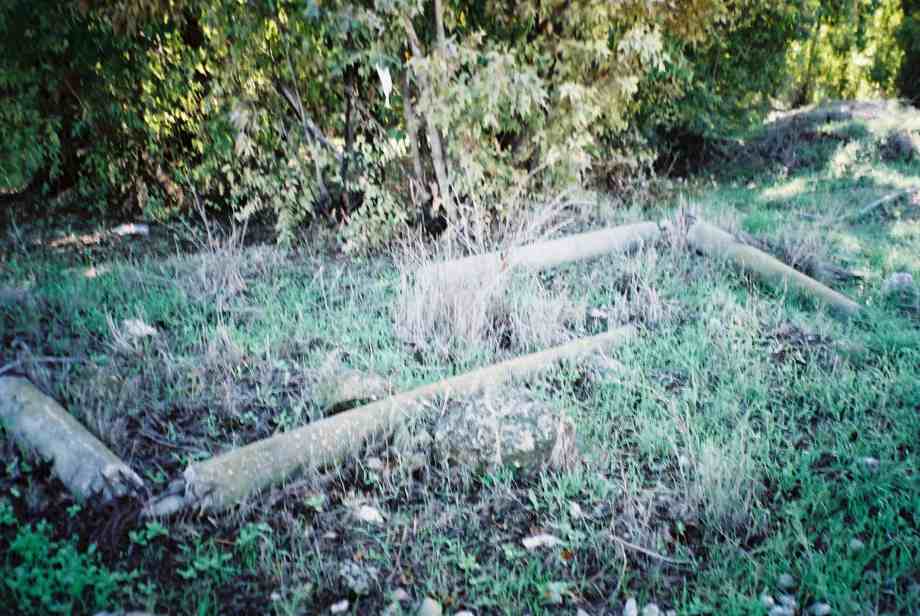
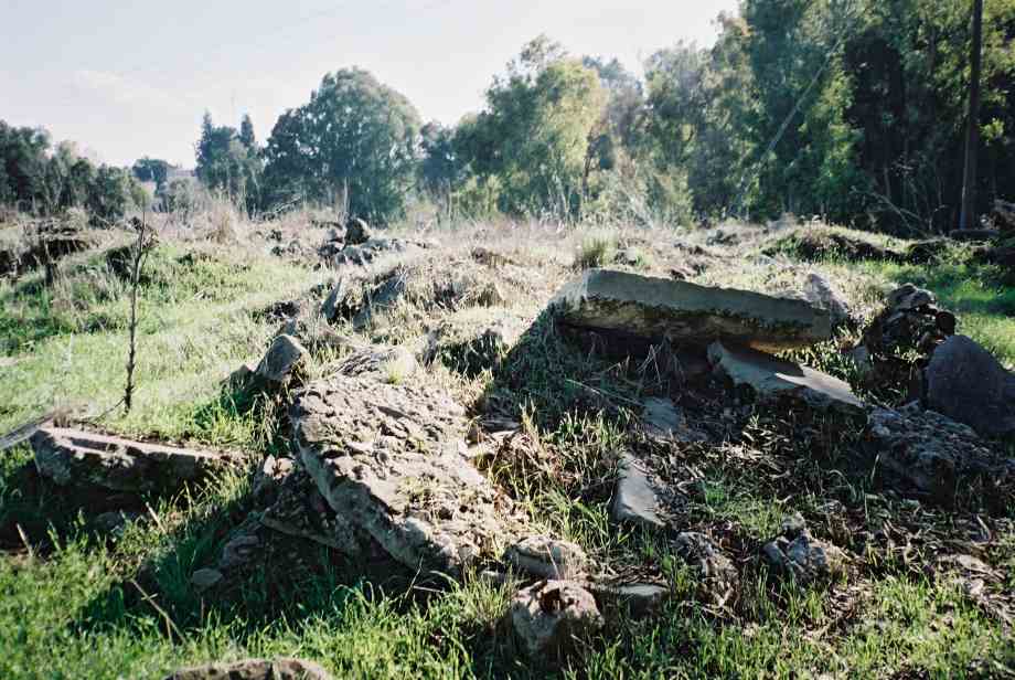
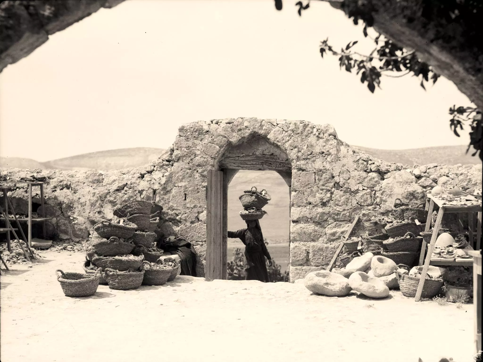
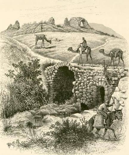
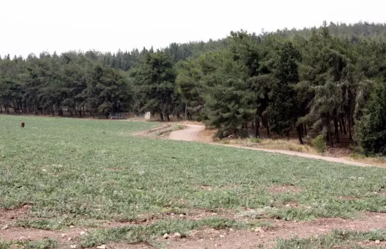
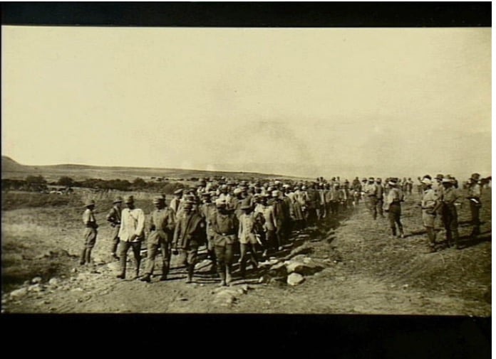
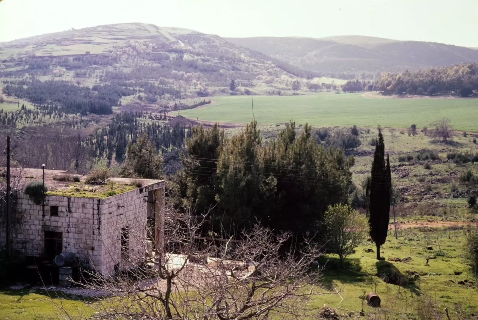
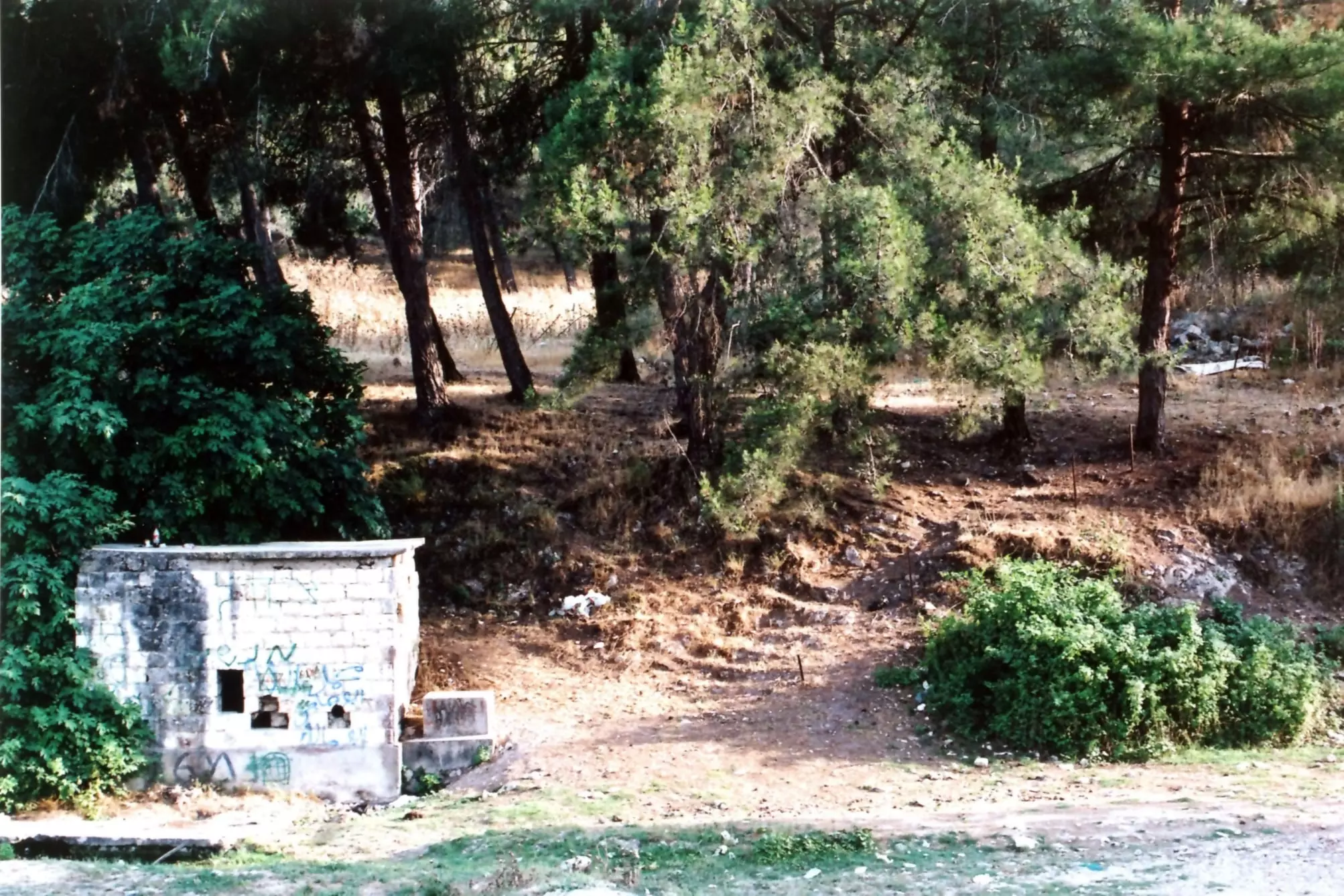
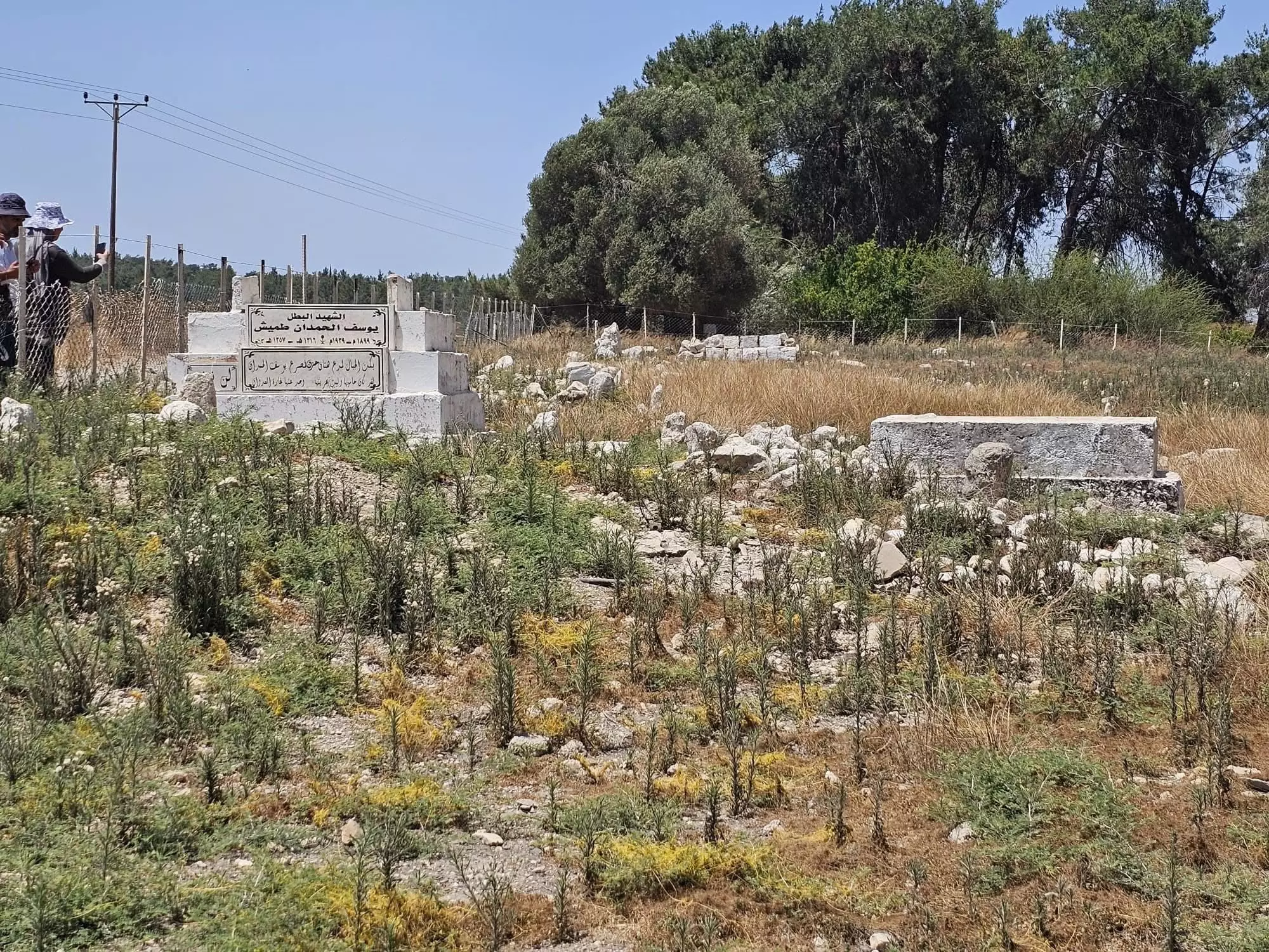
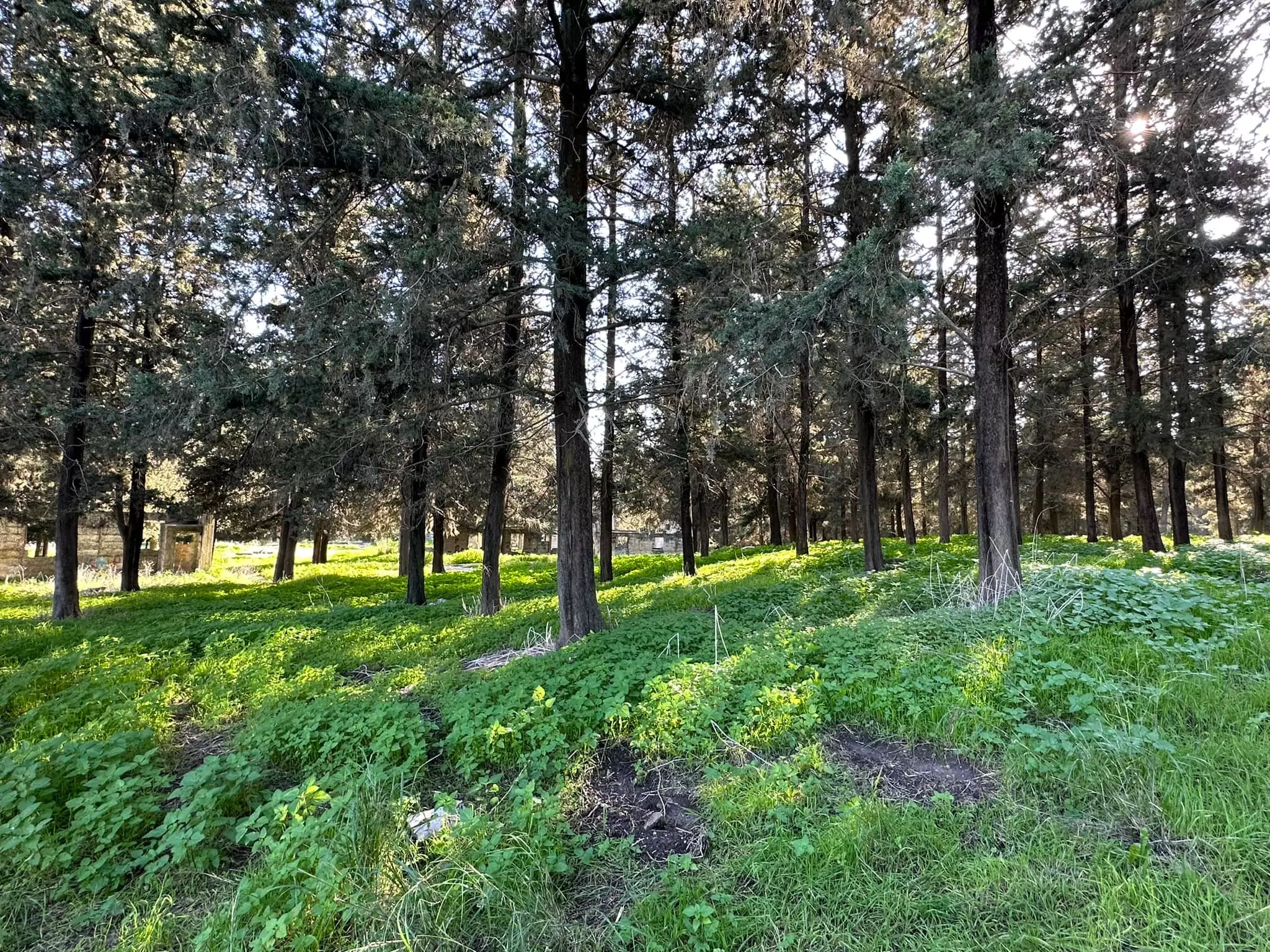
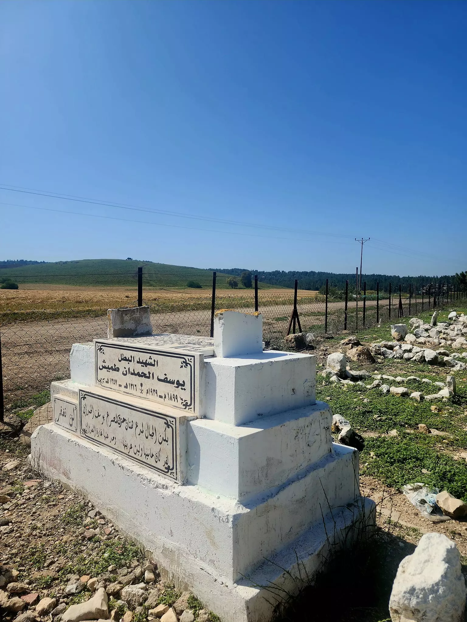
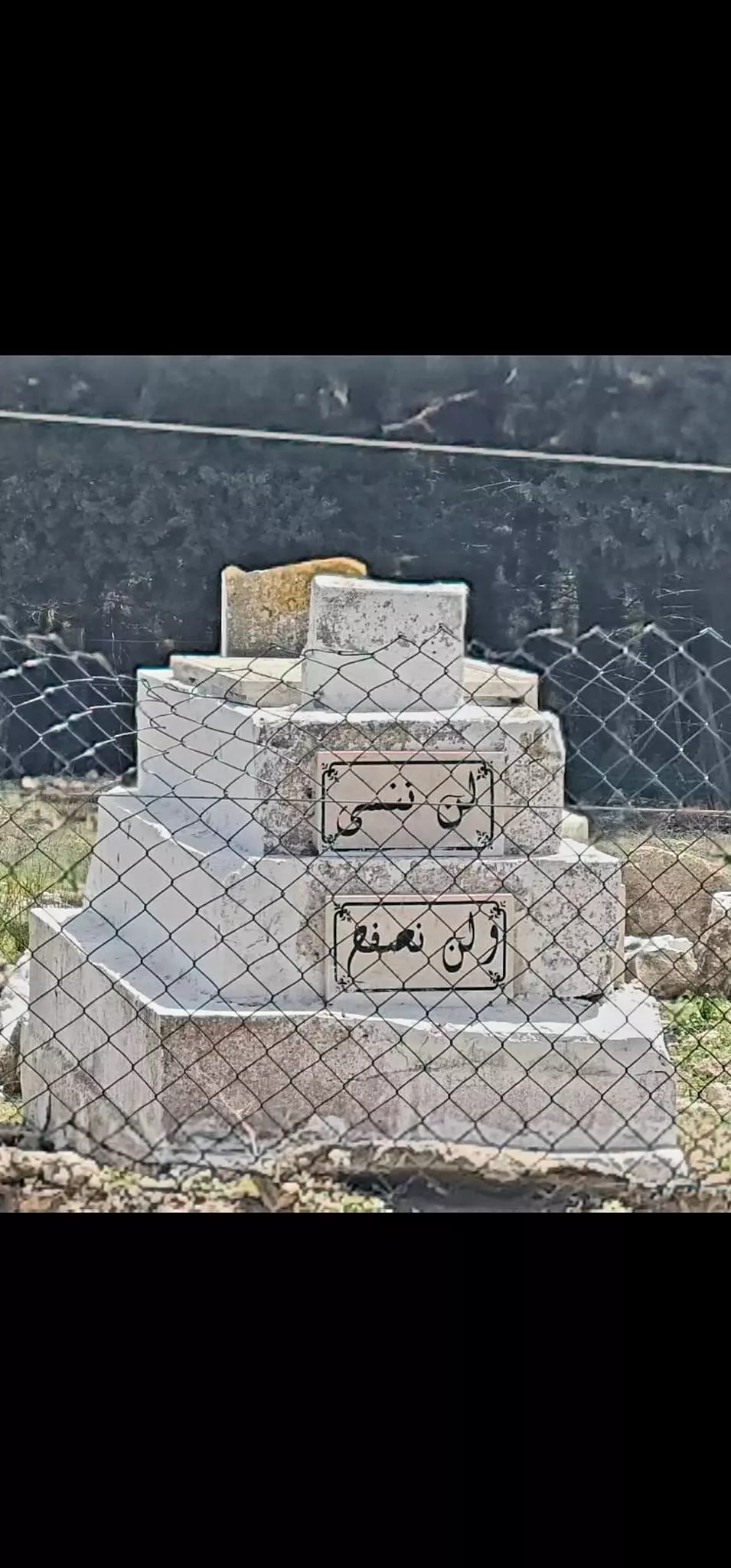
Village Before NakbaThe village stood on a slightly elevated hill on the southwestern edge of the Marj ibn 'Amir Plain, on the two banks of Wadi al-Lajjun. Jenin as well as the plain were visible from al-Lajjun. It was bordered on the west and south by the Carmel Mountains , by Tall al-Mutasallim (to the northeast), and by Tall al-Asmar (to the northwest). The village, which was linked by secondary roads to a highway between Jenin and Haifa and to another highway that led southwest to the town of Umm al-Fahm, lay close to the junction of the two highways.After the Bar-Kochba Revolt had been suppressed in A.D. 130 the Roman emperor Hadrian ordered a second Roman legion, the Legio VI Ferrata ('Ironsides'), to be stationed in the north of the country. The place where it established its camp was known as Legio. When in the third century the army was removed, Legio became a city and its name was augmented with the adjectival Masimianupolis. This remained its name throughout the Byzantine period. It came under Arab control in the seventh century A.D. during the early days of the Islamic conquest. AI-Lajjun was the site of more than one military confrontation between Muslim factions, such as the one in A.D. 945 between the Hamdanids of Aleppo and the Ikhshidids of Egypt in which the renowned Sayf al-Dawla al-Hamadani was defeated. AI-Lajjun was captured by the Crusaders but was taken back by Salah aI-Din al-Ayyubi (Saladin) in 1187. A number of Arab chroniclers and geographers mentioned al-Lajjun over the years, including Ibn al-Faqih (writing in A.D. 903), al-Maqdisi (writing in ca. A.D. 985), and Yaqut al-Hamawi (d. 1228). AI-Maqdisi described it as a pleasant town on the edge of Palestine (when the boundaries between Syria and Palestine were different from the present borders) and mentioned its sources of fresh water. AI-Maqdisi and al-Hamawi (in his Mu'jam) reported the presence of what the people of al-Lajjun called the mosque of Abraham, built over a round rock. But whereas Ibn al-Faqih said that the mosque lay outside al-Lajjun, al-Hamawi reported that it was in the center of the town. A number of Muslim kings and prominent persons passed through the village, including al-Kamil, the sixth Ayyubid ruler, who there gave his daughter 'Ashura' in marriage to his nephew in 1231. The village was also the burial site of two Muslim scholars, 'Ali al-Shafi'i (d. 1310) and 'Ali ibn al-Jalal (d. 1400). In 1596, al-Lajjun was a village in the nahiya of Sha'ra (liwa' of Lajjun), with a population of 226. It paid taxes on a number of crops, including wheat and barley, as well as on other types of property, such as goats, beehives, and water buffalos. Zahir al-'Umar, who became the effective ruler of northern Palestine for a short period during the second half of the eighteenth century, was reported to have used cannons against al-Lajjun in the course of his campaign (1771-73) to capture Nablus. It is unclear whether this attack led to the village's decline in the years that followed; when the British consul for Jerusalem and Palestine (1846-62), James Finn, visited the area, he did not see a village on the site. The authors of the Survey of Western Palestine noticed a khan, however, to the south of the ruins of al-Lajjun in the early 1880s. In the late nineteenth century, villagers from Umm al-Fahm moved to the site of al-Lajjun to make use of its farmland. Gradually, they settled in the village, building their houses around the springs, especially next to the khan. When the massive mound at nearby Tall al-Mutasallim (ancient Megiddo) was excavated by German archaeologists in 1903, some of the inhabitants of al-Lajjun reused stones from the ancient structures that had been unearthed to build new housing. More people moved to al-Lajjun from Umm al-Fahm during the British Mandate, and particularly in the late thirties, due to the British government's persecution of the population for their activities in the 1936-39 revolt that had spread throughout Palestine. AI-Lajjun's economy grew rapidly as a result of the influx of additional population. As the village expanded it was divided into three quarters, one to the east, one to the west, and another known as Khirbat aI-Khan. Each quarter was inhabited by one or more hamulas (clans): the al-Mahajina al-Tahta and al-Ghubariyya clans, the al-Jabbarin and al-Mahamid clans, and the al-Mahajina al-Fawqa clan. In 1931 the population consisted of 829 Muslims, 26 Christians, and 2 Jews; there is no exact breakdown for the year 1945. In 1943 one of the large landowners in the village financed the construction of a mosque, built of white stone, in the al-Ghubariyya (eastern) quarter. Another mosque was also established in the al-Mahamid quarter during the same period, and was financed by the residents of the quarter themselves. AI-Lajjun also had a school that was founded in 1937 and that had an enrollment of 83 in 1944. It was located in the quarter belonging to the al-Mahajina al-Fawqa clan, that is, in Khirbat aI-Khan. There was a small market place in the village, as well as six grain mills (powered by the numerous springs and wadis in the vicinity), and a health center. The various quarters of al-Lajjun had many shops. A bus company was established in al-Lajjun by a villager from Umm al-Fahm; the bus line served Umm al-Fahm, Haifa, and a number of villages, such as Zir'in. In 1937 the line had seven buses. Subsequently the company was licensed to serve Jenin also, and acquired the name of al-Lajjun Bus Company. The villagers cultivated grain, vegetables, and citrus fruits. AI-Lajjun's archaeological heritage has totally disappeared with little record and no excavation. Most ruins have been bulldozed into a heap to allow planting on the fields. Village Occupation and Ethnic CleaningThe official Israeli account states that al-Lajjun was occupied shortly before 1 June 1948, following the 'clearing' of the Baysan Valley and prior to the (unsuccessful) Israeli attack on Jenin. At that time, the Golani Brigade captured a number of villages in the vicinity of Jenin, including al-Lajjun, which was entered at dawn on 30 May, according to a press report in the New York Times. Several Israeli columns moved towards the Triangle area at this time, taking a cluster of villages north of Jenin. It is possible that the Golani's Fourth Battalion expelled the villagers directly, in keeping with their practice during their previous operation in the Baysan Valley.Earlier New York Times reports had stated that the village was first attacked and captured in mid-April, during the battle around the settlement of Mishmar ha-'Emeq (see Abu Shusha, Haifa sub-disctrict). The commander of the Arab Liberation Army (ALA) also reported an assault on 13 April, when Jewish forces attempted 'to reach the crossroads at Lajjun in an outflanking operation.' The attack apparently failed. The Times said that twelve people were killed and fifteen wounded during that offensive. The paper also said that al-Lajjun was occupied a few days later, on 17 April, twelve days after the attack on Mishmar ha-'Emeq had been launched from that village. The account read: 'Lajjun is the most important place taken by the Jews, whose offensive has carried them through ten villages south and east of Mishmar Ha'emek.' The report added that women and children had been removed from the village and that 27 buildings were blown up by the Haganah in al-Lajjun and other villages nearby. But Arab military sources imply that the village was not occupied at that time, for ALA commander Fawzi al-Qawuqji states that attacks resumed the following month, on 6 May, when ALA positions in the area of al-Lajjun were attacked by Haganah forces. The ALA's Yarmuk Battalion and other units drove the attackers back, but two days later, the ALA commander reported that Haganah forces were 'trying to cut off the Lajjun area from Tulkarm in preparation for seizing Lajjun and Jenin....' In summing up the military situation in Palestine on 8 May, al-Qawuqji reported 'great activity' and 'fully equipped and armed [Haganah] concentrations north of Jenin' and 'heavy fighting in the 'Ara sub-disctrict,' i.e., some 12 km southwest of al-Lajjun. It is not clear whether the village of al-Lajjun had come under Haganah control by this time or whether it held out for about three more weeks, as the History of the War of Independence states. During the second truce, in early September, a United Nations official fixed the permanent truce line in the area at al-Lajjun, according to press reports. A 500-yard area was established on both sides of the line in which Arabs and Jews were allowed to harvest crops. Zionists Colonies on Village LandsIn 1949 Israel established the settlement of Yosef Kaplan, which was later renamed Kibbutz Megiddo (167220), about 0.5 km to the northeast of the village site. At the time of its construction the traditional landholdings of a chain of Palestinian villages, stretching between the town of Umm al-Fahm and al-Lajjun, had been amalgamated to form a large bloc. The settlement's proximity to al-Lajjun suggests that it was built on land that had once belonged to al-Lajjun, but this land may have belonged to a neighboring village in earlier times.Village TodayOnly the white stone mosque, one village mill, the village health center, and a few partially destroyed houses remain on the site (see photos). The mosque has been converted into a carpentry workshop and one of the houses has been made into a chicken coop. The health center and grain mill are deserted, and the school is gone. The cemetery remains, but it is in a neglected state; the tomb of Yusuf aI-Hamdan, a prominent nationalist who fell in the 1936 revolt, is clearly visible. The surrounding lands are planted with almond trees, wheat, and barley; they also contain animal sheds, a fodder plant, and a pump installed on the spring of 'Ayn al-Hajja. The site is tightly fenced in and entry is blocked.SourceDr. Walid al-Khalidi, 1992: All That Remains. |
|||||||||||||||
| Related Maps | Town Lands' Demarcation Maps خرائط للقضاء توضح حدود القرى والاودية Town's map on MapQuest View from satellite Help us map this town at WikiMapia |
||||||||||||||
| Related Links | Wikipedia's Page Google Search Google For Images Google For Videos |
||||||||||||||
| More Information | مخطط البلد في كتاب كي لا ننسى في كتاب بلادنا فلسطين المزيد من موقع هوية |
||||||||||||||
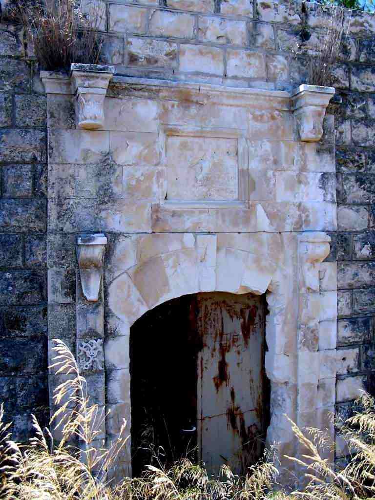
- The interior of the village mosque, which now functions as an Israeli carpentry workshop, 1987
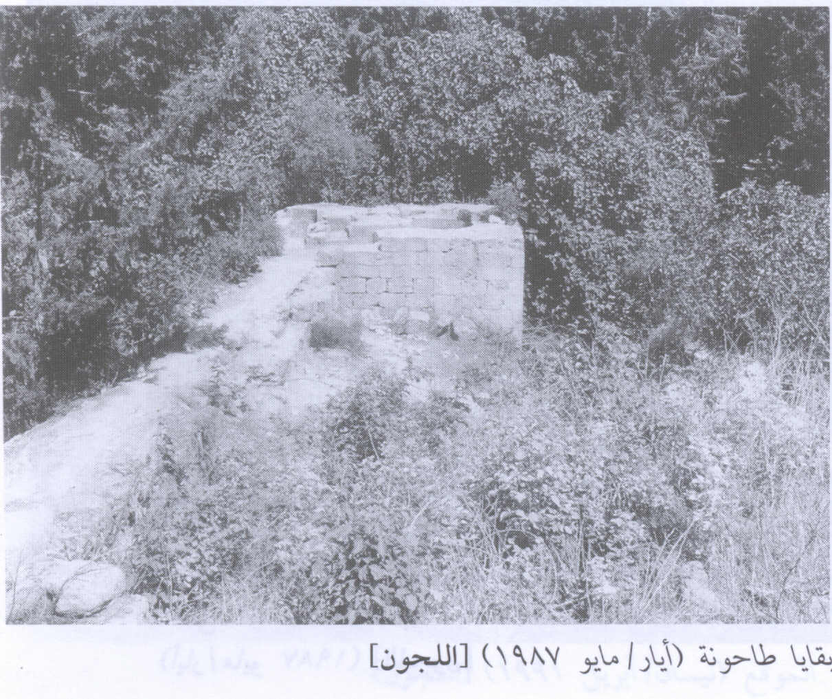
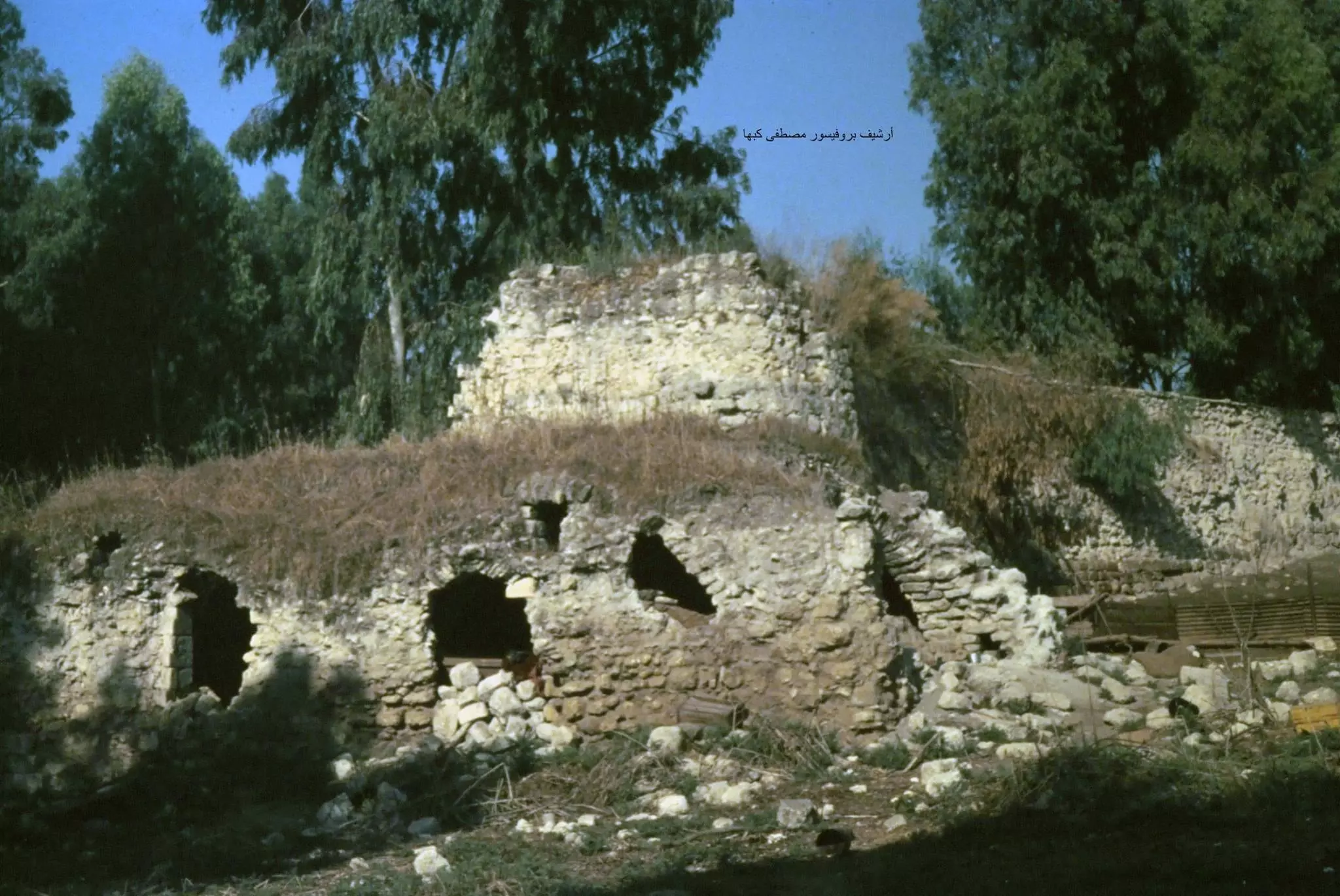
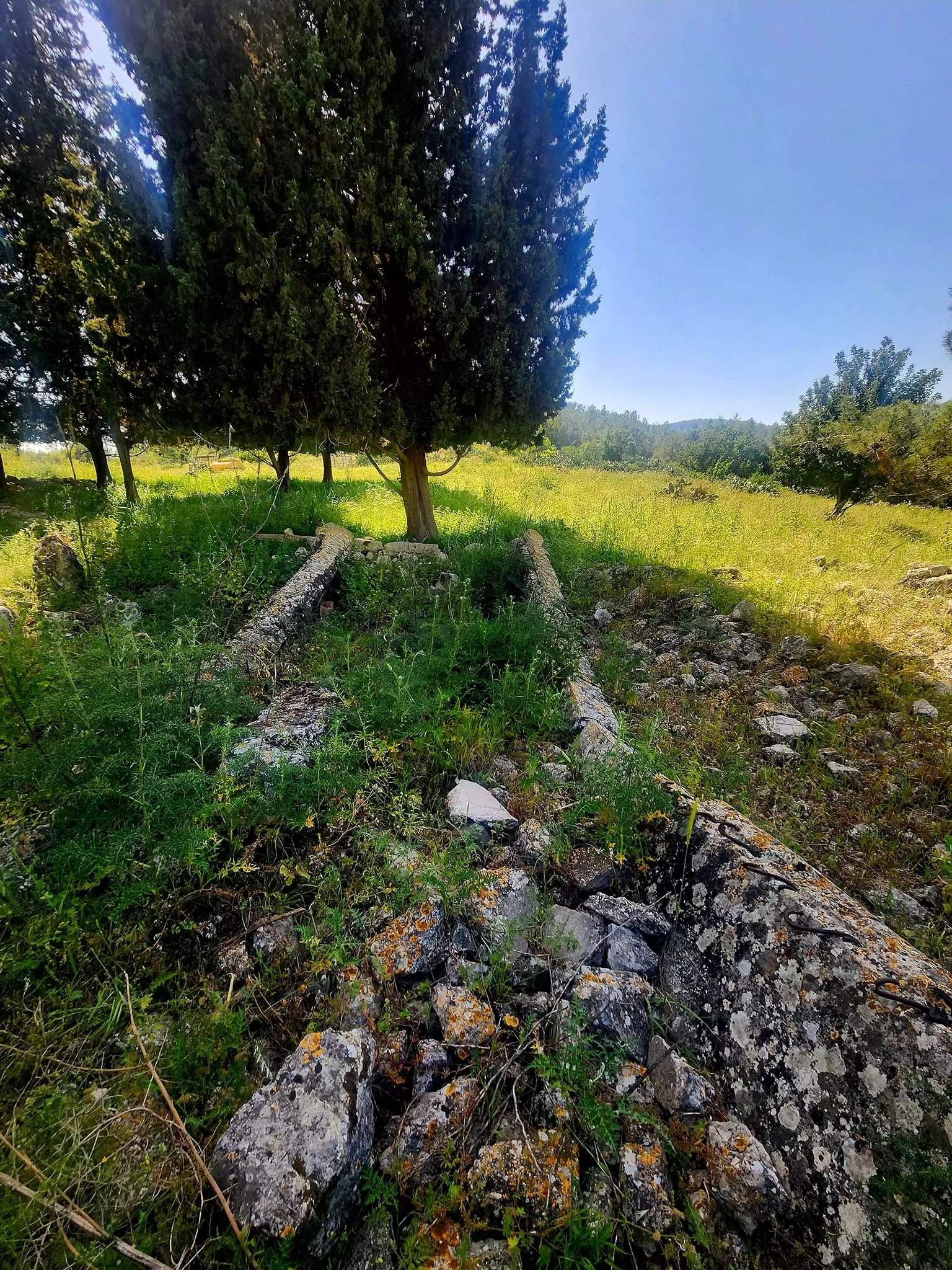
Scanned from "All That Remains" by Dr. Walid Khalidi 2 - Remains of village mill, 1987
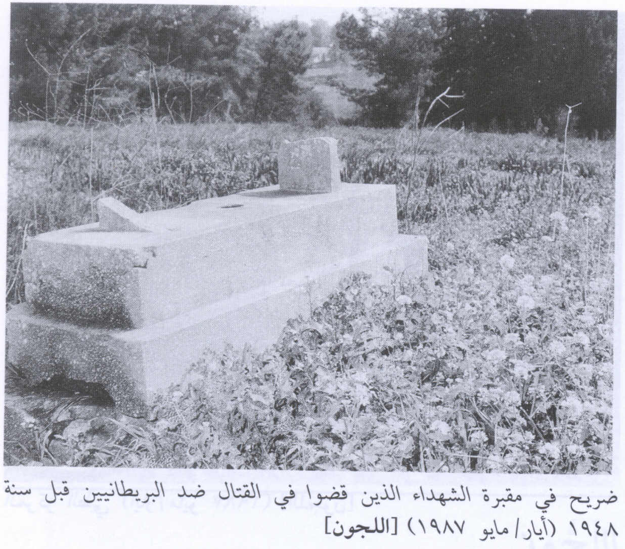
Scanned from "All That Remains" by Dr. Walid Khalidi 1 - Grave in the cemetery for those killed in the pre-1948 struggle against the British Mandate, 1987
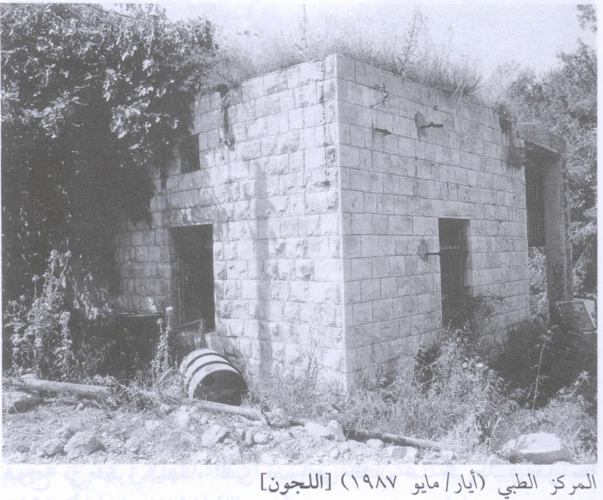
Scanned from "All That Remains" by Dr. Walid Khalidi 1 - The village health center, 1987
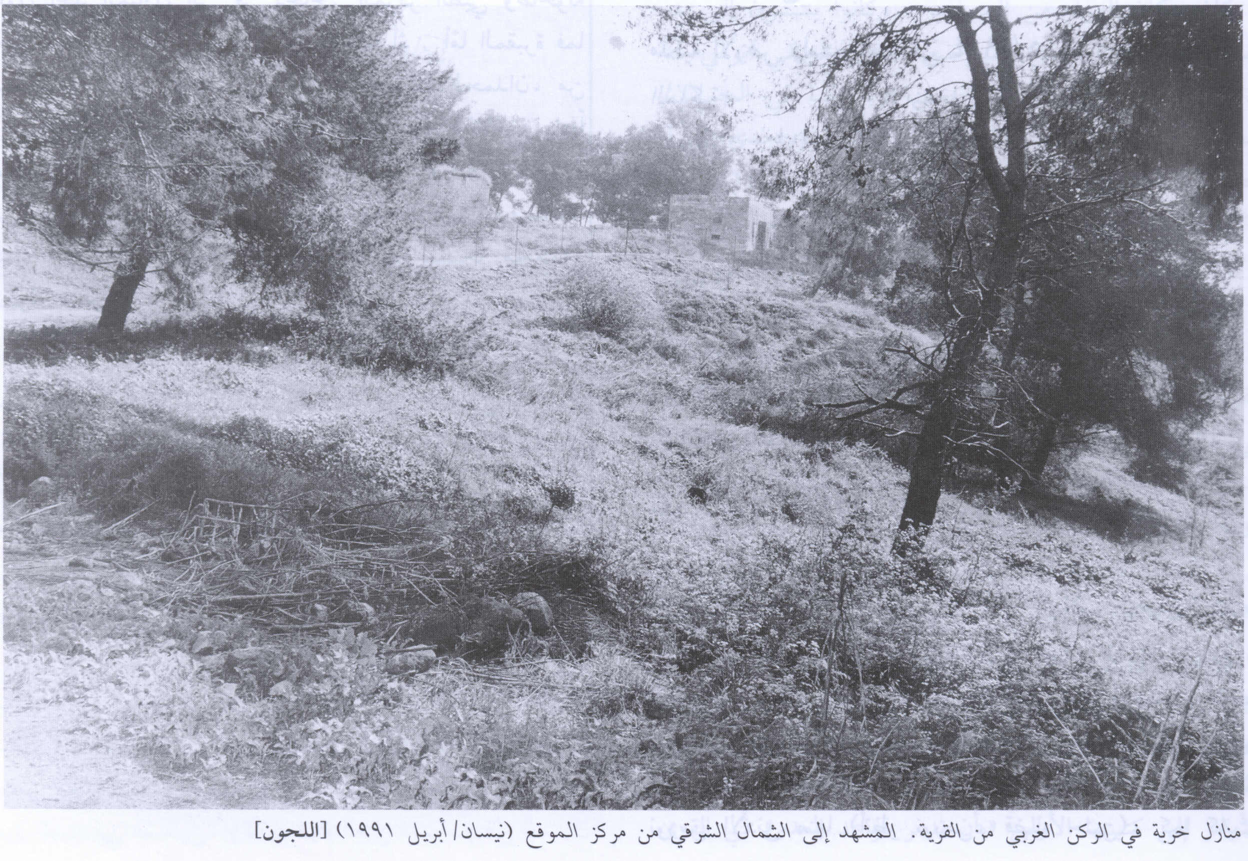
Scanned from "All That Remains" by Dr. Walid Khalidi 2 - Ruined houses in the western section of the village, 1991
Scanned from "All That Remains" by Dr. Walid Khalidi - The Remains Of An Unknown Structure In al-Lajjun, December, 2001
Posted by An Israeli Who Seeks Coexistence - The Remains Of An Unknown Structure In al-Lajjun #1, December, 2001
Posted by An Israeli Who Seeks Coexistence - The Remains Of An Unknown Structure In al-Lajjun #2, December, 2001
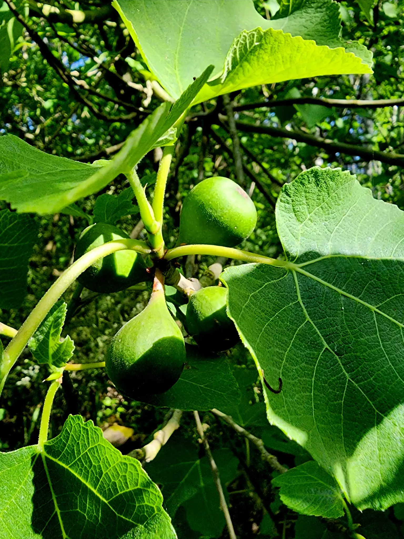
Posted by An Israeli Who Seeks Coexistence - A Palm Tree On al-Lajjun's Land, December, 2001
Posted by An Israeli Who Seeks Coexistence - Inside On Of The Few Standing Stone Houses In al-Lajjun, December, 2001
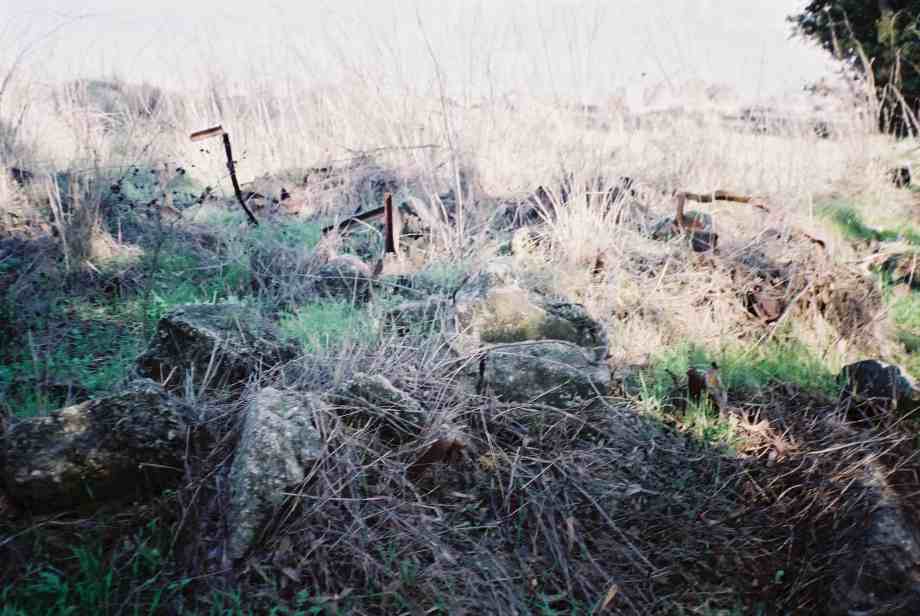
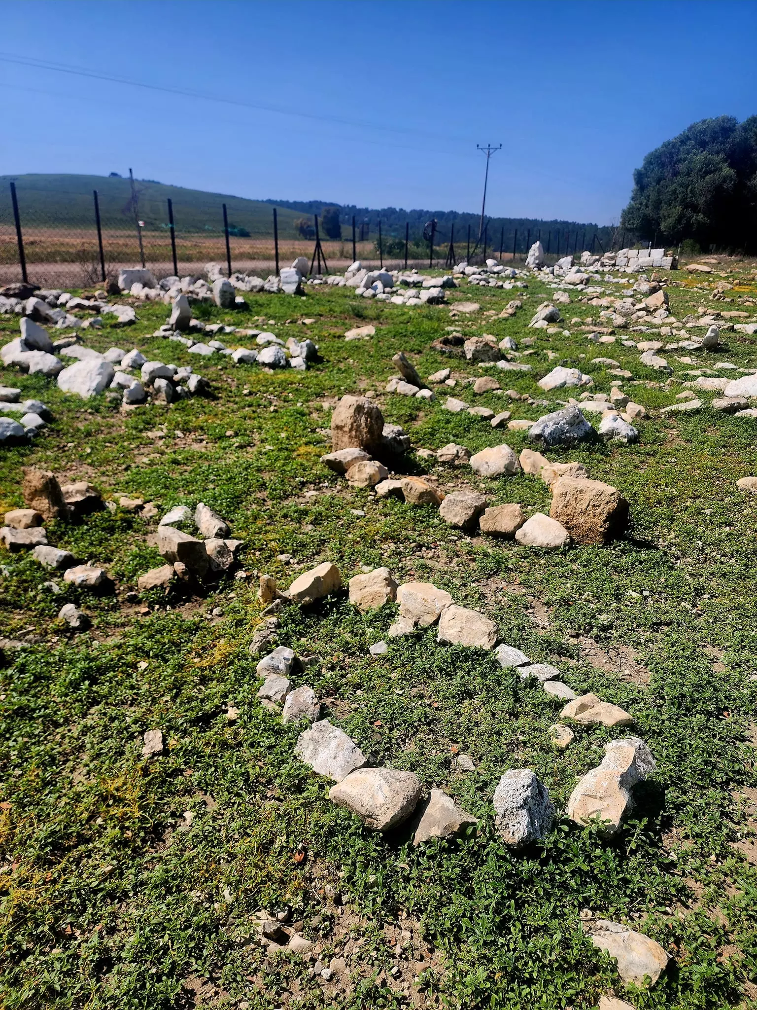
Posted by An Israeli Who Seeks Coexistence - Rubble Belonging To A Demolished Houses In al-Lajjun #1, December, 2001
Posted by An Israeli Who Seeks Coexistence 2 - Rubble Belonging To A Demolished Houses In al-Lajjun #2, December, 2001
Posted by An Israeli Who Seeks Coexistence - Rubble Belonging To A Demolished Houses In al-Lajjun #3, December, 2001
Posted by An Israeli Who Seeks Coexistence - Rubble Belonging To A Demolished Houses In al-Lajjun #4, December, 2001
Posted by An Israeli Who Seeks Coexistence - Rubble Belonging To A Demolished Houses In al-Lajjun #5, December, 2001
Posted by An Israeli Who Seeks Coexistence - Rubble Belonging To A Demolished Houses In al-Lajjun #6, December, 2001
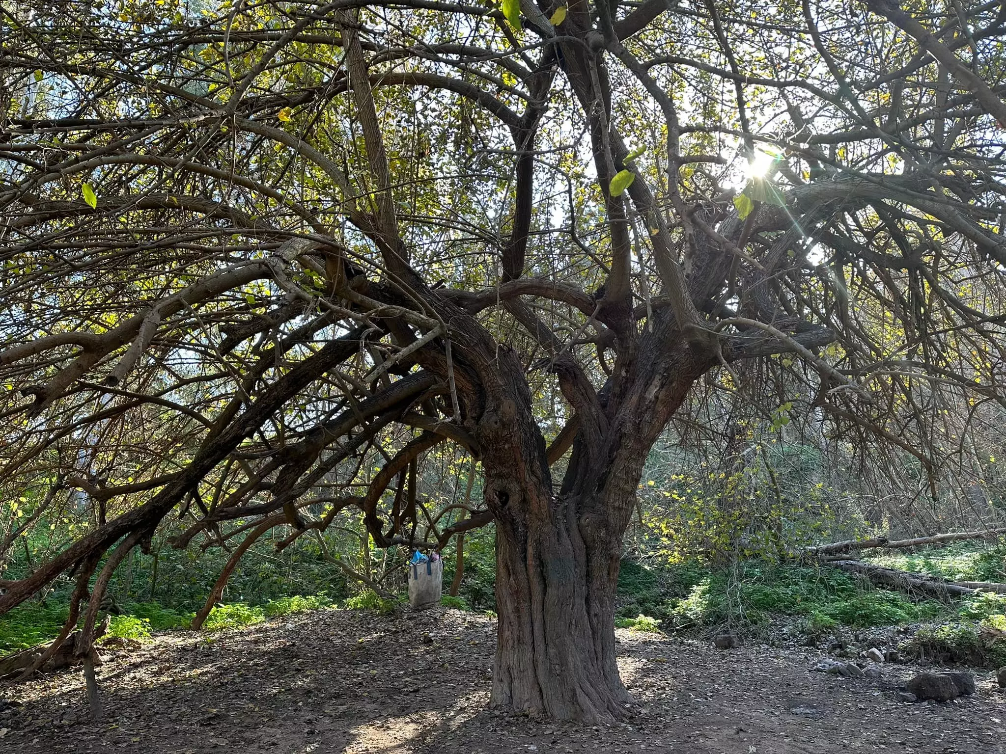
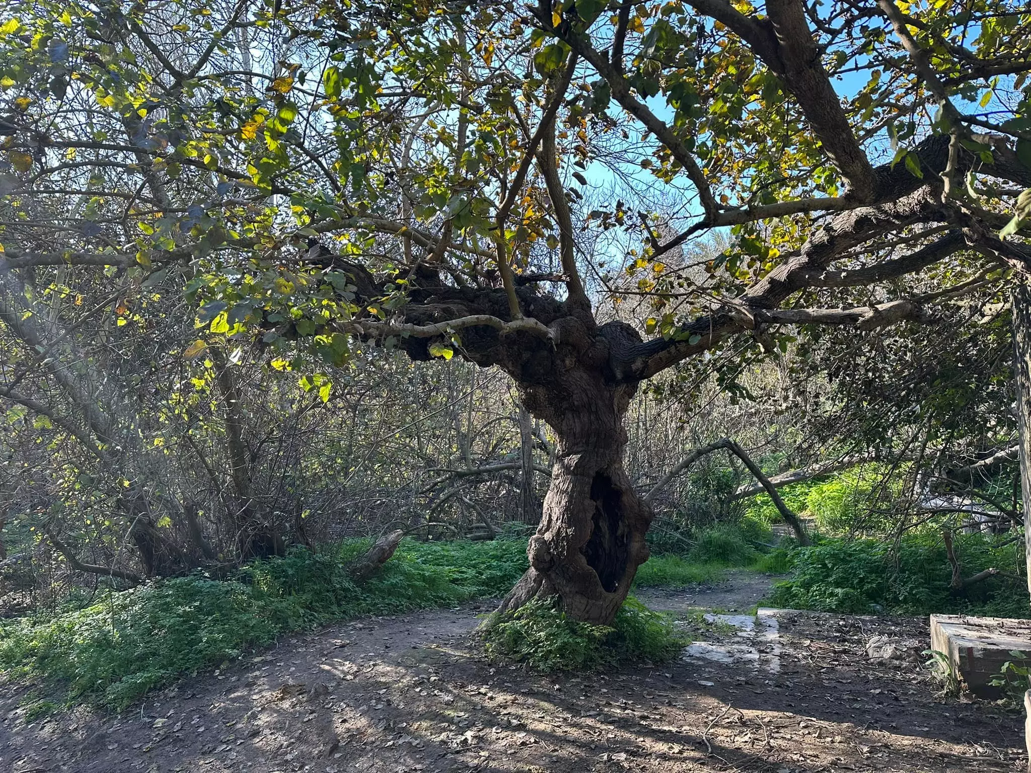
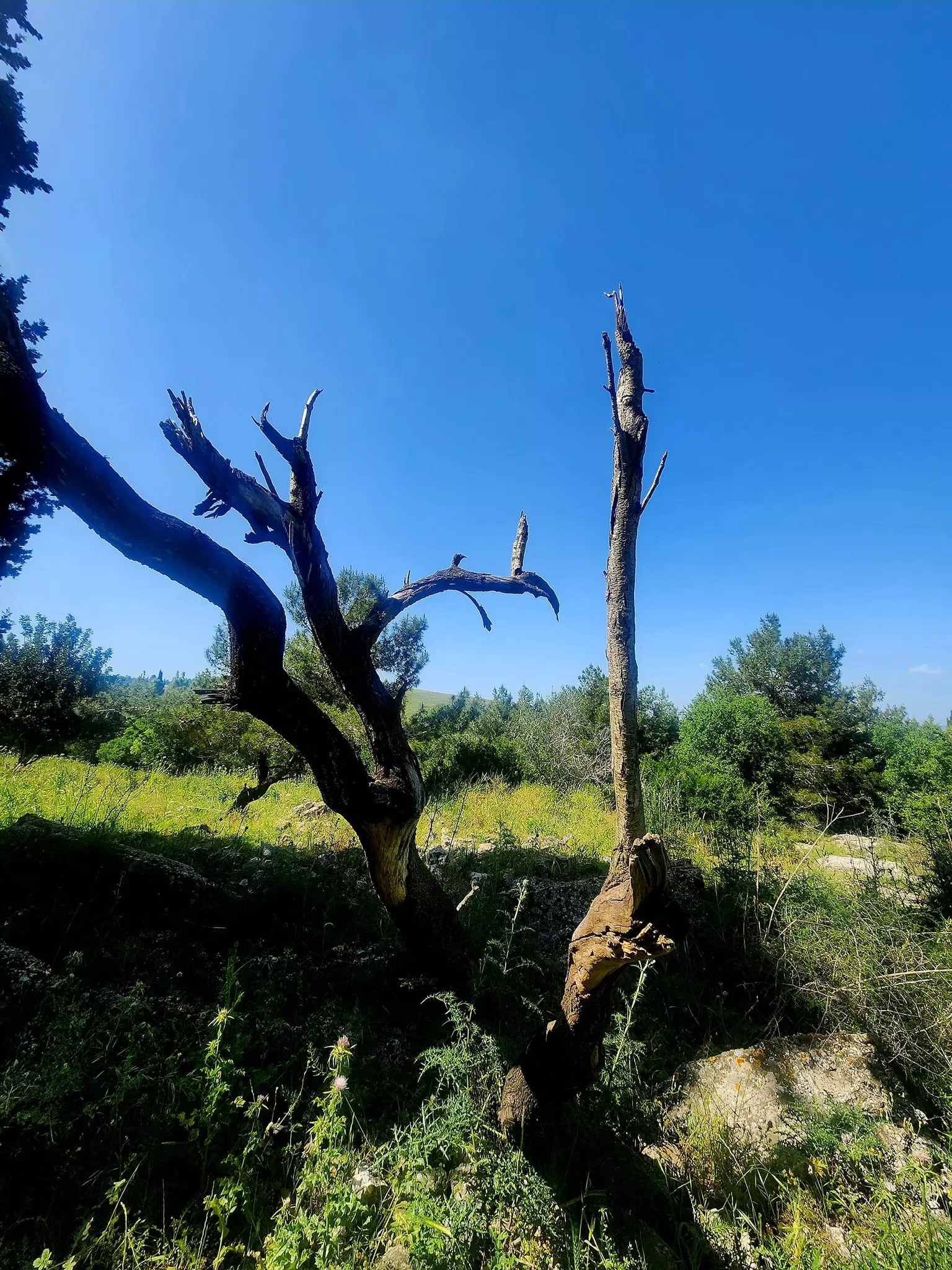
Posted by An Israeli Who Seeks Coexistence - An Old Tree Planted By The People Of al-Lajjun #1 Before 1948, December, 2001
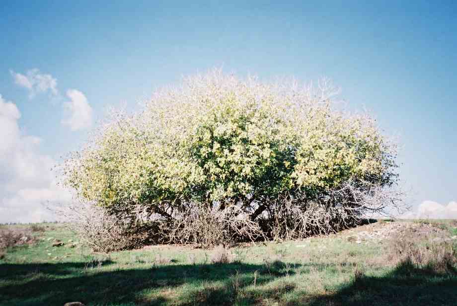
Posted by An Israeli Who Seeks Coexistence - An Old Tree Plantred By The People Of al-Lajjun #2 Before 1948, December, 2001
Posted by An Israeli Who Seeks Coexistence - An Old Tree Plantred By The People Of al-Lajjun #3 Before 1948, December, 2001
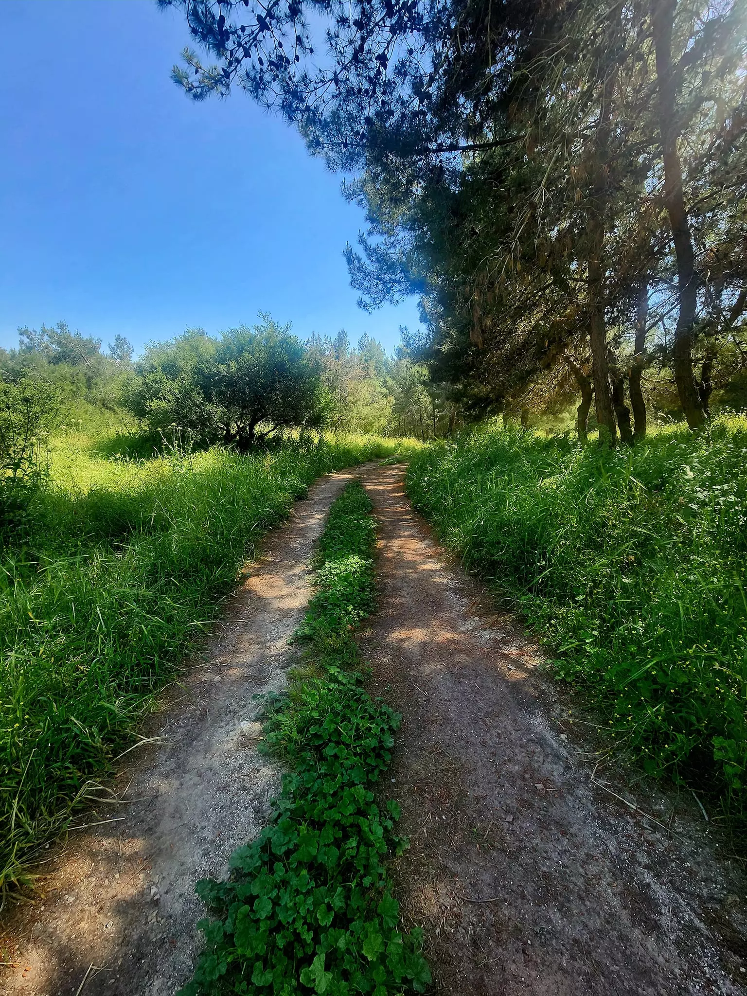
Posted by An Israeli Who Seeks Coexistence - An Old Dirt Road Leading To al-Lajjun #1, December, 2001
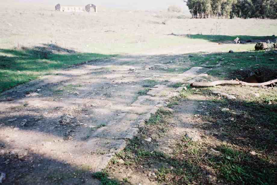
Posted by An Israeli Who Seeks Coexistence - An Old Dirt Road Leading To al-Lajjun #2, December, 2001
Posted by An Israeli Who Seeks Coexistence - A Palestinian Abandoned Structure Or House In al-Lajjun #1, December, 2001
Posted by An Israeli Who Seeks Coexistence - A Palestinian Abandoned Structure Or House In al-Lajjun #2, December, 2001
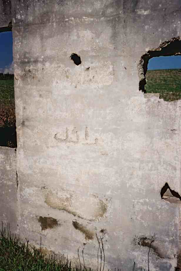
Posted by An Israeli Who Seeks Coexistence - An Arabic Writing On The Wall Of A Demolished Structure, December, 2001
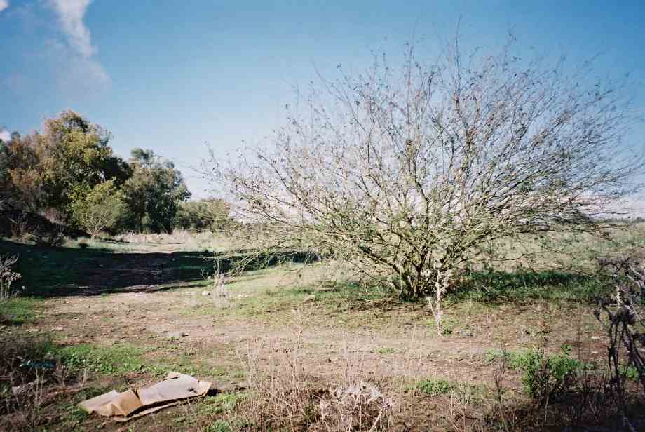
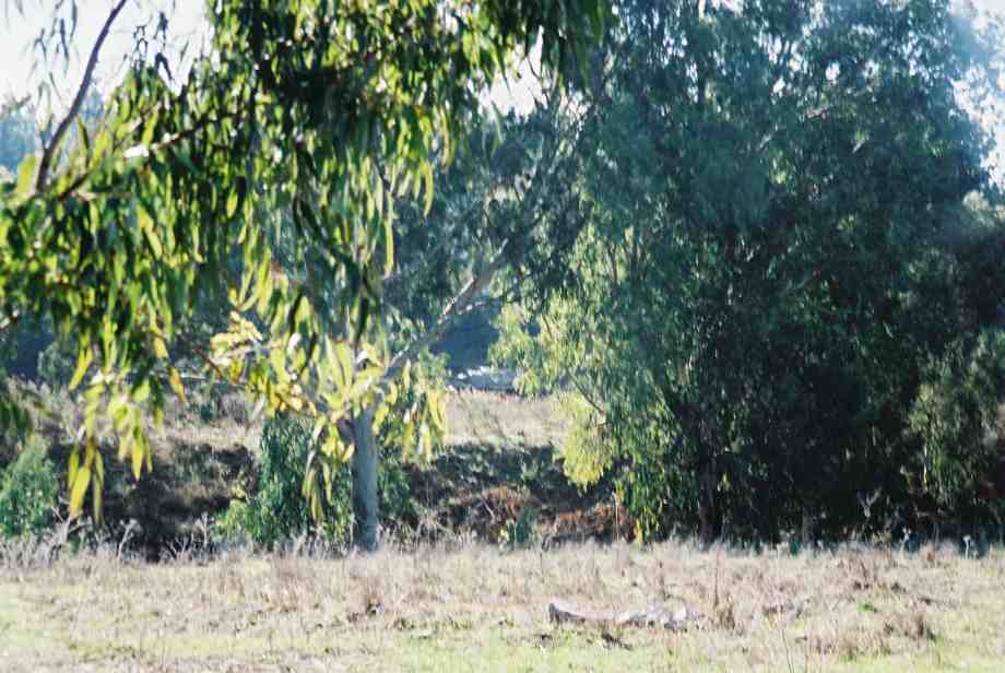
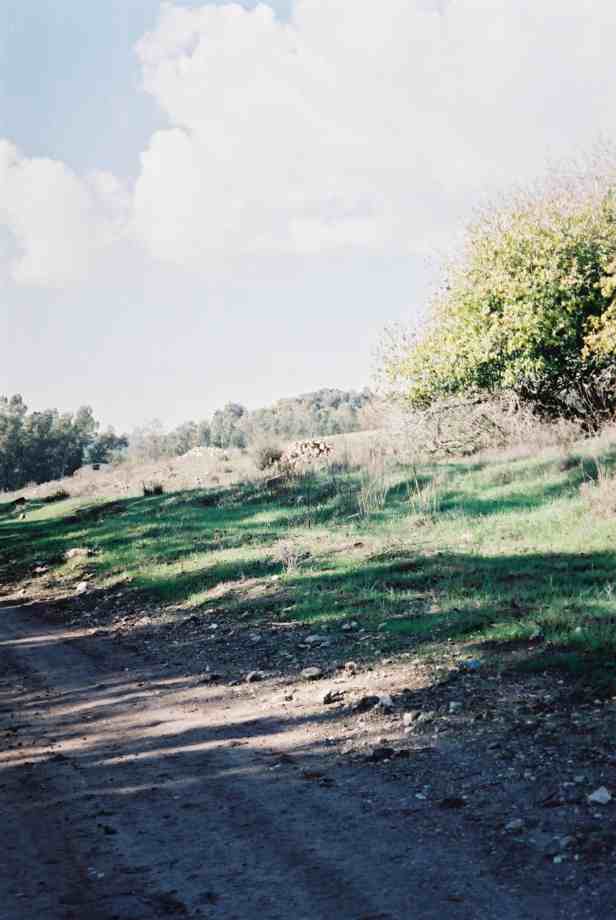
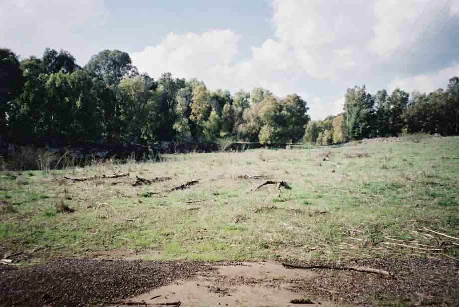
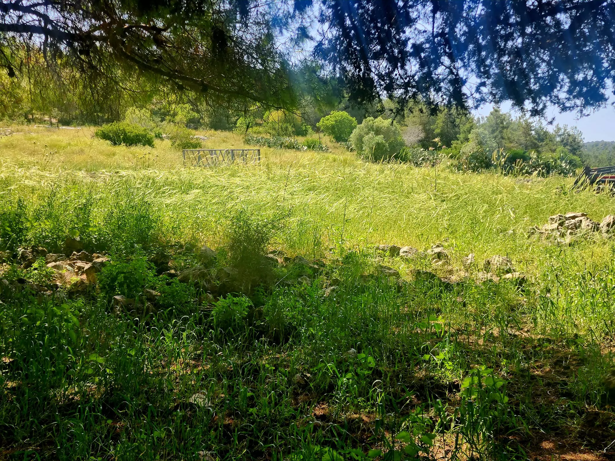
Posted by An Israeli Who Seeks Coexistence - al-Lajjun Lands, A General View, December, 2001
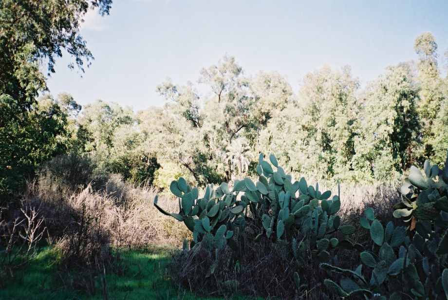
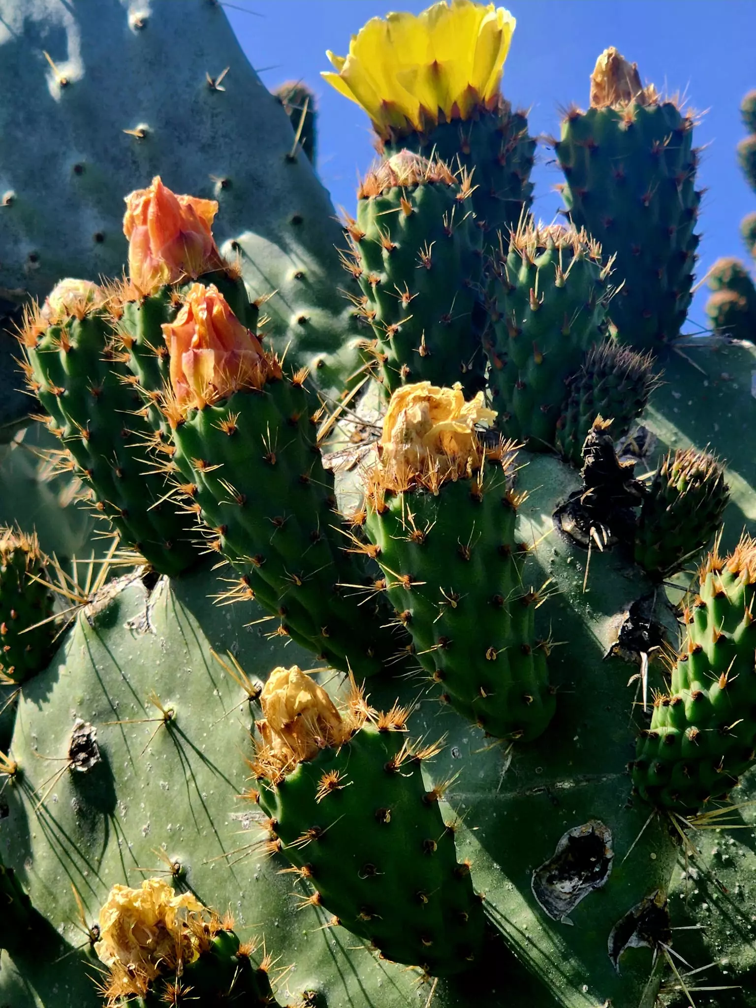
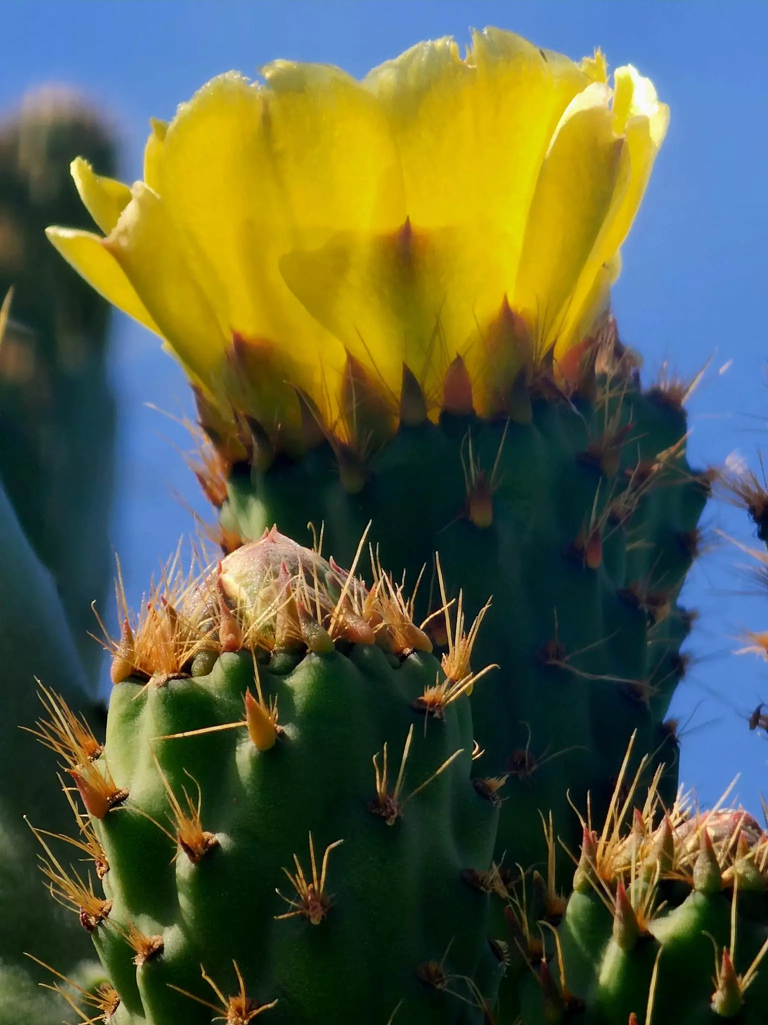
Posted by An Israeli Who Seeks Coexistence - al-Lajjun Cactus Tree, A Customary Way Of Marking Land Boundaries #1, December, 2001
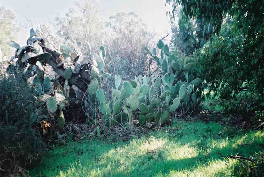
Posted by An Israeli Who Seeks Coexistence - al-Lajjun Cactus Tree, A Customary Way Of Marking Land Boundaries #2, December, 2001
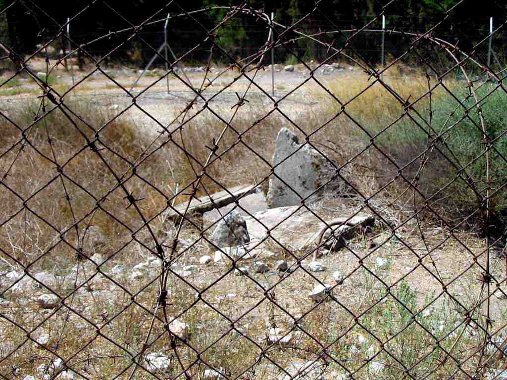
Posted by An Israeli Who Seeks Coexistence - Rubble Of Demolished Structure, December, 2001
Posted by An Israeli Who Seeks Coexistence - House rubble #1
Posted by Abu Raya Muafaq - The entrance to house in Lajjun
Posted by Abu Raya Muafaq - One of the remaining house in Lajjun
Posted by Abu Raya Muafaq - The remains of a Lajjun house
Posted by Abu Raya Muafaq - The remains of Lajjun House #2
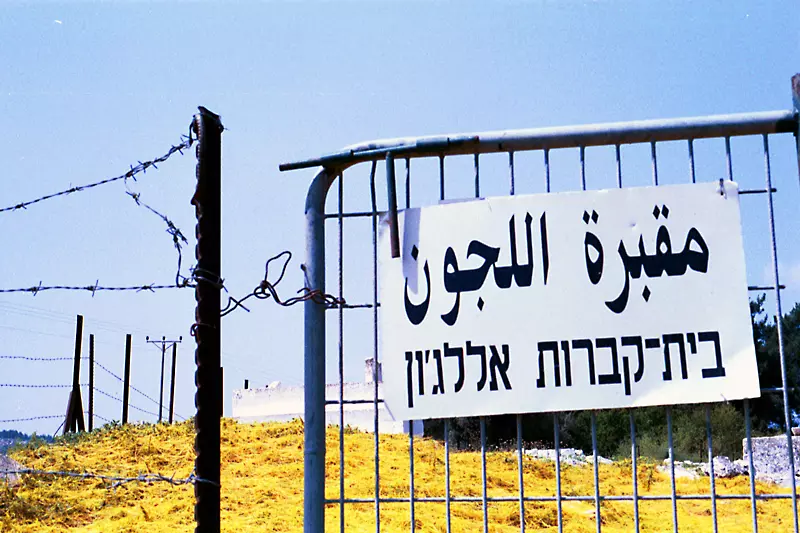
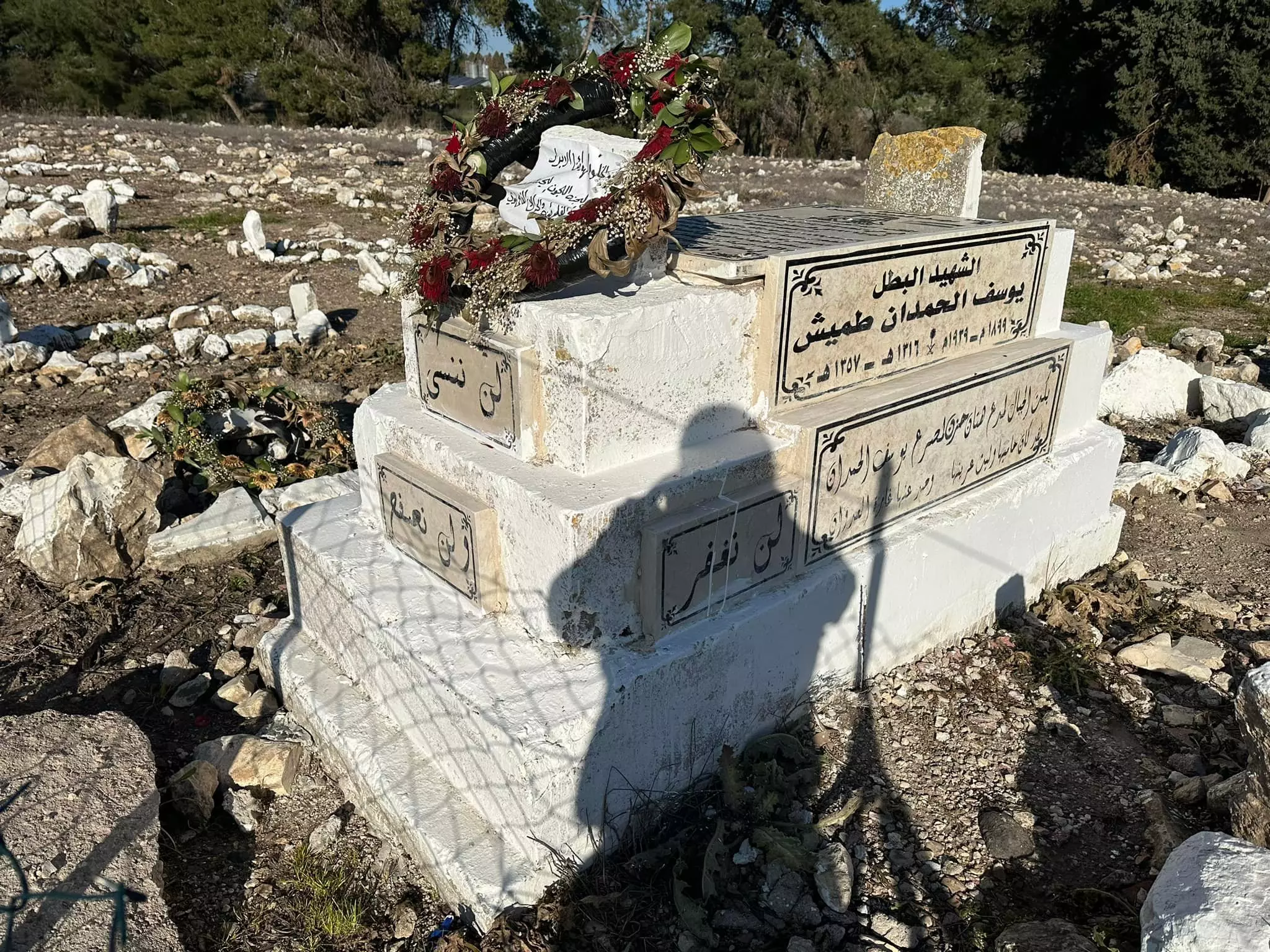
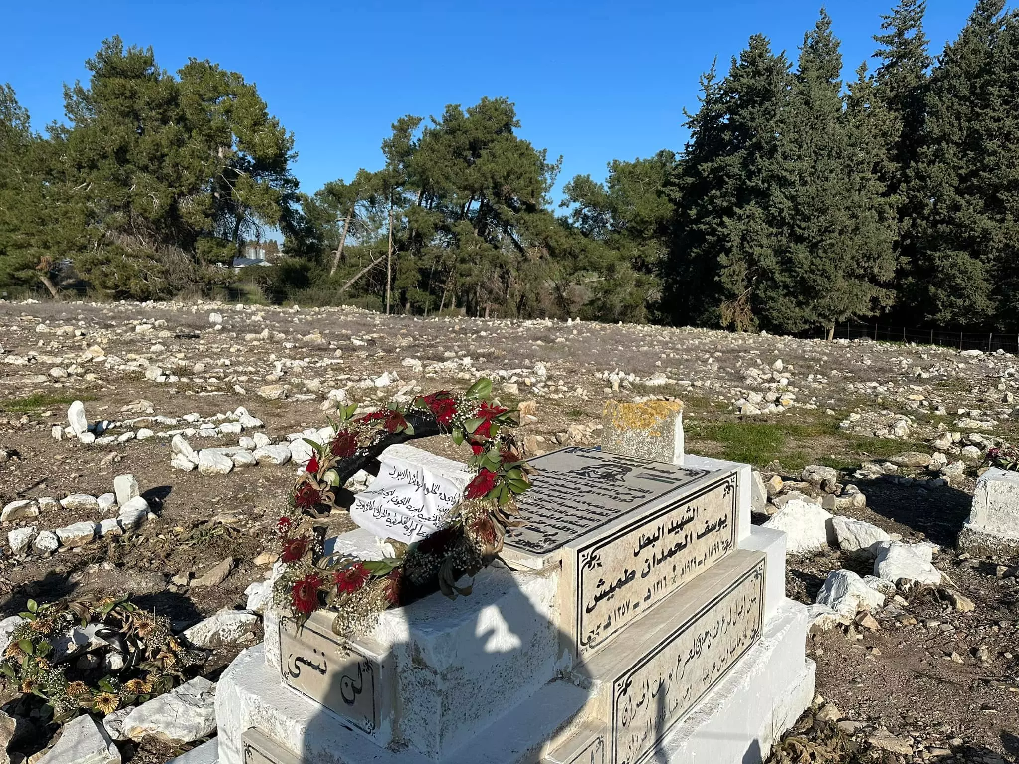
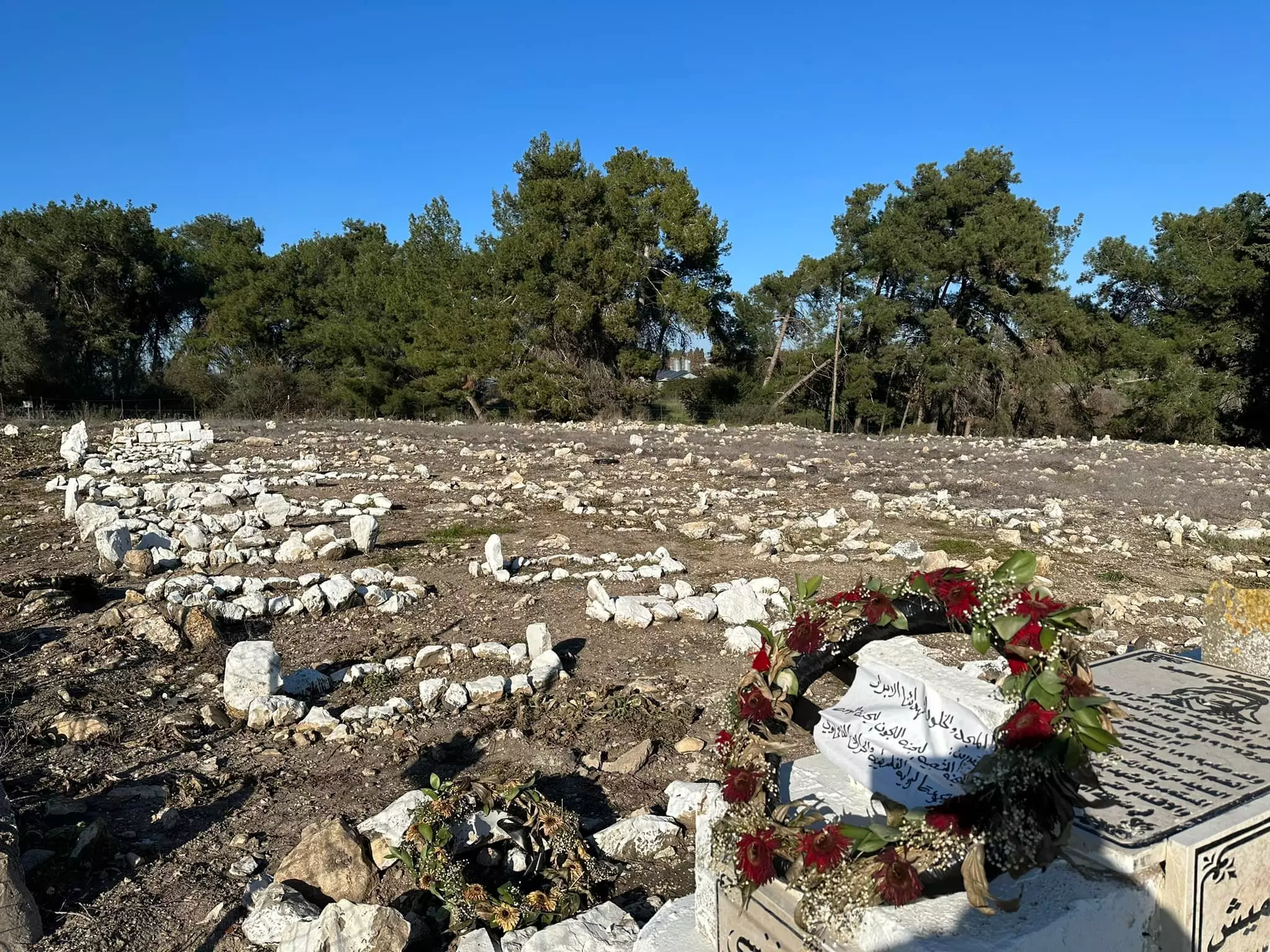
Posted by Abu Raya Muafaq - al-Lajjun's main cemetery
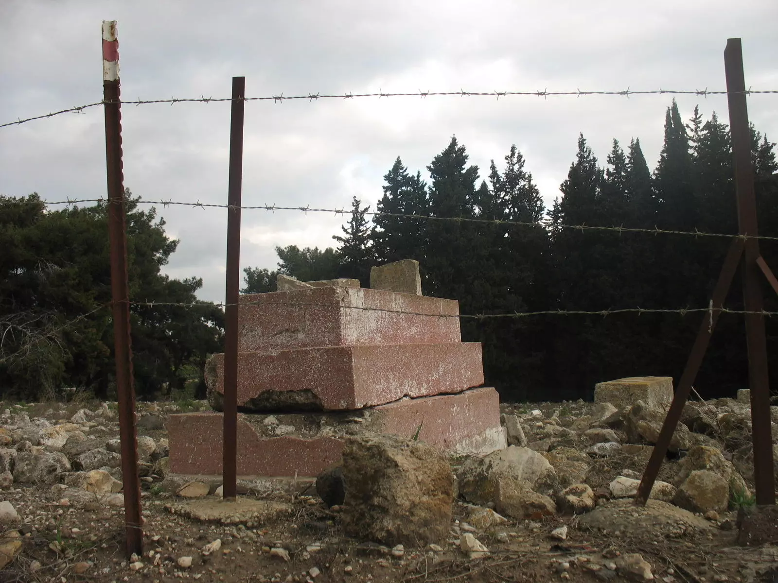
- One of the tombs in the destroyed village's cemetery
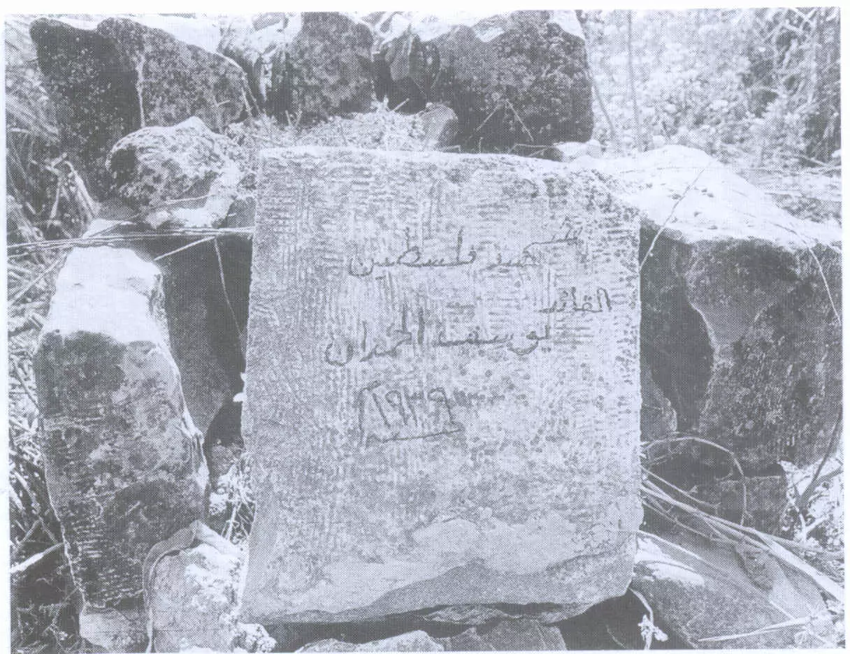
Posted by Noga Kadman 1 - شاهد قير إحدى شهداء ثورة 1936 (يوسف الحمدان)
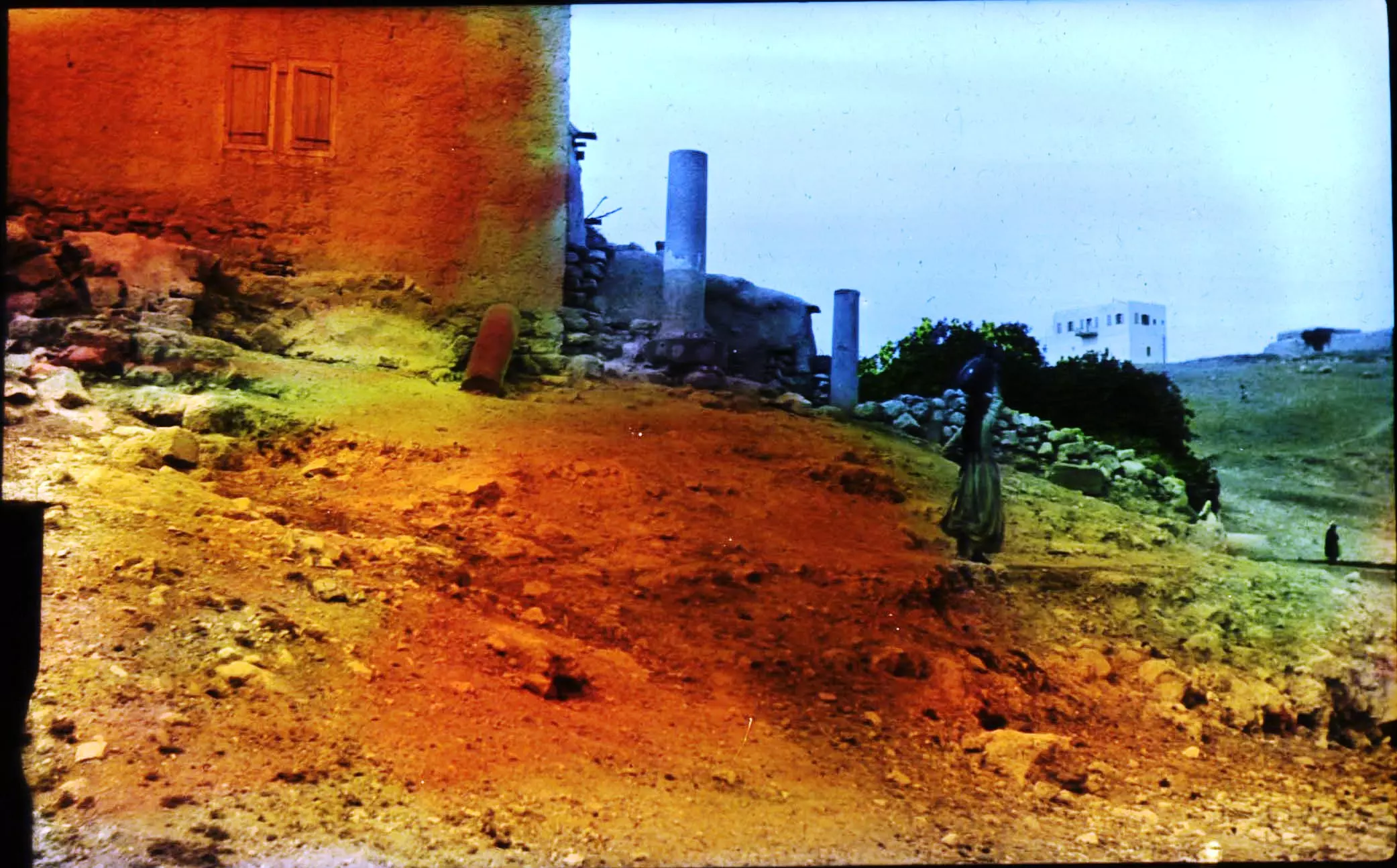
Scanned from "All That Remains" by Dr. Walid Khalidi 2 - Lejjun in the 1930's
Posted by The Archaeologist 2 - بركة ميا عين الحجة - اللجون
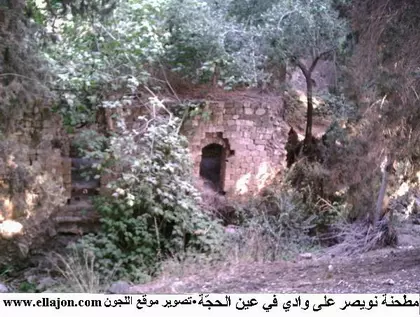
Posted by خالد كساب محاميد - مطحنة نويصر عين الحجة
Posted by خالد كساب محاميد - ابناء حفلة أبناء محمود خليل كساب محاميد في وداع جودت في بيت جده المهدم بقرية اللجون الفلسطينية المهجرة
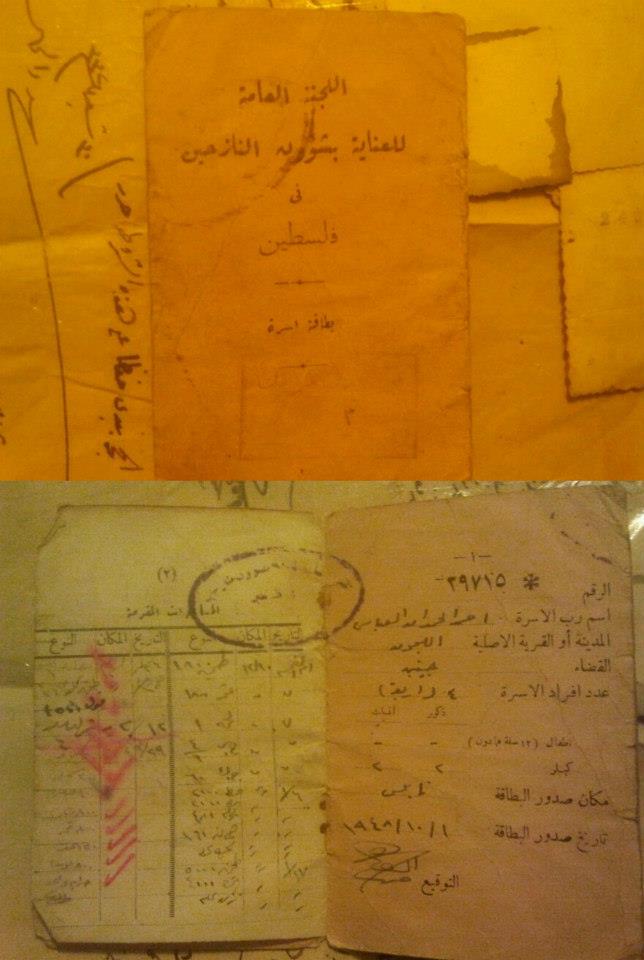
Posted by خالد كساب محاميد - بطاقة أعانه أسريه للنازحين الفلسطبنيين عام 1948
- منظر عام للقرية عام 1934 -- منقول من صفحة أحمد مروات
- موقف باص في اللجون ويظهر جندي انجليزي عام 1937
Posted by فتحي ابو رضا \ العايدي 1 - قرية اللجون قبل النكبة
- خان اللجون قضاء جنين عام 1870(مجدو)
- اراضي اللجون
Posted by abu raya - اللجون
Posted by abu raya - اللجون
Posted by abu raya - اللجون
Posted by abu raya - اللجون
Posted by abu raya - اراضي القريه
Posted by abu raya - اجيش الانتداب البريطاني في قريه اللجون سنه 1918
Posted by abu raya - اللجون سنة 1924
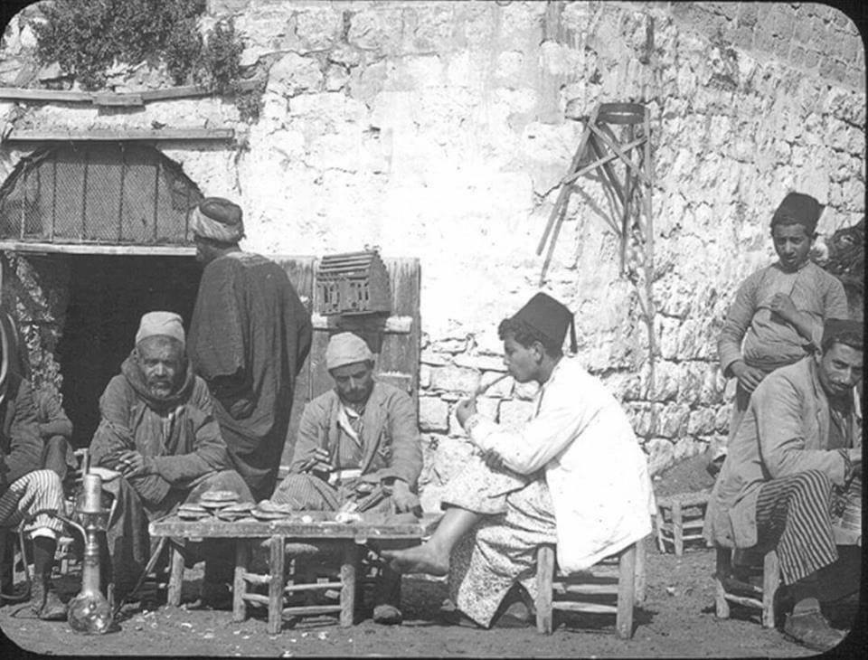
- مقهى في قرية اللجون سنة 1942
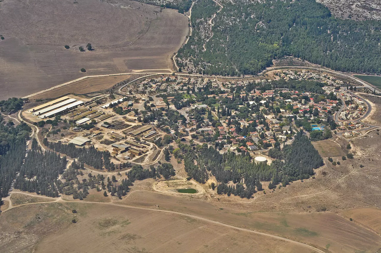
- منظر جوي لكيبوتس مجدو، عام 2013. المقام على جزء من اراضي قرية اللجون المهجرة
- مسجد قرية اللجون المهجرة (قضاء جنين ) . الصورة من ثمانينات القرن الماضي . المسجد ما زال قائما في حدود كيبوتس مجيدو الذي استعمله مرة منجرة ومرة مفقسة للدواجن .
- عين مخلوف في اللجون المهجرة (قضاء جنين )
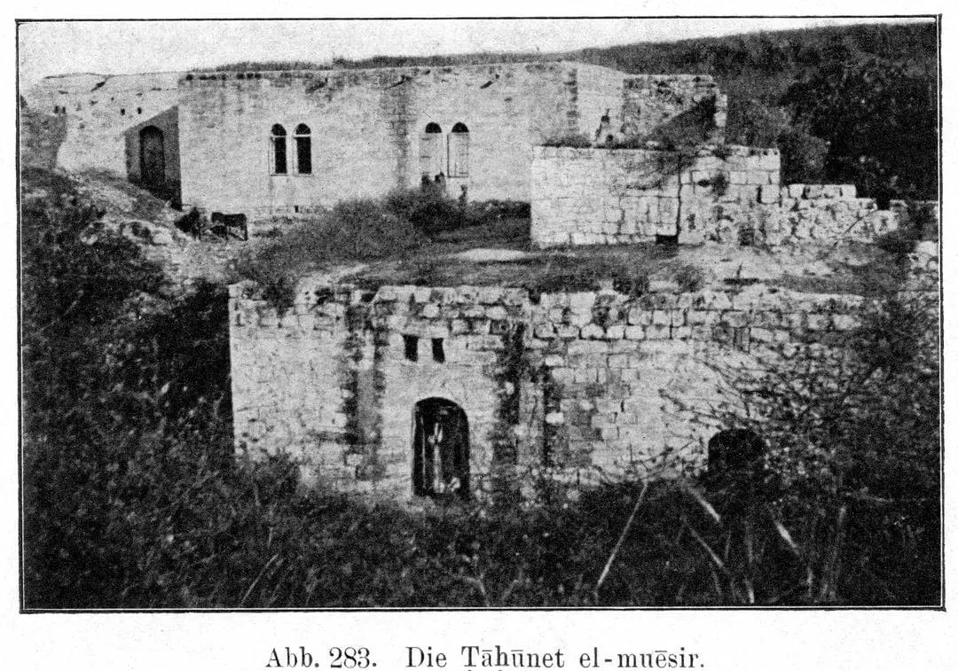
- صورة نادرة لطاحونة نويصر للحبوب في اللجون
1 - خان اللجون (قضاء جنين الانتدابي ) كما كان في نهاية السبعينات من القرن الماضي
- Pre-Nakba Aerial view of the village / صورة من الجو للقرية اخذت قبل النكبة
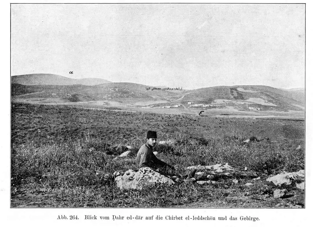
- جندي عثماني في منطقة ظهرة الدار من مرج ابن عامر في قرية اللجون 1903. في الأفق تل المتسلم وهضاب الروحة الشرقية.
(من مجموعة شوماخر، 1903).
- صورة لحارة من قرية اللجون قضاء جنين قبل النكبة..
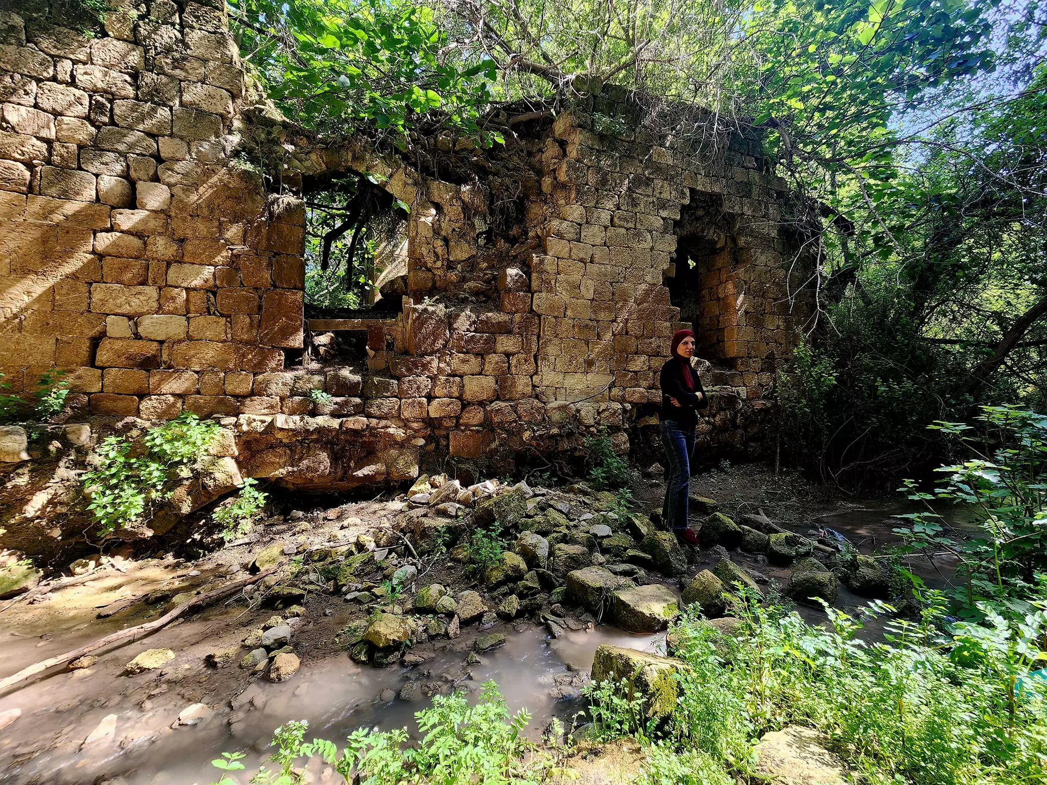
- جولة بين انقاض والقبور في القرية
- جولة بين انقاض والقبور في القرية #2
- جولة بين انقاض والقبور في القرية #3
- جولة بين انقاض والقبور في القرية #4
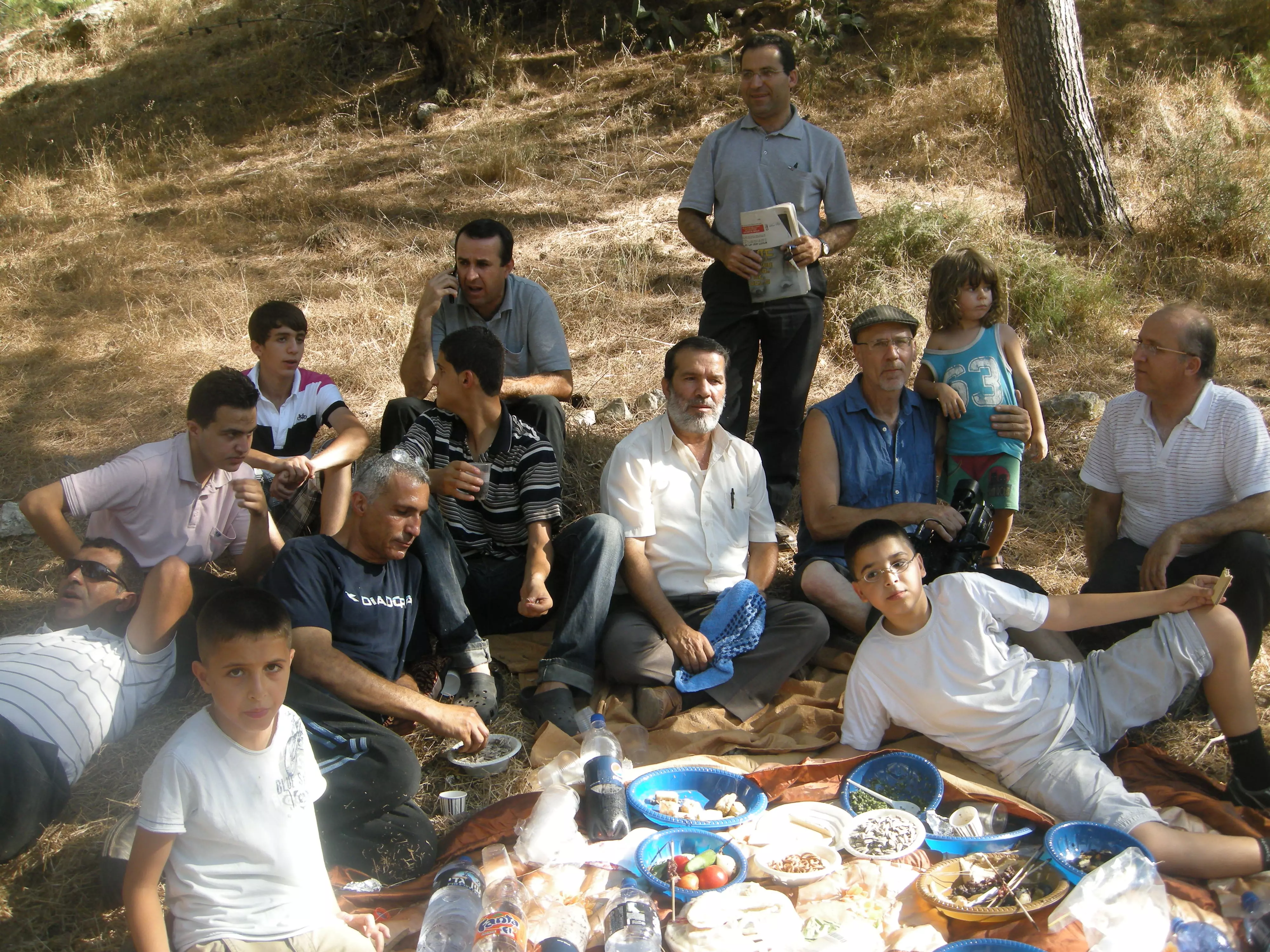
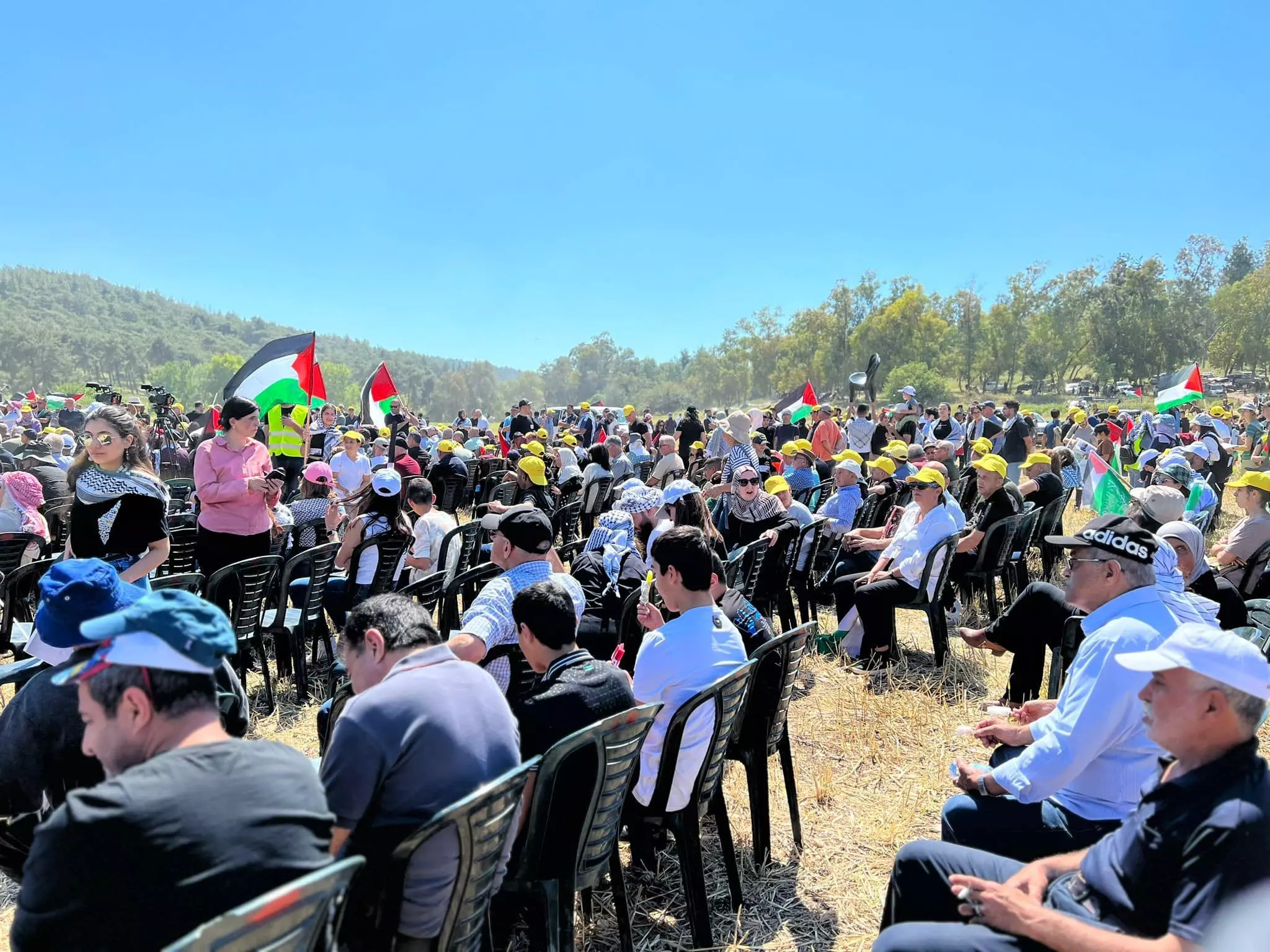
- في إحياء ذكرى النكبة الخامسة والسبعون -- 2023
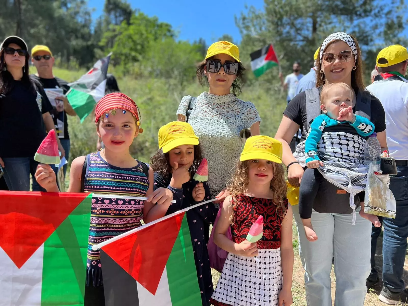
- في إحياء ذكرى النكبة الخامسة والسبعون -- 2023 #2
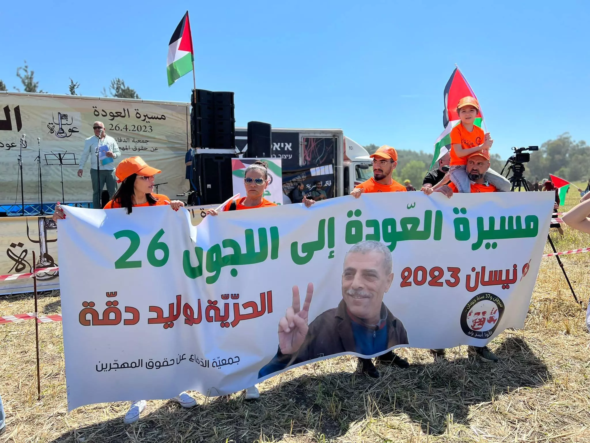
- في إحياء ذكرى النكبة الخامسة والسبعون -- 2023 #3
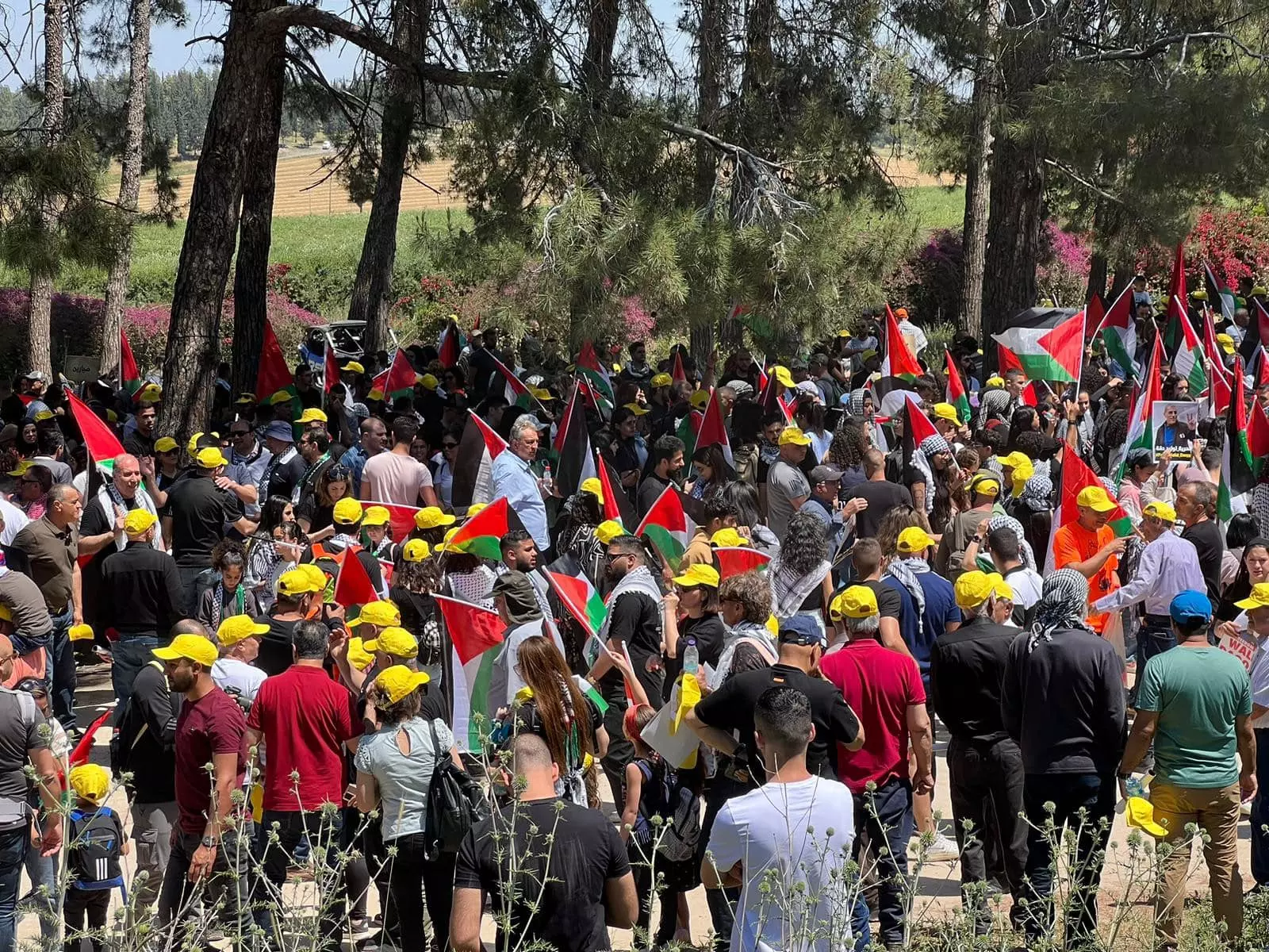
- في إحياء ذكرى النكبة الخامسة والسبعون -- 2023 #4
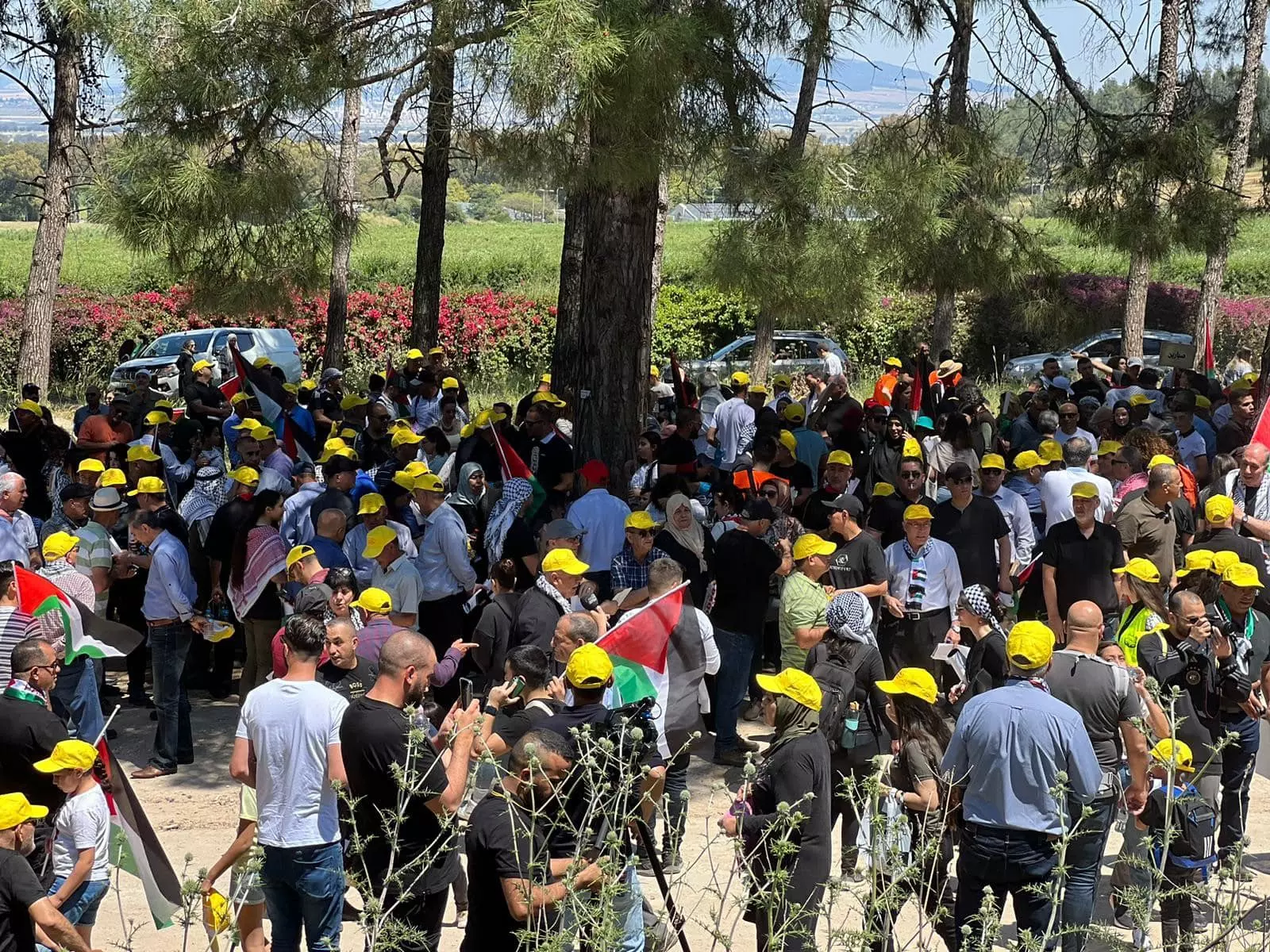
- في إحياء ذكرى النكبة الخامسة والسبعون -- 2023 #5
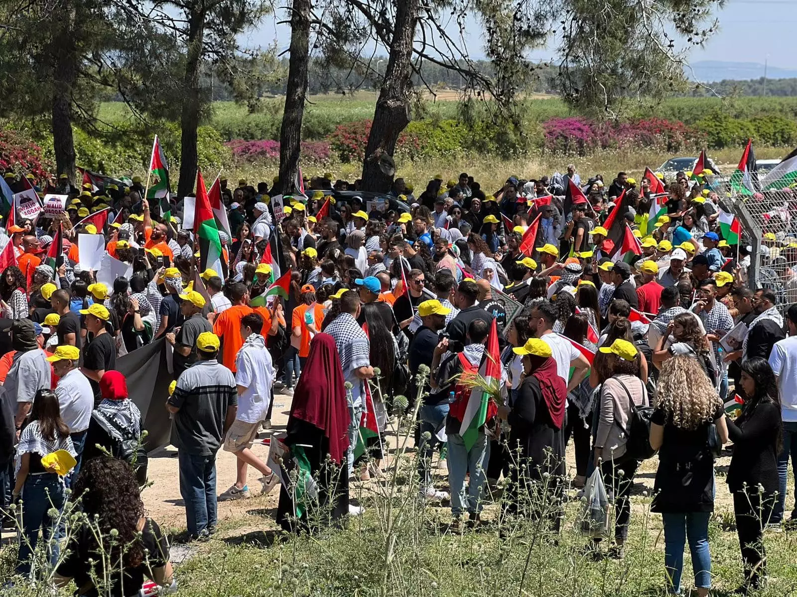
- في إحياء ذكرى النكبة الخامسة والسبعون -- 2023 #6
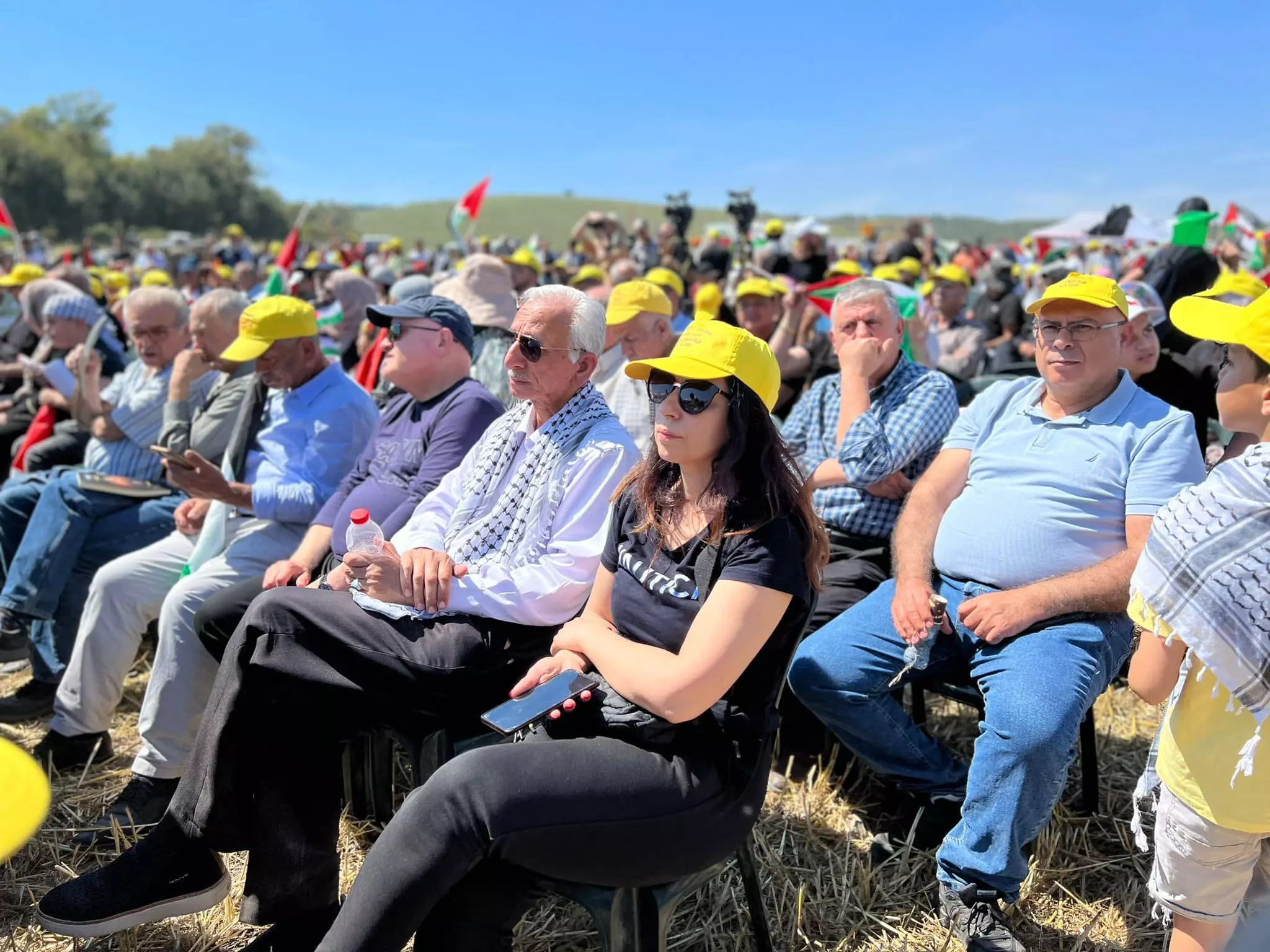
- في إحياء ذكرى النكبة الخامسة والسبعون -- 2023 #7
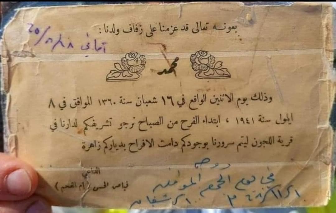
- دعوة زفاف في قرية اللجون المحتلة قضاء جنين من عام 1941
- صورة نادرة لطاحونة نويصر للحبوب في اللجون. المزيد عنها في قسم التعليقات اسفل الصورة

1 - That is how the "civilized" erased and replaced us: al-Lajjun was completely obliterated except for a few remaining structures, as you see. Think about it: how else will the Jews be great, safe, and free again? -- اللجون باتت أثر بعد عين. من هنا مر الهمجّ
- That is how the "civilized" erased and replaced us: al-Lajjun was completely obliterated except for a few remaining structures, as you see. Think about it: how else will the Jews be great, safe, and free again? -- اللجون باتت أثر بعد عين. من هنا مر الهمجّ #2
- That is how the "civilized" erased and replaced us: al-Lajjun was completely obliterated except for a few remaining structures, as you see. Think about it: how else will the Jews be great, safe, and free again? -- اللجون باتت أثر بعد عين. من هنا مر الهمجّ #3
- That is how the "civilized" erased and replaced us: al-Lajjun was completely obliterated except for a few remaining structures, as you see. Think about it: how else will the Jews be great, safe, and free again? -- اللجون باتت أثر بعد عين. من هنا مر الهمجّ #4
- That is how the "civilized" erased and replaced us: al-Lajjun was completely obliterated except for a few remaining structures, as you see. Think about it: how else will the Jews be great, safe, and free again? -- اللجون باتت أثر بعد عين. من هنا مر الهمجّ #5
- That is how the "civilized" erased and replaced us: al-Lajjun was completely obliterated except for a few remaining structures, as you see. Think about it: how else will the Jews be great, safe, and free again? -- اللجون باتت أثر بعد عين. من هنا مر الهمجّ #6
- That is how the "civilized" erased and replaced us: al-Lajjun was completely obliterated except for a few remaining structures, as you see. Think about it: how else will the Jews be great, safe, and free again? -- اللجون باتت أثر بعد عين. من هنا مر الهمجّ #7
- That is how the "civilized" erased and replaced us: al-Lajjun was completely obliterated except for a few remaining structures, as you see. Think about it: how else will the Jews be great, safe, and free again? -- اللجون باتت أثر بعد عين. من هنا مر الهمجّ #8
- That is how the "civilized" erased and replaced us: al-Lajjun was completely obliterated except for a few remaining structures, as you see. Think about it: how else will the Jews be great, safe, and free again? -- اللجون باتت أثر بعد عين. من هنا مر الهمجّ #9
- That is how the "civilized" erased and replaced us: al-Lajjun was completely obliterated except for a few remaining structures, as you see. Think about it: how else will the Jews be great, safe, and free again? -- اللجون باتت أثر بعد عين. من هنا مر الهمجّ #10
- That is how the "civilized" erased and replaced us: al-Lajjun was completely obliterated except for a few remaining structures, as you see. Think about it: how else will the Jews be great, safe, and free again? -- اللجون باتت أثر بعد عين. من هنا مر الهمجّ #11
- That is how the "civilized" erased and replaced us: al-Lajjun was completely obliterated except for a few remaining structures, as you see. Think about it: how else will the Jews be great, safe, and free again? -- اللجون باتت أثر بعد عين. من هنا مر الهمجّ #12
- That is how the "civilized" erased and replaced us: al-Lajjun was completely obliterated except for a few remaining structures, as you see. Think about it: how else will the Jews be great, safe, and free again? -- اللجون باتت أثر بعد عين. من هنا مر الهمجّ #13
- That is how the "civilized" erased and replaced us: al-Lajjun was completely obliterated except for a few remaining structures, as you see. Think about it: how else will the Jews be great, safe, and free again? -- اللجون باتت أثر بعد عين. من هنا مر الهمجّ #14
- That is how the "civilized" erased and replaced us: al-Lajjun was completely obliterated except for a few remaining structures, as you see. Think about it: how else will the Jews be great, safe, and free again? -- اللجون باتت أثر بعد عين. من هنا مر الهمجّ #15
- That is how the "civilized" erased and replaced us: al-Lajjun was completely obliterated except for a few remaining structures, as you see. Think about it: how else will the Jews be great, safe, and free again? -- اللجون باتت أثر بعد عين. من هنا مر الهمجّ #16
- That is how the "civilized" erased and replaced us: al-Lajjun was completely obliterated except for a few remaining structures, as you see. Think about it: how else will the Jews be great, safe, and free again? -- اللجون باتت أثر بعد عين. من هنا مر الهمجّ #17
- That is how the "civilized" erased and replaced us: al-Lajjun was completely obliterated except for a few remaining structures, as you see. Think about it: how else will the Jews be great, safe, and free again? -- اللجون باتت أثر بعد عين. من هنا مر الهمجّ #18
- That is how the "civilized" erased and replaced us: al-Lajjun was completely obliterated except for a few remaining structures, as you see. Think about it: how else will the Jews be great, safe, and free again? -- اللجون باتت أثر بعد عين. من هنا مر الهمجّ #19
- That is how the "civilized" erased and replaced us: al-Lajjun was completely obliterated except for a few remaining structures, as you see. Think about it: how else will the Jews be great, safe, and free again? -- اللجون باتت أثر بعد عين. من هنا مر الهمجّ #20
- That is how the "civilized" erased and replaced us: al-Lajjun was completely obliterated except for a few remaining structures, as you see. Think about it: how else will the Jews be great, safe, and free again? -- اللجون باتت أثر بعد عين. من هنا مر الهمجّ #21
- That is how the "civilized" erased and replaced us: al-Lajjun was completely obliterated except for a few remaining structures, as you see. Think about it: how else will the Jews be great, safe, and free again? -- اللجون باتت أثر بعد عين. من هنا مر الهمجّ #22
- That is how the "civilized" erased and replaced us: al-Lajjun was completely obliterated except for a few remaining structures, as you see. Think about it: how else will the Jews be great, safe, and free again? -- اللجون باتت أثر بعد عين. من هنا مر الهمجّ #23
- That is how the "civilized" erased and replaced us: al-Lajjun was completely obliterated except for a few remaining structures, as you see. Think about it: how else will the Jews be great, safe, and free again? -- اللجون باتت أثر بعد عين. من هنا مر الهمجّ #24
- That is how the "civilized" erased and replaced us: al-Lajjun was completely obliterated except for a few remaining structures, as you see. Think about it: how else will the Jews be great, safe, and free again? -- اللجون باتت أثر بعد عين. من هنا مر الهمجّ #25
- That is how the "civilized" erased and replaced us: al-Lajjun was completely obliterated except for a few remaining structures, as you see. Think about it: how else will the Jews be great, safe, and free again? -- اللجون باتت أثر بعد عين. من هنا مر الهمجّ #26
- That is how the "civilized" erased and replaced us: al-Lajjun was completely obliterated except for a few remaining structures, as you see. Think about it: how else will the Jews be great, safe, and free again? -- اللجون باتت أثر بعد عين. من هنا مر الهمجّ #27
- That is how the "civilized" erased and replaced us: al-Lajjun was completely obliterated except for a few remaining structures, as you see. Think about it: how else will the Jews be great, safe, and free again? -- اللجون باتت أثر بعد عين. من هنا مر الهمجّ #28
- That is how the "civilized" erased and replaced us: al-Lajjun was completely obliterated except for a few remaining structures, as you see. Think about it: how else will the Jews be great, safe, and free again? -- اللجون باتت أثر بعد عين. من هنا مر الهمجّ #29
- That is how the "civilized" erased and replaced us: al-Lajjun was completely obliterated except for a few remaining structures, as you see. Think about it: how else will the Jews be great, safe, and free again? -- اللجون باتت أثر بعد عين. من هنا مر الهمجّ #30
- عين الحجة --- Nabela Salem
- Let us see how the most "liberal and civilized" of world Jewry has obliterated our village. How else will the Jews be great and safe again? -- القرية دمرت بالكامل.. من هنا مر الهمج
- Let us see how the most "liberal and civilized" of world Jewry has obliterated our village. How else will the Jews be great and safe again? -- القرية دمرت بالكامل.. من هنا مر الهمج #2
- Let us see how the most "liberal and civilized" of world Jewry has obliterated our village. How else will the Jews be great and safe again? -- القرية دمرت بالكامل.. من هنا مر الهمج #3
- Let us see how the most "liberal and civilized" of world Jewry has obliterated our village. How else will the Jews be great and safe again? -- القرية دمرت بالكامل.. من هنا مر الهمج #4
- Let us see how the most "liberal and civilized" of world Jewry has obliterated our village. How else will the Jews be great and safe again? -- القرية دمرت بالكامل.. من هنا مر الهمج #5
- Let us see how the most "liberal and civilized" of world Jewry has obliterated our village. How else will the Jews be great and safe again? -- القرية دمرت بالكامل.. من هنا مر الهمج #6
- Let us see how the most "liberal and civilized" of world Jewry has obliterated our village. How else will the Jews be great and safe again? -- القرية دمرت بالكامل.. من هنا مر الهمج #7
- Let us see how the most "liberal and civilized" of world Jewry has obliterated our village. How else will the Jews be great and safe again? -- القرية دمرت بالكامل.. من هنا مر الهمج #8
- Let us see how the most "liberal and civilized" of world Jewry has obliterated our village. How else will the Jews be great and safe again? -- القرية دمرت بالكامل.. من هنا مر الهمج #9
- Let us see how the most "liberal and civilized" of world Jewry has obliterated our village. How else will the Jews be great and safe again? -- القرية دمرت بالكامل.. من هنا مر الهمج #10
- Let us see how the most "liberal and civilized" of world Jewry has obliterated our village. How else will the Jews be great and safe again? -- القرية دمرت بالكامل.. من هنا مر الهمج #11
- Let us see how the most "liberal and civilized" of world Jewry has obliterated our village. How else will the Jews be great and safe again? -- القرية دمرت بالكامل.. من هنا مر الهمج #12
- Let us see how the most "liberal and civilized" of world Jewry has obliterated our village. How else will the Jews be great and safe again? -- القرية دمرت بالكامل.. من هنا مر الهمج #13
- Let us see how the most "liberal and civilized" of world Jewry has obliterated our village. How else will the Jews be great and safe again? -- القرية دمرت بالكامل.. من هنا مر الهمج #14
- Let us see how the most "liberal and civilized" of world Jewry has obliterated our village. How else will the Jews be great and safe again? -- القرية دمرت بالكامل.. من هنا مر الهمج #15
- Let us see how the most "liberal and civilized" of world Jewry has obliterated our village. How else will the Jews be great and safe again? -- القرية دمرت بالكامل.. من هنا مر الهمج #16
- Let us see how the most "liberal and civilized" of world Jewry has obliterated our village. How else will the Jews be great and safe again? -- القرية دمرت بالكامل.. من هنا مر الهمج #17
- Let us see how the most "liberal and civilized" of world Jewry has obliterated our village. How else will the Jews be great and safe again? -- القرية دمرت بالكامل.. من هنا مر الهمج #18
- Let us see how the most "liberal and civilized" of world Jewry has obliterated our village. How else will the Jews be great and safe again? -- القرية دمرت بالكامل.. من هنا مر الهمج #19
- Let us see how the most "liberal and civilized" of world Jewry has obliterated our village. How else will the Jews be great and safe again? -- القرية دمرت بالكامل.. من هنا مر الهمج #20
- Let us see how the most "liberal and civilized" of world Jewry has obliterated our village. How else will the Jews be great and safe again? -- القرية دمرت بالكامل.. من هنا مر الهمج #21
- Let us see how the most "liberal and civilized" of world Jewry has obliterated our village. How else will the Jews be great and safe again? -- القرية دمرت بالكامل.. من هنا مر الهمج #22
- Let us see how the most "liberal and civilized" of world Jewry has obliterated our village. How else will the Jews be great and safe again? -- القرية دمرت بالكامل.. من هنا مر الهمج #23
- Let us see how the most "liberal and civilized" of world Jewry has obliterated our village. How else will the Jews be great and safe again? -- القرية دمرت بالكامل.. من هنا مر الهمج #24
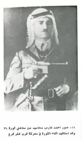
- صور احمد فارس محاميد من مناضل ثورة ٣٦..وقد استشهد اثناء الثورة في معركة قرب كفر قرع
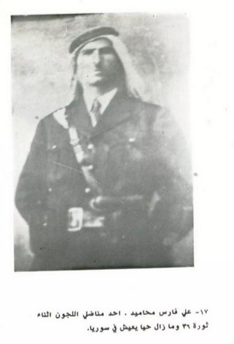
- علي فارس محاميد، احد مناضل اللجون اثناء ثورة ٣٦ وما زال حيا يعيش في سوريا
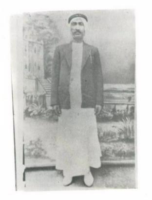
- فياض حسن طميش محاجنة من وجهاء اللجون..وكبار الملاكين فيها اخذت الصورة سنة ١٩٤٥
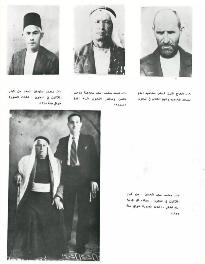
- مجموعة من وجهاء اللجون الذين عايشو النكبة
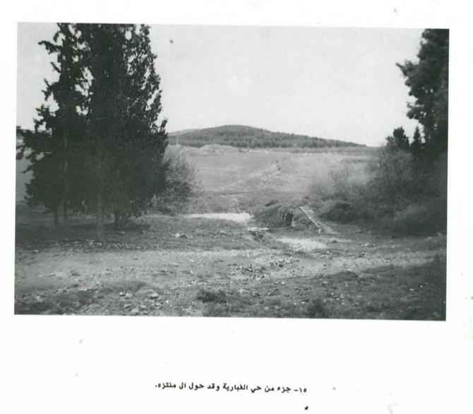
- جزء من حي الغبارية وقد حول لمنتزه
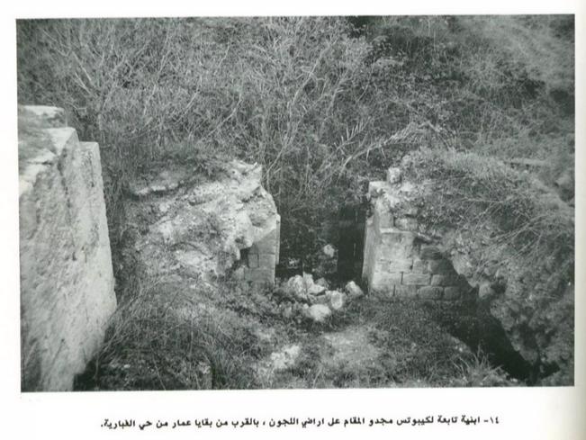
- ابنية تابعة لكيبوتس مجدو المقام على اراضي اللجون ، بالقرب من بقايا عمار من حي الغبارية.
- المزيد من الأنقاض
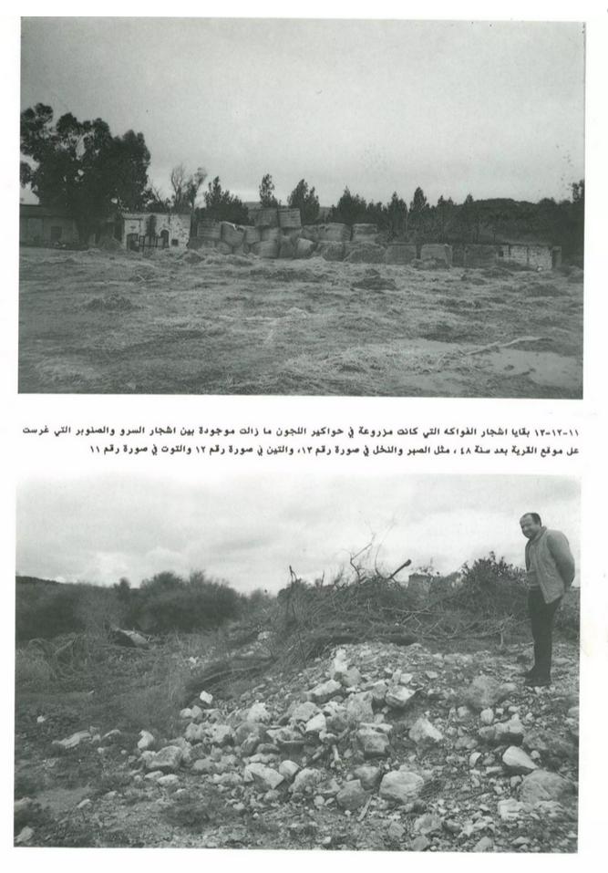
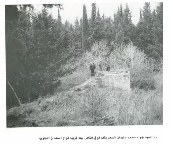
- السيد جواد محمد سليمان السعد يقف فوق انقاض بيت قريبه فواز السعد في اللجون
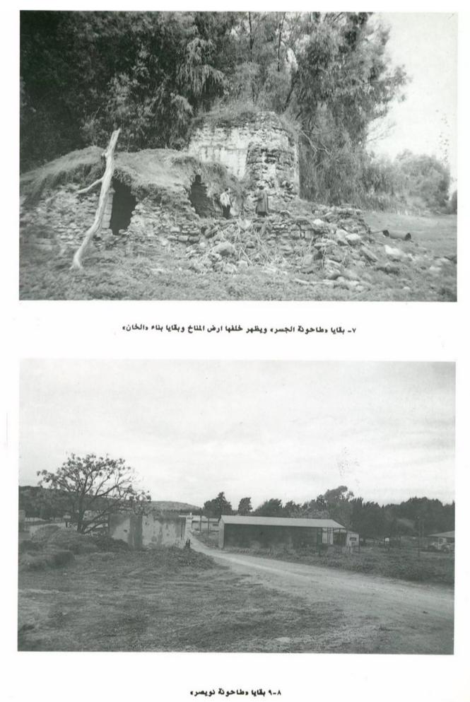
- ما تبقى من الخان والطواحين
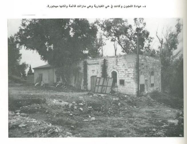
- عيادة اللجون وتبدو مهجورة
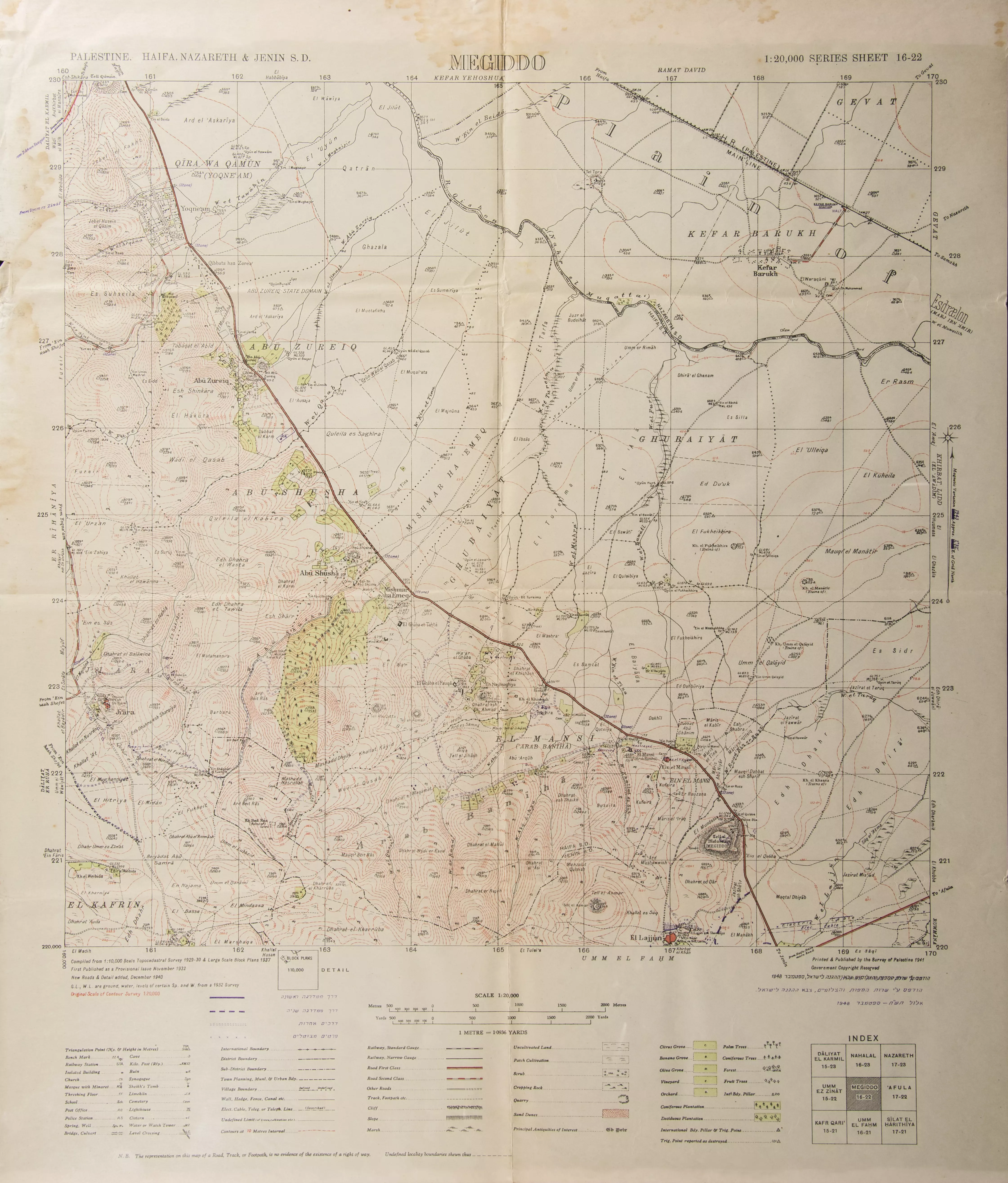
- A map showing borders, roads, sacred places, topographical nature of hills, plains, slopes, natural landscape, and planting types. The map was published during the British Mandate, and was modified by the Maps and Images Service of the Israeli Military Forces in the 1940s.
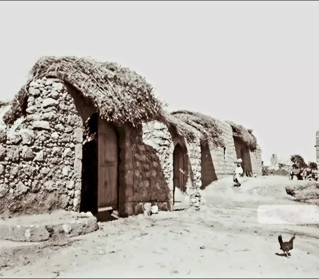
- Lajjun, 1924. Half-buried Roman or Byzantine columns and modern huts (Rockefeller Museum)
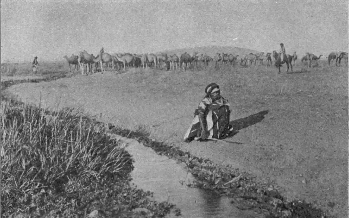
- A herd of camels near a stream in Lajjun, 1908
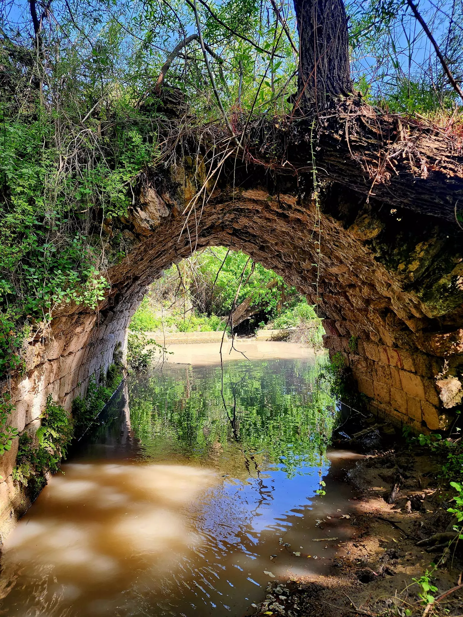
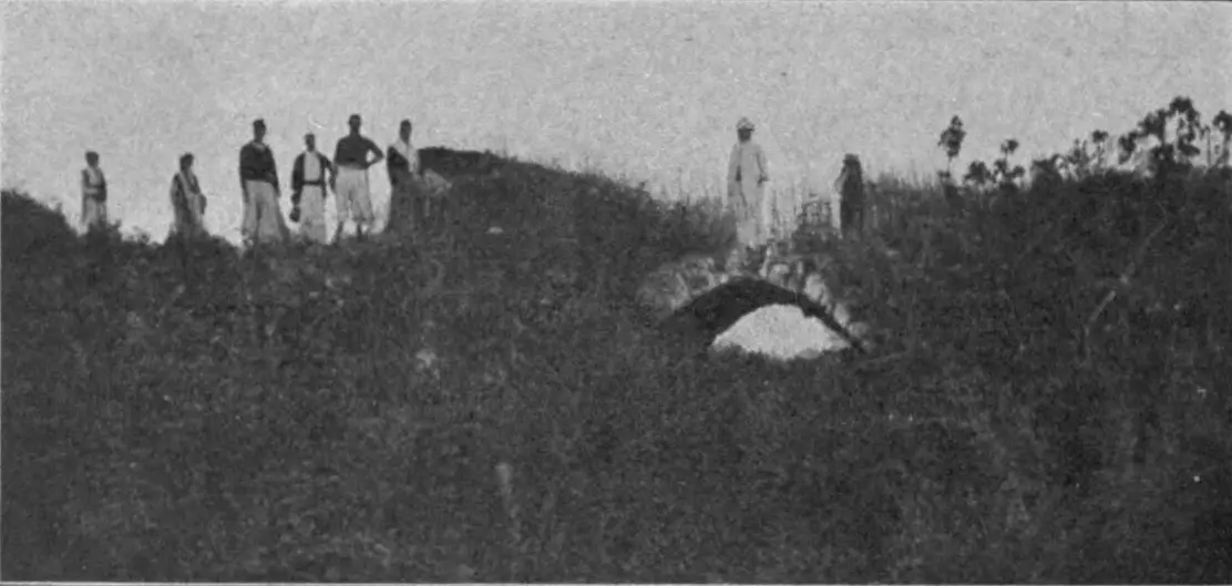
- Old bridge of Lajjun, picture taken between 1903 and 1905
- Survey of Palestine map of Lajjun, 1946 -- Note how the village is mad of three section: East, West, and the north
- Aerial photo with Lajjun and Tell Megiddo, 1944
- إعلان مفاوضة على شراء أرض بين دائرة الآثار الحكومة و علي سعد الحسن في اللجون --28-11-1928 -- أنقر الصورة لتكبيرها لقرآءة اﻷسماء والتفاصيل
- إعلان مفاوضة على شراء أرض بين دائرة الآثار الحكومة و مصطفى الحج حسن الصالح في اللجون --28-11-1928 -- أنقر الصورة لتكبيرها لقرآءة اﻷسماء والتفاصيل
- إعلان مفاوضة على شراء أرض بين دائرة الآثار الحكومة و عبد الله محمد الموسى في اللجون --28-11-1928 -- أنقر الصورة لتكبيرها لقرآءة اﻷسماء والتفاصيل
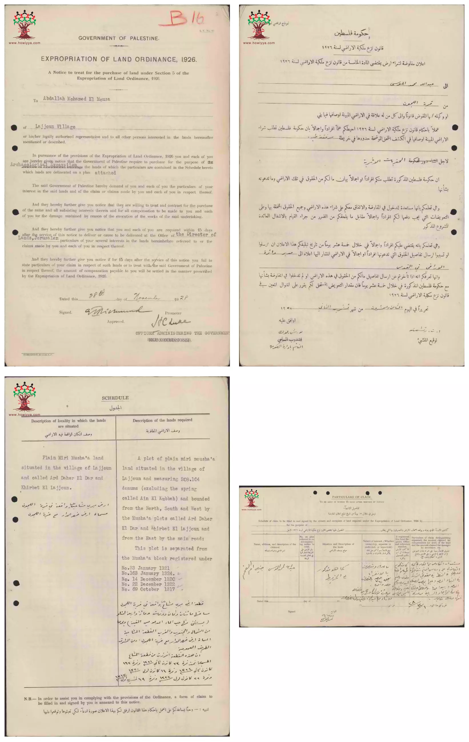
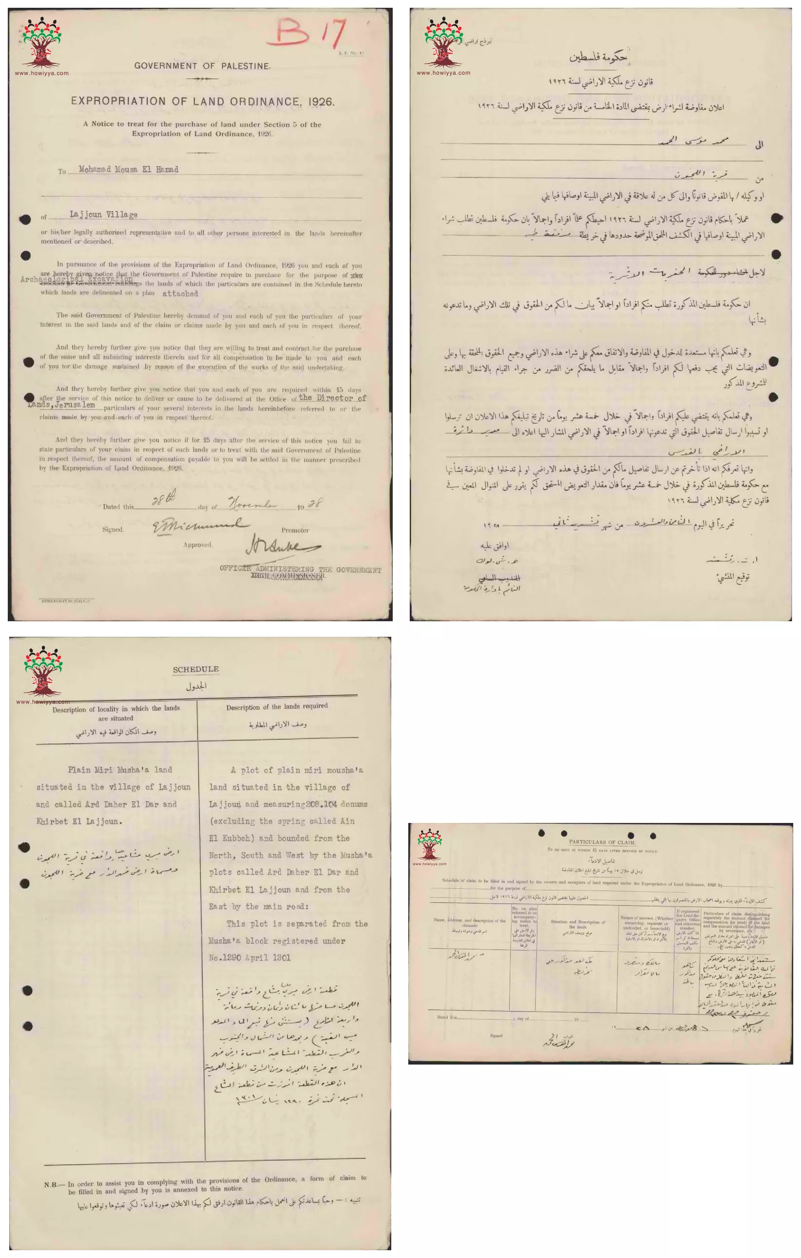
- إعلان مفاوضة على شراء أرض بين دائرة الآثار الحكومة و محمد موسى الحمد في اللجون --28-11-1928 -- أنقر الصورة لتكبيرها لقرآءة اﻷسماء والتفاصيل
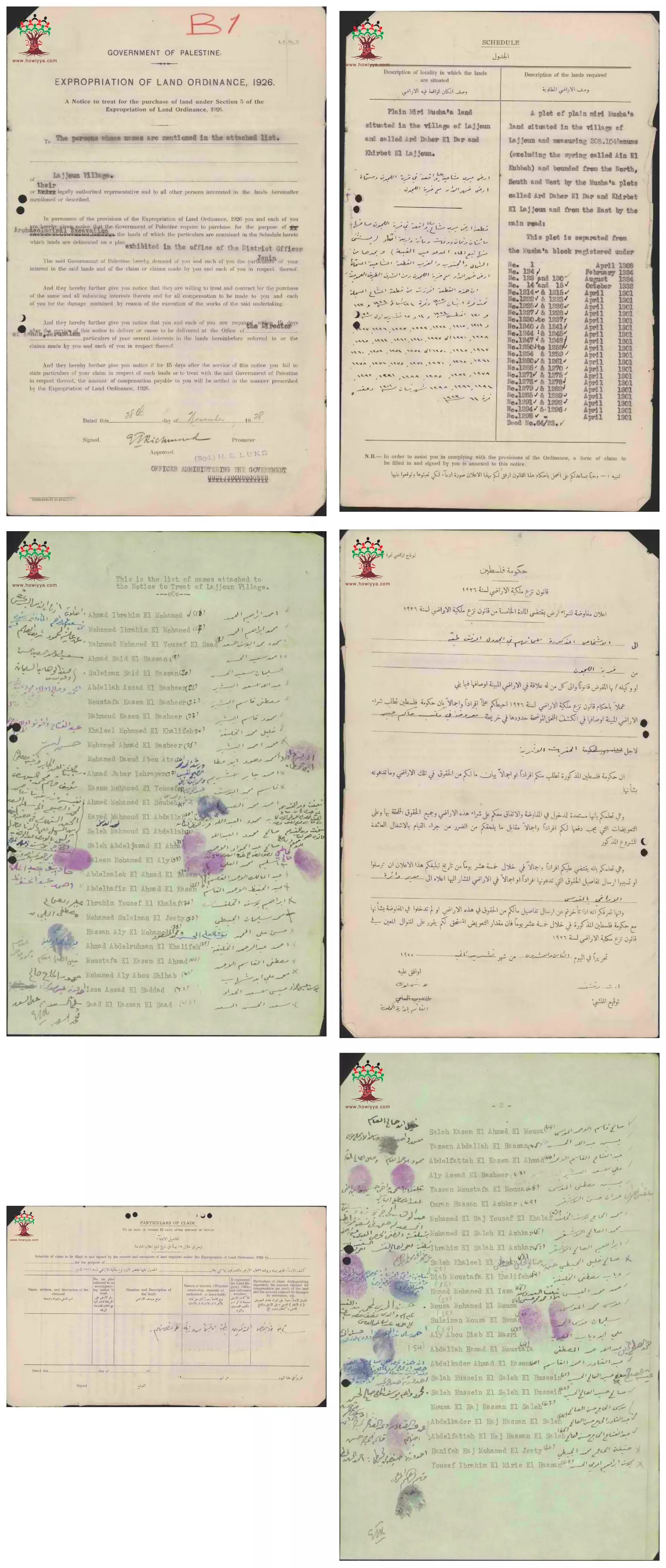
- إعلان مفاوضة على شراء أرض بين دائرة الآثار الحكومة و مجموعة من الأسماء المرفقة في اللجون --28-11-1928 -- أنقر الصورة لتكبيرها لقرآءة اﻷسماء والتفاصيل
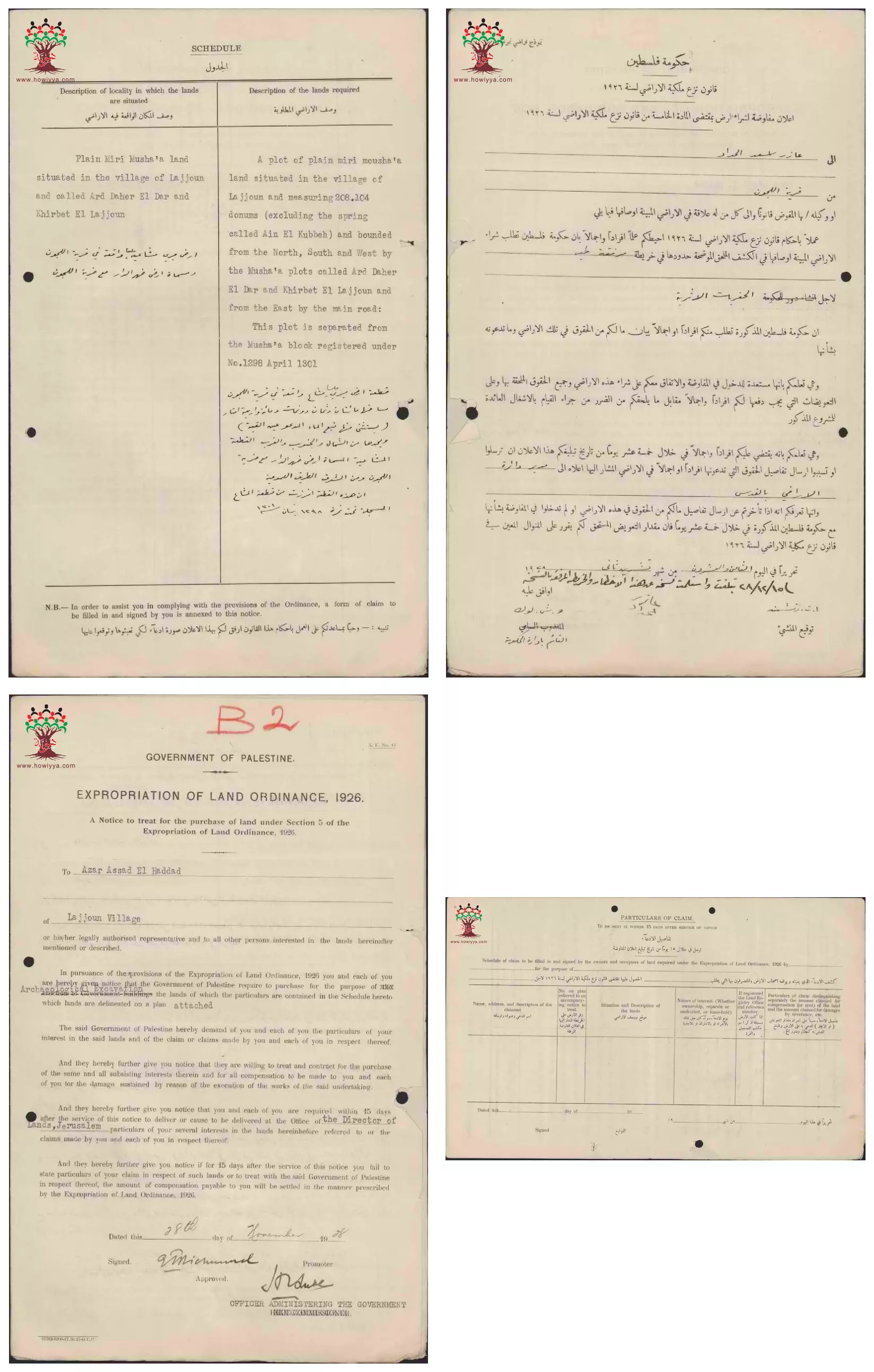
- إعلان مفاوضة على شراء أرض بين دائرة الآثار الحكومة و عازر أسعد الحداد في اللجون --28-11-1928 -- أنقر الصورة لتكبيرها لقرآءة اﻷسماء والتفاصيل
- إعلان مفاوضة على شراء أرض بين دائرة الآثار الحكومة و سعيد محمد الخليفة في اللجون --28-11-1928 -- أنقر الصورة لتكبيرها لقرآءة اﻷسماء والتفاصيل
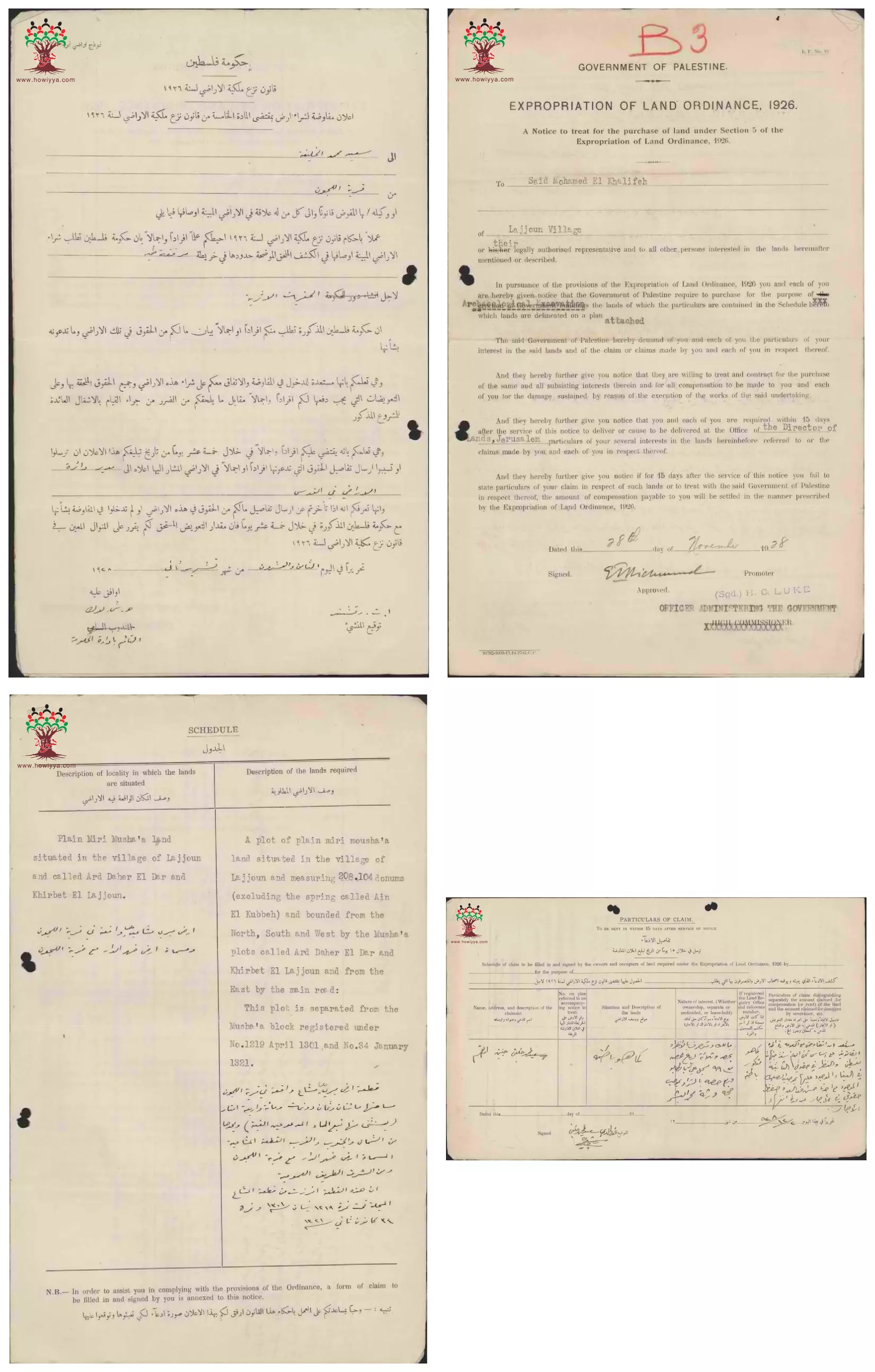
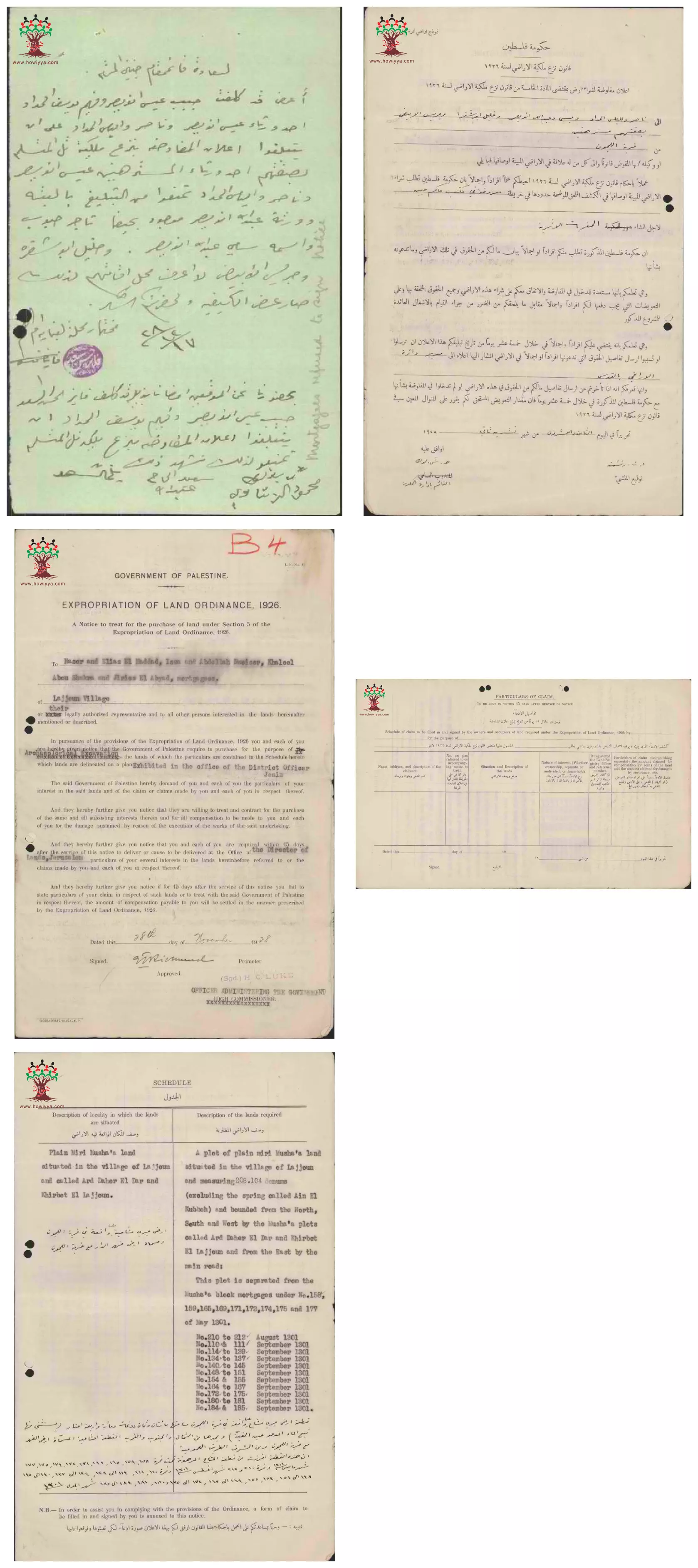
- إعلان مفاوضة على شراء أرض بين دائرة الآثار الحكومة و ناصر والياس الحداد-عيسى وعبد الله نويصر-خليل أبو شقرا-جريس الأبيض في اللجون --28-11-1928 -- أنقر الصورة لتكبيرها لقرآءة اﻷسماء والتفاصيل
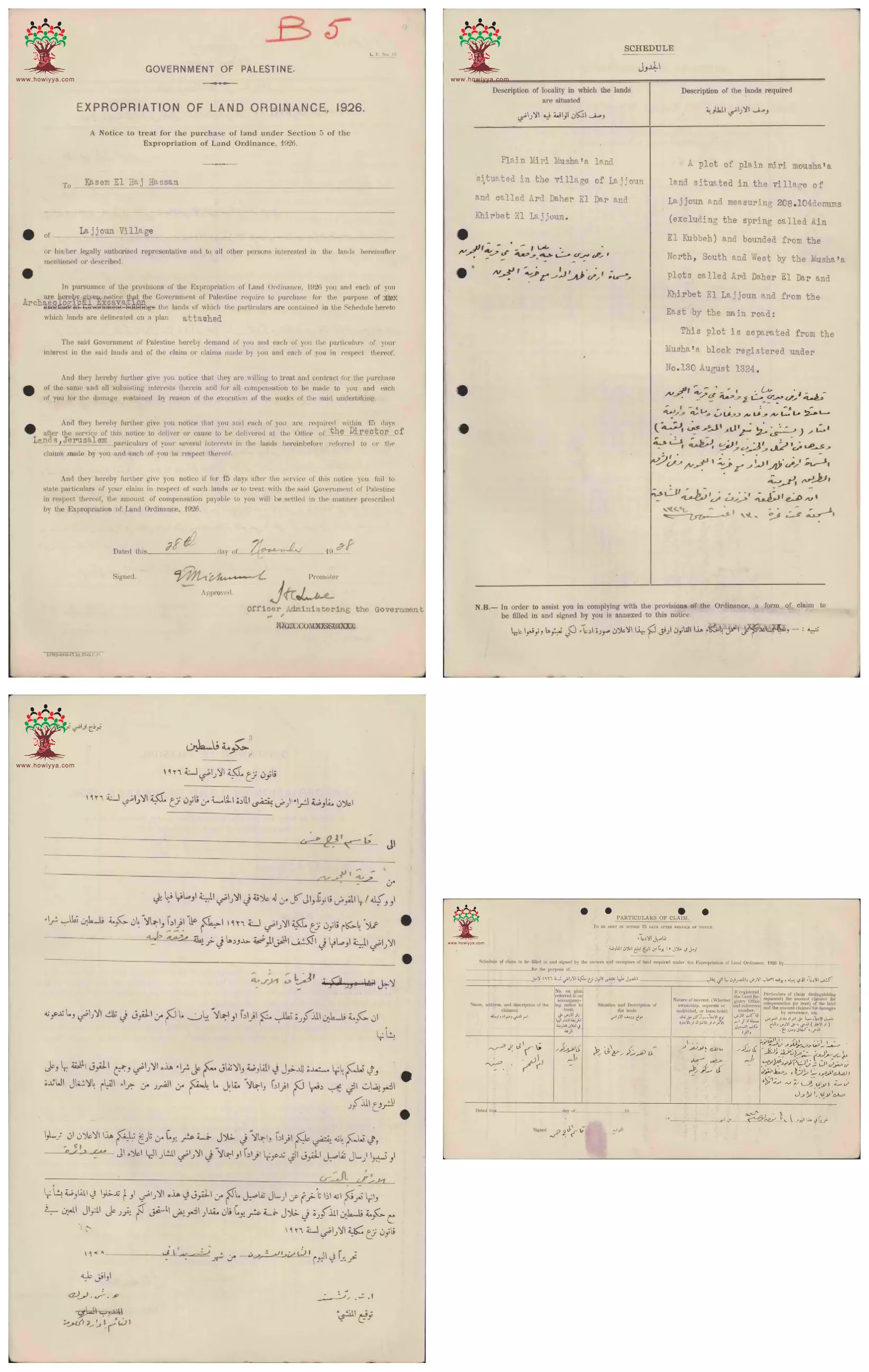
- إعلان مفاوضة على شراء أرض بين دائرة الآثار الحكومة و قاسم الحج حسن في اللجون --28-11-1928 -- أنقر الصورة لتكبيرها لقرآءة اﻷسماء والتفاصيل
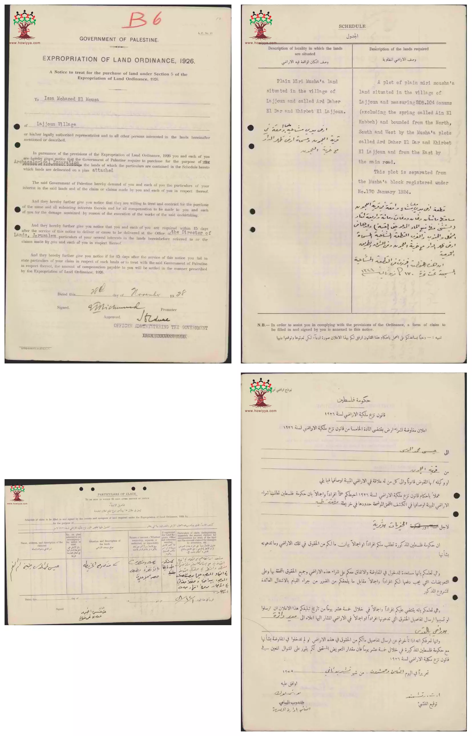
- إعلان مفاوضة على شراء أرض بين دائرة الآثار الحكومة و عيسى محمد الموسى في اللجون --28-11-1928 -- أنقر الصورة لتكبيرها لقرآءة اﻷسماء والتفاصيل
- إعلان مفاوضة على شراء أرض بين دائرة الآثار الحكومة و أحمد محمد الموسى في اللجون --28-11-1928 -- أنقر الصورة لتكبيرها لقرآءة اﻷسماء والتفاصيل
- إعلان مفاوضة على شراء أرض بين دائرة الآثار الحكومة و قاسم الحج حسن في اللجون --28-11-1928 -- أنقر الصورة لتكبيرها لقرآءة اﻷسماء والتفاصيل

- إعلان مفاوضة على شراء أرض بين دائرة الآثار الحكومة و عيسى محمد الموسى في اللجون --28-11-1928 -- أنقر الصورة لتكبيرها لقرآءة اﻷسماء والتفاصيل
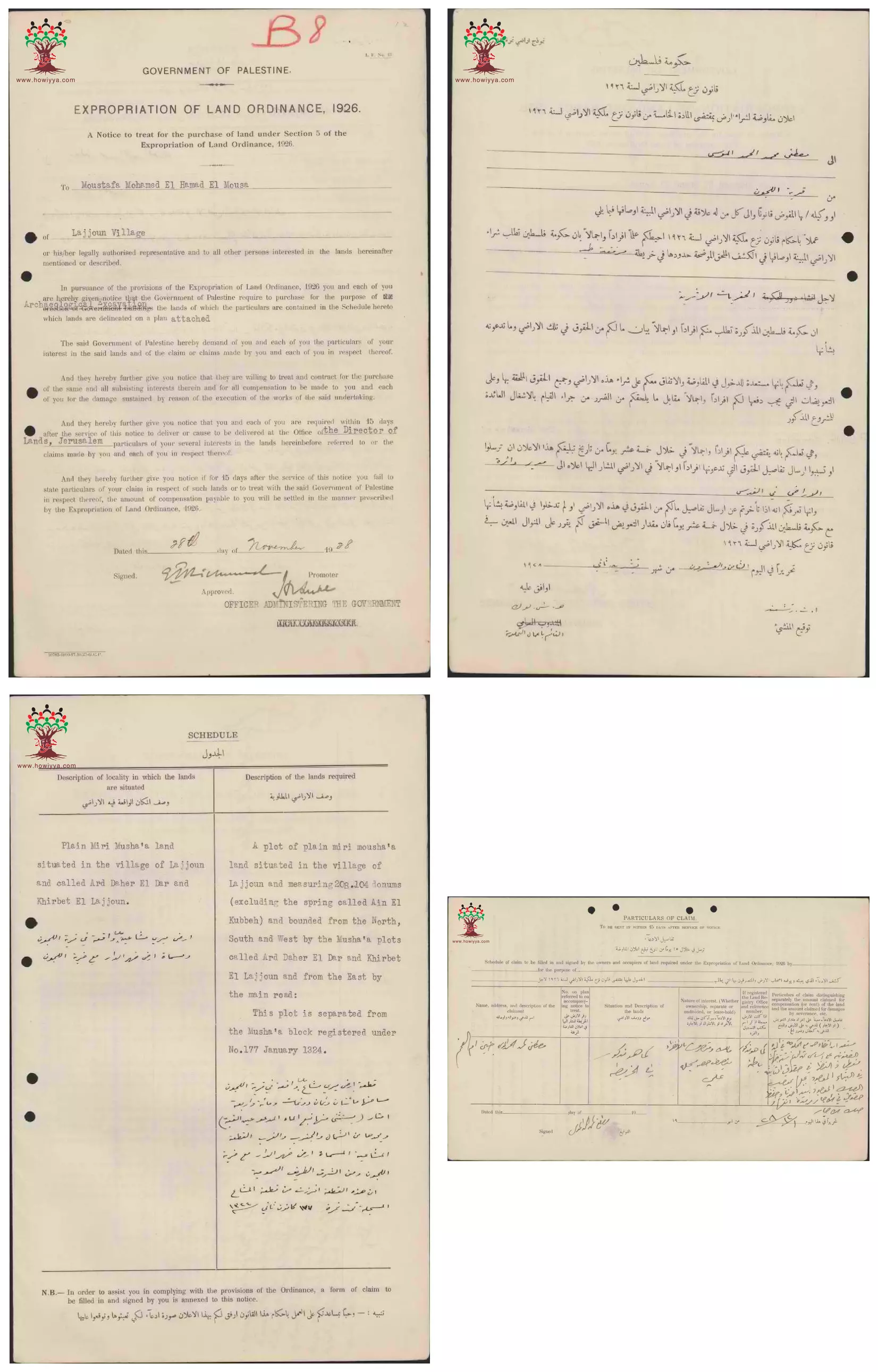
- إعلان مفاوضة على شراء أرض بين دائرة الآثار الحكومة و مصطفى محمد أحمد الموسى في اللجون --28-11-1928 -- أنقر الصورة لتكبيرها لقرآءة اﻷسماء والتفاصيل
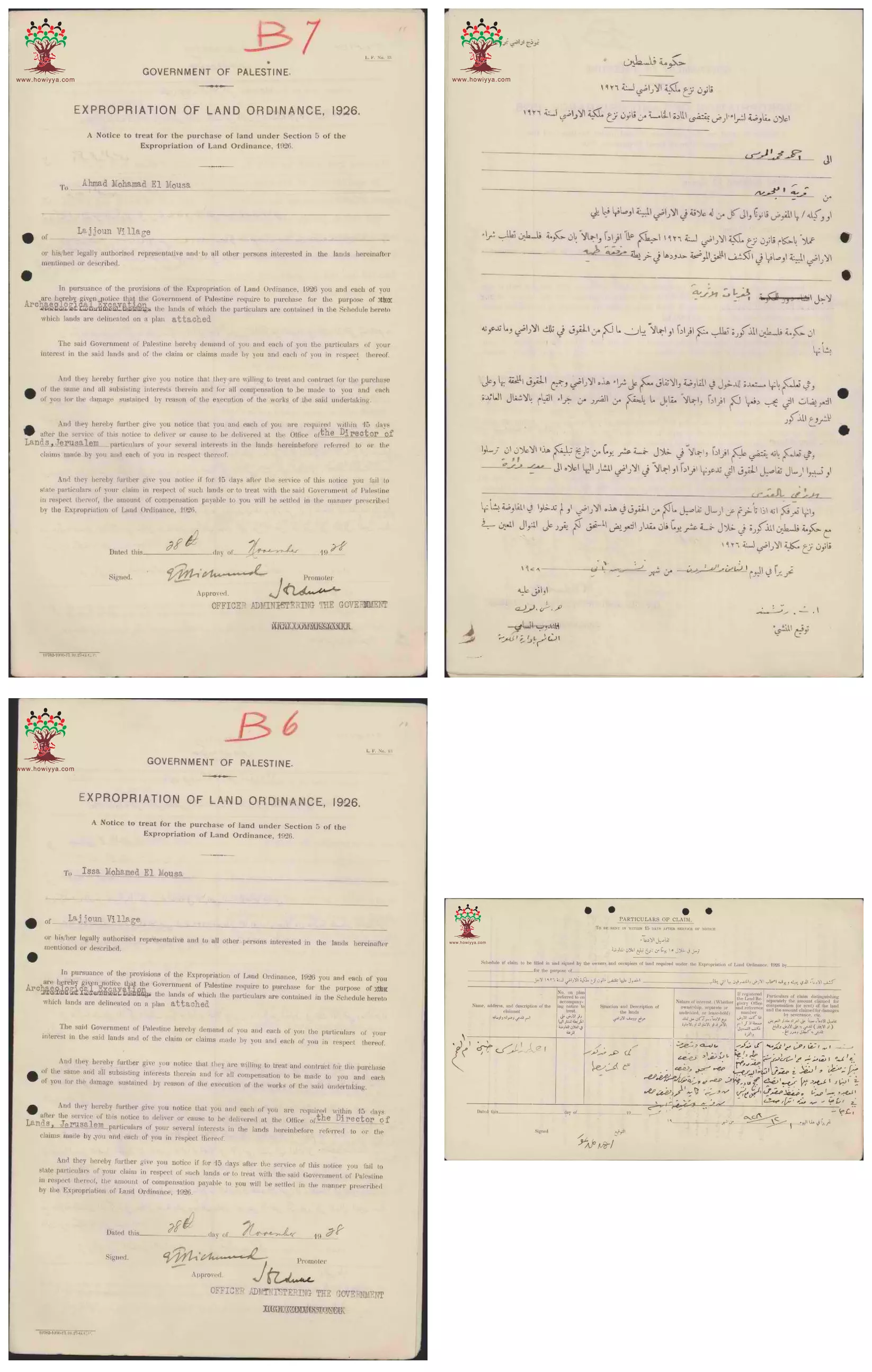
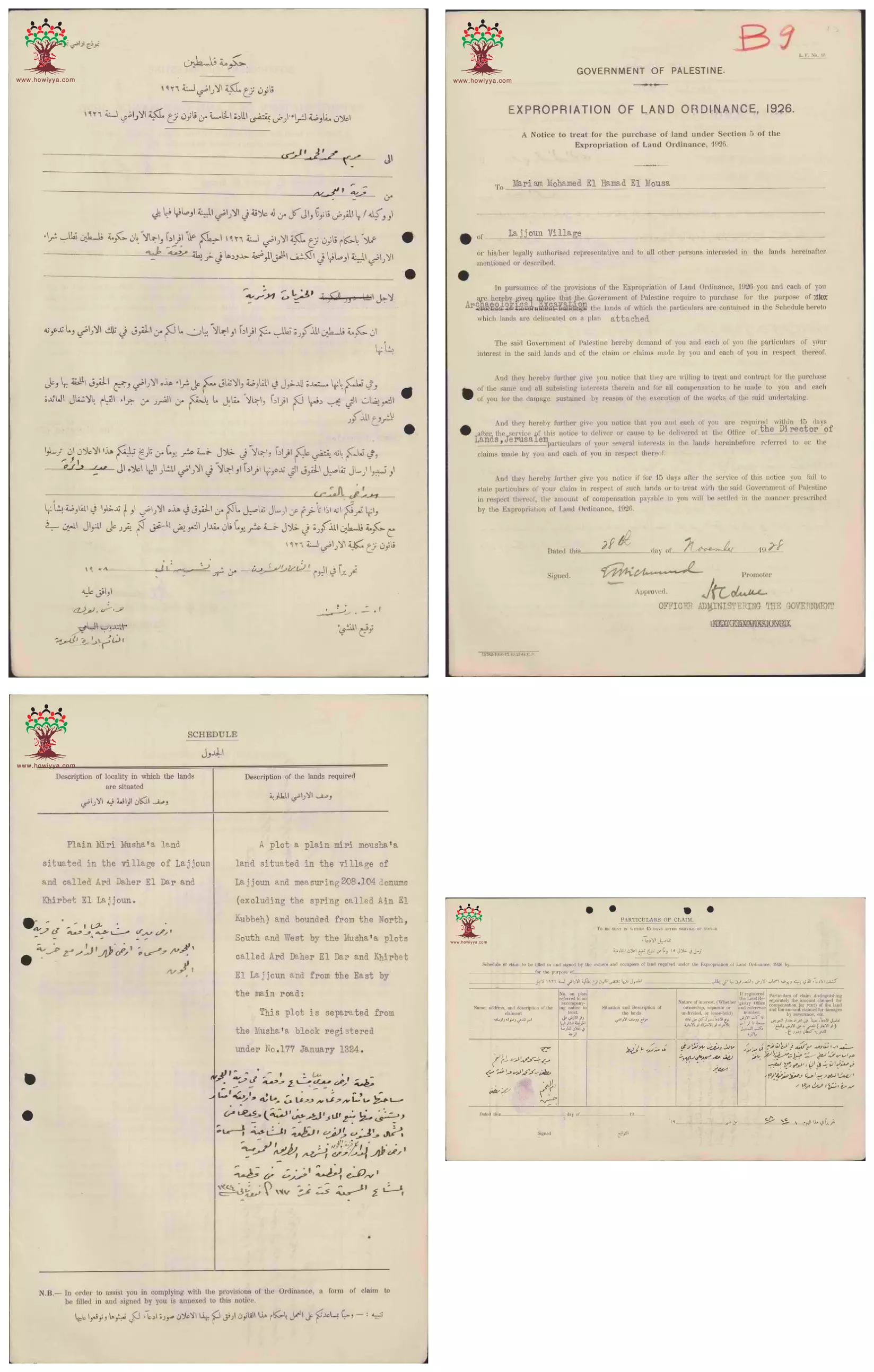
- إعلان مفاوضة على شراء أرض بين دائرة الآثار الحكومة و مريم محمد أحمد الموسى في اللجون --28-11-1928 -- أنقر الصورة لتكبيرها لقرآءة اﻷسماء والتفاصيل
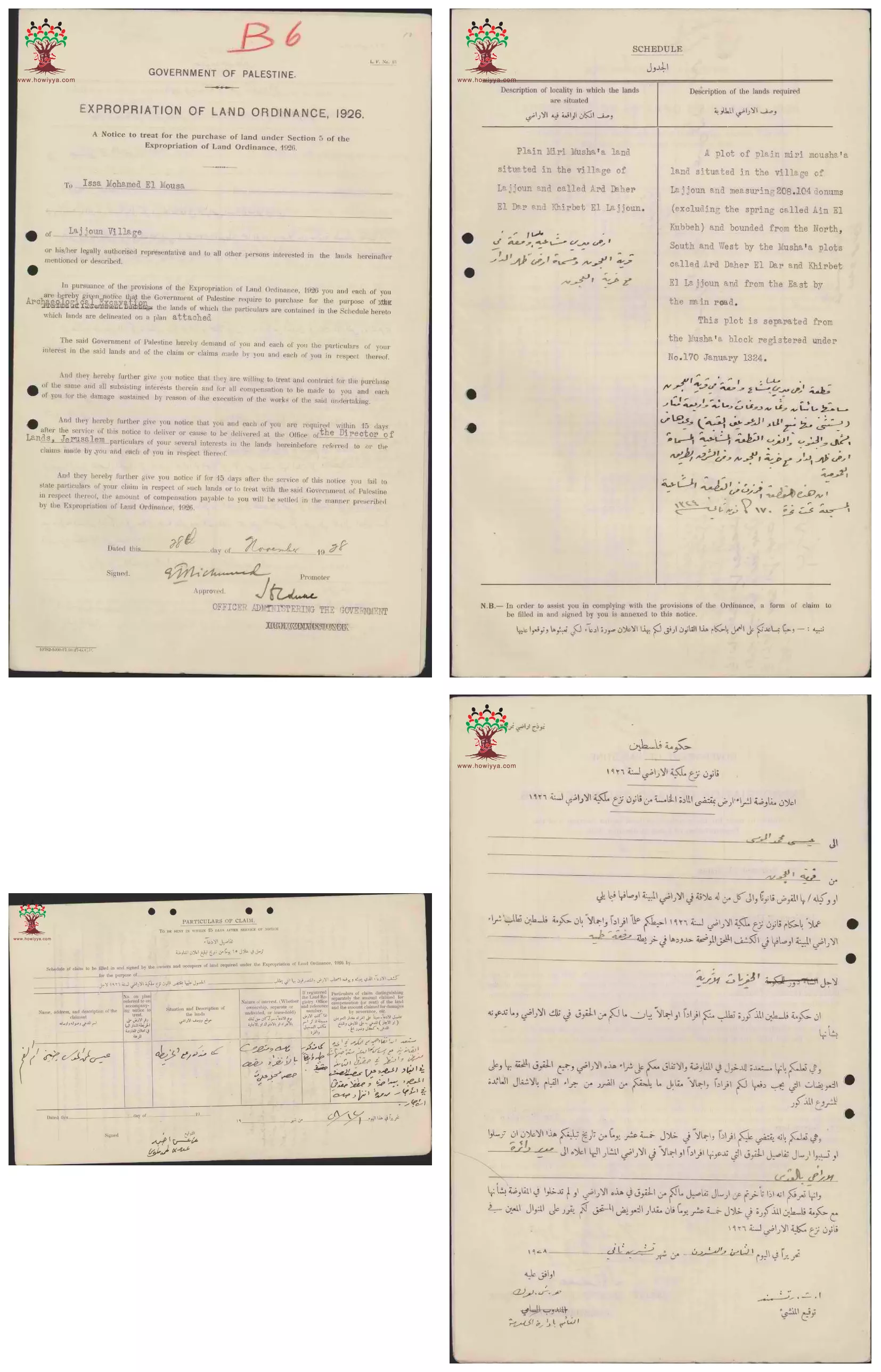
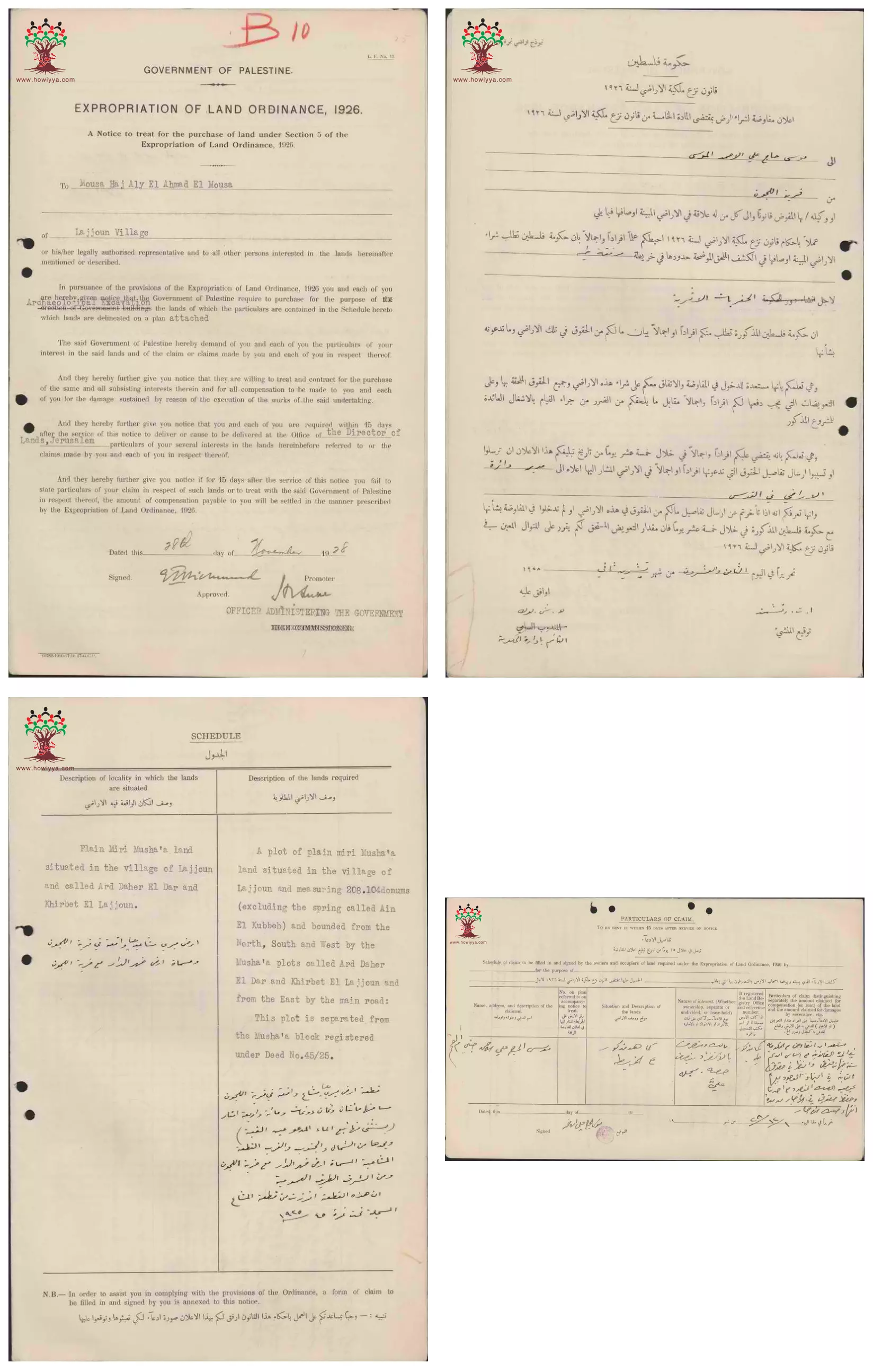
- إعلان مفاوضة على شراء أرض بين دائرة الآثار الحكومة و موسى حج علي أحمد الموسى في اللجون --28-11-1928 -- أنقر الصورة لتكبيرها لقرآءة اﻷسماء والتفاصيل
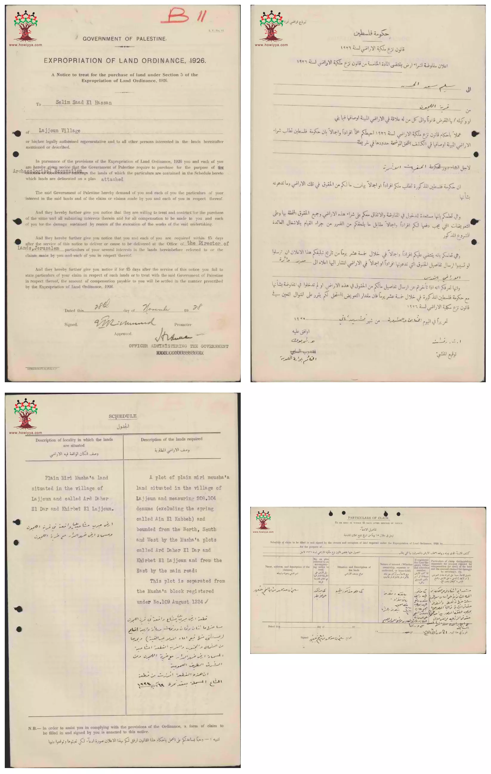
- إعلان مفاوضة على شراء أرض بين دائرة الآثار الحكومة و سليم سعد الحسن في اللجون --28-11-1928 -- أنقر الصورة لتكبيرها لقرآءة اﻷسماء والتفاصيل
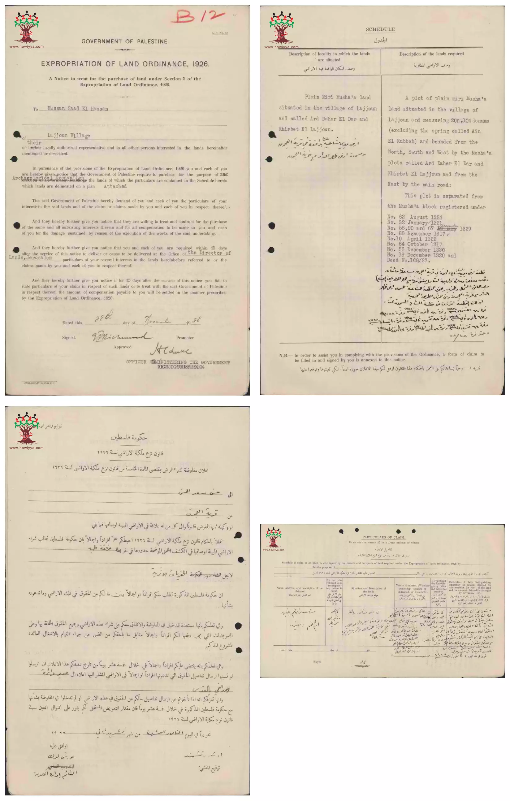
- إعلان مفاوضة على شراء أرض بين دائرة الآثار الحكومة و حسن سعد الحسن في اللجون --28-11-1928 -- أنقر الصورة لتكبيرها لقرآءة اﻷسماء والتفاصيل
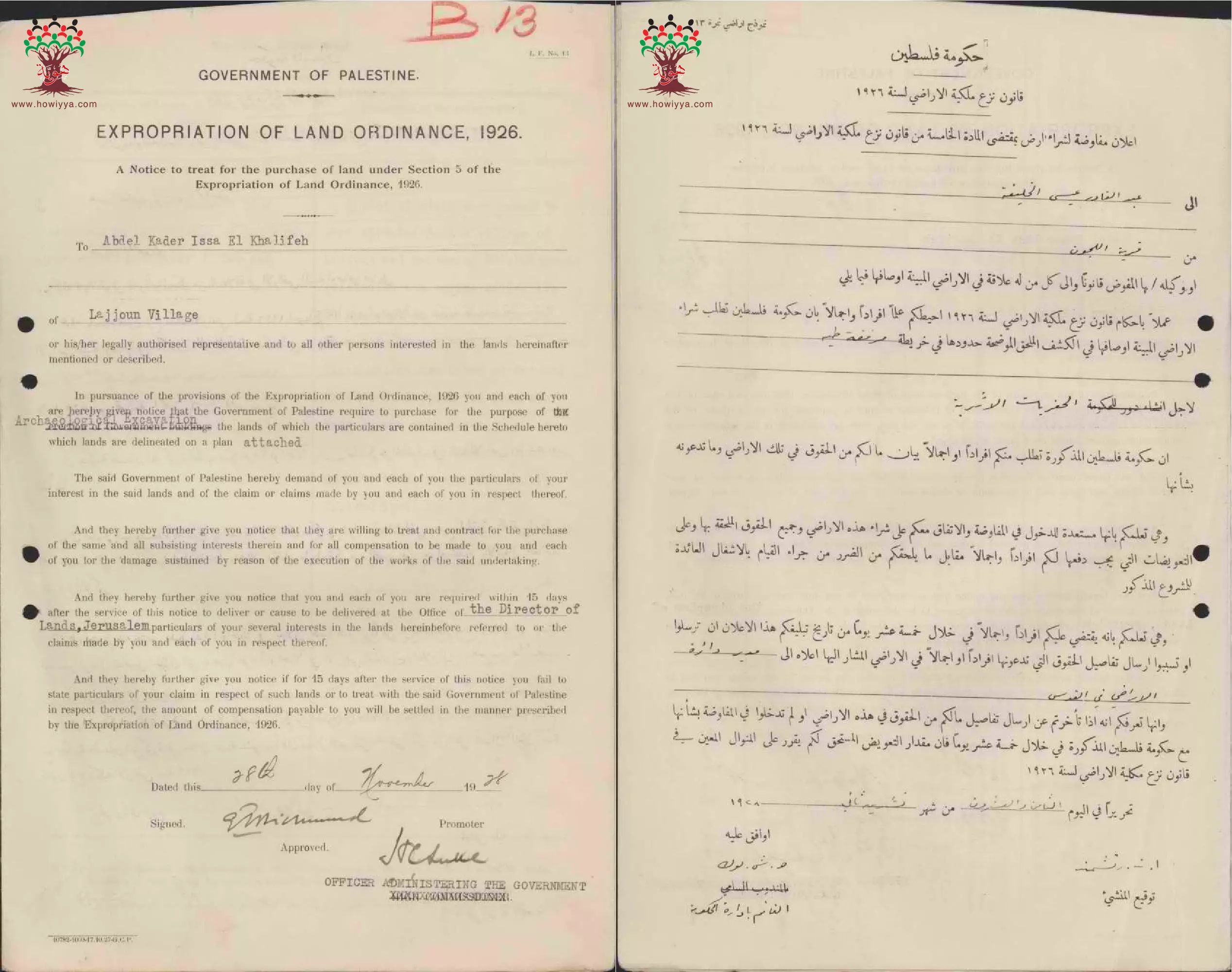
- إعلان مفاوضة على شراء أرض بين دائرة الآثار الحكومة و عبد القادر عيسى الخليفة في اللجون --28-11-1928 -- أنقر الصورة لتكبيرها لقرآءة اﻷسماء والتفاصيل
Want to browse more? 80,000 pictures were grouped in these gallaries:
- Pre-Nakba Aerial view of the village / صورة من الجو للقرية اخذت قبل النكبة
- A map showing borders, roads, sacred places, topographical nature of hills, plains, slopes, natural landscape, and planting types. The map was published during the British Mandate, and was modified by the Maps and Images Service of the Israeli Military Forces in the 1940s.
- Survey of Palestine map of Lajjun, 1946 -- Note how the village is mad of three section: East, West, and the north
- Aerial photo with Lajjun and Tell Megiddo, 1944
- إعلان مفاوضة على شراء أرض بين دائرة الآثار الحكومة و علي سعد الحسن في اللجون --28-11-1928 -- أنقر الصورة لتكبيرها لقرآءة اﻷسماء والتفاصيل
- إعلان مفاوضة على شراء أرض بين دائرة الآثار الحكومة و مصطفى الحج حسن الصالح في اللجون --28-11-1928 -- أنقر الصورة لتكبيرها لقرآءة اﻷسماء والتفاصيل
- إعلان مفاوضة على شراء أرض بين دائرة الآثار الحكومة و عبد الله محمد الموسى في اللجون --28-11-1928 -- أنقر الصورة لتكبيرها لقرآءة اﻷسماء والتفاصيل
- إعلان مفاوضة على شراء أرض بين دائرة الآثار الحكومة و محمد موسى الحمد في اللجون --28-11-1928 -- أنقر الصورة لتكبيرها لقرآءة اﻷسماء والتفاصيل
- إعلان مفاوضة على شراء أرض بين دائرة الآثار الحكومة و مجموعة من الأسماء المرفقة في اللجون --28-11-1928 -- أنقر الصورة لتكبيرها لقرآءة اﻷسماء والتفاصيل
- إعلان مفاوضة على شراء أرض بين دائرة الآثار الحكومة و عازر أسعد الحداد في اللجون --28-11-1928 -- أنقر الصورة لتكبيرها لقرآءة اﻷسماء والتفاصيل
- إعلان مفاوضة على شراء أرض بين دائرة الآثار الحكومة و سعيد محمد الخليفة في اللجون --28-11-1928 -- أنقر الصورة لتكبيرها لقرآءة اﻷسماء والتفاصيل
- إعلان مفاوضة على شراء أرض بين دائرة الآثار الحكومة و ناصر والياس الحداد-عيسى وعبد الله نويصر-خليل أبو شقرا-جريس الأبيض في اللجون --28-11-1928 -- أنقر الصورة لتكبيرها لقرآءة اﻷسماء والتفاصيل
- إعلان مفاوضة على شراء أرض بين دائرة الآثار الحكومة و قاسم الحج حسن في اللجون --28-11-1928 -- أنقر الصورة لتكبيرها لقرآءة اﻷسماء والتفاصيل
- إعلان مفاوضة على شراء أرض بين دائرة الآثار الحكومة و عيسى محمد الموسى في اللجون --28-11-1928 -- أنقر الصورة لتكبيرها لقرآءة اﻷسماء والتفاصيل
- إعلان مفاوضة على شراء أرض بين دائرة الآثار الحكومة و أحمد محمد الموسى في اللجون --28-11-1928 -- أنقر الصورة لتكبيرها لقرآءة اﻷسماء والتفاصيل
- إعلان مفاوضة على شراء أرض بين دائرة الآثار الحكومة و مصطفى محمد أحمد الموسى في اللجون --28-11-1928 -- أنقر الصورة لتكبيرها لقرآءة اﻷسماء والتفاصيل
- إعلان مفاوضة على شراء أرض بين دائرة الآثار الحكومة و مريم محمد أحمد الموسى في اللجون --28-11-1928 -- أنقر الصورة لتكبيرها لقرآءة اﻷسماء والتفاصيل
- إعلان مفاوضة على شراء أرض بين دائرة الآثار الحكومة و موسى حج علي أحمد الموسى في اللجون --28-11-1928 -- أنقر الصورة لتكبيرها لقرآءة اﻷسماء والتفاصيل
- إعلان مفاوضة على شراء أرض بين دائرة الآثار الحكومة و سليم سعد الحسن في اللجون --28-11-1928 -- أنقر الصورة لتكبيرها لقرآءة اﻷسماء والتفاصيل
- إعلان مفاوضة على شراء أرض بين دائرة الآثار الحكومة و حسن سعد الحسن في اللجون --28-11-1928 -- أنقر الصورة لتكبيرها لقرآءة اﻷسماء والتفاصيل
- إعلان مفاوضة على شراء أرض بين دائرة الآثار الحكومة و عبد القادر عيسى الخليفة في اللجون --28-11-1928 -- أنقر الصورة لتكبيرها لقرآءة اﻷسماء والتفاصيل
| Display Name | Clan/Hamolah | Country of Residence |
| يوسف محاميد | محاميد | - |
| نضال الأسمر | جبارين | جنين, الطيبة |
| REMAWI | جمعه | jenin |
| الشاعر راضي عبد الجواد | محاميد | - |
| Dalia Mhaid | Mhaid | Wisconsin, USA |
| nagham | - | - |
- مسيرة العودة العاشرة الى قرية اللجون Duration: min 42 sec
- بسواعدنا -تصور العودة لقرية اللجون المهجرة Duration: 3 min 41 sec
- مسيرة العودة السنوية للجون ب -17 / 4/ 2021 Duration: min 52 sec
- خان اللجون في قرية اللجون المهجرة -قضاء جنين . بعدسة الصديق إبراهيم ابو عمار Duration: min 20 sec
- ذاكرة وعودة - مشروع عدنا 2015 - تصور العودة لقرية اللجون المهجرة Duration: 11 min 11 sec
- عين الحجة في قرية اللّجون المهجرة قضاء جنين
- مقبرة قرية اللّجون المهجرة قضاء جنين وقبر الشهيد يوسف الحمدان طميش رحمه الله
- وثائقي | اللجون.. أم الطواحين ومقصد التجار والثائرين Duration: 14 min 3 sec
- من قرية اللجون المهجرة تل المتسلم جنين فلسطين Duration: min sec
 Fake Valor: Why Did Zionist Jews Hoist Nazis Flag on Their Ships in the 1930s?
What is new?
-
Facts About Oct. 7th Gaza Raid
-
Remined Us Please: Who Did Rape Whom? Was it Palestinians who raped Israelis? Or, was the other way around? You'll be the judge
-
When Prof. Edward Said was invited to debate Bibi Netanyahu in the 1980s, watch what happened!
-
Ezra Klein of the NY Times on the "Jewish Race".
-
Abusing Blood Libel!
-
How and why Israeli Jewry has become the most hated cult?
-
Did Israeli Soldiers Activate The Hannibal Direective On Oct. 7th? You Be The Judge
-
Zionist FAQ: Isn't it true that Palestinians don't want peace? Palestinians never accepted the two-state solution
- Facts about Haavara (Transfer) Agreement between Ben-Gurion & Hitler
-
Haavara FAQs: Why Did Zionist Jews Hoist Nazis' Flags on Their Ships in the 1930s?
- Haavara FAQs: When Chaim Weizmann met FDR in mid-1943, why was he silent about rescuing European Jewry?
-
Dear ChatGPT: How did Palestinians resist Napoleon's invasion of their country in 1799?
-
Dear ChatGPT: Gaza had a vibrant Jewish community in the mid-17th century. What happened to them?
-
Dear ChatGPT: Why did the Jewish Agency suppress news of the Holocaust during WWII?
-
Video Playlist: Jews share their DNA tests to end the conflict for good.
-
A Tale of Two Conflicts: Examining the Definition of Genocide
-
Prof. Abraham Polak And The Suppressed History of the Khazars and European Jewry
-
How Ronald Reagan would have framed the genocide in Gaza if he were still alive?
-
Haavara FAQs: Let us do the math: how many German Jews did The Haavara Agreement save?
-
Zionist FAQs: The Hebron Massacre of 1929, "clearly proves" that Palestinians are antisemitic, how could you deny it?
-
Zionist FAQs: Why Anti-Zionist Is Not Antisemitism?
-
Zionist FAQs: Isn't it true that the KGB created Palestinian Nationalism in the early 1960s?
- Zionist FAQs: Muslims are killing Muslims all the time; why are Israeli Jews being singled out in the media?
- Zionist FAQs: How is Israel an apartheid state when 20% of its citizens are Arabs who enjoy full rights?
-
Haavara FAQs: Why Did Dorothy Thompson Flip From A Zionist Advocate to A Silenced Dissenter?
-
Haavara FAQs: Analysis of Herzl's Uganda Scheme and how it could have saved millions of Jews.
-
Haavara FAQs: Why did Hayim Greenberg describe American Jewry as "morally bankrupt" in early 1943?
-
Haavara FAQs: What if the Evian Conference was a resounding success? What would have been the impact of saving European Jewry on Zionism?
- Haavara FAQs: What if the six million were saved, how that would have impacted the Zionist project?
-
Haavara FAQs: How did Zionist leaders react when Europe's Jews lingered in the DP camps after WWII ended?
-
Why does the American Jewish community repeat lies that David Ben-Gurion had debunked before he died?
-
Who has the power to rename the Tatar/Khazar Gene Marker to Jewish IV?
-
Zionist FAQs: Why won't Egypt, Syria, and Jordan take their people back? Jews are indigenous to Palestine, and Arabs immigrated after Jews developed the country. Arabs should leave.
-
Haavara FAQs: Did Hitler and the Nazis conflate between Judaism and Zionist? If that wasn't case, then why?
-
Haavara FAQs: Winston Churchill and antisemitism, a collection of articles written Churchill.
-
Haavara FAQs: Broken by country, how many Jews survived vs. killed during the Holocaust?
-
Haavara FAQs: Why did European Jews vote with their feet and to immigrated to the Americas, not Palestine, after WWII?
-
Watch this American Jewish Girl describing Israeli Jews' cognitive dissonance like no other in under two minutes
-
Haavara FAQs: When the Nazis went out of their way to hide the Holocaust, Israeli Jews did the exact opposite by broadcasting their genocide of Gazans. But why?
-
Haavara FAQs: How Zionist Jews went out of their to show their appreciation to Nazism and Fascism?
- Haavara FAQs: Why Zionist leaders were against bombing the death camps & the Railroads leading to them?
-
Haavara FAQs: Hitler's message to the British and American people: If Jews are such noble citizens and you care about them, how come you're not letting them in? I will gladly ship them to you at my expense, even on luxury liners!
-
A shortlist of Zionist and Israeli false flag operations in the name Jews.
-
The Most Moral Army
- The Land of Kapos (Israel): Where the brave are boycotted and Kapos walk free.
- Why did early Zionists often named their communal enterprises "colonial"?
- Zionist Relations with Nazi Germany by Faris Glubb
-
Two NY Times advertisements by Zionists in the early 1943 that exposes Zionists' treason at the height of the calamity
- Facts Not Lies about the Palestinian-Israeli Conflict.
- Site's pictures have been categorized
- Campgain Against Lice
- A Survey of Palestine, the official source about Palestine before Nakba produced by the British Mandate; over 1200 pages.
- Satellite View & Google Earth: Over 6,000 placemarks identifying all destroyed towns, W. Bank & Gaza Strip Towns, & refugee camps.
- PalestineRemembered.com and its Nakba Oral History Project were featured on al-Jazeera Satellite TV.
- Nakba Oral History Video Podcast:
 Over 700 Oral History interviews (including 3,500+ hours of recording) can be viewed online.
 - Palestine Village Statistics Project
- Gaza Jail Break
- النسخة العربية للموقع الان متوفرة
- Videos: Documenting the destroyed villages in video: Tracing all that remains since Nakba.
- Videos: Responding to Zionist Propaganda
- Interview: The ethnic cleansing of Palestine: George Galloway interviews Israeli Historian Ilan Pappe.
- For Palestinians, memory matters. It provides a blueprint for their future By George Bisharat.
- Zionist FAQ now available in Hebrew שאלות שציונים שואלים, עכשיו בעברית
- Video: The Stephen Walt and John Mearsheimer report on the influence of the Israel Lobby on U.S. Foreign Policy
- The Palestinian-Israeli conflict for beginners
