| PalestineRemembered | About Us | Oral History | العربية | |
| Pictures | Zionist FAQs | Haavara | Maps | |
| Search |
| Camps |
| Districts |
| Acre |
| Baysan |
| Beersheba |
| Bethlehem |
| Gaza |
| Haifa |
| Hebron |
| Jaffa |
| Jericho |
| Jerusalem |
| Jinin |
| Nablus |
| Nazareth |
| Ramallah |
| al-Ramla |
| Safad |
| Tiberias |
| Tulkarm |
| Donate |
| Contact |
| Profile |
| Videos |
Welcome To al-Mazar - المزار (אל-מזאר)
|
District of Jinin
Ethnically cleansed days ago |
العربية Google Earth |
 |
Gallery (7) |
- Statistics & Facts
-
Before & After

- Satellite View
- Articles 1
- Pictures 7
- Oral History 2
- Members 10
- All That Remains
- Wikipedia
- Videos 2
- Guest Book 3
- Links
| Statistic & Fact | Value | ||||||||||||||
| Occupation Date | May 30, 1948 | ||||||||||||||
| Distance From District | 9 (km) Northeast of Jinin | ||||||||||||||
| Elevation | 400 (meters) | ||||||||||||||
| Before & After Nakba, Click Map For Details |
|||||||||||||||
|
|||||||||||||||
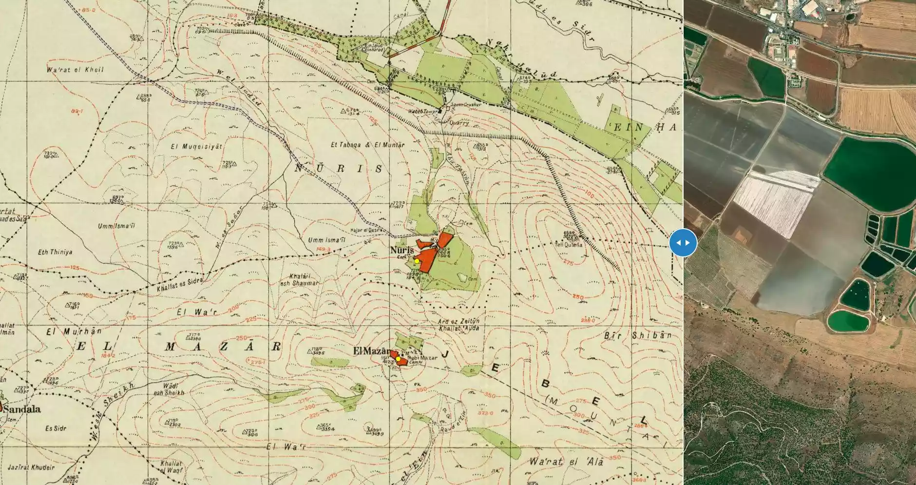
| Map Location | See location #5 on the map View from satellite |
||||||||||||||
| Military Operation | Operation Gidion | ||||||||||||||
| Attacking Units | Fourth Battalion of the Golani Brigade | ||||||||||||||
| Defenders | Yarmuk Battalion of Arab Liberation Army volunteers, and some local Palestinian militia and Iraqi Army. | ||||||||||||||
| Exodus Cause | Military assault by Zionist troops | ||||||||||||||
| Village Temains | al-Mazar was completely obliterated and defaced. | ||||||||||||||
| Ethnically Cleansing | al-Mazar inhabitants were completely ethnically cleansed. | ||||||||||||||
| Pre-Nakba Land Ownership |
**Town Lands' Demarcation Maps |
||||||||||||||
| Land Usage As of 1945 |
|
||||||||||||||
| Population |
|
||||||||||||||
| Number of Houses |
|
||||||||||||||
| Near By Towns |
|||||||||||||||
|
|||||||||||||||
| Town's Name Through History | The village may have been named after the burial places for many of those who were killed during the decisive battle of 'Ayn Jalut (1260), in which the Mamluks of Egypt triumphed over the Mongols. | ||||||||||||||
| Inhabitants Place of Origin | The villagers traced their origins to al-Sa'diyyun nomads who in turn were descended from al-Shaykh Sa'd al-Din al-Shaybani (d. 1224), a prominent Sufi mystic from the village of Jaba' in the Golan Heights, Syria. | ||||||||||||||
| Town's Notable People | al-Mazar was the home of al-Shaykh Farhan al-Sa'di, a prominent leader of the 1936 Palestinian rebellion against the British Mandate. | ||||||||||||||
| Exculsive Jewish Colonies Who Usurped Village Lands |
Perazon, Meytav, and Gan Nir. | ||||||||||||||
| Featured Video | |||||||||||||||
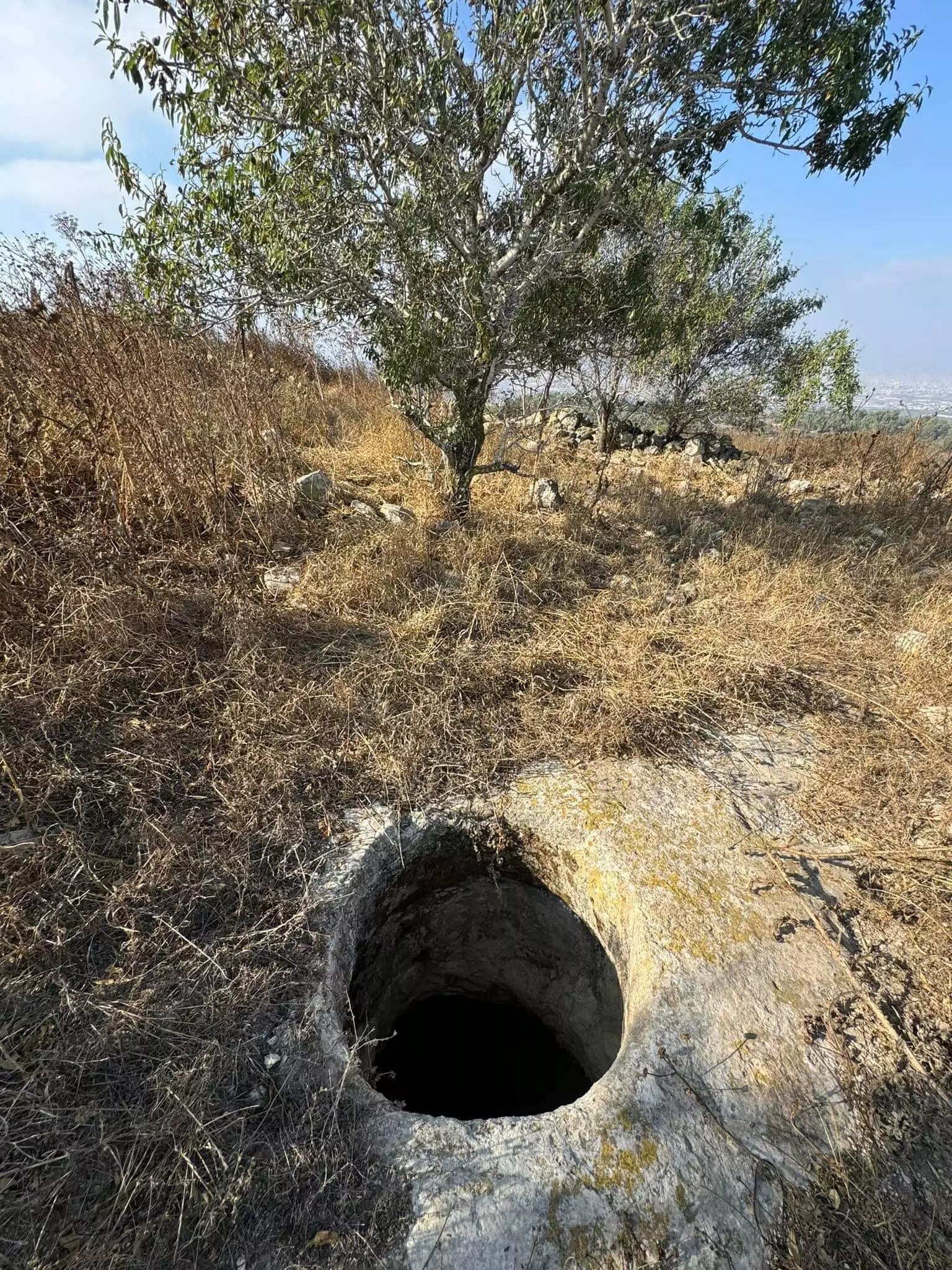
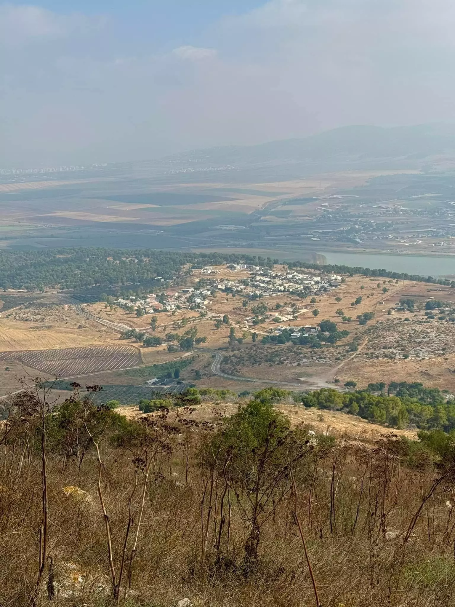
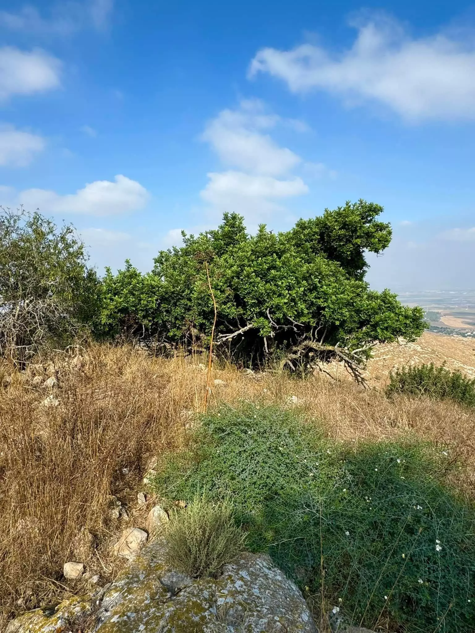
Village Before NakbaThe village stood on the flat, circular peak of Mount al-Mazar. The mountain sloped steeply on all sides except the southeast, where the land rose to join the peaks of the nearby Jaylun Mountains. AI-Mazar was linked by a dirt path to the village of Nuris below it (see Nuris, Jenin sub-disctrict) and by another path to two adjacent villages. It may have been named al-Mazar (Arabic for 'a shrine,' 'a place one visits') because it was the burial place for many of those who fell in the decisive battle of 'Ayn Jalut (1260), in which the Mamluks of Egypt triumphed over the Mongols. In the late nineteenth century, al-Mazar was a village built of stone on the summit of a mountain. Although the terrain was very rocky, a few olive trees were planted around the houses and a well had been dug to the southeast.The people of al-Mazar were Muslims. They traced their origins to the al-Sa'diyyun nomads who in turn were descended from Shaykh Sa'd aI-Din al-Shaybani (d. 1224), a prominent Sufi mystic from the village of Jaba in the Golan, Syria. The village was inhabited by members of a Sufi order and was a place of Muslim pilgrimage. [[SWP (1881) II:85]] It was the home of Shaykh Farhan al-Sa'di, a prominent leader of the 1936 Palestinian revolt. AI-Mazar had a mosque in its eastern section. The houses of al-Mazar occupied the peak of the mountain, surrounded by agricultural land. Agriculture, the backbone of the village economy, was based on grain, fruits, legumes, and olives. In 1944/45 a total of 5,221 dunums was allocated to cereals; 229 dunums were irrigated or used for orchards, of which 68 dunums were for olives. Village Occupation and Ethnic CleaningIsraeli forces broke through to al-Mazar and occupied it after they had captured the villages of Nuris and Zir'in on 30 May 1948. The History of the War of Independence states that the unit involved was the Fourth Battalion of the Golani Brigade. Earlier, in April, Palmach headquarters had issued orders to its First Battalion 'to destroy enemy bases' in all three villages, but these orders do not seem to have been acted upon immediately. Shortly after occupying this village, Israeli forces went on to strike at the town of Jenin, which they did not succeed in holding.Zionists Colonies on Village LandsThere are three Israeli settlements on village lands: Perazon (179216), founded in 1953; Meytav (178216), founded in 1954; and Gan Nir, founded in 1987.Village TodayThe site is overgrown with thorns and cactuses and strewn with stone rubble. None of the village houses or landmarks remain. Almond trees and cactuses grow on parts of the village lands. The hilly lands are used as grazing areas, and other parts are covered with forest (see photos section).SourceDr. Walid al-Khalidi, 1992: All That Remains. |
|||||||||||||||
| Related Maps | Town Lands' Demarcation Maps خرائط للقضاء توضح حدود القرى والاودية Town's map on MapQuest View from satellite Help us map this town at WikiMapia |
||||||||||||||
| Related Links | Wikipedia's Page Facebook Page Google Search Google For Images Google For Videos |
||||||||||||||
| More Information | في كتاب كي لا ننسى في كتاب بلادنا فلسطين المزيد من موقع هوية |
||||||||||||||
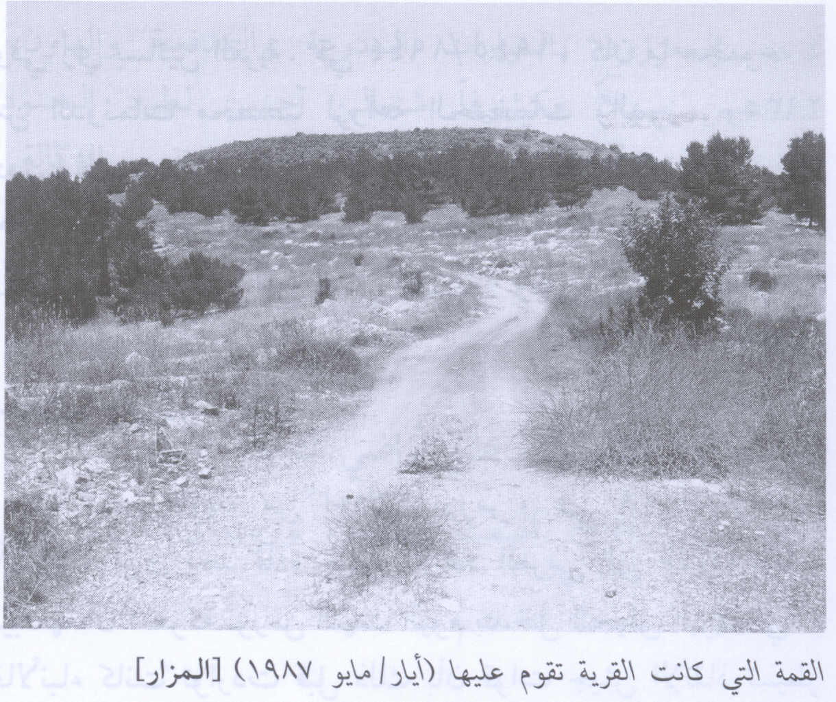
- The hill on which the village stood before destruction, 1987
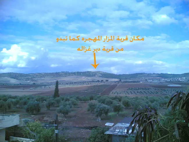
Scanned from "All That Remains" by Dr. Walid Khalidi 2 - صورة قرية المزار حديثة من قرية دير غزالة المجاور صورة شهر 7-2008
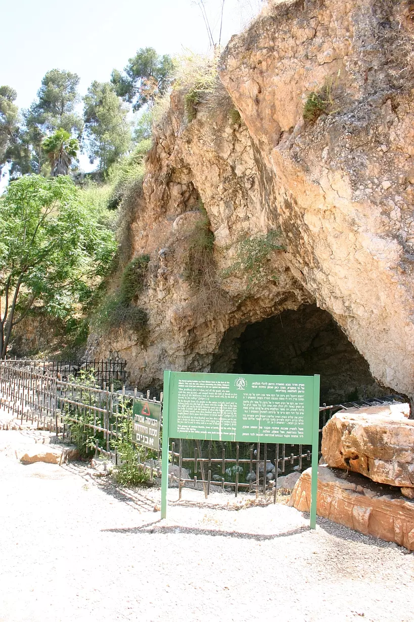
Posted by ابو صالح 5 - 'Ein Jalut
Posted by Uri Zackhem - That is how the "civilized" erased and replaced us: al-Mazar was completely obliterated, as you see -- المزار باتت أثر بعد عين. من هنا مر الهمجّ باتت أثر بعد عين. من هنا مر الهمجّ
- That is how the "civilized" erased and replaced us: al-Mazar was completely obliterated, as you see -- المزار باتت أثر بعد عين. من هنا مر الهمجّ باتت أثر بعد عين. من هنا مر الهمجّ #2
- That is how the "civilized" erased and replaced us: al-Mazar was completely obliterated, as you see -- المزار باتت أثر بعد عين. من هنا مر الهمجّ باتت أثر بعد عين. من هنا مر الهمجّ #3
- That is how the "civilized" erased and replaced us: al-Mazar was completely obliterated, as you see -- المزار باتت أثر بعد عين. من هنا مر الهمجّ باتت أثر بعد عين. من هنا مر الهمجّ #4
Want to browse more? 80,000 pictures were grouped in these gallaries:
| Display Name | Clan/Hamolah | Country of Residence |
| eng.m.ils3di | - | - |
| sa3di84 | Al-Sadi | - |
| R_SA3DI | السعدي | jordan |
| muhammed Al-Sa`di | Alsa`di | amman |
| mansour | alsadi | - |
| Ahmad Tawfiq Saleem Al Sa'adi | Al Sa'adi | - |
| Amin Al-Sadi | Al-Sadi | - |
| goalsadi | alsadi | malaysia |
| Fadi Audah | - | - |
| isam alsadi | al-sadi | - |
No links have been shared yet, be free to the first to share the first link.
 Fake Valor: Why Did Zionist Jews Hoist Nazis Flag on Their Ships in the 1930s?
What is new?
-
Facts About Oct. 7th Gaza Raid
-
Remined Us Please:: Who Did Rape Who? Palestinians Raped Israelis? Or, was the other way around?
-
When Prof. Edward Said was invited to debate Bibi Netanyahu in the 1980s, watch what happened!
-
Abusing Blood Libel!
-
Zionist FAQ: Isn't it true that Palestinians don't want peace? Palestinians never accepted the two-state solution
- Facts about Haavara (Transfer) Agreement between Ben-Gurion & Hitler
-
Haavara FAQs: Why Did Zionist Jews Hoist Nazis' Flags on Their Ships in the 1930s?
-
Dear ChatGPT: Why did the Jewish Agency suppress news of the Holocaust during WWII?
-
Video Playlist: Jews share their DNA tests to end the conflict for good.
-
A Tale of Two Conflicts: Examining the Definition of Genocide
-
Prof. Abraham Polak And The Suppressed History of the Khazars and European Jewry
-
How Ronald Reagan would have framed the genocide in Gaza if he were still alive?
-
Haavara FAQs: Let us do the math: how many German Jews did The Haavara Agreement save?
-
Zionist FAQs: The Hebron Massacre of 1929, "clearly proves" that Palestinians are antisemitic, how could you deny it?
-
Zionist FAQs: Why Anti-Zionist Is Not Antisemitism?
-
Zionist FAQs: Isn't it true that the KGB create Palestinian Nationalism in the early 1960s?
- Zionist FAQs: Muslims are killing Muslims all the time; why are Israeli Jews being singled out in the media?
- Zionist FAQs: How is Israel an apartheid state when 20% of its citizens are Arabs who enjoy full rights?
-
Haavara FAQs: Analysis of Herzl's Uganda Scheme and how it could have saved millions of Jews.
-
Haavara FAQs: Why did Hayim Greenberg describe American Jewry as "morally bankrupt" in early 1943?
-
Haavara FAQs: What if the Evian Conference was a resounding success? What would have been the impact of saving European Jewry on Zionism?
- Haavara FAQs: What if the six million were saved, how that would have impacted the Zionist project?
-
Haavara FAQs: How did Zionist leaders react when Europe's Jews lingered in the DP camps after WWII ended?
-
Why does the American Jewish community repeat lies that David Ben-Gurion had debunked before he died?
-
Who has the power to rename the Tatar/Khazar Gene Marker to Jewish IV?
-
Zionist FAQs: Why won't Egypt, Syria, and Jordan take their people back? Jews are indigenous to Palestine, and Arabs immigrated after Jews developed the country. Arabs should leave.
-
Haavara FAQs: Did Hitler and the Nazis conflate between Judaism and Zionist? If that wasn't case, then why?
-
Haavara FAQs: Winston Churchill and antisemitism, a collection of articles written Churchill.
-
Haavara FAQs: Broken by country, how many Jews survived vs. killed during the Holocaust?
-
Haavara FAQs: Why did European Jews vote with their feet and to immigrated to the Americas, not Palestine, after WWII?
-
Watch this American Jewish Girl describing Israeli Jews' cognitive dissonance like no other in under two minutes
-
Haavara FAQs: When the Nazis went out of their way to hide the Holocaust, Israeli Jews did the exact opposite by broadcasting their genocide of Gazans. But why?
-
Haavara FAQs: How Zionist Jews went out of their to show their appreciation to Nazism and Fascism?
- Haavara FAQs: Why Zionist leaders were against bombing the death camps & the Railroads leading to them?
-
Haavara FAQs: Hitler's message to the British and American people: If Jews are such noble citizens and you care about them, how come you're not letting them in? I will gladly ship them to you at my expense, even on luxury liners!
-
A shortlist of Zionist and Israeli false flag operations in the name Jews.
-
The Most Moral Army
- The Land of Kapos (Israel): Where the brave are boycotted and Kapos walk free.
- Why did early Zionists often named their communal enterprises "colonial"?
- Zionist Relations with Nazi Germany by Faris Glubb
-
Two NY Times advertisements by Zionists in the early 1943 that exposes Zionists' treason at the height of the calamity
- Facts Not Lies about the Palestinian-Israeli Conflict.
- Site's pictures have been categorized
- Campgain Against Lice
- A Survey of Palestine, the official source about Palestine before Nakba produced by the British Mandate; over 1200 pages.
- Satellite View & Google Earth: Over 6,000 placemarks identifying all destroyed towns, W. Bank & Gaza Strip Towns, & refugee camps.
- PalestineRemembered.com and its Nakba Oral History Project were featured on al-Jazeera Satellite TV.
- Nakba Oral History Video Podcast:
 Over 700 Oral History interviews (including 3,500+ hours of recording) can be viewed online.
 - Palestine Village Statistics Project
- Gaza Jail Break
- النسخة العربية للموقع الان متوفرة
- Videos: Documenting the destroyed villages in video: Tracing all that remains since Nakba.
- Videos: Responding to Zionist Propaganda
- Interview: The ethnic cleansing of Palestine: George Galloway interviews Israeli Historian Ilan Pappe.
- For Palestinians, memory matters. It provides a blueprint for their future By George Bisharat.
- Zionist FAQ now available in Hebrew שאלות שציונים שואלים, עכשיו בעברית
- Video: The Stephen Walt and John Mearsheimer report on the influence of the Israel Lobby on U.S. Foreign Policy
- The Palestinian-Israeli conflict for beginners
