| PalestineRemembered | About Us | Oral History | العربية | |
| Pictures | Zionist FAQs | Haavara | Maps | |
| Search |
| Camps |
| Districts |
| Acre |
| Baysan |
| Beersheba |
| Bethlehem |
| Gaza |
| Haifa |
| Hebron |
| Jaffa |
| Jericho |
| Jerusalem |
| Jinin |
| Nablus |
| Nazareth |
| Ramallah |
| al-Ramla |
| Safad |
| Tiberias |
| Tulkarm |
| Donate |
| Contact |
| Profile |
| Videos |
Welcome To Kirad al-Baqqara - كراد البقارة (כיראד אל-בקארה)
|
District of Safad
Ethnically cleansed days ago |
العربية Google Earth |
 |
Gallery (30) |
- Statistics & Facts
-
Before & After

- Satellite View
- Articles 4
- Pictures 30
- Oral History 2
- Members 6
- All That Remains
- Wikipedia
- Videos
- Guest Book 5
- Links
| Statistic & Fact | Value | |||||||||||||||
| Occupation Date | April 22, 1948 | |||||||||||||||
| Distance From District | 11 (km) North West of Safad | |||||||||||||||
| Elevation | 125 (meters) | |||||||||||||||
| Before & After Nakba, Click Map For Details |
||||||||||||||||
|
||||||||||||||||
| Map Location | See location #53 on the map View from satellite |
|||||||||||||||
| Military Operation | Operation Yiftach (commanded by the ethnic cleansing champion Yigal Allon) | |||||||||||||||
| Attacking Units | The Palmach's First Battalion | |||||||||||||||
| Exodus Cause | Influence of fall of, or exoduce from, neighboring town | |||||||||||||||
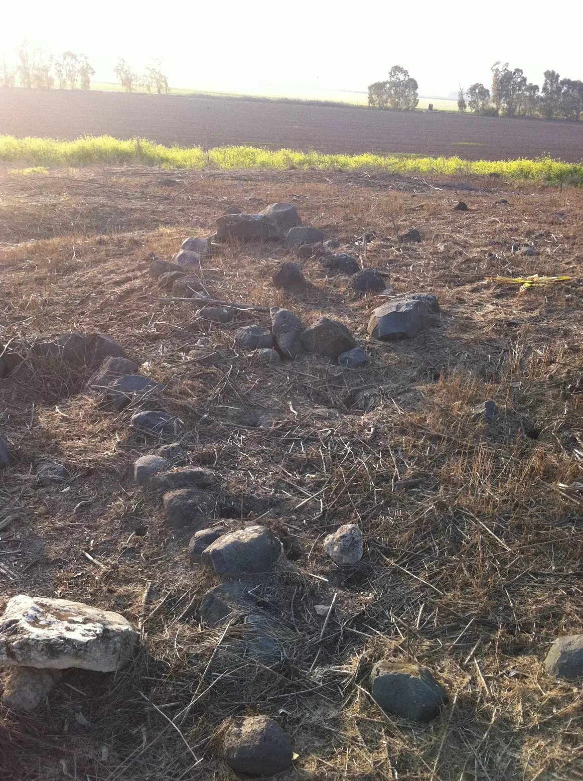
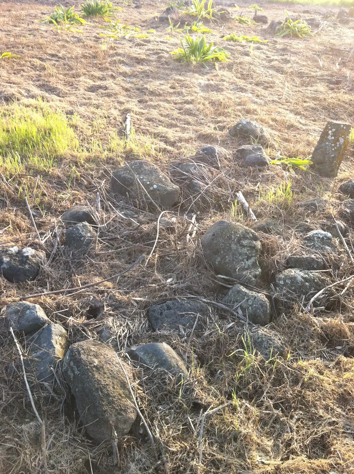
| Village Temains | The village has been completely destroyed, and only the rubble of destroyed houses left behind. | |||||||||||||||
| Ethnically Cleansing | In 1956, the DMZ's 2,200 inhabitants have been terrorized into fleeing to Syria. | |||||||||||||||
| Pre-Nakba Land Ownership |
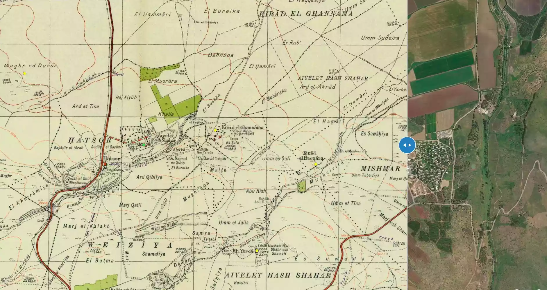
**Town Lands' Demarcation Maps |
|||||||||||||||
| Land Usage As of 1945 |
|
|||||||||||||||
| Population |
|
|||||||||||||||
| Number of Houses |
|
|||||||||||||||
| Near By Towns |
||||||||||||||||
|
||||||||||||||||
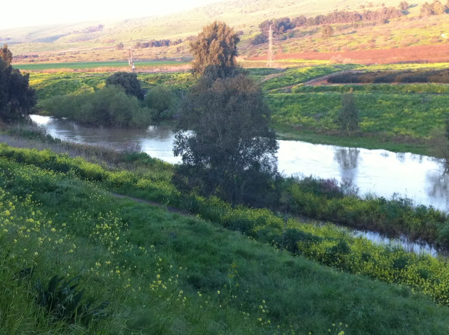
| Nearby Wadies & Rivers | Wadi Mushayrifa ran between the two Kirad villages (al-Ghannama and al-Baqqara) | |||||||||||||||
| Exculsive Jewish Colonies Who Usurped Village Lands |
Gadot and Mishmar ha-Yarden | |||||||||||||||
| Featured Video | ||||||||||||||||
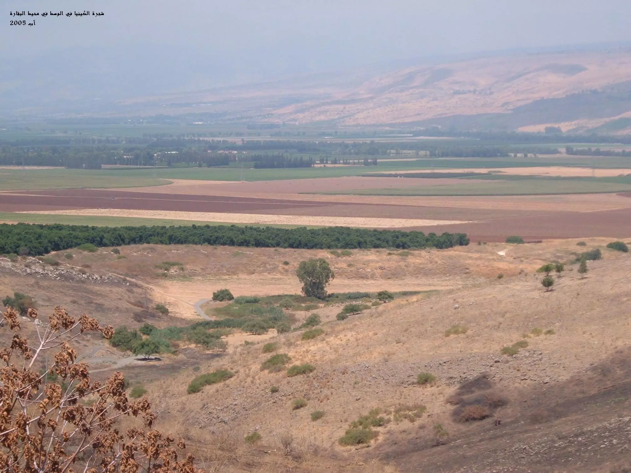
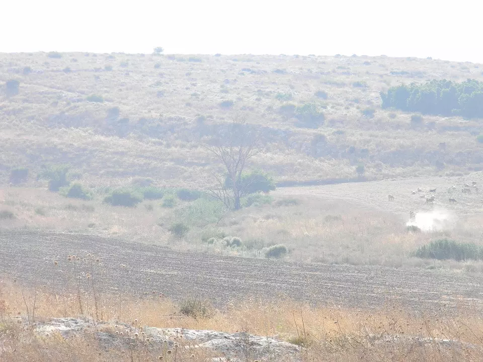
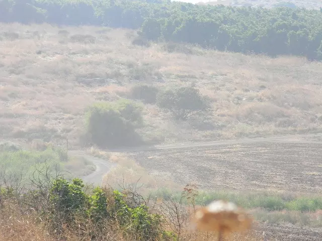
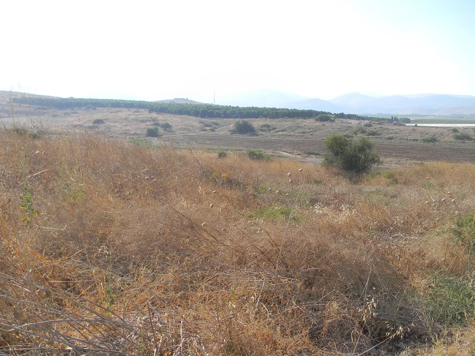
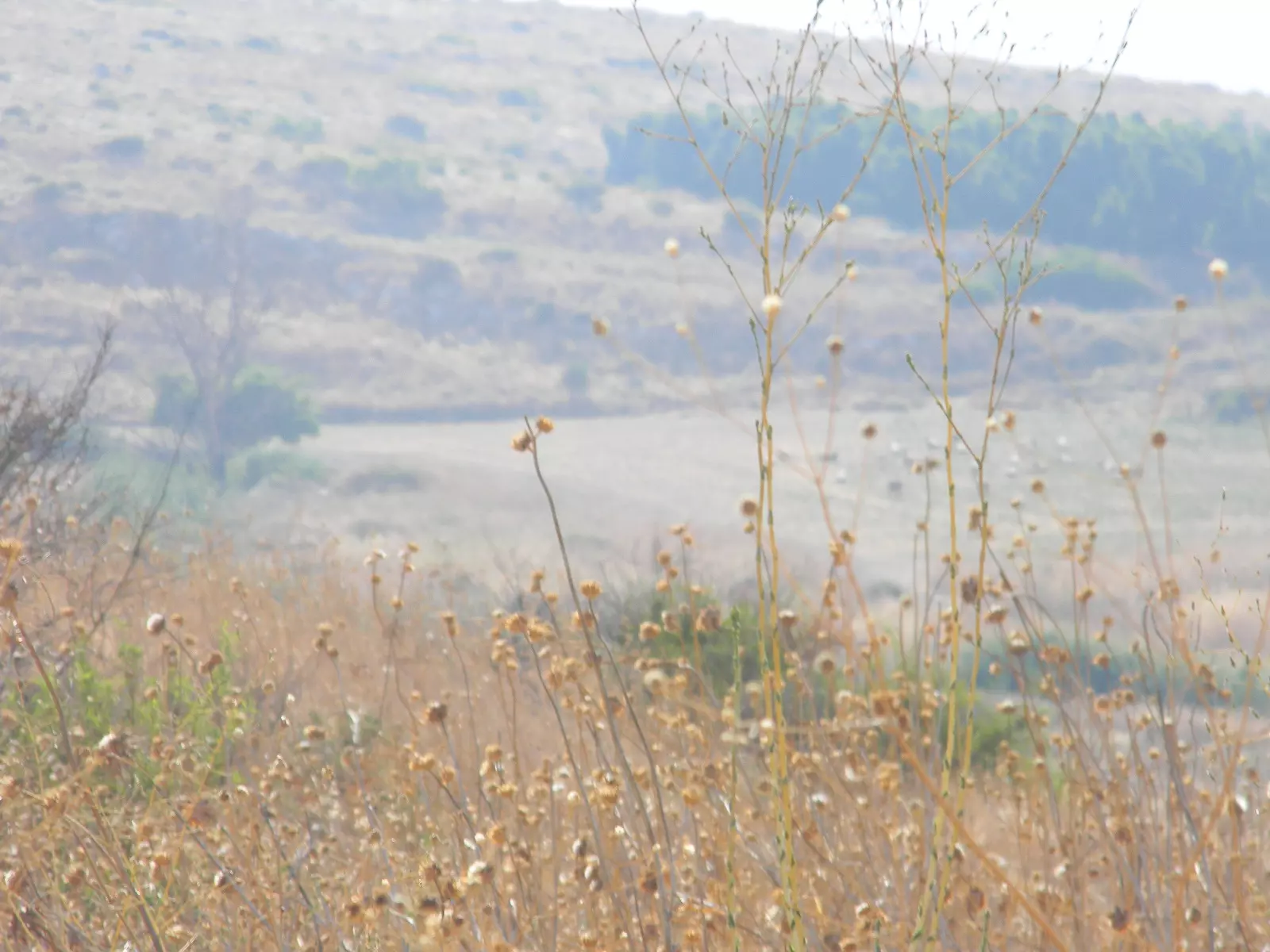
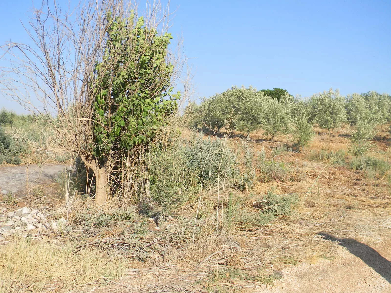
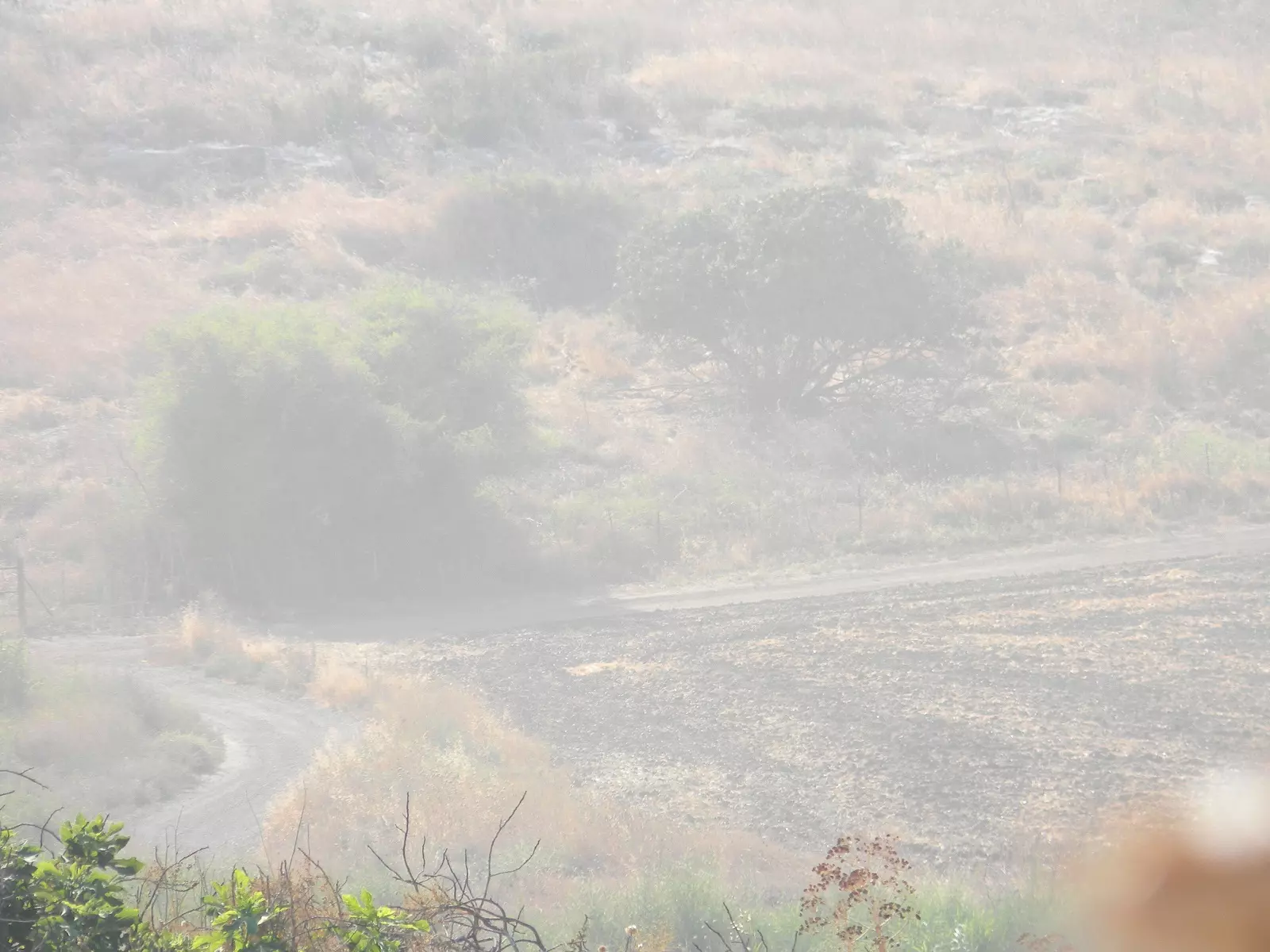
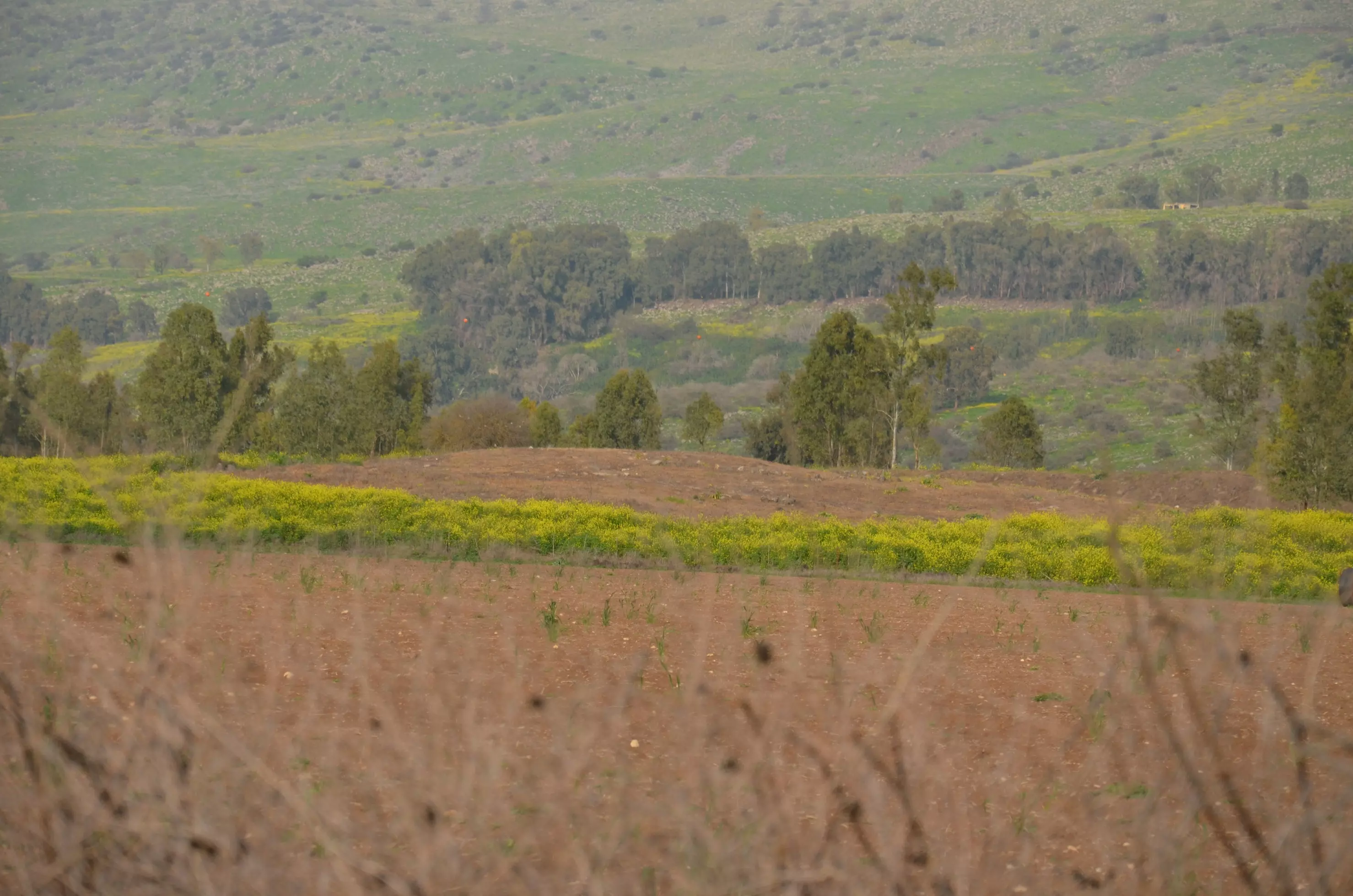
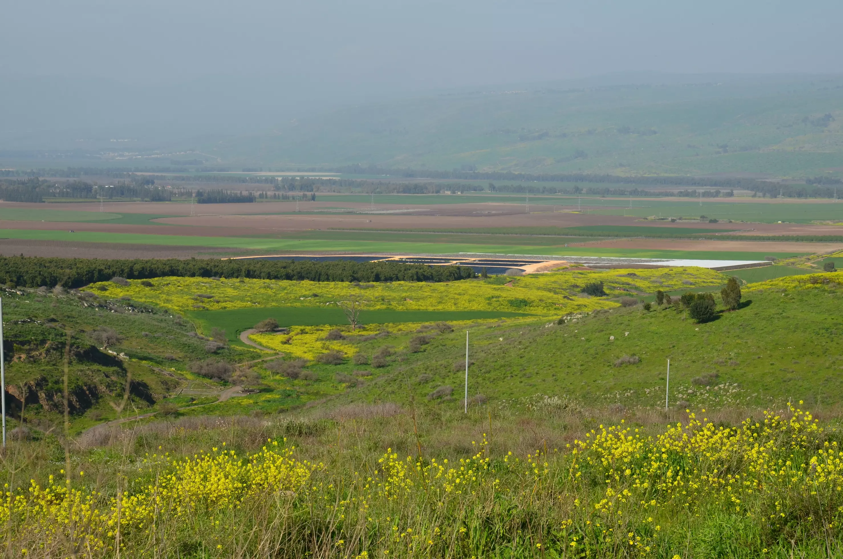
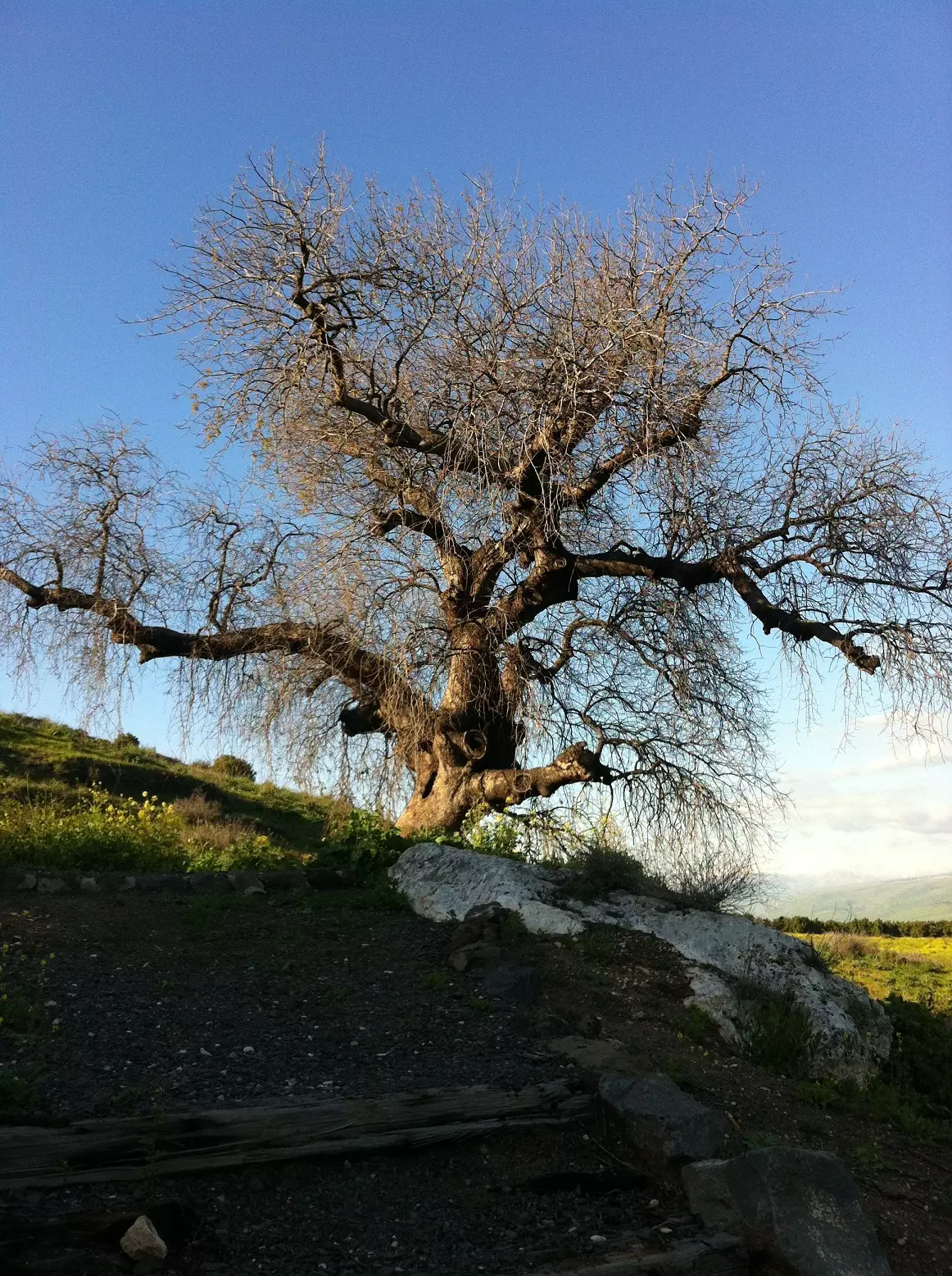
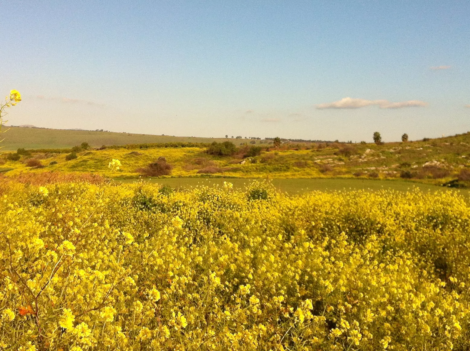
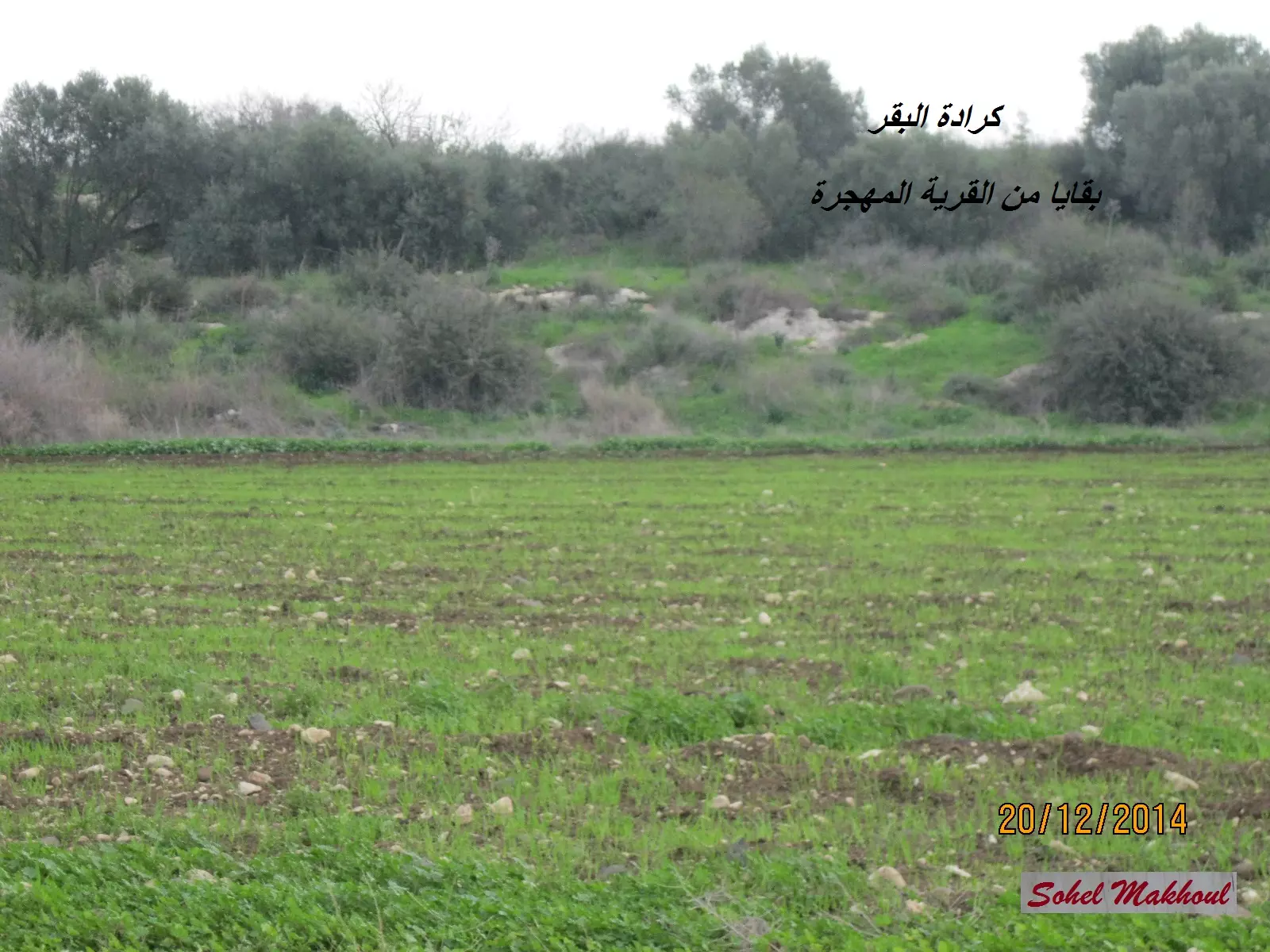
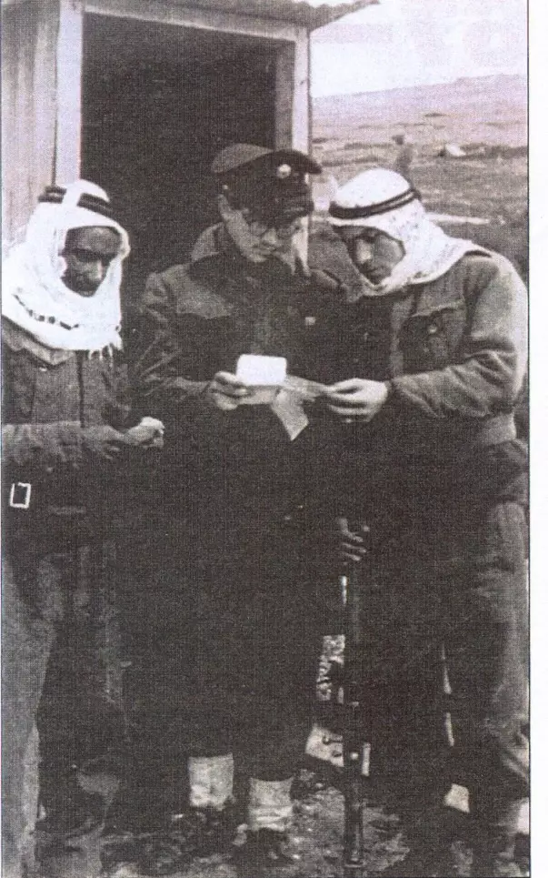
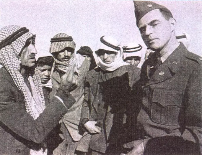
Village Before NakbaThe village stood on a volcanic (basalt) outcrop on the southern edge of the al-Hula Plain, surrounded by the sedimentary rock typical of this part of the Lisan Formation. Kirad al-Baqqara was east of Kirad al-Ghannama and was slightly less elevated; Wadi Mushayrifa ran between them. Both villages were initially populated by Bedouin who had settled in the area to take advantage of the fertile soil and abundant grasses. They had used the land as pasture for cattle and sheep, hence the village names: Baqqara (derived from the Arabic baqara, "cow") and Ghannama (from ghanama, "sheep"). Kirad al-Baqqara was classified in the Mandate Palestine Index Gazetteer as a hamlet, and its entire population was Muslim. It shared a coeducational school with its twin village. Various grains (especially those used as cattle fodder, such as corn) were the primary crop, but citrus fruits and onions were cultivated as well. In 1944/45 a total of 1,961 dunums was allocated to cereals and 60 dunums were irrigated or used for orchards. (See also the twin village of Kirad al-Ghannama.)Village Occupation and Ethnic CleaningKirad al-Baqqara is mentioned as one of several villages evacuated in the first week of Operation Yiftach (see Abil al-Qamh, Safad sub-disctrict) due to 'Jewish attacks-mortaring or ground assaults-and fear of Jewish revenge or of becoming embroiled in others' battles,' In this particular case, the villagers 'feared being in harm's way during the expected Syrian invasion,' according to Israeli historian Benny Morris, paraphrasing a Haganah intelligence report. This explanation is somewhat suspect since the villagers are believed to have left on 22 April 1948, over three weeks before the entry of Syrian troops into Palestine. [M:123–24] In any case, the Yiftach evacuation was either temporary or incomplete, or both. Over a year later, in July 1949, Morris reports that Israeli efforts were underway to evict the villagers again. This effort was by no means a strictly military operation, since the war was long over and the village fell within the Demilitarized Zone (DMZ), according to the armistice agreement signed with Syria. The agreement included a provision protecting some seven villages located within the DMZ; nevertheless, between 1949 and 1956 pressure was applied to 'induce' most of the population of these villages to go into exile in Syria. By 1956, the DMZ's 2,200 inhabitants had been pushed out by a combination of 'economic and police pressure and 'petty persecution,' and economic incentives ... ' according to Morris. [Burns 1969:115, 318; M:243]Zionists Colonies on Village LandsThere are no Israeli settlements on village lands. However, the settlements of Gadot (205269) and Mishmar ha-Yarden (206267), both founded in 1949, are 1 km east and 1.5 km south of the village site, respectively.Village TodayThe village site is littered with rubble, piles of stones, and fragments of houses. Grass, Christ's-thorn trees, and cactuses grow throughout the site.SourceDr. Walid al-Khalidi, 1992: All That Remains. |
||||||||||||||||
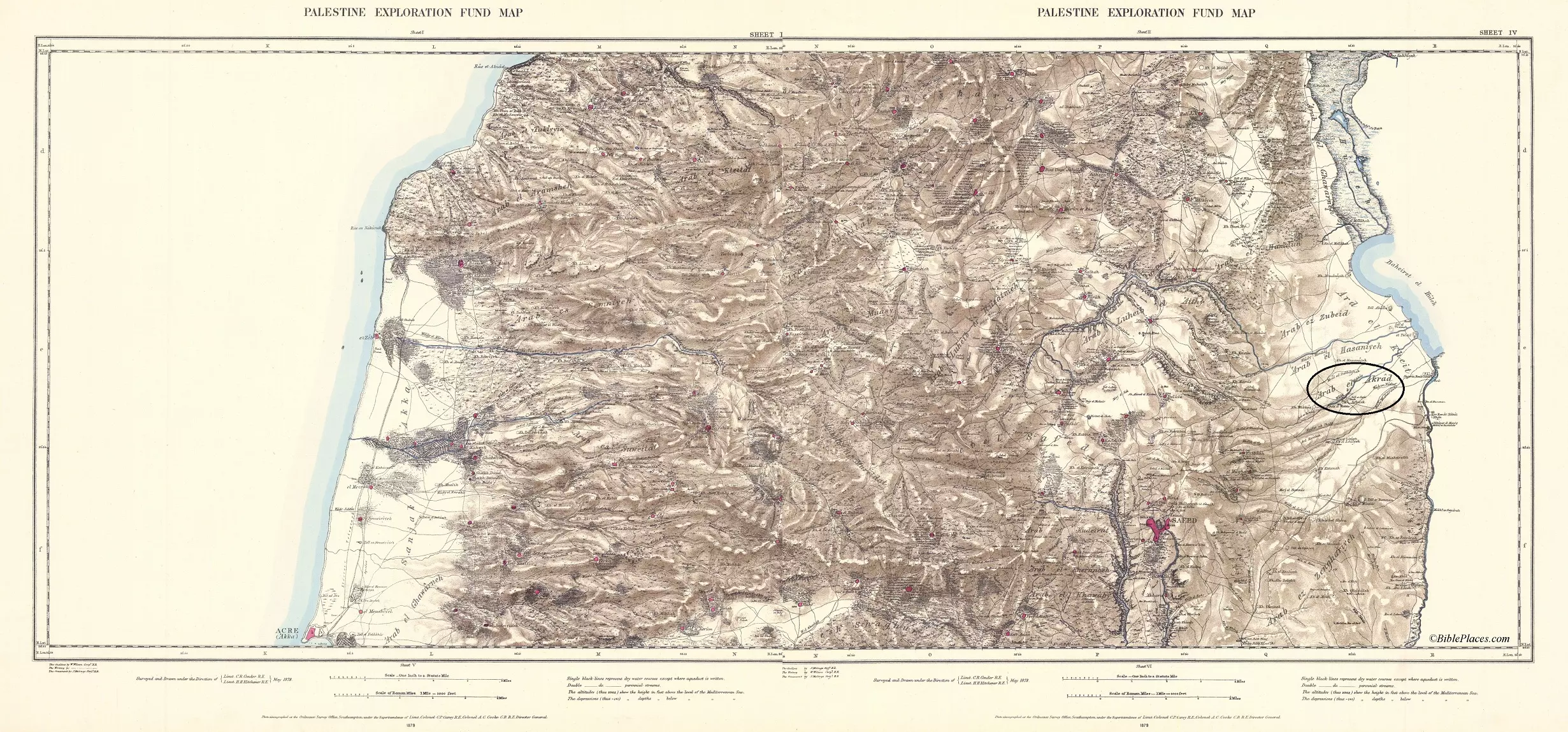
| Related Maps | Town Lands' Demarcation Maps خرائط للقضاء توضح حدود القرى والاودية Town's map on MapQuest View from satellite Help us map this town at WikiMapia |
|||||||||||||||
| Related Links | Wikipedia's Page Google Search Google For Images Google For Videos |
|||||||||||||||
| More Information | في كتاب كي لا ننسى في كتاب بلادنا فلسطين المزيد من موقع هوية |
|||||||||||||||
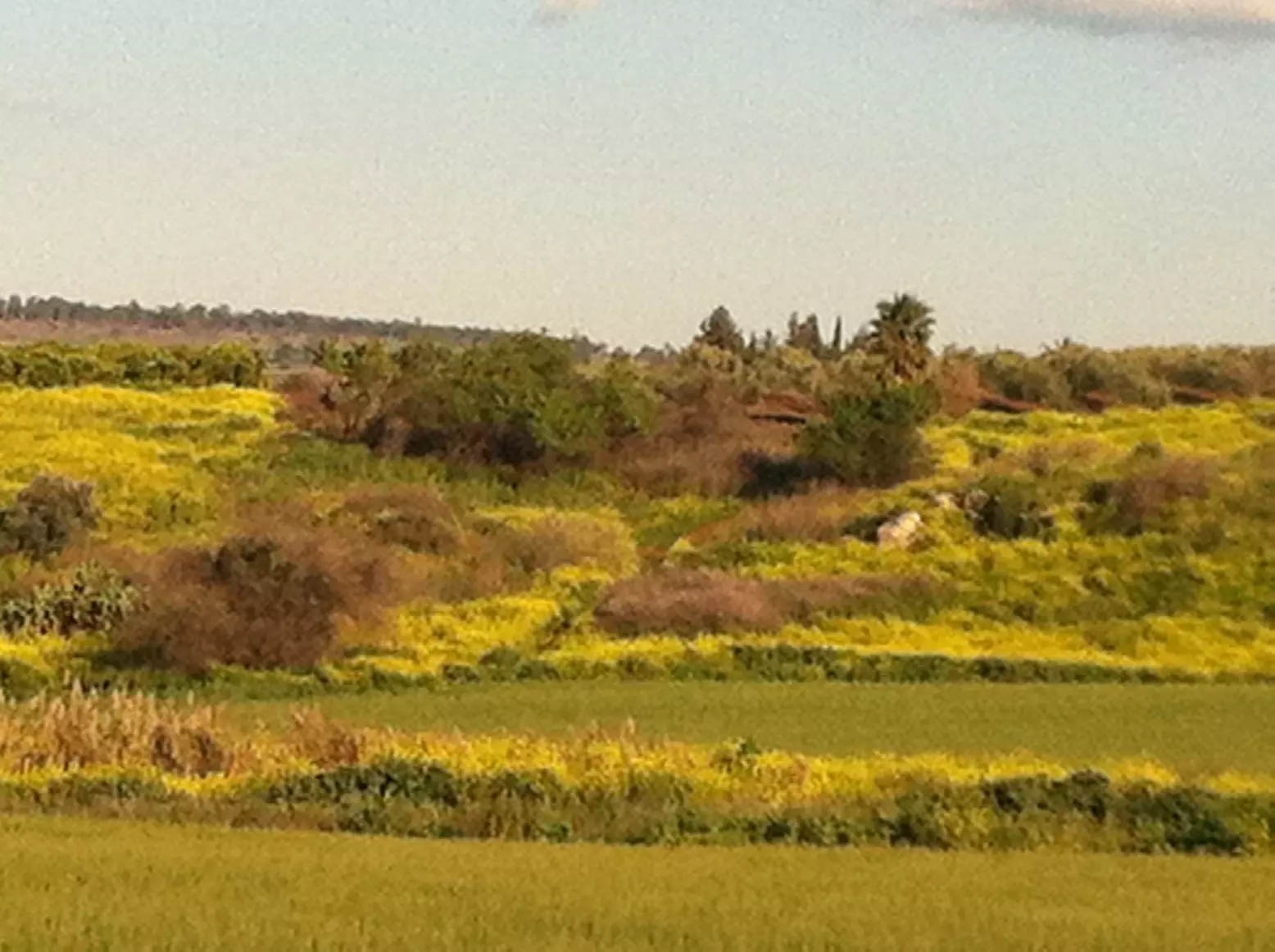
- kirad el baqqara abu rish hill
Posted by Atef Azaiza 1 - محيط قرية البقارة ,التقطت في 12/08/2011
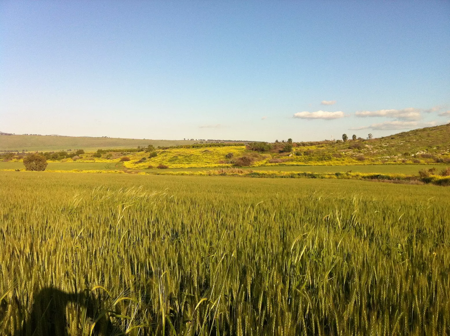
Posted by Atef Azaiza - موقع قرية اكراد البقارة من الجهة الغربية .التقطت في 12/08/2011
Posted by Atef Azaiza - موقع قرية اكراد البقارة . آب 2011
Posted by Atef Azaiza - الناحية الغربية من قرية اكراد البقرة .آب 2011
Posted by Atef Azaiza - أراضي كراد البقارة من الجهة الشرقية .حُملت في آب 2011
Posted by Atef Azaiza - موقع اكراد البقارة .حُملت في آب 2011
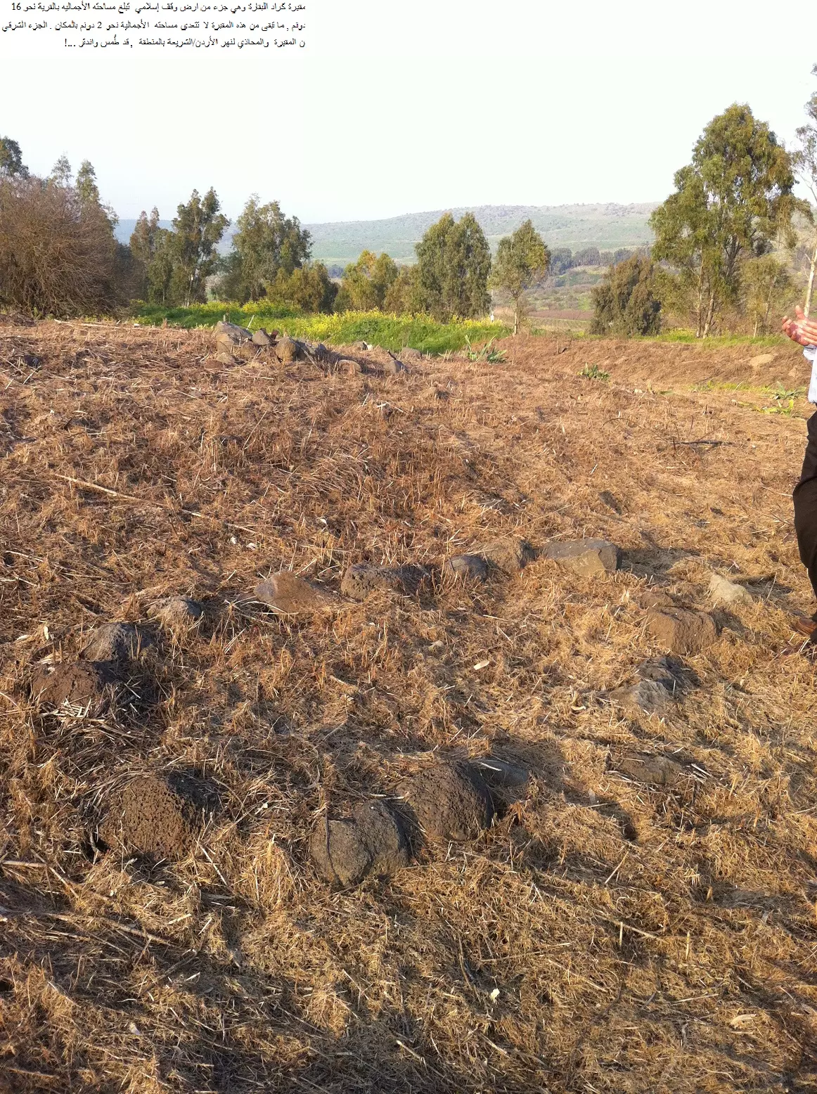
Posted by Atef Azaiza - مقبرة كراد البقارة الواقعة في الجهة الغربية المقابلة لمزارع الدريجات السورية .التقطت في 8/3/2012
Posted by Atef Azaiza - صورة لقبور مندثرة في مقبرة كراد البقارة .التقطت في 8/3/2012
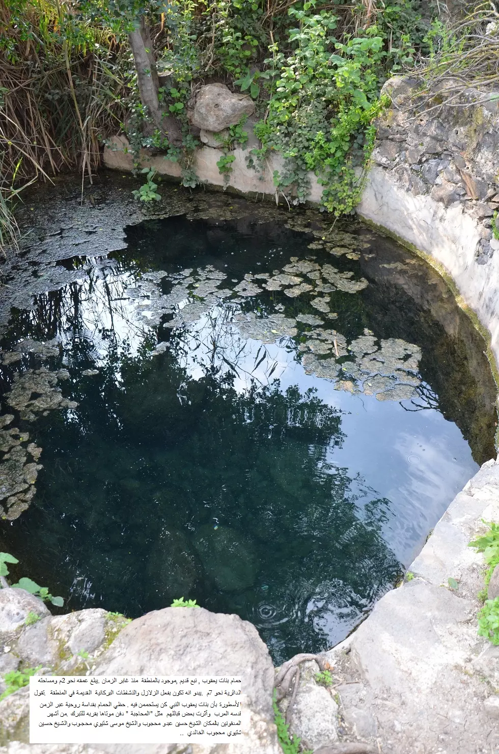
Posted by Atef Azaiza - تقع مقبرة كراد البقارة أو المعروفة بحسب تسميتها القديمة (( مقبرة بنات يعقوب)) ,بمحاذاه نهر الأردن / الشريعة , الى الشمال من جسر بنات يعقوب , على بعد 3 كم عنه ,وعلى بعد 500م شمالي حمام بنات يعقوب .
Posted by Atef Azaiza - حمام بنات يعقوب .التقطت في 8/3/2012
Posted by Atef Azaiza - حمام بنات يعقوب , نبع قديم ,موجود بالمنطقة منذ غابر الزمان
Posted by Atef Azaiza - قبور مندثرة في مقبرة كراد البقارة
Posted by Atef Azaiza - منظر عام لموقع قرية كراد البقارة .حُملت في آذار 2012
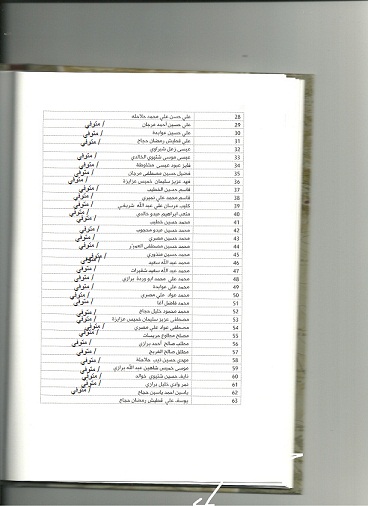
Posted by Atef Azaiza - قائمة بأسماء سكان قريتي كراد البقارة والغنامة المهجرين

Posted by Atef Azaiza - تتمة قائمة أسماء سكان قريتي كراد البقارة والغنامة المهجرين
Posted by Atef Azaiza - موقع عرب الأكراد بموجب خريطة بريطانية تعود لعام 1870م
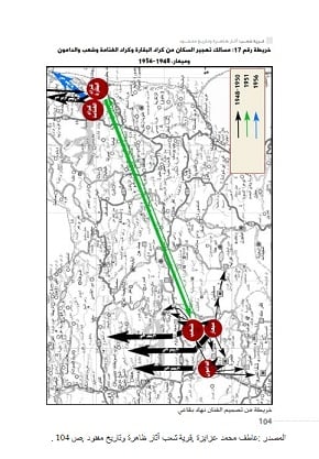
Posted by Atef Azaiza - مسالك تهجير السكان من كراد البقارة والغنامة
Posted by Atef Azaiza - مقام أبو الريش
Posted by Atef Azaiza - موقع قرية كراد البقارة من الجهة الجنوبية لوادي يردا
Posted by Atef Azaiza - موقع الحارة الجنوبية من كراد البقارة
Posted by Atef Azaiza - منظر عام لموقع كراد البقارة جنوبي وادي يردا
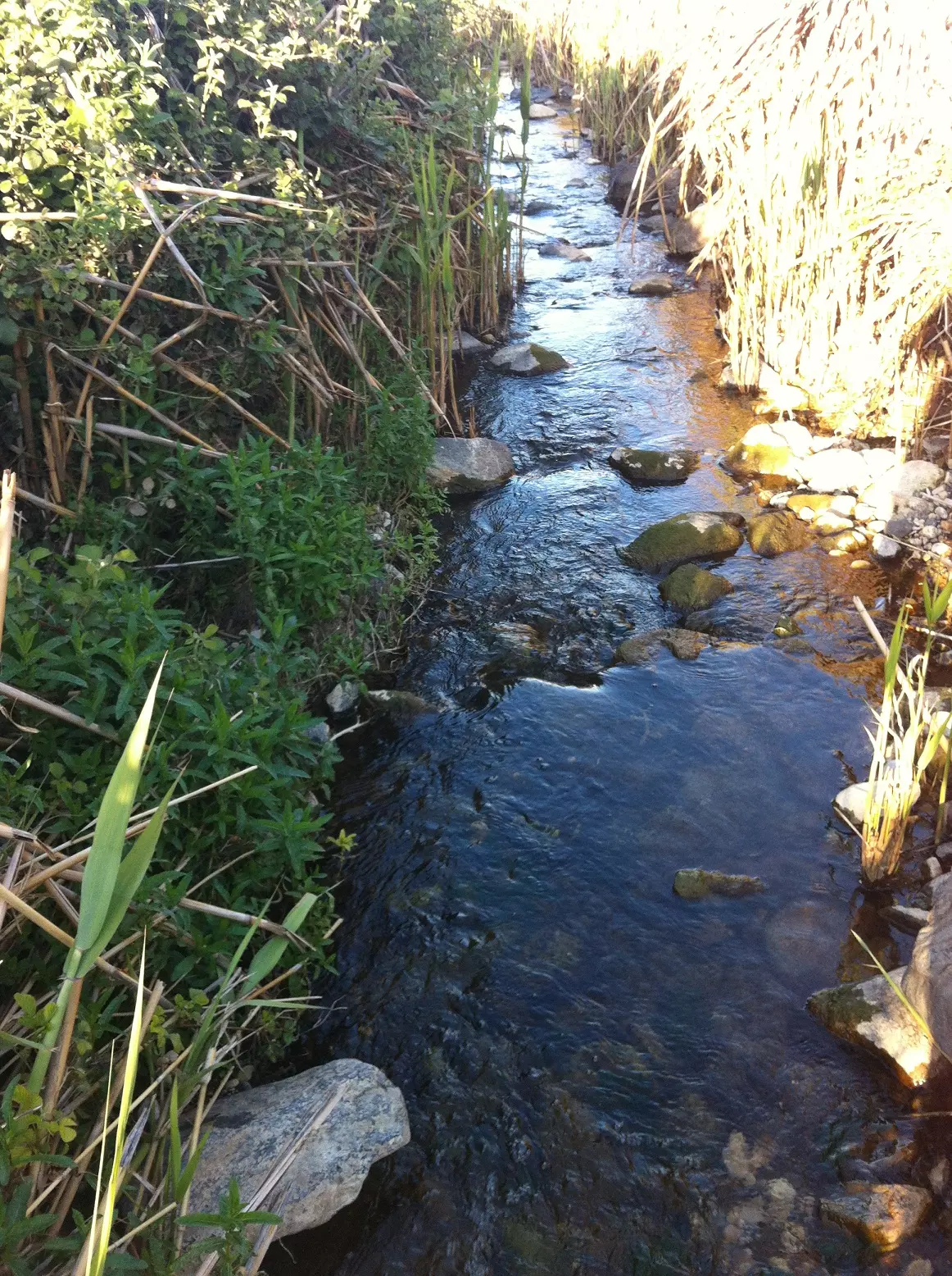
Posted by Atef Azaiza - وادي يردا الذي يمر من وسط كراد البقارة
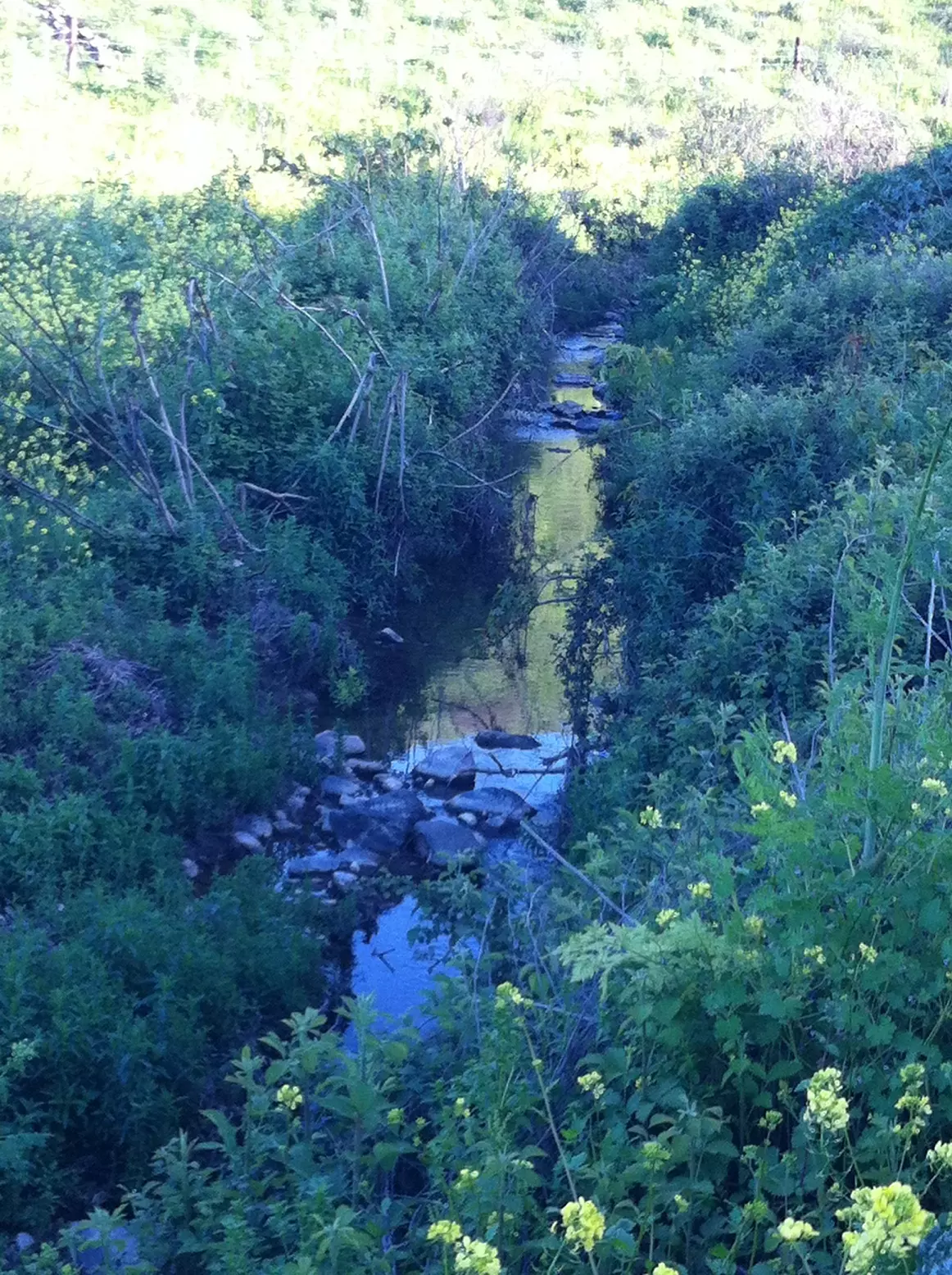
Posted by Atef Azaiza - وادي يردا
Posted by Atef Azaiza - نهر الأردن/ الشريعة بالقرب من مقبرة كراد البقارة
Posted by Atef Azaiza - كراد البقارة - منظر لموقع القرية المهجرة يوم 20 كانون الأول 2014 بعدسة سهيل مخول
Posted by سهيل مخول - صوره قديمه لشرطيين من قريه كراد الغنامه على جسر بنات يعقوب
Posted by abu raya - صوره قديمه لاهل كراد الغنامه مع مراقب الامم المتحده قبل تهجيرهم
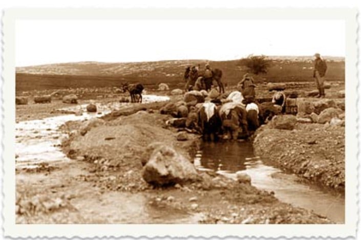
Posted by abu raya - صوره قديمه لسكان من قريه كراد البقاره على نبع يردا جنوب القريه
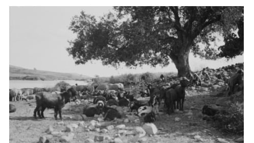
Posted by abu raya - صوره لراعي مع ماشيته بالقرب من نهر الاردن سنه 1918
Posted by abu raya
Want to browse more? 80,000 pictures were grouped in these gallaries:
| Display Name | Clan/Hamolah | Country of Residence |
| محسن يوسف خلف | خليفة خلف | دمشق - مخيم سبينة , سوريا |
| الباز | - | - |
| zuhdi | albakara | aljalel, aljalel |
| ابو مازن | اكراد البقارة | دمشق |
| Atef Azaiza | Azaiza | - |
| nasser al kalla | - | qatar, qatar |
No links have been shared yet, be free to the first to share the first link.
 Fake Valor: Why Did Zionist Jews Hoist Nazis Flag on Their Ships in the 1930s?
What is new?
-
Facts About Oct. 7th Gaza Raid
-
Remined Us Please:: Who Did Rape Who? Palestinians Raped Israelis? Or, was the other way around?
-
When Prof. Edward Said was invited to debate Bibi Netanyahu in the 1980s, watch what happened!
-
Ezra Klein of the NY Times on the "Jewish Race".
-
Abusing Blood Libel!
-
Did Israeli Soldiers Activate The Hanniba Direective On Oct. 7th? You Be The Judge
-
Zionist FAQ: Isn't it true that Palestinians don't want peace? Palestinians never accepted the two-state solution
- Facts about Haavara (Transfer) Agreement between Ben-Gurion & Hitler
-
Haavara FAQs: Why Did Zionist Jews Hoist Nazis' Flags on Their Ships in the 1930s?
- Haavara FAQs: When Chaim Weizmann met FDR in mid-1943, why was he silent about rescuing European Jewry?
-
Dear ChatGPT: How did Palestinians resist Napoleon's invasion of their country in 1799?
-
Dear ChatGPT: Gaza had a vibrant Jewish community in the mid-17th century. What happened to them?
-
Dear ChatGPT: Why did the Jewish Agency suppress news of the Holocaust during WWII?
-
Video Playlist: Jews share their DNA tests to end the conflict for good.
-
A Tale of Two Conflicts: Examining the Definition of Genocide
-
Prof. Abraham Polak And The Suppressed History of the Khazars and European Jewry
-
How Ronald Reagan would have framed the genocide in Gaza if he were still alive?
-
Haavara FAQs: Let us do the math: how many German Jews did The Haavara Agreement save?
-
Zionist FAQs: The Hebron Massacre of 1929, "clearly proves" that Palestinians are antisemitic, how could you deny it?
-
Zionist FAQs: Why Anti-Zionist Is Not Antisemitism?
-
Zionist FAQs: Isn't it true that the KGB created Palestinian Nationalism in the early 1960s?
- Zionist FAQs: Muslims are killing Muslims all the time; why are Israeli Jews being singled out in the media?
- Zionist FAQs: How is Israel an apartheid state when 20% of its citizens are Arabs who enjoy full rights?
-
Haavara FAQs: Why Did Dorothy Thompson Flip From A Zionist Advocate to A Silenced Dissenter?
-
Haavara FAQs: Analysis of Herzl's Uganda Scheme and how it could have saved millions of Jews.
-
Haavara FAQs: Why did Hayim Greenberg describe American Jewry as "morally bankrupt" in early 1943?
-
Haavara FAQs: What if the Evian Conference was a resounding success? What would have been the impact of saving European Jewry on Zionism?
- Haavara FAQs: What if the six million were saved, how that would have impacted the Zionist project?
-
Haavara FAQs: How did Zionist leaders react when Europe's Jews lingered in the DP camps after WWII ended?
-
Why does the American Jewish community repeat lies that David Ben-Gurion had debunked before he died?
-
Who has the power to rename the Tatar/Khazar Gene Marker to Jewish IV?
-
Zionist FAQs: Why won't Egypt, Syria, and Jordan take their people back? Jews are indigenous to Palestine, and Arabs immigrated after Jews developed the country. Arabs should leave.
-
Haavara FAQs: Did Hitler and the Nazis conflate between Judaism and Zionist? If that wasn't case, then why?
-
Haavara FAQs: Winston Churchill and antisemitism, a collection of articles written Churchill.
-
Haavara FAQs: Broken by country, how many Jews survived vs. killed during the Holocaust?
-
Haavara FAQs: Why did European Jews vote with their feet and to immigrated to the Americas, not Palestine, after WWII?
-
Watch this American Jewish Girl describing Israeli Jews' cognitive dissonance like no other in under two minutes
-
Haavara FAQs: When the Nazis went out of their way to hide the Holocaust, Israeli Jews did the exact opposite by broadcasting their genocide of Gazans. But why?
-
Haavara FAQs: How Zionist Jews went out of their to show their appreciation to Nazism and Fascism?
- Haavara FAQs: Why Zionist leaders were against bombing the death camps & the Railroads leading to them?
-
Haavara FAQs: Hitler's message to the British and American people: If Jews are such noble citizens and you care about them, how come you're not letting them in? I will gladly ship them to you at my expense, even on luxury liners!
-
A shortlist of Zionist and Israeli false flag operations in the name Jews.
-
The Most Moral Army
- The Land of Kapos (Israel): Where the brave are boycotted and Kapos walk free.
- Why did early Zionists often named their communal enterprises "colonial"?
- Zionist Relations with Nazi Germany by Faris Glubb
-
Two NY Times advertisements by Zionists in the early 1943 that exposes Zionists' treason at the height of the calamity
- Facts Not Lies about the Palestinian-Israeli Conflict.
- Site's pictures have been categorized
- Campgain Against Lice
- A Survey of Palestine, the official source about Palestine before Nakba produced by the British Mandate; over 1200 pages.
- Satellite View & Google Earth: Over 6,000 placemarks identifying all destroyed towns, W. Bank & Gaza Strip Towns, & refugee camps.
- PalestineRemembered.com and its Nakba Oral History Project were featured on al-Jazeera Satellite TV.
- Nakba Oral History Video Podcast:
 Over 700 Oral History interviews (including 3,500+ hours of recording) can be viewed online.
 - Palestine Village Statistics Project
- Gaza Jail Break
- النسخة العربية للموقع الان متوفرة
- Videos: Documenting the destroyed villages in video: Tracing all that remains since Nakba.
- Videos: Responding to Zionist Propaganda
- Interview: The ethnic cleansing of Palestine: George Galloway interviews Israeli Historian Ilan Pappe.
- For Palestinians, memory matters. It provides a blueprint for their future By George Bisharat.
- Zionist FAQ now available in Hebrew שאלות שציונים שואלים, עכשיו בעברית
- Video: The Stephen Walt and John Mearsheimer report on the influence of the Israel Lobby on U.S. Foreign Policy
- The Palestinian-Israeli conflict for beginners
