| PalestineRemembered | About Us | Oral History | العربية | |
| Pictures | Zionist FAQs | Haavara | Maps | |
| Search |
| Camps |
| Districts |
| Acre |
| Baysan |
| Beersheba |
| Bethlehem |
| Gaza |
| Haifa |
| Hebron |
| Jaffa |
| Jericho |
| Jerusalem |
| Jinin |
| Nablus |
| Nazareth |
| Ramallah |
| al-Ramla |
| Safad |
| Tiberias |
| Tulkarm |
| Donate |
| Contact |
| Profile |
| Videos |
Welcome To Yarda - ياردا (ירדא)
|
District of Safad
Ethnically cleansed days ago |
العربية Google Earth |
 |
Gallery (75) |
- Statistics & Facts
-
Before & After

- Satellite View
- Articles 1
- Pictures 75
- Members
- All That Remains
- Wikipedia
- Videos
- Guest Book 1
- Links
| Statistic & Fact | Value | ||||||||||
| Occupation Date | April 1, 1948 | ||||||||||
| Distance From District | 10.5 (km) North East of Safad | ||||||||||
| Elevation | 225 (meters) | ||||||||||
| Before & After Nakba, Click Map For Details |
|||||||||||
|
|||||||||||
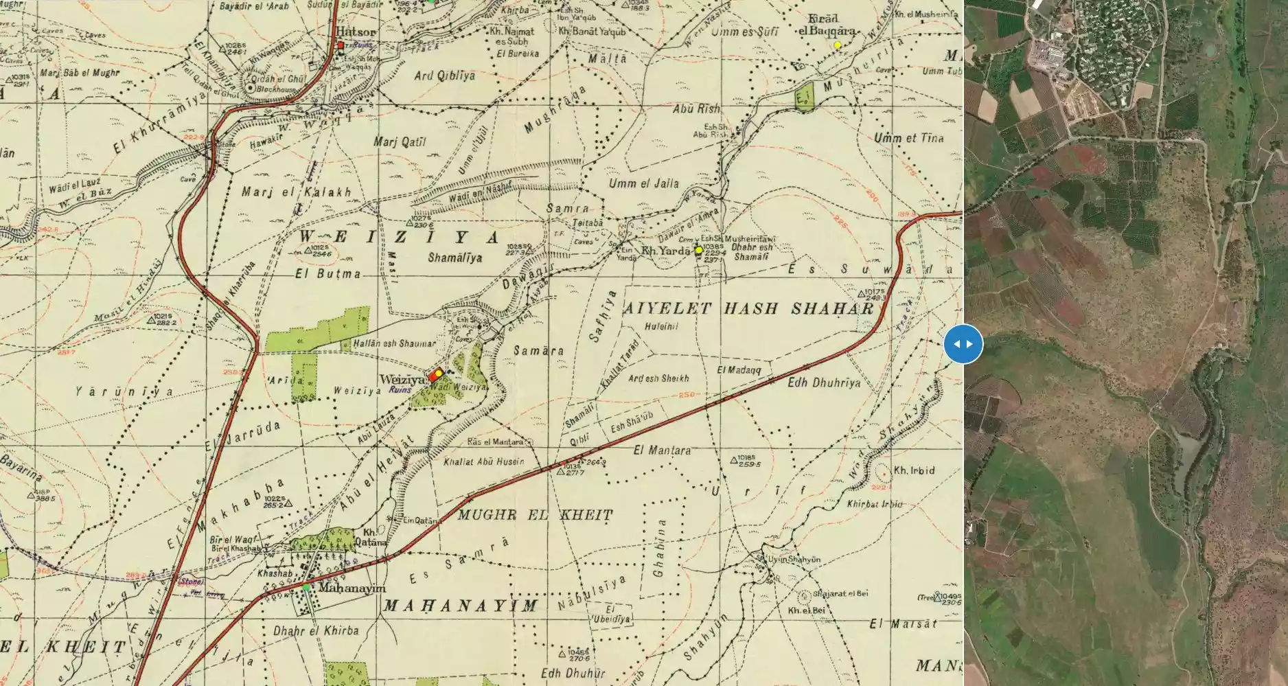
| Map Location | See location #55 on the map View from satellite |
||||||||||
| Military Operation | Operation Yiftach (commanded by the ethnic cleansing champion Yigal Allon) | ||||||||||
| Attacking Units | The Palmach's First Battalion | ||||||||||
| Exodus Cause | Military assault by Zionist troops | ||||||||||
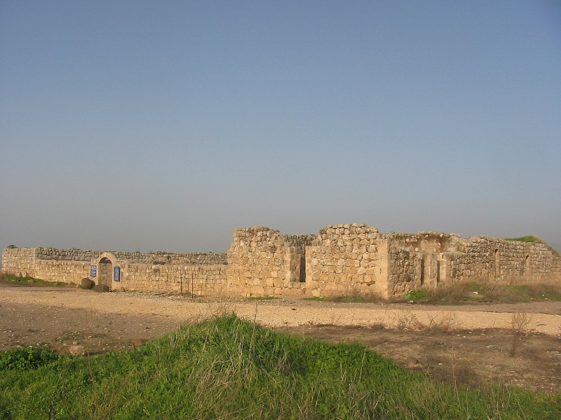
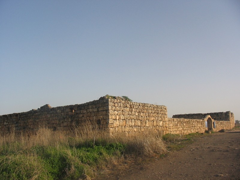
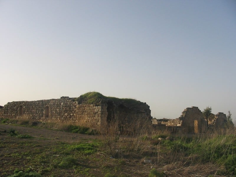
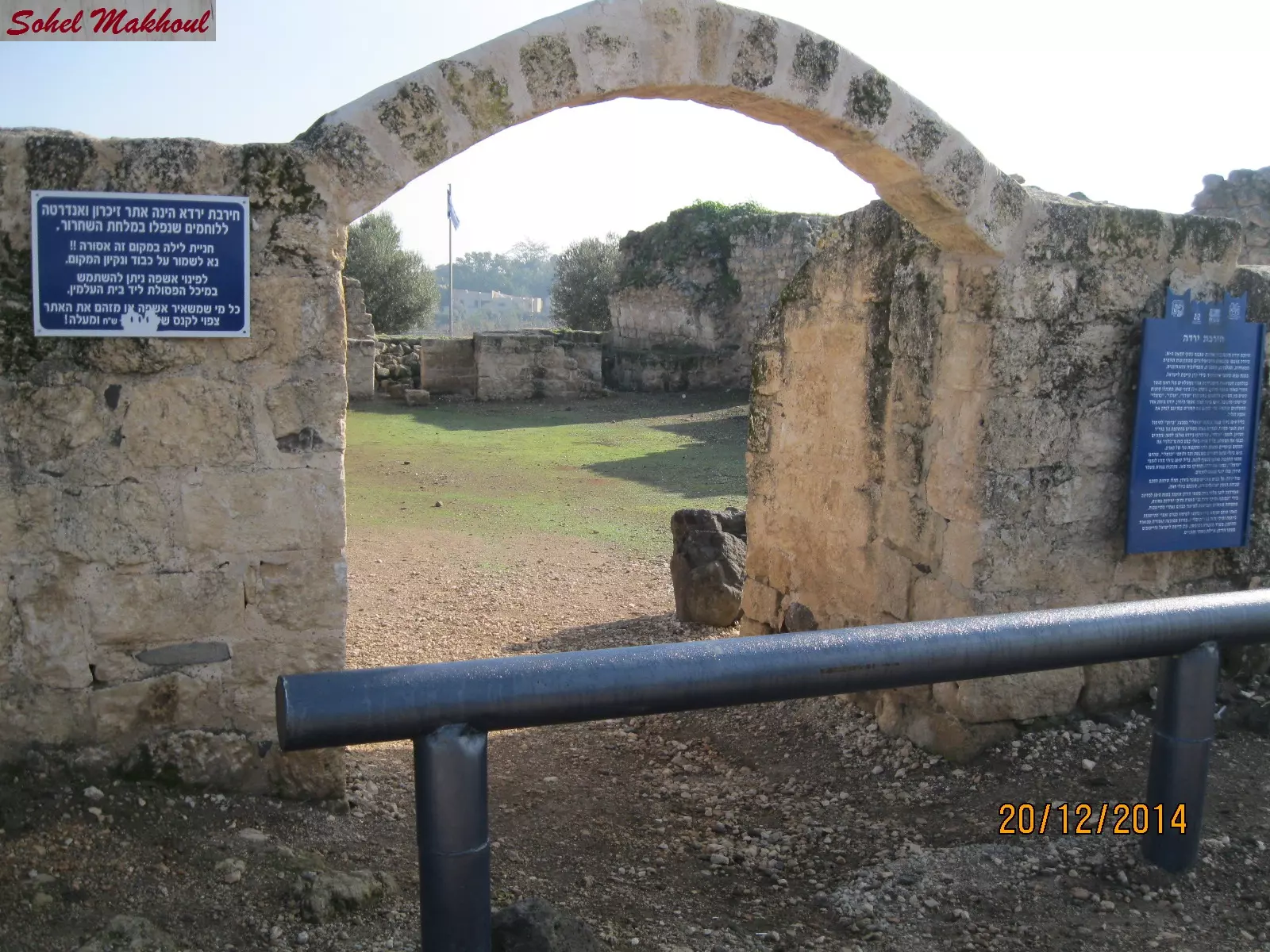
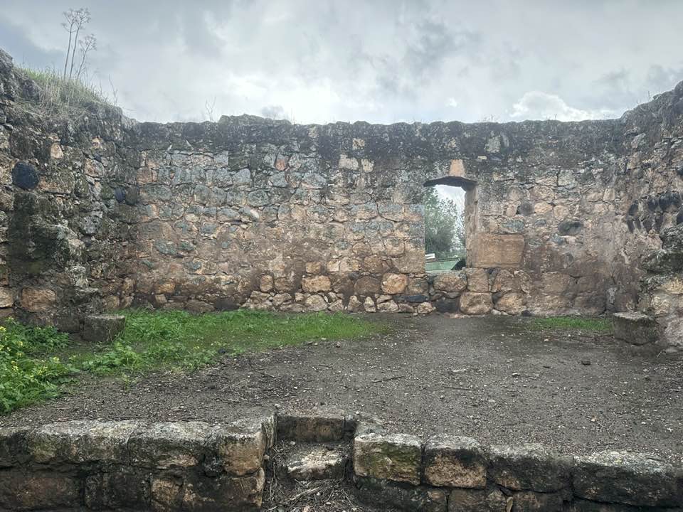
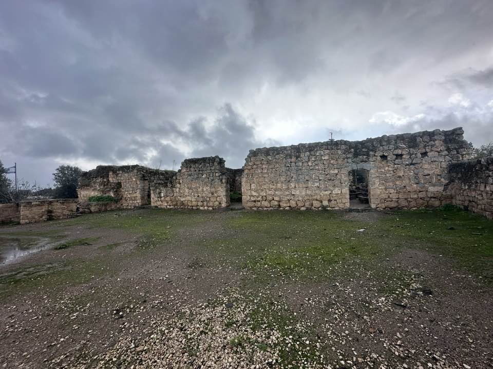
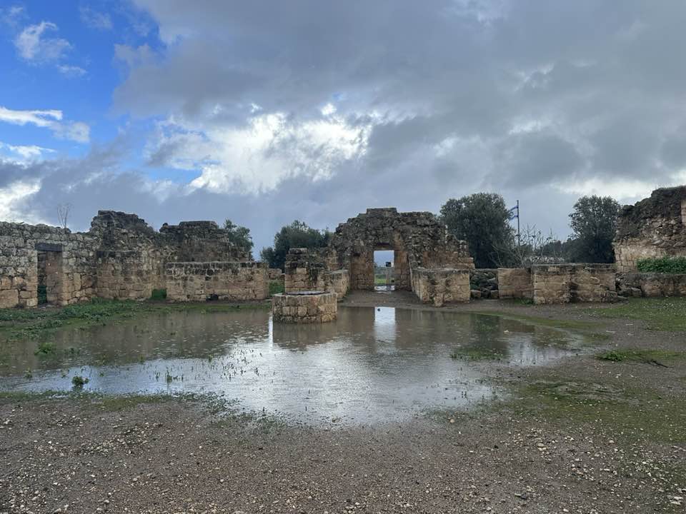
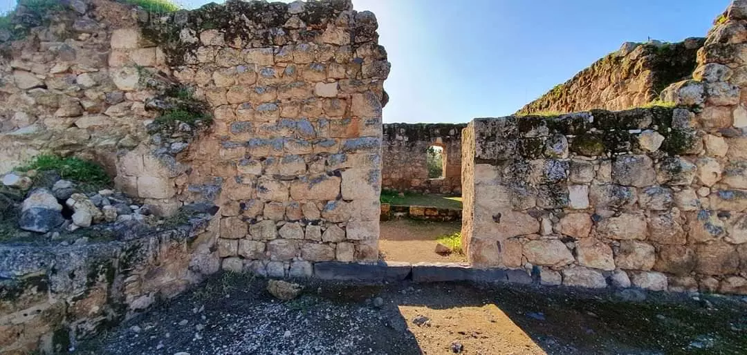
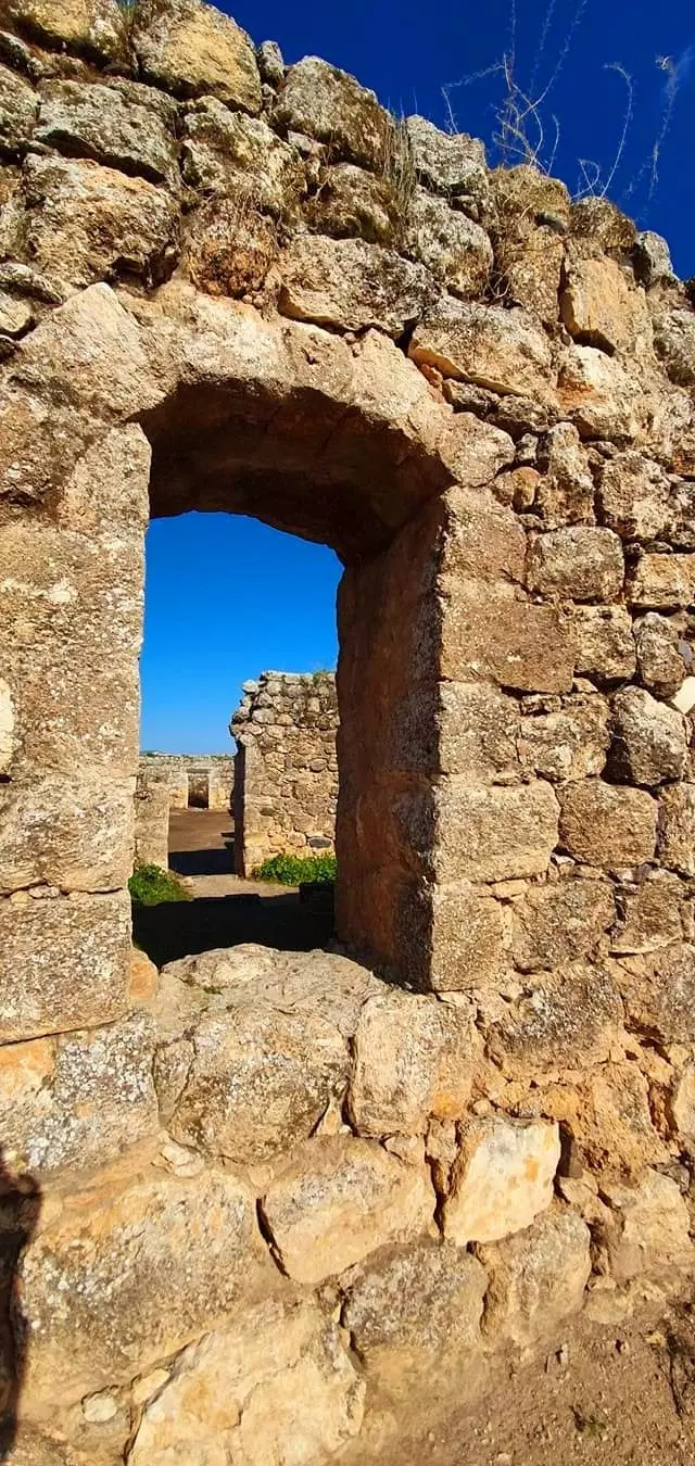
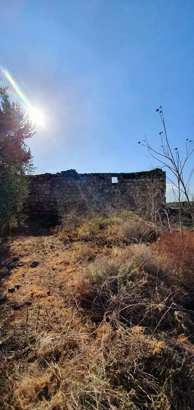
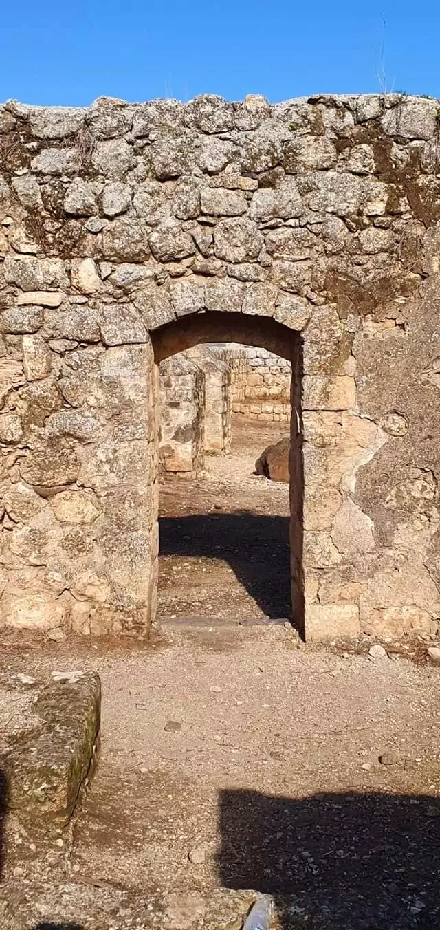
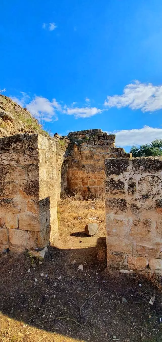
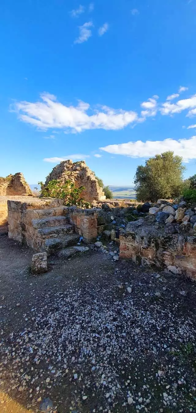
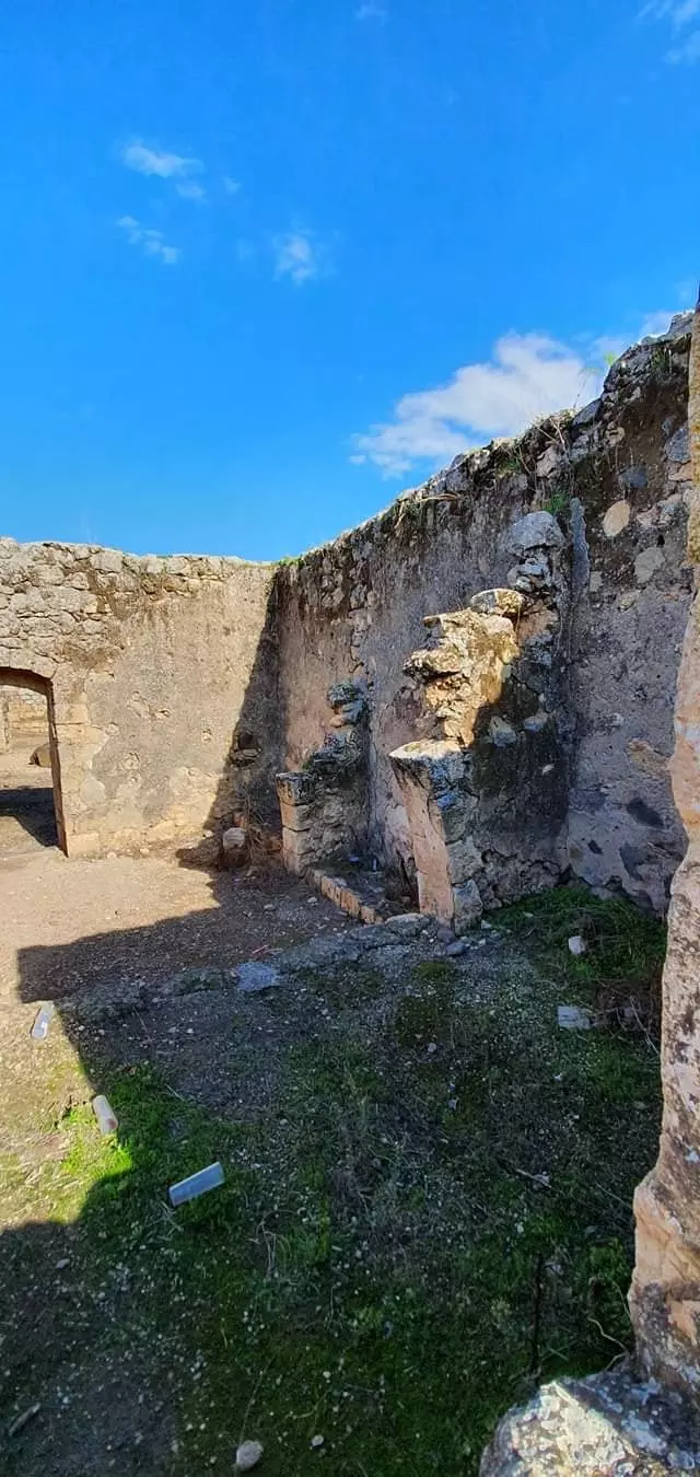
| Village Temains | The village has been mostly destroyed with the exception of deserted houses | ||||||||||
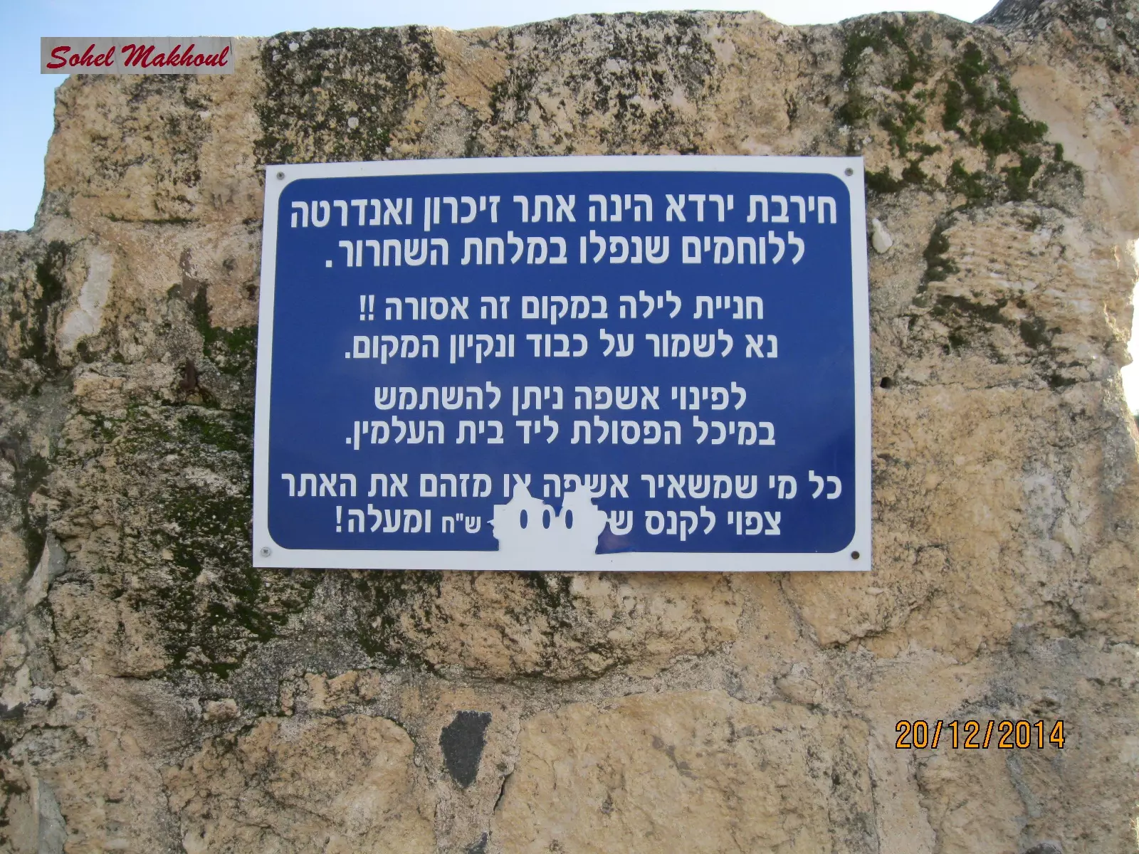
| Ethnically Cleansing | The village has been completely ethnically cleansed between 1949 and 1956 | ||||||||||
| Pre-Nakba Land Ownership |
**Town Lands' Demarcation Maps |
||||||||||
| Population |
|
||||||||||
| Number of Houses |
|
||||||||||
| Near By Towns |
|||||||||||
|
|||||||||||
| Town's Name Through History | The Canaanites referred to the village by the city of Hasur (Chatzor) | ||||||||||
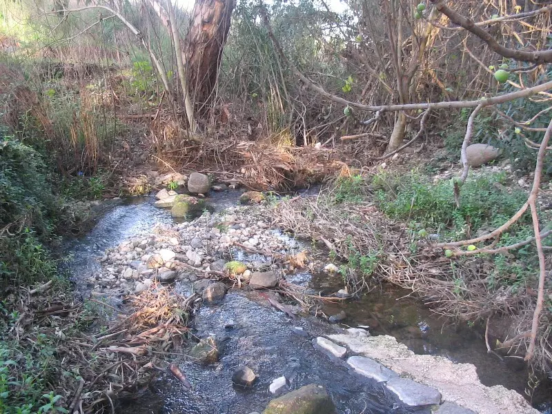
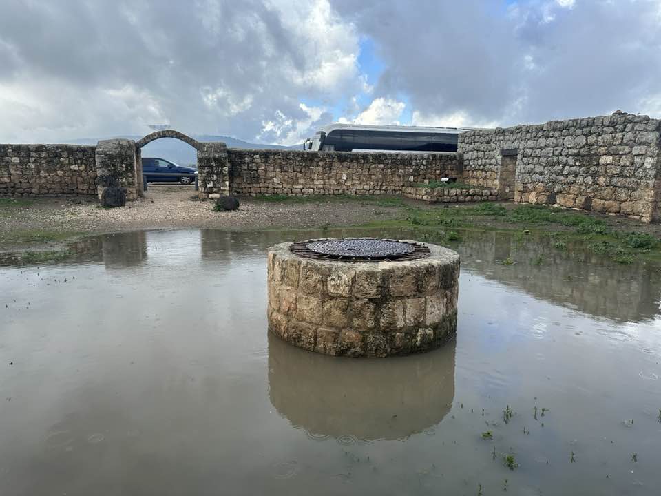
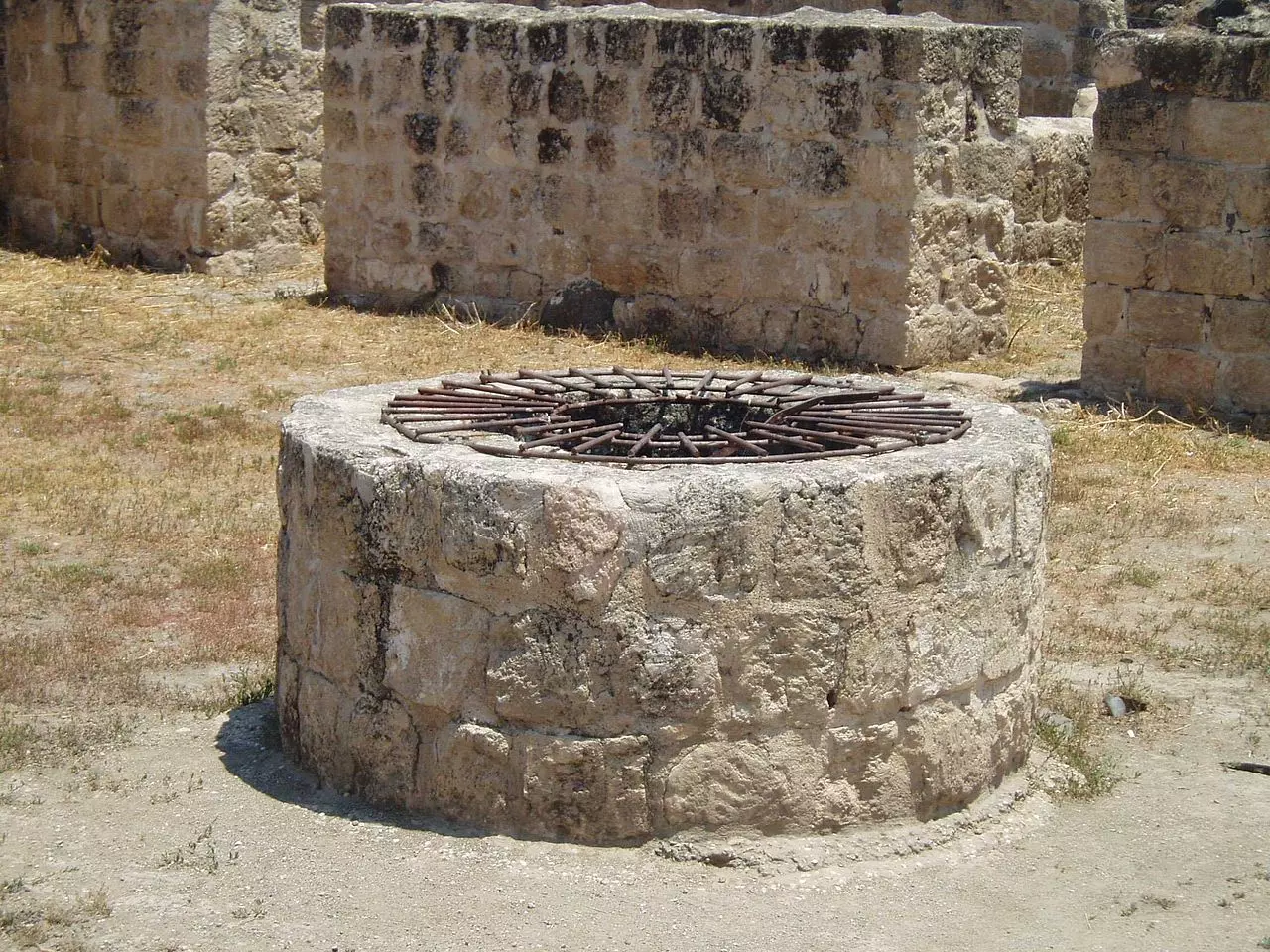
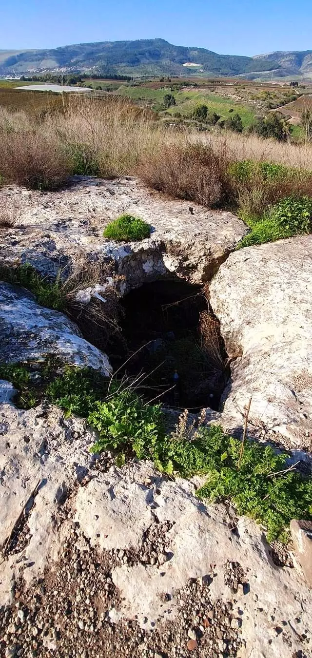
| Water Supply | The village had plenty of water supplies enough to plant RICE | ||||||||||
| Archeological Sites | Khirbat Waqqas was located west-northwest of the village | ||||||||||
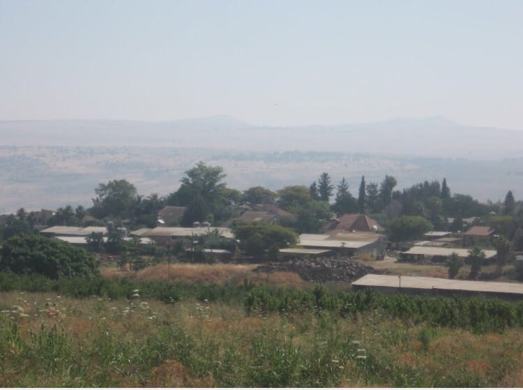
| Exculsive Jewish Colonies Who Usurped Village Lands |
Ayyelet ha-Shahar and Mishmar ha-Yarden | ||||||||||
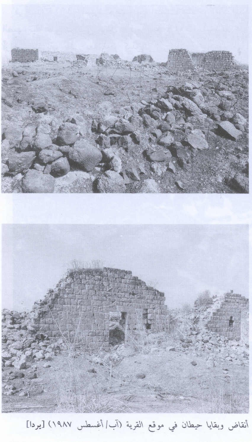
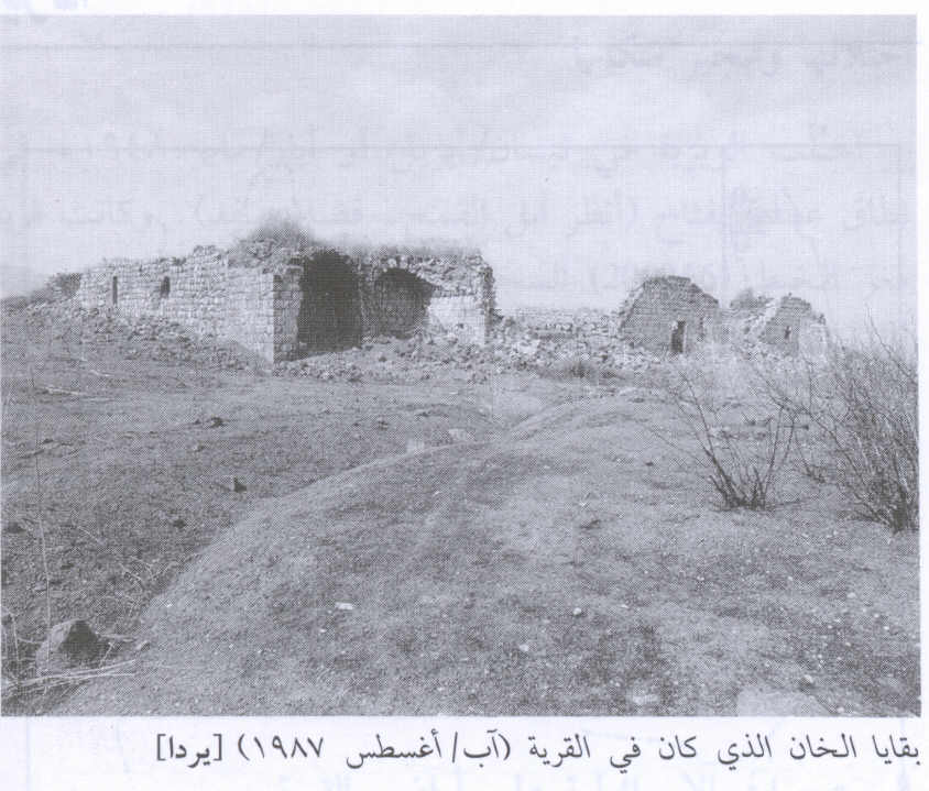
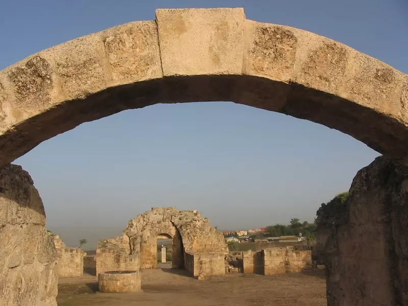
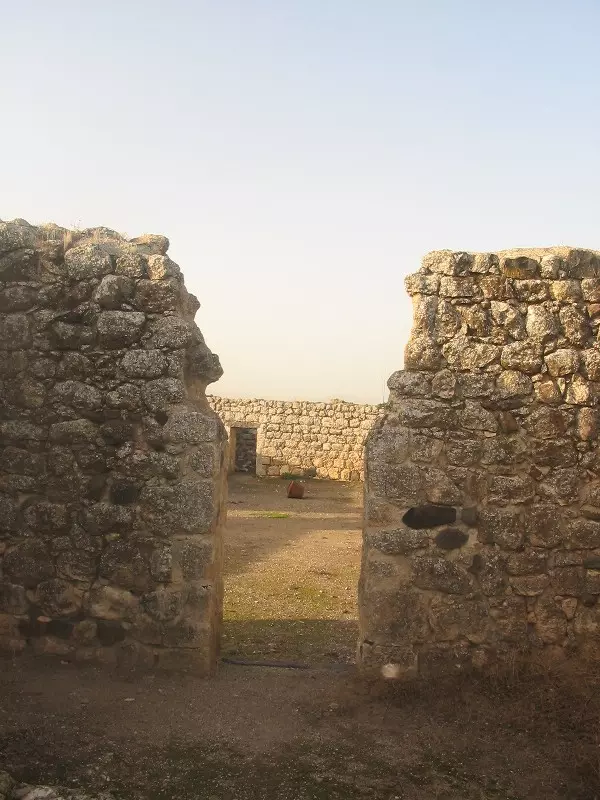
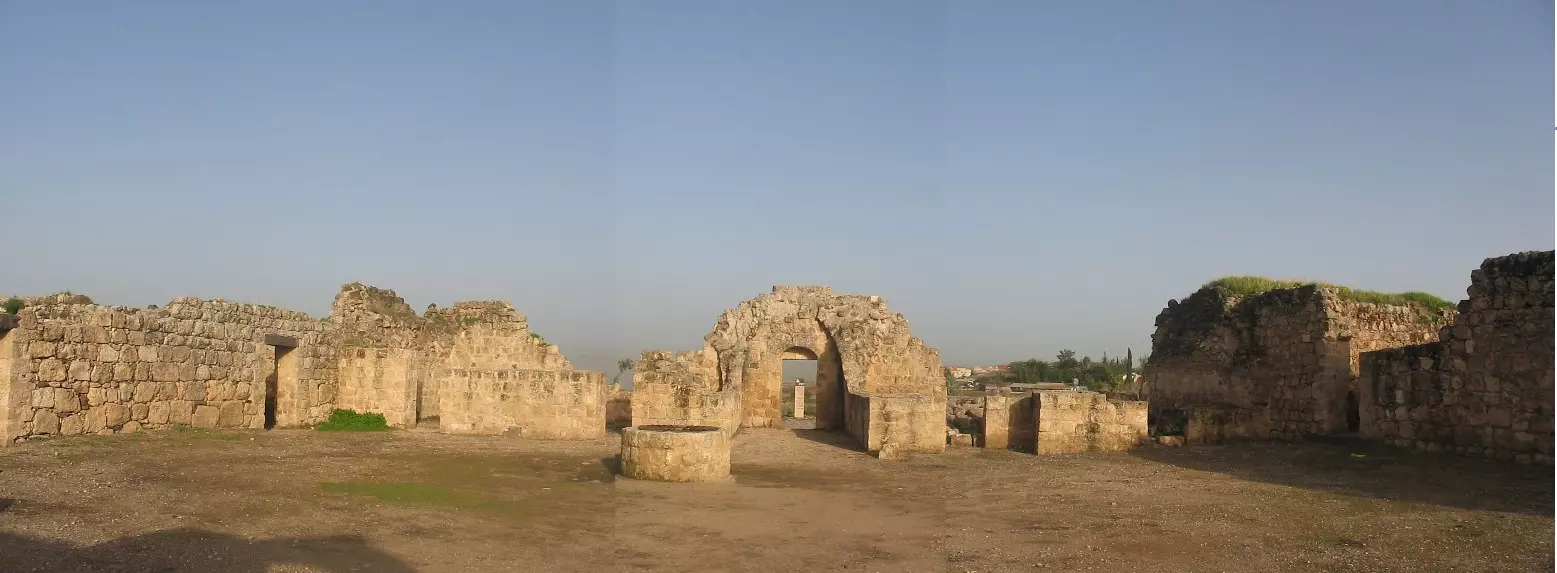
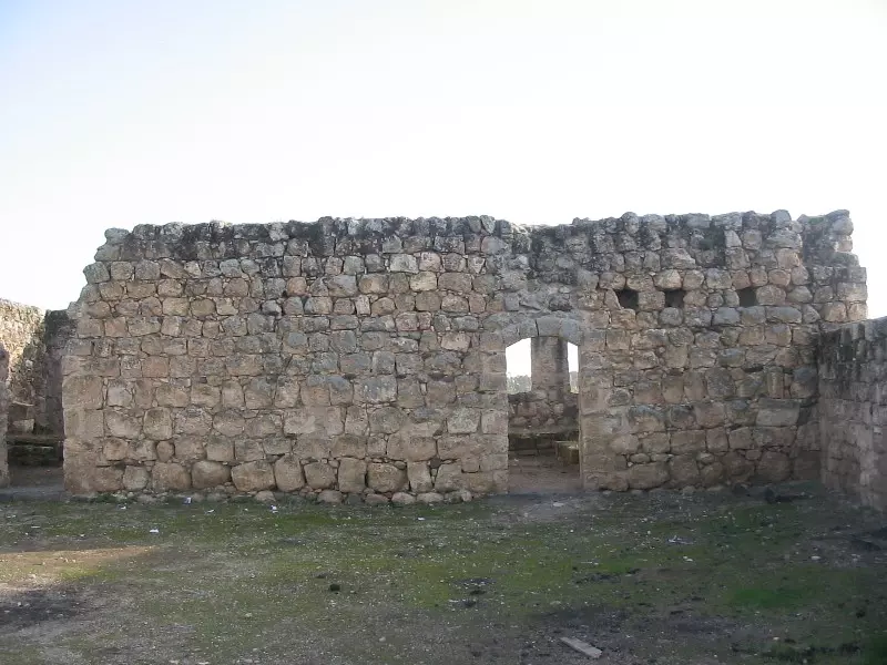
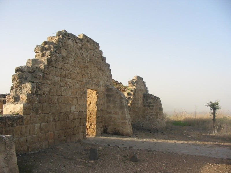
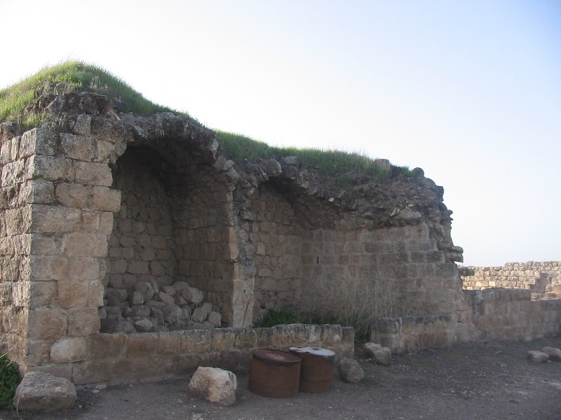
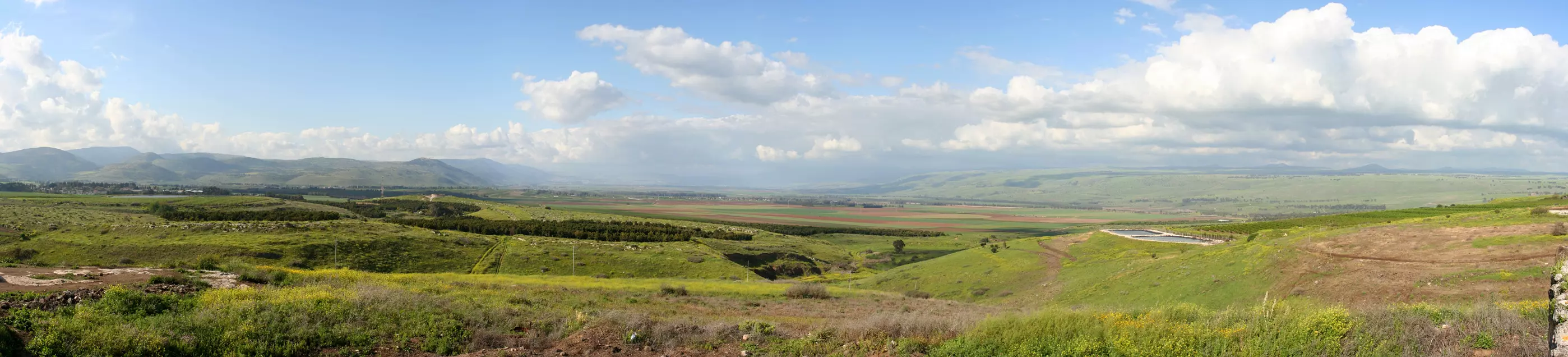
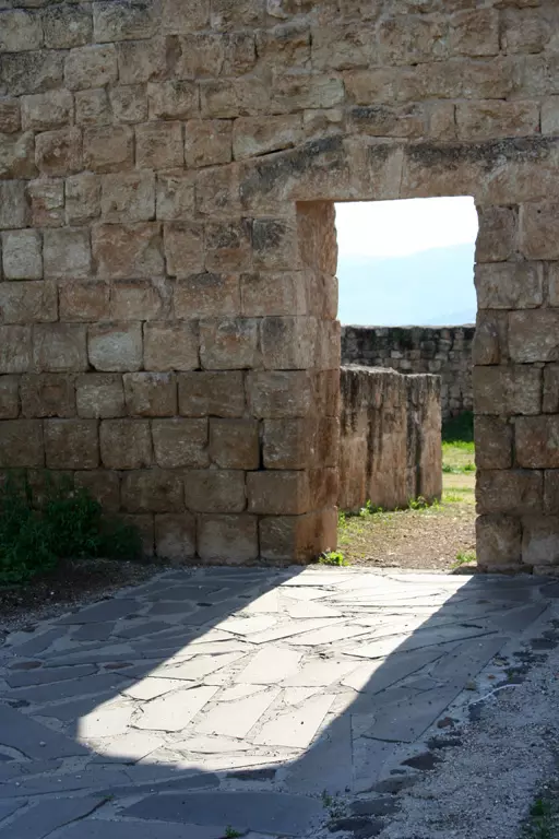
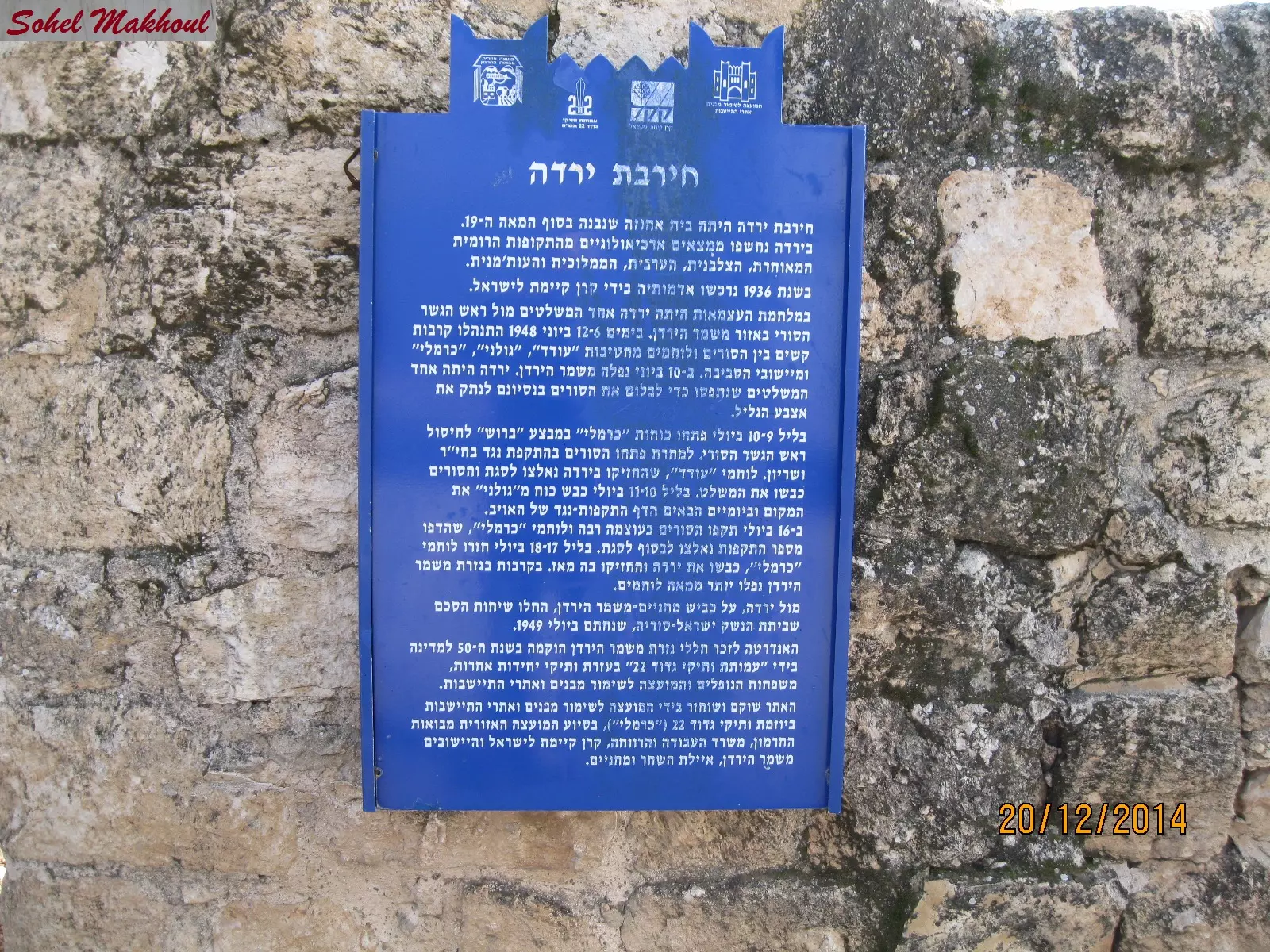
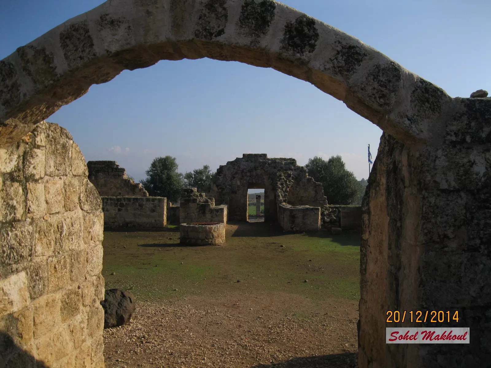
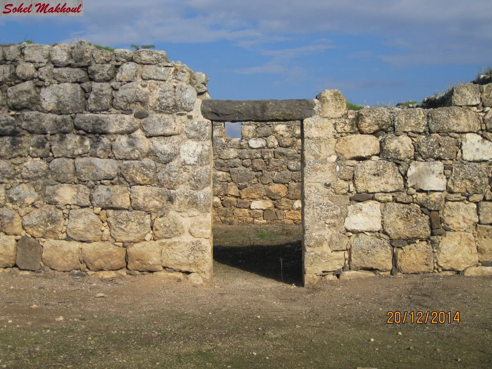
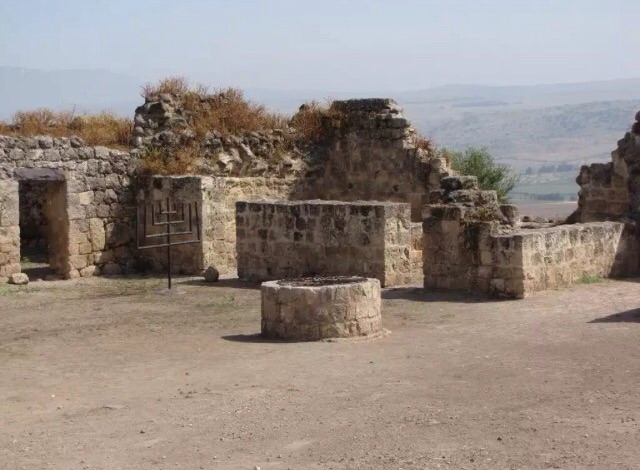
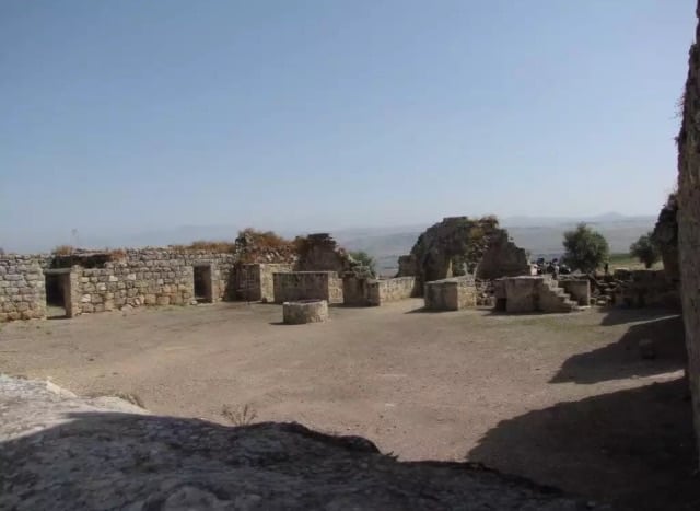
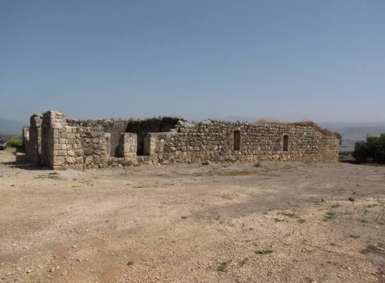
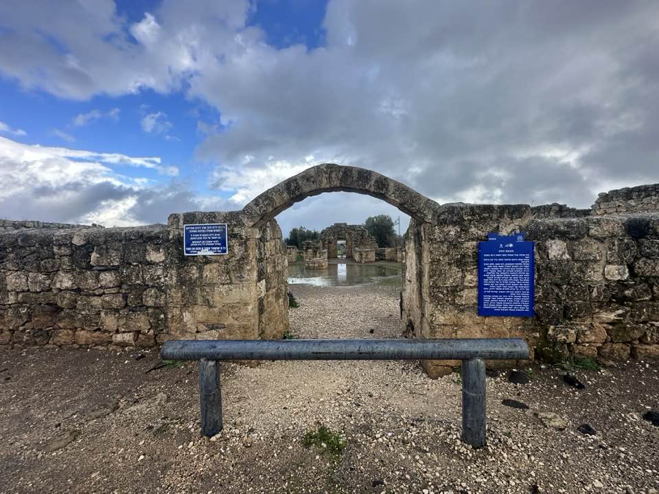
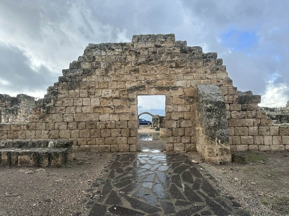
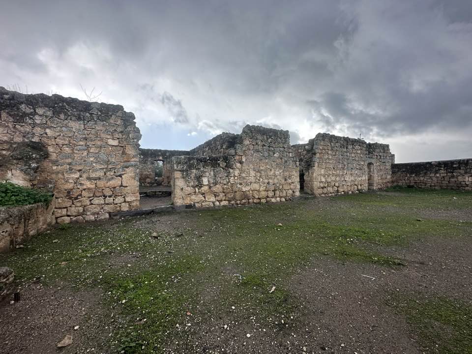
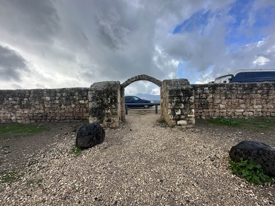
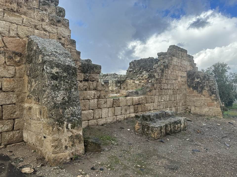
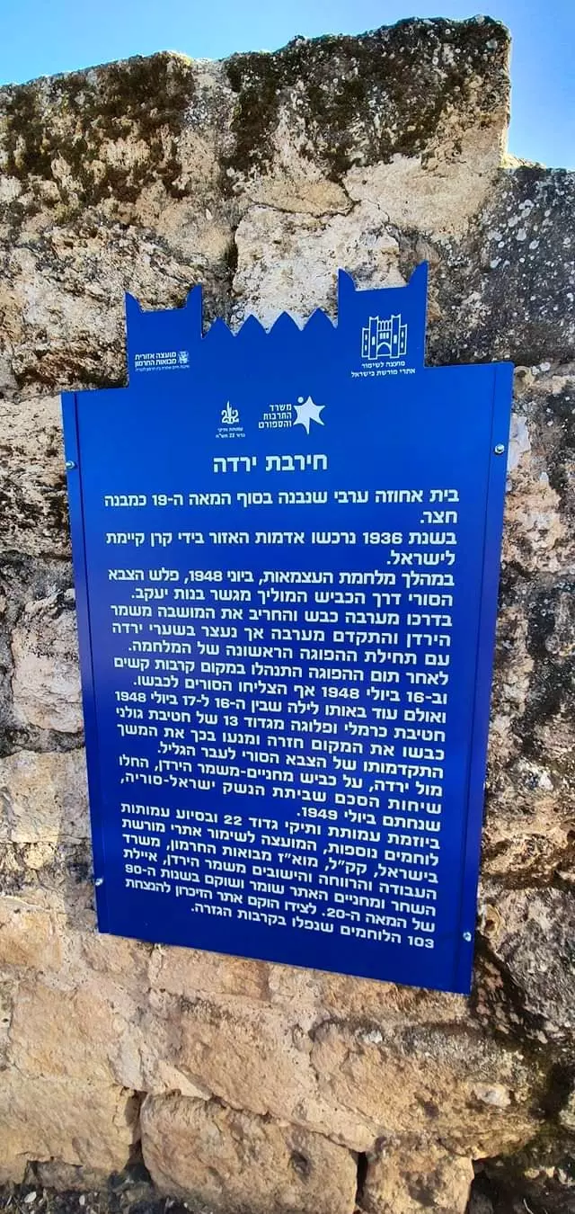
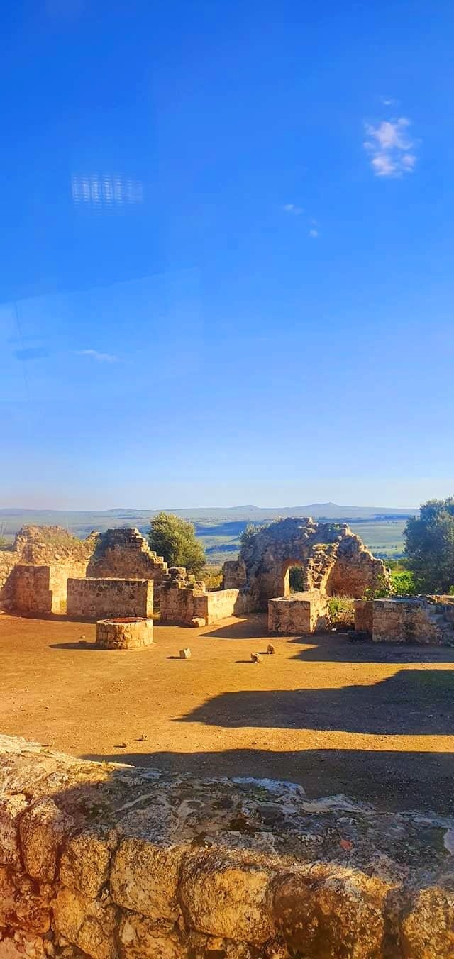
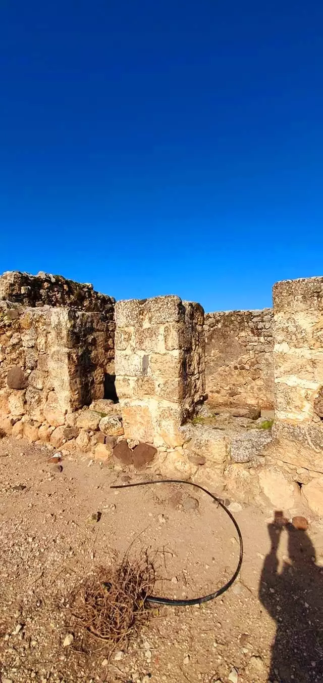
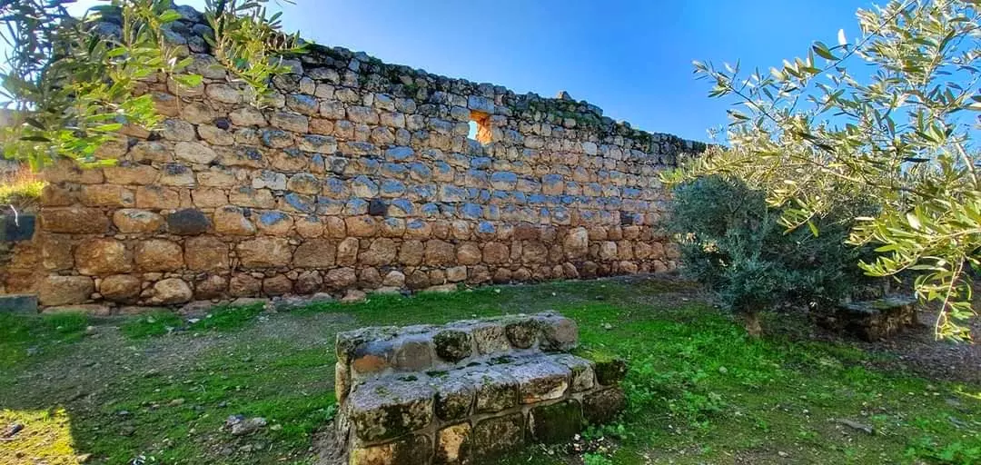
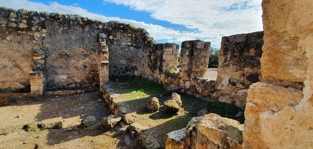
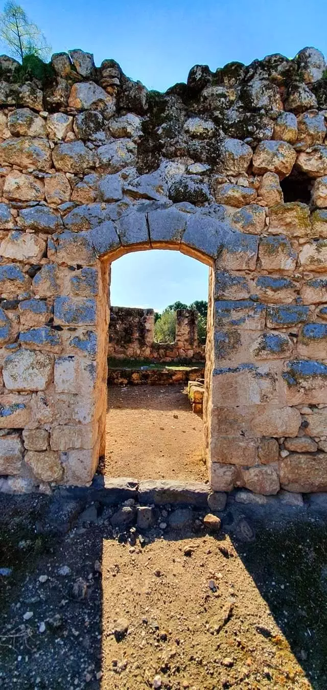
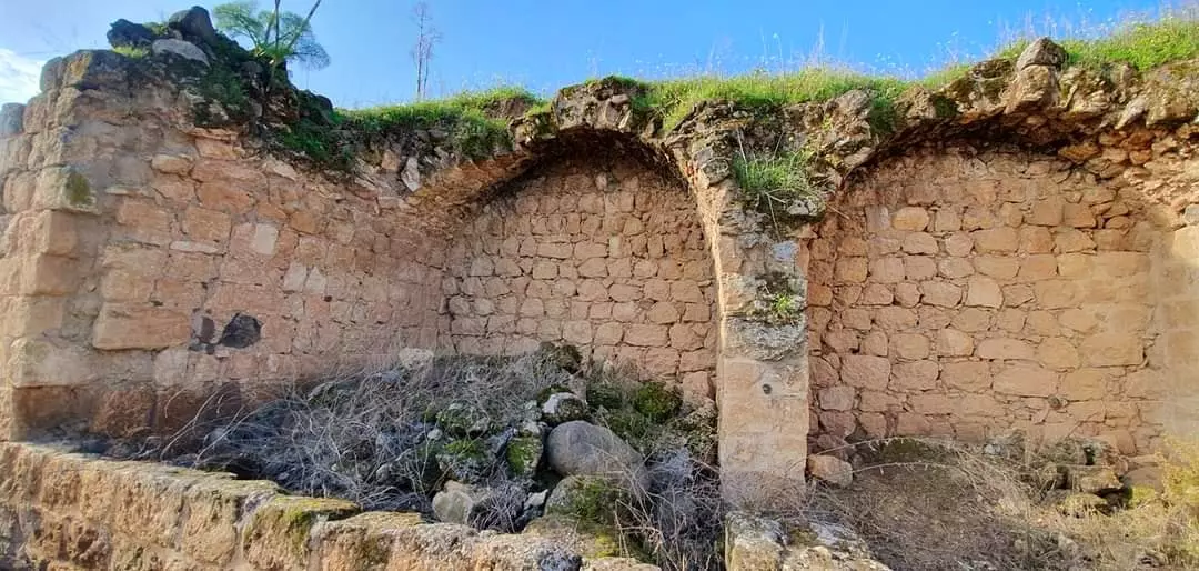
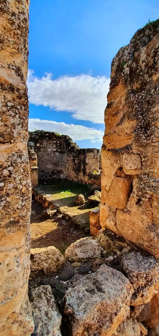
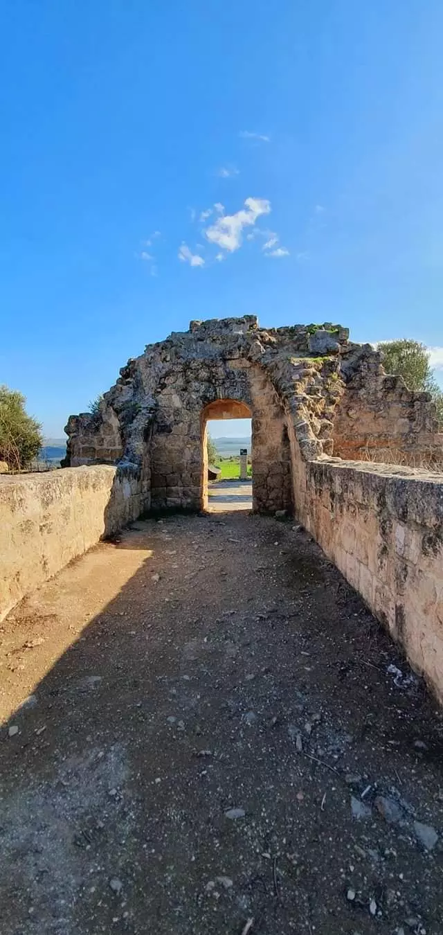
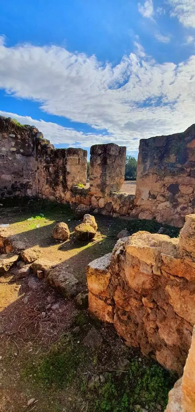
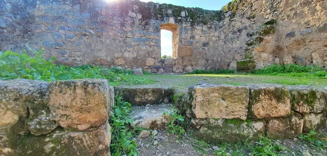
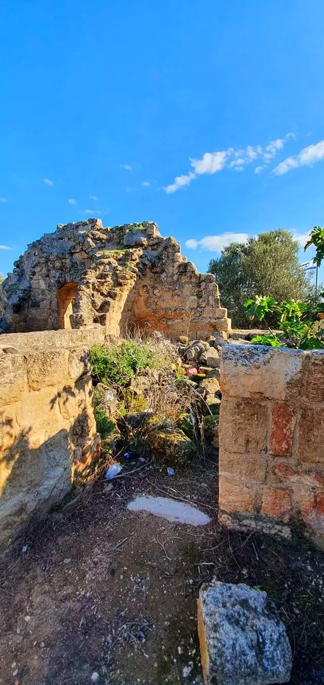
Village Before NakbaThe village stood on land underlain by volcanic rock, in an area sloping toward the al-Hula Plain, and faced north. Its entire population was Muslim. Khirbat Waqqas (also called Khirbat al-Qadah) was located west-northwest of the village and has been identified with the Canaanite (and subsequently Israelite) city of Hasur (Chatzor). Yarda was well-endowed with water resources, which made possible the cultivation of rice, clover, corn, and vegetables.Village Occupation and Ethnic CleaningAlthough it may first have been occupied during Operation Yiftach (see Abil al-Qamh, Safad sub-disctrict) in April–May 1948, Yarda later fell on the periphery of the Demilitarized Zone (DMZ) between Syria and Israel after the July 1949 Armistice Agreement. If Yarda remained inhabited at the end of Operation Yiftach, it is likely that the villagers suffered the same fate as those in villages that fell squarely within the DMZ. Israeli historian Benny Morris relates that the latter were driven out by the Israeli authorities between 1949 and 1956, by means of direct and indirect pressures (see Kirad al-Baqqara, Safad sub-district).Zionists Colonies on Village LandsThe lands of Yarda were taken over by the Zionist settlement of Ayyelet ha-Shahar (204270) in 1948. In 1949 the settlement of Mishmar ha-Yarden (206267) (not to be confused with a settlement of the same name, founded in 1890 near the bridge of Banat Ya'qub) was built on village land, about 1 km east of the village site.Village TodayThe truncated waIls of some houses still stand, as well as those of a khan , or caravansary. The site is strewn with stones from crumbled houses (see photos section). A portion of the land is used as pasture.SourceDr. Walid al-Khalidi, 1992: All That Remains. |
|||||||||||
| Related Maps | Town Lands' Demarcation Maps خرائط للقضاء توضح حدود القرى والاودية Town's map on MapQuest View from satellite Help us map this town at WikiMapia |
||||||||||
| Related Links | Wikipedia's Page Google Search Google For Images Google For Videos |
||||||||||
| More Information | في كتاب كي لا ننسى في كتاب بلادنا فلسطين المزيد من موقع هوية |
||||||||||
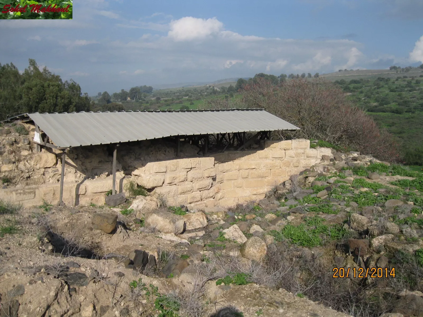
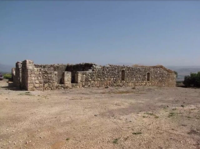
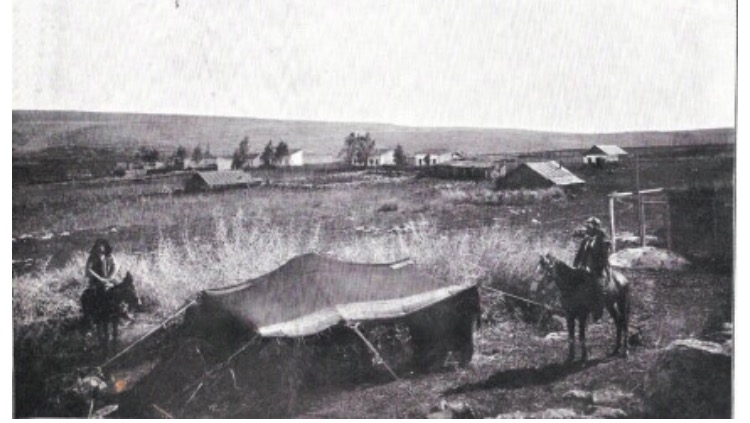
- Remains Of Village Houses And Some Rubble In 1987
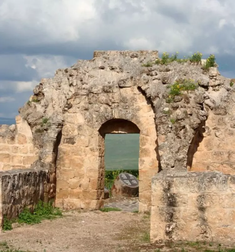
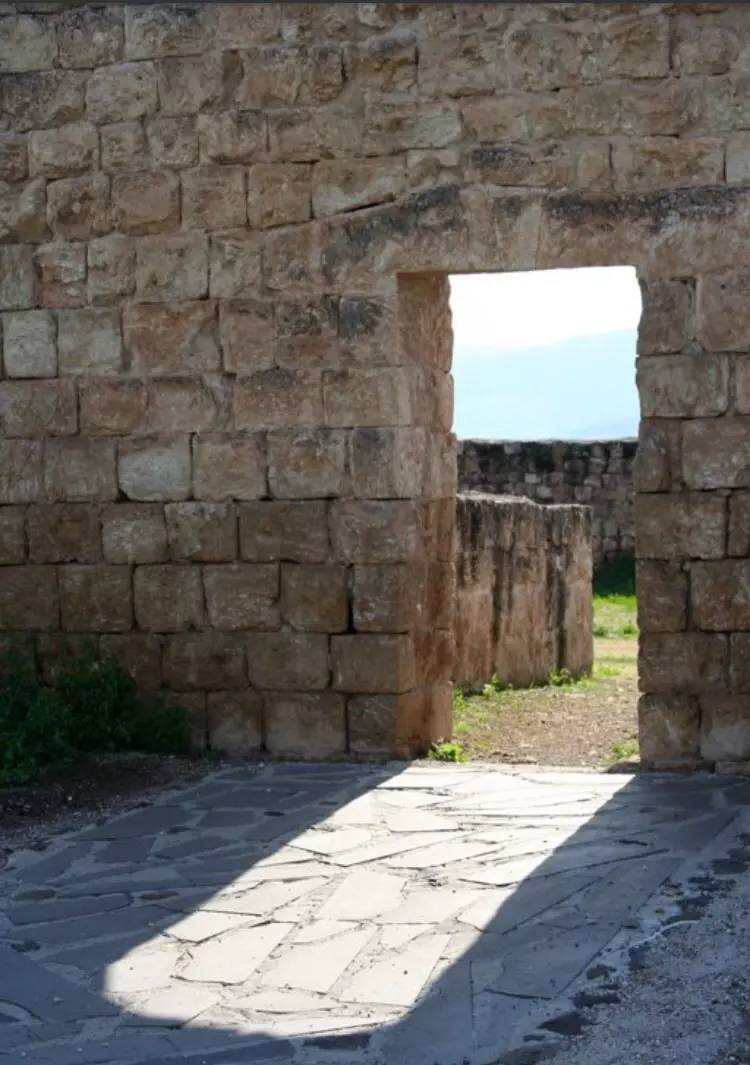
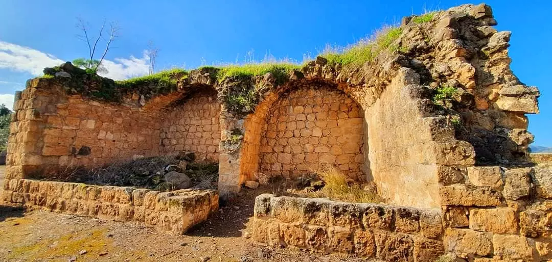
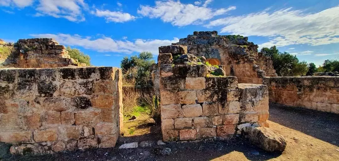
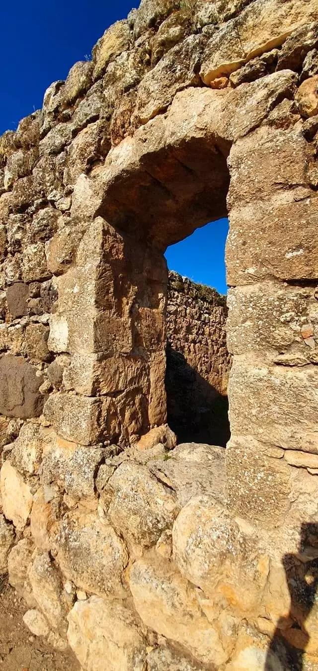
Scanned from "All That Remains" by Dr. Walid Khalidi - Ruins of the village khan/caravanserai, 1987
Scanned from "All That Remains" by Dr. Walid Khalidi - الخان في يردا - تصوير مقبولة نصار - 28.1.2005
Posted by Makbula Nassar - الخان في يردا - تصوير مقبولة نصار - 28.1.2005
Posted by Makbula Nassar - الخان في يردا من الخلف - تصوير مقبولة نصار - 28.1.2005
Posted by Makbula Nassar - مدخل الخان الذي اصبح موقع سياحي - تصوير مقبولة نصار - 28.1.2005
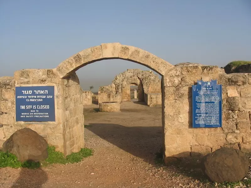
Posted by Makbula Nassar - مدخل الخان الذي اصبح موقع سياحي - تصوير مقبولة نصار - 28.1.2005
Posted by Makbula Nassar - خان يردا مناظر داخلية - تصوير مقبولة نصار - 28.1.2005
Posted by Makbula Nassar - خان يردا مناظر داخلية - تصوير مقبولة نصار - 28.1.2005
Posted by Makbula Nassar - خان يردا مناظر داخلية - تصوير مقبولة نصار - 28.1.2005
Posted by Makbula Nassar - الناحية الخلفية من الخان - تصوير مقبولة نصار - 28.1.2005
Posted by Makbula Nassar - الناحية الخلفية من الخان - تصوير مقبولة نصار - 28.1.2005
Posted by Makbula Nassar - نبع الويزية الذي يأتي من قرية الويزية الى الوادي المجاور ليردا - تصوير مقبولة نصار - 28.1.2005
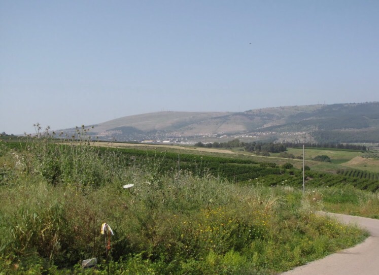
Posted by Makbula Nassar - منظر عريض بإتجاه بحيرة الحولة المجففة، اُنقر الصورة لتكبيرها
- أنقاض الخان
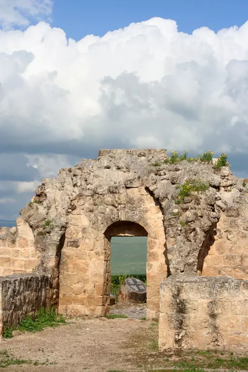
1 - أنقاض الخان
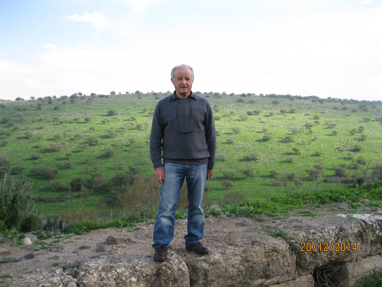
- خان يردا كما يظهر يوم 20 كانون الأول 2014 بعدسة سهيل مخول
Posted by سهيل مخول - خان يردا كما يظهر يوم 20 كانون الأول 2014 بعدسة سهيل مخول
Posted by سهيل مخول - خان يردا كما يظهر يوم 20 كانون الأول 2014 بعدسة سهيل مخول
Posted by سهيل مخول - خان يردا كما يظهر يوم 20 كانون الأول 2014 بعدسة سهيل مخول
Posted by سهيل مخول - خان يردا كما يظهر يوم 20 كانون الأول 2014 بعدسة سهيل مخول
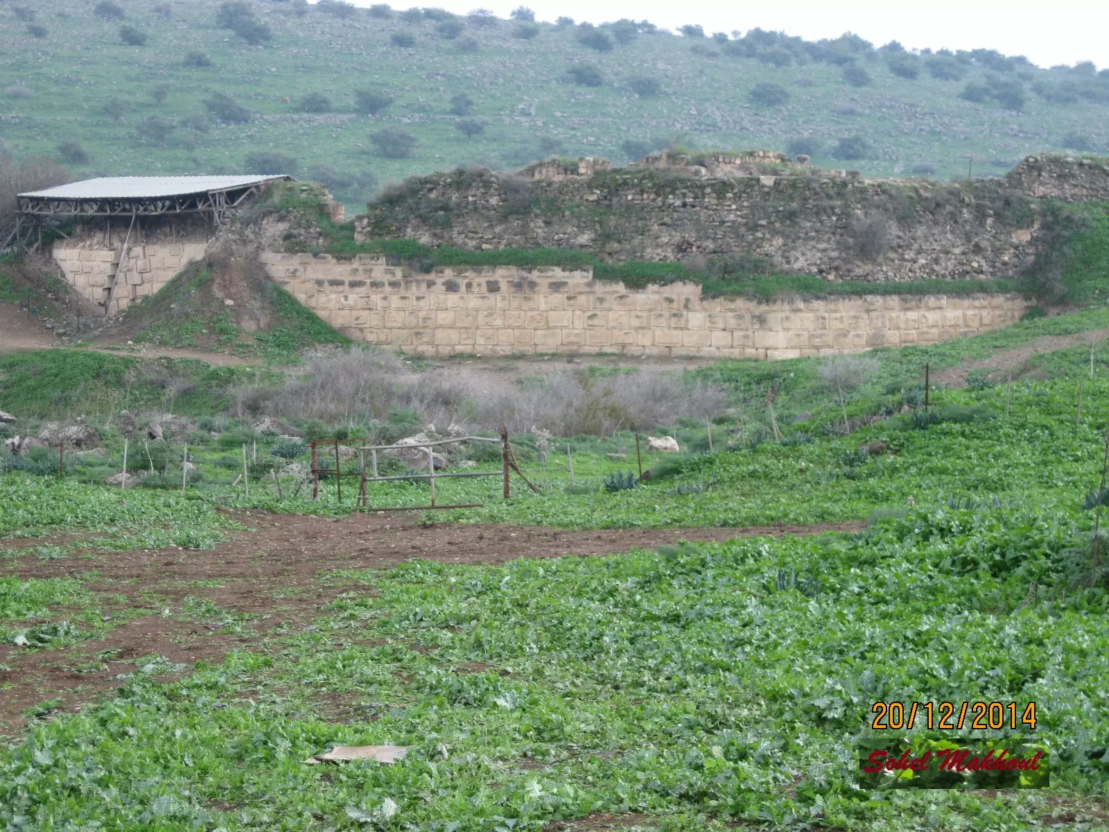
Posted by سهيل مخول 1 - Vadum Iacob قلعة / قصر عثرة Chastellet بمحاذاة جسر بنات يعقوب بالقرب من ياردا بعدسة سهيل مخول يوم 20.12.014
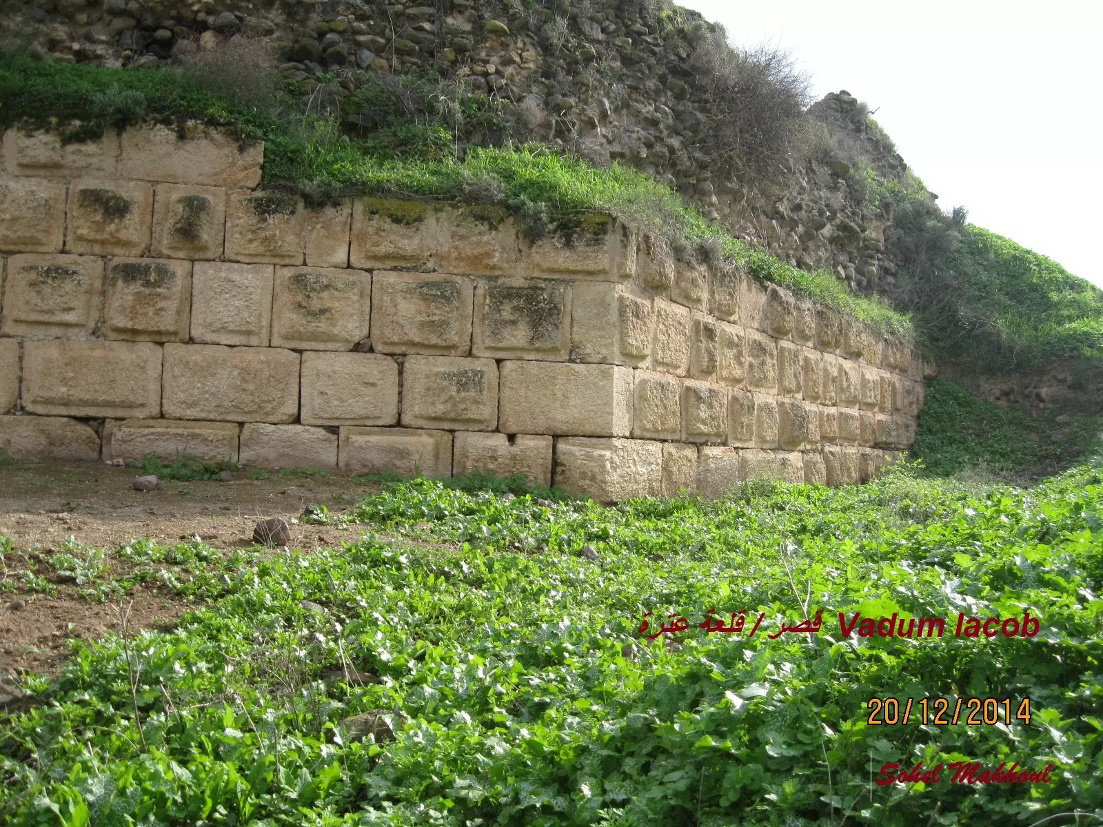
Posted by سهيل مخول - Vadum Iacob قلعة / قصر عثرة Chastellet بمحاذاة جسر بنات يعقوب بالقرب من ياردا بعدسة سهيل مخول يوم 20.12.014
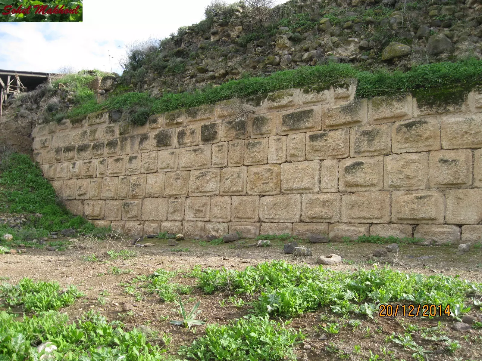
Posted by سهيل مخول - Vadum Iacob قلعة / قصر عثرة Chastellet بمحاذاة جسر بنات يعقوب بالقرب من ياردا بعدسة سهيل مخول يوم 20.12.014
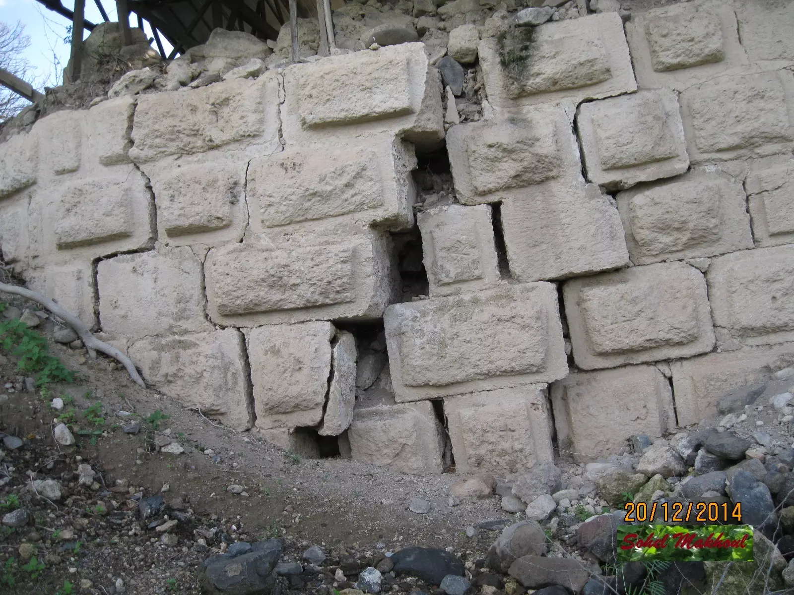
Posted by سهيل مخول - Vadum Iacob قلعة / قصر عثرة Chastellet بمحاذاة جسر بنات يعقوب بالقرب من ياردا بعدسة سهيل مخول يوم 20.12.014
Posted by سهيل مخول - Vadum Iacob قلعة / قصر عثرة Chastellet بمحاذاة جسر بنات يعقوب بالقرب من ياردا بعدسة سهيل مخول يوم 20.12.014
Posted by سهيل مخول - Vadum Iacob قلعة / قصر عثرة Chastellet بمحاذاة جسر بنات يعقوب بالقرب من ياردا بعدسة سهيل مخول يوم 20.12.014
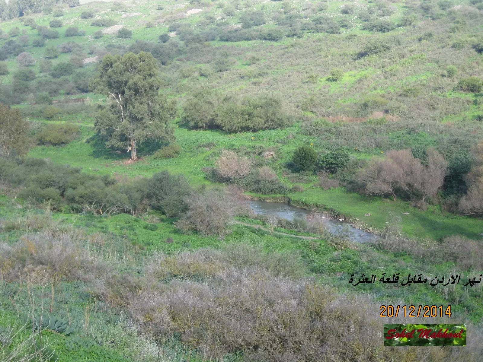
Posted by سهيل مخول - Iacob قلعة / قصر عثرة Chastellet بمحاذاة جسر بنات يعقوب بالقرب من ياردا بعدسة سهيل مخول يوم 20.12.014
Posted by سهيل مخول - Vadum Iacob قلعة / قصر عثرة Chastellet بمحاذاة جسر بنات يعقوب بالقرب من ياردا بعدسة سهيل مخول يوم 20.12.014
Posted by سهيل مخول - بيوت القريه
Posted by abu raya - اثار القريه
Posted by abu raya - من اثار القريه
Posted by abu raya - ياردا
Posted by abu raya - من موقع القريه باتجاه المستوطنه المقامه على اراضيها
Posted by abu raya - خان ياردا
Posted by abu raya - اراضي ياردا
Posted by abu raya - خان ياردا
Posted by abu raya - قريه ياردا قبل النكبه
Posted by abu raya - يردا قضاء صفد waze חירבת ירדה
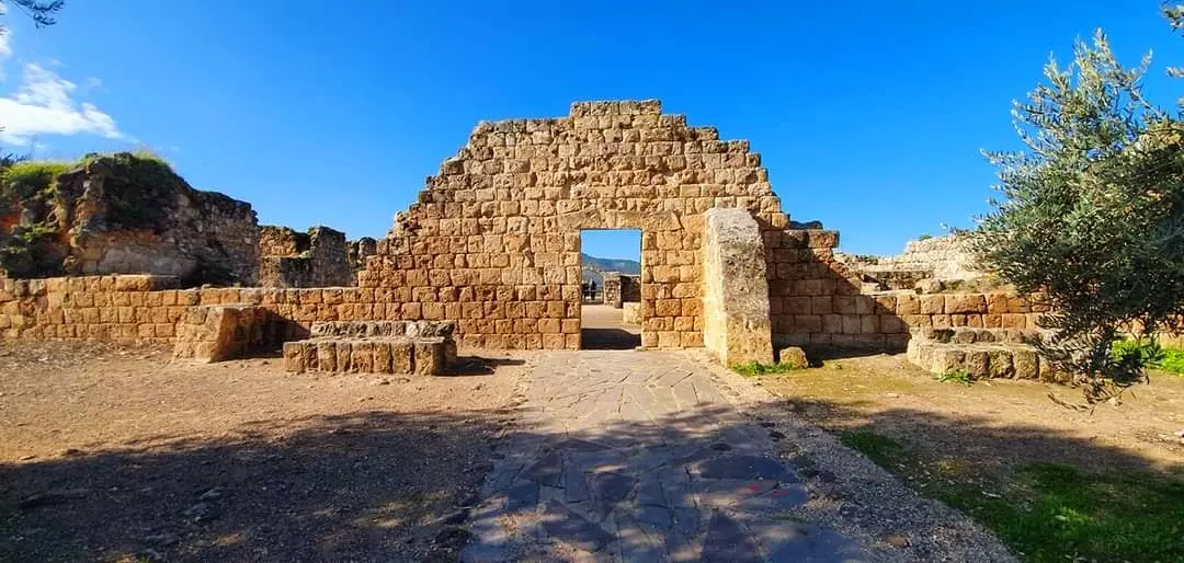
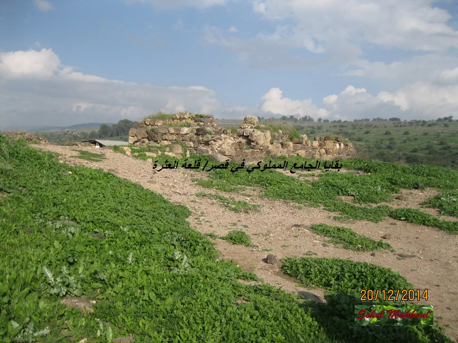
"بقايا خان أقيم في القرن الثالث عشر أي في عهد المماليك، على الطريق بين صفد ودمشق -- المزيد عنها في قسم التعليقات اسفل الصورة -- 2023 -- Iyad Jaber
1 - يردا قضاء صفد waze חירבת ירדה
"بقايا خان أقيم في القرن الثالث عشر أي في عهد المماليك، على الطريق بين صفد ودمشق -- المزيد عنها في قسم التعليقات اسفل الصورة -- 2023 -- Iyad Jaber #2
- يردا قضاء صفد waze חירבת ירדה
"بقايا خان أقيم في القرن الثالث عشر أي في عهد المماليك، على الطريق بين صفد ودمشق -- المزيد عنها في قسم التعليقات اسفل الصورة -- 2023 -- Iyad Jaber #3
- يردا قضاء صفد waze חירבת ירדה
"بقايا خان أقيم في القرن الثالث عشر أي في عهد المماليك، على الطريق بين صفد ودمشق -- المزيد عنها في قسم التعليقات اسفل الصورة -- 2023 -- Iyad Jaber #4
- يردا قضاء صفد waze חירבת ירדה
"بقايا خان أقيم في القرن الثالث عشر أي في عهد المماليك، على الطريق بين صفد ودمشق -- المزيد عنها في قسم التعليقات اسفل الصورة -- 2023 -- Iyad Jaber #5
- يردا قضاء صفد waze חירבת ירדה
"بقايا خان أقيم في القرن الثالث عشر أي في عهد المماليك، على الطريق بين صفد ودمشق -- المزيد عنها في قسم التعليقات اسفل الصورة -- 2023 -- Iyad Jaber #6
- يردا قضاء صفد waze חירבת ירדה
"بقايا خان أقيم في القرن الثالث عشر أي في عهد المماليك، على الطريق بين صفد ودمشق -- المزيد عنها في قسم التعليقات اسفل الصورة -- 2023 -- Iyad Jaber #7
- يردا قضاء صفد waze חירבת ירדה
"بقايا خان أقيم في القرن الثالث عشر أي في عهد المماليك، على الطريق بين صفد ودمشق -- المزيد عنها في قسم التعليقات اسفل الصورة -- 2023 -- Iyad Jaber #8
- يردا قضاء صفد waze חירבת ירדה
"بقايا خان أقيم في القرن الثالث عشر أي في عهد المماليك، على الطريق بين صفد ودمشق -- المزيد عنها في قسم التعليقات اسفل الصورة -- 2023 -- Iyad Jaber #9
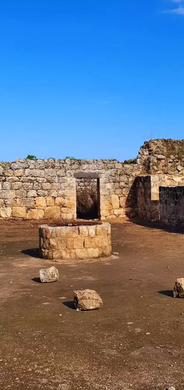
- Well at Yarda
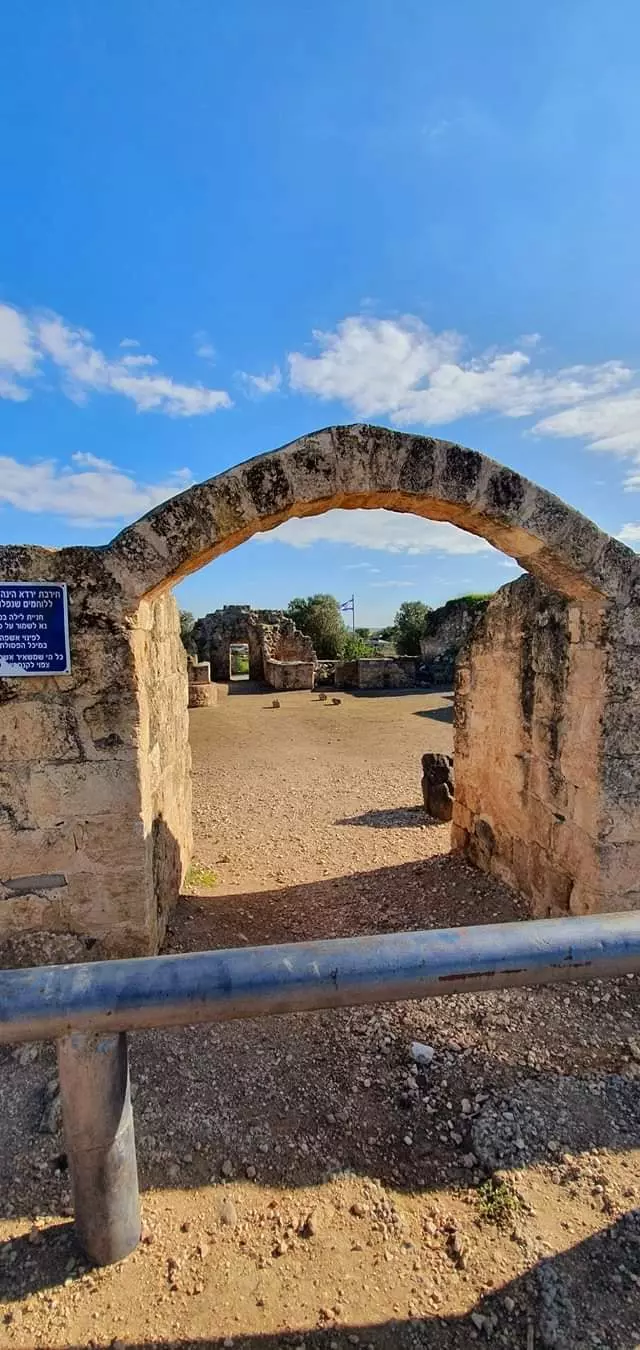
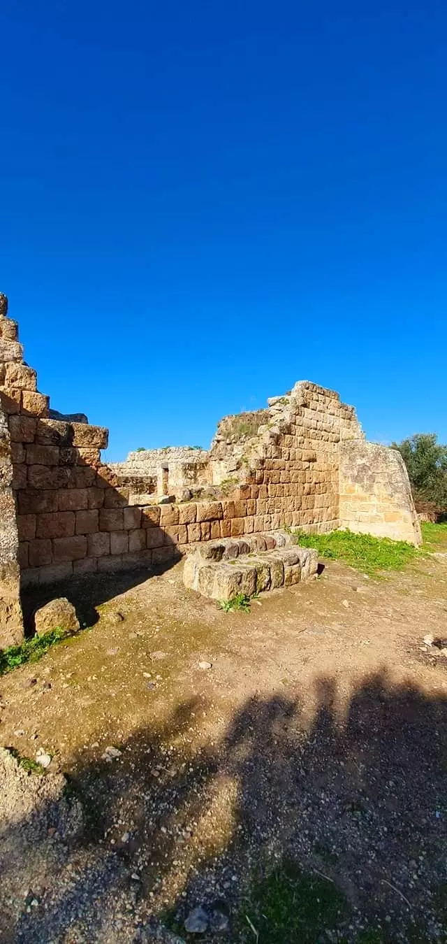
- Let us tour Yarda's famous Khan -- جولة رائعة في خان يردا الشهير -- Jan. 2022 -- Nabela Salem
- Let us tour Yarda's famous Khan -- جولة رائعة في خان يردا الشهير -- Jan. 2022 -- Nabela Salem #2
- Let us tour Yarda's famous Khan -- جولة رائعة في خان يردا الشهير -- Jan. 2022 -- Nabela Salem #3
- Let us tour Yarda's famous Khan -- جولة رائعة في خان يردا الشهير -- Jan. 2022 -- Nabela Salem #4
- Let us tour Yarda's famous Khan -- جولة رائعة في خان يردا الشهير -- Jan. 2022 -- Nabela Salem #5
- Let us tour Yarda's famous Khan -- جولة رائعة في خان يردا الشهير -- Jan. 2022 -- Nabela Salem #6
- Let us tour Yarda's famous Khan -- جولة رائعة في خان يردا الشهير -- Jan. 2022 -- Nabela Salem #7
- Let us tour Yarda's famous Khan -- جولة رائعة في خان يردا الشهير -- Jan. 2022 -- Nabela Salem #8
- Let us tour Yarda's famous Khan -- جولة رائعة في خان يردا الشهير -- Jan. 2022 -- Nabela Salem #9
- Let us tour Yarda's famous Khan -- جولة رائعة في خان يردا الشهير -- Jan. 2022 -- Nabela Salem #10
- Let us tour Yarda's famous Khan -- جولة رائعة في خان يردا الشهير -- Jan. 2022 -- Nabela Salem #11
- Let us tour Yarda's famous Khan -- جولة رائعة في خان يردا الشهير -- Jan. 2022 -- Nabela Salem #12
- Let us tour Yarda's famous Khan -- جولة رائعة في خان يردا الشهير -- Jan. 2022 -- Nabela Salem #13
- Let us tour Yarda's famous Khan -- جولة رائعة في خان يردا الشهير -- Jan. 2022 -- Nabela Salem #14
- Let us tour Yarda's famous Khan -- جولة رائعة في خان يردا الشهير -- Jan. 2022 -- Nabela Salem #15
- Let us tour Yarda's famous Khan -- جولة رائعة في خان يردا الشهير -- Jan. 2022 -- Nabela Salem #16
- Let us tour Yarda's famous Khan -- جولة رائعة في خان يردا الشهير -- Jan. 2022 -- Nabela Salem #17
- Let us tour Yarda's famous Khan -- جولة رائعة في خان يردا الشهير -- Jan. 2022 -- Nabela Salem #18
- Let us tour Yarda's famous Khan -- جولة رائعة في خان يردا الشهير -- Jan. 2022 -- Nabela Salem #19
- Let us tour Yarda's famous Khan -- جولة رائعة في خان يردا الشهير -- Jan. 2022 -- Nabela Salem #20
- Let us tour Yarda's famous Khan -- جولة رائعة في خان يردا الشهير -- Jan. 2022 -- Nabela Salem #21
- Let us tour Yarda's famous Khan -- جولة رائعة في خان يردا الشهير -- Jan. 2022 -- Nabela Salem #22
- Let us tour Yarda's famous Khan -- جولة رائعة في خان يردا الشهير -- Jan. 2022 -- Nabela Salem #23
- Let us tour Yarda's famous Khan -- جولة رائعة في خان يردا الشهير -- Jan. 2022 -- Nabela Salem #24
- Let us tour Yarda's famous Khan -- جولة رائعة في خان يردا الشهير -- Jan. 2022 -- Nabela Salem #25
- Let us tour Yarda's famous Khan -- جولة رائعة في خان يردا الشهير -- Jan. 2022 -- Nabela Salem #26
- Let us tour Yarda's famous Khan -- جولة رائعة في خان يردا الشهير -- Jan. 2022 -- Nabela Salem #27
Want to browse more? 80,000 pictures were grouped in these gallaries:
| Display Name | Clan/Hamolah | Country of Residence |
No links have been shared yet, be free to the first to share the first link.
 Fake Valor: Why Did Zionist Jews Hoist Nazis Flag on Their Ships in the 1930s?
What is new?
-
Facts About Oct. 7th Gaza Raid
-
Remined Us Please:: Who Did Rape Who? Palestinians Raped Israelis? Or, was the other way around?
-
When Prof. Edward Said was invited to debate Bibi Netanyahu in the 1980s, watch what happened!
-
Ezra Klein of the NY Times on the "Jewish Race".
-
Abusing Blood Libel!
-
Did Israeli Soldiers Activate The Hanniba Direective On Oct. 7th? You Be The Judge
-
Zionist FAQ: Isn't it true that Palestinians don't want peace? Palestinians never accepted the two-state solution
- Facts about Haavara (Transfer) Agreement between Ben-Gurion & Hitler
-
Haavara FAQs: Why Did Zionist Jews Hoist Nazis' Flags on Their Ships in the 1930s?
- Haavara FAQs: When Chaim Weizmann met FDR in mid-1943, why was he silent about rescuing European Jewry?
-
Dear ChatGPT: How did Palestinians resist Napoleon's invasion of their country in 1799?
-
Dear ChatGPT: Gaza had a vibrant Jewish community in the mid-17th century. What happened to them?
-
Dear ChatGPT: Why did the Jewish Agency suppress news of the Holocaust during WWII?
-
Video Playlist: Jews share their DNA tests to end the conflict for good.
-
A Tale of Two Conflicts: Examining the Definition of Genocide
-
Prof. Abraham Polak And The Suppressed History of the Khazars and European Jewry
-
How Ronald Reagan would have framed the genocide in Gaza if he were still alive?
-
Haavara FAQs: Let us do the math: how many German Jews did The Haavara Agreement save?
-
Zionist FAQs: The Hebron Massacre of 1929, "clearly proves" that Palestinians are antisemitic, how could you deny it?
-
Zionist FAQs: Why Anti-Zionist Is Not Antisemitism?
-
Zionist FAQs: Isn't it true that the KGB created Palestinian Nationalism in the early 1960s?
- Zionist FAQs: Muslims are killing Muslims all the time; why are Israeli Jews being singled out in the media?
- Zionist FAQs: How is Israel an apartheid state when 20% of its citizens are Arabs who enjoy full rights?
-
Haavara FAQs: Why Did Dorothy Thompson Flip From A Zionist Advocate to A Silenced Dissenter?
-
Haavara FAQs: Analysis of Herzl's Uganda Scheme and how it could have saved millions of Jews.
-
Haavara FAQs: Why did Hayim Greenberg describe American Jewry as "morally bankrupt" in early 1943?
-
Haavara FAQs: What if the Evian Conference was a resounding success? What would have been the impact of saving European Jewry on Zionism?
- Haavara FAQs: What if the six million were saved, how that would have impacted the Zionist project?
-
Haavara FAQs: How did Zionist leaders react when Europe's Jews lingered in the DP camps after WWII ended?
-
Why does the American Jewish community repeat lies that David Ben-Gurion had debunked before he died?
-
Who has the power to rename the Tatar/Khazar Gene Marker to Jewish IV?
-
Zionist FAQs: Why won't Egypt, Syria, and Jordan take their people back? Jews are indigenous to Palestine, and Arabs immigrated after Jews developed the country. Arabs should leave.
-
Haavara FAQs: Did Hitler and the Nazis conflate between Judaism and Zionist? If that wasn't case, then why?
-
Haavara FAQs: Winston Churchill and antisemitism, a collection of articles written Churchill.
-
Haavara FAQs: Broken by country, how many Jews survived vs. killed during the Holocaust?
-
Haavara FAQs: Why did European Jews vote with their feet and to immigrated to the Americas, not Palestine, after WWII?
-
Watch this American Jewish Girl describing Israeli Jews' cognitive dissonance like no other in under two minutes
-
Haavara FAQs: When the Nazis went out of their way to hide the Holocaust, Israeli Jews did the exact opposite by broadcasting their genocide of Gazans. But why?
-
Haavara FAQs: How Zionist Jews went out of their to show their appreciation to Nazism and Fascism?
- Haavara FAQs: Why Zionist leaders were against bombing the death camps & the Railroads leading to them?
-
Haavara FAQs: Hitler's message to the British and American people: If Jews are such noble citizens and you care about them, how come you're not letting them in? I will gladly ship them to you at my expense, even on luxury liners!
-
A shortlist of Zionist and Israeli false flag operations in the name Jews.
-
The Most Moral Army
- The Land of Kapos (Israel): Where the brave are boycotted and Kapos walk free.
- Why did early Zionists often named their communal enterprises "colonial"?
- Zionist Relations with Nazi Germany by Faris Glubb
-
Two NY Times advertisements by Zionists in the early 1943 that exposes Zionists' treason at the height of the calamity
- Facts Not Lies about the Palestinian-Israeli Conflict.
- Site's pictures have been categorized
- Campgain Against Lice
- A Survey of Palestine, the official source about Palestine before Nakba produced by the British Mandate; over 1200 pages.
- Satellite View & Google Earth: Over 6,000 placemarks identifying all destroyed towns, W. Bank & Gaza Strip Towns, & refugee camps.
- PalestineRemembered.com and its Nakba Oral History Project were featured on al-Jazeera Satellite TV.
- Nakba Oral History Video Podcast:
 Over 700 Oral History interviews (including 3,500+ hours of recording) can be viewed online.
 - Palestine Village Statistics Project
- Gaza Jail Break
- النسخة العربية للموقع الان متوفرة
- Videos: Documenting the destroyed villages in video: Tracing all that remains since Nakba.
- Videos: Responding to Zionist Propaganda
- Interview: The ethnic cleansing of Palestine: George Galloway interviews Israeli Historian Ilan Pappe.
- For Palestinians, memory matters. It provides a blueprint for their future By George Bisharat.
- Zionist FAQ now available in Hebrew שאלות שציונים שואלים, עכשיו בעברית
- Video: The Stephen Walt and John Mearsheimer report on the influence of the Israel Lobby on U.S. Foreign Policy
- The Palestinian-Israeli conflict for beginners
