| PalestineRemembered | About Us | Oral History | العربية | |
| Pictures | Zionist FAQs | Haavara | Maps | |
| Search |
| Camps |
| Districts |
| Acre |
| Baysan |
| Beersheba |
| Bethlehem |
| Gaza |
| Haifa |
| Hebron |
| Jaffa |
| Jericho |
| Jerusalem |
| Jinin |
| Nablus |
| Nazareth |
| Ramallah |
| al-Ramla |
| Safad |
| Tiberias |
| Tulkarm |
| Donate |
| Contact |
| Profile |
| Videos |
Welcome To Mansurat al-Khayt - منصورة الخيط (מנצורת אל-ח'יט)
|
District of Safad
Ethnically cleansed days ago |
العربية Google Earth |
 |
Gallery (14) |
- Statistics & Facts
-
Before & After

- Satellite View
- Articles 1
- Pictures 14
- Members
- All That Remains
- Wikipedia
- Videos
- Guest Book 1
- Links
| Statistic & Fact | Value | ||||||||||||
| Occupation Date | January 18, 1948 | ||||||||||||
| Distance From District | 11.5 (km) East of Safad | ||||||||||||
| Elevation | 200 (meters) | ||||||||||||
| Before & After Nakba, Click Map For Details |
|||||||||||||
|
|||||||||||||
| Map Location | See location #65 on the map View from satellite |
||||||||||||
| Acts of Terror | Massacre occured by Zionist troops against the town's inhabitants. | ||||||||||||
| Exodus Cause | Military assault by Zionist troops | ||||||||||||
| Village Temains | The village has been completely defaced | ||||||||||||
| Ethnically Cleansing | Population was completely cleansed | ||||||||||||
| Pre-Nakba Land Ownership |
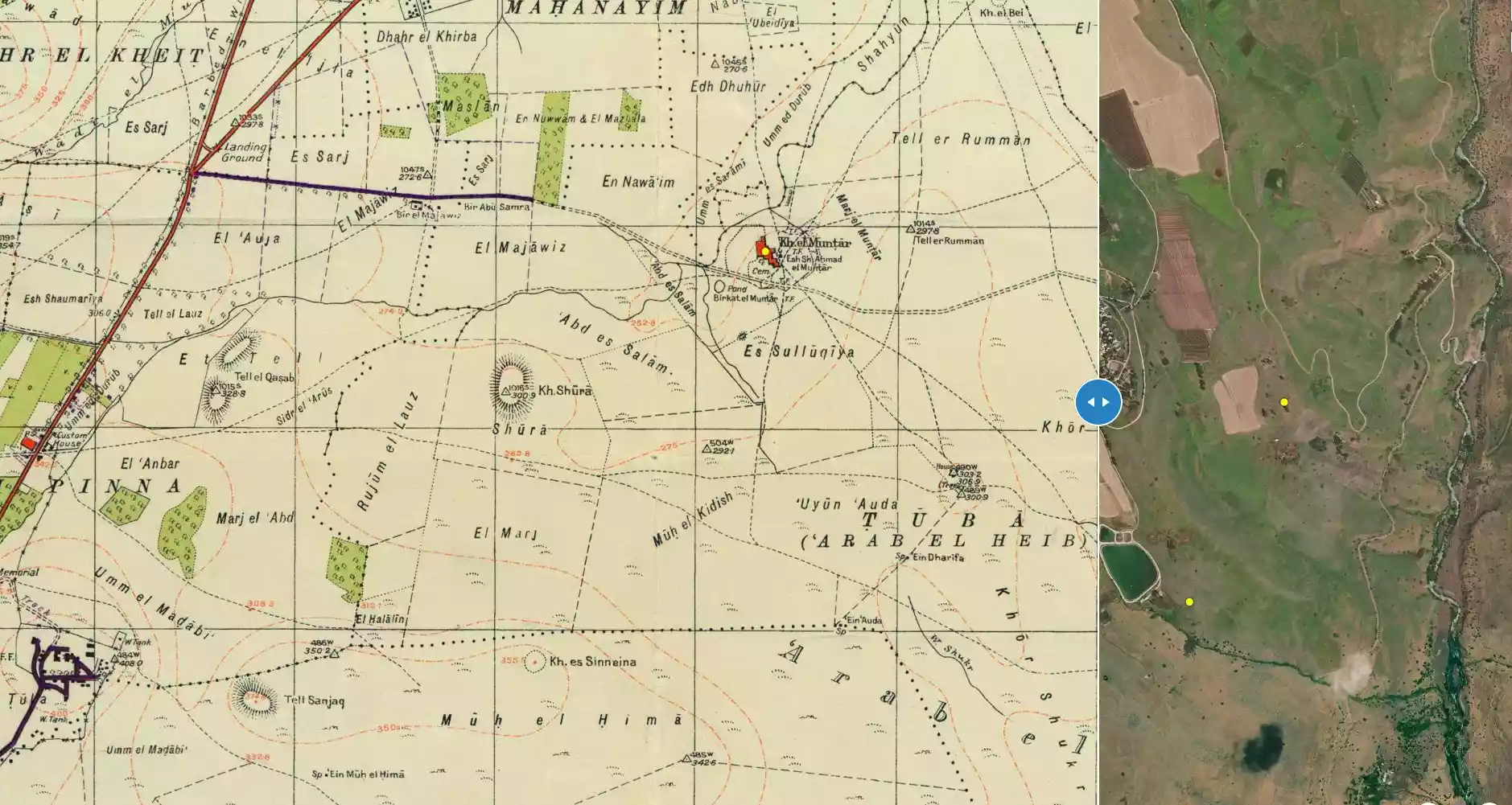
**Town Lands' Demarcation Maps |
||||||||||||
| Land Usage As of 1945 |
|
||||||||||||
| Population |
|
||||||||||||
| Number of Houses |
|
||||||||||||
| Near By Towns |
|||||||||||||
|
|||||||||||||
| Town's Name Through History | The village was also known by Mansurat al-Hula to distinguish it from another village by the same name, al-Mansura, Safad | ||||||||||||
| Shrines / Maqams | A shrine for a local sage known by al-Shaykh Mansur (for his namesake the village was named after him) | ||||||||||||
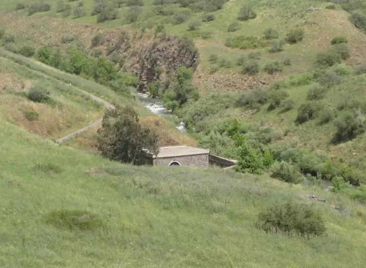
| Nearby Wadies & Rivers | The village was situated 1 km west of the Jordan River | ||||||||||||
| Exculsive Jewish Colonies Who Usurped Village Lands |
Kefar ha-Nasi' is nearby village lands | ||||||||||||
Village Before NakbaThe village was situated on the volcanic sill that formed the southern border of the al-Hula Plain. It was about 1 km west of the Jordan River, and was linked by a secondary road to the highway leading to Safad and Tiberias. The composite name of the village was probably derived from two sources: 'al-Khayt' from the region on the southwestern edge of Lake al-Hula, known as ard al-khayt, in which it was located (see Robinson 1841:341); and 'Mansura' after a Shaykh Mansur, who according to tradition had been buried there. It was also called Mansurat al-Hula, to distinguish it from another village by the same name, al-Mansura (see al-Mansura, Safad sub-district). The Arab geographer al-Dimashqi (d. 1327) wrote that the diyar (territories) of al-Khayt were located in the Jordan Valley and were similar to the land of Iraq because of their rice, birds, warm water, and agricultural crops. [Cited in D 6/2:171-72] Subsequently, the Syrian Sufi traveler al-Bakri al-Siddiqi, who visited the area in the mid-eighteenth century, related that he passed by al-Khayt with the judge of Safad. [Al-Rihla, cited in al-Khalidi 1968:67] Under the Mandate, Mansurat al-Khayt was a hamlet (so classified by the Palestine Index Gazetteer) whose entire population was Muslim. Agricultural production and animal husbandry were the mainstays of its economy.Village Occupation and Ethnic CleaningThe village first came under attack by the Haganah on 18 January 1948, well before widescale fighting had broken out. Israeli historian Benny Morris notes that it 'was temporarily evacuated during a Haganah retaliatory strike,' but he does not say what triggered the alleged retaliation. He also neglects to mention the number of casualties left by the raid and the date the villagers returned after their temporary exile. Another raid followed on the heels of the first one, on the night of 6-7 February. The New York Times reported: 'During the night fifty Jews made well-organized attacks on the Arab village of Mansurat el Kheit ... with automatic arms. They blew up a house under cover of heavy fire from automatic weapons .... ' One villager was reported wounded. An official British communique quoted in the Palestinian daily Filastin confirms this report. [F:2/2/48; M:56-57; NYT:8/2/48]However, if any villagers left as a result of the attacks, they apparently returned soon afterwards, since Israel made a concerted effort to evict them from 1949 until 1956. In July 1949, the armistice agreement was signed between Israel and Syria, according to which the village fell in the Demilitarized Zone (DMZ) along the border. As such, its residents were protected by the agreement and could not be expelled. However, over the next several years Israel used a variety of methods to turn the villagers out of their homes, eventually succeeding in pushing them into Syria (see Kirad al-Baqqara, Safad sub-district). In the case of this and at least seven other villages in the DMZ, the reasons given for the proposed expulsions were 'military, economic and agricultural.' Zionists Colonies on Village LandsThere are no Israeli settlements on village land. The settlement of Kefar ha-Nasi' (206264), founded in 1948, lies nearby to the west, on land belonging to the (still-existing) village of Tuba (206263).Village TodayThe site is partly wooded and partly overgrown with grass; no landmarks are visible. The surrounding land is farmed by the settlement of Kefar ha-Nasi'.SourceDr. Walid al-Khalidi, 1992: All That Remains. |
|||||||||||||
| Related Maps | Town Lands' Demarcation Maps خرائط للقضاء توضح حدود القرى والاودية Town's map on MapQuest View from satellite Help us map this town at WikiMapia |
||||||||||||
| Related Links | Wikipedia's Page Google Search Google For Images Google For Videos |
||||||||||||
| More Information | في كتاب كي لا ننسى في كتاب بلادنا فلسطين المزيد من موقع هوية |
||||||||||||
- View Of Village Site In 1987
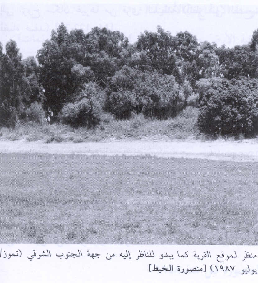
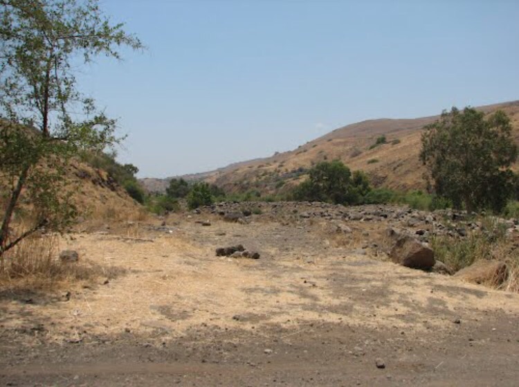
Scanned from "All That Remains" by Dr. Walid Khalidi 1 - نهر الاردن من الشرق للقريه
Posted by abu raya - من الشرق للقريه ويظهر الجسر بين القريه وهضبه الجولان
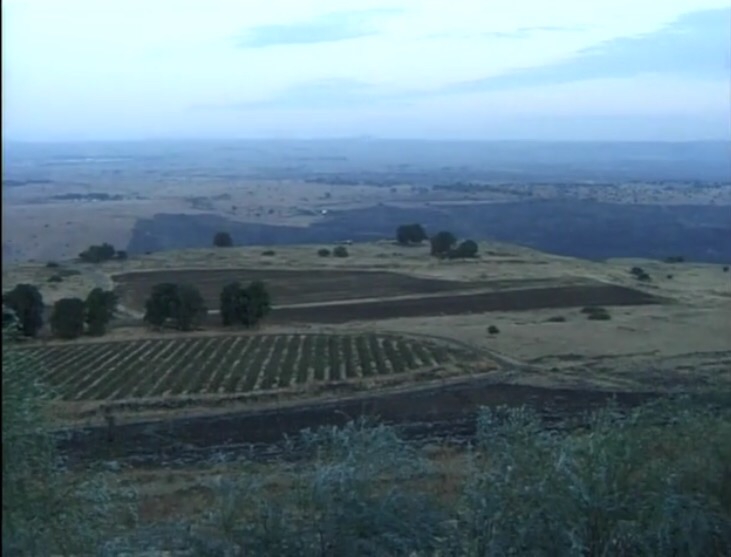
Posted by abu raya - موقع من شرق القريه
Posted by abu raya - موقع القريه بين الاشجار ومن الشرق هضبه الجولان
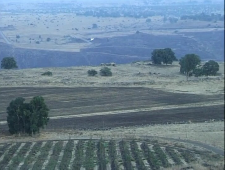
Posted by abu raya - موقع القريه
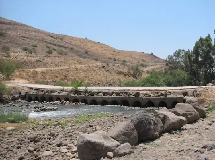
Posted by abu raya - موقع قريب من القريه ويظهر الجسر على نهر الاردن المودي الى القريه
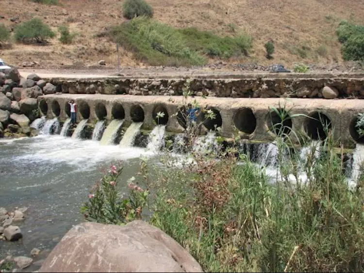
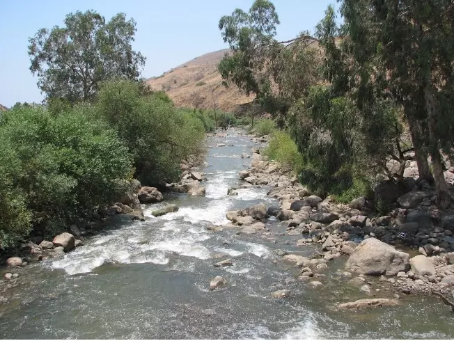
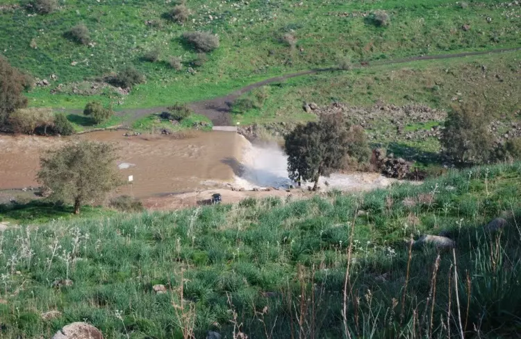
Posted by abu raya - نهر الاردن بالقرب من القريه
Posted by abu raya - نهر الاردن والجسر المودي الى القريه
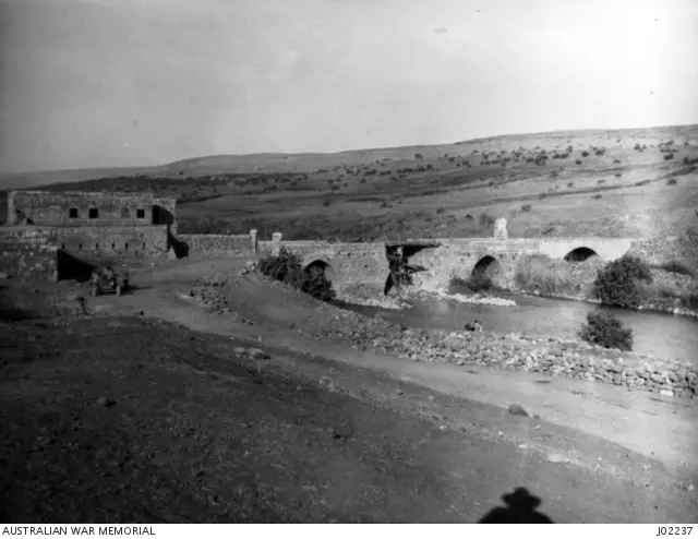
Posted by abu raya - اعادة بناء جسر بنات يعقوب من قبل الوحدة الأسترالية عام 1918م
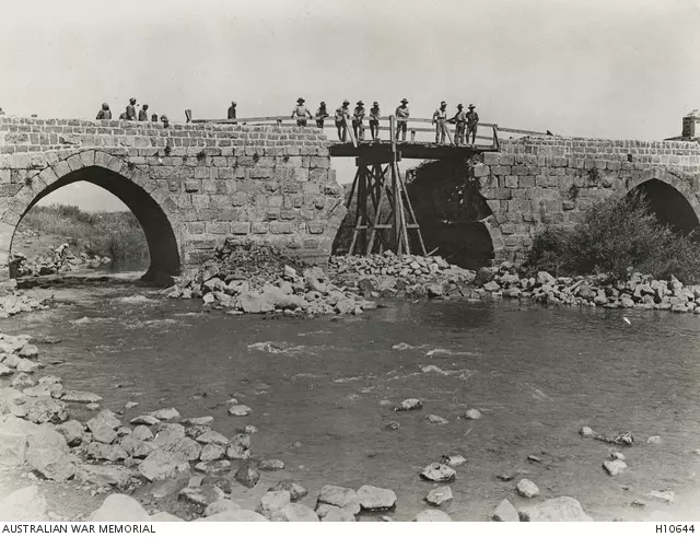
- جنود بريطانيين و أستراليين و بعض السكان المحليين يقفون على الجسر بعد إعادة بنائه عام 1918م
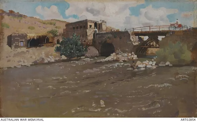
- لوحة فنية لجسر بنات يعقوب بعد إعادة وصله من قبل الوحدة الأسترالية عام 1918م.
- خارطة تُظهِر الحدود والطرق بأنواعها والأماكن المقدسة والطبيعة الطوبغرافية من تلال وسهول ومنحدرات والتشكيلة الطبيعية للأرض وأنواع المزروعات. نُشرت الخريطة فترة الانتداب البريطاني، تم إضافة تعديلات عليها من قِبَل خدمة الخرائط والصور التابعة للقوات العسكرية الاسرائيلية فترة الأربعينيات.
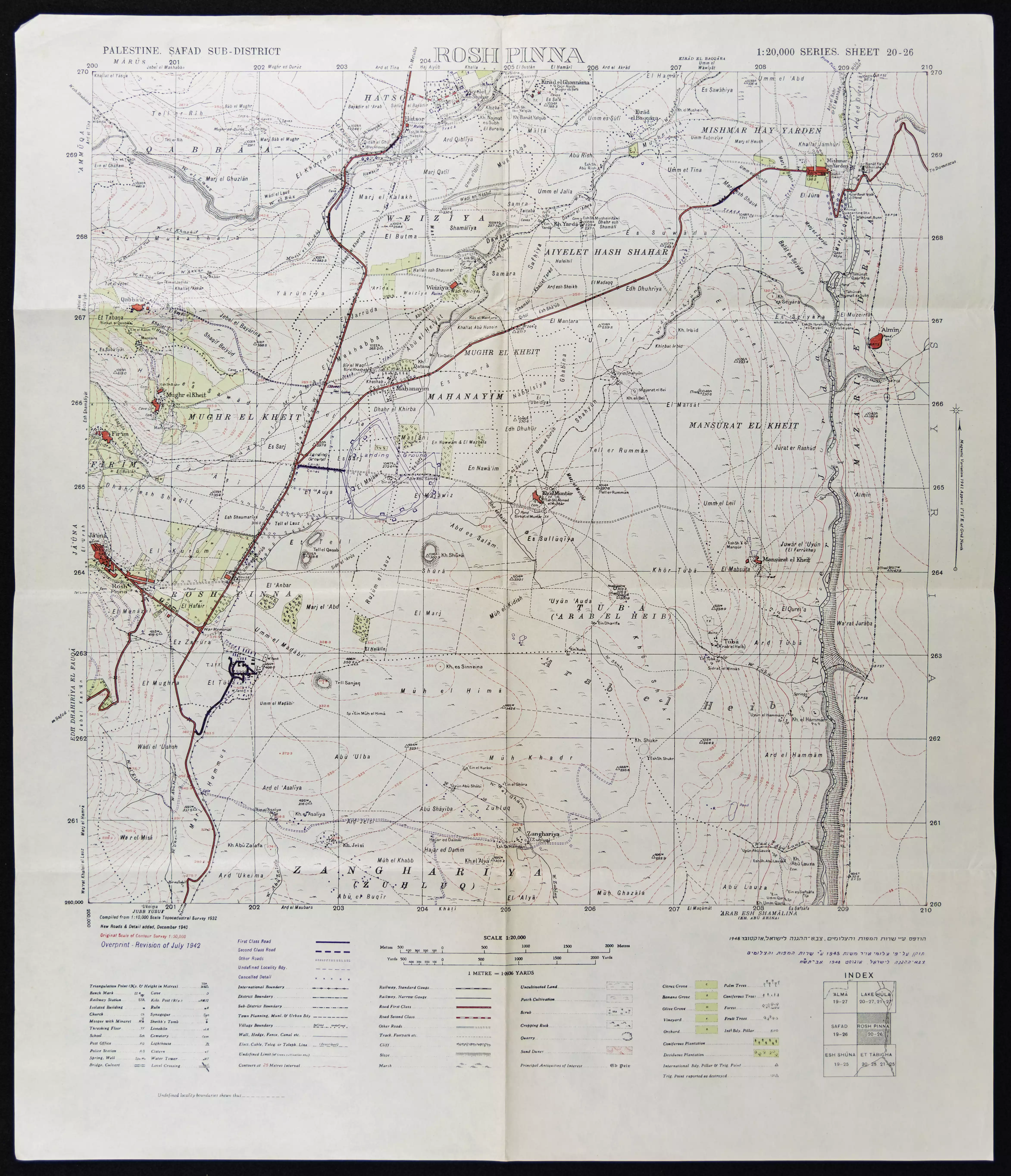
- خارطة تُظهِر الحدود والطرق بأنواعها والأماكن المقدسة والطبيعة الطوبغرافية من تلال وسهول ومنحدرات والتشكيلة الطبيعية للأرض وأنواع المزروعات. نُشرت الخريطة فترة الانتداب البريطاني، تم إضافة تعديلات عليها من قِبَل خدمة الخرائط والصور التابعة للقوات العسكرية الاسرائيلية فترة الأربعينيات.

Want to browse more? 80,000 pictures were grouped in these gallaries:
| Display Name | Clan/Hamolah | Country of Residence |
No links have been shared yet, be free to the first to share the first link.
 Fake Valor: Why Did Zionist Jews Hoist Nazis Flag on Their Ships in the 1930s?
What is new?
-
Facts About Oct. 7th Gaza Raid
-
Remined Us Please:: Who Did Rape Who? Palestinians Raped Israelis? Or, was the other way around?
-
When Prof. Edward Said was invited to debate Bibi Netanyahu in the 1980s, watch what happened!
-
Ezra Klein of the NY Times on the "Jewish Race".
-
Abusing Blood Libel!
-
Did Israeli Soldiers Activate The Hanniba Direective On Oct. 7th? You Be The Judge
-
Zionist FAQ: Isn't it true that Palestinians don't want peace? Palestinians never accepted the two-state solution
- Facts about Haavara (Transfer) Agreement between Ben-Gurion & Hitler
-
Haavara FAQs: Why Did Zionist Jews Hoist Nazis' Flags on Their Ships in the 1930s?
- Haavara FAQs: When Chaim Weizmann met FDR in mid-1943, why was he silent about rescuing European Jewry?
-
Dear ChatGPT: How did Palestinians resist Napoleon's invasion of their country in 1799?
-
Dear ChatGPT: Gaza had a vibrant Jewish community in the mid-17th century. What happened to them?
-
Dear ChatGPT: Why did the Jewish Agency suppress news of the Holocaust during WWII?
-
Video Playlist: Jews share their DNA tests to end the conflict for good.
-
A Tale of Two Conflicts: Examining the Definition of Genocide
-
Prof. Abraham Polak And The Suppressed History of the Khazars and European Jewry
-
How Ronald Reagan would have framed the genocide in Gaza if he were still alive?
-
Haavara FAQs: Let us do the math: how many German Jews did The Haavara Agreement save?
-
Zionist FAQs: The Hebron Massacre of 1929, "clearly proves" that Palestinians are antisemitic, how could you deny it?
-
Zionist FAQs: Why Anti-Zionist Is Not Antisemitism?
-
Zionist FAQs: Isn't it true that the KGB created Palestinian Nationalism in the early 1960s?
- Zionist FAQs: Muslims are killing Muslims all the time; why are Israeli Jews being singled out in the media?
- Zionist FAQs: How is Israel an apartheid state when 20% of its citizens are Arabs who enjoy full rights?
-
Haavara FAQs: Why Did Dorothy Thompson Flip From A Zionist Advocate to A Silenced Dissenter?
-
Haavara FAQs: Analysis of Herzl's Uganda Scheme and how it could have saved millions of Jews.
-
Haavara FAQs: Why did Hayim Greenberg describe American Jewry as "morally bankrupt" in early 1943?
-
Haavara FAQs: What if the Evian Conference was a resounding success? What would have been the impact of saving European Jewry on Zionism?
- Haavara FAQs: What if the six million were saved, how that would have impacted the Zionist project?
-
Haavara FAQs: How did Zionist leaders react when Europe's Jews lingered in the DP camps after WWII ended?
-
Why does the American Jewish community repeat lies that David Ben-Gurion had debunked before he died?
-
Who has the power to rename the Tatar/Khazar Gene Marker to Jewish IV?
-
Zionist FAQs: Why won't Egypt, Syria, and Jordan take their people back? Jews are indigenous to Palestine, and Arabs immigrated after Jews developed the country. Arabs should leave.
-
Haavara FAQs: Did Hitler and the Nazis conflate between Judaism and Zionist? If that wasn't case, then why?
-
Haavara FAQs: Winston Churchill and antisemitism, a collection of articles written Churchill.
-
Haavara FAQs: Broken by country, how many Jews survived vs. killed during the Holocaust?
-
Haavara FAQs: Why did European Jews vote with their feet and to immigrated to the Americas, not Palestine, after WWII?
-
Watch this American Jewish Girl describing Israeli Jews' cognitive dissonance like no other in under two minutes
-
Haavara FAQs: When the Nazis went out of their way to hide the Holocaust, Israeli Jews did the exact opposite by broadcasting their genocide of Gazans. But why?
-
Haavara FAQs: How Zionist Jews went out of their to show their appreciation to Nazism and Fascism?
- Haavara FAQs: Why Zionist leaders were against bombing the death camps & the Railroads leading to them?
-
Haavara FAQs: Hitler's message to the British and American people: If Jews are such noble citizens and you care about them, how come you're not letting them in? I will gladly ship them to you at my expense, even on luxury liners!
-
A shortlist of Zionist and Israeli false flag operations in the name Jews.
-
The Most Moral Army
- The Land of Kapos (Israel): Where the brave are boycotted and Kapos walk free.
- Why did early Zionists often named their communal enterprises "colonial"?
- Zionist Relations with Nazi Germany by Faris Glubb
-
Two NY Times advertisements by Zionists in the early 1943 that exposes Zionists' treason at the height of the calamity
- Facts Not Lies about the Palestinian-Israeli Conflict.
- Site's pictures have been categorized
- Campgain Against Lice
- A Survey of Palestine, the official source about Palestine before Nakba produced by the British Mandate; over 1200 pages.
- Satellite View & Google Earth: Over 6,000 placemarks identifying all destroyed towns, W. Bank & Gaza Strip Towns, & refugee camps.
- PalestineRemembered.com and its Nakba Oral History Project were featured on al-Jazeera Satellite TV.
- Nakba Oral History Video Podcast:
 Over 700 Oral History interviews (including 3,500+ hours of recording) can be viewed online.
 - Palestine Village Statistics Project
- Gaza Jail Break
- النسخة العربية للموقع الان متوفرة
- Videos: Documenting the destroyed villages in video: Tracing all that remains since Nakba.
- Videos: Responding to Zionist Propaganda
- Interview: The ethnic cleansing of Palestine: George Galloway interviews Israeli Historian Ilan Pappe.
- For Palestinians, memory matters. It provides a blueprint for their future By George Bisharat.
- Zionist FAQ now available in Hebrew שאלות שציונים שואלים, עכשיו בעברית
- Video: The Stephen Walt and John Mearsheimer report on the influence of the Israel Lobby on U.S. Foreign Policy
- The Palestinian-Israeli conflict for beginners
