| PalestineRemembered | About Us | Oral History | العربية | |
| Pictures | Zionist FAQs | Haavara | Maps | |
| Search |
| Camps |
| Districts |
| Acre |
| Baysan |
| Beersheba |
| Bethlehem |
| Gaza |
| Haifa |
| Hebron |
| Jaffa |
| Jericho |
| Jerusalem |
| Jinin |
| Nablus |
| Nazareth |
| Ramallah |
| al-Ramla |
| Safad |
| Tiberias |
| Tulkarm |
| Donate |
| Contact |
| Profile |
| Videos |
Welcome To al-Zuq al-Fawqani - الزوق الفوقاني (א-זוק אל-פוקאני)
|
District of Safad
Ethnically cleansed days ago |
العربية Google Earth |
 |
Gallery (13) |
- Statistics & Facts
-
Before & After

- Satellite View
- Articles 1
- Pictures 13
- Members
- All That Remains
- Wikipedia
- Videos
- Guest Book
- Links
| Statistic & Fact | Value | ||||||||||
| Occupation Date | May 21, 1948 | ||||||||||
| Distance From District | 32 (km) South East of Safad | ||||||||||
| Elevation | 250 (meters) | ||||||||||
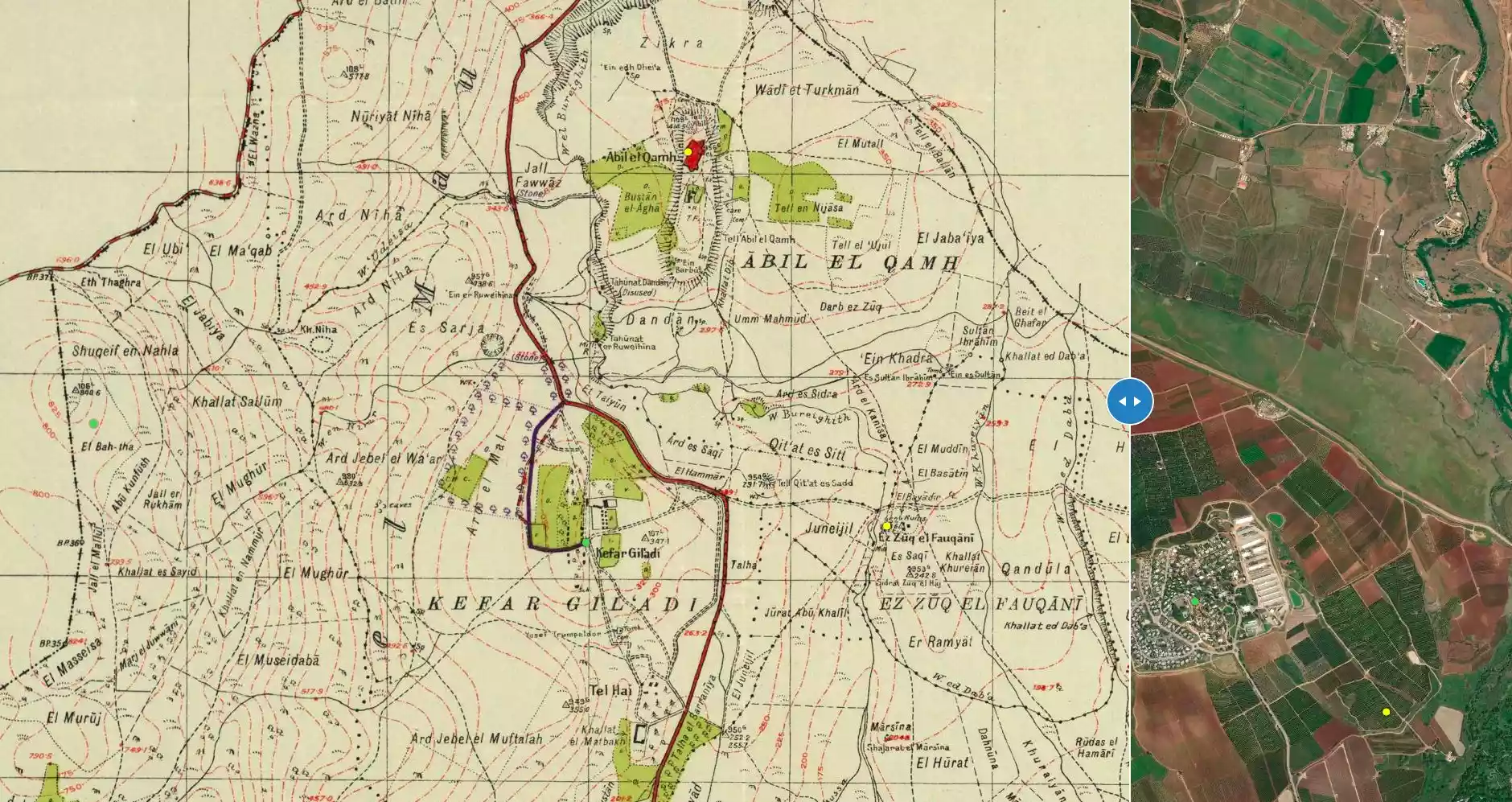
| Before & After Nakba, Click Map For Details |
|||||||||||
|
|||||||||||
| Map Location | See location #2 on the map View from satellite |
||||||||||
| Military Operation | Operation Yiftach (commanded by the ethnic cleansing champion Yigal Allon) | ||||||||||
| Attacking Units | The Palmach's First Battalion | ||||||||||
| Exodus Cause | Military assault by Zionist troops | ||||||||||
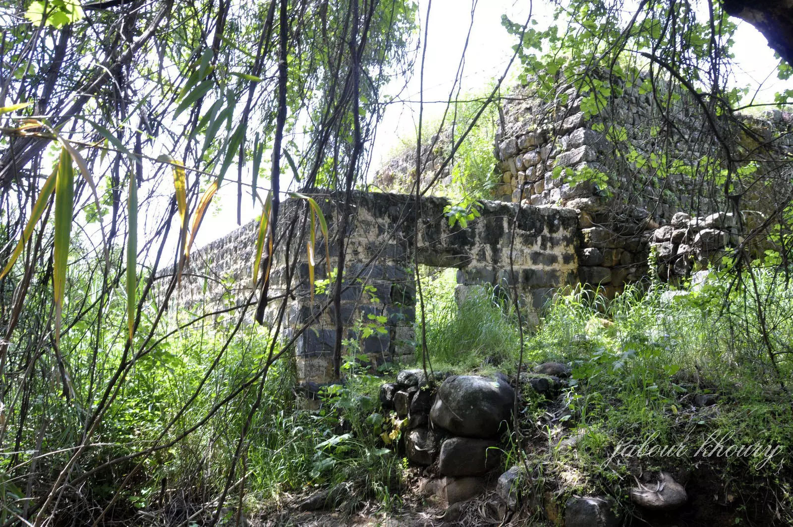
| Village Temains | The village has been completely destroyed, only house rubble left behind | ||||||||||
| Ethnically Cleansing | al-Zuq al-Fuawqani was ethnically cleansed as a result of psychological warfare conducted on in the first half of May 1948. | ||||||||||
| Pre-Nakba Land Ownership |
**Town Lands' Demarcation Maps |
||||||||||
| Land Usage As of 1945 |
|
||||||||||
| Population |
|
||||||||||
| Near By Towns |
|||||||||||
|
|||||||||||
| Water Supply | The village had several springs to power a water mill. | ||||||||||
| Exculsive Jewish Colonies Who Usurped Village Lands |
Yuval settlement is near by village lands. | ||||||||||
| Featured Video | |||||||||||
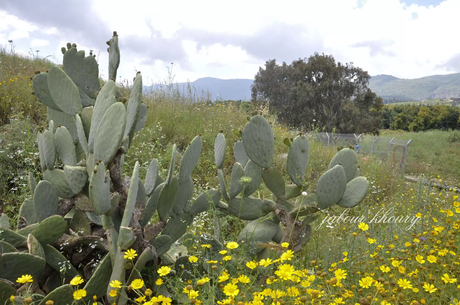
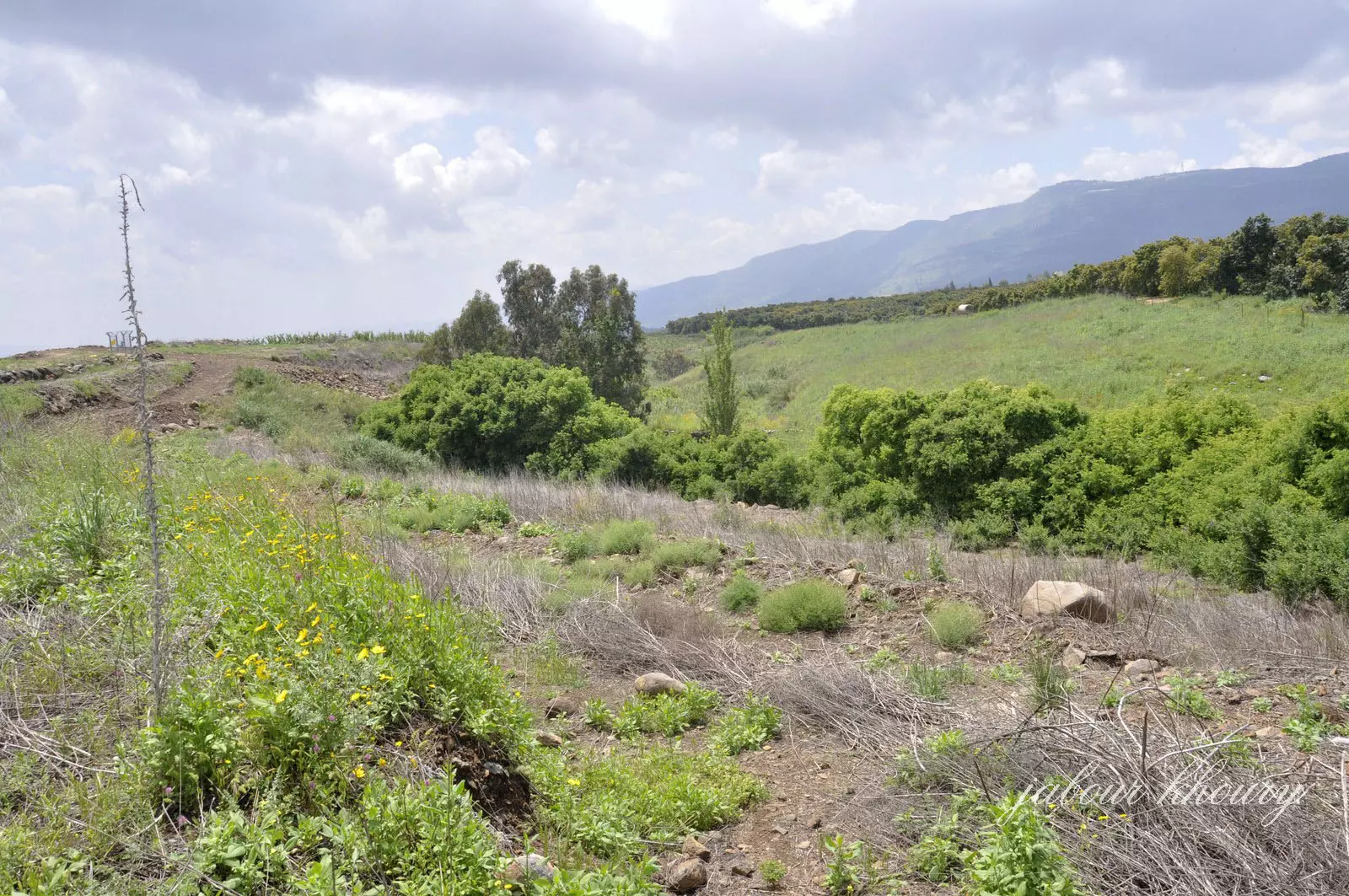
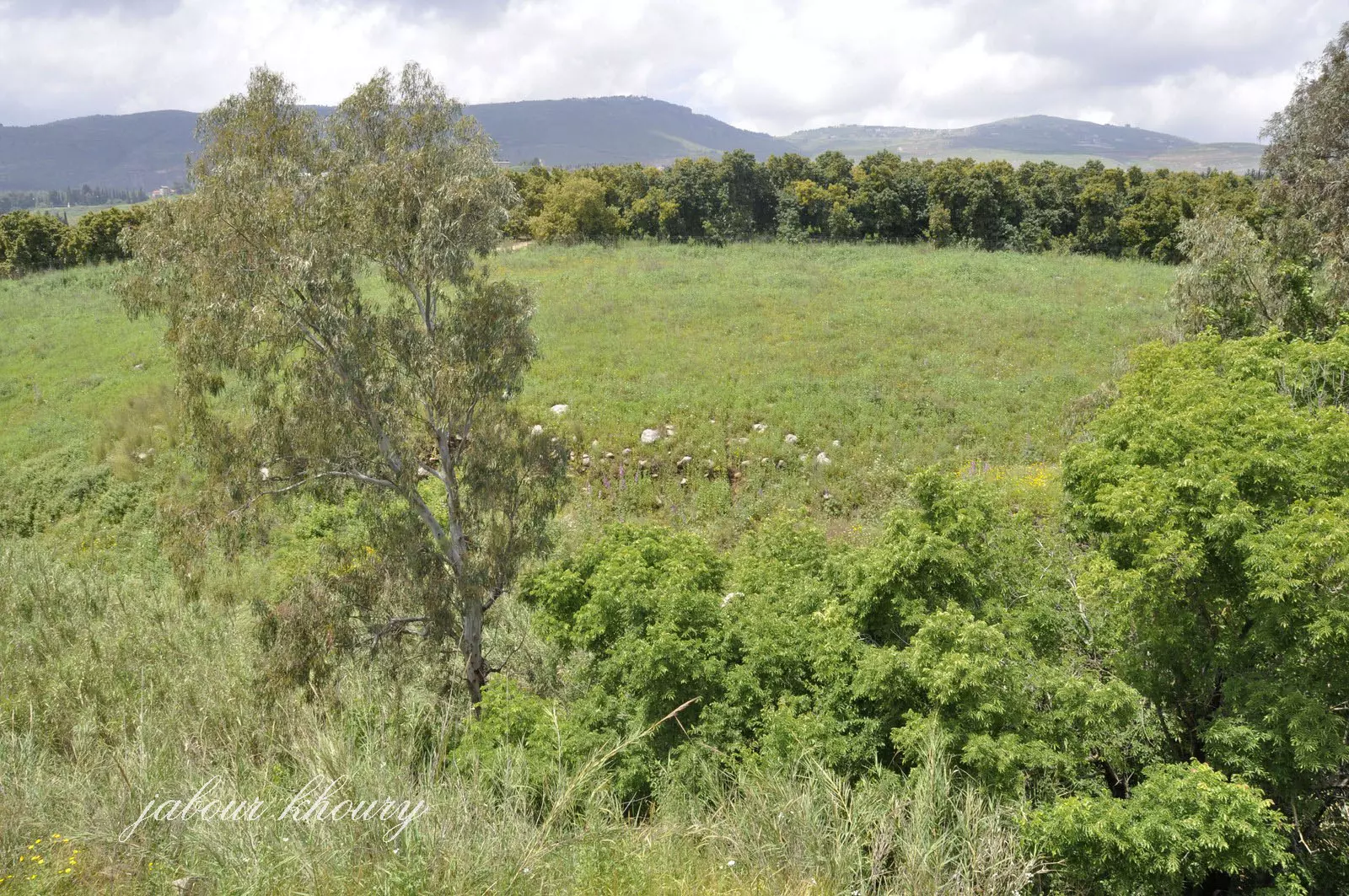
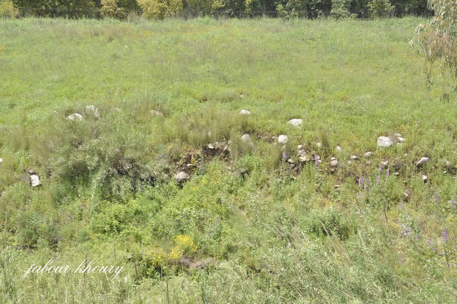
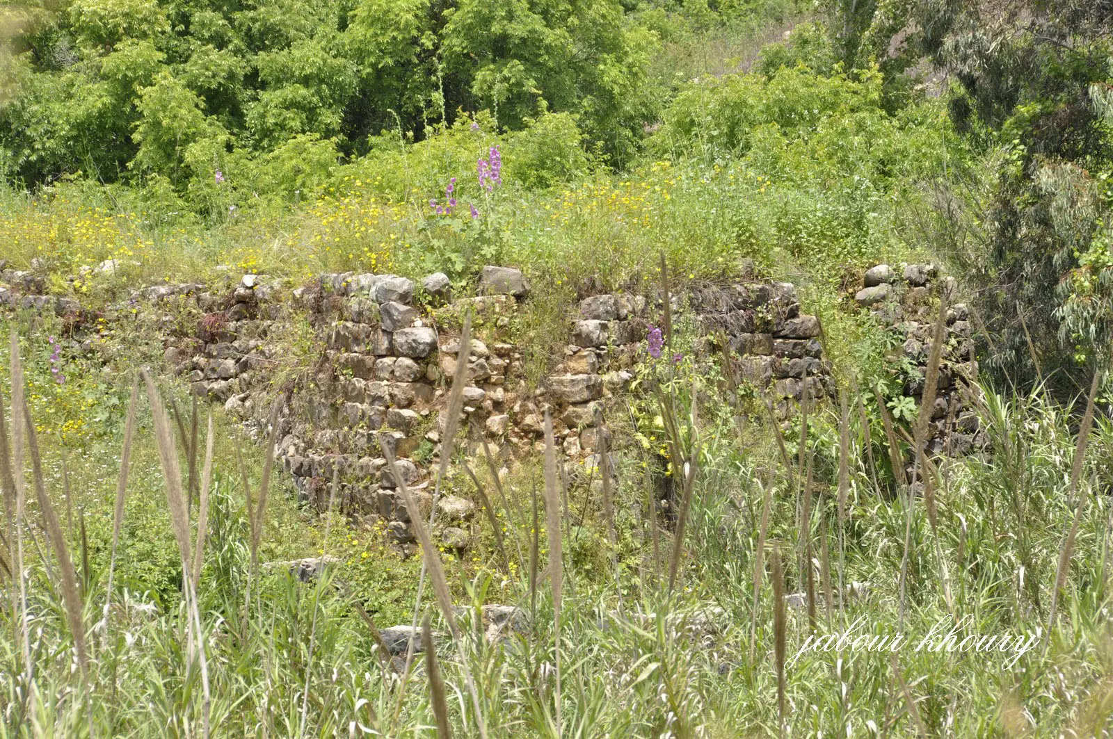
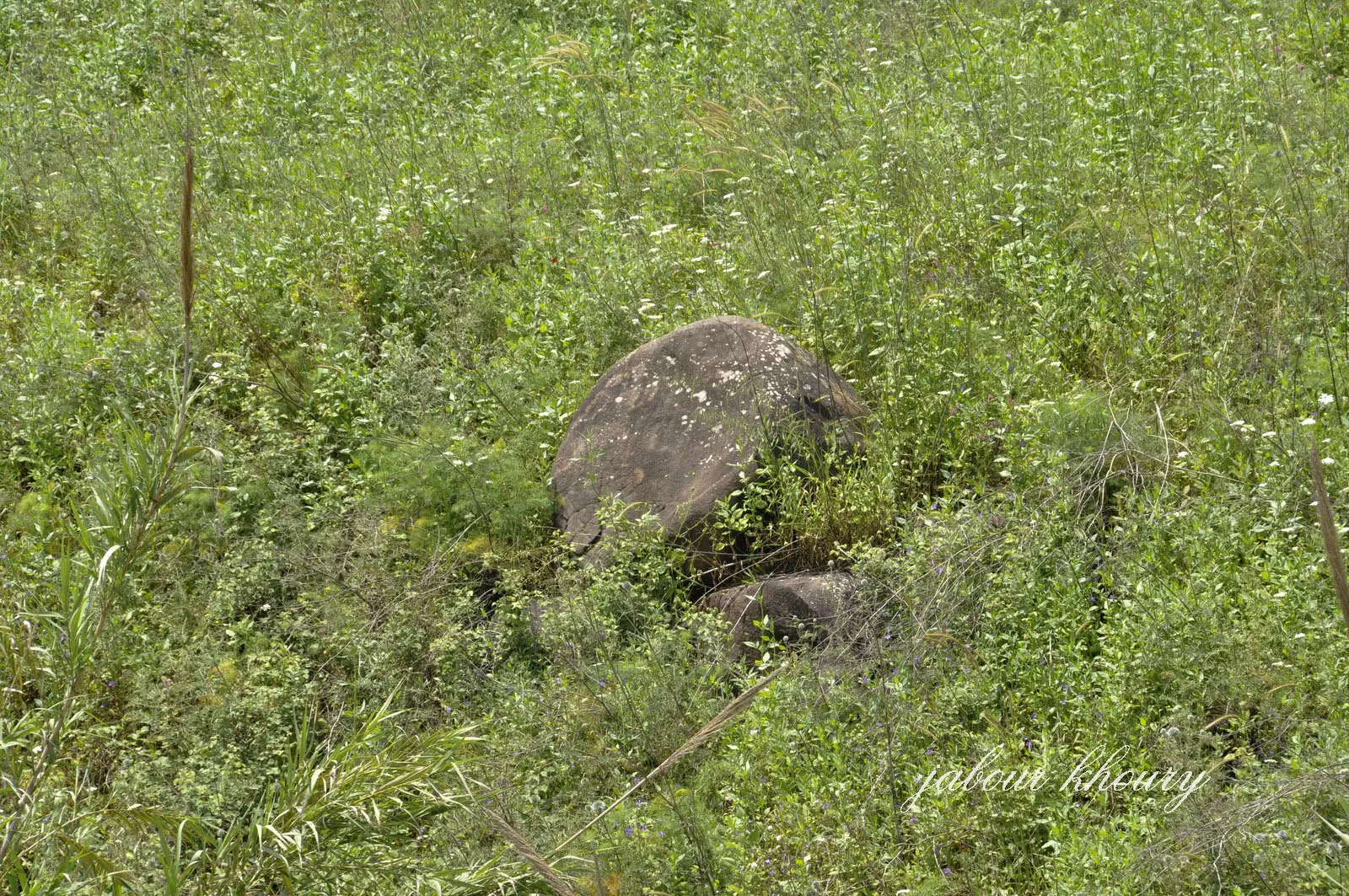
Village Before NakbaThe village was near the Lebanese border in an area that sloped toward the al-Hula Plain, to the south. It was about 1 km east of the highway leading to Safad and Tiberias, at the intersection of secondary roads that linked it to several neighboring villages. The etymology of the first part of the name, al-Zuq, is not known for sure; it may have been derived from the Syriac zuk, meaning "town." The second part, al-Fawqani ("upper" in Arabic) distinguished it from the "lower" village of al-Zuq al-Tahtani to the south. The outline of the village was circular, with its houses built along the roads that radiated outward from its center. Several springs flowed northwest of it, and a water-powered mill was built on the south side. The villagers grew olive trees on the slopes to the north and west of the village, and fruit trees on the western side. In 1944 a total of 1,286 dunums was allocated to cereals; 503 dunums were irrigated or used for orchards. Columns in secondary use, wall fragments, and an olive press all bear witness to earlier occupation at the site of al-Zuq al-Fawqani. Within a 2-km radius of the site were several tells and khirbas, which testify to the attractiveness of the site for settlement in the pastVillage Occupation and Ethnic CleaningThe Palmach 'whispering campaign,' which was launched during Operation Yiftach (see Abil al-Qamh, Safad sub-district), precipitated the flight of many of the villagers of the Galilee panhandle, including the villagers of al-Zuq al-Fawqani. Israeli historian Benny Morris indicates that a direct military assault on the village contributed to the exodus of the villagers, which took place on 21 May 1948. [[M:xiv, 123]]Zionists Colonies on Village LandsThere are no Israeli settlements entirely on village land, although Yuval (206294), established in 1952, is located very close by to the northeast. Yuval sits at the intersection of the village lands of Abil al-Qamh, al-Sanbariyya, and al-Zuq al-Fawqani. Another settlement, Kefar Gil'adi (203294), is about 1 km west of the site; it was founded in 1916.Village TodayThe stones of destroyed homes are strewn across the site, which is overgrown with .grass, thorns, and a few cactus plants. The nearby settlement of Yuval cultivates part of the surrounding land, and uses the rest as forests and grazing grounds.SourceDr. Walid al-Khalidi, 1992: All That Remains. |
|||||||||||
| Related Maps | Town Lands' Demarcation Maps خرائط للقضاء توضح حدود القرى والاودية Town's map on MapQuest View from satellite Help us map this town at WikiMapia |
||||||||||
| Related Links | Wikipedia's Page Google Search Google For Images Google For Videos |
||||||||||
| More Information | في كتاب كي لا ننسى المزيد من موقع هوية |
||||||||||
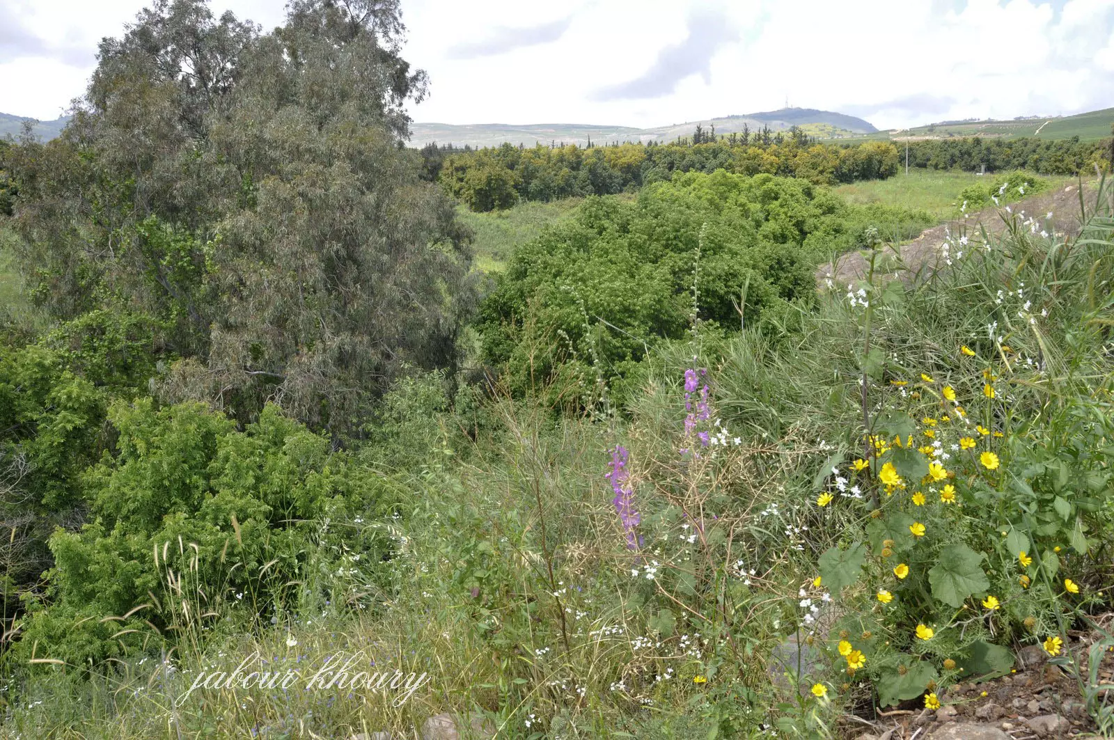
- التله التي كانت تقع عليها القريه

Posted by Jabour Khoury - موقع القريه
Posted by Jabour Khoury - طاحونه القريه وموقعها على وادي عبون-البراغيت
Posted by Jabour Khoury - وادي عيون وعلى ضفافه تبدو أثار المنازل المهدمه
Posted by Jabour Khoury - ردم بعض المنازل
Posted by Jabour Khoury - طاحونه الماء على الوادي
Posted by Jabour Khoury - حجر رحى الطاحونه المهمل بين الاعشاب
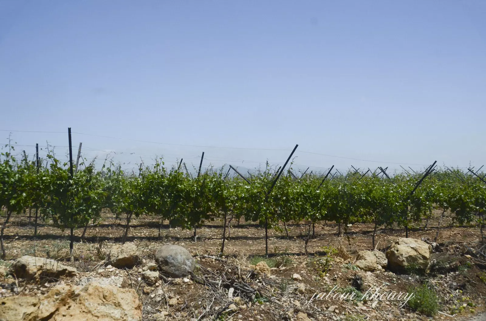
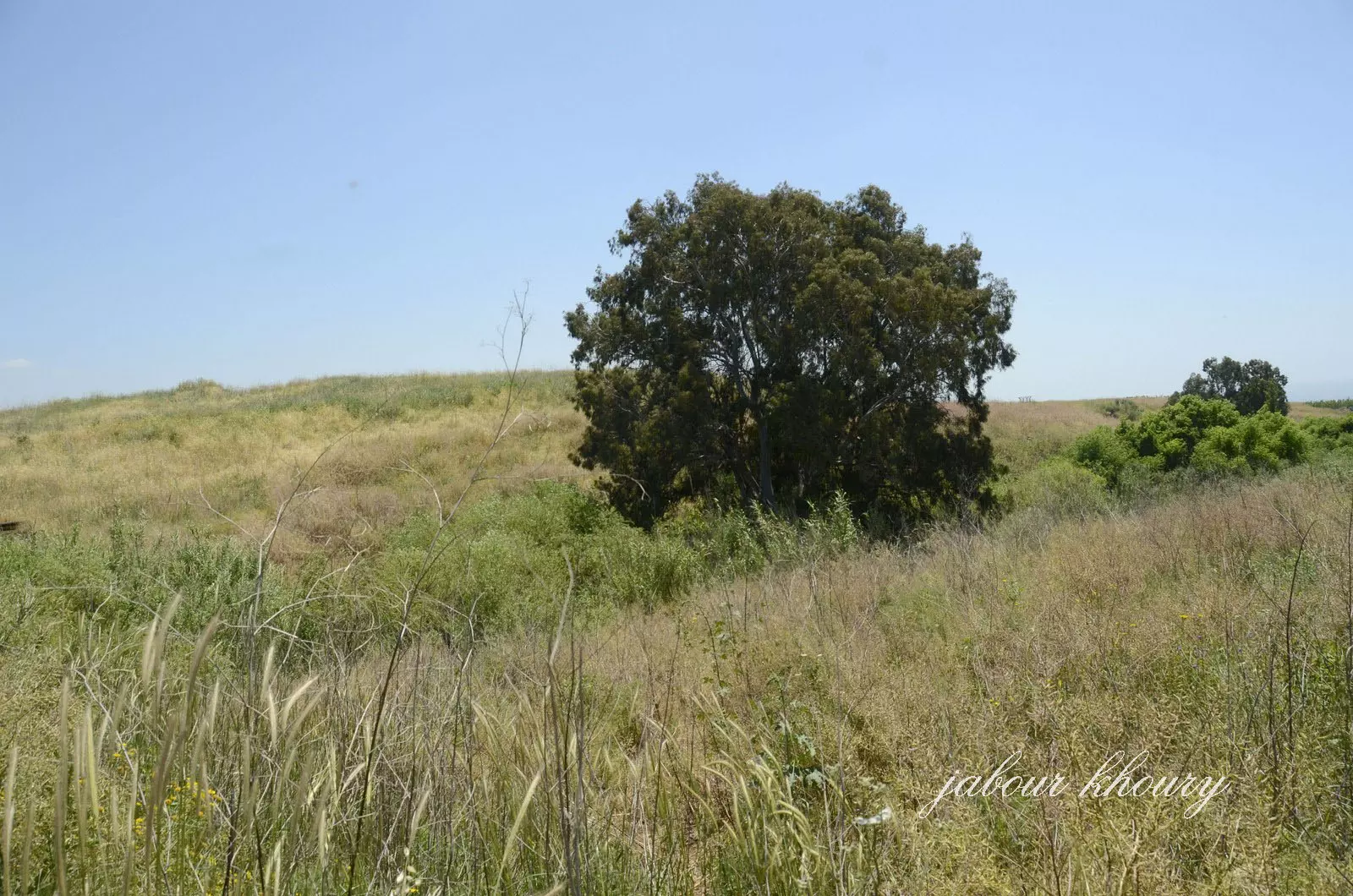
Posted by Jabour Khoury - اراضي القريه
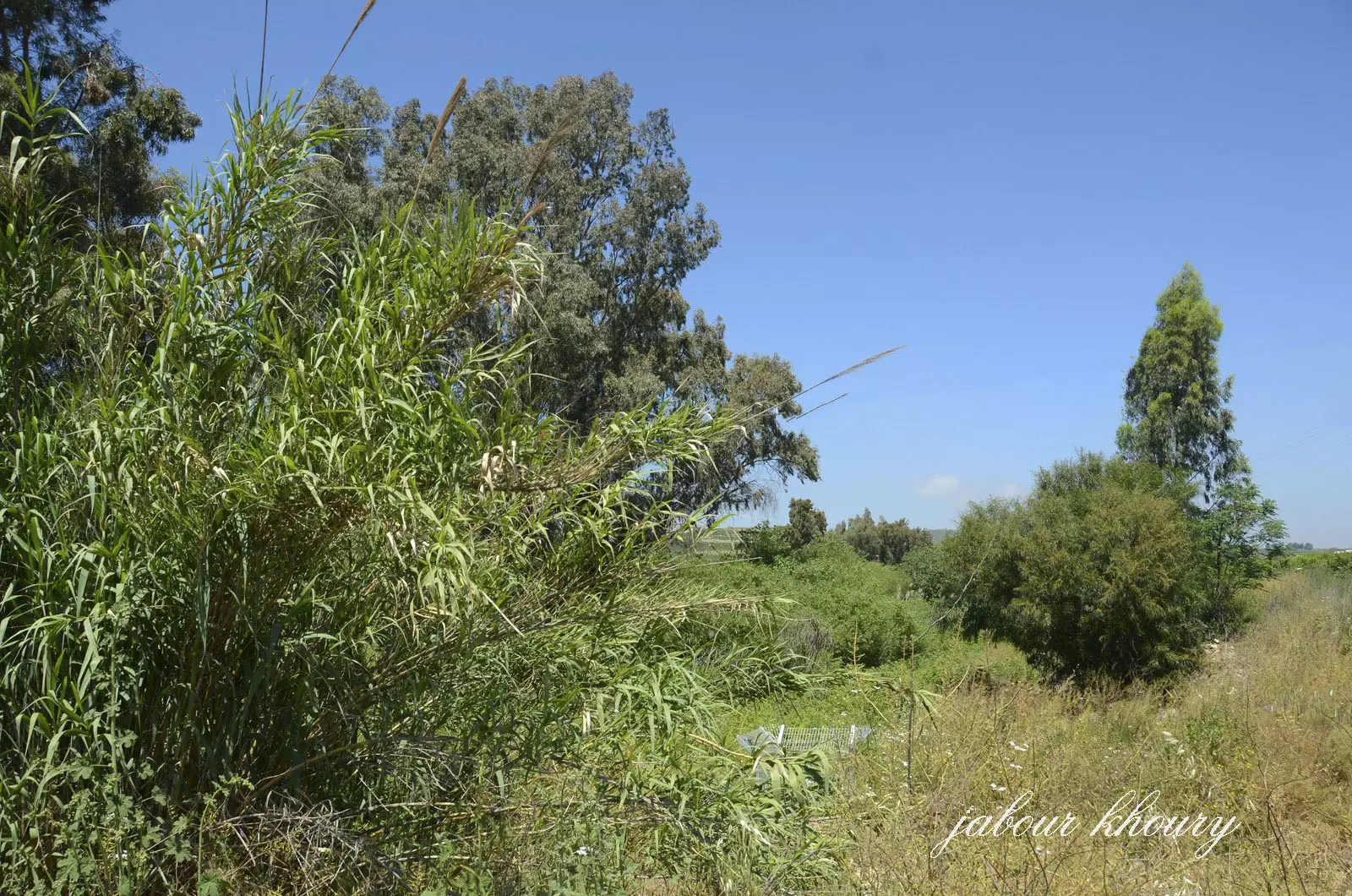
Posted by Jabour Khoury - وادي عيون عند مروره باراضي القريه
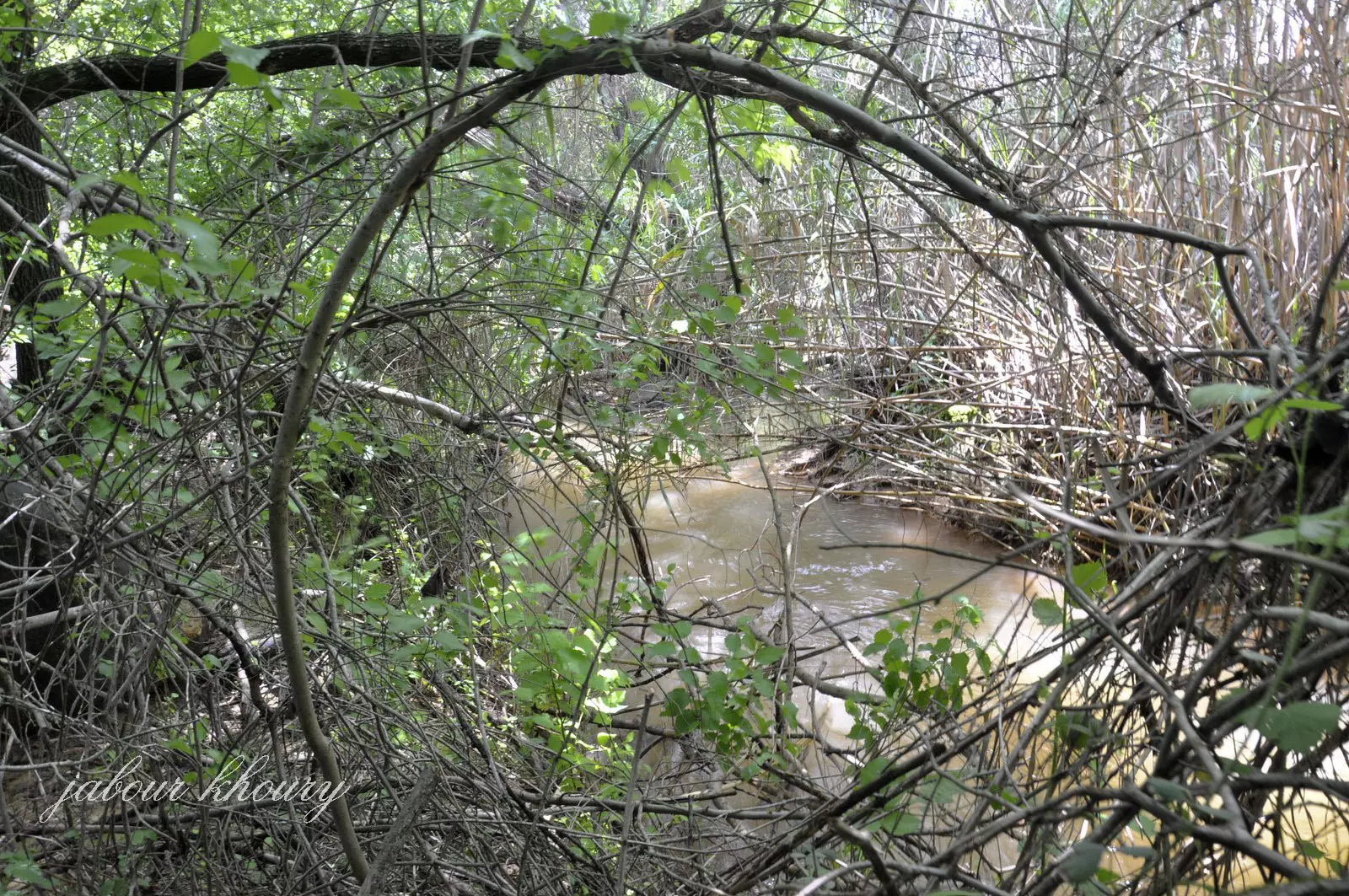
Posted by Jabour Khoury - الطاحونه على الوادي
Posted by Jabour Khoury 1 - اراضي القريه في الجهه الشماليه المزروعه بالبساتين من قبل مستوطنه معيان باروخ
Posted by Jabour Khoury - مجرى وادي عيون في الجهه الشماليه من القريه
Posted by Jabour Khoury - التله التي كانت مقامه عليها القريه
Posted by Jabour Khoury
Want to browse more? 80,000 pictures were grouped in these gallaries:
| Display Name | Clan/Hamolah | Country of Residence |
No links have been shared yet, be free to the first to share the first link.
 Fake Valor: Why Did Zionist Jews Hoist Nazis Flag on Their Ships in the 1930s?
What is new?
-
Facts About Oct. 7th Gaza Raid
-
Remined Us Please:: Who Did Rape Who? Palestinians Raped Israelis? Or, was the other way around?
-
When Prof. Edward Said was invited to debate Bibi Netanyahu in the 1980s, watch what happened!
-
Ezra Klein of the NY Times on the "Jewish Race".
-
Abusing Blood Libel!
-
Did Israeli Soldiers Activate The Hanniba Direective On Oct. 7th? You Be The Judge
-
Zionist FAQ: Isn't it true that Palestinians don't want peace? Palestinians never accepted the two-state solution
- Facts about Haavara (Transfer) Agreement between Ben-Gurion & Hitler
-
Haavara FAQs: Why Did Zionist Jews Hoist Nazis' Flags on Their Ships in the 1930s?
- Haavara FAQs: When Chaim Weizmann met FDR in mid-1943, why was he silent about rescuing European Jewry?
-
Dear ChatGPT: How did Palestinians resist Napoleon's invasion of their country in 1799?
-
Dear ChatGPT: Gaza had a vibrant Jewish community in the mid-17th century. What happened to them?
-
Dear ChatGPT: Why did the Jewish Agency suppress news of the Holocaust during WWII?
-
Video Playlist: Jews share their DNA tests to end the conflict for good.
-
A Tale of Two Conflicts: Examining the Definition of Genocide
-
Prof. Abraham Polak And The Suppressed History of the Khazars and European Jewry
-
How Ronald Reagan would have framed the genocide in Gaza if he were still alive?
-
Haavara FAQs: Let us do the math: how many German Jews did The Haavara Agreement save?
-
Zionist FAQs: The Hebron Massacre of 1929, "clearly proves" that Palestinians are antisemitic, how could you deny it?
-
Zionist FAQs: Why Anti-Zionist Is Not Antisemitism?
-
Zionist FAQs: Isn't it true that the KGB created Palestinian Nationalism in the early 1960s?
- Zionist FAQs: Muslims are killing Muslims all the time; why are Israeli Jews being singled out in the media?
- Zionist FAQs: How is Israel an apartheid state when 20% of its citizens are Arabs who enjoy full rights?
-
Haavara FAQs: Why Did Dorothy Thompson Flip From A Zionist Advocate to A Silenced Dissenter?
-
Haavara FAQs: Analysis of Herzl's Uganda Scheme and how it could have saved millions of Jews.
-
Haavara FAQs: Why did Hayim Greenberg describe American Jewry as "morally bankrupt" in early 1943?
-
Haavara FAQs: What if the Evian Conference was a resounding success? What would have been the impact of saving European Jewry on Zionism?
- Haavara FAQs: What if the six million were saved, how that would have impacted the Zionist project?
-
Haavara FAQs: How did Zionist leaders react when Europe's Jews lingered in the DP camps after WWII ended?
-
Why does the American Jewish community repeat lies that David Ben-Gurion had debunked before he died?
-
Who has the power to rename the Tatar/Khazar Gene Marker to Jewish IV?
-
Zionist FAQs: Why won't Egypt, Syria, and Jordan take their people back? Jews are indigenous to Palestine, and Arabs immigrated after Jews developed the country. Arabs should leave.
-
Haavara FAQs: Did Hitler and the Nazis conflate between Judaism and Zionist? If that wasn't case, then why?
-
Haavara FAQs: Winston Churchill and antisemitism, a collection of articles written Churchill.
-
Haavara FAQs: Broken by country, how many Jews survived vs. killed during the Holocaust?
-
Haavara FAQs: Why did European Jews vote with their feet and to immigrated to the Americas, not Palestine, after WWII?
-
Watch this American Jewish Girl describing Israeli Jews' cognitive dissonance like no other in under two minutes
-
Haavara FAQs: When the Nazis went out of their way to hide the Holocaust, Israeli Jews did the exact opposite by broadcasting their genocide of Gazans. But why?
-
Haavara FAQs: How Zionist Jews went out of their to show their appreciation to Nazism and Fascism?
- Haavara FAQs: Why Zionist leaders were against bombing the death camps & the Railroads leading to them?
-
Haavara FAQs: Hitler's message to the British and American people: If Jews are such noble citizens and you care about them, how come you're not letting them in? I will gladly ship them to you at my expense, even on luxury liners!
-
A shortlist of Zionist and Israeli false flag operations in the name Jews.
-
The Most Moral Army
- The Land of Kapos (Israel): Where the brave are boycotted and Kapos walk free.
- Why did early Zionists often named their communal enterprises "colonial"?
- Zionist Relations with Nazi Germany by Faris Glubb
-
Two NY Times advertisements by Zionists in the early 1943 that exposes Zionists' treason at the height of the calamity
- Facts Not Lies about the Palestinian-Israeli Conflict.
- Site's pictures have been categorized
- Campgain Against Lice
- A Survey of Palestine, the official source about Palestine before Nakba produced by the British Mandate; over 1200 pages.
- Satellite View & Google Earth: Over 6,000 placemarks identifying all destroyed towns, W. Bank & Gaza Strip Towns, & refugee camps.
- PalestineRemembered.com and its Nakba Oral History Project were featured on al-Jazeera Satellite TV.
- Nakba Oral History Video Podcast:
 Over 700 Oral History interviews (including 3,500+ hours of recording) can be viewed online.
 - Palestine Village Statistics Project
- Gaza Jail Break
- النسخة العربية للموقع الان متوفرة
- Videos: Documenting the destroyed villages in video: Tracing all that remains since Nakba.
- Videos: Responding to Zionist Propaganda
- Interview: The ethnic cleansing of Palestine: George Galloway interviews Israeli Historian Ilan Pappe.
- For Palestinians, memory matters. It provides a blueprint for their future By George Bisharat.
- Zionist FAQ now available in Hebrew שאלות שציונים שואלים, עכשיו בעברית
- Video: The Stephen Walt and John Mearsheimer report on the influence of the Israel Lobby on U.S. Foreign Policy
- The Palestinian-Israeli conflict for beginners
