| PalestineRemembered | About Us | Oral History | العربية | |
| Pictures | Zionist FAQs | Haavara | Maps | |
| Search |
| Camps |
| Districts |
| Acre |
| Baysan |
| Beersheba |
| Bethlehem |
| Gaza |
| Haifa |
| Hebron |
| Jaffa |
| Jericho |
| Jerusalem |
| Jinin |
| Nablus |
| Nazareth |
| Ramallah |
| al-Ramla |
| Safad |
| Tiberias |
| Tulkarm |
| Donate |
| Contact |
| Profile |
| Videos |
Welcome To al-Samra - السمرا (א-סמרא)
|
District of Tiberias
Ethnically cleansed days ago |
العربية Google Earth |
 |
Gallery (14) |
- Statistics & Facts
-
Before & After

- Satellite View
- Articles 1
- Pictures 14
- Members
- All That Remains
- Wikipedia
- Videos
- Guest Book 3
- Links
| Statistic & Fact | Value | |||||||||||||||||||||
| Occupation Date | April 21, 1948 | |||||||||||||||||||||
| Distance From District | 10 (km) Southeast of Tiberias | |||||||||||||||||||||
| Elevation | less than -200 (meters) | |||||||||||||||||||||
| Before & After Nakba, Click Map For Details |
||||||||||||||||||||||
|
||||||||||||||||||||||
| Map Location | See location #17 on the map View from satellite |
|||||||||||||||||||||
| Exodus Cause | Influence of fall of, or exoduce from, neighboring town | |||||||||||||||||||||
| Village Temains | al-Samra was completely obliterated. Not even house rubble left behind. | |||||||||||||||||||||
| Ethnically Cleansing | On April 21st, 1948, al-Samra inhabitants were mostly ethnically cleansed, and between 1949-1956 it was completely cleansed. | |||||||||||||||||||||
| Pre-Nakba Land Ownership |
**Town Lands' Demarcation Maps |
|||||||||||||||||||||
| Land Usage As of 1945 |
|
|||||||||||||||||||||
| Population |
|
|||||||||||||||||||||
| Number of Houses |
|
|||||||||||||||||||||
| Near By Towns |
||||||||||||||||||||||
|
||||||||||||||||||||||
| Places of Warship | One mosque | |||||||||||||||||||||
| Archeological Sites | al-Samra contains serveral khirbs including Khirbat al-Tawafiq and Khirbat Duwayraban. | |||||||||||||||||||||
| Exculsive Jewish Colonies Who Usurped Village Lands |
ha-'On | |||||||||||||||||||||
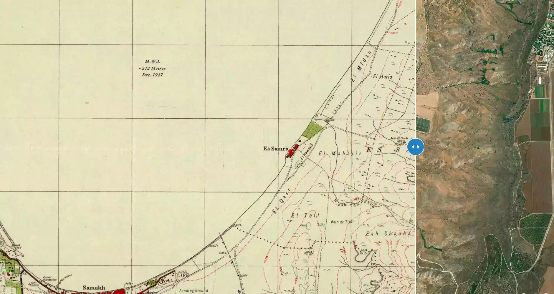
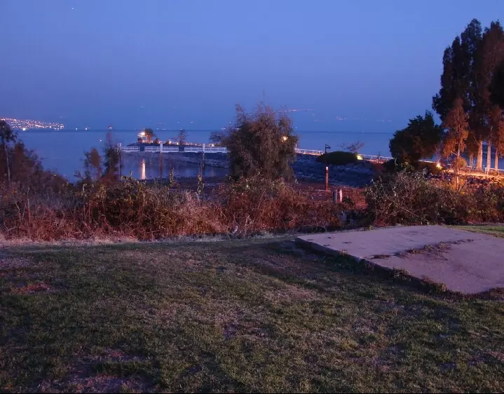
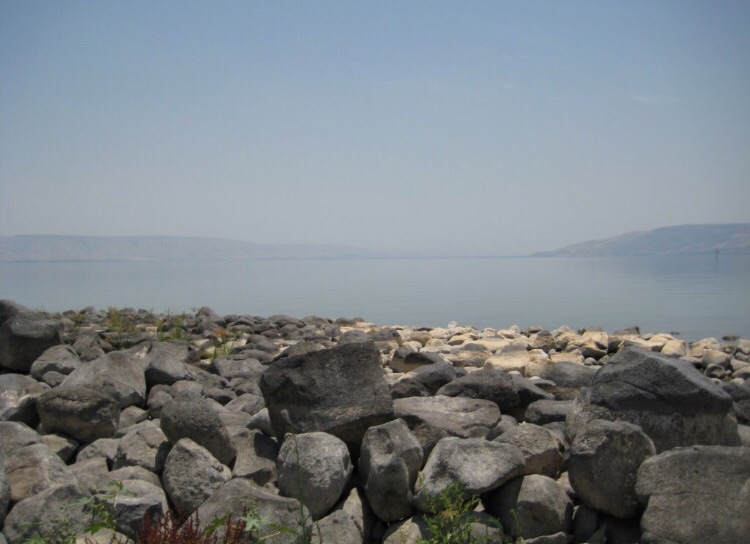
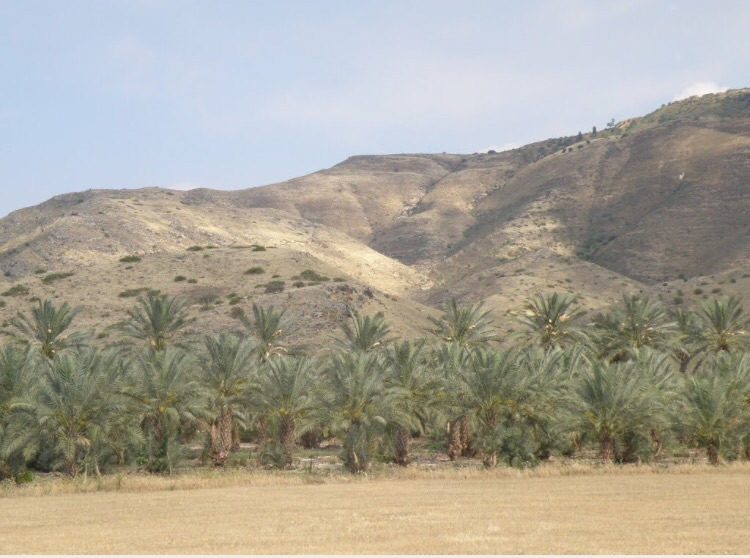
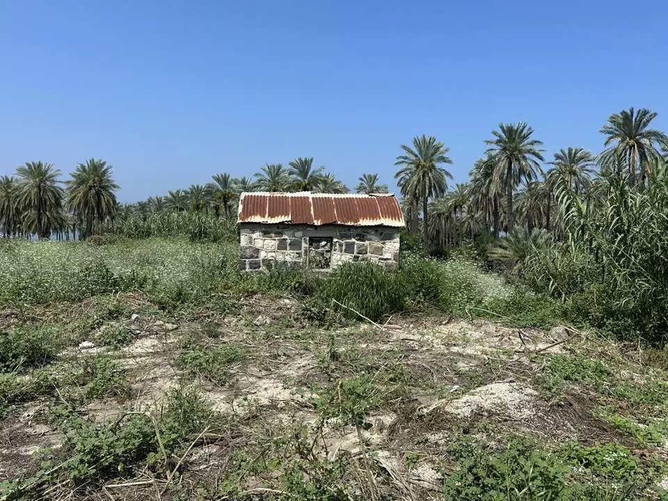
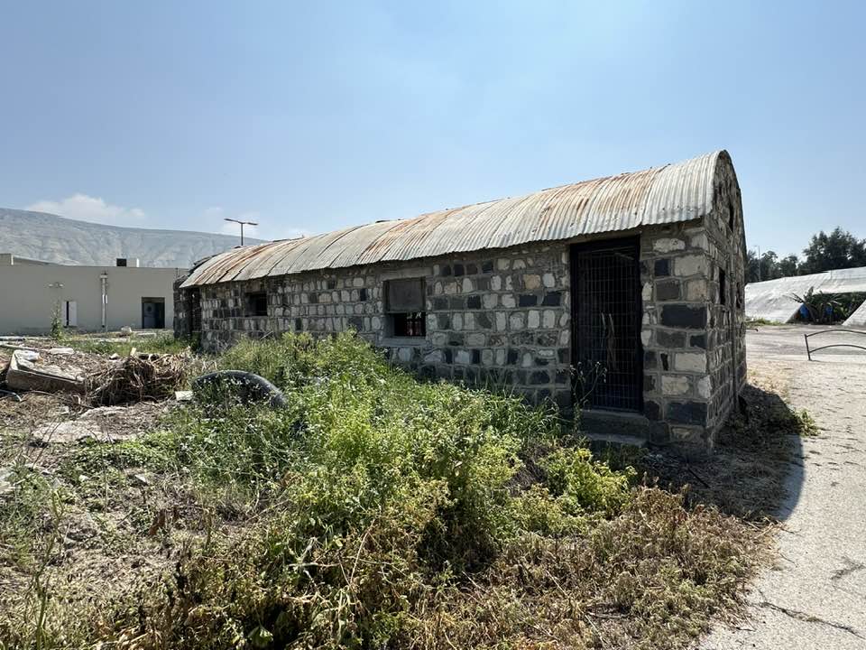
Village Before NakbaThe village stood on flat terrain on the southeastern shore of Lake Tiberias, 3 km west of the Syrian-Palestinian border. It was dominated on the east by the Golan Heights and was linked to the closest village (Samakh) by a secondary road. The village plan was rectangular, extending along the lake in a north-south direction. In the early nineteenth century, the Swiss traveler Burckhardt noted its ancient buildings and mentioned that it was the only inhabited village on the east side of Lake Tiberias. [[Burckhardt 1822:278-79]] The American biblical scholar Edward Robinson was told that al-Samra lay on the eastern shore of Lake Tiberias. [[Robinson (1856) III:264, fn. 1]] The people of al-Samra were predominantly Muslim and worshipped in a mosque that stood in the village center. Their houses were built of adobe and stone.Agriculture was the main occupation of the residents. Some 6,825 dunums were allocated to cereals in 1944/45; 21 dunums were irrigated or used for orchards. The village contained ancient ruins, including the foundations of buildings and Roman burial grounds. Archaeological evidence of the site's antiquity, found on the edge of the village, included a Roman burial ground. Sites in the vicinity included Khirbat al-Tawafiq (209234) and Khirbat Duwayraban (210239). Some 1.5 km east of the village was an Ottoman memorial for two Ottoman pilots who were killed in a plane crash in that area in 1913 while on a trip from Istanbul to Cairo. Village Occupation and Ethnic CleaningAs a result of the fall of Tiberias, al-Samra was evacuated on 21 April 1948, according to Israeli historian Benny Morris. However, some of the villagers must have remained; Morris notes that the residents of al-Samra and other villages were subjected to a concerted campaign between 1949 and 1956 to encourage their departure. Located in the Demilitarized Zone (DMZ), the village was protected by the provisions of the armistice agreement. However, by using a combination of 'economic and police pressure,' the Israeli authorities succeeded in forcing all of the villagers in the DMZ to leave by 1956. Most became refugees in Syria, but some eventually made their way to the village of Sha'b near Acre. [[M:xv, 242-43]]As early as 3 May 1948, Jewish settlers from the area had urged the Jewish National Fund to establish a settlement at al-Samra. Morris quotes them as saying that the opportunity created by the depopulation of Arabs in the area was not to be missed. [[M:xx, 182]] Zionists Colonies on Village LandsThe settlement of ha-'On (208237) was established north of the village site in 1949.Village TodayNothing remains of the village houses. A tourist resort, which consists of a few cabins and small houses, has been established on part of the village site. Other parts of the site are covered with trees. The surrounding land is cultivated by Israelis.SourceDr. Walid al-Khalidi, 1992: All That Remains. |
||||||||||||||||||||||
| Related Maps | Town Lands' Demarcation Maps خرائط للقضاء توضح حدود القرى والاودية Town's map on MapQuest View from satellite Help us map this town at WikiMapia |
|||||||||||||||||||||
| Related Links | Wikipedia's Page Google Search Google For Images Google For Videos |
|||||||||||||||||||||
| More Information | في كتاب كي لا ننسى في كتاب بلادنا فلسطين المزيد من موقع هوية |
|||||||||||||||||||||
- General View Of Samra Soon After Occupation, 1949

Posted by Prince, Peaceful Israeli 1 - موقع القريه بجانب بحيره طبريا واثار مسطبه احد البيوت
Posted by abu raya - شاطى البحيره من ناحيه القريه
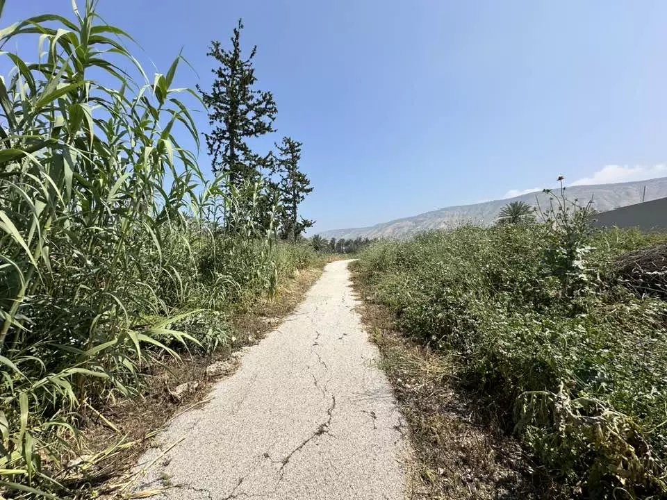
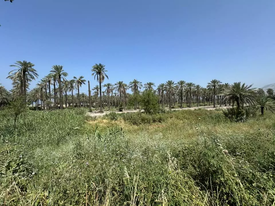
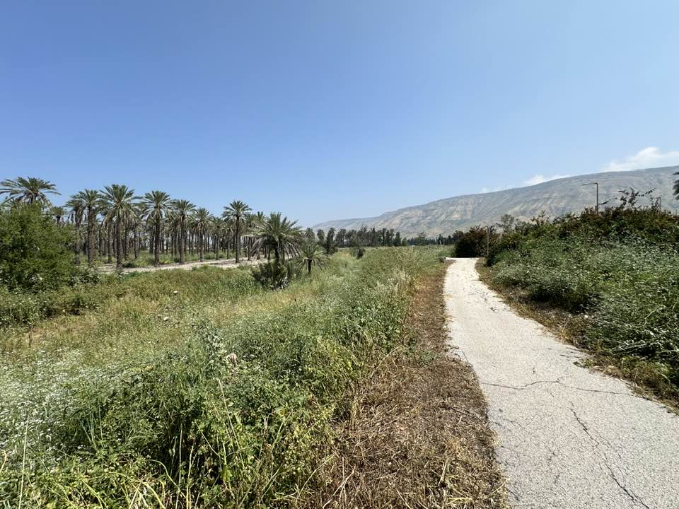
Posted by abu raya - اراضي القريه يستغلها المستوطنين لزراعه النخيل
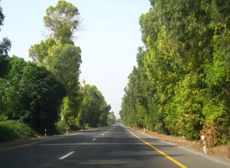
Posted by abu raya - الشارع الذي يربط مدينه طبريا بقرى شرق البحيره يمر بجانب القريه
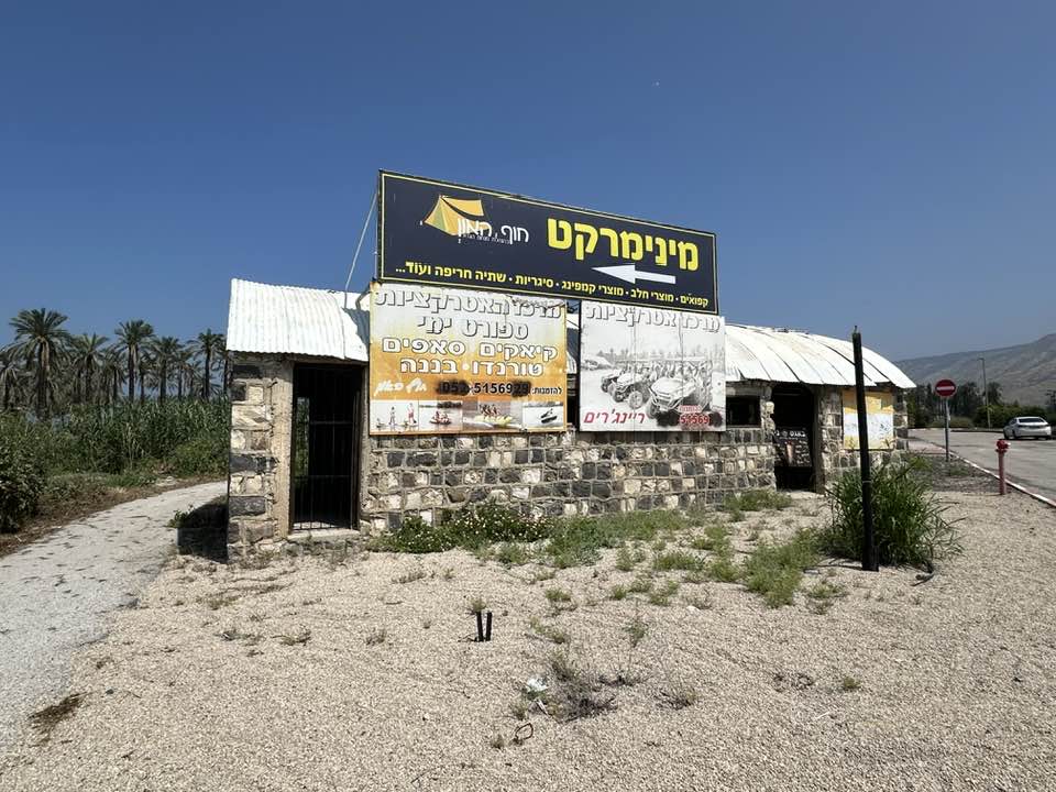
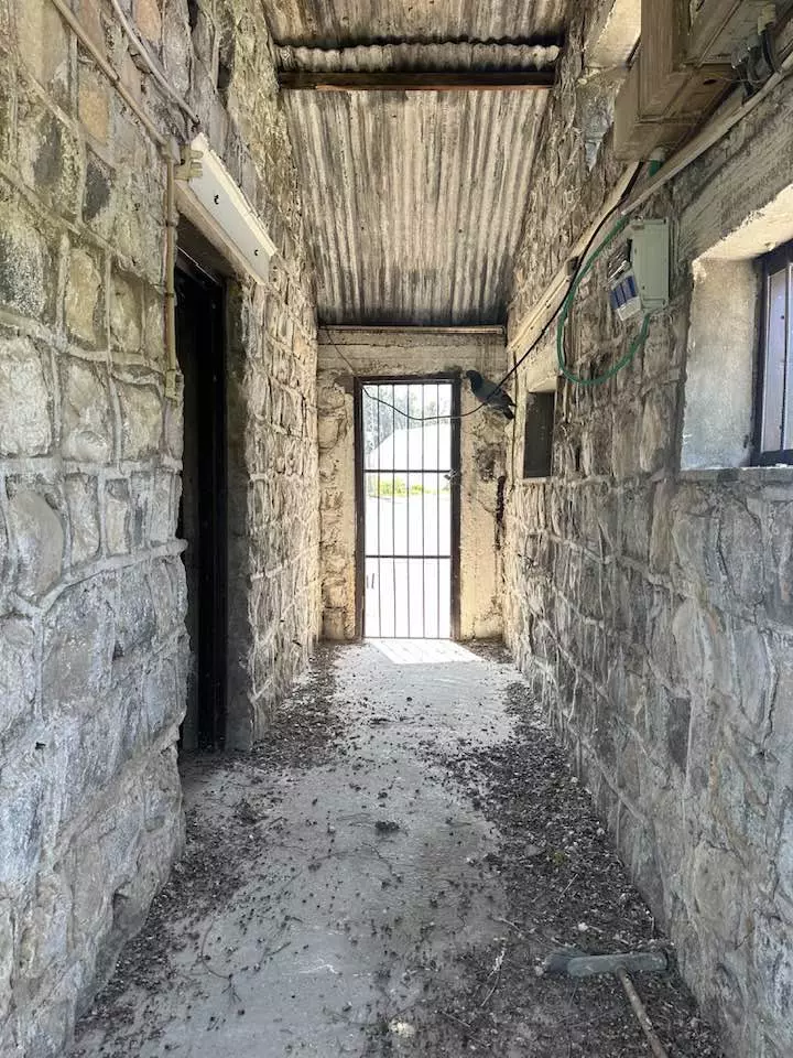
Posted by abu raya - That is how the "civilized" erased and replaced us: al-Samra was completely obliterated except for a few remaining structures, as you see -- السمرا باتت أثر بعد عين. من هنا مر الهمجّ
- That is how the "civilized" erased and replaced us: al-Samra was completely obliterated except for a few remaining structures, as you see -- السمرا باتت أثر بعد عين. من هنا مر الهمجّ #2
- That is how the "civilized" erased and replaced us: al-Samra was completely obliterated except for a few remaining structures, as you see -- السمرا باتت أثر بعد عين. من هنا مر الهمجّ #3
- That is how the "civilized" erased and replaced us: al-Samra was completely obliterated except for a few remaining structures, as you see -- السمرا باتت أثر بعد عين. من هنا مر الهمجّ #4

- That is how the "civilized" erased and replaced us: al-Samra was completely obliterated except for a few remaining structures, as you see -- السمرا باتت أثر بعد عين. من هنا مر الهمجّ #5
- That is how the "civilized" erased and replaced us: al-Samra was completely obliterated except for a few remaining structures, as you see -- السمرا باتت أثر بعد عين. من هنا مر الهمجّ #6

- That is how the "civilized" erased and replaced us: al-Samra was completely obliterated except for a few remaining structures, as you see -- السمرا باتت أثر بعد عين. من هنا مر الهمجّ #7
- That is how the "civilized" erased and replaced us: al-Samra was completely obliterated except for a few remaining structures, as you see -- السمرا باتت أثر بعد عين. من هنا مر الهمجّ #8
- That is how the "civilized" erased and replaced us: al-Samra was completely obliterated except for a few remaining structures, as you see -- السمرا باتت أثر بعد عين. من هنا مر الهمجّ #9
Want to browse more? 80,000 pictures were grouped in these gallaries:
| Display Name | Clan/Hamolah | Country of Residence |
No links have been shared yet, be free to the first to share the first link.
 Fake Valor: Why Did Zionist Jews Hoist Nazis Flag on Their Ships in the 1930s?
What is new?
-
Facts About Oct. 7th Gaza Raid
-
Remined Us Please:: Who Did Rape Who? Palestinians Raped Israelis? Or, was the other way around?
-
When Prof. Edward Said was invited to debate Bibi Netanyahu in the 1980s, watch what happened!
-
Ezra Klein of the NY Times on the "Jewish Race".
-
Abusing Blood Libel!
-
Zionist FAQ: Isn't it true that Palestinians don't want peace? Palestinians never accepted the two-state solution
- Facts about Haavara (Transfer) Agreement between Ben-Gurion & Hitler
-
Haavara FAQs: Why Did Zionist Jews Hoist Nazis' Flags on Their Ships in the 1930s?
-
Dear ChatGPT: Why did the Jewish Agency suppress news of the Holocaust during WWII?
-
Video Playlist: Jews share their DNA tests to end the conflict for good.
-
A Tale of Two Conflicts: Examining the Definition of Genocide
-
Prof. Abraham Polak And The Suppressed History of the Khazars and European Jewry
-
How Ronald Reagan would have framed the genocide in Gaza if he were still alive?
-
Haavara FAQs: Let us do the math: how many German Jews did The Haavara Agreement save?
-
Zionist FAQs: The Hebron Massacre of 1929, "clearly proves" that Palestinians are antisemitic, how could you deny it?
-
Zionist FAQs: Why Anti-Zionist Is Not Antisemitism?
-
Zionist FAQs: Isn't it true that the KGB create Palestinian Nationalism in the early 1960s?
- Zionist FAQs: Muslims are killing Muslims all the time; why are Israeli Jews being singled out in the media?
- Zionist FAQs: How is Israel an apartheid state when 20% of its citizens are Arabs who enjoy full rights?
-
Haavara FAQs: Analysis of Herzl's Uganda Scheme and how it could have saved millions of Jews.
-
Haavara FAQs: Why did Hayim Greenberg describe American Jewry as "morally bankrupt" in early 1943?
-
Haavara FAQs: What if the Evian Conference was a resounding success? What would have been the impact of saving European Jewry on Zionism?
- Haavara FAQs: What if the six million were saved, how that would have impacted the Zionist project?
-
Haavara FAQs: How did Zionist leaders react when Europe's Jews lingered in the DP camps after WWII ended?
-
Why does the American Jewish community repeat lies that David Ben-Gurion had debunked before he died?
-
Who has the power to rename the Tatar/Khazar Gene Marker to Jewish IV?
-
Zionist FAQs: Why won't Egypt, Syria, and Jordan take their people back? Jews are indigenous to Palestine, and Arabs immigrated after Jews developed the country. Arabs should leave.
-
Haavara FAQs: Did Hitler and the Nazis conflate between Judaism and Zionist? If that wasn't case, then why?
-
Haavara FAQs: Winston Churchill and antisemitism, a collection of articles written Churchill.
-
Haavara FAQs: Broken by country, how many Jews survived vs. killed during the Holocaust?
-
Haavara FAQs: Why did European Jews vote with their feet and to immigrated to the Americas, not Palestine, after WWII?
-
Watch this American Jewish Girl describing Israeli Jews' cognitive dissonance like no other in under two minutes
-
Haavara FAQs: When the Nazis went out of their way to hide the Holocaust, Israeli Jews did the exact opposite by broadcasting their genocide of Gazans. But why?
-
Haavara FAQs: How Zionist Jews went out of their to show their appreciation to Nazism and Fascism?
- Haavara FAQs: Why Zionist leaders were against bombing the death camps & the Railroads leading to them?
-
Haavara FAQs: Hitler's message to the British and American people: If Jews are such noble citizens and you care about them, how come you're not letting them in? I will gladly ship them to you at my expense, even on luxury liners!
-
A shortlist of Zionist and Israeli false flag operations in the name Jews.
-
The Most Moral Army
- The Land of Kapos (Israel): Where the brave are boycotted and Kapos walk free.
- Why did early Zionists often named their communal enterprises "colonial"?
- Zionist Relations with Nazi Germany by Faris Glubb
-
Two NY Times advertisements by Zionists in the early 1943 that exposes Zionists' treason at the height of the calamity
- Facts Not Lies about the Palestinian-Israeli Conflict.
- Site's pictures have been categorized
- Campgain Against Lice
- A Survey of Palestine, the official source about Palestine before Nakba produced by the British Mandate; over 1200 pages.
- Satellite View & Google Earth: Over 6,000 placemarks identifying all destroyed towns, W. Bank & Gaza Strip Towns, & refugee camps.
- PalestineRemembered.com and its Nakba Oral History Project were featured on al-Jazeera Satellite TV.
- Nakba Oral History Video Podcast:
 Over 700 Oral History interviews (including 3,500+ hours of recording) can be viewed online.
 - Palestine Village Statistics Project
- Gaza Jail Break
- النسخة العربية للموقع الان متوفرة
- Videos: Documenting the destroyed villages in video: Tracing all that remains since Nakba.
- Videos: Responding to Zionist Propaganda
- Interview: The ethnic cleansing of Palestine: George Galloway interviews Israeli Historian Ilan Pappe.
- For Palestinians, memory matters. It provides a blueprint for their future By George Bisharat.
- Zionist FAQ now available in Hebrew שאלות שציונים שואלים, עכשיו בעברית
- Video: The Stephen Walt and John Mearsheimer report on the influence of the Israel Lobby on U.S. Foreign Policy
- The Palestinian-Israeli conflict for beginners
