| PalestineRemembered | About Us | Oral History | العربية | |
| Pictures | Zionist FAQs | Haavara | Maps | |
| Search |
| Camps |
| Districts |
| Acre |
| Baysan |
| Beersheba |
| Bethlehem |
| Gaza |
| Haifa |
| Hebron |
| Jaffa |
| Jericho |
| Jerusalem |
| Jinin |
| Nablus |
| Nazareth |
| Ramallah |
| al-Ramla |
| Safad |
| Tiberias |
| Tulkarm |
| Donate |
| Contact |
| Profile |
| Videos |
Welcome To al-Nuqayb - النقيب (א-נוקיב)
|
District of Tiberias
Ethnically cleansed days ago |
العربية Google Earth |
 |
Gallery (44) |
- Statistics & Facts
-
Before & After

- Satellite View
- Articles 4
- Pictures 44
- Mayrters & Prisoners 1
- Oral History 1
- Members 9
- All That Remains
- Wikipedia
- Videos 2
- Guest Book 11
- Links 1
| Statistic & Fact | Value | ||||||||||||
| Occupation Date | May 15, 1948 | ||||||||||||
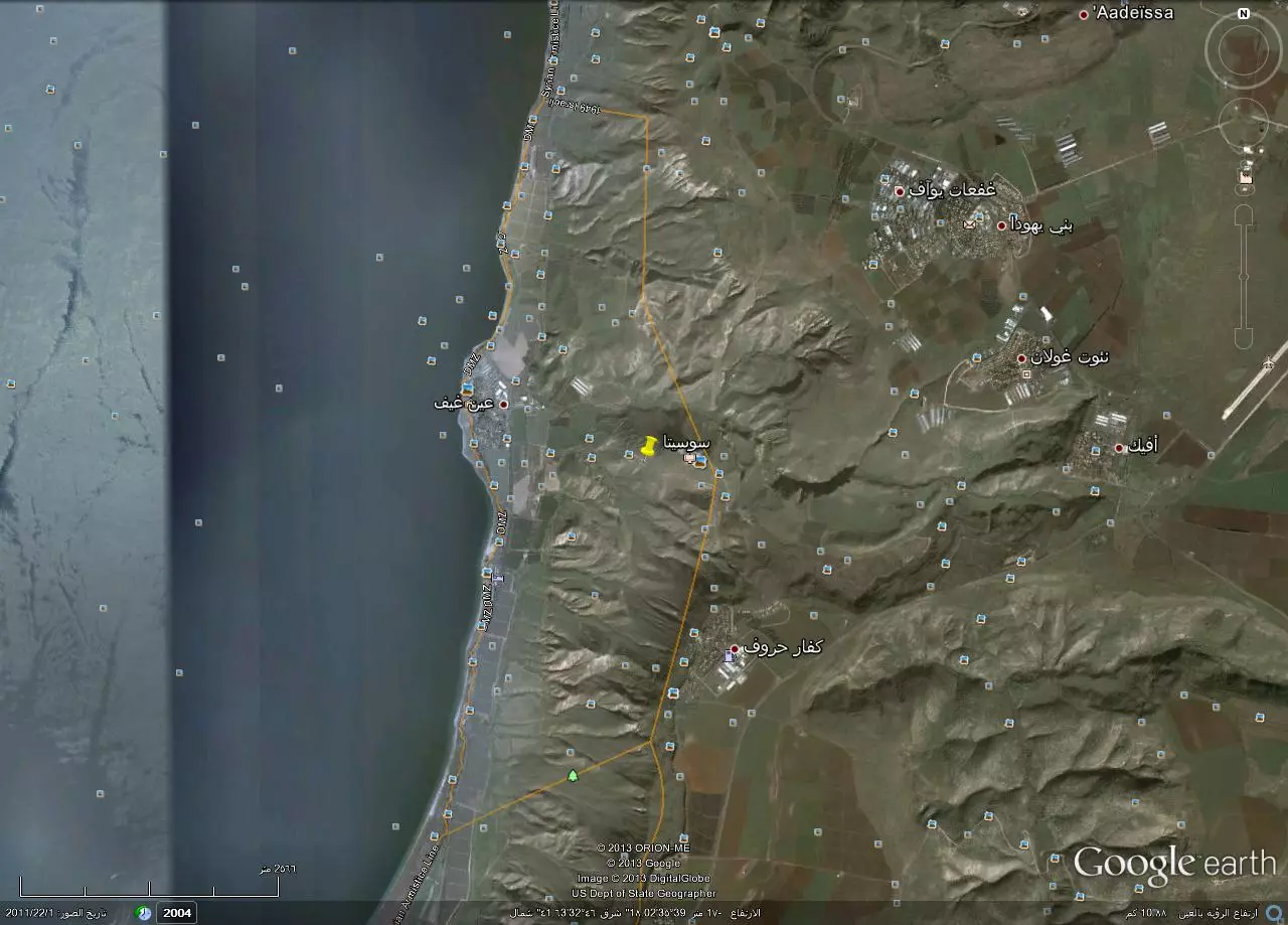
| Distance From District | 10 (km) East (across the lake) of Tiberias | ||||||||||||
| Elevation | less than -200 (meters) | ||||||||||||
| Before & After Nakba, Click Map For Details |
|||||||||||||
|
|||||||||||||
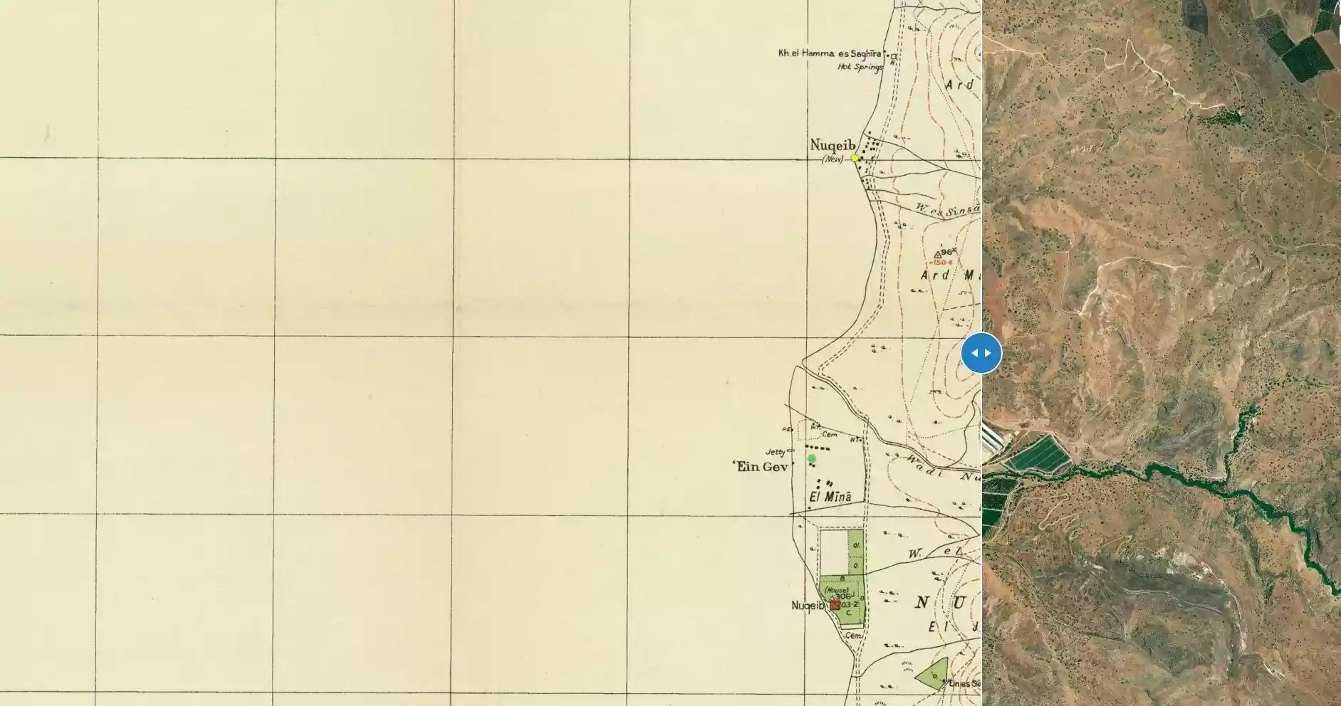
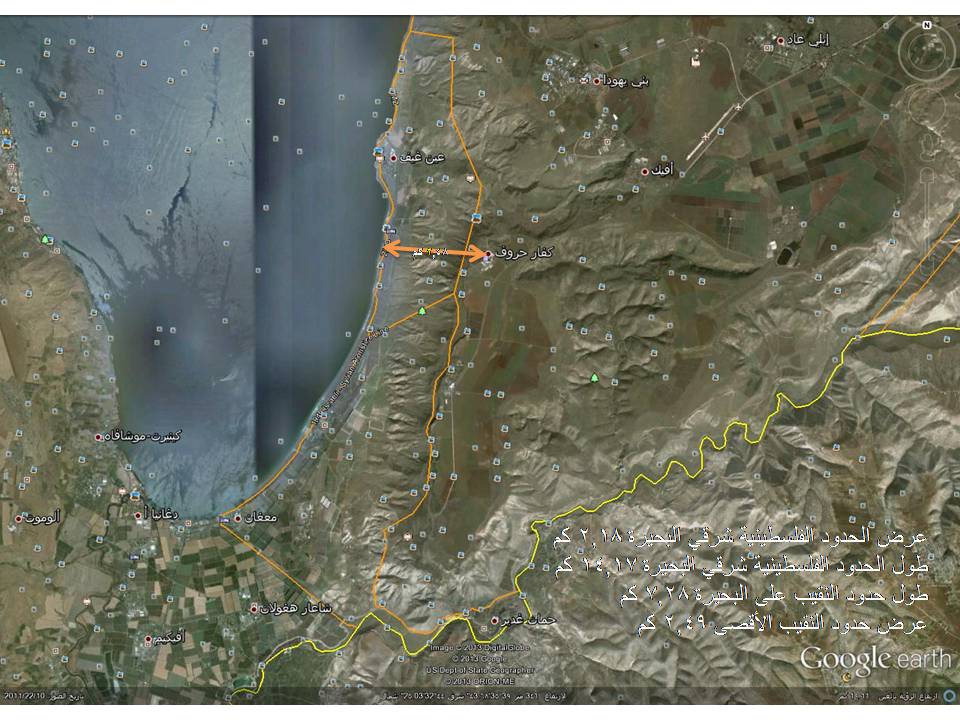
| Map Location | See location #13 on the map View from satellite |
||||||||||||
| Defenders | Syrian Army | ||||||||||||
| Exodus Cause | Expulsion by Zionist troops | ||||||||||||
| Village Temains | al-Nuqayb was completely defaced | ||||||||||||
| Ethnically Cleansing | al-Nuqayb inhabitants were completely ethnically cleansed. | ||||||||||||
| Pre-Nakba Land Ownership |
**Town Lands' Demarcation Maps |
||||||||||||
| Population |
|
||||||||||||
| Number of Houses |
|
||||||||||||
| Near By Towns |
|||||||||||||
|
|||||||||||||
| Town's Name Through History | al-Nuqayb was named after the Bedouin tribe of 'Arab al-Nuqayb. | ||||||||||||
| Nearby Wadies & Rivers | The village bordered Wadi al-Muzaffar and Wadi Samakh. | ||||||||||||
| Exculsive Jewish Colonies Who Usurped Village Lands |
Kibbutz of 'En Gev | ||||||||||||
| Featured Video | |||||||||||||
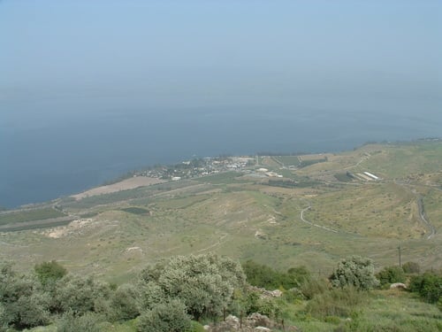
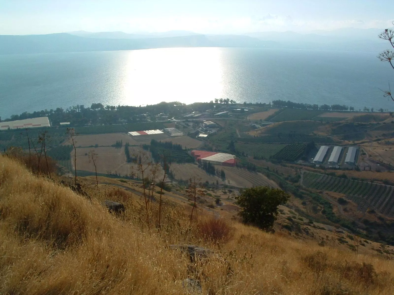
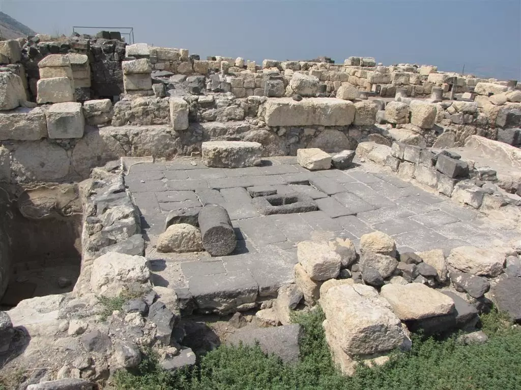
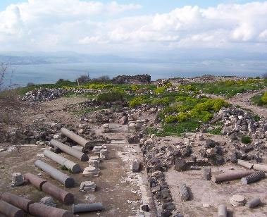
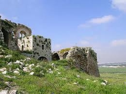
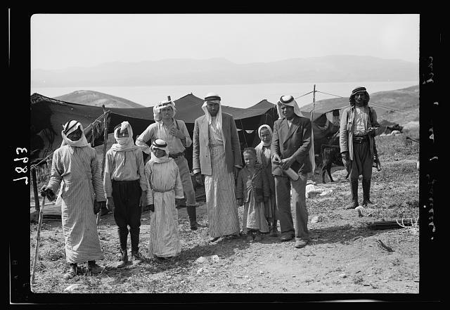
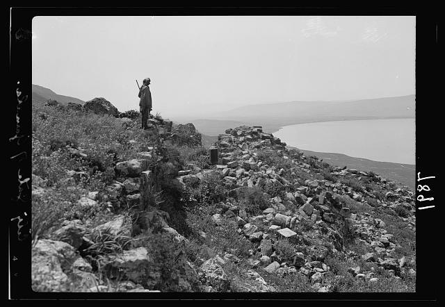
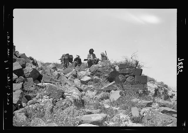
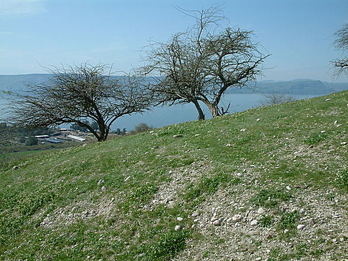
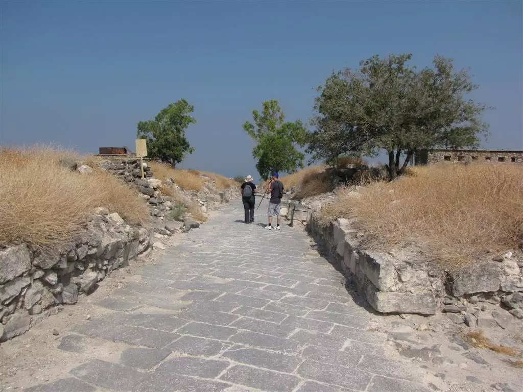
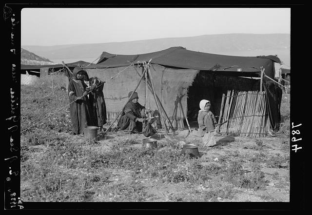
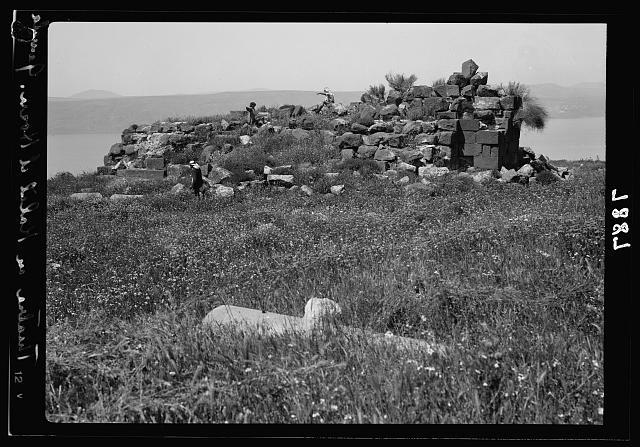
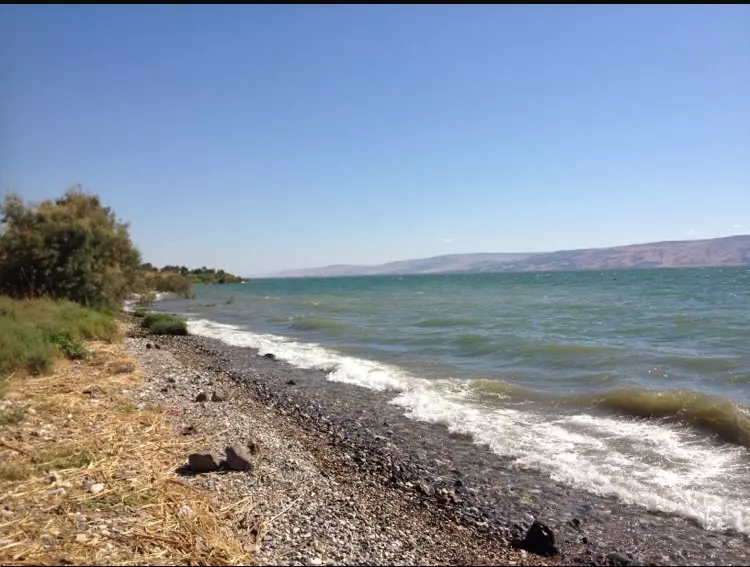
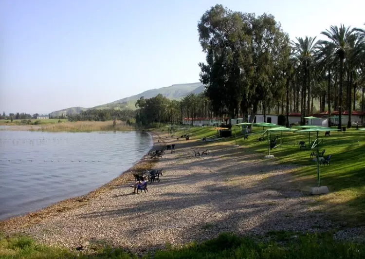
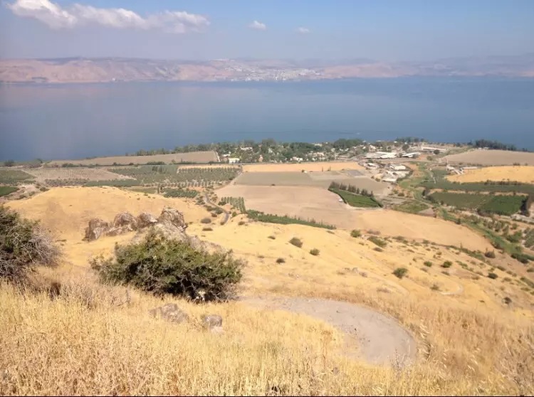
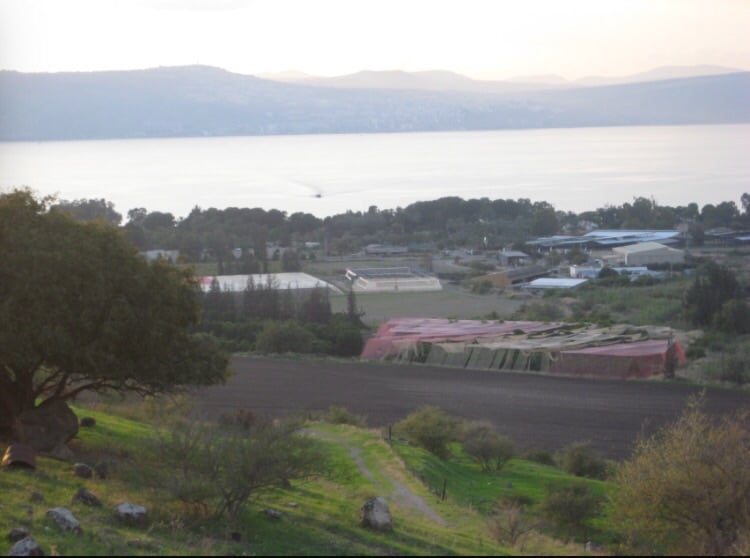
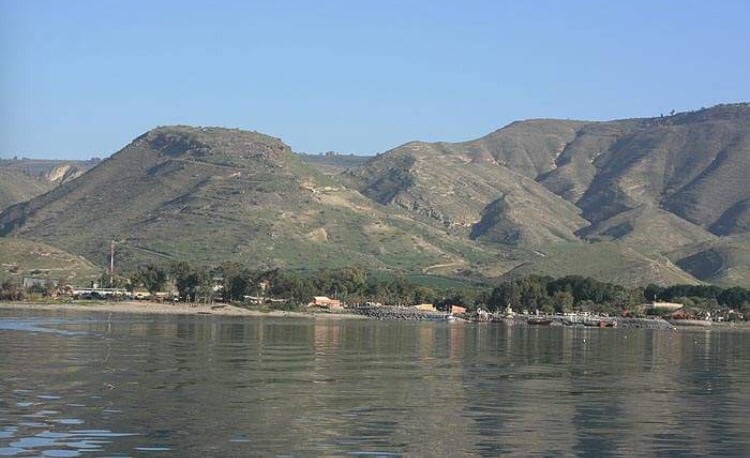
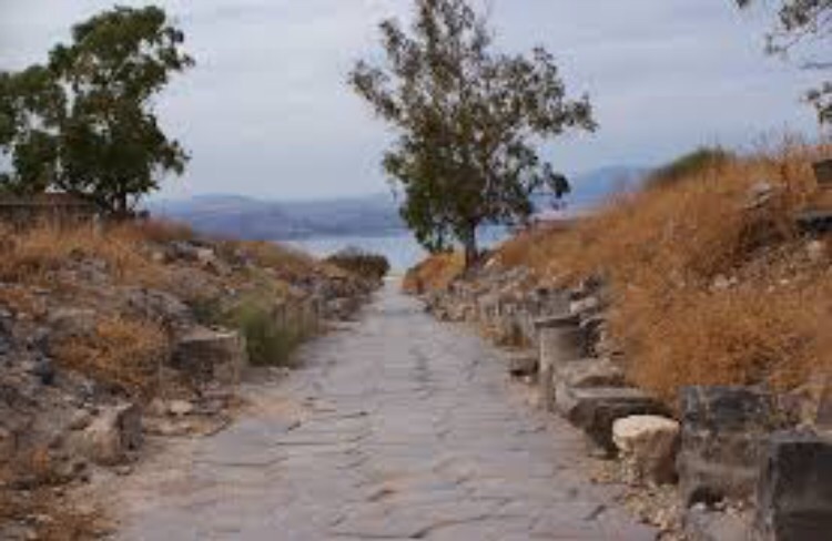
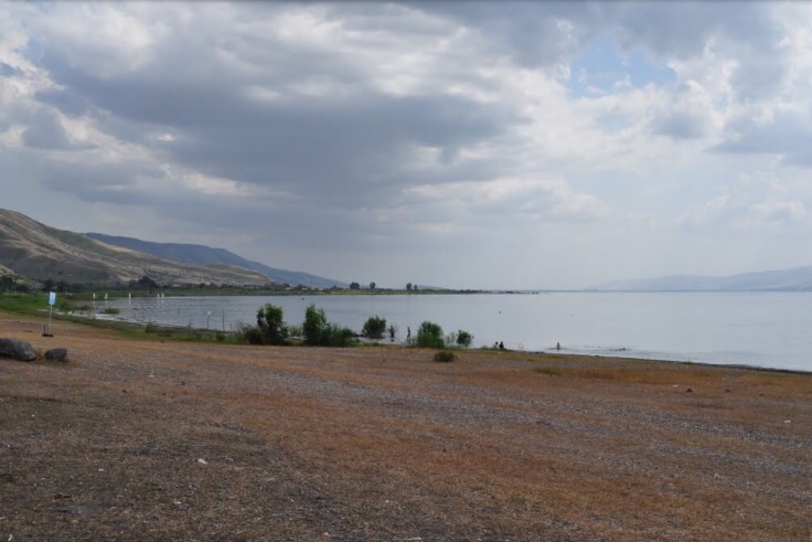
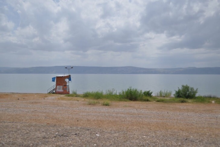
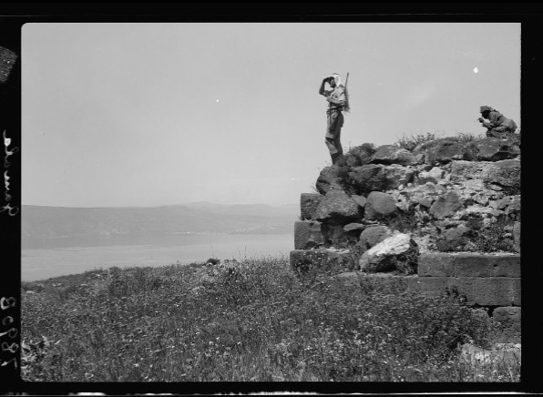
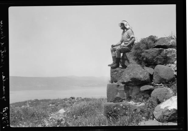
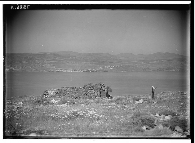
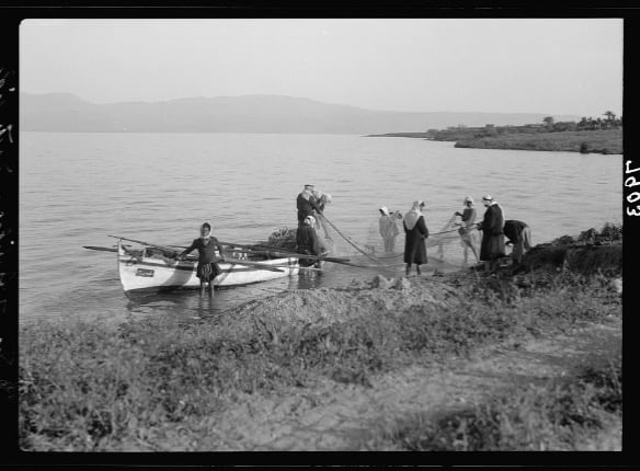
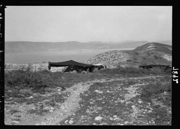
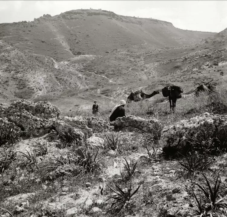
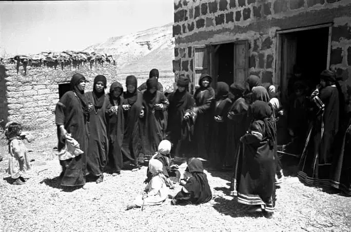
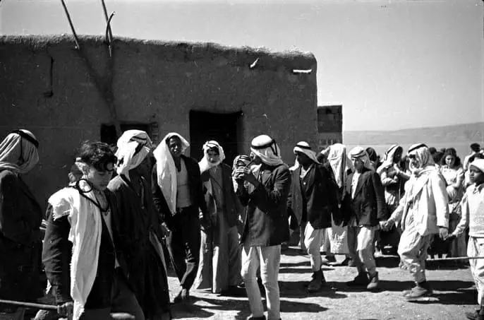
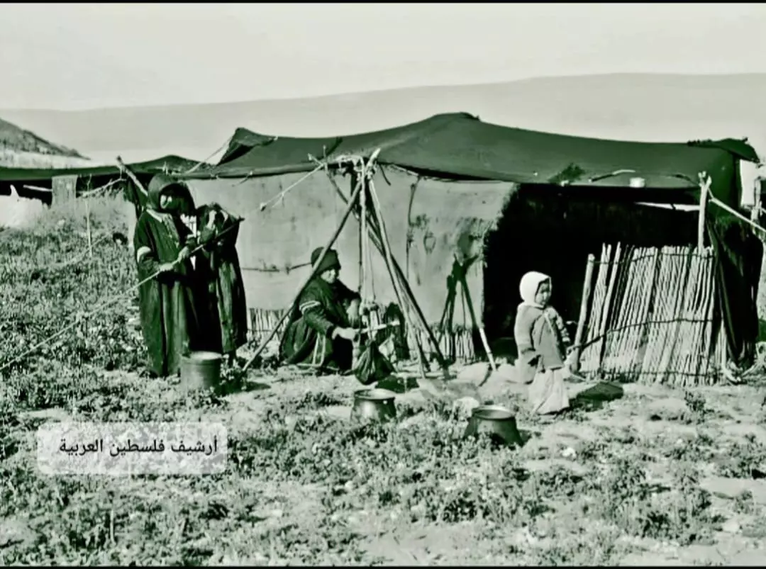
Village Before NakbaThe village was located on the eastern shore of Lake Tiberias in a relatively flat area, dominated by the Golan Heights; the city of Tiberias could be seen across the lake, in the west. Wadi al-Muzaffar flowed into the lake 1 km to the north of the site, and 3 km to the north was the deep Wadi Samakh. There were also two hot springs north of the village. To the east of the village was the fortress of Qal'at al-Hisn (212242), which was probably built on the site of the ancient city of Hippos. The Greek name for this city meant 'livestock' (which was also the meaning of the city's alternative, Aramaic name, Susitha). Hippos was one of the cities of the Decapolis, or league of ten Syrian-Greek cities, in the Roman and Byzantine periods. The fortress contained ruins of the ancient city, such as walls, roads, a church, other buildings, cisterns, and burial grounds. During the 1880s all 13,000 dunums of the lands of al-Nuqayb were purchased by Baha' Allah, the leader of the Babi religious sect (which later became the Baha'i religion; see al-Manshiyya, Acre sub-disctrict). The people of al-Nuqayb continued to farm their lands as tenants, however, until at least the 1920s, when the Baha'is sold all but 200 dunums of the land; most of it was sold to the JNF. [Kark 1990:122-28]Modern al-Nuqayb was 1.5 km from the Syrian-Palestinian border. It had a rectangular outline, with its houses dispersed along the coast of the lake. It was named after its inhabitants, the 'Arab al-Nuqayb, who were of Bedouin stock. Some of the villagers still lived in tents but others had built houses of stone and mud, stone and cement, or concrete. They were predominantly Muslim, although in 1931 six people belonging to the Baha'i sect lived in the village. Their main economic activities were livestock breeding and cultivating grain and vegetables. In 1944/45 a total of 797 dunums was allotted to cereals; 131 dunums were irrigated or used for orchards. Archaeological sites around al-Nuqayb included four khirbas. Village Occupation and Ethnic CleaningForeign press accounts of the entry of Syrian forces into Palestine on 15 May 1948 state that al-Nuqayb was one of the villages they attempted to control. The New York Times wrote that Syrian troops 'encircled, shelled and aerially bombed' al-Nuqayb. This indicates that Haganah forces were already in control of the village, but it is not clear what happened to the village during the rest of the war. [NYT:17/5/48]Having remained in the village until the end of the war, the people of al-Nuqayb were 'induced to leave' by the Israeli authorities between 1949 and 1956. According to the terms of the armistice agreement, the village fell within the Demilitarized Zone (DMZ) along the Israeli-Syrian border. As such, the villagers were formally protected by the provisions of the agreement, but 'for military, economic and agricultural reasons' the Israeli government wanted them (as well as the inhabitants of six other villages in the DMZ) to leave. It is not entirely clear how this aim was achieved, but Israeli historian Benny Morris mentions 'economic and police pressure and 'petty persecution.'' Most residents of these villages were moved to Syria, although some were 'transferred' to the Palestinian village of Sha'b, near Acre. [M:242-43] Zionists Colonies on Village LandsZionist immigrants from the Baltic region and central and eastern Europe established the Kibbutz of 'En Gev (210243) on village lands, about 1.5 km south of the village site, in 1937.Village TodayThe site is fenced in and covered with thorny grass and various kinds of trees, such as Christ's-thorn trees. Piles of stones and the remains of walls can be seen. Part of the surrounding land is cultivated by the nearby settlement, and the remainder is used as a grazing area by Israelis.SourceDr. Walid al-Khalidi, 1992: All That Remains. |
|||||||||||||
| Related Maps | Town Lands' Demarcation Maps خرائط للقضاء توضح حدود القرى والاودية Town's map on MapQuest View from satellite Help us map this town at WikiMapia |
||||||||||||
| Related Links | Wikipedia's Page Facebook Page Google Search Google For Images Google For Videos |
||||||||||||
| More Information | في كتاب كي لا ننسى في كتاب بلادنا فلسطين المزيد من موقع هوية |
||||||||||||
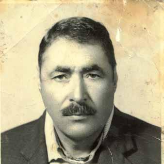
- المرحوم / الشيخ أحمد بن الشيخ حسن العبدالله الرقيبات / شيخ عشيرة الرقيبات
Posted by anwar shawaheen 39 - النفيب العربية
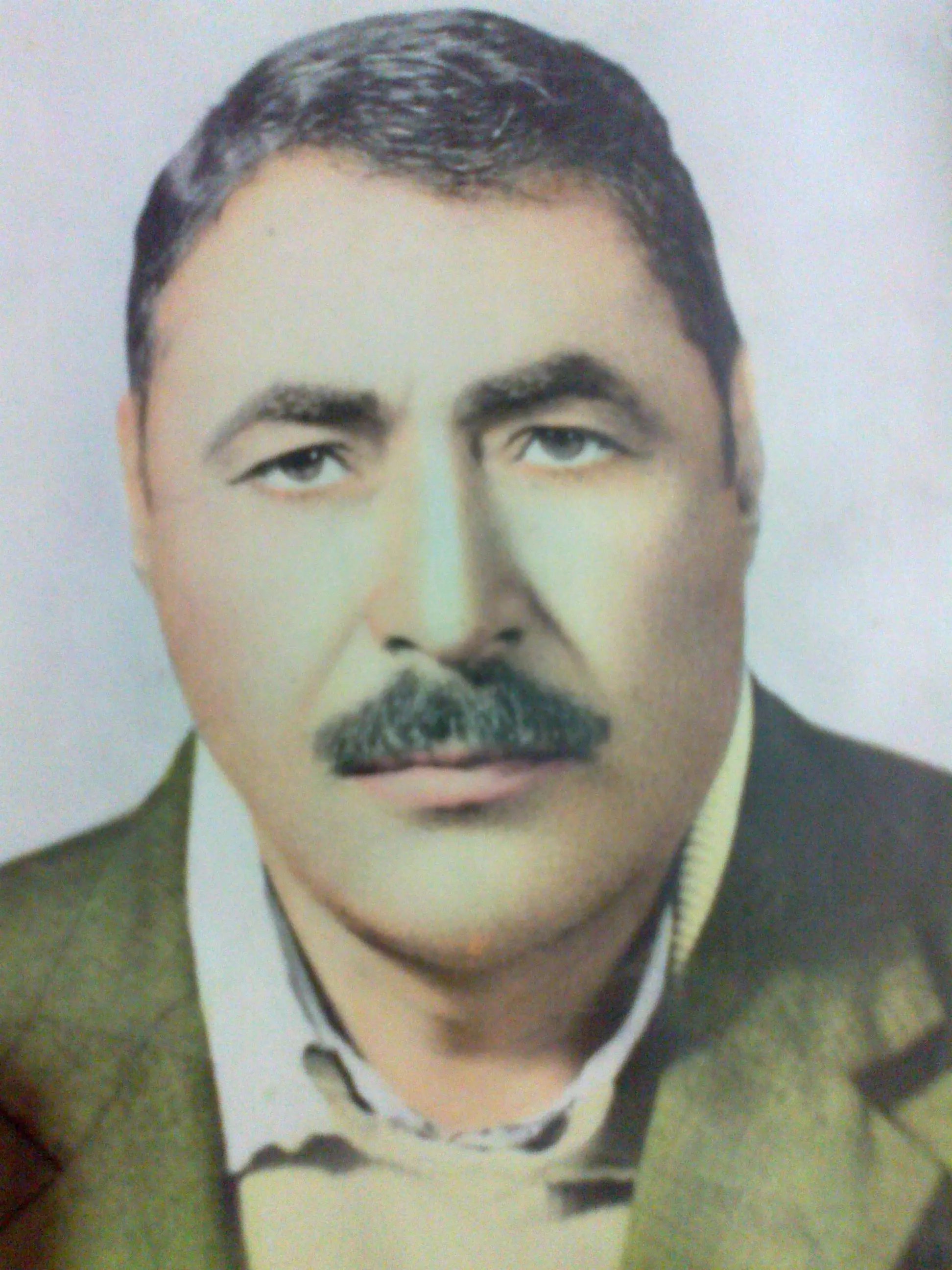
Posted by محمد العبد الله 1 - عبد الله اليوسف بلال ابن النقيب البار
Posted by نقيبي 4 - عبد الله اليوسف بلال ابن النقيب البار
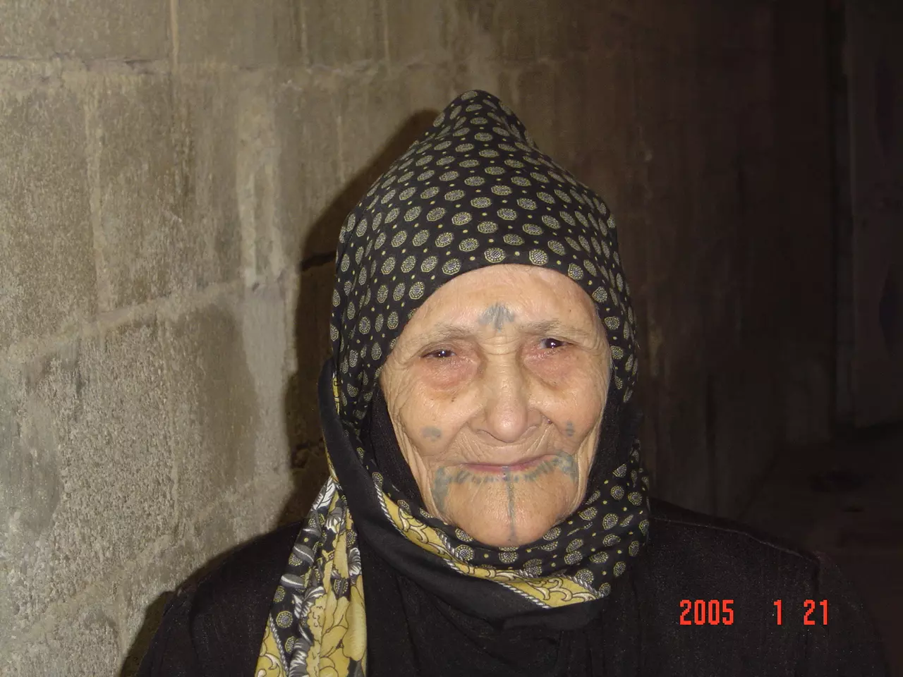
Posted by نقيبي 2 - الحاجة مريم أم اليتامى و الفقراء
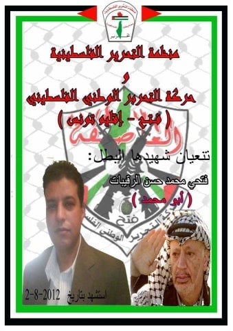
Posted by نقيبي 2 - الشهيد البطل / فتحي محمد حسن الرقيبات
Posted by anwar shawaheen 1 - النقيب جنة الله في الأرض أشجار الكينا تحرس البحر( كينات مصطفى البلال و أهل حسن)
Posted by نقيبي 2 - قلعة الحصن" سوسيتا" في النقيب عراقة التاريخ و عنوان الأصالة
Posted by نقيبي - سوسيتا
Posted by نقيبي - قلعة الحصن" سوسيتا" حضارة تمتد لأكثر2500عام
Posted by نقيبي 2 - النقيب 1939

Posted by نقيبي 2 - النقيب 1939
Posted by نقيبي 1 - النقيب قلعة الحصن 1939
Posted by نقيبي - نظرة القمر الصناعي لقرية النقيب العربية
Posted by نقيبي - بعض من أهل النقيب على سفح جبل قلعة الحصن 1939
Posted by نقيبي - نبات السّدر ( سدرة عبد الله الأحمد الجوادرة ) أبو عبد الحكيم م. بلال
Posted by نقيبي - نبات المقرة في النقيب و يكثر هذا النبات في وادي النقيب الذي تسميه المراجع الغربية الوادي الأصفر Valley Yellow
Posted by نقيبي - الطريق إلى سوسيتا
Posted by نقيبي - موقع قلعة الحصن " سوسيتا" استخرجها: أ. محمد عبد الله بلال
Posted by نقيبي - 1939امرأة من النقيب تخض اللبن بالشكوة لاستخرج الزبدة " بلد الخيرات"
Posted by محمد عبد الله بلال - قلعة الصفحة قبل أعمال الحفريات 1939
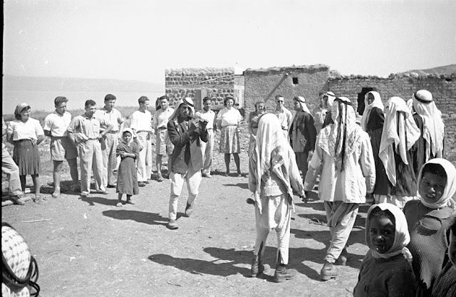
Posted by محمد عبد الله بلال - عرس في النقيب تقريباً في عام 1937 أو بعدها بقليل و يبدو في الصورة بعض من سكان مغتصبة عين غيب
Posted by محمد عبد الله بلال 1 - عرس في النقيب بين عامي 1937- 1952
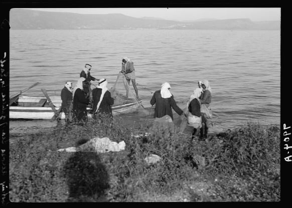
Posted by محمد عبد الله بلال - صيادون
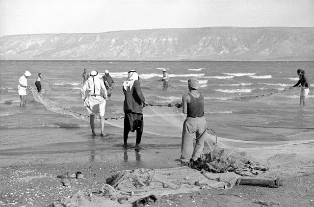
Posted by محمد عبد الله بلال 1 - شاطى بحيره طبريا من ناحيه قريه النقيب
Posted by abu raya - شاطى البحيره قرب النقيب

Posted by abu raya - شاطى البحيره قرب النقيب
Posted by abu raya - منظر من قلعه الحصن يظهر به موقع القريه
Posted by abu raya - موقع القريه
Posted by abu raya - منظر من بحيره طبريا باتجاه قريه النقيب
Posted by abu raya - من قلعه الحصن القريبه من القريه
Posted by abu raya - موقع القريه
Posted by abu raya - من موقع القريه
Posted by abu raya - النقيب قبل النكبه
Posted by abu raya - النقيب قبل النكبه
Posted by abu raya - النقيب قبل النكبه
Posted by abu raya - النقيب قبل النكبه
Posted by abu raya - النقيب قبل النكبه
Posted by abu raya - النقيب قبل النكبه
Posted by abu raya - النقيب قبل النكبه
Posted by abu raya - صور لاحد الاعراس في قرية التقيب المهجرة فبل النكبة 1930
- صور لاحد الاعراس في قرية التقيب المهجرة فبل النكبة 1930 #2
- صور لاحد الاعراس في قرية التقيب المهجرة فبل النكبة 1930 #3
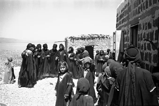
- خض اللبن بالشكوة أو "السعن"..
عائلة أمام "بيت شعر" في قرية النقيب قضاء طبريا قبل النكبة..
Want to browse more? 80,000 pictures were grouped in these gallaries:
| Display Name | Clan/Hamolah | Country of Residence |
| Fida'i | - | - |
| محمود | السعايدة | السعايدة, السعايدة |
| نقيبي | - | - |
| محمد العبد الله | - | - |
| Hussein Diban | - | - |
| ابو هاني | - | ]lar |
| حسين خليفة | - | Abu Dhabi, U.A.E |
| Noura Alabdullah | Alrogeibat Arab Tribe | West Midlands, United Kingdom |
| Hassan Alabdullah Alrogabey | Arab Alrogeibat clan | West Midlands, UK |
- الذاكرة مفتاح العودة - الحلقة 3- قرية النقيب Duration: 23 min 22 sec
- بين سوريا وفلسطين - بلاد الشام:اطلالة على النقيب المهجرة (قضاء طبريا) وفلسطين ال48، ديرة الرقيبات ومزارع البهائيين وبحيرة طبريا وجبال صفد وحطين وقرنة الجرادة التي تتحدي النسيان. تحياتي لابناء منطقة الزوية في الجولان السوري المحتل. — at طبريا. Duration: min 54 sec
 Fake Valor: Why Did Zionist Jews Hoist Nazis Flag on Their Ships in the 1930s?
What is new?
-
Facts About Oct. 7th Gaza Raid
-
Remined Us Please:: Who Did Rape Who? Palestinians Raped Israelis? Or, was the other way around?
-
When Prof. Edward Said was invited to debate Bibi Netanyahu in the 1980s, watch what happened!
-
Ezra Klein of the NY Times on the "Jewish Race".
-
Abusing Blood Libel!
-
Zionist FAQ: Isn't it true that Palestinians don't want peace? Palestinians never accepted the two-state solution
- Facts about Haavara (Transfer) Agreement between Ben-Gurion & Hitler
-
Haavara FAQs: Why Did Zionist Jews Hoist Nazis' Flags on Their Ships in the 1930s?
-
Dear ChatGPT: Why did the Jewish Agency suppress news of the Holocaust during WWII?
-
Video Playlist: Jews share their DNA tests to end the conflict for good.
-
A Tale of Two Conflicts: Examining the Definition of Genocide
-
Prof. Abraham Polak And The Suppressed History of the Khazars and European Jewry
-
How Ronald Reagan would have framed the genocide in Gaza if he were still alive?
-
Haavara FAQs: Let us do the math: how many German Jews did The Haavara Agreement save?
-
Zionist FAQs: The Hebron Massacre of 1929, "clearly proves" that Palestinians are antisemitic, how could you deny it?
-
Zionist FAQs: Why Anti-Zionist Is Not Antisemitism?
-
Zionist FAQs: Isn't it true that the KGB create Palestinian Nationalism in the early 1960s?
- Zionist FAQs: Muslims are killing Muslims all the time; why are Israeli Jews being singled out in the media?
- Zionist FAQs: How is Israel an apartheid state when 20% of its citizens are Arabs who enjoy full rights?
-
Haavara FAQs: Analysis of Herzl's Uganda Scheme and how it could have saved millions of Jews.
-
Haavara FAQs: Why did Hayim Greenberg describe American Jewry as "morally bankrupt" in early 1943?
-
Haavara FAQs: What if the Evian Conference was a resounding success? What would have been the impact of saving European Jewry on Zionism?
- Haavara FAQs: What if the six million were saved, how that would have impacted the Zionist project?
-
Haavara FAQs: How did Zionist leaders react when Europe's Jews lingered in the DP camps after WWII ended?
-
Why does the American Jewish community repeat lies that David Ben-Gurion had debunked before he died?
-
Who has the power to rename the Tatar/Khazar Gene Marker to Jewish IV?
-
Zionist FAQs: Why won't Egypt, Syria, and Jordan take their people back? Jews are indigenous to Palestine, and Arabs immigrated after Jews developed the country. Arabs should leave.
-
Haavara FAQs: Did Hitler and the Nazis conflate between Judaism and Zionist? If that wasn't case, then why?
-
Haavara FAQs: Winston Churchill and antisemitism, a collection of articles written Churchill.
-
Haavara FAQs: Broken by country, how many Jews survived vs. killed during the Holocaust?
-
Haavara FAQs: Why did European Jews vote with their feet and to immigrated to the Americas, not Palestine, after WWII?
-
Watch this American Jewish Girl describing Israeli Jews' cognitive dissonance like no other in under two minutes
-
Haavara FAQs: When the Nazis went out of their way to hide the Holocaust, Israeli Jews did the exact opposite by broadcasting their genocide of Gazans. But why?
-
Haavara FAQs: How Zionist Jews went out of their to show their appreciation to Nazism and Fascism?
- Haavara FAQs: Why Zionist leaders were against bombing the death camps & the Railroads leading to them?
-
Haavara FAQs: Hitler's message to the British and American people: If Jews are such noble citizens and you care about them, how come you're not letting them in? I will gladly ship them to you at my expense, even on luxury liners!
-
A shortlist of Zionist and Israeli false flag operations in the name Jews.
-
The Most Moral Army
- The Land of Kapos (Israel): Where the brave are boycotted and Kapos walk free.
- Why did early Zionists often named their communal enterprises "colonial"?
- Zionist Relations with Nazi Germany by Faris Glubb
-
Two NY Times advertisements by Zionists in the early 1943 that exposes Zionists' treason at the height of the calamity
- Facts Not Lies about the Palestinian-Israeli Conflict.
- Site's pictures have been categorized
- Campgain Against Lice
- A Survey of Palestine, the official source about Palestine before Nakba produced by the British Mandate; over 1200 pages.
- Satellite View & Google Earth: Over 6,000 placemarks identifying all destroyed towns, W. Bank & Gaza Strip Towns, & refugee camps.
- PalestineRemembered.com and its Nakba Oral History Project were featured on al-Jazeera Satellite TV.
- Nakba Oral History Video Podcast:
 Over 700 Oral History interviews (including 3,500+ hours of recording) can be viewed online.
 - Palestine Village Statistics Project
- Gaza Jail Break
- النسخة العربية للموقع الان متوفرة
- Videos: Documenting the destroyed villages in video: Tracing all that remains since Nakba.
- Videos: Responding to Zionist Propaganda
- Interview: The ethnic cleansing of Palestine: George Galloway interviews Israeli Historian Ilan Pappe.
- For Palestinians, memory matters. It provides a blueprint for their future By George Bisharat.
- Zionist FAQ now available in Hebrew שאלות שציונים שואלים, עכשיו בעברית
- Video: The Stephen Walt and John Mearsheimer report on the influence of the Israel Lobby on U.S. Foreign Policy
- The Palestinian-Israeli conflict for beginners
