| PalestineRemembered | About Us | Oral History | العربية | |
| Pictures | Zionist FAQs | Haavara | Maps | |
| Search |
| Camps |
| Districts |
| Acre |
| Baysan |
| Beersheba |
| Bethlehem |
| Gaza |
| Haifa |
| Hebron |
| Jaffa |
| Jericho |
| Jerusalem |
| Jinin |
| Nablus |
| Nazareth |
| Ramallah |
| al-Ramla |
| Safad |
| Tiberias |
| Tulkarm |
| Donate |
| Contact |
| Profile |
| Videos |
Welcome To Bayt Jiz - بيت جيز (בית ג'יז)
|
District of al-Ramla
Ethnically cleansed days ago |
العربية Google Earth |
 |
Gallery (76) |
- Statistics & Facts
-
Before & After

- Satellite View
- Articles 1
- Pictures 76
- Oral History 2
- Members 34
- All That Remains
- Town's Map
- Wikipedia
- Videos 5
- Guest Book 12
- Links 1
| Statistic & Fact | Value | ||||||||||||||
| Occupation Date | May 30, 1948 | ||||||||||||||
| Distance From District | 15 (km) Southeast of al-Ramla | ||||||||||||||
| Elevation | 200 (meters) | ||||||||||||||
| Before & After Nakba, Click Map For Details |
|||||||||||||||
|
|||||||||||||||
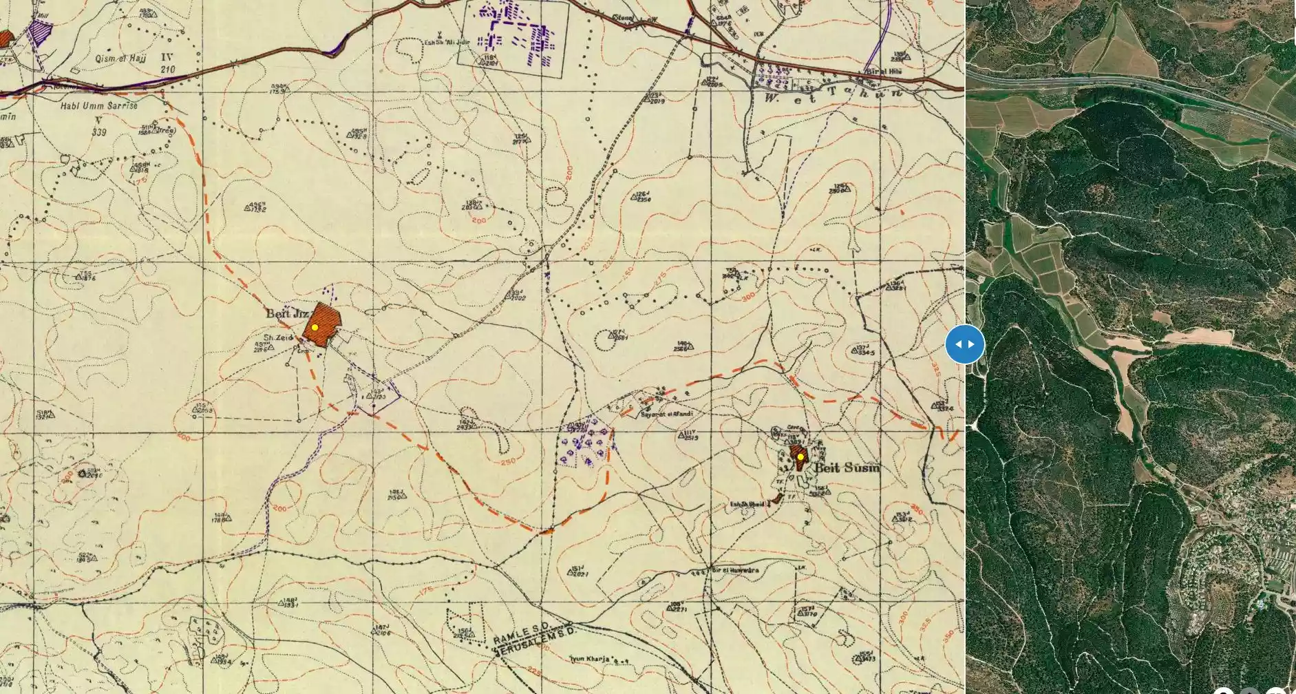
| Map Location | See location #50 on the map View from satellite |
||||||||||||||
| Military Operation | Operation Ben-Nun | ||||||||||||||
| Attacking Units | Sheva' (Seventh) Brigade | ||||||||||||||
| Exodus Cause | Military assault by Zionist troops | ||||||||||||||
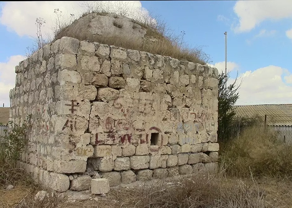
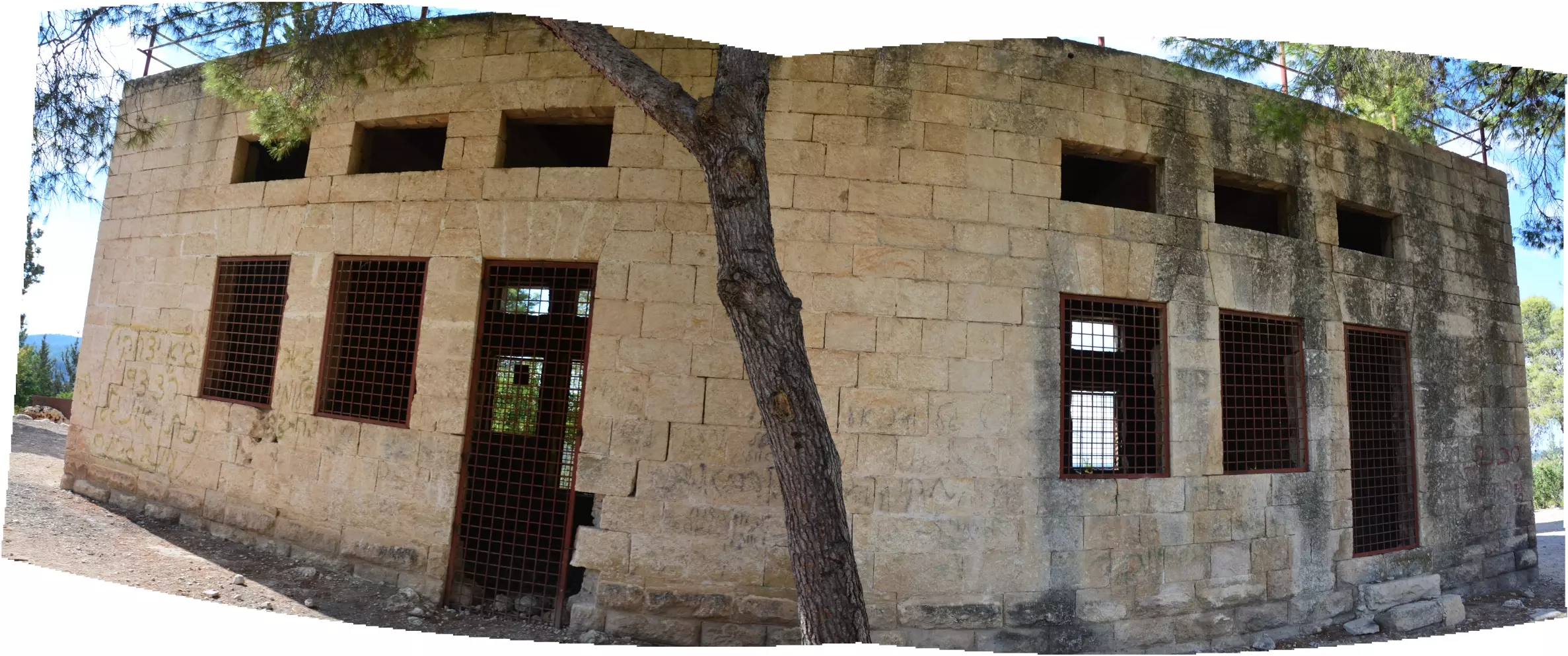
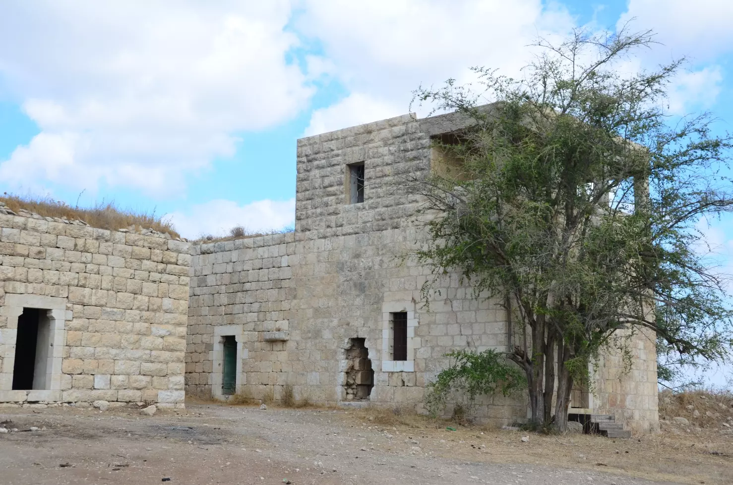
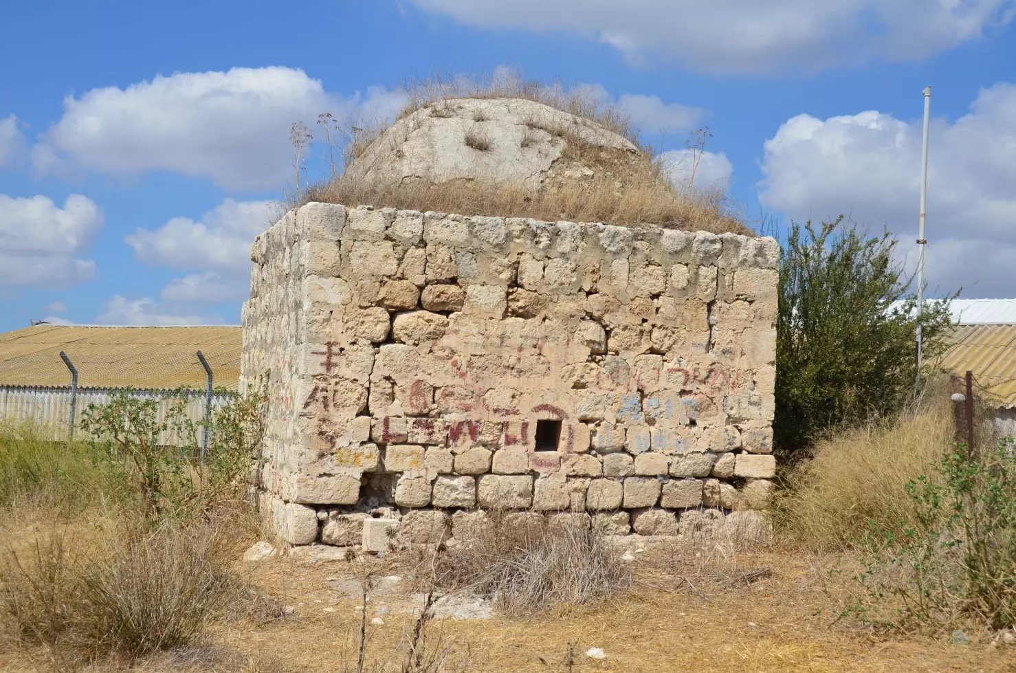
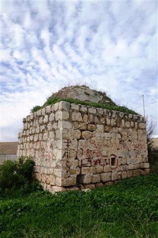
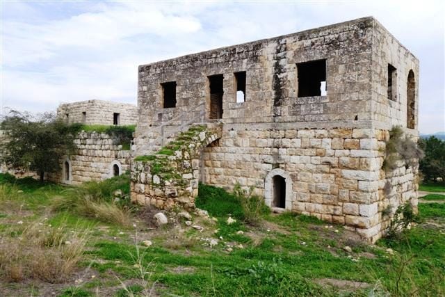
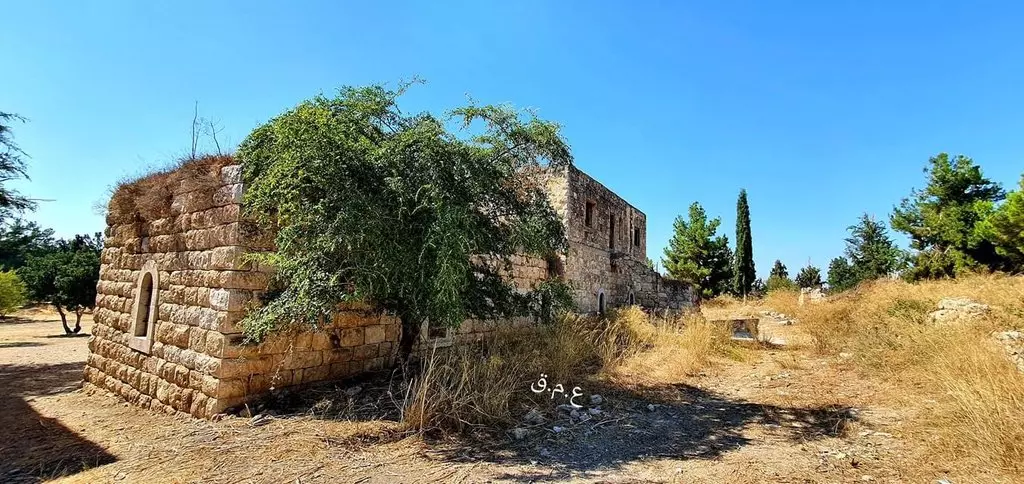
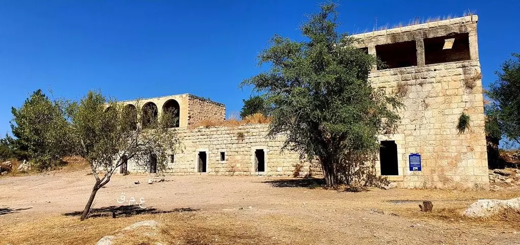
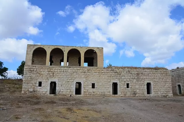
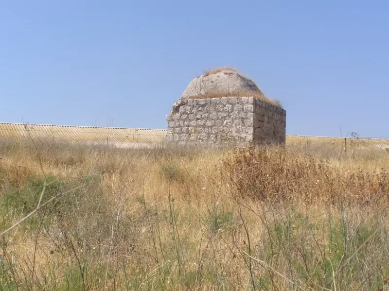
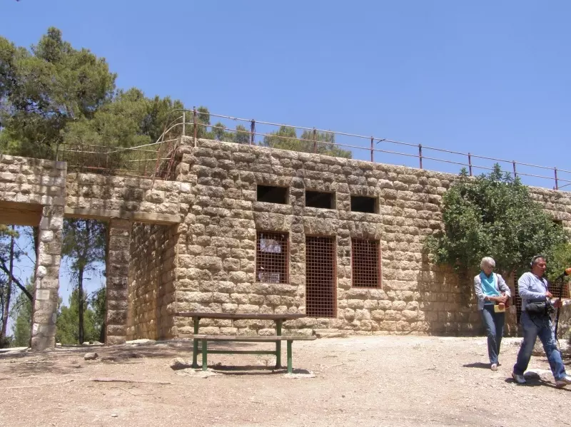
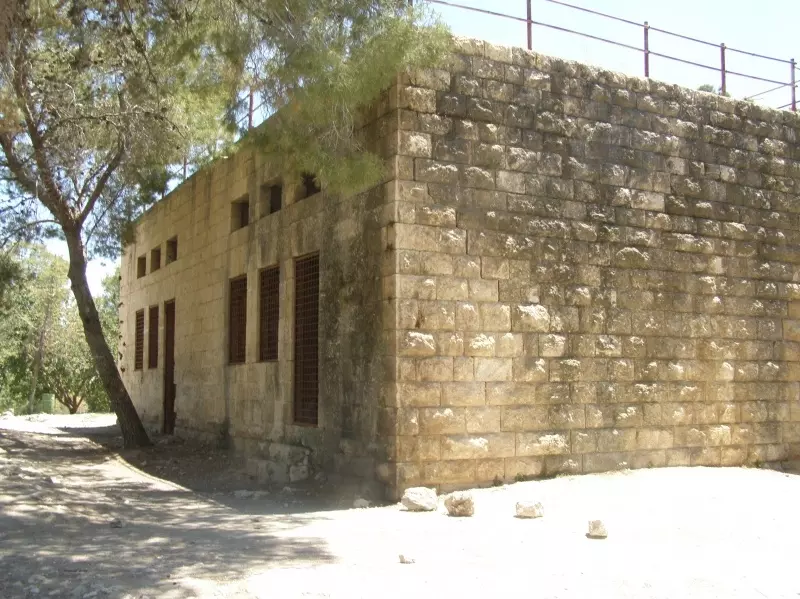
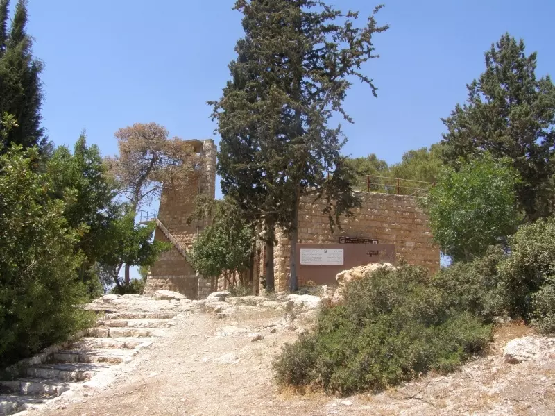
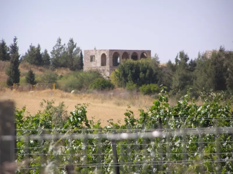
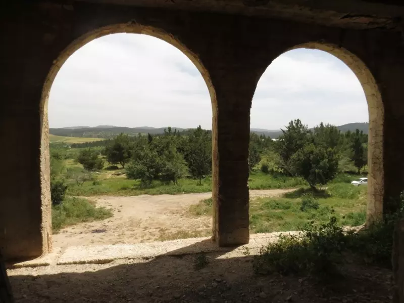
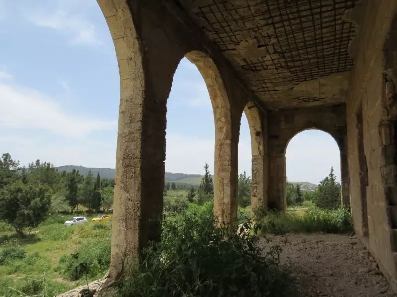
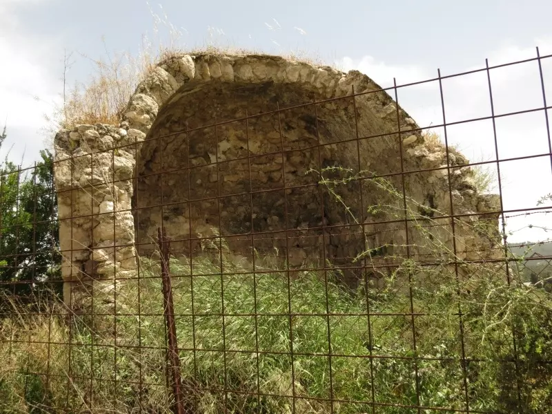
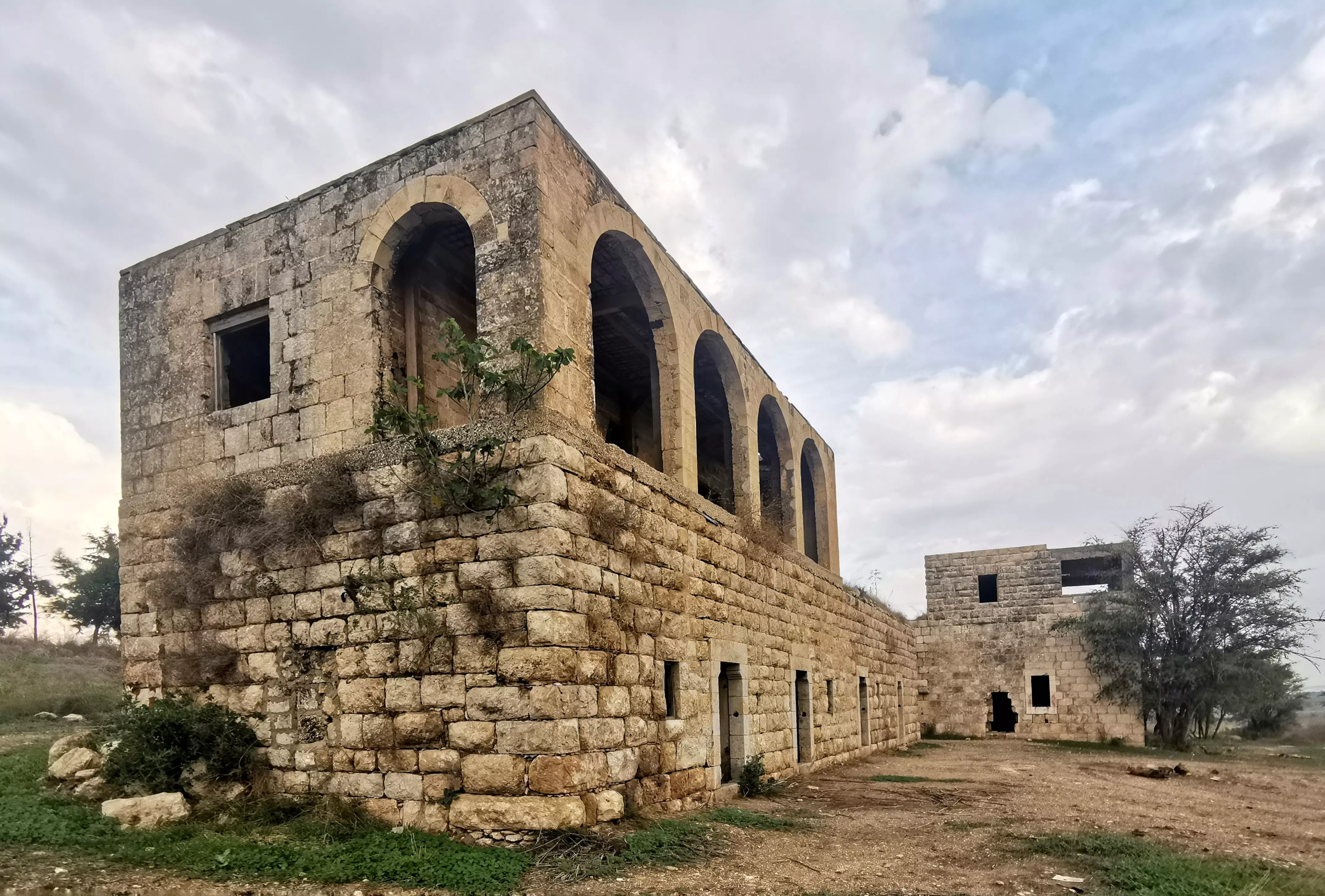
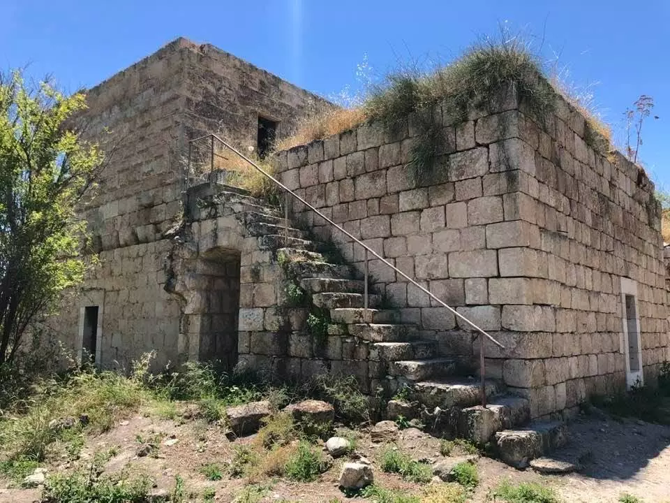
| Village Temains | Bayt Jiz was mostly destroyed with the exception of its school. | ||||||||||||||
| Ethnically Cleansing | Bayt Jiz inhabitants were completely ethnically cleansed. | ||||||||||||||
| Pre-Nakba Land Ownership |
**Town Lands' Demarcation Maps |
||||||||||||||
| Land Usage As of 1945 |
|
||||||||||||||
| Population |
|
||||||||||||||
| Number of Houses |
|
||||||||||||||
| Near By Towns |
|||||||||||||||
|
|
|||||||||||||||
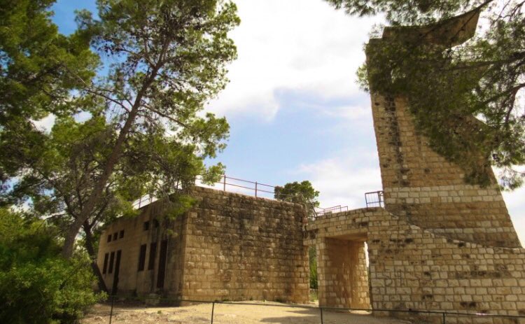
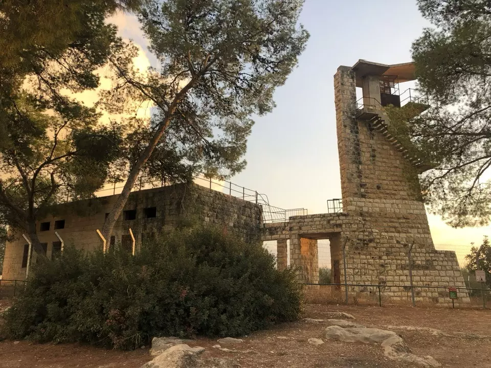
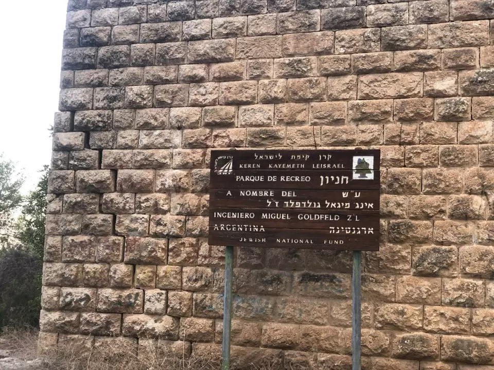
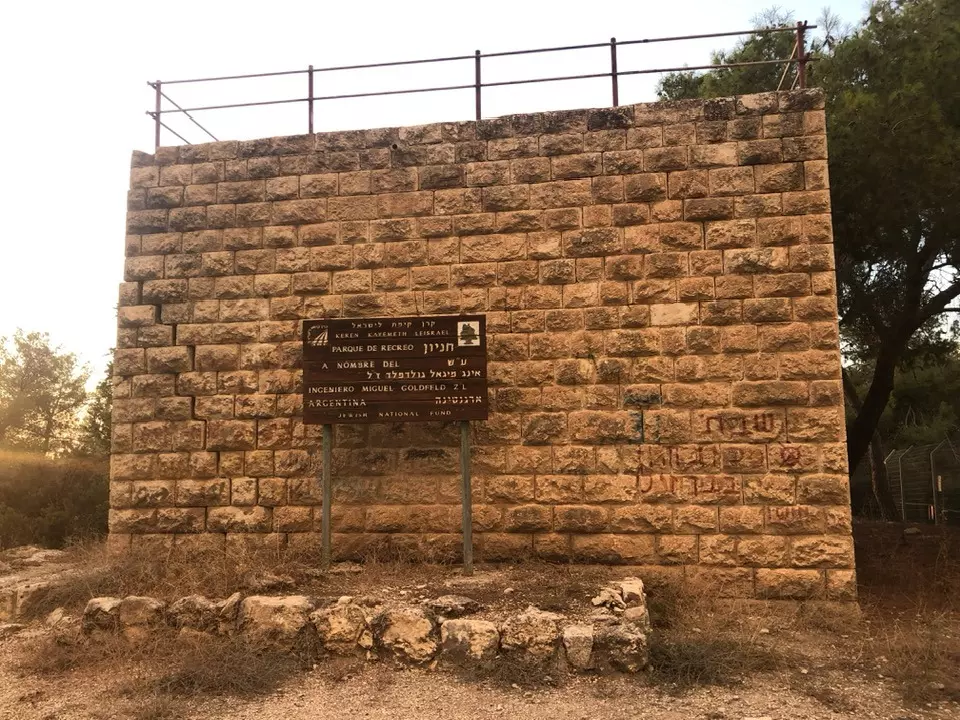
| Schools | An elementary school built in 1947, and it currently functions as a recreational facility. | ||||||||||||||
| Places of Warship | One mosque | ||||||||||||||
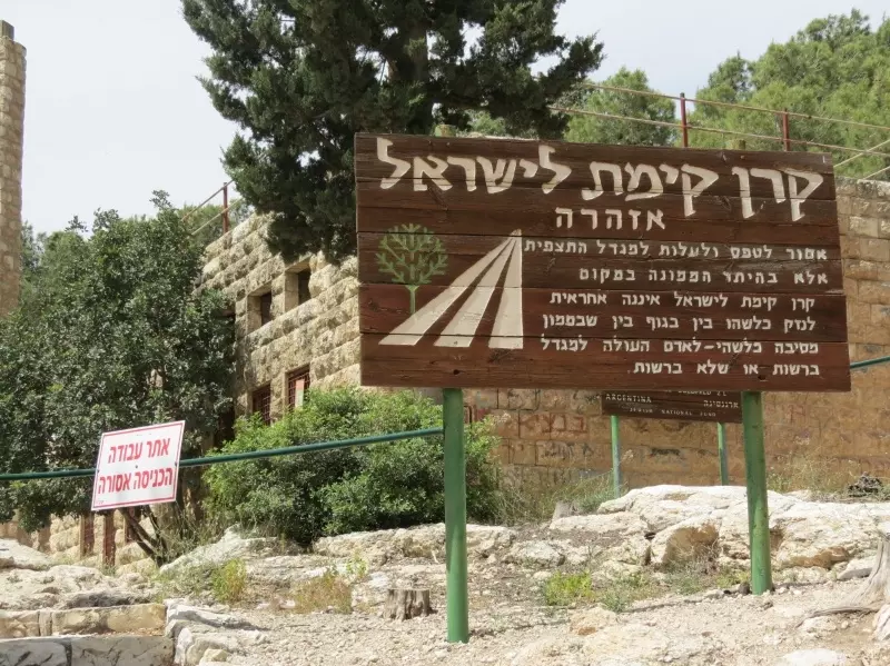
| Exculsive Jewish Colonies Who Usurped Village Lands |
Har'el, Tzelafon, and Gizo. | ||||||||||||||
| Featured Video | |||||||||||||||
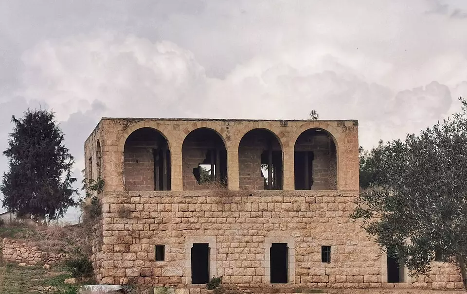
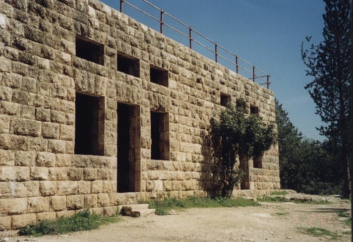
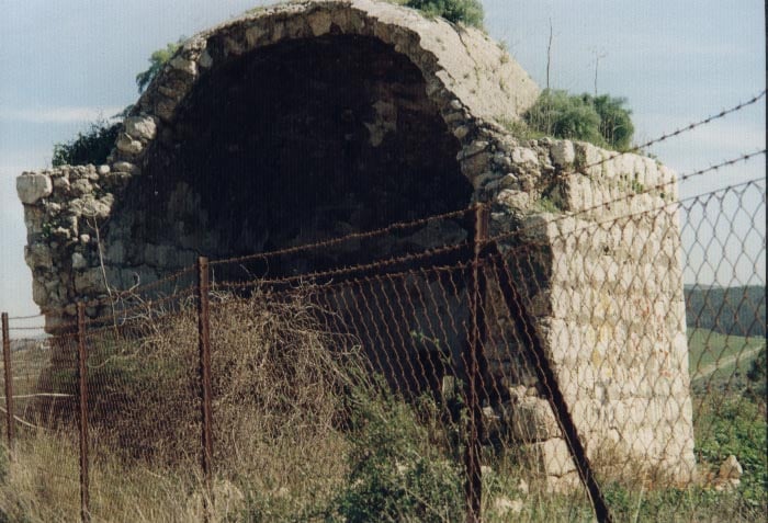
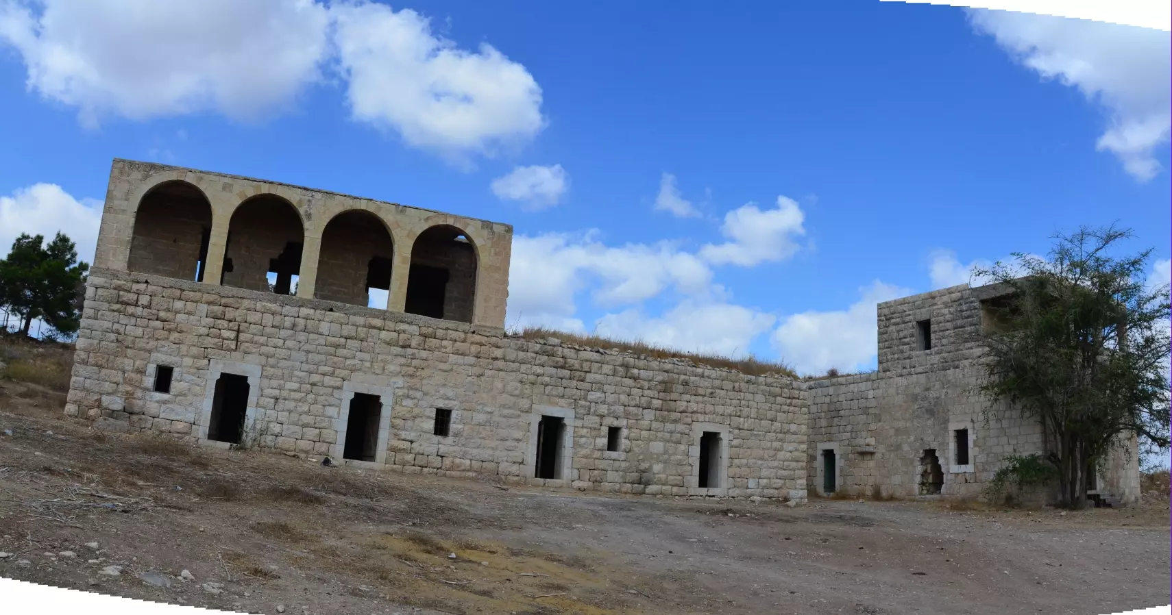
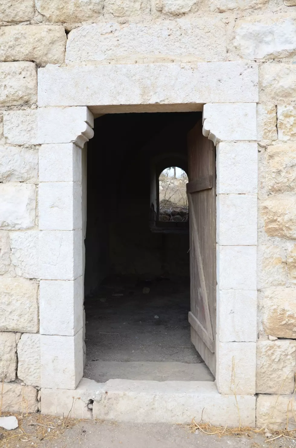
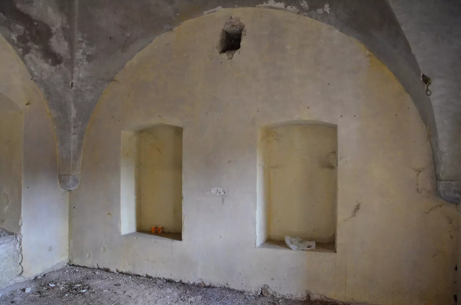
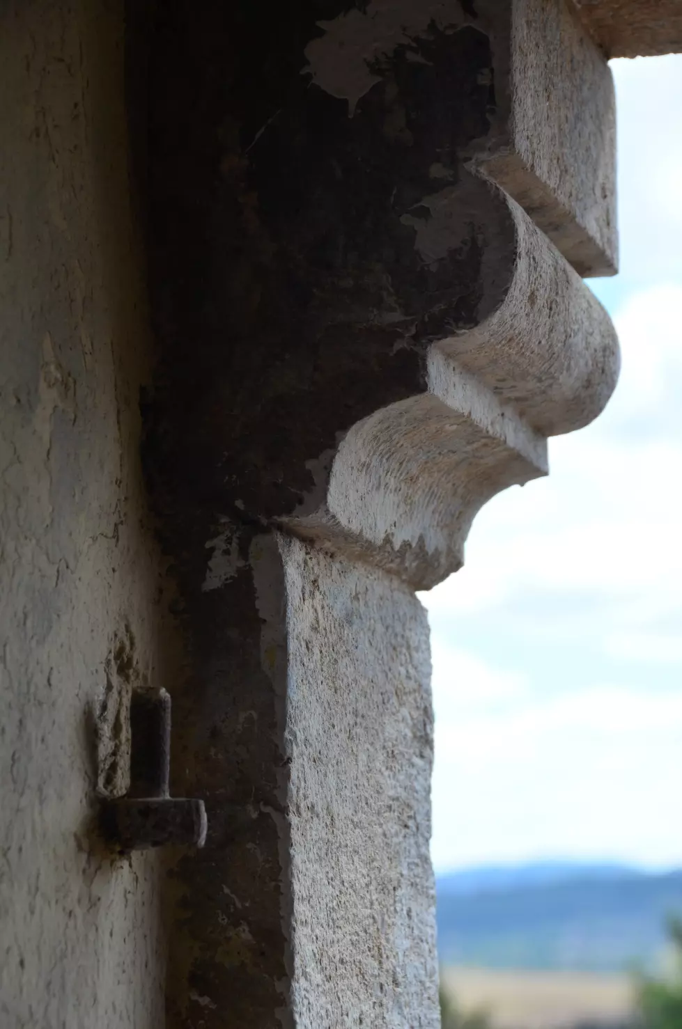
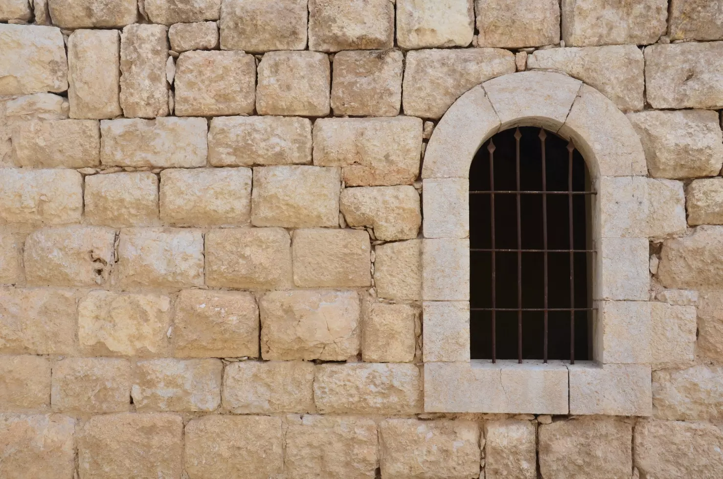
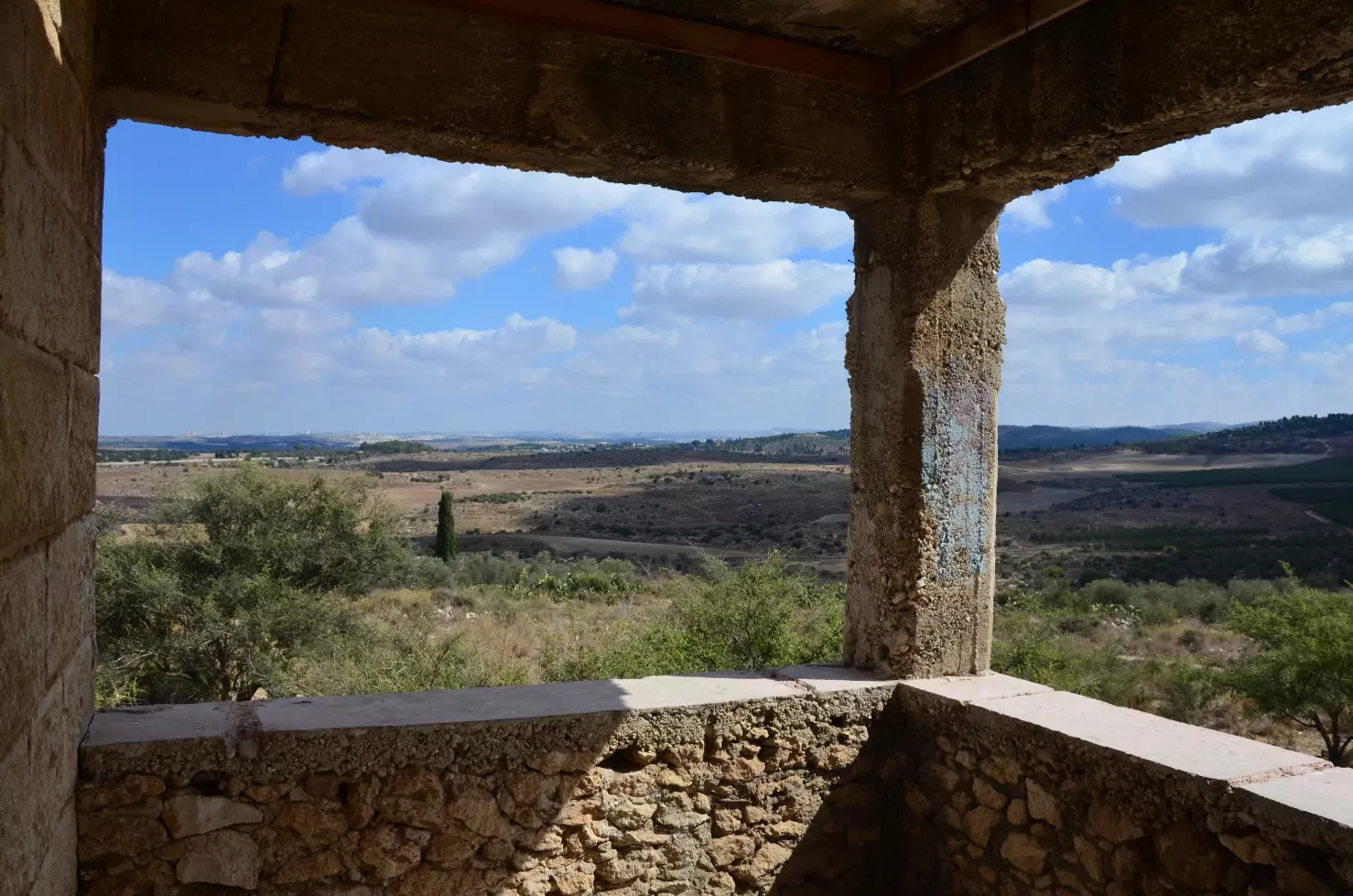
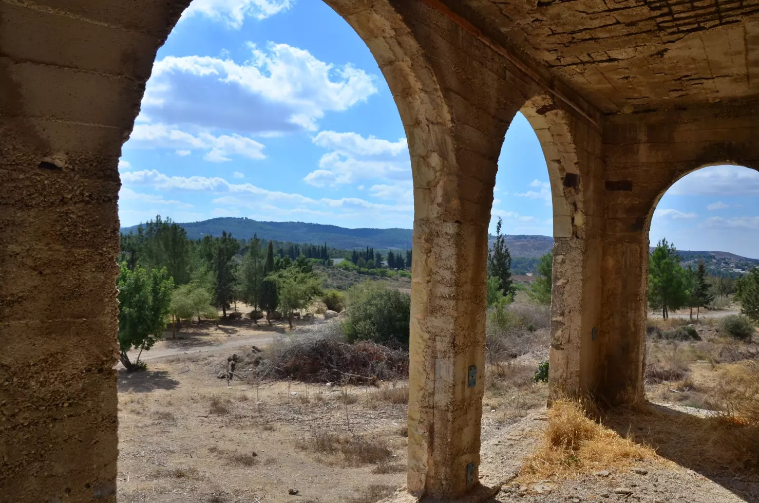
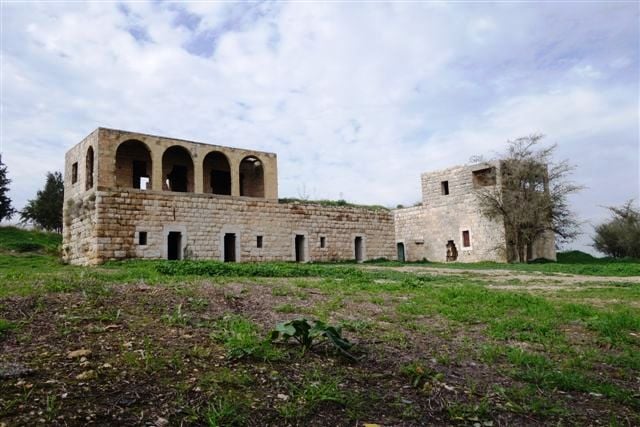
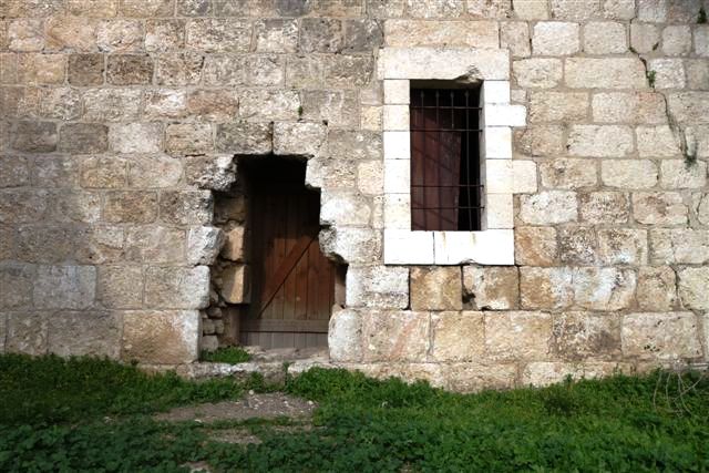
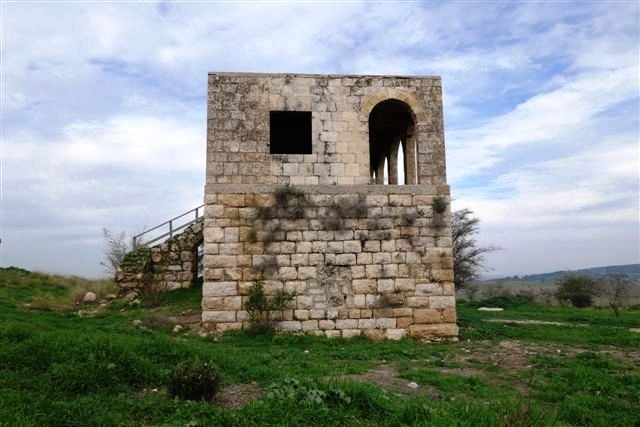
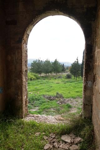
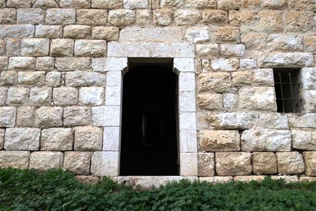
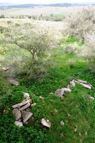
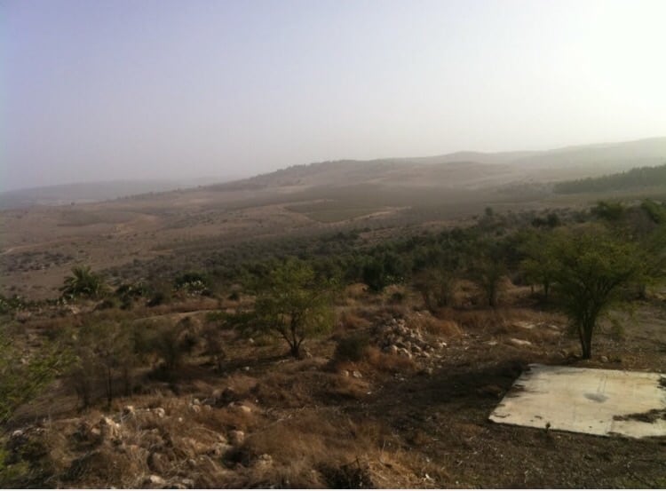
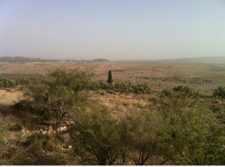
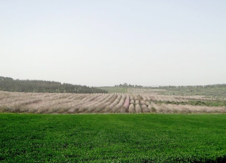
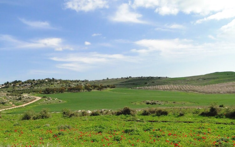
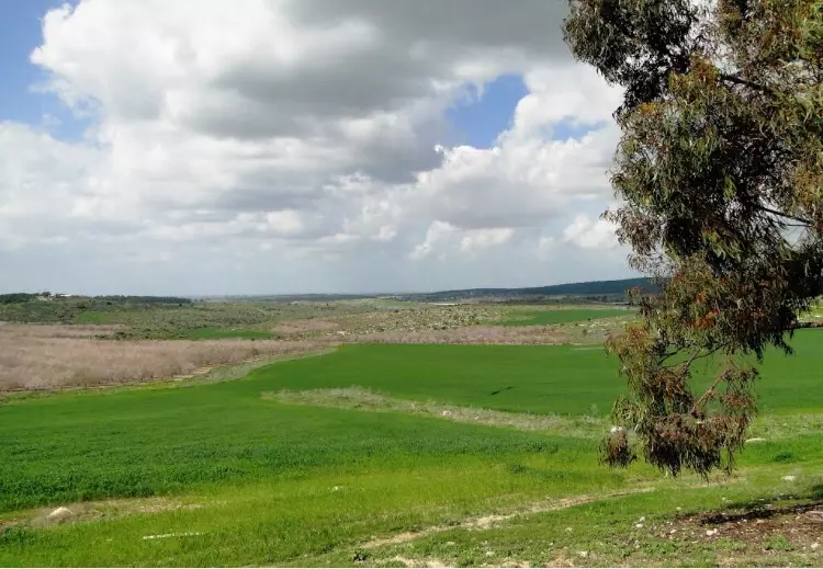
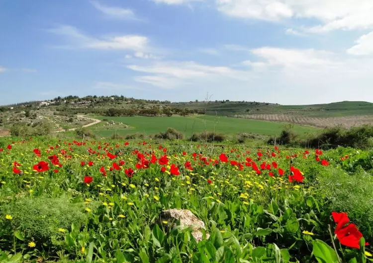
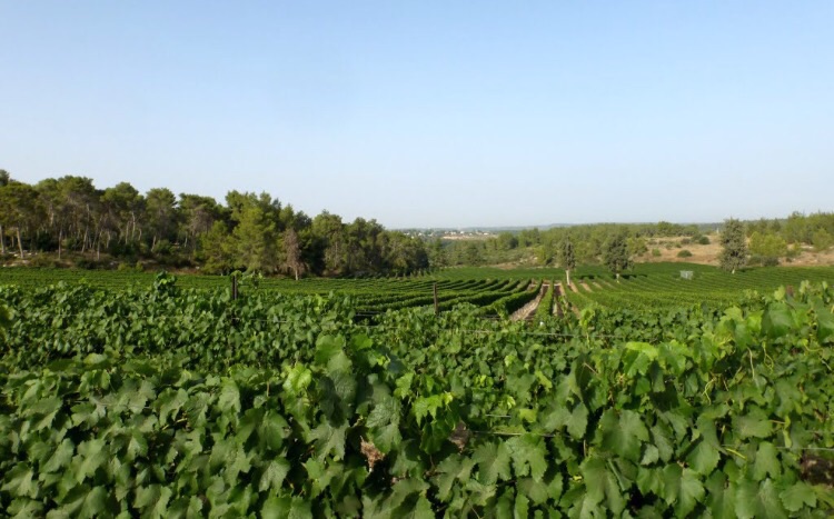
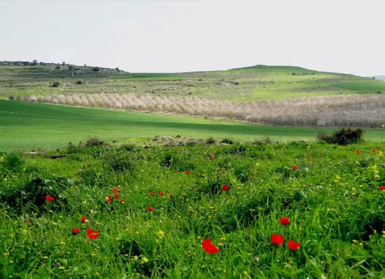
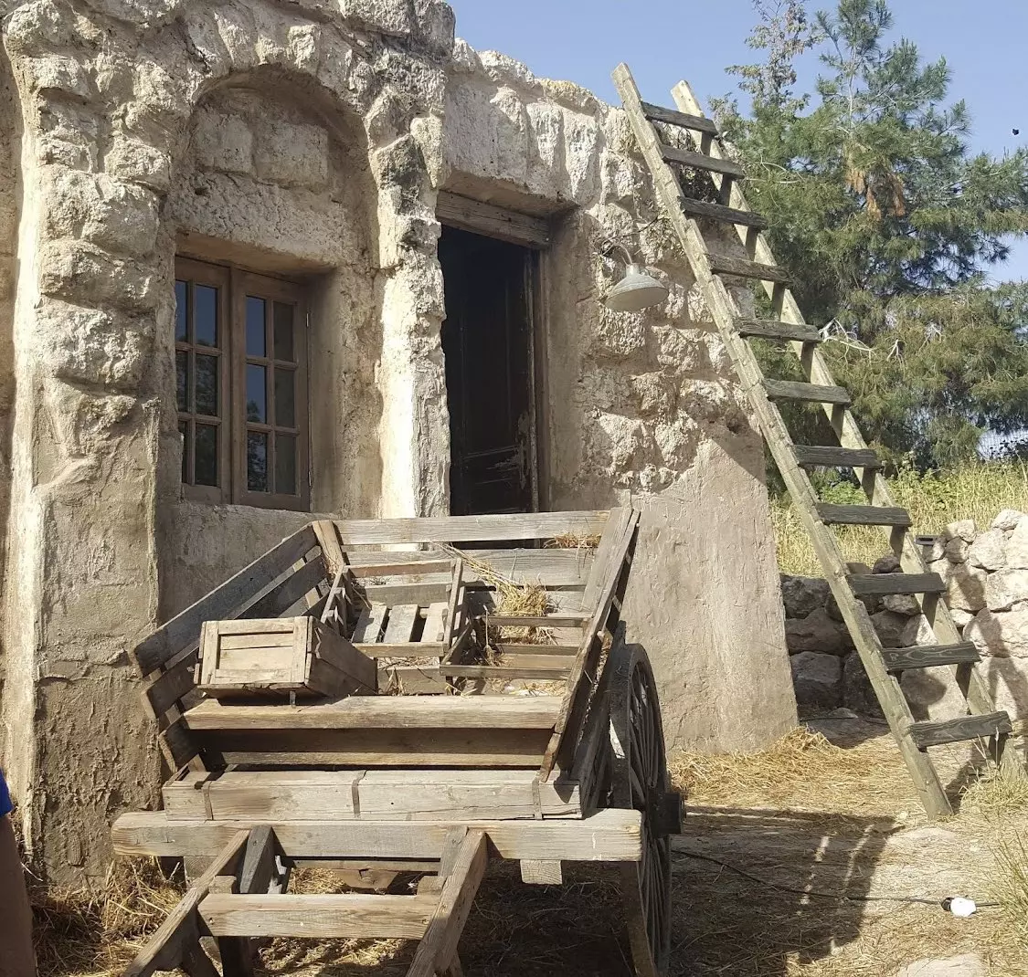
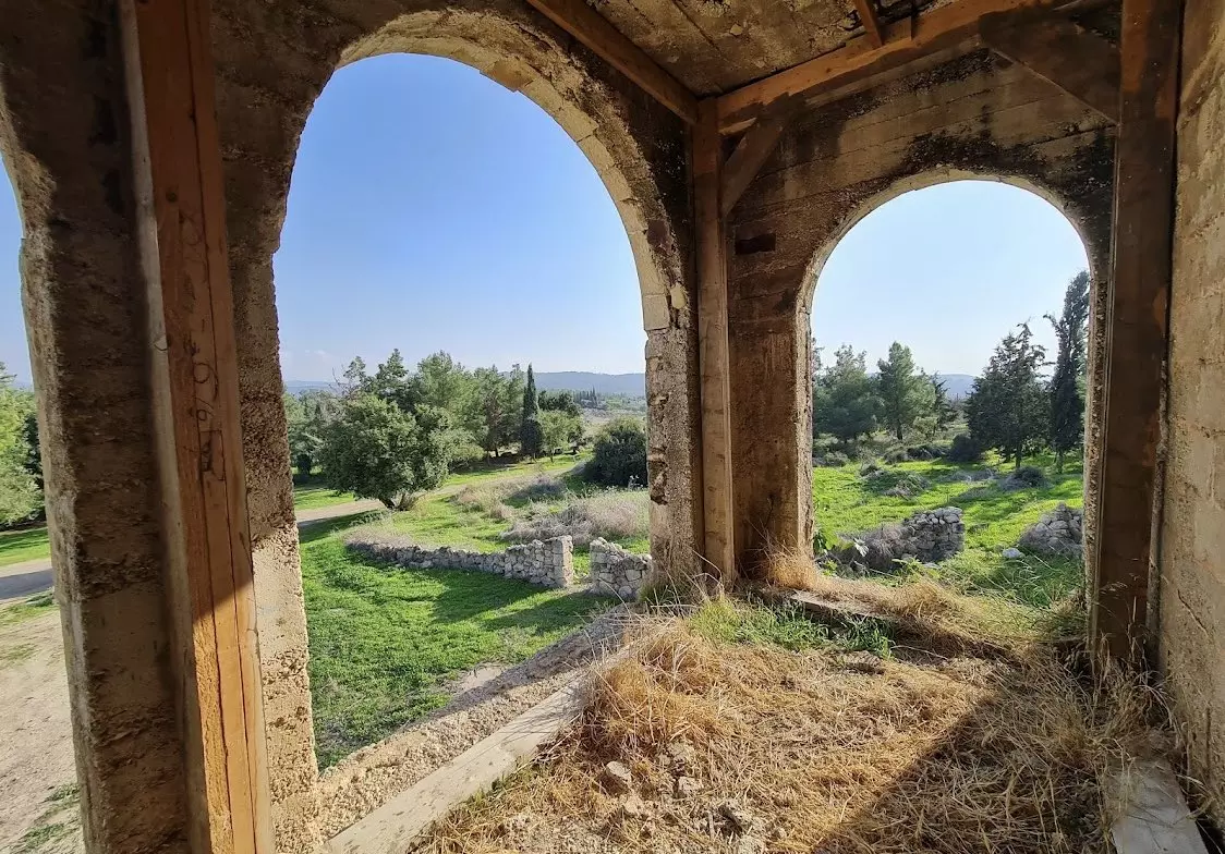
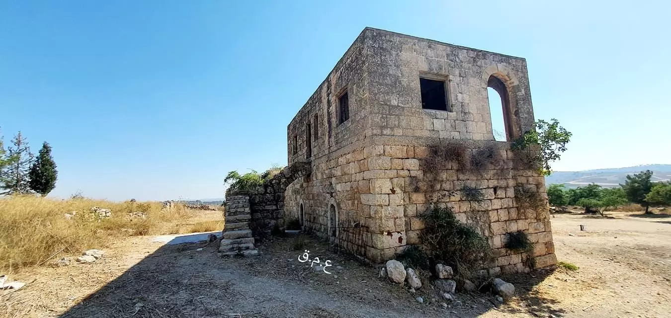
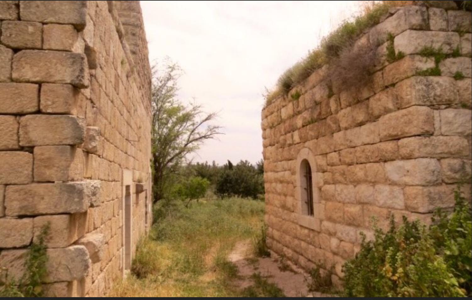
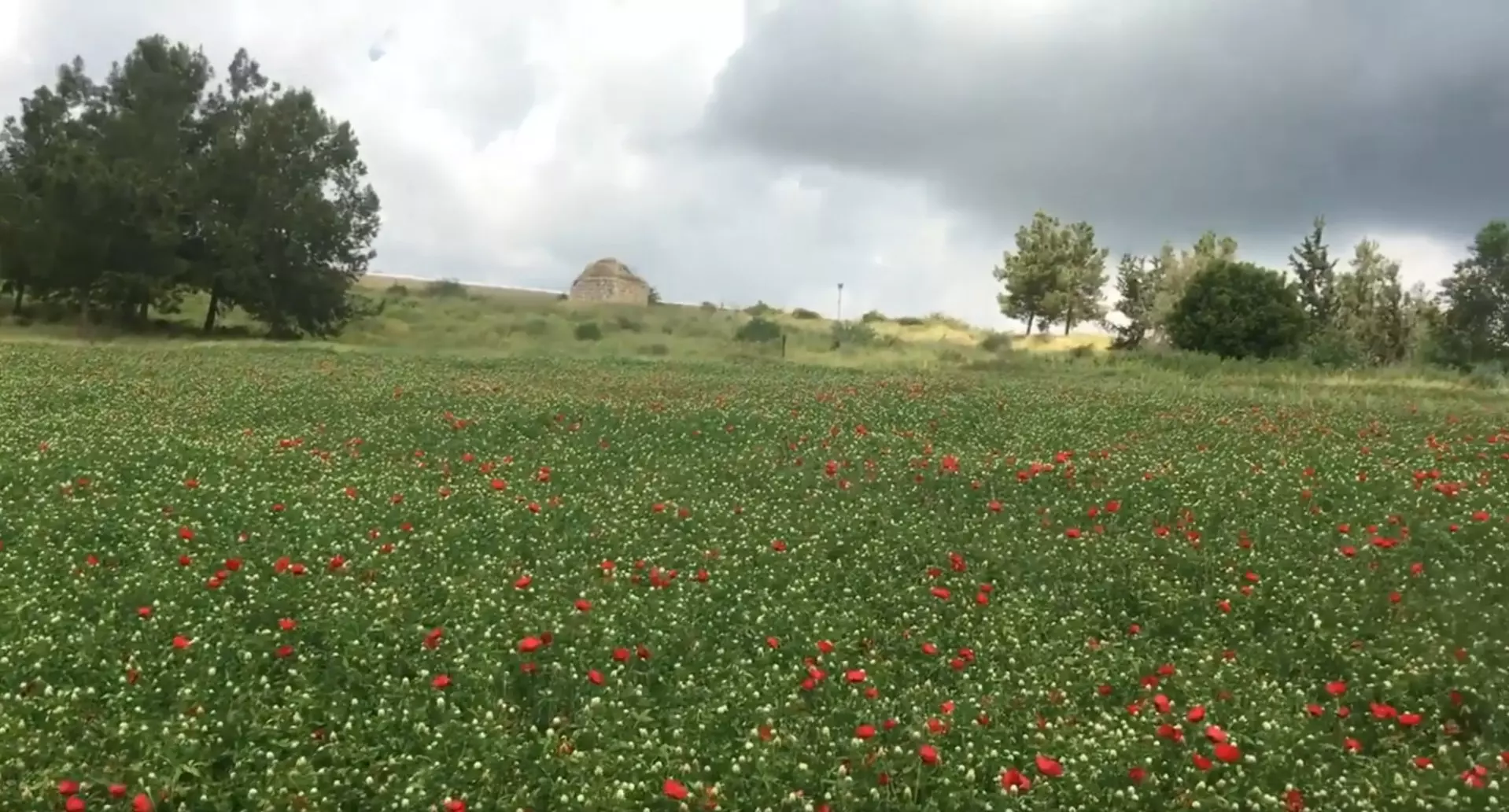
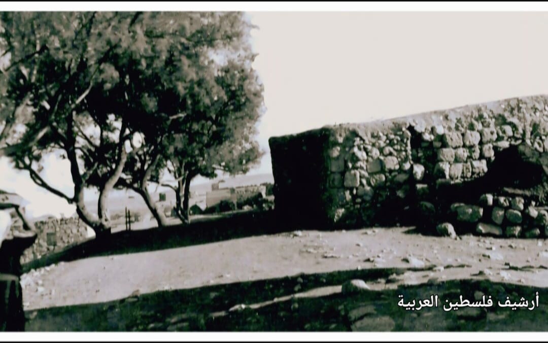
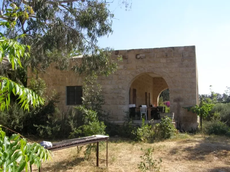
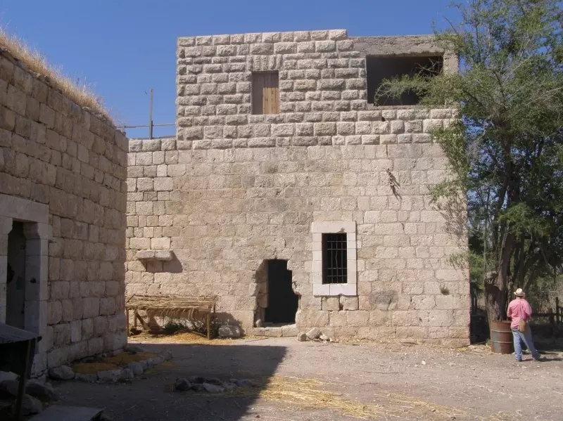
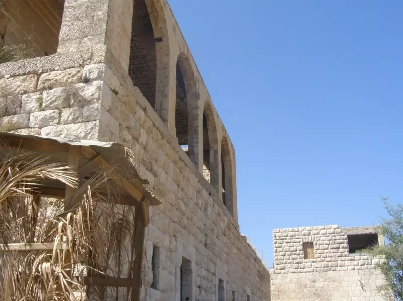
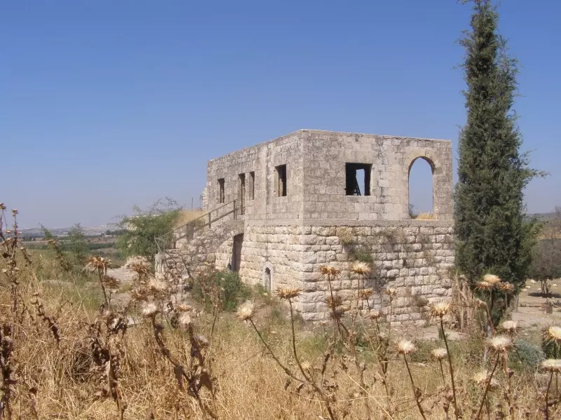
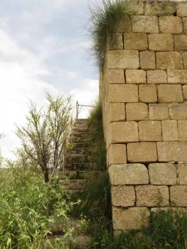
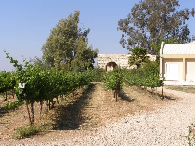
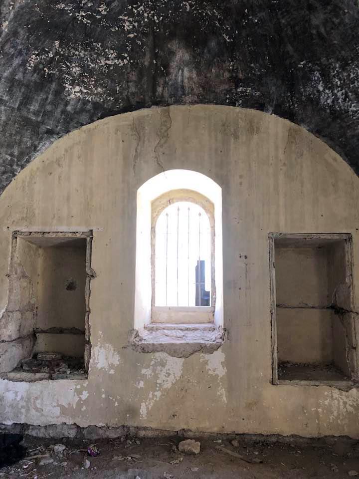
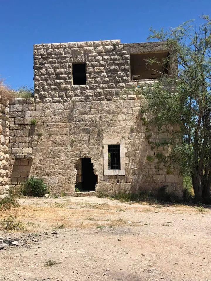
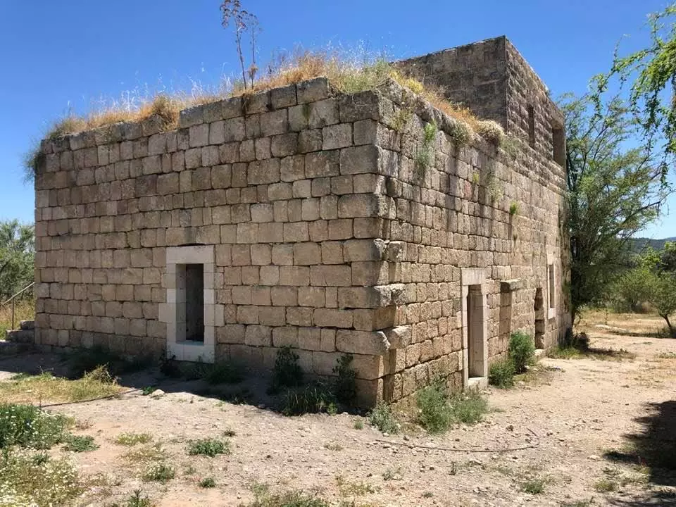
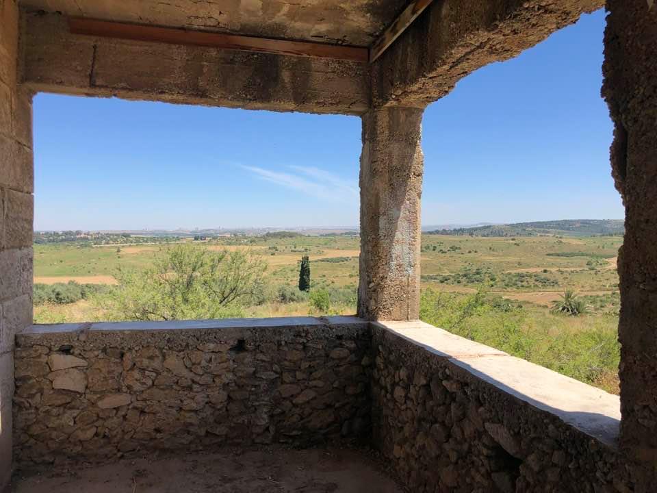
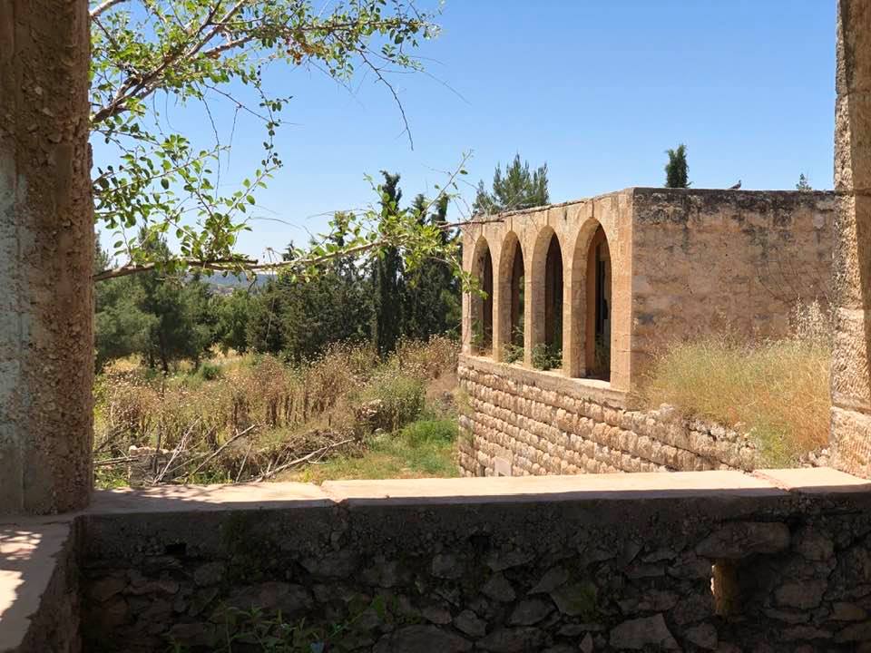
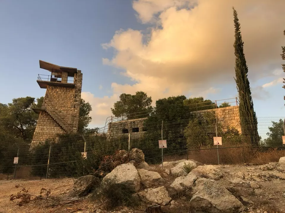
Village Before NakbaThe village was situated on undulating land in the western foothills of the Jerusalem heights. A secondary road linked it to the Gaza-Jerusalem highway that ran north of the village land. Seasonal dirt roads also connected it to the villages of Dayr Muhaysin and Bayt Susin. At the beginning of this century the village had a rectangular plan, narrow streets, and mud-and-stone houses. Its population was predominantly Muslim. The village center included a mosque, some shops, and a school, built in 1947, which was co-financed and shared with the neighboring village of Bayt Susin. Bayt Jiz's economy was based on agriculture. The villagers grew a variety of crops, including grain, vegetables, figs, almonds, and olives. They planted olives on 14 dunums of their land. In 1944/45 a total of 6,525 dunums was allotted to cereals; 36 dunums were irrigated or used for orchards. One part of the surrounding land was grassland, which enabled the villagers to raise sheep and goats, while another part was wooded. Several archaeological sites and khirbas were near Bayt Jiz.Village Occupation and Ethnic CleaningAll the villages in the Jerusalem corridor that did not fall during Operation Nachshon (see Bayt Naqquba, Jerusalem sub-disctrict) were occupied in the subsequent battles around al-Latrun in May and June 1948. Bayt Jiz was occupied in the interval between the first and second assaults on al-Latrun, i.e., between 15 May and 30 May. The New York Times reported that an unsuccessful Israeli attack on al-Latrun on 25 May spread to Bayt Jiz and Khulda the following day. The paper's correspondent called the battle around Bayt Jiz and Khulda 'the biggest single clash of the war to date.' On 28 May, the Israeli army officially announced the capture of the village after they swept south of the Jerusalem-Jaffa road. According to the History of the War of Independence, Bayt Jiz and Bayt Susin fell to the newly-formed Sheva' (Seventh) Brigade in the context of Operation Ben-Nun. The occupation of the two villages enabled Israeli forces to establish an alternative supply line to Jerusalem that bypassed al-Latrun.Israeli historian Benny Morris notes that a military assault on the village took place during the previous month, on 20 April, and the residents were displaced at that time. However, Palestinian historian 'Arif al-'Arif writes that the initial attempt to occupy Bayt Jiz took place on 22-23 May and that it failed partly because Israeli forces had received mistaken reports about the evacuation of the village. Consequently, they were surprised to encounter fierce resistance from the inhabitants of Bayt Jiz and Bayt Susin, as well as from regular Arab forces in the al-Latrun sector. AI-'Arif adds that both villages fell in a subsequent attack on 30 May. Zionists Colonies on Village LandsThree Israeli settlements are on village land: Har'el (145135), founded in 1948; Tzelafon (143134), founded in 1950; and Gizo (144134), founded in 1968.Village TodayThe site, overgrown with wild vegetation, is used as a recreation area. The school is the only remaining landmark. Architecturally it resembles the school in the village of Qula (see QuIa, Ramla sub-disctrict), and is used as a recreation facility, although a fire observation tower has been added to it. A Hebrew and English sign on the tower reads: 'This Fire Observation Post Is Named in Honour Of Mr. And Mrs. Coleman Levene Of Southend And Westcliff England [,] Jewish National Fund.' A number of houses remain. Some are used for storage, others are deserted. One of the storage houses is a large, stone structure, with a flat roof and a three panelled, lancet-arched side window. Three of the deserted houses are two-storey structures. They have a variety of architectural features: rectangular and arched windows and entrances, flat roofs, and balconies supported on square columns. The land is planted in grain, olive trees, and vegetables.SourceDr. Walid al-Khalidi, 1992: All That Remains. |
|||||||||||||||
| Related Maps | Town Lands' Demarcation Maps خرائط للقضاء توضح حدود القرى والاودية Town's map on MapQuest View from satellite Help us map this town at WikiMapia |
||||||||||||||
| Related Links | Wikipedia's Page Google Search Google For Images Google For Videos |
||||||||||||||
| More Information | مخطط البلد في كتاب كي لا ننسى في كتاب بلادنا فلسطين المزيد من موقع هوية |
||||||||||||||
- The school of Beit Jiz and what remains of it, March-2002
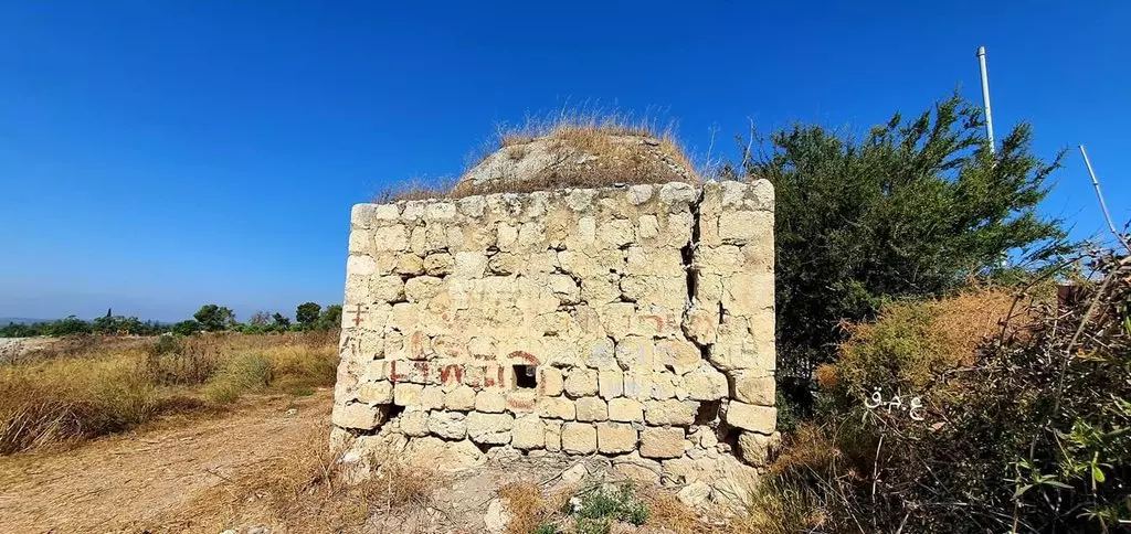
Posted by Aqsa Association-Palestine-1948 6 - The half destroyed Mosque of Beit Jiz-February-2002
Posted by Aqsa Association-Palestine-1948 2 - مدرسة القرية المغتصبة
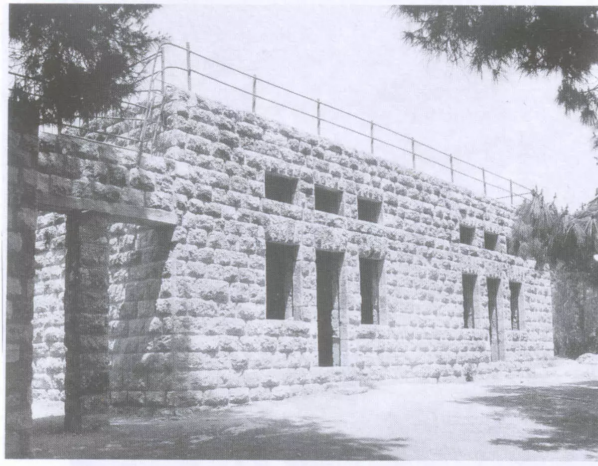
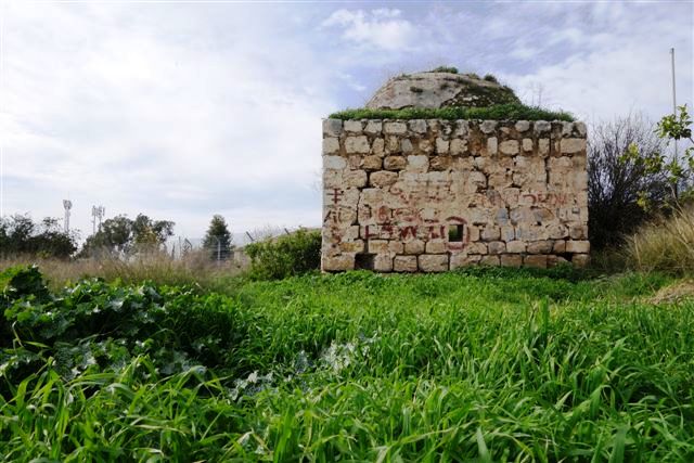
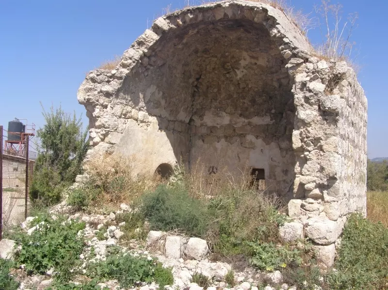
Scanned from "All That Remains" by Dr. Walid Khalidi 15 - A shrine
Posted by Uri Zackhem 2 - The school
Posted by Uri Zackhem 2 - Two homes
Posted by Uri Zackhem 2 - A home
Posted by Uri Zackhem 1 - A door
Posted by Uri Zackhem 1 - A room
Posted by Uri Zackhem 1 - Detail
Posted by Uri Zackhem 1 - نافذة أحد البيوت المغتصبة تظهر الفن المعماري التليدي الفلسطيني القديم
Posted by Uri Zackhem 1 - View from a balcony
Posted by Uri Zackhem 1 - A view from another balcony
Posted by Uri Zackhem 1 - A shrine
Posted by Uri Zackhem 2 - BAYT JIZ 2015
Posted by said - BAYT JIZ 2015
Posted by said - BAYT JIZ 2015
Posted by said - BAYT JIZ 2015
Posted by said - BAYT JIZ 2015
Posted by said - BAYT JIZ 2015
Posted by said - BAYT JIZ 2015
Posted by said - BAYT JIZ 2015
Posted by said - BAYT JIZ 2015
Posted by said - BAYT JIZ 2015

Posted by said - BAYT JIZ 2015
Posted by said - موقع قريه بيت جيز
Posted by abu raya - موقع القريه واطلالها
Posted by abu raya - اراضي القريه
Posted by abu raya - من موقع القريه والمستوطنه المقامه على اراضيها
Posted by abu raya - اراضي القريه
Posted by abu raya - من موقع القريه باتجاه الغرب
Posted by abu raya - اراضي القريه
Posted by abu raya - من موقع القريه
Posted by abu raya - جولة بين منازل وانقاض بيوت بيت جيز المهجرة
- جولة بين منازل وانقاض بيوت بيت جيز المهجرة #2
- جولة بين منازل وانقاض بيوت بيت جيز المهجرة #3
- جولة بين منازل وانقاض بيوت بيت جيز المهجرة #4
- جولة بين منازل وانقاض بيوت بيت جيز المهجرة #5
- جولة بين منازل وانقاض بيوت بيت جيز المهجرة #6
- جولة بين منازل وانقاض بيوت بيت جيز المهجرة #7
- جولة بين منازل وانقاض بيوت بيت جيز المهجرة #8
- زيارة بين انقاض قرية بيت جيز المهجرة -- تصوير قيس فحماوي
- احد المقامات التي لم تدمرعلى ارض بيت جيز المهجرة
- عند مشارف قرية بيت جيز قضاء الرملة عام 1947..
- Let us see what the "MOST CIVILIZED" have looted from the Palestinian people. No, we are not talking about the Germans; we are referring to the "chosen" ones! See for yourself how the most "liberal & progressive" of World Jewry have done to Palestinians' homes. Soon, Gaza might have a similar fate. Mazeltov. How else will Jews be great again?
- Let us see what the "MOST CIVILIZED" have looted from the Palestinian people. No, we are not talking about the Germans; we are referring to the "chosen" ones! See for yourself how the most "liberal & progressive" of World Jewry have done to Palestinians' homes. Soon, Gaza might have a similar fate. Mazeltov. How else will Jews be great again? #2

- Let us see what the "MOST CIVILIZED" have looted from the Palestinian people. No, we are not talking about the Germans; we are referring to the "chosen" ones! See for yourself how the most "liberal & progressive" of World Jewry have done to Palestinians' homes. Soon, Gaza might have a similar fate. Mazeltov. How else will Jews be great again? #3
- Let us see what the "MOST CIVILIZED" have looted from the Palestinian people. No, we are not talking about the Germans; we are referring to the "chosen" ones! See for yourself how the most "liberal & progressive" of World Jewry have done to Palestinians' homes. Soon, Gaza might have a similar fate. Mazeltov. How else will Jews be great again? #4
- Let us see what the "MOST CIVILIZED" have looted from the Palestinian people. No, we are not talking about the Germans; we are referring to the "chosen" ones! See for yourself how the most "liberal & progressive" of World Jewry have done to Palestinians' homes. Soon, Gaza might have a similar fate. Mazeltov. How else will Jews be great again? #5
- Let us see what the "MOST CIVILIZED" have looted from the Palestinian people. No, we are not talking about the Germans; we are referring to the "chosen" ones! See for yourself how the most "liberal & progressive" of World Jewry have done to Palestinians' homes. Soon, Gaza might have a similar fate. Mazeltov. How else will Jews be great again? #6
- Let us see what the "MOST CIVILIZED" have looted from the Palestinian people. No, we are not talking about the Germans; we are referring to the "chosen" ones! See for yourself how the most "liberal & progressive" of World Jewry have done to Palestinians' homes. Soon, Gaza might have a similar fate. Mazeltov. How else will Jews be great again? #7
- Let us see what the "MOST CIVILIZED" have looted from the Palestinian people. No, we are not talking about the Germans; we are referring to the "chosen" ones! See for yourself how the most "liberal & progressive" of World Jewry have done to Palestinians' homes. Soon, Gaza might have a similar fate. Mazeltov. How else will Jews be great again? #8
- Let us see what the "MOST CIVILIZED" have looted from the Palestinian people. No, we are not talking about the Germans; we are referring to the "chosen" ones! See for yourself how the most "liberal & progressive" of World Jewry have done to Palestinians' homes. Soon, Gaza might have a similar fate. Mazeltov. How else will Jews be great again? #9
- Let us see what the "MOST CIVILIZED" have looted from the Palestinian people. No, we are not talking about the Germans; we are referring to the "chosen" ones! See for yourself how the most "liberal & progressive" of World Jewry have done to Palestinians' homes. Soon, Gaza might have a similar fate. Mazeltov. How else will Jews be great again? #10
- Let us see what the "MOST CIVILIZED" have looted from the Palestinian people. No, we are not talking about the Germans; we are referring to the "chosen" ones! See for yourself how the most "liberal & progressive" of World Jewry have done to Palestinians' homes. Soon, Gaza might have a similar fate. Mazeltov. How else will Jews be great again? #11
- Let us see what the "MOST CIVILIZED" have looted from the Palestinian people. No, we are not talking about the Germans; we are referring to the "chosen" ones! See for yourself how the most "liberal & progressive" of World Jewry have done to Palestinians' homes. Soon, Gaza might have a similar fate. Mazeltov. How else will Jews be great again? #12
- Let us see what the "MOST CIVILIZED" have looted from the Palestinian people. No, we are not talking about the Germans; we are referring to the "chosen" ones! See for yourself how the most "liberal & progressive" of World Jewry have done to Palestinians' homes. Soon, Gaza might have a similar fate. Mazeltov. How else will Jews be great again? #13
- Let us see what the "MOST CIVILIZED" have looted from the Palestinian people. No, we are not talking about the Germans; we are referring to the "chosen" ones! See for yourself how the most "liberal & progressive" of World Jewry have done to Palestinians' homes. Soon, Gaza might have a similar fate. Mazeltov. How else will Jews be great again? #14
- Let us see what the "MOST CIVILIZED" have looted from the Palestinian people. No, we are not talking about the Germans; we are referring to the "chosen" ones! See for yourself how the most "liberal & progressive" of World Jewry have done to Palestinians' homes. Soon, Gaza might have a similar fate. Mazeltov. How else will Jews be great again? #15
- Let us see what the "MOST CIVILIZED" have looted from the Palestinian people. No, we are not talking about the Germans; we are referring to the "chosen" ones! See for yourself how the most "liberal & progressive" of World Jewry have done to Palestinians' homes. Soon, Gaza might have a similar fate. Mazeltov. How else will Jews be great again? #16
- Let us see what the "MOST CIVILIZED" have looted from the Palestinian people. No, we are not talking about the Germans; we are referring to the "chosen" ones! See for yourself how the most "liberal & progressive" of World Jewry have done to Palestinians' homes. Soon, Gaza might have a similar fate. Mazeltov. How else will Jews be great again? #17
- Let us see what the "MOST CIVILIZED" have looted from the Palestinian people. No, we are not talking about the Germans; we are referring to the "chosen" ones! See for yourself how the most "liberal & progressive" of World Jewry have done to Palestinians' homes. Soon, Gaza might have a similar fate. Mazeltov. How else will Jews be great again? #18
- Let us see what the "MOST CIVILIZED" have looted from the Palestinian people. No, we are not talking about the Germans; we are referring to the "chosen" ones! See for yourself how the most "liberal & progressive" of World Jewry have done to Palestinians' homes. Soon, Gaza might have a similar fate. Mazeltov. How else will Jews be great again? #19
- Let us see what the "MOST CIVILIZED" have looted from the Palestinian people. No, we are not talking about the Germans; we are referring to the "chosen" ones! See for yourself how the most "liberal & progressive" of World Jewry have done to Palestinians' homes. Soon, Gaza might have a similar fate. Mazeltov. How else will Jews be great again? For those who are curious, this home belongs to Abdulrahman al-Salih #20
- Let us see what the "MOST CIVILIZED" have looted from the Palestinian people. No, we are not talking about the Germans; we are referring to the "chosen" ones! See for yourself how the most "liberal & progressive" of World Jewry have done to Palestinians' homes. Soon, Gaza might have a similar fate. Mazeltov. How else will Jews be great again? #21
- "يا طارق الباب رفقاً حين تطرقهُ
فإنه لم يعد في الدار أصحابُ .
تفرقوا في دروبِ الأرض وانتثروا
كأنه لم يكن انسٌ واحبـابُ .
أرحم يديك فما في الدار من أحد
لا ترج رداً فأهل الود ُ قد راحوا .
ولترحم الدار .. لا توقظ مواجعها
للدور روحٌ .. كما للناس أرواحُ"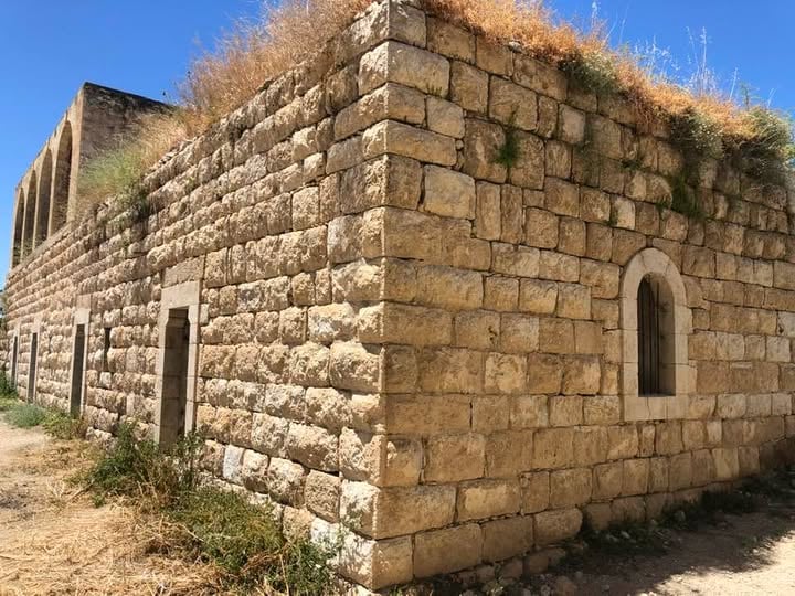
- Let's see how the most "liberal and civilized" of world Jewry...had treated Palestinian homes after they were forced to leave. Remember, this was done 3 years after the Holocaust
- Let's see how the most "liberal and civilized" of world Jewry...had treated Palestinian homes after they were forced to leave. Remember, this was done 3 years after the Holocaust #2
- Let's see how the most "liberal and civilized" of world Jewry...had treated Palestinian homes after they were forced to leave. Remember, this was done 3 years after the Holocaust #3
- Let's see how the most "liberal and civilized" of world Jewry...had treated Palestinian homes after they were forced to leave. Remember, this was done 3 years after the Holocaust #4
- Let's see how the most "liberal and civilized" of world Jewry...had treated Palestinian homes after they were forced to leave. Remember, this was done 3 years after the Holocaust #5
- Let's see how the most "liberal and civilized" of world Jewry...had treated Palestinian homes after they were forced to leave. Remember, this was done 3 years after the Holocaust #6
- One of the only remaining structures was Beit Jiz's school. It was built just before the "most civilized" replaced
- One of the only remaining structures was Beit Jiz's school. It was built just before the "most civilized" replaced #2
- One of the only remaining structures was Beit Jiz's school. It was built just before the "most civilized" replaced #3
- One of the only remaining structures was Beit Jiz's school. It was built just before the "most civilized" replaced #4
Want to browse more? 80,000 pictures were grouped in these gallaries:
| Display Name | Clan/Hamolah | Country of Residence |
| عز الدين عبد الرحيم | - | - |
| محمد سليمان عبد الفتاح ديرية (عميش) | ديرية | فلسطين _بيت لحم |
| Areej | - | Amman, Jordan |
| Areej | - | Jordan, Jordan |
| wasfi hishmeh | hishmeh | illinois, usa |
| محمود حمد | حمد | ايطاليا |
| Ahmad Alammuri | Alammuri | Tennessee, Usa |
| JM | دعيق | ماحص, الأردن |
| saleh saleh | saleh | Texas, Texas |
| monther harb | harb | new jersey usa |
| حسن عبدالرحيم | عياد | الرياض, الرياض |
| Mohammed Hassan | Abdul-Raheem | Riyadh, Riyadh |
| محمود عبد الكريم محمود عبدالله حرب | - | الدوحة, الاردن |
| abu ibraheem | - | - |
| أبو الفداء | الصالح | U.A.E, دير الهوا |
| المحامي | - | - |
| علي عبدالقادر | القاموق | - |
| abdallah | hzaiyen | illinois, usa |
| IBRAHIM HARB | Harb | Amman |
| fares alammuri | العموري | 37215, 37215 |
| Mahmoud Abdelrahim | Abdelrahim | RIYADH, KSA |
| محرر فلسطين | داغر | البلقاء, الأردن |
| Ibrahim Harb | - | - |
| zakaria Ebdah | ebdah | - |
| Bara'a Harb | Harb | Amman, Jordan |
| ABU 7ARB | Harb | Amman, Jordan |
| Osama Ebdah | Ebdah | - |
| Ala' Ibraheem | Ibraheem | Amman, Jordan |
| FIRAS HARB | HARB | RIYADH |
| Zaid Abdelrahim | Abdelrahim | Vega Alta, Puerto Rico |
| al-hosain | ayyad | jordan, jordan |
| Mohammed Muhanna | Muhanna | - |
| Firas HARB | - | - |
| Amani Saleh | Saleh | New York, USA |
- Bayt Jiz 2015
- في موقع المقام - في قرية بيت جيز المهجرة - قضاء الرملة . Duration: min 2 sec
- في موقع قرية بيت جيز المهجرة (قضاء الرملة ) Duration: 52 min
- بيت عبد الرحمن الصالح في قرية بيت جيز المهجرة قضاء الرملة Duration: 12 sec
- كانت مدرسة لقرية بيت جيز المهجرة قضاء الرملة لحتى العام ١٩٤٨ وبعدها اصبحت نقطة عسكرية Duration: 9 sec
 Fake Valor: Why Did Zionist Jews Hoist Nazis Flag on Their Ships in the 1930s?
What is new?
-
Facts About Oct. 7th Gaza Raid
-
Remined Us Please:: Who Did Rape Who? Palestinians Raped Israelis? Or, was the other way around?
-
When Prof. Edward Said was invited to debate Bibi Netanyahu in the 1980s, watch what happened!
-
Ezra Klein of the NY Times on the "Jewish Race".
-
Abusing Blood Libel!
-
Did Israeli Soldiers Activate The Hanniba Direective On Oct. 7th? You Be The Judge
-
Zionist FAQ: Isn't it true that Palestinians don't want peace? Palestinians never accepted the two-state solution
- Facts about Haavara (Transfer) Agreement between Ben-Gurion & Hitler
-
Haavara FAQs: Why Did Zionist Jews Hoist Nazis' Flags on Their Ships in the 1930s?
- Haavara FAQs: When Chaim Weizmann met FDR in mid-1943, why was he silent about rescuing European Jewry?
-
Dear ChatGPT: How did Palestinians resist Napoleon's invasion of their country in 1799?
-
Dear ChatGPT: Gaza had a vibrant Jewish community in the mid-17th century. What happened to them?
-
Dear ChatGPT: Why did the Jewish Agency suppress news of the Holocaust during WWII?
-
Video Playlist: Jews share their DNA tests to end the conflict for good.
-
A Tale of Two Conflicts: Examining the Definition of Genocide
-
Prof. Abraham Polak And The Suppressed History of the Khazars and European Jewry
-
How Ronald Reagan would have framed the genocide in Gaza if he were still alive?
-
Haavara FAQs: Let us do the math: how many German Jews did The Haavara Agreement save?
-
Zionist FAQs: The Hebron Massacre of 1929, "clearly proves" that Palestinians are antisemitic, how could you deny it?
-
Zionist FAQs: Why Anti-Zionist Is Not Antisemitism?
-
Zionist FAQs: Isn't it true that the KGB created Palestinian Nationalism in the early 1960s?
- Zionist FAQs: Muslims are killing Muslims all the time; why are Israeli Jews being singled out in the media?
- Zionist FAQs: How is Israel an apartheid state when 20% of its citizens are Arabs who enjoy full rights?
-
Haavara FAQs: Why Did Dorothy Thompson Flip From A Zionist Advocate to A Silenced Dissenter?
-
Haavara FAQs: Analysis of Herzl's Uganda Scheme and how it could have saved millions of Jews.
-
Haavara FAQs: Why did Hayim Greenberg describe American Jewry as "morally bankrupt" in early 1943?
-
Haavara FAQs: What if the Evian Conference was a resounding success? What would have been the impact of saving European Jewry on Zionism?
- Haavara FAQs: What if the six million were saved, how that would have impacted the Zionist project?
-
Haavara FAQs: How did Zionist leaders react when Europe's Jews lingered in the DP camps after WWII ended?
-
Why does the American Jewish community repeat lies that David Ben-Gurion had debunked before he died?
-
Who has the power to rename the Tatar/Khazar Gene Marker to Jewish IV?
-
Zionist FAQs: Why won't Egypt, Syria, and Jordan take their people back? Jews are indigenous to Palestine, and Arabs immigrated after Jews developed the country. Arabs should leave.
-
Haavara FAQs: Did Hitler and the Nazis conflate between Judaism and Zionist? If that wasn't case, then why?
-
Haavara FAQs: Winston Churchill and antisemitism, a collection of articles written Churchill.
-
Haavara FAQs: Broken by country, how many Jews survived vs. killed during the Holocaust?
-
Haavara FAQs: Why did European Jews vote with their feet and to immigrated to the Americas, not Palestine, after WWII?
-
Watch this American Jewish Girl describing Israeli Jews' cognitive dissonance like no other in under two minutes
-
Haavara FAQs: When the Nazis went out of their way to hide the Holocaust, Israeli Jews did the exact opposite by broadcasting their genocide of Gazans. But why?
-
Haavara FAQs: How Zionist Jews went out of their to show their appreciation to Nazism and Fascism?
- Haavara FAQs: Why Zionist leaders were against bombing the death camps & the Railroads leading to them?
-
Haavara FAQs: Hitler's message to the British and American people: If Jews are such noble citizens and you care about them, how come you're not letting them in? I will gladly ship them to you at my expense, even on luxury liners!
-
A shortlist of Zionist and Israeli false flag operations in the name Jews.
-
The Most Moral Army
- The Land of Kapos (Israel): Where the brave are boycotted and Kapos walk free.
- Why did early Zionists often named their communal enterprises "colonial"?
- Zionist Relations with Nazi Germany by Faris Glubb
-
Two NY Times advertisements by Zionists in the early 1943 that exposes Zionists' treason at the height of the calamity
- Facts Not Lies about the Palestinian-Israeli Conflict.
- Site's pictures have been categorized
- Campgain Against Lice
- A Survey of Palestine, the official source about Palestine before Nakba produced by the British Mandate; over 1200 pages.
- Satellite View & Google Earth: Over 6,000 placemarks identifying all destroyed towns, W. Bank & Gaza Strip Towns, & refugee camps.
- PalestineRemembered.com and its Nakba Oral History Project were featured on al-Jazeera Satellite TV.
- Nakba Oral History Video Podcast:
 Over 700 Oral History interviews (including 3,500+ hours of recording) can be viewed online.
 - Palestine Village Statistics Project
- Gaza Jail Break
- النسخة العربية للموقع الان متوفرة
- Videos: Documenting the destroyed villages in video: Tracing all that remains since Nakba.
- Videos: Responding to Zionist Propaganda
- Interview: The ethnic cleansing of Palestine: George Galloway interviews Israeli Historian Ilan Pappe.
- For Palestinians, memory matters. It provides a blueprint for their future By George Bisharat.
- Zionist FAQ now available in Hebrew שאלות שציונים שואלים, עכשיו בעברית
- Video: The Stephen Walt and John Mearsheimer report on the influence of the Israel Lobby on U.S. Foreign Policy
- The Palestinian-Israeli conflict for beginners
