| PalestineRemembered | About Us | Oral History | العربية | |
| Pictures | Zionist FAQs | Haavara | Maps | |
| Search |
| Camps |
| Districts |
| Acre |
| Baysan |
| Beersheba |
| Bethlehem |
| Gaza |
| Haifa |
| Hebron |
| Jaffa |
| Jericho |
| Jerusalem |
| Jinin |
| Nablus |
| Nazareth |
| Ramallah |
| al-Ramla |
| Safad |
| Tiberias |
| Tulkarm |
| Donate |
| Contact |
| Profile |
| Videos |
Welcome To Bayt Susin - بيت سوسين (בית סוסין)
|
District of al-Ramla
Ethnically cleansed days ago |
العربية Google Earth |
 |
Gallery (27) |
- Statistics & Facts
-
Before & After

- Satellite View
- Articles 1
- Pictures 27
- Members 3
- All That Remains
- Wikipedia
- Videos
- Guest Book
- Links
| Statistic & Fact | Value | ||||||||||||||
| Occupation Date | May 30, 1948 | ||||||||||||||
| Distance From District | 17 (km) Southeast of al-Ramla | ||||||||||||||
| Elevation | 300 (meters) | ||||||||||||||
| Before & After Nakba, Click Map For Details |
|||||||||||||||
|
|||||||||||||||
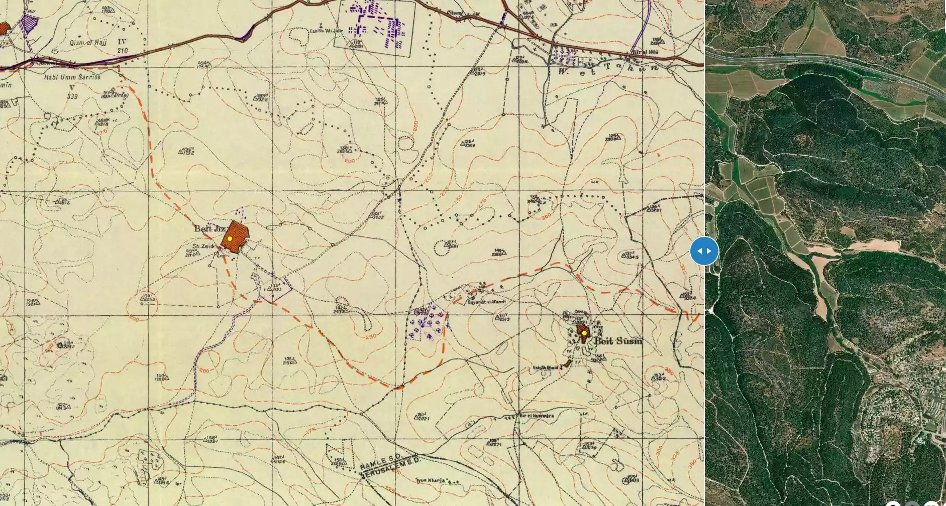
| Map Location | See location #51 on the map View from satellite |
||||||||||||||
| Military Operation | One of the operations launched to capture the important fort and junction at al-Latrun. | ||||||||||||||
| Attacking Units | Sheva' (Seventh) Brigade | ||||||||||||||
| Exodus Cause | Military assault by Zionist troops | ||||||||||||||
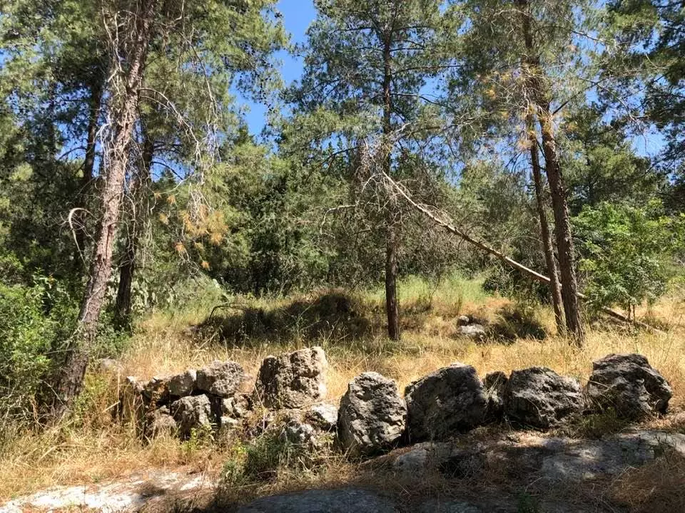
| Village Temains | The village was completely obliterated, and only house rubble left behind. | ||||||||||||||
| Ethnically Cleansing | On April 20th, 1948, Bayt Susin was ethnically cleansed during Operation Nachshon. | ||||||||||||||
| Pre-Nakba Land Ownership |
**Town Lands' Demarcation Maps |
||||||||||||||
| Land Usage As of 1945 |
|
||||||||||||||
| Population |
|
||||||||||||||
| Number of Houses |
|
||||||||||||||
| Near By Towns |
|||||||||||||||
|
|||||||||||||||
| Town's Name Through History | The Crusaders referred to Bayt Susin by Bezezin. | ||||||||||||||
| Places of Warship | One Mosque | ||||||||||||||
| Exculsive Jewish Colonies Who Usurped Village Lands |
Moshav Ta'oz | ||||||||||||||
| Featured Video | |||||||||||||||
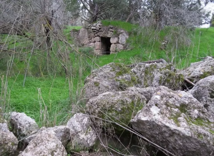
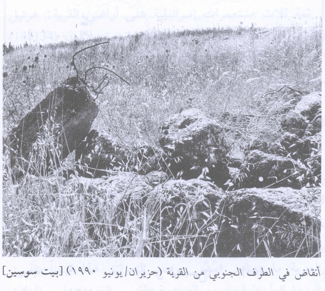
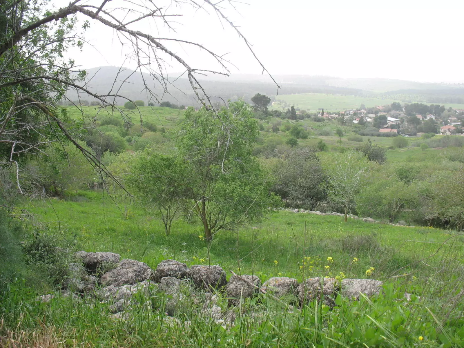
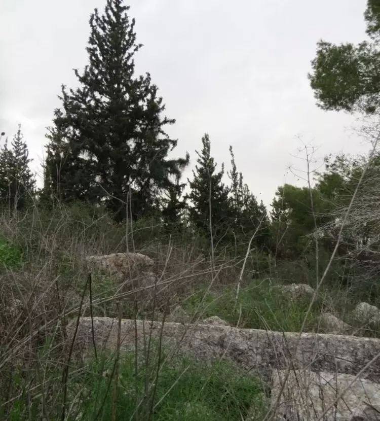
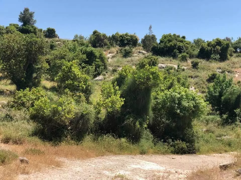
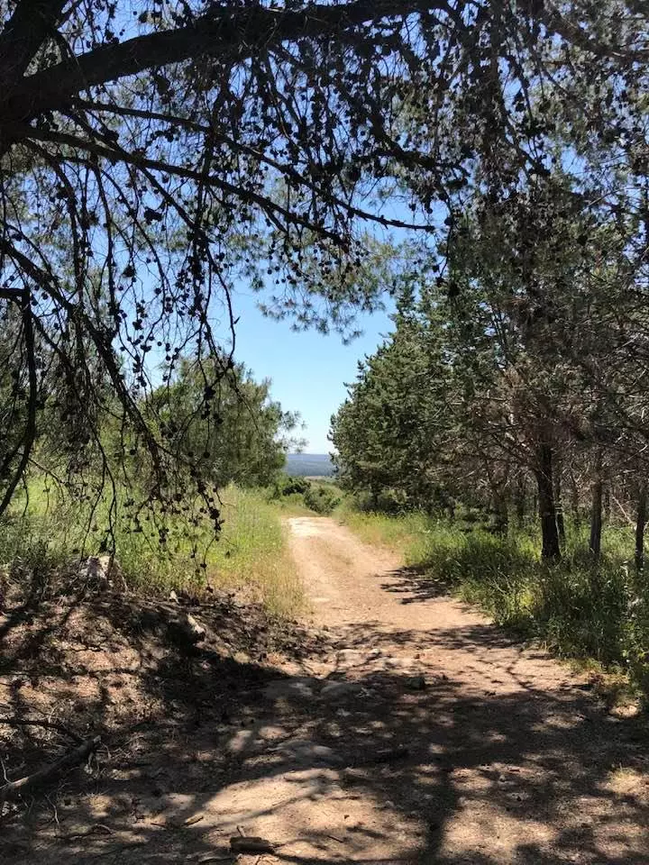
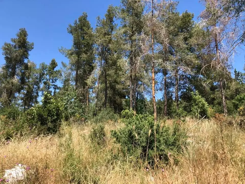
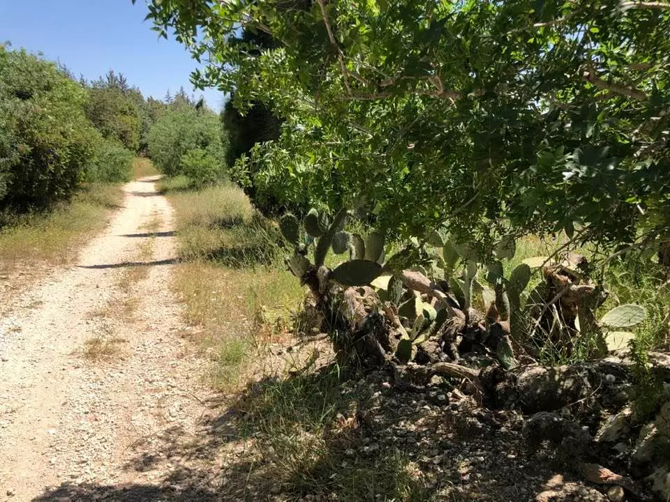
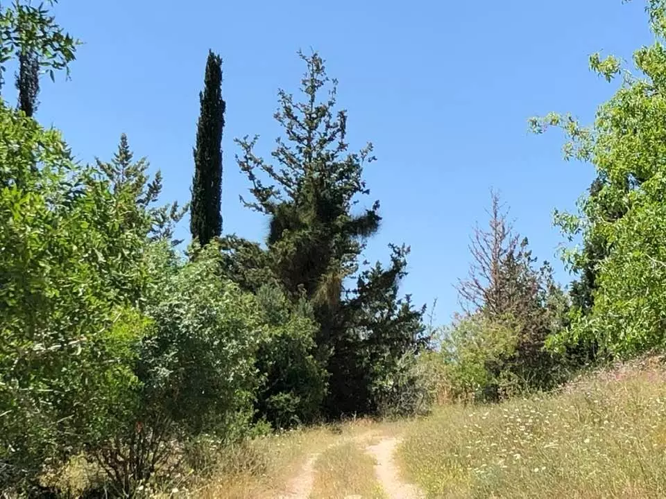
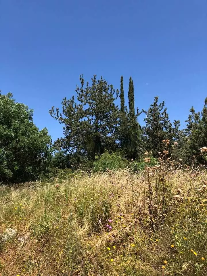
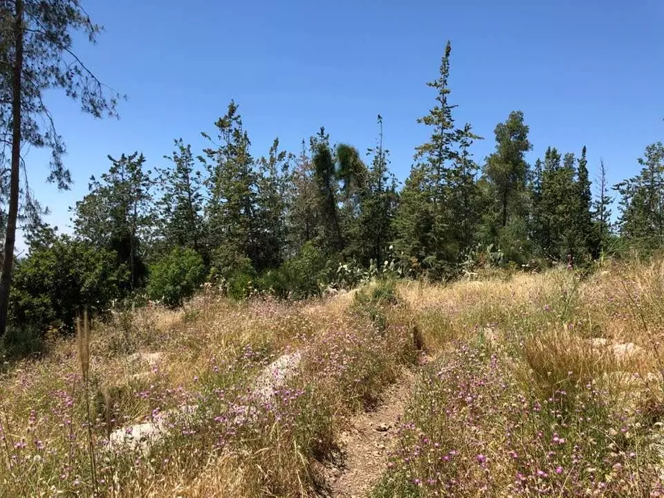
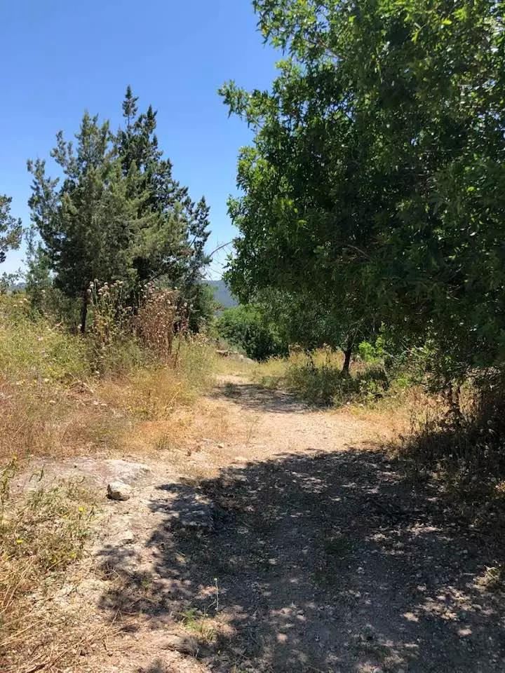
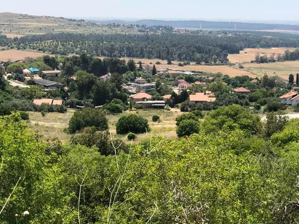
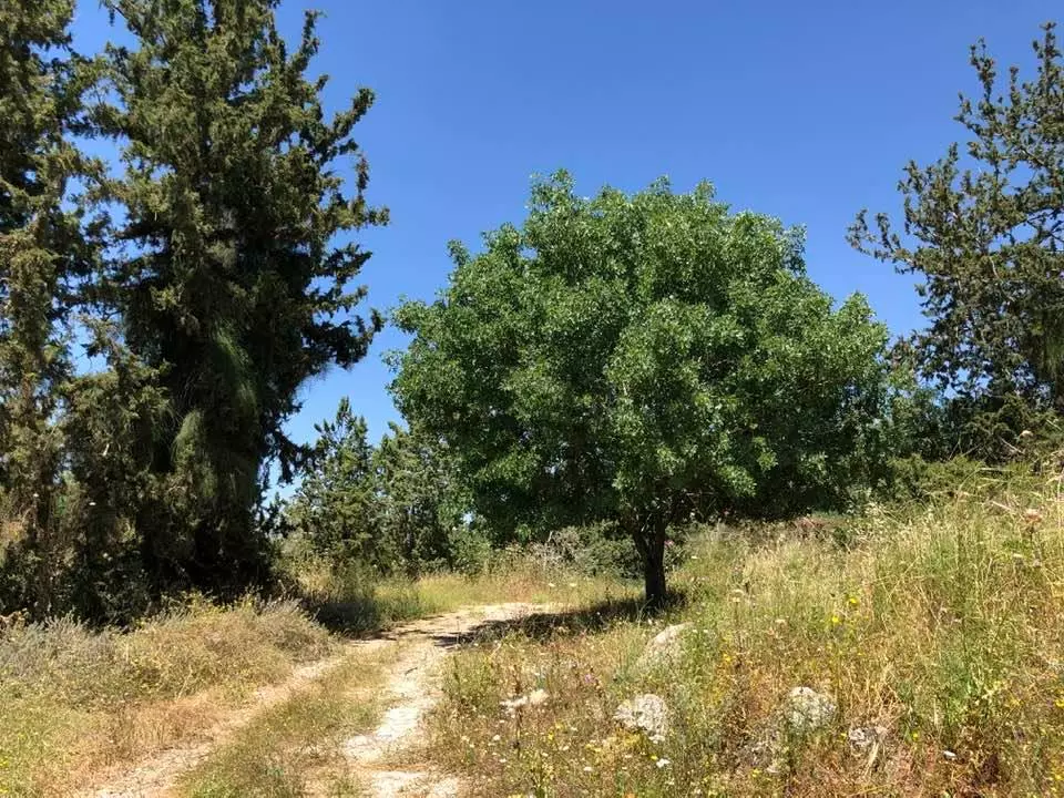
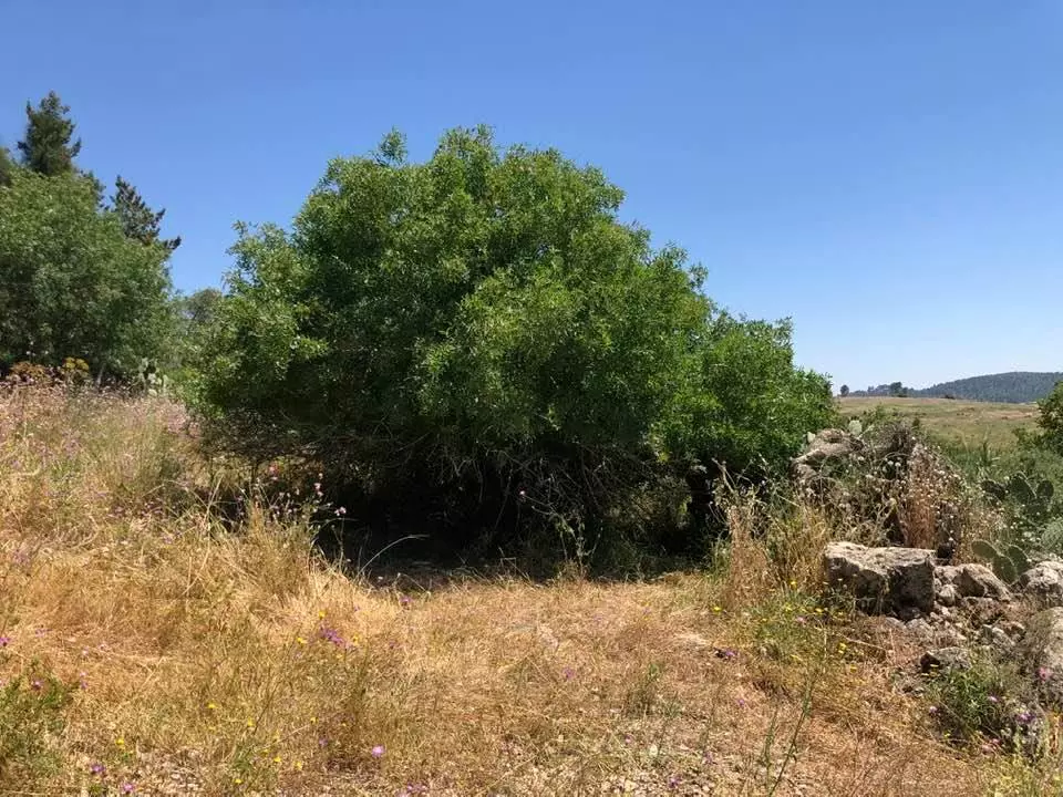
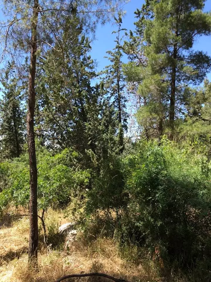
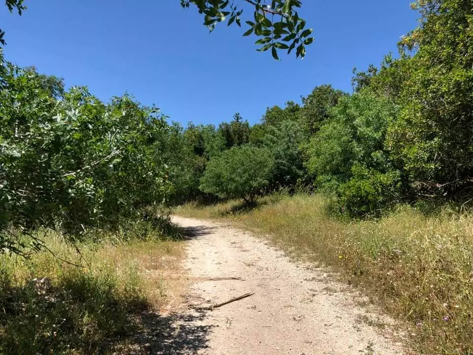
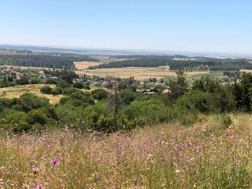
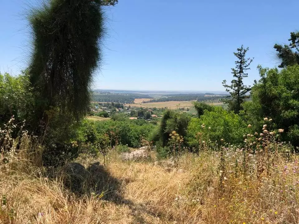
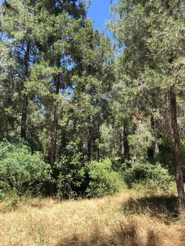
Village Before NakbaThe village stood on a hilltop on the southern slopes of a mountainous area, overlooking a wide area to the west and south. Two wadis flowed down the slopes and met below the village. Bayt Susin was close to a network of roads leading to several urban centers, and was linked by a secondary road to the Jerusalem-Jaffa highway. The Crusaders called it Bezezin. In 1596, Bayt Susin was a village in the nahiya of Ramla (liwa' of Gaza) with a population of 308. It paid taxes on a number of crops, including wheat, barley, and olives. Taxes were also paid on other types of produce and property, such as goats and beehives. In 1852 Edward Robinson passed through the village; he described it as small and ancient.Bayt Susin was classified as a hamlet in the Palestine Index Gazetteer, and was divided into two sections; the larger section had a rectangular, north-south plan, and the other section lay 250 m to the southwest. The houses were made of masonry. A mosque, in which the predominantly Muslim population worshipped, was located near the smaller section of the village. Water for domestic use was obtained from a spring (probably the same spring that Robinson saw was in use when he visited the village in 1852 ). Animal husbandry and agriculture constituted the backbone of the village economy; grain was the chief crop. In 1943, olive trees were planted on 2 dunums, and in 1944/45 a total of 5,108 dunums was planted in cereals; 94 dunums were irrigated or used for orchards. Several khirbas near Bayt Susin contained the ruins of a wall, house foundations, cut stones, rock-hewn cisterns, caves, a basin, and burial grounds. (See also Bayt Jiz, Ramla sub-district.) Village Occupation and Ethnic CleaningAccording to Israeli historian Benny Morris, the village was occupied and depopulated in the wake of Operation Nachshon (see Bayt Naqquba, Jerusalem sub-disctrict) on 20 April 1948, in the course of a series of operations in the Jerusalem corridor. But other sources disagree. Palestinian historian 'Arif al-'Arif writes that an attempt to take the village was made on 22-23 May, and that the attack failed in part because the attackers thought that the village had been evacuated and were surprised to encounter strong resistance from its residents. AI-'Arif claims that Bayt Susin was occupied around a week later, on either 28 or 30 May, during one of the offensives launched to capture al-Latrun. The History of the War of Independence confirms this account, indicating that Bayt Susin and the neighboring Bayt Jiz were captured between 16 and 30 May by units of the Sheva' (Seventh) Brigade. The Israeli army announced the capture of the two villages on 28 May, according to the New York Times. The announcement stated that their units swept south of the Jerusalem-Jaffa highway in a flanking maneuver. With both villages under Israeli control, an alternative supply line was established linking Jewish forces in Jerusalem with the coast. By opening a road from Bayt Susin to Jerusalem, Israeli forces were able to bypass the town of al-Latrun and the strategic al-Latrun salient. It is not clear when the village was destroyed, but most villages captured in the Jerusalem corridor at this time were levelled soon after their capture.Zionists Colonies on Village LandsMoshav Ta'oz (147134) was established in 1950, southeast of the village site, on village lands.Village TodayThe site has been levelled by bulldozers; grass and thorns cover the remaining rubble. Traces of a fig tree are visible at the site's center, and the remains of walls from houses can be seen on the southern edge, where carob, pine, and cedar trees grow. There are cactuses and bushes on the northwestern edge. The entire area to the north and east of the site is wooded (see photos).SourceDr. Walid al-Khalidi, 1992: All That Remains. |
|||||||||||||||
| Related Maps | Town Lands' Demarcation Maps خرائط للقضاء توضح حدود القرى والاودية Town's map on MapQuest View from satellite Help us map this town at WikiMapia |
||||||||||||||
| Related Links | Wikipedia's Page Google Search Google For Images Google For Videos |
||||||||||||||
| More Information | في كتاب كي لا ننسى في كتاب بلادنا فلسطين المزيد من موقع هوية |
||||||||||||||
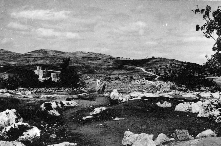
- Villaeg Rubble In 1990
Scanned from "All That Remains" by Dr. Walid Khalidi - Villaeg Site In 1990
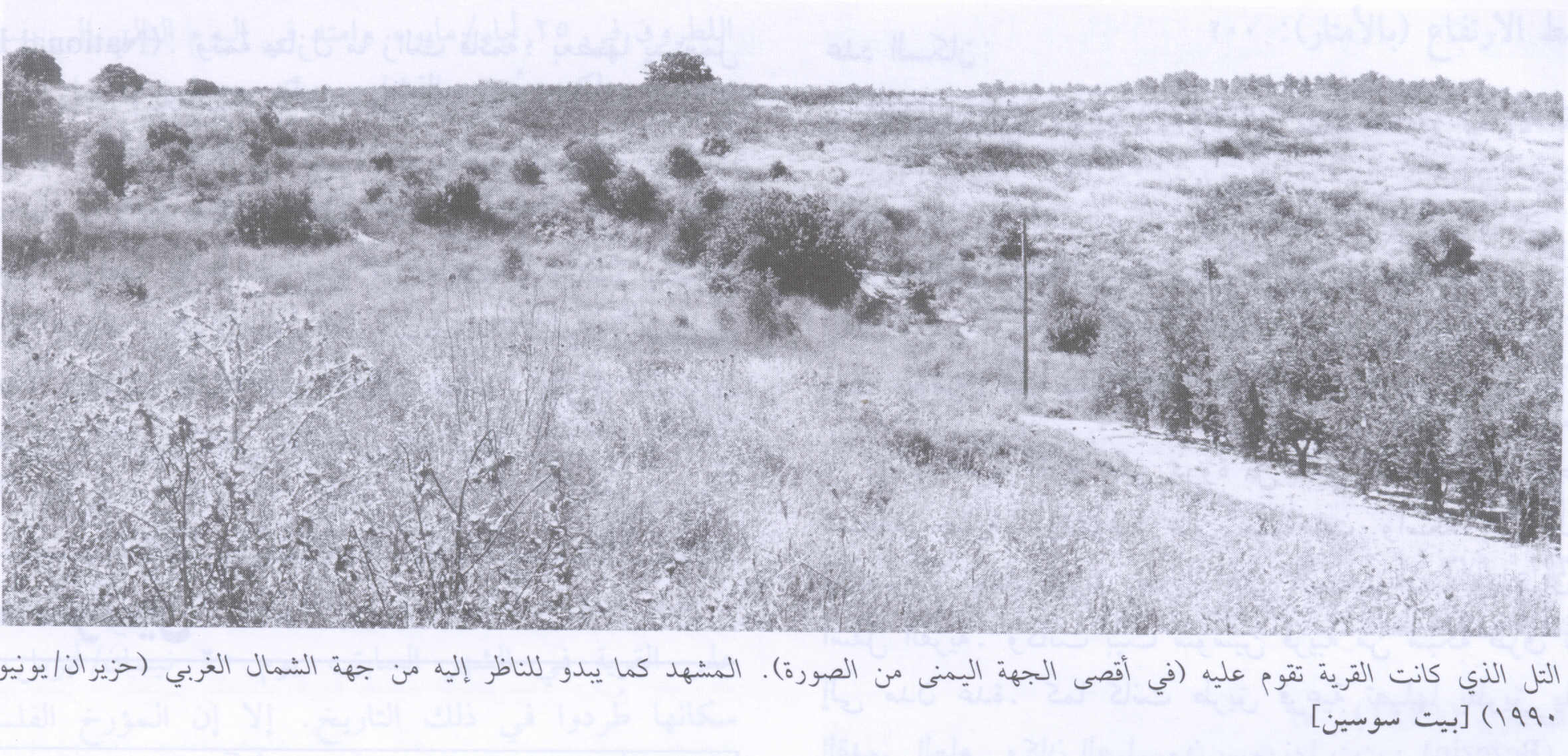
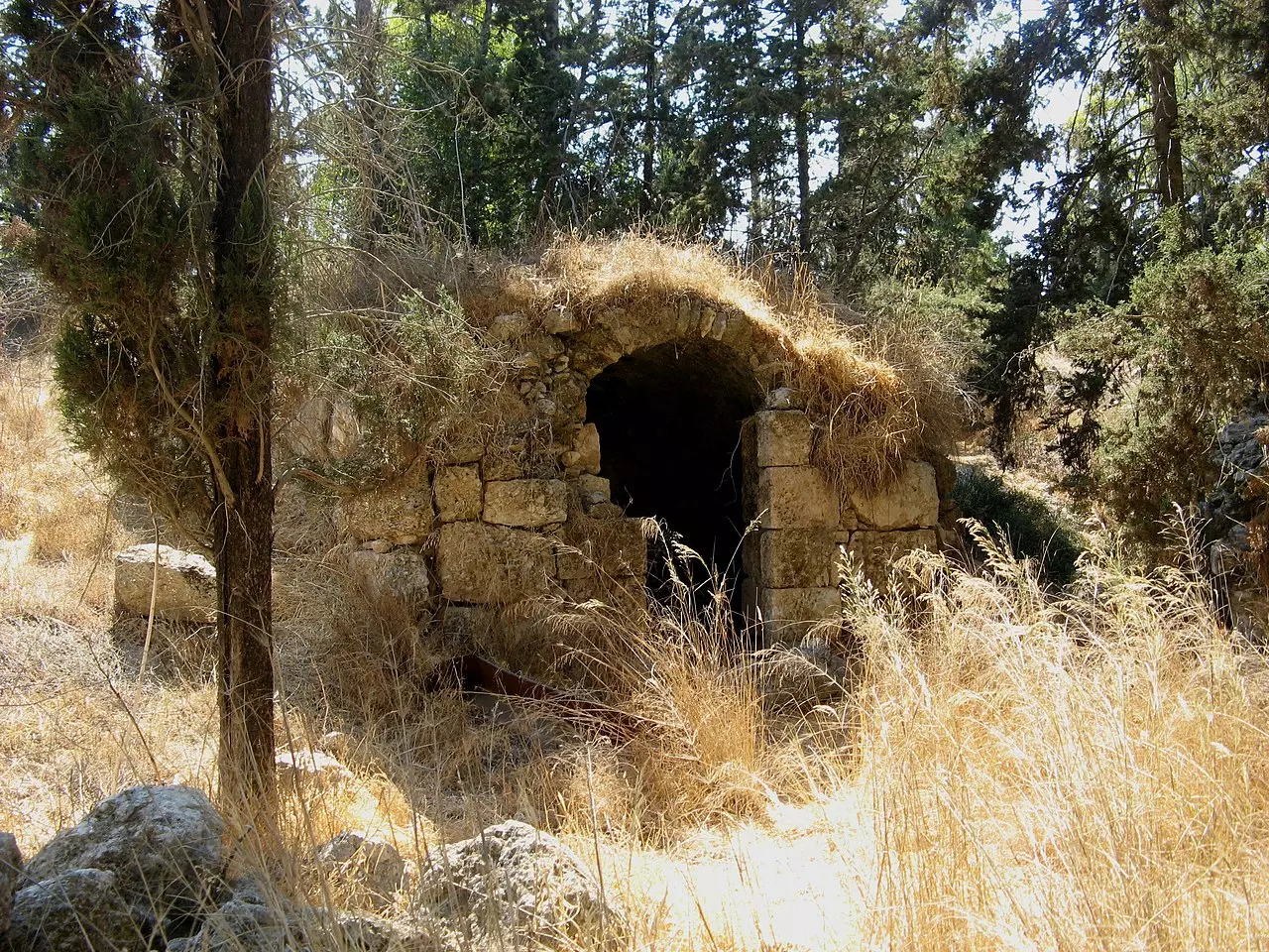
Scanned from "All That Remains" by Dr. Walid Khalidi - Ruins of the Palestinian village, and the exclusive Jewish colony in the background
Posted by Noga Kadman - بقايا ردم بيوت بيت سوسين
Posted by abu raya - اثار بيوت بيت سوسين
Posted by abu raya - بيت سوسين
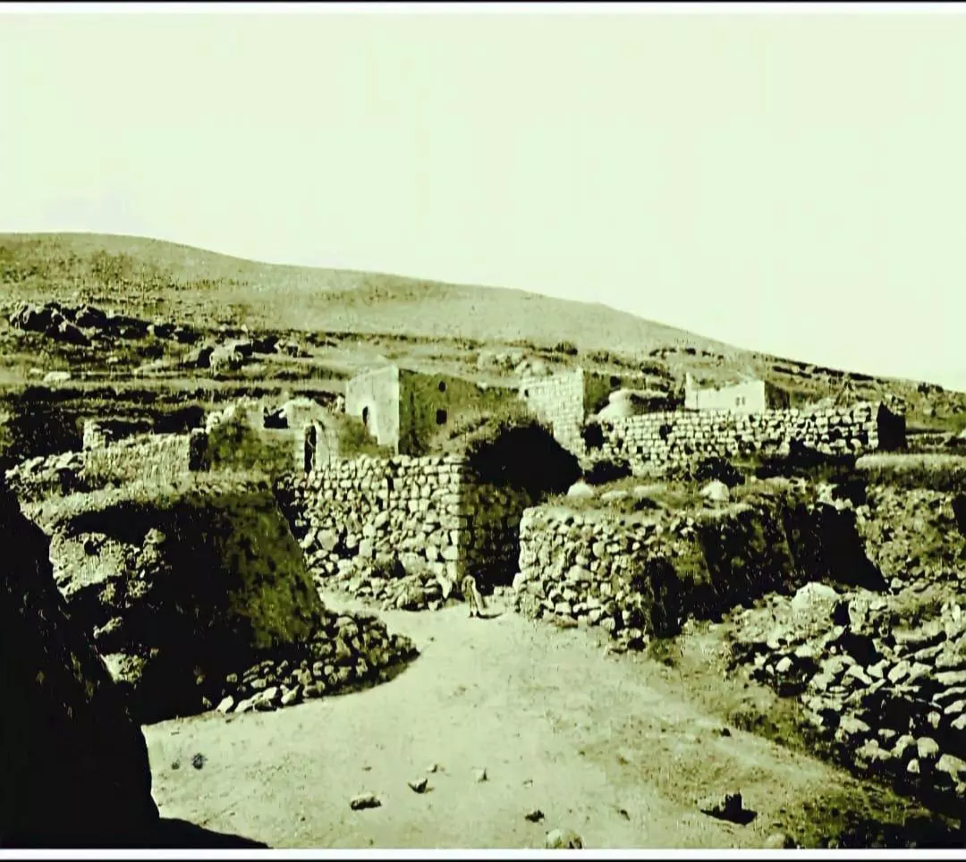
Posted by abu raya - صورة نادرة وساحرة لقرية بيت سوسين قضاء الرملة ثلاثينيات القرن العشرين..
- Let us see how the most "liberal and civilized" of world Jewry has obliterated our village. How else will the Jews be great and safe again?
- Let us see how the most "liberal and civilized" of world Jewry has obliterated our village. How else will the Jews be great and safe again? #2
- Let us see how the most "liberal and civilized" of world Jewry has obliterated our village. How else will the Jews be great and safe again? #3
- Let us see how the most "liberal and civilized" of world Jewry has obliterated our village. How else will the Jews be great and safe again? #4
- Let us see how the most "liberal and civilized" of world Jewry has obliterated our village. How else will the Jews be great and safe again? #5
- Let us see how the most "liberal and civilized" of world Jewry has obliterated our village. How else will the Jews be great and safe again? #6
- Let us see how the most "liberal and civilized" of world Jewry has obliterated our village. How else will the Jews be great and safe again? #7
- Let us see how the most "liberal and civilized" of world Jewry has obliterated our village. How else will the Jews be great and safe again? #8
- Let us see how the most "liberal and civilized" of world Jewry has obliterated our village. How else will the Jews be great and safe again? #9
- Let us see how the most "liberal and civilized" of world Jewry has obliterated our village. How else will the Jews be great and safe again? #10
- Let us see how the most "liberal and civilized" of world Jewry has obliterated our village. How else will the Jews be great and safe again? #11
- Let us see how the most "liberal and civilized" of world Jewry has obliterated our village. How else will the Jews be great and safe again? #12
- Let us see how the most "liberal and civilized" of world Jewry has obliterated our village. How else will the Jews be great and safe again? #13
- Let us see how the most "liberal and civilized" of world Jewry has obliterated our village. How else will the Jews be great and safe again? #14
- Let us see how the most "liberal and civilized" of world Jewry has obliterated our village. How else will the Jews be great and safe again? #15
- Let us see how the most "liberal and civilized" of world Jewry has obliterated our village. How else will the Jews be great and safe again? #16
- Let us see how the most "liberal and civilized" of world Jewry has obliterated our village. How else will the Jews be great and safe again? #17
- Let us see how the most "liberal and civilized" of world Jewry has obliterated our village. How else will the Jews be great and safe again? #18
- View of Bayt Susin from Bayt Jiz, 1948
- Orchard in Bayt Susin after occupation, 1948

Want to browse more? 80,000 pictures were grouped in these gallaries:
| Display Name | Clan/Hamolah | Country of Residence |
| Mustafa Mohd Mustafa | Hamad | Eatern, KSA |
| Mahmmoud M.Hamad | Hamad - حـمــد | palestain, Palestain |
| Osama Odeh | hama'd | Jordan |
No links have been shared yet, be free to the first to share the first link.
 Fake Valor: Why Did Zionist Jews Hoist Nazis Flag on Their Ships in the 1930s?
What is new?
-
Facts About Oct. 7th Gaza Raid
-
Remined Us Please:: Who Did Rape Who? Palestinians Raped Israelis? Or, was the other way around?
-
When Prof. Edward Said was invited to debate Bibi Netanyahu in the 1980s, watch what happened!
-
Ezra Klein of the NY Times on the "Jewish Race".
-
Abusing Blood Libel!
-
Did Israeli Soldiers Activate The Hanniba Direective On Oct. 7th? You Be The Judge
-
Zionist FAQ: Isn't it true that Palestinians don't want peace? Palestinians never accepted the two-state solution
- Facts about Haavara (Transfer) Agreement between Ben-Gurion & Hitler
-
Haavara FAQs: Why Did Zionist Jews Hoist Nazis' Flags on Their Ships in the 1930s?
- Haavara FAQs: When Chaim Weizmann met FDR in mid-1943, why was he silent about rescuing European Jewry?
-
Dear ChatGPT: How did Palestinians resist Napoleon's invasion of their country in 1799?
-
Dear ChatGPT: Gaza had a vibrant Jewish community in the mid-17th century. What happened to them?
-
Dear ChatGPT: Why did the Jewish Agency suppress news of the Holocaust during WWII?
-
Video Playlist: Jews share their DNA tests to end the conflict for good.
-
A Tale of Two Conflicts: Examining the Definition of Genocide
-
Prof. Abraham Polak And The Suppressed History of the Khazars and European Jewry
-
How Ronald Reagan would have framed the genocide in Gaza if he were still alive?
-
Haavara FAQs: Let us do the math: how many German Jews did The Haavara Agreement save?
-
Zionist FAQs: The Hebron Massacre of 1929, "clearly proves" that Palestinians are antisemitic, how could you deny it?
-
Zionist FAQs: Why Anti-Zionist Is Not Antisemitism?
-
Zionist FAQs: Isn't it true that the KGB created Palestinian Nationalism in the early 1960s?
- Zionist FAQs: Muslims are killing Muslims all the time; why are Israeli Jews being singled out in the media?
- Zionist FAQs: How is Israel an apartheid state when 20% of its citizens are Arabs who enjoy full rights?
-
Haavara FAQs: Why Did Dorothy Thompson Flip From A Zionist Advocate to A Silenced Dissenter?
-
Haavara FAQs: Analysis of Herzl's Uganda Scheme and how it could have saved millions of Jews.
-
Haavara FAQs: Why did Hayim Greenberg describe American Jewry as "morally bankrupt" in early 1943?
-
Haavara FAQs: What if the Evian Conference was a resounding success? What would have been the impact of saving European Jewry on Zionism?
- Haavara FAQs: What if the six million were saved, how that would have impacted the Zionist project?
-
Haavara FAQs: How did Zionist leaders react when Europe's Jews lingered in the DP camps after WWII ended?
-
Why does the American Jewish community repeat lies that David Ben-Gurion had debunked before he died?
-
Who has the power to rename the Tatar/Khazar Gene Marker to Jewish IV?
-
Zionist FAQs: Why won't Egypt, Syria, and Jordan take their people back? Jews are indigenous to Palestine, and Arabs immigrated after Jews developed the country. Arabs should leave.
-
Haavara FAQs: Did Hitler and the Nazis conflate between Judaism and Zionist? If that wasn't case, then why?
-
Haavara FAQs: Winston Churchill and antisemitism, a collection of articles written Churchill.
-
Haavara FAQs: Broken by country, how many Jews survived vs. killed during the Holocaust?
-
Haavara FAQs: Why did European Jews vote with their feet and to immigrated to the Americas, not Palestine, after WWII?
-
Watch this American Jewish Girl describing Israeli Jews' cognitive dissonance like no other in under two minutes
-
Haavara FAQs: When the Nazis went out of their way to hide the Holocaust, Israeli Jews did the exact opposite by broadcasting their genocide of Gazans. But why?
-
Haavara FAQs: How Zionist Jews went out of their to show their appreciation to Nazism and Fascism?
- Haavara FAQs: Why Zionist leaders were against bombing the death camps & the Railroads leading to them?
-
Haavara FAQs: Hitler's message to the British and American people: If Jews are such noble citizens and you care about them, how come you're not letting them in? I will gladly ship them to you at my expense, even on luxury liners!
-
A shortlist of Zionist and Israeli false flag operations in the name Jews.
-
The Most Moral Army
- The Land of Kapos (Israel): Where the brave are boycotted and Kapos walk free.
- Why did early Zionists often named their communal enterprises "colonial"?
- Zionist Relations with Nazi Germany by Faris Glubb
-
Two NY Times advertisements by Zionists in the early 1943 that exposes Zionists' treason at the height of the calamity
- Facts Not Lies about the Palestinian-Israeli Conflict.
- Site's pictures have been categorized
- Campgain Against Lice
- A Survey of Palestine, the official source about Palestine before Nakba produced by the British Mandate; over 1200 pages.
- Satellite View & Google Earth: Over 6,000 placemarks identifying all destroyed towns, W. Bank & Gaza Strip Towns, & refugee camps.
- PalestineRemembered.com and its Nakba Oral History Project were featured on al-Jazeera Satellite TV.
- Nakba Oral History Video Podcast:
 Over 700 Oral History interviews (including 3,500+ hours of recording) can be viewed online.
 - Palestine Village Statistics Project
- Gaza Jail Break
- النسخة العربية للموقع الان متوفرة
- Videos: Documenting the destroyed villages in video: Tracing all that remains since Nakba.
- Videos: Responding to Zionist Propaganda
- Interview: The ethnic cleansing of Palestine: George Galloway interviews Israeli Historian Ilan Pappe.
- For Palestinians, memory matters. It provides a blueprint for their future By George Bisharat.
- Zionist FAQ now available in Hebrew שאלות שציונים שואלים, עכשיו בעברית
- Video: The Stephen Walt and John Mearsheimer report on the influence of the Israel Lobby on U.S. Foreign Policy
- The Palestinian-Israeli conflict for beginners
