| PalestineRemembered | About Us | Oral History | العربية | |
| Pictures | Zionist FAQs | Haavara | Maps | |
| Search |
| Camps |
| Districts |
| Acre |
| Baysan |
| Beersheba |
| Bethlehem |
| Gaza |
| Haifa |
| Hebron |
| Jaffa |
| Jericho |
| Jerusalem |
| Jinin |
| Nablus |
| Nazareth |
| Ramallah |
| al-Ramla |
| Safad |
| Tiberias |
| Tulkarm |
| Donate |
| Contact |
| Profile |
| Videos |
Welcome To Bayt Far, Khirbat - خربة بيت فار (ח'ירבת בית פאר)
|
District of al-Ramla
Ethnically cleansed days ago |
العربية Google Earth |
 |
Gallery (12) |
- Statistics & Facts
-
Before & After

- Satellite View
- Articles 1
- Pictures 12
- Land Deeds 2
- Members 2
- All That Remains
- Wikipedia
- Videos
- Guest Book 3
- Links
| Statistic & Fact | Value | ||||||||||||
| Occupation Date | April 7, 1948 | ||||||||||||
| Distance From District | 14 (km) South of al-Ramla | ||||||||||||
| Elevation | 125 (meters) | ||||||||||||
| Before & After Nakba, Click Map For Details |
|||||||||||||
|
|||||||||||||
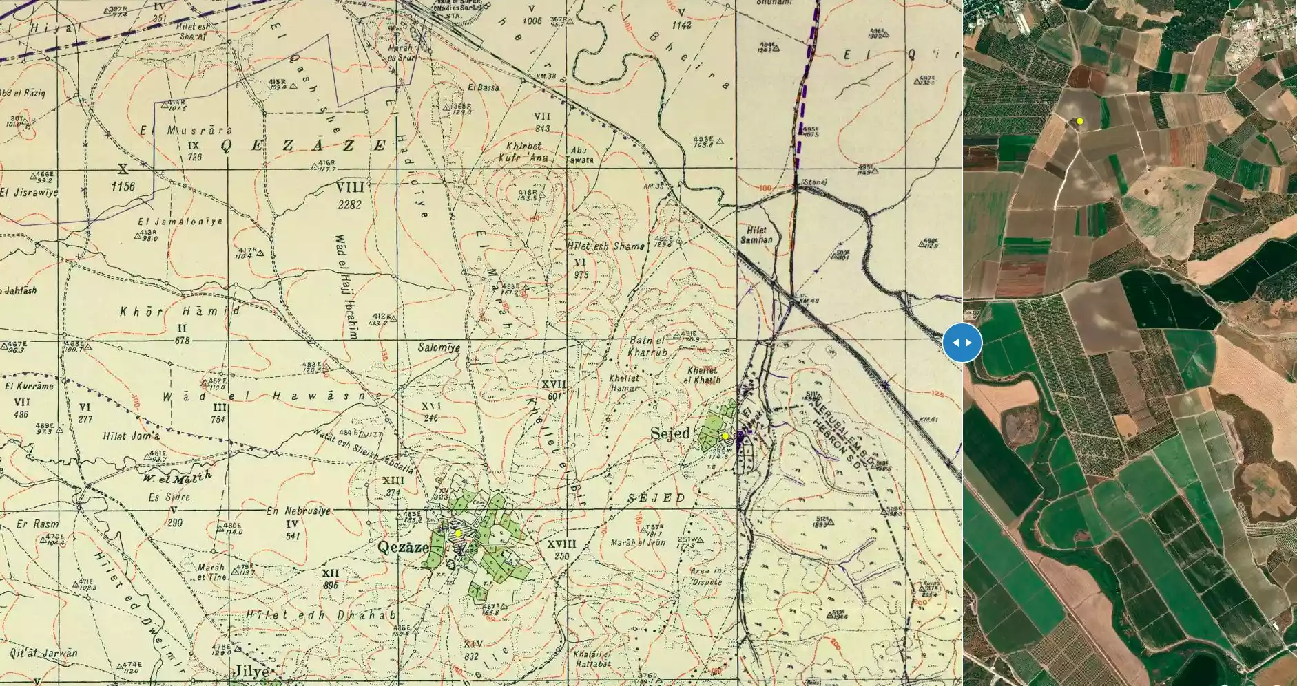
| Map Location | See location #52 on the map View from satellite |
||||||||||||
| Military Operation | Possibly Operation Nachshon or Yoram | ||||||||||||
| Exodus Cause | Military assault by Zionist troops | ||||||||||||
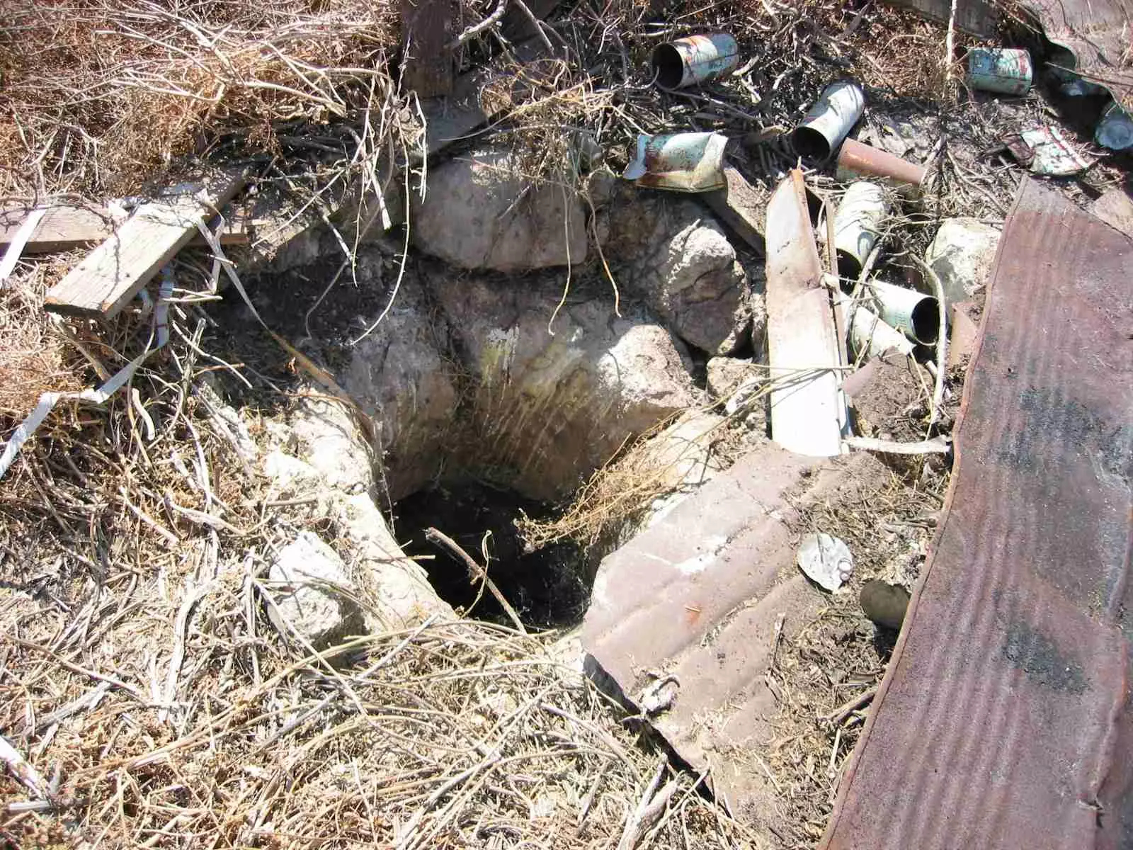
| Village Temains | Khirbat Bayt Far was completely obliterated, and only house rubble left behind. | ||||||||||||
| Ethnically Cleansing | Bayt Far, Khirbat inhabitants were completely ethnically cleansed. | ||||||||||||
| Pre-Nakba Land Ownership |
**Town Lands' Demarcation Maps |
||||||||||||
| Land Usage As of 1945 |
|
||||||||||||
| Population |
|
||||||||||||
| Number of Houses |
|
||||||||||||
| Near By Towns |
|||||||||||||
|
|||||||||||||
| Exculsive Jewish Colonies Who Usurped Village Lands |
Beyt Pe'er and Tal Shachar. | ||||||||||||
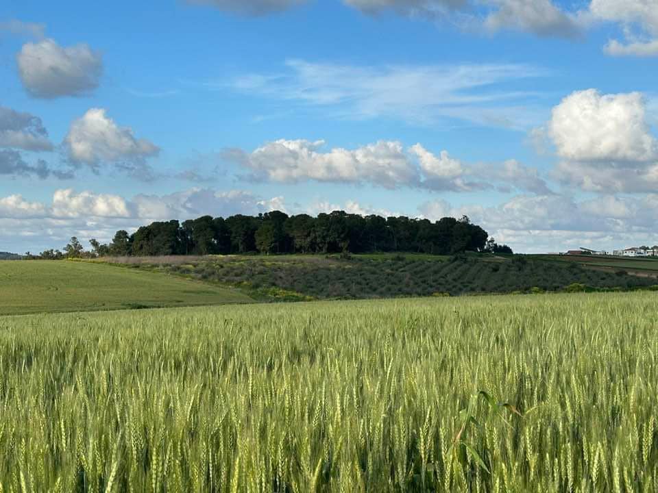
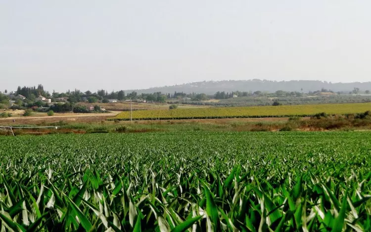
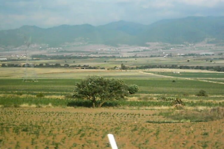
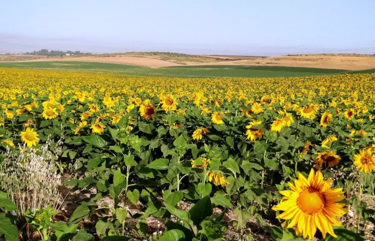
Village Before NakbaThe village stood on an elevated, flat spot at the eastern edge of the central coastal plain. It overlooked a broad hilly area that was bounded on the north and south by two tributaries of Wadi al-Sarar that passed the village some 1.5 km to the southwest. A secondary road of about 1.5 km linked the village to a highway that connected Gaza with the Ramla-Jerusalem highway. Both Edward Robinson, an American biblical scholar who traveled in Palestine in the nineteenth century, and the surveyors who carried out research for the Survey of Western Palestine in the 1870s, describe the site during their visits as an abandoned village with modern walls and foundations. Khirbat Bayt Far was laid out in a circular pattern. Its houses were built of cement and mud, clustered together and separated by narrow alleys. Its entire population was Muslim. The majority of villagers worked in animal husbandry and rainfed agriculture, cultivating vegetables and fruits and using parts of their lands as pastures. In 1944/45 a total of 5,337 dunums was allocated to cereals; 19 dunums were irrigated or used for orchards. A khirba that carried the village's name lay next to it, which suggests that the site had a long history of habitation.Village Occupation and Ethnic CleaningIt is difficult to determine exactly when this village was first entered by Haganah forces. It may have been captured during Operation Nachshon, but more likely it was captured during Operation Makkabi.Zionists Colonies on Village LandsThe settlement of Beyt Pe'er was founded on village lands in 1948. Its name was later changed to Tal Shachar ('Dawn') (140134), which is a rough translation of the family name of Henry Morgenthau, an American supporter of the Zionist movement.Village TodayAll that is left of the village are debris and girders heaped together in a small area. The site is ringed by carob trees. The remains of an uprooted olive grove lie to the north and east.SourceDr. Walid al-Khalidi, 1992: All That Remains. |
|||||||||||||
| Related Maps | Town Lands' Demarcation Maps خرائط للقضاء توضح حدود القرى والاودية Town's map on MapQuest View from satellite Help us map this town at WikiMapia |
||||||||||||
| Related Links | Wikipedia's Page Google Search Google For Images Google For Videos |
||||||||||||
| More Information | في كتاب كي لا ننسى في كتاب بلادنا فلسطين المزيد من موقع هوية |
||||||||||||
- A water hole is the only remain of the place that was ruined by the Zionists, it can be found near the top of the hill.
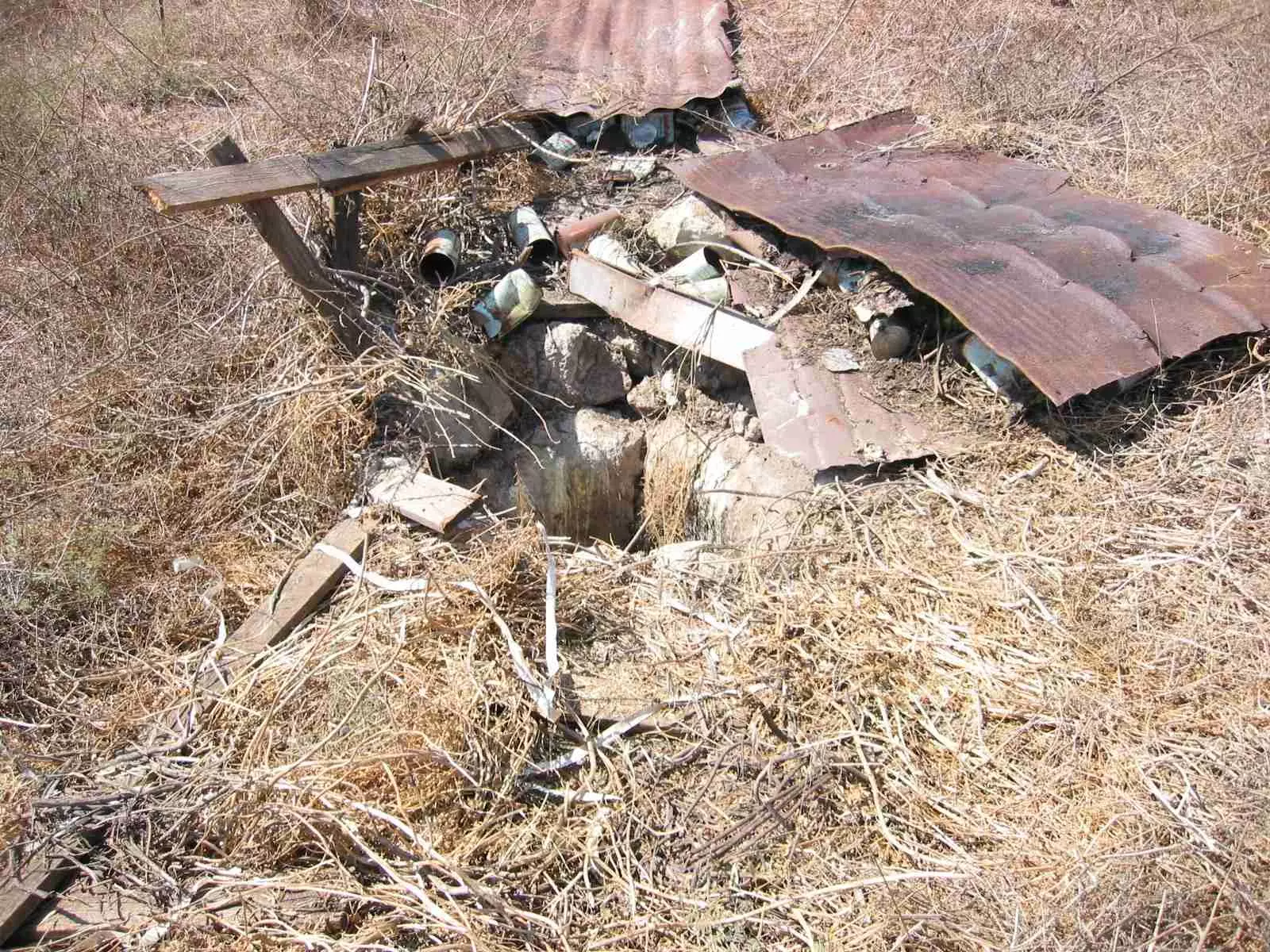
Posted by Hanoch Frankovits - A water hole is the only remain of the place that was ruined by the Zionists, it can be found near the top of the hill.
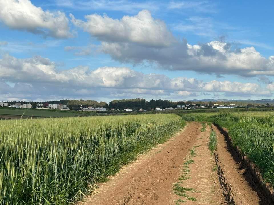
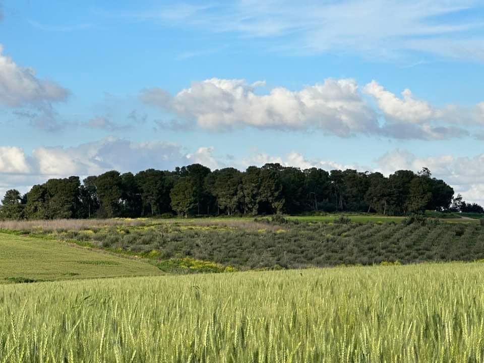
Posted by Hanoch Frankovits - اراضي القريه
Posted by abu raya - اراضي القريه
Posted by abu raya - اراضي القريه
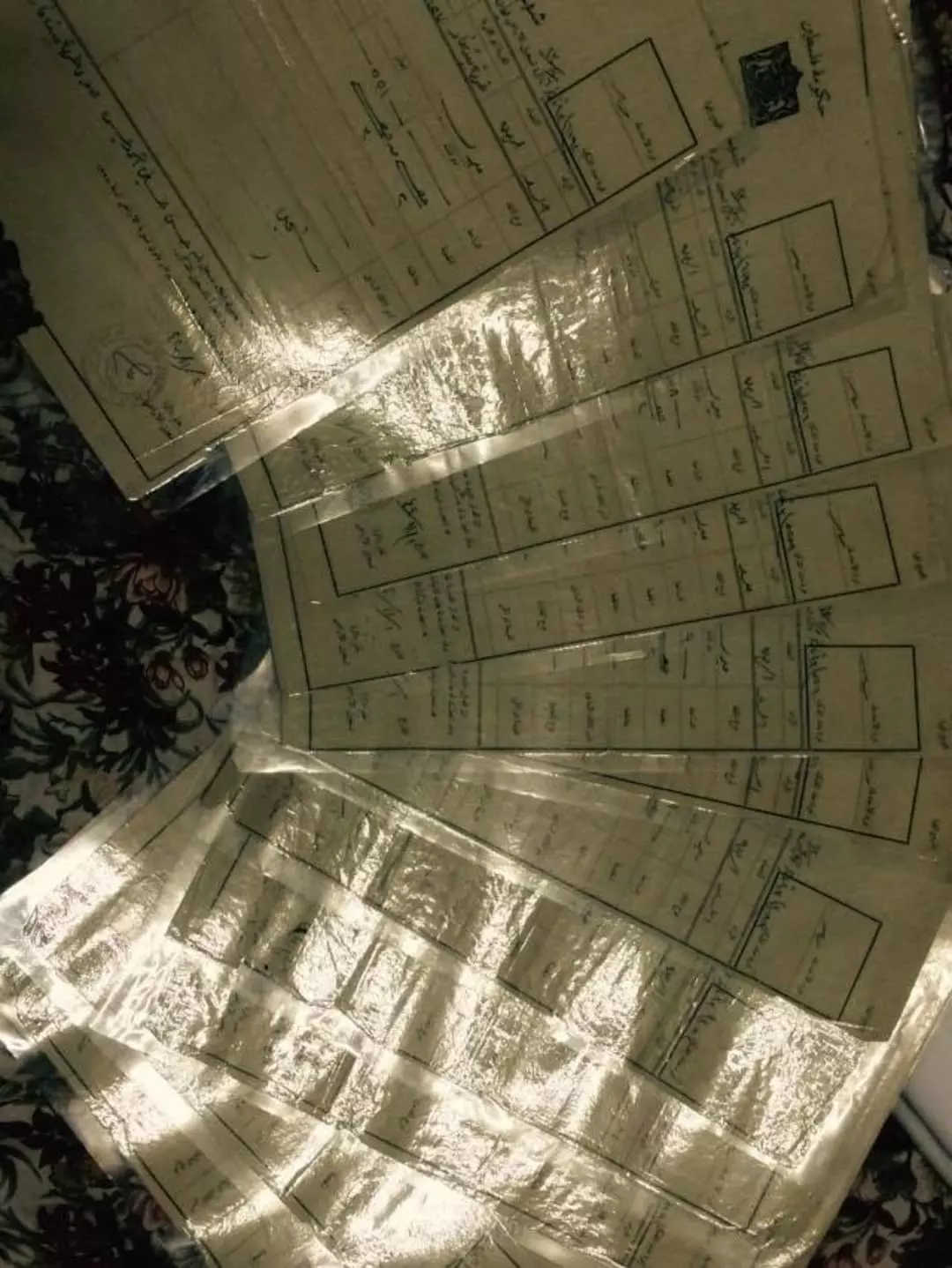
Posted by abu raya - كواشين الارض تعود ل آل عيسى
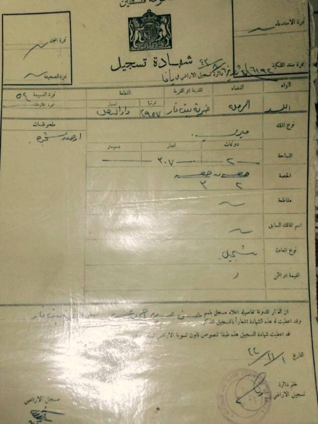
- كواشين الارض تعود ل آل عيسى #2
- That is how the "civilized" erased and replaced us: Beit Far was completely obliterated, as you see -- بيت فار باتت أثر بعد عين. من هنا مر الهمجّ
- That is how the "civilized" erased and replaced us: Beit Far was completely obliterated, as you see -- بيت فار باتت أثر بعد عين. من هنا مر الهمجّ
#2
- That is how the "civilized" erased and replaced us: Beit Far was completely obliterated, as you see -- بيت فار باتت أثر بعد عين. من هنا مر الهمجّ
#3
- That is how the "civilized" erased and replaced us: Beit Far was completely obliterated, as you see -- بيت فار باتت أثر بعد عين. من هنا مر الهمجّ
#4

- That is how the "civilized" erased and replaced us: Beit Far was completely obliterated, as you see -- بيت فار باتت أثر بعد عين. من هنا مر الهمجّ
#5

Want to browse more? 80,000 pictures were grouped in these gallaries:
| Display Name | Clan/Hamolah | Country of Residence |
| رامي | هماش - HammasH | - الخبر -, K S A -AL KHOBAR |
| مالك اللحام | اللحام | القدس, فلسطين |
No links have been shared yet, be free to the first to share the first link.
 Fake Valor: Why Did Zionist Jews Hoist Nazis Flag on Their Ships in the 1930s?
What is new?
-
Facts About Oct. 7th Gaza Raid
-
Remined Us Please:: Who Did Rape Who? Palestinians Raped Israelis? Or, was the other way around?
-
When Prof. Edward Said was invited to debate Bibi Netanyahu in the 1980s, watch what happened!
-
Ezra Klein of the NY Times on the "Jewish Race".
-
Abusing Blood Libel!
-
Did Israeli Soldiers Activate The Hanniba Direective On Oct. 7th? You Be The Judge
-
Zionist FAQ: Isn't it true that Palestinians don't want peace? Palestinians never accepted the two-state solution
- Facts about Haavara (Transfer) Agreement between Ben-Gurion & Hitler
-
Haavara FAQs: Why Did Zionist Jews Hoist Nazis' Flags on Their Ships in the 1930s?
- Haavara FAQs: When Chaim Weizmann met FDR in mid-1943, why was he silent about rescuing European Jewry?
-
Dear ChatGPT: How did Palestinians resist Napoleon's invasion of their country in 1799?
-
Dear ChatGPT: Gaza had a vibrant Jewish community in the mid-17th century. What happened to them?
-
Dear ChatGPT: Why did the Jewish Agency suppress news of the Holocaust during WWII?
-
Video Playlist: Jews share their DNA tests to end the conflict for good.
-
A Tale of Two Conflicts: Examining the Definition of Genocide
-
Prof. Abraham Polak And The Suppressed History of the Khazars and European Jewry
-
How Ronald Reagan would have framed the genocide in Gaza if he were still alive?
-
Haavara FAQs: Let us do the math: how many German Jews did The Haavara Agreement save?
-
Zionist FAQs: The Hebron Massacre of 1929, "clearly proves" that Palestinians are antisemitic, how could you deny it?
-
Zionist FAQs: Why Anti-Zionist Is Not Antisemitism?
-
Zionist FAQs: Isn't it true that the KGB created Palestinian Nationalism in the early 1960s?
- Zionist FAQs: Muslims are killing Muslims all the time; why are Israeli Jews being singled out in the media?
- Zionist FAQs: How is Israel an apartheid state when 20% of its citizens are Arabs who enjoy full rights?
-
Haavara FAQs: Why Did Dorothy Thompson Flip From A Zionist Advocate to A Silenced Dissenter?
-
Haavara FAQs: Analysis of Herzl's Uganda Scheme and how it could have saved millions of Jews.
-
Haavara FAQs: Why did Hayim Greenberg describe American Jewry as "morally bankrupt" in early 1943?
-
Haavara FAQs: What if the Evian Conference was a resounding success? What would have been the impact of saving European Jewry on Zionism?
- Haavara FAQs: What if the six million were saved, how that would have impacted the Zionist project?
-
Haavara FAQs: How did Zionist leaders react when Europe's Jews lingered in the DP camps after WWII ended?
-
Why does the American Jewish community repeat lies that David Ben-Gurion had debunked before he died?
-
Who has the power to rename the Tatar/Khazar Gene Marker to Jewish IV?
-
Zionist FAQs: Why won't Egypt, Syria, and Jordan take their people back? Jews are indigenous to Palestine, and Arabs immigrated after Jews developed the country. Arabs should leave.
-
Haavara FAQs: Did Hitler and the Nazis conflate between Judaism and Zionist? If that wasn't case, then why?
-
Haavara FAQs: Winston Churchill and antisemitism, a collection of articles written Churchill.
-
Haavara FAQs: Broken by country, how many Jews survived vs. killed during the Holocaust?
-
Haavara FAQs: Why did European Jews vote with their feet and to immigrated to the Americas, not Palestine, after WWII?
-
Watch this American Jewish Girl describing Israeli Jews' cognitive dissonance like no other in under two minutes
-
Haavara FAQs: When the Nazis went out of their way to hide the Holocaust, Israeli Jews did the exact opposite by broadcasting their genocide of Gazans. But why?
-
Haavara FAQs: How Zionist Jews went out of their to show their appreciation to Nazism and Fascism?
- Haavara FAQs: Why Zionist leaders were against bombing the death camps & the Railroads leading to them?
-
Haavara FAQs: Hitler's message to the British and American people: If Jews are such noble citizens and you care about them, how come you're not letting them in? I will gladly ship them to you at my expense, even on luxury liners!
-
A shortlist of Zionist and Israeli false flag operations in the name Jews.
-
The Most Moral Army
- The Land of Kapos (Israel): Where the brave are boycotted and Kapos walk free.
- Why did early Zionists often named their communal enterprises "colonial"?
- Zionist Relations with Nazi Germany by Faris Glubb
-
Two NY Times advertisements by Zionists in the early 1943 that exposes Zionists' treason at the height of the calamity
- Facts Not Lies about the Palestinian-Israeli Conflict.
- Site's pictures have been categorized
- Campgain Against Lice
- A Survey of Palestine, the official source about Palestine before Nakba produced by the British Mandate; over 1200 pages.
- Satellite View & Google Earth: Over 6,000 placemarks identifying all destroyed towns, W. Bank & Gaza Strip Towns, & refugee camps.
- PalestineRemembered.com and its Nakba Oral History Project were featured on al-Jazeera Satellite TV.
- Nakba Oral History Video Podcast:
 Over 700 Oral History interviews (including 3,500+ hours of recording) can be viewed online.
 - Palestine Village Statistics Project
- Gaza Jail Break
- النسخة العربية للموقع الان متوفرة
- Videos: Documenting the destroyed villages in video: Tracing all that remains since Nakba.
- Videos: Responding to Zionist Propaganda
- Interview: The ethnic cleansing of Palestine: George Galloway interviews Israeli Historian Ilan Pappe.
- For Palestinians, memory matters. It provides a blueprint for their future By George Bisharat.
- Zionist FAQ now available in Hebrew שאלות שציונים שואלים, עכשיו בעברית
- Video: The Stephen Walt and John Mearsheimer report on the influence of the Israel Lobby on U.S. Foreign Policy
- The Palestinian-Israeli conflict for beginners
