| PalestineRemembered | About Us | Oral History | العربية | |
| Pictures | Zionist FAQs | Haavara | Maps | |
| Search |
| Camps |
| Districts |
| Acre |
| Baysan |
| Beersheba |
| Bethlehem |
| Gaza |
| Haifa |
| Hebron |
| Jaffa |
| Jericho |
| Jerusalem |
| Jinin |
| Nablus |
| Nazareth |
| Ramallah |
| al-Ramla |
| Safad |
| Tiberias |
| Tulkarm |
| Donate |
| Contact |
| Profile |
| Videos |
Welcome To Bashshit - بشيت (בשית)
|
District of al-Ramla
Ethnically cleansed days ago |
العربية Google Earth |
 |
Gallery (30) |
- Statistics & Facts
-
Before & After

- Satellite View
- Articles 1
- Pictures 30
- Aerial Views 1
- Oral History 2
- Members 21
- All That Remains
- Wikipedia
- Videos 2
- Guest Book 8
- Links
| Statistic & Fact | Value | ||||||||||||||||
| Occupation Date | May 13, 1948 | ||||||||||||||||
| Distance From District | 16.5 (km) Southwest of al-Ramla | ||||||||||||||||
| Elevation | 50 (meters) | ||||||||||||||||
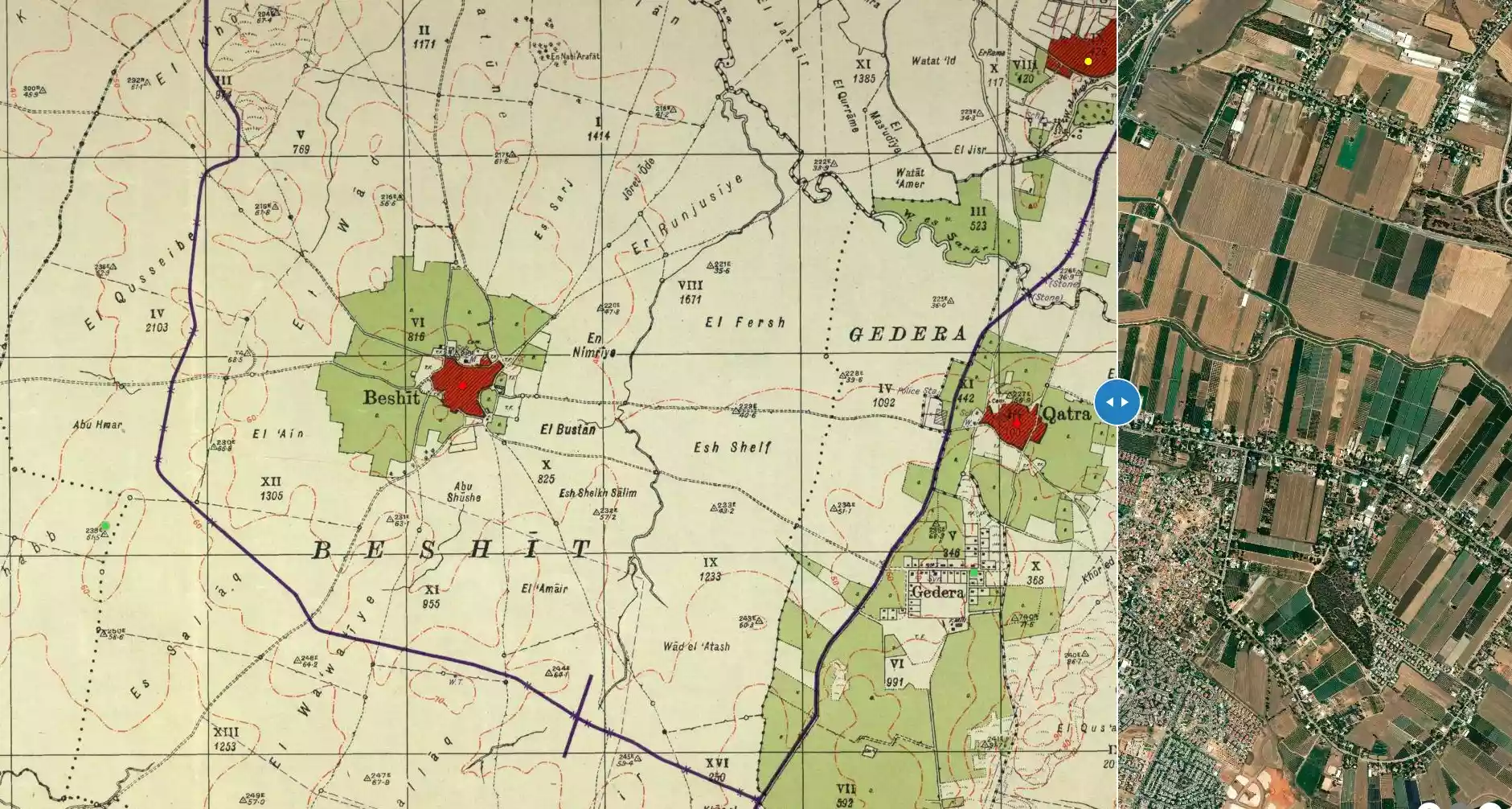
| Before & After Nakba, Click Map For Details |
|||||||||||||||||
|
|||||||||||||||||
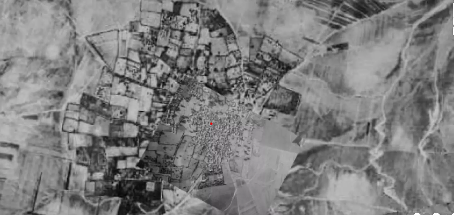
| Pre-Nakba Aerial View |
|||||||||||||||||
|
|||||||||||||||||
| Map Location | See location #41 on the map View from satellite |
||||||||||||||||
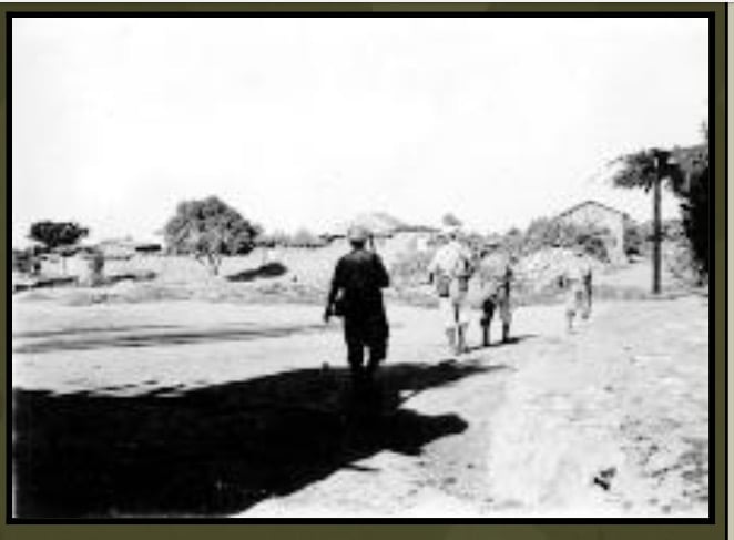
| Military Operation | Operation Barak (lightening) | ||||||||||||||||
| Attacking Units | Giva'ti brigade | ||||||||||||||||
| Exodus Cause | Military assault by Zionist troops | ||||||||||||||||
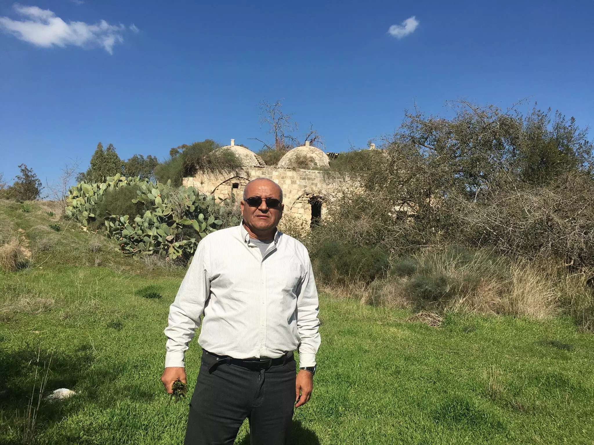
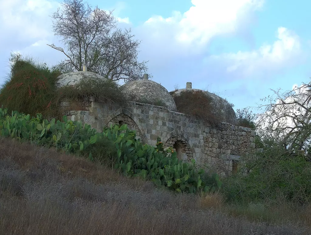
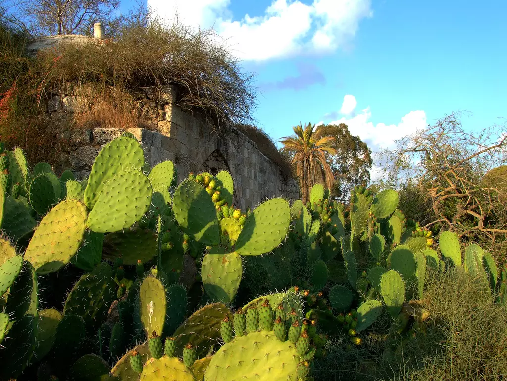
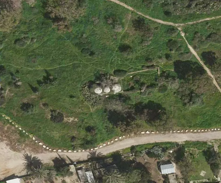
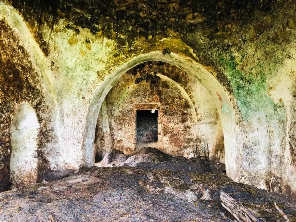
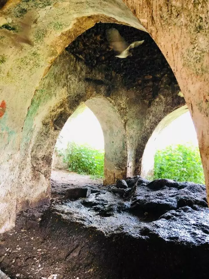
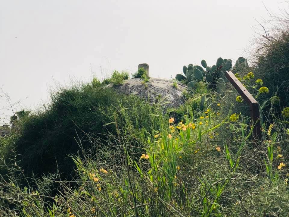
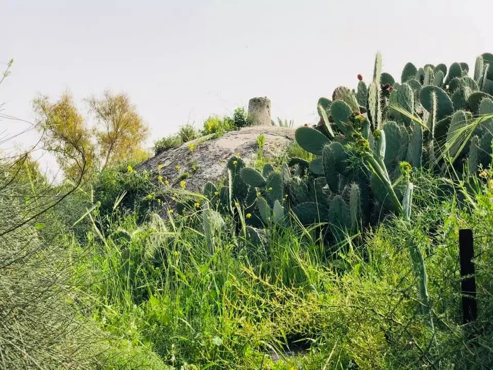
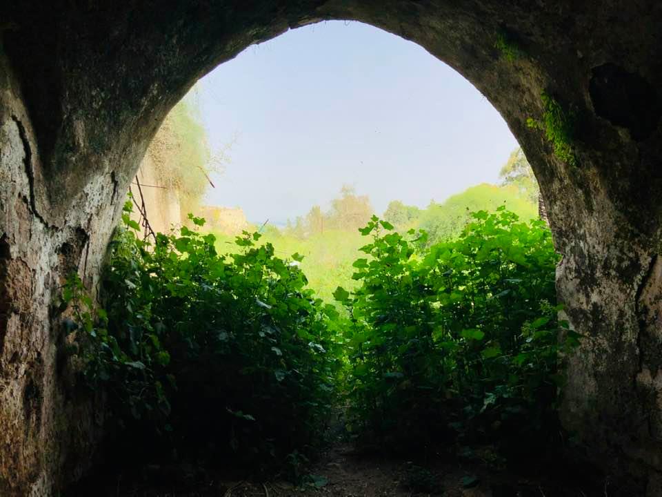
| Village Temains | Bashshit was mostly destroyed with the exception of few houses remain standing. | ||||||||||||||||
| Ethnically Cleansing | Bashshit inhabitants were completely ethnically cleansed. | ||||||||||||||||
| Pre-Nakba Land Ownership |
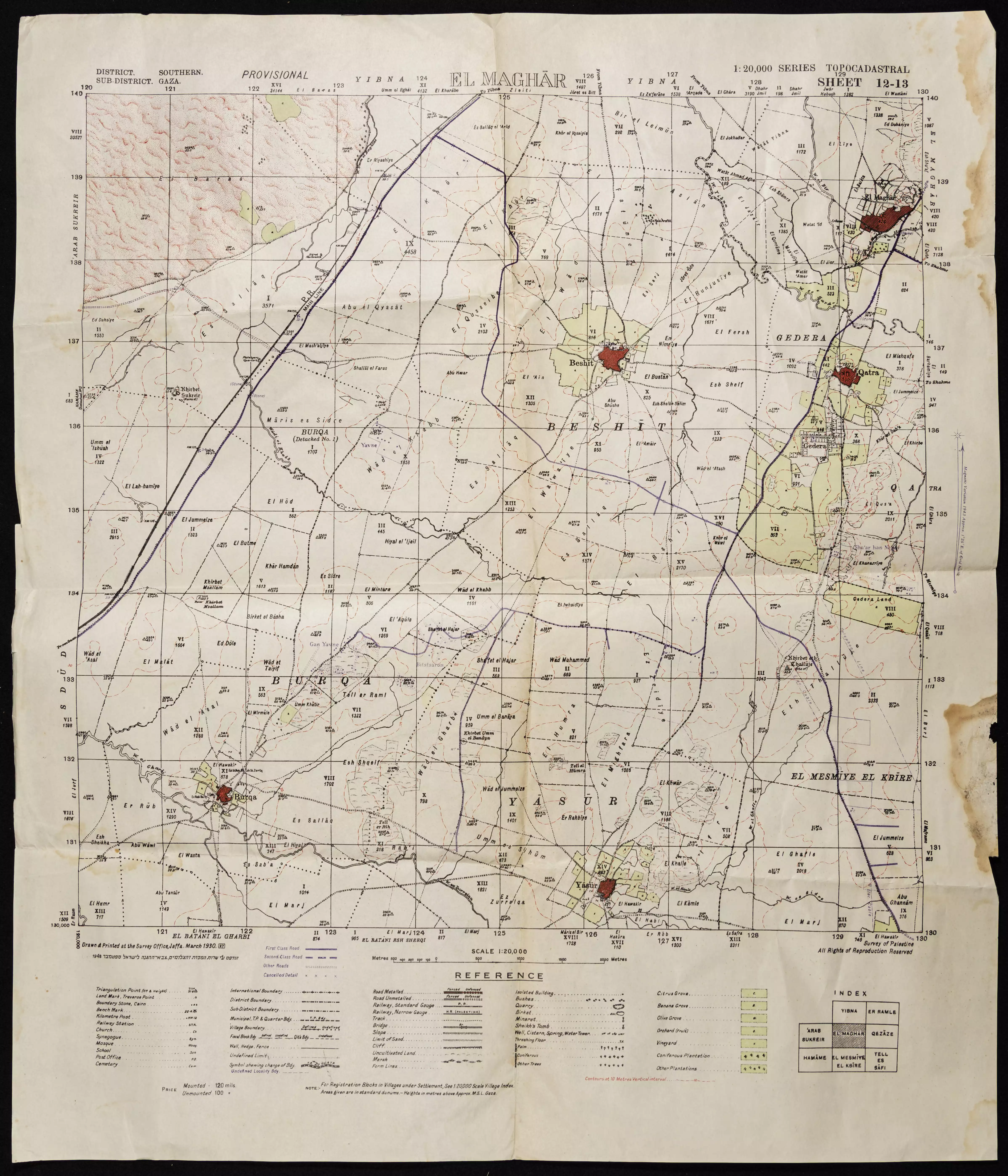
**Town Lands' Demarcation Maps |
||||||||||||||||
| Land Usage As of 1945 |
|
||||||||||||||||
| Population |
|
||||||||||||||||
| Number of Houses |
|
||||||||||||||||
| Near By Towns |
|||||||||||||||||
|
|||||||||||||||||
| Town's Name Through History | The Crusades referred to Bashshit by Basit. | ||||||||||||||||
| Schools | An elementary school for boys which was founded in 1921, and in 1945 it had an enrollment of 148 students. | ||||||||||||||||
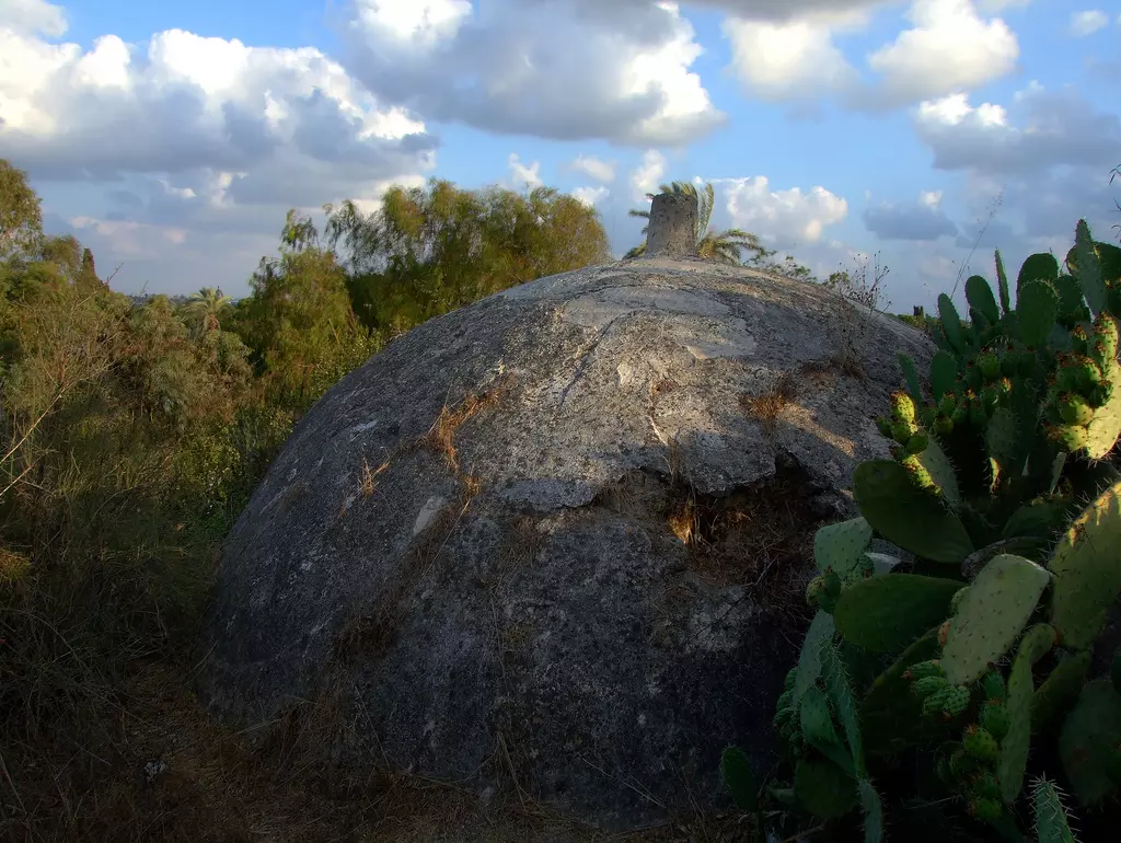
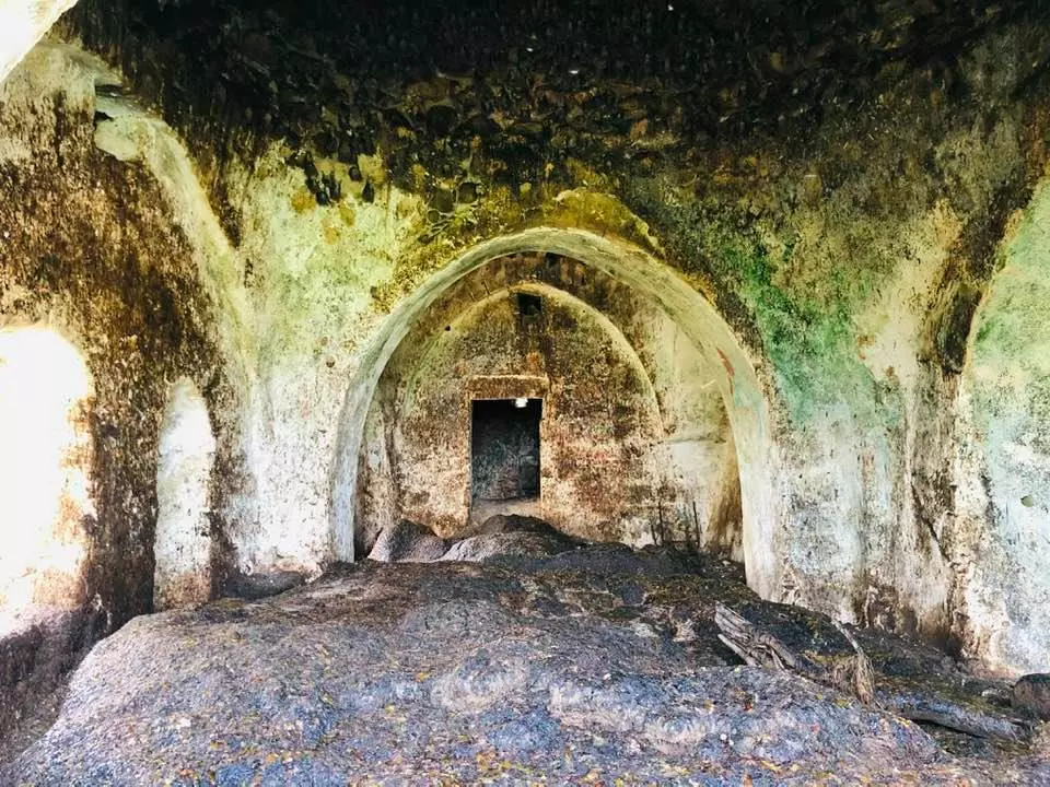
| Places of Warship | One mosque | ||||||||||||||||
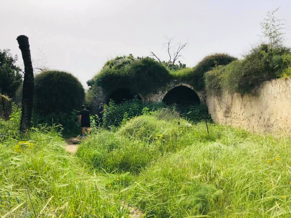
| Shrines / Maqams | One shrine for unknown individual | ||||||||||||||||
| Nearby Wadies & Rivers | Wadi Bashshit ran 1/2 km to the East. | ||||||||||||||||
| Archeological Sites | The village contains khirbat al-Nabi 'Ararat, which has pillars, cisterns, and pottery. | ||||||||||||||||
| Exculsive Jewish Colonies Who Usurped Village Lands |
Newe Mivtach, Meshar, Kefar Mordekhay, Misgav Dov, Kannot, Shedema, and 'Aseret. | ||||||||||||||||
| Featured Video | |||||||||||||||||
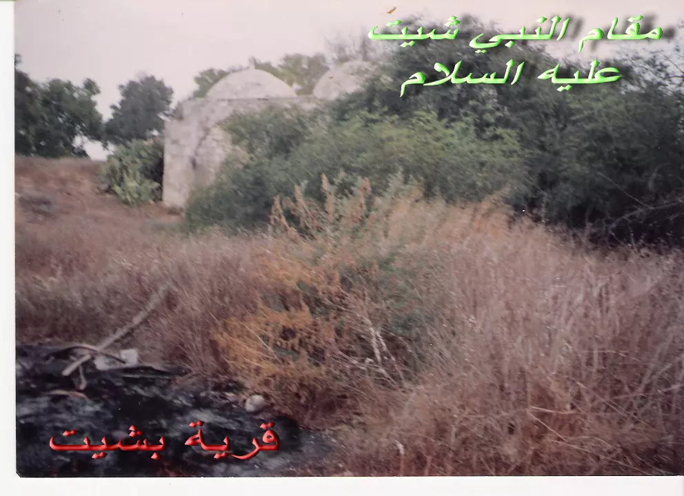
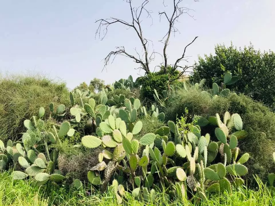
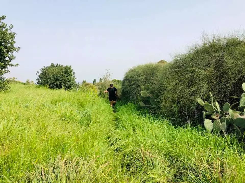
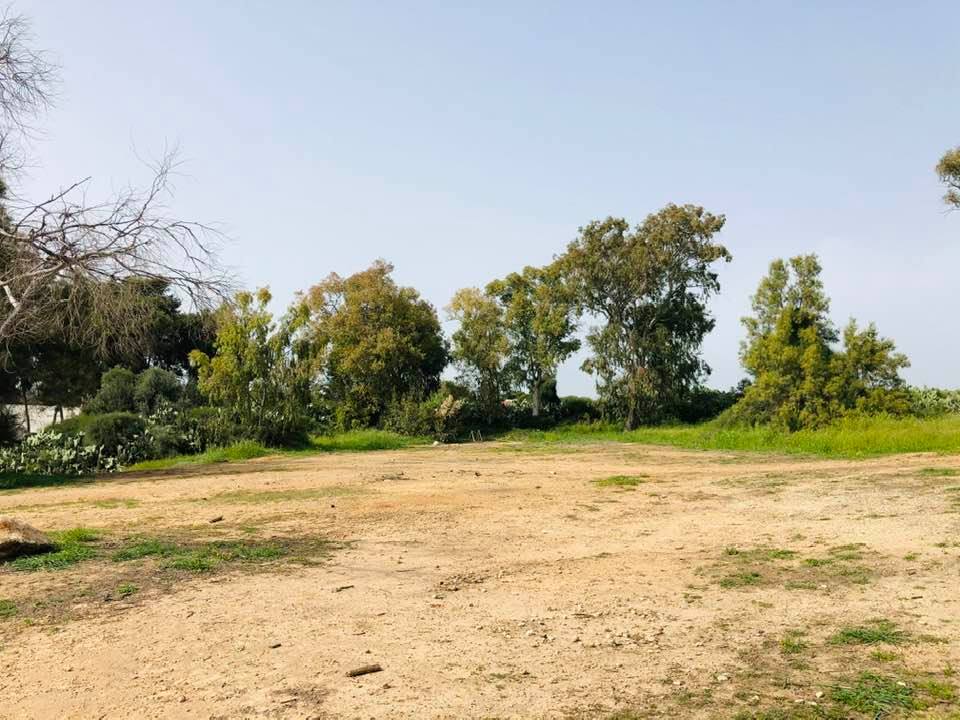
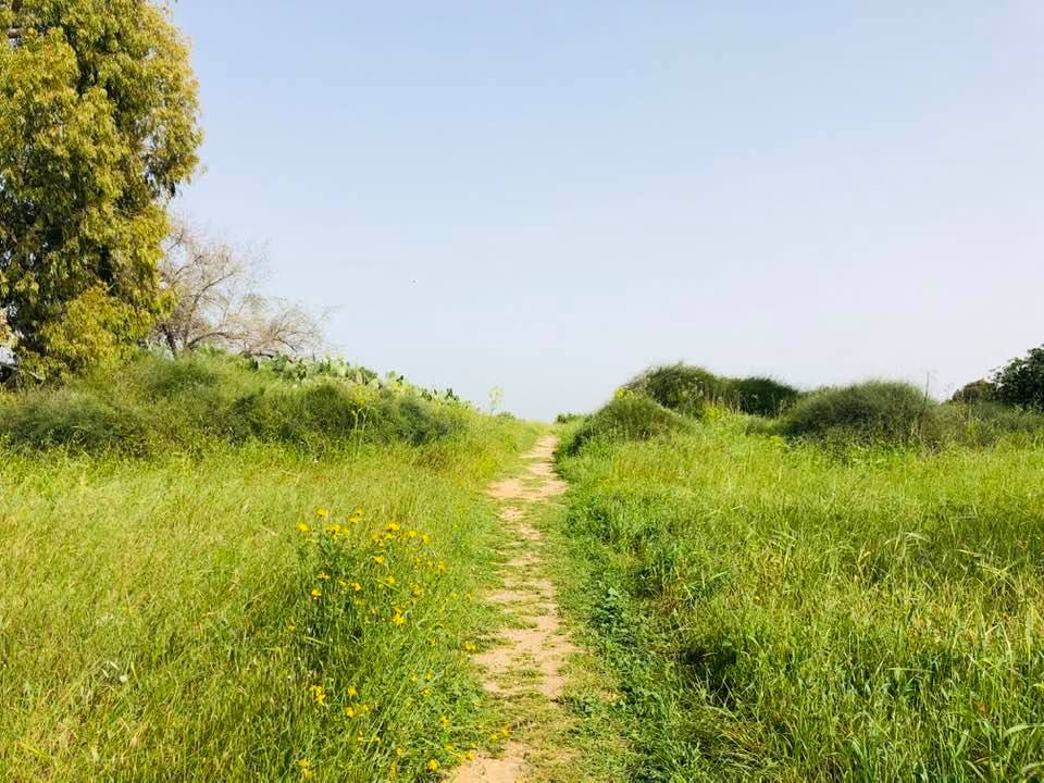
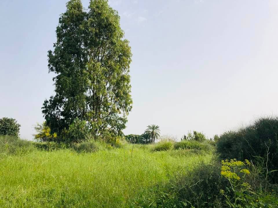
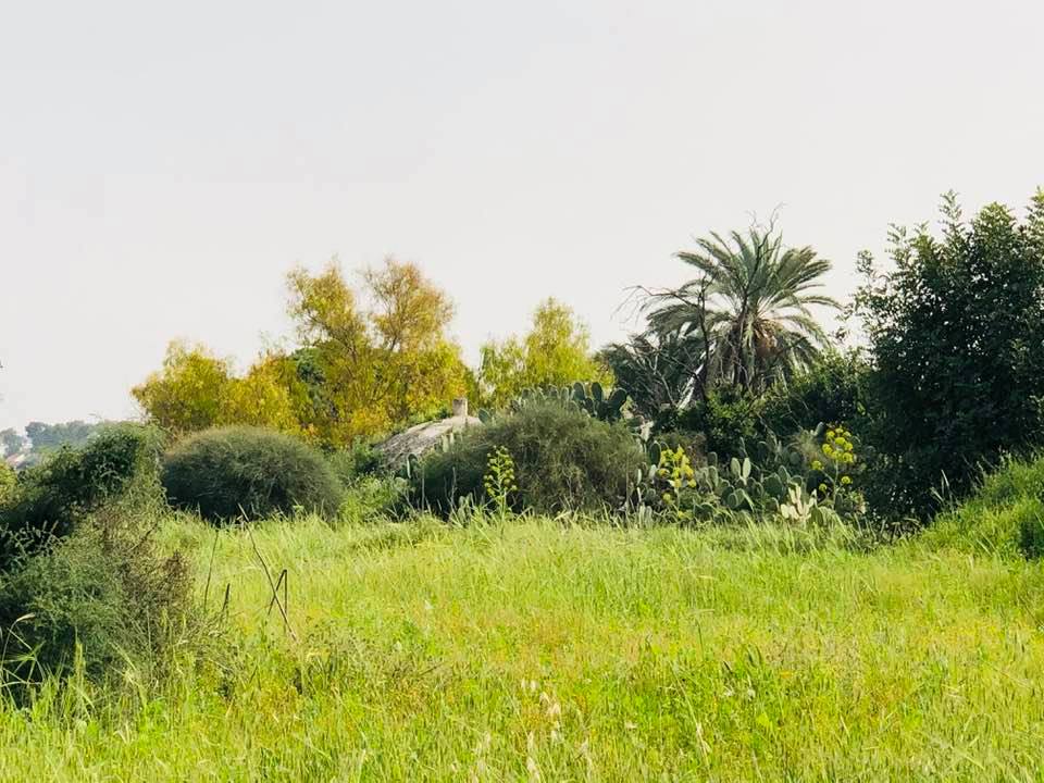
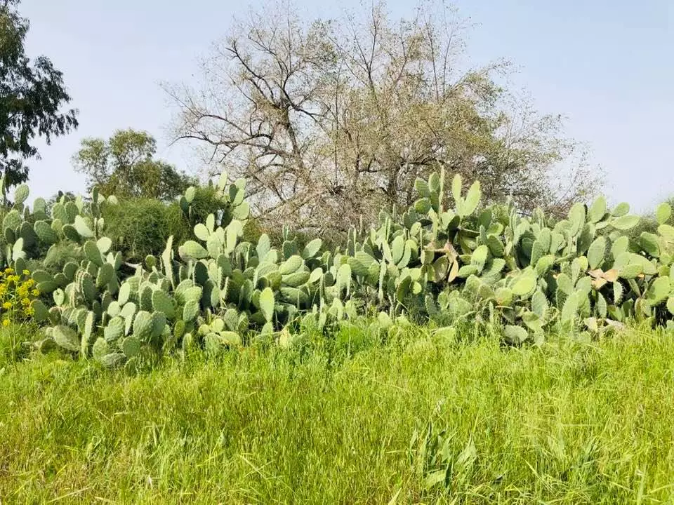
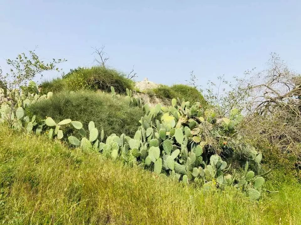
Village Before NakbaThe village was located on the central coastal plain. Wadi Bashshit, a tributary of Wadi al-Sarar, ran 0.5 km east of it. During the Crusader period the village was known as Basit. Bashshit was mentioned by at least two early Arab geographers, Yaqut al-Hamawi (d. 1228) and Ibn al-Imad al-Hanbali (d. 1678). Al-Hamawi reported in his Mu'jam that the village was close to Ramla. Al-Hanbali, in his Shadharat, said that the grammarian and chronicler Jamal al-Bashshiti (d. 1417) came from the village. In the late nineteenth century, Bashshit was a village built of adobe bricks with cultivated gardens nearby. Above the village stood a three-domed shrine.The modern village had a rectangular shape, extending in an east-west direction. Its population was predominantly Muslim. It had an elementary school, established in 1921, with an enrollment of 148 pupils by the mid-1940s. A mosque stood at the village center. It had a number of artesian wells. The principal economic activities of the residents were agriculture and animal husbandry. Grain was their chief crop but they also tended fruit trees in the orchards that bordered the village on the west and northeast. In 1944/45 they allotted 66 dunums of land to citrus and bananas and 17,558 dunums to cereals; 651 dunums were irrigated or used for orchards, including 67 dunums of olives. The village contained archaeological debris and the remains of an altar. Nearby was an archaeological site, al-Nabi Arafat, that contained pillars, cisterns, and pottery Village Occupation and Ethnic CleaningIn an attempt to extend its area of control, the Giv'ati Brigade occupied Bashshit on 12 or 13 May 1948, just before the end of the British Mandate. The Associated Press reported that the Haganah claimed to have captured three villages in this area on 12 May; Bashshit, one of the captured villages, was described in the Haganah statement as a 'strong Arab center.' Israeli historian Benny Morris dates its occupation one day later and claims that it was evacuated by its residents before the attack. The History of the Haganah confirms the general picture without giving a definite date, but it states, probably incorrectly, that the Alexandroni Brigade was responsible for the offensive.Zionists Colonies on Village LandsThere are seven Israeli settlements on village land: Newe Mivtach, Meshar, Kefar Mordekhay, and Misgav Dov, all founded in 1950; Kannot, founded in 1952; and Shedema, and Aseret, founded in 1954.Village TodayThree houses and a pool remain. Two of the houses are deserted and one is occupied by an Israeli family. One of the deserted houses is box-shaped and has a flat roof and a rectangular door with a stone frame. The occupied house, a two-storey, concrete structure, has a flat roof and a rectangular entrance and windows. Cactuses and sycamore and eucalyptus trees grow on the site. The surrounding lands are cultivated by Israelis.SourceDr. Walid al-Khalidi, 1992: All That Remains. |
|||||||||||||||||
| Related Maps | Town Lands' Demarcation Maps خرائط للقضاء توضح حدود القرى والاودية Town's map on MapQuest View from satellite Help us map this town at WikiMapia |
||||||||||||||||
| Related Links | Wikipedia's Page Google Search Google For Images Google For Videos |
||||||||||||||||
| More Information | في كتاب كي لا ننسى في كتاب بلادنا فلسطين المزيد من موقع هوية |
||||||||||||||||
- One of the remaining Palestinian house, the rest was completely destroyed.
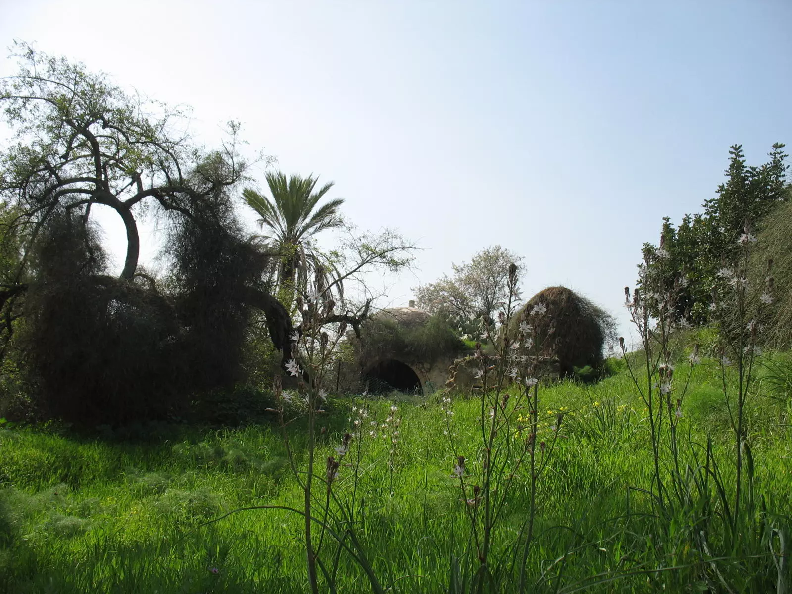
Posted by Noga Kadman 60 - مقام النبى شيت عام 1983
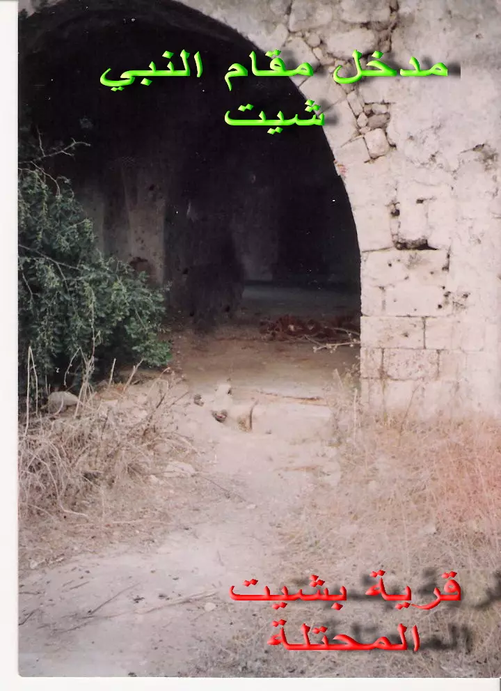
Posted by ahmad yousef foda 2 - مدخل المقام
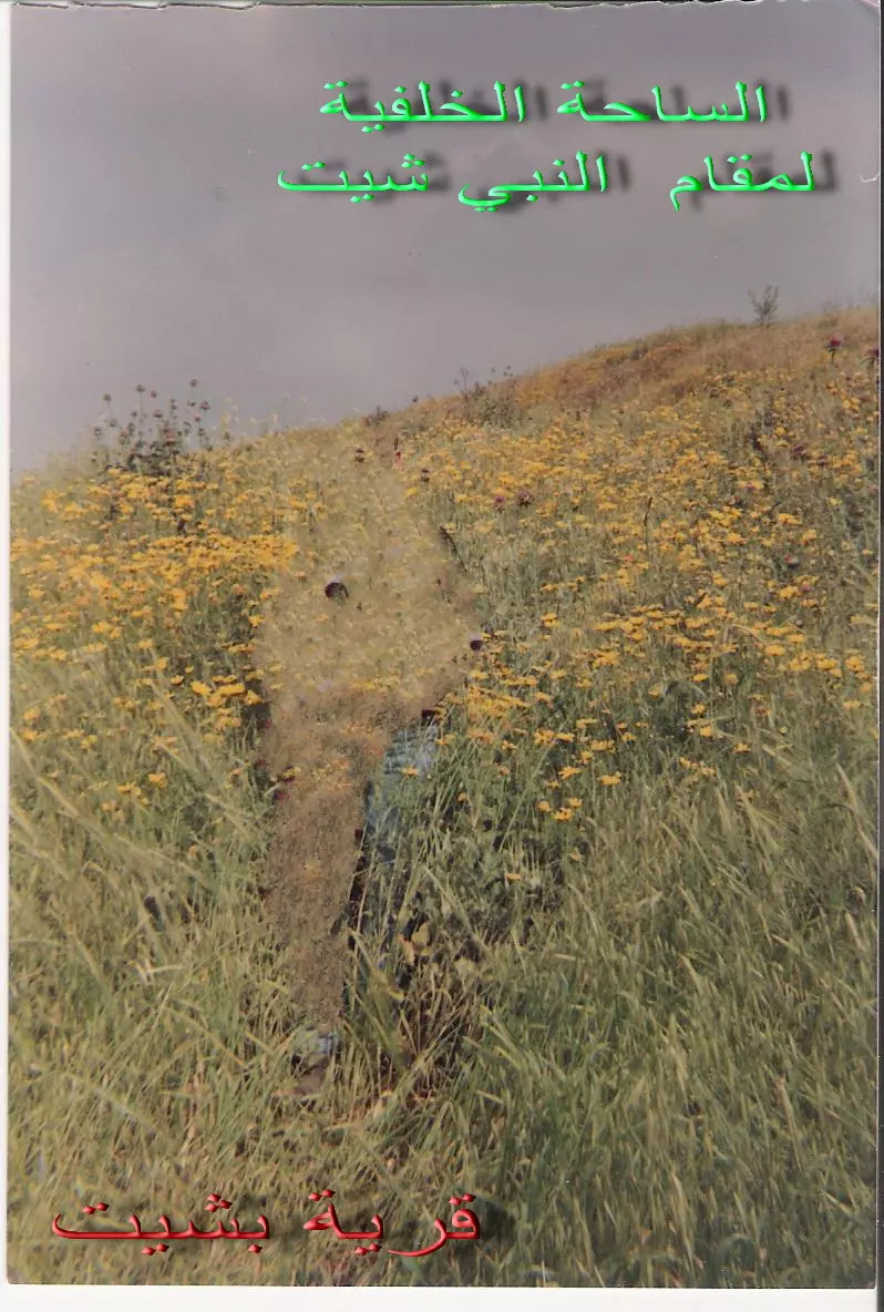
Posted by ahmad yousef foda 1 - الساحة الخلفية للمقام عام 1983
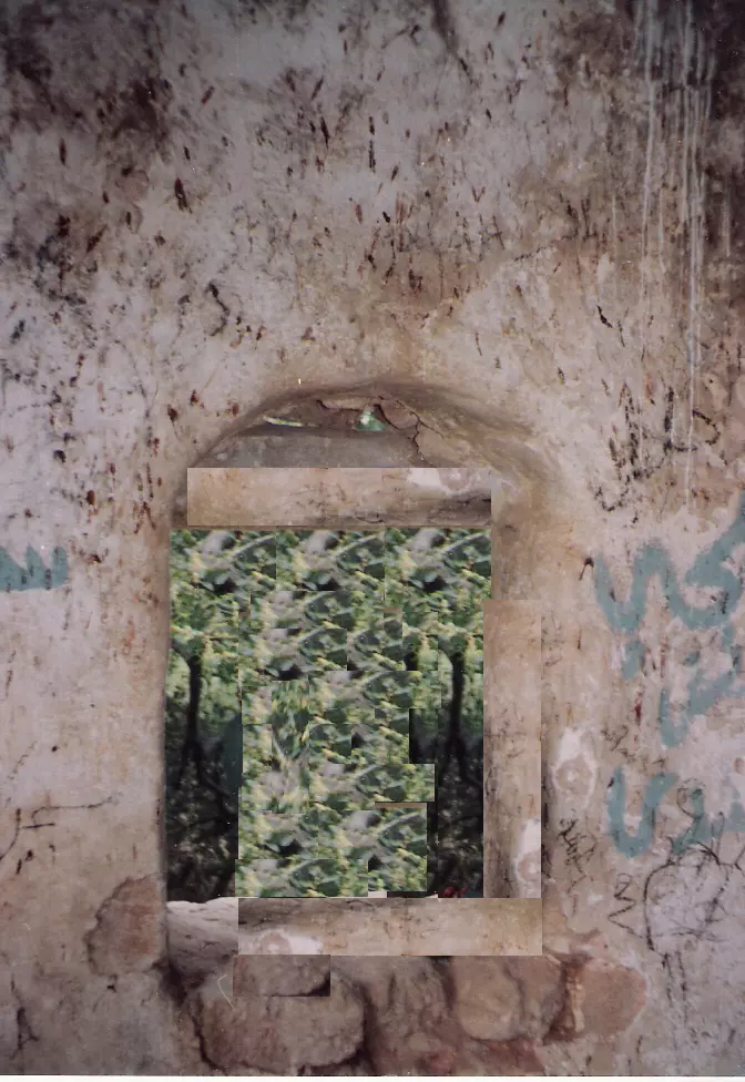
Posted by ahmad yousef foda 7 - مقام النبى شيت من الداخل1983 للتنويه بخصوص جودة الصورة قمت بازالة صورة احد الاخوة بالصورة تماشيا مع سياسة الموقعفى الشباك الظاهر بالصورة
Posted by ahmad yousef foda 8 - Shrine of the prophet Seth | Maqam nabi Shit 14-07-09
Posted by Uri Zackhem 2 - Shrine of the prophet Seth | Maqam nabi Shit 14-07-09
Posted by Uri Zackhem 1 - Shrine of the prophet Seth | Maqam nabi Shit 14-07-09
Posted by Uri Zackhem 1 - Shrine of the prophet Seth | Maqam nabi Shit 14-07-09
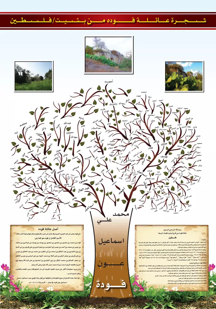
Posted by Uri Zackhem - صورة شجرة عائلة فوده من قرية بشيت قضاء الرملة
Posted by رشاد - بشيت
Posted by abu raya - قريه بشيت بعد احتلالها
Posted by abu raya - Pre-Nakba Aerial view of the village / صورة من الجو للقرية اخذت قبل النكبة
- لدى مقام النبي شيت في قرية بشّيت المهجرة (قضاء الرملة )...بروفيسور مصطفى كبها
- Let us see how the most "liberal and civilized" of world Jewry has obliterated our village except for the village Shrine Bashshit. How else will the Jews be great and safe again?
- Let us see how the most "liberal and civilized" of world Jewry has obliterated our village except for the village Shrine Bashshit. How else will the Jews be great and safe again? #2
- Let us see how the most "liberal and civilized" of world Jewry has obliterated our village except for the village Shrine Bashshit. How else will the Jews be great and safe again? #3
- Let us see how the most "liberal and civilized" of world Jewry has obliterated our village except for the village Shrine Bashshit. How else will the Jews be great and safe again? #4
- Let us see how the most "liberal and civilized" of world Jewry has obliterated our village except for the village Shrine Bashshit. How else will the Jews be great and safe again? #5
- Let us see how the most "liberal and civilized" of world Jewry has obliterated our village except for the village Shrine Bashshit. How else will the Jews be great and safe again? #6
- Let us see how the most "liberal and civilized" of world Jewry has obliterated our village except for the village Shrine Bashshit. How else will the Jews be great and safe again? #7
- Let us see how the most "liberal and civilized" of world Jewry has obliterated our village except for the village Shrine Bashshit. How else will the Jews be great and safe again? #8
- Let us see how the most "liberal and civilized" of world Jewry has obliterated our village except for the village Shrine Bashshit. How else will the Jews be great and safe again? #9
- Let us see how the most "liberal and civilized" of world Jewry has obliterated our village except for the village Shrine Bashshit. How else will the Jews be great and safe again? #10
- Let us see how the most "liberal and civilized" of world Jewry has obliterated our village except for the village Shrine Bashshit. How else will the Jews be great and safe again? #11
- Let us see how the most "liberal and civilized" of world Jewry has obliterated our village except for the village Shrine Bashshit. How else will the Jews be great and safe again? #12
- Let us see how the most "liberal and civilized" of world Jewry has obliterated our village except for the village Shrine Bashshit. How else will the Jews be great and safe again? #13
- Let us see how the most "liberal and civilized" of world Jewry has obliterated our village except for the village Shrine Bashshit. How else will the Jews be great and safe again? #14
- Let us see how the most "liberal and civilized" of world Jewry has obliterated our village except for the village Shrine Bashshit. How else will the Jews be great and safe again? #15
- خارطة تُظهِر الحدود والطرق بأنواعها والأماكن المقدسة والطبيعة الطوبغرافية من تلال وسهول ومنحدرات والتشكيلة الطبيعية للأرض وأنواع المزروعات. نُشرت الخريطة فترة الانتداب البريطاني، تم إضافة تعديلات عليها من قِبَل خدمة الخرائط والصور التابعة للقوات العسكرية الاسرائيلية فترة الأربعينيات.
Want to browse more? 80,000 pictures were grouped in these gallaries:
| Display Name | Clan/Hamolah | Country of Residence |
| أبوعمر | ياسين | GAZA, BASHSHIT |
| ابو يوسف عياد | - | الجزاءر, الجزاءر |
| معاذ هنداوي | - | - |
| رشا كلاب | - | عمان, الاردن |
| أبو إياد | النجار | جدة , السعودية |
| اماني هنداوي | هنداوي | - |
| الحسين | كلاب | - |
| محمد يوسف حسن | شاهين | - |
| أبومحمود | كلاب | قطاع غزة, قطاع غزة |
| ورد | - | - |
| ابوسامح | - | - |
| الحج احمد | كلاب | خانيونس, بشيت |
| Sammi Ibrahem | Ibrahem | West Midland, UK |
| mohamed elsalmi | - | - |
| samikullab | كلاب | jyland, danmark |
| akram | البلبيسي | - |
| محمد كلاب | كلاب | - |
| مجدي كلاب | - | الرياض, الرياض |
| أبو عدي الدرهلي | الدرهلي | قطاع غزة, بشيت |
| اْبو رشاد | المقالدة | مخيم جباليا, برير |
| خليلية | خليلية | جبع |
No links have been shared yet, be free to the first to share the first link.
 Fake Valor: Why Did Zionist Jews Hoist Nazis Flag on Their Ships in the 1930s?
What is new?
-
Facts About Oct. 7th Gaza Raid
-
Remined Us Please:: Who Did Rape Who? Palestinians Raped Israelis? Or, was the other way around?
-
When Prof. Edward Said was invited to debate Bibi Netanyahu in the 1980s, watch what happened!
-
Ezra Klein of the NY Times on the "Jewish Race".
-
Abusing Blood Libel!
-
Did Israeli Soldiers Activate The Hanniba Direective On Oct. 7th? You Be The Judge
-
Zionist FAQ: Isn't it true that Palestinians don't want peace? Palestinians never accepted the two-state solution
- Facts about Haavara (Transfer) Agreement between Ben-Gurion & Hitler
-
Haavara FAQs: Why Did Zionist Jews Hoist Nazis' Flags on Their Ships in the 1930s?
- Haavara FAQs: When Chaim Weizmann met FDR in mid-1943, why was he silent about rescuing European Jewry?
-
Dear ChatGPT: How did Palestinians resist Napoleon's invasion of their country in 1799?
-
Dear ChatGPT: Gaza had a vibrant Jewish community in the mid-17th century. What happened to them?
-
Dear ChatGPT: Why did the Jewish Agency suppress news of the Holocaust during WWII?
-
Video Playlist: Jews share their DNA tests to end the conflict for good.
-
A Tale of Two Conflicts: Examining the Definition of Genocide
-
Prof. Abraham Polak And The Suppressed History of the Khazars and European Jewry
-
How Ronald Reagan would have framed the genocide in Gaza if he were still alive?
-
Haavara FAQs: Let us do the math: how many German Jews did The Haavara Agreement save?
-
Zionist FAQs: The Hebron Massacre of 1929, "clearly proves" that Palestinians are antisemitic, how could you deny it?
-
Zionist FAQs: Why Anti-Zionist Is Not Antisemitism?
-
Zionist FAQs: Isn't it true that the KGB created Palestinian Nationalism in the early 1960s?
- Zionist FAQs: Muslims are killing Muslims all the time; why are Israeli Jews being singled out in the media?
- Zionist FAQs: How is Israel an apartheid state when 20% of its citizens are Arabs who enjoy full rights?
-
Haavara FAQs: Why Did Dorothy Thompson Flip From A Zionist Advocate to A Silenced Dissenter?
-
Haavara FAQs: Analysis of Herzl's Uganda Scheme and how it could have saved millions of Jews.
-
Haavara FAQs: Why did Hayim Greenberg describe American Jewry as "morally bankrupt" in early 1943?
-
Haavara FAQs: What if the Evian Conference was a resounding success? What would have been the impact of saving European Jewry on Zionism?
- Haavara FAQs: What if the six million were saved, how that would have impacted the Zionist project?
-
Haavara FAQs: How did Zionist leaders react when Europe's Jews lingered in the DP camps after WWII ended?
-
Why does the American Jewish community repeat lies that David Ben-Gurion had debunked before he died?
-
Who has the power to rename the Tatar/Khazar Gene Marker to Jewish IV?
-
Zionist FAQs: Why won't Egypt, Syria, and Jordan take their people back? Jews are indigenous to Palestine, and Arabs immigrated after Jews developed the country. Arabs should leave.
-
Haavara FAQs: Did Hitler and the Nazis conflate between Judaism and Zionist? If that wasn't case, then why?
-
Haavara FAQs: Winston Churchill and antisemitism, a collection of articles written Churchill.
-
Haavara FAQs: Broken by country, how many Jews survived vs. killed during the Holocaust?
-
Haavara FAQs: Why did European Jews vote with their feet and to immigrated to the Americas, not Palestine, after WWII?
-
Watch this American Jewish Girl describing Israeli Jews' cognitive dissonance like no other in under two minutes
-
Haavara FAQs: When the Nazis went out of their way to hide the Holocaust, Israeli Jews did the exact opposite by broadcasting their genocide of Gazans. But why?
-
Haavara FAQs: How Zionist Jews went out of their to show their appreciation to Nazism and Fascism?
- Haavara FAQs: Why Zionist leaders were against bombing the death camps & the Railroads leading to them?
-
Haavara FAQs: Hitler's message to the British and American people: If Jews are such noble citizens and you care about them, how come you're not letting them in? I will gladly ship them to you at my expense, even on luxury liners!
-
A shortlist of Zionist and Israeli false flag operations in the name Jews.
-
The Most Moral Army
- The Land of Kapos (Israel): Where the brave are boycotted and Kapos walk free.
- Why did early Zionists often named their communal enterprises "colonial"?
- Zionist Relations with Nazi Germany by Faris Glubb
-
Two NY Times advertisements by Zionists in the early 1943 that exposes Zionists' treason at the height of the calamity
- Facts Not Lies about the Palestinian-Israeli Conflict.
- Site's pictures have been categorized
- Campgain Against Lice
- A Survey of Palestine, the official source about Palestine before Nakba produced by the British Mandate; over 1200 pages.
- Satellite View & Google Earth: Over 6,000 placemarks identifying all destroyed towns, W. Bank & Gaza Strip Towns, & refugee camps.
- PalestineRemembered.com and its Nakba Oral History Project were featured on al-Jazeera Satellite TV.
- Nakba Oral History Video Podcast:
 Over 700 Oral History interviews (including 3,500+ hours of recording) can be viewed online.
 - Palestine Village Statistics Project
- Gaza Jail Break
- النسخة العربية للموقع الان متوفرة
- Videos: Documenting the destroyed villages in video: Tracing all that remains since Nakba.
- Videos: Responding to Zionist Propaganda
- Interview: The ethnic cleansing of Palestine: George Galloway interviews Israeli Historian Ilan Pappe.
- For Palestinians, memory matters. It provides a blueprint for their future By George Bisharat.
- Zionist FAQ now available in Hebrew שאלות שציונים שואלים, עכשיו בעברית
- Video: The Stephen Walt and John Mearsheimer report on the influence of the Israel Lobby on U.S. Foreign Policy
- The Palestinian-Israeli conflict for beginners
