| PalestineRemembered | About Us | Oral History | العربية | |
| Pictures | Zionist FAQs | Haavara | Maps | |
| Search |
| Camps |
| Districts |
| Acre |
| Baysan |
| Beersheba |
| Bethlehem |
| Gaza |
| Haifa |
| Hebron |
| Jaffa |
| Jericho |
| Jerusalem |
| Jinin |
| Nablus |
| Nazareth |
| Ramallah |
| al-Ramla |
| Safad |
| Tiberias |
| Tulkarm |
| Donate |
| Contact |
| Profile |
| Videos |
Welcome To al-Nabi Rubin - النبي روبين (א-נבי רובין)
|
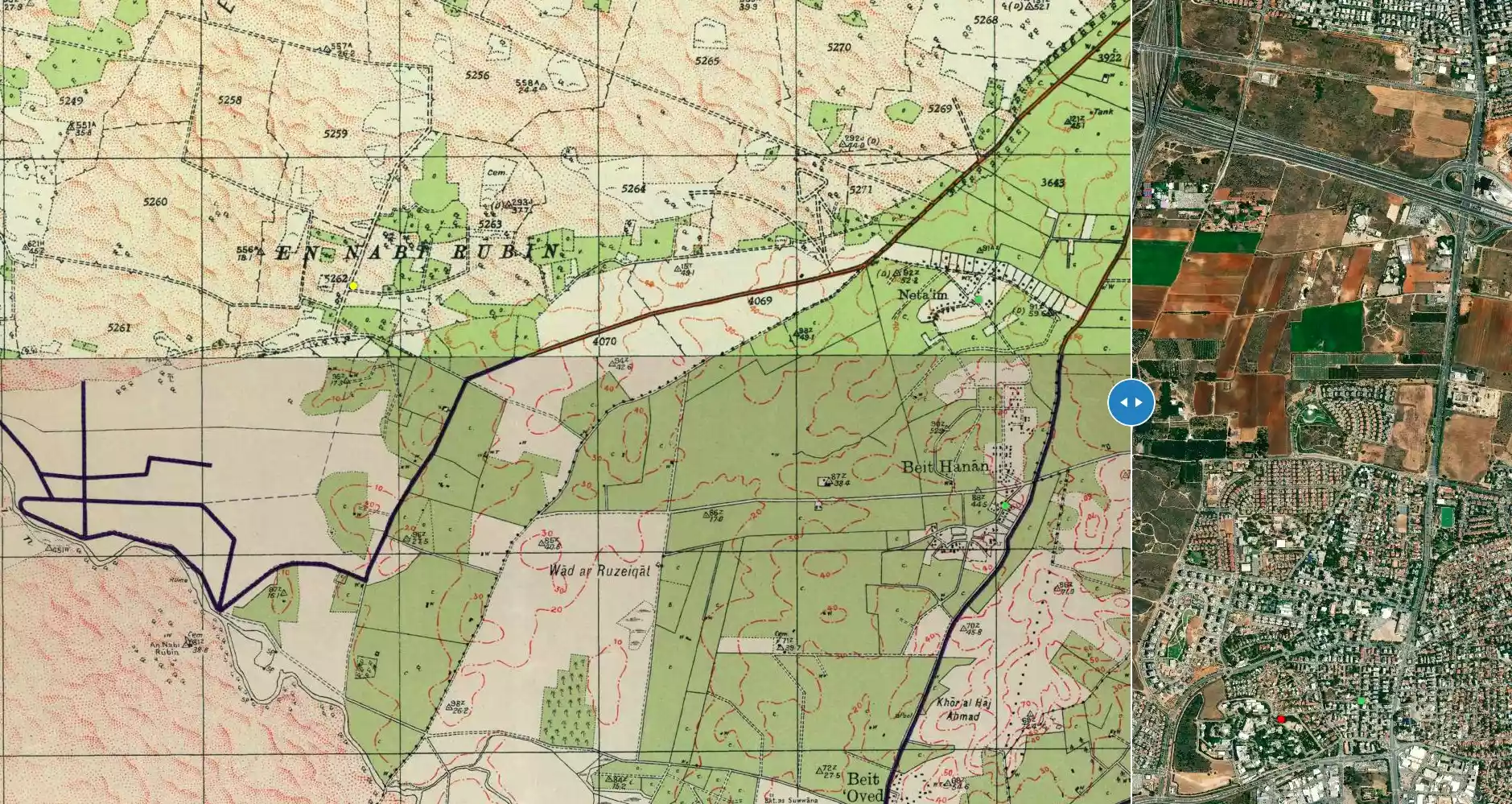
District of al-Ramla
Ethnically cleansed days ago |
العربية Google Earth |
 |
Gallery (60) |
- Statistics & Facts
-
Before & After

- Satellite View
- Articles 2
- Pictures 60
- Members 14
- Families
- All That Remains
- Town's Map
- Wikipedia
- Videos 3
- Guest Book 9
- Links 3
| Statistic & Fact | Value | ||||||||||||
| Occupation Date | June 1, 1948 | ||||||||||||
| Distance From District | 14.5 (km) West of al-Ramla | ||||||||||||
| Elevation | less than 25 (meters) | ||||||||||||
| Before & After Nakba, Click Map For Details |
|||||||||||||
|
|||||||||||||
| Map Location | See location #13 on the map View from satellite |
||||||||||||
| Military Operation | Second stage of Operation Barak | ||||||||||||
| Attacking Units | Giv'ati Brigade | ||||||||||||
| Exodus Cause | Expulsion by Zionist troops | ||||||||||||
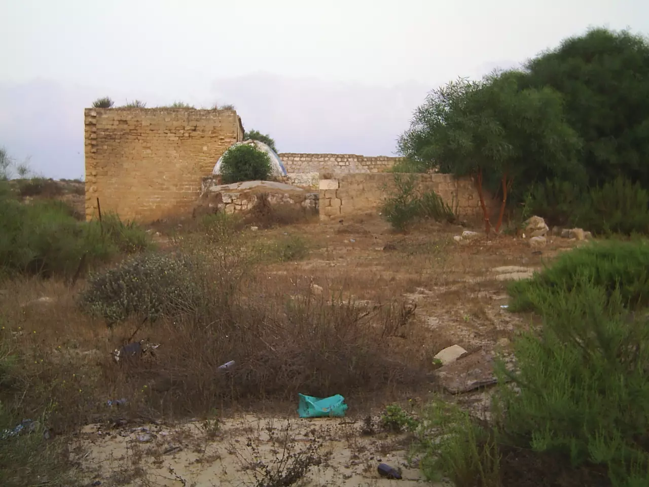
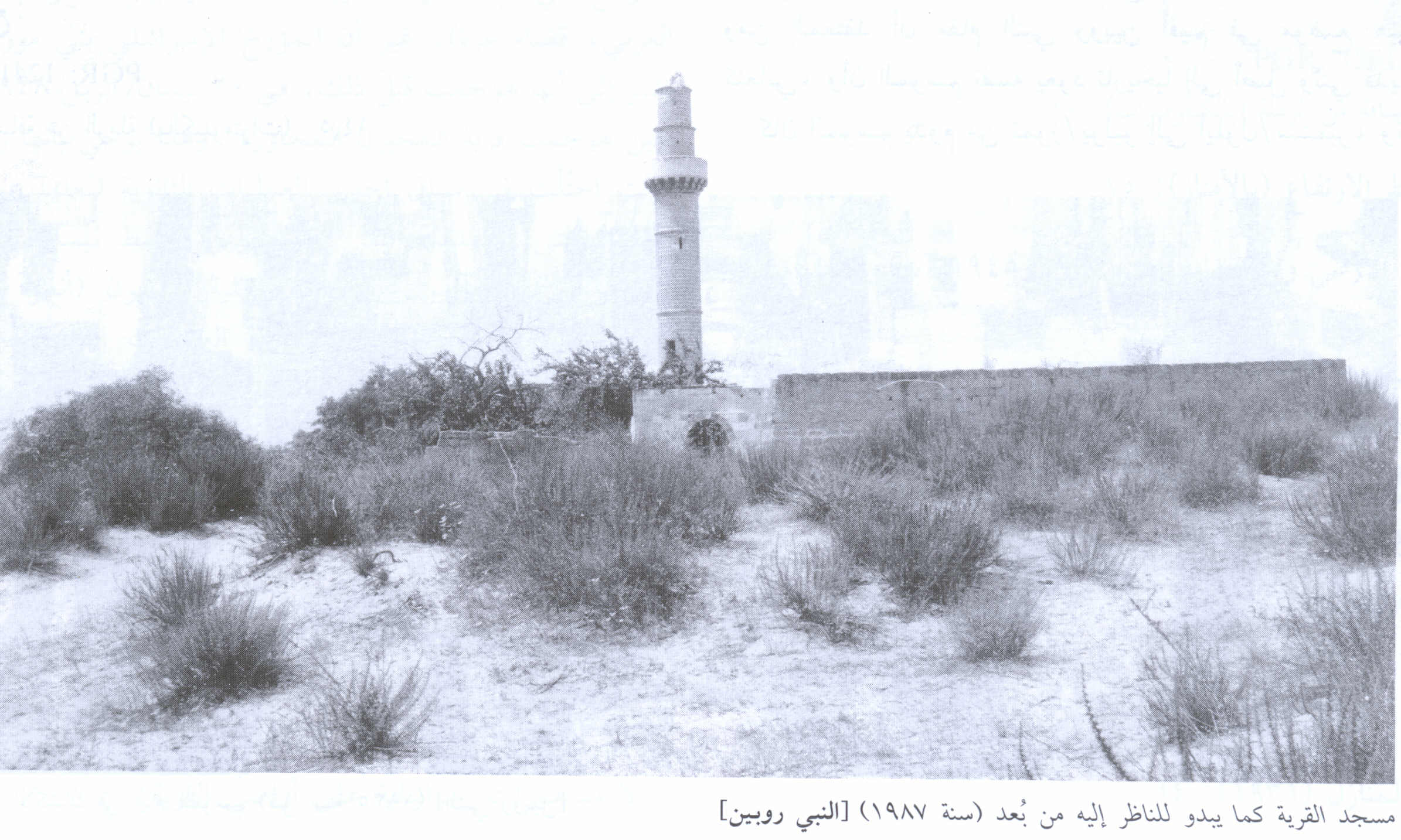
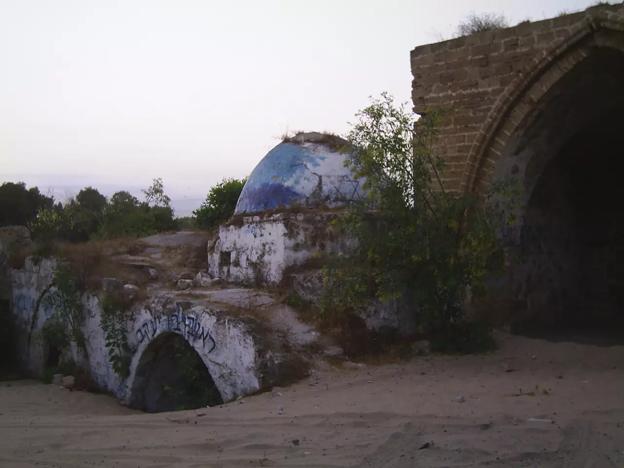
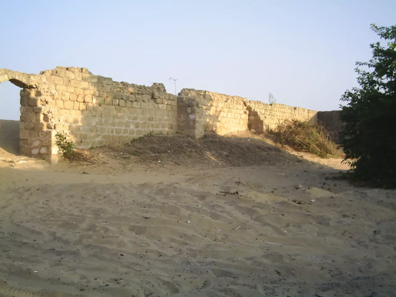
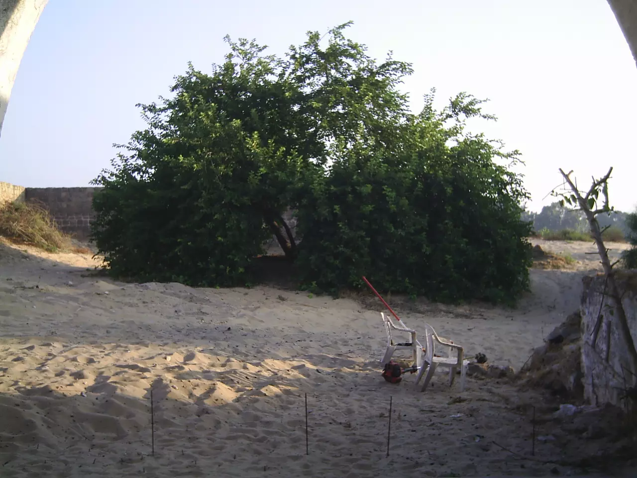
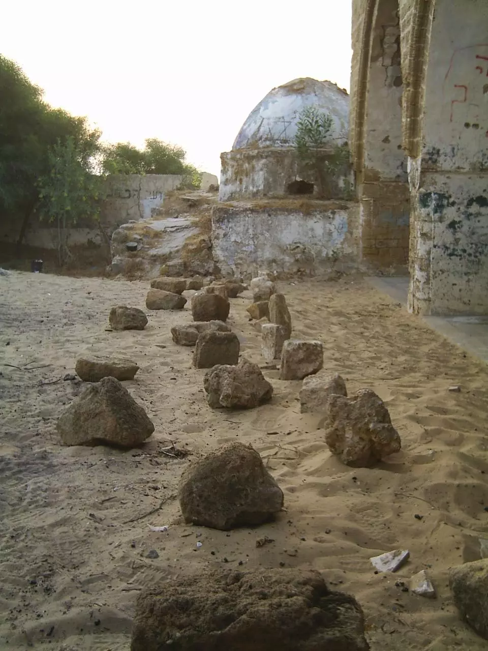
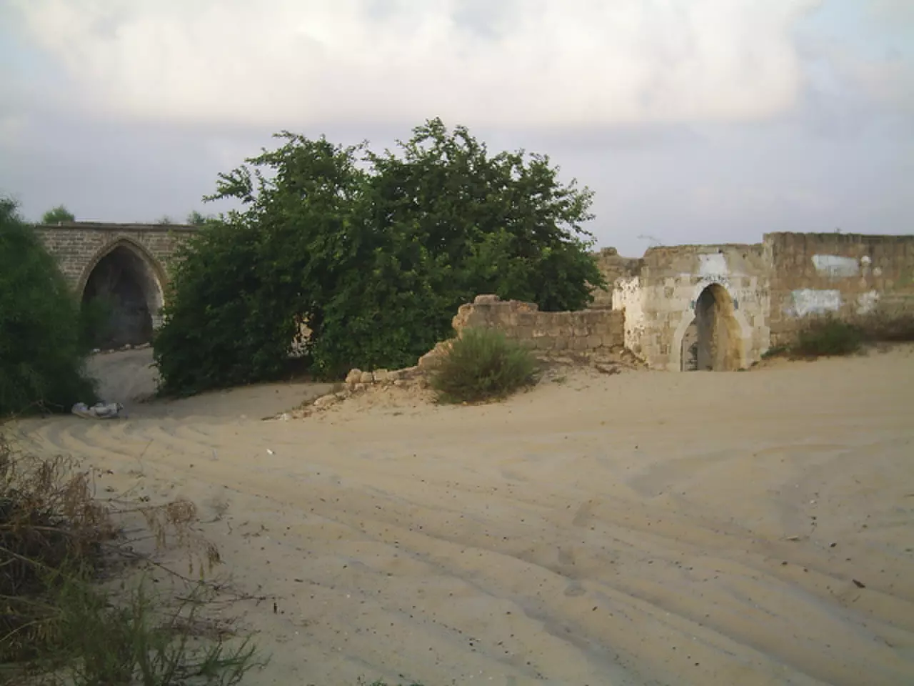
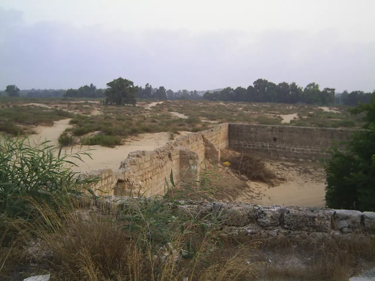
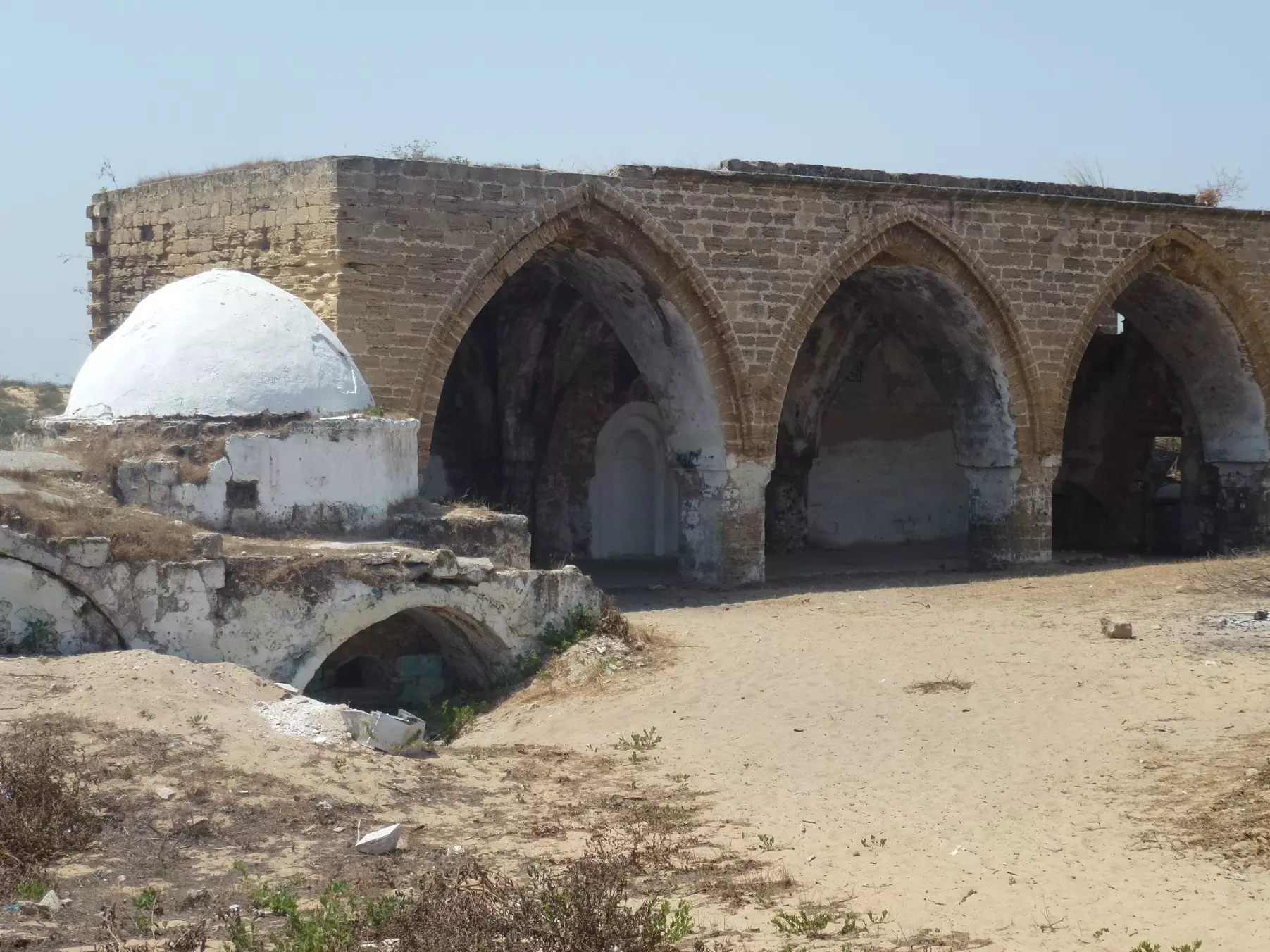
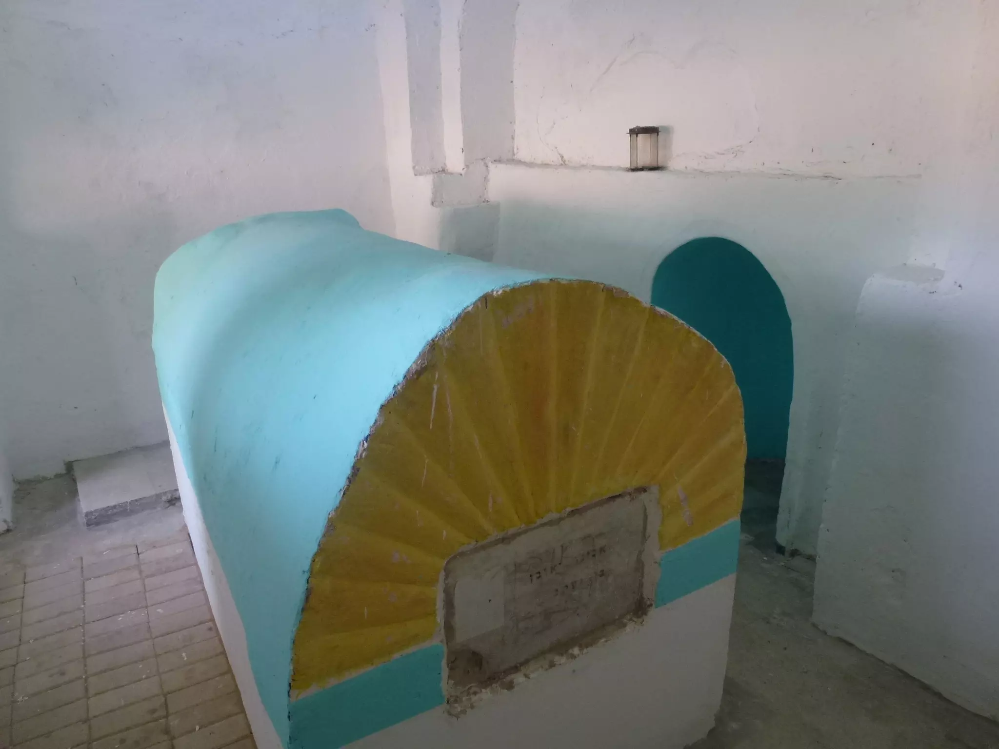
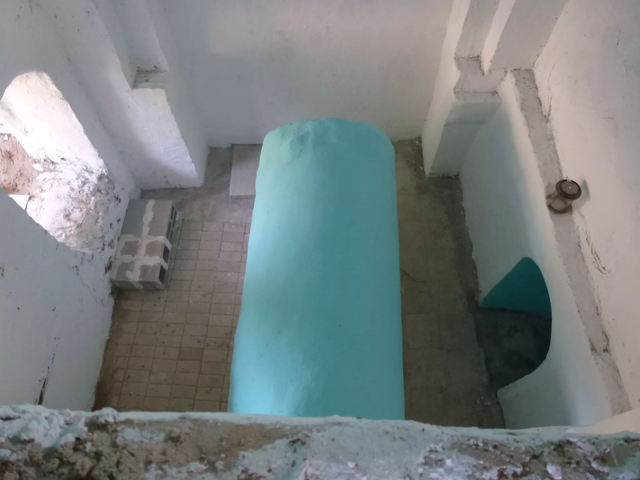
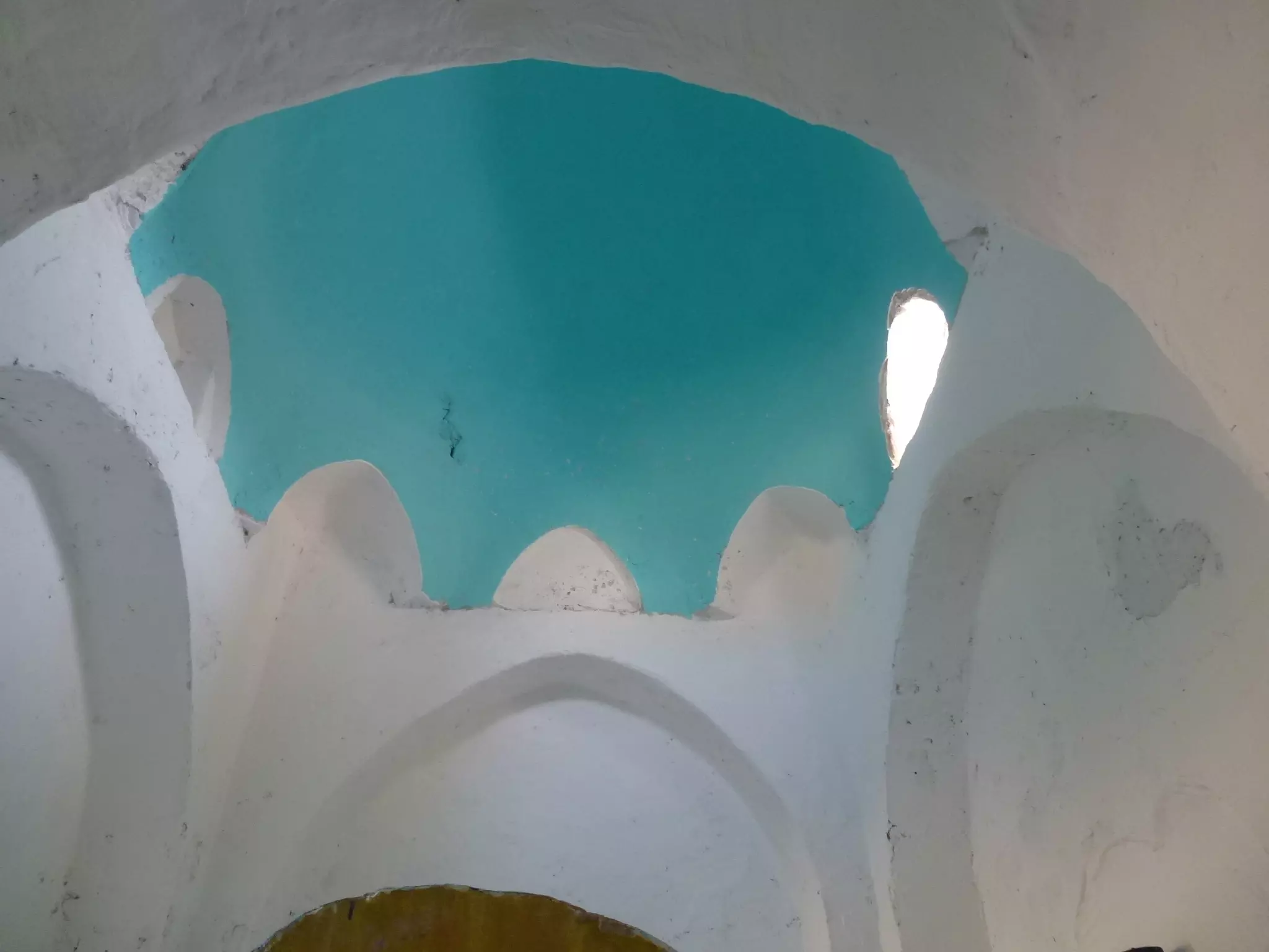
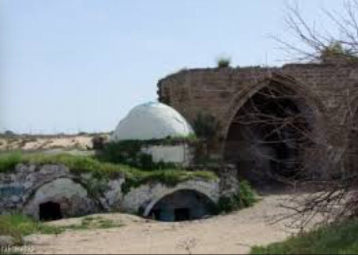
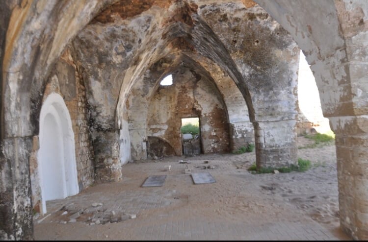
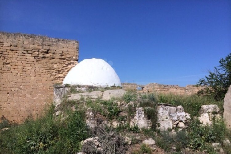
| Village Temains | The village was mostly destroyed with the exception of the village shrine and its mosque. | ||||||||||||
| Ethnically Cleansing | Some villagers managed to stay behind until the end of the harvest time, then they were kicked out. | ||||||||||||
| Pre-Nakba Land Ownership |
**Town Lands' Demarcation Maps |
||||||||||||
| Land Usage As of 1945 |
|
||||||||||||
| Population |
|
||||||||||||
| Near By Towns |
|||||||||||||
|
|||||||||||||
| Schools | An elementary school for boys which was founded in 1946, and in 1945 it had an enrollment of 55 students. | ||||||||||||
| Inhabitants Place of Origin | The village itself was inhabited by members of the Abu Sawayrih tribe, descendants of the al-Maliha Bedouin tribe who had lived in the Sinai desert. | ||||||||||||
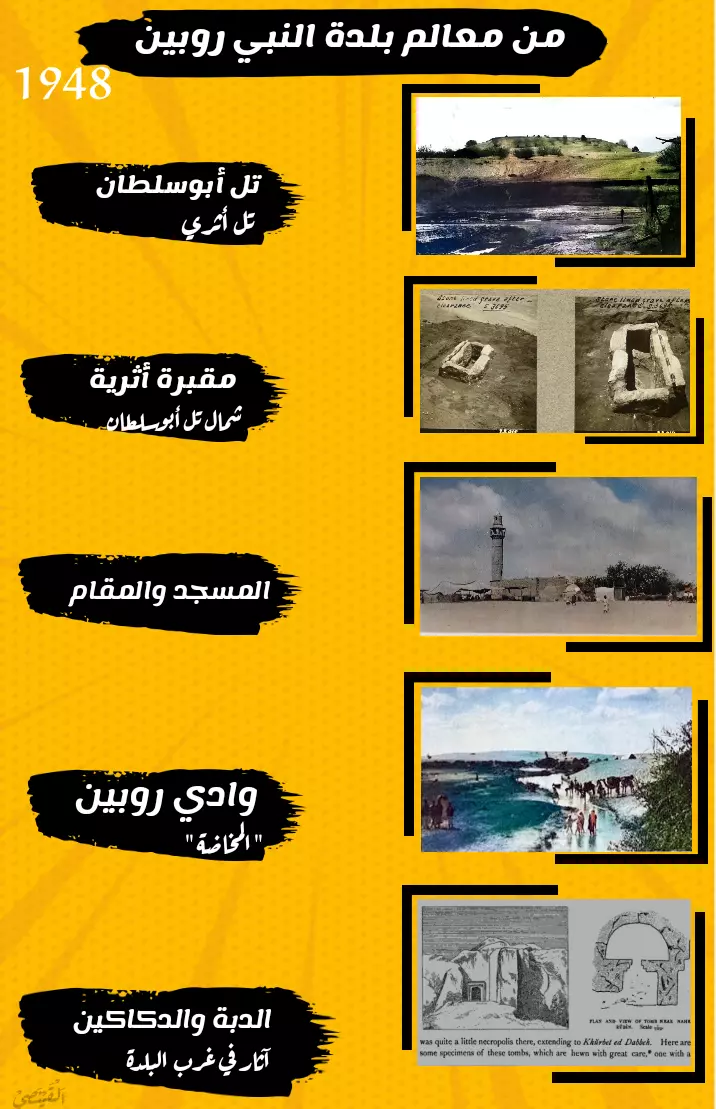
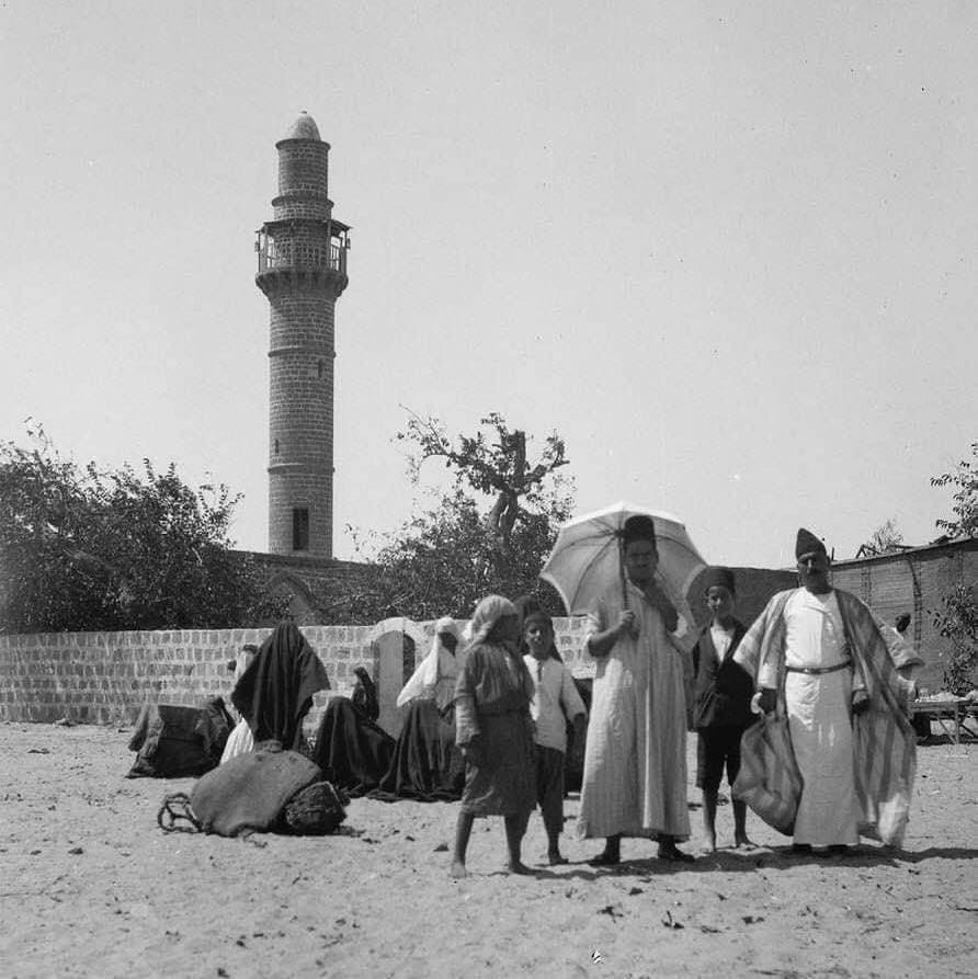
| Places of Warship | One large mosque which remains standing to this date. | ||||||||||||
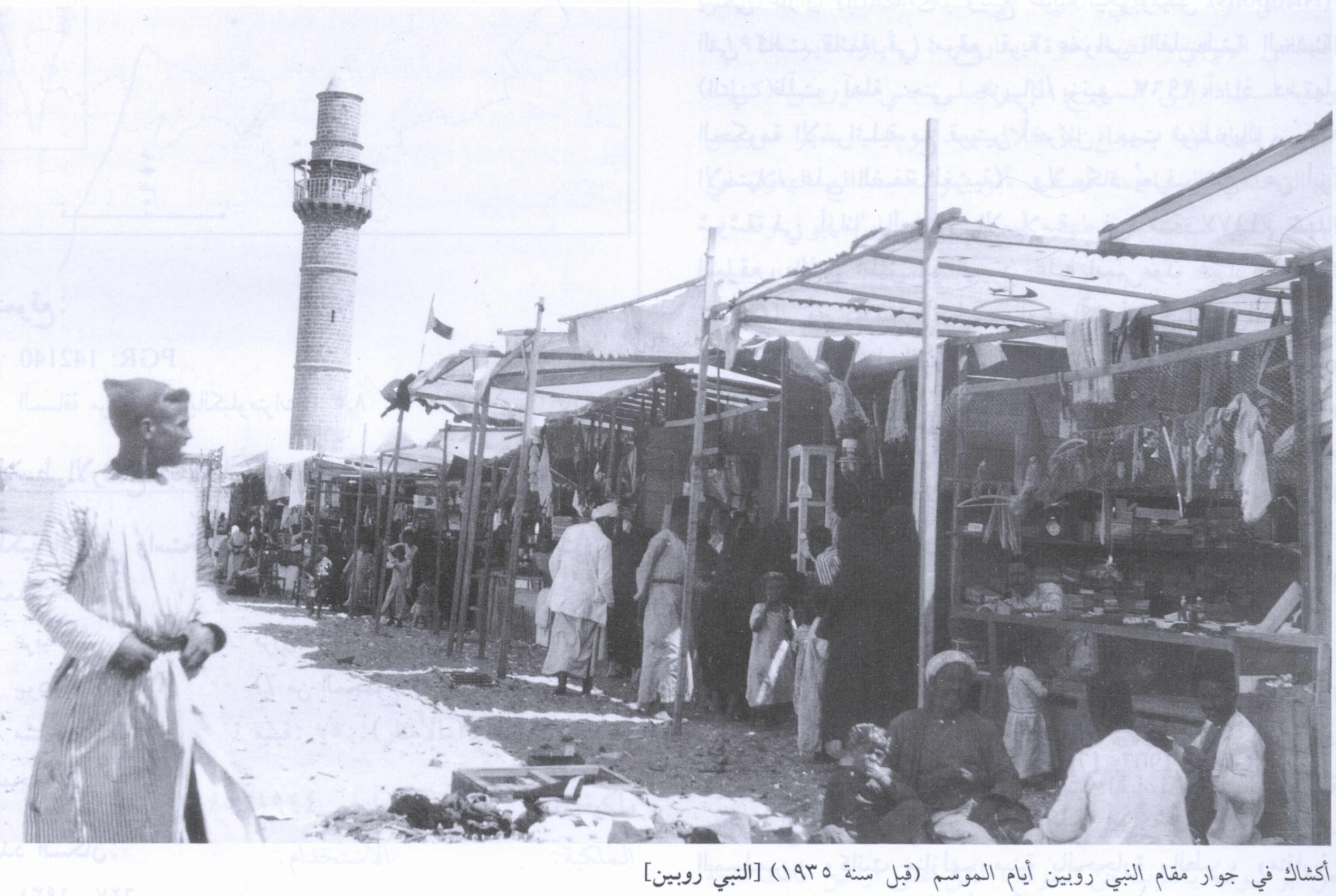
| Shrines / Maqams | A shrine for al-Nabi Rubin who was honored with an annual mawsim. | ||||||||||||
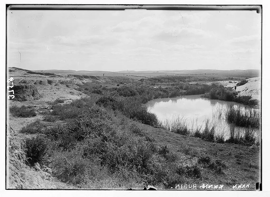
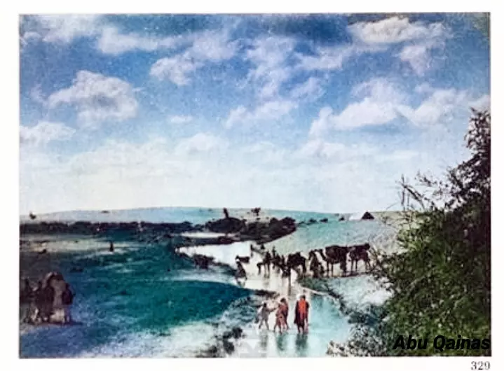
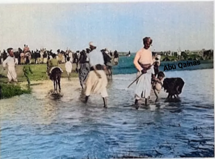
| Nearby Wadies & Rivers | The village is located on the southern banks of the Rubin River (Wadi al-Sarar). | ||||||||||||
| Exculsive Jewish Colonies That Usurped Village Lands |
Kibbutz Palmachim, Gan Soreq, & Hatsofim Dalet. | ||||||||||||
| Featured Video | |||||||||||||
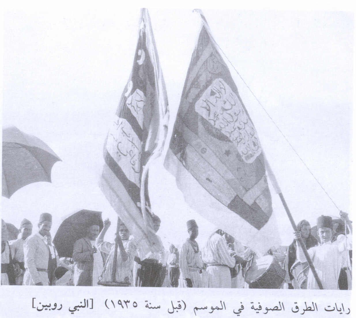
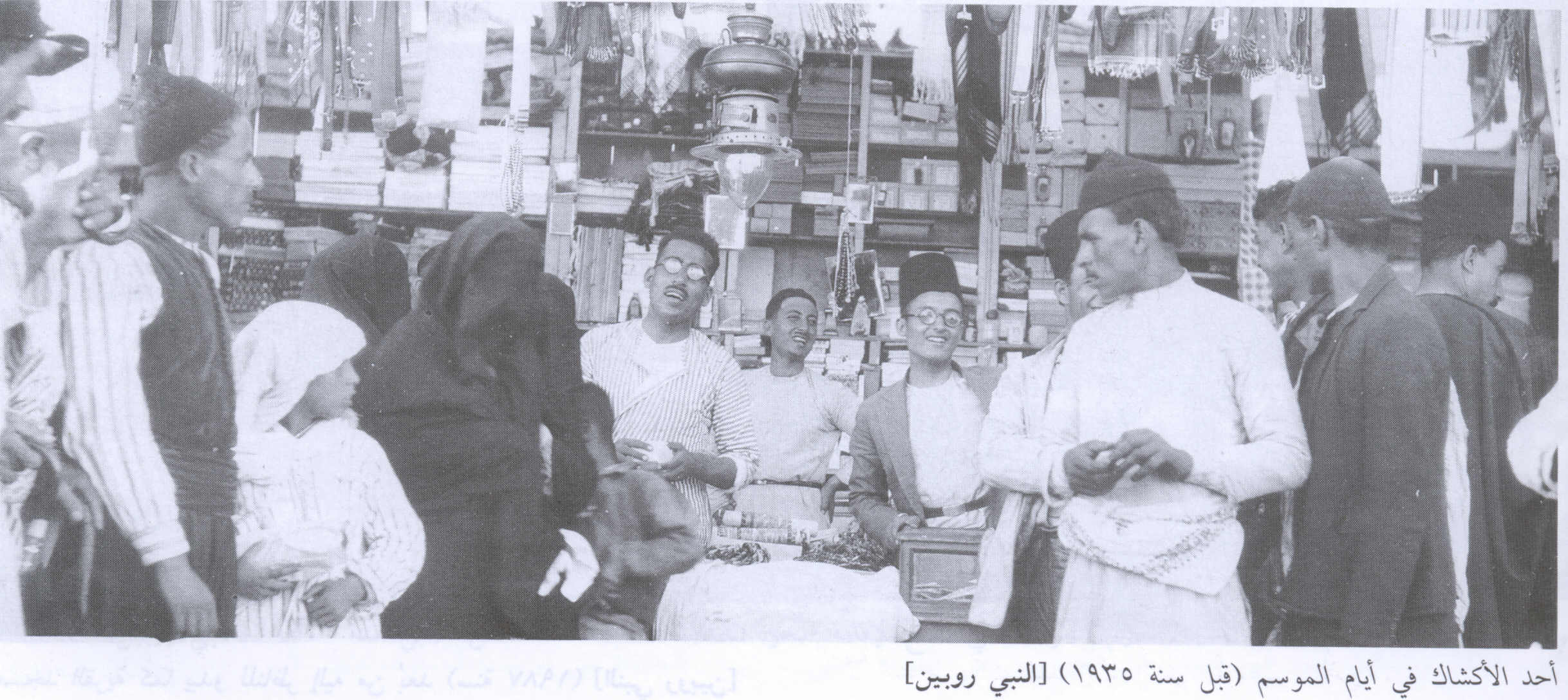
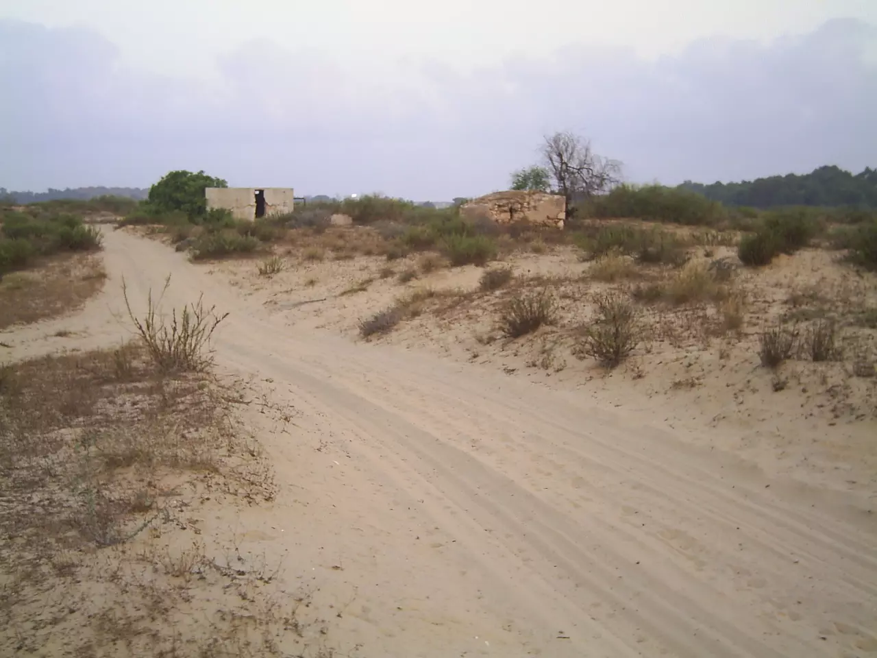
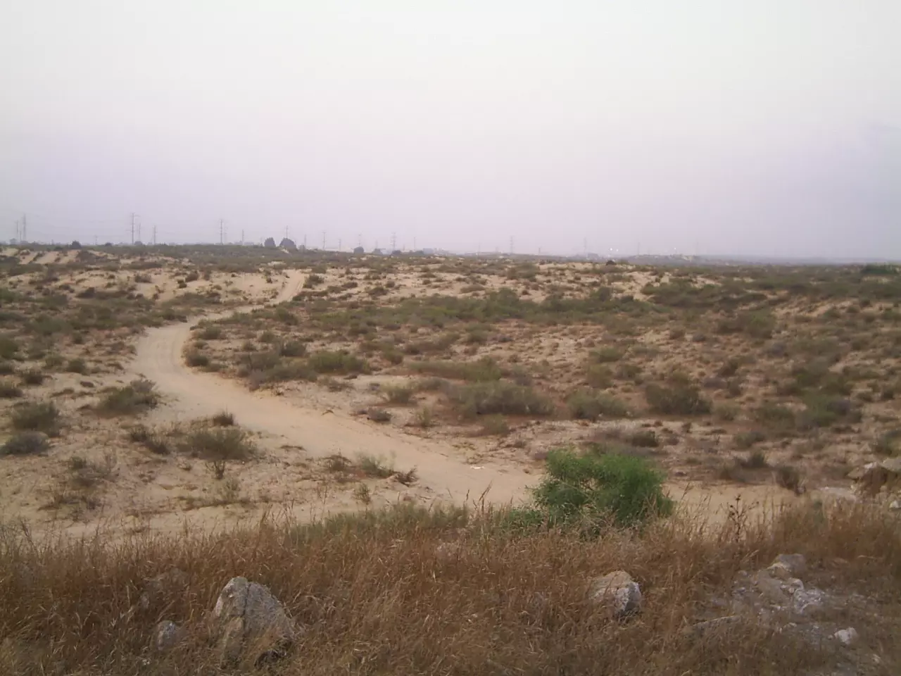
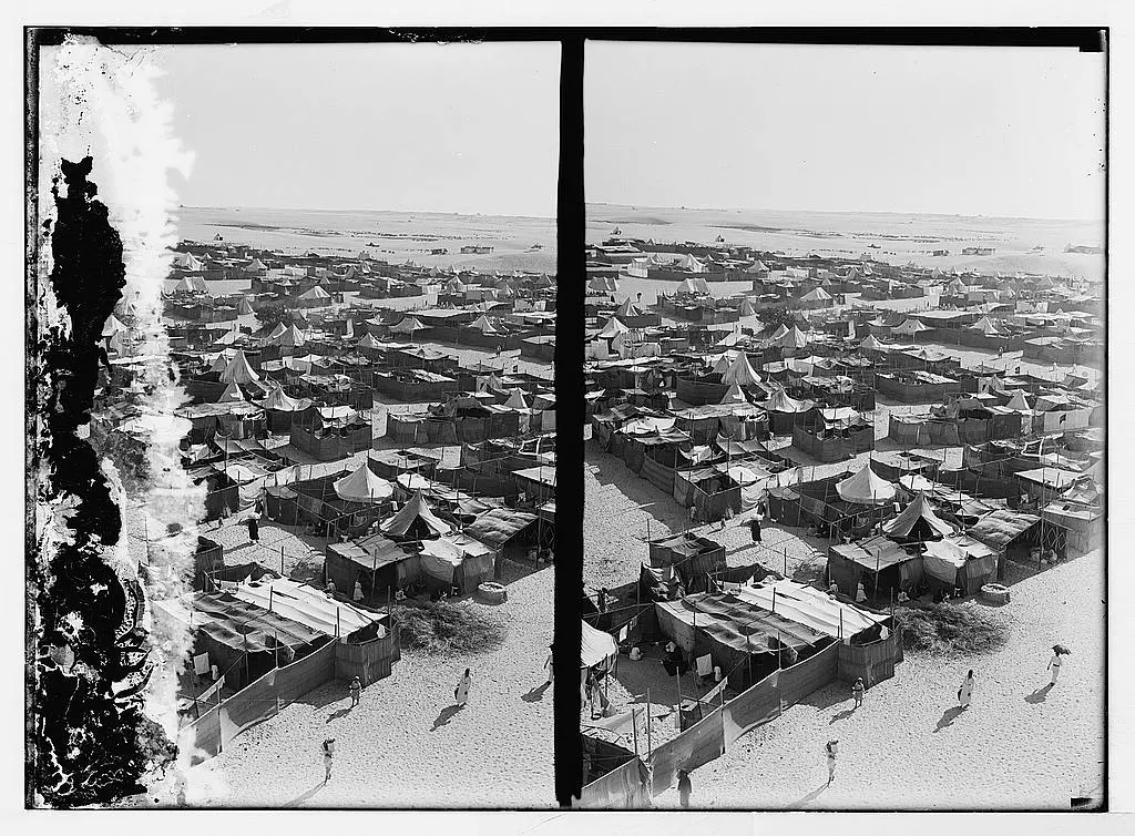
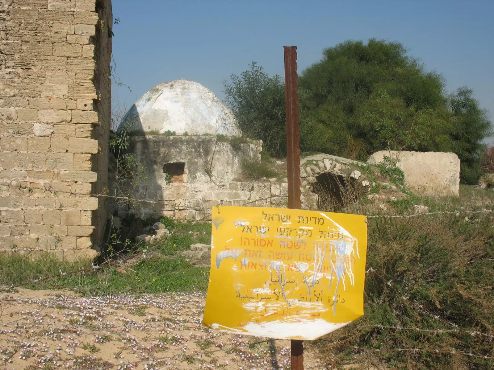
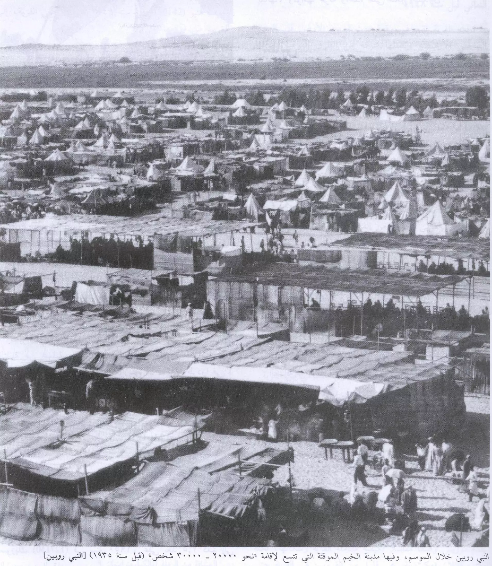
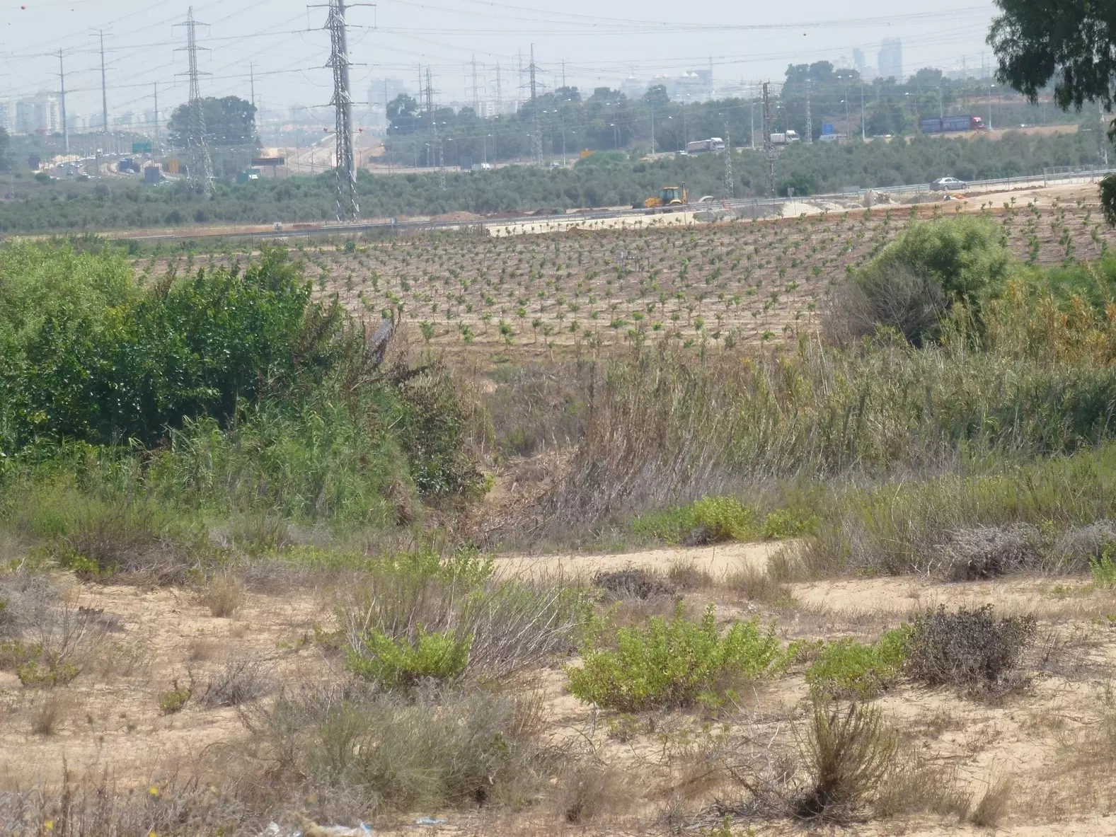
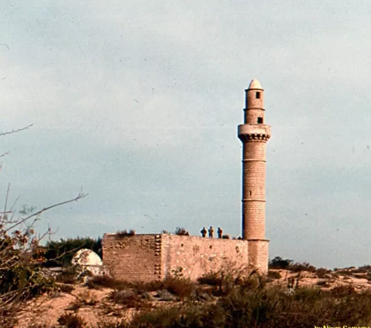
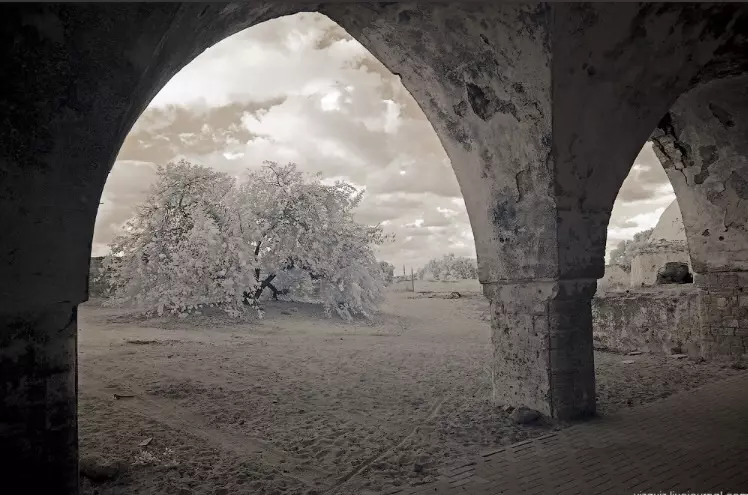
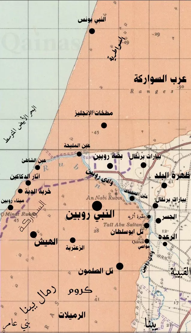
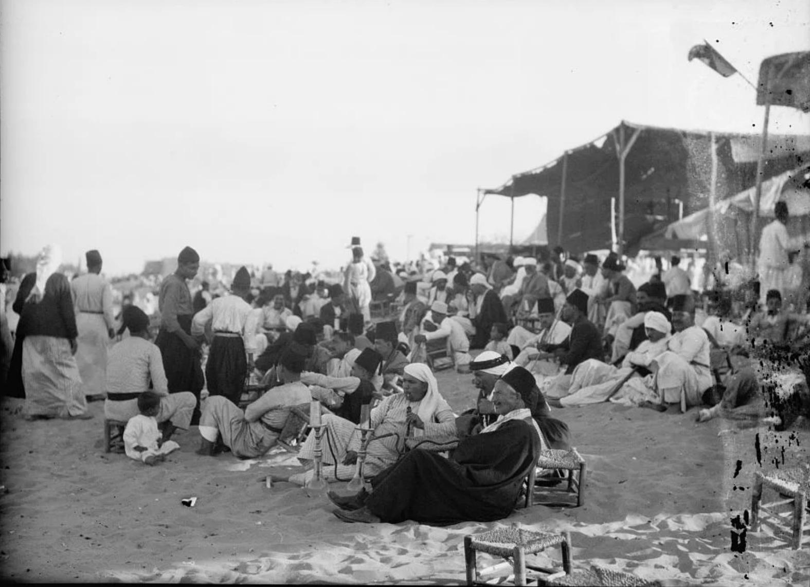
Village Before NakbaThe village was located on the south bank of the Rubin River, 3 km away from the Mediterranean. For Palestinians al-Nabi Rubin had great significance because it was the site of a shrine for al-Nabi (the Prophet) Rubin, who was honored with an annual mawsim (pilgrimage season), during which Islamic and popular celebrations were held. In the Judaic tradition Rubin (or Reuben) was the firstborn son of Jacob and Leah and was known for his scrupulous honesty, in contrast with his half-brother, Esau; while Esau looted and plundered the property of others, Reuben would not even collect plants from a field unless he knew they were ownerless (Genesis 30:14). It was not uncommon for Palestinian Muslims to honor such Old Testament prophets by building shrines for them; there was a shrine for the prophet Moses, for example, south of Jericho, not far from the region in which he is said to have been buried. It is thought that the shrine for al-Nabi Rubin was built in the same place where a Canaanite temple once had stood, and that the mawsim itself was pagan in origin.The mawsim lasted from July through September and was one of two prominent mawsims for Old Testament prophets in Palestine-the other being dedicated to al-Nabi Musa (the prophet Moses). People flocked to the shrine from Jaffa, Lydda, Ramla, and the region's villages. They sang religious as well as secular/popular songs; danced the dabka; held dhikr sessions (Islamic devotional exercises led by adherents of Sufi mysticism); watched horse races and magic shows; and listened to preachers or zajjals (popular poets). The participants camped in tents and were served refreshments at makeshift cafés and restaurants. They shopped for wares at booths that entrepreneurs set up for the occasion (see photos). The village itself was inhabited by members of the Abu Sawayrih tribe, descendants of the al-Maliha Bedouin who had lived in the Sinai. The village's land area, most of which was covered by sand dunes, was the second largest in the sub-disctrict after that of Yibna and was designated as an Islamic waqf (pious endowment). Some of the houses, which were scattered across the site without any discernable nucleus, were also built inside the fruit orchards. Shops as well as a movie theater were built in the neighborhood of the shrine. Water was provided by wells and springs. The population of al-Nabi Rubin was predominantly Muslim. An elementary school for boys was established in the village in 1946, with an enrollment of fifty-six students in the mid-1940s. The villagers worked in agriculture and animal husbandry; they also catered to the visitors during the mawsim. They cultivated mainly grain, followed by citrus and other fruits, such as figs and grapes. In 1944/45 a total of 683 dunums was devoted to citrus and bananas and 4,357 dunums were allocated to cereals; 184 dunums were irrigated or used for orchards. Eucalyptus and chinaberry trees grew along the river bank and covered large portions of village land. On the far southwest edge of the land lay Manarat Rubin ('The Lighthouse of Reuben'), which was built over the ruins of the old port of Yibna (the Iamnitarum Portus of Roman times). Recent excavations there have located a squarish, beaten-earth rampart measuring 800 m on a side that dates to the second millennium B.C. Village Occupation and Ethnic CleaningCircumstantial evidence indicates that the village was occupied during the second stage of the Israeli army's Operation Barak (see al-Batani al-Gharbi, Gaza sub-disctrict). Israeli historian Benny Morris reports that the villagers were expelled on 1 June 1948, three days before the villagers of nearby Yibna were forced to leave their homes. The expulsions were in keeping with the practice of the Giv'ati Brigade under its commander Shim'on Avidan and in accordance with the Haganah's Plan Dalet.Zionists Colonies on Village LandsIn 1949, Zionists established Kibbutz Palmachim (122149) on the coastal lands of the village, south of the mouth of the Rubin River. They also established the settlement of Gan Soreq (127150) in 1950, 3.5 km west of the shrine, on village land.Village TodayThe shrine of al-Nabi Rubin stands amid shrubs and other wild vegetation. A minaret that has three lancet-arched entrances stands at one end of it (see photo). A number of minor shrines built of large stones also remain. Near the shrine is a deserted, free-standing cement structure that consists of a single, box-shaped room.SourceDr. Walid al-Khalidi, 1992: All That Remains. |
|||||||||||||
| Related Maps | Town Lands' Demarcation Maps خرائط للقضاء توضح حدود القرى والاودية Town's map on MapQuest View from satellite Help us map this town at WikiMapia |
||||||||||||
| Related Links | Wikipedia's Page Facebook Page Google Search Google For Images Google For Videos |
||||||||||||
| More Information | مخطط البلد في كتاب كي لا ننسى في كتاب بلادنا فلسطين المزيد من موقع هوية |
||||||||||||
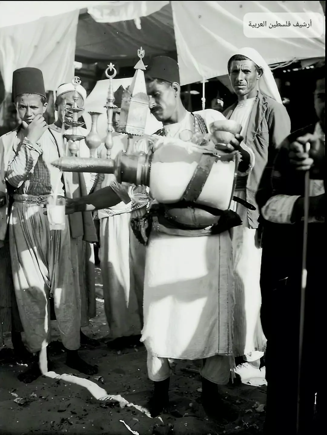
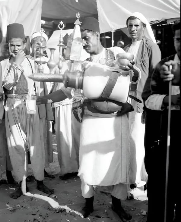
- al-Nabi Rubin Yearly Muwsem Pre 1935
Scanned from "All That Remains" by Dr. Walid Khalidi 6 - Banners Of al-Sufi Order During The al-Muwsem Pre 1935
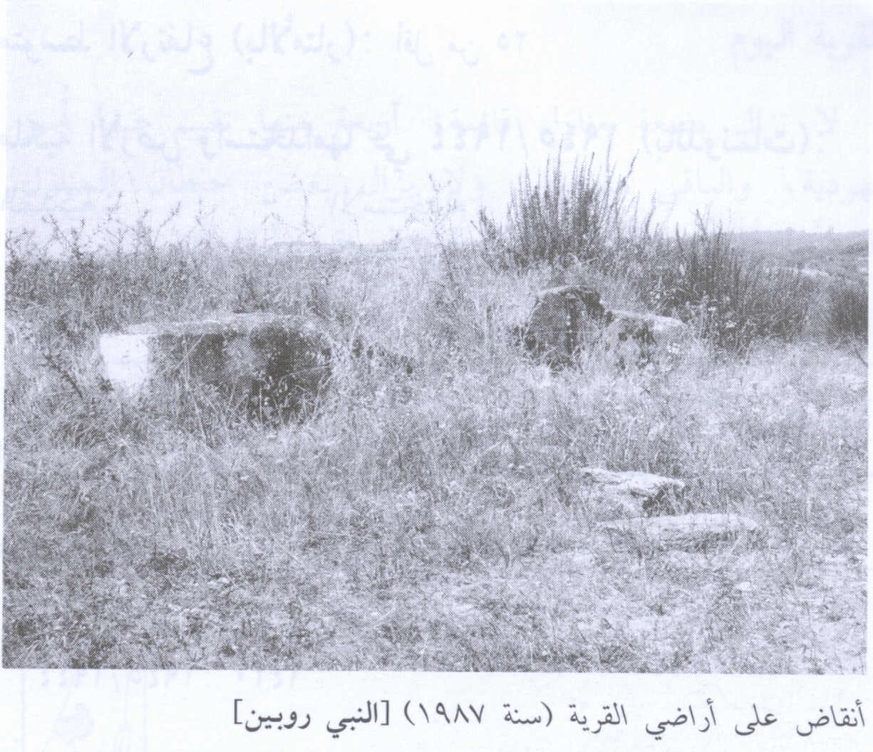
Scanned from "All That Remains" by Dr. Walid Khalidi - Village House Rubble In 1987
Scanned from "All That Remains" by Dr. Walid Khalidi - Village Mosque before its minaret collapsed in 1991 (picture taken 1987)
Scanned from "All That Remains" by Dr. Walid Khalidi 2 - Village Store During The al-Muwsem Pre 1935
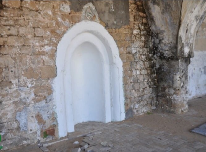
Scanned from "All That Remains" by Dr. Walid Khalidi 1 - Nabi Rubin Mosque's Mihrab before renovation, 2005
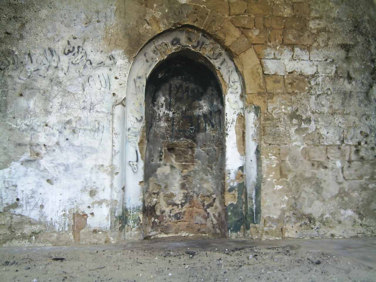
Posted by ran riegler 1 - Nabi Rubin Mosque's Mihreb after renovating, 2005
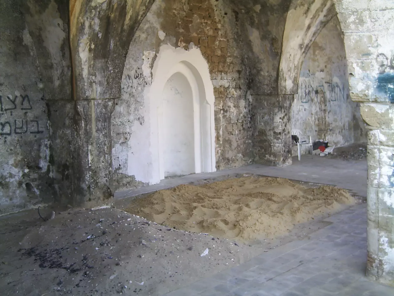
Posted by ran riegler 1 - Entrance to Mosque of Nabi Rubin, 2005
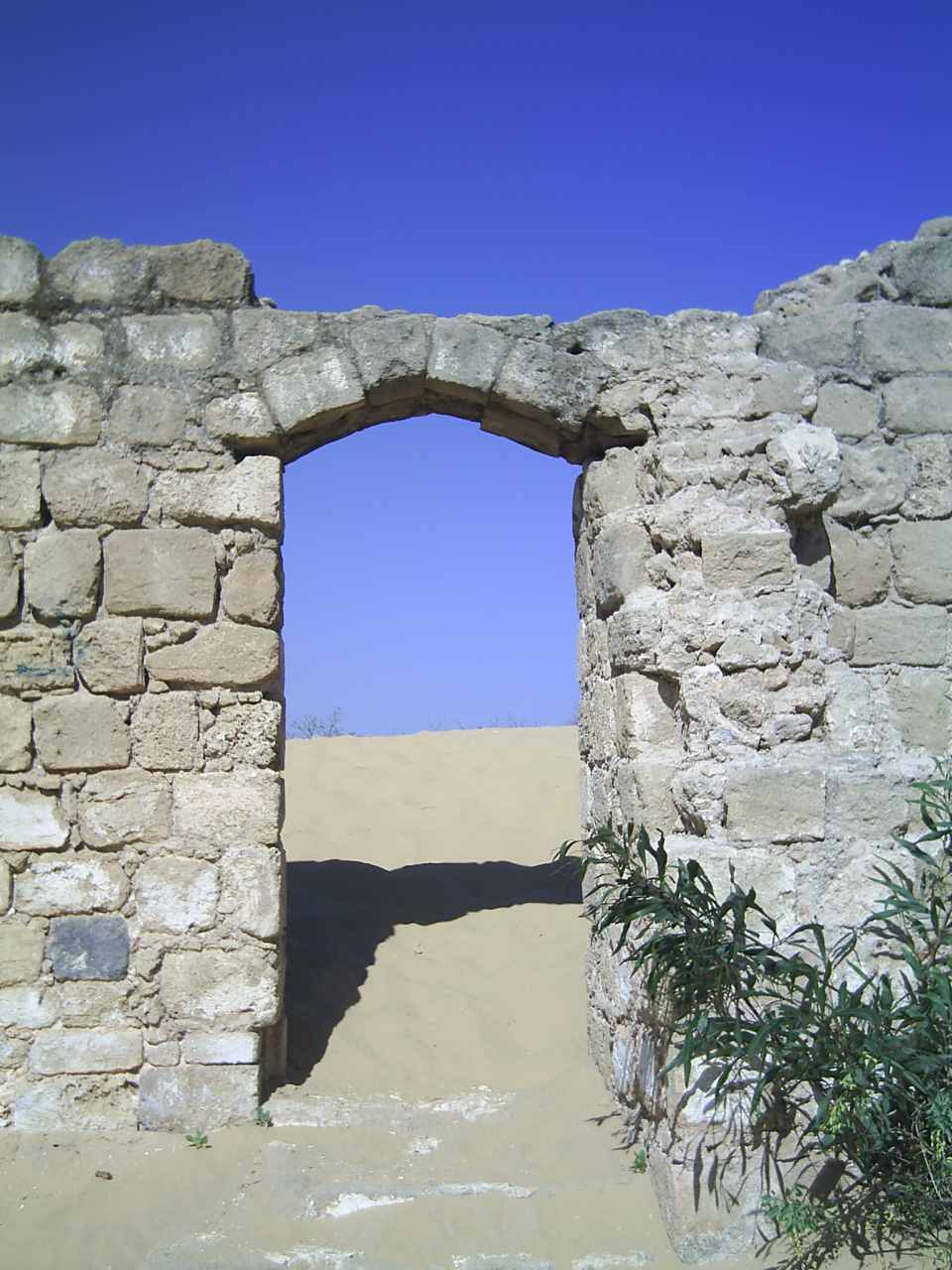
Posted by ran riegler 1 - The shrine swamped with sand dunes, 2005
Posted by ran riegler - The trees around the shirne and the mosque #2, 2005

Posted by ran riegler - One of the Mosque's remaining walls, 2005
Posted by ran riegler - One of the Mosque's remaining walls #2, 2005
Posted by ran riegler - A side picture of the mosque, 2005
Posted by ran riegler - Some remaining structures nearby the mosque, 2005
Posted by ran riegler - General view of the moaque's square, 2005
Posted by ran riegler - General view of the area around the mosque, picture take from the mosque's roof, 2005
Posted by ran riegler 1 - The sand Dunes around the Mosque, 2005
Posted by ran riegler - General View of the Mosque and the shrine of Nabi Robin, 2005
Posted by ran riegler 4 - During the famous yearly festival/mawsim, Matson collection. (Before 1933)
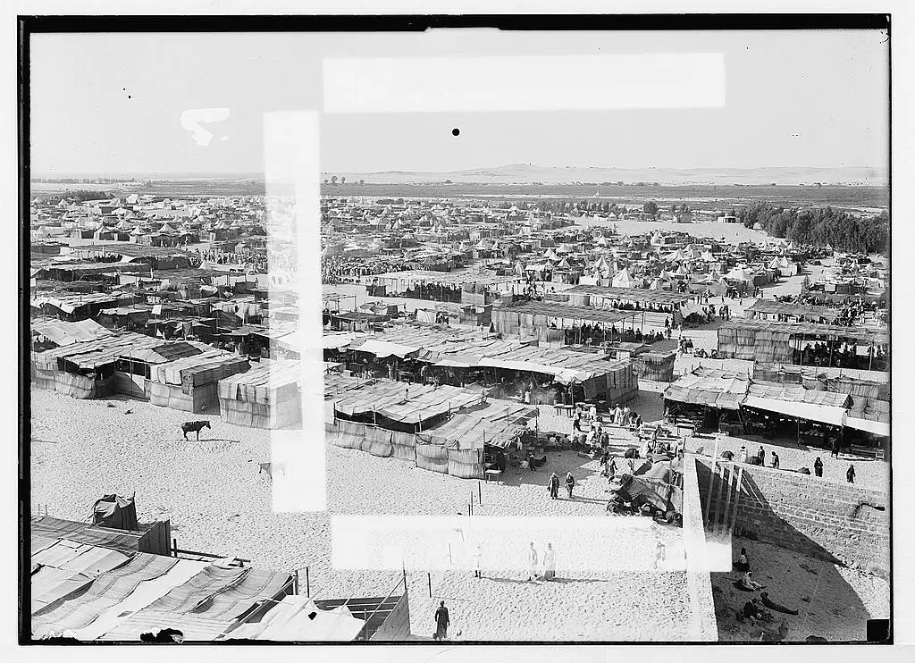
- During the famous yearly festival/mawsim, Matson collection. (Before 1933)
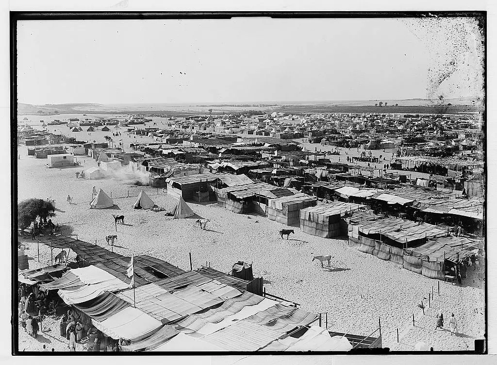
- During the famous yearly festival/mawsim, Matson collection. (Before 1933)
- Nearby wadi al-Sara/Rubin river, Matson collection.
- The shrine, note house the shrine and the mosque were fenced in by the Israeli authorities.
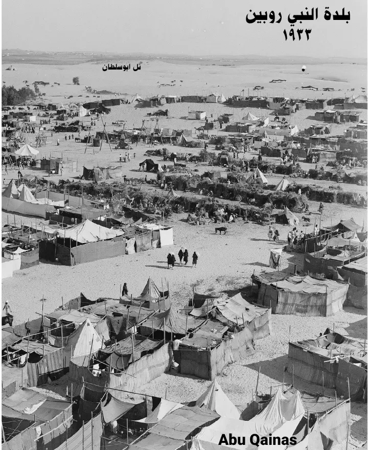
Posted by Noga Kadman - منظر عام لمدينة الخيام غضون الموسم التي كانت تتسع ل 20,000 الى 30,000. (قبل 1935). تدوين لاسماء العائلات التي سكنت النبي روبين قبل النكبة ..وفرت في قسم التعليقات اسفل الصورة.
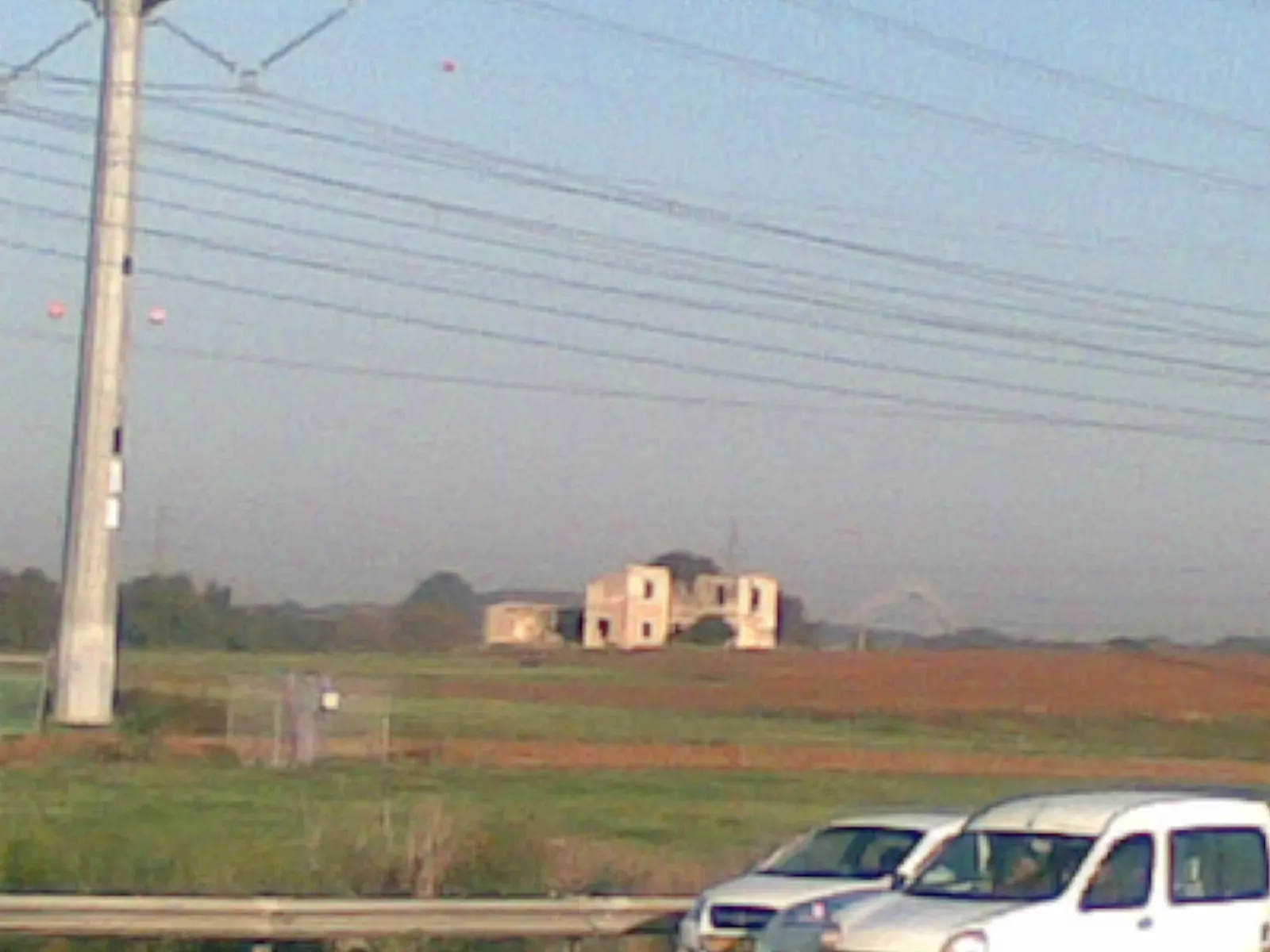
Scanned from "All That Remains" by Dr. Walid Khalidi 3 - من اراضي النبي روبين تصوير من الطريق العام المسمى تل ابيب اشدود
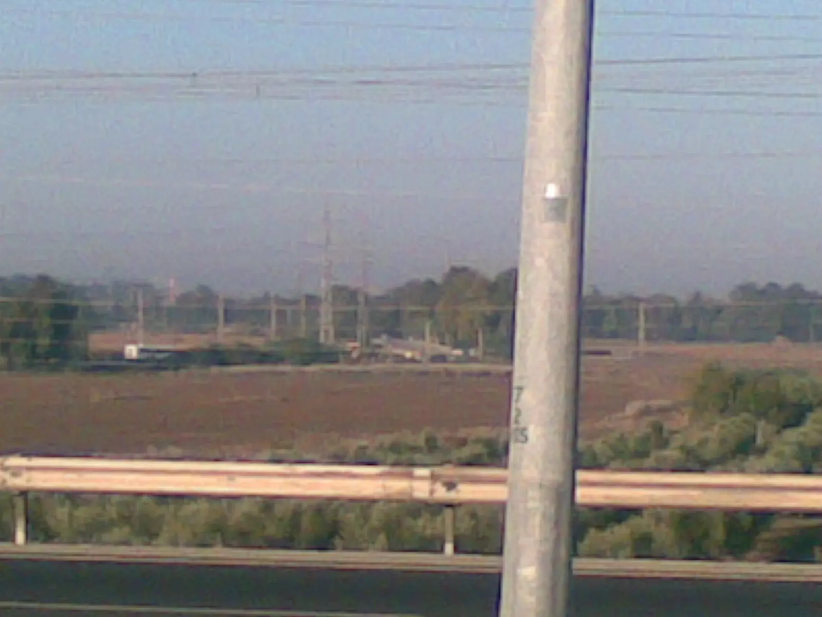
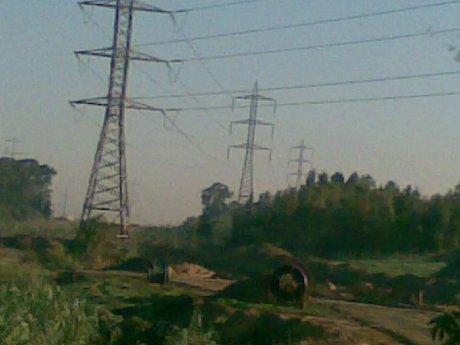
Posted by ابو الثائر - من اراضي النبي روبين تصوير من الطريق العام المسمى تل ابيب اشدود
Posted by ابو الثائر 1 - من اراضي النبي روبين تصوير من الطريق العام المسمى تل ابيب اشدود
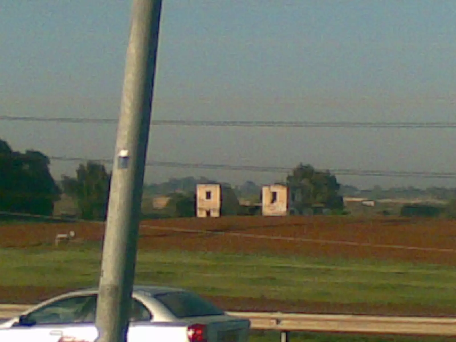
Posted by ابو الثائر - من اراضي النبي روبين تصوير من الطريق العام المسمى تل ابيب اشدود
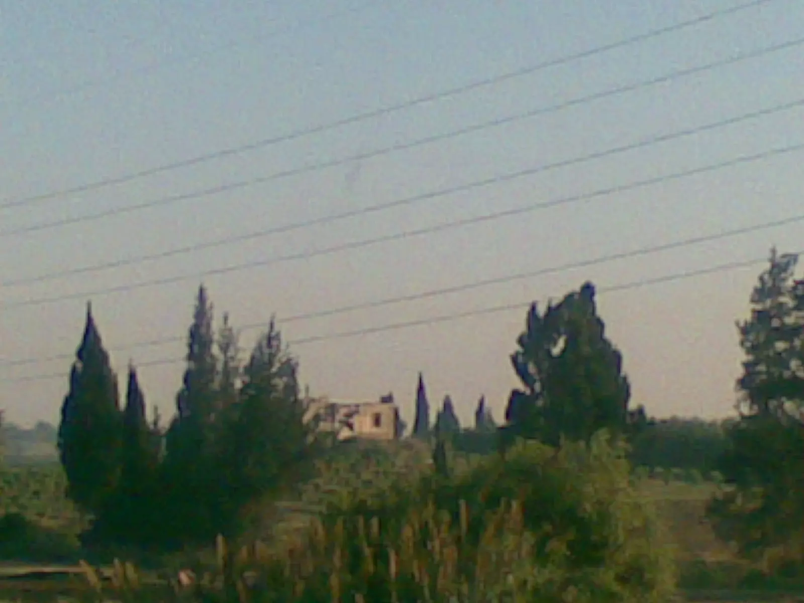
Posted by ابو الثائر - شرقي الشارع للنبي روبين
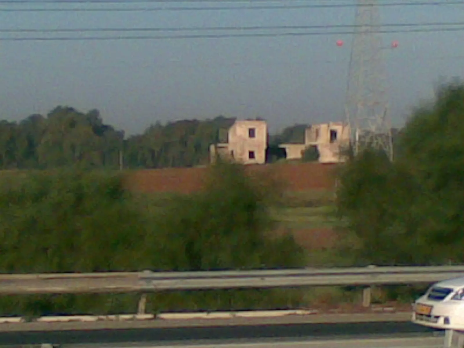
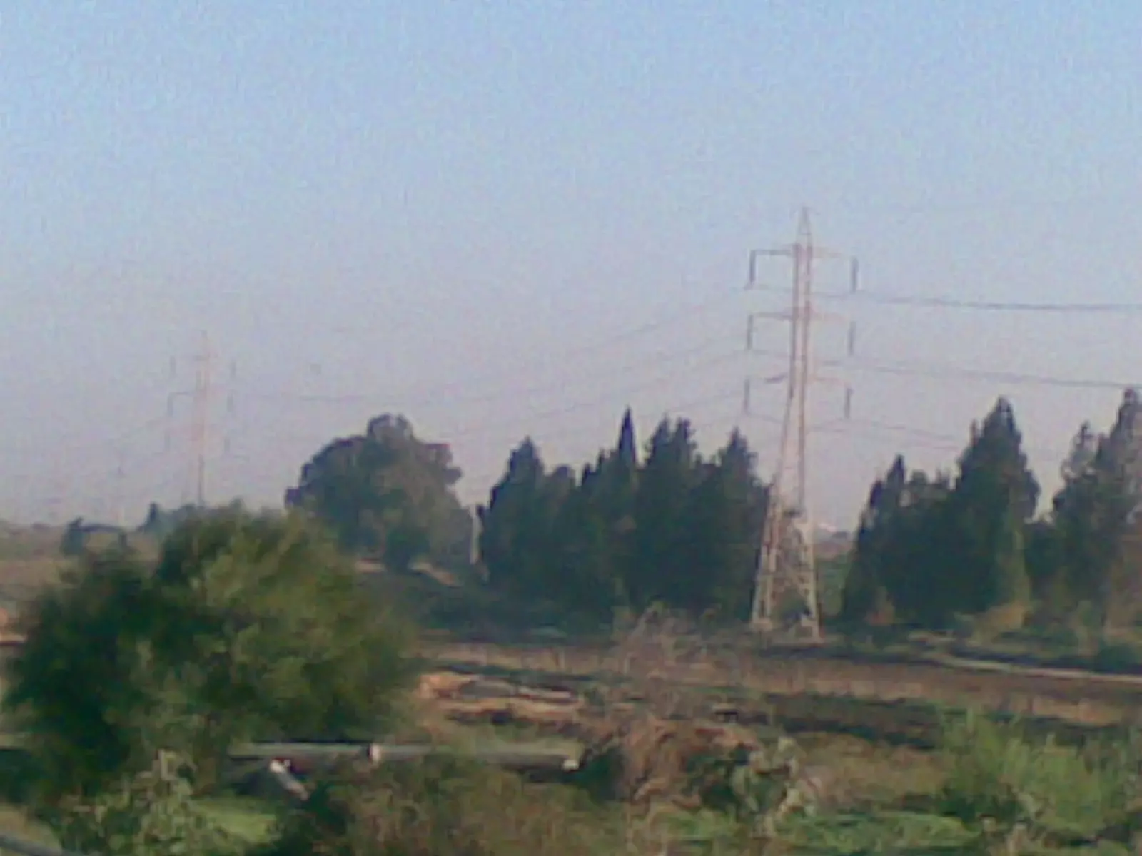
Posted by ابو الثائر - من اراضي النبي روبين تصوير من الطريق العام المسمى تل ابيب اشدود
Posted by ابو الثائر - من اراضي النبي روبين تصوير من الطريق العام المسمى تل ابيب اشدود
Posted by ابو الثائر - 2012
Posted by ran riegler - 2012 the grave
Posted by ran riegler - 2012 renovation
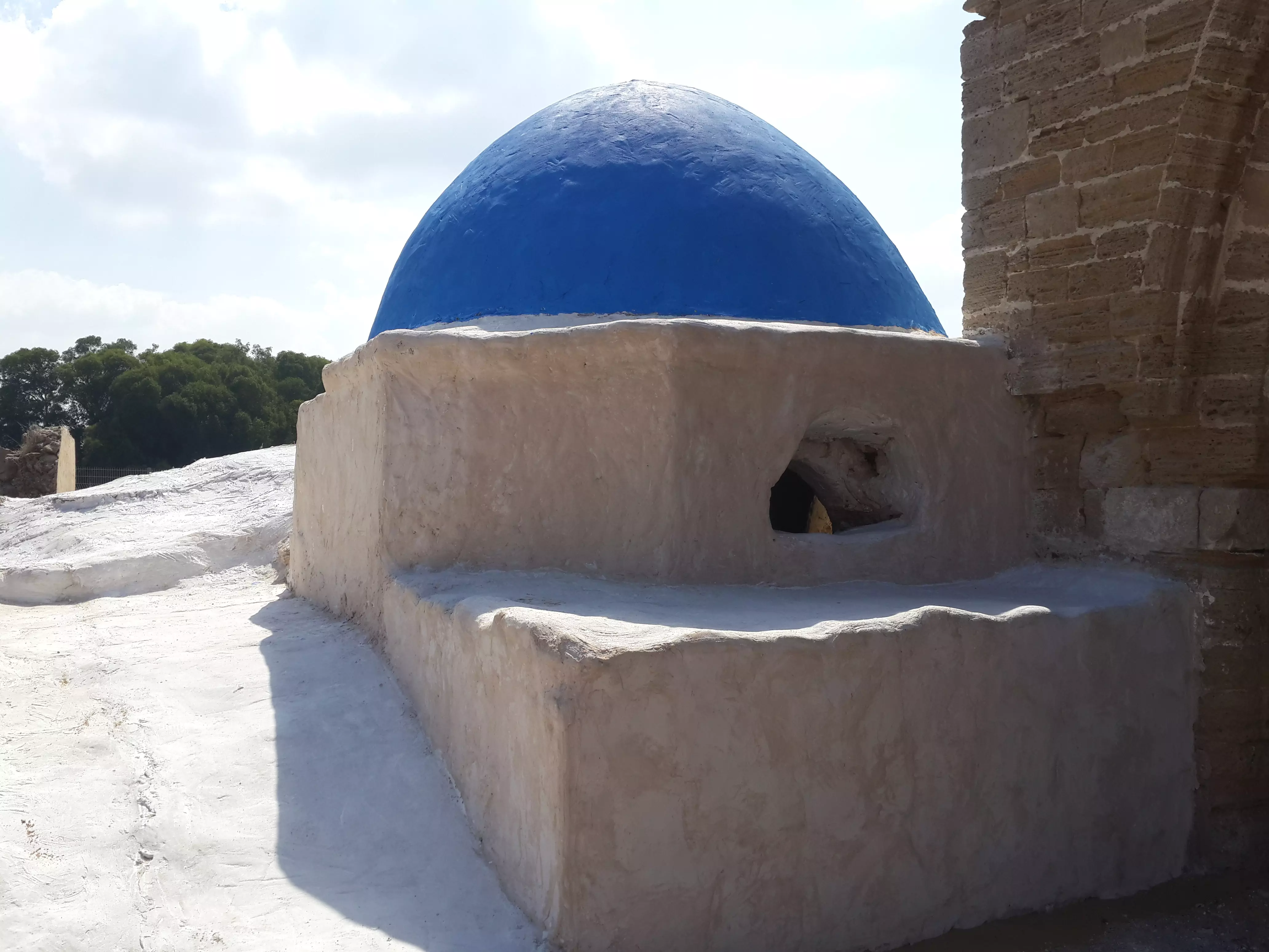
Posted by ran riegler - the dome
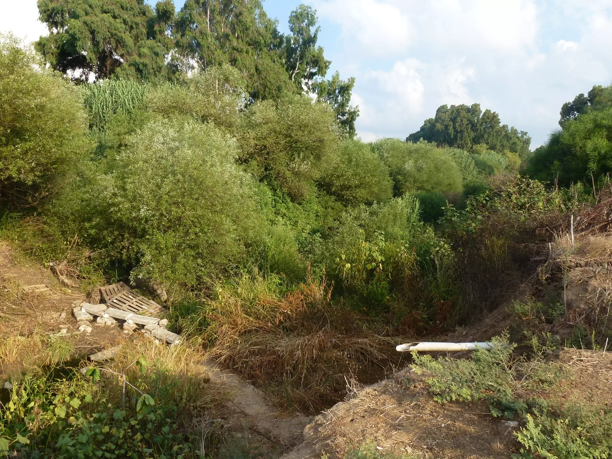
Posted by ran riegler - The shortcut through the river
Posted by ran riegler - The shortcut through the river pass 2012
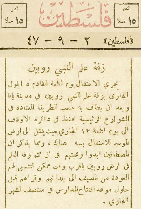
Posted by ran riegler - إعلان عن إجراءات زفة علم النبي روبين بتاريخ 1947/9/2 في صحيفة فلسطين
Posted by Kamal Abu Diab - مقام ومسجد النبي روبين
Posted by abu raya - مقام النبي روبين
Posted by abu raya - مقام النبي روبين
Posted by abu raya - مقام النبي روبين
Posted by abu raya - مقام النبي روبين
Posted by abu raya - مقام النبي روبين من الداخل
Posted by abu raya - 2016 Jewish fix up , new plaster to holly grave
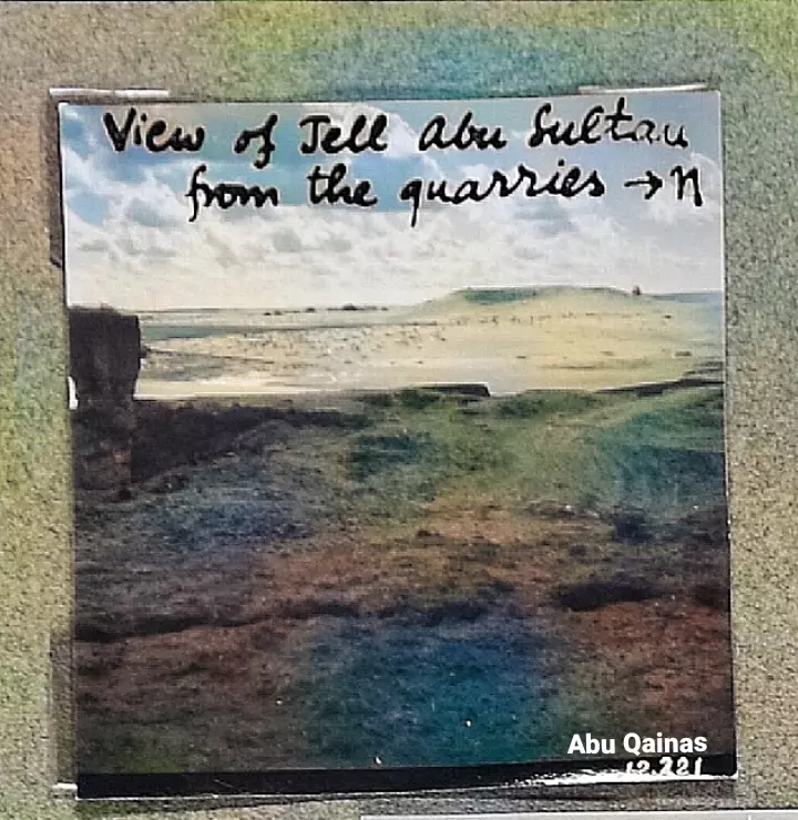
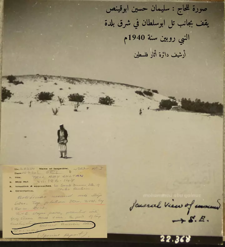
Posted by ran riegler - تل ابو سلطان في شرق بلدة روبين
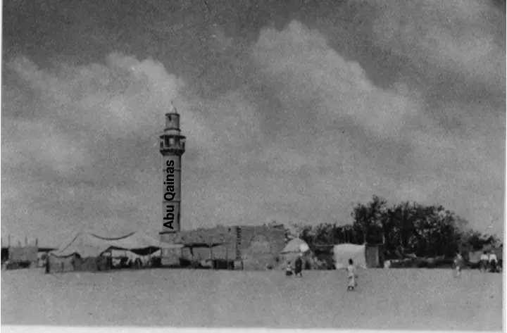
Posted by محمد ابو قينص 2 - مسجد النبي روبين في سنة 1941م
حيث كان قائم المقام / الشيخ شحاده منصور
ويأذن فيه أحياناً الحاج/ حسان أبوقينص الذي يسكن شرق المقام .
Posted by محمد ابو قينص - النبي روبين من فوق مسجد البلدة

Posted by محمد ابو قينص 5 - النبي روبين من فوق مسجد البلدة #2
Posted by محمد ابو قينص - بلدة النبي روبين وعبور الأهالي من الوادي إلي الموسم
Posted by محمد ابو قينص - بلدة النبي روبين وعبور الأهالي من الوادي إلي الموسم #2
Posted by محمد ابو قينص - النبي روبين .
أرشيف دائرة آثار فلسطين
سليمان حسين أبوقينص ، يقف بجانب تل ابوسلطان في بلدة النبي روبين 1940م
Posted by محمد ابو قينص 2 - بلدة النبي روبين al nabi rubin 1948
Posted by محمد ابو قينص - خريطة معالم جديدة بلدة النبي روبين nabi rubin ابوقينص
Posted by محمد ابو قينص - علي(خليل علي عبده المصري) بائع عصير اللوز في موسم الحمضيات"روبين" قضاء الرملة قبل عام 1946
- A Lemonade seller in the village of Nebi Rubin, Palestine -1920 to 1933
- غضون موسم النبي روبين قبل النكبة
- غضون موسم النبي روبين قبل النكبة #2
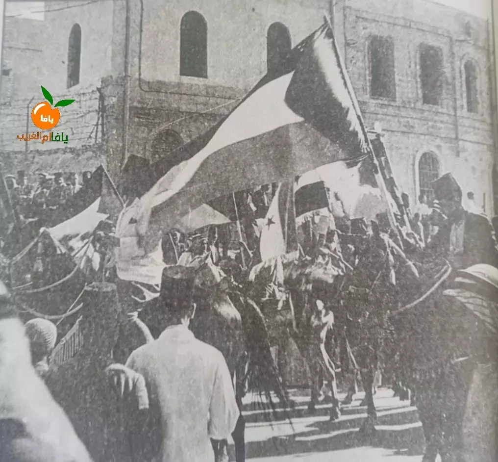
- يافاوي يحمل علم فلسطين أثناء تجمهر اهالي يافا استعدادا للخروج إلى قرية النبي روبين كما هو المعتاد في كل عام . الصورة نادرة جدا ويرجح تاريخها من الثلاثينات من القرن الماضي
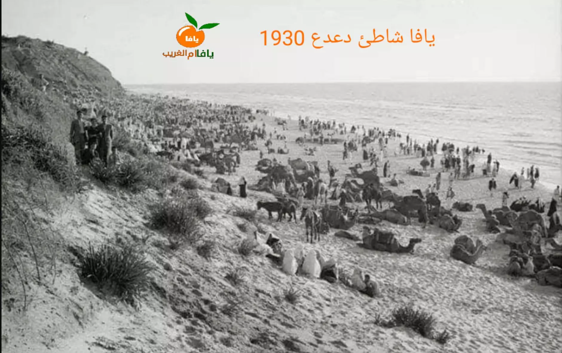
- صورة نادرة جدا لتجمع اهالي يافا في شاطئ دعدع جنوب يافا ابتهاجا للإنطلاق إلى قرية النبي روبين
وفيه كانت تقول النساء لأوزاجهن يا بتروبني يا بتطلقني
كان موسم النبي روبين أكبر الأعياد الشعبية الفلسطينية من حيث حشد وتجمع الناس، إذ كان يشارك فيه كل فئات الشعب الفلسطيني
Want to browse more? 80,000 pictures were grouped in these gallaries:
| Display Name | Clan/Hamolah | Country of Residence |
| وسيم ابو خوصة | ابو خوصة | مخيم الفارعة-محافظة طوباس, فلسطين |
| سدين | الطاهر البيتوني | Beitunia, Palestine |
| محمد ابو قينص | ابو قينص | غزة, فلسطين |
| مؤمن ابو مخدة | - | الزوايدة, غزة |
| وليد | بني عامر | النصيرات |
| mahmoud fathy abu shiha | - | palestine - UAE, palestine - UAE |
| ابو سلمان | عشيرة بني عامر | gaza |
| ابن روبين | الرميلات | qatar , qatar |
| saeed | - | dubai, uae |
| ابوانس | الرميلات | - |
| محمد الزغيبي | الرميلات | - |
| ابن روبين | السواركه | - |
| الكرداسي | الكرداسي | عمان-الاردن, الاردن |
| ran riegler | - | rehovot, israel |
 Fake Valor: Why Did Zionist Jews Hoist Nazis Flag on Their Ships in the 1930s?
What is new?
-
Facts About Oct. 7th Gaza Raid
-
Remined Us Please: Who Did Rape Whom? Was it Palestinians who raped Israelis? Or, was the other way around? You'll be the judge
-
When Prof. Edward Said was invited to debate Bibi Netanyahu in the 1980s, watch what happened!
-
Ezra Klein of the NY Times on the "Jewish Race".
-
Abusing Blood Libel!
-
How and why Israeli Jewry has become the most hated cult?
-
Did Israeli Soldiers Activate The Hannibal Direective On Oct. 7th? You Be The Judge
-
Zionist FAQ: Isn't it true that Palestinians don't want peace? Palestinians never accepted the two-state solution
- Facts about Haavara (Transfer) Agreement between Ben-Gurion & Hitler
-
Haavara FAQs: Why Did Zionist Jews Hoist Nazis' Flags on Their Ships in the 1930s?
- Haavara FAQs: When Chaim Weizmann met FDR in mid-1943, why was he silent about rescuing European Jewry?
-
Dear ChatGPT: How did Palestinians resist Napoleon's invasion of their country in 1799?
-
Dear ChatGPT: Gaza had a vibrant Jewish community in the mid-17th century. What happened to them?
-
Dear ChatGPT: Why did the Jewish Agency suppress news of the Holocaust during WWII?
-
Video Playlist: Jews share their DNA tests to end the conflict for good.
-
A Tale of Two Conflicts: Examining the Definition of Genocide
-
Prof. Abraham Polak And The Suppressed History of the Khazars and European Jewry
-
How Ronald Reagan would have framed the genocide in Gaza if he were still alive?
-
Haavara FAQs: Let us do the math: how many German Jews did The Haavara Agreement save?
-
Zionist FAQs: The Hebron Massacre of 1929, "clearly proves" that Palestinians are antisemitic, how could you deny it?
-
Zionist FAQs: Why Anti-Zionist Is Not Antisemitism?
-
Zionist FAQs: Isn't it true that the KGB created Palestinian Nationalism in the early 1960s?
- Zionist FAQs: Muslims are killing Muslims all the time; why are Israeli Jews being singled out in the media?
- Zionist FAQs: How is Israel an apartheid state when 20% of its citizens are Arabs who enjoy full rights?
-
Haavara FAQs: Why Did Dorothy Thompson Flip From A Zionist Advocate to A Silenced Dissenter?
-
Haavara FAQs: Analysis of Herzl's Uganda Scheme and how it could have saved millions of Jews.
-
Haavara FAQs: Why did Hayim Greenberg describe American Jewry as "morally bankrupt" in early 1943?
-
Haavara FAQs: What if the Evian Conference was a resounding success? What would have been the impact of saving European Jewry on Zionism?
- Haavara FAQs: What if the six million were saved, how that would have impacted the Zionist project?
-
Haavara FAQs: How did Zionist leaders react when Europe's Jews lingered in the DP camps after WWII ended?
-
Why does the American Jewish community repeat lies that David Ben-Gurion had debunked before he died?
-
Who has the power to rename the Tatar/Khazar Gene Marker to Jewish IV?
-
Zionist FAQs: Why won't Egypt, Syria, and Jordan take their people back? Jews are indigenous to Palestine, and Arabs immigrated after Jews developed the country. Arabs should leave.
-
Haavara FAQs: Did Hitler and the Nazis conflate between Judaism and Zionist? If that wasn't case, then why?
-
Haavara FAQs: Winston Churchill and antisemitism, a collection of articles written Churchill.
-
Haavara FAQs: Broken by country, how many Jews survived vs. killed during the Holocaust?
-
Haavara FAQs: Why did European Jews vote with their feet and to immigrated to the Americas, not Palestine, after WWII?
-
Watch this American Jewish Girl describing Israeli Jews' cognitive dissonance like no other in under two minutes
-
Haavara FAQs: When the Nazis went out of their way to hide the Holocaust, Israeli Jews did the exact opposite by broadcasting their genocide of Gazans. But why?
-
Haavara FAQs: How Zionist Jews went out of their to show their appreciation to Nazism and Fascism?
- Haavara FAQs: Why Zionist leaders were against bombing the death camps & the Railroads leading to them?
-
Haavara FAQs: Hitler's message to the British and American people: If Jews are such noble citizens and you care about them, how come you're not letting them in? I will gladly ship them to you at my expense, even on luxury liners!
-
A shortlist of Zionist and Israeli false flag operations in the name Jews.
-
The Most Moral Army
- The Land of Kapos (Israel): Where the brave are boycotted and Kapos walk free.
- Why did early Zionists often named their communal enterprises "colonial"?
- Zionist Relations with Nazi Germany by Faris Glubb
-
Two NY Times advertisements by Zionists in the early 1943 that exposes Zionists' treason at the height of the calamity
- Facts Not Lies about the Palestinian-Israeli Conflict.
- Site's pictures have been categorized
- Campgain Against Lice
- A Survey of Palestine, the official source about Palestine before Nakba produced by the British Mandate; over 1200 pages.
- Satellite View & Google Earth: Over 6,000 placemarks identifying all destroyed towns, W. Bank & Gaza Strip Towns, & refugee camps.
- PalestineRemembered.com and its Nakba Oral History Project were featured on al-Jazeera Satellite TV.
- Nakba Oral History Video Podcast:
 Over 700 Oral History interviews (including 3,500+ hours of recording) can be viewed online.
 - Palestine Village Statistics Project
- Gaza Jail Break
- النسخة العربية للموقع الان متوفرة
- Videos: Documenting the destroyed villages in video: Tracing all that remains since Nakba.
- Videos: Responding to Zionist Propaganda
- Interview: The ethnic cleansing of Palestine: George Galloway interviews Israeli Historian Ilan Pappe.
- For Palestinians, memory matters. It provides a blueprint for their future By George Bisharat.
- Zionist FAQ now available in Hebrew שאלות שציונים שואלים, עכשיו בעברית
- Video: The Stephen Walt and John Mearsheimer report on the influence of the Israel Lobby on U.S. Foreign Policy
- The Palestinian-Israeli conflict for beginners
