| PalestineRemembered | About Us | Oral History | العربية | |
| Pictures | Zionist FAQs | Haavara | Maps | |
| Search |
| Camps |
| Districts |
| Acre |
| Baysan |
| Beersheba |
| Bethlehem |
| Gaza |
| Haifa |
| Hebron |
| Jaffa |
| Jericho |
| Jerusalem |
| Jinin |
| Nablus |
| Nazareth |
| Ramallah |
| al-Ramla |
| Safad |
| Tiberias |
| Tulkarm |
| Donate |
| Contact |
| Profile |
| Videos |
Welcome To 'Amqa - عمقا (עמקא)
|
District of Acre
Ethnically cleansed days ago |
العربية Google Earth |
 |
Gallery (101) |
- Statistics & Facts
-
Before & After

- Satellite View
- Articles 2
- Pictures 101
- Aerial Views 1
- Oral History 16
- Members 39
- All That Remains
- Wikipedia
- Videos 4
- Guest Book 25
- Links 1
| Statistic & Fact | Value | ||||||||||||||
| Occupation Date | July 10, 1948 | ||||||||||||||
| Distance From District | 11 (km) Northeast of Acre | ||||||||||||||
| Elevation | 100 (meters) | ||||||||||||||
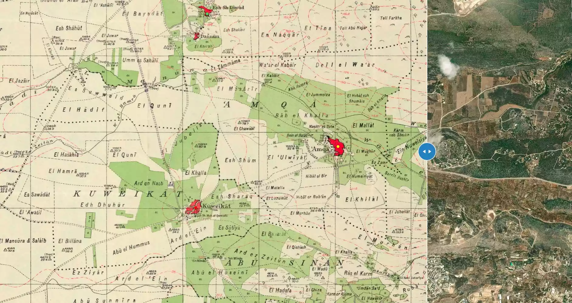
| Before & After Nakba, Click Map For Details |
|||||||||||||||
|
|||||||||||||||
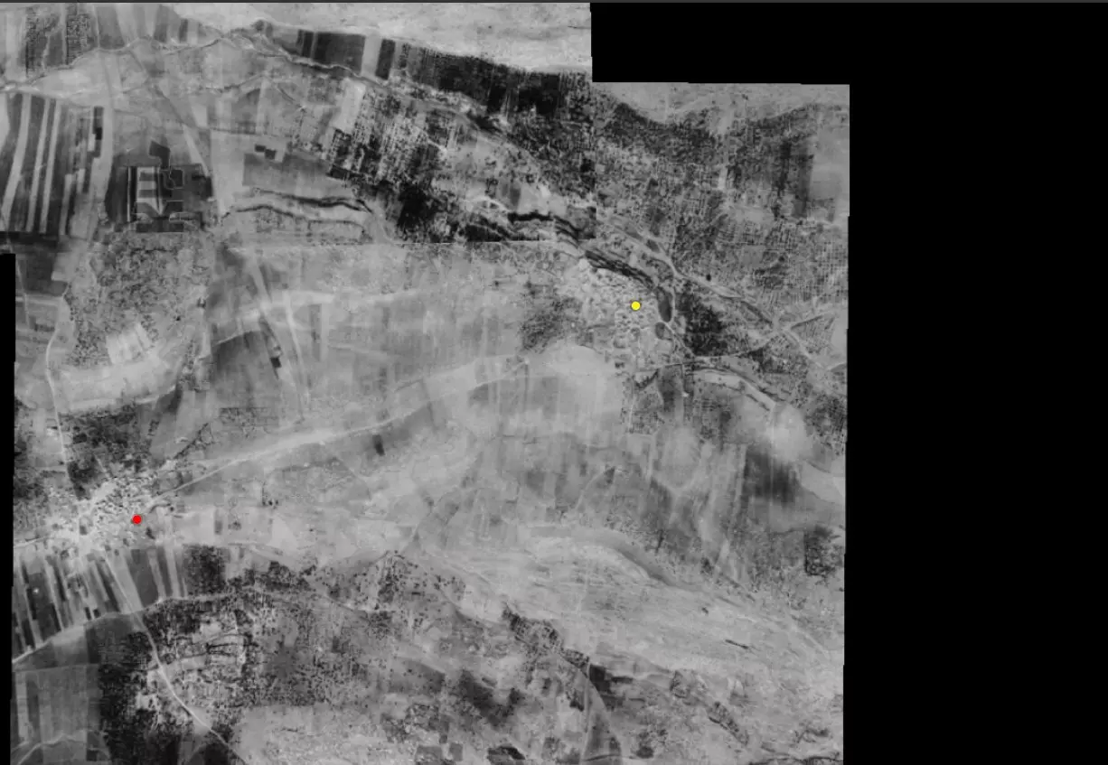
| Pre-Nakba Aerial View |
|||||||||||||||
|
|||||||||||||||
| Map Location | See location #18 on the map View from satellite |
||||||||||||||
| Military Operation | Operation Dekel | ||||||||||||||
| Attacking Units | Sheva' (Seventh) Brigade and the First Battalion of the Carmeli Brigade. | ||||||||||||||
| Exodus Cause | Military assault by Zionist troops | ||||||||||||||
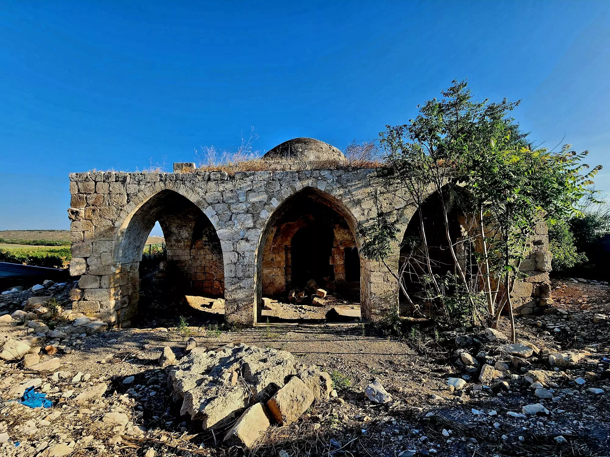
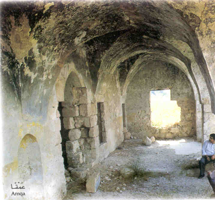
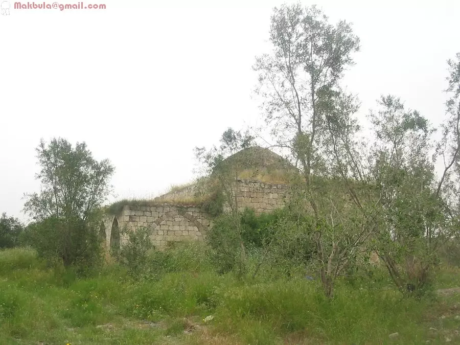
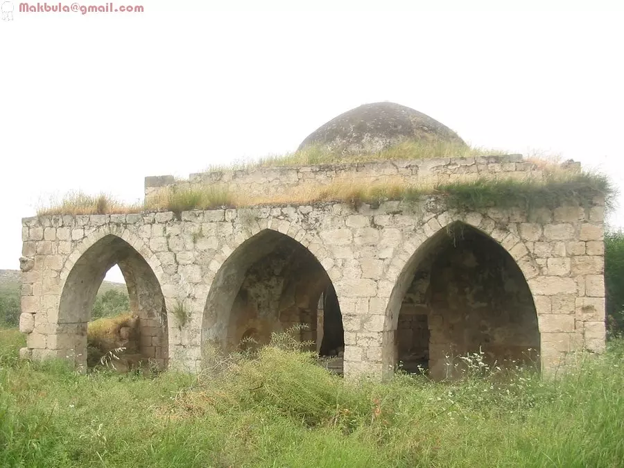
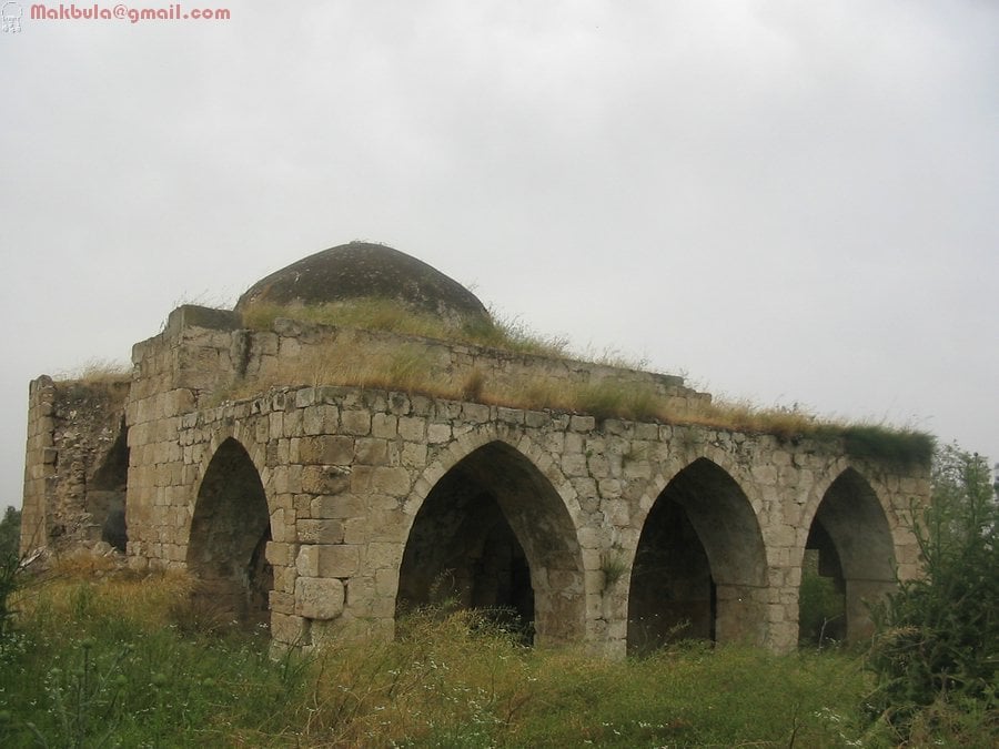
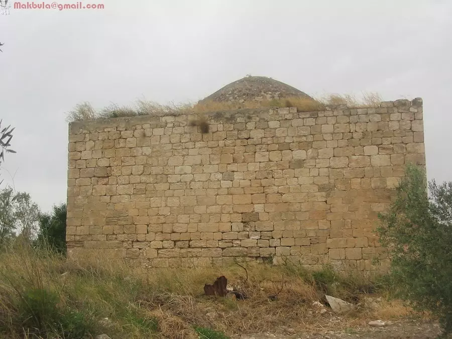
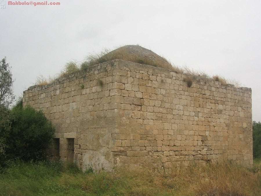
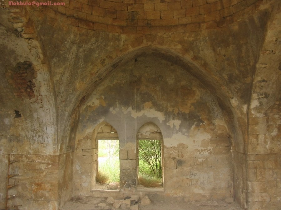
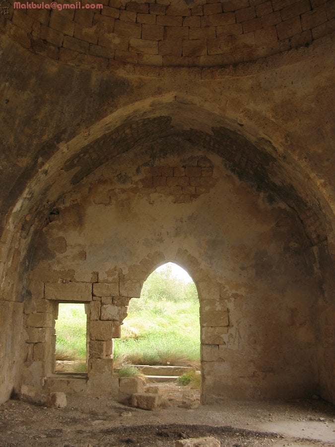
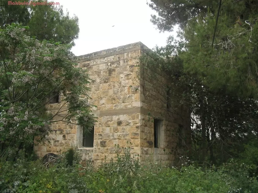
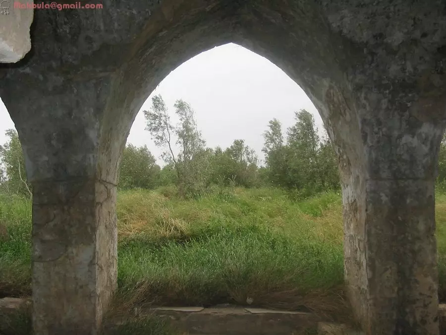
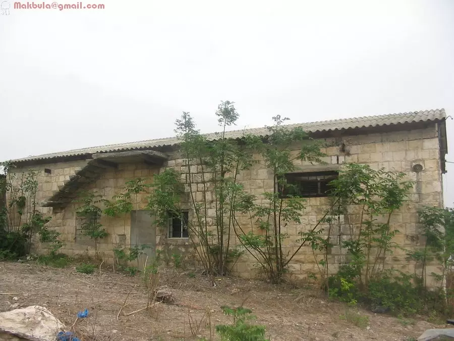
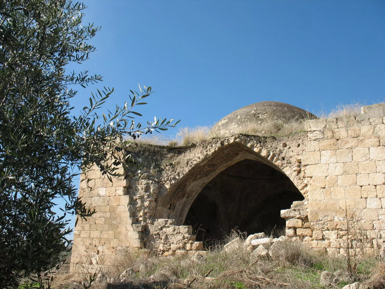
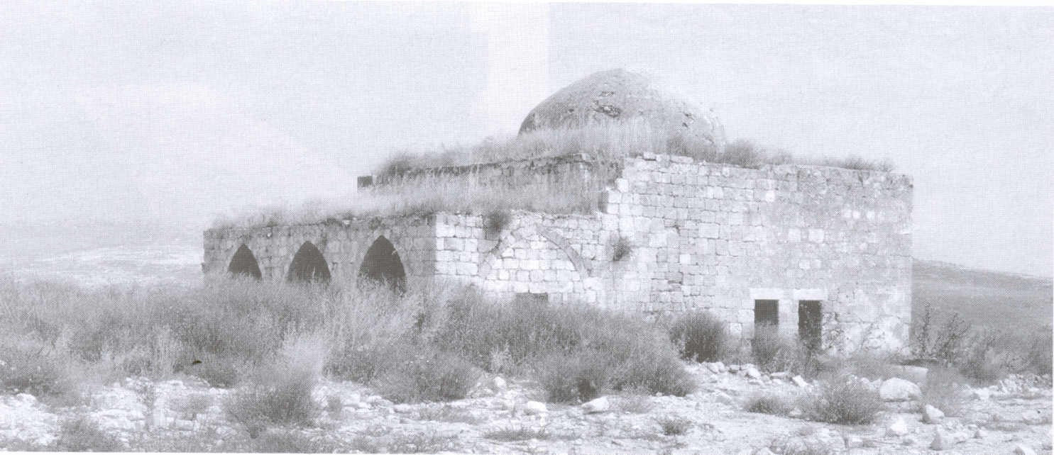
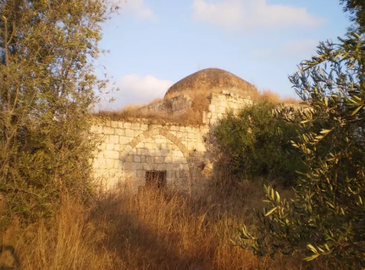
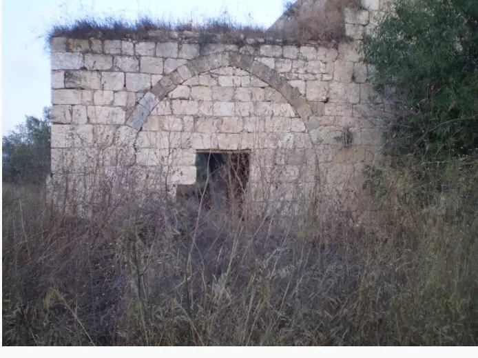
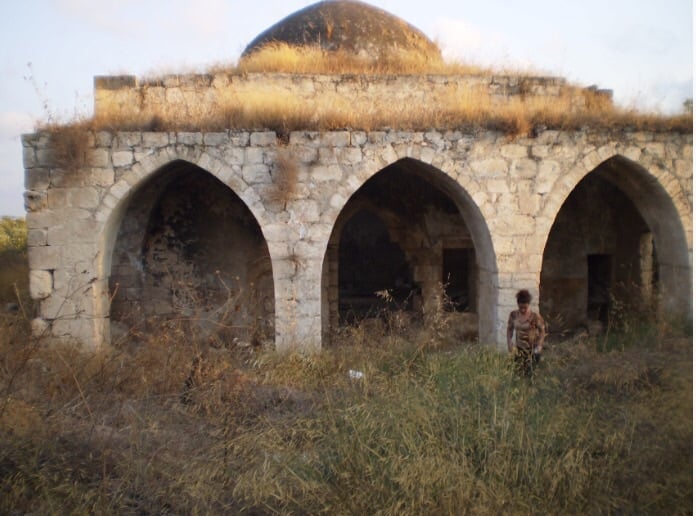
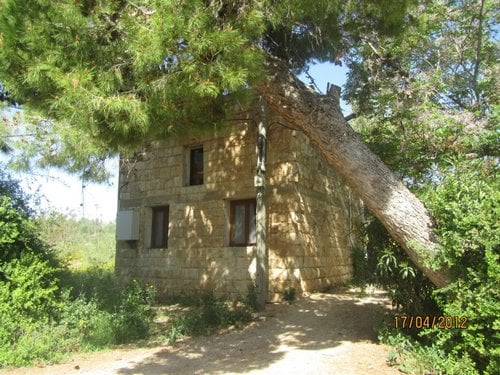
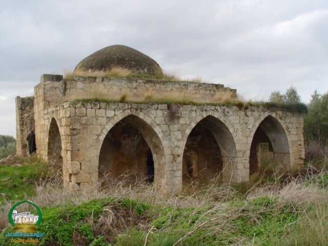
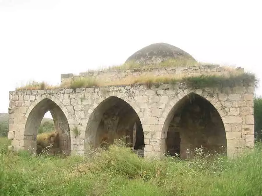
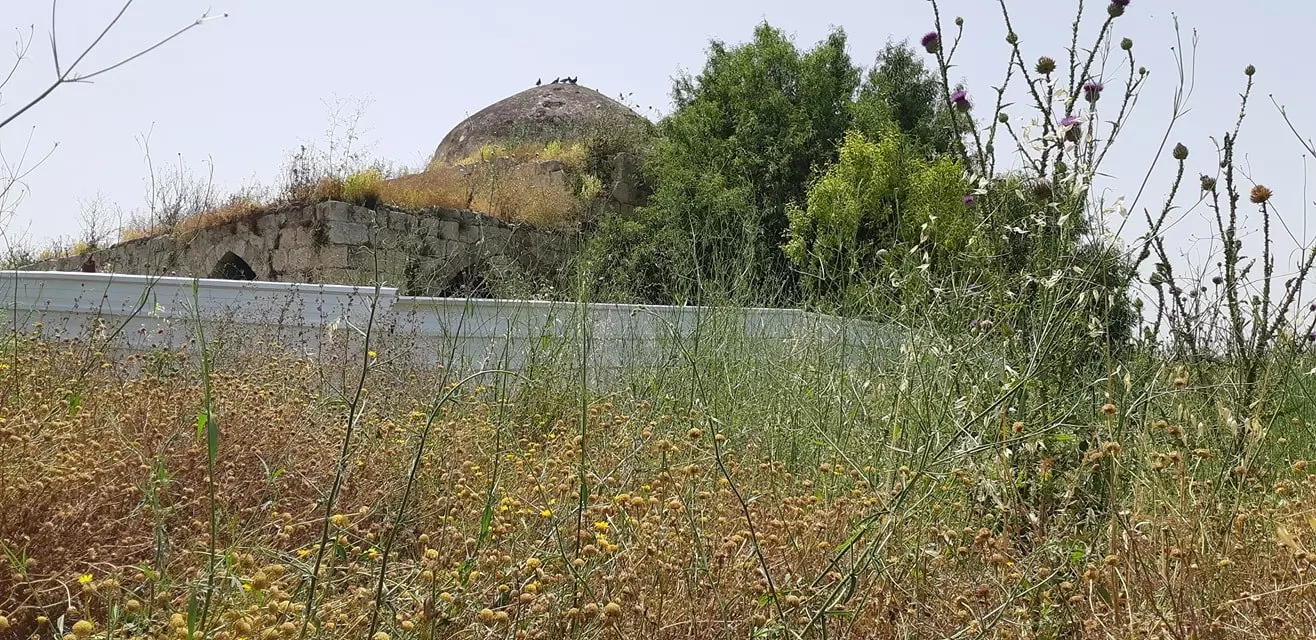
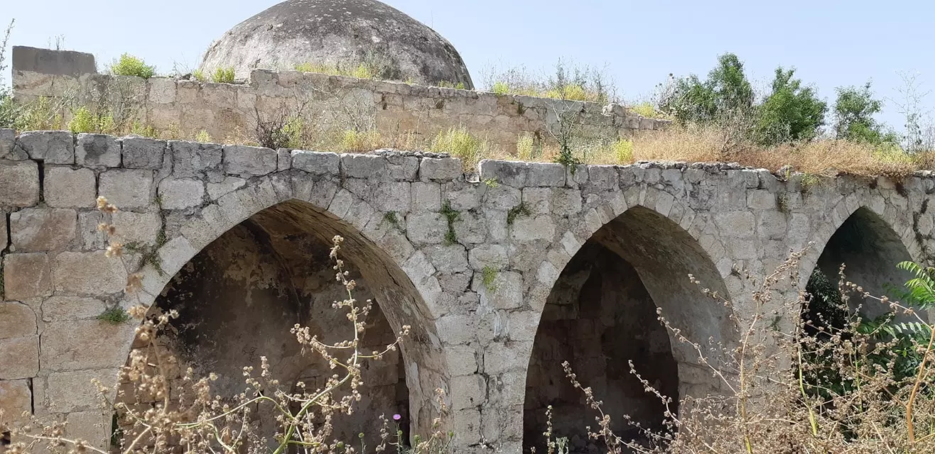
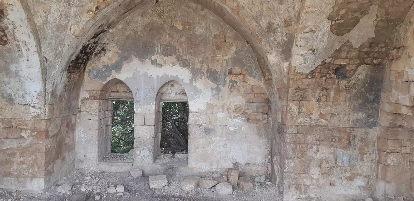
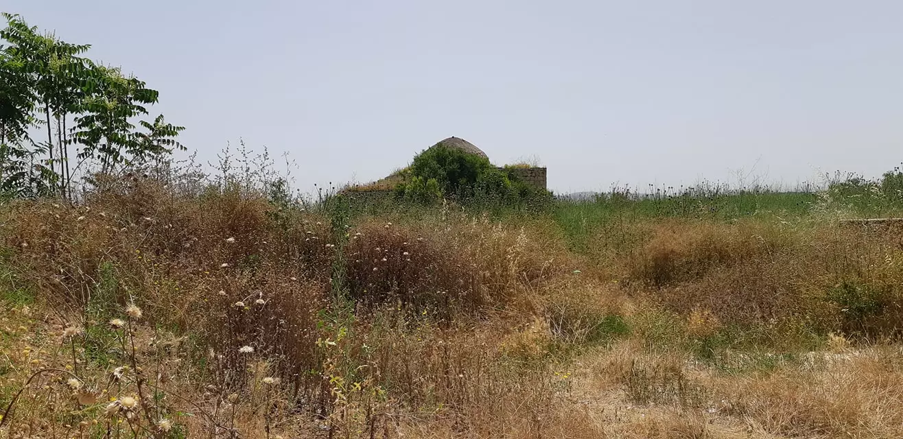
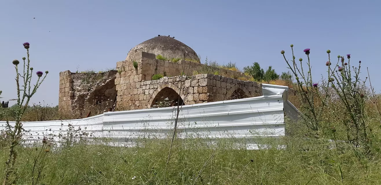
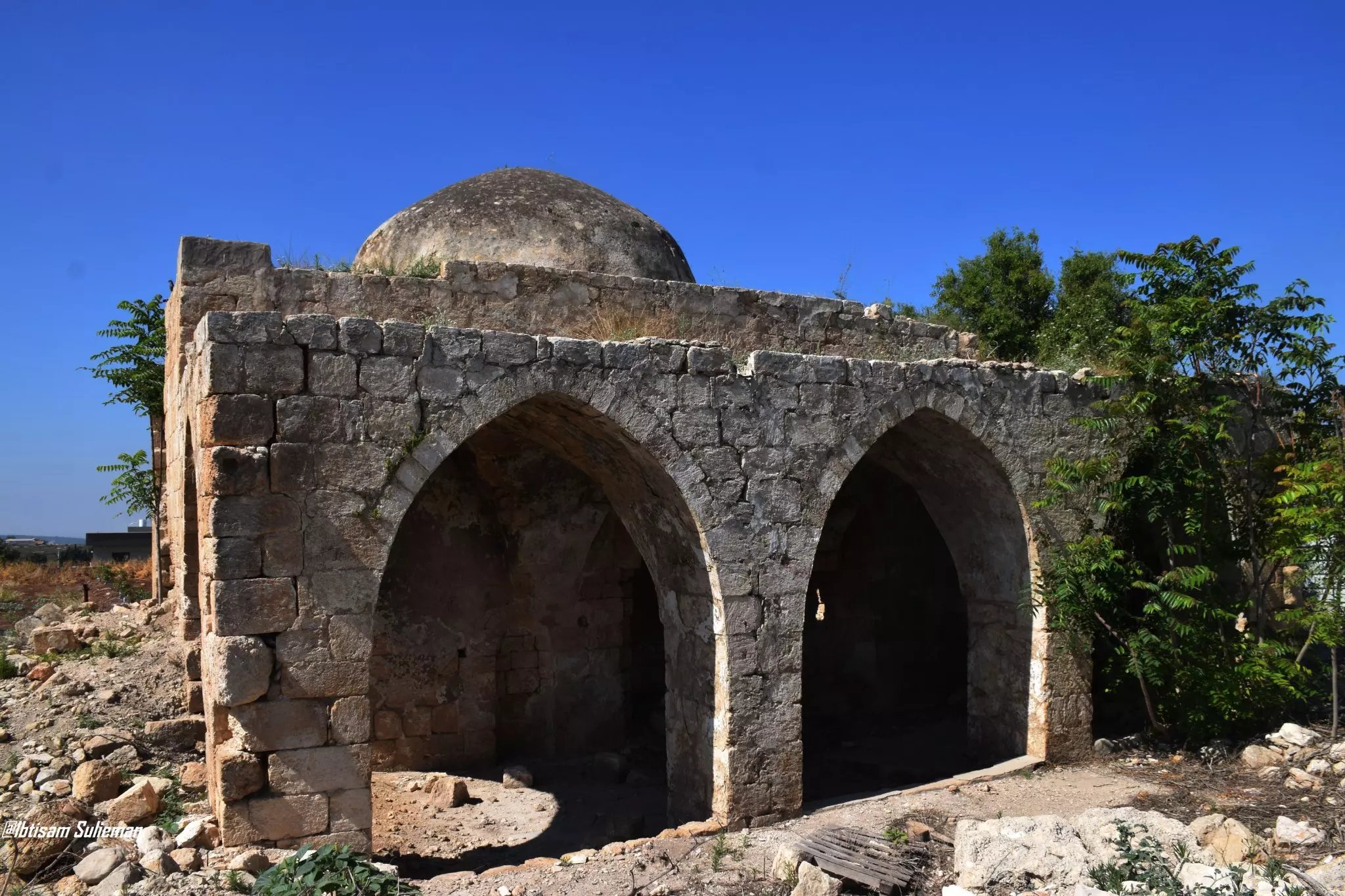
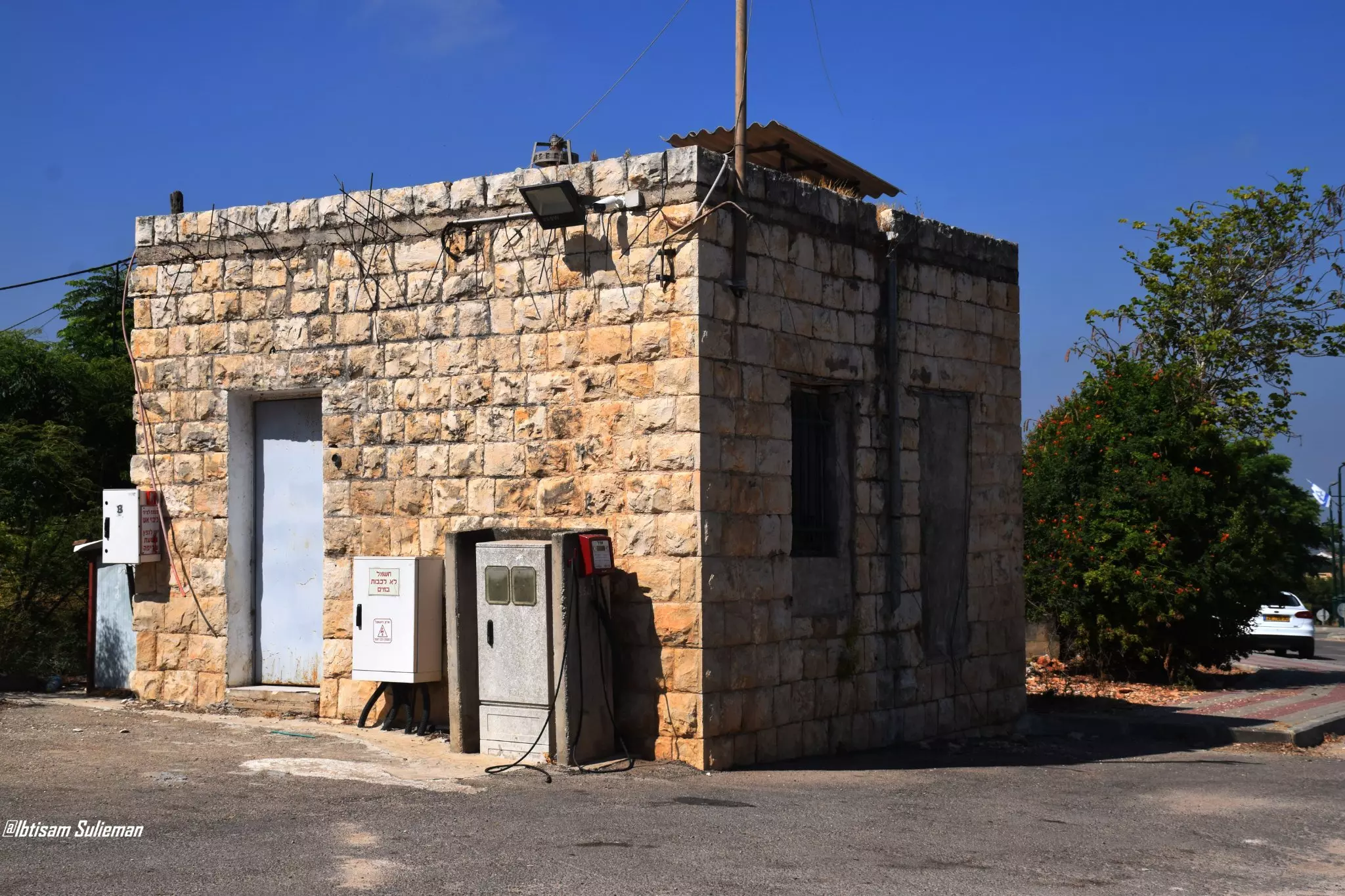
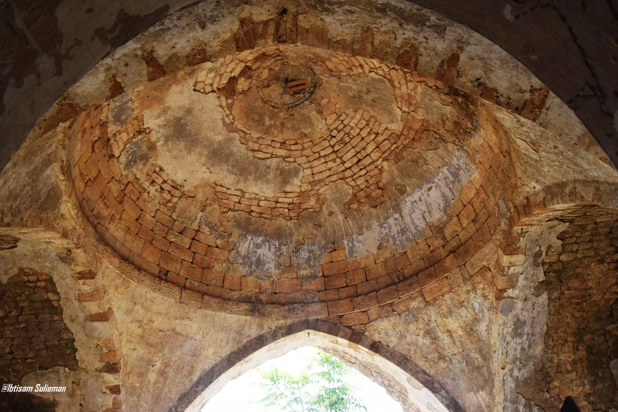
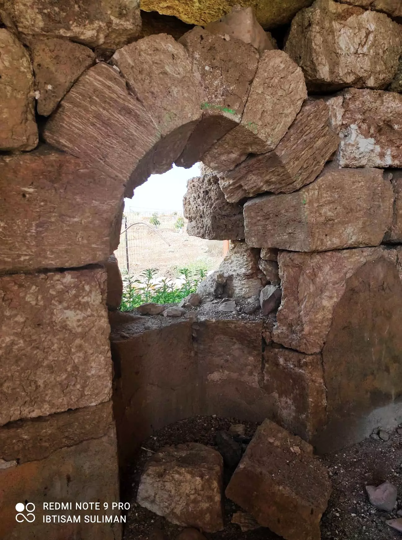
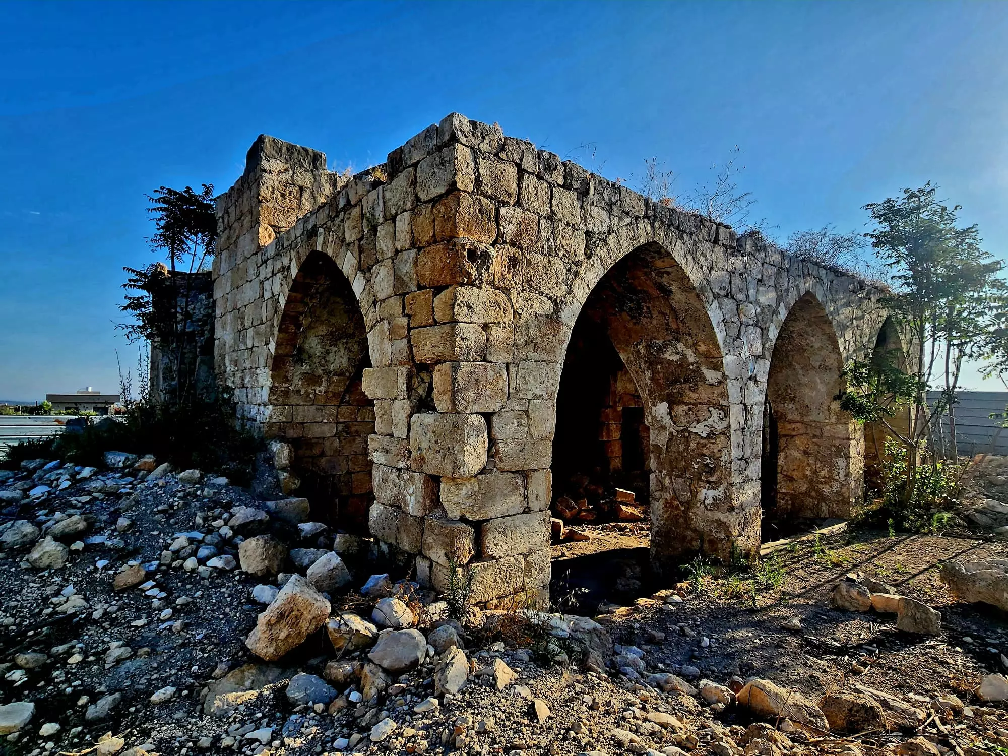
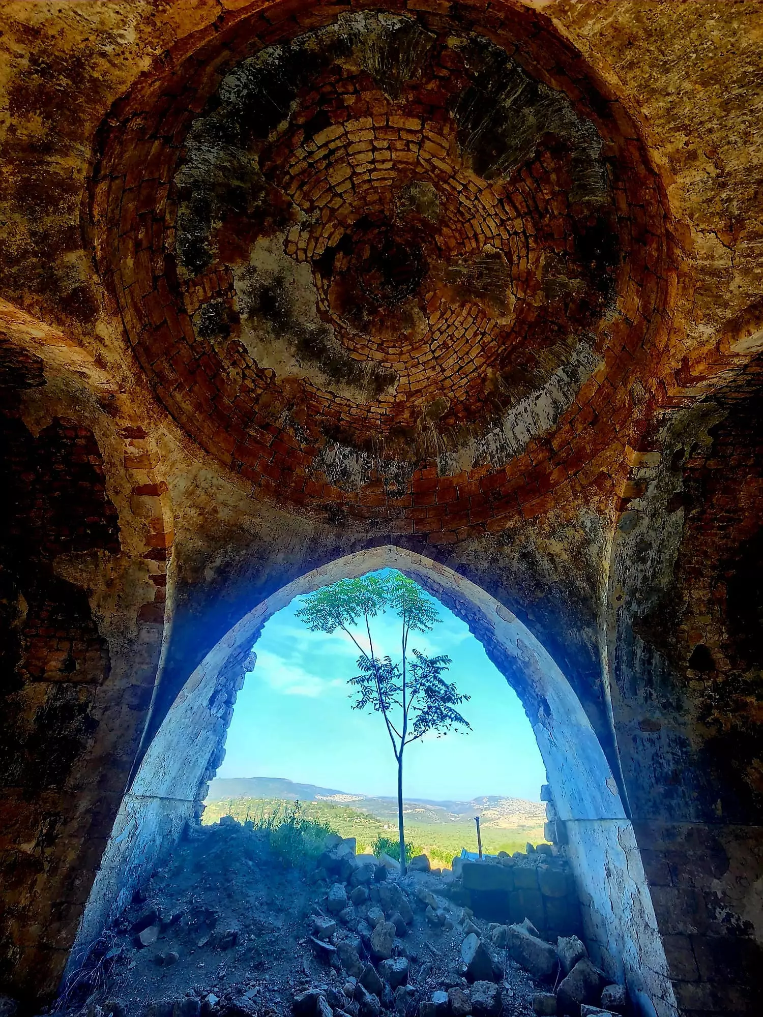
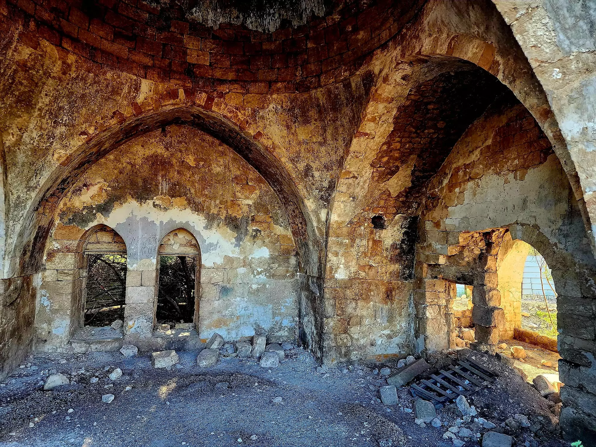
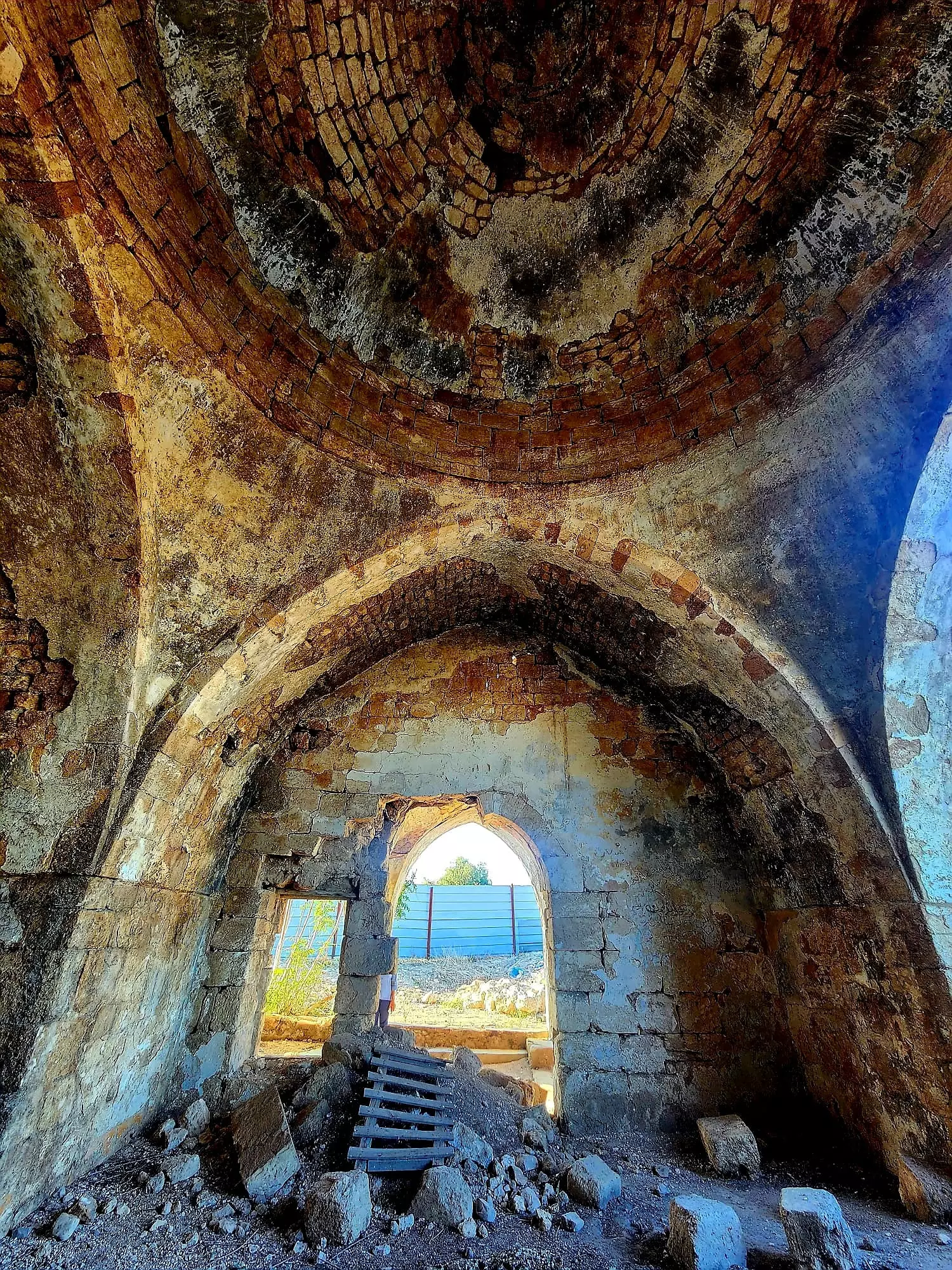
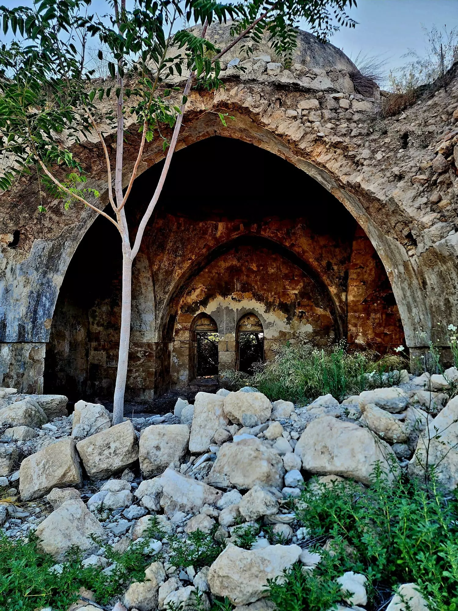
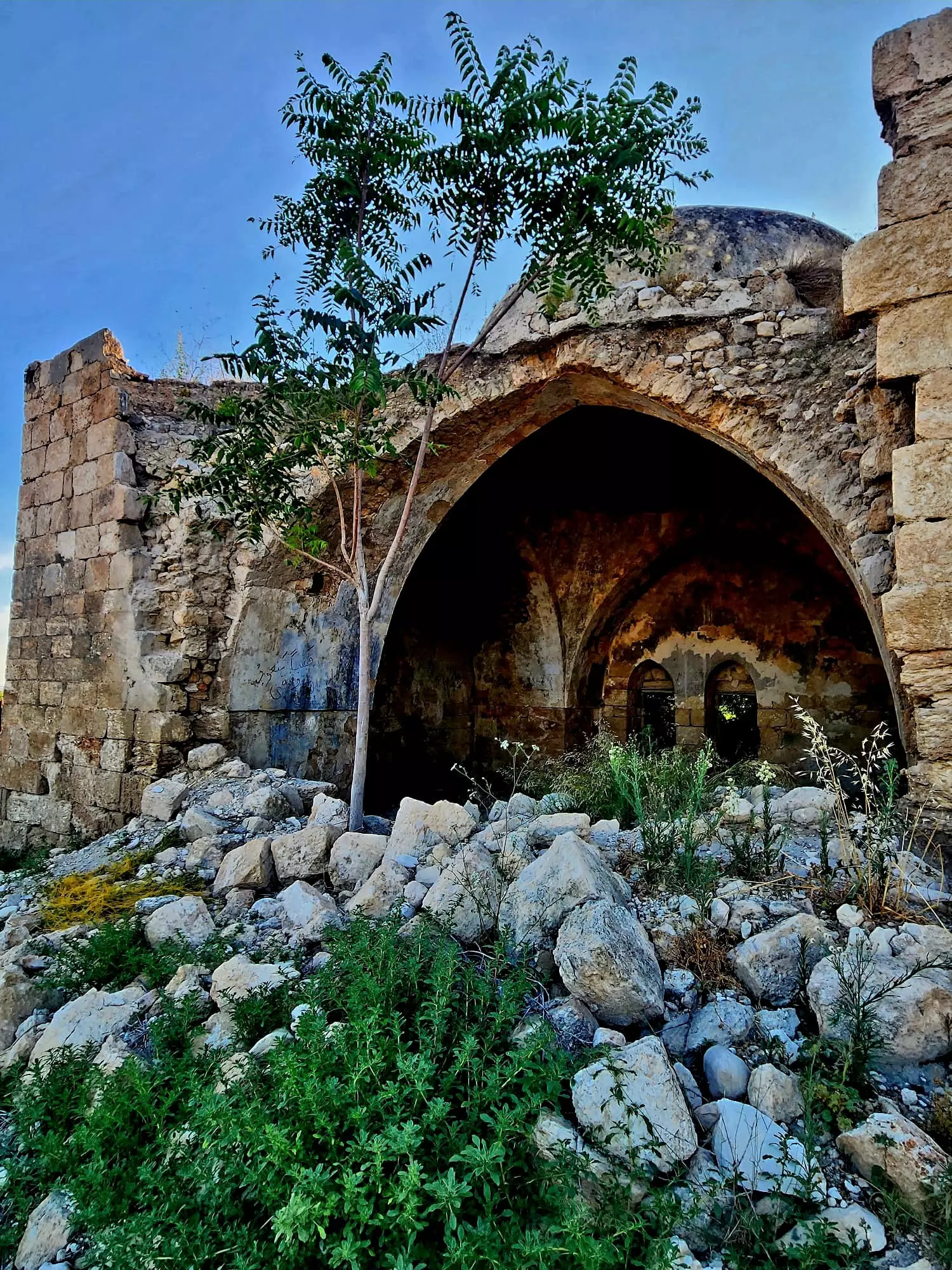
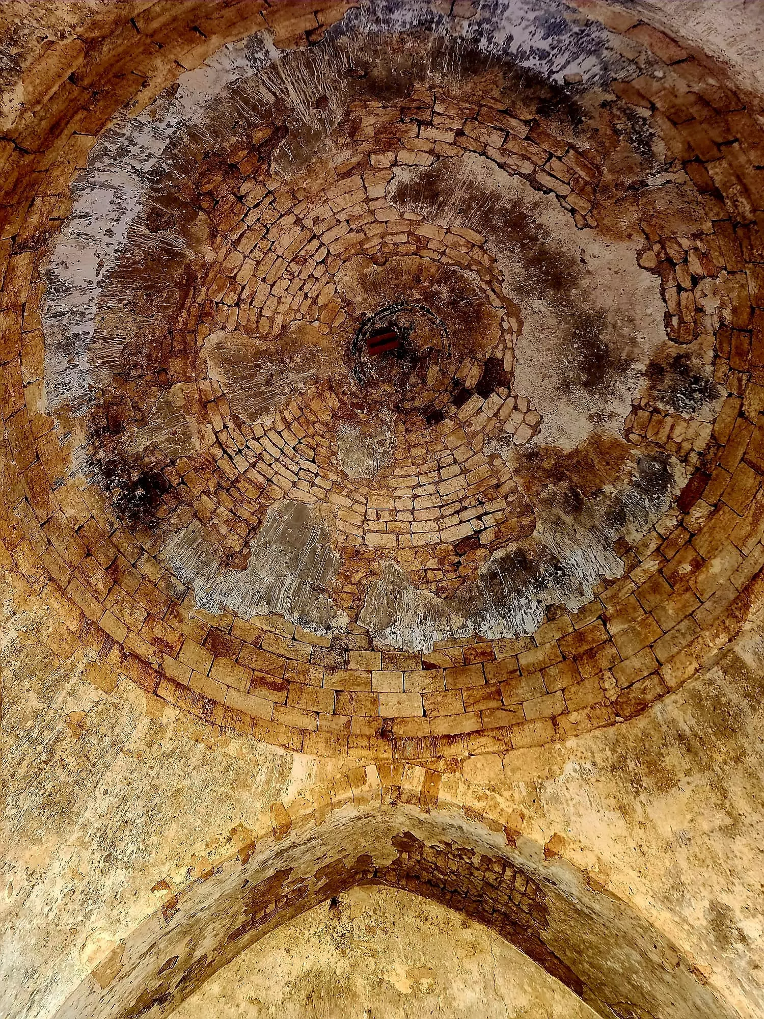
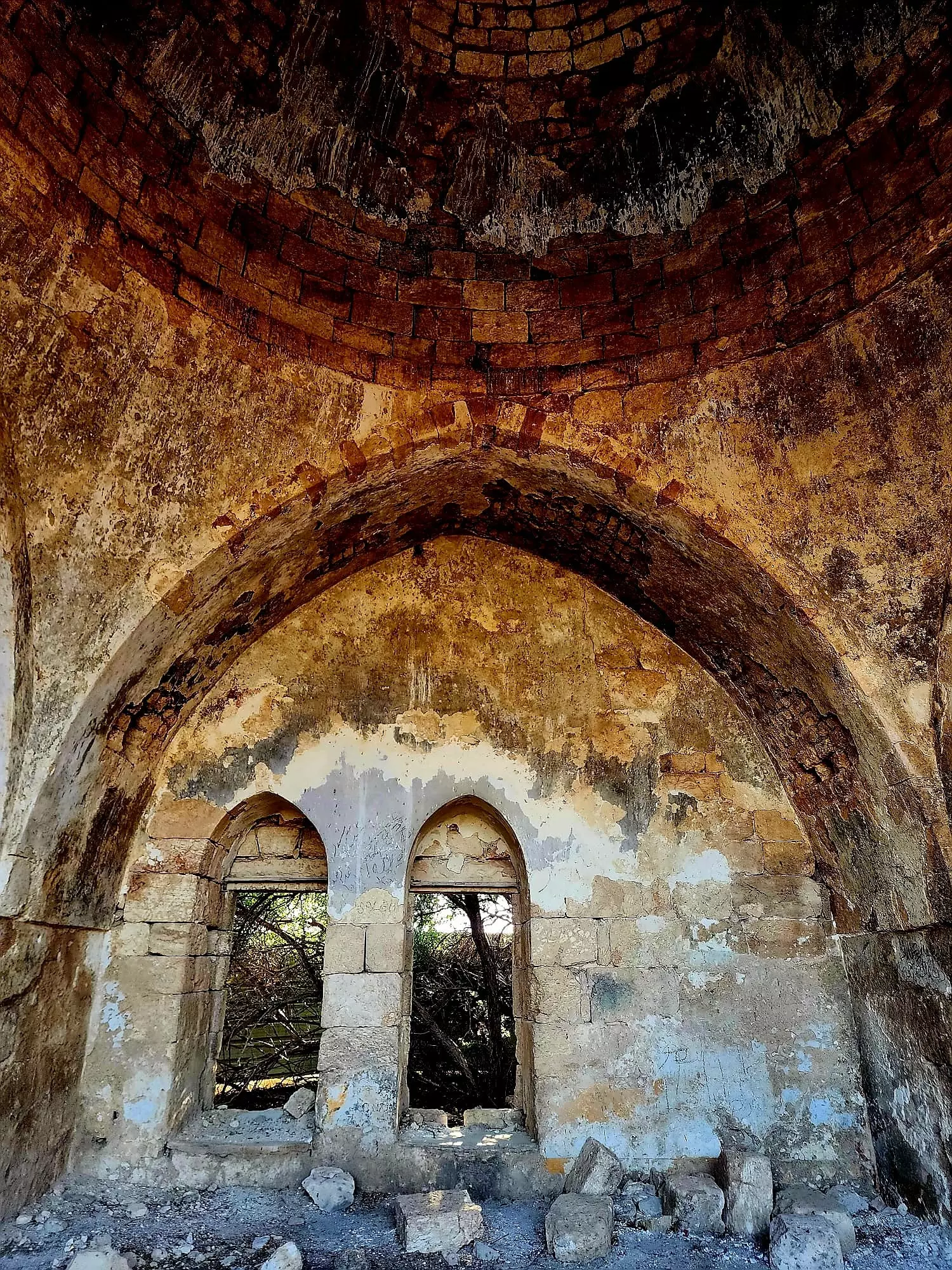
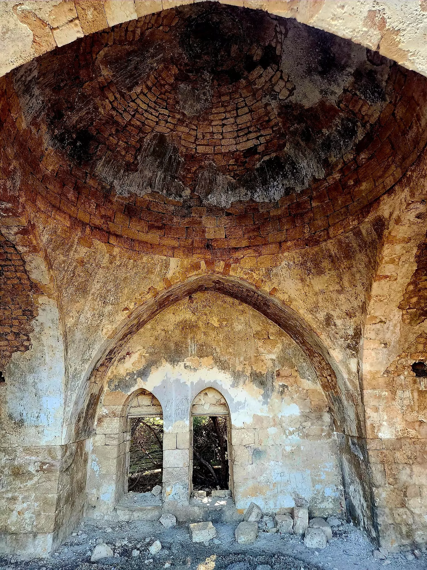
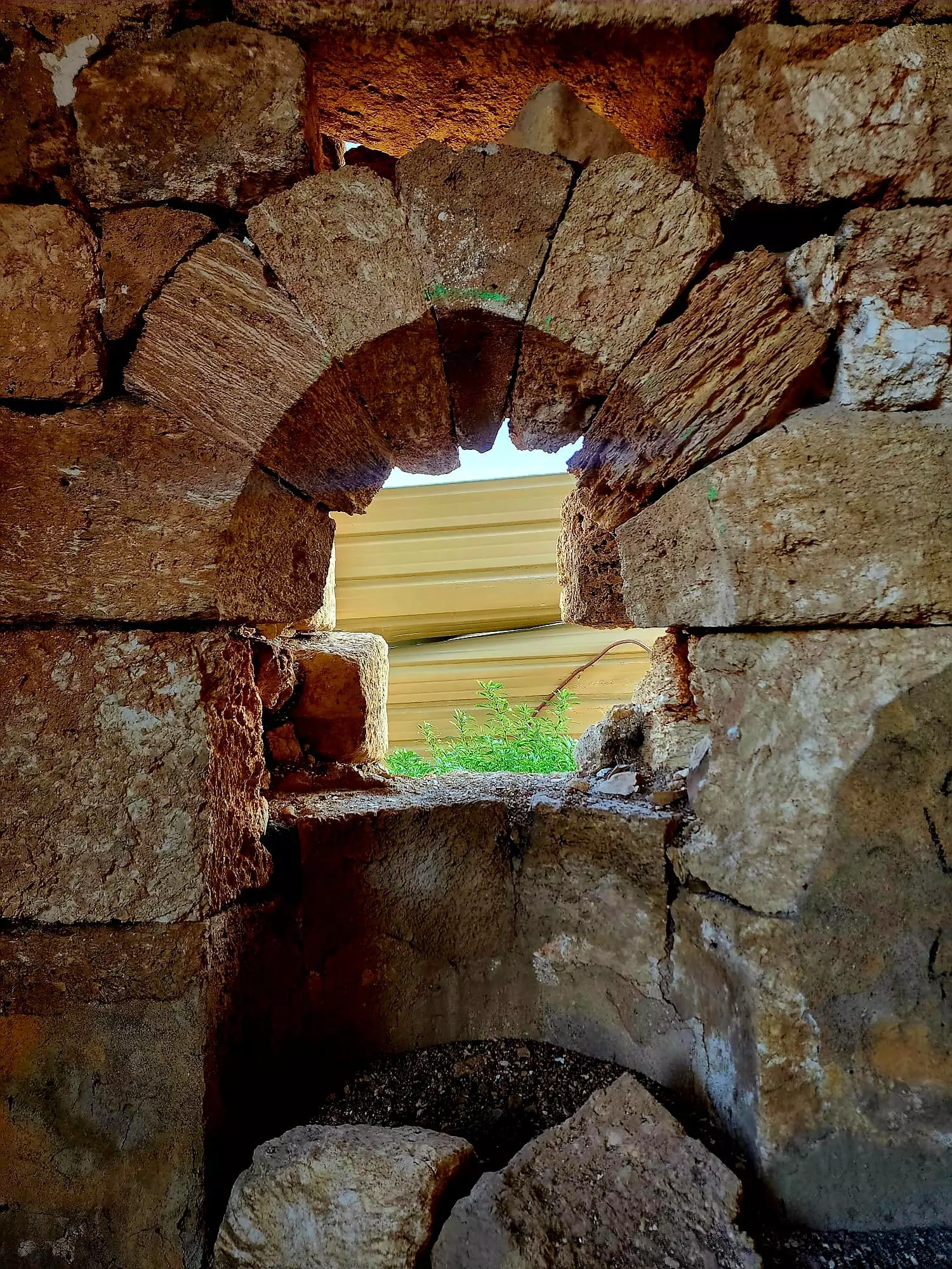
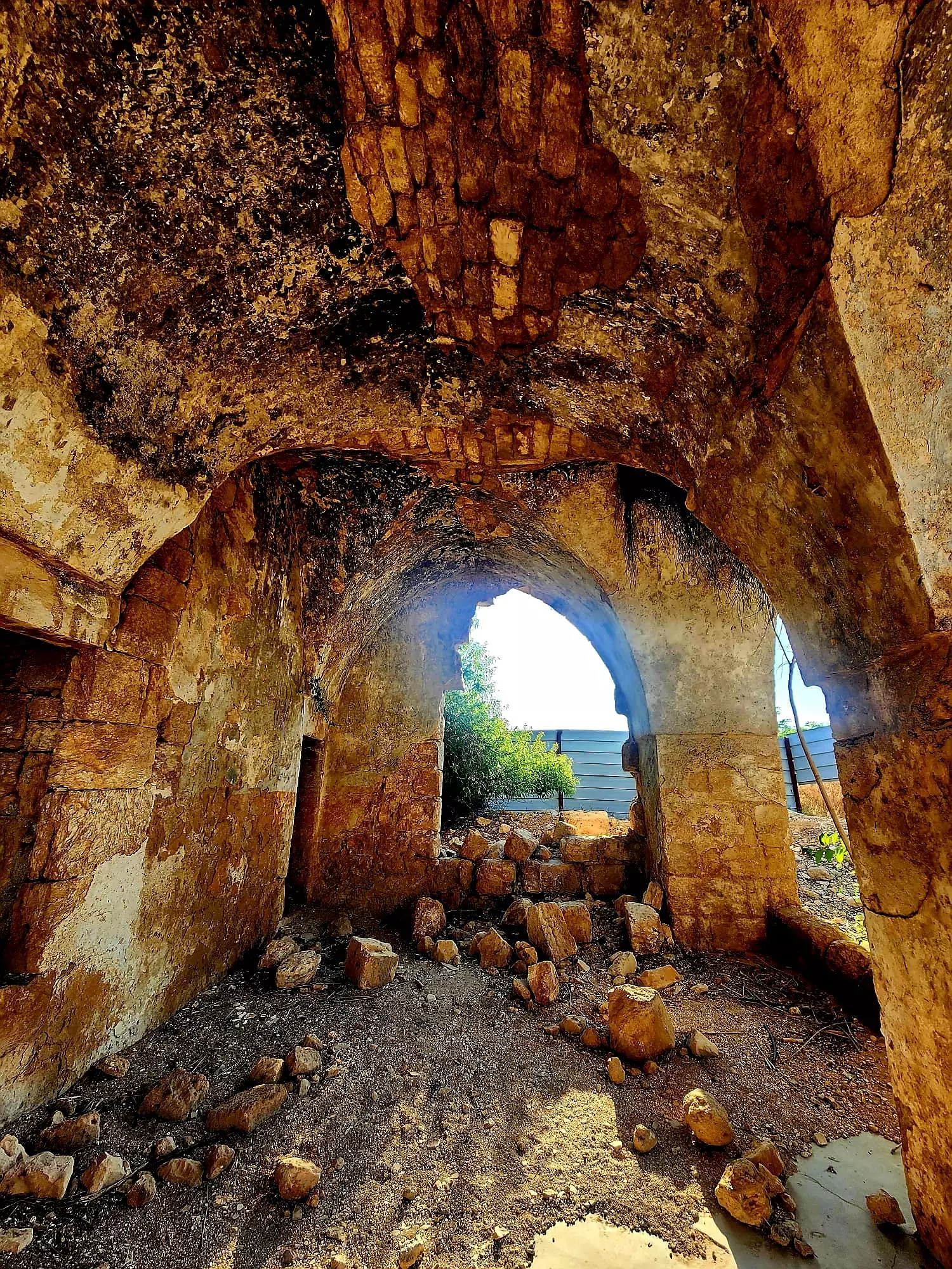
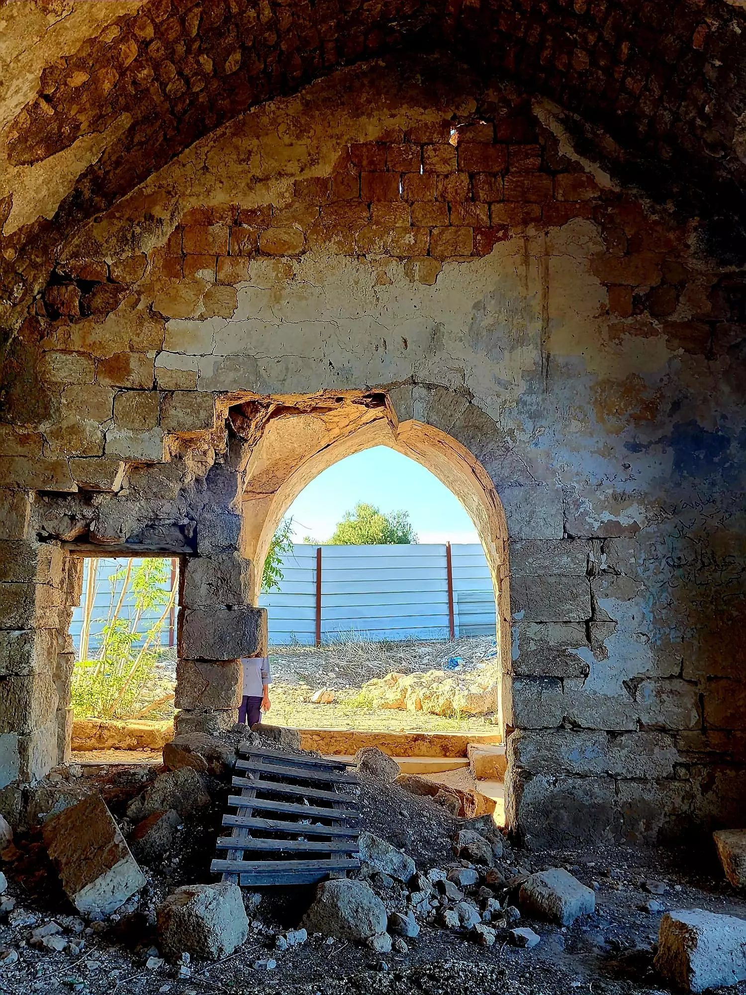
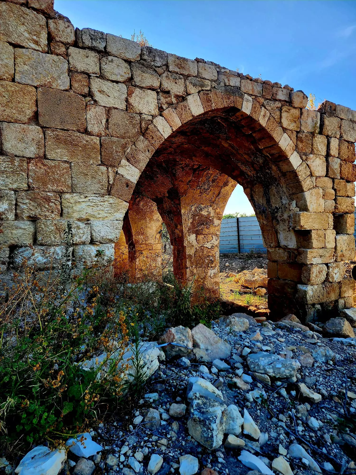
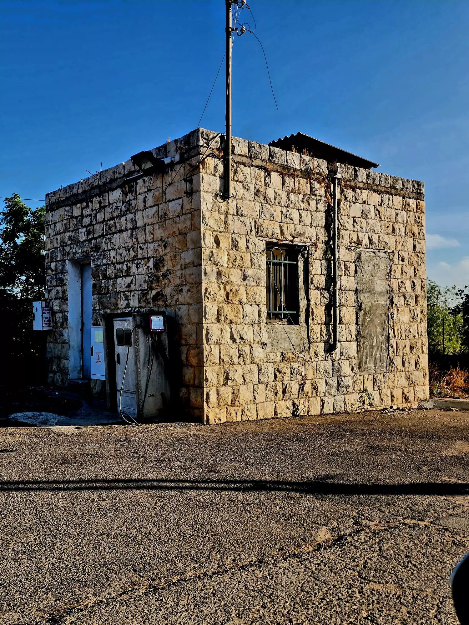
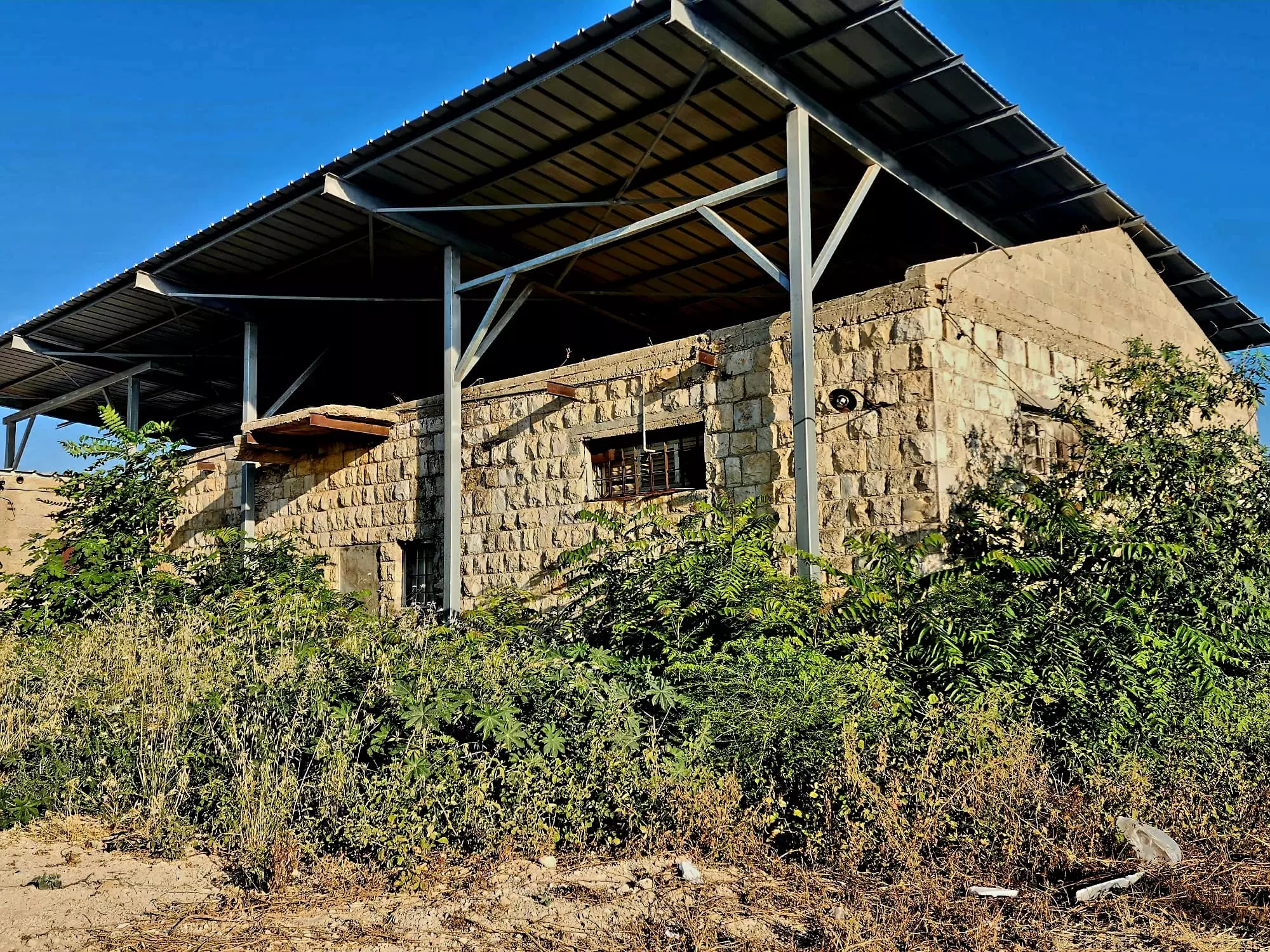
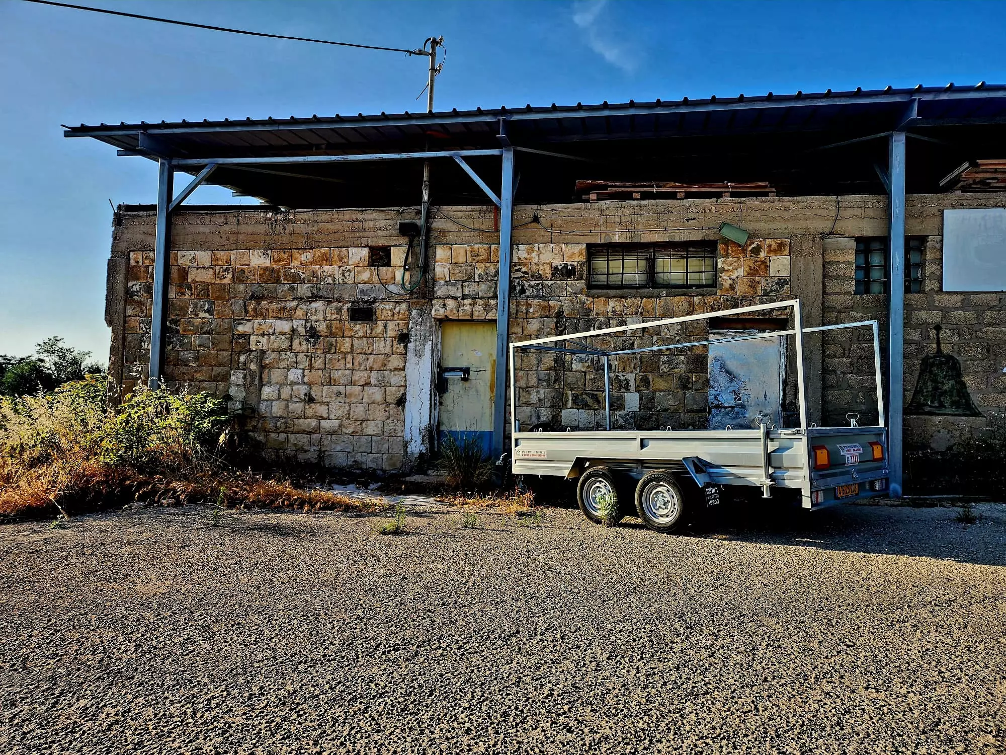
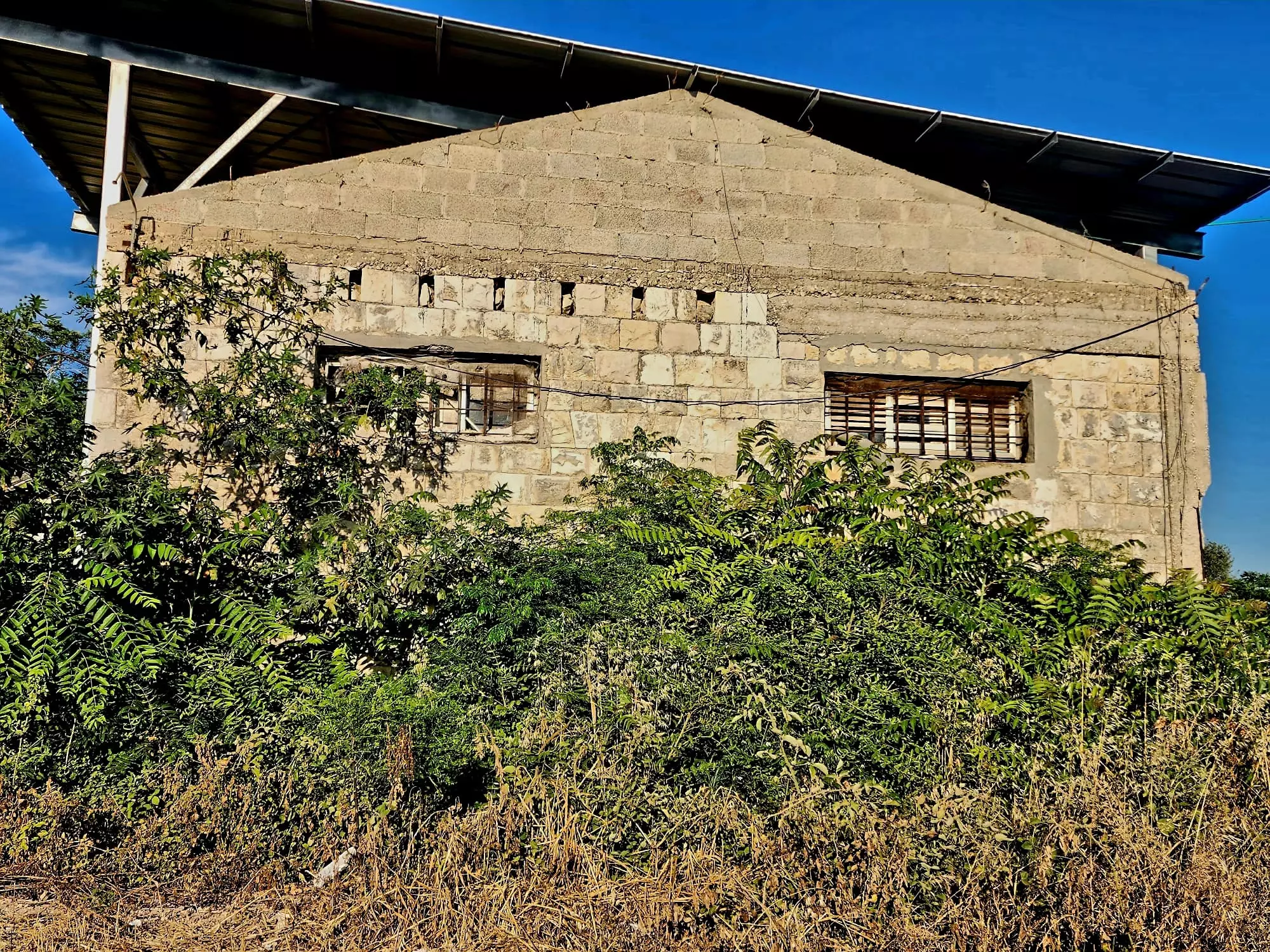
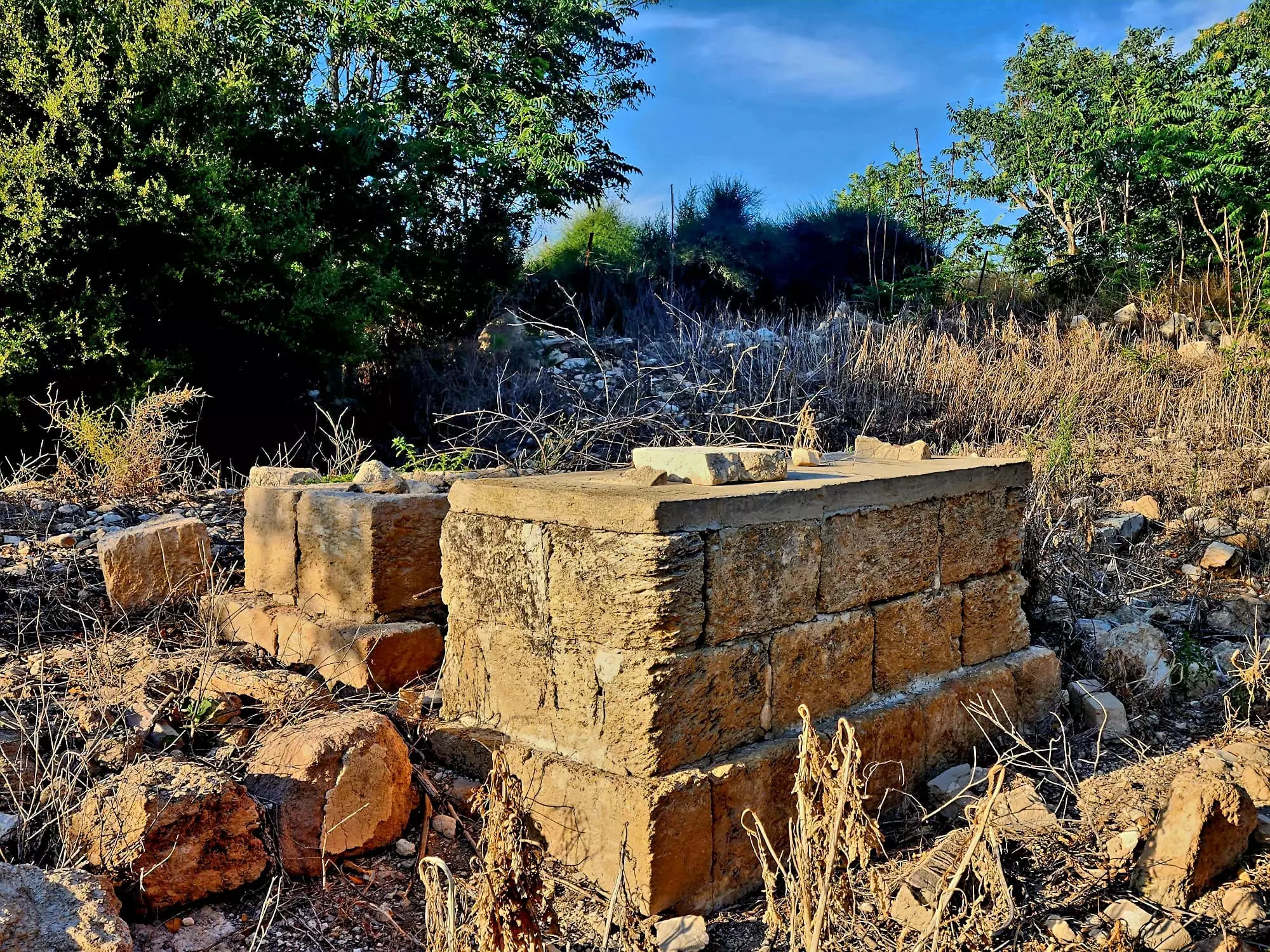
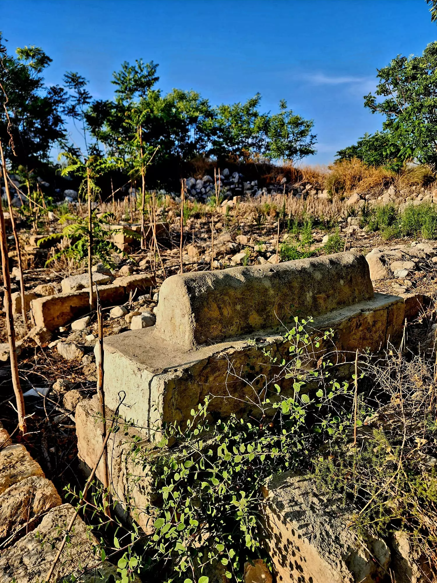
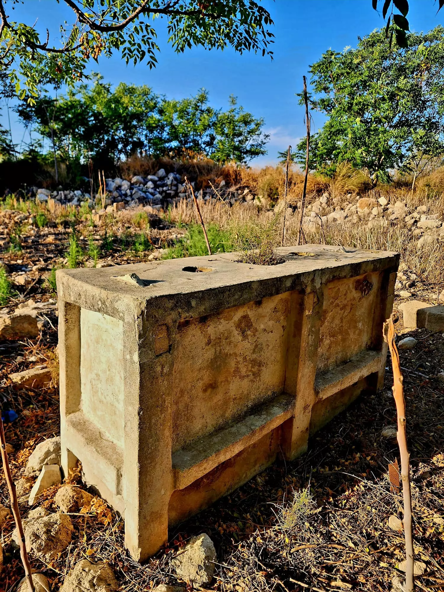
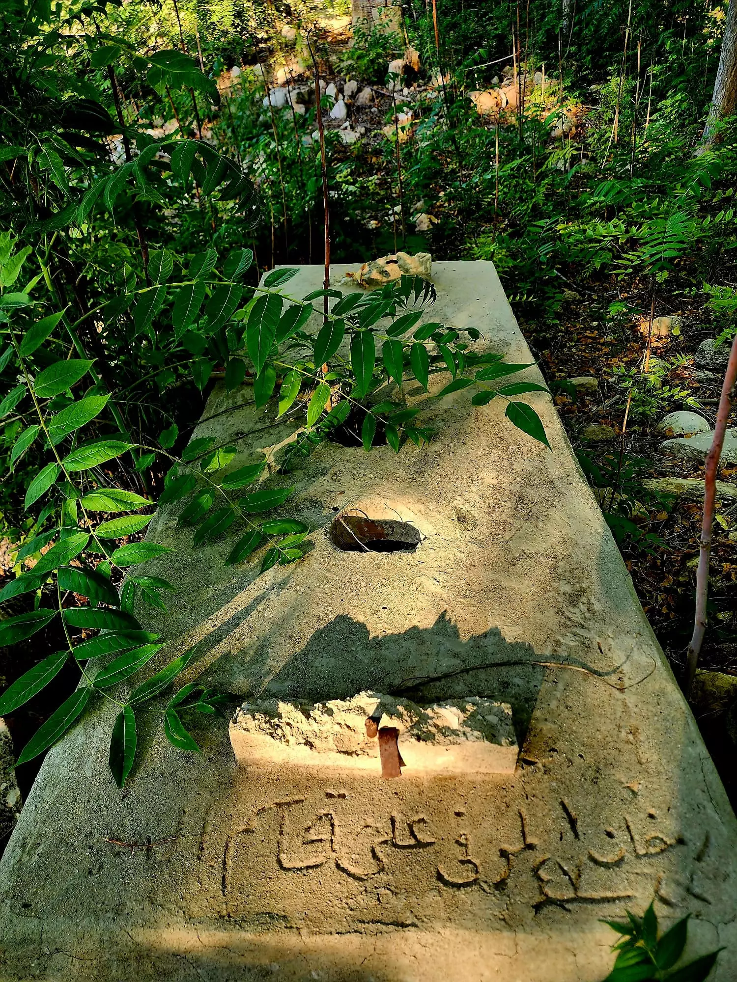
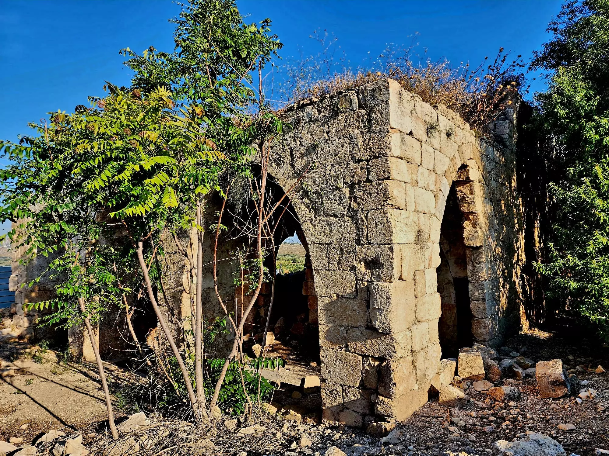
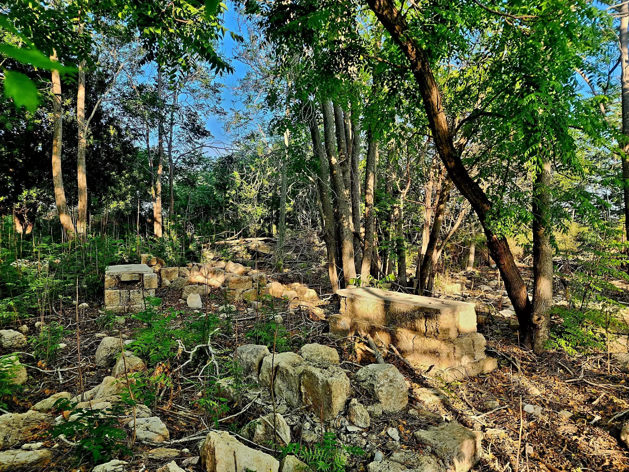
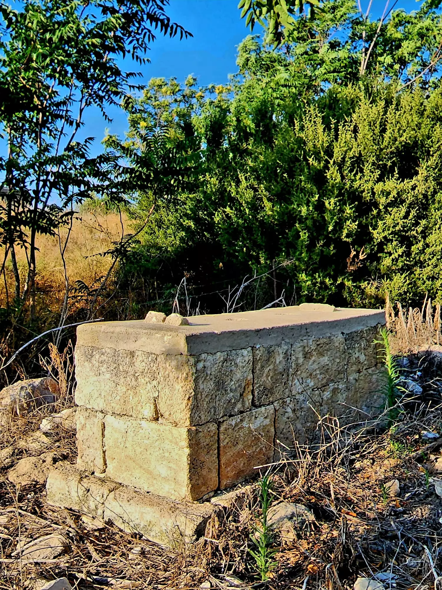
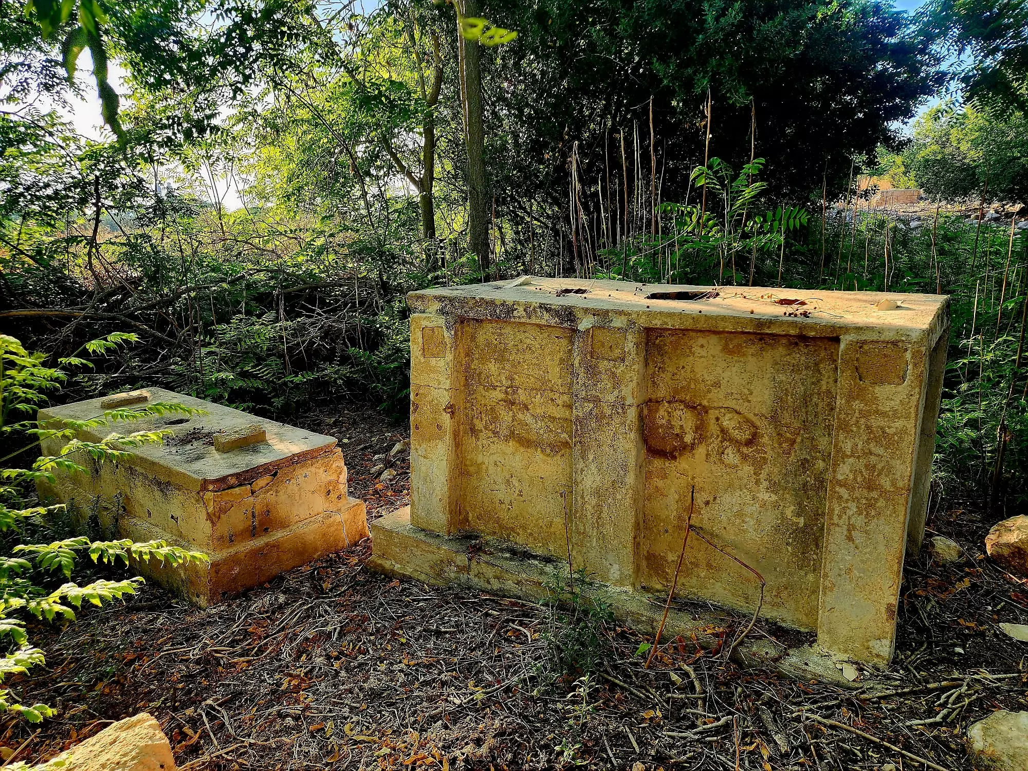
| Village Temains | 'Amqa was mostly destroyed with the exception of the its school and its mosque. | ||||||||||||||
| Ethnically Cleansing | 'Amqa was mostly ethnically cleansed with the exception of its Druze inhabitants who still live nearby. | ||||||||||||||
| Pre-Nakba Land Ownership |
**Town Lands' Demarcation Maps |
||||||||||||||
| Land Usage As of 1945 |
|
||||||||||||||
| Population |
|
||||||||||||||
| Number of Houses |
|
||||||||||||||
| Near By Towns |
|||||||||||||||
|
|||||||||||||||
| Town's Name Through History | The Hebrews referred to the village by 'Emeq (which means valley in Hebrew), the Romans called it Kefar Amqa, and to the Crusaders it was known by Amca. | ||||||||||||||
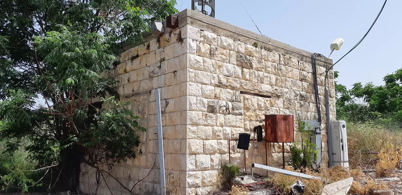
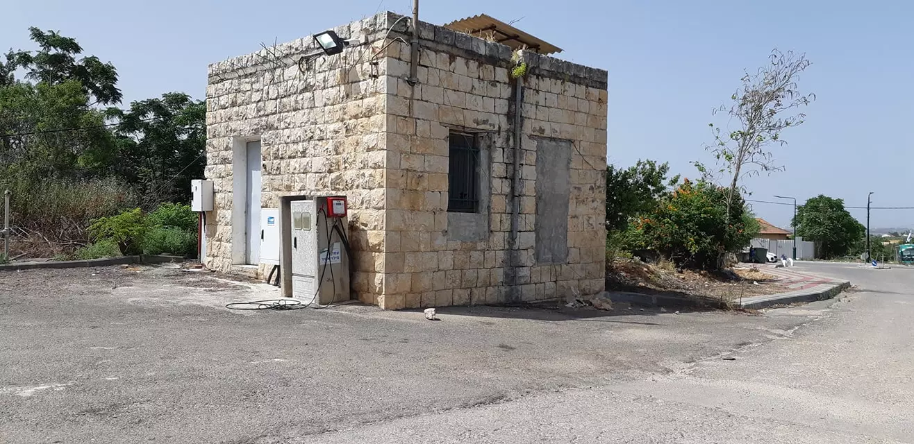
| Schools | One elementary school for boys which was founded by the Ottomans in 1887, which remains standing to this date. | ||||||||||||||
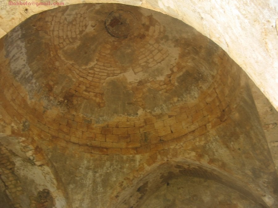
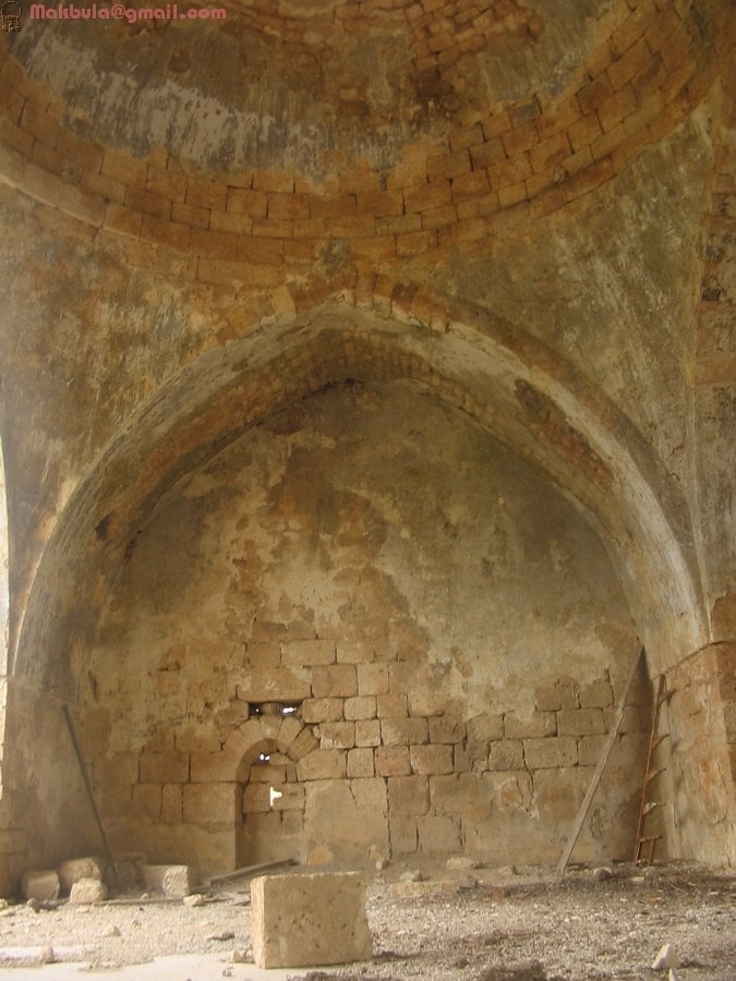
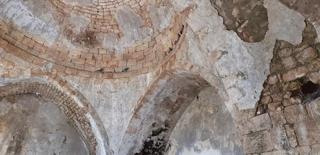
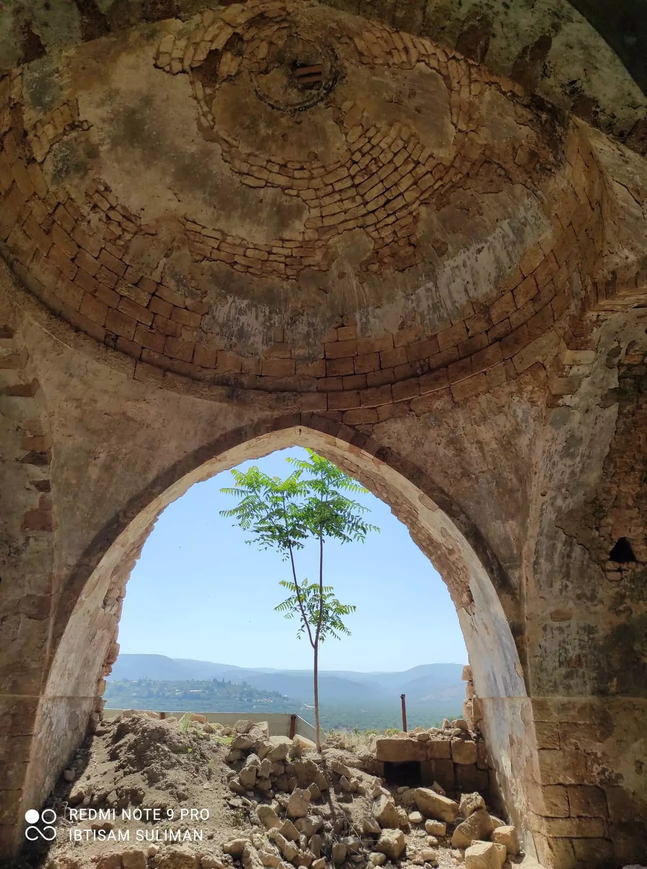
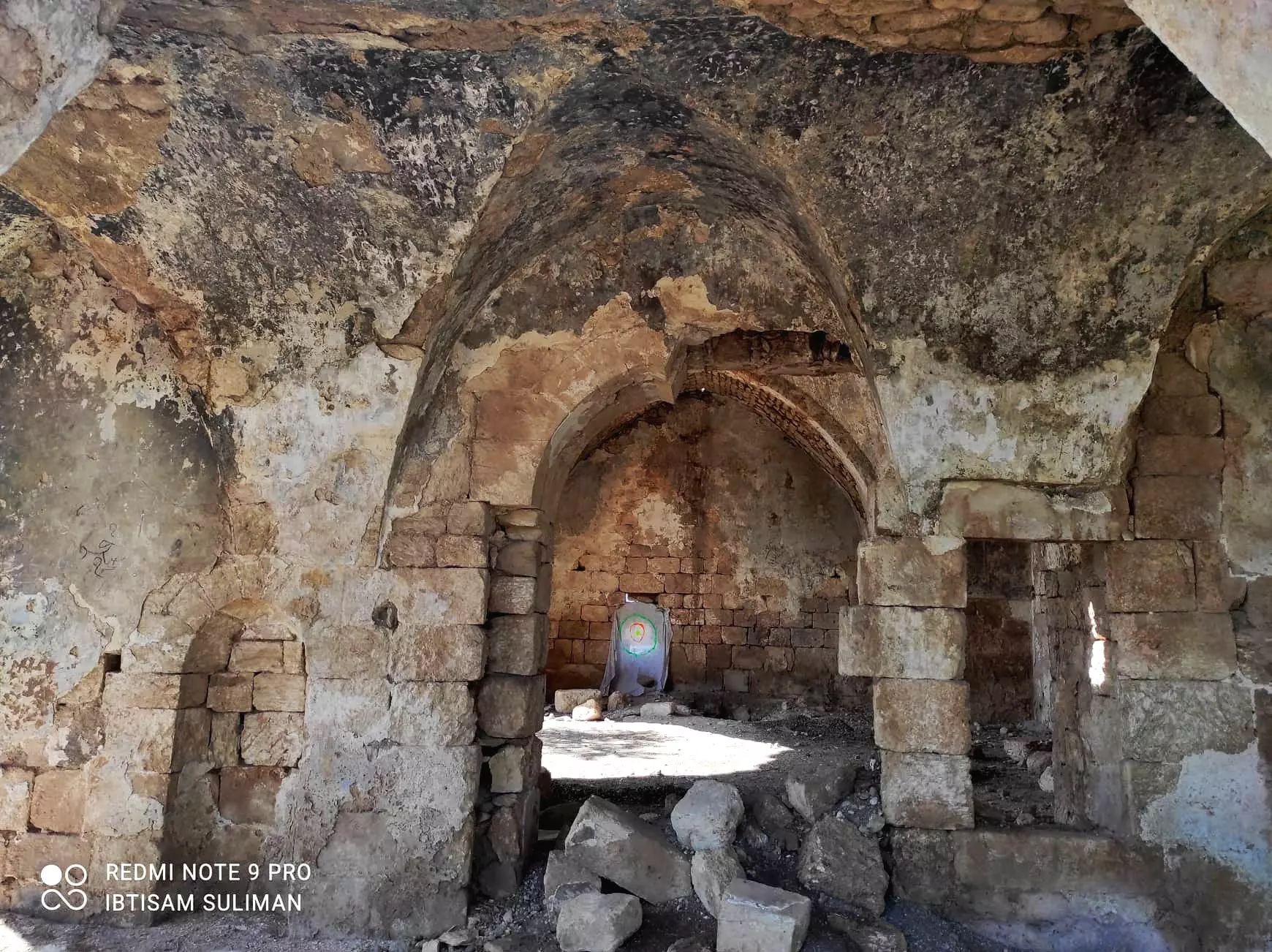
| Places of Warship | 'Amqa has one mosque which remains standing, but in need of serious renovation! | ||||||||||||||
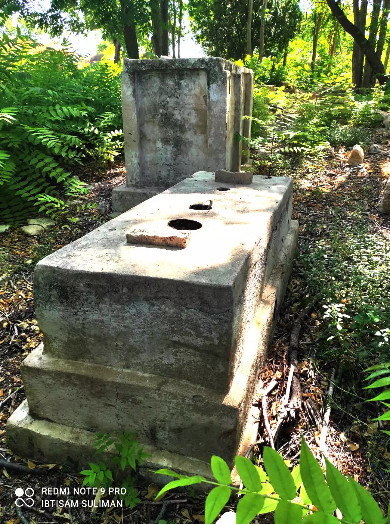
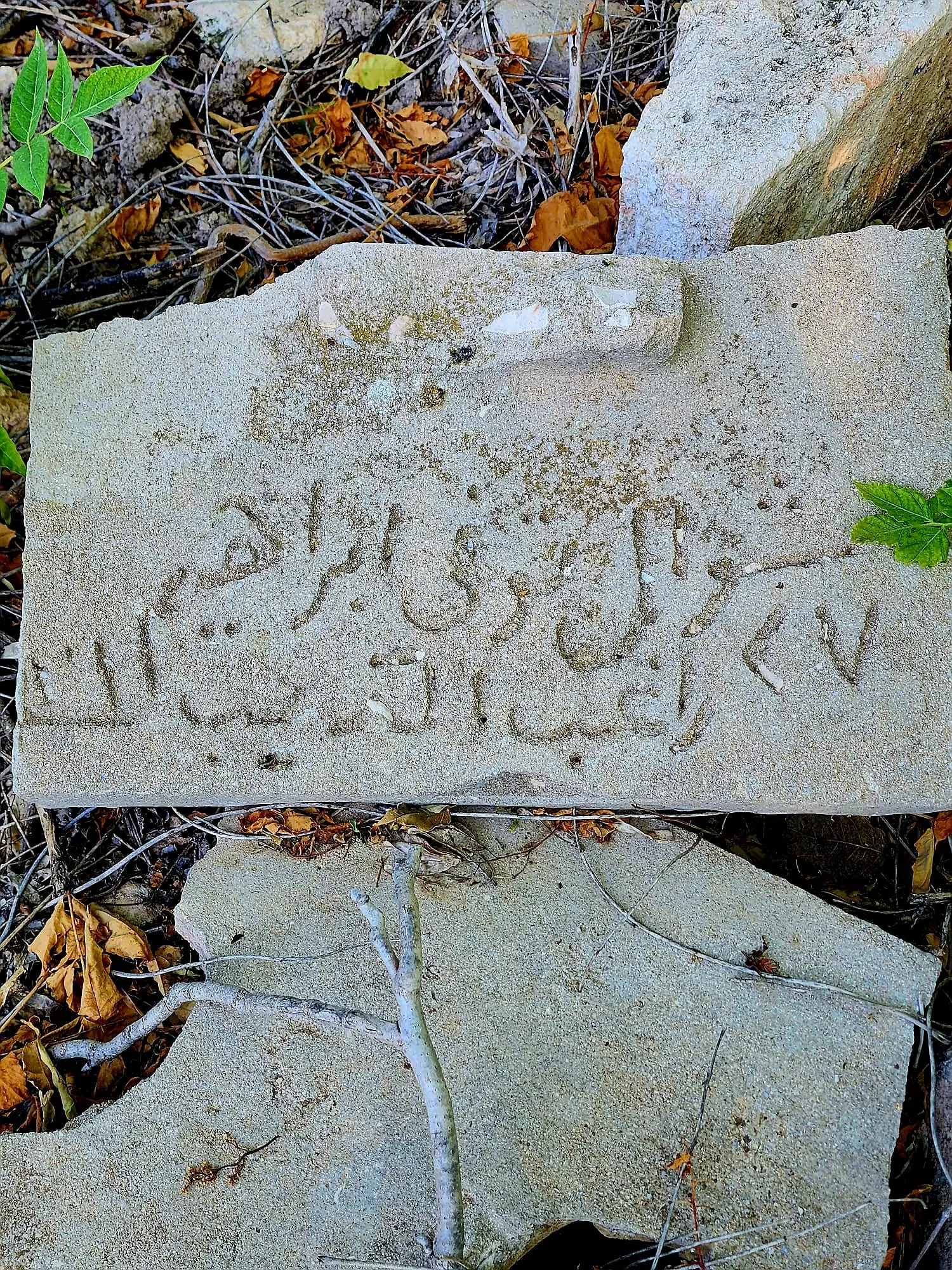
| Archeological Sites | Three khirbats lay within 'Amqa's vicinity that contains the foundations of buildings, well-chiseled building stones, presses, and a cistern. | ||||||||||||||
| Exculsive Jewish Colonies Who Usurped Village Lands |
'Amqa | ||||||||||||||
| Featured Video | |||||||||||||||
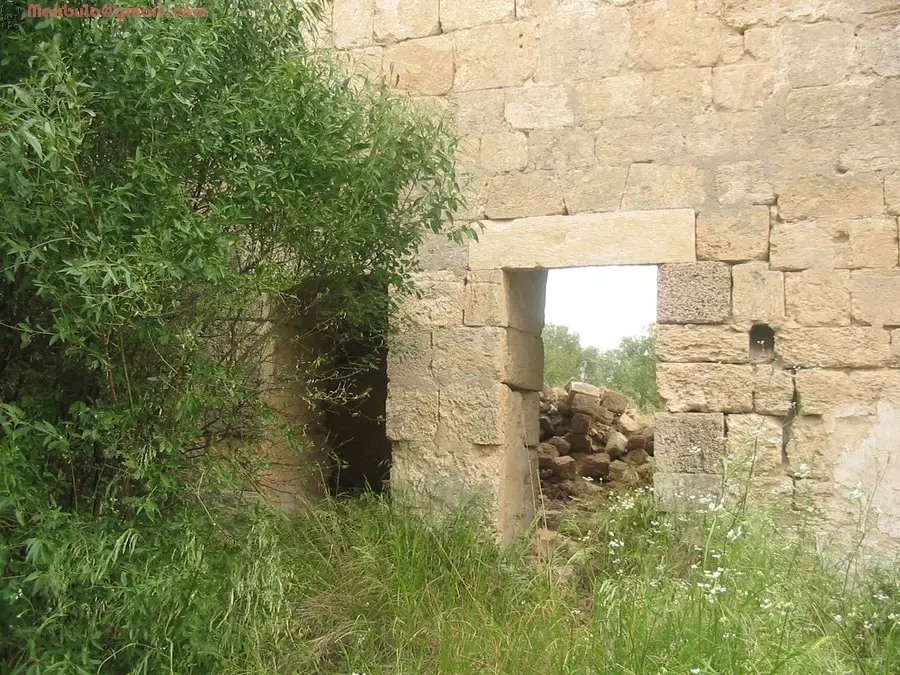
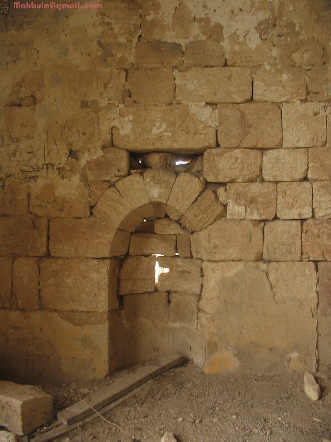
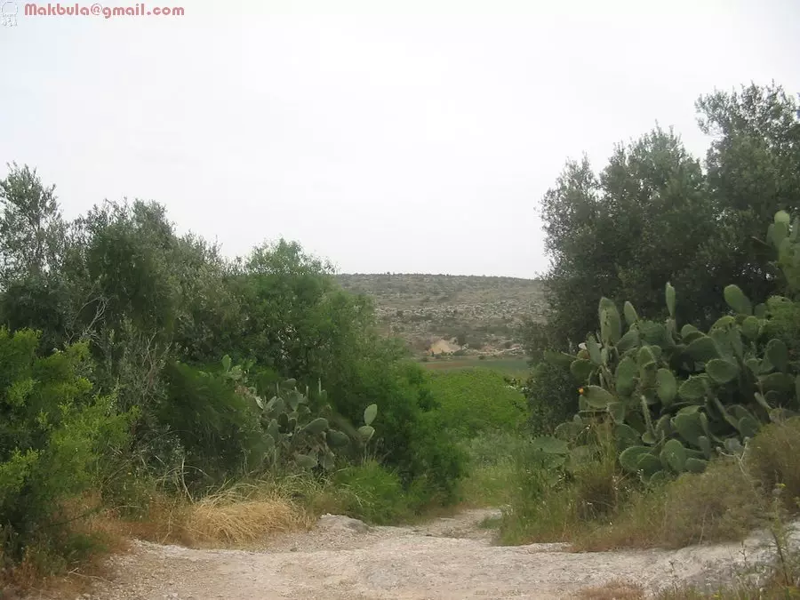
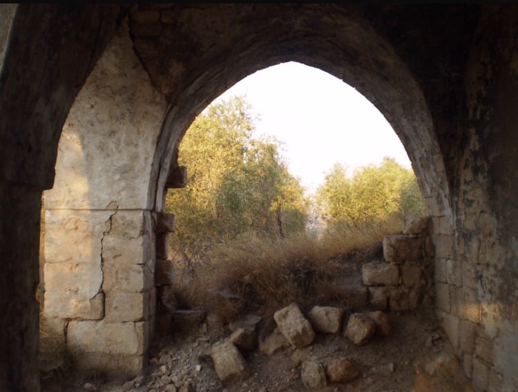
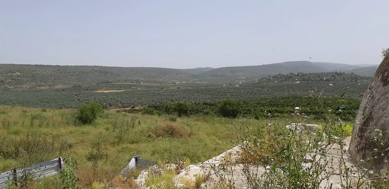
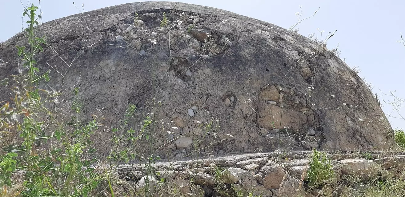
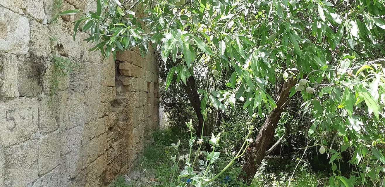
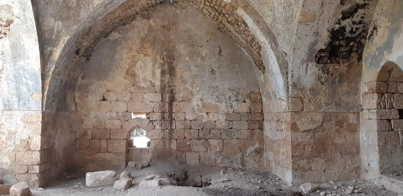
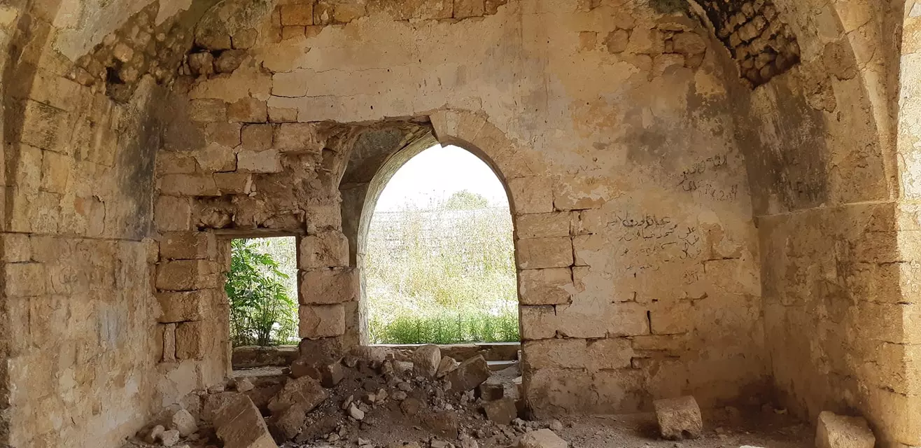
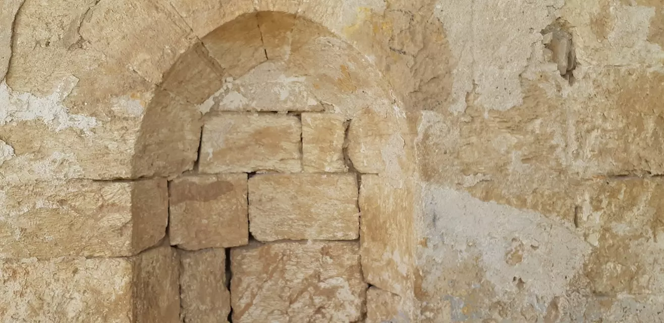
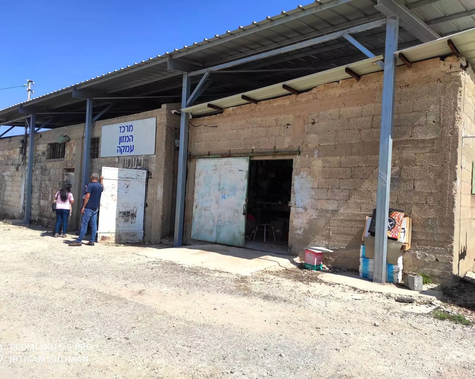
Village Before NakbaThe village was situated on a rocky, uneven hill where the slopes of lower western Galilee met the Acre plain. A secondary road linked it to the coastal highway that led to Acre, and other roads (as well as dirt paths) connected it to neighboring villages. Its name may have been a corruption of the Hebrew emeq, 'valley.' During the Roman period, the village that was located in the same spot was called Kefar Amqa, and later was known as Amca by the Crusaders. The status of the site during the early Islamic period has yet to be established. In 1596, Amqa was a village in the nahiya of Akka (liwa' of Safad), with a population of 215. It paid taxes on a number of crops, such as wheat, barley, olives, cotton, and fruit, and on other types of produce, such as goats and beehives. The Arab traveler al-Bakri al-Siddiqi, who toured the area in the mid-eighteenth century, said that he prayed in the village after visiting the citadel of Atlit. In the late nineteenth century, the village of Amqa was situated on a slight rise in a valley, surrounded by olive trees, fig trees, and arable land. It was built of stone and had about 300 residents. The people of Amqa were Muslims and maintained a village mosque. The Ottomans built a school in Amqa in 1887.In 1944/45 a total of 3,348 dunums was allotted to cereals; 1,648 dunums were irrigated and used for orchards. Amqa contained an archaeological site that contained fragments of structures, cisterns, and tombs. In addition, three khirbas lay in the vicinity that contained the foundations of buildings, well-chiseled building stones, presses, and a cistern. Village Occupation and Ethnic CleaningThe Haganah had begun to attack Palestinian coastal villages as early as December 1947, and people from villages near Amqa began to seek refuge in the village in May 1948. Amqa came under attack on 10-11 July, during the first stage of Operation Dekel.Israeli units bombarded the village with artillery. The attacking units were drawn from the Sheva' (Seventh) Brigade and the First Battalion of the Carmeli Brigade. Amqa was one of the first villages to be occupied in the area, and Israeli historian Benny Morris states that it was the only Druze village in western Galilee to be shelled and evacuated. Most inhabitants probably left during the artillery barrage. But some appear to have remained; Palestinian historian Nafez Nazzal quotes eyewitnesses who said that the shelling of Amqa continued into the second truce of the war, and that a woman was injured in the village as late as 31 July. Zionists Colonies on Village LandsOn 20 August 1948, the Jewish National Fund (JNF) submitted a plan according to which Amqa (together with thirty-one other villages) would be the site of new Jewish settlements. The JNF established the settlement of Amqa in 1949 on village land, directly to the north of the village site.Village TodayThe site is overgrown with wild grasses. Only the school and mosque are extant. The mosque is a stone structure surmounted with a dome; its front facade is defined by three large, lancet-arched entrances. Its walls are cracked in many places and some of the stones from the walls have fallen. It stands deserted amidst shrubs, wild grasses, and the debris of destroyed houses. The school has a gabled roof and has been joined to some new annexes that were added by Israelis who now use the complex as a warehouse. The land in the vicinity is utilized for animal forage.SourceDr. Walid al-Khalidi, 1992: All That Remains. |
|||||||||||||||
| Related Maps | Town Lands' Demarcation Maps خرائط للقضاء توضح حدود القرى والاودية Town's map on MapQuest View from satellite Help us map this town at WikiMapia |
||||||||||||||
| Related Links | Wikipedia's Page Facebook Page Featured Article Google Search Google For Images Google For Videos |
||||||||||||||
| More Information | في كتاب كي لا ننسى في كتاب بلادنا فلسطين المزيد من موقع هوية |
||||||||||||||
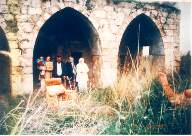
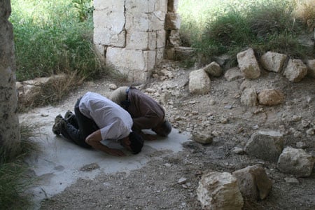
- Jamil & Moniba Majzoub & their niece in front of 'Amqa's 200 years old mosque which was built by Ali Majzoub
Posted by Fayez Majzoub 10 - Inside Amqa's mosque
- مسجد عمقا - تصوير : مقبولة نصار 21/4/2005
Posted by Makbula Nassar 1 - مسجد عمقا - تصوير : مقبولة نصار 21/4/2005
Posted by Makbula Nassar - مسجد عمقا - تصوير : مقبولة نصار 21/4/2005
Posted by Makbula Nassar 1 - مسجد عمقا - تصوير : مقبولة نصار 21/4/2005
Posted by Makbula Nassar - مسجد عمقا - تصوير : مقبولة نصار 21/4/2005
Posted by Makbula Nassar - مسجد عمقا , نوافذ جانبية - تصوير : مقبولة نصار 21/4/2005
Posted by Makbula Nassar - مسجد عمقا من الداخل - تصوير : مقبولة نصار 21/4/2005
Posted by Makbula Nassar 1 - مسجد عمقا - تصوير : مقبولة نصار 21/4/2005
Posted by Makbula Nassar - مسجد عمقا - تصوير : مقبولة نصار 21/4/2005
Posted by Makbula Nassar - مسجد عمقا , القبة من الداخل - تصوير : مقبولة نصار 21/4/2005
Posted by Makbula Nassar - مسجد عمقا من الداخل - تصوير : مقبولة نصار 21/4/2005
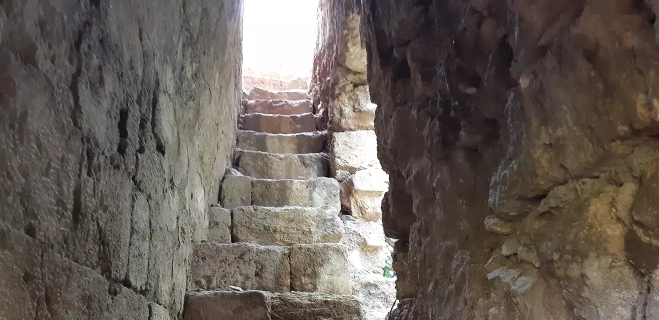
Posted by Makbula Nassar - مسجد عمقا , درج مؤدي الى السطح - تصوير : مقبولة نصار 21/4/2005
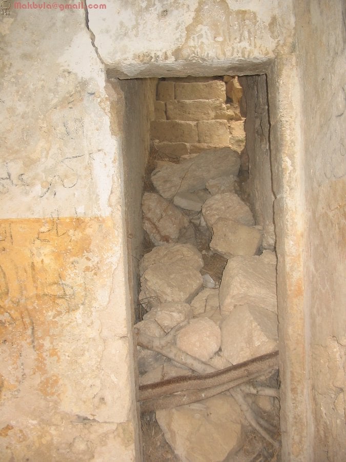
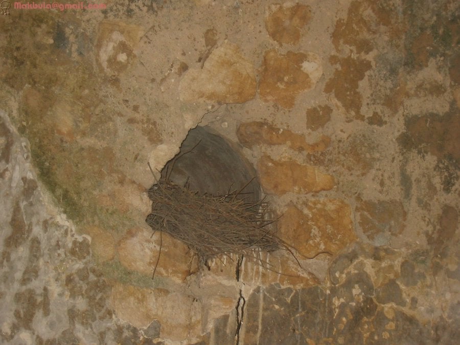
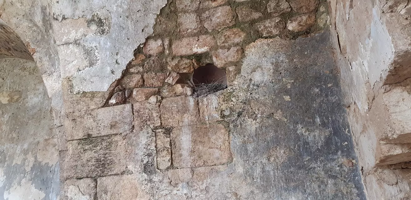
Posted by Makbula Nassar - مسجد عمقا من الداخل, اعشاش للطيور - تصوير : مقبولة نصار 21/4/2005
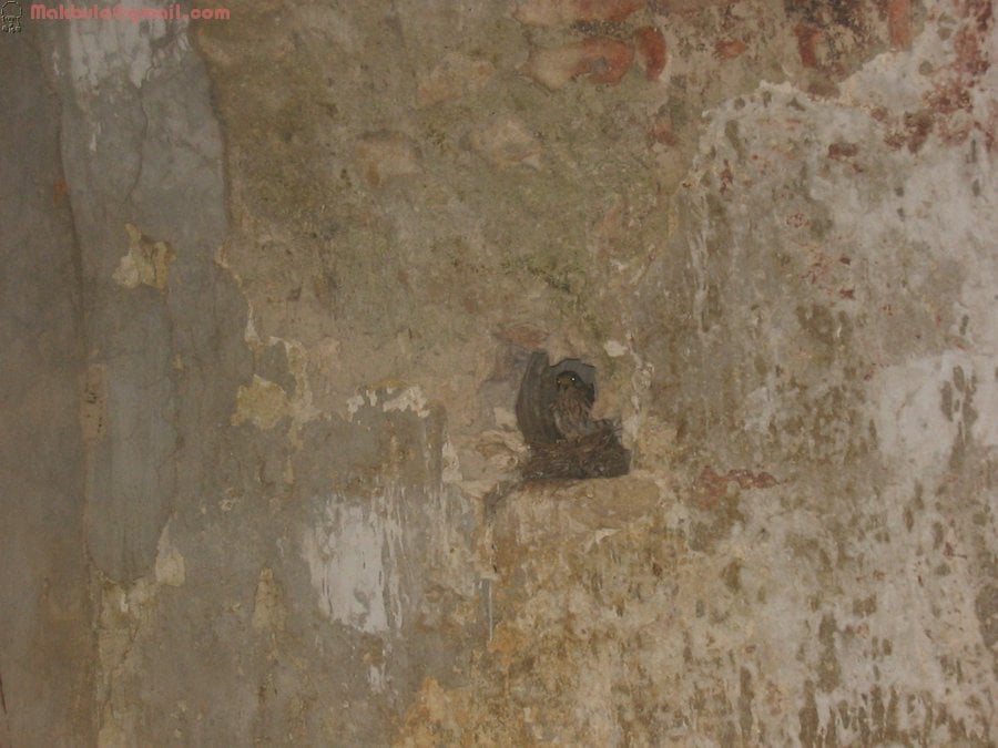
Posted by Makbula Nassar - مسجد عمقا من الداخل , اعشاش للطيور- تصوير : مقبولة نصار 21/4/2005
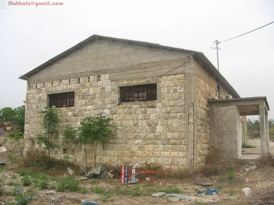
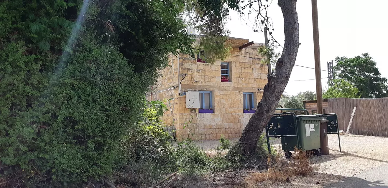
Posted by Makbula Nassar - بيوت باقية في القرية او بنيت من احجار القرية القديمة!! - تصوير : مقبولة نصار 21/4/2005
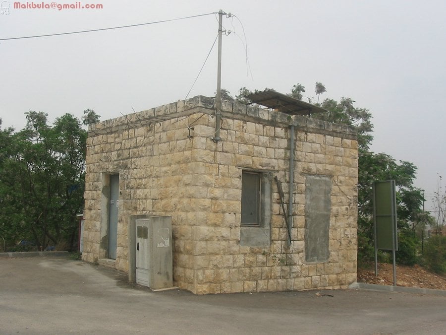
Posted by Makbula Nassar - بيوت قديمة في عمقا مستعملة في مستوطنة تحمل نفس الاسم - تصوير : مقبولة نصار 21/4/2005
Posted by Makbula Nassar - بيوت باقية في القرية او بنيت من احجار القرية القديمة!! - تصوير : مقبولة نصار 21/4/2005
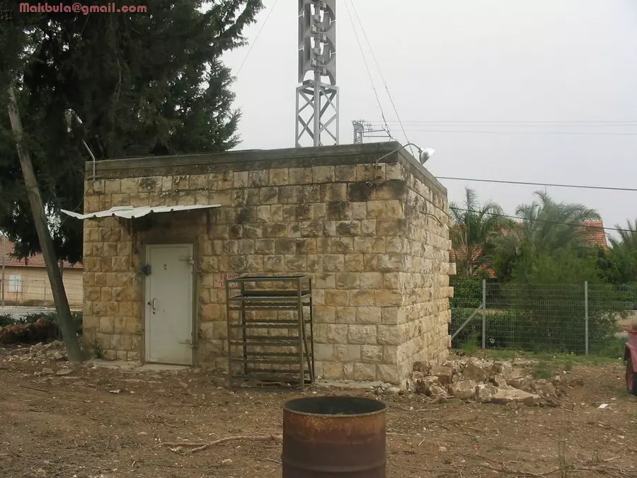
Posted by Makbula Nassar - بيوت قديمة في عمقا مستعملة في مستوطنة تحمل نفس الاسم - تصوير : مقبولة نصار 21/4/2005
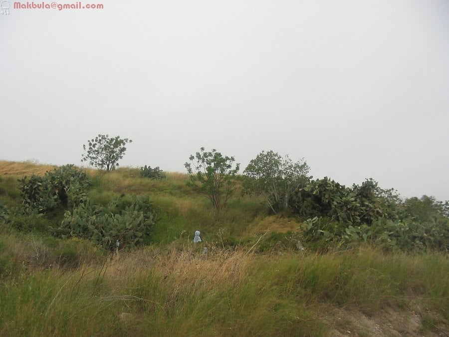
Posted by Makbula Nassar - منظر من اراضي القرية- تصوير : مقبولة نصار 21/4/2005
Posted by Makbula Nassar - بيوت باقية في القرية او بنيت من احجار القرية القديمة!! - تصوير : مقبولة نصار 21/4/2005
Posted by Makbula Nassar - منظر من اراضي القرية- تصوير : مقبولة نصار 21/4/2005
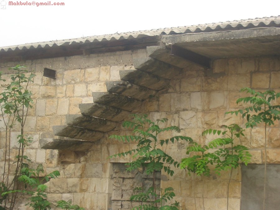
Posted by Makbula Nassar - مسجد عمقا واجهة المدخل من الداخل - تصوير : مقبولة نصار 21/4/2005
Posted by Makbula Nassar - بيوت قديمة في عمقا مستعملة في مستوطنة تحمل نفس الاسم - تصوير : مقبولة نصار 21/4/2005
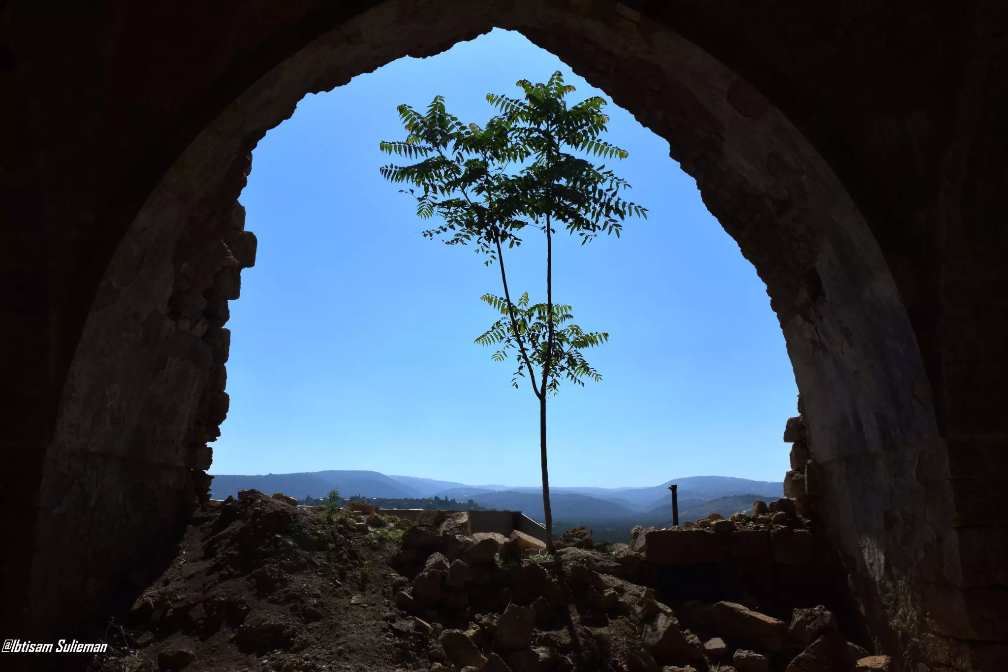
Posted by Makbula Nassar - A view from the village's mosque looking outside
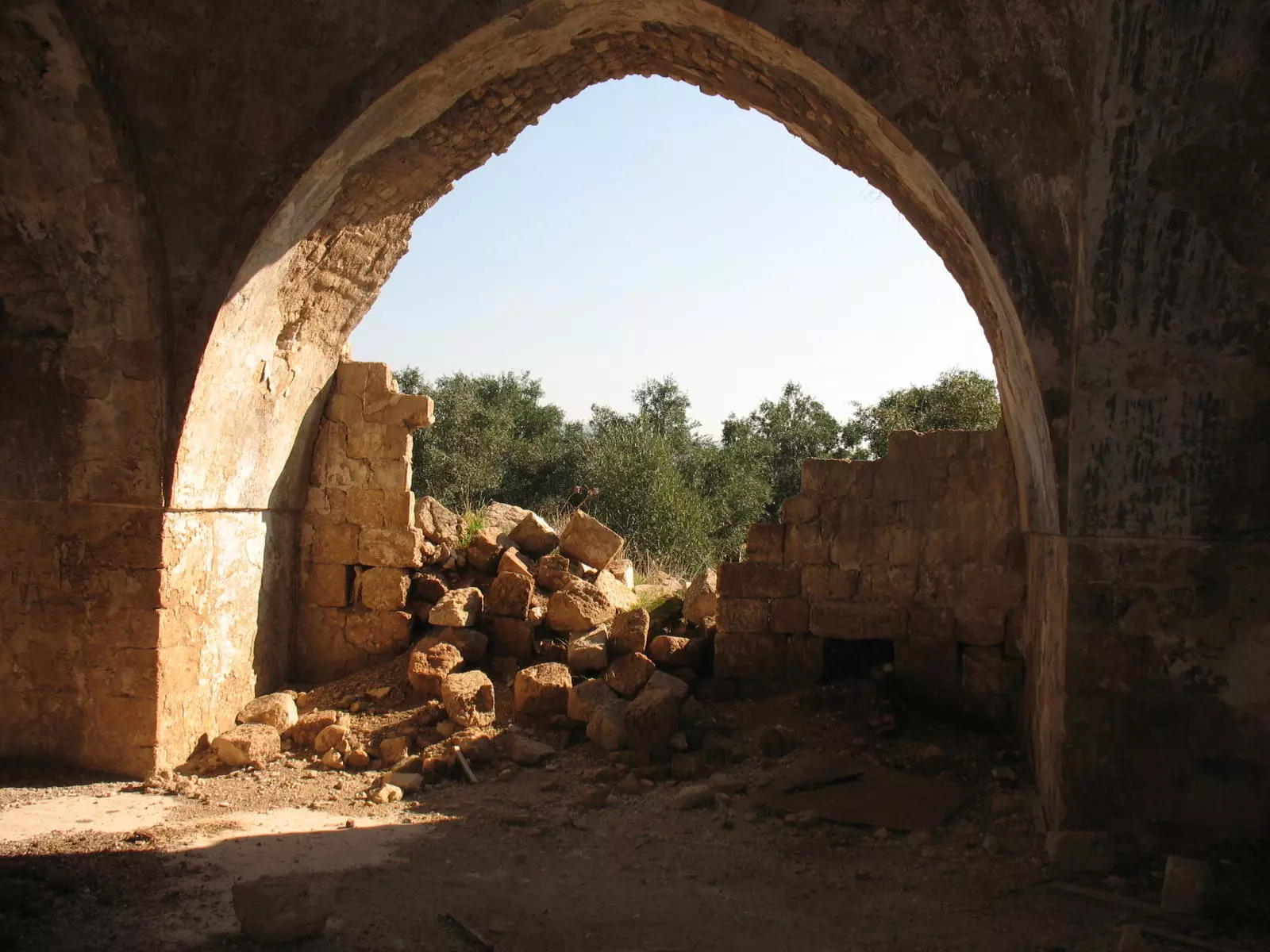
Posted by Noga Kadman - Ruins of the partially destroyed mosque.
Posted by Noga Kadman 1 - مسحد القرية الحزين، اُنقر الصورة لتكبيرها.
Scanned from "All That Remains" by Dr. Walid Khalidi 1 - Jamil Majzoub
Posted by Mahmoud Majzoub 1 - بقايا مسجد عمقه
Posted by abu raya - مسجد عمقه
Posted by abu raya - المسجد من الخلف
Posted by abu raya - الجهه الاماميه للمسجد
Posted by abu raya - أحد بيوت القلرية المنهوبة _ مؤسسة الأقصى
- مسجد القرية _ مؤسسة الأقصى
- مسجد القرية _ مؤسسة الأقصى
- في مسجد القرية
- في مسجد القرية
- مسجد القرية
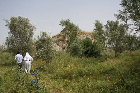
- زيارة بين انقاض قرية عمقا المهجرة -- تصوير قيس فحماوي
- زيارة بين انقاض قرية عمقا المهجرة -- تصوير قيس فحماوي #2
- زيارة بين انقاض قرية عمقا المهجرة -- تصوير قيس فحماوي #3
- زيارة بين انقاض قرية عمقا المهجرة -- تصوير قيس فحماوي #4
- زيارة بين انقاض قرية عمقا المهجرة -- تصوير قيس فحماوي #5
- زيارة بين انقاض قرية عمقا المهجرة -- تصوير قيس فحماوي #6
- زيارة بين انقاض قرية عمقا المهجرة -- تصوير قيس فحماوي #7
- زيارة بين انقاض قرية عمقا المهجرة -- تصوير قيس فحماوي #8
- زيارة بين انقاض قرية عمقا المهجرة -- تصوير قيس فحماوي #9
- زيارة بين انقاض قرية عمقا المهجرة -- تصوير قيس فحماوي #10
- زيارة بين انقاض قرية عمقا المهجرة -- تصوير قيس فحماوي #11
- زيارة بين انقاض قرية عمقا المهجرة -- تصوير قيس فحماوي #12
- زيارة بين انقاض قرية عمقا المهجرة -- تصوير قيس فحماوي #13
- زيارة بين انقاض قرية عمقا المهجرة -- تصوير قيس فحماوي #14
- زيارة بين انقاض قرية عمقا المهجرة -- تصوير قيس فحماوي #15
- زيارة بين انقاض قرية عمقا المهجرة -- تصوير قيس فحماوي #16
- زيارة بين انقاض قرية عمقا المهجرة -- تصوير قيس فحماوي #17
- Pre-Nakba Aerial view of the village / صورة من الجو للقرية اخذت قبل النكبة
- جولة حديثه في قرية عمقا
- جولة حديثه في قرية عمقا #2

- جولة حديثه في قرية عمقا #3

- جولة حديثه في قرية عمقا #4

- جولة حديثه في قرية عمقا #5

- جولة حديثه في قرية عمقا #6

- جولة حديثه في قرية عمقا #7

- جولة حديثه في قرية عمقا #8

- جولة حديثه في قرية عمقا #9
- مسجد قرية عمقا المهجرة--Ibtisam Sulieman

- A tour between the looted Palestinian house and the ruins of the old mosque--Ibtisam Sulieman
- A tour between the looted Palestinian house and the ruins of the old mosque--Ibtisam Sulieman #2
- A tour between the looted Palestinian house and the ruins of the old mosque--Ibtisam Sulieman #3
- A tour between the looted Palestinian house and the ruins of the old mosque--Ibtisam Sulieman #4
- A tour between the looted Palestinian house and the ruins of the old mosque--Ibtisam Sulieman #5
- A tour between the looted Palestinian house and the ruins of the old mosque--Ibtisam Sulieman #6
- A tour between the looted Palestinian house and the ruins of the old mosque--Ibtisam Sulieman #7
- Let us see how the most "liberal and civilized" of world Jewry has obliterated our village except for the mosque, a couple of structures that were looted, and a few graves; mazeltov. How else will the Jews be great and safe again?
- Let us see how the most "liberal and civilized" of world Jewry has obliterated our village except for the mosque, a couple of structures that were looted, and a few graves; mazeltov. How else will the Jews be great and safe again? #2
- Let us see how the most "liberal and civilized" of world Jewry has obliterated our village except for the mosque, a couple of structures that were looted, and a few graves; mazeltov. How else will the Jews be great and safe again? #3
- Let us see how the most "liberal and civilized" of world Jewry has obliterated our village except for the mosque, a couple of structures that were looted, and a few graves; mazeltov. How else will the Jews be great and safe again? #4
- Let us see how the most "liberal and civilized" of world Jewry has obliterated our village except for the mosque, a couple of structures that were looted, and a few graves; mazeltov. How else will the Jews be great and safe again? #5
- Let us see how the most "liberal and civilized" of world Jewry has obliterated our village except for the mosque, a couple of structures that were looted, and a few graves; mazeltov. How else will the Jews be great and safe again? #6
- Let us see how the most "liberal and civilized" of world Jewry has obliterated our village except for the mosque, a couple of structures that were looted, and a few graves; mazeltov. How else will the Jews be great and safe again? #7
- Let us see how the most "liberal and civilized" of world Jewry has obliterated our village except for the mosque, a couple of structures that were looted, and a few graves; mazeltov. How else will the Jews be great and safe again? #8
- Let us see how the most "liberal and civilized" of world Jewry has obliterated our village except for the mosque, a couple of structures that were looted, and a few graves; mazeltov. How else will the Jews be great and safe again? #9
- Let us see how the most "liberal and civilized" of world Jewry has obliterated our village except for the mosque, a couple of structures that were looted, and a few graves; mazeltov. How else will the Jews be great and safe again? #10
- Let us see how the most "liberal and civilized" of world Jewry has obliterated our village except for the mosque, a couple of structures that were looted, and a few graves; mazeltov. How else will the Jews be great and safe again? #11
- Let us see how the most "liberal and civilized" of world Jewry has obliterated our village except for the mosque, a couple of structures that were looted, and a few graves; mazeltov. How else will the Jews be great and safe again? #12
- Let us see how the most "liberal and civilized" of world Jewry has obliterated our village except for the mosque, a couple of structures that were looted, and a few graves; mazeltov. How else will the Jews be great and safe again? #13
- Let us see how the most "liberal and civilized" of world Jewry has obliterated our village except for the mosque, a couple of structures that were looted, and a few graves; mazeltov. How else will the Jews be great and safe again? #14
- Let us see how the most "liberal and civilized" of world Jewry has obliterated our village except for the mosque, a couple of structures that were looted, and a few graves; mazeltov. How else will the Jews be great and safe again? #15
- Let us see how the most "liberal and civilized" of world Jewry has obliterated our village except for the mosque, a couple of structures that were looted, and a few graves; mazeltov. How else will the Jews be great and safe again? #16
- Let us see how the most "liberal and civilized" of world Jewry has obliterated our village except for the mosque, a couple of structures that were looted, and a few graves; mazeltov. How else will the Jews be great and safe again? #17
- Let us see how the most "liberal and civilized" of world Jewry has obliterated our village except for the mosque, a couple of structures that were looted, and a few graves; mazeltov. How else will the Jews be great and safe again? #18
- Let us see how the most "liberal and civilized" of world Jewry has obliterated our village except for the mosque, a couple of structures that were looted, and a few graves; mazeltov. How else will the Jews be great and safe again? #19
- Let us see how the most "liberal and civilized" of world Jewry has obliterated our village except for the mosque, a couple of structures that were looted, and a few graves; mazeltov. How else will the Jews be great and safe again? #20
- Let us see how the most "liberal and civilized" of world Jewry has obliterated our village except for the mosque, a couple of structures that were looted, and a few graves; mazeltov. How else will the Jews be great and safe again? #21
- Let us see how the most "liberal and civilized" of world Jewry has obliterated our village except for the mosque, a couple of structures that were looted, and a few graves; mazeltov. How else will the Jews be great and safe again? #22
- Let us see how the most "liberal and civilized" of world Jewry has obliterated our village except for the mosque, a couple of structures that were looted, and a few graves; mazeltov. How else will the Jews be great and safe again? #23
- Let us see how the most "liberal and civilized" of world Jewry has obliterated our village except for the mosque, a couple of structures that were looted, and a few graves; mazeltov. How else will the Jews be great and safe again? #24
- Let us see how the most "liberal and civilized" of world Jewry has obliterated our village except for the mosque, a couple of structures that were looted, and a few graves; mazeltov. How else will the Jews be great and safe again? #25
- Let us see how the most "liberal and civilized" of world Jewry has obliterated our village except for the mosque, a couple of structures that were looted, and a few graves; mazeltov. How else will the Jews be great and safe again? #26
- Let us see how the most "liberal and civilized" of world Jewry has obliterated our village except for the mosque, a couple of structures that were looted, and a few graves; mazeltov. How else will the Jews be great and safe again? #27
Want to browse more? 80,000 pictures were grouped in these gallaries:
| Display Name | Clan/Hamolah | Country of Residence |
| Mahmoud Majzoub | - | Poznan, POland |
| عمر الخطيب | - | - |
| hassan | الحسن | saida, amka |
| ELKHATIB AHMED | ELKHATIB | FRANCE |
| MUHAMMAD NAIF MUHAMMAD BANNA | BANNA | TEXAS , USA |
| aboadam | - | danmark |
| im ibraheam | - | fyn, Danmark |
| Abu Sara | - | Jeddah, Saudi Arabia |
| Maha Tohaibesh | - | UAE, UAE |
| GadaAbdulRazek | Abdul Razek | Esbjerg, Denmark |
| Ezaldeen | mohammad rushdi hussin ali abdulrazek | lebanon, lebanon |
| Youssef EL KHATIB | EL KHATIB | FRANCE |
| Moussa El-Abed | El-Abed | Dubai-Saida, UAE-Lebanon |
| ابراهيم | الخطيب | Auckland, New Zealand |
| Jalal Majzoub | Majzoub | Saida |
| roro | - | non, lebanon |
| Jamal Ismail | Ismail | Danmark, Danmark |
| Abdullah | - | malmِ kommun, sweden |
| Yara | 3wayed | Palestine |
| mohammad abdulrazzak | - | south, lebanon |
| Aia Abdul_Razek | Abdul-Razek | - |
| ALI | - | CAZABLANCA, MOROCCO |
| Wadih | Abou Jamous | Saida, Lebanon |
| nader | - | saida, libanon |
| Lebanon , Lebanon | ||
| hussein abdul-razak | - | limburge, netherlands |
| mistypink | - | Kuala Lumpur, Malaysia |
| nayax | - | - |
| rami | abed el-hadi | lebanon, beirut |
| wael | abed el-hadi | lebanon, lebanon |
| lina waked | - | tripoli, lebanon |
| SHIREEN WAKED | - | BEIRUT, LEBANON |
| Ibrahim | Wakid | Abu Dhabi, United Arab Emarites |
| mona | alwaked | lebanon, n.b.c |
| mouna | alwaked | lebanon, n.b.c |
| haitham al majzoub | - | lebanon |
| mohammed majzoub | - | lebanon, lebanon |
| Deborah Majzoub | - | Texas, USA |
| T 7aibish | T7aibish | Georgia, USA |
- قصص نساء فلسطينيات - قرية عمقا/عكا Duration: 3 min 7 sec
- مقابلة مع الحاج قاسم سليم حسين جمعة مواليد 1936 عمقا قضاء عكا: مين يلي ما بتمنى يرجع عأرضه Duration: 7 min 12 sec
- الحاج صبحي حسين علي احمد عبد الرازق مواليد 1936 عمقا قضاء عكا: لا أستغني عن عمقا ولا عن ورثتي Duration: 7 min 21 sec
- الذاكرة مفتاح العودة-الحلقة 27 - قرية عمقا Duration: 23 min 22 sec
 Fake Valor: Why Did Zionist Jews Hoist Nazis Flag on Their Ships in the 1930s?
What is new?
-
Facts About Oct. 7th Gaza Raid
-
Remined Us Please:: Who Did Rape Who? Palestinians Raped Israelis? Or, was the other way around?
-
When Prof. Edward Said was invited to debate Bibi Netanyahu in the 1980s, watch what happened!
-
Ezra Klein of the NY Times on the "Jewish Race".
-
Abusing Blood Libel!
-
Did Israeli Soldiers Activate The Hanniba Direective On Oct. 7th? You Be The Judge
-
Zionist FAQ: Isn't it true that Palestinians don't want peace? Palestinians never accepted the two-state solution
- Facts about Haavara (Transfer) Agreement between Ben-Gurion & Hitler
-
Haavara FAQs: Why Did Zionist Jews Hoist Nazis' Flags on Their Ships in the 1930s?
- Haavara FAQs: When Chaim Weizmann met FDR in mid-1943, why was he silent about rescuing European Jewry?
-
Dear ChatGPT: How did Palestinians resist Napoleon's invasion of their country in 1799?
-
Dear ChatGPT: Gaza had a vibrant Jewish community in the mid-17th century. What happened to them?
-
Dear ChatGPT: Why did the Jewish Agency suppress news of the Holocaust during WWII?
-
Video Playlist: Jews share their DNA tests to end the conflict for good.
-
A Tale of Two Conflicts: Examining the Definition of Genocide
-
Prof. Abraham Polak And The Suppressed History of the Khazars and European Jewry
-
How Ronald Reagan would have framed the genocide in Gaza if he were still alive?
-
Haavara FAQs: Let us do the math: how many German Jews did The Haavara Agreement save?
-
Zionist FAQs: The Hebron Massacre of 1929, "clearly proves" that Palestinians are antisemitic, how could you deny it?
-
Zionist FAQs: Why Anti-Zionist Is Not Antisemitism?
-
Zionist FAQs: Isn't it true that the KGB created Palestinian Nationalism in the early 1960s?
- Zionist FAQs: Muslims are killing Muslims all the time; why are Israeli Jews being singled out in the media?
- Zionist FAQs: How is Israel an apartheid state when 20% of its citizens are Arabs who enjoy full rights?
-
Haavara FAQs: Why Did Dorothy Thompson Flip From A Zionist Advocate to A Silenced Dissenter?
-
Haavara FAQs: Analysis of Herzl's Uganda Scheme and how it could have saved millions of Jews.
-
Haavara FAQs: Why did Hayim Greenberg describe American Jewry as "morally bankrupt" in early 1943?
-
Haavara FAQs: What if the Evian Conference was a resounding success? What would have been the impact of saving European Jewry on Zionism?
- Haavara FAQs: What if the six million were saved, how that would have impacted the Zionist project?
-
Haavara FAQs: How did Zionist leaders react when Europe's Jews lingered in the DP camps after WWII ended?
-
Why does the American Jewish community repeat lies that David Ben-Gurion had debunked before he died?
-
Who has the power to rename the Tatar/Khazar Gene Marker to Jewish IV?
-
Zionist FAQs: Why won't Egypt, Syria, and Jordan take their people back? Jews are indigenous to Palestine, and Arabs immigrated after Jews developed the country. Arabs should leave.
-
Haavara FAQs: Did Hitler and the Nazis conflate between Judaism and Zionist? If that wasn't case, then why?
-
Haavara FAQs: Winston Churchill and antisemitism, a collection of articles written Churchill.
-
Haavara FAQs: Broken by country, how many Jews survived vs. killed during the Holocaust?
-
Haavara FAQs: Why did European Jews vote with their feet and to immigrated to the Americas, not Palestine, after WWII?
-
Watch this American Jewish Girl describing Israeli Jews' cognitive dissonance like no other in under two minutes
-
Haavara FAQs: When the Nazis went out of their way to hide the Holocaust, Israeli Jews did the exact opposite by broadcasting their genocide of Gazans. But why?
-
Haavara FAQs: How Zionist Jews went out of their to show their appreciation to Nazism and Fascism?
- Haavara FAQs: Why Zionist leaders were against bombing the death camps & the Railroads leading to them?
-
Haavara FAQs: Hitler's message to the British and American people: If Jews are such noble citizens and you care about them, how come you're not letting them in? I will gladly ship them to you at my expense, even on luxury liners!
-
A shortlist of Zionist and Israeli false flag operations in the name Jews.
-
The Most Moral Army
- The Land of Kapos (Israel): Where the brave are boycotted and Kapos walk free.
- Why did early Zionists often named their communal enterprises "colonial"?
- Zionist Relations with Nazi Germany by Faris Glubb
-
Two NY Times advertisements by Zionists in the early 1943 that exposes Zionists' treason at the height of the calamity
- Facts Not Lies about the Palestinian-Israeli Conflict.
- Site's pictures have been categorized
- Campgain Against Lice
- A Survey of Palestine, the official source about Palestine before Nakba produced by the British Mandate; over 1200 pages.
- Satellite View & Google Earth: Over 6,000 placemarks identifying all destroyed towns, W. Bank & Gaza Strip Towns, & refugee camps.
- PalestineRemembered.com and its Nakba Oral History Project were featured on al-Jazeera Satellite TV.
- Nakba Oral History Video Podcast:
 Over 700 Oral History interviews (including 3,500+ hours of recording) can be viewed online.
 - Palestine Village Statistics Project
- Gaza Jail Break
- النسخة العربية للموقع الان متوفرة
- Videos: Documenting the destroyed villages in video: Tracing all that remains since Nakba.
- Videos: Responding to Zionist Propaganda
- Interview: The ethnic cleansing of Palestine: George Galloway interviews Israeli Historian Ilan Pappe.
- For Palestinians, memory matters. It provides a blueprint for their future By George Bisharat.
- Zionist FAQ now available in Hebrew שאלות שציונים שואלים, עכשיו בעברית
- Video: The Stephen Walt and John Mearsheimer report on the influence of the Israel Lobby on U.S. Foreign Policy
- The Palestinian-Israeli conflict for beginners
