| PalestineRemembered | About Us | Oral History | العربية | |
| Pictures | Zionist FAQs | Haavara | Maps | |
| Search |
| Camps |
| Districts |
| Acre |
| Baysan |
| Beersheba |
| Bethlehem |
| Gaza |
| Haifa |
| Hebron |
| Jaffa |
| Jericho |
| Jerusalem |
| Jinin |
| Nablus |
| Nazareth |
| Ramallah |
| al-Ramla |
| Safad |
| Tiberias |
| Tulkarm |
| Donate |
| Contact |
| Profile |
| Videos |
Welcome To Jiddin, Khirbat - خربة جدين (ח'ירבת ג'דין)
|
District of Acre
Ethnically cleansed days ago |
العربية Google Earth |
 |
Gallery (127) |
- Statistics & Facts
-
Before & After

- Satellite View
- Articles 4
- Pictures 127
- Oral History 1
- Members 1
- All That Remains
- Wikipedia
- Videos
- Guest Book 1
- Links
| Statistic & Fact | Value | ||||||||||||
| Occupation Date | July 1, 1948 | ||||||||||||
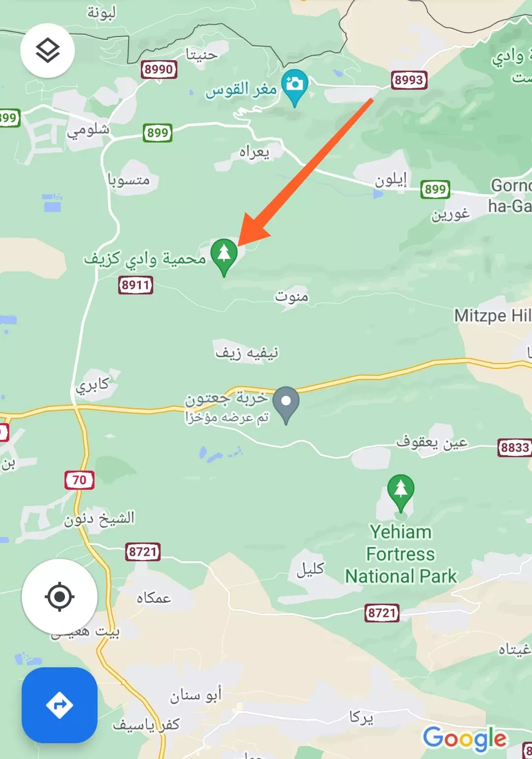
| Distance From District | 16 (km) Northeast of Acre | ||||||||||||
| Elevation | 375 (meters) | ||||||||||||
| Before & After Nakba, Click Map For Details |
|||||||||||||
|
|||||||||||||
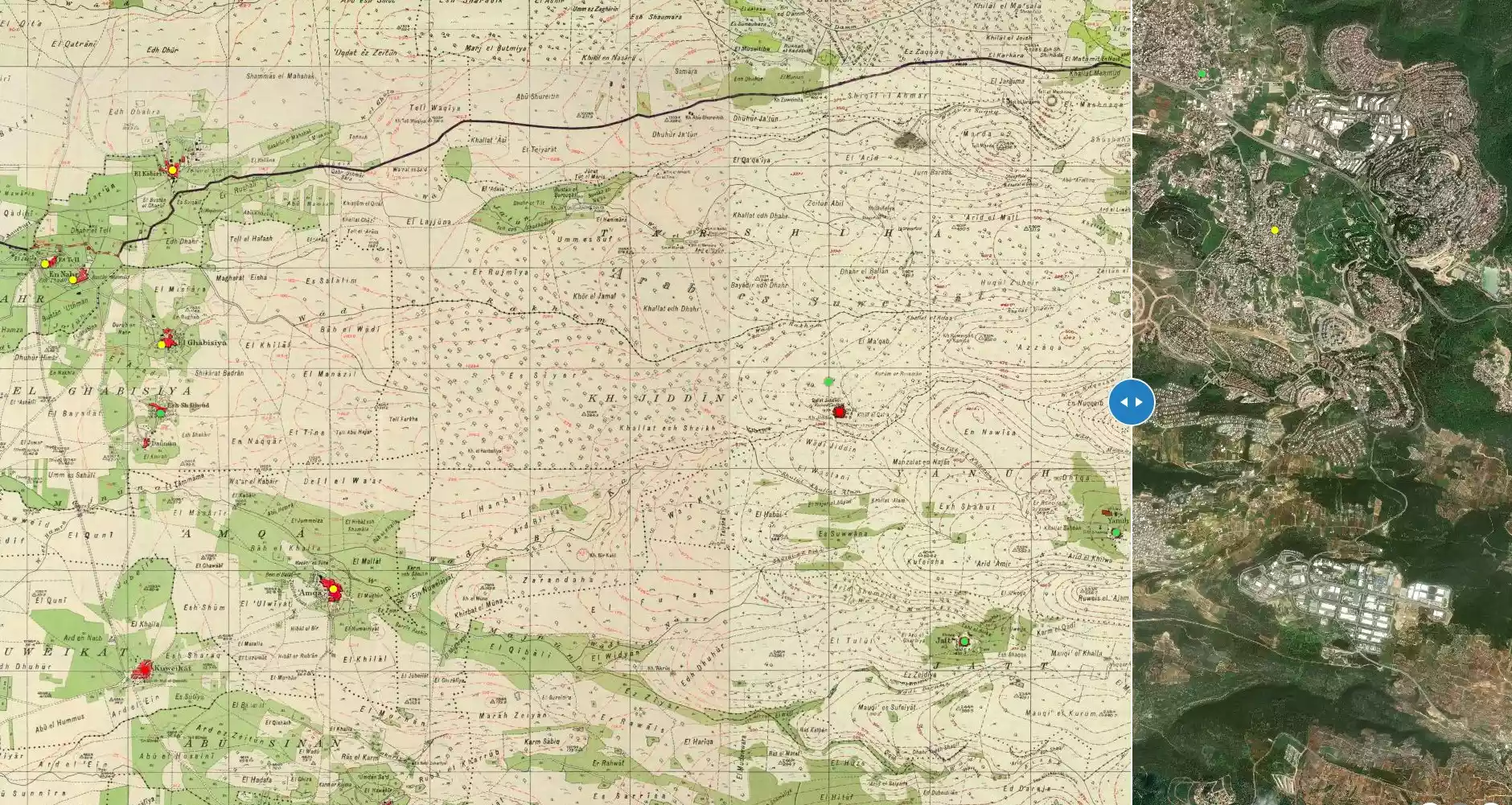
| Map Location | See location #16 on the map View from satellite |
||||||||||||
| Military Operation | Operation Dekel | ||||||||||||
| Attacking Units | Sheva' (Seventh) and Carmeli brigades | ||||||||||||
| Exodus Cause | Military assault by Zionist troops | ||||||||||||
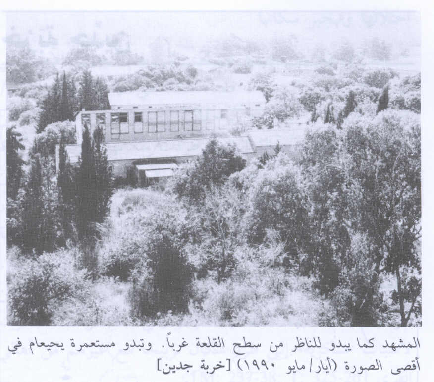
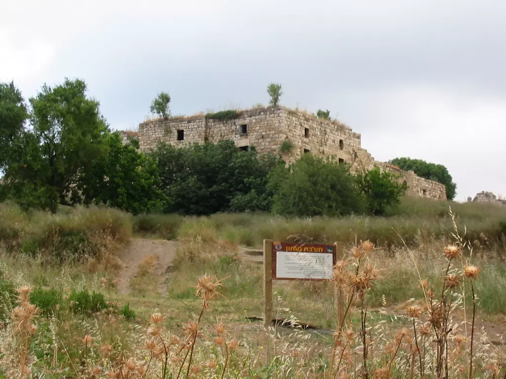
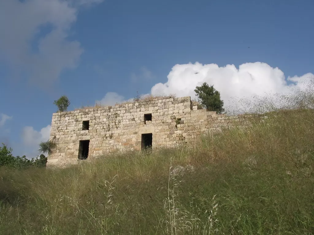
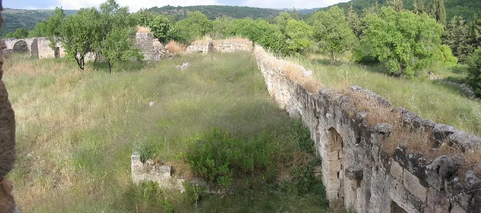
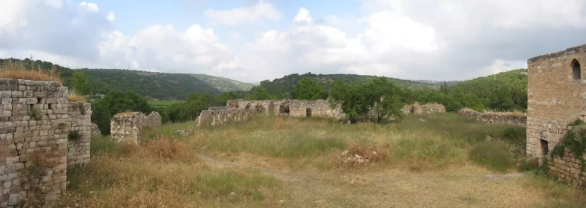
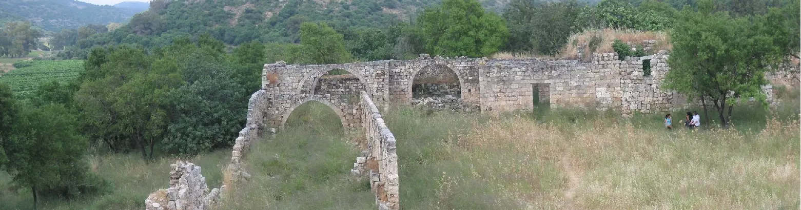
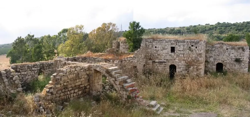
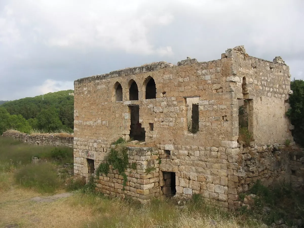
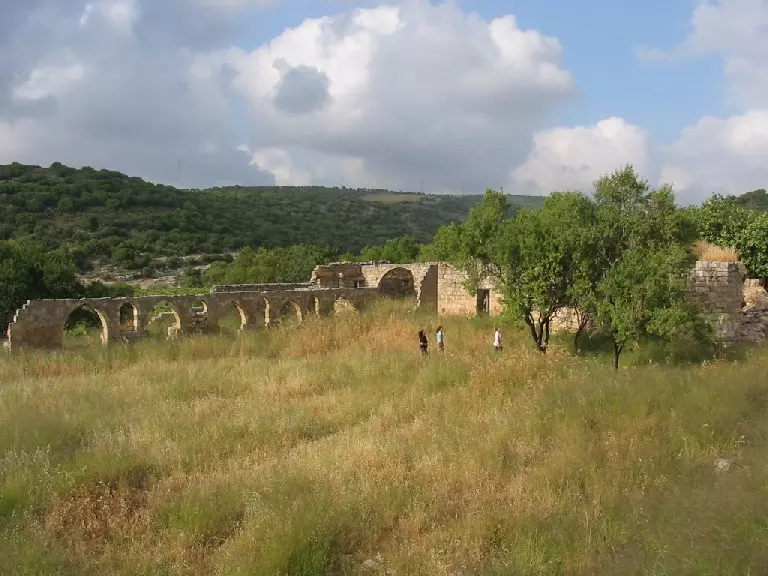
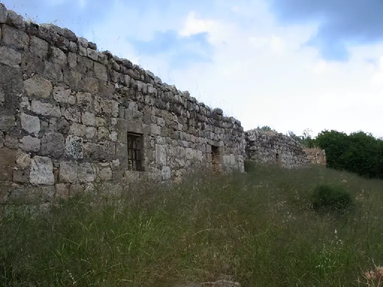
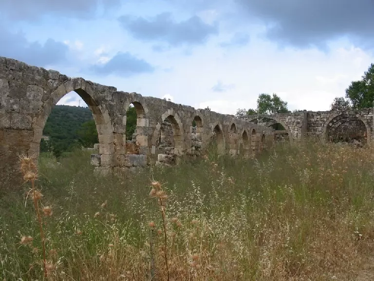
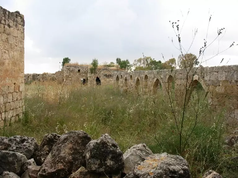
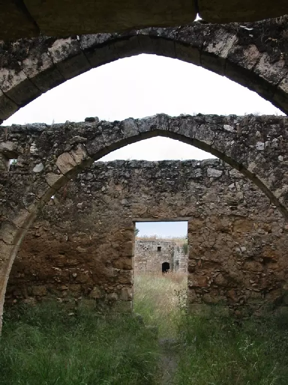
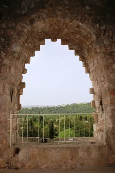
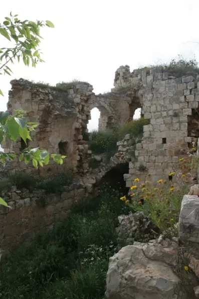
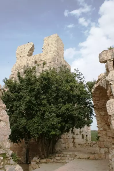
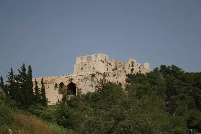
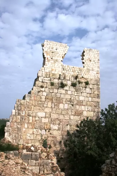
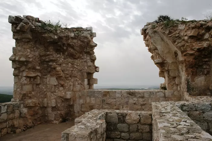
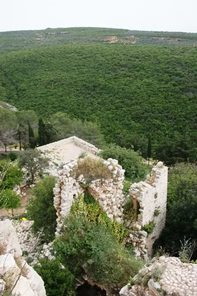
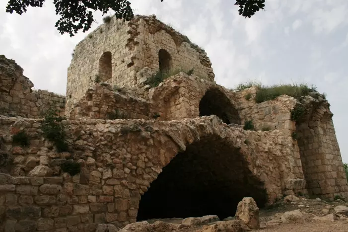
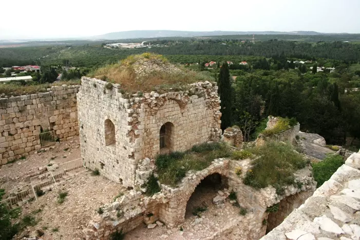
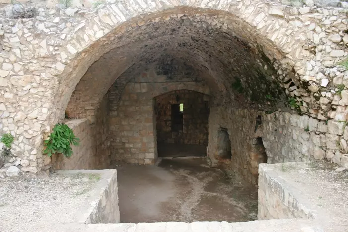
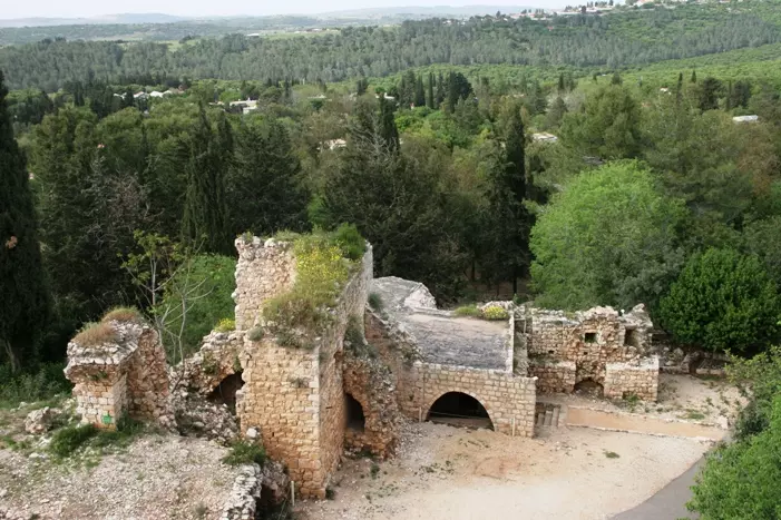
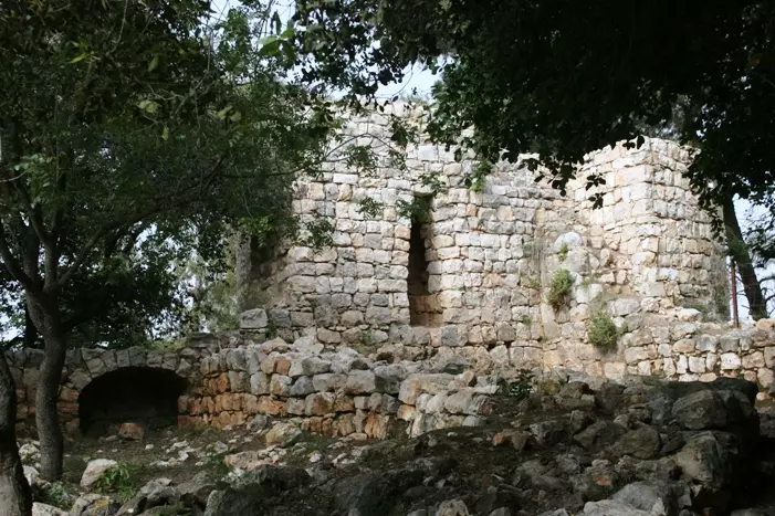
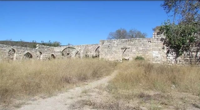
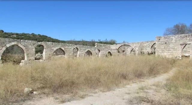
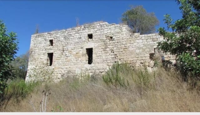
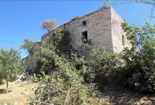
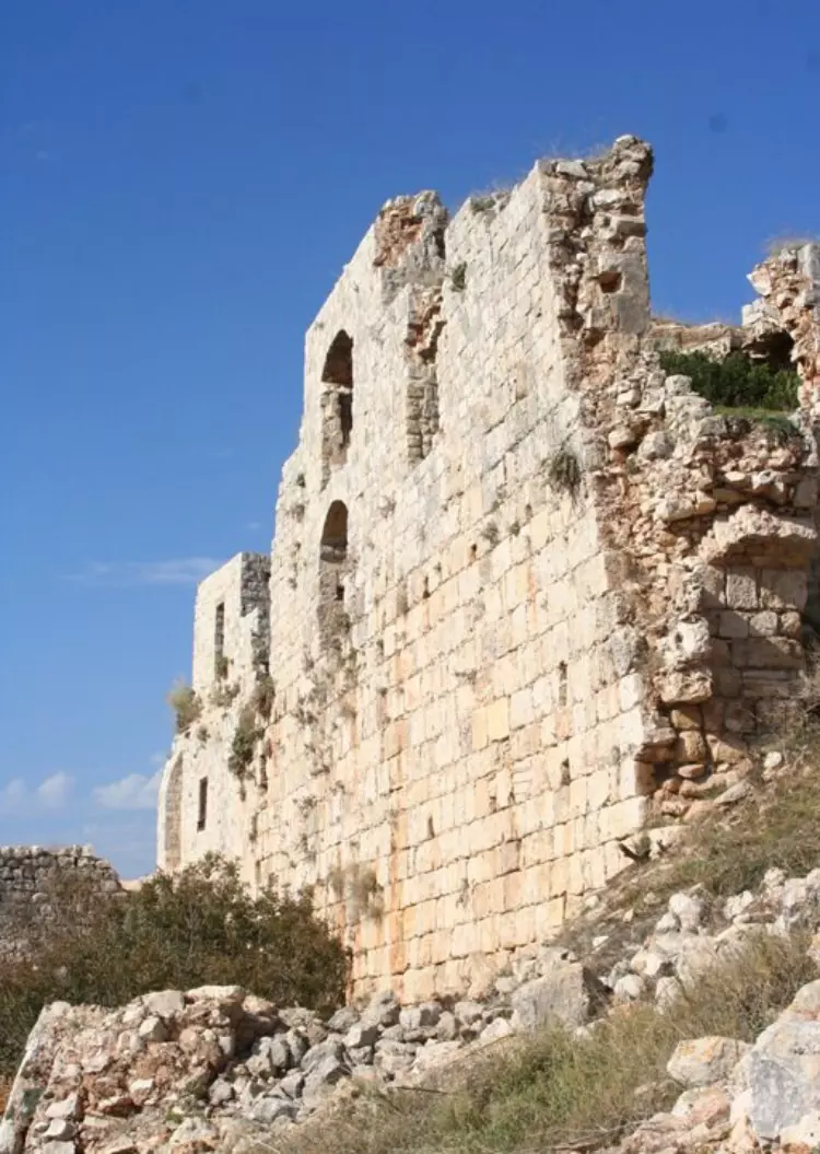
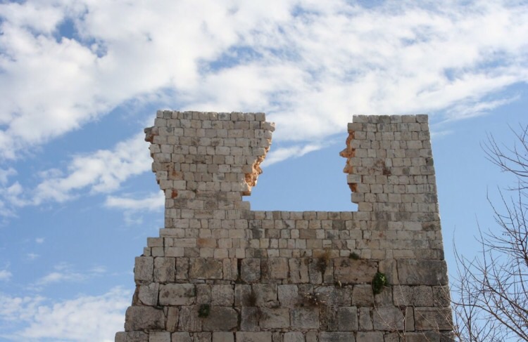
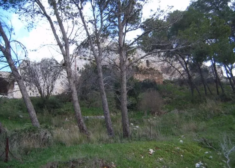
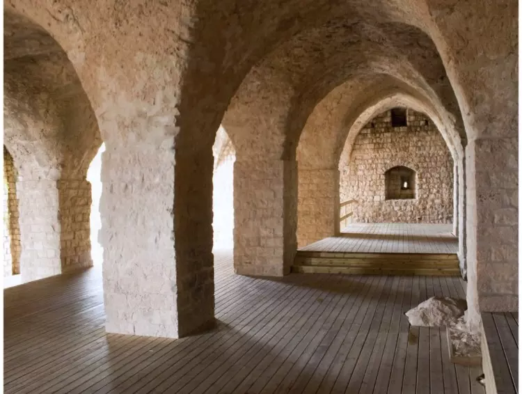
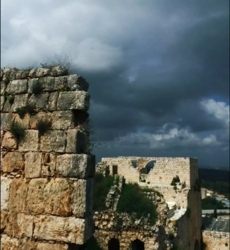
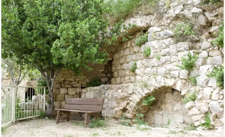
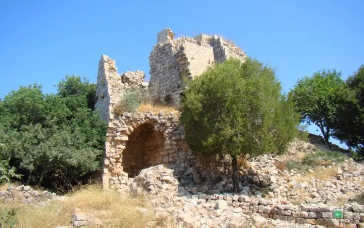
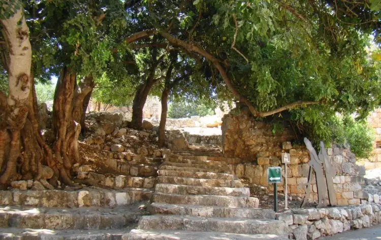
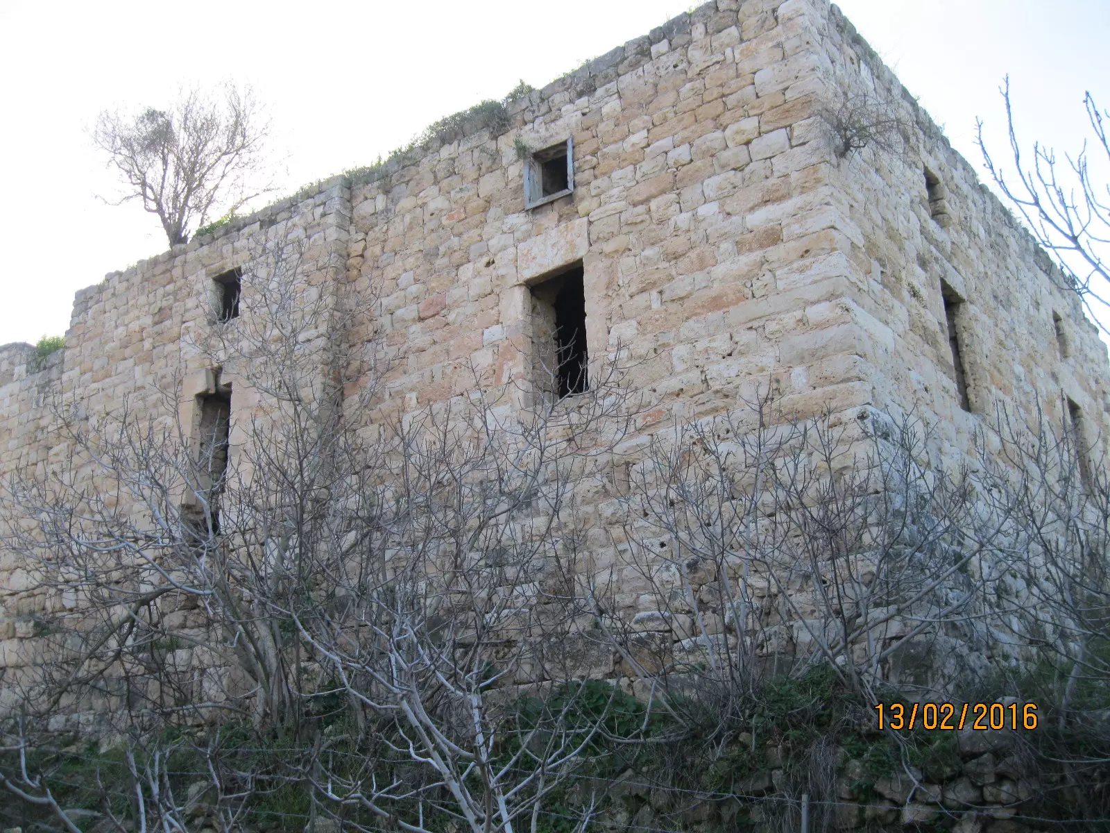
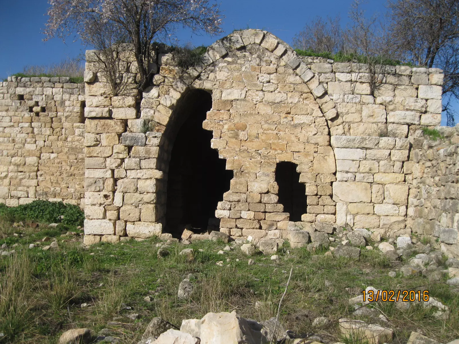
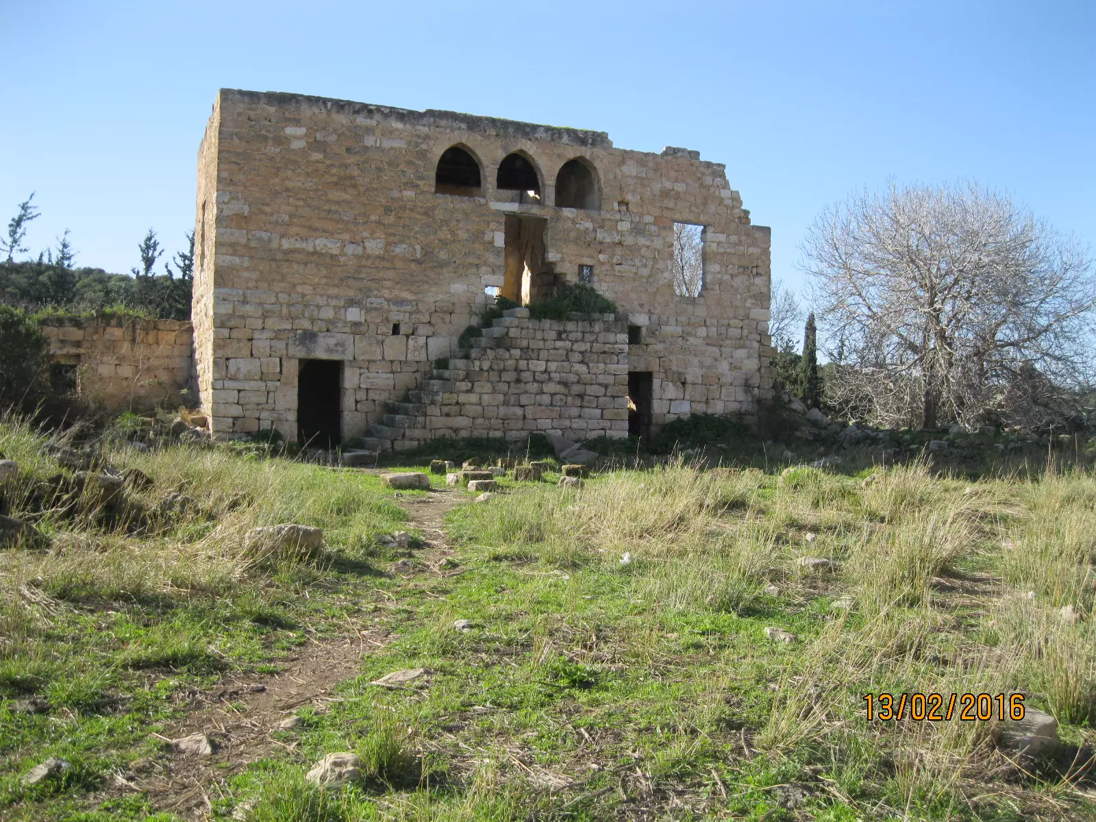
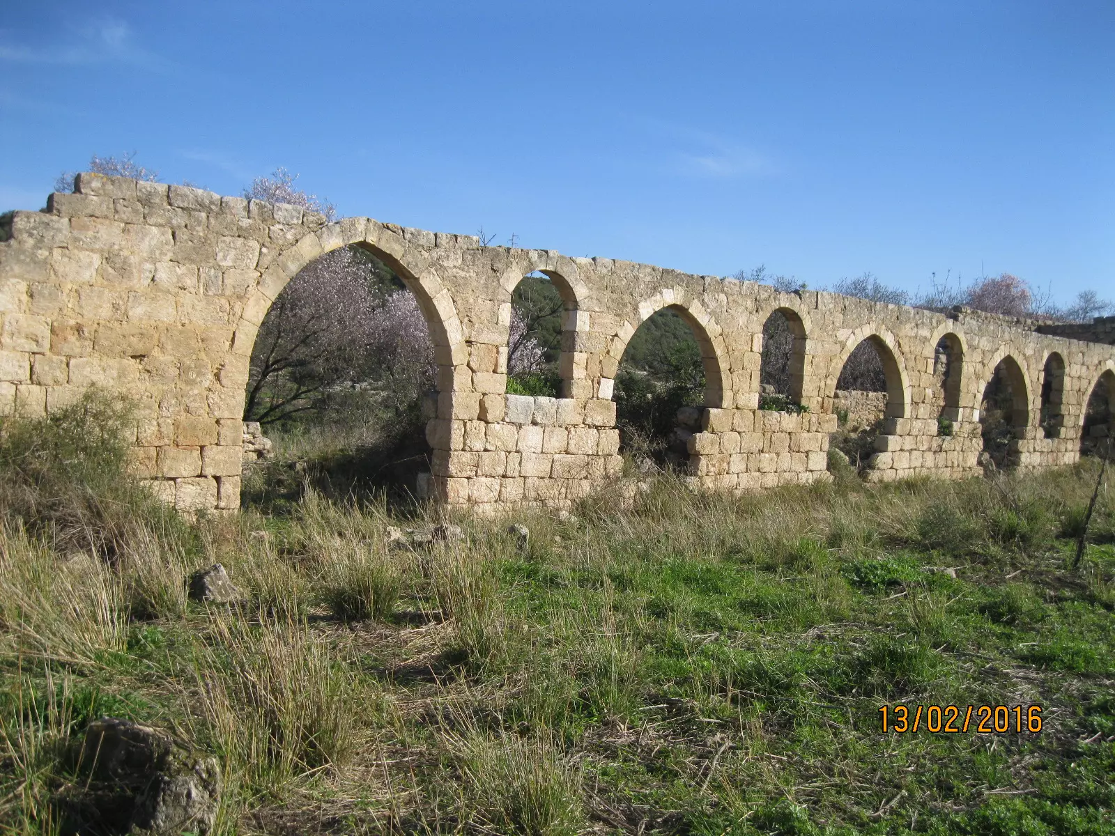
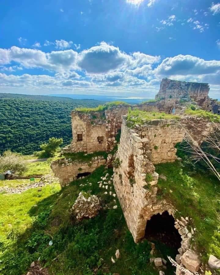
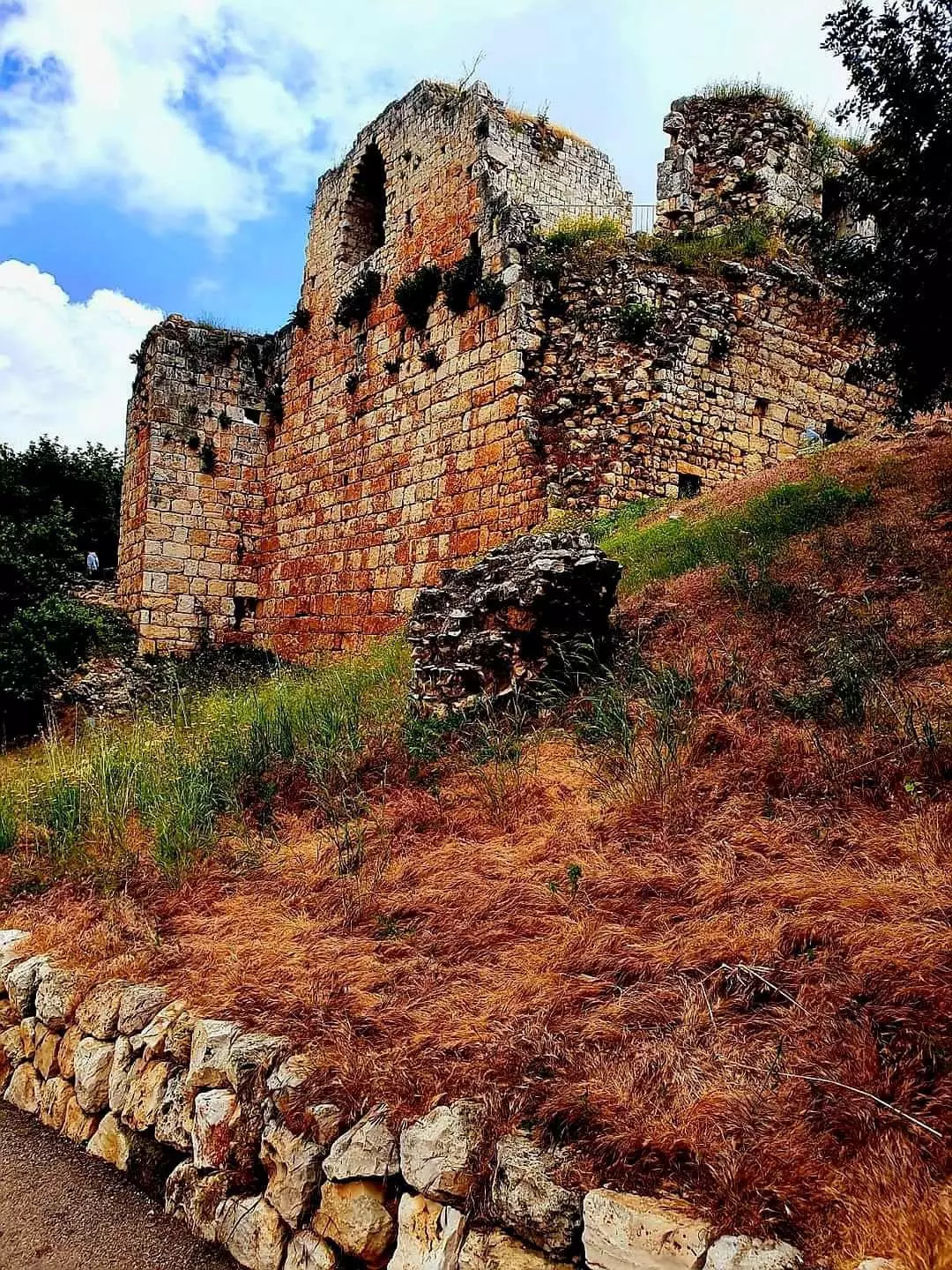
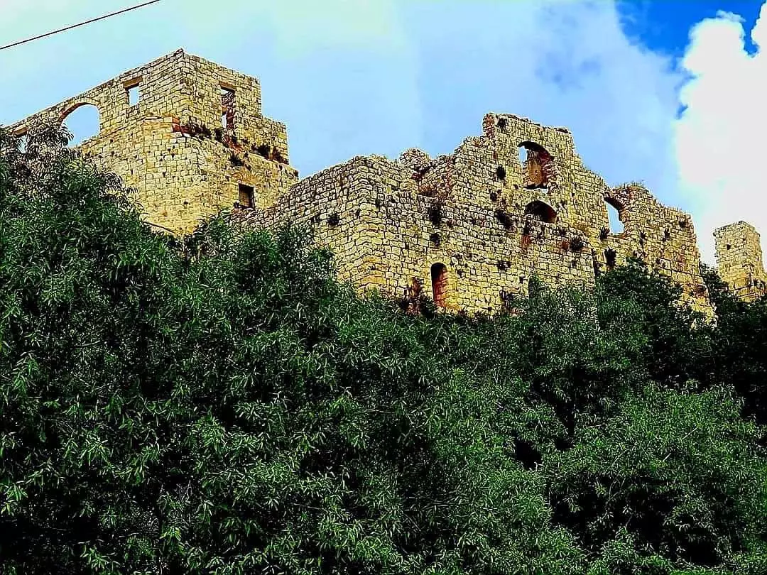
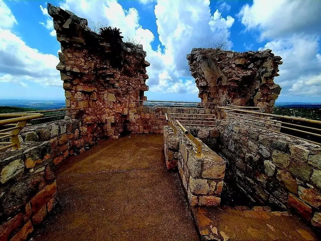
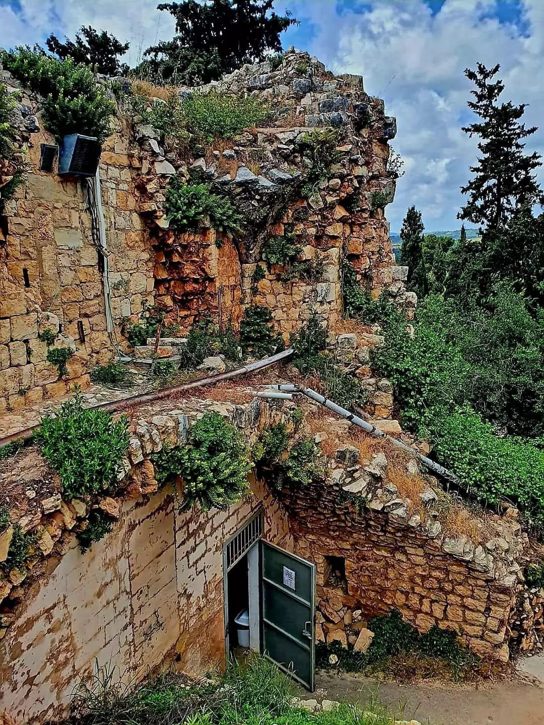
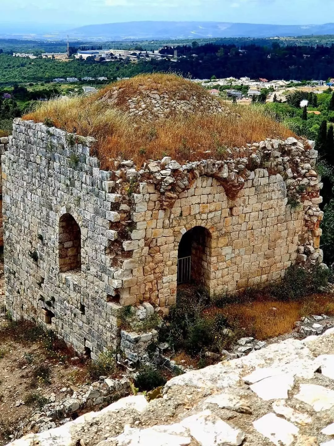
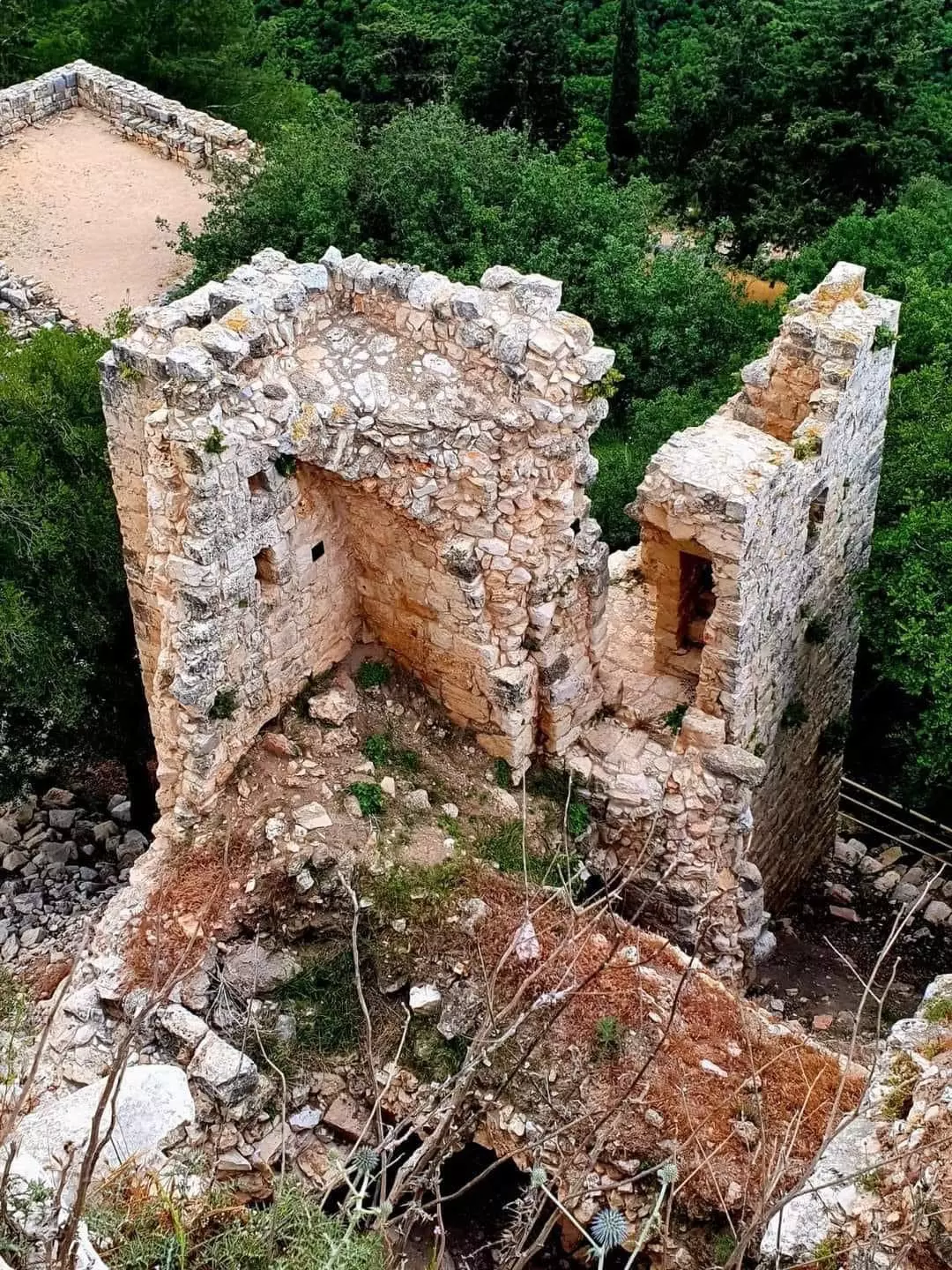
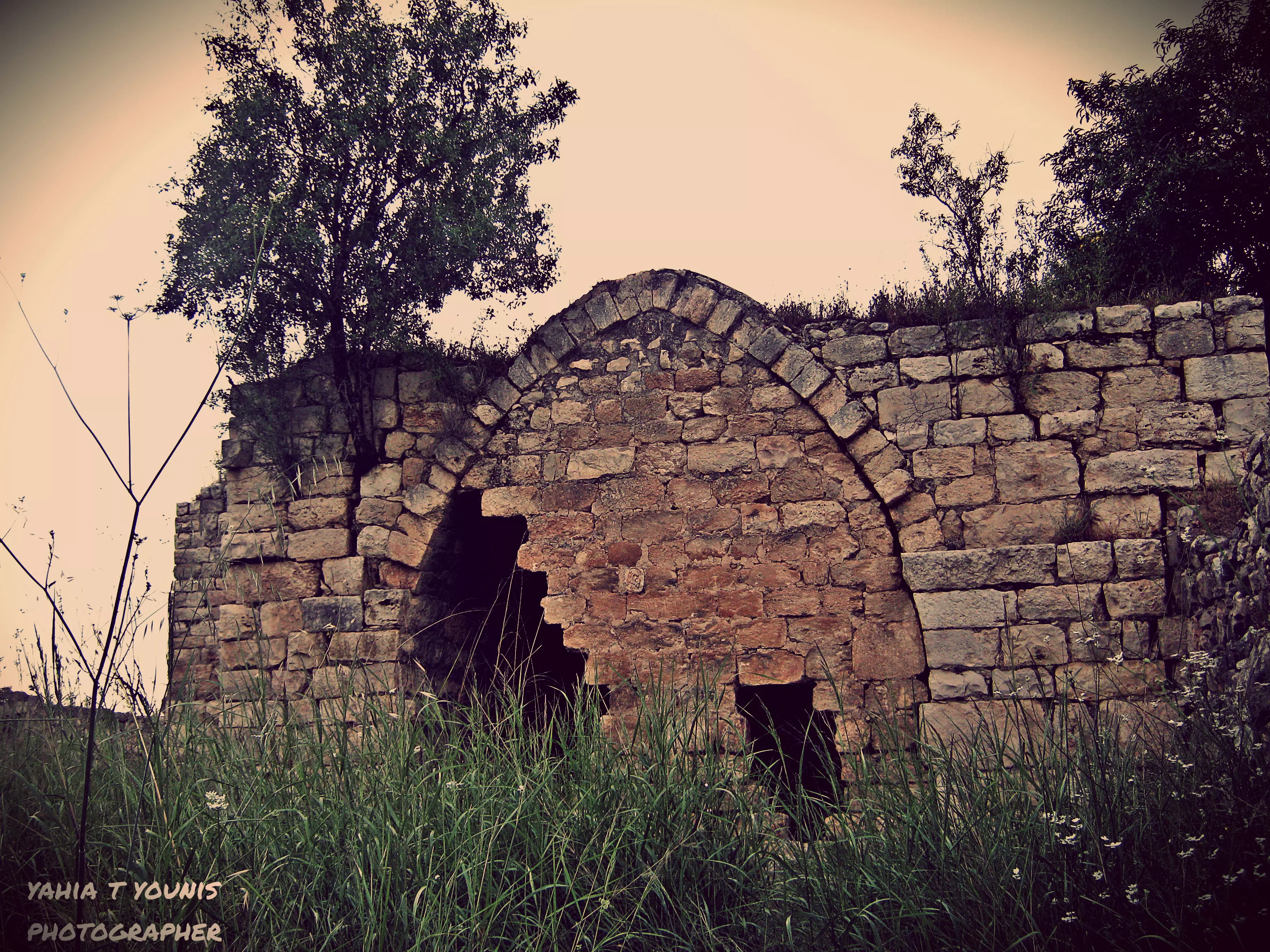
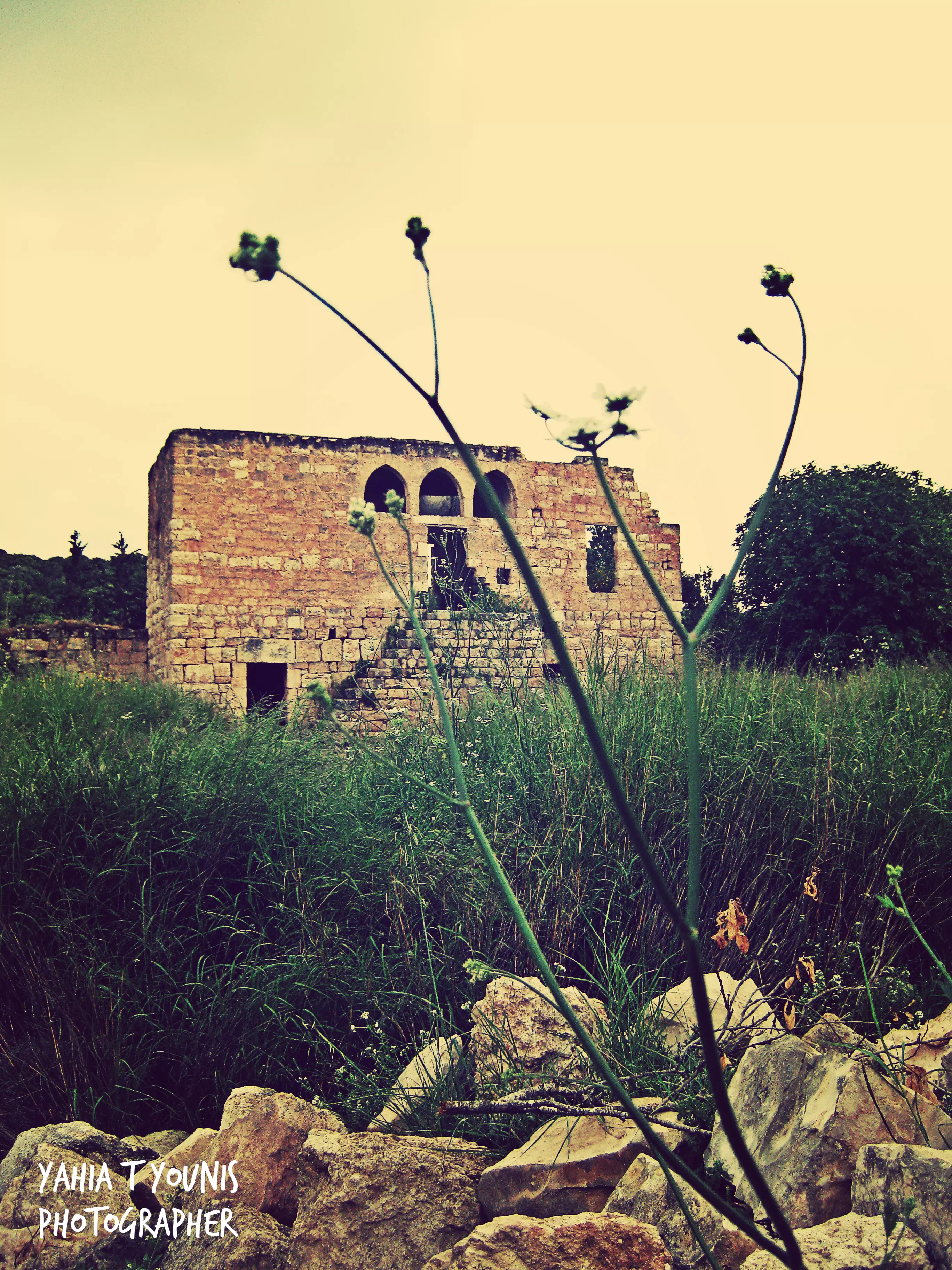
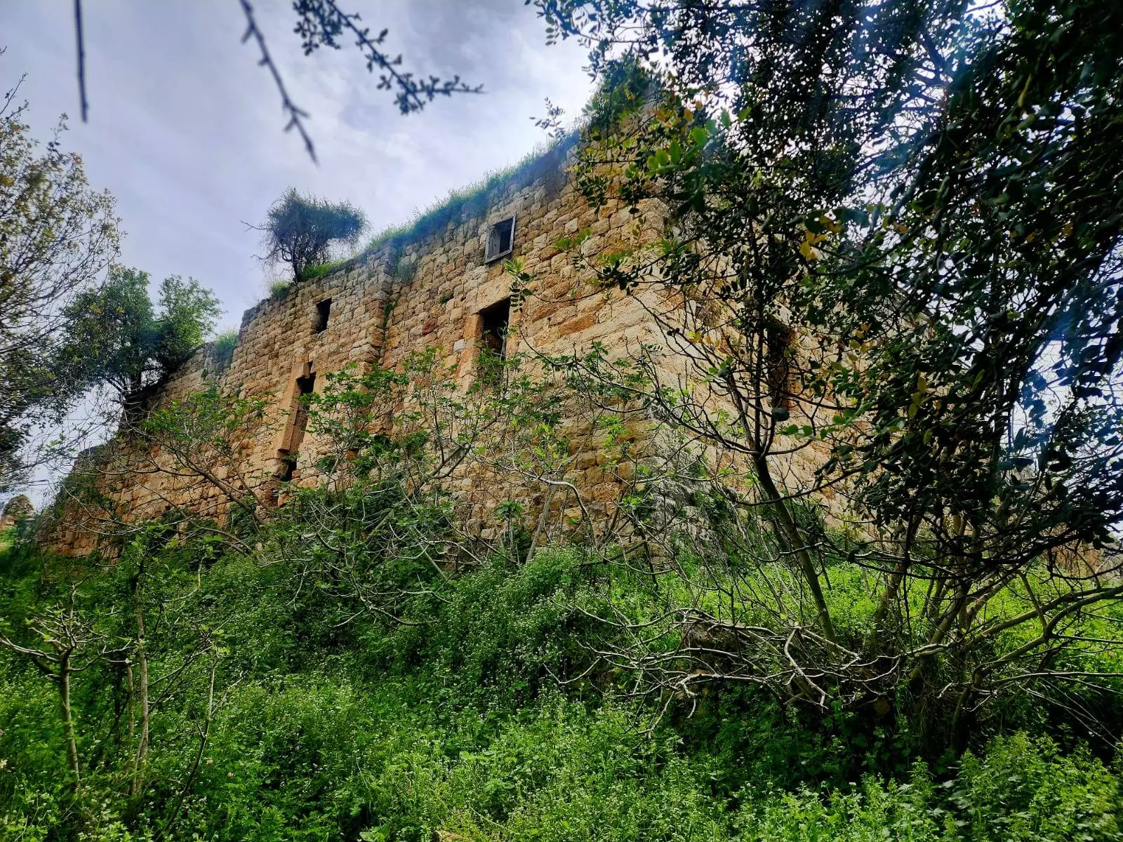
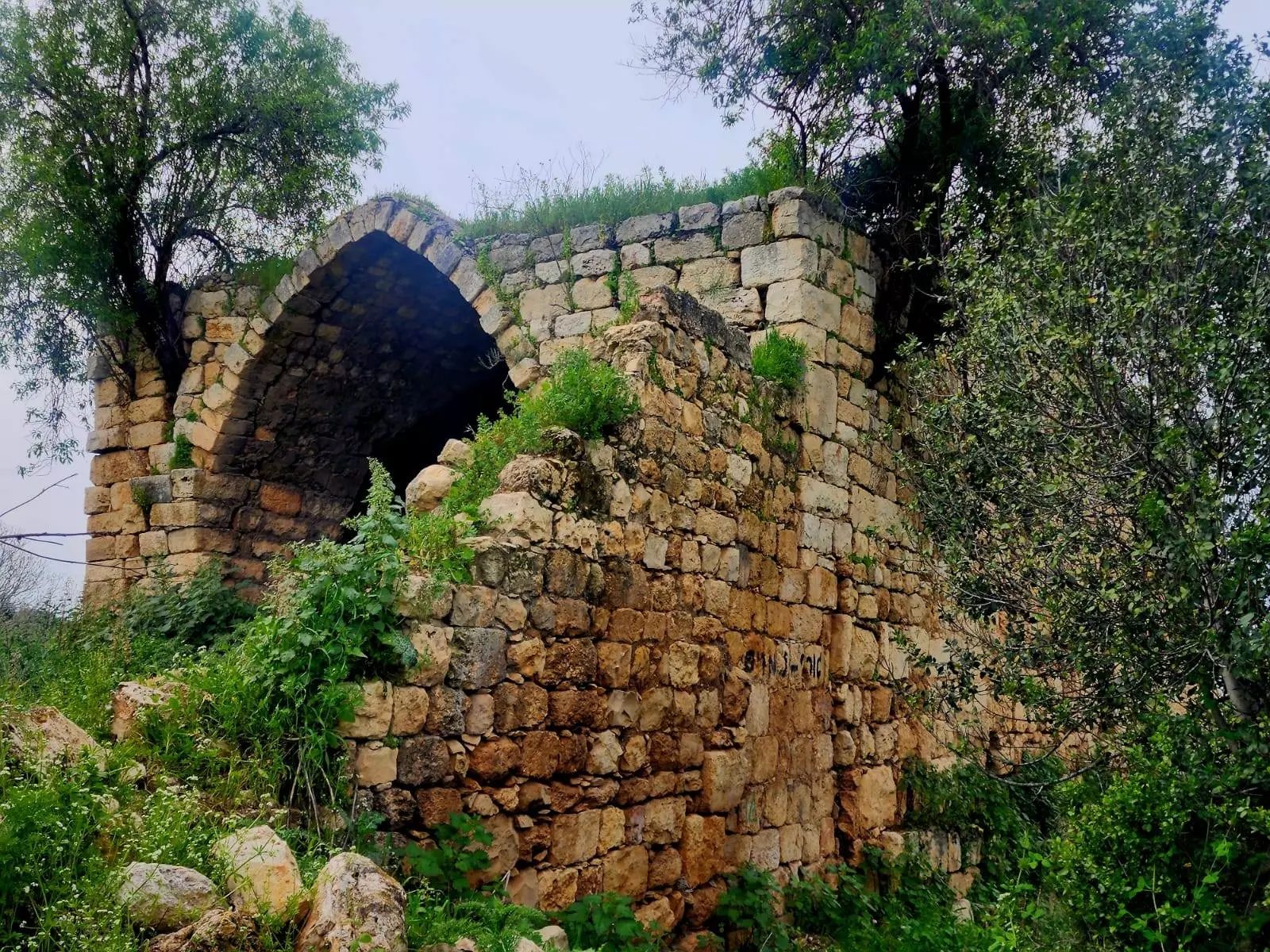
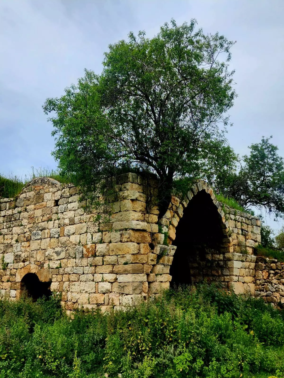
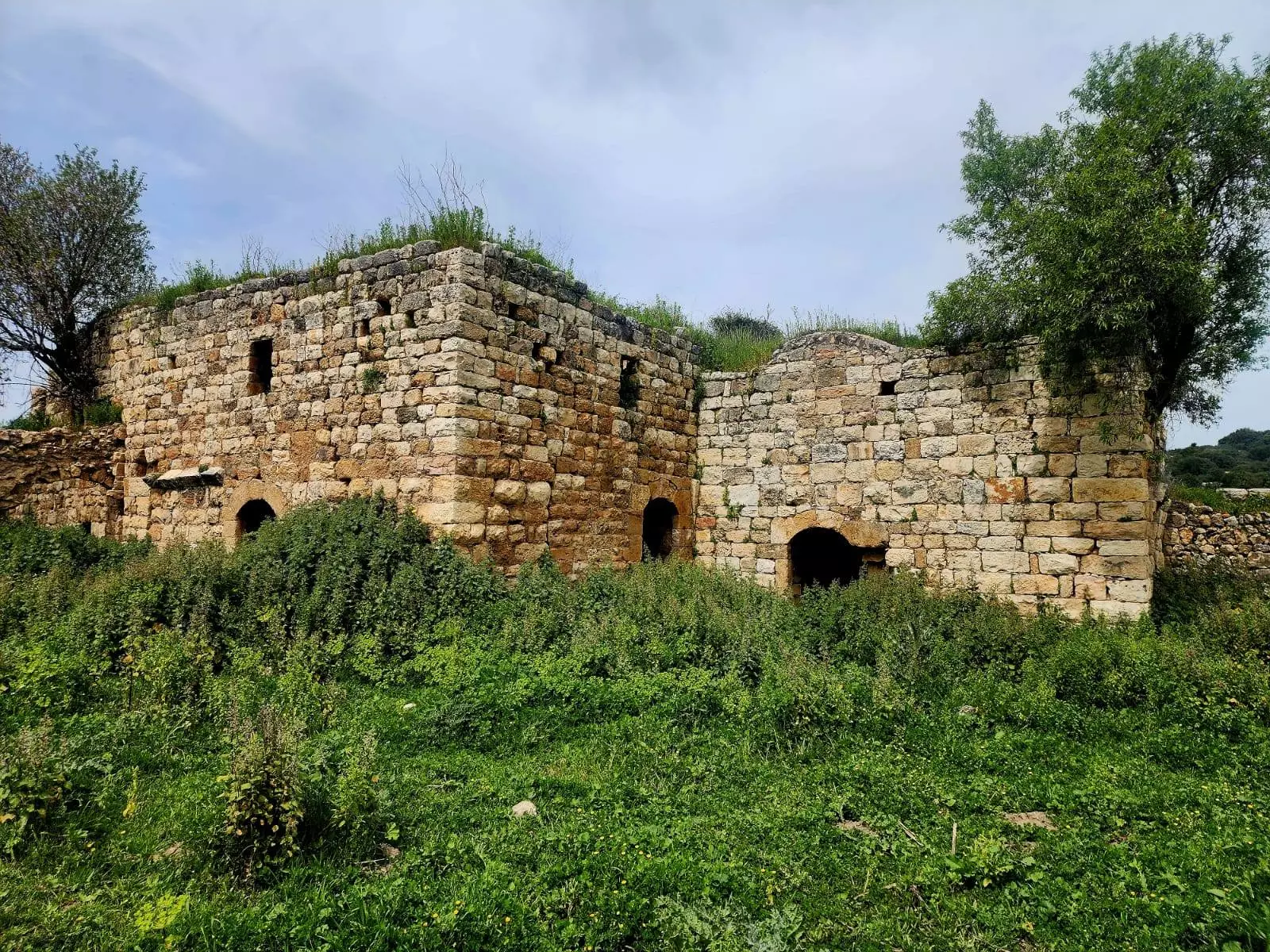
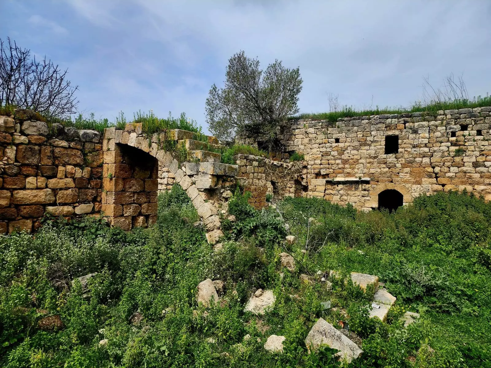
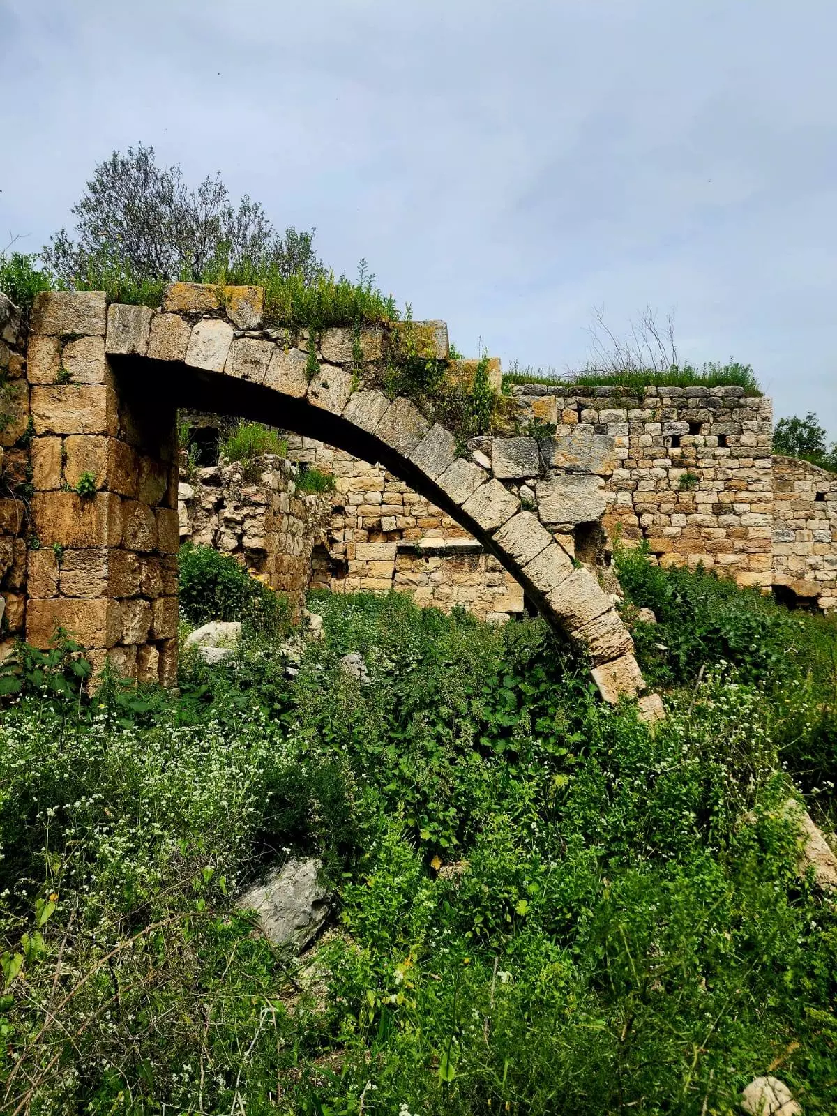
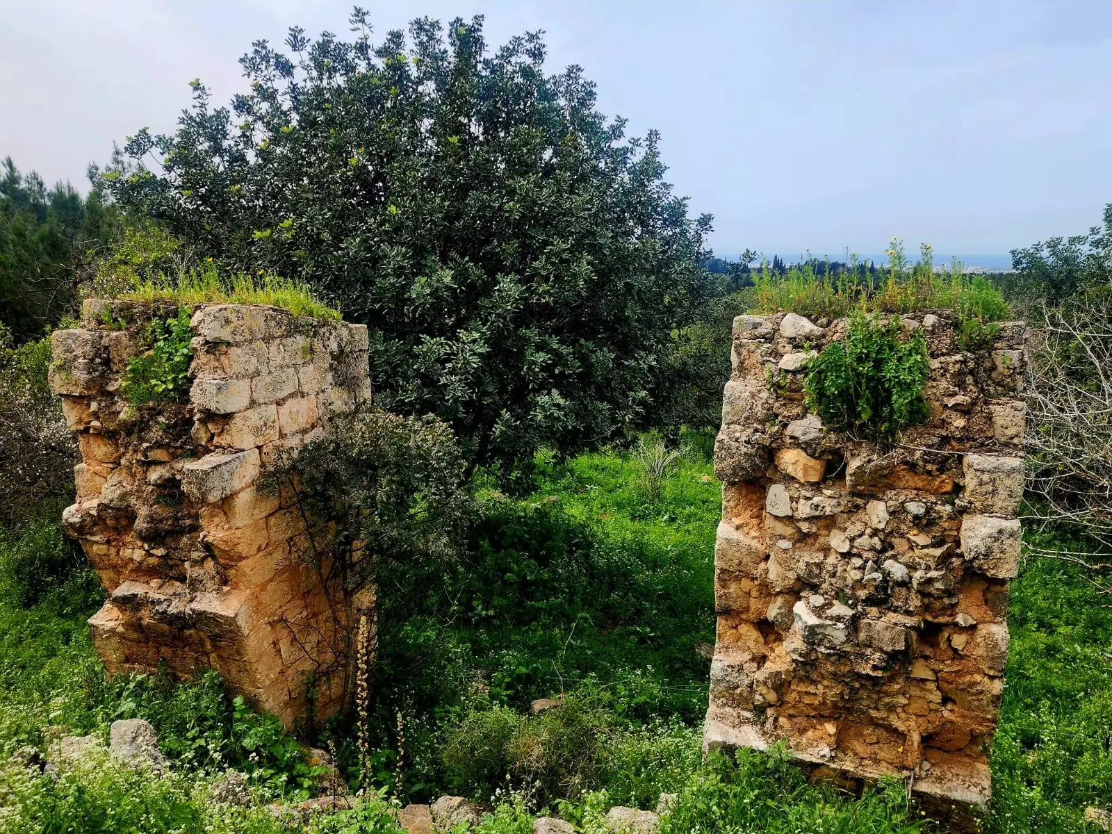
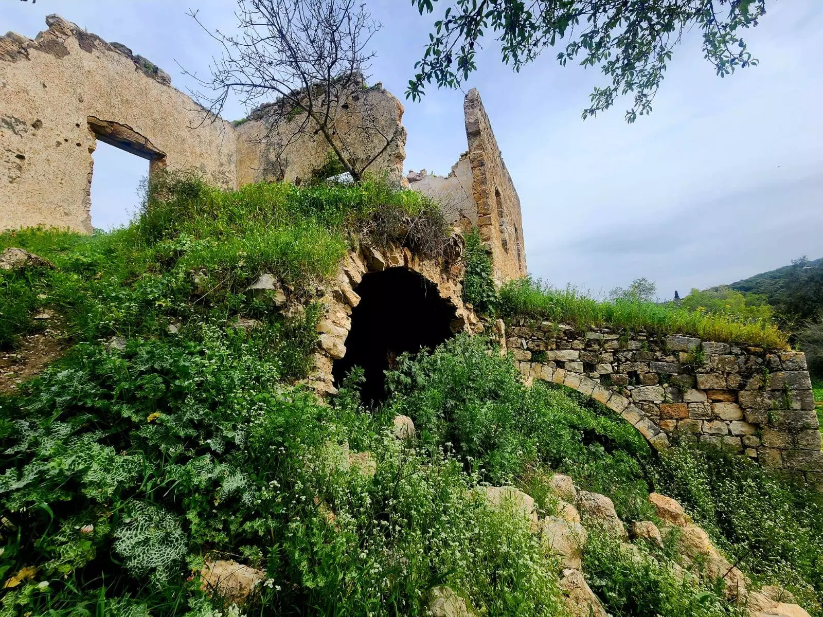
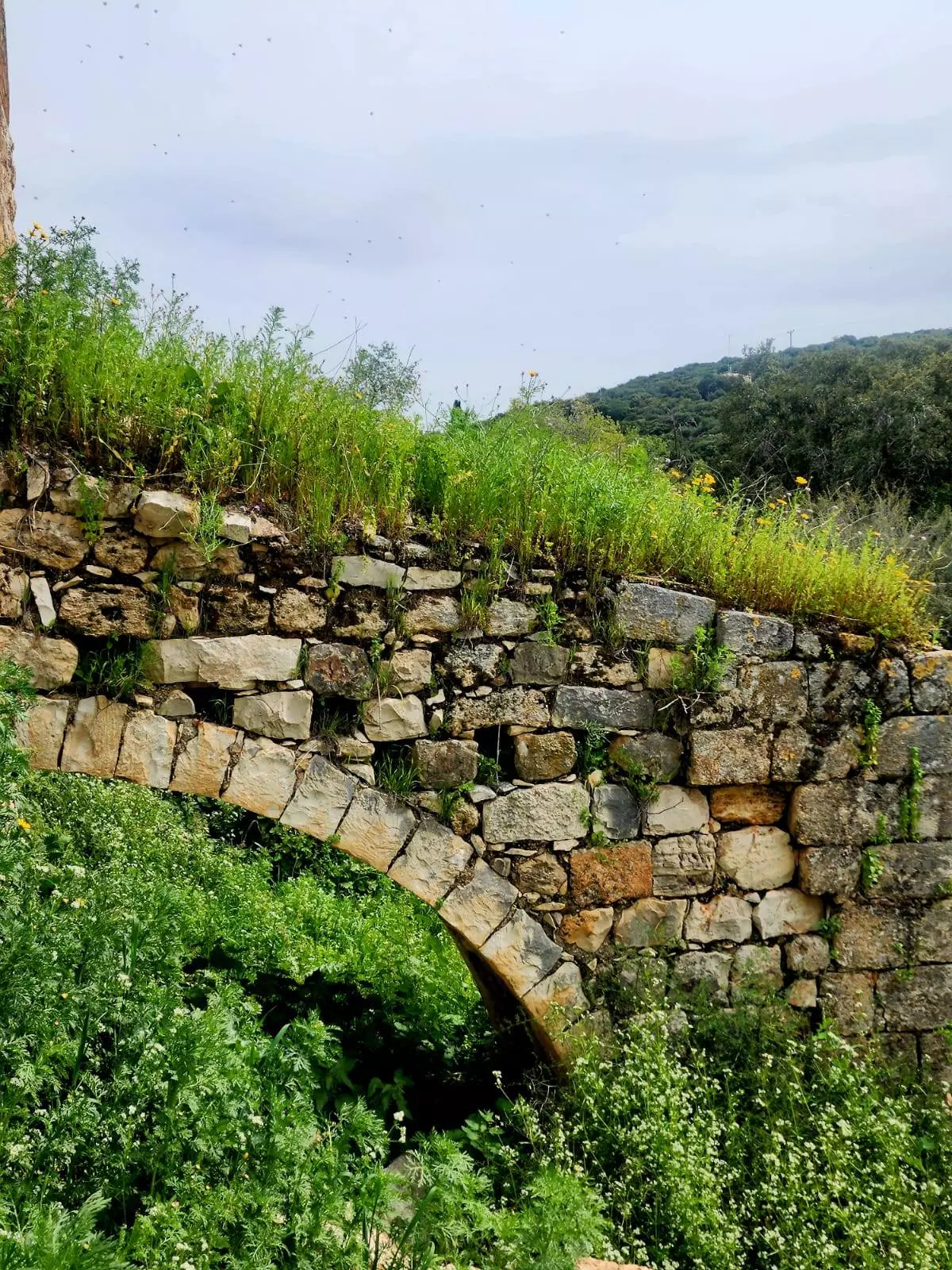
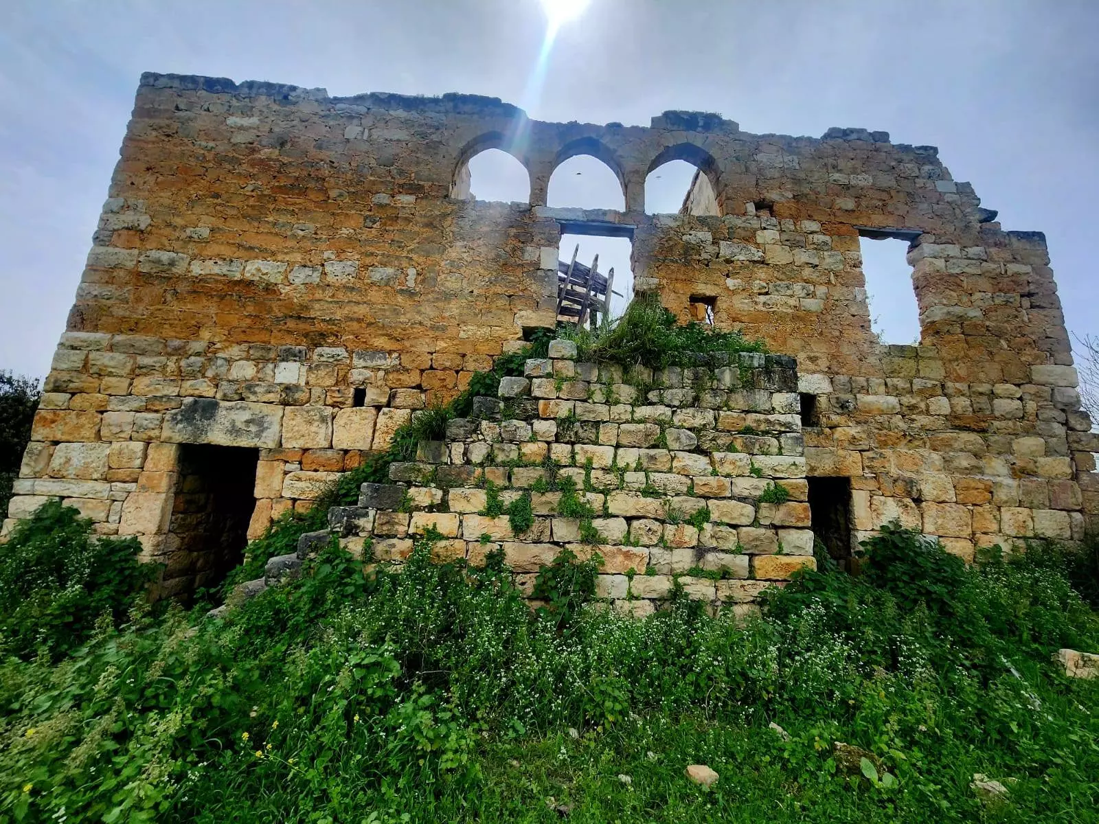
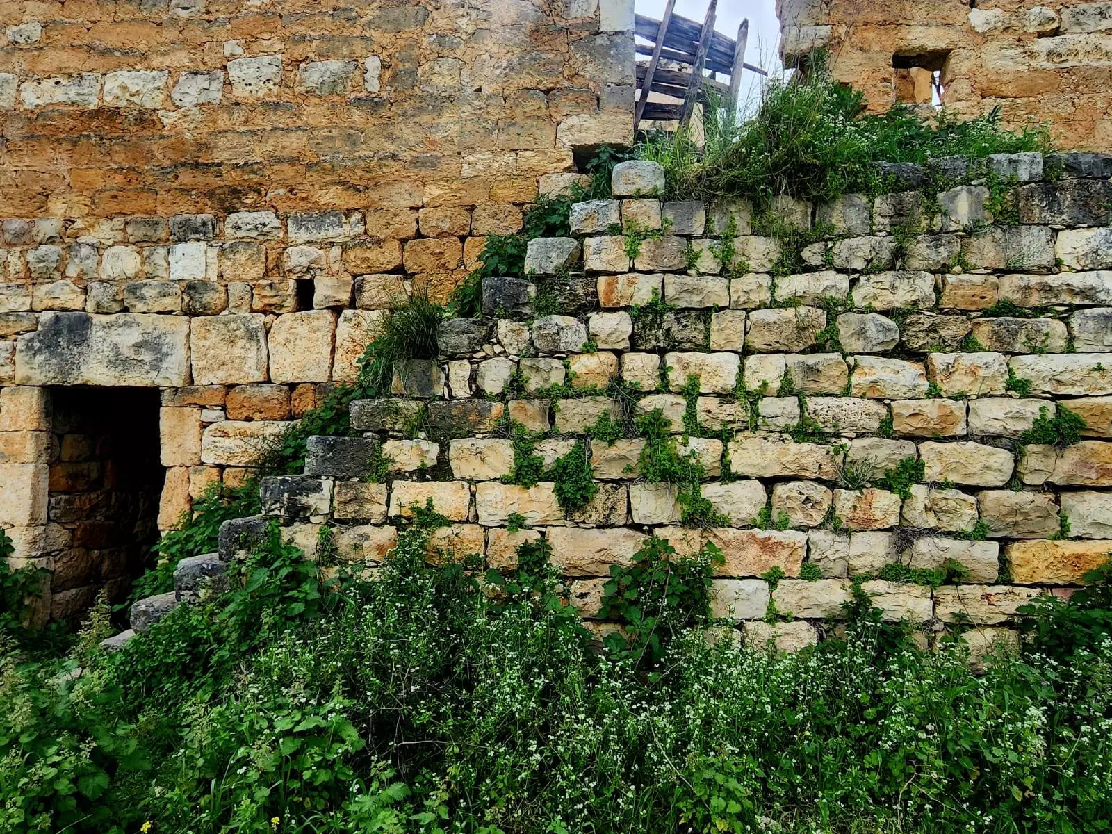
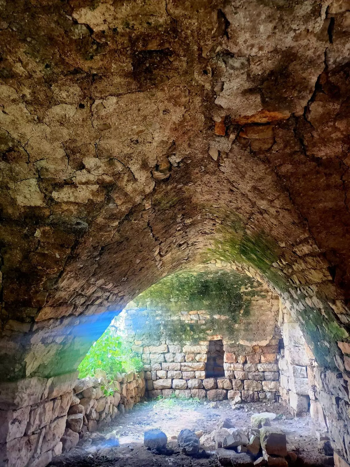
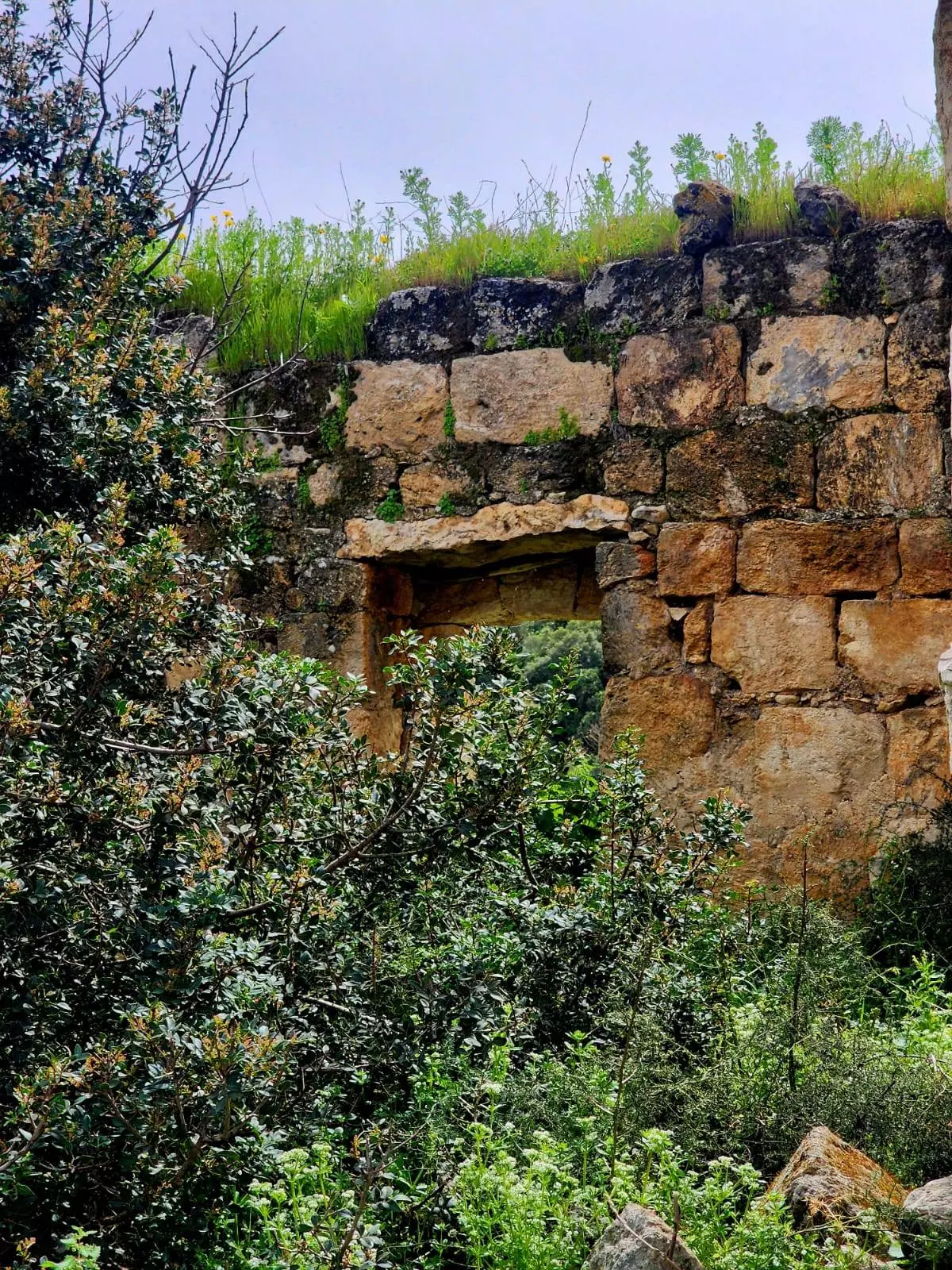
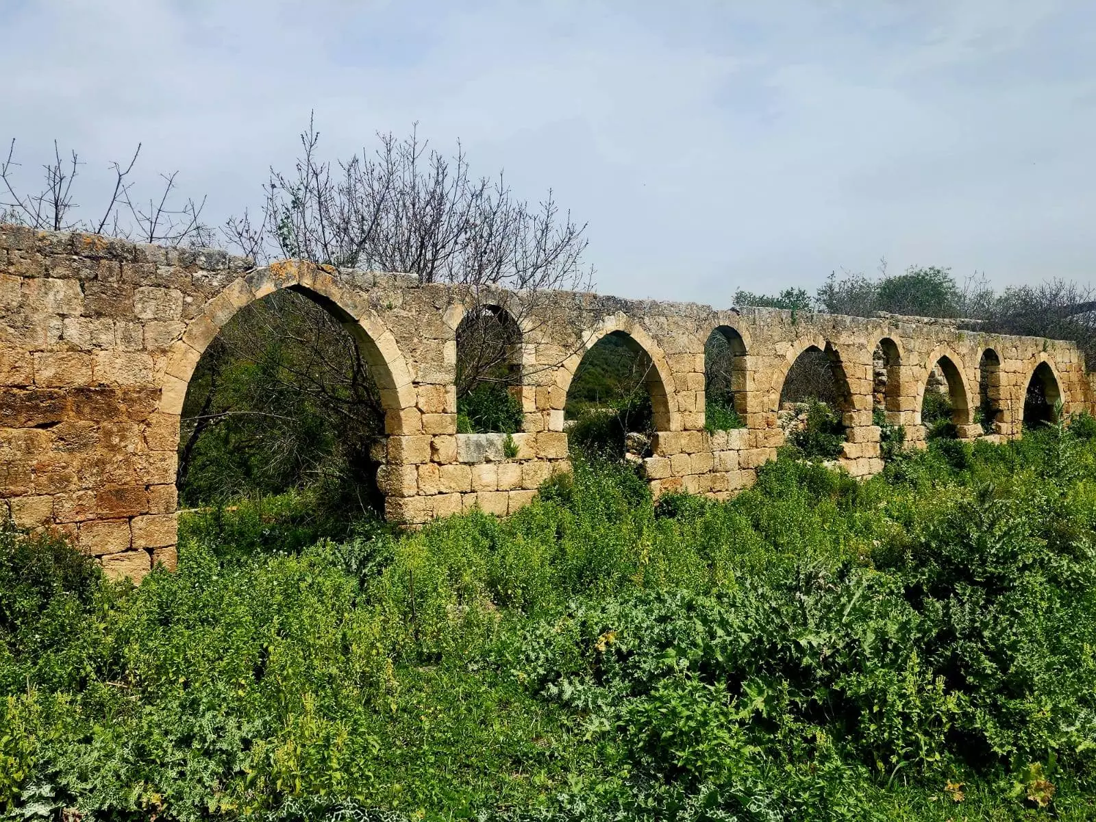
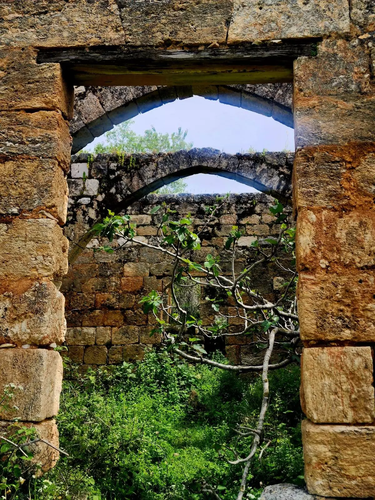
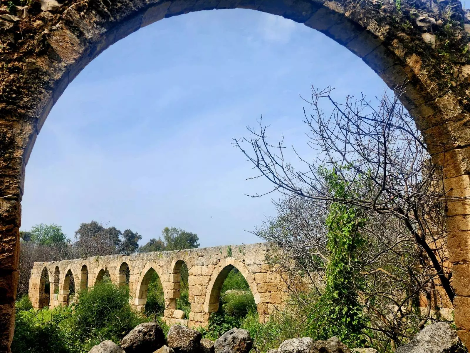
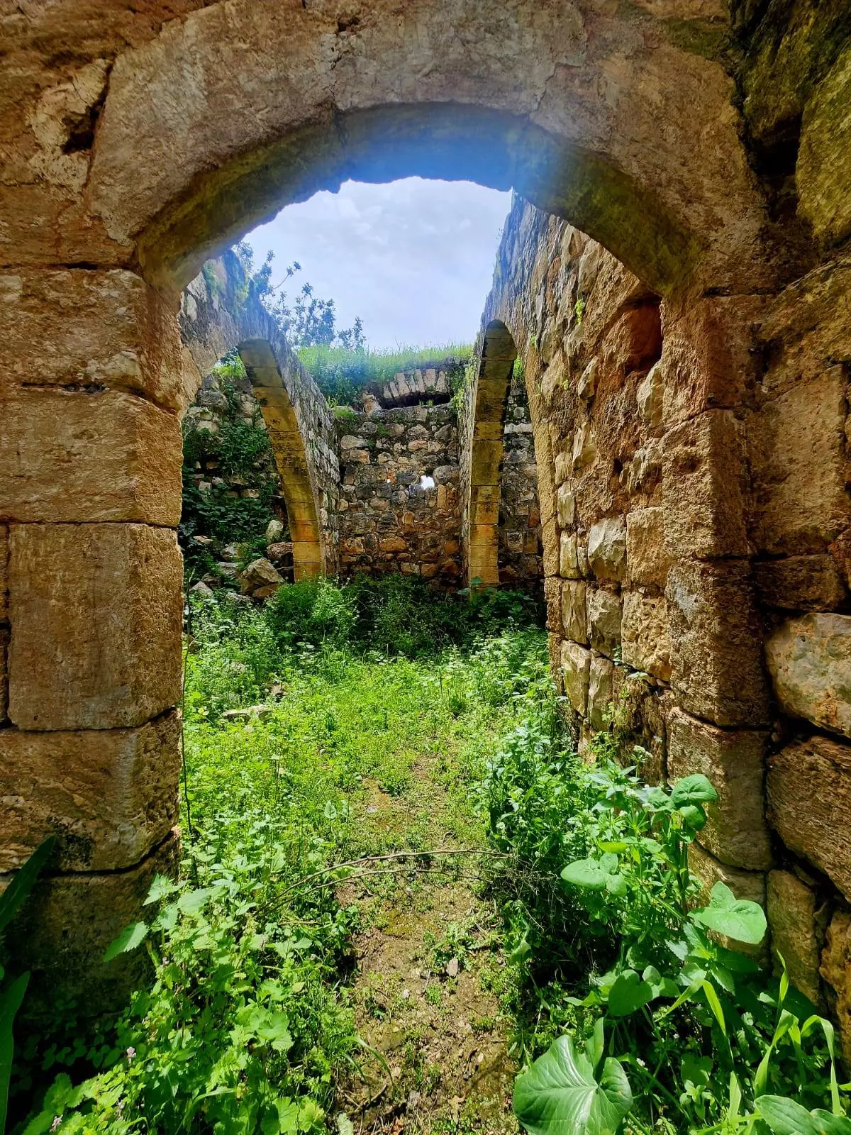
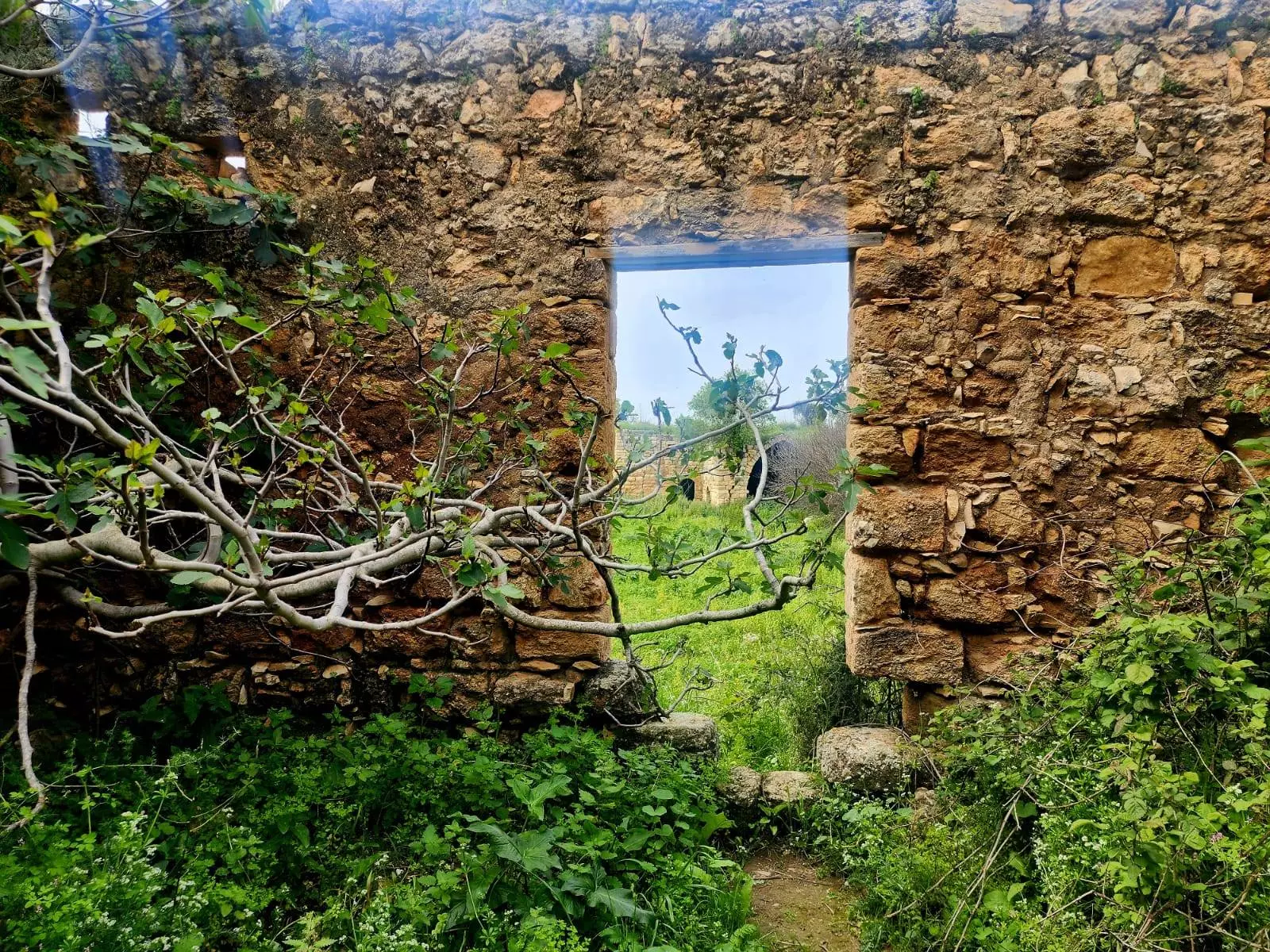
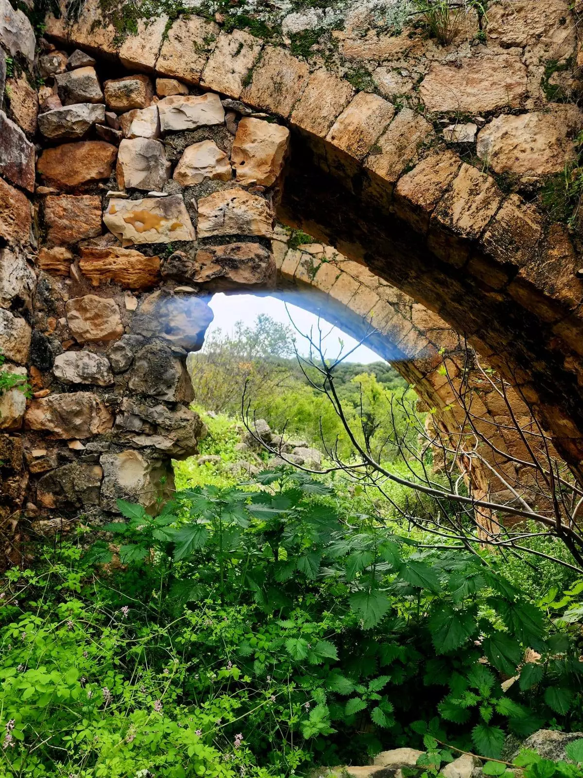
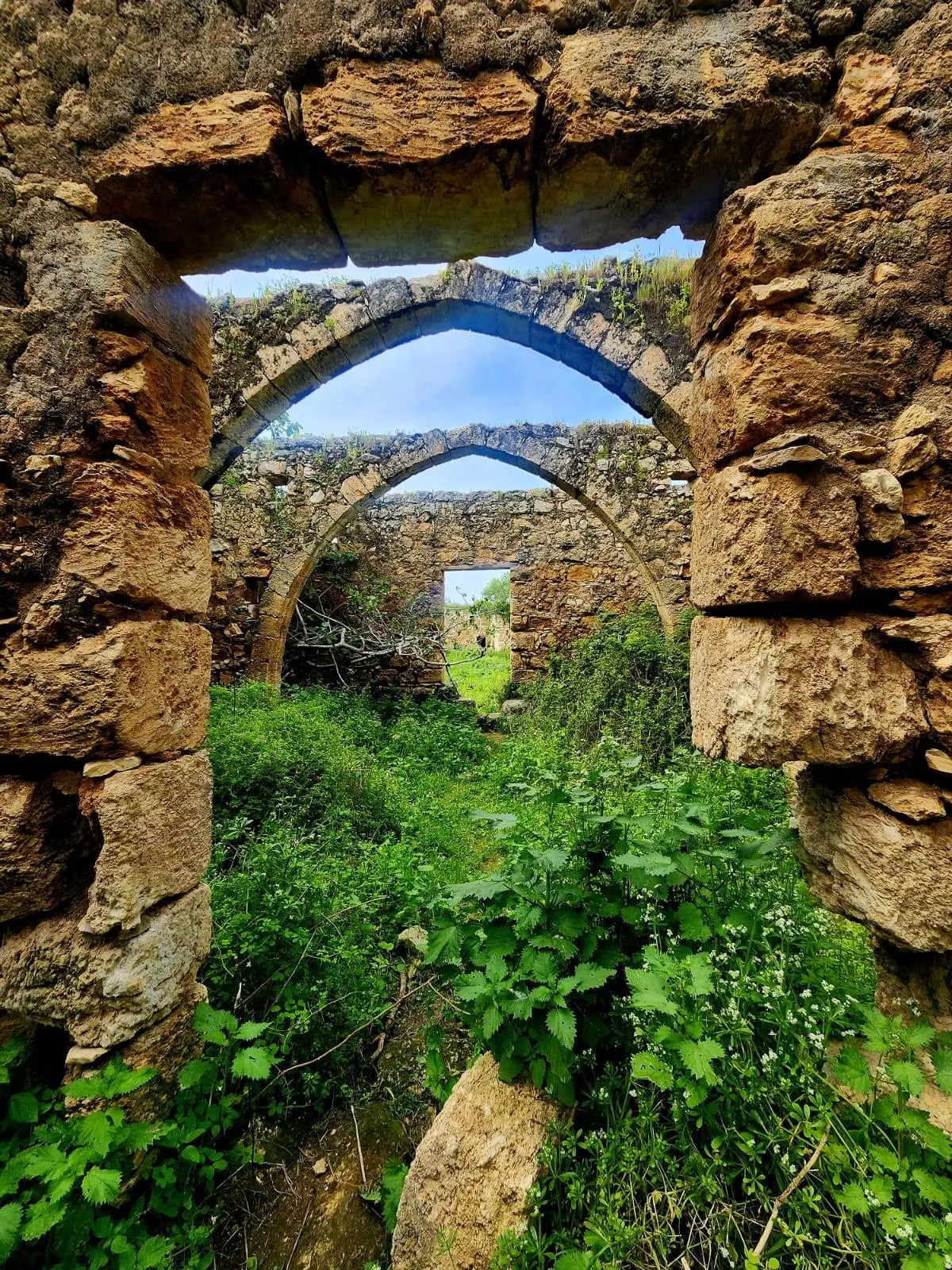
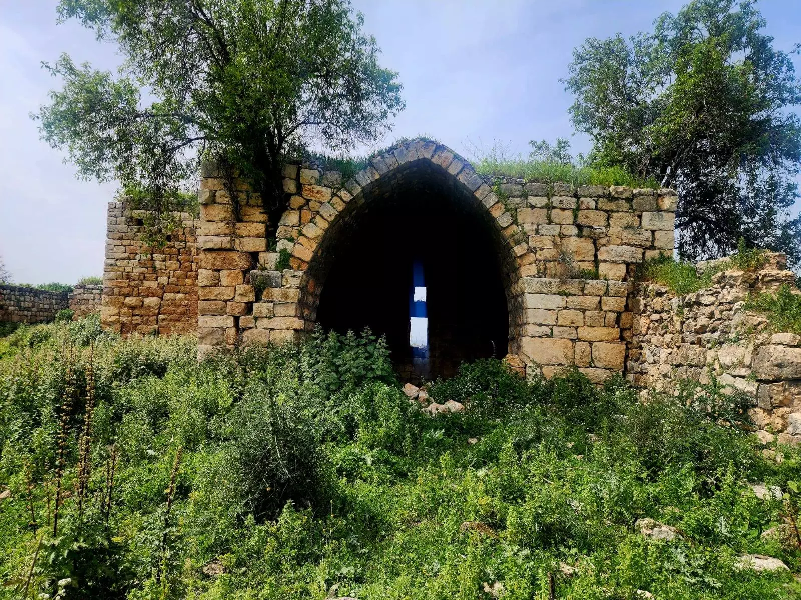
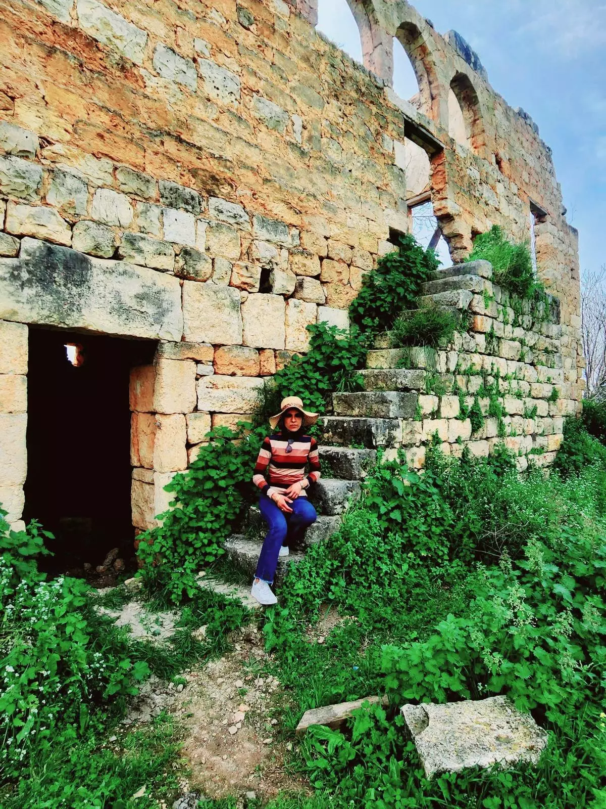
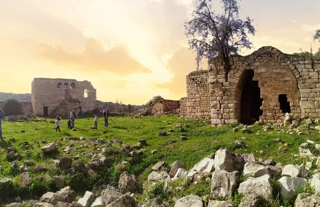
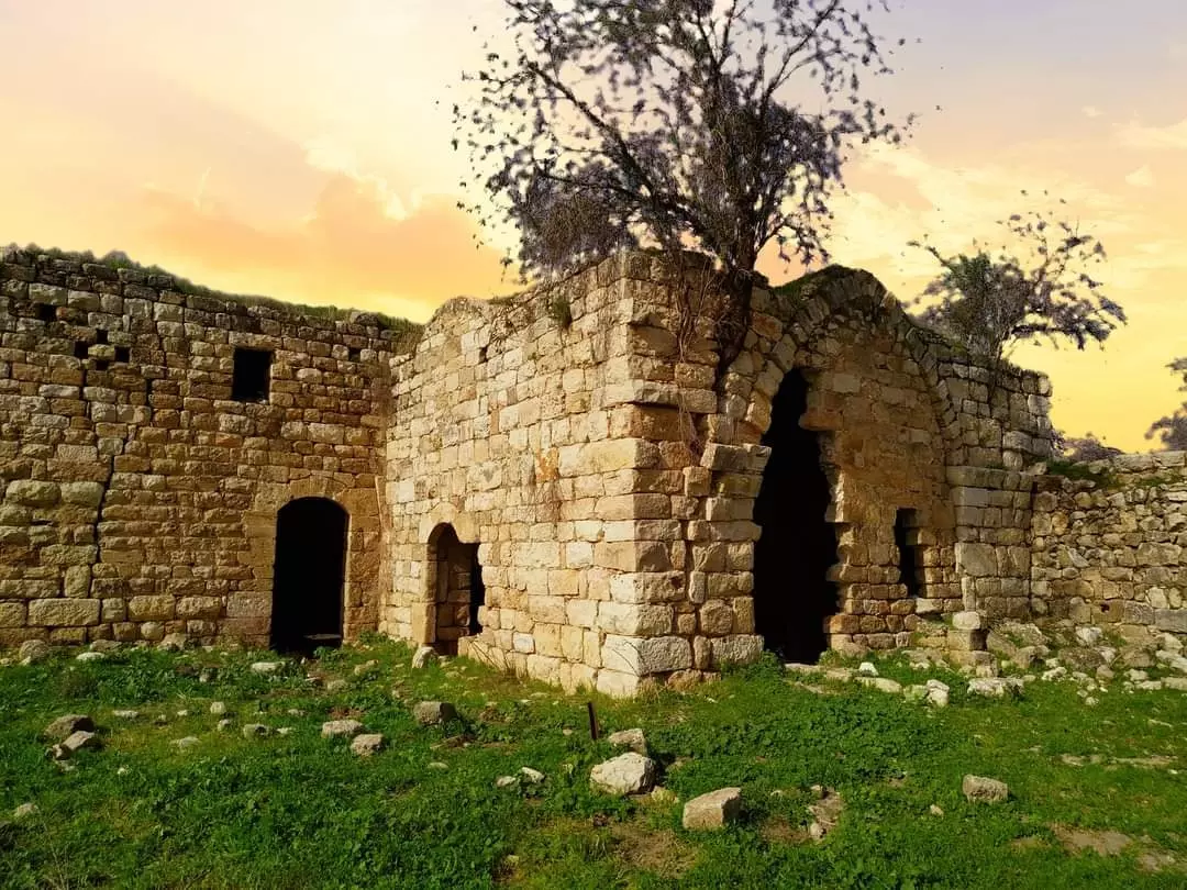
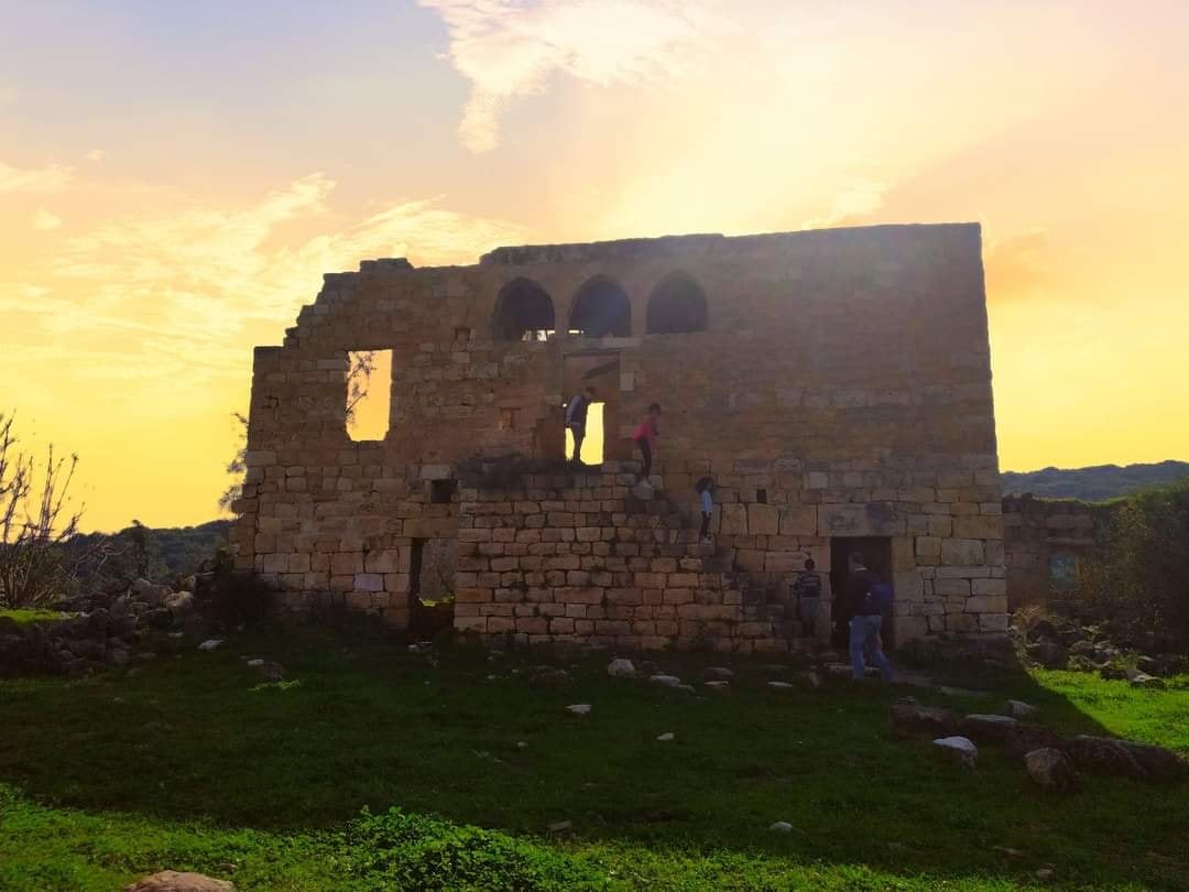
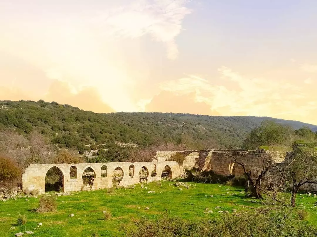
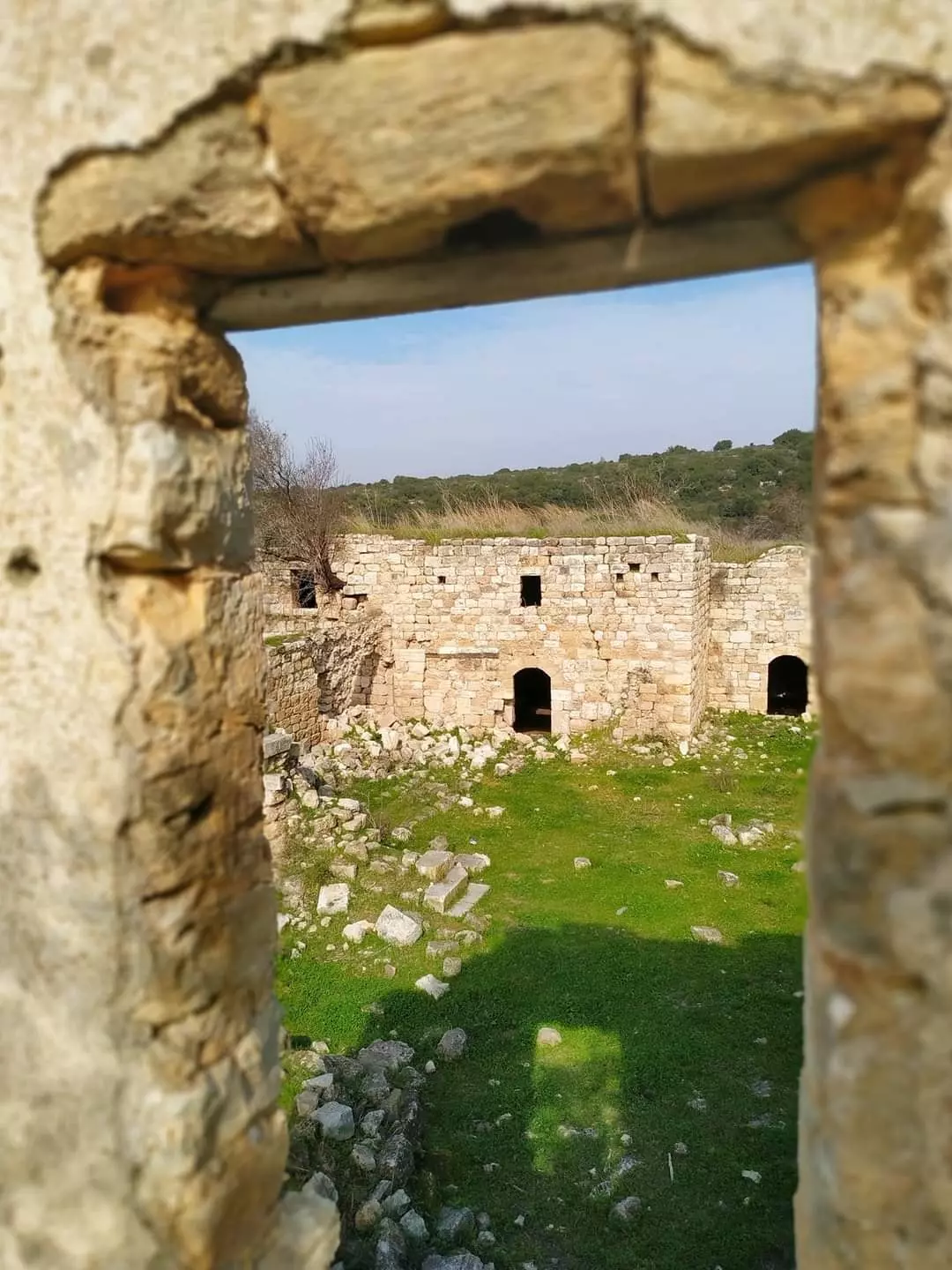
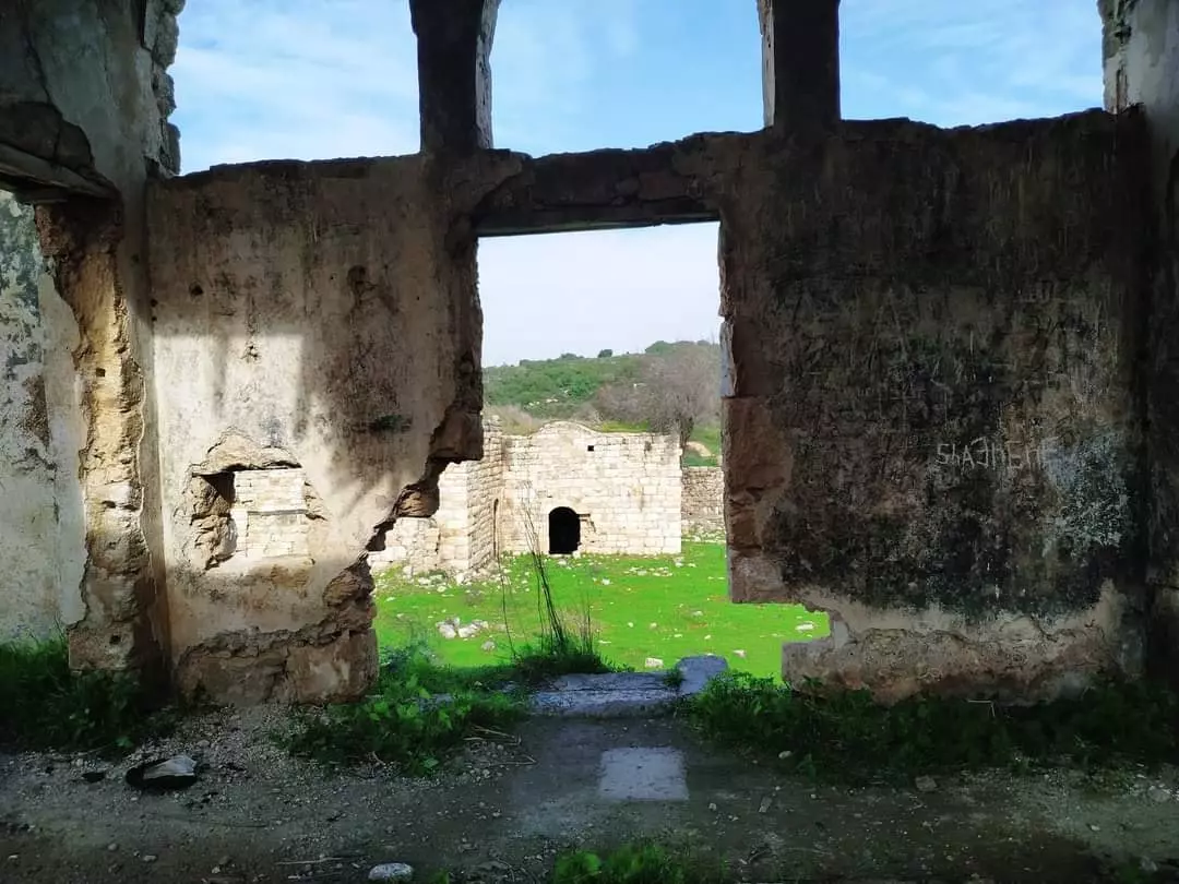
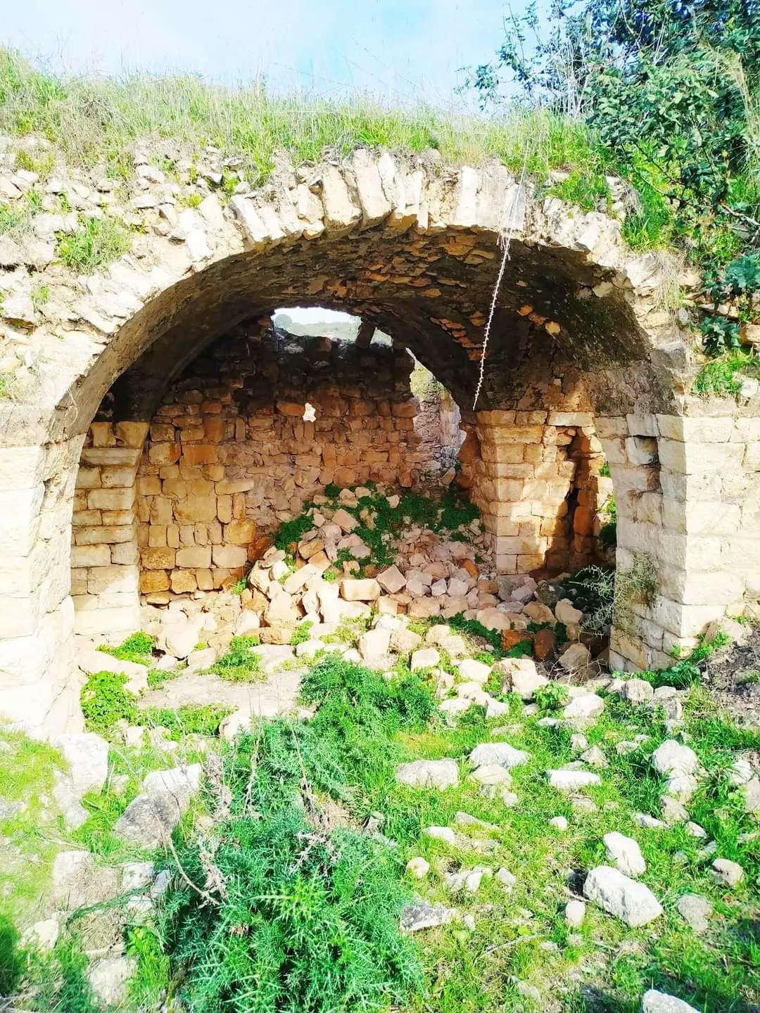
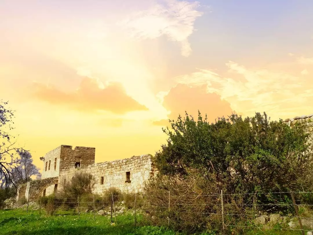
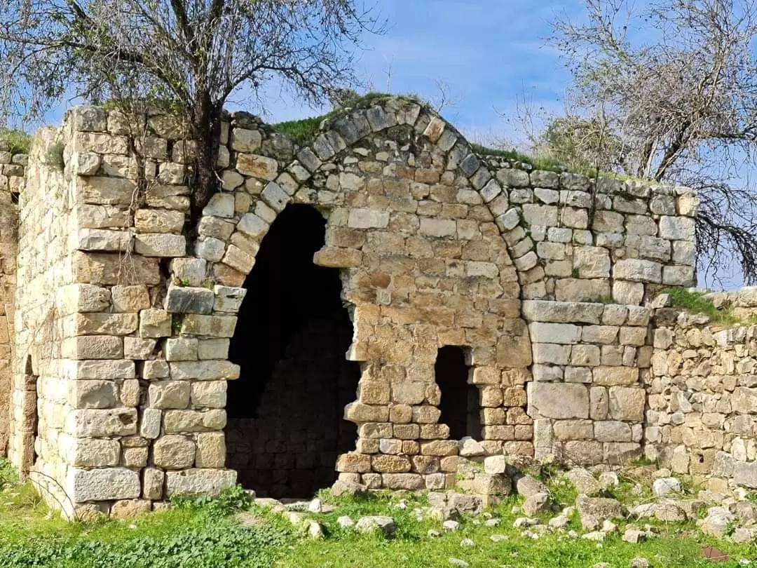
| Village Temains | Khirbat Jiddina was mostly destroyed with the exception of the Crusades fortress, which has been preserved as a tourist attraction. | ||||||||||||
| Ethnically Cleansing | Jiddin, Khirbat inhabitants were completely ethnically cleansed. | ||||||||||||
| Pre-Nakba Land Ownership |
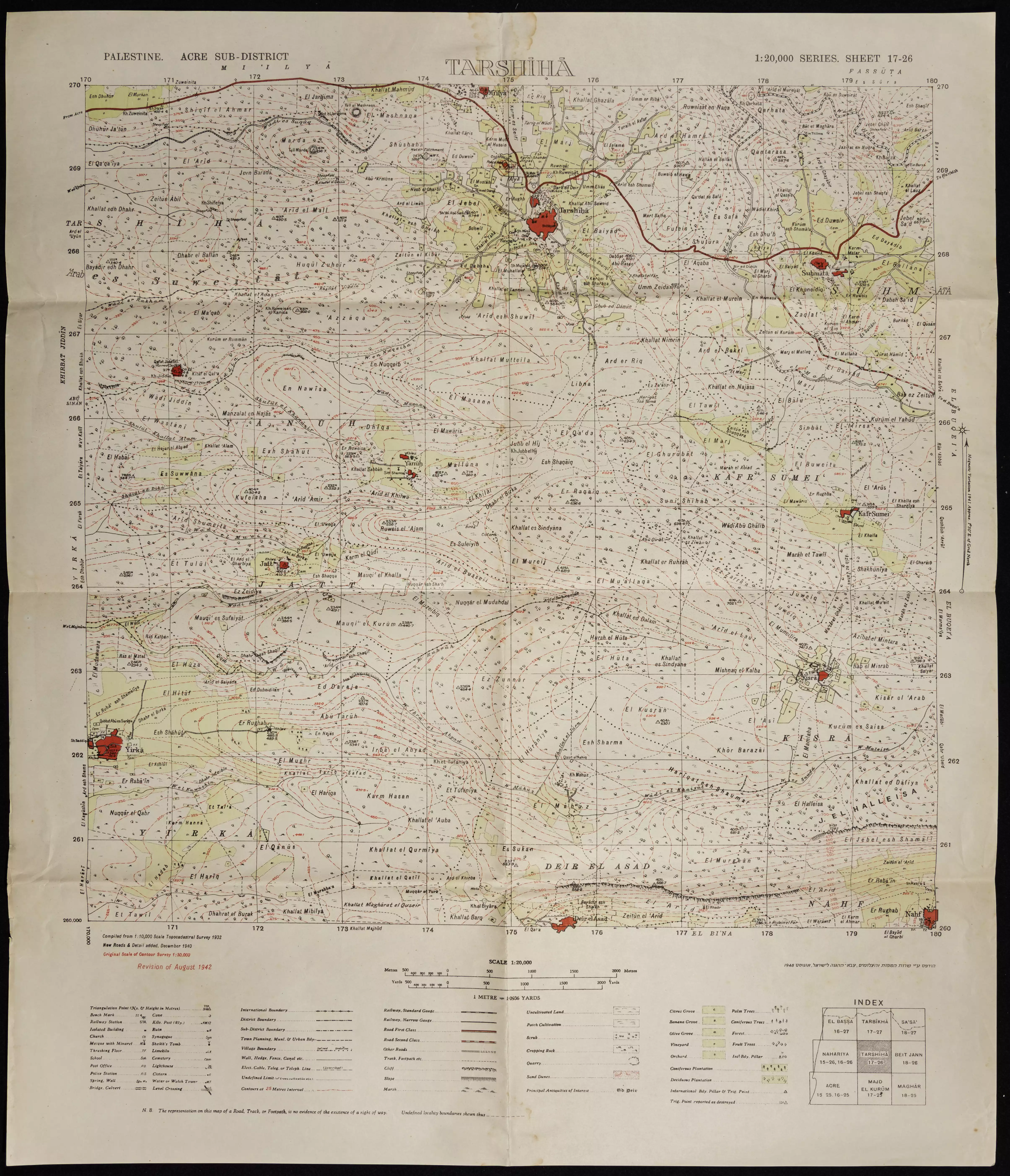
**Town Lands' Demarcation Maps |
||||||||||||
| Land Usage As of 1945 |
|
||||||||||||
| Population |
|
||||||||||||
| Near By Towns |
|||||||||||||
|
|
|||||||||||||
| Town's Name Through History | The Crusades referred to Khirbat Jiddina by Judyn. | ||||||||||||
| Inhabitants Place of Origin | Until occupation by the Israelis in 48, 'Arab al-Suwaytat Bedouin tribe used to live in the ruined fortress. | ||||||||||||
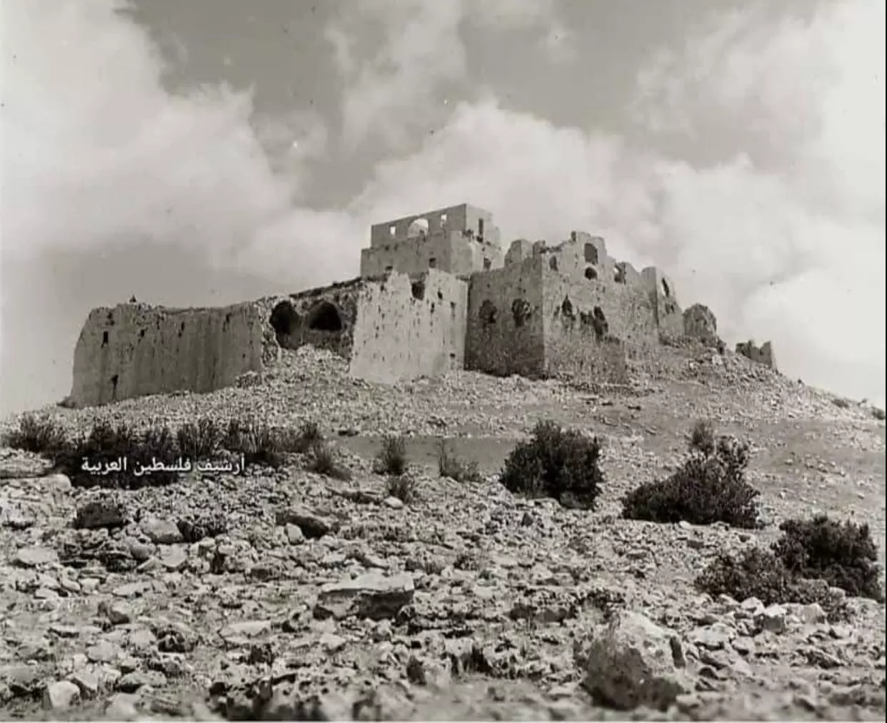
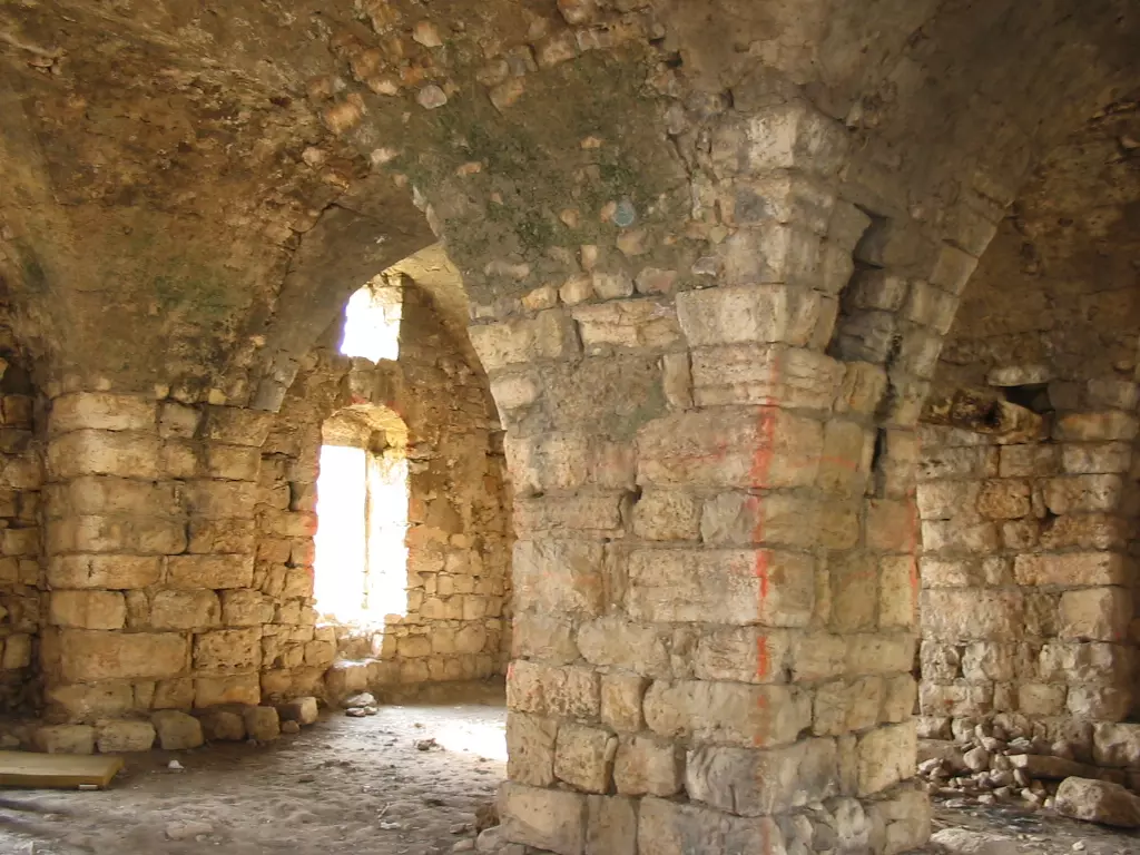
| Archeological Sites | The village contains a fortress built in the 12th century by the Crusades, which was later destroyed by Saladin. In 1780 it was repaired by al-Thahur al-Omar (The 1st independent Palestinian learder). | ||||||||||||
| Exculsive Jewish Colonies Who Usurped Village Lands |
Yechi'am, Qiryat, and Ga'ton. | ||||||||||||
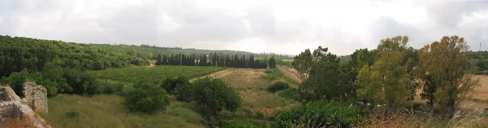
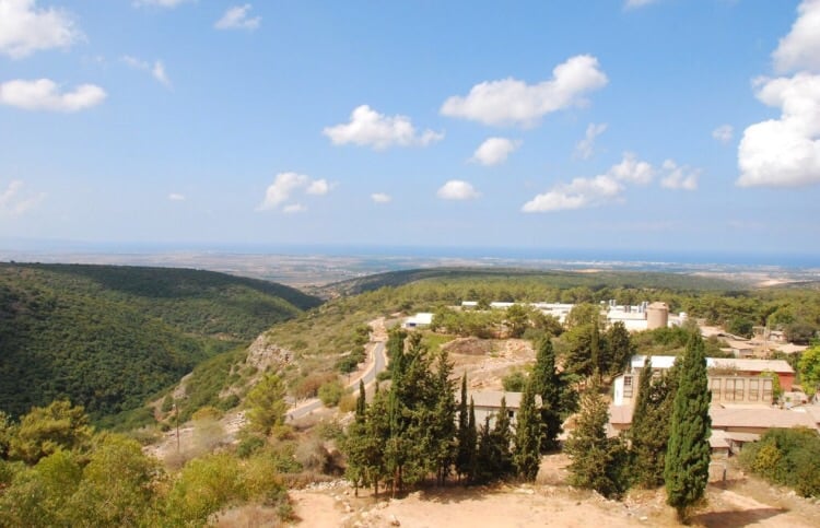
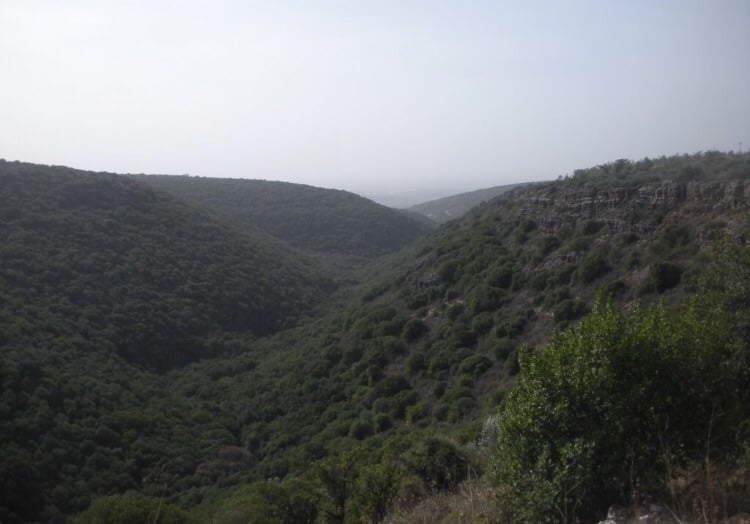
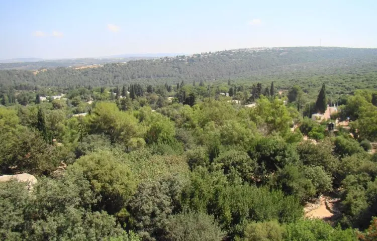
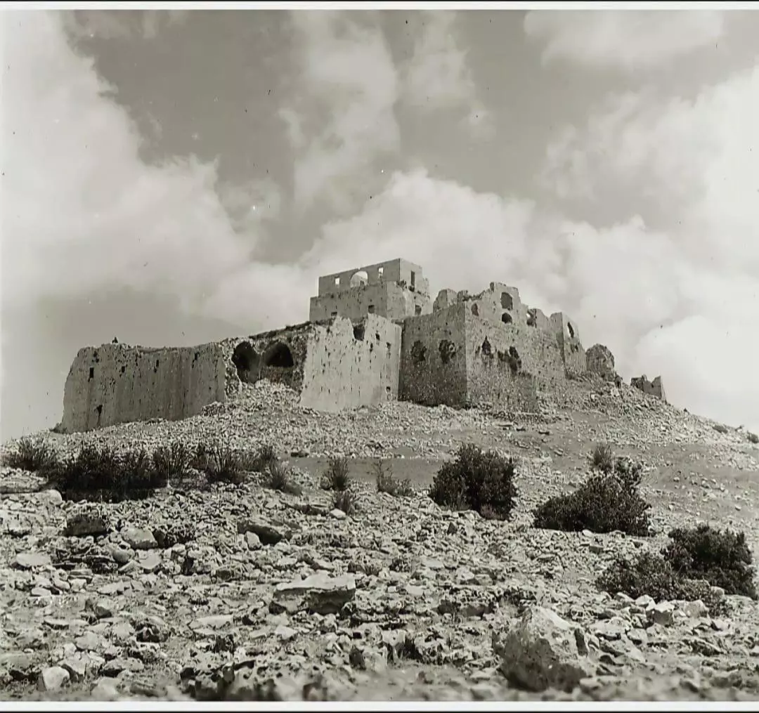
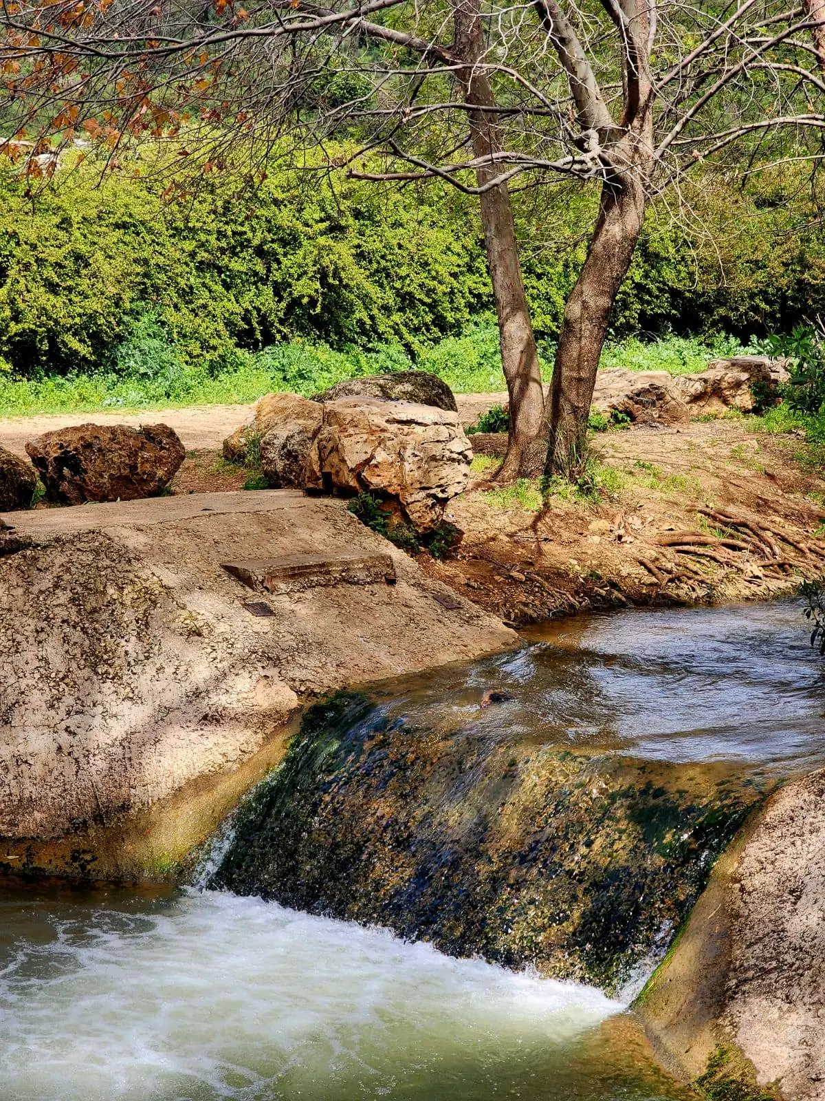
Village Before NakbaThe village was built around the ruins of an old fortress that stood on a hilltop and overlooked the Mediterranean to the west. Wadi Jiddin, a deep wadi, passed to the south of the village through a heavily wooded area. The fortress was built by the Crusaders toward the end of the twelfth century; they called it Judyn. It was destroyed in 1288 by Muslim armies, who sought to deprive the Crusaders of this fortification. It was not used again until 1780, when Zahir al-Umar, who was the de facto ruler of northern Palestine for a short period in the second half of the eighteenth century, renovated it, along with other forts, to enhance his military position. His successor, Ahmad Pasha al-Jazzar, razed the fortress at Khirbat Jiddin in about 1770. Until 1948 the Arab al-Suwaytat Bedouin lived in the ruined fortress, making its buildings into dwellings and also pitching their tents around it. The Arab al-Suwaytat were Muslims. Their primary occupation was animal husbandry, but they also cultivated barley and tobacco on a tiny plot of 22 dunums in 1944/45.Village Occupation and Ethnic CleaningThe date of the occupation of this village can be determined by examining the record of Israeli military operations in the area. While Israeli troops occupied the village of Amqa, a few km to the southwest, in early July 1948 (during Operation Dekel), they did not reach Yanuh, 2 km to the southeast, until the end of October (during Operation Hiram). However, it is also recorded that the settlement of Ga'ton was established to the northwest of the village early in October 1948 , which would indicate that the village was occupied in the earlier operation. In that case, it was probably seized shortly after the capture of Amqa on 10–11 July, and remained on the front lines between July and October. Many villages in the area were heavily bombarded before being attacked by units of the Sheva' (Seventh) and Carmeli brigades.Zionists Colonies on Village LandsThe settlement organization for Yechi'am was established in 1946 by members of the urban settlement of Qiryat Chayyim; the settlement itself was built in November 1947 on village land to the north of the site. The settlement of Ga'ton was built on village land in October 1948.Village TodayThe fortress has been preserved as a tourist attraction. It is surrounded by eucalyptus trees and brush.SourceDr. Walid al-Khalidi, 1992: All That Remains. |
|||||||||||||
| Related Maps | Town Lands' Demarcation Maps خرائط للقضاء توضح حدود القرى والاودية Town's map on MapQuest View from satellite Help us map this town at WikiMapia |
||||||||||||
| Related Links | Wikipedia's Page Google Search Google For Images Google For Videos |
||||||||||||
| More Information | في كتاب كي لا ننسى المزيد من موقع هوية |
||||||||||||
- Jiddin Castle In 1990
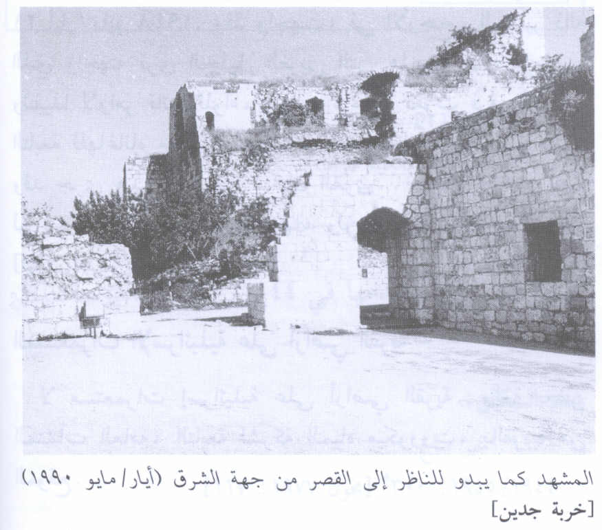
Scanned from "All That Remains" by Dr. Walid Khalidi 2 - Village Site In 1990
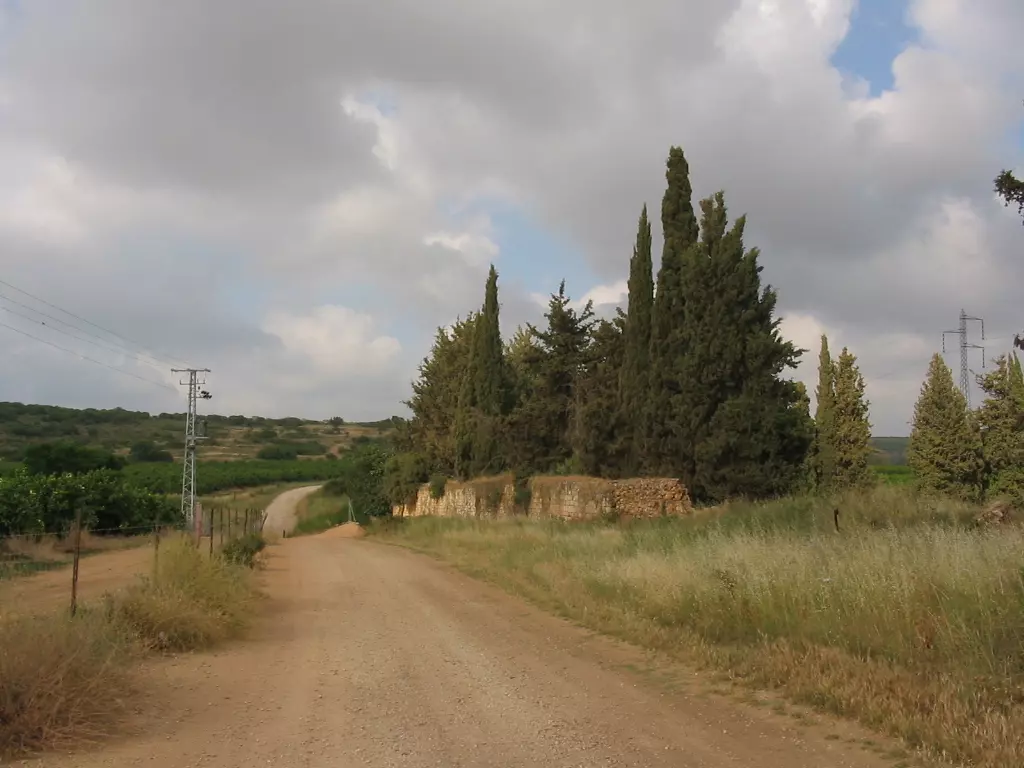
Scanned from "All That Remains" by Dr. Walid Khalidi - الطريق المؤدي الى جدين الى يمين الشارع الواصل من الكابري بعد مفرق الجعتون, 30/5/2003
Posted by Makbula Nassar 2 - قلعة جدين من الناحية الشمالية , 30/5/2003
Posted by Makbula Nassar - قلعة جدين من الناحية الغربية , 30/5/2003
Posted by Makbula Nassar - الاثار الباقية للقلعة , 30/5/2003
Posted by Makbula Nassar - الاثار الباقية للقلعة , 30/5/2003
Posted by Makbula Nassar - الاثار الباقية للقلعة , 30/5/2003
Posted by Makbula Nassar - منظر عام من القرية الى الجهة الغربية , 30/5/2003
Posted by Makbula Nassar - الاثار الباقية للقلعة , 30/5/2003
Posted by Makbula Nassar - المبنى السابق من الداخل , 30/5/2003
Posted by Makbula Nassar - المبنى السابق من الداخل#2 , 30/5/2003
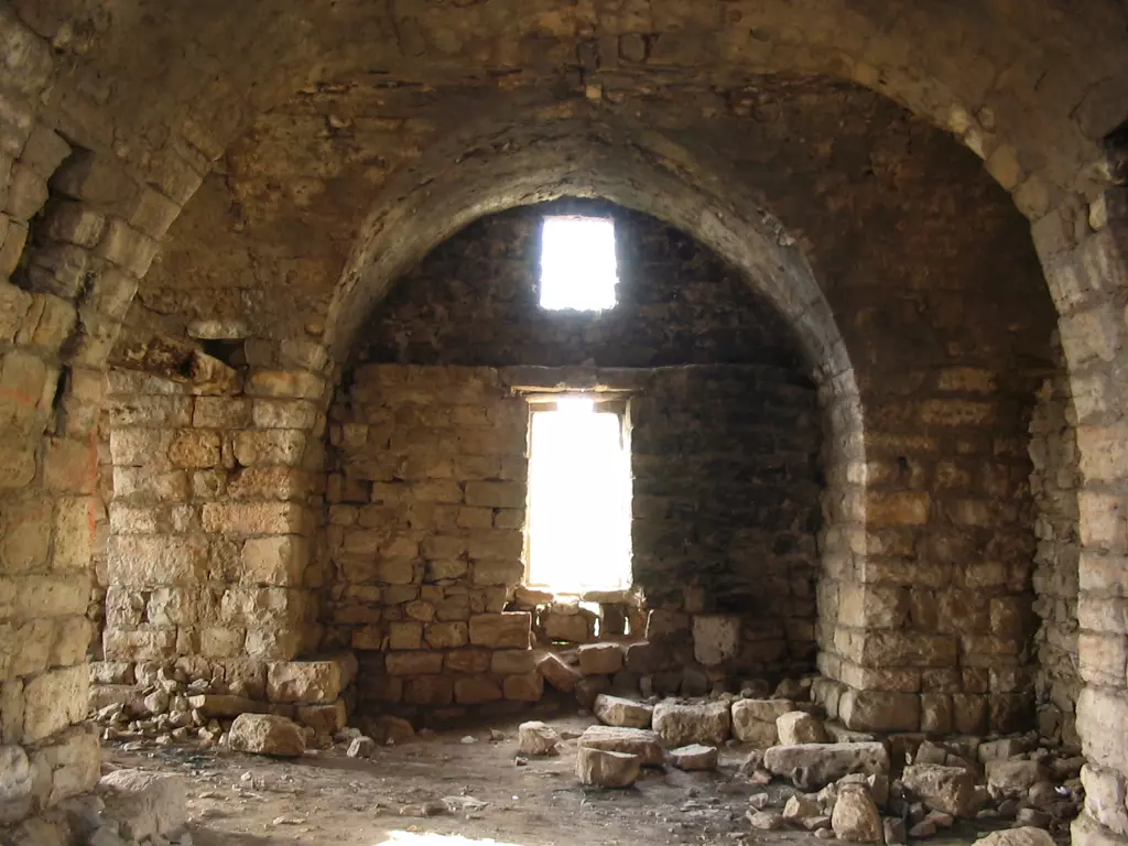
Posted by Makbula Nassar - احد ابنية القلعة الباقية , 30/5/2003
Posted by Makbula Nassar - المبنى في الصورة السابقة من الداخل, منظر مطل للجنوب, 30/5/2003
Posted by Makbula Nassar 1 - المبنى في الصورة السابقة من الداخل, , 30/5/2003
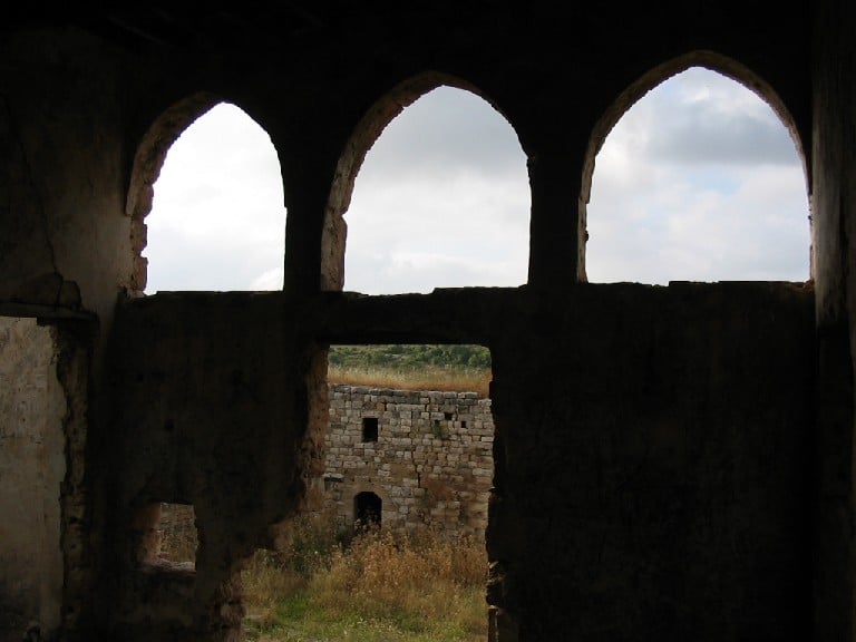
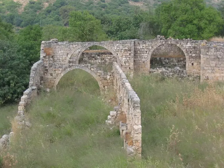
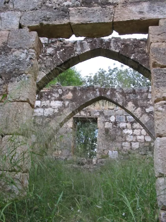
Posted by Makbula Nassar - قناطر رائعة على السور الشمالي للقلعة, 30/5/2003
Posted by Makbula Nassar - قناطر رائعة على السور الشمالي للقلعة#2, 30/5/2003
Posted by Makbula Nassar - السورالجنوبي للقلعة , 30/5/2003
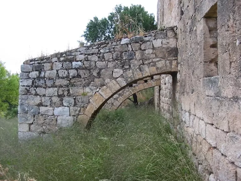
Posted by Makbula Nassar - السورالجنوبي للقلعة , 30/5/2003
Posted by Makbula Nassar - قناطر السور الشمالي, 30/5/2003
Posted by Makbula Nassar - قناطر السور الشمالي, 30/5/2003
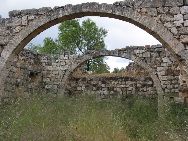
Posted by Makbula Nassar - غرف وقناطر في الناحية الشمالية للقلعة, 30/5/2003
Posted by Makbula Nassar - غرف وقناطر في الناحية الشمالية للقلعة, 30/5/2003
Posted by Makbula Nassar - غرف وقناطر في الناحية الشمالية للقلعة, 30/5/2003
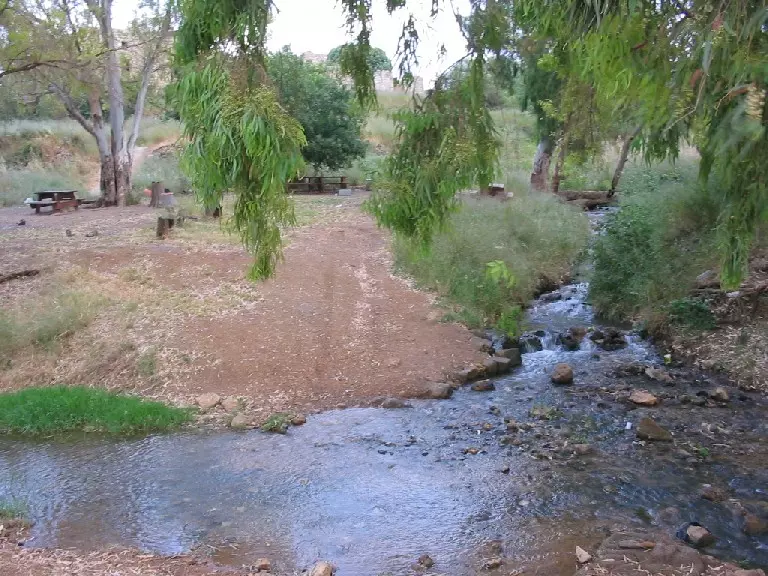
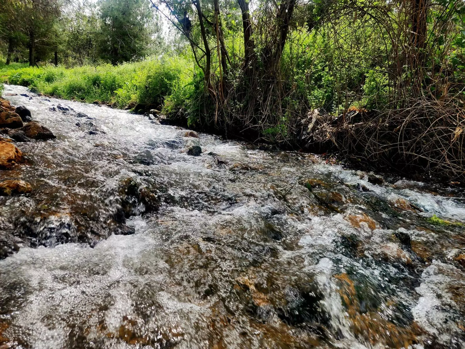
Posted by Makbula Nassar - مياه نهر الجعتون التي تجري بجانب القلعة , 30/5/2003
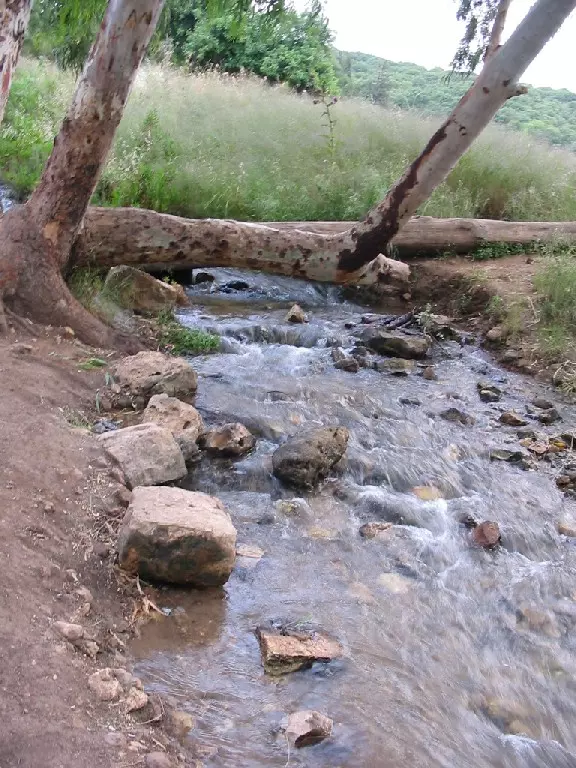
Posted by Makbula Nassar - مياه نهر الجعتون التي تجري بجانب القلعة , 30/5/2003
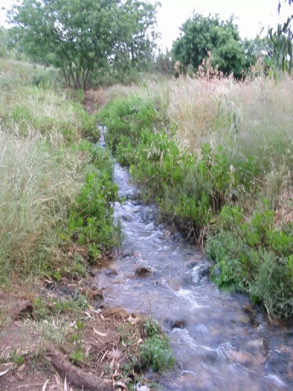
Posted by Makbula Nassar - تفرعات نهر الجعتون تلتقي في منطقة القلعة ,تجري بإتجاه الغرب الى البحر الابيض المتوسط , 30/5/2003
Posted by Makbula Nassar - قلعة جدين - 22/4/2006 , تصوير: مقبولة نصار
Posted by Makbula Nassar 1 - قلعة جدين - 22/4/2006 ,© تصوير: مقبولة نصار
Posted by Makbula Nassar - قلعة جدين - 22/4/2006 ,© تصوير: مقبولة نصار
Posted by Makbula Nassar - قلعة جدين - 22/4/2006 ,© تصوير: مقبولة نصار
Posted by Makbula Nassar - قلعة جدين - 22/4/2006 ,© تصوير: مقبولة نصار
Posted by Makbula Nassar - قلعة جدين - 22/4/2006 ,© تصوير: مقبولة نصار
Posted by Makbula Nassar - قلعة جدين - 22/4/2006 ,© تصوير: مقبولة نصار
Posted by Makbula Nassar - قلعة جدين - 22/4/2006 ,© تصوير: مقبولة نصار
Posted by Makbula Nassar - قلعة جدين - 22/4/2006 ,© تصوير: مقبولة نصار
Posted by Makbula Nassar - قلعة جدين - 22/4/2006 ,© تصوير: مقبولة نصار
Posted by Makbula Nassar - قلعة جدين - 22/4/2006 ,© تصوير: مقبولة نصار
Posted by Makbula Nassar - قلعة جدين - 22/4/2006 ,© تصوير: مقبولة نصار
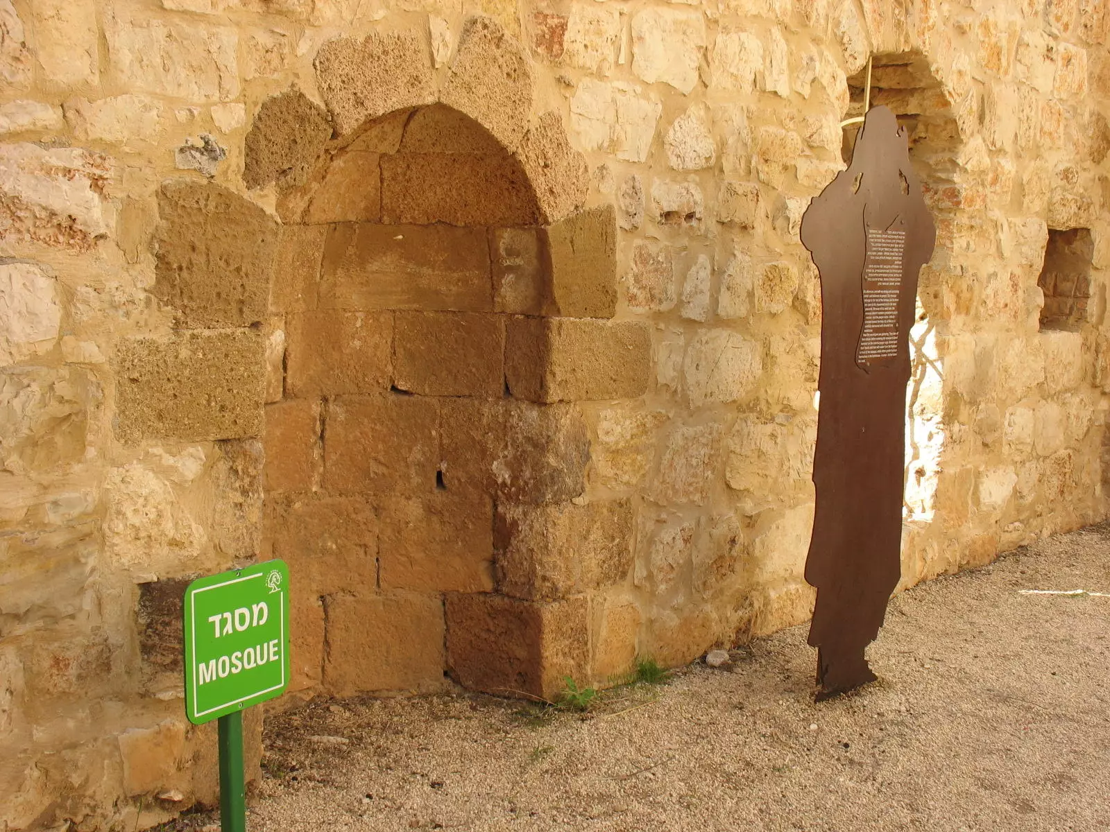
Posted by Makbula Nassar - The Mihrab for the destroyed village's mosque
Posted by Noga Kadman - قلعه جدين
Posted by abu raya - قلعه جدين
Posted by abu raya - قناطر القلعه
Posted by abu raya - قناطر القلعه
Posted by abu raya - القلعه
Posted by abu raya - القلعه
Posted by abu raya - خربه جدين
Posted by abu raya - خربه جدين
Posted by abu raya - خربه جدين
Posted by abu raya - خربه جدين
Posted by abu raya - خربه جدين
Posted by abu raya - خربه جدين
Posted by abu raya - خربه جدين
Posted by abu raya - خربه جدين
Posted by abu raya - خربه جدين
Posted by abu raya - خربه جدين
Posted by abu raya - خربه جدين
Posted by abu raya - مدحلة في خربة جدين - بعدسة سهيل مخول يوم 12.2.2016
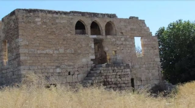
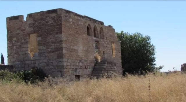
Posted by سهيل مخول 1 - قصر وبيوت عائلة سرسك في خربة جدين
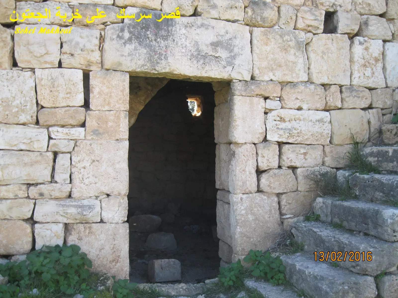
Posted by سهيل مخول 2 - مبنى في خربة الجعتون في محيط قصر سرسك المهجر بعدسة سهيل مخول يوم 13.2.2016
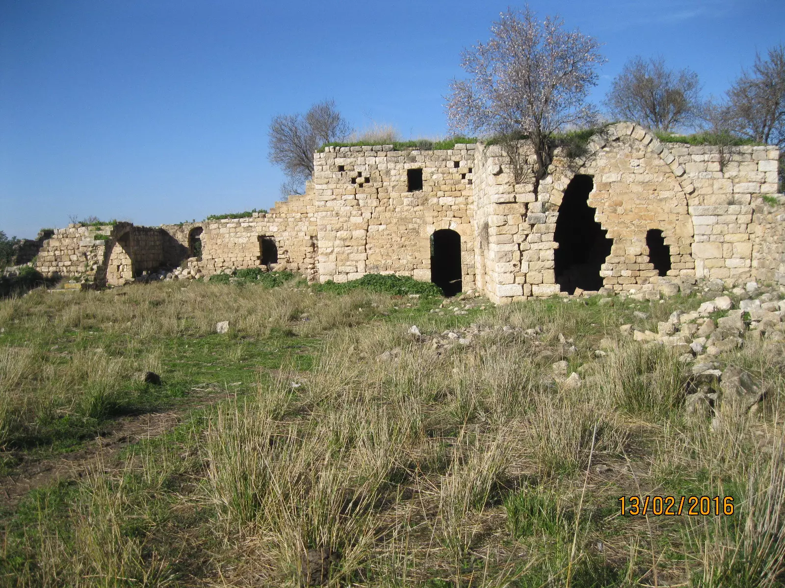
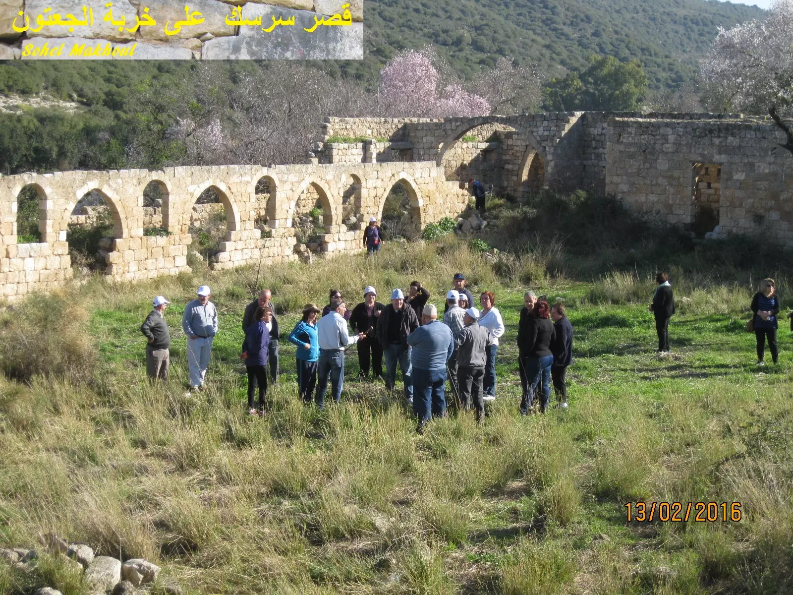
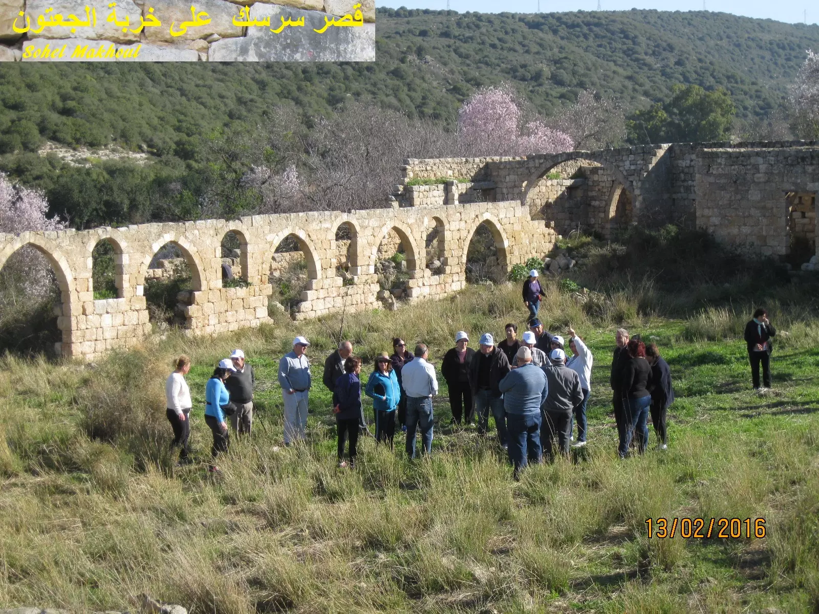
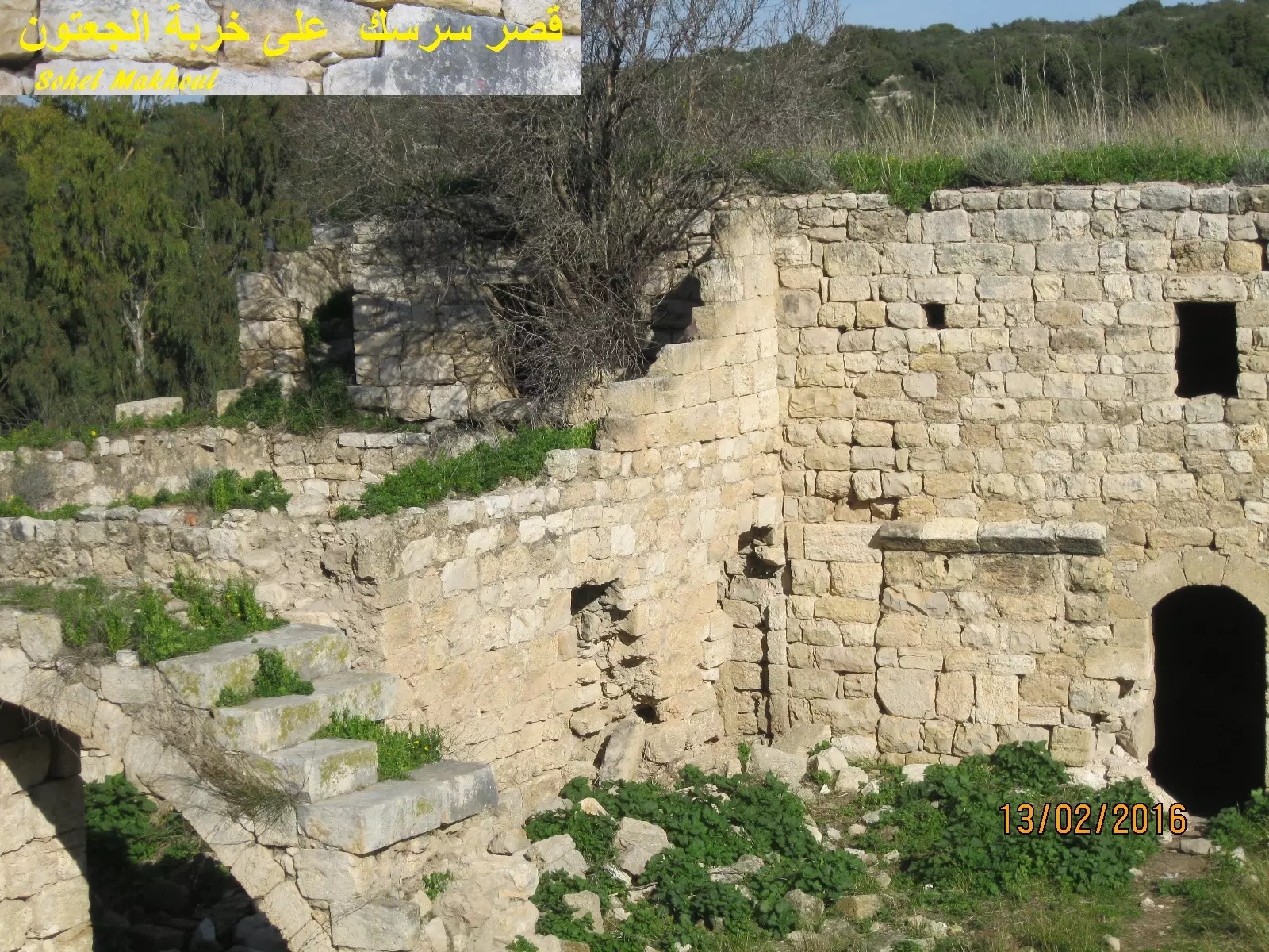
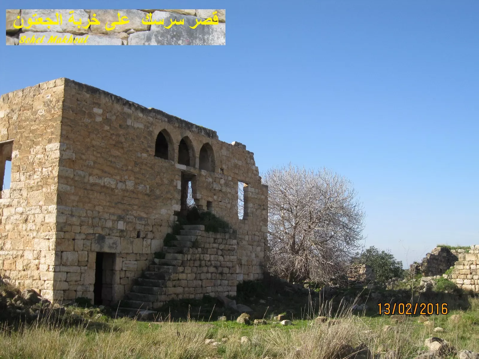
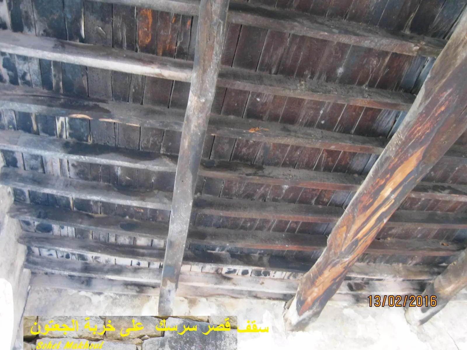
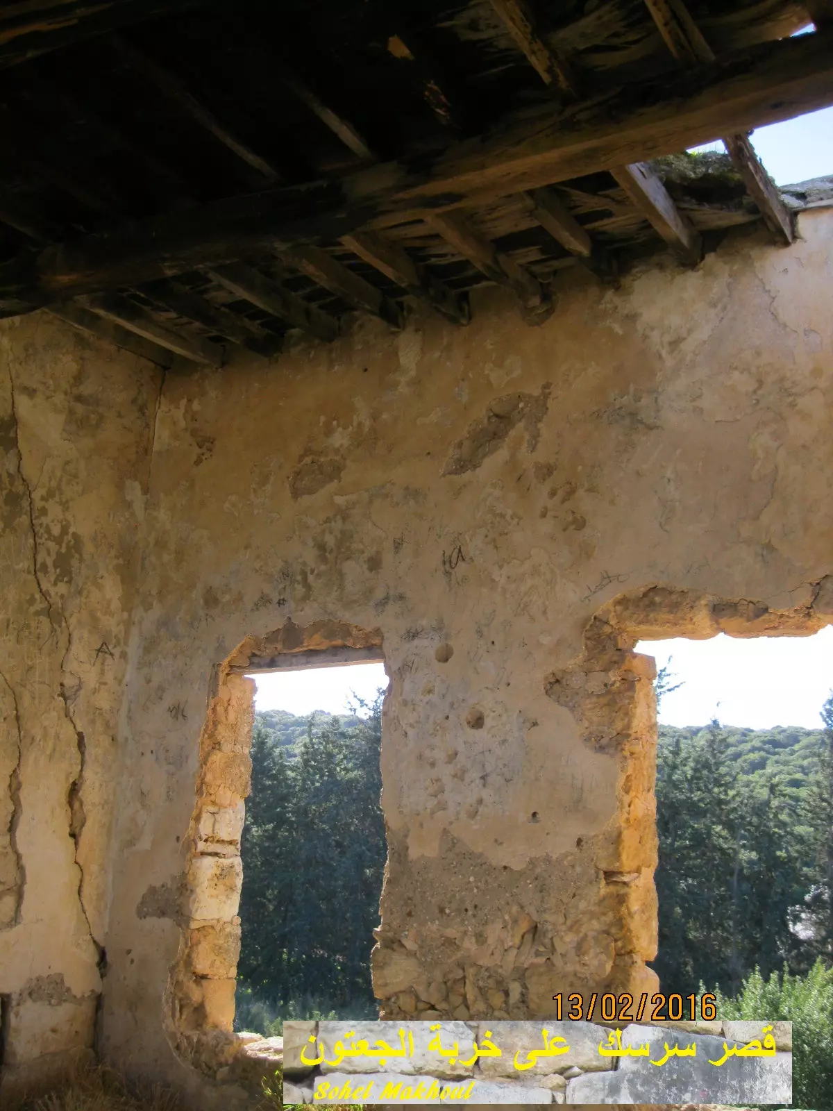
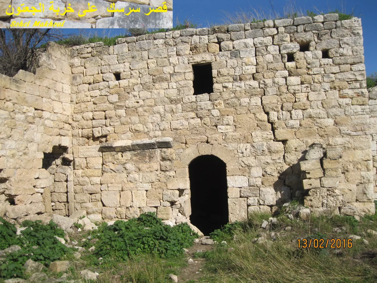
Posted by سهيل مخول - قصر وبيوت عائلة سرسك في خربة الجعتون - بعدسة سهيل مخول يوم 13.2.2016
Posted by سهيل مخول - قصر وبيوت عائلة سرسك في خربة الجعتون - بعدسة سهيل مخول يوم 13.2.2016
Posted by سهيل مخول - قصر وبيوت عائلة سرسك في خربة الجعتون - بعدسة سهيل مخول يوم 13.2.2016
Posted by سهيل مخول - قصر وبيوت عائلة سرسك في خربة الجعتون - بعدسة سهيل مخول يوم 13.2.2016
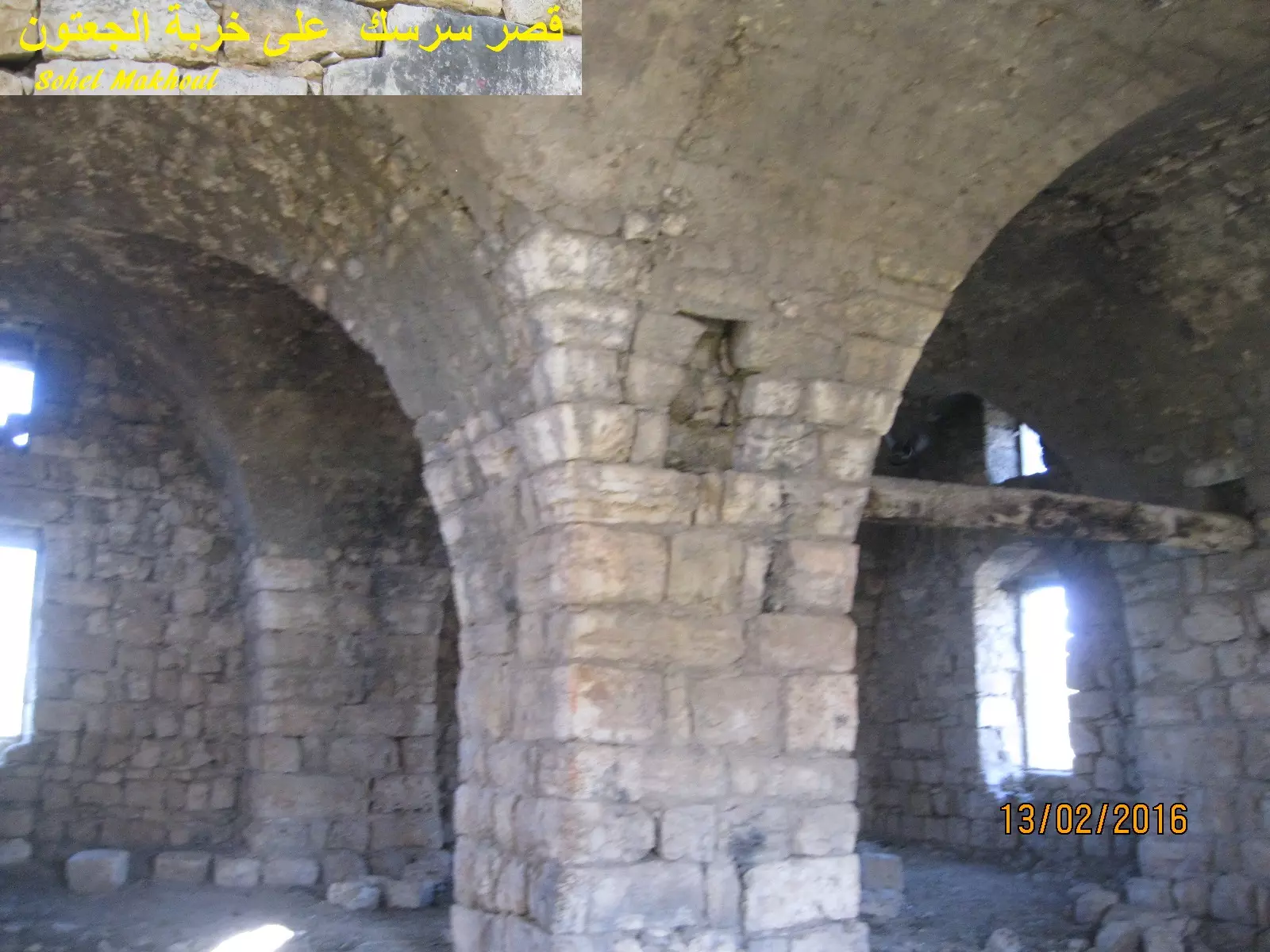
Posted by سهيل مخول - قصر وبيوت عائلة سرسك في خربة الجعتون - بعدسة سهيل مخول يوم 13.2.2016
Posted by سهيل مخول - قصر وبيوت عائلة سرسك في خربة الجعتون - بعدسة سهيل مخول يوم 13.2.2016
Posted by سهيل مخول - قصر وبيوت عائلة سرسك في خربة الجعتون - بعدسة سهيل مخول يوم 13.2.2016
Posted by سهيل مخول - قصر وبيوت عائلة سرسك في خربة الجعتون - بعدسة سهيل مخول يوم 13.2.2016
Posted by سهيل مخول - قصر وبيوت عائلة سرسك في خربة الجعتون - بعدسة سهيل مخول يوم 13.2.2016
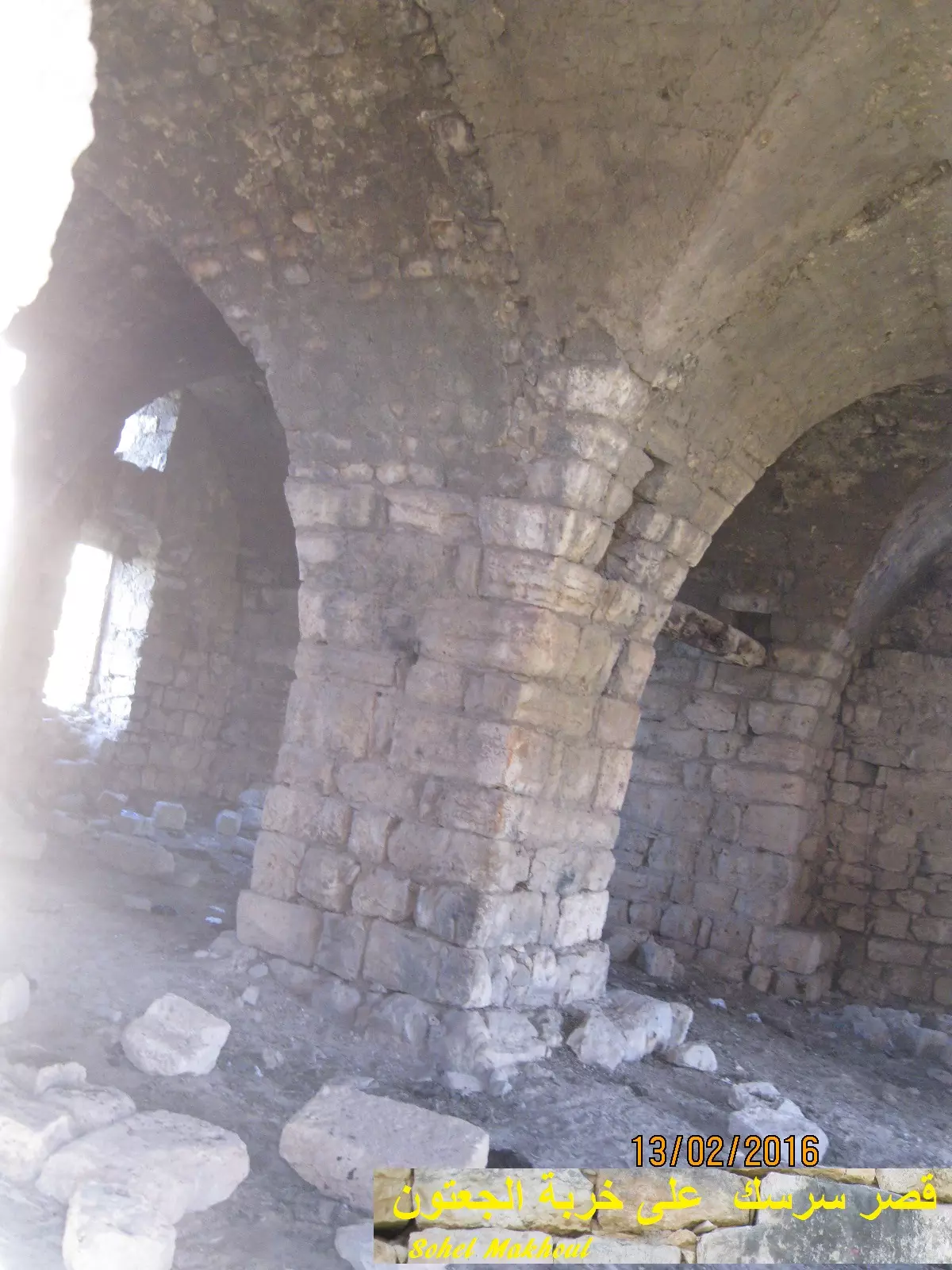
Posted by سهيل مخول - قصر وبيوت عائلة سرسك في خربة الجعتون - بعدسة سهيل مخول يوم 13.2.2016
Posted by سهيل مخول - قصر وبيوت عائلة سرسك في خربة الجعتون - بعدسة سهيل مخول يوم 13.2.2016
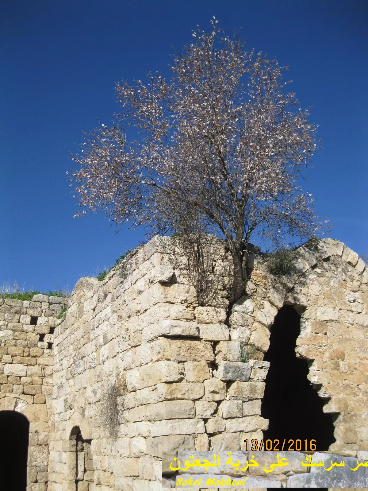
Posted by سهيل مخول - قصر وبيوت عائلة سرسك في خربة الجعتون - بعدسة سهيل مخول يوم 13.2.2016
Posted by سهيل مخول - قصر وبيوت عائلة سرسك في خربة الجعتون - بعدسة سهيل مخول يوم 13.2.2016
Posted by سهيل مخول - قصر وبيوت عائلة سرسك في خربة الجعتون - بعدسة سهيل مخول يوم 13.2.2016
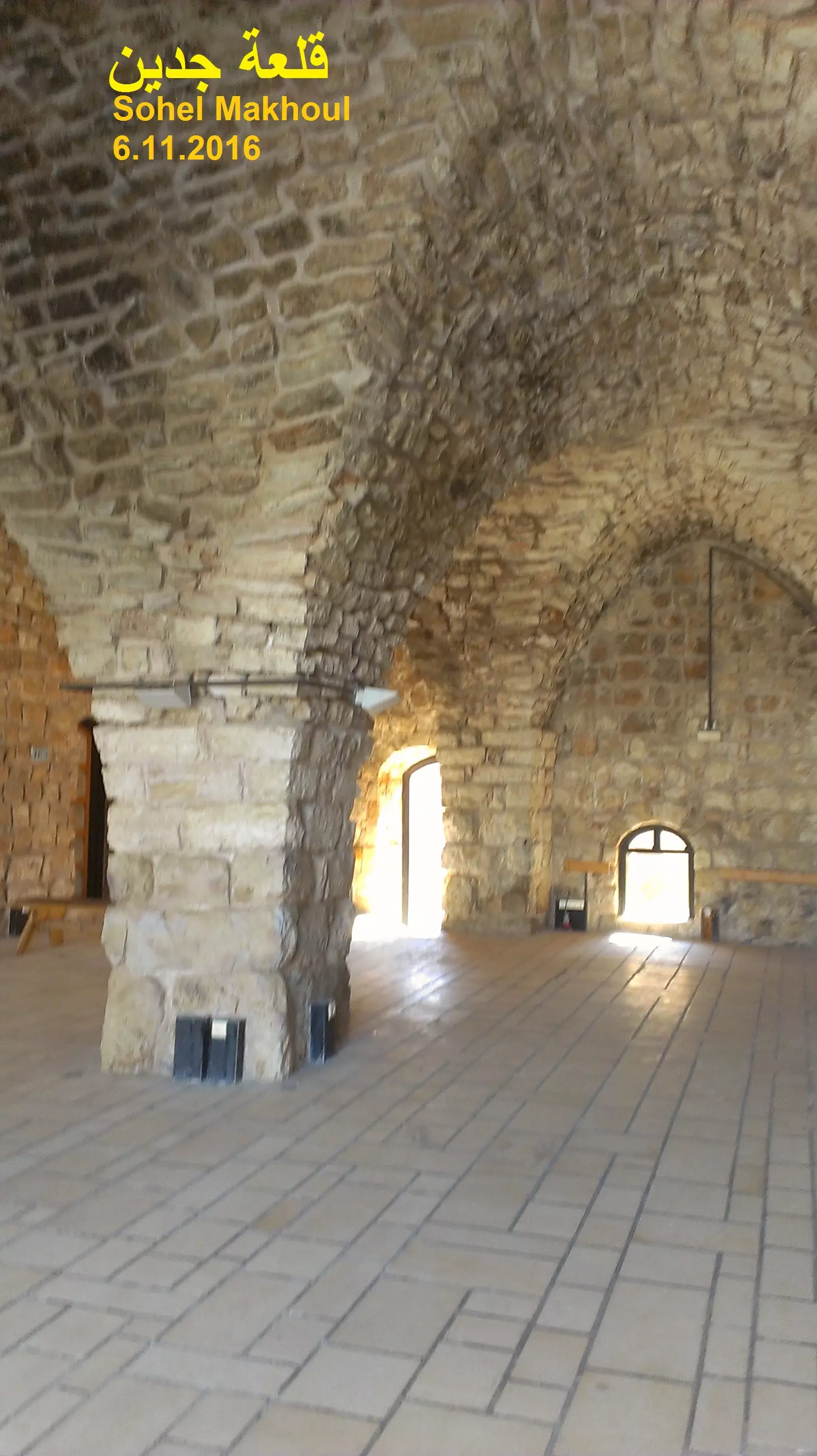
Posted by سهيل مخول - قلعة جدين كما تظهر يوم 6.11.2016
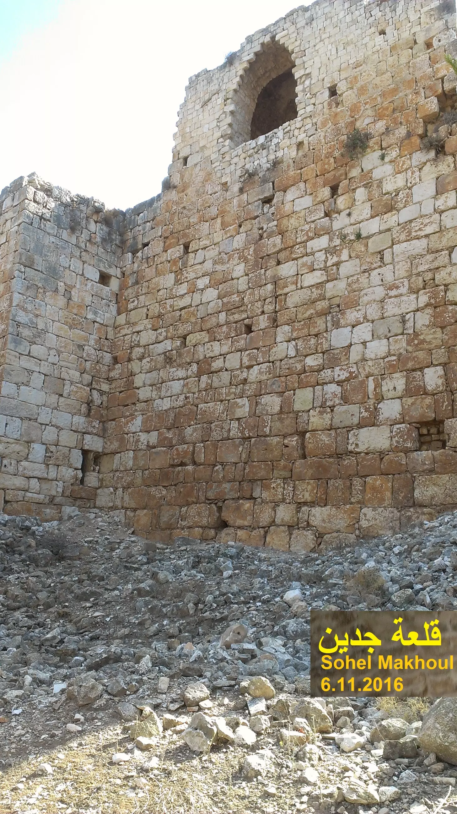
Posted by سهيل مخول - أحد جدران قلعة جدين كما يظهر يوم 6.11.2016
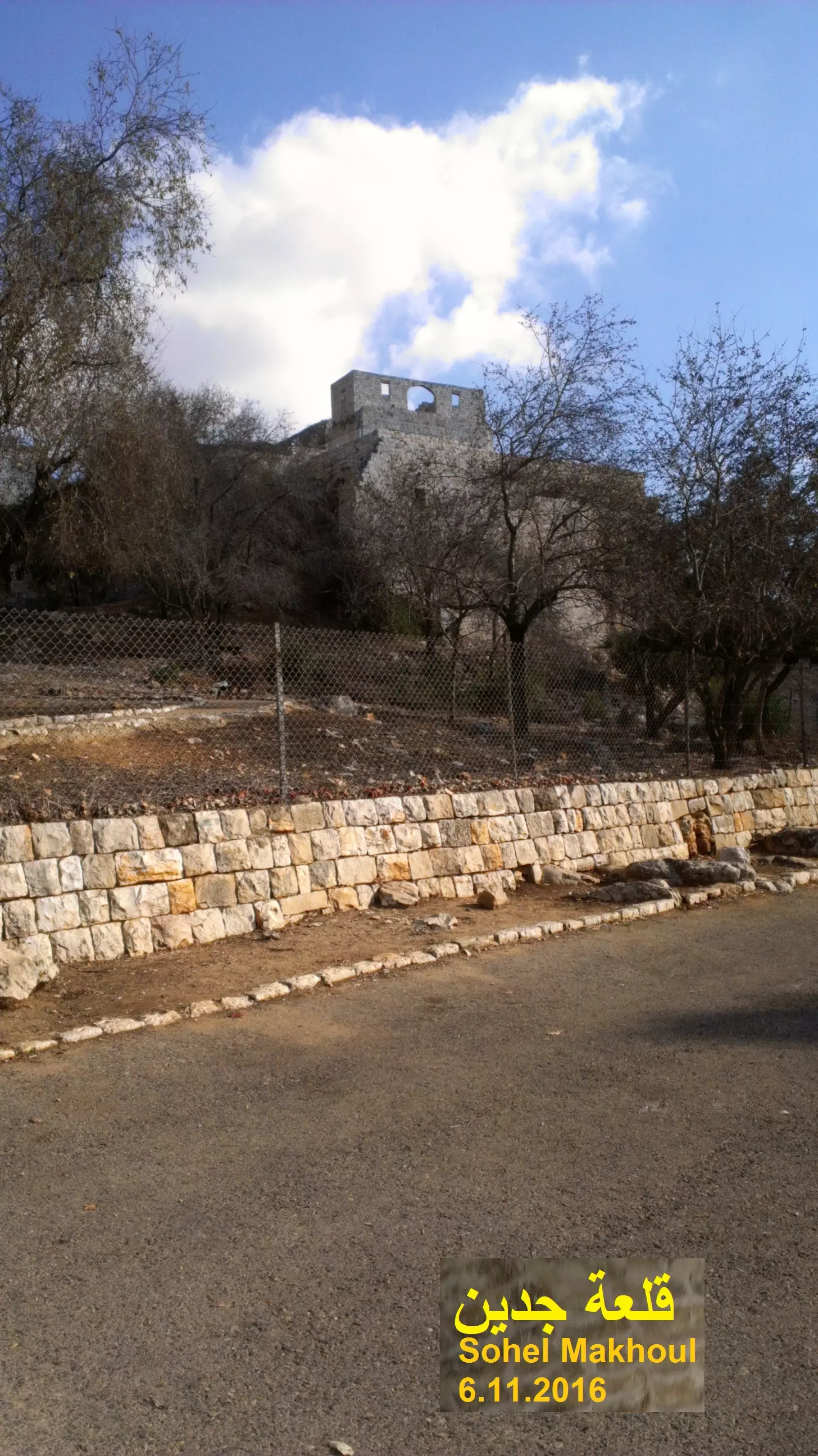
Posted by سهيل مخول - منظر عام لقلعة جدين كما تظهر يوم 6.11.2016
Posted by سهيل مخول - قلعة جدين ،، خربة جدين ،،قضاء عكا ،، شمال فلسطين
- صورة ساحرة لقلعة جدين بالقرب من عكا عام 1933..هذه القلعة بناها ظاهر العمر عام 1750 على أنقاض قلعة صليبية..
- منظر رائع للقلعة اخذ قبل النكبة--المزيد عنها باسفل الصورة -- Pre-Nakba view of the castle--more about its history in the comments section below
1 - قلعة جدين -- نبيلة سالم
- قلعة جدين -- نبيلة سالم #2
- قلعة جدين -- نبيلة سالم #3
- قلعة جدين -- نبيلة سالم #4
- قلعة جدين -- نبيلة سالم #5
- قلعة جدين -- نبيلة سالم #6
- A great view of the castle, looking West

- مبنى في خربة الجعتون في محيط قصر سرسك المهجر
- قصر سرسك -- النبعة المهجر
- وادي المفشوخ الجعتون -- خربة سرسك -- المزيد عنها في قسم التعليقات اسفل الصورة -- Nabela Salem
1 - وادي المفشوخ الجعتون -- خربة سرسك -- المزيد عنها في قسم التعليقات اسفل الصورة -- Nabela Salem #2
- وادي المفشوخ الجعتون -- خربة سرسك -- المزيد عنها في قسم التعليقات اسفل الصورة -- Nabela Salem #3
- وادي المفشوخ الجعتون -- خربة سرسك -- المزيد عنها في قسم التعليقات اسفل الصورة -- Nabela Salem #4
- وادي المفشوخ الجعتون -- خربة سرسك -- المزيد عنها في قسم التعليقات اسفل الصورة -- Nabela Salem #5
- وادي المفشوخ الجعتون -- خربة سرسك -- المزيد عنها في قسم التعليقات اسفل الصورة -- Nabela Salem #6
- وادي المفشوخ الجعتون -- خربة سرسك -- المزيد عنها في قسم التعليقات اسفل الصورة -- Nabela Salem #7
- وادي المفشوخ الجعتون -- خربة سرسك -- المزيد عنها في قسم التعليقات اسفل الصورة -- Nabela Salem #8
- وادي المفشوخ الجعتون -- خربة سرسك -- المزيد عنها في قسم التعليقات اسفل الصورة -- Nabela Salem #9
- وادي المفشوخ الجعتون -- خربة سرسك -- المزيد عنها في قسم التعليقات اسفل الصورة -- Nabela Salem #10
- وادي المفشوخ الجعتون -- خربة سرسك -- المزيد عنها في قسم التعليقات اسفل الصورة -- Nabela Salem #11
- وادي المفشوخ الجعتون -- خربة سرسك -- المزيد عنها في قسم التعليقات اسفل الصورة -- Nabela Salem #12
- وادي المفشوخ الجعتون -- خربة سرسك -- المزيد عنها في قسم التعليقات اسفل الصورة -- Nabela Salem #13
- وادي المفشوخ الجعتون -- خربة سرسك -- المزيد عنها في قسم التعليقات اسفل الصورة -- Nabela Salem #14
- وادي المفشوخ الجعتون -- خربة سرسك -- المزيد عنها في قسم التعليقات اسفل الصورة -- Nabela Salem #15
- وادي المفشوخ الجعتون -- خربة سرسك -- المزيد عنها في قسم التعليقات اسفل الصورة -- Nabela Salem #16
- وادي المفشوخ الجعتون -- خربة سرسك -- المزيد عنها في قسم التعليقات اسفل الصورة -- Nabela Salem #17
- وادي المفشوخ الجعتون -- خربة سرسك -- المزيد عنها في قسم التعليقات اسفل الصورة -- Nabela Salem #18
- وادي المفشوخ الجعتون -- خربة سرسك -- المزيد عنها في قسم التعليقات اسفل الصورة -- Nabela Salem #19
- وادي المفشوخ الجعتون -- خربة سرسك -- المزيد عنها في قسم التعليقات اسفل الصورة -- Nabela Salem #20
- وادي المفشوخ الجعتون -- خربة سرسك -- المزيد عنها في قسم التعليقات اسفل الصورة -- Nabela Salem #21
- وادي المفشوخ الجعتون -- خربة سرسك -- المزيد عنها في قسم التعليقات اسفل الصورة -- Nabela Salem #22
- وادي المفشوخ الجعتون -- خربة سرسك -- المزيد عنها في قسم التعليقات اسفل الصورة -- Nabela Salem #23
- وادي المفشوخ الجعتون -- خربة سرسك -- المزيد عنها في قسم التعليقات اسفل الصورة -- Nabela Salem #24
- وادي المفشوخ الجعتون -- خربة سرسك -- المزيد عنها في قسم التعليقات اسفل الصورة -- Nabela Salem #25
- جولة رائعة في خربة الجعتون في محيط قصر سرسك المهجر -- ..المزيد عنها في قسم التعليقات -- Fairouz Jubran -- Nov. 2021
1 - جولة رائعة في خربة الجعتون في محيط قصر سرسك المهجر -- ..المزيد عنها في قسم التعليقات -- Fairouz Jubran -- Nov. 2021 #2
- جولة رائعة في خربة الجعتون في محيط قصر سرسك المهجر -- ..المزيد عنها في قسم التعليقات -- Fairouz Jubran -- Nov. 2021 #3
- جولة رائعة في خربة الجعتون في محيط قصر سرسك المهجر -- ..المزيد عنها في قسم التعليقات -- Fairouz Jubran -- Nov. 2021 #4
- جولة رائعة في خربة الجعتون في محيط قصر سرسك المهجر -- ..المزيد عنها في قسم التعليقات -- Fairouz Jubran -- Nov. 2021 #5
- جولة رائعة في خربة الجعتون في محيط قصر سرسك المهجر -- ..المزيد عنها في قسم التعليقات -- Fairouz Jubran -- Nov. 2021 #6
- جولة رائعة في خربة الجعتون في محيط قصر سرسك المهجر -- ..المزيد عنها في قسم التعليقات -- Fairouz Jubran -- Nov. 2021 #7
- جولة رائعة في خربة الجعتون في محيط قصر سرسك المهجر -- ..المزيد عنها في قسم التعليقات -- Fairouz Jubran -- Nov. 2021 #8
- جولة رائعة في خربة الجعتون في محيط قصر سرسك المهجر -- ..المزيد عنها في قسم التعليقات -- Fairouz Jubran -- Nov. 2021 #9
- جولة رائعة في خربة الجعتون في محيط قصر سرسك المهجر -- ..المزيد عنها في قسم التعليقات -- Fairouz Jubran -- Nov. 2021 #10
- جولة رائعة في خربة الجعتون في محيط قصر سرسك المهجر -- ..المزيد عنها في قسم التعليقات -- Fairouz Jubran -- Nov. 2021 #11
- جولة رائعة في خربة الجعتون في محيط قصر سرسك المهجر -- ..المزيد عنها في قسم التعليقات -- Fairouz Jubran -- Nov. 2021 #12
- خارطة تُظهِر الحدود والطرق بأنواعها والأماكن المقدسة والطبيعة الطوبغرافية من تلال وسهول ومنحدرات والتشكيلة الطبيعية للأرض وأنواع المزروعات. نُشرت الخريطة فترة الانتداب البريطاني، تم إضافة تعديلات عليها من قِبَل خدمة الخرائط والصور التابعة للقوات العسكرية الاسرائيلية فترة الأربعينيات.
Want to browse more? 80,000 pictures were grouped in these gallaries:
| Display Name | Clan/Hamolah | Country of Residence |
| AKRAM EL-TAYEA | - | NSW, AUSTARLIA |
No links have been shared yet, be free to the first to share the first link.
 Fake Valor: Why Did Zionist Jews Hoist Nazis Flag on Their Ships in the 1930s?
What is new?
-
Facts About Oct. 7th Gaza Raid
-
Remined Us Please:: Who Did Rape Who? Palestinians Raped Israelis? Or, was the other way around?
-
When Prof. Edward Said was invited to debate Bibi Netanyahu in the 1980s, watch what happened!
-
Ezra Klein of the NY Times on the "Jewish Race".
-
Abusing Blood Libel!
-
Did Israeli Soldiers Activate The Hanniba Direective On Oct. 7th? You Be The Judge
-
Zionist FAQ: Isn't it true that Palestinians don't want peace? Palestinians never accepted the two-state solution
- Facts about Haavara (Transfer) Agreement between Ben-Gurion & Hitler
-
Haavara FAQs: Why Did Zionist Jews Hoist Nazis' Flags on Their Ships in the 1930s?
- Haavara FAQs: When Chaim Weizmann met FDR in mid-1943, why was he silent about rescuing European Jewry?
-
Dear ChatGPT: How did Palestinians resist Napoleon's invasion of their country in 1799?
-
Dear ChatGPT: Gaza had a vibrant Jewish community in the mid-17th century. What happened to them?
-
Dear ChatGPT: Why did the Jewish Agency suppress news of the Holocaust during WWII?
-
Video Playlist: Jews share their DNA tests to end the conflict for good.
-
A Tale of Two Conflicts: Examining the Definition of Genocide
-
Prof. Abraham Polak And The Suppressed History of the Khazars and European Jewry
-
How Ronald Reagan would have framed the genocide in Gaza if he were still alive?
-
Haavara FAQs: Let us do the math: how many German Jews did The Haavara Agreement save?
-
Zionist FAQs: The Hebron Massacre of 1929, "clearly proves" that Palestinians are antisemitic, how could you deny it?
-
Zionist FAQs: Why Anti-Zionist Is Not Antisemitism?
-
Zionist FAQs: Isn't it true that the KGB created Palestinian Nationalism in the early 1960s?
- Zionist FAQs: Muslims are killing Muslims all the time; why are Israeli Jews being singled out in the media?
- Zionist FAQs: How is Israel an apartheid state when 20% of its citizens are Arabs who enjoy full rights?
-
Haavara FAQs: Why Did Dorothy Thompson Flip From A Zionist Advocate to A Silenced Dissenter?
-
Haavara FAQs: Analysis of Herzl's Uganda Scheme and how it could have saved millions of Jews.
-
Haavara FAQs: Why did Hayim Greenberg describe American Jewry as "morally bankrupt" in early 1943?
-
Haavara FAQs: What if the Evian Conference was a resounding success? What would have been the impact of saving European Jewry on Zionism?
- Haavara FAQs: What if the six million were saved, how that would have impacted the Zionist project?
-
Haavara FAQs: How did Zionist leaders react when Europe's Jews lingered in the DP camps after WWII ended?
-
Why does the American Jewish community repeat lies that David Ben-Gurion had debunked before he died?
-
Who has the power to rename the Tatar/Khazar Gene Marker to Jewish IV?
-
Zionist FAQs: Why won't Egypt, Syria, and Jordan take their people back? Jews are indigenous to Palestine, and Arabs immigrated after Jews developed the country. Arabs should leave.
-
Haavara FAQs: Did Hitler and the Nazis conflate between Judaism and Zionist? If that wasn't case, then why?
-
Haavara FAQs: Winston Churchill and antisemitism, a collection of articles written Churchill.
-
Haavara FAQs: Broken by country, how many Jews survived vs. killed during the Holocaust?
-
Haavara FAQs: Why did European Jews vote with their feet and to immigrated to the Americas, not Palestine, after WWII?
-
Watch this American Jewish Girl describing Israeli Jews' cognitive dissonance like no other in under two minutes
-
Haavara FAQs: When the Nazis went out of their way to hide the Holocaust, Israeli Jews did the exact opposite by broadcasting their genocide of Gazans. But why?
-
Haavara FAQs: How Zionist Jews went out of their to show their appreciation to Nazism and Fascism?
- Haavara FAQs: Why Zionist leaders were against bombing the death camps & the Railroads leading to them?
-
Haavara FAQs: Hitler's message to the British and American people: If Jews are such noble citizens and you care about them, how come you're not letting them in? I will gladly ship them to you at my expense, even on luxury liners!
-
A shortlist of Zionist and Israeli false flag operations in the name Jews.
-
The Most Moral Army
- The Land of Kapos (Israel): Where the brave are boycotted and Kapos walk free.
- Why did early Zionists often named their communal enterprises "colonial"?
- Zionist Relations with Nazi Germany by Faris Glubb
-
Two NY Times advertisements by Zionists in the early 1943 that exposes Zionists' treason at the height of the calamity
- Facts Not Lies about the Palestinian-Israeli Conflict.
- Site's pictures have been categorized
- Campgain Against Lice
- A Survey of Palestine, the official source about Palestine before Nakba produced by the British Mandate; over 1200 pages.
- Satellite View & Google Earth: Over 6,000 placemarks identifying all destroyed towns, W. Bank & Gaza Strip Towns, & refugee camps.
- PalestineRemembered.com and its Nakba Oral History Project were featured on al-Jazeera Satellite TV.
- Nakba Oral History Video Podcast:
 Over 700 Oral History interviews (including 3,500+ hours of recording) can be viewed online.
 - Palestine Village Statistics Project
- Gaza Jail Break
- النسخة العربية للموقع الان متوفرة
- Videos: Documenting the destroyed villages in video: Tracing all that remains since Nakba.
- Videos: Responding to Zionist Propaganda
- Interview: The ethnic cleansing of Palestine: George Galloway interviews Israeli Historian Ilan Pappe.
- For Palestinians, memory matters. It provides a blueprint for their future By George Bisharat.
- Zionist FAQ now available in Hebrew שאלות שציונים שואלים, עכשיו בעברית
- Video: The Stephen Walt and John Mearsheimer report on the influence of the Israel Lobby on U.S. Foreign Policy
- The Palestinian-Israeli conflict for beginners
