| PalestineRemembered | About Us | Oral History | العربية | |
| Pictures | Zionist FAQs | Haavara | Maps | |
| Search |
| Camps |
| Districts |
| Acre |
| Baysan |
| Beersheba |
| Bethlehem |
| Gaza |
| Haifa |
| Hebron |
| Jaffa |
| Jericho |
| Jerusalem |
| Jinin |
| Nablus |
| Nazareth |
| Ramallah |
| al-Ramla |
| Safad |
| Tiberias |
| Tulkarm |
| Donate |
| Contact |
| Profile |
| Videos |
Welcome To al-Ghabisiyya - الغابسية (אל-ע'אבסיה)
|
District of Acre
Ethnically cleansed days ago |
العربية Google Earth |
 |
Gallery (126) |
- Statistics & Facts
-
Before & After

- Satellite View
- Articles 18
- Pictures 126
- Aerial Views 1
- Oral History 11
- Members 20
- All That Remains
- Wikipedia
- Videos 6
- Guest Book 8
- Links
| Statistic & Fact | Value | ||||||||||||||
| Occupation Date | May 1, 1948 | ||||||||||||||
| Distance From District | 11.5 (km) Northeast of Acre | ||||||||||||||
| Elevation | 75 (meters) | ||||||||||||||
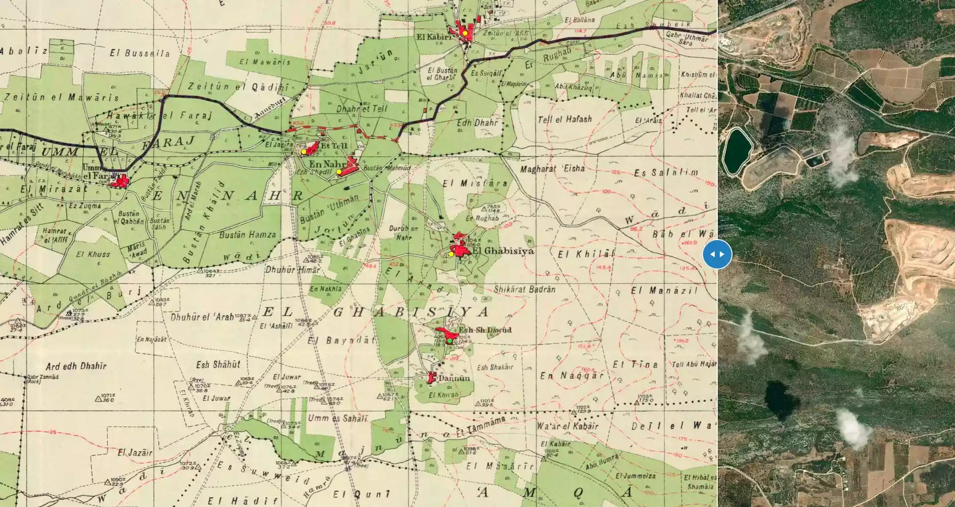
| Before & After Nakba, Click Map For Details |
|||||||||||||||
|
|||||||||||||||
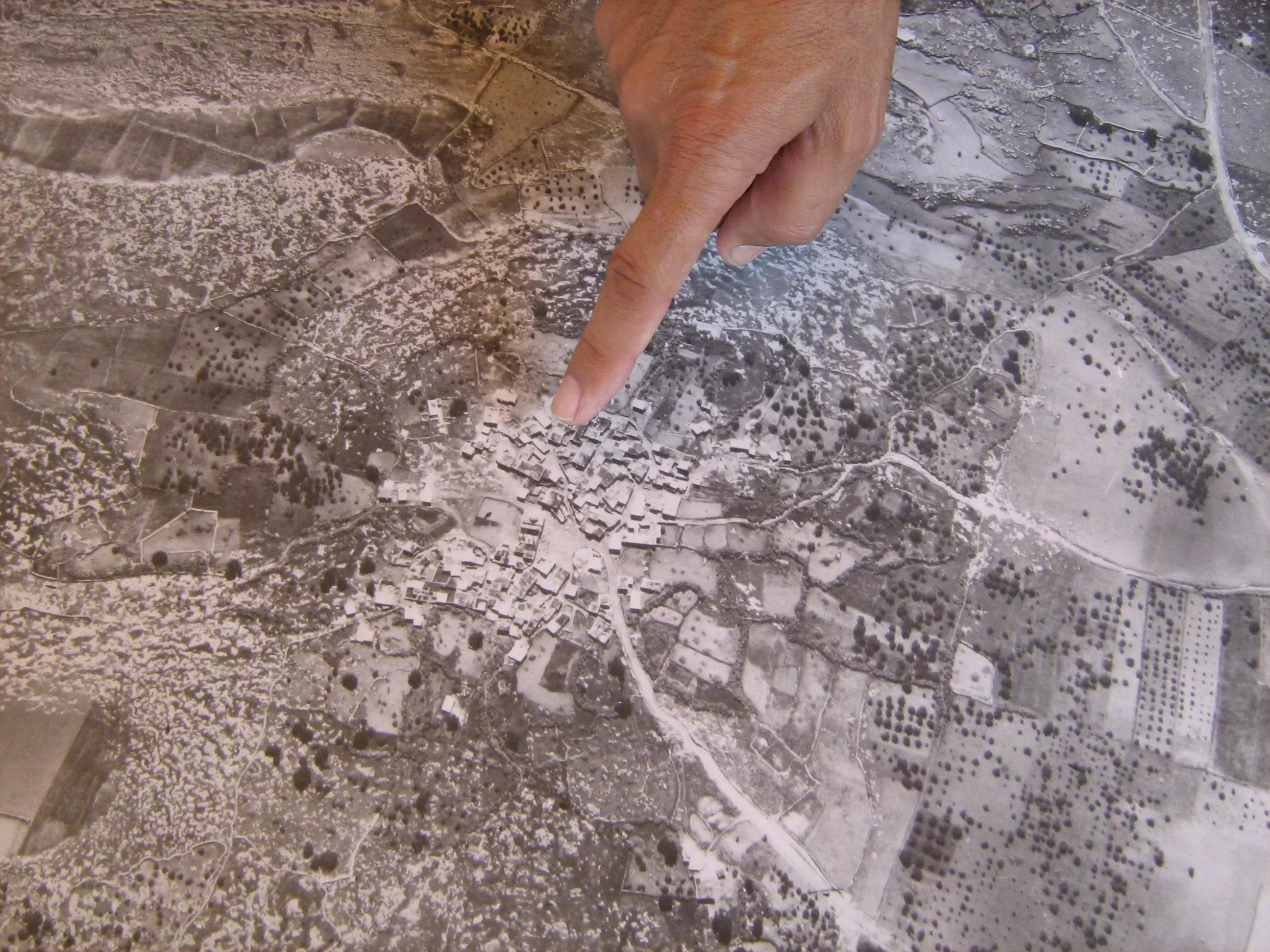
| Pre-Nakba Aerial View |
|||||||||||||||
|
|||||||||||||||
| Map Location | See location #15 on the map View from satellite |
||||||||||||||
| Military Operation | Operation Ben-Ami | ||||||||||||||
| Attacking Units | Carmeli Brigade | ||||||||||||||
| Defenders | Local militia | ||||||||||||||
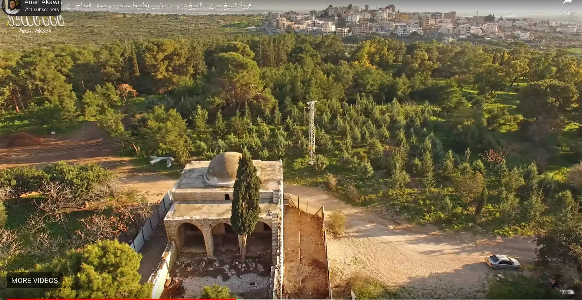
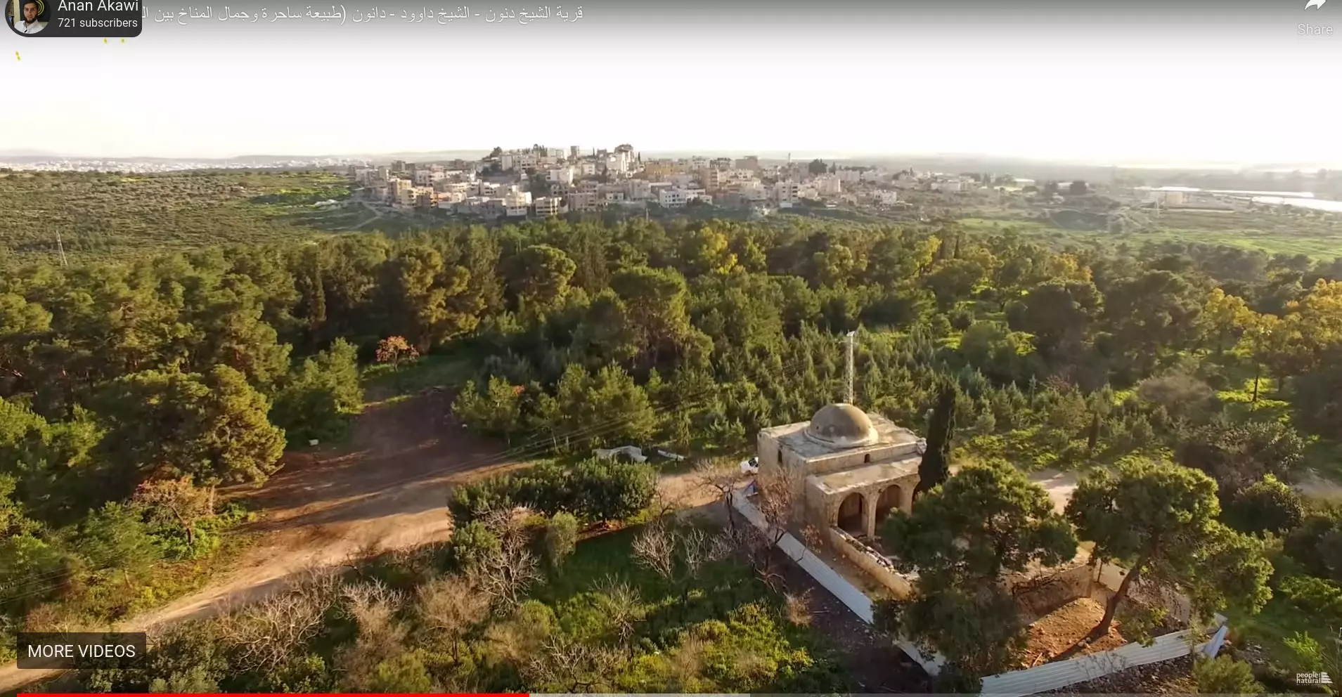
| Refugees' Migration Routes | Many of Ghabisiyya inhabitants were expelled to the upper Galilee until the whole region fell at the end of October 1948, soon after that they were on the move again to Lebanon. | ||||||||||||||
| Exodus Cause | Expulsion by Zionist troops | ||||||||||||||
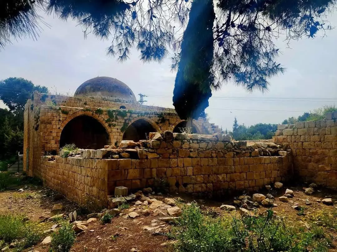
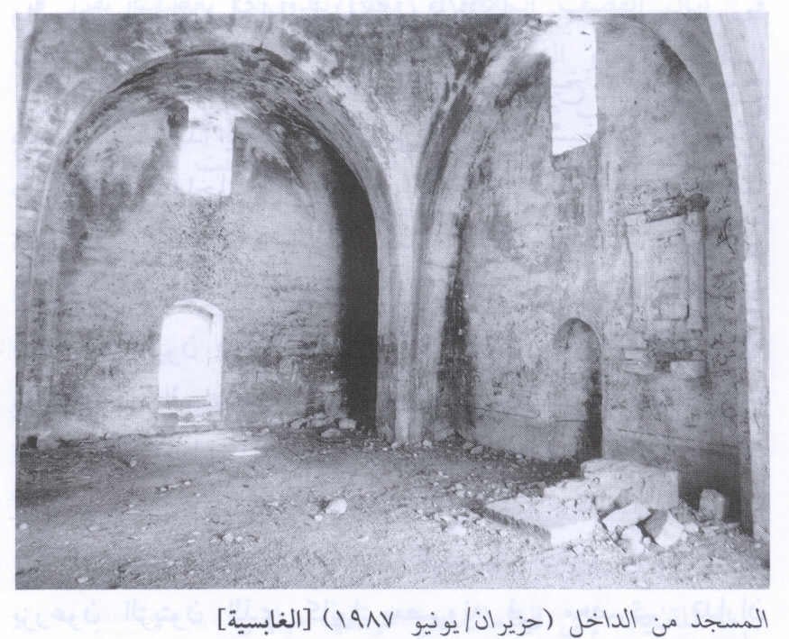
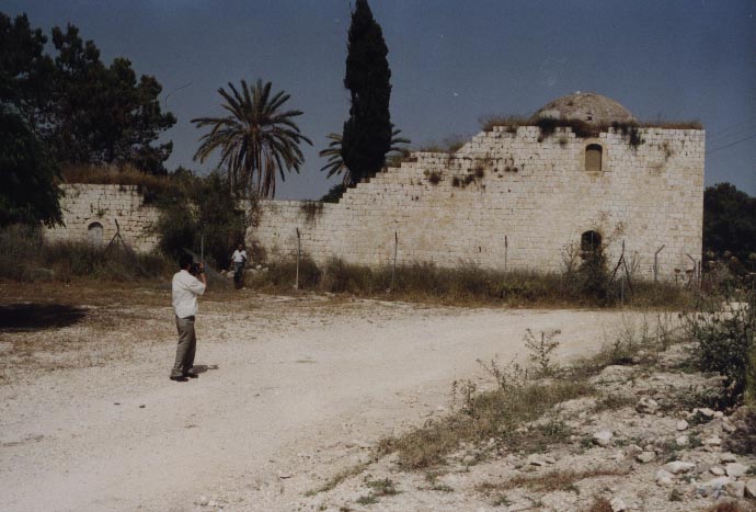
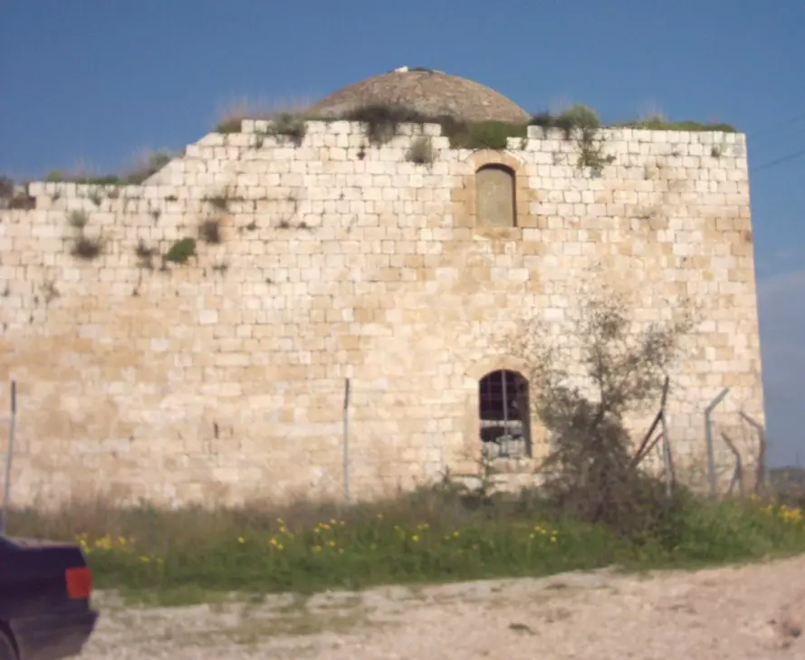
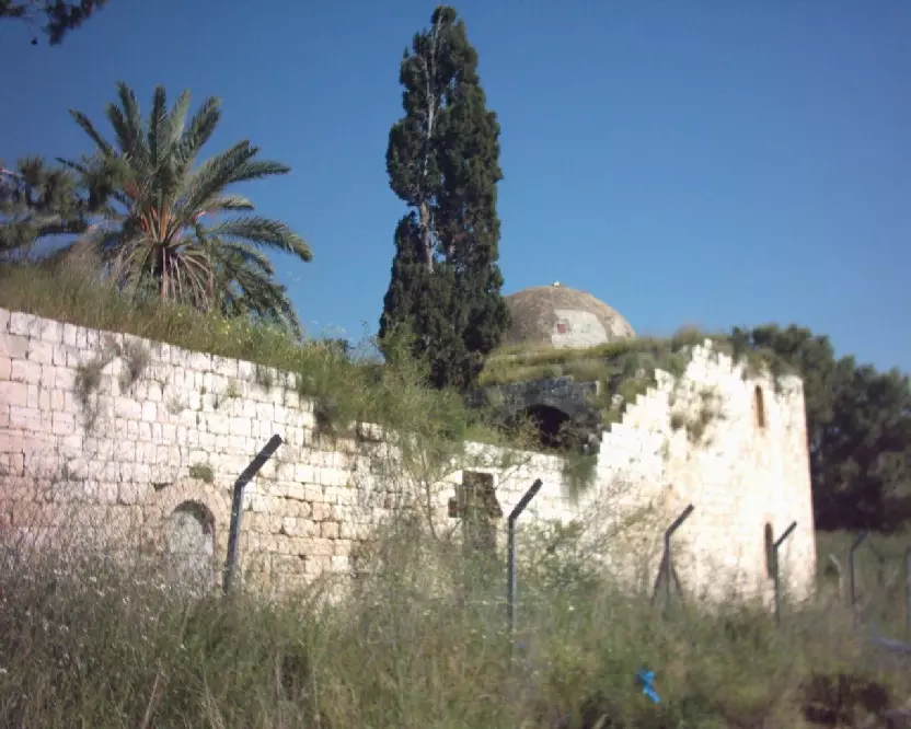
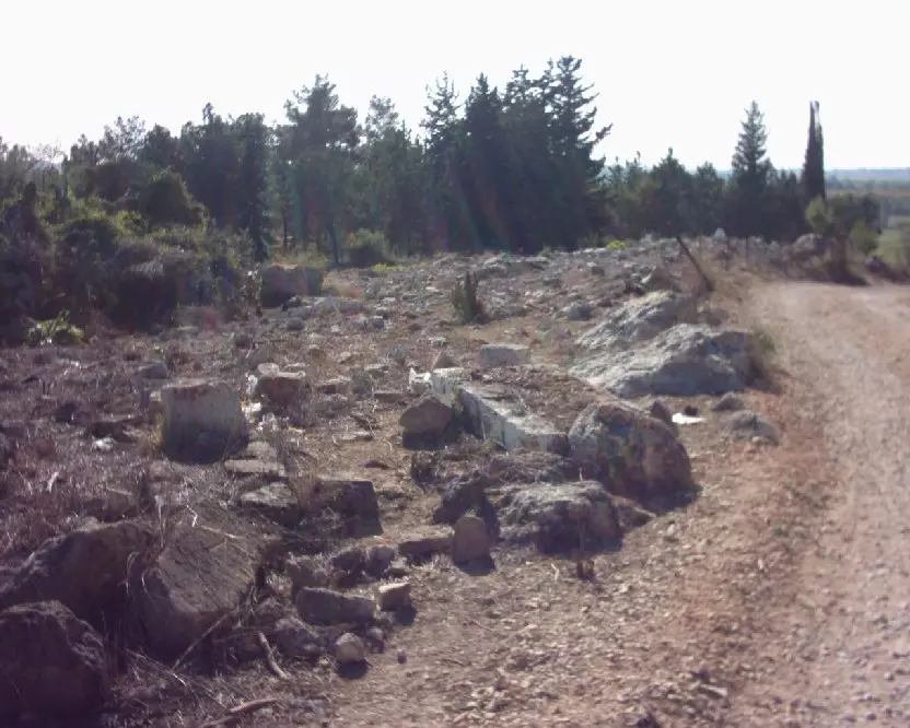
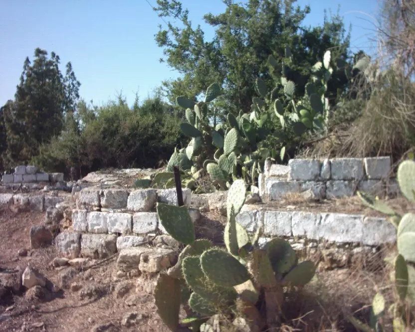
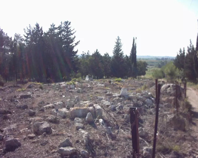
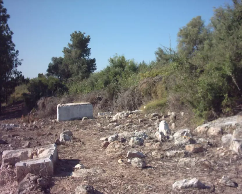
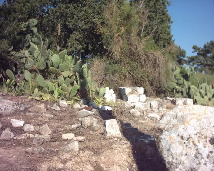
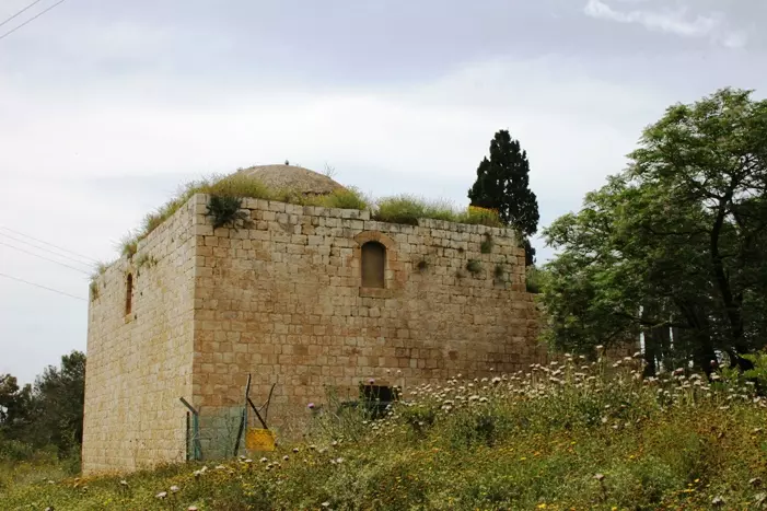
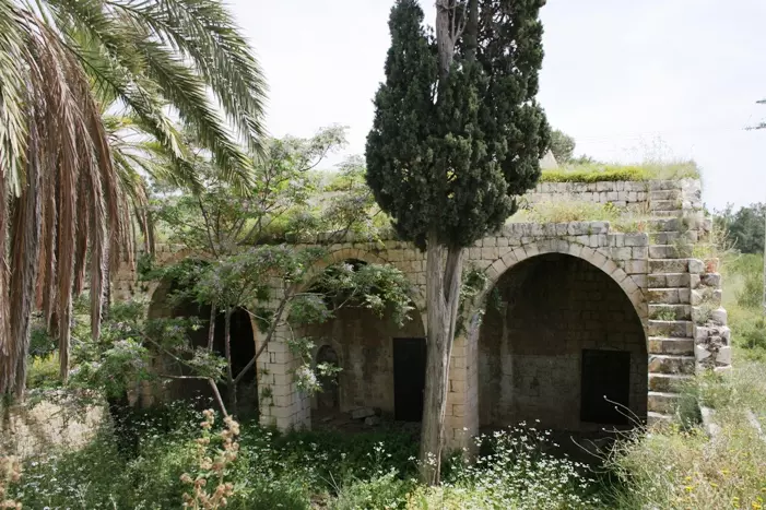
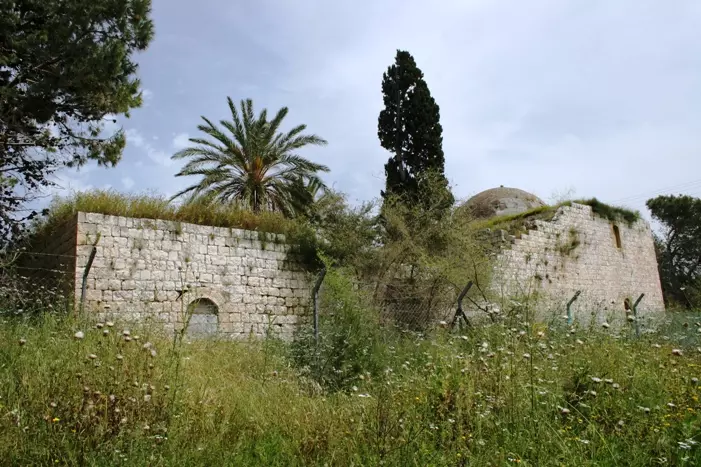
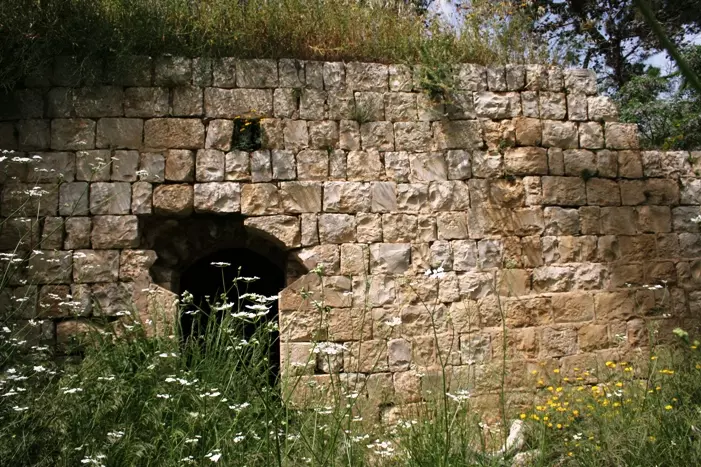
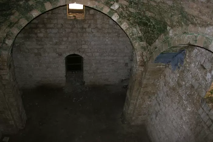
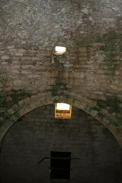
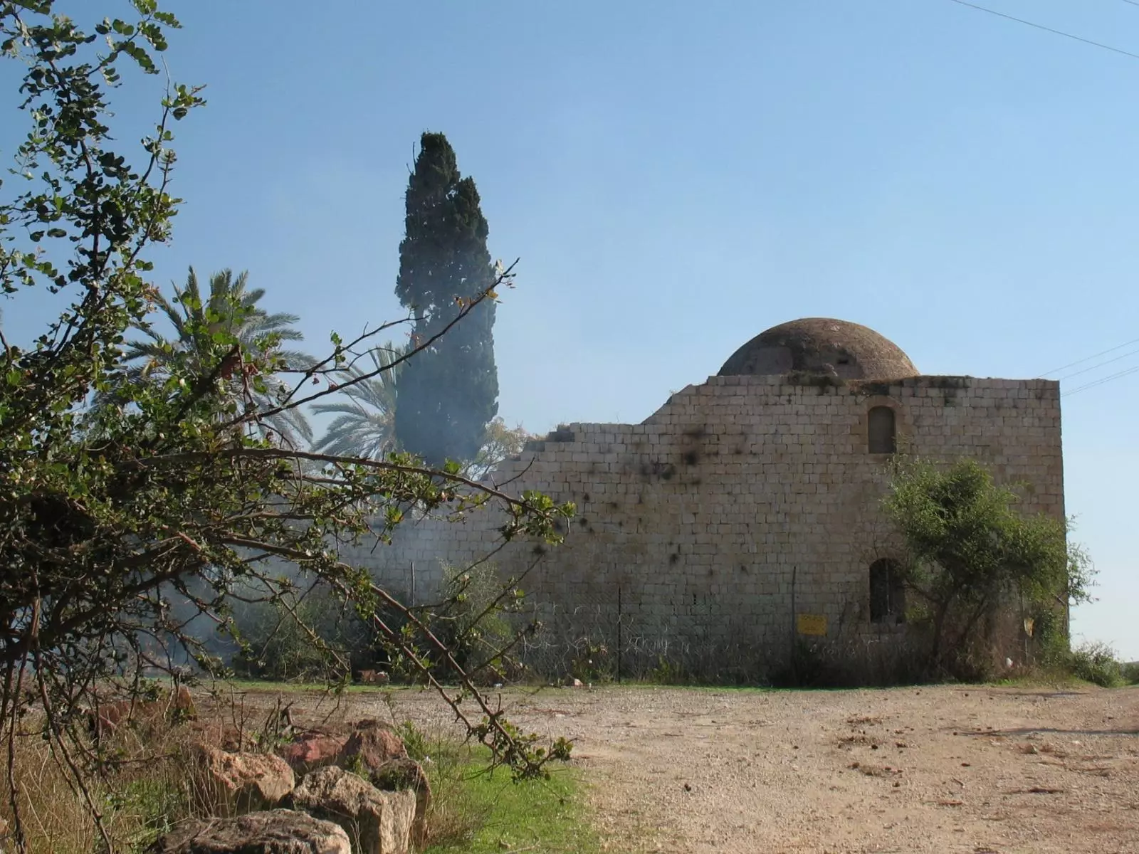
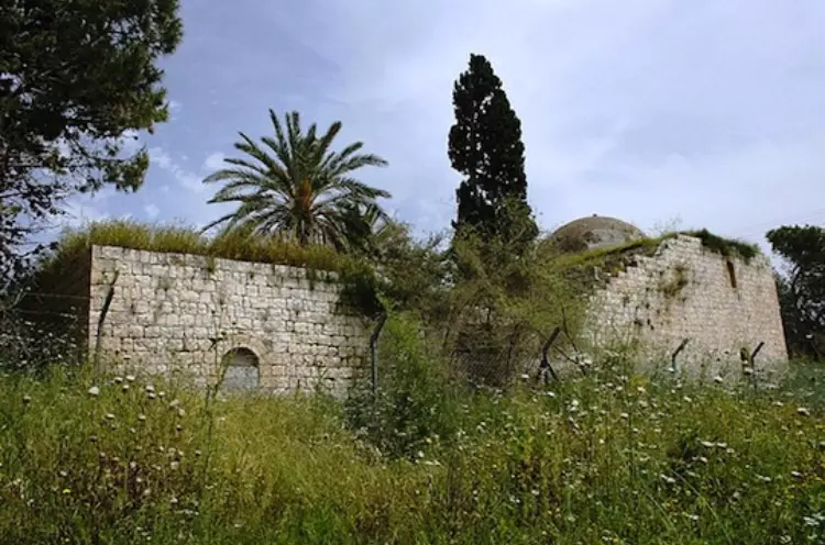
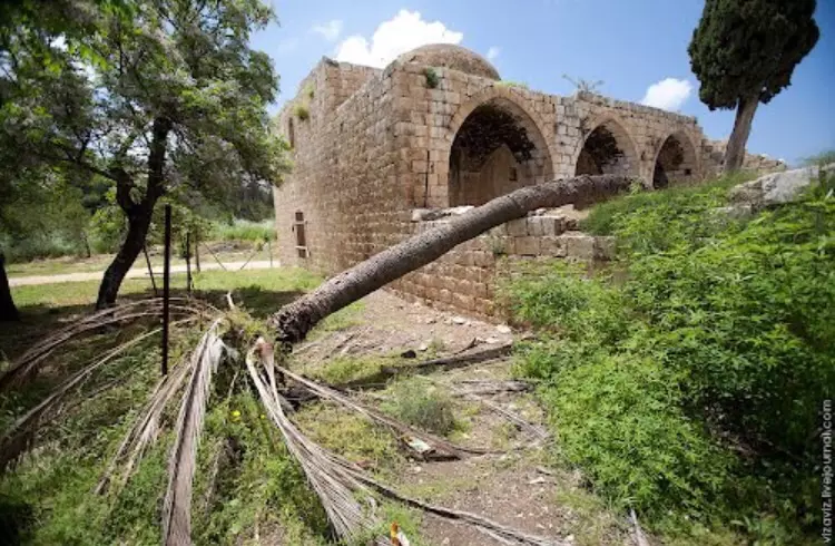
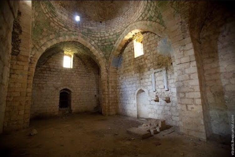
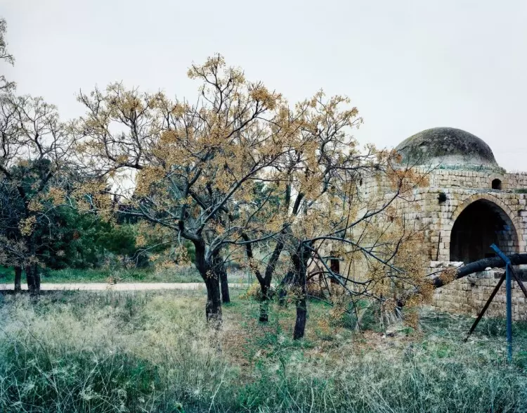
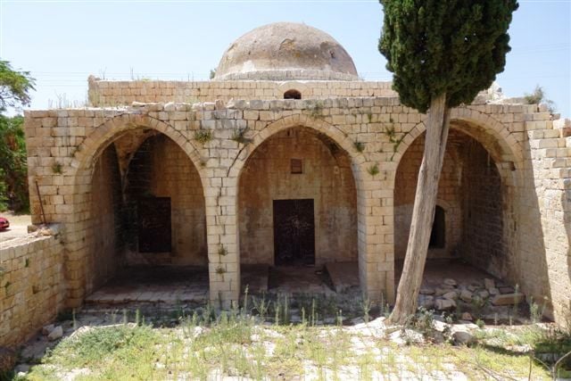
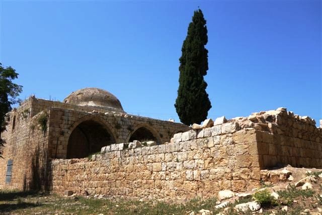
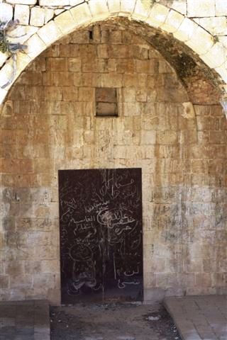
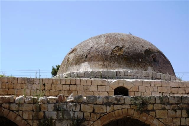
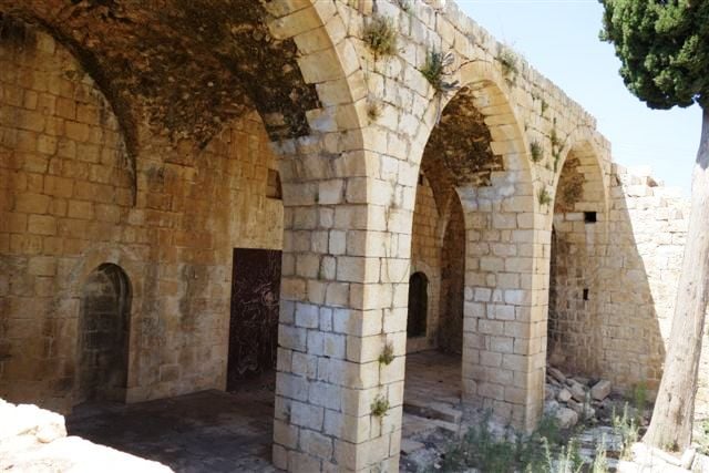
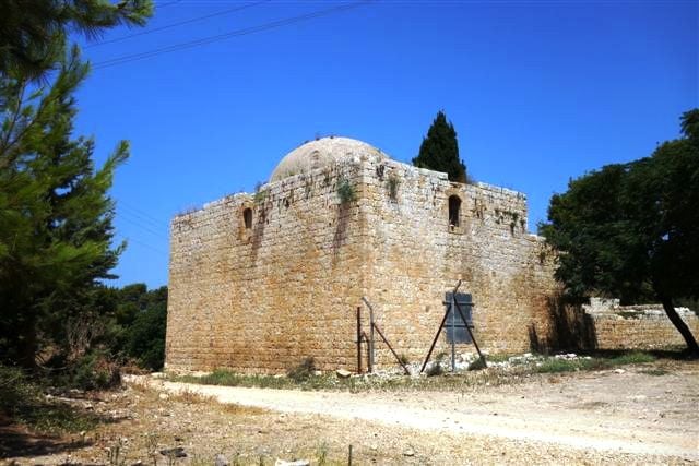
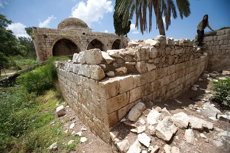
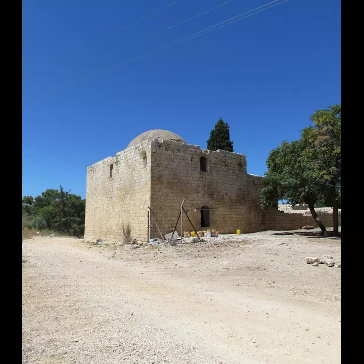
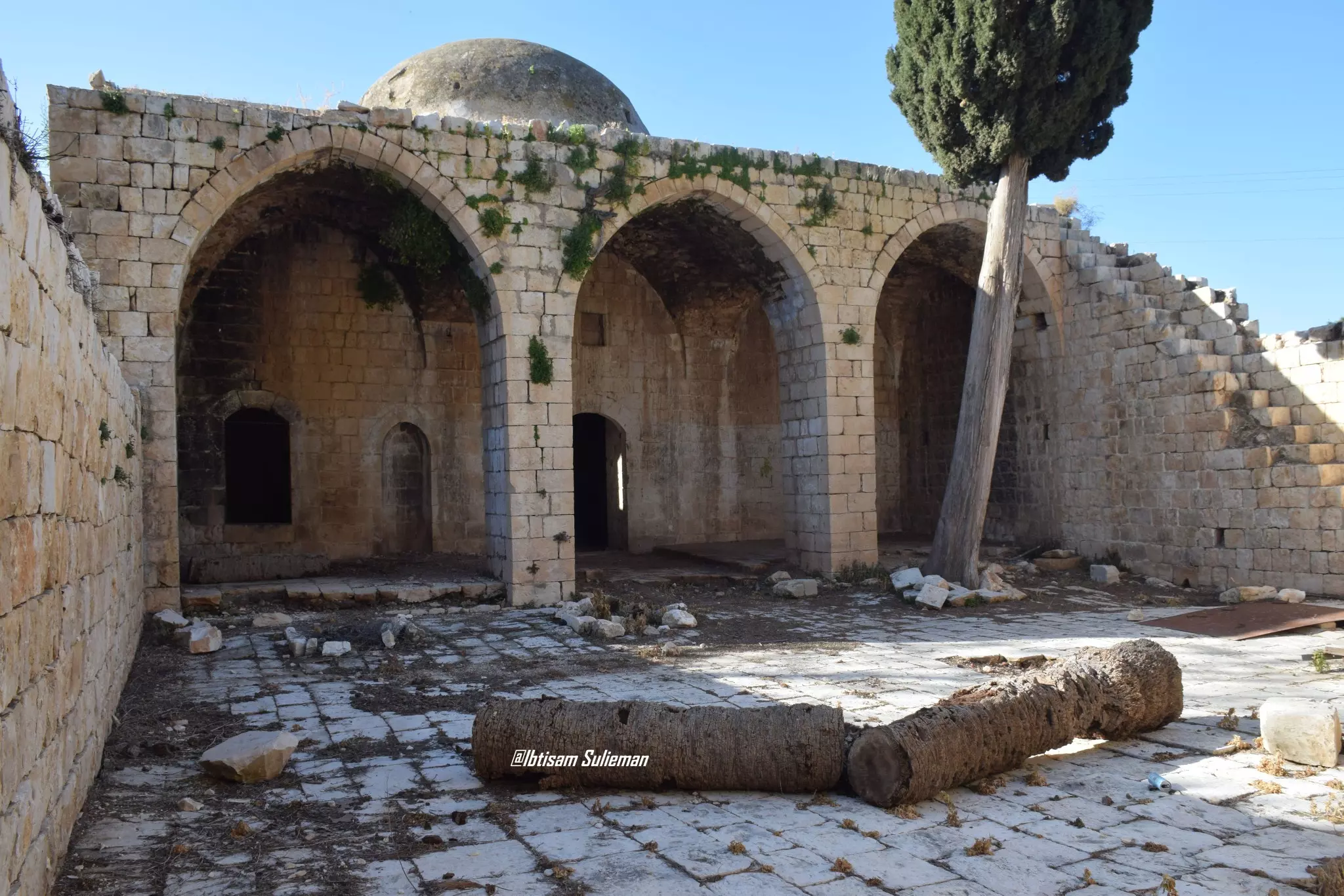
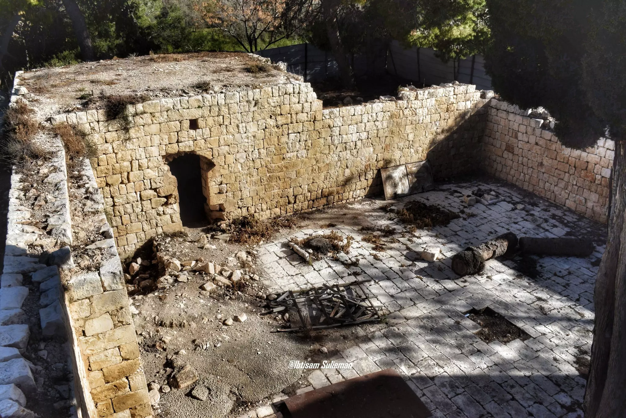
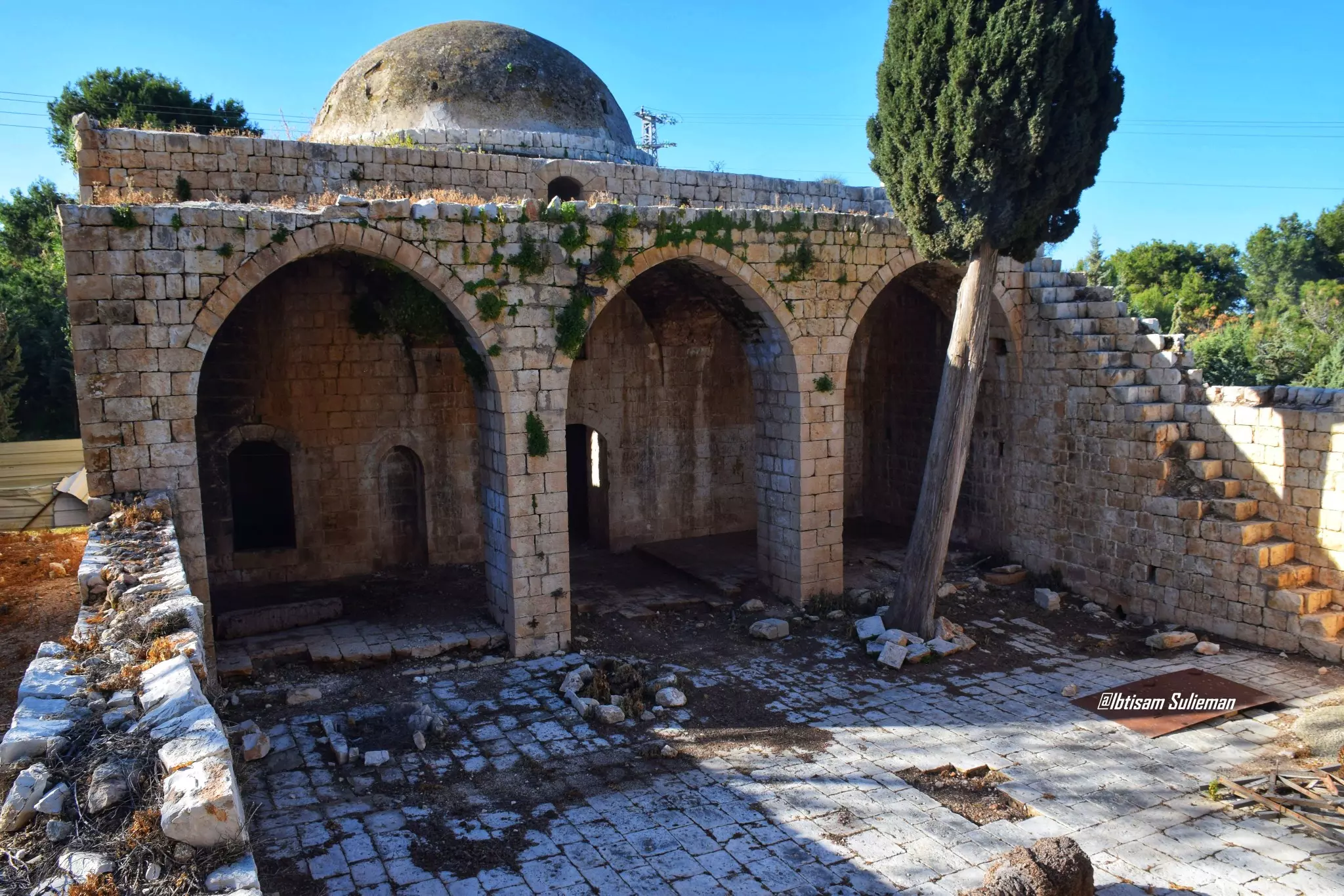
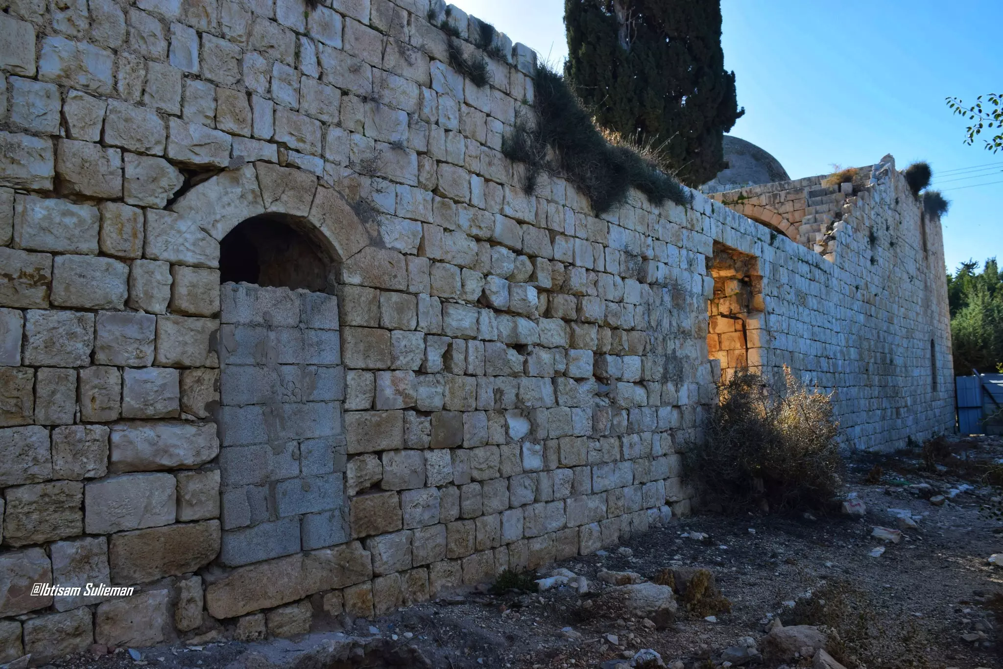
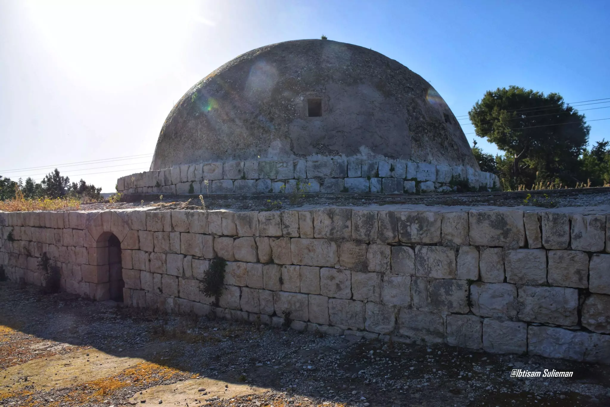
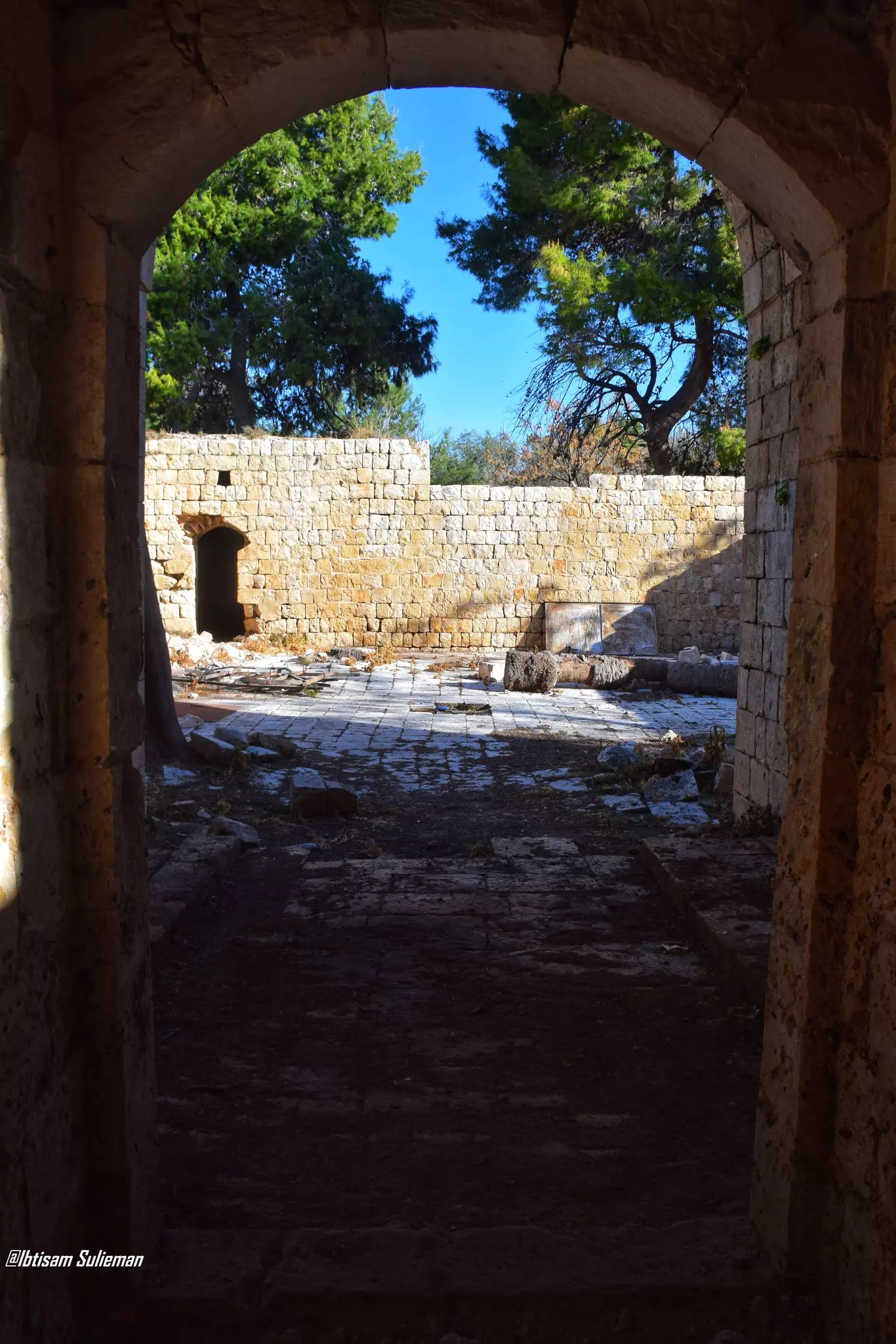
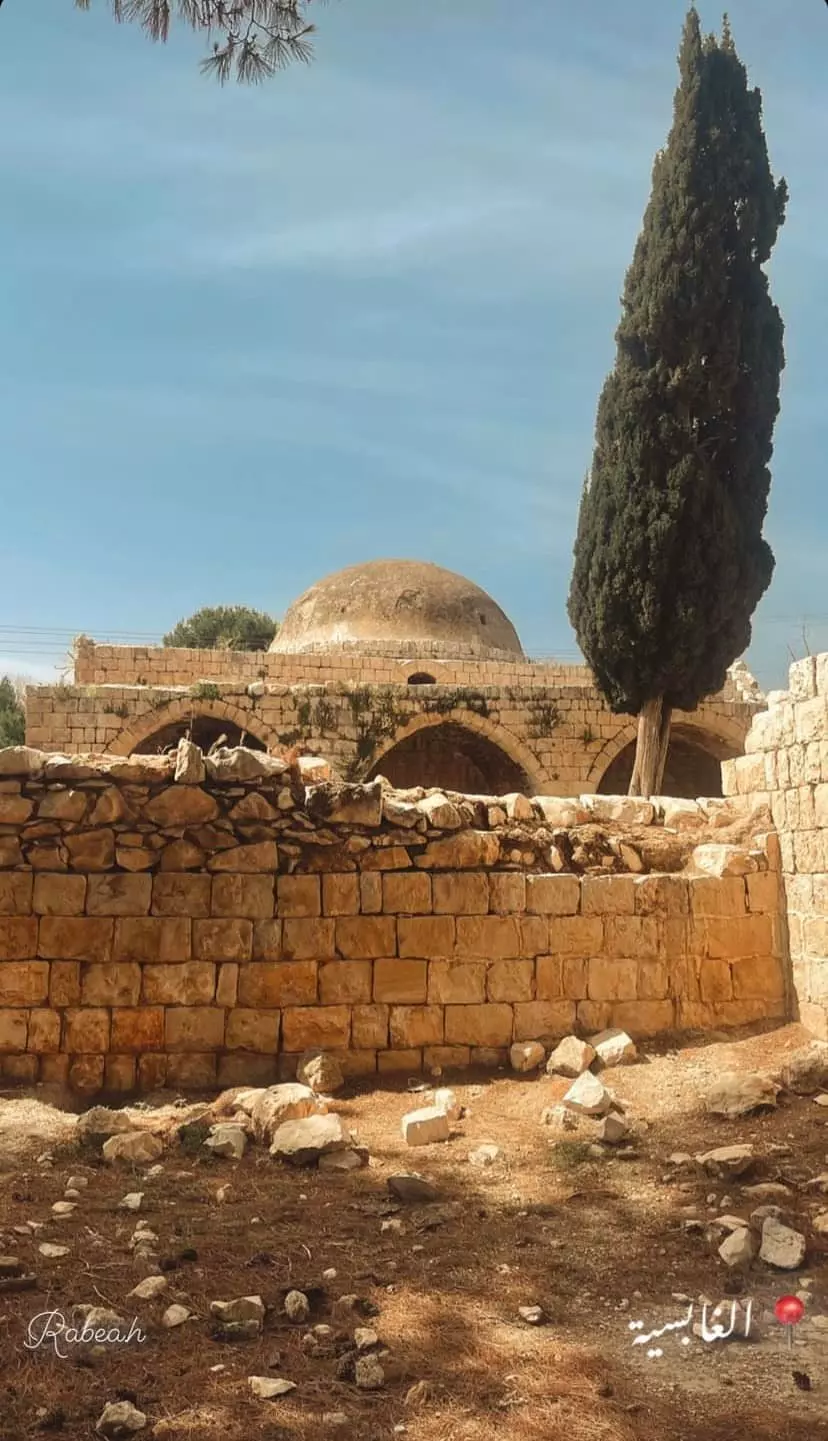
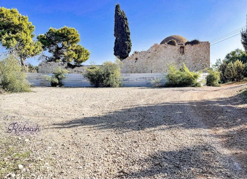
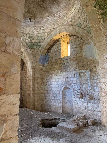
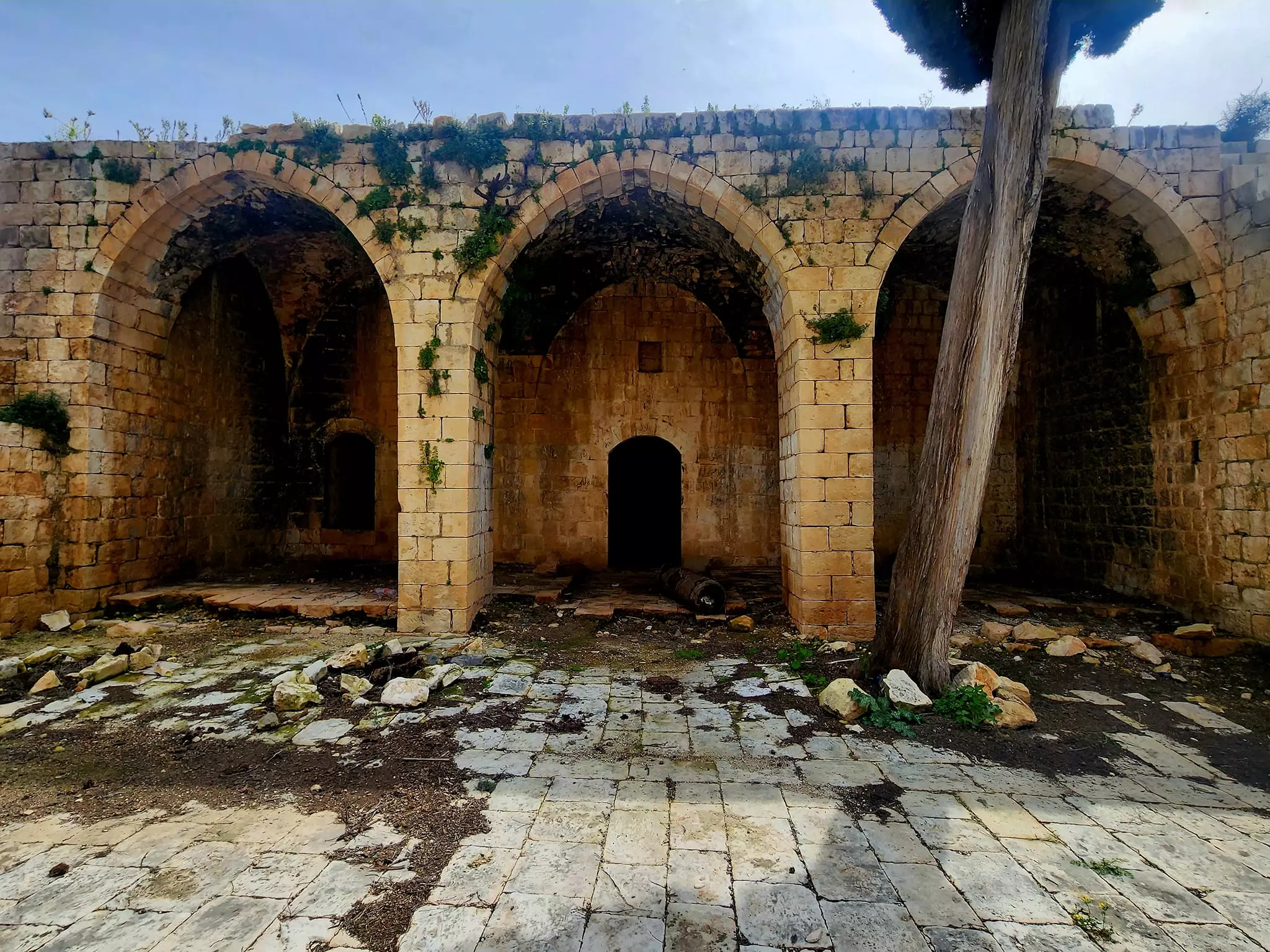
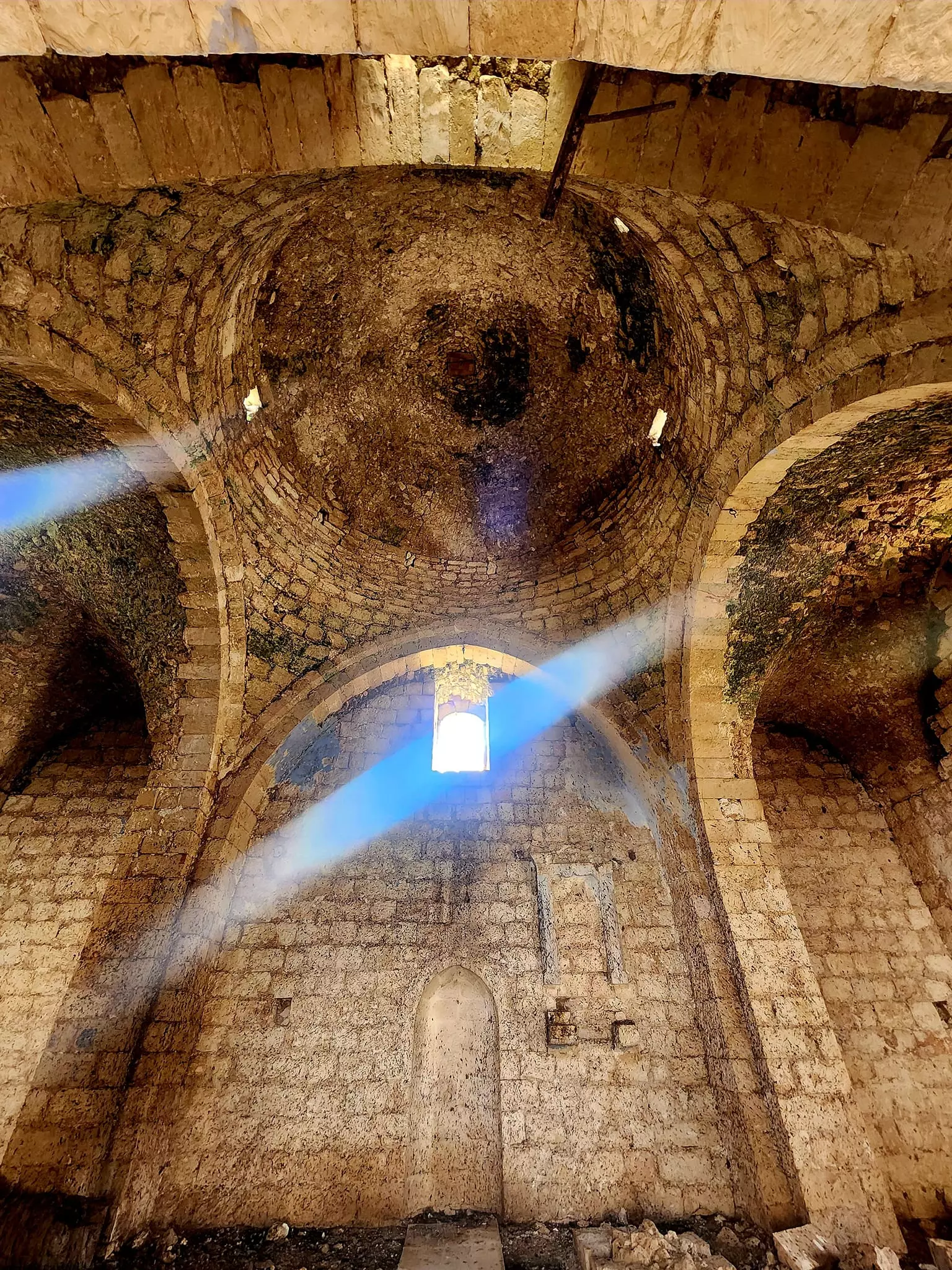
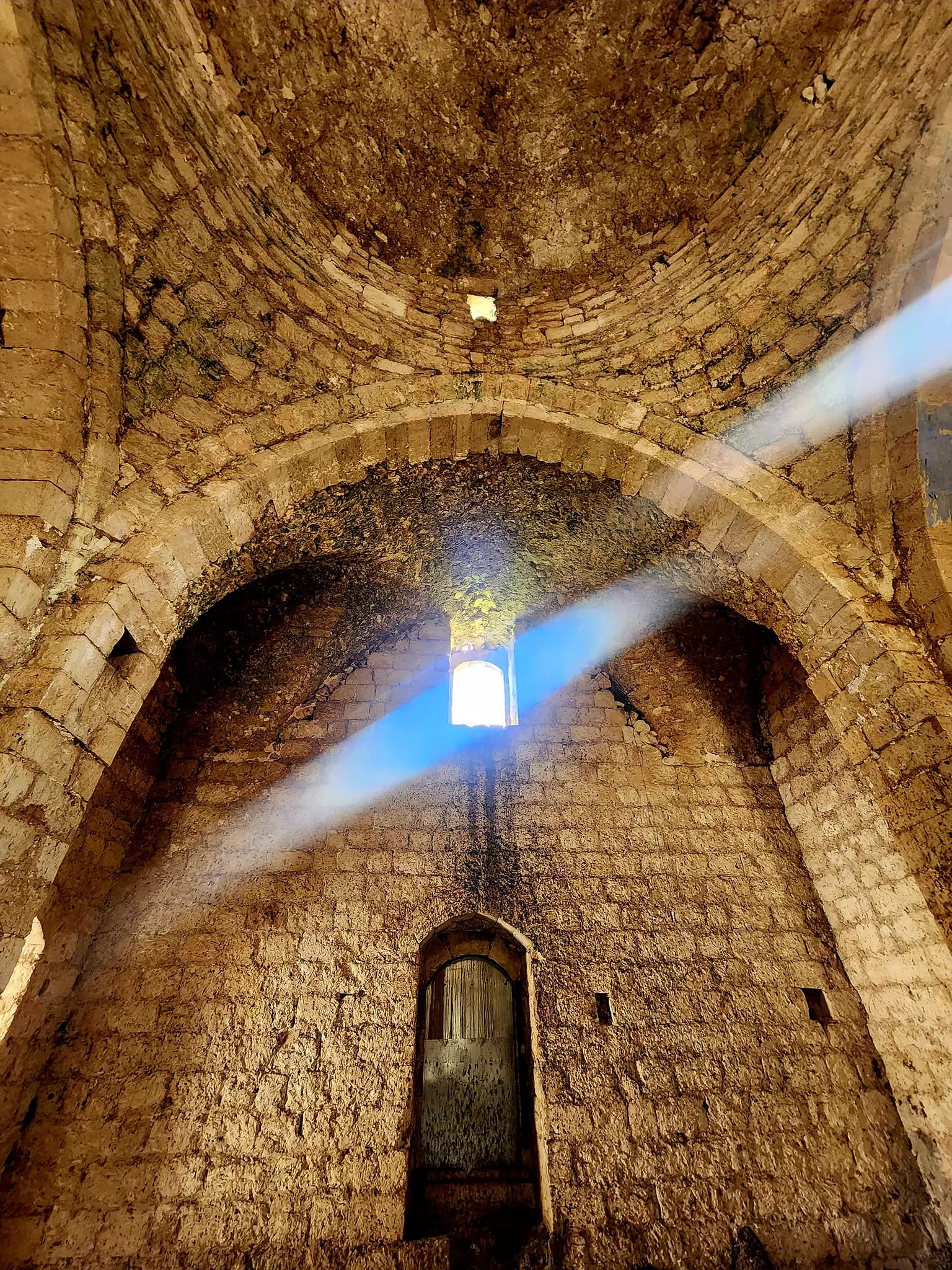
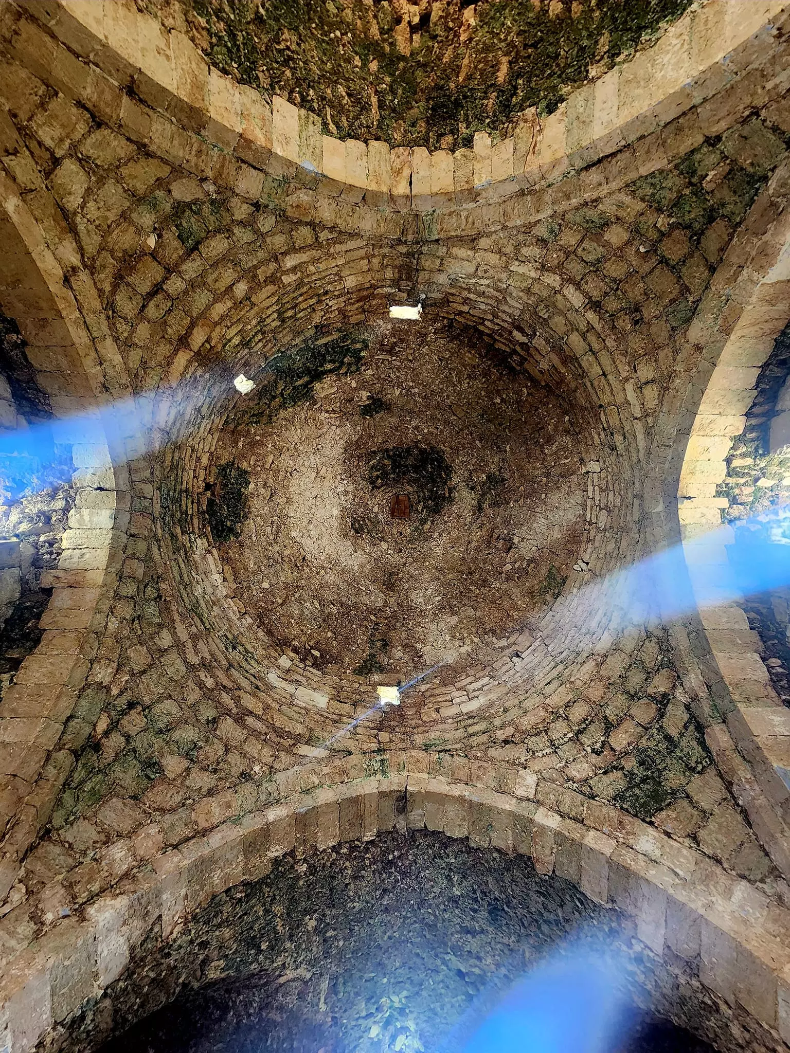
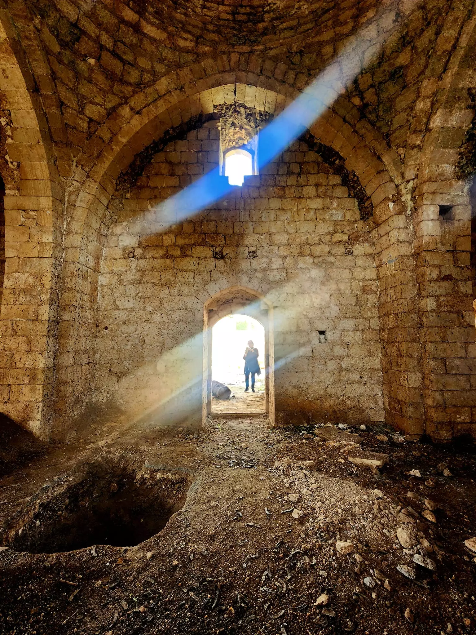
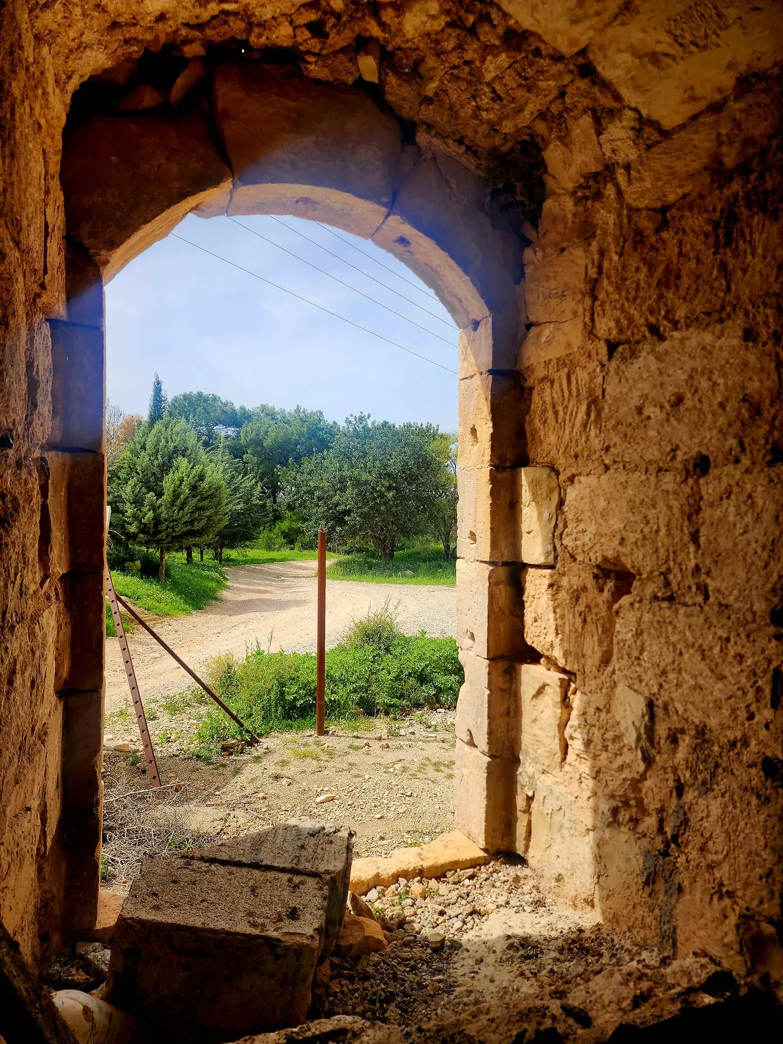
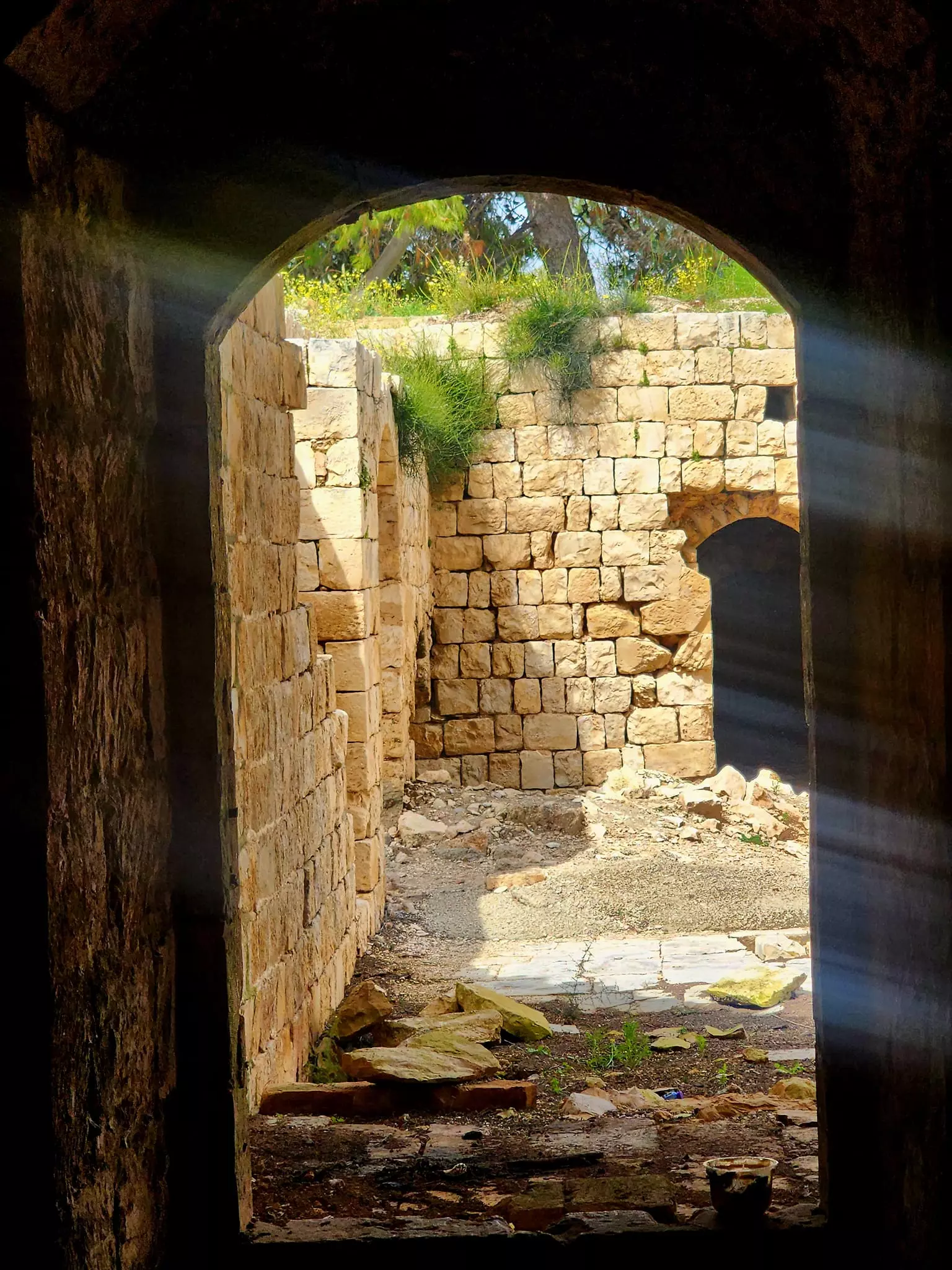
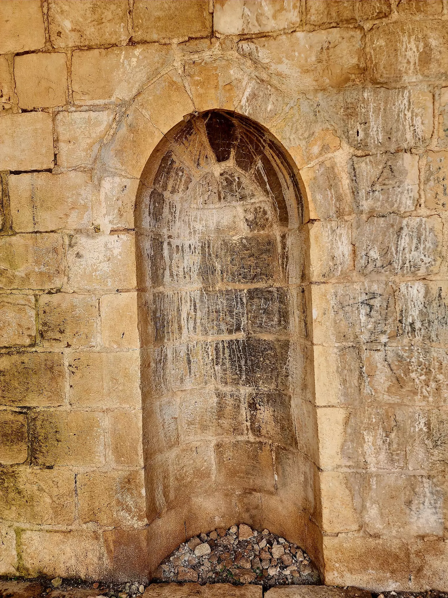
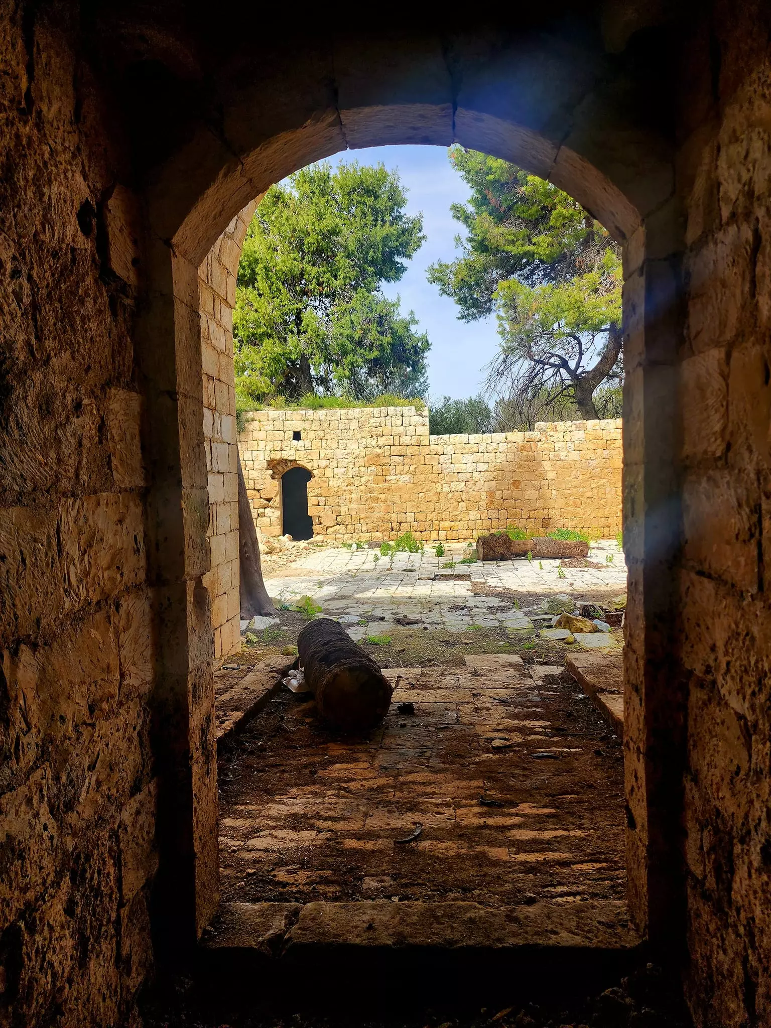
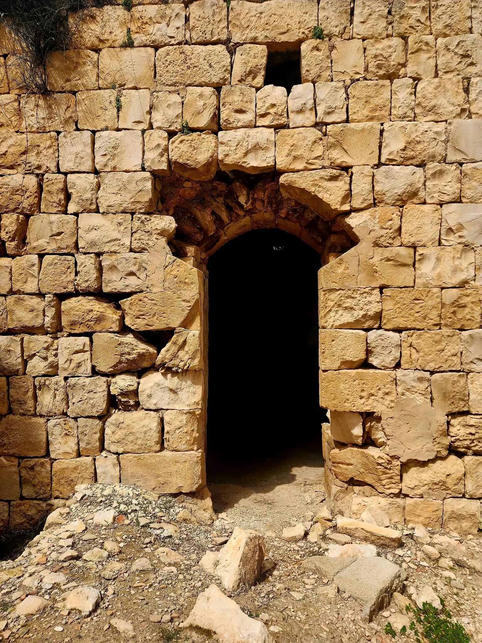
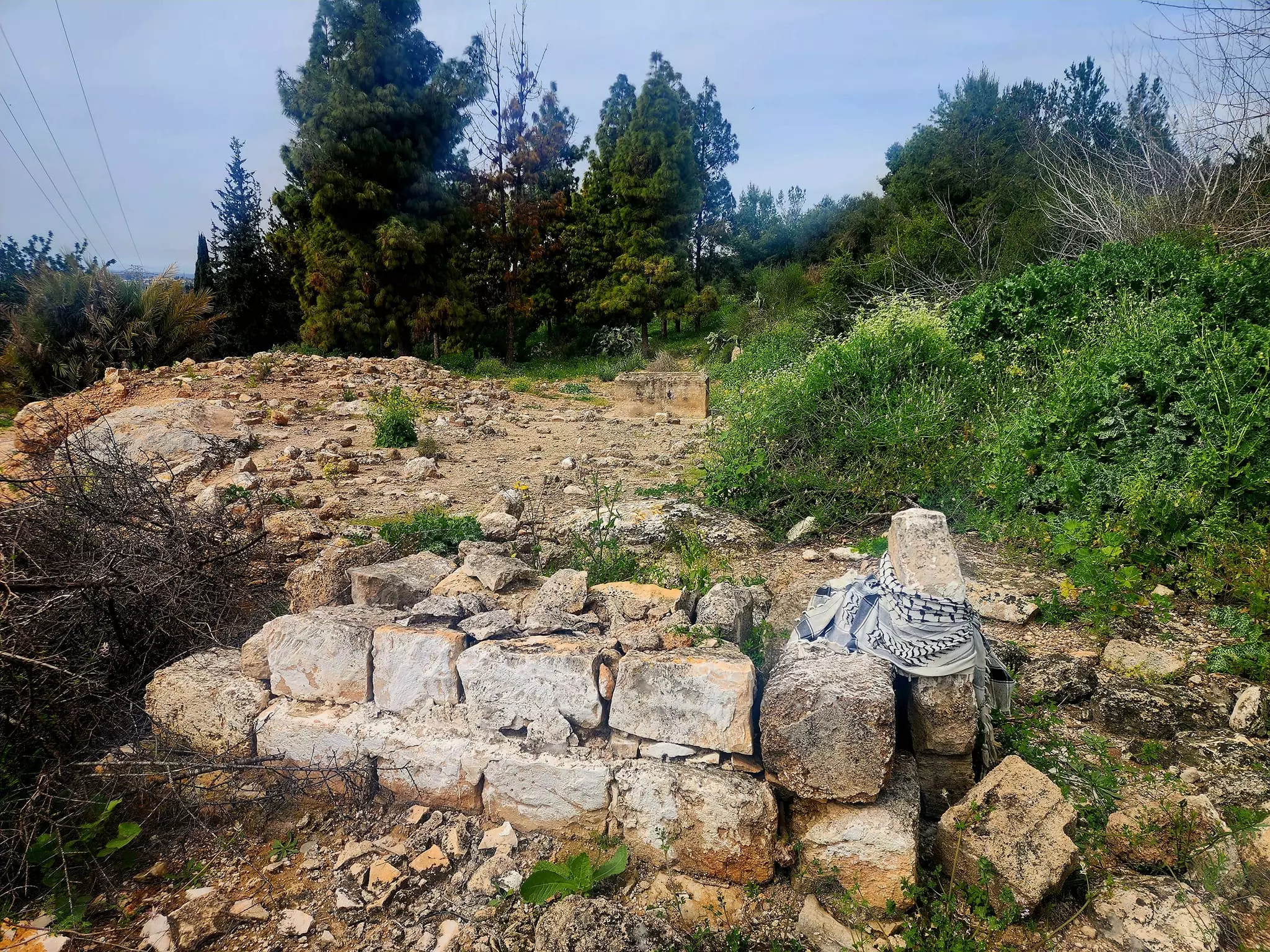
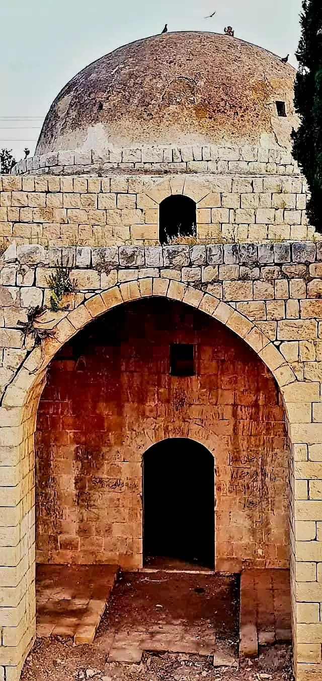
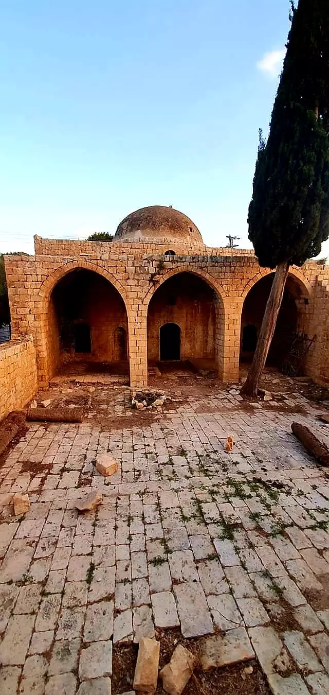
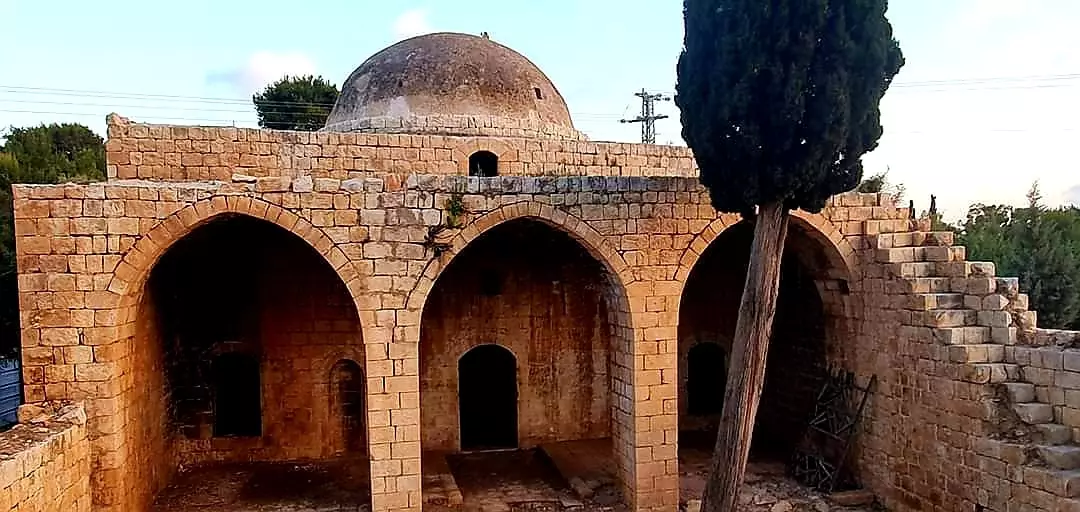
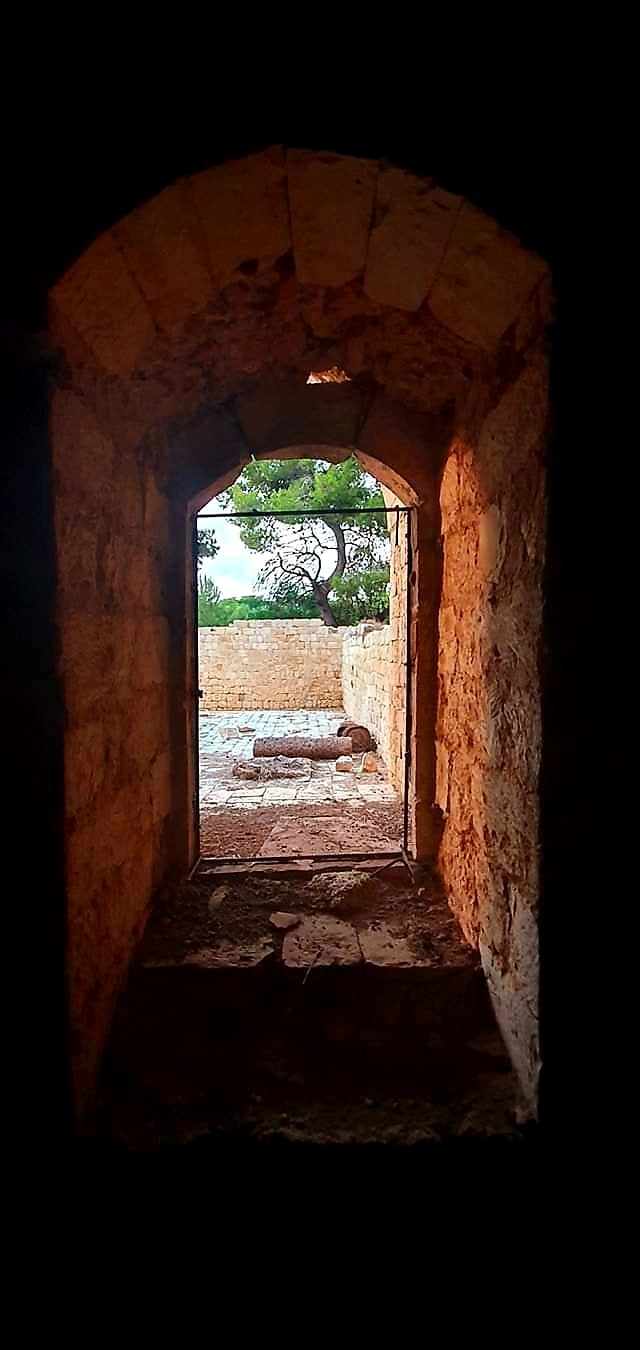
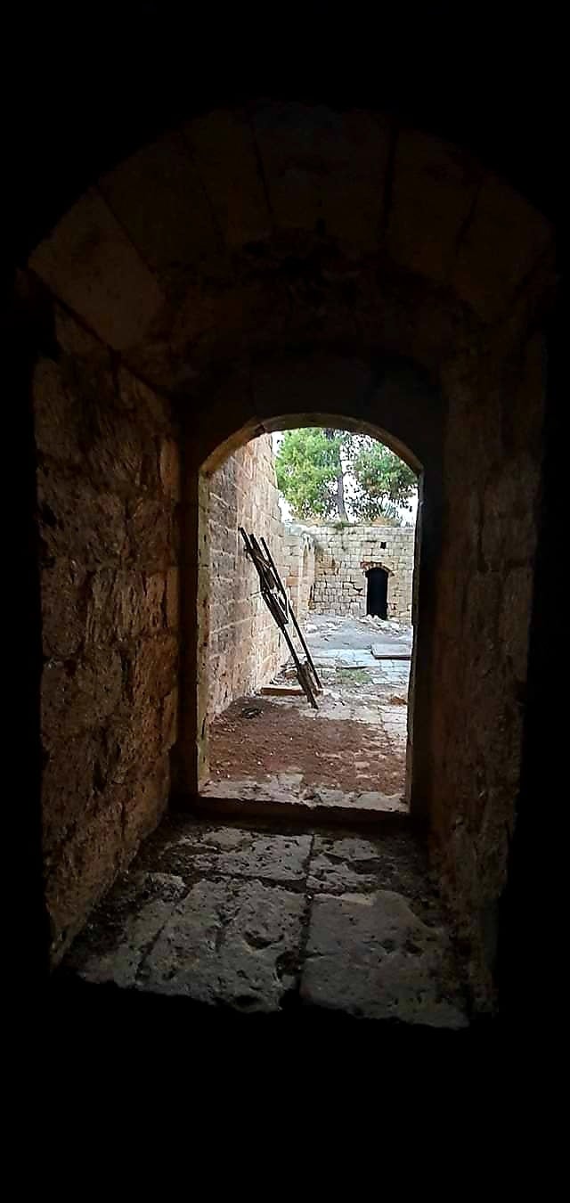
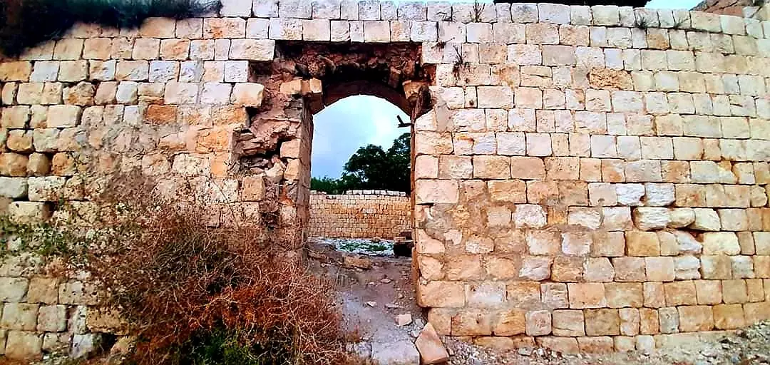
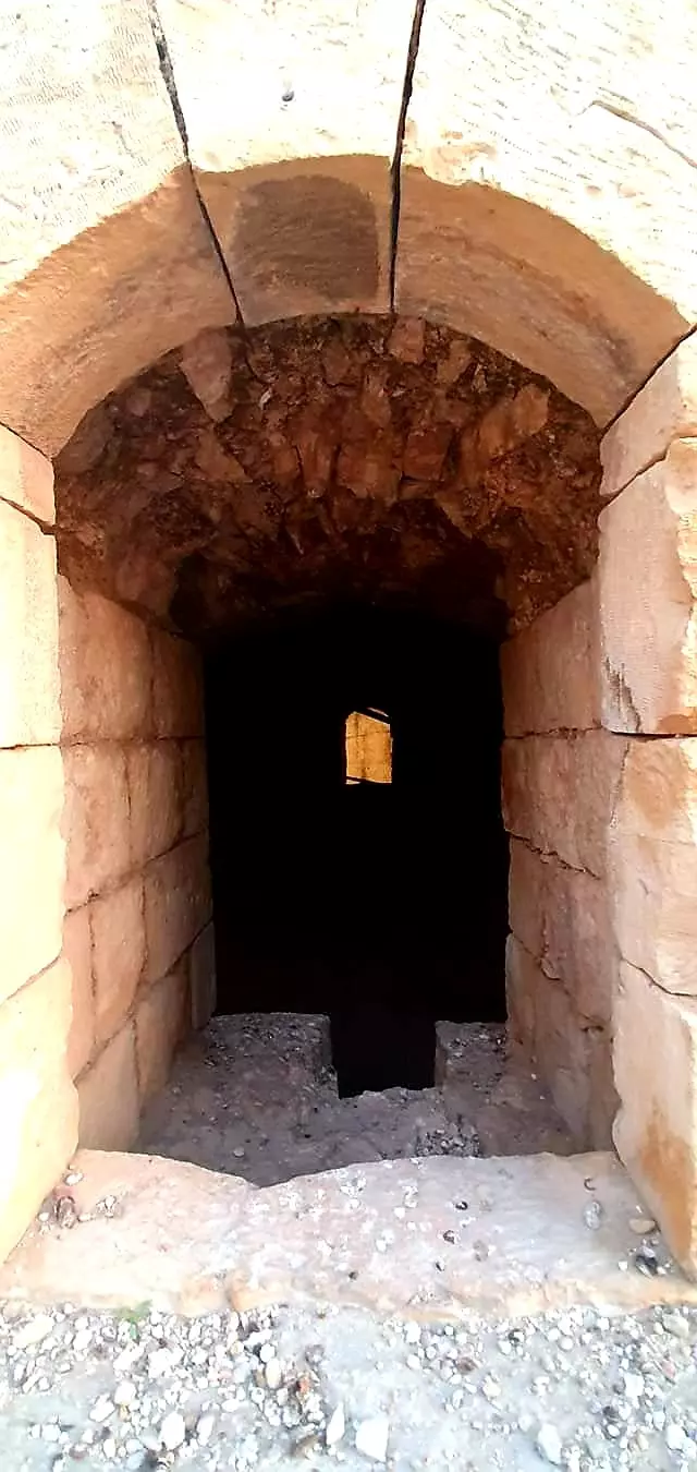
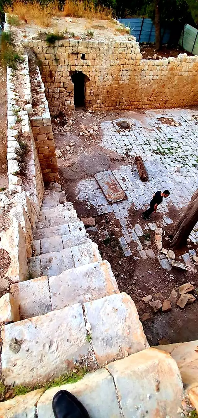
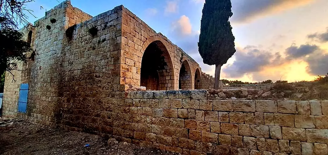
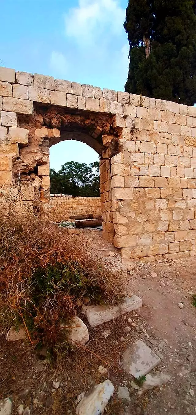
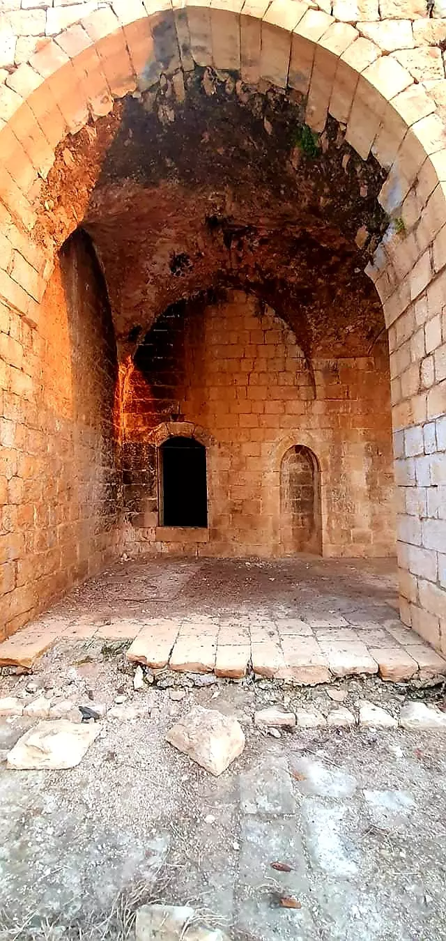
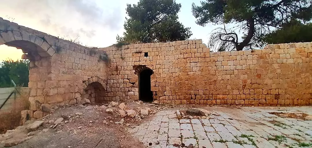
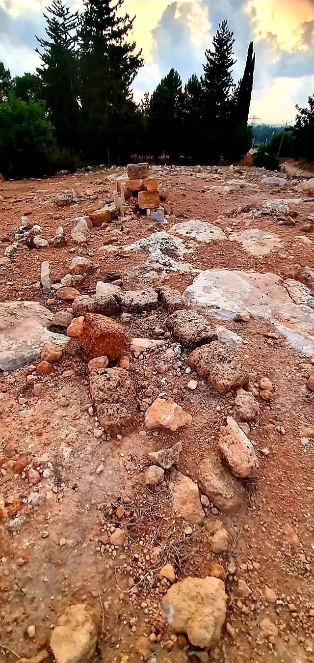
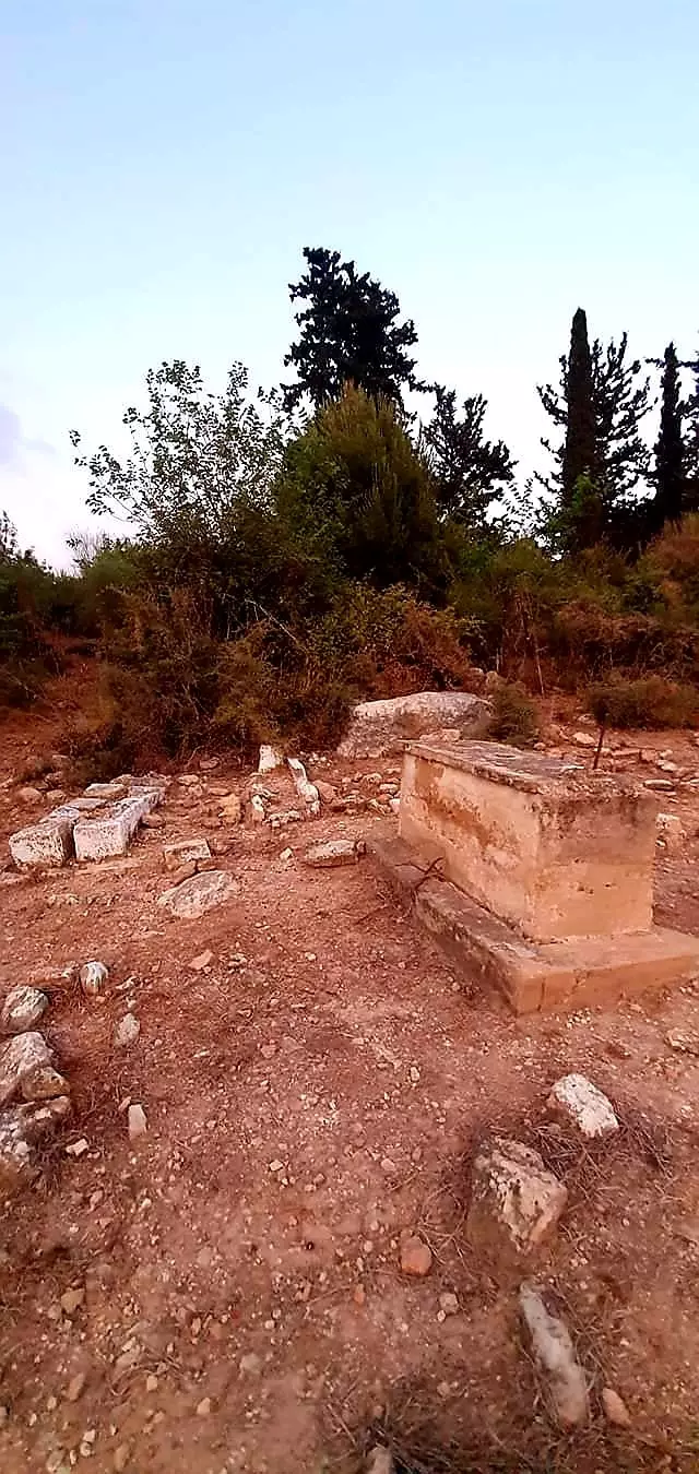
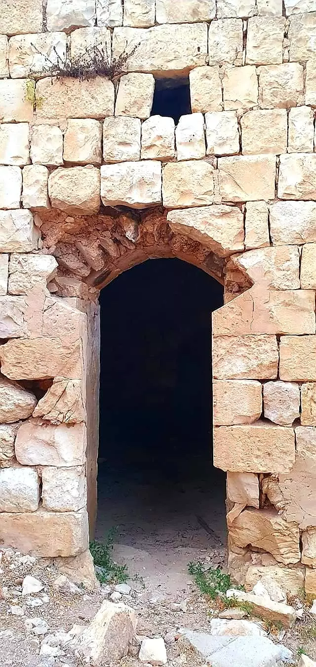
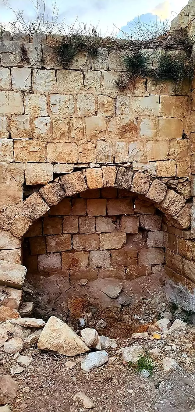
| Village Temains | al-Ghabisiyya was mostly destroyed with the exception of its mosque. | ||||||||||||||
| Ethnically Cleansing | In February 1949, al-Ghabisiyya inhabitants, and some from the nearby villages of al-Shayskh Dawoud & al-Shaykh Danunn, were completely ethnically cleansed to Lebanon. | ||||||||||||||
| Pre-Nakba Land Ownership |
**Town Lands' Demarcation Maps |
||||||||||||||
| Land Usage As of 1945 |
|
||||||||||||||
| Population |
|
||||||||||||||
| Number of Houses |
|
||||||||||||||
| Near By Towns |
|||||||||||||||
|
|
|||||||||||||||
| Schools | One school which was founded by the Ottomans in 1886. | ||||||||||||||
| Places of Warship | One mosque which remains standing, but it needs renovations guys? | ||||||||||||||
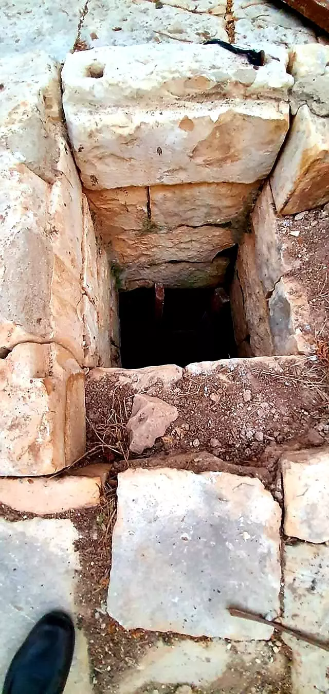
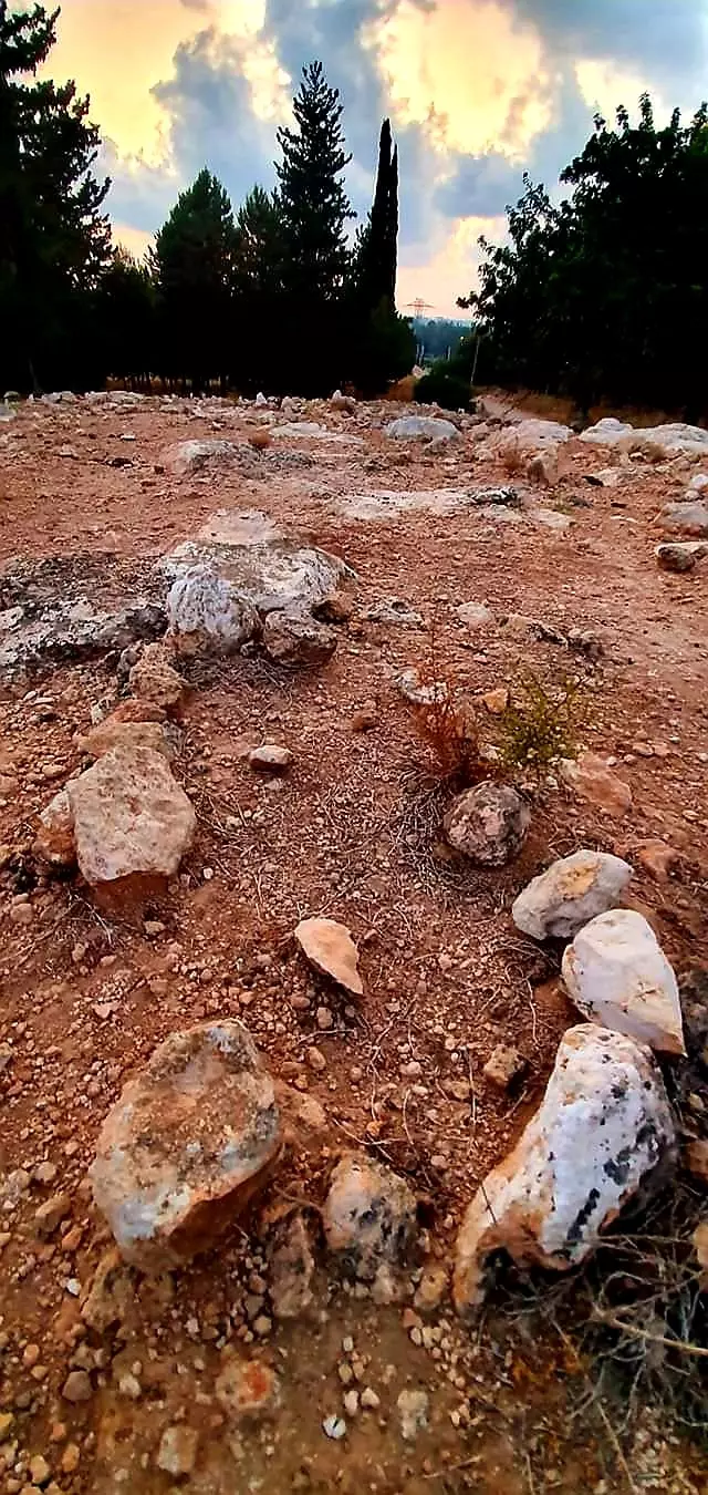
| Archeological Sites | The village contains many caves that were used as burial places and the remains of a large Canaanite town. | ||||||||||||||
| Exculsive Jewish Colonies Who Usurped Village Lands |
Netiv ha-Shayyara | ||||||||||||||
| Featured Video | |||||||||||||||
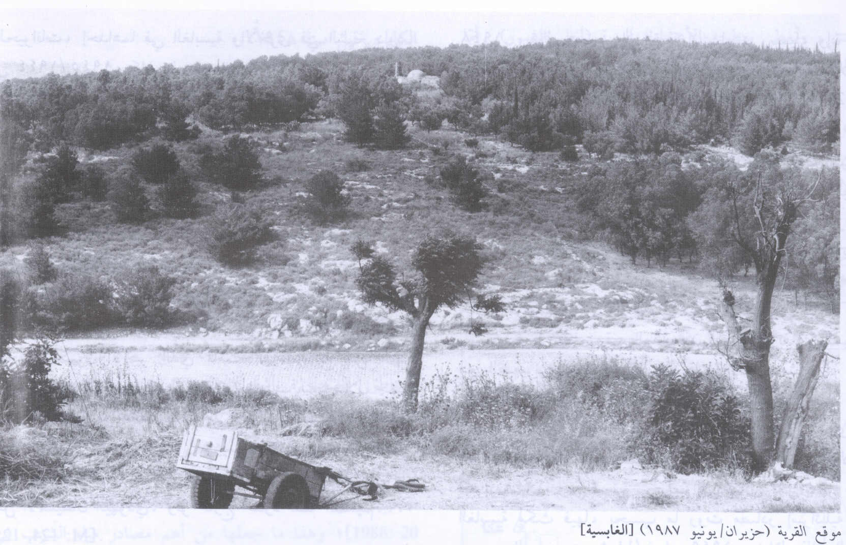
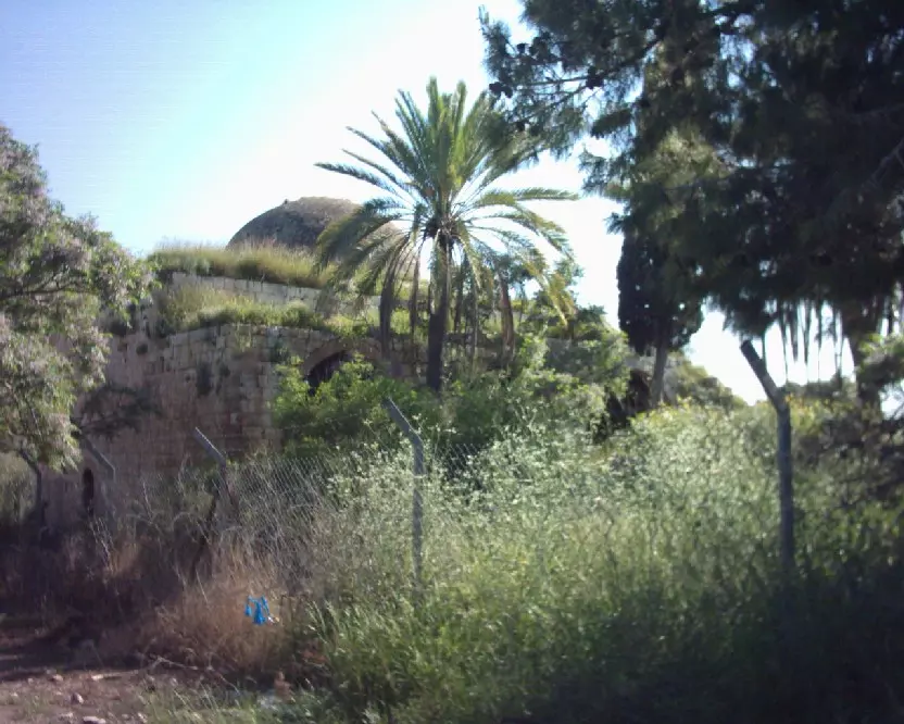
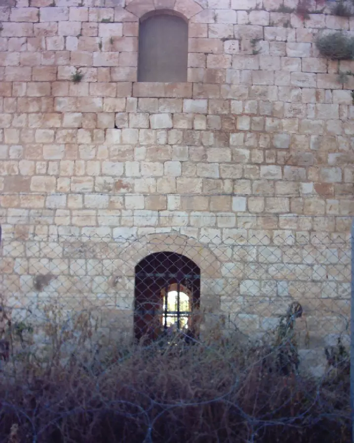
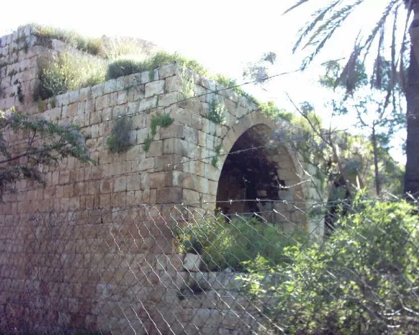
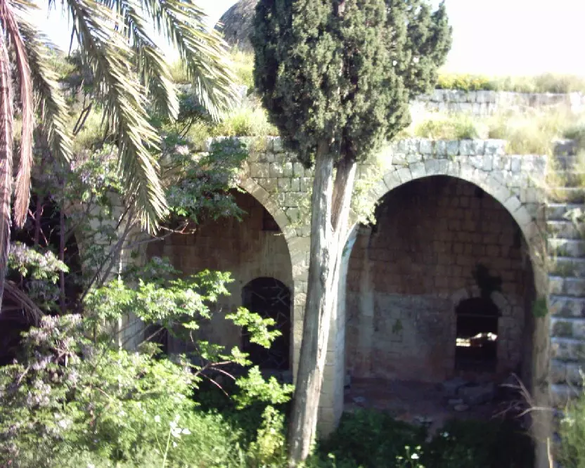
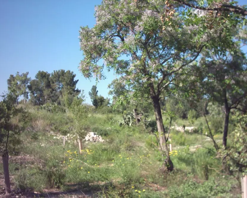
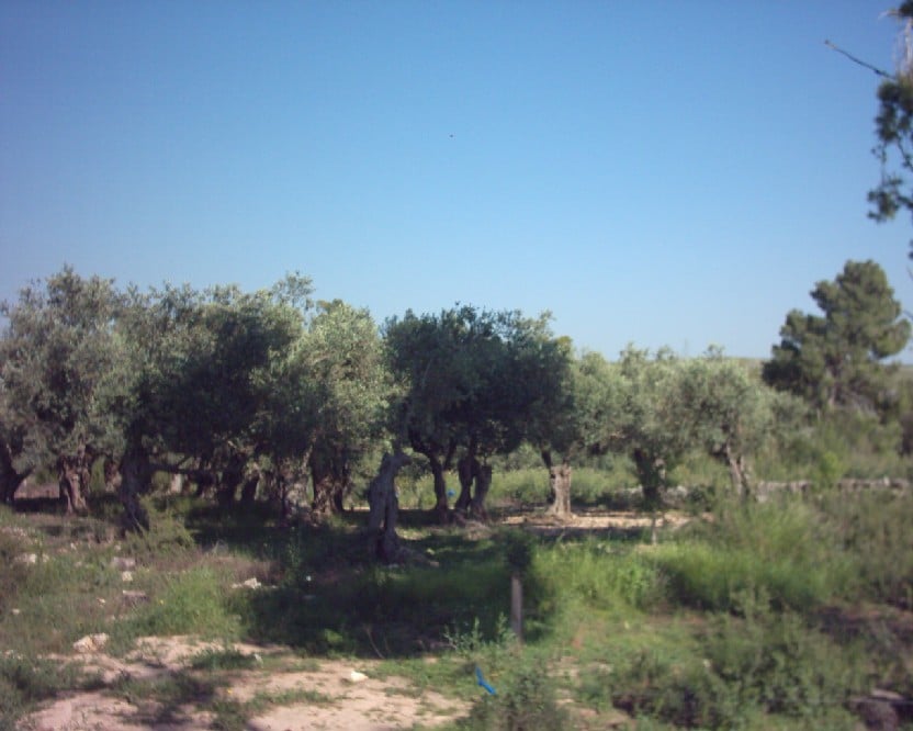
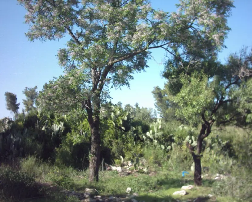
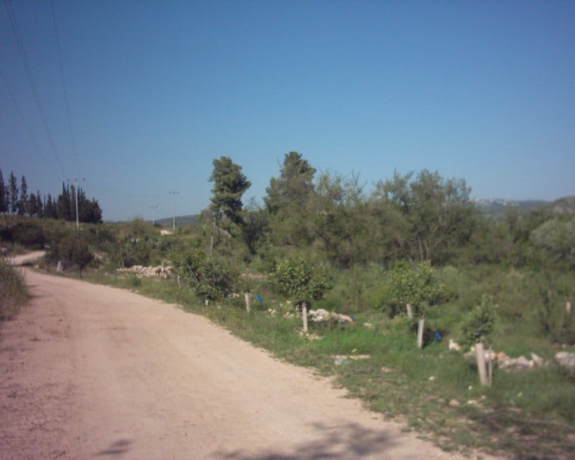
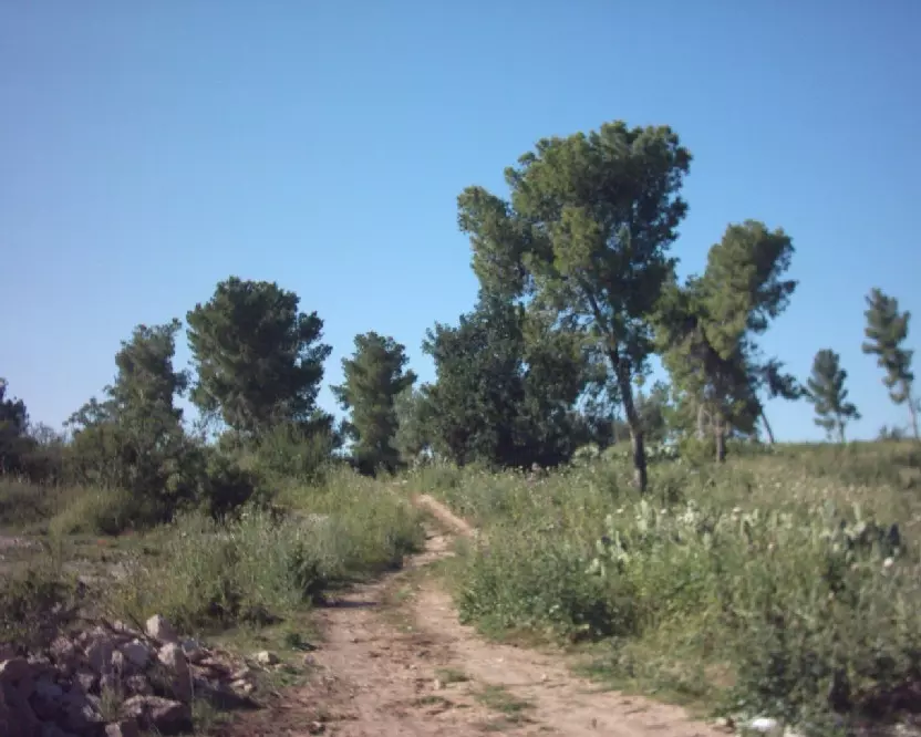
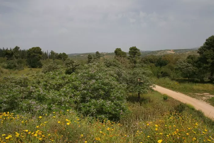
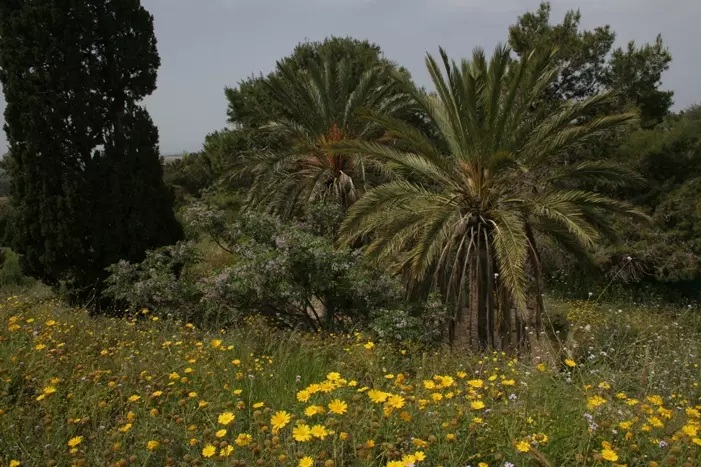
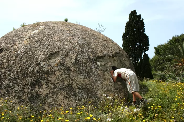
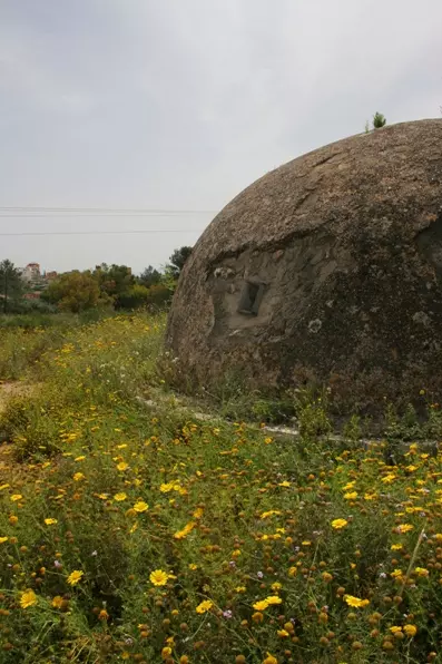
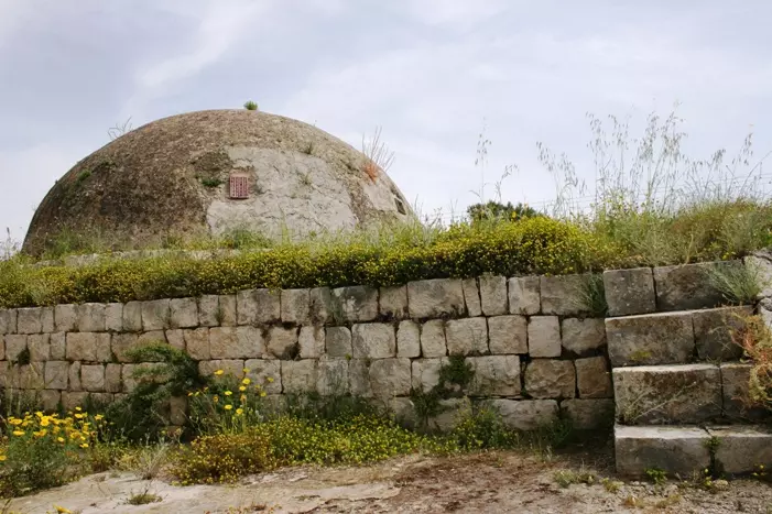
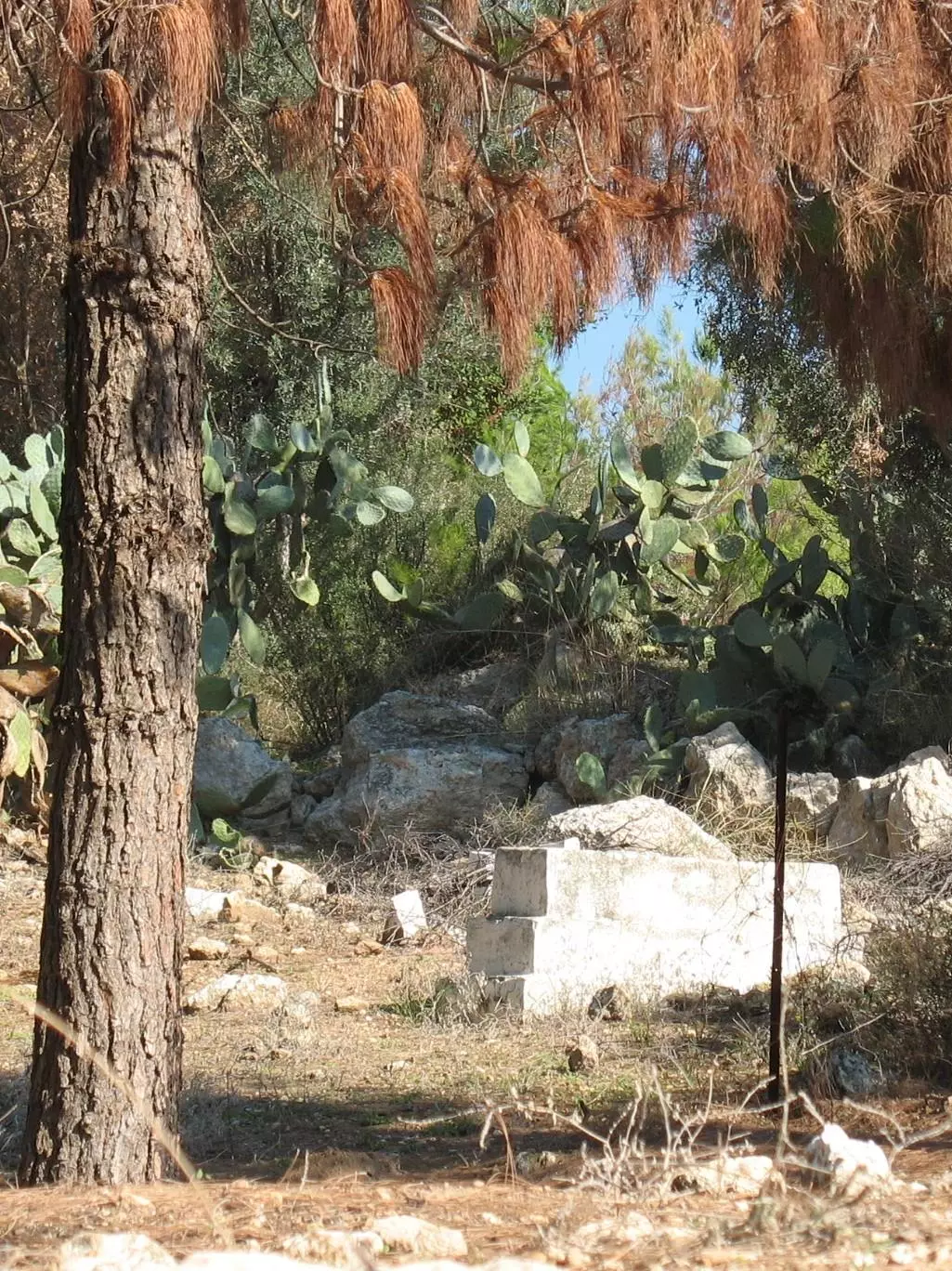
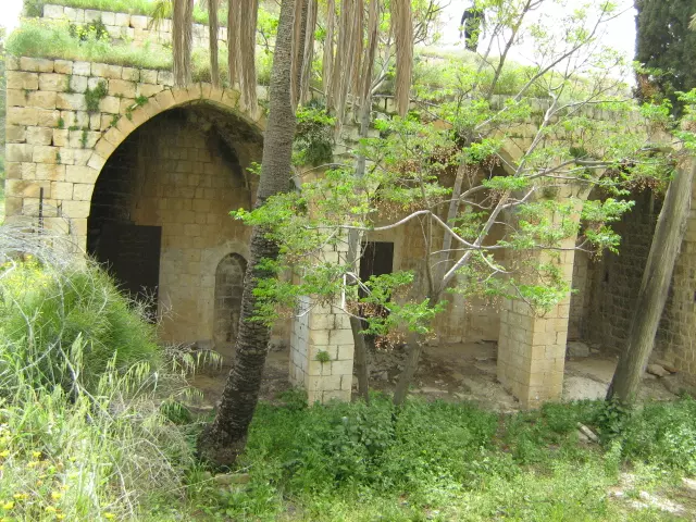
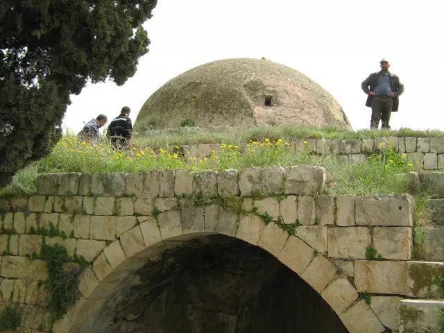
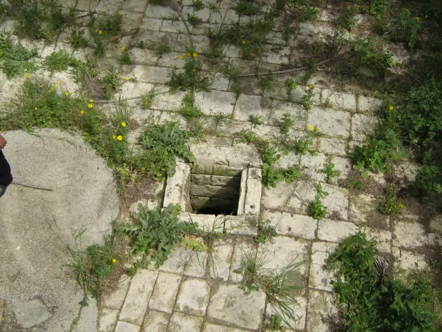
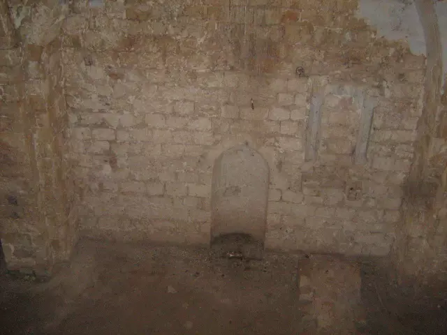
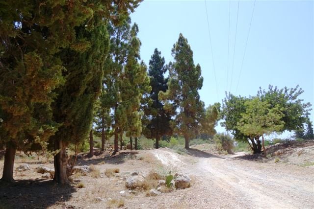
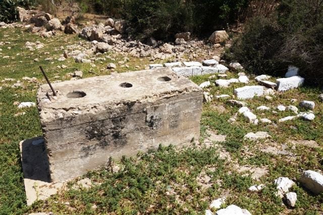
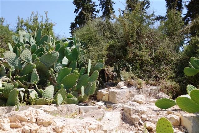
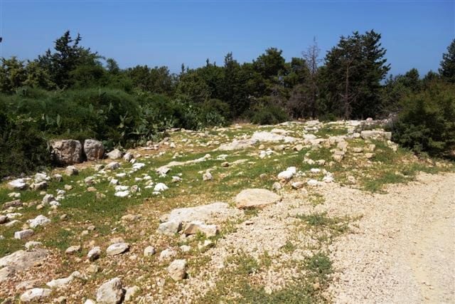
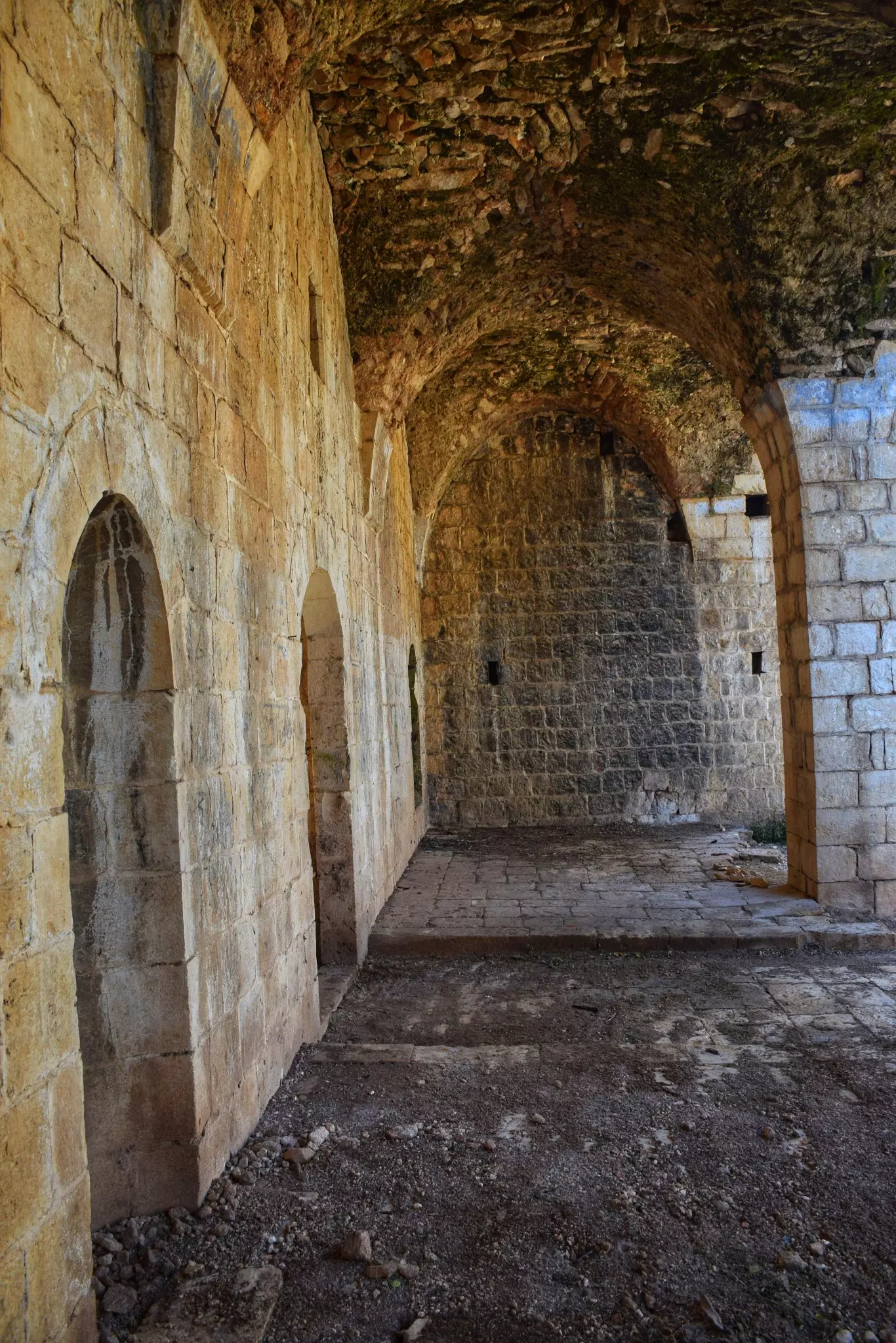
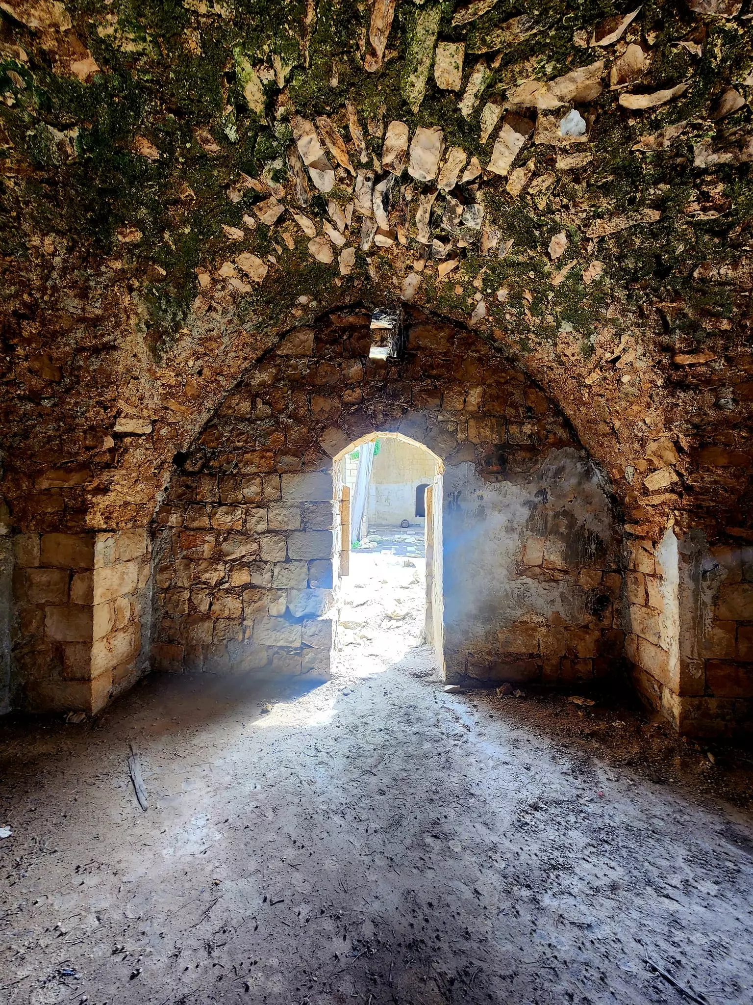
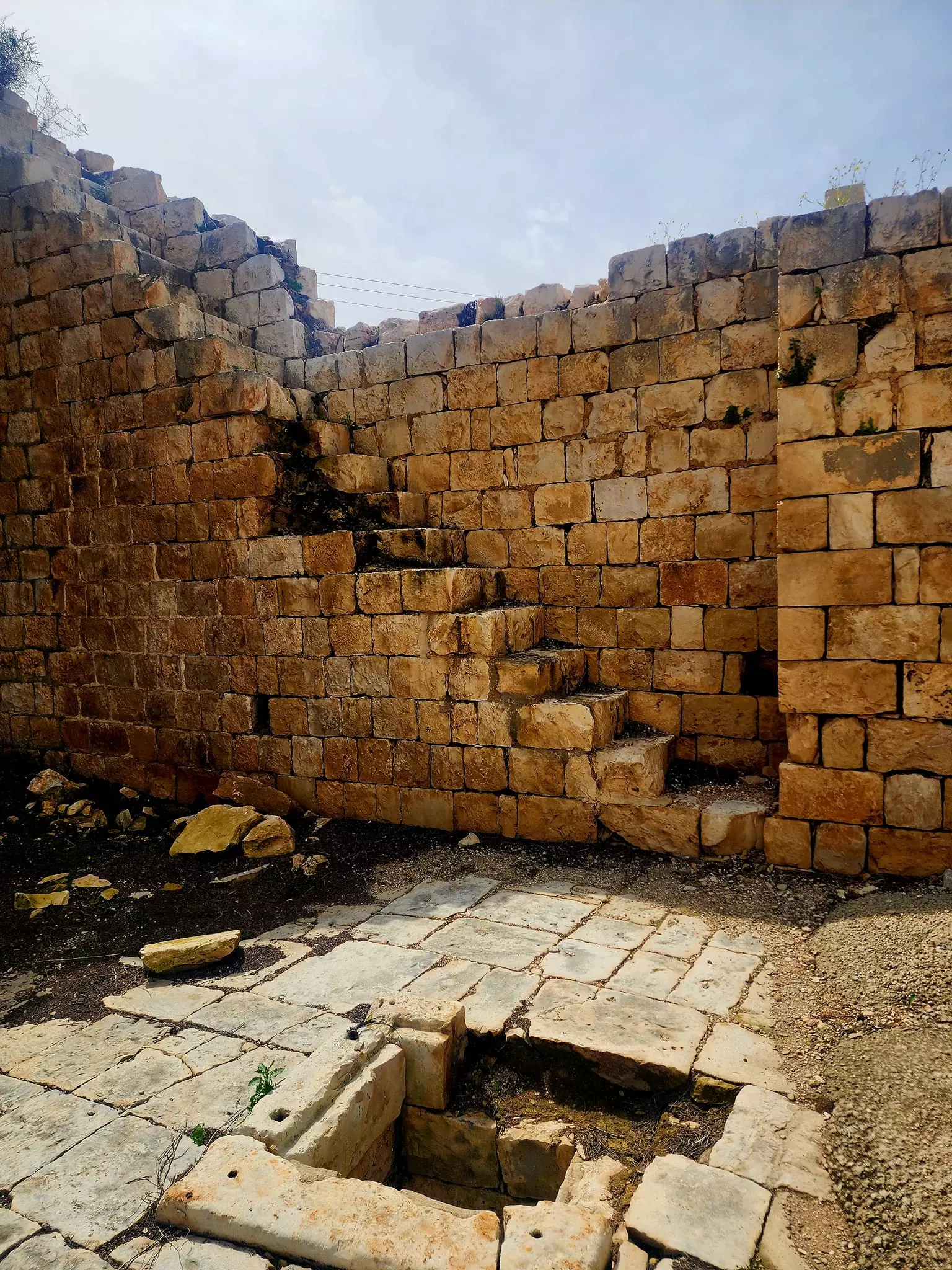
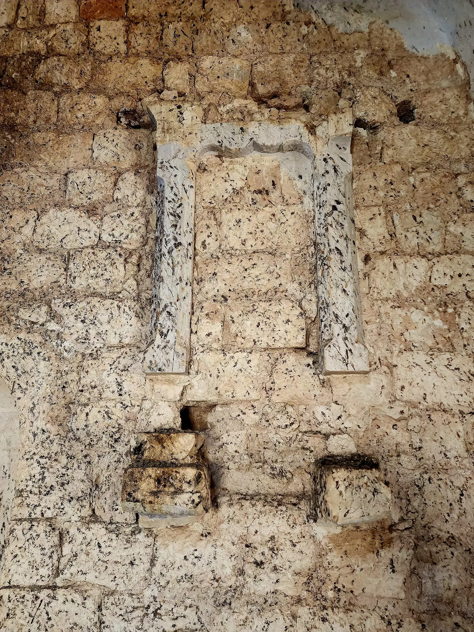
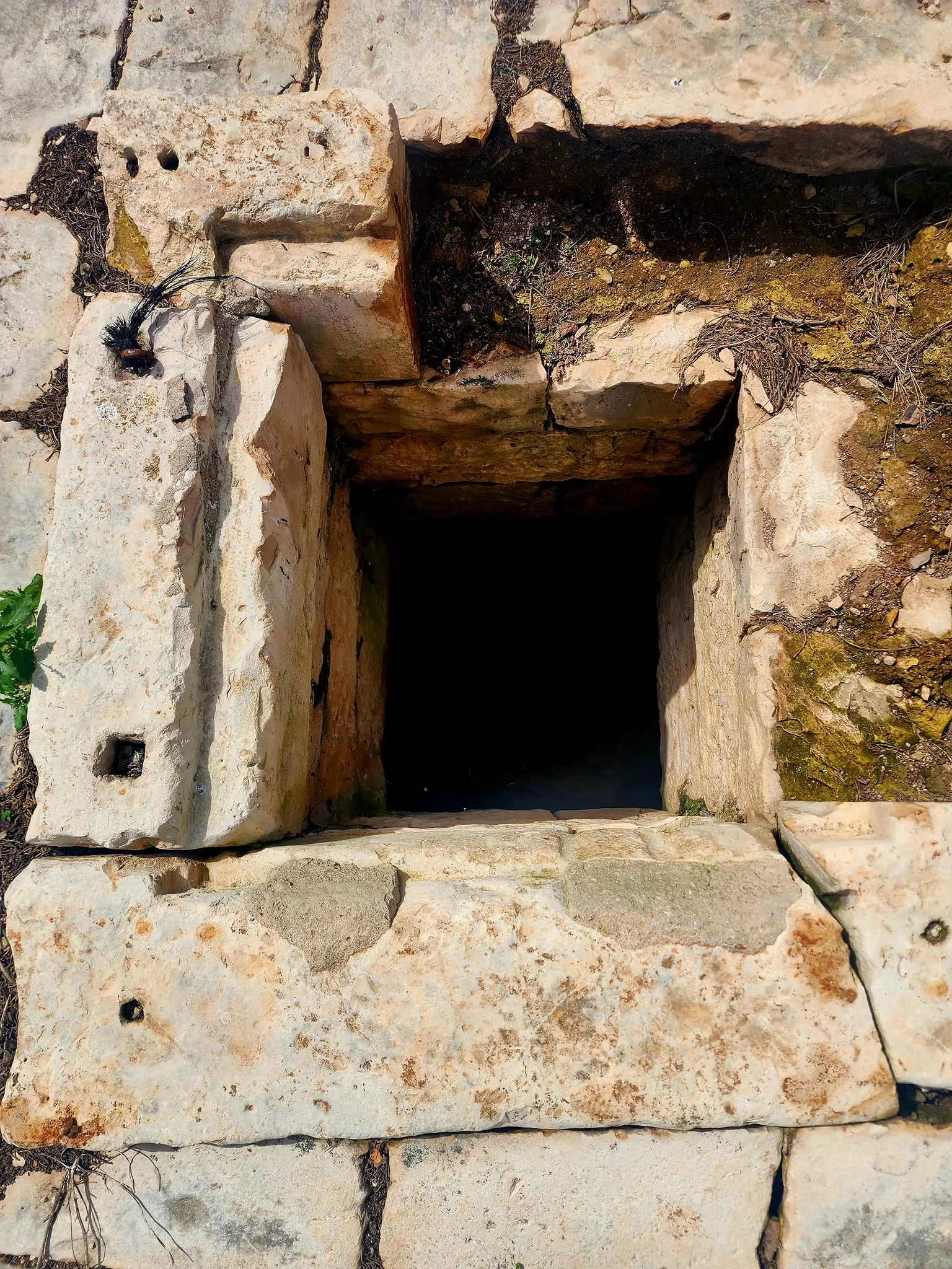
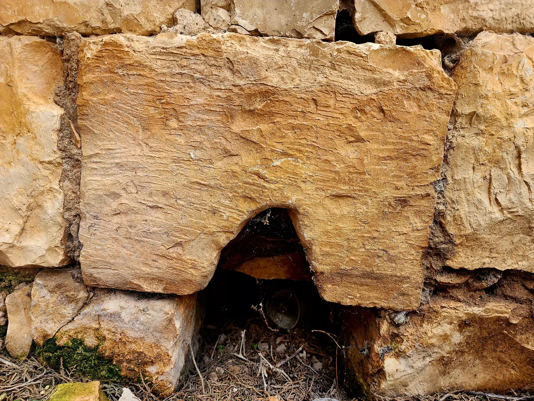
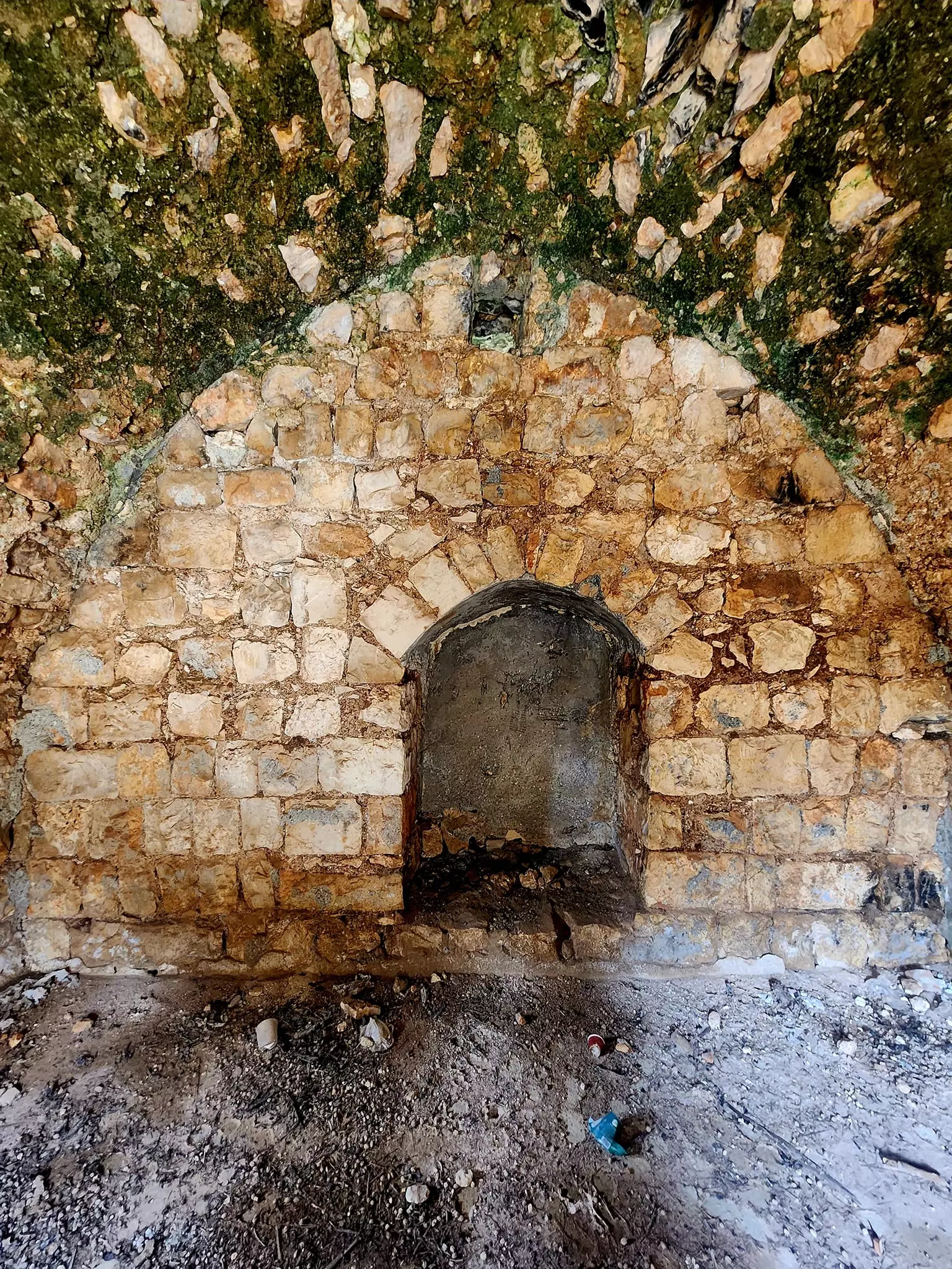
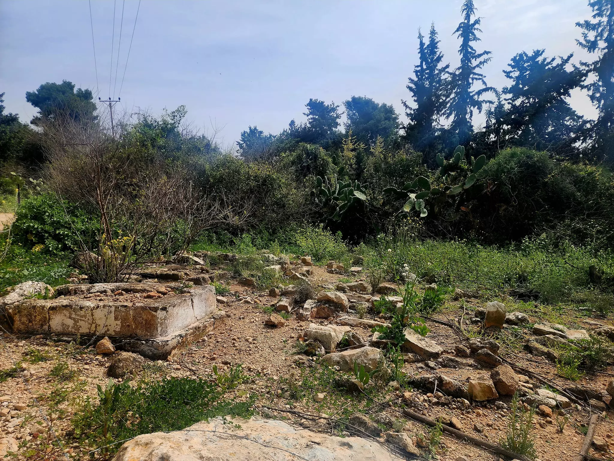
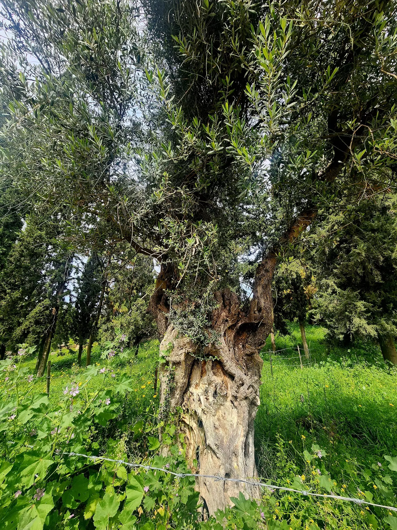
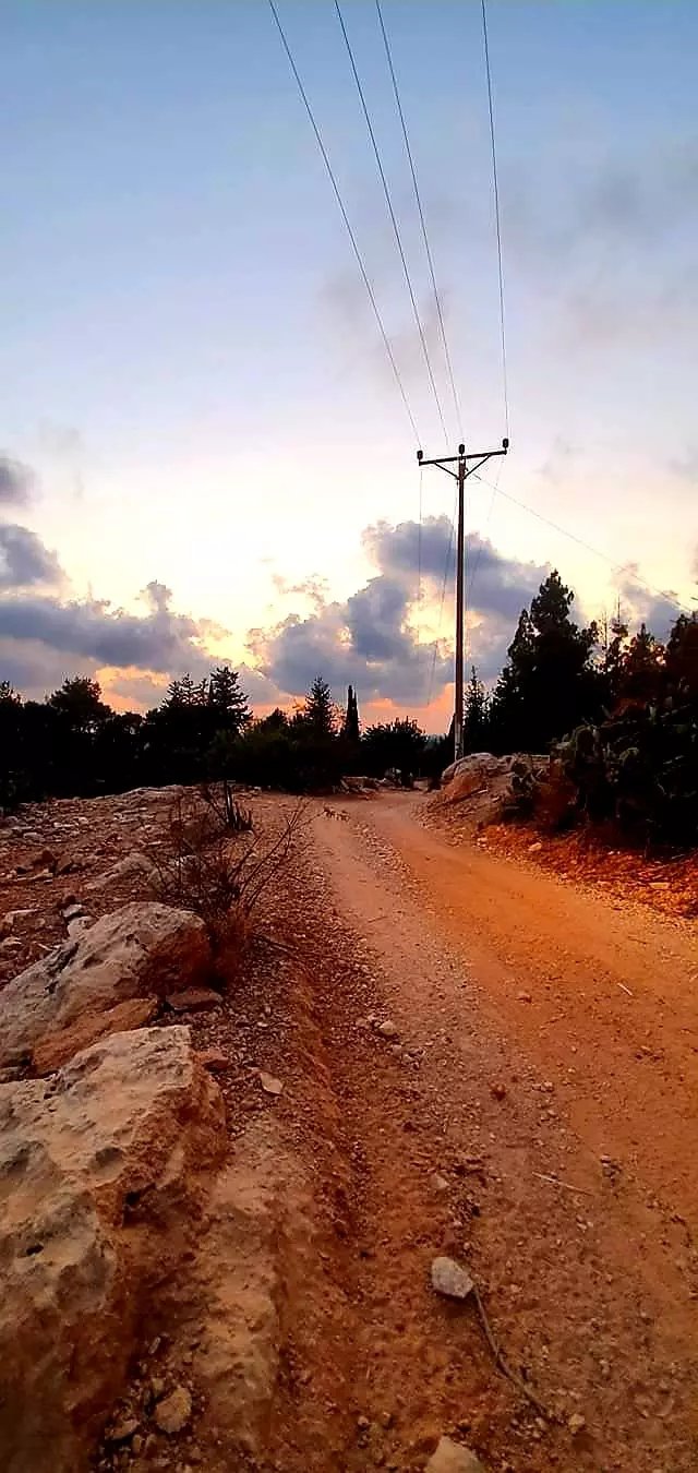
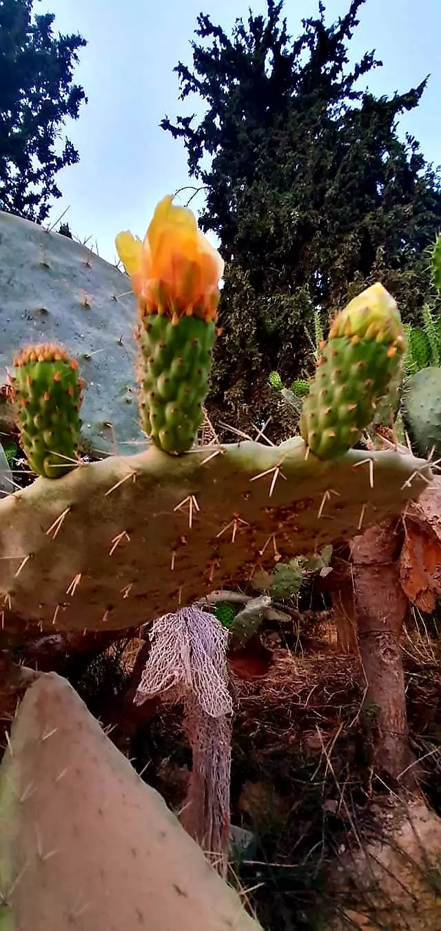
Village Before NakbaThe village stood on a rocky hill that jutted up from the plain of Acre. It was in the foothills of the western Galilee mountains and lay just south of a highway that connected Tarshiha, the Zionist settlement of Nahariyya, and Acre. Judging from the many caves that were used as burial places, the area probably had been a large Canaanite town. In the late nineteenth century, the village of al-Ghabisiyya was built of stone on the ridge of a hill. It was inhabited by about 150 residents and was surrounded by olive trees, fig trees, pomegranate trees, and gardens.The three villages of al-Ghabisiyya, Shaykh Dannun, and Shaykh Dawud were very close to one another; Shaykh Dannun and Shaykh Dawud actually overlapped at points, but al-Ghabisiyya was about 500 m away from them. The entire population of these villages was Muslim. Al-Ghabisiyya had a school, built by the Ottomans in 1886. The village houses were built of reinforced concrete or, in some cases, stones held together with a mortar of mud or cement. The economy of the village was based on livestock-raising and agriculture; grain and vegetables were the chief crops. The villagers also grew olives, which they processed on two animal-drawn presses, one in al-Ghabisiyya and one in Shaykh Dawud. In 1944/45 a total of 6,633 dunums of the lands of the three villages was allocated to cereals; 1,371 dunums were irrigated or used for orchards. In the same year 300 dunums in al-Ghabisiyya were devoted to olive trees. Village Occupation and Ethnic CleaningAl-Ghabisiyya fell at the end of Operation Ben-Ami, the Haganah's invasion of the northwest corner of Palestine. The attack was waged from two directions, the north and southeast, according to the testimony of some of the villagers interviewed by Palestinian researcher Nafez Nazzal. The occupying forces captured a house in the southernmost corner of the village and proceeded to shell the village from the house, killing and injuring many of the villagers while they were fleeing. Others had been evacuated earlier, due to the fall of Acre. The village militia decided not to confront the Zionist forces, because " we were too few [around twenty] and very poorly armed" as some villagers later recalled. Most of those who were driven out remained in other villages in Galilee until the whole region fell at the end of October 1948; after that, they were displaced to Lebanon. But according to Israeli sources cited by Morris, some inhabitants remained in al-Ghabisiyya until February 1949. During that month, there was a second expulsion, this time by the Military Government, on grounds of 'security, law and order.' It is not clear where the expelled villagers were taken.After al-Ghabisiyya and its two neighboring villages of Shaykh Dannun and Shaykh Dawud were evacuated, the Israeli government permitted some of the inhabitants of the latter two villages to return to their homes. Those who had not sought refuge in Lebanon came back and were joined by a few families from al-Ghabisiyya, al-Nahr, al-Tall, Umm al-Faraj, Amqa, and Kuwaykat. The two small villages of Shaykh Dannun and Shaykh Dawud were merged to form a joint village called Shaykh Dannun; in 1973 it had a population of about 1,000. The village of al-Ghabisiyya, however, was not repopulated. Zionists Colonies on Village LandsIn 1950, Jewish immigrants from Iraq established the settlement of Netiv ha-Shayyara, 1.25 km west of the village site, on village land.Village TodayThe only landmark that remains is the mosque—a domed, stone structure, with arched doors and windows and decorative arches in the interior. It is deserted, the cement plaster on the dome is peeling off, and wild shrubs cover the rest of the roof. The debris of houses, terraces, and the village cemetery can be seen amidst a thick forest of cypress trees that was planted on the village site and part of the land. Cactuses also grow on the site. The settlement of Netiv ha-Shayyara uses the adjacent non-forested land for agriculture.SourceDr. Walid al-Khalidi, 1992: All That Remains. |
|||||||||||||||
| Related Maps | Town Lands' Demarcation Maps خرائط للقضاء توضح حدود القرى والاودية Town's map on MapQuest View from satellite Help us map this town at WikiMapia |
||||||||||||||
| Related Links | Wikipedia's Page Facebook Page Google Search Google For Images Google For Videos |
||||||||||||||
| More Information | في كتاب كي لا ننسى في كتاب بلادنا فلسطين المزيد من موقع هوية |
||||||||||||||
- Reuters: Displaced Israeli Arabs demand return to villages
- Back to Shatilla By Ali Abunimah
- كتيب عن قرية الغابيسة من تاليف داود بدر
- موقع قرية الغابيسة واراضيها وسكانها
- عائلات قرية الغابيسة عكا قبل النكبة
- اسماء الاراضي في قرية الغابيسة قبل النكبة
- الغابيسة قصة وقضية
- الغابيسة قصة وقضية #2
- الغابيسة قصة وقضية #2
- شهداء قرية الغابيسة عكا
- You need to know about al-Ghabisiyya in Arabic Page 8, By Dawoud Bader
- You need to know about al-Ghabisiyya in Hebrew Page #1, By Dawoud Bader
- You need to know about al-Ghabisiyya in Hebrew Page 2, By Dawoud Bader
- You need to know about al-Ghabisiyya in Hebrew Page 3, By Dawoud Bader
- You need to know about al-Ghabisiyya in Hebrew Page 4, By Dawoud Bader
- You need to know about al-Ghabisiyya in Hebrew Page 5, By Dawoud Bader
- You need to know about al-Ghabisiyya in Hebrew Page 6, By Dawoud Bader
- نبذة تاريخية عن قرية الغابسية (قضاء عكا) من كتاب (كي لا ننسى)
- Village Mosque In 1987
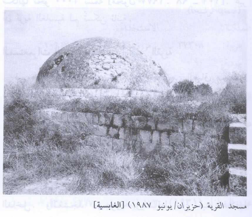
Scanned from "All That Remains" by Dr. Walid Khalidi - Village Mosque From Inside In 1987
Scanned from "All That Remains" by Dr. Walid Khalidi - Village Site in 1987
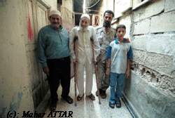
Scanned from "All That Remains" by Dr. Walid Khalidi - Four generations of Khalil Hussein Al Mekdah,110, family at 'Ayn al-Hil في مخيم عين الحلوة. camp. Copyright by Maher Attar
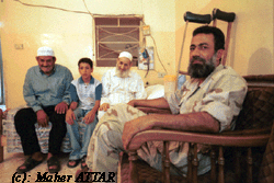
Posted by Maher Attar - Four generations of Khalil Hussein Al Mekdah,110, family # 2 at 'Ayn al-Hilwa refugee camp. Copyright by Maher Attar
Posted by Maher Attar - al-Ghabisiyya Mosque-May-2002-مسجد قرية الغابسية
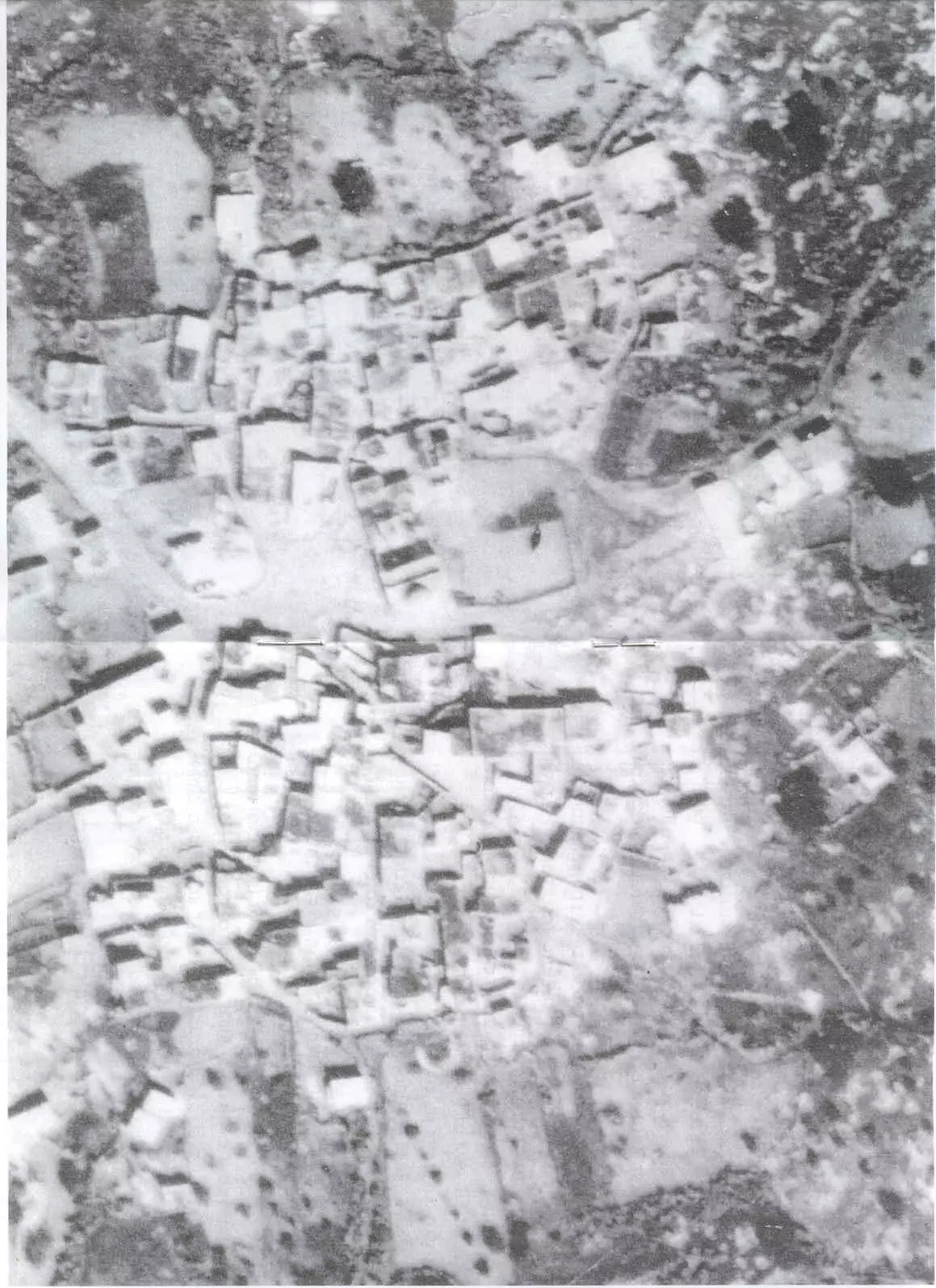
Posted by Aqsa Association-Palestine-1948 1 - An Arial View of al-Ghabisiyya prior to destruction, Feb, 28, 1946
Posted by Dawoud Bader - مسجد الغابسية 2003
Posted by Makbula Nassar - مسجد الغابسية - ربيع 2003
Posted by Makbula Nassar - مسجد الغابسية - ربيع 2003
Posted by Makbula Nassar - مسجد الغابسية , تظهر الاسلاك الشائكة المحيطة بالمسجد , منظر من الناحية الشرقية - ربيع 2003
Posted by Makbula Nassar - مسجد الغابسية, منظر جانبي داخل المسجد من الناحية الشرقية - ربيع 2003
Posted by Makbula Nassar - مسجد الغابسية , القناطر داخل المسجد- ربيع 2003
Posted by Makbula Nassar - مسجد الغابسية, الجهة الخلفية من الناحية الشرقية - ربيع 2003

Posted by Makbula Nassar - طريق داخل الغابسية يمر بجانب المسجد في مركز القرية- ربيع 2003
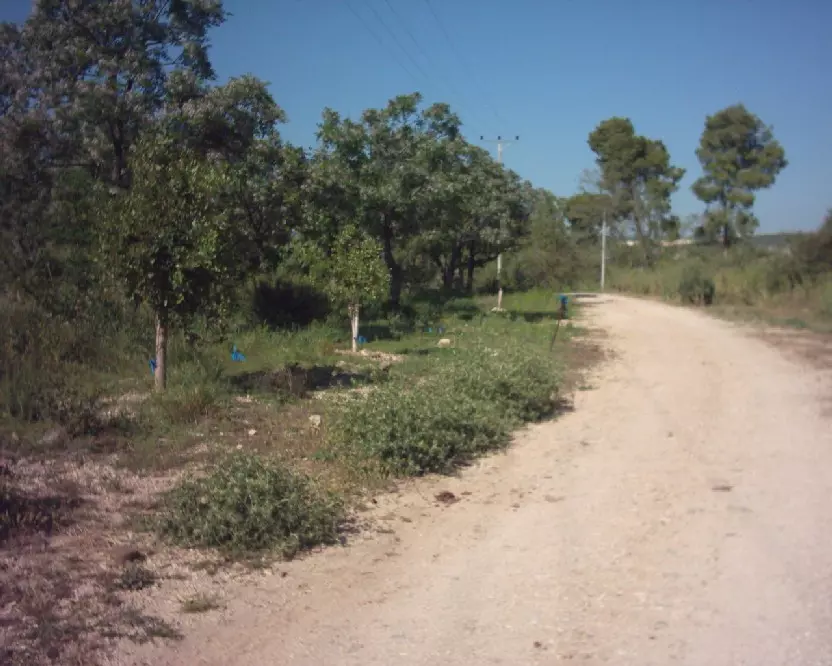
Posted by Makbula Nassar - اراضي القرية بجوار المسجد, تظهر اثار للبيوت واشجار الصبار - ربيع 2003
Posted by Makbula Nassar - اشجار الزيتون شرقي المسجد - ربيع 2003
Posted by Makbula Nassar - اراضي القرية بجوار المسجد, تظهر اثار للبيوت واشجار الصبار- ربيع 2003
Posted by Makbula Nassar - طريق يمر من القرية وتظهر اراضي القرية - ربيع 2003
Posted by Makbula Nassar - طريق يمر من القرية وتظهر اراضي القرية الصبار وبقايا حطام - ربيع 2003
Posted by Makbula Nassar - مقبرة القرية في الناحية الغربية عند مدخل القرية - ربيع 2003
Posted by Makbula Nassar - مقبرة القرية في الناحية الغربية عند مدخل القرية- ربيع 2003
Posted by Makbula Nassar - مقبرة القرية في الناحية الغربية عند مدخل القرية - ربيع 2003
Posted by Makbula Nassar - مقبرة القرية في الناحية الغربية عند مدخل القرية- ربيع 2003
Posted by Makbula Nassar - مقبرة القرية في الناحية الغربية عند مدخل القرية- ربيع 2003
Posted by Makbula Nassar - مدخل القرية من الجهة الغربية - ربيع 2003

Posted by Makbula Nassar - الغابسية ,22/4/2006 © تصوير: مقبولة نصار
Posted by Makbula Nassar - الغابسية ,22/4/2006 © تصوير: مقبولة نصار
Posted by Makbula Nassar - الغابسية ,22/4/2006 © تصوير: مقبولة نصار
Posted by Makbula Nassar - الغابسية ,22/4/2006 © تصوير: مقبولة نصار
Posted by Makbula Nassar - الغابسية ,22/4/2006 © تصوير: مقبولة نصار
Posted by Makbula Nassar - الغابسية ,22/4/2006 © تصوير: مقبولة نصار
Posted by Makbula Nassar - الغابسية ,22/4/2006 © تصوير: مقبولة نصار
Posted by Makbula Nassar - الغابسية ,22/4/2006 © تصوير: مقبولة نصار
Posted by Makbula Nassar - الغابسية ,22/4/2006 © تصوير: مقبولة نصار
Posted by Makbula Nassar - الغابسية ,22/4/2006 © تصوير: مقبولة نصار
Posted by Makbula Nassar - الغابسية ,22/4/2006 © تصوير: مقبولة نصار
Posted by Makbula Nassar - الغابسية ,22/4/2006 © تصوير: مقبولة نصار
Posted by Makbula Nassar - The village's cemetery
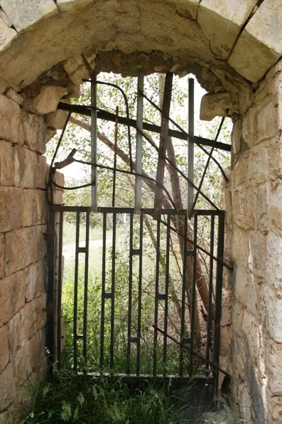
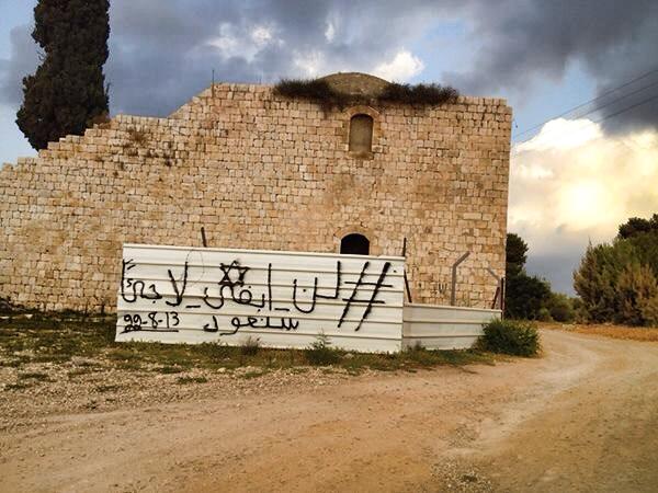
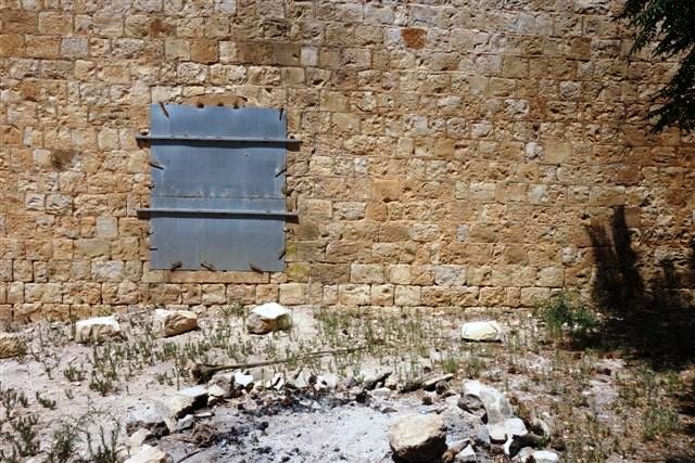
Posted by Noga Kadman - The village's mosque. Note that it was recently fenced by the Israeli authority to keep the refugees from praying inside the ruined mosque.
Posted by Noga Kadman - مسيرة العودة الى الغابسية السبت 29/3/2008
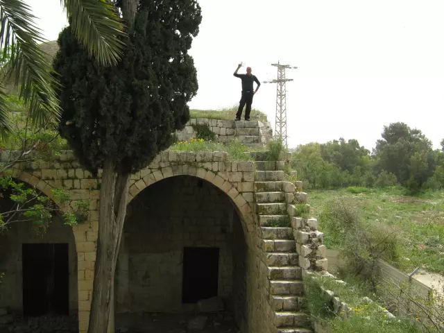
Posted by farid haj yahya - الدرج الذي يصعد على سطح المسجد السبت 29/3/2008
Posted by farid haj yahya - الواجهة الأمامية لمسجد الغابسية السبت 29-3-2008
Posted by farid haj yahya - الصعود على سطح المسجد رغم السياج السبت 29-3-2008
Posted by farid haj yahya - بئر الماء في ساحة مسجد الغابسية التي كانت تستعمل للوضوء السبت 29-3-2008
Posted by farid haj yahya - رغم السياج ورغم الحصار للمسجد صورة للمسجد من الداخل ويرى محراب المسجد وبجانبه المنبر الذي اقتلع السبت 29-3-2008
Posted by farid haj yahya - صورة جوية لقرية الغابسية عام 1946 وترى بوضوح بيوت القرية ومسجدها
Posted by farid haj yahya 1 - لن أبقى لاجئاً .. سنعود- 6/8/2014
- مسجد الغابسيه
Posted by abu raya - مسجد الغابسيه
Posted by abu raya - مسجد الغابسيه من الداخل
Posted by abu raya - مسجد الغابسيه
Posted by abu raya - 7-2015
Posted by said - 7-2015
Posted by said - 7-2015
Posted by said - 7-2015
Posted by said - 7-2015
Posted by said - 7-2015
Posted by said - 7-2015
Posted by said - 7-2015
Posted by said - 7-2015
Posted by said 1 - 7-2015
Posted by said - 7-2015
Posted by said - 7-2015
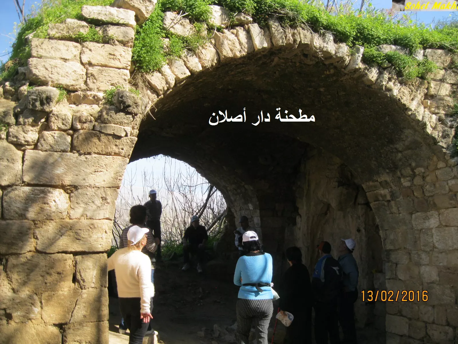
Posted by said - مطحنة دار أصلان في وادي الجعتون بالقرب من الغابسية - بعدسة سهيل مخول يوم 13.2.2016
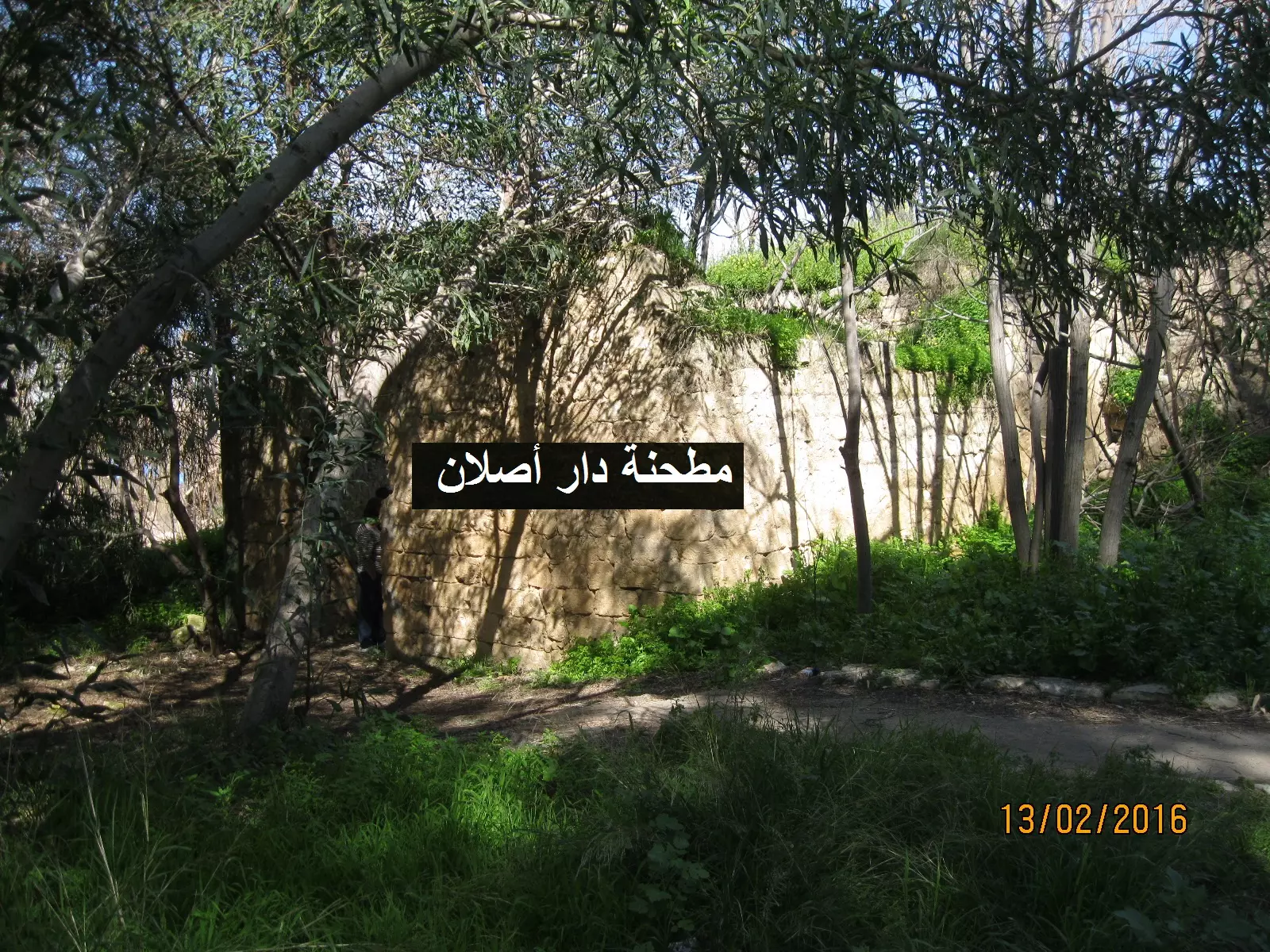
Posted by سهيل مخول - مطحنة دار أصلان في وادي الجعتون بالقرب من الغابسية - بعدسة سهيل مخول يوم 13.2.2016
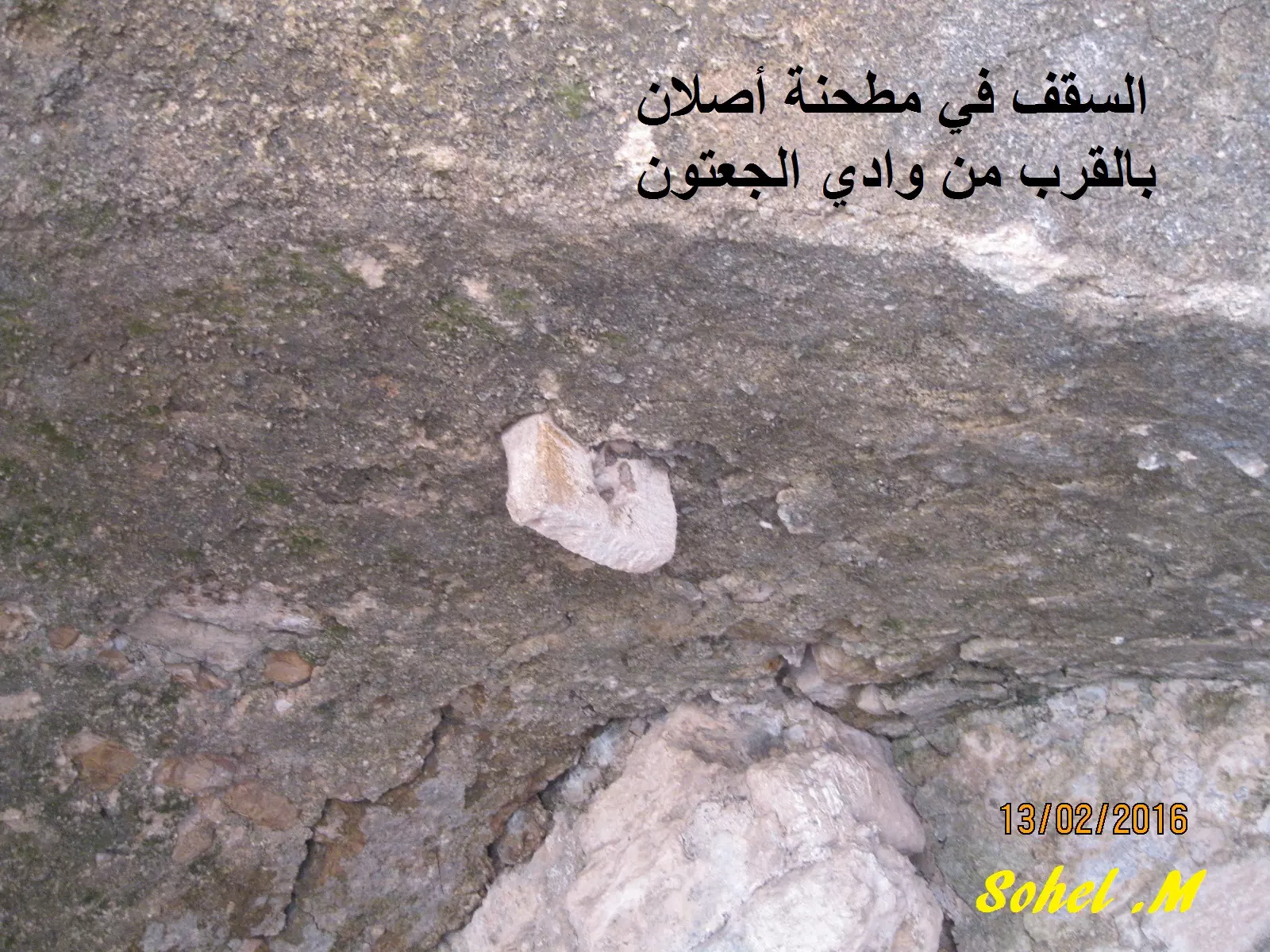
Posted by سهيل مخول - مطحنة دار أصلان في وادي الجعتون بالقرب من الغابسية - بعدسة سهيل مخول يوم 13.2.2016
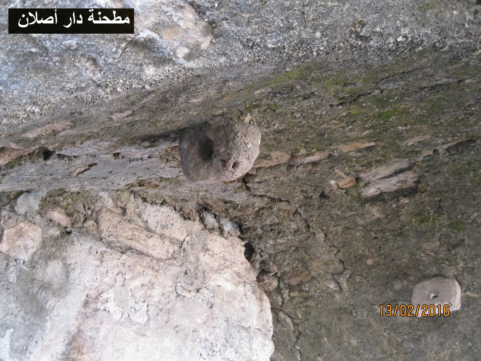
Posted by سهيل مخول - مطحنة دار أصلان في وادي الجعتون بالقرب من الغابسية - بعدسة سهيل مخول يوم 13.2.2016
Posted by سهيل مخول - الجامج
Posted by صلاح غانم - الجامج #2
Posted by صلاح غانم - صور من الجو رائعة للغابسية يظهر الشخ دنون والشيخ داود مجنوبا في اعلى الصورة
- صور من الجو رائعة للغابسية يظهر الشخ دنون والشيخ داود مجنوبا في اعلى الصورة #2
- --مسجد قرية الغابسية-- Ibtisam Sulayman
- --مسجد قرية الغابسية-- Ibtisam Sulayman #2
- --مسجد قرية الغابسية-- Ibtisam Sulayman #3
- --مسجد قرية الغابسية-- Ibtisam Sulayman #4
- --مسجد قرية الغابسية-- Ibtisam Sulayman #5
- --مسجد قرية الغابسية-- Ibtisam Sulayman #6
- --مسجد قرية الغابسية-- Ibtisam Sulayman #7
- مسجد قرية الغابسية المهجرة -- نبيلة سالم
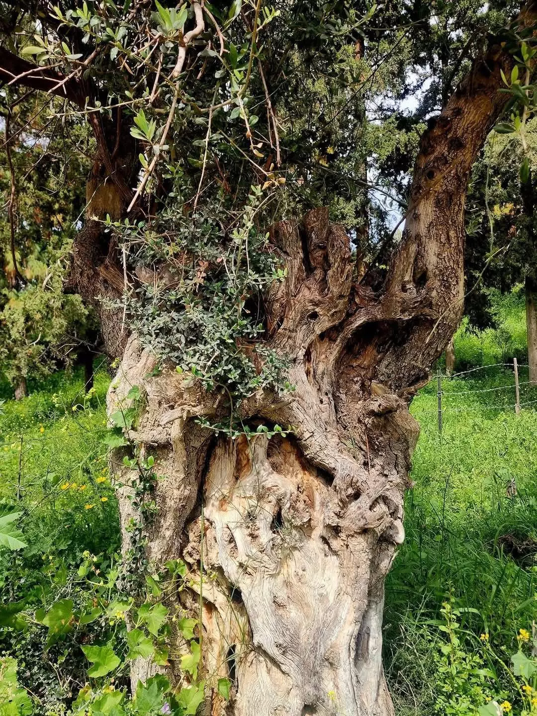
- Rumi Olive tree-- نبيلة سالم
- That is how the "civilized" erased and replaced us: al-Ghabsiyya was completely obliterated, as you see, except for the main mosque -- الغابسية باتت أثر بعد عين. من هنا مر الهمجّ
- That is how the "civilized" erased and replaced us: al-Ghabsiyya was completely obliterated, as you see, except for the main mosque -- الغابسية باتت أثر بعد عين. من هنا مر الهمجّ #2
- Inside the village mosque
- Let us see how the most "liberal and civilized" of world Jewry has obliterated our village except for the mosque and a few graves. How else will the Jews be great and safe again? March, 2024
- Let us see how the most "liberal and civilized" of world Jewry has obliterated our village except for the mosque and a few graves. How else will the Jews be great and safe again? March, 2024 #2
- Let us see how the most "liberal and civilized" of world Jewry has obliterated our village except for the mosque and a few graves. How else will the Jews be great and safe again? March, 2024 #3
- Let us see how the most "liberal and civilized" of world Jewry has obliterated our village except for the mosque and a few graves. How else will the Jews be great and safe again? March, 2024 #4
- Let us see how the most "liberal and civilized" of world Jewry has obliterated our village except for the mosque and a few graves. How else will the Jews be great and safe again? March, 2024 #5
- Let us see how the most "liberal and civilized" of world Jewry has obliterated our village except for the mosque and a few graves. How else will the Jews be great and safe again? March, 2024 #6
- Let us see how the most "liberal and civilized" of world Jewry has obliterated our village except for the mosque and a few graves. How else will the Jews be great and safe again? March, 2024 #7
- Let us see how the most "liberal and civilized" of world Jewry has obliterated our village except for the mosque and a few graves. How else will the Jews be great and safe again? March, 2024 #8
- Let us see how the most "liberal and civilized" of world Jewry has obliterated our village except for the mosque and a few graves. How else will the Jews be great and safe again? March, 2024 #9
- Let us see how the most "liberal and civilized" of world Jewry has obliterated our village except for the mosque and a few graves. How else will the Jews be great and safe again? March, 2024 #10
- Let us see how the most "liberal and civilized" of world Jewry has obliterated our village except for the mosque and a few graves. How else will the Jews be great and safe again? March, 2024 #11
- Let us see how the most "liberal and civilized" of world Jewry has obliterated our village except for the mosque and a few graves. How else will the Jews be great and safe again? March, 2024 #12
- Let us see how the most "liberal and civilized" of world Jewry has obliterated our village except for the mosque and a few graves. How else will the Jews be great and safe again? March, 2024 #13
- Let us see how the most "liberal and civilized" of world Jewry has obliterated our village except for the mosque and a few graves. How else will the Jews be great and safe again? March, 2024 #14
- Let us see how the most "liberal and civilized" of world Jewry has obliterated our village except for the mosque and a few graves. How else will the Jews be great and safe again? March, 2024 #15
- Let us see how the most "liberal and civilized" of world Jewry has obliterated our village except for the mosque and a few graves. How else will the Jews be great and safe again? March, 2024 #16
- Let us see how the most "liberal and civilized" of world Jewry has obliterated our village except for the mosque and a few graves. How else will the Jews be great and safe again? March, 2024 #17
- Let us see how the most "liberal and civilized" of world Jewry has obliterated our village except for the mosque and a few graves. How else will the Jews be great and safe again? March, 2024 #18
- Let us see how the most "liberal and civilized" of world Jewry has obliterated our village except for the mosque and a few graves. How else will the Jews be great and safe again? March, 2024 #19
- We lived in peace until the "civilized" were dumped on us from Europe. The great replacement is not a theory to us Palestinians; it is a living reality; it is a living hell: The Jews replaced us. We can't wait for you to go back. This land is ours
- Let us see how the most "liberal and civilized" of world Jewry has obliterated our village except for the mosque; even the cemetery was destroyed. How else will the Jews be great and safe again? May 2022
- Let us see how the most "liberal and civilized" of world Jewry has obliterated our village except for the mosque; even the cemetery was destroyed. How else will the Jews be great and safe again? May 2022 #2
- Let us see how the most "liberal and civilized" of world Jewry has obliterated our village except for the mosque; even the cemetery was destroyed. How else will the Jews be great and safe again? May 2022 #3
- Let us see how the most "liberal and civilized" of world Jewry has obliterated our village except for the mosque; even the cemetery was destroyed. How else will the Jews be great and safe again? May 2022 #4

- Let us see how the most "liberal and civilized" of world Jewry has obliterated our village except for the mosque; even the cemetery was destroyed. How else will the Jews be great and safe again? May 2022 #5
- Let us see how the most "liberal and civilized" of world Jewry has obliterated our village except for the mosque; even the cemetery was destroyed. How else will the Jews be great and safe again? May 2022 #6
- Let us see how the most "liberal and civilized" of world Jewry has obliterated our village except for the mosque; even the cemetery was destroyed. How else will the Jews be great and safe again? May 2022 #7
- Let us see how the most "liberal and civilized" of world Jewry has obliterated our village except for the mosque; even the cemetery was destroyed. How else will the Jews be great and safe again? May 2022 #8
- Let us see how the most "liberal and civilized" of world Jewry has obliterated our village except for the mosque; even the cemetery was destroyed. How else will the Jews be great and safe again? May 2022 #9
- Let us see how the most "liberal and civilized" of world Jewry has obliterated our village except for the mosque; even the cemetery was destroyed. How else will the Jews be great and safe again? May 2022 #10
- Let us see how the most "liberal and civilized" of world Jewry has obliterated our village except for the mosque; even the cemetery was destroyed. How else will the Jews be great and safe again? May 2022 #11
- Let us see how the most "liberal and civilized" of world Jewry has obliterated our village except for the mosque; even the cemetery was destroyed. How else will the Jews be great and safe again? May 2022 #12
- Let us see how the most "liberal and civilized" of world Jewry has obliterated our village except for the mosque; even the cemetery was destroyed. How else will the Jews be great and safe again? May 2022 #13
- Let us see how the most "liberal and civilized" of world Jewry has obliterated our village except for the mosque; even the cemetery was destroyed. How else will the Jews be great and safe again? May 2022 #14
- Let us see how the most "liberal and civilized" of world Jewry has obliterated our village except for the mosque; even the cemetery was destroyed. How else will the Jews be great and safe again? May 2022 #15
- Let us see how the most "liberal and civilized" of world Jewry has obliterated our village except for the mosque; even the cemetery was destroyed. How else will the Jews be great and safe again? May 2022 #16
- Let us see how the most "liberal and civilized" of world Jewry has obliterated our village except for the mosque; even the cemetery was destroyed. How else will the Jews be great and safe again? May 2022 #17
- Let us see how the most "liberal and civilized" of world Jewry has obliterated our village except for the mosque; even the cemetery was destroyed. How else will the Jews be great and safe again? May 2022 #18
- Let us see how the most "liberal and civilized" of world Jewry has obliterated our village except for the mosque; even the cemetery was destroyed. How else will the Jews be great and safe again? May 2022 #19
- Let us see how the most "liberal and civilized" of world Jewry has obliterated our village except for the mosque; even the cemetery was destroyed. How else will the Jews be great and safe again? May 2022 #20
- Let us see how the most "liberal and civilized" of world Jewry has obliterated our village except for the mosque; even the cemetery was destroyed. How else will the Jews be great and safe again? May 2022 #21
- Let us see how the most "liberal and civilized" of world Jewry has obliterated our village except for the mosque; even the cemetery was destroyed. How else will the Jews be great and safe again? May 2022 #22
Want to browse more? 80,000 pictures were grouped in these gallaries:
| Display Name | Clan/Hamolah | Country of Residence |
| ABO HUSSIEN | EL-MAKDAH | BORTONUVO, BENIN |
| Muhammed Ali Maqdah | El Makdah | Helsingborg, Sweden |
| yahya hussain elchamma | - | - |
| Buthaina | - | ABUTHABI, UAE |
| Ammar El Makdah | - | Sweden |
| emad awad | - | - |
| morad awad | awad | - |
| viktor abdulal | - | Sweden, Sweden |
| mahmoud | alzeini | lebanon, lebanon |
| Diana EL-Hussein | - | Toronto, Canada |
| el_jalil | el_jalil | ean_elhlwi, lebanon |
| Ahmad El Ali | - | Malmoe, Sweden |
| Tarek Abdul-Al | - | Germany |
| Wissam Baytam | - | - |
| Ashraf Baytam | - | Dubai, United Arab Emirates |
| abm01 | Abdulal | sweden, sweden |
| mahmoud alzeini | - | lebanon |
| LOAI KASSEM KASSEM | - | - |
| KHALID KASSEM | - | TEXAS, USA |
| kal | hammoud | texas, usa |
- Palestinian oral history from al-Ghabsiyya and Suhmata, Acre
- Return to ElGhabisiyya, 13/09/13
- مناظر جوية حديثة للشيخ دنون تظهر اراضي الغابسية المهجرة ايضا
- إيابـاً : قرية الغابسية المهجرة .. مع سعيد سلامة والاستاذ داوود بدر Duration: 26 min 31 sec
- الذاكرة مفتاح العودة-الحلقة 56- الغباسية Duration: 23 min 22 sec
- داود بدر من الغابسية ولطفية سمعان من سحماتا | Dahod Badr and Lutfia Simaan Duration: 16 min 10 sec
No links have been shared yet, be free to the first to share the first link.
 Fake Valor: Why Did Zionist Jews Hoist Nazis Flag on Their Ships in the 1930s?
What is new?
-
Facts About Oct. 7th Gaza Raid
-
Remined Us Please:: Who Did Rape Who? Palestinians Raped Israelis? Or, was the other way around?
-
When Prof. Edward Said was invited to debate Bibi Netanyahu in the 1980s, watch what happened!
-
Ezra Klein of the NY Times on the "Jewish Race".
-
Abusing Blood Libel!
-
Zionist FAQ: Isn't it true that Palestinians don't want peace? Palestinians never accepted the two-state solution
- Facts about Haavara (Transfer) Agreement between Ben-Gurion & Hitler
-
Haavara FAQs: Why Did Zionist Jews Hoist Nazis' Flags on Their Ships in the 1930s?
- Haavara FAQs: When Chaim Weizmann met FDR in mid-1943, why was he silent about rescuing European Jewry?
-
Dear ChatGPT: How did Palestinians resist Napoleon's invasion of their country in 1799?
-
Dear ChatGPT: Gaza had a vibrant Jewish community in the mid-17th century. What happened to them?
-
Dear ChatGPT: Why did the Jewish Agency suppress news of the Holocaust during WWII?
-
Video Playlist: Jews share their DNA tests to end the conflict for good.
-
A Tale of Two Conflicts: Examining the Definition of Genocide
-
Prof. Abraham Polak And The Suppressed History of the Khazars and European Jewry
-
How Ronald Reagan would have framed the genocide in Gaza if he were still alive?
-
Haavara FAQs: Let us do the math: how many German Jews did The Haavara Agreement save?
-
Zionist FAQs: The Hebron Massacre of 1929, "clearly proves" that Palestinians are antisemitic, how could you deny it?
-
Zionist FAQs: Why Anti-Zionist Is Not Antisemitism?
-
Zionist FAQs: Isn't it true that the KGB create Palestinian Nationalism in the early 1960s?
- Zionist FAQs: Muslims are killing Muslims all the time; why are Israeli Jews being singled out in the media?
- Zionist FAQs: How is Israel an apartheid state when 20% of its citizens are Arabs who enjoy full rights?
-
Haavara FAQs: Analysis of Herzl's Uganda Scheme and how it could have saved millions of Jews.
-
Haavara FAQs: Why did Hayim Greenberg describe American Jewry as "morally bankrupt" in early 1943?
-
Haavara FAQs: What if the Evian Conference was a resounding success? What would have been the impact of saving European Jewry on Zionism?
- Haavara FAQs: What if the six million were saved, how that would have impacted the Zionist project?
-
Haavara FAQs: How did Zionist leaders react when Europe's Jews lingered in the DP camps after WWII ended?
-
Why does the American Jewish community repeat lies that David Ben-Gurion had debunked before he died?
-
Who has the power to rename the Tatar/Khazar Gene Marker to Jewish IV?
-
Zionist FAQs: Why won't Egypt, Syria, and Jordan take their people back? Jews are indigenous to Palestine, and Arabs immigrated after Jews developed the country. Arabs should leave.
-
Haavara FAQs: Did Hitler and the Nazis conflate between Judaism and Zionist? If that wasn't case, then why?
-
Haavara FAQs: Winston Churchill and antisemitism, a collection of articles written Churchill.
-
Haavara FAQs: Broken by country, how many Jews survived vs. killed during the Holocaust?
-
Haavara FAQs: Why did European Jews vote with their feet and to immigrated to the Americas, not Palestine, after WWII?
-
Watch this American Jewish Girl describing Israeli Jews' cognitive dissonance like no other in under two minutes
-
Haavara FAQs: When the Nazis went out of their way to hide the Holocaust, Israeli Jews did the exact opposite by broadcasting their genocide of Gazans. But why?
-
Haavara FAQs: How Zionist Jews went out of their to show their appreciation to Nazism and Fascism?
- Haavara FAQs: Why Zionist leaders were against bombing the death camps & the Railroads leading to them?
-
Haavara FAQs: Hitler's message to the British and American people: If Jews are such noble citizens and you care about them, how come you're not letting them in? I will gladly ship them to you at my expense, even on luxury liners!
-
A shortlist of Zionist and Israeli false flag operations in the name Jews.
-
The Most Moral Army
- The Land of Kapos (Israel): Where the brave are boycotted and Kapos walk free.
- Why did early Zionists often named their communal enterprises "colonial"?
- Zionist Relations with Nazi Germany by Faris Glubb
-
Two NY Times advertisements by Zionists in the early 1943 that exposes Zionists' treason at the height of the calamity
- Facts Not Lies about the Palestinian-Israeli Conflict.
- Site's pictures have been categorized
- Campgain Against Lice
- A Survey of Palestine, the official source about Palestine before Nakba produced by the British Mandate; over 1200 pages.
- Satellite View & Google Earth: Over 6,000 placemarks identifying all destroyed towns, W. Bank & Gaza Strip Towns, & refugee camps.
- PalestineRemembered.com and its Nakba Oral History Project were featured on al-Jazeera Satellite TV.
- Nakba Oral History Video Podcast:
 Over 700 Oral History interviews (including 3,500+ hours of recording) can be viewed online.
 - Palestine Village Statistics Project
- Gaza Jail Break
- النسخة العربية للموقع الان متوفرة
- Videos: Documenting the destroyed villages in video: Tracing all that remains since Nakba.
- Videos: Responding to Zionist Propaganda
- Interview: The ethnic cleansing of Palestine: George Galloway interviews Israeli Historian Ilan Pappe.
- For Palestinians, memory matters. It provides a blueprint for their future By George Bisharat.
- Zionist FAQ now available in Hebrew שאלות שציונים שואלים, עכשיו בעברית
- Video: The Stephen Walt and John Mearsheimer report on the influence of the Israel Lobby on U.S. Foreign Policy
- The Palestinian-Israeli conflict for beginners
