| PalestineRemembered | About Us | Oral History | العربية | |
| Pictures | Zionist FAQs | Haavara | Maps | |
| Search |
| Camps |
| Districts |
| Acre |
| Baysan |
| Beersheba |
| Bethlehem |
| Gaza |
| Haifa |
| Hebron |
| Jaffa |
| Jericho |
| Jerusalem |
| Jinin |
| Nablus |
| Nazareth |
| Ramallah |
| al-Ramla |
| Safad |
| Tiberias |
| Tulkarm |
| Donate |
| Contact |
| Profile |
| Videos |
Welcome To Mi'ar - ميعار (מיעאר)
|
District of Acre
Ethnically cleansed days ago |
العربية Google Earth |
 |
Gallery (74) |
- Statistics & Facts
-
Before & After

- Satellite View
- Articles 5
- Pictures 74
- Aerial Views 1
- Land Deeds 2
- Oral History 4
- Members 13
- Families
- All That Remains
- Wikipedia
- Videos 5
- Guest Book 13
- Links 1
| Statistic & Fact | Value | ||||||||||||||||
| Occupation Date | July 15, 1948 | ||||||||||||||||
| Distance From District | 17.5 (km) Southeast of Acre | ||||||||||||||||
| Elevation | 275 (meters) | ||||||||||||||||
| Before & After Nakba, Click Map For Details |
|||||||||||||||||
|
|||||||||||||||||
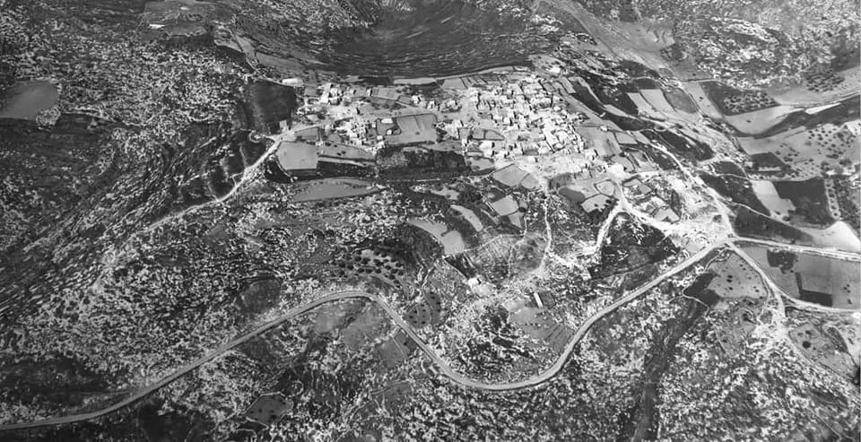
| Pre-Nakba Aerial View |
|||||||||||||||||
|
|||||||||||||||||
| Map Location | See location #25 on the map View from satellite |
||||||||||||||||
| Military Operation | Second stage of Operation Dekel | ||||||||||||||||
| Attacking Units | Sheva' (Seventh) Brigade | ||||||||||||||||
| Exodus Cause | Military assault by Zionist troops | ||||||||||||||||
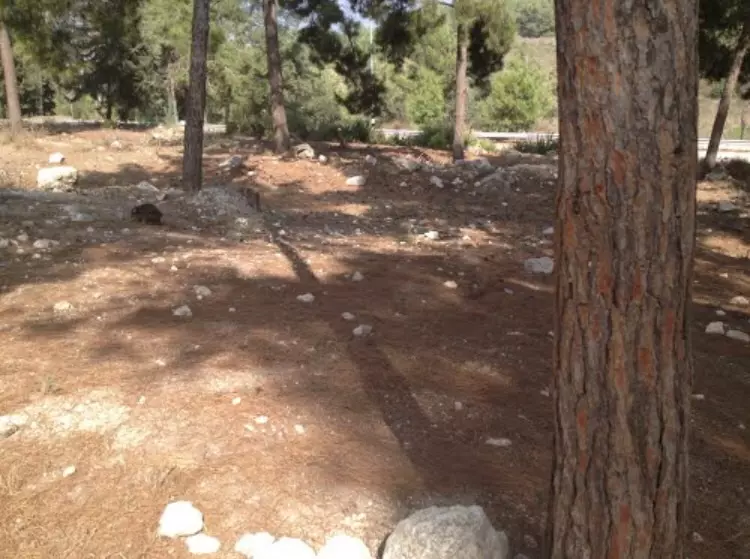
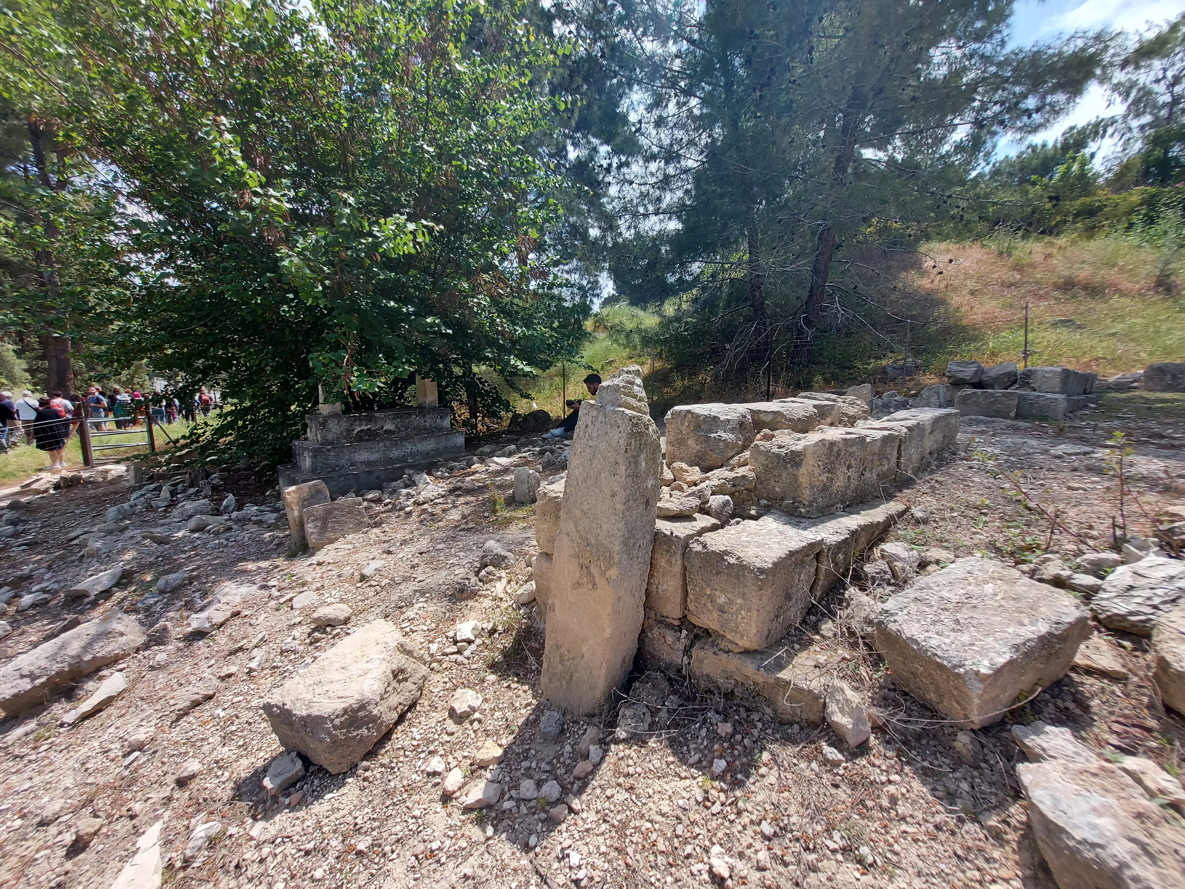
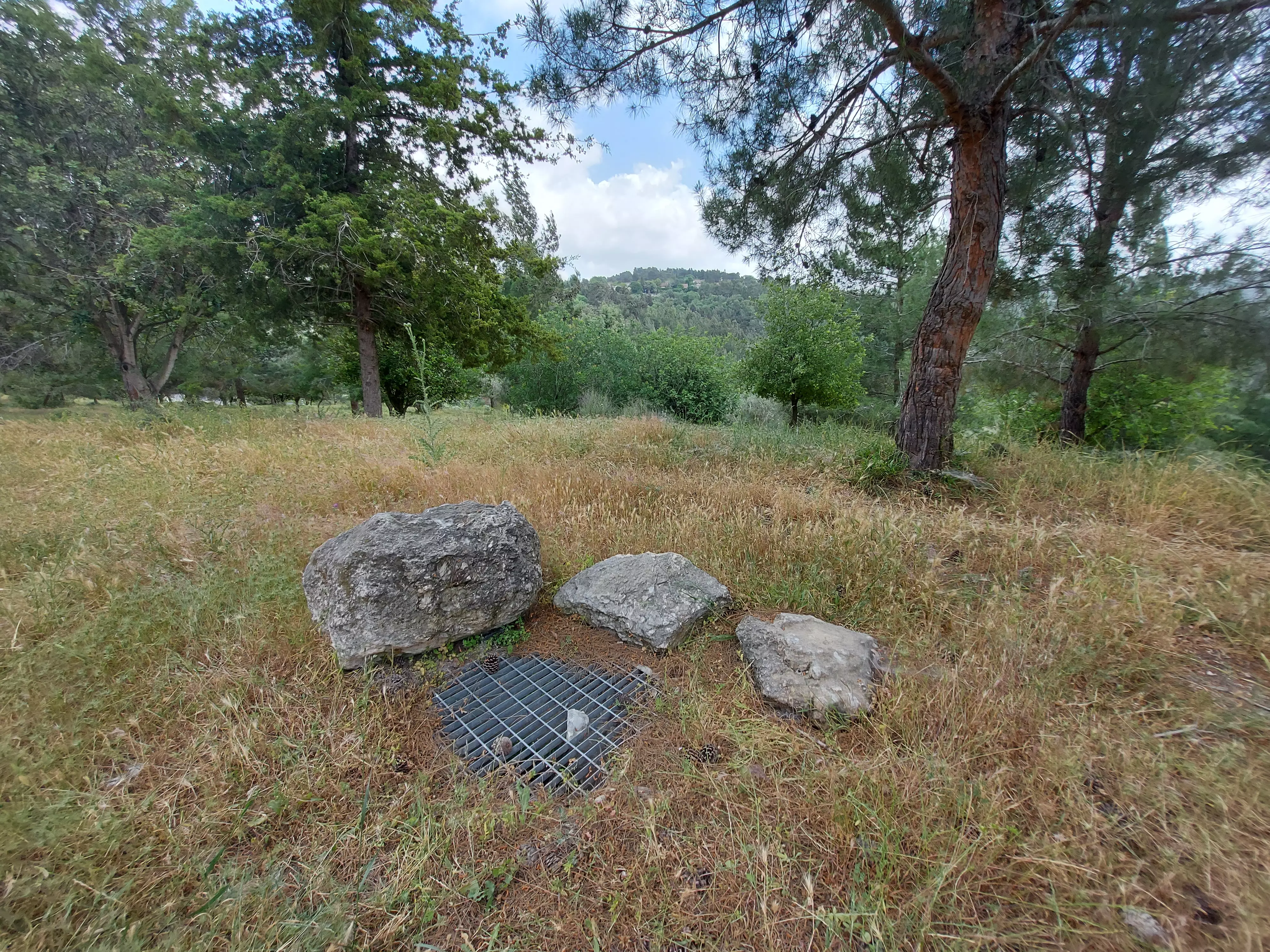
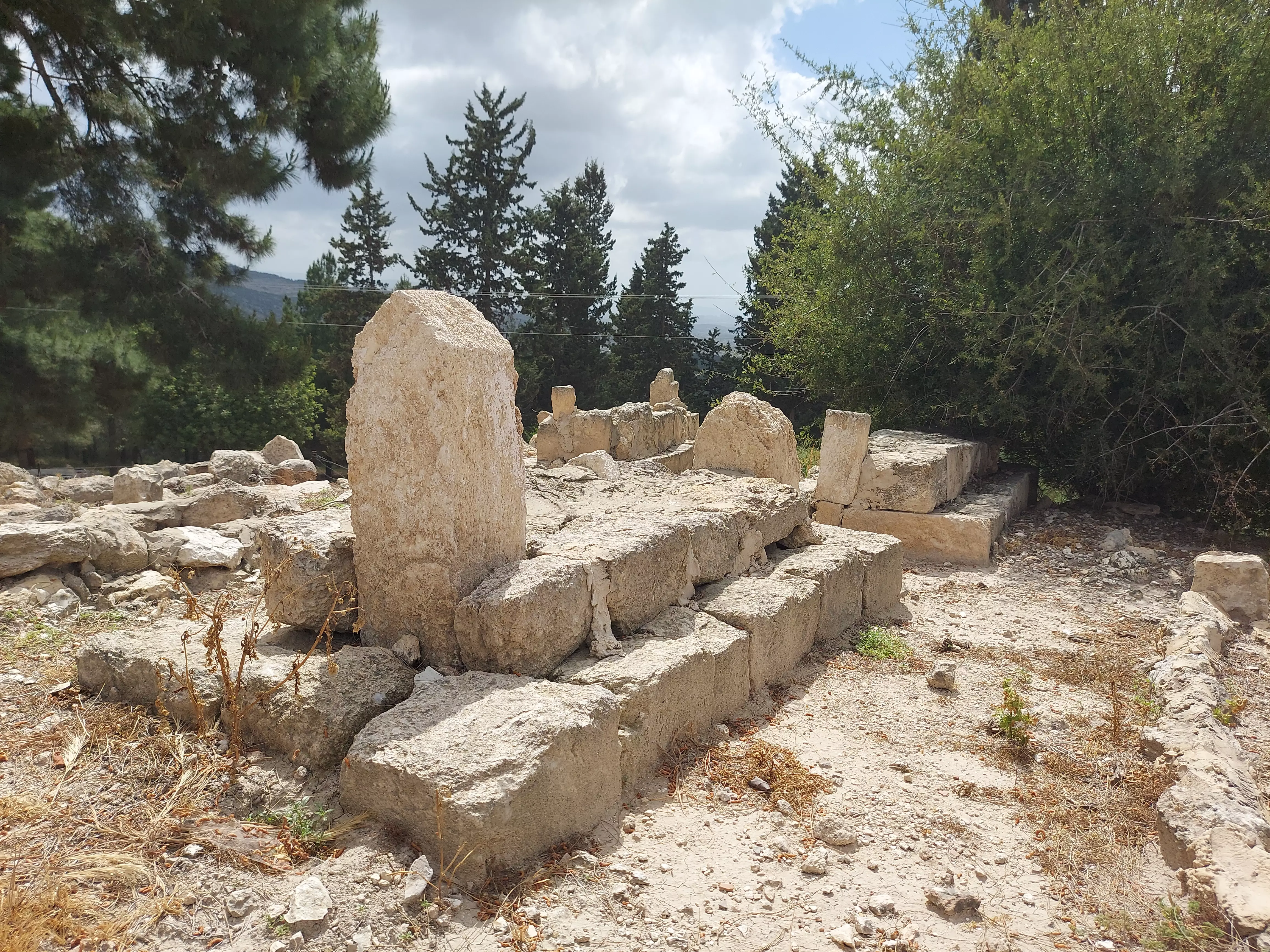
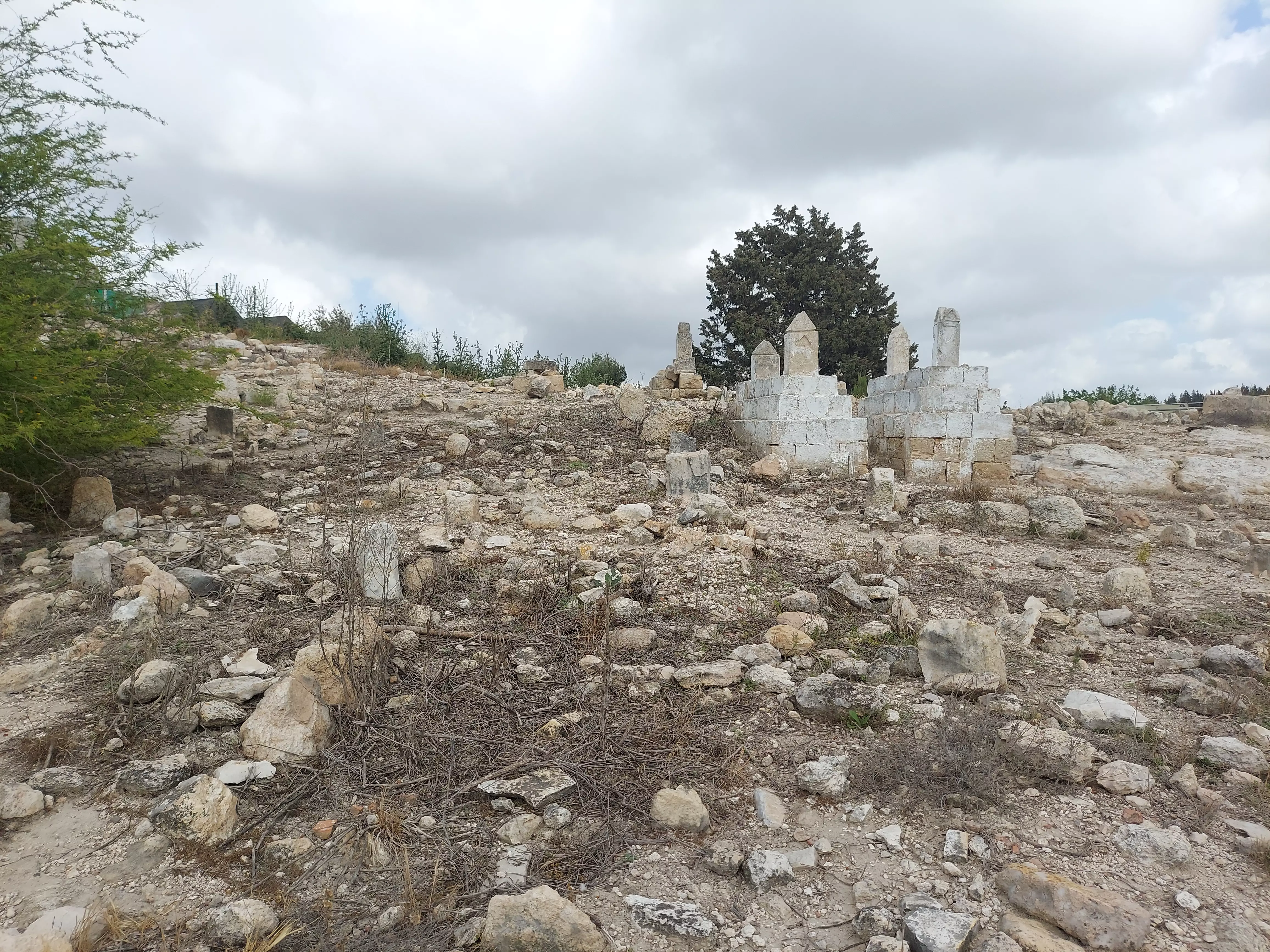
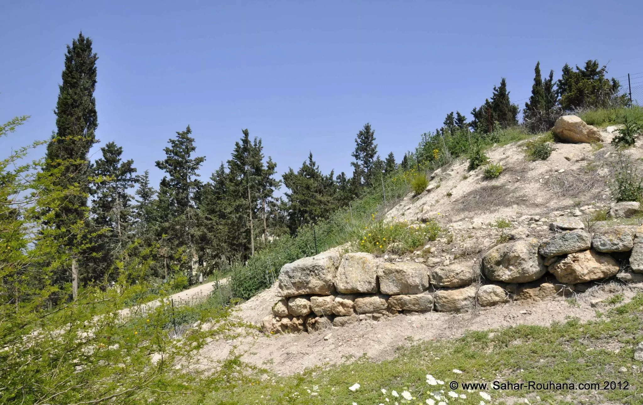
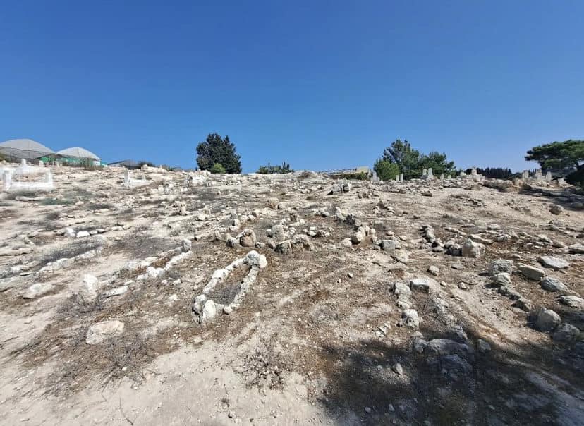
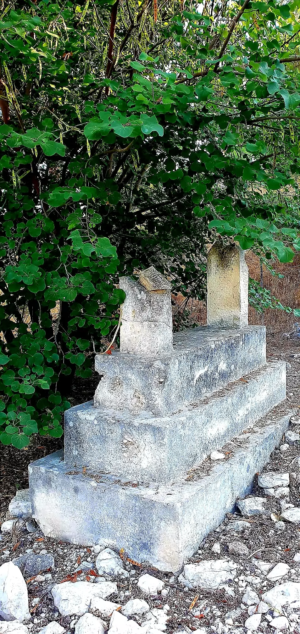
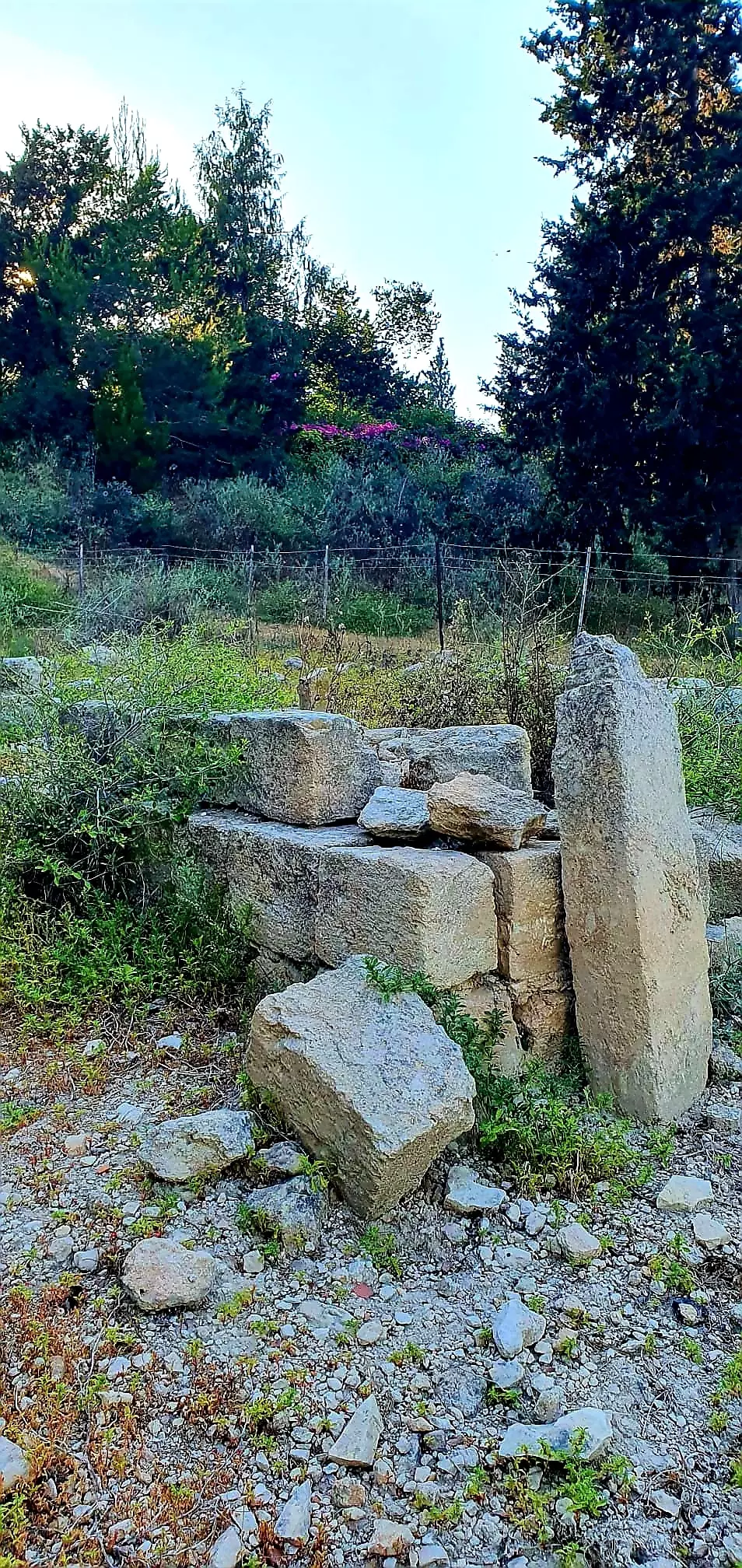
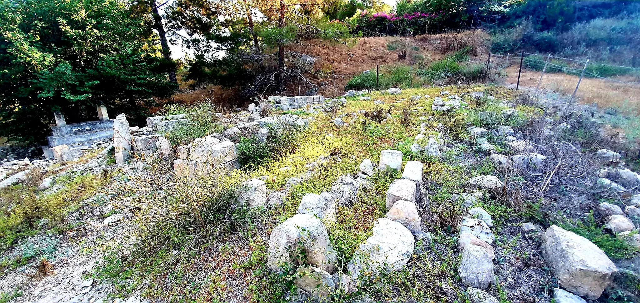
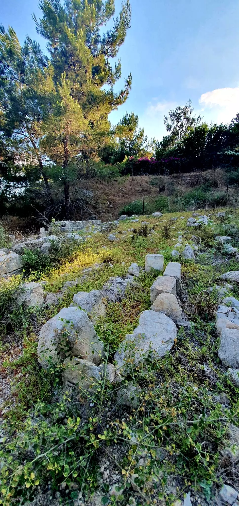
| Village Temains | Mi'ar was completely destroyed, and only house rubble left behind. | ||||||||||||||||
| Ethnically Cleansing | Mi'ar inhabitants were completely ethnically cleansed. | ||||||||||||||||
| Pre-Nakba Land Ownership |
**Town Lands' Demarcation Maps |
||||||||||||||||
| Land Usage As of 1945 |
|
||||||||||||||||
| Population |
|
||||||||||||||||
| Number of Houses |
|
||||||||||||||||
| Near By Towns |
|||||||||||||||||
|
|||||||||||||||||
| Town's Name Through History | The Crusades referred to Mi'ar by Myary. | ||||||||||||||||
| Schools | An elementary school which was founded by the Ottomans in 1888, however, it closed its doors in the final years of the Empire. | ||||||||||||||||
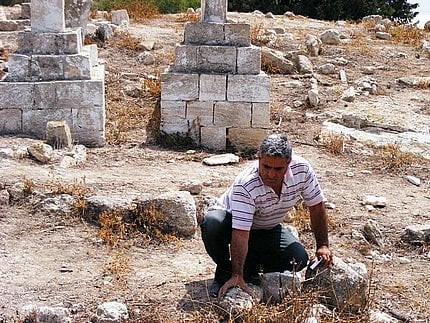
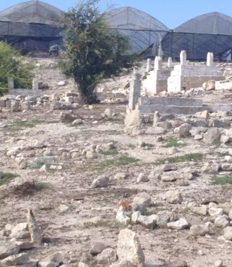
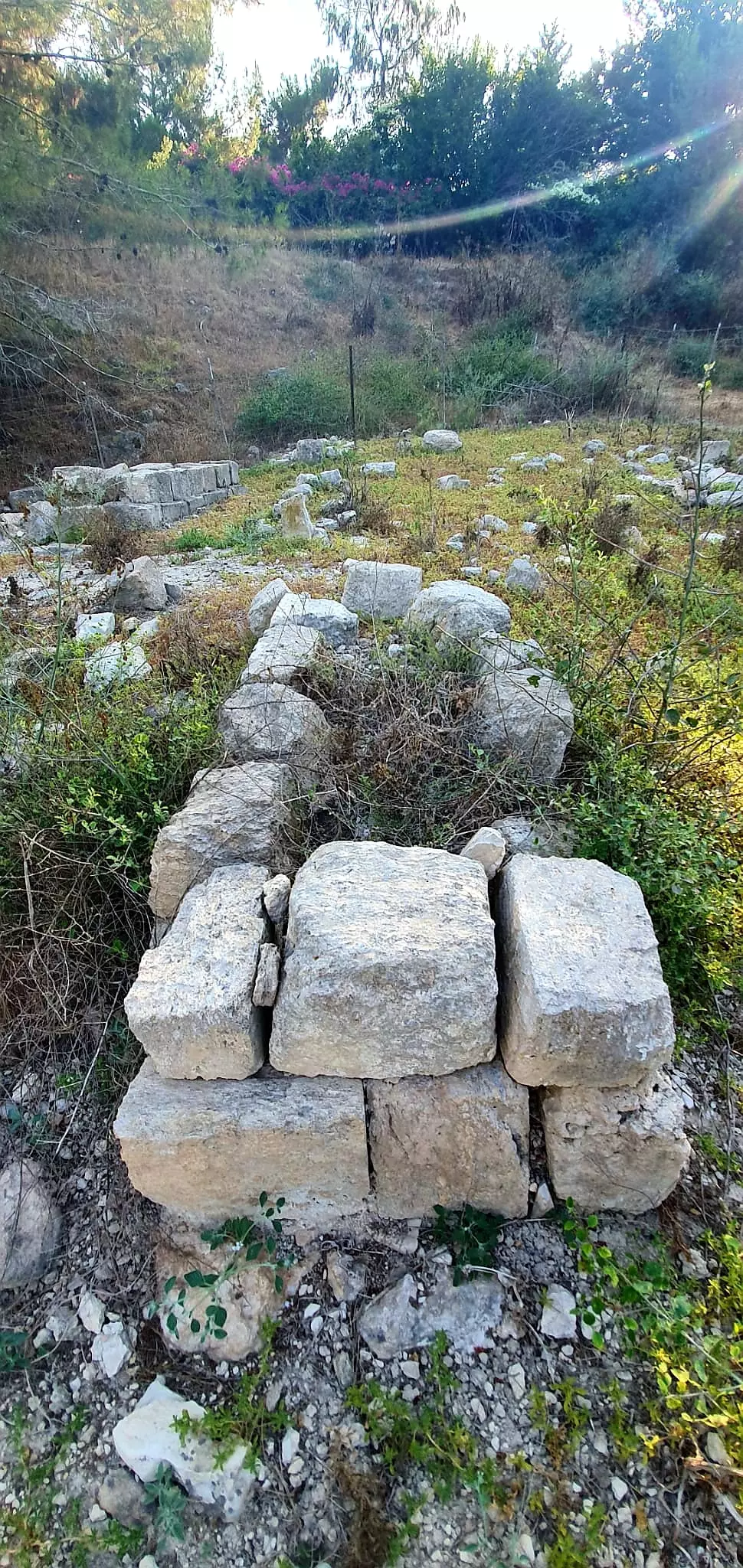
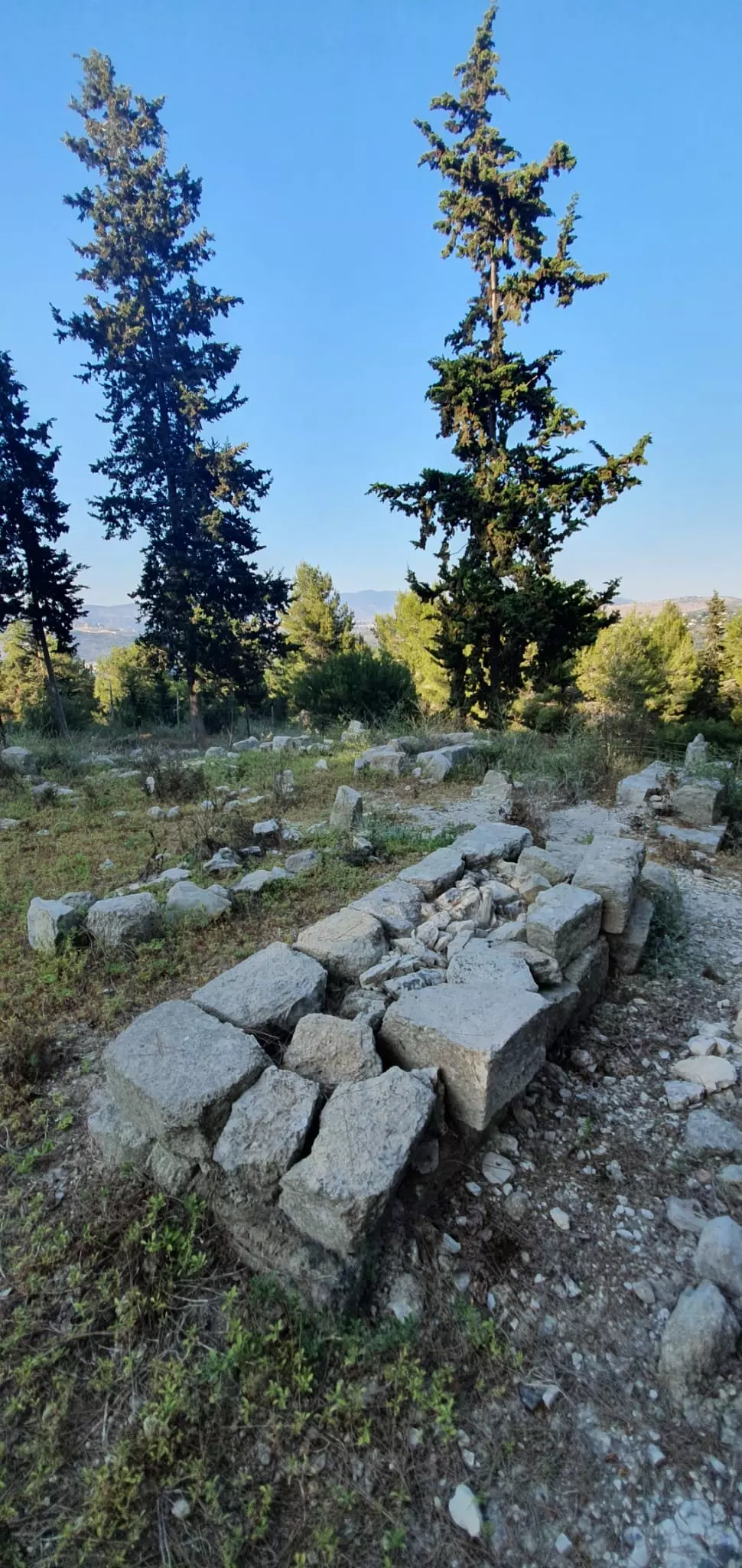
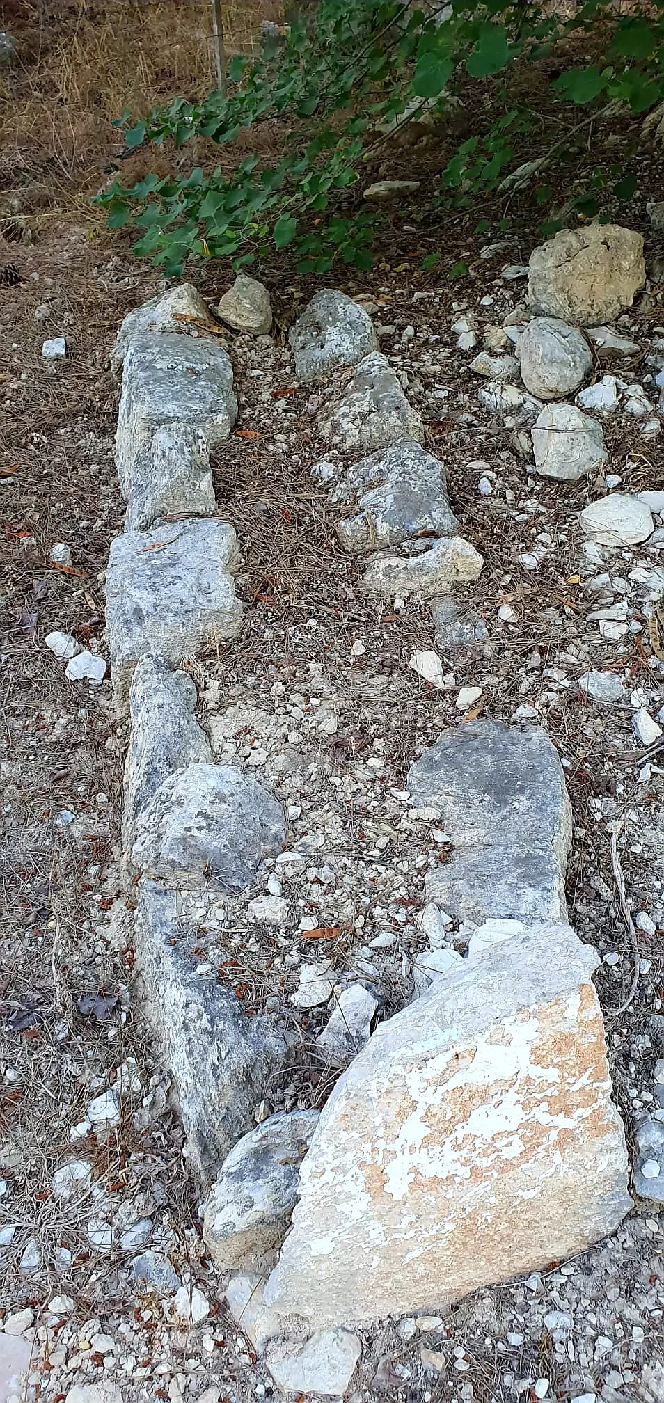
| Archeological Sites | Mi'ar contains the remains of buildings, fragments of columns, olive presses, and cisterns. | ||||||||||||||||
| Exculsive Jewish Colonies That Usurped Village Lands |
Segev, Ya'ad, and Manof. | ||||||||||||||||
| Featured Video | |||||||||||||||||
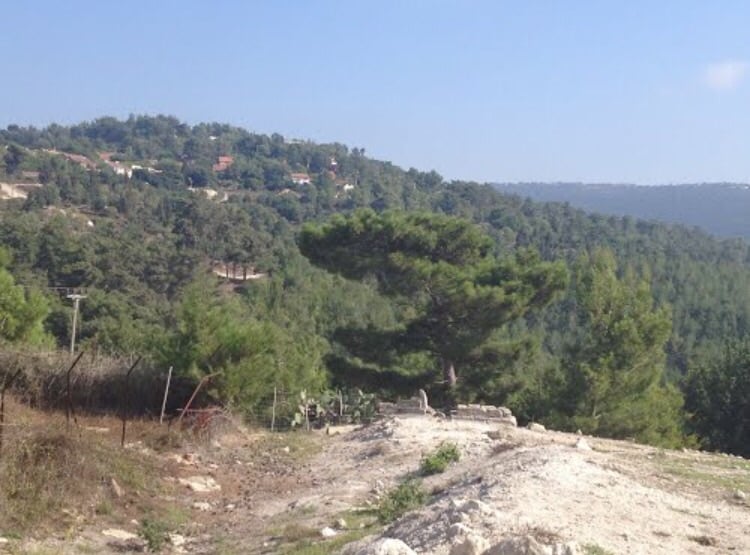
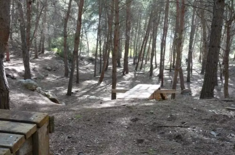
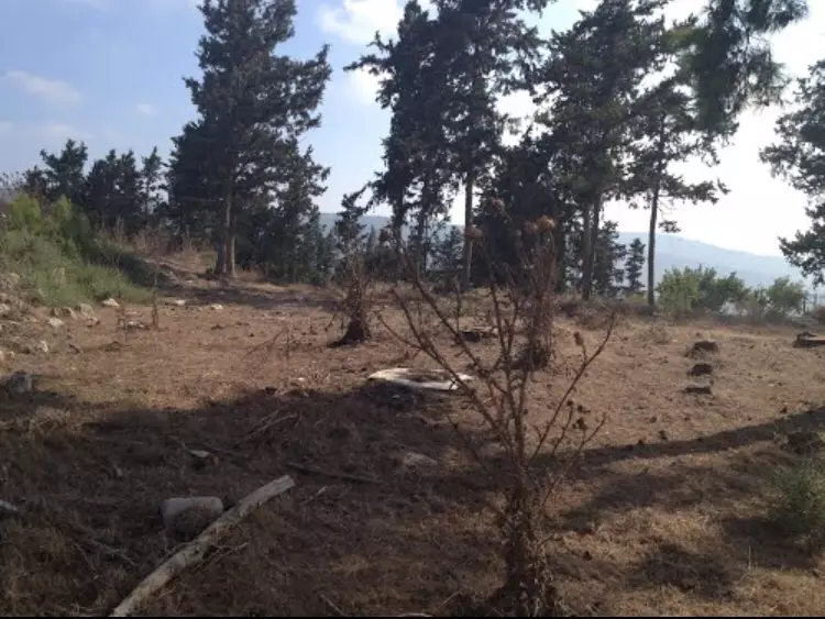
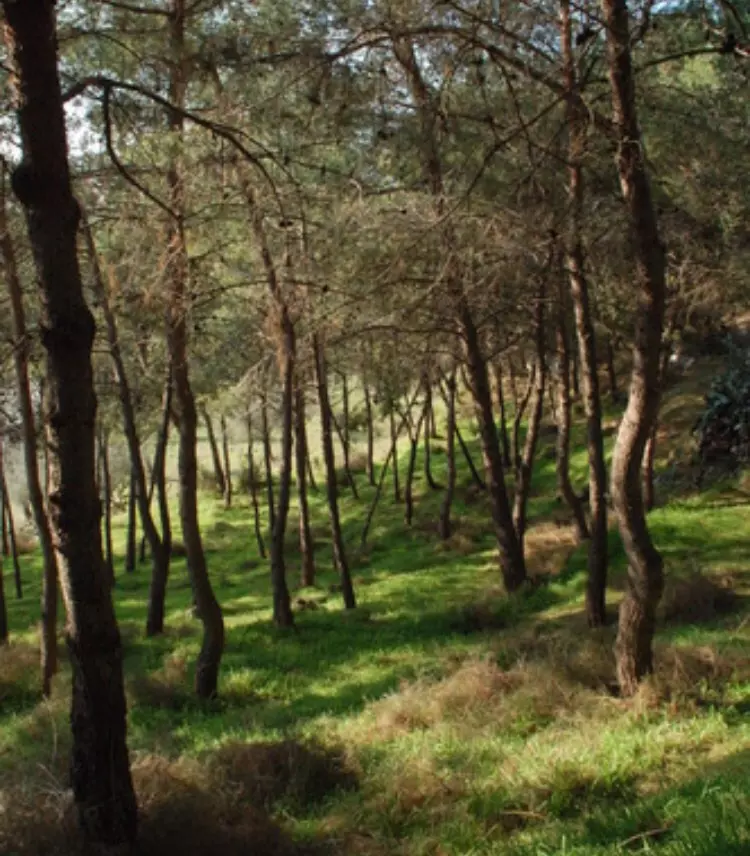
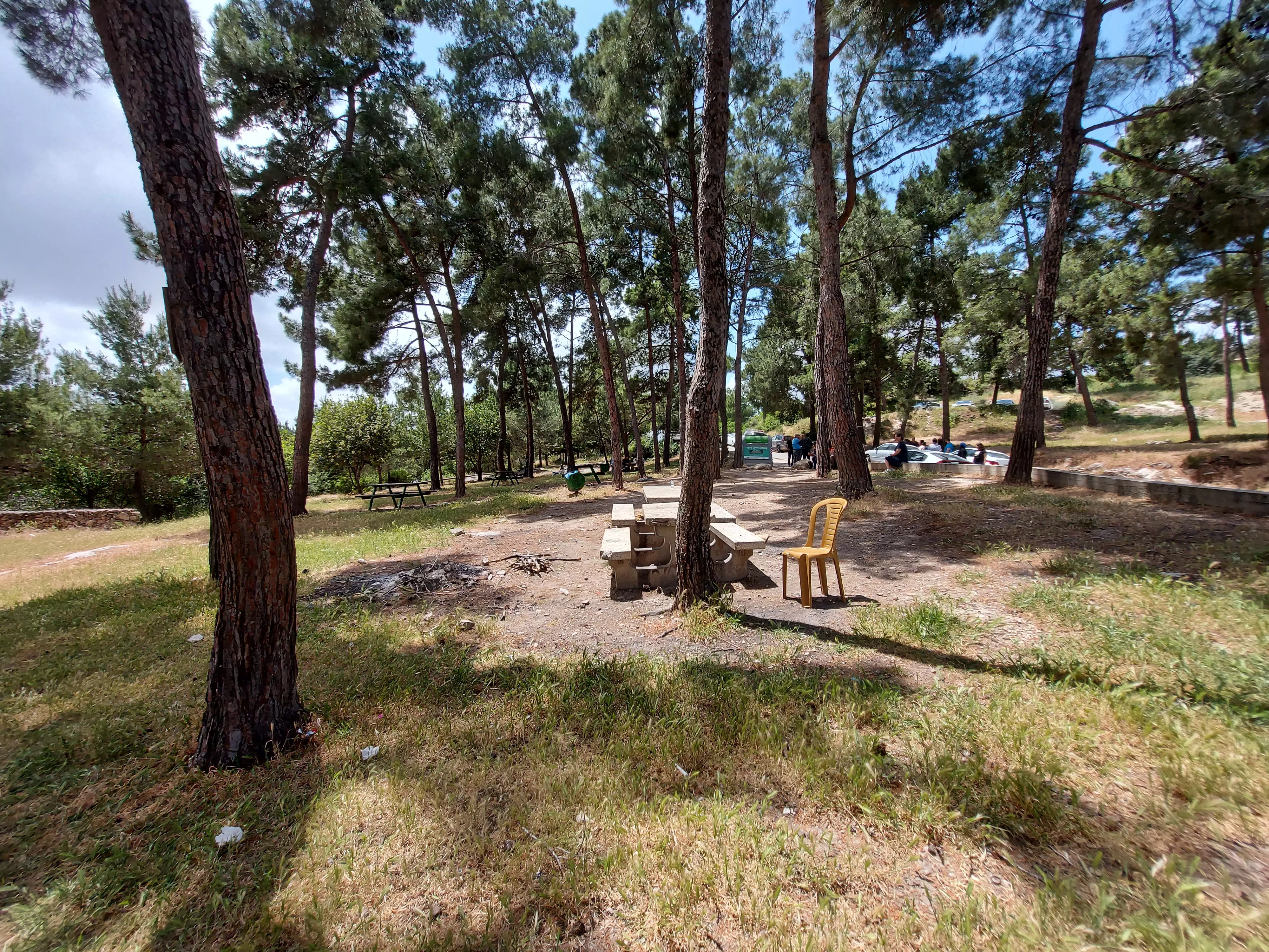
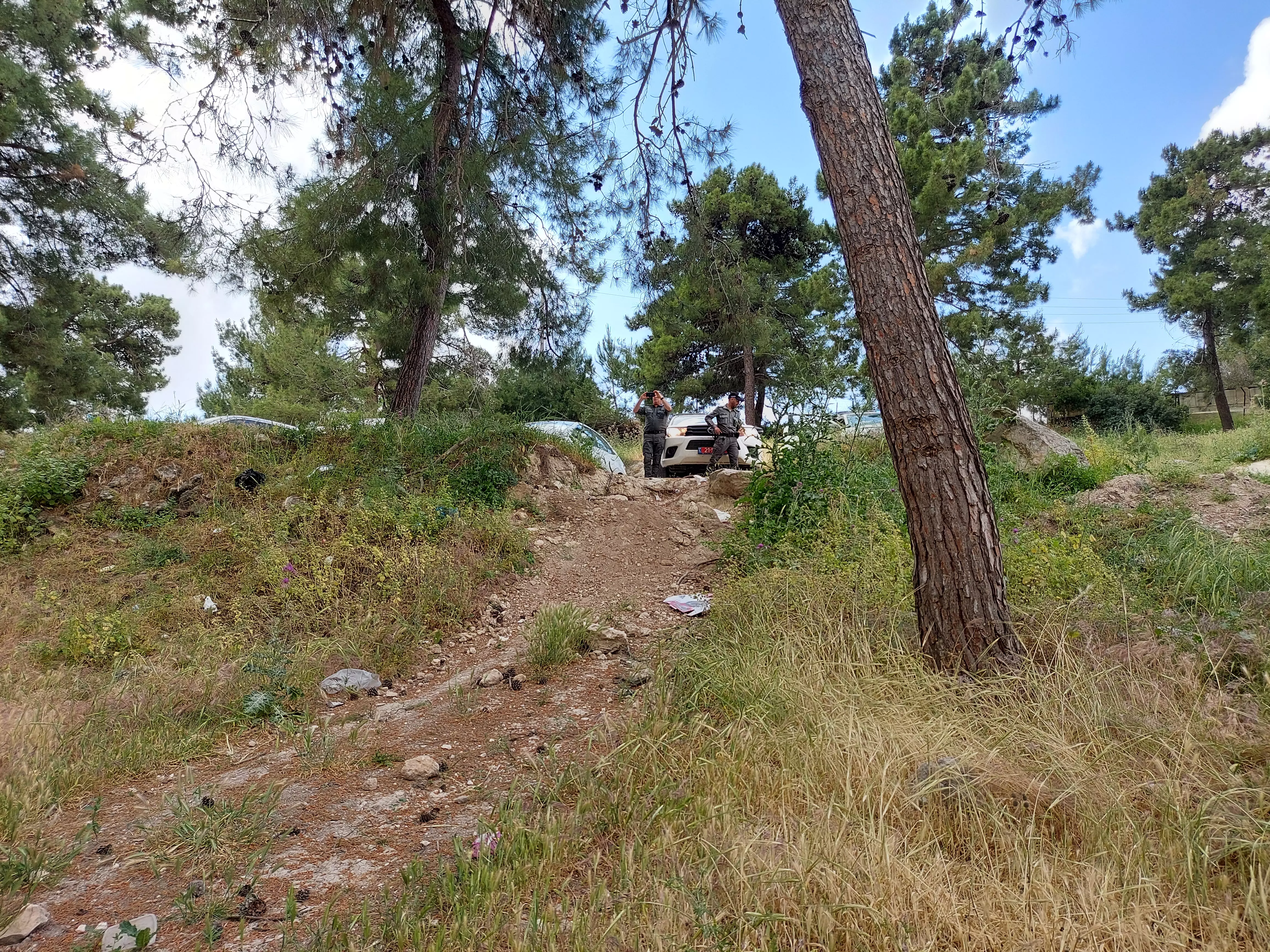
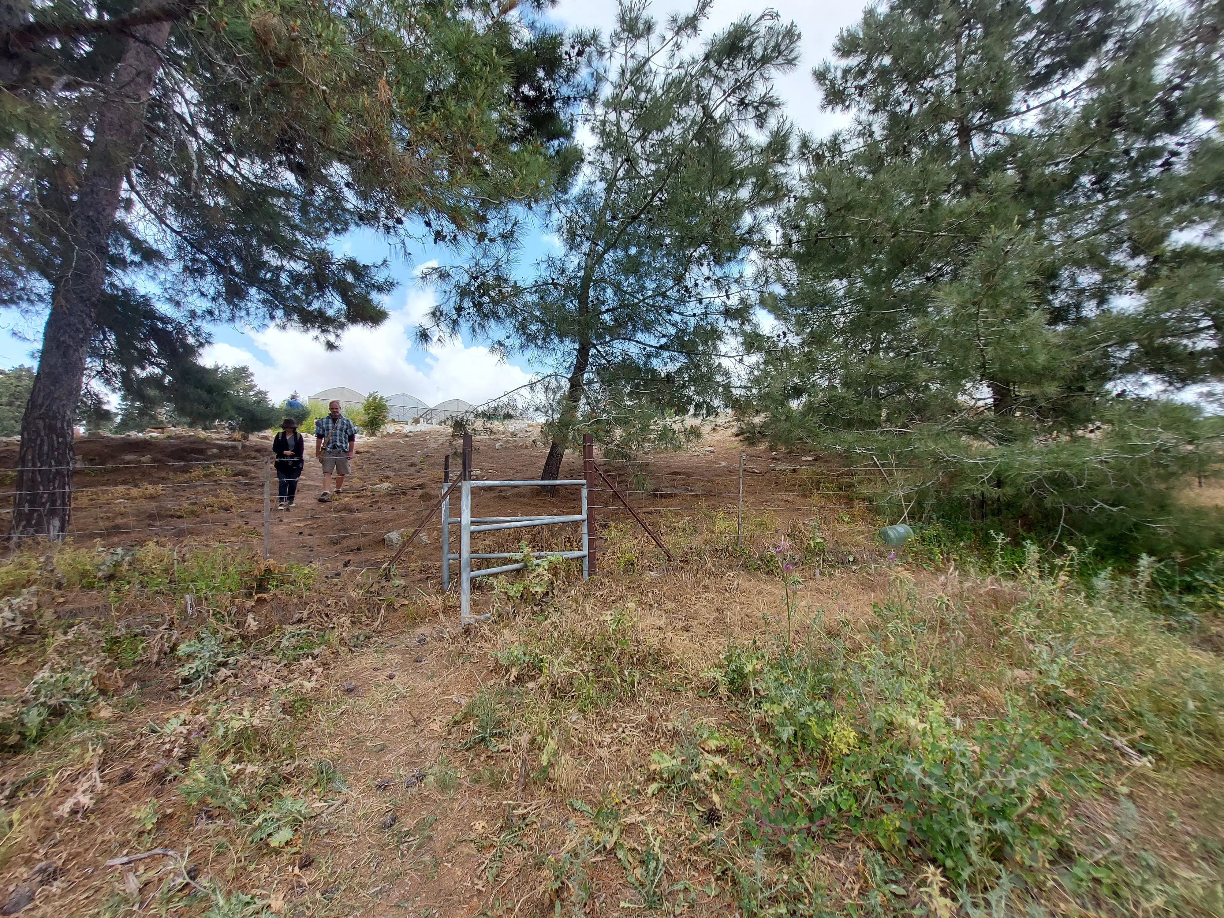
Village Before NakbaThe village stood on a rocky hill at the eastern tip of the plain of Acre. A secondary road linked it to al-Damun, to the northwest. Its archaeology suggests that it dated back to Canaanite times ; the Crusaders knew it as Myary. In 1596, Mi'ar was a village in the nahiya of Akka (liwa' of Safad), with a population of 55. It paid taxes on a number of crops, including wheat, barley, and fruit, as well as on other types of produce, such as goats and beehives. In the late nineteenth century, Mi'ar was a large village situated on high ground that was rough and uncultivated. The residents of the village, who were estimated at 1,500 in 1859, cultivated some thirty faddans (1 faddan = 100-250 dunums).In recent times, the houses of the village were made of stone. The Ottomans established a school in Mi'ar in 1888 but it was closed in the final years of the Empire. All of the people living in Mi'ar were Muslims. In 1944/45 they allocated a total of 2,878 dunums of their land to cereals; 113 dunums were irrigated or used for orchards. A number of archaeological artifacts were found within and outside the village perimeters, including rock carvings, the remains of buildings, fragments of columns, olive presses, and cisterns. Village Occupation and Ethnic CleaningIn the second stage of the Israeli army's Operation Dekel , military units closed in on Mi'ar from recently-occupied areas in Lower Galilee. The village was entered by units of the Sheva' (Seventh) Brigade between 15 and 18 July 1948, according to Israeli historian Benny Morris. Morris' account implies that the villagers fled either as a result of artillery salvos or under the influence of the occupation of large parts of Lower Galilee.Zionists Colonies on Village LandsThe settlement of Segev was founded to the east of Mi'ar in 1953. Ya'ad was established in 1975 to the northeast of the village, and in 1980 Manof was built. All are on village lands. The settlement of Yuvallim), built in 1982 on land that traditionally belonged to nearby Sakhnin, is about 2 km due east of the site.Village TodaySome truncated stone walls, simple graves, and fig and olive trees remain on the site, which is covered by cypress trees. The area has been turned into recreational and picnic grounds.SourceDr. Walid al-Khalidi, 1992: All That Remains. |
|||||||||||||||||
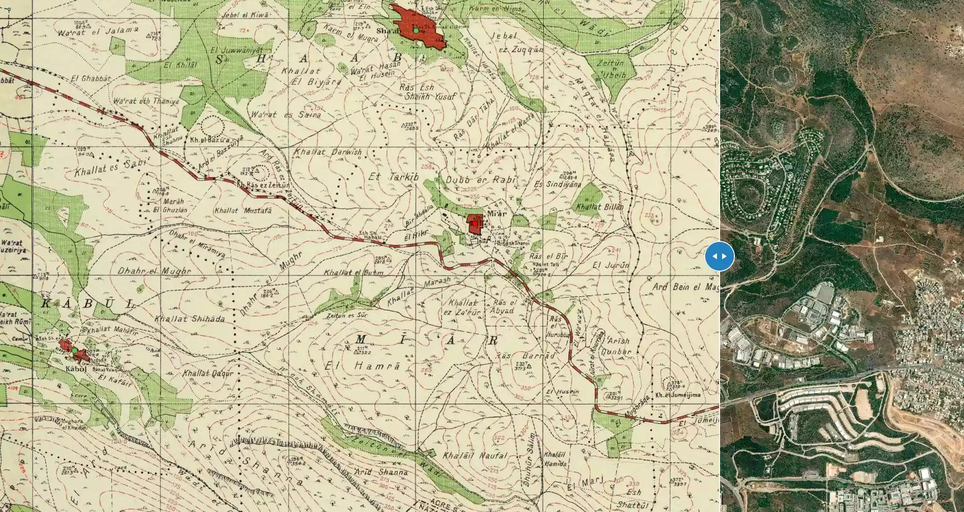
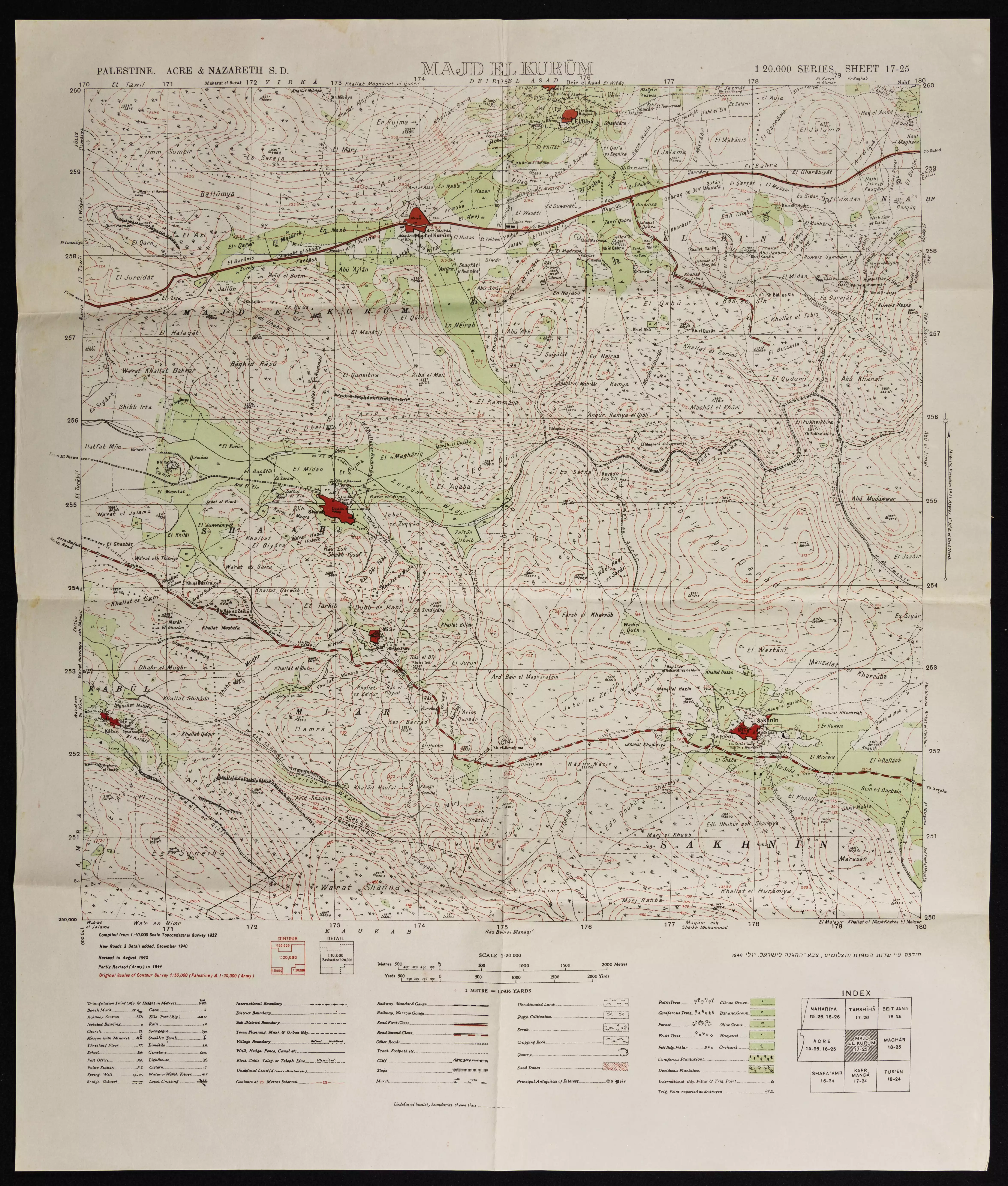
| Related Maps | Town Lands' Demarcation Maps خرائط للقضاء توضح حدود القرى والاودية Town's map on MapQuest View from satellite Help us map this town at WikiMapia |
||||||||||||||||
| Related Links | Wikipedia's Page Google Search Google For Images Google For Videos |
||||||||||||||||
| More Information | في كتاب كي لا ننسى في كتاب بلادنا فلسطين المزيد من موقع هوية |
||||||||||||||||
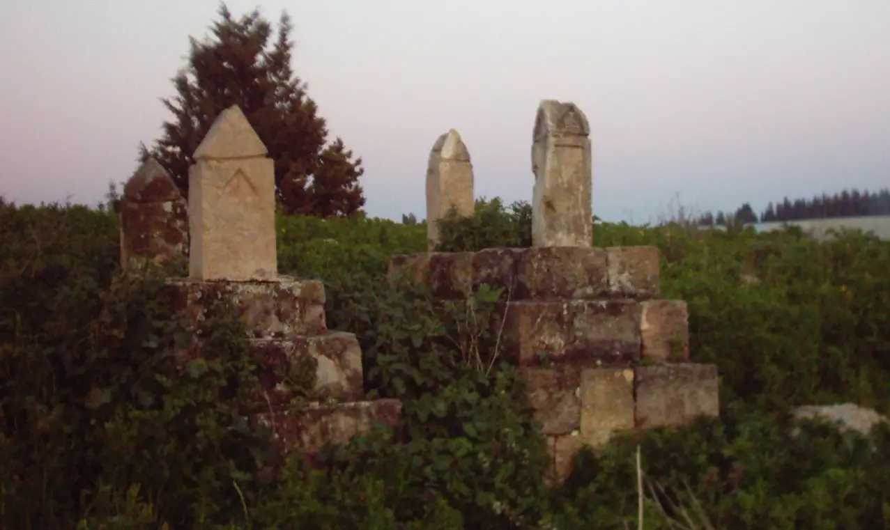
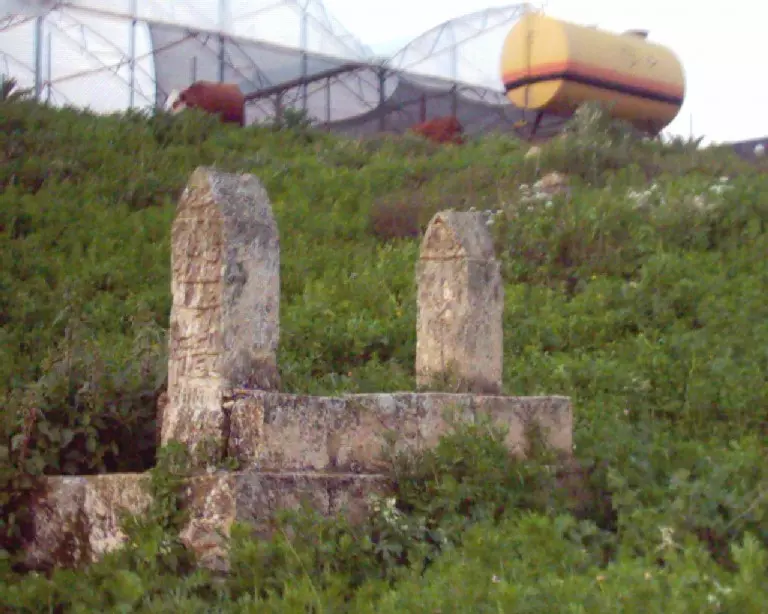
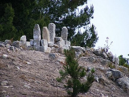
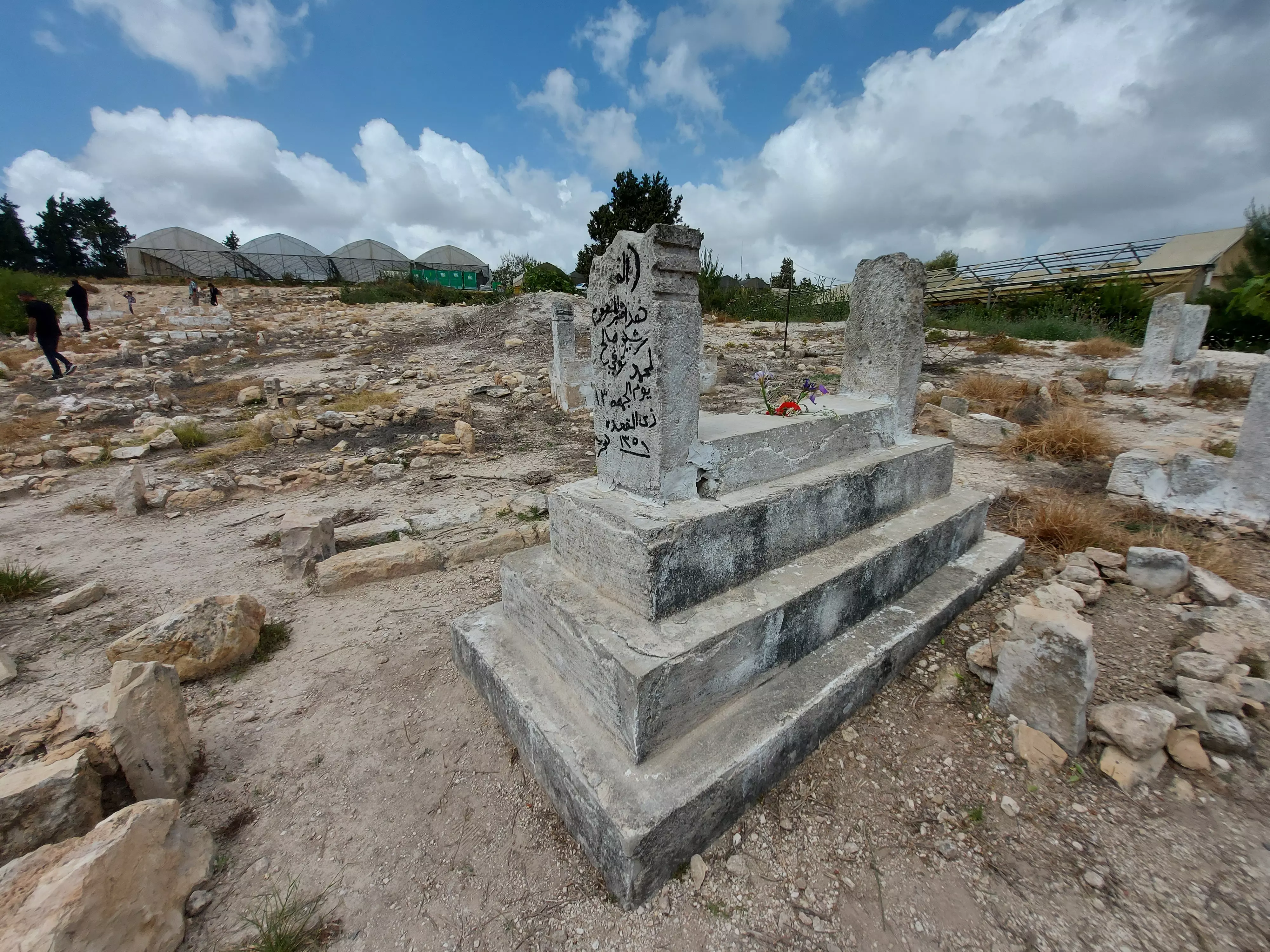
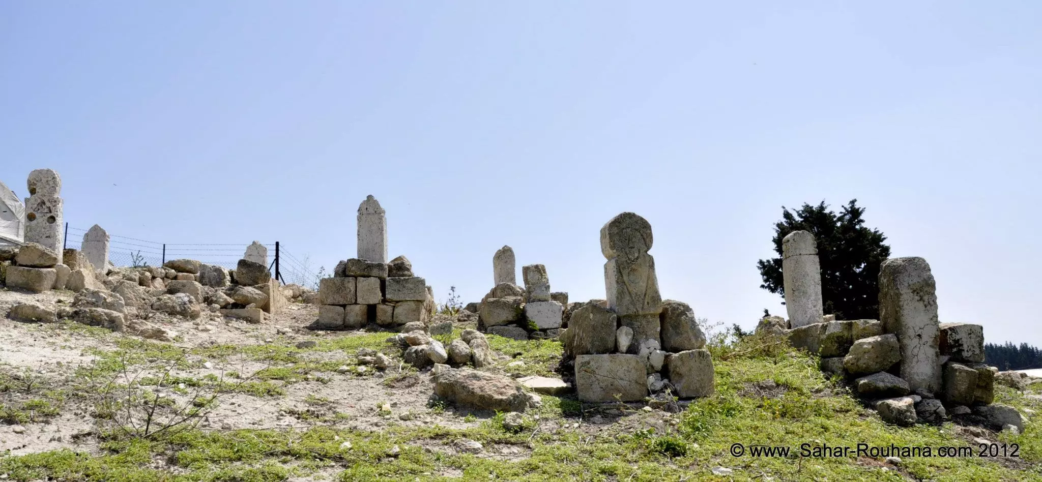
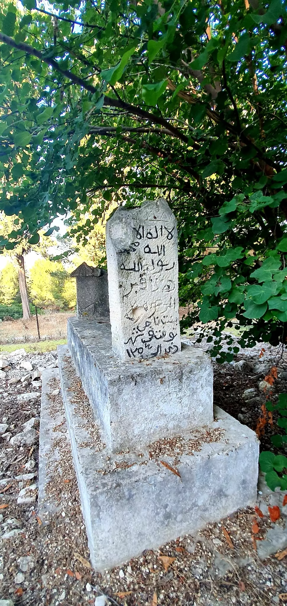
- Village Cemetery In 2003
Posted by Makbula Nassar - مقبرة ميعار , بعض القبور الباقية بشكل كامل ,تظهر قي الخلفية ابنية تابعة لمستعمرة ياعد التي بنيت على اراضي القرية , حيث تقع المقبرة في المنحدر الغربي لموقع القرية ,2003
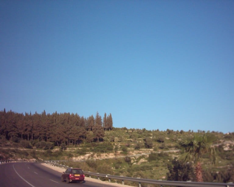
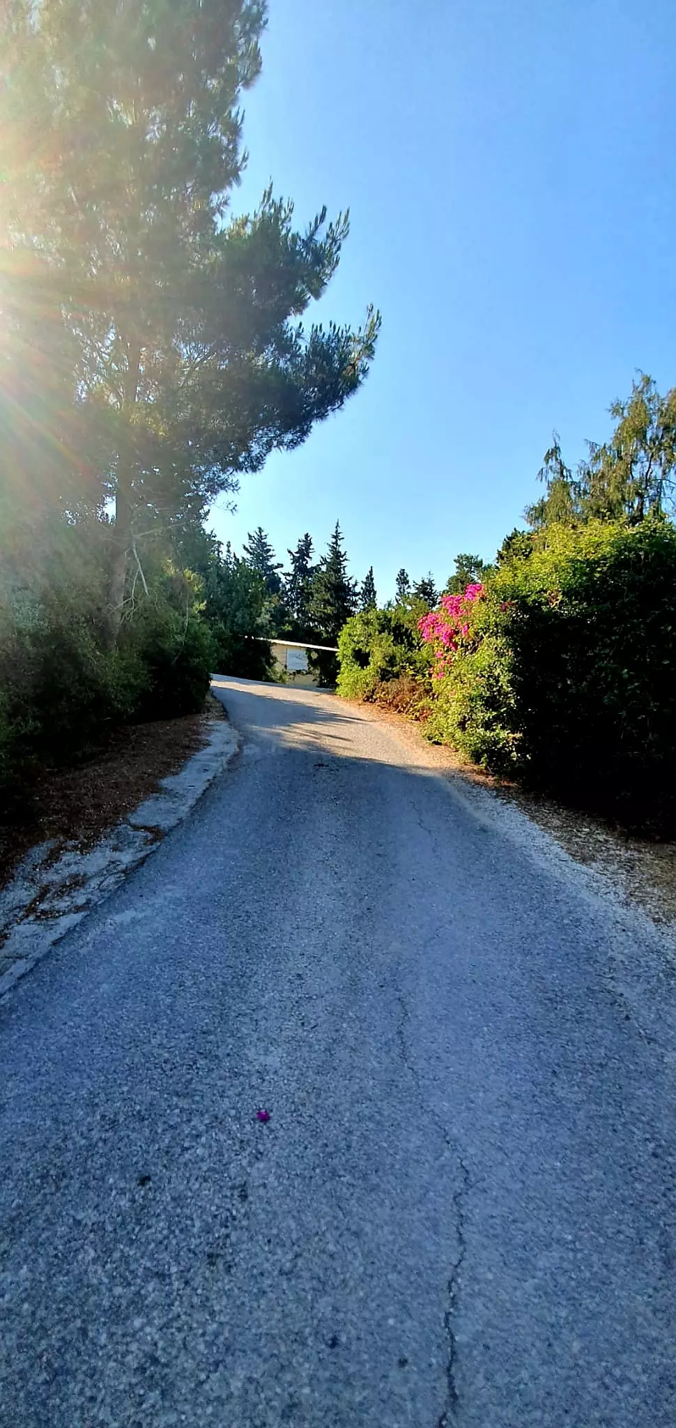
Posted by Makbula Nassar - منظر عام لموقع القرية من الناحية الغربية على الطريق المؤدي الى عكا ,2003
Posted by Makbula Nassar - راجعون ورب الكعبة راجعون
Posted by hesham shehadeh 4 - المقبرة
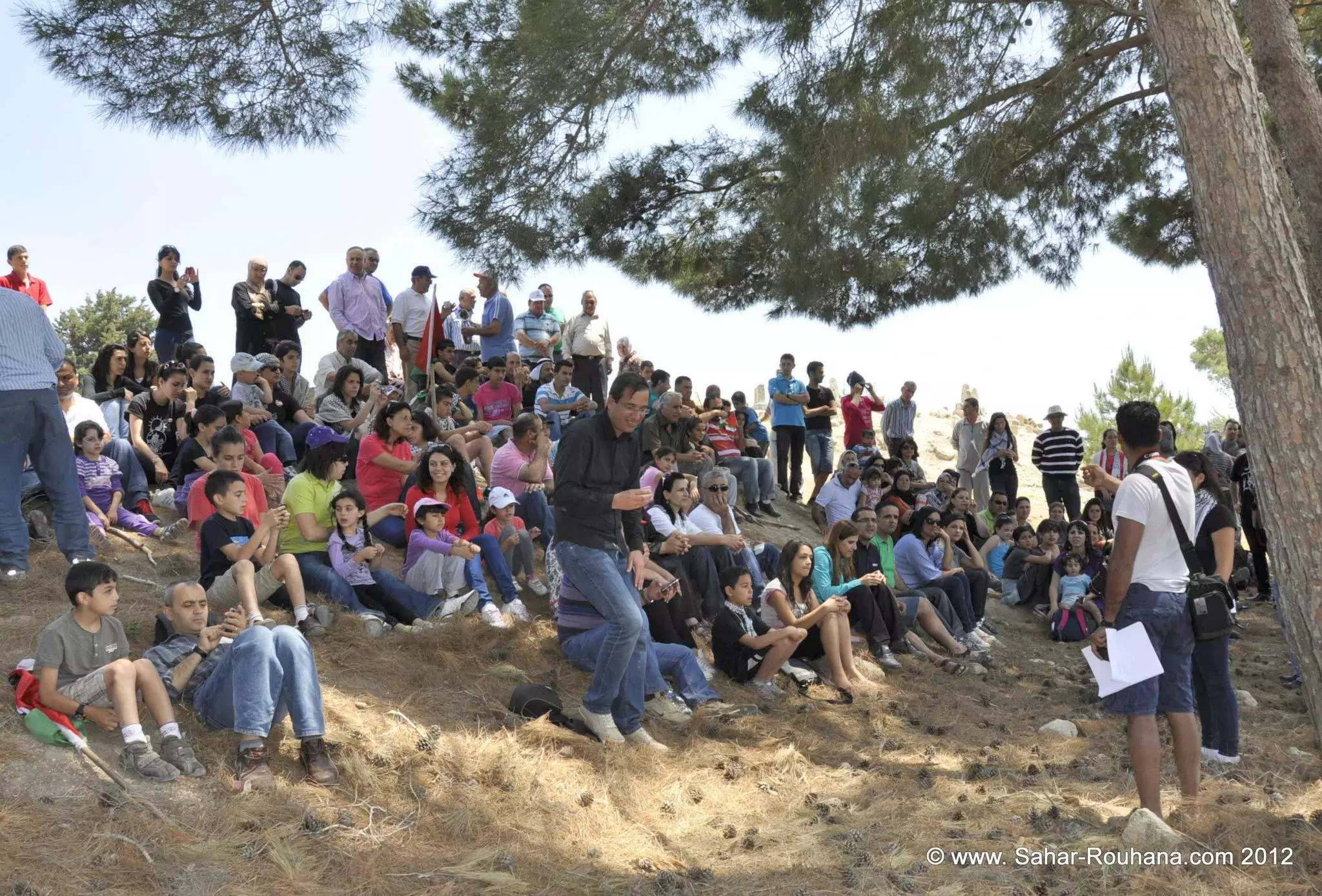
Posted by hesham shehadeh 1 - زيارة للقرية خلال يوم النكبة
Posted by hesham shehadeh - زيارة للقرية خلال يوم النكبة
Posted by hesham shehadeh - زيارة للقرية خلال يوم النكبة
Posted by hesham shehadeh 1 - زيارة للقرية خلال يوم النكبة
Posted by hesham shehadeh - راجعون
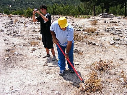
Posted by hesham shehadeh - تنظيف المقبرة
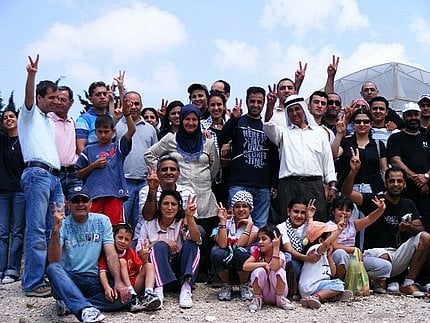
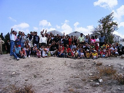
Posted by hesham shehadeh - صورة جماعية غضون زيارة القرية خلال يوم النكبة
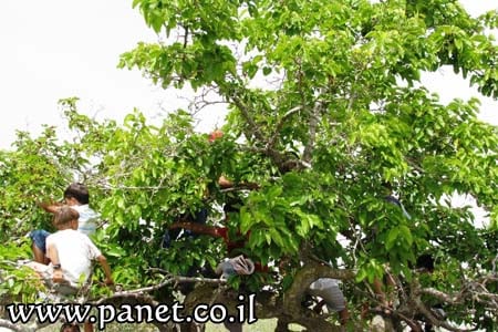
Posted by hesham shehadeh - اشجار القرية
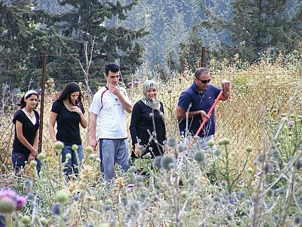
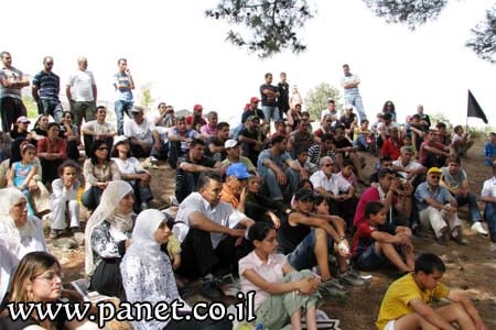
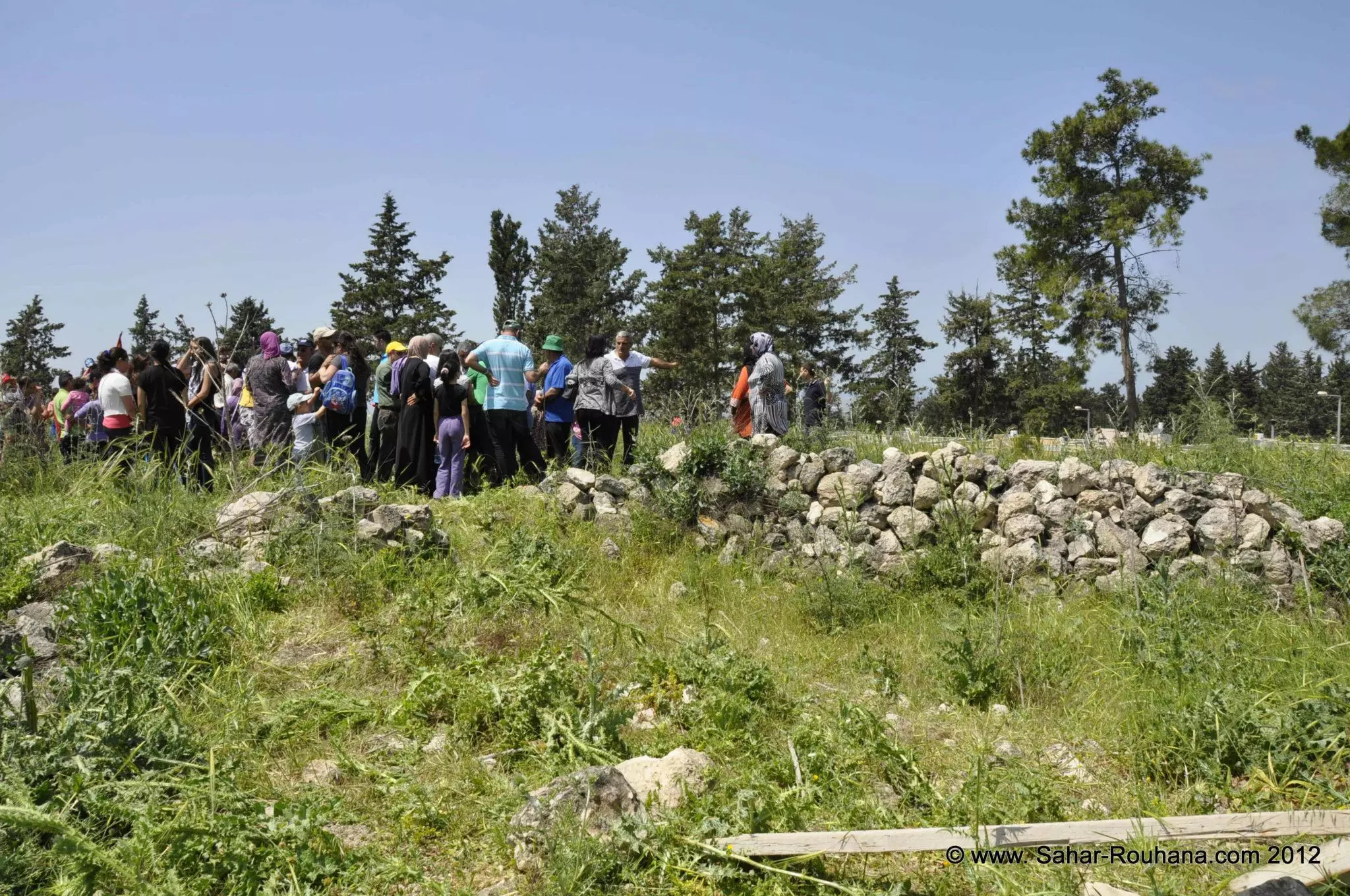
Posted by lamia al-masri - اهالي القرية المهجرين في ذكرى النكبه 61
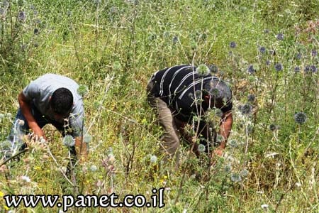
Posted by lamia al-masri - اهالي القرية يعملون على تنظيف القبور المهدمة في قريتهم المغتصبة
Posted by lamia al-masri - تنظيف القبور
Posted by lamia al-masri - في ذكرى النكبة 61
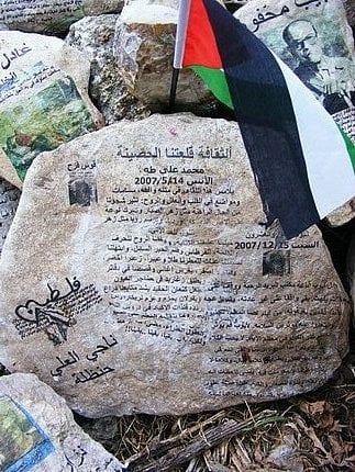
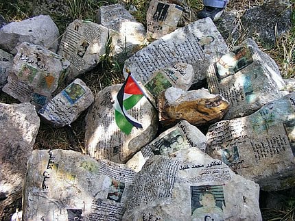
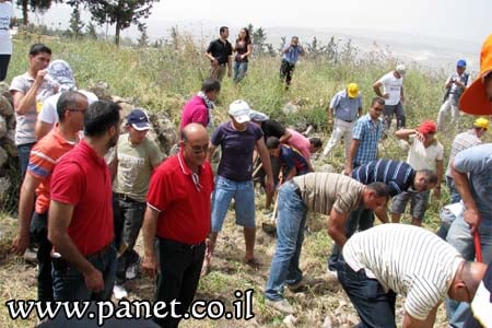
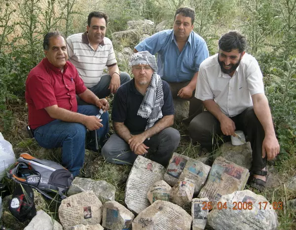
Posted by lamia al-masri - الشاعر عادل خليفة, الشاعر احمد فوزي ابو بكر المحامي خالد محاميد الدكتور اسعد غانم والشاعر راضي عبد الجواد بعد الصاق الادبيات الفلسطينية واسماء العائلات على حجارة بيوت قرية ميعار المهجرة
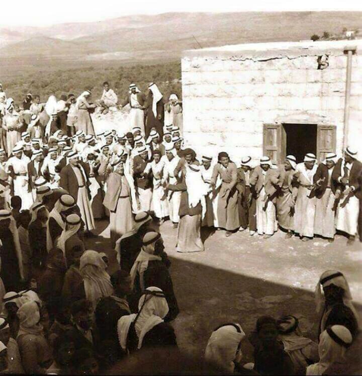
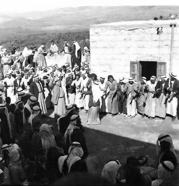
Posted by خالد كساب محاميد 1 - عرس في ميعار1937
Posted by فتحي ابو رضا \ العايدي - ميعار شهر رمضات 1930 احضار المياة من البئر قبل الاقطار
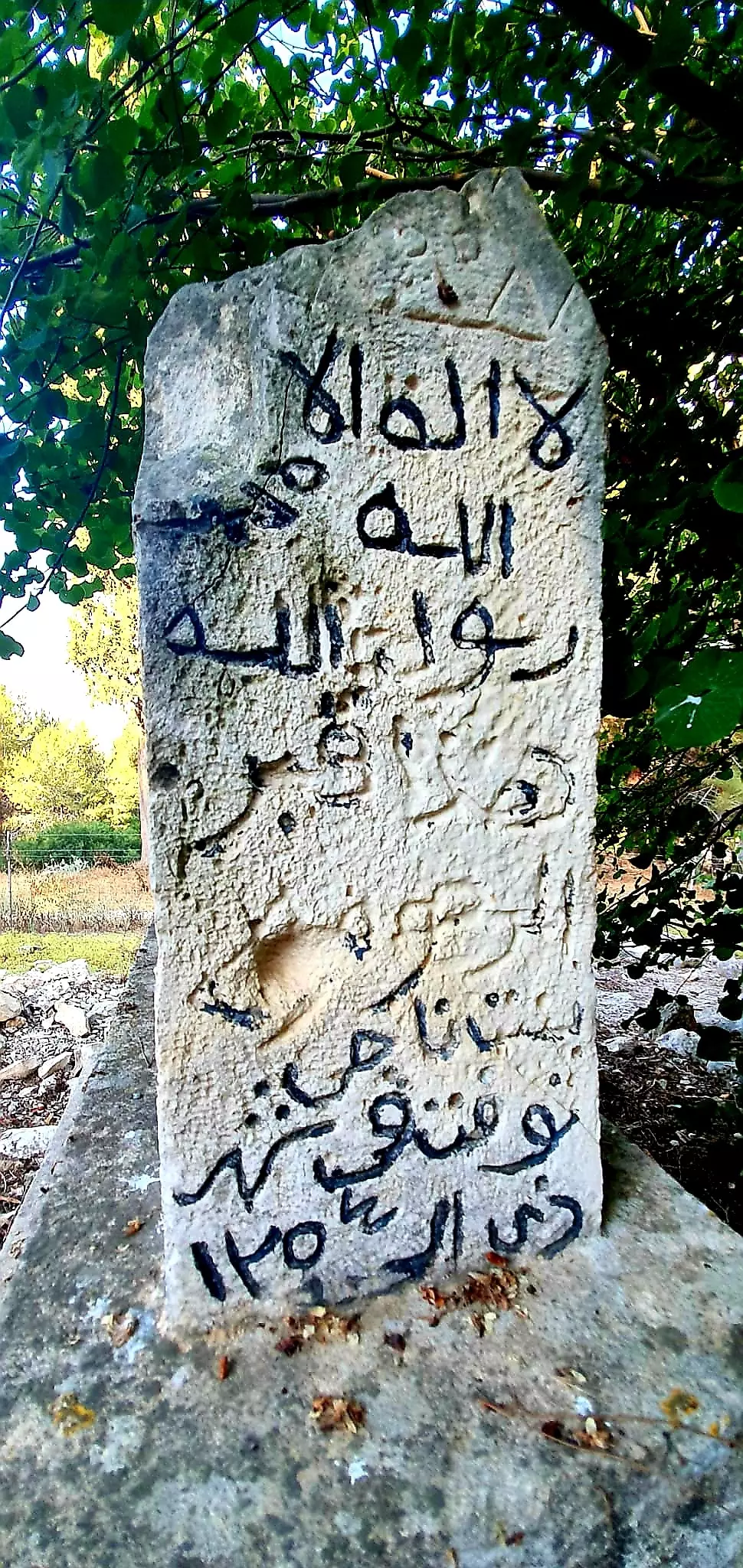
Posted by فتحي ابو رضا \ العايدي 1 - قبر في قريه ميعار
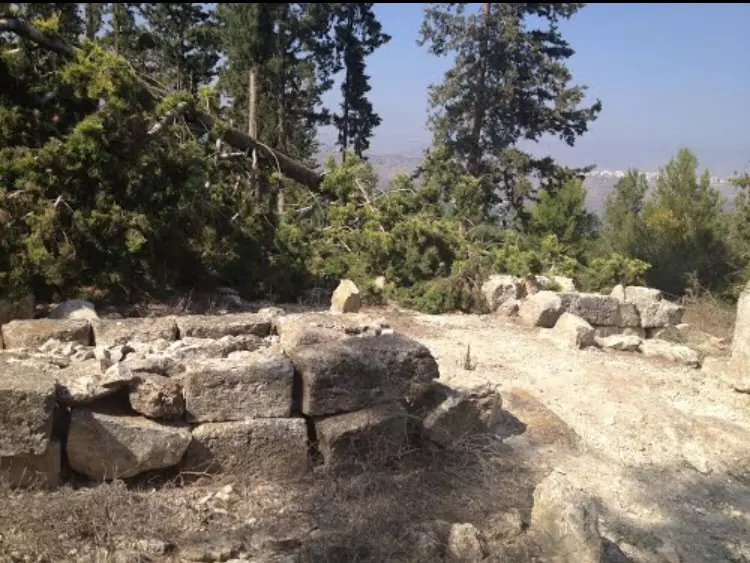
Posted by abu raya - من اطلال ميعار
Posted by abu raya - اطلال ميعار
Posted by abu raya - مقبره ميعار
Posted by abu raya - مكان القريه وقد غطي بالاحراش
Posted by abu raya - اطلال ميعار
Posted by abu raya - اطلال ميعار
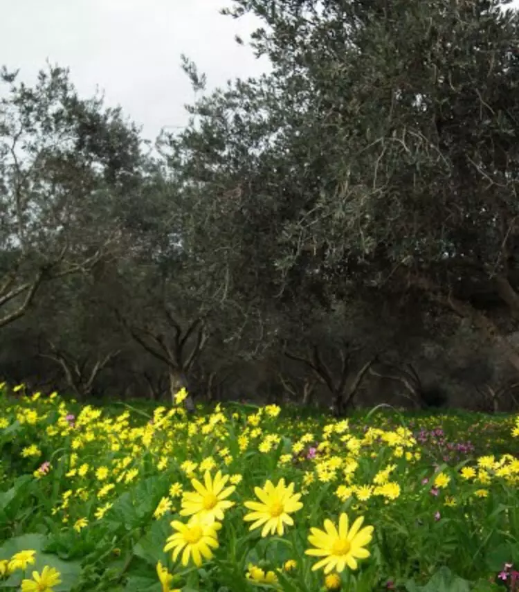
Posted by abu raya - الربيع في ميعار
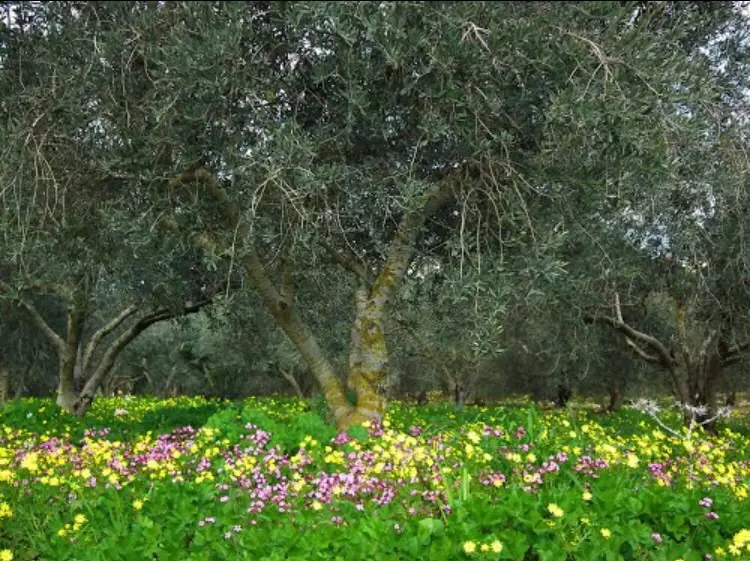
Posted by abu raya - الربيع في ميعار
Posted by abu raya - ميعار
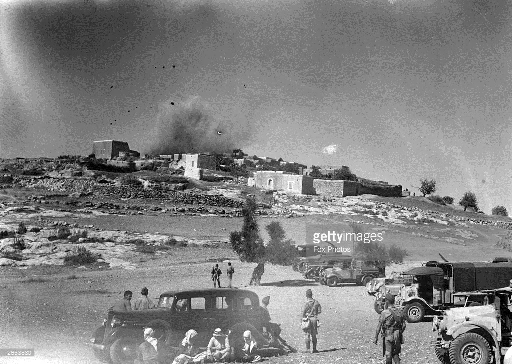
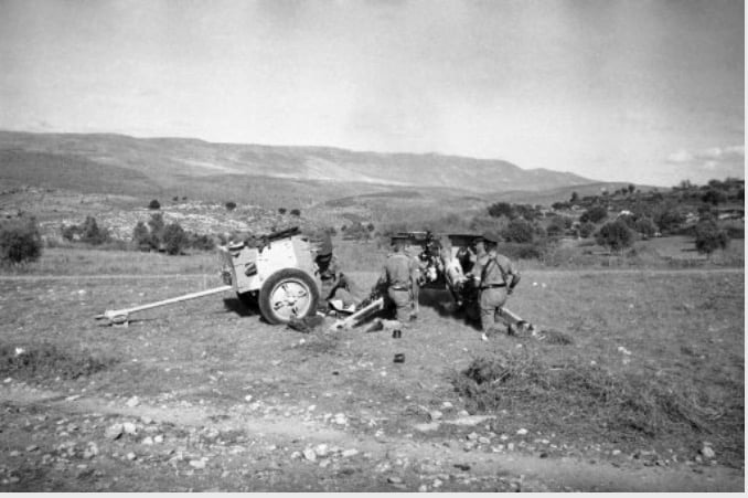
Posted by abu raya - قرية ميعار قرب حيفا سنة 1938 وهي تحترق من الجيش البريطاني ارهابا للأهالي وعقابا للثوار
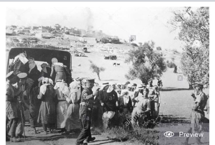
Posted by ياسين الشيخ سليمان - المستعر البريطاني يجمع سكان ميعار تمهيدا لقصفهاعقابا لدعمهم للثوار
Posted by abu raya - المستعر البريطاني يقصف ميعار سنه 1938
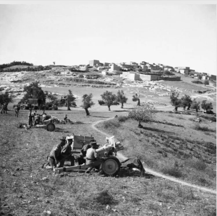
Posted by abu raya - قريه ميعار سنه 1938 تقصف من قبل القوات البريطانيه
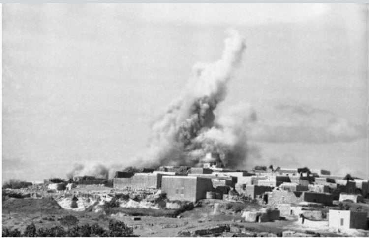
Posted by abu raya - المستعمر البريطاني يقصف ميعار سنه 1938
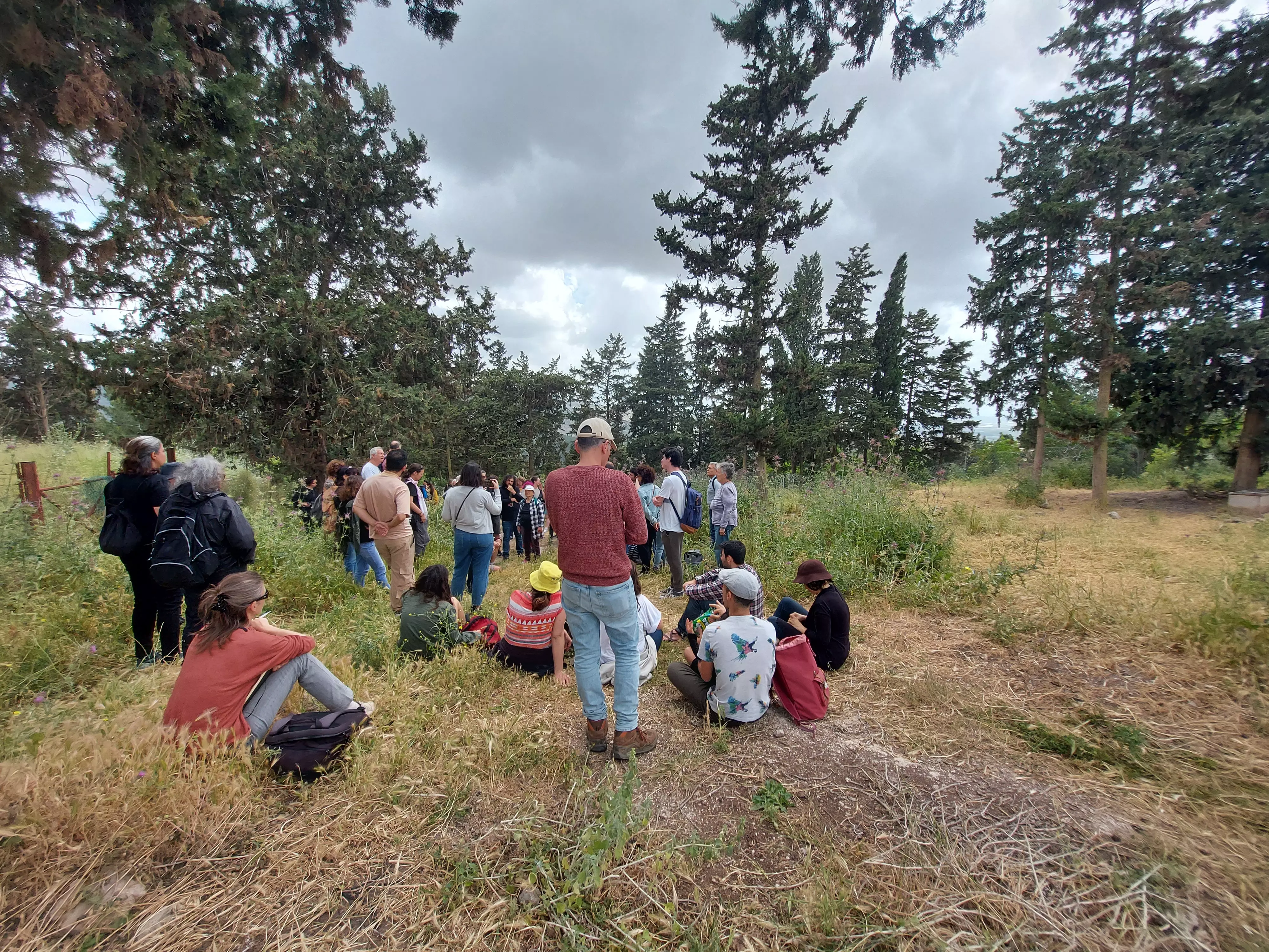
Posted by abu raya - زيارة لقرية ميعار المهجرة - ٢٠٢٢
Posted by said - زيارة لقرية ميعار المهجرة - ٢٠٢٢
Posted by said - مقبرة قرية ميعار المهجرة -٢٠٢٢
Posted by said - زيارة جماعية لقرية ميعار المهجرة - 2022
Posted by said - احد الابار 2022

Posted by said - احد الابار - ٢٠٢٢
Posted by said - مقبرة قرية ميعار المهجرة -٢٠٢٢
Posted by said - زيارة لقرية ميعار المهجرة - ٢٠٢٢
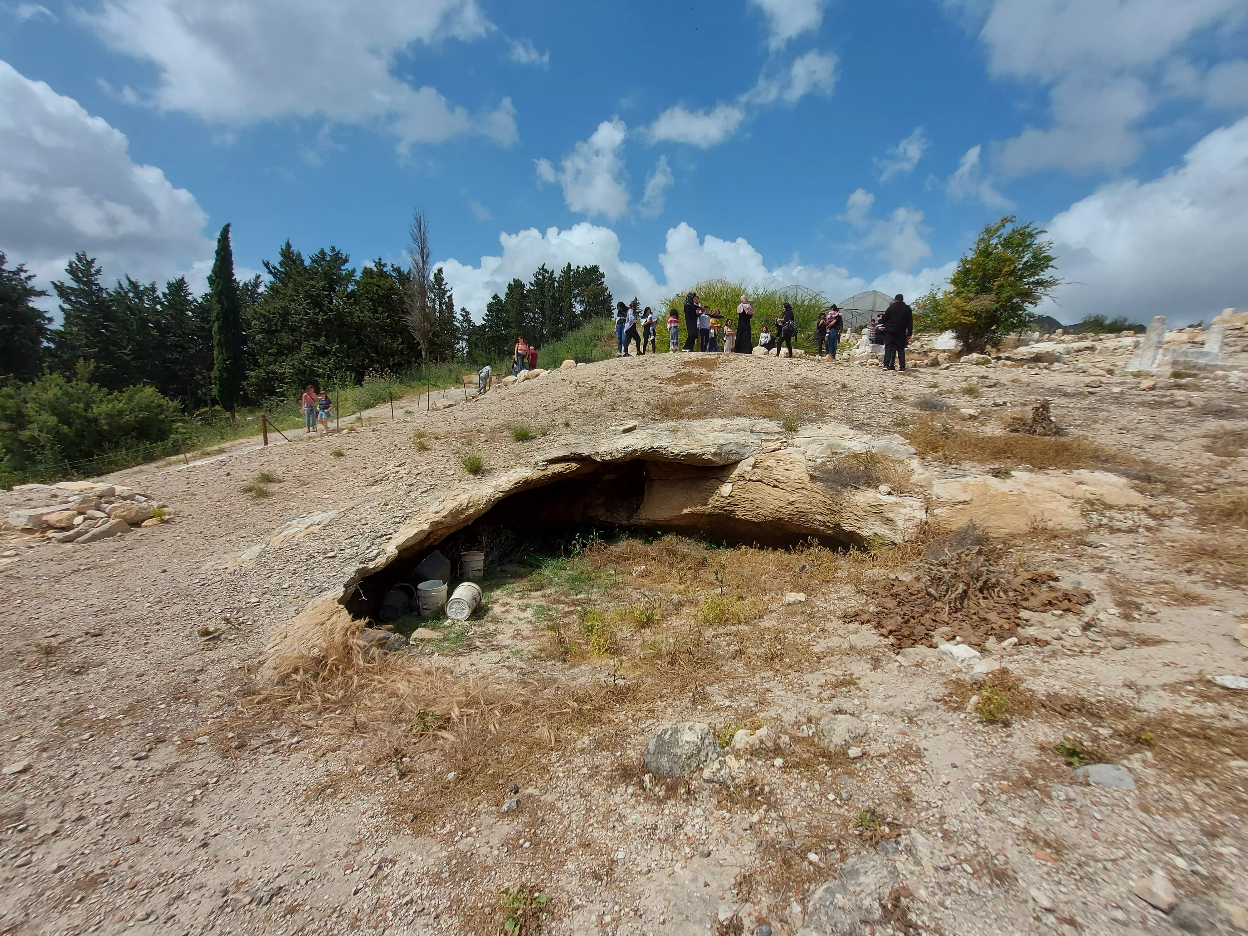
Posted by said - مقبرة قرية ميعار المهجرة -٢٠٢٢
Posted by said - مقبرة قرية ميعار المهجرة -٢٠٢٢
Posted by said - زيارة لقرية ميعار المهجرة - ٢٠٢٢
Posted by said - أهالي ميعار يطالبون السلطات الإسرائيلية بالسماح لهم بالعودة إلى بلدهم في كانون الثاني سنة
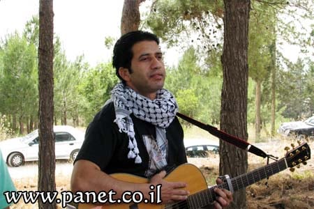
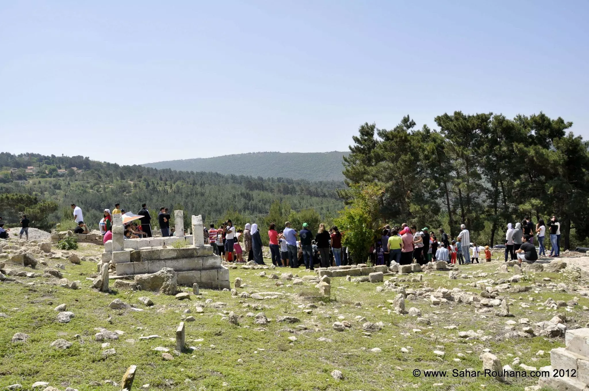
- جولة في ميعار المهجر في ذكرى النكبة -2012 - تصوير سحر روحانا
- جولة في ميعار المهجر في ذكرى النكبة -2012 - تصوير سحر روحانا #2
- جولة في ميعار المهجر في ذكرى النكبة -2012 - تصوير سحر روحانا #3
- جولة في ميعار المهجر في ذكرى النكبة -2012 - تصوير سحر روحانا #4
- جولة في ميعار المهجر في ذكرى النكبة -2012 - تصوير سحر روحانا #5
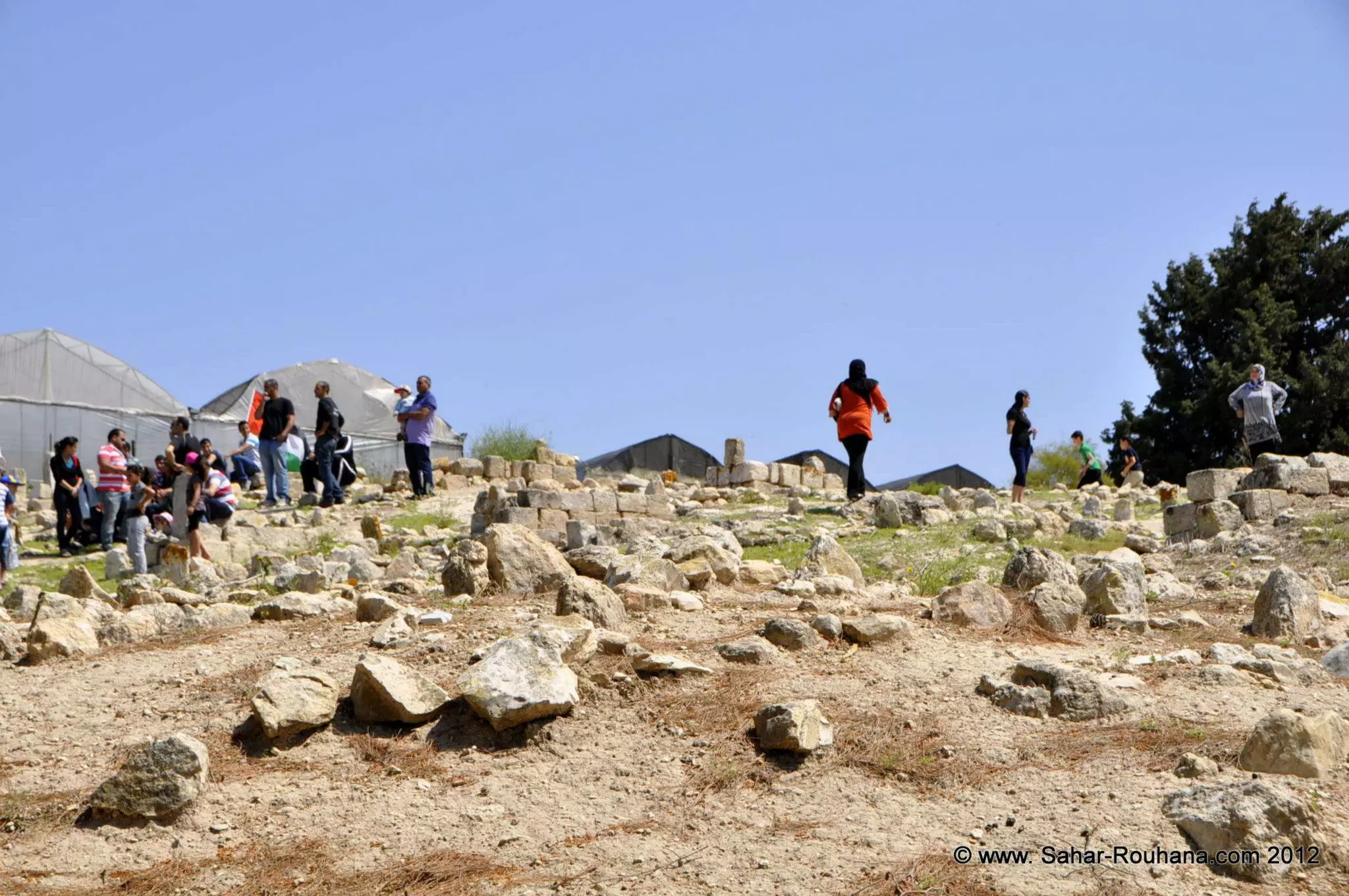
- جولة في ميعار المهجر في ذكرى النكبة -2012 - تصوير سحر روحانا #6
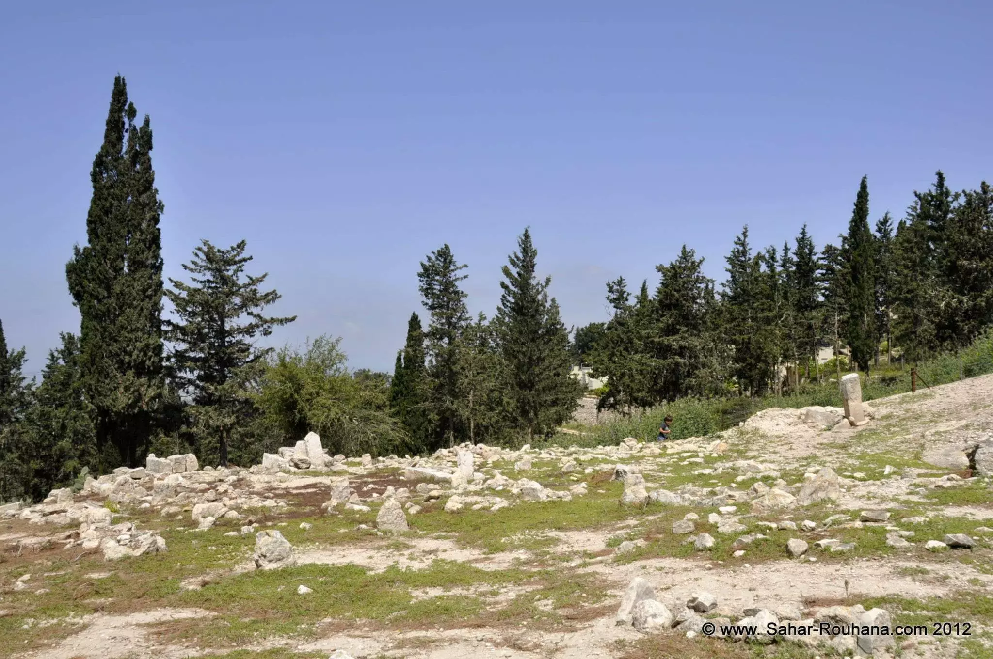
- جولة في ميعار المهجر في ذكرى النكبة -2012 - تصوير سحر روحانا #7
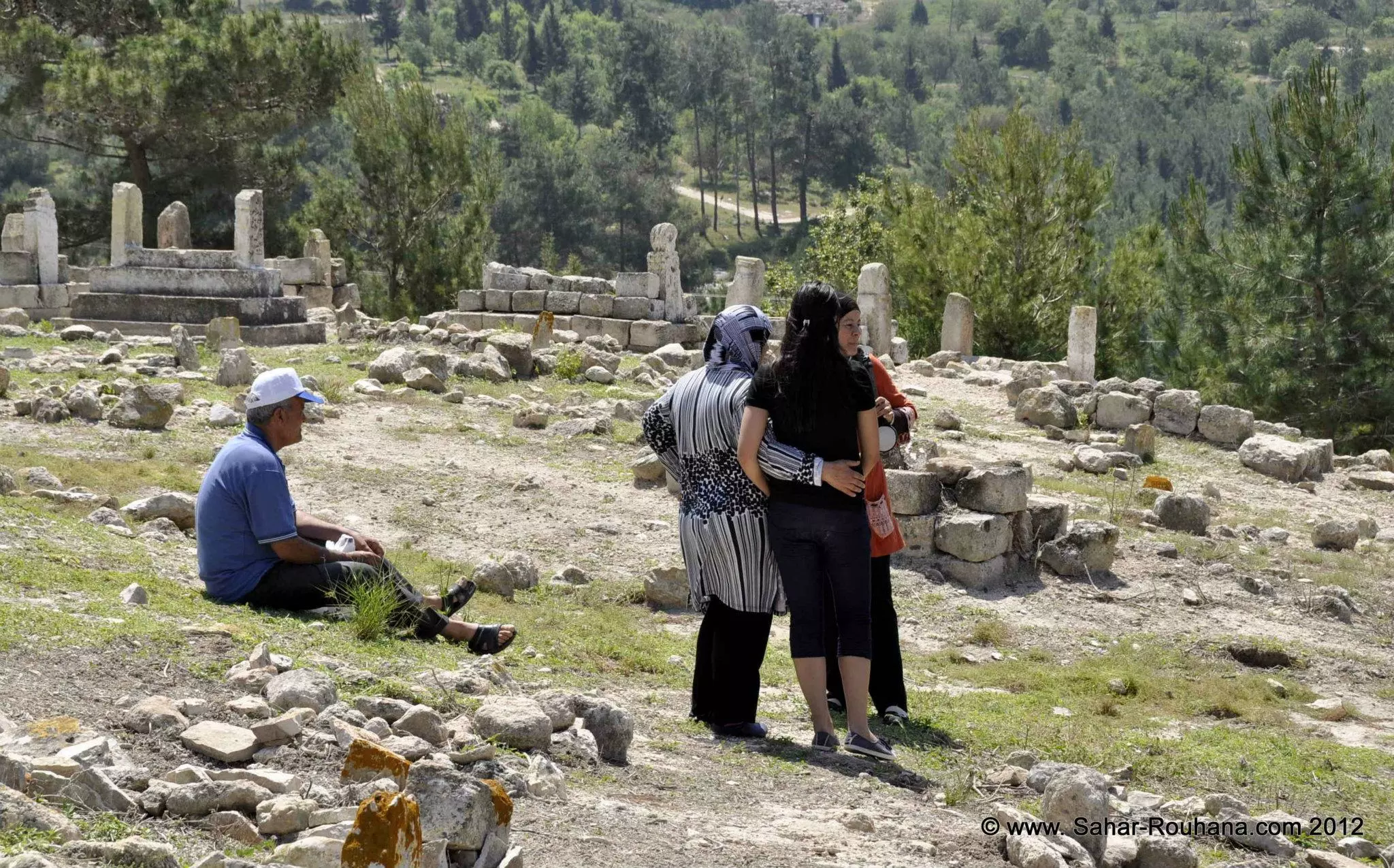
- جولة في ميعار المهجر في ذكرى النكبة -2012 - تصوير سحر روحانا #8
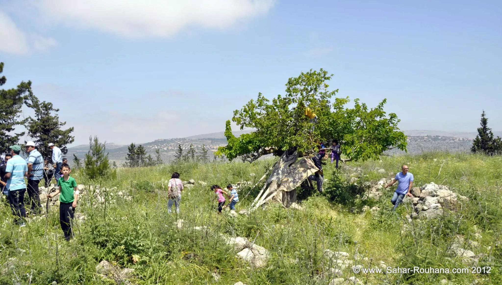
- جولة في ميعار المهجر في ذكرى النكبة -2012 - تصوير سحر روحانا #9
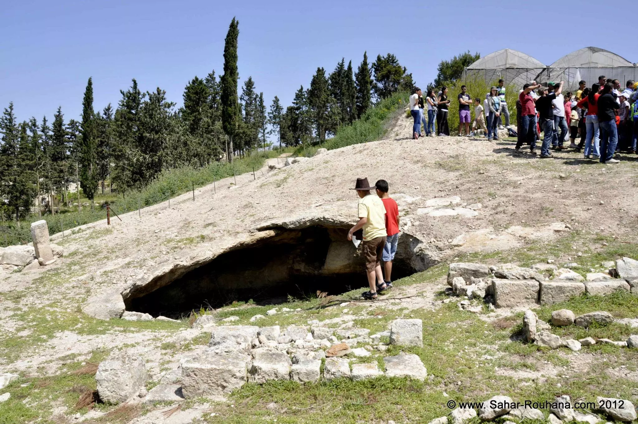
- جولة في ميعار المهجر في ذكرى النكبة -2012 - تصوير سحر روحانا #10
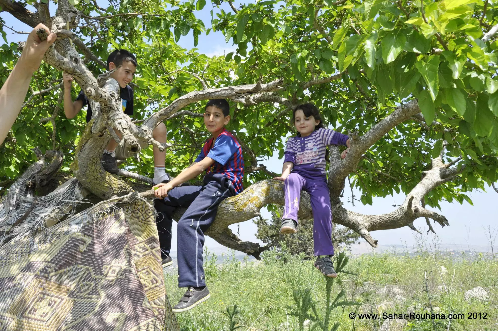
- جولة في ميعار المهجر في ذكرى النكبة -2012 - تصوير سحر روحانا #11
- قرية ميعار من الجو عام 1948
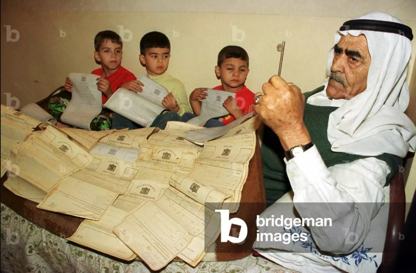
- العشرات من كوشان الارض في ميعار تعود ملكيتها لحسين ميعاري ومن حوله احفاه الذي يقطن في مخيم جعين الحلوة في جنوب لبنان
1 - مقبرة قرية ميعار المهجرة
- Let us see how the most "liberal and civilized" of world Jewry has obliterated our village; even the cemetery didn't escape their wrath. How else will the Jews be great and safe again? -- القرية دمرت بالكامل.. من هنا مر الهمج
- Let us see how the most "liberal and civilized" of world Jewry has obliterated our village; even the cemetery didn't escape their wrath. How else will the Jews be great and safe again? -- القرية دمرت بالكامل.. من هنا مر الهمج
#2
- Let us see how the most "liberal and civilized" of world Jewry has obliterated our village; even the cemetery didn't escape their wrath. How else will the Jews be great and safe again? -- القرية دمرت بالكامل.. من هنا مر الهمج
#3
- Let us see how the most "liberal and civilized" of world Jewry has obliterated our village; even the cemetery didn't escape their wrath. How else will the Jews be great and safe again? -- القرية دمرت بالكامل.. من هنا مر الهمج
#4
- Let us see how the most "liberal and civilized" of world Jewry has obliterated our village; even the cemetery didn't escape their wrath. How else will the Jews be great and safe again? -- القرية دمرت بالكامل.. من هنا مر الهمج
#5
- Let us see how the most "liberal and civilized" of world Jewry has obliterated our village; even the cemetery didn't escape their wrath. How else will the Jews be great and safe again? -- القرية دمرت بالكامل.. من هنا مر الهمج
#6
- Let us see how the most "liberal and civilized" of world Jewry has obliterated our village; even the cemetery didn't escape their wrath. How else will the Jews be great and safe again? -- القرية دمرت بالكامل.. من هنا مر الهمج
#7
- Let us see how the most "liberal and civilized" of world Jewry has obliterated our village; even the cemetery didn't escape their wrath. How else will the Jews be great and safe again? -- القرية دمرت بالكامل.. من هنا مر الهمج
#8
- Let us see how the most "liberal and civilized" of world Jewry has obliterated our village; even the cemetery didn't escape their wrath. How else will the Jews be great and safe again? -- القرية دمرت بالكامل.. من هنا مر الهمج
#9
- Let us see how the most "liberal and civilized" of world Jewry has obliterated our village; even the cemetery didn't escape their wrath. How else will the Jews be great and safe again? -- القرية دمرت بالكامل.. من هنا مر الهمج
#10
- خارطة تُظهِر الحدود والطرق بأنواعها والأماكن المقدسة والطبيعة الطوبغرافية من تلال وسهول ومنحدرات والتشكيلة الطبيعية للأرض وأنواع المزروعات. نُشرت الخريطة فترة الانتداب البريطاني، تم إضافة تعديلات عليها من قِبَل خدمة الخرائط والصور التابعة للقوات العسكرية الاسرائيلية فترة الأربعينيات.
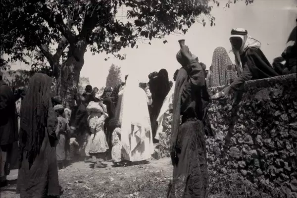
- سحجة في عرس في مقرية ميعار عام 1937
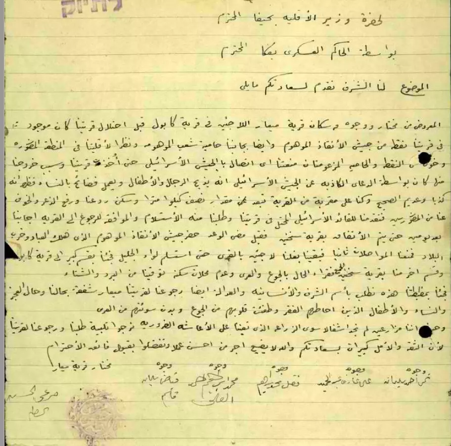
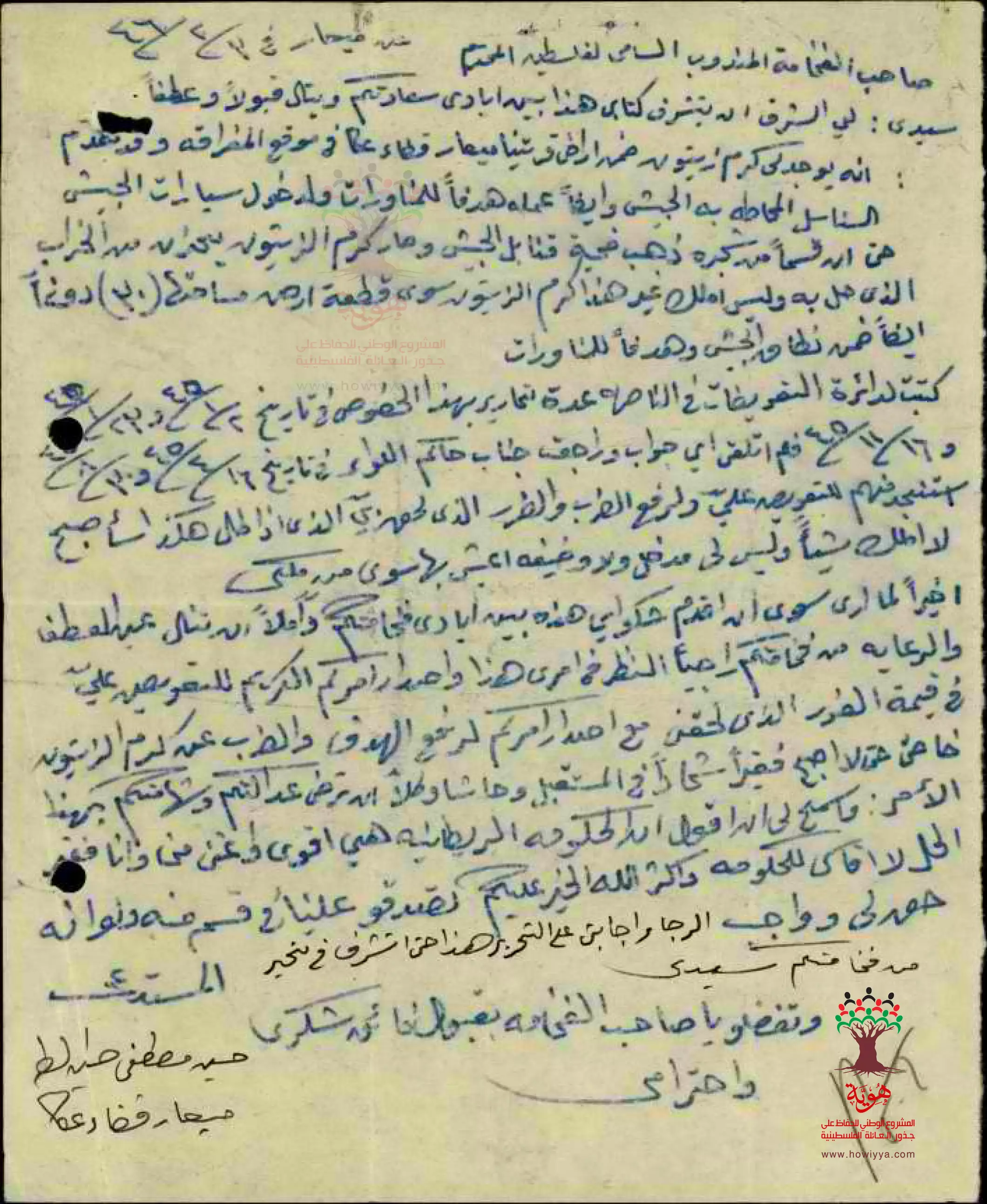
- طلب تعويض عن كرم الزينون الذي استخدم لمناورات الجيش -- مقدم الطلب: حسين مصطفى حسين الطه - ميعار --03/02/1946
Want to browse more? 80,000 pictures were grouped in these gallaries:
| Display Name | Clan/Hamolah | Country of Residence |
| Yosof Miari | Miari | Palestinian, Palestine our homeland |
| Rima Blue eyes | H | Ramallah, Holy Palestine |
| Khalil Hamze | Hamze | Sakhnin, Occupied Palestine |
| sholy | sholy | saida, saida |
| Abu Ashwaq & Haneen | Miari | - |
| مؤنس شحادة | شحادة | قرية شعب ( الاصل ميعار ) |
| hesham shehadeh | shehadeh | kiel, germany |
| العهد | haibai | - |
| jamal turkey | turkey | sha'ap, pl-1948 |
| Sahar Miari | Mi3ar | - |
| fayad | - | israel, israel |
| moatasem alhebi | - | - |
| alhebi fouad | Alhebi | Germany |
- عدنا -قرية ميعار المهجرة Duration: 6 min 44 sec
- قرية ميعار المهجرة - فلسطين - حلوة يا دنيا Duration: 15 min 22 sec
- مشهد من بلدي | قرية ميعار - المهجرة Duration: 2 min 12 sec
- الذاكرة مفتاح العودة - الحلقة 78- قرية ميمار Duration: 23 min 22 sec
- السلام على ساكني الديار: ميعار. تاريخ، تراث، بقاء. نيال من توفي في ارضه وما أًخرج منها Duration: 5 min 53 sec
 Fake Valor: Why Did Zionist Jews Hoist Nazis Flag on Their Ships in the 1930s?
What is new?
-
Facts About Oct. 7th Gaza Raid
-
Remined Us Please: Who Did Rape Whom? Was it Palestinians who raped Israelis? Or, was the other way around? You'll be the judge
-
When Prof. Edward Said was invited to debate Bibi Netanyahu in the 1980s, watch what happened!
-
Ezra Klein of the NY Times on the "Jewish Race".
-
Abusing Blood Libel!
-
How and why Israeli Jewry has become the most hated cult?
-
Did Israeli Soldiers Activate The Hannibal Direective On Oct. 7th? You Be The Judge
-
Zionist FAQ: Isn't it true that Palestinians don't want peace? Palestinians never accepted the two-state solution
- Facts about Haavara (Transfer) Agreement between Ben-Gurion & Hitler
-
Haavara FAQs: Why Did Zionist Jews Hoist Nazis' Flags on Their Ships in the 1930s?
- Haavara FAQs: When Chaim Weizmann met FDR in mid-1943, why was he silent about rescuing European Jewry?
-
Dear ChatGPT: How did Palestinians resist Napoleon's invasion of their country in 1799?
-
Dear ChatGPT: Gaza had a vibrant Jewish community in the mid-17th century. What happened to them?
-
Dear ChatGPT: Why did the Jewish Agency suppress news of the Holocaust during WWII?
-
Video Playlist: Jews share their DNA tests to end the conflict for good.
-
A Tale of Two Conflicts: Examining the Definition of Genocide
-
Prof. Abraham Polak And The Suppressed History of the Khazars and European Jewry
-
How Ronald Reagan would have framed the genocide in Gaza if he were still alive?
-
Haavara FAQs: Let us do the math: how many German Jews did The Haavara Agreement save?
-
Zionist FAQs: The Hebron Massacre of 1929, "clearly proves" that Palestinians are antisemitic, how could you deny it?
-
Zionist FAQs: Why Anti-Zionist Is Not Antisemitism?
-
Zionist FAQs: Isn't it true that the KGB created Palestinian Nationalism in the early 1960s?
- Zionist FAQs: Muslims are killing Muslims all the time; why are Israeli Jews being singled out in the media?
- Zionist FAQs: How is Israel an apartheid state when 20% of its citizens are Arabs who enjoy full rights?
-
Haavara FAQs: Why Did Dorothy Thompson Flip From A Zionist Advocate to A Silenced Dissenter?
-
Haavara FAQs: Analysis of Herzl's Uganda Scheme and how it could have saved millions of Jews.
-
Haavara FAQs: Why did Hayim Greenberg describe American Jewry as "morally bankrupt" in early 1943?
-
Haavara FAQs: What if the Evian Conference was a resounding success? What would have been the impact of saving European Jewry on Zionism?
- Haavara FAQs: What if the six million were saved, how that would have impacted the Zionist project?
-
Haavara FAQs: How did Zionist leaders react when Europe's Jews lingered in the DP camps after WWII ended?
-
Why does the American Jewish community repeat lies that David Ben-Gurion had debunked before he died?
-
Who has the power to rename the Tatar/Khazar Gene Marker to Jewish IV?
-
Zionist FAQs: Why won't Egypt, Syria, and Jordan take their people back? Jews are indigenous to Palestine, and Arabs immigrated after Jews developed the country. Arabs should leave.
-
Haavara FAQs: Did Hitler and the Nazis conflate between Judaism and Zionist? If that wasn't case, then why?
-
Haavara FAQs: Winston Churchill and antisemitism, a collection of articles written Churchill.
-
Haavara FAQs: Broken by country, how many Jews survived vs. killed during the Holocaust?
-
Haavara FAQs: Why did European Jews vote with their feet and to immigrated to the Americas, not Palestine, after WWII?
-
Watch this American Jewish Girl describing Israeli Jews' cognitive dissonance like no other in under two minutes
-
Haavara FAQs: When the Nazis went out of their way to hide the Holocaust, Israeli Jews did the exact opposite by broadcasting their genocide of Gazans. But why?
-
Haavara FAQs: How Zionist Jews went out of their to show their appreciation to Nazism and Fascism?
- Haavara FAQs: Why Zionist leaders were against bombing the death camps & the Railroads leading to them?
-
Haavara FAQs: Hitler's message to the British and American people: If Jews are such noble citizens and you care about them, how come you're not letting them in? I will gladly ship them to you at my expense, even on luxury liners!
-
A shortlist of Zionist and Israeli false flag operations in the name Jews.
-
The Most Moral Army
- The Land of Kapos (Israel): Where the brave are boycotted and Kapos walk free.
- Why did early Zionists often named their communal enterprises "colonial"?
- Zionist Relations with Nazi Germany by Faris Glubb
-
Two NY Times advertisements by Zionists in the early 1943 that exposes Zionists' treason at the height of the calamity
- Facts Not Lies about the Palestinian-Israeli Conflict.
- Site's pictures have been categorized
- Campgain Against Lice
- A Survey of Palestine, the official source about Palestine before Nakba produced by the British Mandate; over 1200 pages.
- Satellite View & Google Earth: Over 6,000 placemarks identifying all destroyed towns, W. Bank & Gaza Strip Towns, & refugee camps.
- PalestineRemembered.com and its Nakba Oral History Project were featured on al-Jazeera Satellite TV.
- Nakba Oral History Video Podcast:
 Over 700 Oral History interviews (including 3,500+ hours of recording) can be viewed online.
 - Palestine Village Statistics Project
- Gaza Jail Break
- النسخة العربية للموقع الان متوفرة
- Videos: Documenting the destroyed villages in video: Tracing all that remains since Nakba.
- Videos: Responding to Zionist Propaganda
- Interview: The ethnic cleansing of Palestine: George Galloway interviews Israeli Historian Ilan Pappe.
- For Palestinians, memory matters. It provides a blueprint for their future By George Bisharat.
- Zionist FAQ now available in Hebrew שאלות שציונים שואלים, עכשיו בעברית
- Video: The Stephen Walt and John Mearsheimer report on the influence of the Israel Lobby on U.S. Foreign Policy
- The Palestinian-Israeli conflict for beginners
