| PalestineRemembered | About Us | Oral History | العربية | |
| Pictures | Zionist FAQs | Haavara | Maps | |
| Search |
| Camps |
| Districts |
| Acre |
| Baysan |
| Beersheba |
| Bethlehem |
| Gaza |
| Haifa |
| Hebron |
| Jaffa |
| Jericho |
| Jerusalem |
| Jinin |
| Nablus |
| Nazareth |
| Ramallah |
| al-Ramla |
| Safad |
| Tiberias |
| Tulkarm |
| Donate |
| Contact |
| Profile |
| Videos |
Welcome To Kabul - كابول (כאבול)
|
District of Acre
Ethnically cleansed days ago |
العربية Google Earth |
| Gallery (16) |
- Statistics & Facts
-
Before & After

- Satellite View
- Articles 5
- Pictures 16
- Aerial Views 1
- Members 6
- Families

- Wikipedia
- Videos 1
- Guest Book 1
- Links
| Statistic & Fact | Value | ||||||||||||||||||||||||
| Occupation Date | July 15, 1948 | ||||||||||||||||||||||||
| Distance From District | 14 (km) Southeast of Acre | ||||||||||||||||||||||||
| Elevation | 100 (meters) | ||||||||||||||||||||||||
| Before & After Nakba, Click Map For Details |
|||||||||||||||||||||||||

|
|||||||||||||||||||||||||
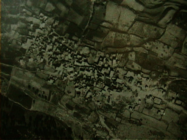
| Pre-Nakba Aerial View |
|||||||||||||||||||||||||

|
|||||||||||||||||||||||||
| Map Location | Click here map | ||||||||||||||||||||||||
| Military Operation | Dekel | ||||||||||||||||||||||||
| Attacking Units | Sheva' (Seventh) Brigade | ||||||||||||||||||||||||
| Village Temains | The village was destroyed during the 1948 war. | ||||||||||||||||||||||||
| Ethnically Cleansing | Few of the village inhabitants have been ethnically cleansed, however, most of its people were allowed to stay. On the other hand, the village currently hosts many internal Palestinian-Israeli refugees from al-Damun, Mia'r, al-Birwa, and al-Ruways. | ||||||||||||||||||||||||
| Clans | We are aware of the following extended families: Rayan, Hamoud, Taha, Ibrahim, Taha Mi'ar, Habi, Uthman, 'Ashkar, Sharari, 'Akari, Badran, and Bouqa'i. | ||||||||||||||||||||||||
| Pre-Nakba Land Ownership |
**Town Lands' Demarcation Maps |
||||||||||||||||||||||||
| Land Usage As of 1945 |
|
||||||||||||||||||||||||
| Population |
|
||||||||||||||||||||||||
| Number of Houses | In (1931): 100 | ||||||||||||||||||||||||
| Near By Towns |
|||||||||||||||||||||||||
|
|||||||||||||||||||||||||
| Town's Name Through History | The romans referred to it by 'Chabalon', and the Crusades called 'Cabor'. | ||||||||||||||||||||||||
| Schools | Before Nakba, there was no schools, but after Nakba the village had 3 elementary schools, one middle school, and one high school. | ||||||||||||||||||||||||
| Places of Warship | Currently, Kaboul has three mosques. | ||||||||||||||||||||||||
| Nearby Wadies & Rivers | Wadi al-Halazoun localed northwest of the village. | ||||||||||||||||||||||||
| Exculsive Jewish Colonies Who Usurped Village Lands |
No settlements were built on village lands, however, most of the sarounding village's lands confiscated by the Israeli government for forestry purposes. | ||||||||||||||||||||||||
| Featured Video | |||||||||||||||||||||||||
| Related Maps | Town Lands' Demarcation Maps خرائط للقضاء توضح حدود القرى والاودية Town's map on MapQuest View from satellite Help us map this town at WikiMapia |
||||||||||||||||||||||||
| Related Links | Wikipedia's Page Facebook Page Google Search Google For Images Google For Videos |
||||||||||||||||||||||||
| More Information | في كتاب بلادنا فلسطين المزيد من موقع هوية |
||||||||||||||||||||||||
- Kabul Village
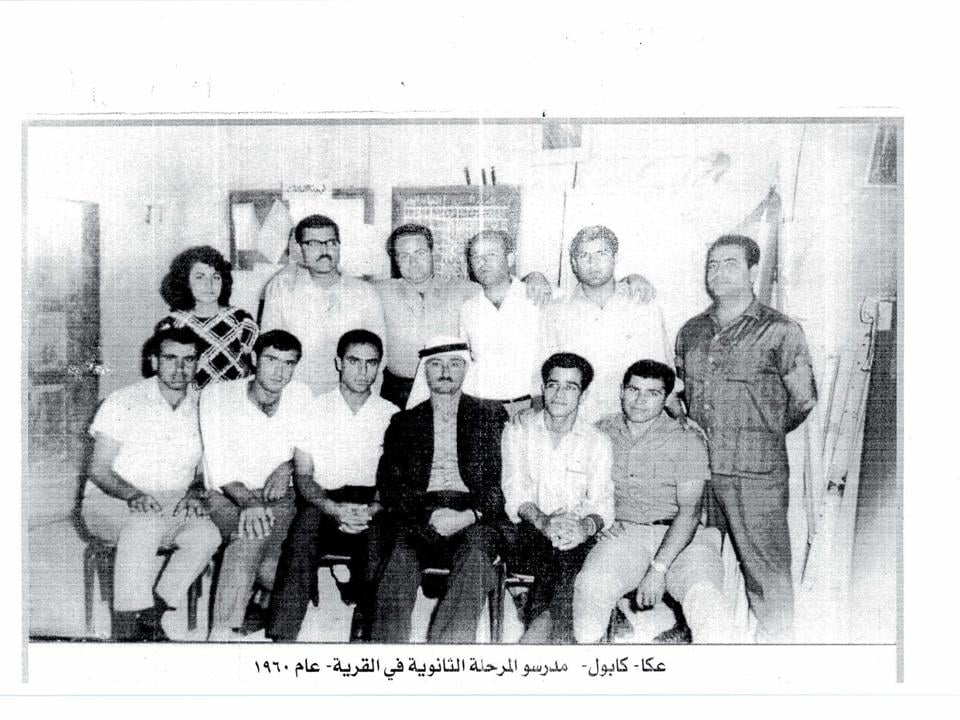
5 - Primary school teachers 60's
Posted by iDAR 1 - aerial view of kabul 1948
Posted by iDAR 3 - Shekh' Romi tomb, kabul, 2001
Posted by iDAR 2 - Eastern View 2003- Artistic Work of the Architect Abed Badran
Posted by iDAR 1 - اراضي كابول عمر عصفور
Posted by عمر عصفور - حمام بيزنطي قديم في كابول عمر عصفور
Posted by عمر عصفور - محراث قديم كابول - عمر عصفور
Posted by عمر عصفور 1 - مدرسو المرحل الثانوية في كابول عام 1960
- منظرعام #2
- منظرعام
- منظرعام #3
- جامع
- جامع #2
- جامع #3
- خارطة تُظهِر الحدود والطرق بأنواعها والأماكن المقدسة والطبيعة الطوبغرافية من تلال وسهول ومنحدرات والتشكيلة الطبيعية للأرض وأنواع المزروعات. نُشرت الخريطة فترة الانتداب البريطاني، تم إضافة تعديلات عليها من قِبَل خدمة الخرائط والصور التابعة للقوات العسكرية الاسرائيلية فترة الأربعينيات.
Want to browse more? 80,000 pictures were grouped in these gallaries:
| Display Name | Clan/Hamolah | Country of Residence |
| ايمن ريان | - | كابول |
| عمر عصفور | عصفور | اسرائيل, اسرائيل |
| Badera Ryan | - | - |
| وطن | - | كابول |
| Intisar Ashkar | Ibrahim | Palestine, Palestine |
| Taha Ashkar | - | Palestine, Palestine |
- حكاية بلد قرية كابول Duration: 17 min 40 sec
No links have been shared yet, be free to the first to share the first link.


