| PalestineRemembered | About Us | Oral History | العربية | |
| Pictures | Zionist FAQs | Haavara | Maps | |
| Search |
| Camps |
| Districts |
| Acre |
| Baysan |
| Beersheba |
| Bethlehem |
| Gaza |
| Haifa |
| Hebron |
| Jaffa |
| Jericho |
| Jerusalem |
| Jinin |
| Nablus |
| Nazareth |
| Ramallah |
| al-Ramla |
| Safad |
| Tiberias |
| Tulkarm |
| Donate |
| Contact |
| Profile |
| Videos |
Welcome To Kawkaba - كوكبا (כוכבא)
|
District of Gaza
Ethnically cleansed days ago |
العربية Google Earth |
 |
Gallery (6) |
- Statistics & Facts
-
Before & After

- Satellite View
- Articles 1
- Pictures 6
- Aerial Views 1
- Oral History 1
- Members 22
- All That Remains
- Wikipedia
- Videos 2
- Guest Book 26
- Links
| Statistic & Fact | Value | ||||||||||||||
| Occupation Date | May 12, 1948 | ||||||||||||||
| Distance From District | 25 (km) North East of Gaza | ||||||||||||||
| Elevation | 100 (meters) | ||||||||||||||
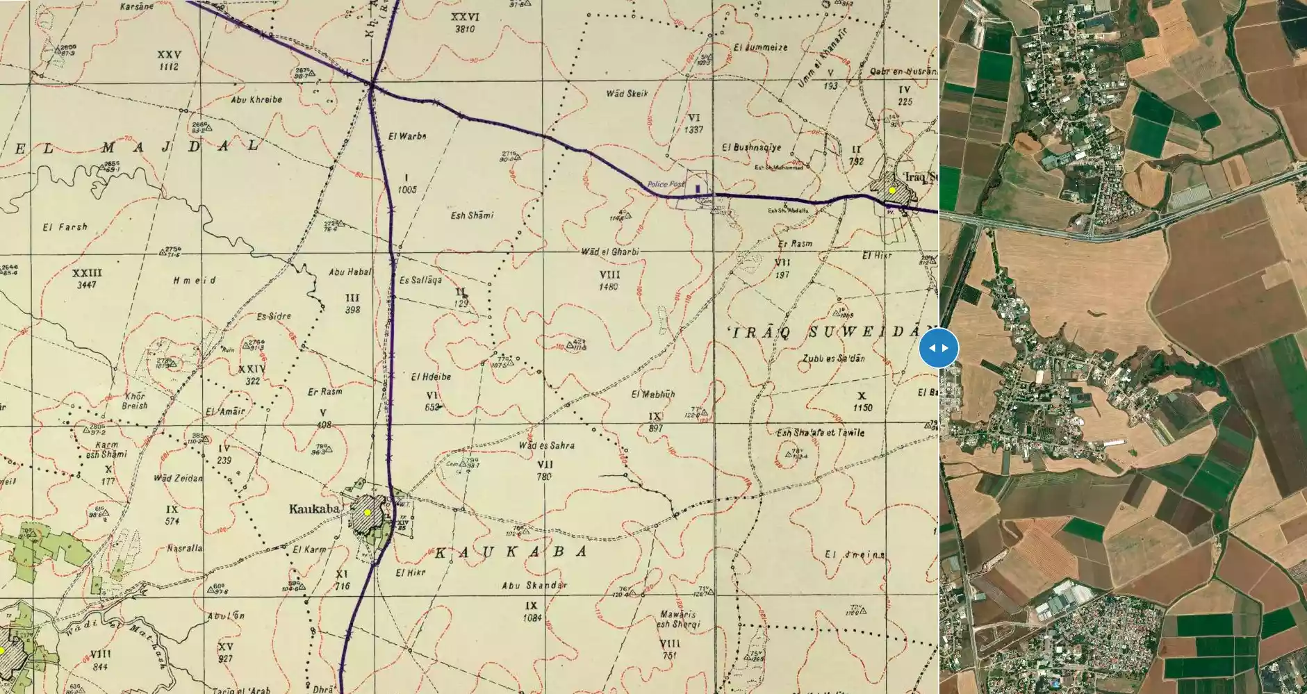
| Before & After Nakba, Click Map For Details |
|||||||||||||||
|
|||||||||||||||
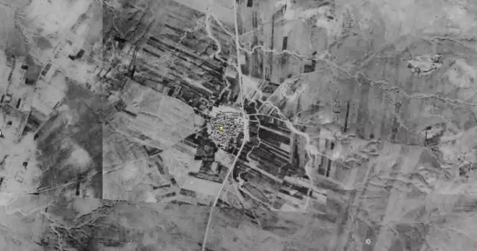
| Pre-Nakba Aerial View |
|||||||||||||||
|
|||||||||||||||
| Map Location | See location #32 on the map View from satellite |
||||||||||||||
| Military Operation | Operation Yo'av | ||||||||||||||
| Exodus Cause | Influence of fall of, or exoduce from, neighboring town | ||||||||||||||
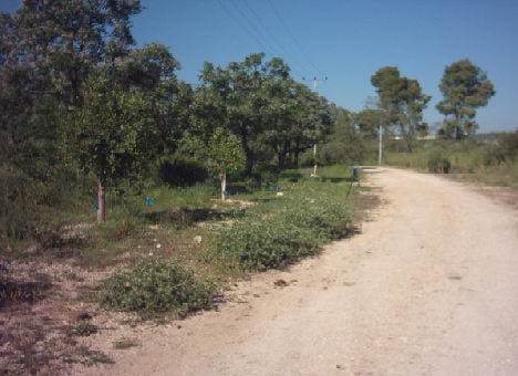
| Village Temains | The village has been completely defaced | ||||||||||||||
| Ethnically Cleansing | Kawkaba inhabitants were completely ethnically cleansed. | ||||||||||||||
| Pre-Nakba Land Ownership |
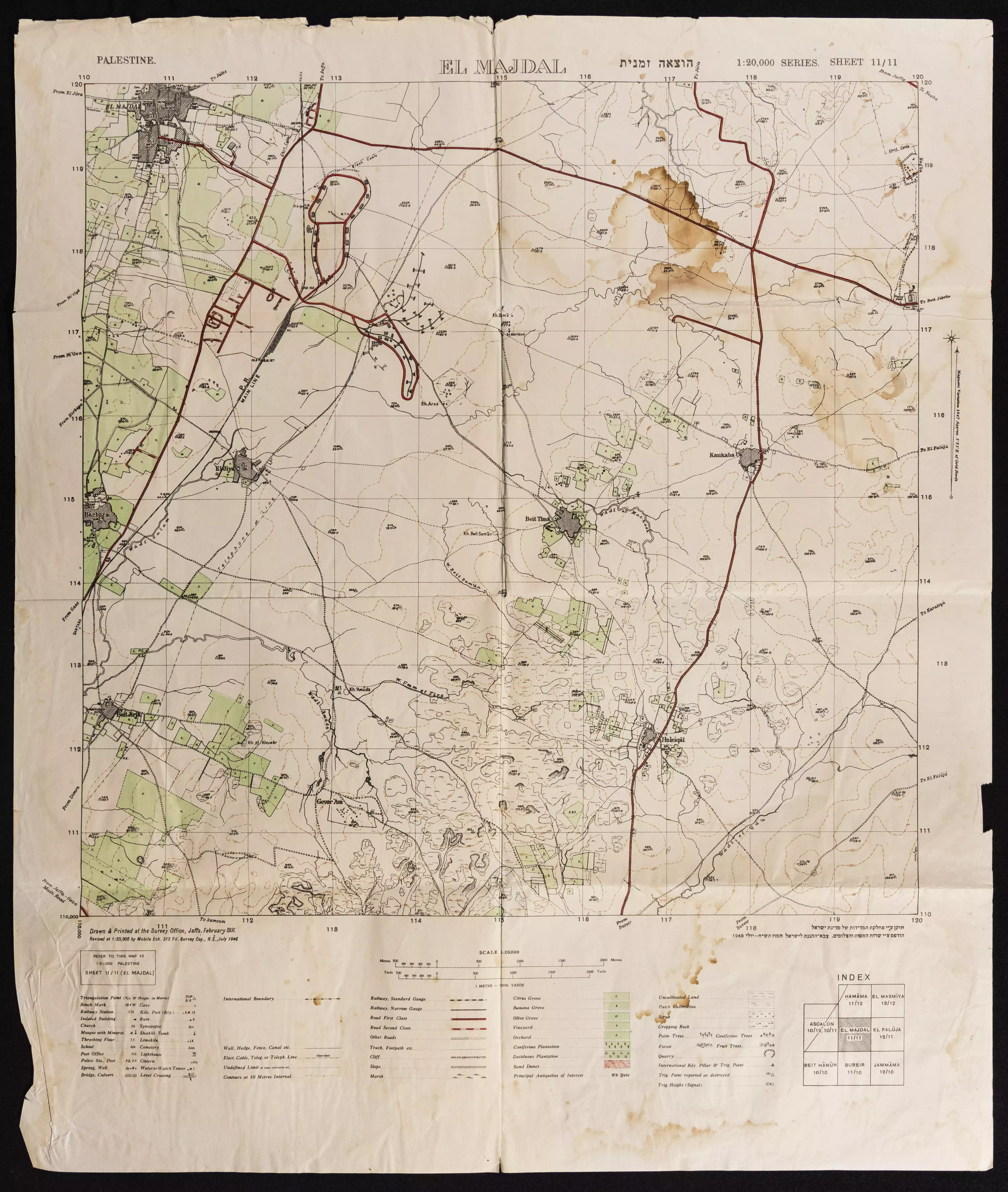
**Town Lands' Demarcation Maps |
||||||||||||||
| Land Usage As of 1945 |
|
||||||||||||||
| Population |
|
||||||||||||||
| Number of Houses |
|
||||||||||||||
| Near By Towns |
|||||||||||||||
|
|||||||||||||||
| Town's Name Through History | The Crusades referred to the village by Coquebel | ||||||||||||||
| Schools | Kawkaba shared its elementary school with the nearby villages of Bayt Tima and Hulayqat | ||||||||||||||
| Exculsive Jewish Colonies Who Usurped Village Lands |
Kokhav Mikha'el | ||||||||||||||
| Featured Video | |||||||||||||||
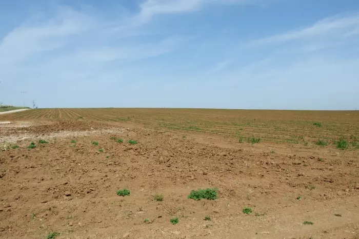
Village Before NakbaThe village was situated on an uneven stretch of red-brown soil on the southern coastal plain. It lay on a highway constructed by the British during World War II, which paralleled and fed the coastal highway and passed through Gaza and Julis. The site was known during the Crusades as Coquebel. In 1596 Kawkab, a site identified with Kawkaba, was a village with 88 people. It paid taxes on wheat, barley, sesame, fruit trees, and vineyards.The modem village was built around the middle of the nineteenth century on the site of a khirba that bore the same name. In the late 1800s, the village of Kawkaba had a rectangular layout along the above-mentioned road, and expanded north-south alongside it; it had a well to the west and a pool to the north. Kawkaba shared an elementary school with the villages of Bayt Tima and Hulayqat. Its houses were made of adobe and cement, and its shops were located at the village center, on the western side of the road. On its eastern lands were two water sources: a spring and a 70-m-deep well. The inhabitants of Kawkaba, who were Muslims, engaged in rainfed agriculture, cultivating grain and winter and summer vegetables. Toward the end of the Mandate they also cultivated fruits, such as figs and grapes, on all their lands except those to the west. In 1944/45 a total of 8,166 dunums was allotted to cereals; 166 dunums were irrigated or used for orchards. Kawkaba contained an archeological site with a pool, cisterns, the foundations of buildings, columns, and severed capitals. North of it was Khirbat Kamas, which was identified with the Crusader Camsa and which yielded some archaeological artifacts. Village Occupation and Ethnic CleaningIsraeli historian Benny Morris writes that the villagers fled westwards to Gaza on 13 May 1948, as a result of the destruction of the nearby village of Burayr, which was carried out during Operation Barak . But some inhabitants seem to have remained in Kawkaba, for the History of the Haganah claims that the villagers left in October 1948, during Operation Yoav.The war reached Kawkaba well before these events, however. The Palestinian newspaper Filastin reported that a clash took place on 11 January on the road outside the village. The clash erupted when an armed Jewish convoy was attacked by Arab fighters, who lost one man in the two-hour skirmish. An Egyptian account complements the Israeli versions of Kawkaba's occupation, claiming that the village was first occupied by Israel on 14 June 1948, in violation of the first truce of the war. Egyptian author Muhammad Abd al-Mun'im writes that the villagers were expelled at this time. Relying on Egyptian official records, he adds that Kawkaba was recaptured on 8 July by the Egyptian Second Infantry Battalion, with the help of a Saudi company, just as the first truce was ending. It apparently remained in Arab hands until the end of the second truce, on 18–19 October. The New York Times reported that, on 20 October, the Israeli army announced the capture of Kawkaba, along with Bayt Tima and Hulayqat. Thus, the village changed hands no less than three times in the course of the war, and the inhabitants were probably displaced in stages. Zionists Colonies on Village LandsThe settlement of Kokhav Mikha'el was founded in 1950 on village lands, southeast of the village site.Village TodayThe site is overgrown with sycamore and Christ's-thorn trees. The old road, as well as crumbled walls and debris in a wooded part of the site are clearly visible. The land in the vicinity is cultivated by Israeli farmers.SourceDr. Walid al-Khalidi, 1992: All That Remains. |
|||||||||||||||
| Related Maps | Town Lands' Demarcation Maps خرائط للقضاء توضح حدود القرى والاودية Town's map on MapQuest View from satellite Help us map this town at WikiMapia |
||||||||||||||
| Related Links | Wikipedia's Page Facebook Page Google Search Google For Images Google For Videos |
||||||||||||||
| More Information | في كتاب كي لا ننسى في كتاب بلادنا فلسطين المزيد من موقع هوية |
||||||||||||||
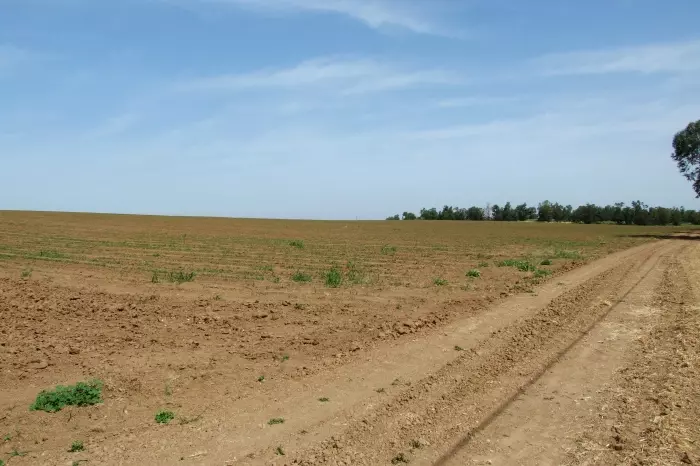
- A field, where the centre of Kawkaba used to be.
Posted by Uri Zackhem 4 - A field, where the centre of Kawkaba used to be.
Posted by Uri Zackhem 3 - صوره من كوكبا
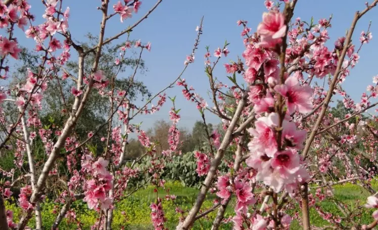
Posted by kawkaba_00 4 - الربيع في كوكبا
Posted by abu raya - Pre-Nakba Aerial view of the village / صورة من الجو للقرية اخذت قبل النكبة
- خارطة تُظهِر الحدود والطرق بأنواعها والأماكن المقدسة والطبيعة الطوبغرافية من تلال وسهول ومنحدرات والتشكيلة الطبيعية للأرض وأنواع المزروعات. نُشرت الخريطة فترة الانتداب البريطاني، تم إضافة تعديلات عليها من قِبَل خدمة الخرائط والصور التابعة للقوات العسكرية الاسرائيلية فترة الأربعينيات.
Want to browse more? 80,000 pictures were grouped in these gallaries:
| Display Name | Clan/Hamolah | Country of Residence |
| Ameer Saleh | صالح | Dearborn Michigan, United States |
| لؤي عيسى | عيسى | السويد |
| عمر مصلح | مصلح | - |
| Mahmoud Hussein | - | Amman, Jordan |
| om mohamed | الحاج | قطاع غزة, فلسطين |
| Mahmoud | Abdell-Hady | Sharjah, United Arab Emirates |
| hani | - | - |
| محمد عبد الهادي | - | الرياض |
| عبد الهادي | - | العليا, العليا |
| rawan Hussein | - | - |
| Israa Hussein | Hussein | Al Ain, UAE |
| Mohammed Hussein | Hussein | Al-Ain, U.A.E |
| Rana Hussein | Hussein | Dubai, UAE |
| محمود | الحاج | غزة, فلسطين |
| أحمد أبوريا | - | - |
| Majd A. Al-Haj | الحاج | Gaza, Nusirat, Palestine |
| انس عبدالسلام | الحاج | السعودية |
| عبدالمعطي القاضي | - | الرياض, السعودية |
| محمد الحاج | الحاج | - |
| kamal hussein | hussein | riyadh , Saudia arabia |
| محمد سليمان عبد القادر | الحاج | الشارقة, الإمارت |
| سامي | عبيد | - |
- All that remains of Kawkaba كل ما تبقى من كوكبا Duration: min 32 sec
- تبقى في الذاكرة - حلقة قرية كوكبا المحتلة تتحدث عن الهجرة والنكبة الفلسطينية سنة 1948 م وترصد المدينة قبل وبعد النبكة Duration: 24 min 4 sec
No links have been shared yet, be free to the first to share the first link.
 Fake Valor: Why Did Zionist Jews Hoist Nazis Flag on Their Ships in the 1930s?
What is new?
-
Facts About Oct. 7th Gaza Raid
-
Remined Us Please:: Who Did Rape Who? Palestinians Raped Israelis? Or, was the other way around?
-
When Prof. Edward Said was invited to debate Bibi Netanyahu in the 1980s, watch what happened!
-
Ezra Klein of the NY Times on the "Jewish Race".
-
Abusing Blood Libel!
-
Did Israeli Soldiers Activate The Hanniba Direective On Oct. 7th? You Be The Judge
-
Zionist FAQ: Isn't it true that Palestinians don't want peace? Palestinians never accepted the two-state solution
- Facts about Haavara (Transfer) Agreement between Ben-Gurion & Hitler
-
Haavara FAQs: Why Did Zionist Jews Hoist Nazis' Flags on Their Ships in the 1930s?
- Haavara FAQs: When Chaim Weizmann met FDR in mid-1943, why was he silent about rescuing European Jewry?
-
Dear ChatGPT: How did Palestinians resist Napoleon's invasion of their country in 1799?
-
Dear ChatGPT: Gaza had a vibrant Jewish community in the mid-17th century. What happened to them?
-
Dear ChatGPT: Why did the Jewish Agency suppress news of the Holocaust during WWII?
-
Video Playlist: Jews share their DNA tests to end the conflict for good.
-
A Tale of Two Conflicts: Examining the Definition of Genocide
-
Prof. Abraham Polak And The Suppressed History of the Khazars and European Jewry
-
How Ronald Reagan would have framed the genocide in Gaza if he were still alive?
-
Haavara FAQs: Let us do the math: how many German Jews did The Haavara Agreement save?
-
Zionist FAQs: The Hebron Massacre of 1929, "clearly proves" that Palestinians are antisemitic, how could you deny it?
-
Zionist FAQs: Why Anti-Zionist Is Not Antisemitism?
-
Zionist FAQs: Isn't it true that the KGB created Palestinian Nationalism in the early 1960s?
- Zionist FAQs: Muslims are killing Muslims all the time; why are Israeli Jews being singled out in the media?
- Zionist FAQs: How is Israel an apartheid state when 20% of its citizens are Arabs who enjoy full rights?
-
Haavara FAQs: Why Did Dorothy Thompson Flip From A Zionist Advocate to A Silenced Dissenter?
-
Haavara FAQs: Analysis of Herzl's Uganda Scheme and how it could have saved millions of Jews.
-
Haavara FAQs: Why did Hayim Greenberg describe American Jewry as "morally bankrupt" in early 1943?
-
Haavara FAQs: What if the Evian Conference was a resounding success? What would have been the impact of saving European Jewry on Zionism?
- Haavara FAQs: What if the six million were saved, how that would have impacted the Zionist project?
-
Haavara FAQs: How did Zionist leaders react when Europe's Jews lingered in the DP camps after WWII ended?
-
Why does the American Jewish community repeat lies that David Ben-Gurion had debunked before he died?
-
Who has the power to rename the Tatar/Khazar Gene Marker to Jewish IV?
-
Zionist FAQs: Why won't Egypt, Syria, and Jordan take their people back? Jews are indigenous to Palestine, and Arabs immigrated after Jews developed the country. Arabs should leave.
-
Haavara FAQs: Did Hitler and the Nazis conflate between Judaism and Zionist? If that wasn't case, then why?
-
Haavara FAQs: Winston Churchill and antisemitism, a collection of articles written Churchill.
-
Haavara FAQs: Broken by country, how many Jews survived vs. killed during the Holocaust?
-
Haavara FAQs: Why did European Jews vote with their feet and to immigrated to the Americas, not Palestine, after WWII?
-
Watch this American Jewish Girl describing Israeli Jews' cognitive dissonance like no other in under two minutes
-
Haavara FAQs: When the Nazis went out of their way to hide the Holocaust, Israeli Jews did the exact opposite by broadcasting their genocide of Gazans. But why?
-
Haavara FAQs: How Zionist Jews went out of their to show their appreciation to Nazism and Fascism?
- Haavara FAQs: Why Zionist leaders were against bombing the death camps & the Railroads leading to them?
-
Haavara FAQs: Hitler's message to the British and American people: If Jews are such noble citizens and you care about them, how come you're not letting them in? I will gladly ship them to you at my expense, even on luxury liners!
-
A shortlist of Zionist and Israeli false flag operations in the name Jews.
-
The Most Moral Army
- The Land of Kapos (Israel): Where the brave are boycotted and Kapos walk free.
- Why did early Zionists often named their communal enterprises "colonial"?
- Zionist Relations with Nazi Germany by Faris Glubb
-
Two NY Times advertisements by Zionists in the early 1943 that exposes Zionists' treason at the height of the calamity
- Facts Not Lies about the Palestinian-Israeli Conflict.
- Site's pictures have been categorized
- Campgain Against Lice
- A Survey of Palestine, the official source about Palestine before Nakba produced by the British Mandate; over 1200 pages.
- Satellite View & Google Earth: Over 6,000 placemarks identifying all destroyed towns, W. Bank & Gaza Strip Towns, & refugee camps.
- PalestineRemembered.com and its Nakba Oral History Project were featured on al-Jazeera Satellite TV.
- Nakba Oral History Video Podcast:
 Over 700 Oral History interviews (including 3,500+ hours of recording) can be viewed online.
 - Palestine Village Statistics Project
- Gaza Jail Break
- النسخة العربية للموقع الان متوفرة
- Videos: Documenting the destroyed villages in video: Tracing all that remains since Nakba.
- Videos: Responding to Zionist Propaganda
- Interview: The ethnic cleansing of Palestine: George Galloway interviews Israeli Historian Ilan Pappe.
- For Palestinians, memory matters. It provides a blueprint for their future By George Bisharat.
- Zionist FAQ now available in Hebrew שאלות שציונים שואלים, עכשיו בעברית
- Video: The Stephen Walt and John Mearsheimer report on the influence of the Israel Lobby on U.S. Foreign Policy
- The Palestinian-Israeli conflict for beginners
