| PalestineRemembered | About Us | Oral History | العربية | |
| Pictures | Zionist FAQs | Haavara | Maps | |
| Search |
| Camps |
| Districts |
| Acre |
| Baysan |
| Beersheba |
| Bethlehem |
| Gaza |
| Haifa |
| Hebron |
| Jaffa |
| Jericho |
| Jerusalem |
| Jinin |
| Nablus |
| Nazareth |
| Ramallah |
| al-Ramla |
| Safad |
| Tiberias |
| Tulkarm |
| Donate |
| Contact |
| Profile |
| Videos |
Welcome To Julis - جولس (ג'וליס)
|
District of Gaza
Ethnically cleansed days ago |
العربية Google Earth |
 |
Gallery (42) |
- Statistics & Facts
-
Before & After

- Satellite View
- Articles 5
- Pictures 42
- Aerial Views 1
- Oral History 1
- Members 34
- Families
- All That Remains
- Wikipedia
- Videos 1
- Guest Book 70
- Links 1
| Statistic & Fact | Value | ||||||||||||||
| Occupation Date | June 11, 1948 | ||||||||||||||
| Distance From District | 26.5 (km) North East of Gaza | ||||||||||||||
| Elevation | 50 (meters) | ||||||||||||||
| Before & After Nakba, Click Map For Details |
|||||||||||||||
|
|||||||||||||||
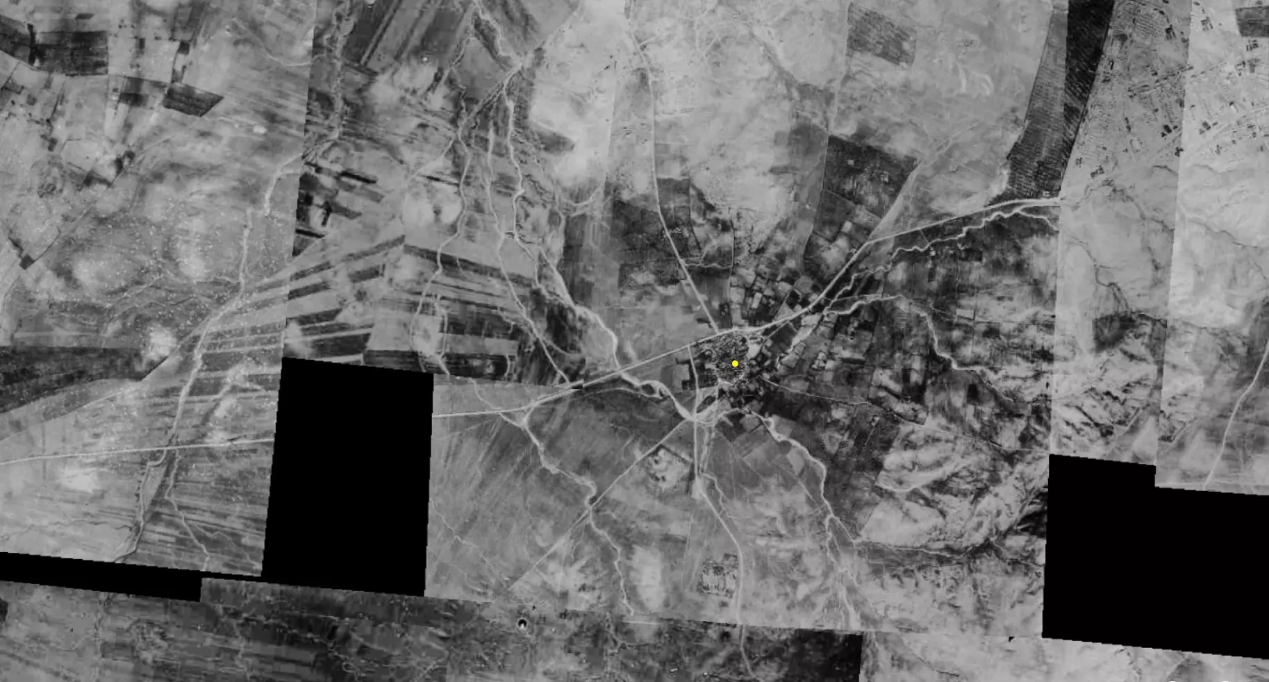
| Pre-Nakba Aerial View |
|||||||||||||||
|
|||||||||||||||
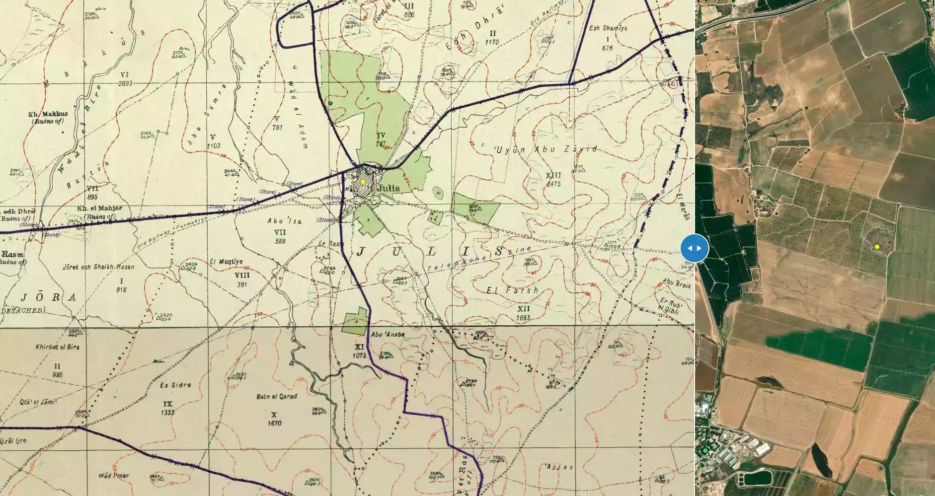
| Map Location | See location #18 on the map View from satellite |
||||||||||||||
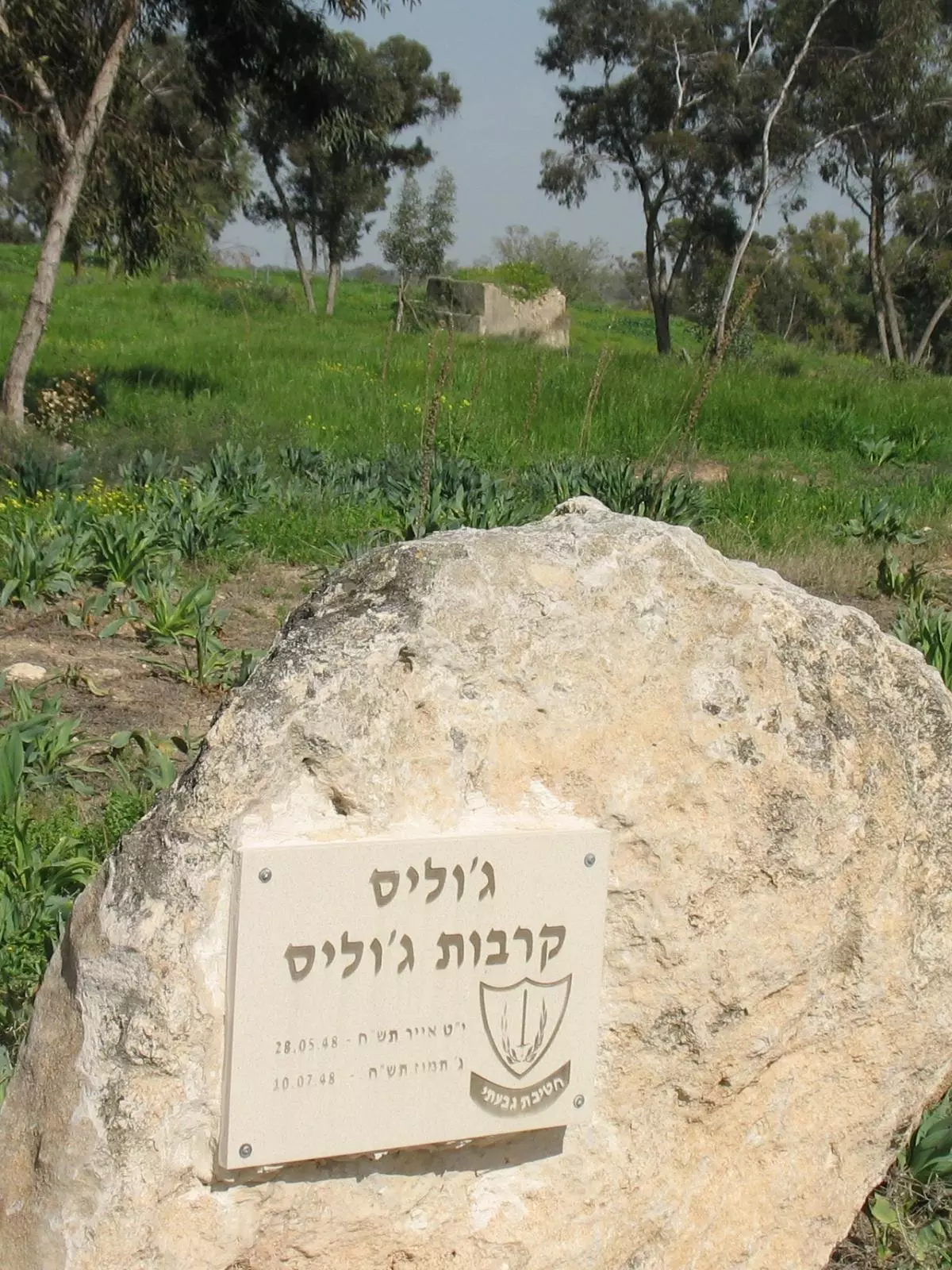
| Military Operation | Operation Barak (lightening) | ||||||||||||||
| Attacking Units | Giv'ati Brigade's Third Battalion | ||||||||||||||
| Defenders | Egyptian Army | ||||||||||||||
| Exodus Cause | Military assault by Zionist troops | ||||||||||||||
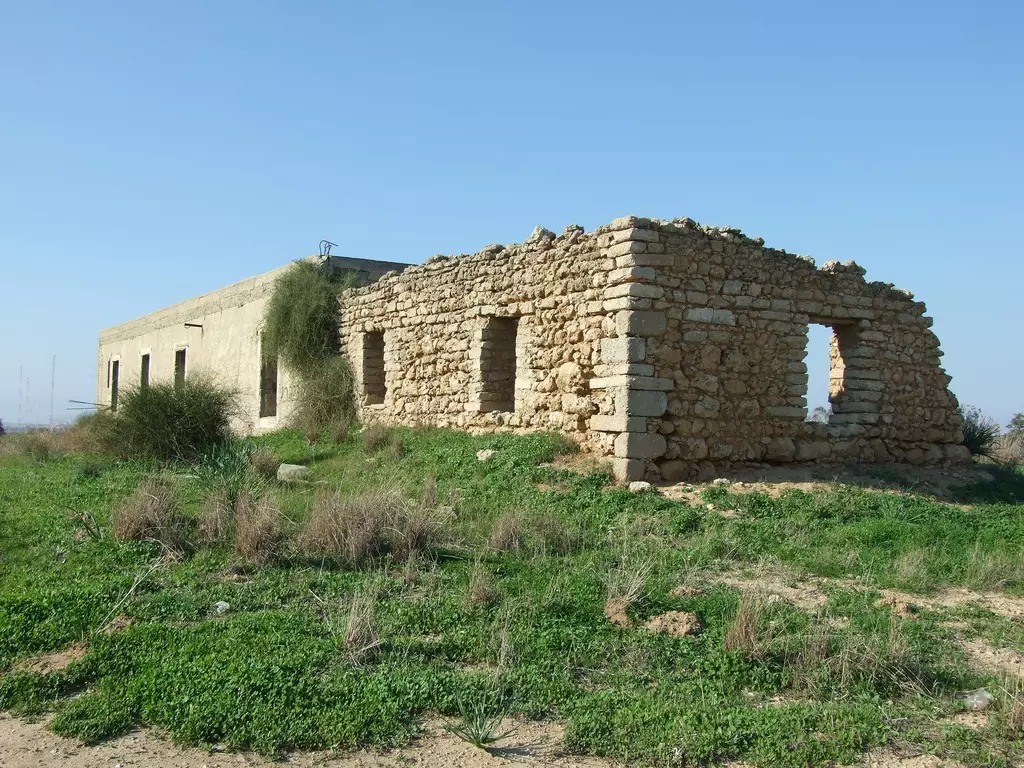
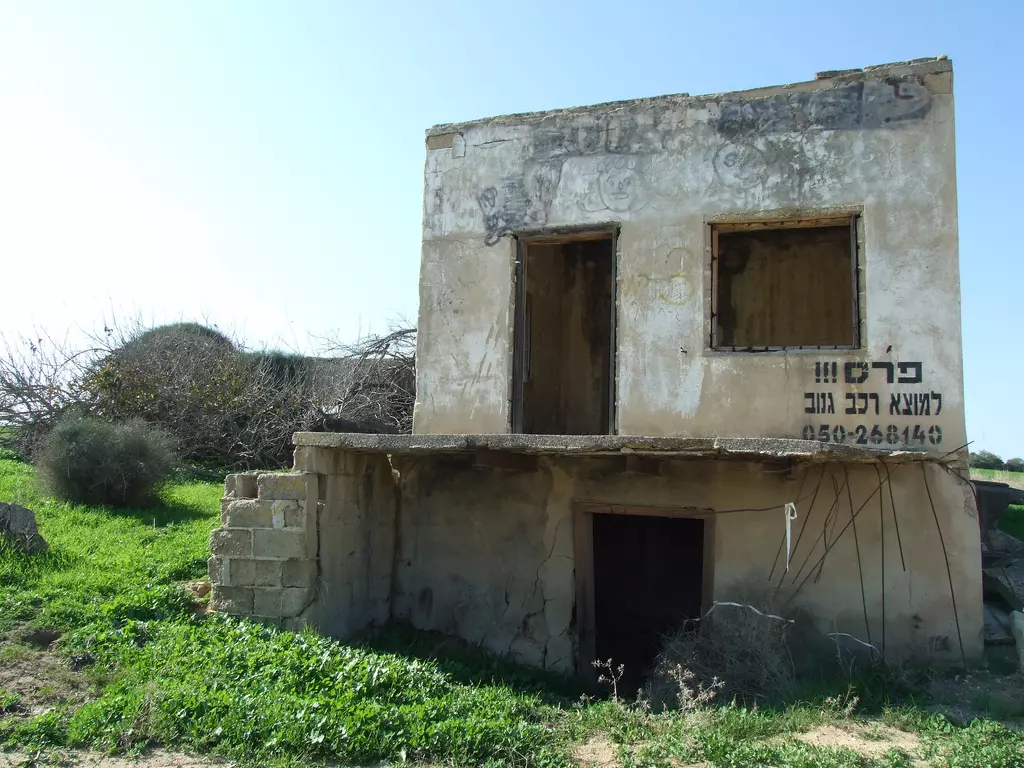
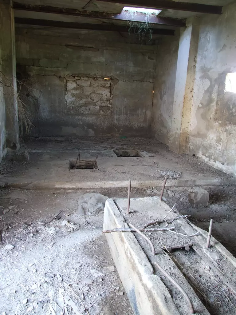
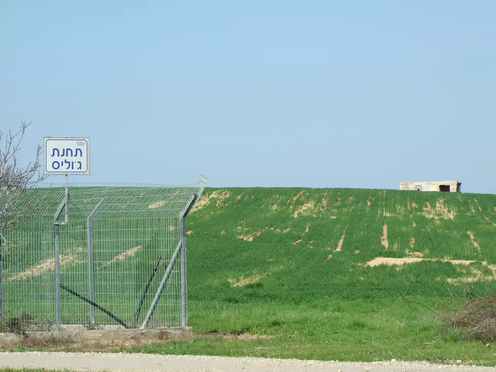
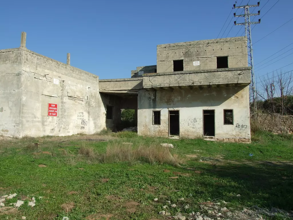
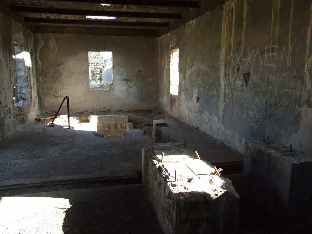
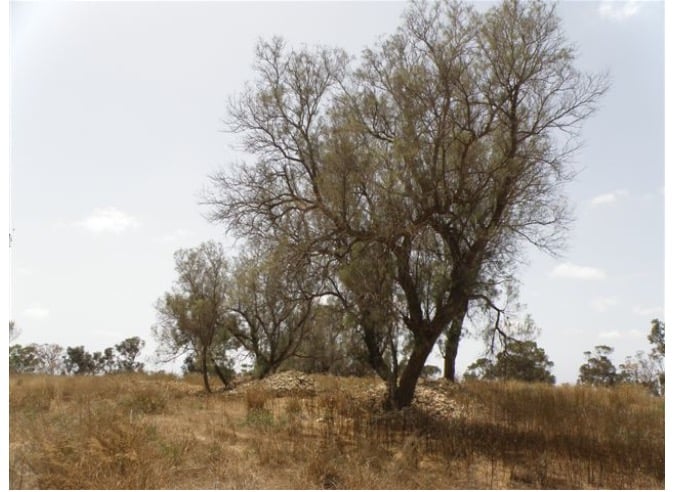
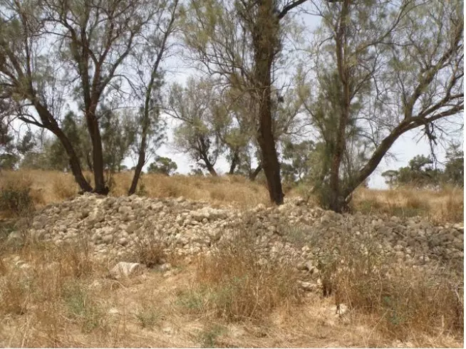
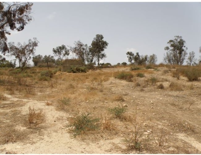
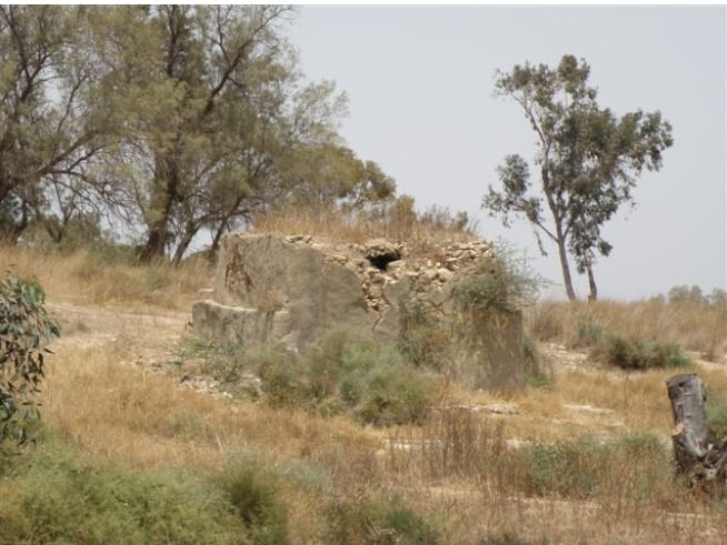
| Village Temains | The village was mostly destroyed with the exception of few houses remain. | ||||||||||||||
| Ethnically Cleansing | Julis inhabitants were completely ethnically cleansed. | ||||||||||||||
| Pre-Nakba Land Ownership |
**Town Lands' Demarcation Maps |
||||||||||||||
| Land Usage As of 1945 |
|
||||||||||||||
| Population |
|
||||||||||||||
| Number of Houses |
|
||||||||||||||
| Near By Towns |
|||||||||||||||
|
|||||||||||||||
| Schools | Julis had an elementary school for boys which was founded in 1937, and in 1945 it had an enrollment of 86 students. | ||||||||||||||
| Places of Warship | One mosque | ||||||||||||||
| Shrines / Maqams | Julis had a shrine for al-Shaykh Khayr who was killed while fighting the Crusades. | ||||||||||||||
| Archeological Sites | Julis contained three archaeological sites: the 1st was Rasm al-Farsh, the 2nd was Shaykh Khayr, and the 3rd was Khirbat al-Biyar. | ||||||||||||||
| Exculsive Jewish Colonies Who Usurped Village Lands |
Hodiyya | ||||||||||||||
| Featured Video | |||||||||||||||
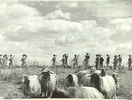
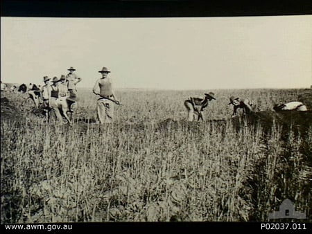
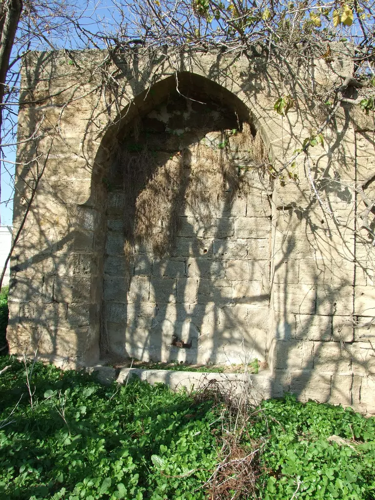
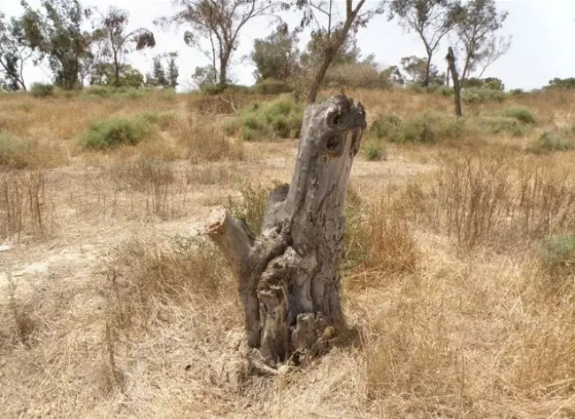
Village Before NakbaThe village stood on a slight elevation on the southern coastal plain, along the bank of a wadi. It was built on an archaeological site whose ancient name is still unknown. In 1596, Julis was a village in the nahiya of Gaza (liwa' of Gaza), with a population of 204. It paid taxes on a number of crops, including wheat, barley, and fruit, as well as on other types of produce and property, such as goats, beehives, and vineyards. In the late nineteenth century, the village of Julis had adobe brick structures, a well to the south, and a pool with gardens to the northeast.During World War II, the British built a highway that passed through Julis, parallel to (and feeding traffic to) the coastal highway; this gave the village special importance as a transportation center. This road also intersected at Julis with the highway leading from al-Majdal to the Jerusalem–Jaffa highway. The British established a military camp at Julis in order to control this junction. The village was laid out in a square, sandwiched between the two highways and bounded at one end by the traffic circle where they intersected. Its adobe and cement houses were built close together. Julis had a mosque—its population was Muslim—and a shrine for Shaykh Khayr, a figure in local historical tradition who the residents believed was killed fighting the Crusaders. The village shops were scattered along the highways. A school, opened in 1937, had an enrollment of eighty-six students in the mid-1940s. Underground water was abundant in Julis and was used for domestic needs. The inhabitants grew grain, vegetables, and fruit; their fruit orchards were concentrated on the east and north sides. Agriculture was both irrigated and rainfed. In 1944/45 a total of 1,360 dunums was devoted to citrus and bananas and 10,803 dunums were allocated to cereals; 931 dunums were irrigated or used for orchards. The antiquity of the village is demonstrated by the presence of an inscribed lintel, an ancient olive press, and cisterns lined with uncut stone. Three other archaeological sites, Rasm al-Farsh, Shaykh Khayr, and Khirbat al-Biyar, are nearby. Village Occupation and Ethnic CleaningOn the night of 27–28 May 1948, the Giv'ati Brigade's First Battalion occupied a military barracks in this village during Operation Barak , but failed to gain complete control of Julis. The History of the War of Independence states that Egyptian forces attempted to recapture it almost immediately: 'The defenders of the place [Giv'ati forces] blocked enemy units which tried ... to infiltrate the barracks from the direction of the village of Julis.' The Haganah account says that the village itself fell some two weeks later, on 10–11 June, as the Giv'ati Brigade's Third Battalion mounted a number of operations to occupy individual villages just before the first truce of the war took effect. However, in his memoirs, the late Egyptian president Gamal Abdel Nasser recalled that these maneuvers occurred just after the truce took effect.At the end of the truce in early July, Julis was one of the main positions that the Egyptians attempted (and failed) to recapture. The Egyptian army's Sixth Battalion, the unit of which Gamal Abdel Nasser was staff officer, was ordered to recapture the position. In later years, Abdel Nasser was highly critical of the planning of this operation. As he wrote in his memoirs of the war, 'Once again we were facing a battle for which we had made no preparation. We had no information about the enemy at Julis.' In the few hours before his unit was to move towards Julis, Abdel Nasser organized a quick reconnaissance of the position. During the course of the battle, his commanding officer (CO) ordered him to participate in the thick of the battle, leaving the unit without direction or coordination. Later, after getting hold of some aerial photographs, he managed to convince his CO and general headquarters that 'even if we had succeeded in entering Julis, we would have been at the mercy of the enemy, who would have turned Julis town into a cemetery for our forces.' Abdel Nasser argued that the village was indefensible, being dominated by the barracks which overlooked it. The attack was belatedly called off after considerable loss of life. From the Israeli perspective, on 10 July, Giv'ati units repulsed an Egyptian attack in which 'none of the defenders were injured in the well-fortified position of Julis.' A close colleague of Abdel Nasser's, Isma'il Muhy al-Din, was killed in the course of the battle. Zionists Colonies on Village LandsThe settlement of Hodiyya was established on village lands in 1949, southwest of the site.Village TodayOnly a few houses remain. Most of them are made of cement, and have simple architectural features: flat roofs and rectangular doors and windows. One has two storeys and another has an illiyya (a single master bedroom or guest room on the top floor, usually available in the houses of wealthier villagers as a symbol of wealth and prestige. ) One house, in the southwestern section of the site, is occupied by Jewish residents. Some cactuses and sycamore and palm trees grow on the site, and a portion of it is planted with citrus trees. The military camp built by the British is now used by the Israeli army. The surrounding lands are cultivated by Israeli farmers.SourceDr. Walid al-Khalidi, 1992: All That Remains. |
|||||||||||||||
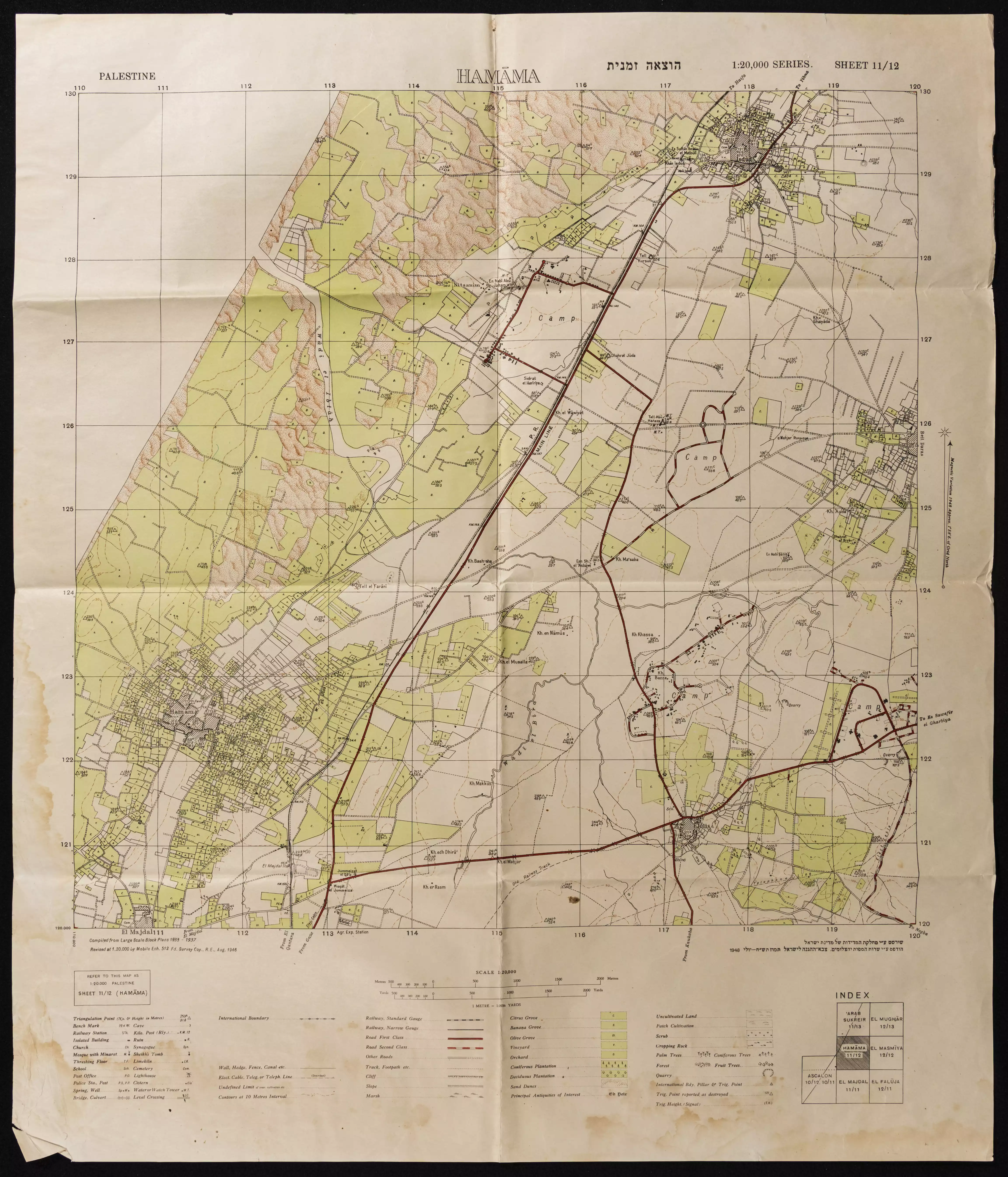
| Related Maps | Town Lands' Demarcation Maps خرائط للقضاء توضح حدود القرى والاودية Town's map on MapQuest View from satellite Help us map this town at WikiMapia |
||||||||||||||
| Related Links | Wikipedia's Page Facebook Page Google Search Google For Images Google For Videos |
||||||||||||||
| More Information | في كتاب كي لا ننسى في كتاب بلادنا فلسطين في كتاب النكبة والفردوس المفقود المزيد من موقع هوية |
||||||||||||||
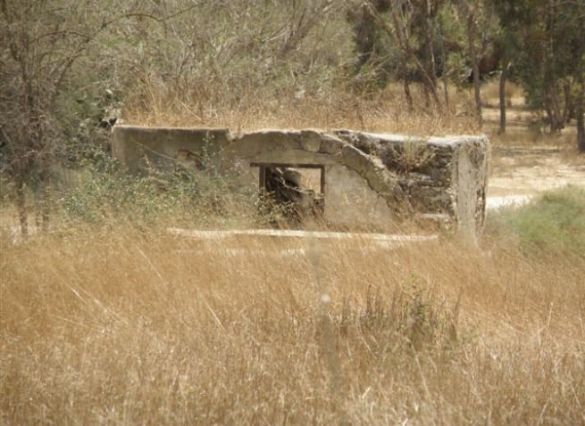
- A well house, further north towards Hasa
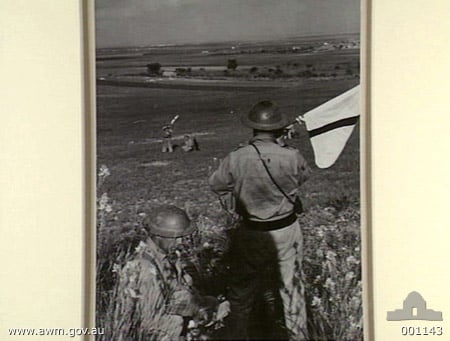
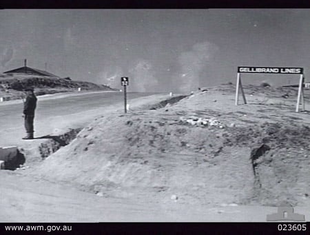
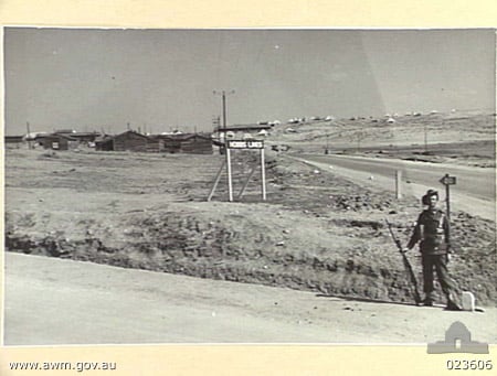
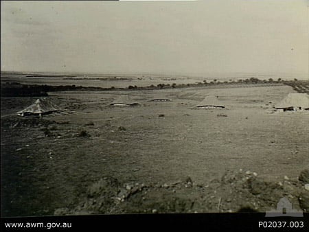
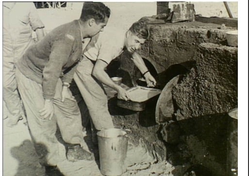
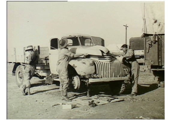
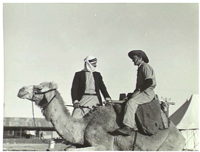
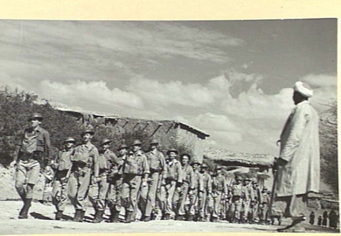
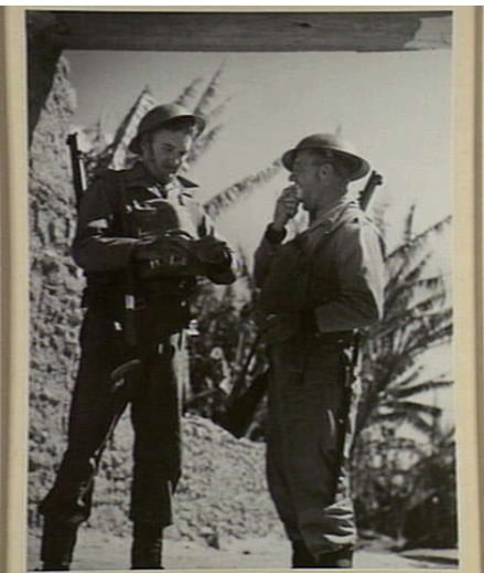
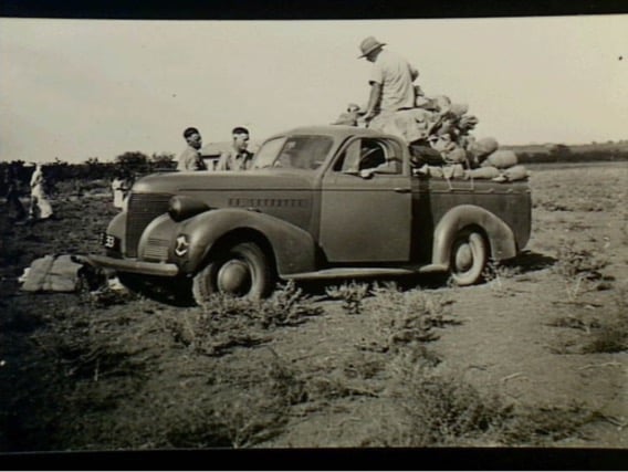
Posted by Uri Zackhem 4 - Julis, Palestine, picture taken from British and Australian military camp in Julis 1940
Posted by Hany Al-Assar 2 - One of the wells in the destroyed village
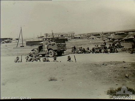
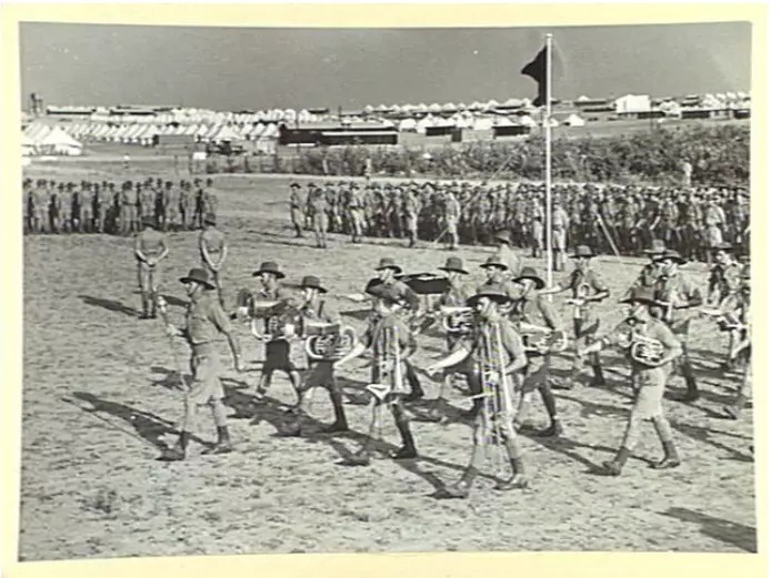
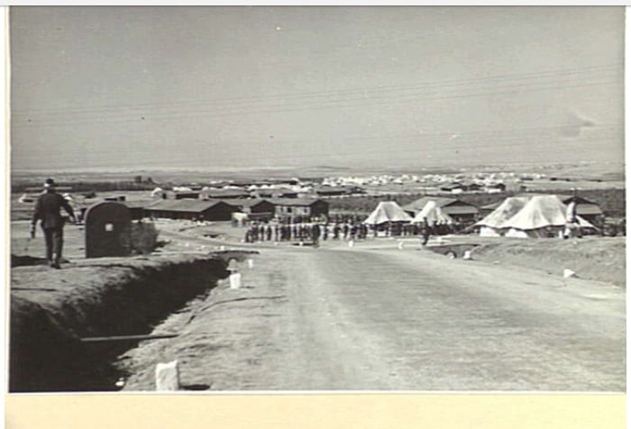
Posted by Noga Kadman 5 - Julis, British and Australian Military Camp in 1940
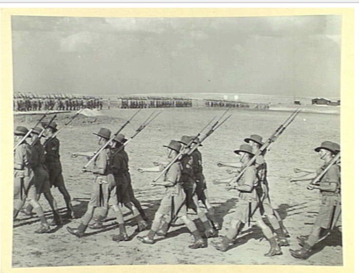
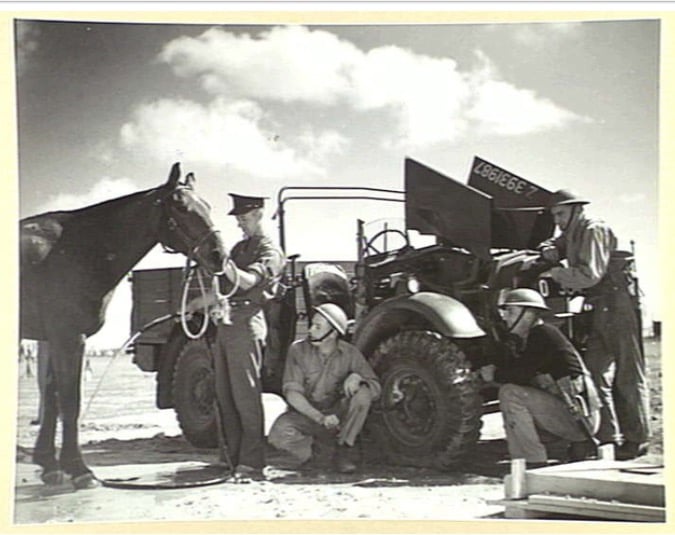
Posted by Hany Al-Assar - Julis, British and Australian Military Camp in 1940, #3
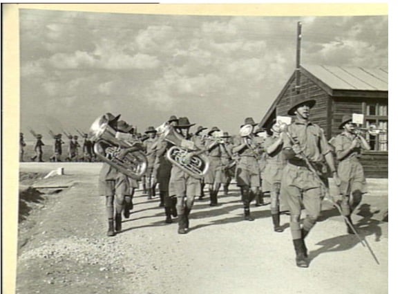
Posted by Hany Al-Assar 1 - Julis, British and Australian Military Camp in 1940, #4
Posted by Hany Al-Assar 1 - Julis, British and Australian Military Camp in 1940, #5
Posted by Hany Al-Assar - Julis, British and Australian Military Camp in 1940, #6
Posted by Hany Al-Assar - Julis, British and Australian Military Camp in 1940, #7
Posted by Hany Al-Assar - Julis, British and Australian Military Camp in 1940, #8
Posted by Hany Al-Assar - Julis, British and Australian Military Camp in 1940, #9
Posted by Hany Al-Assar 1 - A well house, NE of the village, along the road.
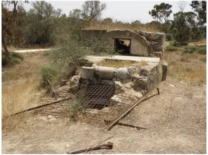
Posted by Uri Zackhem - The well.
Posted by Uri Zackhem - A Julis house, in the foreground the name of the pumping station: Julis
Posted by Uri Zackhem - Another well, house, further east, with a sabil, near a pumping station
Posted by Uri Zackhem - The sabil, on the old main road going east-west.
Posted by Uri Zackhem - The well. It is a very deep well.
Posted by Uri Zackhem - عسكر بريطانيين في جولس سنه 1940
Posted by abu raya - معسكر جولس سنه 1941
Posted by abu raya - المعسكر البريطاني في جولس
Posted by abu raya - المعسكر البريطاني في جولس سنه 1940
Posted by abu raya - المعسكر البريطاني جولس سنه 1940
Posted by abu raya - المعسكر البريطاني جولس 1940
Posted by abu raya - جولس سنه 1940
Posted by abu raya - العسكر البريطاني في جولس سنه 1941
Posted by abu raya - العسكر البريطاني في جولس سنه 1941
Posted by abu raya - قريه جولس سنه 1940
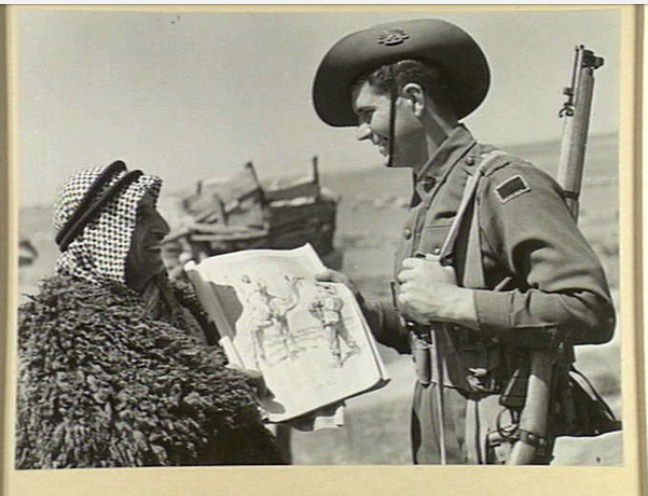
Posted by abu raya - صوره لعسكري مع رجل من جولس قبل النكبه
Posted by abu raya - المعسكر البريطاني في جولس سنه 1942
Posted by abu raya - المعسكر البريطاني في جولس
Posted by abu raya - جولس سنه 1940
Posted by abu raya - اثار ردم بيوت جولس
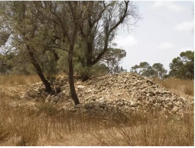
Posted by abu raya - بقايا بيوت قريه جولس
Posted by abu raya - المتبقي من بيوت جولس
Posted by abu raya - من موقع القريه
Posted by abu raya - من موقع القريه
Posted by abu raya - من موقع القريه
Posted by abu raya - قريه جولس
Posted by abu raya - موقع القريه مغطى بالاحراش
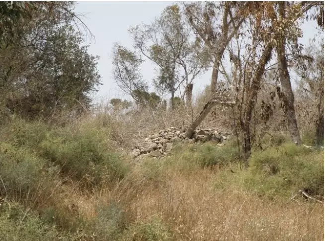
Posted by abu raya - اثار بيوت القريه
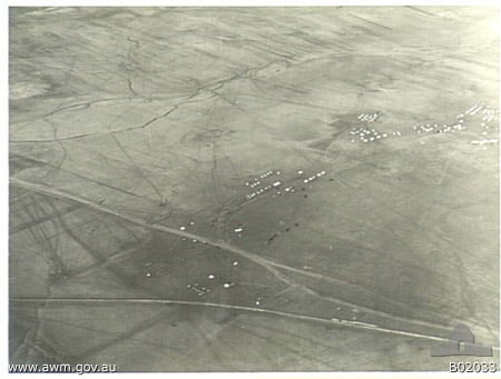
Posted by abu raya - Pre-Nakba Aerial view of the village / صورة من الجو للقرية اخذت قبل النكبة
- خارطة تُظهِر الحدود والطرق بأنواعها والأماكن المقدسة والطبيعة الطوبغرافية من تلال وسهول ومنحدرات والتشكيلة الطبيعية للأرض وأنواع المزروعات. نُشرت الخريطة فترة الانتداب البريطاني، تم إضافة تعديلات عليها من قِبَل خدمة الخرائط والصور التابعة للقوات العسكرية الاسرائيلية فترة الأربعينيات.
Want to browse more? 80,000 pictures were grouped in these gallaries:
| Display Name | Clan/Hamolah | Country of Residence |
| خالد خطاب | خطاب | Jordan, Jordan |
| محمد أبو عويضة | أبو عويضة | غزة, فلسطين |
| Mohammad Abu-Saif | - | - |
| ابن مختار جولس بلدى | ابوسيف | الاقامة الدائمة فيها, الاقامة الدائمة فيها |
| عماد ابو خضير | - | annaba algeria |
| monther alassar | - | - |
| عيد حلمي بديع عنبر | ANBAR | riyadh, saudia arabia |
| فؤاد حلمي بديع عنبر | ANBAR | riyadh, saudia arabia |
| بديع حلمي بديع عنبر | ANBAR | riyadh, saudia arabia |
| إبراهيم حلمي بديع عنبر | ANBAR | riyadh, saudia arabia |
| محمد حلمي بديع عنبر | ANBAR | riyadh, saudia arabia |
| yazan jaser al naqleh | النقله | الدوحه, قطر |
| ابونايف | - | - |
| حسام | عماد | غزة, فلسطين |
| basim | ABU SAIF | abu dabi, uae |
| ابو العبد | شتات | غزة, السلطان |
| بديع عنبر | - | palestine, gaza |
| عنبر بديع عيد عنبر | عنبر | - |
| زكريا | عماد الدين | غزة |
| رائد | ابو خضير | العاصمة, الاردن |
| raed kateeb | حبايبة | ilinoise, ilinoise |
| شباب المستقبل | - | القدس, حارس |
| abdalla badea eid anbar | anbar | 00972, gaza strip |
| Alaa Jebreel Emad | - | Jeddah, Saudi Arabia |
| HELMI BADEI AED ANBAR | ANBAR | RIYADH, SAUDIA ARABIA |
| Elassar | Elassar | USA |
| RASHAD AL-ASSAR | - | 00971-4, 00971-4 |
| Hany Al-Assar | Al-Assar | Gaza , Palestine |
| MAHMOUD EL ASSAR | EL ASSAR | ontario, canada |
| zaid sammy elassar | - | ontario, canada |
| Ramadan El-Ghamry | El-Ghamry | Spain |
| Maged Abdel-hamid EL NAKLA | - | - |
| Mohammad Al-Assar | Al-Assar | U.K. |
| Meamer El Nakla | - | Ontario, Canada |
 Fake Valor: Why Did Zionist Jews Hoist Nazis Flag on Their Ships in the 1930s?
What is new?
-
Facts About Oct. 7th Gaza Raid
-
Remined Us Please:: Who Did Rape Who? Palestinians Raped Israelis? Or, was the other way around?
-
When Prof. Edward Said was invited to debate Bibi Netanyahu in the 1980s, watch what happened!
-
Ezra Klein of the NY Times on the "Jewish Race".
-
Abusing Blood Libel!
-
Did Israeli Soldiers Activate The Hanniba Direective On Oct. 7th? You Be The Judge
-
Zionist FAQ: Isn't it true that Palestinians don't want peace? Palestinians never accepted the two-state solution
- Facts about Haavara (Transfer) Agreement between Ben-Gurion & Hitler
-
Haavara FAQs: Why Did Zionist Jews Hoist Nazis' Flags on Their Ships in the 1930s?
- Haavara FAQs: When Chaim Weizmann met FDR in mid-1943, why was he silent about rescuing European Jewry?
-
Dear ChatGPT: How did Palestinians resist Napoleon's invasion of their country in 1799?
-
Dear ChatGPT: Gaza had a vibrant Jewish community in the mid-17th century. What happened to them?
-
Dear ChatGPT: Why did the Jewish Agency suppress news of the Holocaust during WWII?
-
Video Playlist: Jews share their DNA tests to end the conflict for good.
-
A Tale of Two Conflicts: Examining the Definition of Genocide
-
Prof. Abraham Polak And The Suppressed History of the Khazars and European Jewry
-
How Ronald Reagan would have framed the genocide in Gaza if he were still alive?
-
Haavara FAQs: Let us do the math: how many German Jews did The Haavara Agreement save?
-
Zionist FAQs: The Hebron Massacre of 1929, "clearly proves" that Palestinians are antisemitic, how could you deny it?
-
Zionist FAQs: Why Anti-Zionist Is Not Antisemitism?
-
Zionist FAQs: Isn't it true that the KGB created Palestinian Nationalism in the early 1960s?
- Zionist FAQs: Muslims are killing Muslims all the time; why are Israeli Jews being singled out in the media?
- Zionist FAQs: How is Israel an apartheid state when 20% of its citizens are Arabs who enjoy full rights?
-
Haavara FAQs: Why Did Dorothy Thompson Flip From A Zionist Advocate to A Silenced Dissenter?
-
Haavara FAQs: Analysis of Herzl's Uganda Scheme and how it could have saved millions of Jews.
-
Haavara FAQs: Why did Hayim Greenberg describe American Jewry as "morally bankrupt" in early 1943?
-
Haavara FAQs: What if the Evian Conference was a resounding success? What would have been the impact of saving European Jewry on Zionism?
- Haavara FAQs: What if the six million were saved, how that would have impacted the Zionist project?
-
Haavara FAQs: How did Zionist leaders react when Europe's Jews lingered in the DP camps after WWII ended?
-
Why does the American Jewish community repeat lies that David Ben-Gurion had debunked before he died?
-
Who has the power to rename the Tatar/Khazar Gene Marker to Jewish IV?
-
Zionist FAQs: Why won't Egypt, Syria, and Jordan take their people back? Jews are indigenous to Palestine, and Arabs immigrated after Jews developed the country. Arabs should leave.
-
Haavara FAQs: Did Hitler and the Nazis conflate between Judaism and Zionist? If that wasn't case, then why?
-
Haavara FAQs: Winston Churchill and antisemitism, a collection of articles written Churchill.
-
Haavara FAQs: Broken by country, how many Jews survived vs. killed during the Holocaust?
-
Haavara FAQs: Why did European Jews vote with their feet and to immigrated to the Americas, not Palestine, after WWII?
-
Watch this American Jewish Girl describing Israeli Jews' cognitive dissonance like no other in under two minutes
-
Haavara FAQs: When the Nazis went out of their way to hide the Holocaust, Israeli Jews did the exact opposite by broadcasting their genocide of Gazans. But why?
-
Haavara FAQs: How Zionist Jews went out of their to show their appreciation to Nazism and Fascism?
- Haavara FAQs: Why Zionist leaders were against bombing the death camps & the Railroads leading to them?
-
Haavara FAQs: Hitler's message to the British and American people: If Jews are such noble citizens and you care about them, how come you're not letting them in? I will gladly ship them to you at my expense, even on luxury liners!
-
A shortlist of Zionist and Israeli false flag operations in the name Jews.
-
The Most Moral Army
- The Land of Kapos (Israel): Where the brave are boycotted and Kapos walk free.
- Why did early Zionists often named their communal enterprises "colonial"?
- Zionist Relations with Nazi Germany by Faris Glubb
-
Two NY Times advertisements by Zionists in the early 1943 that exposes Zionists' treason at the height of the calamity
- Facts Not Lies about the Palestinian-Israeli Conflict.
- Site's pictures have been categorized
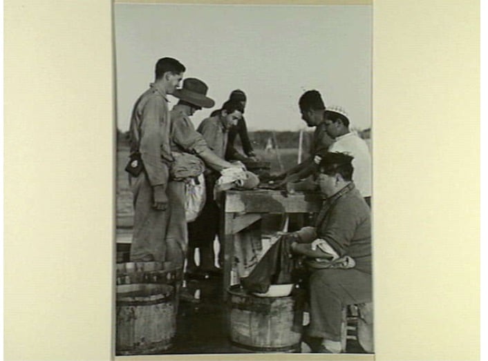
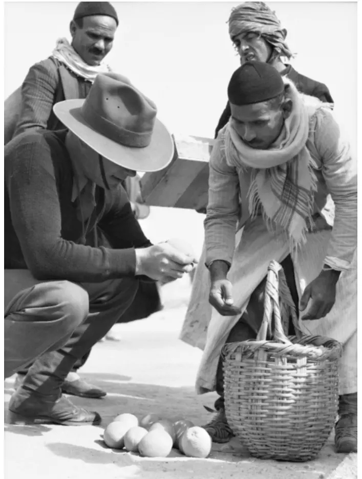
- Campgain Against Lice
- A Survey of Palestine, the official source about Palestine before Nakba produced by the British Mandate; over 1200 pages.
- Satellite View & Google Earth: Over 6,000 placemarks identifying all destroyed towns, W. Bank & Gaza Strip Towns, & refugee camps.
- PalestineRemembered.com and its Nakba Oral History Project were featured on al-Jazeera Satellite TV.
- Nakba Oral History Video Podcast:
 Over 700 Oral History interviews (including 3,500+ hours of recording) can be viewed online.
 - Palestine Village Statistics Project
- Gaza Jail Break
- النسخة العربية للموقع الان متوفرة
- Videos: Documenting the destroyed villages in video: Tracing all that remains since Nakba.
- Videos: Responding to Zionist Propaganda
- Interview: The ethnic cleansing of Palestine: George Galloway interviews Israeli Historian Ilan Pappe.
- For Palestinians, memory matters. It provides a blueprint for their future By George Bisharat.
- Zionist FAQ now available in Hebrew שאלות שציונים שואלים, עכשיו בעברית
- Video: The Stephen Walt and John Mearsheimer report on the influence of the Israel Lobby on U.S. Foreign Policy
- The Palestinian-Israeli conflict for beginners
