| PalestineRemembered | About Us | Oral History | العربية | |
| Pictures | Zionist FAQs | Haavara | Maps | |
| Search |
| Camps |
| Districts |
| Acre |
| Baysan |
| Beersheba |
| Bethlehem |
| Gaza |
| Haifa |
| Hebron |
| Jaffa |
| Jericho |
| Jerusalem |
| Jinin |
| Nablus |
| Nazareth |
| Ramallah |
| al-Ramla |
| Safad |
| Tiberias |
| Tulkarm |
| Donate |
| Contact |
| Profile |
| Videos |
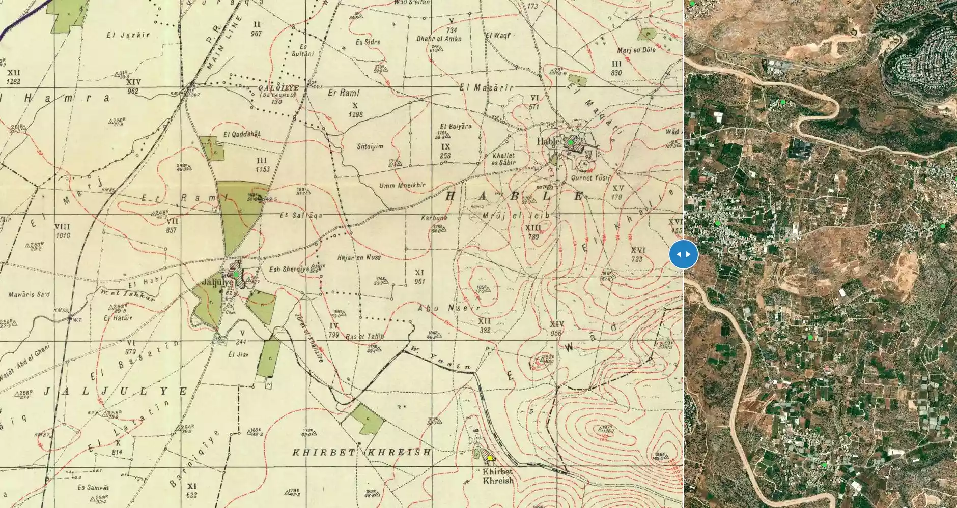
Welcome To Khirbet Khresh/Khureish - خربة خريش
|
District of Tulkarm
|
العربية Google Earth |
 |
Gallery (15) |
- Statistics & Facts
-
Before & After

- Satellite View
- Articles 8
- Pictures 15
- Oral History 1
- Members 6
- Families
- Videos 2
- Guest Book 7
- Links
| Statistic & Fact | Value | ||||||||||||||
| Distance From District | 22 km south of Tulkarm | ||||||||||||||
| Elevation | 75 meters | ||||||||||||||
| Before & After Nakba, Click Map For Details |
|||||||||||||||
|
|||||||||||||||
| Land Ownership |
**Town Lands' Demarcation Maps |
||||||||||||||
| Land Usage As of 1945 |
|
||||||||||||||
| Population |
|
||||||||||||||
| Featured Video | |||||||||||||||
| Related Maps | Town Lands' Demarcation Maps خرائط للقضاء توضح حدود القرى والاودية View from satellite Town's map on MapQuest Help us map this town at WikiMapia |
||||||||||||||
| Related Links | في كتاب بلادنا فلسطين المزيد من موقع هوية |
||||||||||||||
- قرية خريش المهجرةا ولمدمرة
- قرية خريش المهجرةا ولمدمرة - تأليف: عبدا لعزيز أمين عرار
- قرية خريش المهجرةا ولمدمرة - الفصل الثاني
- لأوضاع الحياتية في خريش
- قرية خريش المدمرة أ.عبدالعزيز أمين عرار الفصل الرابع القسم الأول
- لفصل الرابع :تهجير أبناء خريش /تتمة
- ملاحظات الراحلون والباقون وإسم رب الأسرة
- كتاب خربة خريش المهجرة والمدمرة -- أ. عبدالعزيز أمين عرار
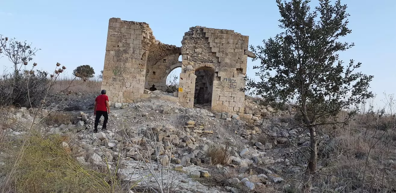
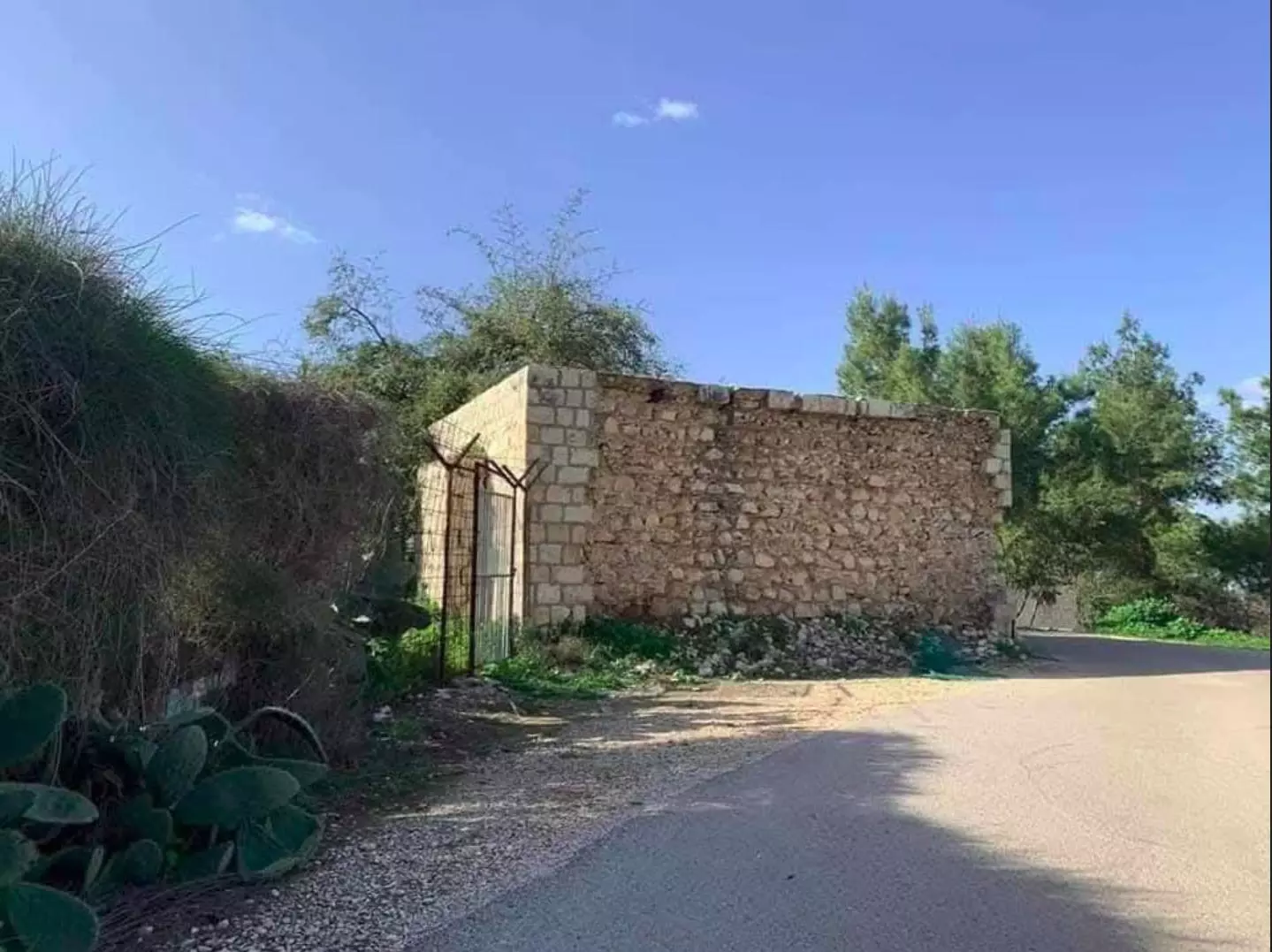
- All That Remains of the mosque!!!
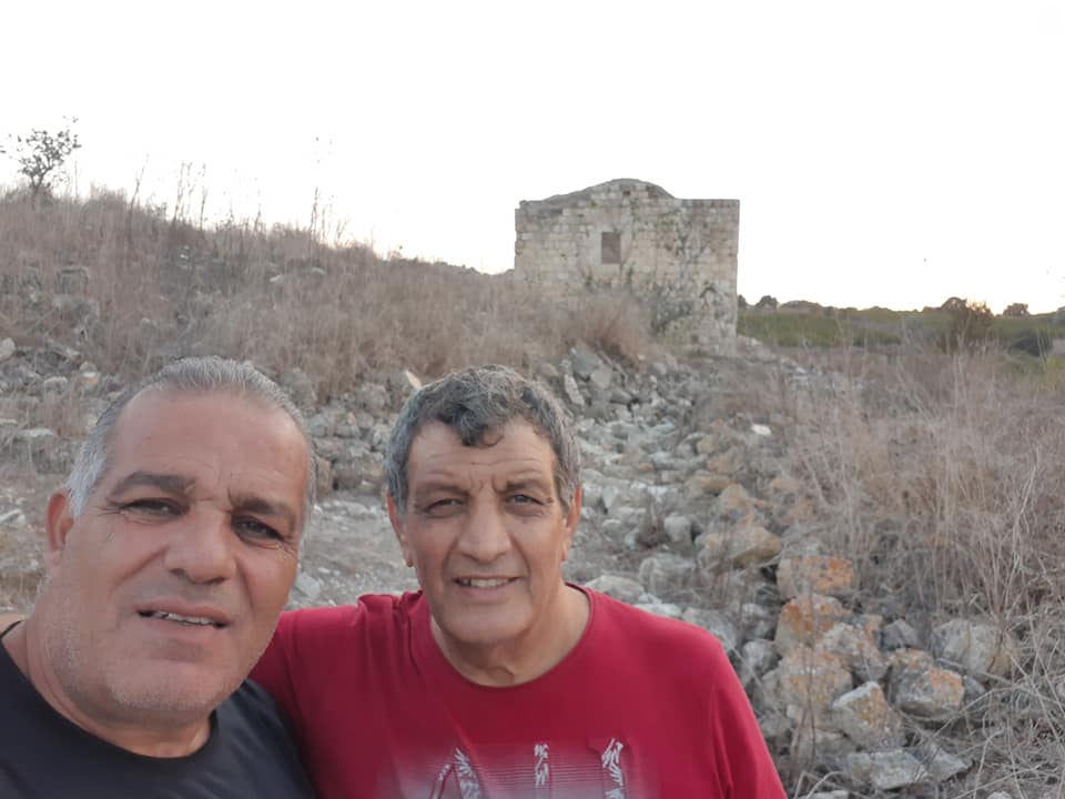
Posted by Uri Zackhem 1 - The remains of a Palestinan Arab house #1, July 2002
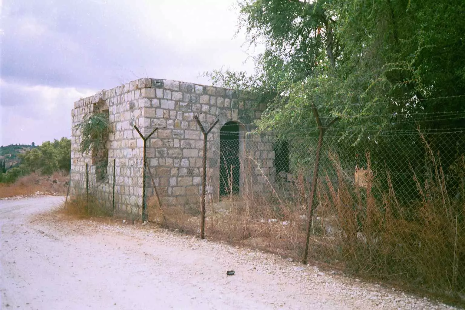
Posted by Uri Zackhem - The remains of a Palestinan Arab house #2, July 2002
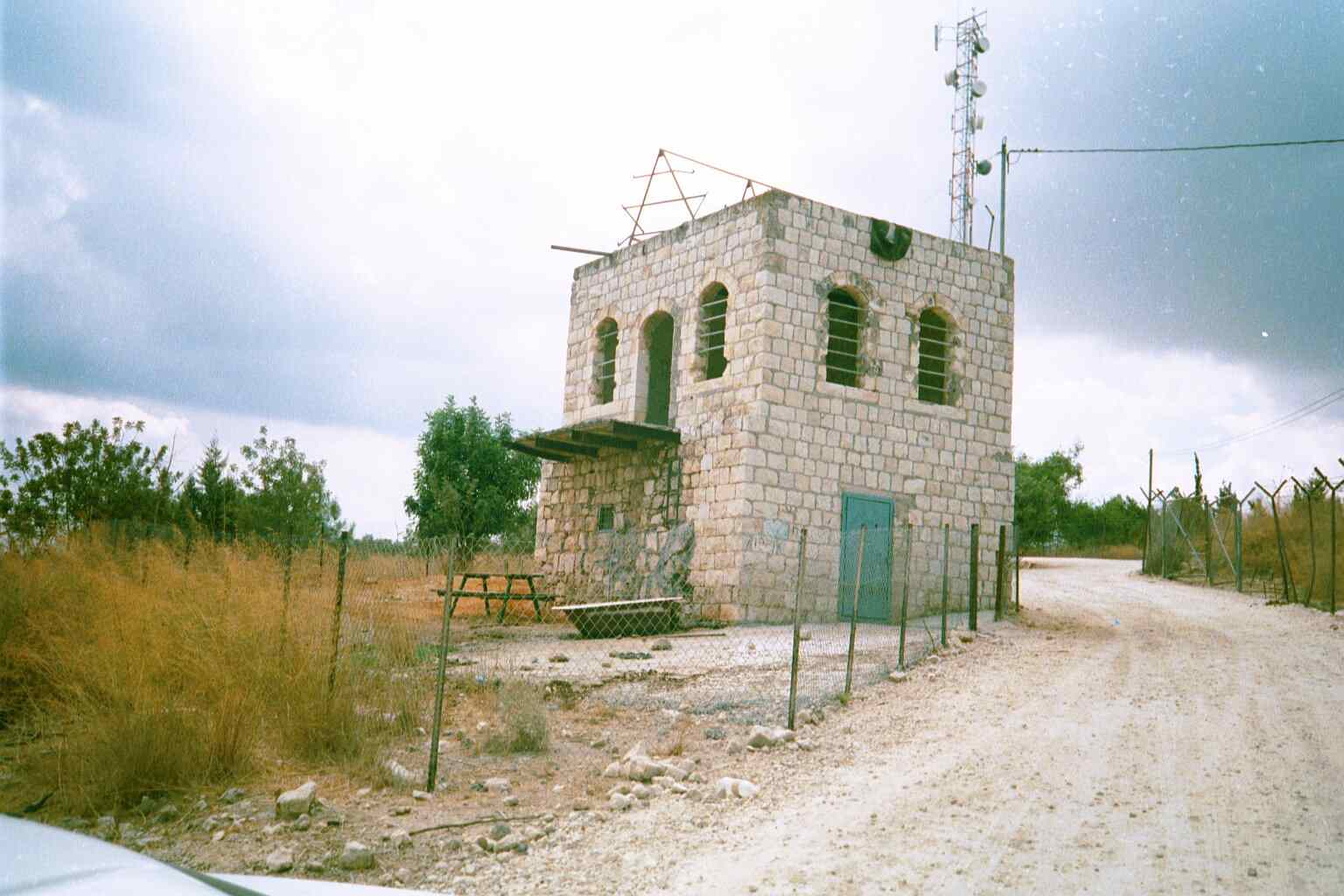
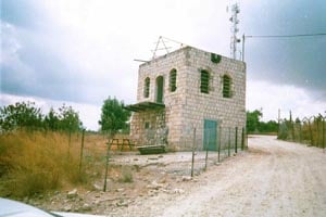
Posted by Uri Zackhem - علية المرحوم الحاج موسى عيسى عبدالسلام عودة (أبو محمد) --البيت الوحيد الباقي بالبلدة بالاضافة الى انقاض المسجد بعد تدمير خريش
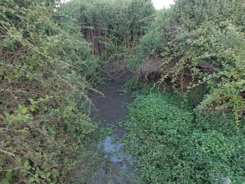
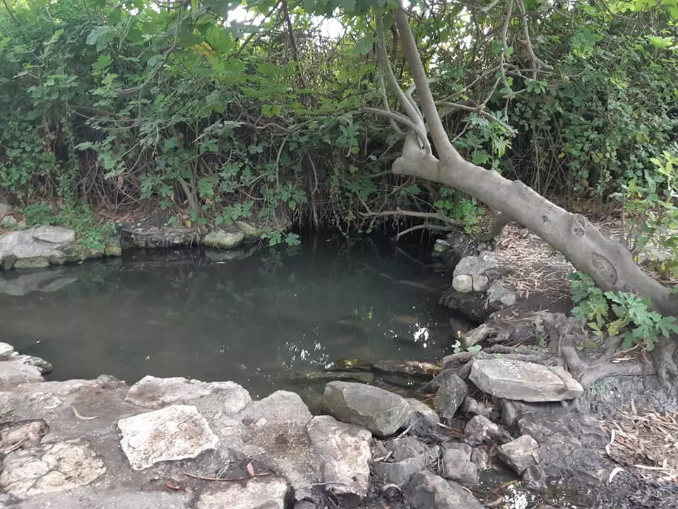
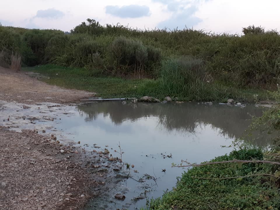
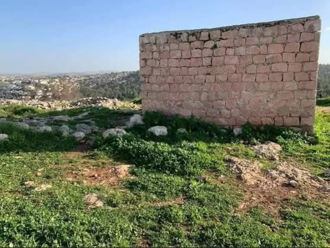
Posted by حامد طه 5 - زيارة لقرية اخربة خريش المهجرة -- تصوير قيس فحماوي
- زيارة لقرية اخربة خريش المهجرة -- تصوير قيس فحماوي #2
- زيارة لقرية اخربة خريش المهجرة -- تصوير قيس فحماوي #3
- زيارة لقرية اخربة خريش المهجرة -- تصوير قيس فحماوي #4
- زيارة لقرية اخربة خريش المهجرة -- تصوير قيس فحماوي #5
- زيارة لقرية اخربة خريش المهجرة -- تصوير قيس فحماوي #6
- جولة بين بيوت القرية المهجرة
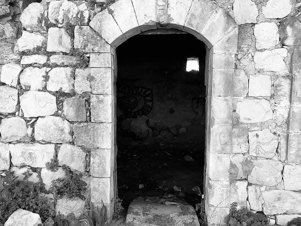
- جولة بين بيوت القرية المهجرة #2
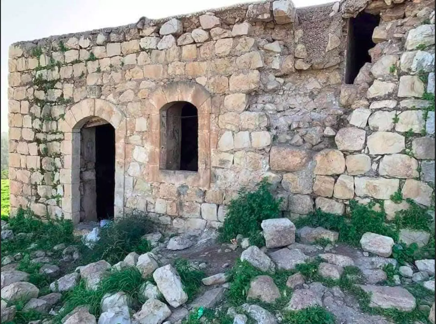
- جولة بين بيوت القرية المهجرة #3
- جولة بين بيوت القرية المهجرة #4
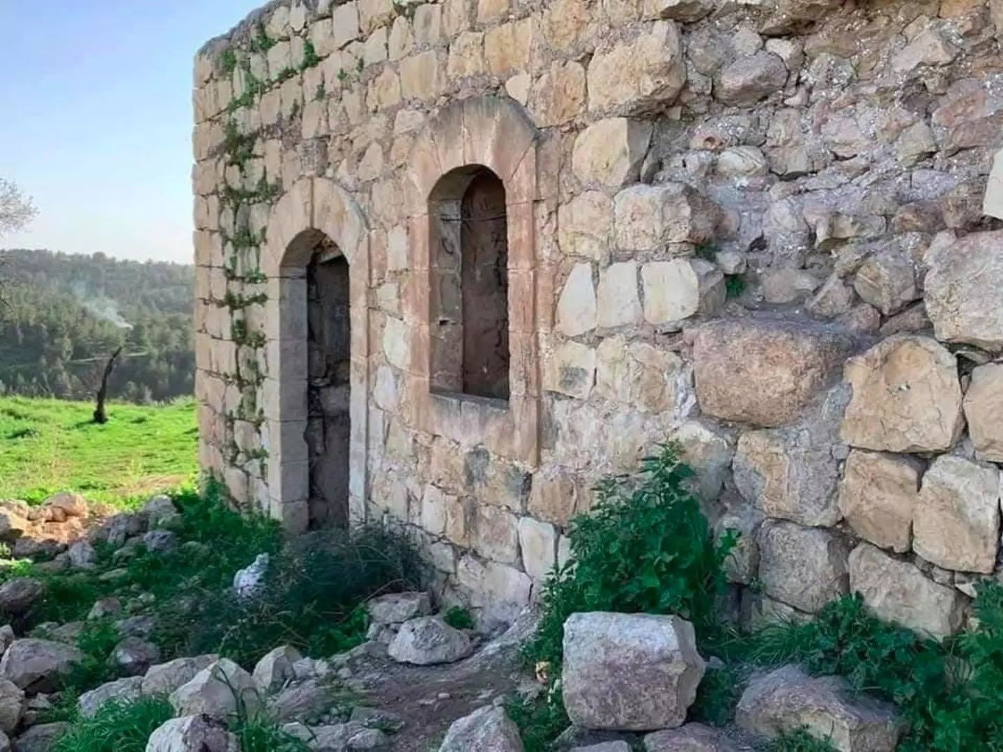
- جولة بين بيوت القرية المهجرة #5
Want to browse more? 80,000 pictures were grouped in these gallaries:
| Display Name | Clan/Hamolah | Country of Residence |
| محمد عبدالسلام عودة | عودة | الامارات |
| عبدالله خطيب | خطيب - شواهنة | - |
| منال | عرار | - |
| خريش | - | - |
| عمر | عرارعوده | الرياض |
| عدي عرار عودة | عودة | طولكرم, كفرثلث |
- توثيق فوتوغرافي لخربة خريش التي تم تهجير اهلها Duration: 6 min 16 sec
- من الذاكرة ..خلال اللقاء مع العم ابو العبد اسماعيل عبد الرحمن عودة اطال الله بعمره ..والاخ ابو الامير حسن شواهنة .على ارض قريتهم المهجرة..... قرية خريش الواقعة الى الجنوب من مدينة قلقيلية والتي هجرت بتاريخ ٢٢-٢-١٩٥١ Duration: 3 min 40 sec
No links have been shared yet, be free to the first to share the first link.
 Fake Valor: Why Did Zionist Jews Hoist Nazis Flag on Their Ships in the 1930s?
What is new?
-
Facts About Oct. 7th Gaza Raid
-
Remined Us Please:: Who Did Rape Who? Palestinians Raped Israelis? Or, was the other way around?
-
When Prof. Edward Said was invited to debate Bibi Netanyahu in the 1980s, watch what happened!
-
Ezra Klein of the NY Times on the "Jewish Race".
-
Abusing Blood Libel!
-
Zionist FAQ: Isn't it true that Palestinians don't want peace? Palestinians never accepted the two-state solution
- Facts about Haavara (Transfer) Agreement between Ben-Gurion & Hitler
-
Haavara FAQs: Why Did Zionist Jews Hoist Nazis' Flags on Their Ships in the 1930s?
-
Dear ChatGPT: Why did the Jewish Agency suppress news of the Holocaust during WWII?
-
Video Playlist: Jews share their DNA tests to end the conflict for good.
-
A Tale of Two Conflicts: Examining the Definition of Genocide
-
Prof. Abraham Polak And The Suppressed History of the Khazars and European Jewry
-
How Ronald Reagan would have framed the genocide in Gaza if he were still alive?
-
Haavara FAQs: Let us do the math: how many German Jews did The Haavara Agreement save?
-
Zionist FAQs: The Hebron Massacre of 1929, "clearly proves" that Palestinians are antisemitic, how could you deny it?
-
Zionist FAQs: Why Anti-Zionist Is Not Antisemitism?
-
Zionist FAQs: Isn't it true that the KGB create Palestinian Nationalism in the early 1960s?
- Zionist FAQs: Muslims are killing Muslims all the time; why are Israeli Jews being singled out in the media?
- Zionist FAQs: How is Israel an apartheid state when 20% of its citizens are Arabs who enjoy full rights?
-
Haavara FAQs: Analysis of Herzl's Uganda Scheme and how it could have saved millions of Jews.
-
Haavara FAQs: Why did Hayim Greenberg describe American Jewry as "morally bankrupt" in early 1943?
-
Haavara FAQs: What if the Evian Conference was a resounding success? What would have been the impact of saving European Jewry on Zionism?
- Haavara FAQs: What if the six million were saved, how that would have impacted the Zionist project?
-
Haavara FAQs: How did Zionist leaders react when Europe's Jews lingered in the DP camps after WWII ended?
-
Why does the American Jewish community repeat lies that David Ben-Gurion had debunked before he died?
-
Who has the power to rename the Tatar/Khazar Gene Marker to Jewish IV?
-
Zionist FAQs: Why won't Egypt, Syria, and Jordan take their people back? Jews are indigenous to Palestine, and Arabs immigrated after Jews developed the country. Arabs should leave.
-
Haavara FAQs: Did Hitler and the Nazis conflate between Judaism and Zionist? If that wasn't case, then why?
-
Haavara FAQs: Winston Churchill and antisemitism, a collection of articles written Churchill.
-
Haavara FAQs: Broken by country, how many Jews survived vs. killed during the Holocaust?
-
Haavara FAQs: Why did European Jews vote with their feet and to immigrated to the Americas, not Palestine, after WWII?
-
Watch this American Jewish Girl describing Israeli Jews' cognitive dissonance like no other in under two minutes
-
Haavara FAQs: When the Nazis went out of their way to hide the Holocaust, Israeli Jews did the exact opposite by broadcasting their genocide of Gazans. But why?
-
Haavara FAQs: How Zionist Jews went out of their to show their appreciation to Nazism and Fascism?
- Haavara FAQs: Why Zionist leaders were against bombing the death camps & the Railroads leading to them?
-
Haavara FAQs: Hitler's message to the British and American people: If Jews are such noble citizens and you care about them, how come you're not letting them in? I will gladly ship them to you at my expense, even on luxury liners!
-
A shortlist of Zionist and Israeli false flag operations in the name Jews.
-
The Most Moral Army
- The Land of Kapos (Israel): Where the brave are boycotted and Kapos walk free.
- Why did early Zionists often named their communal enterprises "colonial"?
- Zionist Relations with Nazi Germany by Faris Glubb
-
Two NY Times advertisements by Zionists in the early 1943 that exposes Zionists' treason at the height of the calamity
- Facts Not Lies about the Palestinian-Israeli Conflict.
- Site's pictures have been categorized
- Campgain Against Lice
- A Survey of Palestine, the official source about Palestine before Nakba produced by the British Mandate; over 1200 pages.
- Satellite View & Google Earth: Over 6,000 placemarks identifying all destroyed towns, W. Bank & Gaza Strip Towns, & refugee camps.
- PalestineRemembered.com and its Nakba Oral History Project were featured on al-Jazeera Satellite TV.
- Nakba Oral History Video Podcast:
 Over 700 Oral History interviews (including 3,500+ hours of recording) can be viewed online.
 - Palestine Village Statistics Project
- Gaza Jail Break
- النسخة العربية للموقع الان متوفرة
- Videos: Documenting the destroyed villages in video: Tracing all that remains since Nakba.
- Videos: Responding to Zionist Propaganda
- Interview: The ethnic cleansing of Palestine: George Galloway interviews Israeli Historian Ilan Pappe.
- For Palestinians, memory matters. It provides a blueprint for their future By George Bisharat.
- Zionist FAQ now available in Hebrew שאלות שציונים שואלים, עכשיו בעברית
- Video: The Stephen Walt and John Mearsheimer report on the influence of the Israel Lobby on U.S. Foreign Policy
- The Palestinian-Israeli conflict for beginners
