| PalestineRemembered | About Us | Oral History | العربية | |
| Pictures | Zionist FAQs | Haavara | Maps | |
| Search |
| Camps |
| Districts |
| Acre |
| Baysan |
| Beersheba |
| Bethlehem |
| Gaza |
| Haifa |
| Hebron |
| Jaffa |
| Jericho |
| Jerusalem |
| Jinin |
| Nablus |
| Nazareth |
| Ramallah |
| al-Ramla |
| Safad |
| Tiberias |
| Tulkarm |
| Donate |
| Contact |
| Profile |
| Videos |
Welcome To Daliyat al-Rawha' - دالية الروحة (דאלית א-רוחא)
|
District of Haifa
Ethnically cleansed days ago |
العربية Google Earth |
 |
Gallery (49) |
- Statistics & Facts
-
Before & After

- Satellite View
- Articles 3
- Pictures 49
- Oral History 1
- Members 7
- All That Remains
- Wikipedia
- Videos 1
- Guest Book 4
- Links 1
| Statistic & Fact | Value | ||||||||||||||||||
| Occupation Date | March 1, 1948 | ||||||||||||||||||
| Distance From District | 24.5 (km) South East of Haifa | ||||||||||||||||||
| Elevation | 200 (meters) | ||||||||||||||||||
| Before & After Nakba, Click Map For Details |
|||||||||||||||||||
|
|||||||||||||||||||
| Map Location | See location #27 on the map View from satellite |
||||||||||||||||||
| Military Operation | Mishmar Ha'emek Battle | ||||||||||||||||||
| Attacking Units | Some unknown troops from the Haganah. | ||||||||||||||||||
| Exodus Cause | Military assault by Zionist troops | ||||||||||||||||||
| Village Temains | In mid-June 1948, the village has been completely obliterated, and only house rubble left behind. | ||||||||||||||||||
| Ethnically Cleansing | Daliyat al-Rawha' inhabitants were completely ethnically cleansed. | ||||||||||||||||||
| Pre-Nakba Land Ownership |
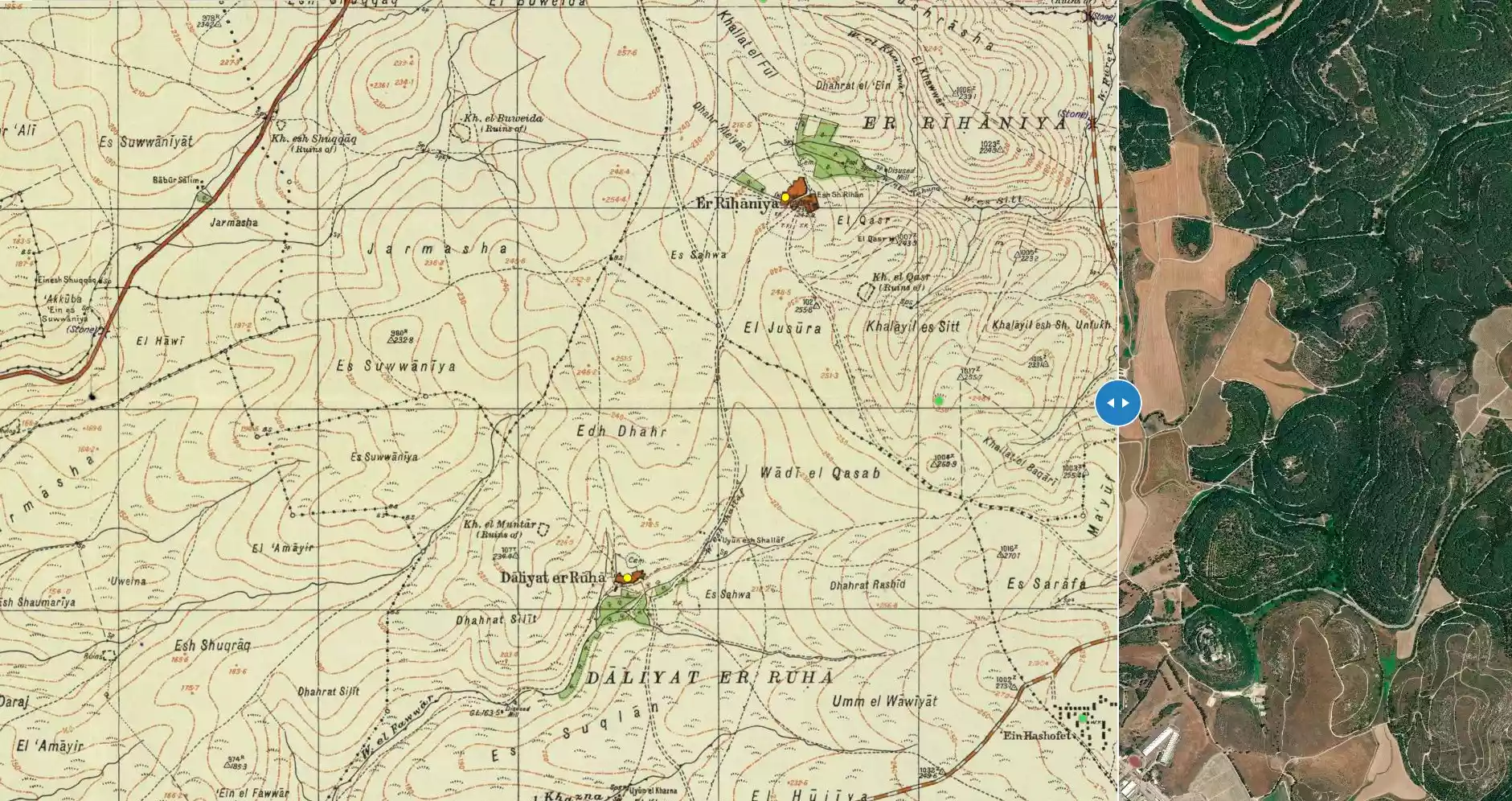
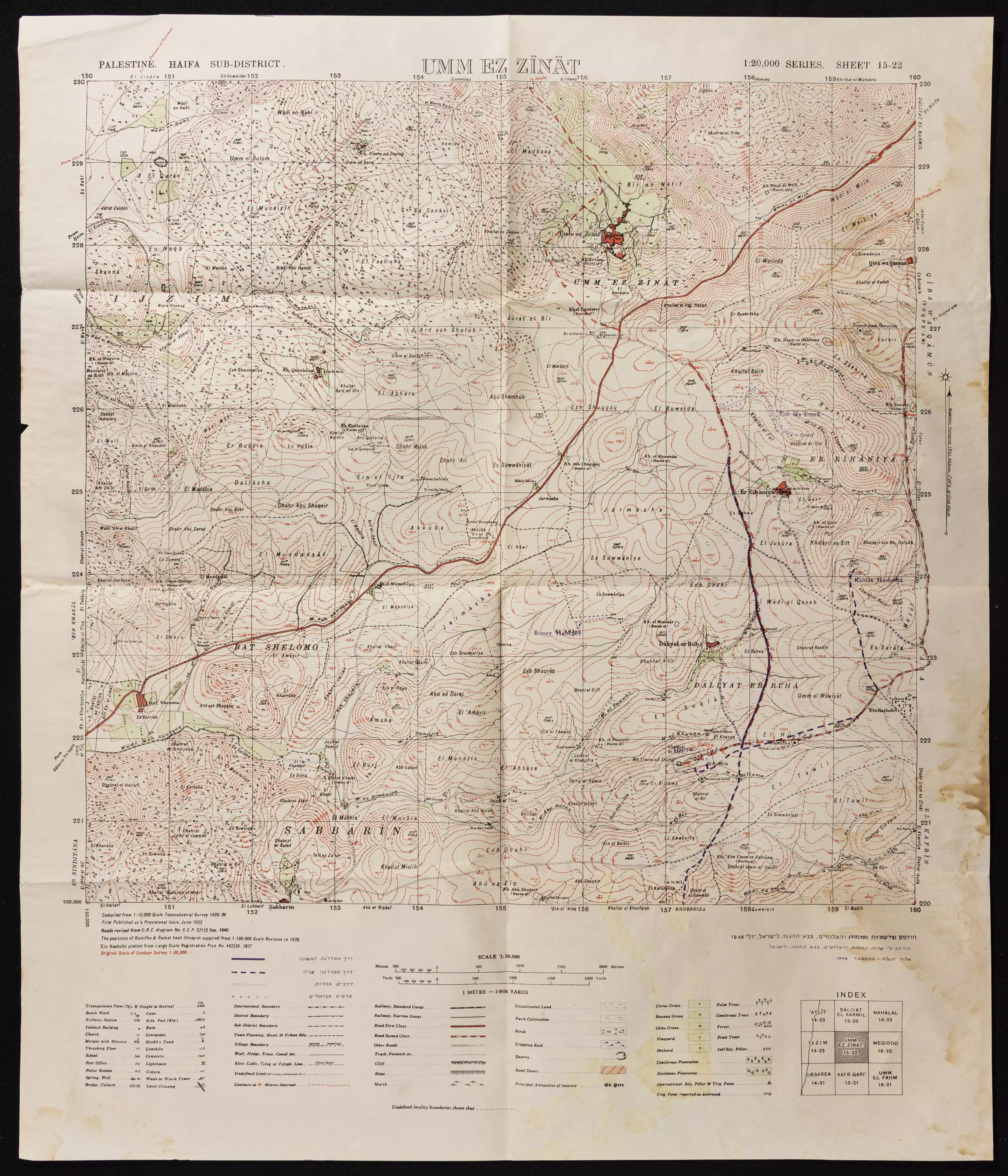
**Town Lands' Demarcation Maps |
||||||||||||||||||
| Land Usage As of 1945 |
|
||||||||||||||||||
| Population |
|
||||||||||||||||||
| Number of Houses |
|
||||||||||||||||||
| Near By Towns |
|||||||||||||||||||
|
|||||||||||||||||||
| Archeological Sites | Daliyat al-Rawha' had a Khirba located northwest of its center. | ||||||||||||||||||
| Exculsive Jewish Colonies Who Usurped Village Lands |
Ramot Menashe & Daliyya | ||||||||||||||||||
| Featured Video | |||||||||||||||||||
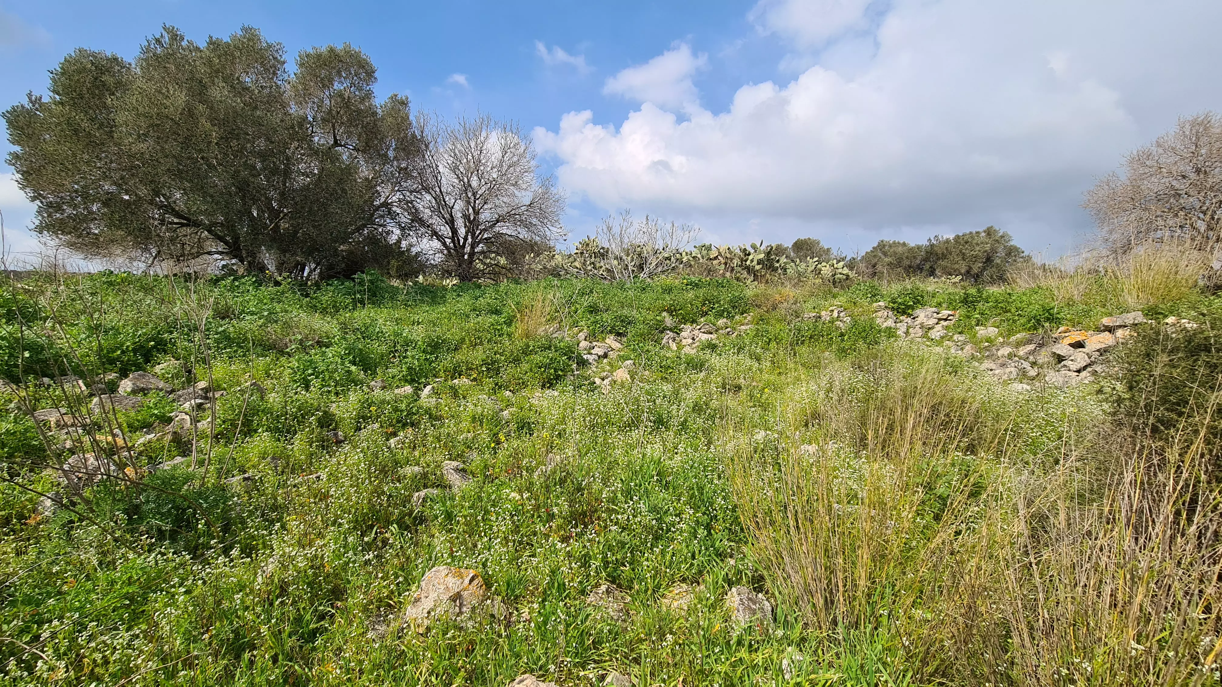
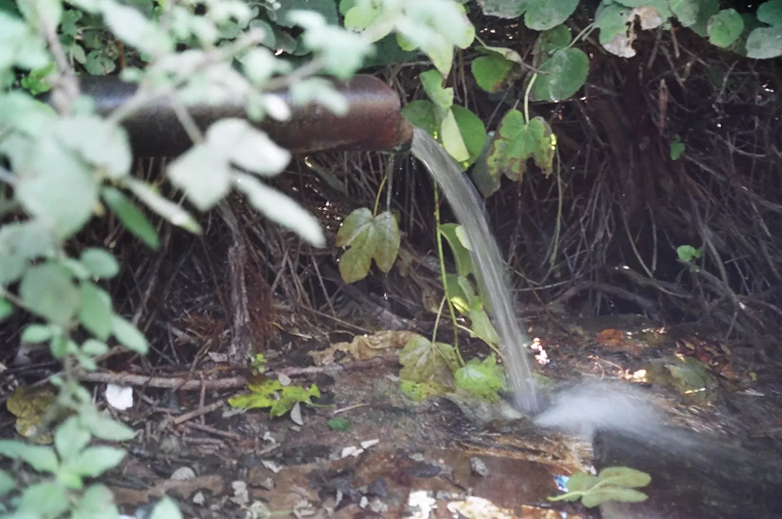
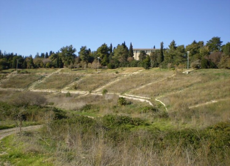
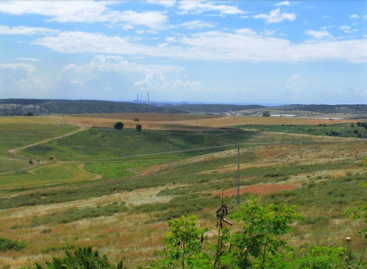
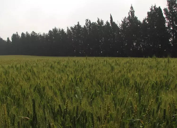
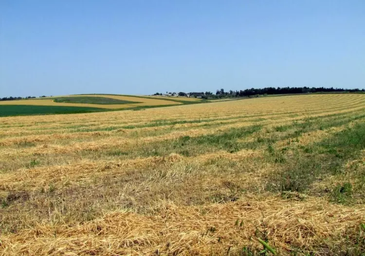
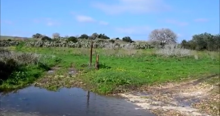
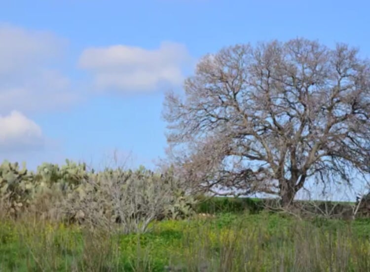
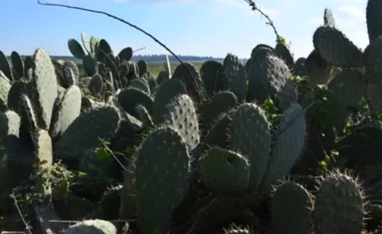
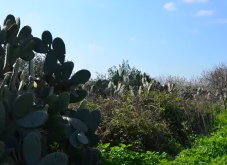
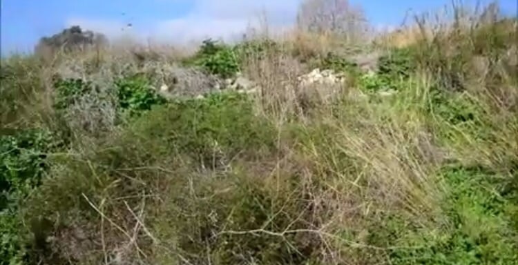
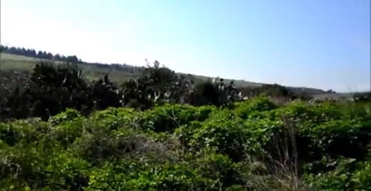
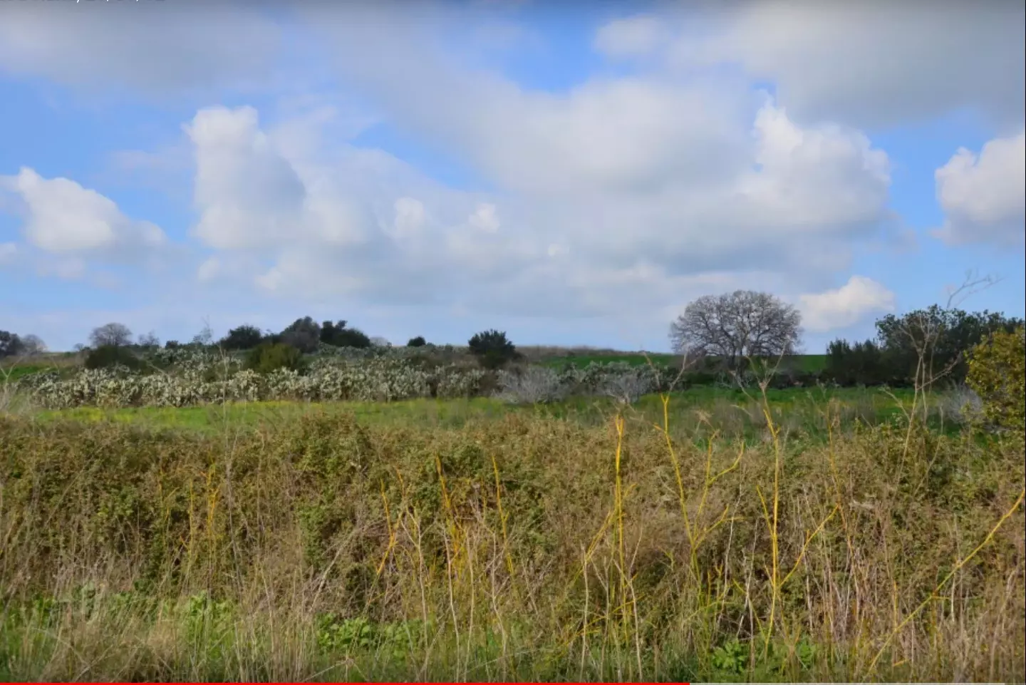
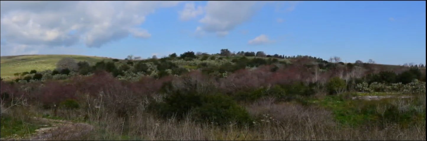
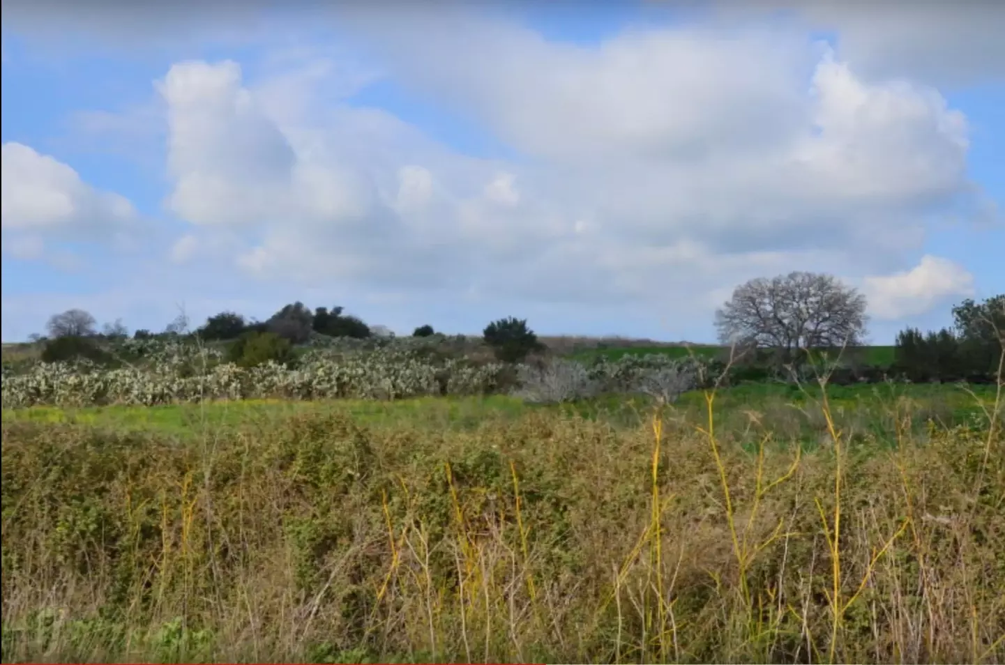
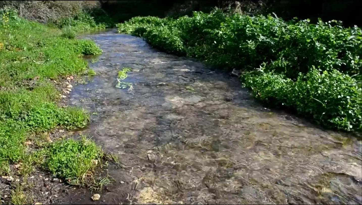
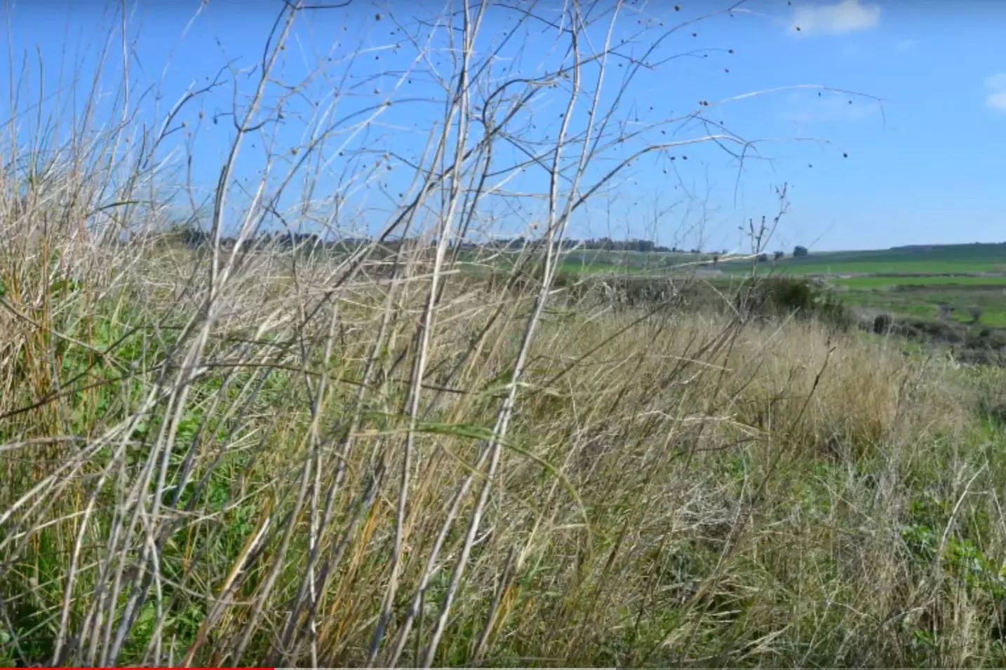
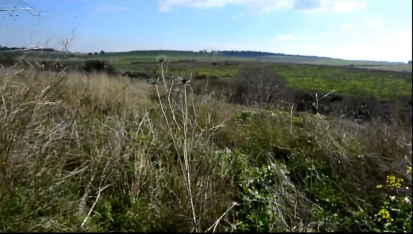
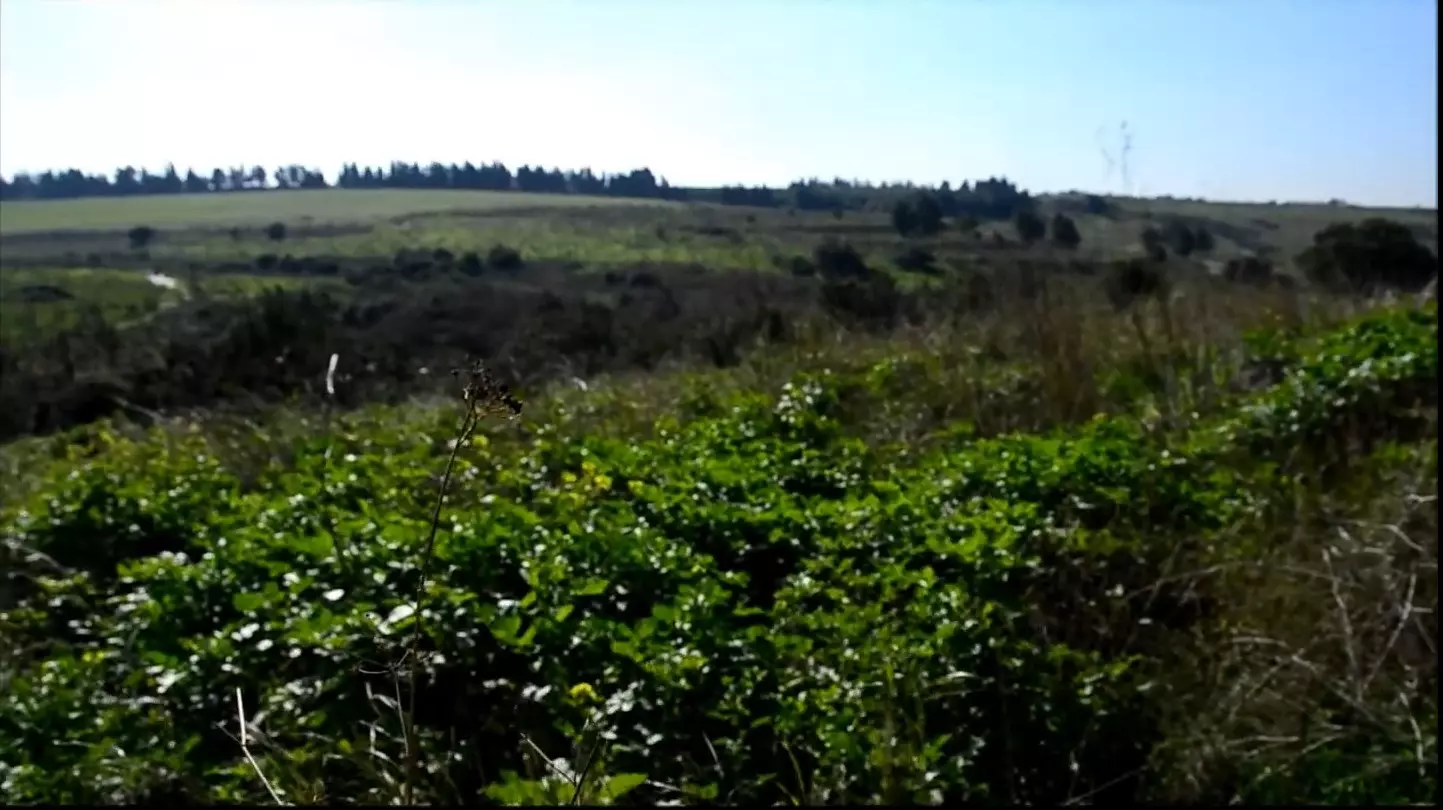
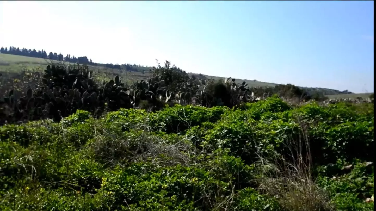
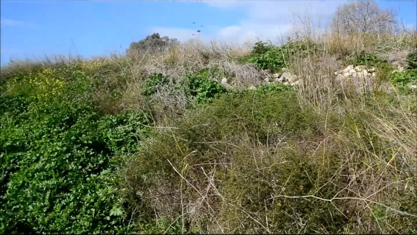
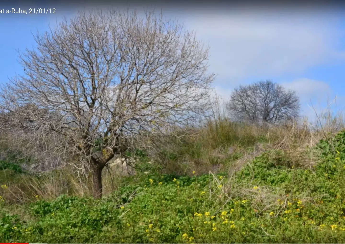
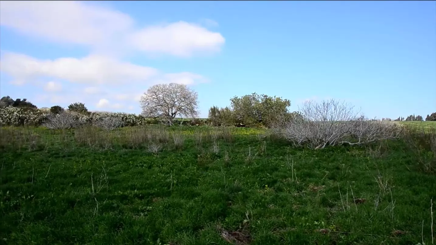
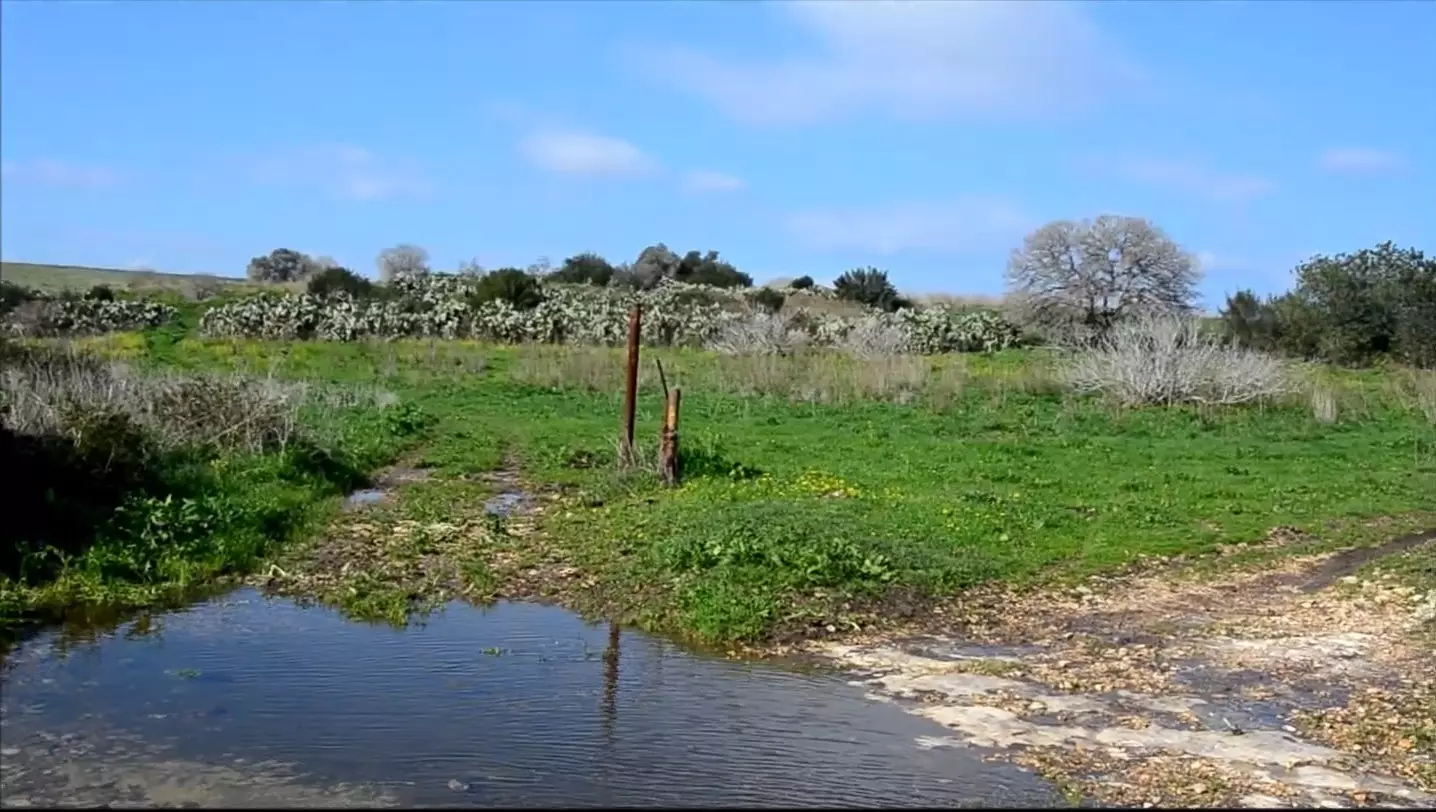
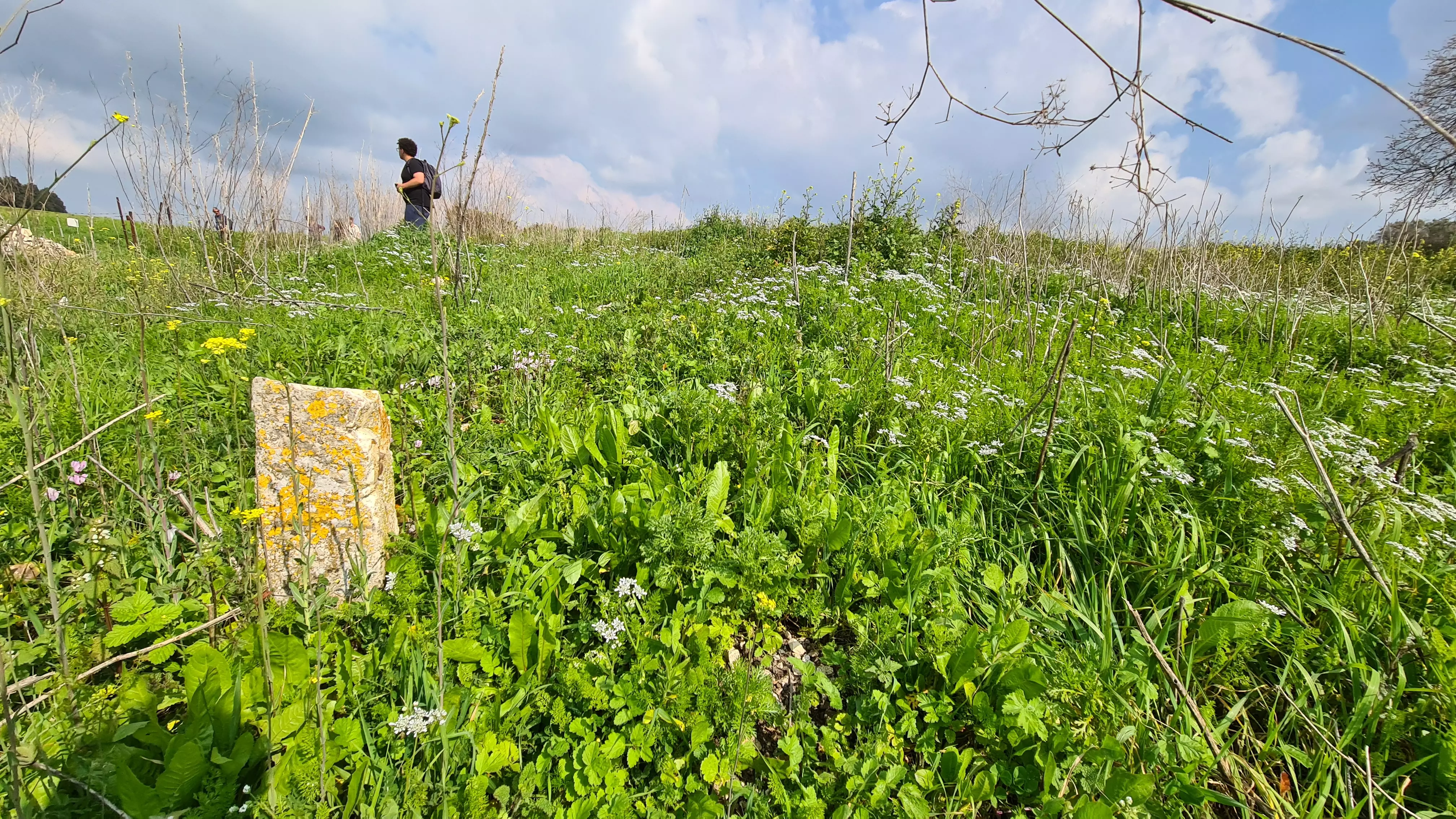
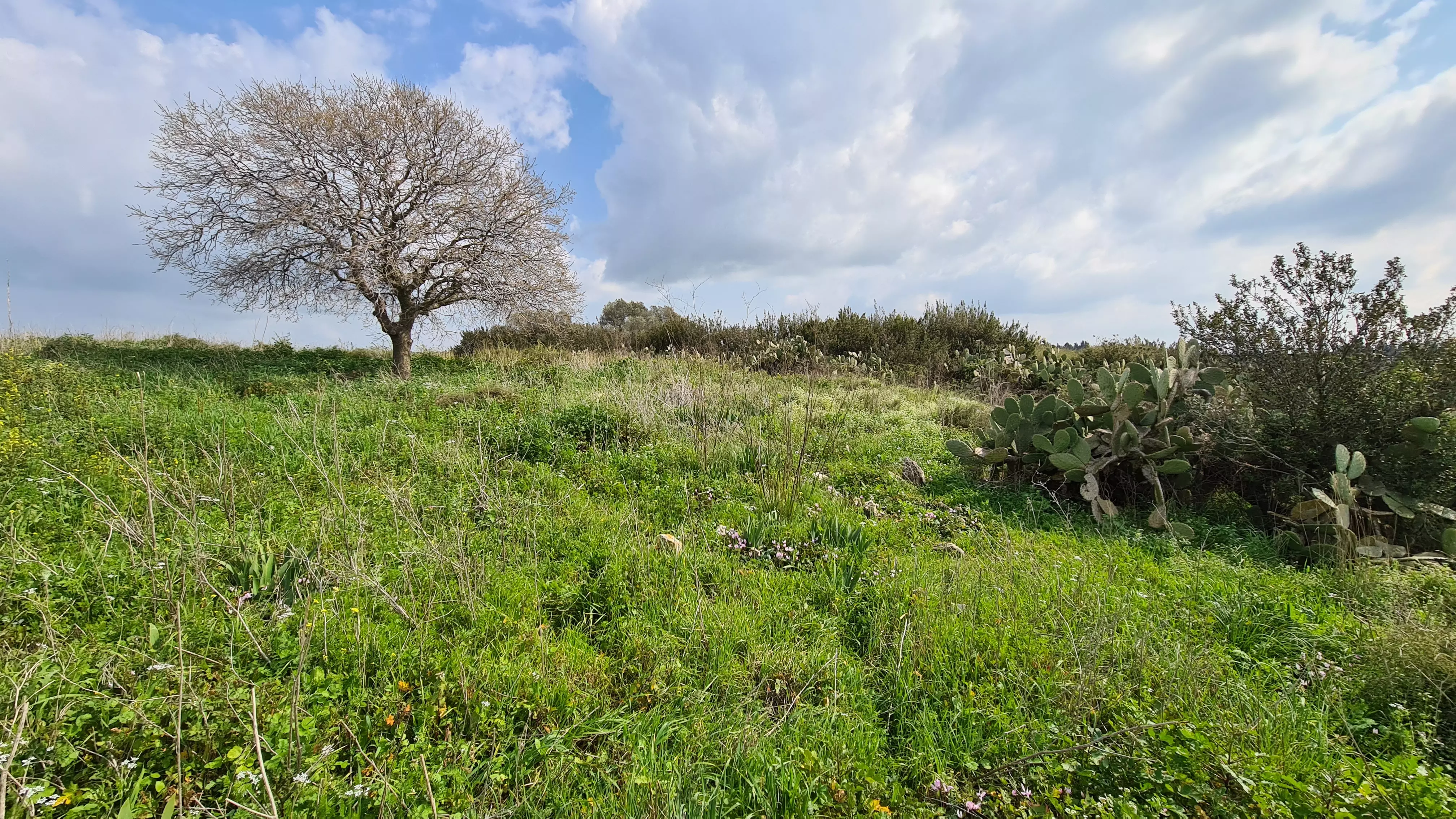
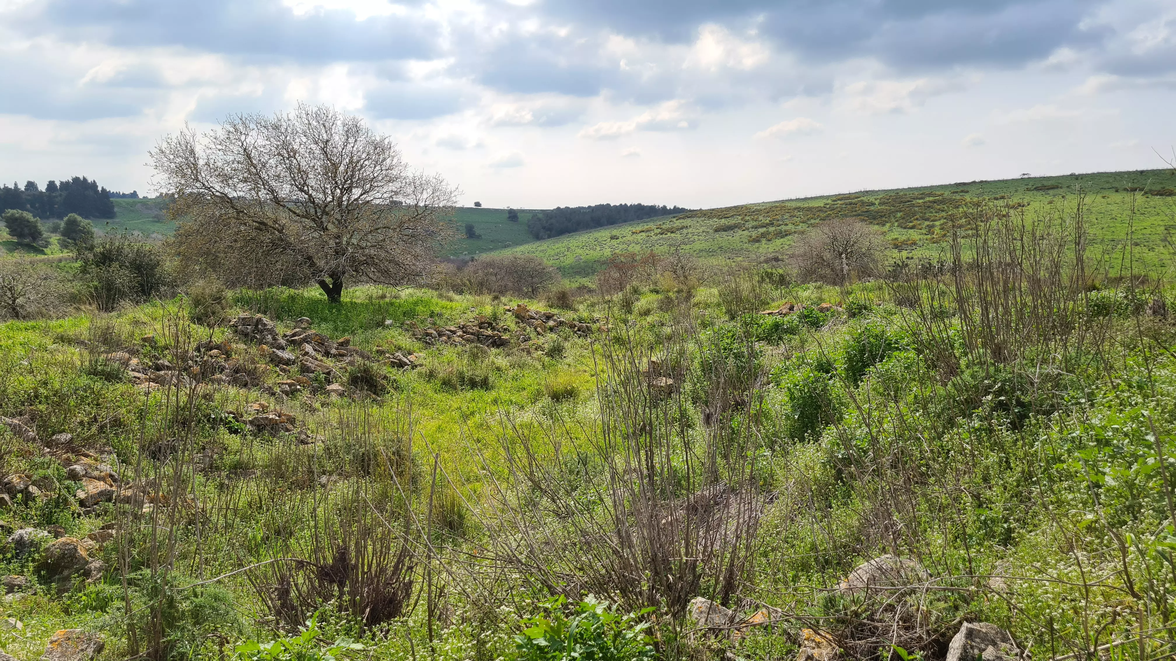
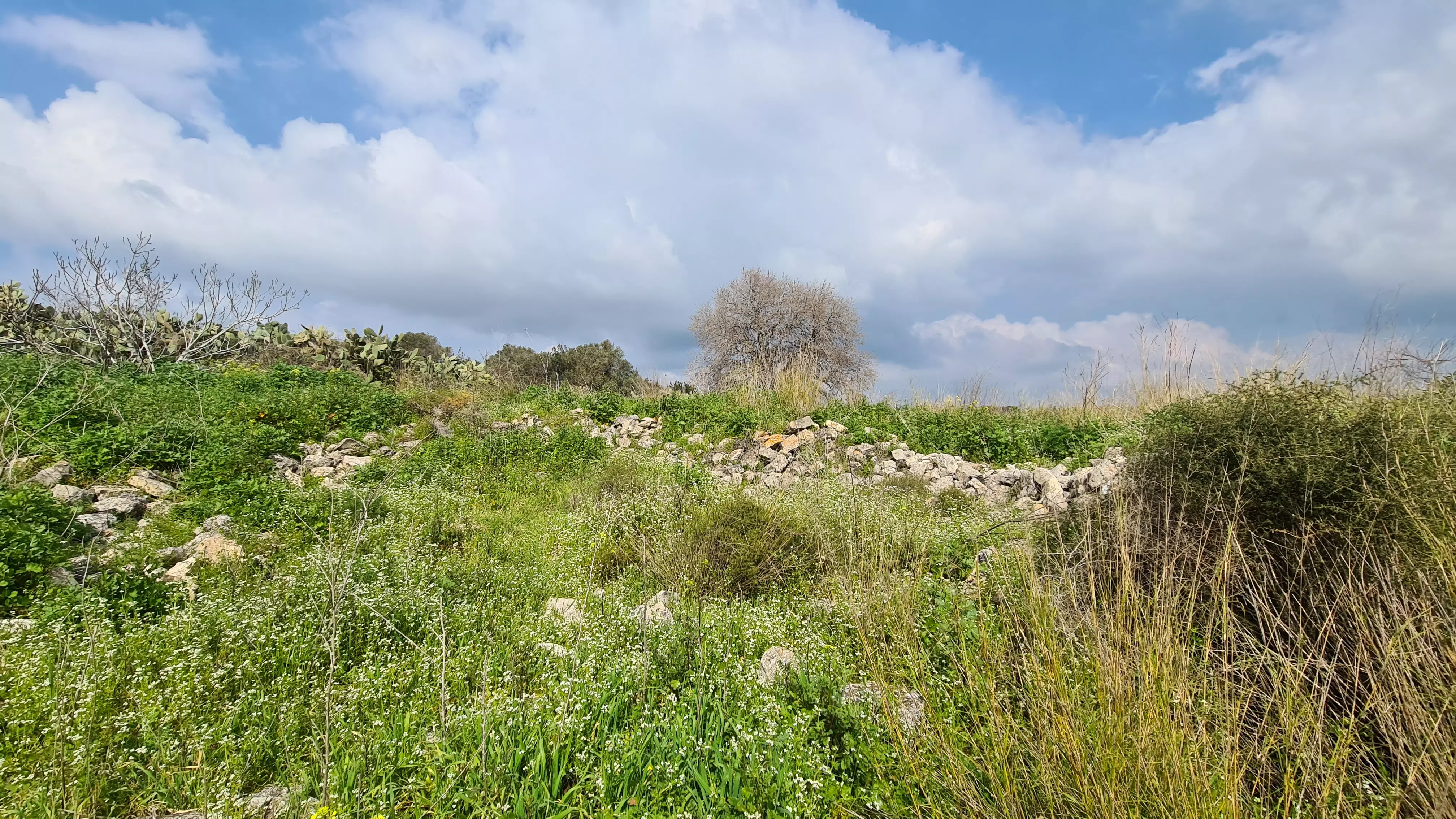
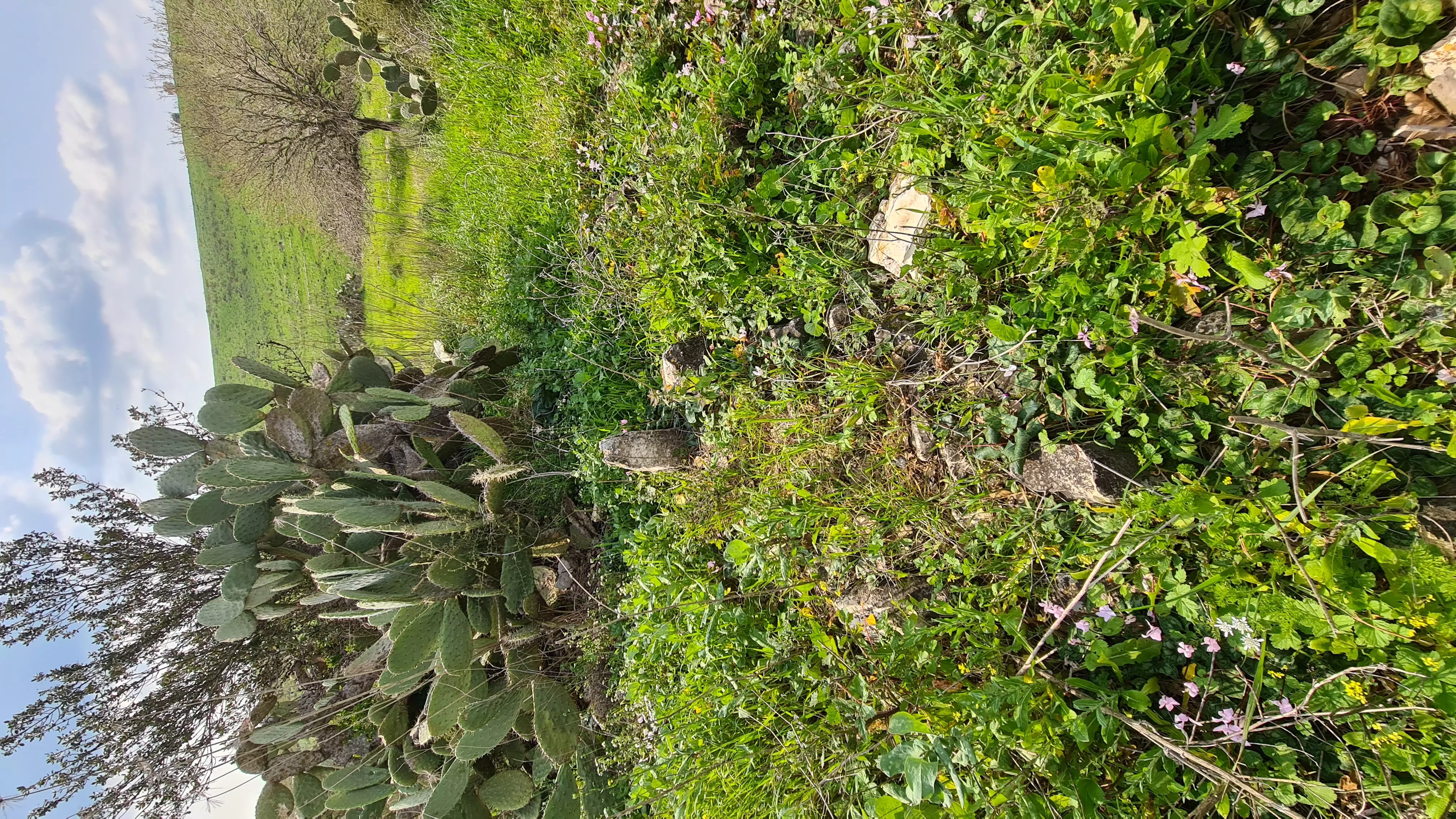
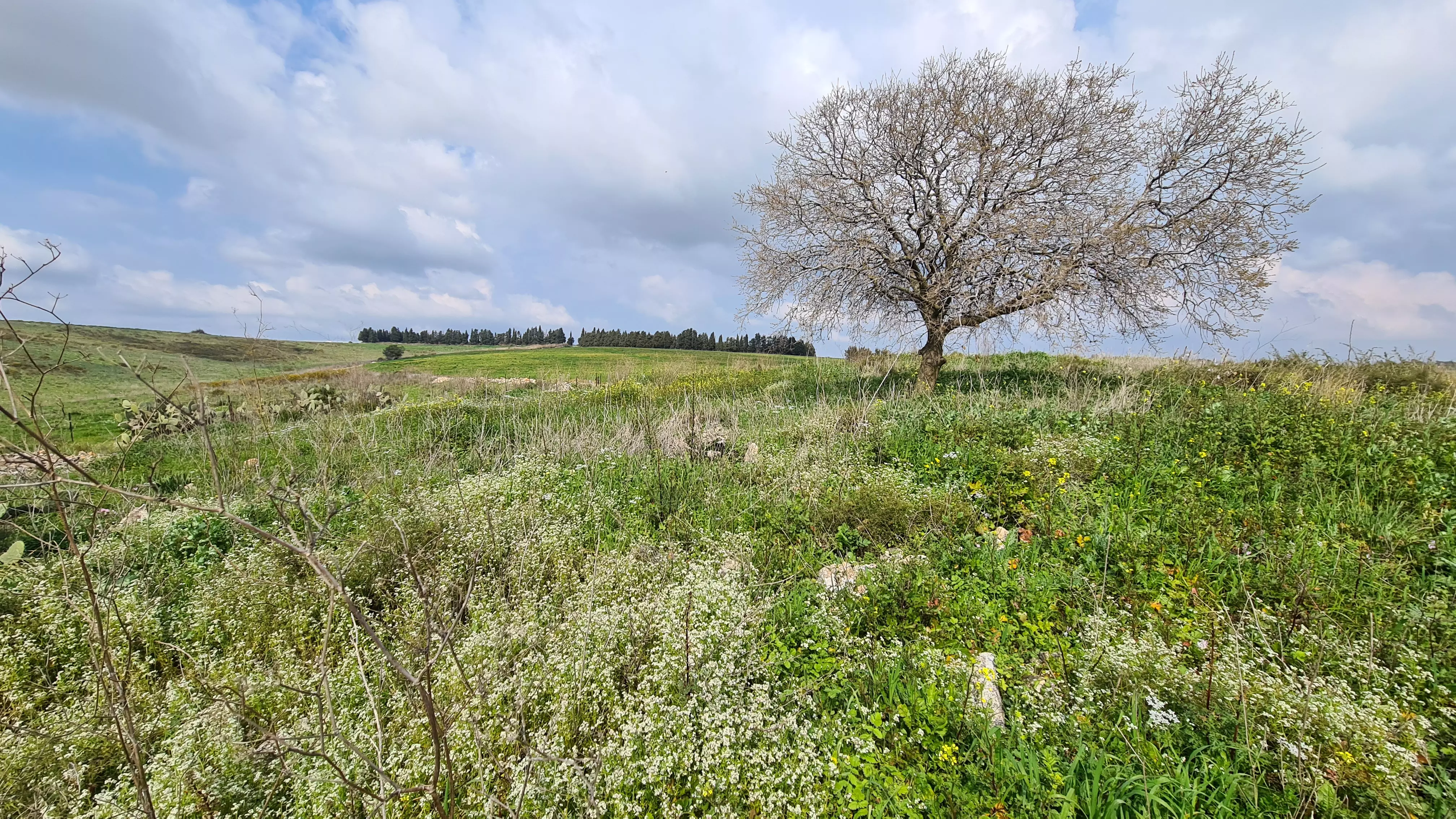
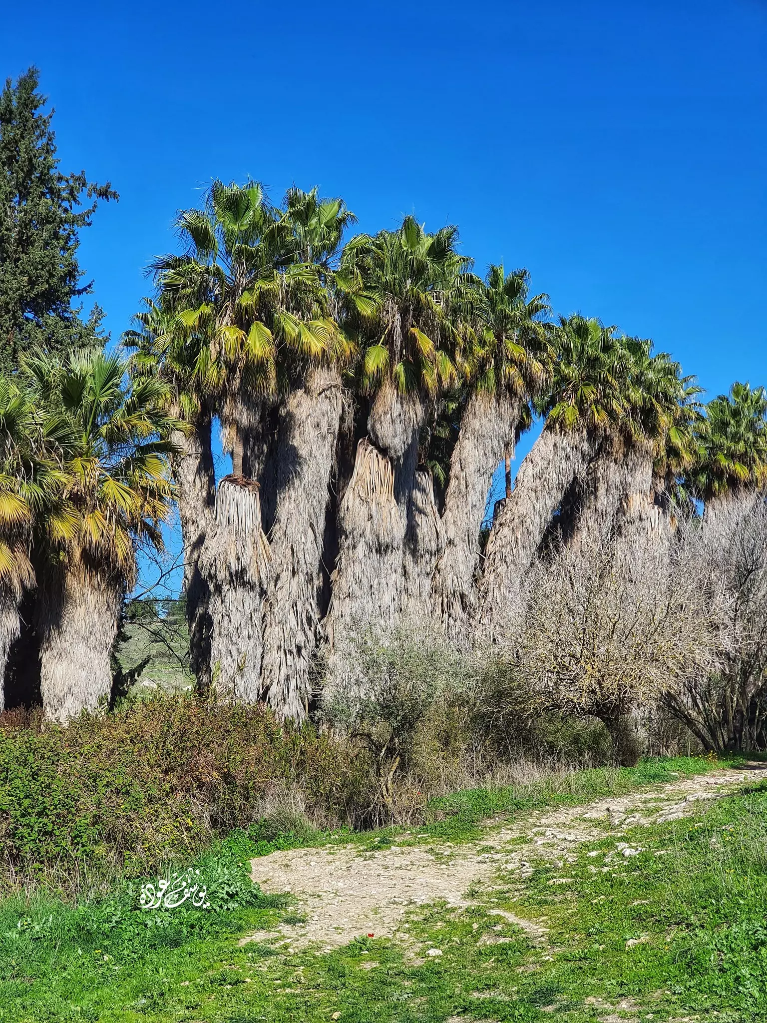
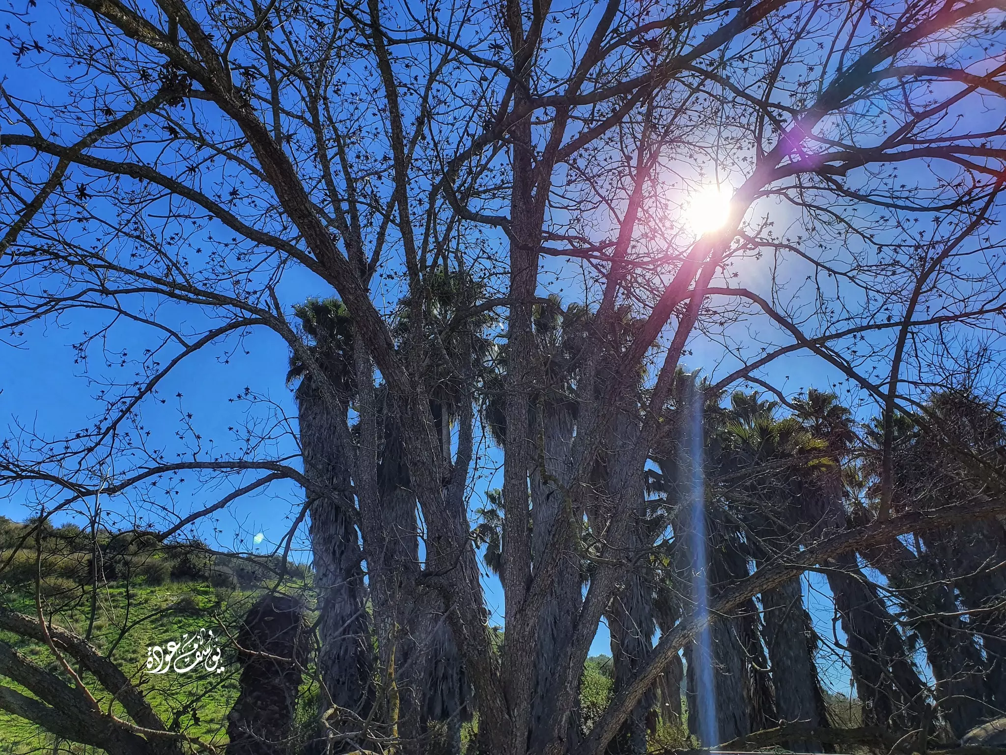
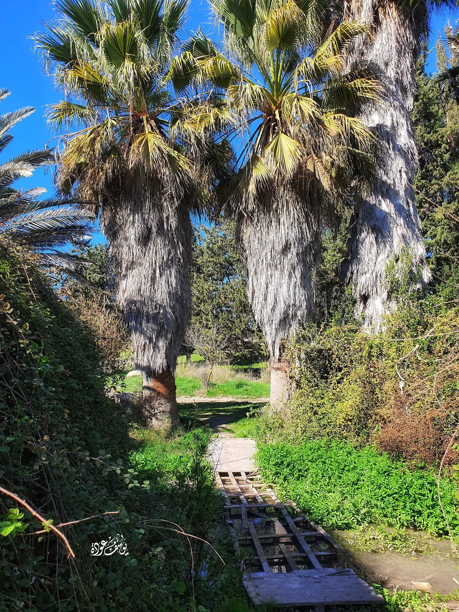
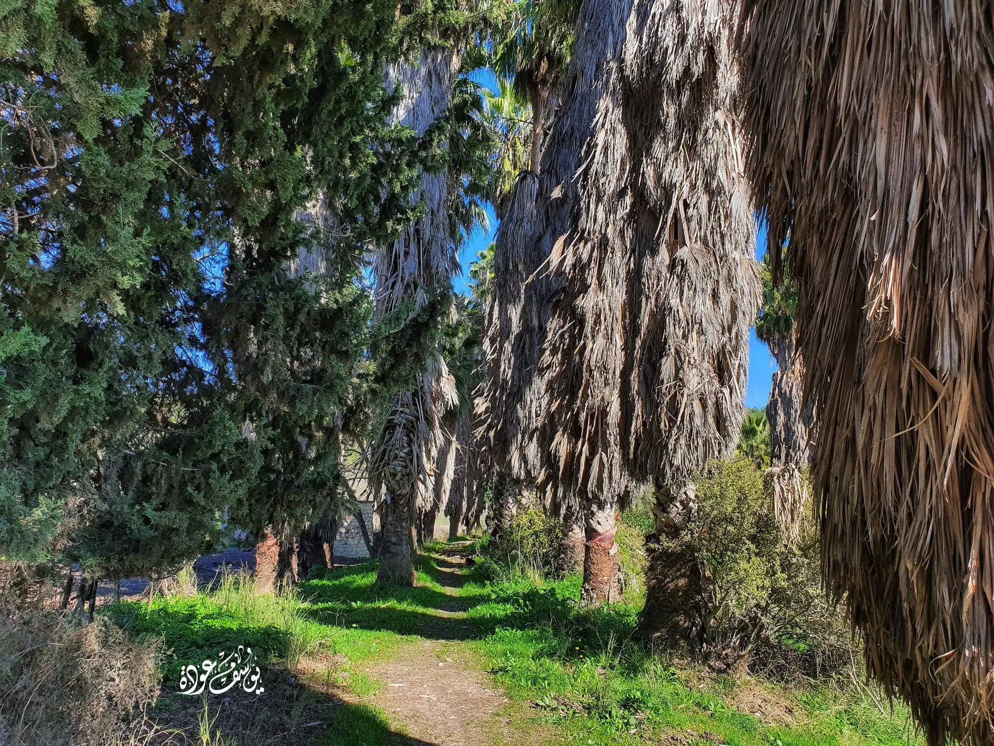
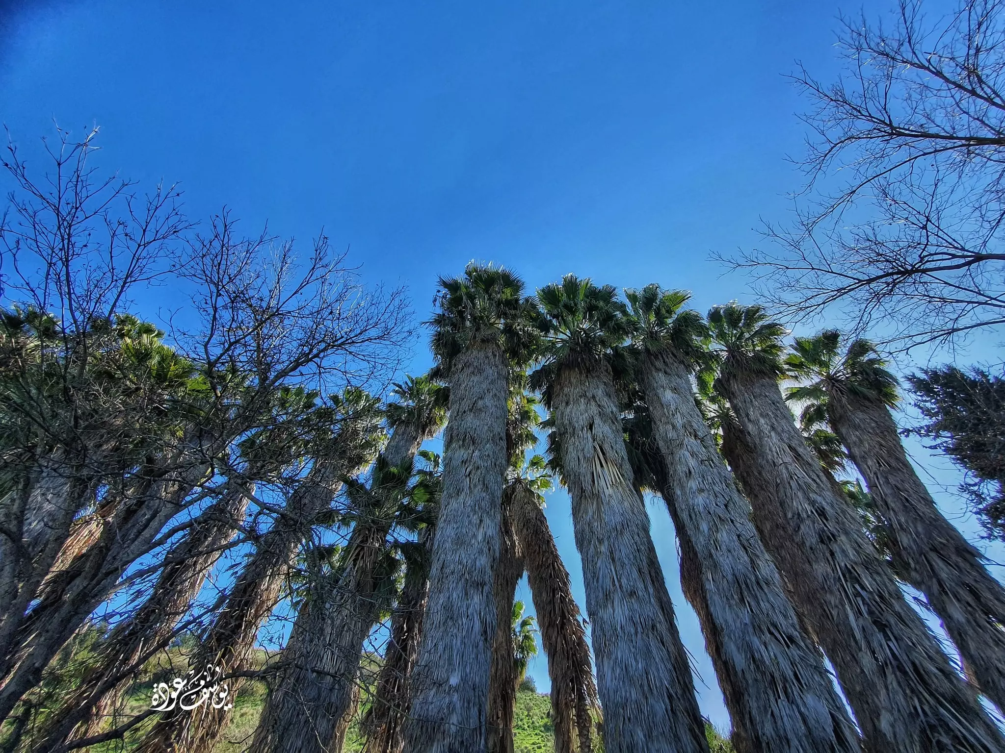
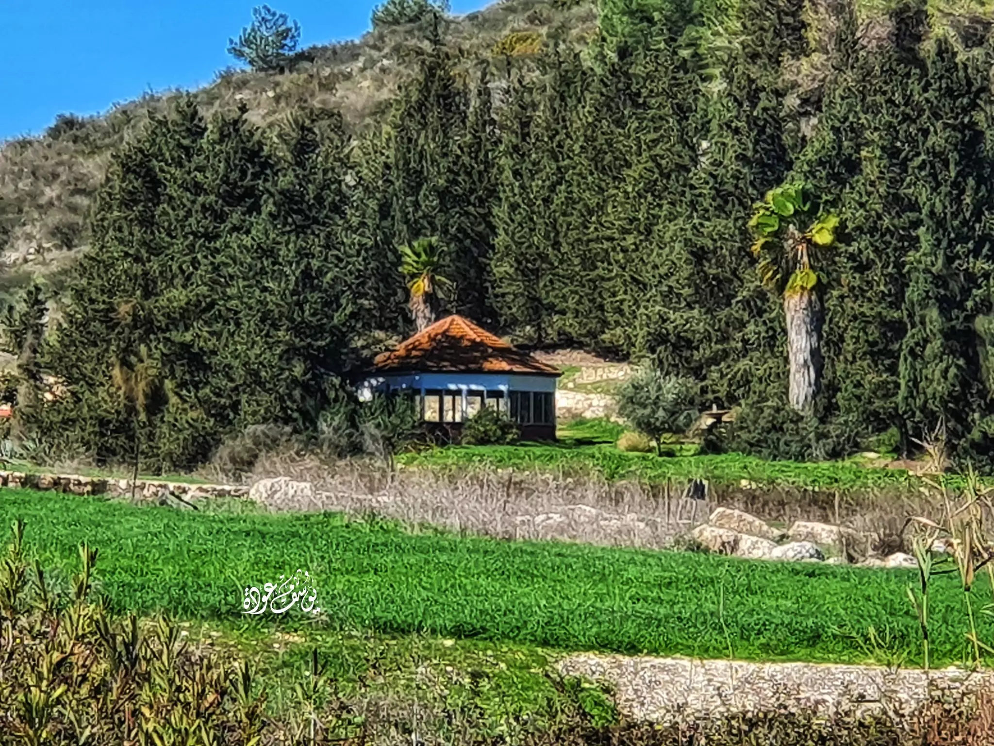
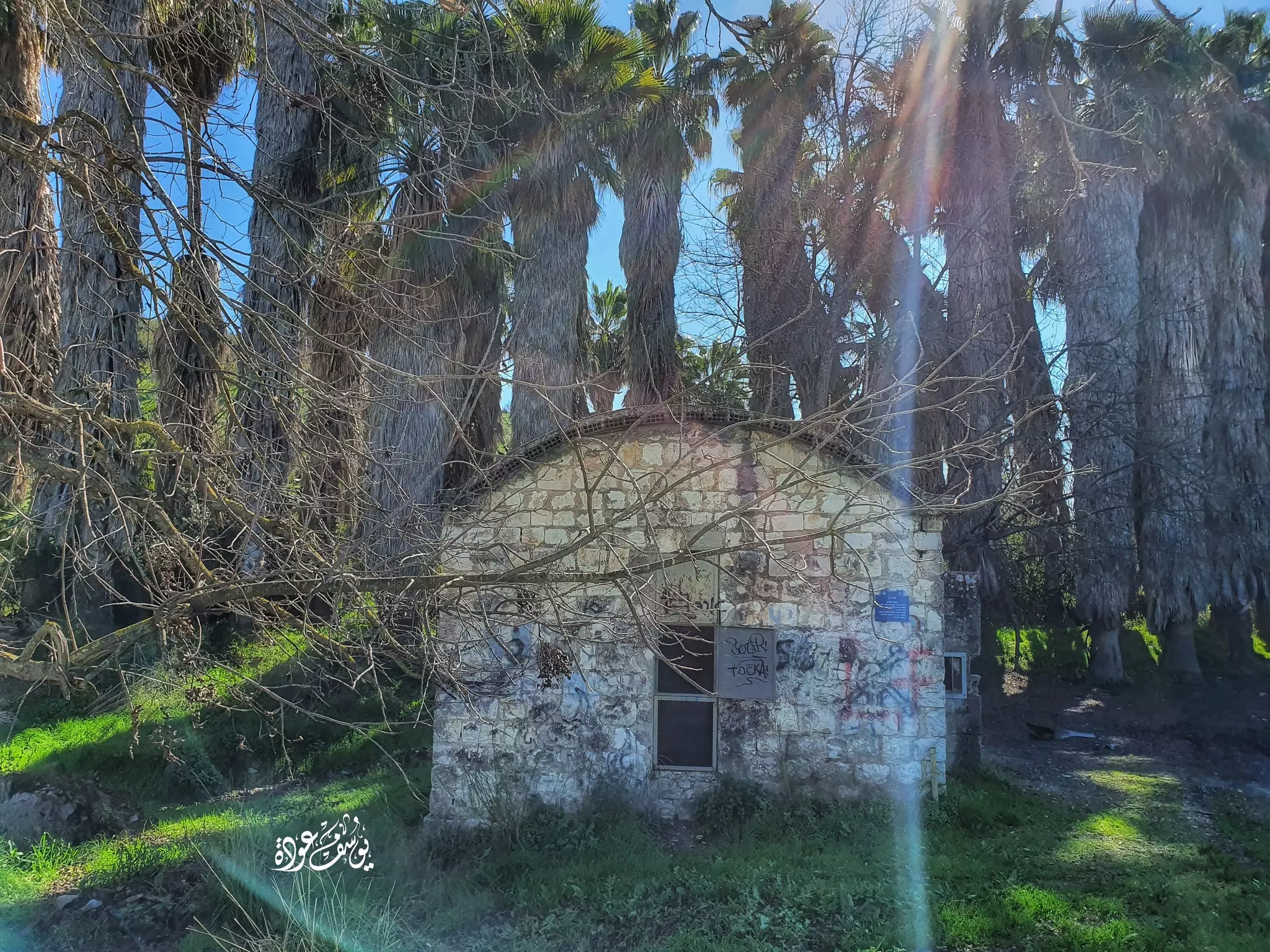
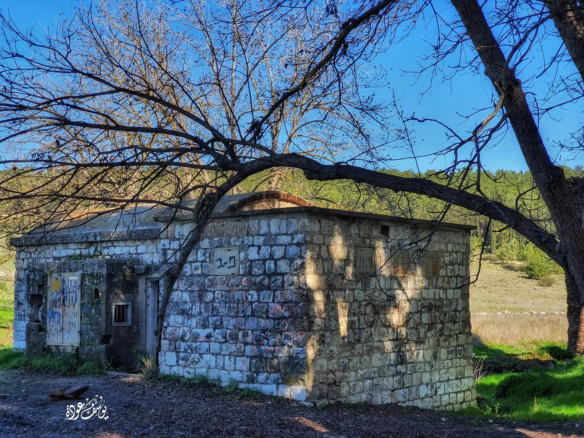
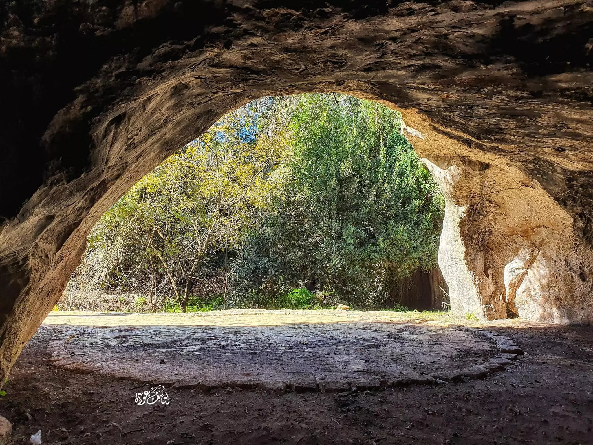
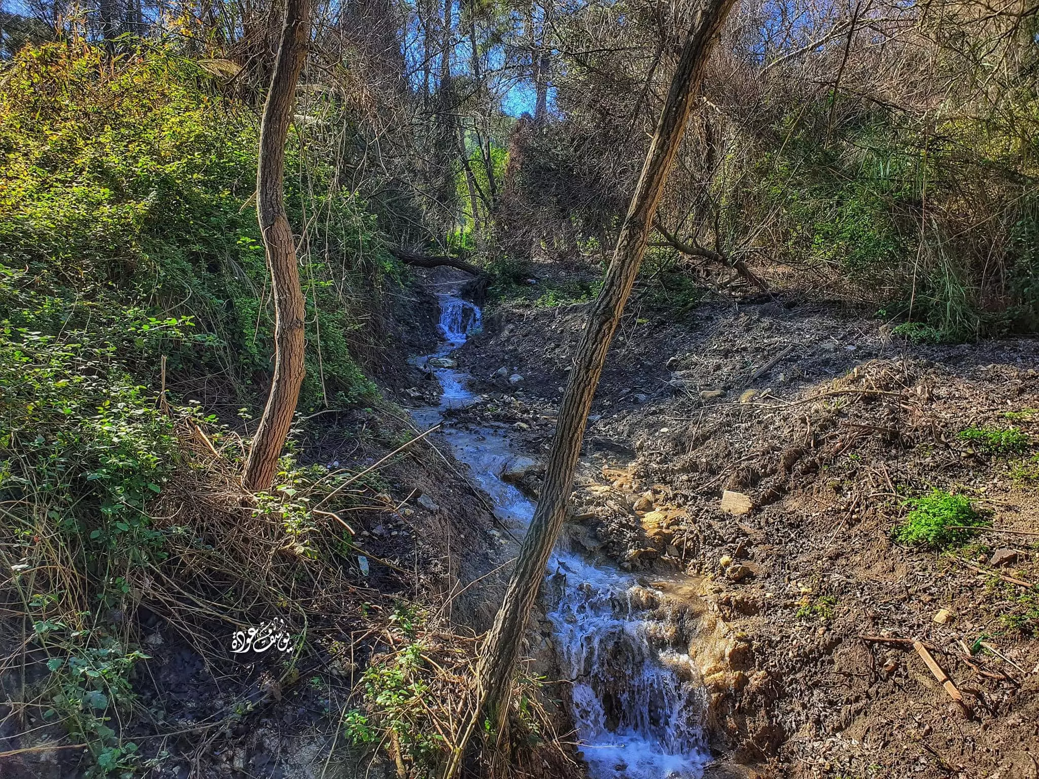
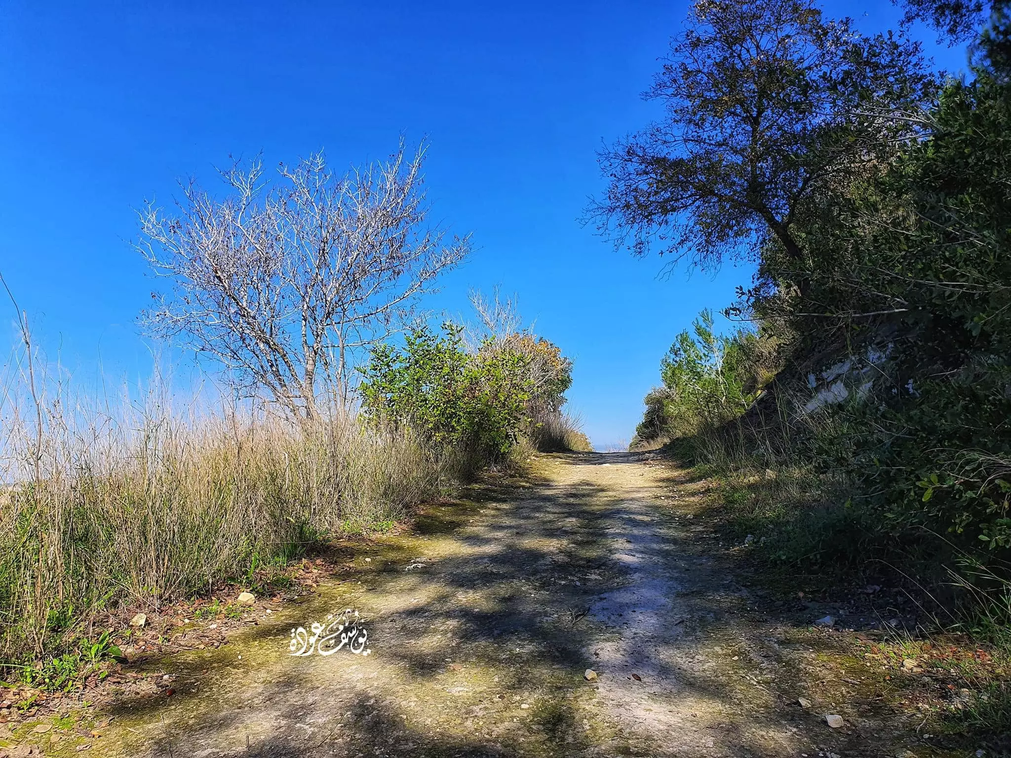
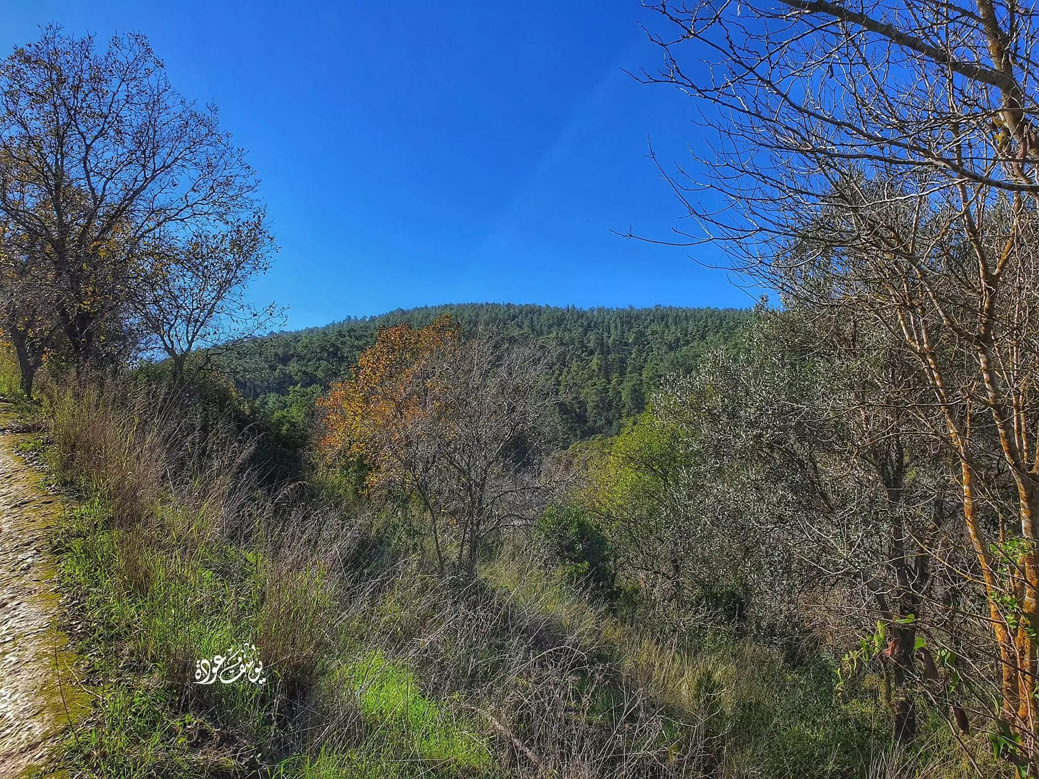
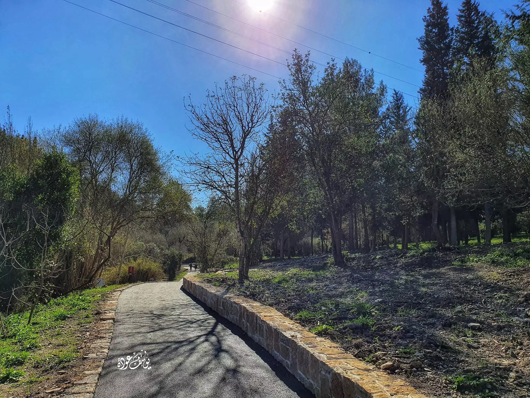
Village Before NakbaThe village stood on a small hill between two shallow wadis that ran north to south. It was linked by a secondary road to a highway that descended in a southwesterly direction to the Mediterranean and led northeast to the plain of Marj ibn Amir. The area extending from Daliyat al-Rawha' (the 'fragrant vine') to the village of Umm al-Fahm to the east was called the bilad al-rawha' (the 'fragrant country'). Al-Maqrizi (d. 1441) wrote that the Mamluk sultan Qalawun stayed in Daliyat al-Rawha' in A.D. 1281 while campaigning against the Crusaders, and that the two sides signed a temporary peace treaty there. In the late nineteenth century the authors of the Survey of Western Palestine saw Daliyat al-Rawha'. They said that it was situated on the west side of a watershed with a good spring on the south. The village's sixty residents cultivated ten faddans (1 faddan = 100-250 dunums).The village had a rectangular outline that extended from east to west; its houses were made of stone with either mud or cement mortar, and were clustered together. The residents of Daliyat al-Rawha' were Muslims. They earned their livelihood from agriculture and animal husbandry and drew water from the many springs in the area. In 1944/45 they allocated a total of 56 dunums to cereals; another 98 dunums were irrigated or used for orchards. To the northwest of the village was a khirba. Village Occupation and Ethnic CleaningThe villagers were evicted from Daliyat al-Rawha' as early as February 1948, according to Israeli historian Benny Morris, who states that the village lands had already been bought by Zionist organizations before 1948 and that the villagers were living as tenant farmers. In the beginning of 1948 discussion had already begun within the Zionist establishment regarding what should be done with such communities. A director of the Jewish National Fund (JNF), Yosef Weitz, held a meeting of JNF officials in January 1948 to decide the fate of Daliyat al-Rawha' and another village. Later, Weitz wrote in his diary: 'Is it not now the time to be rid of them? Why continue to keep in our midst these thorns at a time when they pose a danger to us? Our people are weighing up .' Morris reports that in the following month (February), Weitz used his contacts with local Haganah units and Haganah intelligence officers to have tenants evicted from several villages, among them Daliyat al-Rawha'.While the villagers may have been expelled in February, a story in the New York Times stated that the village was actually occupied on 14 April. That transpired in the course of the battle around the settlement of Mishmar ha-Emeq (see Abu Shusha, Haifa District), bringing to ten the number of villages seized in an arc south of the settlement. There is indirect confirmation of its occupation in Morris' book; he states that in the same month, JNF official Weitz met with top Haganah commanders, who promised to provide manpower and equipment to help set up a settlement on the village site. Before a settlement was established, however, the village was destroyed. In mid-June 1948, Israeli prime minister Ben-Gurion wrote in his diary that the destruction of the village was complete, almost certainly on the basis of a progress report from Weitz. Zionists Colonies on Village LandsMorris states that the JNF established the settlement of Ramot Menashe on the lands of the village some five months after the eviction of its population and three and a half months after its occupation, on 31 July 1948; this settlement is located between Daliyat al-Rawha' and the nearby Sabbarin. Ramot Menashe is not, however, on the lands of Daliyat al-Rawha' but actually stands on lands that belonged to Sabbarin. Daliyya, established in 1939, is south of the village site on land that originally belonged to the village.Village TodayThe stone rubble of houses, covered with dirt, bushes, and thorny shrubs, is visible. Clusters of cactus cover a large portion of the site. There are a few olive, chinaberry, and poplar trees scattered about the site, and at the southern edge one can see a large eucalyptus tree. A few meters to the north of this tree there are stones strewn among the cactus plants these most likely are the remains of the village cemetery. At the southern edge of the site, in the wadi, are the walls of a house with stone floors.SourceDr. Walid al-Khalidi, 1992: All That Remains. |
|||||||||||||||||||
| Related Maps | Town Lands' Demarcation Maps خرائط للقضاء توضح حدود القرى والاودية Town's map on MapQuest View from satellite Help us map this town at WikiMapia |
||||||||||||||||||
| Related Links | Wikipedia's Page Google Search Google For Images Google For Videos |
||||||||||||||||||
| More Information | في كتاب كي لا ننسى في كتاب بلادنا فلسطين المزيد من موقع هوية |
||||||||||||||||||
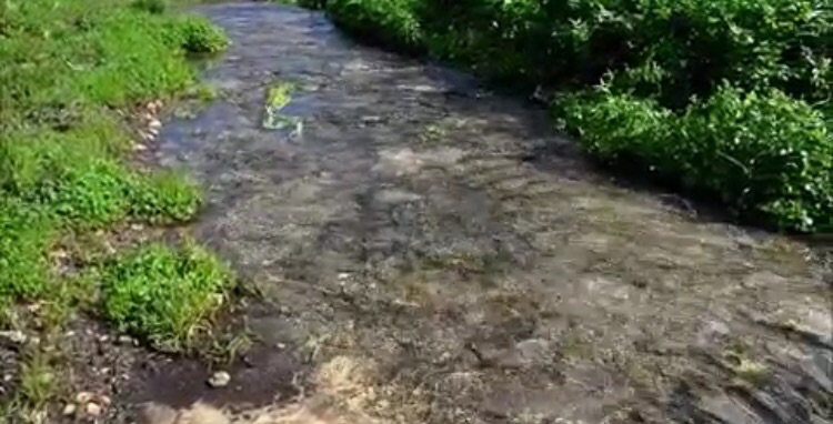
- عين الماء في دالية الروحة: تصوير المهندس محمد يونس
Posted by محمد سلامة يونس - داليه الروحه
Posted by abu raya - اراضي داليه الروحه
Posted by abu raya - اراضي داليه الروحه
Posted by abu raya - اراضي القريه
Posted by abu raya - الربيع في داليه الروحه
Posted by abu raya - داليه الروحه
Posted by abu raya - داليه الروحه
Posted by abu raya - داليه الروحه
Posted by abu raya - داليه الروحه
Posted by abu raya - ينابيع داليه الروحه
Posted by abu raya - موقع القريه مغطى بالاعشاب
Posted by abu raya - داليه الروحه
Posted by abu raya - جولة بين انقاض واراضي وينابيع دالية الروحاء المهجرة - 2011 -- قام بها Uri Zackhem
- جولة بين انقاض واراضي وينابيع دالية الروحاء المهجرة - 2011 -- قام بها Uri Zackhem #2
- جولة بين انقاض واراضي وينابيع دالية الروحاء المهجرة - 2011 -- قام بها Uri Zackhem #3
- جولة بين انقاض واراضي وينابيع دالية الروحاء المهجرة - 2011 -- قام بها Uri Zackhem #4
- جولة بين انقاض واراضي وينابيع دالية الروحاء المهجرة - 2011 -- قام بها Uri Zackhem #5
- جولة بين انقاض واراضي وينابيع دالية الروحاء المهجرة - 2011 -- قام بها Uri Zackhem #6
- جولة بين انقاض واراضي وينابيع دالية الروحاء المهجرة - 2011 -- قام بها Uri Zackhem #7
- جولة بين انقاض واراضي وينابيع دالية الروحاء المهجرة - 2011 -- قام بها Uri Zackhem #8
- جولة بين انقاض واراضي وينابيع دالية الروحاء المهجرة - 2011 -- قام بها Uri Zackhem #9
- جولة بين انقاض واراضي وينابيع دالية الروحاء المهجرة - 2011 -- قام بها Uri Zackhem #10
- جولة بين انقاض واراضي وينابيع دالية الروحاء المهجرة - 2011 -- قام بها Uri Zackhem #11
- جولة بين انقاض واراضي وينابيع دالية الروحاء المهجرة - 2011 -- قام بها Uri Zackhem #12
- Village cemetery and destroyed house, spring 2023 / زيارة لمقبرة دالية الروحة وتظهر انقض البيوت المدمرة - خريف 2023
- Village cemetery and destroyed house, spring 2023 / زيارة لمقبرة دالية الروحة وتظهر انقض البيوت المدمرة - خريف 2023 #2
- Village cemetery and destroyed house, spring 2023 / زيارة لمقبرة دالية الروحة وتظهر انقض البيوت المدمرة - خريف 2023 #3
- Village cemetery and destroyed house, spring 2023 / زيارة لمقبرة دالية الروحة وتظهر انقض البيوت المدمرة - خريف 2023 #4
- Village cemetery and destroyed house, spring 2023 / زيارة لمقبرة دالية الروحة وتظهر انقض البيوت المدمرة - خريف 2023 #5
- Village cemetery and destroyed house, spring 2023 / زيارة لمقبرة دالية الروحة وتظهر انقض البيوت المدمرة - خريف 2023 #6
- Village cemetery and destroyed house, spring 2023 / زيارة لمقبرة دالية الروحة وتظهر انقض البيوت المدمرة - خريف 2023 #7
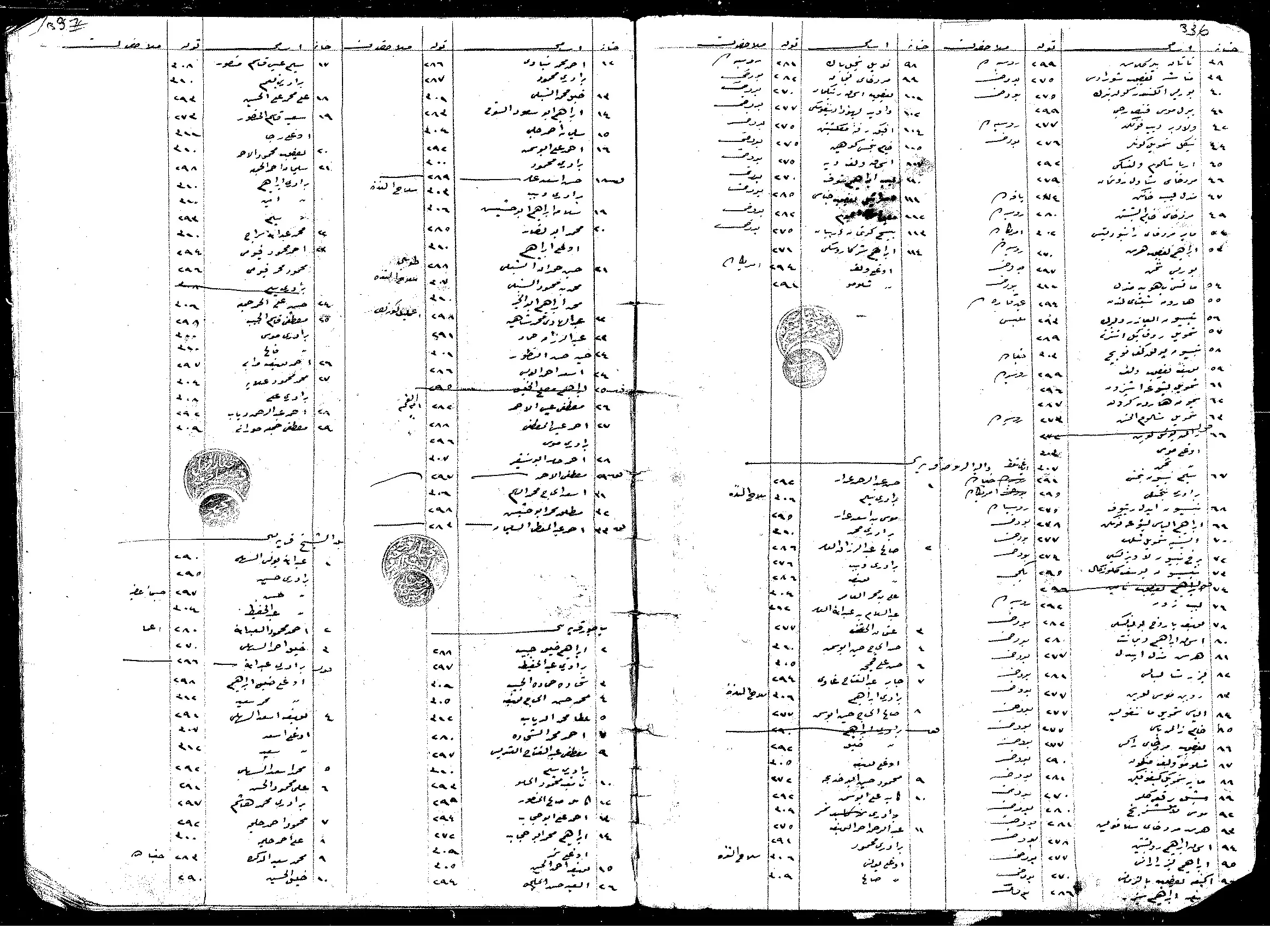
- السجلات العثمانية _ سجل نفوس رب الاسرة من سجلات المخاتير العثمانية دالية الروحة
Posted by Wadi Alhawarith - بلاد الروحة
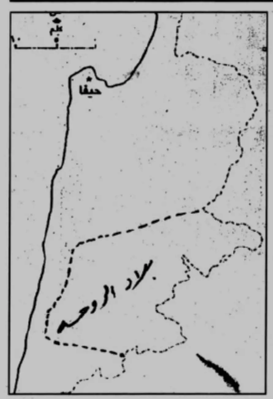
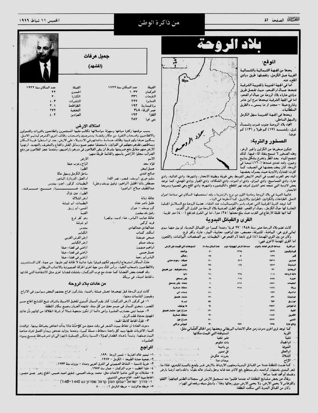
Posted by Wadi Alhawarith - بلاد الروحة مقال نشر في الاتحاد الصفحة 17 الخميس ۱۱ شباط ۱۹۹۹
Posted by Wadi Alhawarith - جولة في باراضي الروحة وانقاضها
- جولة في باراضي الروحة وانقاضها #2
- جولة في باراضي الروحة وانقاضها #3
- جولة في باراضي الروحة وانقاضها #4
- جولة في باراضي الروحة وانقاضها #5
- جولة في باراضي الروحة وانقاضها #6
- جولة في باراضي الروحة وانقاضها #7
- جولة في باراضي الروحة وانقاضها #8
- واد الطوحين، أراضي قرية الروحة المهجرة --يوسف عودة
- واد الطوحين، أراضي قرية الروحة المهجرة --يوسف عودة #2
- واد الطوحين، أراضي قرية الروحة المهجرة --يوسف عودة #3
- واد الطوحين، أراضي قرية الروحة المهجرة --يوسف عودة #4
- واد الطوحين، أراضي قرية الروحة المهجرة --يوسف عودة #5
- خارطة تُظهِر الحدود والطرق بأنواعها والأماكن المقدسة والطبيعة الطوبغرافية من تلال وسهول ومنحدرات والتشكيلة الطبيعية للأرض وأنواع المزروعات. نُشرت الخريطة فترة الانتداب البريطاني، تم إضافة تعديلات عليها من قِبَل خدمة الخرائط والصور التابعة للقوات العسكرية الاسرائيلية فترة الأربعينيات.
Want to browse more? 80,000 pictures were grouped in these gallaries:
| Display Name | Clan/Hamolah | Country of Residence |
| عاصم عبدالرازق | - | - |
| خضره عبد الرازق | - | - |
| وايد عبد الرازق | - | - |
| معتصم عبد الرازق | عبد الرازق | - |
| asem walid abdelraziq | abdelraziq | - |
| محمد عبد الرازق | عبد الرازق | - |
| muhammad shora | shora | florence, italy |
 Fake Valor: Why Did Zionist Jews Hoist Nazis Flag on Their Ships in the 1930s?
What is new?
-
Facts About Oct. 7th Gaza Raid
-
Remined Us Please: Who Did Rape Whom? Was it Palestinians who raped Israelis? Or, was the other way around? You'll be the judge
-
When Prof. Edward Said was invited to debate Bibi Netanyahu in the 1980s, watch what happened!
-
Ezra Klein of the NY Times on the "Jewish Race".
-
Abusing Blood Libel!
-
How and why Israeli Jewry has become the most hated cult?
-
Did Israeli Soldiers Activate The Hannibal Direective On Oct. 7th? You Be The Judge
-
Zionist FAQ: Isn't it true that Palestinians don't want peace? Palestinians never accepted the two-state solution
- Facts about Haavara (Transfer) Agreement between Ben-Gurion & Hitler
-
Haavara FAQs: Why Did Zionist Jews Hoist Nazis' Flags on Their Ships in the 1930s?
- Haavara FAQs: When Chaim Weizmann met FDR in mid-1943, why was he silent about rescuing European Jewry?
-
Dear ChatGPT: How did Palestinians resist Napoleon's invasion of their country in 1799?
-
Dear ChatGPT: Gaza had a vibrant Jewish community in the mid-17th century. What happened to them?
-
Dear ChatGPT: Why did the Jewish Agency suppress news of the Holocaust during WWII?
-
Video Playlist: Jews share their DNA tests to end the conflict for good.
-
A Tale of Two Conflicts: Examining the Definition of Genocide
-
Prof. Abraham Polak And The Suppressed History of the Khazars and European Jewry
-
How Ronald Reagan would have framed the genocide in Gaza if he were still alive?
-
Haavara FAQs: Let us do the math: how many German Jews did The Haavara Agreement save?
-
Zionist FAQs: The Hebron Massacre of 1929, "clearly proves" that Palestinians are antisemitic, how could you deny it?
-
Zionist FAQs: Why Anti-Zionist Is Not Antisemitism?
-
Zionist FAQs: Isn't it true that the KGB created Palestinian Nationalism in the early 1960s?
- Zionist FAQs: Muslims are killing Muslims all the time; why are Israeli Jews being singled out in the media?
- Zionist FAQs: How is Israel an apartheid state when 20% of its citizens are Arabs who enjoy full rights?
-
Haavara FAQs: Why Did Dorothy Thompson Flip From A Zionist Advocate to A Silenced Dissenter?
-
Haavara FAQs: Analysis of Herzl's Uganda Scheme and how it could have saved millions of Jews.
-
Haavara FAQs: Why did Hayim Greenberg describe American Jewry as "morally bankrupt" in early 1943?
-
Haavara FAQs: What if the Evian Conference was a resounding success? What would have been the impact of saving European Jewry on Zionism?
- Haavara FAQs: What if the six million were saved, how that would have impacted the Zionist project?
-
Haavara FAQs: How did Zionist leaders react when Europe's Jews lingered in the DP camps after WWII ended?
-
Why does the American Jewish community repeat lies that David Ben-Gurion had debunked before he died?
-
Who has the power to rename the Tatar/Khazar Gene Marker to Jewish IV?
-
Zionist FAQs: Why won't Egypt, Syria, and Jordan take their people back? Jews are indigenous to Palestine, and Arabs immigrated after Jews developed the country. Arabs should leave.
-
Haavara FAQs: Did Hitler and the Nazis conflate between Judaism and Zionist? If that wasn't case, then why?
-
Haavara FAQs: Winston Churchill and antisemitism, a collection of articles written Churchill.
-
Haavara FAQs: Broken by country, how many Jews survived vs. killed during the Holocaust?
-
Haavara FAQs: Why did European Jews vote with their feet and to immigrated to the Americas, not Palestine, after WWII?
-
Watch this American Jewish Girl describing Israeli Jews' cognitive dissonance like no other in under two minutes
-
Haavara FAQs: When the Nazis went out of their way to hide the Holocaust, Israeli Jews did the exact opposite by broadcasting their genocide of Gazans. But why?
-
Haavara FAQs: How Zionist Jews went out of their to show their appreciation to Nazism and Fascism?
- Haavara FAQs: Why Zionist leaders were against bombing the death camps & the Railroads leading to them?
-
Haavara FAQs: Hitler's message to the British and American people: If Jews are such noble citizens and you care about them, how come you're not letting them in? I will gladly ship them to you at my expense, even on luxury liners!
-
A shortlist of Zionist and Israeli false flag operations in the name Jews.
-
The Most Moral Army
- The Land of Kapos (Israel): Where the brave are boycotted and Kapos walk free.
- Why did early Zionists often named their communal enterprises "colonial"?
- Zionist Relations with Nazi Germany by Faris Glubb
-
Two NY Times advertisements by Zionists in the early 1943 that exposes Zionists' treason at the height of the calamity
- Facts Not Lies about the Palestinian-Israeli Conflict.
- Site's pictures have been categorized
- Campgain Against Lice
- A Survey of Palestine, the official source about Palestine before Nakba produced by the British Mandate; over 1200 pages.
- Satellite View & Google Earth: Over 6,000 placemarks identifying all destroyed towns, W. Bank & Gaza Strip Towns, & refugee camps.
- PalestineRemembered.com and its Nakba Oral History Project were featured on al-Jazeera Satellite TV.
- Nakba Oral History Video Podcast:
 Over 700 Oral History interviews (including 3,500+ hours of recording) can be viewed online.
 - Palestine Village Statistics Project
- Gaza Jail Break
- النسخة العربية للموقع الان متوفرة
- Videos: Documenting the destroyed villages in video: Tracing all that remains since Nakba.
- Videos: Responding to Zionist Propaganda
- Interview: The ethnic cleansing of Palestine: George Galloway interviews Israeli Historian Ilan Pappe.
- For Palestinians, memory matters. It provides a blueprint for their future By George Bisharat.
- Zionist FAQ now available in Hebrew שאלות שציונים שואלים, עכשיו בעברית
- Video: The Stephen Walt and John Mearsheimer report on the influence of the Israel Lobby on U.S. Foreign Policy
- The Palestinian-Israeli conflict for beginners
