| PalestineRemembered | About Us | Oral History | العربية | |
| Pictures | Zionist FAQs | Haavara | Maps | |
| Search |
| Camps |
| Districts |
| Acre |
| Baysan |
| Beersheba |
| Bethlehem |
| Gaza |
| Haifa |
| Hebron |
| Jaffa |
| Jericho |
| Jerusalem |
| Jinin |
| Nablus |
| Nazareth |
| Ramallah |
| al-Ramla |
| Safad |
| Tiberias |
| Tulkarm |
| Donate |
| Contact |
| Profile |
| Videos |
Welcome To al-Damun, Khirbat - خربة الدامون (ח'ירבת א-דאמון)
|
District of Haifa
Ethnically cleansed days ago |
العربية Google Earth |
 |
Gallery (37) |
- Statistics & Facts
-
Before & After

- Satellite View
- Articles 1
- Pictures 37
- Members
- All That Remains
- Wikipedia
- Videos 2
- Guest Book 1
- Links
| Statistic & Fact | Value | ||||||||||||
| Occupation Date | April 30, 1948 | ||||||||||||
| Distance From District | 10.5 (km) South East of Haifa | ||||||||||||
| Elevation | 245 (meters) | ||||||||||||
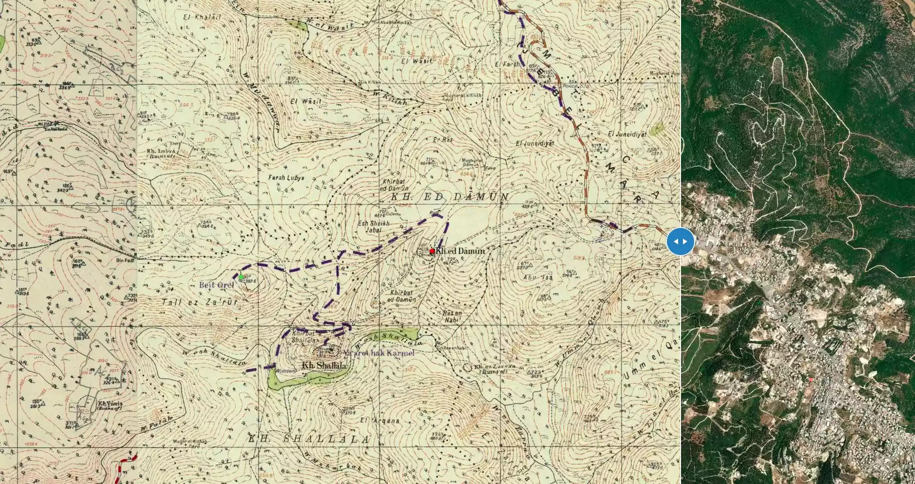
| Before & After Nakba, Click Map For Details |
|||||||||||||
|
|||||||||||||
| Map Location | See location #8 on the map View from satellite |
||||||||||||
| Military Operation | During or after the battle for Haifa | ||||||||||||
| Exodus Cause | Military assault by Zionist troops | ||||||||||||
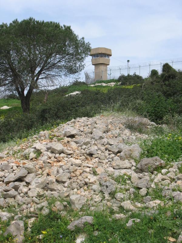
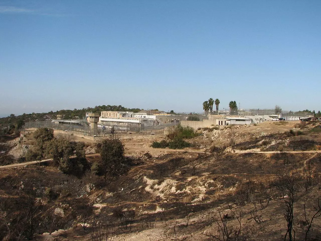
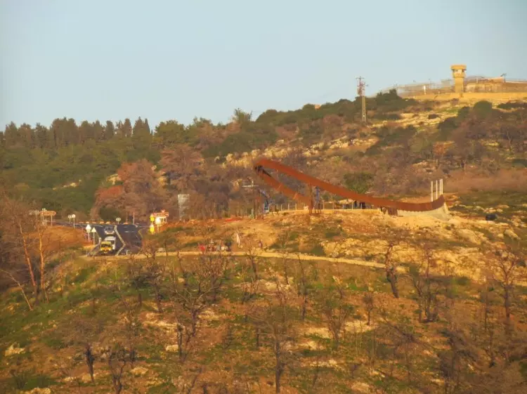
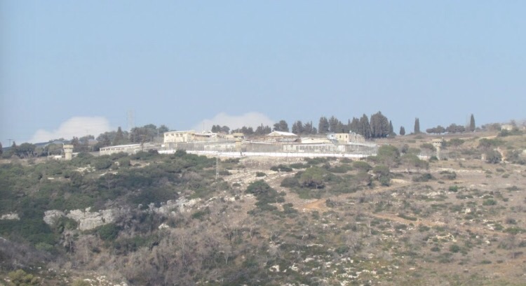
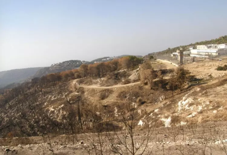
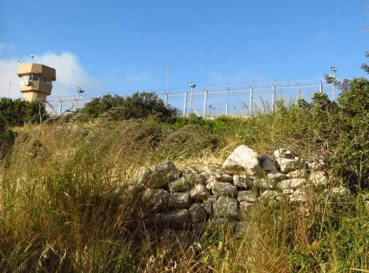
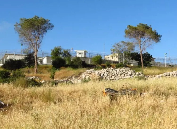
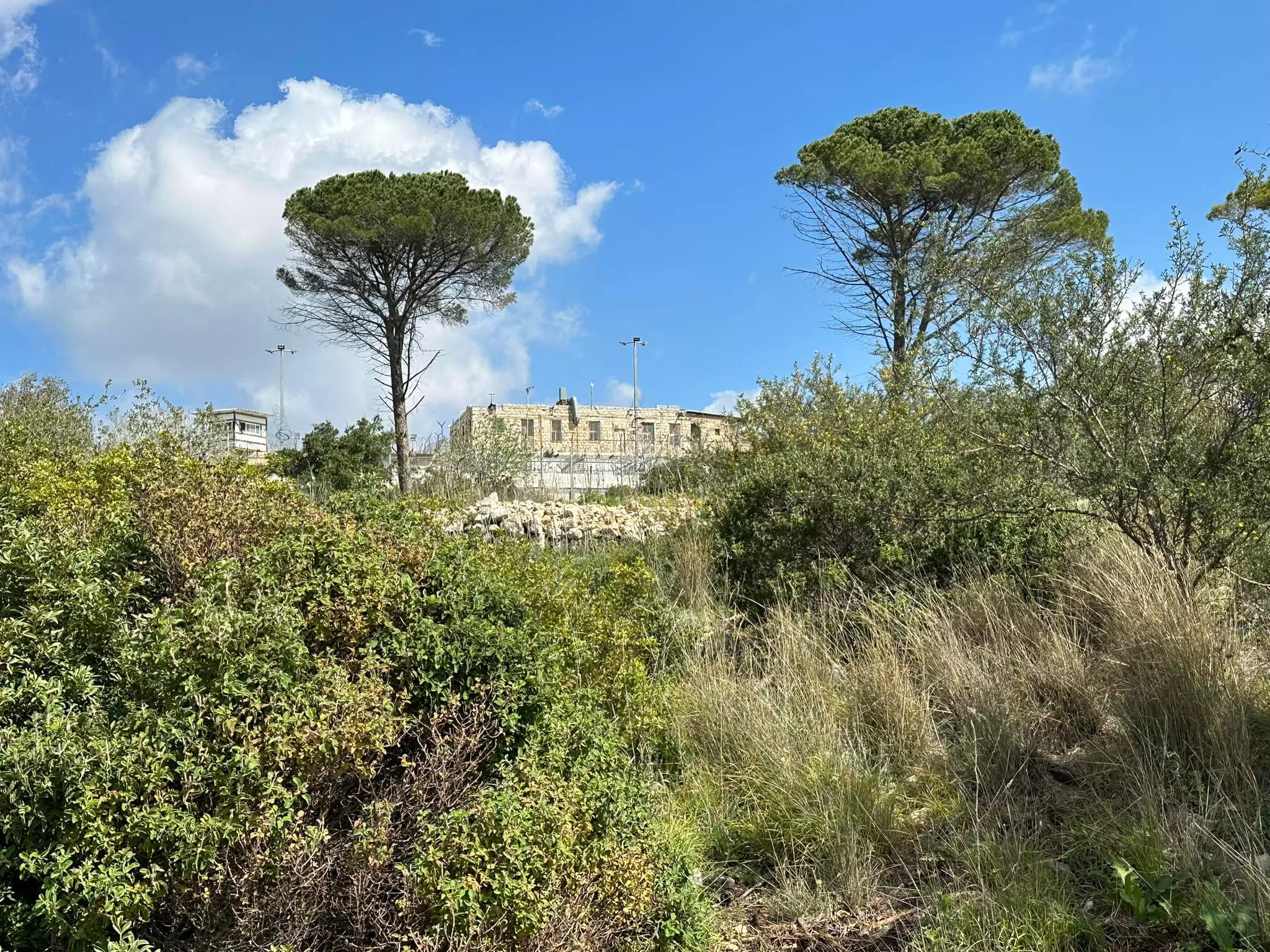
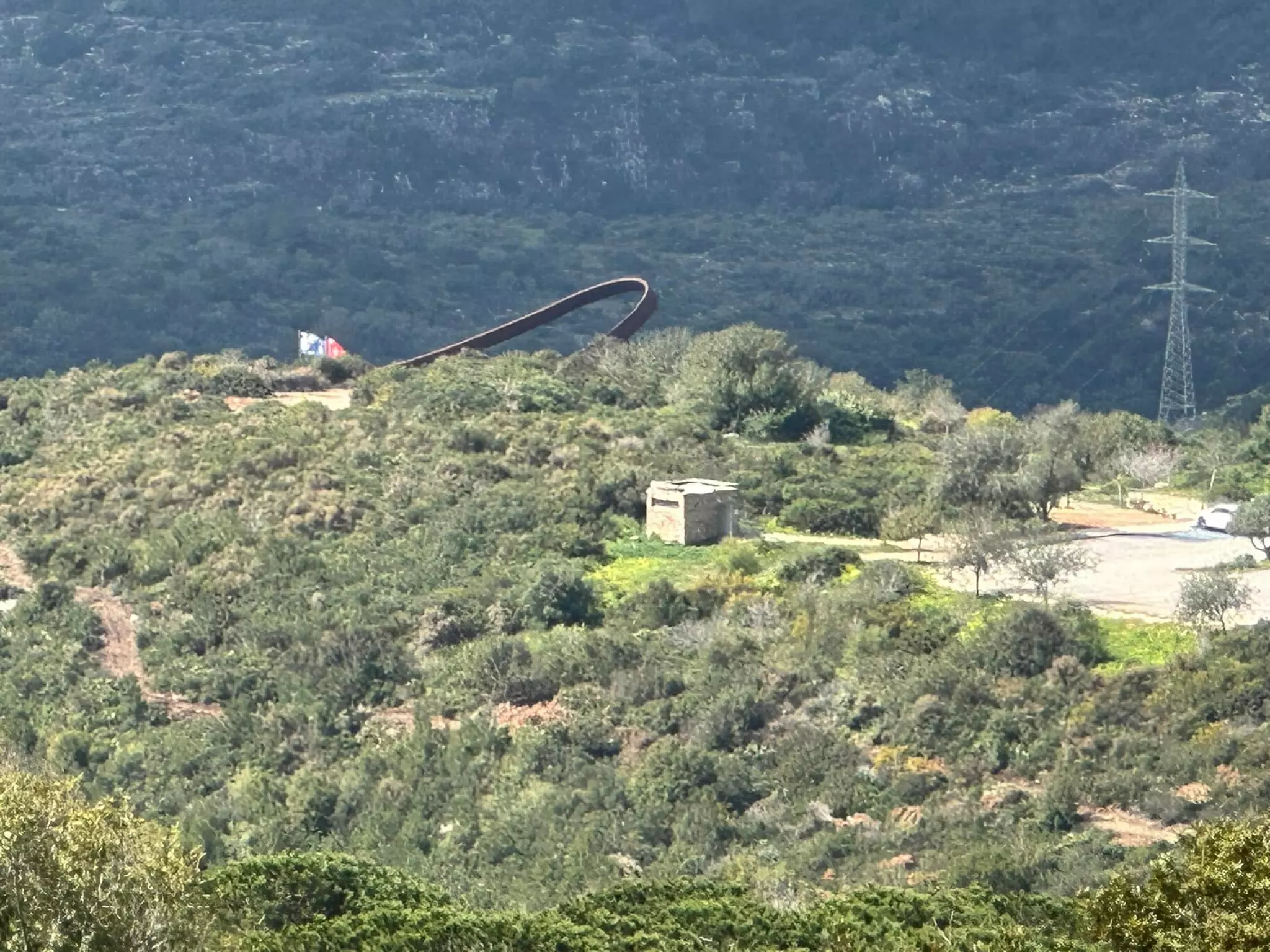
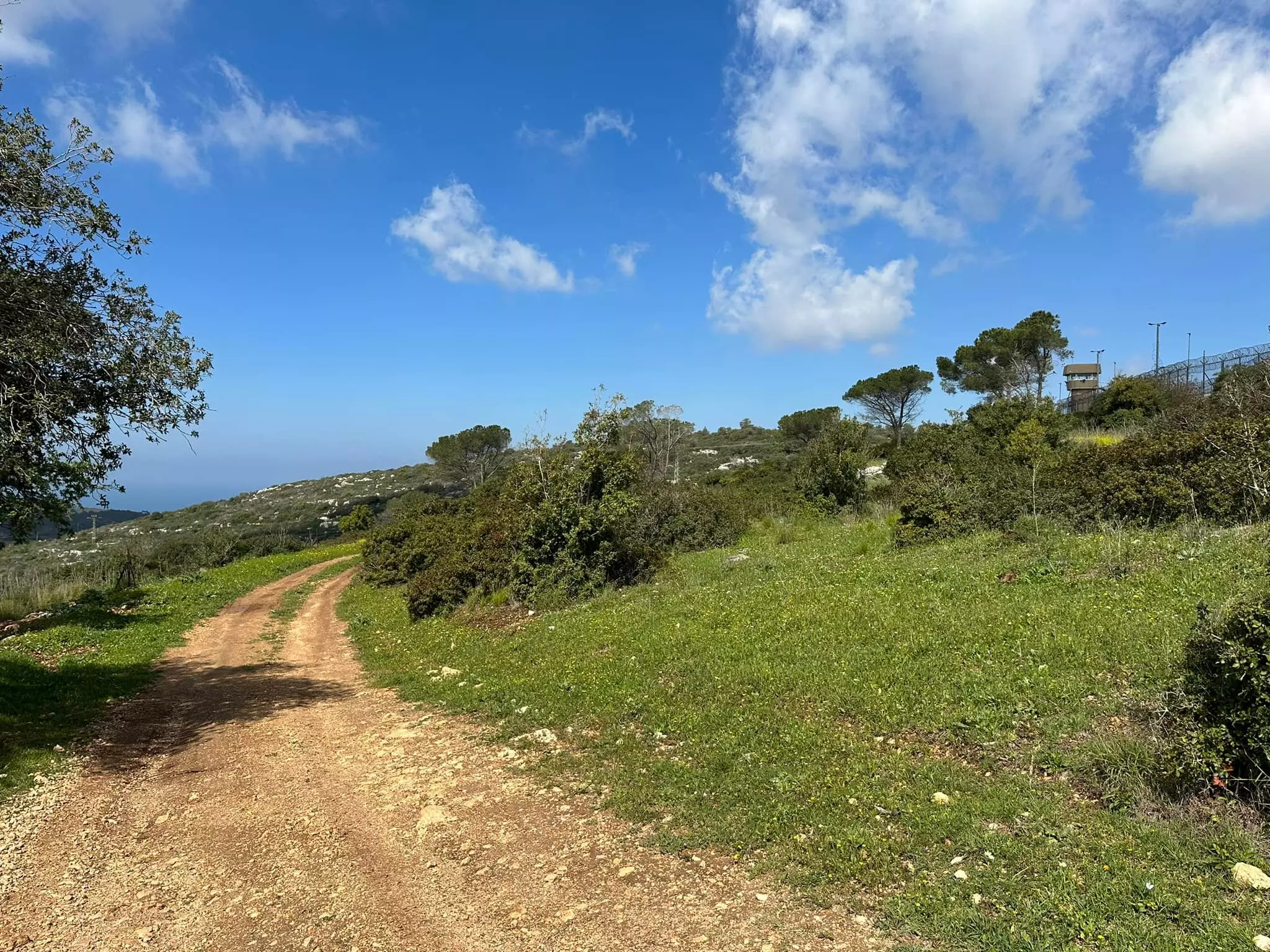
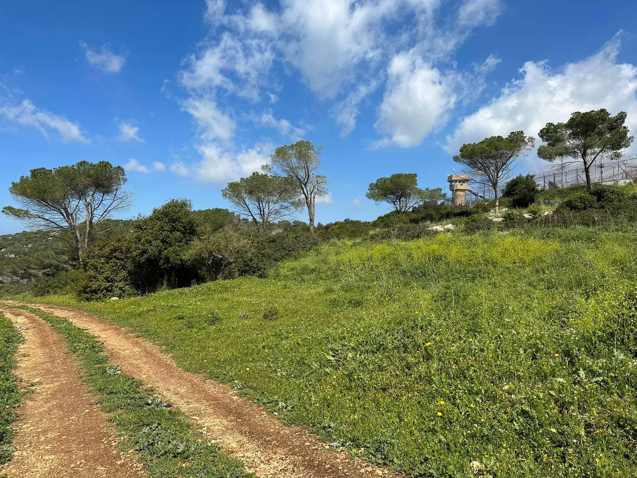
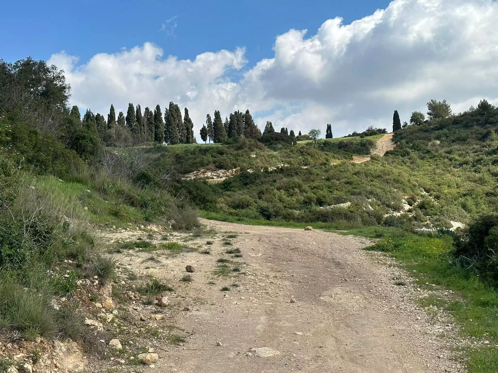
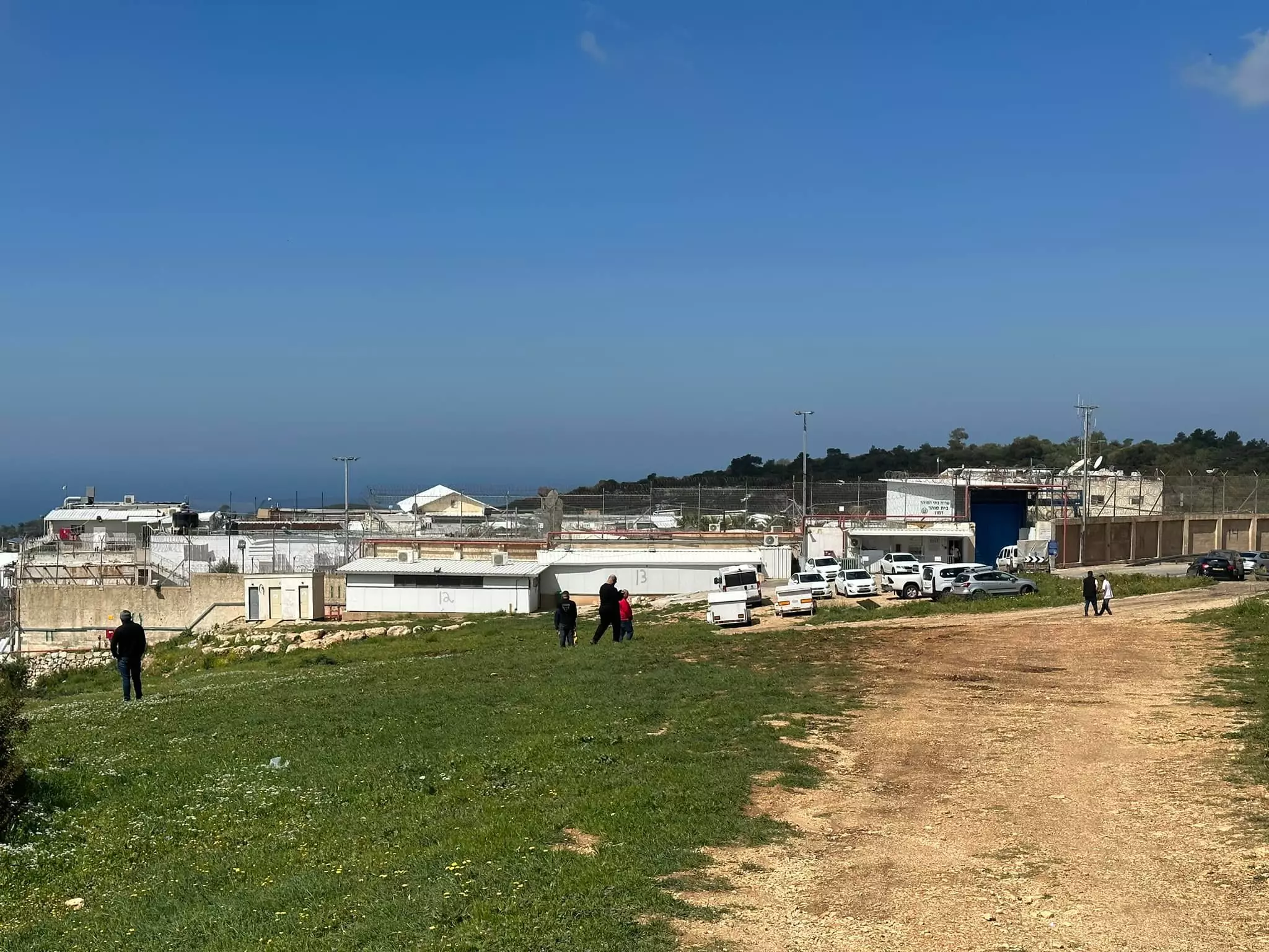
| Village Temains | The village has been mostly destroyed with the exception of a village building now used as a prison. | ||||||||||||
| Ethnically Cleansing | The majority of Khirbat al-Damun inhabitants were terrorized into fleeing, on the other hand, few villagers were allowed to stay behind. | ||||||||||||
| Clans | Qaraman clan | ||||||||||||
| Pre-Nakba Land Ownership |
**Town Lands' Demarcation Maps |
||||||||||||
| Land Usage As of 1945 |
|
||||||||||||
| Population |
|
||||||||||||
| Near By Towns |
|||||||||||||
|
|||||||||||||
| Archeological Sites | At Khirbat al-Damun base there was a cave that was used as a sheep fold, which. The cave led to a series of subterranean rooms | ||||||||||||
| Exculsive Jewish Colonies Who Usurped Village Lands |
No settlements on village lands | ||||||||||||
| Featured Video | |||||||||||||
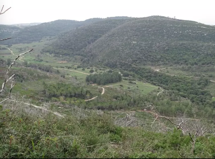
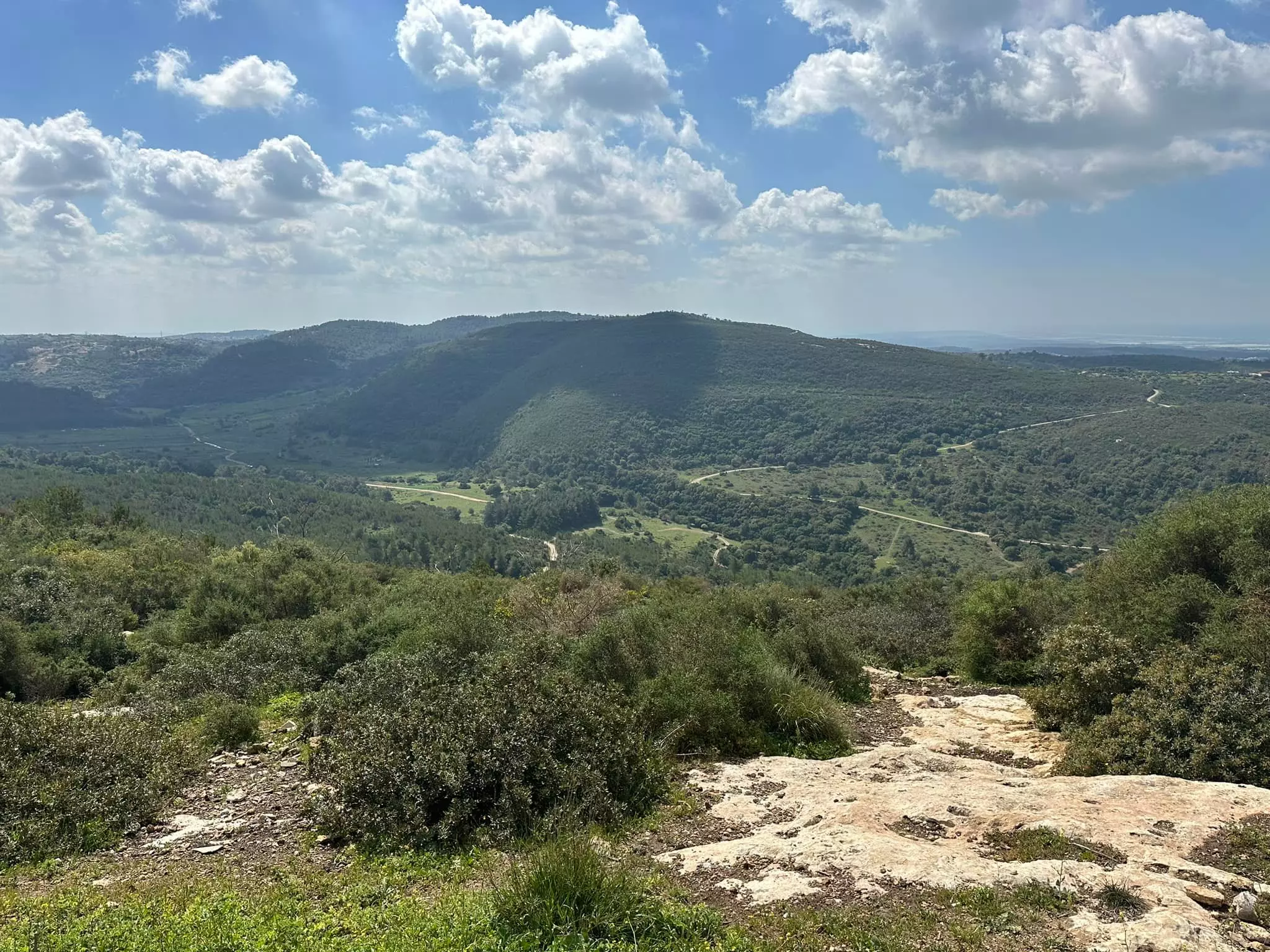
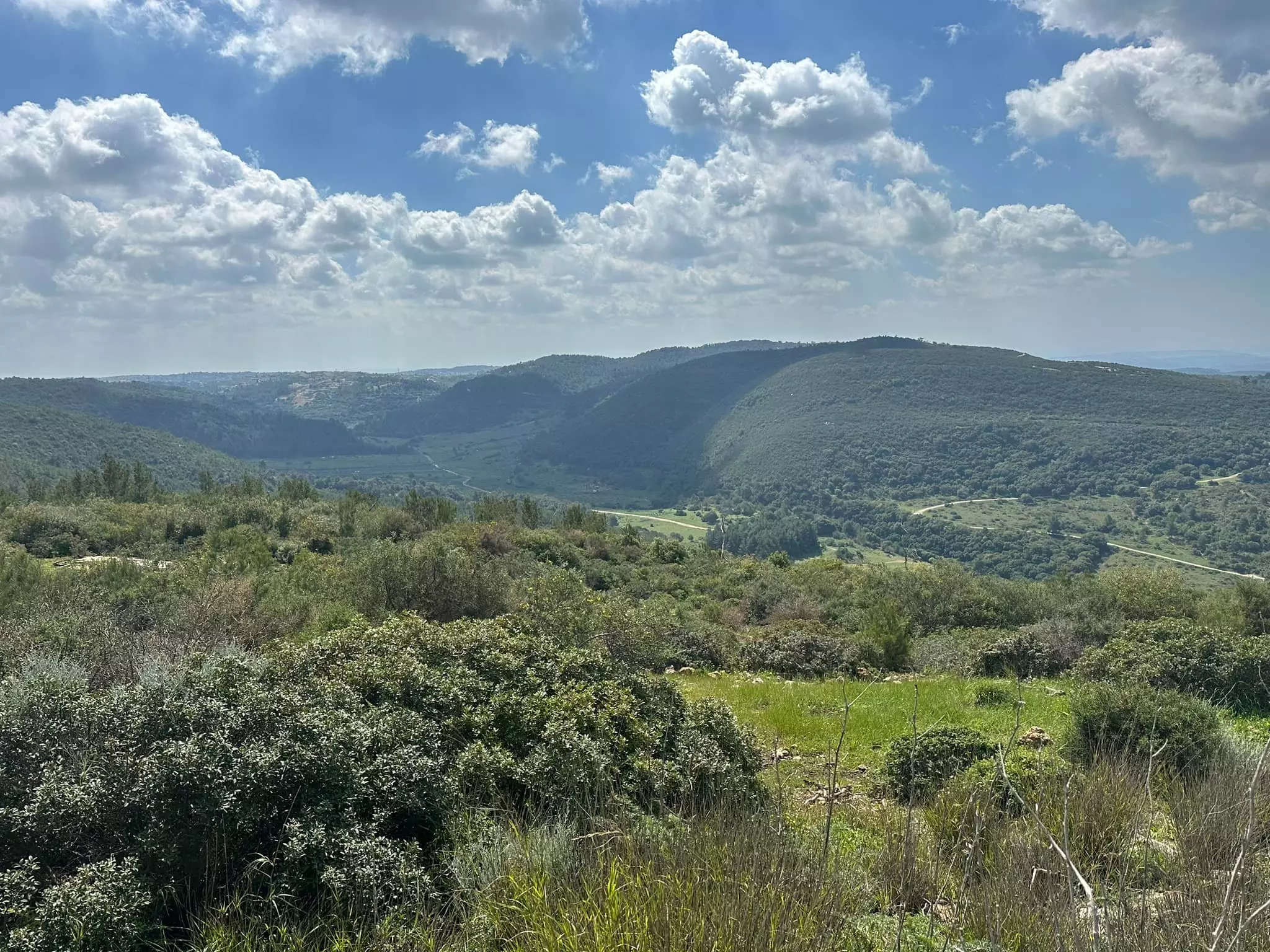
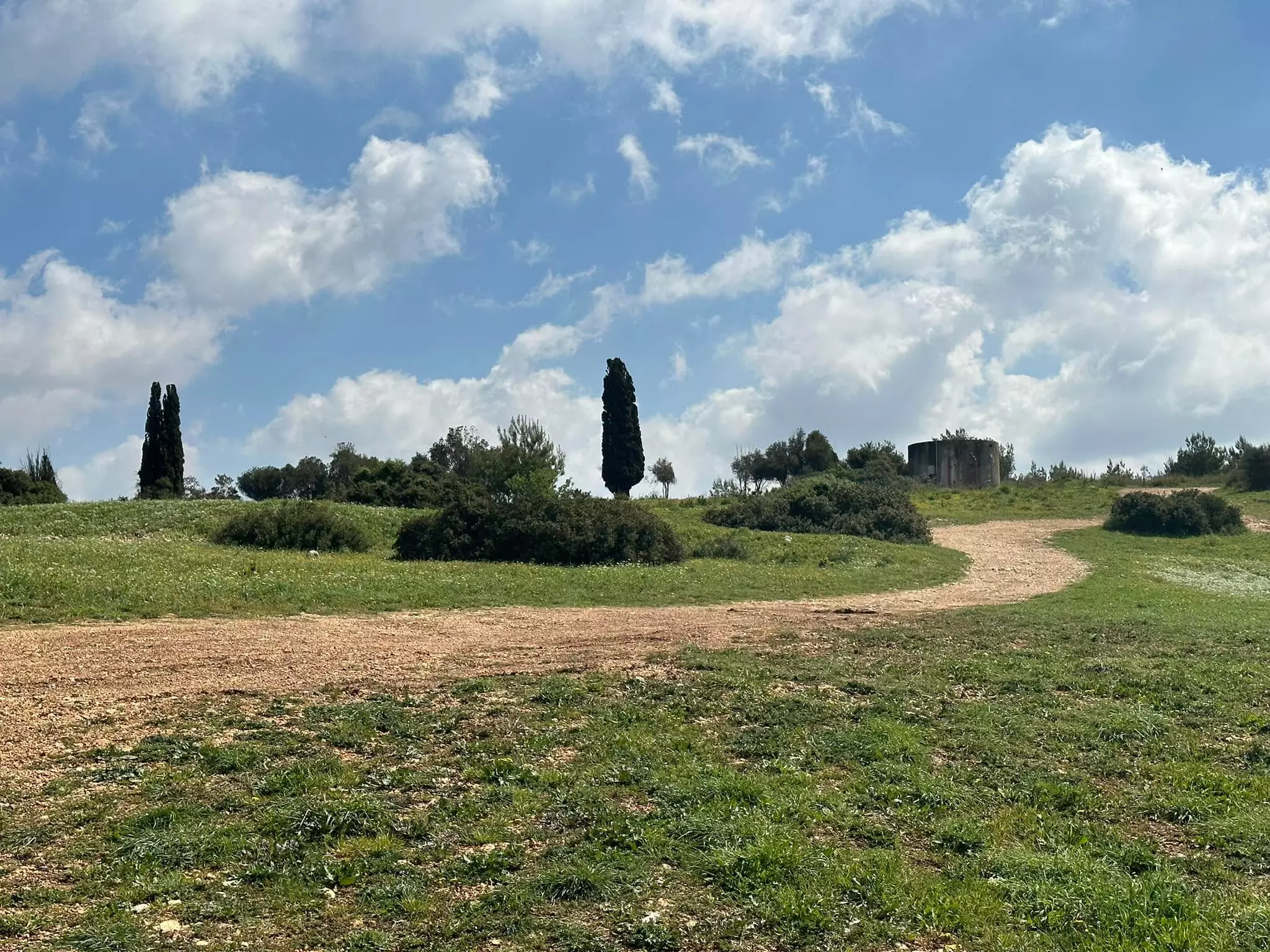
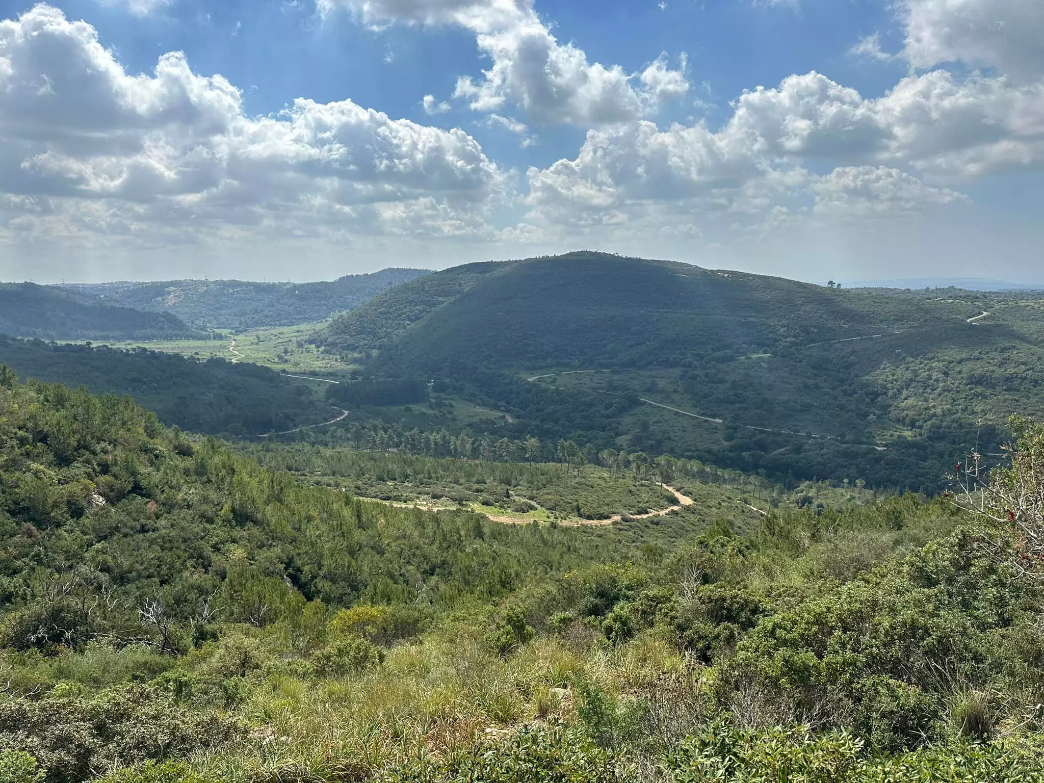
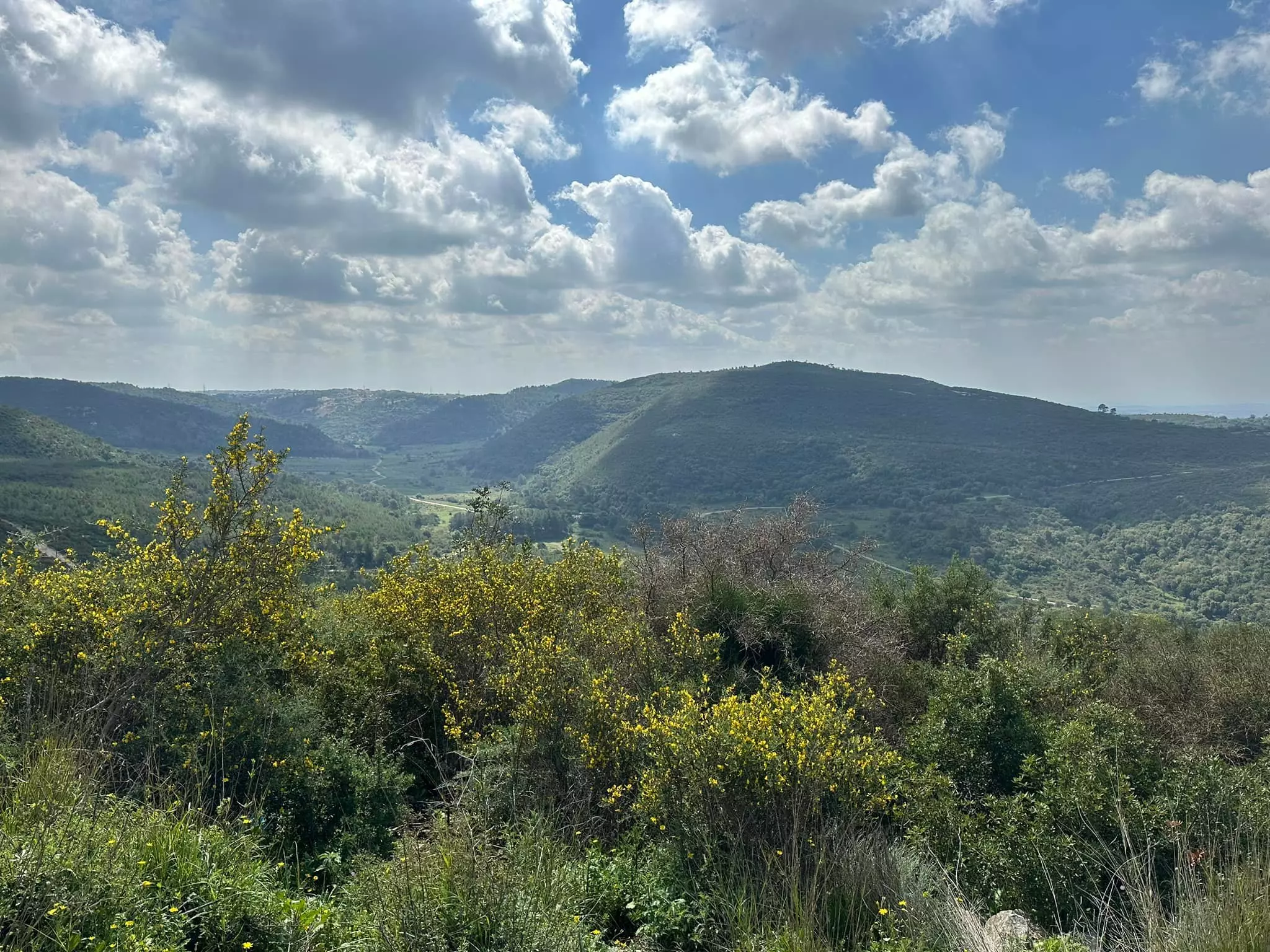
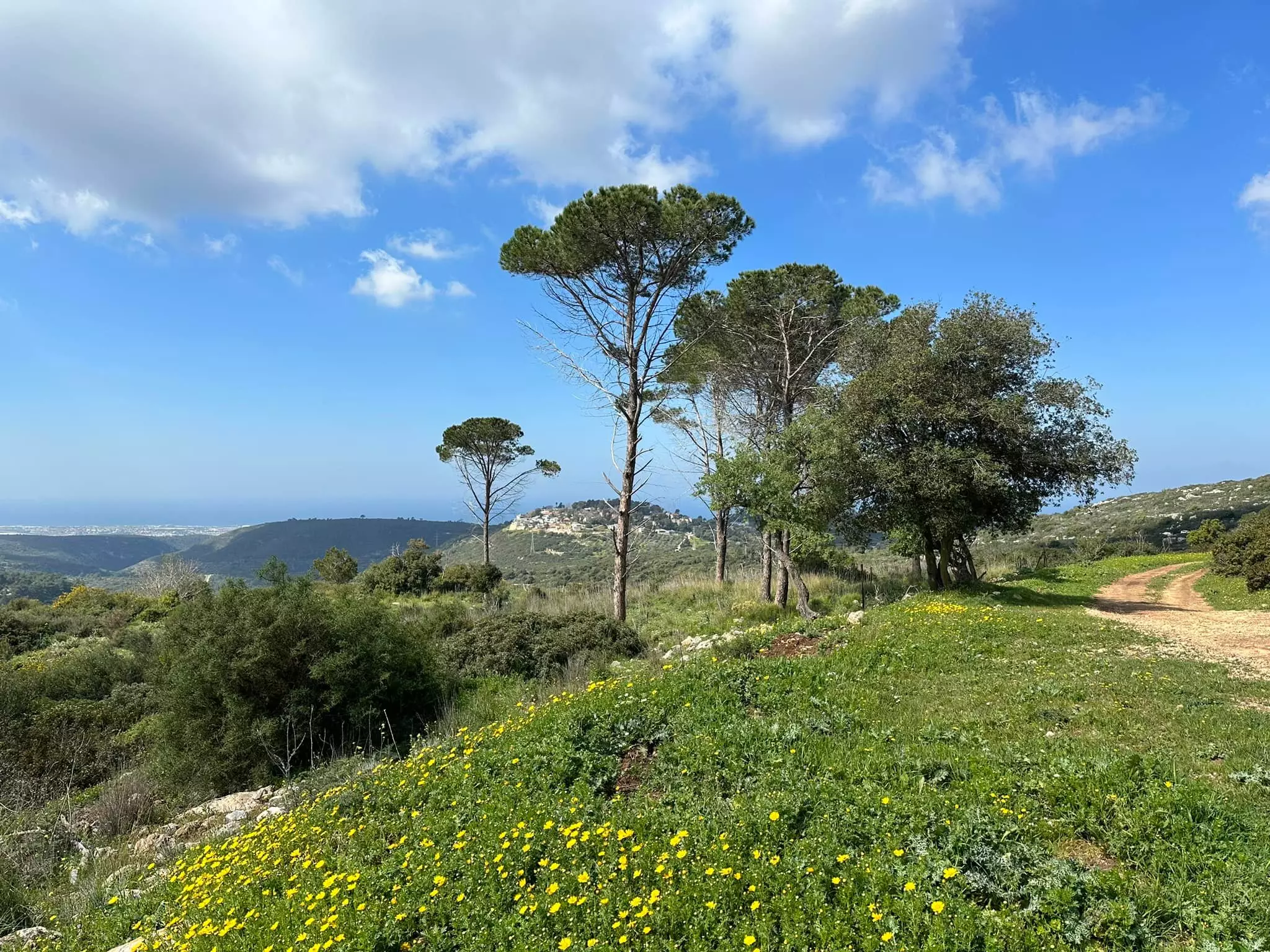
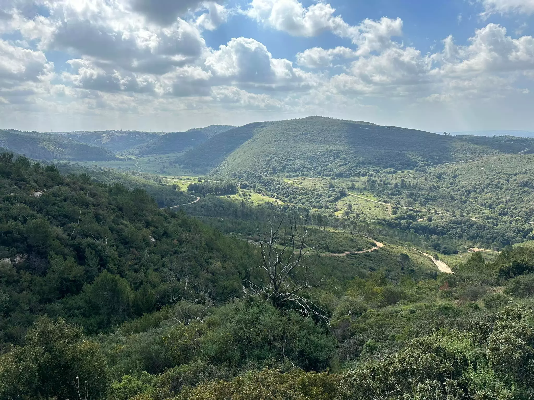
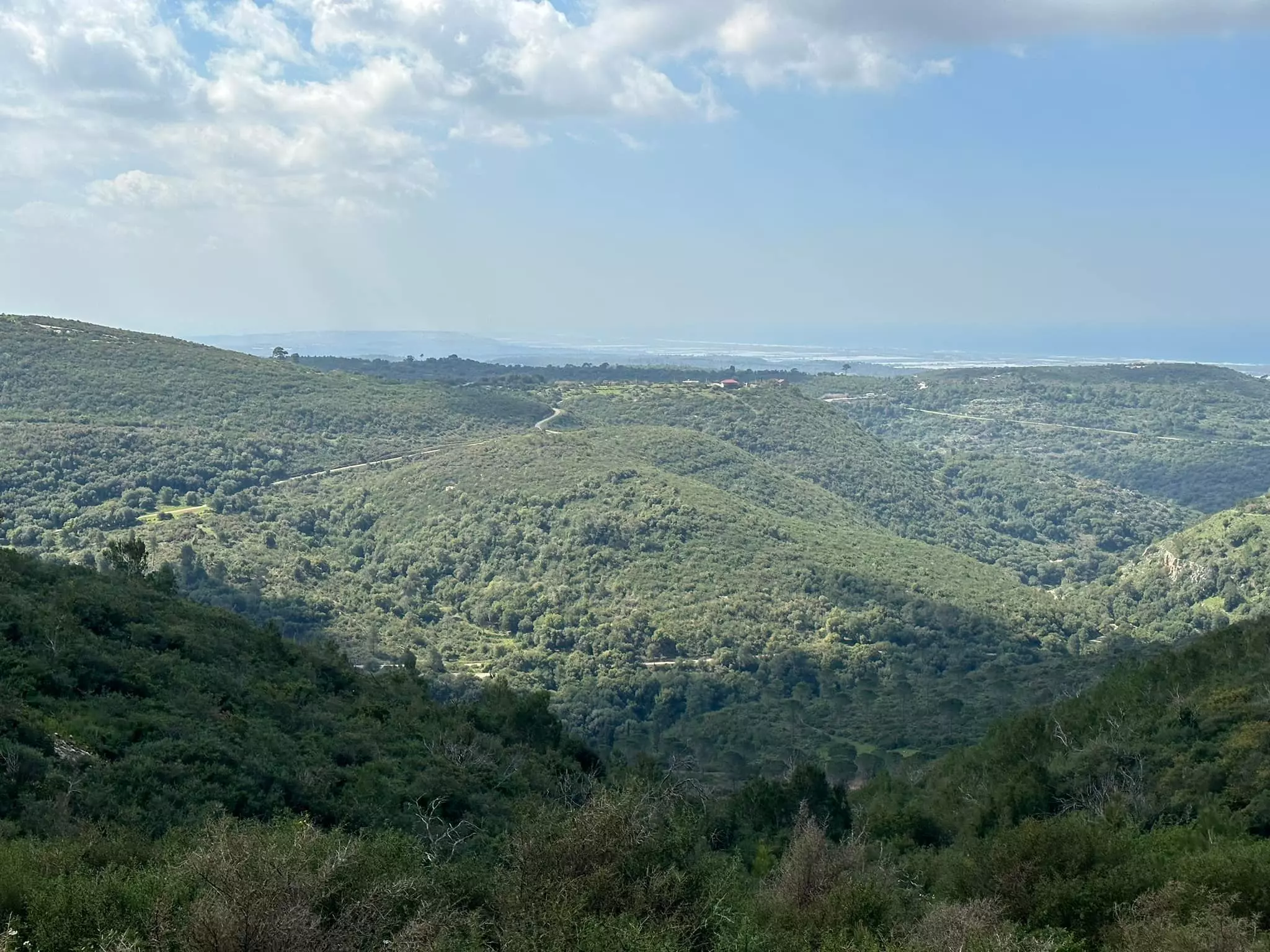
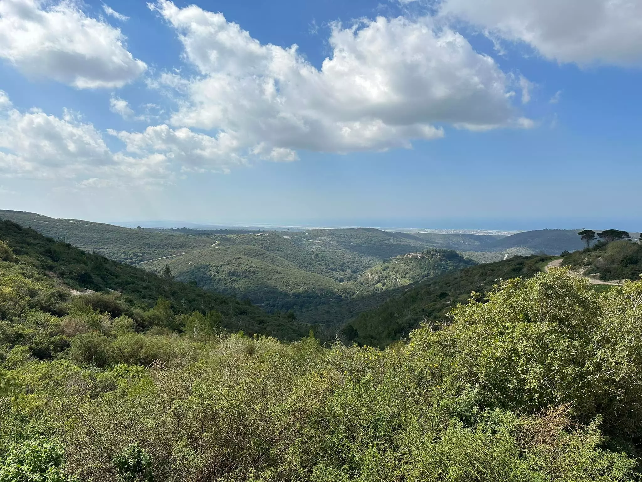
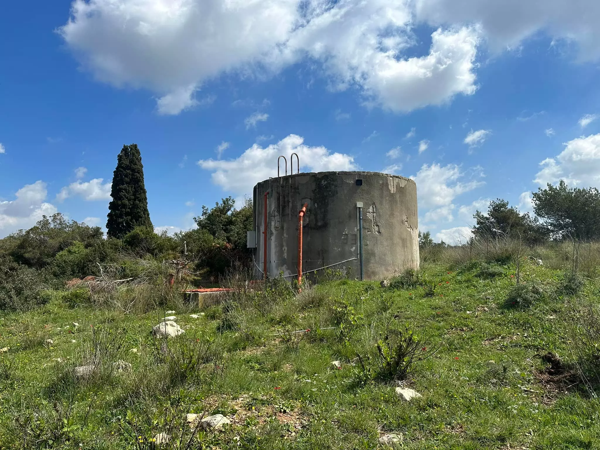
Village Before NakbaThis village was located on the higher reaches of Mount Carmel, along the eastern bank of Wadi Falah. One secondary road linked it directly to Haifa, and a shorter one connected it to the highway that led to the city. During the Mandate the village was classified as a hamlet by the Palestine Index Gazetteer. The residents of Khirbat al-Damun were Muslims. They depended for their livelihood upon animal husbandry and agriculture; their most important crop was grain, although they also grew olives. In 1944/45 a total of 5 dunums was devoted to citrus and bananas, and 1,619 dunums were allotted to cereals; 280 dunums were irrigated or used for orchards. Their lands also contained several forests. At the base of Khirbat al-Damun was a cave that was used as a sheepfold. The cave led to a series of subterranean rooms. Flint artifacts at the entrance to the cave were dated to the Neolithic period at the latest.Village Occupation and Ethnic CleaningNo date is given for the occupation of this village, but judging from its location, it probably was captured either just before or shortly after the fall of Haifa, in late April 1948. After Haifa was captured, the Haganah committed numerous forces to the capture of the surrounding villages in order to strengthen its hold on the city. Although the nearby village of al-Tira managed to hold out until July, it was heavily attacked in the last week of April and women and children were evacuated at that time. The New York Times reported that while al-Tira was being attacked on 26 April, 'another nearby village' was occupied by Jewish forces. Khirbat al-Damun, the closest village, which is otherwise unaccounted for, is the most likely candidate.Zionists Colonies on Village LandsThere are no settlements on village lands.Village TodayAll that is left of the village is a building that is now used as a prison. Cactuses and a few remaining fruit trees, such as pomegranate and almond trees, grow on the site. The land is forested, and the area is currently used by Israelis for recreation.SourceDr. Walid al-Khalidi, 1992: All That Remains. |
|||||||||||||
| Related Maps | Town Lands' Demarcation Maps خرائط للقضاء توضح حدود القرى والاودية Town's map on MapQuest View from satellite Help us map this town at WikiMapia |
||||||||||||
| Related Links | Wikipedia's Page Google Search Google For Images Google For Videos |
||||||||||||
| More Information | في كتاب كي لا ننسى في كتاب بلادنا فلسطين المزيد من موقع هوية |
||||||||||||
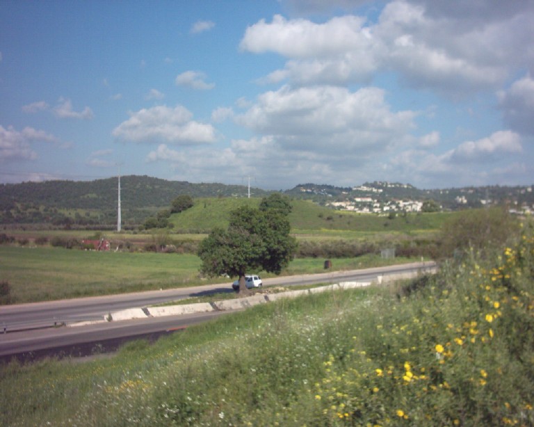
- اراضي خربة الدامون- الطريق الى حيفا تظهر شجرة من اشجار القرية لا تزال تتوسط الشارع - 2003
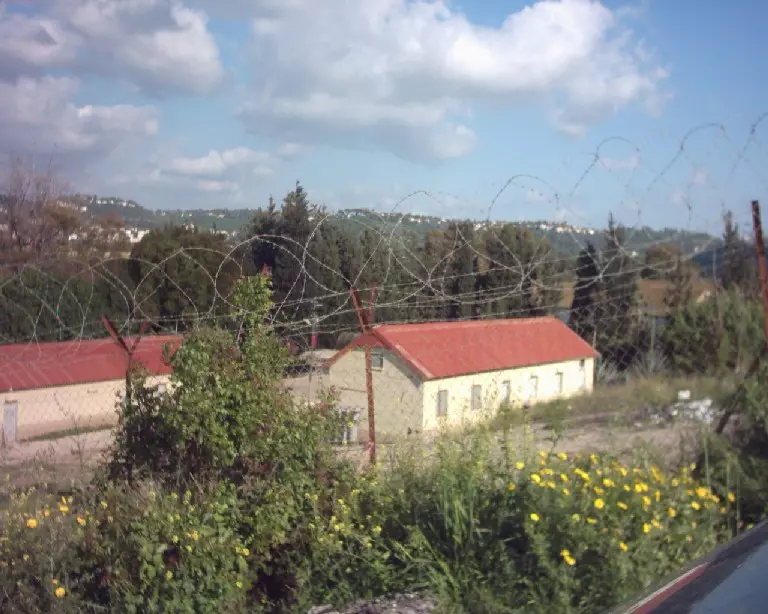
Posted by Makbula Nassar 2 - سجن ( الدامون) المقام على اراضي القرية - 2003
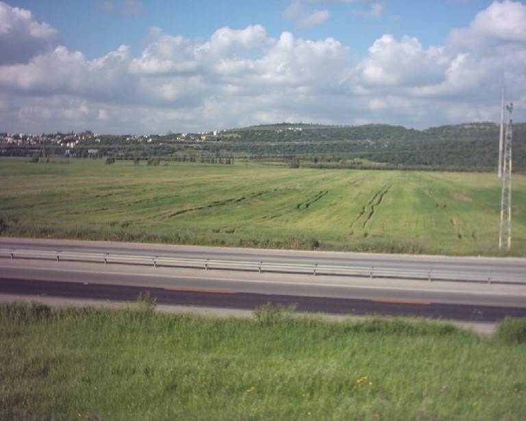
Posted by Makbula Nassar - اراضي القرية المقابلة لمنطقة السجن - 2003
Posted by Makbula Nassar - جانب من سجن ( الدامون) كيشون - المقام على اراضي القرية - 2003
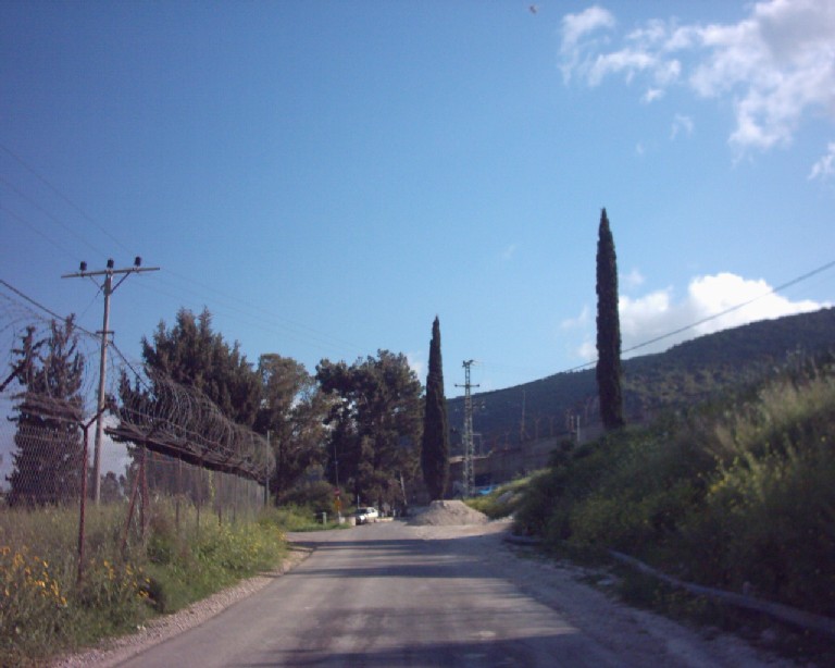
Posted by Makbula Nassar - مبنى ضخم قديم يتواجد على بعد 2 كيلومتر من موقع القرية الى يمين الشارع المتجه جنوباً والذي يتفرع فيما بعد الى وادي الملح غرباً ووادي عارة جنوباُ
Posted by Makbula Nassar - أثار بيت وقنطرة قريبه من موقع القريةتقع مباشرة على يمين الشارع المتجه جنوباً, والذي يتفرع فيما بعد الى وادي الملح غرباً ووادي عارة جنوباُ-ربيع 2003
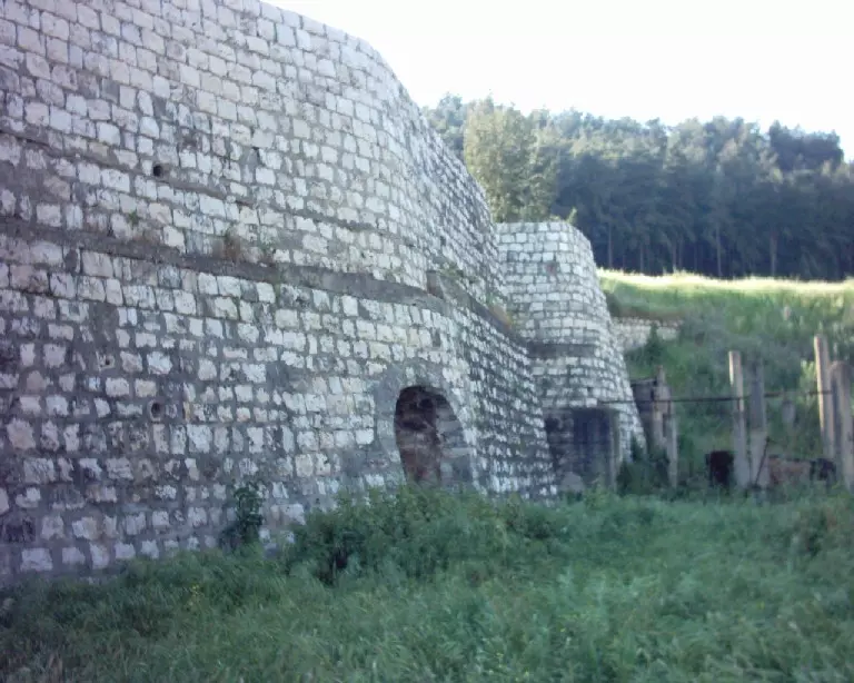
Posted by Makbula Nassar - Ruins of the destroyed Palestinian village, and the tower for al-Damun's famous jail appears in the backgound .
Posted by Noga Kadman 1 - سجن الدامون الشهير
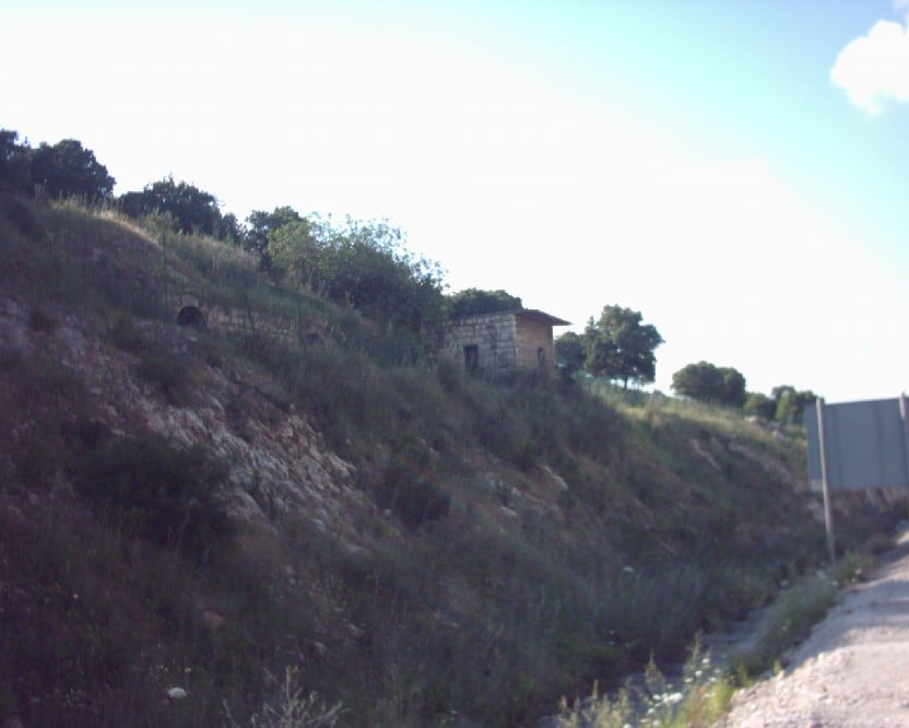
- منظر من موقع القريه باتجاه الجنوب
Posted by abu raya - موقع القريه
Posted by abu raya - موقع القريه وسجن الدامون المقام على اراضيها
Posted by abu raya - موقع القريه على التله
Posted by abu raya - موقع القريه
Posted by abu raya - من اثار القريه
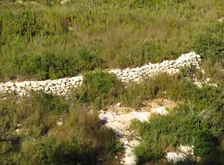
Posted by abu raya - اثار ردم البيوت بجانب السجن
Posted by abu raya - اثار بيوت القريه
Posted by abu raya - في جولة مع الصديقين رياض خليلية وخالد سورة في محطة قطار تل الشمام العثمانية وراس علي والدامون المهجرة وقد تخللها جلسة أنيسة في مضافة الأخ عاطف زبيدات في راس علي وحديث رائق مع الأخ أبي مالك المجذوبي حول أنساب العشائر وتسميات الأماكن في المنطقة وأمور أخرى .---بروفيسور مصطفى كبها
- That is how the "civilized" erased and replaced us: Kh. al-Damun was completely obliterated except for the tobacco storage facility, which functions as a prison for Palestinian women, as you see -- خربة الدامون باتت أثر بعد عين بإستثناء سجنها سيء السيط. من هنا مر الهمجّ
- That is how the "civilized" erased and replaced us: Kh. al-Damun was completely obliterated except for the tobacco storage facility, which functions as a prison for Palestinian women, as you see -- خربة الدامون باتت أثر بعد عين بإستثناء سجنها سيء السيط. من هنا مر الهمجّ
#2
- That is how the "civilized" erased and replaced us: Kh. al-Damun was completely obliterated except for the tobacco storage facility, which functions as a prison for Palestinian women, as you see -- خربة الدامون باتت أثر بعد عين بإستثناء سجنها سيء السيط. من هنا مر الهمجّ
#3
- That is how the "civilized" erased and replaced us: Kh. al-Damun was completely obliterated except for the tobacco storage facility, which functions as a prison for Palestinian women, as you see -- خربة الدامون باتت أثر بعد عين بإستثناء سجنها سيء السيط. من هنا مر الهمجّ
#4
- That is how the "civilized" erased and replaced us: Kh. al-Damun was completely obliterated except for the tobacco storage facility, which functions as a prison for Palestinian women, as you see -- خربة الدامون باتت أثر بعد عين بإستثناء سجنها سيء السيط. من هنا مر الهمجّ
#5
- That is how the "civilized" erased and replaced us: Kh. al-Damun was completely obliterated except for the tobacco storage facility, which functions as a prison for Palestinian women, as you see -- خربة الدامون باتت أثر بعد عين بإستثناء سجنها سيء السيط. من هنا مر الهمجّ
#6
- That is how the "civilized" erased and replaced us: Kh. al-Damun was completely obliterated except for the tobacco storage facility, which functions as a prison for Palestinian women, as you see -- خربة الدامون باتت أثر بعد عين بإستثناء سجنها سيء السيط. من هنا مر الهمجّ
#7
- That is how the "civilized" erased and replaced us: Kh. al-Damun was completely obliterated except for the tobacco storage facility, which functions as a prison for Palestinian women, as you see -- خربة الدامون باتت أثر بعد عين بإستثناء سجنها سيء السيط. من هنا مر الهمجّ
#8
- That is how the "civilized" erased and replaced us: Kh. al-Damun was completely obliterated except for the tobacco storage facility, which functions as a prison for Palestinian women, as you see -- خربة الدامون باتت أثر بعد عين بإستثناء سجنها سيء السيط. من هنا مر الهمجّ
#9
- That is how the "civilized" erased and replaced us: Kh. al-Damun was completely obliterated except for the tobacco storage facility, which functions as a prison for Palestinian women, as you see -- خربة الدامون باتت أثر بعد عين بإستثناء سجنها سيء السيط. من هنا مر الهمجّ
#10
- That is how the "civilized" erased and replaced us: Kh. al-Damun was completely obliterated except for the tobacco storage facility, which functions as a prison for Palestinian women, as you see -- خربة الدامون باتت أثر بعد عين بإستثناء سجنها سيء السيط. من هنا مر الهمجّ
#11
- That is how the "civilized" erased and replaced us: Kh. al-Damun was completely obliterated except for the tobacco storage facility, which functions as a prison for Palestinian women, as you see -- خربة الدامون باتت أثر بعد عين بإستثناء سجنها سيء السيط. من هنا مر الهمجّ
#12
- That is how the "civilized" erased and replaced us: Kh. al-Damun was completely obliterated except for the tobacco storage facility, which functions as a prison for Palestinian women, as you see -- خربة الدامون باتت أثر بعد عين بإستثناء سجنها سيء السيط. من هنا مر الهمجّ
#13
- That is how the "civilized" erased and replaced us: Kh. al-Damun was completely obliterated except for the tobacco storage facility, which functions as a prison for Palestinian women, as you see -- خربة الدامون باتت أثر بعد عين بإستثناء سجنها سيء السيط. من هنا مر الهمجّ
#14
- That is how the "civilized" erased and replaced us: Kh. al-Damun was completely obliterated except for the tobacco storage facility, which functions as a prison for Palestinian women, as you see -- خربة الدامون باتت أثر بعد عين بإستثناء سجنها سيء السيط. من هنا مر الهمجّ
#15
- That is how the "civilized" erased and replaced us: Kh. al-Damun was completely obliterated except for the tobacco storage facility, which functions as a prison for Palestinian women, as you see -- خربة الدامون باتت أثر بعد عين بإستثناء سجنها سيء السيط. من هنا مر الهمجّ
#16
- That is how the "civilized" erased and replaced us: Kh. al-Damun was completely obliterated except for the tobacco storage facility, which functions as a prison for Palestinian women, as you see -- خربة الدامون باتت أثر بعد عين بإستثناء سجنها سيء السيط. من هنا مر الهمجّ
#17
- That is how the "civilized" erased and replaced us: Kh. al-Damun was completely obliterated except for the tobacco storage facility, which functions as a prison for Palestinian women, as you see -- خربة الدامون باتت أثر بعد عين بإستثناء سجنها سيء السيط. من هنا مر الهمجّ
#18
- hat is how the "civilized" erased and replaced us: Kh. al-Damun was completely obliterated except for the tobacco storage facility, which functions as a prison for Palestinian women, as you see -- خربة الدامون باتت أثر بعد عين بإستثناء سجنها سيء السيط. من هنا مر الهمجّ #19
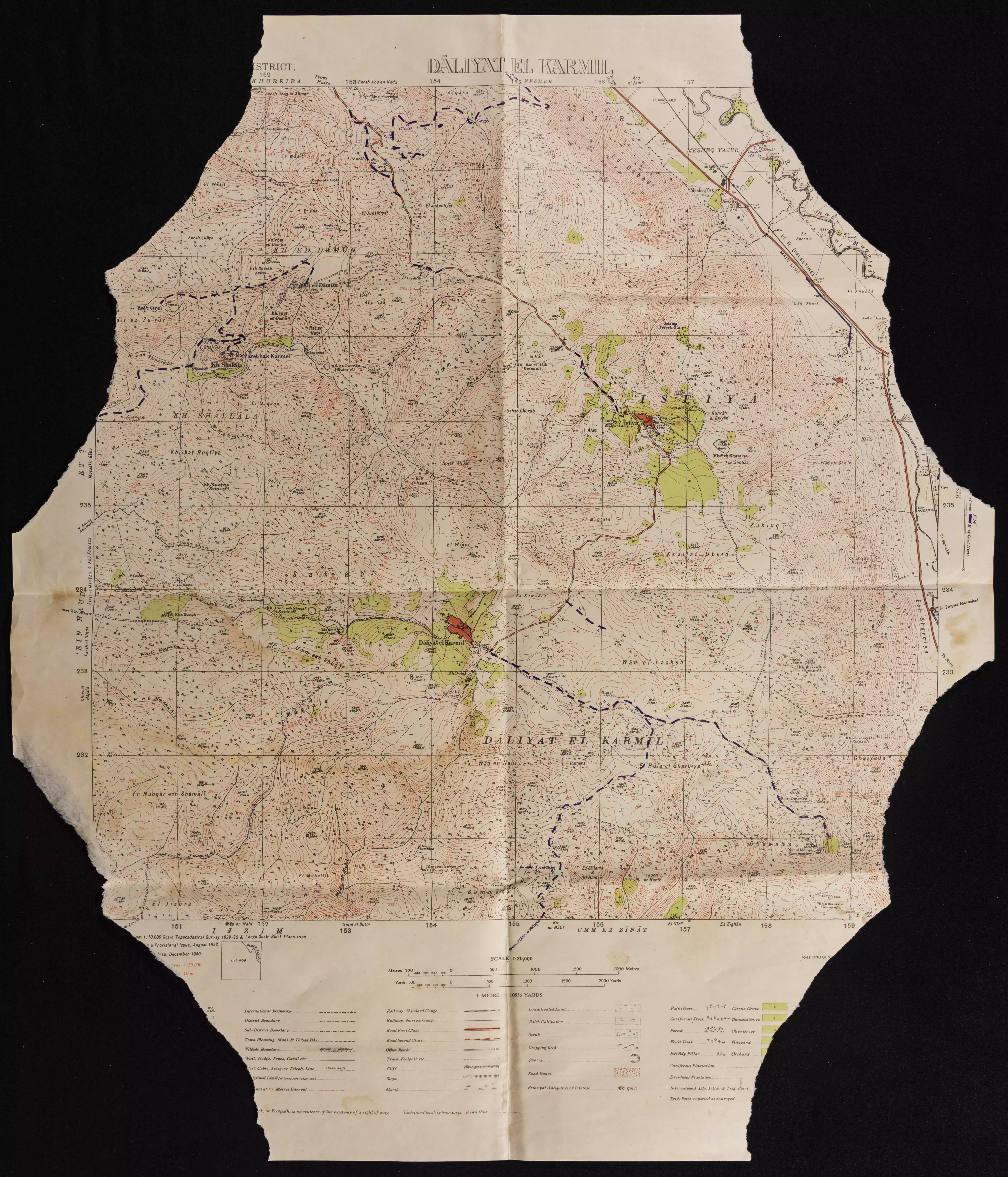
- خارطة تُظهِر الحدود والطرق بأنواعها والأماكن المقدسة والطبيعة الطوبغرافية من تلال وسهول ومنحدرات والتشكيلة الطبيعية للأرض وأنواع المزروعات. نُشرت الخريطة فترة الانتداب البريطاني، تم إضافة تعديلات عليها من قِبَل خدمة الخرائط والصور التابعة للقوات العسكرية الاسرائيلية فترة الأربعينيات.
Want to browse more? 80,000 pictures were grouped in these gallaries:
| Display Name | Clan/Hamolah | Country of Residence |
- على ذرى الكرمل بجانب خربة الدامون Duration: min 10 sec
- من امام سجن الدامون في خربة الدامون المهجرة قضاء حيفا Duration: 49 sec
No links have been shared yet, be free to the first to share the first link.
 Fake Valor: Why Did Zionist Jews Hoist Nazis Flag on Their Ships in the 1930s?
What is new?
-
Facts About Oct. 7th Gaza Raid
-
Remined Us Please:: Who Did Rape Who? Palestinians Raped Israelis? Or, was the other way around?
-
When Prof. Edward Said was invited to debate Bibi Netanyahu in the 1980s, watch what happened!
-
Ezra Klein of the NY Times on the "Jewish Race".
-
Abusing Blood Libel!
-
Did Israeli Soldiers Activate The Hanniba Direective On Oct. 7th? You Be The Judge
-
Zionist FAQ: Isn't it true that Palestinians don't want peace? Palestinians never accepted the two-state solution
- Facts about Haavara (Transfer) Agreement between Ben-Gurion & Hitler
-
Haavara FAQs: Why Did Zionist Jews Hoist Nazis' Flags on Their Ships in the 1930s?
- Haavara FAQs: When Chaim Weizmann met FDR in mid-1943, why was he silent about rescuing European Jewry?
-
Dear ChatGPT: How did Palestinians resist Napoleon's invasion of their country in 1799?
-
Dear ChatGPT: Gaza had a vibrant Jewish community in the mid-17th century. What happened to them?
-
Dear ChatGPT: Why did the Jewish Agency suppress news of the Holocaust during WWII?
-
Video Playlist: Jews share their DNA tests to end the conflict for good.
-
A Tale of Two Conflicts: Examining the Definition of Genocide
-
Prof. Abraham Polak And The Suppressed History of the Khazars and European Jewry
-
How Ronald Reagan would have framed the genocide in Gaza if he were still alive?
-
Haavara FAQs: Let us do the math: how many German Jews did The Haavara Agreement save?
-
Zionist FAQs: The Hebron Massacre of 1929, "clearly proves" that Palestinians are antisemitic, how could you deny it?
-
Zionist FAQs: Why Anti-Zionist Is Not Antisemitism?
-
Zionist FAQs: Isn't it true that the KGB created Palestinian Nationalism in the early 1960s?
- Zionist FAQs: Muslims are killing Muslims all the time; why are Israeli Jews being singled out in the media?
- Zionist FAQs: How is Israel an apartheid state when 20% of its citizens are Arabs who enjoy full rights?
-
Haavara FAQs: Why Did Dorothy Thompson Flip From A Zionist Advocate to A Silenced Dissenter?
-
Haavara FAQs: Analysis of Herzl's Uganda Scheme and how it could have saved millions of Jews.
-
Haavara FAQs: Why did Hayim Greenberg describe American Jewry as "morally bankrupt" in early 1943?
-
Haavara FAQs: What if the Evian Conference was a resounding success? What would have been the impact of saving European Jewry on Zionism?
- Haavara FAQs: What if the six million were saved, how that would have impacted the Zionist project?
-
Haavara FAQs: How did Zionist leaders react when Europe's Jews lingered in the DP camps after WWII ended?
-
Why does the American Jewish community repeat lies that David Ben-Gurion had debunked before he died?
-
Who has the power to rename the Tatar/Khazar Gene Marker to Jewish IV?
-
Zionist FAQs: Why won't Egypt, Syria, and Jordan take their people back? Jews are indigenous to Palestine, and Arabs immigrated after Jews developed the country. Arabs should leave.
-
Haavara FAQs: Did Hitler and the Nazis conflate between Judaism and Zionist? If that wasn't case, then why?
-
Haavara FAQs: Winston Churchill and antisemitism, a collection of articles written Churchill.
-
Haavara FAQs: Broken by country, how many Jews survived vs. killed during the Holocaust?
-
Haavara FAQs: Why did European Jews vote with their feet and to immigrated to the Americas, not Palestine, after WWII?
-
Watch this American Jewish Girl describing Israeli Jews' cognitive dissonance like no other in under two minutes
-
Haavara FAQs: When the Nazis went out of their way to hide the Holocaust, Israeli Jews did the exact opposite by broadcasting their genocide of Gazans. But why?
-
Haavara FAQs: How Zionist Jews went out of their to show their appreciation to Nazism and Fascism?
- Haavara FAQs: Why Zionist leaders were against bombing the death camps & the Railroads leading to them?
-
Haavara FAQs: Hitler's message to the British and American people: If Jews are such noble citizens and you care about them, how come you're not letting them in? I will gladly ship them to you at my expense, even on luxury liners!
-
A shortlist of Zionist and Israeli false flag operations in the name Jews.
-
The Most Moral Army
- The Land of Kapos (Israel): Where the brave are boycotted and Kapos walk free.
- Why did early Zionists often named their communal enterprises "colonial"?
- Zionist Relations with Nazi Germany by Faris Glubb
-
Two NY Times advertisements by Zionists in the early 1943 that exposes Zionists' treason at the height of the calamity
- Facts Not Lies about the Palestinian-Israeli Conflict.
- Site's pictures have been categorized
- Campgain Against Lice
- A Survey of Palestine, the official source about Palestine before Nakba produced by the British Mandate; over 1200 pages.
- Satellite View & Google Earth: Over 6,000 placemarks identifying all destroyed towns, W. Bank & Gaza Strip Towns, & refugee camps.
- PalestineRemembered.com and its Nakba Oral History Project were featured on al-Jazeera Satellite TV.
- Nakba Oral History Video Podcast:
 Over 700 Oral History interviews (including 3,500+ hours of recording) can be viewed online.
 - Palestine Village Statistics Project
- Gaza Jail Break
- النسخة العربية للموقع الان متوفرة
- Videos: Documenting the destroyed villages in video: Tracing all that remains since Nakba.
- Videos: Responding to Zionist Propaganda
- Interview: The ethnic cleansing of Palestine: George Galloway interviews Israeli Historian Ilan Pappe.
- For Palestinians, memory matters. It provides a blueprint for their future By George Bisharat.
- Zionist FAQ now available in Hebrew שאלות שציונים שואלים, עכשיו בעברית
- Video: The Stephen Walt and John Mearsheimer report on the influence of the Israel Lobby on U.S. Foreign Policy
- The Palestinian-Israeli conflict for beginners
