| PalestineRemembered | About Us | Oral History | العربية | |
| Pictures | Zionist FAQs | Haavara | Maps | |
| Search |
| Camps |
| Districts |
| Acre |
| Baysan |
| Beersheba |
| Bethlehem |
| Gaza |
| Haifa |
| Hebron |
| Jaffa |
| Jericho |
| Jerusalem |
| Jinin |
| Nablus |
| Nazareth |
| Ramallah |
| al-Ramla |
| Safad |
| Tiberias |
| Tulkarm |
| Donate |
| Contact |
| Profile |
| Videos |
Welcome To Zayta - زيتا (זיתא)
|
District of Hebron
Ethnically cleansed days ago |
العربية Google Earth |
 |
Gallery (7) |
- Statistics & Facts
-
Before & After

- Satellite View
- Articles 1
- Pictures 7
- Oral History 2
- Members 12
- All That Remains
- Wikipedia
- Videos
- Guest Book 14
- Links 2
| Statistic & Fact | Value | |||||||||||||||
| Occupation Date | July 17, 1948 | |||||||||||||||
| Distance From District | 29 (km) Northwest of Hebron | |||||||||||||||
| Elevation | 75 (meters) | |||||||||||||||
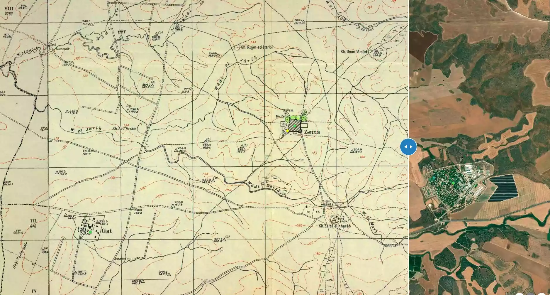
| Before & After Nakba, Click Map For Details |
||||||||||||||||
|
||||||||||||||||
| Map Location | See location #10 on the map View from satellite |
|||||||||||||||
| Military Operation | Operation An-Far | |||||||||||||||
| Defenders | Local Palestinian militias and some Arab Liberation Army volunteers | |||||||||||||||
| Exodus Cause | Military assault by Zionist troops | |||||||||||||||
| Village Temains | Zayta was completely destroyed and defaced. | |||||||||||||||
| Ethnically Cleansing | Zayta inhabitants were completely ethnically cleansed. | |||||||||||||||
| Pre-Nakba Land Ownership |
**Town Lands' Demarcation Maps |
|||||||||||||||
| Land Usage As of 1945 |
|
|||||||||||||||
| Population |
|
|||||||||||||||
| Number of Houses |
|
|||||||||||||||
| Near By Towns |
||||||||||||||||
|
||||||||||||||||
| Nearby Wadies & Rivers | The village stands on a hill 1 km north of Wadi Zayta. | |||||||||||||||
| Water Supply | Drinking water was supplied by artesian wells, most of which were dug to the south of the village, near Wadi Zayta, where the underground water level was close to the surface. Another well was also located to the north. | |||||||||||||||
| Exculsive Jewish Colonies Who Usurped Village Lands |
No Israeli settlements on village lands | |||||||||||||||
| Featured Video | ||||||||||||||||
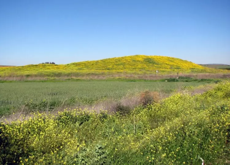
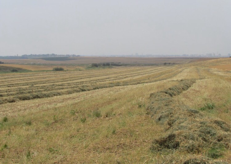
Village Before NakbaThe village stood on a hill 1 km north of Wadi Zayta. It was linked by a dirt track to 'Iraq al-Manshiyya, which was located on a highway that ran from east to west between the city of al-Majdal on the coast and Bayt Jibrin. The old Zayta (Khirbat Zayta al-Kharab, 133115) was located 1.5 km south of this village on the southern bank of the wadi. (Because the wadi's stagnant waters bred insects and diseases, the population was moved during the Mandate to the new site.) In 1596 Zayta was a village in the nahiya of Gaza (liwa' of Gaza), with a population of 165. It paid taxes on wheat, barley, goats, and beehives. In the late nineteenth century, Zayta was described as a small hamlet on the edge of the wadi, flanked on two sides by low hills and built of adobe brick.The new village of Zayta was laid out in a northeast-southwest direction its houses were built of mud, wood, and cane, and its population was Muslim. Drinking water was supplied by artesian wells, most of which were dug south of the village, near Wadi Zayta, where the underground water level was close to the surface. Another well was located north of Zayta. The villagers worked mainly in rainfed agriculture and stock raising, specializing in goats and sheep. They cultivated grain on large tracts of the land and utilized the rest as grazing land for their animals. In 1944/45 a total of 3,027 dunums was allocated to cereals. Village Occupation and Ethnic CleaningZayta was one of the villages captured during Operation An-Far . Israeli historian Benny Morris indicates that Zayta was occupied at the very end of this offensive, on 17-18 July 1948, but the History of the War of Independence states that the occupation occurred around a week earlier, on 9-10 July.Zionists Colonies on Village LandsThere are no Israeli settlements on village lands. About a month after the occupation of the village, the Jewish National Fund submitted a settlement plan to the Israeli cabinet which called for establishing a kibbutz on the village site. The 20 August blueprint called this settlement Kibbutz Gal-On, according to Morris. Other sources, however, state that a kibbutz called Gal-On was already in place on land that traditionally belonged to the village of Ra'na it was established early in 1947, only 2 km east of the village siteVillage TodayThere are no traces of houses; only a well, still in use, is left. Tall grasses, wild flowers, and trees cover parts of the site. The surrounding lands are cultivated by Israeli farmers.SourceDr. Walid al-Khalidi, 1992: All That Remains. |
||||||||||||||||
| Related Maps | Town Lands' Demarcation Maps خرائط للقضاء توضح حدود القرى والاودية Town's map on MapQuest View from satellite Help us map this town at WikiMapia |
|||||||||||||||
| Related Links | Wikipedia's Page Facebook Page Google Search Google For Images Google For Videos |
|||||||||||||||
| More Information | في كتاب كي لا ننسى في كتاب بلادنا فلسطين المزيد من موقع هوية |
|||||||||||||||
- Village Well Still Being Used In 1987
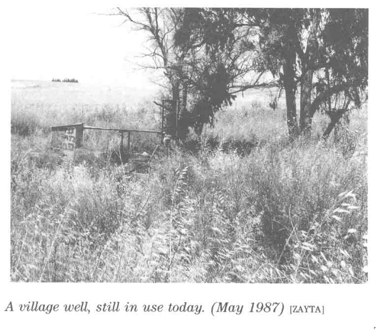
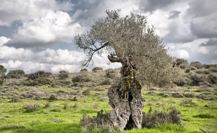
Scanned from "All That Remains" by Dr. Walid Khalidi 19 - زيتون زيتا
Posted by abu raya - زيتا
Posted by abu raya - ربيع زيتا

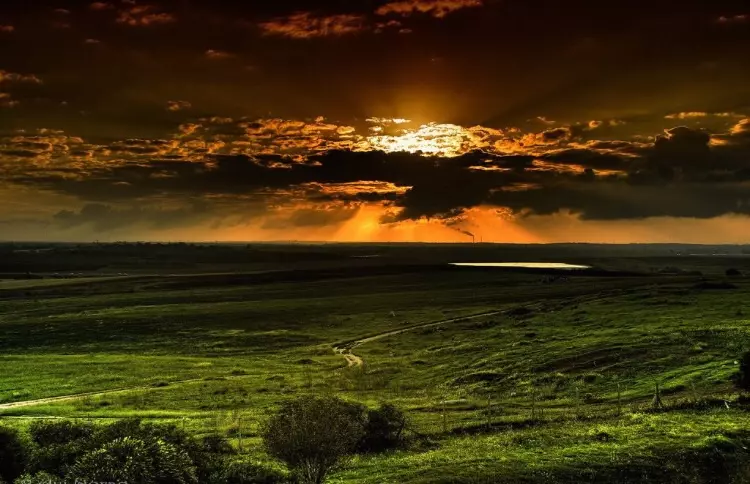
Posted by abu raya - زيتا
Posted by abu raya - اراضي زيتا
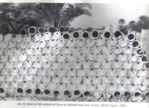
Posted by abu raya - خلايا نحل من الفخار في بيت مختار قرية زيتا بعد الإحتلال 1948 - مع تحيات أخوكم الفوالجي
Posted by أبو اليزن السعافين
Want to browse more? 80,000 pictures were grouped in these gallaries:
| Display Name | Clan/Hamolah | Country of Residence |
| Haneen Alfayoumi | - | Amman, Jordan |
| خليل محمود خليل ابو عطا الله | - | عمان, الأردن |
| اسماعيل السيناوي | - | - |
| Mohammad Wajeeh Abuljoud | - | - |
| الجوهري | - | عمان |
| شاكر | الدمنهورى | زيتا |
| مصطفى ابو حماد | زيتا | عمان, الاردن |
| معاذ | - | عمان, عمان |
| اتش دبور | اسعد | gfdf, فلسطين |
| wael_abumidan | abumidan | jordan, amman |
| Mahmood Abu Samak | abusamak | Riyadh 11466, Saudi Arabia |
| Mohammad Abu Samak | Abu Samak | Dammam, Saudi Arabia |
 Fake Valor: Why Did Zionist Jews Hoist Nazis Flag on Their Ships in the 1930s?
What is new?
-
Facts About Oct. 7th Gaza Raid
-
Remined Us Please:: Who Did Rape Who? Palestinians Raped Israelis? Or, was the other way around?
-
When Prof. Edward Said was invited to debate Bibi Netanyahu in the 1980s, watch what happened!
-
Ezra Klein of the NY Times on the "Jewish Race".
-
Abusing Blood Libel!
-
Did Israeli Soldiers Activate The Hanniba Direective On Oct. 7th? You Be The Judge
-
Zionist FAQ: Isn't it true that Palestinians don't want peace? Palestinians never accepted the two-state solution
- Facts about Haavara (Transfer) Agreement between Ben-Gurion & Hitler
-
Haavara FAQs: Why Did Zionist Jews Hoist Nazis' Flags on Their Ships in the 1930s?
- Haavara FAQs: When Chaim Weizmann met FDR in mid-1943, why was he silent about rescuing European Jewry?
-
Dear ChatGPT: How did Palestinians resist Napoleon's invasion of their country in 1799?
-
Dear ChatGPT: Gaza had a vibrant Jewish community in the mid-17th century. What happened to them?
-
Dear ChatGPT: Why did the Jewish Agency suppress news of the Holocaust during WWII?
-
Video Playlist: Jews share their DNA tests to end the conflict for good.
-
A Tale of Two Conflicts: Examining the Definition of Genocide
-
Prof. Abraham Polak And The Suppressed History of the Khazars and European Jewry
-
How Ronald Reagan would have framed the genocide in Gaza if he were still alive?
-
Haavara FAQs: Let us do the math: how many German Jews did The Haavara Agreement save?
-
Zionist FAQs: The Hebron Massacre of 1929, "clearly proves" that Palestinians are antisemitic, how could you deny it?
-
Zionist FAQs: Why Anti-Zionist Is Not Antisemitism?
-
Zionist FAQs: Isn't it true that the KGB created Palestinian Nationalism in the early 1960s?
- Zionist FAQs: Muslims are killing Muslims all the time; why are Israeli Jews being singled out in the media?
- Zionist FAQs: How is Israel an apartheid state when 20% of its citizens are Arabs who enjoy full rights?
-
Haavara FAQs: Why Did Dorothy Thompson Flip From A Zionist Advocate to A Silenced Dissenter?
-
Haavara FAQs: Analysis of Herzl's Uganda Scheme and how it could have saved millions of Jews.
-
Haavara FAQs: Why did Hayim Greenberg describe American Jewry as "morally bankrupt" in early 1943?
-
Haavara FAQs: What if the Evian Conference was a resounding success? What would have been the impact of saving European Jewry on Zionism?
- Haavara FAQs: What if the six million were saved, how that would have impacted the Zionist project?
-
Haavara FAQs: How did Zionist leaders react when Europe's Jews lingered in the DP camps after WWII ended?
-
Why does the American Jewish community repeat lies that David Ben-Gurion had debunked before he died?
-
Who has the power to rename the Tatar/Khazar Gene Marker to Jewish IV?
-
Zionist FAQs: Why won't Egypt, Syria, and Jordan take their people back? Jews are indigenous to Palestine, and Arabs immigrated after Jews developed the country. Arabs should leave.
-
Haavara FAQs: Did Hitler and the Nazis conflate between Judaism and Zionist? If that wasn't case, then why?
-
Haavara FAQs: Winston Churchill and antisemitism, a collection of articles written Churchill.
-
Haavara FAQs: Broken by country, how many Jews survived vs. killed during the Holocaust?
-
Haavara FAQs: Why did European Jews vote with their feet and to immigrated to the Americas, not Palestine, after WWII?
-
Watch this American Jewish Girl describing Israeli Jews' cognitive dissonance like no other in under two minutes
-
Haavara FAQs: When the Nazis went out of their way to hide the Holocaust, Israeli Jews did the exact opposite by broadcasting their genocide of Gazans. But why?
-
Haavara FAQs: How Zionist Jews went out of their to show their appreciation to Nazism and Fascism?
- Haavara FAQs: Why Zionist leaders were against bombing the death camps & the Railroads leading to them?
-
Haavara FAQs: Hitler's message to the British and American people: If Jews are such noble citizens and you care about them, how come you're not letting them in? I will gladly ship them to you at my expense, even on luxury liners!
-
A shortlist of Zionist and Israeli false flag operations in the name Jews.
-
The Most Moral Army
- The Land of Kapos (Israel): Where the brave are boycotted and Kapos walk free.
- Why did early Zionists often named their communal enterprises "colonial"?
- Zionist Relations with Nazi Germany by Faris Glubb
-
Two NY Times advertisements by Zionists in the early 1943 that exposes Zionists' treason at the height of the calamity
- Facts Not Lies about the Palestinian-Israeli Conflict.
- Site's pictures have been categorized
- Campgain Against Lice
- A Survey of Palestine, the official source about Palestine before Nakba produced by the British Mandate; over 1200 pages.
- Satellite View & Google Earth: Over 6,000 placemarks identifying all destroyed towns, W. Bank & Gaza Strip Towns, & refugee camps.
- PalestineRemembered.com and its Nakba Oral History Project were featured on al-Jazeera Satellite TV.
- Nakba Oral History Video Podcast:
 Over 700 Oral History interviews (including 3,500+ hours of recording) can be viewed online.
 - Palestine Village Statistics Project
- Gaza Jail Break
- النسخة العربية للموقع الان متوفرة
- Videos: Documenting the destroyed villages in video: Tracing all that remains since Nakba.
- Videos: Responding to Zionist Propaganda
- Interview: The ethnic cleansing of Palestine: George Galloway interviews Israeli Historian Ilan Pappe.
- For Palestinians, memory matters. It provides a blueprint for their future By George Bisharat.
- Zionist FAQ now available in Hebrew שאלות שציונים שואלים, עכשיו בעברית
- Video: The Stephen Walt and John Mearsheimer report on the influence of the Israel Lobby on U.S. Foreign Policy
- The Palestinian-Israeli conflict for beginners
