| PalestineRemembered | About Us | Oral History | العربية | |
| Pictures | Zionist FAQs | Haavara | Maps | |
| Search |
| Camps |
| Districts |
| Acre |
| Baysan |
| Beersheba |
| Bethlehem |
| Gaza |
| Haifa |
| Hebron |
| Jaffa |
| Jericho |
| Jerusalem |
| Jinin |
| Nablus |
| Nazareth |
| Ramallah |
| al-Ramla |
| Safad |
| Tiberias |
| Tulkarm |
| Donate |
| Contact |
| Profile |
| Videos |
Welcome To Jarash - جراش (ג'רש)
|
District of Jerusalem
Ethnically cleansed days ago |
العربية Google Earth |
 |
Gallery (52) |
- Statistics & Facts
-
Before & After

- Satellite View
- Articles 1
- Pictures 52
- Oral History 1
- Members 37
- All That Remains
- Wikipedia
- Videos 2
- Guest Book
- Links
| Statistic & Fact | Value | ||||||||||||||
| Occupation Date | October 21, 1948 | ||||||||||||||
| Distance From District | 21 (km) West of Jerusalem | ||||||||||||||
| Elevation | 425 (meters) | ||||||||||||||
| Before & After Nakba, Click Map For Details |
|||||||||||||||
|
|||||||||||||||
| Map Location | See location #33 on the map View from satellite |
||||||||||||||
| Military Operation | Operation ha-Har | ||||||||||||||
| Attacking Units | Sixth Battalion of the Har' el Brigade | ||||||||||||||
| Exodus Cause | Military assault by Zionist troops | ||||||||||||||
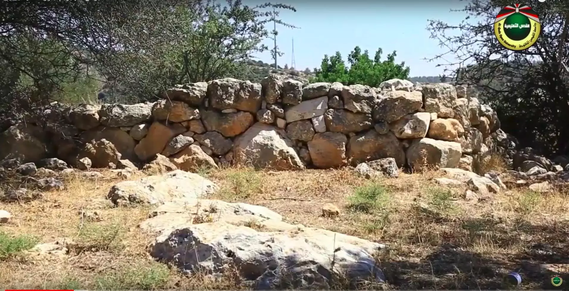
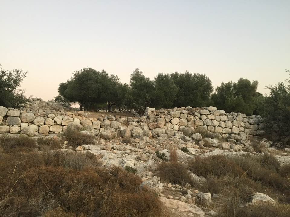
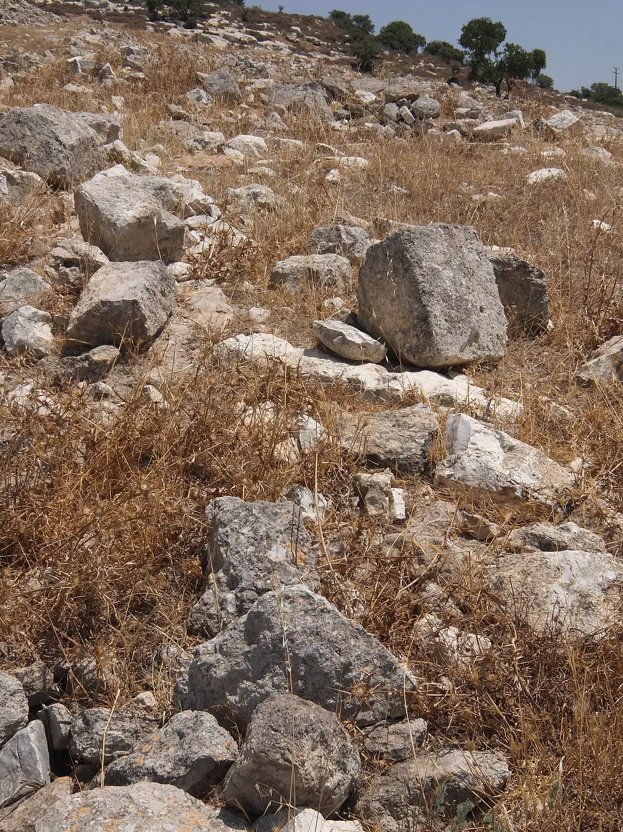
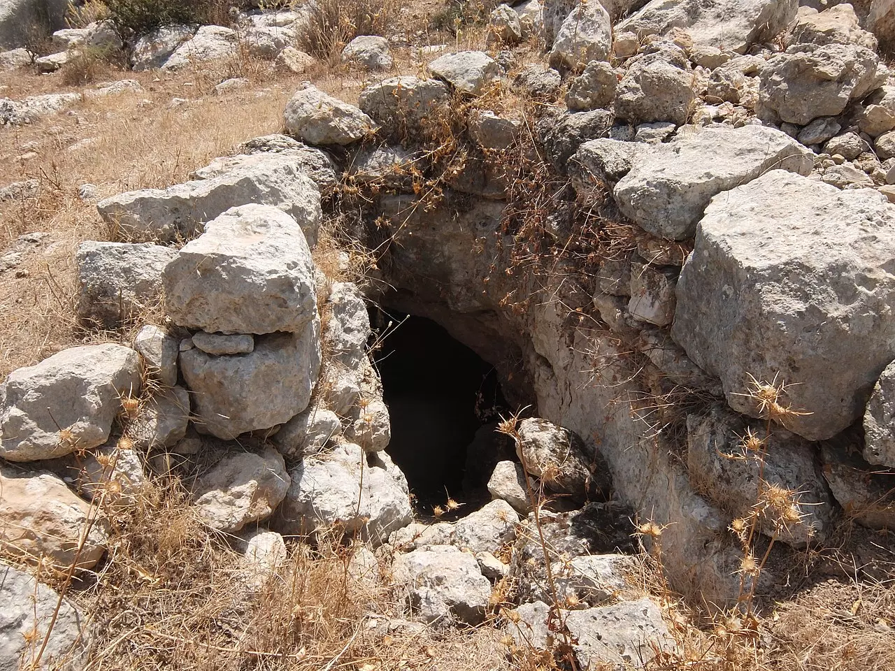
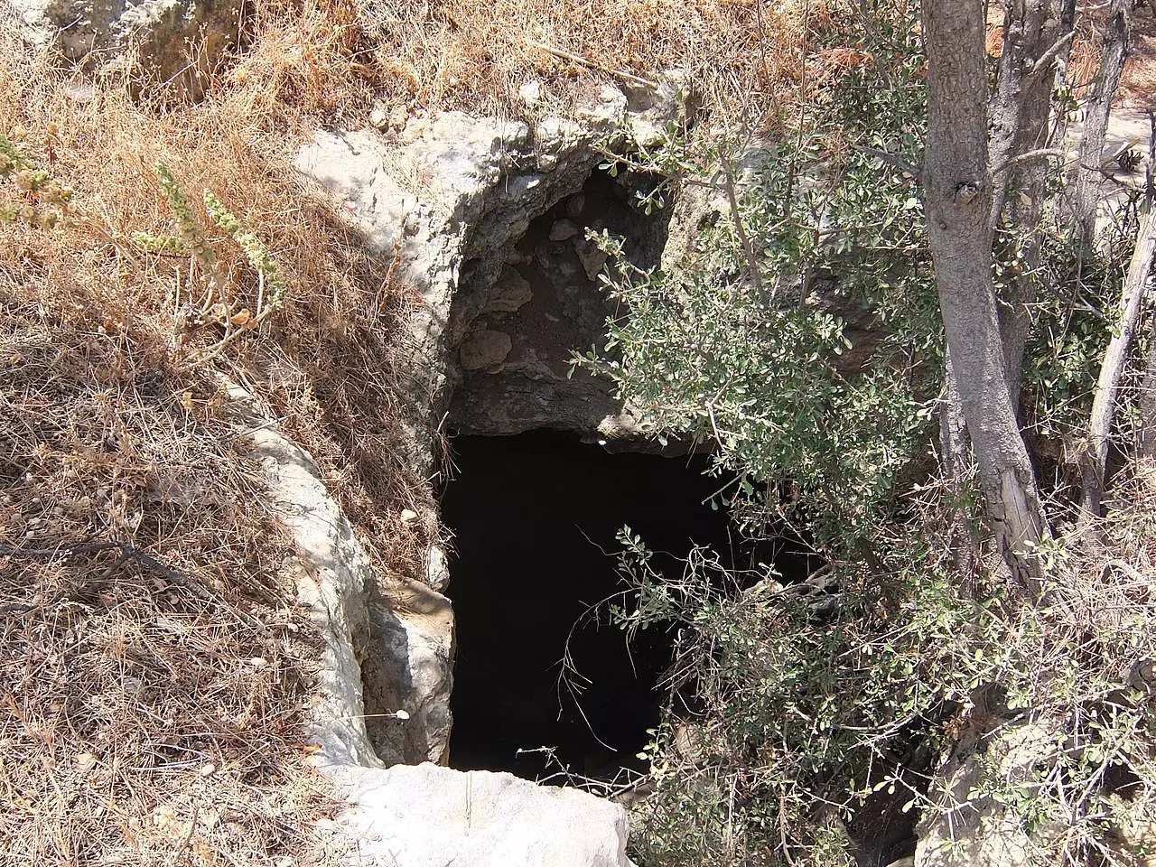
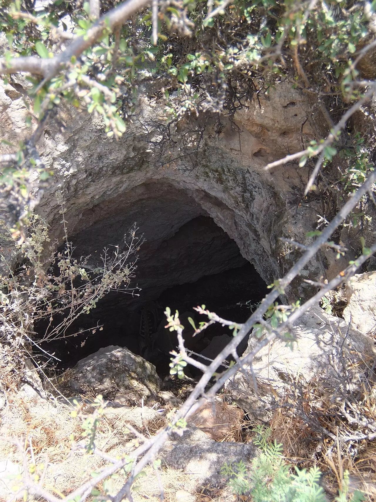
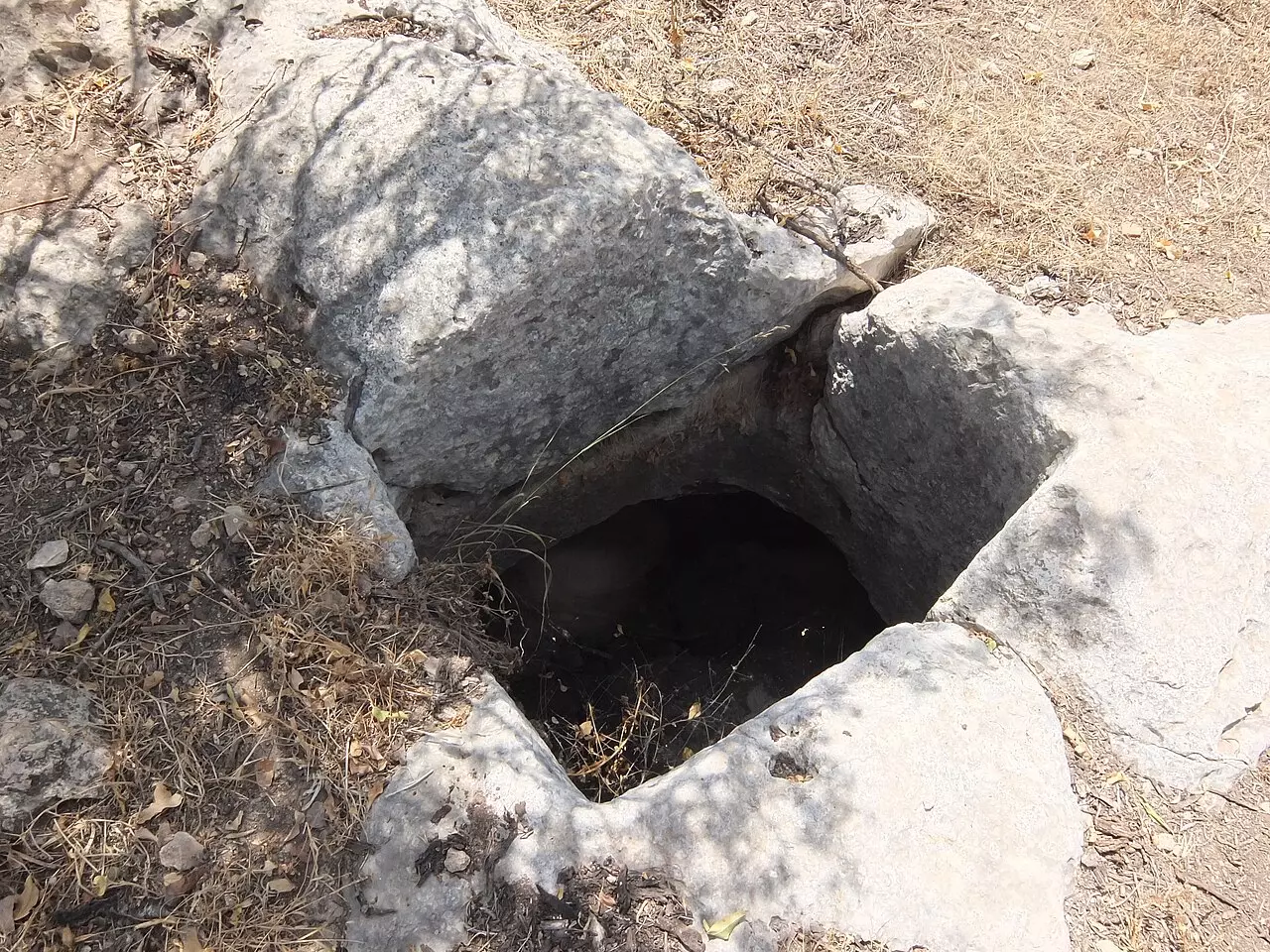
| Village Temains | Jarash was completely defaced, and only house rubble left behind. | ||||||||||||||
| Ethnically Cleansing | Jarash inhabitants were completely ethnically cleansed. | ||||||||||||||
| Pre-Nakba Land Ownership |
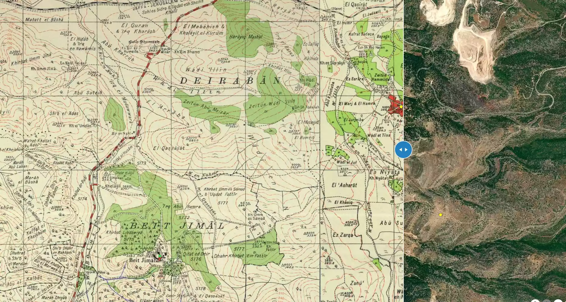
**Town Lands' Demarcation Maps |
||||||||||||||
| Land Usage As of 1945 |
|
||||||||||||||
| Population |
|
||||||||||||||
| Number of Houses |
|
||||||||||||||
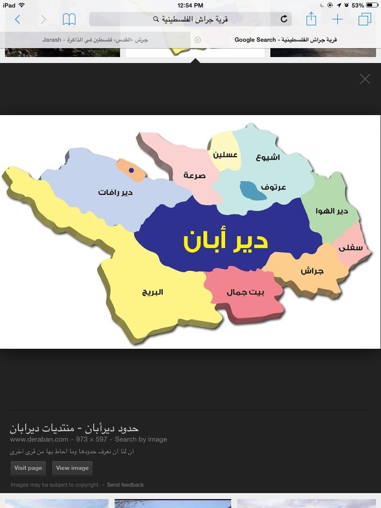
| Near By Towns |
|||||||||||||||
|
|||||||||||||||
| Shrines / Maqams | A shrine for a local religious teacher known as al-Shaykh Abroad. | ||||||||||||||
| Archeological Sites | To the east of the village lay Khirbat Sira, which is identified with a Mamluk/Ottoman village. | ||||||||||||||
| Exculsive Jewish Colonies Who Usurped Village Lands |
No Israeli settlements on village lands | ||||||||||||||
| Featured Video | |||||||||||||||
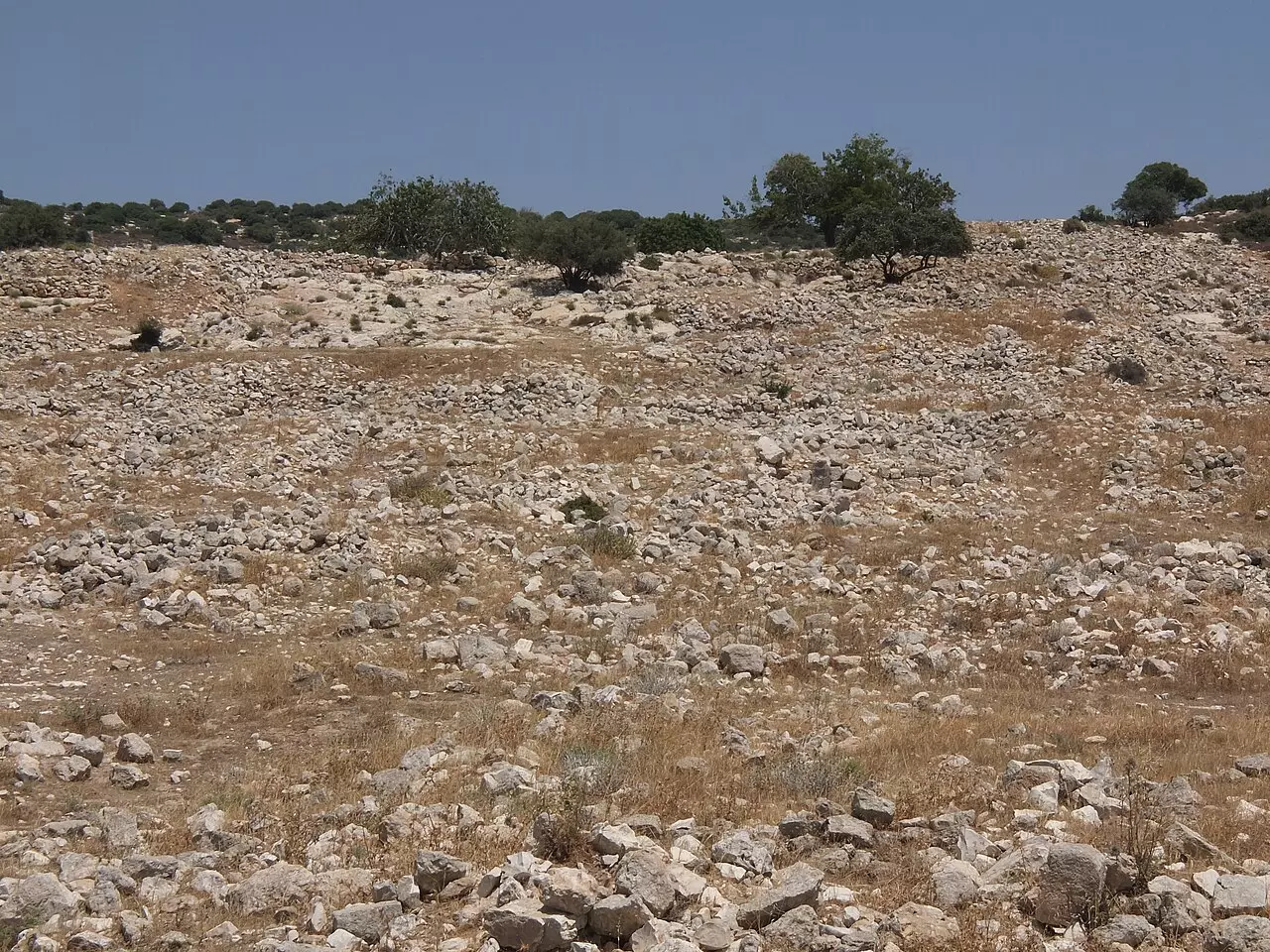
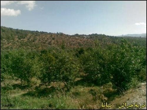
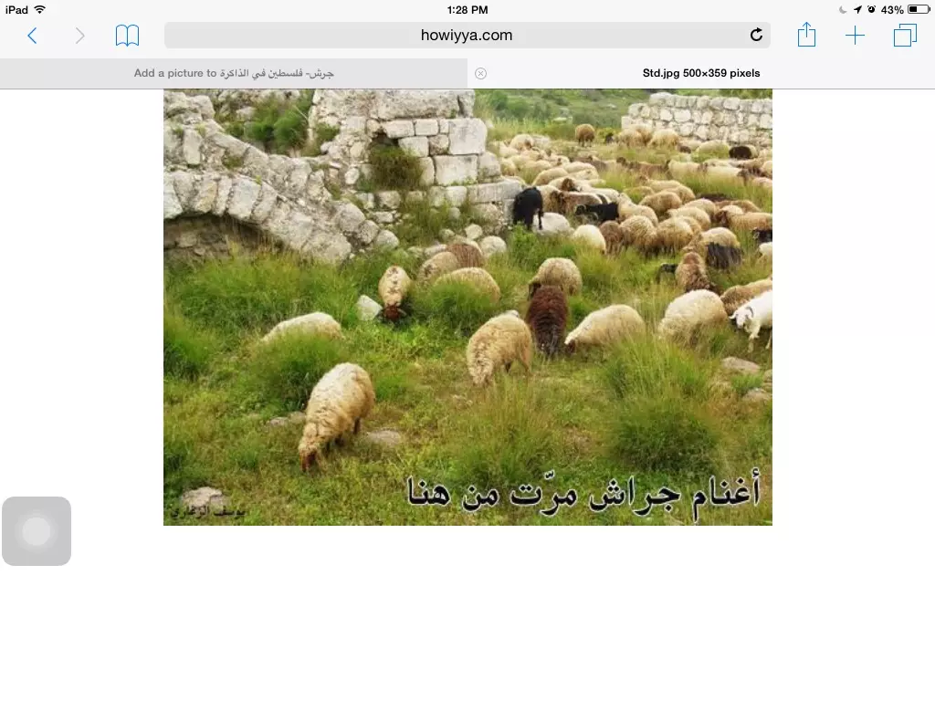
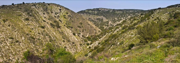
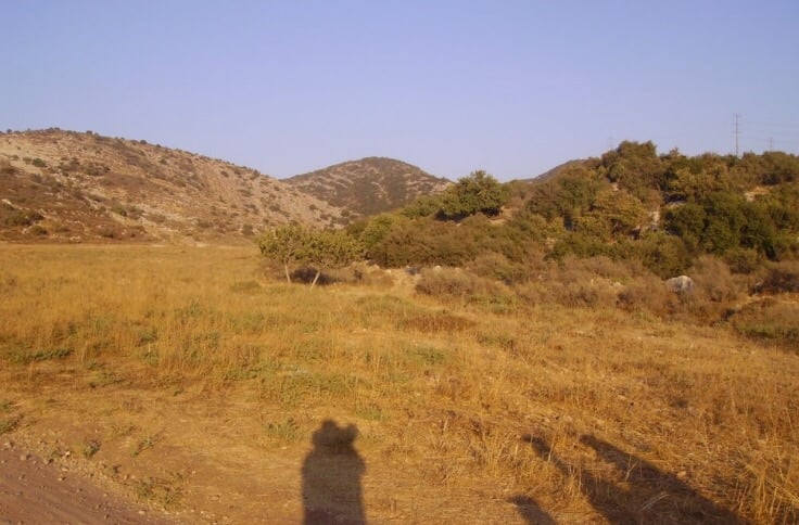
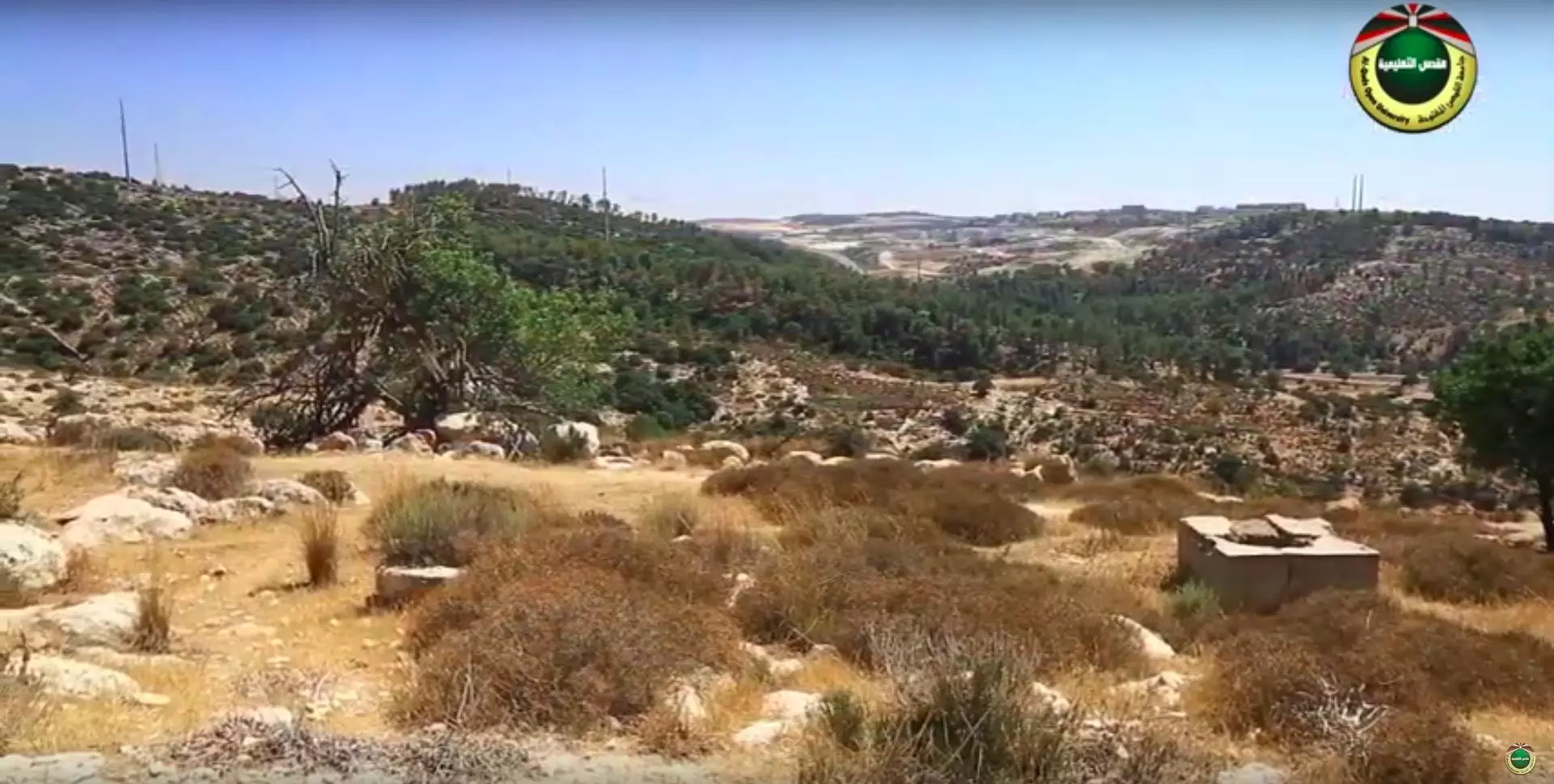
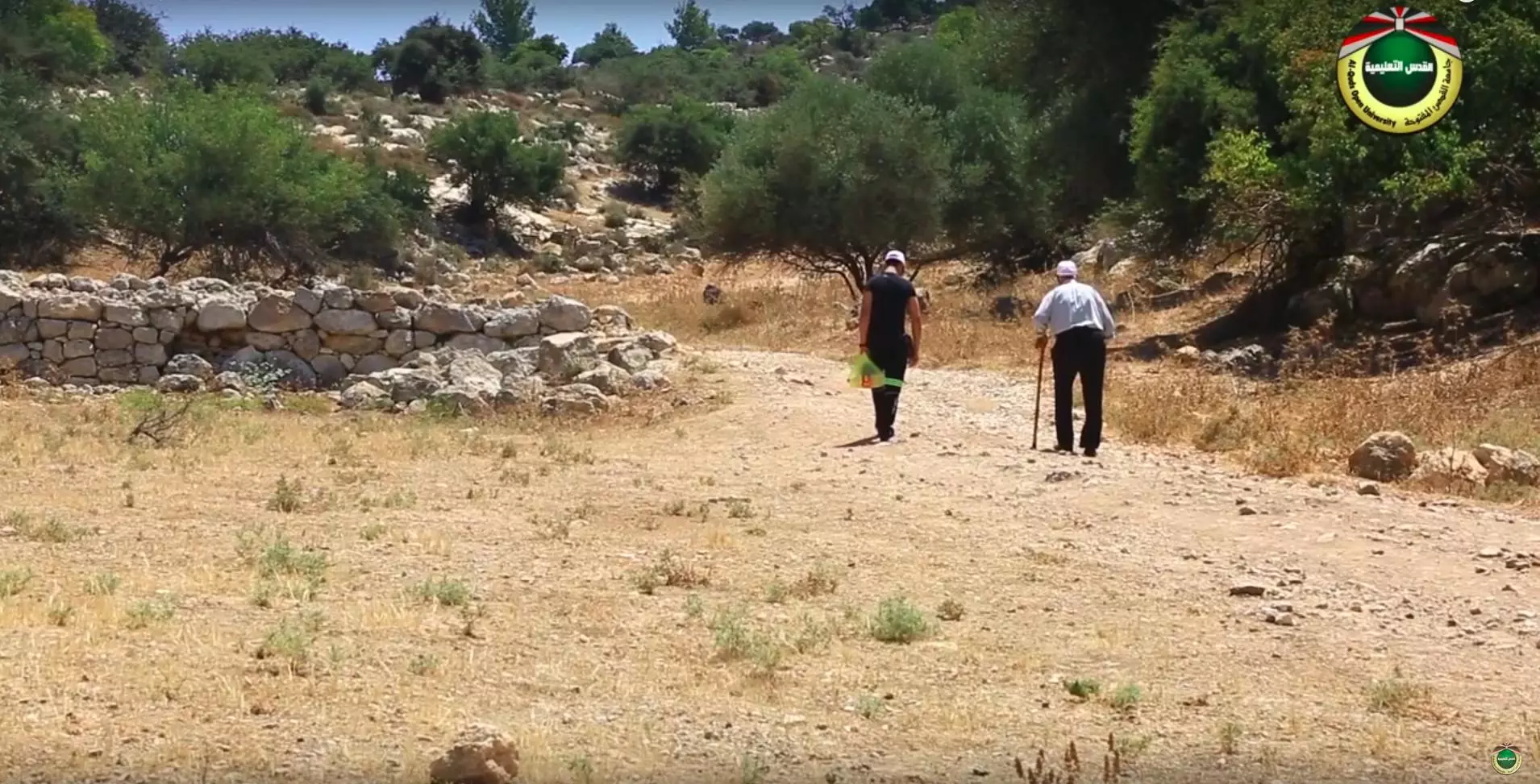
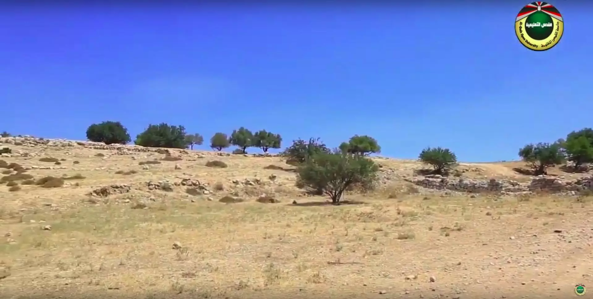
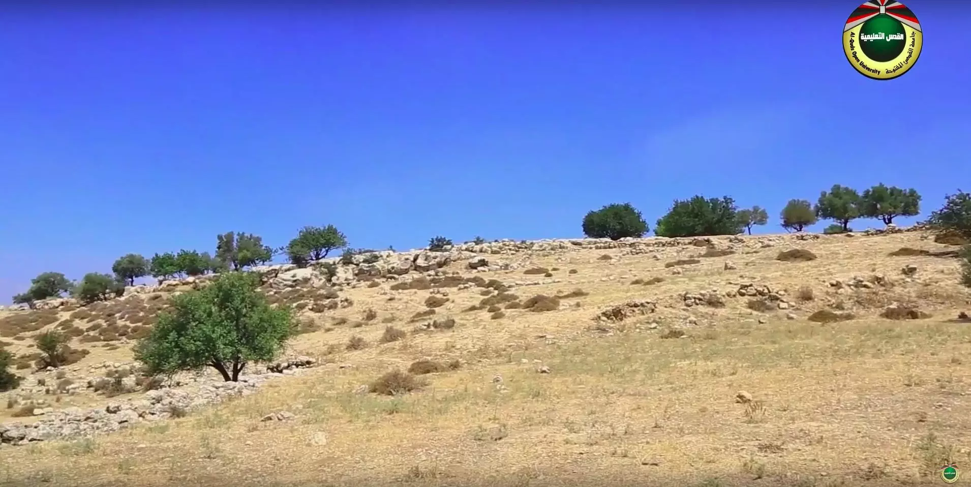
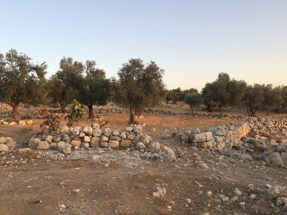
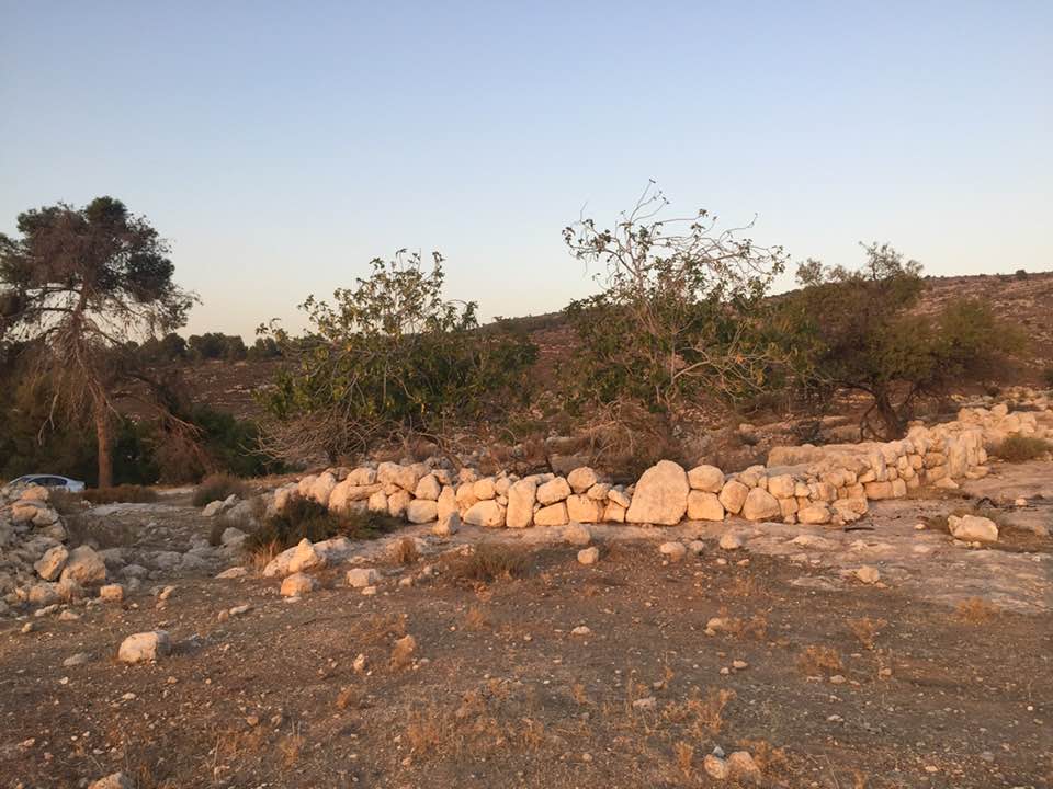
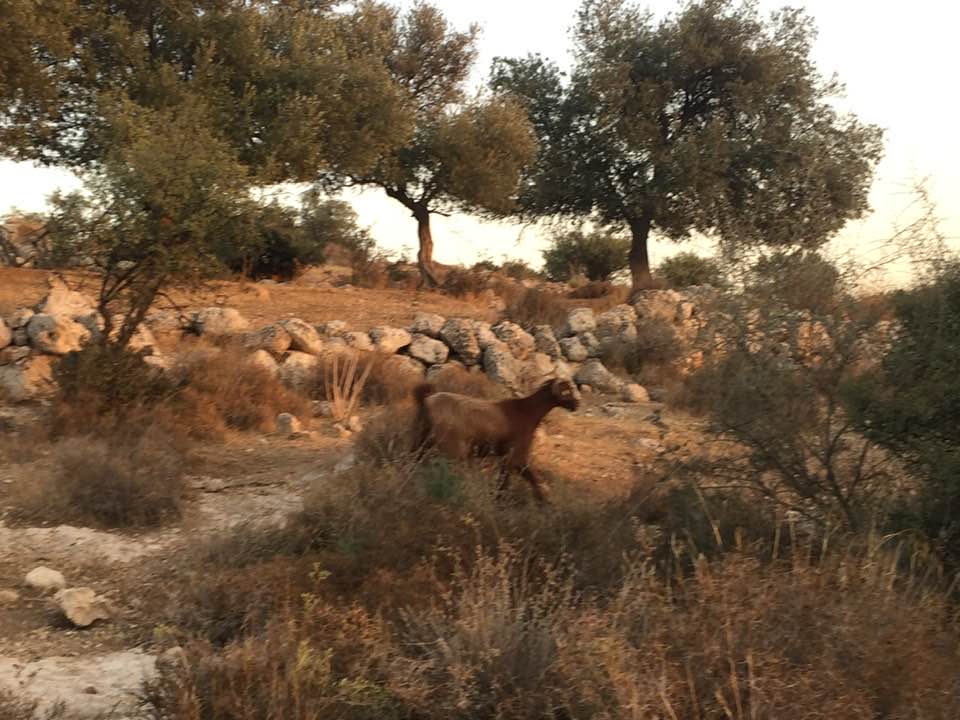
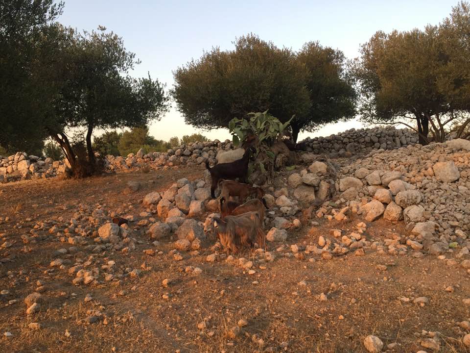
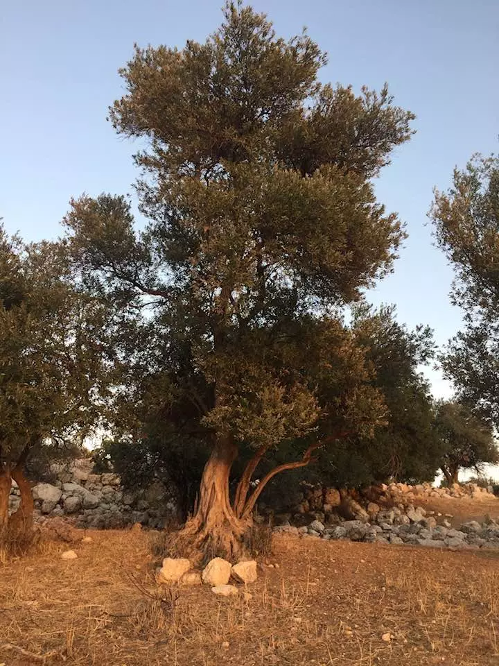
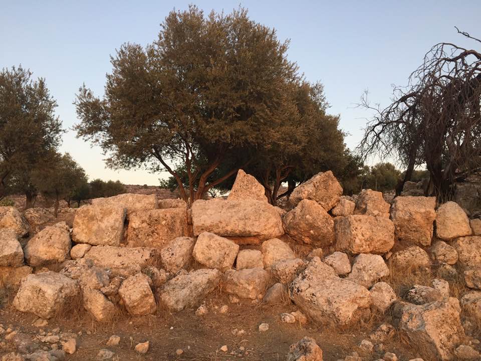
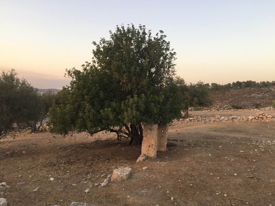
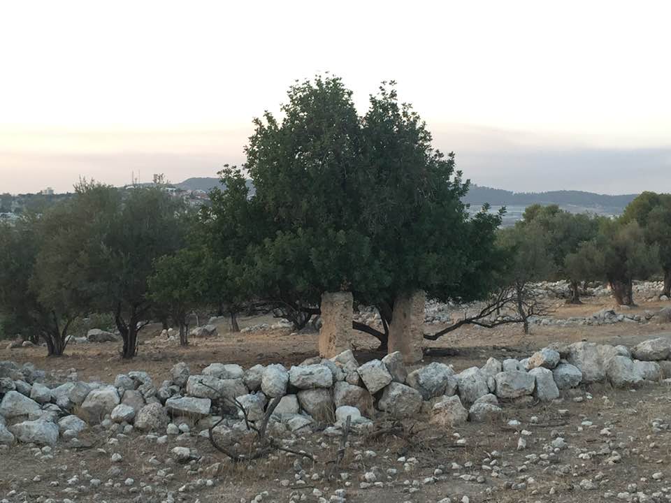
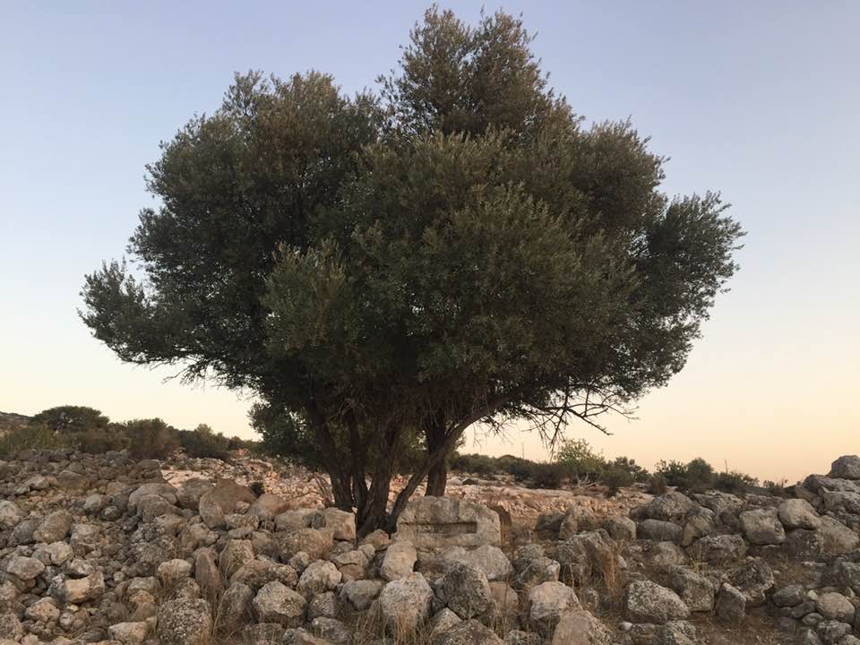
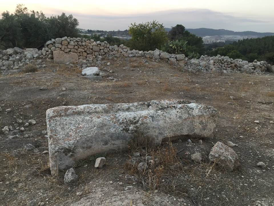
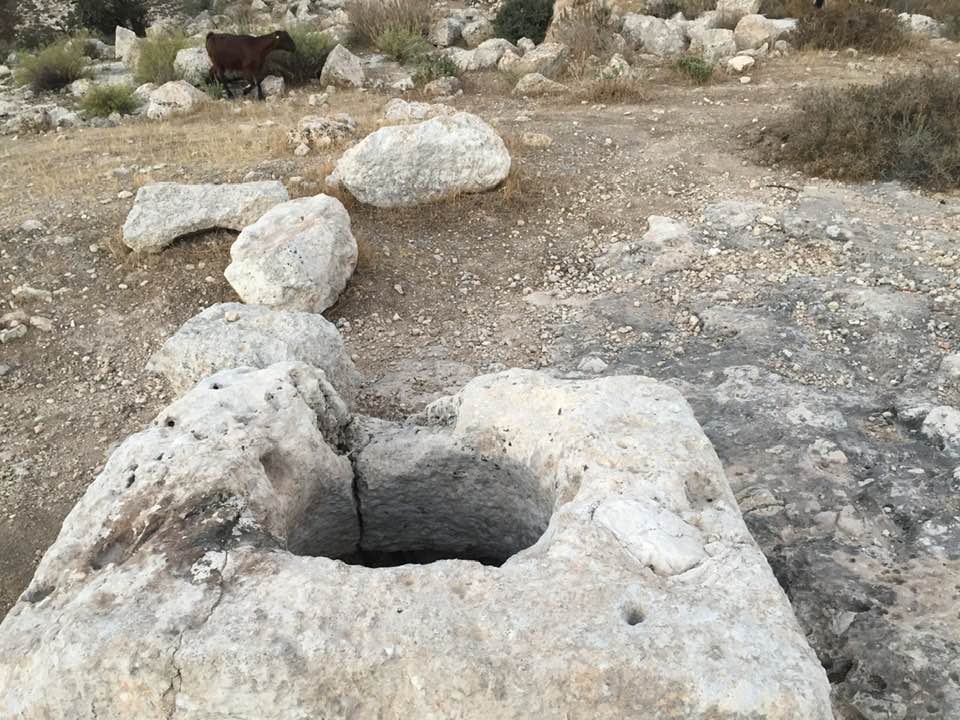
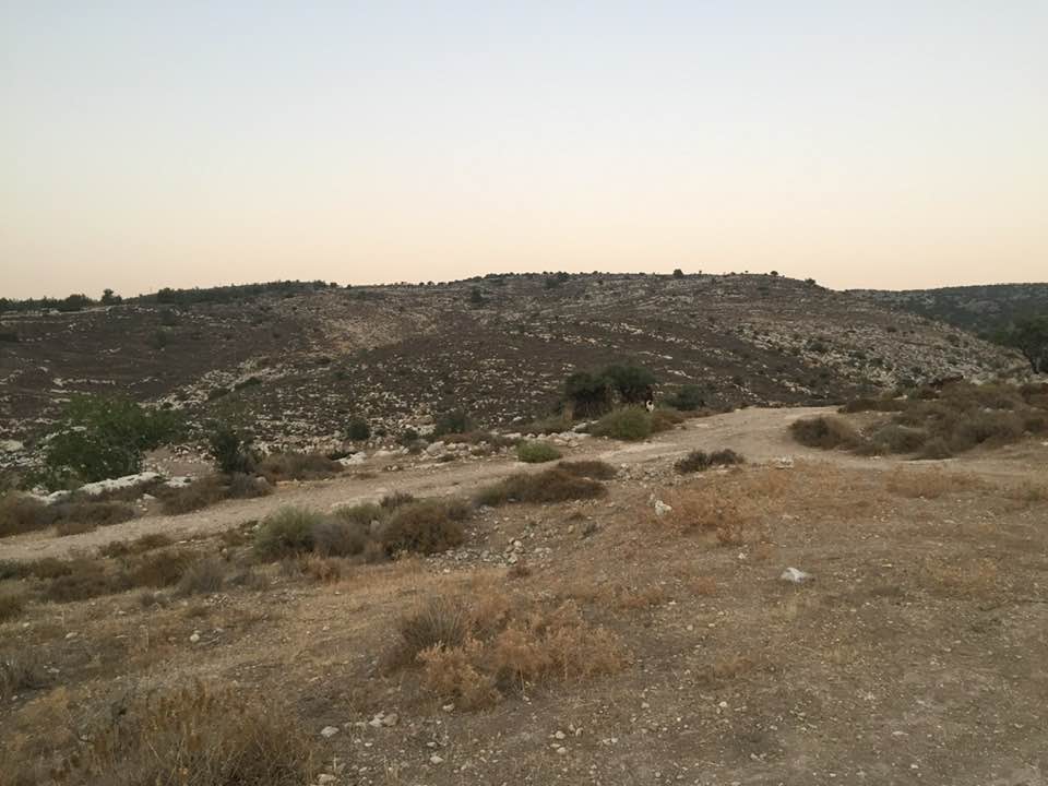
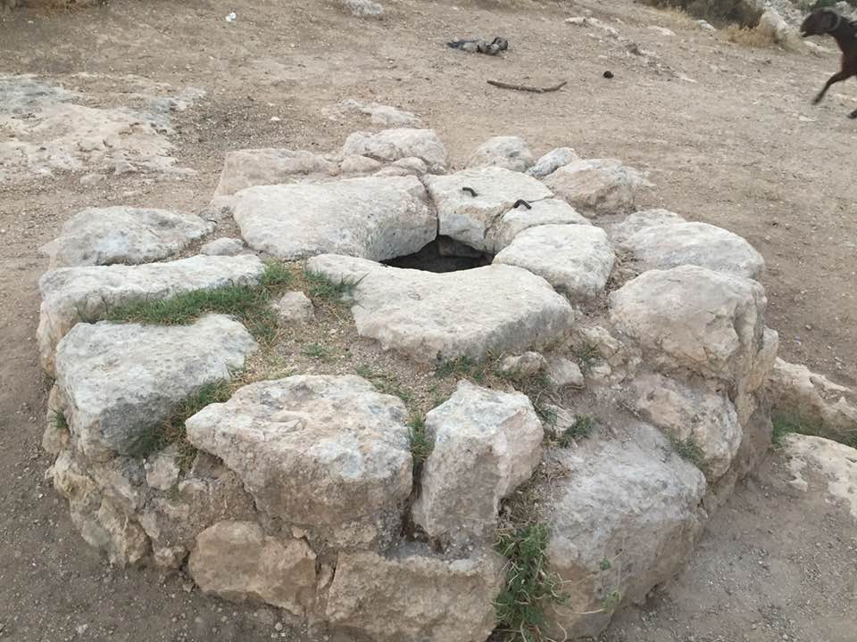
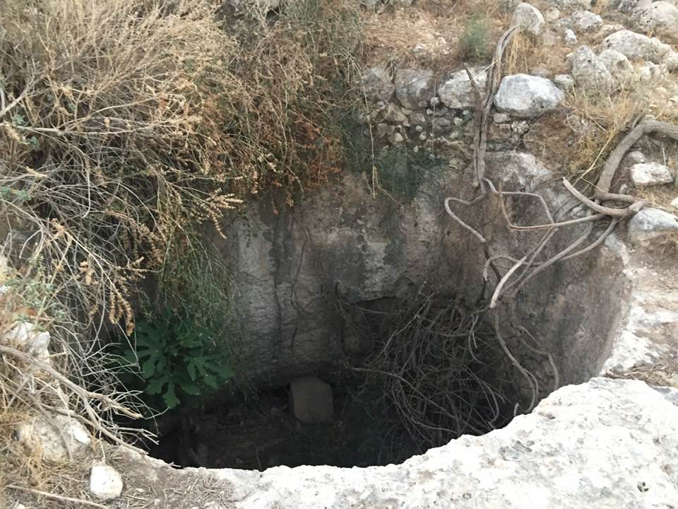
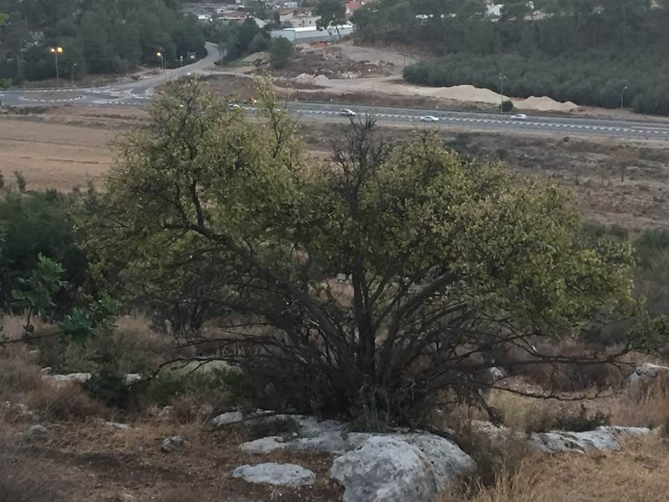
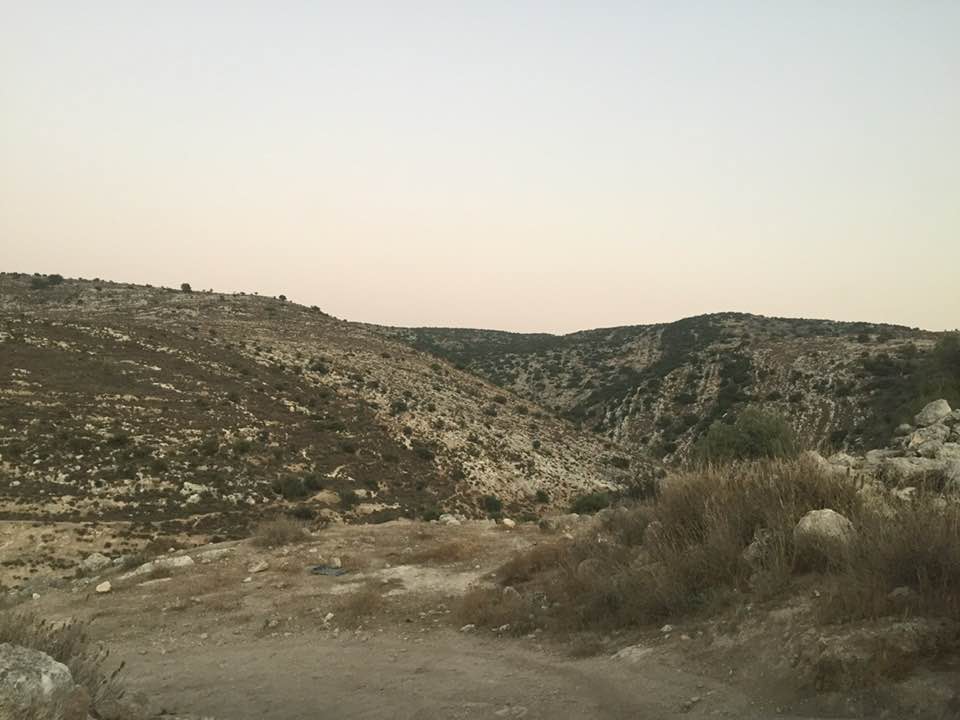
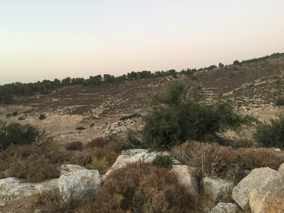
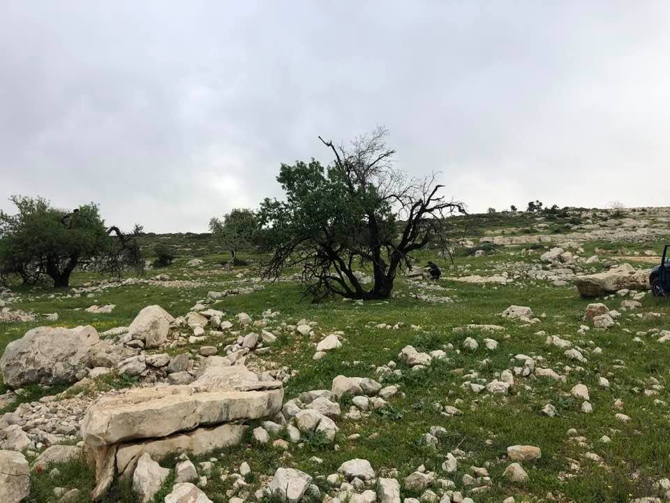
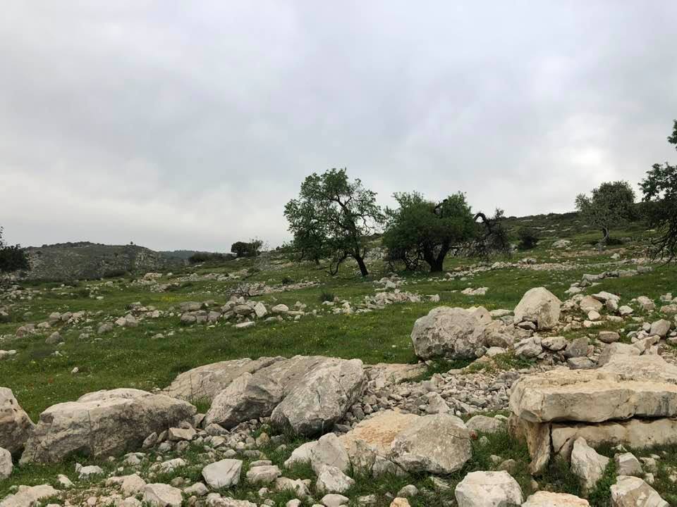
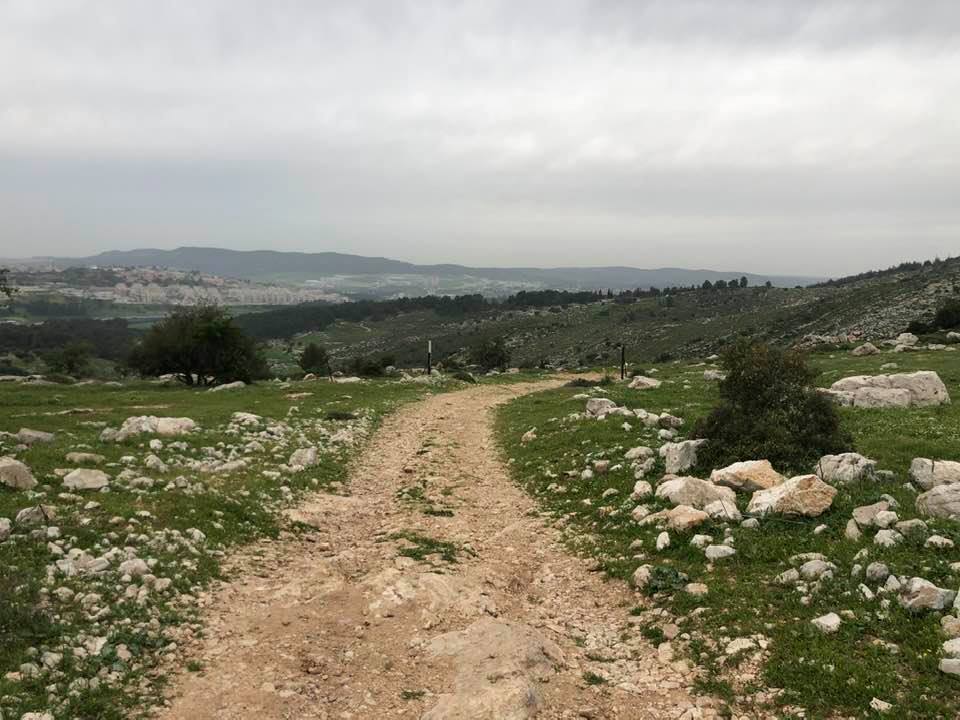
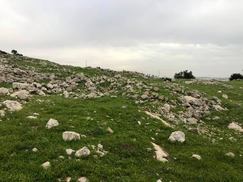
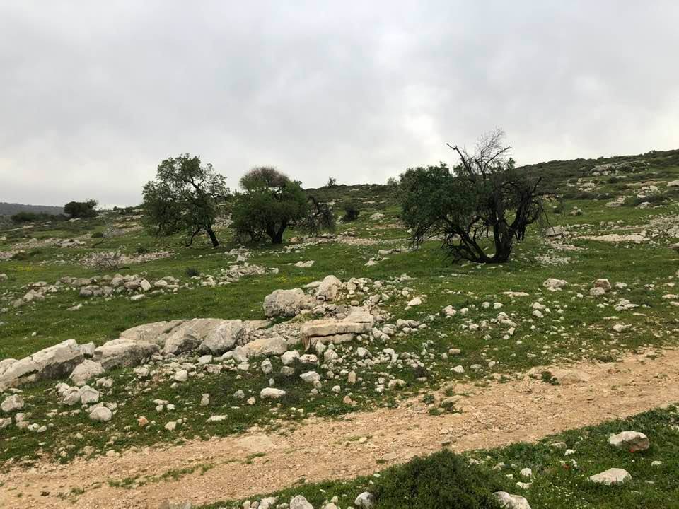
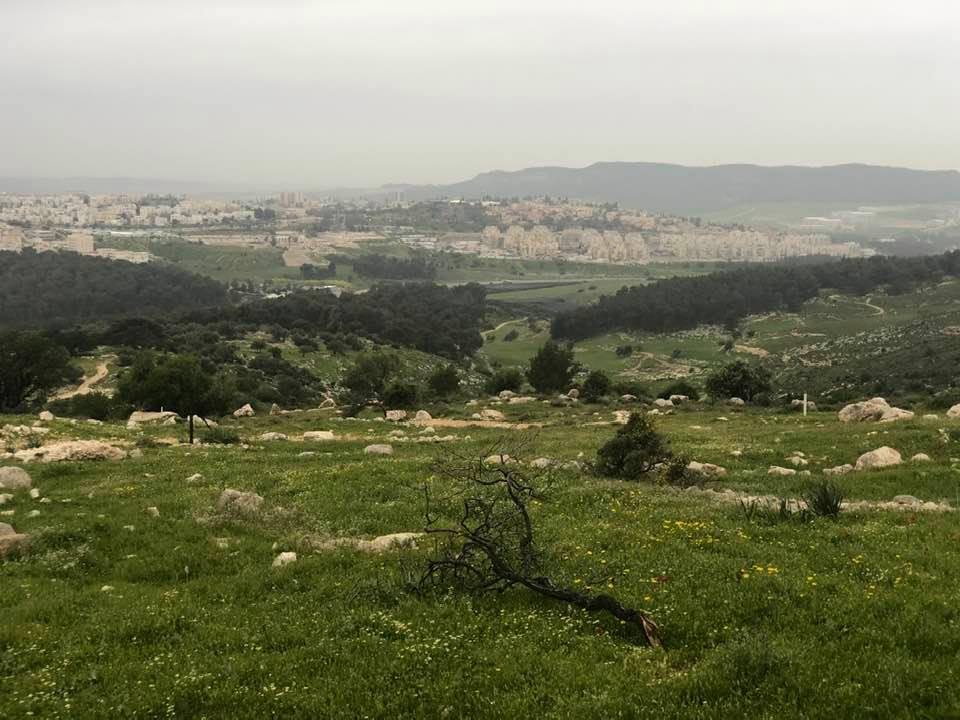
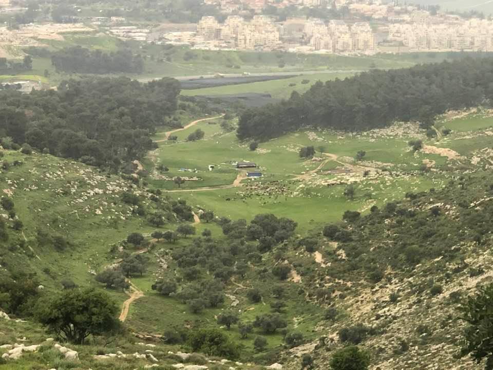
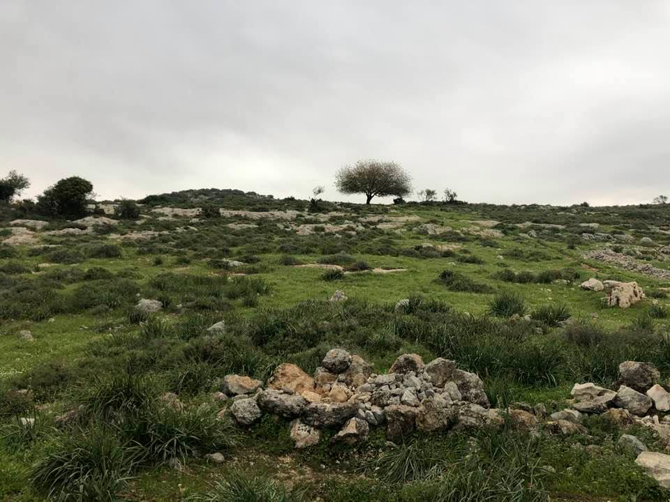
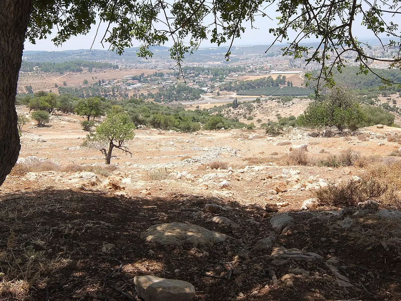
Village Before NakbaThe village stood on the lower western slope of a mountain, surrounded by wadis on the south, north, and west. A secondary road linked it to the Jerusalem−Bethlehem highway, passing through the neighboring village of Sufla; another secondary road linked it to Dayr Aban, the largest of the adjacent villages. In the late nineteenth century, Jarash was described as a village built on the spur of a hill with olive trees growing below it. The village was rectangular in shape, and most of its houses were built of stone. Construction initially extended in a northwestern−southeastern direction, but towards the end of the Mandate, new construction extended in a southeasterly direction along the road to Sufla. Jarash was classified in this period as a hamlet by the Palestine Index Gazetteer. The residents of Jarash were Muslims and maintained a shrine for Shaykh Ahmad, a local religious teacher. The village had several small shops, but the villagers relied on the neighboring village of Dayr Aban for other necessities, such as administrative and medical services. Water for domestic use was supplied by wells and by a nearby spring.Crops were watered by rainfall. The villagers cultivated grain on the valley's floor and tended olive trees and vineyards that were planted on the slopes. Herbs and wild trees covered large areas of the mountain slopes and peaks to the east of the village. These areas were utilized for grazing and as a source of firewood. In 1944/45 a total of 1,355 dunums was allocated to cereals; 5 dunums were irrigated or used for orchards. To the east of the village lay Khirbat Sira (152127), which is identified with a Mamluk/Ottoman village. Village Occupation and Ethnic CleaningBetween 19 and 21 October 1948, Israeli forces attacked this village, in the context of Operation Ha-Har (see 'Allar, Jerusalem sub-disctrict). The main force participating in Ha-Har was the Har'el Brigade; its Sixth Battalion was the unit responsible for occupying Jarash, according to the History of the War of Independence.Zionists Colonies on Village LandsThere are no settlements on village lands. The closest settlement is Zanoach (149126), which was founded in 1950 about 2 km west of the village site.Village TodayThe site is overgrown with grass, interspersed with the debris of destroyed houses and stones from the terraces. The ruins of a cemetery lie northwest of the site. Groves of trees cover two hills to the west of the site that are separated by a valley. Carob, fig, almond, and olive trees grow on these hills.SourceDr. Walid al-Khalidi, 1992: All That Remains. |
|||||||||||||||
| Related Maps | Town Lands' Demarcation Maps خرائط للقضاء توضح حدود القرى والاودية Town's map on MapQuest View from satellite Help us map this town at WikiMapia |
||||||||||||||
| Related Links | Wikipedia's Page Google Search Google For Images Google For Videos |
||||||||||||||
| More Information | في كتاب كي لا ننسى في كتاب بلادنا فلسطين المزيد من موقع هوية |
||||||||||||||
- House Rubble In 1986
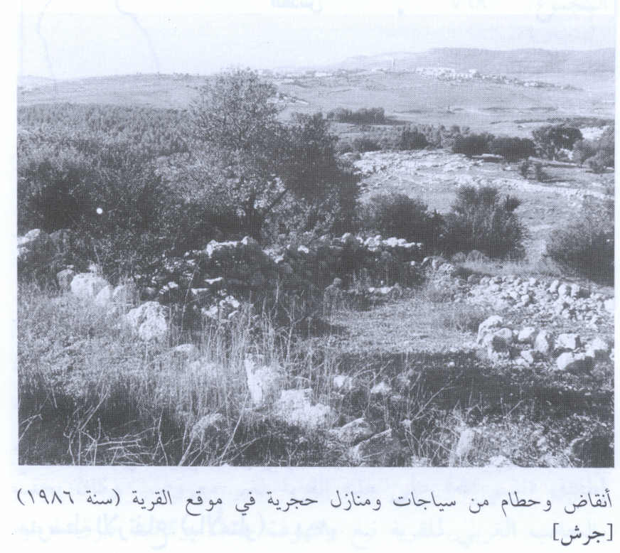
Scanned from "All That Remains" by Dr. Walid Khalidi 2 - Ruins of the destroyed Palestinian village and surrounding hills

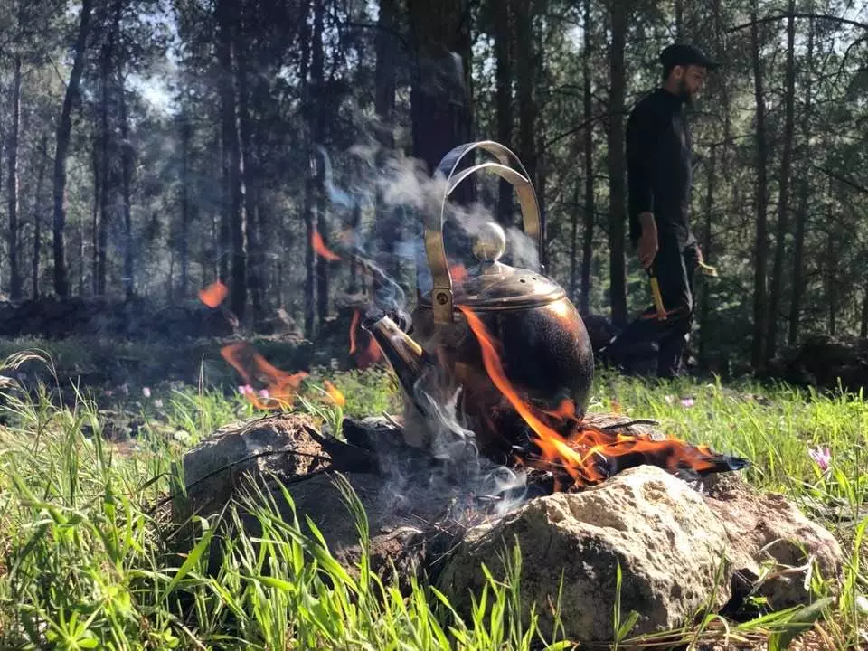
Posted by Noga Kadman 2 - منظر عام
Posted by Aya Ramadan - منظر عام
Posted by Aya Ramadan - موقع قرية جراش بالنسبة للبري المحيطة
Posted by Aya Ramadan - جراش
Posted by abu raya - جراش
Posted by abu raya - جراش
Posted by abu raya - جراش
Posted by abu raya - غرب القريه

Posted by abu raya - منظر عام لانقاض قرية جراش المهجرة والمدمرة
- منظر عام لانقاض قرية جراش المهجرة والمدمرة #2
- منظر عام لانقاض قرية جراش المهجرة والمدمرة #3
- منظر عام لانقاض قرية جراش المهجرة والمدمرة #4
- منظر عام لانقاض قرية جراش المهجرة والمدمرة #5
- Zeiad Abbas Shamrouch, at the entrance to my mother’s village Jarash
- Let us see how the most "liberal and civilized" of world Jewry has obliterated our village. How else will the Jews be great and safe again? -- القرية دمرت بالكامل.. من هنا مر الهمج
- Let us see how the most "liberal and civilized" of world Jewry has obliterated our village. How else will the Jews be great and safe again? -- القرية دمرت بالكامل.. من هنا مر الهمج #2
- Let us see how the most "liberal and civilized" of world Jewry has obliterated our village. How else will the Jews be great and safe again? -- القرية دمرت بالكامل.. من هنا مر الهمج #3
- Let us see how the most "liberal and civilized" of world Jewry has obliterated our village. How else will the Jews be great and safe again? -- القرية دمرت بالكامل.. من هنا مر الهمج #4
- Let us see how the most "liberal and civilized" of world Jewry has obliterated our village. How else will the Jews be great and safe again? -- القرية دمرت بالكامل.. من هنا مر الهمج #5
- Let us see how the most "liberal and civilized" of world Jewry has obliterated our village. How else will the Jews be great and safe again? -- القرية دمرت بالكامل.. من هنا مر الهمج #6
- Let us see how the most "liberal and civilized" of world Jewry has obliterated our village. How else will the Jews be great and safe again? -- القرية دمرت بالكامل.. من هنا مر الهمج #7
- Let us see how the most "liberal and civilized" of world Jewry has obliterated our village. How else will the Jews be great and safe again? -- القرية دمرت بالكامل.. من هنا مر الهمج #8
- Let us see how the most "liberal and civilized" of world Jewry has obliterated our village. How else will the Jews be great and safe again? -- القرية دمرت بالكامل.. من هنا مر الهمج #9
- Let us see how the most "liberal and civilized" of world Jewry has obliterated our village. How else will the Jews be great and safe again? -- القرية دمرت بالكامل.. من هنا مر الهمج #10
- Let us see how the most "liberal and civilized" of world Jewry has obliterated our village. How else will the Jews be great and safe again? -- القرية دمرت بالكامل.. من هنا مر الهمج #11
- Let us see how the most "liberal and civilized" of world Jewry has obliterated our village. How else will the Jews be great and safe again? -- القرية دمرت بالكامل.. من هنا مر الهمج #12
- Let us see how the most "liberal and civilized" of world Jewry has obliterated our village. How else will the Jews be great and safe again? -- القرية دمرت بالكامل.. من هنا مر الهمج #13
- Let us see how the most "liberal and civilized" of world Jewry has obliterated our village. How else will the Jews be great and safe again? -- القرية دمرت بالكامل.. من هنا مر الهمج #14
- Let us see how the most "liberal and civilized" of world Jewry has obliterated our village. How else will the Jews be great and safe again? -- القرية دمرت بالكامل.. من هنا مر الهمج #15
- Let us see how the most "liberal and civilized" of world Jewry has obliterated our village. How else will the Jews be great and safe again? -- القرية دمرت بالكامل.. من هنا مر الهمج #16
- Let us see how the most "liberal and civilized" of world Jewry has obliterated our village. How else will the Jews be great and safe again? -- القرية دمرت بالكامل.. من هنا مر الهمج #17
- Let us see how the most "liberal and civilized" of world Jewry has obliterated our village. How else will the Jews be great and safe again? -- القرية دمرت بالكامل.. من هنا مر الهمج #18
- Let us see how the most "liberal and civilized" of world Jewry has obliterated our village. How else will the Jews be great and safe again? -- القرية دمرت بالكامل.. من هنا مر الهمج #19
- Let us see how the most "liberal and civilized" of world Jewry has obliterated our village. How else will the Jews be great and safe again? -- القرية دمرت بالكامل.. من هنا مر الهمج #20
- Let us see how the most "liberal and civilized" of world Jewry has obliterated our village. How else will the Jews be great and safe again? -- القرية دمرت بالكامل.. من هنا مر الهمج #21
- Let us see how the most "liberal and civilized" of world Jewry has obliterated our village. How else will the Jews be great and safe again? -- القرية دمرت بالكامل.. من هنا مر الهمج #22
- Let us see how the most "liberal and civilized" of world Jewry has obliterated our village. How else will the Jews be great and safe again? -- القرية دمرت بالكامل.. من هنا مر الهمج #23
- Let us see how the most "liberal and civilized" of world Jewry has obliterated our village. How else will the Jews be great and safe again? -- القرية دمرت بالكامل.. من هنا مر الهمج #24
- Let us see how the most "liberal and civilized" of world Jewry has obliterated our village. How else will the Jews be great and safe again? -- القرية دمرت بالكامل.. من هنا مر الهمج #25
- Let us see how the most "liberal and civilized" of world Jewry has obliterated our village. How else will the Jews be great and safe again? -- القرية دمرت بالكامل.. من هنا مر الهمج #26
- Let us see how the most "liberal and civilized" of world Jewry has obliterated our village. How else will the Jews be great and safe again? -- القرية دمرت بالكامل.. من هنا مر الهمج #27
- Let us see how the most "liberal and civilized" of world Jewry has obliterated our village. How else will the Jews be great and safe again? -- القرية دمرت بالكامل.. من هنا مر الهمج #28
- Let us see how the most "liberal and civilized" of world Jewry has obliterated our village. How else will the Jews be great and safe again? -- القرية دمرت بالكامل.. من هنا مر الهمج #29
- Let us see how the most "liberal and civilized" of world Jewry has obliterated our village. How else will the Jews be great and safe again? -- القرية دمرت بالكامل.. من هنا مر الهمج
- Let us see how the most "liberal and civilized" of world Jewry has obliterated our village. How else will the Jews be great and safe again? -- القرية دمرت بالكامل.. من هنا مر الهمج #2
- Let us see how the most "liberal and civilized" of world Jewry has obliterated our village. How else will the Jews be great and safe again? -- القرية دمرت بالكامل.. من هنا مر الهمج #3
- Let us see how the most "liberal and civilized" of world Jewry has obliterated our village. How else will the Jews be great and safe again? -- القرية دمرت بالكامل.. من هنا مر الهمج #4
- Let us see how the most "liberal and civilized" of world Jewry has obliterated our village. How else will the Jews be great and safe again? -- القرية دمرت بالكامل.. من هنا مر الهمج #5
- Let us see how the most "liberal and civilized" of world Jewry has obliterated our village. How else will the Jews be great and safe again? -- القرية دمرت بالكامل.. من هنا مر الهمج #6
- Let us see how the most "liberal and civilized" of world Jewry has obliterated our village. How else will the Jews be great and safe again? -- القرية دمرت بالكامل.. من هنا مر الهمج #7
Want to browse more? 80,000 pictures were grouped in these gallaries:
| Display Name | Clan/Hamolah | Country of Residence |
| يارا رمضان | - | Palestine |
| Haitham Salem | - | IL, US |
| Aya Ramadan | رمضان | - |
| J.M.Al Zeghari | - | Amman, Jordan |
| عزات رشاد الزغارى الزغارى | الزغارى | - |
| فدوى سلامه | سلامه | مادبا |
| فدوى اسليم | سلامه | - |
| Aseel Salameh | سلامه | - |
| hossam ajrashe | اسليم | madaba , jordan |
| بلال عمران | الزاغاري | عمان, البقعة |
| Mai Salameh | الاجراشي | Madaba, Jordan |
| yousef ramadan | GARSHI | california, http://www.palestineremembered.com/ATR/servlet/com.PalestineRemembered.servlets.EditContactServlet/ar/USA |
| الزغاري | - | - |
| HASAN MOHAMMAD SALAMEH | - | - |
| HASAN SALAMEH | اسليم | - |
| Rami Salameh | Salameh | Zarqa & Cologne, Jordan & Germany |
| الاجراشي | ال اسليم | مادبا , الاردن |
| IBRRAHIM RAMADAN | Ramadan | USA, USA |
| Mohammad saleem | - | jordan, jordan |
| alia salem | ramadan | usa, usa |
| Khalil Jadallah | Al zeghari | Riyadh, Saudi Arabia |
| muath jadalla | jadalla | يت لحم |
| ATIYEH SALEM | Ramadan | il, il |
| Mu'tasem SHEAHDEH | Al-Shuheil | California, USA |
| M.ABDULQADER | - | AMMAN, JORDAN |
| Ahid Al_zeghari | al-zeghari | Bethlehem, Palestine- dehesha camp |
| khaled Jadallah | Al Zghari | Palestine, Palestine |
| mohannad salameh | salameh | zarka, jordan |
| Ahmad Shehadeh | sheheel | - |
| Mamoun Shehadeh | - | - |
| Abu Hassan | - | jordan, jordan |
| Abd Aljwad shehada | eshhale | madaba, jordan |
| nabil al zghari | zghari | amman |
| Amjad Al-Zaghari | Al-Zaghari | Qatar |
| mutasem shehadeh | Shuheil | California, USA |
| Ibraheem Salameh | - | Sarjah, UAE |
| Nayef Salameh | - | - |
- جراش المهجرة | جذور مقدسية 2020 Duration: 22 min 20 sec
- قصة لاجىء قرية جرش المهجرة | جذور مقدسية Duration: 20 min 9 sec
No links have been shared yet, be free to the first to share the first link.
 Fake Valor: Why Did Zionist Jews Hoist Nazis Flag on Their Ships in the 1930s?
What is new?
-
Facts About Oct. 7th Gaza Raid
-
Remined Us Please:: Who Did Rape Who? Palestinians Raped Israelis? Or, was the other way around?
-
When Prof. Edward Said was invited to debate Bibi Netanyahu in the 1980s, watch what happened!
-
Ezra Klein of the NY Times on the "Jewish Race".
-
Abusing Blood Libel!
-
Did Israeli Soldiers Activate The Hanniba Direective On Oct. 7th? You Be The Judge
-
Zionist FAQ: Isn't it true that Palestinians don't want peace? Palestinians never accepted the two-state solution
- Facts about Haavara (Transfer) Agreement between Ben-Gurion & Hitler
-
Haavara FAQs: Why Did Zionist Jews Hoist Nazis' Flags on Their Ships in the 1930s?
- Haavara FAQs: When Chaim Weizmann met FDR in mid-1943, why was he silent about rescuing European Jewry?
-
Dear ChatGPT: How did Palestinians resist Napoleon's invasion of their country in 1799?
-
Dear ChatGPT: Gaza had a vibrant Jewish community in the mid-17th century. What happened to them?
-
Dear ChatGPT: Why did the Jewish Agency suppress news of the Holocaust during WWII?
-
Video Playlist: Jews share their DNA tests to end the conflict for good.
-
A Tale of Two Conflicts: Examining the Definition of Genocide
-
Prof. Abraham Polak And The Suppressed History of the Khazars and European Jewry
-
How Ronald Reagan would have framed the genocide in Gaza if he were still alive?
-
Haavara FAQs: Let us do the math: how many German Jews did The Haavara Agreement save?
-
Zionist FAQs: The Hebron Massacre of 1929, "clearly proves" that Palestinians are antisemitic, how could you deny it?
-
Zionist FAQs: Why Anti-Zionist Is Not Antisemitism?
-
Zionist FAQs: Isn't it true that the KGB created Palestinian Nationalism in the early 1960s?
- Zionist FAQs: Muslims are killing Muslims all the time; why are Israeli Jews being singled out in the media?
- Zionist FAQs: How is Israel an apartheid state when 20% of its citizens are Arabs who enjoy full rights?
-
Haavara FAQs: Why Did Dorothy Thompson Flip From A Zionist Advocate to A Silenced Dissenter?
-
Haavara FAQs: Analysis of Herzl's Uganda Scheme and how it could have saved millions of Jews.
-
Haavara FAQs: Why did Hayim Greenberg describe American Jewry as "morally bankrupt" in early 1943?
-
Haavara FAQs: What if the Evian Conference was a resounding success? What would have been the impact of saving European Jewry on Zionism?
- Haavara FAQs: What if the six million were saved, how that would have impacted the Zionist project?
-
Haavara FAQs: How did Zionist leaders react when Europe's Jews lingered in the DP camps after WWII ended?
-
Why does the American Jewish community repeat lies that David Ben-Gurion had debunked before he died?
-
Who has the power to rename the Tatar/Khazar Gene Marker to Jewish IV?
-
Zionist FAQs: Why won't Egypt, Syria, and Jordan take their people back? Jews are indigenous to Palestine, and Arabs immigrated after Jews developed the country. Arabs should leave.
-
Haavara FAQs: Did Hitler and the Nazis conflate between Judaism and Zionist? If that wasn't case, then why?
-
Haavara FAQs: Winston Churchill and antisemitism, a collection of articles written Churchill.
-
Haavara FAQs: Broken by country, how many Jews survived vs. killed during the Holocaust?
-
Haavara FAQs: Why did European Jews vote with their feet and to immigrated to the Americas, not Palestine, after WWII?
-
Watch this American Jewish Girl describing Israeli Jews' cognitive dissonance like no other in under two minutes
-
Haavara FAQs: When the Nazis went out of their way to hide the Holocaust, Israeli Jews did the exact opposite by broadcasting their genocide of Gazans. But why?
-
Haavara FAQs: How Zionist Jews went out of their to show their appreciation to Nazism and Fascism?
- Haavara FAQs: Why Zionist leaders were against bombing the death camps & the Railroads leading to them?
-
Haavara FAQs: Hitler's message to the British and American people: If Jews are such noble citizens and you care about them, how come you're not letting them in? I will gladly ship them to you at my expense, even on luxury liners!
-
A shortlist of Zionist and Israeli false flag operations in the name Jews.
-
The Most Moral Army
- The Land of Kapos (Israel): Where the brave are boycotted and Kapos walk free.
- Why did early Zionists often named their communal enterprises "colonial"?
- Zionist Relations with Nazi Germany by Faris Glubb
-
Two NY Times advertisements by Zionists in the early 1943 that exposes Zionists' treason at the height of the calamity
- Facts Not Lies about the Palestinian-Israeli Conflict.
- Site's pictures have been categorized
- Campgain Against Lice
- A Survey of Palestine, the official source about Palestine before Nakba produced by the British Mandate; over 1200 pages.
- Satellite View & Google Earth: Over 6,000 placemarks identifying all destroyed towns, W. Bank & Gaza Strip Towns, & refugee camps.
- PalestineRemembered.com and its Nakba Oral History Project were featured on al-Jazeera Satellite TV.
- Nakba Oral History Video Podcast:
 Over 700 Oral History interviews (including 3,500+ hours of recording) can be viewed online.
 - Palestine Village Statistics Project
- Gaza Jail Break
- النسخة العربية للموقع الان متوفرة
- Videos: Documenting the destroyed villages in video: Tracing all that remains since Nakba.
- Videos: Responding to Zionist Propaganda
- Interview: The ethnic cleansing of Palestine: George Galloway interviews Israeli Historian Ilan Pappe.
- For Palestinians, memory matters. It provides a blueprint for their future By George Bisharat.
- Zionist FAQ now available in Hebrew שאלות שציונים שואלים, עכשיו בעברית
- Video: The Stephen Walt and John Mearsheimer report on the influence of the Israel Lobby on U.S. Foreign Policy
- The Palestinian-Israeli conflict for beginners
