| PalestineRemembered | About Us | Oral History | العربية | |
| Pictures | Zionist FAQs | Haavara | Maps | |
| Search |
| Camps |
| Districts |
| Acre |
| Baysan |
| Beersheba |
| Bethlehem |
| Gaza |
| Haifa |
| Hebron |
| Jaffa |
| Jericho |
| Jerusalem |
| Jinin |
| Nablus |
| Nazareth |
| Ramallah |
| al-Ramla |
| Safad |
| Tiberias |
| Tulkarm |
| Donate |
| Contact |
| Profile |
| Videos |
Welcome To Dayr al-Hawa - دير الهوا (דיר אל-הוא)
|
District of Jerusalem
Ethnically cleansed days ago |
العربية Google Earth |
 |
Gallery (82) |
- Statistics & Facts
-
Before & After

- Satellite View
- Articles 1
- Pictures 82
- Members 7
- All That Remains
- Wikipedia
- Videos 1
- Guest Book
- Links
| Statistic & Fact | Value | ||||||||||||||
| Occupation Date | October 19, 1948 | ||||||||||||||
| Distance From District | 18.5 (km) West of Jerusalem | ||||||||||||||
| Elevation | 650 (meters) | ||||||||||||||
| Before & After Nakba, Click Map For Details |
|||||||||||||||
|
|||||||||||||||
| Map Location | See location #27 on the map View from satellite |
||||||||||||||
| Military Operation | Operation ha-Har | ||||||||||||||
| Attacking Units | Fourth Battalion of the Har'el Brigade (commanded by the Ethnic Cleansing champion, Yigal Allon). | ||||||||||||||
| Defenders | Local militia and Egyptian Army/Muslim Brotherhood Battalion | ||||||||||||||
| Exodus Cause | Military assault by Zionist troops | ||||||||||||||
| Village Temains | Deir al-Hawa was completely obliterated. Currently the Jewish National Fund owns your village, and you're more than welcome to sue them in U.S. courts if you wish, see 'Imwas, al-Ramla for more details. | ||||||||||||||
| Ethnically Cleansing | Dayr al-Hawa inhabitants were completely ethnically cleansed. | ||||||||||||||
| Pre-Nakba Land Ownership |
**Town Lands' Demarcation Maps |
||||||||||||||
| Land Usage As of 1945 |
|
||||||||||||||
| Population |
|
||||||||||||||
| Number of Houses |
|
||||||||||||||
| Near By Towns |
|||||||||||||||
|
|
|||||||||||||||
| Places of Warship | A mosque in the western part of the village. | ||||||||||||||
| Shrines / Maqams | A shrine for a local sage known by al-Shaykh Sulayman. | ||||||||||||||
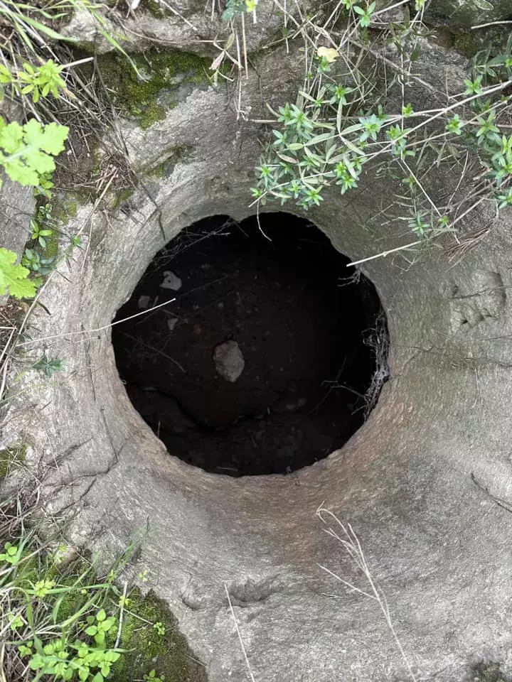
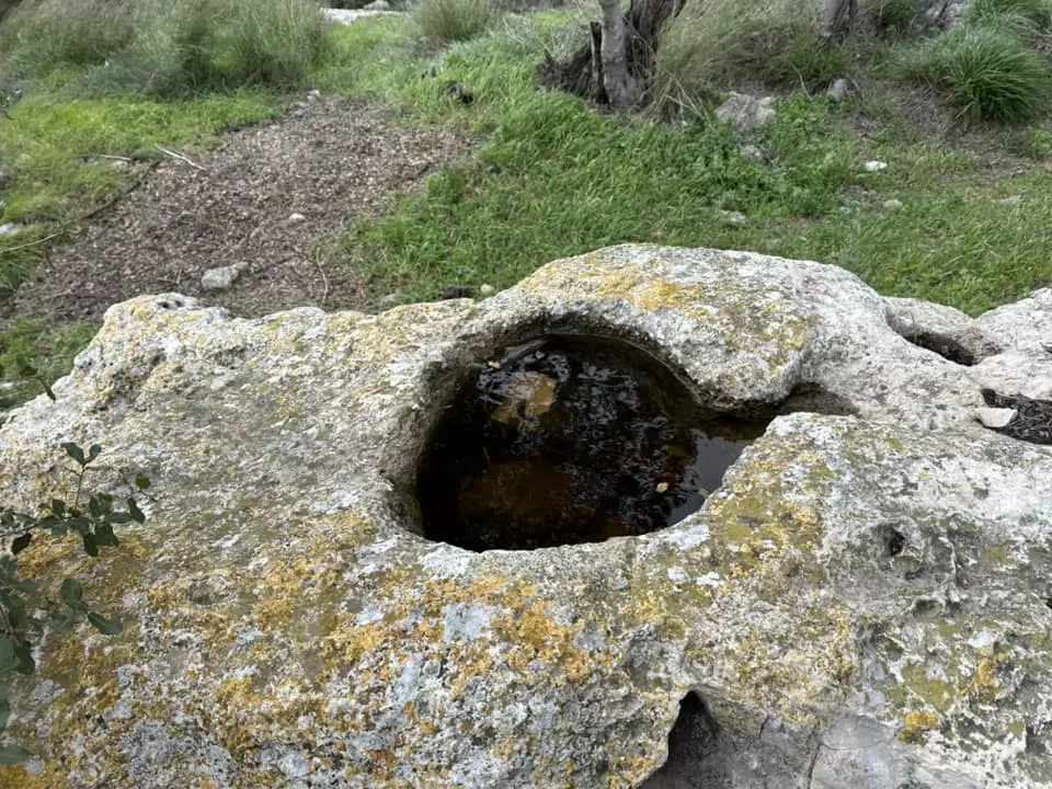
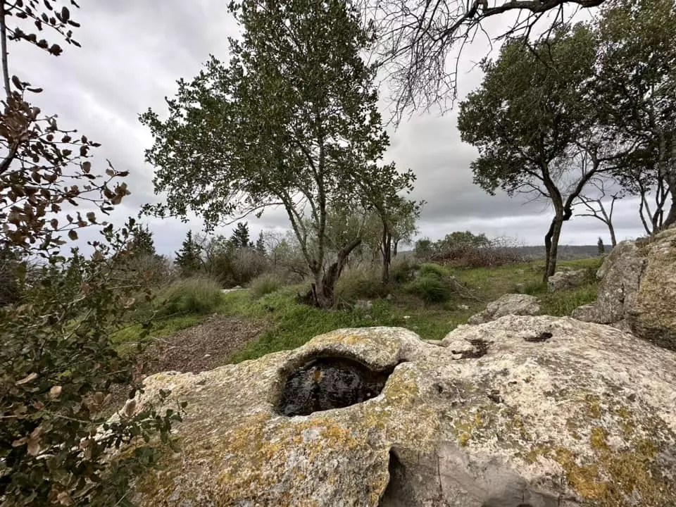
| Water Supply | Dayr al-Hawa contained two wells located southeast and west of its center. | ||||||||||||||
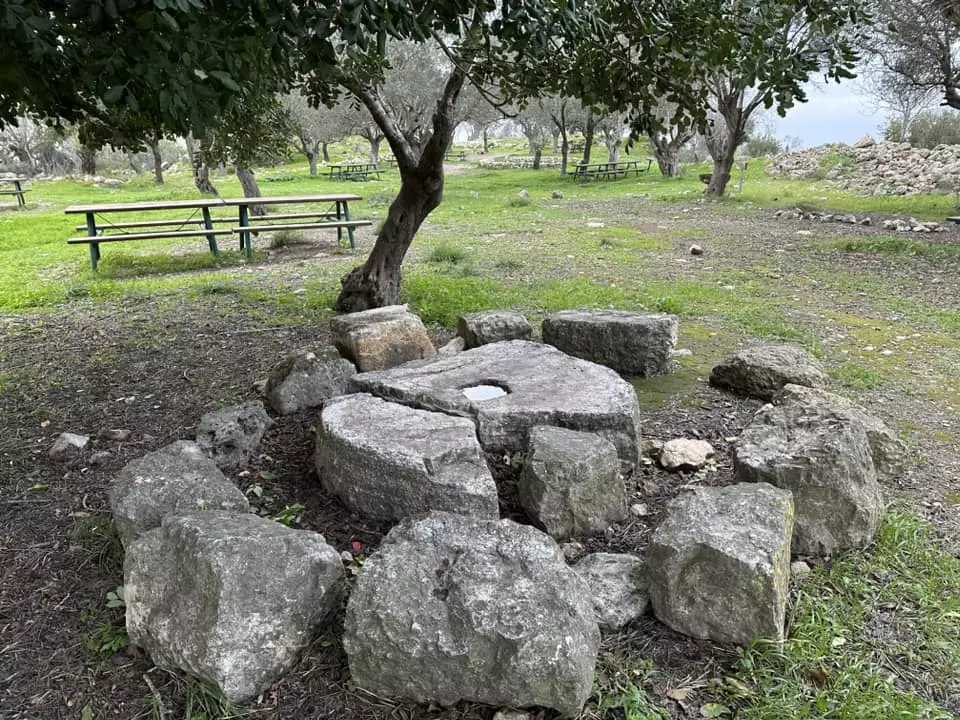
| Archeological Sites | Deir al-Hawa was built on an unknown archaeological site. | ||||||||||||||
| Exculsive Jewish Colonies Who Usurped Village Lands |
Nes Harim is nearby village lands. | ||||||||||||||
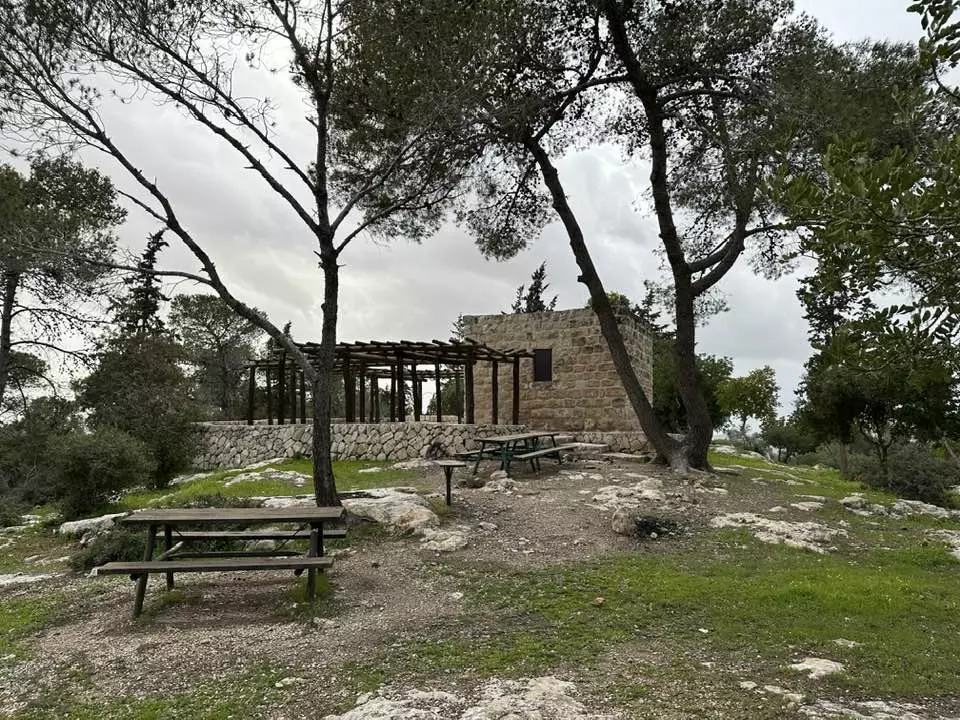
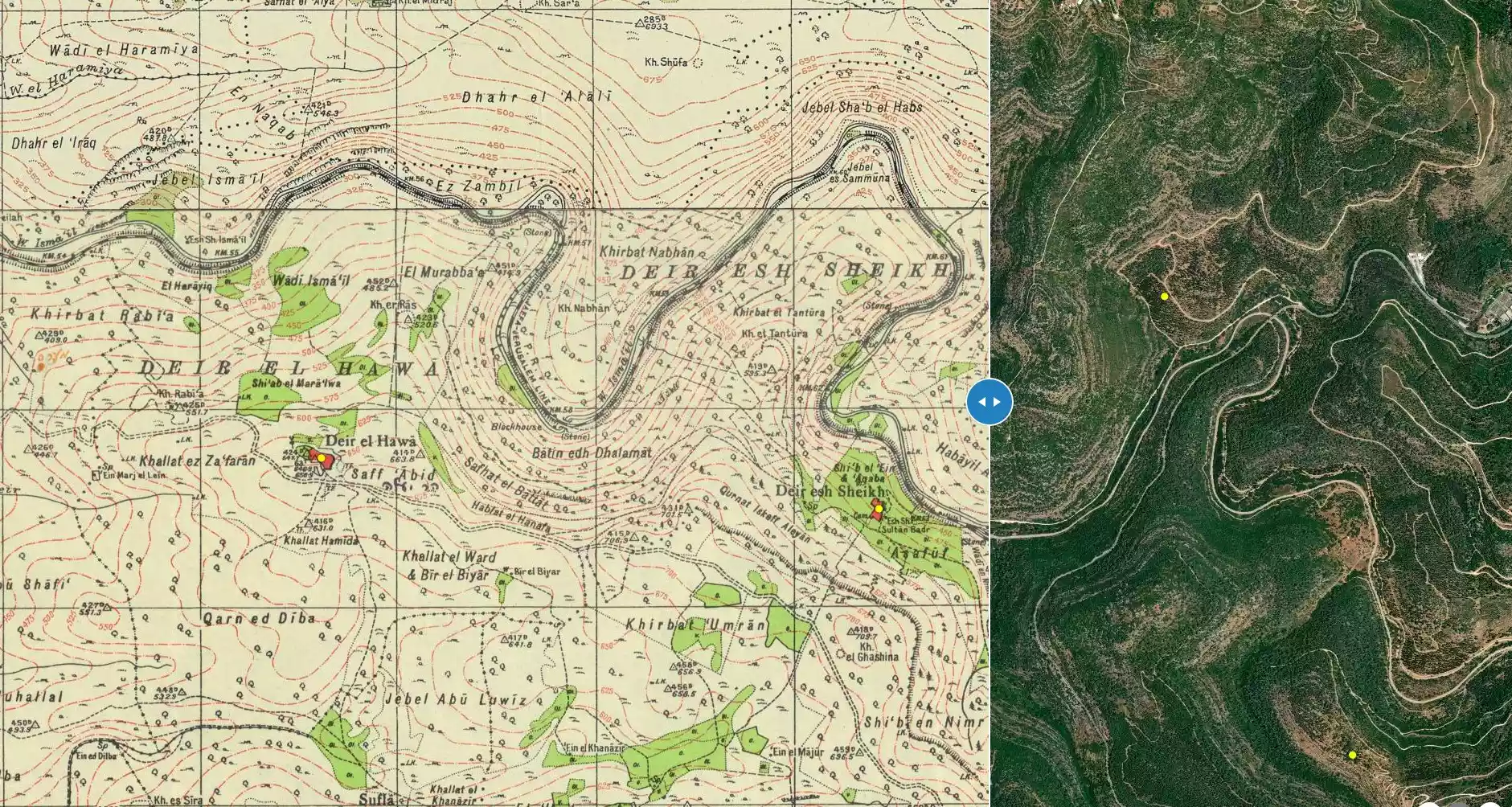
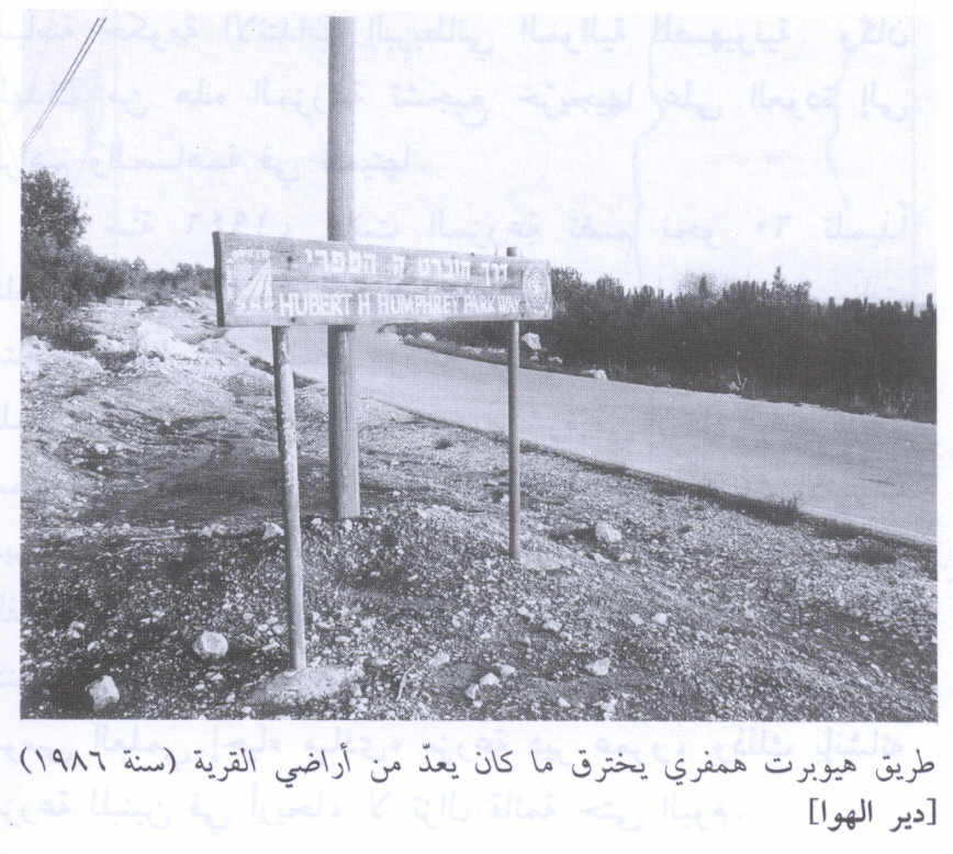
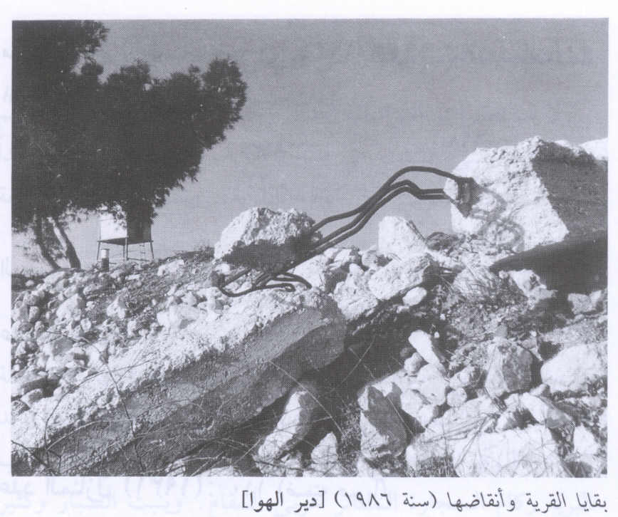
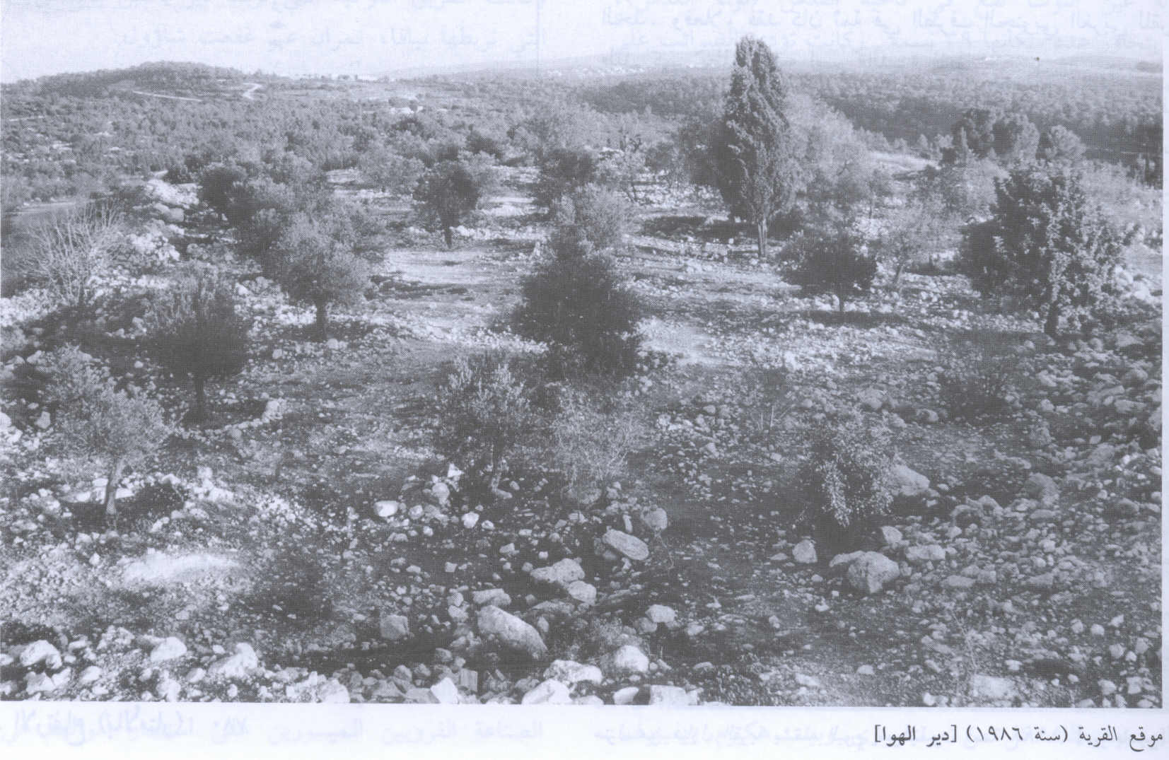
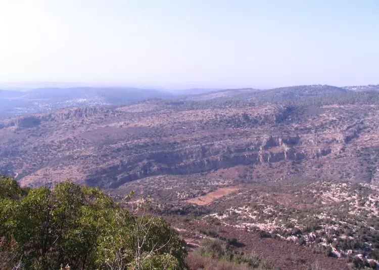
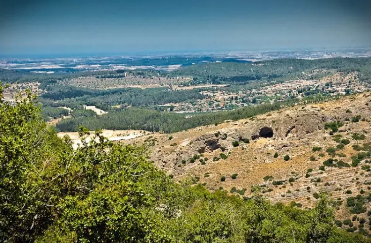
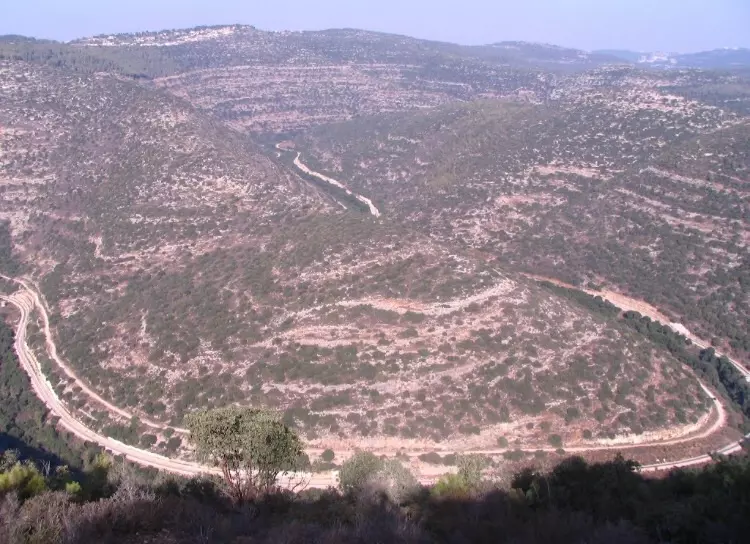
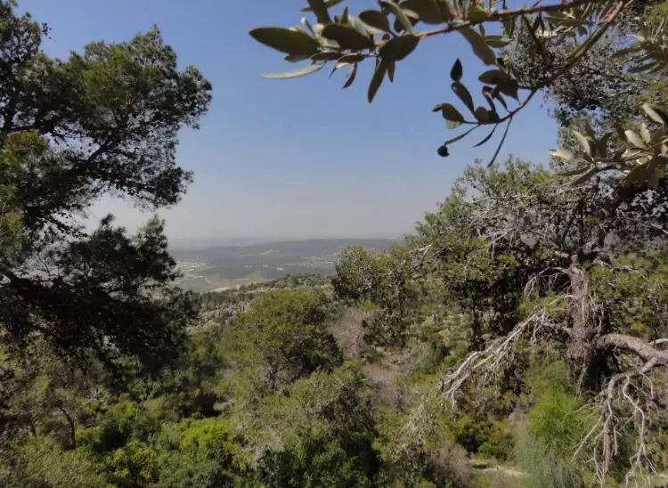
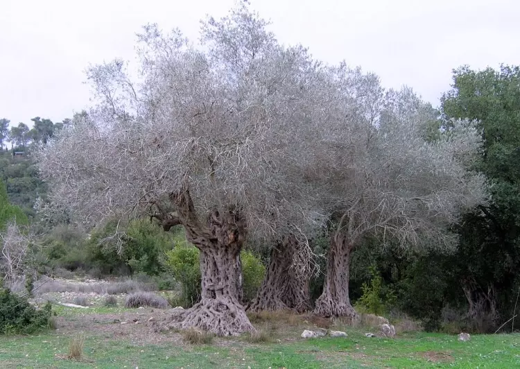
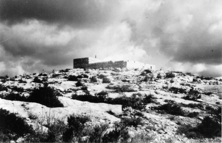
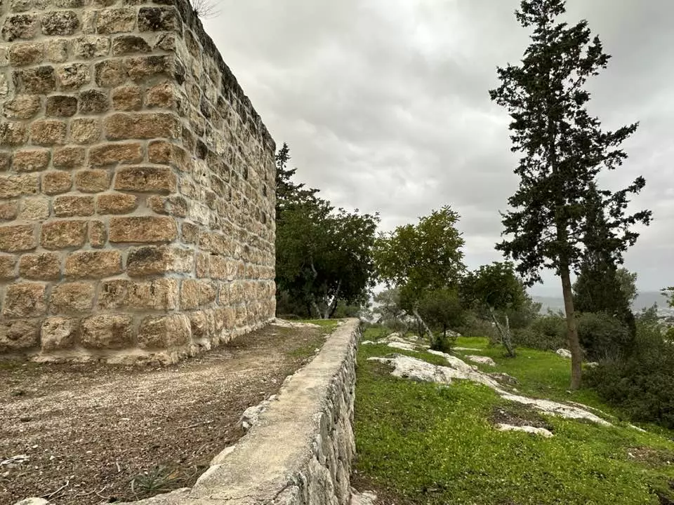
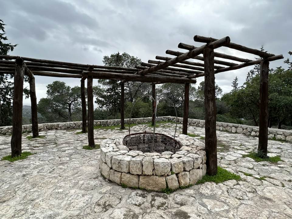
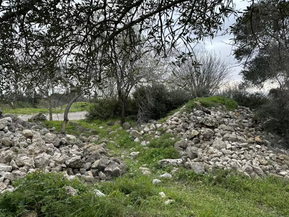
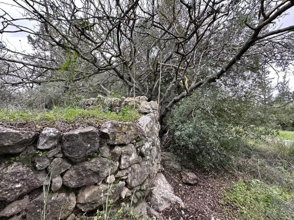
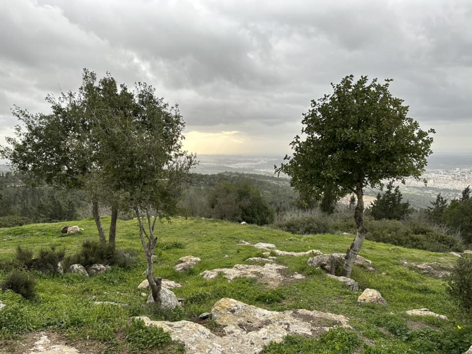
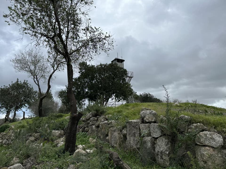
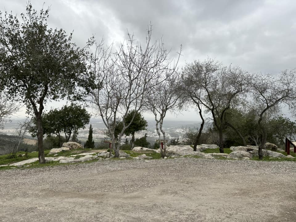
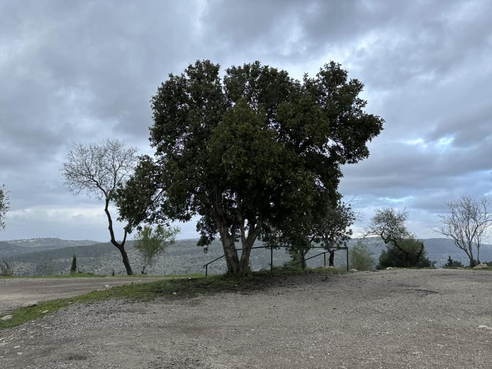
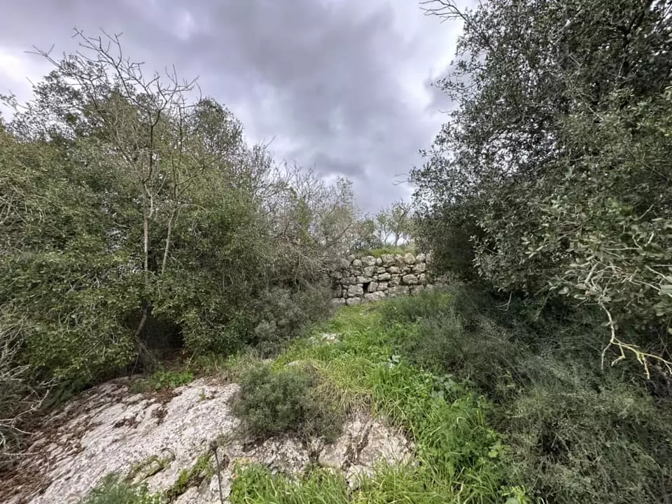
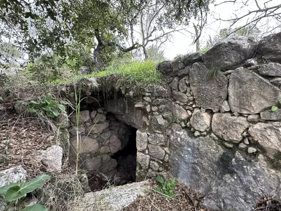
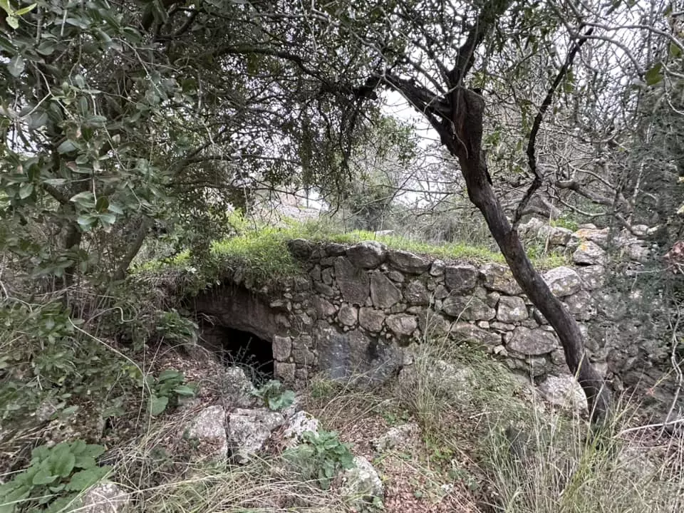
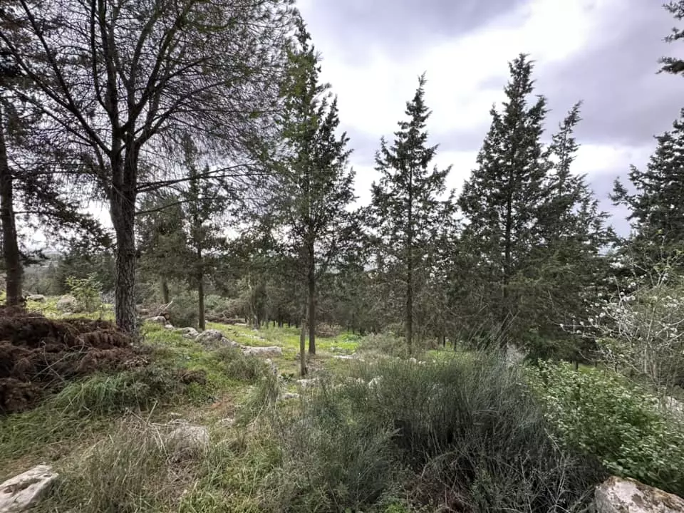
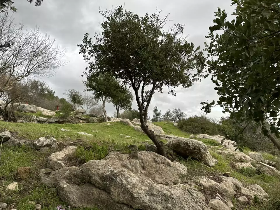
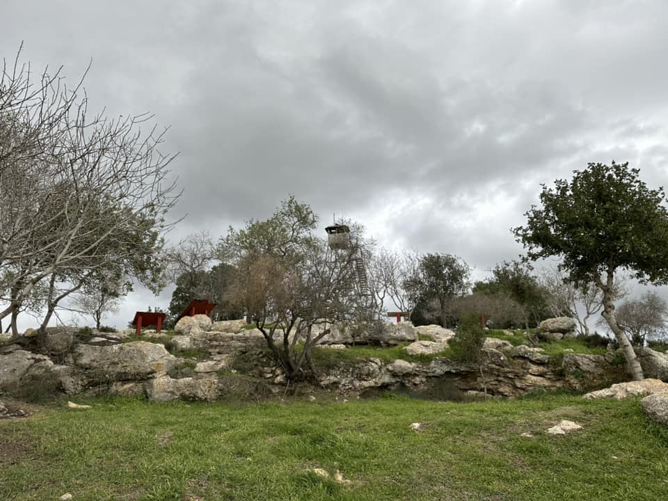
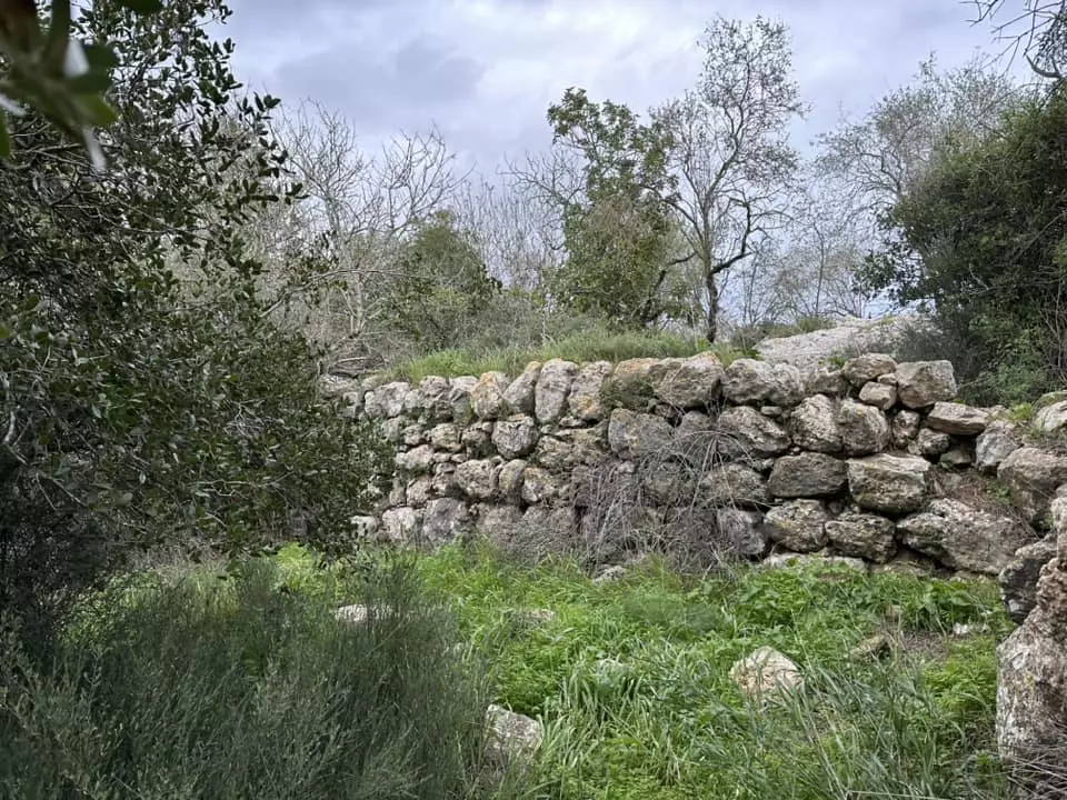
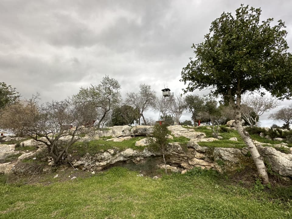
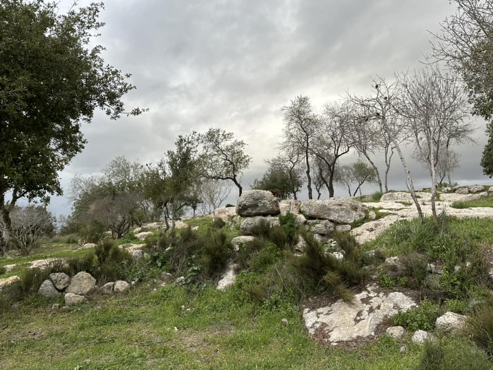
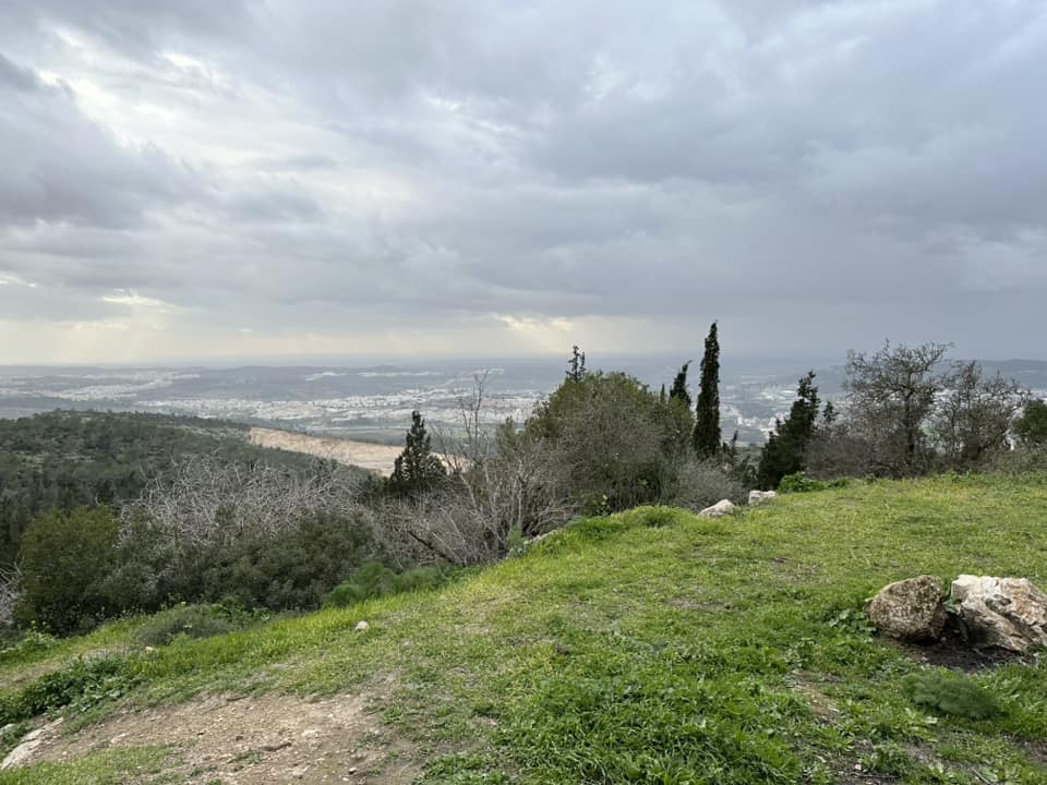
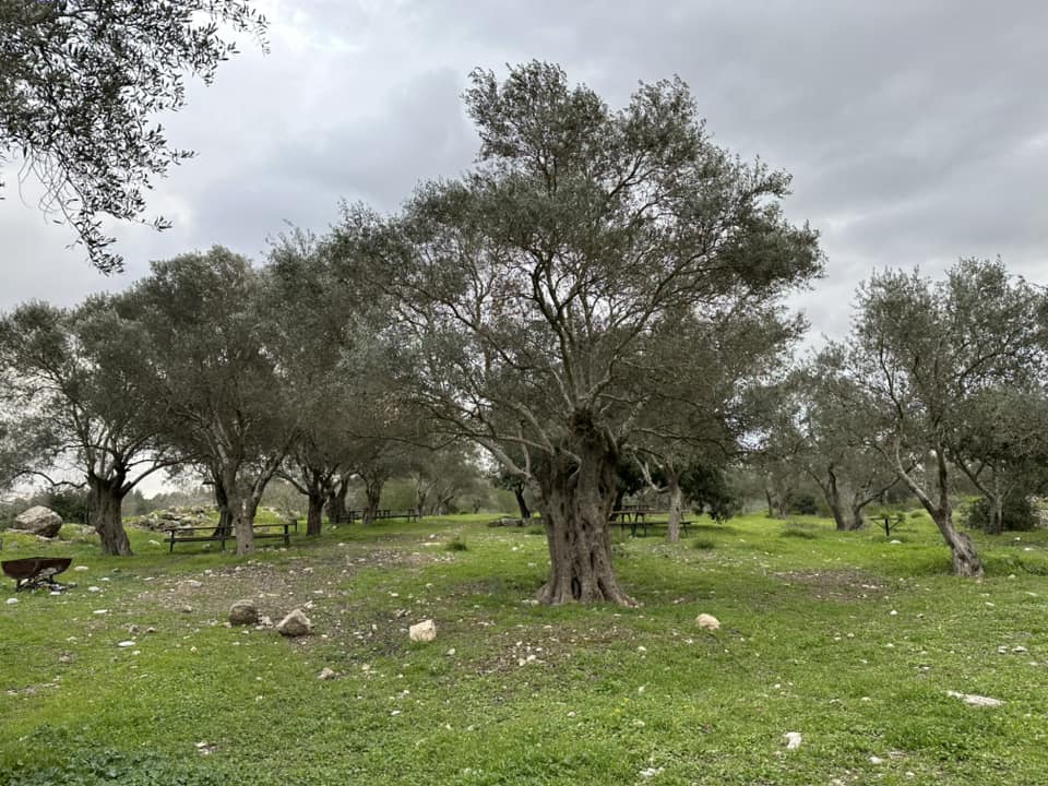
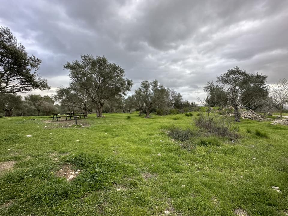
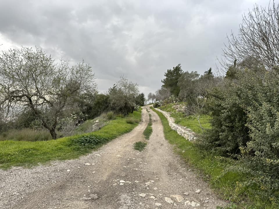
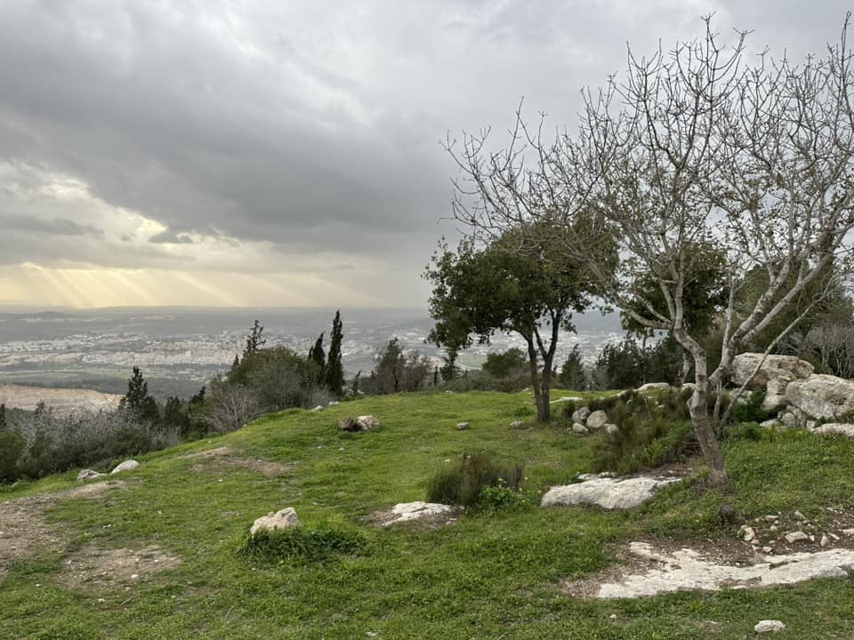
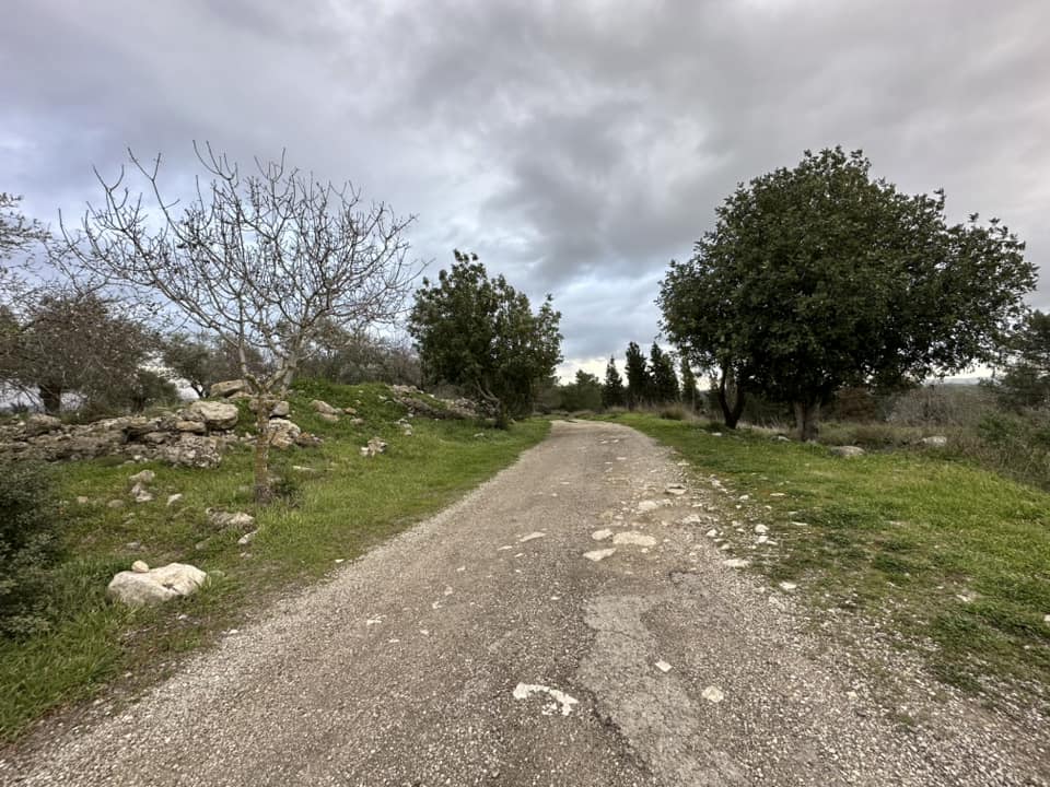
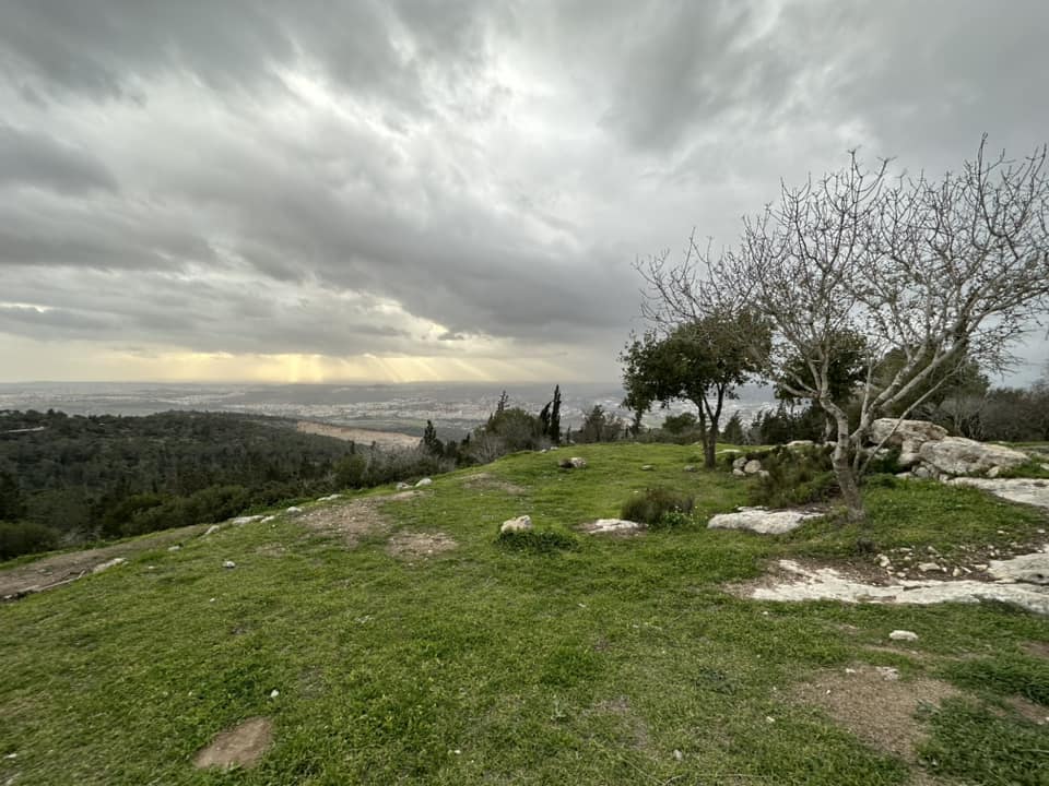
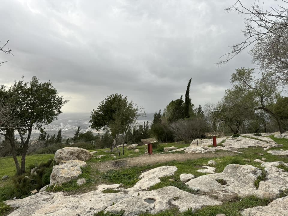
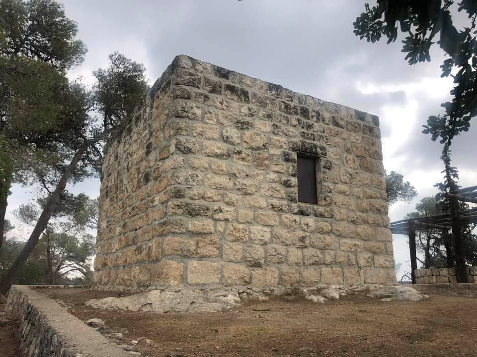
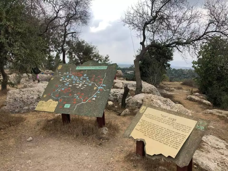
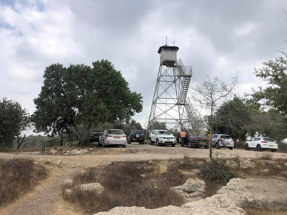
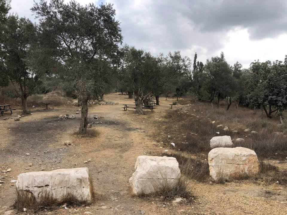
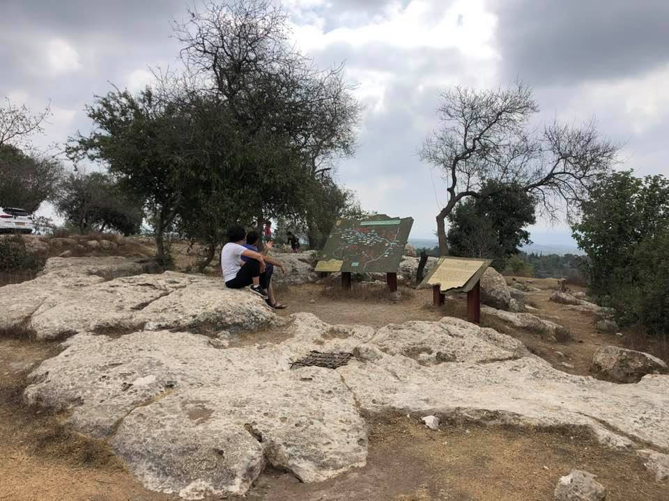
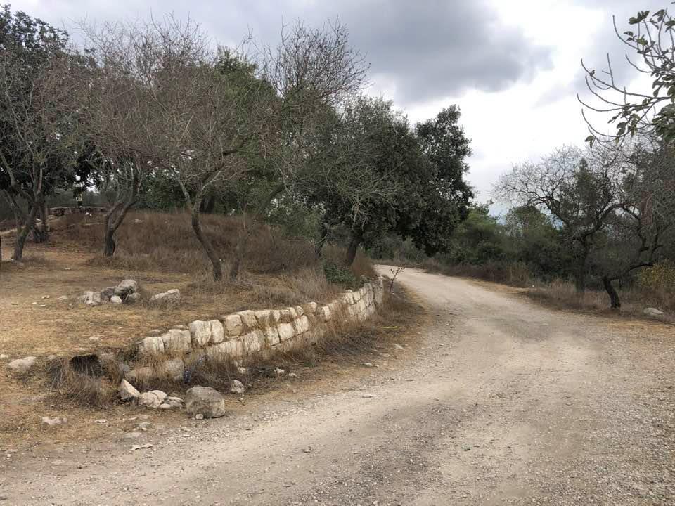
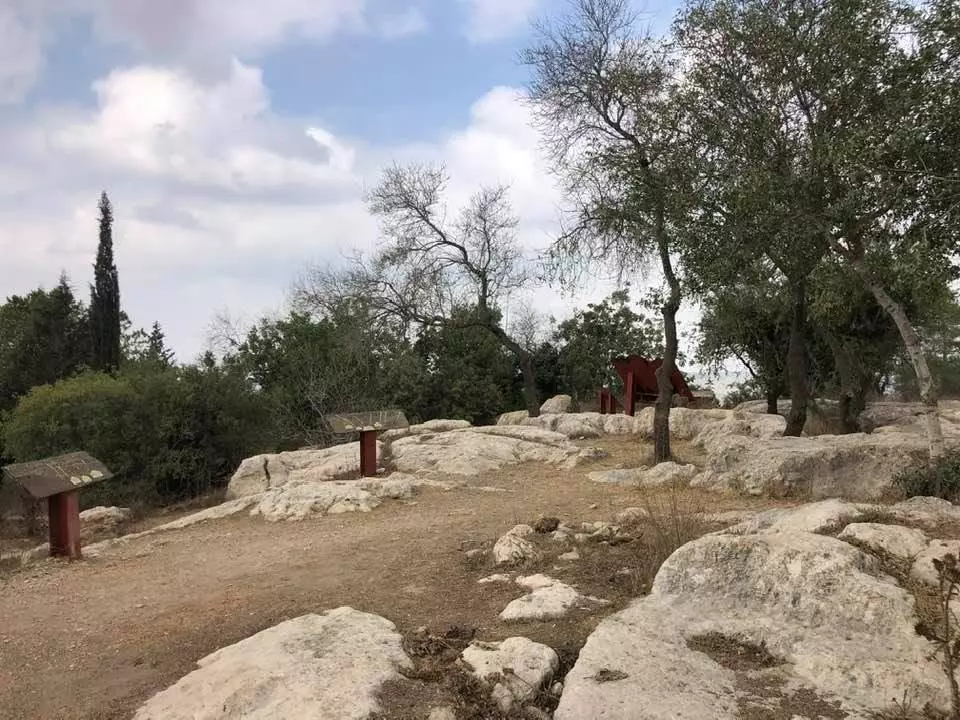
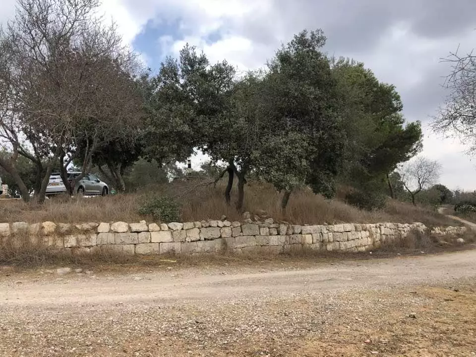
Village Before NakbaThe village stood on a high mountain top, overlooking wide expanses of land to the west, north, and south. A secondary road linked it to another secondary road that led to Bethlehem and that ran several km southeast of the village, and dirt paths linked it to nearby villages. In the late nineteenth century, Dayr al-Hawa stood on a knoll rising from a high ridge and overlooked a deep valley to the north. It consisted of a few tall houses at this time, and was listed as a hamlet in the Palestine Index Gazetteer. The village had a rectangular layout, with new construction extending in a northwest−southeast direction, in conformity with the topography of the land. Its houses were built of mud and stone and were crowded together, separated only by narrow alleys.The villagers, all of whom were Muslim, worshipped at a mosque in the western part of the village and maintained a shrine for Shaykh Sulayman, a local teacher. Two wells, southeast and west of the village, provided potable water. Most of its agricultural lands were mountainous, except for the valley floors where grain was planted. Fruit trees, which yielded apples, olives, figs, and almonds, were planted on the slopes. All of these crops were rainfed. In 1944/45 a total of 1,565 dunums was allocated to cereals; 58 dunums were irrigated or used for orchards. Dayr al-Hawa was built on an archaeological site. Some of the building stones and columns from the site had been used to construct the village houses. Village Occupation and Ethnic CleaningDayr al-Hawa was one of the villages to be captured at the beginning of Operation Ha-Har (see 'Allar, Jerusalem sub-disctrict) toward the end of the second truce of the war. It was occupied on the night of 18−19 October 1948 (or perhaps on the following night) by the Fourth Battalion of the Har'el Brigade. After wresting Dayr Aban from Egyptian forces, the Israeli units turned their attention to Dayr al-Hawa which, although only 2 km from Dayr Aban, was 300 m higher. The History of the War of Independence notes that '… the ascent to the village was difficult enough by itself; had the enemy [Egyptian forces] the ability to hold out he could certainly have caused us many difficulties. But here too the troops withdrew as soon as the place was shelled because they lost confidence in their ability to hold out and because the fear of our army was in their hearts.' No mention is made of the fate of the civilian population, but Israeli historian Benny Morris states that the commander of the operation, Yigal Allon, probably made it clear to his officers that no civilian communities should remain in the area captured during the operation.Zionists Colonies on Village LandsThere are no Israeli settlements on village land. The settlement of Nes Harim (155128), founded in 1950, is close by, northeast of the village site.Village TodayThe stone rubble of houses is mixed with the ruined walls of terraces. Parts of the site have been levelled and cleared and the debris has been gathered to form a large pile at one end of the site (see photo). In the north, south, and west, terraces are covered with groves of carob and olive trees. Cactuses grow on the southern edge of the site, and ruined walls lie on the western side of the village. Large slabs of reinforced concrete can still be seen near the watchtower that was erected on the cleared area (see photo). The "Two Hundred Years" park, commemorating the U.S. bicentennial, was established by the Jewish National Fund on the lands of Dayr al-Hawa and a few neighboring villages. Fir trees have been recently planted near the park. The Hubert Humphrey Parkway passes through the park on the lands of Dayr al-Hawa (see photo).SourceDr. Walid al-Khalidi, 1992: All That Remains. |
|||||||||||||||
| Related Maps | Town Lands' Demarcation Maps خرائط للقضاء توضح حدود القرى والاودية Town's map on MapQuest View from satellite Help us map this town at WikiMapia |
||||||||||||||
| Related Links | Wikipedia's Page Facebook Page Google Search Google For Images Google For Videos |
||||||||||||||
| More Information | في كتاب كي لا ننسى في كتاب بلادنا فلسطين المزيد من موقع هوية |
||||||||||||||
- A parkway which cuts through village lands, 1986
Scanned from "All That Remains" by Dr. Walid Khalidi - The destroyed village remains & rubble, 1986
Scanned from "All That Remains" by Dr. Walid Khalidi - The village site, 1986
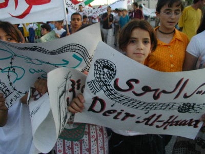
Scanned from "All That Remains" by Dr. Walid Khalidi - I am an eight years old girl from Dayr al-Hawa. It's time for me & my family to go back home NOW
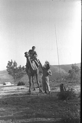
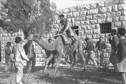
Posted by BADIL Organization 1 - Israeli Soldiers Enjoying The New Loot, A poor Camel, Oct. 1948
Posted by Prince, Peaceful Israeli - Israeli Soldiers Enjoying The New Loot, A poor Camel #2, Oct. 1948
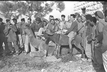
Posted by Prince, Peaceful Israeli - Israeli Soldiers Enjoying The New Loot, A poor Camel #3, Oct. 1948
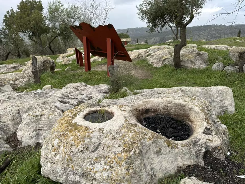
Posted by Prince, Peaceful Israeli - Tabun Is Ready To Be Used For Cooking The Best Bread Coming Out Of Palestine, Right Here In Dayr al-Hawa, Enjoy!, Oct. 1948
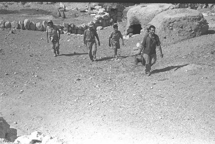
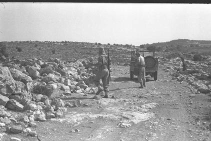
Posted by Prince, Peaceful Israeli - A Dirt Road Around Dayr al-Hawa, Oct. 1948
Posted by Prince, Peaceful Israeli - دير الهوا
Posted by abu raya - من نواحي القريه
Posted by abu raya - دير الهوا
Posted by abu raya - دير الهوا
Posted by abu raya - دير الهوا

Posted by abu raya - جنوب القريه
Posted by abu raya - دير الهوا
Posted by abu raya - زيتون دير الهوا
Posted by abu raya - دير الهوا

Posted by abu raya - منظر في القرية بوقت النكبة
- صورة بيت من قرية دير الهوا قضاء القدس 1948..

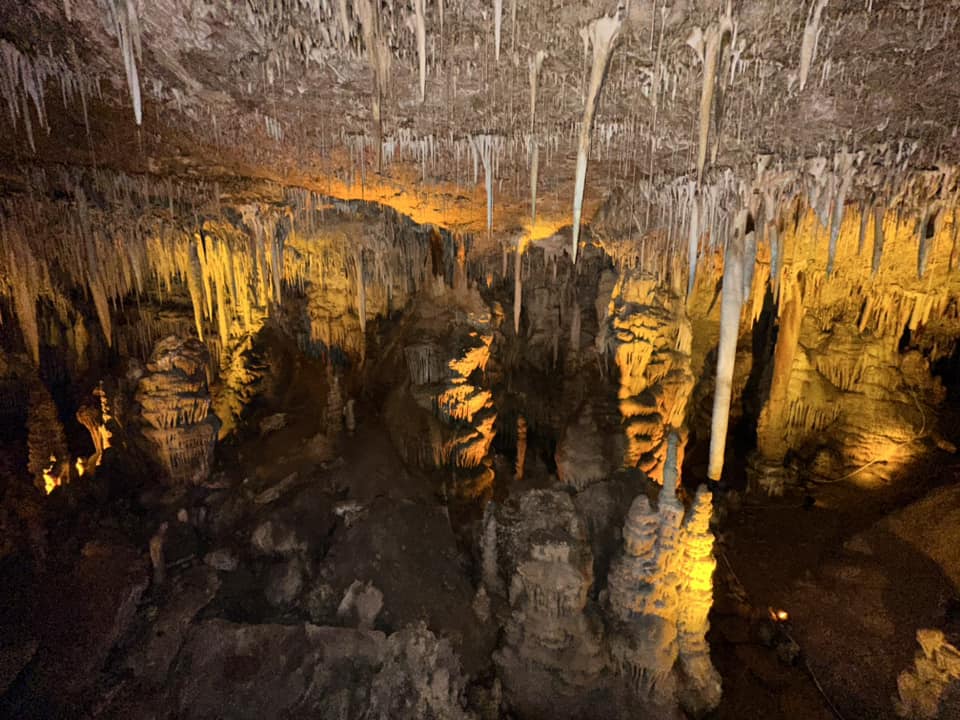
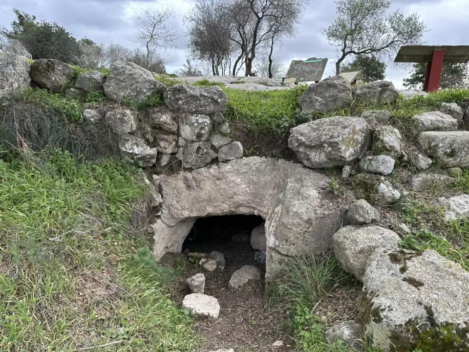
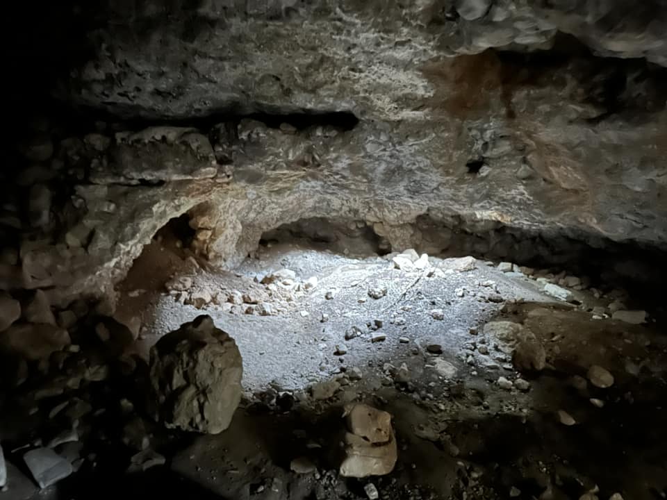
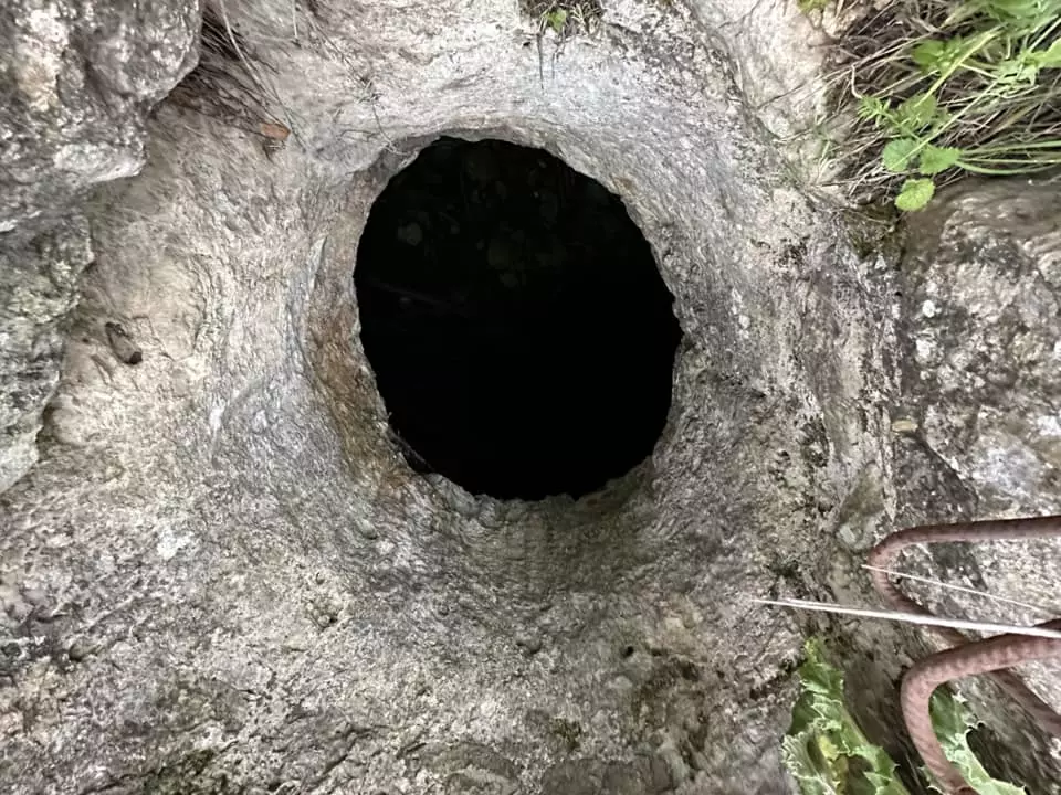
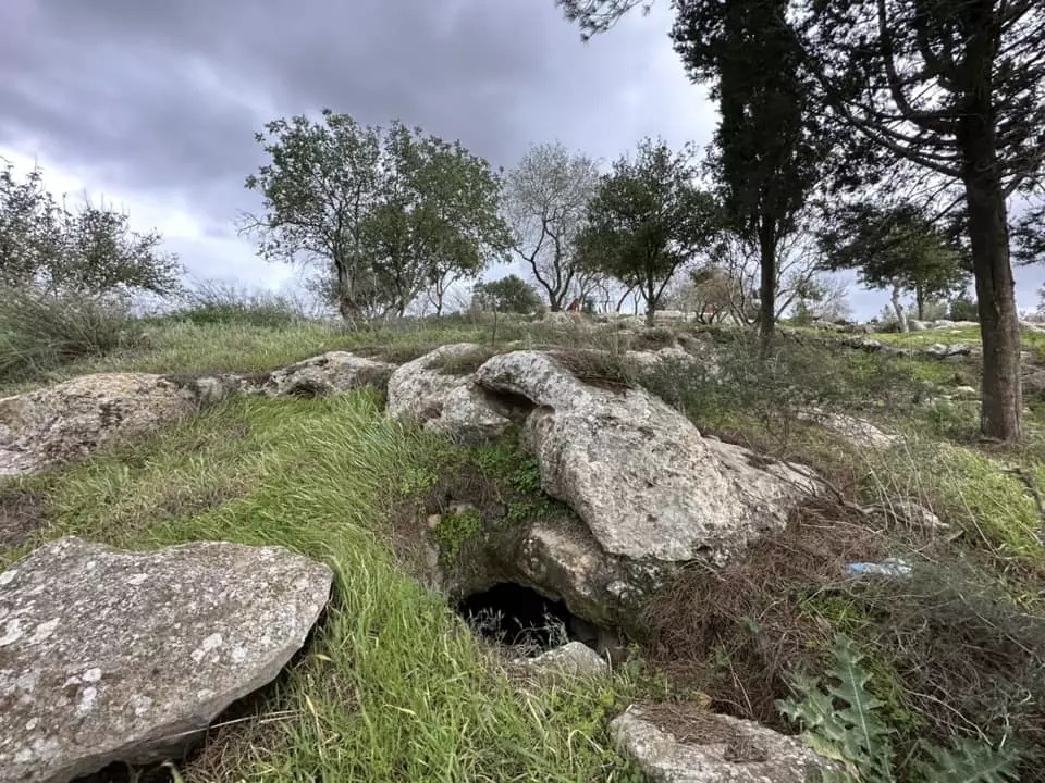
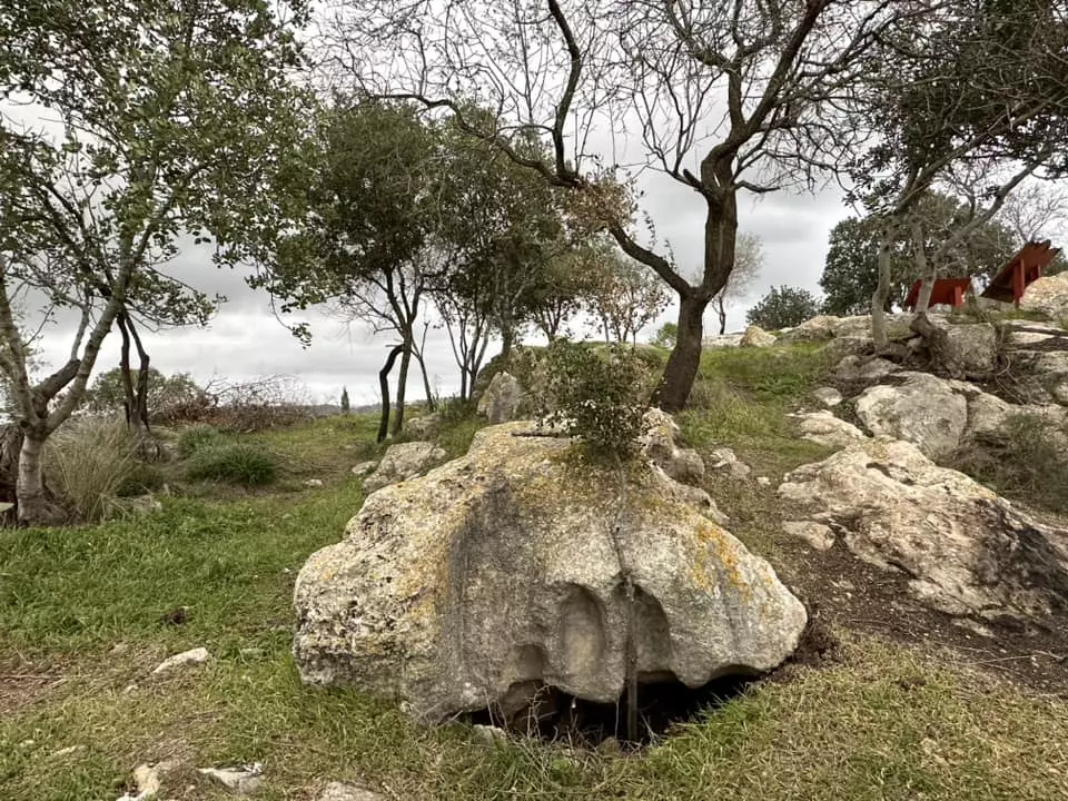
- مغارة الشموع او المغارة الجيرية في القدس وقرب قرية دير الهوى قضاء القدس waze מערת הנטיפים -- 2023 -- Iyad Jaber
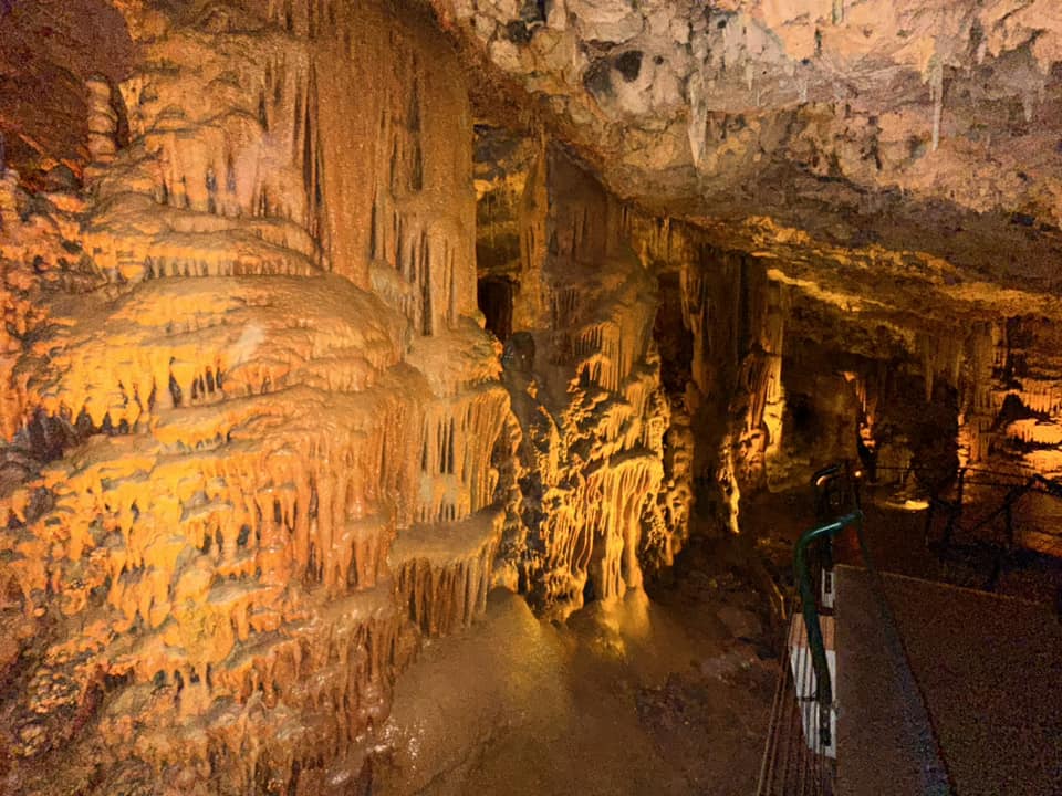
- مغارة الشموع او المغارة الجيرية في القدس وقرب قرية دير الهوى قضاء القدس waze מערת הנטיפים -- 2023 -- Iyad Jaber #2
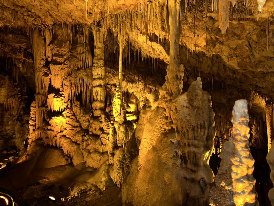
- مغارة الشموع او المغارة الجيرية في القدس وقرب قرية دير الهوى قضاء القدس waze מערת הנטיפים -- 2023 -- Iyad Jaber #3
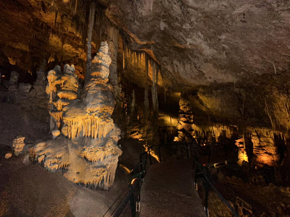
- مغارة الشموع او المغارة الجيرية في القدس وقرب قرية دير الهوى قضاء القدس waze מערת הנטיפים -- 2023 -- Iyad Jaber #4
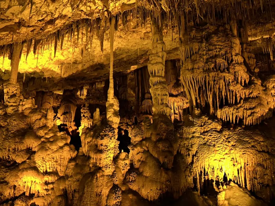
- مغارة الشموع او المغارة الجيرية في القدس وقرب قرية دير الهوى قضاء القدس waze מערת הנטיפים -- 2023 -- Iyad Jaber #5

- مغارة الشموع او المغارة الجيرية في القدس وقرب قرية دير الهوى قضاء القدس waze מערת הנטיפים -- 2023 -- Iyad Jaber #6

- مغارة الشموع او المغارة الجيرية في القدس وقرب قرية دير الهوى قضاء القدس waze מערת הנטיפים -- 2023 -- Iyad Jaber #7
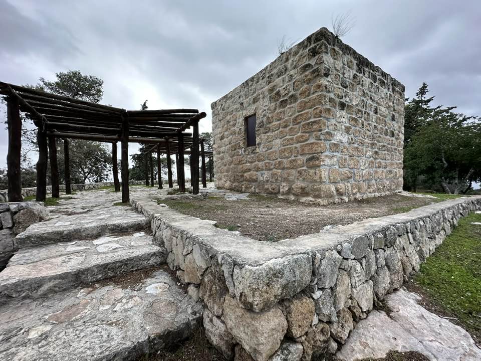
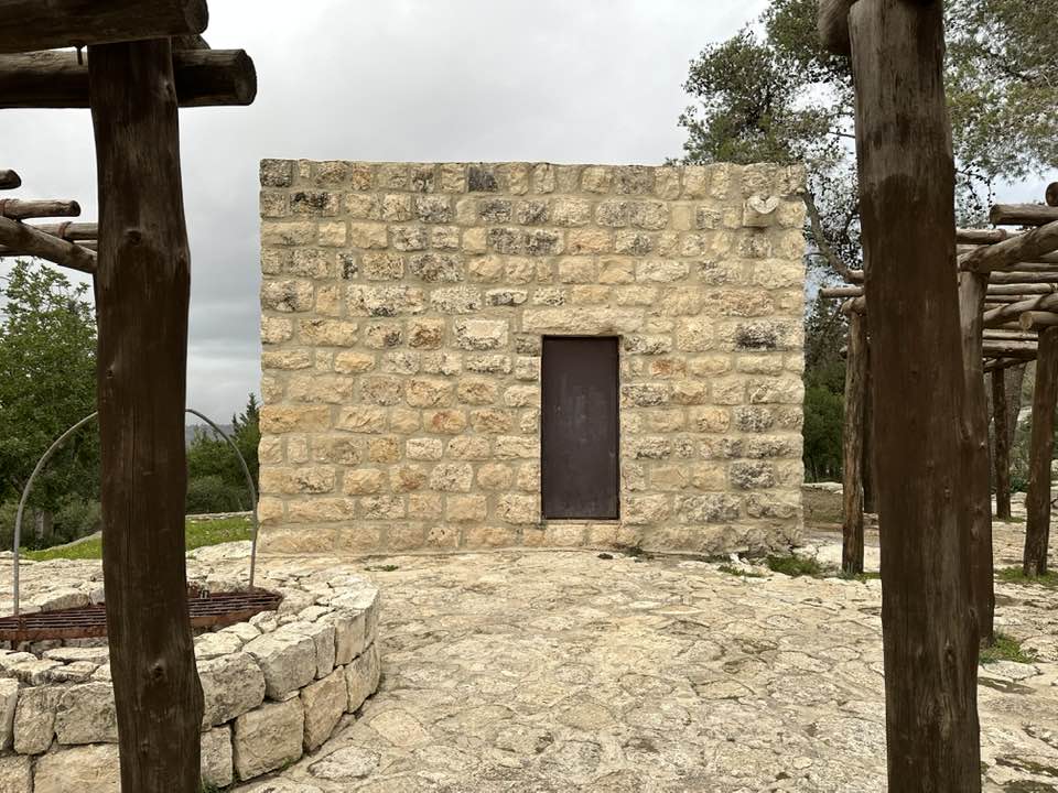
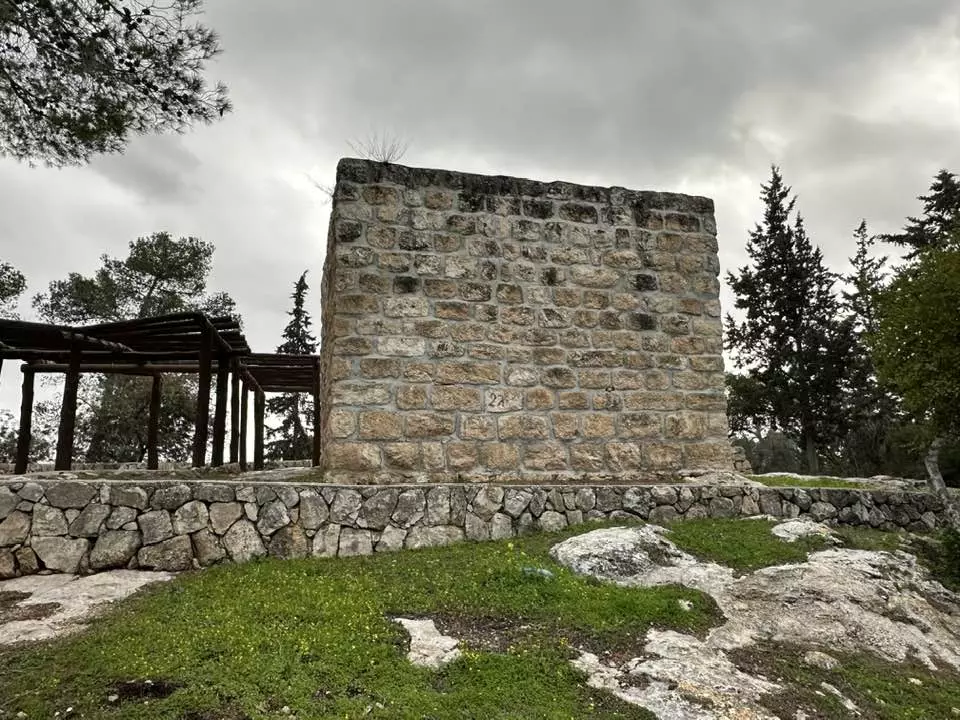
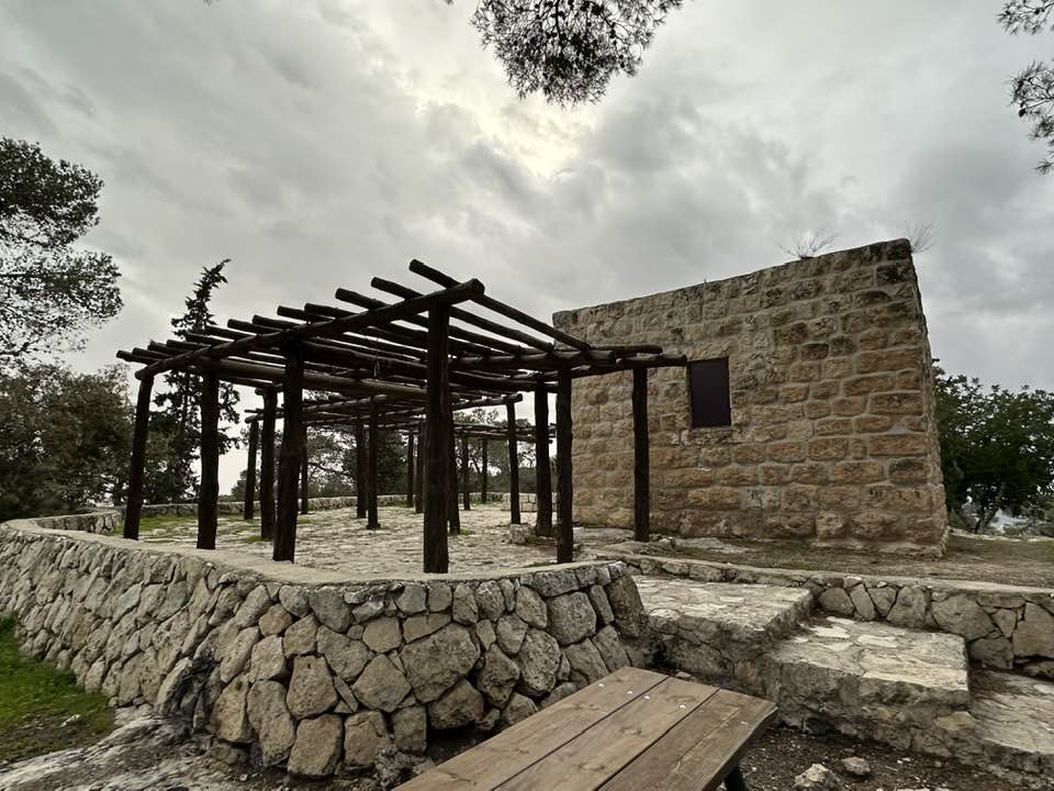
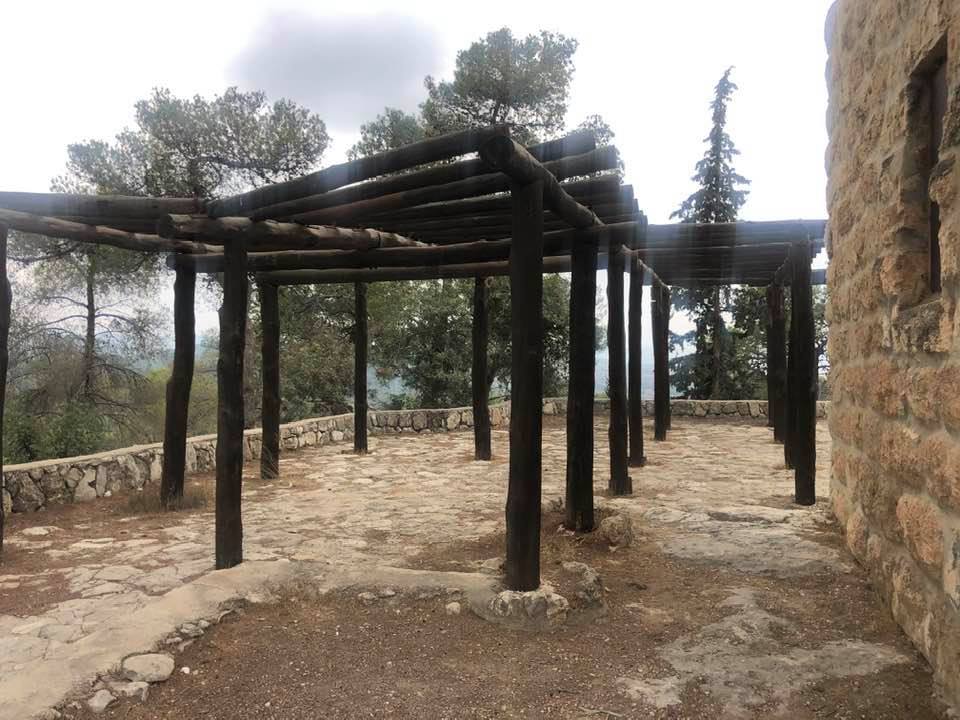
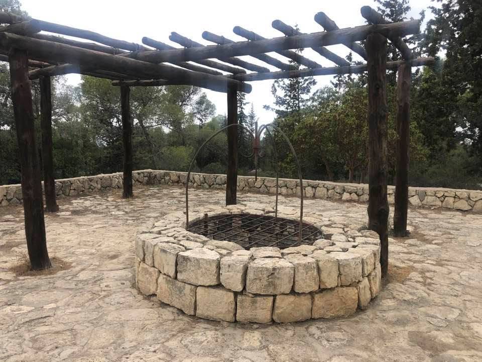
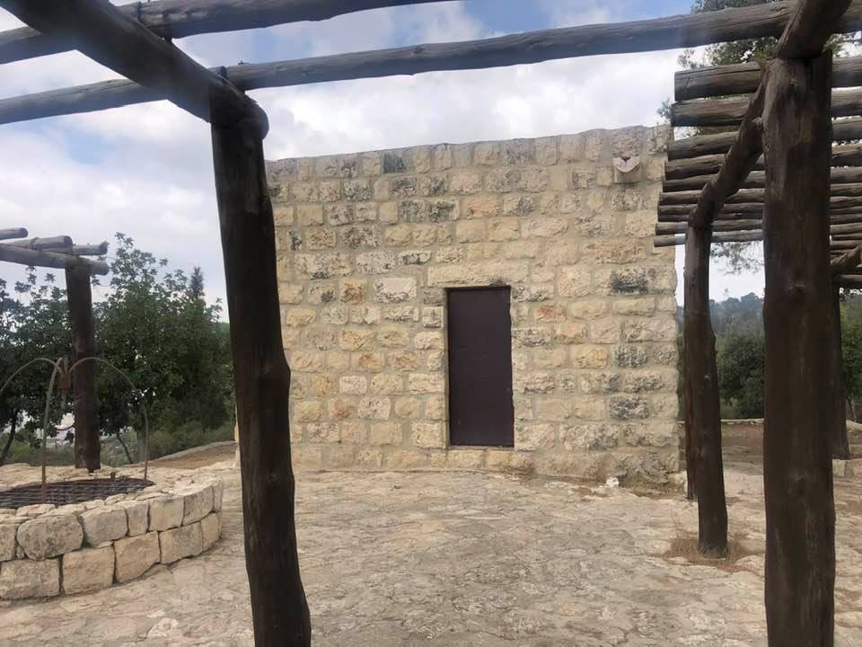
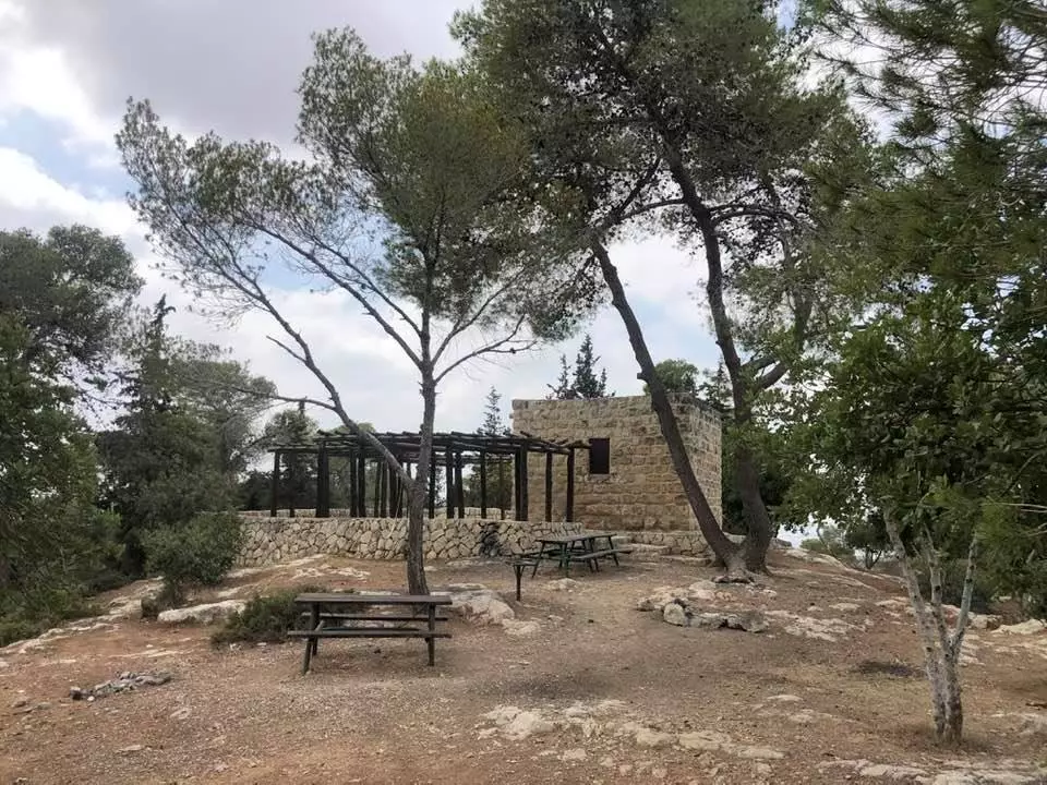
- That is how the "civilized" erased and replaced us: Deir al-Hawa was completely obliterated except for a few remaining structures, as you see -- دير الهوا باتت أثر بعد عين. من هنا مر الهمجّ
- That is how the "civilized" erased and replaced us: Deir al-Hawa was completely obliterated except for a few remaining structures, as you see -- دير الهوا باتت أثر بعد عين. من هنا مر الهمجّ
#2
- That is how the "civilized" erased and replaced us: Deir al-Hawa was completely obliterated except for a few remaining structures, as you see -- دير الهوا باتت أثر بعد عين. من هنا مر الهمجّ
#3
- That is how the "civilized" erased and replaced us: Deir al-Hawa was completely obliterated except for a few remaining structures, as you see -- دير الهوا باتت أثر بعد عين. من هنا مر الهمجّ
#4
- That is how the "civilized" erased and replaced us: Deir al-Hawa was completely obliterated except for a few remaining structures, as you see -- دير الهوا باتت أثر بعد عين. من هنا مر الهمجّ
#5
- That is how the "civilized" erased and replaced us: Deir al-Hawa was completely obliterated except for a few remaining structures, as you see -- دير الهوا باتت أثر بعد عين. من هنا مر الهمجّ
#6
- That is how the "civilized" erased and replaced us: Deir al-Hawa was completely obliterated except for a few remaining structures, as you see -- دير الهوا باتت أثر بعد عين. من هنا مر الهمجّ
#7
- That is how the "civilized" erased and replaced us: Deir al-Hawa was completely obliterated except for a few remaining structures, as you see -- دير الهوا باتت أثر بعد عين. من هنا مر الهمجّ
- That is how the "civilized" erased and replaced us: Deir al-Hawa was completely obliterated except for a few remaining structures, as you see -- دير الهوا باتت أثر بعد عين. من هنا مر الهمجّ #2
- That is how the "civilized" erased and replaced us: Deir al-Hawa was completely obliterated except for a few remaining structures, as you see -- دير الهوا باتت أثر بعد عين. من هنا مر الهمجّ #3
- That is how the "civilized" erased and replaced us: Deir al-Hawa was completely obliterated except for a few remaining structures, as you see -- دير الهوا باتت أثر بعد عين. من هنا مر الهمجّ #4
- That is how the "civilized" erased and replaced us: Deir al-Hawa was completely obliterated except for a few remaining structures, as you see -- دير الهوا باتت أثر بعد عين. من هنا مر الهمجّ #5
- That is how the "civilized" erased and replaced us: Deir al-Hawa was completely obliterated except for a few remaining structures, as you see -- دير الهوا باتت أثر بعد عين. من هنا مر الهمجّ #6
- That is how the "civilized" erased and replaced us: Deir al-Hawa was completely obliterated except for a few remaining structures, as you see -- دير الهوا باتت أثر بعد عين. من هنا مر الهمجّ #7
- That is how the "civilized" erased and replaced us: Deir al-Hawa was completely obliterated except for a few remaining structures, as you see -- دير الهوا باتت أثر بعد عين. من هنا مر الهمجّ #8
- That is how the "civilized" erased and replaced us: Deir al-Hawa was completely obliterated except for a few remaining structures, as you see -- دير الهوا باتت أثر بعد عين. من هنا مر الهمجّ #9
- That is how the "civilized" erased and replaced us: Deir al-Hawa was completely obliterated except for a few remaining structures, as you see -- دير الهوا باتت أثر بعد عين. من هنا مر الهمجّ #10
- That is how the "civilized" erased and replaced us: Deir al-Hawa was completely obliterated except for a few remaining structures, as you see -- دير الهوا باتت أثر بعد عين. من هنا مر الهمجّ #11
- That is how the "civilized" erased and replaced us: Deir al-Hawa was completely obliterated except for a few remaining structures, as you see -- دير الهوا باتت أثر بعد عين. من هنا مر الهمجّ #12
- That is how the "civilized" erased and replaced us: Deir al-Hawa was completely obliterated except for a few remaining structures, as you see -- دير الهوا باتت أثر بعد عين. من هنا مر الهمجّ #13
- That is how the "civilized" erased and replaced us: Deir al-Hawa was completely obliterated except for a few remaining structures, as you see -- دير الهوا باتت أثر بعد عين. من هنا مر الهمجّ #14
- That is how the "civilized" erased and replaced us: Deir al-Hawa was completely obliterated except for a few remaining structures, as you see -- دير الهوا باتت أثر بعد عين. من هنا مر الهمجّ #15
- That is how the "civilized" erased and replaced us: Deir al-Hawa was completely obliterated except for a few remaining structures, as you see -- دير الهوا باتت أثر بعد عين. من هنا مر الهمجّ #16
- That is how the "civilized" erased and replaced us: Deir al-Hawa was completely obliterated except for a few remaining structures, as you see -- دير الهوا باتت أثر بعد عين. من هنا مر الهمجّ #17
- That is how the "civilized" erased and replaced us: Deir al-Hawa was completely obliterated except for a few remaining structures, as you see -- دير الهوا باتت أثر بعد عين. من هنا مر الهمجّ #18
- That is how the "civilized" erased and replaced us: Deir al-Hawa was completely obliterated except for a few remaining structures, as you see -- دير الهوا باتت أثر بعد عين. من هنا مر الهمجّ #19
- That is how the "civilized" erased and replaced us: Deir al-Hawa was completely obliterated except for a few remaining structures, as you see -- دير الهوا باتت أثر بعد عين. من هنا مر الهمجّ #20
- That is how the "civilized" erased and replaced us: Deir al-Hawa was completely obliterated except for a few remaining structures, as you see -- دير الهوا باتت أثر بعد عين. من هنا مر الهمجّ #21
- That is how the "civilized" erased and replaced us: Deir al-Hawa was completely obliterated except for a few remaining structures, as you see -- دير الهوا باتت أثر بعد عين. من هنا مر الهمجّ #22
- That is how the "civilized" erased and replaced us: Deir al-Hawa was completely obliterated except for a few remaining structures, as you see -- دير الهوا باتت أثر بعد عين. من هنا مر الهمجّ #23
- That is how the "civilized" erased and replaced us: Deir al-Hawa was completely obliterated except for a few remaining structures, as you see -- دير الهوا باتت أثر بعد عين. من هنا مر الهمجّ #24
- That is how the "civilized" erased and replaced us: Deir al-Hawa was completely obliterated except for a few remaining structures, as you see -- دير الهوا باتت أثر بعد عين. من هنا مر الهمجّ #25
- That is how the "civilized" erased and replaced us: Deir al-Hawa was completely obliterated except for a few remaining structures, as you see -- دير الهوا باتت أثر بعد عين. من هنا مر الهمجّ #26
- That is how the "civilized" erased and replaced us: Deir al-Hawa was completely obliterated except for a few remaining structures, as you see -- دير الهوا باتت أثر بعد عين. من هنا مر الهمجّ #27
- That is how the "civilized" erased and replaced us: Deir al-Hawa was completely obliterated except for a few remaining structures, as you see -- دير الهوا باتت أثر بعد عين. من هنا مر الهمجّ #28
- That is how the "civilized" erased and replaced us: Deir al-Hawa was completely obliterated except for a few remaining structures, as you see -- دير الهوا باتت أثر بعد عين. من هنا مر الهمجّ #29

- That is how the "civilized" erased and replaced us: Deir al-Hawa was completely obliterated except for a few remaining structures, as you see -- دير الهوا باتت أثر بعد عين. من هنا مر الهمجّ #30
- That is how the "civilized" erased and replaced us: Deir al-Hawa was completely obliterated except for a few remaining structures, as you see -- دير الهوا باتت أثر بعد عين. من هنا مر الهمجّ #31
- That is how the "civilized" erased and replaced us: Deir al-Hawa was completely obliterated except for a few remaining structures, as you see -- دير الهوا باتت أثر بعد عين. من هنا مر الهمجّ #32
- That is how the "civilized" erased and replaced us: Deir al-Hawa was completely obliterated except for a few remaining structures, as you see -- دير الهوا باتت أثر بعد عين. من هنا مر الهمجّ #33
- That is how the "civilized" erased and replaced us: Deir al-Hawa was completely obliterated except for a few remaining structures, as you see -- دير الهوا باتت أثر بعد عين. من هنا مر الهمجّ #34
- That is how the "civilized" erased and replaced us: Deir al-Hawa was completely obliterated except for a few remaining structures, as you see -- دير الهوا باتت أثر بعد عين. من هنا مر الهمجّ #35

- That is how the "civilized" erased and replaced us: Deir al-Hawa was completely obliterated except for a few remaining structures, as you see -- دير الهوا باتت أثر بعد عين. من هنا مر الهمجّ
- That is how the "civilized" erased and replaced us: Deir al-Hawa was completely obliterated except for a few remaining structures, as you see -- دير الهوا باتت أثر بعد عين. من هنا مر الهمجّ #2
- That is how the "civilized" erased and replaced us: Deir al-Hawa was completely obliterated except for a few remaining structures, as you see -- دير الهوا باتت أثر بعد عين. من هنا مر الهمجّ #3
- That is how the "civilized" erased and replaced us: Deir al-Hawa was completely obliterated except for a few remaining structures, as you see -- دير الهوا باتت أثر بعد عين. من هنا مر الهمجّ #4
- That is how the "civilized" erased and replaced us: Deir al-Hawa was completely obliterated except for a few remaining structures, as you see -- دير الهوا باتت أثر بعد عين. من هنا مر الهمجّ #5
- That is how the "civilized" erased and replaced us: Deir al-Hawa was completely obliterated except for a few remaining structures, as you see -- دير الهوا باتت أثر بعد عين. من هنا مر الهمجّ #6
- That is how the "civilized" erased and replaced us: Deir al-Hawa was completely obliterated except for a few remaining structures, as you see -- دير الهوا باتت أثر بعد عين. من هنا مر الهمجّ #7
- That is how the "civilized" erased and replaced us: Deir al-Hawa was completely obliterated except for a few remaining structures, as you see -- دير الهوا باتت أثر بعد عين. من هنا مر الهمجّ #8
- That is how the "civilized" erased and replaced us: Deir al-Hawa was completely obliterated except for a few remaining structures, as you see -- دير الهوا باتت أثر بعد عين. من هنا مر الهمجّ #9
- That is how the "civilized" erased and replaced us: Deir al-Hawa was completely obliterated except for a few remaining structures, as you see -- دير الهوا باتت أثر بعد عين. من هنا مر الهمجّ #10
- That is how the "civilized" erased and replaced us: Deir al-Hawa was completely obliterated except for a few remaining structures, as you see -- دير الهوا باتت أثر بعد عين. من هنا مر الهمجّ #11
- That is how the "civilized" erased and replaced us: Deir al-Hawa was completely obliterated except for a few remaining structures, as you see -- دير الهوا باتت أثر بعد عين. من هنا مر الهمجّ #12
- That is how the "civilized" erased and replaced us: Deir al-Hawa was completely obliterated except for a few remaining structures, as you see -- دير الهوا باتت أثر بعد عين. من هنا مر الهمجّ #13
Want to browse more? 80,000 pictures were grouped in these gallaries:
| Display Name | Clan/Hamolah | Country of Residence |
| محمود عثمان | عثمان | amman, jordan |
| أبو الفداء | الصالح | U.A.E, دير الهوا |
| محمود أبوالهوى | حسين | - |
| mahmoud abu-el-hawa | abu-el hawa | lancs, united kingdome |
| Osama Ebdah | Ebdah | - |
| Marwan | AbulHawa | Qatar, Qatar |
| susan abulhawa | - | PA, USA |
- من اراضي قرية دير الهوى المهجرة Duration: min 42 sec
No links have been shared yet, be free to the first to share the first link.
 Fake Valor: Why Did Zionist Jews Hoist Nazis Flag on Their Ships in the 1930s?
What is new?
-
Facts About Oct. 7th Gaza Raid
-
Remined Us Please:: Who Did Rape Who? Palestinians Raped Israelis? Or, was the other way around?
-
When Prof. Edward Said was invited to debate Bibi Netanyahu in the 1980s, watch what happened!
-
Ezra Klein of the NY Times on the "Jewish Race".
-
Abusing Blood Libel!
-
Did Israeli Soldiers Activate The Hanniba Direective On Oct. 7th? You Be The Judge
-
Zionist FAQ: Isn't it true that Palestinians don't want peace? Palestinians never accepted the two-state solution
- Facts about Haavara (Transfer) Agreement between Ben-Gurion & Hitler
-
Haavara FAQs: Why Did Zionist Jews Hoist Nazis' Flags on Their Ships in the 1930s?
- Haavara FAQs: When Chaim Weizmann met FDR in mid-1943, why was he silent about rescuing European Jewry?
-
Dear ChatGPT: How did Palestinians resist Napoleon's invasion of their country in 1799?
-
Dear ChatGPT: Gaza had a vibrant Jewish community in the mid-17th century. What happened to them?
-
Dear ChatGPT: Why did the Jewish Agency suppress news of the Holocaust during WWII?
-
Video Playlist: Jews share their DNA tests to end the conflict for good.
-
A Tale of Two Conflicts: Examining the Definition of Genocide
-
Prof. Abraham Polak And The Suppressed History of the Khazars and European Jewry
-
How Ronald Reagan would have framed the genocide in Gaza if he were still alive?
-
Haavara FAQs: Let us do the math: how many German Jews did The Haavara Agreement save?
-
Zionist FAQs: The Hebron Massacre of 1929, "clearly proves" that Palestinians are antisemitic, how could you deny it?
-
Zionist FAQs: Why Anti-Zionist Is Not Antisemitism?
-
Zionist FAQs: Isn't it true that the KGB created Palestinian Nationalism in the early 1960s?
- Zionist FAQs: Muslims are killing Muslims all the time; why are Israeli Jews being singled out in the media?
- Zionist FAQs: How is Israel an apartheid state when 20% of its citizens are Arabs who enjoy full rights?
-
Haavara FAQs: Why Did Dorothy Thompson Flip From A Zionist Advocate to A Silenced Dissenter?
-
Haavara FAQs: Analysis of Herzl's Uganda Scheme and how it could have saved millions of Jews.
-
Haavara FAQs: Why did Hayim Greenberg describe American Jewry as "morally bankrupt" in early 1943?
-
Haavara FAQs: What if the Evian Conference was a resounding success? What would have been the impact of saving European Jewry on Zionism?
- Haavara FAQs: What if the six million were saved, how that would have impacted the Zionist project?
-
Haavara FAQs: How did Zionist leaders react when Europe's Jews lingered in the DP camps after WWII ended?
-
Why does the American Jewish community repeat lies that David Ben-Gurion had debunked before he died?
-
Who has the power to rename the Tatar/Khazar Gene Marker to Jewish IV?
-
Zionist FAQs: Why won't Egypt, Syria, and Jordan take their people back? Jews are indigenous to Palestine, and Arabs immigrated after Jews developed the country. Arabs should leave.
-
Haavara FAQs: Did Hitler and the Nazis conflate between Judaism and Zionist? If that wasn't case, then why?
-
Haavara FAQs: Winston Churchill and antisemitism, a collection of articles written Churchill.
-
Haavara FAQs: Broken by country, how many Jews survived vs. killed during the Holocaust?
-
Haavara FAQs: Why did European Jews vote with their feet and to immigrated to the Americas, not Palestine, after WWII?
-
Watch this American Jewish Girl describing Israeli Jews' cognitive dissonance like no other in under two minutes
-
Haavara FAQs: When the Nazis went out of their way to hide the Holocaust, Israeli Jews did the exact opposite by broadcasting their genocide of Gazans. But why?
-
Haavara FAQs: How Zionist Jews went out of their to show their appreciation to Nazism and Fascism?
- Haavara FAQs: Why Zionist leaders were against bombing the death camps & the Railroads leading to them?
-
Haavara FAQs: Hitler's message to the British and American people: If Jews are such noble citizens and you care about them, how come you're not letting them in? I will gladly ship them to you at my expense, even on luxury liners!
-
A shortlist of Zionist and Israeli false flag operations in the name Jews.
-
The Most Moral Army
- The Land of Kapos (Israel): Where the brave are boycotted and Kapos walk free.
- Why did early Zionists often named their communal enterprises "colonial"?
- Zionist Relations with Nazi Germany by Faris Glubb
-
Two NY Times advertisements by Zionists in the early 1943 that exposes Zionists' treason at the height of the calamity
- Facts Not Lies about the Palestinian-Israeli Conflict.
- Site's pictures have been categorized
- Campgain Against Lice
- A Survey of Palestine, the official source about Palestine before Nakba produced by the British Mandate; over 1200 pages.
- Satellite View & Google Earth: Over 6,000 placemarks identifying all destroyed towns, W. Bank & Gaza Strip Towns, & refugee camps.
- PalestineRemembered.com and its Nakba Oral History Project were featured on al-Jazeera Satellite TV.
- Nakba Oral History Video Podcast:
 Over 700 Oral History interviews (including 3,500+ hours of recording) can be viewed online.
 - Palestine Village Statistics Project
- Gaza Jail Break
- النسخة العربية للموقع الان متوفرة
- Videos: Documenting the destroyed villages in video: Tracing all that remains since Nakba.
- Videos: Responding to Zionist Propaganda
- Interview: The ethnic cleansing of Palestine: George Galloway interviews Israeli Historian Ilan Pappe.
- For Palestinians, memory matters. It provides a blueprint for their future By George Bisharat.
- Zionist FAQ now available in Hebrew שאלות שציונים שואלים, עכשיו בעברית
- Video: The Stephen Walt and John Mearsheimer report on the influence of the Israel Lobby on U.S. Foreign Policy
- The Palestinian-Israeli conflict for beginners
