| PalestineRemembered | About Us | Oral History | العربية | |
| Pictures | Zionist FAQs | Haavara | Maps | |
| Search |
| Camps |
| Districts |
| Acre |
| Baysan |
| Beersheba |
| Bethlehem |
| Gaza |
| Haifa |
| Hebron |
| Jaffa |
| Jericho |
| Jerusalem |
| Jinin |
| Nablus |
| Nazareth |
| Ramallah |
| al-Ramla |
| Safad |
| Tiberias |
| Tulkarm |
| Donate |
| Contact |
| Profile |
| Videos |
Welcome To Dayr Aban - دير آبان (דיראבאן)
|
District of Jerusalem
Ethnically cleansed days ago |
العربية Google Earth |
 |
Gallery (155) |
- Statistics & Facts
-
Before & After

- Satellite View
- Articles 8
- Pictures 155
- Land Deeds 3
- Oral History 4
- Members 69
- Families
- All That Remains
- Wikipedia
- Videos 5
- Guest Book 20
- Links 3
| Statistic & Fact | Value | |||||||||||||||||||||
| Occupation Date | October 19, 1948 | |||||||||||||||||||||
| Distance From District | 21 (km) West of Jerusalem | |||||||||||||||||||||
| Elevation | 300(meters) | |||||||||||||||||||||
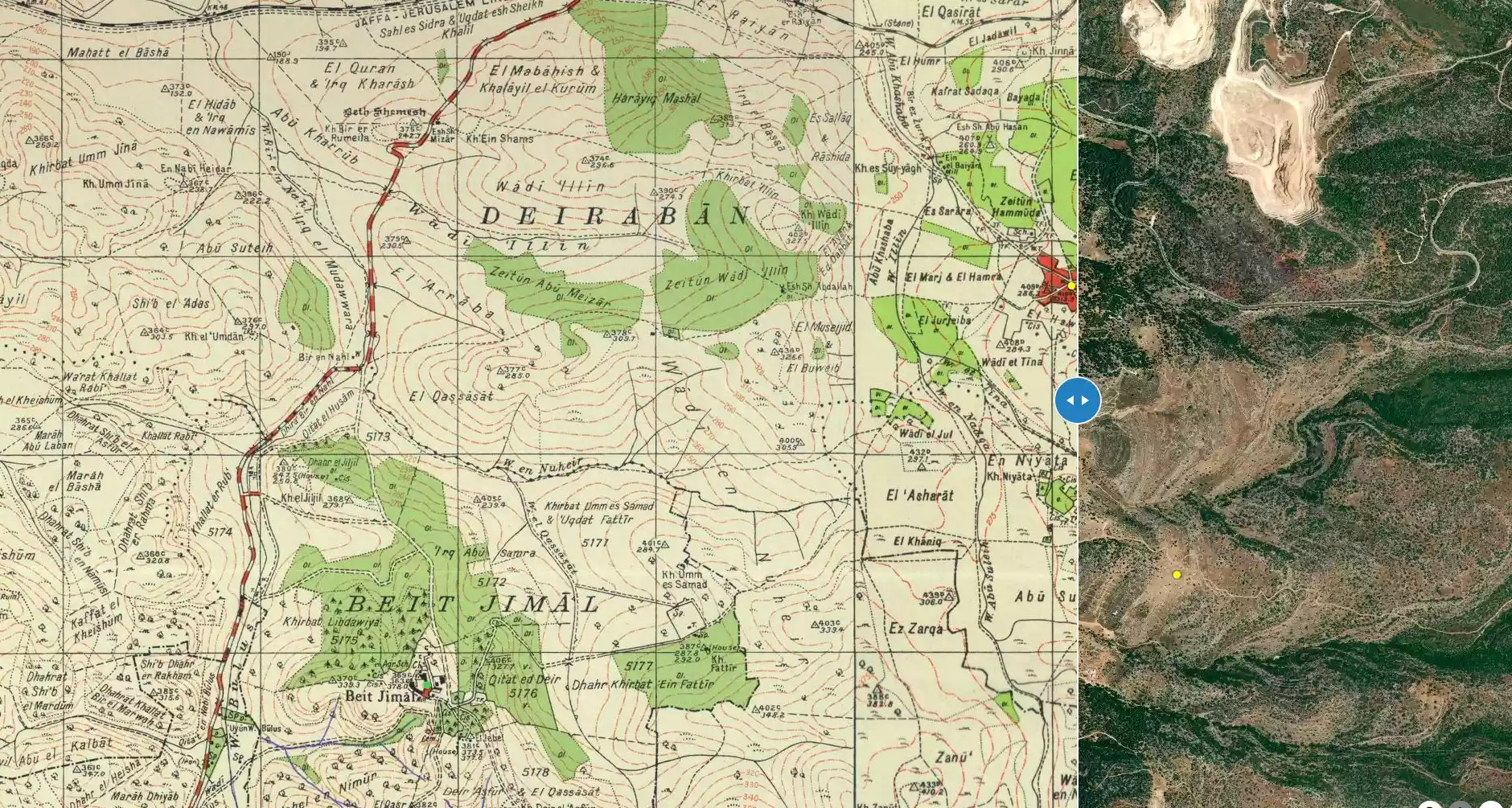
| Before & After Nakba, Click Map For Details |
||||||||||||||||||||||
|
||||||||||||||||||||||
| Map Location | See location #31 on the map View from satellite |
|||||||||||||||||||||
| Defenders | Local militia and Egyptian Army/Muslim Brotherhood Battalion | |||||||||||||||||||||
| Refugees' Migration Routes | Population most likely ethnically cleansed eastwards to Bethlehem or to the Hebron hills. | |||||||||||||||||||||
| Exodus Cause | Military assault by Zionist troops | |||||||||||||||||||||
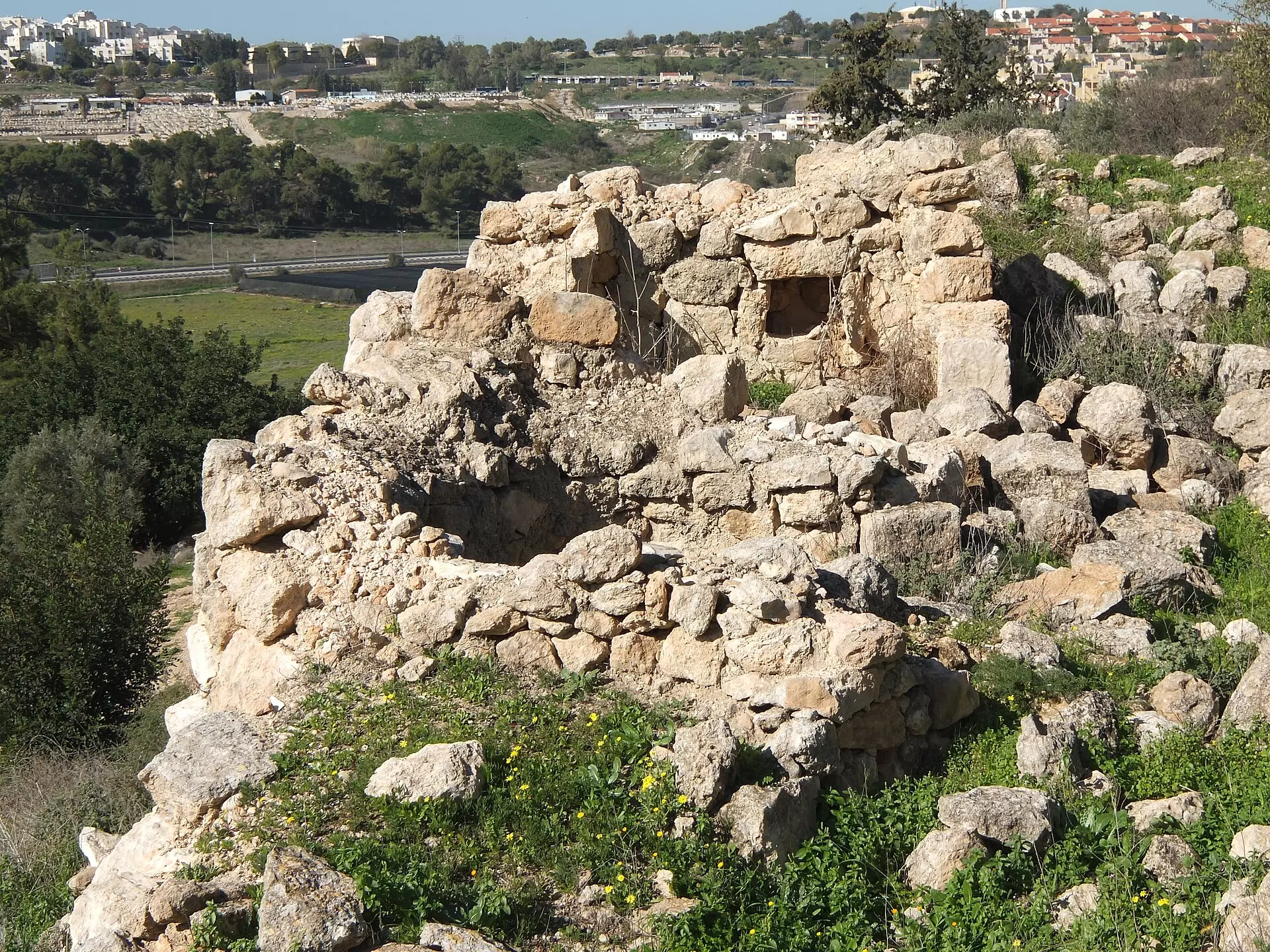
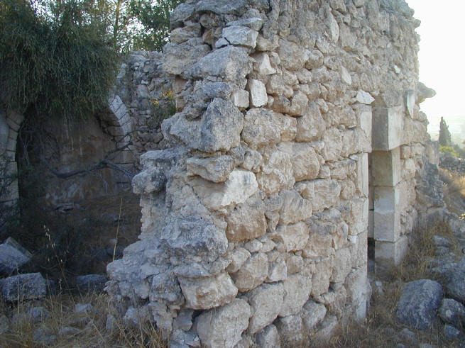
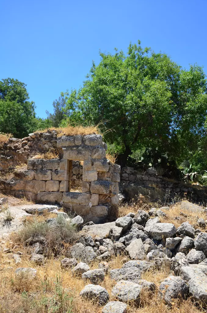
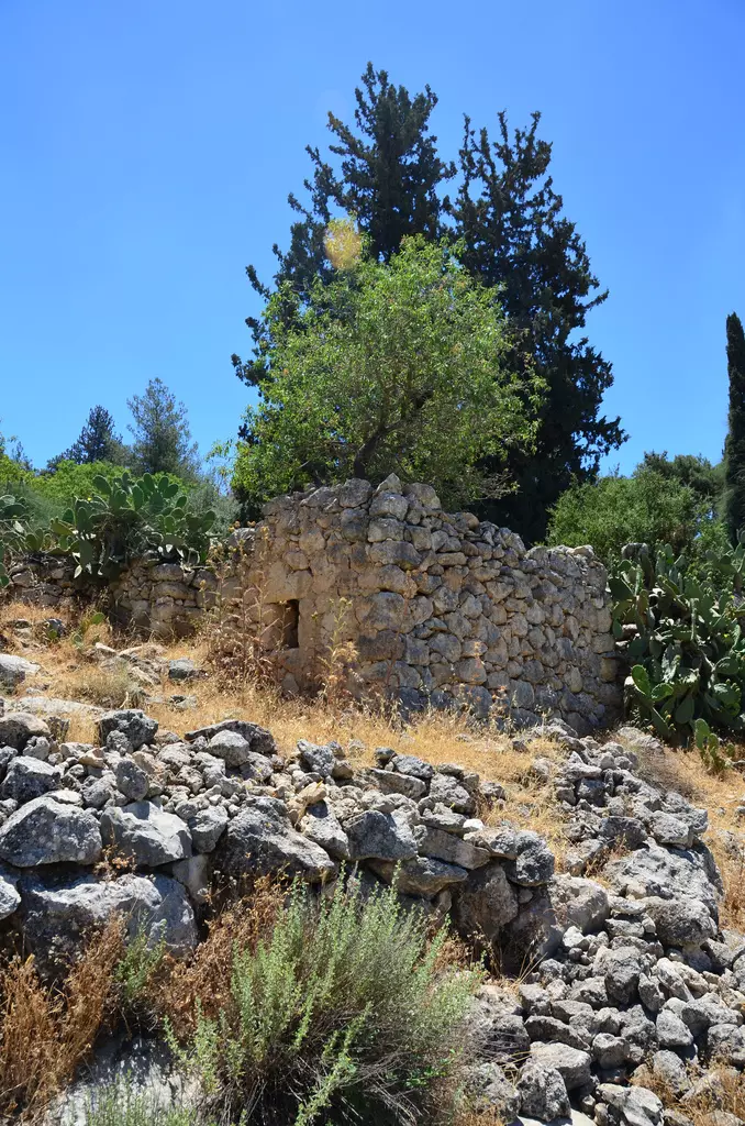
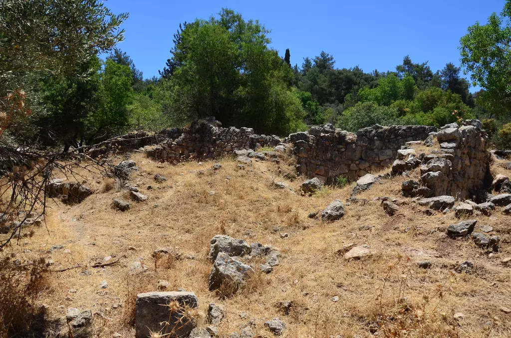
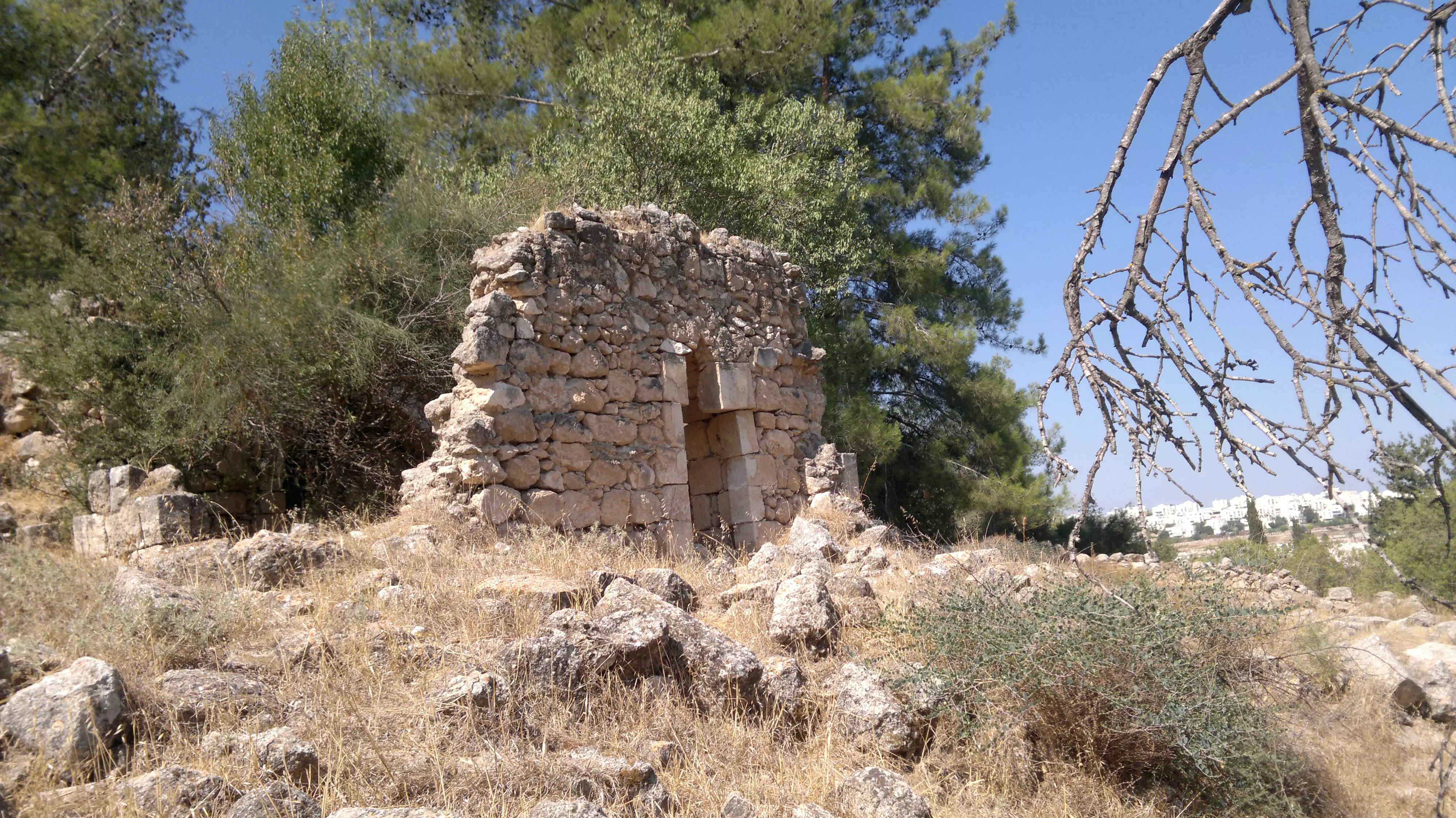
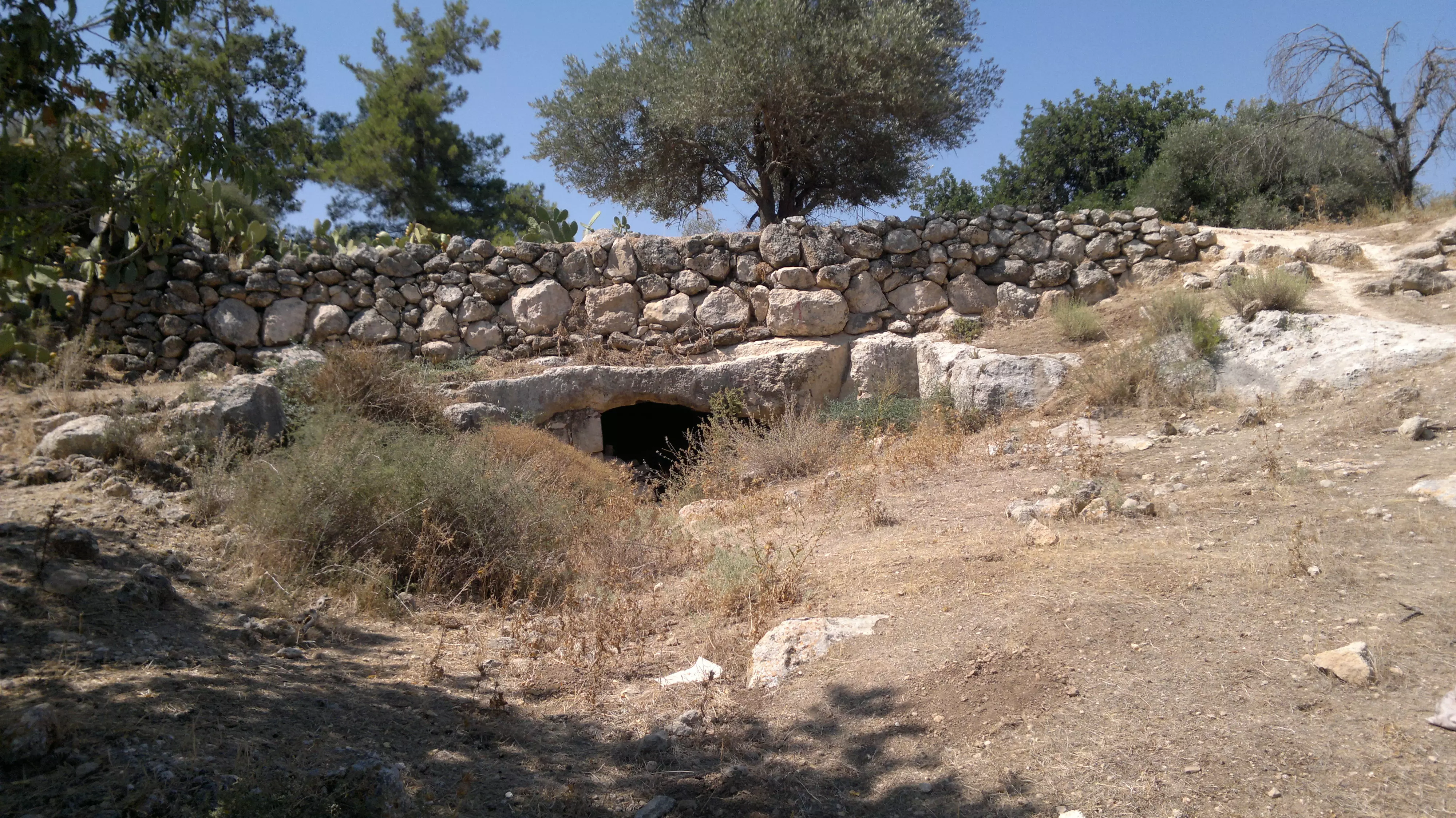
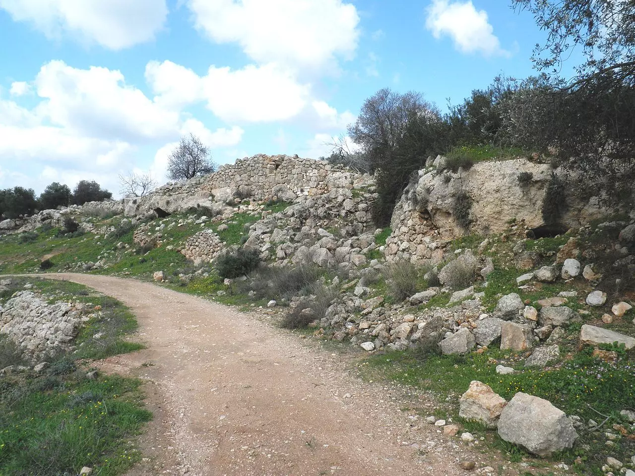
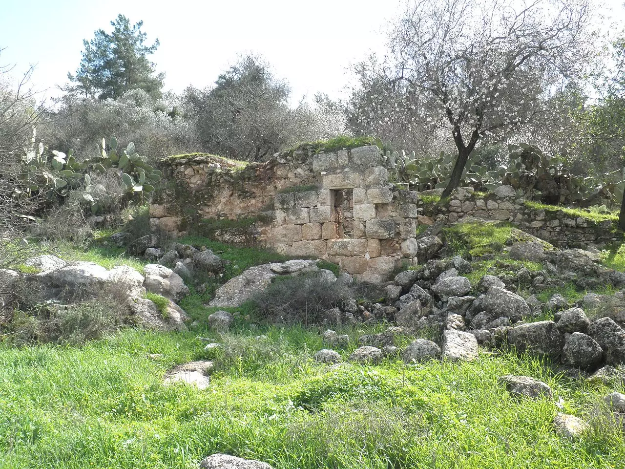
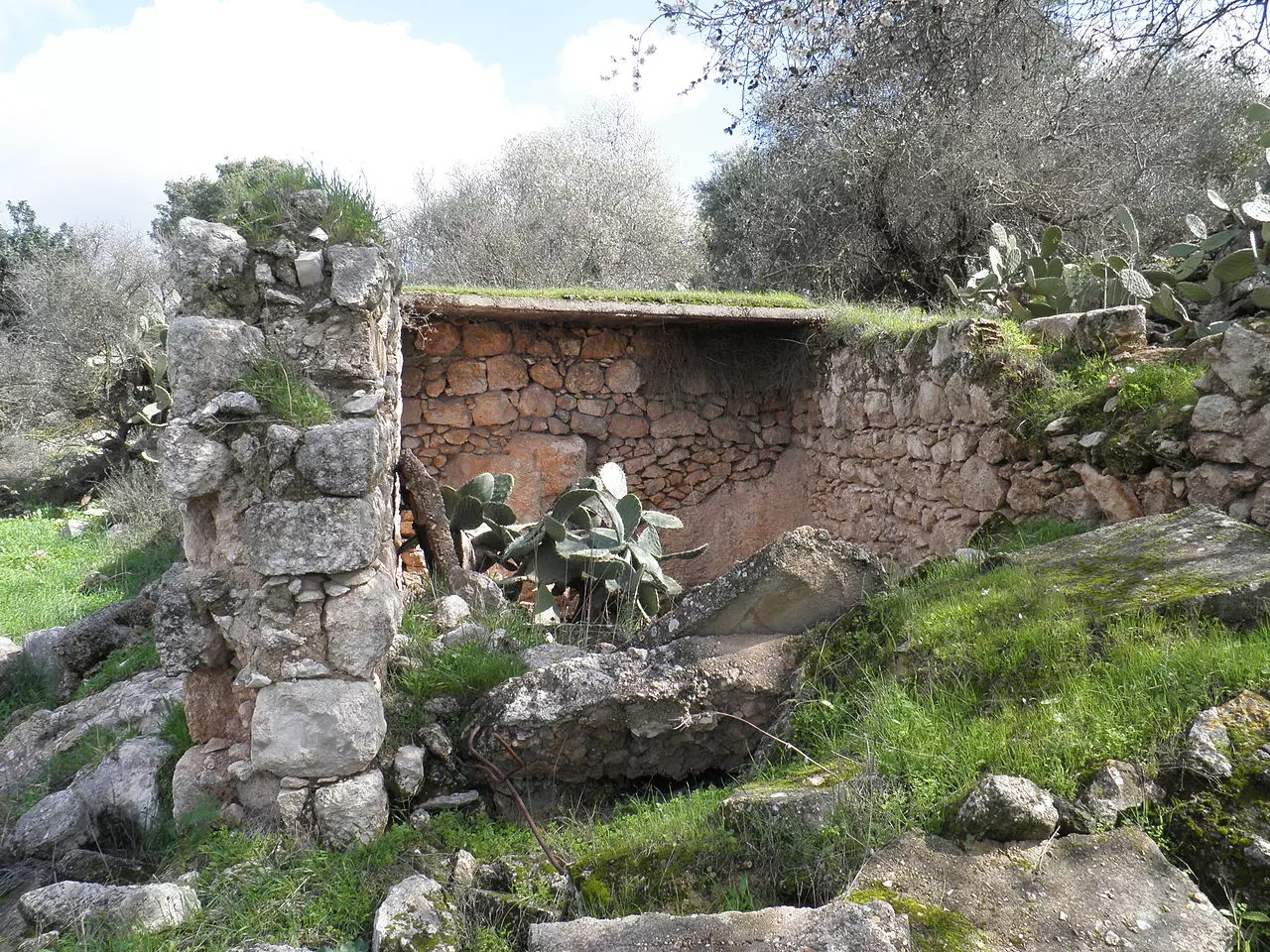
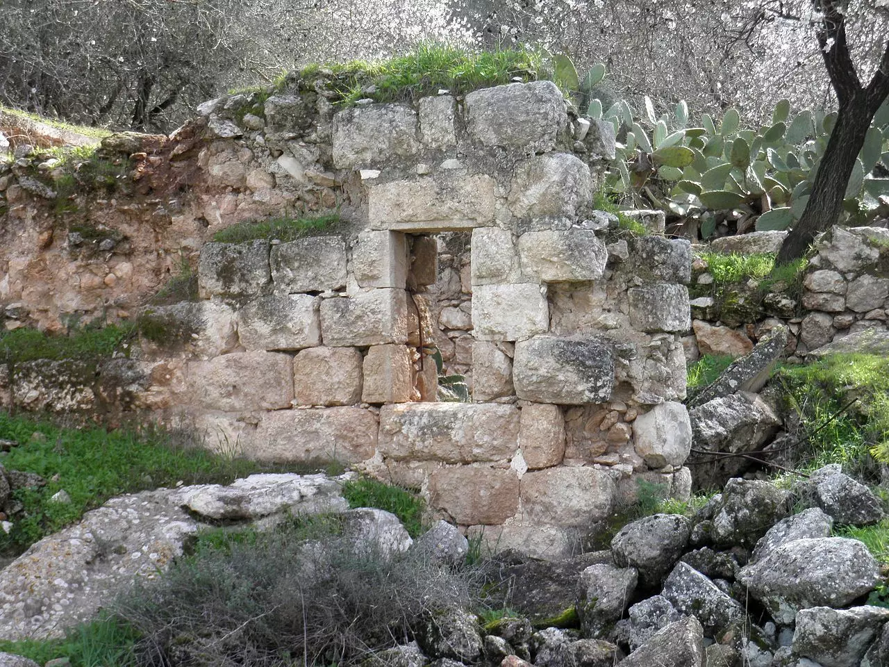
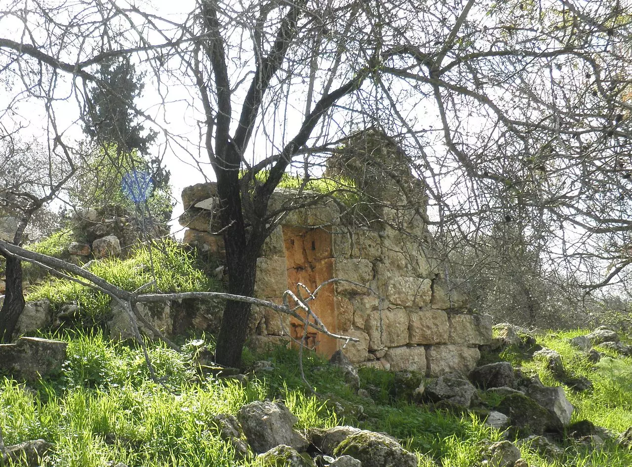
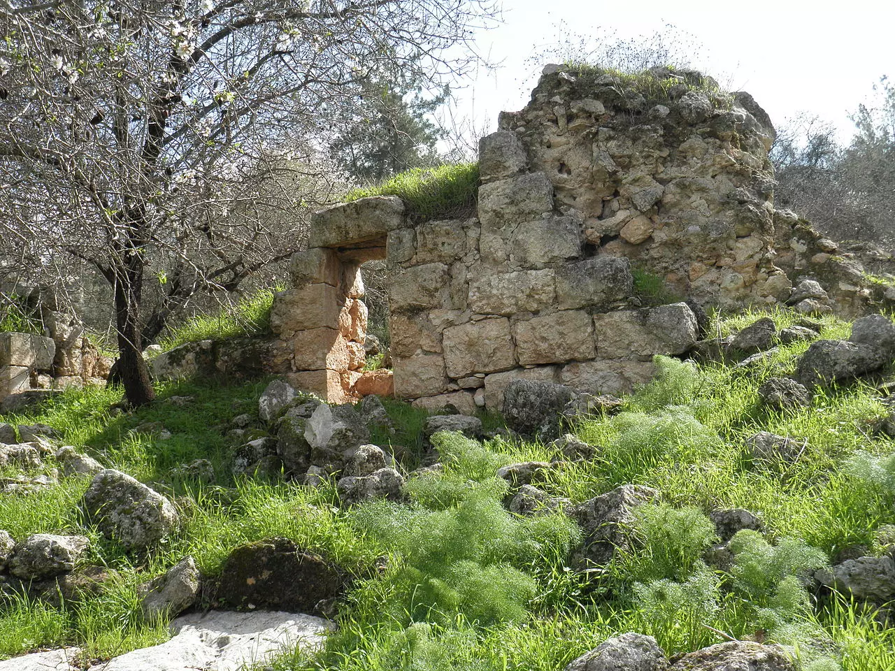
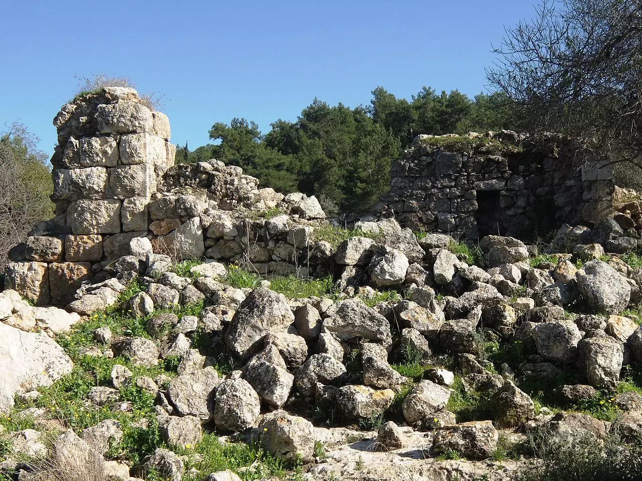
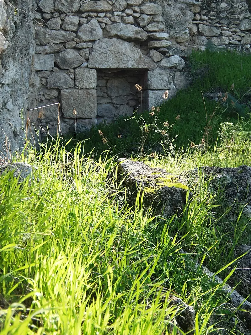
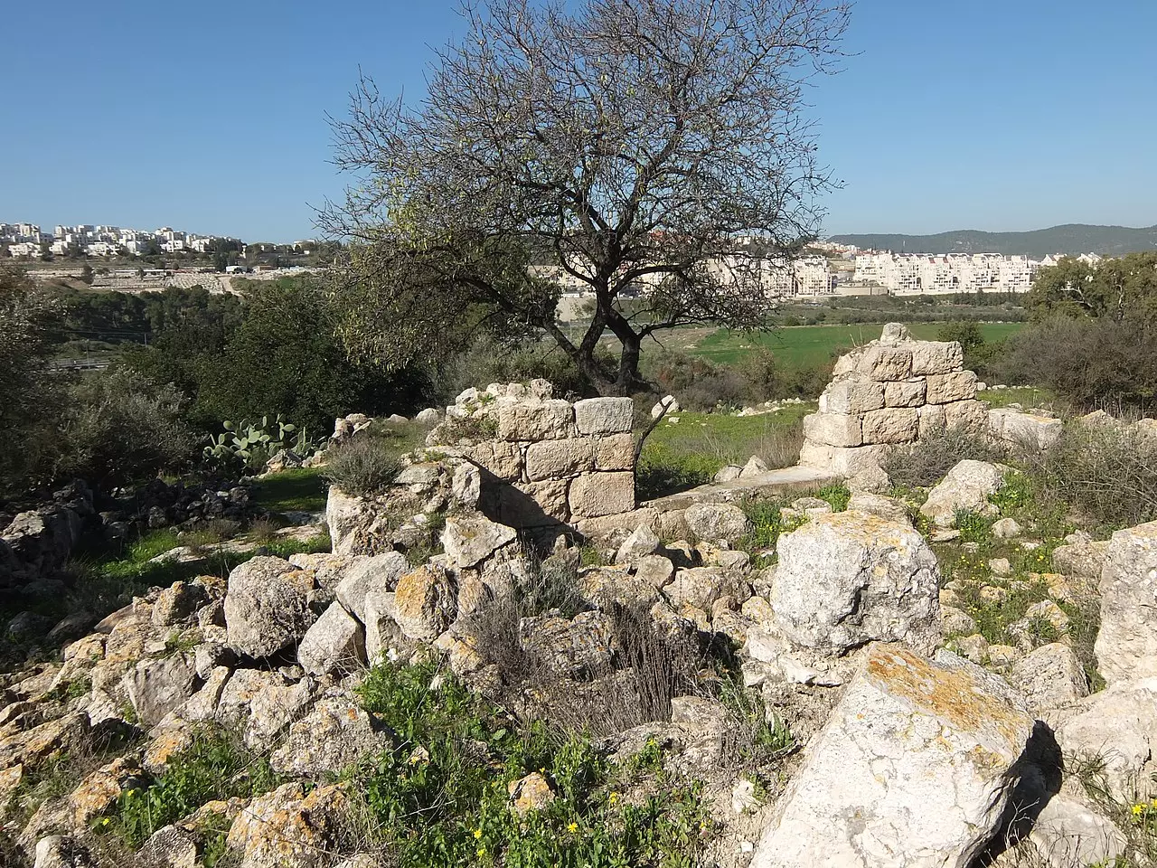
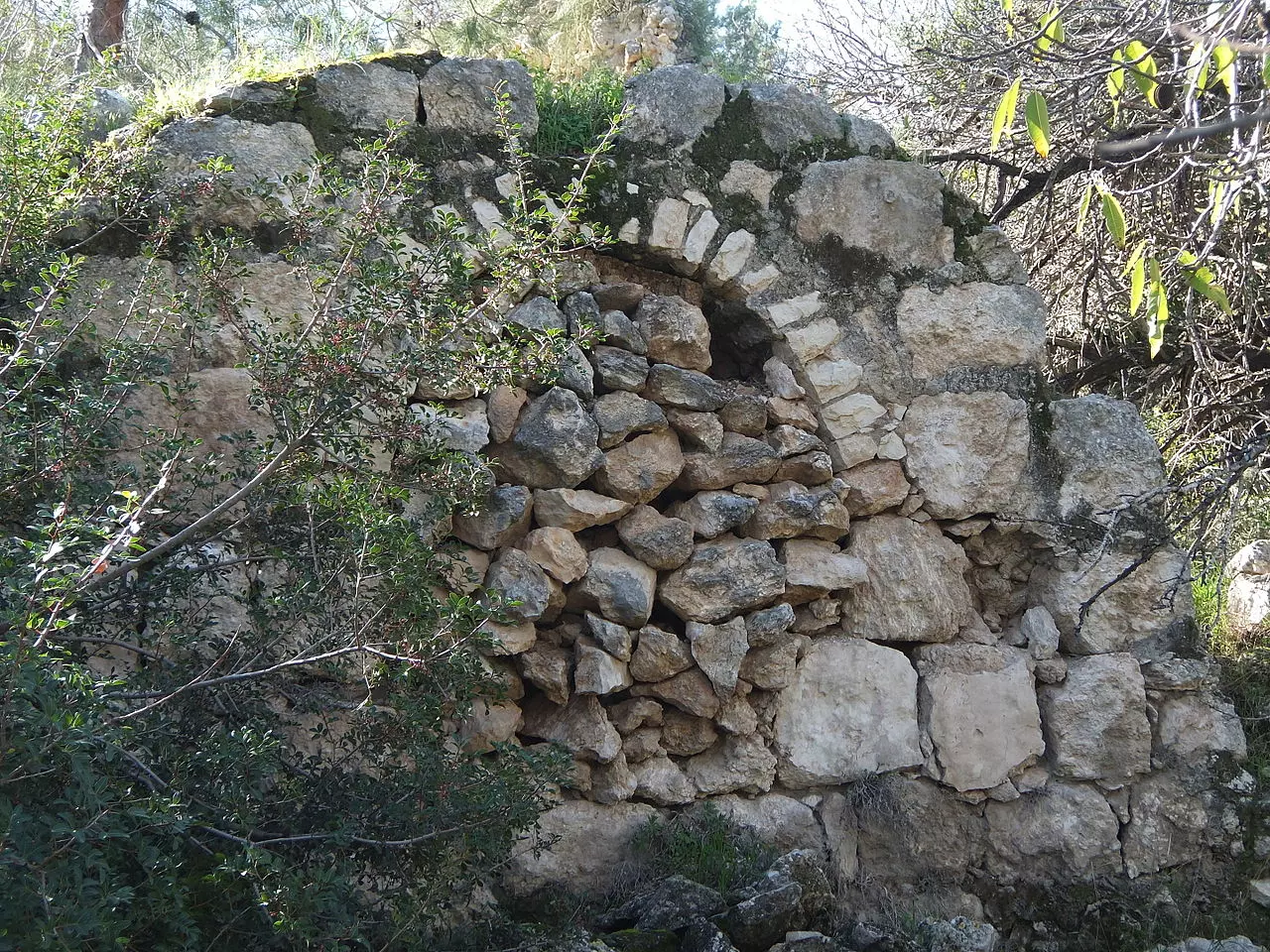
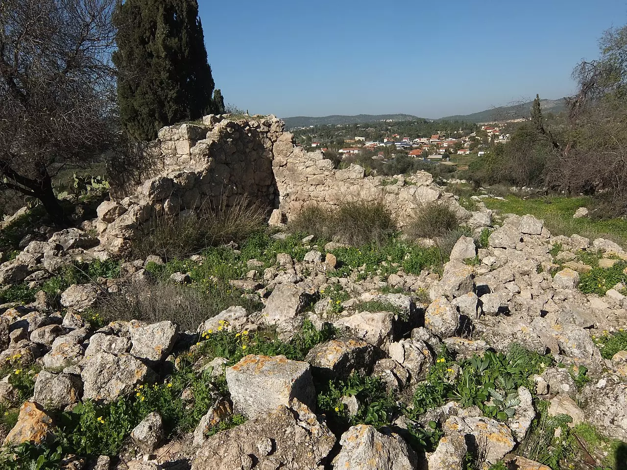
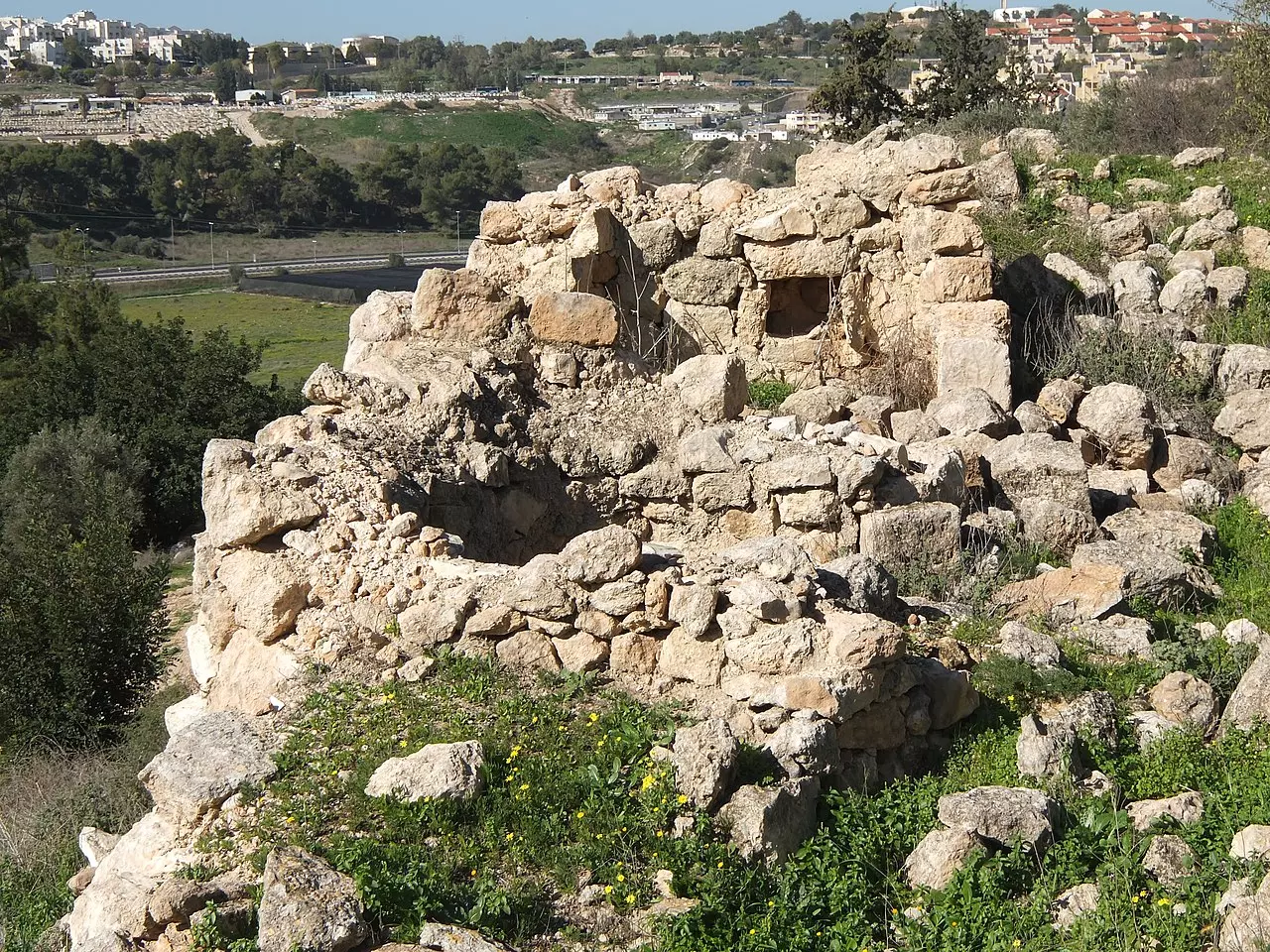
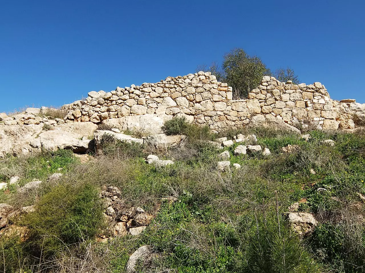
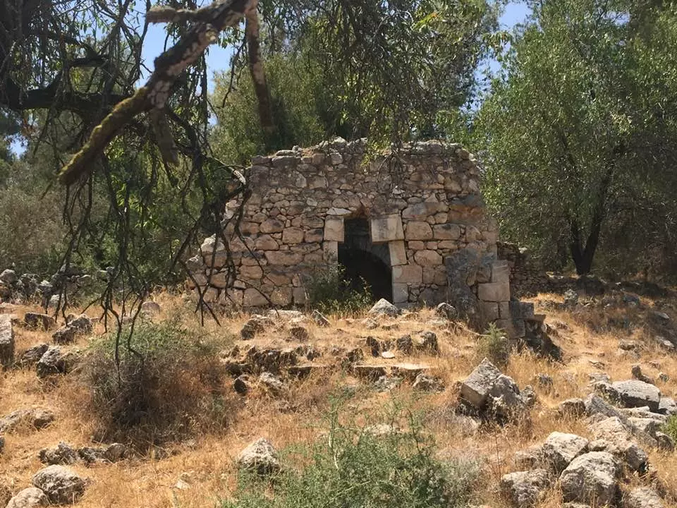
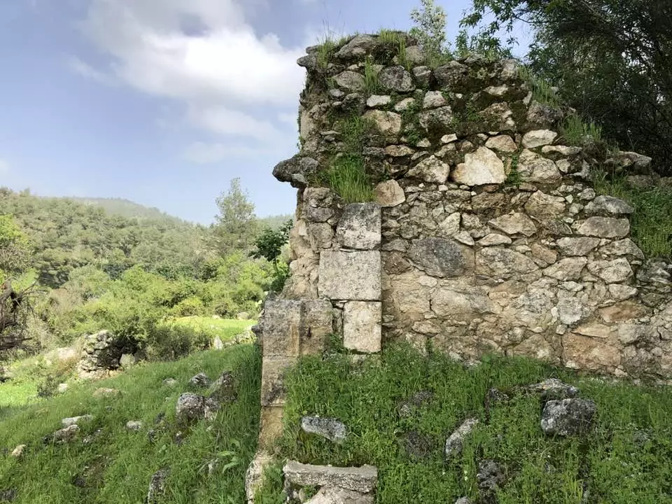
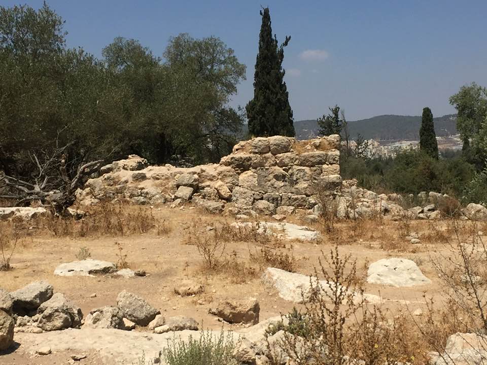
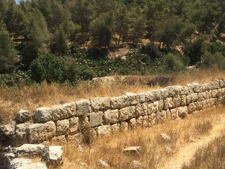
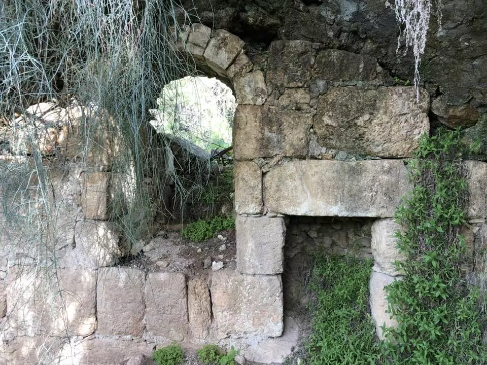
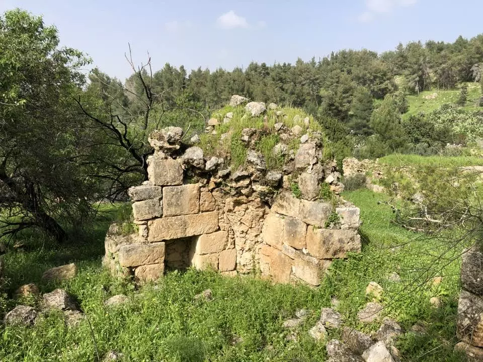
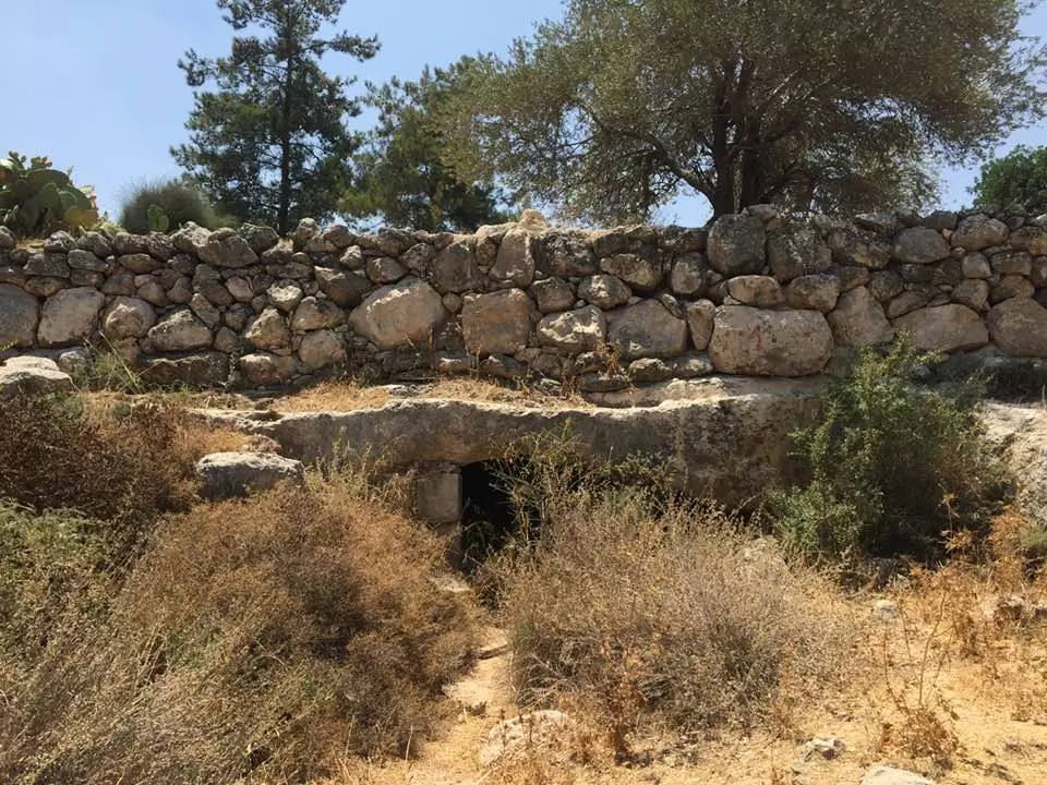
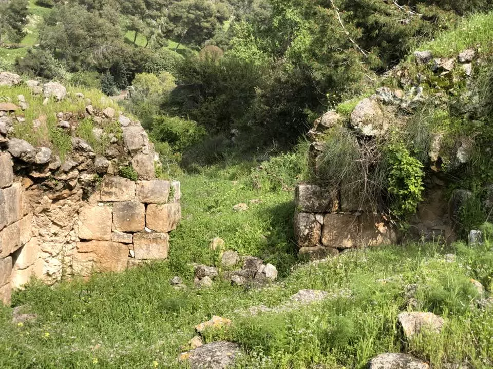
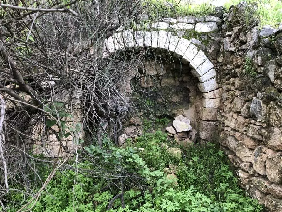
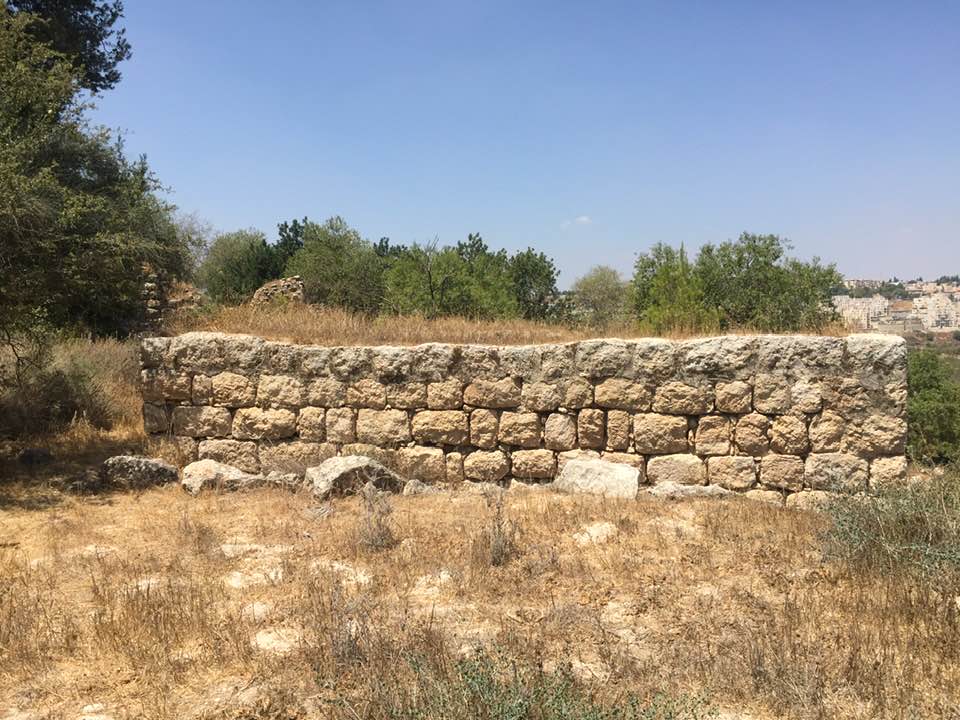
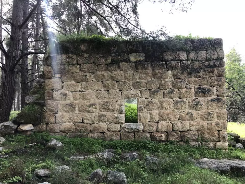
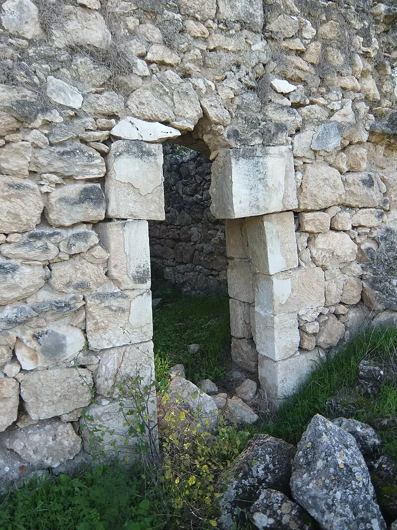
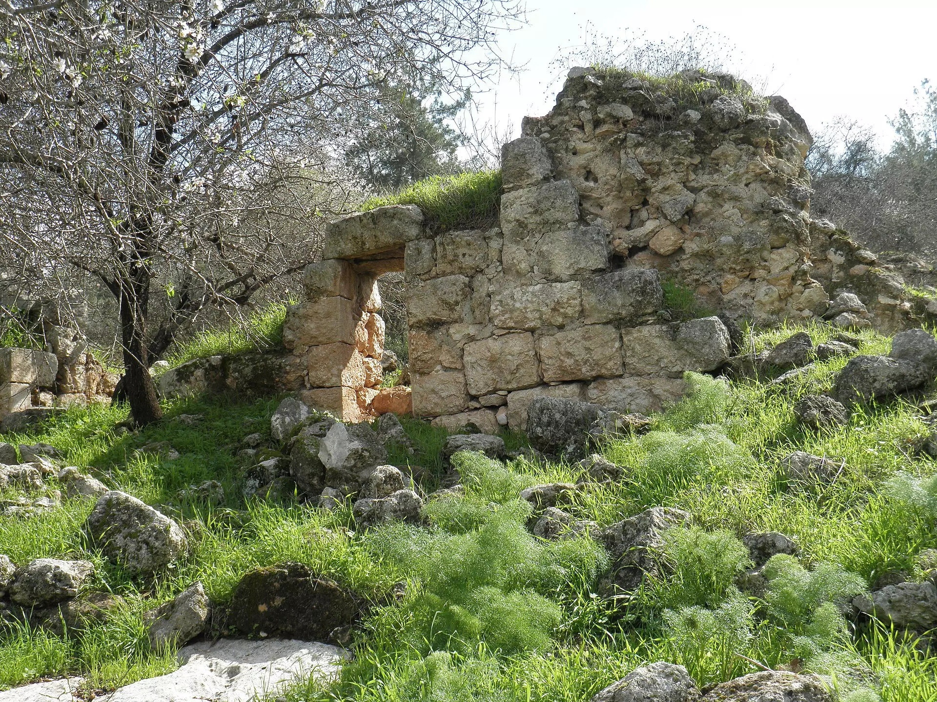
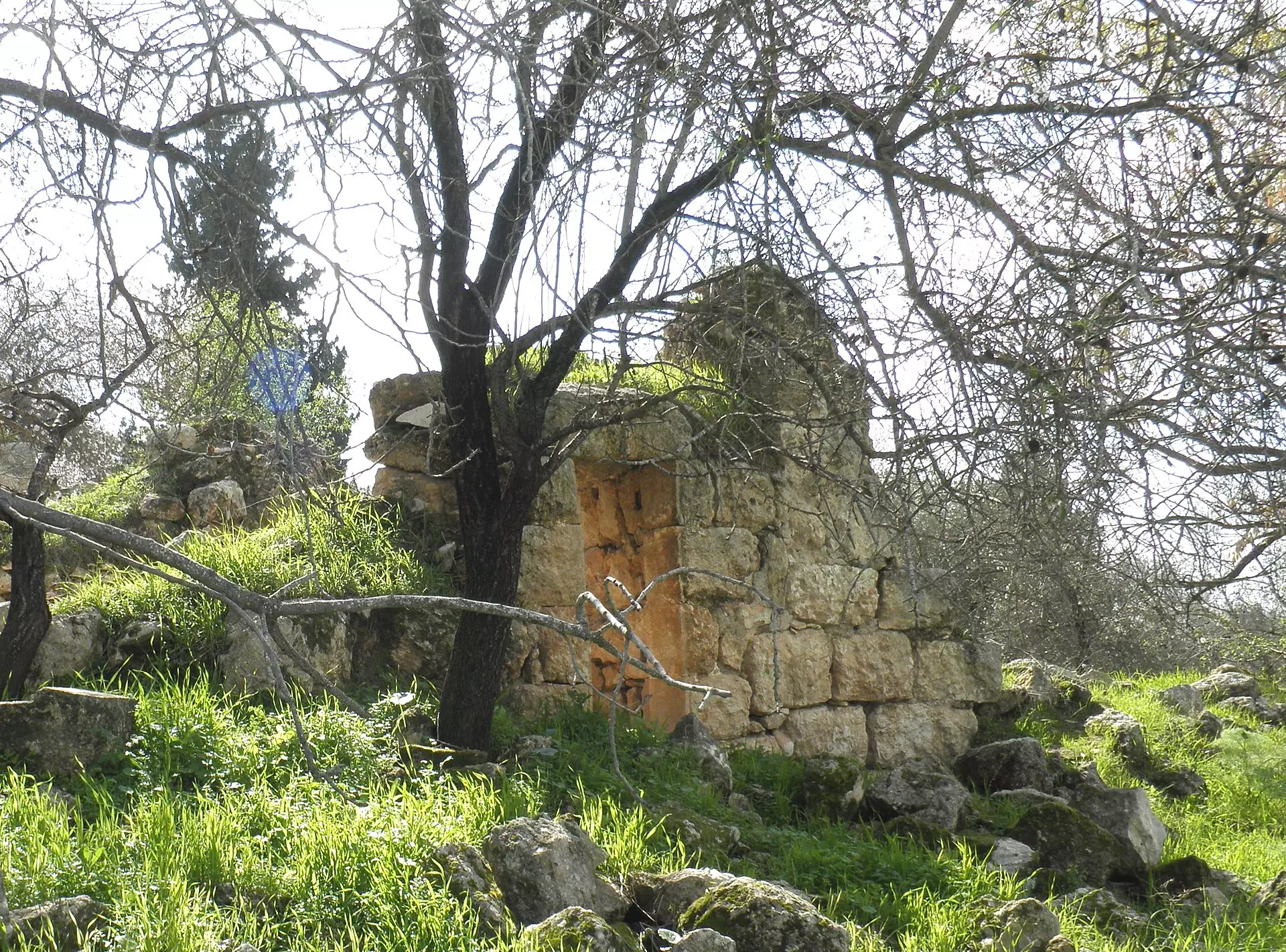
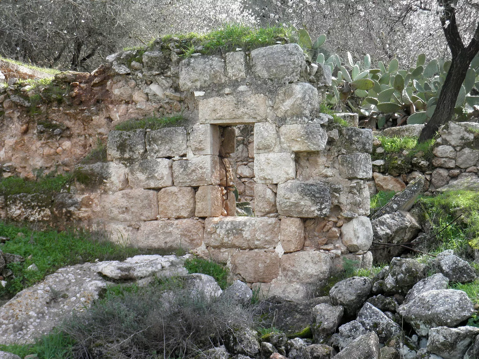
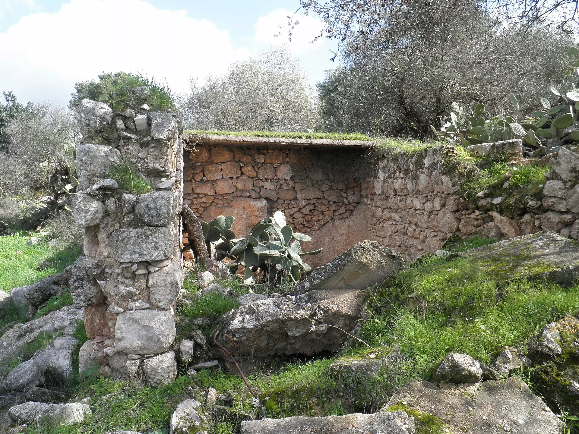
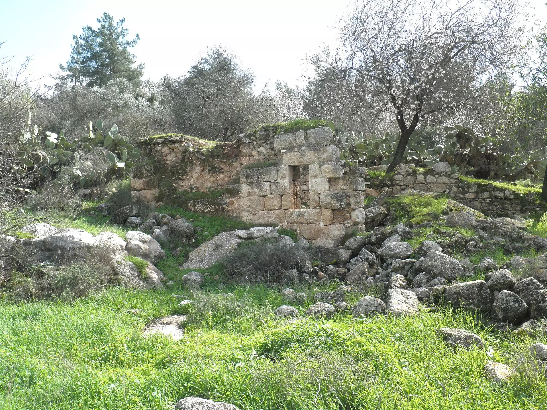
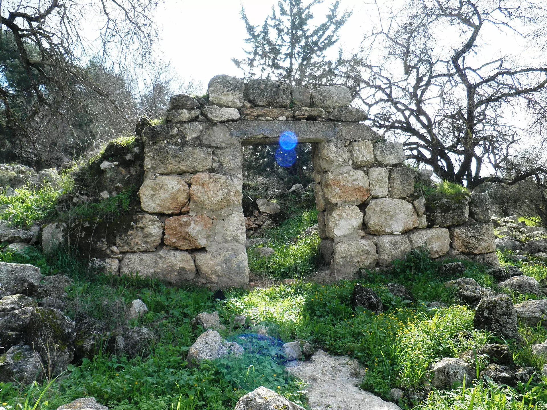
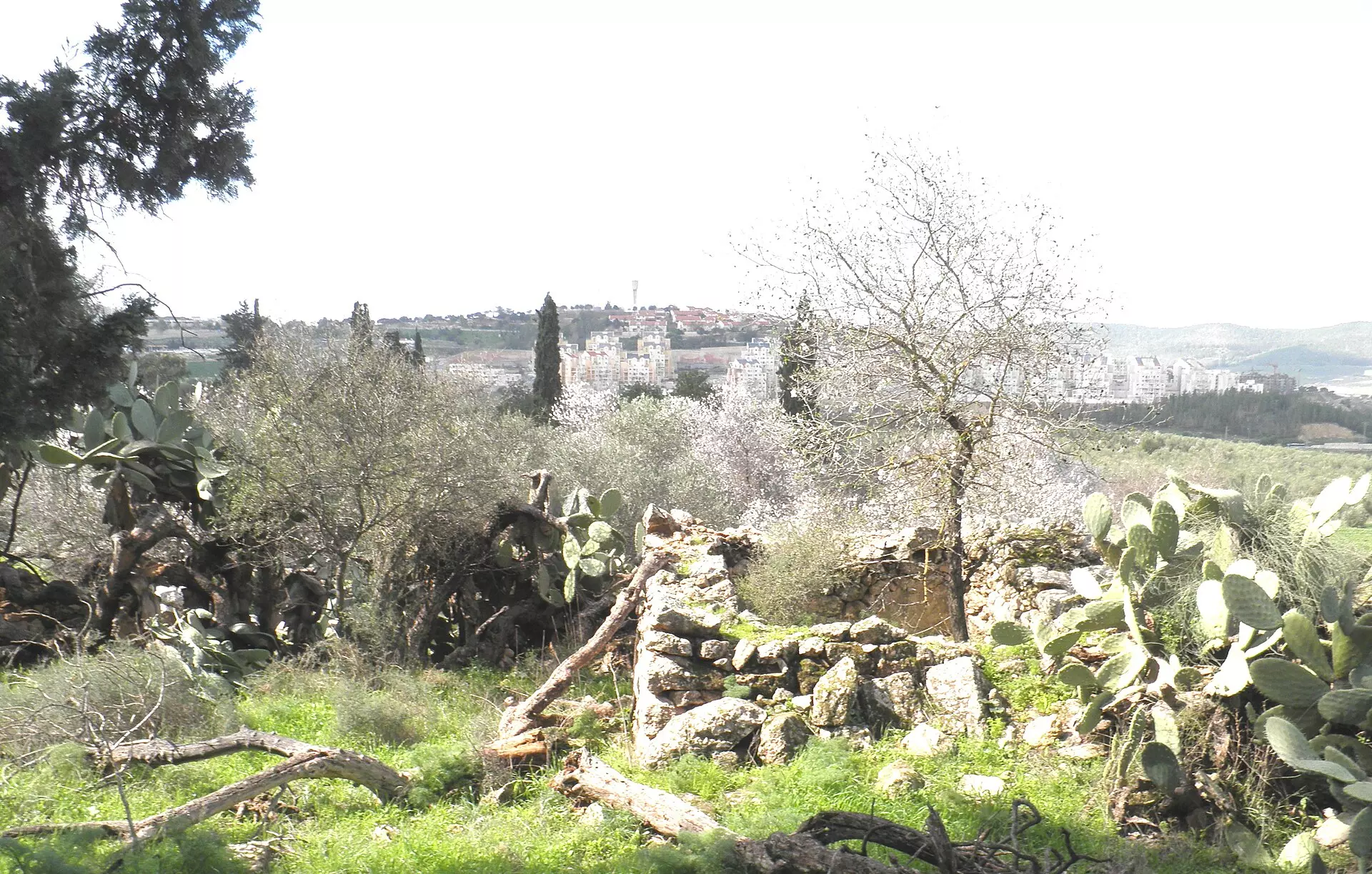
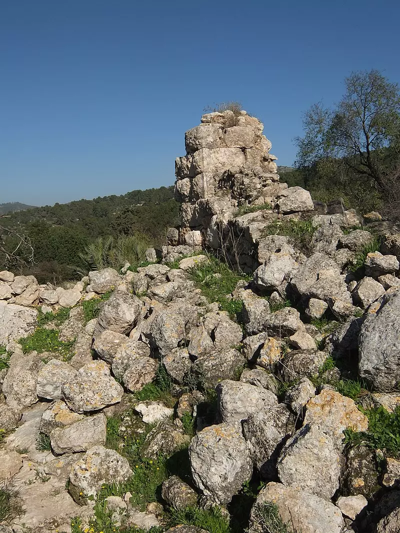
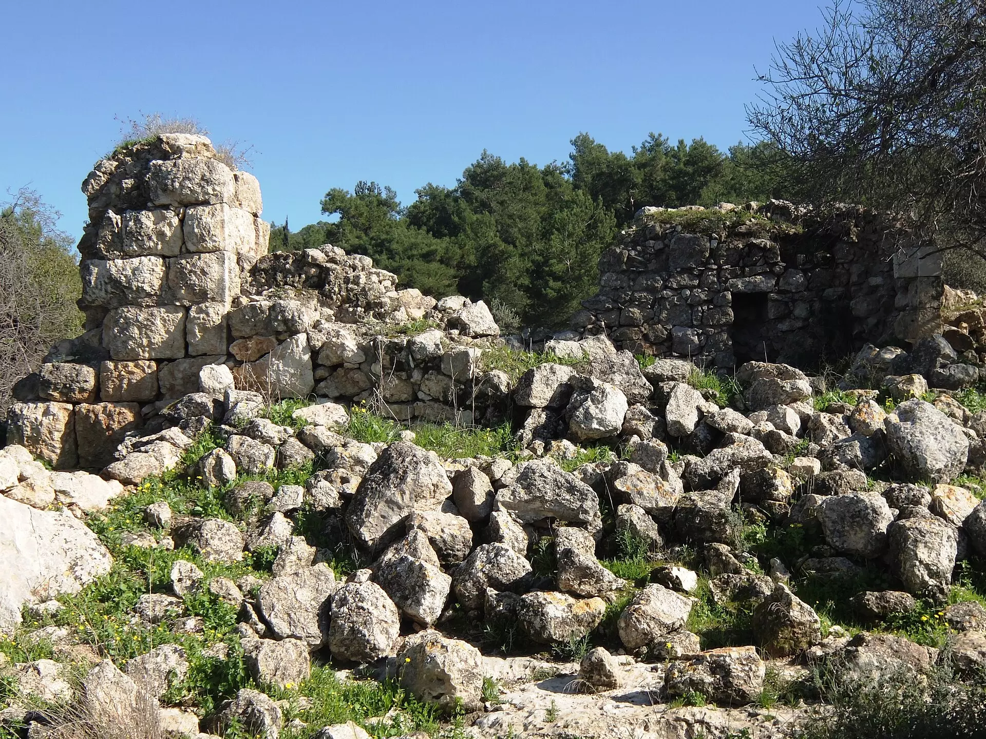
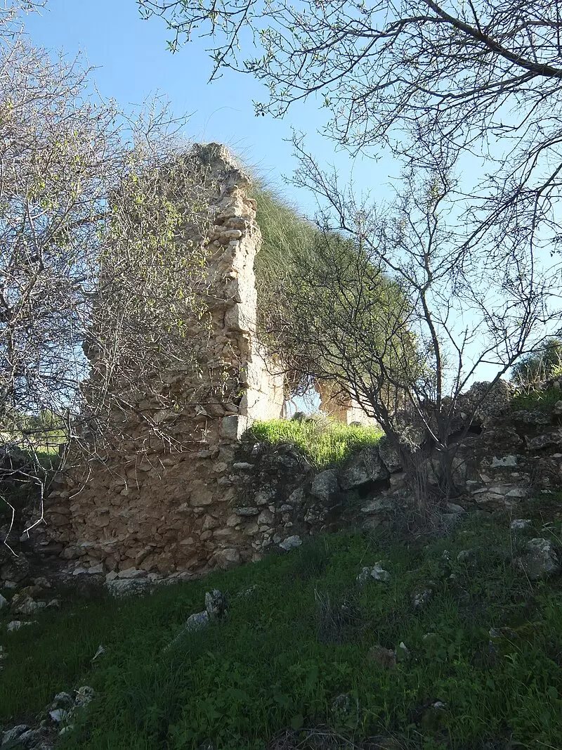
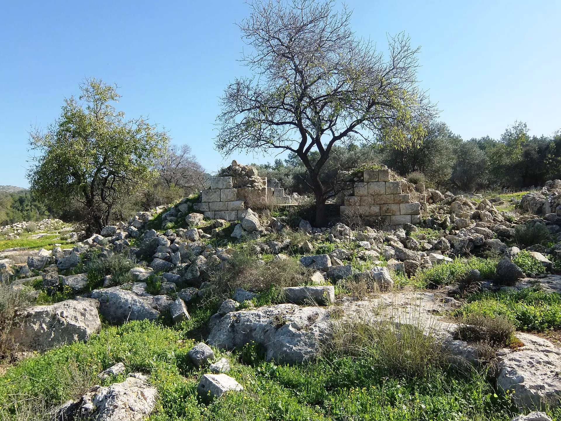
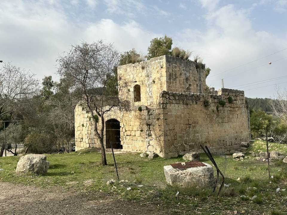
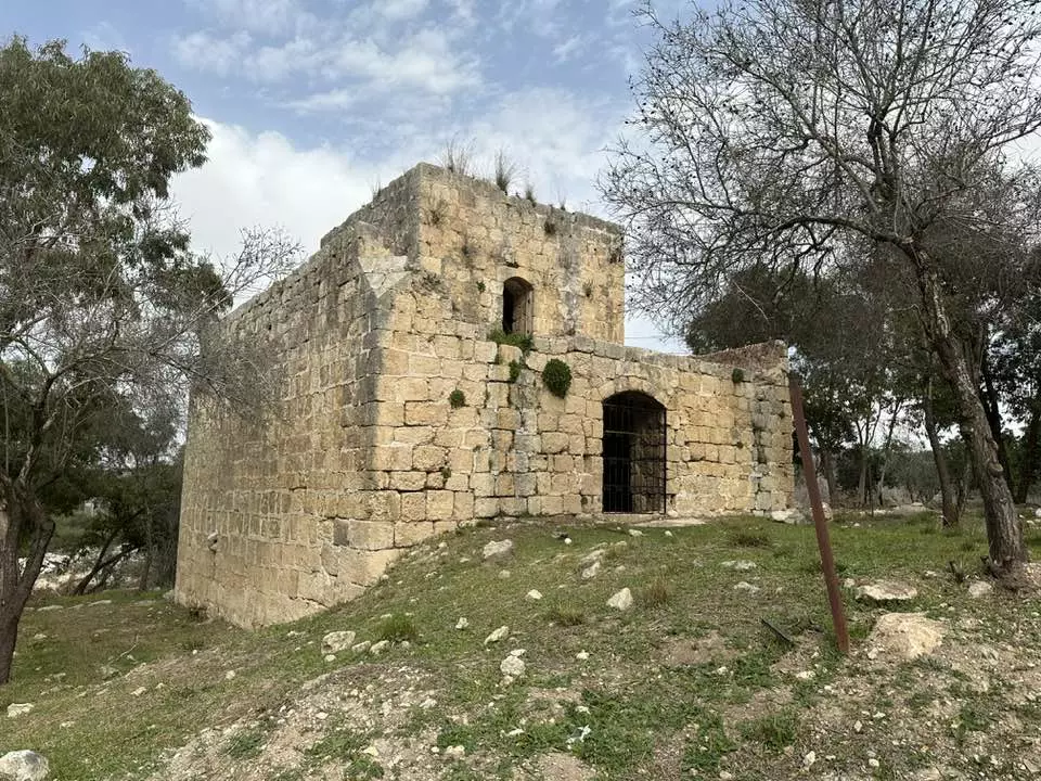
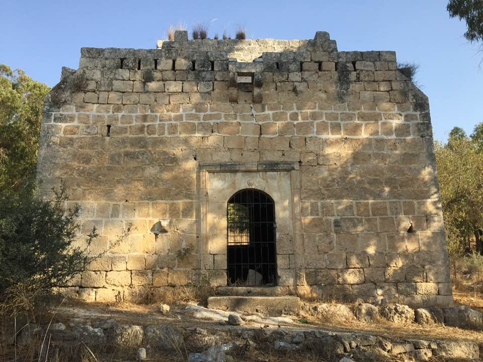
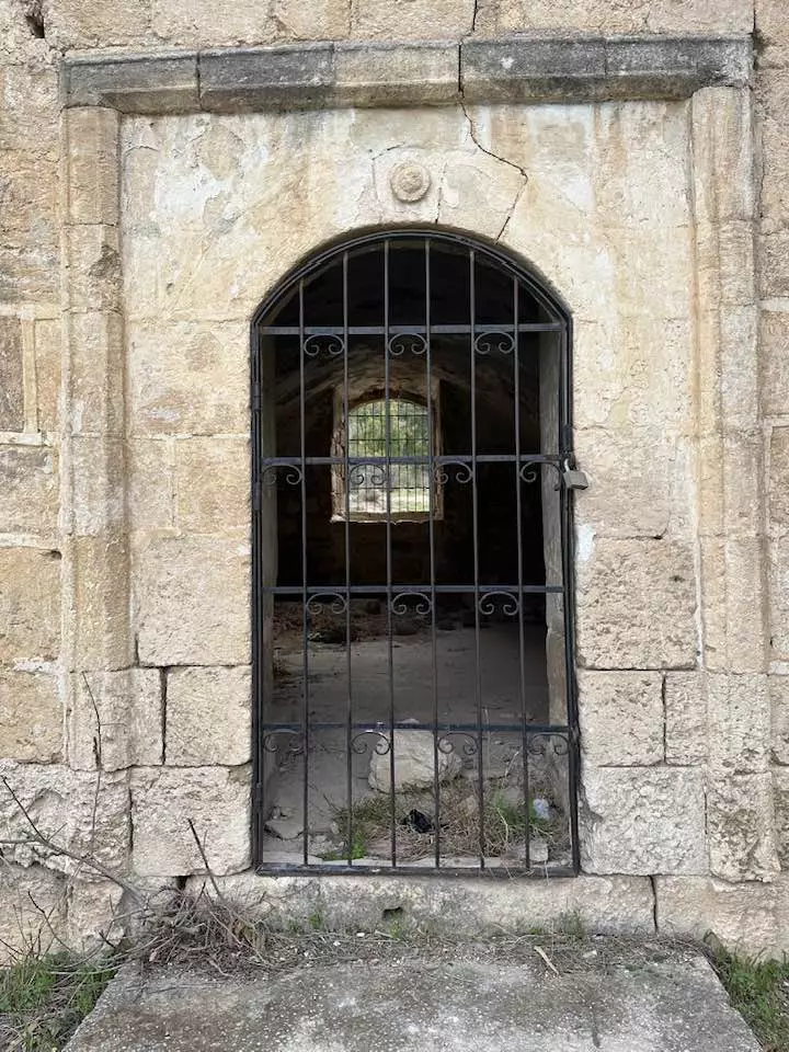
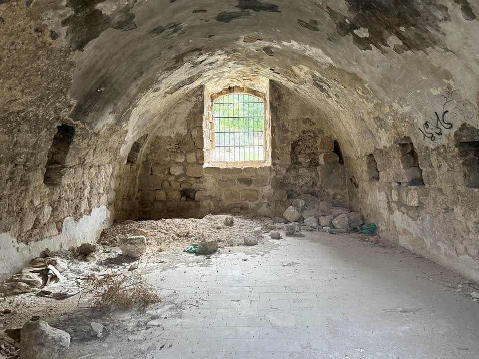
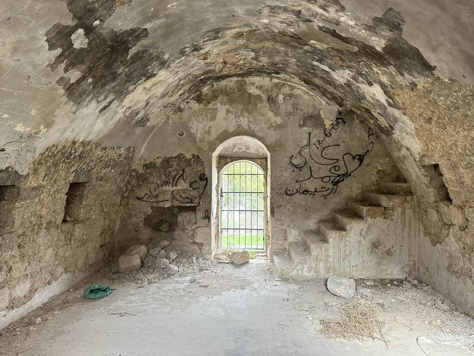
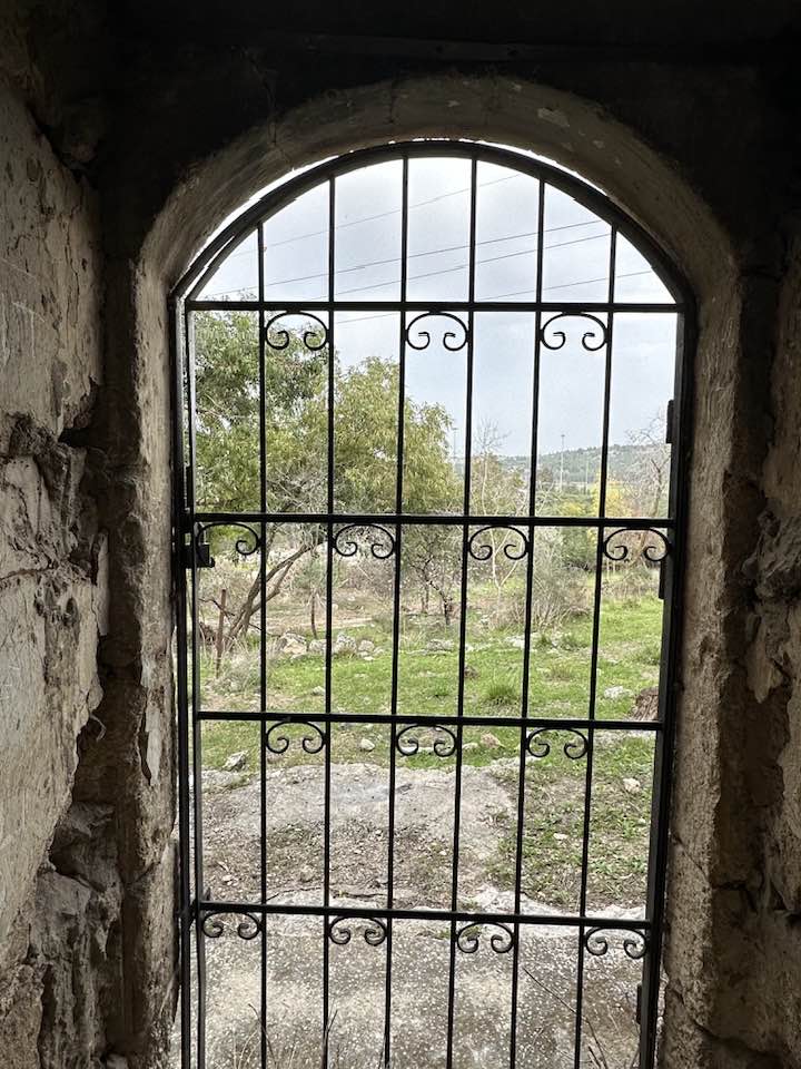
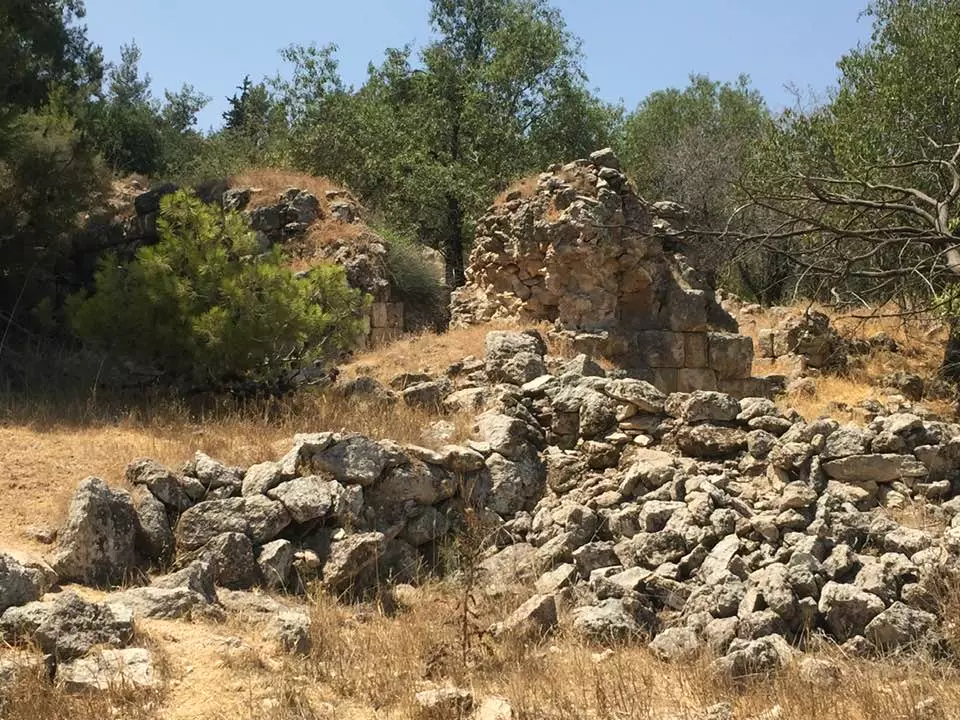
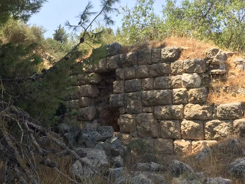
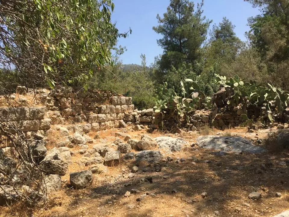
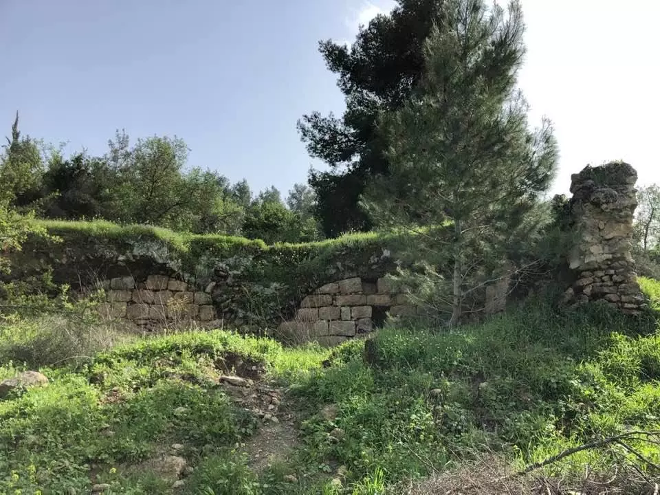
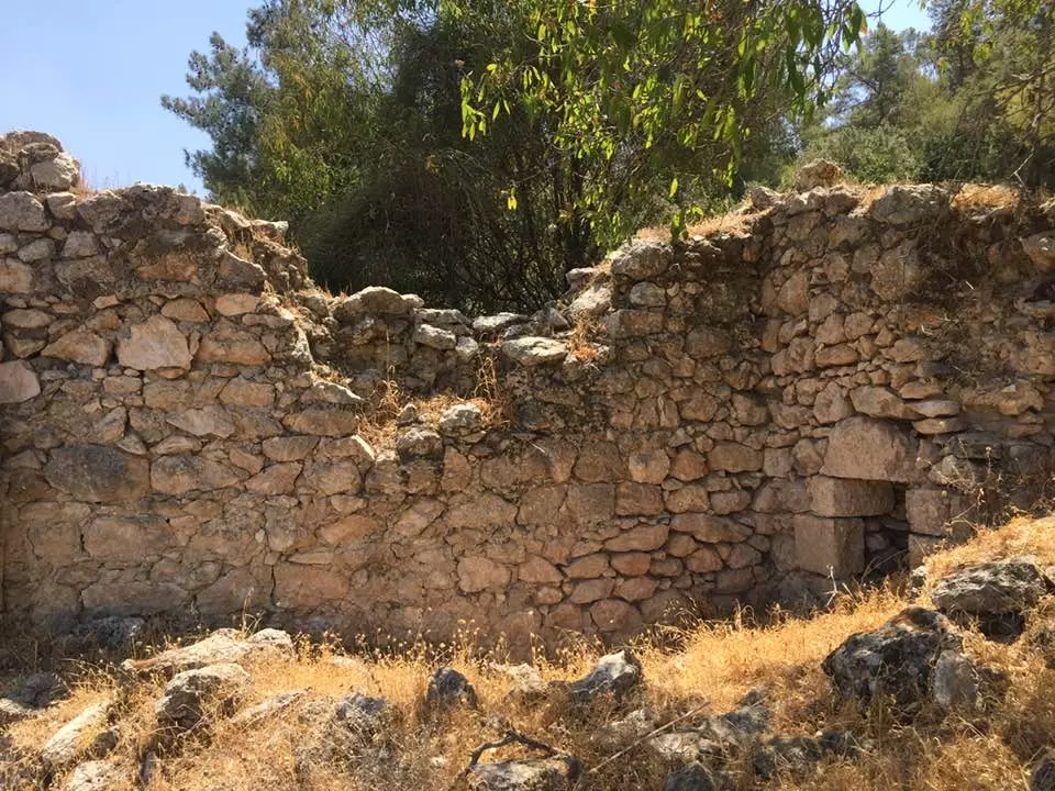
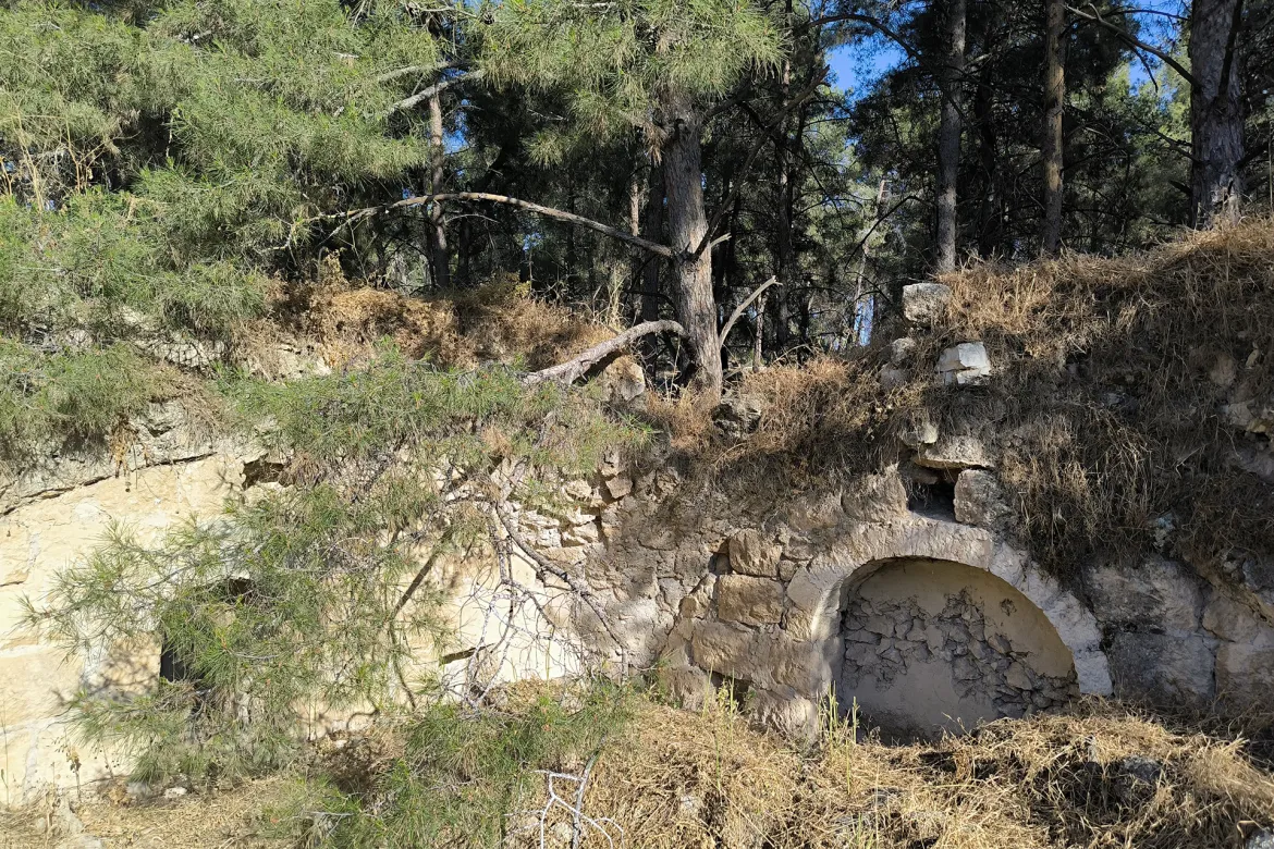
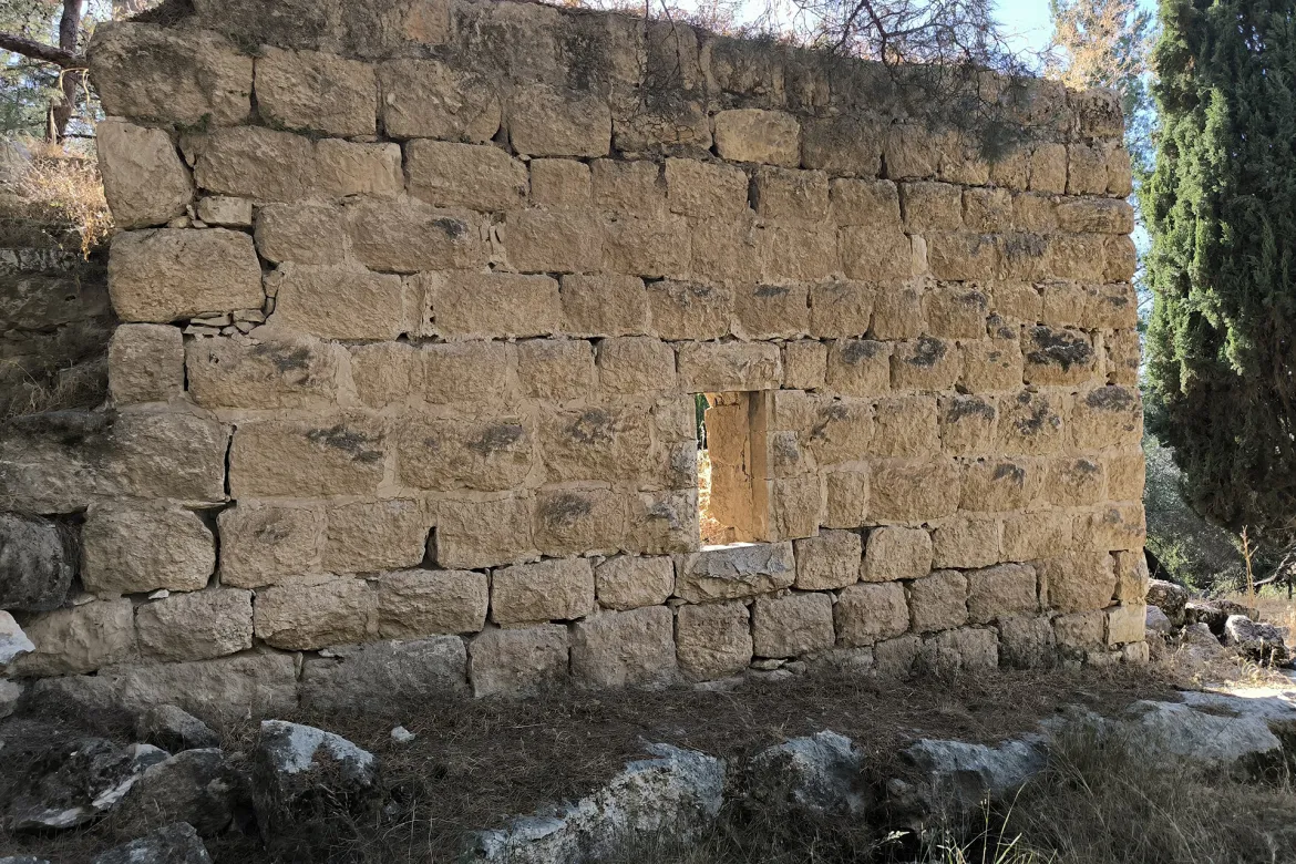
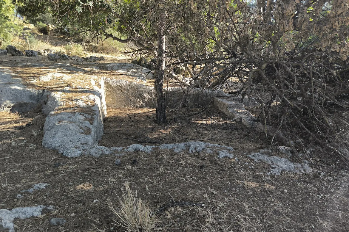
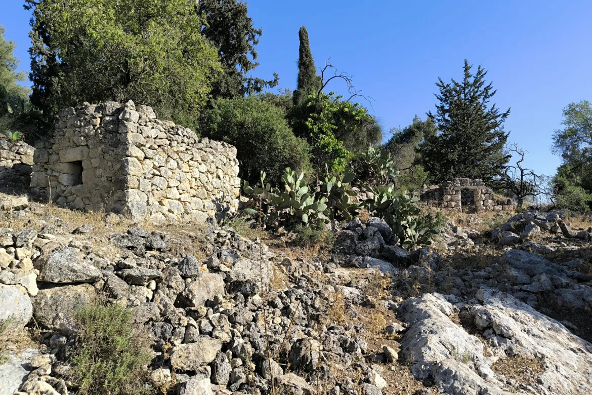
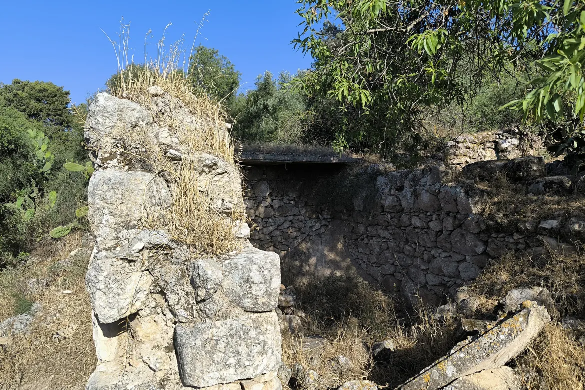
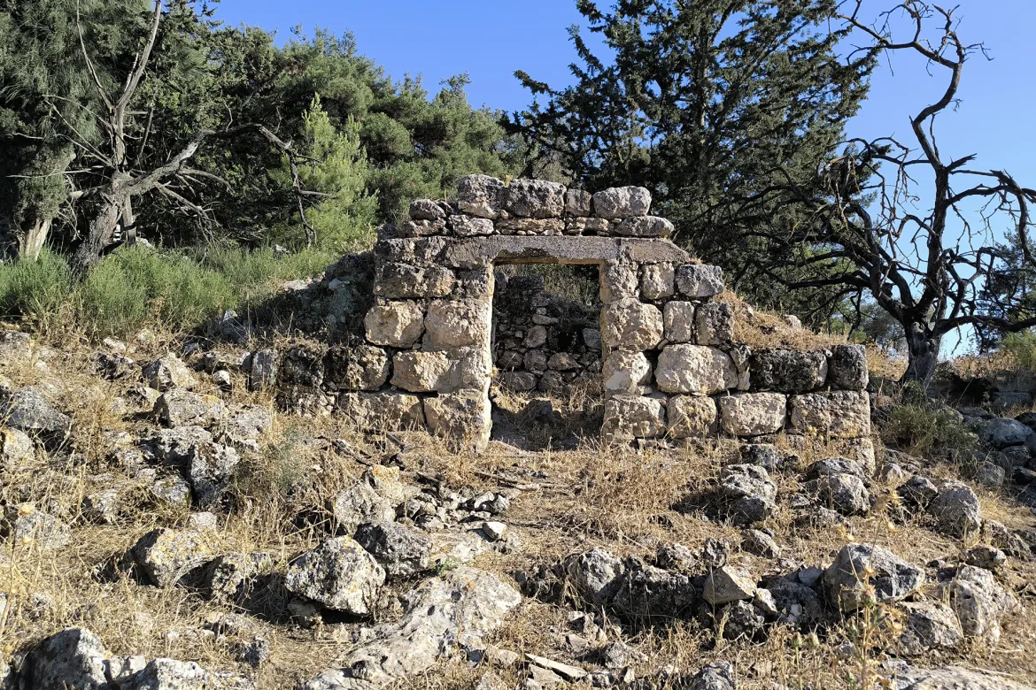
| Village Temains | Deir Abban was completely destroyed and defaced, and only house rubble left behind. | |||||||||||||||||||||
| Ethnically Cleansing | Dayr Aban inhabitants were completely ethnically cleansed. | |||||||||||||||||||||
| Pre-Nakba Land Ownership |
**Town Lands' Demarcation Maps |
|||||||||||||||||||||
| Land Usage As of 1945 |
|
|||||||||||||||||||||
| Population |
|
|||||||||||||||||||||
| Number of Houses |
|
|||||||||||||||||||||
| Near By Towns |
||||||||||||||||||||||
|
|
||||||||||||||||||||||
| Town's Name Through History | The Romans referred to the Deir Abban by Abenezer. | |||||||||||||||||||||
| Places of Warship | Dayr Abban had a mosque called al-'Umari mosque. | |||||||||||||||||||||
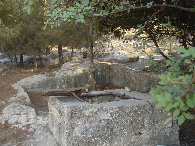
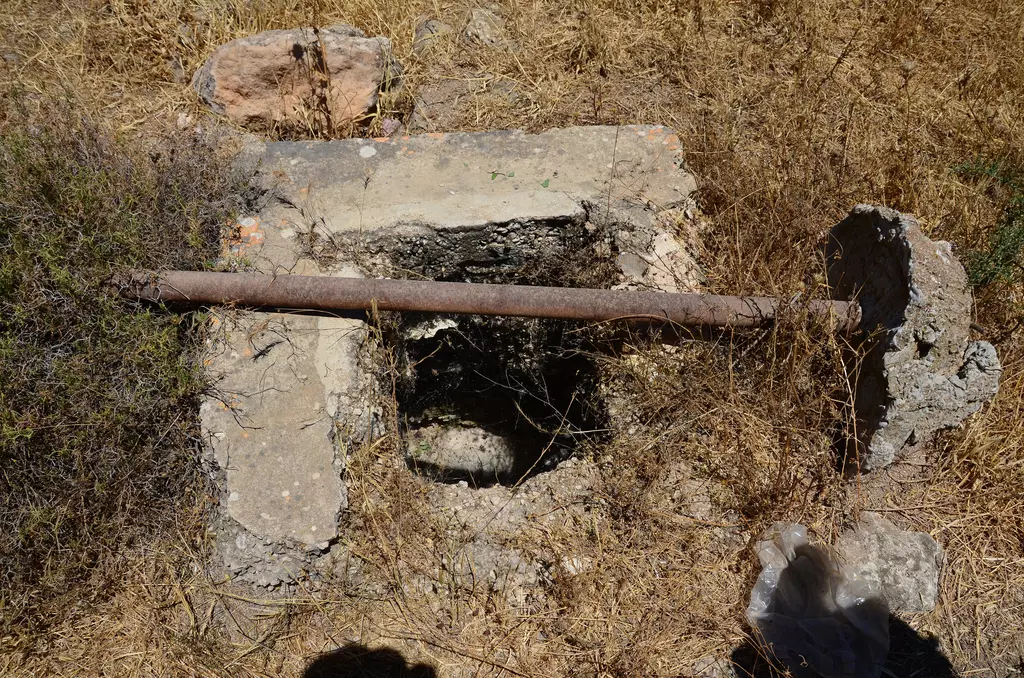
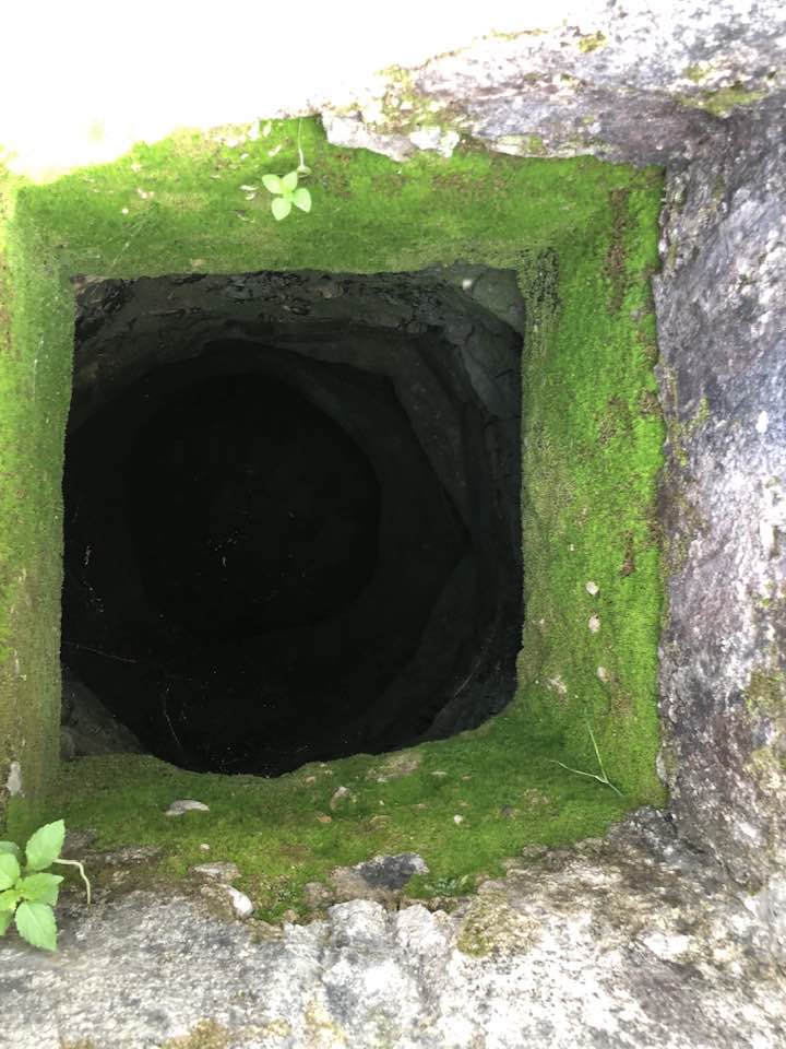
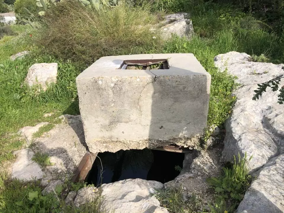
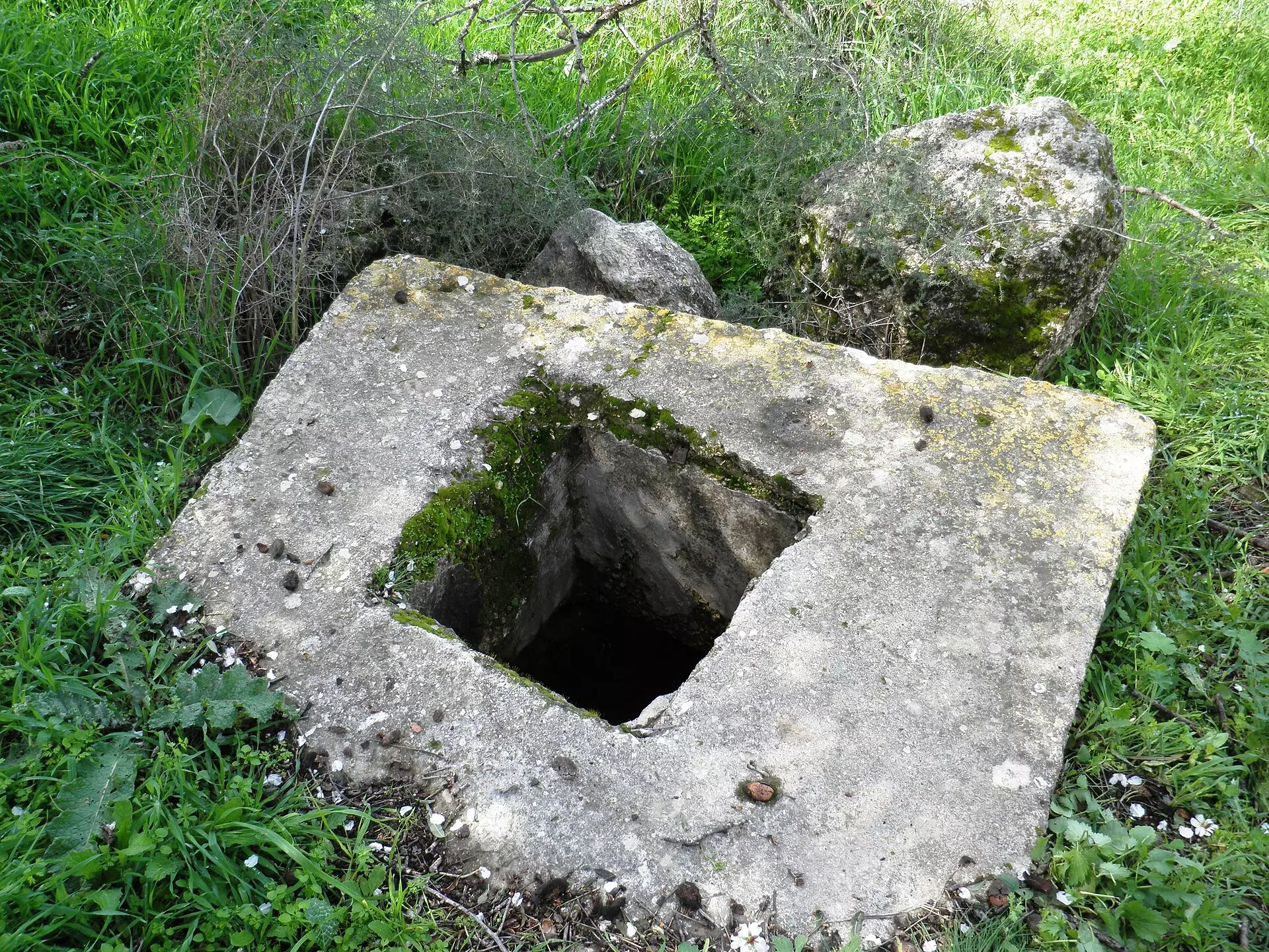
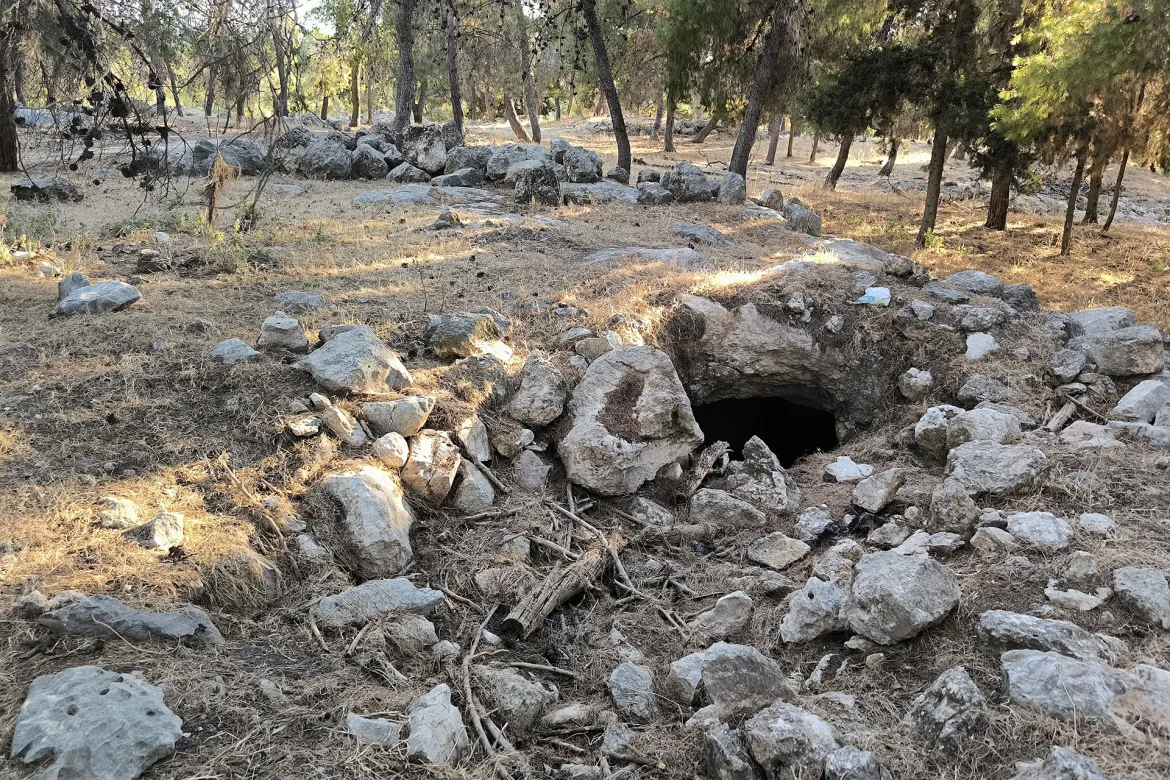
| Water Supply | A pipeline was constructed to transport water from 'Ayn Marjalayn (5 km to the east). | |||||||||||||||||||||
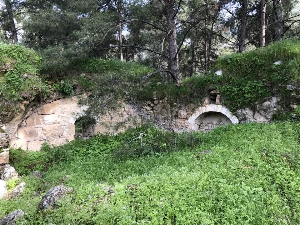
| Archeological Sites | Dayr Abban contains three khirbats: Khirbat Jinna'ir, Khirbat Haraza, and Khirbat al-Suyyag. | |||||||||||||||||||||
| Exculsive Jewish Colonies Who Usurped Village Lands |
Tzor'a, Machseya, Beyt Shemesh, and Yish'i | |||||||||||||||||||||
| Featured Video | ||||||||||||||||||||||
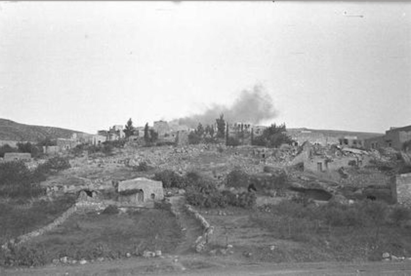
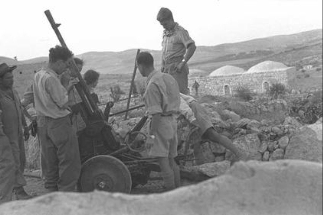
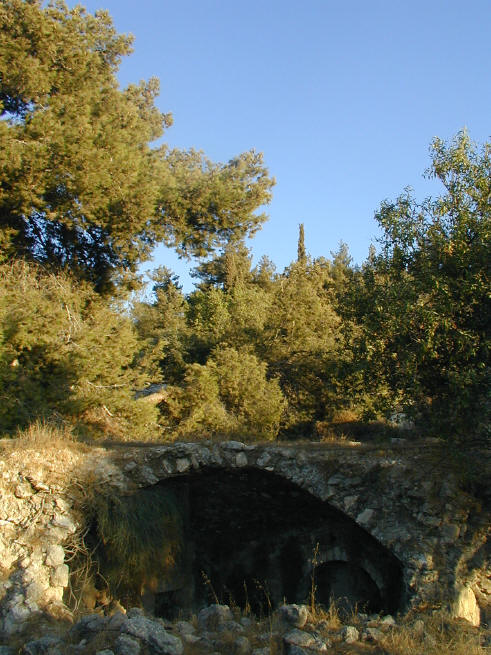
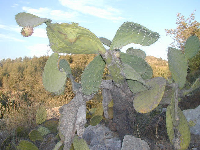
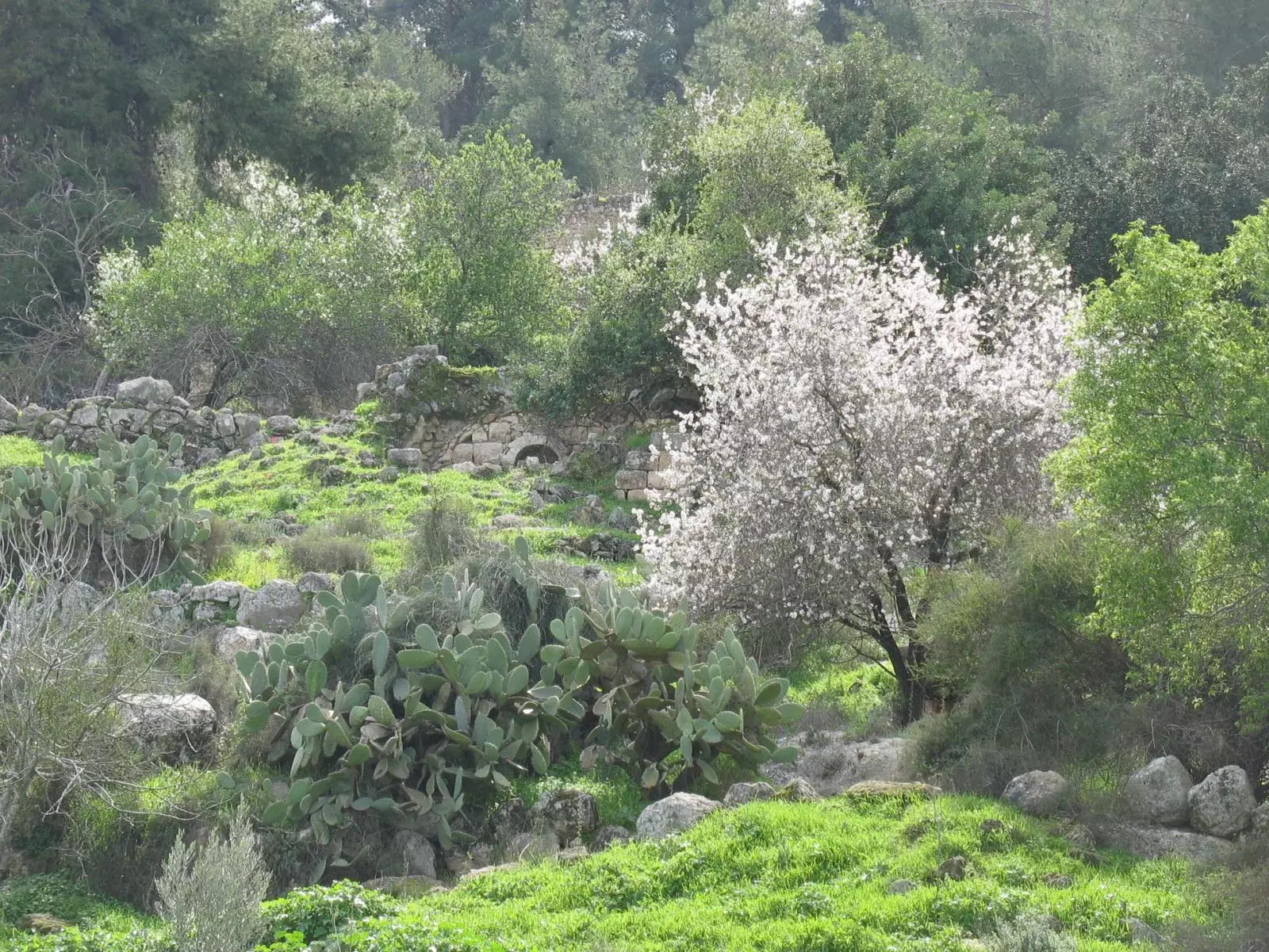
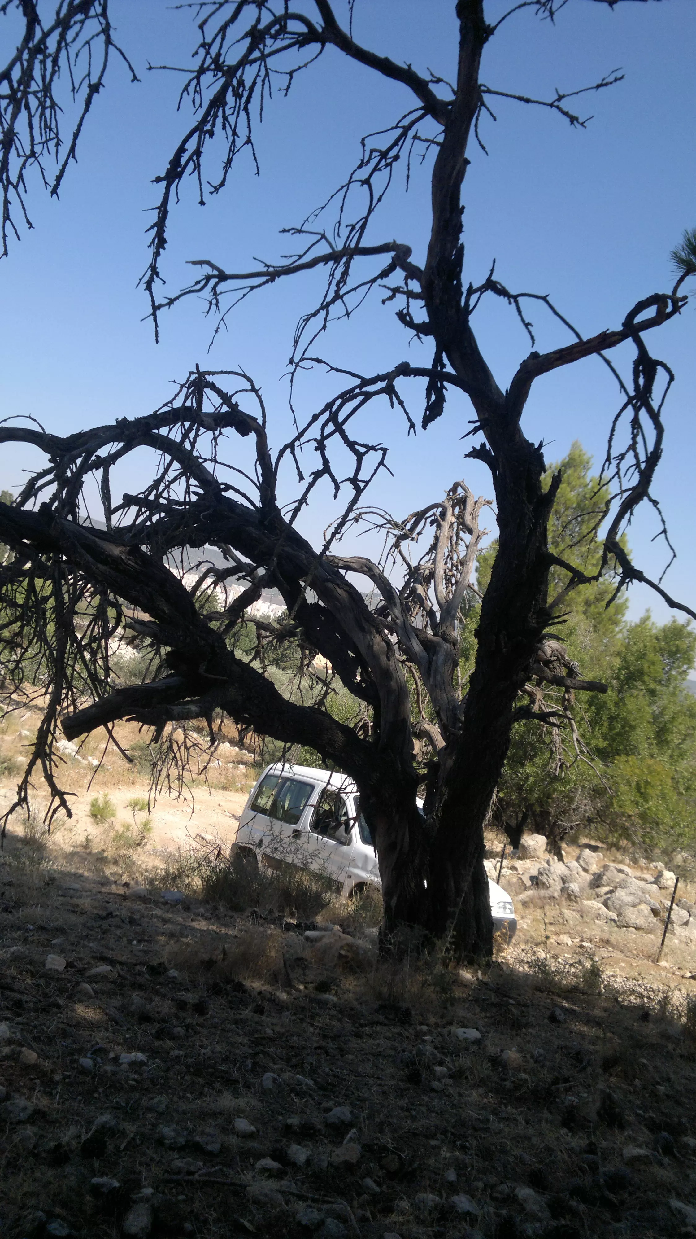
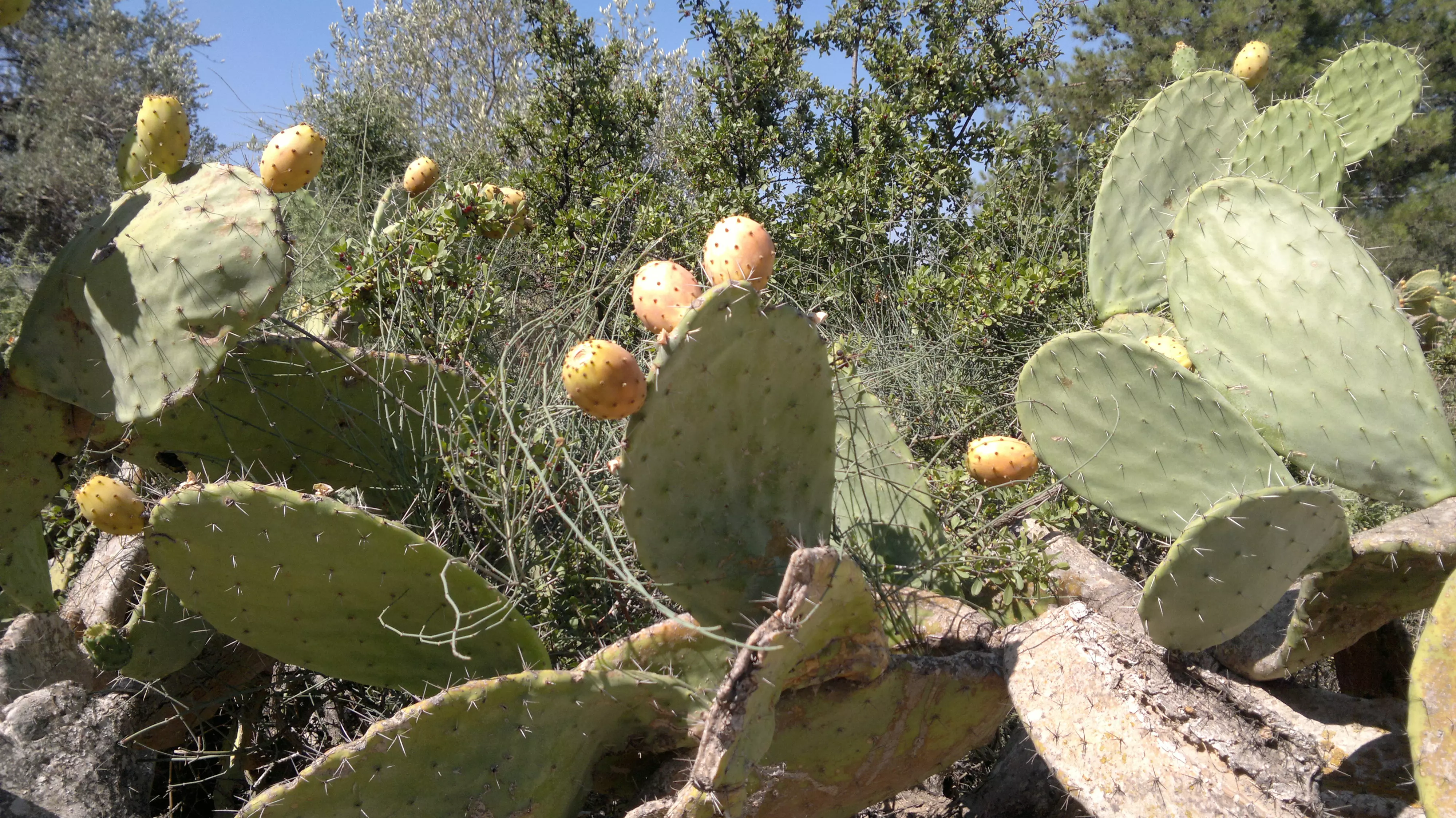
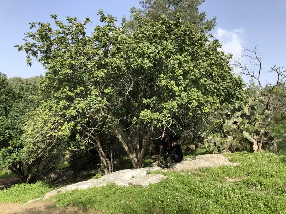
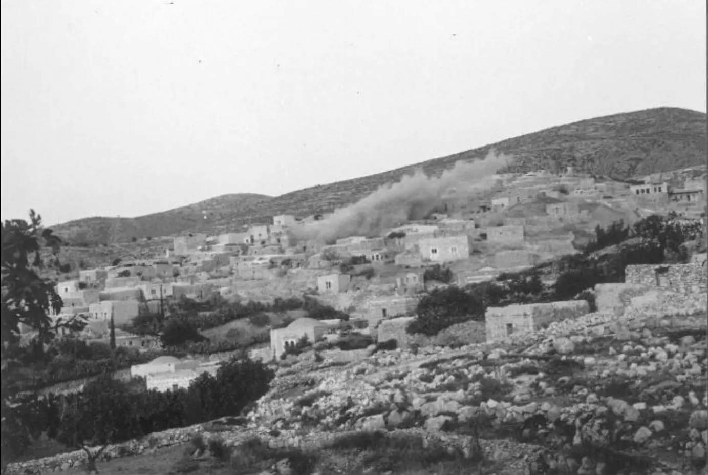
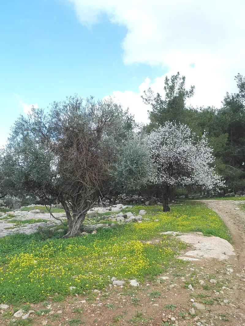
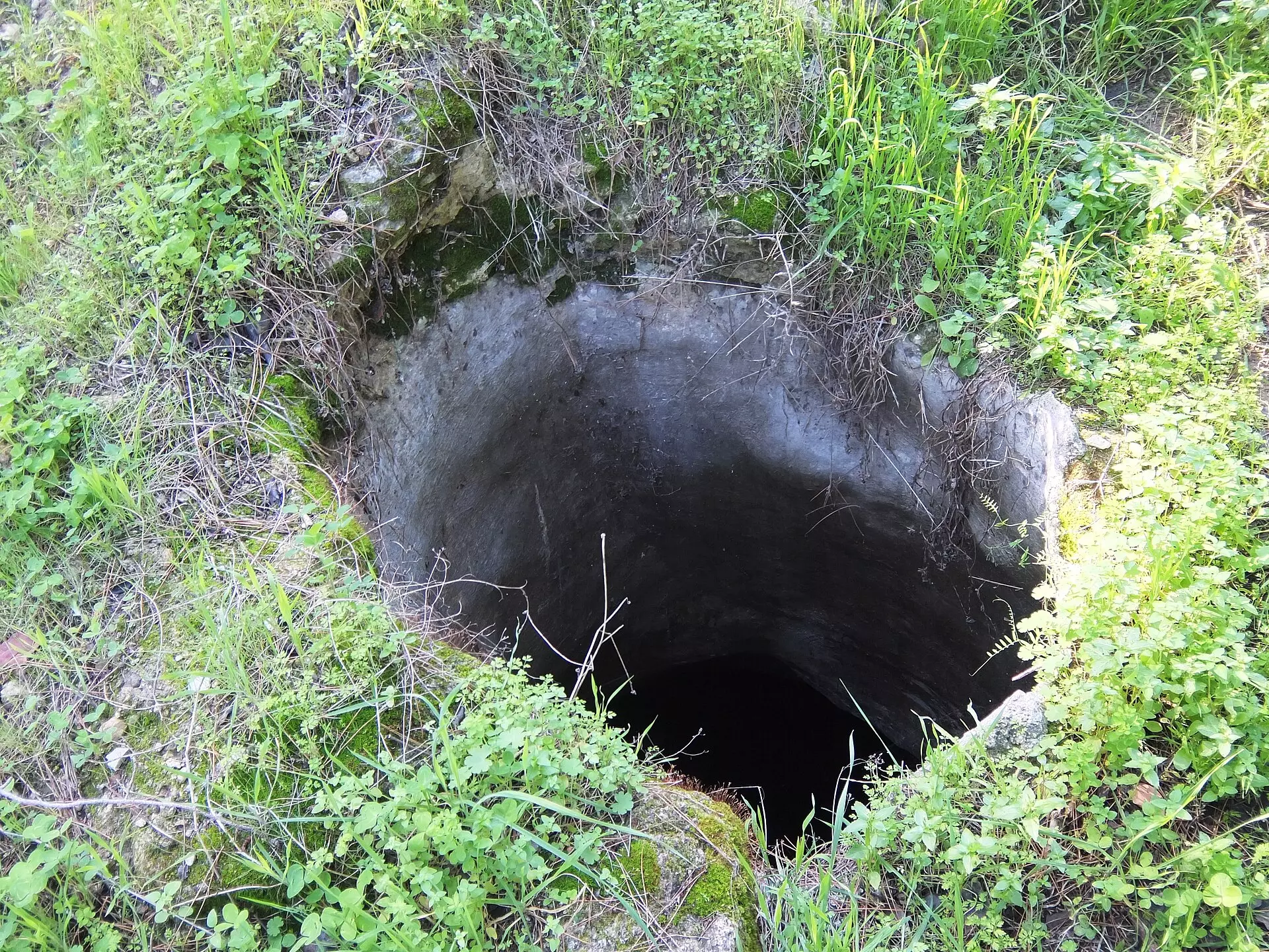
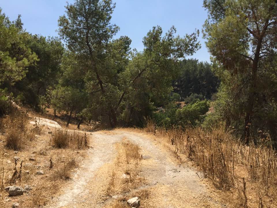
Village Before NakbaThe village was located on a large hill on the western slope of a mountain, and was surrounded by two broad wadis to the south and the north. The highway that linked Bayt Jibrin to the Jerusalem−Jaffa highway passed about 3 km west of the village. This highway constituted the village's main link to other cities and villages. Dayr Aban has been identified with the locality of Abenezer in the Roman period; in later times it fell within the administrative jurisdiction of Bayt Jibrin. In 1596 Dayr Aban was a village in the nahiya of Jerusalem (liwa' of Jerusalem) with a population of 127. It paid taxes on wheat, barley, olive trees, vineyards, fruit trees, goats, and beehives. In the late nineteenth century, Dayr Aban was a large village built on the lower slope of a high ridge. It was bordered by olive trees to the north, east, and west.The village had a circular layout and was centered around the intersection point of five roads, including the main road to Bayt Jibrin. Most village houses were built of stone and mud, with roofs made of wood, straw, and adobe; a few were topped with domes and built of limestone. The population was predominantly Muslim, as there were about 10 Christians out of 2,100 people in the mid-1940s. The al-'Umari mosque stood at the village center, where there was also an elementary school. Before the 1940s, rainfed wells constituted the major source of water; later, a pipeline was built to transport water from 'Ayn Marjalayn (5 km east of the village). Some of the villagers worked in agriculture while others worked in the commerce and service sectors. Olive trees were planted on a large part of the land. Vineyards were kept in the mountainous areas, while grain and corn grew in the flat parts of the village lands. In 1944/45 a total of 14,925 dunums was allotted to cereals; 1,580 dunums were irrigated or used for orchards. Three archaeological sites are in the vicinity: Khirbat Jinna'ir (150129), Khirbat Haraza (151129), and Khirbat al-Suyyagh (150128). Village Occupation and Ethnic CleaningThe village first came under attack in the early weeks of the war, when it was surrounded by an armed Jewish force on 17 January 1948. The New York Times reported that this occurred during the battle around the Kfar Etziyon group of Jewish settlements south of Bethlehem. The Zionist 'punitive expedition' against three villages in the vicinity (Zakariyya, Bayt Nattif, and Dayr Aban) continued for at least twenty-four hours. 'Arab sources' quoted in the Times estimated that the Zionist force involved at least 100 men. Two months later, on 20 March, a day-long exchange of fire was reported between the village and the Jewish settlement of Hartuv. No casualty figures were given.Dayr Aban was the first village to be occupied during Operation Ha-Har (see 'Allar, Jerusalem sub-district) at the end of the second truce of the war. The Haganah account relates that the hill overlooking Dayr Aban was occupied 'with relative ease' after Egyptian forces were taken by surprise and exposed to 'concentrated' firepower from artillery pieces and mortars. The village itself was taken the following night, on 19−20 October, and its population was probably displaced eastwards to Bethlehem or to the Hebron hills. Zionists Colonies on Village LandsIsrael established the settlement of Tzor'a (147130) northwest of the village site late in 1948. Machseya (130128), Beyt Shemesh (149129), and Yish'i (147128) were established west of the site in 1950. All four are on village lands.Village Todayalmond, cypress, and eucalyptus trees grow on the site, along with cactuses. Carob trees grow along the nearby terraces. Several wells still exist, but the mouths of some have been covered with boards.SourceDr. Walid al-Khalidi, 1992: All That Remains. |
||||||||||||||||||||||
| Related Maps | Town Lands' Demarcation Maps خرائط للقضاء توضح حدود القرى والاودية Town's map on MapQuest View from satellite Help us map this town at WikiMapia |
|||||||||||||||||||||
| Related Links | Wikipedia's Page Facebook Page Google Search Google For Images Google For Videos |
|||||||||||||||||||||
| More Information | في كتاب كي لا ننسى في كتاب بلادنا فلسطين في كتاب النكبة والفردوس المفقود المزيد من موقع هوية |
|||||||||||||||||||||
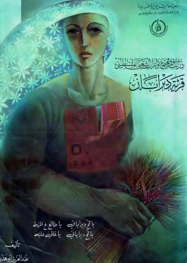
- كتاب قرية دير أبان المهجرة -- إعداد عبدالعزيز أبو هدبة
- كتاب دﻳﺮ ﺑﺎن/ دﻳﺮ أبان من قرى العرقوب
- Dayr aban
- Correction Of Dayr aban story
- نبذة تاريخية عن قرية دير آبان (قضاء القدس) من كتاب (كي لا ننسى)
- دير أبان… قرية فلسطينية طمست النكبة معالمها - Al Jazeera
- تقرير عن عائلة شريم من دير ابآن (Powerpoint)
- خان باب الواد، ملك عائلة قطينة الذي تحول إلى متحف إسرائيلي
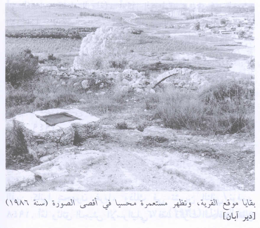
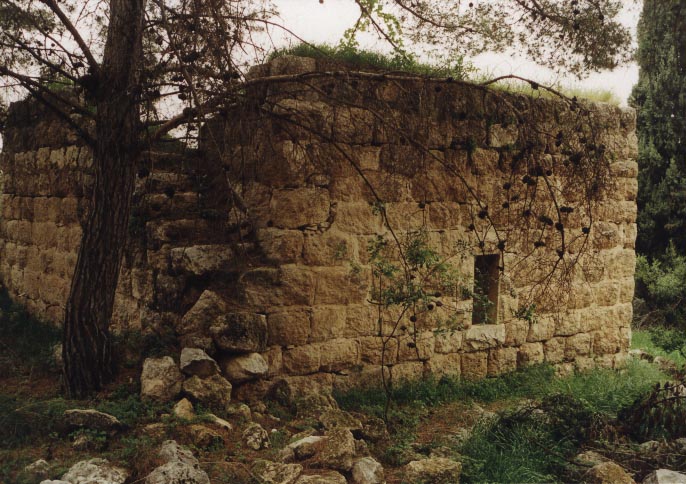
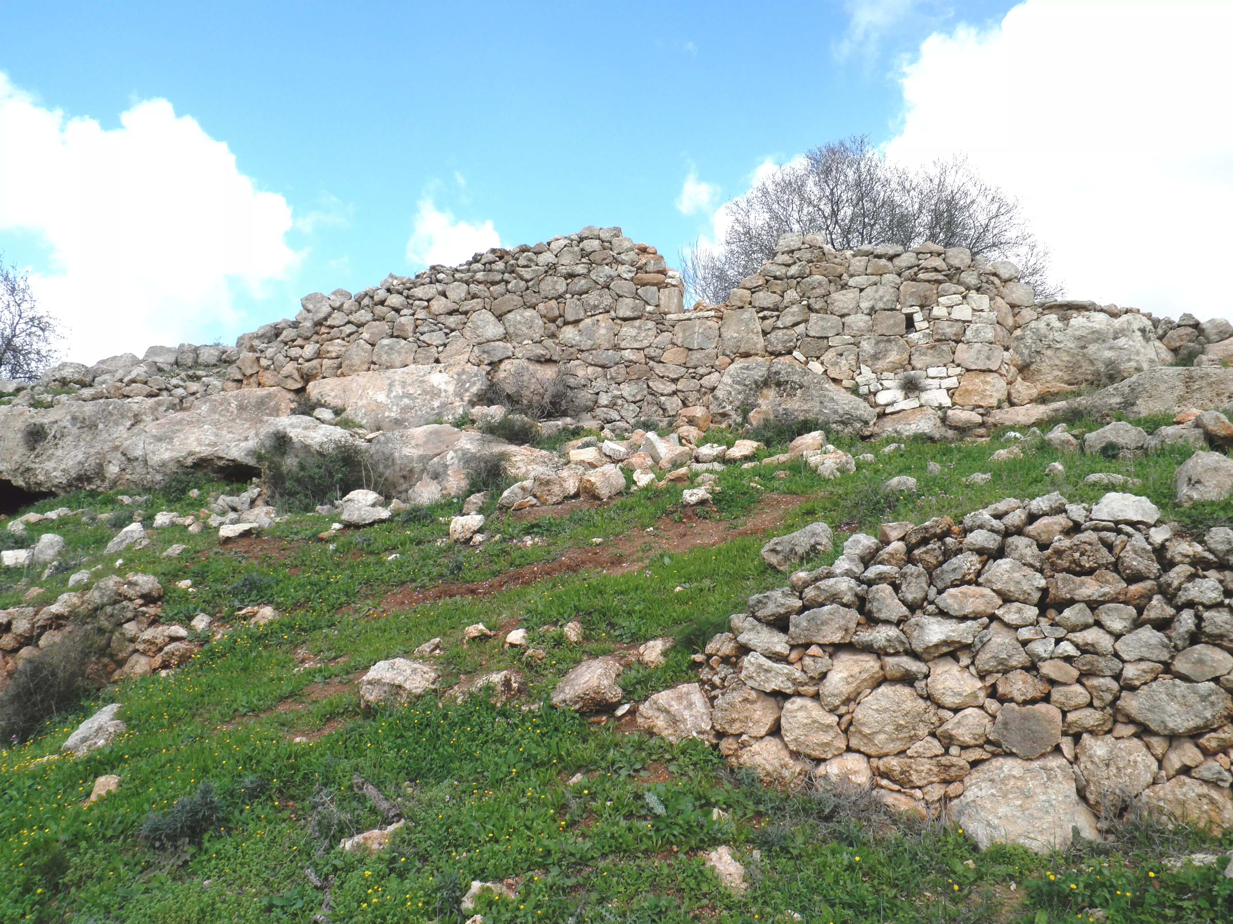
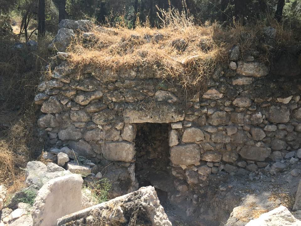
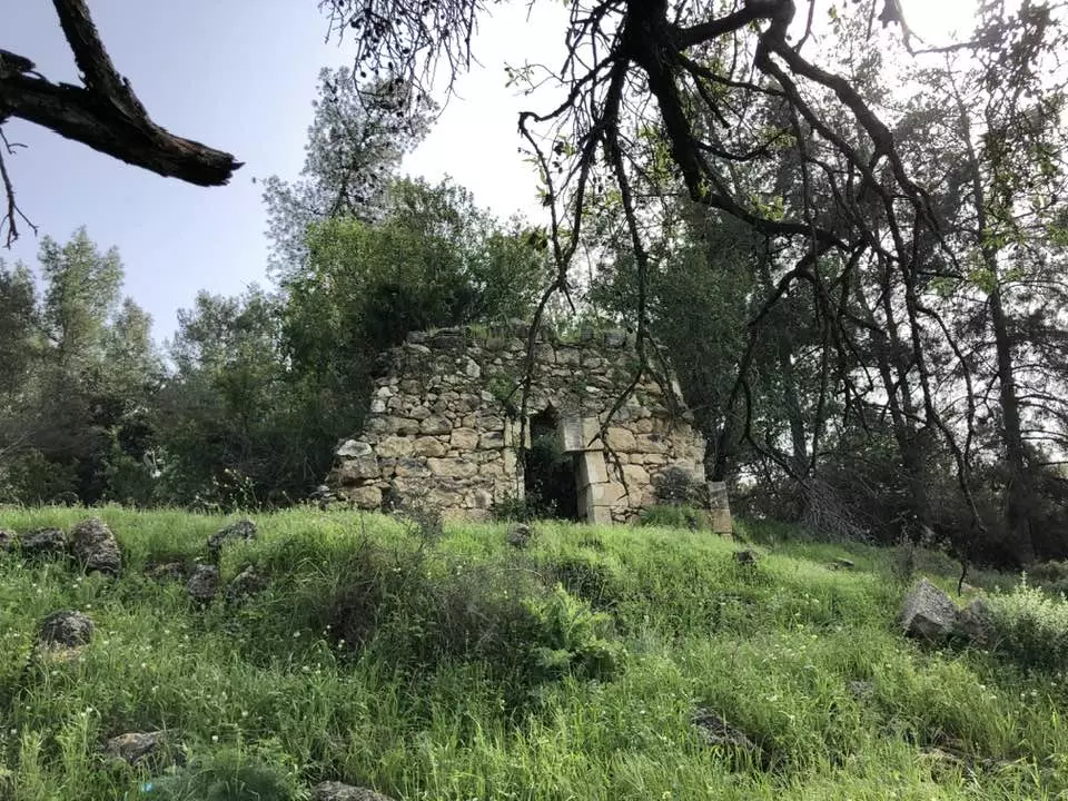
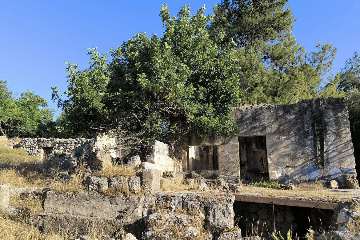
- Remains Of Village Site In 1986
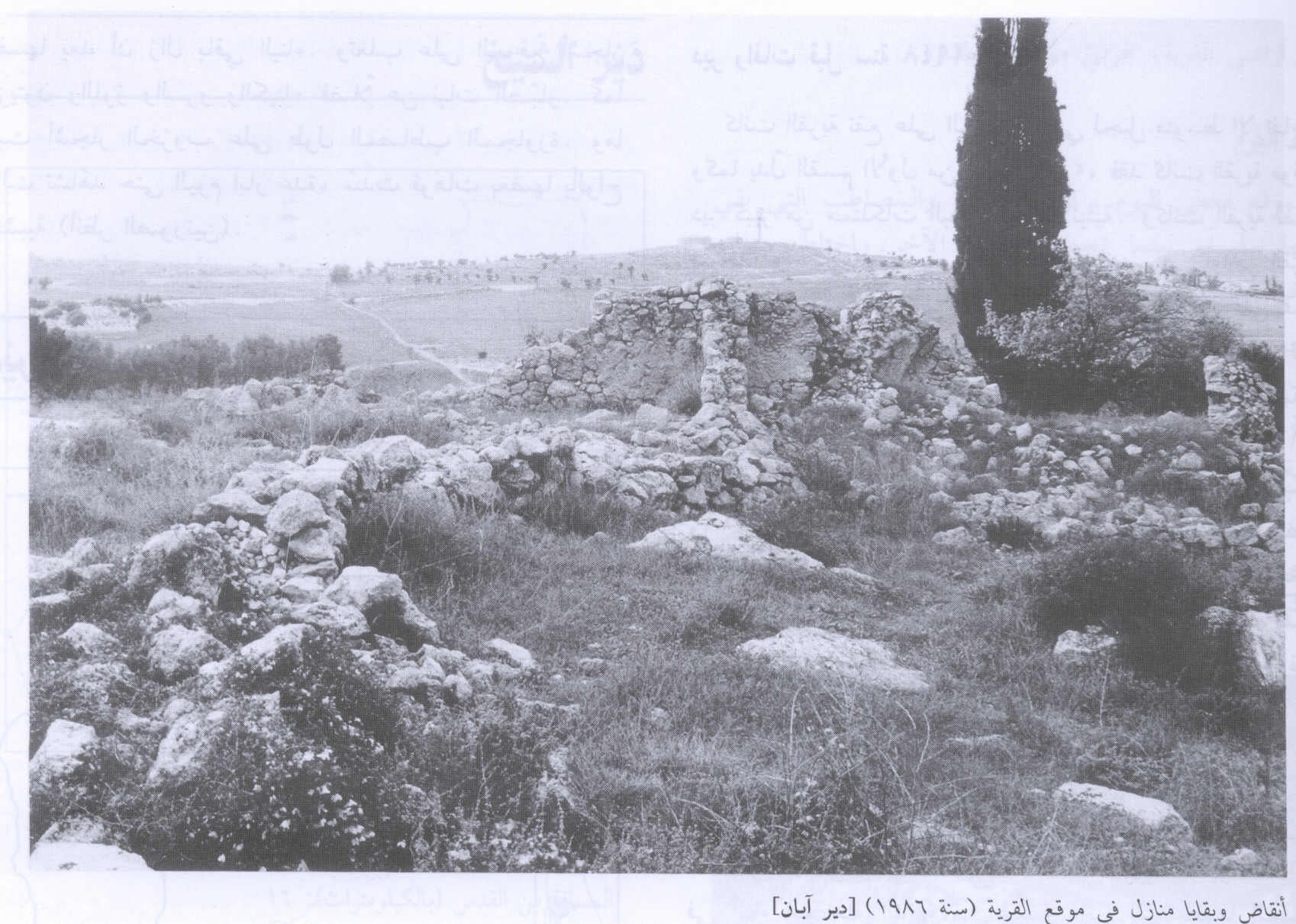
Scanned from "All That Remains" by Dr. Walid Khalidi 10 - House Rubble In 1986
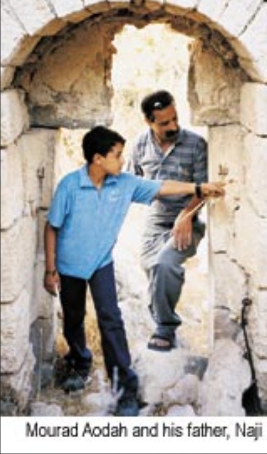
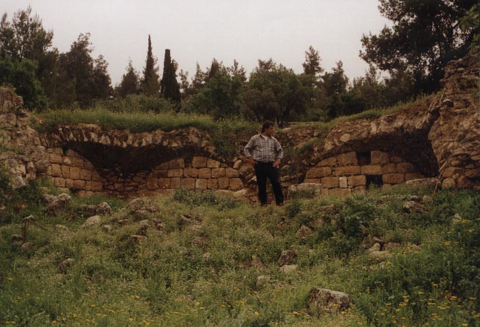
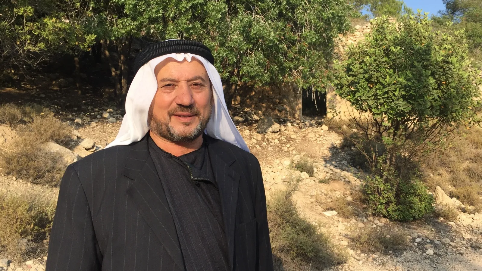
Scanned from "All That Remains" by Dr. Walid Khalidi 1 - Naji 'Udeh, 39, and his son Mourad, 12, visit their destoryed & ethnically cleansed village again
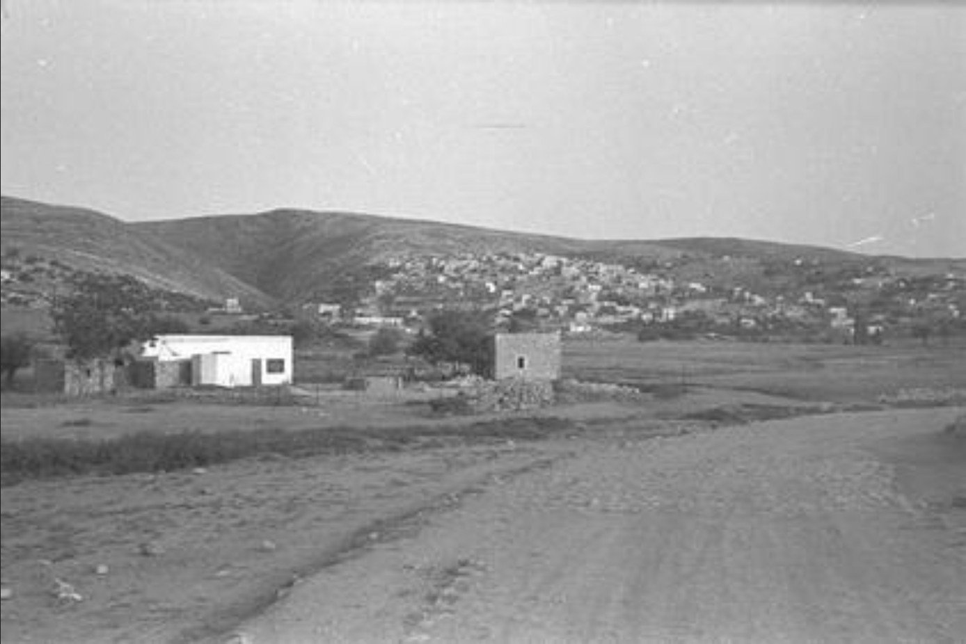
1 - General View Of Dayr Aban Just Before Occupation, 1948
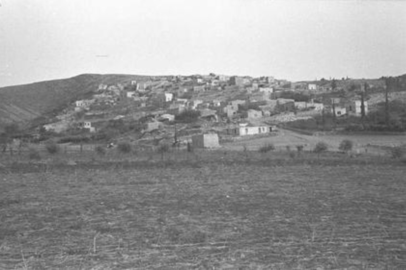
Posted by Prince, Peaceful Israeli - General View Of Dayr Aban Just Before Occupation #2, 1948
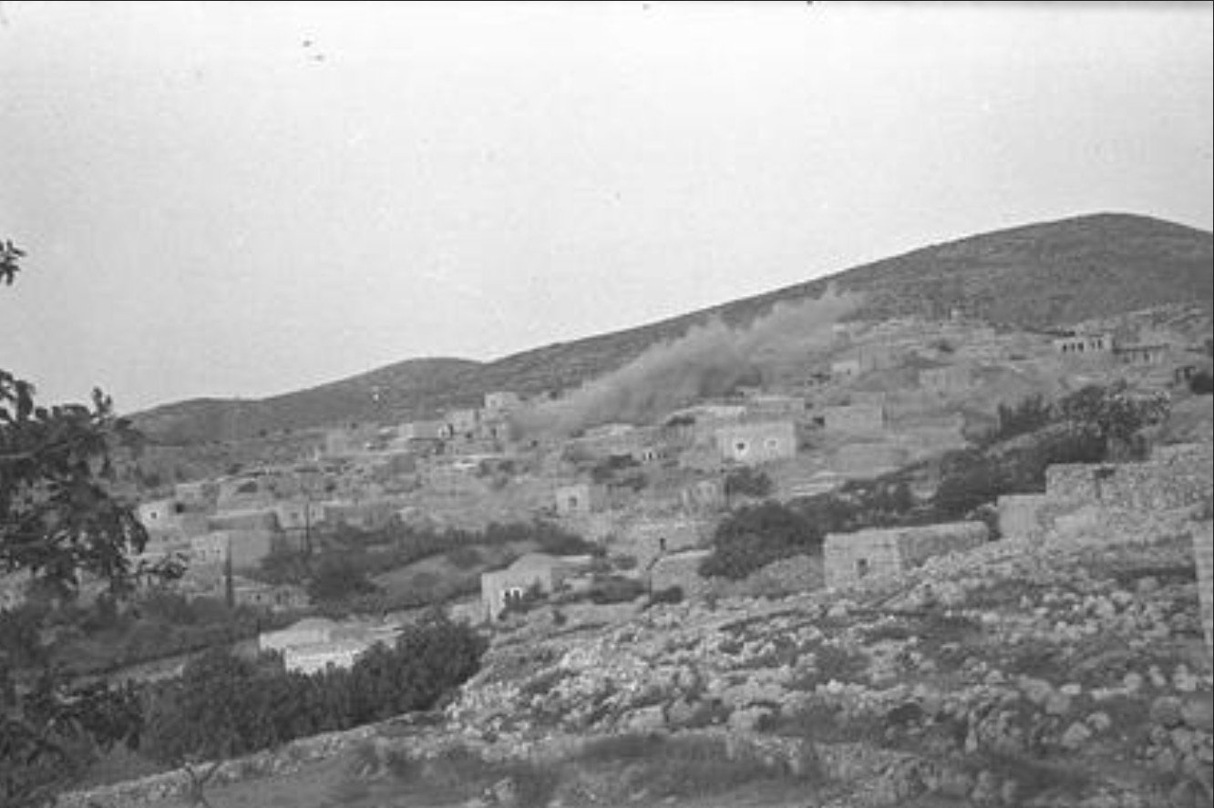
Posted by Prince, Peaceful Israeli - Attacking Dayr Aban #1, 1948
Posted by Prince, Peaceful Israeli 1 - Attacking Dayr Aban #2, 1948
Posted by Prince, Peaceful Israeli 2 - Attacking Dayr Aban #3, 1948
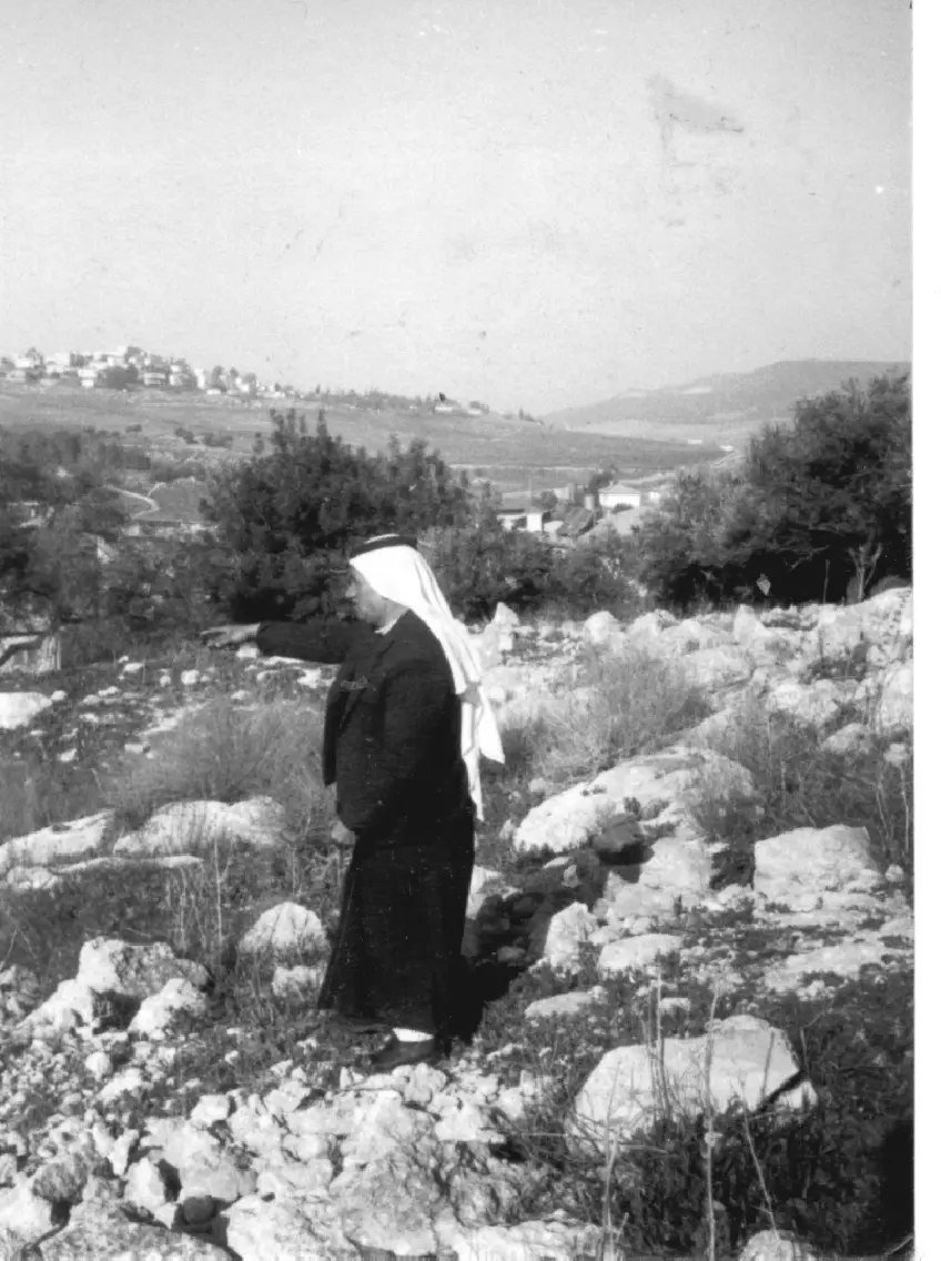
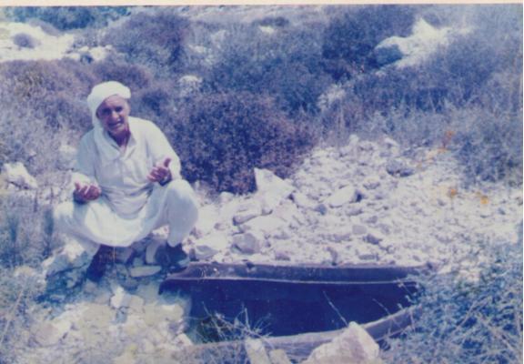
Posted by Prince, Peaceful Israeli - Abed Alhafeth Amira in his land in Dayr Aban, 1978
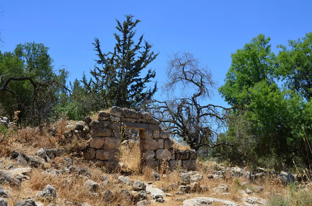
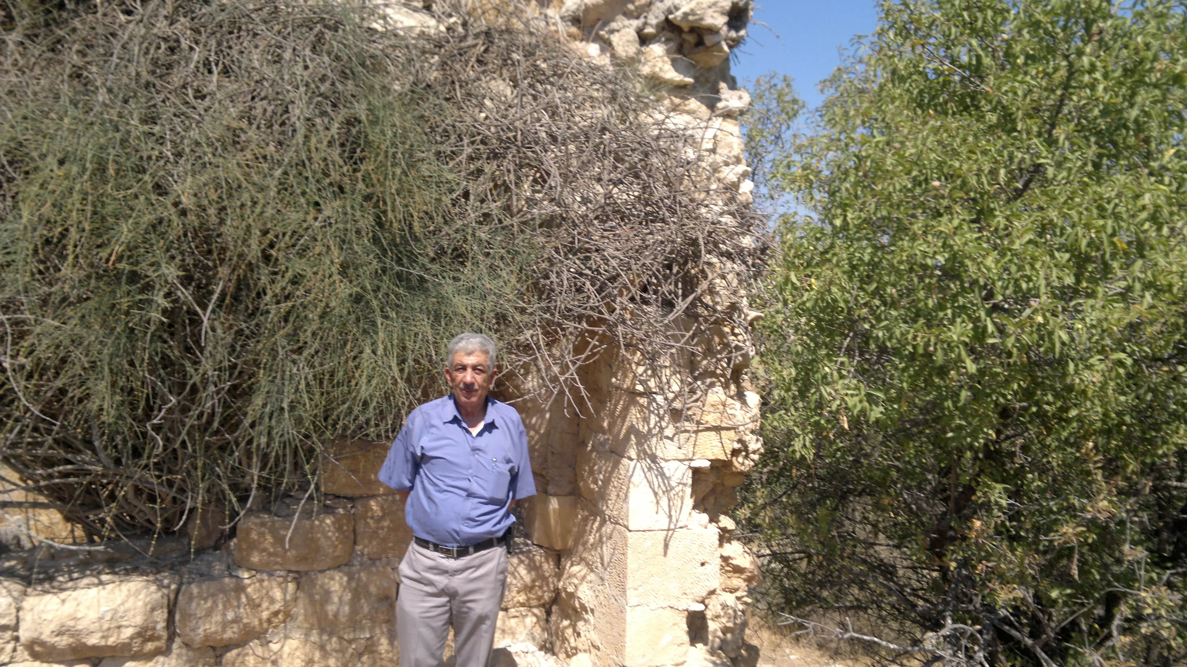
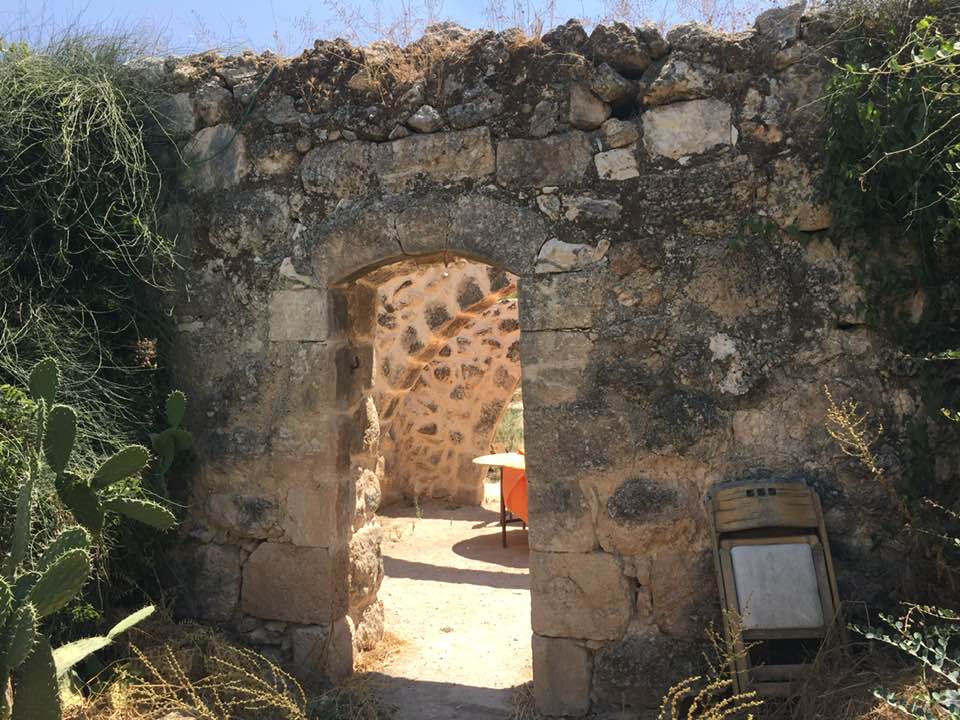
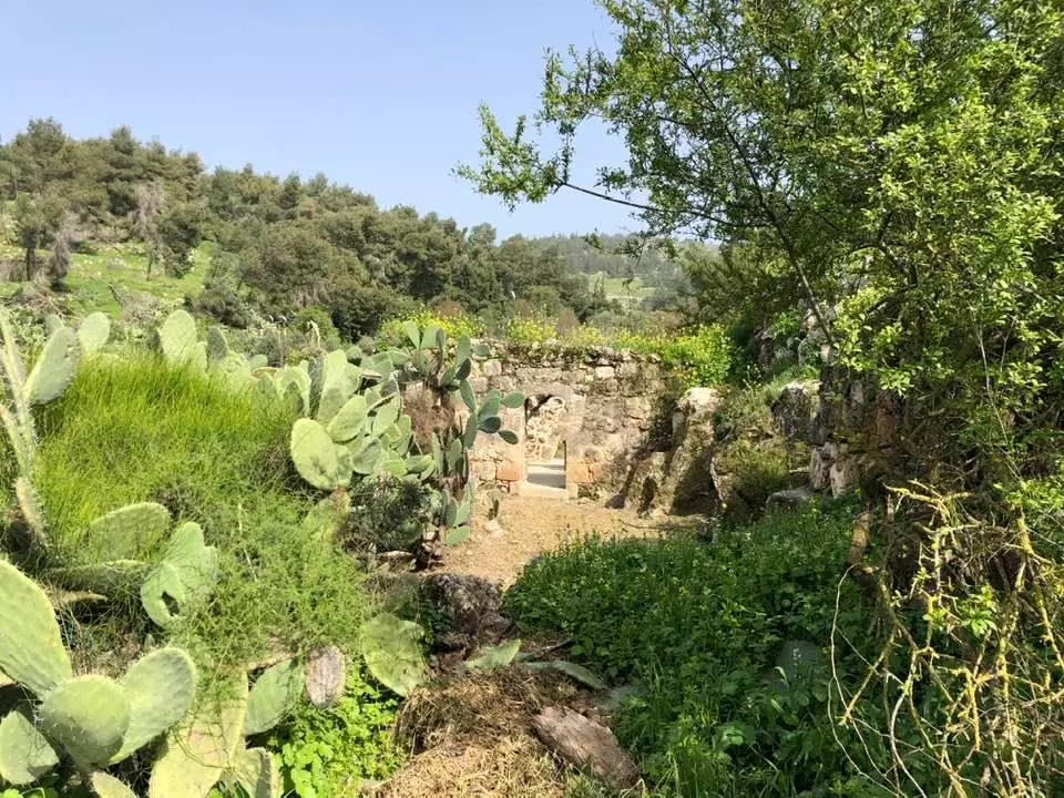
Posted by عميرة 2 - One of the remaining houses in Deir Abban, March-2002
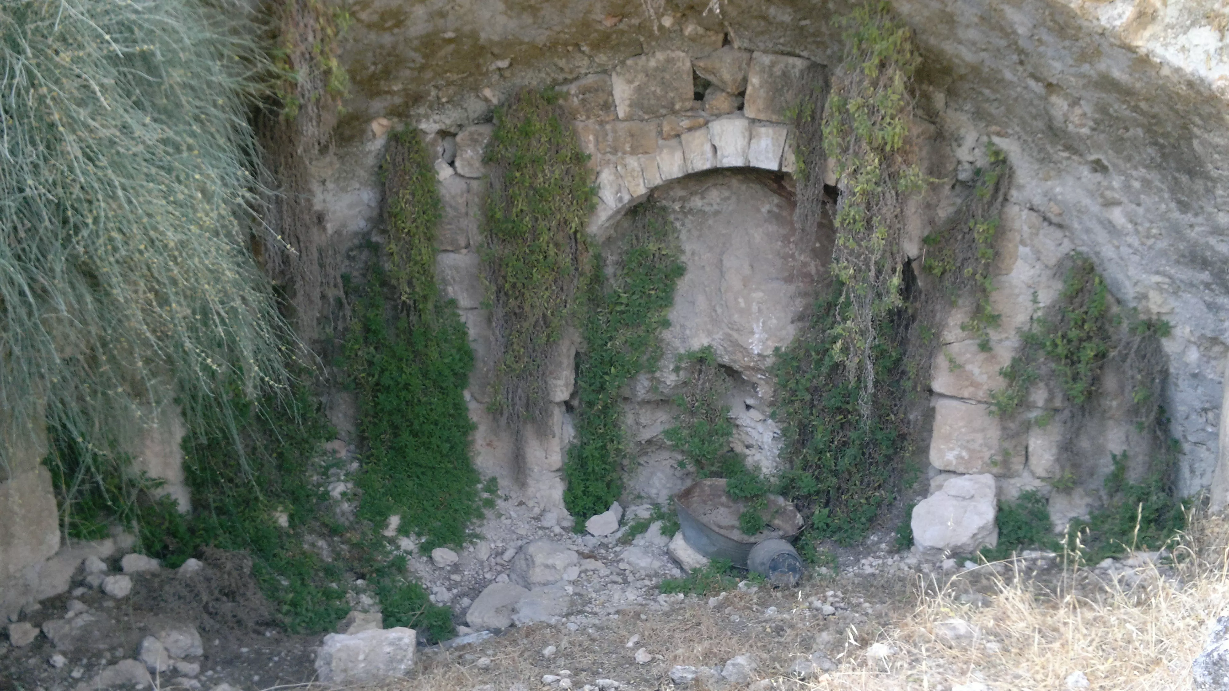
Posted by Aqsa Association-Palestine-1948 - The destroyed Mosque of Deir Abban, March-2002
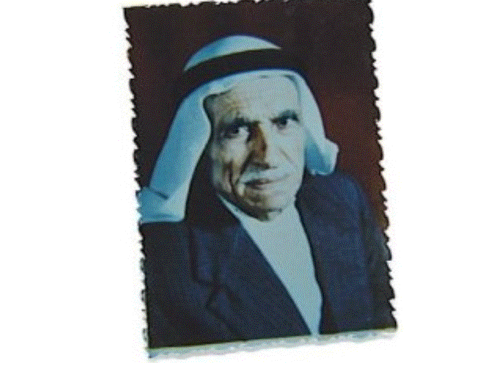
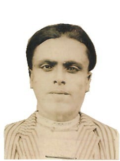
Posted by Aqsa Association-Palestine-1948 1 - الحاج مصطفى درويش صرار
Posted by ramzi05 - Deir Aban's house rubble and some walls, copyright belongs to Badil.org
5 - Deir Aban's house rubble and some walls #2, copyright belongs to Badil.org
4 - Deir Aban's house rubble and some walls #3, copyright belongs to Badil.org
- Deir Abans house rubble and some remaining walls #4, copyright belongs to Badil.org
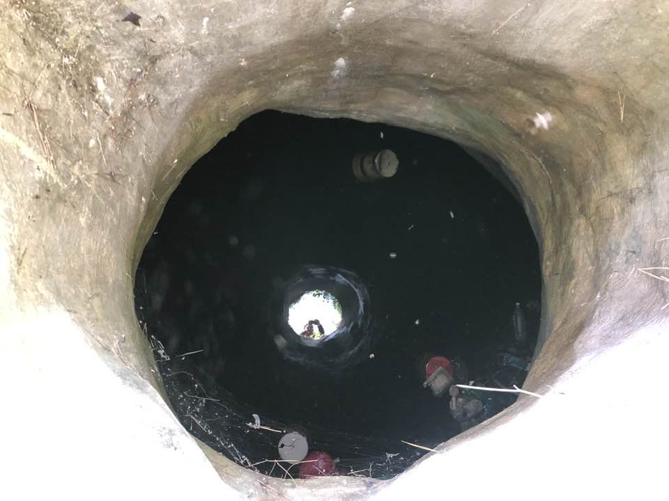
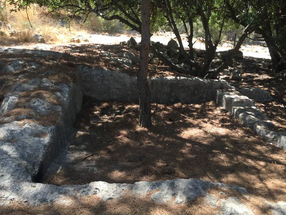
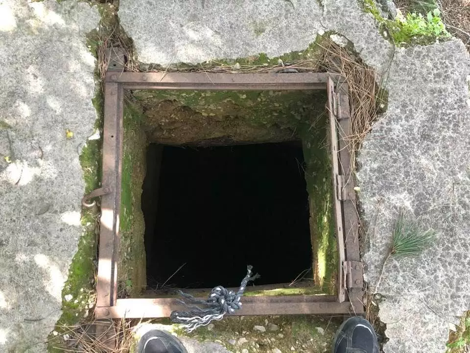
1 - A water well in Deir Abans, copyright belongs to Badil.org
2 - Cactus trees in Deir Aban, copyright belongs to Badil.org
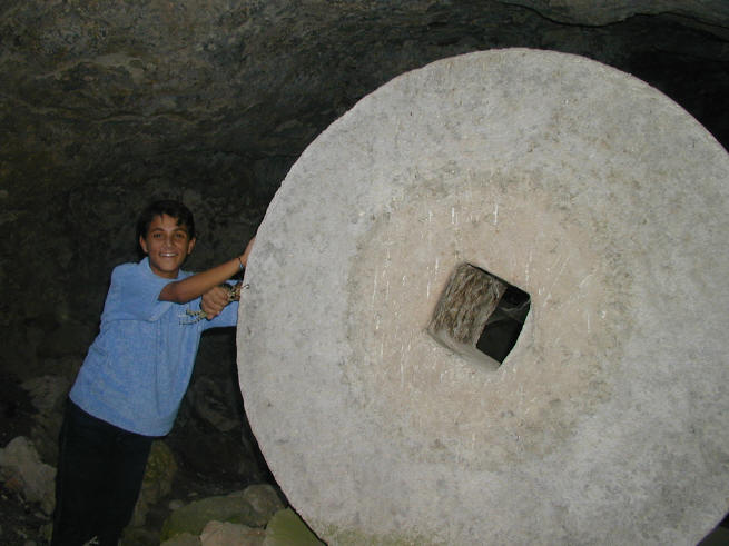
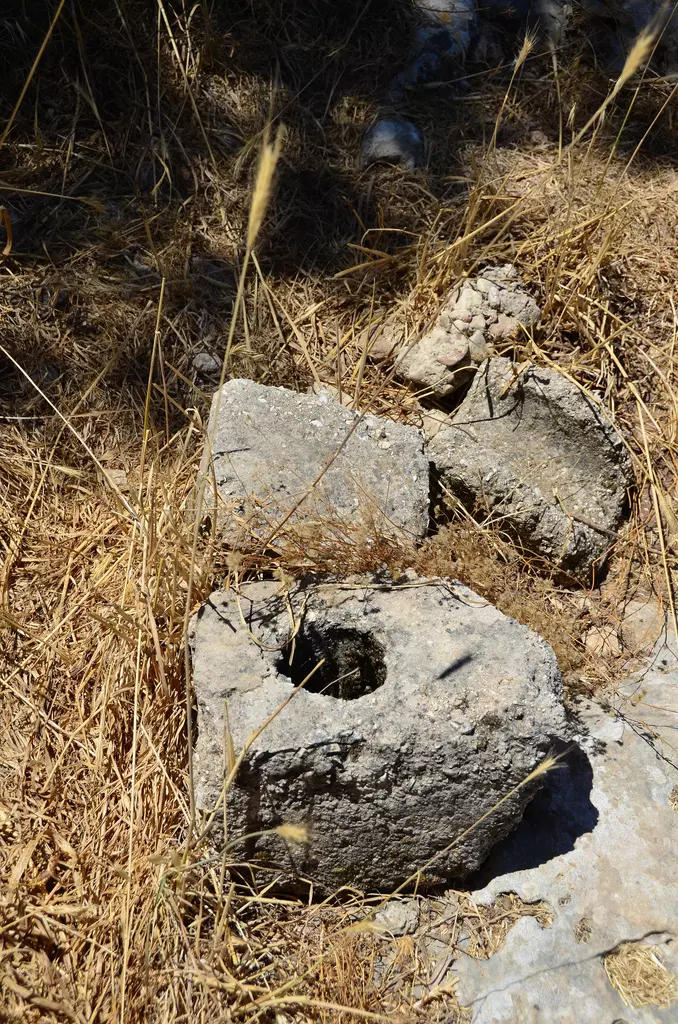
1 - Stone wheel used to grind olive for oil extraction, copyright belongs to Badil.org
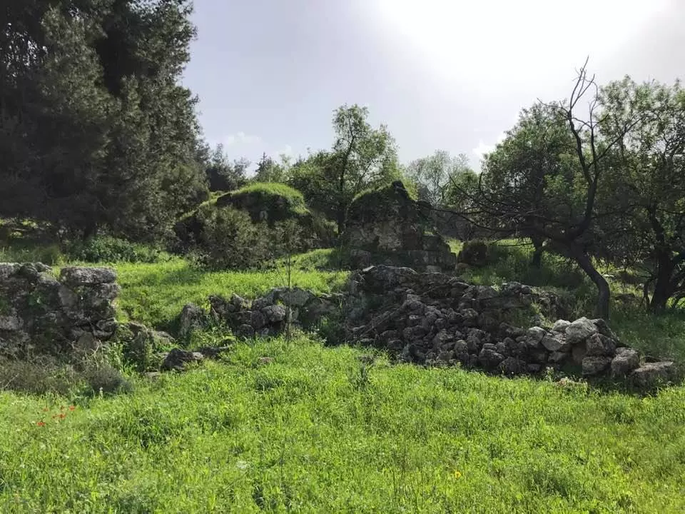
3 - Ruins of destroyed houses in the destroyed Palestinian village
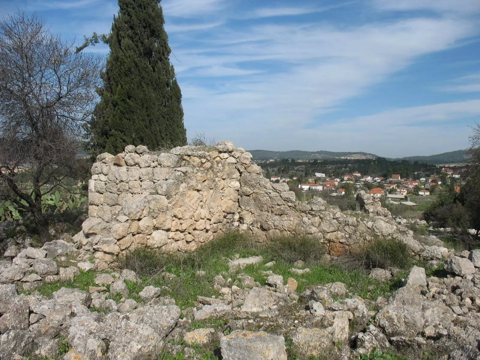
Posted by Noga Kadman 2 - The remains of destroyed Palestinian house and an exclusive Jewish colony appears in the background
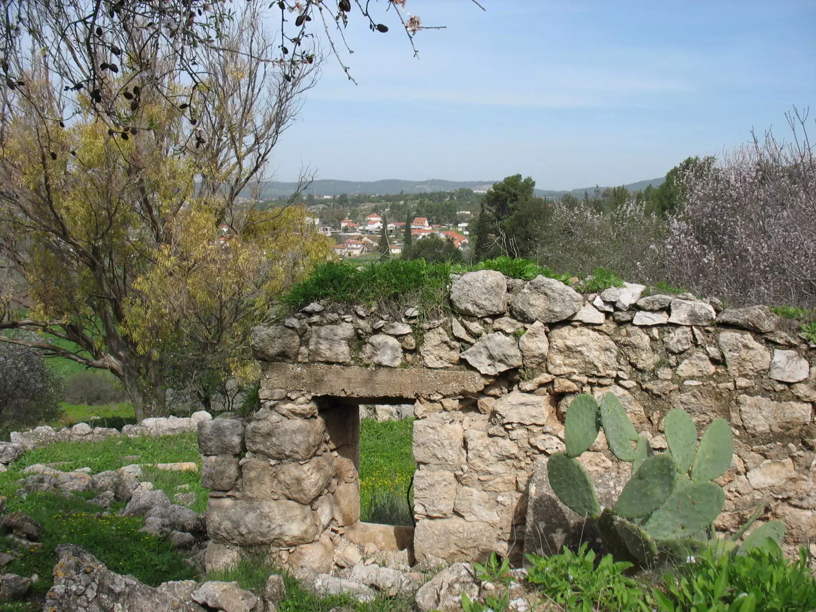
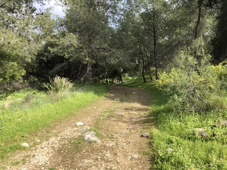
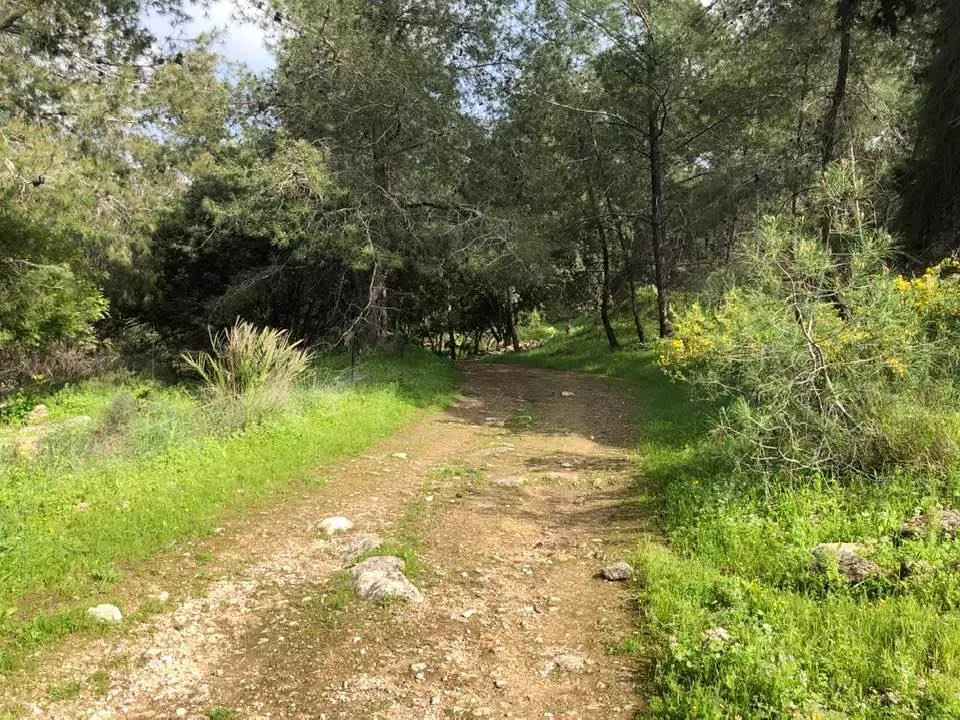
Posted by Noga Kadman 7 - The ruins of the destroyed Palestinian village during the spring season.
Posted by Noga Kadman 3 - صورة الشهيد محمد حسين محمد احمد سليمان عطالله من عشيرة الوعره, استشهد في منطقه الخضر عام 1949 متأثرا بجراح المقاومه في إستحكام نمره أربعه بدير آبان سنه 1948
Posted by Dr. Mohammed Atallah 2 - الحاج موسى عبد الله حسين دعامسة يتلو الفاتحة على روح والده الحاج عبدالله دعامسة
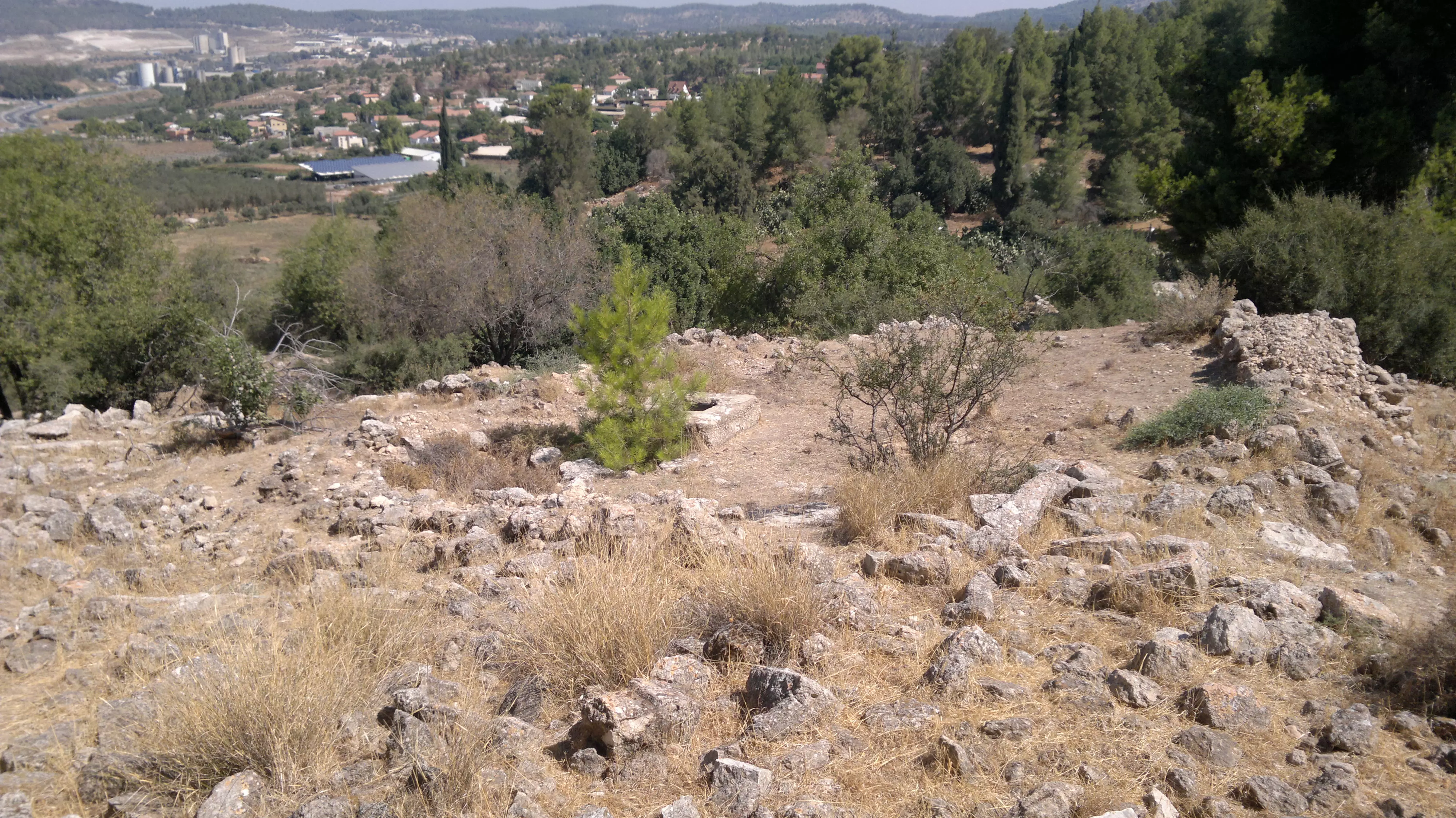
Posted by حبشي 8 - Remains, 08/06/12
Posted by Uri Zackhem - Remains, 08/06/12
Posted by Uri Zackhem - Remains, 08/06/12
Posted by Uri Zackhem 1 - Remains, 08/06/12
Posted by Uri Zackhem - Remains, 08/06/12
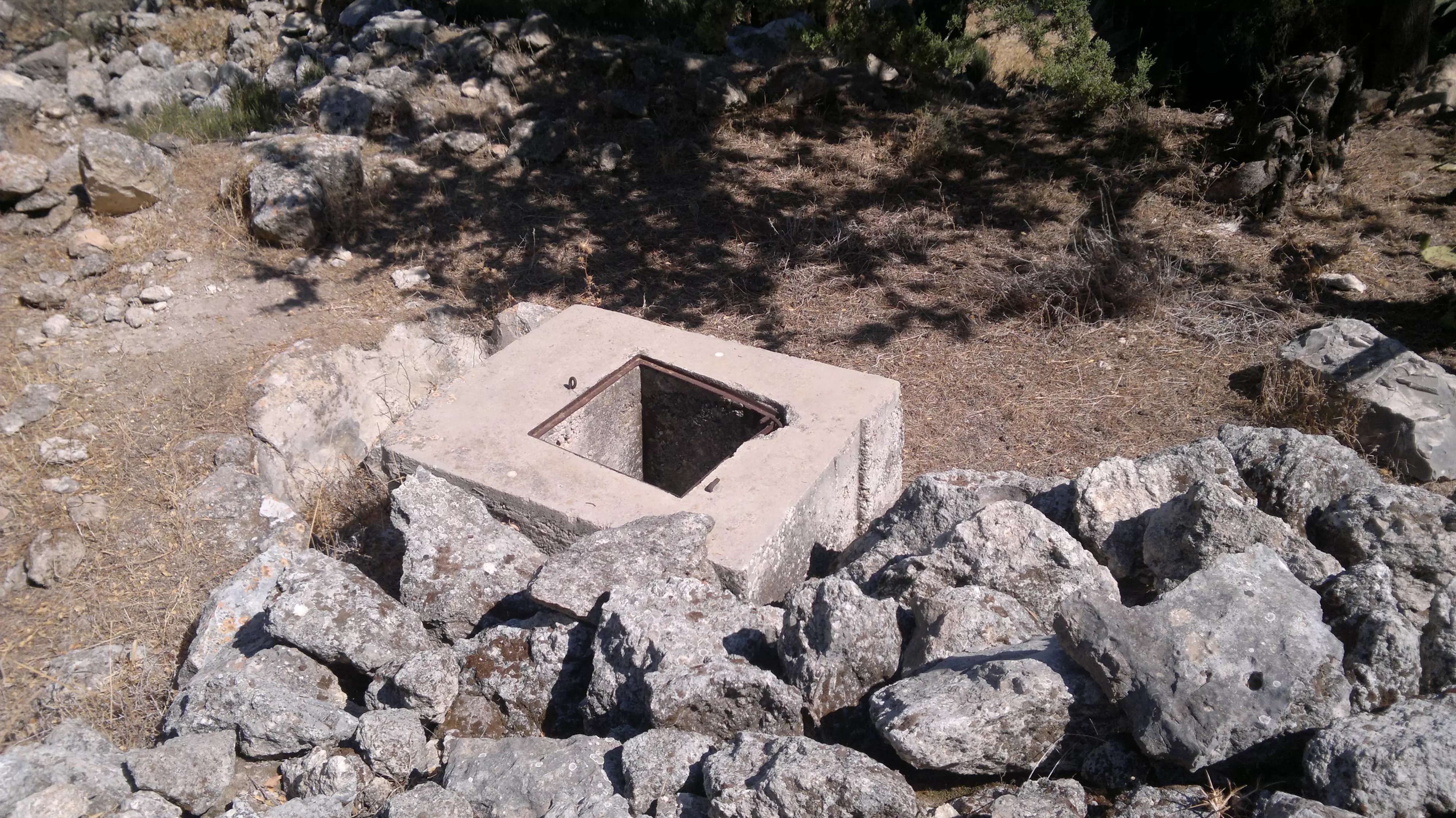
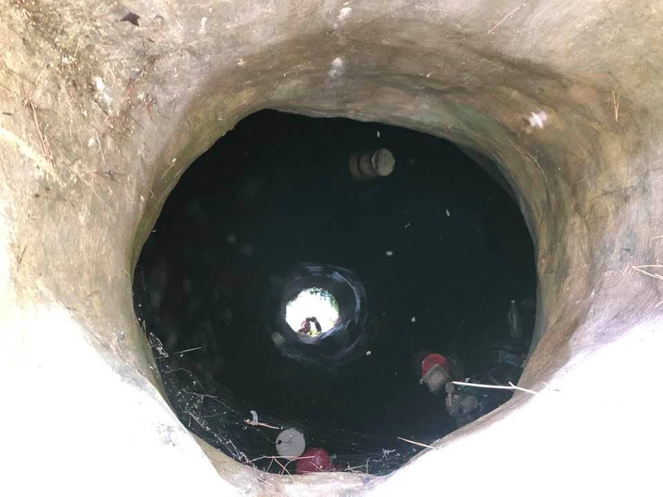
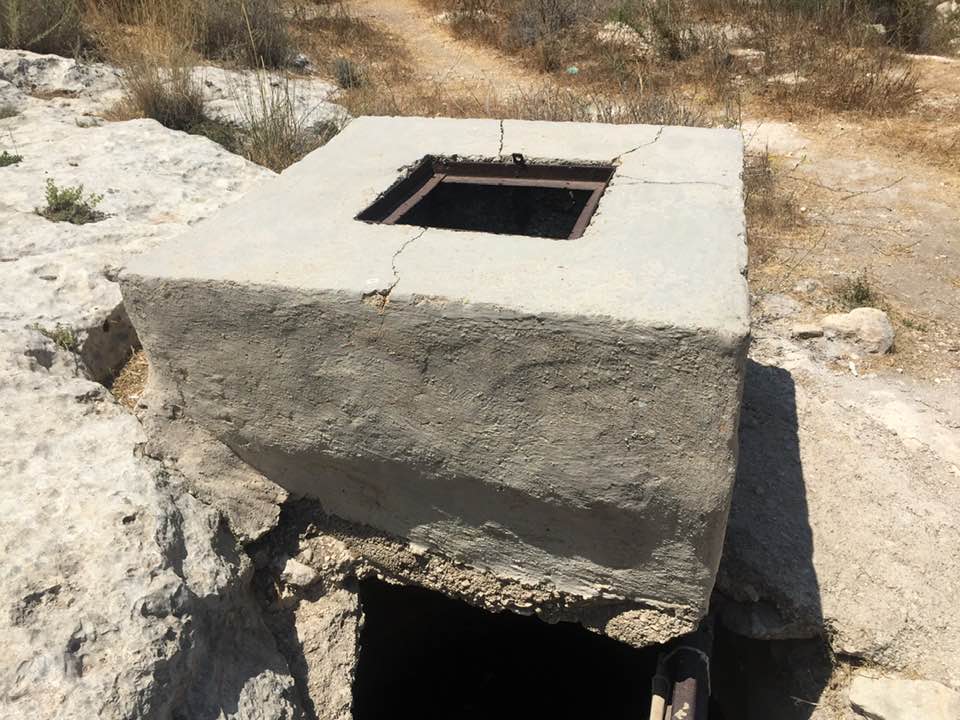
Posted by Uri Zackhem - A cistern
Posted by Uri Zackhem - صوره من القرية
Posted by نعيم عميره 2 - هذه حالي بعد غياب الاهل والاحباب
Posted by نعيم عميره 1 - نعيم عميره وماجد البرميل على انقاض قريتهم المدمره
Posted by نعيم عميره - الصبر في ديرابان
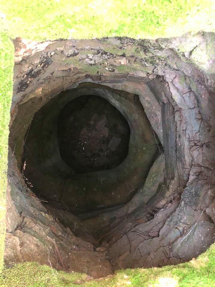
Posted by نعيم عميره - احد الابار في ديرابان
Posted by نعيم عميره - منظر من القرية
Posted by نعيم عميره 1 - الاستاذ نعيم عميره في زياره للقرية 1/8/2013
Posted by نعيم عميره 1 - lان بقايا البيوت المدمره
Posted by نعيم عميره - مغاره وهى احدى المغر النتشره في القرية
Posted by نعيم عميره - جولة بين انقاض قرية دير ابان المهجرة والمدمرة
- جولة بين انقاض قرية دير ابان المهجرة والمدمرة #2

- جولة بين انقاض قرية دير ابان المهجرة والمدمرة #3
- جولة بين انقاض قرية دير ابان المهجرة والمدمرة #4
- جولة بين انقاض قرية دير ابان المهجرة والمدمرة #5
- جولة بين انقاض قرية دير ابان المهجرة والمدمرة #6
- جولة بين انقاض قرية دير ابان المهجرة والمدمرة #7
- جولة بين انقاض قرية دير ابان المهجرة والمدمرة #8
- جولة بين انقاض قرية دير ابان المهجرة والمدمرة #9
- جولة بين انقاض قرية دير ابان المهجرة والمدمرة #10
- جولة بين انقاض قرية دير ابان المهجرة والمدمرة #11
- جولة بين انقاض قرية دير ابان المهجرة والمدمرة #12
- جولة بين انقاض قرية دير ابان المهجرة والمدمرة #13
- جولة بين انقاض قرية دير ابان المهجرة والمدمرة #14
- جولة بين انقاض قرية دير ابان المهجرة والمدمرة #15
- احد آبار القرية المغتصبة

- احد آبار القرية المغتصبة #2

- يحمل الستيني يوسف عودة العديد من التفاصيل والذكريات التي رواها والداه وأهله عن قريته دير أبان (الجزيرة)
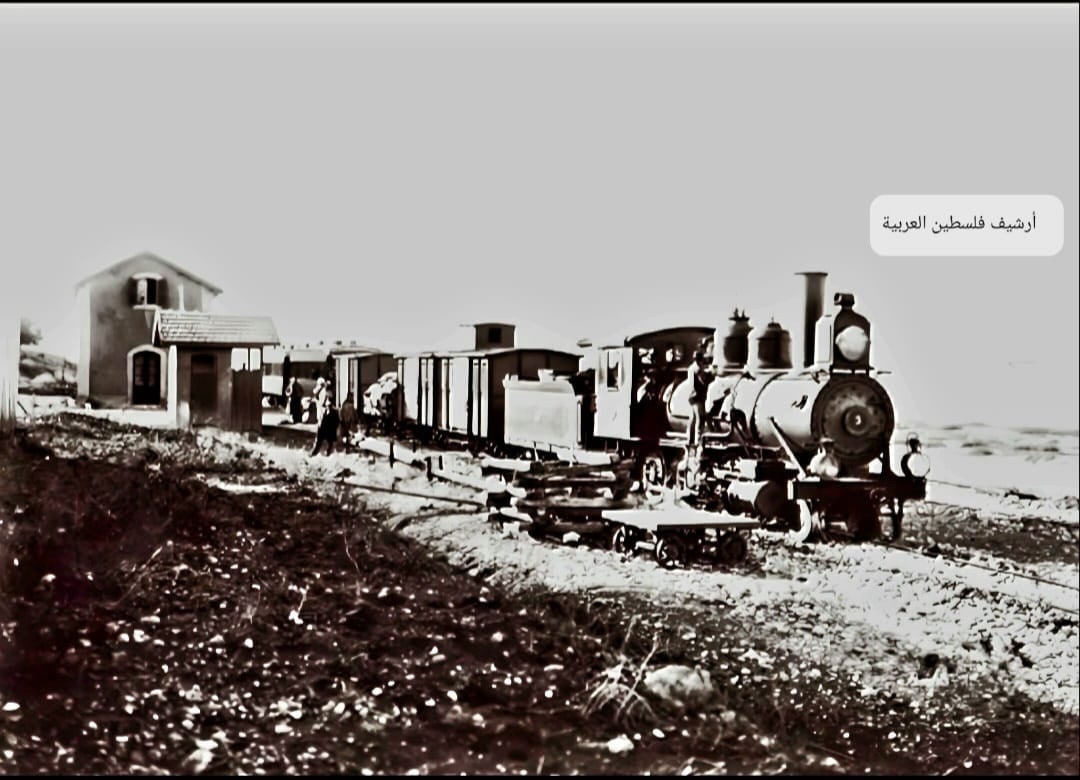
- قطار الحجاز يتحرك من محطة دير آبان قضاء القدس نحو الرملة عشرينيات القرن العشرين..
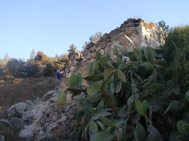
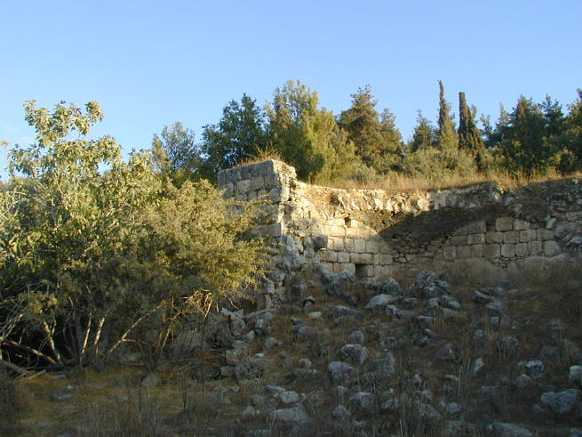
- House rubble
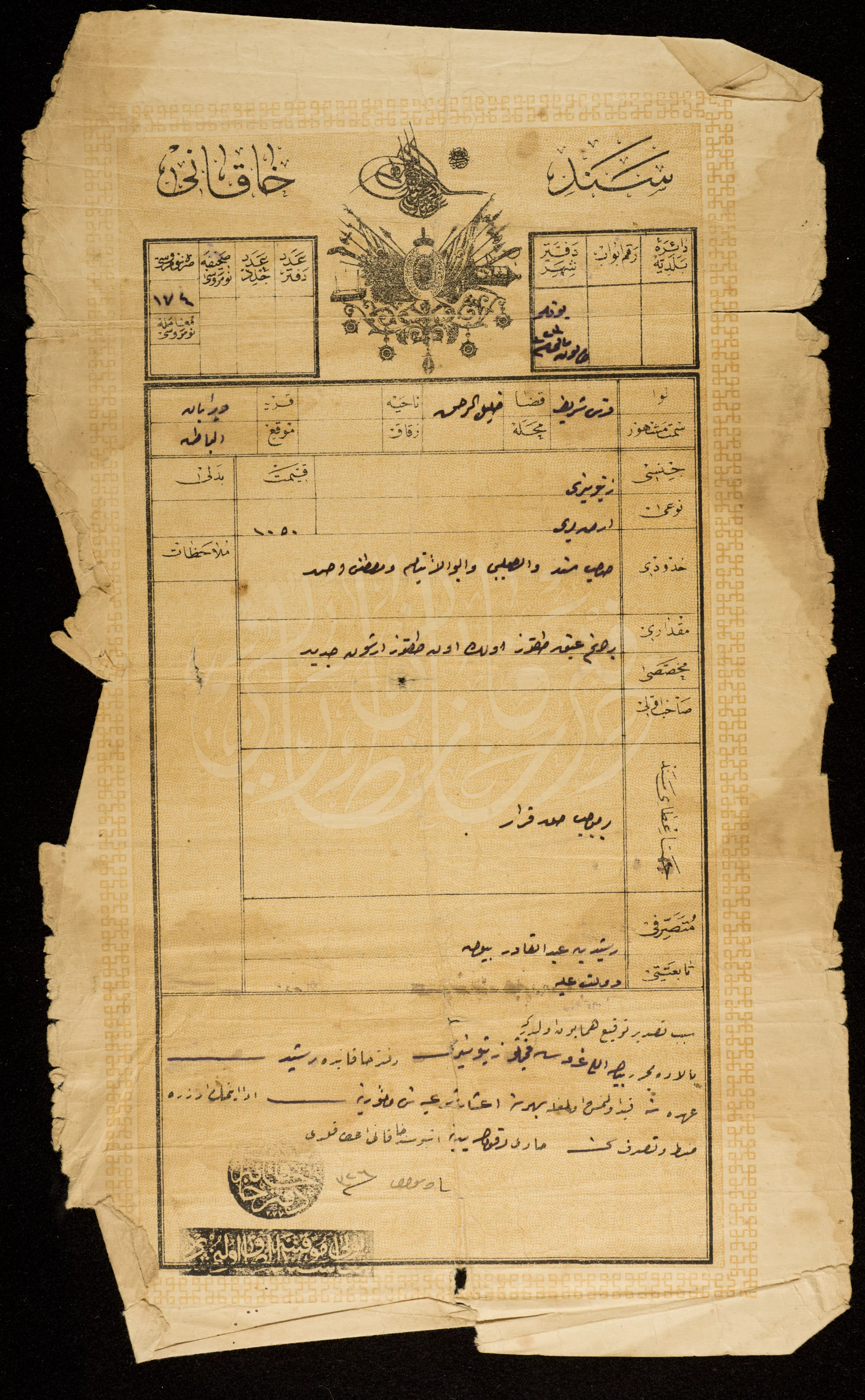
- كوشان عثماني لارض في القرية -- وثيقة عثمانية في مجموعة عبد القادر ارشيد الأرشيفية
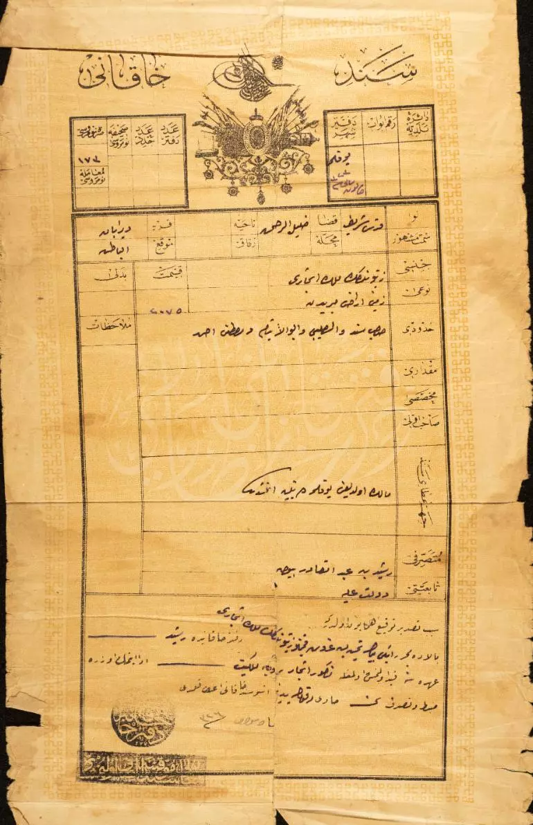
- كوشان عثماني لارض في القرية -- وثيقة عثمانية في مجموعة عبد القادر ارشيد الأرشيفية
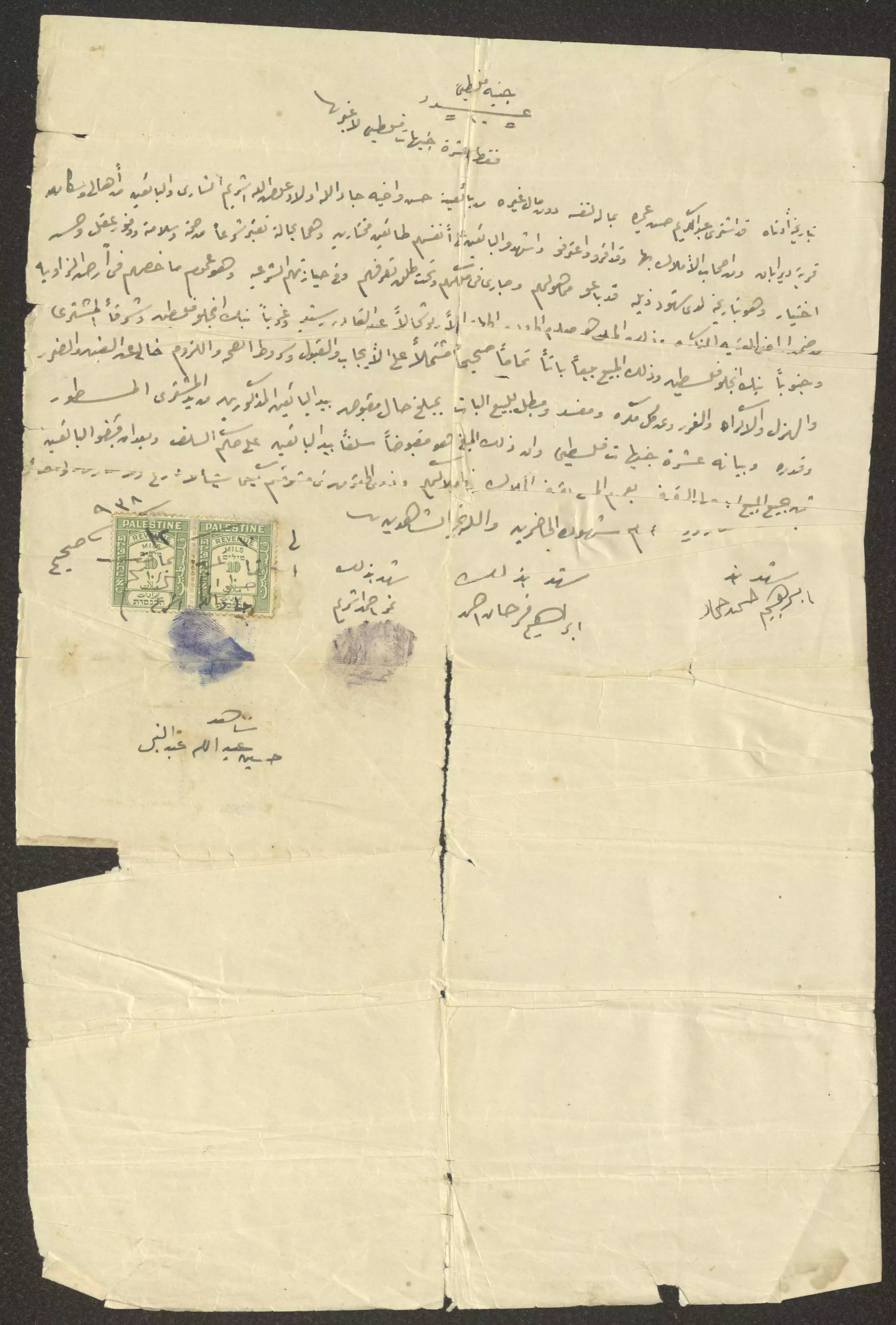
- حجة بيع حسن وجاد الله عوض الله "أرض الزاوية" إلى عبد الكريم حسن عميرة من دير أبان، قضاء القدس، بتاريخ 10 كانون الأول 1938 مقابل عشرة جنيهات فلسطينية. يظهر في أسفل الحجة طابعا إيراد وأسماء وتواقيع البائع والمشتري والشهود.
- That is how the "civilized" erased and replaced us: Deir Aban was completely obliterated except for a few remaining structures, as you see -- دير آبان باتت أثر بعد عين. من هنا مر الهمجّ
- That is how the "civilized" erased and replaced us: Deir Aban was completely obliterated except for a few remaining structures, as you see -- دير آبان باتت أثر بعد عين. من هنا مر الهمجّ #2
- That is how the "civilized" erased and replaced us: Deir Aban was completely obliterated except for a few remaining structures, as you see -- دير آبان باتت أثر بعد عين. من هنا مر الهمجّ #3
- That is how the "civilized" erased and replaced us: Deir Aban was completely obliterated except for a few remaining structures, as you see -- دير آبان باتت أثر بعد عين. من هنا مر الهمجّ #4
- That is how the "civilized" erased and replaced us: Deir Aban was completely obliterated except for a few remaining structures, as you see -- دير آبان باتت أثر بعد عين. من هنا مر الهمجّ #5
- That is how the "civilized" erased and replaced us: Deir Aban was completely obliterated except for a few remaining structures, as you see -- دير آبان باتت أثر بعد عين. من هنا مر الهمجّ #6
- That is how the "civilized" erased and replaced us: Deir Aban was completely obliterated except for a few remaining structures, as you see -- دير آبان باتت أثر بعد عين. من هنا مر الهمجّ #7
- That is how the "civilized" erased and replaced us: Deir Aban was completely obliterated except for a few remaining structures, as you see -- دير آبان باتت أثر بعد عين. من هنا مر الهمجّ #8

- That is how the "civilized" erased and replaced us: Deir Aban was completely obliterated except for a few remaining structures, as you see -- دير آبان باتت أثر بعد عين. من هنا مر الهمجّ #9
- That is how the "civilized" erased and replaced us: Deir Aban was completely obliterated except for a few remaining structures, as you see -- دير آبان باتت أثر بعد عين. من هنا مر الهمجّ #10
- That is how the "civilized" erased and replaced us: Deir Aban was completely obliterated except for a few remaining structures, as you see -- دير آبان باتت أثر بعد عين. من هنا مر الهمجّ #11
- That is how the "civilized" erased and replaced us: Deir Aban was completely obliterated except for a few remaining structures, as you see -- دير آبان باتت أثر بعد عين. من هنا مر الهمجّ #12
- That is how the "civilized" erased and replaced us: Deir Aban was completely obliterated except for a few remaining structures, as you see -- دير آبان باتت أثر بعد عين. من هنا مر الهمجّ #13
- That is how the "civilized" erased and replaced us: Deir Aban was completely obliterated except for a few remaining structures, as you see -- دير آبان باتت أثر بعد عين. من هنا مر الهمجّ #14
- That is how the "civilized" erased and replaced us: Deir Aban was completely obliterated except for a few remaining structures, as you see -- دير آبان باتت أثر بعد عين. من هنا مر الهمجّ #15
- That is how the "civilized" erased and replaced us: Deir Aban was completely obliterated except for a few remaining structures, as you see -- دير آبان باتت أثر بعد عين. من هنا مر الهمجّ #16
- That is how the "civilized" erased and replaced us: Deir Aban was completely obliterated except for a few remaining structures, as you see -- دير آبان باتت أثر بعد عين. من هنا مر الهمجّ #17
- That is how the "civilized" erased and replaced us: Deir Aban was completely obliterated except for a few remaining structures, as you see -- دير آبان باتت أثر بعد عين. من هنا مر الهمجّ #18
- That is how the "civilized" erased and replaced us: Deir Aban was completely obliterated except for a few remaining structures, as you see -- دير آبان باتت أثر بعد عين. من هنا مر الهمجّ #19
- That is how the "civilized" erased and replaced us: Deir Aban was completely obliterated except for a few remaining structures, as you see -- دير آبان باتت أثر بعد عين. من هنا مر الهمجّ #20
- That is how the "civilized" erased and replaced us: Deir Aban was completely obliterated except for a few remaining structures, as you see -- دير آبان باتت أثر بعد عين. من هنا مر الهمجّ #21
- That is how the "civilized" erased and replaced us: Deir Aban was completely obliterated except for a few remaining structures, as you see -- دير آبان باتت أثر بعد عين. من هنا مر الهمجّ #22
- That is how the "civilized" erased and replaced us: Deir Aban was completely obliterated except for a few remaining structures, as you see -- دير آبان باتت أثر بعد عين. من هنا مر الهمجّ #23
- That is how the "civilized" erased and replaced us: Deir Aban was completely obliterated except for a few remaining structures, as you see -- دير آبان باتت أثر بعد عين. من هنا مر الهمجّ #24
- That is how the "civilized" erased and replaced us: Deir Aban was completely obliterated except for a few remaining structures, as you see -- دير آبان باتت أثر بعد عين. من هنا مر الهمجّ #25
- The most "civilized" destroyed the village, although the battle was over. Despite this being a clear war crime, the vast majority of Jews keep denying the Nakba ever happened, although it was done by many of those who survived the Shoah just three years earlier. You would think they fought the Nazis as they did to Palestinians! You think some people have 6 million to make more friends, not more enemies! Some people NEVER learn!
- That is how the "civilized" erased and replaced us: Deir Aban was completely obliterated except for a few remaining structures, as you see -- دير آبان باتت أثر بعد عين. من هنا مر الهمجّ
- That is how the "civilized" erased and replaced us: Deir Aban was completely obliterated except for a few remaining structures, as you see -- دير آبان باتت أثر بعد عين. من هنا مر الهمجّ
#2
- That is how the "civilized" erased and replaced us: Deir Aban was completely obliterated except for a few remaining structures, as you see -- دير آبان باتت أثر بعد عين. من هنا مر الهمجّ
#3
- That is how the "civilized" erased and replaced us: Deir Aban was completely obliterated except for a few remaining structures, as you see -- دير آبان باتت أثر بعد عين. من هنا مر الهمجّ
#4
- That is how the "civilized" erased and replaced us: Deir Aban was completely obliterated except for a few remaining structures, as you see -- دير آبان باتت أثر بعد عين. من هنا مر الهمجّ
#5
- That is how the "civilized" erased and replaced us: Deir Aban was completely obliterated except for a few remaining structures, as you see -- دير آبان باتت أثر بعد عين. من هنا مر الهمجّ
#6
- That is how the "civilized" erased and replaced us: Deir Aban was completely obliterated except for a few remaining structures, as you see -- دير آبان باتت أثر بعد عين. من هنا مر الهمجّ
#7
- That is how the "civilized" erased and replaced us: Deir Aban was completely obliterated except for a few remaining structures, as you see -- دير آبان باتت أثر بعد عين. من هنا مر الهمجّ
#8
- That is how the "civilized" erased and replaced us: Deir Aban was completely obliterated except for a few remaining structures, as you see -- دير آبان باتت أثر بعد عين. من هنا مر الهمجّ
#9

- That is how the "civilized" erased and replaced us: Deir Aban was completely obliterated except for a few remaining structures, as you see -- دير آبان باتت أثر بعد عين. من هنا مر الهمجّ
#10

- That is how the "civilized" erased and replaced us: Deir Aban was completely obliterated except for a few remaining structures, as you see -- دير آبان باتت أثر بعد عين. من هنا مر الهمجّ
#11
- That is how the "civilized" erased and replaced us: Deir Aban was completely obliterated except for a few remaining structures, as you see -- دير آبان باتت أثر بعد عين. من هنا مر الهمجّ
#12
- That is how the "civilized" erased and replaced us: Deir Aban was completely obliterated except for a few remaining structures, as you see -- دير آبان باتت أثر بعد عين. من هنا مر الهمجّ
#13

- That is how the "civilized" erased and replaced us: Deir Aban was completely obliterated except for a few remaining structures, as you see -- دير آبان باتت أثر بعد عين. من هنا مر الهمجّ
#14
- That is how the "civilized" erased and replaced us: Deir Aban was completely obliterated except for a few remaining structures, as you see -- دير آبان باتت أثر بعد عين. من هنا مر الهمجّ
#15

- That is how the "civilized" erased and replaced us: Deir Aban was completely obliterated except for a few remaining structures, as you see -- دير آبان باتت أثر بعد عين. من هنا مر الهمجّ
#16

- That is how the "civilized" erased and replaced us: Deir Aban was completely obliterated except for a few remaining structures, as you see -- دير آبان باتت أثر بعد عين. من هنا مر الهمجّ
#17
- That is how the "civilized" erased and replaced us: Deir Aban was completely obliterated except for a few remaining structures, as you see -- دير آبان باتت أثر بعد عين. من هنا مر الهمجّ
#18
- That is how the "civilized" erased and replaced us: Deir Aban was completely obliterated except for a few remaining structures, as you see -- دير آبان باتت أثر بعد عين. من هنا مر الهمجّ
#19

- That is how the "civilized" erased and replaced us: Deir Aban was completely obliterated except for a few remaining structures, as you see -- دير آبان باتت أثر بعد عين. من هنا مر الهمجّ
#20
- That is how the "civilized" erased and replaced us: Deir Aban was completely obliterated except for a few remaining structures, as you see -- دير آبان باتت أثر بعد عين. من هنا مر الهمجّ
#21
- That is how the "civilized" erased and replaced us: Deir Aban was completely obliterated except for a few remaining structures, as you see -- دير آبان باتت أثر بعد عين. من هنا مر الهمجّ
#22
- That is how the "civilized" erased and replaced us: Deir Aban was completely obliterated except for a few remaining structures, as you see -- دير آبان باتت أثر بعد عين. من هنا مر الهمجّ
#23

- That is how the "civilized" erased and replaced us: Deir Aban was completely obliterated except for a few remaining structures, as you see -- دير آبان باتت أثر بعد عين. من هنا مر الهمجّ
#24
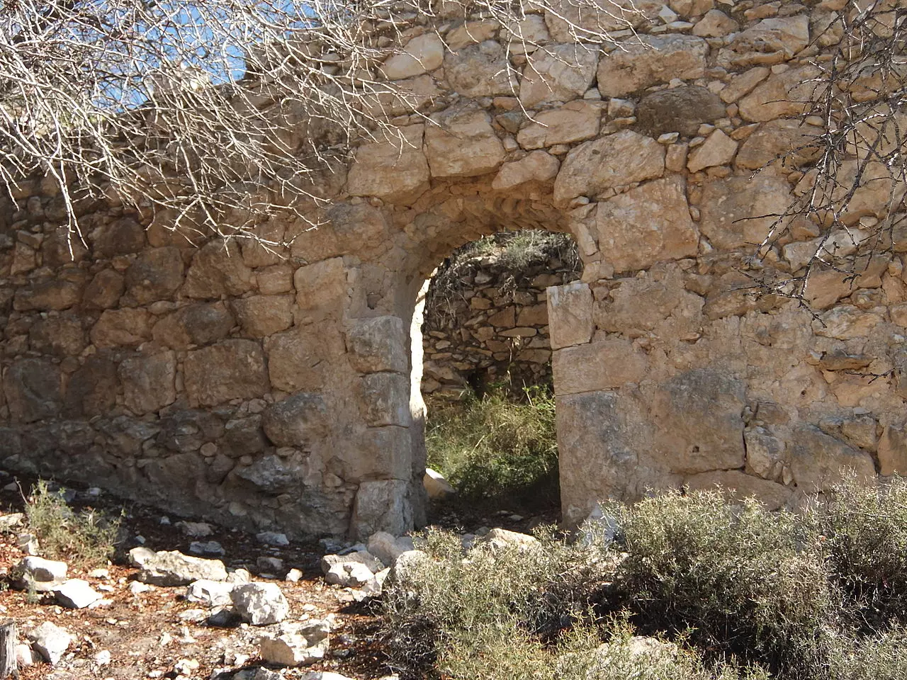
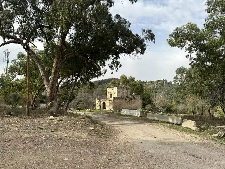
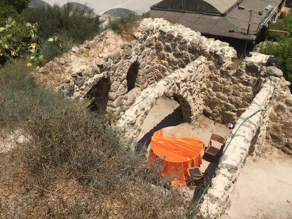
- احدة من مباني الحراسة السبعة عشر التي أنشأها متصرف القدس محمد سريا باشا لتأمين مسار طريق القدس-يافا في ستينات القرن التاسع عشر. يوجد المبنى في خربة حرصيص القريبة من خان باب الواد. منقول من صفحة الاستاذ المبدع Daoud Al-Hali
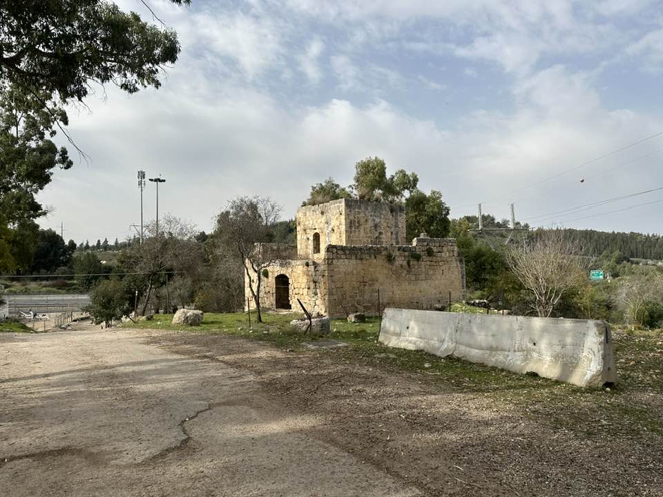
- احدة من مباني الحراسة السبعة عشر التي أنشأها متصرف القدس محمد سريا باشا لتأمين مسار طريق القدس-يافا في ستينات القرن التاسع عشر. يوجد المبنى في خربة حرصيص القريبة من خان باب الواد. منقول من صفحة الاستاذ المبدع Daoud Al-Hali #2
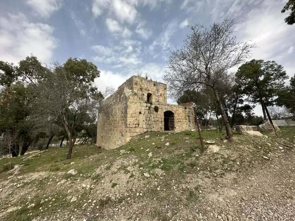
- احدة من مباني الحراسة السبعة عشر التي أنشأها متصرف القدس محمد سريا باشا لتأمين مسار طريق القدس-يافا في ستينات القرن التاسع عشر. يوجد المبنى في خربة حرصيص القريبة من خان باب الواد. منقول من صفحة الاستاذ المبدع Daoud Al-Hali #3
- احدة من مباني الحراسة السبعة عشر التي أنشأها متصرف القدس محمد سريا باشا لتأمين مسار طريق القدس-يافا في ستينات القرن التاسع عشر. يوجد المبنى في خربة حرصيص القريبة من خان باب الواد. منقول من صفحة الاستاذ المبدع Daoud Al-Hali #4
- احدة من مباني الحراسة السبعة عشر التي أنشأها متصرف القدس محمد سريا باشا لتأمين مسار طريق القدس-يافا في ستينات القرن التاسع عشر. يوجد المبنى في خربة حرصيص القريبة من خان باب الواد. منقول من صفحة الاستاذ المبدع Daoud Al-Hali #5
- احدة من مباني الحراسة السبعة عشر التي أنشأها متصرف القدس محمد سريا باشا لتأمين مسار طريق القدس-يافا في ستينات القرن التاسع عشر. يوجد المبنى في خربة حرصيص القريبة من خان باب الواد. منقول من صفحة الاستاذ المبدع Daoud Al-Hali #6
- احدة من مباني الحراسة السبعة عشر التي أنشأها متصرف القدس محمد سريا باشا لتأمين مسار طريق القدس-يافا في ستينات القرن التاسع عشر. يوجد المبنى في خربة حرصيص القريبة من خان باب الواد. منقول من صفحة الاستاذ المبدع Daoud Al-Hali #7
- احدة من مباني الحراسة السبعة عشر التي أنشأها متصرف القدس محمد سريا باشا لتأمين مسار طريق القدس-يافا في ستينات القرن التاسع عشر. يوجد المبنى في خربة حرصيص القريبة من خان باب الواد. منقول من صفحة الاستاذ المبدع Daoud Al-Hali #8
- احدة من مباني الحراسة السبعة عشر التي أنشأها متصرف القدس محمد سريا باشا لتأمين مسار طريق القدس-يافا في ستينات القرن التاسع عشر. يوجد المبنى في خربة حرصيص القريبة من خان باب الواد. منقول من صفحة الاستاذ المبدع Daoud Al-Hali #9
- احدة من مباني الحراسة السبعة عشر التي أنشأها متصرف القدس محمد سريا باشا لتأمين مسار طريق القدس-يافا في ستينات القرن التاسع عشر. يوجد المبنى في خربة حرصيص القريبة من خان باب الواد. منقول من صفحة الاستاذ المبدع Daoud Al-Hali #10
- احدة من مباني الحراسة السبعة عشر التي أنشأها متصرف القدس محمد سريا باشا لتأمين مسار طريق القدس-يافا في ستينات القرن التاسع عشر. يوجد المبنى في خربة حرصيص القريبة من خان باب الواد. منقول من صفحة الاستاذ المبدع Daoud Al-Hali #11
- Let us see how the most "liberal and civilized" of world Jewry has obliterated our village. How else will the Jews be great and safe again?
- Let us see how the most "liberal and civilized" of world Jewry has obliterated our village. How else will the Jews be great and safe again? #2
- Let us see how the most "liberal and civilized" of world Jewry has obliterated our village. How else will the Jews be great and safe again? #3
- Let us see how the most "liberal and civilized" of world Jewry has obliterated our village. How else will the Jews be great and safe again? #4
- Let us see how the most "liberal and civilized" of world Jewry has obliterated our village. How else will the Jews be great and safe again? #5
- Let us see how the most "liberal and civilized" of world Jewry has obliterated our village. How else will the Jews be great and safe again? #6
- Let us see how the most "liberal and civilized" of world Jewry has obliterated our village. How else will the Jews be great and safe again? #7
- Let us see how the most "liberal and civilized" of world Jewry has obliterated our village. How else will the Jews be great and safe again? #8
- Let us see how the most "liberal and civilized" of world Jewry has obliterated our village. How else will the Jews be great and safe again? #9
- Let us see how the most "liberal and civilized" of world Jewry has obliterated our village. How else will the Jews be great and safe again? #10
- Let us see how the most "liberal and civilized" of world Jewry has obliterated our village. How else will the Jews be great and safe again? #11
- Let us see how the most "liberal and civilized" of world Jewry has obliterated our village. How else will the Jews be great and safe again? #12
- Let us see how the most "liberal and civilized" of world Jewry has obliterated our village. How else will the Jews be great and safe again? #13
- Let us see how the most "liberal and civilized" of world Jewry has obliterated our village. How else will the Jews be great and safe again? #14

- Let us see how the most "liberal and civilized" of world Jewry has obliterated our village. How else will the Jews be great and safe again? #15
- Let us see how the most "liberal and civilized" of world Jewry has obliterated our village. How else will the Jews be great and safe again? #16

- Let us see how the most "liberal and civilized" of world Jewry has obliterated our village. How else will the Jews be great and safe again? #17
- Let us see how the most "liberal and civilized" of world Jewry has obliterated our village. How else will the Jews be great and safe again? #18
- Let us see how the most "liberal and civilized" of world Jewry has obliterated our village. How else will the Jews be great and safe again? #19
- Let us see how the most "liberal and civilized" of world Jewry has obliterated our village. How else will the Jews be great and safe again? #20

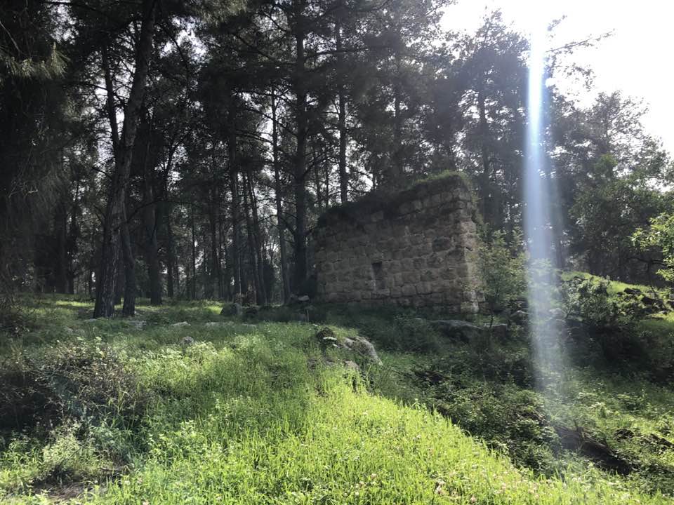
- That is how the "civilized" erased and replaced us: Deir Aban was completely obliterated, and pine trees were planted to erase our existence in the village
- That is how the "civilized" erased and replaced us: Deir Aban was completely obliterated, and pine trees were planted to erase our existence in the village #2
- That is how the "civilized" erased and replaced us: Deir Aban was completely obliterated, and pine trees were planted to erase our existence in the village #3

- That is how the "civilized" erased and replaced us: Deir Aban was completely obliterated, and pine trees were planted to erase our existence in the village #4
- That is how the "civilized" erased and replaced us: Deir Aban was completely obliterated, and pine trees were planted to erase our existence in the village #5
- That is how the "civilized" erased and replaced us: Deir Aban was completely obliterated, and pine trees were planted to erase our existence in the village #6
- That is how the "civilized" erased and replaced us: Deir Aban was completely obliterated, and pine trees were planted to erase our existence in the village #7
- That is how the "civilized" erased and replaced us: Deir Aban was completely obliterated, and pine trees were planted to erase our existence in the village #8
- That is how the "civilized" erased and replaced us: Deir Aban was completely obliterated, and pine trees were planted to erase our existence in the village #9
- That is how the "civilized" erased and replaced us: Deir Aban was completely obliterated, and pine trees were planted to erase our existence in the village #10
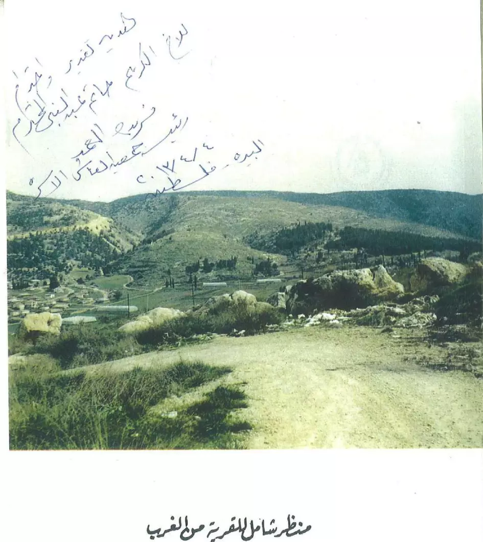
- General view of the village from the West -- Abdul Aziz Abu Hadbah
- كتاب قرية دير أبان المهجرة -- إعداد عبدالعزيز أبو هدبة -- نسخة متوفرة في قسم المقالات
Want to browse more? 80,000 pictures were grouped in these gallaries:
- كوشان عثماني لارض في القرية -- وثيقة عثمانية في مجموعة عبد القادر ارشيد الأرشيفية
- كوشان عثماني لارض في القرية -- وثيقة عثمانية في مجموعة عبد القادر ارشيد الأرشيفية
- حجة بيع حسن وجاد الله عوض الله "أرض الزاوية" إلى عبد الكريم حسن عميرة من دير أبان، قضاء القدس، بتاريخ 10 كانون الأول 1938 مقابل عشرة جنيهات فلسطينية. يظهر في أسفل الحجة طابعا إيراد وأسماء وتواقيع البائع والمشتري والشهود.
| Display Name | Clan/Hamolah | Country of Residence |
| عماد نجيب ذيب بيوض | بيوض | مادبا |
| وجدي سلامه | الوعرة | دبي , 00971555286445 |
| ابو صرار | صرار | الكويت -الاردن |
| ZAIN | الكراملة | AMMAN |
| شاهين | ابن هذيل | - |
| المعتزبالله جعاره | ديرآبان | السعودية |
| Oday Muhaisen | بني هذيل | Amman, Jordan |
| قيس اسحق احمد ابوتينة | الكراملة / ال ابو تينة | يارسلافل, روسيا |
| حسن حسين خليل صرار | - | مادبا, الاردن |
| bentjaara | jaara | Darmstadt, Deutschland |
| عامر زاهر الكسابره | الكسابره | عمان, الاردن |
| ضياء الحق جعاره | - | - |
| محمد محمود بيوض | بيوض | عمان, الاردن |
| حاتم عبد النبي | سلامة | أبو ظبي, الامارات |
| بلال عودة | عودة | مأدبا |
| Fadi udwan | Dassan | amman |
| محمد | عوده | الاردن, الاردن |
| عادل | الباز | - |
| خالد مصطفى الدعامسة | الدعامسة | السويد |
| ثائر جعارة | ديرابان | - |
| ساهر فلسطين | سويد | عمان |
| علاء الدين الدعامسه | الدعامسه | swansea , united kingdom |
| muammer othman | othman | - |
| ahmed naji | الوعره | الرياض, السعودية |
| akram ghannam | - | TX, TX |
| reyad schram | Wa'ara | Tx, USA |
| habdelnabi | سلامه | المدينة المنورة, السعودية |
| سمير محيسن | ديربان | germany |
| Dipl.-Bertriebswirt Isaak Muhaisen | Karamlah / Muhaisen | Hessen, Deutschlad |
| Ramadan Farhan Salameh | Karamleh | Indiana, USA |
| روان | عوده | الكويت, الاردن |
| Dr. Mohammed Atallah | الوعره | riradh, Saudi Arabia |
| N. shraim | shraim | Amman, Jordan |
| Architect, Mohammad H.K.Sarrar | Sarrar | Amman, Jordan |
| أبو هيثم | القراملة | بيت لحم, فلسطين |
| نعيم عميره | عميره | - |
| DEEB BAYOUD | - | - |
| Muath Salameh | - | tx, tx |
| abdul kareem almasaaeed | almasaaeed | - |
| Jihad Zdouq | Zdouq | New Jersey, New Jersey |
| mohammad abu-hadba | - | domincana, domincana |
| Raba' | - | -, Deutschland-Germany |
| Muhammad Rashid | - | New Brunswick, Canada |
| Malek Rashid | Rashid | Amman, Jordan |
| sarrar | qaramelah | dd, dd |
| ramzi05 | - | - |
| Omar Abuhadba | Addamsa | - |
| Fathi Muhammed Ibrahim Zaidan | Kasabrah | Texas, United States |
| Abo Rumuz | - | - |
| JAMAL ZAIDAN | ALKASABRAH | TEXAS, USA |
| Mohammed Sarrar | Al Karamlea | - |
| Waseem Sarrar | Al Karamlea | - |
| mohammad abuhadba | - | - |
| Ibrahim al-baz | Al-Baz | Zuid Holland, The Netherlands |
| Omar Thiban م/عمر ذيبان | kasabra | palestine, palestine |
| Abdulla Alkasabrah | alkasabrah | Jordan, Jordan |
| awni abuhadba | - | usa |
| abdelaziz abuhadba | aldaamsa | - |
| abdelaziz abuhadba | aldaamsa | - |
| Amjad Rashid | Rashid | - |
| Hammad | Almasaed | - |
| - | - | |
| Wasfi Sarrar Jr | - | - |
| murad abumufreh | - | tagu |
| Wasfi Sarrar | Qaramlah | - |
| Waleed Sarrar | Qaramlah | - |
| عمر دعسان | القراملة | - |
| [email protected] | - | jordan, jordan |
| Ala' Dasan علاء دعسان | Qaramlah القراملة | Jordan الأردن |
- جولة ميدانية مصّورة لبلدة ديرابان المهجرة (ناحية العرقوب - قضاء القدس) ماشيًا من أطراف البلدة الشمالية – منطقة زيتون حمّودة والصرارة والمرج مرورًا من منطقة البيادر وبساتين الحواكير حتى الوصول الى مسطح البلد وما تبقى فيه من بيوت وابار وجدران. Duration: 5 min 2 sec
- يا قدس انا قادمون ( أحراش قرية دير آبان المهجرة قضاء القدس ). Duration: min 40 sec
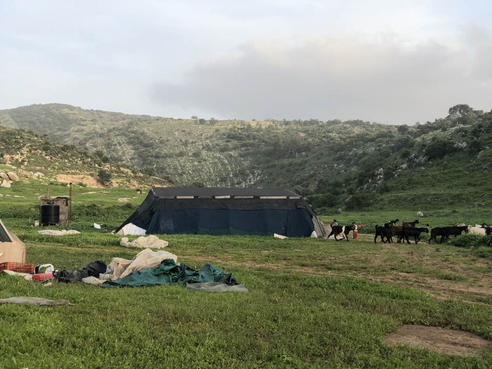
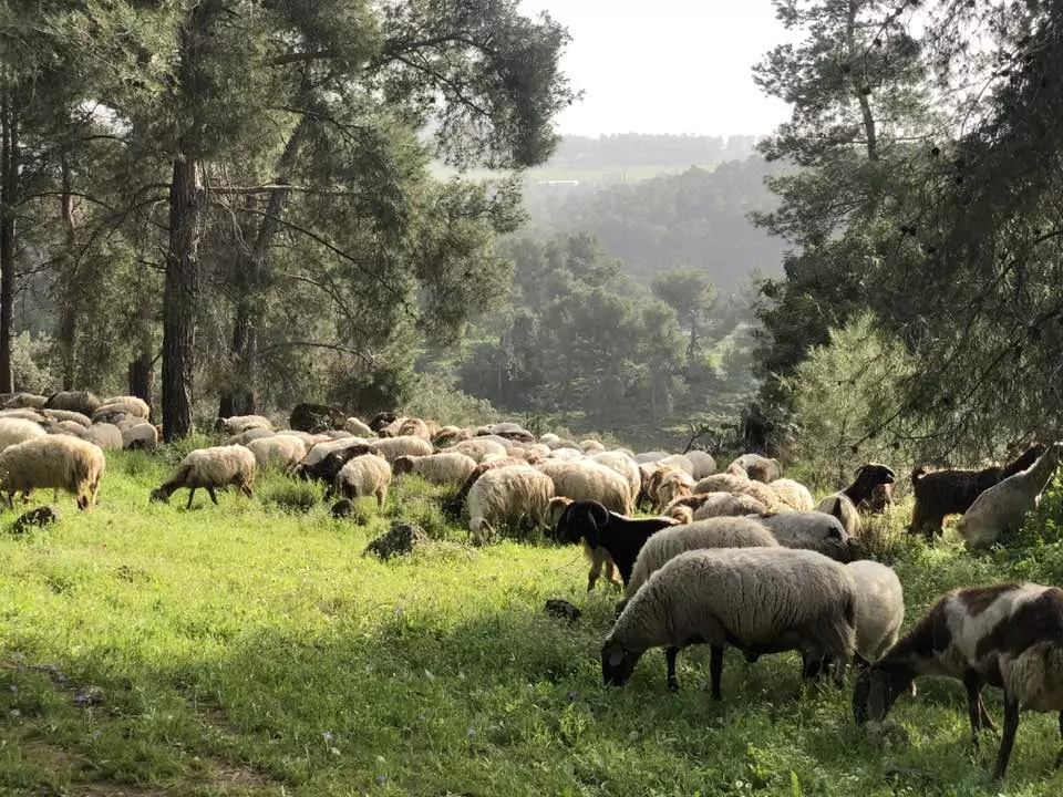
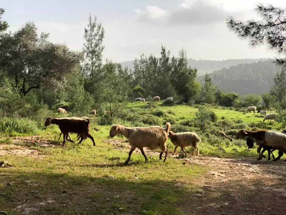
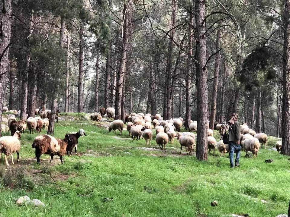
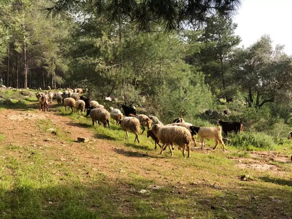
- رعي الاغنام في أراضي قرية دير أبان المهجرة قضاء القدس Duration: 46 sec
- Let us see how the most civilized of world Jewry obliterated our village
- جولة رائعة في القرية المهجرة -- 2025 Duration: min 11 sec
 Fake Valor: Why Did Zionist Jews Hoist Nazis Flag on Their Ships in the 1930s?
What is new?
-
Facts About Oct. 7th Gaza Raid
-
Remined Us Please:: Who Did Rape Who? Palestinians Raped Israelis? Or, was the other way around?
-
When Prof. Edward Said was invited to debate Bibi Netanyahu in the 1980s, watch what happened!
-
Ezra Klein of the NY Times on the "Jewish Race".
-
Abusing Blood Libel!
-
Did Israeli Soldiers Activate The Hanniba Direective On Oct. 7th? You Be The Judge
-
Zionist FAQ: Isn't it true that Palestinians don't want peace? Palestinians never accepted the two-state solution
- Facts about Haavara (Transfer) Agreement between Ben-Gurion & Hitler
-
Haavara FAQs: Why Did Zionist Jews Hoist Nazis' Flags on Their Ships in the 1930s?
- Haavara FAQs: When Chaim Weizmann met FDR in mid-1943, why was he silent about rescuing European Jewry?
-
Dear ChatGPT: How did Palestinians resist Napoleon's invasion of their country in 1799?
-
Dear ChatGPT: Gaza had a vibrant Jewish community in the mid-17th century. What happened to them?
-
Dear ChatGPT: Why did the Jewish Agency suppress news of the Holocaust during WWII?
-
Video Playlist: Jews share their DNA tests to end the conflict for good.
-
A Tale of Two Conflicts: Examining the Definition of Genocide
-
Prof. Abraham Polak And The Suppressed History of the Khazars and European Jewry
-
How Ronald Reagan would have framed the genocide in Gaza if he were still alive?
-
Haavara FAQs: Let us do the math: how many German Jews did The Haavara Agreement save?
-
Zionist FAQs: The Hebron Massacre of 1929, "clearly proves" that Palestinians are antisemitic, how could you deny it?
-
Zionist FAQs: Why Anti-Zionist Is Not Antisemitism?
-
Zionist FAQs: Isn't it true that the KGB created Palestinian Nationalism in the early 1960s?
- Zionist FAQs: Muslims are killing Muslims all the time; why are Israeli Jews being singled out in the media?
- Zionist FAQs: How is Israel an apartheid state when 20% of its citizens are Arabs who enjoy full rights?
-
Haavara FAQs: Why Did Dorothy Thompson Flip From A Zionist Advocate to A Silenced Dissenter?
-
Haavara FAQs: Analysis of Herzl's Uganda Scheme and how it could have saved millions of Jews.
-
Haavara FAQs: Why did Hayim Greenberg describe American Jewry as "morally bankrupt" in early 1943?
-
Haavara FAQs: What if the Evian Conference was a resounding success? What would have been the impact of saving European Jewry on Zionism?
- Haavara FAQs: What if the six million were saved, how that would have impacted the Zionist project?
-
Haavara FAQs: How did Zionist leaders react when Europe's Jews lingered in the DP camps after WWII ended?
-
Why does the American Jewish community repeat lies that David Ben-Gurion had debunked before he died?
-
Who has the power to rename the Tatar/Khazar Gene Marker to Jewish IV?
-
Zionist FAQs: Why won't Egypt, Syria, and Jordan take their people back? Jews are indigenous to Palestine, and Arabs immigrated after Jews developed the country. Arabs should leave.
-
Haavara FAQs: Did Hitler and the Nazis conflate between Judaism and Zionist? If that wasn't case, then why?
-
Haavara FAQs: Winston Churchill and antisemitism, a collection of articles written Churchill.
-
Haavara FAQs: Broken by country, how many Jews survived vs. killed during the Holocaust?
-
Haavara FAQs: Why did European Jews vote with their feet and to immigrated to the Americas, not Palestine, after WWII?
-
Watch this American Jewish Girl describing Israeli Jews' cognitive dissonance like no other in under two minutes
-
Haavara FAQs: When the Nazis went out of their way to hide the Holocaust, Israeli Jews did the exact opposite by broadcasting their genocide of Gazans. But why?
-
Haavara FAQs: How Zionist Jews went out of their to show their appreciation to Nazism and Fascism?
- Haavara FAQs: Why Zionist leaders were against bombing the death camps & the Railroads leading to them?
-
Haavara FAQs: Hitler's message to the British and American people: If Jews are such noble citizens and you care about them, how come you're not letting them in? I will gladly ship them to you at my expense, even on luxury liners!
-
A shortlist of Zionist and Israeli false flag operations in the name Jews.
-
The Most Moral Army
- The Land of Kapos (Israel): Where the brave are boycotted and Kapos walk free.
- Why did early Zionists often named their communal enterprises "colonial"?
- Zionist Relations with Nazi Germany by Faris Glubb
-
Two NY Times advertisements by Zionists in the early 1943 that exposes Zionists' treason at the height of the calamity
- Facts Not Lies about the Palestinian-Israeli Conflict.
- Site's pictures have been categorized
- Campgain Against Lice
- A Survey of Palestine, the official source about Palestine before Nakba produced by the British Mandate; over 1200 pages.
- Satellite View & Google Earth: Over 6,000 placemarks identifying all destroyed towns, W. Bank & Gaza Strip Towns, & refugee camps.
- PalestineRemembered.com and its Nakba Oral History Project were featured on al-Jazeera Satellite TV.
- Nakba Oral History Video Podcast:
 Over 700 Oral History interviews (including 3,500+ hours of recording) can be viewed online.
 - Palestine Village Statistics Project
- Gaza Jail Break
- النسخة العربية للموقع الان متوفرة
- Videos: Documenting the destroyed villages in video: Tracing all that remains since Nakba.
- Videos: Responding to Zionist Propaganda
- Interview: The ethnic cleansing of Palestine: George Galloway interviews Israeli Historian Ilan Pappe.
- For Palestinians, memory matters. It provides a blueprint for their future By George Bisharat.
- Zionist FAQ now available in Hebrew שאלות שציונים שואלים, עכשיו בעברית
- Video: The Stephen Walt and John Mearsheimer report on the influence of the Israel Lobby on U.S. Foreign Policy
- The Palestinian-Israeli conflict for beginners
