| PalestineRemembered | About Us | Oral History | العربية | |
| Pictures | Zionist FAQs | Haavara | Maps | |
| Search |
| Camps |
| Districts |
| Acre |
| Baysan |
| Beersheba |
| Bethlehem |
| Gaza |
| Haifa |
| Hebron |
| Jaffa |
| Jericho |
| Jerusalem |
| Jinin |
| Nablus |
| Nazareth |
| Ramallah |
| al-Ramla |
| Safad |
| Tiberias |
| Tulkarm |
| Donate |
| Contact |
| Profile |
| Videos |
Welcome To al-Tannur, Khirbat - خربة التنور (ח'ירבת א-תנור)
|
District of Jerusalem
Ethnically cleansed days ago |
العربية Google Earth |
 |
Gallery (57) |
- Statistics & Facts
-
Before & After

- Satellite View
- Articles 1
- Pictures 57
- Members
- All That Remains
- Wikipedia
- Videos 1
- Guest Book
- Links
| Statistic & Fact | Value | |||||||||
| Occupation Date | October 21, 1948 | |||||||||
| Distance From District | 18.5 (km) West of Jerusalem | |||||||||
| Elevation | 575 (meters) | |||||||||
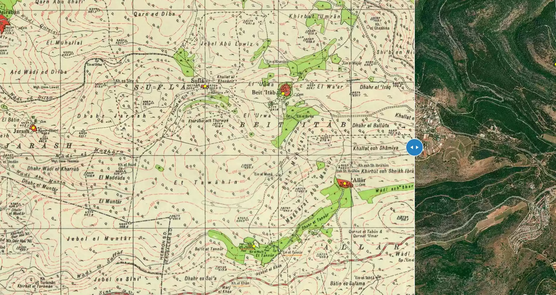
| Before & After Nakba, Click Map For Details |
||||||||||
|
||||||||||
| Map Location | See location #38 on the map View from satellite |
|||||||||
| Military Operation | Operation Ha'ar | |||||||||
| Exodus Cause | Military assault by Zionist troops | |||||||||
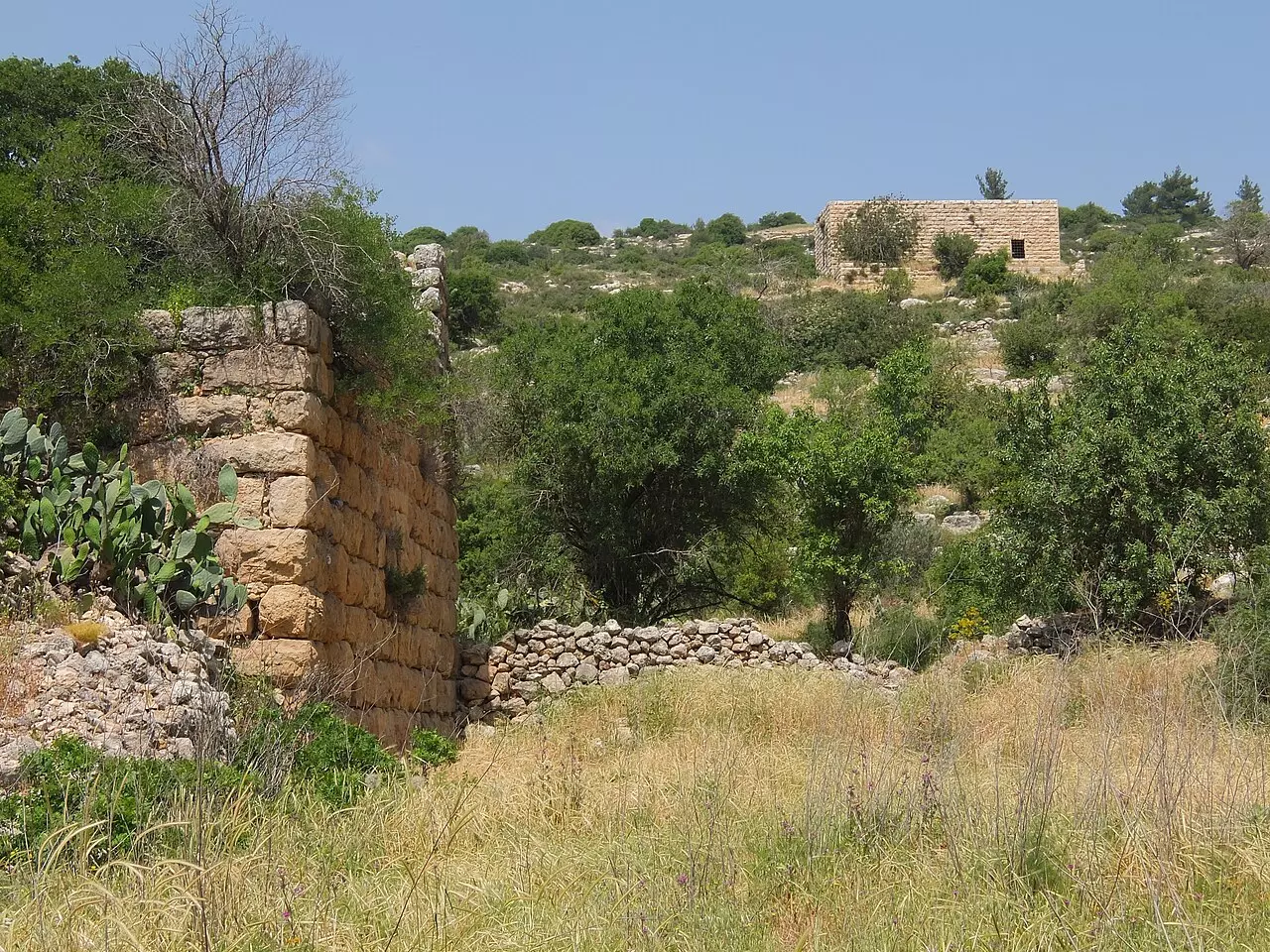
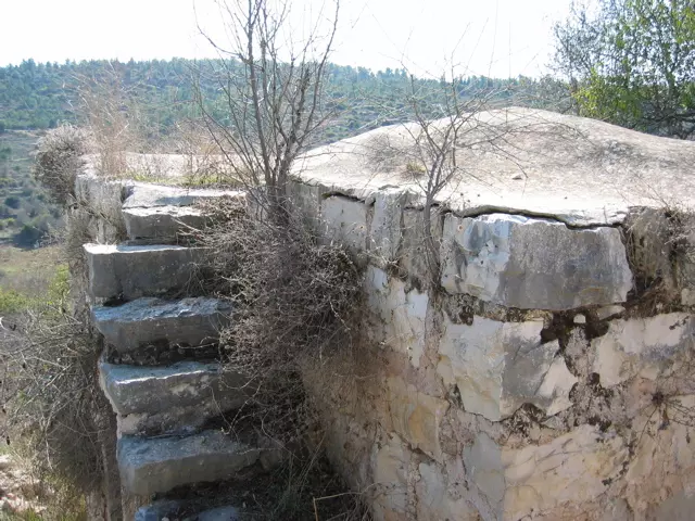
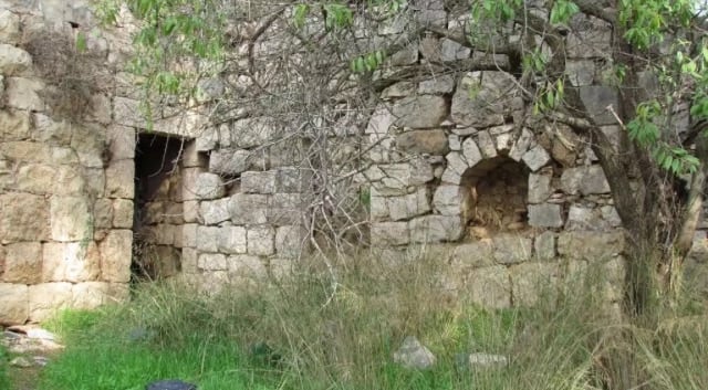
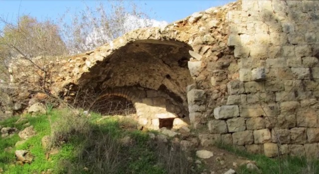
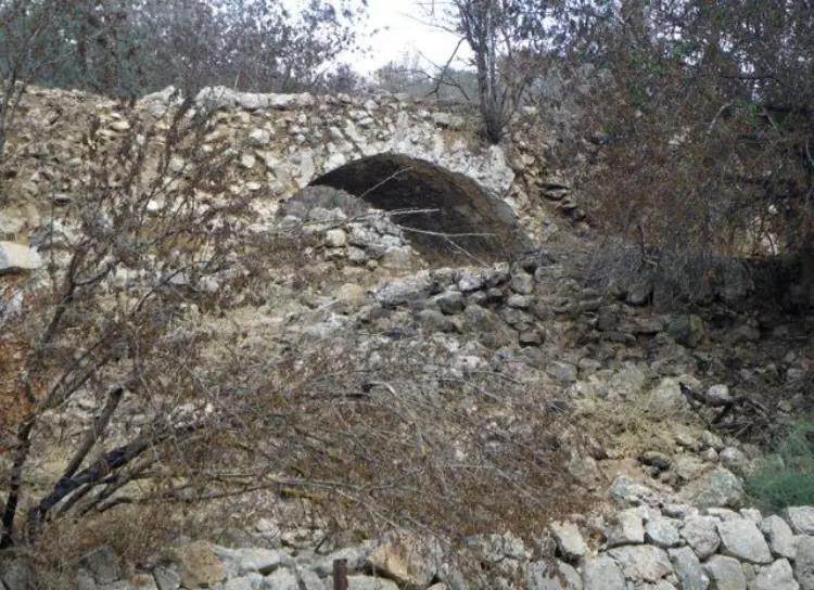
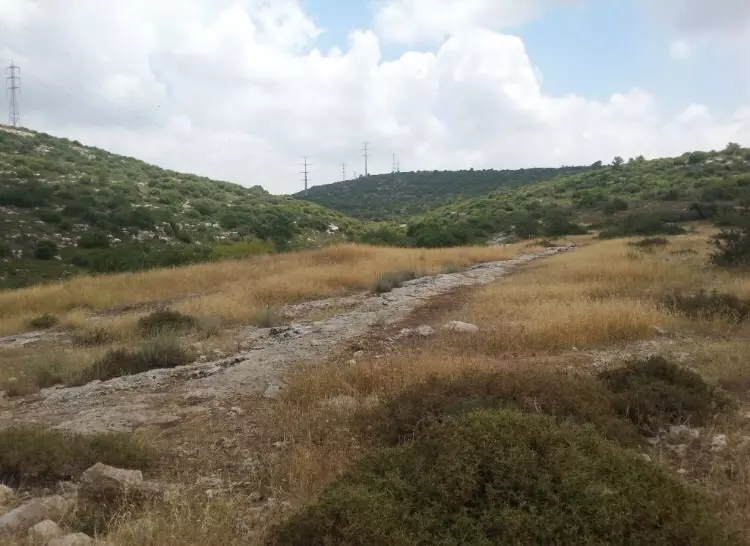
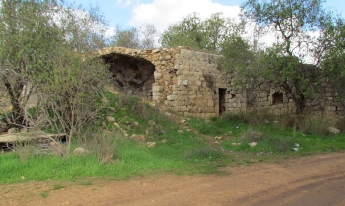
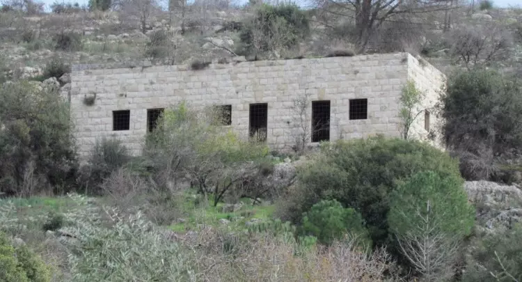
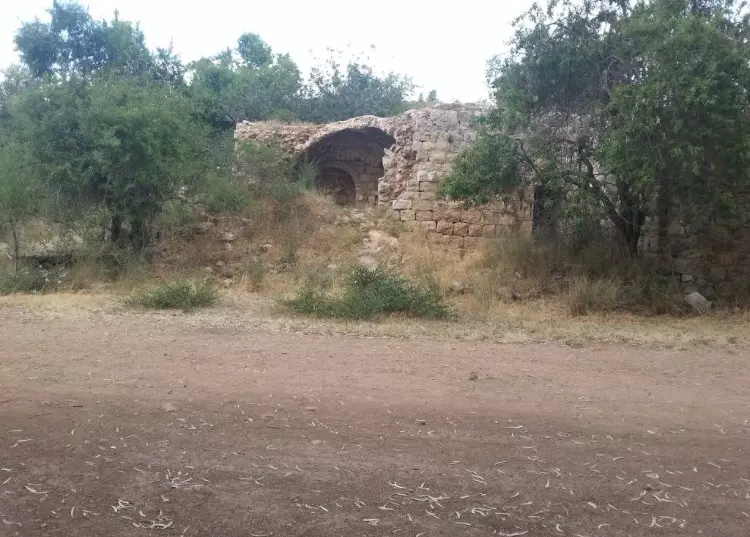
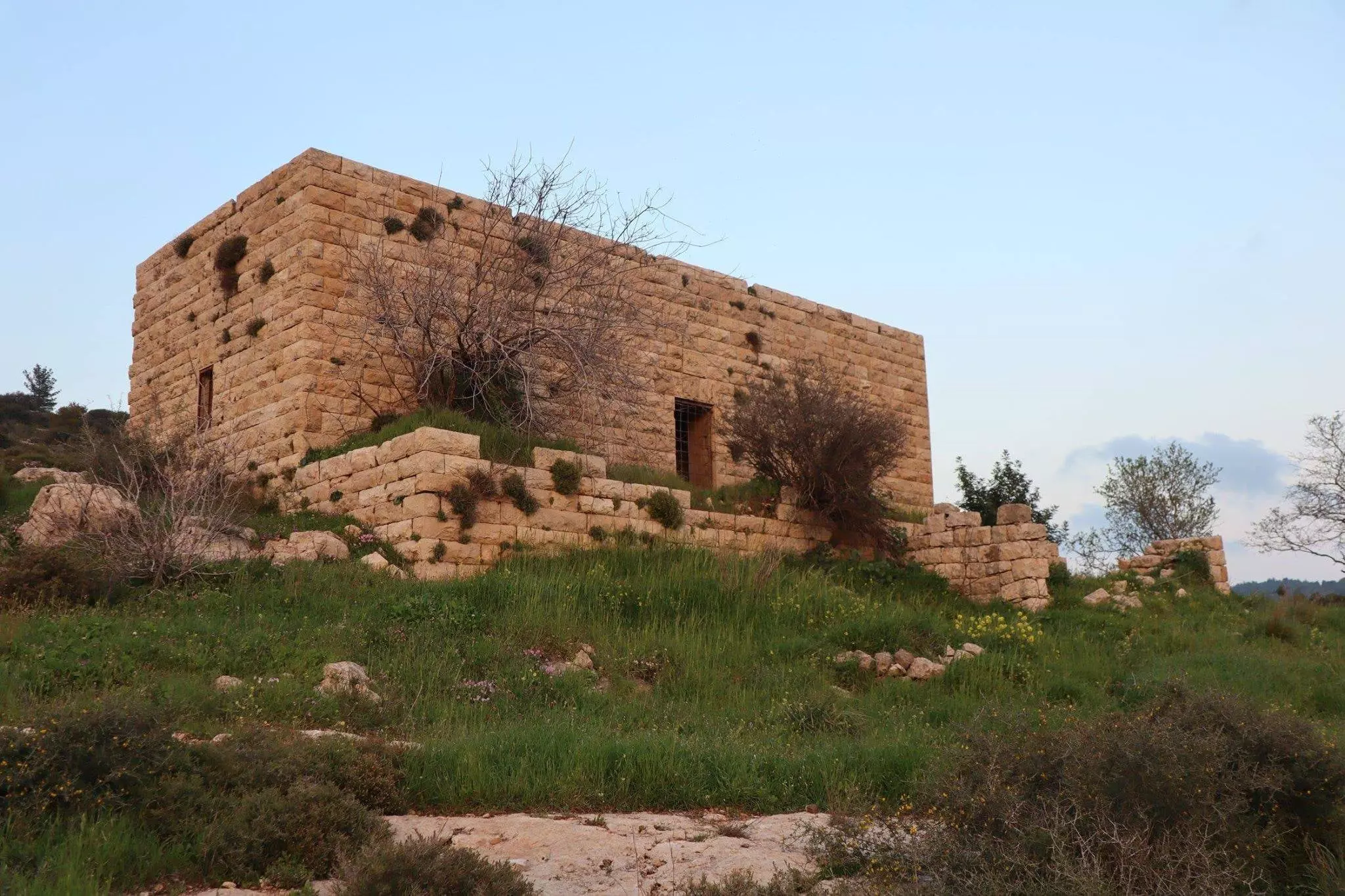
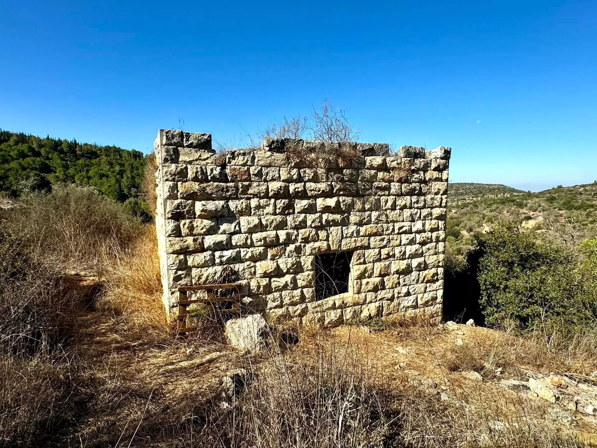
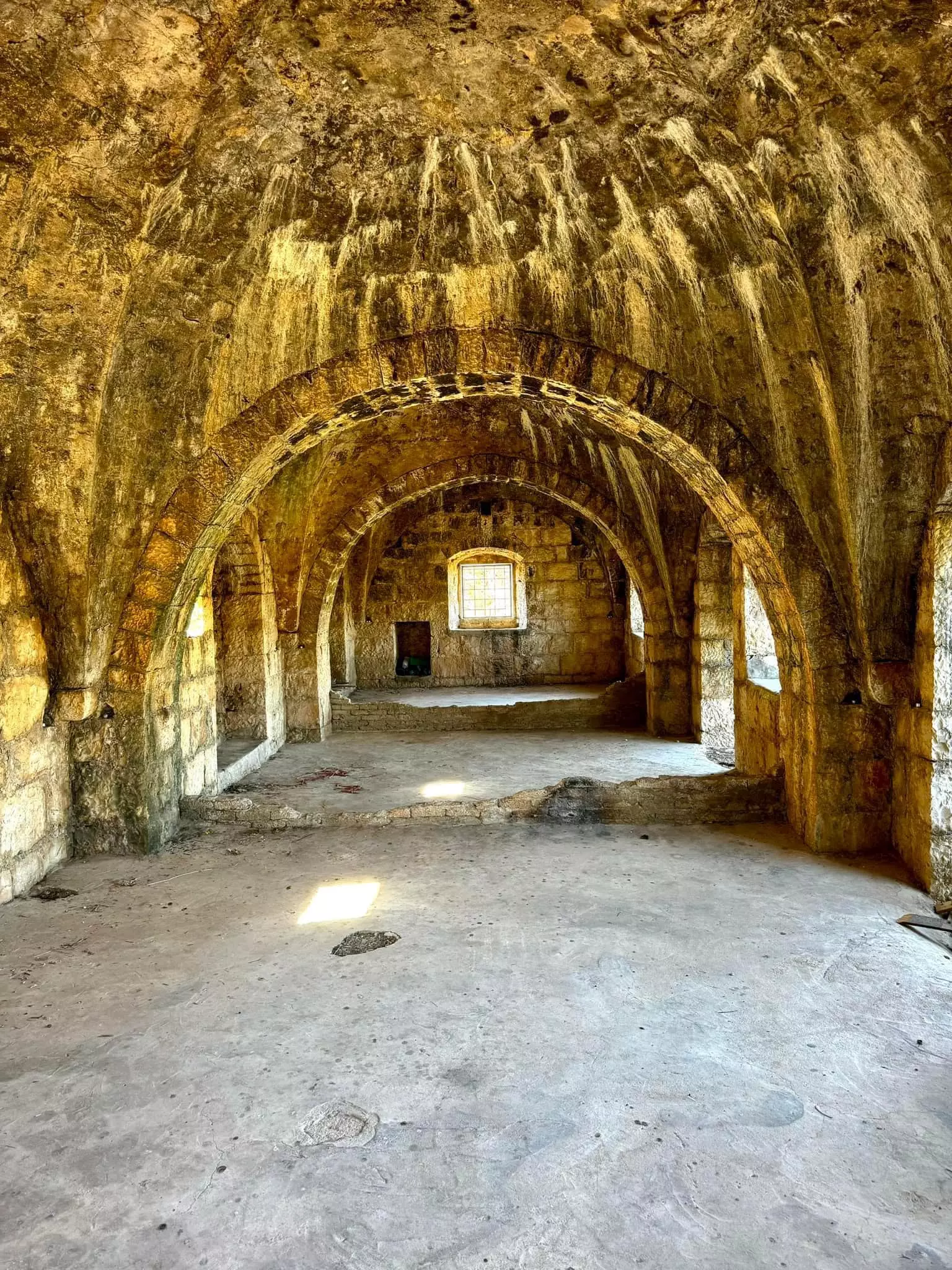
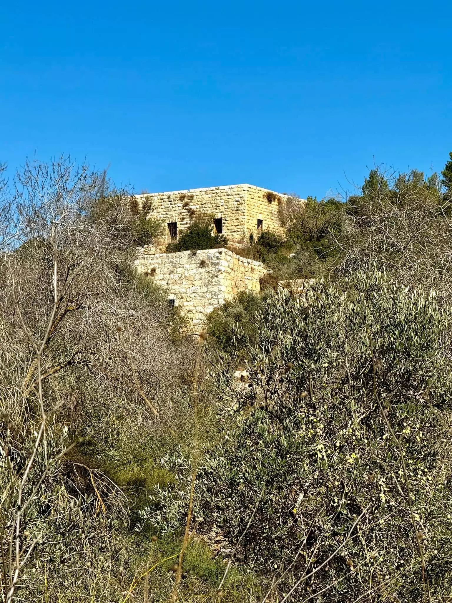
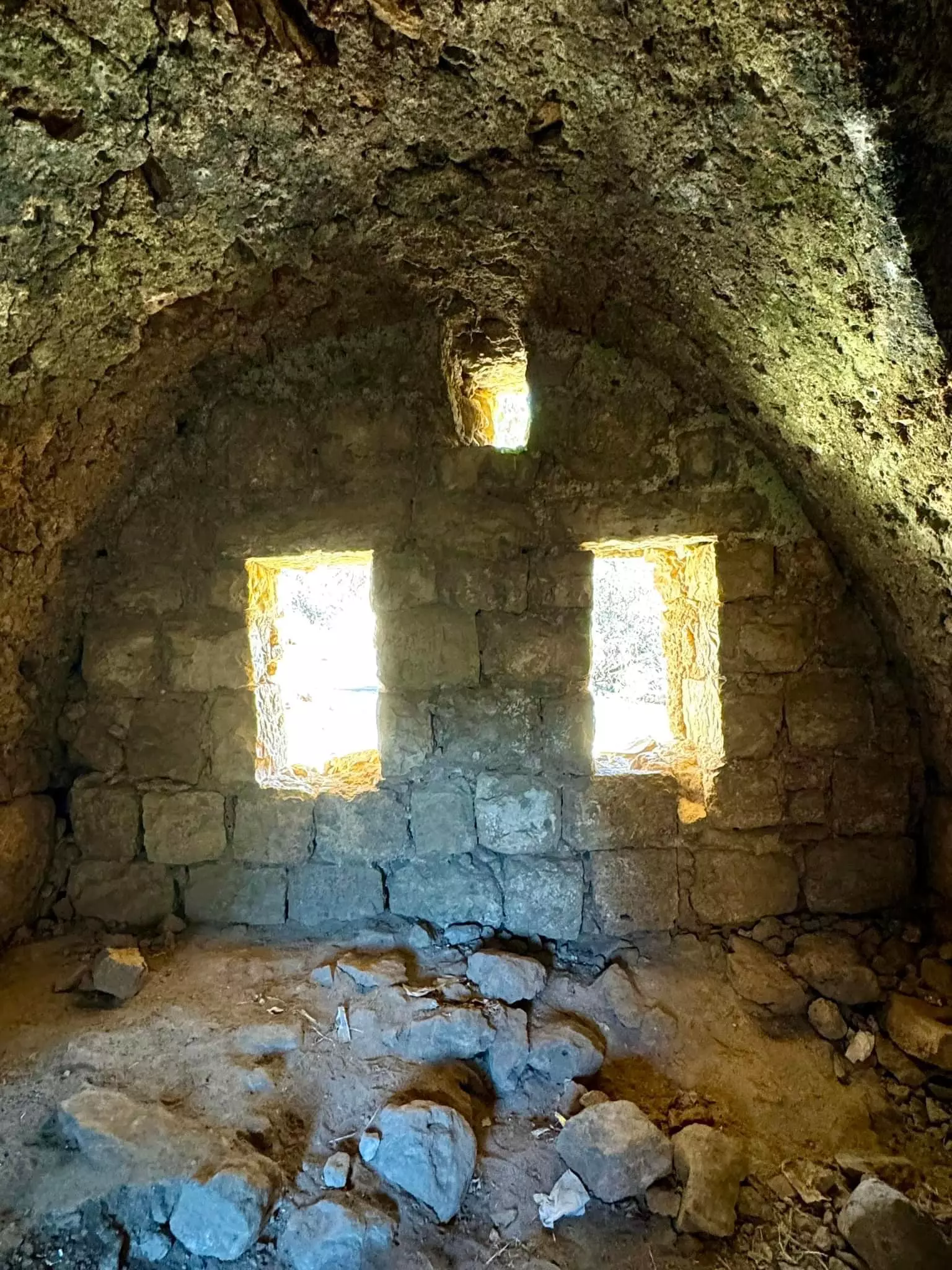
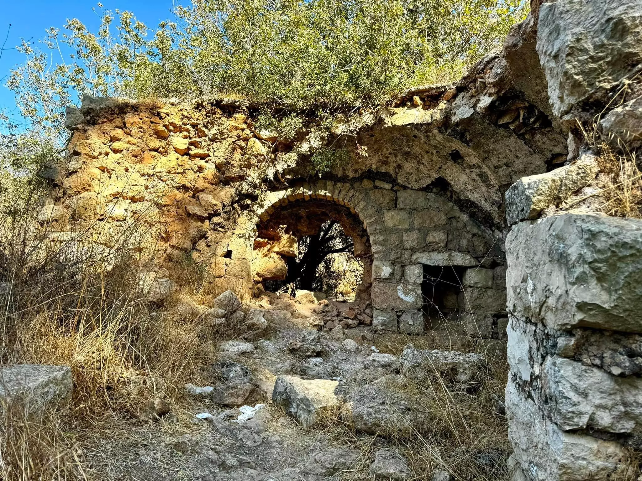
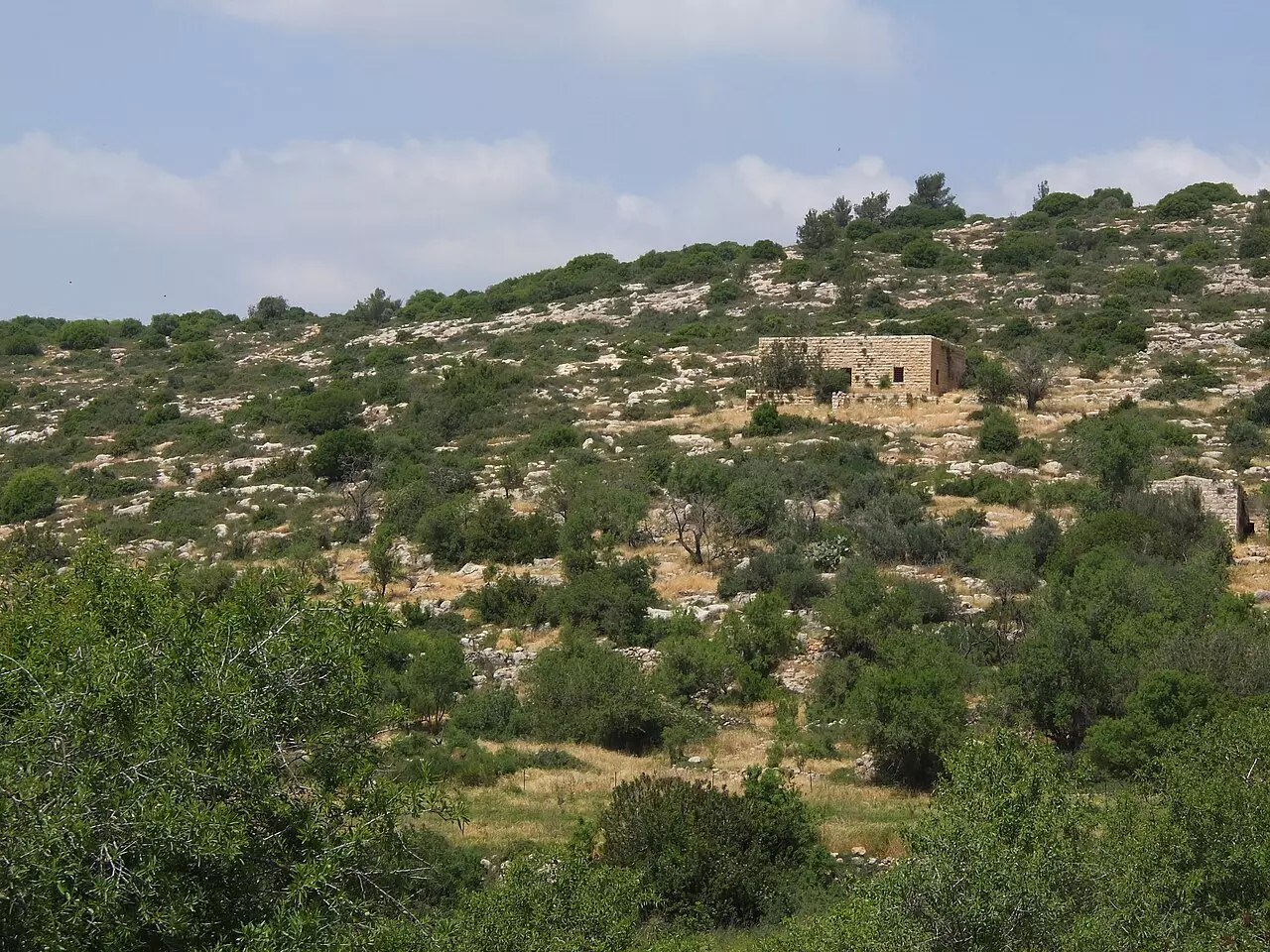
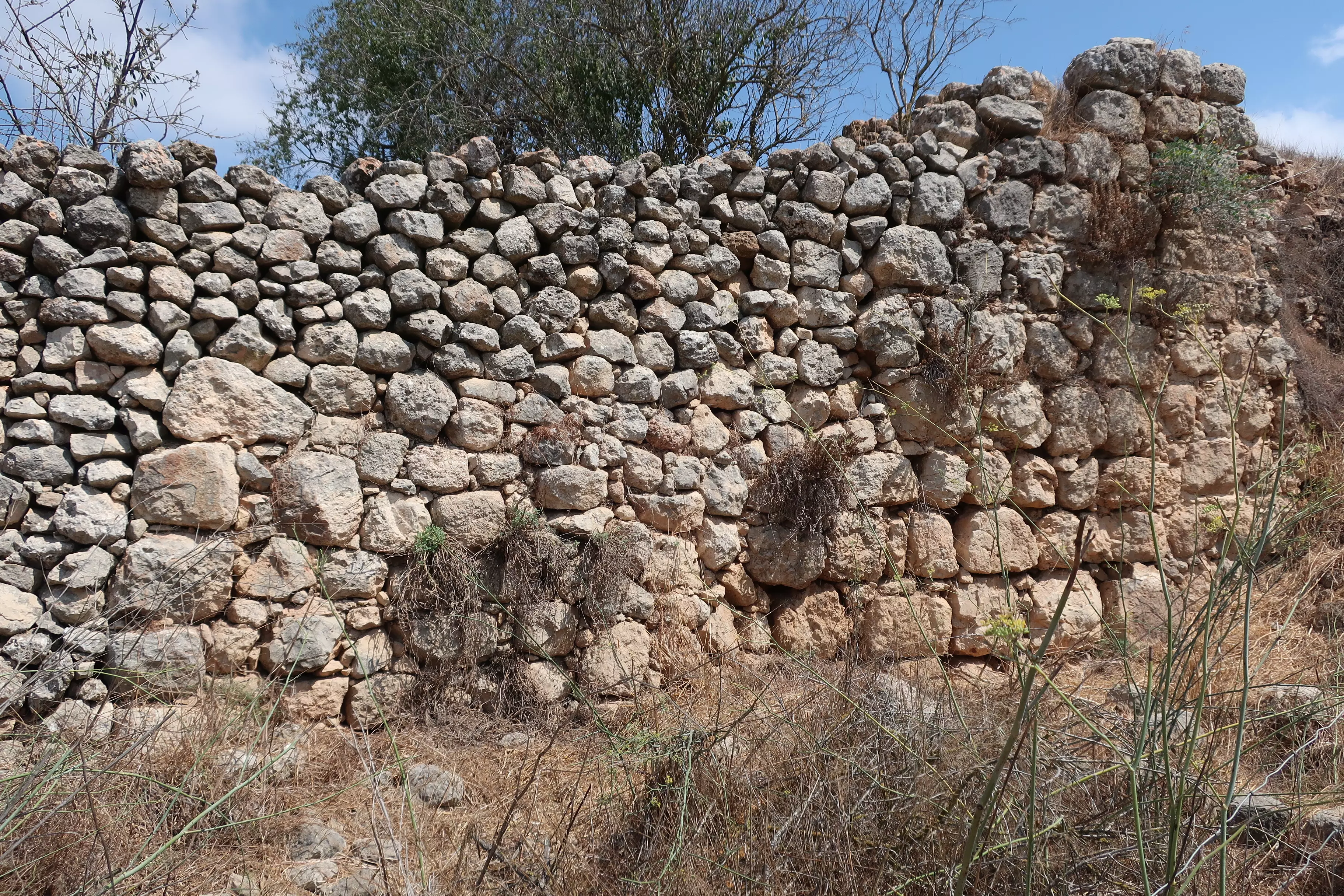
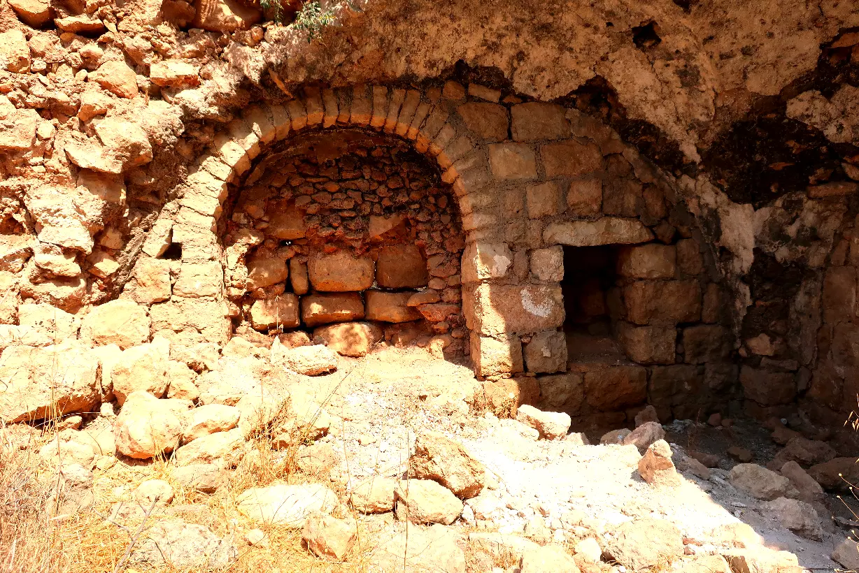
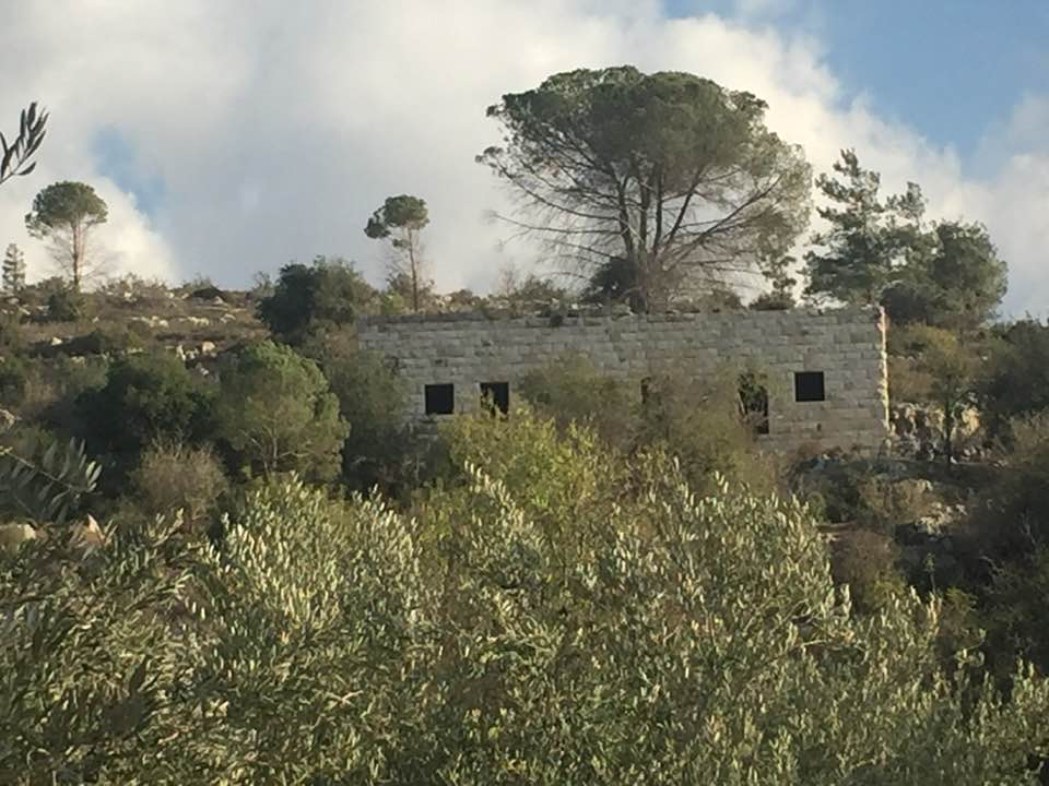
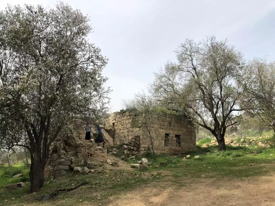
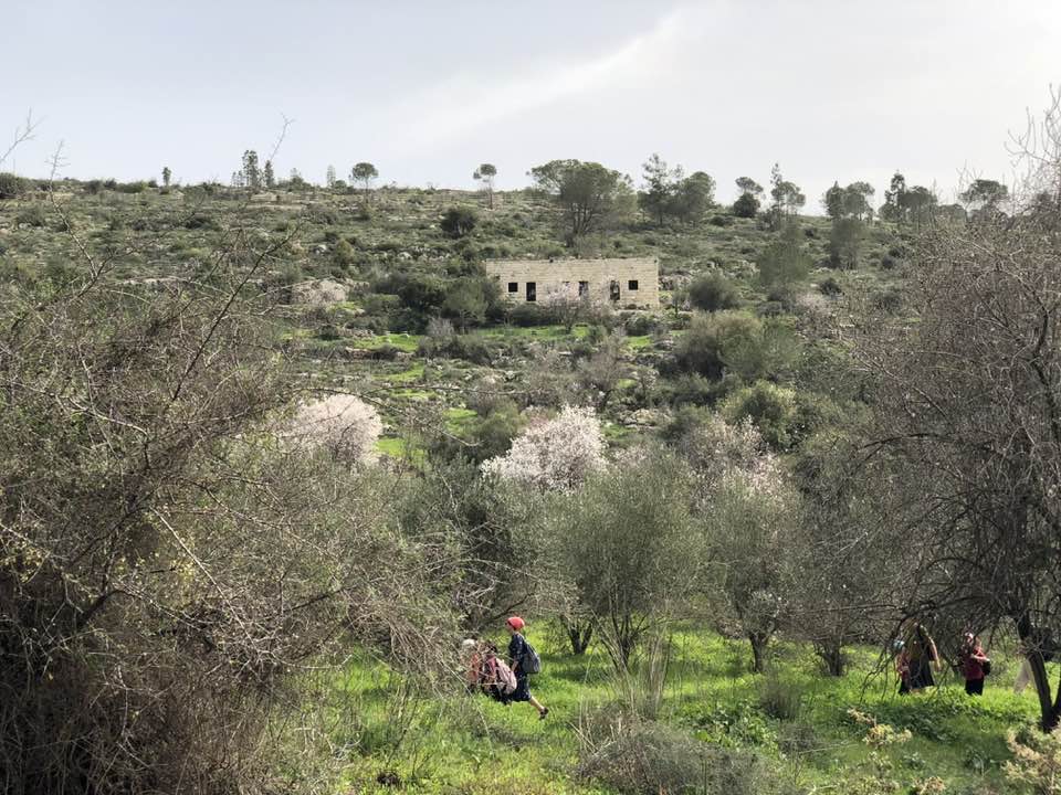
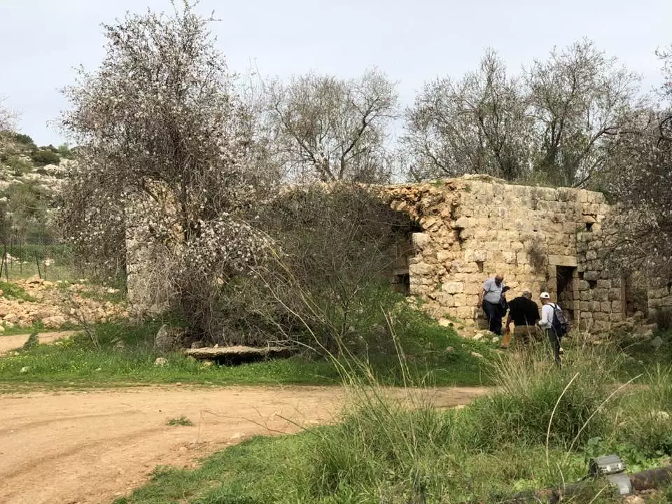
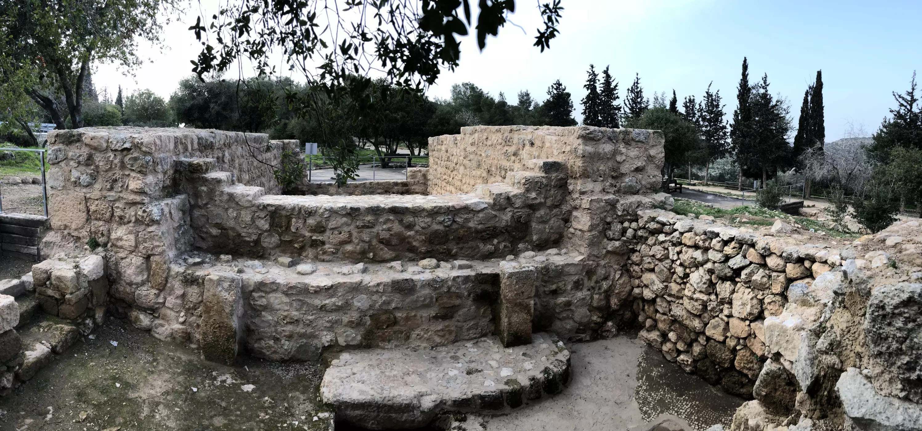
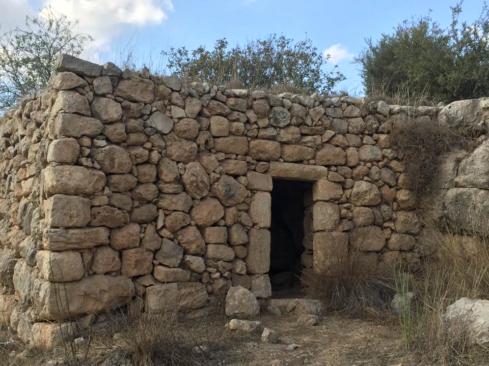
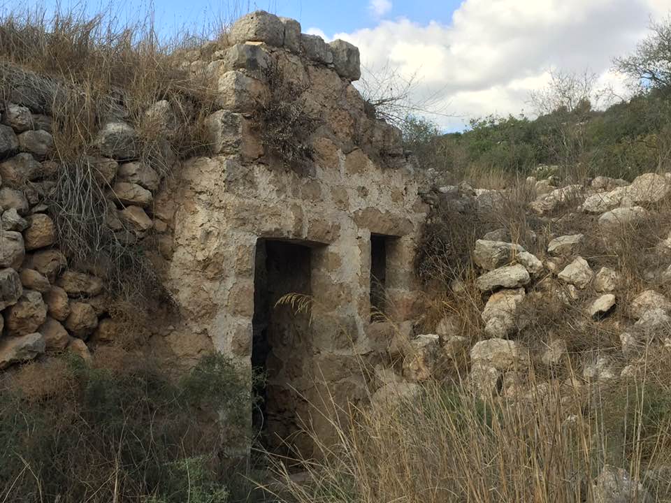
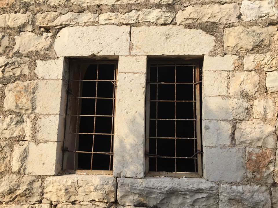
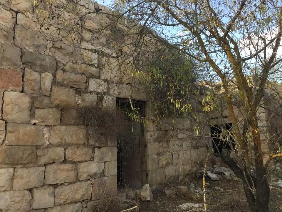
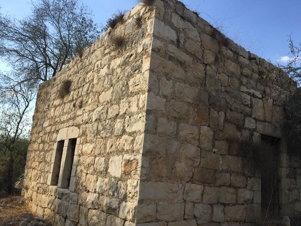
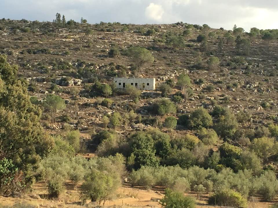
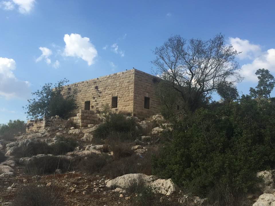
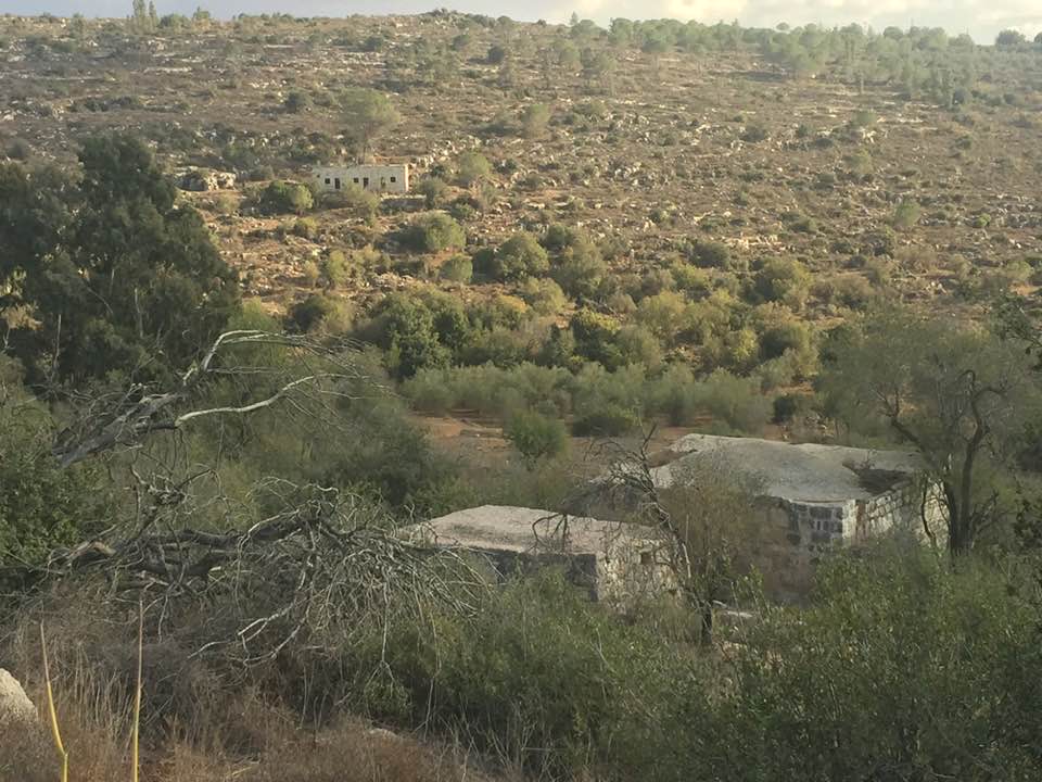
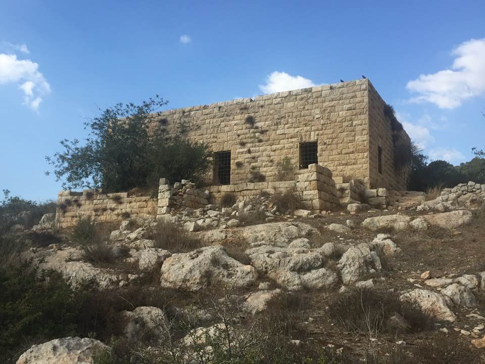
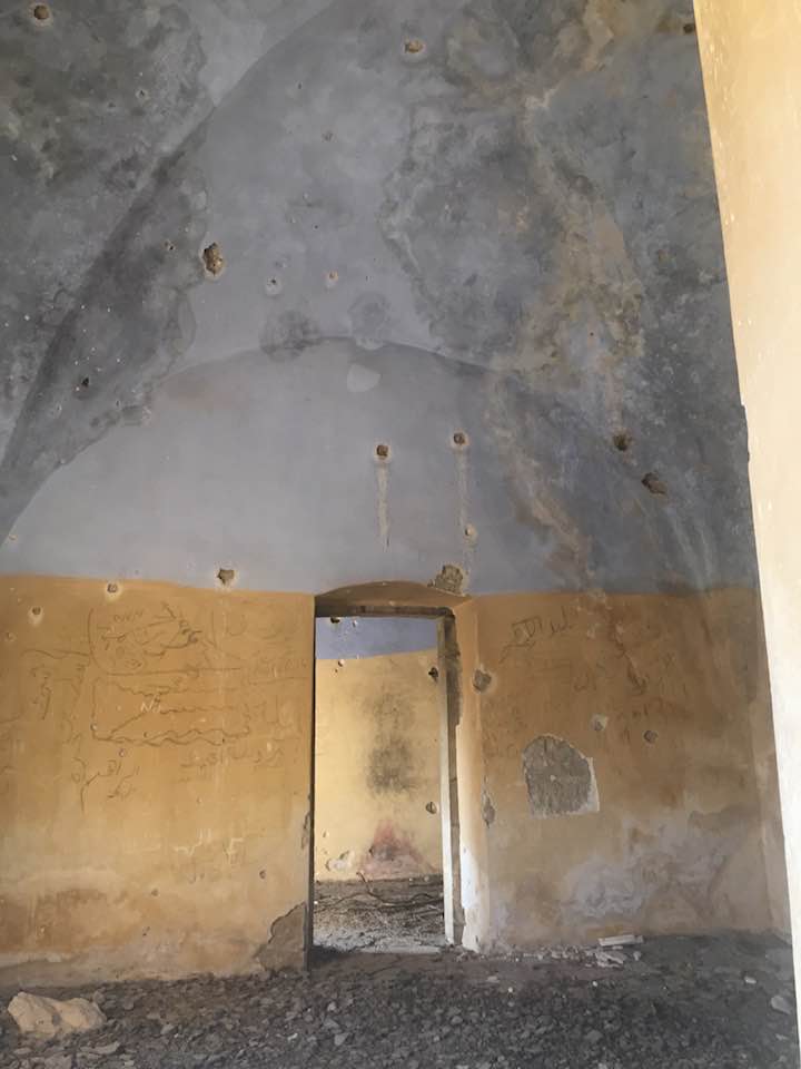
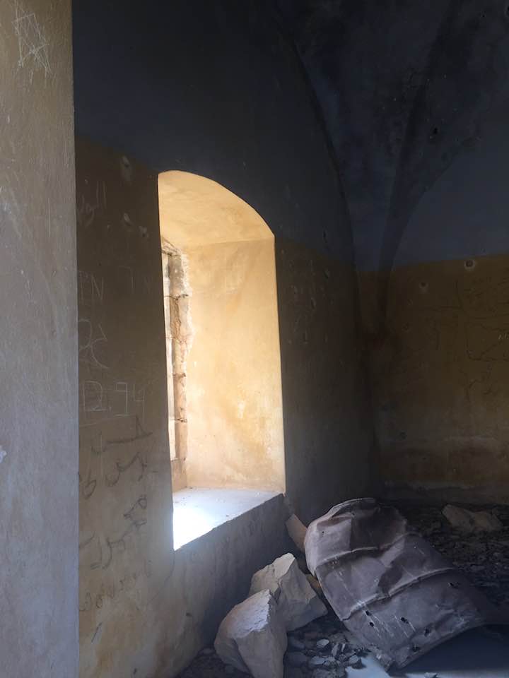
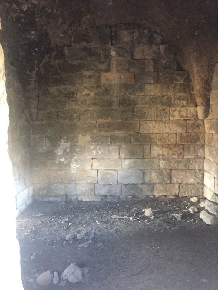
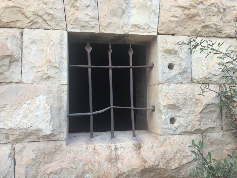
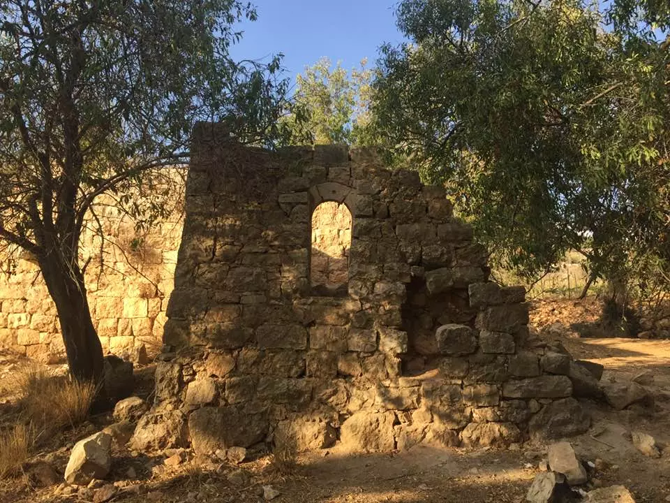
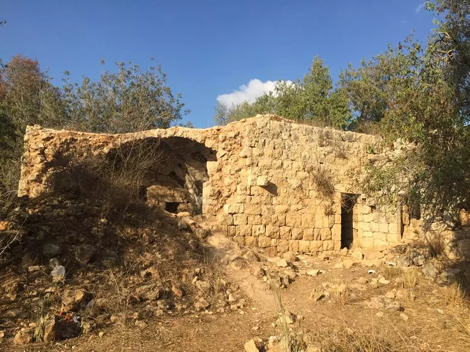
| Village Temains | Khirbat al-Tannur was mostly destroyed with the exception of few deserted and partially destroyed houses. | |||||||||
| Ethnically Cleansing | al-Tannur, Khirbat inhabitants were completely ethnically cleansed. | |||||||||
| Population |
|
|||||||||
| Number of Houses | At least 10 houses just before occupation | |||||||||
| Near By Towns |
||||||||||
|
|
||||||||||
| Town's Name Through History | At one point Khirbat al-Tannur was also known by 'Allar al-Sufla (relative to current 'Allar before destruction). | |||||||||
| Exculsive Jewish Colonies That Usurped Village Lands |
Matta' | |||||||||
| Featured Video | ||||||||||
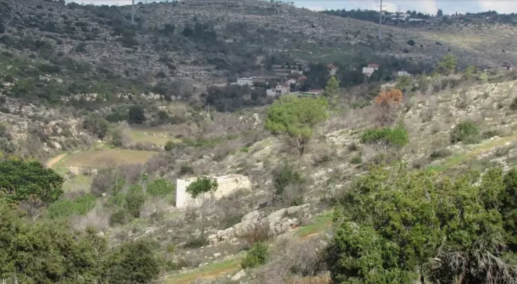
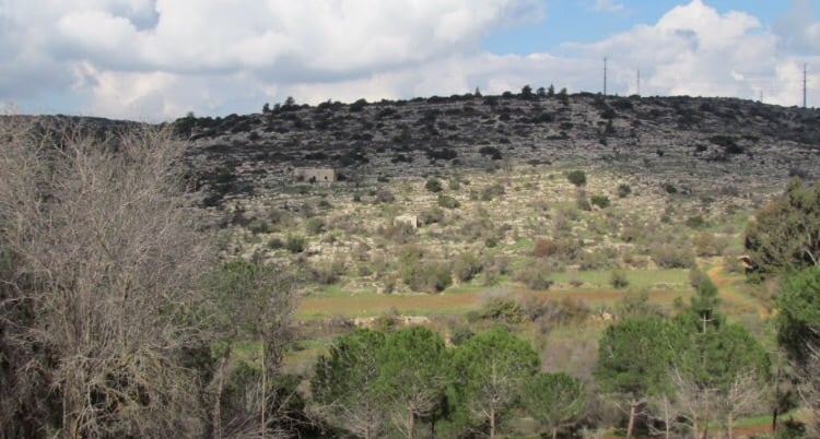
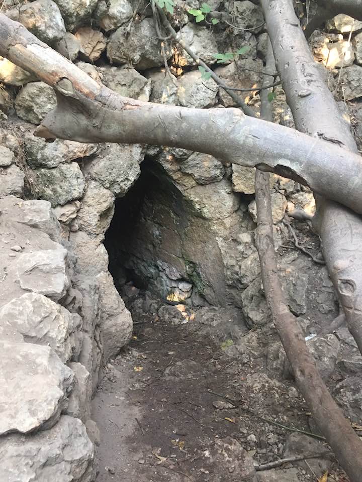
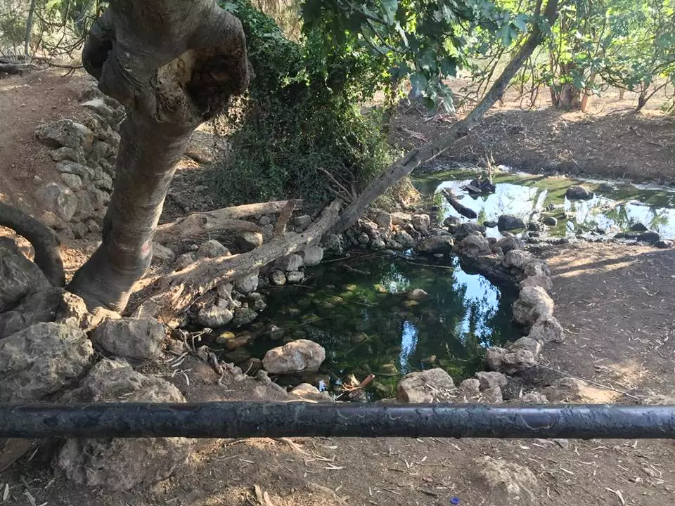
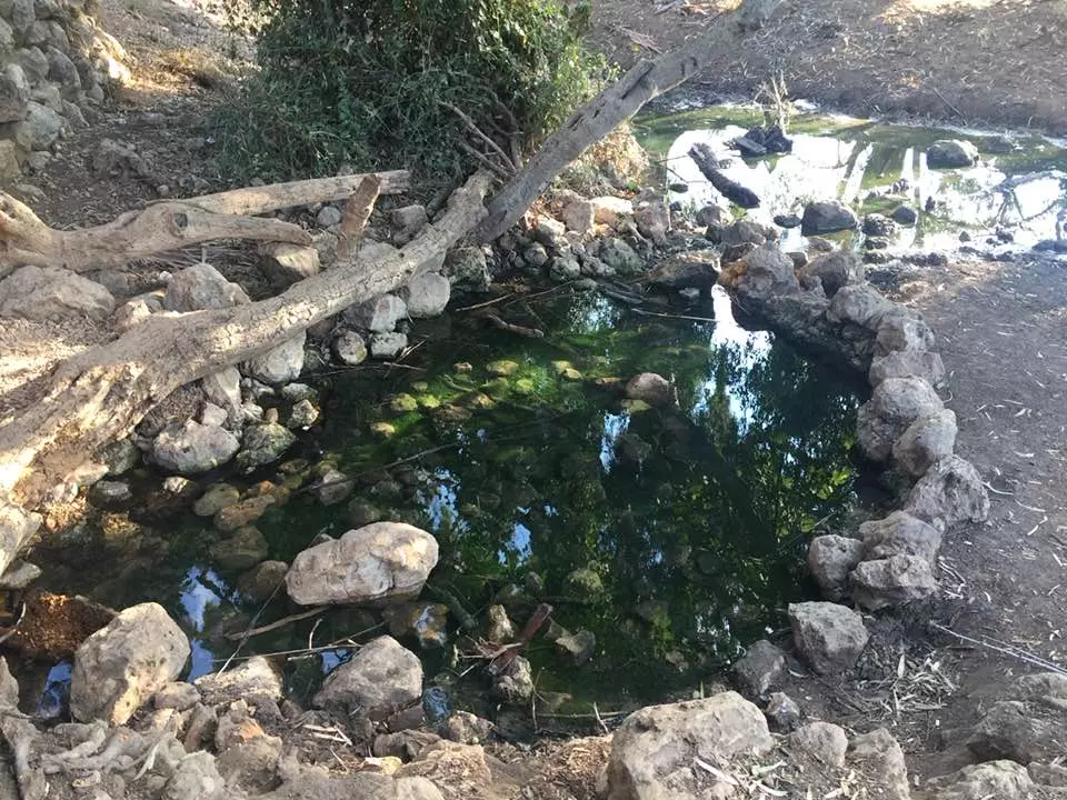
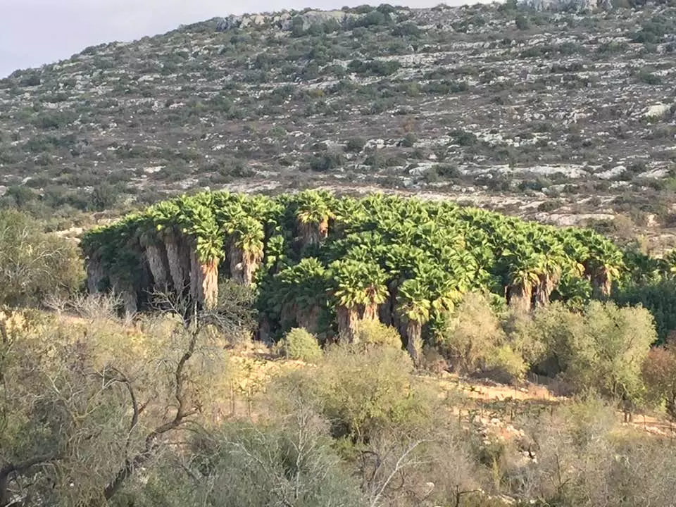
Village Before NakbaThe village was located on the northern bank of a wadi that flowed from north to south and then turned west. Its houses were built at this westward bend in the wadi. In early Ottoman times Khirbat al-Tannur was a sister village of 'Allar al-Fawqa (155125), that is, 'upper' 'Allar; it was called 'Allar al-Sufla ('lower' 'Allar). In 1596, 'Allar al-Sufla was a village in the nahiya of Jerusalem (liwa' of Jerusalem) with a population of thirty-nine. It paid taxes on a number of crops, including wheat, barley, and olives. The traveler Edward Robinson saw the village in 1838 , when the ruins of a church were visible in it. A village in the same area with a similar name―'Allar al-Tahta ('lower' 'Allar)―was reported to have a population of 400 in 1875. It seems, however, that the site was temporarily abandoned not long after this. Khirbat al-Tannur was inhabited again during the Mandate period, when it was classified as a hamlet by the Palestine Index Gazetteer. It was on the north side of a secondary road leading eastwards to Bethlehem.Village Occupation and Ethnic CleaningAlthough no information about the village itself is available, its location indicates that it almost certainly was occupied during the Israeli army's Operation Ha-Har (see 'Allar, Jerusalem sub-disctrict). It probably fell around 21−22 October, at the same time as 'Allar and Bayt 'Itab.Zionists Colonies on Village LandsThe lands of the village were amalgamated with those of nearby 'Allar. Two Israeli settlements are on these lands; the one closest to the site of Khirbat al-Tannur is Matta' (155125), built in 1950.Village TodaySix houses have been destroyed and their rubble is strewn over the site; four others still stand. Clusters of trees grow along the terraces on the valley bottom. Almond, olive, and cypress trees grow at the northern edge of the site. To the east, eucalyptus trees grow around the ruins of what had been a stone house. A spring flows north of this ruined house.SourceDr. Walid al-Khalidi, 1992: All That Remains. |
||||||||||
| Related Maps | Town Lands' Demarcation Maps خرائط للقضاء توضح حدود القرى والاودية Town's map on MapQuest View from satellite Help us map this town at WikiMapia |
|||||||||
| Related Links | Wikipedia's Page Google Search Google For Images Google For Videos |
|||||||||
| More Information | في كتاب كي لا ننسى المزيد من موقع هوية |
|||||||||
- Inside of home. Fall 2006. Photo: Annemarie Jacir
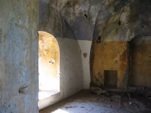
Posted by Annemarie Jacir - Roof of home still mostly standing. Fall 2006. Photo: Annemarie Jacir
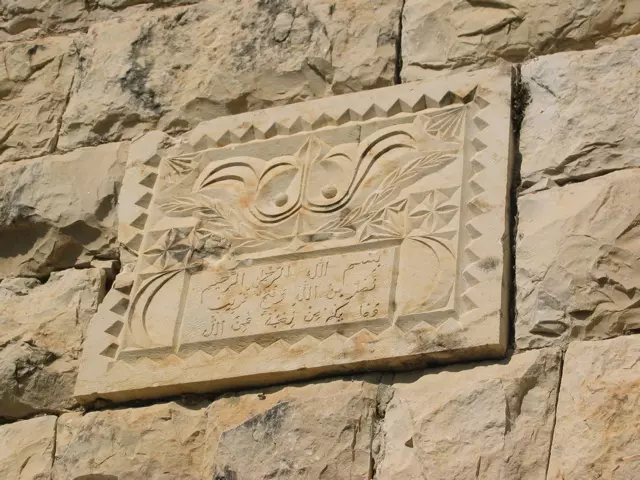
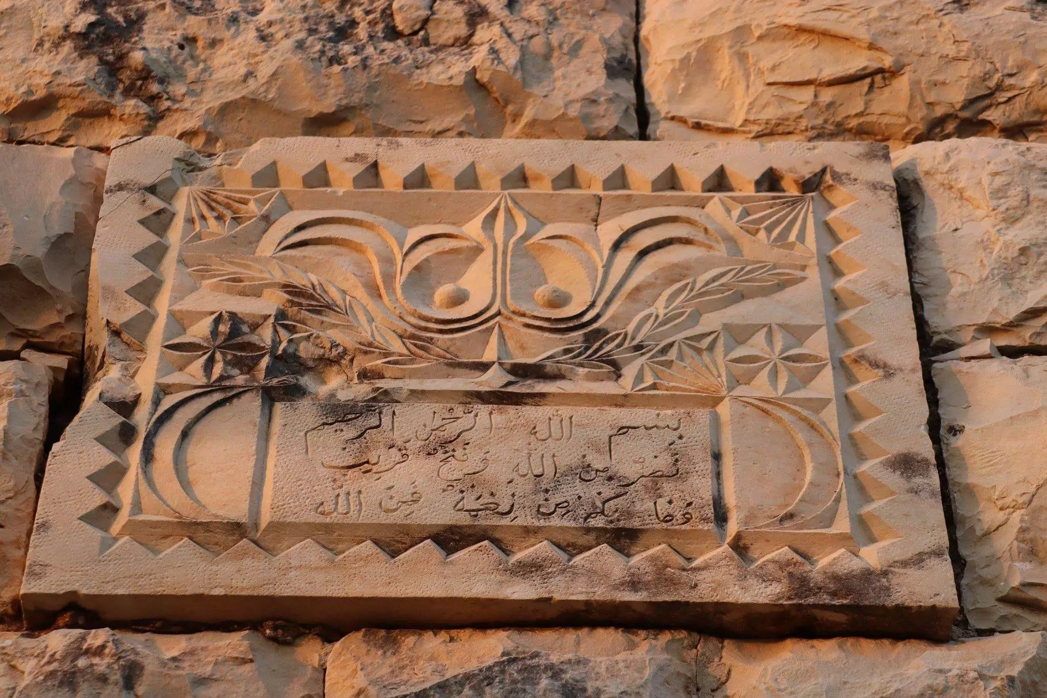
Posted by Annemarie Jacir - Plaque above door of fully standing home. Fall 2006. Photo: Annemarie Jacir
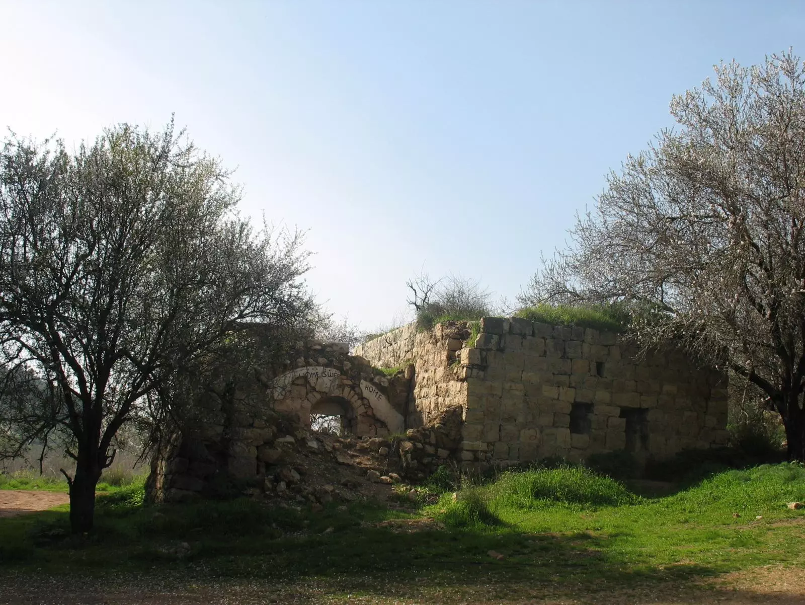
Posted by Annemarie Jacir 1 - Ruins of a destroyed house in the destroyed Palestinian village. Note the Engslish inscription written on the house: Home Sweet Home.
Posted by Noga Kadman - إحدى البيوت التي سلمت التدمير الشامل الذي حل بكل القرية.
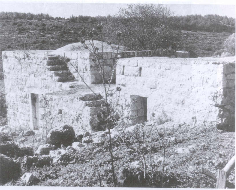
Scanned from "All That Remains" by Dr. Walid Khalidi - من اثار القريه
Posted by abu raya - من اثار القريه
Posted by abu raya - اثار القريه
Posted by abu raya - خربه التنور
Posted by abu raya - خربه التنور
Posted by abu raya - خربه التنور
Posted by abu raya - اثار بيوت القريه
Posted by abu raya - من البيوت الباقيه في القريه
Posted by abu raya - خربه التنور
Posted by abu raya - خربه التنور
Posted by abu raya - بيوت خربه التنور
Posted by abu raya - من البيوت الباقيه في القريه
- من البيوت الباقيه في القريه #2
- A tour of Palestinian homes that were destroyed by the "most civilized". How else will the Jews be great again? Mazletov
- A tour of Palestinian homes that were destroyed by the "most civilized". How else will the Jews be great again? Mazletov #2
- A tour of Palestinian homes that were destroyed by the "most civilized". How else will the Jews be great again? Mazletov #3
- A tour of Palestinian homes that were destroyed by the "most civilized". How else will the Jews be great again? Mazletov #4
- A tour of Palestinian homes that were destroyed by the "most civilized". How else will the Jews be great again? Mazletov #5
- A tour of Palestinian homes that were destroyed by the "most civilized". How else will the Jews be great again? Mazletov #6
- A tour of Palestinian homes that were destroyed by the "most civilized". How else will the Jews be great again? Mazletov #7
- A tour of Palestinian homes that were destroyed by the "most civilized". How else will the Jews be great again? Mazletov #8
- A tour of Palestinian homes that were destroyed by the "most civilized". How else will the Jews be great again? Mazletov #9
- That is how the "civilized" erased and replaced us: Kh. خربة التنور was completely obliterated except for a few remaining structures, as you see -- خربة التنور باتت أثر بعد عين. من هنا مر الهمجّ
- That is how the "civilized" erased and replaced us: Kh. خربة التنور was completely obliterated except for a few remaining structures, as you see -- خربة التنور باتت أثر بعد عين. من هنا مر الهمجّ #2
- That is how the "civilized" erased and replaced us: Kh. خربة التنور was completely obliterated except for a few remaining structures, as you see -- خربة التنور باتت أثر بعد عين. من هنا مر الهمجّ #3
- That is how the "civilized" erased and replaced us: Kh. خربة التنور was completely obliterated except for a few remaining structures, as you see -- خربة التنور باتت أثر بعد عين. من هنا مر الهمجّ #4
- That is how the "civilized" erased and replaced us: Kh. خربة التنور was completely obliterated except for a few remaining structures, as you see -- خربة التنور باتت أثر بعد عين. من هنا مر الهمجّ #5
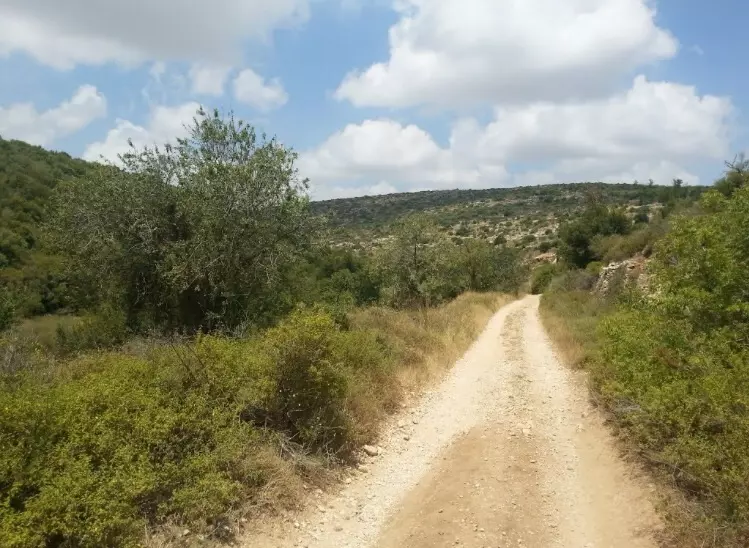
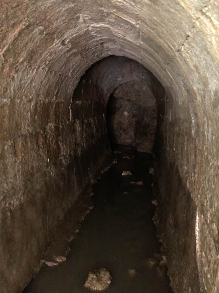
- Let us tour Ein al-Tannur, 2023 -- Iyad Jaber -- عين تنور في قرية علاّر السفلى خربة التنور
- Let us tour Ein al-Tannur, 2023 -- Iyad Jaber -- عين تنور في قرية علاّر السفلى خربة التنور #2
- Let us tour Ein al-Tannur, 2023 -- Iyad Jaber -- عين تنور في قرية علاّر السفلى خربة التنور #3
- Let us tour Ein al-Tannur, 2023 -- Iyad Jaber -- عين تنور في قرية علاّر السفلى خربة التنور #4
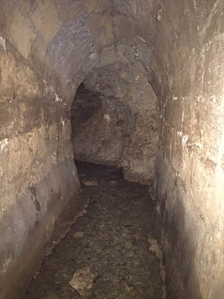
- Let us tour Ein al-Tannur, 2023 -- Iyad Jaber -- عين تنور في قرية علاّر السفلى خربة التنور #5
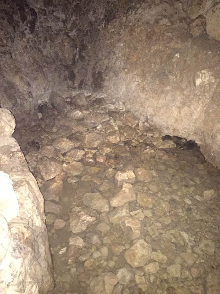
- Let us tour Ein al-Tannur, 2023 -- Iyad Jaber -- عين تنور في قرية علاّر السفلى خربة التنور #6
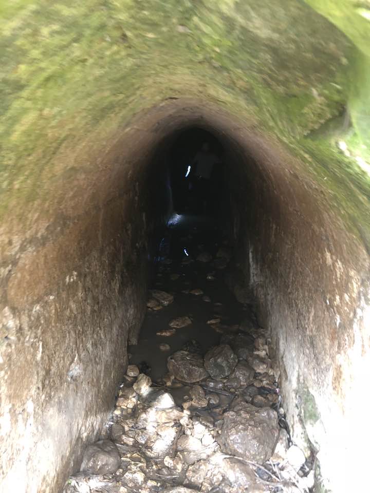
- Let us tour Ein al-Tannur, 2023 -- Iyad Jaber -- عين تنور في قرية علاّر السفلى خربة التنور #7
- That is how the "civilized" erased and replaced us: Kh. al-Tannur was completely obliterated except for a few remaining structures, as you see -- خربة التنور باتت أثر بعد عين. من هنا مر الهمجّ

- Let us see how the most "liberal and civilized" of world Jewry has obliterated our village. How else will the Jews be great and safe again?
- Let us see how the most "liberal and civilized" of world Jewry has obliterated our village. How else will the Jews be great and safe again? #2
- Let us see how the most "liberal and civilized" of world Jewry has obliterated our village. How else will the Jews be great and safe again? #3
- Let us see how the most "liberal and civilized" of world Jewry has obliterated our village. How else will the Jews be great and safe again? #4
- Let us see how the most "liberal and civilized" of world Jewry has obliterated our village. How else will the Jews be great and safe again? #5
- Let us see how the most "liberal and civilized" of world Jewry has obliterated our village. How else will the Jews be great and safe again? #6
- Let us see how the most "liberal and civilized" of world Jewry has obliterated our village. How else will the Jews be great and safe again? #7
- Let us see how the most "liberal and civilized" of world Jewry has obliterated our village. How else will the Jews be great and safe again? #8
- Let us see how the most "liberal and civilized" of world Jewry has obliterated our village. How else will the Jews be great and safe again? #9
- Let us see how the most "liberal and civilized" of world Jewry has obliterated our village. How else will the Jews be great and safe again? #10
- Let us see how the most "liberal and civilized" of world Jewry has obliterated our village. How else will the Jews be great and safe again? #11
- Let us see how the most "liberal and civilized" of world Jewry has obliterated our village. How else will the Jews be great and safe again? #12
- Let us see how the most "liberal and civilized" of world Jewry has obliterated our village. How else will the Jews be great and safe again? #13
- Let us see how the most "liberal and civilized" of world Jewry has obliterated our village. How else will the Jews be great and safe again? #14
- Let us see how the most "liberal and civilized" of world Jewry has obliterated our village. How else will the Jews be great and safe again? #15
- Let us see how the most "liberal and civilized" of world Jewry has obliterated our village. How else will the Jews be great and safe again? #16
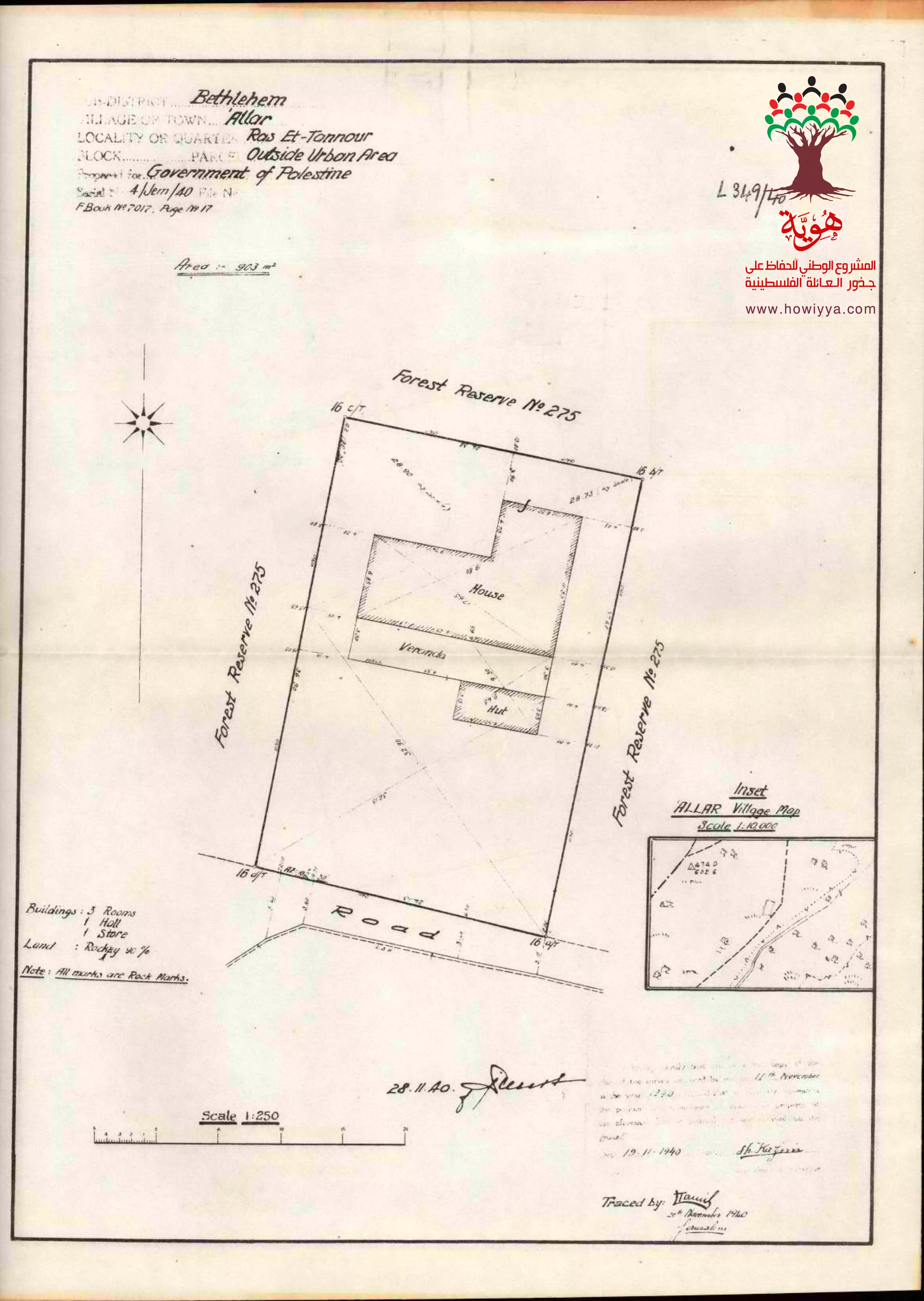
- Ras al-Tannur ? Al-Ahrash Map ? Allar / Bethlehem ? 28/11/1940
Want to browse more? 80,000 pictures were grouped in these gallaries:
| Display Name | Clan/Hamolah | Country of Residence |
- قرية علاّر المهجرة وخربة التنور قضاء القدس waze חורבת תנור . Duration: 35 sec
No links have been shared yet, be free to the first to share the first link.
 Fake Valor: Why Did Zionist Jews Hoist Nazis Flag on Their Ships in the 1930s?
What is new?
-
Facts About Oct. 7th Gaza Raid
-
Remined Us Please: Who Did Rape Whom? Was it Palestinians who raped Israelis? Or, was the other way around? You'll be the judge
-
When Prof. Edward Said was invited to debate Bibi Netanyahu in the 1980s, watch what happened!
-
Ezra Klein of the NY Times on the "Jewish Race".
-
Abusing Blood Libel!
-
How and why Israeli Jewry has become the most hated cult?
-
Did Israeli Soldiers Activate The Hannibal Direective On Oct. 7th? You Be The Judge
-
Zionist FAQ: Isn't it true that Palestinians don't want peace? Palestinians never accepted the two-state solution
- Facts about Haavara (Transfer) Agreement between Ben-Gurion & Hitler
-
Haavara FAQs: Why Did Zionist Jews Hoist Nazis' Flags on Their Ships in the 1930s?
- Haavara FAQs: When Chaim Weizmann met FDR in mid-1943, why was he silent about rescuing European Jewry?
-
Dear ChatGPT: How did Palestinians resist Napoleon's invasion of their country in 1799?
-
Dear ChatGPT: Gaza had a vibrant Jewish community in the mid-17th century. What happened to them?
-
Dear ChatGPT: Why did the Jewish Agency suppress news of the Holocaust during WWII?
-
Video Playlist: Jews share their DNA tests to end the conflict for good.
-
A Tale of Two Conflicts: Examining the Definition of Genocide
-
Prof. Abraham Polak And The Suppressed History of the Khazars and European Jewry
-
How Ronald Reagan would have framed the genocide in Gaza if he were still alive?
-
Haavara FAQs: Let us do the math: how many German Jews did The Haavara Agreement save?
-
Zionist FAQs: The Hebron Massacre of 1929, "clearly proves" that Palestinians are antisemitic, how could you deny it?
-
Zionist FAQs: Why Anti-Zionist Is Not Antisemitism?
-
Zionist FAQs: Isn't it true that the KGB created Palestinian Nationalism in the early 1960s?
- Zionist FAQs: Muslims are killing Muslims all the time; why are Israeli Jews being singled out in the media?
- Zionist FAQs: How is Israel an apartheid state when 20% of its citizens are Arabs who enjoy full rights?
-
Haavara FAQs: Why Did Dorothy Thompson Flip From A Zionist Advocate to A Silenced Dissenter?
-
Haavara FAQs: Analysis of Herzl's Uganda Scheme and how it could have saved millions of Jews.
-
Haavara FAQs: Why did Hayim Greenberg describe American Jewry as "morally bankrupt" in early 1943?
-
Haavara FAQs: What if the Evian Conference was a resounding success? What would have been the impact of saving European Jewry on Zionism?
- Haavara FAQs: What if the six million were saved, how that would have impacted the Zionist project?
-
Haavara FAQs: How did Zionist leaders react when Europe's Jews lingered in the DP camps after WWII ended?
-
Why does the American Jewish community repeat lies that David Ben-Gurion had debunked before he died?
-
Who has the power to rename the Tatar/Khazar Gene Marker to Jewish IV?
-
Zionist FAQs: Why won't Egypt, Syria, and Jordan take their people back? Jews are indigenous to Palestine, and Arabs immigrated after Jews developed the country. Arabs should leave.
-
Haavara FAQs: Did Hitler and the Nazis conflate between Judaism and Zionist? If that wasn't case, then why?
-
Haavara FAQs: Winston Churchill and antisemitism, a collection of articles written Churchill.
-
Haavara FAQs: Broken by country, how many Jews survived vs. killed during the Holocaust?
-
Haavara FAQs: Why did European Jews vote with their feet and to immigrated to the Americas, not Palestine, after WWII?
-
Watch this American Jewish Girl describing Israeli Jews' cognitive dissonance like no other in under two minutes
-
Haavara FAQs: When the Nazis went out of their way to hide the Holocaust, Israeli Jews did the exact opposite by broadcasting their genocide of Gazans. But why?
-
Haavara FAQs: How Zionist Jews went out of their to show their appreciation to Nazism and Fascism?
- Haavara FAQs: Why Zionist leaders were against bombing the death camps & the Railroads leading to them?
-
Haavara FAQs: Hitler's message to the British and American people: If Jews are such noble citizens and you care about them, how come you're not letting them in? I will gladly ship them to you at my expense, even on luxury liners!
-
A shortlist of Zionist and Israeli false flag operations in the name Jews.
-
The Most Moral Army
- The Land of Kapos (Israel): Where the brave are boycotted and Kapos walk free.
- Why did early Zionists often named their communal enterprises "colonial"?
- Zionist Relations with Nazi Germany by Faris Glubb
-
Two NY Times advertisements by Zionists in the early 1943 that exposes Zionists' treason at the height of the calamity
- Facts Not Lies about the Palestinian-Israeli Conflict.
- Site's pictures have been categorized
- Campgain Against Lice
- A Survey of Palestine, the official source about Palestine before Nakba produced by the British Mandate; over 1200 pages.
- Satellite View & Google Earth: Over 6,000 placemarks identifying all destroyed towns, W. Bank & Gaza Strip Towns, & refugee camps.
- PalestineRemembered.com and its Nakba Oral History Project were featured on al-Jazeera Satellite TV.
- Nakba Oral History Video Podcast:
 Over 700 Oral History interviews (including 3,500+ hours of recording) can be viewed online.
 - Palestine Village Statistics Project
- Gaza Jail Break
- النسخة العربية للموقع الان متوفرة
- Videos: Documenting the destroyed villages in video: Tracing all that remains since Nakba.
- Videos: Responding to Zionist Propaganda
- Interview: The ethnic cleansing of Palestine: George Galloway interviews Israeli Historian Ilan Pappe.
- For Palestinians, memory matters. It provides a blueprint for their future By George Bisharat.
- Zionist FAQ now available in Hebrew שאלות שציונים שואלים, עכשיו בעברית
- Video: The Stephen Walt and John Mearsheimer report on the influence of the Israel Lobby on U.S. Foreign Policy
- The Palestinian-Israeli conflict for beginners
