| PalestineRemembered | About Us | Oral History | العربية | |
| Pictures | Zionist FAQs | Haavara | Maps | |
| Search |
| Camps |
| Districts |
| Acre |
| Baysan |
| Beersheba |
| Bethlehem |
| Gaza |
| Haifa |
| Hebron |
| Jaffa |
| Jericho |
| Jerusalem |
| Jinin |
| Nablus |
| Nazareth |
| Ramallah |
| al-Ramla |
| Safad |
| Tiberias |
| Tulkarm |
| Donate |
| Contact |
| Profile |
| Videos |
Welcome To 'Allar - علار (עלאר)
|
District of Jerusalem
Ethnically cleansed days ago |
العربية Google Earth |
 |
Gallery (69) |
- Statistics & Facts
-
Before & After

- Satellite View
- Articles 1
- Pictures 69
- Oral History 2
- Members 25
- All That Remains
- Wikipedia
- Videos 2
- Guest Book 10
- Links
| Statistic & Fact | Value | ||||||||||||
| Occupation Date | October 22, 1948 | ||||||||||||
| Distance From District | 17.5 (km) West of Jerusalem | ||||||||||||
| Elevation | 675 (meters) | ||||||||||||
| Before & After Nakba, Click Map For Details |
|||||||||||||
|
|||||||||||||
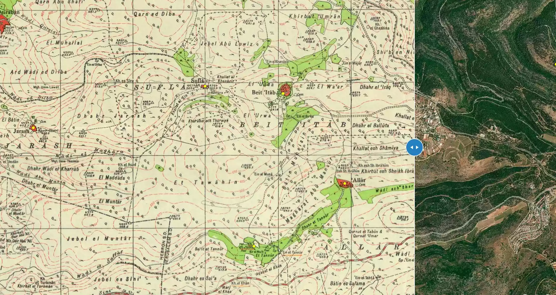
| Map Location | See location #37 on the map View from satellite |
||||||||||||
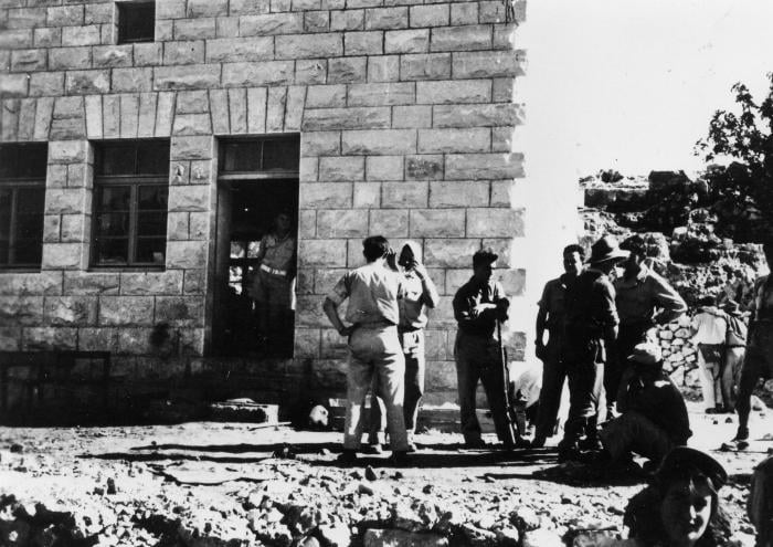
| Military Operation | Operation ha-Har | ||||||||||||
| Attacking Units | Har'el and Etzioni brigades | ||||||||||||
| Defenders | Local militia and Egyptian Army/Muslim Brotherhood Battalion | ||||||||||||
| Exodus Cause | Military assault by Zionist troops | ||||||||||||
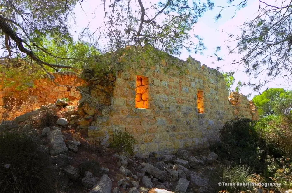
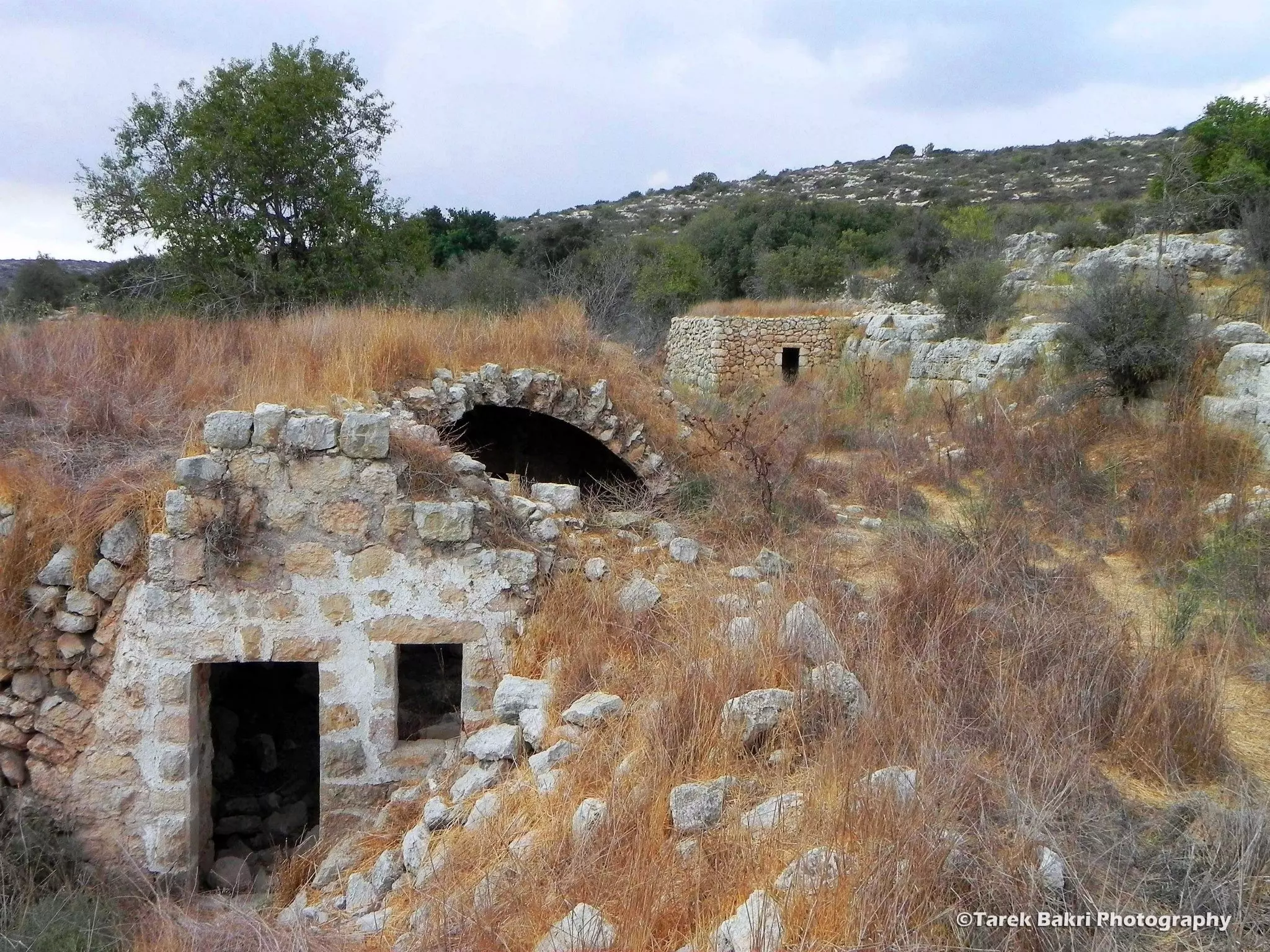
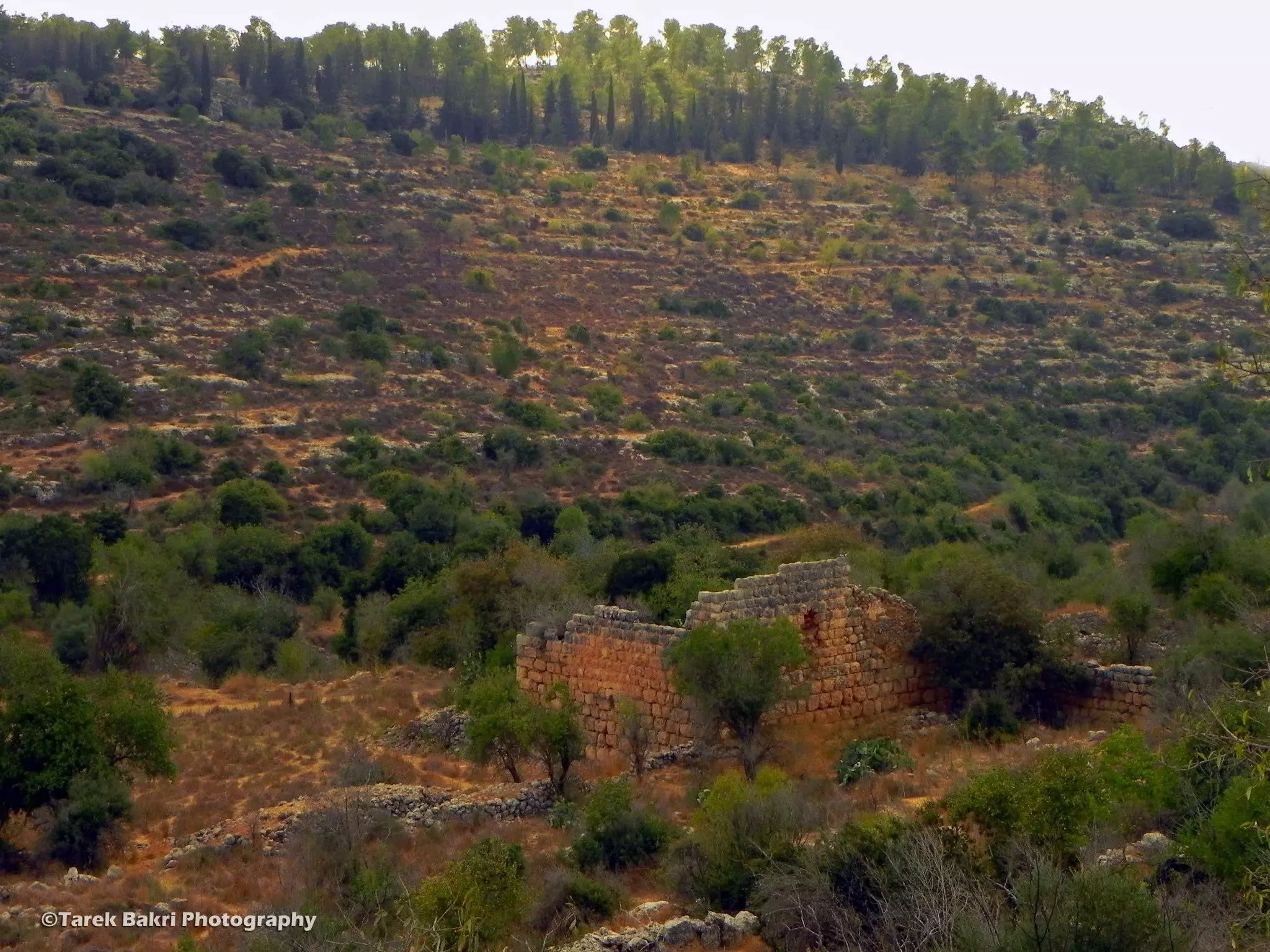
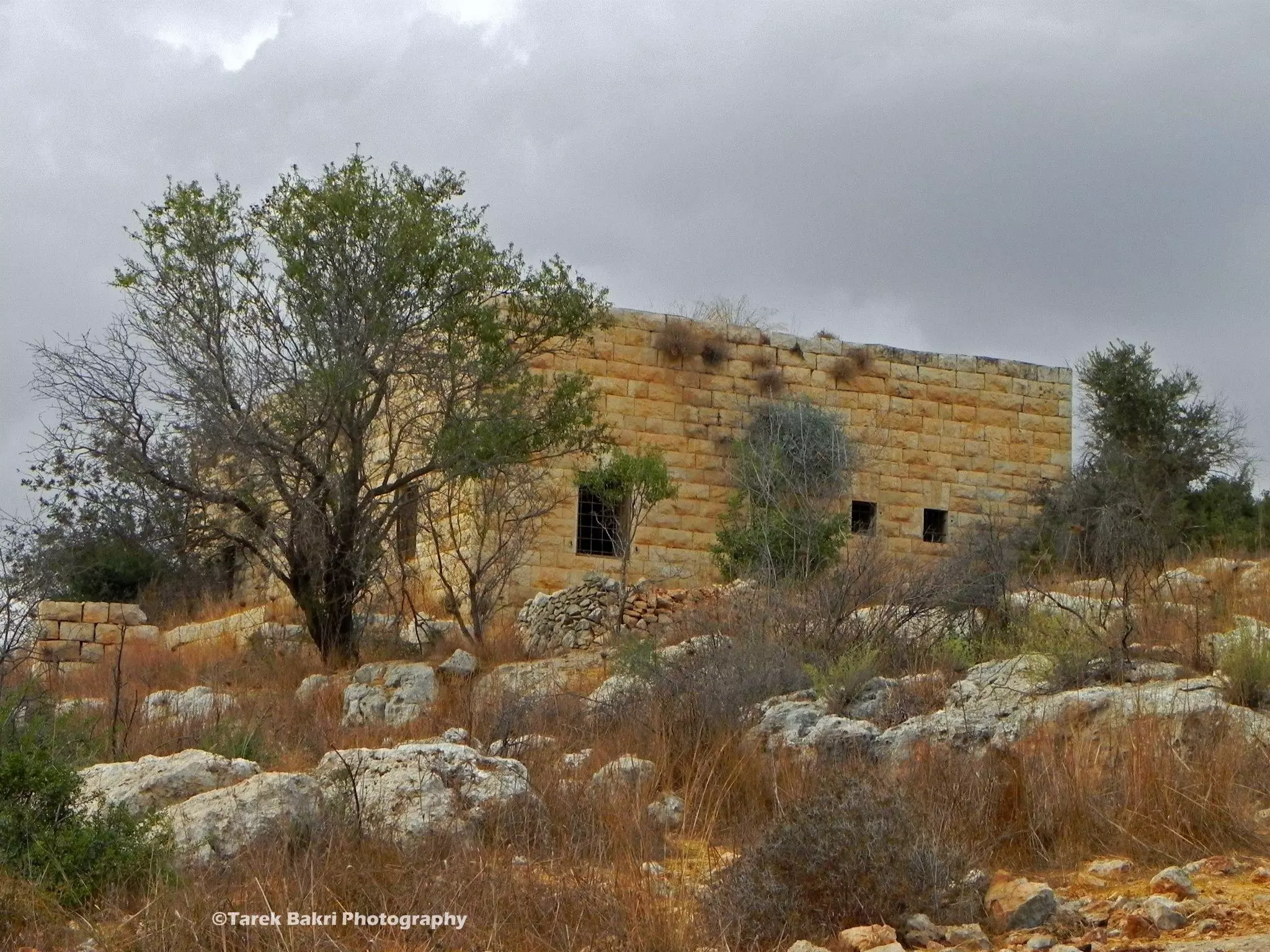
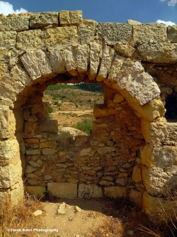
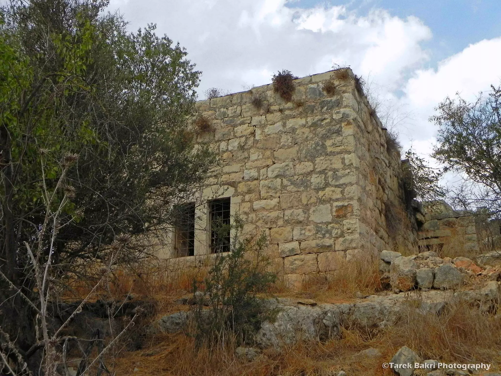
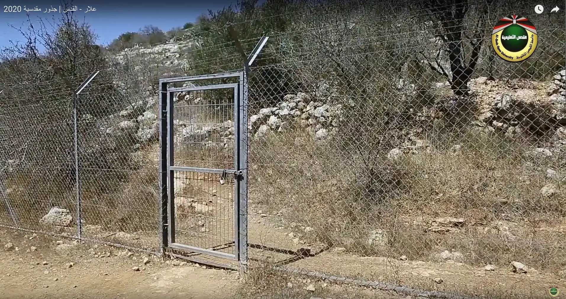
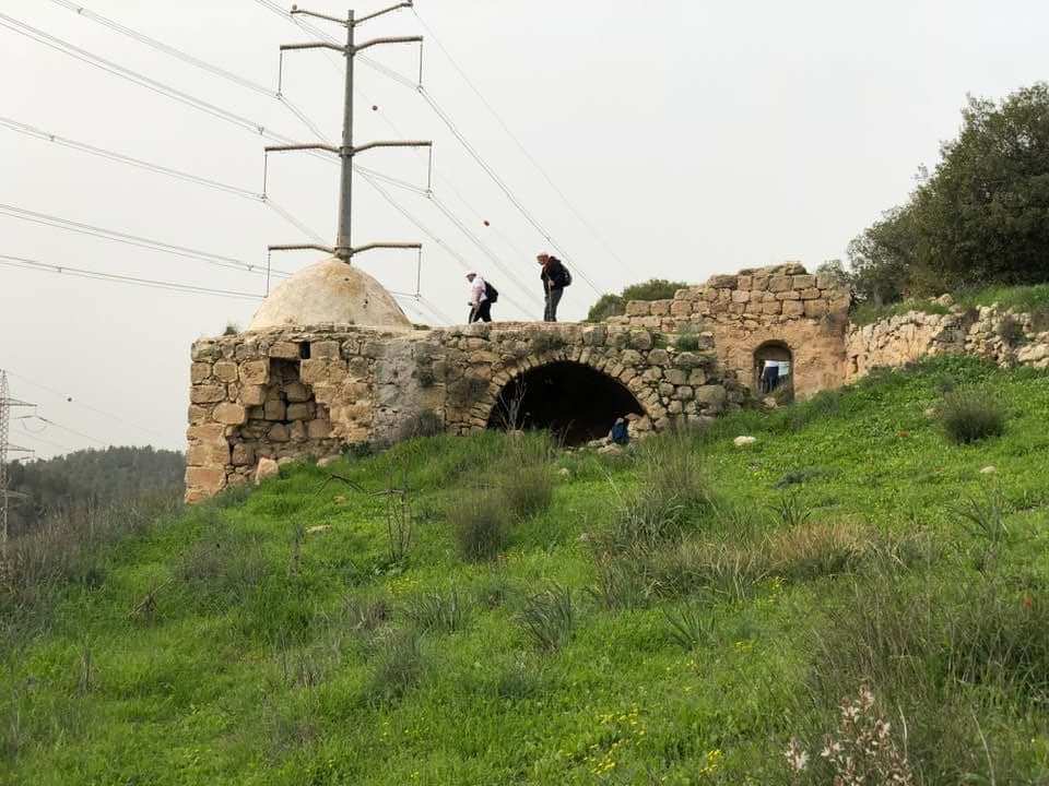
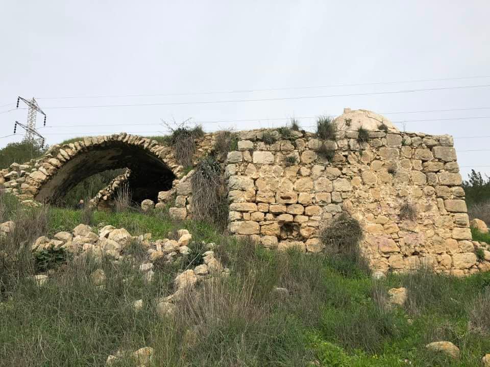
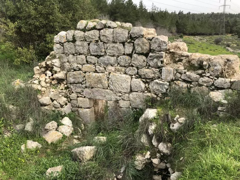
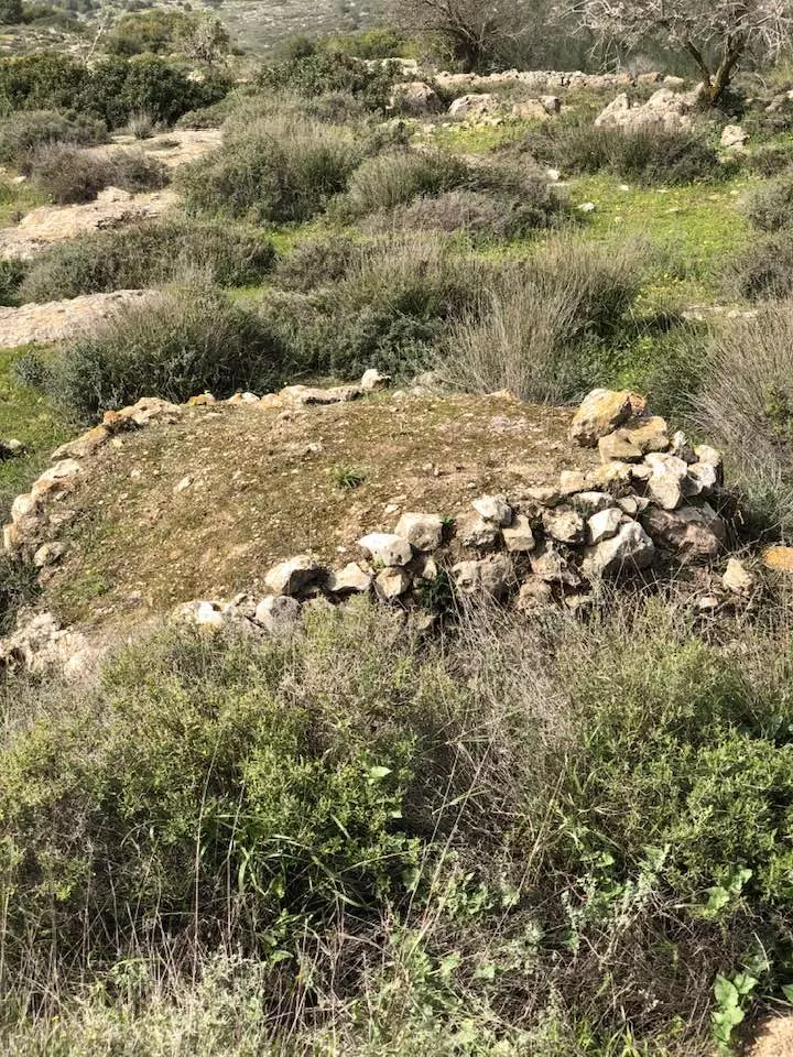
| Village Temains | 'Allar was mostly destroyed with the exception of the village school, and possibly either its shrine or its mosque remain standing. | ||||||||||||
| Ethnically Cleansing | A large number of 'Allar's refugees remained encamped in the gullies and caves around the villages, only to be expelled during Israeli raids in subsequent months. | ||||||||||||
| Pre-Nakba Land Ownership |
**Town Lands' Demarcation Maps |
||||||||||||
| Land Usage As of 1945 |
|
||||||||||||
| Population |
|
||||||||||||
| Number of Houses | N/A | ||||||||||||
| Near By Towns |
|||||||||||||
|
|||||||||||||
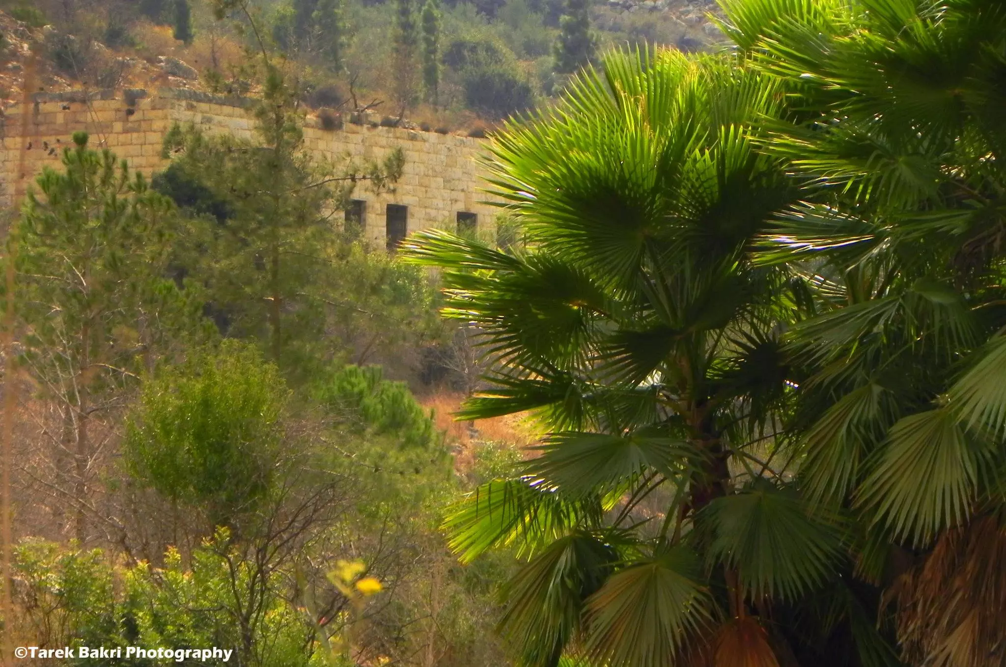
| Schools | One elementary school (remain standing) | ||||||||||||
| Places of Warship | Since 'Allar currently contains a domed structure, then it's possibly that it had at least a mosque before destruction. | ||||||||||||
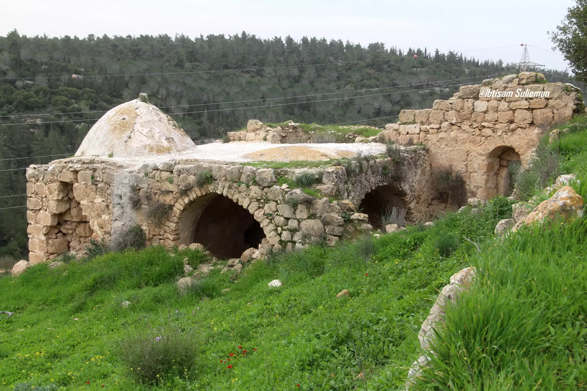
| Shrines / Maqams | One shrine/maqam for al-Shaykh Ibrahim (probably, it's still standing), plus three other unknown maqams. | ||||||||||||
| Nearby Wadies & Rivers | The village overlooked a tributary of Wadi al-Sarar. | ||||||||||||
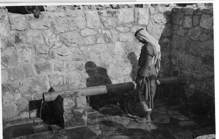
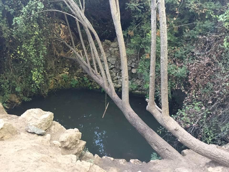
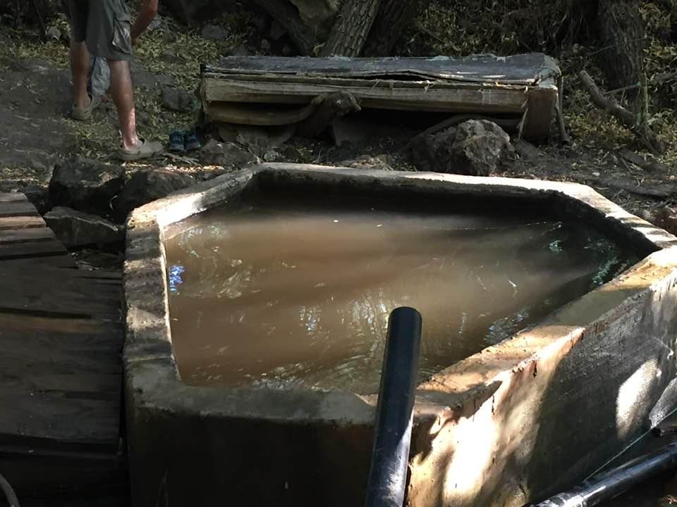
| Water Supply | 'Allar has several springs which used to supply the inhabitants with fresh water including 'Ayn al-Tannur. | ||||||||||||
| Archeological Sites | Several khirbas are in 'Allar's vicinity including Khirbat al-Shaykh Ibrahim. | ||||||||||||
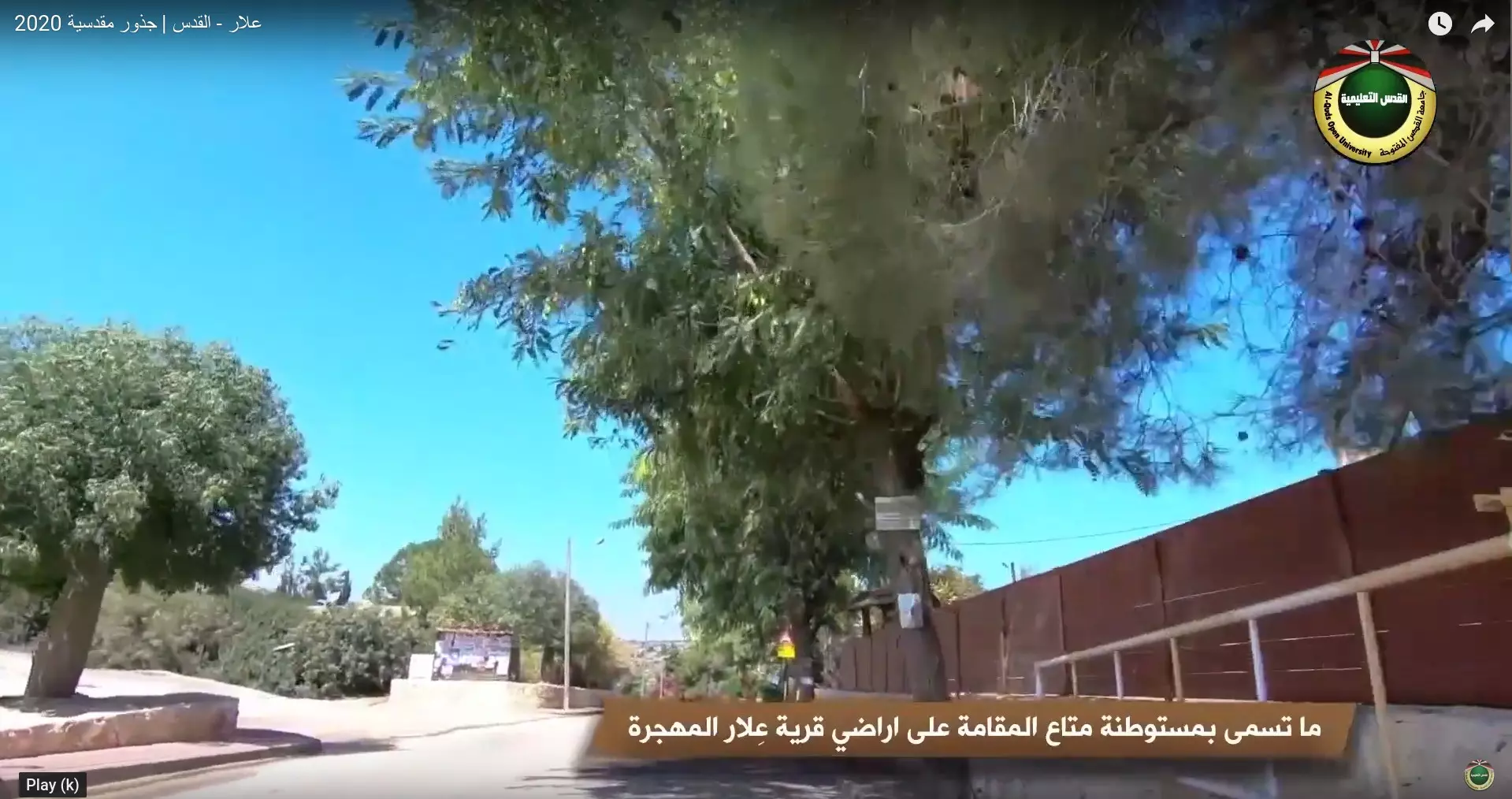
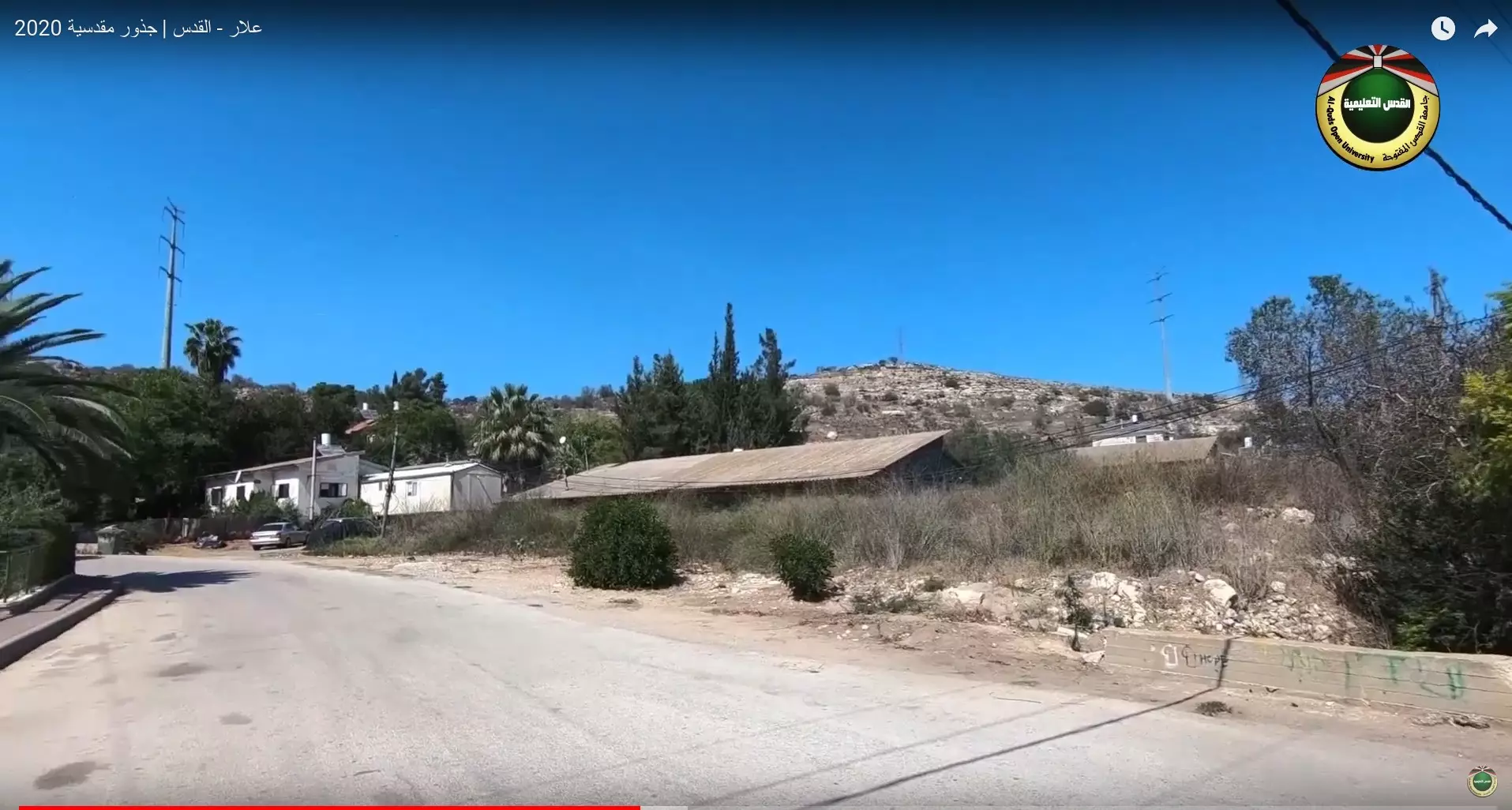
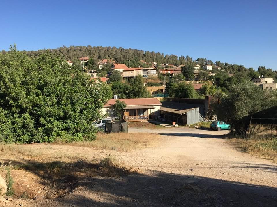
| Exculsive Jewish Colonies Who Usurped Village Lands |
Matta' and Bar-Giyyora | ||||||||||||
| Featured Video | |||||||||||||
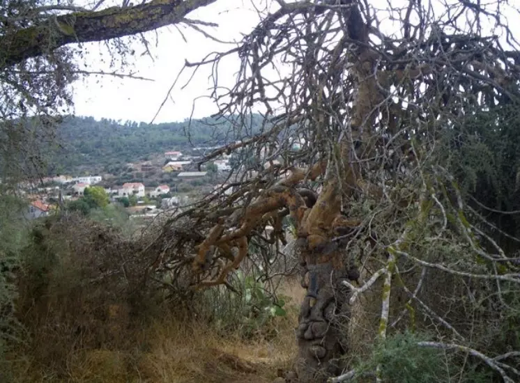
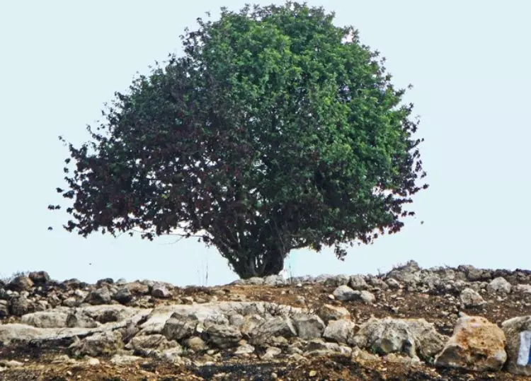
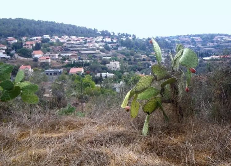
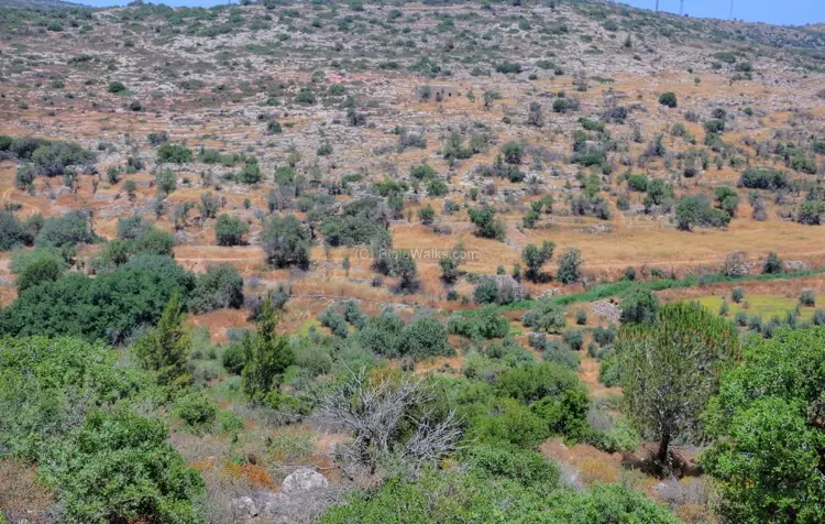
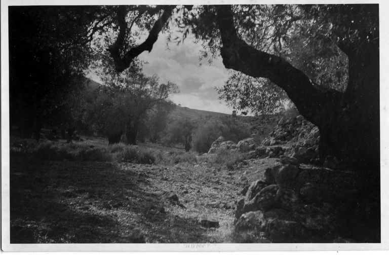
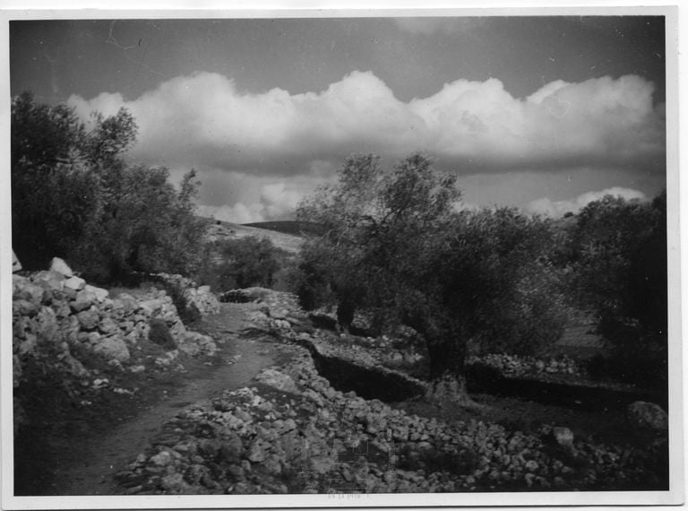
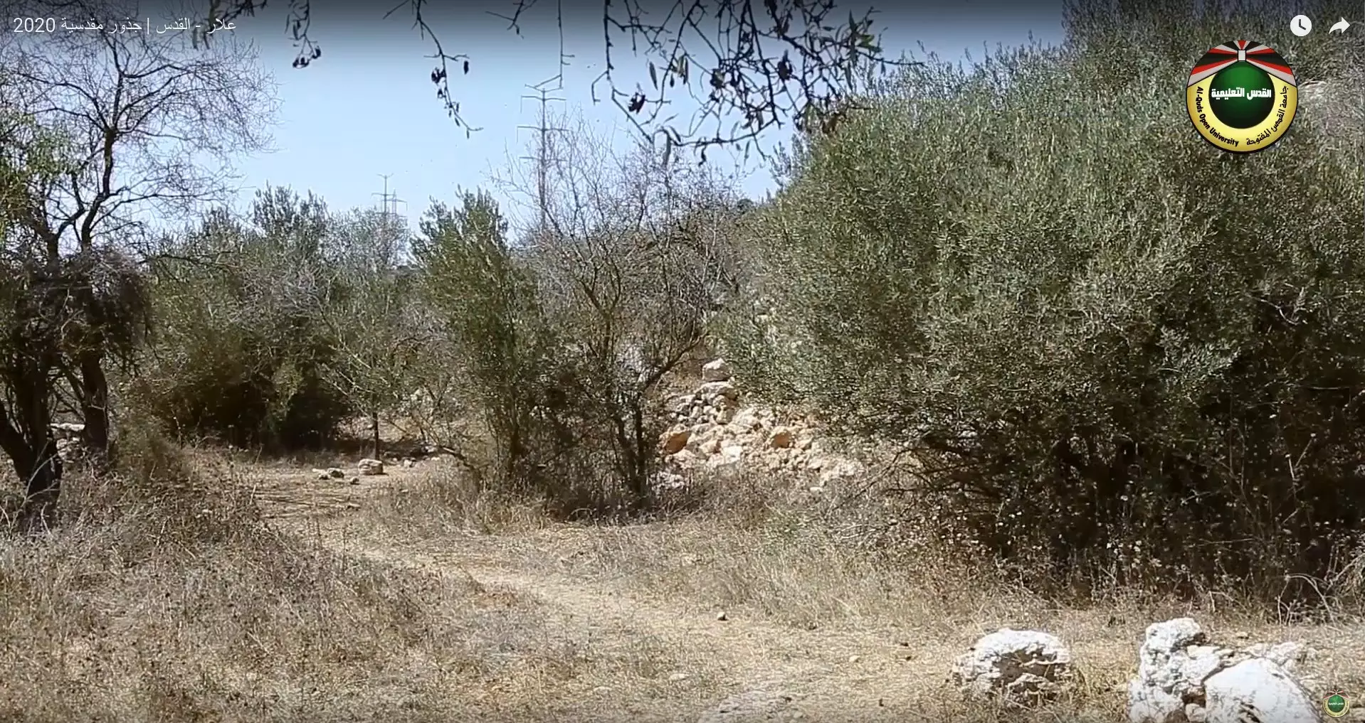
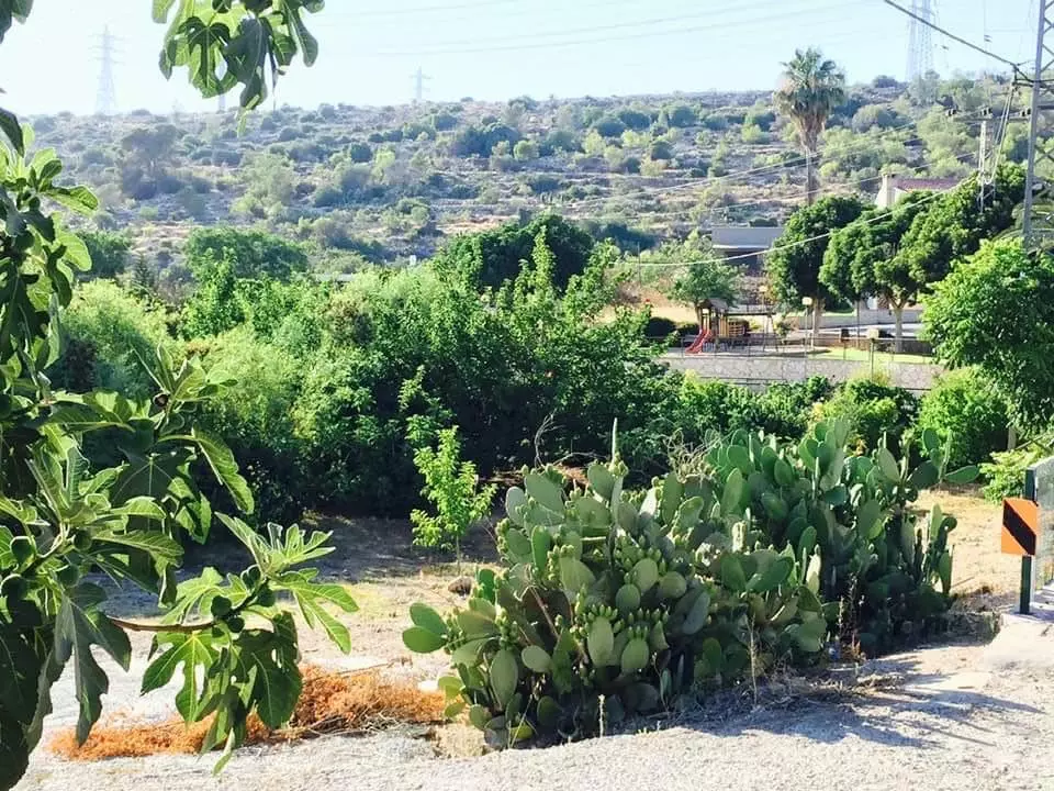
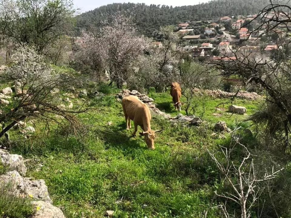
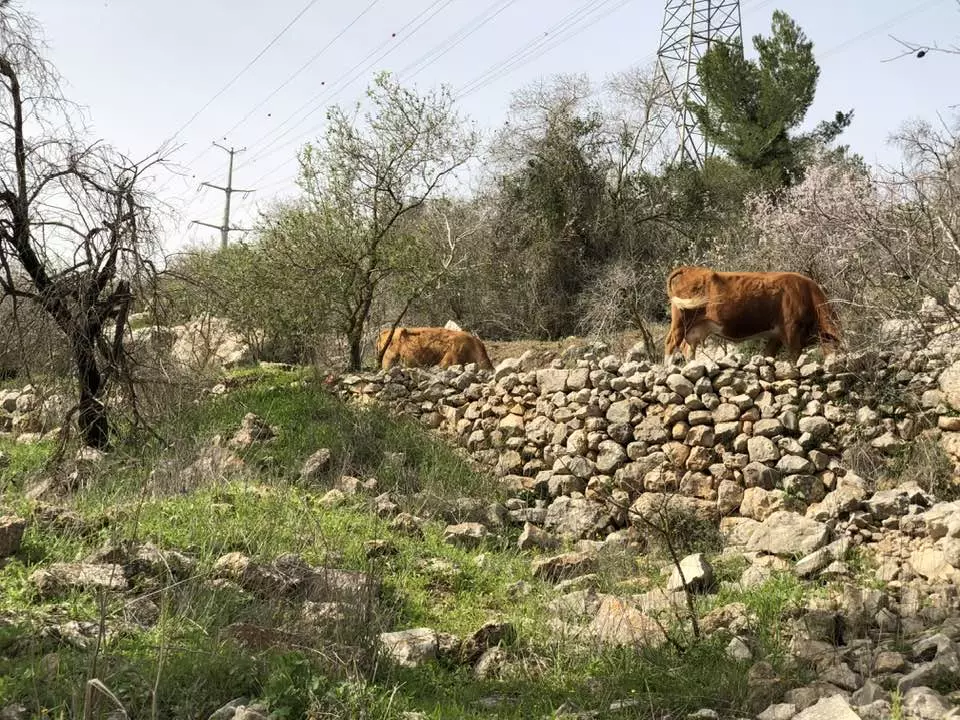
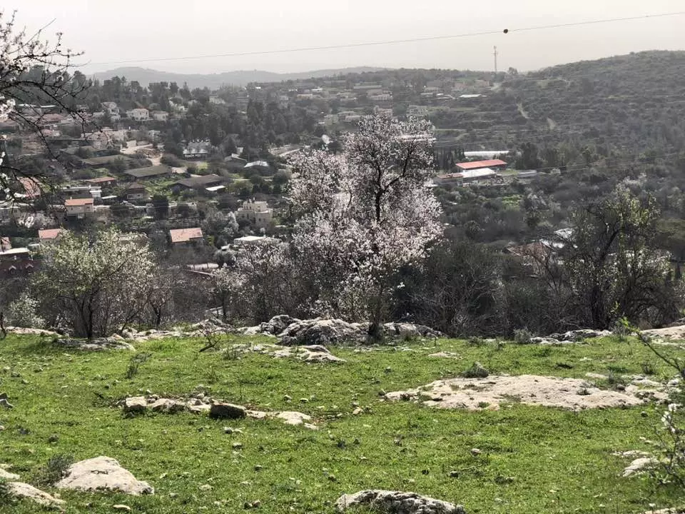
Village Before NakbaThe village stood on the northeastern slope of a mountain range and overlooked a tributary of Wadi al-Sarar that ran parallel to this range. A secondary road connected it to a road that linked Bayt Jibrin to Bethlehem and that ran 1 km south of 'Allar. In 1596 'Allar was a village in the nahiya of Jerusalem (liwa' of Jerusalem) with a population of 204. It paid taxes on wheat, barley, olive trees, molasses, goats, and beehives. The traveler Edward Robinson saw it in 1838 when he passed through the area. He said it was on a hill, slightly above its sister village, 'Allar al-Sufla (see Khirbat al-Tannur, Jerusalem sub-disctrict). By 1875 it had a population of approximately 400. In the late nineteenth century, 'Allar was built on the slope of a ridge with a well to the south and rock-cut tombs to the north. The village stretched out along an approximately east-west axis. Its houses, built of stone, were connected by narrow, winding streets. Small village shops were built along those streets. The residents of 'Allar were Muslims and maintained four maqams (shrines) in the vicinity. Their children were educated in the village elementary school.The villagers relied mainly on agriculture for their livelihood, and cultivated grain, vegetables, olives, and grapes. Most of these crops were rainfed, but some were irrigated with water drawn from the several springs around the village, including 'Ayn al-Tannur. In 1944/45 a total of 2,234 dunums was allocated to cereals; 353 dunums were irrigated or used for orchards. Wild trees and grass also grew on village lands. The village also had several khirbas in its vicinity, including Khirbat al-Shaykh Ibrahim (156125), named after one of the local religious teachers whose tomb had been made into a maqam. Village Occupation and Ethnic CleaningAccording to research conducted by Israeli historian Benny Morris, Allar, captured on 22 October, was one of a string of villages occupied during Operation Ha-Har. The population of this region either was expelled or fled under pressure, probably in the direction of Bethlehem and the Hebron hills. A large number of refugees remained encamped in the gullies and caves around their villages, only to be expelled during Israeli raids in subsequent months.Zionists Colonies on Village LandsIsrael established the settlement of Matta' (155124) on the southern edge of the village site in 1950. Bar-Giyyora (157126), also founded in 1950, is northeast of the site. Both are on the village lands.Village TodayStone rubble, concrete blocks and slabs, and steel bars litter the site, together with the remains of stone terraces and walls. One domed stone structure, the former school building, still stands. On the slopes overlooking the site, almond and cypress trees and cactuses grow along the terraces.SourceDr. Walid al-Khalidi, 1992: All That Remains. |
|||||||||||||
| Related Maps | Town Lands' Demarcation Maps خرائط للقضاء توضح حدود القرى والاودية Town's map on MapQuest View from satellite Help us map this town at WikiMapia |
||||||||||||
| Related Links | Wikipedia's Page Facebook Page Google Search Google For Images Google For Videos |
||||||||||||
| More Information | في كتاب كي لا ننسى في كتاب بلادنا فلسطين المزيد من موقع هوية |
||||||||||||
- The ruins of a destroyed Palestinian house, and the exclusive Jewish colony appears in the background.

Posted by Noga Kadman 4 - General view
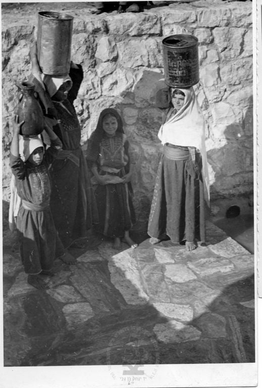
Posted by Tarek Bakri 1 - Allar's Old Houses - A View From Across A Hill Top.

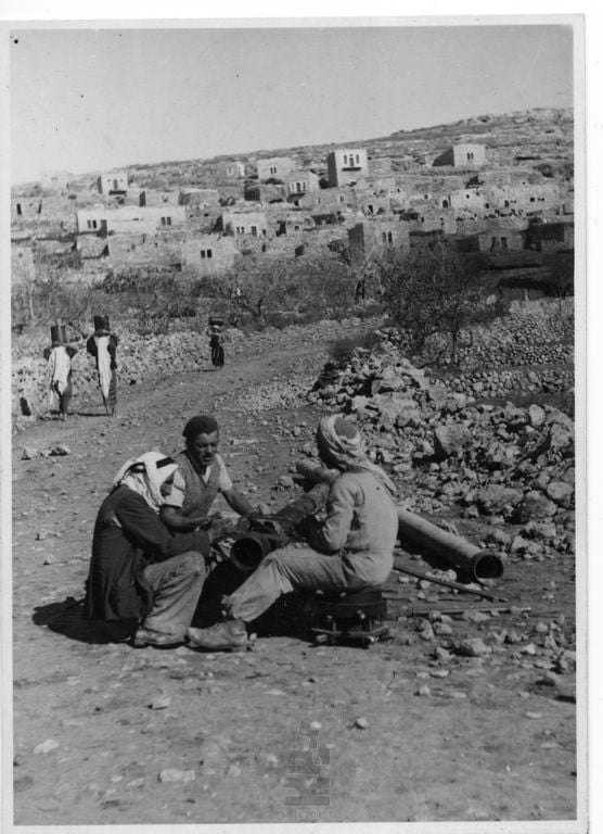
Posted by Umar Abu El-Bararri 2 - Soon after occupation, 1948
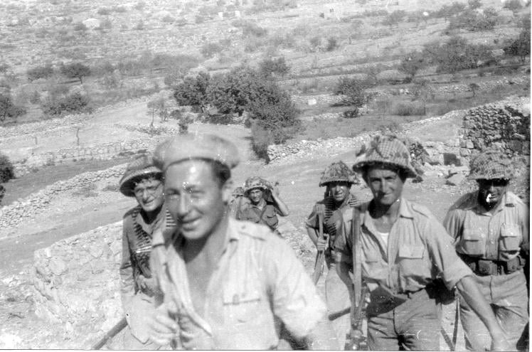
Posted by صفافي أصيل 1 - The attachking Israeli soldiers during Nakba, 1948
Posted by صفافي أصيل 2 - The famous Khan as if its people left it during Nakba
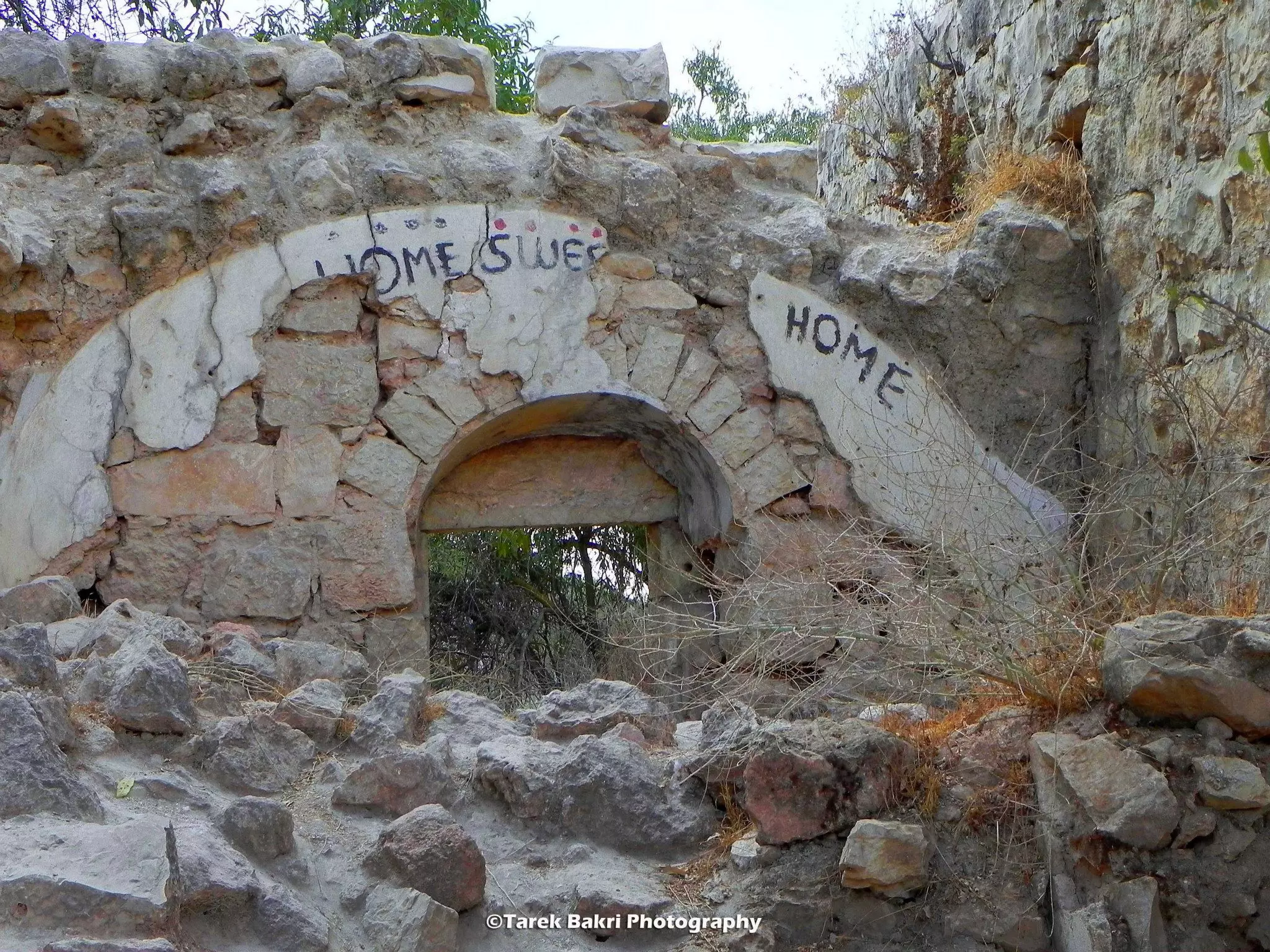
Posted by Tarek Bakri - One of the destroyed houses, not what has been writtenon one of its walls: Home sweet home
Posted by Tarek Bakri - The arch of one of the remaining homes
Posted by Tarek Bakri - One of the remaining homes
Posted by Tarek Bakri - The arch of one of the remaining homes
Posted by Tarek Bakri - One of the remaining houses still waiting . .....
Posted by Tarek Bakri - The school still waiting, note the palm trees to the right
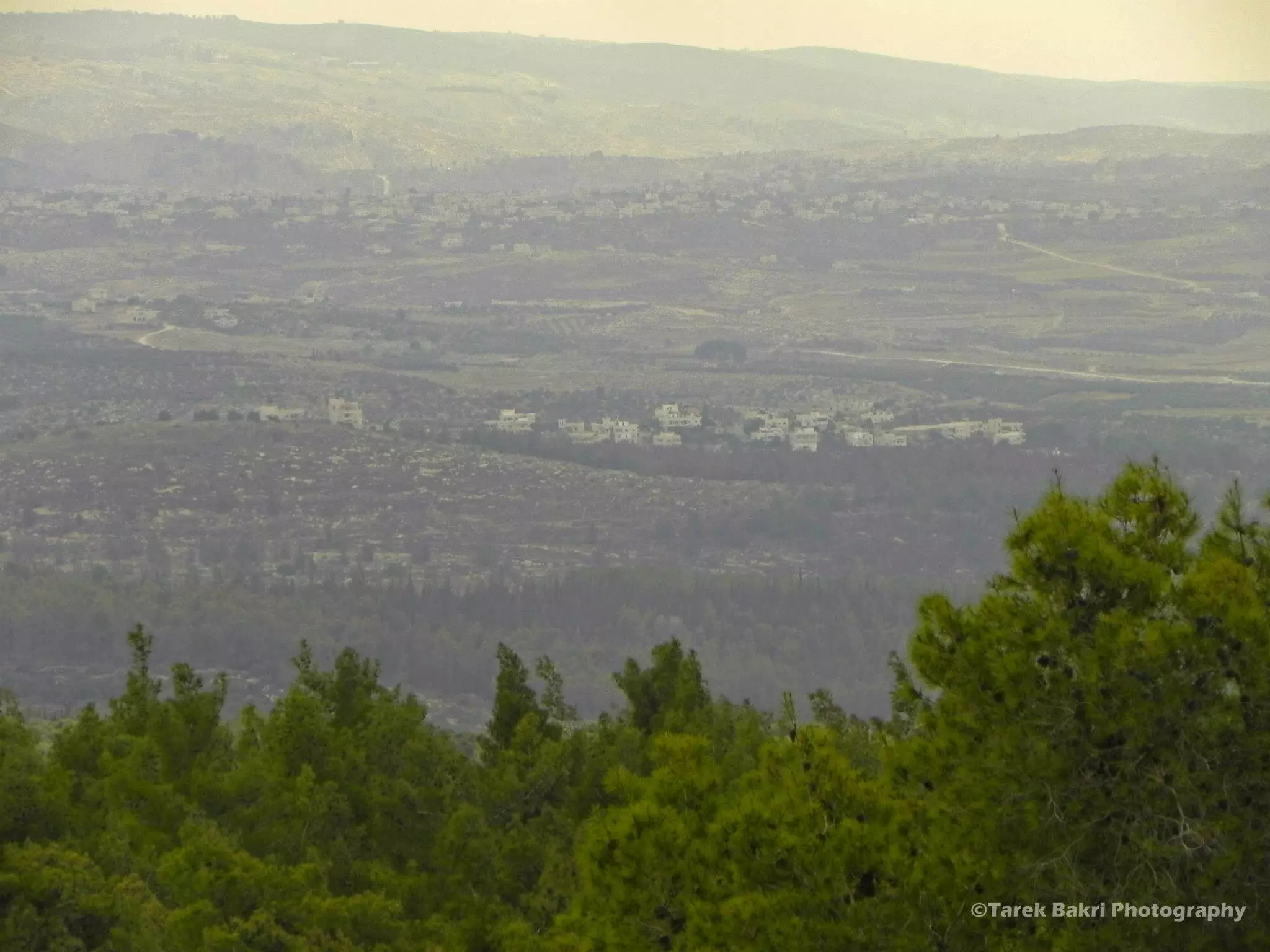
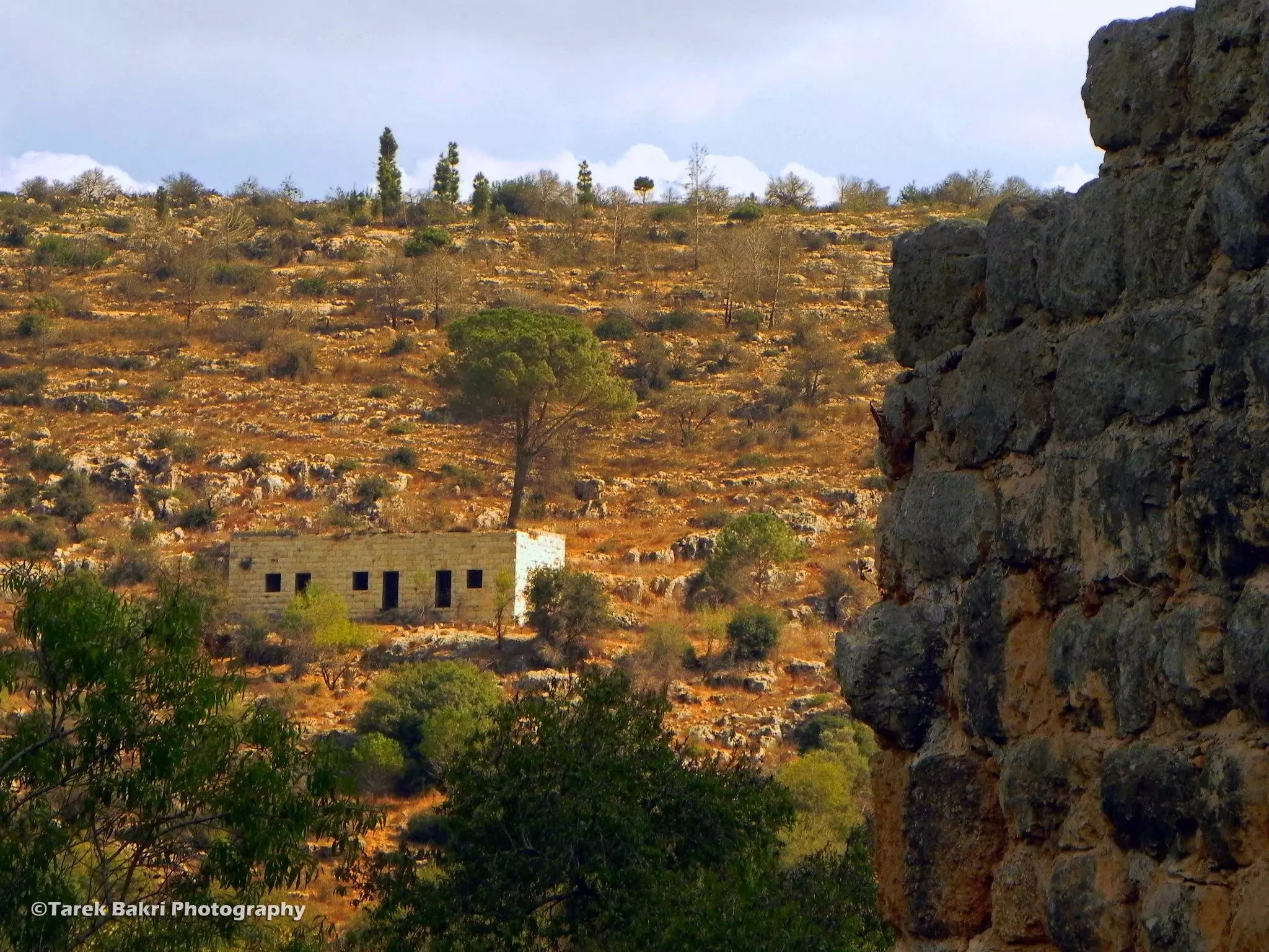
Posted by Tarek Bakri - Looking towards the Hebron mountains in the W. Bank
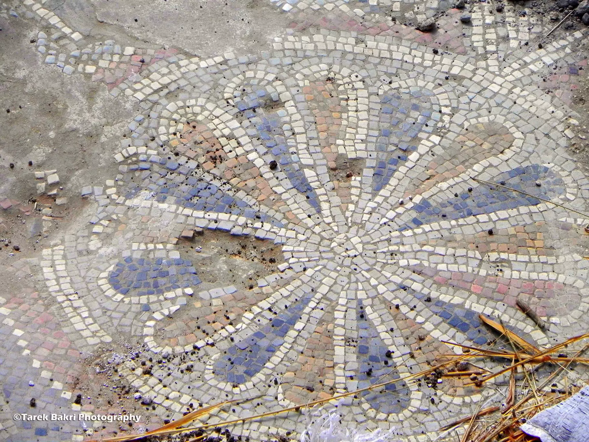
Posted by Tarek Bakri - Ancient mosaics in the village
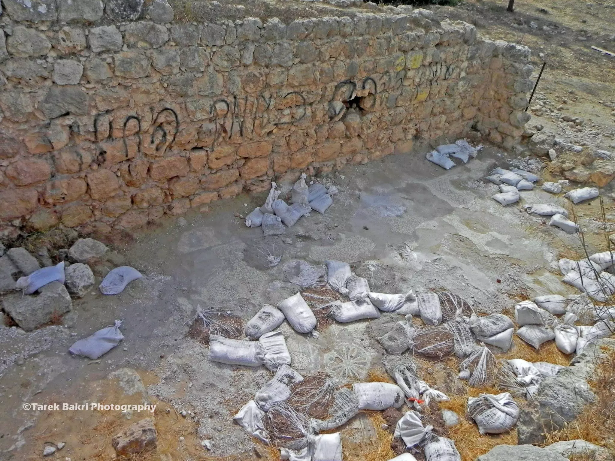
Posted by Tarek Bakri - An old church was attacked by the colonizer settlers
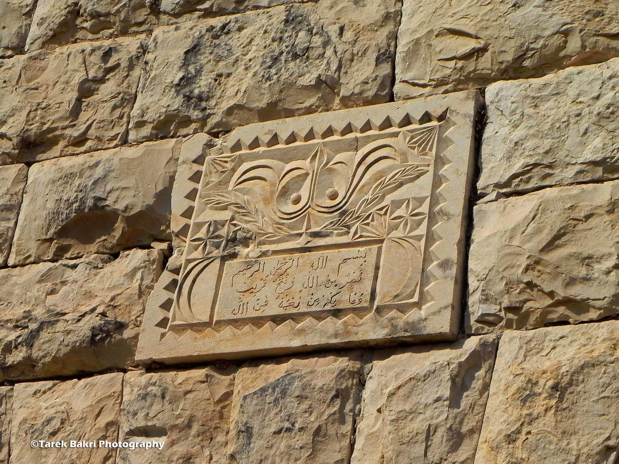
- Arabic inscription on one of the houses
Posted by Tarek Bakri - Palm trees

- One of the remaining house waiting .....
Posted by Tarek Bakri - عبيدة عساف

Posted by عبيدة عساف - علار
Posted by abu raya - علار
Posted by abu raya - علار

Posted by abu raya - علار
Posted by abu raya - علار
Posted by abu raya - شجر اللوز و التين علار 1947

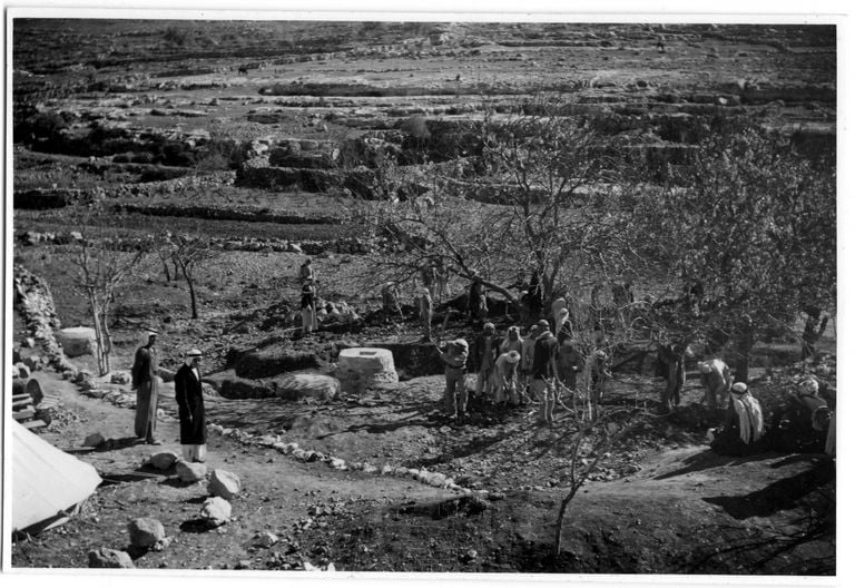
Posted by أبو اليزن السعافين - تطوير شبكة المياه في علار 1947
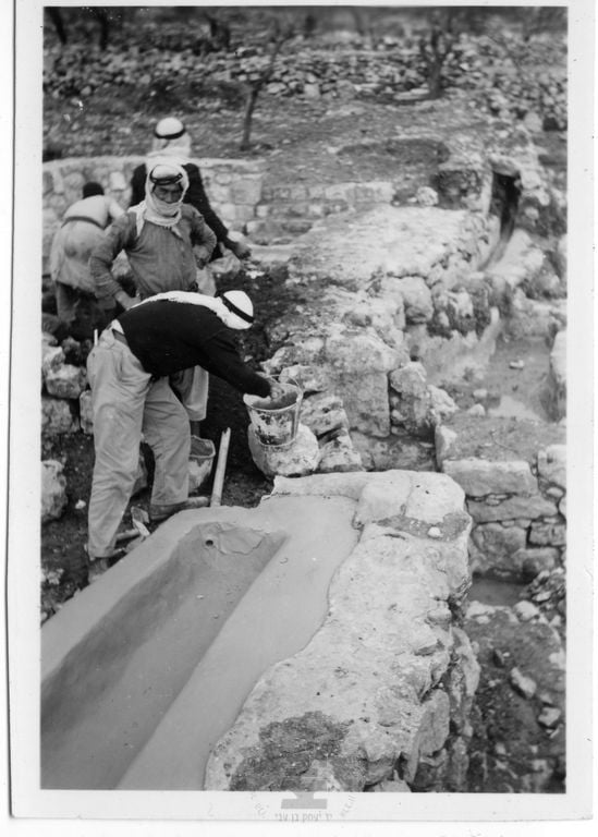
Posted by أبو اليزن السعافين - تطوير شبكة المياه في علار 1947
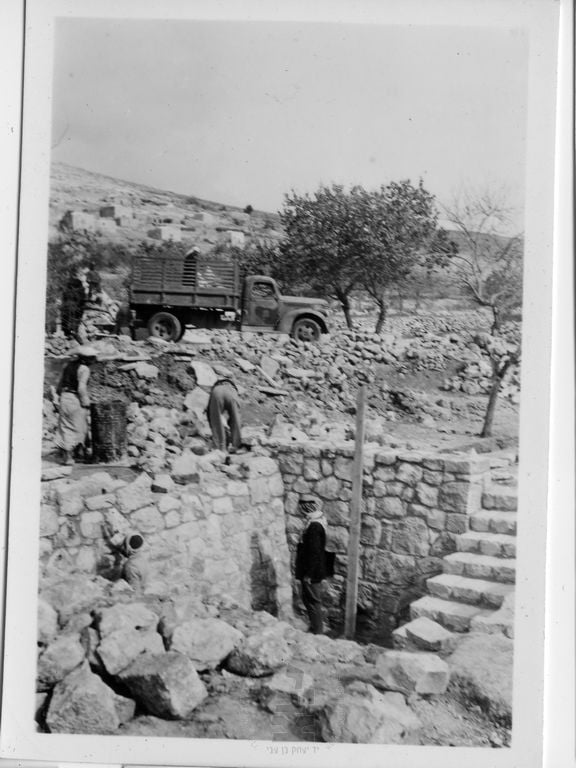
Posted by أبو اليزن السعافين - تطوير شبكة المياه في علار 1947
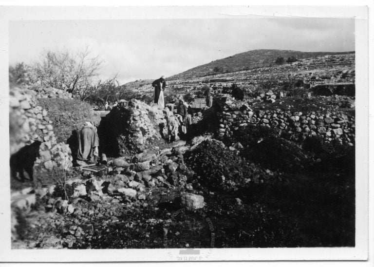
Posted by أبو اليزن السعافين - تطوير شبكة المياه في علار 1947
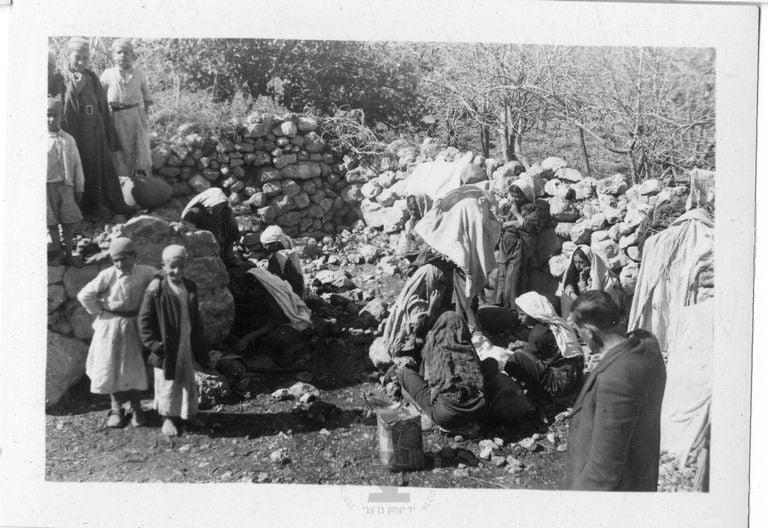
Posted by أبو اليزن السعافين - تطوير شبكة المياه في علار 1947

Posted by أبو اليزن السعافين - تطوير شبكة المياه في علار 1947
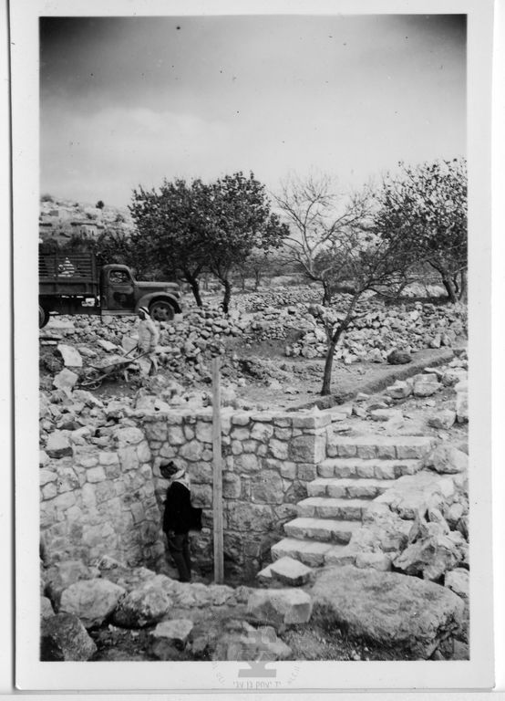
Posted by أبو اليزن السعافين - تطوير شبكة المياه في علار 1947
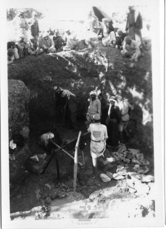
Posted by أبو اليزن السعافين - تطوير شبكة المياه في علار 1947
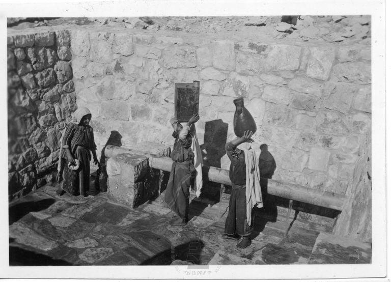
Posted by أبو اليزن السعافين - تطوير شبكة المياه في علار 1947
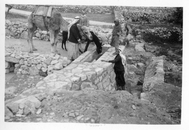
Posted by أبو اليزن السعافين - تطوير شبكة المياه في علار 1947
Posted by أبو اليزن السعافين - كروم الزيتون في علار 1947
Posted by أبو اليزن السعافين - كروم الزيتون في علار 1947
Posted by أبو اليزن السعافين - كروم الزيتون في علار 1947
Posted by أبو اليزن السعافين - علار 1947
Posted by أبو اليزن السعافين - علار 1947
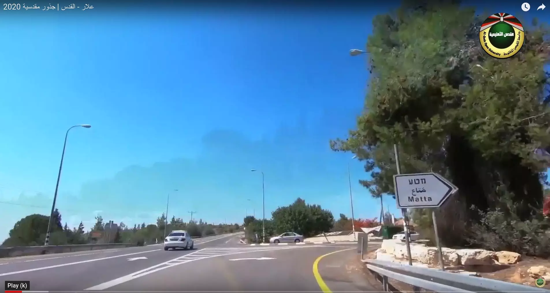
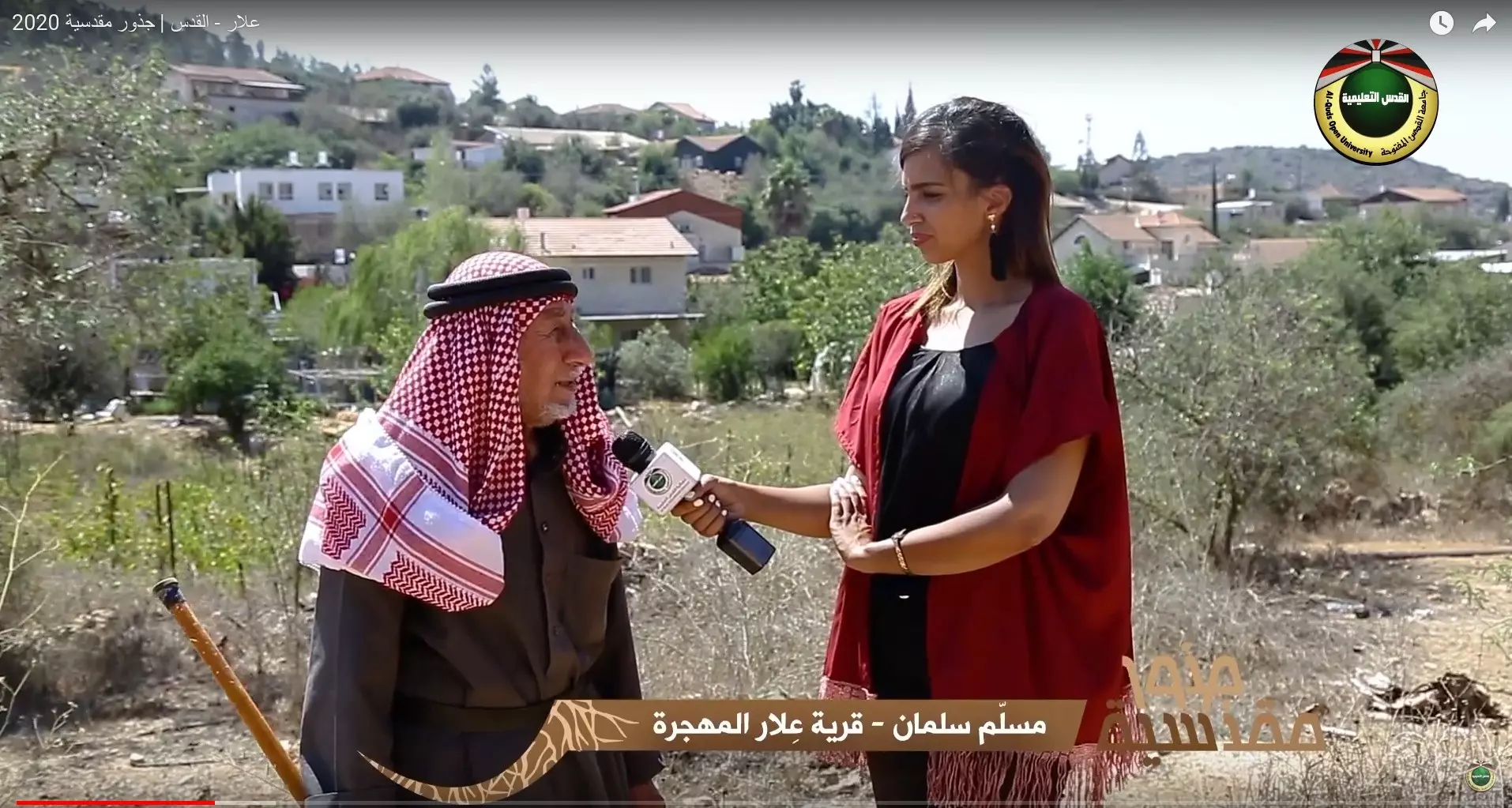
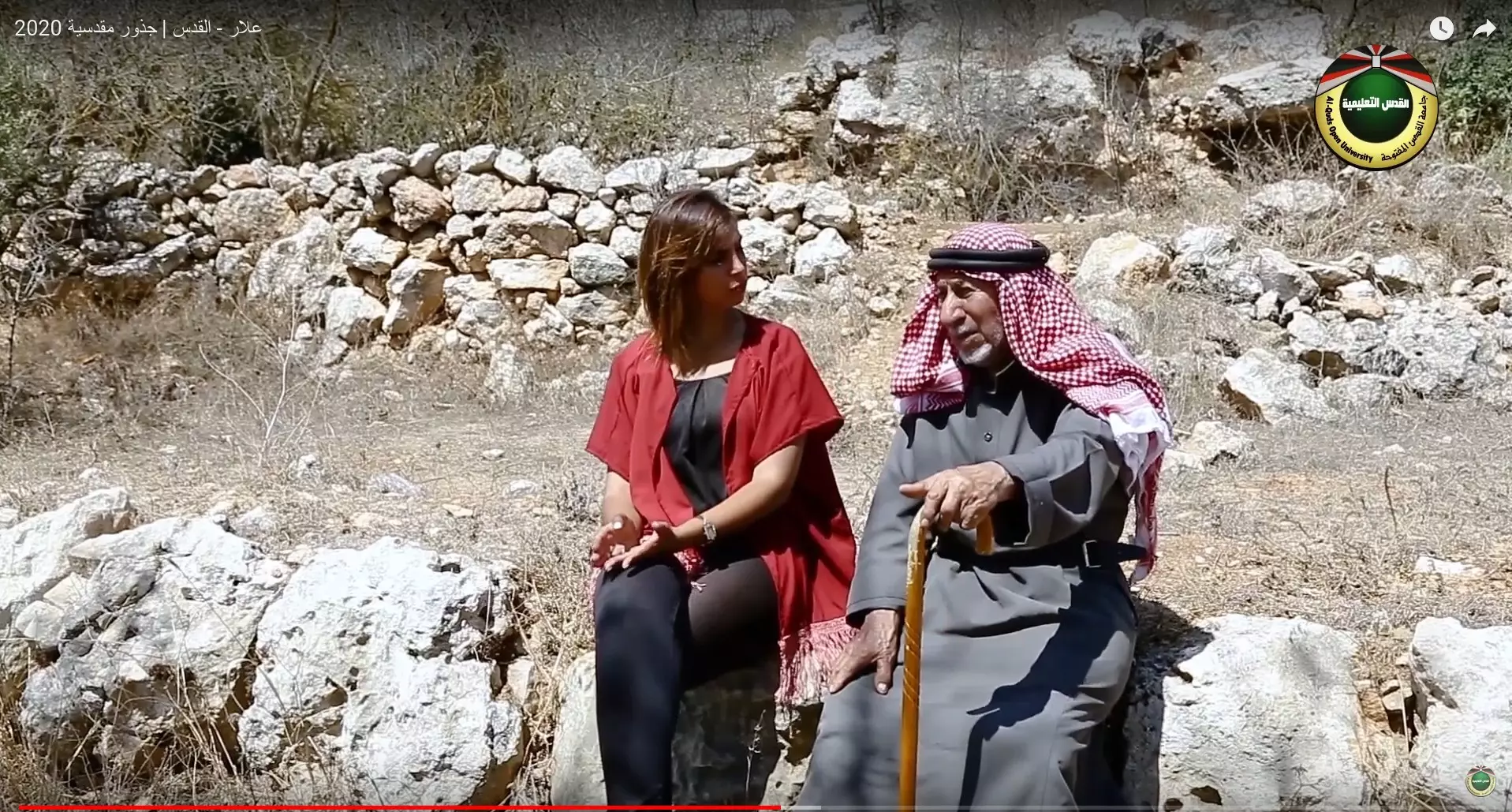
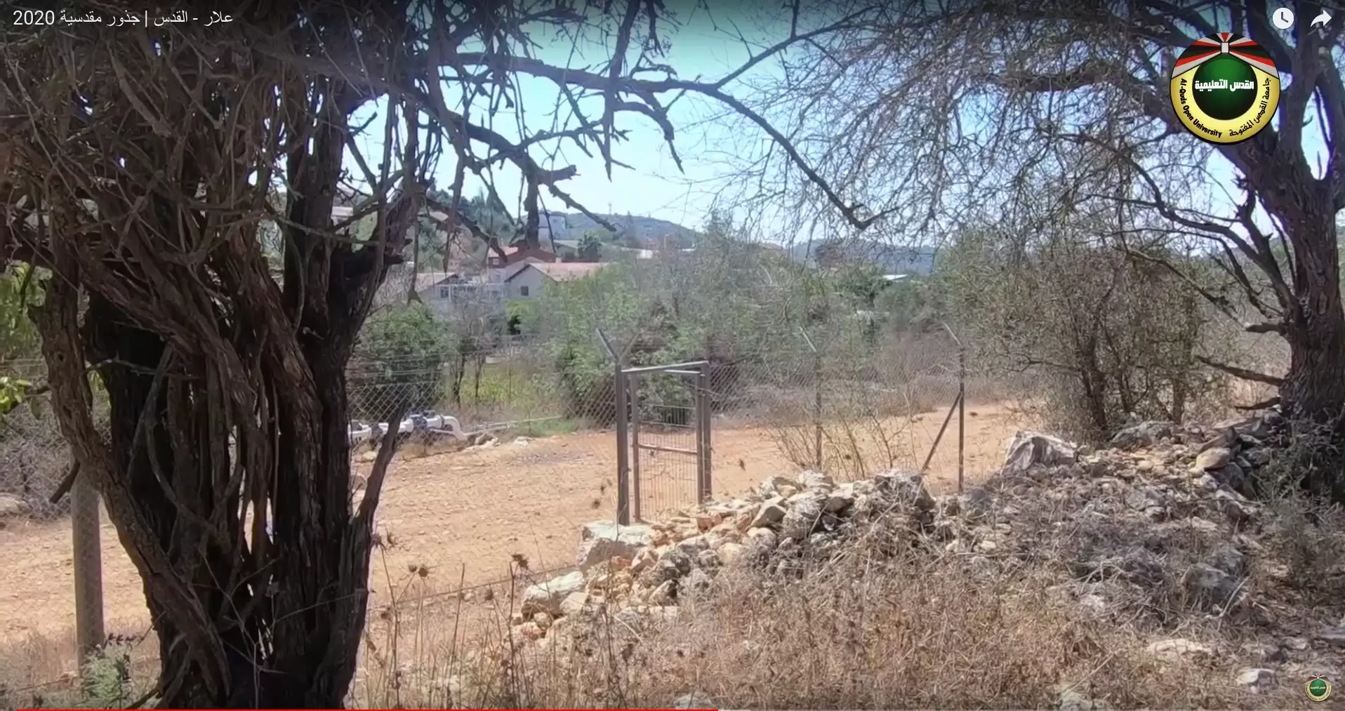
Posted by أبو اليزن السعافين - جولة بين انقاض قرية علار المهجره 2020- جذور مدسية
- جولة بين انقاض قرية علار المهجره 2020- جذور مدسية #2
- جولة بين انقاض قرية علار المهجره 2020- جذور مدسية #3
- جولة بين انقاض قرية علار المهجره 2020- جذور مدسية #4
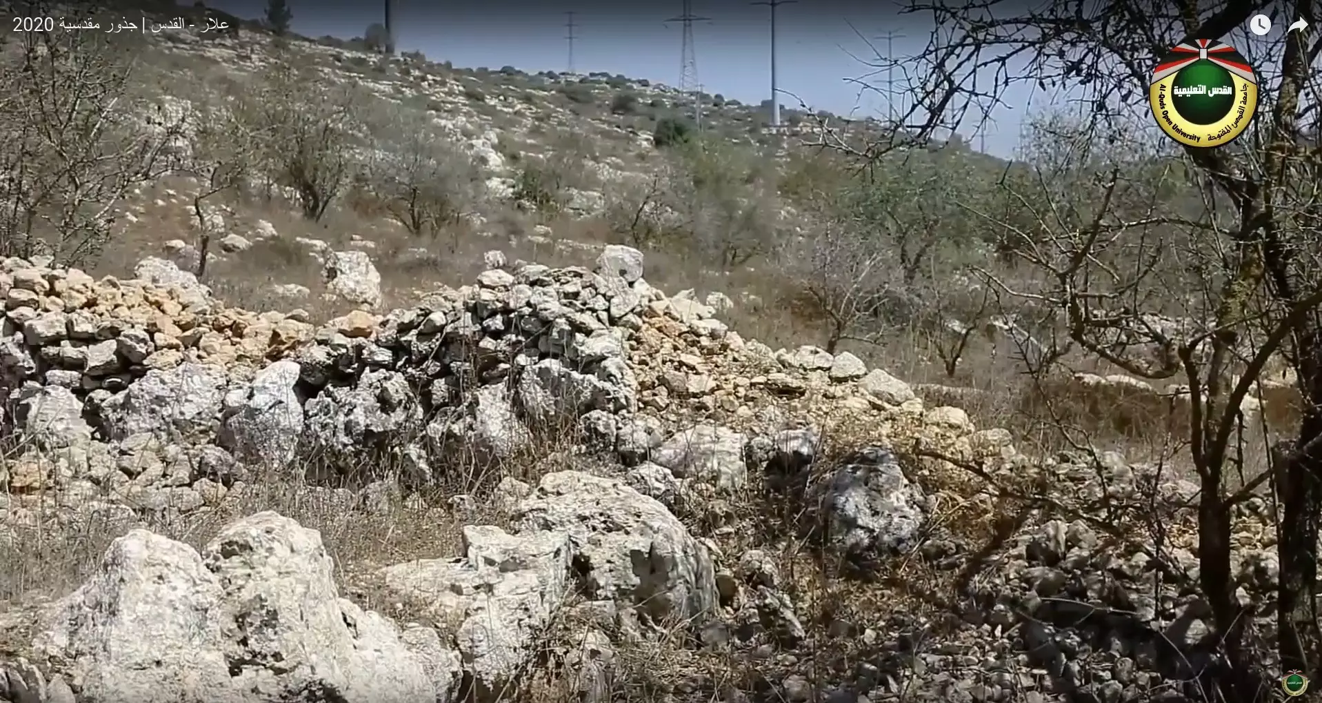
- جولة بين انقاض قرية علار المهجره 2020- جذور مدسية #5
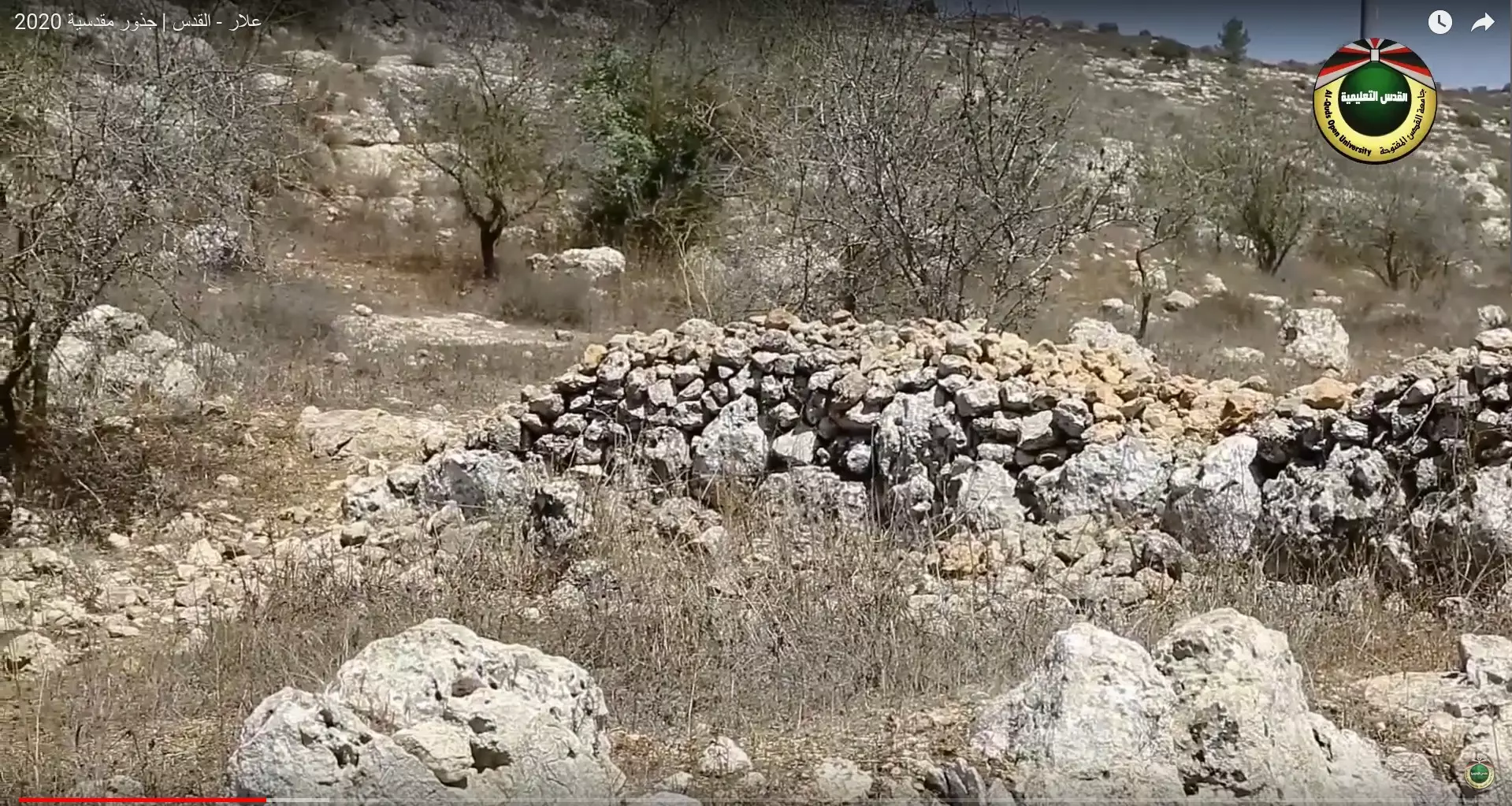
- جولة بين انقاض قرية علار المهجره 2020- جذور مدسية #6
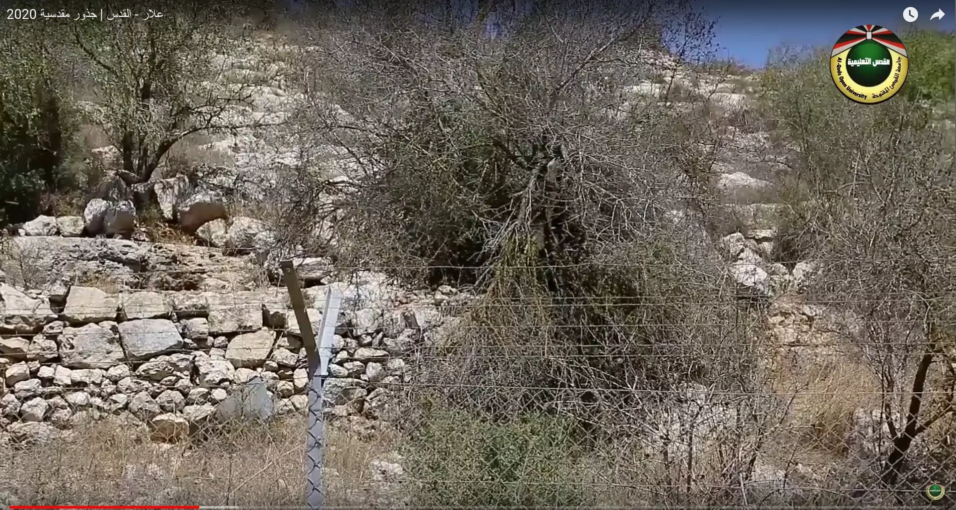
- جولة بين انقاض قرية علار المهجره 2020- جذور مدسية #7
- جولة بين انقاض قرية علار المهجره 2020- جذور مدسية #8
- جولة بين انقاض قرية علار المهجره 2020- جذور مدسية #9
- جولة بين انقاض قرية علار المهجره 2020- جذور مدسية #10
- جولة بين انقاض قرية علار المهجره 2020- جذور مدسية #11
- جولة بين انقاض قرية علار المهجره 2020- جذور مدسية #12
- قرية علار اثناء بناء عين القرية عام 1947

- قرية علار قبل النكبة

- احد المقامات الموجود بقرية علار المهجرة--Ibtisam Sulieman
- That is how the "civilized" erased and replaced us: 'Allar was completely obliterated, as you see -- علار باتت أثر بعد عين. من هنا مر الهمجّ
- That is how the "civilized" erased and replaced us: 'Allar was completely obliterated, as you see -- علار باتت أثر بعد عين. من هنا مر الهمجّ #2
- That is how the "civilized" erased and replaced us: 'Allar was completely obliterated, as you see -- علار باتت أثر بعد عين. من هنا مر الهمجّ #3
- That is how the "civilized" erased and replaced us: 'Allar was completely obliterated, as you see -- علار باتت أثر بعد عين. من هنا مر الهمجّ #4
- That is how the "civilized" erased and replaced us: 'Allar was completely obliterated, as you see -- علار باتت أثر بعد عين. من هنا مر الهمجّ #5
- That is how the "civilized" erased and replaced us: 'Allar was completely obliterated, as you see -- علار باتت أثر بعد عين. من هنا مر الهمجّ #6
- That is how the "civilized" erased and replaced us: 'Allar was completely obliterated, as you see -- علار باتت أثر بعد عين. من هنا مر الهمجّ #7
2 - That is how the "civilized" erased and replaced us: 'Allar was completely obliterated, as you see -- علار باتت أثر بعد عين. من هنا مر الهمجّ #8
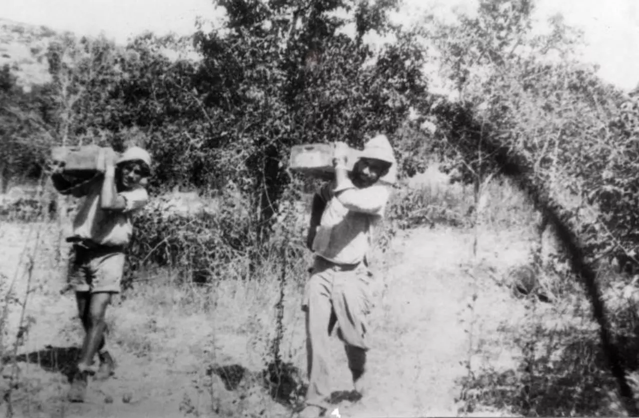
- Members of Yiftach Brigade harvesting fruit from Allar orchards. 1949
- That is how the "civilized" erased and replaced us: 'Allar was completely obliterated, as you see -- علار باتت أثر بعد عين. من هنا مر الهمجّ
- That is how the "civilized" erased and replaced us: 'Allar was completely obliterated, as you see -- علار باتت أثر بعد عين. من هنا مر الهمجّ
#2
- That is how the "civilized" erased and replaced us: 'Allar was completely obliterated, as you see -- علار باتت أثر بعد عين. من هنا مر الهمجّ
#3
- That is how the "civilized" erased and replaced us: 'Allar was completely obliterated, as you see -- علار باتت أثر بعد عين. من هنا مر الهمجّ
#4
- That is how the "civilized" erased and replaced us: 'Allar was completely obliterated, as you see -- علار باتت أثر بعد عين. من هنا مر الهمجّ
#5
Want to browse more? 80,000 pictures were grouped in these gallaries:
| Display Name | Clan/Hamolah | Country of Residence |
| Inon | - | Allar, Palestine |
| Yazan sarayrah | Sarayrah | - |
| اميرة ماجد عساف | Assaf | Netherlands |
| Ahed Awwad | Awwad | saudi arabia, jeddah- saudi arabia |
| majid Alhamamdah | Alhamamdah | Qatar-Doha |
| Mahmoud Taha Alhamamdah | - | Ontario, Canada |
| alaa srasra | srasra | - |
| Palestineinmyheart | Sarasra | Sharjah, palestine-Bethlehem |
| mahmoud assaf | Assaf | Ramallah, Palestine |
| حسين | البرق | عمان, الاردن |
| عبد الفتاح عواد | عواد | jordan, jordan |
| Sana Ihmoud | - | il, usa |
| 1@#$%^المارد@#$@%# | assaf | رام الله |
| ماهر عساف | - | - |
| عيسى صراصرة | صراصرة | فلسطين |
| abo3rfat | assaf | kalandia camp, palestine |
| ADEL ASSAF | ASSAF | RAMALLAH, PALESTINE |
| Osama Mohammad Hamamdeh | حمامده | Jeddah, KSA |
| Nidal Assaf | Assaf | abu dhabi |
| الصفدي | الصفدي | فلسطين, عوريف |
| Ahmad Awwadf | - | jordan, jordan |
| Maher Assaf | Assaf | Bethlehem, Palestine |
| Maher Assaf | Assaf | Bet hlehem, Palestine |
| HUSAIN | ALATEEQ | KARAK, O32340321 |
| Ahmad Assaf | Assaf | Betlehem, Palestine |
- برنامج جذور مقدسية يزور قرية علار المهجرة Duration: 24 min 50 sec
- الذاكرة مفتاح العودة-- الحلقة 110 -- علار
No links have been shared yet, be free to the first to share the first link.
 Fake Valor: Why Did Zionist Jews Hoist Nazis Flag on Their Ships in the 1930s?
What is new?
-
Facts About Oct. 7th Gaza Raid
-
Remined Us Please:: Who Did Rape Who? Palestinians Raped Israelis? Or, was the other way around?
-
When Prof. Edward Said was invited to debate Bibi Netanyahu in the 1980s, watch what happened!
-
Ezra Klein of the NY Times on the "Jewish Race".
-
Abusing Blood Libel!
-
Did Israeli Soldiers Activate The Hanniba Direective On Oct. 7th? You Be The Judge
-
Zionist FAQ: Isn't it true that Palestinians don't want peace? Palestinians never accepted the two-state solution
- Facts about Haavara (Transfer) Agreement between Ben-Gurion & Hitler
-
Haavara FAQs: Why Did Zionist Jews Hoist Nazis' Flags on Their Ships in the 1930s?
- Haavara FAQs: When Chaim Weizmann met FDR in mid-1943, why was he silent about rescuing European Jewry?
-
Dear ChatGPT: How did Palestinians resist Napoleon's invasion of their country in 1799?
-
Dear ChatGPT: Gaza had a vibrant Jewish community in the mid-17th century. What happened to them?
-
Dear ChatGPT: Why did the Jewish Agency suppress news of the Holocaust during WWII?
-
Video Playlist: Jews share their DNA tests to end the conflict for good.
-
A Tale of Two Conflicts: Examining the Definition of Genocide
-
Prof. Abraham Polak And The Suppressed History of the Khazars and European Jewry
-
How Ronald Reagan would have framed the genocide in Gaza if he were still alive?
-
Haavara FAQs: Let us do the math: how many German Jews did The Haavara Agreement save?
-
Zionist FAQs: The Hebron Massacre of 1929, "clearly proves" that Palestinians are antisemitic, how could you deny it?
-
Zionist FAQs: Why Anti-Zionist Is Not Antisemitism?
-
Zionist FAQs: Isn't it true that the KGB created Palestinian Nationalism in the early 1960s?
- Zionist FAQs: Muslims are killing Muslims all the time; why are Israeli Jews being singled out in the media?
- Zionist FAQs: How is Israel an apartheid state when 20% of its citizens are Arabs who enjoy full rights?
-
Haavara FAQs: Why Did Dorothy Thompson Flip From A Zionist Advocate to A Silenced Dissenter?
-
Haavara FAQs: Analysis of Herzl's Uganda Scheme and how it could have saved millions of Jews.
-
Haavara FAQs: Why did Hayim Greenberg describe American Jewry as "morally bankrupt" in early 1943?
-
Haavara FAQs: What if the Evian Conference was a resounding success? What would have been the impact of saving European Jewry on Zionism?
- Haavara FAQs: What if the six million were saved, how that would have impacted the Zionist project?
-
Haavara FAQs: How did Zionist leaders react when Europe's Jews lingered in the DP camps after WWII ended?
-
Why does the American Jewish community repeat lies that David Ben-Gurion had debunked before he died?
-
Who has the power to rename the Tatar/Khazar Gene Marker to Jewish IV?
-
Zionist FAQs: Why won't Egypt, Syria, and Jordan take their people back? Jews are indigenous to Palestine, and Arabs immigrated after Jews developed the country. Arabs should leave.
-
Haavara FAQs: Did Hitler and the Nazis conflate between Judaism and Zionist? If that wasn't case, then why?
-
Haavara FAQs: Winston Churchill and antisemitism, a collection of articles written Churchill.
-
Haavara FAQs: Broken by country, how many Jews survived vs. killed during the Holocaust?
-
Haavara FAQs: Why did European Jews vote with their feet and to immigrated to the Americas, not Palestine, after WWII?
-
Watch this American Jewish Girl describing Israeli Jews' cognitive dissonance like no other in under two minutes
-
Haavara FAQs: When the Nazis went out of their way to hide the Holocaust, Israeli Jews did the exact opposite by broadcasting their genocide of Gazans. But why?
-
Haavara FAQs: How Zionist Jews went out of their to show their appreciation to Nazism and Fascism?
- Haavara FAQs: Why Zionist leaders were against bombing the death camps & the Railroads leading to them?
-
Haavara FAQs: Hitler's message to the British and American people: If Jews are such noble citizens and you care about them, how come you're not letting them in? I will gladly ship them to you at my expense, even on luxury liners!
-
A shortlist of Zionist and Israeli false flag operations in the name Jews.
-
The Most Moral Army
- The Land of Kapos (Israel): Where the brave are boycotted and Kapos walk free.
- Why did early Zionists often named their communal enterprises "colonial"?
- Zionist Relations with Nazi Germany by Faris Glubb
-
Two NY Times advertisements by Zionists in the early 1943 that exposes Zionists' treason at the height of the calamity
- Facts Not Lies about the Palestinian-Israeli Conflict.
- Site's pictures have been categorized
- Campgain Against Lice
- A Survey of Palestine, the official source about Palestine before Nakba produced by the British Mandate; over 1200 pages.
- Satellite View & Google Earth: Over 6,000 placemarks identifying all destroyed towns, W. Bank & Gaza Strip Towns, & refugee camps.
- PalestineRemembered.com and its Nakba Oral History Project were featured on al-Jazeera Satellite TV.
- Nakba Oral History Video Podcast:
 Over 700 Oral History interviews (including 3,500+ hours of recording) can be viewed online.
 - Palestine Village Statistics Project
- Gaza Jail Break
- النسخة العربية للموقع الان متوفرة
- Videos: Documenting the destroyed villages in video: Tracing all that remains since Nakba.
- Videos: Responding to Zionist Propaganda
- Interview: The ethnic cleansing of Palestine: George Galloway interviews Israeli Historian Ilan Pappe.
- For Palestinians, memory matters. It provides a blueprint for their future By George Bisharat.
- Zionist FAQ now available in Hebrew שאלות שציונים שואלים, עכשיו בעברית
- Video: The Stephen Walt and John Mearsheimer report on the influence of the Israel Lobby on U.S. Foreign Policy
- The Palestinian-Israeli conflict for beginners
