| PalestineRemembered | About Us | Oral History | العربية | |
| Pictures | Zionist FAQs | Haavara | Maps | |
| Search |
| Camps |
| Districts |
| Acre |
| Baysan |
| Beersheba |
| Bethlehem |
| Gaza |
| Haifa |
| Hebron |
| Jaffa |
| Jericho |
| Jerusalem |
| Jinin |
| Nablus |
| Nazareth |
| Ramallah |
| al-Ramla |
| Safad |
| Tiberias |
| Tulkarm |
| Donate |
| Contact |
| Profile |
| Videos |
Welcome To Mallaha - ملاحة (عرب الزبيد) (מלאחה)
|
District of Safad
Ethnically cleansed days ago |
العربية Google Earth |
 |
Gallery (42) |
- Statistics & Facts
-
Before & After

- Satellite View
- Articles 1
- Pictures 42
- Oral History 2
- Members 16
- All That Remains
- Wikipedia
- Videos
- Guest Book 1
- Links
| Statistic & Fact | Value | |||||||||||||||
| Occupation Date | May 25, 1948 | |||||||||||||||
| Distance From District | 16 (km) North East of Safad | |||||||||||||||
| Elevation | 75 (meters) | |||||||||||||||
| Before & After Nakba, Click Map For Details |
||||||||||||||||
|
||||||||||||||||
| Map Location | See location #33 on the map View from satellite |
|||||||||||||||
| Military Operation | Operation Yiftach (commanded by the ethnic cleansing champion Yigal Allon) | |||||||||||||||
| Attacking Units | The Palmach's First Battalion | |||||||||||||||
| Exodus Cause | Haganah 'Wispering' campaign (psychological warfare) | |||||||||||||||
| Village Temains | The village has been completely destroyed. | |||||||||||||||
| Ethnically Cleansing | Mallaha inhabitants were completely ethnically cleansed. | |||||||||||||||
| Pre-Nakba Land Ownership |
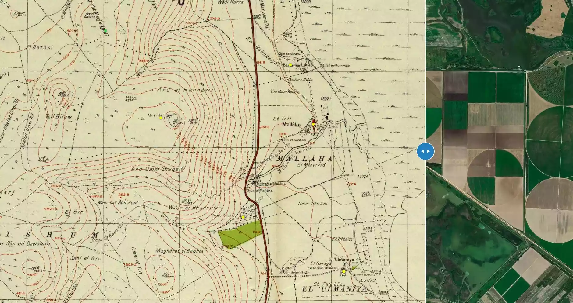
**Town Lands' Demarcation Maps |
|||||||||||||||
| Land Usage As of 1945 |
|
|||||||||||||||
| Population |
|
|||||||||||||||
| Number of Houses |
|
|||||||||||||||
| Near By Towns |
||||||||||||||||
|
||||||||||||||||
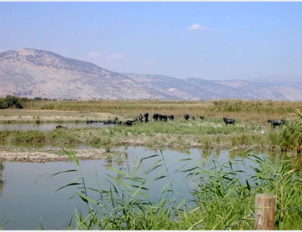
| Nearby Wadies & Rivers | The village was situated on the northern banks of Wadi al-Barid. | |||||||||||||||
| Water Supply | Wadi al-Barid contained the spring of 'Ayn Mallaha, which was considered to be one of the most productive springs in Palestine. | |||||||||||||||
| Exculsive Jewish Colonies Who Usurped Village Lands |
Yesud ha-Ma'ala is nearby village lands. | |||||||||||||||
Village Before NakbaThe village was located on the north bank of Wadi Barid, a seasonal watercourse which flowed into the northwest corner of Lake al-Hula. This wadi was filled by water from the spring of 'Ayn Mallaha (204276), which lay to the south of the village and which was one of the most copious springs in Palestine, yeilding between 1,800 and 2,700 cubic meters of water per hour. The village of Mallaha lay along a highway that led to Safad and Tiberias. In 1157, following a breakdown in relations between Damascus and the Crusader Kingdom of Jerusalem, Mallaha was close to the site of a battle between the armies of Nur al-Din ibn Zangi (also known by his first name Mahmud) [Maalouf 1987:143-58] and King Baldwin III (in command of the Templars), in which the Muslims decisively defeated the Crusaders. Their king escaped, however, together with a small bodyguard. [D 6/2:165-66] The Syrian Sufi traveler al-Bakri al-Siddiqi, who journeyed in Palestine in the mid-eighteenth century, passed by a village named al-Mallaha, which may have been the present village. [AI-Khalidi 1968:202] The American biblical scholar Edward Robinson observed in 1838 that al-Mallaha lay northwest of Lake al-Hula. [Robinson (1841) III:341] The modern Mallaha had a roughly rectangular configuration that stretched from north to south. Its entire population was Muslim. Agriculture was the mainstay of the village's economy. In 1944/45 a total of 1,761 dunums was allocated to cereals.Village Occupation and Ethnic CleaningIsraeli forces seized Mallaha at the very end of Operation Yiftach (see Abil al-Qamh, Safad sub-disctrict), on 25 May 1948. They induced the villagers to flee by carrying out a campaign of psychological warfare. However, a direct attack, which may have included the use of mortars, cannot be ruled out, since most of the psychological warfare was conducted some ten days before the reported date of evacuation. Furthermore, Zionist forces directed mortar fire against a number of other neighboring villages at this time in the context of Operation Yiftach.Zionists Colonies on Village LandsThere are no Israeli settlements on village lands. The settlement of Yesud ha-Ma'ala (207273), founded in 1883, is some 5 km to the southeast.Village TodayThe sandy hill on which the village was situated is completely overgrown with tall grass, cactuses, and weeds, as well as an assortment of fig, eucalyptus, and date-palm trees. Amidst the overgrowth, stone rubble from destroyed houses can be seen. The surrounding land is cultivated by the settlement of Yesud ha-Ma'ala.SourceDr. Walid al-Khalidi, 1992: All That Remains. |
||||||||||||||||
| Related Maps | Town Lands' Demarcation Maps خرائط للقضاء توضح حدود القرى والاودية Town's map on MapQuest View from satellite Help us map this town at WikiMapia |
|||||||||||||||
| Related Links | Wikipedia's Page Google Search Google For Images Google For Videos |
|||||||||||||||
| More Information | في كتاب كي لا ننسى في كتاب بلادنا فلسطين المزيد من موقع هوية |
|||||||||||||||
- Rubble on the village site, 1987
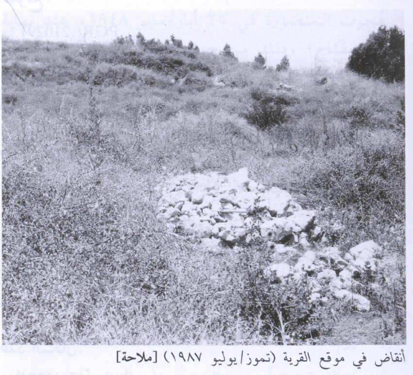
Scanned from "All That Remains" by Dr. Walid Khalidi 2 - موقع القريه على التل بيت اشجار الكينا نظره من الغرب الى الشرق
Posted by Jabour Khoury - موقع القريه
Posted by Jabour Khoury - موقع القريه لا يمكن الوصول الى موقع القريه فا الاراضي مسيجه ويمنع الدخول للموقع
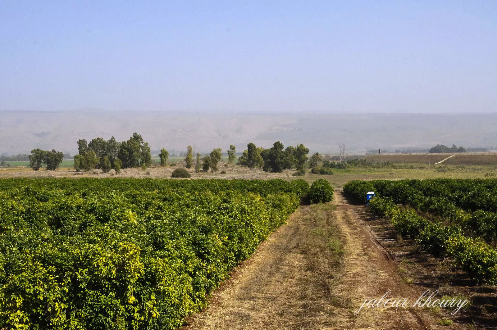
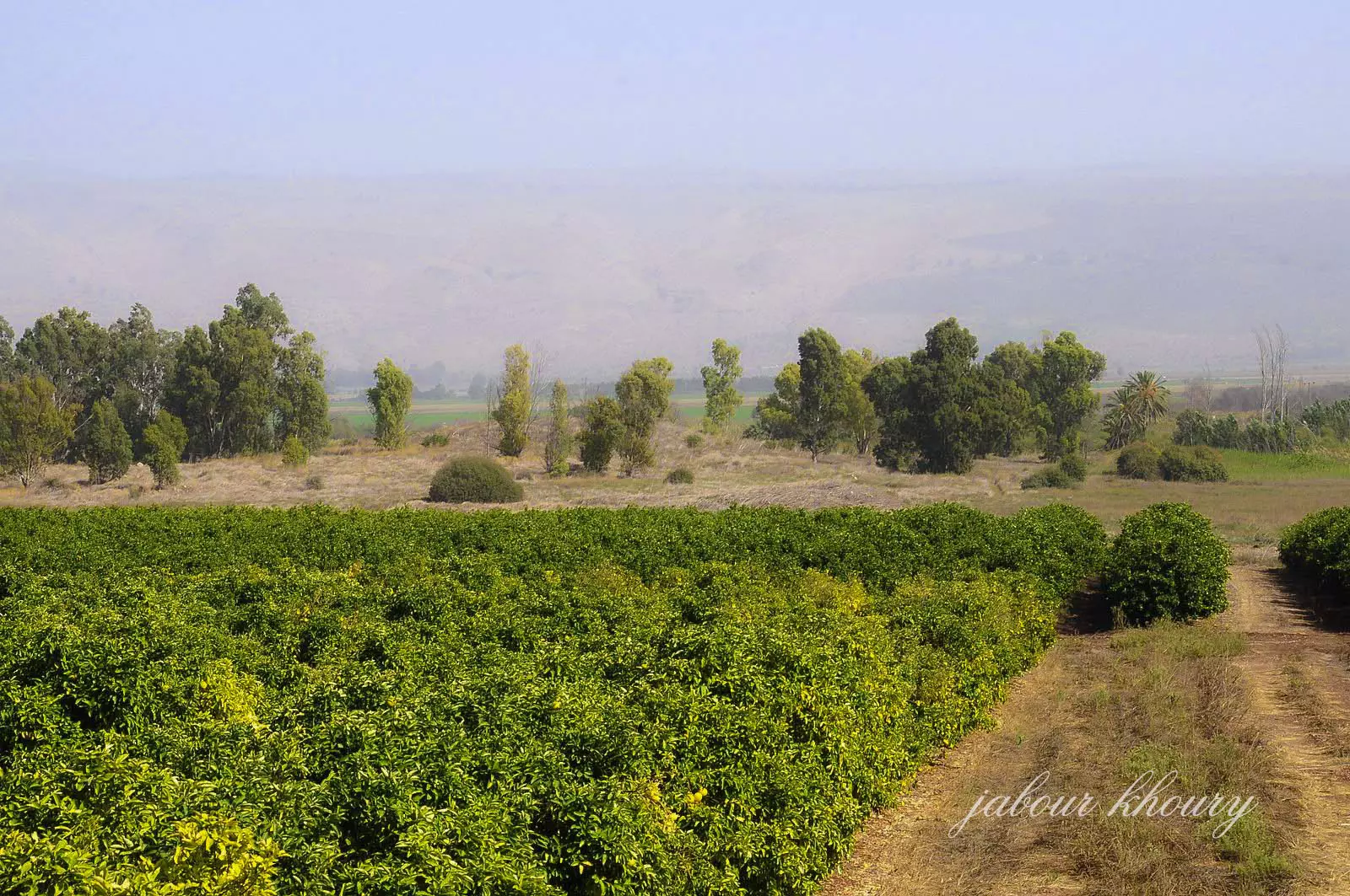
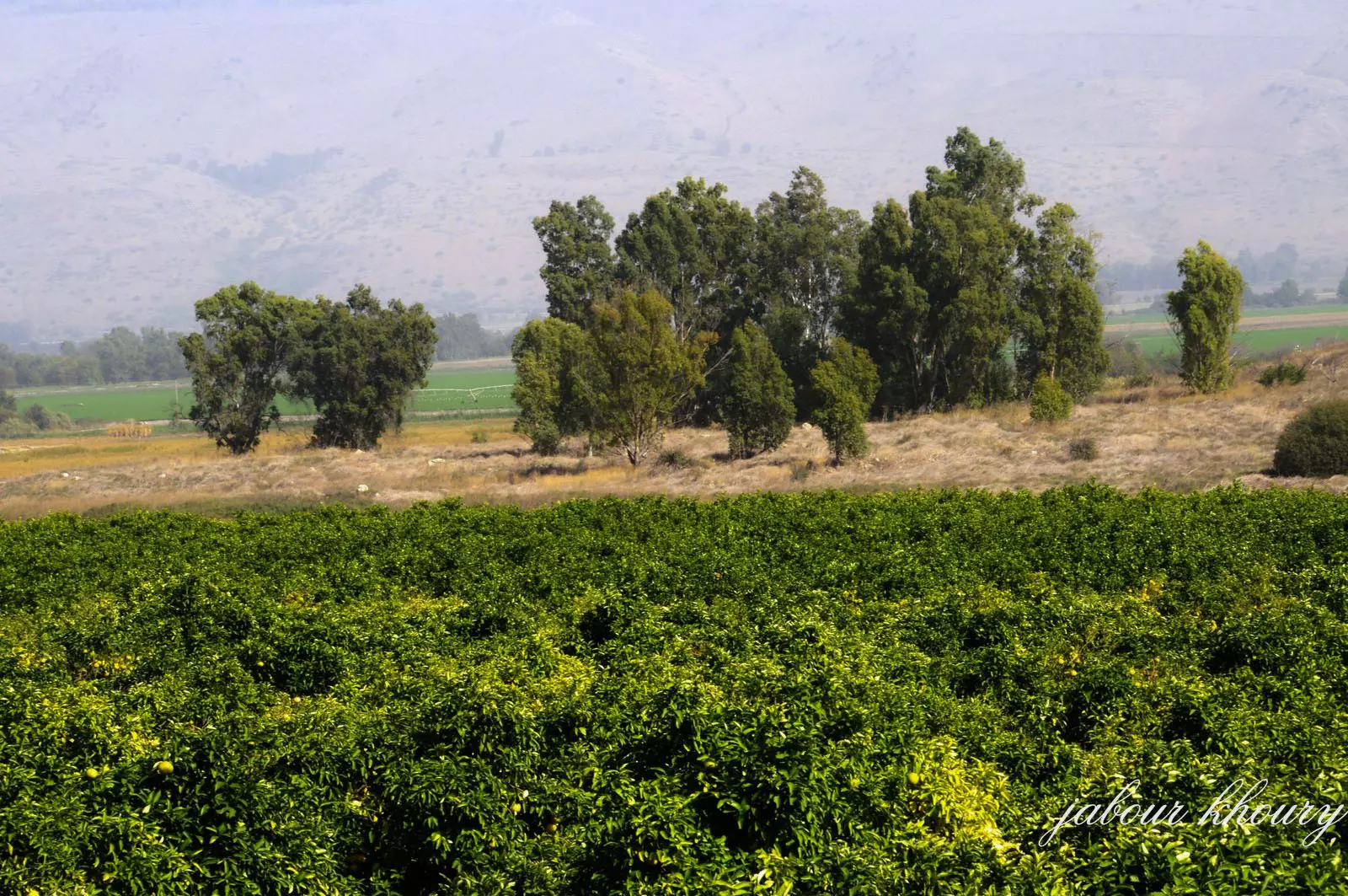
Posted by Jabour Khoury - اراضي القريه المزروعه بالحمضيات من قبل المستوطنين
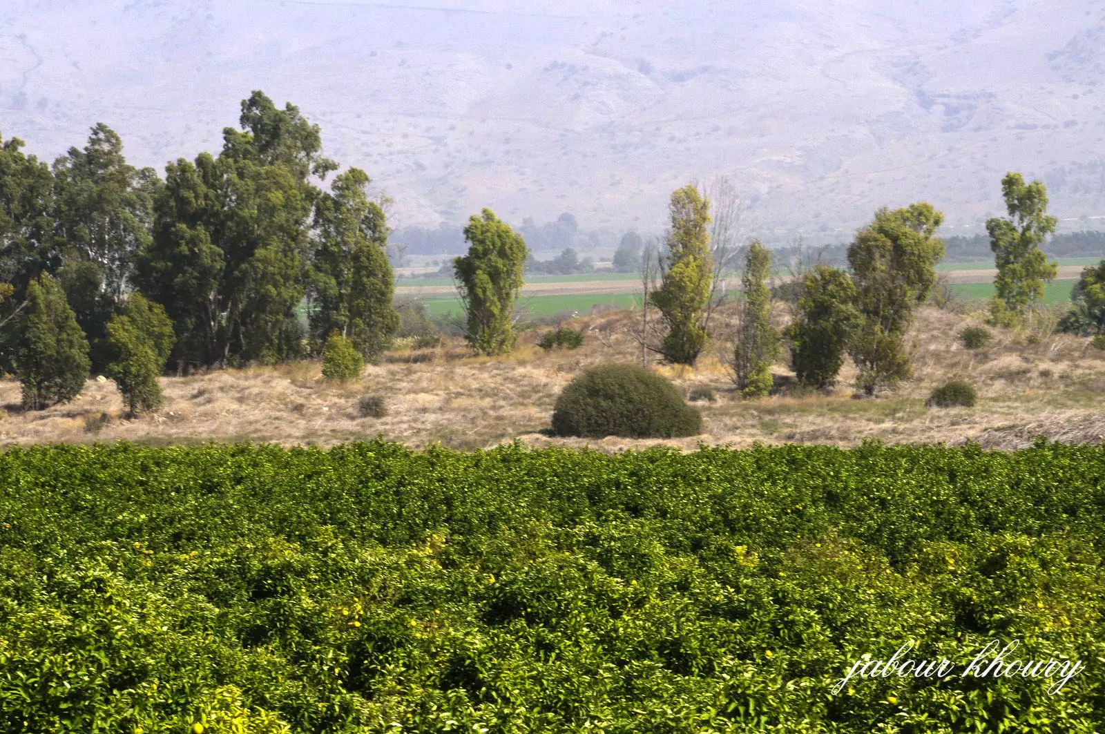
Posted by Jabour Khoury - موقع القريه
Posted by Jabour Khoury - موقع القريه
Posted by Jabour Khoury - موقع القريه
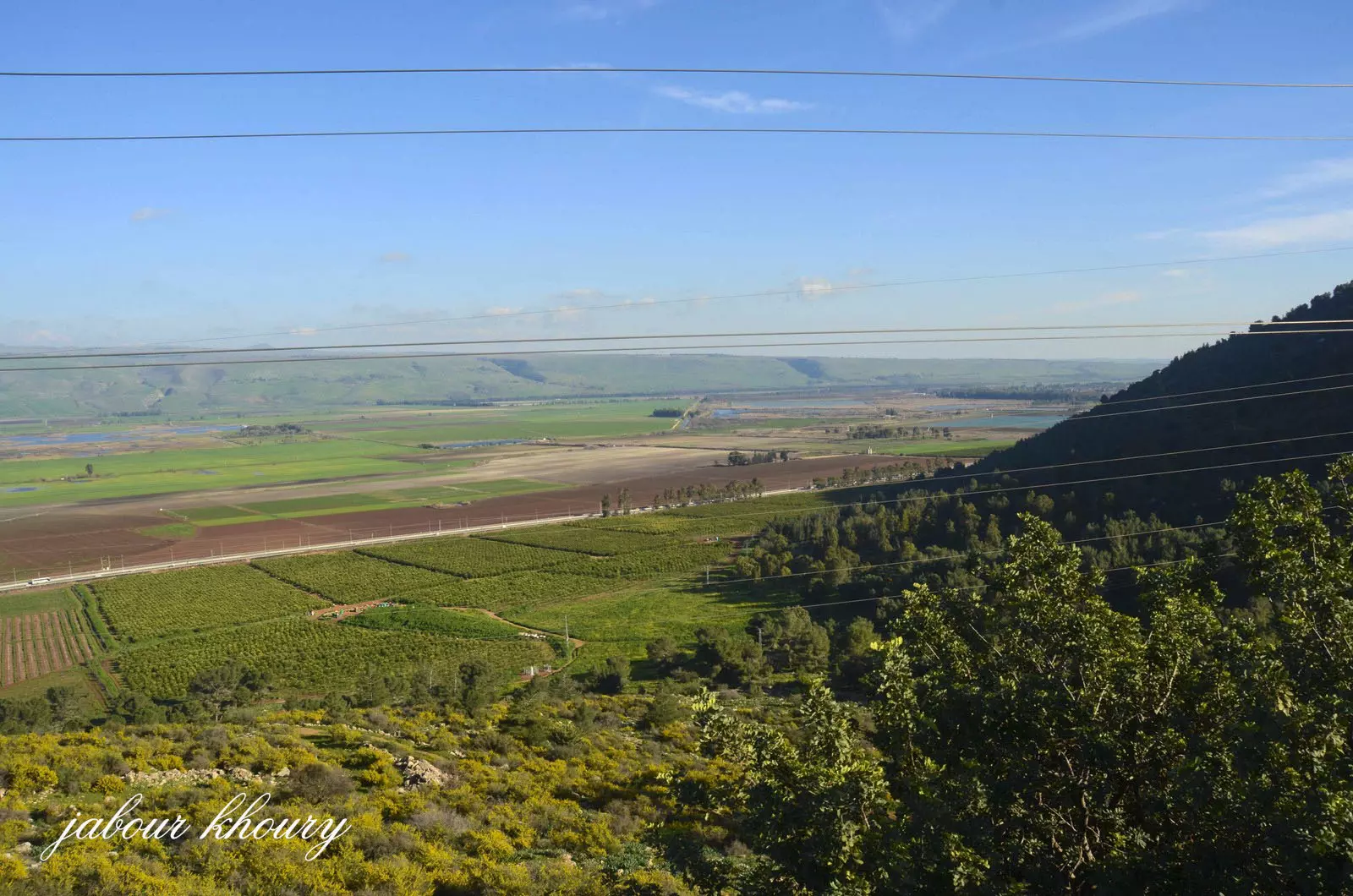
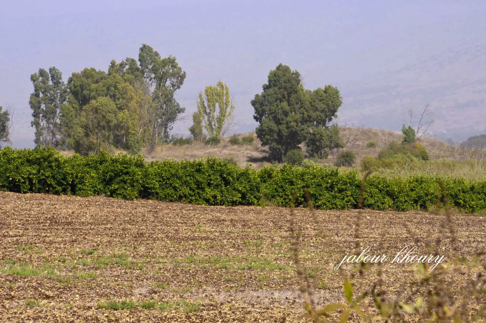
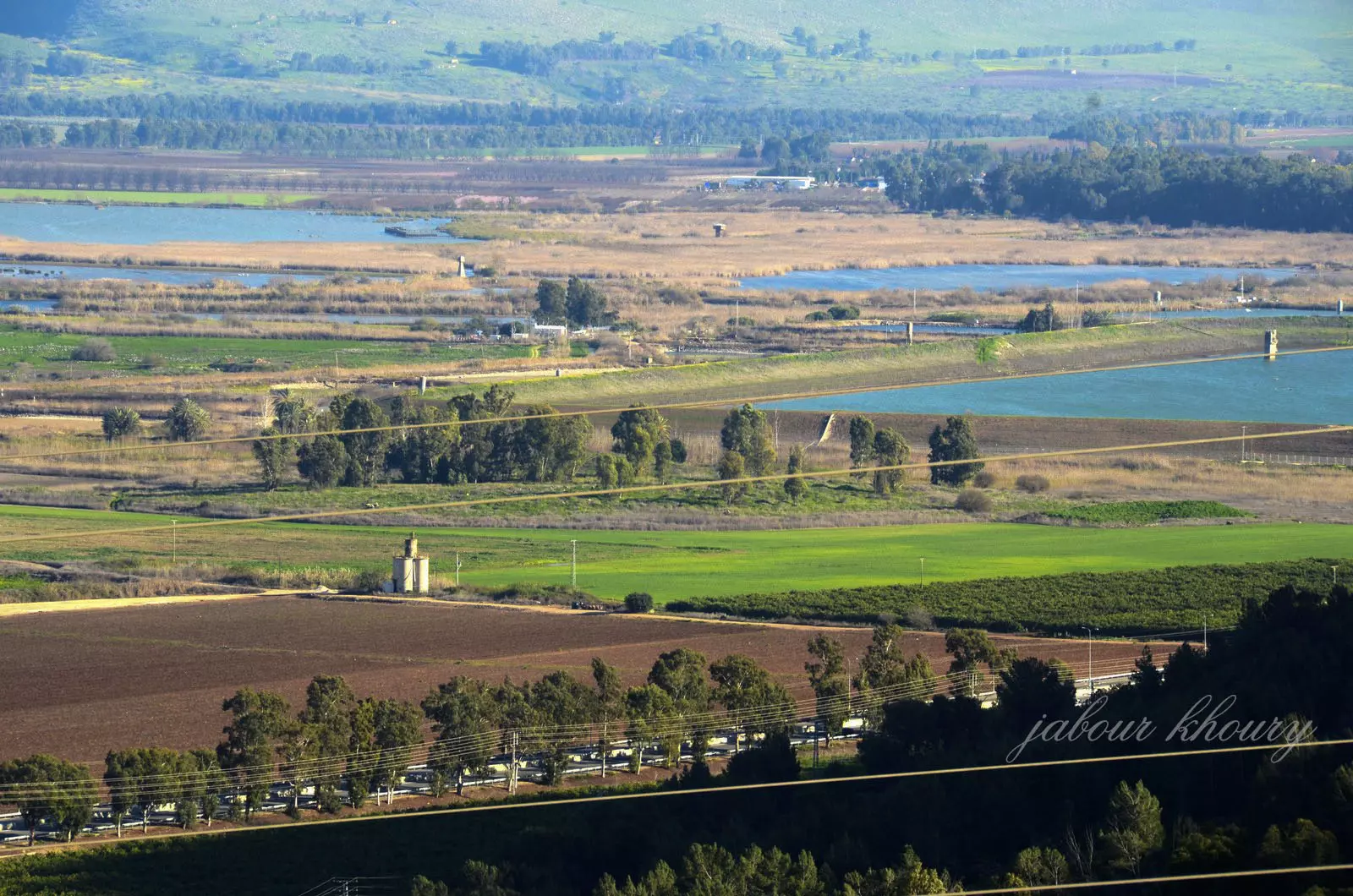
Posted by Jabour Khoury - الملاحه كما تظهر من قريه النبي يوشع
Posted by Jabour Khoury - الملاحه كما تظهر من قريه النبي يوشع
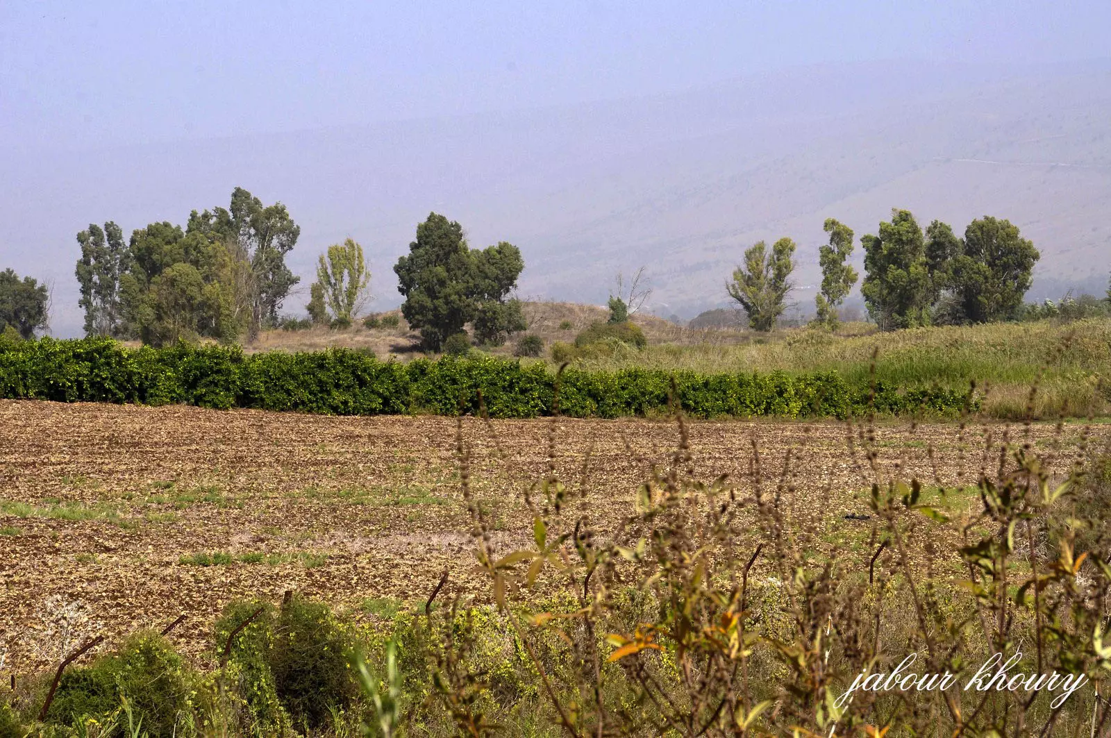
Posted by Jabour Khoury 1 - اراضي الملاحه كم تظهر من قريه النبي يوشع
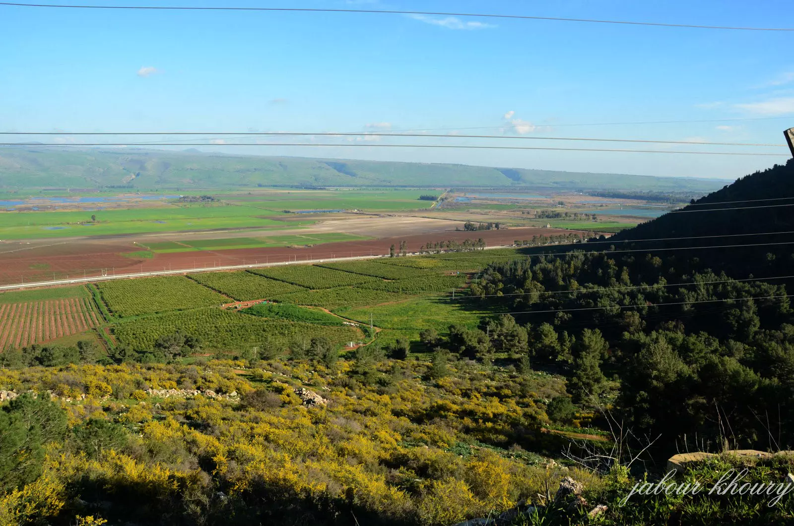
Posted by Jabour Khoury - اراضي الملاحه وبيسمون كما تظهر من قريه النبي يوشع
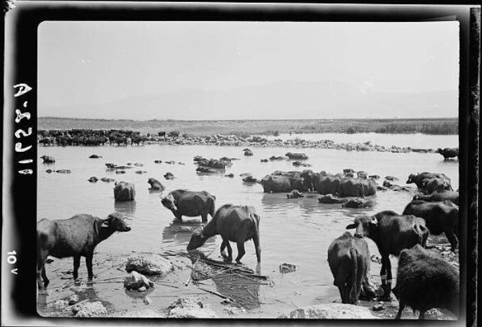
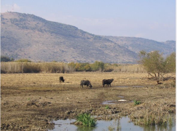
Posted by Jabour Khoury - صوره قديمه من قريه الملاحه ويظهر فيها اعتماد اهل القريه على تربيه الجواميس
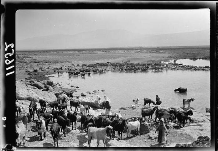
Posted by abu raya - صوره قديمه من الملاحه يظهر بها بعض سكان القريه مع حلالهم
Posted by abu raya - صوره قديمه من الملاحه
Posted by abu raya - صوره قديمه من الملاحه
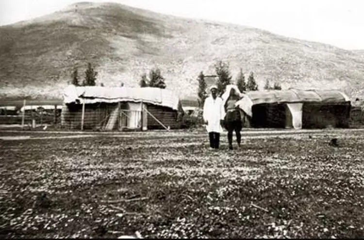
Posted by abu raya - الملاحه قبل النكبه
Posted by abu raya - الملاحه قبل النكبه
Posted by abu raya - الملاحه قبل النكبه
Posted by abu raya - الملاحه قبل النكبه
Posted by abu raya - الملاحه قبل النكبه
Posted by abu raya - الملاحه قبل النكبه
Posted by abu raya - الملاحه قبل النكبه
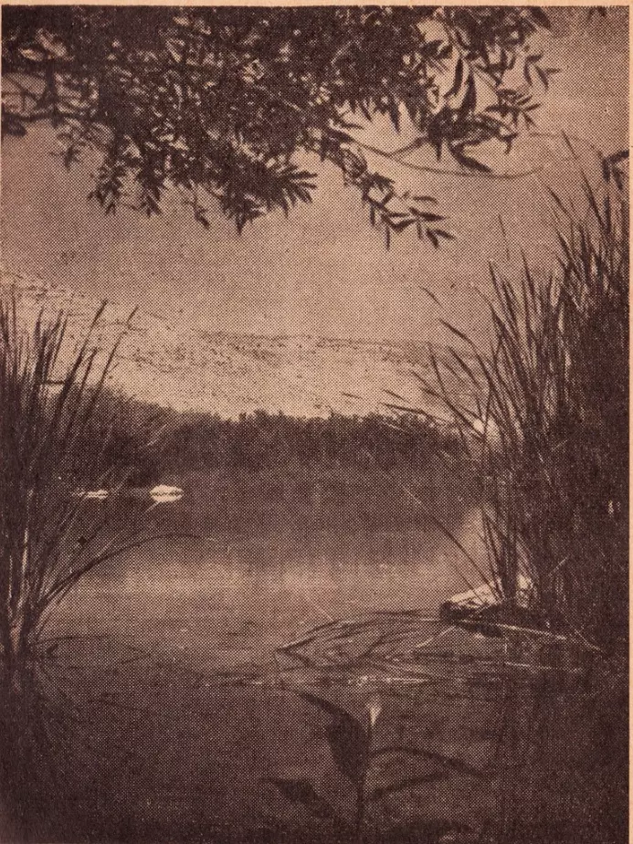
Posted by abu raya - صوره قديمه للملاحه قبل النكبه باتجاه بحيره الحوله
Posted by abu raya - الملاحه قبل النكبه
Posted by abu raya - من موقع القريه
Posted by abu raya - الملاحه
Posted by abu raya - موقع الملاحه بجانب بركه المياه
Posted by abu raya - بجانب موقع القريه
Posted by abu raya - الملاحه قبل النكبه
Posted by abu raya - صوره قديمه قبل النكبه لقصيب قريه الملاحه
Posted by abu raya - الملاحه قبل النكبه
Posted by abu raya - الملاحه قبل النكبه
Posted by abu raya - صوره نادره من قريه الملاحه قبل النكبه
Posted by abu raya - الملاحه قبل النكبه
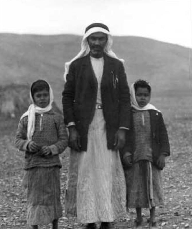
Posted by abu raya - صوره قديمه لبعض سكان الملاحه في طريقهم الى سوق الخالصه
Posted by abu raya - الملاحه قبل النكبه
Posted by abu raya - الملاحه قبل النكبه
Posted by abu raya - الملاحه قبل النكبه
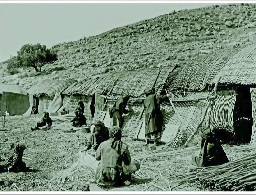
Posted by abu raya - ذكرى بعيدة من قرية الملاحة قضاء صفد..
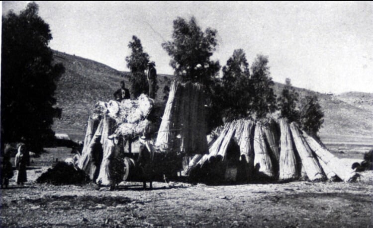
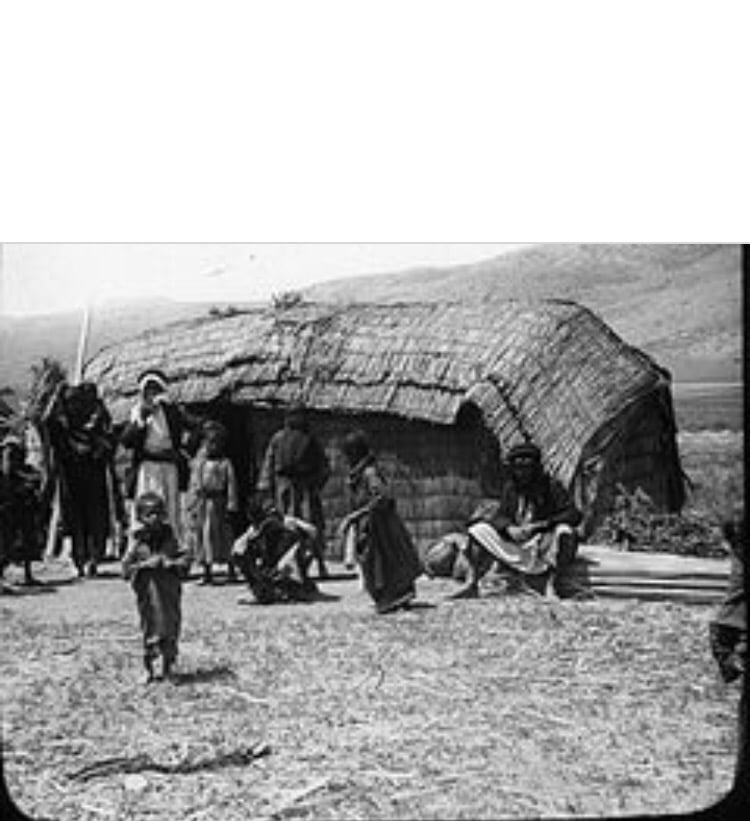
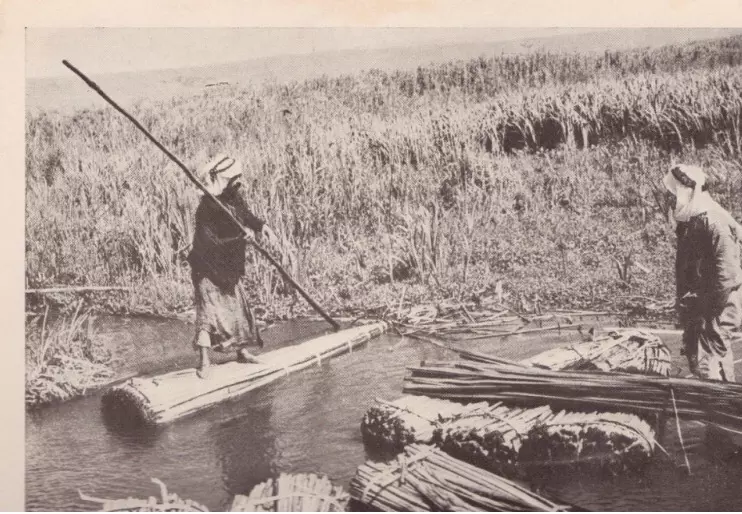
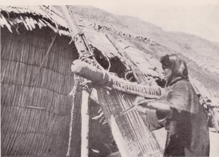
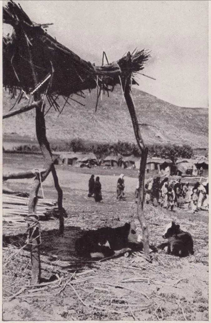
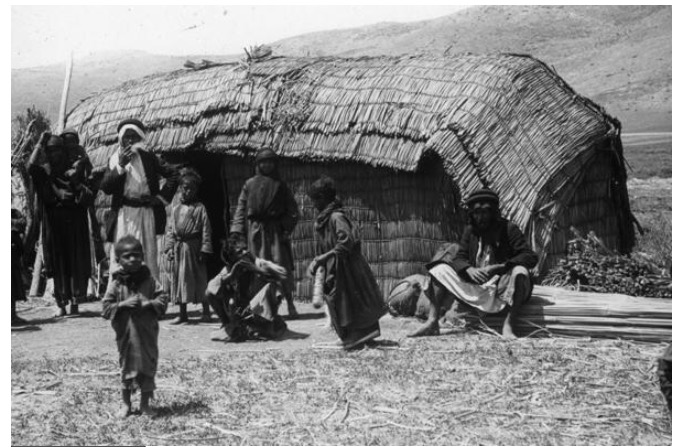
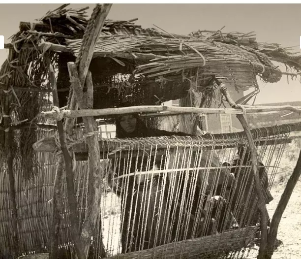
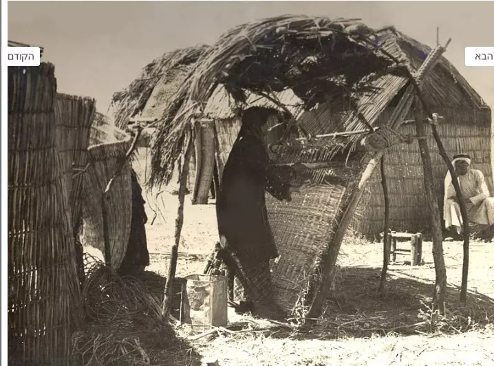
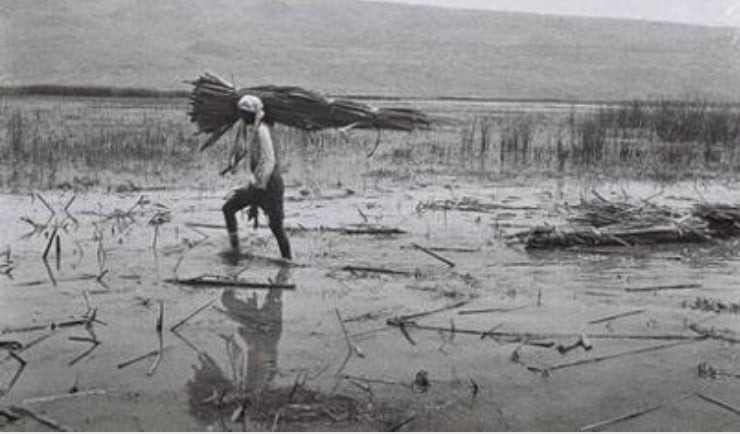
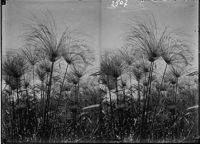
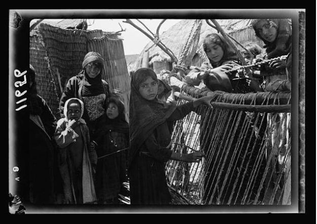
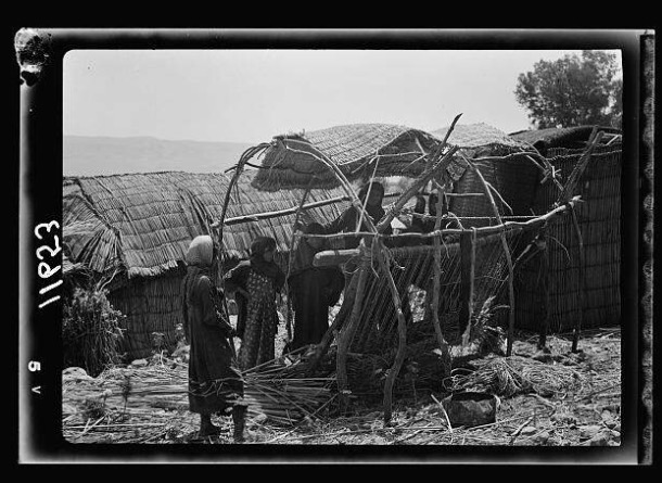
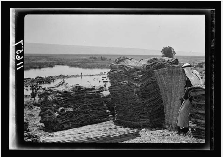
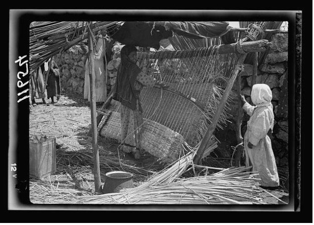
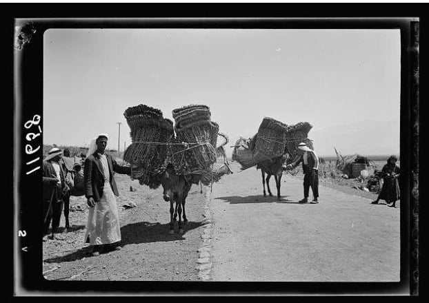
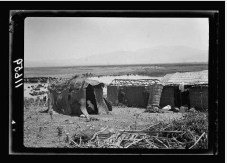
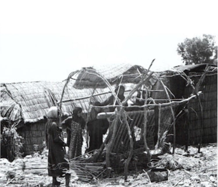
كان عرب الزبيد يعملون في صناعة الحصر من القصب، ويمضون أيام الصيف في ضفرها، حيث يتعلم الجميع هذه الصناعة منذ الصغر، وكانت تباع في القرى المجاورة، ولاسيما في سوق الخالصة الشهير..
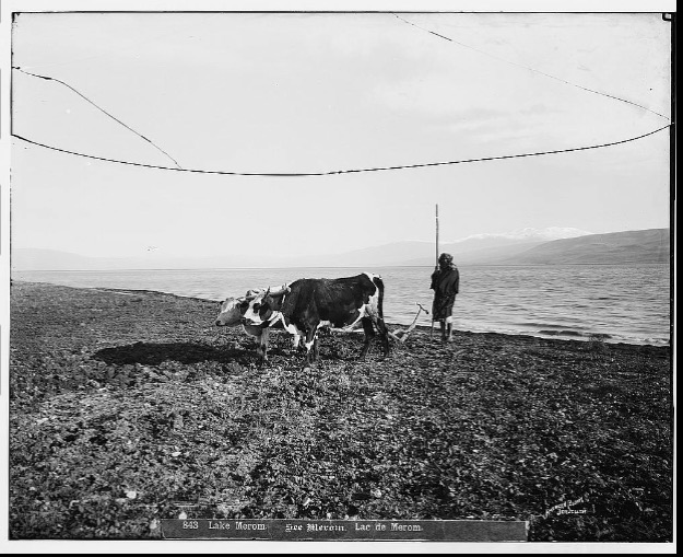
تتشابه حياة أهل هذه القرية مع قرى جنوب العراق حيث كانوا يتعايشون مع مستنقعات المياه ما بين بحيرة طبريا والحولة ويربون الجواميس، ويبنون من القصب النابت حولها، أفانين الحصر والسلال، وحتى بيوتهم الصيفية التي كانت ترى من بعيد لسكان مدينة صفد، كانت من القصب..
إنها أرض وحياة ومسلوبة..
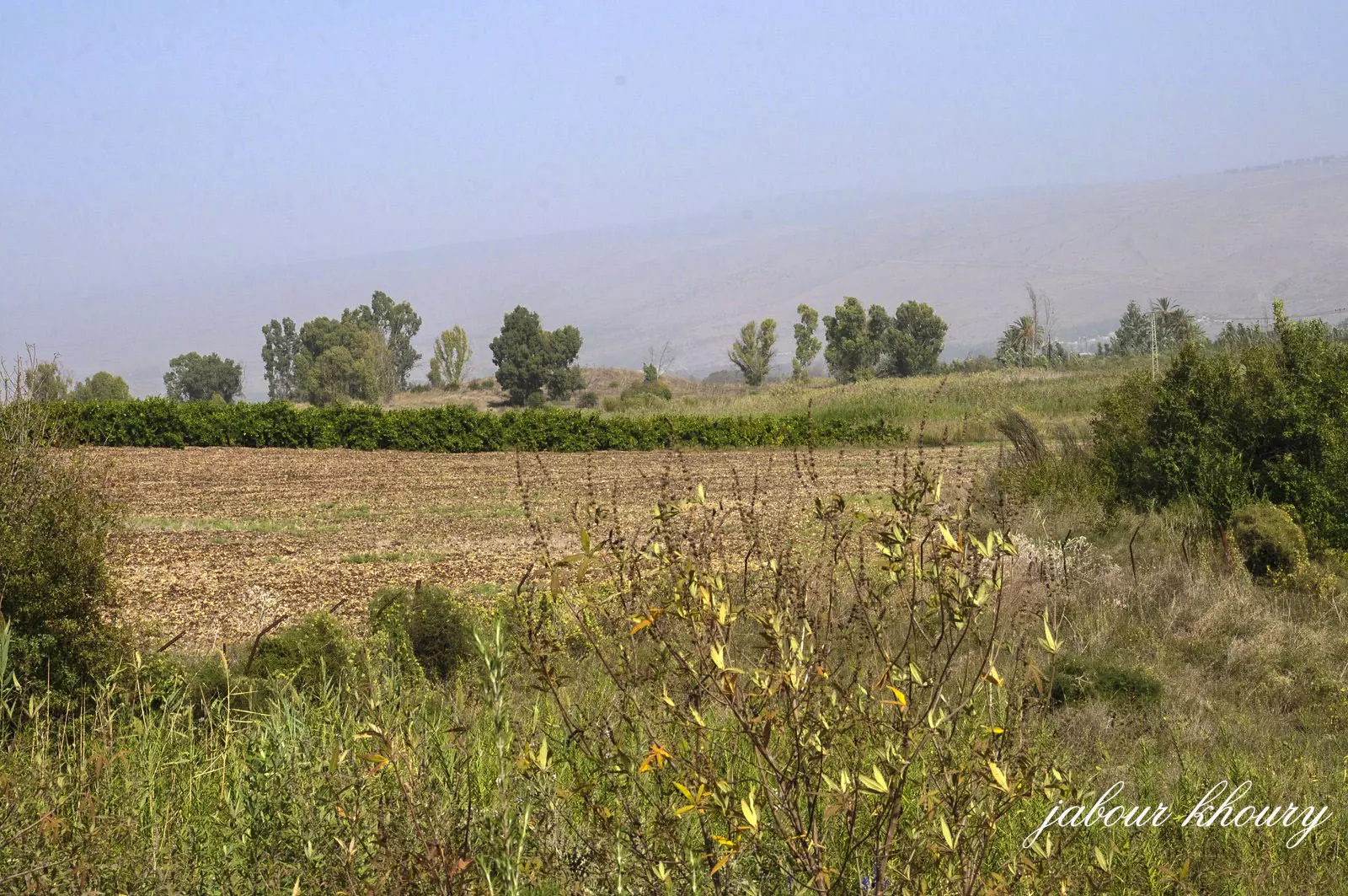
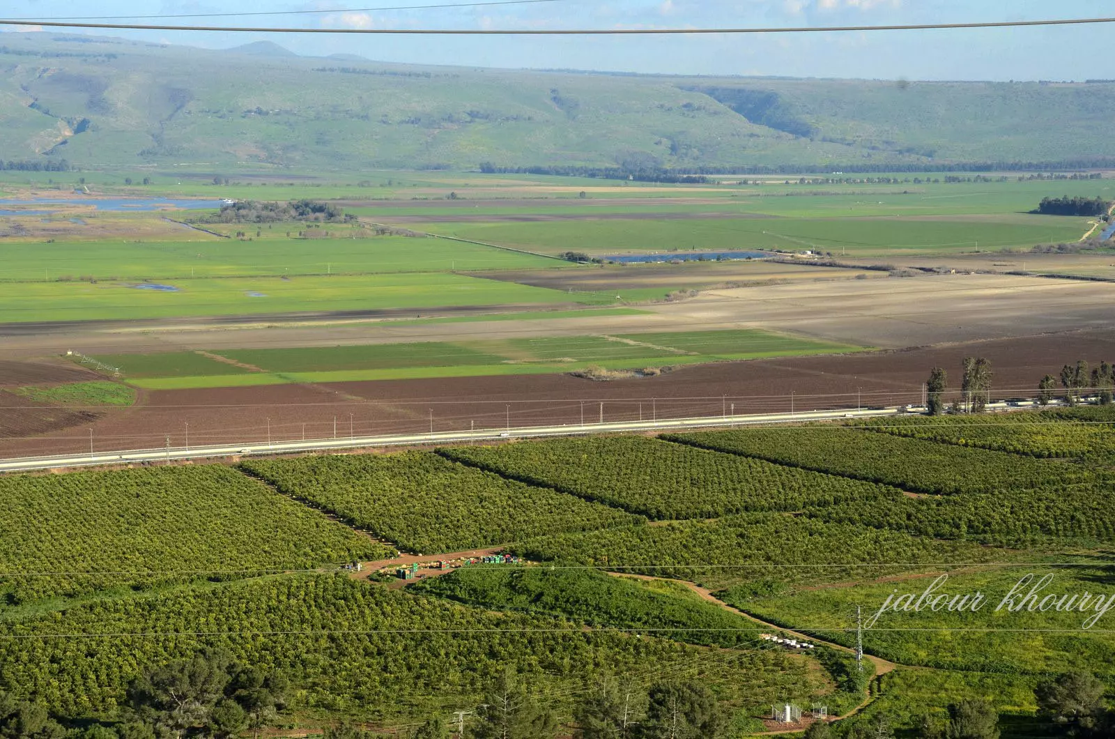
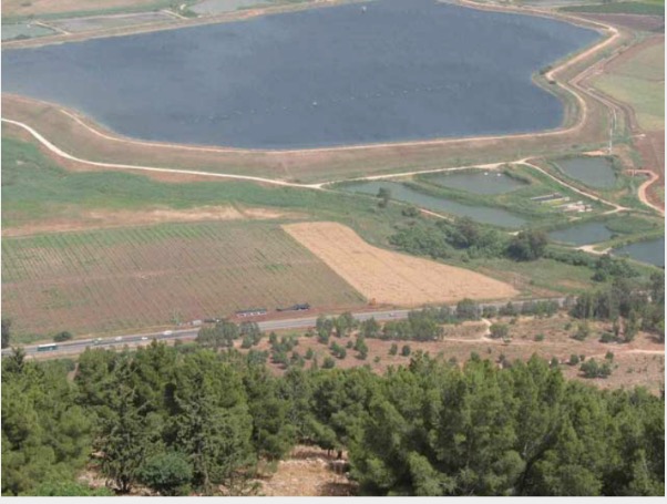
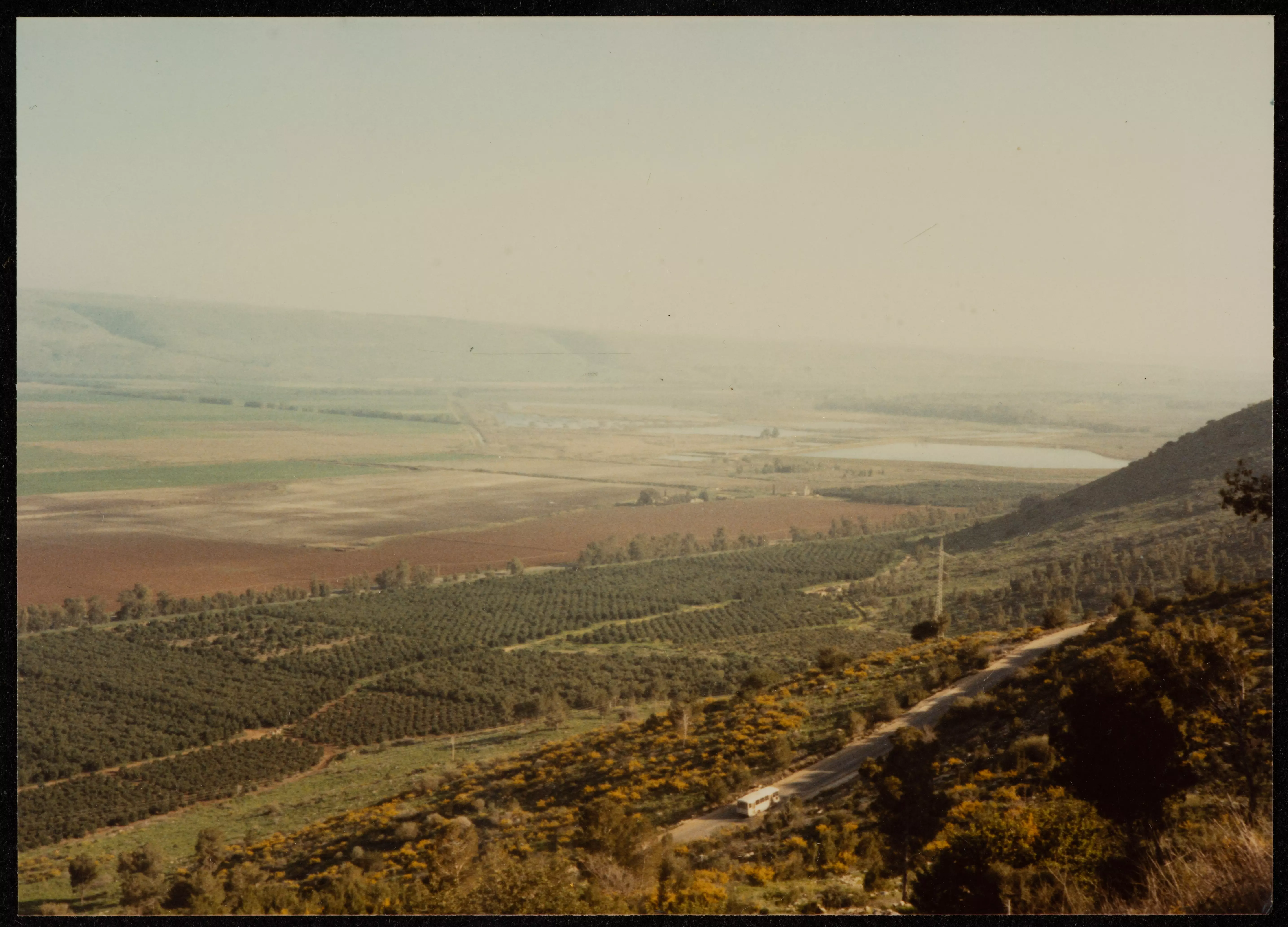
- صورة لأراضي وسهول قرية الملاحة (عرب الزبيد) المهجرة، قضاء صفد، في ثمانينيات القرن العشرين.
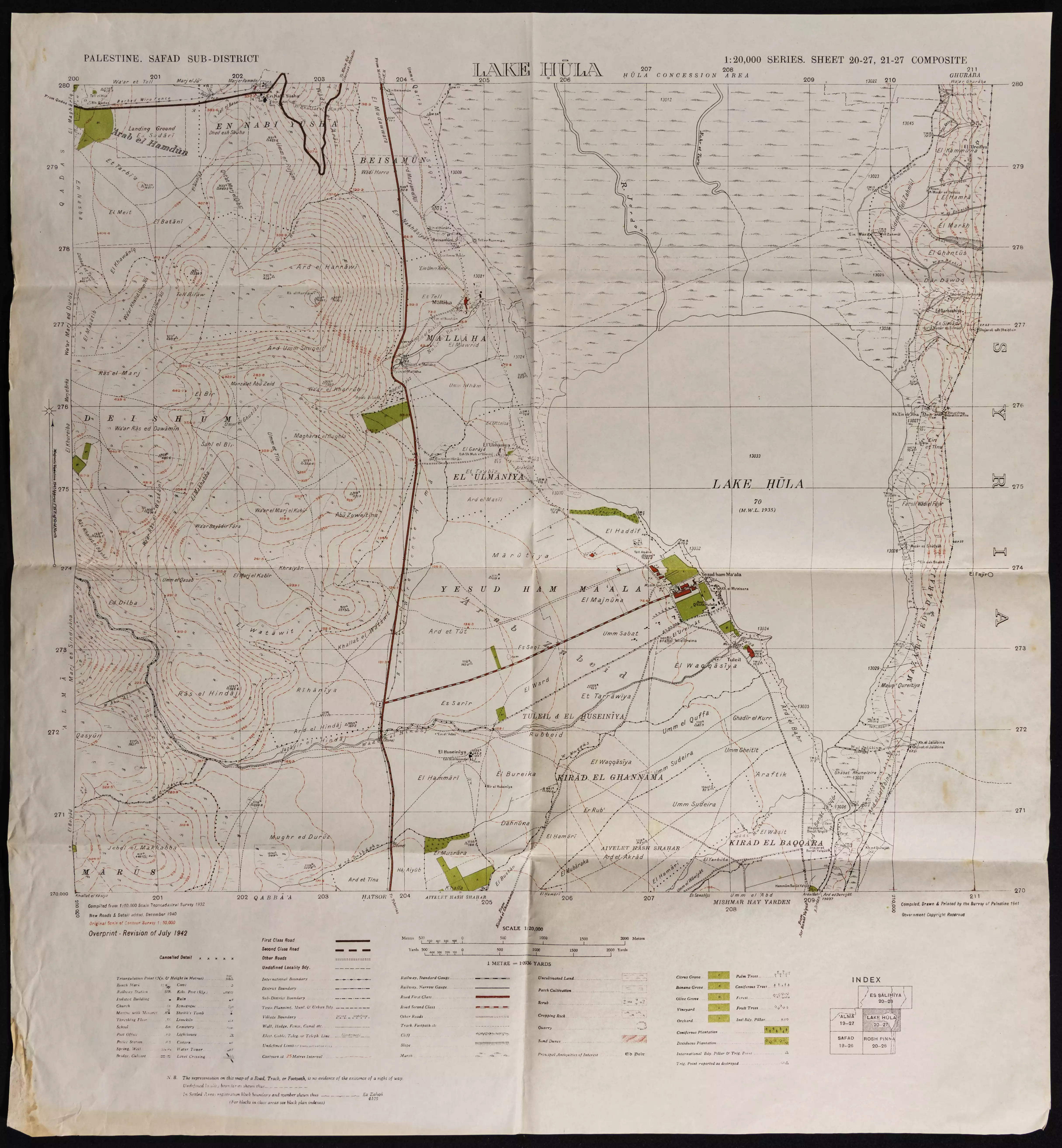
- خارطة تُظهِر الحدود والطرق بأنواعها والأماكن المقدسة والطبيعة الطوبغرافية من تلال وسهول ومنحدرات والتشكيلة الطبيعية للأرض وأنواع المزروعات. نُشرت الخريطة فترة الانتداب البريطاني، تم إضافة تعديلات عليها من قِبَل خدمة الخرائط والصور التابعة للقوات العسكرية الاسرائيلية فترة الأربعينيات.
Want to browse more? 80,000 pictures were grouped in these gallaries:
| Display Name | Clan/Hamolah | Country of Residence |
| STOUHAN | - | DUBAI, DUBAI |
| P.F.L.P | hestory | south, lebanon |
| khalel_abas | عباس | triboly, libya |
| alaaessaa | - | Damackas, Danon |
| khaliiil | khalil | lebanon, lebanon |
| Maher Hmeidan | HMEIDAN | DAMASCUS, SYRIA |
| LOTFI EL-KHATIB | - | Copenhagen, DENMARK |
| ANWAR EL-KHATIB | - | Copenhagen, DENMARK |
| Ismail | Ismail | Russia, Russia |
| ESSA ELHATIB | ELKHATIB | al-ain, uae |
| Kamal Hmeidan | - | Canada |
| hameed maray | maray | damascus |
| ibraheem maray | maray | damascus, syria |
| zaher ellkhatib | - | lebanon, lebanon |
| Khalil Othman | Othman | Damascus, Syria |
| ayssar al khatib | alkhatib | on, canada |
No links have been shared yet, be free to the first to share the first link.
 Fake Valor: Why Did Zionist Jews Hoist Nazis Flag on Their Ships in the 1930s?
What is new?
-
Facts About Oct. 7th Gaza Raid
-
Remined Us Please:: Who Did Rape Who? Palestinians Raped Israelis? Or, was the other way around?
-
When Prof. Edward Said was invited to debate Bibi Netanyahu in the 1980s, watch what happened!
-
Ezra Klein of the NY Times on the "Jewish Race".
-
Abusing Blood Libel!
-
Did Israeli Soldiers Activate The Hanniba Direective On Oct. 7th? You Be The Judge
-
Zionist FAQ: Isn't it true that Palestinians don't want peace? Palestinians never accepted the two-state solution
- Facts about Haavara (Transfer) Agreement between Ben-Gurion & Hitler
-
Haavara FAQs: Why Did Zionist Jews Hoist Nazis' Flags on Their Ships in the 1930s?
- Haavara FAQs: When Chaim Weizmann met FDR in mid-1943, why was he silent about rescuing European Jewry?
-
Dear ChatGPT: How did Palestinians resist Napoleon's invasion of their country in 1799?
-
Dear ChatGPT: Gaza had a vibrant Jewish community in the mid-17th century. What happened to them?
-
Dear ChatGPT: Why did the Jewish Agency suppress news of the Holocaust during WWII?
-
Video Playlist: Jews share their DNA tests to end the conflict for good.
-
A Tale of Two Conflicts: Examining the Definition of Genocide
-
Prof. Abraham Polak And The Suppressed History of the Khazars and European Jewry
-
How Ronald Reagan would have framed the genocide in Gaza if he were still alive?
-
Haavara FAQs: Let us do the math: how many German Jews did The Haavara Agreement save?
-
Zionist FAQs: The Hebron Massacre of 1929, "clearly proves" that Palestinians are antisemitic, how could you deny it?
-
Zionist FAQs: Why Anti-Zionist Is Not Antisemitism?
-
Zionist FAQs: Isn't it true that the KGB created Palestinian Nationalism in the early 1960s?
- Zionist FAQs: Muslims are killing Muslims all the time; why are Israeli Jews being singled out in the media?
- Zionist FAQs: How is Israel an apartheid state when 20% of its citizens are Arabs who enjoy full rights?
-
Haavara FAQs: Why Did Dorothy Thompson Flip From A Zionist Advocate to A Silenced Dissenter?
-
Haavara FAQs: Analysis of Herzl's Uganda Scheme and how it could have saved millions of Jews.
-
Haavara FAQs: Why did Hayim Greenberg describe American Jewry as "morally bankrupt" in early 1943?
-
Haavara FAQs: What if the Evian Conference was a resounding success? What would have been the impact of saving European Jewry on Zionism?
- Haavara FAQs: What if the six million were saved, how that would have impacted the Zionist project?
-
Haavara FAQs: How did Zionist leaders react when Europe's Jews lingered in the DP camps after WWII ended?
-
Why does the American Jewish community repeat lies that David Ben-Gurion had debunked before he died?
-
Who has the power to rename the Tatar/Khazar Gene Marker to Jewish IV?
-
Zionist FAQs: Why won't Egypt, Syria, and Jordan take their people back? Jews are indigenous to Palestine, and Arabs immigrated after Jews developed the country. Arabs should leave.
-
Haavara FAQs: Did Hitler and the Nazis conflate between Judaism and Zionist? If that wasn't case, then why?
-
Haavara FAQs: Winston Churchill and antisemitism, a collection of articles written Churchill.
-
Haavara FAQs: Broken by country, how many Jews survived vs. killed during the Holocaust?
-
Haavara FAQs: Why did European Jews vote with their feet and to immigrated to the Americas, not Palestine, after WWII?
-
Watch this American Jewish Girl describing Israeli Jews' cognitive dissonance like no other in under two minutes
-
Haavara FAQs: When the Nazis went out of their way to hide the Holocaust, Israeli Jews did the exact opposite by broadcasting their genocide of Gazans. But why?
-
Haavara FAQs: How Zionist Jews went out of their to show their appreciation to Nazism and Fascism?
- Haavara FAQs: Why Zionist leaders were against bombing the death camps & the Railroads leading to them?
-
Haavara FAQs: Hitler's message to the British and American people: If Jews are such noble citizens and you care about them, how come you're not letting them in? I will gladly ship them to you at my expense, even on luxury liners!
-
A shortlist of Zionist and Israeli false flag operations in the name Jews.
-
The Most Moral Army
- The Land of Kapos (Israel): Where the brave are boycotted and Kapos walk free.
- Why did early Zionists often named their communal enterprises "colonial"?
- Zionist Relations with Nazi Germany by Faris Glubb
-
Two NY Times advertisements by Zionists in the early 1943 that exposes Zionists' treason at the height of the calamity
- Facts Not Lies about the Palestinian-Israeli Conflict.
- Site's pictures have been categorized
- Campgain Against Lice
- A Survey of Palestine, the official source about Palestine before Nakba produced by the British Mandate; over 1200 pages.
- Satellite View & Google Earth: Over 6,000 placemarks identifying all destroyed towns, W. Bank & Gaza Strip Towns, & refugee camps.
- PalestineRemembered.com and its Nakba Oral History Project were featured on al-Jazeera Satellite TV.
- Nakba Oral History Video Podcast:
 Over 700 Oral History interviews (including 3,500+ hours of recording) can be viewed online.
 - Palestine Village Statistics Project
- Gaza Jail Break
- النسخة العربية للموقع الان متوفرة
- Videos: Documenting the destroyed villages in video: Tracing all that remains since Nakba.
- Videos: Responding to Zionist Propaganda
- Interview: The ethnic cleansing of Palestine: George Galloway interviews Israeli Historian Ilan Pappe.
- For Palestinians, memory matters. It provides a blueprint for their future By George Bisharat.
- Zionist FAQ now available in Hebrew שאלות שציונים שואלים, עכשיו בעברית
- Video: The Stephen Walt and John Mearsheimer report on the influence of the Israel Lobby on U.S. Foreign Policy
- The Palestinian-Israeli conflict for beginners
